{
	"@context": "https://project-open-data.cio.gov/v1.1/schema/catalog.jsonld",
	"@type": "dcat:Catalog",
	"conformsTo": "https://project-open-data.cio.gov/v1.1/schema",
	"describedBy": "https://project-open-data.cio.gov/v1.1/schema/catalog.json",
	"dataset": [
		{
			"@type": "dcat:Dataset",
			"identifier": "https://www.arcgis.com/home/item.html?id=ec6a5a3eae714910a7de3db3d3dc9d9c&sublayer=41",
			"landingPage": "https://www.cacgeoportal.com/datasets/nation::antarctic-cover",
			"title": "Antarctic Cover",
			"description": "<p><span style='font-family:&quot;Avenir Next W01&quot;, &quot;Avenir Next W00&quot;, &quot;Avenir Next&quot;, Avenir, &quot;Helvetica Neue&quot;, sans-serif; font-size:16px;'>This basemap was designed with the Vizzuality team for use in the Half-Earth Project globe. The saturated palette and rich landcover tones are meant to engage an audience and to provide the sense that the earth is a charming and beautiful place worthy of thoughtful stewardship. As you zoom in, the saturated basemap is slowly replaced by imagery.</span></p><p><span style='font-family:Avenir Next W01, Avenir Next W00, Avenir Next, Avenir, Helvetica Neue, sans-serif; font-size:16px;'>This basemap is the major component of the&nbsp;</span><a target='_blank' href='https://nation.maps.arcgis.com/home/item.html?id=d27a3805595e4bb598678f2dc3b1fca3' rel='nofollow ugc noopener noreferrer'>Vibrant Map</a><span style='font-family:Avenir Next W01, Avenir Next W00, Avenir Next, Avenir, Helvetica Neue, sans-serif; font-size:16px;'>. The Vibrant Map is configured to use these basemap tiles from global to regional extents, then transition to&nbsp;</span><span style='font-family:&quot;Avenir Next W01&quot;, &quot;Avenir Next W00&quot;, &quot;Avenir Next&quot;, Avenir, &quot;Helvetica Neue&quot;, sans-serif; font-size:16px;'>Esri's World Imagery basemap tiles for a seamless transition from small to large scale.</span></p><p>Find more information about this basemap, and its contributing data, here:&nbsp;<a style='color:rgb(0, 121, 193); font-family:inherit; text-decoration-line:none;' target='_blank' href='https://www.esri.com/arcgis-blog/products/arcgis-pro/mapping/creating-the-half-earth-vibrant-basemap/' rel='nofollow ugc noopener noreferrer'>https://www.esri.com/arcgis-blog/products/arcgis-pro/mapping/creating-the-half-earth-vibrant-basemap/</a></p><div><div style='font-family:&quot;Avenir Next W01&quot;, &quot;Avenir Next W00&quot;, &quot;Avenir Next&quot;, Avenir, &quot;Helvetica Neue&quot;, sans-serif; font-size:16px;'>Learn more about the Half-Earth Project&nbsp;<a style='color:rgb(0, 121, 193); font-family:inherit; text-decoration-line:none;' target='_blank' href='https://www.half-earthproject.org/' rel='nofollow ugc noopener noreferrer'>here</a>&nbsp;and explore highlighted areas of biodiversity&nbsp;<a target='_blank' href='https://eowilsonfoundation.org/what-is-the-half-earth-project/' rel='nofollow ugc noopener noreferrer'>here</a>.</div><div style='font-family:&quot;Avenir Next W01&quot;, &quot;Avenir Next W00&quot;, &quot;Avenir Next&quot;, Avenir, &quot;Helvetica Neue&quot;, sans-serif; font-size:16px;'>&nbsp;</div><div style='font-family:&quot;Avenir Next W01&quot;, &quot;Avenir Next W00&quot;, &quot;Avenir Next&quot;, Avenir, &quot;Helvetica Neue&quot;, sans-serif; font-size:16px;'>Happy Mapping!&nbsp;<a style='color:rgb(0, 121, 193); font-family:inherit; text-decoration-line:none;' target='_blank' href='https://twitter.com/John_M_Nelson' rel='nofollow ugc noopener noreferrer'>John</a></div></div>",
			"keyword": [
				"HalfEarth",
				"cartography",
				"basemap",
				"vibrant",
				"physical",
				"landforms",
				"imagery",
				"landcover",
				"physiographic",
				"topographic",
				"natural"
			],
			"issued": "2019-08-09T14:31:52.000Z",
			"modified": "2025-10-10T00:22:22.000Z",
			"publisher": {
				"name": "ArcGIS Maps for the Nation"
			},
			"contactPoint": {
				"@type": "vcard:Contact",
				"fn": "j_nelson",
				"hasEmail": "mailto:jherries@esri.com"
			},
			"accessLevel": "public",
			"spatial": "179.9955,-89.0000,-179.9995,89.0000",
			"license": "<p><img style='background-color:rgb(255, 255, 255); border:0px solid currentcolor; box-sizing:border-box; color:rgb(74, 74, 74); display:inline; font-family:&quot;Avenir Next&quot;, Avenir, &quot;Helvetica Neue&quot;, sans-serif; font-size:16px; font-style:normal; font-variant-caps:normal; font-variant-ligatures:normal; font-weight:400; height:auto; letter-spacing:normal; max-width:100%; text-align:start; text-decoration-color:initial; text-decoration-style:initial; text-indent:0px; text-transform:none; word-spacing:0px;' src='https://downloads.esri.com/blogs/arcgisonline/esrilogo_new.png' width='113' height='39' /><span style='background-color:rgb(255,255,255); color:rgb(74,74,74); font-family:&quot;Avenir Next&quot;, Avenir, &quot;Helvetica Neue&quot;, sans-serif; font-size:16px;'><span style='display:inline !important; float:none; font-style:normal; font-variant-caps:normal; font-variant-ligatures:normal; font-weight:400; letter-spacing:normal; text-align:start; text-decoration-color:initial; text-decoration-style:initial; text-indent:0px; text-transform:none; word-spacing:0px;'> This work is licensed under the Esri Master License Agreement.</span></span><br /><a style='border:0px solid currentcolor; box-sizing:border-box; color:rgb(0, 97, 155); font-family:inherit; line-height:1.5; text-decoration:none;' target='_blank' href='https://goto.arcgis.com/termsofuse/viewsummary' rel='nofollow ugc noopener noreferrer'><strong>View Summary</strong></a>&nbsp;|&nbsp;<a style='border:0px solid currentcolor; box-sizing:border-box; color:rgb(0, 97, 155); font-family:inherit; line-height:1.5; text-decoration:none;' target='_blank' href='https://goto.arcgis.com/termsofuse/viewtermsofuse' rel='nofollow ugc noopener noreferrer'><strong>View Terms of Use</strong></a></p>",
			"distribution": [
				{
					"@type": "dcat:Distribution",
					"title": "ArcGIS Hub Dataset",
					"format": "Web Page",
					"mediaType": "text/html",
					"accessURL": "https://www.cacgeoportal.com/datasets/nation::antarctic-cover"
				},
				{
					"@type": "dcat:Distribution",
					"title": "ArcGIS GeoService",
					"format": "ArcGIS GeoServices REST API",
					"mediaType": "application/json",
					"accessURL": "https://tiles.arcgis.com/tiles/nGt4QxSblgDfeJn9/arcgis/rest/services/Vibrant/MapServer/41"
				}
			],
			"theme": [
				"geospatial"
			]
		},
		{
			"@type": "dcat:Dataset",
			"identifier": "https://www.arcgis.com/home/item.html?id=ec6a5a3eae714910a7de3db3d3dc9d9c&sublayer=42",
			"landingPage": "https://www.cacgeoportal.com/maps/nation::desert-patch",
			"title": "Desert Patch",
			"description": "<p><span style='font-family:&quot;Avenir Next W01&quot;, &quot;Avenir Next W00&quot;, &quot;Avenir Next&quot;, Avenir, &quot;Helvetica Neue&quot;, sans-serif; font-size:16px;'>This basemap was designed with the Vizzuality team for use in the Half-Earth Project globe. The saturated palette and rich landcover tones are meant to engage an audience and to provide the sense that the earth is a charming and beautiful place worthy of thoughtful stewardship. As you zoom in, the saturated basemap is slowly replaced by imagery.</span></p><p><span style='font-family:Avenir Next W01, Avenir Next W00, Avenir Next, Avenir, Helvetica Neue, sans-serif; font-size:16px;'>This basemap is the major component of the&nbsp;</span><a target='_blank' href='https://nation.maps.arcgis.com/home/item.html?id=d27a3805595e4bb598678f2dc3b1fca3' rel='nofollow ugc noopener noreferrer'>Vibrant Map</a><span style='font-family:Avenir Next W01, Avenir Next W00, Avenir Next, Avenir, Helvetica Neue, sans-serif; font-size:16px;'>. The Vibrant Map is configured to use these basemap tiles from global to regional extents, then transition to&nbsp;</span><span style='font-family:&quot;Avenir Next W01&quot;, &quot;Avenir Next W00&quot;, &quot;Avenir Next&quot;, Avenir, &quot;Helvetica Neue&quot;, sans-serif; font-size:16px;'>Esri's World Imagery basemap tiles for a seamless transition from small to large scale.</span></p><p>Find more information about this basemap, and its contributing data, here:&nbsp;<a style='color:rgb(0, 121, 193); font-family:inherit; text-decoration-line:none;' target='_blank' href='https://www.esri.com/arcgis-blog/products/arcgis-pro/mapping/creating-the-half-earth-vibrant-basemap/' rel='nofollow ugc noopener noreferrer'>https://www.esri.com/arcgis-blog/products/arcgis-pro/mapping/creating-the-half-earth-vibrant-basemap/</a></p><div><div style='font-family:&quot;Avenir Next W01&quot;, &quot;Avenir Next W00&quot;, &quot;Avenir Next&quot;, Avenir, &quot;Helvetica Neue&quot;, sans-serif; font-size:16px;'>Learn more about the Half-Earth Project&nbsp;<a style='color:rgb(0, 121, 193); font-family:inherit; text-decoration-line:none;' target='_blank' href='https://www.half-earthproject.org/' rel='nofollow ugc noopener noreferrer'>here</a>&nbsp;and explore highlighted areas of biodiversity&nbsp;<a target='_blank' href='https://eowilsonfoundation.org/what-is-the-half-earth-project/' rel='nofollow ugc noopener noreferrer'>here</a>.</div><div style='font-family:&quot;Avenir Next W01&quot;, &quot;Avenir Next W00&quot;, &quot;Avenir Next&quot;, Avenir, &quot;Helvetica Neue&quot;, sans-serif; font-size:16px;'>&nbsp;</div><div style='font-family:&quot;Avenir Next W01&quot;, &quot;Avenir Next W00&quot;, &quot;Avenir Next&quot;, Avenir, &quot;Helvetica Neue&quot;, sans-serif; font-size:16px;'>Happy Mapping!&nbsp;<a style='color:rgb(0, 121, 193); font-family:inherit; text-decoration-line:none;' target='_blank' href='https://twitter.com/John_M_Nelson' rel='nofollow ugc noopener noreferrer'>John</a></div></div>",
			"keyword": [
				"HalfEarth",
				"cartography",
				"basemap",
				"vibrant",
				"physical",
				"landforms",
				"imagery",
				"landcover",
				"physiographic",
				"topographic",
				"natural"
			],
			"issued": "2019-08-09T14:31:52.000Z",
			"modified": "2025-10-10T00:22:22.000Z",
			"publisher": {
				"name": "ArcGIS Maps for the Nation"
			},
			"contactPoint": {
				"@type": "vcard:Contact",
				"fn": "j_nelson",
				"hasEmail": "mailto:jherries@esri.com"
			},
			"accessLevel": "public",
			"spatial": "179.9955,-89.0000,-179.9995,89.0000",
			"license": "<p><img style='background-color:rgb(255, 255, 255); border:0px solid currentcolor; box-sizing:border-box; color:rgb(74, 74, 74); display:inline; font-family:&quot;Avenir Next&quot;, Avenir, &quot;Helvetica Neue&quot;, sans-serif; font-size:16px; font-style:normal; font-variant-caps:normal; font-variant-ligatures:normal; font-weight:400; height:auto; letter-spacing:normal; max-width:100%; text-align:start; text-decoration-color:initial; text-decoration-style:initial; text-indent:0px; text-transform:none; word-spacing:0px;' src='https://downloads.esri.com/blogs/arcgisonline/esrilogo_new.png' width='113' height='39' /><span style='background-color:rgb(255,255,255); color:rgb(74,74,74); font-family:&quot;Avenir Next&quot;, Avenir, &quot;Helvetica Neue&quot;, sans-serif; font-size:16px;'><span style='display:inline !important; float:none; font-style:normal; font-variant-caps:normal; font-variant-ligatures:normal; font-weight:400; letter-spacing:normal; text-align:start; text-decoration-color:initial; text-decoration-style:initial; text-indent:0px; text-transform:none; word-spacing:0px;'> This work is licensed under the Esri Master License Agreement.</span></span><br /><a style='border:0px solid currentcolor; box-sizing:border-box; color:rgb(0, 97, 155); font-family:inherit; line-height:1.5; text-decoration:none;' target='_blank' href='https://goto.arcgis.com/termsofuse/viewsummary' rel='nofollow ugc noopener noreferrer'><strong>View Summary</strong></a>&nbsp;|&nbsp;<a style='border:0px solid currentcolor; box-sizing:border-box; color:rgb(0, 97, 155); font-family:inherit; line-height:1.5; text-decoration:none;' target='_blank' href='https://goto.arcgis.com/termsofuse/viewtermsofuse' rel='nofollow ugc noopener noreferrer'><strong>View Terms of Use</strong></a></p>",
			"distribution": [
				{
					"@type": "dcat:Distribution",
					"title": "ArcGIS Hub Dataset",
					"format": "Web Page",
					"mediaType": "text/html",
					"accessURL": "https://www.cacgeoportal.com/maps/nation::desert-patch"
				},
				{
					"@type": "dcat:Distribution",
					"title": "ArcGIS GeoService",
					"format": "ArcGIS GeoServices REST API",
					"mediaType": "application/json",
					"accessURL": "https://tiles.arcgis.com/tiles/nGt4QxSblgDfeJn9/arcgis/rest/services/Vibrant/MapServer/42"
				}
			],
			"theme": [
				"geospatial"
			]
		},
		{
			"@type": "dcat:Dataset",
			"identifier": "https://www.arcgis.com/home/item.html?id=ec6a5a3eae714910a7de3db3d3dc9d9c&sublayer=43",
			"landingPage": "https://www.cacgeoportal.com/maps/nation::jungle-patch",
			"title": "Jungle Patch",
			"description": "<p><span style='font-family:&quot;Avenir Next W01&quot;, &quot;Avenir Next W00&quot;, &quot;Avenir Next&quot;, Avenir, &quot;Helvetica Neue&quot;, sans-serif; font-size:16px;'>This basemap was designed with the Vizzuality team for use in the Half-Earth Project globe. The saturated palette and rich landcover tones are meant to engage an audience and to provide the sense that the earth is a charming and beautiful place worthy of thoughtful stewardship. As you zoom in, the saturated basemap is slowly replaced by imagery.</span></p><p><span style='font-family:Avenir Next W01, Avenir Next W00, Avenir Next, Avenir, Helvetica Neue, sans-serif; font-size:16px;'>This basemap is the major component of the&nbsp;</span><a target='_blank' href='https://nation.maps.arcgis.com/home/item.html?id=d27a3805595e4bb598678f2dc3b1fca3' rel='nofollow ugc noopener noreferrer'>Vibrant Map</a><span style='font-family:Avenir Next W01, Avenir Next W00, Avenir Next, Avenir, Helvetica Neue, sans-serif; font-size:16px;'>. The Vibrant Map is configured to use these basemap tiles from global to regional extents, then transition to&nbsp;</span><span style='font-family:&quot;Avenir Next W01&quot;, &quot;Avenir Next W00&quot;, &quot;Avenir Next&quot;, Avenir, &quot;Helvetica Neue&quot;, sans-serif; font-size:16px;'>Esri's World Imagery basemap tiles for a seamless transition from small to large scale.</span></p><p>Find more information about this basemap, and its contributing data, here:&nbsp;<a style='color:rgb(0, 121, 193); font-family:inherit; text-decoration-line:none;' target='_blank' href='https://www.esri.com/arcgis-blog/products/arcgis-pro/mapping/creating-the-half-earth-vibrant-basemap/' rel='nofollow ugc noopener noreferrer'>https://www.esri.com/arcgis-blog/products/arcgis-pro/mapping/creating-the-half-earth-vibrant-basemap/</a></p><div><div style='font-family:&quot;Avenir Next W01&quot;, &quot;Avenir Next W00&quot;, &quot;Avenir Next&quot;, Avenir, &quot;Helvetica Neue&quot;, sans-serif; font-size:16px;'>Learn more about the Half-Earth Project&nbsp;<a style='color:rgb(0, 121, 193); font-family:inherit; text-decoration-line:none;' target='_blank' href='https://www.half-earthproject.org/' rel='nofollow ugc noopener noreferrer'>here</a>&nbsp;and explore highlighted areas of biodiversity&nbsp;<a target='_blank' href='https://eowilsonfoundation.org/what-is-the-half-earth-project/' rel='nofollow ugc noopener noreferrer'>here</a>.</div><div style='font-family:&quot;Avenir Next W01&quot;, &quot;Avenir Next W00&quot;, &quot;Avenir Next&quot;, Avenir, &quot;Helvetica Neue&quot;, sans-serif; font-size:16px;'>&nbsp;</div><div style='font-family:&quot;Avenir Next W01&quot;, &quot;Avenir Next W00&quot;, &quot;Avenir Next&quot;, Avenir, &quot;Helvetica Neue&quot;, sans-serif; font-size:16px;'>Happy Mapping!&nbsp;<a style='color:rgb(0, 121, 193); font-family:inherit; text-decoration-line:none;' target='_blank' href='https://twitter.com/John_M_Nelson' rel='nofollow ugc noopener noreferrer'>John</a></div></div>",
			"keyword": [
				"HalfEarth",
				"cartography",
				"basemap",
				"vibrant",
				"physical",
				"landforms",
				"imagery",
				"landcover",
				"physiographic",
				"topographic",
				"natural"
			],
			"issued": "2019-08-09T14:31:52.000Z",
			"modified": "2025-10-10T00:22:22.000Z",
			"publisher": {
				"name": "ArcGIS Maps for the Nation"
			},
			"contactPoint": {
				"@type": "vcard:Contact",
				"fn": "j_nelson",
				"hasEmail": "mailto:jherries@esri.com"
			},
			"accessLevel": "public",
			"spatial": "179.9955,-89.0000,-179.9995,89.0000",
			"license": "<p><img style='background-color:rgb(255, 255, 255); border:0px solid currentcolor; box-sizing:border-box; color:rgb(74, 74, 74); display:inline; font-family:&quot;Avenir Next&quot;, Avenir, &quot;Helvetica Neue&quot;, sans-serif; font-size:16px; font-style:normal; font-variant-caps:normal; font-variant-ligatures:normal; font-weight:400; height:auto; letter-spacing:normal; max-width:100%; text-align:start; text-decoration-color:initial; text-decoration-style:initial; text-indent:0px; text-transform:none; word-spacing:0px;' src='https://downloads.esri.com/blogs/arcgisonline/esrilogo_new.png' width='113' height='39' /><span style='background-color:rgb(255,255,255); color:rgb(74,74,74); font-family:&quot;Avenir Next&quot;, Avenir, &quot;Helvetica Neue&quot;, sans-serif; font-size:16px;'><span style='display:inline !important; float:none; font-style:normal; font-variant-caps:normal; font-variant-ligatures:normal; font-weight:400; letter-spacing:normal; text-align:start; text-decoration-color:initial; text-decoration-style:initial; text-indent:0px; text-transform:none; word-spacing:0px;'> This work is licensed under the Esri Master License Agreement.</span></span><br /><a style='border:0px solid currentcolor; box-sizing:border-box; color:rgb(0, 97, 155); font-family:inherit; line-height:1.5; text-decoration:none;' target='_blank' href='https://goto.arcgis.com/termsofuse/viewsummary' rel='nofollow ugc noopener noreferrer'><strong>View Summary</strong></a>&nbsp;|&nbsp;<a style='border:0px solid currentcolor; box-sizing:border-box; color:rgb(0, 97, 155); font-family:inherit; line-height:1.5; text-decoration:none;' target='_blank' href='https://goto.arcgis.com/termsofuse/viewtermsofuse' rel='nofollow ugc noopener noreferrer'><strong>View Terms of Use</strong></a></p>",
			"distribution": [
				{
					"@type": "dcat:Distribution",
					"title": "ArcGIS Hub Dataset",
					"format": "Web Page",
					"mediaType": "text/html",
					"accessURL": "https://www.cacgeoportal.com/maps/nation::jungle-patch"
				},
				{
					"@type": "dcat:Distribution",
					"title": "ArcGIS GeoService",
					"format": "ArcGIS GeoServices REST API",
					"mediaType": "application/json",
					"accessURL": "https://tiles.arcgis.com/tiles/nGt4QxSblgDfeJn9/arcgis/rest/services/Vibrant/MapServer/43"
				}
			],
			"theme": [
				"geospatial"
			]
		},
		{
			"@type": "dcat:Dataset",
			"identifier": "https://www.arcgis.com/home/item.html?id=ec6a5a3eae714910a7de3db3d3dc9d9c&sublayer=44",
			"landingPage": "https://www.cacgeoportal.com/datasets/nation::qattaradepression",
			"title": "QattaraDepression",
			"description": "<p><span style='font-family:&quot;Avenir Next W01&quot;, &quot;Avenir Next W00&quot;, &quot;Avenir Next&quot;, Avenir, &quot;Helvetica Neue&quot;, sans-serif; font-size:16px;'>This basemap was designed with the Vizzuality team for use in the Half-Earth Project globe. The saturated palette and rich landcover tones are meant to engage an audience and to provide the sense that the earth is a charming and beautiful place worthy of thoughtful stewardship. As you zoom in, the saturated basemap is slowly replaced by imagery.</span></p><p><span style='font-family:Avenir Next W01, Avenir Next W00, Avenir Next, Avenir, Helvetica Neue, sans-serif; font-size:16px;'>This basemap is the major component of the&nbsp;</span><a target='_blank' href='https://nation.maps.arcgis.com/home/item.html?id=d27a3805595e4bb598678f2dc3b1fca3' rel='nofollow ugc noopener noreferrer'>Vibrant Map</a><span style='font-family:Avenir Next W01, Avenir Next W00, Avenir Next, Avenir, Helvetica Neue, sans-serif; font-size:16px;'>. The Vibrant Map is configured to use these basemap tiles from global to regional extents, then transition to&nbsp;</span><span style='font-family:&quot;Avenir Next W01&quot;, &quot;Avenir Next W00&quot;, &quot;Avenir Next&quot;, Avenir, &quot;Helvetica Neue&quot;, sans-serif; font-size:16px;'>Esri's World Imagery basemap tiles for a seamless transition from small to large scale.</span></p><p>Find more information about this basemap, and its contributing data, here:&nbsp;<a style='color:rgb(0, 121, 193); font-family:inherit; text-decoration-line:none;' target='_blank' href='https://www.esri.com/arcgis-blog/products/arcgis-pro/mapping/creating-the-half-earth-vibrant-basemap/' rel='nofollow ugc noopener noreferrer'>https://www.esri.com/arcgis-blog/products/arcgis-pro/mapping/creating-the-half-earth-vibrant-basemap/</a></p><div><div style='font-family:&quot;Avenir Next W01&quot;, &quot;Avenir Next W00&quot;, &quot;Avenir Next&quot;, Avenir, &quot;Helvetica Neue&quot;, sans-serif; font-size:16px;'>Learn more about the Half-Earth Project&nbsp;<a style='color:rgb(0, 121, 193); font-family:inherit; text-decoration-line:none;' target='_blank' href='https://www.half-earthproject.org/' rel='nofollow ugc noopener noreferrer'>here</a>&nbsp;and explore highlighted areas of biodiversity&nbsp;<a target='_blank' href='https://eowilsonfoundation.org/what-is-the-half-earth-project/' rel='nofollow ugc noopener noreferrer'>here</a>.</div><div style='font-family:&quot;Avenir Next W01&quot;, &quot;Avenir Next W00&quot;, &quot;Avenir Next&quot;, Avenir, &quot;Helvetica Neue&quot;, sans-serif; font-size:16px;'>&nbsp;</div><div style='font-family:&quot;Avenir Next W01&quot;, &quot;Avenir Next W00&quot;, &quot;Avenir Next&quot;, Avenir, &quot;Helvetica Neue&quot;, sans-serif; font-size:16px;'>Happy Mapping!&nbsp;<a style='color:rgb(0, 121, 193); font-family:inherit; text-decoration-line:none;' target='_blank' href='https://twitter.com/John_M_Nelson' rel='nofollow ugc noopener noreferrer'>John</a></div></div>",
			"keyword": [
				"HalfEarth",
				"cartography",
				"basemap",
				"vibrant",
				"physical",
				"landforms",
				"imagery",
				"landcover",
				"physiographic",
				"topographic",
				"natural"
			],
			"issued": "2019-08-09T14:31:52.000Z",
			"modified": "2025-10-10T00:22:22.000Z",
			"publisher": {
				"name": "ArcGIS Maps for the Nation"
			},
			"contactPoint": {
				"@type": "vcard:Contact",
				"fn": "j_nelson",
				"hasEmail": "mailto:jherries@esri.com"
			},
			"accessLevel": "public",
			"spatial": "179.9955,-89.0000,-179.9995,89.0000",
			"license": "<p><img style='background-color:rgb(255, 255, 255); border:0px solid currentcolor; box-sizing:border-box; color:rgb(74, 74, 74); display:inline; font-family:&quot;Avenir Next&quot;, Avenir, &quot;Helvetica Neue&quot;, sans-serif; font-size:16px; font-style:normal; font-variant-caps:normal; font-variant-ligatures:normal; font-weight:400; height:auto; letter-spacing:normal; max-width:100%; text-align:start; text-decoration-color:initial; text-decoration-style:initial; text-indent:0px; text-transform:none; word-spacing:0px;' src='https://downloads.esri.com/blogs/arcgisonline/esrilogo_new.png' width='113' height='39' /><span style='background-color:rgb(255,255,255); color:rgb(74,74,74); font-family:&quot;Avenir Next&quot;, Avenir, &quot;Helvetica Neue&quot;, sans-serif; font-size:16px;'><span style='display:inline !important; float:none; font-style:normal; font-variant-caps:normal; font-variant-ligatures:normal; font-weight:400; letter-spacing:normal; text-align:start; text-decoration-color:initial; text-decoration-style:initial; text-indent:0px; text-transform:none; word-spacing:0px;'> This work is licensed under the Esri Master License Agreement.</span></span><br /><a style='border:0px solid currentcolor; box-sizing:border-box; color:rgb(0, 97, 155); font-family:inherit; line-height:1.5; text-decoration:none;' target='_blank' href='https://goto.arcgis.com/termsofuse/viewsummary' rel='nofollow ugc noopener noreferrer'><strong>View Summary</strong></a>&nbsp;|&nbsp;<a style='border:0px solid currentcolor; box-sizing:border-box; color:rgb(0, 97, 155); font-family:inherit; line-height:1.5; text-decoration:none;' target='_blank' href='https://goto.arcgis.com/termsofuse/viewtermsofuse' rel='nofollow ugc noopener noreferrer'><strong>View Terms of Use</strong></a></p>",
			"distribution": [
				{
					"@type": "dcat:Distribution",
					"title": "ArcGIS Hub Dataset",
					"format": "Web Page",
					"mediaType": "text/html",
					"accessURL": "https://www.cacgeoportal.com/datasets/nation::qattaradepression"
				},
				{
					"@type": "dcat:Distribution",
					"title": "ArcGIS GeoService",
					"format": "ArcGIS GeoServices REST API",
					"mediaType": "application/json",
					"accessURL": "https://tiles.arcgis.com/tiles/nGt4QxSblgDfeJn9/arcgis/rest/services/Vibrant/MapServer/44"
				}
			],
			"theme": [
				"geospatial"
			]
		},
		{
			"@type": "dcat:Dataset",
			"identifier": "https://www.arcgis.com/home/item.html?id=ec6a5a3eae714910a7de3db3d3dc9d9c&sublayer=45",
			"landingPage": "https://www.cacgeoportal.com/maps/nation::world-ecological-units-course-1",
			"title": "World Ecological Units Course",
			"description": "<p><span style='font-family:&quot;Avenir Next W01&quot;, &quot;Avenir Next W00&quot;, &quot;Avenir Next&quot;, Avenir, &quot;Helvetica Neue&quot;, sans-serif; font-size:16px;'>This basemap was designed with the Vizzuality team for use in the Half-Earth Project globe. The saturated palette and rich landcover tones are meant to engage an audience and to provide the sense that the earth is a charming and beautiful place worthy of thoughtful stewardship. As you zoom in, the saturated basemap is slowly replaced by imagery.</span></p><p><span style='font-family:Avenir Next W01, Avenir Next W00, Avenir Next, Avenir, Helvetica Neue, sans-serif; font-size:16px;'>This basemap is the major component of the&nbsp;</span><a target='_blank' href='https://nation.maps.arcgis.com/home/item.html?id=d27a3805595e4bb598678f2dc3b1fca3' rel='nofollow ugc noopener noreferrer'>Vibrant Map</a><span style='font-family:Avenir Next W01, Avenir Next W00, Avenir Next, Avenir, Helvetica Neue, sans-serif; font-size:16px;'>. The Vibrant Map is configured to use these basemap tiles from global to regional extents, then transition to&nbsp;</span><span style='font-family:&quot;Avenir Next W01&quot;, &quot;Avenir Next W00&quot;, &quot;Avenir Next&quot;, Avenir, &quot;Helvetica Neue&quot;, sans-serif; font-size:16px;'>Esri's World Imagery basemap tiles for a seamless transition from small to large scale.</span></p><p>Find more information about this basemap, and its contributing data, here:&nbsp;<a style='color:rgb(0, 121, 193); font-family:inherit; text-decoration-line:none;' target='_blank' href='https://www.esri.com/arcgis-blog/products/arcgis-pro/mapping/creating-the-half-earth-vibrant-basemap/' rel='nofollow ugc noopener noreferrer'>https://www.esri.com/arcgis-blog/products/arcgis-pro/mapping/creating-the-half-earth-vibrant-basemap/</a></p><div><div style='font-family:&quot;Avenir Next W01&quot;, &quot;Avenir Next W00&quot;, &quot;Avenir Next&quot;, Avenir, &quot;Helvetica Neue&quot;, sans-serif; font-size:16px;'>Learn more about the Half-Earth Project&nbsp;<a style='color:rgb(0, 121, 193); font-family:inherit; text-decoration-line:none;' target='_blank' href='https://www.half-earthproject.org/' rel='nofollow ugc noopener noreferrer'>here</a>&nbsp;and explore highlighted areas of biodiversity&nbsp;<a target='_blank' href='https://eowilsonfoundation.org/what-is-the-half-earth-project/' rel='nofollow ugc noopener noreferrer'>here</a>.</div><div style='font-family:&quot;Avenir Next W01&quot;, &quot;Avenir Next W00&quot;, &quot;Avenir Next&quot;, Avenir, &quot;Helvetica Neue&quot;, sans-serif; font-size:16px;'>&nbsp;</div><div style='font-family:&quot;Avenir Next W01&quot;, &quot;Avenir Next W00&quot;, &quot;Avenir Next&quot;, Avenir, &quot;Helvetica Neue&quot;, sans-serif; font-size:16px;'>Happy Mapping!&nbsp;<a style='color:rgb(0, 121, 193); font-family:inherit; text-decoration-line:none;' target='_blank' href='https://twitter.com/John_M_Nelson' rel='nofollow ugc noopener noreferrer'>John</a></div></div>",
			"keyword": [
				"HalfEarth",
				"cartography",
				"basemap",
				"vibrant",
				"physical",
				"landforms",
				"imagery",
				"landcover",
				"physiographic",
				"topographic",
				"natural"
			],
			"issued": "2019-08-09T14:31:52.000Z",
			"modified": "2025-10-10T00:22:22.000Z",
			"publisher": {
				"name": "ArcGIS Maps for the Nation"
			},
			"contactPoint": {
				"@type": "vcard:Contact",
				"fn": "j_nelson",
				"hasEmail": "mailto:jherries@esri.com"
			},
			"accessLevel": "public",
			"spatial": "179.9955,-89.0000,-179.9995,89.0000",
			"license": "<p><img style='background-color:rgb(255, 255, 255); border:0px solid currentcolor; box-sizing:border-box; color:rgb(74, 74, 74); display:inline; font-family:&quot;Avenir Next&quot;, Avenir, &quot;Helvetica Neue&quot;, sans-serif; font-size:16px; font-style:normal; font-variant-caps:normal; font-variant-ligatures:normal; font-weight:400; height:auto; letter-spacing:normal; max-width:100%; text-align:start; text-decoration-color:initial; text-decoration-style:initial; text-indent:0px; text-transform:none; word-spacing:0px;' src='https://downloads.esri.com/blogs/arcgisonline/esrilogo_new.png' width='113' height='39' /><span style='background-color:rgb(255,255,255); color:rgb(74,74,74); font-family:&quot;Avenir Next&quot;, Avenir, &quot;Helvetica Neue&quot;, sans-serif; font-size:16px;'><span style='display:inline !important; float:none; font-style:normal; font-variant-caps:normal; font-variant-ligatures:normal; font-weight:400; letter-spacing:normal; text-align:start; text-decoration-color:initial; text-decoration-style:initial; text-indent:0px; text-transform:none; word-spacing:0px;'> This work is licensed under the Esri Master License Agreement.</span></span><br /><a style='border:0px solid currentcolor; box-sizing:border-box; color:rgb(0, 97, 155); font-family:inherit; line-height:1.5; text-decoration:none;' target='_blank' href='https://goto.arcgis.com/termsofuse/viewsummary' rel='nofollow ugc noopener noreferrer'><strong>View Summary</strong></a>&nbsp;|&nbsp;<a style='border:0px solid currentcolor; box-sizing:border-box; color:rgb(0, 97, 155); font-family:inherit; line-height:1.5; text-decoration:none;' target='_blank' href='https://goto.arcgis.com/termsofuse/viewtermsofuse' rel='nofollow ugc noopener noreferrer'><strong>View Terms of Use</strong></a></p>",
			"distribution": [
				{
					"@type": "dcat:Distribution",
					"title": "ArcGIS Hub Dataset",
					"format": "Web Page",
					"mediaType": "text/html",
					"accessURL": "https://www.cacgeoportal.com/maps/nation::world-ecological-units-course-1"
				},
				{
					"@type": "dcat:Distribution",
					"title": "ArcGIS GeoService",
					"format": "ArcGIS GeoServices REST API",
					"mediaType": "application/json",
					"accessURL": "https://tiles.arcgis.com/tiles/nGt4QxSblgDfeJn9/arcgis/rest/services/Vibrant/MapServer/45"
				}
			],
			"theme": [
				"geospatial"
			]
		},
		{
			"@type": "dcat:Dataset",
			"identifier": "https://www.arcgis.com/home/item.html?id=ec6a5a3eae714910a7de3db3d3dc9d9c&sublayer=46",
			"landingPage": "https://www.cacgeoportal.com/content/nation::l6",
			"title": "L6",
			"description": "<p><span style='font-family:&quot;Avenir Next W01&quot;, &quot;Avenir Next W00&quot;, &quot;Avenir Next&quot;, Avenir, &quot;Helvetica Neue&quot;, sans-serif; font-size:16px;'>This basemap was designed with the Vizzuality team for use in the Half-Earth Project globe. The saturated palette and rich landcover tones are meant to engage an audience and to provide the sense that the earth is a charming and beautiful place worthy of thoughtful stewardship. As you zoom in, the saturated basemap is slowly replaced by imagery.</span></p><p><span style='font-family:Avenir Next W01, Avenir Next W00, Avenir Next, Avenir, Helvetica Neue, sans-serif; font-size:16px;'>This basemap is the major component of the&nbsp;</span><a target='_blank' href='https://nation.maps.arcgis.com/home/item.html?id=d27a3805595e4bb598678f2dc3b1fca3' rel='nofollow ugc noopener noreferrer'>Vibrant Map</a><span style='font-family:Avenir Next W01, Avenir Next W00, Avenir Next, Avenir, Helvetica Neue, sans-serif; font-size:16px;'>. The Vibrant Map is configured to use these basemap tiles from global to regional extents, then transition to&nbsp;</span><span style='font-family:&quot;Avenir Next W01&quot;, &quot;Avenir Next W00&quot;, &quot;Avenir Next&quot;, Avenir, &quot;Helvetica Neue&quot;, sans-serif; font-size:16px;'>Esri's World Imagery basemap tiles for a seamless transition from small to large scale.</span></p><p>Find more information about this basemap, and its contributing data, here:&nbsp;<a style='color:rgb(0, 121, 193); font-family:inherit; text-decoration-line:none;' target='_blank' href='https://www.esri.com/arcgis-blog/products/arcgis-pro/mapping/creating-the-half-earth-vibrant-basemap/' rel='nofollow ugc noopener noreferrer'>https://www.esri.com/arcgis-blog/products/arcgis-pro/mapping/creating-the-half-earth-vibrant-basemap/</a></p><div><div style='font-family:&quot;Avenir Next W01&quot;, &quot;Avenir Next W00&quot;, &quot;Avenir Next&quot;, Avenir, &quot;Helvetica Neue&quot;, sans-serif; font-size:16px;'>Learn more about the Half-Earth Project&nbsp;<a style='color:rgb(0, 121, 193); font-family:inherit; text-decoration-line:none;' target='_blank' href='https://www.half-earthproject.org/' rel='nofollow ugc noopener noreferrer'>here</a>&nbsp;and explore highlighted areas of biodiversity&nbsp;<a target='_blank' href='https://eowilsonfoundation.org/what-is-the-half-earth-project/' rel='nofollow ugc noopener noreferrer'>here</a>.</div><div style='font-family:&quot;Avenir Next W01&quot;, &quot;Avenir Next W00&quot;, &quot;Avenir Next&quot;, Avenir, &quot;Helvetica Neue&quot;, sans-serif; font-size:16px;'>&nbsp;</div><div style='font-family:&quot;Avenir Next W01&quot;, &quot;Avenir Next W00&quot;, &quot;Avenir Next&quot;, Avenir, &quot;Helvetica Neue&quot;, sans-serif; font-size:16px;'>Happy Mapping!&nbsp;<a style='color:rgb(0, 121, 193); font-family:inherit; text-decoration-line:none;' target='_blank' href='https://twitter.com/John_M_Nelson' rel='nofollow ugc noopener noreferrer'>John</a></div></div>",
			"keyword": [
				"HalfEarth",
				"cartography",
				"basemap",
				"vibrant",
				"physical",
				"landforms",
				"imagery",
				"landcover",
				"physiographic",
				"topographic",
				"natural"
			],
			"issued": "2019-08-09T14:31:52.000Z",
			"modified": "2025-10-10T00:22:22.000Z",
			"publisher": {
				"name": "ArcGIS Maps for the Nation"
			},
			"contactPoint": {
				"@type": "vcard:Contact",
				"fn": "j_nelson",
				"hasEmail": "mailto:jherries@esri.com"
			},
			"accessLevel": "public",
			"spatial": "179.9955,-89.0000,-179.9995,89.0000",
			"license": "<p><img style='background-color:rgb(255, 255, 255); border:0px solid currentcolor; box-sizing:border-box; color:rgb(74, 74, 74); display:inline; font-family:&quot;Avenir Next&quot;, Avenir, &quot;Helvetica Neue&quot;, sans-serif; font-size:16px; font-style:normal; font-variant-caps:normal; font-variant-ligatures:normal; font-weight:400; height:auto; letter-spacing:normal; max-width:100%; text-align:start; text-decoration-color:initial; text-decoration-style:initial; text-indent:0px; text-transform:none; word-spacing:0px;' src='https://downloads.esri.com/blogs/arcgisonline/esrilogo_new.png' width='113' height='39' /><span style='background-color:rgb(255,255,255); color:rgb(74,74,74); font-family:&quot;Avenir Next&quot;, Avenir, &quot;Helvetica Neue&quot;, sans-serif; font-size:16px;'><span style='display:inline !important; float:none; font-style:normal; font-variant-caps:normal; font-variant-ligatures:normal; font-weight:400; letter-spacing:normal; text-align:start; text-decoration-color:initial; text-decoration-style:initial; text-indent:0px; text-transform:none; word-spacing:0px;'> This work is licensed under the Esri Master License Agreement.</span></span><br /><a style='border:0px solid currentcolor; box-sizing:border-box; color:rgb(0, 97, 155); font-family:inherit; line-height:1.5; text-decoration:none;' target='_blank' href='https://goto.arcgis.com/termsofuse/viewsummary' rel='nofollow ugc noopener noreferrer'><strong>View Summary</strong></a>&nbsp;|&nbsp;<a style='border:0px solid currentcolor; box-sizing:border-box; color:rgb(0, 97, 155); font-family:inherit; line-height:1.5; text-decoration:none;' target='_blank' href='https://goto.arcgis.com/termsofuse/viewtermsofuse' rel='nofollow ugc noopener noreferrer'><strong>View Terms of Use</strong></a></p>",
			"distribution": [
				{
					"@type": "dcat:Distribution",
					"title": "ArcGIS Hub Dataset",
					"format": "Web Page",
					"mediaType": "text/html",
					"accessURL": "https://www.cacgeoportal.com/content/nation::l6"
				},
				{
					"@type": "dcat:Distribution",
					"title": "ArcGIS GeoService",
					"format": "ArcGIS GeoServices REST API",
					"mediaType": "application/json",
					"accessURL": "https://tiles.arcgis.com/tiles/nGt4QxSblgDfeJn9/arcgis/rest/services/Vibrant/MapServer/46"
				}
			],
			"theme": [
				"geospatial"
			]
		},
		{
			"@type": "dcat:Dataset",
			"identifier": "https://www.arcgis.com/home/item.html?id=ec6a5a3eae714910a7de3db3d3dc9d9c&sublayer=47",
			"landingPage": "https://www.cacgeoportal.com/content/nation::hillshade-zoomed-in",
			"title": "Hillshade Zoomed In",
			"description": "<p><span style='font-family:&quot;Avenir Next W01&quot;, &quot;Avenir Next W00&quot;, &quot;Avenir Next&quot;, Avenir, &quot;Helvetica Neue&quot;, sans-serif; font-size:16px;'>This basemap was designed with the Vizzuality team for use in the Half-Earth Project globe. The saturated palette and rich landcover tones are meant to engage an audience and to provide the sense that the earth is a charming and beautiful place worthy of thoughtful stewardship. As you zoom in, the saturated basemap is slowly replaced by imagery.</span></p><p><span style='font-family:Avenir Next W01, Avenir Next W00, Avenir Next, Avenir, Helvetica Neue, sans-serif; font-size:16px;'>This basemap is the major component of the&nbsp;</span><a target='_blank' href='https://nation.maps.arcgis.com/home/item.html?id=d27a3805595e4bb598678f2dc3b1fca3' rel='nofollow ugc noopener noreferrer'>Vibrant Map</a><span style='font-family:Avenir Next W01, Avenir Next W00, Avenir Next, Avenir, Helvetica Neue, sans-serif; font-size:16px;'>. The Vibrant Map is configured to use these basemap tiles from global to regional extents, then transition to&nbsp;</span><span style='font-family:&quot;Avenir Next W01&quot;, &quot;Avenir Next W00&quot;, &quot;Avenir Next&quot;, Avenir, &quot;Helvetica Neue&quot;, sans-serif; font-size:16px;'>Esri's World Imagery basemap tiles for a seamless transition from small to large scale.</span></p><p>Find more information about this basemap, and its contributing data, here:&nbsp;<a style='color:rgb(0, 121, 193); font-family:inherit; text-decoration-line:none;' target='_blank' href='https://www.esri.com/arcgis-blog/products/arcgis-pro/mapping/creating-the-half-earth-vibrant-basemap/' rel='nofollow ugc noopener noreferrer'>https://www.esri.com/arcgis-blog/products/arcgis-pro/mapping/creating-the-half-earth-vibrant-basemap/</a></p><div><div style='font-family:&quot;Avenir Next W01&quot;, &quot;Avenir Next W00&quot;, &quot;Avenir Next&quot;, Avenir, &quot;Helvetica Neue&quot;, sans-serif; font-size:16px;'>Learn more about the Half-Earth Project&nbsp;<a style='color:rgb(0, 121, 193); font-family:inherit; text-decoration-line:none;' target='_blank' href='https://www.half-earthproject.org/' rel='nofollow ugc noopener noreferrer'>here</a>&nbsp;and explore highlighted areas of biodiversity&nbsp;<a target='_blank' href='https://eowilsonfoundation.org/what-is-the-half-earth-project/' rel='nofollow ugc noopener noreferrer'>here</a>.</div><div style='font-family:&quot;Avenir Next W01&quot;, &quot;Avenir Next W00&quot;, &quot;Avenir Next&quot;, Avenir, &quot;Helvetica Neue&quot;, sans-serif; font-size:16px;'>&nbsp;</div><div style='font-family:&quot;Avenir Next W01&quot;, &quot;Avenir Next W00&quot;, &quot;Avenir Next&quot;, Avenir, &quot;Helvetica Neue&quot;, sans-serif; font-size:16px;'>Happy Mapping!&nbsp;<a style='color:rgb(0, 121, 193); font-family:inherit; text-decoration-line:none;' target='_blank' href='https://twitter.com/John_M_Nelson' rel='nofollow ugc noopener noreferrer'>John</a></div></div>",
			"keyword": [
				"HalfEarth",
				"cartography",
				"basemap",
				"vibrant",
				"physical",
				"landforms",
				"imagery",
				"landcover",
				"physiographic",
				"topographic",
				"natural"
			],
			"issued": "2019-08-09T14:31:52.000Z",
			"modified": "2025-10-10T00:22:22.000Z",
			"publisher": {
				"name": "ArcGIS Maps for the Nation"
			},
			"contactPoint": {
				"@type": "vcard:Contact",
				"fn": "j_nelson",
				"hasEmail": "mailto:jherries@esri.com"
			},
			"accessLevel": "public",
			"spatial": "179.9955,-89.0000,-179.9995,89.0000",
			"license": "<p><img style='background-color:rgb(255, 255, 255); border:0px solid currentcolor; box-sizing:border-box; color:rgb(74, 74, 74); display:inline; font-family:&quot;Avenir Next&quot;, Avenir, &quot;Helvetica Neue&quot;, sans-serif; font-size:16px; font-style:normal; font-variant-caps:normal; font-variant-ligatures:normal; font-weight:400; height:auto; letter-spacing:normal; max-width:100%; text-align:start; text-decoration-color:initial; text-decoration-style:initial; text-indent:0px; text-transform:none; word-spacing:0px;' src='https://downloads.esri.com/blogs/arcgisonline/esrilogo_new.png' width='113' height='39' /><span style='background-color:rgb(255,255,255); color:rgb(74,74,74); font-family:&quot;Avenir Next&quot;, Avenir, &quot;Helvetica Neue&quot;, sans-serif; font-size:16px;'><span style='display:inline !important; float:none; font-style:normal; font-variant-caps:normal; font-variant-ligatures:normal; font-weight:400; letter-spacing:normal; text-align:start; text-decoration-color:initial; text-decoration-style:initial; text-indent:0px; text-transform:none; word-spacing:0px;'> This work is licensed under the Esri Master License Agreement.</span></span><br /><a style='border:0px solid currentcolor; box-sizing:border-box; color:rgb(0, 97, 155); font-family:inherit; line-height:1.5; text-decoration:none;' target='_blank' href='https://goto.arcgis.com/termsofuse/viewsummary' rel='nofollow ugc noopener noreferrer'><strong>View Summary</strong></a>&nbsp;|&nbsp;<a style='border:0px solid currentcolor; box-sizing:border-box; color:rgb(0, 97, 155); font-family:inherit; line-height:1.5; text-decoration:none;' target='_blank' href='https://goto.arcgis.com/termsofuse/viewtermsofuse' rel='nofollow ugc noopener noreferrer'><strong>View Terms of Use</strong></a></p>",
			"distribution": [
				{
					"@type": "dcat:Distribution",
					"title": "ArcGIS Hub Dataset",
					"format": "Web Page",
					"mediaType": "text/html",
					"accessURL": "https://www.cacgeoportal.com/content/nation::hillshade-zoomed-in"
				},
				{
					"@type": "dcat:Distribution",
					"title": "ArcGIS GeoService",
					"format": "ArcGIS GeoServices REST API",
					"mediaType": "application/json",
					"accessURL": "https://tiles.arcgis.com/tiles/nGt4QxSblgDfeJn9/arcgis/rest/services/Vibrant/MapServer/47"
				}
			],
			"theme": [
				"geospatial"
			]
		},
		{
			"@type": "dcat:Dataset",
			"identifier": "https://www.arcgis.com/home/item.html?id=ec6a5a3eae714910a7de3db3d3dc9d9c&sublayer=48",
			"landingPage": "https://www.cacgeoportal.com/maps/nation::ice-hillshade",
			"title": "Ice Hillshade",
			"description": "<p><span style='font-family:&quot;Avenir Next W01&quot;, &quot;Avenir Next W00&quot;, &quot;Avenir Next&quot;, Avenir, &quot;Helvetica Neue&quot;, sans-serif; font-size:16px;'>This basemap was designed with the Vizzuality team for use in the Half-Earth Project globe. The saturated palette and rich landcover tones are meant to engage an audience and to provide the sense that the earth is a charming and beautiful place worthy of thoughtful stewardship. As you zoom in, the saturated basemap is slowly replaced by imagery.</span></p><p><span style='font-family:Avenir Next W01, Avenir Next W00, Avenir Next, Avenir, Helvetica Neue, sans-serif; font-size:16px;'>This basemap is the major component of the&nbsp;</span><a target='_blank' href='https://nation.maps.arcgis.com/home/item.html?id=d27a3805595e4bb598678f2dc3b1fca3' rel='nofollow ugc noopener noreferrer'>Vibrant Map</a><span style='font-family:Avenir Next W01, Avenir Next W00, Avenir Next, Avenir, Helvetica Neue, sans-serif; font-size:16px;'>. The Vibrant Map is configured to use these basemap tiles from global to regional extents, then transition to&nbsp;</span><span style='font-family:&quot;Avenir Next W01&quot;, &quot;Avenir Next W00&quot;, &quot;Avenir Next&quot;, Avenir, &quot;Helvetica Neue&quot;, sans-serif; font-size:16px;'>Esri's World Imagery basemap tiles for a seamless transition from small to large scale.</span></p><p>Find more information about this basemap, and its contributing data, here:&nbsp;<a style='color:rgb(0, 121, 193); font-family:inherit; text-decoration-line:none;' target='_blank' href='https://www.esri.com/arcgis-blog/products/arcgis-pro/mapping/creating-the-half-earth-vibrant-basemap/' rel='nofollow ugc noopener noreferrer'>https://www.esri.com/arcgis-blog/products/arcgis-pro/mapping/creating-the-half-earth-vibrant-basemap/</a></p><div><div style='font-family:&quot;Avenir Next W01&quot;, &quot;Avenir Next W00&quot;, &quot;Avenir Next&quot;, Avenir, &quot;Helvetica Neue&quot;, sans-serif; font-size:16px;'>Learn more about the Half-Earth Project&nbsp;<a style='color:rgb(0, 121, 193); font-family:inherit; text-decoration-line:none;' target='_blank' href='https://www.half-earthproject.org/' rel='nofollow ugc noopener noreferrer'>here</a>&nbsp;and explore highlighted areas of biodiversity&nbsp;<a target='_blank' href='https://eowilsonfoundation.org/what-is-the-half-earth-project/' rel='nofollow ugc noopener noreferrer'>here</a>.</div><div style='font-family:&quot;Avenir Next W01&quot;, &quot;Avenir Next W00&quot;, &quot;Avenir Next&quot;, Avenir, &quot;Helvetica Neue&quot;, sans-serif; font-size:16px;'>&nbsp;</div><div style='font-family:&quot;Avenir Next W01&quot;, &quot;Avenir Next W00&quot;, &quot;Avenir Next&quot;, Avenir, &quot;Helvetica Neue&quot;, sans-serif; font-size:16px;'>Happy Mapping!&nbsp;<a style='color:rgb(0, 121, 193); font-family:inherit; text-decoration-line:none;' target='_blank' href='https://twitter.com/John_M_Nelson' rel='nofollow ugc noopener noreferrer'>John</a></div></div>",
			"keyword": [
				"HalfEarth",
				"cartography",
				"basemap",
				"vibrant",
				"physical",
				"landforms",
				"imagery",
				"landcover",
				"physiographic",
				"topographic",
				"natural"
			],
			"issued": "2019-08-09T14:31:52.000Z",
			"modified": "2025-10-10T00:22:22.000Z",
			"publisher": {
				"name": "ArcGIS Maps for the Nation"
			},
			"contactPoint": {
				"@type": "vcard:Contact",
				"fn": "j_nelson",
				"hasEmail": "mailto:jherries@esri.com"
			},
			"accessLevel": "public",
			"spatial": "179.9955,-89.0000,-179.9995,89.0000",
			"license": "<p><img style='background-color:rgb(255, 255, 255); border:0px solid currentcolor; box-sizing:border-box; color:rgb(74, 74, 74); display:inline; font-family:&quot;Avenir Next&quot;, Avenir, &quot;Helvetica Neue&quot;, sans-serif; font-size:16px; font-style:normal; font-variant-caps:normal; font-variant-ligatures:normal; font-weight:400; height:auto; letter-spacing:normal; max-width:100%; text-align:start; text-decoration-color:initial; text-decoration-style:initial; text-indent:0px; text-transform:none; word-spacing:0px;' src='https://downloads.esri.com/blogs/arcgisonline/esrilogo_new.png' width='113' height='39' /><span style='background-color:rgb(255,255,255); color:rgb(74,74,74); font-family:&quot;Avenir Next&quot;, Avenir, &quot;Helvetica Neue&quot;, sans-serif; font-size:16px;'><span style='display:inline !important; float:none; font-style:normal; font-variant-caps:normal; font-variant-ligatures:normal; font-weight:400; letter-spacing:normal; text-align:start; text-decoration-color:initial; text-decoration-style:initial; text-indent:0px; text-transform:none; word-spacing:0px;'> This work is licensed under the Esri Master License Agreement.</span></span><br /><a style='border:0px solid currentcolor; box-sizing:border-box; color:rgb(0, 97, 155); font-family:inherit; line-height:1.5; text-decoration:none;' target='_blank' href='https://goto.arcgis.com/termsofuse/viewsummary' rel='nofollow ugc noopener noreferrer'><strong>View Summary</strong></a>&nbsp;|&nbsp;<a style='border:0px solid currentcolor; box-sizing:border-box; color:rgb(0, 97, 155); font-family:inherit; line-height:1.5; text-decoration:none;' target='_blank' href='https://goto.arcgis.com/termsofuse/viewtermsofuse' rel='nofollow ugc noopener noreferrer'><strong>View Terms of Use</strong></a></p>",
			"distribution": [
				{
					"@type": "dcat:Distribution",
					"title": "ArcGIS Hub Dataset",
					"format": "Web Page",
					"mediaType": "text/html",
					"accessURL": "https://www.cacgeoportal.com/maps/nation::ice-hillshade"
				},
				{
					"@type": "dcat:Distribution",
					"title": "ArcGIS GeoService",
					"format": "ArcGIS GeoServices REST API",
					"mediaType": "application/json",
					"accessURL": "https://tiles.arcgis.com/tiles/nGt4QxSblgDfeJn9/arcgis/rest/services/Vibrant/MapServer/48"
				}
			],
			"theme": [
				"geospatial"
			]
		},
		{
			"@type": "dcat:Dataset",
			"identifier": "https://www.arcgis.com/home/item.html?id=ec6a5a3eae714910a7de3db3d3dc9d9c&sublayer=49",
			"landingPage": "https://www.cacgeoportal.com/maps/nation::hillshade-c",
			"title": "Hillshade C",
			"description": "<p><span style='font-family:&quot;Avenir Next W01&quot;, &quot;Avenir Next W00&quot;, &quot;Avenir Next&quot;, Avenir, &quot;Helvetica Neue&quot;, sans-serif; font-size:16px;'>This basemap was designed with the Vizzuality team for use in the Half-Earth Project globe. The saturated palette and rich landcover tones are meant to engage an audience and to provide the sense that the earth is a charming and beautiful place worthy of thoughtful stewardship. As you zoom in, the saturated basemap is slowly replaced by imagery.</span></p><p><span style='font-family:Avenir Next W01, Avenir Next W00, Avenir Next, Avenir, Helvetica Neue, sans-serif; font-size:16px;'>This basemap is the major component of the&nbsp;</span><a target='_blank' href='https://nation.maps.arcgis.com/home/item.html?id=d27a3805595e4bb598678f2dc3b1fca3' rel='nofollow ugc noopener noreferrer'>Vibrant Map</a><span style='font-family:Avenir Next W01, Avenir Next W00, Avenir Next, Avenir, Helvetica Neue, sans-serif; font-size:16px;'>. The Vibrant Map is configured to use these basemap tiles from global to regional extents, then transition to&nbsp;</span><span style='font-family:&quot;Avenir Next W01&quot;, &quot;Avenir Next W00&quot;, &quot;Avenir Next&quot;, Avenir, &quot;Helvetica Neue&quot;, sans-serif; font-size:16px;'>Esri's World Imagery basemap tiles for a seamless transition from small to large scale.</span></p><p>Find more information about this basemap, and its contributing data, here:&nbsp;<a style='color:rgb(0, 121, 193); font-family:inherit; text-decoration-line:none;' target='_blank' href='https://www.esri.com/arcgis-blog/products/arcgis-pro/mapping/creating-the-half-earth-vibrant-basemap/' rel='nofollow ugc noopener noreferrer'>https://www.esri.com/arcgis-blog/products/arcgis-pro/mapping/creating-the-half-earth-vibrant-basemap/</a></p><div><div style='font-family:&quot;Avenir Next W01&quot;, &quot;Avenir Next W00&quot;, &quot;Avenir Next&quot;, Avenir, &quot;Helvetica Neue&quot;, sans-serif; font-size:16px;'>Learn more about the Half-Earth Project&nbsp;<a style='color:rgb(0, 121, 193); font-family:inherit; text-decoration-line:none;' target='_blank' href='https://www.half-earthproject.org/' rel='nofollow ugc noopener noreferrer'>here</a>&nbsp;and explore highlighted areas of biodiversity&nbsp;<a target='_blank' href='https://eowilsonfoundation.org/what-is-the-half-earth-project/' rel='nofollow ugc noopener noreferrer'>here</a>.</div><div style='font-family:&quot;Avenir Next W01&quot;, &quot;Avenir Next W00&quot;, &quot;Avenir Next&quot;, Avenir, &quot;Helvetica Neue&quot;, sans-serif; font-size:16px;'>&nbsp;</div><div style='font-family:&quot;Avenir Next W01&quot;, &quot;Avenir Next W00&quot;, &quot;Avenir Next&quot;, Avenir, &quot;Helvetica Neue&quot;, sans-serif; font-size:16px;'>Happy Mapping!&nbsp;<a style='color:rgb(0, 121, 193); font-family:inherit; text-decoration-line:none;' target='_blank' href='https://twitter.com/John_M_Nelson' rel='nofollow ugc noopener noreferrer'>John</a></div></div>",
			"keyword": [
				"HalfEarth",
				"cartography",
				"basemap",
				"vibrant",
				"physical",
				"landforms",
				"imagery",
				"landcover",
				"physiographic",
				"topographic",
				"natural"
			],
			"issued": "2019-08-09T14:31:52.000Z",
			"modified": "2025-10-10T00:22:22.000Z",
			"publisher": {
				"name": "ArcGIS Maps for the Nation"
			},
			"contactPoint": {
				"@type": "vcard:Contact",
				"fn": "j_nelson",
				"hasEmail": "mailto:jherries@esri.com"
			},
			"accessLevel": "public",
			"spatial": "179.9955,-89.0000,-179.9995,89.0000",
			"license": "<p><img style='background-color:rgb(255, 255, 255); border:0px solid currentcolor; box-sizing:border-box; color:rgb(74, 74, 74); display:inline; font-family:&quot;Avenir Next&quot;, Avenir, &quot;Helvetica Neue&quot;, sans-serif; font-size:16px; font-style:normal; font-variant-caps:normal; font-variant-ligatures:normal; font-weight:400; height:auto; letter-spacing:normal; max-width:100%; text-align:start; text-decoration-color:initial; text-decoration-style:initial; text-indent:0px; text-transform:none; word-spacing:0px;' src='https://downloads.esri.com/blogs/arcgisonline/esrilogo_new.png' width='113' height='39' /><span style='background-color:rgb(255,255,255); color:rgb(74,74,74); font-family:&quot;Avenir Next&quot;, Avenir, &quot;Helvetica Neue&quot;, sans-serif; font-size:16px;'><span style='display:inline !important; float:none; font-style:normal; font-variant-caps:normal; font-variant-ligatures:normal; font-weight:400; letter-spacing:normal; text-align:start; text-decoration-color:initial; text-decoration-style:initial; text-indent:0px; text-transform:none; word-spacing:0px;'> This work is licensed under the Esri Master License Agreement.</span></span><br /><a style='border:0px solid currentcolor; box-sizing:border-box; color:rgb(0, 97, 155); font-family:inherit; line-height:1.5; text-decoration:none;' target='_blank' href='https://goto.arcgis.com/termsofuse/viewsummary' rel='nofollow ugc noopener noreferrer'><strong>View Summary</strong></a>&nbsp;|&nbsp;<a style='border:0px solid currentcolor; box-sizing:border-box; color:rgb(0, 97, 155); font-family:inherit; line-height:1.5; text-decoration:none;' target='_blank' href='https://goto.arcgis.com/termsofuse/viewtermsofuse' rel='nofollow ugc noopener noreferrer'><strong>View Terms of Use</strong></a></p>",
			"distribution": [
				{
					"@type": "dcat:Distribution",
					"title": "ArcGIS Hub Dataset",
					"format": "Web Page",
					"mediaType": "text/html",
					"accessURL": "https://www.cacgeoportal.com/maps/nation::hillshade-c"
				},
				{
					"@type": "dcat:Distribution",
					"title": "ArcGIS GeoService",
					"format": "ArcGIS GeoServices REST API",
					"mediaType": "application/json",
					"accessURL": "https://tiles.arcgis.com/tiles/nGt4QxSblgDfeJn9/arcgis/rest/services/Vibrant/MapServer/49"
				}
			],
			"theme": [
				"geospatial"
			]
		},
		{
			"@type": "dcat:Dataset",
			"identifier": "https://www.arcgis.com/home/item.html?id=ec6a5a3eae714910a7de3db3d3dc9d9c&sublayer=5",
			"landingPage": "https://www.cacgeoportal.com/maps/nation::hillshade-zoomed-out-b-2",
			"title": "Hillshade Zoomed Out B",
			"description": "<p><span style='font-family:&quot;Avenir Next W01&quot;, &quot;Avenir Next W00&quot;, &quot;Avenir Next&quot;, Avenir, &quot;Helvetica Neue&quot;, sans-serif; font-size:16px;'>This basemap was designed with the Vizzuality team for use in the Half-Earth Project globe. The saturated palette and rich landcover tones are meant to engage an audience and to provide the sense that the earth is a charming and beautiful place worthy of thoughtful stewardship. As you zoom in, the saturated basemap is slowly replaced by imagery.</span></p><p><span style='font-family:Avenir Next W01, Avenir Next W00, Avenir Next, Avenir, Helvetica Neue, sans-serif; font-size:16px;'>This basemap is the major component of the&nbsp;</span><a target='_blank' href='https://nation.maps.arcgis.com/home/item.html?id=d27a3805595e4bb598678f2dc3b1fca3' rel='nofollow ugc noopener noreferrer'>Vibrant Map</a><span style='font-family:Avenir Next W01, Avenir Next W00, Avenir Next, Avenir, Helvetica Neue, sans-serif; font-size:16px;'>. The Vibrant Map is configured to use these basemap tiles from global to regional extents, then transition to&nbsp;</span><span style='font-family:&quot;Avenir Next W01&quot;, &quot;Avenir Next W00&quot;, &quot;Avenir Next&quot;, Avenir, &quot;Helvetica Neue&quot;, sans-serif; font-size:16px;'>Esri's World Imagery basemap tiles for a seamless transition from small to large scale.</span></p><p>Find more information about this basemap, and its contributing data, here:&nbsp;<a style='color:rgb(0, 121, 193); font-family:inherit; text-decoration-line:none;' target='_blank' href='https://www.esri.com/arcgis-blog/products/arcgis-pro/mapping/creating-the-half-earth-vibrant-basemap/' rel='nofollow ugc noopener noreferrer'>https://www.esri.com/arcgis-blog/products/arcgis-pro/mapping/creating-the-half-earth-vibrant-basemap/</a></p><div><div style='font-family:&quot;Avenir Next W01&quot;, &quot;Avenir Next W00&quot;, &quot;Avenir Next&quot;, Avenir, &quot;Helvetica Neue&quot;, sans-serif; font-size:16px;'>Learn more about the Half-Earth Project&nbsp;<a style='color:rgb(0, 121, 193); font-family:inherit; text-decoration-line:none;' target='_blank' href='https://www.half-earthproject.org/' rel='nofollow ugc noopener noreferrer'>here</a>&nbsp;and explore highlighted areas of biodiversity&nbsp;<a target='_blank' href='https://eowilsonfoundation.org/what-is-the-half-earth-project/' rel='nofollow ugc noopener noreferrer'>here</a>.</div><div style='font-family:&quot;Avenir Next W01&quot;, &quot;Avenir Next W00&quot;, &quot;Avenir Next&quot;, Avenir, &quot;Helvetica Neue&quot;, sans-serif; font-size:16px;'>&nbsp;</div><div style='font-family:&quot;Avenir Next W01&quot;, &quot;Avenir Next W00&quot;, &quot;Avenir Next&quot;, Avenir, &quot;Helvetica Neue&quot;, sans-serif; font-size:16px;'>Happy Mapping!&nbsp;<a style='color:rgb(0, 121, 193); font-family:inherit; text-decoration-line:none;' target='_blank' href='https://twitter.com/John_M_Nelson' rel='nofollow ugc noopener noreferrer'>John</a></div></div>",
			"keyword": [
				"HalfEarth",
				"cartography",
				"basemap",
				"vibrant",
				"physical",
				"landforms",
				"imagery",
				"landcover",
				"physiographic",
				"topographic",
				"natural"
			],
			"issued": "2019-08-09T14:31:52.000Z",
			"modified": "2025-10-10T00:22:22.000Z",
			"publisher": {
				"name": "ArcGIS Maps for the Nation"
			},
			"contactPoint": {
				"@type": "vcard:Contact",
				"fn": "j_nelson",
				"hasEmail": "mailto:jherries@esri.com"
			},
			"accessLevel": "public",
			"spatial": "179.9955,-89.0000,-179.9995,89.0000",
			"license": "<p><img style='background-color:rgb(255, 255, 255); border:0px solid currentcolor; box-sizing:border-box; color:rgb(74, 74, 74); display:inline; font-family:&quot;Avenir Next&quot;, Avenir, &quot;Helvetica Neue&quot;, sans-serif; font-size:16px; font-style:normal; font-variant-caps:normal; font-variant-ligatures:normal; font-weight:400; height:auto; letter-spacing:normal; max-width:100%; text-align:start; text-decoration-color:initial; text-decoration-style:initial; text-indent:0px; text-transform:none; word-spacing:0px;' src='https://downloads.esri.com/blogs/arcgisonline/esrilogo_new.png' width='113' height='39' /><span style='background-color:rgb(255,255,255); color:rgb(74,74,74); font-family:&quot;Avenir Next&quot;, Avenir, &quot;Helvetica Neue&quot;, sans-serif; font-size:16px;'><span style='display:inline !important; float:none; font-style:normal; font-variant-caps:normal; font-variant-ligatures:normal; font-weight:400; letter-spacing:normal; text-align:start; text-decoration-color:initial; text-decoration-style:initial; text-indent:0px; text-transform:none; word-spacing:0px;'> This work is licensed under the Esri Master License Agreement.</span></span><br /><a style='border:0px solid currentcolor; box-sizing:border-box; color:rgb(0, 97, 155); font-family:inherit; line-height:1.5; text-decoration:none;' target='_blank' href='https://goto.arcgis.com/termsofuse/viewsummary' rel='nofollow ugc noopener noreferrer'><strong>View Summary</strong></a>&nbsp;|&nbsp;<a style='border:0px solid currentcolor; box-sizing:border-box; color:rgb(0, 97, 155); font-family:inherit; line-height:1.5; text-decoration:none;' target='_blank' href='https://goto.arcgis.com/termsofuse/viewtermsofuse' rel='nofollow ugc noopener noreferrer'><strong>View Terms of Use</strong></a></p>",
			"distribution": [
				{
					"@type": "dcat:Distribution",
					"title": "ArcGIS Hub Dataset",
					"format": "Web Page",
					"mediaType": "text/html",
					"accessURL": "https://www.cacgeoportal.com/maps/nation::hillshade-zoomed-out-b-2"
				},
				{
					"@type": "dcat:Distribution",
					"title": "ArcGIS GeoService",
					"format": "ArcGIS GeoServices REST API",
					"mediaType": "application/json",
					"accessURL": "https://tiles.arcgis.com/tiles/nGt4QxSblgDfeJn9/arcgis/rest/services/Vibrant/MapServer/5"
				}
			],
			"theme": [
				"geospatial"
			]
		},
		{
			"@type": "dcat:Dataset",
			"identifier": "https://www.arcgis.com/home/item.html?id=ec6a5a3eae714910a7de3db3d3dc9d9c&sublayer=50",
			"landingPage": "https://www.cacgeoportal.com/maps/nation::hillshade-b",
			"title": "Hillshade B",
			"description": "<p><span style='font-family:&quot;Avenir Next W01&quot;, &quot;Avenir Next W00&quot;, &quot;Avenir Next&quot;, Avenir, &quot;Helvetica Neue&quot;, sans-serif; font-size:16px;'>This basemap was designed with the Vizzuality team for use in the Half-Earth Project globe. The saturated palette and rich landcover tones are meant to engage an audience and to provide the sense that the earth is a charming and beautiful place worthy of thoughtful stewardship. As you zoom in, the saturated basemap is slowly replaced by imagery.</span></p><p><span style='font-family:Avenir Next W01, Avenir Next W00, Avenir Next, Avenir, Helvetica Neue, sans-serif; font-size:16px;'>This basemap is the major component of the&nbsp;</span><a target='_blank' href='https://nation.maps.arcgis.com/home/item.html?id=d27a3805595e4bb598678f2dc3b1fca3' rel='nofollow ugc noopener noreferrer'>Vibrant Map</a><span style='font-family:Avenir Next W01, Avenir Next W00, Avenir Next, Avenir, Helvetica Neue, sans-serif; font-size:16px;'>. The Vibrant Map is configured to use these basemap tiles from global to regional extents, then transition to&nbsp;</span><span style='font-family:&quot;Avenir Next W01&quot;, &quot;Avenir Next W00&quot;, &quot;Avenir Next&quot;, Avenir, &quot;Helvetica Neue&quot;, sans-serif; font-size:16px;'>Esri's World Imagery basemap tiles for a seamless transition from small to large scale.</span></p><p>Find more information about this basemap, and its contributing data, here:&nbsp;<a style='color:rgb(0, 121, 193); font-family:inherit; text-decoration-line:none;' target='_blank' href='https://www.esri.com/arcgis-blog/products/arcgis-pro/mapping/creating-the-half-earth-vibrant-basemap/' rel='nofollow ugc noopener noreferrer'>https://www.esri.com/arcgis-blog/products/arcgis-pro/mapping/creating-the-half-earth-vibrant-basemap/</a></p><div><div style='font-family:&quot;Avenir Next W01&quot;, &quot;Avenir Next W00&quot;, &quot;Avenir Next&quot;, Avenir, &quot;Helvetica Neue&quot;, sans-serif; font-size:16px;'>Learn more about the Half-Earth Project&nbsp;<a style='color:rgb(0, 121, 193); font-family:inherit; text-decoration-line:none;' target='_blank' href='https://www.half-earthproject.org/' rel='nofollow ugc noopener noreferrer'>here</a>&nbsp;and explore highlighted areas of biodiversity&nbsp;<a target='_blank' href='https://eowilsonfoundation.org/what-is-the-half-earth-project/' rel='nofollow ugc noopener noreferrer'>here</a>.</div><div style='font-family:&quot;Avenir Next W01&quot;, &quot;Avenir Next W00&quot;, &quot;Avenir Next&quot;, Avenir, &quot;Helvetica Neue&quot;, sans-serif; font-size:16px;'>&nbsp;</div><div style='font-family:&quot;Avenir Next W01&quot;, &quot;Avenir Next W00&quot;, &quot;Avenir Next&quot;, Avenir, &quot;Helvetica Neue&quot;, sans-serif; font-size:16px;'>Happy Mapping!&nbsp;<a style='color:rgb(0, 121, 193); font-family:inherit; text-decoration-line:none;' target='_blank' href='https://twitter.com/John_M_Nelson' rel='nofollow ugc noopener noreferrer'>John</a></div></div>",
			"keyword": [
				"HalfEarth",
				"cartography",
				"basemap",
				"vibrant",
				"physical",
				"landforms",
				"imagery",
				"landcover",
				"physiographic",
				"topographic",
				"natural"
			],
			"issued": "2019-08-09T14:31:52.000Z",
			"modified": "2025-10-10T00:22:22.000Z",
			"publisher": {
				"name": "ArcGIS Maps for the Nation"
			},
			"contactPoint": {
				"@type": "vcard:Contact",
				"fn": "j_nelson",
				"hasEmail": "mailto:jherries@esri.com"
			},
			"accessLevel": "public",
			"spatial": "179.9955,-89.0000,-179.9995,89.0000",
			"license": "<p><img style='background-color:rgb(255, 255, 255); border:0px solid currentcolor; box-sizing:border-box; color:rgb(74, 74, 74); display:inline; font-family:&quot;Avenir Next&quot;, Avenir, &quot;Helvetica Neue&quot;, sans-serif; font-size:16px; font-style:normal; font-variant-caps:normal; font-variant-ligatures:normal; font-weight:400; height:auto; letter-spacing:normal; max-width:100%; text-align:start; text-decoration-color:initial; text-decoration-style:initial; text-indent:0px; text-transform:none; word-spacing:0px;' src='https://downloads.esri.com/blogs/arcgisonline/esrilogo_new.png' width='113' height='39' /><span style='background-color:rgb(255,255,255); color:rgb(74,74,74); font-family:&quot;Avenir Next&quot;, Avenir, &quot;Helvetica Neue&quot;, sans-serif; font-size:16px;'><span style='display:inline !important; float:none; font-style:normal; font-variant-caps:normal; font-variant-ligatures:normal; font-weight:400; letter-spacing:normal; text-align:start; text-decoration-color:initial; text-decoration-style:initial; text-indent:0px; text-transform:none; word-spacing:0px;'> This work is licensed under the Esri Master License Agreement.</span></span><br /><a style='border:0px solid currentcolor; box-sizing:border-box; color:rgb(0, 97, 155); font-family:inherit; line-height:1.5; text-decoration:none;' target='_blank' href='https://goto.arcgis.com/termsofuse/viewsummary' rel='nofollow ugc noopener noreferrer'><strong>View Summary</strong></a>&nbsp;|&nbsp;<a style='border:0px solid currentcolor; box-sizing:border-box; color:rgb(0, 97, 155); font-family:inherit; line-height:1.5; text-decoration:none;' target='_blank' href='https://goto.arcgis.com/termsofuse/viewtermsofuse' rel='nofollow ugc noopener noreferrer'><strong>View Terms of Use</strong></a></p>",
			"distribution": [
				{
					"@type": "dcat:Distribution",
					"title": "ArcGIS Hub Dataset",
					"format": "Web Page",
					"mediaType": "text/html",
					"accessURL": "https://www.cacgeoportal.com/maps/nation::hillshade-b"
				},
				{
					"@type": "dcat:Distribution",
					"title": "ArcGIS GeoService",
					"format": "ArcGIS GeoServices REST API",
					"mediaType": "application/json",
					"accessURL": "https://tiles.arcgis.com/tiles/nGt4QxSblgDfeJn9/arcgis/rest/services/Vibrant/MapServer/50"
				}
			],
			"theme": [
				"geospatial"
			]
		},
		{
			"@type": "dcat:Dataset",
			"identifier": "https://www.arcgis.com/home/item.html?id=ec6a5a3eae714910a7de3db3d3dc9d9c&sublayer=51",
			"landingPage": "https://www.cacgeoportal.com/maps/nation::hillshade-a",
			"title": "Hillshade A",
			"description": "<p><span style='font-family:&quot;Avenir Next W01&quot;, &quot;Avenir Next W00&quot;, &quot;Avenir Next&quot;, Avenir, &quot;Helvetica Neue&quot;, sans-serif; font-size:16px;'>This basemap was designed with the Vizzuality team for use in the Half-Earth Project globe. The saturated palette and rich landcover tones are meant to engage an audience and to provide the sense that the earth is a charming and beautiful place worthy of thoughtful stewardship. As you zoom in, the saturated basemap is slowly replaced by imagery.</span></p><p><span style='font-family:Avenir Next W01, Avenir Next W00, Avenir Next, Avenir, Helvetica Neue, sans-serif; font-size:16px;'>This basemap is the major component of the&nbsp;</span><a target='_blank' href='https://nation.maps.arcgis.com/home/item.html?id=d27a3805595e4bb598678f2dc3b1fca3' rel='nofollow ugc noopener noreferrer'>Vibrant Map</a><span style='font-family:Avenir Next W01, Avenir Next W00, Avenir Next, Avenir, Helvetica Neue, sans-serif; font-size:16px;'>. The Vibrant Map is configured to use these basemap tiles from global to regional extents, then transition to&nbsp;</span><span style='font-family:&quot;Avenir Next W01&quot;, &quot;Avenir Next W00&quot;, &quot;Avenir Next&quot;, Avenir, &quot;Helvetica Neue&quot;, sans-serif; font-size:16px;'>Esri's World Imagery basemap tiles for a seamless transition from small to large scale.</span></p><p>Find more information about this basemap, and its contributing data, here:&nbsp;<a style='color:rgb(0, 121, 193); font-family:inherit; text-decoration-line:none;' target='_blank' href='https://www.esri.com/arcgis-blog/products/arcgis-pro/mapping/creating-the-half-earth-vibrant-basemap/' rel='nofollow ugc noopener noreferrer'>https://www.esri.com/arcgis-blog/products/arcgis-pro/mapping/creating-the-half-earth-vibrant-basemap/</a></p><div><div style='font-family:&quot;Avenir Next W01&quot;, &quot;Avenir Next W00&quot;, &quot;Avenir Next&quot;, Avenir, &quot;Helvetica Neue&quot;, sans-serif; font-size:16px;'>Learn more about the Half-Earth Project&nbsp;<a style='color:rgb(0, 121, 193); font-family:inherit; text-decoration-line:none;' target='_blank' href='https://www.half-earthproject.org/' rel='nofollow ugc noopener noreferrer'>here</a>&nbsp;and explore highlighted areas of biodiversity&nbsp;<a target='_blank' href='https://eowilsonfoundation.org/what-is-the-half-earth-project/' rel='nofollow ugc noopener noreferrer'>here</a>.</div><div style='font-family:&quot;Avenir Next W01&quot;, &quot;Avenir Next W00&quot;, &quot;Avenir Next&quot;, Avenir, &quot;Helvetica Neue&quot;, sans-serif; font-size:16px;'>&nbsp;</div><div style='font-family:&quot;Avenir Next W01&quot;, &quot;Avenir Next W00&quot;, &quot;Avenir Next&quot;, Avenir, &quot;Helvetica Neue&quot;, sans-serif; font-size:16px;'>Happy Mapping!&nbsp;<a style='color:rgb(0, 121, 193); font-family:inherit; text-decoration-line:none;' target='_blank' href='https://twitter.com/John_M_Nelson' rel='nofollow ugc noopener noreferrer'>John</a></div></div>",
			"keyword": [
				"HalfEarth",
				"cartography",
				"basemap",
				"vibrant",
				"physical",
				"landforms",
				"imagery",
				"landcover",
				"physiographic",
				"topographic",
				"natural"
			],
			"issued": "2019-08-09T14:31:52.000Z",
			"modified": "2025-10-10T00:22:22.000Z",
			"publisher": {
				"name": "ArcGIS Maps for the Nation"
			},
			"contactPoint": {
				"@type": "vcard:Contact",
				"fn": "j_nelson",
				"hasEmail": "mailto:jherries@esri.com"
			},
			"accessLevel": "public",
			"spatial": "179.9955,-89.0000,-179.9995,89.0000",
			"license": "<p><img style='background-color:rgb(255, 255, 255); border:0px solid currentcolor; box-sizing:border-box; color:rgb(74, 74, 74); display:inline; font-family:&quot;Avenir Next&quot;, Avenir, &quot;Helvetica Neue&quot;, sans-serif; font-size:16px; font-style:normal; font-variant-caps:normal; font-variant-ligatures:normal; font-weight:400; height:auto; letter-spacing:normal; max-width:100%; text-align:start; text-decoration-color:initial; text-decoration-style:initial; text-indent:0px; text-transform:none; word-spacing:0px;' src='https://downloads.esri.com/blogs/arcgisonline/esrilogo_new.png' width='113' height='39' /><span style='background-color:rgb(255,255,255); color:rgb(74,74,74); font-family:&quot;Avenir Next&quot;, Avenir, &quot;Helvetica Neue&quot;, sans-serif; font-size:16px;'><span style='display:inline !important; float:none; font-style:normal; font-variant-caps:normal; font-variant-ligatures:normal; font-weight:400; letter-spacing:normal; text-align:start; text-decoration-color:initial; text-decoration-style:initial; text-indent:0px; text-transform:none; word-spacing:0px;'> This work is licensed under the Esri Master License Agreement.</span></span><br /><a style='border:0px solid currentcolor; box-sizing:border-box; color:rgb(0, 97, 155); font-family:inherit; line-height:1.5; text-decoration:none;' target='_blank' href='https://goto.arcgis.com/termsofuse/viewsummary' rel='nofollow ugc noopener noreferrer'><strong>View Summary</strong></a>&nbsp;|&nbsp;<a style='border:0px solid currentcolor; box-sizing:border-box; color:rgb(0, 97, 155); font-family:inherit; line-height:1.5; text-decoration:none;' target='_blank' href='https://goto.arcgis.com/termsofuse/viewtermsofuse' rel='nofollow ugc noopener noreferrer'><strong>View Terms of Use</strong></a></p>",
			"distribution": [
				{
					"@type": "dcat:Distribution",
					"title": "ArcGIS Hub Dataset",
					"format": "Web Page",
					"mediaType": "text/html",
					"accessURL": "https://www.cacgeoportal.com/maps/nation::hillshade-a"
				},
				{
					"@type": "dcat:Distribution",
					"title": "ArcGIS GeoService",
					"format": "ArcGIS GeoServices REST API",
					"mediaType": "application/json",
					"accessURL": "https://tiles.arcgis.com/tiles/nGt4QxSblgDfeJn9/arcgis/rest/services/Vibrant/MapServer/51"
				}
			],
			"theme": [
				"geospatial"
			]
		},
		{
			"@type": "dcat:Dataset",
			"identifier": "https://www.arcgis.com/home/item.html?id=ec6a5a3eae714910a7de3db3d3dc9d9c&sublayer=52",
			"landingPage": "https://www.cacgeoportal.com/datasets/nation::coastlinenoantarcticsmooth",
			"title": "CoastlineNoAntarcticSmooth",
			"description": "<p><span style='font-family:&quot;Avenir Next W01&quot;, &quot;Avenir Next W00&quot;, &quot;Avenir Next&quot;, Avenir, &quot;Helvetica Neue&quot;, sans-serif; font-size:16px;'>This basemap was designed with the Vizzuality team for use in the Half-Earth Project globe. The saturated palette and rich landcover tones are meant to engage an audience and to provide the sense that the earth is a charming and beautiful place worthy of thoughtful stewardship. As you zoom in, the saturated basemap is slowly replaced by imagery.</span></p><p><span style='font-family:Avenir Next W01, Avenir Next W00, Avenir Next, Avenir, Helvetica Neue, sans-serif; font-size:16px;'>This basemap is the major component of the&nbsp;</span><a target='_blank' href='https://nation.maps.arcgis.com/home/item.html?id=d27a3805595e4bb598678f2dc3b1fca3' rel='nofollow ugc noopener noreferrer'>Vibrant Map</a><span style='font-family:Avenir Next W01, Avenir Next W00, Avenir Next, Avenir, Helvetica Neue, sans-serif; font-size:16px;'>. The Vibrant Map is configured to use these basemap tiles from global to regional extents, then transition to&nbsp;</span><span style='font-family:&quot;Avenir Next W01&quot;, &quot;Avenir Next W00&quot;, &quot;Avenir Next&quot;, Avenir, &quot;Helvetica Neue&quot;, sans-serif; font-size:16px;'>Esri's World Imagery basemap tiles for a seamless transition from small to large scale.</span></p><p>Find more information about this basemap, and its contributing data, here:&nbsp;<a style='color:rgb(0, 121, 193); font-family:inherit; text-decoration-line:none;' target='_blank' href='https://www.esri.com/arcgis-blog/products/arcgis-pro/mapping/creating-the-half-earth-vibrant-basemap/' rel='nofollow ugc noopener noreferrer'>https://www.esri.com/arcgis-blog/products/arcgis-pro/mapping/creating-the-half-earth-vibrant-basemap/</a></p><div><div style='font-family:&quot;Avenir Next W01&quot;, &quot;Avenir Next W00&quot;, &quot;Avenir Next&quot;, Avenir, &quot;Helvetica Neue&quot;, sans-serif; font-size:16px;'>Learn more about the Half-Earth Project&nbsp;<a style='color:rgb(0, 121, 193); font-family:inherit; text-decoration-line:none;' target='_blank' href='https://www.half-earthproject.org/' rel='nofollow ugc noopener noreferrer'>here</a>&nbsp;and explore highlighted areas of biodiversity&nbsp;<a target='_blank' href='https://eowilsonfoundation.org/what-is-the-half-earth-project/' rel='nofollow ugc noopener noreferrer'>here</a>.</div><div style='font-family:&quot;Avenir Next W01&quot;, &quot;Avenir Next W00&quot;, &quot;Avenir Next&quot;, Avenir, &quot;Helvetica Neue&quot;, sans-serif; font-size:16px;'>&nbsp;</div><div style='font-family:&quot;Avenir Next W01&quot;, &quot;Avenir Next W00&quot;, &quot;Avenir Next&quot;, Avenir, &quot;Helvetica Neue&quot;, sans-serif; font-size:16px;'>Happy Mapping!&nbsp;<a style='color:rgb(0, 121, 193); font-family:inherit; text-decoration-line:none;' target='_blank' href='https://twitter.com/John_M_Nelson' rel='nofollow ugc noopener noreferrer'>John</a></div></div>",
			"keyword": [
				"HalfEarth",
				"cartography",
				"basemap",
				"vibrant",
				"physical",
				"landforms",
				"imagery",
				"landcover",
				"physiographic",
				"topographic",
				"natural"
			],
			"issued": "2019-08-09T14:31:52.000Z",
			"modified": "2025-10-10T00:22:22.000Z",
			"publisher": {
				"name": "ArcGIS Maps for the Nation"
			},
			"contactPoint": {
				"@type": "vcard:Contact",
				"fn": "j_nelson",
				"hasEmail": "mailto:jherries@esri.com"
			},
			"accessLevel": "public",
			"spatial": "179.9955,-89.0000,-179.9995,89.0000",
			"license": "<p><img style='background-color:rgb(255, 255, 255); border:0px solid currentcolor; box-sizing:border-box; color:rgb(74, 74, 74); display:inline; font-family:&quot;Avenir Next&quot;, Avenir, &quot;Helvetica Neue&quot;, sans-serif; font-size:16px; font-style:normal; font-variant-caps:normal; font-variant-ligatures:normal; font-weight:400; height:auto; letter-spacing:normal; max-width:100%; text-align:start; text-decoration-color:initial; text-decoration-style:initial; text-indent:0px; text-transform:none; word-spacing:0px;' src='https://downloads.esri.com/blogs/arcgisonline/esrilogo_new.png' width='113' height='39' /><span style='background-color:rgb(255,255,255); color:rgb(74,74,74); font-family:&quot;Avenir Next&quot;, Avenir, &quot;Helvetica Neue&quot;, sans-serif; font-size:16px;'><span style='display:inline !important; float:none; font-style:normal; font-variant-caps:normal; font-variant-ligatures:normal; font-weight:400; letter-spacing:normal; text-align:start; text-decoration-color:initial; text-decoration-style:initial; text-indent:0px; text-transform:none; word-spacing:0px;'> This work is licensed under the Esri Master License Agreement.</span></span><br /><a style='border:0px solid currentcolor; box-sizing:border-box; color:rgb(0, 97, 155); font-family:inherit; line-height:1.5; text-decoration:none;' target='_blank' href='https://goto.arcgis.com/termsofuse/viewsummary' rel='nofollow ugc noopener noreferrer'><strong>View Summary</strong></a>&nbsp;|&nbsp;<a style='border:0px solid currentcolor; box-sizing:border-box; color:rgb(0, 97, 155); font-family:inherit; line-height:1.5; text-decoration:none;' target='_blank' href='https://goto.arcgis.com/termsofuse/viewtermsofuse' rel='nofollow ugc noopener noreferrer'><strong>View Terms of Use</strong></a></p>",
			"distribution": [
				{
					"@type": "dcat:Distribution",
					"title": "ArcGIS Hub Dataset",
					"format": "Web Page",
					"mediaType": "text/html",
					"accessURL": "https://www.cacgeoportal.com/datasets/nation::coastlinenoantarcticsmooth"
				},
				{
					"@type": "dcat:Distribution",
					"title": "ArcGIS GeoService",
					"format": "ArcGIS GeoServices REST API",
					"mediaType": "application/json",
					"accessURL": "https://tiles.arcgis.com/tiles/nGt4QxSblgDfeJn9/arcgis/rest/services/Vibrant/MapServer/52"
				}
			],
			"theme": [
				"geospatial"
			]
		},
		{
			"@type": "dcat:Dataset",
			"identifier": "https://www.arcgis.com/home/item.html?id=ec6a5a3eae714910a7de3db3d3dc9d9c&sublayer=53",
			"landingPage": "https://www.cacgeoportal.com/datasets/nation::coastline-9m-4m-noantarctic-2",
			"title": "Coastline 9m 4m NoAntarctic",
			"description": "<p><span style='font-family:&quot;Avenir Next W01&quot;, &quot;Avenir Next W00&quot;, &quot;Avenir Next&quot;, Avenir, &quot;Helvetica Neue&quot;, sans-serif; font-size:16px;'>This basemap was designed with the Vizzuality team for use in the Half-Earth Project globe. The saturated palette and rich landcover tones are meant to engage an audience and to provide the sense that the earth is a charming and beautiful place worthy of thoughtful stewardship. As you zoom in, the saturated basemap is slowly replaced by imagery.</span></p><p><span style='font-family:Avenir Next W01, Avenir Next W00, Avenir Next, Avenir, Helvetica Neue, sans-serif; font-size:16px;'>This basemap is the major component of the&nbsp;</span><a target='_blank' href='https://nation.maps.arcgis.com/home/item.html?id=d27a3805595e4bb598678f2dc3b1fca3' rel='nofollow ugc noopener noreferrer'>Vibrant Map</a><span style='font-family:Avenir Next W01, Avenir Next W00, Avenir Next, Avenir, Helvetica Neue, sans-serif; font-size:16px;'>. The Vibrant Map is configured to use these basemap tiles from global to regional extents, then transition to&nbsp;</span><span style='font-family:&quot;Avenir Next W01&quot;, &quot;Avenir Next W00&quot;, &quot;Avenir Next&quot;, Avenir, &quot;Helvetica Neue&quot;, sans-serif; font-size:16px;'>Esri's World Imagery basemap tiles for a seamless transition from small to large scale.</span></p><p>Find more information about this basemap, and its contributing data, here:&nbsp;<a style='color:rgb(0, 121, 193); font-family:inherit; text-decoration-line:none;' target='_blank' href='https://www.esri.com/arcgis-blog/products/arcgis-pro/mapping/creating-the-half-earth-vibrant-basemap/' rel='nofollow ugc noopener noreferrer'>https://www.esri.com/arcgis-blog/products/arcgis-pro/mapping/creating-the-half-earth-vibrant-basemap/</a></p><div><div style='font-family:&quot;Avenir Next W01&quot;, &quot;Avenir Next W00&quot;, &quot;Avenir Next&quot;, Avenir, &quot;Helvetica Neue&quot;, sans-serif; font-size:16px;'>Learn more about the Half-Earth Project&nbsp;<a style='color:rgb(0, 121, 193); font-family:inherit; text-decoration-line:none;' target='_blank' href='https://www.half-earthproject.org/' rel='nofollow ugc noopener noreferrer'>here</a>&nbsp;and explore highlighted areas of biodiversity&nbsp;<a target='_blank' href='https://eowilsonfoundation.org/what-is-the-half-earth-project/' rel='nofollow ugc noopener noreferrer'>here</a>.</div><div style='font-family:&quot;Avenir Next W01&quot;, &quot;Avenir Next W00&quot;, &quot;Avenir Next&quot;, Avenir, &quot;Helvetica Neue&quot;, sans-serif; font-size:16px;'>&nbsp;</div><div style='font-family:&quot;Avenir Next W01&quot;, &quot;Avenir Next W00&quot;, &quot;Avenir Next&quot;, Avenir, &quot;Helvetica Neue&quot;, sans-serif; font-size:16px;'>Happy Mapping!&nbsp;<a style='color:rgb(0, 121, 193); font-family:inherit; text-decoration-line:none;' target='_blank' href='https://twitter.com/John_M_Nelson' rel='nofollow ugc noopener noreferrer'>John</a></div></div>",
			"keyword": [
				"HalfEarth",
				"cartography",
				"basemap",
				"vibrant",
				"physical",
				"landforms",
				"imagery",
				"landcover",
				"physiographic",
				"topographic",
				"natural"
			],
			"issued": "2019-08-09T14:31:52.000Z",
			"modified": "2025-10-10T00:22:22.000Z",
			"publisher": {
				"name": "ArcGIS Maps for the Nation"
			},
			"contactPoint": {
				"@type": "vcard:Contact",
				"fn": "j_nelson",
				"hasEmail": "mailto:jherries@esri.com"
			},
			"accessLevel": "public",
			"spatial": "179.9955,-89.0000,-179.9995,89.0000",
			"license": "<p><img style='background-color:rgb(255, 255, 255); border:0px solid currentcolor; box-sizing:border-box; color:rgb(74, 74, 74); display:inline; font-family:&quot;Avenir Next&quot;, Avenir, &quot;Helvetica Neue&quot;, sans-serif; font-size:16px; font-style:normal; font-variant-caps:normal; font-variant-ligatures:normal; font-weight:400; height:auto; letter-spacing:normal; max-width:100%; text-align:start; text-decoration-color:initial; text-decoration-style:initial; text-indent:0px; text-transform:none; word-spacing:0px;' src='https://downloads.esri.com/blogs/arcgisonline/esrilogo_new.png' width='113' height='39' /><span style='background-color:rgb(255,255,255); color:rgb(74,74,74); font-family:&quot;Avenir Next&quot;, Avenir, &quot;Helvetica Neue&quot;, sans-serif; font-size:16px;'><span style='display:inline !important; float:none; font-style:normal; font-variant-caps:normal; font-variant-ligatures:normal; font-weight:400; letter-spacing:normal; text-align:start; text-decoration-color:initial; text-decoration-style:initial; text-indent:0px; text-transform:none; word-spacing:0px;'> This work is licensed under the Esri Master License Agreement.</span></span><br /><a style='border:0px solid currentcolor; box-sizing:border-box; color:rgb(0, 97, 155); font-family:inherit; line-height:1.5; text-decoration:none;' target='_blank' href='https://goto.arcgis.com/termsofuse/viewsummary' rel='nofollow ugc noopener noreferrer'><strong>View Summary</strong></a>&nbsp;|&nbsp;<a style='border:0px solid currentcolor; box-sizing:border-box; color:rgb(0, 97, 155); font-family:inherit; line-height:1.5; text-decoration:none;' target='_blank' href='https://goto.arcgis.com/termsofuse/viewtermsofuse' rel='nofollow ugc noopener noreferrer'><strong>View Terms of Use</strong></a></p>",
			"distribution": [
				{
					"@type": "dcat:Distribution",
					"title": "ArcGIS Hub Dataset",
					"format": "Web Page",
					"mediaType": "text/html",
					"accessURL": "https://www.cacgeoportal.com/datasets/nation::coastline-9m-4m-noantarctic-2"
				},
				{
					"@type": "dcat:Distribution",
					"title": "ArcGIS GeoService",
					"format": "ArcGIS GeoServices REST API",
					"mediaType": "application/json",
					"accessURL": "https://tiles.arcgis.com/tiles/nGt4QxSblgDfeJn9/arcgis/rest/services/Vibrant/MapServer/53"
				}
			],
			"theme": [
				"geospatial"
			]
		},
		{
			"@type": "dcat:Dataset",
			"identifier": "https://www.arcgis.com/home/item.html?id=ec6a5a3eae714910a7de3db3d3dc9d9c&sublayer=54",
			"landingPage": "https://www.cacgeoportal.com/maps/nation::bathy-1",
			"title": "bathy",
			"description": "<p><span style='font-family:&quot;Avenir Next W01&quot;, &quot;Avenir Next W00&quot;, &quot;Avenir Next&quot;, Avenir, &quot;Helvetica Neue&quot;, sans-serif; font-size:16px;'>This basemap was designed with the Vizzuality team for use in the Half-Earth Project globe. The saturated palette and rich landcover tones are meant to engage an audience and to provide the sense that the earth is a charming and beautiful place worthy of thoughtful stewardship. As you zoom in, the saturated basemap is slowly replaced by imagery.</span></p><p><span style='font-family:Avenir Next W01, Avenir Next W00, Avenir Next, Avenir, Helvetica Neue, sans-serif; font-size:16px;'>This basemap is the major component of the&nbsp;</span><a target='_blank' href='https://nation.maps.arcgis.com/home/item.html?id=d27a3805595e4bb598678f2dc3b1fca3' rel='nofollow ugc noopener noreferrer'>Vibrant Map</a><span style='font-family:Avenir Next W01, Avenir Next W00, Avenir Next, Avenir, Helvetica Neue, sans-serif; font-size:16px;'>. The Vibrant Map is configured to use these basemap tiles from global to regional extents, then transition to&nbsp;</span><span style='font-family:&quot;Avenir Next W01&quot;, &quot;Avenir Next W00&quot;, &quot;Avenir Next&quot;, Avenir, &quot;Helvetica Neue&quot;, sans-serif; font-size:16px;'>Esri's World Imagery basemap tiles for a seamless transition from small to large scale.</span></p><p>Find more information about this basemap, and its contributing data, here:&nbsp;<a style='color:rgb(0, 121, 193); font-family:inherit; text-decoration-line:none;' target='_blank' href='https://www.esri.com/arcgis-blog/products/arcgis-pro/mapping/creating-the-half-earth-vibrant-basemap/' rel='nofollow ugc noopener noreferrer'>https://www.esri.com/arcgis-blog/products/arcgis-pro/mapping/creating-the-half-earth-vibrant-basemap/</a></p><div><div style='font-family:&quot;Avenir Next W01&quot;, &quot;Avenir Next W00&quot;, &quot;Avenir Next&quot;, Avenir, &quot;Helvetica Neue&quot;, sans-serif; font-size:16px;'>Learn more about the Half-Earth Project&nbsp;<a style='color:rgb(0, 121, 193); font-family:inherit; text-decoration-line:none;' target='_blank' href='https://www.half-earthproject.org/' rel='nofollow ugc noopener noreferrer'>here</a>&nbsp;and explore highlighted areas of biodiversity&nbsp;<a target='_blank' href='https://eowilsonfoundation.org/what-is-the-half-earth-project/' rel='nofollow ugc noopener noreferrer'>here</a>.</div><div style='font-family:&quot;Avenir Next W01&quot;, &quot;Avenir Next W00&quot;, &quot;Avenir Next&quot;, Avenir, &quot;Helvetica Neue&quot;, sans-serif; font-size:16px;'>&nbsp;</div><div style='font-family:&quot;Avenir Next W01&quot;, &quot;Avenir Next W00&quot;, &quot;Avenir Next&quot;, Avenir, &quot;Helvetica Neue&quot;, sans-serif; font-size:16px;'>Happy Mapping!&nbsp;<a style='color:rgb(0, 121, 193); font-family:inherit; text-decoration-line:none;' target='_blank' href='https://twitter.com/John_M_Nelson' rel='nofollow ugc noopener noreferrer'>John</a></div></div>",
			"keyword": [
				"HalfEarth",
				"cartography",
				"basemap",
				"vibrant",
				"physical",
				"landforms",
				"imagery",
				"landcover",
				"physiographic",
				"topographic",
				"natural"
			],
			"issued": "2019-08-09T14:31:52.000Z",
			"modified": "2025-10-10T00:22:22.000Z",
			"publisher": {
				"name": "ArcGIS Maps for the Nation"
			},
			"contactPoint": {
				"@type": "vcard:Contact",
				"fn": "j_nelson",
				"hasEmail": "mailto:jherries@esri.com"
			},
			"accessLevel": "public",
			"spatial": "179.9955,-89.0000,-179.9995,89.0000",
			"license": "<p><img style='background-color:rgb(255, 255, 255); border:0px solid currentcolor; box-sizing:border-box; color:rgb(74, 74, 74); display:inline; font-family:&quot;Avenir Next&quot;, Avenir, &quot;Helvetica Neue&quot;, sans-serif; font-size:16px; font-style:normal; font-variant-caps:normal; font-variant-ligatures:normal; font-weight:400; height:auto; letter-spacing:normal; max-width:100%; text-align:start; text-decoration-color:initial; text-decoration-style:initial; text-indent:0px; text-transform:none; word-spacing:0px;' src='https://downloads.esri.com/blogs/arcgisonline/esrilogo_new.png' width='113' height='39' /><span style='background-color:rgb(255,255,255); color:rgb(74,74,74); font-family:&quot;Avenir Next&quot;, Avenir, &quot;Helvetica Neue&quot;, sans-serif; font-size:16px;'><span style='display:inline !important; float:none; font-style:normal; font-variant-caps:normal; font-variant-ligatures:normal; font-weight:400; letter-spacing:normal; text-align:start; text-decoration-color:initial; text-decoration-style:initial; text-indent:0px; text-transform:none; word-spacing:0px;'> This work is licensed under the Esri Master License Agreement.</span></span><br /><a style='border:0px solid currentcolor; box-sizing:border-box; color:rgb(0, 97, 155); font-family:inherit; line-height:1.5; text-decoration:none;' target='_blank' href='https://goto.arcgis.com/termsofuse/viewsummary' rel='nofollow ugc noopener noreferrer'><strong>View Summary</strong></a>&nbsp;|&nbsp;<a style='border:0px solid currentcolor; box-sizing:border-box; color:rgb(0, 97, 155); font-family:inherit; line-height:1.5; text-decoration:none;' target='_blank' href='https://goto.arcgis.com/termsofuse/viewtermsofuse' rel='nofollow ugc noopener noreferrer'><strong>View Terms of Use</strong></a></p>",
			"distribution": [
				{
					"@type": "dcat:Distribution",
					"title": "ArcGIS Hub Dataset",
					"format": "Web Page",
					"mediaType": "text/html",
					"accessURL": "https://www.cacgeoportal.com/maps/nation::bathy-1"
				},
				{
					"@type": "dcat:Distribution",
					"title": "ArcGIS GeoService",
					"format": "ArcGIS GeoServices REST API",
					"mediaType": "application/json",
					"accessURL": "https://tiles.arcgis.com/tiles/nGt4QxSblgDfeJn9/arcgis/rest/services/Vibrant/MapServer/54"
				}
			],
			"theme": [
				"geospatial"
			]
		},
		{
			"@type": "dcat:Dataset",
			"identifier": "https://www.arcgis.com/home/item.html?id=ec6a5a3eae714910a7de3db3d3dc9d9c&sublayer=55",
			"landingPage": "https://www.cacgeoportal.com/datasets/nation::lakes-undefined",
			"title": "Lakes",
			"description": "<p><span style='font-family:&quot;Avenir Next W01&quot;, &quot;Avenir Next W00&quot;, &quot;Avenir Next&quot;, Avenir, &quot;Helvetica Neue&quot;, sans-serif; font-size:16px;'>This basemap was designed with the Vizzuality team for use in the Half-Earth Project globe. The saturated palette and rich landcover tones are meant to engage an audience and to provide the sense that the earth is a charming and beautiful place worthy of thoughtful stewardship. As you zoom in, the saturated basemap is slowly replaced by imagery.</span></p><p><span style='font-family:Avenir Next W01, Avenir Next W00, Avenir Next, Avenir, Helvetica Neue, sans-serif; font-size:16px;'>This basemap is the major component of the&nbsp;</span><a target='_blank' href='https://nation.maps.arcgis.com/home/item.html?id=d27a3805595e4bb598678f2dc3b1fca3' rel='nofollow ugc noopener noreferrer'>Vibrant Map</a><span style='font-family:Avenir Next W01, Avenir Next W00, Avenir Next, Avenir, Helvetica Neue, sans-serif; font-size:16px;'>. The Vibrant Map is configured to use these basemap tiles from global to regional extents, then transition to&nbsp;</span><span style='font-family:&quot;Avenir Next W01&quot;, &quot;Avenir Next W00&quot;, &quot;Avenir Next&quot;, Avenir, &quot;Helvetica Neue&quot;, sans-serif; font-size:16px;'>Esri's World Imagery basemap tiles for a seamless transition from small to large scale.</span></p><p>Find more information about this basemap, and its contributing data, here:&nbsp;<a style='color:rgb(0, 121, 193); font-family:inherit; text-decoration-line:none;' target='_blank' href='https://www.esri.com/arcgis-blog/products/arcgis-pro/mapping/creating-the-half-earth-vibrant-basemap/' rel='nofollow ugc noopener noreferrer'>https://www.esri.com/arcgis-blog/products/arcgis-pro/mapping/creating-the-half-earth-vibrant-basemap/</a></p><div><div style='font-family:&quot;Avenir Next W01&quot;, &quot;Avenir Next W00&quot;, &quot;Avenir Next&quot;, Avenir, &quot;Helvetica Neue&quot;, sans-serif; font-size:16px;'>Learn more about the Half-Earth Project&nbsp;<a style='color:rgb(0, 121, 193); font-family:inherit; text-decoration-line:none;' target='_blank' href='https://www.half-earthproject.org/' rel='nofollow ugc noopener noreferrer'>here</a>&nbsp;and explore highlighted areas of biodiversity&nbsp;<a target='_blank' href='https://eowilsonfoundation.org/what-is-the-half-earth-project/' rel='nofollow ugc noopener noreferrer'>here</a>.</div><div style='font-family:&quot;Avenir Next W01&quot;, &quot;Avenir Next W00&quot;, &quot;Avenir Next&quot;, Avenir, &quot;Helvetica Neue&quot;, sans-serif; font-size:16px;'>&nbsp;</div><div style='font-family:&quot;Avenir Next W01&quot;, &quot;Avenir Next W00&quot;, &quot;Avenir Next&quot;, Avenir, &quot;Helvetica Neue&quot;, sans-serif; font-size:16px;'>Happy Mapping!&nbsp;<a style='color:rgb(0, 121, 193); font-family:inherit; text-decoration-line:none;' target='_blank' href='https://twitter.com/John_M_Nelson' rel='nofollow ugc noopener noreferrer'>John</a></div></div>",
			"keyword": [
				"HalfEarth",
				"cartography",
				"basemap",
				"vibrant",
				"physical",
				"landforms",
				"imagery",
				"landcover",
				"physiographic",
				"topographic",
				"natural"
			],
			"issued": "2019-08-09T14:31:52.000Z",
			"modified": "2025-10-10T00:22:22.000Z",
			"publisher": {
				"name": "ArcGIS Maps for the Nation"
			},
			"contactPoint": {
				"@type": "vcard:Contact",
				"fn": "j_nelson",
				"hasEmail": "mailto:jherries@esri.com"
			},
			"accessLevel": "public",
			"spatial": "179.9955,-89.0000,-179.9995,89.0000",
			"license": "<p><img style='background-color:rgb(255, 255, 255); border:0px solid currentcolor; box-sizing:border-box; color:rgb(74, 74, 74); display:inline; font-family:&quot;Avenir Next&quot;, Avenir, &quot;Helvetica Neue&quot;, sans-serif; font-size:16px; font-style:normal; font-variant-caps:normal; font-variant-ligatures:normal; font-weight:400; height:auto; letter-spacing:normal; max-width:100%; text-align:start; text-decoration-color:initial; text-decoration-style:initial; text-indent:0px; text-transform:none; word-spacing:0px;' src='https://downloads.esri.com/blogs/arcgisonline/esrilogo_new.png' width='113' height='39' /><span style='background-color:rgb(255,255,255); color:rgb(74,74,74); font-family:&quot;Avenir Next&quot;, Avenir, &quot;Helvetica Neue&quot;, sans-serif; font-size:16px;'><span style='display:inline !important; float:none; font-style:normal; font-variant-caps:normal; font-variant-ligatures:normal; font-weight:400; letter-spacing:normal; text-align:start; text-decoration-color:initial; text-decoration-style:initial; text-indent:0px; text-transform:none; word-spacing:0px;'> This work is licensed under the Esri Master License Agreement.</span></span><br /><a style='border:0px solid currentcolor; box-sizing:border-box; color:rgb(0, 97, 155); font-family:inherit; line-height:1.5; text-decoration:none;' target='_blank' href='https://goto.arcgis.com/termsofuse/viewsummary' rel='nofollow ugc noopener noreferrer'><strong>View Summary</strong></a>&nbsp;|&nbsp;<a style='border:0px solid currentcolor; box-sizing:border-box; color:rgb(0, 97, 155); font-family:inherit; line-height:1.5; text-decoration:none;' target='_blank' href='https://goto.arcgis.com/termsofuse/viewtermsofuse' rel='nofollow ugc noopener noreferrer'><strong>View Terms of Use</strong></a></p>",
			"distribution": [
				{
					"@type": "dcat:Distribution",
					"title": "ArcGIS Hub Dataset",
					"format": "Web Page",
					"mediaType": "text/html",
					"accessURL": "https://www.cacgeoportal.com/datasets/nation::lakes-undefined"
				},
				{
					"@type": "dcat:Distribution",
					"title": "ArcGIS GeoService",
					"format": "ArcGIS GeoServices REST API",
					"mediaType": "application/json",
					"accessURL": "https://tiles.arcgis.com/tiles/nGt4QxSblgDfeJn9/arcgis/rest/services/Vibrant/MapServer/55"
				}
			],
			"theme": [
				"geospatial"
			]
		},
		{
			"@type": "dcat:Dataset",
			"identifier": "https://www.arcgis.com/home/item.html?id=ec6a5a3eae714910a7de3db3d3dc9d9c&sublayer=56",
			"landingPage": "https://www.cacgeoportal.com/datasets/nation::waterbody-577k",
			"title": "Waterbody 577k",
			"description": "<p><span style='font-family:&quot;Avenir Next W01&quot;, &quot;Avenir Next W00&quot;, &quot;Avenir Next&quot;, Avenir, &quot;Helvetica Neue&quot;, sans-serif; font-size:16px;'>This basemap was designed with the Vizzuality team for use in the Half-Earth Project globe. The saturated palette and rich landcover tones are meant to engage an audience and to provide the sense that the earth is a charming and beautiful place worthy of thoughtful stewardship. As you zoom in, the saturated basemap is slowly replaced by imagery.</span></p><p><span style='font-family:Avenir Next W01, Avenir Next W00, Avenir Next, Avenir, Helvetica Neue, sans-serif; font-size:16px;'>This basemap is the major component of the&nbsp;</span><a target='_blank' href='https://nation.maps.arcgis.com/home/item.html?id=d27a3805595e4bb598678f2dc3b1fca3' rel='nofollow ugc noopener noreferrer'>Vibrant Map</a><span style='font-family:Avenir Next W01, Avenir Next W00, Avenir Next, Avenir, Helvetica Neue, sans-serif; font-size:16px;'>. The Vibrant Map is configured to use these basemap tiles from global to regional extents, then transition to&nbsp;</span><span style='font-family:&quot;Avenir Next W01&quot;, &quot;Avenir Next W00&quot;, &quot;Avenir Next&quot;, Avenir, &quot;Helvetica Neue&quot;, sans-serif; font-size:16px;'>Esri's World Imagery basemap tiles for a seamless transition from small to large scale.</span></p><p>Find more information about this basemap, and its contributing data, here:&nbsp;<a style='color:rgb(0, 121, 193); font-family:inherit; text-decoration-line:none;' target='_blank' href='https://www.esri.com/arcgis-blog/products/arcgis-pro/mapping/creating-the-half-earth-vibrant-basemap/' rel='nofollow ugc noopener noreferrer'>https://www.esri.com/arcgis-blog/products/arcgis-pro/mapping/creating-the-half-earth-vibrant-basemap/</a></p><div><div style='font-family:&quot;Avenir Next W01&quot;, &quot;Avenir Next W00&quot;, &quot;Avenir Next&quot;, Avenir, &quot;Helvetica Neue&quot;, sans-serif; font-size:16px;'>Learn more about the Half-Earth Project&nbsp;<a style='color:rgb(0, 121, 193); font-family:inherit; text-decoration-line:none;' target='_blank' href='https://www.half-earthproject.org/' rel='nofollow ugc noopener noreferrer'>here</a>&nbsp;and explore highlighted areas of biodiversity&nbsp;<a target='_blank' href='https://eowilsonfoundation.org/what-is-the-half-earth-project/' rel='nofollow ugc noopener noreferrer'>here</a>.</div><div style='font-family:&quot;Avenir Next W01&quot;, &quot;Avenir Next W00&quot;, &quot;Avenir Next&quot;, Avenir, &quot;Helvetica Neue&quot;, sans-serif; font-size:16px;'>&nbsp;</div><div style='font-family:&quot;Avenir Next W01&quot;, &quot;Avenir Next W00&quot;, &quot;Avenir Next&quot;, Avenir, &quot;Helvetica Neue&quot;, sans-serif; font-size:16px;'>Happy Mapping!&nbsp;<a style='color:rgb(0, 121, 193); font-family:inherit; text-decoration-line:none;' target='_blank' href='https://twitter.com/John_M_Nelson' rel='nofollow ugc noopener noreferrer'>John</a></div></div>",
			"keyword": [
				"HalfEarth",
				"cartography",
				"basemap",
				"vibrant",
				"physical",
				"landforms",
				"imagery",
				"landcover",
				"physiographic",
				"topographic",
				"natural"
			],
			"issued": "2019-08-09T14:31:52.000Z",
			"modified": "2025-10-10T00:22:22.000Z",
			"publisher": {
				"name": "ArcGIS Maps for the Nation"
			},
			"contactPoint": {
				"@type": "vcard:Contact",
				"fn": "j_nelson",
				"hasEmail": "mailto:jherries@esri.com"
			},
			"accessLevel": "public",
			"spatial": "179.9955,-89.0000,-179.9995,89.0000",
			"license": "<p><img style='background-color:rgb(255, 255, 255); border:0px solid currentcolor; box-sizing:border-box; color:rgb(74, 74, 74); display:inline; font-family:&quot;Avenir Next&quot;, Avenir, &quot;Helvetica Neue&quot;, sans-serif; font-size:16px; font-style:normal; font-variant-caps:normal; font-variant-ligatures:normal; font-weight:400; height:auto; letter-spacing:normal; max-width:100%; text-align:start; text-decoration-color:initial; text-decoration-style:initial; text-indent:0px; text-transform:none; word-spacing:0px;' src='https://downloads.esri.com/blogs/arcgisonline/esrilogo_new.png' width='113' height='39' /><span style='background-color:rgb(255,255,255); color:rgb(74,74,74); font-family:&quot;Avenir Next&quot;, Avenir, &quot;Helvetica Neue&quot;, sans-serif; font-size:16px;'><span style='display:inline !important; float:none; font-style:normal; font-variant-caps:normal; font-variant-ligatures:normal; font-weight:400; letter-spacing:normal; text-align:start; text-decoration-color:initial; text-decoration-style:initial; text-indent:0px; text-transform:none; word-spacing:0px;'> This work is licensed under the Esri Master License Agreement.</span></span><br /><a style='border:0px solid currentcolor; box-sizing:border-box; color:rgb(0, 97, 155); font-family:inherit; line-height:1.5; text-decoration:none;' target='_blank' href='https://goto.arcgis.com/termsofuse/viewsummary' rel='nofollow ugc noopener noreferrer'><strong>View Summary</strong></a>&nbsp;|&nbsp;<a style='border:0px solid currentcolor; box-sizing:border-box; color:rgb(0, 97, 155); font-family:inherit; line-height:1.5; text-decoration:none;' target='_blank' href='https://goto.arcgis.com/termsofuse/viewtermsofuse' rel='nofollow ugc noopener noreferrer'><strong>View Terms of Use</strong></a></p>",
			"distribution": [
				{
					"@type": "dcat:Distribution",
					"title": "ArcGIS Hub Dataset",
					"format": "Web Page",
					"mediaType": "text/html",
					"accessURL": "https://www.cacgeoportal.com/datasets/nation::waterbody-577k"
				},
				{
					"@type": "dcat:Distribution",
					"title": "ArcGIS GeoService",
					"format": "ArcGIS GeoServices REST API",
					"mediaType": "application/json",
					"accessURL": "https://tiles.arcgis.com/tiles/nGt4QxSblgDfeJn9/arcgis/rest/services/Vibrant/MapServer/56"
				}
			],
			"theme": [
				"geospatial"
			]
		},
		{
			"@type": "dcat:Dataset",
			"identifier": "https://www.arcgis.com/home/item.html?id=ec6a5a3eae714910a7de3db3d3dc9d9c&sublayer=57",
			"landingPage": "https://www.cacgeoportal.com/content/nation::tc-nextgen-150m-geotiff",
			"title": "TC NextGen 150m GeoTIFF",
			"description": "<p><span style='font-family:&quot;Avenir Next W01&quot;, &quot;Avenir Next W00&quot;, &quot;Avenir Next&quot;, Avenir, &quot;Helvetica Neue&quot;, sans-serif; font-size:16px;'>This basemap was designed with the Vizzuality team for use in the Half-Earth Project globe. The saturated palette and rich landcover tones are meant to engage an audience and to provide the sense that the earth is a charming and beautiful place worthy of thoughtful stewardship. As you zoom in, the saturated basemap is slowly replaced by imagery.</span></p><p><span style='font-family:Avenir Next W01, Avenir Next W00, Avenir Next, Avenir, Helvetica Neue, sans-serif; font-size:16px;'>This basemap is the major component of the&nbsp;</span><a target='_blank' href='https://nation.maps.arcgis.com/home/item.html?id=d27a3805595e4bb598678f2dc3b1fca3' rel='nofollow ugc noopener noreferrer'>Vibrant Map</a><span style='font-family:Avenir Next W01, Avenir Next W00, Avenir Next, Avenir, Helvetica Neue, sans-serif; font-size:16px;'>. The Vibrant Map is configured to use these basemap tiles from global to regional extents, then transition to&nbsp;</span><span style='font-family:&quot;Avenir Next W01&quot;, &quot;Avenir Next W00&quot;, &quot;Avenir Next&quot;, Avenir, &quot;Helvetica Neue&quot;, sans-serif; font-size:16px;'>Esri's World Imagery basemap tiles for a seamless transition from small to large scale.</span></p><p>Find more information about this basemap, and its contributing data, here:&nbsp;<a style='color:rgb(0, 121, 193); font-family:inherit; text-decoration-line:none;' target='_blank' href='https://www.esri.com/arcgis-blog/products/arcgis-pro/mapping/creating-the-half-earth-vibrant-basemap/' rel='nofollow ugc noopener noreferrer'>https://www.esri.com/arcgis-blog/products/arcgis-pro/mapping/creating-the-half-earth-vibrant-basemap/</a></p><div><div style='font-family:&quot;Avenir Next W01&quot;, &quot;Avenir Next W00&quot;, &quot;Avenir Next&quot;, Avenir, &quot;Helvetica Neue&quot;, sans-serif; font-size:16px;'>Learn more about the Half-Earth Project&nbsp;<a style='color:rgb(0, 121, 193); font-family:inherit; text-decoration-line:none;' target='_blank' href='https://www.half-earthproject.org/' rel='nofollow ugc noopener noreferrer'>here</a>&nbsp;and explore highlighted areas of biodiversity&nbsp;<a target='_blank' href='https://eowilsonfoundation.org/what-is-the-half-earth-project/' rel='nofollow ugc noopener noreferrer'>here</a>.</div><div style='font-family:&quot;Avenir Next W01&quot;, &quot;Avenir Next W00&quot;, &quot;Avenir Next&quot;, Avenir, &quot;Helvetica Neue&quot;, sans-serif; font-size:16px;'>&nbsp;</div><div style='font-family:&quot;Avenir Next W01&quot;, &quot;Avenir Next W00&quot;, &quot;Avenir Next&quot;, Avenir, &quot;Helvetica Neue&quot;, sans-serif; font-size:16px;'>Happy Mapping!&nbsp;<a style='color:rgb(0, 121, 193); font-family:inherit; text-decoration-line:none;' target='_blank' href='https://twitter.com/John_M_Nelson' rel='nofollow ugc noopener noreferrer'>John</a></div></div>",
			"keyword": [
				"HalfEarth",
				"cartography",
				"basemap",
				"vibrant",
				"physical",
				"landforms",
				"imagery",
				"landcover",
				"physiographic",
				"topographic",
				"natural"
			],
			"issued": "2019-08-09T14:31:52.000Z",
			"modified": "2025-10-10T00:22:22.000Z",
			"publisher": {
				"name": "ArcGIS Maps for the Nation"
			},
			"contactPoint": {
				"@type": "vcard:Contact",
				"fn": "j_nelson",
				"hasEmail": "mailto:jherries@esri.com"
			},
			"accessLevel": "public",
			"spatial": "179.9955,-89.0000,-179.9995,89.0000",
			"license": "<p><img style='background-color:rgb(255, 255, 255); border:0px solid currentcolor; box-sizing:border-box; color:rgb(74, 74, 74); display:inline; font-family:&quot;Avenir Next&quot;, Avenir, &quot;Helvetica Neue&quot;, sans-serif; font-size:16px; font-style:normal; font-variant-caps:normal; font-variant-ligatures:normal; font-weight:400; height:auto; letter-spacing:normal; max-width:100%; text-align:start; text-decoration-color:initial; text-decoration-style:initial; text-indent:0px; text-transform:none; word-spacing:0px;' src='https://downloads.esri.com/blogs/arcgisonline/esrilogo_new.png' width='113' height='39' /><span style='background-color:rgb(255,255,255); color:rgb(74,74,74); font-family:&quot;Avenir Next&quot;, Avenir, &quot;Helvetica Neue&quot;, sans-serif; font-size:16px;'><span style='display:inline !important; float:none; font-style:normal; font-variant-caps:normal; font-variant-ligatures:normal; font-weight:400; letter-spacing:normal; text-align:start; text-decoration-color:initial; text-decoration-style:initial; text-indent:0px; text-transform:none; word-spacing:0px;'> This work is licensed under the Esri Master License Agreement.</span></span><br /><a style='border:0px solid currentcolor; box-sizing:border-box; color:rgb(0, 97, 155); font-family:inherit; line-height:1.5; text-decoration:none;' target='_blank' href='https://goto.arcgis.com/termsofuse/viewsummary' rel='nofollow ugc noopener noreferrer'><strong>View Summary</strong></a>&nbsp;|&nbsp;<a style='border:0px solid currentcolor; box-sizing:border-box; color:rgb(0, 97, 155); font-family:inherit; line-height:1.5; text-decoration:none;' target='_blank' href='https://goto.arcgis.com/termsofuse/viewtermsofuse' rel='nofollow ugc noopener noreferrer'><strong>View Terms of Use</strong></a></p>",
			"distribution": [
				{
					"@type": "dcat:Distribution",
					"title": "ArcGIS Hub Dataset",
					"format": "Web Page",
					"mediaType": "text/html",
					"accessURL": "https://www.cacgeoportal.com/content/nation::tc-nextgen-150m-geotiff"
				},
				{
					"@type": "dcat:Distribution",
					"title": "ArcGIS GeoService",
					"format": "ArcGIS GeoServices REST API",
					"mediaType": "application/json",
					"accessURL": "https://tiles.arcgis.com/tiles/nGt4QxSblgDfeJn9/arcgis/rest/services/Vibrant/MapServer/57"
				}
			],
			"theme": [
				"geospatial"
			]
		},
		{
			"@type": "dcat:Dataset",
			"identifier": "https://www.arcgis.com/home/item.html?id=ec6a5a3eae714910a7de3db3d3dc9d9c&sublayer=58",
			"landingPage": "https://www.cacgeoportal.com/datasets/nation::boundary",
			"title": "Boundary",
			"description": "<p><span style='font-family:&quot;Avenir Next W01&quot;, &quot;Avenir Next W00&quot;, &quot;Avenir Next&quot;, Avenir, &quot;Helvetica Neue&quot;, sans-serif; font-size:16px;'>This basemap was designed with the Vizzuality team for use in the Half-Earth Project globe. The saturated palette and rich landcover tones are meant to engage an audience and to provide the sense that the earth is a charming and beautiful place worthy of thoughtful stewardship. As you zoom in, the saturated basemap is slowly replaced by imagery.</span></p><p><span style='font-family:Avenir Next W01, Avenir Next W00, Avenir Next, Avenir, Helvetica Neue, sans-serif; font-size:16px;'>This basemap is the major component of the&nbsp;</span><a target='_blank' href='https://nation.maps.arcgis.com/home/item.html?id=d27a3805595e4bb598678f2dc3b1fca3' rel='nofollow ugc noopener noreferrer'>Vibrant Map</a><span style='font-family:Avenir Next W01, Avenir Next W00, Avenir Next, Avenir, Helvetica Neue, sans-serif; font-size:16px;'>. The Vibrant Map is configured to use these basemap tiles from global to regional extents, then transition to&nbsp;</span><span style='font-family:&quot;Avenir Next W01&quot;, &quot;Avenir Next W00&quot;, &quot;Avenir Next&quot;, Avenir, &quot;Helvetica Neue&quot;, sans-serif; font-size:16px;'>Esri's World Imagery basemap tiles for a seamless transition from small to large scale.</span></p><p>Find more information about this basemap, and its contributing data, here:&nbsp;<a style='color:rgb(0, 121, 193); font-family:inherit; text-decoration-line:none;' target='_blank' href='https://www.esri.com/arcgis-blog/products/arcgis-pro/mapping/creating-the-half-earth-vibrant-basemap/' rel='nofollow ugc noopener noreferrer'>https://www.esri.com/arcgis-blog/products/arcgis-pro/mapping/creating-the-half-earth-vibrant-basemap/</a></p><div><div style='font-family:&quot;Avenir Next W01&quot;, &quot;Avenir Next W00&quot;, &quot;Avenir Next&quot;, Avenir, &quot;Helvetica Neue&quot;, sans-serif; font-size:16px;'>Learn more about the Half-Earth Project&nbsp;<a style='color:rgb(0, 121, 193); font-family:inherit; text-decoration-line:none;' target='_blank' href='https://www.half-earthproject.org/' rel='nofollow ugc noopener noreferrer'>here</a>&nbsp;and explore highlighted areas of biodiversity&nbsp;<a target='_blank' href='https://eowilsonfoundation.org/what-is-the-half-earth-project/' rel='nofollow ugc noopener noreferrer'>here</a>.</div><div style='font-family:&quot;Avenir Next W01&quot;, &quot;Avenir Next W00&quot;, &quot;Avenir Next&quot;, Avenir, &quot;Helvetica Neue&quot;, sans-serif; font-size:16px;'>&nbsp;</div><div style='font-family:&quot;Avenir Next W01&quot;, &quot;Avenir Next W00&quot;, &quot;Avenir Next&quot;, Avenir, &quot;Helvetica Neue&quot;, sans-serif; font-size:16px;'>Happy Mapping!&nbsp;<a style='color:rgb(0, 121, 193); font-family:inherit; text-decoration-line:none;' target='_blank' href='https://twitter.com/John_M_Nelson' rel='nofollow ugc noopener noreferrer'>John</a></div></div>",
			"keyword": [
				"HalfEarth",
				"cartography",
				"basemap",
				"vibrant",
				"physical",
				"landforms",
				"imagery",
				"landcover",
				"physiographic",
				"topographic",
				"natural"
			],
			"issued": "2019-08-09T14:31:52.000Z",
			"modified": "2025-10-10T00:22:22.000Z",
			"publisher": {
				"name": "ArcGIS Maps for the Nation"
			},
			"contactPoint": {
				"@type": "vcard:Contact",
				"fn": "j_nelson",
				"hasEmail": "mailto:jherries@esri.com"
			},
			"accessLevel": "public",
			"spatial": "179.9955,-89.0000,-179.9995,89.0000",
			"license": "<p><img style='background-color:rgb(255, 255, 255); border:0px solid currentcolor; box-sizing:border-box; color:rgb(74, 74, 74); display:inline; font-family:&quot;Avenir Next&quot;, Avenir, &quot;Helvetica Neue&quot;, sans-serif; font-size:16px; font-style:normal; font-variant-caps:normal; font-variant-ligatures:normal; font-weight:400; height:auto; letter-spacing:normal; max-width:100%; text-align:start; text-decoration-color:initial; text-decoration-style:initial; text-indent:0px; text-transform:none; word-spacing:0px;' src='https://downloads.esri.com/blogs/arcgisonline/esrilogo_new.png' width='113' height='39' /><span style='background-color:rgb(255,255,255); color:rgb(74,74,74); font-family:&quot;Avenir Next&quot;, Avenir, &quot;Helvetica Neue&quot;, sans-serif; font-size:16px;'><span style='display:inline !important; float:none; font-style:normal; font-variant-caps:normal; font-variant-ligatures:normal; font-weight:400; letter-spacing:normal; text-align:start; text-decoration-color:initial; text-decoration-style:initial; text-indent:0px; text-transform:none; word-spacing:0px;'> This work is licensed under the Esri Master License Agreement.</span></span><br /><a style='border:0px solid currentcolor; box-sizing:border-box; color:rgb(0, 97, 155); font-family:inherit; line-height:1.5; text-decoration:none;' target='_blank' href='https://goto.arcgis.com/termsofuse/viewsummary' rel='nofollow ugc noopener noreferrer'><strong>View Summary</strong></a>&nbsp;|&nbsp;<a style='border:0px solid currentcolor; box-sizing:border-box; color:rgb(0, 97, 155); font-family:inherit; line-height:1.5; text-decoration:none;' target='_blank' href='https://goto.arcgis.com/termsofuse/viewtermsofuse' rel='nofollow ugc noopener noreferrer'><strong>View Terms of Use</strong></a></p>",
			"distribution": [
				{
					"@type": "dcat:Distribution",
					"title": "ArcGIS Hub Dataset",
					"format": "Web Page",
					"mediaType": "text/html",
					"accessURL": "https://www.cacgeoportal.com/datasets/nation::boundary"
				},
				{
					"@type": "dcat:Distribution",
					"title": "ArcGIS GeoService",
					"format": "ArcGIS GeoServices REST API",
					"mediaType": "application/json",
					"accessURL": "https://tiles.arcgis.com/tiles/nGt4QxSblgDfeJn9/arcgis/rest/services/Vibrant/MapServer/58"
				}
			],
			"theme": [
				"geospatial"
			]
		},
		{
			"@type": "dcat:Dataset",
			"identifier": "https://www.arcgis.com/home/item.html?id=ec6a5a3eae714910a7de3db3d3dc9d9c&sublayer=59",
			"landingPage": "https://www.cacgeoportal.com/datasets/nation::footprint",
			"title": "Footprint",
			"description": "<p><span style='font-family:&quot;Avenir Next W01&quot;, &quot;Avenir Next W00&quot;, &quot;Avenir Next&quot;, Avenir, &quot;Helvetica Neue&quot;, sans-serif; font-size:16px;'>This basemap was designed with the Vizzuality team for use in the Half-Earth Project globe. The saturated palette and rich landcover tones are meant to engage an audience and to provide the sense that the earth is a charming and beautiful place worthy of thoughtful stewardship. As you zoom in, the saturated basemap is slowly replaced by imagery.</span></p><p><span style='font-family:Avenir Next W01, Avenir Next W00, Avenir Next, Avenir, Helvetica Neue, sans-serif; font-size:16px;'>This basemap is the major component of the&nbsp;</span><a target='_blank' href='https://nation.maps.arcgis.com/home/item.html?id=d27a3805595e4bb598678f2dc3b1fca3' rel='nofollow ugc noopener noreferrer'>Vibrant Map</a><span style='font-family:Avenir Next W01, Avenir Next W00, Avenir Next, Avenir, Helvetica Neue, sans-serif; font-size:16px;'>. The Vibrant Map is configured to use these basemap tiles from global to regional extents, then transition to&nbsp;</span><span style='font-family:&quot;Avenir Next W01&quot;, &quot;Avenir Next W00&quot;, &quot;Avenir Next&quot;, Avenir, &quot;Helvetica Neue&quot;, sans-serif; font-size:16px;'>Esri's World Imagery basemap tiles for a seamless transition from small to large scale.</span></p><p>Find more information about this basemap, and its contributing data, here:&nbsp;<a style='color:rgb(0, 121, 193); font-family:inherit; text-decoration-line:none;' target='_blank' href='https://www.esri.com/arcgis-blog/products/arcgis-pro/mapping/creating-the-half-earth-vibrant-basemap/' rel='nofollow ugc noopener noreferrer'>https://www.esri.com/arcgis-blog/products/arcgis-pro/mapping/creating-the-half-earth-vibrant-basemap/</a></p><div><div style='font-family:&quot;Avenir Next W01&quot;, &quot;Avenir Next W00&quot;, &quot;Avenir Next&quot;, Avenir, &quot;Helvetica Neue&quot;, sans-serif; font-size:16px;'>Learn more about the Half-Earth Project&nbsp;<a style='color:rgb(0, 121, 193); font-family:inherit; text-decoration-line:none;' target='_blank' href='https://www.half-earthproject.org/' rel='nofollow ugc noopener noreferrer'>here</a>&nbsp;and explore highlighted areas of biodiversity&nbsp;<a target='_blank' href='https://eowilsonfoundation.org/what-is-the-half-earth-project/' rel='nofollow ugc noopener noreferrer'>here</a>.</div><div style='font-family:&quot;Avenir Next W01&quot;, &quot;Avenir Next W00&quot;, &quot;Avenir Next&quot;, Avenir, &quot;Helvetica Neue&quot;, sans-serif; font-size:16px;'>&nbsp;</div><div style='font-family:&quot;Avenir Next W01&quot;, &quot;Avenir Next W00&quot;, &quot;Avenir Next&quot;, Avenir, &quot;Helvetica Neue&quot;, sans-serif; font-size:16px;'>Happy Mapping!&nbsp;<a style='color:rgb(0, 121, 193); font-family:inherit; text-decoration-line:none;' target='_blank' href='https://twitter.com/John_M_Nelson' rel='nofollow ugc noopener noreferrer'>John</a></div></div>",
			"keyword": [
				"HalfEarth",
				"cartography",
				"basemap",
				"vibrant",
				"physical",
				"landforms",
				"imagery",
				"landcover",
				"physiographic",
				"topographic",
				"natural"
			],
			"issued": "2019-08-09T14:31:52.000Z",
			"modified": "2025-10-10T00:22:22.000Z",
			"publisher": {
				"name": "ArcGIS Maps for the Nation"
			},
			"contactPoint": {
				"@type": "vcard:Contact",
				"fn": "j_nelson",
				"hasEmail": "mailto:jherries@esri.com"
			},
			"accessLevel": "public",
			"spatial": "179.9955,-89.0000,-179.9995,89.0000",
			"license": "<p><img style='background-color:rgb(255, 255, 255); border:0px solid currentcolor; box-sizing:border-box; color:rgb(74, 74, 74); display:inline; font-family:&quot;Avenir Next&quot;, Avenir, &quot;Helvetica Neue&quot;, sans-serif; font-size:16px; font-style:normal; font-variant-caps:normal; font-variant-ligatures:normal; font-weight:400; height:auto; letter-spacing:normal; max-width:100%; text-align:start; text-decoration-color:initial; text-decoration-style:initial; text-indent:0px; text-transform:none; word-spacing:0px;' src='https://downloads.esri.com/blogs/arcgisonline/esrilogo_new.png' width='113' height='39' /><span style='background-color:rgb(255,255,255); color:rgb(74,74,74); font-family:&quot;Avenir Next&quot;, Avenir, &quot;Helvetica Neue&quot;, sans-serif; font-size:16px;'><span style='display:inline !important; float:none; font-style:normal; font-variant-caps:normal; font-variant-ligatures:normal; font-weight:400; letter-spacing:normal; text-align:start; text-decoration-color:initial; text-decoration-style:initial; text-indent:0px; text-transform:none; word-spacing:0px;'> This work is licensed under the Esri Master License Agreement.</span></span><br /><a style='border:0px solid currentcolor; box-sizing:border-box; color:rgb(0, 97, 155); font-family:inherit; line-height:1.5; text-decoration:none;' target='_blank' href='https://goto.arcgis.com/termsofuse/viewsummary' rel='nofollow ugc noopener noreferrer'><strong>View Summary</strong></a>&nbsp;|&nbsp;<a style='border:0px solid currentcolor; box-sizing:border-box; color:rgb(0, 97, 155); font-family:inherit; line-height:1.5; text-decoration:none;' target='_blank' href='https://goto.arcgis.com/termsofuse/viewtermsofuse' rel='nofollow ugc noopener noreferrer'><strong>View Terms of Use</strong></a></p>",
			"distribution": [
				{
					"@type": "dcat:Distribution",
					"title": "ArcGIS Hub Dataset",
					"format": "Web Page",
					"mediaType": "text/html",
					"accessURL": "https://www.cacgeoportal.com/datasets/nation::footprint"
				},
				{
					"@type": "dcat:Distribution",
					"title": "ArcGIS GeoService",
					"format": "ArcGIS GeoServices REST API",
					"mediaType": "application/json",
					"accessURL": "https://tiles.arcgis.com/tiles/nGt4QxSblgDfeJn9/arcgis/rest/services/Vibrant/MapServer/59"
				}
			],
			"theme": [
				"geospatial"
			]
		},
		{
			"@type": "dcat:Dataset",
			"identifier": "https://www.arcgis.com/home/item.html?id=ec6a5a3eae714910a7de3db3d3dc9d9c&sublayer=6",
			"landingPage": "https://www.cacgeoportal.com/maps/nation::hillshade-zoomed-out-a-2",
			"title": "Hillshade Zoomed Out A",
			"description": "<p><span style='font-family:&quot;Avenir Next W01&quot;, &quot;Avenir Next W00&quot;, &quot;Avenir Next&quot;, Avenir, &quot;Helvetica Neue&quot;, sans-serif; font-size:16px;'>This basemap was designed with the Vizzuality team for use in the Half-Earth Project globe. The saturated palette and rich landcover tones are meant to engage an audience and to provide the sense that the earth is a charming and beautiful place worthy of thoughtful stewardship. As you zoom in, the saturated basemap is slowly replaced by imagery.</span></p><p><span style='font-family:Avenir Next W01, Avenir Next W00, Avenir Next, Avenir, Helvetica Neue, sans-serif; font-size:16px;'>This basemap is the major component of the&nbsp;</span><a target='_blank' href='https://nation.maps.arcgis.com/home/item.html?id=d27a3805595e4bb598678f2dc3b1fca3' rel='nofollow ugc noopener noreferrer'>Vibrant Map</a><span style='font-family:Avenir Next W01, Avenir Next W00, Avenir Next, Avenir, Helvetica Neue, sans-serif; font-size:16px;'>. The Vibrant Map is configured to use these basemap tiles from global to regional extents, then transition to&nbsp;</span><span style='font-family:&quot;Avenir Next W01&quot;, &quot;Avenir Next W00&quot;, &quot;Avenir Next&quot;, Avenir, &quot;Helvetica Neue&quot;, sans-serif; font-size:16px;'>Esri's World Imagery basemap tiles for a seamless transition from small to large scale.</span></p><p>Find more information about this basemap, and its contributing data, here:&nbsp;<a style='color:rgb(0, 121, 193); font-family:inherit; text-decoration-line:none;' target='_blank' href='https://www.esri.com/arcgis-blog/products/arcgis-pro/mapping/creating-the-half-earth-vibrant-basemap/' rel='nofollow ugc noopener noreferrer'>https://www.esri.com/arcgis-blog/products/arcgis-pro/mapping/creating-the-half-earth-vibrant-basemap/</a></p><div><div style='font-family:&quot;Avenir Next W01&quot;, &quot;Avenir Next W00&quot;, &quot;Avenir Next&quot;, Avenir, &quot;Helvetica Neue&quot;, sans-serif; font-size:16px;'>Learn more about the Half-Earth Project&nbsp;<a style='color:rgb(0, 121, 193); font-family:inherit; text-decoration-line:none;' target='_blank' href='https://www.half-earthproject.org/' rel='nofollow ugc noopener noreferrer'>here</a>&nbsp;and explore highlighted areas of biodiversity&nbsp;<a target='_blank' href='https://eowilsonfoundation.org/what-is-the-half-earth-project/' rel='nofollow ugc noopener noreferrer'>here</a>.</div><div style='font-family:&quot;Avenir Next W01&quot;, &quot;Avenir Next W00&quot;, &quot;Avenir Next&quot;, Avenir, &quot;Helvetica Neue&quot;, sans-serif; font-size:16px;'>&nbsp;</div><div style='font-family:&quot;Avenir Next W01&quot;, &quot;Avenir Next W00&quot;, &quot;Avenir Next&quot;, Avenir, &quot;Helvetica Neue&quot;, sans-serif; font-size:16px;'>Happy Mapping!&nbsp;<a style='color:rgb(0, 121, 193); font-family:inherit; text-decoration-line:none;' target='_blank' href='https://twitter.com/John_M_Nelson' rel='nofollow ugc noopener noreferrer'>John</a></div></div>",
			"keyword": [
				"HalfEarth",
				"cartography",
				"basemap",
				"vibrant",
				"physical",
				"landforms",
				"imagery",
				"landcover",
				"physiographic",
				"topographic",
				"natural"
			],
			"issued": "2019-08-09T14:31:52.000Z",
			"modified": "2025-10-10T00:22:22.000Z",
			"publisher": {
				"name": "ArcGIS Maps for the Nation"
			},
			"contactPoint": {
				"@type": "vcard:Contact",
				"fn": "j_nelson",
				"hasEmail": "mailto:jherries@esri.com"
			},
			"accessLevel": "public",
			"spatial": "179.9955,-89.0000,-179.9995,89.0000",
			"license": "<p><img style='background-color:rgb(255, 255, 255); border:0px solid currentcolor; box-sizing:border-box; color:rgb(74, 74, 74); display:inline; font-family:&quot;Avenir Next&quot;, Avenir, &quot;Helvetica Neue&quot;, sans-serif; font-size:16px; font-style:normal; font-variant-caps:normal; font-variant-ligatures:normal; font-weight:400; height:auto; letter-spacing:normal; max-width:100%; text-align:start; text-decoration-color:initial; text-decoration-style:initial; text-indent:0px; text-transform:none; word-spacing:0px;' src='https://downloads.esri.com/blogs/arcgisonline/esrilogo_new.png' width='113' height='39' /><span style='background-color:rgb(255,255,255); color:rgb(74,74,74); font-family:&quot;Avenir Next&quot;, Avenir, &quot;Helvetica Neue&quot;, sans-serif; font-size:16px;'><span style='display:inline !important; float:none; font-style:normal; font-variant-caps:normal; font-variant-ligatures:normal; font-weight:400; letter-spacing:normal; text-align:start; text-decoration-color:initial; text-decoration-style:initial; text-indent:0px; text-transform:none; word-spacing:0px;'> This work is licensed under the Esri Master License Agreement.</span></span><br /><a style='border:0px solid currentcolor; box-sizing:border-box; color:rgb(0, 97, 155); font-family:inherit; line-height:1.5; text-decoration:none;' target='_blank' href='https://goto.arcgis.com/termsofuse/viewsummary' rel='nofollow ugc noopener noreferrer'><strong>View Summary</strong></a>&nbsp;|&nbsp;<a style='border:0px solid currentcolor; box-sizing:border-box; color:rgb(0, 97, 155); font-family:inherit; line-height:1.5; text-decoration:none;' target='_blank' href='https://goto.arcgis.com/termsofuse/viewtermsofuse' rel='nofollow ugc noopener noreferrer'><strong>View Terms of Use</strong></a></p>",
			"distribution": [
				{
					"@type": "dcat:Distribution",
					"title": "ArcGIS Hub Dataset",
					"format": "Web Page",
					"mediaType": "text/html",
					"accessURL": "https://www.cacgeoportal.com/maps/nation::hillshade-zoomed-out-a-2"
				},
				{
					"@type": "dcat:Distribution",
					"title": "ArcGIS GeoService",
					"format": "ArcGIS GeoServices REST API",
					"mediaType": "application/json",
					"accessURL": "https://tiles.arcgis.com/tiles/nGt4QxSblgDfeJn9/arcgis/rest/services/Vibrant/MapServer/6"
				}
			],
			"theme": [
				"geospatial"
			]
		},
		{
			"@type": "dcat:Dataset",
			"identifier": "https://www.arcgis.com/home/item.html?id=ec6a5a3eae714910a7de3db3d3dc9d9c&sublayer=60",
			"landingPage": "https://www.cacgeoportal.com/maps/nation::image",
			"title": "Image",
			"description": "<p><span style='font-family:&quot;Avenir Next W01&quot;, &quot;Avenir Next W00&quot;, &quot;Avenir Next&quot;, Avenir, &quot;Helvetica Neue&quot;, sans-serif; font-size:16px;'>This basemap was designed with the Vizzuality team for use in the Half-Earth Project globe. The saturated palette and rich landcover tones are meant to engage an audience and to provide the sense that the earth is a charming and beautiful place worthy of thoughtful stewardship. As you zoom in, the saturated basemap is slowly replaced by imagery.</span></p><p><span style='font-family:Avenir Next W01, Avenir Next W00, Avenir Next, Avenir, Helvetica Neue, sans-serif; font-size:16px;'>This basemap is the major component of the&nbsp;</span><a target='_blank' href='https://nation.maps.arcgis.com/home/item.html?id=d27a3805595e4bb598678f2dc3b1fca3' rel='nofollow ugc noopener noreferrer'>Vibrant Map</a><span style='font-family:Avenir Next W01, Avenir Next W00, Avenir Next, Avenir, Helvetica Neue, sans-serif; font-size:16px;'>. The Vibrant Map is configured to use these basemap tiles from global to regional extents, then transition to&nbsp;</span><span style='font-family:&quot;Avenir Next W01&quot;, &quot;Avenir Next W00&quot;, &quot;Avenir Next&quot;, Avenir, &quot;Helvetica Neue&quot;, sans-serif; font-size:16px;'>Esri's World Imagery basemap tiles for a seamless transition from small to large scale.</span></p><p>Find more information about this basemap, and its contributing data, here:&nbsp;<a style='color:rgb(0, 121, 193); font-family:inherit; text-decoration-line:none;' target='_blank' href='https://www.esri.com/arcgis-blog/products/arcgis-pro/mapping/creating-the-half-earth-vibrant-basemap/' rel='nofollow ugc noopener noreferrer'>https://www.esri.com/arcgis-blog/products/arcgis-pro/mapping/creating-the-half-earth-vibrant-basemap/</a></p><div><div style='font-family:&quot;Avenir Next W01&quot;, &quot;Avenir Next W00&quot;, &quot;Avenir Next&quot;, Avenir, &quot;Helvetica Neue&quot;, sans-serif; font-size:16px;'>Learn more about the Half-Earth Project&nbsp;<a style='color:rgb(0, 121, 193); font-family:inherit; text-decoration-line:none;' target='_blank' href='https://www.half-earthproject.org/' rel='nofollow ugc noopener noreferrer'>here</a>&nbsp;and explore highlighted areas of biodiversity&nbsp;<a target='_blank' href='https://eowilsonfoundation.org/what-is-the-half-earth-project/' rel='nofollow ugc noopener noreferrer'>here</a>.</div><div style='font-family:&quot;Avenir Next W01&quot;, &quot;Avenir Next W00&quot;, &quot;Avenir Next&quot;, Avenir, &quot;Helvetica Neue&quot;, sans-serif; font-size:16px;'>&nbsp;</div><div style='font-family:&quot;Avenir Next W01&quot;, &quot;Avenir Next W00&quot;, &quot;Avenir Next&quot;, Avenir, &quot;Helvetica Neue&quot;, sans-serif; font-size:16px;'>Happy Mapping!&nbsp;<a style='color:rgb(0, 121, 193); font-family:inherit; text-decoration-line:none;' target='_blank' href='https://twitter.com/John_M_Nelson' rel='nofollow ugc noopener noreferrer'>John</a></div></div>",
			"keyword": [
				"HalfEarth",
				"cartography",
				"basemap",
				"vibrant",
				"physical",
				"landforms",
				"imagery",
				"landcover",
				"physiographic",
				"topographic",
				"natural"
			],
			"issued": "2019-08-09T14:31:52.000Z",
			"modified": "2025-10-10T00:22:22.000Z",
			"publisher": {
				"name": "ArcGIS Maps for the Nation"
			},
			"contactPoint": {
				"@type": "vcard:Contact",
				"fn": "j_nelson",
				"hasEmail": "mailto:jherries@esri.com"
			},
			"accessLevel": "public",
			"spatial": "179.9955,-89.0000,-179.9995,89.0000",
			"license": "<p><img style='background-color:rgb(255, 255, 255); border:0px solid currentcolor; box-sizing:border-box; color:rgb(74, 74, 74); display:inline; font-family:&quot;Avenir Next&quot;, Avenir, &quot;Helvetica Neue&quot;, sans-serif; font-size:16px; font-style:normal; font-variant-caps:normal; font-variant-ligatures:normal; font-weight:400; height:auto; letter-spacing:normal; max-width:100%; text-align:start; text-decoration-color:initial; text-decoration-style:initial; text-indent:0px; text-transform:none; word-spacing:0px;' src='https://downloads.esri.com/blogs/arcgisonline/esrilogo_new.png' width='113' height='39' /><span style='background-color:rgb(255,255,255); color:rgb(74,74,74); font-family:&quot;Avenir Next&quot;, Avenir, &quot;Helvetica Neue&quot;, sans-serif; font-size:16px;'><span style='display:inline !important; float:none; font-style:normal; font-variant-caps:normal; font-variant-ligatures:normal; font-weight:400; letter-spacing:normal; text-align:start; text-decoration-color:initial; text-decoration-style:initial; text-indent:0px; text-transform:none; word-spacing:0px;'> This work is licensed under the Esri Master License Agreement.</span></span><br /><a style='border:0px solid currentcolor; box-sizing:border-box; color:rgb(0, 97, 155); font-family:inherit; line-height:1.5; text-decoration:none;' target='_blank' href='https://goto.arcgis.com/termsofuse/viewsummary' rel='nofollow ugc noopener noreferrer'><strong>View Summary</strong></a>&nbsp;|&nbsp;<a style='border:0px solid currentcolor; box-sizing:border-box; color:rgb(0, 97, 155); font-family:inherit; line-height:1.5; text-decoration:none;' target='_blank' href='https://goto.arcgis.com/termsofuse/viewtermsofuse' rel='nofollow ugc noopener noreferrer'><strong>View Terms of Use</strong></a></p>",
			"distribution": [
				{
					"@type": "dcat:Distribution",
					"title": "ArcGIS Hub Dataset",
					"format": "Web Page",
					"mediaType": "text/html",
					"accessURL": "https://www.cacgeoportal.com/maps/nation::image"
				},
				{
					"@type": "dcat:Distribution",
					"title": "ArcGIS GeoService",
					"format": "ArcGIS GeoServices REST API",
					"mediaType": "application/json",
					"accessURL": "https://tiles.arcgis.com/tiles/nGt4QxSblgDfeJn9/arcgis/rest/services/Vibrant/MapServer/60"
				}
			],
			"theme": [
				"geospatial"
			]
		},
		{
			"@type": "dcat:Dataset",
			"identifier": "https://www.arcgis.com/home/item.html?id=ec6a5a3eae714910a7de3db3d3dc9d9c&sublayer=61",
			"landingPage": "https://www.cacgeoportal.com/maps/nation::desert-patch",
			"title": "Desert Patch",
			"description": "<p><span style='font-family:&quot;Avenir Next W01&quot;, &quot;Avenir Next W00&quot;, &quot;Avenir Next&quot;, Avenir, &quot;Helvetica Neue&quot;, sans-serif; font-size:16px;'>This basemap was designed with the Vizzuality team for use in the Half-Earth Project globe. The saturated palette and rich landcover tones are meant to engage an audience and to provide the sense that the earth is a charming and beautiful place worthy of thoughtful stewardship. As you zoom in, the saturated basemap is slowly replaced by imagery.</span></p><p><span style='font-family:Avenir Next W01, Avenir Next W00, Avenir Next, Avenir, Helvetica Neue, sans-serif; font-size:16px;'>This basemap is the major component of the&nbsp;</span><a target='_blank' href='https://nation.maps.arcgis.com/home/item.html?id=d27a3805595e4bb598678f2dc3b1fca3' rel='nofollow ugc noopener noreferrer'>Vibrant Map</a><span style='font-family:Avenir Next W01, Avenir Next W00, Avenir Next, Avenir, Helvetica Neue, sans-serif; font-size:16px;'>. The Vibrant Map is configured to use these basemap tiles from global to regional extents, then transition to&nbsp;</span><span style='font-family:&quot;Avenir Next W01&quot;, &quot;Avenir Next W00&quot;, &quot;Avenir Next&quot;, Avenir, &quot;Helvetica Neue&quot;, sans-serif; font-size:16px;'>Esri's World Imagery basemap tiles for a seamless transition from small to large scale.</span></p><p>Find more information about this basemap, and its contributing data, here:&nbsp;<a style='color:rgb(0, 121, 193); font-family:inherit; text-decoration-line:none;' target='_blank' href='https://www.esri.com/arcgis-blog/products/arcgis-pro/mapping/creating-the-half-earth-vibrant-basemap/' rel='nofollow ugc noopener noreferrer'>https://www.esri.com/arcgis-blog/products/arcgis-pro/mapping/creating-the-half-earth-vibrant-basemap/</a></p><div><div style='font-family:&quot;Avenir Next W01&quot;, &quot;Avenir Next W00&quot;, &quot;Avenir Next&quot;, Avenir, &quot;Helvetica Neue&quot;, sans-serif; font-size:16px;'>Learn more about the Half-Earth Project&nbsp;<a style='color:rgb(0, 121, 193); font-family:inherit; text-decoration-line:none;' target='_blank' href='https://www.half-earthproject.org/' rel='nofollow ugc noopener noreferrer'>here</a>&nbsp;and explore highlighted areas of biodiversity&nbsp;<a target='_blank' href='https://eowilsonfoundation.org/what-is-the-half-earth-project/' rel='nofollow ugc noopener noreferrer'>here</a>.</div><div style='font-family:&quot;Avenir Next W01&quot;, &quot;Avenir Next W00&quot;, &quot;Avenir Next&quot;, Avenir, &quot;Helvetica Neue&quot;, sans-serif; font-size:16px;'>&nbsp;</div><div style='font-family:&quot;Avenir Next W01&quot;, &quot;Avenir Next W00&quot;, &quot;Avenir Next&quot;, Avenir, &quot;Helvetica Neue&quot;, sans-serif; font-size:16px;'>Happy Mapping!&nbsp;<a style='color:rgb(0, 121, 193); font-family:inherit; text-decoration-line:none;' target='_blank' href='https://twitter.com/John_M_Nelson' rel='nofollow ugc noopener noreferrer'>John</a></div></div>",
			"keyword": [
				"HalfEarth",
				"cartography",
				"basemap",
				"vibrant",
				"physical",
				"landforms",
				"imagery",
				"landcover",
				"physiographic",
				"topographic",
				"natural"
			],
			"issued": "2019-08-09T14:31:52.000Z",
			"modified": "2025-10-10T00:22:22.000Z",
			"publisher": {
				"name": "ArcGIS Maps for the Nation"
			},
			"contactPoint": {
				"@type": "vcard:Contact",
				"fn": "j_nelson",
				"hasEmail": "mailto:jherries@esri.com"
			},
			"accessLevel": "public",
			"spatial": "179.9955,-89.0000,-179.9995,89.0000",
			"license": "<p><img style='background-color:rgb(255, 255, 255); border:0px solid currentcolor; box-sizing:border-box; color:rgb(74, 74, 74); display:inline; font-family:&quot;Avenir Next&quot;, Avenir, &quot;Helvetica Neue&quot;, sans-serif; font-size:16px; font-style:normal; font-variant-caps:normal; font-variant-ligatures:normal; font-weight:400; height:auto; letter-spacing:normal; max-width:100%; text-align:start; text-decoration-color:initial; text-decoration-style:initial; text-indent:0px; text-transform:none; word-spacing:0px;' src='https://downloads.esri.com/blogs/arcgisonline/esrilogo_new.png' width='113' height='39' /><span style='background-color:rgb(255,255,255); color:rgb(74,74,74); font-family:&quot;Avenir Next&quot;, Avenir, &quot;Helvetica Neue&quot;, sans-serif; font-size:16px;'><span style='display:inline !important; float:none; font-style:normal; font-variant-caps:normal; font-variant-ligatures:normal; font-weight:400; letter-spacing:normal; text-align:start; text-decoration-color:initial; text-decoration-style:initial; text-indent:0px; text-transform:none; word-spacing:0px;'> This work is licensed under the Esri Master License Agreement.</span></span><br /><a style='border:0px solid currentcolor; box-sizing:border-box; color:rgb(0, 97, 155); font-family:inherit; line-height:1.5; text-decoration:none;' target='_blank' href='https://goto.arcgis.com/termsofuse/viewsummary' rel='nofollow ugc noopener noreferrer'><strong>View Summary</strong></a>&nbsp;|&nbsp;<a style='border:0px solid currentcolor; box-sizing:border-box; color:rgb(0, 97, 155); font-family:inherit; line-height:1.5; text-decoration:none;' target='_blank' href='https://goto.arcgis.com/termsofuse/viewtermsofuse' rel='nofollow ugc noopener noreferrer'><strong>View Terms of Use</strong></a></p>",
			"distribution": [
				{
					"@type": "dcat:Distribution",
					"title": "ArcGIS Hub Dataset",
					"format": "Web Page",
					"mediaType": "text/html",
					"accessURL": "https://www.cacgeoportal.com/maps/nation::desert-patch"
				},
				{
					"@type": "dcat:Distribution",
					"title": "ArcGIS GeoService",
					"format": "ArcGIS GeoServices REST API",
					"mediaType": "application/json",
					"accessURL": "https://tiles.arcgis.com/tiles/nGt4QxSblgDfeJn9/arcgis/rest/services/Vibrant/MapServer/61"
				}
			],
			"theme": [
				"geospatial"
			]
		},
		{
			"@type": "dcat:Dataset",
			"identifier": "https://www.arcgis.com/home/item.html?id=ec6a5a3eae714910a7de3db3d3dc9d9c&sublayer=62",
			"landingPage": "https://www.cacgeoportal.com/maps/nation::jungle-patch",
			"title": "Jungle Patch",
			"description": "<p><span style='font-family:&quot;Avenir Next W01&quot;, &quot;Avenir Next W00&quot;, &quot;Avenir Next&quot;, Avenir, &quot;Helvetica Neue&quot;, sans-serif; font-size:16px;'>This basemap was designed with the Vizzuality team for use in the Half-Earth Project globe. The saturated palette and rich landcover tones are meant to engage an audience and to provide the sense that the earth is a charming and beautiful place worthy of thoughtful stewardship. As you zoom in, the saturated basemap is slowly replaced by imagery.</span></p><p><span style='font-family:Avenir Next W01, Avenir Next W00, Avenir Next, Avenir, Helvetica Neue, sans-serif; font-size:16px;'>This basemap is the major component of the&nbsp;</span><a target='_blank' href='https://nation.maps.arcgis.com/home/item.html?id=d27a3805595e4bb598678f2dc3b1fca3' rel='nofollow ugc noopener noreferrer'>Vibrant Map</a><span style='font-family:Avenir Next W01, Avenir Next W00, Avenir Next, Avenir, Helvetica Neue, sans-serif; font-size:16px;'>. The Vibrant Map is configured to use these basemap tiles from global to regional extents, then transition to&nbsp;</span><span style='font-family:&quot;Avenir Next W01&quot;, &quot;Avenir Next W00&quot;, &quot;Avenir Next&quot;, Avenir, &quot;Helvetica Neue&quot;, sans-serif; font-size:16px;'>Esri's World Imagery basemap tiles for a seamless transition from small to large scale.</span></p><p>Find more information about this basemap, and its contributing data, here:&nbsp;<a style='color:rgb(0, 121, 193); font-family:inherit; text-decoration-line:none;' target='_blank' href='https://www.esri.com/arcgis-blog/products/arcgis-pro/mapping/creating-the-half-earth-vibrant-basemap/' rel='nofollow ugc noopener noreferrer'>https://www.esri.com/arcgis-blog/products/arcgis-pro/mapping/creating-the-half-earth-vibrant-basemap/</a></p><div><div style='font-family:&quot;Avenir Next W01&quot;, &quot;Avenir Next W00&quot;, &quot;Avenir Next&quot;, Avenir, &quot;Helvetica Neue&quot;, sans-serif; font-size:16px;'>Learn more about the Half-Earth Project&nbsp;<a style='color:rgb(0, 121, 193); font-family:inherit; text-decoration-line:none;' target='_blank' href='https://www.half-earthproject.org/' rel='nofollow ugc noopener noreferrer'>here</a>&nbsp;and explore highlighted areas of biodiversity&nbsp;<a target='_blank' href='https://eowilsonfoundation.org/what-is-the-half-earth-project/' rel='nofollow ugc noopener noreferrer'>here</a>.</div><div style='font-family:&quot;Avenir Next W01&quot;, &quot;Avenir Next W00&quot;, &quot;Avenir Next&quot;, Avenir, &quot;Helvetica Neue&quot;, sans-serif; font-size:16px;'>&nbsp;</div><div style='font-family:&quot;Avenir Next W01&quot;, &quot;Avenir Next W00&quot;, &quot;Avenir Next&quot;, Avenir, &quot;Helvetica Neue&quot;, sans-serif; font-size:16px;'>Happy Mapping!&nbsp;<a style='color:rgb(0, 121, 193); font-family:inherit; text-decoration-line:none;' target='_blank' href='https://twitter.com/John_M_Nelson' rel='nofollow ugc noopener noreferrer'>John</a></div></div>",
			"keyword": [
				"HalfEarth",
				"cartography",
				"basemap",
				"vibrant",
				"physical",
				"landforms",
				"imagery",
				"landcover",
				"physiographic",
				"topographic",
				"natural"
			],
			"issued": "2019-08-09T14:31:52.000Z",
			"modified": "2025-10-10T00:22:22.000Z",
			"publisher": {
				"name": "ArcGIS Maps for the Nation"
			},
			"contactPoint": {
				"@type": "vcard:Contact",
				"fn": "j_nelson",
				"hasEmail": "mailto:jherries@esri.com"
			},
			"accessLevel": "public",
			"spatial": "179.9955,-89.0000,-179.9995,89.0000",
			"license": "<p><img style='background-color:rgb(255, 255, 255); border:0px solid currentcolor; box-sizing:border-box; color:rgb(74, 74, 74); display:inline; font-family:&quot;Avenir Next&quot;, Avenir, &quot;Helvetica Neue&quot;, sans-serif; font-size:16px; font-style:normal; font-variant-caps:normal; font-variant-ligatures:normal; font-weight:400; height:auto; letter-spacing:normal; max-width:100%; text-align:start; text-decoration-color:initial; text-decoration-style:initial; text-indent:0px; text-transform:none; word-spacing:0px;' src='https://downloads.esri.com/blogs/arcgisonline/esrilogo_new.png' width='113' height='39' /><span style='background-color:rgb(255,255,255); color:rgb(74,74,74); font-family:&quot;Avenir Next&quot;, Avenir, &quot;Helvetica Neue&quot;, sans-serif; font-size:16px;'><span style='display:inline !important; float:none; font-style:normal; font-variant-caps:normal; font-variant-ligatures:normal; font-weight:400; letter-spacing:normal; text-align:start; text-decoration-color:initial; text-decoration-style:initial; text-indent:0px; text-transform:none; word-spacing:0px;'> This work is licensed under the Esri Master License Agreement.</span></span><br /><a style='border:0px solid currentcolor; box-sizing:border-box; color:rgb(0, 97, 155); font-family:inherit; line-height:1.5; text-decoration:none;' target='_blank' href='https://goto.arcgis.com/termsofuse/viewsummary' rel='nofollow ugc noopener noreferrer'><strong>View Summary</strong></a>&nbsp;|&nbsp;<a style='border:0px solid currentcolor; box-sizing:border-box; color:rgb(0, 97, 155); font-family:inherit; line-height:1.5; text-decoration:none;' target='_blank' href='https://goto.arcgis.com/termsofuse/viewtermsofuse' rel='nofollow ugc noopener noreferrer'><strong>View Terms of Use</strong></a></p>",
			"distribution": [
				{
					"@type": "dcat:Distribution",
					"title": "ArcGIS Hub Dataset",
					"format": "Web Page",
					"mediaType": "text/html",
					"accessURL": "https://www.cacgeoportal.com/maps/nation::jungle-patch"
				},
				{
					"@type": "dcat:Distribution",
					"title": "ArcGIS GeoService",
					"format": "ArcGIS GeoServices REST API",
					"mediaType": "application/json",
					"accessURL": "https://tiles.arcgis.com/tiles/nGt4QxSblgDfeJn9/arcgis/rest/services/Vibrant/MapServer/62"
				}
			],
			"theme": [
				"geospatial"
			]
		},
		{
			"@type": "dcat:Dataset",
			"identifier": "https://www.arcgis.com/home/item.html?id=ec6a5a3eae714910a7de3db3d3dc9d9c&sublayer=63",
			"landingPage": "https://www.cacgeoportal.com/datasets/nation::qattaradepression",
			"title": "QattaraDepression",
			"description": "<p><span style='font-family:&quot;Avenir Next W01&quot;, &quot;Avenir Next W00&quot;, &quot;Avenir Next&quot;, Avenir, &quot;Helvetica Neue&quot;, sans-serif; font-size:16px;'>This basemap was designed with the Vizzuality team for use in the Half-Earth Project globe. The saturated palette and rich landcover tones are meant to engage an audience and to provide the sense that the earth is a charming and beautiful place worthy of thoughtful stewardship. As you zoom in, the saturated basemap is slowly replaced by imagery.</span></p><p><span style='font-family:Avenir Next W01, Avenir Next W00, Avenir Next, Avenir, Helvetica Neue, sans-serif; font-size:16px;'>This basemap is the major component of the&nbsp;</span><a target='_blank' href='https://nation.maps.arcgis.com/home/item.html?id=d27a3805595e4bb598678f2dc3b1fca3' rel='nofollow ugc noopener noreferrer'>Vibrant Map</a><span style='font-family:Avenir Next W01, Avenir Next W00, Avenir Next, Avenir, Helvetica Neue, sans-serif; font-size:16px;'>. The Vibrant Map is configured to use these basemap tiles from global to regional extents, then transition to&nbsp;</span><span style='font-family:&quot;Avenir Next W01&quot;, &quot;Avenir Next W00&quot;, &quot;Avenir Next&quot;, Avenir, &quot;Helvetica Neue&quot;, sans-serif; font-size:16px;'>Esri's World Imagery basemap tiles for a seamless transition from small to large scale.</span></p><p>Find more information about this basemap, and its contributing data, here:&nbsp;<a style='color:rgb(0, 121, 193); font-family:inherit; text-decoration-line:none;' target='_blank' href='https://www.esri.com/arcgis-blog/products/arcgis-pro/mapping/creating-the-half-earth-vibrant-basemap/' rel='nofollow ugc noopener noreferrer'>https://www.esri.com/arcgis-blog/products/arcgis-pro/mapping/creating-the-half-earth-vibrant-basemap/</a></p><div><div style='font-family:&quot;Avenir Next W01&quot;, &quot;Avenir Next W00&quot;, &quot;Avenir Next&quot;, Avenir, &quot;Helvetica Neue&quot;, sans-serif; font-size:16px;'>Learn more about the Half-Earth Project&nbsp;<a style='color:rgb(0, 121, 193); font-family:inherit; text-decoration-line:none;' target='_blank' href='https://www.half-earthproject.org/' rel='nofollow ugc noopener noreferrer'>here</a>&nbsp;and explore highlighted areas of biodiversity&nbsp;<a target='_blank' href='https://eowilsonfoundation.org/what-is-the-half-earth-project/' rel='nofollow ugc noopener noreferrer'>here</a>.</div><div style='font-family:&quot;Avenir Next W01&quot;, &quot;Avenir Next W00&quot;, &quot;Avenir Next&quot;, Avenir, &quot;Helvetica Neue&quot;, sans-serif; font-size:16px;'>&nbsp;</div><div style='font-family:&quot;Avenir Next W01&quot;, &quot;Avenir Next W00&quot;, &quot;Avenir Next&quot;, Avenir, &quot;Helvetica Neue&quot;, sans-serif; font-size:16px;'>Happy Mapping!&nbsp;<a style='color:rgb(0, 121, 193); font-family:inherit; text-decoration-line:none;' target='_blank' href='https://twitter.com/John_M_Nelson' rel='nofollow ugc noopener noreferrer'>John</a></div></div>",
			"keyword": [
				"HalfEarth",
				"cartography",
				"basemap",
				"vibrant",
				"physical",
				"landforms",
				"imagery",
				"landcover",
				"physiographic",
				"topographic",
				"natural"
			],
			"issued": "2019-08-09T14:31:52.000Z",
			"modified": "2025-10-10T00:22:22.000Z",
			"publisher": {
				"name": "ArcGIS Maps for the Nation"
			},
			"contactPoint": {
				"@type": "vcard:Contact",
				"fn": "j_nelson",
				"hasEmail": "mailto:jherries@esri.com"
			},
			"accessLevel": "public",
			"spatial": "179.9955,-89.0000,-179.9995,89.0000",
			"license": "<p><img style='background-color:rgb(255, 255, 255); border:0px solid currentcolor; box-sizing:border-box; color:rgb(74, 74, 74); display:inline; font-family:&quot;Avenir Next&quot;, Avenir, &quot;Helvetica Neue&quot;, sans-serif; font-size:16px; font-style:normal; font-variant-caps:normal; font-variant-ligatures:normal; font-weight:400; height:auto; letter-spacing:normal; max-width:100%; text-align:start; text-decoration-color:initial; text-decoration-style:initial; text-indent:0px; text-transform:none; word-spacing:0px;' src='https://downloads.esri.com/blogs/arcgisonline/esrilogo_new.png' width='113' height='39' /><span style='background-color:rgb(255,255,255); color:rgb(74,74,74); font-family:&quot;Avenir Next&quot;, Avenir, &quot;Helvetica Neue&quot;, sans-serif; font-size:16px;'><span style='display:inline !important; float:none; font-style:normal; font-variant-caps:normal; font-variant-ligatures:normal; font-weight:400; letter-spacing:normal; text-align:start; text-decoration-color:initial; text-decoration-style:initial; text-indent:0px; text-transform:none; word-spacing:0px;'> This work is licensed under the Esri Master License Agreement.</span></span><br /><a style='border:0px solid currentcolor; box-sizing:border-box; color:rgb(0, 97, 155); font-family:inherit; line-height:1.5; text-decoration:none;' target='_blank' href='https://goto.arcgis.com/termsofuse/viewsummary' rel='nofollow ugc noopener noreferrer'><strong>View Summary</strong></a>&nbsp;|&nbsp;<a style='border:0px solid currentcolor; box-sizing:border-box; color:rgb(0, 97, 155); font-family:inherit; line-height:1.5; text-decoration:none;' target='_blank' href='https://goto.arcgis.com/termsofuse/viewtermsofuse' rel='nofollow ugc noopener noreferrer'><strong>View Terms of Use</strong></a></p>",
			"distribution": [
				{
					"@type": "dcat:Distribution",
					"title": "ArcGIS Hub Dataset",
					"format": "Web Page",
					"mediaType": "text/html",
					"accessURL": "https://www.cacgeoportal.com/datasets/nation::qattaradepression"
				},
				{
					"@type": "dcat:Distribution",
					"title": "ArcGIS GeoService",
					"format": "ArcGIS GeoServices REST API",
					"mediaType": "application/json",
					"accessURL": "https://tiles.arcgis.com/tiles/nGt4QxSblgDfeJn9/arcgis/rest/services/Vibrant/MapServer/63"
				}
			],
			"theme": [
				"geospatial"
			]
		},
		{
			"@type": "dcat:Dataset",
			"identifier": "https://www.arcgis.com/home/item.html?id=ec6a5a3eae714910a7de3db3d3dc9d9c&sublayer=64",
			"landingPage": "https://www.cacgeoportal.com/maps/nation::world-ecological-units-fine",
			"title": "World Ecological Units Fine",
			"description": "<p><span style='font-family:&quot;Avenir Next W01&quot;, &quot;Avenir Next W00&quot;, &quot;Avenir Next&quot;, Avenir, &quot;Helvetica Neue&quot;, sans-serif; font-size:16px;'>This basemap was designed with the Vizzuality team for use in the Half-Earth Project globe. The saturated palette and rich landcover tones are meant to engage an audience and to provide the sense that the earth is a charming and beautiful place worthy of thoughtful stewardship. As you zoom in, the saturated basemap is slowly replaced by imagery.</span></p><p><span style='font-family:Avenir Next W01, Avenir Next W00, Avenir Next, Avenir, Helvetica Neue, sans-serif; font-size:16px;'>This basemap is the major component of the&nbsp;</span><a target='_blank' href='https://nation.maps.arcgis.com/home/item.html?id=d27a3805595e4bb598678f2dc3b1fca3' rel='nofollow ugc noopener noreferrer'>Vibrant Map</a><span style='font-family:Avenir Next W01, Avenir Next W00, Avenir Next, Avenir, Helvetica Neue, sans-serif; font-size:16px;'>. The Vibrant Map is configured to use these basemap tiles from global to regional extents, then transition to&nbsp;</span><span style='font-family:&quot;Avenir Next W01&quot;, &quot;Avenir Next W00&quot;, &quot;Avenir Next&quot;, Avenir, &quot;Helvetica Neue&quot;, sans-serif; font-size:16px;'>Esri's World Imagery basemap tiles for a seamless transition from small to large scale.</span></p><p>Find more information about this basemap, and its contributing data, here:&nbsp;<a style='color:rgb(0, 121, 193); font-family:inherit; text-decoration-line:none;' target='_blank' href='https://www.esri.com/arcgis-blog/products/arcgis-pro/mapping/creating-the-half-earth-vibrant-basemap/' rel='nofollow ugc noopener noreferrer'>https://www.esri.com/arcgis-blog/products/arcgis-pro/mapping/creating-the-half-earth-vibrant-basemap/</a></p><div><div style='font-family:&quot;Avenir Next W01&quot;, &quot;Avenir Next W00&quot;, &quot;Avenir Next&quot;, Avenir, &quot;Helvetica Neue&quot;, sans-serif; font-size:16px;'>Learn more about the Half-Earth Project&nbsp;<a style='color:rgb(0, 121, 193); font-family:inherit; text-decoration-line:none;' target='_blank' href='https://www.half-earthproject.org/' rel='nofollow ugc noopener noreferrer'>here</a>&nbsp;and explore highlighted areas of biodiversity&nbsp;<a target='_blank' href='https://eowilsonfoundation.org/what-is-the-half-earth-project/' rel='nofollow ugc noopener noreferrer'>here</a>.</div><div style='font-family:&quot;Avenir Next W01&quot;, &quot;Avenir Next W00&quot;, &quot;Avenir Next&quot;, Avenir, &quot;Helvetica Neue&quot;, sans-serif; font-size:16px;'>&nbsp;</div><div style='font-family:&quot;Avenir Next W01&quot;, &quot;Avenir Next W00&quot;, &quot;Avenir Next&quot;, Avenir, &quot;Helvetica Neue&quot;, sans-serif; font-size:16px;'>Happy Mapping!&nbsp;<a style='color:rgb(0, 121, 193); font-family:inherit; text-decoration-line:none;' target='_blank' href='https://twitter.com/John_M_Nelson' rel='nofollow ugc noopener noreferrer'>John</a></div></div>",
			"keyword": [
				"HalfEarth",
				"cartography",
				"basemap",
				"vibrant",
				"physical",
				"landforms",
				"imagery",
				"landcover",
				"physiographic",
				"topographic",
				"natural"
			],
			"issued": "2019-08-09T14:31:52.000Z",
			"modified": "2025-10-10T00:22:22.000Z",
			"publisher": {
				"name": "ArcGIS Maps for the Nation"
			},
			"contactPoint": {
				"@type": "vcard:Contact",
				"fn": "j_nelson",
				"hasEmail": "mailto:jherries@esri.com"
			},
			"accessLevel": "public",
			"spatial": "179.9955,-89.0000,-179.9995,89.0000",
			"license": "<p><img style='background-color:rgb(255, 255, 255); border:0px solid currentcolor; box-sizing:border-box; color:rgb(74, 74, 74); display:inline; font-family:&quot;Avenir Next&quot;, Avenir, &quot;Helvetica Neue&quot;, sans-serif; font-size:16px; font-style:normal; font-variant-caps:normal; font-variant-ligatures:normal; font-weight:400; height:auto; letter-spacing:normal; max-width:100%; text-align:start; text-decoration-color:initial; text-decoration-style:initial; text-indent:0px; text-transform:none; word-spacing:0px;' src='https://downloads.esri.com/blogs/arcgisonline/esrilogo_new.png' width='113' height='39' /><span style='background-color:rgb(255,255,255); color:rgb(74,74,74); font-family:&quot;Avenir Next&quot;, Avenir, &quot;Helvetica Neue&quot;, sans-serif; font-size:16px;'><span style='display:inline !important; float:none; font-style:normal; font-variant-caps:normal; font-variant-ligatures:normal; font-weight:400; letter-spacing:normal; text-align:start; text-decoration-color:initial; text-decoration-style:initial; text-indent:0px; text-transform:none; word-spacing:0px;'> This work is licensed under the Esri Master License Agreement.</span></span><br /><a style='border:0px solid currentcolor; box-sizing:border-box; color:rgb(0, 97, 155); font-family:inherit; line-height:1.5; text-decoration:none;' target='_blank' href='https://goto.arcgis.com/termsofuse/viewsummary' rel='nofollow ugc noopener noreferrer'><strong>View Summary</strong></a>&nbsp;|&nbsp;<a style='border:0px solid currentcolor; box-sizing:border-box; color:rgb(0, 97, 155); font-family:inherit; line-height:1.5; text-decoration:none;' target='_blank' href='https://goto.arcgis.com/termsofuse/viewtermsofuse' rel='nofollow ugc noopener noreferrer'><strong>View Terms of Use</strong></a></p>",
			"distribution": [
				{
					"@type": "dcat:Distribution",
					"title": "ArcGIS Hub Dataset",
					"format": "Web Page",
					"mediaType": "text/html",
					"accessURL": "https://www.cacgeoportal.com/maps/nation::world-ecological-units-fine"
				},
				{
					"@type": "dcat:Distribution",
					"title": "ArcGIS GeoService",
					"format": "ArcGIS GeoServices REST API",
					"mediaType": "application/json",
					"accessURL": "https://tiles.arcgis.com/tiles/nGt4QxSblgDfeJn9/arcgis/rest/services/Vibrant/MapServer/64"
				}
			],
			"theme": [
				"geospatial"
			]
		},
		{
			"@type": "dcat:Dataset",
			"identifier": "https://www.arcgis.com/home/item.html?id=ec6a5a3eae714910a7de3db3d3dc9d9c&sublayer=65",
			"landingPage": "https://www.cacgeoportal.com/content/nation::l7",
			"title": "L7",
			"description": "<p><span style='font-family:&quot;Avenir Next W01&quot;, &quot;Avenir Next W00&quot;, &quot;Avenir Next&quot;, Avenir, &quot;Helvetica Neue&quot;, sans-serif; font-size:16px;'>This basemap was designed with the Vizzuality team for use in the Half-Earth Project globe. The saturated palette and rich landcover tones are meant to engage an audience and to provide the sense that the earth is a charming and beautiful place worthy of thoughtful stewardship. As you zoom in, the saturated basemap is slowly replaced by imagery.</span></p><p><span style='font-family:Avenir Next W01, Avenir Next W00, Avenir Next, Avenir, Helvetica Neue, sans-serif; font-size:16px;'>This basemap is the major component of the&nbsp;</span><a target='_blank' href='https://nation.maps.arcgis.com/home/item.html?id=d27a3805595e4bb598678f2dc3b1fca3' rel='nofollow ugc noopener noreferrer'>Vibrant Map</a><span style='font-family:Avenir Next W01, Avenir Next W00, Avenir Next, Avenir, Helvetica Neue, sans-serif; font-size:16px;'>. The Vibrant Map is configured to use these basemap tiles from global to regional extents, then transition to&nbsp;</span><span style='font-family:&quot;Avenir Next W01&quot;, &quot;Avenir Next W00&quot;, &quot;Avenir Next&quot;, Avenir, &quot;Helvetica Neue&quot;, sans-serif; font-size:16px;'>Esri's World Imagery basemap tiles for a seamless transition from small to large scale.</span></p><p>Find more information about this basemap, and its contributing data, here:&nbsp;<a style='color:rgb(0, 121, 193); font-family:inherit; text-decoration-line:none;' target='_blank' href='https://www.esri.com/arcgis-blog/products/arcgis-pro/mapping/creating-the-half-earth-vibrant-basemap/' rel='nofollow ugc noopener noreferrer'>https://www.esri.com/arcgis-blog/products/arcgis-pro/mapping/creating-the-half-earth-vibrant-basemap/</a></p><div><div style='font-family:&quot;Avenir Next W01&quot;, &quot;Avenir Next W00&quot;, &quot;Avenir Next&quot;, Avenir, &quot;Helvetica Neue&quot;, sans-serif; font-size:16px;'>Learn more about the Half-Earth Project&nbsp;<a style='color:rgb(0, 121, 193); font-family:inherit; text-decoration-line:none;' target='_blank' href='https://www.half-earthproject.org/' rel='nofollow ugc noopener noreferrer'>here</a>&nbsp;and explore highlighted areas of biodiversity&nbsp;<a target='_blank' href='https://eowilsonfoundation.org/what-is-the-half-earth-project/' rel='nofollow ugc noopener noreferrer'>here</a>.</div><div style='font-family:&quot;Avenir Next W01&quot;, &quot;Avenir Next W00&quot;, &quot;Avenir Next&quot;, Avenir, &quot;Helvetica Neue&quot;, sans-serif; font-size:16px;'>&nbsp;</div><div style='font-family:&quot;Avenir Next W01&quot;, &quot;Avenir Next W00&quot;, &quot;Avenir Next&quot;, Avenir, &quot;Helvetica Neue&quot;, sans-serif; font-size:16px;'>Happy Mapping!&nbsp;<a style='color:rgb(0, 121, 193); font-family:inherit; text-decoration-line:none;' target='_blank' href='https://twitter.com/John_M_Nelson' rel='nofollow ugc noopener noreferrer'>John</a></div></div>",
			"keyword": [
				"HalfEarth",
				"cartography",
				"basemap",
				"vibrant",
				"physical",
				"landforms",
				"imagery",
				"landcover",
				"physiographic",
				"topographic",
				"natural"
			],
			"issued": "2019-08-09T14:31:52.000Z",
			"modified": "2025-10-10T00:22:22.000Z",
			"publisher": {
				"name": "ArcGIS Maps for the Nation"
			},
			"contactPoint": {
				"@type": "vcard:Contact",
				"fn": "j_nelson",
				"hasEmail": "mailto:jherries@esri.com"
			},
			"accessLevel": "public",
			"spatial": "179.9955,-89.0000,-179.9995,89.0000",
			"license": "<p><img style='background-color:rgb(255, 255, 255); border:0px solid currentcolor; box-sizing:border-box; color:rgb(74, 74, 74); display:inline; font-family:&quot;Avenir Next&quot;, Avenir, &quot;Helvetica Neue&quot;, sans-serif; font-size:16px; font-style:normal; font-variant-caps:normal; font-variant-ligatures:normal; font-weight:400; height:auto; letter-spacing:normal; max-width:100%; text-align:start; text-decoration-color:initial; text-decoration-style:initial; text-indent:0px; text-transform:none; word-spacing:0px;' src='https://downloads.esri.com/blogs/arcgisonline/esrilogo_new.png' width='113' height='39' /><span style='background-color:rgb(255,255,255); color:rgb(74,74,74); font-family:&quot;Avenir Next&quot;, Avenir, &quot;Helvetica Neue&quot;, sans-serif; font-size:16px;'><span style='display:inline !important; float:none; font-style:normal; font-variant-caps:normal; font-variant-ligatures:normal; font-weight:400; letter-spacing:normal; text-align:start; text-decoration-color:initial; text-decoration-style:initial; text-indent:0px; text-transform:none; word-spacing:0px;'> This work is licensed under the Esri Master License Agreement.</span></span><br /><a style='border:0px solid currentcolor; box-sizing:border-box; color:rgb(0, 97, 155); font-family:inherit; line-height:1.5; text-decoration:none;' target='_blank' href='https://goto.arcgis.com/termsofuse/viewsummary' rel='nofollow ugc noopener noreferrer'><strong>View Summary</strong></a>&nbsp;|&nbsp;<a style='border:0px solid currentcolor; box-sizing:border-box; color:rgb(0, 97, 155); font-family:inherit; line-height:1.5; text-decoration:none;' target='_blank' href='https://goto.arcgis.com/termsofuse/viewtermsofuse' rel='nofollow ugc noopener noreferrer'><strong>View Terms of Use</strong></a></p>",
			"distribution": [
				{
					"@type": "dcat:Distribution",
					"title": "ArcGIS Hub Dataset",
					"format": "Web Page",
					"mediaType": "text/html",
					"accessURL": "https://www.cacgeoportal.com/content/nation::l7"
				},
				{
					"@type": "dcat:Distribution",
					"title": "ArcGIS GeoService",
					"format": "ArcGIS GeoServices REST API",
					"mediaType": "application/json",
					"accessURL": "https://tiles.arcgis.com/tiles/nGt4QxSblgDfeJn9/arcgis/rest/services/Vibrant/MapServer/65"
				}
			],
			"theme": [
				"geospatial"
			]
		},
		{
			"@type": "dcat:Dataset",
			"identifier": "https://www.arcgis.com/home/item.html?id=ec6a5a3eae714910a7de3db3d3dc9d9c&sublayer=66",
			"landingPage": "https://www.cacgeoportal.com/datasets/nation::coastline-9m-4m-noantarctic-1",
			"title": "Coastline 9m 4m NoAntarctic",
			"description": "<p><span style='font-family:&quot;Avenir Next W01&quot;, &quot;Avenir Next W00&quot;, &quot;Avenir Next&quot;, Avenir, &quot;Helvetica Neue&quot;, sans-serif; font-size:16px;'>This basemap was designed with the Vizzuality team for use in the Half-Earth Project globe. The saturated palette and rich landcover tones are meant to engage an audience and to provide the sense that the earth is a charming and beautiful place worthy of thoughtful stewardship. As you zoom in, the saturated basemap is slowly replaced by imagery.</span></p><p><span style='font-family:Avenir Next W01, Avenir Next W00, Avenir Next, Avenir, Helvetica Neue, sans-serif; font-size:16px;'>This basemap is the major component of the&nbsp;</span><a target='_blank' href='https://nation.maps.arcgis.com/home/item.html?id=d27a3805595e4bb598678f2dc3b1fca3' rel='nofollow ugc noopener noreferrer'>Vibrant Map</a><span style='font-family:Avenir Next W01, Avenir Next W00, Avenir Next, Avenir, Helvetica Neue, sans-serif; font-size:16px;'>. The Vibrant Map is configured to use these basemap tiles from global to regional extents, then transition to&nbsp;</span><span style='font-family:&quot;Avenir Next W01&quot;, &quot;Avenir Next W00&quot;, &quot;Avenir Next&quot;, Avenir, &quot;Helvetica Neue&quot;, sans-serif; font-size:16px;'>Esri's World Imagery basemap tiles for a seamless transition from small to large scale.</span></p><p>Find more information about this basemap, and its contributing data, here:&nbsp;<a style='color:rgb(0, 121, 193); font-family:inherit; text-decoration-line:none;' target='_blank' href='https://www.esri.com/arcgis-blog/products/arcgis-pro/mapping/creating-the-half-earth-vibrant-basemap/' rel='nofollow ugc noopener noreferrer'>https://www.esri.com/arcgis-blog/products/arcgis-pro/mapping/creating-the-half-earth-vibrant-basemap/</a></p><div><div style='font-family:&quot;Avenir Next W01&quot;, &quot;Avenir Next W00&quot;, &quot;Avenir Next&quot;, Avenir, &quot;Helvetica Neue&quot;, sans-serif; font-size:16px;'>Learn more about the Half-Earth Project&nbsp;<a style='color:rgb(0, 121, 193); font-family:inherit; text-decoration-line:none;' target='_blank' href='https://www.half-earthproject.org/' rel='nofollow ugc noopener noreferrer'>here</a>&nbsp;and explore highlighted areas of biodiversity&nbsp;<a target='_blank' href='https://eowilsonfoundation.org/what-is-the-half-earth-project/' rel='nofollow ugc noopener noreferrer'>here</a>.</div><div style='font-family:&quot;Avenir Next W01&quot;, &quot;Avenir Next W00&quot;, &quot;Avenir Next&quot;, Avenir, &quot;Helvetica Neue&quot;, sans-serif; font-size:16px;'>&nbsp;</div><div style='font-family:&quot;Avenir Next W01&quot;, &quot;Avenir Next W00&quot;, &quot;Avenir Next&quot;, Avenir, &quot;Helvetica Neue&quot;, sans-serif; font-size:16px;'>Happy Mapping!&nbsp;<a style='color:rgb(0, 121, 193); font-family:inherit; text-decoration-line:none;' target='_blank' href='https://twitter.com/John_M_Nelson' rel='nofollow ugc noopener noreferrer'>John</a></div></div>",
			"keyword": [
				"HalfEarth",
				"cartography",
				"basemap",
				"vibrant",
				"physical",
				"landforms",
				"imagery",
				"landcover",
				"physiographic",
				"topographic",
				"natural"
			],
			"issued": "2019-08-09T14:31:52.000Z",
			"modified": "2025-10-10T00:22:22.000Z",
			"publisher": {
				"name": "ArcGIS Maps for the Nation"
			},
			"contactPoint": {
				"@type": "vcard:Contact",
				"fn": "j_nelson",
				"hasEmail": "mailto:jherries@esri.com"
			},
			"accessLevel": "public",
			"spatial": "179.9955,-89.0000,-179.9995,89.0000",
			"license": "<p><img style='background-color:rgb(255, 255, 255); border:0px solid currentcolor; box-sizing:border-box; color:rgb(74, 74, 74); display:inline; font-family:&quot;Avenir Next&quot;, Avenir, &quot;Helvetica Neue&quot;, sans-serif; font-size:16px; font-style:normal; font-variant-caps:normal; font-variant-ligatures:normal; font-weight:400; height:auto; letter-spacing:normal; max-width:100%; text-align:start; text-decoration-color:initial; text-decoration-style:initial; text-indent:0px; text-transform:none; word-spacing:0px;' src='https://downloads.esri.com/blogs/arcgisonline/esrilogo_new.png' width='113' height='39' /><span style='background-color:rgb(255,255,255); color:rgb(74,74,74); font-family:&quot;Avenir Next&quot;, Avenir, &quot;Helvetica Neue&quot;, sans-serif; font-size:16px;'><span style='display:inline !important; float:none; font-style:normal; font-variant-caps:normal; font-variant-ligatures:normal; font-weight:400; letter-spacing:normal; text-align:start; text-decoration-color:initial; text-decoration-style:initial; text-indent:0px; text-transform:none; word-spacing:0px;'> This work is licensed under the Esri Master License Agreement.</span></span><br /><a style='border:0px solid currentcolor; box-sizing:border-box; color:rgb(0, 97, 155); font-family:inherit; line-height:1.5; text-decoration:none;' target='_blank' href='https://goto.arcgis.com/termsofuse/viewsummary' rel='nofollow ugc noopener noreferrer'><strong>View Summary</strong></a>&nbsp;|&nbsp;<a style='border:0px solid currentcolor; box-sizing:border-box; color:rgb(0, 97, 155); font-family:inherit; line-height:1.5; text-decoration:none;' target='_blank' href='https://goto.arcgis.com/termsofuse/viewtermsofuse' rel='nofollow ugc noopener noreferrer'><strong>View Terms of Use</strong></a></p>",
			"distribution": [
				{
					"@type": "dcat:Distribution",
					"title": "ArcGIS Hub Dataset",
					"format": "Web Page",
					"mediaType": "text/html",
					"accessURL": "https://www.cacgeoportal.com/datasets/nation::coastline-9m-4m-noantarctic-1"
				},
				{
					"@type": "dcat:Distribution",
					"title": "ArcGIS GeoService",
					"format": "ArcGIS GeoServices REST API",
					"mediaType": "application/json",
					"accessURL": "https://tiles.arcgis.com/tiles/nGt4QxSblgDfeJn9/arcgis/rest/services/Vibrant/MapServer/66"
				}
			],
			"theme": [
				"geospatial"
			]
		},
		{
			"@type": "dcat:Dataset",
			"identifier": "https://www.arcgis.com/home/item.html?id=ec6a5a3eae714910a7de3db3d3dc9d9c&sublayer=67",
			"landingPage": "https://www.cacgeoportal.com/content/nation::hillshade-zoomed-in",
			"title": "Hillshade Zoomed In",
			"description": "<p><span style='font-family:&quot;Avenir Next W01&quot;, &quot;Avenir Next W00&quot;, &quot;Avenir Next&quot;, Avenir, &quot;Helvetica Neue&quot;, sans-serif; font-size:16px;'>This basemap was designed with the Vizzuality team for use in the Half-Earth Project globe. The saturated palette and rich landcover tones are meant to engage an audience and to provide the sense that the earth is a charming and beautiful place worthy of thoughtful stewardship. As you zoom in, the saturated basemap is slowly replaced by imagery.</span></p><p><span style='font-family:Avenir Next W01, Avenir Next W00, Avenir Next, Avenir, Helvetica Neue, sans-serif; font-size:16px;'>This basemap is the major component of the&nbsp;</span><a target='_blank' href='https://nation.maps.arcgis.com/home/item.html?id=d27a3805595e4bb598678f2dc3b1fca3' rel='nofollow ugc noopener noreferrer'>Vibrant Map</a><span style='font-family:Avenir Next W01, Avenir Next W00, Avenir Next, Avenir, Helvetica Neue, sans-serif; font-size:16px;'>. The Vibrant Map is configured to use these basemap tiles from global to regional extents, then transition to&nbsp;</span><span style='font-family:&quot;Avenir Next W01&quot;, &quot;Avenir Next W00&quot;, &quot;Avenir Next&quot;, Avenir, &quot;Helvetica Neue&quot;, sans-serif; font-size:16px;'>Esri's World Imagery basemap tiles for a seamless transition from small to large scale.</span></p><p>Find more information about this basemap, and its contributing data, here:&nbsp;<a style='color:rgb(0, 121, 193); font-family:inherit; text-decoration-line:none;' target='_blank' href='https://www.esri.com/arcgis-blog/products/arcgis-pro/mapping/creating-the-half-earth-vibrant-basemap/' rel='nofollow ugc noopener noreferrer'>https://www.esri.com/arcgis-blog/products/arcgis-pro/mapping/creating-the-half-earth-vibrant-basemap/</a></p><div><div style='font-family:&quot;Avenir Next W01&quot;, &quot;Avenir Next W00&quot;, &quot;Avenir Next&quot;, Avenir, &quot;Helvetica Neue&quot;, sans-serif; font-size:16px;'>Learn more about the Half-Earth Project&nbsp;<a style='color:rgb(0, 121, 193); font-family:inherit; text-decoration-line:none;' target='_blank' href='https://www.half-earthproject.org/' rel='nofollow ugc noopener noreferrer'>here</a>&nbsp;and explore highlighted areas of biodiversity&nbsp;<a target='_blank' href='https://eowilsonfoundation.org/what-is-the-half-earth-project/' rel='nofollow ugc noopener noreferrer'>here</a>.</div><div style='font-family:&quot;Avenir Next W01&quot;, &quot;Avenir Next W00&quot;, &quot;Avenir Next&quot;, Avenir, &quot;Helvetica Neue&quot;, sans-serif; font-size:16px;'>&nbsp;</div><div style='font-family:&quot;Avenir Next W01&quot;, &quot;Avenir Next W00&quot;, &quot;Avenir Next&quot;, Avenir, &quot;Helvetica Neue&quot;, sans-serif; font-size:16px;'>Happy Mapping!&nbsp;<a style='color:rgb(0, 121, 193); font-family:inherit; text-decoration-line:none;' target='_blank' href='https://twitter.com/John_M_Nelson' rel='nofollow ugc noopener noreferrer'>John</a></div></div>",
			"keyword": [
				"HalfEarth",
				"cartography",
				"basemap",
				"vibrant",
				"physical",
				"landforms",
				"imagery",
				"landcover",
				"physiographic",
				"topographic",
				"natural"
			],
			"issued": "2019-08-09T14:31:52.000Z",
			"modified": "2025-10-10T00:22:22.000Z",
			"publisher": {
				"name": "ArcGIS Maps for the Nation"
			},
			"contactPoint": {
				"@type": "vcard:Contact",
				"fn": "j_nelson",
				"hasEmail": "mailto:jherries@esri.com"
			},
			"accessLevel": "public",
			"spatial": "179.9955,-89.0000,-179.9995,89.0000",
			"license": "<p><img style='background-color:rgb(255, 255, 255); border:0px solid currentcolor; box-sizing:border-box; color:rgb(74, 74, 74); display:inline; font-family:&quot;Avenir Next&quot;, Avenir, &quot;Helvetica Neue&quot;, sans-serif; font-size:16px; font-style:normal; font-variant-caps:normal; font-variant-ligatures:normal; font-weight:400; height:auto; letter-spacing:normal; max-width:100%; text-align:start; text-decoration-color:initial; text-decoration-style:initial; text-indent:0px; text-transform:none; word-spacing:0px;' src='https://downloads.esri.com/blogs/arcgisonline/esrilogo_new.png' width='113' height='39' /><span style='background-color:rgb(255,255,255); color:rgb(74,74,74); font-family:&quot;Avenir Next&quot;, Avenir, &quot;Helvetica Neue&quot;, sans-serif; font-size:16px;'><span style='display:inline !important; float:none; font-style:normal; font-variant-caps:normal; font-variant-ligatures:normal; font-weight:400; letter-spacing:normal; text-align:start; text-decoration-color:initial; text-decoration-style:initial; text-indent:0px; text-transform:none; word-spacing:0px;'> This work is licensed under the Esri Master License Agreement.</span></span><br /><a style='border:0px solid currentcolor; box-sizing:border-box; color:rgb(0, 97, 155); font-family:inherit; line-height:1.5; text-decoration:none;' target='_blank' href='https://goto.arcgis.com/termsofuse/viewsummary' rel='nofollow ugc noopener noreferrer'><strong>View Summary</strong></a>&nbsp;|&nbsp;<a style='border:0px solid currentcolor; box-sizing:border-box; color:rgb(0, 97, 155); font-family:inherit; line-height:1.5; text-decoration:none;' target='_blank' href='https://goto.arcgis.com/termsofuse/viewtermsofuse' rel='nofollow ugc noopener noreferrer'><strong>View Terms of Use</strong></a></p>",
			"distribution": [
				{
					"@type": "dcat:Distribution",
					"title": "ArcGIS Hub Dataset",
					"format": "Web Page",
					"mediaType": "text/html",
					"accessURL": "https://www.cacgeoportal.com/content/nation::hillshade-zoomed-in"
				},
				{
					"@type": "dcat:Distribution",
					"title": "ArcGIS GeoService",
					"format": "ArcGIS GeoServices REST API",
					"mediaType": "application/json",
					"accessURL": "https://tiles.arcgis.com/tiles/nGt4QxSblgDfeJn9/arcgis/rest/services/Vibrant/MapServer/67"
				}
			],
			"theme": [
				"geospatial"
			]
		},
		{
			"@type": "dcat:Dataset",
			"identifier": "https://www.arcgis.com/home/item.html?id=ec6a5a3eae714910a7de3db3d3dc9d9c&sublayer=68",
			"landingPage": "https://www.cacgeoportal.com/maps/nation::ice-hillshade",
			"title": "Ice Hillshade",
			"description": "<p><span style='font-family:&quot;Avenir Next W01&quot;, &quot;Avenir Next W00&quot;, &quot;Avenir Next&quot;, Avenir, &quot;Helvetica Neue&quot;, sans-serif; font-size:16px;'>This basemap was designed with the Vizzuality team for use in the Half-Earth Project globe. The saturated palette and rich landcover tones are meant to engage an audience and to provide the sense that the earth is a charming and beautiful place worthy of thoughtful stewardship. As you zoom in, the saturated basemap is slowly replaced by imagery.</span></p><p><span style='font-family:Avenir Next W01, Avenir Next W00, Avenir Next, Avenir, Helvetica Neue, sans-serif; font-size:16px;'>This basemap is the major component of the&nbsp;</span><a target='_blank' href='https://nation.maps.arcgis.com/home/item.html?id=d27a3805595e4bb598678f2dc3b1fca3' rel='nofollow ugc noopener noreferrer'>Vibrant Map</a><span style='font-family:Avenir Next W01, Avenir Next W00, Avenir Next, Avenir, Helvetica Neue, sans-serif; font-size:16px;'>. The Vibrant Map is configured to use these basemap tiles from global to regional extents, then transition to&nbsp;</span><span style='font-family:&quot;Avenir Next W01&quot;, &quot;Avenir Next W00&quot;, &quot;Avenir Next&quot;, Avenir, &quot;Helvetica Neue&quot;, sans-serif; font-size:16px;'>Esri's World Imagery basemap tiles for a seamless transition from small to large scale.</span></p><p>Find more information about this basemap, and its contributing data, here:&nbsp;<a style='color:rgb(0, 121, 193); font-family:inherit; text-decoration-line:none;' target='_blank' href='https://www.esri.com/arcgis-blog/products/arcgis-pro/mapping/creating-the-half-earth-vibrant-basemap/' rel='nofollow ugc noopener noreferrer'>https://www.esri.com/arcgis-blog/products/arcgis-pro/mapping/creating-the-half-earth-vibrant-basemap/</a></p><div><div style='font-family:&quot;Avenir Next W01&quot;, &quot;Avenir Next W00&quot;, &quot;Avenir Next&quot;, Avenir, &quot;Helvetica Neue&quot;, sans-serif; font-size:16px;'>Learn more about the Half-Earth Project&nbsp;<a style='color:rgb(0, 121, 193); font-family:inherit; text-decoration-line:none;' target='_blank' href='https://www.half-earthproject.org/' rel='nofollow ugc noopener noreferrer'>here</a>&nbsp;and explore highlighted areas of biodiversity&nbsp;<a target='_blank' href='https://eowilsonfoundation.org/what-is-the-half-earth-project/' rel='nofollow ugc noopener noreferrer'>here</a>.</div><div style='font-family:&quot;Avenir Next W01&quot;, &quot;Avenir Next W00&quot;, &quot;Avenir Next&quot;, Avenir, &quot;Helvetica Neue&quot;, sans-serif; font-size:16px;'>&nbsp;</div><div style='font-family:&quot;Avenir Next W01&quot;, &quot;Avenir Next W00&quot;, &quot;Avenir Next&quot;, Avenir, &quot;Helvetica Neue&quot;, sans-serif; font-size:16px;'>Happy Mapping!&nbsp;<a style='color:rgb(0, 121, 193); font-family:inherit; text-decoration-line:none;' target='_blank' href='https://twitter.com/John_M_Nelson' rel='nofollow ugc noopener noreferrer'>John</a></div></div>",
			"keyword": [
				"HalfEarth",
				"cartography",
				"basemap",
				"vibrant",
				"physical",
				"landforms",
				"imagery",
				"landcover",
				"physiographic",
				"topographic",
				"natural"
			],
			"issued": "2019-08-09T14:31:52.000Z",
			"modified": "2025-10-10T00:22:22.000Z",
			"publisher": {
				"name": "ArcGIS Maps for the Nation"
			},
			"contactPoint": {
				"@type": "vcard:Contact",
				"fn": "j_nelson",
				"hasEmail": "mailto:jherries@esri.com"
			},
			"accessLevel": "public",
			"spatial": "179.9955,-89.0000,-179.9995,89.0000",
			"license": "<p><img style='background-color:rgb(255, 255, 255); border:0px solid currentcolor; box-sizing:border-box; color:rgb(74, 74, 74); display:inline; font-family:&quot;Avenir Next&quot;, Avenir, &quot;Helvetica Neue&quot;, sans-serif; font-size:16px; font-style:normal; font-variant-caps:normal; font-variant-ligatures:normal; font-weight:400; height:auto; letter-spacing:normal; max-width:100%; text-align:start; text-decoration-color:initial; text-decoration-style:initial; text-indent:0px; text-transform:none; word-spacing:0px;' src='https://downloads.esri.com/blogs/arcgisonline/esrilogo_new.png' width='113' height='39' /><span style='background-color:rgb(255,255,255); color:rgb(74,74,74); font-family:&quot;Avenir Next&quot;, Avenir, &quot;Helvetica Neue&quot;, sans-serif; font-size:16px;'><span style='display:inline !important; float:none; font-style:normal; font-variant-caps:normal; font-variant-ligatures:normal; font-weight:400; letter-spacing:normal; text-align:start; text-decoration-color:initial; text-decoration-style:initial; text-indent:0px; text-transform:none; word-spacing:0px;'> This work is licensed under the Esri Master License Agreement.</span></span><br /><a style='border:0px solid currentcolor; box-sizing:border-box; color:rgb(0, 97, 155); font-family:inherit; line-height:1.5; text-decoration:none;' target='_blank' href='https://goto.arcgis.com/termsofuse/viewsummary' rel='nofollow ugc noopener noreferrer'><strong>View Summary</strong></a>&nbsp;|&nbsp;<a style='border:0px solid currentcolor; box-sizing:border-box; color:rgb(0, 97, 155); font-family:inherit; line-height:1.5; text-decoration:none;' target='_blank' href='https://goto.arcgis.com/termsofuse/viewtermsofuse' rel='nofollow ugc noopener noreferrer'><strong>View Terms of Use</strong></a></p>",
			"distribution": [
				{
					"@type": "dcat:Distribution",
					"title": "ArcGIS Hub Dataset",
					"format": "Web Page",
					"mediaType": "text/html",
					"accessURL": "https://www.cacgeoportal.com/maps/nation::ice-hillshade"
				},
				{
					"@type": "dcat:Distribution",
					"title": "ArcGIS GeoService",
					"format": "ArcGIS GeoServices REST API",
					"mediaType": "application/json",
					"accessURL": "https://tiles.arcgis.com/tiles/nGt4QxSblgDfeJn9/arcgis/rest/services/Vibrant/MapServer/68"
				}
			],
			"theme": [
				"geospatial"
			]
		},
		{
			"@type": "dcat:Dataset",
			"identifier": "https://www.arcgis.com/home/item.html?id=ec6a5a3eae714910a7de3db3d3dc9d9c&sublayer=69",
			"landingPage": "https://www.cacgeoportal.com/maps/nation::hillshade-c",
			"title": "Hillshade C",
			"description": "<p><span style='font-family:&quot;Avenir Next W01&quot;, &quot;Avenir Next W00&quot;, &quot;Avenir Next&quot;, Avenir, &quot;Helvetica Neue&quot;, sans-serif; font-size:16px;'>This basemap was designed with the Vizzuality team for use in the Half-Earth Project globe. The saturated palette and rich landcover tones are meant to engage an audience and to provide the sense that the earth is a charming and beautiful place worthy of thoughtful stewardship. As you zoom in, the saturated basemap is slowly replaced by imagery.</span></p><p><span style='font-family:Avenir Next W01, Avenir Next W00, Avenir Next, Avenir, Helvetica Neue, sans-serif; font-size:16px;'>This basemap is the major component of the&nbsp;</span><a target='_blank' href='https://nation.maps.arcgis.com/home/item.html?id=d27a3805595e4bb598678f2dc3b1fca3' rel='nofollow ugc noopener noreferrer'>Vibrant Map</a><span style='font-family:Avenir Next W01, Avenir Next W00, Avenir Next, Avenir, Helvetica Neue, sans-serif; font-size:16px;'>. The Vibrant Map is configured to use these basemap tiles from global to regional extents, then transition to&nbsp;</span><span style='font-family:&quot;Avenir Next W01&quot;, &quot;Avenir Next W00&quot;, &quot;Avenir Next&quot;, Avenir, &quot;Helvetica Neue&quot;, sans-serif; font-size:16px;'>Esri's World Imagery basemap tiles for a seamless transition from small to large scale.</span></p><p>Find more information about this basemap, and its contributing data, here:&nbsp;<a style='color:rgb(0, 121, 193); font-family:inherit; text-decoration-line:none;' target='_blank' href='https://www.esri.com/arcgis-blog/products/arcgis-pro/mapping/creating-the-half-earth-vibrant-basemap/' rel='nofollow ugc noopener noreferrer'>https://www.esri.com/arcgis-blog/products/arcgis-pro/mapping/creating-the-half-earth-vibrant-basemap/</a></p><div><div style='font-family:&quot;Avenir Next W01&quot;, &quot;Avenir Next W00&quot;, &quot;Avenir Next&quot;, Avenir, &quot;Helvetica Neue&quot;, sans-serif; font-size:16px;'>Learn more about the Half-Earth Project&nbsp;<a style='color:rgb(0, 121, 193); font-family:inherit; text-decoration-line:none;' target='_blank' href='https://www.half-earthproject.org/' rel='nofollow ugc noopener noreferrer'>here</a>&nbsp;and explore highlighted areas of biodiversity&nbsp;<a target='_blank' href='https://eowilsonfoundation.org/what-is-the-half-earth-project/' rel='nofollow ugc noopener noreferrer'>here</a>.</div><div style='font-family:&quot;Avenir Next W01&quot;, &quot;Avenir Next W00&quot;, &quot;Avenir Next&quot;, Avenir, &quot;Helvetica Neue&quot;, sans-serif; font-size:16px;'>&nbsp;</div><div style='font-family:&quot;Avenir Next W01&quot;, &quot;Avenir Next W00&quot;, &quot;Avenir Next&quot;, Avenir, &quot;Helvetica Neue&quot;, sans-serif; font-size:16px;'>Happy Mapping!&nbsp;<a style='color:rgb(0, 121, 193); font-family:inherit; text-decoration-line:none;' target='_blank' href='https://twitter.com/John_M_Nelson' rel='nofollow ugc noopener noreferrer'>John</a></div></div>",
			"keyword": [
				"HalfEarth",
				"cartography",
				"basemap",
				"vibrant",
				"physical",
				"landforms",
				"imagery",
				"landcover",
				"physiographic",
				"topographic",
				"natural"
			],
			"issued": "2019-08-09T14:31:52.000Z",
			"modified": "2025-10-10T00:22:22.000Z",
			"publisher": {
				"name": "ArcGIS Maps for the Nation"
			},
			"contactPoint": {
				"@type": "vcard:Contact",
				"fn": "j_nelson",
				"hasEmail": "mailto:jherries@esri.com"
			},
			"accessLevel": "public",
			"spatial": "179.9955,-89.0000,-179.9995,89.0000",
			"license": "<p><img style='background-color:rgb(255, 255, 255); border:0px solid currentcolor; box-sizing:border-box; color:rgb(74, 74, 74); display:inline; font-family:&quot;Avenir Next&quot;, Avenir, &quot;Helvetica Neue&quot;, sans-serif; font-size:16px; font-style:normal; font-variant-caps:normal; font-variant-ligatures:normal; font-weight:400; height:auto; letter-spacing:normal; max-width:100%; text-align:start; text-decoration-color:initial; text-decoration-style:initial; text-indent:0px; text-transform:none; word-spacing:0px;' src='https://downloads.esri.com/blogs/arcgisonline/esrilogo_new.png' width='113' height='39' /><span style='background-color:rgb(255,255,255); color:rgb(74,74,74); font-family:&quot;Avenir Next&quot;, Avenir, &quot;Helvetica Neue&quot;, sans-serif; font-size:16px;'><span style='display:inline !important; float:none; font-style:normal; font-variant-caps:normal; font-variant-ligatures:normal; font-weight:400; letter-spacing:normal; text-align:start; text-decoration-color:initial; text-decoration-style:initial; text-indent:0px; text-transform:none; word-spacing:0px;'> This work is licensed under the Esri Master License Agreement.</span></span><br /><a style='border:0px solid currentcolor; box-sizing:border-box; color:rgb(0, 97, 155); font-family:inherit; line-height:1.5; text-decoration:none;' target='_blank' href='https://goto.arcgis.com/termsofuse/viewsummary' rel='nofollow ugc noopener noreferrer'><strong>View Summary</strong></a>&nbsp;|&nbsp;<a style='border:0px solid currentcolor; box-sizing:border-box; color:rgb(0, 97, 155); font-family:inherit; line-height:1.5; text-decoration:none;' target='_blank' href='https://goto.arcgis.com/termsofuse/viewtermsofuse' rel='nofollow ugc noopener noreferrer'><strong>View Terms of Use</strong></a></p>",
			"distribution": [
				{
					"@type": "dcat:Distribution",
					"title": "ArcGIS Hub Dataset",
					"format": "Web Page",
					"mediaType": "text/html",
					"accessURL": "https://www.cacgeoportal.com/maps/nation::hillshade-c"
				},
				{
					"@type": "dcat:Distribution",
					"title": "ArcGIS GeoService",
					"format": "ArcGIS GeoServices REST API",
					"mediaType": "application/json",
					"accessURL": "https://tiles.arcgis.com/tiles/nGt4QxSblgDfeJn9/arcgis/rest/services/Vibrant/MapServer/69"
				}
			],
			"theme": [
				"geospatial"
			]
		},
		{
			"@type": "dcat:Dataset",
			"identifier": "https://www.arcgis.com/home/item.html?id=ec6a5a3eae714910a7de3db3d3dc9d9c&sublayer=7",
			"landingPage": "https://www.cacgeoportal.com/maps/nation::bathy-1",
			"title": "bathy",
			"description": "<p><span style='font-family:&quot;Avenir Next W01&quot;, &quot;Avenir Next W00&quot;, &quot;Avenir Next&quot;, Avenir, &quot;Helvetica Neue&quot;, sans-serif; font-size:16px;'>This basemap was designed with the Vizzuality team for use in the Half-Earth Project globe. The saturated palette and rich landcover tones are meant to engage an audience and to provide the sense that the earth is a charming and beautiful place worthy of thoughtful stewardship. As you zoom in, the saturated basemap is slowly replaced by imagery.</span></p><p><span style='font-family:Avenir Next W01, Avenir Next W00, Avenir Next, Avenir, Helvetica Neue, sans-serif; font-size:16px;'>This basemap is the major component of the&nbsp;</span><a target='_blank' href='https://nation.maps.arcgis.com/home/item.html?id=d27a3805595e4bb598678f2dc3b1fca3' rel='nofollow ugc noopener noreferrer'>Vibrant Map</a><span style='font-family:Avenir Next W01, Avenir Next W00, Avenir Next, Avenir, Helvetica Neue, sans-serif; font-size:16px;'>. The Vibrant Map is configured to use these basemap tiles from global to regional extents, then transition to&nbsp;</span><span style='font-family:&quot;Avenir Next W01&quot;, &quot;Avenir Next W00&quot;, &quot;Avenir Next&quot;, Avenir, &quot;Helvetica Neue&quot;, sans-serif; font-size:16px;'>Esri's World Imagery basemap tiles for a seamless transition from small to large scale.</span></p><p>Find more information about this basemap, and its contributing data, here:&nbsp;<a style='color:rgb(0, 121, 193); font-family:inherit; text-decoration-line:none;' target='_blank' href='https://www.esri.com/arcgis-blog/products/arcgis-pro/mapping/creating-the-half-earth-vibrant-basemap/' rel='nofollow ugc noopener noreferrer'>https://www.esri.com/arcgis-blog/products/arcgis-pro/mapping/creating-the-half-earth-vibrant-basemap/</a></p><div><div style='font-family:&quot;Avenir Next W01&quot;, &quot;Avenir Next W00&quot;, &quot;Avenir Next&quot;, Avenir, &quot;Helvetica Neue&quot;, sans-serif; font-size:16px;'>Learn more about the Half-Earth Project&nbsp;<a style='color:rgb(0, 121, 193); font-family:inherit; text-decoration-line:none;' target='_blank' href='https://www.half-earthproject.org/' rel='nofollow ugc noopener noreferrer'>here</a>&nbsp;and explore highlighted areas of biodiversity&nbsp;<a target='_blank' href='https://eowilsonfoundation.org/what-is-the-half-earth-project/' rel='nofollow ugc noopener noreferrer'>here</a>.</div><div style='font-family:&quot;Avenir Next W01&quot;, &quot;Avenir Next W00&quot;, &quot;Avenir Next&quot;, Avenir, &quot;Helvetica Neue&quot;, sans-serif; font-size:16px;'>&nbsp;</div><div style='font-family:&quot;Avenir Next W01&quot;, &quot;Avenir Next W00&quot;, &quot;Avenir Next&quot;, Avenir, &quot;Helvetica Neue&quot;, sans-serif; font-size:16px;'>Happy Mapping!&nbsp;<a style='color:rgb(0, 121, 193); font-family:inherit; text-decoration-line:none;' target='_blank' href='https://twitter.com/John_M_Nelson' rel='nofollow ugc noopener noreferrer'>John</a></div></div>",
			"keyword": [
				"HalfEarth",
				"cartography",
				"basemap",
				"vibrant",
				"physical",
				"landforms",
				"imagery",
				"landcover",
				"physiographic",
				"topographic",
				"natural"
			],
			"issued": "2019-08-09T14:31:52.000Z",
			"modified": "2025-10-10T00:22:22.000Z",
			"publisher": {
				"name": "ArcGIS Maps for the Nation"
			},
			"contactPoint": {
				"@type": "vcard:Contact",
				"fn": "j_nelson",
				"hasEmail": "mailto:jherries@esri.com"
			},
			"accessLevel": "public",
			"spatial": "179.9955,-89.0000,-179.9995,89.0000",
			"license": "<p><img style='background-color:rgb(255, 255, 255); border:0px solid currentcolor; box-sizing:border-box; color:rgb(74, 74, 74); display:inline; font-family:&quot;Avenir Next&quot;, Avenir, &quot;Helvetica Neue&quot;, sans-serif; font-size:16px; font-style:normal; font-variant-caps:normal; font-variant-ligatures:normal; font-weight:400; height:auto; letter-spacing:normal; max-width:100%; text-align:start; text-decoration-color:initial; text-decoration-style:initial; text-indent:0px; text-transform:none; word-spacing:0px;' src='https://downloads.esri.com/blogs/arcgisonline/esrilogo_new.png' width='113' height='39' /><span style='background-color:rgb(255,255,255); color:rgb(74,74,74); font-family:&quot;Avenir Next&quot;, Avenir, &quot;Helvetica Neue&quot;, sans-serif; font-size:16px;'><span style='display:inline !important; float:none; font-style:normal; font-variant-caps:normal; font-variant-ligatures:normal; font-weight:400; letter-spacing:normal; text-align:start; text-decoration-color:initial; text-decoration-style:initial; text-indent:0px; text-transform:none; word-spacing:0px;'> This work is licensed under the Esri Master License Agreement.</span></span><br /><a style='border:0px solid currentcolor; box-sizing:border-box; color:rgb(0, 97, 155); font-family:inherit; line-height:1.5; text-decoration:none;' target='_blank' href='https://goto.arcgis.com/termsofuse/viewsummary' rel='nofollow ugc noopener noreferrer'><strong>View Summary</strong></a>&nbsp;|&nbsp;<a style='border:0px solid currentcolor; box-sizing:border-box; color:rgb(0, 97, 155); font-family:inherit; line-height:1.5; text-decoration:none;' target='_blank' href='https://goto.arcgis.com/termsofuse/viewtermsofuse' rel='nofollow ugc noopener noreferrer'><strong>View Terms of Use</strong></a></p>",
			"distribution": [
				{
					"@type": "dcat:Distribution",
					"title": "ArcGIS Hub Dataset",
					"format": "Web Page",
					"mediaType": "text/html",
					"accessURL": "https://www.cacgeoportal.com/maps/nation::bathy-1"
				},
				{
					"@type": "dcat:Distribution",
					"title": "ArcGIS GeoService",
					"format": "ArcGIS GeoServices REST API",
					"mediaType": "application/json",
					"accessURL": "https://tiles.arcgis.com/tiles/nGt4QxSblgDfeJn9/arcgis/rest/services/Vibrant/MapServer/7"
				}
			],
			"theme": [
				"geospatial"
			]
		},
		{
			"@type": "dcat:Dataset",
			"identifier": "https://www.arcgis.com/home/item.html?id=ec6a5a3eae714910a7de3db3d3dc9d9c&sublayer=70",
			"landingPage": "https://www.cacgeoportal.com/maps/nation::hillshade-b",
			"title": "Hillshade B",
			"description": "<p><span style='font-family:&quot;Avenir Next W01&quot;, &quot;Avenir Next W00&quot;, &quot;Avenir Next&quot;, Avenir, &quot;Helvetica Neue&quot;, sans-serif; font-size:16px;'>This basemap was designed with the Vizzuality team for use in the Half-Earth Project globe. The saturated palette and rich landcover tones are meant to engage an audience and to provide the sense that the earth is a charming and beautiful place worthy of thoughtful stewardship. As you zoom in, the saturated basemap is slowly replaced by imagery.</span></p><p><span style='font-family:Avenir Next W01, Avenir Next W00, Avenir Next, Avenir, Helvetica Neue, sans-serif; font-size:16px;'>This basemap is the major component of the&nbsp;</span><a target='_blank' href='https://nation.maps.arcgis.com/home/item.html?id=d27a3805595e4bb598678f2dc3b1fca3' rel='nofollow ugc noopener noreferrer'>Vibrant Map</a><span style='font-family:Avenir Next W01, Avenir Next W00, Avenir Next, Avenir, Helvetica Neue, sans-serif; font-size:16px;'>. The Vibrant Map is configured to use these basemap tiles from global to regional extents, then transition to&nbsp;</span><span style='font-family:&quot;Avenir Next W01&quot;, &quot;Avenir Next W00&quot;, &quot;Avenir Next&quot;, Avenir, &quot;Helvetica Neue&quot;, sans-serif; font-size:16px;'>Esri's World Imagery basemap tiles for a seamless transition from small to large scale.</span></p><p>Find more information about this basemap, and its contributing data, here:&nbsp;<a style='color:rgb(0, 121, 193); font-family:inherit; text-decoration-line:none;' target='_blank' href='https://www.esri.com/arcgis-blog/products/arcgis-pro/mapping/creating-the-half-earth-vibrant-basemap/' rel='nofollow ugc noopener noreferrer'>https://www.esri.com/arcgis-blog/products/arcgis-pro/mapping/creating-the-half-earth-vibrant-basemap/</a></p><div><div style='font-family:&quot;Avenir Next W01&quot;, &quot;Avenir Next W00&quot;, &quot;Avenir Next&quot;, Avenir, &quot;Helvetica Neue&quot;, sans-serif; font-size:16px;'>Learn more about the Half-Earth Project&nbsp;<a style='color:rgb(0, 121, 193); font-family:inherit; text-decoration-line:none;' target='_blank' href='https://www.half-earthproject.org/' rel='nofollow ugc noopener noreferrer'>here</a>&nbsp;and explore highlighted areas of biodiversity&nbsp;<a target='_blank' href='https://eowilsonfoundation.org/what-is-the-half-earth-project/' rel='nofollow ugc noopener noreferrer'>here</a>.</div><div style='font-family:&quot;Avenir Next W01&quot;, &quot;Avenir Next W00&quot;, &quot;Avenir Next&quot;, Avenir, &quot;Helvetica Neue&quot;, sans-serif; font-size:16px;'>&nbsp;</div><div style='font-family:&quot;Avenir Next W01&quot;, &quot;Avenir Next W00&quot;, &quot;Avenir Next&quot;, Avenir, &quot;Helvetica Neue&quot;, sans-serif; font-size:16px;'>Happy Mapping!&nbsp;<a style='color:rgb(0, 121, 193); font-family:inherit; text-decoration-line:none;' target='_blank' href='https://twitter.com/John_M_Nelson' rel='nofollow ugc noopener noreferrer'>John</a></div></div>",
			"keyword": [
				"HalfEarth",
				"cartography",
				"basemap",
				"vibrant",
				"physical",
				"landforms",
				"imagery",
				"landcover",
				"physiographic",
				"topographic",
				"natural"
			],
			"issued": "2019-08-09T14:31:52.000Z",
			"modified": "2025-10-10T00:22:22.000Z",
			"publisher": {
				"name": "ArcGIS Maps for the Nation"
			},
			"contactPoint": {
				"@type": "vcard:Contact",
				"fn": "j_nelson",
				"hasEmail": "mailto:jherries@esri.com"
			},
			"accessLevel": "public",
			"spatial": "179.9955,-89.0000,-179.9995,89.0000",
			"license": "<p><img style='background-color:rgb(255, 255, 255); border:0px solid currentcolor; box-sizing:border-box; color:rgb(74, 74, 74); display:inline; font-family:&quot;Avenir Next&quot;, Avenir, &quot;Helvetica Neue&quot;, sans-serif; font-size:16px; font-style:normal; font-variant-caps:normal; font-variant-ligatures:normal; font-weight:400; height:auto; letter-spacing:normal; max-width:100%; text-align:start; text-decoration-color:initial; text-decoration-style:initial; text-indent:0px; text-transform:none; word-spacing:0px;' src='https://downloads.esri.com/blogs/arcgisonline/esrilogo_new.png' width='113' height='39' /><span style='background-color:rgb(255,255,255); color:rgb(74,74,74); font-family:&quot;Avenir Next&quot;, Avenir, &quot;Helvetica Neue&quot;, sans-serif; font-size:16px;'><span style='display:inline !important; float:none; font-style:normal; font-variant-caps:normal; font-variant-ligatures:normal; font-weight:400; letter-spacing:normal; text-align:start; text-decoration-color:initial; text-decoration-style:initial; text-indent:0px; text-transform:none; word-spacing:0px;'> This work is licensed under the Esri Master License Agreement.</span></span><br /><a style='border:0px solid currentcolor; box-sizing:border-box; color:rgb(0, 97, 155); font-family:inherit; line-height:1.5; text-decoration:none;' target='_blank' href='https://goto.arcgis.com/termsofuse/viewsummary' rel='nofollow ugc noopener noreferrer'><strong>View Summary</strong></a>&nbsp;|&nbsp;<a style='border:0px solid currentcolor; box-sizing:border-box; color:rgb(0, 97, 155); font-family:inherit; line-height:1.5; text-decoration:none;' target='_blank' href='https://goto.arcgis.com/termsofuse/viewtermsofuse' rel='nofollow ugc noopener noreferrer'><strong>View Terms of Use</strong></a></p>",
			"distribution": [
				{
					"@type": "dcat:Distribution",
					"title": "ArcGIS Hub Dataset",
					"format": "Web Page",
					"mediaType": "text/html",
					"accessURL": "https://www.cacgeoportal.com/maps/nation::hillshade-b"
				},
				{
					"@type": "dcat:Distribution",
					"title": "ArcGIS GeoService",
					"format": "ArcGIS GeoServices REST API",
					"mediaType": "application/json",
					"accessURL": "https://tiles.arcgis.com/tiles/nGt4QxSblgDfeJn9/arcgis/rest/services/Vibrant/MapServer/70"
				}
			],
			"theme": [
				"geospatial"
			]
		},
		{
			"@type": "dcat:Dataset",
			"identifier": "https://www.arcgis.com/home/item.html?id=ec6a5a3eae714910a7de3db3d3dc9d9c&sublayer=71",
			"landingPage": "https://www.cacgeoportal.com/maps/nation::hillshade-a",
			"title": "Hillshade A",
			"description": "<p><span style='font-family:&quot;Avenir Next W01&quot;, &quot;Avenir Next W00&quot;, &quot;Avenir Next&quot;, Avenir, &quot;Helvetica Neue&quot;, sans-serif; font-size:16px;'>This basemap was designed with the Vizzuality team for use in the Half-Earth Project globe. The saturated palette and rich landcover tones are meant to engage an audience and to provide the sense that the earth is a charming and beautiful place worthy of thoughtful stewardship. As you zoom in, the saturated basemap is slowly replaced by imagery.</span></p><p><span style='font-family:Avenir Next W01, Avenir Next W00, Avenir Next, Avenir, Helvetica Neue, sans-serif; font-size:16px;'>This basemap is the major component of the&nbsp;</span><a target='_blank' href='https://nation.maps.arcgis.com/home/item.html?id=d27a3805595e4bb598678f2dc3b1fca3' rel='nofollow ugc noopener noreferrer'>Vibrant Map</a><span style='font-family:Avenir Next W01, Avenir Next W00, Avenir Next, Avenir, Helvetica Neue, sans-serif; font-size:16px;'>. The Vibrant Map is configured to use these basemap tiles from global to regional extents, then transition to&nbsp;</span><span style='font-family:&quot;Avenir Next W01&quot;, &quot;Avenir Next W00&quot;, &quot;Avenir Next&quot;, Avenir, &quot;Helvetica Neue&quot;, sans-serif; font-size:16px;'>Esri's World Imagery basemap tiles for a seamless transition from small to large scale.</span></p><p>Find more information about this basemap, and its contributing data, here:&nbsp;<a style='color:rgb(0, 121, 193); font-family:inherit; text-decoration-line:none;' target='_blank' href='https://www.esri.com/arcgis-blog/products/arcgis-pro/mapping/creating-the-half-earth-vibrant-basemap/' rel='nofollow ugc noopener noreferrer'>https://www.esri.com/arcgis-blog/products/arcgis-pro/mapping/creating-the-half-earth-vibrant-basemap/</a></p><div><div style='font-family:&quot;Avenir Next W01&quot;, &quot;Avenir Next W00&quot;, &quot;Avenir Next&quot;, Avenir, &quot;Helvetica Neue&quot;, sans-serif; font-size:16px;'>Learn more about the Half-Earth Project&nbsp;<a style='color:rgb(0, 121, 193); font-family:inherit; text-decoration-line:none;' target='_blank' href='https://www.half-earthproject.org/' rel='nofollow ugc noopener noreferrer'>here</a>&nbsp;and explore highlighted areas of biodiversity&nbsp;<a target='_blank' href='https://eowilsonfoundation.org/what-is-the-half-earth-project/' rel='nofollow ugc noopener noreferrer'>here</a>.</div><div style='font-family:&quot;Avenir Next W01&quot;, &quot;Avenir Next W00&quot;, &quot;Avenir Next&quot;, Avenir, &quot;Helvetica Neue&quot;, sans-serif; font-size:16px;'>&nbsp;</div><div style='font-family:&quot;Avenir Next W01&quot;, &quot;Avenir Next W00&quot;, &quot;Avenir Next&quot;, Avenir, &quot;Helvetica Neue&quot;, sans-serif; font-size:16px;'>Happy Mapping!&nbsp;<a style='color:rgb(0, 121, 193); font-family:inherit; text-decoration-line:none;' target='_blank' href='https://twitter.com/John_M_Nelson' rel='nofollow ugc noopener noreferrer'>John</a></div></div>",
			"keyword": [
				"HalfEarth",
				"cartography",
				"basemap",
				"vibrant",
				"physical",
				"landforms",
				"imagery",
				"landcover",
				"physiographic",
				"topographic",
				"natural"
			],
			"issued": "2019-08-09T14:31:52.000Z",
			"modified": "2025-10-10T00:22:22.000Z",
			"publisher": {
				"name": "ArcGIS Maps for the Nation"
			},
			"contactPoint": {
				"@type": "vcard:Contact",
				"fn": "j_nelson",
				"hasEmail": "mailto:jherries@esri.com"
			},
			"accessLevel": "public",
			"spatial": "179.9955,-89.0000,-179.9995,89.0000",
			"license": "<p><img style='background-color:rgb(255, 255, 255); border:0px solid currentcolor; box-sizing:border-box; color:rgb(74, 74, 74); display:inline; font-family:&quot;Avenir Next&quot;, Avenir, &quot;Helvetica Neue&quot;, sans-serif; font-size:16px; font-style:normal; font-variant-caps:normal; font-variant-ligatures:normal; font-weight:400; height:auto; letter-spacing:normal; max-width:100%; text-align:start; text-decoration-color:initial; text-decoration-style:initial; text-indent:0px; text-transform:none; word-spacing:0px;' src='https://downloads.esri.com/blogs/arcgisonline/esrilogo_new.png' width='113' height='39' /><span style='background-color:rgb(255,255,255); color:rgb(74,74,74); font-family:&quot;Avenir Next&quot;, Avenir, &quot;Helvetica Neue&quot;, sans-serif; font-size:16px;'><span style='display:inline !important; float:none; font-style:normal; font-variant-caps:normal; font-variant-ligatures:normal; font-weight:400; letter-spacing:normal; text-align:start; text-decoration-color:initial; text-decoration-style:initial; text-indent:0px; text-transform:none; word-spacing:0px;'> This work is licensed under the Esri Master License Agreement.</span></span><br /><a style='border:0px solid currentcolor; box-sizing:border-box; color:rgb(0, 97, 155); font-family:inherit; line-height:1.5; text-decoration:none;' target='_blank' href='https://goto.arcgis.com/termsofuse/viewsummary' rel='nofollow ugc noopener noreferrer'><strong>View Summary</strong></a>&nbsp;|&nbsp;<a style='border:0px solid currentcolor; box-sizing:border-box; color:rgb(0, 97, 155); font-family:inherit; line-height:1.5; text-decoration:none;' target='_blank' href='https://goto.arcgis.com/termsofuse/viewtermsofuse' rel='nofollow ugc noopener noreferrer'><strong>View Terms of Use</strong></a></p>",
			"distribution": [
				{
					"@type": "dcat:Distribution",
					"title": "ArcGIS Hub Dataset",
					"format": "Web Page",
					"mediaType": "text/html",
					"accessURL": "https://www.cacgeoportal.com/maps/nation::hillshade-a"
				},
				{
					"@type": "dcat:Distribution",
					"title": "ArcGIS GeoService",
					"format": "ArcGIS GeoServices REST API",
					"mediaType": "application/json",
					"accessURL": "https://tiles.arcgis.com/tiles/nGt4QxSblgDfeJn9/arcgis/rest/services/Vibrant/MapServer/71"
				}
			],
			"theme": [
				"geospatial"
			]
		},
		{
			"@type": "dcat:Dataset",
			"identifier": "https://www.arcgis.com/home/item.html?id=ec6a5a3eae714910a7de3db3d3dc9d9c&sublayer=72",
			"landingPage": "https://www.cacgeoportal.com/maps/nation::bathy-1",
			"title": "bathy",
			"description": "<p><span style='font-family:&quot;Avenir Next W01&quot;, &quot;Avenir Next W00&quot;, &quot;Avenir Next&quot;, Avenir, &quot;Helvetica Neue&quot;, sans-serif; font-size:16px;'>This basemap was designed with the Vizzuality team for use in the Half-Earth Project globe. The saturated palette and rich landcover tones are meant to engage an audience and to provide the sense that the earth is a charming and beautiful place worthy of thoughtful stewardship. As you zoom in, the saturated basemap is slowly replaced by imagery.</span></p><p><span style='font-family:Avenir Next W01, Avenir Next W00, Avenir Next, Avenir, Helvetica Neue, sans-serif; font-size:16px;'>This basemap is the major component of the&nbsp;</span><a target='_blank' href='https://nation.maps.arcgis.com/home/item.html?id=d27a3805595e4bb598678f2dc3b1fca3' rel='nofollow ugc noopener noreferrer'>Vibrant Map</a><span style='font-family:Avenir Next W01, Avenir Next W00, Avenir Next, Avenir, Helvetica Neue, sans-serif; font-size:16px;'>. The Vibrant Map is configured to use these basemap tiles from global to regional extents, then transition to&nbsp;</span><span style='font-family:&quot;Avenir Next W01&quot;, &quot;Avenir Next W00&quot;, &quot;Avenir Next&quot;, Avenir, &quot;Helvetica Neue&quot;, sans-serif; font-size:16px;'>Esri's World Imagery basemap tiles for a seamless transition from small to large scale.</span></p><p>Find more information about this basemap, and its contributing data, here:&nbsp;<a style='color:rgb(0, 121, 193); font-family:inherit; text-decoration-line:none;' target='_blank' href='https://www.esri.com/arcgis-blog/products/arcgis-pro/mapping/creating-the-half-earth-vibrant-basemap/' rel='nofollow ugc noopener noreferrer'>https://www.esri.com/arcgis-blog/products/arcgis-pro/mapping/creating-the-half-earth-vibrant-basemap/</a></p><div><div style='font-family:&quot;Avenir Next W01&quot;, &quot;Avenir Next W00&quot;, &quot;Avenir Next&quot;, Avenir, &quot;Helvetica Neue&quot;, sans-serif; font-size:16px;'>Learn more about the Half-Earth Project&nbsp;<a style='color:rgb(0, 121, 193); font-family:inherit; text-decoration-line:none;' target='_blank' href='https://www.half-earthproject.org/' rel='nofollow ugc noopener noreferrer'>here</a>&nbsp;and explore highlighted areas of biodiversity&nbsp;<a target='_blank' href='https://eowilsonfoundation.org/what-is-the-half-earth-project/' rel='nofollow ugc noopener noreferrer'>here</a>.</div><div style='font-family:&quot;Avenir Next W01&quot;, &quot;Avenir Next W00&quot;, &quot;Avenir Next&quot;, Avenir, &quot;Helvetica Neue&quot;, sans-serif; font-size:16px;'>&nbsp;</div><div style='font-family:&quot;Avenir Next W01&quot;, &quot;Avenir Next W00&quot;, &quot;Avenir Next&quot;, Avenir, &quot;Helvetica Neue&quot;, sans-serif; font-size:16px;'>Happy Mapping!&nbsp;<a style='color:rgb(0, 121, 193); font-family:inherit; text-decoration-line:none;' target='_blank' href='https://twitter.com/John_M_Nelson' rel='nofollow ugc noopener noreferrer'>John</a></div></div>",
			"keyword": [
				"HalfEarth",
				"cartography",
				"basemap",
				"vibrant",
				"physical",
				"landforms",
				"imagery",
				"landcover",
				"physiographic",
				"topographic",
				"natural"
			],
			"issued": "2019-08-09T14:31:52.000Z",
			"modified": "2025-10-10T00:22:22.000Z",
			"publisher": {
				"name": "ArcGIS Maps for the Nation"
			},
			"contactPoint": {
				"@type": "vcard:Contact",
				"fn": "j_nelson",
				"hasEmail": "mailto:jherries@esri.com"
			},
			"accessLevel": "public",
			"spatial": "179.9955,-89.0000,-179.9995,89.0000",
			"license": "<p><img style='background-color:rgb(255, 255, 255); border:0px solid currentcolor; box-sizing:border-box; color:rgb(74, 74, 74); display:inline; font-family:&quot;Avenir Next&quot;, Avenir, &quot;Helvetica Neue&quot;, sans-serif; font-size:16px; font-style:normal; font-variant-caps:normal; font-variant-ligatures:normal; font-weight:400; height:auto; letter-spacing:normal; max-width:100%; text-align:start; text-decoration-color:initial; text-decoration-style:initial; text-indent:0px; text-transform:none; word-spacing:0px;' src='https://downloads.esri.com/blogs/arcgisonline/esrilogo_new.png' width='113' height='39' /><span style='background-color:rgb(255,255,255); color:rgb(74,74,74); font-family:&quot;Avenir Next&quot;, Avenir, &quot;Helvetica Neue&quot;, sans-serif; font-size:16px;'><span style='display:inline !important; float:none; font-style:normal; font-variant-caps:normal; font-variant-ligatures:normal; font-weight:400; letter-spacing:normal; text-align:start; text-decoration-color:initial; text-decoration-style:initial; text-indent:0px; text-transform:none; word-spacing:0px;'> This work is licensed under the Esri Master License Agreement.</span></span><br /><a style='border:0px solid currentcolor; box-sizing:border-box; color:rgb(0, 97, 155); font-family:inherit; line-height:1.5; text-decoration:none;' target='_blank' href='https://goto.arcgis.com/termsofuse/viewsummary' rel='nofollow ugc noopener noreferrer'><strong>View Summary</strong></a>&nbsp;|&nbsp;<a style='border:0px solid currentcolor; box-sizing:border-box; color:rgb(0, 97, 155); font-family:inherit; line-height:1.5; text-decoration:none;' target='_blank' href='https://goto.arcgis.com/termsofuse/viewtermsofuse' rel='nofollow ugc noopener noreferrer'><strong>View Terms of Use</strong></a></p>",
			"distribution": [
				{
					"@type": "dcat:Distribution",
					"title": "ArcGIS Hub Dataset",
					"format": "Web Page",
					"mediaType": "text/html",
					"accessURL": "https://www.cacgeoportal.com/maps/nation::bathy-1"
				},
				{
					"@type": "dcat:Distribution",
					"title": "ArcGIS GeoService",
					"format": "ArcGIS GeoServices REST API",
					"mediaType": "application/json",
					"accessURL": "https://tiles.arcgis.com/tiles/nGt4QxSblgDfeJn9/arcgis/rest/services/Vibrant/MapServer/72"
				}
			],
			"theme": [
				"geospatial"
			]
		},
		{
			"@type": "dcat:Dataset",
			"identifier": "https://www.arcgis.com/home/item.html?id=ec6a5a3eae714910a7de3db3d3dc9d9c&sublayer=73",
			"landingPage": "https://www.cacgeoportal.com/datasets/nation::lakes-undefined",
			"title": "Lakes",
			"description": "<p><span style='font-family:&quot;Avenir Next W01&quot;, &quot;Avenir Next W00&quot;, &quot;Avenir Next&quot;, Avenir, &quot;Helvetica Neue&quot;, sans-serif; font-size:16px;'>This basemap was designed with the Vizzuality team for use in the Half-Earth Project globe. The saturated palette and rich landcover tones are meant to engage an audience and to provide the sense that the earth is a charming and beautiful place worthy of thoughtful stewardship. As you zoom in, the saturated basemap is slowly replaced by imagery.</span></p><p><span style='font-family:Avenir Next W01, Avenir Next W00, Avenir Next, Avenir, Helvetica Neue, sans-serif; font-size:16px;'>This basemap is the major component of the&nbsp;</span><a target='_blank' href='https://nation.maps.arcgis.com/home/item.html?id=d27a3805595e4bb598678f2dc3b1fca3' rel='nofollow ugc noopener noreferrer'>Vibrant Map</a><span style='font-family:Avenir Next W01, Avenir Next W00, Avenir Next, Avenir, Helvetica Neue, sans-serif; font-size:16px;'>. The Vibrant Map is configured to use these basemap tiles from global to regional extents, then transition to&nbsp;</span><span style='font-family:&quot;Avenir Next W01&quot;, &quot;Avenir Next W00&quot;, &quot;Avenir Next&quot;, Avenir, &quot;Helvetica Neue&quot;, sans-serif; font-size:16px;'>Esri's World Imagery basemap tiles for a seamless transition from small to large scale.</span></p><p>Find more information about this basemap, and its contributing data, here:&nbsp;<a style='color:rgb(0, 121, 193); font-family:inherit; text-decoration-line:none;' target='_blank' href='https://www.esri.com/arcgis-blog/products/arcgis-pro/mapping/creating-the-half-earth-vibrant-basemap/' rel='nofollow ugc noopener noreferrer'>https://www.esri.com/arcgis-blog/products/arcgis-pro/mapping/creating-the-half-earth-vibrant-basemap/</a></p><div><div style='font-family:&quot;Avenir Next W01&quot;, &quot;Avenir Next W00&quot;, &quot;Avenir Next&quot;, Avenir, &quot;Helvetica Neue&quot;, sans-serif; font-size:16px;'>Learn more about the Half-Earth Project&nbsp;<a style='color:rgb(0, 121, 193); font-family:inherit; text-decoration-line:none;' target='_blank' href='https://www.half-earthproject.org/' rel='nofollow ugc noopener noreferrer'>here</a>&nbsp;and explore highlighted areas of biodiversity&nbsp;<a target='_blank' href='https://eowilsonfoundation.org/what-is-the-half-earth-project/' rel='nofollow ugc noopener noreferrer'>here</a>.</div><div style='font-family:&quot;Avenir Next W01&quot;, &quot;Avenir Next W00&quot;, &quot;Avenir Next&quot;, Avenir, &quot;Helvetica Neue&quot;, sans-serif; font-size:16px;'>&nbsp;</div><div style='font-family:&quot;Avenir Next W01&quot;, &quot;Avenir Next W00&quot;, &quot;Avenir Next&quot;, Avenir, &quot;Helvetica Neue&quot;, sans-serif; font-size:16px;'>Happy Mapping!&nbsp;<a style='color:rgb(0, 121, 193); font-family:inherit; text-decoration-line:none;' target='_blank' href='https://twitter.com/John_M_Nelson' rel='nofollow ugc noopener noreferrer'>John</a></div></div>",
			"keyword": [
				"HalfEarth",
				"cartography",
				"basemap",
				"vibrant",
				"physical",
				"landforms",
				"imagery",
				"landcover",
				"physiographic",
				"topographic",
				"natural"
			],
			"issued": "2019-08-09T14:31:52.000Z",
			"modified": "2025-10-10T00:22:22.000Z",
			"publisher": {
				"name": "ArcGIS Maps for the Nation"
			},
			"contactPoint": {
				"@type": "vcard:Contact",
				"fn": "j_nelson",
				"hasEmail": "mailto:jherries@esri.com"
			},
			"accessLevel": "public",
			"spatial": "179.9955,-89.0000,-179.9995,89.0000",
			"license": "<p><img style='background-color:rgb(255, 255, 255); border:0px solid currentcolor; box-sizing:border-box; color:rgb(74, 74, 74); display:inline; font-family:&quot;Avenir Next&quot;, Avenir, &quot;Helvetica Neue&quot;, sans-serif; font-size:16px; font-style:normal; font-variant-caps:normal; font-variant-ligatures:normal; font-weight:400; height:auto; letter-spacing:normal; max-width:100%; text-align:start; text-decoration-color:initial; text-decoration-style:initial; text-indent:0px; text-transform:none; word-spacing:0px;' src='https://downloads.esri.com/blogs/arcgisonline/esrilogo_new.png' width='113' height='39' /><span style='background-color:rgb(255,255,255); color:rgb(74,74,74); font-family:&quot;Avenir Next&quot;, Avenir, &quot;Helvetica Neue&quot;, sans-serif; font-size:16px;'><span style='display:inline !important; float:none; font-style:normal; font-variant-caps:normal; font-variant-ligatures:normal; font-weight:400; letter-spacing:normal; text-align:start; text-decoration-color:initial; text-decoration-style:initial; text-indent:0px; text-transform:none; word-spacing:0px;'> This work is licensed under the Esri Master License Agreement.</span></span><br /><a style='border:0px solid currentcolor; box-sizing:border-box; color:rgb(0, 97, 155); font-family:inherit; line-height:1.5; text-decoration:none;' target='_blank' href='https://goto.arcgis.com/termsofuse/viewsummary' rel='nofollow ugc noopener noreferrer'><strong>View Summary</strong></a>&nbsp;|&nbsp;<a style='border:0px solid currentcolor; box-sizing:border-box; color:rgb(0, 97, 155); font-family:inherit; line-height:1.5; text-decoration:none;' target='_blank' href='https://goto.arcgis.com/termsofuse/viewtermsofuse' rel='nofollow ugc noopener noreferrer'><strong>View Terms of Use</strong></a></p>",
			"distribution": [
				{
					"@type": "dcat:Distribution",
					"title": "ArcGIS Hub Dataset",
					"format": "Web Page",
					"mediaType": "text/html",
					"accessURL": "https://www.cacgeoportal.com/datasets/nation::lakes-undefined"
				},
				{
					"@type": "dcat:Distribution",
					"title": "ArcGIS GeoService",
					"format": "ArcGIS GeoServices REST API",
					"mediaType": "application/json",
					"accessURL": "https://tiles.arcgis.com/tiles/nGt4QxSblgDfeJn9/arcgis/rest/services/Vibrant/MapServer/73"
				}
			],
			"theme": [
				"geospatial"
			]
		},
		{
			"@type": "dcat:Dataset",
			"identifier": "https://www.arcgis.com/home/item.html?id=ec6a5a3eae714910a7de3db3d3dc9d9c&sublayer=74",
			"landingPage": "https://www.cacgeoportal.com/datasets/nation::waterbody-577k",
			"title": "Waterbody 577k",
			"description": "<p><span style='font-family:&quot;Avenir Next W01&quot;, &quot;Avenir Next W00&quot;, &quot;Avenir Next&quot;, Avenir, &quot;Helvetica Neue&quot;, sans-serif; font-size:16px;'>This basemap was designed with the Vizzuality team for use in the Half-Earth Project globe. The saturated palette and rich landcover tones are meant to engage an audience and to provide the sense that the earth is a charming and beautiful place worthy of thoughtful stewardship. As you zoom in, the saturated basemap is slowly replaced by imagery.</span></p><p><span style='font-family:Avenir Next W01, Avenir Next W00, Avenir Next, Avenir, Helvetica Neue, sans-serif; font-size:16px;'>This basemap is the major component of the&nbsp;</span><a target='_blank' href='https://nation.maps.arcgis.com/home/item.html?id=d27a3805595e4bb598678f2dc3b1fca3' rel='nofollow ugc noopener noreferrer'>Vibrant Map</a><span style='font-family:Avenir Next W01, Avenir Next W00, Avenir Next, Avenir, Helvetica Neue, sans-serif; font-size:16px;'>. The Vibrant Map is configured to use these basemap tiles from global to regional extents, then transition to&nbsp;</span><span style='font-family:&quot;Avenir Next W01&quot;, &quot;Avenir Next W00&quot;, &quot;Avenir Next&quot;, Avenir, &quot;Helvetica Neue&quot;, sans-serif; font-size:16px;'>Esri's World Imagery basemap tiles for a seamless transition from small to large scale.</span></p><p>Find more information about this basemap, and its contributing data, here:&nbsp;<a style='color:rgb(0, 121, 193); font-family:inherit; text-decoration-line:none;' target='_blank' href='https://www.esri.com/arcgis-blog/products/arcgis-pro/mapping/creating-the-half-earth-vibrant-basemap/' rel='nofollow ugc noopener noreferrer'>https://www.esri.com/arcgis-blog/products/arcgis-pro/mapping/creating-the-half-earth-vibrant-basemap/</a></p><div><div style='font-family:&quot;Avenir Next W01&quot;, &quot;Avenir Next W00&quot;, &quot;Avenir Next&quot;, Avenir, &quot;Helvetica Neue&quot;, sans-serif; font-size:16px;'>Learn more about the Half-Earth Project&nbsp;<a style='color:rgb(0, 121, 193); font-family:inherit; text-decoration-line:none;' target='_blank' href='https://www.half-earthproject.org/' rel='nofollow ugc noopener noreferrer'>here</a>&nbsp;and explore highlighted areas of biodiversity&nbsp;<a target='_blank' href='https://eowilsonfoundation.org/what-is-the-half-earth-project/' rel='nofollow ugc noopener noreferrer'>here</a>.</div><div style='font-family:&quot;Avenir Next W01&quot;, &quot;Avenir Next W00&quot;, &quot;Avenir Next&quot;, Avenir, &quot;Helvetica Neue&quot;, sans-serif; font-size:16px;'>&nbsp;</div><div style='font-family:&quot;Avenir Next W01&quot;, &quot;Avenir Next W00&quot;, &quot;Avenir Next&quot;, Avenir, &quot;Helvetica Neue&quot;, sans-serif; font-size:16px;'>Happy Mapping!&nbsp;<a style='color:rgb(0, 121, 193); font-family:inherit; text-decoration-line:none;' target='_blank' href='https://twitter.com/John_M_Nelson' rel='nofollow ugc noopener noreferrer'>John</a></div></div>",
			"keyword": [
				"HalfEarth",
				"cartography",
				"basemap",
				"vibrant",
				"physical",
				"landforms",
				"imagery",
				"landcover",
				"physiographic",
				"topographic",
				"natural"
			],
			"issued": "2019-08-09T14:31:52.000Z",
			"modified": "2025-10-10T00:22:22.000Z",
			"publisher": {
				"name": "ArcGIS Maps for the Nation"
			},
			"contactPoint": {
				"@type": "vcard:Contact",
				"fn": "j_nelson",
				"hasEmail": "mailto:jherries@esri.com"
			},
			"accessLevel": "public",
			"spatial": "179.9955,-89.0000,-179.9995,89.0000",
			"license": "<p><img style='background-color:rgb(255, 255, 255); border:0px solid currentcolor; box-sizing:border-box; color:rgb(74, 74, 74); display:inline; font-family:&quot;Avenir Next&quot;, Avenir, &quot;Helvetica Neue&quot;, sans-serif; font-size:16px; font-style:normal; font-variant-caps:normal; font-variant-ligatures:normal; font-weight:400; height:auto; letter-spacing:normal; max-width:100%; text-align:start; text-decoration-color:initial; text-decoration-style:initial; text-indent:0px; text-transform:none; word-spacing:0px;' src='https://downloads.esri.com/blogs/arcgisonline/esrilogo_new.png' width='113' height='39' /><span style='background-color:rgb(255,255,255); color:rgb(74,74,74); font-family:&quot;Avenir Next&quot;, Avenir, &quot;Helvetica Neue&quot;, sans-serif; font-size:16px;'><span style='display:inline !important; float:none; font-style:normal; font-variant-caps:normal; font-variant-ligatures:normal; font-weight:400; letter-spacing:normal; text-align:start; text-decoration-color:initial; text-decoration-style:initial; text-indent:0px; text-transform:none; word-spacing:0px;'> This work is licensed under the Esri Master License Agreement.</span></span><br /><a style='border:0px solid currentcolor; box-sizing:border-box; color:rgb(0, 97, 155); font-family:inherit; line-height:1.5; text-decoration:none;' target='_blank' href='https://goto.arcgis.com/termsofuse/viewsummary' rel='nofollow ugc noopener noreferrer'><strong>View Summary</strong></a>&nbsp;|&nbsp;<a style='border:0px solid currentcolor; box-sizing:border-box; color:rgb(0, 97, 155); font-family:inherit; line-height:1.5; text-decoration:none;' target='_blank' href='https://goto.arcgis.com/termsofuse/viewtermsofuse' rel='nofollow ugc noopener noreferrer'><strong>View Terms of Use</strong></a></p>",
			"distribution": [
				{
					"@type": "dcat:Distribution",
					"title": "ArcGIS Hub Dataset",
					"format": "Web Page",
					"mediaType": "text/html",
					"accessURL": "https://www.cacgeoportal.com/datasets/nation::waterbody-577k"
				},
				{
					"@type": "dcat:Distribution",
					"title": "ArcGIS GeoService",
					"format": "ArcGIS GeoServices REST API",
					"mediaType": "application/json",
					"accessURL": "https://tiles.arcgis.com/tiles/nGt4QxSblgDfeJn9/arcgis/rest/services/Vibrant/MapServer/74"
				}
			],
			"theme": [
				"geospatial"
			]
		},
		{
			"@type": "dcat:Dataset",
			"identifier": "https://www.arcgis.com/home/item.html?id=ec6a5a3eae714910a7de3db3d3dc9d9c&sublayer=75",
			"landingPage": "https://www.cacgeoportal.com/content/nation::tc-nextgen-150m-geotiff",
			"title": "TC NextGen 150m GeoTIFF",
			"description": "<p><span style='font-family:&quot;Avenir Next W01&quot;, &quot;Avenir Next W00&quot;, &quot;Avenir Next&quot;, Avenir, &quot;Helvetica Neue&quot;, sans-serif; font-size:16px;'>This basemap was designed with the Vizzuality team for use in the Half-Earth Project globe. The saturated palette and rich landcover tones are meant to engage an audience and to provide the sense that the earth is a charming and beautiful place worthy of thoughtful stewardship. As you zoom in, the saturated basemap is slowly replaced by imagery.</span></p><p><span style='font-family:Avenir Next W01, Avenir Next W00, Avenir Next, Avenir, Helvetica Neue, sans-serif; font-size:16px;'>This basemap is the major component of the&nbsp;</span><a target='_blank' href='https://nation.maps.arcgis.com/home/item.html?id=d27a3805595e4bb598678f2dc3b1fca3' rel='nofollow ugc noopener noreferrer'>Vibrant Map</a><span style='font-family:Avenir Next W01, Avenir Next W00, Avenir Next, Avenir, Helvetica Neue, sans-serif; font-size:16px;'>. The Vibrant Map is configured to use these basemap tiles from global to regional extents, then transition to&nbsp;</span><span style='font-family:&quot;Avenir Next W01&quot;, &quot;Avenir Next W00&quot;, &quot;Avenir Next&quot;, Avenir, &quot;Helvetica Neue&quot;, sans-serif; font-size:16px;'>Esri's World Imagery basemap tiles for a seamless transition from small to large scale.</span></p><p>Find more information about this basemap, and its contributing data, here:&nbsp;<a style='color:rgb(0, 121, 193); font-family:inherit; text-decoration-line:none;' target='_blank' href='https://www.esri.com/arcgis-blog/products/arcgis-pro/mapping/creating-the-half-earth-vibrant-basemap/' rel='nofollow ugc noopener noreferrer'>https://www.esri.com/arcgis-blog/products/arcgis-pro/mapping/creating-the-half-earth-vibrant-basemap/</a></p><div><div style='font-family:&quot;Avenir Next W01&quot;, &quot;Avenir Next W00&quot;, &quot;Avenir Next&quot;, Avenir, &quot;Helvetica Neue&quot;, sans-serif; font-size:16px;'>Learn more about the Half-Earth Project&nbsp;<a style='color:rgb(0, 121, 193); font-family:inherit; text-decoration-line:none;' target='_blank' href='https://www.half-earthproject.org/' rel='nofollow ugc noopener noreferrer'>here</a>&nbsp;and explore highlighted areas of biodiversity&nbsp;<a target='_blank' href='https://eowilsonfoundation.org/what-is-the-half-earth-project/' rel='nofollow ugc noopener noreferrer'>here</a>.</div><div style='font-family:&quot;Avenir Next W01&quot;, &quot;Avenir Next W00&quot;, &quot;Avenir Next&quot;, Avenir, &quot;Helvetica Neue&quot;, sans-serif; font-size:16px;'>&nbsp;</div><div style='font-family:&quot;Avenir Next W01&quot;, &quot;Avenir Next W00&quot;, &quot;Avenir Next&quot;, Avenir, &quot;Helvetica Neue&quot;, sans-serif; font-size:16px;'>Happy Mapping!&nbsp;<a style='color:rgb(0, 121, 193); font-family:inherit; text-decoration-line:none;' target='_blank' href='https://twitter.com/John_M_Nelson' rel='nofollow ugc noopener noreferrer'>John</a></div></div>",
			"keyword": [
				"HalfEarth",
				"cartography",
				"basemap",
				"vibrant",
				"physical",
				"landforms",
				"imagery",
				"landcover",
				"physiographic",
				"topographic",
				"natural"
			],
			"issued": "2019-08-09T14:31:52.000Z",
			"modified": "2025-10-10T00:22:22.000Z",
			"publisher": {
				"name": "ArcGIS Maps for the Nation"
			},
			"contactPoint": {
				"@type": "vcard:Contact",
				"fn": "j_nelson",
				"hasEmail": "mailto:jherries@esri.com"
			},
			"accessLevel": "public",
			"spatial": "179.9955,-89.0000,-179.9995,89.0000",
			"license": "<p><img style='background-color:rgb(255, 255, 255); border:0px solid currentcolor; box-sizing:border-box; color:rgb(74, 74, 74); display:inline; font-family:&quot;Avenir Next&quot;, Avenir, &quot;Helvetica Neue&quot;, sans-serif; font-size:16px; font-style:normal; font-variant-caps:normal; font-variant-ligatures:normal; font-weight:400; height:auto; letter-spacing:normal; max-width:100%; text-align:start; text-decoration-color:initial; text-decoration-style:initial; text-indent:0px; text-transform:none; word-spacing:0px;' src='https://downloads.esri.com/blogs/arcgisonline/esrilogo_new.png' width='113' height='39' /><span style='background-color:rgb(255,255,255); color:rgb(74,74,74); font-family:&quot;Avenir Next&quot;, Avenir, &quot;Helvetica Neue&quot;, sans-serif; font-size:16px;'><span style='display:inline !important; float:none; font-style:normal; font-variant-caps:normal; font-variant-ligatures:normal; font-weight:400; letter-spacing:normal; text-align:start; text-decoration-color:initial; text-decoration-style:initial; text-indent:0px; text-transform:none; word-spacing:0px;'> This work is licensed under the Esri Master License Agreement.</span></span><br /><a style='border:0px solid currentcolor; box-sizing:border-box; color:rgb(0, 97, 155); font-family:inherit; line-height:1.5; text-decoration:none;' target='_blank' href='https://goto.arcgis.com/termsofuse/viewsummary' rel='nofollow ugc noopener noreferrer'><strong>View Summary</strong></a>&nbsp;|&nbsp;<a style='border:0px solid currentcolor; box-sizing:border-box; color:rgb(0, 97, 155); font-family:inherit; line-height:1.5; text-decoration:none;' target='_blank' href='https://goto.arcgis.com/termsofuse/viewtermsofuse' rel='nofollow ugc noopener noreferrer'><strong>View Terms of Use</strong></a></p>",
			"distribution": [
				{
					"@type": "dcat:Distribution",
					"title": "ArcGIS Hub Dataset",
					"format": "Web Page",
					"mediaType": "text/html",
					"accessURL": "https://www.cacgeoportal.com/content/nation::tc-nextgen-150m-geotiff"
				},
				{
					"@type": "dcat:Distribution",
					"title": "ArcGIS GeoService",
					"format": "ArcGIS GeoServices REST API",
					"mediaType": "application/json",
					"accessURL": "https://tiles.arcgis.com/tiles/nGt4QxSblgDfeJn9/arcgis/rest/services/Vibrant/MapServer/75"
				}
			],
			"theme": [
				"geospatial"
			]
		},
		{
			"@type": "dcat:Dataset",
			"identifier": "https://www.arcgis.com/home/item.html?id=ec6a5a3eae714910a7de3db3d3dc9d9c&sublayer=76",
			"landingPage": "https://www.cacgeoportal.com/datasets/nation::boundary",
			"title": "Boundary",
			"description": "<p><span style='font-family:&quot;Avenir Next W01&quot;, &quot;Avenir Next W00&quot;, &quot;Avenir Next&quot;, Avenir, &quot;Helvetica Neue&quot;, sans-serif; font-size:16px;'>This basemap was designed with the Vizzuality team for use in the Half-Earth Project globe. The saturated palette and rich landcover tones are meant to engage an audience and to provide the sense that the earth is a charming and beautiful place worthy of thoughtful stewardship. As you zoom in, the saturated basemap is slowly replaced by imagery.</span></p><p><span style='font-family:Avenir Next W01, Avenir Next W00, Avenir Next, Avenir, Helvetica Neue, sans-serif; font-size:16px;'>This basemap is the major component of the&nbsp;</span><a target='_blank' href='https://nation.maps.arcgis.com/home/item.html?id=d27a3805595e4bb598678f2dc3b1fca3' rel='nofollow ugc noopener noreferrer'>Vibrant Map</a><span style='font-family:Avenir Next W01, Avenir Next W00, Avenir Next, Avenir, Helvetica Neue, sans-serif; font-size:16px;'>. The Vibrant Map is configured to use these basemap tiles from global to regional extents, then transition to&nbsp;</span><span style='font-family:&quot;Avenir Next W01&quot;, &quot;Avenir Next W00&quot;, &quot;Avenir Next&quot;, Avenir, &quot;Helvetica Neue&quot;, sans-serif; font-size:16px;'>Esri's World Imagery basemap tiles for a seamless transition from small to large scale.</span></p><p>Find more information about this basemap, and its contributing data, here:&nbsp;<a style='color:rgb(0, 121, 193); font-family:inherit; text-decoration-line:none;' target='_blank' href='https://www.esri.com/arcgis-blog/products/arcgis-pro/mapping/creating-the-half-earth-vibrant-basemap/' rel='nofollow ugc noopener noreferrer'>https://www.esri.com/arcgis-blog/products/arcgis-pro/mapping/creating-the-half-earth-vibrant-basemap/</a></p><div><div style='font-family:&quot;Avenir Next W01&quot;, &quot;Avenir Next W00&quot;, &quot;Avenir Next&quot;, Avenir, &quot;Helvetica Neue&quot;, sans-serif; font-size:16px;'>Learn more about the Half-Earth Project&nbsp;<a style='color:rgb(0, 121, 193); font-family:inherit; text-decoration-line:none;' target='_blank' href='https://www.half-earthproject.org/' rel='nofollow ugc noopener noreferrer'>here</a>&nbsp;and explore highlighted areas of biodiversity&nbsp;<a target='_blank' href='https://eowilsonfoundation.org/what-is-the-half-earth-project/' rel='nofollow ugc noopener noreferrer'>here</a>.</div><div style='font-family:&quot;Avenir Next W01&quot;, &quot;Avenir Next W00&quot;, &quot;Avenir Next&quot;, Avenir, &quot;Helvetica Neue&quot;, sans-serif; font-size:16px;'>&nbsp;</div><div style='font-family:&quot;Avenir Next W01&quot;, &quot;Avenir Next W00&quot;, &quot;Avenir Next&quot;, Avenir, &quot;Helvetica Neue&quot;, sans-serif; font-size:16px;'>Happy Mapping!&nbsp;<a style='color:rgb(0, 121, 193); font-family:inherit; text-decoration-line:none;' target='_blank' href='https://twitter.com/John_M_Nelson' rel='nofollow ugc noopener noreferrer'>John</a></div></div>",
			"keyword": [
				"HalfEarth",
				"cartography",
				"basemap",
				"vibrant",
				"physical",
				"landforms",
				"imagery",
				"landcover",
				"physiographic",
				"topographic",
				"natural"
			],
			"issued": "2019-08-09T14:31:52.000Z",
			"modified": "2025-10-10T00:22:22.000Z",
			"publisher": {
				"name": "ArcGIS Maps for the Nation"
			},
			"contactPoint": {
				"@type": "vcard:Contact",
				"fn": "j_nelson",
				"hasEmail": "mailto:jherries@esri.com"
			},
			"accessLevel": "public",
			"spatial": "179.9955,-89.0000,-179.9995,89.0000",
			"license": "<p><img style='background-color:rgb(255, 255, 255); border:0px solid currentcolor; box-sizing:border-box; color:rgb(74, 74, 74); display:inline; font-family:&quot;Avenir Next&quot;, Avenir, &quot;Helvetica Neue&quot;, sans-serif; font-size:16px; font-style:normal; font-variant-caps:normal; font-variant-ligatures:normal; font-weight:400; height:auto; letter-spacing:normal; max-width:100%; text-align:start; text-decoration-color:initial; text-decoration-style:initial; text-indent:0px; text-transform:none; word-spacing:0px;' src='https://downloads.esri.com/blogs/arcgisonline/esrilogo_new.png' width='113' height='39' /><span style='background-color:rgb(255,255,255); color:rgb(74,74,74); font-family:&quot;Avenir Next&quot;, Avenir, &quot;Helvetica Neue&quot;, sans-serif; font-size:16px;'><span style='display:inline !important; float:none; font-style:normal; font-variant-caps:normal; font-variant-ligatures:normal; font-weight:400; letter-spacing:normal; text-align:start; text-decoration-color:initial; text-decoration-style:initial; text-indent:0px; text-transform:none; word-spacing:0px;'> This work is licensed under the Esri Master License Agreement.</span></span><br /><a style='border:0px solid currentcolor; box-sizing:border-box; color:rgb(0, 97, 155); font-family:inherit; line-height:1.5; text-decoration:none;' target='_blank' href='https://goto.arcgis.com/termsofuse/viewsummary' rel='nofollow ugc noopener noreferrer'><strong>View Summary</strong></a>&nbsp;|&nbsp;<a style='border:0px solid currentcolor; box-sizing:border-box; color:rgb(0, 97, 155); font-family:inherit; line-height:1.5; text-decoration:none;' target='_blank' href='https://goto.arcgis.com/termsofuse/viewtermsofuse' rel='nofollow ugc noopener noreferrer'><strong>View Terms of Use</strong></a></p>",
			"distribution": [
				{
					"@type": "dcat:Distribution",
					"title": "ArcGIS Hub Dataset",
					"format": "Web Page",
					"mediaType": "text/html",
					"accessURL": "https://www.cacgeoportal.com/datasets/nation::boundary"
				},
				{
					"@type": "dcat:Distribution",
					"title": "ArcGIS GeoService",
					"format": "ArcGIS GeoServices REST API",
					"mediaType": "application/json",
					"accessURL": "https://tiles.arcgis.com/tiles/nGt4QxSblgDfeJn9/arcgis/rest/services/Vibrant/MapServer/76"
				}
			],
			"theme": [
				"geospatial"
			]
		},
		{
			"@type": "dcat:Dataset",
			"identifier": "https://www.arcgis.com/home/item.html?id=ec6a5a3eae714910a7de3db3d3dc9d9c&sublayer=77",
			"landingPage": "https://www.cacgeoportal.com/datasets/nation::footprint",
			"title": "Footprint",
			"description": "<p><span style='font-family:&quot;Avenir Next W01&quot;, &quot;Avenir Next W00&quot;, &quot;Avenir Next&quot;, Avenir, &quot;Helvetica Neue&quot;, sans-serif; font-size:16px;'>This basemap was designed with the Vizzuality team for use in the Half-Earth Project globe. The saturated palette and rich landcover tones are meant to engage an audience and to provide the sense that the earth is a charming and beautiful place worthy of thoughtful stewardship. As you zoom in, the saturated basemap is slowly replaced by imagery.</span></p><p><span style='font-family:Avenir Next W01, Avenir Next W00, Avenir Next, Avenir, Helvetica Neue, sans-serif; font-size:16px;'>This basemap is the major component of the&nbsp;</span><a target='_blank' href='https://nation.maps.arcgis.com/home/item.html?id=d27a3805595e4bb598678f2dc3b1fca3' rel='nofollow ugc noopener noreferrer'>Vibrant Map</a><span style='font-family:Avenir Next W01, Avenir Next W00, Avenir Next, Avenir, Helvetica Neue, sans-serif; font-size:16px;'>. The Vibrant Map is configured to use these basemap tiles from global to regional extents, then transition to&nbsp;</span><span style='font-family:&quot;Avenir Next W01&quot;, &quot;Avenir Next W00&quot;, &quot;Avenir Next&quot;, Avenir, &quot;Helvetica Neue&quot;, sans-serif; font-size:16px;'>Esri's World Imagery basemap tiles for a seamless transition from small to large scale.</span></p><p>Find more information about this basemap, and its contributing data, here:&nbsp;<a style='color:rgb(0, 121, 193); font-family:inherit; text-decoration-line:none;' target='_blank' href='https://www.esri.com/arcgis-blog/products/arcgis-pro/mapping/creating-the-half-earth-vibrant-basemap/' rel='nofollow ugc noopener noreferrer'>https://www.esri.com/arcgis-blog/products/arcgis-pro/mapping/creating-the-half-earth-vibrant-basemap/</a></p><div><div style='font-family:&quot;Avenir Next W01&quot;, &quot;Avenir Next W00&quot;, &quot;Avenir Next&quot;, Avenir, &quot;Helvetica Neue&quot;, sans-serif; font-size:16px;'>Learn more about the Half-Earth Project&nbsp;<a style='color:rgb(0, 121, 193); font-family:inherit; text-decoration-line:none;' target='_blank' href='https://www.half-earthproject.org/' rel='nofollow ugc noopener noreferrer'>here</a>&nbsp;and explore highlighted areas of biodiversity&nbsp;<a target='_blank' href='https://eowilsonfoundation.org/what-is-the-half-earth-project/' rel='nofollow ugc noopener noreferrer'>here</a>.</div><div style='font-family:&quot;Avenir Next W01&quot;, &quot;Avenir Next W00&quot;, &quot;Avenir Next&quot;, Avenir, &quot;Helvetica Neue&quot;, sans-serif; font-size:16px;'>&nbsp;</div><div style='font-family:&quot;Avenir Next W01&quot;, &quot;Avenir Next W00&quot;, &quot;Avenir Next&quot;, Avenir, &quot;Helvetica Neue&quot;, sans-serif; font-size:16px;'>Happy Mapping!&nbsp;<a style='color:rgb(0, 121, 193); font-family:inherit; text-decoration-line:none;' target='_blank' href='https://twitter.com/John_M_Nelson' rel='nofollow ugc noopener noreferrer'>John</a></div></div>",
			"keyword": [
				"HalfEarth",
				"cartography",
				"basemap",
				"vibrant",
				"physical",
				"landforms",
				"imagery",
				"landcover",
				"physiographic",
				"topographic",
				"natural"
			],
			"issued": "2019-08-09T14:31:52.000Z",
			"modified": "2025-10-10T00:22:22.000Z",
			"publisher": {
				"name": "ArcGIS Maps for the Nation"
			},
			"contactPoint": {
				"@type": "vcard:Contact",
				"fn": "j_nelson",
				"hasEmail": "mailto:jherries@esri.com"
			},
			"accessLevel": "public",
			"spatial": "179.9955,-89.0000,-179.9995,89.0000",
			"license": "<p><img style='background-color:rgb(255, 255, 255); border:0px solid currentcolor; box-sizing:border-box; color:rgb(74, 74, 74); display:inline; font-family:&quot;Avenir Next&quot;, Avenir, &quot;Helvetica Neue&quot;, sans-serif; font-size:16px; font-style:normal; font-variant-caps:normal; font-variant-ligatures:normal; font-weight:400; height:auto; letter-spacing:normal; max-width:100%; text-align:start; text-decoration-color:initial; text-decoration-style:initial; text-indent:0px; text-transform:none; word-spacing:0px;' src='https://downloads.esri.com/blogs/arcgisonline/esrilogo_new.png' width='113' height='39' /><span style='background-color:rgb(255,255,255); color:rgb(74,74,74); font-family:&quot;Avenir Next&quot;, Avenir, &quot;Helvetica Neue&quot;, sans-serif; font-size:16px;'><span style='display:inline !important; float:none; font-style:normal; font-variant-caps:normal; font-variant-ligatures:normal; font-weight:400; letter-spacing:normal; text-align:start; text-decoration-color:initial; text-decoration-style:initial; text-indent:0px; text-transform:none; word-spacing:0px;'> This work is licensed under the Esri Master License Agreement.</span></span><br /><a style='border:0px solid currentcolor; box-sizing:border-box; color:rgb(0, 97, 155); font-family:inherit; line-height:1.5; text-decoration:none;' target='_blank' href='https://goto.arcgis.com/termsofuse/viewsummary' rel='nofollow ugc noopener noreferrer'><strong>View Summary</strong></a>&nbsp;|&nbsp;<a style='border:0px solid currentcolor; box-sizing:border-box; color:rgb(0, 97, 155); font-family:inherit; line-height:1.5; text-decoration:none;' target='_blank' href='https://goto.arcgis.com/termsofuse/viewtermsofuse' rel='nofollow ugc noopener noreferrer'><strong>View Terms of Use</strong></a></p>",
			"distribution": [
				{
					"@type": "dcat:Distribution",
					"title": "ArcGIS Hub Dataset",
					"format": "Web Page",
					"mediaType": "text/html",
					"accessURL": "https://www.cacgeoportal.com/datasets/nation::footprint"
				},
				{
					"@type": "dcat:Distribution",
					"title": "ArcGIS GeoService",
					"format": "ArcGIS GeoServices REST API",
					"mediaType": "application/json",
					"accessURL": "https://tiles.arcgis.com/tiles/nGt4QxSblgDfeJn9/arcgis/rest/services/Vibrant/MapServer/77"
				}
			],
			"theme": [
				"geospatial"
			]
		},
		{
			"@type": "dcat:Dataset",
			"identifier": "https://www.arcgis.com/home/item.html?id=ec6a5a3eae714910a7de3db3d3dc9d9c&sublayer=78",
			"landingPage": "https://www.cacgeoportal.com/maps/nation::image",
			"title": "Image",
			"description": "<p><span style='font-family:&quot;Avenir Next W01&quot;, &quot;Avenir Next W00&quot;, &quot;Avenir Next&quot;, Avenir, &quot;Helvetica Neue&quot;, sans-serif; font-size:16px;'>This basemap was designed with the Vizzuality team for use in the Half-Earth Project globe. The saturated palette and rich landcover tones are meant to engage an audience and to provide the sense that the earth is a charming and beautiful place worthy of thoughtful stewardship. As you zoom in, the saturated basemap is slowly replaced by imagery.</span></p><p><span style='font-family:Avenir Next W01, Avenir Next W00, Avenir Next, Avenir, Helvetica Neue, sans-serif; font-size:16px;'>This basemap is the major component of the&nbsp;</span><a target='_blank' href='https://nation.maps.arcgis.com/home/item.html?id=d27a3805595e4bb598678f2dc3b1fca3' rel='nofollow ugc noopener noreferrer'>Vibrant Map</a><span style='font-family:Avenir Next W01, Avenir Next W00, Avenir Next, Avenir, Helvetica Neue, sans-serif; font-size:16px;'>. The Vibrant Map is configured to use these basemap tiles from global to regional extents, then transition to&nbsp;</span><span style='font-family:&quot;Avenir Next W01&quot;, &quot;Avenir Next W00&quot;, &quot;Avenir Next&quot;, Avenir, &quot;Helvetica Neue&quot;, sans-serif; font-size:16px;'>Esri's World Imagery basemap tiles for a seamless transition from small to large scale.</span></p><p>Find more information about this basemap, and its contributing data, here:&nbsp;<a style='color:rgb(0, 121, 193); font-family:inherit; text-decoration-line:none;' target='_blank' href='https://www.esri.com/arcgis-blog/products/arcgis-pro/mapping/creating-the-half-earth-vibrant-basemap/' rel='nofollow ugc noopener noreferrer'>https://www.esri.com/arcgis-blog/products/arcgis-pro/mapping/creating-the-half-earth-vibrant-basemap/</a></p><div><div style='font-family:&quot;Avenir Next W01&quot;, &quot;Avenir Next W00&quot;, &quot;Avenir Next&quot;, Avenir, &quot;Helvetica Neue&quot;, sans-serif; font-size:16px;'>Learn more about the Half-Earth Project&nbsp;<a style='color:rgb(0, 121, 193); font-family:inherit; text-decoration-line:none;' target='_blank' href='https://www.half-earthproject.org/' rel='nofollow ugc noopener noreferrer'>here</a>&nbsp;and explore highlighted areas of biodiversity&nbsp;<a target='_blank' href='https://eowilsonfoundation.org/what-is-the-half-earth-project/' rel='nofollow ugc noopener noreferrer'>here</a>.</div><div style='font-family:&quot;Avenir Next W01&quot;, &quot;Avenir Next W00&quot;, &quot;Avenir Next&quot;, Avenir, &quot;Helvetica Neue&quot;, sans-serif; font-size:16px;'>&nbsp;</div><div style='font-family:&quot;Avenir Next W01&quot;, &quot;Avenir Next W00&quot;, &quot;Avenir Next&quot;, Avenir, &quot;Helvetica Neue&quot;, sans-serif; font-size:16px;'>Happy Mapping!&nbsp;<a style='color:rgb(0, 121, 193); font-family:inherit; text-decoration-line:none;' target='_blank' href='https://twitter.com/John_M_Nelson' rel='nofollow ugc noopener noreferrer'>John</a></div></div>",
			"keyword": [
				"HalfEarth",
				"cartography",
				"basemap",
				"vibrant",
				"physical",
				"landforms",
				"imagery",
				"landcover",
				"physiographic",
				"topographic",
				"natural"
			],
			"issued": "2019-08-09T14:31:52.000Z",
			"modified": "2025-10-10T00:22:22.000Z",
			"publisher": {
				"name": "ArcGIS Maps for the Nation"
			},
			"contactPoint": {
				"@type": "vcard:Contact",
				"fn": "j_nelson",
				"hasEmail": "mailto:jherries@esri.com"
			},
			"accessLevel": "public",
			"spatial": "179.9955,-89.0000,-179.9995,89.0000",
			"license": "<p><img style='background-color:rgb(255, 255, 255); border:0px solid currentcolor; box-sizing:border-box; color:rgb(74, 74, 74); display:inline; font-family:&quot;Avenir Next&quot;, Avenir, &quot;Helvetica Neue&quot;, sans-serif; font-size:16px; font-style:normal; font-variant-caps:normal; font-variant-ligatures:normal; font-weight:400; height:auto; letter-spacing:normal; max-width:100%; text-align:start; text-decoration-color:initial; text-decoration-style:initial; text-indent:0px; text-transform:none; word-spacing:0px;' src='https://downloads.esri.com/blogs/arcgisonline/esrilogo_new.png' width='113' height='39' /><span style='background-color:rgb(255,255,255); color:rgb(74,74,74); font-family:&quot;Avenir Next&quot;, Avenir, &quot;Helvetica Neue&quot;, sans-serif; font-size:16px;'><span style='display:inline !important; float:none; font-style:normal; font-variant-caps:normal; font-variant-ligatures:normal; font-weight:400; letter-spacing:normal; text-align:start; text-decoration-color:initial; text-decoration-style:initial; text-indent:0px; text-transform:none; word-spacing:0px;'> This work is licensed under the Esri Master License Agreement.</span></span><br /><a style='border:0px solid currentcolor; box-sizing:border-box; color:rgb(0, 97, 155); font-family:inherit; line-height:1.5; text-decoration:none;' target='_blank' href='https://goto.arcgis.com/termsofuse/viewsummary' rel='nofollow ugc noopener noreferrer'><strong>View Summary</strong></a>&nbsp;|&nbsp;<a style='border:0px solid currentcolor; box-sizing:border-box; color:rgb(0, 97, 155); font-family:inherit; line-height:1.5; text-decoration:none;' target='_blank' href='https://goto.arcgis.com/termsofuse/viewtermsofuse' rel='nofollow ugc noopener noreferrer'><strong>View Terms of Use</strong></a></p>",
			"distribution": [
				{
					"@type": "dcat:Distribution",
					"title": "ArcGIS Hub Dataset",
					"format": "Web Page",
					"mediaType": "text/html",
					"accessURL": "https://www.cacgeoportal.com/maps/nation::image"
				},
				{
					"@type": "dcat:Distribution",
					"title": "ArcGIS GeoService",
					"format": "ArcGIS GeoServices REST API",
					"mediaType": "application/json",
					"accessURL": "https://tiles.arcgis.com/tiles/nGt4QxSblgDfeJn9/arcgis/rest/services/Vibrant/MapServer/78"
				}
			],
			"theme": [
				"geospatial"
			]
		},
		{
			"@type": "dcat:Dataset",
			"identifier": "https://www.arcgis.com/home/item.html?id=ec6a5a3eae714910a7de3db3d3dc9d9c&sublayer=79",
			"landingPage": "https://www.cacgeoportal.com/maps/nation::desert-patch",
			"title": "Desert Patch",
			"description": "<p><span style='font-family:&quot;Avenir Next W01&quot;, &quot;Avenir Next W00&quot;, &quot;Avenir Next&quot;, Avenir, &quot;Helvetica Neue&quot;, sans-serif; font-size:16px;'>This basemap was designed with the Vizzuality team for use in the Half-Earth Project globe. The saturated palette and rich landcover tones are meant to engage an audience and to provide the sense that the earth is a charming and beautiful place worthy of thoughtful stewardship. As you zoom in, the saturated basemap is slowly replaced by imagery.</span></p><p><span style='font-family:Avenir Next W01, Avenir Next W00, Avenir Next, Avenir, Helvetica Neue, sans-serif; font-size:16px;'>This basemap is the major component of the&nbsp;</span><a target='_blank' href='https://nation.maps.arcgis.com/home/item.html?id=d27a3805595e4bb598678f2dc3b1fca3' rel='nofollow ugc noopener noreferrer'>Vibrant Map</a><span style='font-family:Avenir Next W01, Avenir Next W00, Avenir Next, Avenir, Helvetica Neue, sans-serif; font-size:16px;'>. The Vibrant Map is configured to use these basemap tiles from global to regional extents, then transition to&nbsp;</span><span style='font-family:&quot;Avenir Next W01&quot;, &quot;Avenir Next W00&quot;, &quot;Avenir Next&quot;, Avenir, &quot;Helvetica Neue&quot;, sans-serif; font-size:16px;'>Esri's World Imagery basemap tiles for a seamless transition from small to large scale.</span></p><p>Find more information about this basemap, and its contributing data, here:&nbsp;<a style='color:rgb(0, 121, 193); font-family:inherit; text-decoration-line:none;' target='_blank' href='https://www.esri.com/arcgis-blog/products/arcgis-pro/mapping/creating-the-half-earth-vibrant-basemap/' rel='nofollow ugc noopener noreferrer'>https://www.esri.com/arcgis-blog/products/arcgis-pro/mapping/creating-the-half-earth-vibrant-basemap/</a></p><div><div style='font-family:&quot;Avenir Next W01&quot;, &quot;Avenir Next W00&quot;, &quot;Avenir Next&quot;, Avenir, &quot;Helvetica Neue&quot;, sans-serif; font-size:16px;'>Learn more about the Half-Earth Project&nbsp;<a style='color:rgb(0, 121, 193); font-family:inherit; text-decoration-line:none;' target='_blank' href='https://www.half-earthproject.org/' rel='nofollow ugc noopener noreferrer'>here</a>&nbsp;and explore highlighted areas of biodiversity&nbsp;<a target='_blank' href='https://eowilsonfoundation.org/what-is-the-half-earth-project/' rel='nofollow ugc noopener noreferrer'>here</a>.</div><div style='font-family:&quot;Avenir Next W01&quot;, &quot;Avenir Next W00&quot;, &quot;Avenir Next&quot;, Avenir, &quot;Helvetica Neue&quot;, sans-serif; font-size:16px;'>&nbsp;</div><div style='font-family:&quot;Avenir Next W01&quot;, &quot;Avenir Next W00&quot;, &quot;Avenir Next&quot;, Avenir, &quot;Helvetica Neue&quot;, sans-serif; font-size:16px;'>Happy Mapping!&nbsp;<a style='color:rgb(0, 121, 193); font-family:inherit; text-decoration-line:none;' target='_blank' href='https://twitter.com/John_M_Nelson' rel='nofollow ugc noopener noreferrer'>John</a></div></div>",
			"keyword": [
				"HalfEarth",
				"cartography",
				"basemap",
				"vibrant",
				"physical",
				"landforms",
				"imagery",
				"landcover",
				"physiographic",
				"topographic",
				"natural"
			],
			"issued": "2019-08-09T14:31:52.000Z",
			"modified": "2025-10-10T00:22:22.000Z",
			"publisher": {
				"name": "ArcGIS Maps for the Nation"
			},
			"contactPoint": {
				"@type": "vcard:Contact",
				"fn": "j_nelson",
				"hasEmail": "mailto:jherries@esri.com"
			},
			"accessLevel": "public",
			"spatial": "179.9955,-89.0000,-179.9995,89.0000",
			"license": "<p><img style='background-color:rgb(255, 255, 255); border:0px solid currentcolor; box-sizing:border-box; color:rgb(74, 74, 74); display:inline; font-family:&quot;Avenir Next&quot;, Avenir, &quot;Helvetica Neue&quot;, sans-serif; font-size:16px; font-style:normal; font-variant-caps:normal; font-variant-ligatures:normal; font-weight:400; height:auto; letter-spacing:normal; max-width:100%; text-align:start; text-decoration-color:initial; text-decoration-style:initial; text-indent:0px; text-transform:none; word-spacing:0px;' src='https://downloads.esri.com/blogs/arcgisonline/esrilogo_new.png' width='113' height='39' /><span style='background-color:rgb(255,255,255); color:rgb(74,74,74); font-family:&quot;Avenir Next&quot;, Avenir, &quot;Helvetica Neue&quot;, sans-serif; font-size:16px;'><span style='display:inline !important; float:none; font-style:normal; font-variant-caps:normal; font-variant-ligatures:normal; font-weight:400; letter-spacing:normal; text-align:start; text-decoration-color:initial; text-decoration-style:initial; text-indent:0px; text-transform:none; word-spacing:0px;'> This work is licensed under the Esri Master License Agreement.</span></span><br /><a style='border:0px solid currentcolor; box-sizing:border-box; color:rgb(0, 97, 155); font-family:inherit; line-height:1.5; text-decoration:none;' target='_blank' href='https://goto.arcgis.com/termsofuse/viewsummary' rel='nofollow ugc noopener noreferrer'><strong>View Summary</strong></a>&nbsp;|&nbsp;<a style='border:0px solid currentcolor; box-sizing:border-box; color:rgb(0, 97, 155); font-family:inherit; line-height:1.5; text-decoration:none;' target='_blank' href='https://goto.arcgis.com/termsofuse/viewtermsofuse' rel='nofollow ugc noopener noreferrer'><strong>View Terms of Use</strong></a></p>",
			"distribution": [
				{
					"@type": "dcat:Distribution",
					"title": "ArcGIS Hub Dataset",
					"format": "Web Page",
					"mediaType": "text/html",
					"accessURL": "https://www.cacgeoportal.com/maps/nation::desert-patch"
				},
				{
					"@type": "dcat:Distribution",
					"title": "ArcGIS GeoService",
					"format": "ArcGIS GeoServices REST API",
					"mediaType": "application/json",
					"accessURL": "https://tiles.arcgis.com/tiles/nGt4QxSblgDfeJn9/arcgis/rest/services/Vibrant/MapServer/79"
				}
			],
			"theme": [
				"geospatial"
			]
		},
		{
			"@type": "dcat:Dataset",
			"identifier": "https://www.arcgis.com/home/item.html?id=ec6a5a3eae714910a7de3db3d3dc9d9c&sublayer=8",
			"landingPage": "https://www.cacgeoportal.com/datasets/nation::lakes-undefined",
			"title": "Lakes",
			"description": "<p><span style='font-family:&quot;Avenir Next W01&quot;, &quot;Avenir Next W00&quot;, &quot;Avenir Next&quot;, Avenir, &quot;Helvetica Neue&quot;, sans-serif; font-size:16px;'>This basemap was designed with the Vizzuality team for use in the Half-Earth Project globe. The saturated palette and rich landcover tones are meant to engage an audience and to provide the sense that the earth is a charming and beautiful place worthy of thoughtful stewardship. As you zoom in, the saturated basemap is slowly replaced by imagery.</span></p><p><span style='font-family:Avenir Next W01, Avenir Next W00, Avenir Next, Avenir, Helvetica Neue, sans-serif; font-size:16px;'>This basemap is the major component of the&nbsp;</span><a target='_blank' href='https://nation.maps.arcgis.com/home/item.html?id=d27a3805595e4bb598678f2dc3b1fca3' rel='nofollow ugc noopener noreferrer'>Vibrant Map</a><span style='font-family:Avenir Next W01, Avenir Next W00, Avenir Next, Avenir, Helvetica Neue, sans-serif; font-size:16px;'>. The Vibrant Map is configured to use these basemap tiles from global to regional extents, then transition to&nbsp;</span><span style='font-family:&quot;Avenir Next W01&quot;, &quot;Avenir Next W00&quot;, &quot;Avenir Next&quot;, Avenir, &quot;Helvetica Neue&quot;, sans-serif; font-size:16px;'>Esri's World Imagery basemap tiles for a seamless transition from small to large scale.</span></p><p>Find more information about this basemap, and its contributing data, here:&nbsp;<a style='color:rgb(0, 121, 193); font-family:inherit; text-decoration-line:none;' target='_blank' href='https://www.esri.com/arcgis-blog/products/arcgis-pro/mapping/creating-the-half-earth-vibrant-basemap/' rel='nofollow ugc noopener noreferrer'>https://www.esri.com/arcgis-blog/products/arcgis-pro/mapping/creating-the-half-earth-vibrant-basemap/</a></p><div><div style='font-family:&quot;Avenir Next W01&quot;, &quot;Avenir Next W00&quot;, &quot;Avenir Next&quot;, Avenir, &quot;Helvetica Neue&quot;, sans-serif; font-size:16px;'>Learn more about the Half-Earth Project&nbsp;<a style='color:rgb(0, 121, 193); font-family:inherit; text-decoration-line:none;' target='_blank' href='https://www.half-earthproject.org/' rel='nofollow ugc noopener noreferrer'>here</a>&nbsp;and explore highlighted areas of biodiversity&nbsp;<a target='_blank' href='https://eowilsonfoundation.org/what-is-the-half-earth-project/' rel='nofollow ugc noopener noreferrer'>here</a>.</div><div style='font-family:&quot;Avenir Next W01&quot;, &quot;Avenir Next W00&quot;, &quot;Avenir Next&quot;, Avenir, &quot;Helvetica Neue&quot;, sans-serif; font-size:16px;'>&nbsp;</div><div style='font-family:&quot;Avenir Next W01&quot;, &quot;Avenir Next W00&quot;, &quot;Avenir Next&quot;, Avenir, &quot;Helvetica Neue&quot;, sans-serif; font-size:16px;'>Happy Mapping!&nbsp;<a style='color:rgb(0, 121, 193); font-family:inherit; text-decoration-line:none;' target='_blank' href='https://twitter.com/John_M_Nelson' rel='nofollow ugc noopener noreferrer'>John</a></div></div>",
			"keyword": [
				"HalfEarth",
				"cartography",
				"basemap",
				"vibrant",
				"physical",
				"landforms",
				"imagery",
				"landcover",
				"physiographic",
				"topographic",
				"natural"
			],
			"issued": "2019-08-09T14:31:52.000Z",
			"modified": "2025-10-10T00:22:22.000Z",
			"publisher": {
				"name": "ArcGIS Maps for the Nation"
			},
			"contactPoint": {
				"@type": "vcard:Contact",
				"fn": "j_nelson",
				"hasEmail": "mailto:jherries@esri.com"
			},
			"accessLevel": "public",
			"spatial": "179.9955,-89.0000,-179.9995,89.0000",
			"license": "<p><img style='background-color:rgb(255, 255, 255); border:0px solid currentcolor; box-sizing:border-box; color:rgb(74, 74, 74); display:inline; font-family:&quot;Avenir Next&quot;, Avenir, &quot;Helvetica Neue&quot;, sans-serif; font-size:16px; font-style:normal; font-variant-caps:normal; font-variant-ligatures:normal; font-weight:400; height:auto; letter-spacing:normal; max-width:100%; text-align:start; text-decoration-color:initial; text-decoration-style:initial; text-indent:0px; text-transform:none; word-spacing:0px;' src='https://downloads.esri.com/blogs/arcgisonline/esrilogo_new.png' width='113' height='39' /><span style='background-color:rgb(255,255,255); color:rgb(74,74,74); font-family:&quot;Avenir Next&quot;, Avenir, &quot;Helvetica Neue&quot;, sans-serif; font-size:16px;'><span style='display:inline !important; float:none; font-style:normal; font-variant-caps:normal; font-variant-ligatures:normal; font-weight:400; letter-spacing:normal; text-align:start; text-decoration-color:initial; text-decoration-style:initial; text-indent:0px; text-transform:none; word-spacing:0px;'> This work is licensed under the Esri Master License Agreement.</span></span><br /><a style='border:0px solid currentcolor; box-sizing:border-box; color:rgb(0, 97, 155); font-family:inherit; line-height:1.5; text-decoration:none;' target='_blank' href='https://goto.arcgis.com/termsofuse/viewsummary' rel='nofollow ugc noopener noreferrer'><strong>View Summary</strong></a>&nbsp;|&nbsp;<a style='border:0px solid currentcolor; box-sizing:border-box; color:rgb(0, 97, 155); font-family:inherit; line-height:1.5; text-decoration:none;' target='_blank' href='https://goto.arcgis.com/termsofuse/viewtermsofuse' rel='nofollow ugc noopener noreferrer'><strong>View Terms of Use</strong></a></p>",
			"distribution": [
				{
					"@type": "dcat:Distribution",
					"title": "ArcGIS Hub Dataset",
					"format": "Web Page",
					"mediaType": "text/html",
					"accessURL": "https://www.cacgeoportal.com/datasets/nation::lakes-undefined"
				},
				{
					"@type": "dcat:Distribution",
					"title": "ArcGIS GeoService",
					"format": "ArcGIS GeoServices REST API",
					"mediaType": "application/json",
					"accessURL": "https://tiles.arcgis.com/tiles/nGt4QxSblgDfeJn9/arcgis/rest/services/Vibrant/MapServer/8"
				}
			],
			"theme": [
				"geospatial"
			]
		},
		{
			"@type": "dcat:Dataset",
			"identifier": "https://www.arcgis.com/home/item.html?id=ec6a5a3eae714910a7de3db3d3dc9d9c&sublayer=80",
			"landingPage": "https://www.cacgeoportal.com/maps/nation::jungle-patch",
			"title": "Jungle Patch",
			"description": "<p><span style='font-family:&quot;Avenir Next W01&quot;, &quot;Avenir Next W00&quot;, &quot;Avenir Next&quot;, Avenir, &quot;Helvetica Neue&quot;, sans-serif; font-size:16px;'>This basemap was designed with the Vizzuality team for use in the Half-Earth Project globe. The saturated palette and rich landcover tones are meant to engage an audience and to provide the sense that the earth is a charming and beautiful place worthy of thoughtful stewardship. As you zoom in, the saturated basemap is slowly replaced by imagery.</span></p><p><span style='font-family:Avenir Next W01, Avenir Next W00, Avenir Next, Avenir, Helvetica Neue, sans-serif; font-size:16px;'>This basemap is the major component of the&nbsp;</span><a target='_blank' href='https://nation.maps.arcgis.com/home/item.html?id=d27a3805595e4bb598678f2dc3b1fca3' rel='nofollow ugc noopener noreferrer'>Vibrant Map</a><span style='font-family:Avenir Next W01, Avenir Next W00, Avenir Next, Avenir, Helvetica Neue, sans-serif; font-size:16px;'>. The Vibrant Map is configured to use these basemap tiles from global to regional extents, then transition to&nbsp;</span><span style='font-family:&quot;Avenir Next W01&quot;, &quot;Avenir Next W00&quot;, &quot;Avenir Next&quot;, Avenir, &quot;Helvetica Neue&quot;, sans-serif; font-size:16px;'>Esri's World Imagery basemap tiles for a seamless transition from small to large scale.</span></p><p>Find more information about this basemap, and its contributing data, here:&nbsp;<a style='color:rgb(0, 121, 193); font-family:inherit; text-decoration-line:none;' target='_blank' href='https://www.esri.com/arcgis-blog/products/arcgis-pro/mapping/creating-the-half-earth-vibrant-basemap/' rel='nofollow ugc noopener noreferrer'>https://www.esri.com/arcgis-blog/products/arcgis-pro/mapping/creating-the-half-earth-vibrant-basemap/</a></p><div><div style='font-family:&quot;Avenir Next W01&quot;, &quot;Avenir Next W00&quot;, &quot;Avenir Next&quot;, Avenir, &quot;Helvetica Neue&quot;, sans-serif; font-size:16px;'>Learn more about the Half-Earth Project&nbsp;<a style='color:rgb(0, 121, 193); font-family:inherit; text-decoration-line:none;' target='_blank' href='https://www.half-earthproject.org/' rel='nofollow ugc noopener noreferrer'>here</a>&nbsp;and explore highlighted areas of biodiversity&nbsp;<a target='_blank' href='https://eowilsonfoundation.org/what-is-the-half-earth-project/' rel='nofollow ugc noopener noreferrer'>here</a>.</div><div style='font-family:&quot;Avenir Next W01&quot;, &quot;Avenir Next W00&quot;, &quot;Avenir Next&quot;, Avenir, &quot;Helvetica Neue&quot;, sans-serif; font-size:16px;'>&nbsp;</div><div style='font-family:&quot;Avenir Next W01&quot;, &quot;Avenir Next W00&quot;, &quot;Avenir Next&quot;, Avenir, &quot;Helvetica Neue&quot;, sans-serif; font-size:16px;'>Happy Mapping!&nbsp;<a style='color:rgb(0, 121, 193); font-family:inherit; text-decoration-line:none;' target='_blank' href='https://twitter.com/John_M_Nelson' rel='nofollow ugc noopener noreferrer'>John</a></div></div>",
			"keyword": [
				"HalfEarth",
				"cartography",
				"basemap",
				"vibrant",
				"physical",
				"landforms",
				"imagery",
				"landcover",
				"physiographic",
				"topographic",
				"natural"
			],
			"issued": "2019-08-09T14:31:52.000Z",
			"modified": "2025-10-10T00:22:22.000Z",
			"publisher": {
				"name": "ArcGIS Maps for the Nation"
			},
			"contactPoint": {
				"@type": "vcard:Contact",
				"fn": "j_nelson",
				"hasEmail": "mailto:jherries@esri.com"
			},
			"accessLevel": "public",
			"spatial": "179.9955,-89.0000,-179.9995,89.0000",
			"license": "<p><img style='background-color:rgb(255, 255, 255); border:0px solid currentcolor; box-sizing:border-box; color:rgb(74, 74, 74); display:inline; font-family:&quot;Avenir Next&quot;, Avenir, &quot;Helvetica Neue&quot;, sans-serif; font-size:16px; font-style:normal; font-variant-caps:normal; font-variant-ligatures:normal; font-weight:400; height:auto; letter-spacing:normal; max-width:100%; text-align:start; text-decoration-color:initial; text-decoration-style:initial; text-indent:0px; text-transform:none; word-spacing:0px;' src='https://downloads.esri.com/blogs/arcgisonline/esrilogo_new.png' width='113' height='39' /><span style='background-color:rgb(255,255,255); color:rgb(74,74,74); font-family:&quot;Avenir Next&quot;, Avenir, &quot;Helvetica Neue&quot;, sans-serif; font-size:16px;'><span style='display:inline !important; float:none; font-style:normal; font-variant-caps:normal; font-variant-ligatures:normal; font-weight:400; letter-spacing:normal; text-align:start; text-decoration-color:initial; text-decoration-style:initial; text-indent:0px; text-transform:none; word-spacing:0px;'> This work is licensed under the Esri Master License Agreement.</span></span><br /><a style='border:0px solid currentcolor; box-sizing:border-box; color:rgb(0, 97, 155); font-family:inherit; line-height:1.5; text-decoration:none;' target='_blank' href='https://goto.arcgis.com/termsofuse/viewsummary' rel='nofollow ugc noopener noreferrer'><strong>View Summary</strong></a>&nbsp;|&nbsp;<a style='border:0px solid currentcolor; box-sizing:border-box; color:rgb(0, 97, 155); font-family:inherit; line-height:1.5; text-decoration:none;' target='_blank' href='https://goto.arcgis.com/termsofuse/viewtermsofuse' rel='nofollow ugc noopener noreferrer'><strong>View Terms of Use</strong></a></p>",
			"distribution": [
				{
					"@type": "dcat:Distribution",
					"title": "ArcGIS Hub Dataset",
					"format": "Web Page",
					"mediaType": "text/html",
					"accessURL": "https://www.cacgeoportal.com/maps/nation::jungle-patch"
				},
				{
					"@type": "dcat:Distribution",
					"title": "ArcGIS GeoService",
					"format": "ArcGIS GeoServices REST API",
					"mediaType": "application/json",
					"accessURL": "https://tiles.arcgis.com/tiles/nGt4QxSblgDfeJn9/arcgis/rest/services/Vibrant/MapServer/80"
				}
			],
			"theme": [
				"geospatial"
			]
		},
		{
			"@type": "dcat:Dataset",
			"identifier": "https://www.arcgis.com/home/item.html?id=ec6a5a3eae714910a7de3db3d3dc9d9c&sublayer=81",
			"landingPage": "https://www.cacgeoportal.com/datasets/nation::qattaradepression",
			"title": "QattaraDepression",
			"description": "<p><span style='font-family:&quot;Avenir Next W01&quot;, &quot;Avenir Next W00&quot;, &quot;Avenir Next&quot;, Avenir, &quot;Helvetica Neue&quot;, sans-serif; font-size:16px;'>This basemap was designed with the Vizzuality team for use in the Half-Earth Project globe. The saturated palette and rich landcover tones are meant to engage an audience and to provide the sense that the earth is a charming and beautiful place worthy of thoughtful stewardship. As you zoom in, the saturated basemap is slowly replaced by imagery.</span></p><p><span style='font-family:Avenir Next W01, Avenir Next W00, Avenir Next, Avenir, Helvetica Neue, sans-serif; font-size:16px;'>This basemap is the major component of the&nbsp;</span><a target='_blank' href='https://nation.maps.arcgis.com/home/item.html?id=d27a3805595e4bb598678f2dc3b1fca3' rel='nofollow ugc noopener noreferrer'>Vibrant Map</a><span style='font-family:Avenir Next W01, Avenir Next W00, Avenir Next, Avenir, Helvetica Neue, sans-serif; font-size:16px;'>. The Vibrant Map is configured to use these basemap tiles from global to regional extents, then transition to&nbsp;</span><span style='font-family:&quot;Avenir Next W01&quot;, &quot;Avenir Next W00&quot;, &quot;Avenir Next&quot;, Avenir, &quot;Helvetica Neue&quot;, sans-serif; font-size:16px;'>Esri's World Imagery basemap tiles for a seamless transition from small to large scale.</span></p><p>Find more information about this basemap, and its contributing data, here:&nbsp;<a style='color:rgb(0, 121, 193); font-family:inherit; text-decoration-line:none;' target='_blank' href='https://www.esri.com/arcgis-blog/products/arcgis-pro/mapping/creating-the-half-earth-vibrant-basemap/' rel='nofollow ugc noopener noreferrer'>https://www.esri.com/arcgis-blog/products/arcgis-pro/mapping/creating-the-half-earth-vibrant-basemap/</a></p><div><div style='font-family:&quot;Avenir Next W01&quot;, &quot;Avenir Next W00&quot;, &quot;Avenir Next&quot;, Avenir, &quot;Helvetica Neue&quot;, sans-serif; font-size:16px;'>Learn more about the Half-Earth Project&nbsp;<a style='color:rgb(0, 121, 193); font-family:inherit; text-decoration-line:none;' target='_blank' href='https://www.half-earthproject.org/' rel='nofollow ugc noopener noreferrer'>here</a>&nbsp;and explore highlighted areas of biodiversity&nbsp;<a target='_blank' href='https://eowilsonfoundation.org/what-is-the-half-earth-project/' rel='nofollow ugc noopener noreferrer'>here</a>.</div><div style='font-family:&quot;Avenir Next W01&quot;, &quot;Avenir Next W00&quot;, &quot;Avenir Next&quot;, Avenir, &quot;Helvetica Neue&quot;, sans-serif; font-size:16px;'>&nbsp;</div><div style='font-family:&quot;Avenir Next W01&quot;, &quot;Avenir Next W00&quot;, &quot;Avenir Next&quot;, Avenir, &quot;Helvetica Neue&quot;, sans-serif; font-size:16px;'>Happy Mapping!&nbsp;<a style='color:rgb(0, 121, 193); font-family:inherit; text-decoration-line:none;' target='_blank' href='https://twitter.com/John_M_Nelson' rel='nofollow ugc noopener noreferrer'>John</a></div></div>",
			"keyword": [
				"HalfEarth",
				"cartography",
				"basemap",
				"vibrant",
				"physical",
				"landforms",
				"imagery",
				"landcover",
				"physiographic",
				"topographic",
				"natural"
			],
			"issued": "2019-08-09T14:31:52.000Z",
			"modified": "2025-10-10T00:22:22.000Z",
			"publisher": {
				"name": "ArcGIS Maps for the Nation"
			},
			"contactPoint": {
				"@type": "vcard:Contact",
				"fn": "j_nelson",
				"hasEmail": "mailto:jherries@esri.com"
			},
			"accessLevel": "public",
			"spatial": "179.9955,-89.0000,-179.9995,89.0000",
			"license": "<p><img style='background-color:rgb(255, 255, 255); border:0px solid currentcolor; box-sizing:border-box; color:rgb(74, 74, 74); display:inline; font-family:&quot;Avenir Next&quot;, Avenir, &quot;Helvetica Neue&quot;, sans-serif; font-size:16px; font-style:normal; font-variant-caps:normal; font-variant-ligatures:normal; font-weight:400; height:auto; letter-spacing:normal; max-width:100%; text-align:start; text-decoration-color:initial; text-decoration-style:initial; text-indent:0px; text-transform:none; word-spacing:0px;' src='https://downloads.esri.com/blogs/arcgisonline/esrilogo_new.png' width='113' height='39' /><span style='background-color:rgb(255,255,255); color:rgb(74,74,74); font-family:&quot;Avenir Next&quot;, Avenir, &quot;Helvetica Neue&quot;, sans-serif; font-size:16px;'><span style='display:inline !important; float:none; font-style:normal; font-variant-caps:normal; font-variant-ligatures:normal; font-weight:400; letter-spacing:normal; text-align:start; text-decoration-color:initial; text-decoration-style:initial; text-indent:0px; text-transform:none; word-spacing:0px;'> This work is licensed under the Esri Master License Agreement.</span></span><br /><a style='border:0px solid currentcolor; box-sizing:border-box; color:rgb(0, 97, 155); font-family:inherit; line-height:1.5; text-decoration:none;' target='_blank' href='https://goto.arcgis.com/termsofuse/viewsummary' rel='nofollow ugc noopener noreferrer'><strong>View Summary</strong></a>&nbsp;|&nbsp;<a style='border:0px solid currentcolor; box-sizing:border-box; color:rgb(0, 97, 155); font-family:inherit; line-height:1.5; text-decoration:none;' target='_blank' href='https://goto.arcgis.com/termsofuse/viewtermsofuse' rel='nofollow ugc noopener noreferrer'><strong>View Terms of Use</strong></a></p>",
			"distribution": [
				{
					"@type": "dcat:Distribution",
					"title": "ArcGIS Hub Dataset",
					"format": "Web Page",
					"mediaType": "text/html",
					"accessURL": "https://www.cacgeoportal.com/datasets/nation::qattaradepression"
				},
				{
					"@type": "dcat:Distribution",
					"title": "ArcGIS GeoService",
					"format": "ArcGIS GeoServices REST API",
					"mediaType": "application/json",
					"accessURL": "https://tiles.arcgis.com/tiles/nGt4QxSblgDfeJn9/arcgis/rest/services/Vibrant/MapServer/81"
				}
			],
			"theme": [
				"geospatial"
			]
		},
		{
			"@type": "dcat:Dataset",
			"identifier": "https://www.arcgis.com/home/item.html?id=ec6a5a3eae714910a7de3db3d3dc9d9c&sublayer=82",
			"landingPage": "https://www.cacgeoportal.com/maps/nation::world-ecological-units-fine",
			"title": "World Ecological Units Fine",
			"description": "<p><span style='font-family:&quot;Avenir Next W01&quot;, &quot;Avenir Next W00&quot;, &quot;Avenir Next&quot;, Avenir, &quot;Helvetica Neue&quot;, sans-serif; font-size:16px;'>This basemap was designed with the Vizzuality team for use in the Half-Earth Project globe. The saturated palette and rich landcover tones are meant to engage an audience and to provide the sense that the earth is a charming and beautiful place worthy of thoughtful stewardship. As you zoom in, the saturated basemap is slowly replaced by imagery.</span></p><p><span style='font-family:Avenir Next W01, Avenir Next W00, Avenir Next, Avenir, Helvetica Neue, sans-serif; font-size:16px;'>This basemap is the major component of the&nbsp;</span><a target='_blank' href='https://nation.maps.arcgis.com/home/item.html?id=d27a3805595e4bb598678f2dc3b1fca3' rel='nofollow ugc noopener noreferrer'>Vibrant Map</a><span style='font-family:Avenir Next W01, Avenir Next W00, Avenir Next, Avenir, Helvetica Neue, sans-serif; font-size:16px;'>. The Vibrant Map is configured to use these basemap tiles from global to regional extents, then transition to&nbsp;</span><span style='font-family:&quot;Avenir Next W01&quot;, &quot;Avenir Next W00&quot;, &quot;Avenir Next&quot;, Avenir, &quot;Helvetica Neue&quot;, sans-serif; font-size:16px;'>Esri's World Imagery basemap tiles for a seamless transition from small to large scale.</span></p><p>Find more information about this basemap, and its contributing data, here:&nbsp;<a style='color:rgb(0, 121, 193); font-family:inherit; text-decoration-line:none;' target='_blank' href='https://www.esri.com/arcgis-blog/products/arcgis-pro/mapping/creating-the-half-earth-vibrant-basemap/' rel='nofollow ugc noopener noreferrer'>https://www.esri.com/arcgis-blog/products/arcgis-pro/mapping/creating-the-half-earth-vibrant-basemap/</a></p><div><div style='font-family:&quot;Avenir Next W01&quot;, &quot;Avenir Next W00&quot;, &quot;Avenir Next&quot;, Avenir, &quot;Helvetica Neue&quot;, sans-serif; font-size:16px;'>Learn more about the Half-Earth Project&nbsp;<a style='color:rgb(0, 121, 193); font-family:inherit; text-decoration-line:none;' target='_blank' href='https://www.half-earthproject.org/' rel='nofollow ugc noopener noreferrer'>here</a>&nbsp;and explore highlighted areas of biodiversity&nbsp;<a target='_blank' href='https://eowilsonfoundation.org/what-is-the-half-earth-project/' rel='nofollow ugc noopener noreferrer'>here</a>.</div><div style='font-family:&quot;Avenir Next W01&quot;, &quot;Avenir Next W00&quot;, &quot;Avenir Next&quot;, Avenir, &quot;Helvetica Neue&quot;, sans-serif; font-size:16px;'>&nbsp;</div><div style='font-family:&quot;Avenir Next W01&quot;, &quot;Avenir Next W00&quot;, &quot;Avenir Next&quot;, Avenir, &quot;Helvetica Neue&quot;, sans-serif; font-size:16px;'>Happy Mapping!&nbsp;<a style='color:rgb(0, 121, 193); font-family:inherit; text-decoration-line:none;' target='_blank' href='https://twitter.com/John_M_Nelson' rel='nofollow ugc noopener noreferrer'>John</a></div></div>",
			"keyword": [
				"HalfEarth",
				"cartography",
				"basemap",
				"vibrant",
				"physical",
				"landforms",
				"imagery",
				"landcover",
				"physiographic",
				"topographic",
				"natural"
			],
			"issued": "2019-08-09T14:31:52.000Z",
			"modified": "2025-10-10T00:22:22.000Z",
			"publisher": {
				"name": "ArcGIS Maps for the Nation"
			},
			"contactPoint": {
				"@type": "vcard:Contact",
				"fn": "j_nelson",
				"hasEmail": "mailto:jherries@esri.com"
			},
			"accessLevel": "public",
			"spatial": "179.9955,-89.0000,-179.9995,89.0000",
			"license": "<p><img style='background-color:rgb(255, 255, 255); border:0px solid currentcolor; box-sizing:border-box; color:rgb(74, 74, 74); display:inline; font-family:&quot;Avenir Next&quot;, Avenir, &quot;Helvetica Neue&quot;, sans-serif; font-size:16px; font-style:normal; font-variant-caps:normal; font-variant-ligatures:normal; font-weight:400; height:auto; letter-spacing:normal; max-width:100%; text-align:start; text-decoration-color:initial; text-decoration-style:initial; text-indent:0px; text-transform:none; word-spacing:0px;' src='https://downloads.esri.com/blogs/arcgisonline/esrilogo_new.png' width='113' height='39' /><span style='background-color:rgb(255,255,255); color:rgb(74,74,74); font-family:&quot;Avenir Next&quot;, Avenir, &quot;Helvetica Neue&quot;, sans-serif; font-size:16px;'><span style='display:inline !important; float:none; font-style:normal; font-variant-caps:normal; font-variant-ligatures:normal; font-weight:400; letter-spacing:normal; text-align:start; text-decoration-color:initial; text-decoration-style:initial; text-indent:0px; text-transform:none; word-spacing:0px;'> This work is licensed under the Esri Master License Agreement.</span></span><br /><a style='border:0px solid currentcolor; box-sizing:border-box; color:rgb(0, 97, 155); font-family:inherit; line-height:1.5; text-decoration:none;' target='_blank' href='https://goto.arcgis.com/termsofuse/viewsummary' rel='nofollow ugc noopener noreferrer'><strong>View Summary</strong></a>&nbsp;|&nbsp;<a style='border:0px solid currentcolor; box-sizing:border-box; color:rgb(0, 97, 155); font-family:inherit; line-height:1.5; text-decoration:none;' target='_blank' href='https://goto.arcgis.com/termsofuse/viewtermsofuse' rel='nofollow ugc noopener noreferrer'><strong>View Terms of Use</strong></a></p>",
			"distribution": [
				{
					"@type": "dcat:Distribution",
					"title": "ArcGIS Hub Dataset",
					"format": "Web Page",
					"mediaType": "text/html",
					"accessURL": "https://www.cacgeoportal.com/maps/nation::world-ecological-units-fine"
				},
				{
					"@type": "dcat:Distribution",
					"title": "ArcGIS GeoService",
					"format": "ArcGIS GeoServices REST API",
					"mediaType": "application/json",
					"accessURL": "https://tiles.arcgis.com/tiles/nGt4QxSblgDfeJn9/arcgis/rest/services/Vibrant/MapServer/82"
				}
			],
			"theme": [
				"geospatial"
			]
		},
		{
			"@type": "dcat:Dataset",
			"identifier": "https://www.arcgis.com/home/item.html?id=ec6a5a3eae714910a7de3db3d3dc9d9c&sublayer=83",
			"landingPage": "https://www.cacgeoportal.com/content/nation::l8",
			"title": "L8",
			"description": "<p><span style='font-family:&quot;Avenir Next W01&quot;, &quot;Avenir Next W00&quot;, &quot;Avenir Next&quot;, Avenir, &quot;Helvetica Neue&quot;, sans-serif; font-size:16px;'>This basemap was designed with the Vizzuality team for use in the Half-Earth Project globe. The saturated palette and rich landcover tones are meant to engage an audience and to provide the sense that the earth is a charming and beautiful place worthy of thoughtful stewardship. As you zoom in, the saturated basemap is slowly replaced by imagery.</span></p><p><span style='font-family:Avenir Next W01, Avenir Next W00, Avenir Next, Avenir, Helvetica Neue, sans-serif; font-size:16px;'>This basemap is the major component of the&nbsp;</span><a target='_blank' href='https://nation.maps.arcgis.com/home/item.html?id=d27a3805595e4bb598678f2dc3b1fca3' rel='nofollow ugc noopener noreferrer'>Vibrant Map</a><span style='font-family:Avenir Next W01, Avenir Next W00, Avenir Next, Avenir, Helvetica Neue, sans-serif; font-size:16px;'>. The Vibrant Map is configured to use these basemap tiles from global to regional extents, then transition to&nbsp;</span><span style='font-family:&quot;Avenir Next W01&quot;, &quot;Avenir Next W00&quot;, &quot;Avenir Next&quot;, Avenir, &quot;Helvetica Neue&quot;, sans-serif; font-size:16px;'>Esri's World Imagery basemap tiles for a seamless transition from small to large scale.</span></p><p>Find more information about this basemap, and its contributing data, here:&nbsp;<a style='color:rgb(0, 121, 193); font-family:inherit; text-decoration-line:none;' target='_blank' href='https://www.esri.com/arcgis-blog/products/arcgis-pro/mapping/creating-the-half-earth-vibrant-basemap/' rel='nofollow ugc noopener noreferrer'>https://www.esri.com/arcgis-blog/products/arcgis-pro/mapping/creating-the-half-earth-vibrant-basemap/</a></p><div><div style='font-family:&quot;Avenir Next W01&quot;, &quot;Avenir Next W00&quot;, &quot;Avenir Next&quot;, Avenir, &quot;Helvetica Neue&quot;, sans-serif; font-size:16px;'>Learn more about the Half-Earth Project&nbsp;<a style='color:rgb(0, 121, 193); font-family:inherit; text-decoration-line:none;' target='_blank' href='https://www.half-earthproject.org/' rel='nofollow ugc noopener noreferrer'>here</a>&nbsp;and explore highlighted areas of biodiversity&nbsp;<a target='_blank' href='https://eowilsonfoundation.org/what-is-the-half-earth-project/' rel='nofollow ugc noopener noreferrer'>here</a>.</div><div style='font-family:&quot;Avenir Next W01&quot;, &quot;Avenir Next W00&quot;, &quot;Avenir Next&quot;, Avenir, &quot;Helvetica Neue&quot;, sans-serif; font-size:16px;'>&nbsp;</div><div style='font-family:&quot;Avenir Next W01&quot;, &quot;Avenir Next W00&quot;, &quot;Avenir Next&quot;, Avenir, &quot;Helvetica Neue&quot;, sans-serif; font-size:16px;'>Happy Mapping!&nbsp;<a style='color:rgb(0, 121, 193); font-family:inherit; text-decoration-line:none;' target='_blank' href='https://twitter.com/John_M_Nelson' rel='nofollow ugc noopener noreferrer'>John</a></div></div>",
			"keyword": [
				"HalfEarth",
				"cartography",
				"basemap",
				"vibrant",
				"physical",
				"landforms",
				"imagery",
				"landcover",
				"physiographic",
				"topographic",
				"natural"
			],
			"issued": "2019-08-09T14:31:52.000Z",
			"modified": "2025-10-10T00:22:22.000Z",
			"publisher": {
				"name": "ArcGIS Maps for the Nation"
			},
			"contactPoint": {
				"@type": "vcard:Contact",
				"fn": "j_nelson",
				"hasEmail": "mailto:jherries@esri.com"
			},
			"accessLevel": "public",
			"spatial": "179.9955,-89.0000,-179.9995,89.0000",
			"license": "<p><img style='background-color:rgb(255, 255, 255); border:0px solid currentcolor; box-sizing:border-box; color:rgb(74, 74, 74); display:inline; font-family:&quot;Avenir Next&quot;, Avenir, &quot;Helvetica Neue&quot;, sans-serif; font-size:16px; font-style:normal; font-variant-caps:normal; font-variant-ligatures:normal; font-weight:400; height:auto; letter-spacing:normal; max-width:100%; text-align:start; text-decoration-color:initial; text-decoration-style:initial; text-indent:0px; text-transform:none; word-spacing:0px;' src='https://downloads.esri.com/blogs/arcgisonline/esrilogo_new.png' width='113' height='39' /><span style='background-color:rgb(255,255,255); color:rgb(74,74,74); font-family:&quot;Avenir Next&quot;, Avenir, &quot;Helvetica Neue&quot;, sans-serif; font-size:16px;'><span style='display:inline !important; float:none; font-style:normal; font-variant-caps:normal; font-variant-ligatures:normal; font-weight:400; letter-spacing:normal; text-align:start; text-decoration-color:initial; text-decoration-style:initial; text-indent:0px; text-transform:none; word-spacing:0px;'> This work is licensed under the Esri Master License Agreement.</span></span><br /><a style='border:0px solid currentcolor; box-sizing:border-box; color:rgb(0, 97, 155); font-family:inherit; line-height:1.5; text-decoration:none;' target='_blank' href='https://goto.arcgis.com/termsofuse/viewsummary' rel='nofollow ugc noopener noreferrer'><strong>View Summary</strong></a>&nbsp;|&nbsp;<a style='border:0px solid currentcolor; box-sizing:border-box; color:rgb(0, 97, 155); font-family:inherit; line-height:1.5; text-decoration:none;' target='_blank' href='https://goto.arcgis.com/termsofuse/viewtermsofuse' rel='nofollow ugc noopener noreferrer'><strong>View Terms of Use</strong></a></p>",
			"distribution": [
				{
					"@type": "dcat:Distribution",
					"title": "ArcGIS Hub Dataset",
					"format": "Web Page",
					"mediaType": "text/html",
					"accessURL": "https://www.cacgeoportal.com/content/nation::l8"
				},
				{
					"@type": "dcat:Distribution",
					"title": "ArcGIS GeoService",
					"format": "ArcGIS GeoServices REST API",
					"mediaType": "application/json",
					"accessURL": "https://tiles.arcgis.com/tiles/nGt4QxSblgDfeJn9/arcgis/rest/services/Vibrant/MapServer/83"
				}
			],
			"theme": [
				"geospatial"
			]
		},
		{
			"@type": "dcat:Dataset",
			"identifier": "https://www.arcgis.com/home/item.html?id=ec6a5a3eae714910a7de3db3d3dc9d9c&sublayer=84",
			"landingPage": "https://www.cacgeoportal.com/datasets/nation::coastline-9m-4m",
			"title": "Coastline 9m 4m",
			"description": "<p><span style='font-family:&quot;Avenir Next W01&quot;, &quot;Avenir Next W00&quot;, &quot;Avenir Next&quot;, Avenir, &quot;Helvetica Neue&quot;, sans-serif; font-size:16px;'>This basemap was designed with the Vizzuality team for use in the Half-Earth Project globe. The saturated palette and rich landcover tones are meant to engage an audience and to provide the sense that the earth is a charming and beautiful place worthy of thoughtful stewardship. As you zoom in, the saturated basemap is slowly replaced by imagery.</span></p><p><span style='font-family:Avenir Next W01, Avenir Next W00, Avenir Next, Avenir, Helvetica Neue, sans-serif; font-size:16px;'>This basemap is the major component of the&nbsp;</span><a target='_blank' href='https://nation.maps.arcgis.com/home/item.html?id=d27a3805595e4bb598678f2dc3b1fca3' rel='nofollow ugc noopener noreferrer'>Vibrant Map</a><span style='font-family:Avenir Next W01, Avenir Next W00, Avenir Next, Avenir, Helvetica Neue, sans-serif; font-size:16px;'>. The Vibrant Map is configured to use these basemap tiles from global to regional extents, then transition to&nbsp;</span><span style='font-family:&quot;Avenir Next W01&quot;, &quot;Avenir Next W00&quot;, &quot;Avenir Next&quot;, Avenir, &quot;Helvetica Neue&quot;, sans-serif; font-size:16px;'>Esri's World Imagery basemap tiles for a seamless transition from small to large scale.</span></p><p>Find more information about this basemap, and its contributing data, here:&nbsp;<a style='color:rgb(0, 121, 193); font-family:inherit; text-decoration-line:none;' target='_blank' href='https://www.esri.com/arcgis-blog/products/arcgis-pro/mapping/creating-the-half-earth-vibrant-basemap/' rel='nofollow ugc noopener noreferrer'>https://www.esri.com/arcgis-blog/products/arcgis-pro/mapping/creating-the-half-earth-vibrant-basemap/</a></p><div><div style='font-family:&quot;Avenir Next W01&quot;, &quot;Avenir Next W00&quot;, &quot;Avenir Next&quot;, Avenir, &quot;Helvetica Neue&quot;, sans-serif; font-size:16px;'>Learn more about the Half-Earth Project&nbsp;<a style='color:rgb(0, 121, 193); font-family:inherit; text-decoration-line:none;' target='_blank' href='https://www.half-earthproject.org/' rel='nofollow ugc noopener noreferrer'>here</a>&nbsp;and explore highlighted areas of biodiversity&nbsp;<a target='_blank' href='https://eowilsonfoundation.org/what-is-the-half-earth-project/' rel='nofollow ugc noopener noreferrer'>here</a>.</div><div style='font-family:&quot;Avenir Next W01&quot;, &quot;Avenir Next W00&quot;, &quot;Avenir Next&quot;, Avenir, &quot;Helvetica Neue&quot;, sans-serif; font-size:16px;'>&nbsp;</div><div style='font-family:&quot;Avenir Next W01&quot;, &quot;Avenir Next W00&quot;, &quot;Avenir Next&quot;, Avenir, &quot;Helvetica Neue&quot;, sans-serif; font-size:16px;'>Happy Mapping!&nbsp;<a style='color:rgb(0, 121, 193); font-family:inherit; text-decoration-line:none;' target='_blank' href='https://twitter.com/John_M_Nelson' rel='nofollow ugc noopener noreferrer'>John</a></div></div>",
			"keyword": [
				"HalfEarth",
				"cartography",
				"basemap",
				"vibrant",
				"physical",
				"landforms",
				"imagery",
				"landcover",
				"physiographic",
				"topographic",
				"natural"
			],
			"issued": "2019-08-09T14:31:52.000Z",
			"modified": "2025-10-10T00:22:22.000Z",
			"publisher": {
				"name": "ArcGIS Maps for the Nation"
			},
			"contactPoint": {
				"@type": "vcard:Contact",
				"fn": "j_nelson",
				"hasEmail": "mailto:jherries@esri.com"
			},
			"accessLevel": "public",
			"spatial": "179.9955,-89.0000,-179.9995,89.0000",
			"license": "<p><img style='background-color:rgb(255, 255, 255); border:0px solid currentcolor; box-sizing:border-box; color:rgb(74, 74, 74); display:inline; font-family:&quot;Avenir Next&quot;, Avenir, &quot;Helvetica Neue&quot;, sans-serif; font-size:16px; font-style:normal; font-variant-caps:normal; font-variant-ligatures:normal; font-weight:400; height:auto; letter-spacing:normal; max-width:100%; text-align:start; text-decoration-color:initial; text-decoration-style:initial; text-indent:0px; text-transform:none; word-spacing:0px;' src='https://downloads.esri.com/blogs/arcgisonline/esrilogo_new.png' width='113' height='39' /><span style='background-color:rgb(255,255,255); color:rgb(74,74,74); font-family:&quot;Avenir Next&quot;, Avenir, &quot;Helvetica Neue&quot;, sans-serif; font-size:16px;'><span style='display:inline !important; float:none; font-style:normal; font-variant-caps:normal; font-variant-ligatures:normal; font-weight:400; letter-spacing:normal; text-align:start; text-decoration-color:initial; text-decoration-style:initial; text-indent:0px; text-transform:none; word-spacing:0px;'> This work is licensed under the Esri Master License Agreement.</span></span><br /><a style='border:0px solid currentcolor; box-sizing:border-box; color:rgb(0, 97, 155); font-family:inherit; line-height:1.5; text-decoration:none;' target='_blank' href='https://goto.arcgis.com/termsofuse/viewsummary' rel='nofollow ugc noopener noreferrer'><strong>View Summary</strong></a>&nbsp;|&nbsp;<a style='border:0px solid currentcolor; box-sizing:border-box; color:rgb(0, 97, 155); font-family:inherit; line-height:1.5; text-decoration:none;' target='_blank' href='https://goto.arcgis.com/termsofuse/viewtermsofuse' rel='nofollow ugc noopener noreferrer'><strong>View Terms of Use</strong></a></p>",
			"distribution": [
				{
					"@type": "dcat:Distribution",
					"title": "ArcGIS Hub Dataset",
					"format": "Web Page",
					"mediaType": "text/html",
					"accessURL": "https://www.cacgeoportal.com/datasets/nation::coastline-9m-4m"
				},
				{
					"@type": "dcat:Distribution",
					"title": "ArcGIS GeoService",
					"format": "ArcGIS GeoServices REST API",
					"mediaType": "application/json",
					"accessURL": "https://tiles.arcgis.com/tiles/nGt4QxSblgDfeJn9/arcgis/rest/services/Vibrant/MapServer/84"
				}
			],
			"theme": [
				"geospatial"
			]
		},
		{
			"@type": "dcat:Dataset",
			"identifier": "https://www.arcgis.com/home/item.html?id=ec6a5a3eae714910a7de3db3d3dc9d9c&sublayer=85",
			"landingPage": "https://www.cacgeoportal.com/maps/nation::bathy-1",
			"title": "bathy",
			"description": "<p><span style='font-family:&quot;Avenir Next W01&quot;, &quot;Avenir Next W00&quot;, &quot;Avenir Next&quot;, Avenir, &quot;Helvetica Neue&quot;, sans-serif; font-size:16px;'>This basemap was designed with the Vizzuality team for use in the Half-Earth Project globe. The saturated palette and rich landcover tones are meant to engage an audience and to provide the sense that the earth is a charming and beautiful place worthy of thoughtful stewardship. As you zoom in, the saturated basemap is slowly replaced by imagery.</span></p><p><span style='font-family:Avenir Next W01, Avenir Next W00, Avenir Next, Avenir, Helvetica Neue, sans-serif; font-size:16px;'>This basemap is the major component of the&nbsp;</span><a target='_blank' href='https://nation.maps.arcgis.com/home/item.html?id=d27a3805595e4bb598678f2dc3b1fca3' rel='nofollow ugc noopener noreferrer'>Vibrant Map</a><span style='font-family:Avenir Next W01, Avenir Next W00, Avenir Next, Avenir, Helvetica Neue, sans-serif; font-size:16px;'>. The Vibrant Map is configured to use these basemap tiles from global to regional extents, then transition to&nbsp;</span><span style='font-family:&quot;Avenir Next W01&quot;, &quot;Avenir Next W00&quot;, &quot;Avenir Next&quot;, Avenir, &quot;Helvetica Neue&quot;, sans-serif; font-size:16px;'>Esri's World Imagery basemap tiles for a seamless transition from small to large scale.</span></p><p>Find more information about this basemap, and its contributing data, here:&nbsp;<a style='color:rgb(0, 121, 193); font-family:inherit; text-decoration-line:none;' target='_blank' href='https://www.esri.com/arcgis-blog/products/arcgis-pro/mapping/creating-the-half-earth-vibrant-basemap/' rel='nofollow ugc noopener noreferrer'>https://www.esri.com/arcgis-blog/products/arcgis-pro/mapping/creating-the-half-earth-vibrant-basemap/</a></p><div><div style='font-family:&quot;Avenir Next W01&quot;, &quot;Avenir Next W00&quot;, &quot;Avenir Next&quot;, Avenir, &quot;Helvetica Neue&quot;, sans-serif; font-size:16px;'>Learn more about the Half-Earth Project&nbsp;<a style='color:rgb(0, 121, 193); font-family:inherit; text-decoration-line:none;' target='_blank' href='https://www.half-earthproject.org/' rel='nofollow ugc noopener noreferrer'>here</a>&nbsp;and explore highlighted areas of biodiversity&nbsp;<a target='_blank' href='https://eowilsonfoundation.org/what-is-the-half-earth-project/' rel='nofollow ugc noopener noreferrer'>here</a>.</div><div style='font-family:&quot;Avenir Next W01&quot;, &quot;Avenir Next W00&quot;, &quot;Avenir Next&quot;, Avenir, &quot;Helvetica Neue&quot;, sans-serif; font-size:16px;'>&nbsp;</div><div style='font-family:&quot;Avenir Next W01&quot;, &quot;Avenir Next W00&quot;, &quot;Avenir Next&quot;, Avenir, &quot;Helvetica Neue&quot;, sans-serif; font-size:16px;'>Happy Mapping!&nbsp;<a style='color:rgb(0, 121, 193); font-family:inherit; text-decoration-line:none;' target='_blank' href='https://twitter.com/John_M_Nelson' rel='nofollow ugc noopener noreferrer'>John</a></div></div>",
			"keyword": [
				"HalfEarth",
				"cartography",
				"basemap",
				"vibrant",
				"physical",
				"landforms",
				"imagery",
				"landcover",
				"physiographic",
				"topographic",
				"natural"
			],
			"issued": "2019-08-09T14:31:52.000Z",
			"modified": "2025-10-10T00:22:22.000Z",
			"publisher": {
				"name": "ArcGIS Maps for the Nation"
			},
			"contactPoint": {
				"@type": "vcard:Contact",
				"fn": "j_nelson",
				"hasEmail": "mailto:jherries@esri.com"
			},
			"accessLevel": "public",
			"spatial": "179.9955,-89.0000,-179.9995,89.0000",
			"license": "<p><img style='background-color:rgb(255, 255, 255); border:0px solid currentcolor; box-sizing:border-box; color:rgb(74, 74, 74); display:inline; font-family:&quot;Avenir Next&quot;, Avenir, &quot;Helvetica Neue&quot;, sans-serif; font-size:16px; font-style:normal; font-variant-caps:normal; font-variant-ligatures:normal; font-weight:400; height:auto; letter-spacing:normal; max-width:100%; text-align:start; text-decoration-color:initial; text-decoration-style:initial; text-indent:0px; text-transform:none; word-spacing:0px;' src='https://downloads.esri.com/blogs/arcgisonline/esrilogo_new.png' width='113' height='39' /><span style='background-color:rgb(255,255,255); color:rgb(74,74,74); font-family:&quot;Avenir Next&quot;, Avenir, &quot;Helvetica Neue&quot;, sans-serif; font-size:16px;'><span style='display:inline !important; float:none; font-style:normal; font-variant-caps:normal; font-variant-ligatures:normal; font-weight:400; letter-spacing:normal; text-align:start; text-decoration-color:initial; text-decoration-style:initial; text-indent:0px; text-transform:none; word-spacing:0px;'> This work is licensed under the Esri Master License Agreement.</span></span><br /><a style='border:0px solid currentcolor; box-sizing:border-box; color:rgb(0, 97, 155); font-family:inherit; line-height:1.5; text-decoration:none;' target='_blank' href='https://goto.arcgis.com/termsofuse/viewsummary' rel='nofollow ugc noopener noreferrer'><strong>View Summary</strong></a>&nbsp;|&nbsp;<a style='border:0px solid currentcolor; box-sizing:border-box; color:rgb(0, 97, 155); font-family:inherit; line-height:1.5; text-decoration:none;' target='_blank' href='https://goto.arcgis.com/termsofuse/viewtermsofuse' rel='nofollow ugc noopener noreferrer'><strong>View Terms of Use</strong></a></p>",
			"distribution": [
				{
					"@type": "dcat:Distribution",
					"title": "ArcGIS Hub Dataset",
					"format": "Web Page",
					"mediaType": "text/html",
					"accessURL": "https://www.cacgeoportal.com/maps/nation::bathy-1"
				},
				{
					"@type": "dcat:Distribution",
					"title": "ArcGIS GeoService",
					"format": "ArcGIS GeoServices REST API",
					"mediaType": "application/json",
					"accessURL": "https://tiles.arcgis.com/tiles/nGt4QxSblgDfeJn9/arcgis/rest/services/Vibrant/MapServer/85"
				}
			],
			"theme": [
				"geospatial"
			]
		},
		{
			"@type": "dcat:Dataset",
			"identifier": "https://www.arcgis.com/home/item.html?id=ec6a5a3eae714910a7de3db3d3dc9d9c&sublayer=86",
			"landingPage": "https://www.cacgeoportal.com/datasets/nation::waterbody-577k",
			"title": "Waterbody 577k",
			"description": "<p><span style='font-family:&quot;Avenir Next W01&quot;, &quot;Avenir Next W00&quot;, &quot;Avenir Next&quot;, Avenir, &quot;Helvetica Neue&quot;, sans-serif; font-size:16px;'>This basemap was designed with the Vizzuality team for use in the Half-Earth Project globe. The saturated palette and rich landcover tones are meant to engage an audience and to provide the sense that the earth is a charming and beautiful place worthy of thoughtful stewardship. As you zoom in, the saturated basemap is slowly replaced by imagery.</span></p><p><span style='font-family:Avenir Next W01, Avenir Next W00, Avenir Next, Avenir, Helvetica Neue, sans-serif; font-size:16px;'>This basemap is the major component of the&nbsp;</span><a target='_blank' href='https://nation.maps.arcgis.com/home/item.html?id=d27a3805595e4bb598678f2dc3b1fca3' rel='nofollow ugc noopener noreferrer'>Vibrant Map</a><span style='font-family:Avenir Next W01, Avenir Next W00, Avenir Next, Avenir, Helvetica Neue, sans-serif; font-size:16px;'>. The Vibrant Map is configured to use these basemap tiles from global to regional extents, then transition to&nbsp;</span><span style='font-family:&quot;Avenir Next W01&quot;, &quot;Avenir Next W00&quot;, &quot;Avenir Next&quot;, Avenir, &quot;Helvetica Neue&quot;, sans-serif; font-size:16px;'>Esri's World Imagery basemap tiles for a seamless transition from small to large scale.</span></p><p>Find more information about this basemap, and its contributing data, here:&nbsp;<a style='color:rgb(0, 121, 193); font-family:inherit; text-decoration-line:none;' target='_blank' href='https://www.esri.com/arcgis-blog/products/arcgis-pro/mapping/creating-the-half-earth-vibrant-basemap/' rel='nofollow ugc noopener noreferrer'>https://www.esri.com/arcgis-blog/products/arcgis-pro/mapping/creating-the-half-earth-vibrant-basemap/</a></p><div><div style='font-family:&quot;Avenir Next W01&quot;, &quot;Avenir Next W00&quot;, &quot;Avenir Next&quot;, Avenir, &quot;Helvetica Neue&quot;, sans-serif; font-size:16px;'>Learn more about the Half-Earth Project&nbsp;<a style='color:rgb(0, 121, 193); font-family:inherit; text-decoration-line:none;' target='_blank' href='https://www.half-earthproject.org/' rel='nofollow ugc noopener noreferrer'>here</a>&nbsp;and explore highlighted areas of biodiversity&nbsp;<a target='_blank' href='https://eowilsonfoundation.org/what-is-the-half-earth-project/' rel='nofollow ugc noopener noreferrer'>here</a>.</div><div style='font-family:&quot;Avenir Next W01&quot;, &quot;Avenir Next W00&quot;, &quot;Avenir Next&quot;, Avenir, &quot;Helvetica Neue&quot;, sans-serif; font-size:16px;'>&nbsp;</div><div style='font-family:&quot;Avenir Next W01&quot;, &quot;Avenir Next W00&quot;, &quot;Avenir Next&quot;, Avenir, &quot;Helvetica Neue&quot;, sans-serif; font-size:16px;'>Happy Mapping!&nbsp;<a style='color:rgb(0, 121, 193); font-family:inherit; text-decoration-line:none;' target='_blank' href='https://twitter.com/John_M_Nelson' rel='nofollow ugc noopener noreferrer'>John</a></div></div>",
			"keyword": [
				"HalfEarth",
				"cartography",
				"basemap",
				"vibrant",
				"physical",
				"landforms",
				"imagery",
				"landcover",
				"physiographic",
				"topographic",
				"natural"
			],
			"issued": "2019-08-09T14:31:52.000Z",
			"modified": "2025-10-10T00:22:22.000Z",
			"publisher": {
				"name": "ArcGIS Maps for the Nation"
			},
			"contactPoint": {
				"@type": "vcard:Contact",
				"fn": "j_nelson",
				"hasEmail": "mailto:jherries@esri.com"
			},
			"accessLevel": "public",
			"spatial": "179.9955,-89.0000,-179.9995,89.0000",
			"license": "<p><img style='background-color:rgb(255, 255, 255); border:0px solid currentcolor; box-sizing:border-box; color:rgb(74, 74, 74); display:inline; font-family:&quot;Avenir Next&quot;, Avenir, &quot;Helvetica Neue&quot;, sans-serif; font-size:16px; font-style:normal; font-variant-caps:normal; font-variant-ligatures:normal; font-weight:400; height:auto; letter-spacing:normal; max-width:100%; text-align:start; text-decoration-color:initial; text-decoration-style:initial; text-indent:0px; text-transform:none; word-spacing:0px;' src='https://downloads.esri.com/blogs/arcgisonline/esrilogo_new.png' width='113' height='39' /><span style='background-color:rgb(255,255,255); color:rgb(74,74,74); font-family:&quot;Avenir Next&quot;, Avenir, &quot;Helvetica Neue&quot;, sans-serif; font-size:16px;'><span style='display:inline !important; float:none; font-style:normal; font-variant-caps:normal; font-variant-ligatures:normal; font-weight:400; letter-spacing:normal; text-align:start; text-decoration-color:initial; text-decoration-style:initial; text-indent:0px; text-transform:none; word-spacing:0px;'> This work is licensed under the Esri Master License Agreement.</span></span><br /><a style='border:0px solid currentcolor; box-sizing:border-box; color:rgb(0, 97, 155); font-family:inherit; line-height:1.5; text-decoration:none;' target='_blank' href='https://goto.arcgis.com/termsofuse/viewsummary' rel='nofollow ugc noopener noreferrer'><strong>View Summary</strong></a>&nbsp;|&nbsp;<a style='border:0px solid currentcolor; box-sizing:border-box; color:rgb(0, 97, 155); font-family:inherit; line-height:1.5; text-decoration:none;' target='_blank' href='https://goto.arcgis.com/termsofuse/viewtermsofuse' rel='nofollow ugc noopener noreferrer'><strong>View Terms of Use</strong></a></p>",
			"distribution": [
				{
					"@type": "dcat:Distribution",
					"title": "ArcGIS Hub Dataset",
					"format": "Web Page",
					"mediaType": "text/html",
					"accessURL": "https://www.cacgeoportal.com/datasets/nation::waterbody-577k"
				},
				{
					"@type": "dcat:Distribution",
					"title": "ArcGIS GeoService",
					"format": "ArcGIS GeoServices REST API",
					"mediaType": "application/json",
					"accessURL": "https://tiles.arcgis.com/tiles/nGt4QxSblgDfeJn9/arcgis/rest/services/Vibrant/MapServer/86"
				}
			],
			"theme": [
				"geospatial"
			]
		},
		{
			"@type": "dcat:Dataset",
			"identifier": "https://www.arcgis.com/home/item.html?id=ec6a5a3eae714910a7de3db3d3dc9d9c&sublayer=87",
			"landingPage": "https://www.cacgeoportal.com/content/nation::tc-nextgen-150m-geotiff",
			"title": "TC NextGen 150m GeoTIFF",
			"description": "<p><span style='font-family:&quot;Avenir Next W01&quot;, &quot;Avenir Next W00&quot;, &quot;Avenir Next&quot;, Avenir, &quot;Helvetica Neue&quot;, sans-serif; font-size:16px;'>This basemap was designed with the Vizzuality team for use in the Half-Earth Project globe. The saturated palette and rich landcover tones are meant to engage an audience and to provide the sense that the earth is a charming and beautiful place worthy of thoughtful stewardship. As you zoom in, the saturated basemap is slowly replaced by imagery.</span></p><p><span style='font-family:Avenir Next W01, Avenir Next W00, Avenir Next, Avenir, Helvetica Neue, sans-serif; font-size:16px;'>This basemap is the major component of the&nbsp;</span><a target='_blank' href='https://nation.maps.arcgis.com/home/item.html?id=d27a3805595e4bb598678f2dc3b1fca3' rel='nofollow ugc noopener noreferrer'>Vibrant Map</a><span style='font-family:Avenir Next W01, Avenir Next W00, Avenir Next, Avenir, Helvetica Neue, sans-serif; font-size:16px;'>. The Vibrant Map is configured to use these basemap tiles from global to regional extents, then transition to&nbsp;</span><span style='font-family:&quot;Avenir Next W01&quot;, &quot;Avenir Next W00&quot;, &quot;Avenir Next&quot;, Avenir, &quot;Helvetica Neue&quot;, sans-serif; font-size:16px;'>Esri's World Imagery basemap tiles for a seamless transition from small to large scale.</span></p><p>Find more information about this basemap, and its contributing data, here:&nbsp;<a style='color:rgb(0, 121, 193); font-family:inherit; text-decoration-line:none;' target='_blank' href='https://www.esri.com/arcgis-blog/products/arcgis-pro/mapping/creating-the-half-earth-vibrant-basemap/' rel='nofollow ugc noopener noreferrer'>https://www.esri.com/arcgis-blog/products/arcgis-pro/mapping/creating-the-half-earth-vibrant-basemap/</a></p><div><div style='font-family:&quot;Avenir Next W01&quot;, &quot;Avenir Next W00&quot;, &quot;Avenir Next&quot;, Avenir, &quot;Helvetica Neue&quot;, sans-serif; font-size:16px;'>Learn more about the Half-Earth Project&nbsp;<a style='color:rgb(0, 121, 193); font-family:inherit; text-decoration-line:none;' target='_blank' href='https://www.half-earthproject.org/' rel='nofollow ugc noopener noreferrer'>here</a>&nbsp;and explore highlighted areas of biodiversity&nbsp;<a target='_blank' href='https://eowilsonfoundation.org/what-is-the-half-earth-project/' rel='nofollow ugc noopener noreferrer'>here</a>.</div><div style='font-family:&quot;Avenir Next W01&quot;, &quot;Avenir Next W00&quot;, &quot;Avenir Next&quot;, Avenir, &quot;Helvetica Neue&quot;, sans-serif; font-size:16px;'>&nbsp;</div><div style='font-family:&quot;Avenir Next W01&quot;, &quot;Avenir Next W00&quot;, &quot;Avenir Next&quot;, Avenir, &quot;Helvetica Neue&quot;, sans-serif; font-size:16px;'>Happy Mapping!&nbsp;<a style='color:rgb(0, 121, 193); font-family:inherit; text-decoration-line:none;' target='_blank' href='https://twitter.com/John_M_Nelson' rel='nofollow ugc noopener noreferrer'>John</a></div></div>",
			"keyword": [
				"HalfEarth",
				"cartography",
				"basemap",
				"vibrant",
				"physical",
				"landforms",
				"imagery",
				"landcover",
				"physiographic",
				"topographic",
				"natural"
			],
			"issued": "2019-08-09T14:31:52.000Z",
			"modified": "2025-10-10T00:22:22.000Z",
			"publisher": {
				"name": "ArcGIS Maps for the Nation"
			},
			"contactPoint": {
				"@type": "vcard:Contact",
				"fn": "j_nelson",
				"hasEmail": "mailto:jherries@esri.com"
			},
			"accessLevel": "public",
			"spatial": "179.9955,-89.0000,-179.9995,89.0000",
			"license": "<p><img style='background-color:rgb(255, 255, 255); border:0px solid currentcolor; box-sizing:border-box; color:rgb(74, 74, 74); display:inline; font-family:&quot;Avenir Next&quot;, Avenir, &quot;Helvetica Neue&quot;, sans-serif; font-size:16px; font-style:normal; font-variant-caps:normal; font-variant-ligatures:normal; font-weight:400; height:auto; letter-spacing:normal; max-width:100%; text-align:start; text-decoration-color:initial; text-decoration-style:initial; text-indent:0px; text-transform:none; word-spacing:0px;' src='https://downloads.esri.com/blogs/arcgisonline/esrilogo_new.png' width='113' height='39' /><span style='background-color:rgb(255,255,255); color:rgb(74,74,74); font-family:&quot;Avenir Next&quot;, Avenir, &quot;Helvetica Neue&quot;, sans-serif; font-size:16px;'><span style='display:inline !important; float:none; font-style:normal; font-variant-caps:normal; font-variant-ligatures:normal; font-weight:400; letter-spacing:normal; text-align:start; text-decoration-color:initial; text-decoration-style:initial; text-indent:0px; text-transform:none; word-spacing:0px;'> This work is licensed under the Esri Master License Agreement.</span></span><br /><a style='border:0px solid currentcolor; box-sizing:border-box; color:rgb(0, 97, 155); font-family:inherit; line-height:1.5; text-decoration:none;' target='_blank' href='https://goto.arcgis.com/termsofuse/viewsummary' rel='nofollow ugc noopener noreferrer'><strong>View Summary</strong></a>&nbsp;|&nbsp;<a style='border:0px solid currentcolor; box-sizing:border-box; color:rgb(0, 97, 155); font-family:inherit; line-height:1.5; text-decoration:none;' target='_blank' href='https://goto.arcgis.com/termsofuse/viewtermsofuse' rel='nofollow ugc noopener noreferrer'><strong>View Terms of Use</strong></a></p>",
			"distribution": [
				{
					"@type": "dcat:Distribution",
					"title": "ArcGIS Hub Dataset",
					"format": "Web Page",
					"mediaType": "text/html",
					"accessURL": "https://www.cacgeoportal.com/content/nation::tc-nextgen-150m-geotiff"
				},
				{
					"@type": "dcat:Distribution",
					"title": "ArcGIS GeoService",
					"format": "ArcGIS GeoServices REST API",
					"mediaType": "application/json",
					"accessURL": "https://tiles.arcgis.com/tiles/nGt4QxSblgDfeJn9/arcgis/rest/services/Vibrant/MapServer/87"
				}
			],
			"theme": [
				"geospatial"
			]
		},
		{
			"@type": "dcat:Dataset",
			"identifier": "https://www.arcgis.com/home/item.html?id=ec6a5a3eae714910a7de3db3d3dc9d9c&sublayer=88",
			"landingPage": "https://www.cacgeoportal.com/datasets/nation::boundary",
			"title": "Boundary",
			"description": "<p><span style='font-family:&quot;Avenir Next W01&quot;, &quot;Avenir Next W00&quot;, &quot;Avenir Next&quot;, Avenir, &quot;Helvetica Neue&quot;, sans-serif; font-size:16px;'>This basemap was designed with the Vizzuality team for use in the Half-Earth Project globe. The saturated palette and rich landcover tones are meant to engage an audience and to provide the sense that the earth is a charming and beautiful place worthy of thoughtful stewardship. As you zoom in, the saturated basemap is slowly replaced by imagery.</span></p><p><span style='font-family:Avenir Next W01, Avenir Next W00, Avenir Next, Avenir, Helvetica Neue, sans-serif; font-size:16px;'>This basemap is the major component of the&nbsp;</span><a target='_blank' href='https://nation.maps.arcgis.com/home/item.html?id=d27a3805595e4bb598678f2dc3b1fca3' rel='nofollow ugc noopener noreferrer'>Vibrant Map</a><span style='font-family:Avenir Next W01, Avenir Next W00, Avenir Next, Avenir, Helvetica Neue, sans-serif; font-size:16px;'>. The Vibrant Map is configured to use these basemap tiles from global to regional extents, then transition to&nbsp;</span><span style='font-family:&quot;Avenir Next W01&quot;, &quot;Avenir Next W00&quot;, &quot;Avenir Next&quot;, Avenir, &quot;Helvetica Neue&quot;, sans-serif; font-size:16px;'>Esri's World Imagery basemap tiles for a seamless transition from small to large scale.</span></p><p>Find more information about this basemap, and its contributing data, here:&nbsp;<a style='color:rgb(0, 121, 193); font-family:inherit; text-decoration-line:none;' target='_blank' href='https://www.esri.com/arcgis-blog/products/arcgis-pro/mapping/creating-the-half-earth-vibrant-basemap/' rel='nofollow ugc noopener noreferrer'>https://www.esri.com/arcgis-blog/products/arcgis-pro/mapping/creating-the-half-earth-vibrant-basemap/</a></p><div><div style='font-family:&quot;Avenir Next W01&quot;, &quot;Avenir Next W00&quot;, &quot;Avenir Next&quot;, Avenir, &quot;Helvetica Neue&quot;, sans-serif; font-size:16px;'>Learn more about the Half-Earth Project&nbsp;<a style='color:rgb(0, 121, 193); font-family:inherit; text-decoration-line:none;' target='_blank' href='https://www.half-earthproject.org/' rel='nofollow ugc noopener noreferrer'>here</a>&nbsp;and explore highlighted areas of biodiversity&nbsp;<a target='_blank' href='https://eowilsonfoundation.org/what-is-the-half-earth-project/' rel='nofollow ugc noopener noreferrer'>here</a>.</div><div style='font-family:&quot;Avenir Next W01&quot;, &quot;Avenir Next W00&quot;, &quot;Avenir Next&quot;, Avenir, &quot;Helvetica Neue&quot;, sans-serif; font-size:16px;'>&nbsp;</div><div style='font-family:&quot;Avenir Next W01&quot;, &quot;Avenir Next W00&quot;, &quot;Avenir Next&quot;, Avenir, &quot;Helvetica Neue&quot;, sans-serif; font-size:16px;'>Happy Mapping!&nbsp;<a style='color:rgb(0, 121, 193); font-family:inherit; text-decoration-line:none;' target='_blank' href='https://twitter.com/John_M_Nelson' rel='nofollow ugc noopener noreferrer'>John</a></div></div>",
			"keyword": [
				"HalfEarth",
				"cartography",
				"basemap",
				"vibrant",
				"physical",
				"landforms",
				"imagery",
				"landcover",
				"physiographic",
				"topographic",
				"natural"
			],
			"issued": "2019-08-09T14:31:52.000Z",
			"modified": "2025-10-10T00:22:22.000Z",
			"publisher": {
				"name": "ArcGIS Maps for the Nation"
			},
			"contactPoint": {
				"@type": "vcard:Contact",
				"fn": "j_nelson",
				"hasEmail": "mailto:jherries@esri.com"
			},
			"accessLevel": "public",
			"spatial": "179.9955,-89.0000,-179.9995,89.0000",
			"license": "<p><img style='background-color:rgb(255, 255, 255); border:0px solid currentcolor; box-sizing:border-box; color:rgb(74, 74, 74); display:inline; font-family:&quot;Avenir Next&quot;, Avenir, &quot;Helvetica Neue&quot;, sans-serif; font-size:16px; font-style:normal; font-variant-caps:normal; font-variant-ligatures:normal; font-weight:400; height:auto; letter-spacing:normal; max-width:100%; text-align:start; text-decoration-color:initial; text-decoration-style:initial; text-indent:0px; text-transform:none; word-spacing:0px;' src='https://downloads.esri.com/blogs/arcgisonline/esrilogo_new.png' width='113' height='39' /><span style='background-color:rgb(255,255,255); color:rgb(74,74,74); font-family:&quot;Avenir Next&quot;, Avenir, &quot;Helvetica Neue&quot;, sans-serif; font-size:16px;'><span style='display:inline !important; float:none; font-style:normal; font-variant-caps:normal; font-variant-ligatures:normal; font-weight:400; letter-spacing:normal; text-align:start; text-decoration-color:initial; text-decoration-style:initial; text-indent:0px; text-transform:none; word-spacing:0px;'> This work is licensed under the Esri Master License Agreement.</span></span><br /><a style='border:0px solid currentcolor; box-sizing:border-box; color:rgb(0, 97, 155); font-family:inherit; line-height:1.5; text-decoration:none;' target='_blank' href='https://goto.arcgis.com/termsofuse/viewsummary' rel='nofollow ugc noopener noreferrer'><strong>View Summary</strong></a>&nbsp;|&nbsp;<a style='border:0px solid currentcolor; box-sizing:border-box; color:rgb(0, 97, 155); font-family:inherit; line-height:1.5; text-decoration:none;' target='_blank' href='https://goto.arcgis.com/termsofuse/viewtermsofuse' rel='nofollow ugc noopener noreferrer'><strong>View Terms of Use</strong></a></p>",
			"distribution": [
				{
					"@type": "dcat:Distribution",
					"title": "ArcGIS Hub Dataset",
					"format": "Web Page",
					"mediaType": "text/html",
					"accessURL": "https://www.cacgeoportal.com/datasets/nation::boundary"
				},
				{
					"@type": "dcat:Distribution",
					"title": "ArcGIS GeoService",
					"format": "ArcGIS GeoServices REST API",
					"mediaType": "application/json",
					"accessURL": "https://tiles.arcgis.com/tiles/nGt4QxSblgDfeJn9/arcgis/rest/services/Vibrant/MapServer/88"
				}
			],
			"theme": [
				"geospatial"
			]
		},
		{
			"@type": "dcat:Dataset",
			"identifier": "https://www.arcgis.com/home/item.html?id=ec6a5a3eae714910a7de3db3d3dc9d9c&sublayer=89",
			"landingPage": "https://www.cacgeoportal.com/datasets/nation::footprint",
			"title": "Footprint",
			"description": "<p><span style='font-family:&quot;Avenir Next W01&quot;, &quot;Avenir Next W00&quot;, &quot;Avenir Next&quot;, Avenir, &quot;Helvetica Neue&quot;, sans-serif; font-size:16px;'>This basemap was designed with the Vizzuality team for use in the Half-Earth Project globe. The saturated palette and rich landcover tones are meant to engage an audience and to provide the sense that the earth is a charming and beautiful place worthy of thoughtful stewardship. As you zoom in, the saturated basemap is slowly replaced by imagery.</span></p><p><span style='font-family:Avenir Next W01, Avenir Next W00, Avenir Next, Avenir, Helvetica Neue, sans-serif; font-size:16px;'>This basemap is the major component of the&nbsp;</span><a target='_blank' href='https://nation.maps.arcgis.com/home/item.html?id=d27a3805595e4bb598678f2dc3b1fca3' rel='nofollow ugc noopener noreferrer'>Vibrant Map</a><span style='font-family:Avenir Next W01, Avenir Next W00, Avenir Next, Avenir, Helvetica Neue, sans-serif; font-size:16px;'>. The Vibrant Map is configured to use these basemap tiles from global to regional extents, then transition to&nbsp;</span><span style='font-family:&quot;Avenir Next W01&quot;, &quot;Avenir Next W00&quot;, &quot;Avenir Next&quot;, Avenir, &quot;Helvetica Neue&quot;, sans-serif; font-size:16px;'>Esri's World Imagery basemap tiles for a seamless transition from small to large scale.</span></p><p>Find more information about this basemap, and its contributing data, here:&nbsp;<a style='color:rgb(0, 121, 193); font-family:inherit; text-decoration-line:none;' target='_blank' href='https://www.esri.com/arcgis-blog/products/arcgis-pro/mapping/creating-the-half-earth-vibrant-basemap/' rel='nofollow ugc noopener noreferrer'>https://www.esri.com/arcgis-blog/products/arcgis-pro/mapping/creating-the-half-earth-vibrant-basemap/</a></p><div><div style='font-family:&quot;Avenir Next W01&quot;, &quot;Avenir Next W00&quot;, &quot;Avenir Next&quot;, Avenir, &quot;Helvetica Neue&quot;, sans-serif; font-size:16px;'>Learn more about the Half-Earth Project&nbsp;<a style='color:rgb(0, 121, 193); font-family:inherit; text-decoration-line:none;' target='_blank' href='https://www.half-earthproject.org/' rel='nofollow ugc noopener noreferrer'>here</a>&nbsp;and explore highlighted areas of biodiversity&nbsp;<a target='_blank' href='https://eowilsonfoundation.org/what-is-the-half-earth-project/' rel='nofollow ugc noopener noreferrer'>here</a>.</div><div style='font-family:&quot;Avenir Next W01&quot;, &quot;Avenir Next W00&quot;, &quot;Avenir Next&quot;, Avenir, &quot;Helvetica Neue&quot;, sans-serif; font-size:16px;'>&nbsp;</div><div style='font-family:&quot;Avenir Next W01&quot;, &quot;Avenir Next W00&quot;, &quot;Avenir Next&quot;, Avenir, &quot;Helvetica Neue&quot;, sans-serif; font-size:16px;'>Happy Mapping!&nbsp;<a style='color:rgb(0, 121, 193); font-family:inherit; text-decoration-line:none;' target='_blank' href='https://twitter.com/John_M_Nelson' rel='nofollow ugc noopener noreferrer'>John</a></div></div>",
			"keyword": [
				"HalfEarth",
				"cartography",
				"basemap",
				"vibrant",
				"physical",
				"landforms",
				"imagery",
				"landcover",
				"physiographic",
				"topographic",
				"natural"
			],
			"issued": "2019-08-09T14:31:52.000Z",
			"modified": "2025-10-10T00:22:22.000Z",
			"publisher": {
				"name": "ArcGIS Maps for the Nation"
			},
			"contactPoint": {
				"@type": "vcard:Contact",
				"fn": "j_nelson",
				"hasEmail": "mailto:jherries@esri.com"
			},
			"accessLevel": "public",
			"spatial": "179.9955,-89.0000,-179.9995,89.0000",
			"license": "<p><img style='background-color:rgb(255, 255, 255); border:0px solid currentcolor; box-sizing:border-box; color:rgb(74, 74, 74); display:inline; font-family:&quot;Avenir Next&quot;, Avenir, &quot;Helvetica Neue&quot;, sans-serif; font-size:16px; font-style:normal; font-variant-caps:normal; font-variant-ligatures:normal; font-weight:400; height:auto; letter-spacing:normal; max-width:100%; text-align:start; text-decoration-color:initial; text-decoration-style:initial; text-indent:0px; text-transform:none; word-spacing:0px;' src='https://downloads.esri.com/blogs/arcgisonline/esrilogo_new.png' width='113' height='39' /><span style='background-color:rgb(255,255,255); color:rgb(74,74,74); font-family:&quot;Avenir Next&quot;, Avenir, &quot;Helvetica Neue&quot;, sans-serif; font-size:16px;'><span style='display:inline !important; float:none; font-style:normal; font-variant-caps:normal; font-variant-ligatures:normal; font-weight:400; letter-spacing:normal; text-align:start; text-decoration-color:initial; text-decoration-style:initial; text-indent:0px; text-transform:none; word-spacing:0px;'> This work is licensed under the Esri Master License Agreement.</span></span><br /><a style='border:0px solid currentcolor; box-sizing:border-box; color:rgb(0, 97, 155); font-family:inherit; line-height:1.5; text-decoration:none;' target='_blank' href='https://goto.arcgis.com/termsofuse/viewsummary' rel='nofollow ugc noopener noreferrer'><strong>View Summary</strong></a>&nbsp;|&nbsp;<a style='border:0px solid currentcolor; box-sizing:border-box; color:rgb(0, 97, 155); font-family:inherit; line-height:1.5; text-decoration:none;' target='_blank' href='https://goto.arcgis.com/termsofuse/viewtermsofuse' rel='nofollow ugc noopener noreferrer'><strong>View Terms of Use</strong></a></p>",
			"distribution": [
				{
					"@type": "dcat:Distribution",
					"title": "ArcGIS Hub Dataset",
					"format": "Web Page",
					"mediaType": "text/html",
					"accessURL": "https://www.cacgeoportal.com/datasets/nation::footprint"
				},
				{
					"@type": "dcat:Distribution",
					"title": "ArcGIS GeoService",
					"format": "ArcGIS GeoServices REST API",
					"mediaType": "application/json",
					"accessURL": "https://tiles.arcgis.com/tiles/nGt4QxSblgDfeJn9/arcgis/rest/services/Vibrant/MapServer/89"
				}
			],
			"theme": [
				"geospatial"
			]
		},
		{
			"@type": "dcat:Dataset",
			"identifier": "https://www.arcgis.com/home/item.html?id=ec6a5a3eae714910a7de3db3d3dc9d9c&sublayer=9",
			"landingPage": "https://www.cacgeoportal.com/datasets/nation::antarctic-cover",
			"title": "Antarctic Cover",
			"description": "<p><span style='font-family:&quot;Avenir Next W01&quot;, &quot;Avenir Next W00&quot;, &quot;Avenir Next&quot;, Avenir, &quot;Helvetica Neue&quot;, sans-serif; font-size:16px;'>This basemap was designed with the Vizzuality team for use in the Half-Earth Project globe. The saturated palette and rich landcover tones are meant to engage an audience and to provide the sense that the earth is a charming and beautiful place worthy of thoughtful stewardship. As you zoom in, the saturated basemap is slowly replaced by imagery.</span></p><p><span style='font-family:Avenir Next W01, Avenir Next W00, Avenir Next, Avenir, Helvetica Neue, sans-serif; font-size:16px;'>This basemap is the major component of the&nbsp;</span><a target='_blank' href='https://nation.maps.arcgis.com/home/item.html?id=d27a3805595e4bb598678f2dc3b1fca3' rel='nofollow ugc noopener noreferrer'>Vibrant Map</a><span style='font-family:Avenir Next W01, Avenir Next W00, Avenir Next, Avenir, Helvetica Neue, sans-serif; font-size:16px;'>. The Vibrant Map is configured to use these basemap tiles from global to regional extents, then transition to&nbsp;</span><span style='font-family:&quot;Avenir Next W01&quot;, &quot;Avenir Next W00&quot;, &quot;Avenir Next&quot;, Avenir, &quot;Helvetica Neue&quot;, sans-serif; font-size:16px;'>Esri's World Imagery basemap tiles for a seamless transition from small to large scale.</span></p><p>Find more information about this basemap, and its contributing data, here:&nbsp;<a style='color:rgb(0, 121, 193); font-family:inherit; text-decoration-line:none;' target='_blank' href='https://www.esri.com/arcgis-blog/products/arcgis-pro/mapping/creating-the-half-earth-vibrant-basemap/' rel='nofollow ugc noopener noreferrer'>https://www.esri.com/arcgis-blog/products/arcgis-pro/mapping/creating-the-half-earth-vibrant-basemap/</a></p><div><div style='font-family:&quot;Avenir Next W01&quot;, &quot;Avenir Next W00&quot;, &quot;Avenir Next&quot;, Avenir, &quot;Helvetica Neue&quot;, sans-serif; font-size:16px;'>Learn more about the Half-Earth Project&nbsp;<a style='color:rgb(0, 121, 193); font-family:inherit; text-decoration-line:none;' target='_blank' href='https://www.half-earthproject.org/' rel='nofollow ugc noopener noreferrer'>here</a>&nbsp;and explore highlighted areas of biodiversity&nbsp;<a target='_blank' href='https://eowilsonfoundation.org/what-is-the-half-earth-project/' rel='nofollow ugc noopener noreferrer'>here</a>.</div><div style='font-family:&quot;Avenir Next W01&quot;, &quot;Avenir Next W00&quot;, &quot;Avenir Next&quot;, Avenir, &quot;Helvetica Neue&quot;, sans-serif; font-size:16px;'>&nbsp;</div><div style='font-family:&quot;Avenir Next W01&quot;, &quot;Avenir Next W00&quot;, &quot;Avenir Next&quot;, Avenir, &quot;Helvetica Neue&quot;, sans-serif; font-size:16px;'>Happy Mapping!&nbsp;<a style='color:rgb(0, 121, 193); font-family:inherit; text-decoration-line:none;' target='_blank' href='https://twitter.com/John_M_Nelson' rel='nofollow ugc noopener noreferrer'>John</a></div></div>",
			"keyword": [
				"HalfEarth",
				"cartography",
				"basemap",
				"vibrant",
				"physical",
				"landforms",
				"imagery",
				"landcover",
				"physiographic",
				"topographic",
				"natural"
			],
			"issued": "2019-08-09T14:31:52.000Z",
			"modified": "2025-10-10T00:22:22.000Z",
			"publisher": {
				"name": "ArcGIS Maps for the Nation"
			},
			"contactPoint": {
				"@type": "vcard:Contact",
				"fn": "j_nelson",
				"hasEmail": "mailto:jherries@esri.com"
			},
			"accessLevel": "public",
			"spatial": "179.9955,-89.0000,-179.9995,89.0000",
			"license": "<p><img style='background-color:rgb(255, 255, 255); border:0px solid currentcolor; box-sizing:border-box; color:rgb(74, 74, 74); display:inline; font-family:&quot;Avenir Next&quot;, Avenir, &quot;Helvetica Neue&quot;, sans-serif; font-size:16px; font-style:normal; font-variant-caps:normal; font-variant-ligatures:normal; font-weight:400; height:auto; letter-spacing:normal; max-width:100%; text-align:start; text-decoration-color:initial; text-decoration-style:initial; text-indent:0px; text-transform:none; word-spacing:0px;' src='https://downloads.esri.com/blogs/arcgisonline/esrilogo_new.png' width='113' height='39' /><span style='background-color:rgb(255,255,255); color:rgb(74,74,74); font-family:&quot;Avenir Next&quot;, Avenir, &quot;Helvetica Neue&quot;, sans-serif; font-size:16px;'><span style='display:inline !important; float:none; font-style:normal; font-variant-caps:normal; font-variant-ligatures:normal; font-weight:400; letter-spacing:normal; text-align:start; text-decoration-color:initial; text-decoration-style:initial; text-indent:0px; text-transform:none; word-spacing:0px;'> This work is licensed under the Esri Master License Agreement.</span></span><br /><a style='border:0px solid currentcolor; box-sizing:border-box; color:rgb(0, 97, 155); font-family:inherit; line-height:1.5; text-decoration:none;' target='_blank' href='https://goto.arcgis.com/termsofuse/viewsummary' rel='nofollow ugc noopener noreferrer'><strong>View Summary</strong></a>&nbsp;|&nbsp;<a style='border:0px solid currentcolor; box-sizing:border-box; color:rgb(0, 97, 155); font-family:inherit; line-height:1.5; text-decoration:none;' target='_blank' href='https://goto.arcgis.com/termsofuse/viewtermsofuse' rel='nofollow ugc noopener noreferrer'><strong>View Terms of Use</strong></a></p>",
			"distribution": [
				{
					"@type": "dcat:Distribution",
					"title": "ArcGIS Hub Dataset",
					"format": "Web Page",
					"mediaType": "text/html",
					"accessURL": "https://www.cacgeoportal.com/datasets/nation::antarctic-cover"
				},
				{
					"@type": "dcat:Distribution",
					"title": "ArcGIS GeoService",
					"format": "ArcGIS GeoServices REST API",
					"mediaType": "application/json",
					"accessURL": "https://tiles.arcgis.com/tiles/nGt4QxSblgDfeJn9/arcgis/rest/services/Vibrant/MapServer/9"
				}
			],
			"theme": [
				"geospatial"
			]
		},
		{
			"@type": "dcat:Dataset",
			"identifier": "https://www.arcgis.com/home/item.html?id=ec6a5a3eae714910a7de3db3d3dc9d9c&sublayer=90",
			"landingPage": "https://www.cacgeoportal.com/maps/nation::image",
			"title": "Image",
			"description": "<p><span style='font-family:&quot;Avenir Next W01&quot;, &quot;Avenir Next W00&quot;, &quot;Avenir Next&quot;, Avenir, &quot;Helvetica Neue&quot;, sans-serif; font-size:16px;'>This basemap was designed with the Vizzuality team for use in the Half-Earth Project globe. The saturated palette and rich landcover tones are meant to engage an audience and to provide the sense that the earth is a charming and beautiful place worthy of thoughtful stewardship. As you zoom in, the saturated basemap is slowly replaced by imagery.</span></p><p><span style='font-family:Avenir Next W01, Avenir Next W00, Avenir Next, Avenir, Helvetica Neue, sans-serif; font-size:16px;'>This basemap is the major component of the&nbsp;</span><a target='_blank' href='https://nation.maps.arcgis.com/home/item.html?id=d27a3805595e4bb598678f2dc3b1fca3' rel='nofollow ugc noopener noreferrer'>Vibrant Map</a><span style='font-family:Avenir Next W01, Avenir Next W00, Avenir Next, Avenir, Helvetica Neue, sans-serif; font-size:16px;'>. The Vibrant Map is configured to use these basemap tiles from global to regional extents, then transition to&nbsp;</span><span style='font-family:&quot;Avenir Next W01&quot;, &quot;Avenir Next W00&quot;, &quot;Avenir Next&quot;, Avenir, &quot;Helvetica Neue&quot;, sans-serif; font-size:16px;'>Esri's World Imagery basemap tiles for a seamless transition from small to large scale.</span></p><p>Find more information about this basemap, and its contributing data, here:&nbsp;<a style='color:rgb(0, 121, 193); font-family:inherit; text-decoration-line:none;' target='_blank' href='https://www.esri.com/arcgis-blog/products/arcgis-pro/mapping/creating-the-half-earth-vibrant-basemap/' rel='nofollow ugc noopener noreferrer'>https://www.esri.com/arcgis-blog/products/arcgis-pro/mapping/creating-the-half-earth-vibrant-basemap/</a></p><div><div style='font-family:&quot;Avenir Next W01&quot;, &quot;Avenir Next W00&quot;, &quot;Avenir Next&quot;, Avenir, &quot;Helvetica Neue&quot;, sans-serif; font-size:16px;'>Learn more about the Half-Earth Project&nbsp;<a style='color:rgb(0, 121, 193); font-family:inherit; text-decoration-line:none;' target='_blank' href='https://www.half-earthproject.org/' rel='nofollow ugc noopener noreferrer'>here</a>&nbsp;and explore highlighted areas of biodiversity&nbsp;<a target='_blank' href='https://eowilsonfoundation.org/what-is-the-half-earth-project/' rel='nofollow ugc noopener noreferrer'>here</a>.</div><div style='font-family:&quot;Avenir Next W01&quot;, &quot;Avenir Next W00&quot;, &quot;Avenir Next&quot;, Avenir, &quot;Helvetica Neue&quot;, sans-serif; font-size:16px;'>&nbsp;</div><div style='font-family:&quot;Avenir Next W01&quot;, &quot;Avenir Next W00&quot;, &quot;Avenir Next&quot;, Avenir, &quot;Helvetica Neue&quot;, sans-serif; font-size:16px;'>Happy Mapping!&nbsp;<a style='color:rgb(0, 121, 193); font-family:inherit; text-decoration-line:none;' target='_blank' href='https://twitter.com/John_M_Nelson' rel='nofollow ugc noopener noreferrer'>John</a></div></div>",
			"keyword": [
				"HalfEarth",
				"cartography",
				"basemap",
				"vibrant",
				"physical",
				"landforms",
				"imagery",
				"landcover",
				"physiographic",
				"topographic",
				"natural"
			],
			"issued": "2019-08-09T14:31:52.000Z",
			"modified": "2025-10-10T00:22:22.000Z",
			"publisher": {
				"name": "ArcGIS Maps for the Nation"
			},
			"contactPoint": {
				"@type": "vcard:Contact",
				"fn": "j_nelson",
				"hasEmail": "mailto:jherries@esri.com"
			},
			"accessLevel": "public",
			"spatial": "179.9955,-89.0000,-179.9995,89.0000",
			"license": "<p><img style='background-color:rgb(255, 255, 255); border:0px solid currentcolor; box-sizing:border-box; color:rgb(74, 74, 74); display:inline; font-family:&quot;Avenir Next&quot;, Avenir, &quot;Helvetica Neue&quot;, sans-serif; font-size:16px; font-style:normal; font-variant-caps:normal; font-variant-ligatures:normal; font-weight:400; height:auto; letter-spacing:normal; max-width:100%; text-align:start; text-decoration-color:initial; text-decoration-style:initial; text-indent:0px; text-transform:none; word-spacing:0px;' src='https://downloads.esri.com/blogs/arcgisonline/esrilogo_new.png' width='113' height='39' /><span style='background-color:rgb(255,255,255); color:rgb(74,74,74); font-family:&quot;Avenir Next&quot;, Avenir, &quot;Helvetica Neue&quot;, sans-serif; font-size:16px;'><span style='display:inline !important; float:none; font-style:normal; font-variant-caps:normal; font-variant-ligatures:normal; font-weight:400; letter-spacing:normal; text-align:start; text-decoration-color:initial; text-decoration-style:initial; text-indent:0px; text-transform:none; word-spacing:0px;'> This work is licensed under the Esri Master License Agreement.</span></span><br /><a style='border:0px solid currentcolor; box-sizing:border-box; color:rgb(0, 97, 155); font-family:inherit; line-height:1.5; text-decoration:none;' target='_blank' href='https://goto.arcgis.com/termsofuse/viewsummary' rel='nofollow ugc noopener noreferrer'><strong>View Summary</strong></a>&nbsp;|&nbsp;<a style='border:0px solid currentcolor; box-sizing:border-box; color:rgb(0, 97, 155); font-family:inherit; line-height:1.5; text-decoration:none;' target='_blank' href='https://goto.arcgis.com/termsofuse/viewtermsofuse' rel='nofollow ugc noopener noreferrer'><strong>View Terms of Use</strong></a></p>",
			"distribution": [
				{
					"@type": "dcat:Distribution",
					"title": "ArcGIS Hub Dataset",
					"format": "Web Page",
					"mediaType": "text/html",
					"accessURL": "https://www.cacgeoportal.com/maps/nation::image"
				},
				{
					"@type": "dcat:Distribution",
					"title": "ArcGIS GeoService",
					"format": "ArcGIS GeoServices REST API",
					"mediaType": "application/json",
					"accessURL": "https://tiles.arcgis.com/tiles/nGt4QxSblgDfeJn9/arcgis/rest/services/Vibrant/MapServer/90"
				}
			],
			"theme": [
				"geospatial"
			]
		},
		{
			"@type": "dcat:Dataset",
			"identifier": "https://www.arcgis.com/home/item.html?id=ec6a5a3eae714910a7de3db3d3dc9d9c&sublayer=91",
			"landingPage": "https://www.cacgeoportal.com/maps/nation::desert-patch",
			"title": "Desert Patch",
			"description": "<p><span style='font-family:&quot;Avenir Next W01&quot;, &quot;Avenir Next W00&quot;, &quot;Avenir Next&quot;, Avenir, &quot;Helvetica Neue&quot;, sans-serif; font-size:16px;'>This basemap was designed with the Vizzuality team for use in the Half-Earth Project globe. The saturated palette and rich landcover tones are meant to engage an audience and to provide the sense that the earth is a charming and beautiful place worthy of thoughtful stewardship. As you zoom in, the saturated basemap is slowly replaced by imagery.</span></p><p><span style='font-family:Avenir Next W01, Avenir Next W00, Avenir Next, Avenir, Helvetica Neue, sans-serif; font-size:16px;'>This basemap is the major component of the&nbsp;</span><a target='_blank' href='https://nation.maps.arcgis.com/home/item.html?id=d27a3805595e4bb598678f2dc3b1fca3' rel='nofollow ugc noopener noreferrer'>Vibrant Map</a><span style='font-family:Avenir Next W01, Avenir Next W00, Avenir Next, Avenir, Helvetica Neue, sans-serif; font-size:16px;'>. The Vibrant Map is configured to use these basemap tiles from global to regional extents, then transition to&nbsp;</span><span style='font-family:&quot;Avenir Next W01&quot;, &quot;Avenir Next W00&quot;, &quot;Avenir Next&quot;, Avenir, &quot;Helvetica Neue&quot;, sans-serif; font-size:16px;'>Esri's World Imagery basemap tiles for a seamless transition from small to large scale.</span></p><p>Find more information about this basemap, and its contributing data, here:&nbsp;<a style='color:rgb(0, 121, 193); font-family:inherit; text-decoration-line:none;' target='_blank' href='https://www.esri.com/arcgis-blog/products/arcgis-pro/mapping/creating-the-half-earth-vibrant-basemap/' rel='nofollow ugc noopener noreferrer'>https://www.esri.com/arcgis-blog/products/arcgis-pro/mapping/creating-the-half-earth-vibrant-basemap/</a></p><div><div style='font-family:&quot;Avenir Next W01&quot;, &quot;Avenir Next W00&quot;, &quot;Avenir Next&quot;, Avenir, &quot;Helvetica Neue&quot;, sans-serif; font-size:16px;'>Learn more about the Half-Earth Project&nbsp;<a style='color:rgb(0, 121, 193); font-family:inherit; text-decoration-line:none;' target='_blank' href='https://www.half-earthproject.org/' rel='nofollow ugc noopener noreferrer'>here</a>&nbsp;and explore highlighted areas of biodiversity&nbsp;<a target='_blank' href='https://eowilsonfoundation.org/what-is-the-half-earth-project/' rel='nofollow ugc noopener noreferrer'>here</a>.</div><div style='font-family:&quot;Avenir Next W01&quot;, &quot;Avenir Next W00&quot;, &quot;Avenir Next&quot;, Avenir, &quot;Helvetica Neue&quot;, sans-serif; font-size:16px;'>&nbsp;</div><div style='font-family:&quot;Avenir Next W01&quot;, &quot;Avenir Next W00&quot;, &quot;Avenir Next&quot;, Avenir, &quot;Helvetica Neue&quot;, sans-serif; font-size:16px;'>Happy Mapping!&nbsp;<a style='color:rgb(0, 121, 193); font-family:inherit; text-decoration-line:none;' target='_blank' href='https://twitter.com/John_M_Nelson' rel='nofollow ugc noopener noreferrer'>John</a></div></div>",
			"keyword": [
				"HalfEarth",
				"cartography",
				"basemap",
				"vibrant",
				"physical",
				"landforms",
				"imagery",
				"landcover",
				"physiographic",
				"topographic",
				"natural"
			],
			"issued": "2019-08-09T14:31:52.000Z",
			"modified": "2025-10-10T00:22:22.000Z",
			"publisher": {
				"name": "ArcGIS Maps for the Nation"
			},
			"contactPoint": {
				"@type": "vcard:Contact",
				"fn": "j_nelson",
				"hasEmail": "mailto:jherries@esri.com"
			},
			"accessLevel": "public",
			"spatial": "179.9955,-89.0000,-179.9995,89.0000",
			"license": "<p><img style='background-color:rgb(255, 255, 255); border:0px solid currentcolor; box-sizing:border-box; color:rgb(74, 74, 74); display:inline; font-family:&quot;Avenir Next&quot;, Avenir, &quot;Helvetica Neue&quot;, sans-serif; font-size:16px; font-style:normal; font-variant-caps:normal; font-variant-ligatures:normal; font-weight:400; height:auto; letter-spacing:normal; max-width:100%; text-align:start; text-decoration-color:initial; text-decoration-style:initial; text-indent:0px; text-transform:none; word-spacing:0px;' src='https://downloads.esri.com/blogs/arcgisonline/esrilogo_new.png' width='113' height='39' /><span style='background-color:rgb(255,255,255); color:rgb(74,74,74); font-family:&quot;Avenir Next&quot;, Avenir, &quot;Helvetica Neue&quot;, sans-serif; font-size:16px;'><span style='display:inline !important; float:none; font-style:normal; font-variant-caps:normal; font-variant-ligatures:normal; font-weight:400; letter-spacing:normal; text-align:start; text-decoration-color:initial; text-decoration-style:initial; text-indent:0px; text-transform:none; word-spacing:0px;'> This work is licensed under the Esri Master License Agreement.</span></span><br /><a style='border:0px solid currentcolor; box-sizing:border-box; color:rgb(0, 97, 155); font-family:inherit; line-height:1.5; text-decoration:none;' target='_blank' href='https://goto.arcgis.com/termsofuse/viewsummary' rel='nofollow ugc noopener noreferrer'><strong>View Summary</strong></a>&nbsp;|&nbsp;<a style='border:0px solid currentcolor; box-sizing:border-box; color:rgb(0, 97, 155); font-family:inherit; line-height:1.5; text-decoration:none;' target='_blank' href='https://goto.arcgis.com/termsofuse/viewtermsofuse' rel='nofollow ugc noopener noreferrer'><strong>View Terms of Use</strong></a></p>",
			"distribution": [
				{
					"@type": "dcat:Distribution",
					"title": "ArcGIS Hub Dataset",
					"format": "Web Page",
					"mediaType": "text/html",
					"accessURL": "https://www.cacgeoportal.com/maps/nation::desert-patch"
				},
				{
					"@type": "dcat:Distribution",
					"title": "ArcGIS GeoService",
					"format": "ArcGIS GeoServices REST API",
					"mediaType": "application/json",
					"accessURL": "https://tiles.arcgis.com/tiles/nGt4QxSblgDfeJn9/arcgis/rest/services/Vibrant/MapServer/91"
				}
			],
			"theme": [
				"geospatial"
			]
		},
		{
			"@type": "dcat:Dataset",
			"identifier": "https://www.arcgis.com/home/item.html?id=ec6a5a3eae714910a7de3db3d3dc9d9c&sublayer=92",
			"landingPage": "https://www.cacgeoportal.com/maps/nation::jungle-patch",
			"title": "Jungle Patch",
			"description": "<p><span style='font-family:&quot;Avenir Next W01&quot;, &quot;Avenir Next W00&quot;, &quot;Avenir Next&quot;, Avenir, &quot;Helvetica Neue&quot;, sans-serif; font-size:16px;'>This basemap was designed with the Vizzuality team for use in the Half-Earth Project globe. The saturated palette and rich landcover tones are meant to engage an audience and to provide the sense that the earth is a charming and beautiful place worthy of thoughtful stewardship. As you zoom in, the saturated basemap is slowly replaced by imagery.</span></p><p><span style='font-family:Avenir Next W01, Avenir Next W00, Avenir Next, Avenir, Helvetica Neue, sans-serif; font-size:16px;'>This basemap is the major component of the&nbsp;</span><a target='_blank' href='https://nation.maps.arcgis.com/home/item.html?id=d27a3805595e4bb598678f2dc3b1fca3' rel='nofollow ugc noopener noreferrer'>Vibrant Map</a><span style='font-family:Avenir Next W01, Avenir Next W00, Avenir Next, Avenir, Helvetica Neue, sans-serif; font-size:16px;'>. The Vibrant Map is configured to use these basemap tiles from global to regional extents, then transition to&nbsp;</span><span style='font-family:&quot;Avenir Next W01&quot;, &quot;Avenir Next W00&quot;, &quot;Avenir Next&quot;, Avenir, &quot;Helvetica Neue&quot;, sans-serif; font-size:16px;'>Esri's World Imagery basemap tiles for a seamless transition from small to large scale.</span></p><p>Find more information about this basemap, and its contributing data, here:&nbsp;<a style='color:rgb(0, 121, 193); font-family:inherit; text-decoration-line:none;' target='_blank' href='https://www.esri.com/arcgis-blog/products/arcgis-pro/mapping/creating-the-half-earth-vibrant-basemap/' rel='nofollow ugc noopener noreferrer'>https://www.esri.com/arcgis-blog/products/arcgis-pro/mapping/creating-the-half-earth-vibrant-basemap/</a></p><div><div style='font-family:&quot;Avenir Next W01&quot;, &quot;Avenir Next W00&quot;, &quot;Avenir Next&quot;, Avenir, &quot;Helvetica Neue&quot;, sans-serif; font-size:16px;'>Learn more about the Half-Earth Project&nbsp;<a style='color:rgb(0, 121, 193); font-family:inherit; text-decoration-line:none;' target='_blank' href='https://www.half-earthproject.org/' rel='nofollow ugc noopener noreferrer'>here</a>&nbsp;and explore highlighted areas of biodiversity&nbsp;<a target='_blank' href='https://eowilsonfoundation.org/what-is-the-half-earth-project/' rel='nofollow ugc noopener noreferrer'>here</a>.</div><div style='font-family:&quot;Avenir Next W01&quot;, &quot;Avenir Next W00&quot;, &quot;Avenir Next&quot;, Avenir, &quot;Helvetica Neue&quot;, sans-serif; font-size:16px;'>&nbsp;</div><div style='font-family:&quot;Avenir Next W01&quot;, &quot;Avenir Next W00&quot;, &quot;Avenir Next&quot;, Avenir, &quot;Helvetica Neue&quot;, sans-serif; font-size:16px;'>Happy Mapping!&nbsp;<a style='color:rgb(0, 121, 193); font-family:inherit; text-decoration-line:none;' target='_blank' href='https://twitter.com/John_M_Nelson' rel='nofollow ugc noopener noreferrer'>John</a></div></div>",
			"keyword": [
				"HalfEarth",
				"cartography",
				"basemap",
				"vibrant",
				"physical",
				"landforms",
				"imagery",
				"landcover",
				"physiographic",
				"topographic",
				"natural"
			],
			"issued": "2019-08-09T14:31:52.000Z",
			"modified": "2025-10-10T00:22:22.000Z",
			"publisher": {
				"name": "ArcGIS Maps for the Nation"
			},
			"contactPoint": {
				"@type": "vcard:Contact",
				"fn": "j_nelson",
				"hasEmail": "mailto:jherries@esri.com"
			},
			"accessLevel": "public",
			"spatial": "179.9955,-89.0000,-179.9995,89.0000",
			"license": "<p><img style='background-color:rgb(255, 255, 255); border:0px solid currentcolor; box-sizing:border-box; color:rgb(74, 74, 74); display:inline; font-family:&quot;Avenir Next&quot;, Avenir, &quot;Helvetica Neue&quot;, sans-serif; font-size:16px; font-style:normal; font-variant-caps:normal; font-variant-ligatures:normal; font-weight:400; height:auto; letter-spacing:normal; max-width:100%; text-align:start; text-decoration-color:initial; text-decoration-style:initial; text-indent:0px; text-transform:none; word-spacing:0px;' src='https://downloads.esri.com/blogs/arcgisonline/esrilogo_new.png' width='113' height='39' /><span style='background-color:rgb(255,255,255); color:rgb(74,74,74); font-family:&quot;Avenir Next&quot;, Avenir, &quot;Helvetica Neue&quot;, sans-serif; font-size:16px;'><span style='display:inline !important; float:none; font-style:normal; font-variant-caps:normal; font-variant-ligatures:normal; font-weight:400; letter-spacing:normal; text-align:start; text-decoration-color:initial; text-decoration-style:initial; text-indent:0px; text-transform:none; word-spacing:0px;'> This work is licensed under the Esri Master License Agreement.</span></span><br /><a style='border:0px solid currentcolor; box-sizing:border-box; color:rgb(0, 97, 155); font-family:inherit; line-height:1.5; text-decoration:none;' target='_blank' href='https://goto.arcgis.com/termsofuse/viewsummary' rel='nofollow ugc noopener noreferrer'><strong>View Summary</strong></a>&nbsp;|&nbsp;<a style='border:0px solid currentcolor; box-sizing:border-box; color:rgb(0, 97, 155); font-family:inherit; line-height:1.5; text-decoration:none;' target='_blank' href='https://goto.arcgis.com/termsofuse/viewtermsofuse' rel='nofollow ugc noopener noreferrer'><strong>View Terms of Use</strong></a></p>",
			"distribution": [
				{
					"@type": "dcat:Distribution",
					"title": "ArcGIS Hub Dataset",
					"format": "Web Page",
					"mediaType": "text/html",
					"accessURL": "https://www.cacgeoportal.com/maps/nation::jungle-patch"
				},
				{
					"@type": "dcat:Distribution",
					"title": "ArcGIS GeoService",
					"format": "ArcGIS GeoServices REST API",
					"mediaType": "application/json",
					"accessURL": "https://tiles.arcgis.com/tiles/nGt4QxSblgDfeJn9/arcgis/rest/services/Vibrant/MapServer/92"
				}
			],
			"theme": [
				"geospatial"
			]
		},
		{
			"@type": "dcat:Dataset",
			"identifier": "https://www.arcgis.com/home/item.html?id=ec6a5a3eae714910a7de3db3d3dc9d9c&sublayer=93",
			"landingPage": "https://www.cacgeoportal.com/datasets/nation::qattaradepression",
			"title": "QattaraDepression",
			"description": "<p><span style='font-family:&quot;Avenir Next W01&quot;, &quot;Avenir Next W00&quot;, &quot;Avenir Next&quot;, Avenir, &quot;Helvetica Neue&quot;, sans-serif; font-size:16px;'>This basemap was designed with the Vizzuality team for use in the Half-Earth Project globe. The saturated palette and rich landcover tones are meant to engage an audience and to provide the sense that the earth is a charming and beautiful place worthy of thoughtful stewardship. As you zoom in, the saturated basemap is slowly replaced by imagery.</span></p><p><span style='font-family:Avenir Next W01, Avenir Next W00, Avenir Next, Avenir, Helvetica Neue, sans-serif; font-size:16px;'>This basemap is the major component of the&nbsp;</span><a target='_blank' href='https://nation.maps.arcgis.com/home/item.html?id=d27a3805595e4bb598678f2dc3b1fca3' rel='nofollow ugc noopener noreferrer'>Vibrant Map</a><span style='font-family:Avenir Next W01, Avenir Next W00, Avenir Next, Avenir, Helvetica Neue, sans-serif; font-size:16px;'>. The Vibrant Map is configured to use these basemap tiles from global to regional extents, then transition to&nbsp;</span><span style='font-family:&quot;Avenir Next W01&quot;, &quot;Avenir Next W00&quot;, &quot;Avenir Next&quot;, Avenir, &quot;Helvetica Neue&quot;, sans-serif; font-size:16px;'>Esri's World Imagery basemap tiles for a seamless transition from small to large scale.</span></p><p>Find more information about this basemap, and its contributing data, here:&nbsp;<a style='color:rgb(0, 121, 193); font-family:inherit; text-decoration-line:none;' target='_blank' href='https://www.esri.com/arcgis-blog/products/arcgis-pro/mapping/creating-the-half-earth-vibrant-basemap/' rel='nofollow ugc noopener noreferrer'>https://www.esri.com/arcgis-blog/products/arcgis-pro/mapping/creating-the-half-earth-vibrant-basemap/</a></p><div><div style='font-family:&quot;Avenir Next W01&quot;, &quot;Avenir Next W00&quot;, &quot;Avenir Next&quot;, Avenir, &quot;Helvetica Neue&quot;, sans-serif; font-size:16px;'>Learn more about the Half-Earth Project&nbsp;<a style='color:rgb(0, 121, 193); font-family:inherit; text-decoration-line:none;' target='_blank' href='https://www.half-earthproject.org/' rel='nofollow ugc noopener noreferrer'>here</a>&nbsp;and explore highlighted areas of biodiversity&nbsp;<a target='_blank' href='https://eowilsonfoundation.org/what-is-the-half-earth-project/' rel='nofollow ugc noopener noreferrer'>here</a>.</div><div style='font-family:&quot;Avenir Next W01&quot;, &quot;Avenir Next W00&quot;, &quot;Avenir Next&quot;, Avenir, &quot;Helvetica Neue&quot;, sans-serif; font-size:16px;'>&nbsp;</div><div style='font-family:&quot;Avenir Next W01&quot;, &quot;Avenir Next W00&quot;, &quot;Avenir Next&quot;, Avenir, &quot;Helvetica Neue&quot;, sans-serif; font-size:16px;'>Happy Mapping!&nbsp;<a style='color:rgb(0, 121, 193); font-family:inherit; text-decoration-line:none;' target='_blank' href='https://twitter.com/John_M_Nelson' rel='nofollow ugc noopener noreferrer'>John</a></div></div>",
			"keyword": [
				"HalfEarth",
				"cartography",
				"basemap",
				"vibrant",
				"physical",
				"landforms",
				"imagery",
				"landcover",
				"physiographic",
				"topographic",
				"natural"
			],
			"issued": "2019-08-09T14:31:52.000Z",
			"modified": "2025-10-10T00:22:22.000Z",
			"publisher": {
				"name": "ArcGIS Maps for the Nation"
			},
			"contactPoint": {
				"@type": "vcard:Contact",
				"fn": "j_nelson",
				"hasEmail": "mailto:jherries@esri.com"
			},
			"accessLevel": "public",
			"spatial": "179.9955,-89.0000,-179.9995,89.0000",
			"license": "<p><img style='background-color:rgb(255, 255, 255); border:0px solid currentcolor; box-sizing:border-box; color:rgb(74, 74, 74); display:inline; font-family:&quot;Avenir Next&quot;, Avenir, &quot;Helvetica Neue&quot;, sans-serif; font-size:16px; font-style:normal; font-variant-caps:normal; font-variant-ligatures:normal; font-weight:400; height:auto; letter-spacing:normal; max-width:100%; text-align:start; text-decoration-color:initial; text-decoration-style:initial; text-indent:0px; text-transform:none; word-spacing:0px;' src='https://downloads.esri.com/blogs/arcgisonline/esrilogo_new.png' width='113' height='39' /><span style='background-color:rgb(255,255,255); color:rgb(74,74,74); font-family:&quot;Avenir Next&quot;, Avenir, &quot;Helvetica Neue&quot;, sans-serif; font-size:16px;'><span style='display:inline !important; float:none; font-style:normal; font-variant-caps:normal; font-variant-ligatures:normal; font-weight:400; letter-spacing:normal; text-align:start; text-decoration-color:initial; text-decoration-style:initial; text-indent:0px; text-transform:none; word-spacing:0px;'> This work is licensed under the Esri Master License Agreement.</span></span><br /><a style='border:0px solid currentcolor; box-sizing:border-box; color:rgb(0, 97, 155); font-family:inherit; line-height:1.5; text-decoration:none;' target='_blank' href='https://goto.arcgis.com/termsofuse/viewsummary' rel='nofollow ugc noopener noreferrer'><strong>View Summary</strong></a>&nbsp;|&nbsp;<a style='border:0px solid currentcolor; box-sizing:border-box; color:rgb(0, 97, 155); font-family:inherit; line-height:1.5; text-decoration:none;' target='_blank' href='https://goto.arcgis.com/termsofuse/viewtermsofuse' rel='nofollow ugc noopener noreferrer'><strong>View Terms of Use</strong></a></p>",
			"distribution": [
				{
					"@type": "dcat:Distribution",
					"title": "ArcGIS Hub Dataset",
					"format": "Web Page",
					"mediaType": "text/html",
					"accessURL": "https://www.cacgeoportal.com/datasets/nation::qattaradepression"
				},
				{
					"@type": "dcat:Distribution",
					"title": "ArcGIS GeoService",
					"format": "ArcGIS GeoServices REST API",
					"mediaType": "application/json",
					"accessURL": "https://tiles.arcgis.com/tiles/nGt4QxSblgDfeJn9/arcgis/rest/services/Vibrant/MapServer/93"
				}
			],
			"theme": [
				"geospatial"
			]
		},
		{
			"@type": "dcat:Dataset",
			"identifier": "https://www.arcgis.com/home/item.html?id=ec6a5a3eae714910a7de3db3d3dc9d9c&sublayer=94",
			"landingPage": "https://www.cacgeoportal.com/maps/nation::world-ecological-units-fine",
			"title": "World Ecological Units Fine",
			"description": "<p><span style='font-family:&quot;Avenir Next W01&quot;, &quot;Avenir Next W00&quot;, &quot;Avenir Next&quot;, Avenir, &quot;Helvetica Neue&quot;, sans-serif; font-size:16px;'>This basemap was designed with the Vizzuality team for use in the Half-Earth Project globe. The saturated palette and rich landcover tones are meant to engage an audience and to provide the sense that the earth is a charming and beautiful place worthy of thoughtful stewardship. As you zoom in, the saturated basemap is slowly replaced by imagery.</span></p><p><span style='font-family:Avenir Next W01, Avenir Next W00, Avenir Next, Avenir, Helvetica Neue, sans-serif; font-size:16px;'>This basemap is the major component of the&nbsp;</span><a target='_blank' href='https://nation.maps.arcgis.com/home/item.html?id=d27a3805595e4bb598678f2dc3b1fca3' rel='nofollow ugc noopener noreferrer'>Vibrant Map</a><span style='font-family:Avenir Next W01, Avenir Next W00, Avenir Next, Avenir, Helvetica Neue, sans-serif; font-size:16px;'>. The Vibrant Map is configured to use these basemap tiles from global to regional extents, then transition to&nbsp;</span><span style='font-family:&quot;Avenir Next W01&quot;, &quot;Avenir Next W00&quot;, &quot;Avenir Next&quot;, Avenir, &quot;Helvetica Neue&quot;, sans-serif; font-size:16px;'>Esri's World Imagery basemap tiles for a seamless transition from small to large scale.</span></p><p>Find more information about this basemap, and its contributing data, here:&nbsp;<a style='color:rgb(0, 121, 193); font-family:inherit; text-decoration-line:none;' target='_blank' href='https://www.esri.com/arcgis-blog/products/arcgis-pro/mapping/creating-the-half-earth-vibrant-basemap/' rel='nofollow ugc noopener noreferrer'>https://www.esri.com/arcgis-blog/products/arcgis-pro/mapping/creating-the-half-earth-vibrant-basemap/</a></p><div><div style='font-family:&quot;Avenir Next W01&quot;, &quot;Avenir Next W00&quot;, &quot;Avenir Next&quot;, Avenir, &quot;Helvetica Neue&quot;, sans-serif; font-size:16px;'>Learn more about the Half-Earth Project&nbsp;<a style='color:rgb(0, 121, 193); font-family:inherit; text-decoration-line:none;' target='_blank' href='https://www.half-earthproject.org/' rel='nofollow ugc noopener noreferrer'>here</a>&nbsp;and explore highlighted areas of biodiversity&nbsp;<a target='_blank' href='https://eowilsonfoundation.org/what-is-the-half-earth-project/' rel='nofollow ugc noopener noreferrer'>here</a>.</div><div style='font-family:&quot;Avenir Next W01&quot;, &quot;Avenir Next W00&quot;, &quot;Avenir Next&quot;, Avenir, &quot;Helvetica Neue&quot;, sans-serif; font-size:16px;'>&nbsp;</div><div style='font-family:&quot;Avenir Next W01&quot;, &quot;Avenir Next W00&quot;, &quot;Avenir Next&quot;, Avenir, &quot;Helvetica Neue&quot;, sans-serif; font-size:16px;'>Happy Mapping!&nbsp;<a style='color:rgb(0, 121, 193); font-family:inherit; text-decoration-line:none;' target='_blank' href='https://twitter.com/John_M_Nelson' rel='nofollow ugc noopener noreferrer'>John</a></div></div>",
			"keyword": [
				"HalfEarth",
				"cartography",
				"basemap",
				"vibrant",
				"physical",
				"landforms",
				"imagery",
				"landcover",
				"physiographic",
				"topographic",
				"natural"
			],
			"issued": "2019-08-09T14:31:52.000Z",
			"modified": "2025-10-10T00:22:22.000Z",
			"publisher": {
				"name": "ArcGIS Maps for the Nation"
			},
			"contactPoint": {
				"@type": "vcard:Contact",
				"fn": "j_nelson",
				"hasEmail": "mailto:jherries@esri.com"
			},
			"accessLevel": "public",
			"spatial": "179.9955,-89.0000,-179.9995,89.0000",
			"license": "<p><img style='background-color:rgb(255, 255, 255); border:0px solid currentcolor; box-sizing:border-box; color:rgb(74, 74, 74); display:inline; font-family:&quot;Avenir Next&quot;, Avenir, &quot;Helvetica Neue&quot;, sans-serif; font-size:16px; font-style:normal; font-variant-caps:normal; font-variant-ligatures:normal; font-weight:400; height:auto; letter-spacing:normal; max-width:100%; text-align:start; text-decoration-color:initial; text-decoration-style:initial; text-indent:0px; text-transform:none; word-spacing:0px;' src='https://downloads.esri.com/blogs/arcgisonline/esrilogo_new.png' width='113' height='39' /><span style='background-color:rgb(255,255,255); color:rgb(74,74,74); font-family:&quot;Avenir Next&quot;, Avenir, &quot;Helvetica Neue&quot;, sans-serif; font-size:16px;'><span style='display:inline !important; float:none; font-style:normal; font-variant-caps:normal; font-variant-ligatures:normal; font-weight:400; letter-spacing:normal; text-align:start; text-decoration-color:initial; text-decoration-style:initial; text-indent:0px; text-transform:none; word-spacing:0px;'> This work is licensed under the Esri Master License Agreement.</span></span><br /><a style='border:0px solid currentcolor; box-sizing:border-box; color:rgb(0, 97, 155); font-family:inherit; line-height:1.5; text-decoration:none;' target='_blank' href='https://goto.arcgis.com/termsofuse/viewsummary' rel='nofollow ugc noopener noreferrer'><strong>View Summary</strong></a>&nbsp;|&nbsp;<a style='border:0px solid currentcolor; box-sizing:border-box; color:rgb(0, 97, 155); font-family:inherit; line-height:1.5; text-decoration:none;' target='_blank' href='https://goto.arcgis.com/termsofuse/viewtermsofuse' rel='nofollow ugc noopener noreferrer'><strong>View Terms of Use</strong></a></p>",
			"distribution": [
				{
					"@type": "dcat:Distribution",
					"title": "ArcGIS Hub Dataset",
					"format": "Web Page",
					"mediaType": "text/html",
					"accessURL": "https://www.cacgeoportal.com/maps/nation::world-ecological-units-fine"
				},
				{
					"@type": "dcat:Distribution",
					"title": "ArcGIS GeoService",
					"format": "ArcGIS GeoServices REST API",
					"mediaType": "application/json",
					"accessURL": "https://tiles.arcgis.com/tiles/nGt4QxSblgDfeJn9/arcgis/rest/services/Vibrant/MapServer/94"
				}
			],
			"theme": [
				"geospatial"
			]
		},
		{
			"@type": "dcat:Dataset",
			"identifier": "https://www.arcgis.com/home/item.html?id=ec6a5a3eae714910a7de3db3d3dc9d9c&sublayer=95",
			"landingPage": "https://www.cacgeoportal.com/content/nation::l9",
			"title": "L9",
			"description": "<p><span style='font-family:&quot;Avenir Next W01&quot;, &quot;Avenir Next W00&quot;, &quot;Avenir Next&quot;, Avenir, &quot;Helvetica Neue&quot;, sans-serif; font-size:16px;'>This basemap was designed with the Vizzuality team for use in the Half-Earth Project globe. The saturated palette and rich landcover tones are meant to engage an audience and to provide the sense that the earth is a charming and beautiful place worthy of thoughtful stewardship. As you zoom in, the saturated basemap is slowly replaced by imagery.</span></p><p><span style='font-family:Avenir Next W01, Avenir Next W00, Avenir Next, Avenir, Helvetica Neue, sans-serif; font-size:16px;'>This basemap is the major component of the&nbsp;</span><a target='_blank' href='https://nation.maps.arcgis.com/home/item.html?id=d27a3805595e4bb598678f2dc3b1fca3' rel='nofollow ugc noopener noreferrer'>Vibrant Map</a><span style='font-family:Avenir Next W01, Avenir Next W00, Avenir Next, Avenir, Helvetica Neue, sans-serif; font-size:16px;'>. The Vibrant Map is configured to use these basemap tiles from global to regional extents, then transition to&nbsp;</span><span style='font-family:&quot;Avenir Next W01&quot;, &quot;Avenir Next W00&quot;, &quot;Avenir Next&quot;, Avenir, &quot;Helvetica Neue&quot;, sans-serif; font-size:16px;'>Esri's World Imagery basemap tiles for a seamless transition from small to large scale.</span></p><p>Find more information about this basemap, and its contributing data, here:&nbsp;<a style='color:rgb(0, 121, 193); font-family:inherit; text-decoration-line:none;' target='_blank' href='https://www.esri.com/arcgis-blog/products/arcgis-pro/mapping/creating-the-half-earth-vibrant-basemap/' rel='nofollow ugc noopener noreferrer'>https://www.esri.com/arcgis-blog/products/arcgis-pro/mapping/creating-the-half-earth-vibrant-basemap/</a></p><div><div style='font-family:&quot;Avenir Next W01&quot;, &quot;Avenir Next W00&quot;, &quot;Avenir Next&quot;, Avenir, &quot;Helvetica Neue&quot;, sans-serif; font-size:16px;'>Learn more about the Half-Earth Project&nbsp;<a style='color:rgb(0, 121, 193); font-family:inherit; text-decoration-line:none;' target='_blank' href='https://www.half-earthproject.org/' rel='nofollow ugc noopener noreferrer'>here</a>&nbsp;and explore highlighted areas of biodiversity&nbsp;<a target='_blank' href='https://eowilsonfoundation.org/what-is-the-half-earth-project/' rel='nofollow ugc noopener noreferrer'>here</a>.</div><div style='font-family:&quot;Avenir Next W01&quot;, &quot;Avenir Next W00&quot;, &quot;Avenir Next&quot;, Avenir, &quot;Helvetica Neue&quot;, sans-serif; font-size:16px;'>&nbsp;</div><div style='font-family:&quot;Avenir Next W01&quot;, &quot;Avenir Next W00&quot;, &quot;Avenir Next&quot;, Avenir, &quot;Helvetica Neue&quot;, sans-serif; font-size:16px;'>Happy Mapping!&nbsp;<a style='color:rgb(0, 121, 193); font-family:inherit; text-decoration-line:none;' target='_blank' href='https://twitter.com/John_M_Nelson' rel='nofollow ugc noopener noreferrer'>John</a></div></div>",
			"keyword": [
				"HalfEarth",
				"cartography",
				"basemap",
				"vibrant",
				"physical",
				"landforms",
				"imagery",
				"landcover",
				"physiographic",
				"topographic",
				"natural"
			],
			"issued": "2019-08-09T14:31:52.000Z",
			"modified": "2025-10-10T00:22:22.000Z",
			"publisher": {
				"name": "ArcGIS Maps for the Nation"
			},
			"contactPoint": {
				"@type": "vcard:Contact",
				"fn": "j_nelson",
				"hasEmail": "mailto:jherries@esri.com"
			},
			"accessLevel": "public",
			"spatial": "179.9955,-89.0000,-179.9995,89.0000",
			"license": "<p><img style='background-color:rgb(255, 255, 255); border:0px solid currentcolor; box-sizing:border-box; color:rgb(74, 74, 74); display:inline; font-family:&quot;Avenir Next&quot;, Avenir, &quot;Helvetica Neue&quot;, sans-serif; font-size:16px; font-style:normal; font-variant-caps:normal; font-variant-ligatures:normal; font-weight:400; height:auto; letter-spacing:normal; max-width:100%; text-align:start; text-decoration-color:initial; text-decoration-style:initial; text-indent:0px; text-transform:none; word-spacing:0px;' src='https://downloads.esri.com/blogs/arcgisonline/esrilogo_new.png' width='113' height='39' /><span style='background-color:rgb(255,255,255); color:rgb(74,74,74); font-family:&quot;Avenir Next&quot;, Avenir, &quot;Helvetica Neue&quot;, sans-serif; font-size:16px;'><span style='display:inline !important; float:none; font-style:normal; font-variant-caps:normal; font-variant-ligatures:normal; font-weight:400; letter-spacing:normal; text-align:start; text-decoration-color:initial; text-decoration-style:initial; text-indent:0px; text-transform:none; word-spacing:0px;'> This work is licensed under the Esri Master License Agreement.</span></span><br /><a style='border:0px solid currentcolor; box-sizing:border-box; color:rgb(0, 97, 155); font-family:inherit; line-height:1.5; text-decoration:none;' target='_blank' href='https://goto.arcgis.com/termsofuse/viewsummary' rel='nofollow ugc noopener noreferrer'><strong>View Summary</strong></a>&nbsp;|&nbsp;<a style='border:0px solid currentcolor; box-sizing:border-box; color:rgb(0, 97, 155); font-family:inherit; line-height:1.5; text-decoration:none;' target='_blank' href='https://goto.arcgis.com/termsofuse/viewtermsofuse' rel='nofollow ugc noopener noreferrer'><strong>View Terms of Use</strong></a></p>",
			"distribution": [
				{
					"@type": "dcat:Distribution",
					"title": "ArcGIS Hub Dataset",
					"format": "Web Page",
					"mediaType": "text/html",
					"accessURL": "https://www.cacgeoportal.com/content/nation::l9"
				},
				{
					"@type": "dcat:Distribution",
					"title": "ArcGIS GeoService",
					"format": "ArcGIS GeoServices REST API",
					"mediaType": "application/json",
					"accessURL": "https://tiles.arcgis.com/tiles/nGt4QxSblgDfeJn9/arcgis/rest/services/Vibrant/MapServer/95"
				}
			],
			"theme": [
				"geospatial"
			]
		},
		{
			"@type": "dcat:Dataset",
			"identifier": "https://www.arcgis.com/home/item.html?id=ec6a5a3eae714910a7de3db3d3dc9d9c&sublayer=96",
			"landingPage": "https://www.cacgeoportal.com/datasets/nation::coastline-9m-4m",
			"title": "Coastline 9m 4m",
			"description": "<p><span style='font-family:&quot;Avenir Next W01&quot;, &quot;Avenir Next W00&quot;, &quot;Avenir Next&quot;, Avenir, &quot;Helvetica Neue&quot;, sans-serif; font-size:16px;'>This basemap was designed with the Vizzuality team for use in the Half-Earth Project globe. The saturated palette and rich landcover tones are meant to engage an audience and to provide the sense that the earth is a charming and beautiful place worthy of thoughtful stewardship. As you zoom in, the saturated basemap is slowly replaced by imagery.</span></p><p><span style='font-family:Avenir Next W01, Avenir Next W00, Avenir Next, Avenir, Helvetica Neue, sans-serif; font-size:16px;'>This basemap is the major component of the&nbsp;</span><a target='_blank' href='https://nation.maps.arcgis.com/home/item.html?id=d27a3805595e4bb598678f2dc3b1fca3' rel='nofollow ugc noopener noreferrer'>Vibrant Map</a><span style='font-family:Avenir Next W01, Avenir Next W00, Avenir Next, Avenir, Helvetica Neue, sans-serif; font-size:16px;'>. The Vibrant Map is configured to use these basemap tiles from global to regional extents, then transition to&nbsp;</span><span style='font-family:&quot;Avenir Next W01&quot;, &quot;Avenir Next W00&quot;, &quot;Avenir Next&quot;, Avenir, &quot;Helvetica Neue&quot;, sans-serif; font-size:16px;'>Esri's World Imagery basemap tiles for a seamless transition from small to large scale.</span></p><p>Find more information about this basemap, and its contributing data, here:&nbsp;<a style='color:rgb(0, 121, 193); font-family:inherit; text-decoration-line:none;' target='_blank' href='https://www.esri.com/arcgis-blog/products/arcgis-pro/mapping/creating-the-half-earth-vibrant-basemap/' rel='nofollow ugc noopener noreferrer'>https://www.esri.com/arcgis-blog/products/arcgis-pro/mapping/creating-the-half-earth-vibrant-basemap/</a></p><div><div style='font-family:&quot;Avenir Next W01&quot;, &quot;Avenir Next W00&quot;, &quot;Avenir Next&quot;, Avenir, &quot;Helvetica Neue&quot;, sans-serif; font-size:16px;'>Learn more about the Half-Earth Project&nbsp;<a style='color:rgb(0, 121, 193); font-family:inherit; text-decoration-line:none;' target='_blank' href='https://www.half-earthproject.org/' rel='nofollow ugc noopener noreferrer'>here</a>&nbsp;and explore highlighted areas of biodiversity&nbsp;<a target='_blank' href='https://eowilsonfoundation.org/what-is-the-half-earth-project/' rel='nofollow ugc noopener noreferrer'>here</a>.</div><div style='font-family:&quot;Avenir Next W01&quot;, &quot;Avenir Next W00&quot;, &quot;Avenir Next&quot;, Avenir, &quot;Helvetica Neue&quot;, sans-serif; font-size:16px;'>&nbsp;</div><div style='font-family:&quot;Avenir Next W01&quot;, &quot;Avenir Next W00&quot;, &quot;Avenir Next&quot;, Avenir, &quot;Helvetica Neue&quot;, sans-serif; font-size:16px;'>Happy Mapping!&nbsp;<a style='color:rgb(0, 121, 193); font-family:inherit; text-decoration-line:none;' target='_blank' href='https://twitter.com/John_M_Nelson' rel='nofollow ugc noopener noreferrer'>John</a></div></div>",
			"keyword": [
				"HalfEarth",
				"cartography",
				"basemap",
				"vibrant",
				"physical",
				"landforms",
				"imagery",
				"landcover",
				"physiographic",
				"topographic",
				"natural"
			],
			"issued": "2019-08-09T14:31:52.000Z",
			"modified": "2025-10-10T00:22:22.000Z",
			"publisher": {
				"name": "ArcGIS Maps for the Nation"
			},
			"contactPoint": {
				"@type": "vcard:Contact",
				"fn": "j_nelson",
				"hasEmail": "mailto:jherries@esri.com"
			},
			"accessLevel": "public",
			"spatial": "179.9955,-89.0000,-179.9995,89.0000",
			"license": "<p><img style='background-color:rgb(255, 255, 255); border:0px solid currentcolor; box-sizing:border-box; color:rgb(74, 74, 74); display:inline; font-family:&quot;Avenir Next&quot;, Avenir, &quot;Helvetica Neue&quot;, sans-serif; font-size:16px; font-style:normal; font-variant-caps:normal; font-variant-ligatures:normal; font-weight:400; height:auto; letter-spacing:normal; max-width:100%; text-align:start; text-decoration-color:initial; text-decoration-style:initial; text-indent:0px; text-transform:none; word-spacing:0px;' src='https://downloads.esri.com/blogs/arcgisonline/esrilogo_new.png' width='113' height='39' /><span style='background-color:rgb(255,255,255); color:rgb(74,74,74); font-family:&quot;Avenir Next&quot;, Avenir, &quot;Helvetica Neue&quot;, sans-serif; font-size:16px;'><span style='display:inline !important; float:none; font-style:normal; font-variant-caps:normal; font-variant-ligatures:normal; font-weight:400; letter-spacing:normal; text-align:start; text-decoration-color:initial; text-decoration-style:initial; text-indent:0px; text-transform:none; word-spacing:0px;'> This work is licensed under the Esri Master License Agreement.</span></span><br /><a style='border:0px solid currentcolor; box-sizing:border-box; color:rgb(0, 97, 155); font-family:inherit; line-height:1.5; text-decoration:none;' target='_blank' href='https://goto.arcgis.com/termsofuse/viewsummary' rel='nofollow ugc noopener noreferrer'><strong>View Summary</strong></a>&nbsp;|&nbsp;<a style='border:0px solid currentcolor; box-sizing:border-box; color:rgb(0, 97, 155); font-family:inherit; line-height:1.5; text-decoration:none;' target='_blank' href='https://goto.arcgis.com/termsofuse/viewtermsofuse' rel='nofollow ugc noopener noreferrer'><strong>View Terms of Use</strong></a></p>",
			"distribution": [
				{
					"@type": "dcat:Distribution",
					"title": "ArcGIS Hub Dataset",
					"format": "Web Page",
					"mediaType": "text/html",
					"accessURL": "https://www.cacgeoportal.com/datasets/nation::coastline-9m-4m"
				},
				{
					"@type": "dcat:Distribution",
					"title": "ArcGIS GeoService",
					"format": "ArcGIS GeoServices REST API",
					"mediaType": "application/json",
					"accessURL": "https://tiles.arcgis.com/tiles/nGt4QxSblgDfeJn9/arcgis/rest/services/Vibrant/MapServer/96"
				}
			],
			"theme": [
				"geospatial"
			]
		},
		{
			"@type": "dcat:Dataset",
			"identifier": "https://www.arcgis.com/home/item.html?id=ec6a5a3eae714910a7de3db3d3dc9d9c&sublayer=97",
			"landingPage": "https://www.cacgeoportal.com/maps/nation::bathy-1",
			"title": "bathy",
			"description": "<p><span style='font-family:&quot;Avenir Next W01&quot;, &quot;Avenir Next W00&quot;, &quot;Avenir Next&quot;, Avenir, &quot;Helvetica Neue&quot;, sans-serif; font-size:16px;'>This basemap was designed with the Vizzuality team for use in the Half-Earth Project globe. The saturated palette and rich landcover tones are meant to engage an audience and to provide the sense that the earth is a charming and beautiful place worthy of thoughtful stewardship. As you zoom in, the saturated basemap is slowly replaced by imagery.</span></p><p><span style='font-family:Avenir Next W01, Avenir Next W00, Avenir Next, Avenir, Helvetica Neue, sans-serif; font-size:16px;'>This basemap is the major component of the&nbsp;</span><a target='_blank' href='https://nation.maps.arcgis.com/home/item.html?id=d27a3805595e4bb598678f2dc3b1fca3' rel='nofollow ugc noopener noreferrer'>Vibrant Map</a><span style='font-family:Avenir Next W01, Avenir Next W00, Avenir Next, Avenir, Helvetica Neue, sans-serif; font-size:16px;'>. The Vibrant Map is configured to use these basemap tiles from global to regional extents, then transition to&nbsp;</span><span style='font-family:&quot;Avenir Next W01&quot;, &quot;Avenir Next W00&quot;, &quot;Avenir Next&quot;, Avenir, &quot;Helvetica Neue&quot;, sans-serif; font-size:16px;'>Esri's World Imagery basemap tiles for a seamless transition from small to large scale.</span></p><p>Find more information about this basemap, and its contributing data, here:&nbsp;<a style='color:rgb(0, 121, 193); font-family:inherit; text-decoration-line:none;' target='_blank' href='https://www.esri.com/arcgis-blog/products/arcgis-pro/mapping/creating-the-half-earth-vibrant-basemap/' rel='nofollow ugc noopener noreferrer'>https://www.esri.com/arcgis-blog/products/arcgis-pro/mapping/creating-the-half-earth-vibrant-basemap/</a></p><div><div style='font-family:&quot;Avenir Next W01&quot;, &quot;Avenir Next W00&quot;, &quot;Avenir Next&quot;, Avenir, &quot;Helvetica Neue&quot;, sans-serif; font-size:16px;'>Learn more about the Half-Earth Project&nbsp;<a style='color:rgb(0, 121, 193); font-family:inherit; text-decoration-line:none;' target='_blank' href='https://www.half-earthproject.org/' rel='nofollow ugc noopener noreferrer'>here</a>&nbsp;and explore highlighted areas of biodiversity&nbsp;<a target='_blank' href='https://eowilsonfoundation.org/what-is-the-half-earth-project/' rel='nofollow ugc noopener noreferrer'>here</a>.</div><div style='font-family:&quot;Avenir Next W01&quot;, &quot;Avenir Next W00&quot;, &quot;Avenir Next&quot;, Avenir, &quot;Helvetica Neue&quot;, sans-serif; font-size:16px;'>&nbsp;</div><div style='font-family:&quot;Avenir Next W01&quot;, &quot;Avenir Next W00&quot;, &quot;Avenir Next&quot;, Avenir, &quot;Helvetica Neue&quot;, sans-serif; font-size:16px;'>Happy Mapping!&nbsp;<a style='color:rgb(0, 121, 193); font-family:inherit; text-decoration-line:none;' target='_blank' href='https://twitter.com/John_M_Nelson' rel='nofollow ugc noopener noreferrer'>John</a></div></div>",
			"keyword": [
				"HalfEarth",
				"cartography",
				"basemap",
				"vibrant",
				"physical",
				"landforms",
				"imagery",
				"landcover",
				"physiographic",
				"topographic",
				"natural"
			],
			"issued": "2019-08-09T14:31:52.000Z",
			"modified": "2025-10-10T00:22:22.000Z",
			"publisher": {
				"name": "ArcGIS Maps for the Nation"
			},
			"contactPoint": {
				"@type": "vcard:Contact",
				"fn": "j_nelson",
				"hasEmail": "mailto:jherries@esri.com"
			},
			"accessLevel": "public",
			"spatial": "179.9955,-89.0000,-179.9995,89.0000",
			"license": "<p><img style='background-color:rgb(255, 255, 255); border:0px solid currentcolor; box-sizing:border-box; color:rgb(74, 74, 74); display:inline; font-family:&quot;Avenir Next&quot;, Avenir, &quot;Helvetica Neue&quot;, sans-serif; font-size:16px; font-style:normal; font-variant-caps:normal; font-variant-ligatures:normal; font-weight:400; height:auto; letter-spacing:normal; max-width:100%; text-align:start; text-decoration-color:initial; text-decoration-style:initial; text-indent:0px; text-transform:none; word-spacing:0px;' src='https://downloads.esri.com/blogs/arcgisonline/esrilogo_new.png' width='113' height='39' /><span style='background-color:rgb(255,255,255); color:rgb(74,74,74); font-family:&quot;Avenir Next&quot;, Avenir, &quot;Helvetica Neue&quot;, sans-serif; font-size:16px;'><span style='display:inline !important; float:none; font-style:normal; font-variant-caps:normal; font-variant-ligatures:normal; font-weight:400; letter-spacing:normal; text-align:start; text-decoration-color:initial; text-decoration-style:initial; text-indent:0px; text-transform:none; word-spacing:0px;'> This work is licensed under the Esri Master License Agreement.</span></span><br /><a style='border:0px solid currentcolor; box-sizing:border-box; color:rgb(0, 97, 155); font-family:inherit; line-height:1.5; text-decoration:none;' target='_blank' href='https://goto.arcgis.com/termsofuse/viewsummary' rel='nofollow ugc noopener noreferrer'><strong>View Summary</strong></a>&nbsp;|&nbsp;<a style='border:0px solid currentcolor; box-sizing:border-box; color:rgb(0, 97, 155); font-family:inherit; line-height:1.5; text-decoration:none;' target='_blank' href='https://goto.arcgis.com/termsofuse/viewtermsofuse' rel='nofollow ugc noopener noreferrer'><strong>View Terms of Use</strong></a></p>",
			"distribution": [
				{
					"@type": "dcat:Distribution",
					"title": "ArcGIS Hub Dataset",
					"format": "Web Page",
					"mediaType": "text/html",
					"accessURL": "https://www.cacgeoportal.com/maps/nation::bathy-1"
				},
				{
					"@type": "dcat:Distribution",
					"title": "ArcGIS GeoService",
					"format": "ArcGIS GeoServices REST API",
					"mediaType": "application/json",
					"accessURL": "https://tiles.arcgis.com/tiles/nGt4QxSblgDfeJn9/arcgis/rest/services/Vibrant/MapServer/97"
				}
			],
			"theme": [
				"geospatial"
			]
		},
		{
			"@type": "dcat:Dataset",
			"identifier": "https://www.arcgis.com/home/item.html?id=ec6a5a3eae714910a7de3db3d3dc9d9c&sublayer=98",
			"landingPage": "https://www.cacgeoportal.com/datasets/nation::waterbody-577k",
			"title": "Waterbody 577k",
			"description": "<p><span style='font-family:&quot;Avenir Next W01&quot;, &quot;Avenir Next W00&quot;, &quot;Avenir Next&quot;, Avenir, &quot;Helvetica Neue&quot;, sans-serif; font-size:16px;'>This basemap was designed with the Vizzuality team for use in the Half-Earth Project globe. The saturated palette and rich landcover tones are meant to engage an audience and to provide the sense that the earth is a charming and beautiful place worthy of thoughtful stewardship. As you zoom in, the saturated basemap is slowly replaced by imagery.</span></p><p><span style='font-family:Avenir Next W01, Avenir Next W00, Avenir Next, Avenir, Helvetica Neue, sans-serif; font-size:16px;'>This basemap is the major component of the&nbsp;</span><a target='_blank' href='https://nation.maps.arcgis.com/home/item.html?id=d27a3805595e4bb598678f2dc3b1fca3' rel='nofollow ugc noopener noreferrer'>Vibrant Map</a><span style='font-family:Avenir Next W01, Avenir Next W00, Avenir Next, Avenir, Helvetica Neue, sans-serif; font-size:16px;'>. The Vibrant Map is configured to use these basemap tiles from global to regional extents, then transition to&nbsp;</span><span style='font-family:&quot;Avenir Next W01&quot;, &quot;Avenir Next W00&quot;, &quot;Avenir Next&quot;, Avenir, &quot;Helvetica Neue&quot;, sans-serif; font-size:16px;'>Esri's World Imagery basemap tiles for a seamless transition from small to large scale.</span></p><p>Find more information about this basemap, and its contributing data, here:&nbsp;<a style='color:rgb(0, 121, 193); font-family:inherit; text-decoration-line:none;' target='_blank' href='https://www.esri.com/arcgis-blog/products/arcgis-pro/mapping/creating-the-half-earth-vibrant-basemap/' rel='nofollow ugc noopener noreferrer'>https://www.esri.com/arcgis-blog/products/arcgis-pro/mapping/creating-the-half-earth-vibrant-basemap/</a></p><div><div style='font-family:&quot;Avenir Next W01&quot;, &quot;Avenir Next W00&quot;, &quot;Avenir Next&quot;, Avenir, &quot;Helvetica Neue&quot;, sans-serif; font-size:16px;'>Learn more about the Half-Earth Project&nbsp;<a style='color:rgb(0, 121, 193); font-family:inherit; text-decoration-line:none;' target='_blank' href='https://www.half-earthproject.org/' rel='nofollow ugc noopener noreferrer'>here</a>&nbsp;and explore highlighted areas of biodiversity&nbsp;<a target='_blank' href='https://eowilsonfoundation.org/what-is-the-half-earth-project/' rel='nofollow ugc noopener noreferrer'>here</a>.</div><div style='font-family:&quot;Avenir Next W01&quot;, &quot;Avenir Next W00&quot;, &quot;Avenir Next&quot;, Avenir, &quot;Helvetica Neue&quot;, sans-serif; font-size:16px;'>&nbsp;</div><div style='font-family:&quot;Avenir Next W01&quot;, &quot;Avenir Next W00&quot;, &quot;Avenir Next&quot;, Avenir, &quot;Helvetica Neue&quot;, sans-serif; font-size:16px;'>Happy Mapping!&nbsp;<a style='color:rgb(0, 121, 193); font-family:inherit; text-decoration-line:none;' target='_blank' href='https://twitter.com/John_M_Nelson' rel='nofollow ugc noopener noreferrer'>John</a></div></div>",
			"keyword": [
				"HalfEarth",
				"cartography",
				"basemap",
				"vibrant",
				"physical",
				"landforms",
				"imagery",
				"landcover",
				"physiographic",
				"topographic",
				"natural"
			],
			"issued": "2019-08-09T14:31:52.000Z",
			"modified": "2025-10-10T00:22:22.000Z",
			"publisher": {
				"name": "ArcGIS Maps for the Nation"
			},
			"contactPoint": {
				"@type": "vcard:Contact",
				"fn": "j_nelson",
				"hasEmail": "mailto:jherries@esri.com"
			},
			"accessLevel": "public",
			"spatial": "179.9955,-89.0000,-179.9995,89.0000",
			"license": "<p><img style='background-color:rgb(255, 255, 255); border:0px solid currentcolor; box-sizing:border-box; color:rgb(74, 74, 74); display:inline; font-family:&quot;Avenir Next&quot;, Avenir, &quot;Helvetica Neue&quot;, sans-serif; font-size:16px; font-style:normal; font-variant-caps:normal; font-variant-ligatures:normal; font-weight:400; height:auto; letter-spacing:normal; max-width:100%; text-align:start; text-decoration-color:initial; text-decoration-style:initial; text-indent:0px; text-transform:none; word-spacing:0px;' src='https://downloads.esri.com/blogs/arcgisonline/esrilogo_new.png' width='113' height='39' /><span style='background-color:rgb(255,255,255); color:rgb(74,74,74); font-family:&quot;Avenir Next&quot;, Avenir, &quot;Helvetica Neue&quot;, sans-serif; font-size:16px;'><span style='display:inline !important; float:none; font-style:normal; font-variant-caps:normal; font-variant-ligatures:normal; font-weight:400; letter-spacing:normal; text-align:start; text-decoration-color:initial; text-decoration-style:initial; text-indent:0px; text-transform:none; word-spacing:0px;'> This work is licensed under the Esri Master License Agreement.</span></span><br /><a style='border:0px solid currentcolor; box-sizing:border-box; color:rgb(0, 97, 155); font-family:inherit; line-height:1.5; text-decoration:none;' target='_blank' href='https://goto.arcgis.com/termsofuse/viewsummary' rel='nofollow ugc noopener noreferrer'><strong>View Summary</strong></a>&nbsp;|&nbsp;<a style='border:0px solid currentcolor; box-sizing:border-box; color:rgb(0, 97, 155); font-family:inherit; line-height:1.5; text-decoration:none;' target='_blank' href='https://goto.arcgis.com/termsofuse/viewtermsofuse' rel='nofollow ugc noopener noreferrer'><strong>View Terms of Use</strong></a></p>",
			"distribution": [
				{
					"@type": "dcat:Distribution",
					"title": "ArcGIS Hub Dataset",
					"format": "Web Page",
					"mediaType": "text/html",
					"accessURL": "https://www.cacgeoportal.com/datasets/nation::waterbody-577k"
				},
				{
					"@type": "dcat:Distribution",
					"title": "ArcGIS GeoService",
					"format": "ArcGIS GeoServices REST API",
					"mediaType": "application/json",
					"accessURL": "https://tiles.arcgis.com/tiles/nGt4QxSblgDfeJn9/arcgis/rest/services/Vibrant/MapServer/98"
				}
			],
			"theme": [
				"geospatial"
			]
		},
		{
			"@type": "dcat:Dataset",
			"identifier": "https://www.arcgis.com/home/item.html?id=ec6a5a3eae714910a7de3db3d3dc9d9c&sublayer=99",
			"landingPage": "https://www.cacgeoportal.com/content/nation::tc-nextgen-150m-geotiff",
			"title": "TC NextGen 150m GeoTIFF",
			"description": "<p><span style='font-family:&quot;Avenir Next W01&quot;, &quot;Avenir Next W00&quot;, &quot;Avenir Next&quot;, Avenir, &quot;Helvetica Neue&quot;, sans-serif; font-size:16px;'>This basemap was designed with the Vizzuality team for use in the Half-Earth Project globe. The saturated palette and rich landcover tones are meant to engage an audience and to provide the sense that the earth is a charming and beautiful place worthy of thoughtful stewardship. As you zoom in, the saturated basemap is slowly replaced by imagery.</span></p><p><span style='font-family:Avenir Next W01, Avenir Next W00, Avenir Next, Avenir, Helvetica Neue, sans-serif; font-size:16px;'>This basemap is the major component of the&nbsp;</span><a target='_blank' href='https://nation.maps.arcgis.com/home/item.html?id=d27a3805595e4bb598678f2dc3b1fca3' rel='nofollow ugc noopener noreferrer'>Vibrant Map</a><span style='font-family:Avenir Next W01, Avenir Next W00, Avenir Next, Avenir, Helvetica Neue, sans-serif; font-size:16px;'>. The Vibrant Map is configured to use these basemap tiles from global to regional extents, then transition to&nbsp;</span><span style='font-family:&quot;Avenir Next W01&quot;, &quot;Avenir Next W00&quot;, &quot;Avenir Next&quot;, Avenir, &quot;Helvetica Neue&quot;, sans-serif; font-size:16px;'>Esri's World Imagery basemap tiles for a seamless transition from small to large scale.</span></p><p>Find more information about this basemap, and its contributing data, here:&nbsp;<a style='color:rgb(0, 121, 193); font-family:inherit; text-decoration-line:none;' target='_blank' href='https://www.esri.com/arcgis-blog/products/arcgis-pro/mapping/creating-the-half-earth-vibrant-basemap/' rel='nofollow ugc noopener noreferrer'>https://www.esri.com/arcgis-blog/products/arcgis-pro/mapping/creating-the-half-earth-vibrant-basemap/</a></p><div><div style='font-family:&quot;Avenir Next W01&quot;, &quot;Avenir Next W00&quot;, &quot;Avenir Next&quot;, Avenir, &quot;Helvetica Neue&quot;, sans-serif; font-size:16px;'>Learn more about the Half-Earth Project&nbsp;<a style='color:rgb(0, 121, 193); font-family:inherit; text-decoration-line:none;' target='_blank' href='https://www.half-earthproject.org/' rel='nofollow ugc noopener noreferrer'>here</a>&nbsp;and explore highlighted areas of biodiversity&nbsp;<a target='_blank' href='https://eowilsonfoundation.org/what-is-the-half-earth-project/' rel='nofollow ugc noopener noreferrer'>here</a>.</div><div style='font-family:&quot;Avenir Next W01&quot;, &quot;Avenir Next W00&quot;, &quot;Avenir Next&quot;, Avenir, &quot;Helvetica Neue&quot;, sans-serif; font-size:16px;'>&nbsp;</div><div style='font-family:&quot;Avenir Next W01&quot;, &quot;Avenir Next W00&quot;, &quot;Avenir Next&quot;, Avenir, &quot;Helvetica Neue&quot;, sans-serif; font-size:16px;'>Happy Mapping!&nbsp;<a style='color:rgb(0, 121, 193); font-family:inherit; text-decoration-line:none;' target='_blank' href='https://twitter.com/John_M_Nelson' rel='nofollow ugc noopener noreferrer'>John</a></div></div>",
			"keyword": [
				"HalfEarth",
				"cartography",
				"basemap",
				"vibrant",
				"physical",
				"landforms",
				"imagery",
				"landcover",
				"physiographic",
				"topographic",
				"natural"
			],
			"issued": "2019-08-09T14:31:52.000Z",
			"modified": "2025-10-10T00:22:22.000Z",
			"publisher": {
				"name": "ArcGIS Maps for the Nation"
			},
			"contactPoint": {
				"@type": "vcard:Contact",
				"fn": "j_nelson",
				"hasEmail": "mailto:jherries@esri.com"
			},
			"accessLevel": "public",
			"spatial": "179.9955,-89.0000,-179.9995,89.0000",
			"license": "<p><img style='background-color:rgb(255, 255, 255); border:0px solid currentcolor; box-sizing:border-box; color:rgb(74, 74, 74); display:inline; font-family:&quot;Avenir Next&quot;, Avenir, &quot;Helvetica Neue&quot;, sans-serif; font-size:16px; font-style:normal; font-variant-caps:normal; font-variant-ligatures:normal; font-weight:400; height:auto; letter-spacing:normal; max-width:100%; text-align:start; text-decoration-color:initial; text-decoration-style:initial; text-indent:0px; text-transform:none; word-spacing:0px;' src='https://downloads.esri.com/blogs/arcgisonline/esrilogo_new.png' width='113' height='39' /><span style='background-color:rgb(255,255,255); color:rgb(74,74,74); font-family:&quot;Avenir Next&quot;, Avenir, &quot;Helvetica Neue&quot;, sans-serif; font-size:16px;'><span style='display:inline !important; float:none; font-style:normal; font-variant-caps:normal; font-variant-ligatures:normal; font-weight:400; letter-spacing:normal; text-align:start; text-decoration-color:initial; text-decoration-style:initial; text-indent:0px; text-transform:none; word-spacing:0px;'> This work is licensed under the Esri Master License Agreement.</span></span><br /><a style='border:0px solid currentcolor; box-sizing:border-box; color:rgb(0, 97, 155); font-family:inherit; line-height:1.5; text-decoration:none;' target='_blank' href='https://goto.arcgis.com/termsofuse/viewsummary' rel='nofollow ugc noopener noreferrer'><strong>View Summary</strong></a>&nbsp;|&nbsp;<a style='border:0px solid currentcolor; box-sizing:border-box; color:rgb(0, 97, 155); font-family:inherit; line-height:1.5; text-decoration:none;' target='_blank' href='https://goto.arcgis.com/termsofuse/viewtermsofuse' rel='nofollow ugc noopener noreferrer'><strong>View Terms of Use</strong></a></p>",
			"distribution": [
				{
					"@type": "dcat:Distribution",
					"title": "ArcGIS Hub Dataset",
					"format": "Web Page",
					"mediaType": "text/html",
					"accessURL": "https://www.cacgeoportal.com/content/nation::tc-nextgen-150m-geotiff"
				},
				{
					"@type": "dcat:Distribution",
					"title": "ArcGIS GeoService",
					"format": "ArcGIS GeoServices REST API",
					"mediaType": "application/json",
					"accessURL": "https://tiles.arcgis.com/tiles/nGt4QxSblgDfeJn9/arcgis/rest/services/Vibrant/MapServer/99"
				}
			],
			"theme": [
				"geospatial"
			]
		},
		{
			"@type": "dcat:Dataset",
			"identifier": "https://www.arcgis.com/home/item.html?id=4dc9b19aba6f405c9686e08e57fa7d75&sublayer=0",
			"landingPage": "https://www.cacgeoportal.com/datasets/cacgeoportal::geocoded-buildings-of-astana-геокодированные-здания-города-астаны",
			"title": "Geocoded Buildings of Astana (Геокодированные здания города Астаны)",
			"description": "<p>Набор данных содержит свыше 60 000 объектов с геокодированными адресами города Астаны.</p><p>Геометрия зданий получена на основе данных OSM, атрибутивная информация - с базы данных 2ГИС.</p><p>Сервис объектов содержит следующие атрибутивные данные:<br />1. Address - адрес;<br />2. b_type - тип здания (жилой дом, административное здание и т.д.);<br />3. post_id - новый почтовый индекс;<br />4. b_name - это название здания (ТРЦ и т.д.).</p>",
			"keyword": [],
			"issued": "2025-09-16T08:51:16.000Z",
			"modified": "2025-10-02T12:28:00.889Z",
			"publisher": {
				"name": "Central Asia and the Caucasus GeoPortal"
			},
			"contactPoint": {
				"@type": "vcard:Contact",
				"fn": "vragulin_cacgeoportal2",
				"hasEmail": "mailto:cacgeoportal@esri.com"
			},
			"accessLevel": "public",
			"spatial": "71.0717,50.8342,71.9034,51.4216",
			"license": "",
			"distribution": [
				{
					"@type": "dcat:Distribution",
					"title": "ArcGIS Hub Dataset",
					"format": "Web Page",
					"mediaType": "text/html",
					"accessURL": "https://www.cacgeoportal.com/datasets/cacgeoportal::geocoded-buildings-of-astana-геокодированные-здания-города-астаны"
				},
				{
					"@type": "dcat:Distribution",
					"title": "ArcGIS GeoService",
					"format": "ArcGIS GeoServices REST API",
					"mediaType": "application/json",
					"accessURL": "https://services8.arcgis.com/GyR85gR88mMqIY4t/arcgis/rest/services/addresses_ast/FeatureServer/0"
				},
				{
					"@type": "dcat:Distribution",
					"title": "CSV",
					"format": "CSV",
					"mediaType": "text/csv",
					"accessURL": "https://www.cacgeoportal.com/api/download/v1/items/4dc9b19aba6f405c9686e08e57fa7d75/csv?layers=0"
				},
				{
					"@type": "dcat:Distribution",
					"title": "Shapefile",
					"format": "ZIP",
					"mediaType": "application/zip",
					"accessURL": "https://www.cacgeoportal.com/api/download/v1/items/4dc9b19aba6f405c9686e08e57fa7d75/shapefile?layers=0"
				},
				{
					"@type": "dcat:Distribution",
					"title": "GeoJSON",
					"format": "GeoJSON",
					"mediaType": "application/vnd.geo+json",
					"accessURL": "https://www.cacgeoportal.com/api/download/v1/items/4dc9b19aba6f405c9686e08e57fa7d75/geojson?layers=0"
				},
				{
					"@type": "dcat:Distribution",
					"title": "KML",
					"format": "KML",
					"mediaType": "application/vnd.google-earth.kml+xml",
					"accessURL": "https://www.cacgeoportal.com/api/download/v1/items/4dc9b19aba6f405c9686e08e57fa7d75/kml?layers=0"
				},
				{
					"@type": "dcat:Distribution",
					"title": "File Geodatabase",
					"format": "ZIP",
					"mediaType": "application/zip",
					"accessURL": "https://www.cacgeoportal.com/api/download/v1/items/4dc9b19aba6f405c9686e08e57fa7d75/filegdb?layers=0"
				},
				{
					"@type": "dcat:Distribution",
					"title": "Feature Collection",
					"format": "TXT",
					"mediaType": "text/plain",
					"accessURL": "https://www.cacgeoportal.com/api/download/v1/items/4dc9b19aba6f405c9686e08e57fa7d75/featureCollection?layers=0"
				},
				{
					"@type": "dcat:Distribution",
					"title": "Excel",
					"format": "XLSX",
					"mediaType": "application/vnd.ms-excel",
					"accessURL": "https://www.cacgeoportal.com/api/download/v1/items/4dc9b19aba6f405c9686e08e57fa7d75/excel?layers=0"
				},
				{
					"@type": "dcat:Distribution",
					"title": "GeoPackage",
					"format": "GPKG",
					"mediaType": "application/geopackage+sqlite3",
					"accessURL": "https://www.cacgeoportal.com/api/download/v1/items/4dc9b19aba6f405c9686e08e57fa7d75/geoPackage?layers=0"
				},
				{
					"@type": "dcat:Distribution",
					"title": "SQLite Geodatabase",
					"format": "GDB",
					"mediaType": "application/geopackage+sqlite3",
					"accessURL": "https://www.cacgeoportal.com/api/download/v1/items/4dc9b19aba6f405c9686e08e57fa7d75/sqlite?layers=0"
				}
			],
			"theme": [
				"geospatial"
			]
		},
		{
			"@type": "dcat:Dataset",
			"identifier": "https://www.arcgis.com/home/item.html?id=6a4773842e93487a86ce1f55bd9fe747",
			"landingPage": "https://www.cacgeoportal.com/maps/6a4773842e93487a86ce1f55bd9fe747",
			"title": "{{name}}",
			"description": "{{description}}",
			"keyword": [
				"polygon",
				"boundary",
				"boundaries",
				"administrative division",
				"analysis ready",
				"GE",
				"Georgia",
				"GG",
				"GEO",
				"GEO_Boundaries_2022",
				"retiring-2027-12"
			],
			"issued": "2022-11-30T18:23:06.000Z",
			"modified": "{{modified:toISO}}",
			"publisher": {
				"name": "{{source}}"
			},
			"contactPoint": {
				"@type": "vcard:Contact",
				"fn": "esri_dm",
				"hasEmail": "{{orgContactEmail}}"
			},
			"accessLevel": "public",
			"spatial": "",
			"license": "<figure><figure><p><img style='aspect-ratio:113/43;width:9.65%;' src='https://content.esri.com/blogs/arcgisonline/esrilogo_new.png' width='113' height='43' /> &nbsp;This work is licensed under the Esri Master License Agreement.<br /><a target='_blank' href='https://goto.arcgis.com/termsofuse/viewsummary' rel='nofollow ugc noopener noreferrer'><strong>View Summary</strong></a> | <a target='_blank' href='https://goto.arcgis.com/termsofuse/viewtermsofuse' rel='nofollow ugc noopener noreferrer'><strong>View Terms of Use</strong></a></p></figure><p><span style='color:#ff0000;'>Important Note:</span> This layer is intended to support online visualization and analysis. Users are <strong><u>not permitted to export data</u></strong> for offline use.</p><p><span style='color:#ff0000;'>Important Note:</span> This item requires an ArcGIS Online organizational subscription or an ArcGIS Developer account and does not consume credits. To access this item, you'll need to do one of the following:</p><ul><li>Sign in with an account that is a member of an oranizational subscription</li><li>Sign in with a developer account</li><li><a target='_blank' href='https://goto.arcgis.com/termsofuse/registeranapplication' rel='nofollow ugc noopener noreferrer'>Register an application</a> and use your application's credentials</li></ul><p><br />If you don't have an account, you can sign up for a <a target='_blank' href='https://goto.arcgis.com/features/trial' rel='nofollow ugc noopener noreferrer'>free trial of ArcGIS</a> or a <a target='_blank' href='https://goto.arcgis.com/developers/signup' rel='nofollow ugc noopener noreferrer'>free ArcGIS Developer account</a>.</p></figure>",
			"distribution": [
				{
					"@type": "dcat:Distribution",
					"title": "ArcGIS Hub Dataset",
					"format": "Web Page",
					"mediaType": "text/html",
					"accessURL": "https://www.cacgeoportal.com/maps/6a4773842e93487a86ce1f55bd9fe747"
				}
			],
			"theme": ""
		},
		{
			"@type": "dcat:Dataset",
			"identifier": "https://www.arcgis.com/home/item.html?id=6ebe8f9c0e4c472c8b915638c8df885f",
			"landingPage": "https://www.cacgeoportal.com/maps/6ebe8f9c0e4c472c8b915638c8df885f",
			"title": "{{name}}",
			"description": "{{description}}",
			"keyword": [
				"polygon",
				"boundary",
				"boundaries",
				"administrative division",
				"analysis ready",
				"AZE",
				"AJ",
				"AZ",
				"Azerbaijan",
				"AZE_Boundaries_2022",
				"retiring-2027-12"
			],
			"issued": "2022-11-29T22:47:19.000Z",
			"modified": "{{modified:toISO}}",
			"publisher": {
				"name": "{{source}}"
			},
			"contactPoint": {
				"@type": "vcard:Contact",
				"fn": "esri_dm",
				"hasEmail": "{{orgContactEmail}}"
			},
			"accessLevel": "public",
			"spatial": "",
			"license": "<figure><figure><p><img style='aspect-ratio:113/43;width:9.65%;' src='https://content.esri.com/blogs/arcgisonline/esrilogo_new.png' width='113' height='43' /> &nbsp;This work is licensed under the Esri Master License Agreement.<br /><a target='_blank' href='https://goto.arcgis.com/termsofuse/viewsummary' rel='nofollow ugc noopener noreferrer'><strong>View Summary</strong></a> | <a target='_blank' href='https://goto.arcgis.com/termsofuse/viewtermsofuse' rel='nofollow ugc noopener noreferrer'><strong>View Terms of Use</strong></a></p></figure><p><span style='color:#ff0000;'>Important Note:</span> This layer is intended to support online visualization and analysis. Users are <strong><u>not permitted to export data</u></strong> for offline use.</p><p><span style='color:#ff0000;'>Important Note:</span> This item requires an ArcGIS Online organizational subscription or an ArcGIS Developer account and does not consume credits. To access this item, you'll need to do one of the following:</p><ul><li>Sign in with an account that is a member of an oranizational subscription</li><li>Sign in with a developer account</li><li><a target='_blank' href='https://goto.arcgis.com/termsofuse/registeranapplication' rel='nofollow ugc noopener noreferrer'>Register an application</a> and use your application's credentials</li></ul><p><br />If you don't have an account, you can sign up for a <a target='_blank' href='https://goto.arcgis.com/features/trial' rel='nofollow ugc noopener noreferrer'>free trial of ArcGIS</a> or a <a target='_blank' href='https://goto.arcgis.com/developers/signup' rel='nofollow ugc noopener noreferrer'>free ArcGIS Developer account</a>.</p></figure>",
			"distribution": [
				{
					"@type": "dcat:Distribution",
					"title": "ArcGIS Hub Dataset",
					"format": "Web Page",
					"mediaType": "text/html",
					"accessURL": "https://www.cacgeoportal.com/maps/6ebe8f9c0e4c472c8b915638c8df885f"
				}
			],
			"theme": ""
		},
		{
			"@type": "dcat:Dataset",
			"identifier": "https://www.arcgis.com/home/item.html?id=7b5f2639adb548fdadf01f496a6117c5",
			"landingPage": "https://www.cacgeoportal.com/maps/7b5f2639adb548fdadf01f496a6117c5",
			"title": "{{name}}",
			"description": "{{description}}",
			"keyword": [
				"polygon",
				"boundary",
				"boundaries",
				"administrative division",
				"analysis ready",
				"AZE",
				"AJ",
				"AZ",
				"Azerbaijan",
				"AZE_Boundaries_2022",
				"retiring-2027-12"
			],
			"issued": "2022-11-29T22:47:16.000Z",
			"modified": "{{modified:toISO}}",
			"publisher": {
				"name": "{{source}}"
			},
			"contactPoint": {
				"@type": "vcard:Contact",
				"fn": "esri_dm",
				"hasEmail": "{{orgContactEmail}}"
			},
			"accessLevel": "public",
			"spatial": "",
			"license": "<figure><figure><p><img style='aspect-ratio:113/43;width:9.65%;' src='https://content.esri.com/blogs/arcgisonline/esrilogo_new.png' width='113' height='43' /> &nbsp;This work is licensed under the Esri Master License Agreement.<br /><a target='_blank' href='https://goto.arcgis.com/termsofuse/viewsummary' rel='nofollow ugc noopener noreferrer'><strong>View Summary</strong></a> | <a target='_blank' href='https://goto.arcgis.com/termsofuse/viewtermsofuse' rel='nofollow ugc noopener noreferrer'><strong>View Terms of Use</strong></a></p></figure><p><span style='color:#ff0000;'>Important Note:</span> This layer is intended to support online visualization and analysis. Users are <strong><u>not permitted to export data</u></strong> for offline use.</p><p><span style='color:#ff0000;'>Important Note:</span> This item requires an ArcGIS Online organizational subscription or an ArcGIS Developer account and does not consume credits. To access this item, you'll need to do one of the following:</p><ul><li>Sign in with an account that is a member of an oranizational subscription</li><li>Sign in with a developer account</li><li><a target='_blank' href='https://goto.arcgis.com/termsofuse/registeranapplication' rel='nofollow ugc noopener noreferrer'>Register an application</a> and use your application's credentials</li></ul><p><br />If you don't have an account, you can sign up for a <a target='_blank' href='https://goto.arcgis.com/features/trial' rel='nofollow ugc noopener noreferrer'>free trial of ArcGIS</a> or a <a target='_blank' href='https://goto.arcgis.com/developers/signup' rel='nofollow ugc noopener noreferrer'>free ArcGIS Developer account</a>.</p></figure>",
			"distribution": [
				{
					"@type": "dcat:Distribution",
					"title": "ArcGIS Hub Dataset",
					"format": "Web Page",
					"mediaType": "text/html",
					"accessURL": "https://www.cacgeoportal.com/maps/7b5f2639adb548fdadf01f496a6117c5"
				}
			],
			"theme": ""
		},
		{
			"@type": "dcat:Dataset",
			"identifier": "https://www.arcgis.com/home/item.html?id=811cfa90c7244367aba627de61d16063",
			"landingPage": "https://www.cacgeoportal.com/maps/811cfa90c7244367aba627de61d16063",
			"title": "{{name}}",
			"description": "{{description}}",
			"keyword": [
				"polygon",
				"boundary",
				"boundaries",
				"administrative division",
				"analysis ready",
				"ARM",
				"Armenia",
				"AM",
				"ARM_Boundaries_2022",
				"retiring-2027-12"
			],
			"issued": "2024-04-05T17:51:10.000Z",
			"modified": "{{modified:toISO}}",
			"publisher": {
				"name": "{{source}}"
			},
			"contactPoint": {
				"@type": "vcard:Contact",
				"fn": "esri_dm",
				"hasEmail": "{{orgContactEmail}}"
			},
			"accessLevel": "public",
			"spatial": "",
			"license": "<figure><figure><p><img style='aspect-ratio:113/43;width:9.65%;' src='https://content.esri.com/blogs/arcgisonline/esrilogo_new.png' width='113' height='43' /> &nbsp;This work is licensed under the Esri Master License Agreement.<br /><a target='_blank' href='https://goto.arcgis.com/termsofuse/viewsummary' rel='nofollow ugc noopener noreferrer'><strong>View Summary</strong></a> | <a target='_blank' href='https://goto.arcgis.com/termsofuse/viewtermsofuse' rel='nofollow ugc noopener noreferrer'><strong>View Terms of Use</strong></a></p></figure><p><span style='color:#ff0000;'>Important Note:</span> This layer is intended to support online visualization and analysis. Users are <strong><u>not permitted to export data</u></strong> for offline use.</p><p><span style='color:#ff0000;'>Important Note:</span> This item requires an ArcGIS Online organizational subscription or an ArcGIS Developer account and does not consume credits. To access this item, you'll need to do one of the following:</p><ul><li>Sign in with an account that is a member of an oranizational subscription</li><li>Sign in with a developer account</li><li><a target='_blank' href='https://goto.arcgis.com/termsofuse/registeranapplication' rel='nofollow ugc noopener noreferrer'>Register an application</a> and use your application's credentials</li></ul><p><br />If you don't have an account, you can sign up for a <a target='_blank' href='https://goto.arcgis.com/features/trial' rel='nofollow ugc noopener noreferrer'>free trial of ArcGIS</a> or a <a target='_blank' href='https://goto.arcgis.com/developers/signup' rel='nofollow ugc noopener noreferrer'>free ArcGIS Developer account</a>.</p></figure>",
			"distribution": [
				{
					"@type": "dcat:Distribution",
					"title": "ArcGIS Hub Dataset",
					"format": "Web Page",
					"mediaType": "text/html",
					"accessURL": "https://www.cacgeoportal.com/maps/811cfa90c7244367aba627de61d16063"
				}
			],
			"theme": ""
		},
		{
			"@type": "dcat:Dataset",
			"identifier": "https://www.arcgis.com/home/item.html?id=f5f60f2583e94999898493800684db8d",
			"landingPage": "https://www.cacgeoportal.com/maps/f5f60f2583e94999898493800684db8d",
			"title": "{{name}}",
			"description": "{{description}}",
			"keyword": [
				"polygon",
				"boundary",
				"boundaries",
				"administrative division",
				"analysis ready",
				"ARM",
				"Armenia",
				"AM",
				"ARM_Boundaries_2022",
				"retiring-2027-12"
			],
			"issued": "2024-04-05T17:51:07.000Z",
			"modified": "{{modified:toISO}}",
			"publisher": {
				"name": "{{source}}"
			},
			"contactPoint": {
				"@type": "vcard:Contact",
				"fn": "esri_dm",
				"hasEmail": "{{orgContactEmail}}"
			},
			"accessLevel": "public",
			"spatial": "",
			"license": "<figure><figure><p><img style='aspect-ratio:113/43;width:9.65%;' src='https://content.esri.com/blogs/arcgisonline/esrilogo_new.png' width='113' height='43' /> &nbsp;This work is licensed under the Esri Master License Agreement.<br /><a target='_blank' href='https://goto.arcgis.com/termsofuse/viewsummary' rel='nofollow ugc noopener noreferrer'><strong>View Summary</strong></a> | <a target='_blank' href='https://goto.arcgis.com/termsofuse/viewtermsofuse' rel='nofollow ugc noopener noreferrer'><strong>View Terms of Use</strong></a></p></figure><p><span style='color:#ff0000;'>Important Note:</span> This layer is intended to support online visualization and analysis. Users are <strong><u>not permitted to export data</u></strong> for offline use.</p><p><span style='color:#ff0000;'>Important Note:</span> This item requires an ArcGIS Online organizational subscription or an ArcGIS Developer account and does not consume credits. To access this item, you'll need to do one of the following:</p><ul><li>Sign in with an account that is a member of an oranizational subscription</li><li>Sign in with a developer account</li><li><a target='_blank' href='https://goto.arcgis.com/termsofuse/registeranapplication' rel='nofollow ugc noopener noreferrer'>Register an application</a> and use your application's credentials</li></ul><p><br />If you don't have an account, you can sign up for a <a target='_blank' href='https://goto.arcgis.com/features/trial' rel='nofollow ugc noopener noreferrer'>free trial of ArcGIS</a> or a <a target='_blank' href='https://goto.arcgis.com/developers/signup' rel='nofollow ugc noopener noreferrer'>free ArcGIS Developer account</a>.</p></figure>",
			"distribution": [
				{
					"@type": "dcat:Distribution",
					"title": "ArcGIS Hub Dataset",
					"format": "Web Page",
					"mediaType": "text/html",
					"accessURL": "https://www.cacgeoportal.com/maps/f5f60f2583e94999898493800684db8d"
				}
			],
			"theme": ""
		},
		{
			"@type": "dcat:Dataset",
			"identifier": "https://www.arcgis.com/home/item.html?id=34072839a60d4745905165698ba49f65",
			"landingPage": "https://www.cacgeoportal.com/maps/34072839a60d4745905165698ba49f65",
			"title": "{{name}}",
			"description": "{{description}}",
			"keyword": [
				"polygon",
				"boundary",
				"boundaries",
				"administrative division",
				"analysis ready",
				"UZ",
				"Uzbekistan",
				"UZB",
				"UZB_Boundaries_2022",
				"retiring-2027-12"
			],
			"issued": "2022-11-30T02:52:12.000Z",
			"modified": "{{modified:toISO}}",
			"publisher": {
				"name": "{{source}}"
			},
			"contactPoint": {
				"@type": "vcard:Contact",
				"fn": "esri_dm",
				"hasEmail": "{{orgContactEmail}}"
			},
			"accessLevel": "public",
			"spatial": "",
			"license": "<figure><figure><p><img style='aspect-ratio:113/43;width:9.65%;' src='https://content.esri.com/blogs/arcgisonline/esrilogo_new.png' width='113' height='43' /> &nbsp;This work is licensed under the Esri Master License Agreement.<br /><a target='_blank' href='https://goto.arcgis.com/termsofuse/viewsummary' rel='nofollow ugc noopener noreferrer'><strong>View Summary</strong></a> | <a target='_blank' href='https://goto.arcgis.com/termsofuse/viewtermsofuse' rel='nofollow ugc noopener noreferrer'><strong>View Terms of Use</strong></a></p></figure><p><span style='color:#ff0000;'>Important Note:</span> This layer is intended to support online visualization and analysis. Users are <strong><u>not permitted to export data</u></strong> for offline use.</p><p><span style='color:#ff0000;'>Important Note:</span> This item requires an ArcGIS Online organizational subscription or an ArcGIS Developer account and does not consume credits. To access this item, you'll need to do one of the following:</p><ul><li>Sign in with an account that is a member of an oranizational subscription</li><li>Sign in with a developer account</li><li><a target='_blank' href='https://goto.arcgis.com/termsofuse/registeranapplication' rel='nofollow ugc noopener noreferrer'>Register an application</a> and use your application's credentials</li></ul><p><br />If you don't have an account, you can sign up for a <a target='_blank' href='https://goto.arcgis.com/features/trial' rel='nofollow ugc noopener noreferrer'>free trial of ArcGIS</a> or a <a target='_blank' href='https://goto.arcgis.com/developers/signup' rel='nofollow ugc noopener noreferrer'>free ArcGIS Developer account</a>.</p></figure>",
			"distribution": [
				{
					"@type": "dcat:Distribution",
					"title": "ArcGIS Hub Dataset",
					"format": "Web Page",
					"mediaType": "text/html",
					"accessURL": "https://www.cacgeoportal.com/maps/34072839a60d4745905165698ba49f65"
				}
			],
			"theme": ""
		},
		{
			"@type": "dcat:Dataset",
			"identifier": "https://www.arcgis.com/home/item.html?id=f795b5be456342169314809011474dee",
			"landingPage": "https://www.cacgeoportal.com/maps/f795b5be456342169314809011474dee",
			"title": "{{name}}",
			"description": "{{description}}",
			"keyword": [
				"polygon",
				"boundary",
				"boundaries",
				"administrative division",
				"analysis ready",
				"UZ",
				"Uzbekistan",
				"UZB",
				"UZB_Boundaries_2022",
				"retiring-2027-12"
			],
			"issued": "2022-11-30T02:52:09.000Z",
			"modified": "{{modified:toISO}}",
			"publisher": {
				"name": "{{source}}"
			},
			"contactPoint": {
				"@type": "vcard:Contact",
				"fn": "esri_dm",
				"hasEmail": "{{orgContactEmail}}"
			},
			"accessLevel": "public",
			"spatial": "",
			"license": "<figure><figure><p><img style='aspect-ratio:113/43;width:9.65%;' src='https://content.esri.com/blogs/arcgisonline/esrilogo_new.png' width='113' height='43' /> &nbsp;This work is licensed under the Esri Master License Agreement.<br /><a target='_blank' href='https://goto.arcgis.com/termsofuse/viewsummary' rel='nofollow ugc noopener noreferrer'><strong>View Summary</strong></a> | <a target='_blank' href='https://goto.arcgis.com/termsofuse/viewtermsofuse' rel='nofollow ugc noopener noreferrer'><strong>View Terms of Use</strong></a></p></figure><p><span style='color:#ff0000;'>Important Note:</span> This layer is intended to support online visualization and analysis. Users are <strong><u>not permitted to export data</u></strong> for offline use.</p><p><span style='color:#ff0000;'>Important Note:</span> This item requires an ArcGIS Online organizational subscription or an ArcGIS Developer account and does not consume credits. To access this item, you'll need to do one of the following:</p><ul><li>Sign in with an account that is a member of an oranizational subscription</li><li>Sign in with a developer account</li><li><a target='_blank' href='https://goto.arcgis.com/termsofuse/registeranapplication' rel='nofollow ugc noopener noreferrer'>Register an application</a> and use your application's credentials</li></ul><p><br />If you don't have an account, you can sign up for a <a target='_blank' href='https://goto.arcgis.com/features/trial' rel='nofollow ugc noopener noreferrer'>free trial of ArcGIS</a> or a <a target='_blank' href='https://goto.arcgis.com/developers/signup' rel='nofollow ugc noopener noreferrer'>free ArcGIS Developer account</a>.</p></figure>",
			"distribution": [
				{
					"@type": "dcat:Distribution",
					"title": "ArcGIS Hub Dataset",
					"format": "Web Page",
					"mediaType": "text/html",
					"accessURL": "https://www.cacgeoportal.com/maps/f795b5be456342169314809011474dee"
				}
			],
			"theme": ""
		},
		{
			"@type": "dcat:Dataset",
			"identifier": "https://www.arcgis.com/home/item.html?id=29561aeb9b294c8793f8ee6facb03ca9",
			"landingPage": "https://www.cacgeoportal.com/maps/29561aeb9b294c8793f8ee6facb03ca9",
			"title": "{{name}}",
			"description": "{{description}}",
			"keyword": [
				"polygon",
				"boundary",
				"boundaries",
				"administrative division",
				"analysis ready",
				"TI",
				"TJK",
				"Tajikistan",
				"TJ",
				"TJK_Boundaries_2022",
				"retiring-2027-12"
			],
			"issued": "2022-11-30T02:46:04.000Z",
			"modified": "{{modified:toISO}}",
			"publisher": {
				"name": "{{source}}"
			},
			"contactPoint": {
				"@type": "vcard:Contact",
				"fn": "esri_dm",
				"hasEmail": "{{orgContactEmail}}"
			},
			"accessLevel": "public",
			"spatial": "",
			"license": "<figure><figure><p><img style='aspect-ratio:113/43;width:9.65%;' src='https://content.esri.com/blogs/arcgisonline/esrilogo_new.png' width='113' height='43' /> &nbsp;This work is licensed under the Esri Master License Agreement.<br /><a target='_blank' href='https://goto.arcgis.com/termsofuse/viewsummary' rel='nofollow ugc noopener noreferrer'><strong>View Summary</strong></a> | <a target='_blank' href='https://goto.arcgis.com/termsofuse/viewtermsofuse' rel='nofollow ugc noopener noreferrer'><strong>View Terms of Use</strong></a></p></figure><p><span style='color:#ff0000;'>Important Note:</span> This layer is intended to support online visualization and analysis. Users are <strong><u>not permitted to export data</u></strong> for offline use.</p><p><span style='color:#ff0000;'>Important Note:</span> This item requires an ArcGIS Online organizational subscription or an ArcGIS Developer account and does not consume credits. To access this item, you'll need to do one of the following:</p><ul><li>Sign in with an account that is a member of an oranizational subscription</li><li>Sign in with a developer account</li><li><a target='_blank' href='https://goto.arcgis.com/termsofuse/registeranapplication' rel='nofollow ugc noopener noreferrer'>Register an application</a> and use your application's credentials</li></ul><p><br />If you don't have an account, you can sign up for a <a target='_blank' href='https://goto.arcgis.com/features/trial' rel='nofollow ugc noopener noreferrer'>free trial of ArcGIS</a> or a <a target='_blank' href='https://goto.arcgis.com/developers/signup' rel='nofollow ugc noopener noreferrer'>free ArcGIS Developer account</a>.</p></figure>",
			"distribution": [
				{
					"@type": "dcat:Distribution",
					"title": "ArcGIS Hub Dataset",
					"format": "Web Page",
					"mediaType": "text/html",
					"accessURL": "https://www.cacgeoportal.com/maps/29561aeb9b294c8793f8ee6facb03ca9"
				}
			],
			"theme": ""
		},
		{
			"@type": "dcat:Dataset",
			"identifier": "https://www.arcgis.com/home/item.html?id=c879ea4740fc4cd8947caf73b2cc88f3",
			"landingPage": "https://www.cacgeoportal.com/maps/cacgeoportal::land-cover-2050",
			"title": "Land Cover 2050",
			"description": "This Web Map is a subset of <a href='https://www.arcgis.com/home/item.html?id=cee96e0ada6541d0bd3d67f3f8b5ce63#' style='text-overflow:ellipsis; margin:0px; border-bottom:1px solid transparent;' rel='nofollow ugc'>Land Cover 2050 - Global</a> Image Layer. <div><br /><div><span style='font-family:&quot;Avenir Next W01&quot;, &quot;Avenir Next W00&quot;, &quot;Avenir Next&quot;, Avenir, &quot;Helvetica Neue&quot;, sans-serif; font-size:16px;'>Use this web map to visualize and understand the global model landcover 2050 and use the global model image layer when performing analysis across continents. This layer displays a global land cover map and model for the year 2050 at a pixel resolution of 300m. ESA CCI land cover from the years 2010 and 2018 were used to create this prediction.</span><div style='font-family:&quot;Avenir Next W01&quot;, &quot;Avenir Next W00&quot;, &quot;Avenir Next&quot;, Avenir, &quot;Helvetica Neue&quot;, sans-serif; font-size:16px;'><br /></div><div style='font-family:&quot;Avenir Next W01&quot;, &quot;Avenir Next W00&quot;, &quot;Avenir Next&quot;, Avenir, &quot;Helvetica Neue&quot;, sans-serif; font-size:16px;'><b>Variable mapped:</b> Projected land cover in 2050.</div><div style='font-family:&quot;Avenir Next W01&quot;, &quot;Avenir Next W00&quot;, &quot;Avenir Next&quot;, Avenir, &quot;Helvetica Neue&quot;, sans-serif; font-size:16px;'><b>Data Projection:</b> Cylindrical Equal Area</div><div style='font-family:&quot;Avenir Next W01&quot;, &quot;Avenir Next W00&quot;, &quot;Avenir Next&quot;, Avenir, &quot;Helvetica Neue&quot;, sans-serif; font-size:16px;'><b>Mosaic Projection</b>: Cylindrical Equal Area</div><div style='font-family:&quot;Avenir Next W01&quot;, &quot;Avenir Next W00&quot;, &quot;Avenir Next&quot;, Avenir, &quot;Helvetica Neue&quot;, sans-serif; font-size:16px;'><b>Extent:</b> Global </div><div style='font-family:&quot;Avenir Next W01&quot;, &quot;Avenir Next W00&quot;, &quot;Avenir Next&quot;, Avenir, &quot;Helvetica Neue&quot;, sans-serif; font-size:16px;'><b>Cell Size: 300m</b></div><div style='font-family:&quot;Avenir Next W01&quot;, &quot;Avenir Next W00&quot;, &quot;Avenir Next&quot;, Avenir, &quot;Helvetica Neue&quot;, sans-serif; font-size:16px;'><b>Source Type:</b> Thematic</div><div style='font-family:&quot;Avenir Next W01&quot;, &quot;Avenir Next W00&quot;, &quot;Avenir Next&quot;, Avenir, &quot;Helvetica Neue&quot;, sans-serif; font-size:16px;'><b>Visible Scale:</b> 1:50,000 and smaller</div><div style='font-family:&quot;Avenir Next W01&quot;, &quot;Avenir Next W00&quot;, &quot;Avenir Next&quot;, Avenir, &quot;Helvetica Neue&quot;, sans-serif; font-size:16px;'><b>Source: </b>Clark University</div><div style='font-family:&quot;Avenir Next W01&quot;, &quot;Avenir Next W00&quot;, &quot;Avenir Next&quot;, Avenir, &quot;Helvetica Neue&quot;, sans-serif; font-size:16px;'><b>Publication date: </b>April 2021</div><div style='font-family:&quot;Avenir Next W01&quot;, &quot;Avenir Next W00&quot;, &quot;Avenir Next&quot;, Avenir, &quot;Helvetica Neue&quot;, sans-serif; font-size:16px;'><br /></div><div style='font-family:&quot;Avenir Next W01&quot;, &quot;Avenir Next W00&quot;, &quot;Avenir Next&quot;, Avenir, &quot;Helvetica Neue&quot;, sans-serif; font-size:16px;'><b>What you can do with this layer?</b></div><div style='font-family:&quot;Avenir Next W01&quot;, &quot;Avenir Next W00&quot;, &quot;Avenir Next&quot;, Avenir, &quot;Helvetica Neue&quot;, sans-serif; font-size:16px;'><br /></div><div style='font-family:&quot;Avenir Next W01&quot;, &quot;Avenir Next W00&quot;, &quot;Avenir Next&quot;, Avenir, &quot;Helvetica Neue&quot;, sans-serif; font-size:16px;'>This layer may be added to online maps and compared with the ESA CCI Land Cover from any year from 1992 to 2018. To do this, add Global Land Cover 1992-2018 to your map and choose the processing template (image display) from that layer called “Simplified Renderer.” </div><div style='font-family:&quot;Avenir Next W01&quot;, &quot;Avenir Next W00&quot;, &quot;Avenir Next&quot;, Avenir, &quot;Helvetica Neue&quot;, sans-serif; font-size:16px;'><br /></div><div style='font-family:&quot;Avenir Next W01&quot;, &quot;Avenir Next W00&quot;, &quot;Avenir Next&quot;, Avenir, &quot;Helvetica Neue&quot;, sans-serif; font-size:16px;'>This layer can also be used in analysis in ecological planning to find specific areas that may need to be set aside before they are converted to human use.</div><div style='font-family:&quot;Avenir Next W01&quot;, &quot;Avenir Next W00&quot;, &quot;Avenir Next&quot;, Avenir, &quot;Helvetica Neue&quot;, sans-serif; font-size:16px;'><br /></div><div style='font-family:&quot;Avenir Next W01&quot;, &quot;Avenir Next W00&quot;, &quot;Avenir Next&quot;, Avenir, &quot;Helvetica Neue&quot;, sans-serif; font-size:16px;'><b>Links to the six Clark University land cover 2050 layers in ArcGIS Living Atlas of the World:</b></div><div style='font-family:&quot;Avenir Next W01&quot;, &quot;Avenir Next W00&quot;, &quot;Avenir Next&quot;, Avenir, &quot;Helvetica Neue&quot;, sans-serif; font-size:16px;'>There are three scales (country, regional, and world) for the land cover and vulnerability models. They’re all slightly different since the country model can be more fine-tuned to the drivers in that particular area. Regional (continental) and global have more spatially consistent model weights. Which should you use? If you’re analyzing one country or want to make accurate comparisons between countries, use the country level. If mapping larger patterns, use the global or regional extent (depending on your area of interest). </div><div style='font-family:&quot;Avenir Next W01&quot;, &quot;Avenir Next W00&quot;, &quot;Avenir Next&quot;, Avenir, &quot;Helvetica Neue&quot;, sans-serif; font-size:16px;'><br /></div><div style='font-family:&quot;Avenir Next W01&quot;, &quot;Avenir Next W00&quot;, &quot;Avenir Next&quot;, Avenir, &quot;Helvetica Neue&quot;, sans-serif; font-size:16px;'><div><a href='https://arcgis.com/home/item.html?id=cee96e0ada6541d0bd3d67f3f8b5ce63' style='color:rgb(0, 121, 193); text-decoration-line:none; font-family:inherit;' target='_blank' rel='nofollow ugc noopener noreferrer'>Land Cover 2050  - Global</a><br /></div><div><a href='https://arcgis.com/home/item.html?id=ec4d1d1fe03a4e62997a7a9397cf644d' style='color:rgb(0, 121, 193); text-decoration-line:none; font-family:inherit;' target='_blank' rel='nofollow ugc noopener noreferrer'>Land Cover 2050 - Regional</a><br /></div><div><a href='https://arcgis.com/home/item.html?id=afeaa714dd8b4553bc92898002abf145' style='color:rgb(0, 121, 193); text-decoration-line:none; font-family:inherit;' target='_blank' rel='nofollow ugc noopener noreferrer'>Land Cover 2050 - Country</a><br /></div><div><a href='https://arcgis.com/home/item.html?id=4040cafb922440f59d3ce52326402875' style='color:rgb(0, 121, 193); text-decoration-line:none; font-family:inherit;' target='_blank' rel='nofollow ugc noopener noreferrer'>Land Cover Vulnerability to Change 2050 Global</a><br /></div><div><a href='https://arcgis.com/home/item.html?id=4f870e3f114f4ebc80477b9fcc4369bb' style='color:rgb(0, 121, 193); text-decoration-line:none; font-family:inherit;' target='_blank' rel='nofollow ugc noopener noreferrer'>Land Cover Vulnerability to Change 2050 Regional</a><br /></div><div><a href='https://arcgis.com/home/item.html?id=20bfd812017e4bc1a241d2581c156bcd' style='color:rgb(0, 121, 193); text-decoration-line:none; font-family:inherit;' target='_blank' rel='nofollow ugc noopener noreferrer'>Land Cover Vulnerability to Change 2050 Country</a></div></div><div style='font-family:&quot;Avenir Next W01&quot;, &quot;Avenir Next W00&quot;, &quot;Avenir Next&quot;, Avenir, &quot;Helvetica Neue&quot;, sans-serif; font-size:16px;'><br /></div><div style='font-family:&quot;Avenir Next W01&quot;, &quot;Avenir Next W00&quot;, &quot;Avenir Next&quot;, Avenir, &quot;Helvetica Neue&quot;, sans-serif; font-size:16px;'><b>What these layers model (and what they don’t model)</b></div><div style='font-family:&quot;Avenir Next W01&quot;, &quot;Avenir Next W00&quot;, &quot;Avenir Next&quot;, Avenir, &quot;Helvetica Neue&quot;, sans-serif; font-size:16px;'><br /></div><div style='font-family:&quot;Avenir Next W01&quot;, &quot;Avenir Next W00&quot;, &quot;Avenir Next&quot;, Avenir, &quot;Helvetica Neue&quot;, sans-serif; font-size:16px;'>The model focuses on human-based land cover changes and projects the extent of these changes to the year 2050. It seeks to find where agricultural and urban land cover will cover the planet in that year, and what areas are most vulnerable to change due to the expansion of the human footprint. It does not predict changes to other land cover types such as forests or other natural vegetation during that time period unless it is replaced by agriculture or urban land cover. It also doesn’t predict sea level rise unless the model detected a pattern in changes in bodies of water between 2010 and 2018. A few 300m pixels might have changed due to sea level rise during that timeframe, but not many.</div><div style='font-family:&quot;Avenir Next W01&quot;, &quot;Avenir Next W00&quot;, &quot;Avenir Next&quot;, Avenir, &quot;Helvetica Neue&quot;, sans-serif; font-size:16px;'><br /></div><div style='font-family:&quot;Avenir Next W01&quot;, &quot;Avenir Next W00&quot;, &quot;Avenir Next&quot;, Avenir, &quot;Helvetica Neue&quot;, sans-serif; font-size:16px;'>The model predicts land cover changes based upon patterns it found in the period 2010-2018. But it cannot predict future land use. This is partly because current land use is not necessarily a model input. In this model, land set aside as a result of political decisions, for example military bases or nature reserves, may be found to be filled in with urban or agricultural areas in 2050. This is because the model is blind to the political decisions that affect land use.</div><div style='font-family:&quot;Avenir Next W01&quot;, &quot;Avenir Next W00&quot;, &quot;Avenir Next&quot;, Avenir, &quot;Helvetica Neue&quot;, sans-serif; font-size:16px;'><br /></div><div style='font-family:&quot;Avenir Next W01&quot;, &quot;Avenir Next W00&quot;, &quot;Avenir Next&quot;, Avenir, &quot;Helvetica Neue&quot;, sans-serif; font-size:16px;'><b>Quantitative Variables used to create Models</b></div><div style='font-family:&quot;Avenir Next W01&quot;, &quot;Avenir Next W00&quot;, &quot;Avenir Next&quot;, Avenir, &quot;Helvetica Neue&quot;, sans-serif; font-size:16px;'><ul><li>Biomass</li><li>Crop Suitability</li><li>Distance to Airports</li><li>Distance to Cropland 2010</li><li>Distance to Primary Roads</li><li>Distance to Railroads</li><li>Distance to Secondary Roads</li><li>Distance to Settled Areas</li><li>Distance to Urban 2010</li><li>Elevation</li><li>GDP</li><li>Human Influence Index</li><li>Population Density</li><li>Precipitation</li><li>Regions </li><li>Slope</li><li>Temperature</li></ul></div><div style='font-family:&quot;Avenir Next W01&quot;, &quot;Avenir Next W00&quot;, &quot;Avenir Next&quot;, Avenir, &quot;Helvetica Neue&quot;, sans-serif; font-size:16px;'><br /></div><div style='font-family:&quot;Avenir Next W01&quot;, &quot;Avenir Next W00&quot;, &quot;Avenir Next&quot;, Avenir, &quot;Helvetica Neue&quot;, sans-serif; font-size:16px;'><b>Qualitative Variables used to create Models</b></div><div style='font-family:&quot;Avenir Next W01&quot;, &quot;Avenir Next W00&quot;, &quot;Avenir Next&quot;, Avenir, &quot;Helvetica Neue&quot;, sans-serif;'><ul><li>Biomes</li><li>Ecoregions</li><li>Irrigated Crops</li><li>Protected Areas</li><li>Provinces</li><li>Rainfed Crops</li><li>Soil Classification</li><li>Soil Depth</li><li>Soil Drainage</li><li>Soil pH</li><li>Soil Texture</li></ul><div><div style='font-size:16px;'><b>Index to land cover values in this dataset:</b></div><div style='font-size:16px;'><br /></div><div style='font-size:16px;'>The Clark University Land Cover 2050 projections display a ten-class land cover generalized from ESA Climate Change Initiative Land Cover. </div><div style='font-size:16px;'><br /></div><div style='font-size:16px;'>1    Mostly Cropland</div><div style='font-size:16px;'>2    Grassland, Scrub, or Shrub</div><div style='font-size:16px;'>3    Mostly Deciduous Forest</div><div style='font-size:16px;'>4    Mostly Needleleaf/Evergreen Forest</div><div style='font-size:16px;'>5    Sparse Vegetation</div><div style='font-size:16px;'>6    Bare Area</div><div style='font-size:16px;'>7    Swampy or Often Flooded Vegetation</div><div style='font-size:16px;'>8    Artificial Surface or Urban Area</div><div style='font-size:16px;'>9    Surface Water</div><div style='font-size:16px;'>10    Permanent Snow and Ice</div></div></div></div></div>",
			"keyword": [
				"2050",
				"env1",
				"esri_environment",
				"environment",
				"Land Cover",
				"beta",
				"landcover",
				"conservation",
				"development",
				"ESA",
				"European Space Agency"
			],
			"issued": "2024-04-01T21:13:26.000Z",
			"modified": "2024-04-11T00:14:18.000Z",
			"publisher": {
				"name": "Central Asia and the Caucasus GeoPortal"
			},
			"contactPoint": {
				"@type": "vcard:Contact",
				"fn": "dkaragulle_cacgeoportal",
				"hasEmail": "mailto:cacgeoportal@esri.com"
			},
			"accessLevel": "public",
			"spatial": "14.5747,9.1717,107.2115,65.7235",
			"license": "https://creativecommons.org/licenses/by/4.0",
			"distribution": [
				{
					"@type": "dcat:Distribution",
					"title": "ArcGIS Hub Dataset",
					"format": "Web Page",
					"mediaType": "text/html",
					"accessURL": "https://www.cacgeoportal.com/maps/cacgeoportal::land-cover-2050"
				}
			],
			"theme": [
				"geospatial"
			]
		},
		{
			"@type": "dcat:Dataset",
			"identifier": "https://www.arcgis.com/home/item.html?id=2130a960628445938fd70ae1b108c29a",
			"landingPage": "https://www.cacgeoportal.com/apps/esri::global-actives-fires-and-hotspots-dashboard",
			"title": "Global Actives Fires and Hotspots Dashboard",
			"description": "<div><div>This <a href='https://www.esri.com/en-us/arcgis/products/operations-dashboard/overview' target='_blank' rel='nofollow ugc noopener noreferrer'>Operations Dashboard</a> presents detectable thermal activity from the MODIS sensor on-board NASA's Aqua and Terra satellites for the last 48 hours. MODIS Global Fires is a product of NASA’s Earth Observing System Data and Information System (EOSDIS), part of NASA's Earth Science Data. EOSDIS integrates remote sensing and GIS technologies to deliver global MODIS hotspot/fire locations to natural resource managers and other stakeholders around the World. The <a href='https://arcgis.com/home/item.html?id=b8f4033069f141729ffb298b7418b653' target='_blank' rel='nofollow ugc noopener noreferrer'>Satellite (Thermal) Hotspots and Fire Activity</a> layer can be access from the ArcGIS Living Atlas of the World. </div><div><br /></div><div>Many of the fire stats represented here include the Fire Radiative Power intensity attribute, which is a measure of the total energy output of a fire in megawatts. This metric is important for applications of biomass burning, as fires in areas with greater biomass are associated with higher FRP. </div></div><div><br /></div><div>Each of the elements in the Dashboard help to filter, select, and zoom into the thousands of features on the map. </div><div><br /></div><div>The basemap was customized using the <a href='https://developers.arcgis.com/vector-tile-style-editor/' target='_blank' rel='nofollow ugc noopener noreferrer'>ArcGIS Vector Tile Style Editor</a> app. </div><div><br /></div>",
			"keyword": [
				"dashboard",
				"esri_observations",
				"fire",
				"wildfire",
				"MODIS",
				"earth observations",
				"landscape"
			],
			"issued": "2019-06-25T16:24:45.000Z",
			"modified": "2025-01-21T21:25:32.000Z",
			"publisher": {
				"name": "Esri"
			},
			"contactPoint": {
				"@type": "vcard:Contact",
				"fn": "esri_observations",
				"hasEmail": "{{orgContactEmail}}"
			},
			"accessLevel": "public",
			"spatial": "",
			"license": "<img alt='' src='https://downloads.esri.com/blogs/arcgisonline/esrilogo_new.png' /> This work is licensed under the Esri Master License Agreement.<br /><div><a href='https://goto.arcgis.com/termsofuse/viewsummary' target='_blank' rel='nofollow ugc noopener noreferrer'><b>View Summary</b></a> | <a href='https://goto.arcgis.com/termsofuse/viewtermsofuse' target='_blank' rel='nofollow ugc noopener noreferrer'><b>View Terms of Use</b></a></div>",
			"distribution": [
				{
					"@type": "dcat:Distribution",
					"title": "ArcGIS Hub Dataset",
					"format": "Web Page",
					"mediaType": "text/html",
					"accessURL": "https://www.cacgeoportal.com/apps/esri::global-actives-fires-and-hotspots-dashboard"
				}
			],
			"theme": ""
		},
		{
			"@type": "dcat:Dataset",
			"identifier": "https://www.arcgis.com/home/item.html?id=8eaddf4279684fc09abb2b61f1338be4",
			"landingPage": "https://www.cacgeoportal.com/maps/esri::openstreetmap-streets-with-relief-wgs84",
			"title": "OpenStreetMap Streets with Relief (WGS84)",
			"description": "<p><span style='color:#b22222;'><font style='font-family:&quot;Avenir Next W01&quot;, &quot;Avenir Next W00&quot;, &quot;Avenir Next&quot;, Avenir, &quot;Helvetica Neue&quot;, sans-serif; font-size:16px;'><strong>Mature Support Notice:&nbsp;</strong></font></span><strong>This item is in&nbsp;</strong><a style='color:rgb(0, 97, 155); font-family:&quot;Avenir Next W01&quot;, &quot;Avenir Next W00&quot;, &quot;Avenir Next&quot;, Avenir, &quot;Helvetica Neue&quot;, sans-serif; font-size:16px; text-decoration-line:none;' target='_blank' href='https://goto.arcgis.com/lifecycle/content' rel='nofollow ugc noopener noreferrer'><strong>mature support</strong></a><strong>&nbsp;as of December 2024. A&nbsp;</strong><a style='background-color:rgb(255, 255, 255); border:0px solid currentcolor; box-sizing:border-box; color:rgb(0, 97, 155); font-family:&quot;Avenir Next&quot;, Avenir, &quot;Helvetica Neue&quot;, sans-serif; font-size:16px; font-style:normal; font-variant-caps:normal; font-variant-ligatures:normal; font-weight:400; letter-spacing:normal; line-height:1.5; text-align:start; text-decoration:none; text-indent:0px; text-transform:none; word-spacing:0px;' target='_blank' href='https://www.arcgis.com/home/item.html?id=5bea2c3e825e4d1e8333093a155b6011' rel='nofollow ugc noopener noreferrer'><strong>new version of this item</strong></a><strong>&nbsp;is available for your use. </strong>Esri recommends updating your maps and apps to use the new version. <span style='font-family:&quot;Avenir Next W01&quot;, &quot;Avenir Next W00&quot;, &quot;Avenir Next&quot;, Avenir, &quot;Helvetica Neue&quot;, sans-serif; font-size:16px;'>See&nbsp;</span><a style='color:rgb(0, 97, 155); font-family:&quot;Avenir Next W01&quot;, &quot;Avenir Next W00&quot;, &quot;Avenir Next&quot;, Avenir, &quot;Helvetica Neue&quot;, sans-serif; font-size:16px; text-decoration-line:none;' target='_blank' href='https://goto.arcgis.com/blogs/osmmaturesupport' rel='nofollow ugc noopener noreferrer'>blog</a><span style='font-family:inherit; font-size:14px;'><font style='font-family:&quot;Avenir Next W01&quot;, &quot;Avenir Next W00&quot;, &quot;Avenir Next&quot;, Avenir, &quot;Helvetica Neue&quot;, sans-serif; font-size:16px;'>&nbsp;</font></span><span style='font-family:&quot;Avenir Next W01&quot;, &quot;Avenir Next W00&quot;, &quot;Avenir Next&quot;, Avenir, &quot;Helvetica Neue&quot;, sans-serif; font-size:16px;'>for more information.</span></p><div><p style='margin-bottom:1.5rem; margin-top:0px;'>This web map presents a vector basemap of OpenStreetMap (OSM) data hosted by Esri. This version of the map is rendered in a style similar to the Esri Street Map (with Relief).&nbsp;It includes the World Hillshade layer.&nbsp;<span style='font-family:&quot;Avenir Next W01&quot;, &quot;Avenir Next W00&quot;, &quot;Avenir Next&quot;, Avenir, &quot;Helvetica Neue&quot;, sans-serif; font-size:16px;'>Created from the&nbsp;</span><a style='color:rgb(0, 97, 155); font-family:inherit; font-size:16px; text-decoration-line:none;' target='_blank' href='https://daylightmap.org/2024/05/03/sunsetting-daylight.html' rel='nofollow ugc noopener noreferrer'>sunsetted Daylight map distribution</a><span style='font-family:&quot;Avenir Next W01&quot;, &quot;Avenir Next W00&quot;, &quot;Avenir Next&quot;, Avenir, &quot;Helvetica Neue&quot;, sans-serif; font-size:16px;'>, data updates supporting this layer are no longer available.</span></p><div style='font-family:inherit; font-size:16px;'><div style='font-family:inherit;'><div style='font-family:&quot;Avenir Next W01&quot;, &quot;Avenir Next W00&quot;, &quot;Avenir Next&quot;, Avenir, &quot;Helvetica Neue&quot;, sans-serif;'><div style='margin-bottom:3rem;'><div style='display:inherit; max-width:100%; overflow:auto; padding-bottom:0.375rem;'><div style='font-family:inherit;'><div style='font-family:inherit;'>OpenStreetMap is an open collaborative project to create a free editable map of the world. Volunteers gather location data using GPS, local knowledge, and other free sources of information and upload it. The resulting free map can be viewed and downloaded from the OpenStreetMap site: www.OpenStreetMap.org. Esri is a supporter of the OSM project.&nbsp;</div><div style='font-family:inherit;'>&nbsp;</div><div style='font-family:inherit;'><strong>Precise Tile Registration:&nbsp;</strong><span style='font-family:&quot;Avenir Next&quot;, Avenir, &quot;Helvetica Neue&quot;, Helvetica, Arial, sans-serif; font-size:15px;'>The tile layer uses the improved tiling scheme “WGS84 Geographic, Version 2” to ensure proper tile positioning at higher resolutions (neighborhood level and beyond). The new tiling scheme is much more precise than tiling schemes of the legacy basemaps Esri released years ago. We recommend that you start using this new basemap for any new web maps in WGS84 that you plan to author. &nbsp; Due to the number of differences between the old and new tiling schemes, some web clients will not be able to overlay tile layers in the old and new tiling schemes in one web map.&nbsp;</span></div></div></div></div></div></div></div></div>",
			"keyword": [
				"basemap",
				"OpenStreetMap",
				"OSM",
				"Streets with Relief",
				"osmStreetsrelief",
				"gcs",
				"vector",
				"WGS84"
			],
			"issued": "2019-09-05T20:53:48.000Z",
			"modified": "2026-05-29T21:31:50.000Z",
			"publisher": {
				"name": "Esri"
			},
			"contactPoint": {
				"@type": "vcard:Contact",
				"fn": "esri_vector",
				"hasEmail": "{{orgContactEmail}}"
			},
			"accessLevel": "public",
			"spatial": "-140.0000,-60.0000,140.0000,60.0000",
			"license": "<p><img style='font-family:&quot;Avenir Next W01&quot;, &quot;Avenir Next W00&quot;, &quot;Avenir Next&quot;, Avenir, &quot;Helvetica Neue&quot;, sans-serif; font-size:16px; height:auto; max-width:100%;' src='https://downloads.esri.com/blogs/arcgisonline/esrilogo_new.png' width='113' height='43' /><span style='font-family:&quot;Avenir Next W01&quot;, &quot;Avenir Next W00&quot;, &quot;Avenir Next&quot;, Avenir, &quot;Helvetica Neue&quot;, sans-serif; font-size:16px;'> This work is licensed under the Esri Master License Agreement.</span></p><div style='font-family:&quot;Avenir Next W01&quot;, &quot;Avenir Next W00&quot;, &quot;Avenir Next&quot;, Avenir, &quot;Helvetica Neue&quot;, sans-serif; font-size:16px;'><a style='color:rgb(0, 121, 193); text-decoration-line:none;' target='_blank' href='https://goto.arcgis.com/termsofuse/viewsummary' rel='nofollow ugc noopener noreferrer'><strong>View Summary</strong></a><strong>&nbsp;|&nbsp;</strong><a style='color:rgb(0, 121, 193); text-decoration-line:none;' target='_blank' href='https://goto.arcgis.com/termsofuse/viewtermsofuse' rel='nofollow ugc noopener noreferrer'><strong>View Terms of Use</strong></a></div>",
			"distribution": [
				{
					"@type": "dcat:Distribution",
					"title": "ArcGIS Hub Dataset",
					"format": "Web Page",
					"mediaType": "text/html",
					"accessURL": "https://www.cacgeoportal.com/maps/esri::openstreetmap-streets-with-relief-wgs84"
				},
				{
					"@type": "dcat:Distribution",
					"title": "ArcGIS GeoService",
					"format": "ArcGIS GeoServices REST API",
					"mediaType": "application/json",
					"accessURL": "https://basemaps.arcgis.com/arcgis/rest/services/OpenStreetMap_GCS_v2/VectorTileServer"
				}
			],
			"theme": [
				"geospatial"
			]
		},
		{
			"@type": "dcat:Dataset",
			"identifier": "https://www.arcgis.com/home/item.html?id=b8f4033069f141729ffb298b7418b653",
			"landingPage": "https://www.cacgeoportal.com/maps/esri2::satellite-modis-thermal-hotspots-and-fire-activity",
			"title": "Satellite (MODIS) Thermal Hotspots and Fire Activity",
			"description": "<p>This layer presents detectable thermal activity from MODIS satellites for the last 7 days. <a target='_blank' href='https://earthdata.nasa.gov/earth-observation-data/near-real-time/firms/active-fire-data' rel='nofollow ugc noopener noreferrer'>MODIS Global Fires</a> is a product of NASA’s <a target='_blank' href='https://earthdata.nasa.gov/about' rel='nofollow ugc noopener noreferrer'>Earth Observing System Data and Information System</a> (EOSDIS), part of NASA's <a target='_blank' href='https://science.nasa.gov/earth-science/earth-data/' rel='nofollow ugc noopener noreferrer'>Earth Science Data</a>. EOSDIS integrates remote sensing and GIS technologies to deliver global MODIS hotspot/fire locations to natural resource managers and other stakeholders around the World.<br />&nbsp;</p><div>&nbsp;</div><div><div><p><strong>Consumption Best Practices:</strong></p><ul><li>As a service that is subject to very high usage, ensure peak performance and accessibility of your maps and apps by avoiding the use of non-cacheable relative Date/Time field filters. To accommodate filtering events by Date/Time, we suggest using the included \"Age\" fields that maintain the number of days or hours since a record was created or last modified, compared to the last service update. These queries fully support the ability to cache a response, allowing common query results to be efficiently provided to users in a high demand service environment.</li><li>When ingesting this service in your applications, avoid using <a target='_blank' href='https://en.wikipedia.org/wiki/POST_(HTTP)' rel='nofollow ugc noopener noreferrer'>POST</a> requests whenever possible. These requests can compromise performance and scalability during periods of high usage because they too are not cacheable.</li></ul></div></div><div><strong>Source: </strong>NASA <a target='_blank' href='https://firms.modaps.eosdis.nasa.gov/active_fire/#firms-shapefile' rel='nofollow ugc noopener noreferrer'>FIRMS - Active Fire Data - for World</a></div><p><br />&nbsp;</p><div><strong>Scale/Resolution: </strong>1km</div><p><br />&nbsp;</p><div><strong>Update Frequency: </strong>1/2 Hour (every 30 minutes) using the <a target='_blank' href='https://www.esriurl.com/LiveFeed' rel='nofollow ugc noopener noreferrer'>Aggregated Live Feed Methodology</a></div><p><br /><strong>Area Covered: </strong>World<br /><br /><span style='font-size:large;'>What can I do with this layer?</span><br />The MODIS thermal activity layer can be used to visualize and assess wildfires worldwide. However, it should be noted that this dataset contains many “false positives” (e.g., oil/natural gas wells or volcanoes) since the satellite will detect any large thermal signal.<br /><br />&nbsp;</p><div><span style='font-size:large;'>Additional Information</span></div><div>MODIS stands for <a target='_blank' href='https://earthdata.nasa.gov/earth-observation-data/near-real-time/download-nrt-data/modis-nrt' rel='nofollow ugc noopener noreferrer'>MODerate resolution Imaging Spectroradiometer</a>. The MODIS instrument is on board NASA’s Earth Observing System (EOS) <a target='_blank' href='https://terra.nasa.gov/' rel='nofollow ugc noopener noreferrer'>Terra (EOS AM)</a> and <a target='_blank' href='https://aqua.nasa.gov/' rel='nofollow ugc noopener noreferrer'>Aqua (EOS PM)</a> satellites. The orbit of the Terra satellite goes from north to south across the equator in the morning and Aqua passes south to north over the equator in the afternoon resulting in global coverage every 1 to 2 days. The EOS satellites have a ±55 degree scanning pattern and orbit at 705 km with a 2,330 km swath width.</div><p><br />It takes approximately 2 – 4 hours after satellite overpass for MODIS Rapid Response to process the data, and for the <a target='_blank' href='https://earthdata.nasa.gov/earth-observation-data/near-real-time/firms' rel='nofollow ugc noopener noreferrer'>Fire Information for Resource Management System</a> (FIRMS) to update the website. Occasionally, hardware errors can result in processing delays beyond the 2-4 hour range. Additional information on the MODIS system status can be found at <a target='_blank' href='https://earthdata.nasa.gov/earth-observation-data/near-real-time/rapid-response' rel='nofollow ugc noopener noreferrer'>MODIS Rapid Response</a>.<br /><br /><span style='font-size:large;'>Attribute Information</span><br />&nbsp;</p><ul><li><i>Latitude and Longitude</i>: The center point location of the 1km (approx.) pixel flagged as containing one or more fires/hotspots (fire size is not 1km, but variable). Stored by Point Geometry. See <a target='_blank' href='https://earthdata.nasa.gov/faq/firms-faq#ed-modis-fire-onground' rel='nofollow ugc noopener noreferrer'>What does a hotspot/fire detection mean on the ground?</a></li><li><a target='_blank' href='https://earthdata.nasa.gov/faq/firms-faq#ed-modis-brightness' rel='nofollow ugc noopener noreferrer'><i>Brightness</i></a>: The brightness temperature measured (in Kelvin) using the MODIS channels 21/22 and channel 31.</li><li><a target='_blank' href='https://earthdata.nasa.gov/faq/firms-faq#ed-modis-scan-track' rel='nofollow ugc noopener noreferrer'><i>Scan and Track</i></a>: The actual spatial resolution of the scanned pixel. Although the algorithm works at 1km resolution, the MODIS pixels get bigger toward the edge of the scan. See <a target='_blank' href='https://earthdata.nasa.gov/faq/firms-faq#ed-modis-scan-track' rel='nofollow ugc noopener noreferrer'>What does scan and track mean?</a></li><li><i>Date and Time</i>: Acquisition date of the hotspot/active fire pixel and time of satellite overpass in UTC (client presentation in local time). Stored by Acquisition Date.</li><li><i>Acquisition Date</i>: Derived Date/Time field combining Date and Time attributes.</li><li><a target='_blank' href='https://earthdata.nasa.gov/faq/firms-faq#ed-modis-missing' rel='nofollow ugc noopener noreferrer'><i>Satellite</i></a>: Whether the detection was picked up by the Terra or Aqua satellite.</li><li><a target='_blank' href='https://earthdata.nasa.gov/faq/firms-faq#ed-confidence' rel='nofollow ugc noopener noreferrer'><i>Confidence</i></a>: The detection confidence is a quality flag of the individual hotspot/active fire pixel.</li><li><i>Version</i>: Version refers to the processing collection and source of data. The number before the decimal refers to the <a target='_blank' href='https://earthdata.nasa.gov/faq/firms-faq#ed-modis-collections' rel='nofollow ugc noopener noreferrer'>collection</a> (e.g. MODIS <a target='_blank' href='https://www.earthdata.nasa.gov/s3fs-public/2023-09/MODIS_C6_C6.1_Fire_User_Guide_1.0.pdf' rel='nofollow ugc noopener noreferrer'>Collection 6</a>). The number after the decimal indicates the source of Level 1B data; data processed in near-real time by <a target='_blank' href='https://earthdata.nasa.gov/earth-observation-data/near-real-time/rapid-response' rel='nofollow ugc noopener noreferrer'>MODIS Rapid Response</a> will have the source code “CollectionNumber.0”. Data sourced from MODAPS (with a 2-month lag) and processed by FIRMS using the standard MOD14/MYD14 Thermal Anomalies algorithm will have a source code “CollectionNumber.x”. For example, data with the version listed as 5.0 is collection 5, processed by MRR, data with the version listed as 5.1 is collection 5 data processed by FIRMS using Level 1B data from MODAPS.</li><li><i>Bright.T31</i>: Channel 31 brightness temperature (in Kelvins) of the hotspot/active fire pixel.</li><li><i>FRP</i>: Fire Radiative Power. Depicts the pixel-integrated fire radiative power in MW (MegaWatts). FRP provides information on the measured radiant heat output of detected fires. The amount of radiant heat energy liberated per unit time (the Fire Radiative Power) is thought to be related to the rate at which fuel is being consumed (Wooster et. al. (2005)).</li><li><a target='_blank' href='https://www.earthdata.nasa.gov/faq/firms-faq#ed-nrt-standard' rel='nofollow ugc noopener noreferrer'><i>DayNight</i></a>: The standard processing algorithm uses the solar zenith angle (SZA) to threshold the day/night value; if the SZA exceeds 85 degrees it is assigned a night value. SZA values less than 85 degrees are assigned a day time value. For the NRT algorithm the day/night flag is assigned by ascending (day) vs descending (night) observation. It is expected that the NRT assignment of the day/night flag will be amended to be consistent with the standard processing.</li><li><i>Hours Old</i>: Derived field that provides age of record in hours between Acquisition date/time and latest update date/time. 0 = less than 1 hour ago, 1 = less than 2 hours ago, 2 = less than 3 hours ago, and so on.</li></ul><div><span style='font-size:x-large;'>Revisions</span></div><div><ul><li><strong>June 22, 2022</strong>: Added 'HOURS_OLD' field to enhance Filtering data. Added 'Last 7 days' Layer to extend data to match time range of <a target='_blank' href='https://www.arcgis.com/home/item.html?id=dece90af1a0242dcbf0ca36d30276aa3' rel='nofollow ugc noopener noreferrer'>VIIRS</a> offering. Added Field level descriptions.</li></ul></div><p><span style='background-color:rgb(255,255,255); color:rgb(128,128,128);'>This map is provided for informational purposes and is not monitored 24/7 for accuracy and currency.</span></p><div>&nbsp;</div><p>If you would like to be alerted to potential issues or simply see when this Service will update next, please visit our <a target='_blank' href='https://livingatlas.arcgis.com/livefeeds-status/' rel='nofollow ugc noopener noreferrer'>Live Feed Status</a> Page!</p>",
			"keyword": [
				"  Esri",
				"MODIS",
				"Esri",
				"FIRMS",
				"Hot spots",
				"Wildfire",
				"Live Feed",
				"Risk",
				"Earth Observations",
				"Disturbance",
				"Landscape",
				"Hazards",
				"University of Maryland",
				"Esri_environment",
				"hosted"
			],
			"issued": "2019-06-11T21:50:03.000Z",
			"modified": "2026-11-11T15:31:06.000Z",
			"publisher": {
				"name": "Esri"
			},
			"contactPoint": {
				"@type": "vcard:Contact",
				"fn": "esri_livefeeds2",
				"hasEmail": "{{orgContactEmail}}"
			},
			"accessLevel": "public",
			"spatial": "-164.9496,-42.3004,175.6217,69.3761",
			"license": "<img alt='' src='https://downloads.esri.com/blogs/arcgisonline/esrilogo_new.png' /> This work is licensed under the Esri Master License Agreement.<br /><div><a href='https://goto.arcgis.com/termsofuse/viewsummary' target='_blank' rel='nofollow ugc noopener noreferrer'><b>View Summary</b></a> | <a href='https://goto.arcgis.com/termsofuse/viewtermsofuse' target='_blank' rel='nofollow ugc noopener noreferrer'><b>View Terms of Use</b></a></div>",
			"distribution": [
				{
					"@type": "dcat:Distribution",
					"title": "ArcGIS Hub Dataset",
					"format": "Web Page",
					"mediaType": "text/html",
					"accessURL": "https://www.cacgeoportal.com/maps/esri2::satellite-modis-thermal-hotspots-and-fire-activity"
				},
				{
					"@type": "dcat:Distribution",
					"title": "ArcGIS GeoService",
					"format": "ArcGIS GeoServices REST API",
					"mediaType": "application/json",
					"accessURL": "https://services9.arcgis.com/RHVPKKiFTONKtxq3/arcgis/rest/services/MODIS_Thermal_v1/FeatureServer"
				}
			],
			"theme": [
				"geospatial"
			]
		},
		{
			"@type": "dcat:Dataset",
			"identifier": "https://www.arcgis.com/home/item.html?id=c7ae23b5b0574bcfa073ed3176ac827e",
			"landingPage": "https://www.cacgeoportal.com/maps/c7ae23b5b0574bcfa073ed3176ac827e",
			"title": "{{name}}",
			"description": "{{description}}",
			"keyword": [
				"polygon",
				"boundary",
				"boundaries",
				"administrative division",
				"analysis ready",
				"TI",
				"TJK",
				"Tajikistan",
				"TJ",
				"TJK_Boundaries_2022",
				"retiring-2027-12"
			],
			"issued": "2022-11-30T02:46:01.000Z",
			"modified": "{{modified:toISO}}",
			"publisher": {
				"name": "{{source}}"
			},
			"contactPoint": {
				"@type": "vcard:Contact",
				"fn": "esri_dm",
				"hasEmail": "{{orgContactEmail}}"
			},
			"accessLevel": "public",
			"spatial": "",
			"license": "<figure><figure><p><img style='aspect-ratio:113/43;width:9.65%;' src='https://content.esri.com/blogs/arcgisonline/esrilogo_new.png' width='113' height='43' /> &nbsp;This work is licensed under the Esri Master License Agreement.<br /><a target='_blank' href='https://goto.arcgis.com/termsofuse/viewsummary' rel='nofollow ugc noopener noreferrer'><strong>View Summary</strong></a> | <a target='_blank' href='https://goto.arcgis.com/termsofuse/viewtermsofuse' rel='nofollow ugc noopener noreferrer'><strong>View Terms of Use</strong></a></p></figure><p><span style='color:#ff0000;'>Important Note:</span> This layer is intended to support online visualization and analysis. Users are <strong><u>not permitted to export data</u></strong> for offline use.</p><p><span style='color:#ff0000;'>Important Note:</span> This item requires an ArcGIS Online organizational subscription or an ArcGIS Developer account and does not consume credits. To access this item, you'll need to do one of the following:</p><ul><li>Sign in with an account that is a member of an oranizational subscription</li><li>Sign in with a developer account</li><li><a target='_blank' href='https://goto.arcgis.com/termsofuse/registeranapplication' rel='nofollow ugc noopener noreferrer'>Register an application</a> and use your application's credentials</li></ul><p><br />If you don't have an account, you can sign up for a <a target='_blank' href='https://goto.arcgis.com/features/trial' rel='nofollow ugc noopener noreferrer'>free trial of ArcGIS</a> or a <a target='_blank' href='https://goto.arcgis.com/developers/signup' rel='nofollow ugc noopener noreferrer'>free ArcGIS Developer account</a>.</p></figure>",
			"distribution": [
				{
					"@type": "dcat:Distribution",
					"title": "ArcGIS Hub Dataset",
					"format": "Web Page",
					"mediaType": "text/html",
					"accessURL": "https://www.cacgeoportal.com/maps/c7ae23b5b0574bcfa073ed3176ac827e"
				}
			],
			"theme": ""
		},
		{
			"@type": "dcat:Dataset",
			"identifier": "https://www.arcgis.com/home/item.html?id=d8246af55dec405896cb5d5b64a42b27",
			"landingPage": "https://www.cacgeoportal.com/maps/d8246af55dec405896cb5d5b64a42b27",
			"title": "{{name}}",
			"description": "{{description}}",
			"keyword": [
				"polygon",
				"boundary",
				"boundaries",
				"administrative division",
				"analysis ready",
				"TI",
				"TJK",
				"Tajikistan",
				"TJ",
				"TJK_Boundaries_2022",
				"retiring-2027-12",
				"retiring-2027-12"
			],
			"issued": "2022-11-30T02:45:58.000Z",
			"modified": "{{modified:toISO}}",
			"publisher": {
				"name": "{{source}}"
			},
			"contactPoint": {
				"@type": "vcard:Contact",
				"fn": "esri_dm",
				"hasEmail": "{{orgContactEmail}}"
			},
			"accessLevel": "public",
			"spatial": "",
			"license": "<figure><figure><p><img style='aspect-ratio:113/43;width:9.65%;' src='https://content.esri.com/blogs/arcgisonline/esrilogo_new.png' width='113' height='43' /> &nbsp;This work is licensed under the Esri Master License Agreement.<br /><a target='_blank' href='https://goto.arcgis.com/termsofuse/viewsummary' rel='nofollow ugc noopener noreferrer'><strong>View Summary</strong></a> | <a target='_blank' href='https://goto.arcgis.com/termsofuse/viewtermsofuse' rel='nofollow ugc noopener noreferrer'><strong>View Terms of Use</strong></a></p></figure><p><span style='color:#ff0000;'>Important Note:</span> This layer is intended to support online visualization and analysis. Users are <strong><u>not permitted to export data</u></strong> for offline use.</p><p><span style='color:#ff0000;'>Important Note:</span> This item requires an ArcGIS Online organizational subscription or an ArcGIS Developer account and does not consume credits. To access this item, you'll need to do one of the following:</p><ul><li>Sign in with an account that is a member of an oranizational subscription</li><li>Sign in with a developer account</li><li><a target='_blank' href='https://goto.arcgis.com/termsofuse/registeranapplication' rel='nofollow ugc noopener noreferrer'>Register an application</a> and use your application's credentials</li></ul><p><br />If you don't have an account, you can sign up for a <a target='_blank' href='https://goto.arcgis.com/features/trial' rel='nofollow ugc noopener noreferrer'>free trial of ArcGIS</a> or a <a target='_blank' href='https://goto.arcgis.com/developers/signup' rel='nofollow ugc noopener noreferrer'>free ArcGIS Developer account</a>.</p></figure>",
			"distribution": [
				{
					"@type": "dcat:Distribution",
					"title": "ArcGIS Hub Dataset",
					"format": "Web Page",
					"mediaType": "text/html",
					"accessURL": "https://www.cacgeoportal.com/maps/d8246af55dec405896cb5d5b64a42b27"
				}
			],
			"theme": ""
		},
		{
			"@type": "dcat:Dataset",
			"identifier": "https://www.arcgis.com/home/item.html?id=18fd00d20f2143e9aeba0a56d0b05dbc",
			"landingPage": "https://www.cacgeoportal.com/maps/18fd00d20f2143e9aeba0a56d0b05dbc",
			"title": "{{name}}",
			"description": "{{description}}",
			"keyword": [
				"polygon",
				"boundary",
				"boundaries",
				"administrative division",
				"analysis ready",
				"KGZ",
				"KG",
				"Kyrgyzstan",
				"KGZ_Boundaries_2022",
				"retiring-2027-12"
			],
			"issued": "2022-11-30T18:25:46.000Z",
			"modified": "{{modified:toISO}}",
			"publisher": {
				"name": "{{source}}"
			},
			"contactPoint": {
				"@type": "vcard:Contact",
				"fn": "esri_dm",
				"hasEmail": "{{orgContactEmail}}"
			},
			"accessLevel": "public",
			"spatial": "",
			"license": "<figure><figure><p><img style='aspect-ratio:113/43;width:9.65%;' src='https://content.esri.com/blogs/arcgisonline/esrilogo_new.png' width='113' height='43' /> &nbsp;This work is licensed under the Esri Master License Agreement.<br /><a target='_blank' href='https://goto.arcgis.com/termsofuse/viewsummary' rel='nofollow ugc noopener noreferrer'><strong>View Summary</strong></a> | <a target='_blank' href='https://goto.arcgis.com/termsofuse/viewtermsofuse' rel='nofollow ugc noopener noreferrer'><strong>View Terms of Use</strong></a></p></figure><p><span style='color:#ff0000;'>Important Note:</span> This layer is intended to support online visualization and analysis. Users are <strong><u>not permitted to export data</u></strong> for offline use.</p><p><span style='color:#ff0000;'>Important Note:</span> This item requires an ArcGIS Online organizational subscription or an ArcGIS Developer account and does not consume credits. To access this item, you'll need to do one of the following:</p><ul><li>Sign in with an account that is a member of an oranizational subscription</li><li>Sign in with a developer account</li><li><a target='_blank' href='https://goto.arcgis.com/termsofuse/registeranapplication' rel='nofollow ugc noopener noreferrer'>Register an application</a> and use your application's credentials</li></ul><p><br />If you don't have an account, you can sign up for a <a target='_blank' href='https://goto.arcgis.com/features/trial' rel='nofollow ugc noopener noreferrer'>free trial of ArcGIS</a> or a <a target='_blank' href='https://goto.arcgis.com/developers/signup' rel='nofollow ugc noopener noreferrer'>free ArcGIS Developer account</a>.</p></figure>",
			"distribution": [
				{
					"@type": "dcat:Distribution",
					"title": "ArcGIS Hub Dataset",
					"format": "Web Page",
					"mediaType": "text/html",
					"accessURL": "https://www.cacgeoportal.com/maps/18fd00d20f2143e9aeba0a56d0b05dbc"
				}
			],
			"theme": ""
		},
		{
			"@type": "dcat:Dataset",
			"identifier": "https://www.arcgis.com/home/item.html?id=815d8002bf6044ebb5e412261b3480c8",
			"landingPage": "https://www.cacgeoportal.com/maps/815d8002bf6044ebb5e412261b3480c8",
			"title": "{{name}}",
			"description": "{{description}}",
			"keyword": [
				"polygon",
				"boundary",
				"boundaries",
				"administrative division",
				"analysis ready",
				"KGZ",
				"KG",
				"Kyrgyzstan",
				"KGZ_Boundaries_2022",
				"retiring-2027-12"
			],
			"issued": "2022-11-30T18:25:43.000Z",
			"modified": "{{modified:toISO}}",
			"publisher": {
				"name": "{{source}}"
			},
			"contactPoint": {
				"@type": "vcard:Contact",
				"fn": "esri_dm",
				"hasEmail": "{{orgContactEmail}}"
			},
			"accessLevel": "public",
			"spatial": "",
			"license": "<figure><figure><p><img style='aspect-ratio:113/43;width:9.65%;' src='https://content.esri.com/blogs/arcgisonline/esrilogo_new.png' width='113' height='43' /> &nbsp;This work is licensed under the Esri Master License Agreement.<br /><a target='_blank' href='https://goto.arcgis.com/termsofuse/viewsummary' rel='nofollow ugc noopener noreferrer'><strong>View Summary</strong></a> | <a target='_blank' href='https://goto.arcgis.com/termsofuse/viewtermsofuse' rel='nofollow ugc noopener noreferrer'><strong>View Terms of Use</strong></a></p></figure><p><span style='color:#ff0000;'>Important Note:</span> This layer is intended to support online visualization and analysis. Users are <strong><u>not permitted to export data</u></strong> for offline use.</p><p><span style='color:#ff0000;'>Important Note:</span> This item requires an ArcGIS Online organizational subscription or an ArcGIS Developer account and does not consume credits. To access this item, you'll need to do one of the following:</p><ul><li>Sign in with an account that is a member of an oranizational subscription</li><li>Sign in with a developer account</li><li><a target='_blank' href='https://goto.arcgis.com/termsofuse/registeranapplication' rel='nofollow ugc noopener noreferrer'>Register an application</a> and use your application's credentials</li></ul><p><br />If you don't have an account, you can sign up for a <a target='_blank' href='https://goto.arcgis.com/features/trial' rel='nofollow ugc noopener noreferrer'>free trial of ArcGIS</a> or a <a target='_blank' href='https://goto.arcgis.com/developers/signup' rel='nofollow ugc noopener noreferrer'>free ArcGIS Developer account</a>.</p></figure>",
			"distribution": [
				{
					"@type": "dcat:Distribution",
					"title": "ArcGIS Hub Dataset",
					"format": "Web Page",
					"mediaType": "text/html",
					"accessURL": "https://www.cacgeoportal.com/maps/815d8002bf6044ebb5e412261b3480c8"
				}
			],
			"theme": ""
		},
		{
			"@type": "dcat:Dataset",
			"identifier": "https://www.arcgis.com/home/item.html?id=15b0dc124bb0497788d5b5781f8e9a53",
			"landingPage": "https://www.cacgeoportal.com/maps/15b0dc124bb0497788d5b5781f8e9a53",
			"title": "{{name}}",
			"description": "{{description}}",
			"keyword": [
				"polygon",
				"boundary",
				"boundaries",
				"administrative division",
				"analysis ready",
				"KGZ",
				"KG",
				"Kyrgyzstan",
				"KGZ_Boundaries_2022",
				"retiring-2027-12"
			],
			"issued": "2022-11-30T18:25:41.000Z",
			"modified": "{{modified:toISO}}",
			"publisher": {
				"name": "{{source}}"
			},
			"contactPoint": {
				"@type": "vcard:Contact",
				"fn": "esri_dm",
				"hasEmail": "{{orgContactEmail}}"
			},
			"accessLevel": "public",
			"spatial": "",
			"license": "<figure><figure><p><img style='aspect-ratio:113/43;width:9.65%;' src='https://content.esri.com/blogs/arcgisonline/esrilogo_new.png' width='113' height='43' /> &nbsp;This work is licensed under the Esri Master License Agreement.<br /><a target='_blank' href='https://goto.arcgis.com/termsofuse/viewsummary' rel='nofollow ugc noopener noreferrer'><strong>View Summary</strong></a> | <a target='_blank' href='https://goto.arcgis.com/termsofuse/viewtermsofuse' rel='nofollow ugc noopener noreferrer'><strong>View Terms of Use</strong></a></p></figure><p><span style='color:#ff0000;'>Important Note:</span> This layer is intended to support online visualization and analysis. Users are <strong><u>not permitted to export data</u></strong> for offline use.</p><p><span style='color:#ff0000;'>Important Note:</span> This item requires an ArcGIS Online organizational subscription or an ArcGIS Developer account and does not consume credits. To access this item, you'll need to do one of the following:</p><ul><li>Sign in with an account that is a member of an oranizational subscription</li><li>Sign in with a developer account</li><li><a target='_blank' href='https://goto.arcgis.com/termsofuse/registeranapplication' rel='nofollow ugc noopener noreferrer'>Register an application</a> and use your application's credentials</li></ul><p><br />If you don't have an account, you can sign up for a <a target='_blank' href='https://goto.arcgis.com/features/trial' rel='nofollow ugc noopener noreferrer'>free trial of ArcGIS</a> or a <a target='_blank' href='https://goto.arcgis.com/developers/signup' rel='nofollow ugc noopener noreferrer'>free ArcGIS Developer account</a>.</p></figure>",
			"distribution": [
				{
					"@type": "dcat:Distribution",
					"title": "ArcGIS Hub Dataset",
					"format": "Web Page",
					"mediaType": "text/html",
					"accessURL": "https://www.cacgeoportal.com/maps/15b0dc124bb0497788d5b5781f8e9a53"
				}
			],
			"theme": ""
		},
		{
			"@type": "dcat:Dataset",
			"identifier": "https://www.arcgis.com/home/item.html?id=307c2dc595e24d5bafb9ea6061a8d1b1",
			"landingPage": "https://www.cacgeoportal.com/maps/307c2dc595e24d5bafb9ea6061a8d1b1",
			"title": "{{name}}",
			"description": "{{description}}",
			"keyword": [
				"polygon",
				"boundary",
				"boundaries",
				"administrative division",
				"analysis ready",
				"Kazakhstan",
				"KZ",
				"KAZ",
				"KAZ_Boundaries_2022",
				"retiring-2027-12"
			],
			"issued": "2022-11-30T01:29:12.000Z",
			"modified": "{{modified:toISO}}",
			"publisher": {
				"name": "{{source}}"
			},
			"contactPoint": {
				"@type": "vcard:Contact",
				"fn": "esri_dm",
				"hasEmail": "{{orgContactEmail}}"
			},
			"accessLevel": "public",
			"spatial": "",
			"license": "<figure><figure><p><img style='aspect-ratio:113/43;width:9.65%;' src='https://content.esri.com/blogs/arcgisonline/esrilogo_new.png' width='113' height='43' /> &nbsp;This work is licensed under the Esri Master License Agreement.<br /><a target='_blank' href='https://goto.arcgis.com/termsofuse/viewsummary' rel='nofollow ugc noopener noreferrer'><strong>View Summary</strong></a> | <a target='_blank' href='https://goto.arcgis.com/termsofuse/viewtermsofuse' rel='nofollow ugc noopener noreferrer'><strong>View Terms of Use</strong></a></p></figure><p><span style='color:#ff0000;'>Important Note:</span> This layer is intended to support online visualization and analysis. Users are <strong><u>not permitted to export data</u></strong> for offline use.</p><p><span style='color:#ff0000;'>Important Note:</span> This item requires an ArcGIS Online organizational subscription or an ArcGIS Developer account and does not consume credits. To access this item, you'll need to do one of the following:</p><ul><li>Sign in with an account that is a member of an oranizational subscription</li><li>Sign in with a developer account</li><li><a target='_blank' href='https://goto.arcgis.com/termsofuse/registeranapplication' rel='nofollow ugc noopener noreferrer'>Register an application</a> and use your application's credentials</li></ul><p><br />If you don't have an account, you can sign up for a <a target='_blank' href='https://goto.arcgis.com/features/trial' rel='nofollow ugc noopener noreferrer'>free trial of ArcGIS</a> or a <a target='_blank' href='https://goto.arcgis.com/developers/signup' rel='nofollow ugc noopener noreferrer'>free ArcGIS Developer account</a>.</p></figure>",
			"distribution": [
				{
					"@type": "dcat:Distribution",
					"title": "ArcGIS Hub Dataset",
					"format": "Web Page",
					"mediaType": "text/html",
					"accessURL": "https://www.cacgeoportal.com/maps/307c2dc595e24d5bafb9ea6061a8d1b1"
				}
			],
			"theme": ""
		},
		{
			"@type": "dcat:Dataset",
			"identifier": "https://www.arcgis.com/home/item.html?id=37dbe4d1ae1a4cefbe0640bdbabae802",
			"landingPage": "https://www.cacgeoportal.com/maps/37dbe4d1ae1a4cefbe0640bdbabae802",
			"title": "{{name}}",
			"description": "{{description}}",
			"keyword": [
				"polygon",
				"boundary",
				"boundaries",
				"administrative division",
				"analysis ready",
				"Kazakhstan",
				"KZ",
				"KAZ",
				"KAZ_Boundaries_2022",
				"retiring-2027-12"
			],
			"issued": "2022-11-30T01:29:09.000Z",
			"modified": "{{modified:toISO}}",
			"publisher": {
				"name": "{{source}}"
			},
			"contactPoint": {
				"@type": "vcard:Contact",
				"fn": "esri_dm",
				"hasEmail": "{{orgContactEmail}}"
			},
			"accessLevel": "public",
			"spatial": "",
			"license": "<figure><figure><p><img style='aspect-ratio:113/43;width:9.65%;' src='https://content.esri.com/blogs/arcgisonline/esrilogo_new.png' width='113' height='43' /> &nbsp;This work is licensed under the Esri Master License Agreement.<br /><a target='_blank' href='https://goto.arcgis.com/termsofuse/viewsummary' rel='nofollow ugc noopener noreferrer'><strong>View Summary</strong></a> | <a target='_blank' href='https://goto.arcgis.com/termsofuse/viewtermsofuse' rel='nofollow ugc noopener noreferrer'><strong>View Terms of Use</strong></a></p></figure><p><span style='color:#ff0000;'>Important Note:</span> This layer is intended to support online visualization and analysis. Users are <strong><u>not permitted to export data</u></strong> for offline use.</p><p><span style='color:#ff0000;'>Important Note:</span> This item requires an ArcGIS Online organizational subscription or an ArcGIS Developer account and does not consume credits. To access this item, you'll need to do one of the following:</p><ul><li>Sign in with an account that is a member of an oranizational subscription</li><li>Sign in with a developer account</li><li><a target='_blank' href='https://goto.arcgis.com/termsofuse/registeranapplication' rel='nofollow ugc noopener noreferrer'>Register an application</a> and use your application's credentials</li></ul><p><br />If you don't have an account, you can sign up for a <a target='_blank' href='https://goto.arcgis.com/features/trial' rel='nofollow ugc noopener noreferrer'>free trial of ArcGIS</a> or a <a target='_blank' href='https://goto.arcgis.com/developers/signup' rel='nofollow ugc noopener noreferrer'>free ArcGIS Developer account</a>.</p></figure>",
			"distribution": [
				{
					"@type": "dcat:Distribution",
					"title": "ArcGIS Hub Dataset",
					"format": "Web Page",
					"mediaType": "text/html",
					"accessURL": "https://www.cacgeoportal.com/maps/37dbe4d1ae1a4cefbe0640bdbabae802"
				}
			],
			"theme": ""
		},
		{
			"@type": "dcat:Dataset",
			"identifier": "https://www.arcgis.com/home/item.html?id=d5cf52ce2c9e4ce8b707dd6c6996f62e",
			"landingPage": "https://www.cacgeoportal.com/maps/d5cf52ce2c9e4ce8b707dd6c6996f62e",
			"title": "{{name}}",
			"description": "{{description}}",
			"keyword": [
				"polygon",
				"boundary",
				"boundaries",
				"administrative division",
				"analysis ready",
				"GE",
				"Georgia",
				"GG",
				"GEO",
				"GEO_Boundaries_2022",
				"retiring-2027-12"
			],
			"issued": "2022-11-30T18:23:03.000Z",
			"modified": "{{modified:toISO}}",
			"publisher": {
				"name": "{{source}}"
			},
			"contactPoint": {
				"@type": "vcard:Contact",
				"fn": "esri_dm",
				"hasEmail": "{{orgContactEmail}}"
			},
			"accessLevel": "public",
			"spatial": "",
			"license": "<figure><figure><p><img style='aspect-ratio:113/43;width:9.65%;' src='https://content.esri.com/blogs/arcgisonline/esrilogo_new.png' width='113' height='43' /> &nbsp;This work is licensed under the Esri Master License Agreement.<br /><a target='_blank' href='https://goto.arcgis.com/termsofuse/viewsummary' rel='nofollow ugc noopener noreferrer'><strong>View Summary</strong></a> | <a target='_blank' href='https://goto.arcgis.com/termsofuse/viewtermsofuse' rel='nofollow ugc noopener noreferrer'><strong>View Terms of Use</strong></a></p></figure><p><span style='color:#ff0000;'>Important Note:</span> This layer is intended to support online visualization and analysis. Users are <strong><u>not permitted to export data</u></strong> for offline use.</p><p><span style='color:#ff0000;'>Important Note:</span> This item requires an ArcGIS Online organizational subscription or an ArcGIS Developer account and does not consume credits. To access this item, you'll need to do one of the following:</p><ul><li>Sign in with an account that is a member of an oranizational subscription</li><li>Sign in with a developer account</li><li><a target='_blank' href='https://goto.arcgis.com/termsofuse/registeranapplication' rel='nofollow ugc noopener noreferrer'>Register an application</a> and use your application's credentials</li></ul><p><br />If you don't have an account, you can sign up for a <a target='_blank' href='https://goto.arcgis.com/features/trial' rel='nofollow ugc noopener noreferrer'>free trial of ArcGIS</a> or a <a target='_blank' href='https://goto.arcgis.com/developers/signup' rel='nofollow ugc noopener noreferrer'>free ArcGIS Developer account</a>.</p></figure>",
			"distribution": [
				{
					"@type": "dcat:Distribution",
					"title": "ArcGIS Hub Dataset",
					"format": "Web Page",
					"mediaType": "text/html",
					"accessURL": "https://www.cacgeoportal.com/maps/d5cf52ce2c9e4ce8b707dd6c6996f62e"
				}
			],
			"theme": ""
		},
		{
			"@type": "dcat:Dataset",
			"identifier": "https://www.arcgis.com/home/item.html?id=22345e2765384591b169c48393d260a7",
			"landingPage": "https://www.cacgeoportal.com/maps/22345e2765384591b169c48393d260a7",
			"title": "{{name}}",
			"description": "{{description}}",
			"keyword": [
				"polygon",
				"boundary",
				"boundaries",
				"administrative division",
				"analysis ready",
				"AZE",
				"AJ",
				"AZ",
				"Azerbaijan",
				"AZE_Boundaries_2022",
				"retiring-2027-12"
			],
			"issued": "2022-11-29T22:47:14.000Z",
			"modified": "{{modified:toISO}}",
			"publisher": {
				"name": "{{source}}"
			},
			"contactPoint": {
				"@type": "vcard:Contact",
				"fn": "esri_dm",
				"hasEmail": "{{orgContactEmail}}"
			},
			"accessLevel": "public",
			"spatial": "",
			"license": "<figure><figure><p><img style='aspect-ratio:113/43;width:9.65%;' src='https://content.esri.com/blogs/arcgisonline/esrilogo_new.png' width='113' height='43' /> &nbsp;This work is licensed under the Esri Master License Agreement.<br /><a target='_blank' href='https://goto.arcgis.com/termsofuse/viewsummary' rel='nofollow ugc noopener noreferrer'><strong>View Summary</strong></a> | <a target='_blank' href='https://goto.arcgis.com/termsofuse/viewtermsofuse' rel='nofollow ugc noopener noreferrer'><strong>View Terms of Use</strong></a></p></figure><p><span style='color:#ff0000;'>Important Note:</span> This layer is intended to support online visualization and analysis. Users are <strong><u>not permitted to export data</u></strong> for offline use.</p><p><span style='color:#ff0000;'>Important Note:</span> This item requires an ArcGIS Online organizational subscription or an ArcGIS Developer account and does not consume credits. To access this item, you'll need to do one of the following:</p><ul><li>Sign in with an account that is a member of an oranizational subscription</li><li>Sign in with a developer account</li><li><a target='_blank' href='https://goto.arcgis.com/termsofuse/registeranapplication' rel='nofollow ugc noopener noreferrer'>Register an application</a> and use your application's credentials</li></ul><p><br />If you don't have an account, you can sign up for a <a target='_blank' href='https://goto.arcgis.com/features/trial' rel='nofollow ugc noopener noreferrer'>free trial of ArcGIS</a> or a <a target='_blank' href='https://goto.arcgis.com/developers/signup' rel='nofollow ugc noopener noreferrer'>free ArcGIS Developer account</a>.</p></figure>",
			"distribution": [
				{
					"@type": "dcat:Distribution",
					"title": "ArcGIS Hub Dataset",
					"format": "Web Page",
					"mediaType": "text/html",
					"accessURL": "https://www.cacgeoportal.com/maps/22345e2765384591b169c48393d260a7"
				}
			],
			"theme": ""
		},
		{
			"@type": "dcat:Dataset",
			"identifier": "https://www.arcgis.com/home/item.html?id=9654b535fa9e436f848a2a35916ffc61",
			"landingPage": "https://www.cacgeoportal.com/apps/cacgeoportal-hub::факторы-проявления-селевых-процессов-в-таджикистане",
			"title": "Факторы проявления селевых процессов в Таджикистане",
			"description": "<p><span style='font-size:18px;'><strong>Функциональные возможности приложения:</strong></span></p><p><i>Интерактивные элементы.</i> При нажатии на точки или бассейны на карте отображается детальная информация о них в виде таблицы со значениями.<br /><i>Слои карты</i>. Доступны различные слои, отражающие условия гидрологических бассейнов Таджикистана. Это позволяет пользователям выбирать нужные данные для отображения. Для просмотра нижележащих слоев необходимо отключить все вышележащие.<br /><i>Круговая диаграмма</i>: отображает соотношение бассейнов с селями и без них, предоставляя общее представление о распределении.</p>",
			"keyword": [
				"Сели",
				"Таджикистан",
				"Природные риски"
			],
			"issued": "2025-06-23T17:00:19.000Z",
			"modified": "2025-09-09T16:16:40.000Z",
			"publisher": {
				"name": "Central Asia and Caucasus GeoPortal Hub Community"
			},
			"contactPoint": {
				"@type": "vcard:Contact",
				"fn": "Edka27112",
				"hasEmail": "{{orgContactEmail}}"
			},
			"accessLevel": "public",
			"spatial": "",
			"license": "<p>Нет</p>",
			"distribution": [
				{
					"@type": "dcat:Distribution",
					"title": "ArcGIS Hub Dataset",
					"format": "Web Page",
					"mediaType": "text/html",
					"accessURL": "https://www.cacgeoportal.com/apps/cacgeoportal-hub::факторы-проявления-селевых-процессов-в-таджикистане"
				},
				{
					"@type": "dcat:Distribution",
					"title": "ArcGIS GeoService",
					"format": "ArcGIS GeoServices REST API",
					"mediaType": "application/json",
					"accessURL": "https://experience.arcgis.com/experience/9654b535fa9e436f848a2a35916ffc61"
				}
			],
			"theme": ""
		},
		{
			"@type": "dcat:Dataset",
			"identifier": "https://www.arcgis.com/home/item.html?id=d9b578f7419d4cdd859fdf8c61cbe01f",
			"landingPage": "https://www.cacgeoportal.com/apps/cacgeoportal::area-of-the-taldykol-lake-group-20072024-interactive-application",
			"title": "Area of the Taldykol Lake Group, 2007–2024 Interactive application",
			"description": "",
			"keyword": [
				"wayback"
			],
			"issued": "2025-05-16T05:00:55.000Z",
			"modified": "2025-09-08T13:28:05.000Z",
			"publisher": {
				"name": "Central Asia and the Caucasus GeoPortal"
			},
			"contactPoint": {
				"@type": "vcard:Contact",
				"fn": "vragulin_cacgeoportal2",
				"hasEmail": "mailto:cacgeoportal@esri.com"
			},
			"accessLevel": "public",
			"spatial": "",
			"license": "",
			"distribution": [
				{
					"@type": "dcat:Distribution",
					"title": "ArcGIS Hub Dataset",
					"format": "Web Page",
					"mediaType": "text/html",
					"accessURL": "https://www.cacgeoportal.com/apps/cacgeoportal::area-of-the-taldykol-lake-group-20072024-interactive-application"
				},
				{
					"@type": "dcat:Distribution",
					"title": "ArcGIS GeoService",
					"format": "ArcGIS GeoServices REST API",
					"mediaType": "application/json",
					"accessURL": "https://cacgeoportal.maps.arcgis.com/apps/instant/media/index.html?appid=d9b578f7419d4cdd859fdf8c61cbe01f"
				}
			],
			"theme": ""
		},
		{
			"@type": "dcat:Dataset",
			"identifier": "https://www.arcgis.com/home/item.html?id=3e1a00aeae81496587988075fe529f71",
			"landingPage": "https://www.cacgeoportal.com/maps/esri::openstreetmap-1",
			"title": "OpenStreetMap",
			"description": "<div><div style='margin-bottom:3rem;'><div style='display:inherit; max-width:100%;'><span style='color:#b22222;'><font style='font-family:&quot;Avenir Next W01&quot;, &quot;Avenir Next W00&quot;, &quot;Avenir Next&quot;, Avenir, &quot;Helvetica Neue&quot;, sans-serif; font-size:16px;'><strong>Mature Support Notice:&nbsp;</strong></font></span><strong>This item is in&nbsp;</strong><a style='color:rgb(0, 97, 155); font-family:&quot;Avenir Next W01&quot;, &quot;Avenir Next W00&quot;, &quot;Avenir Next&quot;, Avenir, &quot;Helvetica Neue&quot;, sans-serif; font-size:16px; text-decoration-line:none;' target='_blank' href='https://goto.arcgis.com/lifecycle/content' rel='nofollow ugc noopener noreferrer'><strong>mature support</strong></a><strong>&nbsp;as of December 2024. A&nbsp;</strong><a style='background-color:rgb(255, 255, 255); border:0px solid currentcolor; box-sizing:border-box; color:rgb(0, 97, 155); font-family:&quot;Avenir Next&quot;, Avenir, &quot;Helvetica Neue&quot;, sans-serif; font-size:16px; font-style:normal; font-variant-caps:normal; font-variant-ligatures:normal; font-weight:400; letter-spacing:normal; line-height:1.5; text-align:start; text-decoration:none; text-indent:0px; text-transform:none; word-spacing:0px;' target='_blank' href='https://www.arcgis.com/home/item.html?id=aa809b0ba7a14c61a3a25a6d1df3e6af' rel='nofollow ugc noopener noreferrer'><strong>new version of this item</strong></a><strong>&nbsp;is available for your use. </strong>Esri recommends updating your maps and apps to use the new version. <span style='font-family:&quot;Avenir Next W01&quot;, &quot;Avenir Next W00&quot;, &quot;Avenir Next&quot;, Avenir, &quot;Helvetica Neue&quot;, sans-serif; font-size:16px;'>See&nbsp;</span><a style='color:rgb(0, 97, 155); font-family:&quot;Avenir Next W01&quot;, &quot;Avenir Next W00&quot;, &quot;Avenir Next&quot;, Avenir, &quot;Helvetica Neue&quot;, sans-serif; font-size:16px; text-decoration-line:none;' target='_blank' href='https://goto.arcgis.com/blogs/osmmaturesupport' rel='nofollow ugc noopener noreferrer'>blog</a><span style='font-family:inherit; font-size:14px;'>&nbsp;</span><span style='font-family:&quot;Avenir Next W01&quot;, &quot;Avenir Next W00&quot;, &quot;Avenir Next&quot;, Avenir, &quot;Helvetica Neue&quot;, sans-serif; font-size:16px;'>for more information.</span></div><div style='display:inherit; max-width:100%;'>&nbsp;</div><div style='display:inherit; max-width:100%;'><p>This tile layer presents a world basemap of OpenStreetMap (OSM) data hosted by Esri. This version of the map is rendered using OSM cartography. C<span style='font-family:&quot;Avenir Next W01&quot;, &quot;Avenir Next W00&quot;, &quot;Avenir Next&quot;, Avenir, &quot;Helvetica Neue&quot;, sans-serif; font-size:16px;'>reated from the&nbsp;</span><a style='color:rgb(0, 97, 155); font-family:&quot;Avenir Next W01&quot;, &quot;Avenir Next W00&quot;, &quot;Avenir Next&quot;, Avenir, &quot;Helvetica Neue&quot;, sans-serif; font-size:16px; text-decoration-line:none;' target='_blank' href='https://daylightmap.org/2024/05/03/sunsetting-daylight.html' rel='nofollow ugc noopener noreferrer'>sunsetted Daylight map distribution</a><span style='font-family:&quot;Avenir Next W01&quot;, &quot;Avenir Next W00&quot;, &quot;Avenir Next&quot;, Avenir, &quot;Helvetica Neue&quot;, sans-serif; font-size:16px;'>, data updates supporting this layer are no longer available.</span></p><div><div><div style='margin-bottom:3rem;'><div><div style='display:inherit; max-width:100%; overflow:auto; padding-bottom:0.375rem;'><div><div>OpenStreetMap is an open collaborative project to create a free editable map of the world. Volunteers gather location data using GPS, local knowledge, and other free sources of information and upload it. The resulting free map can be viewed and downloaded from the OpenStreetMap site: www.OpenStreetMap.org. Esri is a supporter of the OSM project.&nbsp;</div></div></div></div></div></div></div></div></div></div>",
			"keyword": [
				"basemap",
				"OpenStreetMap",
				"OSM",
				"osmOpenstreetmap",
				"wma",
				"vector"
			],
			"issued": "2018-07-05T19:33:43.000Z",
			"modified": "2025-09-04T20:03:53.000Z",
			"publisher": {
				"name": "Esri"
			},
			"contactPoint": {
				"@type": "vcard:Contact",
				"fn": "esri_vector",
				"hasEmail": "{{orgContactEmail}}"
			},
			"accessLevel": "public",
			"spatial": "-140.0000,-60.0000,140.0000,60.0000",
			"license": "<p><img style='font-family:&quot;Avenir Next W01&quot;, &quot;Avenir Next W00&quot;, &quot;Avenir Next&quot;, Avenir, &quot;Helvetica Neue&quot;, sans-serif; font-size:16px; height:auto; max-width:100%;' src='https://downloads.esri.com/blogs/arcgisonline/esrilogo_new.png' /><span style='font-family:&quot;Avenir Next W01&quot;, &quot;Avenir Next W00&quot;, &quot;Avenir Next&quot;, Avenir, &quot;Helvetica Neue&quot;, sans-serif; font-size:16px;'> &nbsp;This work is licensed under the Esri Master License Agreement.</span></p><div style='font-family:&quot;Avenir Next W01&quot;, &quot;Avenir Next W00&quot;, &quot;Avenir Next&quot;, Avenir, &quot;Helvetica Neue&quot;, sans-serif; font-size:16px;'><a style='color:rgb(0, 121, 193); text-decoration-line:none;' target='_blank' href='https://goto.arcgis.com/termsofuse/viewsummary' rel='nofollow ugc noopener noreferrer'><strong>View Summary</strong></a><strong>&nbsp;|&nbsp;</strong><a style='color:rgb(0, 121, 193); text-decoration-line:none;' target='_blank' href='https://goto.arcgis.com/termsofuse/viewtermsofuse' rel='nofollow ugc noopener noreferrer'><strong>View Terms of Use</strong></a></div>",
			"distribution": [
				{
					"@type": "dcat:Distribution",
					"title": "ArcGIS Hub Dataset",
					"format": "Web Page",
					"mediaType": "text/html",
					"accessURL": "https://www.cacgeoportal.com/maps/esri::openstreetmap-1"
				},
				{
					"@type": "dcat:Distribution",
					"title": "ArcGIS GeoService",
					"format": "ArcGIS GeoServices REST API",
					"mediaType": "application/json",
					"accessURL": "https://basemaps.arcgis.com/arcgis/rest/services/OpenStreetMap_v2/VectorTileServer"
				}
			],
			"theme": [
				"geospatial"
			]
		},
		{
			"@type": "dcat:Dataset",
			"identifier": "https://www.arcgis.com/home/item.html?id=ccdc212f57b54865abf6549ff2c9eda6&sublayer=0",
			"landingPage": "https://www.cacgeoportal.com/datasets/esri::world-regions-2",
			"title": "World Regions",
			"description": "<div><span style='color:#b22222;'><strong>Retirement Notice:</strong></span><strong> This item is in </strong><a target='_blank' href='https://goto.arcgisonline.com/lifecycle/boundaries' rel='nofollow ugc noopener noreferrer'><strong>mature support</strong></a><strong> as of April 2024 and will retire in December 2026.&nbsp;</strong><a target='_blank' href='https://www.arcgis.com/home/item.html?id=a79a3e4dc55343b08543b1b6133bfb90' rel='nofollow ugc noopener noreferrer'> A new version of this item is available for your use.</a> <span>Esri recommends updating your maps and apps to use the new version.</span></div><div>&nbsp;</div><p><span>This layer represents the boundaries for the regions of the world. There are 25 commonly recognized world regions. The layer provides a base map of the regions for the world, providing a straightforward method of selecting a small multi-country area for display or study. The layer is suitable for display to a largest scale of 1:15,000,000 and ready for use in analysis.</span></p>",
			"keyword": [
				"layer",
				"polygon",
				"area",
				"detail",
				"population",
				"boundaries",
				"U.S. States",
				"States",
				"Puerto Rico",
				"National",
				"Federal",
				"USA",
				"analysis ready",
				"2015",
				"United States",
				"retiring-2026-12"
			],
			"issued": "2015-06-30T16:24:51.000Z",
			"modified": "2025-08-27T14:32:29.129Z",
			"publisher": {
				"name": "Esri"
			},
			"contactPoint": {
				"@type": "vcard:Contact",
				"fn": "esri_dm",
				"hasEmail": "{{orgContactEmail}}"
			},
			"accessLevel": "public",
			"spatial": "-180.0000,-89.0000,180.0000,83.6236",
			"license": "<p><img src='https://downloads.esri.com/blogs/arcgisonline/esrilogo_new.png' /> This work is licensed under the Esri Master License Agreement.<br />&nbsp;</p><div><a target='_blank' href='https://goto.arcgis.com/termsofuse/viewsummary' rel='nofollow ugc noopener noreferrer'><strong>View Summary</strong></a> | <a target='_blank' href='https://goto.arcgis.com/termsofuse/viewtermsofuse' rel='nofollow ugc noopener noreferrer'><strong>View Terms of Use</strong></a></div>",
			"distribution": [
				{
					"@type": "dcat:Distribution",
					"title": "ArcGIS Hub Dataset",
					"format": "Web Page",
					"mediaType": "text/html",
					"accessURL": "https://www.cacgeoportal.com/datasets/esri::world-regions-2"
				},
				{
					"@type": "dcat:Distribution",
					"title": "ArcGIS GeoService",
					"format": "ArcGIS GeoServices REST API",
					"mediaType": "application/json",
					"accessURL": "https://services.arcgis.com/P3ePLMYs2RVChkJx/arcgis/rest/services/World_Regions_analysis/FeatureServer/0"
				},
				{
					"@type": "dcat:Distribution",
					"title": "CSV",
					"format": "CSV",
					"mediaType": "text/csv",
					"accessURL": "https://www.cacgeoportal.com/api/download/v1/items/ccdc212f57b54865abf6549ff2c9eda6/csv?layers=0"
				},
				{
					"@type": "dcat:Distribution",
					"title": "Shapefile",
					"format": "ZIP",
					"mediaType": "application/zip",
					"accessURL": "https://www.cacgeoportal.com/api/download/v1/items/ccdc212f57b54865abf6549ff2c9eda6/shapefile?layers=0"
				},
				{
					"@type": "dcat:Distribution",
					"title": "GeoJSON",
					"format": "GeoJSON",
					"mediaType": "application/vnd.geo+json",
					"accessURL": "https://www.cacgeoportal.com/api/download/v1/items/ccdc212f57b54865abf6549ff2c9eda6/geojson?layers=0"
				},
				{
					"@type": "dcat:Distribution",
					"title": "KML",
					"format": "KML",
					"mediaType": "application/vnd.google-earth.kml+xml",
					"accessURL": "https://www.cacgeoportal.com/api/download/v1/items/ccdc212f57b54865abf6549ff2c9eda6/kml?layers=0"
				}
			],
			"theme": [
				"geospatial"
			]
		},
		{
			"@type": "dcat:Dataset",
			"identifier": "https://www.arcgis.com/home/item.html?id=a78894720c984694a1673bc9c3702d82",
			"landingPage": "https://www.cacgeoportal.com/datasets/esri::world-forests-30m-basevue-2013-mature-support",
			"title": "World Forests 30m BaseVue 2013 (Mature Support)",
			"description": "<font color='#dc143c'>Important Note:</font> <b>This item is in </b><a href='https://goto.arcgis.com/lifecycle/content' target='_blank' rel='nofollow ugc noopener noreferrer'><b>mature support</b></a><b> as of April 2024 and will be retired in December 2026.</b>  A <a href='https://www.arcgis.com/home/item.html?id=cfcb7609de5f478eb7666240902d4d3d' target='_blank' rel='nofollow ugc noopener noreferrer'>replacement for this item</a> is available for your use. Esri recommends updating your maps and apps to use the new version. <div><br /></div><div><span style='color:rgb(77, 77, 77);'>Forests are provided here as an excerpted subset of the </span><a href='https://www.arcgis.com/home/item.html?id=1770449f11df418db482a14df4ac26eb' target='_blank' rel='nofollow ugc noopener noreferrer'>World Land Cover 30m BaseVue 2013</a><span style='color:rgb(77, 77, 77);'> layer. Separating forests is useful as a cartographic layer on environmentally oriented maps and analytically as a basis for ecosystem and habitat definition.</span><div style='margin:0px; padding:0px; color:rgb(77, 77, 77);'><br /></div><div style='margin:0px; padding:0px; color:rgb(77, 77, 77);'><font size='4'>Dataset Summary</font></div><div style='margin:0px; padding:0px; color:rgb(77, 77, 77);'><br /></div><div style='margin:0px; padding:0px;'><a href='https://mdaus.com/Geospatial/BaseVue-2013.aspx' target='_blank' rel='nofollow ugc noopener noreferrer'>BaseVue 2013</a><span style='color:rgb(77, 77, 77);'> is a commercial global, land use / land cover (LULC) product developed by </span><a href='https://www.mdaus.com/' style='color:rgb(33, 117, 155);' target='_blank' rel='nofollow ugc noopener noreferrer'>MDA</a><font color='#4d4d4d'><span>. BaseVue covers the Earth’s entire land area, excluding Antarctica. BaseVue is independently derived from roughly 9,200 Landsat 8 images and is the highest spatial resolution (30m), most current LULC product available. The capture dates for the Landsat 8 imagery range from April 11, 2013 to June 29, 2014. The following 4 classes of forest are featured</span><span> in this layer: </span></font><br /><ul><li><b>Deciduous Forest:</b><font color='#4d4d4d'><span>  Trees &gt; 3 meters in height, canopy closure &gt;35% (&lt;25% </span>inter-mixture<span> with evergreen species) that seasonally lose their leaves, except Larch.</span></font><br /></li><li><b>Evergreen Forest:</b><font color='#4d4d4d'><span>  Trees &gt;3 meters in height, canopy closure &gt;35% (&lt;25% </span>inter-mixture<span> with deciduous species), of species that do not lose leaves. (will include coniferous Larch regardless of deciduous nature).</span></font></li><li><span><b>Woody Wetlands:</b>  Areas where forest or shrubland vegetation accounts for greater than 20% of vegetative cover and the soil or substrate periodically is saturated with, or covered by water.<i> <font color='#b22222'>Only used within the continental U.S.</font></i></span><br /></li><li><span><b>Mixed Forest:</b>  Areas dominated by trees generally greater than 5 meters tall, and greater than 20% of total vegetation cover. Neither deciduous nor evergreen species are greater than 75% of total tree cover. <i><font color='#b22222'>Only used within the continental U.S.</font></i></span></li></ul></div><div style='margin:0px; padding:0px; color:rgb(77, 77, 77);'><font size='4'><font size='4'><font size='3'>MDA updated the underlying data in late \n2016 and this service was updated in February 2017. An improved \nselection of cloud-free images was used to produce the update, resulting\n in improvement of classification quality to 80% of the tiles for this \nservice.<br /><br /></font></font>What can you do with this layer?</font><br /></div><div style='margin:0px; padding:0px; color:rgb(77, 77, 77);'><span style='color:rgb(76, 76, 76); font-family:&quot;Avenir Next W01&quot;, &quot;Avenir Next W00&quot;, &quot;Avenir Next&quot;, Avenir, &quot;Helvetica Neue&quot;, Helvetica, Arial, sans-serif; font-size:17px;'><br /></span></div><div style='margin:0px; padding:0px; color:rgb(77, 77, 77);'><span style='color:rgb(76, 76, 76); font-family:&quot;Avenir Next W01&quot;, &quot;Avenir Next W00&quot;, &quot;Avenir Next&quot;, Avenir, &quot;Helvetica Neue&quot;, Helvetica, Arial, sans-serif; font-size:17px;'>This layer can be used to create maps and to visualize the underlying data across the ArcGIS platform. It can also be used as an analytic input in ArcMap and ArcGIS Pro.</span><br /></div><div style='margin:0px; padding:0px; color:rgb(77, 77, 77);'><span style='color:rgb(76, 76, 76); font-family:&quot;Avenir Next W01&quot;, &quot;Avenir Next W00&quot;, &quot;Avenir Next&quot;, Avenir, &quot;Helvetica Neue&quot;, Helvetica, Arial, sans-serif; font-size:17px;'><br /></span></div><div style='margin:0px; padding:0px; color:rgb(77, 77, 77);'>This layer has query, identify, and export image services available.  The layer is restricted to an 16,000 x 16,000 pixel limit, which represents an area of nearly 300 miles on a side. This layer is part of a larger collection of <a href='https://www.arcgis.com/home/group.html?owner=esri&amp;title=Landscape%20Layers' style='color:rgb(33, 117, 155);' target='_blank' rel='nofollow ugc noopener noreferrer'>landscape layers</a> that you can use to perform a wide variety of mapping and analysis tasks.</div><div style='margin:0px; padding:0px; color:rgb(77, 77, 77);'><p style='padding:0px;'>For more information, see the <a href='https://www.arcgis.com/home/group.html?owner=esri&amp;title=Landscape%20Layers' style='color:rgb(33, 117, 155);' target='_blank' rel='nofollow ugc noopener noreferrer'>Landscape Layers</a> group on ArcGIS Online.</p></div></div>",
			"keyword": [
				"landscape6",
				"retiring-2026-12"
			],
			"issued": "2015-03-16T17:39:40.000Z",
			"modified": "2024-04-05T00:38:20.000Z",
			"publisher": {
				"name": "Esri"
			},
			"contactPoint": {
				"@type": "vcard:Contact",
				"fn": "esri_landscape2",
				"hasEmail": "{{orgContactEmail}}"
			},
			"accessLevel": "public",
			"spatial": "-180.0000,-62.0002,180.0000,84.0001",
			"license": "<div><p><span><img src='https://downloads.esri.com/blogs/arcgisonline/esrilogo_new.png' />This work is licensed under the Esri Master License Agreement.&nbsp;</span></p><div><a target='_blank' href='https://goto.arcgis.com/termsofuse/viewsummary' rel='nofollow ugc noopener noreferrer'><span>View Summary</span></a><span> | </span><a target='_blank' href='https://goto.arcgis.com/termsofuse/viewtermsofuse' rel='nofollow ugc noopener noreferrer'><span>View Terms of Use</span></a><br />&nbsp;</div><div><span style='color:#dc143c;'><span>Important Note:</span></span><span> This item requires an ArcGIS Online organizational subscription or an ArcGIS Developer account and does not consume credits. To access this item, you'll need to do one of the following:</span></div><div><ul><li><span>Sign in with an account that is a member of an organizational subscription</span></li><li><span>Sign in with a developer account</span></li><li><a target='_blank' href='https://goto.arcgis.com/termsofuse/registeranapplication' rel='nofollow ugc noopener noreferrer'><span>Register an application</span></a><span> and use your application's credentials.</span><br />&nbsp;</li></ul><p><span>If you don't have an account, you can sign up for a </span><a target='_blank' href='https://goto.arcgis.com/features/trial' rel='nofollow ugc noopener noreferrer'><span>free trial of ArcGIS</span></a><span> or a </span><a target='_blank' href='https://goto.arcgis.com/developers/signup' rel='nofollow ugc noopener noreferrer'><span>free ArcGIS Developer account</span></a><span>.</span></p></div></div>",
			"distribution": [
				{
					"@type": "dcat:Distribution",
					"title": "ArcGIS Hub Dataset",
					"format": "Web Page",
					"mediaType": "text/html",
					"accessURL": "https://www.cacgeoportal.com/datasets/esri::world-forests-30m-basevue-2013-mature-support"
				},
				{
					"@type": "dcat:Distribution",
					"title": "ArcGIS GeoService",
					"format": "ArcGIS GeoServices REST API",
					"mediaType": "application/json",
					"accessURL": "https://landscape6.arcgis.com/arcgis/rest/services/World_Forests_30m_BaseVue_2013/ImageServer"
				}
			],
			"theme": [
				"geospatial"
			]
		},
		{
			"@type": "dcat:Dataset",
			"identifier": "https://www.arcgis.com/home/item.html?id=265ffc95d7f74280b6952752244b8f81",
			"landingPage": "https://www.cacgeoportal.com/datasets/esri::world-biomass-mature-support",
			"title": "World Biomass (Mature Support)",
			"description": "<font color='#dc143c'>Important Note:</font> <b>This item is in </b><a href='https://goto.arcgis.com/lifecycle/content' target='_blank' rel='nofollow ugc noopener noreferrer'><b>mature support</b></a><b> as of April 2024 and will be retired in December 2026.</b>  A <a href='https://www.arcgis.com/home/item.html?id=f797683411784e73975736cf4d1f3f22' target='_blank' rel='nofollow ugc noopener noreferrer'>new version of this item</a> is available for your use. Esri recommends updating your maps and apps to use the new version.<div>   <div>Plants play a central role in the <a href='https://en.wikipedia.org/wiki/Carbon_cycle' target='_blank' rel='nofollow ugc noopener noreferrer'>carbon cycle</a> by absorbing carbon dioxide from the atmosphere and incorporating it in the structure of the plant. Globally living plants contain 500 billion metric tons of carbon, more than 60 times the amount of carbon released to the atmosphere by humans each year. Understanding the distribution of the carbon stored in living plants, known as <a href='https://en.wikipedia.org/wiki/Biomass_(ecology)' target='_blank' rel='nofollow ugc noopener noreferrer'>biomass</a>, is key to estimating the effects of land use change on the climate.<br /></div><div><br /></div><div><font size='4'>Dataset Summary</font></div><div><br /></div><div>This layer provides access to a 1-km cell-sized raster with data on the density of carbon stored in living plants in metric tons per hectare for the year 2000. It was published by the Oak Ridge National Laboratory Carbon Dioxide Information Analysis Center in 2008.</div><div><br /></div><div>The authors of these data request that they be cited as:</div><div>Ruesch, Aaron, and Holly K. Gibbs. 2008. New IPCC Tier-1 Global Biomass Carbon Map For the Year 2000. Available online from the Carbon Dioxide Information Analysis Center, Oak Ridge National Laboratory, Oak Ridge, Tennessee.</div><div><p><font size='4'>What can you do with this layer?</font></p><p><span>This layer is suitable for both visualization and analysis. It can be used in ArcGIS Online in web maps and applications and can be used in ArcGIS Desktop.</span></p><div style='margin:0px; padding:0px;'>This layer has <a href='https://resources.arcgis.com/en/help/main/10.2/index.html#//00sp00000007000000' target='_blank' rel='nofollow ugc noopener noreferrer'>query</a>, <a href='https://resources.arcgis.com/en/help/main/10.2/index.html#//00s500000010000000' target='_blank' rel='nofollow ugc noopener noreferrer'>identify</a>, and <a href='https://resources.arcgis.com/en/help/main/10.2/index.html#/Downloading_data_from_an_image_service/00sp00000016000000/' target='_blank' rel='nofollow ugc noopener noreferrer'>export</a> image services available. This layer is restricted to a maximum area of 16,000 x 16,000 pixels - an area 4,000 kilometers on a side or an area approximately the size of Europe. </div><div style='margin:0px; padding:0px;'><div style='margin:0px; padding:0px;'><br /></div><div style='margin:0px; padding:0px;'>The <a href='https://goto.arcgisonline.com/arcgis/Ecological_Land_Units/RolloutBlog' target='_blank' rel='nofollow ugc noopener noreferrer'>Esri Insider Blog</a> provides an introduction to the Ecophysiographic Mapping project.</div></div></div></div>",
			"keyword": [
				"landscape6",
				"retiring-2026-12"
			],
			"issued": "2014-12-03T19:05:10.000Z",
			"modified": "2024-04-26T03:45:29.000Z",
			"publisher": {
				"name": "Esri"
			},
			"contactPoint": {
				"@type": "vcard:Contact",
				"fn": "esri_landscape2",
				"hasEmail": "{{orgContactEmail}}"
			},
			"accessLevel": "public",
			"spatial": "-180.0000,-89.0000,180.0000,89.0000",
			"license": "<p><img src='https://downloads.esri.com/blogs/arcgisonline/esrilogo_new.png' />This work is licensed under the Esri Master License Agreement.&nbsp;</p><div><a target='_blank' href='https://goto.arcgis.com/termsofuse/viewsummary' rel='nofollow ugc noopener noreferrer'>View Summary</a> | <a target='_blank' href='https://goto.arcgis.com/termsofuse/viewtermsofuse' rel='nofollow ugc noopener noreferrer'>View Terms of Use</a></div><div>&nbsp;</div><div><span style='color:#dc143c;'>Important Note:</span> This item requires an ArcGIS Online organizational subscription or an ArcGIS Developer account and does not consume credits. To access this item, you'll need to do one of the following:</div><div><ul><li>Sign in with an account that is a member of an organizational subscription</li><li>Sign in with a developer account</li><li><a target='_blank' href='https://goto.arcgis.com/termsofuse/registeranapplication' rel='nofollow ugc noopener noreferrer'>Register an application</a> and use your application's credentials.<br />&nbsp;</li></ul><p>If you don't have an account, you can sign up for a <a target='_blank' href='https://goto.arcgis.com/features/trial' rel='nofollow ugc noopener noreferrer'>free trial of ArcGIS</a> or a <a target='_blank' href='https://goto.arcgis.com/developers/signup' rel='nofollow ugc noopener noreferrer'>free ArcGIS Developer account</a>.</p></div>",
			"distribution": [
				{
					"@type": "dcat:Distribution",
					"title": "ArcGIS Hub Dataset",
					"format": "Web Page",
					"mediaType": "text/html",
					"accessURL": "https://www.cacgeoportal.com/datasets/esri::world-biomass-mature-support"
				},
				{
					"@type": "dcat:Distribution",
					"title": "ArcGIS GeoService",
					"format": "ArcGIS GeoServices REST API",
					"mediaType": "application/json",
					"accessURL": "https://landscape6.arcgis.com/arcgis/rest/services/World_Biomass/ImageServer"
				}
			],
			"theme": [
				"geospatial"
			]
		},
		{
			"@type": "dcat:Dataset",
			"identifier": "https://www.arcgis.com/home/item.html?id=e28b7e1da5414010ba4f47dd5a3c3ebb",
			"landingPage": "https://www.cacgeoportal.com/content/esri::european-space-agency-worldcover-2020-land-cover",
			"title": "European Space Agency WorldCover 2020 Land Cover",
			"description": "<p><span style='color:#b22222;'><strong>Retirement Notice:&nbsp;</strong></span><strong>This item is in </strong><a target='_blank' href='https://goto.arcgis.com/lifecycle/content' rel='nofollow ugc noopener noreferrer'><strong>mature support</strong></a><strong> as of June 2024 and will be retired in December 2026. A&nbsp;</strong><a target='_blank' href='https://www.arcgis.com/home/item.html?id=7bec35d76dd54ea584f98d286571eb84' rel='nofollow ugc noopener noreferrer'><strong>new version of this item</strong></a><strong>&nbsp;is available for your use. </strong>Esri recommends updating your maps and apps to use the new version.</p><div><div>WorldCover provides a new baseline global land cover product at 10 m resolution for 2020 based on Sentinel-1 and 2 data. It was developed and validated in almost near-real time and at the same time maximizes the impact and uptake for the end users.<br /><br /><strong>Variable mapped: </strong>11 land cover classes<br /><strong>Data Projection:</strong> WGS84 (WKID 4326)<br /><strong>Mosaic Projection:</strong> Web Mercator (WKID3857)<br /><strong>Extent:</strong> World<br /><strong>Cell Size:</strong> 8.33333333333333E-05 degrees (10m)<br /><strong>Source Type:</strong> 8 bit unsigned<br /><strong>Visible Scale:</strong> All scales are visible<br /><strong>Source:</strong> ESA (European Space Agency)<br /><strong>Publication Date:</strong> October 20, 2021<br /><br />More Details from the WorldCover consortium:&nbsp;<a target='_blank' href='https://esa-worldcover.org/en' rel='nofollow ugc noopener noreferrer'>https://esa-worldcover.org/en</a></div><div>&nbsp;</div><div><span style='font-size:x-large;'>Classes</span></div><div>&nbsp;</div><div><strong>10. Tree Cover</strong><br />This class includes any geographic area dominated by trees with a cover of 10% or more. Other land cover classes (shrubs and/or herbs in the understorey, built-up, permanent water bodies, …) can be present below the canopy, even with a density higher than trees. Areas planted with trees for afforestation purposes and plantations (e.g. oil palm, olive trees) are included in this class. This class also includes tree covered areas seasonally or permanently flooded with fresh water except for mangroves.<br /><br /><strong>20. Shrubland</strong><br />This class includes any geographic area dominated by natural shrubs having a cover of 10% or more. Shrubs are defined as woody perennial plants with persistent and woody stems and without any defined main stem being less than 5 m tall. Trees can be present in scattered form if their cover is less than 10%. Herbaceous plants can also be present at any density. The shrub foliage can be either evergreen or deciduous.<br /><br /><strong>30. Grassland</strong><br />This class includes any geographic area dominated by natural herbaceous plants (Plants without persistent stem or shoots above ground and lacking definite firm structure): (grasslands, prairies, steppes, savannahs, pastures) with a cover of 10% or more, irrespective of different human and/or animal activities, such as: grazing, selective fire management etc. Woody plants (trees and/or shrubs) can be present assuming their cover is less than 10%. It may also contain uncultivated cropland areas (without harvest/ bare soil period) in the reference year.<br /><br /><strong>40. Cropland</strong><br />Land covered with annual cropland that is sowed/planted and harvestable at least once within the 12 months after the<br />sowing/planting date. The annual cropland produces an herbaceous cover and is sometimes combined with some tree or woody&nbsp;<br />vegetation. Note that perennial woody crops will be classified as the appropriate tree cover or shrub land cover type. Greenhouses are considered as built-up.<br /><br /><strong>50. Built-up</strong><br />Land covered by buildings, roads and other man-made structures such as railroads. Buildings include both residential and industrial building. Urban green (parks, sport facilities) is not included in this class. Waste dump deposits and extraction sites are considered as bare.<br /><br /><strong>60. Bare or sparse vegetation</strong><br />Lands with exposed soil, sand, or rocks and never has more than 10 % vegetated cover during any time of the year.<br /><br /><strong>70. Snow and Ice</strong><br />This class includes any geographic area covered by snow or glaciers persistently.<br /><br /><strong>80. Permanent water bodies</strong><br />This class includes any geographic area covered for most of the year (more than 9 months) by water bodies: lakes, reservoirs, and rivers. Can be either fresh or salt-water bodies. In some cases the water can be frozen for part of the year (less than 9 months).<br /><br /><strong>90. Herbaceous wetland</strong><br />Land dominated by natural herbaceous vegetation (cover of 10% or more) that is permanently or regularly flooded by fresh, brackish or salt water. It excludes unvegetated sediment (see 60), swamp forests (classified as tree cover) and mangroves see 95).<br /><br /><strong>95. Mangroves</strong><br />Taxonomically diverse, salt-tolerant tree and other plant species which thrive in intertidal zones of sheltered tropical shores,&nbsp;<br />\"overwash\" islands, and estuaries.<br /><br /><strong>100. Moss and lichen</strong><br />Land covered with lichens and/or mosses. Lichens are composite organisms formed from the symbiotic association of fungi and algae. Mosses contain photo-autotrophic land plants without true leaves, stems, roots but with leaf-and stemlike organs.<br />&nbsp;</div></div>",
			"keyword": [
				"esri_environment",
				"hosted",
				"retiring-2026-12"
			],
			"issued": "2022-02-23T02:41:01.000Z",
			"modified": "2025-09-02T20:25:59.000Z",
			"publisher": {
				"name": "Esri"
			},
			"contactPoint": {
				"@type": "vcard:Contact",
				"fn": "esri_environment",
				"hasEmail": "{{orgContactEmail}}"
			},
			"accessLevel": "public",
			"spatial": "-180.0000,-60.0000,180.0000,84.0000",
			"license": "<p><img src='https://downloads.esri.com/blogs/arcgisonline/esrilogo_new.png' />This work is licensed under the Esri Master License Agreement.&nbsp;</p><div><a target='_blank' href='https://goto.arcgis.com/termsofuse/viewsummary' rel='nofollow ugc noopener noreferrer'>View Summary</a> | <a target='_blank' href='https://goto.arcgis.com/termsofuse/viewtermsofuse' rel='nofollow ugc noopener noreferrer'>View Terms of Use</a></div>",
			"distribution": [
				{
					"@type": "dcat:Distribution",
					"title": "ArcGIS Hub Dataset",
					"format": "Web Page",
					"mediaType": "text/html",
					"accessURL": "https://www.cacgeoportal.com/content/esri::european-space-agency-worldcover-2020-land-cover"
				},
				{
					"@type": "dcat:Distribution",
					"title": "ArcGIS GeoService",
					"format": "ArcGIS GeoServices REST API",
					"mediaType": "application/json",
					"accessURL": "https://tiledimageservices.arcgis.com/P3ePLMYs2RVChkJx/arcgis/rest/services/European_Space_Agency_WorldCover_2020_Land_Cover_220202a/ImageServer"
				}
			],
			"theme": [
				"geospatial"
			]
		},
		{
			"@type": "dcat:Dataset",
			"identifier": "https://www.arcgis.com/home/item.html?id=fd61b9e0c69c4e14bebd50a9a968348c",
			"landingPage": "https://www.cacgeoportal.com/datasets/esri::sentinel-2-views",
			"title": "Sentinel-2 Views",
			"description": "<p><span style='font-size:medium;'>Sentinel-2 Level-1C imagery with on-the-fly renderings for visualization. This imagery layer pulls directly from the </span><a target='_blank' href='https://registry.opendata.aws/sentinel-2/' rel='nofollow ugc noopener noreferrer'><span style='font-size:medium;'>Sentinel-2 on AWS</span></a><span style='font-size:medium;'> collection and is updated daily with new imagery.</span></p><p><span style='font-size:medium;'>Sentinel-2 imagery can be applied across a number of industries, scientific disciplines, and management practices. Some applications include, but are not limited to, land cover and environmental monitoring, climate change, deforestation, disaster and emergency management, national security, plant health and precision agriculture, forest monitoring, watershed analysis and runoff predictions, land-use planning, tracking urban expansion, highlighting burned areas and estimating fire severity.</span></p><p><span style='font-size:medium;'>Geographic Coverage</span></p><ul><li><span style='font-size:medium;'>Global</span></li><li><span style='font-size:medium;'>Continental land masses from 65.4° South to 72.1° North, with these special guidelines:</span><ul><li><span style='font-size:medium;'>All coastal waters up to 20 km from the shore</span></li><li><span style='font-size:medium;'>All islands greater than 100 km2</span></li><li><span style='font-size:medium;'>All EU islands</span></li><li><span style='font-size:medium;'>All closed seas (e.g. Caspian Sea)</span></li><li><span style='font-size:medium;'>The Mediterranean Sea</span><br />&nbsp;</li></ul></li></ul><p><span style='font-size:medium;'>Temporal Coverage</span></p><ul><li><span style='font-size:medium;'>This layer includes a rolling collection of Sentinel-2 imagery acquired within the past 14 months.</span></li><li><span style='font-size:medium;'>This layer is updated daily with new imagery.</span></li><li><span style='font-size:medium;'>The revisit time for each point on Earth is every 5 days.</span></li><li><span style='font-size:medium;'>The number of images available will vary depending on location.</span><br />&nbsp;</li></ul><p><span style='font-size:medium;'>Product Level</span></p><ul><li><span style='font-size:medium;'>This service provides Level-1C Top of Atmosphere imagery.</span></li><li><span style='font-size:medium;'>Alternatively, </span><a target='_blank' href='https://www.arcgis.com/home/item.html?id=255af1ceee844d6da8ef8440c8f90d00' rel='nofollow ugc noopener noreferrer'>Sentinel-2 Level-2A</a><span style='font-size:medium;'> is also available.</span><br />&nbsp;</li></ul><p><span style='font-size:medium;'>Image Selection/Filtering</span></p><ul><li><span style='font-size:medium;'>The most recent and cloud free images are displayed by default.</span></li><li><span style='font-size:medium;'>Any image available within the past 14 months can be displayed via custom filtering.</span></li><li><span style='font-size:medium;'>Filtering can be done based on attributes such as Acquisition Date, Estimated Cloud Cover, and Tile ID.</span></li><li><span style='font-size:medium;'>Tile_ID is computed as [year][month][day]T[hours][minutes][seconds]_<span style='background-attachment:initial; background-clip:initial; background-image:initial; background-origin:initial; background-position:initial; background-repeat:initial; background-size:initial;'>[UTMcode][latitudeband][square]_[sequence]</span>.</span><a target='_blank' href='https://sentinel-pds.s3-website.eu-central-1.amazonaws.com/' rel='nofollow ugc noopener noreferrer'><span style='font-size:medium;'> More…</span></a><br />&nbsp;</li></ul><p><span style='font-size:medium;'>Visual Rendering</span></p><ul><li><span style='font-size:medium;'>Default rendering is Natural Color (bands 4,3,2) with Dynamic Range Adjustment (DRA).</span></li><li><span style='font-size:medium;'>The DRA version of each layer enables visualization of the full dynamic range of the images.</span></li><li><span style='font-size:medium;'>Rendering (or display) of band combinations and calculated indices is done on-the-fly from the source images via Raster Functions.</span></li><li><span style='font-size:medium;'>Various pre-defined Raster Functions can be selected or custom functions created.</span></li><li><span style='font-size:medium;'>Available renderings include: </span><a target='_blank' href='https://www.arcgis.com/home/item.html?id=1f650908c00c42338aa3da3d654dfe59' rel='nofollow ugc noopener noreferrer'><span style='font-size:medium;'>Agriculture with DRA</span></a><span style='font-size:medium;'>,</span><a target='_blank' href='https://www.arcgis.com/home/item.html?id=5ff454d2e9ea420ba1f810076ce70ec2' rel='nofollow ugc noopener noreferrer'><span style='font-size:medium;'> Bathymetric with DRA</span></a><span style='font-size:medium;'>,</span><a target='_blank' href='https://www.arcgis.com/home/item.html?id=2658178ff00e440aae303452bfcec6cf' rel='nofollow ugc noopener noreferrer'><span style='font-size:medium;'> Color-Infrared with DRA</span></a><span style='font-size:medium;'>,</span><a target='_blank' href='https://www.arcgis.com/home/item.html?id=41c1069f84eb40ff90940c0299f31c77' rel='nofollow ugc noopener noreferrer'><span style='font-size:medium;'> Natural Color with DRA</span></a><span style='font-size:medium;'>, </span><a target='_blank' href='https://www.arcgis.com/home/item.html?id=972c8f73028a4a358160e449d458bdf7' rel='nofollow ugc noopener noreferrer'><span style='font-size:medium;'>Short-wave Infrared with DRA</span></a><span style='font-size:medium;'>, </span><a target='_blank' href='https://www.arcgis.com/home/item.html?id=b9701ce2f0184c058ad132d28f0495b9' rel='nofollow ugc noopener noreferrer'><span style='font-size:medium;'>Geology with DRA</span></a><span style='font-size:medium;'>, </span><a target='_blank' href='https://www.arcgis.com/home/item.html?id=c9fe8496820442c08a531fb20c0cded6' rel='nofollow ugc noopener noreferrer'><span style='font-size:medium;'>NDMI Colorized</span></a><span style='font-size:medium;'>, </span><a target='_blank' href='https://www.arcgis.com/home/item.html?id=3cf4e98f035e47279091dc74d43392a5' rel='nofollow ugc noopener noreferrer'><span style='font-size:medium;'>Normalized Difference Built-Up Index (NDBI)</span></a><span style='font-size:medium;'>, </span><a target='_blank' href='https://www.arcgis.com/home/item.html?id=112db40d3640473aacb0d1f891462496' rel='nofollow ugc noopener noreferrer'><span style='font-size:medium;'>NDWI Raw</span></a><span style='font-size:medium;'>, </span><a target='_blank' href='https://www.arcgis.com/home/item.html?id=69478c5dc15a4b128d36de858602e275' rel='nofollow ugc noopener noreferrer'><span style='font-size:medium;'>NDWI - with VRE Raw</span></a><span style='font-size:medium;'>, </span><a target='_blank' href='https://www.arcgis.com/home/item.html?id=807d13b07c95425a99b9559d7c6d8579' rel='nofollow ugc noopener noreferrer'><span style='font-size:medium;'>NDVI – with VRE Raw (NDRE)</span></a><span style='font-size:medium;'>,</span><a target='_blank' href='https://www.arcgis.com/home/item.html?id=d74d10dc48444cf5bbbc48faecd65442' rel='nofollow ugc noopener noreferrer'><span style='font-size:medium;'> NDVI - VRE only Raw</span></a><span style='font-size:medium;'>, </span><a target='_blank' href='https://www.arcgis.com/home/item.html?id=1e5fe250cdb8444c9d8b16bb14bd1140' rel='nofollow ugc noopener noreferrer'><span style='font-size:medium;'>NDVI Raw</span></a><span style='font-size:medium;'>, </span><a target='_blank' href='https://www.arcgis.com/home/item.html?id=5cbafcf777e845129771e601701aaae7' rel='nofollow ugc noopener noreferrer'><span style='font-size:medium;'>Normalized Burn Ratio</span></a><span style='font-size:medium;'>, </span><a target='_blank' href='https://www.arcgis.com/home/item.html?id=dccafe125bbe4e2bb3315393acbd4701' rel='nofollow ugc noopener noreferrer'><span style='font-size:medium;'>NDVI Colormap</span></a><span style='font-size:medium;'>.</span><br />&nbsp;</li></ul><p><span style='font-size:medium;'>Multispectral Bands</span></p><figure><figure><figure><figure><figure><figure><figure><figure><figure><table style='border-collapse:collapse;' width='708' cellpadding='0' cellspacing='0' border='1'><tbody><tr style='height:15pt;'><td style='border:1pt solid windowtext; height:15pt; padding:0in 5.4pt;'><p style='margin-bottom:0.0001pt; text-align:center;'><span style='font-size:medium;'>Band</span></p></td><td style='border-bottom:1pt solid windowtext; border-image:initial; border-left-style:none; border-right:1pt solid windowtext; border-top:1pt solid windowtext; height:15pt; padding:0in 5.4pt; width:249.6pt;' width='333'><p style='margin-bottom:0.0001pt; text-align:center;'><span style='font-size:medium;'>Description</span></p></td><td style='border-bottom:1pt solid windowtext; border-image:initial; border-left-style:none; border-right:1pt solid windowtext; border-top:1pt solid windowtext; height:15pt; padding:0in 5.4pt; width:2in;' width='192'><p style='margin-bottom:0.0001pt; text-align:center;'><span style='font-size:medium;'>Wavelength (µm)</span></p></td><td style='border-bottom:1pt solid windowtext; border-image:initial; border-left-style:none; border-right:1pt solid windowtext; border-top:1pt solid windowtext; height:15pt; padding:0in 5.4pt; width:103.5pt;' width='138'><p style='margin-bottom:0.0001pt; text-align:center;'><span style='font-size:medium;'>Resolution (m)</span></p></td></tr><tr style='height:15pt;'><td style='border-bottom:1pt solid windowtext; border-image:initial; border-left:1pt solid windowtext; border-right:1pt solid windowtext; border-top-style:none; height:15pt; padding:0in 5.4pt;'><p style='margin-bottom:0.0001pt; text-align:center;'><span style='font-size:medium;'>1</span></p></td><td style='border-bottom:1pt solid windowtext; border-left-style:none; border-right:1pt solid windowtext; border-top-style:none; height:15pt; padding:0in 5.4pt; width:249.6pt;' width='333'><p style='margin-bottom:0.0001pt;'><span style='font-size:medium;'>Coastal aerosol</span></p></td><td style='border-bottom:1pt solid windowtext; border-left-style:none; border-right:1pt solid windowtext; border-top-style:none; height:15pt; padding:0in 5.4pt; width:2in;' width='192'><p style='margin-bottom:0.0001pt; text-align:center;'><span style='font-size:medium;'>0.433 - 0.453</span></p></td><td style='border-bottom:1pt solid windowtext; border-left-style:none; border-right:1pt solid windowtext; border-top-style:none; height:15pt; padding:0in 5.4pt; width:103.5pt;' width='138'><p style='margin-bottom:0.0001pt; text-align:center;'><span style='font-size:medium;'>60</span></p></td></tr><tr style='height:15pt;'><td style='border-bottom:1pt solid windowtext; border-image:initial; border-left:1pt solid windowtext; border-right:1pt solid windowtext; border-top-style:none; height:15pt; padding:0in 5.4pt;'><p style='margin-bottom:0.0001pt; text-align:center;'><span style='font-size:medium;'>2</span></p></td><td style='border-bottom:1pt solid windowtext; border-left-style:none; border-right:1pt solid windowtext; border-top-style:none; height:15pt; padding:0in 5.4pt; width:249.6pt;' width='333'><p style='margin-bottom:0.0001pt;'><span style='font-size:medium;'>Blue</span></p></td><td style='border-bottom:1pt solid windowtext; border-left-style:none; border-right:1pt solid windowtext; border-top-style:none; height:15pt; padding:0in 5.4pt; width:2in;' width='192'><p style='margin-bottom:0.0001pt; text-align:center;'><span style='font-size:medium;'>0.458 - 0.523</span></p></td><td style='border-bottom:1pt solid windowtext; border-left-style:none; border-right:1pt solid windowtext; border-top-style:none; height:15pt; padding:0in 5.4pt; width:103.5pt;' width='138'><p style='margin-bottom:0.0001pt; text-align:center;'><span style='font-size:medium;'>10</span></p></td></tr><tr style='height:15pt;'><td style='border-bottom:1pt solid windowtext; border-image:initial; border-left:1pt solid windowtext; border-right:1pt solid windowtext; border-top-style:none; height:15pt; padding:0in 5.4pt;'><p style='margin-bottom:0.0001pt; text-align:center;'><span style='font-size:medium;'>3</span></p></td><td style='border-bottom:1pt solid windowtext; border-left-style:none; border-right:1pt solid windowtext; border-top-style:none; height:15pt; padding:0in 5.4pt; width:249.6pt;' width='333'><p style='margin-bottom:0.0001pt;'><span style='font-size:medium;'>Green</span></p></td><td style='border-bottom:1pt solid windowtext; border-left-style:none; border-right:1pt solid windowtext; border-top-style:none; height:15pt; padding:0in 5.4pt; width:2in;' width='192'><p style='margin-bottom:0.0001pt; text-align:center;'><span style='font-size:medium;'>0.543 - 0.578</span></p></td><td style='border-bottom:1pt solid windowtext; border-left-style:none; border-right:1pt solid windowtext; border-top-style:none; height:15pt; padding:0in 5.4pt; width:103.5pt;' width='138'><p style='margin-bottom:0.0001pt; text-align:center;'><span style='font-size:medium;'>10</span></p></td></tr><tr style='height:15pt;'><td style='border-bottom:1pt solid windowtext; border-image:initial; border-left:1pt solid windowtext; border-right:1pt solid windowtext; border-top-style:none; height:15pt; padding:0in 5.4pt;'><p style='margin-bottom:0.0001pt; text-align:center;'><span style='font-size:medium;'>4</span></p></td><td style='border-bottom:1pt solid windowtext; border-left-style:none; border-right:1pt solid windowtext; border-top-style:none; height:15pt; padding:0in 5.4pt; width:249.6pt;' width='333'><p style='margin-bottom:0.0001pt;'><span style='font-size:medium;'>Red</span></p></td><td style='border-bottom:1pt solid windowtext; border-left-style:none; border-right:1pt solid windowtext; border-top-style:none; height:15pt; padding:0in 5.4pt; width:2in;' width='192'><p style='margin-bottom:0.0001pt; text-align:center;'><span style='font-size:medium;'>0.650 - 0.680</span></p></td><td style='border-bottom:1pt solid windowtext; border-left-style:none; border-right:1pt solid windowtext; border-top-style:none; height:15pt; padding:0in 5.4pt; width:103.5pt;' width='138'><p style='margin-bottom:0.0001pt; text-align:center;'><span style='font-size:medium;'>10</span></p></td></tr><tr style='height:15pt;'><td style='border-bottom:1pt solid windowtext; border-image:initial; border-left:1pt solid windowtext; border-right:1pt solid windowtext; border-top-style:none; height:15pt; padding:0in 5.4pt;'><p style='margin-bottom:0.0001pt; text-align:center;'><span style='font-size:medium;'>5</span></p></td><td style='border-bottom:1pt solid windowtext; border-left-style:none; border-right:1pt solid windowtext; border-top-style:none; height:15pt; padding:0in 5.4pt; width:249.6pt;' width='333'><p style='margin-bottom:0.0001pt;'><span style='font-size:medium;'>Vegetation Red Edge</span></p></td><td style='border-bottom:1pt solid windowtext; border-left-style:none; border-right:1pt solid windowtext; border-top-style:none; height:15pt; padding:0in 5.4pt; width:2in;' width='192'><p style='margin-bottom:0.0001pt; text-align:center;'><span style='font-size:medium;'>0.698 - 0.713</span></p></td><td style='border-bottom:1pt solid windowtext; border-left-style:none; border-right:1pt solid windowtext; border-top-style:none; height:15pt; padding:0in 5.4pt; width:103.5pt;' width='138'><p style='margin-bottom:0.0001pt; text-align:center;'><span style='font-size:medium;'>20</span></p></td></tr><tr style='height:15pt;'><td style='border-bottom:1pt solid windowtext; border-image:initial; border-left:1pt solid windowtext; border-right:1pt solid windowtext; border-top-style:none; height:15pt; padding:0in 5.4pt;'><p style='margin-bottom:0.0001pt; text-align:center;'><span style='font-size:medium;'>6</span></p></td><td style='border-bottom:1pt solid windowtext; border-left-style:none; border-right:1pt solid windowtext; border-top-style:none; height:15pt; padding:0in 5.4pt; width:249.6pt;' width='333'><p style='margin-bottom:0.0001pt;'><span style='font-size:medium;'>Vegetation Red Edge</span></p></td><td style='border-bottom:1pt solid windowtext; border-left-style:none; border-right:1pt solid windowtext; border-top-style:none; height:15pt; padding:0in 5.4pt; width:2in;' width='192'><p style='margin-bottom:0.0001pt; text-align:center;'><span style='font-size:medium;'>0.733 - 0.748</span></p></td><td style='border-bottom:1pt solid windowtext; border-left-style:none; border-right:1pt solid windowtext; border-top-style:none; height:15pt; padding:0in 5.4pt; width:103.5pt;' width='138'><p style='margin-bottom:0.0001pt; text-align:center;'><span style='font-size:medium;'>20</span></p></td></tr><tr style='height:15pt;'><td style='border-bottom:1pt solid windowtext; border-image:initial; border-left:1pt solid windowtext; border-right:1pt solid windowtext; border-top-style:none; height:15pt; padding:0in 5.4pt;'><p style='margin-bottom:0.0001pt; text-align:center;'><span style='font-size:medium;'>7</span></p></td><td style='border-bottom:1pt solid windowtext; border-left-style:none; border-right:1pt solid windowtext; border-top-style:none; height:15pt; padding:0in 5.4pt; width:249.6pt;' width='333'><p style='margin-bottom:0.0001pt;'><span style='font-size:medium;'>Vegetation Red Edge</span></p></td><td style='border-bottom:1pt solid windowtext; border-left-style:none; border-right:1pt solid windowtext; border-top-style:none; height:15pt; padding:0in 5.4pt; width:2in;' width='192'><p style='margin-bottom:0.0001pt; text-align:center;'><span style='font-size:medium;'>0.773 - 0.793</span></p></td><td style='border-bottom:1pt solid windowtext; border-left-style:none; border-right:1pt solid windowtext; border-top-style:none; height:15pt; padding:0in 5.4pt; width:103.5pt;' width='138'><p style='margin-bottom:0.0001pt; text-align:center;'><span style='font-size:medium;'>20</span></p></td></tr><tr style='height:15pt;'><td style='border-bottom:1pt solid windowtext; border-image:initial; border-left:1pt solid windowtext; border-right:1pt solid windowtext; border-top-style:none; height:15pt; padding:0in 5.4pt;'><p style='margin-bottom:0.0001pt; text-align:center;'><span style='font-size:medium;'>8</span></p></td><td style='border-bottom:1pt solid windowtext; border-left-style:none; border-right:1pt solid windowtext; border-top-style:none; height:15pt; padding:0in 5.4pt; width:249.6pt;' width='333'><p style='margin-bottom:0.0001pt;'><span style='font-size:medium;'>NIR</span></p></td><td style='border-bottom:1pt solid windowtext; border-left-style:none; border-right:1pt solid windowtext; border-top-style:none; height:15pt; padding:0in 5.4pt; width:2in;' width='192'><p style='margin-bottom:0.0001pt; text-align:center;'><span style='font-size:medium;'>0.785 - 0.900</span></p></td><td style='border-bottom:1pt solid windowtext; border-left-style:none; border-right:1pt solid windowtext; border-top-style:none; height:15pt; padding:0in 5.4pt; width:103.5pt;' width='138'><p style='margin-bottom:0.0001pt; text-align:center;'><span style='font-size:medium;'>10</span></p></td></tr><tr style='height:15pt;'><td style='border-bottom:1pt solid windowtext; border-image:initial; border-left:1pt solid windowtext; border-right:1pt solid windowtext; border-top-style:none; height:15pt; padding:0in 5.4pt;'><p style='margin-bottom:0.0001pt; text-align:center;'><span style='font-size:medium;'>8A</span></p></td><td style='border-bottom:1pt solid windowtext; border-left-style:none; border-right:1pt solid windowtext; border-top-style:none; height:15pt; padding:0in 5.4pt; width:249.6pt;' width='333'><p style='margin-bottom:0.0001pt;'><span style='font-size:medium;'>Narrow NIR</span></p></td><td style='border-bottom:1pt solid windowtext; border-left-style:none; border-right:1pt solid windowtext; border-top-style:none; height:15pt; padding:0in 5.4pt; width:2in;' width='192'><p style='margin-bottom:0.0001pt; text-align:center;'><span style='font-size:medium;'>0.855 - 0.875</span></p></td><td style='border-bottom:1pt solid windowtext; border-left-style:none; border-right:1pt solid windowtext; border-top-style:none; height:15pt; padding:0in 5.4pt; width:103.5pt;' width='138'><p style='margin-bottom:0.0001pt; text-align:center;'><span style='font-size:medium;'>20</span></p></td></tr><tr style='height:15pt;'><td style='border-bottom:1pt solid windowtext; border-image:initial; border-left:1pt solid windowtext; border-right:1pt solid windowtext; border-top-style:none; height:15pt; padding:0in 5.4pt;'><p style='margin-bottom:0.0001pt; text-align:center;'><span style='font-size:medium;'>9</span></p></td><td style='border-bottom:1pt solid windowtext; border-left-style:none; border-right:1pt solid windowtext; border-top-style:none; height:15pt; padding:0in 5.4pt; width:249.6pt;' width='333'><p style='margin-bottom:0.0001pt;'><span style='font-size:medium;'>Water vapour</span></p></td><td style='border-bottom:1pt solid windowtext; border-left-style:none; border-right:1pt solid windowtext; border-top-style:none; height:15pt; padding:0in 5.4pt; width:2in;' width='192'><p style='margin-bottom:0.0001pt; text-align:center;'><span style='font-size:medium;'>0.935 - 0.955</span></p></td><td style='border-bottom:1pt solid windowtext; border-left-style:none; border-right:1pt solid windowtext; border-top-style:none; height:15pt; padding:0in 5.4pt; width:103.5pt;' width='138'><p style='margin-bottom:0.0001pt; text-align:center;'><span style='font-size:medium;'>60</span></p></td></tr><tr style='height:15pt;'><td style='border-bottom:1pt solid windowtext; border-image:initial; border-left:1pt solid windowtext; border-right:1pt solid windowtext; border-top-style:none; height:15pt; padding:0in 5.4pt;'><p style='margin-bottom:0.0001pt; text-align:center;'><span style='font-size:medium;'>10</span></p></td><td style='border-bottom:1pt solid windowtext; border-left-style:none; border-right:1pt solid windowtext; border-top-style:none; height:15pt; padding:0in 5.4pt; width:249.6pt;' width='333'><p style='margin-bottom:0.0001pt;'><span style='font-size:medium;'>SWIR – Cirrus</span></p></td><td style='border-bottom:1pt solid windowtext; border-left-style:none; border-right:1pt solid windowtext; border-top-style:none; height:15pt; padding:0in 5.4pt; width:2in;' width='192'><p style='margin-bottom:0.0001pt; text-align:center;'><span style='font-size:medium;'>1.365 - 1.385</span></p></td><td style='border-bottom:1pt solid windowtext; border-left-style:none; border-right:1pt solid windowtext; border-top-style:none; height:15pt; padding:0in 5.4pt; width:103.5pt;' width='138'><p style='margin-bottom:0.0001pt; text-align:center;'><span style='font-size:medium;'>60</span></p></td></tr><tr style='height:15pt;'><td style='border-bottom:1pt solid windowtext; border-image:initial; border-left:1pt solid windowtext; border-right:1pt solid windowtext; border-top-style:none; height:15pt; padding:0in 5.4pt;'><p style='margin-bottom:0.0001pt; text-align:center;'><span style='font-size:medium;'>11</span></p></td><td style='border-bottom:1pt solid windowtext; border-left-style:none; border-right:1pt solid windowtext; border-top-style:none; height:15pt; padding:0in 5.4pt; width:249.6pt;' width='333'><p style='margin-bottom:0.0001pt;'><span style='font-size:medium;'>SWIR-1</span></p></td><td style='border-bottom:1pt solid windowtext; border-left-style:none; border-right:1pt solid windowtext; border-top-style:none; height:15pt; padding:0in 5.4pt; width:2in;' width='192'><p style='margin-bottom:0.0001pt; text-align:center;'><span style='font-size:medium;'>1.565 - 1.655</span></p></td><td style='border-bottom:1pt solid windowtext; border-left-style:none; border-right:1pt solid windowtext; border-top-style:none; height:15pt; padding:0in 5.4pt; width:103.5pt;' width='138'><p style='margin-bottom:0.0001pt; text-align:center;'><span style='font-size:medium;'>20</span></p></td></tr><tr style='height:15pt;'><td style='border-bottom:1pt solid windowtext; border-image:initial; border-left:1pt solid windowtext; border-right:1pt solid windowtext; border-top-style:none; height:15pt; padding:0in 5.4pt;'><p style='margin-bottom:0.0001pt; text-align:center;'><span style='font-size:medium;'>12</span></p></td><td style='border-bottom:1pt solid windowtext; border-left-style:none; border-right:1pt solid windowtext; border-top-style:none; height:15pt; padding:0in 5.4pt; width:249.6pt;' width='333'><p style='margin-bottom:0.0001pt;'><span style='font-size:medium;'>SWIR-2</span></p></td><td style='border-bottom:1pt solid windowtext; border-left-style:none; border-right:1pt solid windowtext; border-top-style:none; height:15pt; padding:0in 5.4pt; width:2in;' width='192'><p style='margin-bottom:0.0001pt; text-align:center;'><span style='font-size:medium;'>2.100 - 2.280</span></p></td><td style='border-bottom:1pt solid windowtext; border-left-style:none; border-right:1pt solid windowtext; border-top-style:none; height:15pt; padding:0in 5.4pt; width:103.5pt;' width='138'><p style='margin-bottom:0.0001pt; text-align:center;'><span style='font-size:medium;'>20</span></p></td></tr></tbody></table></figure></figure></figure></figure></figure></figure></figure></figure></figure><p><span style='font-size:medium;'>Additional Notes</span></p><ul><li><span style='font-size:medium;'>Overviews exist with a spatial resolution of 150m and are updated every quarter based on the best and latest imagery available at that time.</span></li><li><span style='font-size:medium;'>To work with source images at all scales, the ‘Lock Raster’ functionality is available.</span>&nbsp;<ul><li><span style='font-size:medium;'>NOTE: ‘Lock Raster’ should only be used on the layer for short periods of time, as the imagery and associated record Object IDs may change daily.</span></li></ul></li><li><span style='font-size:medium;'>This ArcGIS Server dynamic imagery layer can be used in Web Maps and ArcGIS Desktop as well as Web and Mobile applications using the REST based Image services API.</span></li><li><span style='font-size:medium;'>Images can be exported up to a maximum of 4,000 columns x 4,000 rows per request.</span><br />&nbsp;</li></ul><p><span style='font-size:medium;'>Data Source</span></p><p><span style='font-size:medium;'>Sentinel-2 imagery is the result of close collaboration between the (European Space Agency) ESA, the European Commission and USGS. Data is hosted by the Amazon Web Services as part of their </span><a target='_blank' href='https://registry.opendata.aws/' rel='nofollow ugc noopener noreferrer'><span style='font-size:medium;'>Registry of Open Data</span></a><span style='font-size:medium;'>. Users can access the imagery from</span><a target='_blank' href='https://registry.opendata.aws/sentinel-2/' rel='nofollow ugc noopener noreferrer'><span style='font-size:medium;'> Sentinel-2 on AWS</span></a><span style='font-size:medium;'>, or alternatively access </span><a target='_blank' href='https://earthexplorer.usgs.gov/' rel='nofollow ugc noopener noreferrer'><span style='font-size:medium;'>EarthExplorer</span></a><span style='font-size:medium;'> or the </span><a target='_blank' href='https://dataspace.copernicus.eu/' rel='nofollow ugc noopener noreferrer'>Copernicus Data Space Ecosystem </a><span style='font-size:medium;'>to download the scenes.</span></p><p><span style='font-size:medium;'>For information on Sentinel-2 imagery, see</span><a target='_blank' href='https://sentinel.esa.int/web/sentinel/missions/sentinel-2' rel='nofollow ugc noopener noreferrer'><span style='font-size:medium;'> Sentinel-2</span></a><span style='font-size:medium;'>.</span></p>",
			"keyword": [
				"sentinel",
				"imagery",
				"multispectral",
				"temporal",
				"amazon",
				"MS",
				"esa",
				"sentinel on aws",
				"sentinel2",
				"sentinel2 on aws",
				"sentinel2 views",
				"sentinel-2"
			],
			"issued": "2018-05-02T15:47:29.000Z",
			"modified": "2025-09-02T18:15:06.000Z",
			"publisher": {
				"name": "Esri"
			},
			"contactPoint": {
				"@type": "vcard:Contact",
				"fn": "esri_imagery",
				"hasEmail": "{{orgContactEmail}}"
			},
			"accessLevel": "public",
			"spatial": "-179.9973,-66.8050,179.9973,72.9957",
			"license": "<div><p><img src='https://downloads.esri.com/blogs/arcgisonline/esrilogo_new.png' /> This work is licensed under the Esri Master License Agreement.</p><div><a target='_blank' href='https://goto.arcgis.com/termsofuse/viewsummary' rel='nofollow ugc noopener noreferrer'><strong>View Summary</strong></a>&nbsp;|&nbsp;<a target='_blank' href='https://goto.arcgis.com/termsofuse/viewtermsofuse' rel='nofollow ugc noopener noreferrer'><strong>View Terms of Use</strong></a></div></div><div>&nbsp;</div><div>&nbsp;</div>",
			"distribution": [
				{
					"@type": "dcat:Distribution",
					"title": "ArcGIS Hub Dataset",
					"format": "Web Page",
					"mediaType": "text/html",
					"accessURL": "https://www.cacgeoportal.com/datasets/esri::sentinel-2-views"
				},
				{
					"@type": "dcat:Distribution",
					"title": "ArcGIS GeoService",
					"format": "ArcGIS GeoServices REST API",
					"mediaType": "application/json",
					"accessURL": "https://sentinel.arcgis.com/arcgis/rest/services/Sentinel2/ImageServer"
				}
			],
			"theme": [
				"geospatial"
			]
		},
		{
			"@type": "dcat:Dataset",
			"identifier": "https://www.arcgis.com/home/item.html?id=fae788aa91e54244b161b59725dcbb2a",
			"landingPage": "https://www.cacgeoportal.com/maps/esri::openstreetmap-2",
			"title": "OpenStreetMap",
			"description": "<div><div style='margin-bottom:3.1rem;'><div style='display:inherit; max-width:100%;'><p style='margin-bottom:1.55rem; margin-top:0px;'><span style='color:#b22222;'><font style='font-family:&quot;Avenir Next W01&quot;, &quot;Avenir Next W00&quot;, &quot;Avenir Next&quot;, Avenir, &quot;Helvetica Neue&quot;, sans-serif; font-size:16px;'><strong>Mature Support Notice:</strong></font></span><span style='color:#dc143c;'><font style='font-family:&quot;Avenir Next W01&quot;, &quot;Avenir Next W00&quot;, &quot;Avenir Next&quot;, Avenir, &quot;Helvetica Neue&quot;, sans-serif; font-size:16px;'><strong>&nbsp;</strong></font></span><span style='font-family:&quot;Avenir Next W01&quot;, &quot;Avenir Next W00&quot;, &quot;Avenir Next&quot;, Avenir, &quot;Helvetica Neue&quot;, sans-serif; font-size:16px;'><strong>This item is in&nbsp;</strong></span><a style='color:rgb(0, 97, 155); font-family:&quot;Avenir Next W01&quot;, &quot;Avenir Next W00&quot;, &quot;Avenir Next&quot;, Avenir, &quot;Helvetica Neue&quot;, sans-serif; font-size:16px; text-decoration-line:none;' target='_blank' href='https://goto.arcgis.com/lifecycle/content' rel='nofollow ugc noopener noreferrer'><strong>mature support</strong></a><span style='font-family:&quot;Avenir Next W01&quot;, &quot;Avenir Next W00&quot;, &quot;Avenir Next&quot;, Avenir, &quot;Helvetica Neue&quot;, sans-serif; font-size:16px;'><strong>&nbsp;as of December 2024. </strong></span><span style='background-color:rgb(255,255,255); color:rgb(74,74,74); font-family:&quot;Avenir Next W01&quot;, &quot;Avenir Next W00&quot;, &quot;Avenir Next&quot;, Avenir, &quot;Helvetica Neue&quot;, sans-serif; font-size:16px;'><span style='border:0px solid currentcolor; box-sizing:border-box; font-style:normal; font-variant-caps:normal; font-variant-ligatures:normal; font-weight:400; letter-spacing:normal; line-height:1.5; text-align:start; text-decoration-color:initial; text-decoration-style:initial; text-indent:0px; text-transform:none; word-spacing:0px;'><strong>A&nbsp;</strong></span></span><a style='background-color:rgb(255, 255, 255); border:0px solid currentcolor; box-sizing:border-box; color:rgb(0, 97, 155); font-family:&quot;Avenir Next&quot;, Avenir, &quot;Helvetica Neue&quot;, sans-serif; font-size:16px; font-style:normal; font-variant-caps:normal; font-variant-ligatures:normal; font-weight:400; letter-spacing:normal; line-height:1.5; text-align:start; text-decoration:none; text-indent:0px; text-transform:none; word-spacing:0px;' target='_blank' href='https://www.arcgis.com/home/item.html?id=afa007556f2e4d66831d1e9b693e023e' rel='nofollow ugc noopener noreferrer'><strong>new version of this item</strong></a><span style='background-color:rgb(255,255,255); color:rgb(74,74,74); font-family:&quot;Avenir Next W01&quot;, &quot;Avenir Next W00&quot;, &quot;Avenir Next&quot;, Avenir, &quot;Helvetica Neue&quot;, sans-serif; font-size:16px;'><span style='border:0px solid currentcolor; box-sizing:border-box; font-style:normal; font-variant-caps:normal; font-variant-ligatures:normal; font-weight:400; letter-spacing:normal; line-height:1.5; text-align:start; text-decoration-color:initial; text-decoration-style:initial; text-indent:0px; text-transform:none; word-spacing:0px;'><strong>&nbsp;is available for your use. </strong>Esri recommends updating your maps and apps to use the new version. </span></span><span style='font-family:&quot;Avenir Next W01&quot;, &quot;Avenir Next W00&quot;, &quot;Avenir Next&quot;, Avenir, &quot;Helvetica Neue&quot;, sans-serif; font-size:16px;'>See&nbsp;</span><a style='color:rgb(0, 97, 155); font-family:&quot;Avenir Next W01&quot;, &quot;Avenir Next W00&quot;, &quot;Avenir Next&quot;, Avenir, &quot;Helvetica Neue&quot;, sans-serif; font-size:16px; text-decoration-line:none;' target='_blank' href='https://goto.arcgis.com/blogs/osmmaturesupport' rel='nofollow ugc noopener noreferrer'>blog</a><span style='font-family:inherit; font-size:14px;'>&nbsp;</span><span style='font-family:&quot;Avenir Next W01&quot;, &quot;Avenir Next W00&quot;, &quot;Avenir Next&quot;, Avenir, &quot;Helvetica Neue&quot;, sans-serif; font-size:16px;'>for more information.</span></p><p style='margin-bottom:0px; margin-top:10px; padding:0px;'>This world basemap presents OpenStreetMap (OSM) data hosted by Esri. This version of the map is rendered using OSM cartography.&nbsp;<span style='font-family:&quot;Avenir Next W01&quot;, &quot;Avenir Next W00&quot;, &quot;Avenir Next&quot;, Avenir, &quot;Helvetica Neue&quot;, sans-serif; font-size:16px;'>Created from the&nbsp;</span><a style='color:rgb(0, 97, 155); font-family:inherit; font-size:16px; text-decoration-line:none;' target='_blank' href='https://daylightmap.org/2024/05/03/sunsetting-daylight.html' rel='nofollow ugc noopener noreferrer'>sunsetted Daylight map distribution</a><span style='font-family:&quot;Avenir Next W01&quot;, &quot;Avenir Next W00&quot;, &quot;Avenir Next&quot;, Avenir, &quot;Helvetica Neue&quot;, sans-serif; font-size:16px;'>, data updates supporting this layer are no longer available.</span></p><div style='font-family:inherit; font-size:16px;'><div style='font-family:inherit;'>&nbsp;</div><div style='font-family:inherit;'>OpenStreetMap is an open collaborative project to create a free editable map of the world. Volunteers gather location data using GPS, local knowledge, and other free sources of information and upload it. The resulting free map can be viewed and downloaded from the OpenStreetMap site: www.OpenStreetMap.org. Esri is a supporter of the OSM project.&nbsp;</div></div></div></div></div><div style='display:inherit; font-family:&quot;Avenir Next W01&quot;, &quot;Avenir Next W00&quot;, &quot;Avenir Next&quot;, Avenir, &quot;Helvetica Neue&quot;, sans-serif; font-size:17px; margin-bottom:3.1rem;'><div style='display:inherit;'>&nbsp;</div></div>",
			"keyword": [
				"basemap",
				"OpenStreetMap",
				"OSM",
				"osmOpenstreetmap",
				"wma",
				"vector"
			],
			"issued": "2018-06-21T23:52:23.000Z",
			"modified": "2025-08-29T10:21:08.000Z",
			"publisher": {
				"name": "Esri"
			},
			"contactPoint": {
				"@type": "vcard:Contact",
				"fn": "esri_vector",
				"hasEmail": "{{orgContactEmail}}"
			},
			"accessLevel": "public",
			"spatial": "-0.1732,51.4957,-0.1098,51.5180",
			"license": "<p><img style='font-family:&quot;Avenir Next W01&quot;, &quot;Avenir Next W00&quot;, &quot;Avenir Next&quot;, Avenir, &quot;Helvetica Neue&quot;, sans-serif; font-size:16px; height:auto; max-width:100%;' src='https://downloads.esri.com/blogs/arcgisonline/esrilogo_new.png' /><span style='font-family:&quot;Avenir Next W01&quot;, &quot;Avenir Next W00&quot;, &quot;Avenir Next&quot;, Avenir, &quot;Helvetica Neue&quot;, sans-serif; font-size:16px;'> This work is licensed under the Esri Master License Agreement.</span><br /><br /><a style='color:rgb(0, 121, 193); text-decoration-line:none;' target='_blank' href='https://goto.arcgis.com/termsofuse/viewsummary' rel='nofollow ugc noopener noreferrer'><strong>View Summary</strong></a><strong>&nbsp;|&nbsp;</strong><a style='color:rgb(0, 121, 193); text-decoration-line:none;' target='_blank' href='https://goto.arcgis.com/termsofuse/viewtermsofuse' rel='nofollow ugc noopener noreferrer'><strong>View Terms of Use</strong></a></p>",
			"distribution": [
				{
					"@type": "dcat:Distribution",
					"title": "ArcGIS Hub Dataset",
					"format": "Web Page",
					"mediaType": "text/html",
					"accessURL": "https://www.cacgeoportal.com/maps/esri::openstreetmap-2"
				}
			],
			"theme": [
				"geospatial"
			]
		},
		{
			"@type": "dcat:Dataset",
			"identifier": "https://www.arcgis.com/home/item.html?id=9a541c1fd0884f898435fc48b9a7beb7",
			"landingPage": "https://www.cacgeoportal.com/maps/cacgeoportal::urban-density-footprint-in-2020",
			"title": "Urban Density Footprint in 2020",
			"description": "This webmap is a subset of Global <a href='https://www.arcgis.com/home/item.html?id=dece835b488a468788729b78479790d7#' style='text-overflow:ellipsis; margin:0px; border-bottom:1px solid transparent;' rel='nofollow ugc'>Urban Density Footprint in 2020</a> Tile Image Layer. <div><br /></div><div><div style='font-family:&quot;Avenir Next W01&quot;, &quot;Avenir Next W00&quot;, &quot;Avenir Next&quot;, Avenir, &quot;Helvetica Neue&quot;, sans-serif; font-size:16px;'>This layer represents an estimate of the footprint of urban settings in 2020. It is intended as a fast-drawing cartographic layer to augment base maps and to focus a map reader's attention on the location of human population. This layer is not intended for analysis. </div><div style='font-family:&quot;Avenir Next W01&quot;, &quot;Avenir Next W00&quot;, &quot;Avenir Next&quot;, Avenir, &quot;Helvetica Neue&quot;, sans-serif; font-size:16px;'><br /></div><div style='font-family:&quot;Avenir Next W01&quot;, &quot;Avenir Next W00&quot;, &quot;Avenir Next&quot;, Avenir, &quot;Helvetica Neue&quot;, sans-serif; font-size:16px;'>This layer was derived from the 2020 slice of the <a href='https://livingatlas.arcgis.com/en/browse/?q=worldpop%20density#d=2&amp;q=WorldPop%20Density' style='color:rgb(0, 97, 155); text-decoration-line:none; font-family:inherit;' target='_blank' rel='nofollow ugc noopener noreferrer'>WorldPop Population Density 2000-2020 100m and 1km layers</a>.</div><div style='font-family:&quot;Avenir Next W01&quot;, &quot;Avenir Next W00&quot;, &quot;Avenir Next&quot;, Avenir, &quot;Helvetica Neue&quot;, sans-serif; font-size:16px;'><br /></div><div style='font-family:&quot;Avenir Next W01&quot;, &quot;Avenir Next W00&quot;, &quot;Avenir Next&quot;, Avenir, &quot;Helvetica Neue&quot;, sans-serif; font-size:16px;'>Also see the <a href='https://arcgis-content.maps.arcgis.com/home/item.html?id=564afc8398874a659e6bd964ce783f1d' style='color:rgb(0, 97, 155); text-decoration-line:none; font-family:inherit;' target='_blank' rel='nofollow ugc noopener noreferrer'>Populated Footprint layer</a>, which like this layer, is intended to provide a fast-drawing cartographic context for the footprint of total population.<br /></div><div style='font-family:&quot;Avenir Next W01&quot;, &quot;Avenir Next W00&quot;, &quot;Avenir Next&quot;, Avenir, &quot;Helvetica Neue&quot;, sans-serif; font-size:16px;'><br /></div><div style='font-family:&quot;Avenir Next W01&quot;, &quot;Avenir Next W00&quot;, &quot;Avenir Next&quot;, Avenir, &quot;Helvetica Neue&quot;, sans-serif; font-size:16px;'>The following processing steps were used to produce this layer in ArcGIS Pro:<div style='font-family:inherit;'><div style='font-family:inherit;'><br /></div><div style='font-family:inherit;'>1. <a href='https://pro.arcgis.com/en/pro-app/2.8/tool-reference/spatial-analyst/int.htm' style='color:rgb(0, 121, 193); text-decoration-line:none;' target='_blank' rel='nofollow ugc noopener noreferrer'>Int tool (Spatial Analyst)</a> to truncate double precision values; all values less than 0.99 become 0.</div><div style='font-family:inherit;'>2. <a href='https://pro.arcgis.com/en/pro-app/2.8/tool-reference/spatial-analyst/reclassify.htm' style='color:rgb(0, 121, 193); text-decoration-line:none;' target='_blank' rel='nofollow ugc noopener noreferrer'>Reclassify tool</a> (Spatial Analyst) to set values 0 through 1499 to NoData (Null) and all other values become 1.</div><div style='font-family:inherit;'>3. <a href='https://pro.arcgis.com/en/pro-app/2.8/tool-reference/data-management/copy-raster.htm' style='color:rgb(0, 121, 193); text-decoration-line:none;' target='_blank' rel='nofollow ugc noopener noreferrer'>Copy Raster tool</a> with Output Coordinate System environment set to Web Mercator, bit depth to 1 bit, and NoData Value to 0.</div></div></div><div style='font-family:&quot;Avenir Next W01&quot;, &quot;Avenir Next W00&quot;, &quot;Avenir Next&quot;, Avenir, &quot;Helvetica Neue&quot;, sans-serif; font-size:16px;'><br /></div><div style='font-family:&quot;Avenir Next W01&quot;, &quot;Avenir Next W00&quot;, &quot;Avenir Next&quot;, Avenir, &quot;Helvetica Neue&quot;, sans-serif; font-size:16px;'><div>Source:</div><div><ul><li><font style='font-family:inherit;'><span style='font-family:inherit; font-size:16px;'><a href='https://worldpop.maps.arcgis.com/home/item.html?id=c90197b8948948d7b2194e1b03b11d1e' style='color:rgb(0, 121, 193); text-decoration-line:none; font-family:inherit;' target='_blank' rel='nofollow ugc noopener noreferrer'>WorldPop Population Density 2000-2020 100m</a>, which is created from WorldPop (www.worldpop.org - School of Geography and Environmental Science, University of Southampton; Department of Geography and Geosciences, University of Louisville; Departement de Geographie, Universite de Namur) and Center for International Earth Science Information Network (CIESIN), Columbia University (2018). Global High Resolution Population Denominators Project - Funded by The Bill and Melinda Gates Foundation. </span></font>The DOI for the original WorldPop.org total population population data<span style='font-family:inherit; font-size:16px;'> is </span><a href='https://www.worldpop.org/doi/10.5258/SOTON/WP00645' style='color:rgb(0, 121, 193); text-decoration-line:none; font-family:inherit; font-size:16px;' target='_blank' rel='nofollow ugc noopener noreferrer'>10.5258/SOTON/WP00645</a><span style='font-family:inherit; font-size:16px;'>.</span></li></ul></div></div></div>",
			"keyword": [
				"Population",
				"Population Footprint",
				"Settlement",
				"Human Settlement",
				"Human Footprint"
			],
			"issued": "2024-04-02T23:48:34.000Z",
			"modified": "2024-04-11T00:13:12.000Z",
			"publisher": {
				"name": "Central Asia and the Caucasus GeoPortal"
			},
			"contactPoint": {
				"@type": "vcard:Contact",
				"fn": "dkaragulle_cacgeoportal",
				"hasEmail": "mailto:cacgeoportal@esri.com"
			},
			"accessLevel": "public",
			"spatial": "40.3473,32.7134,86.6656,59.2996",
			"license": "https://creativecommons.org/licenses/by/4.0",
			"distribution": [
				{
					"@type": "dcat:Distribution",
					"title": "ArcGIS Hub Dataset",
					"format": "Web Page",
					"mediaType": "text/html",
					"accessURL": "https://www.cacgeoportal.com/maps/cacgeoportal::urban-density-footprint-in-2020"
				}
			],
			"theme": [
				"geospatial"
			]
		},
		{
			"@type": "dcat:Dataset",
			"identifier": "https://www.arcgis.com/home/item.html?id=cbbd55ef17d045fbb87b5a3ee2fdb732",
			"landingPage": "https://www.cacgeoportal.com/apps/cacgeoportal::tree-segmentation-digitization-of-tree-cover-using-artificial-intelligence",
			"title": "Tree Segmentation - Digitization of Tree Cover Using Artificial Intelligence",
			"description": "<span style='color:rgb(0, 0, 0); font-family:&quot;Avenir Next&quot;, &quot;Helvetica Neue&quot;, Helvetica, Arial, sans-serif; font-size:14px; font-weight:700;'>&quot;Tree Segmentation - Digitization of Tree Cover Using Artificial Intelligence&quot; in Uzbekistan refers to the use of AI algorithms to map and monitor tree cover across the country. This project aims to employ satellite imagery and modern machine learning methods for precision mapping, change detection, and monitoring of the tree cover moving over time. This technology aids in tree planting activities, the management of forest resources, and the monitoring of weather patterns. At the same time, the saving of time processes due to tree segmentation creates a better information base for the effective management of activities concerning restoration of the trees in Uzbekistan.</span>",
			"keyword": [
				"treesegmentation",
				"ai",
				"tree",
				"forest",
				"segmentation",
				"remotesensing"
			],
			"issued": "2024-11-08T23:22:36.000Z",
			"modified": "2024-11-08T23:24:17.000Z",
			"publisher": {
				"name": "Central Asia and the Caucasus GeoPortal"
			},
			"contactPoint": {
				"@type": "vcard:Contact",
				"fn": "dkaragulle_cacgeoportal",
				"hasEmail": "mailto:cacgeoportal@esri.com"
			},
			"accessLevel": "public",
			"spatial": "",
			"license": "<span style='color:rgb(0, 0, 0); font-family:&quot;Avenir Next&quot;, &quot;Helvetica Neue&quot;, Helvetica, Arial, sans-serif; font-size:14px; font-weight:700;'>CC-BY-NC-SA</span>",
			"distribution": [
				{
					"@type": "dcat:Distribution",
					"title": "ArcGIS Hub Dataset",
					"format": "Web Page",
					"mediaType": "text/html",
					"accessURL": "https://www.cacgeoportal.com/apps/cacgeoportal::tree-segmentation-digitization-of-tree-cover-using-artificial-intelligence"
				},
				{
					"@type": "dcat:Distribution",
					"title": "ArcGIS GeoService",
					"format": "ArcGIS GeoServices REST API",
					"mediaType": "application/json",
					"accessURL": "https://gis.uzspace.uz/uzspace/apps/storymaps/stories/ab6a49bcb4a74dd3b074e6dcb747d252"
				}
			],
			"theme": ""
		},
		{
			"@type": "dcat:Dataset",
			"identifier": "https://www.arcgis.com/home/item.html?id=13100ed96b7a4e18b9a7c024c56910aa",
			"landingPage": "https://www.cacgeoportal.com/maps/esri::openstreetmap-streets-wgs84",
			"title": "OpenStreetMap Streets (WGS84)",
			"description": "<div><p style='margin-bottom:1.55rem; margin-top:0px;'><span style='color:#b22222;'><font style='font-family:&quot;Avenir Next W01&quot;, &quot;Avenir Next W00&quot;, &quot;Avenir Next&quot;, Avenir, &quot;Helvetica Neue&quot;, sans-serif; font-size:16px;'><strong>Mature Support Notice:&nbsp;</strong></font></span><strong>This item is in&nbsp;</strong><a style='color:rgb(0, 97, 155); font-family:&quot;Avenir Next W01&quot;, &quot;Avenir Next W00&quot;, &quot;Avenir Next&quot;, Avenir, &quot;Helvetica Neue&quot;, sans-serif; font-size:16px; text-decoration-line:none;' target='_blank' href='https://goto.arcgis.com/lifecycle/content' rel='nofollow ugc noopener noreferrer'><strong>mature support</strong></a><strong>&nbsp;as of December 2024. A&nbsp;</strong><a style='background-color:rgb(255, 255, 255); border:0px solid currentcolor; box-sizing:border-box; color:rgb(0, 97, 155); font-family:&quot;Avenir Next&quot;, Avenir, &quot;Helvetica Neue&quot;, sans-serif; font-size:16px; font-style:normal; font-variant-caps:normal; font-variant-ligatures:normal; font-weight:400; letter-spacing:normal; line-height:1.5; text-align:start; text-decoration:none; text-indent:0px; text-transform:none; word-spacing:0px;' target='_blank' href='https://www.arcgis.com/home/item.html?id=221a6297360341afacf621df53b84e32' rel='nofollow ugc noopener noreferrer'><strong>new version of this item</strong></a><strong>&nbsp;is available for your use. </strong>Esri recommends updating your maps and apps to use the new version. <span style='font-family:&quot;Avenir Next W01&quot;, &quot;Avenir Next W00&quot;, &quot;Avenir Next&quot;, Avenir, &quot;Helvetica Neue&quot;, sans-serif; font-size:16px;'>See&nbsp;</span><a style='color:rgb(0, 97, 155); font-family:&quot;Avenir Next W01&quot;, &quot;Avenir Next W00&quot;, &quot;Avenir Next&quot;, Avenir, &quot;Helvetica Neue&quot;, sans-serif; font-size:16px; text-decoration-line:none;' target='_blank' href='https://goto.arcgis.com/blogs/osmmaturesupport' rel='nofollow ugc noopener noreferrer'>blog</a><span style='font-family:inherit; font-size:14px;'>&nbsp;</span><span style='font-family:&quot;Avenir Next W01&quot;, &quot;Avenir Next W00&quot;, &quot;Avenir Next&quot;, Avenir, &quot;Helvetica Neue&quot;, sans-serif; font-size:16px;'>for more information.</span></p></div><div>This tile layer presents a vector basemap of OpenStreetMap (OSM) data hosted by Esri. This version of the map is rendered in a style similar to the Esri Street Map.&nbsp;<span style='font-family:&quot;Avenir Next W01&quot;, &quot;Avenir Next W00&quot;, &quot;Avenir Next&quot;, Avenir, &quot;Helvetica Neue&quot;, sans-serif; font-size:16px;'>Created from the&nbsp;</span><a style='color:rgb(0, 97, 155); font-family:inherit; font-size:16px; text-decoration-line:none;' target='_blank' href='https://daylightmap.org/2024/05/03/sunsetting-daylight.html' rel='nofollow ugc noopener noreferrer'>sunsetted Daylight map distribution</a><span style='font-family:&quot;Avenir Next W01&quot;, &quot;Avenir Next W00&quot;, &quot;Avenir Next&quot;, Avenir, &quot;Helvetica Neue&quot;, sans-serif; font-size:16px;'>, data updates supporting this layer are no longer available.</span></div><div style='font-family:inherit; font-size:16px;'><div style='font-family:inherit;'>&nbsp;</div><div style='font-family:inherit;'>OpenStreetMap is an open collaborative project to create a free editable map of the world. Volunteers gather location data using GPS, local knowledge, and other free sources of information and upload it. The resulting free map can be viewed and downloaded from the OpenStreetMap site: www.OpenStreetMap.org. Esri is a supporter of the OSM project.&nbsp;</div></div><div><br />&nbsp;</div><div><strong>Precise Tile Registration:&nbsp;</strong><span style='font-family:&quot;Avenir Next W01&quot;, &quot;Avenir Next W00&quot;, &quot;Avenir Next&quot;, Avenir, &quot;Helvetica Neue&quot;, sans-serif; font-size:16px;'>The tile layer uses the improved tiling scheme “WGS84 Geographic, Version 2” to ensure proper tile positioning at higher resolutions (neighborhood level and beyond). The new tiling scheme is much more precise than tiling schemes of the legacy basemaps Esri released years ago. We recommend that you start using this new basemap for any new web maps in WGS84 that you plan to author. &nbsp; Due to the number of differences between the old and new tiling schemes, some web clients will not be able to overlay tile layers in the old and new tiling schemes in one web map.&nbsp;</span></div>",
			"keyword": [
				"basemap",
				"OpenStreetMap",
				"OSM",
				"Streets",
				"osmStreets",
				"gcs",
				"vector",
				"roads",
				"transportation",
				"WGS84"
			],
			"issued": "2019-06-18T07:13:20.000Z",
			"modified": "2026-05-29T21:31:43.000Z",
			"publisher": {
				"name": "Esri"
			},
			"contactPoint": {
				"@type": "vcard:Contact",
				"fn": "esri_vector",
				"hasEmail": "{{orgContactEmail}}"
			},
			"accessLevel": "public",
			"spatial": "-140.0000,-60.0000,140.0000,60.0000",
			"license": "<p><img style='font-family:&quot;Avenir Next W01&quot;, &quot;Avenir Next W00&quot;, &quot;Avenir Next&quot;, Avenir, &quot;Helvetica Neue&quot;, sans-serif; font-size:16px; height:auto; max-width:100%;' src='https://downloads.esri.com/blogs/arcgisonline/esrilogo_new.png' width='113' height='43' /><span style='font-family:&quot;Avenir Next W01&quot;, &quot;Avenir Next W00&quot;, &quot;Avenir Next&quot;, Avenir, &quot;Helvetica Neue&quot;, sans-serif; font-size:16px;'> This work is licensed under the Esri Master License Agreement.</span></p><div style='font-family:&quot;Avenir Next W01&quot;, &quot;Avenir Next W00&quot;, &quot;Avenir Next&quot;, Avenir, &quot;Helvetica Neue&quot;, sans-serif; font-size:16px;'><a style='color:rgb(0, 121, 193); text-decoration-line:none;' target='_blank' href='https://goto.arcgis.com/termsofuse/viewsummary' rel='nofollow ugc noopener noreferrer'><strong>View Summary</strong></a><strong>&nbsp;|&nbsp;</strong><a style='color:rgb(0, 121, 193); text-decoration-line:none;' target='_blank' href='https://goto.arcgis.com/termsofuse/viewtermsofuse' rel='nofollow ugc noopener noreferrer'><strong>View Terms of Use</strong></a></div>",
			"distribution": [
				{
					"@type": "dcat:Distribution",
					"title": "ArcGIS Hub Dataset",
					"format": "Web Page",
					"mediaType": "text/html",
					"accessURL": "https://www.cacgeoportal.com/maps/esri::openstreetmap-streets-wgs84"
				},
				{
					"@type": "dcat:Distribution",
					"title": "ArcGIS GeoService",
					"format": "ArcGIS GeoServices REST API",
					"mediaType": "application/json",
					"accessURL": "https://basemaps.arcgis.com/arcgis/rest/services/OpenStreetMap_GCS_v2/VectorTileServer"
				}
			],
			"theme": [
				"geospatial"
			]
		},
		{
			"@type": "dcat:Dataset",
			"identifier": "https://www.arcgis.com/home/item.html?id=b8f4033069f141729ffb298b7418b653&sublayer=0",
			"landingPage": "https://www.cacgeoportal.com/datasets/esri2::modis-thermal-last-48-hours",
			"title": "MODIS Thermal (Last 48 hours)",
			"description": "<p>This layer presents detectable thermal activity from MODIS satellites for the last 7 days. <a target='_blank' href='https://earthdata.nasa.gov/earth-observation-data/near-real-time/firms/active-fire-data' rel='nofollow ugc noopener noreferrer'>MODIS Global Fires</a> is a product of NASA’s <a target='_blank' href='https://earthdata.nasa.gov/about' rel='nofollow ugc noopener noreferrer'>Earth Observing System Data and Information System</a> (EOSDIS), part of NASA's <a target='_blank' href='https://science.nasa.gov/earth-science/earth-data/' rel='nofollow ugc noopener noreferrer'>Earth Science Data</a>. EOSDIS integrates remote sensing and GIS technologies to deliver global MODIS hotspot/fire locations to natural resource managers and other stakeholders around the World.<br />&nbsp;</p><div>&nbsp;</div><div><div><p><strong>Consumption Best Practices:</strong></p><ul><li>As a service that is subject to very high usage, ensure peak performance and accessibility of your maps and apps by avoiding the use of non-cacheable relative Date/Time field filters. To accommodate filtering events by Date/Time, we suggest using the included \"Age\" fields that maintain the number of days or hours since a record was created or last modified, compared to the last service update. These queries fully support the ability to cache a response, allowing common query results to be efficiently provided to users in a high demand service environment.</li><li>When ingesting this service in your applications, avoid using <a target='_blank' href='https://en.wikipedia.org/wiki/POST_(HTTP)' rel='nofollow ugc noopener noreferrer'>POST</a> requests whenever possible. These requests can compromise performance and scalability during periods of high usage because they too are not cacheable.</li></ul></div></div><div><strong>Source: </strong>NASA <a target='_blank' href='https://firms.modaps.eosdis.nasa.gov/active_fire/#firms-shapefile' rel='nofollow ugc noopener noreferrer'>FIRMS - Active Fire Data - for World</a></div><p><br />&nbsp;</p><div><strong>Scale/Resolution: </strong>1km</div><p><br />&nbsp;</p><div><strong>Update Frequency: </strong>1/2 Hour (every 30 minutes) using the <a target='_blank' href='https://www.esriurl.com/LiveFeed' rel='nofollow ugc noopener noreferrer'>Aggregated Live Feed Methodology</a></div><p><br /><strong>Area Covered: </strong>World<br /><br /><span style='font-size:large;'>What can I do with this layer?</span><br />The MODIS thermal activity layer can be used to visualize and assess wildfires worldwide. However, it should be noted that this dataset contains many “false positives” (e.g., oil/natural gas wells or volcanoes) since the satellite will detect any large thermal signal.<br /><br />&nbsp;</p><div><span style='font-size:large;'>Additional Information</span></div><div>MODIS stands for <a target='_blank' href='https://earthdata.nasa.gov/earth-observation-data/near-real-time/download-nrt-data/modis-nrt' rel='nofollow ugc noopener noreferrer'>MODerate resolution Imaging Spectroradiometer</a>. The MODIS instrument is on board NASA’s Earth Observing System (EOS) <a target='_blank' href='https://terra.nasa.gov/' rel='nofollow ugc noopener noreferrer'>Terra (EOS AM)</a> and <a target='_blank' href='https://aqua.nasa.gov/' rel='nofollow ugc noopener noreferrer'>Aqua (EOS PM)</a> satellites. The orbit of the Terra satellite goes from north to south across the equator in the morning and Aqua passes south to north over the equator in the afternoon resulting in global coverage every 1 to 2 days. The EOS satellites have a ±55 degree scanning pattern and orbit at 705 km with a 2,330 km swath width.</div><p><br />It takes approximately 2 – 4 hours after satellite overpass for MODIS Rapid Response to process the data, and for the <a target='_blank' href='https://earthdata.nasa.gov/earth-observation-data/near-real-time/firms' rel='nofollow ugc noopener noreferrer'>Fire Information for Resource Management System</a> (FIRMS) to update the website. Occasionally, hardware errors can result in processing delays beyond the 2-4 hour range. Additional information on the MODIS system status can be found at <a target='_blank' href='https://earthdata.nasa.gov/earth-observation-data/near-real-time/rapid-response' rel='nofollow ugc noopener noreferrer'>MODIS Rapid Response</a>.<br /><br /><span style='font-size:large;'>Attribute Information</span><br />&nbsp;</p><ul><li><i>Latitude and Longitude</i>: The center point location of the 1km (approx.) pixel flagged as containing one or more fires/hotspots (fire size is not 1km, but variable). Stored by Point Geometry. See <a target='_blank' href='https://earthdata.nasa.gov/faq/firms-faq#ed-modis-fire-onground' rel='nofollow ugc noopener noreferrer'>What does a hotspot/fire detection mean on the ground?</a></li><li><a target='_blank' href='https://earthdata.nasa.gov/faq/firms-faq#ed-modis-brightness' rel='nofollow ugc noopener noreferrer'><i>Brightness</i></a>: The brightness temperature measured (in Kelvin) using the MODIS channels 21/22 and channel 31.</li><li><a target='_blank' href='https://earthdata.nasa.gov/faq/firms-faq#ed-modis-scan-track' rel='nofollow ugc noopener noreferrer'><i>Scan and Track</i></a>: The actual spatial resolution of the scanned pixel. Although the algorithm works at 1km resolution, the MODIS pixels get bigger toward the edge of the scan. See <a target='_blank' href='https://earthdata.nasa.gov/faq/firms-faq#ed-modis-scan-track' rel='nofollow ugc noopener noreferrer'>What does scan and track mean?</a></li><li><i>Date and Time</i>: Acquisition date of the hotspot/active fire pixel and time of satellite overpass in UTC (client presentation in local time). Stored by Acquisition Date.</li><li><i>Acquisition Date</i>: Derived Date/Time field combining Date and Time attributes.</li><li><a target='_blank' href='https://earthdata.nasa.gov/faq/firms-faq#ed-modis-missing' rel='nofollow ugc noopener noreferrer'><i>Satellite</i></a>: Whether the detection was picked up by the Terra or Aqua satellite.</li><li><a target='_blank' href='https://earthdata.nasa.gov/faq/firms-faq#ed-confidence' rel='nofollow ugc noopener noreferrer'><i>Confidence</i></a>: The detection confidence is a quality flag of the individual hotspot/active fire pixel.</li><li><i>Version</i>: Version refers to the processing collection and source of data. The number before the decimal refers to the <a target='_blank' href='https://earthdata.nasa.gov/faq/firms-faq#ed-modis-collections' rel='nofollow ugc noopener noreferrer'>collection</a> (e.g. MODIS <a target='_blank' href='https://www.earthdata.nasa.gov/s3fs-public/2023-09/MODIS_C6_C6.1_Fire_User_Guide_1.0.pdf' rel='nofollow ugc noopener noreferrer'>Collection 6</a>). The number after the decimal indicates the source of Level 1B data; data processed in near-real time by <a target='_blank' href='https://earthdata.nasa.gov/earth-observation-data/near-real-time/rapid-response' rel='nofollow ugc noopener noreferrer'>MODIS Rapid Response</a> will have the source code “CollectionNumber.0”. Data sourced from MODAPS (with a 2-month lag) and processed by FIRMS using the standard MOD14/MYD14 Thermal Anomalies algorithm will have a source code “CollectionNumber.x”. For example, data with the version listed as 5.0 is collection 5, processed by MRR, data with the version listed as 5.1 is collection 5 data processed by FIRMS using Level 1B data from MODAPS.</li><li><i>Bright.T31</i>: Channel 31 brightness temperature (in Kelvins) of the hotspot/active fire pixel.</li><li><i>FRP</i>: Fire Radiative Power. Depicts the pixel-integrated fire radiative power in MW (MegaWatts). FRP provides information on the measured radiant heat output of detected fires. The amount of radiant heat energy liberated per unit time (the Fire Radiative Power) is thought to be related to the rate at which fuel is being consumed (Wooster et. al. (2005)).</li><li><a target='_blank' href='https://www.earthdata.nasa.gov/faq/firms-faq#ed-nrt-standard' rel='nofollow ugc noopener noreferrer'><i>DayNight</i></a>: The standard processing algorithm uses the solar zenith angle (SZA) to threshold the day/night value; if the SZA exceeds 85 degrees it is assigned a night value. SZA values less than 85 degrees are assigned a day time value. For the NRT algorithm the day/night flag is assigned by ascending (day) vs descending (night) observation. It is expected that the NRT assignment of the day/night flag will be amended to be consistent with the standard processing.</li><li><i>Hours Old</i>: Derived field that provides age of record in hours between Acquisition date/time and latest update date/time. 0 = less than 1 hour ago, 1 = less than 2 hours ago, 2 = less than 3 hours ago, and so on.</li></ul><div><span style='font-size:x-large;'>Revisions</span></div><div><ul><li><strong>June 22, 2022</strong>: Added 'HOURS_OLD' field to enhance Filtering data. Added 'Last 7 days' Layer to extend data to match time range of <a target='_blank' href='https://www.arcgis.com/home/item.html?id=dece90af1a0242dcbf0ca36d30276aa3' rel='nofollow ugc noopener noreferrer'>VIIRS</a> offering. Added Field level descriptions.</li></ul></div><p><span style='background-color:rgb(255,255,255); color:rgb(128,128,128);'>This map is provided for informational purposes and is not monitored 24/7 for accuracy and currency.</span></p><div>&nbsp;</div><p>If you would like to be alerted to potential issues or simply see when this Service will update next, please visit our <a target='_blank' href='https://livingatlas.arcgis.com/livefeeds-status/' rel='nofollow ugc noopener noreferrer'>Live Feed Status</a> Page!</p>",
			"keyword": [
				"  Esri",
				"MODIS",
				"Esri",
				"FIRMS",
				"Hot spots",
				"Wildfire",
				"Live Feed",
				"Risk",
				"Earth Observations",
				"Disturbance",
				"Landscape",
				"Hazards",
				"University of Maryland",
				"Esri_environment",
				"hosted"
			],
			"issued": "2019-06-11T21:50:03.000Z",
			"modified": "2026-11-11T15:02:18.523Z",
			"publisher": {
				"name": "Esri"
			},
			"contactPoint": {
				"@type": "vcard:Contact",
				"fn": "esri_livefeeds2",
				"hasEmail": "{{orgContactEmail}}"
			},
			"accessLevel": "public",
			"spatial": "-164.9496,-42.3004,175.6217,69.3761",
			"license": "<img alt='' src='https://downloads.esri.com/blogs/arcgisonline/esrilogo_new.png' /> This work is licensed under the Esri Master License Agreement.<br /><div><a href='https://goto.arcgis.com/termsofuse/viewsummary' target='_blank' rel='nofollow ugc noopener noreferrer'><b>View Summary</b></a> | <a href='https://goto.arcgis.com/termsofuse/viewtermsofuse' target='_blank' rel='nofollow ugc noopener noreferrer'><b>View Terms of Use</b></a></div>",
			"distribution": [
				{
					"@type": "dcat:Distribution",
					"title": "ArcGIS Hub Dataset",
					"format": "Web Page",
					"mediaType": "text/html",
					"accessURL": "https://www.cacgeoportal.com/datasets/esri2::modis-thermal-last-48-hours"
				},
				{
					"@type": "dcat:Distribution",
					"title": "ArcGIS GeoService",
					"format": "ArcGIS GeoServices REST API",
					"mediaType": "application/json",
					"accessURL": "https://services9.arcgis.com/RHVPKKiFTONKtxq3/arcgis/rest/services/MODIS_Thermal_v1/FeatureServer/0"
				},
				{
					"@type": "dcat:Distribution",
					"title": "CSV",
					"format": "CSV",
					"mediaType": "text/csv",
					"accessURL": "https://www.cacgeoportal.com/api/download/v1/items/b8f4033069f141729ffb298b7418b653/csv?layers=0"
				},
				{
					"@type": "dcat:Distribution",
					"title": "Shapefile",
					"format": "ZIP",
					"mediaType": "application/zip",
					"accessURL": "https://www.cacgeoportal.com/api/download/v1/items/b8f4033069f141729ffb298b7418b653/shapefile?layers=0"
				},
				{
					"@type": "dcat:Distribution",
					"title": "GeoJSON",
					"format": "GeoJSON",
					"mediaType": "application/vnd.geo+json",
					"accessURL": "https://www.cacgeoportal.com/api/download/v1/items/b8f4033069f141729ffb298b7418b653/geojson?layers=0"
				},
				{
					"@type": "dcat:Distribution",
					"title": "KML",
					"format": "KML",
					"mediaType": "application/vnd.google-earth.kml+xml",
					"accessURL": "https://www.cacgeoportal.com/api/download/v1/items/b8f4033069f141729ffb298b7418b653/kml?layers=0"
				}
			],
			"theme": [
				"geospatial"
			]
		},
		{
			"@type": "dcat:Dataset",
			"identifier": "https://www.arcgis.com/home/item.html?id=1396c369fa3b44a2a5437f18412f8032",
			"landingPage": "https://www.cacgeoportal.com/maps/esri::openstreetmap-wgs84-1",
			"title": "OpenStreetMap (WGS84)",
			"description": "<div><p style='margin-bottom:1.55rem; margin-top:0px;'><span style='color:#b22222;'><font style='font-family:&quot;Avenir Next W01&quot;, &quot;Avenir Next W00&quot;, &quot;Avenir Next&quot;, Avenir, &quot;Helvetica Neue&quot;, sans-serif; font-size:16px;'><strong>Mature Support Notice:</strong></font></span><span style='color:#dc143c;'><font style='font-family:&quot;Avenir Next W01&quot;, &quot;Avenir Next W00&quot;, &quot;Avenir Next&quot;, Avenir, &quot;Helvetica Neue&quot;, sans-serif; font-size:16px;'><strong>&nbsp;</strong></font></span><span style='font-family:&quot;Avenir Next W01&quot;, &quot;Avenir Next W00&quot;, &quot;Avenir Next&quot;, Avenir, &quot;Helvetica Neue&quot;, sans-serif; font-size:16px;'><strong>This item is in&nbsp;</strong></span><a style='color:rgb(0, 97, 155); font-family:&quot;Avenir Next W01&quot;, &quot;Avenir Next W00&quot;, &quot;Avenir Next&quot;, Avenir, &quot;Helvetica Neue&quot;, sans-serif; font-size:16px; text-decoration-line:none;' target='_blank' href='https://goto.arcgis.com/lifecycle/content' rel='nofollow ugc noopener noreferrer'><strong>mature support</strong></a><span style='font-family:&quot;Avenir Next W01&quot;, &quot;Avenir Next W00&quot;, &quot;Avenir Next&quot;, Avenir, &quot;Helvetica Neue&quot;, sans-serif; font-size:16px;'><strong>&nbsp;as of December 2024. </strong></span><span style='background-color:rgb(255,255,255); color:rgb(74,74,74); font-family:&quot;Avenir Next W01&quot;, &quot;Avenir Next W00&quot;, &quot;Avenir Next&quot;, Avenir, &quot;Helvetica Neue&quot;, sans-serif; font-size:16px;'><span style='border:0px solid currentcolor; box-sizing:border-box; font-style:normal; font-variant-caps:normal; font-variant-ligatures:normal; font-weight:400; letter-spacing:normal; line-height:1.5; text-align:start; text-decoration-color:initial; text-decoration-style:initial; text-indent:0px; text-transform:none; word-spacing:0px;'><strong>A&nbsp;</strong></span></span><a style='background-color:rgb(255, 255, 255); border:0px solid currentcolor; box-sizing:border-box; color:rgb(0, 97, 155); font-family:&quot;Avenir Next&quot;, Avenir, &quot;Helvetica Neue&quot;, sans-serif; font-size:16px; font-style:normal; font-variant-caps:normal; font-variant-ligatures:normal; font-weight:400; letter-spacing:normal; line-height:1.5; text-align:start; text-decoration:none; text-indent:0px; text-transform:none; word-spacing:0px;' target='_blank' href='https://www.arcgis.com/home/item.html?id=21f4f6c2a0f64b87a45587410bb350dd' rel='nofollow ugc noopener noreferrer'><strong>new version of this item</strong></a><span style='background-color:rgb(255,255,255); color:rgb(74,74,74); font-family:&quot;Avenir Next W01&quot;, &quot;Avenir Next W00&quot;, &quot;Avenir Next&quot;, Avenir, &quot;Helvetica Neue&quot;, sans-serif; font-size:16px;'><span style='border:0px solid currentcolor; box-sizing:border-box; font-style:normal; font-variant-caps:normal; font-variant-ligatures:normal; font-weight:400; letter-spacing:normal; line-height:1.5; text-align:start; text-decoration-color:initial; text-decoration-style:initial; text-indent:0px; text-transform:none; word-spacing:0px;'><strong>&nbsp;is available for your use. </strong>Esri recommends updating your maps and apps to use the new version.&nbsp;</span></span><span style='font-family:&quot;Avenir Next W01&quot;, &quot;Avenir Next W00&quot;, &quot;Avenir Next&quot;, Avenir, &quot;Helvetica Neue&quot;, sans-serif; font-size:16px;'>See&nbsp;</span><a style='color:rgb(0, 97, 155); font-family:&quot;Avenir Next W01&quot;, &quot;Avenir Next W00&quot;, &quot;Avenir Next&quot;, Avenir, &quot;Helvetica Neue&quot;, sans-serif; font-size:16px; text-decoration-line:none;' target='_blank' href='https://goto.arcgis.com/blogs/osmmaturesupport' rel='nofollow ugc noopener noreferrer'>blog</a><span style='font-family:inherit; font-size:14px;'>&nbsp;</span><span style='font-family:&quot;Avenir Next W01&quot;, &quot;Avenir Next W00&quot;, &quot;Avenir Next&quot;, Avenir, &quot;Helvetica Neue&quot;, sans-serif; font-size:16px;'>for more information.</span></p><p style='margin-bottom:1.55rem; margin-top:0px;'>This web map presents a vector basemap of OpenStreetMap (OSM) data hosted by Esri. This version of the map is rendered using OSM cartography.&nbsp;<span style='font-family:&quot;Avenir Next W01&quot;, &quot;Avenir Next W00&quot;, &quot;Avenir Next&quot;, Avenir, &quot;Helvetica Neue&quot;, sans-serif; font-size:16px;'>Created from the&nbsp;</span><a style='color:rgb(0, 97, 155); font-family:inherit; font-size:16px; text-decoration-line:none;' target='_blank' href='https://daylightmap.org/2024/05/03/sunsetting-daylight.html' rel='nofollow ugc noopener noreferrer'>sunsetted Daylight map distribution</a><span style='font-family:&quot;Avenir Next W01&quot;, &quot;Avenir Next W00&quot;, &quot;Avenir Next&quot;, Avenir, &quot;Helvetica Neue&quot;, sans-serif; font-size:16px;'>, data updates supporting this layer are no longer available.</span></p><div style='font-family:inherit; font-size:16px;'><div style='font-family:inherit;'>OpenStreetMap is an open collaborative project to create a free editable map of the world. Volunteers gather location data using GPS, local knowledge, and other free sources of information and upload it. The resulting free map can be viewed and downloaded from the OpenStreetMap site: www.OpenStreetMap.org. Esri is a supporter of the OSM project.&nbsp;</div><div style='font-family:inherit;'>&nbsp;</div><div style='font-family:inherit;'><strong>Precise Tile Registration:&nbsp;</strong><span style='font-size:15px;'>The web map uses the improved tiling scheme “WGS84 Geographic, Version 2” to ensure proper tile positioning at higher resolutions (neighborhood level and beyond). The new tiling scheme is much more precise than tiling schemes of the legacy basemaps Esri released years ago. We recommend that you start using this new basemap for any new web maps in WGS84 that you plan to author. &nbsp; Due to the number of differences between the old and new tiling schemes, some web clients will not be able to overlay tile layers in the old and new tiling schemes in one web map.&nbsp;</span></div></div></div>",
			"keyword": [
				"basemap",
				"OpenStreetMap",
				"OSM",
				"osmOpenstreetmap",
				"gcs",
				"vector",
				"WGS84"
			],
			"issued": "2019-06-24T18:58:44.000Z",
			"modified": "2025-08-29T10:18:30.000Z",
			"publisher": {
				"name": "Esri"
			},
			"contactPoint": {
				"@type": "vcard:Contact",
				"fn": "esri",
				"hasEmail": "{{orgContactEmail}}"
			},
			"accessLevel": "public",
			"spatial": "-132.5377,-64.9416,99.3178,77.3533",
			"license": "<p><img style='font-family:&quot;Avenir Next W01&quot;, &quot;Avenir Next W00&quot;, &quot;Avenir Next&quot;, Avenir, &quot;Helvetica Neue&quot;, sans-serif; font-size:16px; height:auto; max-width:100%;' src='https://downloads.esri.com/blogs/arcgisonline/esrilogo_new.png' width='113' height='43' /><span style='font-family:&quot;Avenir Next W01&quot;, &quot;Avenir Next W00&quot;, &quot;Avenir Next&quot;, Avenir, &quot;Helvetica Neue&quot;, sans-serif; font-size:16px;'> This work is licensed under the Esri Master License Agreement.</span></p><div style='font-family:&quot;Avenir Next W01&quot;, &quot;Avenir Next W00&quot;, &quot;Avenir Next&quot;, Avenir, &quot;Helvetica Neue&quot;, sans-serif; font-size:16px;'><a style='color:rgb(0, 121, 193); text-decoration-line:none;' target='_blank' href='https://goto.arcgis.com/termsofuse/viewsummary' rel='nofollow ugc noopener noreferrer'><strong>View Summary</strong></a><strong>&nbsp;|&nbsp;</strong><a style='color:rgb(0, 121, 193); text-decoration-line:none;' target='_blank' href='https://goto.arcgis.com/termsofuse/viewtermsofuse' rel='nofollow ugc noopener noreferrer'><strong>View Terms of Use</strong></a></div>",
			"distribution": [
				{
					"@type": "dcat:Distribution",
					"title": "ArcGIS Hub Dataset",
					"format": "Web Page",
					"mediaType": "text/html",
					"accessURL": "https://www.cacgeoportal.com/maps/esri::openstreetmap-wgs84-1"
				}
			],
			"theme": [
				"geospatial"
			]
		},
		{
			"@type": "dcat:Dataset",
			"identifier": "https://www.arcgis.com/home/item.html?id=9d150cad73e248c29c7149e84915a1c5",
			"landingPage": "https://www.cacgeoportal.com/maps/esri::openstreetmap-streets-2",
			"title": "OpenStreetMap (Streets)",
			"description": "<div><p><span style='color:#b22222;'><font style='font-family:&quot;Avenir Next W01&quot;, &quot;Avenir Next W00&quot;, &quot;Avenir Next&quot;, Avenir, &quot;Helvetica Neue&quot;, sans-serif; font-size:16px;'><strong>Mature Support Notice:&nbsp;</strong></font></span><span style='font-family:&quot;Avenir Next W01&quot;, &quot;Avenir Next W00&quot;, &quot;Avenir Next&quot;, Avenir, &quot;Helvetica Neue&quot;, sans-serif; font-size:16px;'><strong>This item is in&nbsp;</strong></span><a style='color:rgb(0, 97, 155); font-family:&quot;Avenir Next W01&quot;, &quot;Avenir Next W00&quot;, &quot;Avenir Next&quot;, Avenir, &quot;Helvetica Neue&quot;, sans-serif; font-size:16px; text-decoration-line:none;' target='_blank' href='https://goto.arcgis.com/lifecycle/content' rel='nofollow ugc noopener noreferrer'><strong>mature support</strong></a><span style='font-family:&quot;Avenir Next W01&quot;, &quot;Avenir Next W00&quot;, &quot;Avenir Next&quot;, Avenir, &quot;Helvetica Neue&quot;, sans-serif; font-size:16px;'><strong>&nbsp;as of December 2024. </strong></span><span style='background-color:rgb(255,255,255); color:rgb(74,74,74); font-family:&quot;Avenir Next W01&quot;, &quot;Avenir Next W00&quot;, &quot;Avenir Next&quot;, Avenir, &quot;Helvetica Neue&quot;, sans-serif; font-size:16px;'><span style='border:0px solid currentcolor; box-sizing:border-box; font-style:normal; font-variant-caps:normal; font-variant-ligatures:normal; font-weight:400; letter-spacing:normal; line-height:1.5; text-align:start; text-decoration-color:initial; text-decoration-style:initial; text-indent:0px; text-transform:none; word-spacing:0px;'><strong>A&nbsp;</strong></span></span><a style='background-color:rgb(255, 255, 255); border:0px solid currentcolor; box-sizing:border-box; color:rgb(0, 97, 155); font-family:&quot;Avenir Next&quot;, Avenir, &quot;Helvetica Neue&quot;, sans-serif; font-size:16px; font-style:normal; font-variant-caps:normal; font-variant-ligatures:normal; font-weight:400; letter-spacing:normal; line-height:1.5; text-align:start; text-decoration:none; text-indent:0px; text-transform:none; word-spacing:0px;' target='_blank' href='https://www.arcgis.com/home/item.html?id=d8c5e76fb2cc4bb6955a6783a5f577b7' rel='nofollow ugc noopener noreferrer'><strong>new version of this item</strong></a><span style='background-color:rgb(255,255,255); color:rgb(74,74,74); font-family:&quot;Avenir Next W01&quot;, &quot;Avenir Next W00&quot;, &quot;Avenir Next&quot;, Avenir, &quot;Helvetica Neue&quot;, sans-serif; font-size:16px;'><span style='border:0px solid currentcolor; box-sizing:border-box; font-style:normal; font-variant-caps:normal; font-variant-ligatures:normal; font-weight:400; letter-spacing:normal; line-height:1.5; text-align:start; text-decoration-color:initial; text-decoration-style:initial; text-indent:0px; text-transform:none; word-spacing:0px;'><strong>&nbsp;is available for your use. </strong>Esri recommends updating your maps and apps to use the new version. </span></span><span style='font-family:&quot;Avenir Next W01&quot;, &quot;Avenir Next W00&quot;, &quot;Avenir Next&quot;, Avenir, &quot;Helvetica Neue&quot;, sans-serif; font-size:16px;'>See&nbsp;</span><a style='color:rgb(0, 97, 155); font-family:&quot;Avenir Next W01&quot;, &quot;Avenir Next W00&quot;, &quot;Avenir Next&quot;, Avenir, &quot;Helvetica Neue&quot;, sans-serif; font-size:16px; text-decoration-line:none;' target='_blank' href='https://goto.arcgis.com/blogs/osmmaturesupport' rel='nofollow ugc noopener noreferrer'>blog</a><span style='font-family:inherit; font-size:14px;'>&nbsp;</span><span style='font-family:&quot;Avenir Next W01&quot;, &quot;Avenir Next W00&quot;, &quot;Avenir Next&quot;, Avenir, &quot;Helvetica Neue&quot;, sans-serif; font-size:16px;'>for more information.</span></p><p style='margin-bottom:1.5rem; margin-top:0px;'><span style='font-family:&quot;Avenir Next W01&quot;, &quot;Avenir Next W00&quot;, &quot;Avenir Next&quot;, Avenir, &quot;Helvetica Neue&quot;, sans-serif; font-size:16px;'>This web map presents a vector basemap of OpenStreetMap (OSM) data hosted by Esri. </span><span style='font-family:&quot;Avenir Next&quot;, Avenir, &quot;Helvetica Neue&quot;, Helvetica, Arial, sans-serif; font-size:15px;'><font style='font-family:&quot;Avenir Next W01&quot;, &quot;Avenir Next W00&quot;, &quot;Avenir Next&quot;, Avenir, &quot;Helvetica Neue&quot;, sans-serif; font-size:16px;'>This version of the map is rendered in a style similar to the Esri Street Map.&nbsp;</font></span><span style='font-family:&quot;Avenir Next W01&quot;, &quot;Avenir Next W00&quot;, &quot;Avenir Next&quot;, Avenir, &quot;Helvetica Neue&quot;, sans-serif; font-size:16px;'>Created from the&nbsp;</span><a style='color:rgb(0, 97, 155); font-family:inherit; font-size:16px; text-decoration-line:none;' target='_blank' href='https://daylightmap.org/2024/05/03/sunsetting-daylight.html' rel='nofollow ugc noopener noreferrer'>sunsetted Daylight map distribution</a><span style='font-family:&quot;Avenir Next W01&quot;, &quot;Avenir Next W00&quot;, &quot;Avenir Next&quot;, Avenir, &quot;Helvetica Neue&quot;, sans-serif; font-size:16px;'>, data updates supporting this layer are no longer available.</span></p><div style='font-family:inherit; font-size:16px;'><div style='font-family:inherit;'>OpenStreetMap is an open collaborative project to create a free editable map of the world. Volunteers gather location data using GPS, local knowledge, and other free sources of information and upload it. The resulting free map can be viewed and downloaded from the OpenStreetMap site: www.OpenStreetMap.org. Esri is a supporter of the OSM project.&nbsp;</div></div></div>",
			"keyword": [
				"basemap",
				"OpenStreetMap",
				"OSM",
				"Streets",
				"osmStreets",
				"wma",
				"vector",
				"roads",
				"transportation"
			],
			"issued": "2019-05-03T17:25:49.000Z",
			"modified": "2025-08-29T10:15:50.000Z",
			"publisher": {
				"name": "Esri"
			},
			"contactPoint": {
				"@type": "vcard:Contact",
				"fn": "esri_vector",
				"hasEmail": "{{orgContactEmail}}"
			},
			"accessLevel": "public",
			"spatial": "-118.8282,-58.3556,113.0273,57.1839",
			"license": "<p><img style='font-family:&quot;Avenir Next W01&quot;, &quot;Avenir Next W00&quot;, &quot;Avenir Next&quot;, Avenir, &quot;Helvetica Neue&quot;, sans-serif; font-size:16px; height:auto; max-width:100%;' src='https://downloads.esri.com/blogs/arcgisonline/esrilogo_new.png' width='113' height='43' /><span style='font-family:&quot;Avenir Next W01&quot;, &quot;Avenir Next W00&quot;, &quot;Avenir Next&quot;, Avenir, &quot;Helvetica Neue&quot;, sans-serif; font-size:16px;'> This work is licensed under the Esri Master License Agreement.</span></p><div style='font-family:&quot;Avenir Next W01&quot;, &quot;Avenir Next W00&quot;, &quot;Avenir Next&quot;, Avenir, &quot;Helvetica Neue&quot;, sans-serif; font-size:16px;'><a style='color:rgb(0, 121, 193); text-decoration-line:none;' target='_blank' href='https://goto.arcgis.com/termsofuse/viewsummary' rel='nofollow ugc noopener noreferrer'><strong>View Summary</strong></a><strong>&nbsp;|&nbsp;</strong><a style='color:rgb(0, 121, 193); text-decoration-line:none;' target='_blank' href='https://goto.arcgis.com/termsofuse/viewtermsofuse' rel='nofollow ugc noopener noreferrer'><strong>View Terms of Use</strong></a></div>",
			"distribution": [
				{
					"@type": "dcat:Distribution",
					"title": "ArcGIS Hub Dataset",
					"format": "Web Page",
					"mediaType": "text/html",
					"accessURL": "https://www.cacgeoportal.com/maps/esri::openstreetmap-streets-2"
				}
			],
			"theme": [
				"geospatial"
			]
		},
		{
			"@type": "dcat:Dataset",
			"identifier": "https://www.arcgis.com/home/item.html?id=7ba5fedbafb747ec9d50e61b55ca0844",
			"landingPage": "https://www.cacgeoportal.com/maps/esri::openstreetmap-imagery-hybrid",
			"title": "OpenStreetMap (Imagery Hybrid)",
			"description": "<div><div style='margin-bottom:3rem;'><div><div style='display:inherit; max-width:100%;'><p style='margin-bottom:1.55rem; margin-top:0px;'><span style='color:#b22222;'><font style='font-family:&quot;Avenir Next W01&quot;, &quot;Avenir Next W00&quot;, &quot;Avenir Next&quot;, Avenir, &quot;Helvetica Neue&quot;, sans-serif; font-size:16px;'><strong>Mature Support Notice:&nbsp;</strong></font></span><span style='font-family:&quot;Avenir Next W01&quot;, &quot;Avenir Next W00&quot;, &quot;Avenir Next&quot;, Avenir, &quot;Helvetica Neue&quot;, sans-serif; font-size:16px;'><strong>This item is in&nbsp;</strong></span><a style='color:rgb(0, 97, 155); font-family:&quot;Avenir Next W01&quot;, &quot;Avenir Next W00&quot;, &quot;Avenir Next&quot;, Avenir, &quot;Helvetica Neue&quot;, sans-serif; font-size:16px; text-decoration-line:none;' target='_blank' href='https://goto.arcgis.com/lifecycle/content' rel='nofollow ugc noopener noreferrer'><strong>mature support</strong></a><span style='font-family:&quot;Avenir Next W01&quot;, &quot;Avenir Next W00&quot;, &quot;Avenir Next&quot;, Avenir, &quot;Helvetica Neue&quot;, sans-serif; font-size:16px;'><strong>&nbsp;as of December 2024. </strong></span><span style='background-color:rgb(255,255,255); color:rgb(74,74,74); font-family:&quot;Avenir Next W01&quot;, &quot;Avenir Next W00&quot;, &quot;Avenir Next&quot;, Avenir, &quot;Helvetica Neue&quot;, sans-serif; font-size:16px;'><span style='border:0px solid currentcolor; box-sizing:border-box; font-style:normal; font-variant-caps:normal; font-variant-ligatures:normal; font-weight:400; letter-spacing:normal; line-height:1.5; text-align:start; text-decoration-color:initial; text-decoration-style:initial; text-indent:0px; text-transform:none; word-spacing:0px;'><strong>A&nbsp;</strong></span></span><a style='background-color:rgb(255, 255, 255); border:0px solid currentcolor; box-sizing:border-box; color:rgb(0, 97, 155); font-family:&quot;Avenir Next&quot;, Avenir, &quot;Helvetica Neue&quot;, sans-serif; font-size:16px; font-style:normal; font-variant-caps:normal; font-variant-ligatures:normal; font-weight:400; letter-spacing:normal; line-height:1.5; text-align:start; text-decoration:none; text-indent:0px; text-transform:none; word-spacing:0px;' target='_blank' href='https://www.arcgis.com/home/item.html?id=ae04a03962e4487c9bc0af644a472437' rel='nofollow ugc noopener noreferrer'><strong>new version of this item</strong></a><span style='background-color:rgb(255,255,255); color:rgb(74,74,74); font-family:&quot;Avenir Next W01&quot;, &quot;Avenir Next W00&quot;, &quot;Avenir Next&quot;, Avenir, &quot;Helvetica Neue&quot;, sans-serif; font-size:16px;'><span style='border:0px solid currentcolor; box-sizing:border-box; font-style:normal; font-variant-caps:normal; font-variant-ligatures:normal; font-weight:400; letter-spacing:normal; line-height:1.5; text-align:start; text-decoration-color:initial; text-decoration-style:initial; text-indent:0px; text-transform:none; word-spacing:0px;'><strong>&nbsp;is available for your use.</strong> Esri recommends updating your maps and apps to use the new version. </span></span><span style='font-family:&quot;Avenir Next W01&quot;, &quot;Avenir Next W00&quot;, &quot;Avenir Next&quot;, Avenir, &quot;Helvetica Neue&quot;, sans-serif; font-size:16px;'>See&nbsp;</span><a style='color:rgb(0, 97, 155); font-family:&quot;Avenir Next W01&quot;, &quot;Avenir Next W00&quot;, &quot;Avenir Next&quot;, Avenir, &quot;Helvetica Neue&quot;, sans-serif; font-size:16px; text-decoration-line:none;' target='_blank' href='https://goto.arcgis.com/blogs/osmmaturesupport' rel='nofollow ugc noopener noreferrer'>blog</a><span style='font-family:inherit; font-size:14px;'>&nbsp;</span><span style='font-family:&quot;Avenir Next W01&quot;, &quot;Avenir Next W00&quot;, &quot;Avenir Next&quot;, Avenir, &quot;Helvetica Neue&quot;, sans-serif; font-size:16px;'>for more information.</span></p><p style='margin-bottom:1.55rem; margin-top:0px;'><span style='font-family:&quot;Avenir Next W01&quot;, &quot;Avenir Next W00&quot;, &quot;Avenir Next&quot;, Avenir, &quot;Helvetica Neue&quot;, sans-serif; font-size:16px;'>This web map presents a vector basemap of OpenStreetMap (OSM) data hosted by Esri. It provides a reference&nbsp;layer featuring map labels, boundary lines, and roads and includes imagery.&nbsp;Created from the&nbsp;</span><a style='color:rgb(0, 97, 155); font-family:inherit; font-size:16px; text-decoration-line:none;' target='_blank' href='https://daylightmap.org/2024/05/03/sunsetting-daylight.html' rel='nofollow ugc noopener noreferrer'>sunsetted Daylight map distribution</a><span style='font-family:&quot;Avenir Next W01&quot;, &quot;Avenir Next W00&quot;, &quot;Avenir Next&quot;, Avenir, &quot;Helvetica Neue&quot;, sans-serif; font-size:16px;'>, data updates supporting this layer are no longer available.</span></p><div style='font-family:inherit; font-size:16px;'><div style='font-family:inherit;'>OpenStreetMap is an open collaborative project to create a free editable map of the world. Volunteers gather location data using GPS, local knowledge, and other free sources of information and upload it. The resulting free map can be viewed and downloaded from the OpenStreetMap site: www.OpenStreetMap.org. Esri is a supporter of the OSM project.</div></div></div></div></div></div>",
			"keyword": [
				"basemap",
				"OpenStreetMap",
				"OSM",
				"Hybrid Reference",
				"Imagery",
				"osmHybrid",
				"esriImagery",
				"wma",
				"vector"
			],
			"issued": "2019-05-20T17:09:07.000Z",
			"modified": "2025-08-29T10:14:32.000Z",
			"publisher": {
				"name": "Esri"
			},
			"contactPoint": {
				"@type": "vcard:Contact",
				"fn": "esri_vector",
				"hasEmail": "{{orgContactEmail}}"
			},
			"accessLevel": "public",
			"spatial": "-180.0000,-84.6408,180.0000,73.0738",
			"license": "<p><img style='font-family:&quot;Avenir Next W01&quot;, &quot;Avenir Next W00&quot;, &quot;Avenir Next&quot;, Avenir, &quot;Helvetica Neue&quot;, sans-serif; font-size:16px; height:auto; max-width:100%;' src='https://downloads.esri.com/blogs/arcgisonline/esrilogo_new.png' width='113' height='43' /><span style='font-family:&quot;Avenir Next W01&quot;, &quot;Avenir Next W00&quot;, &quot;Avenir Next&quot;, Avenir, &quot;Helvetica Neue&quot;, sans-serif; font-size:16px;'> This work is licensed under the Esri Master License Agreement.</span></p><div style='font-family:&quot;Avenir Next W01&quot;, &quot;Avenir Next W00&quot;, &quot;Avenir Next&quot;, Avenir, &quot;Helvetica Neue&quot;, sans-serif; font-size:16px;'><a style='color:rgb(0, 121, 193); text-decoration-line:none;' target='_blank' href='https://goto.arcgis.com/termsofuse/viewsummary' rel='nofollow ugc noopener noreferrer'><strong>View Summary</strong></a><strong>&nbsp;|&nbsp;</strong><a style='color:rgb(0, 121, 193); text-decoration-line:none;' target='_blank' href='https://goto.arcgis.com/termsofuse/viewtermsofuse' rel='nofollow ugc noopener noreferrer'><strong>View Terms of Use</strong></a></div>",
			"distribution": [
				{
					"@type": "dcat:Distribution",
					"title": "ArcGIS Hub Dataset",
					"format": "Web Page",
					"mediaType": "text/html",
					"accessURL": "https://www.cacgeoportal.com/maps/esri::openstreetmap-imagery-hybrid"
				}
			],
			"theme": [
				"geospatial"
			]
		},
		{
			"@type": "dcat:Dataset",
			"identifier": "https://www.arcgis.com/home/item.html?id=f240fe360b434afc87dd989bf0c0b825",
			"landingPage": "https://www.cacgeoportal.com/maps/esri::openstreetmap-hybrid-reference",
			"title": "OpenStreetMap Hybrid Reference",
			"description": "<div><p style='margin-bottom:1.55rem; margin-top:0px;'><span style='color:#b22222;'><font style='font-family:&quot;Avenir Next W01&quot;, &quot;Avenir Next W00&quot;, &quot;Avenir Next&quot;, Avenir, &quot;Helvetica Neue&quot;, sans-serif; font-size:16px;'><strong>Mature Support Notice:&nbsp;</strong></font></span><strong>This item is in&nbsp;</strong><a style='color:rgb(0, 97, 155); font-family:&quot;Avenir Next W01&quot;, &quot;Avenir Next W00&quot;, &quot;Avenir Next&quot;, Avenir, &quot;Helvetica Neue&quot;, sans-serif; font-size:16px; text-decoration-line:none;' target='_blank' href='https://goto.arcgis.com/lifecycle/content' rel='nofollow ugc noopener noreferrer'><strong>mature support</strong></a><strong>&nbsp;as of December 2024. A&nbsp;</strong><a style='background-color:rgb(255, 255, 255); border:0px solid currentcolor; box-sizing:border-box; color:rgb(0, 97, 155); font-family:&quot;Avenir Next&quot;, Avenir, &quot;Helvetica Neue&quot;, sans-serif; font-size:16px; font-style:normal; font-variant-caps:normal; font-variant-ligatures:normal; font-weight:400; letter-spacing:normal; line-height:1.5; text-align:start; text-decoration:none; text-indent:0px; text-transform:none; word-spacing:0px;' target='_blank' href='https://www.arcgis.com/home/item.html?id=0769f07cc0c3453faec703e77dbb3459' rel='nofollow ugc noopener noreferrer'><strong>new version of this item</strong></a><strong>&nbsp;is available for your use. </strong>Esri recommends updating your maps and apps to use the new version. <span style='font-family:&quot;Avenir Next W01&quot;, &quot;Avenir Next W00&quot;, &quot;Avenir Next&quot;, Avenir, &quot;Helvetica Neue&quot;, sans-serif; font-size:16px;'>See&nbsp;</span><a style='color:rgb(0, 97, 155); font-family:&quot;Avenir Next W01&quot;, &quot;Avenir Next W00&quot;, &quot;Avenir Next&quot;, Avenir, &quot;Helvetica Neue&quot;, sans-serif; font-size:16px; text-decoration-line:none;' target='_blank' href='https://goto.arcgis.com/blogs/osmmaturesupport' rel='nofollow ugc noopener noreferrer'>blog</a><span style='font-family:inherit; font-size:14px;'>&nbsp;</span><span style='font-family:&quot;Avenir Next W01&quot;, &quot;Avenir Next W00&quot;, &quot;Avenir Next&quot;, Avenir, &quot;Helvetica Neue&quot;, sans-serif; font-size:16px;'>for more information.</span></p></div><div><p>This tile layer presents a vector basemap of OpenStreetMap (OSM) data hosted by Esri. It provides a reference&nbsp;layer featuring map labels, boundary lines, and roads. This layer is designed to be overlaid on imagery.&nbsp;<span style='font-family:&quot;Avenir Next W01&quot;, &quot;Avenir Next W00&quot;, &quot;Avenir Next&quot;, Avenir, &quot;Helvetica Neue&quot;, sans-serif; font-size:16px;'>&nbsp;Created from the&nbsp;</span><a style='color:rgb(0, 97, 155); font-family:inherit; font-size:16px; text-decoration-line:none;' target='_blank' href='https://daylightmap.org/2024/05/03/sunsetting-daylight.html' rel='nofollow ugc noopener noreferrer'>sunsetted Daylight map distribution</a><span style='font-family:&quot;Avenir Next W01&quot;, &quot;Avenir Next W00&quot;, &quot;Avenir Next&quot;, Avenir, &quot;Helvetica Neue&quot;, sans-serif; font-size:16px;'>, data updates supporting this layer are no longer available.</span></p><div style='font-family:inherit; font-size:16px;'><div style='font-family:inherit;'>OpenStreetMap is an open collaborative project to create a free editable map of the world. Volunteers gather location data using GPS, local knowledge, and other free sources of information and upload it. The resulting free map can be viewed and downloaded from the OpenStreetMap site: www.OpenStreetMap.org. Esri is a supporter of the OSM project.</div></div></div>",
			"keyword": [
				"basemap",
				"OpenStreetMap",
				"OSM",
				"Hybrid Reference",
				"osmHybrid",
				"wma",
				"vector"
			],
			"issued": "2019-05-20T16:23:34.000Z",
			"modified": "2025-08-29T10:13:12.000Z",
			"publisher": {
				"name": "Esri"
			},
			"contactPoint": {
				"@type": "vcard:Contact",
				"fn": "esri_vector",
				"hasEmail": "{{orgContactEmail}}"
			},
			"accessLevel": "public",
			"spatial": "-140.0000,-60.0000,140.0000,60.0000",
			"license": "<p><img style='font-family:&quot;Avenir Next W01&quot;, &quot;Avenir Next W00&quot;, &quot;Avenir Next&quot;, Avenir, &quot;Helvetica Neue&quot;, sans-serif; font-size:16px; height:auto; max-width:100%;' src='https://downloads.esri.com/blogs/arcgisonline/esrilogo_new.png' width='113' height='43' /><span style='font-family:&quot;Avenir Next W01&quot;, &quot;Avenir Next W00&quot;, &quot;Avenir Next&quot;, Avenir, &quot;Helvetica Neue&quot;, sans-serif; font-size:16px;'> This work is licensed under the Esri Master License Agreement.</span></p><div style='font-family:&quot;Avenir Next W01&quot;, &quot;Avenir Next W00&quot;, &quot;Avenir Next&quot;, Avenir, &quot;Helvetica Neue&quot;, sans-serif; font-size:16px;'><a style='color:rgb(0, 121, 193); text-decoration-line:none;' target='_blank' href='https://goto.arcgis.com/termsofuse/viewsummary' rel='nofollow ugc noopener noreferrer'><strong>View Summary</strong></a><strong>&nbsp;|&nbsp;</strong><a style='color:rgb(0, 121, 193); text-decoration-line:none;' target='_blank' href='https://goto.arcgis.com/termsofuse/viewtermsofuse' rel='nofollow ugc noopener noreferrer'><strong>View Terms of Use</strong></a></div>",
			"distribution": [
				{
					"@type": "dcat:Distribution",
					"title": "ArcGIS Hub Dataset",
					"format": "Web Page",
					"mediaType": "text/html",
					"accessURL": "https://www.cacgeoportal.com/maps/esri::openstreetmap-hybrid-reference"
				},
				{
					"@type": "dcat:Distribution",
					"title": "ArcGIS GeoService",
					"format": "ArcGIS GeoServices REST API",
					"mediaType": "application/json",
					"accessURL": "https://basemaps.arcgis.com/arcgis/rest/services/OpenStreetMap_v2/VectorTileServer"
				}
			],
			"theme": [
				"geospatial"
			]
		},
		{
			"@type": "dcat:Dataset",
			"identifier": "https://www.arcgis.com/home/item.html?id=667de8a61b50499f96ae11c3fb7aa6ff",
			"landingPage": "https://www.cacgeoportal.com/maps/esri::openstreetmap-imagery-hybrid-wgs84",
			"title": "OpenStreetMap (Imagery Hybrid - WGS84)",
			"description": "<p style='margin-bottom:1.55rem; margin-top:0px;'><span style='color:#b22222;'><font style='font-family:&quot;Avenir Next W01&quot;, &quot;Avenir Next W00&quot;, &quot;Avenir Next&quot;, Avenir, &quot;Helvetica Neue&quot;, sans-serif; font-size:16px;'><strong>Mature Support Notice:&nbsp;</strong></font></span><span style='font-family:&quot;Avenir Next W01&quot;, &quot;Avenir Next W00&quot;, &quot;Avenir Next&quot;, Avenir, &quot;Helvetica Neue&quot;, sans-serif; font-size:16px;'><strong>This item is in&nbsp;</strong></span><a style='color:rgb(0, 97, 155); font-family:&quot;Avenir Next W01&quot;, &quot;Avenir Next W00&quot;, &quot;Avenir Next&quot;, Avenir, &quot;Helvetica Neue&quot;, sans-serif; font-size:16px; text-decoration-line:none;' target='_blank' href='https://goto.arcgis.com/lifecycle/content' rel='nofollow ugc noopener noreferrer'><strong>mature support</strong></a><span style='font-family:&quot;Avenir Next W01&quot;, &quot;Avenir Next W00&quot;, &quot;Avenir Next&quot;, Avenir, &quot;Helvetica Neue&quot;, sans-serif; font-size:16px;'><strong>&nbsp;as of December 2024. </strong></span><span style='background-color:rgb(255,255,255); color:rgb(74,74,74); font-family:&quot;Avenir Next W01&quot;, &quot;Avenir Next W00&quot;, &quot;Avenir Next&quot;, Avenir, &quot;Helvetica Neue&quot;, sans-serif; font-size:16px;'><span style='border:0px solid currentcolor; box-sizing:border-box; font-style:normal; font-variant-caps:normal; font-variant-ligatures:normal; font-weight:400; letter-spacing:normal; line-height:1.5; text-align:start; text-decoration-color:initial; text-decoration-style:initial; text-indent:0px; text-transform:none; word-spacing:0px;'><strong>A&nbsp;</strong></span></span><a style='background-color:rgb(255, 255, 255); border:0px solid currentcolor; box-sizing:border-box; color:rgb(0, 97, 155); font-family:&quot;Avenir Next&quot;, Avenir, &quot;Helvetica Neue&quot;, sans-serif; font-size:16px; font-style:normal; font-variant-caps:normal; font-variant-ligatures:normal; font-weight:400; letter-spacing:normal; line-height:1.5; text-align:start; text-decoration:none; text-indent:0px; text-transform:none; word-spacing:0px;' target='_blank' href='https://www.arcgis.com/home/item.html?id=cc75b9f3afdd403b8d8a9de3469b9062' rel='nofollow ugc noopener noreferrer'><strong>new version of this item</strong></a><span style='background-color:rgb(255,255,255); color:rgb(74,74,74); font-family:&quot;Avenir Next W01&quot;, &quot;Avenir Next W00&quot;, &quot;Avenir Next&quot;, Avenir, &quot;Helvetica Neue&quot;, sans-serif; font-size:16px;'><span style='border:0px solid currentcolor; box-sizing:border-box; font-style:normal; font-variant-caps:normal; font-variant-ligatures:normal; font-weight:400; letter-spacing:normal; line-height:1.5; text-align:start; text-decoration-color:initial; text-decoration-style:initial; text-indent:0px; text-transform:none; word-spacing:0px;'><strong>&nbsp;is available for your use. </strong>Esri recommends updating your maps and apps to use the new version.&nbsp;</span></span><span style='font-family:&quot;Avenir Next W01&quot;, &quot;Avenir Next W00&quot;, &quot;Avenir Next&quot;, Avenir, &quot;Helvetica Neue&quot;, sans-serif; font-size:16px;'>See&nbsp;</span><a style='color:rgb(0, 97, 155); font-family:&quot;Avenir Next W01&quot;, &quot;Avenir Next W00&quot;, &quot;Avenir Next&quot;, Avenir, &quot;Helvetica Neue&quot;, sans-serif; font-size:16px; text-decoration-line:none;' target='_blank' href='https://goto.arcgis.com/blogs/osmmaturesupport' rel='nofollow ugc noopener noreferrer'>blog</a><span style='font-family:inherit; font-size:14px;'>&nbsp;</span><span style='font-family:&quot;Avenir Next W01&quot;, &quot;Avenir Next W00&quot;, &quot;Avenir Next&quot;, Avenir, &quot;Helvetica Neue&quot;, sans-serif; font-size:16px;'>for more information.</span></p><p style='margin-bottom:1.55rem; margin-top:0px;'>This web map presents a vector basemap of OpenStreetMap (OSM) data hosted by Esri. It provides a reference&nbsp;layer featuring map labels, boundary lines, and roads and includes imagery.&nbsp;Created from the&nbsp;<a style='color:rgb(0, 97, 155); font-family:inherit; font-size:16px; text-decoration-line:none;' target='_blank' href='https://daylightmap.org/2024/05/03/sunsetting-daylight.html' rel='nofollow ugc noopener noreferrer'>sunsetted Daylight map distribution</a>, data updates supporting this layer are no longer available.</p><div style='font-family:inherit; font-size:16px;'><div style='font-family:inherit;'>OpenStreetMap is an open collaborative project to create a free editable map of the world. Volunteers gather location data using GPS, local knowledge, and other free sources of information and upload it. The resulting free map can be viewed and downloaded from the OpenStreetMap site: www.OpenStreetMap.org. Esri is a supporter of the OSM project.&nbsp;</div><div style='font-family:inherit;'>&nbsp;</div><div style='font-family:inherit;'><strong>Precise Tile Registration:</strong>&nbsp;The web map uses the improved tiling scheme “WGS84 Geographic, Version 2” to ensure proper tile positioning at higher resolutions (neighborhood level and beyond). The new tiling scheme is much more precise than tiling schemes of the legacy basemaps Esri released years ago. We recommend that you start using this new basemap for any new web maps in WGS84 that you plan to author. &nbsp; Due to the number of differences between the old and new tiling schemes, some web clients will not be able to overlay tile layers in the old and new tiling schemes in one web map.</div></div>",
			"keyword": [
				"basemap",
				"OpenStreetMap",
				"OSM",
				"Hybrid Reference",
				"Imagery",
				"osmHybrid",
				"esriImagery",
				"gcs",
				"vector",
				"WGS84"
			],
			"issued": "2019-06-21T17:39:56.000Z",
			"modified": "2025-08-29T10:10:31.000Z",
			"publisher": {
				"name": "Esri"
			},
			"contactPoint": {
				"@type": "vcard:Contact",
				"fn": "esri",
				"hasEmail": "{{orgContactEmail}}"
			},
			"accessLevel": "public",
			"spatial": "-132.8749,-66.9957,98.9806,75.2992",
			"license": "<p><img style='font-family:&quot;Avenir Next W01&quot;, &quot;Avenir Next W00&quot;, &quot;Avenir Next&quot;, Avenir, &quot;Helvetica Neue&quot;, sans-serif; font-size:16px; height:auto; max-width:100%;' src='https://downloads.esri.com/blogs/arcgisonline/esrilogo_new.png' width='113' height='43' /><span style='font-family:&quot;Avenir Next W01&quot;, &quot;Avenir Next W00&quot;, &quot;Avenir Next&quot;, Avenir, &quot;Helvetica Neue&quot;, sans-serif; font-size:16px;'> This work is licensed under the Esri Master License Agreement.</span></p><div style='font-family:&quot;Avenir Next W01&quot;, &quot;Avenir Next W00&quot;, &quot;Avenir Next&quot;, Avenir, &quot;Helvetica Neue&quot;, sans-serif; font-size:16px;'><a style='color:rgb(0, 121, 193); text-decoration-line:none;' target='_blank' href='https://goto.arcgis.com/termsofuse/viewsummary' rel='nofollow ugc noopener noreferrer'><strong>View Summary</strong></a><strong>&nbsp;|&nbsp;</strong><a style='color:rgb(0, 121, 193); text-decoration-line:none;' target='_blank' href='https://goto.arcgis.com/termsofuse/viewtermsofuse' rel='nofollow ugc noopener noreferrer'><strong>View Terms of Use</strong></a></div>",
			"distribution": [
				{
					"@type": "dcat:Distribution",
					"title": "ArcGIS Hub Dataset",
					"format": "Web Page",
					"mediaType": "text/html",
					"accessURL": "https://www.cacgeoportal.com/maps/esri::openstreetmap-imagery-hybrid-wgs84"
				}
			],
			"theme": [
				"geospatial"
			]
		},
		{
			"@type": "dcat:Dataset",
			"identifier": "https://www.arcgis.com/home/item.html?id=2152397b2b414e6bae096eef297eedd3",
			"landingPage": "https://www.cacgeoportal.com/maps/esri::openstreetmap-streets-wgs84-1",
			"title": "OpenStreetMap (Streets - WGS84)",
			"description": "<div><span style='color:#b22222;'><font style='font-family:&quot;Avenir Next W01&quot;, &quot;Avenir Next W00&quot;, &quot;Avenir Next&quot;, Avenir, &quot;Helvetica Neue&quot;, sans-serif; font-size:16px;'><strong>Mature Support Notice:&nbsp;</strong></font></span><span style='font-family:&quot;Avenir Next W01&quot;, &quot;Avenir Next W00&quot;, &quot;Avenir Next&quot;, Avenir, &quot;Helvetica Neue&quot;, sans-serif; font-size:16px;'><strong>This item is in&nbsp;</strong></span><a style='color:rgb(0, 97, 155); font-family:&quot;Avenir Next W01&quot;, &quot;Avenir Next W00&quot;, &quot;Avenir Next&quot;, Avenir, &quot;Helvetica Neue&quot;, sans-serif; font-size:16px; text-decoration-line:none;' target='_blank' href='https://goto.arcgis.com/lifecycle/content' rel='nofollow ugc noopener noreferrer'><strong>mature support</strong></a><span style='font-family:&quot;Avenir Next W01&quot;, &quot;Avenir Next W00&quot;, &quot;Avenir Next&quot;, Avenir, &quot;Helvetica Neue&quot;, sans-serif; font-size:16px;'><strong>&nbsp;as of December 2024. </strong></span><span style='background-color:rgb(255,255,255); color:rgb(74,74,74); font-family:&quot;Avenir Next W01&quot;, &quot;Avenir Next W00&quot;, &quot;Avenir Next&quot;, Avenir, &quot;Helvetica Neue&quot;, sans-serif; font-size:16px;'><span style='border:0px solid currentcolor; box-sizing:border-box; font-style:normal; font-variant-caps:normal; font-variant-ligatures:normal; font-weight:400; letter-spacing:normal; line-height:1.5; text-align:start; text-decoration-color:initial; text-decoration-style:initial; text-indent:0px; text-transform:none; word-spacing:0px;'><strong>A&nbsp;</strong></span></span><a style='background-color:rgb(255, 255, 255); border:0px solid currentcolor; box-sizing:border-box; color:rgb(0, 97, 155); font-family:&quot;Avenir Next&quot;, Avenir, &quot;Helvetica Neue&quot;, sans-serif; font-size:16px; font-style:normal; font-variant-caps:normal; font-variant-ligatures:normal; font-weight:400; letter-spacing:normal; line-height:1.5; text-align:start; text-decoration:none; text-indent:0px; text-transform:none; word-spacing:0px;' target='_blank' href='https://www.arcgis.com/home/item.html?id=4f7925196e604445965b3ad61aa34765' rel='nofollow ugc noopener noreferrer'><strong>new version of this item</strong></a><span style='background-color:rgb(255,255,255); color:rgb(74,74,74); font-family:&quot;Avenir Next W01&quot;, &quot;Avenir Next W00&quot;, &quot;Avenir Next&quot;, Avenir, &quot;Helvetica Neue&quot;, sans-serif; font-size:16px;'><span style='border:0px solid currentcolor; box-sizing:border-box; font-style:normal; font-variant-caps:normal; font-variant-ligatures:normal; font-weight:400; letter-spacing:normal; line-height:1.5; text-align:start; text-decoration-color:initial; text-decoration-style:initial; text-indent:0px; text-transform:none; word-spacing:0px;'><strong>&nbsp;is available for your use. </strong>Esri recommends updating your maps and apps to use the new version.&nbsp;</span></span><span style='font-family:&quot;Avenir Next W01&quot;, &quot;Avenir Next W00&quot;, &quot;Avenir Next&quot;, Avenir, &quot;Helvetica Neue&quot;, sans-serif; font-size:16px;'>See&nbsp;</span><a style='color:rgb(0, 97, 155); font-family:&quot;Avenir Next W01&quot;, &quot;Avenir Next W00&quot;, &quot;Avenir Next&quot;, Avenir, &quot;Helvetica Neue&quot;, sans-serif; font-size:16px; text-decoration-line:none;' target='_blank' href='https://goto.arcgis.com/blogs/osmmaturesupport' rel='nofollow ugc noopener noreferrer'>blog</a><span style='font-family:inherit; font-size:14px;'>&nbsp;</span><span style='font-family:&quot;Avenir Next W01&quot;, &quot;Avenir Next W00&quot;, &quot;Avenir Next&quot;, Avenir, &quot;Helvetica Neue&quot;, sans-serif; font-size:16px;'>for more information.</span></div><div><br /><span style='font-family:&quot;Avenir Next W01&quot;, &quot;Avenir Next W00&quot;, &quot;Avenir Next&quot;, Avenir, &quot;Helvetica Neue&quot;, sans-serif; font-size:16px;'>This web map presents a vector basemap of OpenStreetMap (OSM) data hosted by Esri. </span>This version of the map is rendered in a style similar to the Esri Street map.&nbsp;<span style='font-family:&quot;Avenir Next W01&quot;, &quot;Avenir Next W00&quot;, &quot;Avenir Next&quot;, Avenir, &quot;Helvetica Neue&quot;, sans-serif; font-size:16px;'>Created from the&nbsp;</span><a style='color:rgb(0, 97, 155); font-family:inherit; font-size:16px; text-decoration-line:none;' target='_blank' href='https://daylightmap.org/2024/05/03/sunsetting-daylight.html' rel='nofollow ugc noopener noreferrer'>sunsetted Daylight map distribution</a><span style='font-family:&quot;Avenir Next W01&quot;, &quot;Avenir Next W00&quot;, &quot;Avenir Next&quot;, Avenir, &quot;Helvetica Neue&quot;, sans-serif; font-size:16px;'>, data updates supporting this layer are no longer available.</span></div><div style='font-family:inherit; font-size:16px;'><div style='font-family:inherit;'><br />OpenStreetMap is an open collaborative project to create a free editable map of the world. Volunteers gather location data using GPS, local knowledge, and other free sources of information and upload it. The resulting free map can be viewed and downloaded from the OpenStreetMap site: www.OpenStreetMap.org. Esri is a supporter of the OSM project.&nbsp;</div></div><div><div><div>&nbsp;</div><div><strong>Precise Tile Registration:</strong> The web map uses the improved tiling scheme “WGS84 Geographic, Version 2” to ensure proper tile positioning at higher resolutions (neighborhood level and beyond). The new tiling scheme is much more precise than tiling schemes of the legacy basemaps Esri released years ago. We recommend that you start using this new basemap for any new web maps in WGS84 that you plan to author. Due to the number of differences between the old and new tiling schemes, some web clients will not be able to overlay tile layers in the old and new tiling schemes in one web map.</div></div></div>",
			"keyword": [
				"basemap",
				"OpenStreetMap",
				"OSM",
				"Streets",
				"osmStreets",
				"gcs",
				"vector",
				"roads",
				"transportation",
				"WGS84"
			],
			"issued": "2019-06-21T17:39:16.000Z",
			"modified": "2025-08-29T10:09:12.000Z",
			"publisher": {
				"name": "Esri"
			},
			"contactPoint": {
				"@type": "vcard:Contact",
				"fn": "esri",
				"hasEmail": "{{orgContactEmail}}"
			},
			"accessLevel": "public",
			"spatial": "-77.4544,37.5136,-77.3978,37.5483",
			"license": "<p><img style='font-family:&quot;Avenir Next W01&quot;, &quot;Avenir Next W00&quot;, &quot;Avenir Next&quot;, Avenir, &quot;Helvetica Neue&quot;, sans-serif; font-size:16px; height:auto; max-width:100%;' src='https://downloads.esri.com/blogs/arcgisonline/esrilogo_new.png' width='113' height='43' /><span style='font-family:&quot;Avenir Next W01&quot;, &quot;Avenir Next W00&quot;, &quot;Avenir Next&quot;, Avenir, &quot;Helvetica Neue&quot;, sans-serif; font-size:16px;'> This work is licensed under the Esri Master License Agreement.</span></p><div style='font-family:&quot;Avenir Next W01&quot;, &quot;Avenir Next W00&quot;, &quot;Avenir Next&quot;, Avenir, &quot;Helvetica Neue&quot;, sans-serif; font-size:16px;'><a style='color:rgb(0, 121, 193); text-decoration-line:none;' target='_blank' href='https://goto.arcgis.com/termsofuse/viewsummary' rel='nofollow ugc noopener noreferrer'><strong>View Summary</strong></a><strong>&nbsp;|&nbsp;</strong><a style='color:rgb(0, 121, 193); text-decoration-line:none;' target='_blank' href='https://goto.arcgis.com/termsofuse/viewtermsofuse' rel='nofollow ugc noopener noreferrer'><strong>View Terms of Use</strong></a></div>",
			"distribution": [
				{
					"@type": "dcat:Distribution",
					"title": "ArcGIS Hub Dataset",
					"format": "Web Page",
					"mediaType": "text/html",
					"accessURL": "https://www.cacgeoportal.com/maps/esri::openstreetmap-streets-wgs84-1"
				}
			],
			"theme": [
				"geospatial"
			]
		},
		{
			"@type": "dcat:Dataset",
			"identifier": "https://www.arcgis.com/home/item.html?id=80be160f0ca1413d898ad4e90d197278",
			"landingPage": "https://www.cacgeoportal.com/maps/esri::openstreetmap-blueprint",
			"title": "OpenStreetMap Blueprint",
			"description": "<div style='display:inherit; font-family:&quot;Avenir Next W01&quot;, &quot;Avenir Next W00&quot;, &quot;Avenir Next&quot;, Avenir, &quot;Helvetica Neue&quot;, sans-serif; font-size:16px; max-width:100%; overflow:auto; padding-bottom:0.375rem;'><span style='color:#b22222;'><font style='font-family:&quot;Avenir Next W01&quot;, &quot;Avenir Next W00&quot;, &quot;Avenir Next&quot;, Avenir, &quot;Helvetica Neue&quot;, sans-serif; font-size:16px;'><strong>Mature Support Notice:&nbsp;</strong></font></span><strong>This item is in&nbsp;</strong><a style='color:rgb(0, 97, 155); font-family:&quot;Avenir Next W01&quot;, &quot;Avenir Next W00&quot;, &quot;Avenir Next&quot;, Avenir, &quot;Helvetica Neue&quot;, sans-serif; font-size:16px; text-decoration-line:none;' target='_blank' href='https://goto.arcgis.com/lifecycle/content' rel='nofollow ugc noopener noreferrer'><strong>mature support</strong></a><strong>&nbsp;as of December 2024. A&nbsp;</strong><a style='background-color:rgb(255, 255, 255); border:0px solid currentcolor; box-sizing:border-box; color:rgb(0, 97, 155); font-family:&quot;Avenir Next&quot;, Avenir, &quot;Helvetica Neue&quot;, sans-serif; font-size:16px; font-style:normal; font-variant-caps:normal; font-variant-ligatures:normal; font-weight:400; letter-spacing:normal; line-height:1.5; text-align:start; text-decoration:none; text-indent:0px; text-transform:none; word-spacing:0px;' target='_blank' href='https://www.arcgis.com/home/item.html?id=b426a8073b8c4a418d1b73ecbc40a0c2' rel='nofollow ugc noopener noreferrer'><strong>new version of this item</strong></a><strong>&nbsp;is available for your use</strong>. Esri recommends updating your maps and apps to use the new version. &nbsp;See&nbsp;<a style='color:rgb(0, 97, 155); text-decoration-line:none;' target='_blank' href='https://goto.arcgis.com/blogs/osmmaturesupport' rel='nofollow ugc noopener noreferrer'>blog</a><span style='font-family:inherit; font-size:14px;'>&nbsp;</span>for more information.</div><div>&nbsp;</div><p style='margin-bottom:1.55rem; margin-top:0px;'>This tile layer presents a new vector basemap of OpenStreetMap (OSM) data hosted by Esri. This version of the map is rendered using a creative cartographic style emulating the style of blueprint technical drawing.&nbsp;Created from the&nbsp;<a target='_blank' href='https://daylightmap.org/2024/05/03/sunsetting-daylight.html' rel='nofollow ugc noopener noreferrer'>sunsetted Daylight map distribution</a>, data updates supporting this layer are no longer available.</p><p>OpenStreetMap is an open collaborative project to create a free editable map of the world. Volunteers gather location data using GPS, local knowledge, and other free sources of information and upload it. The resulting free map can be viewed and downloaded from the OpenStreetMap site: www.OpenStreetMap.org. Esri is a supporter of the OSM project.&nbsp;</p>",
			"keyword": [
				"basemap",
				"OpenStreetMap",
				"OSM",
				"Blueprint",
				"osmBlueprint",
				"wma",
				"vector"
			],
			"issued": "2019-08-30T16:09:28.000Z",
			"modified": "2025-08-29T10:06:41.000Z",
			"publisher": {
				"name": "Esri"
			},
			"contactPoint": {
				"@type": "vcard:Contact",
				"fn": "esri_vector",
				"hasEmail": "{{orgContactEmail}}"
			},
			"accessLevel": "public",
			"spatial": "-140.0000,-60.0000,140.0000,60.0000",
			"license": "<p><img style='font-family:&quot;Avenir Next W01&quot;, &quot;Avenir Next W00&quot;, &quot;Avenir Next&quot;, Avenir, &quot;Helvetica Neue&quot;, sans-serif; font-size:16px; height:auto; max-width:100%;' src='https://downloads.esri.com/blogs/arcgisonline/esrilogo_new.png' width='113' height='43' /><span style='font-family:&quot;Avenir Next W01&quot;, &quot;Avenir Next W00&quot;, &quot;Avenir Next&quot;, Avenir, &quot;Helvetica Neue&quot;, sans-serif; font-size:16px;'> This work is licensed under the Esri Master License Agreement.</span></p><div style='font-family:&quot;Avenir Next W01&quot;, &quot;Avenir Next W00&quot;, &quot;Avenir Next&quot;, Avenir, &quot;Helvetica Neue&quot;, sans-serif; font-size:16px;'><a style='color:rgb(0, 121, 193); text-decoration-line:none;' target='_blank' href='https://goto.arcgis.com/termsofuse/viewsummary' rel='nofollow ugc noopener noreferrer'><strong>View Summary</strong></a><strong>&nbsp;|&nbsp;</strong><a style='color:rgb(0, 121, 193); text-decoration-line:none;' target='_blank' href='https://goto.arcgis.com/termsofuse/viewtermsofuse' rel='nofollow ugc noopener noreferrer'><strong>View Terms of Use</strong></a></div>",
			"distribution": [
				{
					"@type": "dcat:Distribution",
					"title": "ArcGIS Hub Dataset",
					"format": "Web Page",
					"mediaType": "text/html",
					"accessURL": "https://www.cacgeoportal.com/maps/esri::openstreetmap-blueprint"
				},
				{
					"@type": "dcat:Distribution",
					"title": "ArcGIS GeoService",
					"format": "ArcGIS GeoServices REST API",
					"mediaType": "application/json",
					"accessURL": "https://basemaps.arcgis.com/arcgis/rest/services/OpenStreetMap_v2/VectorTileServer"
				}
			],
			"theme": [
				"geospatial"
			]
		},
		{
			"@type": "dcat:Dataset",
			"identifier": "https://www.arcgis.com/home/item.html?id=46a87c20f09e4fc48fa3c38081e0cae6",
			"landingPage": "https://www.cacgeoportal.com/maps/esri::openstreetmap-blueprint-2",
			"title": "OpenStreetMap (Blueprint)",
			"description": "<div><div style='margin-bottom:3rem;'><div style='display:inherit; max-width:100%;'><span style='color:#b22222;'><font style='font-family:&quot;Avenir Next W01&quot;, &quot;Avenir Next W00&quot;, &quot;Avenir Next&quot;, Avenir, &quot;Helvetica Neue&quot;, sans-serif; font-size:16px;'><strong>Mature Support Notice:&nbsp;</strong></font></span><span style='font-family:&quot;Avenir Next W01&quot;, &quot;Avenir Next W00&quot;, &quot;Avenir Next&quot;, Avenir, &quot;Helvetica Neue&quot;, sans-serif; font-size:16px;'><strong>This item is in&nbsp;</strong></span><a style='color:rgb(0, 97, 155); font-family:&quot;Avenir Next W01&quot;, &quot;Avenir Next W00&quot;, &quot;Avenir Next&quot;, Avenir, &quot;Helvetica Neue&quot;, sans-serif; font-size:16px; text-decoration-line:none;' target='_blank' href='https://goto.arcgis.com/lifecycle/content' rel='nofollow ugc noopener noreferrer'><strong>mature support</strong></a><span style='font-family:&quot;Avenir Next W01&quot;, &quot;Avenir Next W00&quot;, &quot;Avenir Next&quot;, Avenir, &quot;Helvetica Neue&quot;, sans-serif; font-size:16px;'><strong>&nbsp;as of December 2024. </strong></span><span style='background-color:rgb(255,255,255); color:rgb(74,74,74); font-family:&quot;Avenir Next W01&quot;, &quot;Avenir Next W00&quot;, &quot;Avenir Next&quot;, Avenir, &quot;Helvetica Neue&quot;, sans-serif; font-size:16px;'><span style='border:0px solid currentcolor; box-sizing:border-box; font-style:normal; font-variant-caps:normal; font-variant-ligatures:normal; font-weight:400; letter-spacing:normal; line-height:1.5; text-align:start; text-decoration-color:initial; text-decoration-style:initial; text-indent:0px; text-transform:none; word-spacing:0px;'><strong>A&nbsp;</strong></span></span><a style='background-color:rgb(255, 255, 255); border:0px solid currentcolor; box-sizing:border-box; color:rgb(0, 97, 155); font-family:&quot;Avenir Next&quot;, Avenir, &quot;Helvetica Neue&quot;, sans-serif; font-size:16px; font-style:normal; font-variant-caps:normal; font-variant-ligatures:normal; font-weight:400; letter-spacing:normal; line-height:1.5; text-align:start; text-decoration:none; text-indent:0px; text-transform:none; word-spacing:0px;' target='_blank' href='https://www.arcgis.com/home/item.html?id=9ea9b367aa0c4fa0b01fcef32243246e' rel='nofollow ugc noopener noreferrer'><strong>new version of this item</strong></a><span style='background-color:rgb(255,255,255); color:rgb(74,74,74); font-family:&quot;Avenir Next W01&quot;, &quot;Avenir Next W00&quot;, &quot;Avenir Next&quot;, Avenir, &quot;Helvetica Neue&quot;, sans-serif; font-size:16px;'><span style='border:0px solid currentcolor; box-sizing:border-box; font-style:normal; font-variant-caps:normal; font-variant-ligatures:normal; font-weight:400; letter-spacing:normal; line-height:1.5; text-align:start; text-decoration-color:initial; text-decoration-style:initial; text-indent:0px; text-transform:none; word-spacing:0px;'><strong>&nbsp;is available for your use. </strong>Esri recommends updating your maps and apps to use the new version. </span></span><span style='font-family:&quot;Avenir Next W01&quot;, &quot;Avenir Next W00&quot;, &quot;Avenir Next&quot;, Avenir, &quot;Helvetica Neue&quot;, sans-serif; font-size:16px;'>See&nbsp;</span><a style='color:rgb(0, 97, 155); font-family:&quot;Avenir Next W01&quot;, &quot;Avenir Next W00&quot;, &quot;Avenir Next&quot;, Avenir, &quot;Helvetica Neue&quot;, sans-serif; font-size:16px; text-decoration-line:none;' target='_blank' href='https://goto.arcgis.com/blogs/osmmaturesupport' rel='nofollow ugc noopener noreferrer'>blog</a><span style='font-family:inherit; font-size:14px;'><font style='font-family:&quot;Avenir Next W01&quot;, &quot;Avenir Next W00&quot;, &quot;Avenir Next&quot;, Avenir, &quot;Helvetica Neue&quot;, sans-serif; font-size:16px;'>&nbsp;</font></span><span style='font-family:&quot;Avenir Next W01&quot;, &quot;Avenir Next W00&quot;, &quot;Avenir Next&quot;, Avenir, &quot;Helvetica Neue&quot;, sans-serif; font-size:16px;'>for more information.</span></div><div style='display:inherit; max-width:100%;'><br />&nbsp;</div><div style='display:inherit; max-width:100%;'><p style='margin-bottom:1.5rem; margin-top:0px;'><span style='font-family:&quot;Avenir Next W01&quot;, &quot;Avenir Next W00&quot;, &quot;Avenir Next&quot;, Avenir, &quot;Helvetica Neue&quot;, sans-serif; font-size:16px;'>This web map presents a vector basemap of OpenStreetMap (OSM) data hosted by Esri. </span><font style='font-family:&quot;Avenir Next W01&quot;, &quot;Avenir Next W00&quot;, &quot;Avenir Next&quot;, Avenir, &quot;Helvetica Neue&quot;, sans-serif; font-size:16px;'>It presents the map in a cartographic style is like a blueprint technical drawing.&nbsp;</font><span style='font-family:inherit; font-size:16px;'>Created from the&nbsp;</span><a style='color:rgb(0, 97, 155); font-family:inherit; font-size:16px; text-decoration-line:none;' target='_blank' href='https://daylightmap.org/2024/05/03/sunsetting-daylight.html' rel='nofollow ugc noopener noreferrer'>sunsetted Daylight map distribution</a><span style='font-family:inherit; font-size:16px;'>, data updates supporting this layer are no longer available.</span></p><div style='font-family:&quot;Avenir Next W01&quot;, &quot;Avenir Next W00&quot;, &quot;Avenir Next&quot;, Avenir, &quot;Helvetica Neue&quot;, sans-serif; font-size:16px;'><div style='margin-bottom:3rem;'><div><div style='display:inherit; max-width:100%; overflow:auto; padding-bottom:0.375rem;'><div style='font-family:inherit;'><div style='font-family:inherit;'>OpenStreetMap is an open collaborative project to create a free editable map of the world. Volunteers gather location data using GPS, local knowledge, and other free sources of information and upload it. The resulting free map can be viewed and downloaded from the OpenStreetMap site: www.OpenStreetMap.org. Esri is a supporter of the OSM project.&nbsp;</div></div></div></div></div></div></div></div></div><div style='display:inherit; font-family:&quot;Avenir Next W01&quot;, &quot;Avenir Next W00&quot;, &quot;Avenir Next&quot;, Avenir, &quot;Helvetica Neue&quot;, sans-serif; font-size:16px; margin-bottom:3rem;'><div style='display:inherit;'>&nbsp;</div></div>",
			"keyword": [
				"basemap",
				"OpenStreetMap",
				"OSM",
				"Blueprint",
				"osmBlueprint",
				"wma",
				"vector"
			],
			"issued": "2019-08-30T16:22:28.000Z",
			"modified": "2025-08-29T10:05:23.000Z",
			"publisher": {
				"name": "Esri"
			},
			"contactPoint": {
				"@type": "vcard:Contact",
				"fn": "esri_vector",
				"hasEmail": "{{orgContactEmail}}"
			},
			"accessLevel": "public",
			"spatial": "-121.0214,-63.0441,110.8341,51.6056",
			"license": "<p><img style='font-family:&quot;Avenir Next W01&quot;, &quot;Avenir Next W00&quot;, &quot;Avenir Next&quot;, Avenir, &quot;Helvetica Neue&quot;, sans-serif; font-size:16px; height:auto; max-width:100%;' src='https://downloads.esri.com/blogs/arcgisonline/esrilogo_new.png' width='113' height='43' /><span style='font-family:&quot;Avenir Next W01&quot;, &quot;Avenir Next W00&quot;, &quot;Avenir Next&quot;, Avenir, &quot;Helvetica Neue&quot;, sans-serif; font-size:16px;'> This work is licensed under the Esri Master License Agreement.</span><br /><br /><a style='color:rgb(0, 121, 193); text-decoration-line:none;' target='_blank' href='https://goto.arcgis.com/termsofuse/viewsummary' rel='nofollow ugc noopener noreferrer'><strong>View Summary</strong></a><strong>&nbsp;|&nbsp;</strong><a style='color:rgb(0, 121, 193); text-decoration-line:none;' target='_blank' href='https://goto.arcgis.com/termsofuse/viewtermsofuse' rel='nofollow ugc noopener noreferrer'><strong>View Terms of Use</strong></a></p>",
			"distribution": [
				{
					"@type": "dcat:Distribution",
					"title": "ArcGIS Hub Dataset",
					"format": "Web Page",
					"mediaType": "text/html",
					"accessURL": "https://www.cacgeoportal.com/maps/esri::openstreetmap-blueprint-2"
				}
			],
			"theme": [
				"geospatial"
			]
		},
		{
			"@type": "dcat:Dataset",
			"identifier": "https://www.arcgis.com/home/item.html?id=d167e0b1e9ed4abf982ab1aecc97e3ce",
			"landingPage": "https://www.cacgeoportal.com/maps/esri::openstreetmap-streets-with-relief-2",
			"title": "OpenStreetMap (Streets with Relief)",
			"description": "<div><div style='margin-bottom:3rem;'><div style='display:inherit; max-width:100%;'><div><div style='margin-bottom:3rem;'><div style='display:inherit; max-width:100%;'><span style='color:#b22222;'><font style='font-family:&quot;Avenir Next W01&quot;, &quot;Avenir Next W00&quot;, &quot;Avenir Next&quot;, Avenir, &quot;Helvetica Neue&quot;, sans-serif; font-size:16px;'><strong>Mature Support Notice:&nbsp;</strong></font></span><span style='font-family:&quot;Avenir Next W01&quot;, &quot;Avenir Next W00&quot;, &quot;Avenir Next&quot;, Avenir, &quot;Helvetica Neue&quot;, sans-serif; font-size:16px;'><strong>This item is in&nbsp;</strong></span><a style='color:rgb(0, 97, 155); font-family:&quot;Avenir Next W01&quot;, &quot;Avenir Next W00&quot;, &quot;Avenir Next&quot;, Avenir, &quot;Helvetica Neue&quot;, sans-serif; font-size:16px; text-decoration-line:none;' target='_blank' href='https://goto.arcgis.com/lifecycle/content' rel='nofollow ugc noopener noreferrer'><strong>mature support</strong></a><span style='font-family:&quot;Avenir Next W01&quot;, &quot;Avenir Next W00&quot;, &quot;Avenir Next&quot;, Avenir, &quot;Helvetica Neue&quot;, sans-serif; font-size:16px;'><strong>&nbsp;as of December 2024. </strong></span><span style='background-color:rgb(255,255,255); color:rgb(74,74,74); font-family:&quot;Avenir Next W01&quot;, &quot;Avenir Next W00&quot;, &quot;Avenir Next&quot;, Avenir, &quot;Helvetica Neue&quot;, sans-serif; font-size:16px;'><span style='border:0px solid currentcolor; box-sizing:border-box; font-style:normal; font-variant-caps:normal; font-variant-ligatures:normal; font-weight:400; letter-spacing:normal; line-height:1.5; text-align:start; text-decoration-color:initial; text-decoration-style:initial; text-indent:0px; text-transform:none; word-spacing:0px;'><strong>A&nbsp;</strong></span></span><a style='background-color:rgb(255, 255, 255); border:0px solid currentcolor; box-sizing:border-box; color:rgb(0, 97, 155); font-family:&quot;Avenir Next&quot;, Avenir, &quot;Helvetica Neue&quot;, sans-serif; font-size:16px; font-style:normal; font-variant-caps:normal; font-variant-ligatures:normal; font-weight:400; letter-spacing:normal; line-height:1.5; text-align:start; text-decoration:none; text-indent:0px; text-transform:none; word-spacing:0px;' target='_blank' href='https://www.arcgis.com/home/item.html?id=c2fa809eb670468795a38b79690f0eb2' rel='nofollow ugc noopener noreferrer'><strong>new version of this item</strong></a><span style='background-color:rgb(255,255,255); color:rgb(74,74,74); font-family:&quot;Avenir Next W01&quot;, &quot;Avenir Next W00&quot;, &quot;Avenir Next&quot;, Avenir, &quot;Helvetica Neue&quot;, sans-serif; font-size:16px;'><span style='border:0px solid currentcolor; box-sizing:border-box; font-style:normal; font-variant-caps:normal; font-variant-ligatures:normal; font-weight:400; letter-spacing:normal; line-height:1.5; text-align:start; text-decoration-color:initial; text-decoration-style:initial; text-indent:0px; text-transform:none; word-spacing:0px;'><strong>&nbsp;is available for your use.</strong> Esri recommends updating your maps and apps to use the new version. </span></span><span style='font-family:&quot;Avenir Next W01&quot;, &quot;Avenir Next W00&quot;, &quot;Avenir Next&quot;, Avenir, &quot;Helvetica Neue&quot;, sans-serif; font-size:16px;'>See&nbsp;</span><a style='color:rgb(0, 97, 155); font-family:&quot;Avenir Next W01&quot;, &quot;Avenir Next W00&quot;, &quot;Avenir Next&quot;, Avenir, &quot;Helvetica Neue&quot;, sans-serif; font-size:16px; text-decoration-line:none;' target='_blank' href='https://goto.arcgis.com/blogs/osmmaturesupport' rel='nofollow ugc noopener noreferrer'>blog</a><span style='font-family:inherit; font-size:14px;'>&nbsp;</span><span style='font-family:&quot;Avenir Next W01&quot;, &quot;Avenir Next W00&quot;, &quot;Avenir Next&quot;, Avenir, &quot;Helvetica Neue&quot;, sans-serif; font-size:16px;'>for more information.</span></div><div style='display:inherit; max-width:100%;'>&nbsp;</div><div style='display:inherit; max-width:100%;'>This web map presents a vector basemap of OpenStreetMap (OSM) data hosted by Esri. This version of the map is rendered in a style similar to the Esri Street Map (with Relief).&nbsp;It includes the World Hillshade layer.&nbsp;<span style='font-family:&quot;Avenir Next W01&quot;, &quot;Avenir Next W00&quot;, &quot;Avenir Next&quot;, Avenir, &quot;Helvetica Neue&quot;, sans-serif; font-size:16px;'>Created from the&nbsp;</span><a style='color:rgb(0, 97, 155); font-family:inherit; font-size:16px; text-decoration-line:none;' target='_blank' href='https://daylightmap.org/2024/05/03/sunsetting-daylight.html' rel='nofollow ugc noopener noreferrer'>sunsetted Daylight map distribution</a><span style='font-family:&quot;Avenir Next W01&quot;, &quot;Avenir Next W00&quot;, &quot;Avenir Next&quot;, Avenir, &quot;Helvetica Neue&quot;, sans-serif; font-size:16px;'>, data updates supporting this layer are no longer available.</span></div><div style='display:inherit; max-width:100%;'>&nbsp;</div><div style='display:inherit; max-width:100%;'>OpenStreetMap is an open collaborative project to create a free editable map of the world. Volunteers gather location data using GPS, local knowledge, and other free sources of information and upload it. The resulting free map can be viewed and downloaded from the OpenStreetMap site: www.OpenStreetMap.org. Esri is a supporter of the OSM project.&nbsp;</div></div></div></div></div></div>",
			"keyword": [
				"basemap",
				"OpenStreetMap",
				"OSM",
				"Streets with Relief",
				"Hillshade",
				"osmStreetsrelief",
				"esriHillshadeRaster",
				"wma",
				"vector"
			],
			"issued": "2019-09-03T17:42:00.000Z",
			"modified": "2025-08-29T10:04:04.000Z",
			"publisher": {
				"name": "Esri"
			},
			"contactPoint": {
				"@type": "vcard:Contact",
				"fn": "esri_vector",
				"hasEmail": "{{orgContactEmail}}"
			},
			"accessLevel": "public",
			"spatial": "-180.0000,-85.9459,180.0000,67.7382",
			"license": "<p><img style='font-family:&quot;Avenir Next W01&quot;, &quot;Avenir Next W00&quot;, &quot;Avenir Next&quot;, Avenir, &quot;Helvetica Neue&quot;, sans-serif; font-size:16px; height:auto; max-width:100%;' src='https://downloads.esri.com/blogs/arcgisonline/esrilogo_new.png' width='113' height='43' /><span style='font-family:&quot;Avenir Next W01&quot;, &quot;Avenir Next W00&quot;, &quot;Avenir Next&quot;, Avenir, &quot;Helvetica Neue&quot;, sans-serif; font-size:16px;'> This work is licensed under the Esri Master License Agreement.</span></p><div style='font-family:&quot;Avenir Next W01&quot;, &quot;Avenir Next W00&quot;, &quot;Avenir Next&quot;, Avenir, &quot;Helvetica Neue&quot;, sans-serif; font-size:16px;'><a style='color:rgb(0, 121, 193); text-decoration-line:none;' target='_blank' href='https://goto.arcgis.com/termsofuse/viewsummary' rel='nofollow ugc noopener noreferrer'><strong>View Summary</strong></a><strong>&nbsp;|&nbsp;</strong><a style='color:rgb(0, 121, 193); text-decoration-line:none;' target='_blank' href='https://goto.arcgis.com/termsofuse/viewtermsofuse' rel='nofollow ugc noopener noreferrer'><strong>View Terms of Use</strong></a></div>",
			"distribution": [
				{
					"@type": "dcat:Distribution",
					"title": "ArcGIS Hub Dataset",
					"format": "Web Page",
					"mediaType": "text/html",
					"accessURL": "https://www.cacgeoportal.com/maps/esri::openstreetmap-streets-with-relief-2"
				}
			],
			"theme": [
				"geospatial"
			]
		},
		{
			"@type": "dcat:Dataset",
			"identifier": "https://www.arcgis.com/home/item.html?id=fab47203217543328f50448dd03d90ef",
			"landingPage": "https://www.cacgeoportal.com/maps/cacgeoportal::human-geography-map",
			"title": "Human Geography Map",
			"description": "<div>This is a subset of <a href='https://www.arcgis.com/home/item.html?id=265ffc95d7f74280b6952752244b8f81' target='_blank' rel='nofollow ugc noopener noreferrer'>World Biomass</a> Image Layer to focus on Central Asia and Caucasus Region. Use this web map to visualize and understand the Biomass for that region. Use image layer for your analysis. </div><div style='font-family:&quot;Avenir Next W01&quot;, &quot;Avenir Next W00&quot;, &quot;Avenir Next&quot;, Avenir, &quot;Helvetica Neue&quot;, sans-serif; font-size:16px;'><br /></div><div style='font-family:&quot;Avenir Next W01&quot;, &quot;Avenir Next W00&quot;, &quot;Avenir Next&quot;, Avenir, &quot;Helvetica Neue&quot;, sans-serif; font-size:16px;'>Plants play a central role in the <a href='https://en.wikipedia.org/wiki/Carbon_cycle' style='color:rgb(0, 97, 155); text-decoration-line:none; font-family:inherit;' target='_blank' rel='nofollow ugc noopener noreferrer'>carbon cycle</a> by absorbing carbon dioxide from the atmosphere and incorporating it in the structure of the plant. Globally living plants contain 500 billion metric tons of carbon, more than 60 times the amount of carbon released to the atmosphere by humans each year. Understanding the distribution of the carbon stored in living plants, known as <a href='https://en.wikipedia.org/wiki/Biomass_(ecology)' style='color:rgb(0, 97, 155); text-decoration-line:none; font-family:inherit;' target='_blank' rel='nofollow ugc noopener noreferrer'>biomass</a>, is key to estimating the effects of land use change on the climate.<br /></div><div style='font-family:&quot;Avenir Next W01&quot;, &quot;Avenir Next W00&quot;, &quot;Avenir Next&quot;, Avenir, &quot;Helvetica Neue&quot;, sans-serif; font-size:16px;'><br /></div><div style='font-family:&quot;Avenir Next W01&quot;, &quot;Avenir Next W00&quot;, &quot;Avenir Next&quot;, Avenir, &quot;Helvetica Neue&quot;, sans-serif; font-size:16px;'><font size='4' style='font-family:inherit;'>Dataset Summary</font></div><div style='font-family:&quot;Avenir Next W01&quot;, &quot;Avenir Next W00&quot;, &quot;Avenir Next&quot;, Avenir, &quot;Helvetica Neue&quot;, sans-serif; font-size:16px;'><br /></div><div style='font-family:&quot;Avenir Next W01&quot;, &quot;Avenir Next W00&quot;, &quot;Avenir Next&quot;, Avenir, &quot;Helvetica Neue&quot;, sans-serif; font-size:16px;'>This layer provides access to a 1-km cell-sized raster with data on the density of carbon stored in living plants in metric tons per hectare for the year 2000. It was published by the Oak Ridge National Laboratory Carbon Dioxide Information Analysis Center in 2008.</div><div style='font-family:&quot;Avenir Next W01&quot;, &quot;Avenir Next W00&quot;, &quot;Avenir Next&quot;, Avenir, &quot;Helvetica Neue&quot;, sans-serif; font-size:16px;'><br /></div><div style='font-family:&quot;Avenir Next W01&quot;, &quot;Avenir Next W00&quot;, &quot;Avenir Next&quot;, Avenir, &quot;Helvetica Neue&quot;, sans-serif; font-size:16px;'>The authors of these data request that they be cited as:</div><div style='font-family:&quot;Avenir Next W01&quot;, &quot;Avenir Next W00&quot;, &quot;Avenir Next&quot;, Avenir, &quot;Helvetica Neue&quot;, sans-serif; font-size:16px;'>Ruesch, Aaron, and Holly K. Gibbs. 2008. New IPCC Tier-1 Global Biomass Carbon Map For the Year 2000. Available online from the Carbon Dioxide Information Analysis Center, Oak Ridge National Laboratory, Oak Ridge, Tennessee.</div><div style='font-family:&quot;Avenir Next W01&quot;, &quot;Avenir Next W00&quot;, &quot;Avenir Next&quot;, Avenir, &quot;Helvetica Neue&quot;, sans-serif; font-size:16px;'><p style='margin-top:0px; margin-bottom:1.5rem;'><font size='4' style='font-family:inherit;'>What can you do with this layer?</font></p><p style='margin-top:0px; margin-bottom:1.5rem;'><span style='font-family:inherit;'>This layer is suitable for both visualization and analysis. It can be used in ArcGIS Online in web maps and applications and can be used in ArcGIS Desktop.</span></p><div style='font-family:inherit; margin:0px; padding:0px;'>This layer has <a href='https://resources.arcgis.com/en/help/main/10.2/index.html#//00sp00000007000000' style='color:rgb(0, 97, 155); text-decoration-line:none; font-family:inherit;' target='_blank' rel='nofollow ugc noopener noreferrer'>query</a>, <a href='https://resources.arcgis.com/en/help/main/10.2/index.html#//00s500000010000000' style='color:rgb(0, 97, 155); text-decoration-line:none; font-family:inherit;' target='_blank' rel='nofollow ugc noopener noreferrer'>identify</a>, and <a href='https://resources.arcgis.com/en/help/main/10.2/index.html#/Downloading_data_from_an_image_service/00sp00000016000000/' style='color:rgb(0, 97, 155); text-decoration-line:none; font-family:inherit;' target='_blank' rel='nofollow ugc noopener noreferrer'>export</a> image services available. This layer is restricted to a maximum area of 16,000 x 16,000 pixels - an area 4,000 kilometers on a side or an area approximately the size of Europe. </div><div style='font-family:inherit; margin:0px; padding:0px;'><div style='font-family:inherit; margin:0px; padding:0px;'><br /></div><div style='font-family:inherit; margin:0px; padding:0px;'>The <a href='https://goto.arcgisonline.com/arcgis/Ecological_Land_Units/RolloutBlog' style='color:rgb(0, 97, 155); text-decoration-line:none; font-family:inherit;' target='_blank' rel='nofollow ugc noopener noreferrer'>Esri Insider Blog</a> provides an introduction to the Ecophysiographic Mapping project.</div></div></div>",
			"keyword": [
				"landscape6",
				"landscape",
				"esri_landscape",
				"landcover",
				"ecology"
			],
			"issued": "2024-04-01T21:05:26.000Z",
			"modified": "2024-04-11T00:11:16.000Z",
			"publisher": {
				"name": "Central Asia and the Caucasus GeoPortal"
			},
			"contactPoint": {
				"@type": "vcard:Contact",
				"fn": "dkaragulle_cacgeoportal",
				"hasEmail": "mailto:cacgeoportal@esri.com"
			},
			"accessLevel": "public",
			"spatial": "14.5747,9.1717,107.2115,65.7235",
			"license": "<img src='https://downloads.esri.com/blogs/arcgisonline/esrilogo_new.png' style='max-width:100%; height:auto; font-family:&quot;Avenir Next W01&quot;, &quot;Avenir Next W00&quot;, &quot;Avenir Next&quot;, Avenir, &quot;Helvetica Neue&quot;, sans-serif; font-size:16px;' /><span style='font-family:&quot;Avenir Next W01&quot;, &quot;Avenir Next W00&quot;, &quot;Avenir Next&quot;, Avenir, &quot;Helvetica Neue&quot;, sans-serif; font-size:16px;'>This work is licensed under the Esri Master License Agreement.</span><br /><div style='font-family:&quot;Avenir Next W01&quot;, &quot;Avenir Next W00&quot;, &quot;Avenir Next&quot;, Avenir, &quot;Helvetica Neue&quot;, sans-serif; font-size:16px;'><a href='https://goto.arcgis.com/termsofuse/viewsummary' style='color:rgb(0, 97, 155); text-decoration-line:none;' target='_blank' rel='nofollow ugc noopener noreferrer'><b>View Summary</b></a> | <a href='https://goto.arcgis.com/termsofuse/viewtermsofuse' style='color:rgb(0, 97, 155); text-decoration-line:none;' target='_blank' rel='nofollow ugc noopener noreferrer'><b>View Terms of Use</b></a></div><div style='font-family:&quot;Avenir Next W01&quot;, &quot;Avenir Next W00&quot;, &quot;Avenir Next&quot;, Avenir, &quot;Helvetica Neue&quot;, sans-serif; font-size:16px;'><br /></div><div style='font-family:&quot;Avenir Next W01&quot;, &quot;Avenir Next W00&quot;, &quot;Avenir Next&quot;, Avenir, &quot;Helvetica Neue&quot;, sans-serif; font-size:16px;'><font color='#b22222'>Important Note:</font> This item requires an ArcGIS Online organizational subscription or an ArcGIS Developer account and does not consume credits. To access this item, you'll need to do one of the following:</div><div style='font-family:&quot;Avenir Next W01&quot;, &quot;Avenir Next W00&quot;, &quot;Avenir Next&quot;, Avenir, &quot;Helvetica Neue&quot;, sans-serif; font-size:16px;'><ul><li>Sign in with an account that is a member of an organizational subscription</li><li>Sign in with a developer account</li><li><a href='https://goto.arcgis.com/termsofuse/registeranapplication' style='color:rgb(0, 97, 155); text-decoration-line:none;' target='_blank' rel='nofollow ugc noopener noreferrer'>Register an application</a> and use your application's credentials.</li></ul>If you don't have an account, you can sign up for a <a href='https://goto.arcgis.com/features/trial' style='color:rgb(0, 97, 155); text-decoration-line:none;' target='_blank' rel='nofollow ugc noopener noreferrer'>free trial of ArcGIS</a> or a <a href='https://goto.arcgis.com/developers/signup' style='color:rgb(0, 97, 155); text-decoration-line:none;' target='_blank' rel='nofollow ugc noopener noreferrer'>free ArcGIS Developer account</a>.</div>",
			"distribution": [
				{
					"@type": "dcat:Distribution",
					"title": "ArcGIS Hub Dataset",
					"format": "Web Page",
					"mediaType": "text/html",
					"accessURL": "https://www.cacgeoportal.com/maps/cacgeoportal::human-geography-map"
				}
			],
			"theme": [
				"geospatial"
			]
		},
		{
			"@type": "dcat:Dataset",
			"identifier": "https://www.arcgis.com/home/item.html?id=1f176f98fa7d47489fc0d6e51bd682f6",
			"landingPage": "https://www.cacgeoportal.com/maps/cacgeoportal::land-cover-2020",
			"title": "Land Cover 2020",
			"description": "This web map is a subset of <a href='https://www.arcgis.com/home/item.html?id=e28b7e1da5414010ba4f47dd5a3c3ebb#' style='text-overflow:ellipsis; margin:0px; border-bottom:1px solid transparent;' rel='nofollow ugc'>European Space Agency WorldCover 2020 Land Cover</a>. <div><br /><div><div style='font-family:&quot;Avenir Next W01&quot;, &quot;Avenir Next W00&quot;, &quot;Avenir Next&quot;, Avenir, &quot;Helvetica Neue&quot;, sans-serif; font-size:16px;'>WorldCover provides a new baseline global land cover product at 10 m resolution for 2020 based on Sentinel-1 and 2 data. It was developed and validated in almost near-real time and at the same time maximizes the impact and uptake for the end users.<br /><br /><span style='font-family:inherit; font-weight:bold;'>Variable mapped: </span>11 land cover classes<br /><span style='font-family:inherit; font-weight:bold;'>Data Projection:</span> WGS84 (WKID 4326)<br /><span style='font-family:inherit; font-weight:bold;'>Mosaic Projection:</span> Web Mercator (WKID3857)<br /><span style='font-family:inherit; font-weight:bold;'>Extent:</span> World<br /><span style='font-family:inherit; font-weight:bold;'>Cell Size:</span> 8.33333333333333E-05 degrees (10m)<br /><span style='font-family:inherit; font-weight:bold;'>Source Type:</span> 8 bit unsigned<br /><span style='font-family:inherit; font-weight:bold;'>Visible Scale:</span> All scales are visible<br /><span style='font-family:inherit; font-weight:bold;'>Source:</span> ESA (European Space Agency)<br /><span style='font-family:inherit; font-weight:bold;'>Publication Date:</span> October 20, 2021<br /><br />More Details from the WorldCover consortium: <a href='https://esa-worldcover.org/en' style='color:rgb(0, 97, 155); text-decoration-line:none; font-family:inherit;' target='_blank' rel='nofollow ugc noopener noreferrer'>https://esa-worldcover.org/en</a></div><div style='font-family:&quot;Avenir Next W01&quot;, &quot;Avenir Next W00&quot;, &quot;Avenir Next&quot;, Avenir, &quot;Helvetica Neue&quot;, sans-serif; font-size:16px;'><br /></div><div style='font-family:&quot;Avenir Next W01&quot;, &quot;Avenir Next W00&quot;, &quot;Avenir Next&quot;, Avenir, &quot;Helvetica Neue&quot;, sans-serif; font-size:16px;'><font size='5' style='font-family:inherit;'>Classes</font></div><div style='font-family:&quot;Avenir Next W01&quot;, &quot;Avenir Next W00&quot;, &quot;Avenir Next&quot;, Avenir, &quot;Helvetica Neue&quot;, sans-serif; font-size:16px;'><br /></div><div style='font-family:&quot;Avenir Next W01&quot;, &quot;Avenir Next W00&quot;, &quot;Avenir Next&quot;, Avenir, &quot;Helvetica Neue&quot;, sans-serif; font-size:16px;'><span style='font-family:inherit; font-weight:bold;'>10. Tree Cover</span><br />This class includes any geographic area dominated by trees with a cover of 10% or more. Other land cover classes (shrubs and/or herbs in the understorey, built-up, permanent water bodies, …) can be present below the canopy, even with a density higher than trees. Areas planted with trees for afforestation purposes and plantations (e.g. oil palm, olive trees) are included in this class. This class also includes tree covered areas seasonally or permanently flooded with fresh water except for mangroves.<br /><br /><span style='font-family:inherit; font-weight:bold;'>20. Shrubland</span><br />This class includes any geographic area dominated by natural shrubs having a cover of 10% or more. Shrubs are defined as woody perennial plants with persistent and woody stems and without any defined main stem being less than 5 m tall. Trees can be present in scattered form if their cover is less than 10%. Herbaceous plants can also be present at any density. The shrub foliage can be either evergreen or deciduous.<br /><br /><span style='font-family:inherit; font-weight:bold;'>30. Grassland</span><br />This class includes any geographic area dominated by natural herbaceous plants (Plants without persistent stem or shoots above ground and lacking definite firm structure): (grasslands, prairies, steppes, savannahs, pastures) with a cover of 10% or more, irrespective of different human and/or animal activities, such as: grazing, selective fire management etc. Woody plants (trees and/or shrubs) can be present assuming their cover is less than 10%. It may also contain uncultivated cropland areas (without harvest/ bare soil period) in the reference year.<br /><br /><span style='font-family:inherit; font-weight:bold;'>40. Cropland</span><br />Land covered with annual cropland that is sowed/planted and harvestable at least once within the 12 months after the<br />sowing/planting date. The annual cropland produces an herbaceous cover and is sometimes combined with some tree or woody<br />vegetation. Note that perennial woody crops will be classified as the appropriate tree cover or shrub land cover type. Greenhouses are considered as built-up.<br /><br /><span style='font-family:inherit; font-weight:bold;'>50. Built-up</span><br />Land covered by buildings, roads and other man-made structures such as railroads. Buildings include both residential and industrial building. Urban green (parks, sport facilities) is not included in this class. Waste dump deposits and extraction sites are considered as bare.<br /><br /><span style='font-family:inherit; font-weight:bold;'>60. Bare or sparse vegetation</span><br />Lands with exposed soil, sand, or rocks and never has more than 10 % vegetated cover during any time of the year.<br /><br /><span style='font-family:inherit; font-weight:bold;'>70. Snow and Ice</span><br />This class includes any geographic area covered by snow or glaciers persistently.<br /><br /><span style='font-family:inherit; font-weight:bold;'>80. Permanent water bodies</span><br />This class includes any geographic area covered for most of the year (more than 9 months) by water bodies: lakes, reservoirs, and rivers. Can be either fresh or salt-water bodies. In some cases the water can be frozen for part of the year (less than 9 months).<br /><br /><span style='font-family:inherit; font-weight:bold;'>90. Herbaceous wetland</span><br />Land dominated by natural herbaceous vegetation (cover of 10% or more) that is permanently or regularly flooded by fresh, brackish or salt water. It excludes unvegetated sediment (see 60), swamp forests (classified as tree cover) and mangroves see 95).<br /><br /><span style='font-family:inherit; font-weight:bold;'>95. Mangroves</span><br />Taxonomically diverse, salt-tolerant tree and other plant species which thrive in intertidal zones of sheltered tropical shores,<br />&quot;overwash&quot; islands, and estuaries.<br /><br /><span style='font-family:inherit; font-weight:bold;'>100. Moss and lichen</span><br />Land covered with lichens and/or mosses. Lichens are composite organisms formed from the symbiotic association of fungi and algae. Mosses contain photo-autotrophic land plants without true leaves, stems, roots but with leaf-and stemlike organs.</div></div><div><br /></div></div>",
			"keyword": [
				"mangrove",
				"mangroves",
				"sentinel-2",
				"sentinel-1",
				"land cover",
				"landcover",
				"WorldCover",
				"ESA",
				"environment",
				"esri_environment",
				"hosted"
			],
			"issued": "2024-04-01T21:14:39.000Z",
			"modified": "2024-04-11T00:09:00.000Z",
			"publisher": {
				"name": "Central Asia and the Caucasus GeoPortal"
			},
			"contactPoint": {
				"@type": "vcard:Contact",
				"fn": "dkaragulle_cacgeoportal",
				"hasEmail": "mailto:cacgeoportal@esri.com"
			},
			"accessLevel": "public",
			"spatial": "16.2817,8.3854,108.9185,65.3943",
			"license": "<img src='https://downloads.esri.com/blogs/arcgisonline/esrilogo_new.png' style='max-width:100%; height:auto; font-family:&quot;Avenir Next W01&quot;, &quot;Avenir Next W00&quot;, &quot;Avenir Next&quot;, Avenir, &quot;Helvetica Neue&quot;, sans-serif; font-size:16px;' /><span style='font-family:&quot;Avenir Next W01&quot;, &quot;Avenir Next W00&quot;, &quot;Avenir Next&quot;, Avenir, &quot;Helvetica Neue&quot;, sans-serif; font-size:16px;'> This work is licensed under the Esri Master License Agreement.</span><br /><div style='font-family:&quot;Avenir Next W01&quot;, &quot;Avenir Next W00&quot;, &quot;Avenir Next&quot;, Avenir, &quot;Helvetica Neue&quot;, sans-serif; font-size:16px;'><a href='https://goto.arcgis.com/termsofuse/viewsummary' style='color:rgb(0, 97, 155); text-decoration-line:none;' target='_blank' rel='nofollow ugc noopener noreferrer'><b>View Summary</b></a> | <a href='https://goto.arcgis.com/termsofuse/viewtermsofuse' style='color:rgb(0, 97, 155); text-decoration-line:none;' target='_blank' rel='nofollow ugc noopener noreferrer'><b>View Terms of Use</b></a></div>",
			"distribution": [
				{
					"@type": "dcat:Distribution",
					"title": "ArcGIS Hub Dataset",
					"format": "Web Page",
					"mediaType": "text/html",
					"accessURL": "https://www.cacgeoportal.com/maps/cacgeoportal::land-cover-2020"
				}
			],
			"theme": [
				"geospatial"
			]
		},
		{
			"@type": "dcat:Dataset",
			"identifier": "https://www.arcgis.com/home/item.html?id=e5891ee78f0942a8bf940ecc224a1e7b",
			"landingPage": "https://www.cacgeoportal.com/maps/cacgeoportal::satellite-modis-thermal-hotspots-and-fire-activity",
			"title": "Satellite (MODIS) Thermal Hotspots and Fire Activity",
			"description": "This live Web Map is a subset of global <a href='https://arcgis.com/home/item.html?id=b8f4033069f141729ffb298b7418b653' target='_blank' rel='nofollow ugc noopener noreferrer'>Satellite (MODIS) Thermal Hotspots and Fire Activity</a><div><br /></div><div><span style='font-family:&quot;Avenir Next W01&quot;, &quot;Avenir Next W00&quot;, &quot;Avenir Next&quot;, Avenir, &quot;Helvetica Neue&quot;, sans-serif; font-size:16px;'>This layer presents detectable thermal activity from MODIS satellites for the last 7 days. </span><a href='https://earthdata.nasa.gov/earth-observation-data/near-real-time/firms/active-fire-data' style='color:rgb(0, 97, 155); text-decoration-line:none; font-family:&quot;Avenir Next W01&quot;, &quot;Avenir Next W00&quot;, &quot;Avenir Next&quot;, Avenir, &quot;Helvetica Neue&quot;, sans-serif; font-size:16px;' target='_blank' rel='nofollow ugc noopener noreferrer'>MODIS Global Fires</a><span style='font-family:&quot;Avenir Next W01&quot;, &quot;Avenir Next W00&quot;, &quot;Avenir Next&quot;, Avenir, &quot;Helvetica Neue&quot;, sans-serif; font-size:16px;'> is a product of NASA’s </span><a href='https://earthdata.nasa.gov/about' style='color:rgb(0, 97, 155); text-decoration-line:none; font-family:&quot;Avenir Next W01&quot;, &quot;Avenir Next W00&quot;, &quot;Avenir Next&quot;, Avenir, &quot;Helvetica Neue&quot;, sans-serif; font-size:16px;' target='_blank' rel='nofollow ugc noopener noreferrer'>Earth Observing System Data and Information System</a><span style='font-family:&quot;Avenir Next W01&quot;, &quot;Avenir Next W00&quot;, &quot;Avenir Next&quot;, Avenir, &quot;Helvetica Neue&quot;, sans-serif; font-size:16px;'> (EOSDIS), part of NASA's </span><a href='https://science.nasa.gov/earth-science/earth-data/' style='color:rgb(0, 97, 155); text-decoration-line:none; font-family:&quot;Avenir Next W01&quot;, &quot;Avenir Next W00&quot;, &quot;Avenir Next&quot;, Avenir, &quot;Helvetica Neue&quot;, sans-serif; font-size:16px;' target='_blank' rel='nofollow ugc noopener noreferrer'>Earth Science Data</a><span style='font-family:&quot;Avenir Next W01&quot;, &quot;Avenir Next W00&quot;, &quot;Avenir Next&quot;, Avenir, &quot;Helvetica Neue&quot;, sans-serif; font-size:16px;'>. EOSDIS integrates remote sensing and GIS technologies to deliver global MODIS hotspot/fire locations to natural resource managers and other stakeholders around the World.</span><br /><div style='font-family:&quot;Avenir Next W01&quot;, &quot;Avenir Next W00&quot;, &quot;Avenir Next&quot;, Avenir, &quot;Helvetica Neue&quot;, sans-serif; font-size:16px;'><br /></div><div style='font-family:&quot;Avenir Next W01&quot;, &quot;Avenir Next W00&quot;, &quot;Avenir Next&quot;, Avenir, &quot;Helvetica Neue&quot;, sans-serif; font-size:16px;'><div style='font-family:inherit;'><p style='margin-top:0px; margin-bottom:1.5rem;'><b>Consumption Best Practices:</b></p><ul><li>As a service that is subject to very high usage, ensure peak performance and accessibility of your maps and apps by avoiding the use of non-cacheable relative Date/Time field filters. To accommodate filtering events by Date/Time, we suggest using the included &quot;Age&quot; fields that maintain the number of days or hours since a record was created or last modified, compared to the last service update. These queries fully support the ability to cache a response, allowing common query results to be efficiently provided to users in a high demand service environment.</li><li>When ingesting this service in your applications, avoid using <a href='https://en.wikipedia.org/wiki/POST_(HTTP)' style='color:rgb(0, 97, 155); text-decoration-line:none; font-family:inherit;' target='_blank' rel='nofollow ugc noopener noreferrer'>POST</a> requests whenever possible. These requests can compromise performance and scalability during periods of high usage because they too are not cacheable.</li></ul></div></div><div style='font-family:&quot;Avenir Next W01&quot;, &quot;Avenir Next W00&quot;, &quot;Avenir Next&quot;, Avenir, &quot;Helvetica Neue&quot;, sans-serif; font-size:16px;'><span style='font-family:inherit; font-weight:bold;'>Source: </span>NASA <a href='https://firms.modaps.eosdis.nasa.gov/active_fire/#firms-shapefile' style='color:rgb(0, 97, 155); text-decoration-line:none; font-family:inherit;' target='_blank' rel='nofollow ugc noopener noreferrer'>FIRMS - Active Fire Data - for World</a></div><br /><div style='font-family:&quot;Avenir Next W01&quot;, &quot;Avenir Next W00&quot;, &quot;Avenir Next&quot;, Avenir, &quot;Helvetica Neue&quot;, sans-serif; font-size:16px;'><span style='font-family:inherit; font-weight:bold;'>Scale/Resolution: </span>1km</div><br /><div style='font-family:&quot;Avenir Next W01&quot;, &quot;Avenir Next W00&quot;, &quot;Avenir Next&quot;, Avenir, &quot;Helvetica Neue&quot;, sans-serif; font-size:16px;'><span style='font-family:inherit; font-weight:bold;'>Update Frequency: </span>1/2 Hour (every 30 minutes) using the <a href='https://www.esriurl.com/LiveFeed' style='color:rgb(0, 97, 155); text-decoration-line:none; font-family:inherit;' target='_blank' rel='nofollow ugc noopener noreferrer'>Aggregated Live Feed Methodology</a></div><br /><span style='font-family:&quot;Avenir Next W01&quot;, &quot;Avenir Next W00&quot;, &quot;Avenir Next&quot;, Avenir, &quot;Helvetica Neue&quot;, sans-serif; font-size:16px; font-weight:bold;'>Area Covered: </span><span style='font-family:&quot;Avenir Next W01&quot;, &quot;Avenir Next W00&quot;, &quot;Avenir Next&quot;, Avenir, &quot;Helvetica Neue&quot;, sans-serif; font-size:16px;'>World</span><br /><br /><font size='4' style='font-family:&quot;Avenir Next W01&quot;, &quot;Avenir Next W00&quot;, &quot;Avenir Next&quot;, Avenir, &quot;Helvetica Neue&quot;, sans-serif;'>What can I do with this layer?</font><br /><span style='font-family:&quot;Avenir Next W01&quot;, &quot;Avenir Next W00&quot;, &quot;Avenir Next&quot;, Avenir, &quot;Helvetica Neue&quot;, sans-serif; font-size:16px;'>The MODIS thermal activity layer can be used to visualize and assess wildfires worldwide. However, it should be noted that this dataset contains many “false positives” (e.g., oil/natural gas wells or volcanoes) since the satellite will detect any large thermal signal.</span><br /><font size='4' style='font-family:&quot;Avenir Next W01&quot;, &quot;Avenir Next W00&quot;, &quot;Avenir Next&quot;, Avenir, &quot;Helvetica Neue&quot;, sans-serif;'><br /></font><div style='font-family:&quot;Avenir Next W01&quot;, &quot;Avenir Next W00&quot;, &quot;Avenir Next&quot;, Avenir, &quot;Helvetica Neue&quot;, sans-serif; font-size:16px;'><font size='4' style='font-family:inherit;'>Additional Information</font></div><div style='font-family:&quot;Avenir Next W01&quot;, &quot;Avenir Next W00&quot;, &quot;Avenir Next&quot;, Avenir, &quot;Helvetica Neue&quot;, sans-serif; font-size:16px;'>MODIS stands for <a href='https://earthdata.nasa.gov/earth-observation-data/near-real-time/download-nrt-data/modis-nrt' style='color:rgb(0, 97, 155); text-decoration-line:none; font-family:inherit;' target='_blank' rel='nofollow ugc noopener noreferrer'>MODerate resolution Imaging Spectroradiometer</a>. The MODIS instrument is on board NASA’s Earth Observing System (EOS) <a href='https://terra.nasa.gov/' style='color:rgb(0, 97, 155); text-decoration-line:none; font-family:inherit;' target='_blank' rel='nofollow ugc noopener noreferrer'>Terra (EOS AM)</a> and <a href='https://aqua.nasa.gov/' style='color:rgb(0, 97, 155); text-decoration-line:none; font-family:inherit;' target='_blank' rel='nofollow ugc noopener noreferrer'>Aqua (EOS PM)</a> satellites. The orbit of the Terra satellite goes from north to south across the equator in the morning and Aqua passes south to north over the equator in the afternoon resulting in global coverage every 1 to 2 days. The EOS satellites have a ±55 degree scanning pattern and orbit at 705 km with a 2,330 km swath width.</div><br /><span style='font-family:&quot;Avenir Next W01&quot;, &quot;Avenir Next W00&quot;, &quot;Avenir Next&quot;, Avenir, &quot;Helvetica Neue&quot;, sans-serif; font-size:16px;'>It takes approximately 2 – 4 hours after satellite overpass for MODIS Rapid Response to process the data, and for the </span><a href='https://earthdata.nasa.gov/earth-observation-data/near-real-time/firms' style='color:rgb(0, 97, 155); text-decoration-line:none; font-family:&quot;Avenir Next W01&quot;, &quot;Avenir Next W00&quot;, &quot;Avenir Next&quot;, Avenir, &quot;Helvetica Neue&quot;, sans-serif; font-size:16px;' target='_blank' rel='nofollow ugc noopener noreferrer'>Fire Information for Resource Management System</a><span style='font-family:&quot;Avenir Next W01&quot;, &quot;Avenir Next W00&quot;, &quot;Avenir Next&quot;, Avenir, &quot;Helvetica Neue&quot;, sans-serif; font-size:16px;'> (FIRMS) to update the website. Occasionally, hardware errors can result in processing delays beyond the 2-4 hour range. Additional information on the MODIS system status can be found at </span><a href='https://earthdata.nasa.gov/earth-observation-data/near-real-time/rapid-response' style='color:rgb(0, 97, 155); text-decoration-line:none; font-family:&quot;Avenir Next W01&quot;, &quot;Avenir Next W00&quot;, &quot;Avenir Next&quot;, Avenir, &quot;Helvetica Neue&quot;, sans-serif; font-size:16px;' target='_blank' rel='nofollow ugc noopener noreferrer'>MODIS Rapid Response</a><span style='font-family:&quot;Avenir Next W01&quot;, &quot;Avenir Next W00&quot;, &quot;Avenir Next&quot;, Avenir, &quot;Helvetica Neue&quot;, sans-serif; font-size:16px;'>.</span><br /><br /><font size='4' style='font-family:&quot;Avenir Next W01&quot;, &quot;Avenir Next W00&quot;, &quot;Avenir Next&quot;, Avenir, &quot;Helvetica Neue&quot;, sans-serif;'>Attribute Information</font><br /><ul><li><span style='font-family:inherit; font-style:italic;'>Latitude and Longitude</span>: The center point location of the 1km (approx.) pixel flagged as containing one or more fires/hotspots (fire size is not 1km, but variable). Stored by Point Geometry. See <a href='https://earthdata.nasa.gov/faq/firms-faq#ed-modis-fire-onground' style='color:rgb(0, 97, 155); text-decoration-line:none; font-family:inherit;' target='_blank' rel='nofollow ugc noopener noreferrer'>What does a hotspot/fire detection mean on the ground?</a></li><li><span style='font-family:inherit; font-style:italic;'><a href='https://earthdata.nasa.gov/faq/firms-faq#ed-modis-brightness' style='color:rgb(0, 97, 155); text-decoration-line:none; font-family:inherit;' target='_blank' rel='nofollow ugc noopener noreferrer'>Brightness</a></span>: The brightness temperature measured (in Kelvin) using the MODIS channels 21/22 and channel 31.</li><li><span style='font-family:inherit; font-style:italic;'><a href='https://earthdata.nasa.gov/faq/firms-faq#ed-modis-scan-track' style='color:rgb(0, 97, 155); text-decoration-line:none; font-family:inherit;' target='_blank' rel='nofollow ugc noopener noreferrer'>Scan and Track</a></span>: The actual spatial resolution of the scanned pixel. Although the algorithm works at 1km resolution, the MODIS pixels get bigger toward the edge of the scan. See <a href='https://earthdata.nasa.gov/faq/firms-faq#ed-modis-scan-track' style='color:rgb(0, 97, 155); text-decoration-line:none; font-family:inherit;' target='_blank' rel='nofollow ugc noopener noreferrer'>What does scan and track mean?</a></li><li><span style='font-family:inherit; font-style:italic;'>Date and Time</span>: Acquisition date of the hotspot/active fire pixel and time of satellite overpass in UTC (client presentation in local time). Stored by Acquisition Date.<br /></li><li><span style='font-family:inherit; font-style:italic;'>Acquisition Date</span>: Derived Date/Time field combining Date and Time attributes.</li><li><span style='font-family:inherit; font-style:italic;'><a href='https://earthdata.nasa.gov/faq/firms-faq#ed-modis-missing' style='color:rgb(0, 97, 155); text-decoration-line:none; font-family:inherit;' target='_blank' rel='nofollow ugc noopener noreferrer'>Satellite</a></span>: Whether the detection was picked up by the Terra or Aqua satellite.</li><li><span style='font-family:inherit; font-style:italic;'><a href='https://earthdata.nasa.gov/faq/firms-faq#ed-confidence' style='color:rgb(0, 97, 155); text-decoration-line:none; font-family:inherit;' target='_blank' rel='nofollow ugc noopener noreferrer'>Confidence</a></span>: The detection confidence is a quality flag of the individual hotspot/active fire pixel.</li><li><span style='font-family:inherit; font-style:italic;'>Version</span>: Version refers to the processing collection and source of data. The number before the decimal refers to the <a href='https://earthdata.nasa.gov/faq/firms-faq#ed-modis-collections' style='color:rgb(0, 97, 155); text-decoration-line:none; font-family:inherit;' target='_blank' rel='nofollow ugc noopener noreferrer'>collection</a> (e.g. MODIS <a href='https://earthdata.nasa.gov/what-is-new-collection-6-modis-active-fire-data' style='color:rgb(0, 97, 155); text-decoration-line:none; font-family:inherit;' target='_blank' rel='nofollow ugc noopener noreferrer'>Collection 6</a>). The number after the decimal indicates the source of Level 1B data; data processed in near-real time by <a href='https://earthdata.nasa.gov/earth-observation-data/near-real-time/rapid-response' style='color:rgb(0, 97, 155); text-decoration-line:none; font-family:inherit;' target='_blank' rel='nofollow ugc noopener noreferrer'>MODIS Rapid Response</a> will have the source code “CollectionNumber.0”. Data sourced from MODAPS (with a 2-month lag) and processed by FIRMS using the standard MOD14/MYD14 Thermal Anomalies algorith<span style='font-family:inherit; color:rgb(105, 105, 105);'></span>m will have a source code “CollectionNumber.x”. For example, data with the version listed as 5.0 is collection 5, processed by MRR, data with the version listed as 5.1 is collection 5 data processed by FIRMS using Level 1B data from MODAPS.</li><li><span style='font-family:inherit; font-style:italic;'>Bright.T31</span>: Channel 31 brightness tempera<span style='font-family:inherit; color:rgb(128, 128, 128);'></span>ture (in Kelvins) of the hotspot/active fire pixel.</li><li><span style='font-family:inherit; font-style:italic;'>FRP</span>: Fire Radiative Power. Depicts the pixel-integrated fire radiative power in MW (MegaWatts). FRP provides information on the measured radiant heat output of detected fires. The amount of radiant heat energy liberated per unit time (the Fire Radiative Power) is thought to be related to the rate at which fuel is being consumed (Wooster et. al. (2005)).</li><li><span style='font-family:inherit; font-style:italic;'><a href='https://www.earthdata.nasa.gov/faq/firms-faq#ed-nrt-standard' style='color:rgb(0, 97, 155); text-decoration-line:none; font-family:inherit;' target='_blank' rel='nofollow ugc noopener noreferrer'>DayNight</a></span>: The standard processing algorithm uses the solar zenith angle (SZA) to threshold the day/night value; if the SZA exceeds 85 degrees it is assigned a night value. SZA values less than 85 degrees are assigned a day time value. For the NRT algorithm the day/night flag is assigned by ascending (day) vs descending (night) observation. It is expected that the NRT assignment of the day/night flag will be amended to be consistent with the standard processing.</li><li><span style='font-family:inherit; font-style:italic;'>Hours Old</span>: Derived field that provides age of record in hours between Acquisition date/time and latest update date/time. 0 = less than 1 hour ago, 1 = less than 2 hours ago, 2 = less than 3 hours ago, and so on.</li></ul><div style='font-family:&quot;Avenir Next W01&quot;, &quot;Avenir Next W00&quot;, &quot;Avenir Next&quot;, Avenir, &quot;Helvetica Neue&quot;, sans-serif; font-size:16px;'><font size='5' style='font-family:inherit;'>Revisions</font></div><div style='font-family:&quot;Avenir Next W01&quot;, &quot;Avenir Next W00&quot;, &quot;Avenir Next&quot;, Avenir, &quot;Helvetica Neue&quot;, sans-serif; font-size:16px;'><ul><li><span style='font-family:inherit; font-weight:bold;'>June 22, 2022</span>: Added 'HOURS_OLD' field to enhance Filtering data. Added 'Last 7 days' Layer to extend data to match time range of <a href='https://www.arcgis.com/home/item.html?id=dece90af1a0242dcbf0ca36d30276aa3' style='color:rgb(0, 97, 155); text-decoration-line:none; font-family:inherit;' target='_blank' rel='nofollow ugc noopener noreferrer'>VIIRS</a> offering. Added Field level descriptions.<br /></li></ul></div><span style='font-family:&quot;Avenir Next W01&quot;, &quot;Avenir Next W00&quot;, &quot;Avenir Next&quot;, Avenir, &quot;Helvetica Neue&quot;, sans-serif; font-size:16px; color:rgb(128, 128, 128);'>This map is provided for informational purposes and is not monitored 24/7 for accuracy and currency.</span><div style='font-family:&quot;Avenir Next W01&quot;, &quot;Avenir Next W00&quot;, &quot;Avenir Next&quot;, Avenir, &quot;Helvetica Neue&quot;, sans-serif; font-size:16px;'><br /></div><span style='font-family:&quot;Avenir Next W01&quot;, &quot;Avenir Next W00&quot;, &quot;Avenir Next&quot;, Avenir, &quot;Helvetica Neue&quot;, sans-serif; font-size:16px;'>If you would like to be alerted to potential issues or simply see when this Service will update next, please visit our </span><a href='https://livingatlas.arcgis.com/livefeeds-status/' style='color:rgb(0, 97, 155); text-decoration-line:none; font-family:&quot;Avenir Next W01&quot;, &quot;Avenir Next W00&quot;, &quot;Avenir Next&quot;, Avenir, &quot;Helvetica Neue&quot;, sans-serif; font-size:16px;' target='_blank' rel='nofollow ugc noopener noreferrer'>Live Feed Status</a><span style='font-family:&quot;Avenir Next W01&quot;, &quot;Avenir Next W00&quot;, &quot;Avenir Next&quot;, Avenir, &quot;Helvetica Neue&quot;, sans-serif; font-size:16px;'> Page!</span><br /></div>",
			"keyword": [
				"Esri",
				"MODIS",
				"FIRMS",
				"Hot spots",
				"Wildfire",
				"Live Feed",
				"Risk",
				"Earth Observations",
				"Disturbance",
				"Landscape",
				"Hazards",
				"University of Maryland",
				"Esri_environment",
				"hosted"
			],
			"issued": "2024-04-03T21:06:41.000Z",
			"modified": "2024-04-11T00:07:35.000Z",
			"publisher": {
				"name": "Central Asia and the Caucasus GeoPortal"
			},
			"contactPoint": {
				"@type": "vcard:Contact",
				"fn": "dkaragulle_cacgeoportal",
				"hasEmail": "mailto:cacgeoportal@esri.com"
			},
			"accessLevel": "public",
			"spatial": "14.5747,9.1717,107.2115,65.7235",
			"license": "<img src='https://downloads.esri.com/blogs/arcgisonline/esrilogo_new.png' style='max-width:100%; height:auto; font-family:&quot;Avenir Next W01&quot;, &quot;Avenir Next W00&quot;, &quot;Avenir Next&quot;, Avenir, &quot;Helvetica Neue&quot;, sans-serif; font-size:16px;' /><span style='font-family:&quot;Avenir Next W01&quot;, &quot;Avenir Next W00&quot;, &quot;Avenir Next&quot;, Avenir, &quot;Helvetica Neue&quot;, sans-serif; font-size:16px;'> This work is licensed under the Esri Master License Agreement.</span><br /><div style='font-family:&quot;Avenir Next W01&quot;, &quot;Avenir Next W00&quot;, &quot;Avenir Next&quot;, Avenir, &quot;Helvetica Neue&quot;, sans-serif; font-size:16px;'><a href='https://goto.arcgis.com/termsofuse/viewsummary' style='color:rgb(0, 97, 155); text-decoration-line:none;' target='_blank' rel='nofollow ugc noopener noreferrer'><b>View Summary</b></a> | <a href='https://goto.arcgis.com/termsofuse/viewtermsofuse' style='color:rgb(0, 97, 155); text-decoration-line:none;' target='_blank' rel='nofollow ugc noopener noreferrer'><b>View Terms of Use</b></a></div>",
			"distribution": [
				{
					"@type": "dcat:Distribution",
					"title": "ArcGIS Hub Dataset",
					"format": "Web Page",
					"mediaType": "text/html",
					"accessURL": "https://www.cacgeoportal.com/maps/cacgeoportal::satellite-modis-thermal-hotspots-and-fire-activity"
				}
			],
			"theme": [
				"geospatial"
			]
		},
		{
			"@type": "dcat:Dataset",
			"identifier": "https://www.arcgis.com/home/item.html?id=8f48b435b5704c08a2cbbdb4d2cd9cdb",
			"landingPage": "https://www.cacgeoportal.com/maps/cacgeoportal::world-imagery-firefly",
			"title": "World Imagery (Firefly)",
			"description": "This is a subset of <a href='https://www.arcgis.com/home/item.html?id=a66bfb7dd3b14228bf7ba42b138fe2ea' target='_blank' rel='nofollow ugc noopener noreferrer'>World Imagery (Firefly)</a>.<div><br /></div><div><span style='font-family:&quot;Avenir Next W01&quot;, &quot;Avenir Next W00&quot;, &quot;Avenir Next&quot;, Avenir, &quot;Helvetica Neue&quot;, Helvetica, Arial, sans-serif; font-size:17px;'>This layer presents an alternative view of the </span><a href='https://www.arcgis.com/home/item.html?id=10df2279f9684e4a9f6a7f08febac2a9' style='color:rgb(0, 97, 155); text-decoration-line:none; font-family:&quot;Avenir Next W01&quot;, &quot;Avenir Next W00&quot;, &quot;Avenir Next&quot;, Avenir, &quot;Helvetica Neue&quot;, sans-serif; font-size:16px;' target='_blank' rel='nofollow ugc noopener noreferrer'>World Imagery map</a><span style='font-family:&quot;Avenir Next W01&quot;, &quot;Avenir Next W00&quot;, &quot;Avenir Next&quot;, Avenir, &quot;Helvetica Neue&quot;, Helvetica, Arial, sans-serif; font-size:17px;'> designed to be used as a neutral imagery basemap, with de-saturated colors, that is useful for overlaying other brightly styled layers.  This map is intended to support '</span><a href='https://adventuresinmapping.com/2016/10/17/firefly-cartography/' style='color:rgb(0, 97, 155); text-decoration-line:none; font-family:&quot;Avenir Next W01&quot;, &quot;Avenir Next W00&quot;, &quot;Avenir Next&quot;, Avenir, &quot;Helvetica Neue&quot;, sans-serif; font-size:16px;' target='_blank' rel='nofollow ugc noopener noreferrer'>firefly cartography</a><span style='font-family:&quot;Avenir Next W01&quot;, &quot;Avenir Next W00&quot;, &quot;Avenir Next&quot;, Avenir, &quot;Helvetica Neue&quot;, Helvetica, Arial, sans-serif; font-size:17px;'>' and other cartographic designs that require a neutral background, with the spatial context and texture of imagery, to contrast with the foreground thematic layers that are designed to capture the users attention.</span><div style='font-family:&quot;Avenir Next W01&quot;, &quot;Avenir Next W00&quot;, &quot;Avenir Next&quot;, Avenir, &quot;Helvetica Neue&quot;, sans-serif; font-size:16px;'><font style='font-family:inherit;'><span style='font-family:inherit; font-size:17px;'><br /></span></font></div><div style='font-family:&quot;Avenir Next W01&quot;, &quot;Avenir Next W00&quot;, &quot;Avenir Next&quot;, Avenir, &quot;Helvetica Neue&quot;, sans-serif; font-size:16px;'><font style='font-family:inherit;'><span style='font-family:inherit; font-size:17px;'>Content meant to provide spatial context (the basemap) should recede in visual priority, helping to establish the thematic layers that they support (rather than compete with them).  There are many ways to sufficiently mute your basemap, but for satellite imagery, de-saturation is a nice option. An image that is all or mostly black and white won’t compete as much with the brightly colored thematic data that it supports.  With this map, the color of the imagery is mostly removed at the smallest global scales and then gradually re-introduced at the larger scales, </span></font><span style='font-family:&quot;Avenir Next W01&quot;, &quot;Avenir Next W00&quot;, &quot;Avenir Next&quot;, Avenir, &quot;Helvetica Neue&quot;, Helvetica, Arial, sans-serif; font-size:17px;'>where the full detail of the imagery is available</span><span style='font-family:&quot;Avenir Next W01&quot;, &quot;Avenir Next W00&quot;, &quot;Avenir Next&quot;, Avenir, &quot;Helvetica Neue&quot;, Helvetica, Arial, sans-serif; font-size:17px;'>.</span></div></div>",
			"keyword": [
				"imagery",
				"firefly",
				"baseimagery",
				"esri_basemap",
				"basemap",
				"fly"
			],
			"issued": "2024-04-03T21:25:34.000Z",
			"modified": "2024-04-11T00:06:13.000Z",
			"publisher": {
				"name": "Central Asia and the Caucasus GeoPortal"
			},
			"contactPoint": {
				"@type": "vcard:Contact",
				"fn": "dkaragulle_cacgeoportal",
				"hasEmail": "mailto:cacgeoportal@esri.com"
			},
			"accessLevel": "public",
			"spatial": "22.7486,7.8462,115.3853,65.1665",
			"license": "<img src='https://downloads.esri.com/blogs/arcgisonline/esrilogo_new.png' style='max-width:100%; height:auto; font-family:&quot;Avenir Next W01&quot;, &quot;Avenir Next W00&quot;, &quot;Avenir Next&quot;, Avenir, &quot;Helvetica Neue&quot;, sans-serif; font-size:16px;' /><span style='font-family:&quot;Avenir Next W01&quot;, &quot;Avenir Next W00&quot;, &quot;Avenir Next&quot;, Avenir, &quot;Helvetica Neue&quot;, sans-serif; font-size:16px;'> This work is licensed under the Esri Master License Agreement.</span><br /><div style='font-family:&quot;Avenir Next W01&quot;, &quot;Avenir Next W00&quot;, &quot;Avenir Next&quot;, Avenir, &quot;Helvetica Neue&quot;, sans-serif; font-size:16px;'><a href='https://goto.arcgis.com/termsofuse/viewsummary' style='color:rgb(0, 97, 155); text-decoration-line:none;' target='_blank' rel='nofollow ugc noopener noreferrer'><b>View Summary</b></a> | <b><a href='https://goto.arcgis.com/termsofuse/viewtermsofuse' style='color:rgb(0, 97, 155); text-decoration-line:none;' target='_blank' rel='nofollow ugc noopener noreferrer'>View Terms of Use</a></b></div><div style='font-family:&quot;Avenir Next W01&quot;, &quot;Avenir Next W00&quot;, &quot;Avenir Next&quot;, Avenir, &quot;Helvetica Neue&quot;, sans-serif; font-size:16px;'><br /></div><div style='font-family:&quot;Avenir Next W01&quot;, &quot;Avenir Next W00&quot;, &quot;Avenir Next&quot;, Avenir, &quot;Helvetica Neue&quot;, sans-serif; font-size:16px;'><b>Export:</b> This layer is not intended to be used to export tiles for offline.</div>",
			"distribution": [
				{
					"@type": "dcat:Distribution",
					"title": "ArcGIS Hub Dataset",
					"format": "Web Page",
					"mediaType": "text/html",
					"accessURL": "https://www.cacgeoportal.com/maps/cacgeoportal::world-imagery-firefly"
				}
			],
			"theme": [
				"geospatial"
			]
		},
		{
			"@type": "dcat:Dataset",
			"identifier": "https://www.arcgis.com/home/item.html?id=0be3c244376c4d539a854ad5d0842eed",
			"landingPage": "https://www.cacgeoportal.com/maps/cacgeoportal::world-imagery-for-central-asia-and-caucasus-region",
			"title": "World Imagery for Central Asia and Caucasus Region",
			"description": "<p style='margin-top:0px; margin-bottom:1.5rem; font-family:&quot;Avenir Next W01&quot;, &quot;Avenir Next W00&quot;, &quot;Avenir Next&quot;, Avenir, &quot;Helvetica Neue&quot;, sans-serif; font-size:16px;'>This web map is a subset of <a href='https://www.arcgis.com/home/item.html?id=10df2279f9684e4a9f6a7f08febac2a9' style='font-family:&quot;Avenir Next&quot;, Avenir, &quot;Helvetica Neue&quot;, Helvetica, Arial, sans-serif; font-size:15px;' target='_blank' rel='nofollow ugc noopener noreferrer'>World Imagery Layer. </a></p><p style='margin-top:0px; margin-bottom:1.5rem; font-family:&quot;Avenir Next W01&quot;, &quot;Avenir Next W00&quot;, &quot;Avenir Next&quot;, Avenir, &quot;Helvetica Neue&quot;, sans-serif; font-size:16px;'>World Imagery provides one meter or better satellite and aerial imagery in many parts of the world and lower resolution satellite imagery worldwide. The map includes 15-meter TerraColor imagery at small and mid-scales (~1:591M down to ~1:288k) for the world. The map features Maxar imagery at 0.3-meter resolution for select metropolitan areas around the world, 0.5-meter resolution across the United States and parts of Western Europe, and 0.6-1.2-meter resolution imagery across the rest of the world. In addition to commercial sources, the World Imagery map features high-resolution aerial photography contributed by the GIS User Community. This imagery ranges from 0.3-meter to 0.03-meter resolution, down to ~1:280 in select communities. <br /></p><p style='margin-top:0px; margin-bottom:1.5rem; font-family:&quot;Avenir Next W01&quot;, &quot;Avenir Next W00&quot;, &quot;Avenir Next&quot;, Avenir, &quot;Helvetica Neue&quot;, sans-serif; font-size:16px;'>You can contribute your imagery to this map and have it served by Esri via the <a href='https://livingatlas.arcgis.com/en/participate/#v=community&amp;subTab=what-to-contribute' style='color:rgb(0, 97, 155); text-decoration-line:none; font-family:inherit;' target='_blank' rel='nofollow ugc noopener noreferrer'>Community Maps Program</a>.</p><p style='margin-top:0px; margin-bottom:1.5rem; font-family:&quot;Avenir Next W01&quot;, &quot;Avenir Next W00&quot;, &quot;Avenir Next&quot;, Avenir, &quot;Helvetica Neue&quot;, sans-serif; font-size:16px;'><br /><font size='4' style='font-family:inherit;'>Updates and Coverage</font><br />You can use the <a href='https://www.arcgis.com/apps/MapSeries/index.html?appid=27236479807f43e9ac3ff65d6777e324' style='color:rgb(0, 97, 155); text-decoration-line:none; font-family:inherit;' target='_blank' rel='nofollow ugc noopener noreferrer'>World Imagery Updates</a> app to learn more about recent updates and map coverage.</p><br /><p style='margin-top:0px; margin-bottom:0px; font-family:&quot;Avenir Next W01&quot;, &quot;Avenir Next W00&quot;, &quot;Avenir Next&quot;, Avenir, &quot;Helvetica Neue&quot;, sans-serif; font-size:16px;'></p><p style='margin-top:0px; margin-bottom:1.5rem; font-family:&quot;Avenir Next W01&quot;, &quot;Avenir Next W00&quot;, &quot;Avenir Next&quot;, Avenir, &quot;Helvetica Neue&quot;, sans-serif; font-size:16px;'><font size='4' style='font-family:inherit;'>Citations</font><br />This layer includes imagery provider, collection date, resolution, accuracy, and source of the imagery. With the Identify tool in ArcGIS Desktop or the ArcGIS Online Map Viewer you can see imagery citations. Citations returned apply only to the available imagery at that location and scale. You may need to zoom in to view the best available imagery. Citations can also be accessed in the <a href='https://www.arcgis.com/home/item.html?id=c03a526d94704bfb839445e80de95495' style='color:rgb(0, 97, 155); text-decoration-line:none; font-family:inherit;' target='_blank' rel='nofollow ugc noopener noreferrer'>World Imagery with Metadata web map</a>.</p><p style='margin-top:0px; margin-bottom:1.5rem; font-family:&quot;Avenir Next W01&quot;, &quot;Avenir Next W00&quot;, &quot;Avenir Next&quot;, Avenir, &quot;Helvetica Neue&quot;, sans-serif; font-size:16px;'><br /><font size='4' style='font-family:inherit;'>Use</font><br />You can add this layer to the ArcGIS Online Map Viewer, ArcGIS Desktop, or ArcGIS Pro. To view this layer with a useful reference overlay, open the <a href='https://www.arcgis.com/home/item.html?id=28f49811a6974659988fd279de5ce39f' style='color:rgb(0, 97, 155); text-decoration-line:none; font-family:inherit;' target='_blank' rel='nofollow ugc noopener noreferrer'>Imagery Hybrid</a> web map.</p><p style='margin-top:0px; margin-bottom:1.5rem; font-family:&quot;Avenir Next W01&quot;, &quot;Avenir Next W00&quot;, &quot;Avenir Next&quot;, Avenir, &quot;Helvetica Neue&quot;, sans-serif; font-size:16px;'><br /><font size='4' style='font-family:inherit;'>Feedback</font><br />Have you ever seen a problem in the Esri World Imagery Map that you wanted to report?  You can use the <a href='https://www.arcgis.com/home/item.html?id=ebdfa4146680410bb952c7d532ea5407' style='color:rgb(0, 97, 155); text-decoration-line:none; font-family:inherit;' target='_blank' rel='nofollow ugc noopener noreferrer'>Imagery Map Feedback web map</a> to provide comments on issues. The feedback will be reviewed by the ArcGIS Online team and considered for one of our updates.</p>",
			"keyword": [
				"world",
				"imagery",
				"basemap",
				"satellite",
				"aerial",
				"community",
				"community basemap",
				"orthophotos",
				"esri_basemap",
				"general availability"
			],
			"issued": "2024-04-03T21:24:04.000Z",
			"modified": "2024-04-11T00:05:14.000Z",
			"publisher": {
				"name": "Central Asia and the Caucasus GeoPortal"
			},
			"contactPoint": {
				"@type": "vcard:Contact",
				"fn": "dkaragulle_cacgeoportal",
				"hasEmail": "mailto:cacgeoportal@esri.com"
			},
			"accessLevel": "public",
			"spatial": "16.7720,10.8810,109.4087,66.4274",
			"license": "<img src='https://downloads.esri.com/blogs/arcgisonline/esrilogo_new.png' style='max-width:100%; height:auto; font-family:&quot;Avenir Next W01&quot;, &quot;Avenir Next W00&quot;, &quot;Avenir Next&quot;, Avenir, &quot;Helvetica Neue&quot;, sans-serif; font-size:16px;' /><span style='font-family:&quot;Avenir Next W01&quot;, &quot;Avenir Next W00&quot;, &quot;Avenir Next&quot;, Avenir, &quot;Helvetica Neue&quot;, sans-serif; font-size:16px;'> This work is licensed under the Esri Master License Agreement.</span><br /><div style='font-family:&quot;Avenir Next W01&quot;, &quot;Avenir Next W00&quot;, &quot;Avenir Next&quot;, Avenir, &quot;Helvetica Neue&quot;, sans-serif; font-size:16px;'><a href='https://goto.arcgis.com/termsofuse/viewsummary' style='color:rgb(0, 97, 155); text-decoration-line:none;' target='_blank' rel='nofollow ugc noopener noreferrer'><b>View Summary</b></a> | <b><a href='https://goto.arcgis.com/termsofuse/viewtermsofuse' style='color:rgb(0, 97, 155); text-decoration-line:none;' target='_blank' rel='nofollow ugc noopener noreferrer'>View Terms of Use</a></b></div><div style='font-family:&quot;Avenir Next W01&quot;, &quot;Avenir Next W00&quot;, &quot;Avenir Next&quot;, Avenir, &quot;Helvetica Neue&quot;, sans-serif; font-size:16px;'><br /></div><div style='font-family:&quot;Avenir Next W01&quot;, &quot;Avenir Next W00&quot;, &quot;Avenir Next&quot;, Avenir, &quot;Helvetica Neue&quot;, sans-serif; font-size:16px;'><div><b>Export:</b> This layer is not intended to be used to export tiles for offline.  If you would like to export imagery for offline use in ArcGIS applications, you may use the <a href='https://www.arcgis.com/home/item.html?id=226d23f076da478bba4589e7eae95952' style='color:rgb(0, 97, 155); text-decoration-line:none;' target='_blank' rel='nofollow ugc noopener noreferrer'>World Imagery (for Export)</a> layer, which is intended for this purpose.</div><div><br /></div><div><b>Data Collection and Editing:</b> This layer may be used in various ArcGIS apps to support data collection and editing, with the results used internally or shared with others, as described for these <a href='https://www.arcgis.com/home/item.html?id=8e90a00a0a6845a49262e0b756f57a10' style='color:rgb(0, 97, 155); text-decoration-line:none;' target='_blank' rel='nofollow ugc noopener noreferrer'>use cases</a>.</div></div>",
			"distribution": [
				{
					"@type": "dcat:Distribution",
					"title": "ArcGIS Hub Dataset",
					"format": "Web Page",
					"mediaType": "text/html",
					"accessURL": "https://www.cacgeoportal.com/maps/cacgeoportal::world-imagery-for-central-asia-and-caucasus-region"
				}
			],
			"theme": [
				"geospatial"
			]
		},
		{
			"@type": "dcat:Dataset",
			"identifier": "https://www.arcgis.com/home/item.html?id=535a76c5f9fc4d70a4b8a5f70bc025d7",
			"landingPage": "https://www.cacgeoportal.com/maps/cacgeoportal::world-navigation-dark",
			"title": "World Navigation (Dark)",
			"description": "This web map is a subset of <a href='https://cacgeoportal.maps.arcgis.com/home/item.html?id=b69e76a446ac479998ff31de839ba323#' style='text-overflow:ellipsis; margin:0px; border-bottom:1px solid transparent;' rel='nofollow ugc'>World Navigation Map (Dark)</a><div><br /></div><div><span style='font-family:inherit;'>This (v2) vector tile layer provides a detailed basemap for the world featuring a 'dark mode' version of the Navigation vector basemap, using the same content. It is designed to be an alternative for low light conditions, or for users who prefer to work with a darker basemap.</span><div style='font-family:inherit;'><br /></div><div style='font-family:inherit;'><div style='font-family:inherit;'><div style='font-family:inherit; margin-bottom:3rem;'><div style='font-family:inherit;'><div style='font-family:inherit; max-width:100%; display:inherit;'><p style='margin-top:0px; margin-bottom:1.55rem; padding:0px;'>Use this Map<br /></p><p style='margin-top:0px; margin-bottom:1.55rem; padding:0px;'><span style='font-family:inherit;'>This map is designed to be used as a basemap layer or reference layer in a web map.  You can add this layer to a web map and save as your own map.  If you would like to use this map as a basemap layer in a web map, you may use the vector basemap </span><a href='https://www.arcgis.com/home/item.html?id=459cc334740944d38580455a0a777a24' style='color:rgb(0, 97, 155); text-decoration-line:none; font-family:inherit;' target='_blank' rel='nofollow ugc noopener noreferrer'>Navigation (Dark)</a><span style='font-family:inherit;'> web map.</span></p><p style='margin-top:0px; margin-bottom:1.55rem; padding:0px;'>Customize this Map</p><p style='margin-top:0px; margin-bottom:1.55rem; padding:0px;'><span style='font-family:inherit;'>Because this map is delivered as a vector tile layer, users can customize the map to change its content and symbology, including fonts. Users are able to turn on and off layers, change symbols for layers, switch to alternate local language (in some areas), and refine the treatment of disputed boundaries.</span> See the <a href='https://www.arcgis.com/home/group.html?id=30de8da907d240a0bccd5ad3ff25ef4a' style='color:rgb(0, 97, 155); text-decoration-line:none; font-family:inherit;' target='_blank' rel='nofollow ugc noopener noreferrer'>Vector Basemap group</a> for other vector tile layers. <span style='font-family:inherit;'>For details on how to customize this map, please refer to these articles on the </span><a href='https://blogs.esri.com/esri/arcgis/tag/vector-basemap/' style='color:rgb(0, 97, 155); text-decoration-line:none; font-family:inherit;' target='_blank' rel='nofollow ugc noopener noreferrer'>ArcGIS Online Blog</a> and view the <a href='https://esri.maps.arcgis.com/home/item.html?id=c908722b0841404ba6a87d6221f201e4' style='color:rgb(0, 97, 155); text-decoration-line:none; font-family:inherit;' target='_blank' rel='nofollow ugc noopener noreferrer'>Esri Vector Basemaps Reference Document</a>.</p><div style='font-family:inherit;'><br /></div></div></div></div></div></div></div>",
			"keyword": [
				"v2",
				"wma",
				"World_Basemap_v2",
				"global",
				"basemaps",
				"vector",
				"basemap",
				"esri_basemap",
				"general availability",
				"navigation",
				"dark",
				"dark mode",
				"creative",
				"esri_vector"
			],
			"issued": "2024-04-03T19:56:50.000Z",
			"modified": "2024-04-11T00:01:45.000Z",
			"publisher": {
				"name": "Central Asia and the Caucasus GeoPortal"
			},
			"contactPoint": {
				"@type": "vcard:Contact",
				"fn": "dkaragulle_cacgeoportal",
				"hasEmail": "mailto:cacgeoportal@esri.com"
			},
			"accessLevel": "public",
			"spatial": "39.8473,33.2696,86.1656,59.6365",
			"license": "<img src='https://downloads.esri.com/blogs/arcgisonline/esrilogo_new.png' style='max-width:100%; height:auto; font-family:&quot;Avenir Next W01&quot;, &quot;Avenir Next W00&quot;, &quot;Avenir Next&quot;, Avenir, &quot;Helvetica Neue&quot;, sans-serif; font-size:16px;' /><span style='font-family:&quot;Avenir Next W01&quot;, &quot;Avenir Next W00&quot;, &quot;Avenir Next&quot;, Avenir, &quot;Helvetica Neue&quot;, sans-serif; font-size:16px;'> This work is licensed under the Esri Master License Agreement.</span><br /><div style='font-family:&quot;Avenir Next W01&quot;, &quot;Avenir Next W00&quot;, &quot;Avenir Next&quot;, Avenir, &quot;Helvetica Neue&quot;, sans-serif; font-size:16px;'><b><a href='https://goto.arcgis.com/termsofuse/viewsummary' style='color:rgb(0, 97, 155); text-decoration-line:none;' target='_blank' rel='nofollow ugc noopener noreferrer'>View Summary</a> | <a href='https://goto.arcgis.com/termsofuse/viewtermsofuse' style='color:rgb(0, 97, 155); text-decoration-line:none;' target='_blank' rel='nofollow ugc noopener noreferrer'>View Terms of Use</a></b></div><div style='font-family:&quot;Avenir Next W01&quot;, &quot;Avenir Next W00&quot;, &quot;Avenir Next&quot;, Avenir, &quot;Helvetica Neue&quot;, sans-serif; font-size:16px;'><br /></div><div style='font-family:&quot;Avenir Next W01&quot;, &quot;Avenir Next W00&quot;, &quot;Avenir Next&quot;, Avenir, &quot;Helvetica Neue&quot;, sans-serif; font-size:16px;'>Alignment of boundaries is a presentation of the feature provided by our data vendors and does not imply endorsement by Esri or any governing authority.<br /></div><div style='font-family:&quot;Avenir Next W01&quot;, &quot;Avenir Next W00&quot;, &quot;Avenir Next&quot;, Avenir, &quot;Helvetica Neue&quot;, sans-serif; font-size:16px;'><br /></div><div style='font-family:&quot;Avenir Next W01&quot;, &quot;Avenir Next W00&quot;, &quot;Avenir Next&quot;, Avenir, &quot;Helvetica Neue&quot;, sans-serif; font-size:16px;'>For details on data sources contributed by the GIS community, view the map of <a href='https://goto.arcgis.com/vectorbasemaps/community' style='color:rgb(0, 97, 155); text-decoration-line:none;' target='_blank' rel='nofollow ugc noopener noreferrer'>Community Maps Basemap Contributors</a>.</div>",
			"distribution": [
				{
					"@type": "dcat:Distribution",
					"title": "ArcGIS Hub Dataset",
					"format": "Web Page",
					"mediaType": "text/html",
					"accessURL": "https://www.cacgeoportal.com/maps/cacgeoportal::world-navigation-dark"
				}
			],
			"theme": [
				"geospatial"
			]
		},
		{
			"@type": "dcat:Dataset",
			"identifier": "https://www.arcgis.com/home/item.html?id=b43880e8799046429a1f4dfb6421c8d2",
			"landingPage": "https://www.cacgeoportal.com/maps/b43880e8799046429a1f4dfb6421c8d2",
			"title": "{{name}}",
			"description": "{{description}}",
			"keyword": [
				""
			],
			"issued": "2024-04-10T20:35:54.000Z",
			"modified": "{{modified:toISO}}",
			"publisher": {
				"name": "{{source}}"
			},
			"contactPoint": {
				"@type": "vcard:Contact",
				"fn": "dkaragulle_cacgeoportal",
				"hasEmail": "{{orgContactEmail}}"
			},
			"accessLevel": "public",
			"spatial": "",
			"license": "",
			"distribution": [
				{
					"@type": "dcat:Distribution",
					"title": "ArcGIS Hub Dataset",
					"format": "Web Page",
					"mediaType": "text/html",
					"accessURL": "https://www.cacgeoportal.com/maps/b43880e8799046429a1f4dfb6421c8d2"
				}
			],
			"theme": ""
		},
		{
			"@type": "dcat:Dataset",
			"identifier": "https://www.arcgis.com/home/item.html?id=e1778917484f4f43b2edb2ffe1187dd3",
			"landingPage": "https://www.cacgeoportal.com/maps/cacgeoportal::terrestrial-ecosystems",
			"title": "Terrestrial Ecosystems",
			"description": "This web map is a subset of <a href='https://www.arcgis.com/home/item.html?id=926a206393ec40a590d8caf29ae9a93e#' style='text-overflow:ellipsis; margin:0px; border-bottom:1px solid transparent;' rel='nofollow ugc'>World Terrestrial Ecosystems</a> to focus on Central Asia and Caucasus Region.<div><br /></div><div><div style='font-family:&quot;Avenir Next W01&quot;, &quot;Avenir Next W00&quot;, &quot;Avenir Next&quot;, Avenir, &quot;Helvetica Neue&quot;, sans-serif; font-size:16px;'>The World Terrestrial Ecosystems map classifies the world into areas of similar climate, landform, and land cover, which form the basic components of any terrestrial ecosystem structure. </div><div style='font-family:&quot;Avenir Next W01&quot;, &quot;Avenir Next W00&quot;, &quot;Avenir Next&quot;, Avenir, &quot;Helvetica Neue&quot;, sans-serif; font-size:16px;'><br /></div><div style='font-family:&quot;Avenir Next W01&quot;, &quot;Avenir Next W00&quot;, &quot;Avenir Next&quot;, Avenir, &quot;Helvetica Neue&quot;, sans-serif; font-size:16px;'>This map is important because it uses objectively derived and globally consistent data to characterize the ecosystems at a much finer spatial resolution (250-m) than existing ecoregionalizations, and a much finer thematic resolution (431 classes) than existing global land cover products. </div><div style='font-family:&quot;Avenir Next W01&quot;, &quot;Avenir Next W00&quot;, &quot;Avenir Next&quot;, Avenir, &quot;Helvetica Neue&quot;, sans-serif; font-size:16px;'><br /></div><div style='font-family:&quot;Avenir Next W01&quot;, &quot;Avenir Next W00&quot;, &quot;Avenir Next&quot;, Avenir, &quot;Helvetica Neue&quot;, sans-serif; font-size:16px;'><div style='font-family:inherit;'>This item was updated on Apr 14, 2023 to distinguish between Boreal and Polar climate regions in the terrestrial ecosystems. </div></div><div style='font-family:&quot;Avenir Next W01&quot;, &quot;Avenir Next W00&quot;, &quot;Avenir Next&quot;, Avenir, &quot;Helvetica Neue&quot;, sans-serif; font-size:16px;'><br /></div><div style='font-family:&quot;Avenir Next W01&quot;, &quot;Avenir Next W00&quot;, &quot;Avenir Next&quot;, Avenir, &quot;Helvetica Neue&quot;, sans-serif; font-size:16px;'><div style='font-family:inherit;'><b>Cell Size</b>: 250-meter </div><div style='font-family:inherit;'><b>Source Type</b>: Thematic</div><div style='font-family:inherit;'><b>Pixel Type</b>: 16 Bit Unsigned</div><div style='font-family:inherit;'><b>Data Projection</b>: GCS WGS84</div><div style='font-family:inherit;'><b>Extent</b>: Global</div><div style='font-family:inherit;'><b>Source</b>: USGS, The Nature Conservancy, Esri</div><div style='font-family:inherit;'><b>Update Cycle</b>: None</div></div><div style='font-family:&quot;Avenir Next W01&quot;, &quot;Avenir Next W00&quot;, &quot;Avenir Next&quot;, Avenir, &quot;Helvetica Neue&quot;, sans-serif; font-size:16px;'><br /></div><div style='font-family:&quot;Avenir Next W01&quot;, &quot;Avenir Next W00&quot;, &quot;Avenir Next&quot;, Avenir, &quot;Helvetica Neue&quot;, sans-serif; font-size:16px;'><div style='font-family:inherit;'><font size='4' style='font-family:inherit;'>What can you do with this layer?</font></div><div style='font-family:inherit;'>This map allows you to query the land surface pixels and returns the values of all the input parameters (landform type, landcover/vegetation type, climate region) and the name of the terrestrial ecosystem at that location.</div><div style='font-family:inherit;'><br /></div><div style='font-family:inherit;'>This layer can be used in analysis at global and local regions. However, for large scale spatial analysis, we have also provided an <a href='https://www.arcgis.com/home/item.html?id=3bfa1aa4cd9844d5a0922540210da25b' style='color:rgb(0, 97, 155); text-decoration-line:none; font-family:inherit;' target='_blank' rel='nofollow ugc noopener noreferrer'>ArcGIS Pro Package</a> that contains the original raster data with multiple table attributes. For simple mapping applications, there is also a <a href='https://www.arcgis.com/home/item.html?id=d9434e94c817434c8448445501aee60a' style='color:rgb(0, 97, 155); text-decoration-line:none; font-family:inherit;' target='_blank' rel='nofollow ugc noopener noreferrer'>raster tile layer</a>. </div><div style='font-family:inherit;'><br /></div><div style='font-family:inherit;'>This layer can be combined with the <a href='https://www.arcgis.com/home/item.html?id=ae78aeb913a343d69e950b53e29076f7' style='color:rgb(0, 97, 155); text-decoration-line:none; font-family:inherit;' target='_blank' rel='nofollow ugc noopener noreferrer'>World Protected Areas Database</a> to assess the types of ecosystems that are protected, and progress towards meeting conservation goals. The WDPA layer updates monthly from the United Nations Environment Programme.</div><div style='font-family:inherit;'><br /></div><div style='font-family:inherit;'><font size='4' style='font-family:inherit;'>Developing the World Terrestrial Ecosystems</font></div><div style='font-family:inherit;'>World Terrestrial Ecosystems map was produced by adopting and modifying the Intergovernmental Panel on Climate Change (IPCC) approach on the definition of Terrestrial Ecosystems and development of standardized global climate regions using the values of environmental moisture regime and temperature regime. We then combined the values of Global Climate Regions, Landforms and matrix-forming vegetation assemblage or land use, using the ArcGIS Combine tool (Spatial Analyst) to produce World Ecosystems Dataset. This combination resulted of 431 World Ecosystems classes.</div><div style='font-family:inherit;'><br /></div><div style='font-family:inherit;'>Each combination was assigned a color using an algorithm that blended traditional color schemes for each of the three components. Every pixel in this map is symbolized by a combination of values for each of these fields.</div><div style='font-family:inherit;'><br /></div><div style='font-family:inherit;'>The work from this collaboration is documented in the publication:</div><div style='font-family:inherit;'><a href='https://www.sciencedirect.com/science/article/pii/S2351989419307231' style='color:rgb(0, 97, 155); text-decoration-line:none; font-family:inherit;' target='_blank' rel='nofollow ugc noopener noreferrer'>Sayre et al. 2020.  An assessment of the representation of ecosystems in global protected areas using new maps of World Climate Regions and World Ecosystems - Global Ecology and Conservation</a>  </div><div style='font-family:inherit;'><br /></div><div style='font-family:inherit;'>More information about World Terrestrial Ecosystems can be found in <a href='https://storymaps.arcgis.com/stories/a4a6b1f779be4b64816d1876cfe669b9' style='color:rgb(0, 97, 155); text-decoration-line:none; font-family:inherit;' target='_blank' rel='nofollow ugc noopener noreferrer'>this Story Map</a>. </div></div></div>",
			"keyword": [
				"esri_environment",
				"environment",
				"landscape",
				"worldecosystems",
				"terrestrialecosystems",
				"sdg15",
				"sdg",
				"landscape12"
			],
			"issued": "2024-04-05T06:49:10.000Z",
			"modified": "2024-04-10T23:12:49.000Z",
			"publisher": {
				"name": "Central Asia and the Caucasus GeoPortal"
			},
			"contactPoint": {
				"@type": "vcard:Contact",
				"fn": "dkaragulle_cacgeoportal",
				"hasEmail": "mailto:cacgeoportal@esri.com"
			},
			"accessLevel": "public",
			"spatial": "35.4048,29.8065,98.5982,57.5183",
			"license": "<img src='https://downloads.esri.com/blogs/arcgisonline/esrilogo_new.png' style='max-width:100%; height:auto; font-family:&quot;Avenir Next W01&quot;, &quot;Avenir Next W00&quot;, &quot;Avenir Next&quot;, Avenir, &quot;Helvetica Neue&quot;, sans-serif; font-size:16px;' /><span style='font-family:&quot;Avenir Next W01&quot;, &quot;Avenir Next W00&quot;, &quot;Avenir Next&quot;, Avenir, &quot;Helvetica Neue&quot;, sans-serif; font-size:16px;'> This work is licensed under the Esri Master License Agreement.</span><br /><div style='font-family:&quot;Avenir Next W01&quot;, &quot;Avenir Next W00&quot;, &quot;Avenir Next&quot;, Avenir, &quot;Helvetica Neue&quot;, sans-serif; font-size:16px;'><a href='https://goto.arcgis.com/termsofuse/viewsummary' style='color:rgb(0, 97, 155); text-decoration-line:none;' target='_blank' rel='nofollow ugc noopener noreferrer'><b>View Summary</b></a> | <a href='https://goto.arcgis.com/termsofuse/viewtermsofuse' style='color:rgb(0, 97, 155); text-decoration-line:none;' target='_blank' rel='nofollow ugc noopener noreferrer'><b>View Terms of Use</b></a></div>",
			"distribution": [
				{
					"@type": "dcat:Distribution",
					"title": "ArcGIS Hub Dataset",
					"format": "Web Page",
					"mediaType": "text/html",
					"accessURL": "https://www.cacgeoportal.com/maps/cacgeoportal::terrestrial-ecosystems"
				}
			],
			"theme": [
				"geospatial"
			]
		},
		{
			"@type": "dcat:Dataset",
			"identifier": "https://www.arcgis.com/home/item.html?id=7d06a589933644d498f452633c1c93f8",
			"landingPage": "https://www.cacgeoportal.com/maps/cacgeoportal::wayback-imagery-and-today-imagery-for-central-asia-and-caucasus",
			"title": "Wayback Imagery and Today Imagery for Central Asia and Caucasus",
			"description": "<div style='font-family:&quot;Avenir Next W01&quot;, &quot;Avenir Next W00&quot;, &quot;Avenir Next&quot;, Avenir, &quot;Helvetica Neue&quot;, sans-serif; font-size:16px;'><font size='3' style='font-family:inherit;'>This map features a selection of World Imagery (Wayback) layers from the past 6 years, which reveal different versions of the World Imagery basemap for Central Asia and Caucasus over that time. The map contains a few bookmarks for areas that show significant change, as well as a presentation.  </font></div><div style='font-family:&quot;Avenir Next W01&quot;, &quot;Avenir Next W00&quot;, &quot;Avenir Next&quot;, Avenir, &quot;Helvetica Neue&quot;, sans-serif; font-size:16px;'><font size='3' style='font-family:inherit;'><br /></font></div><font style='font-family:&quot;Avenir Next W01&quot;, &quot;Avenir Next W00&quot;, &quot;Avenir Next&quot;, Avenir, &quot;Helvetica Neue&quot;, sans-serif; font-size:16px;'>This custom web map was generated from Wayback layers selected in the </font><a href='https://livingatlas.arcgis.com/wayback/' style='color:rgb(0, 97, 155); text-decoration-line:none; font-family:&quot;Avenir Next W01&quot;, &quot;Avenir Next W00&quot;, &quot;Avenir Next&quot;, Avenir, &quot;Helvetica Neue&quot;, sans-serif; font-size:16px;' target='_blank' rel='nofollow ugc noopener noreferrer'>World Imagery Wayback app</a><font style='font-family:&quot;Avenir Next W01&quot;, &quot;Avenir Next W00&quot;, &quot;Avenir Next&quot;, Avenir, &quot;Helvetica Neue&quot;, sans-serif; font-size:16px;'>. Wayback imagery is a digital archive of the World Imagery basemap, enabling users to access different versions of World Imagery captured over the years. Each Wayback layer in this web map represents World Imagery as it existed on the date specified.</font>",
			"keyword": [
				"wayback",
				"imagery",
				"central asia"
			],
			"issued": "2024-04-02T19:17:02.000Z",
			"modified": "2024-04-10T22:01:37.000Z",
			"publisher": {
				"name": "Central Asia and the Caucasus GeoPortal"
			},
			"contactPoint": {
				"@type": "vcard:Contact",
				"fn": "dkaragulle_cacgeoportal",
				"hasEmail": "mailto:cacgeoportal@esri.com"
			},
			"accessLevel": "public",
			"spatial": "56.1754,43.9579,64.0746,47.3989",
			"license": "",
			"distribution": [
				{
					"@type": "dcat:Distribution",
					"title": "ArcGIS Hub Dataset",
					"format": "Web Page",
					"mediaType": "text/html",
					"accessURL": "https://www.cacgeoportal.com/maps/cacgeoportal::wayback-imagery-and-today-imagery-for-central-asia-and-caucasus"
				}
			],
			"theme": [
				"geospatial"
			]
		},
		{
			"@type": "dcat:Dataset",
			"identifier": "https://www.arcgis.com/home/item.html?id=4eacb9fb74ef4ccc91702ac94d54cb8c",
			"landingPage": "https://www.cacgeoportal.com/apps/cacgeoportal::post-harvest-arson-monitoring-in-agricultural-lands-",
			"title": "Post-harvest arson monitoring in agricultural lands ",
			"description": "<span style='color:rgb(0, 0, 0); font-family:&quot;Avenir Next&quot;, &quot;Helvetica Neue&quot;, Helvetica, Arial, sans-serif; font-size:14px; font-weight:700;'>The storymap on “Post-harvest arson monitoring in agricultural lands in Uzbekistan,” partly shows how satellites can be used to detect and assess the impact of the fires that are deliberately set in agricultural fields after the harvest season. The study introduced an alarm system that identifies burn-off areas using data. The system consists of identifying fire occurrences and estimating fire consequences in terms of environmental degradation by many current and historical satellite images. The study indicates the most serious ecological effects resulting from the process such as the emission of CO2 and NO2 gases and argues for putting measures in place including continuous surveillance and feedback to the landowners to avoid environmental degradation.</span>",
			"keyword": [
				"harevts",
				"agriclulture"
			],
			"issued": "2024-11-08T22:59:34.000Z",
			"modified": "2024-11-08T23:17:00.000Z",
			"publisher": {
				"name": "Central Asia and the Caucasus GeoPortal"
			},
			"contactPoint": {
				"@type": "vcard:Contact",
				"fn": "dkaragulle_cacgeoportal",
				"hasEmail": "mailto:cacgeoportal@esri.com"
			},
			"accessLevel": "public",
			"spatial": "",
			"license": "<span style='color:rgb(0, 0, 0); font-family:&quot;Avenir Next&quot;, &quot;Helvetica Neue&quot;, Helvetica, Arial, sans-serif; font-size:14px; font-weight:700;'>CC-BY-NC-SA</span>",
			"distribution": [
				{
					"@type": "dcat:Distribution",
					"title": "ArcGIS Hub Dataset",
					"format": "Web Page",
					"mediaType": "text/html",
					"accessURL": "https://www.cacgeoportal.com/apps/cacgeoportal::post-harvest-arson-monitoring-in-agricultural-lands-"
				},
				{
					"@type": "dcat:Distribution",
					"title": "ArcGIS GeoService",
					"format": "ArcGIS GeoServices REST API",
					"mediaType": "application/json",
					"accessURL": "https://gis.uzspace.uz/uzspace/apps/storymaps/stories/f29fd366c20b46659f1b3f2519c35a6a"
				}
			],
			"theme": ""
		},
		{
			"@type": "dcat:Dataset",
			"identifier": "https://www.arcgis.com/home/item.html?id=e67de4be72b349fd8f8ca114bac82a8c",
			"landingPage": "https://www.cacgeoportal.com/maps/esri::openstreetmap-hybrid-reference-wgs84",
			"title": "OpenStreetMap Hybrid Reference (WGS84)",
			"description": "<div><div><p style='margin-bottom:1.55rem; margin-top:0px;'><span style='color:#b22222;'><font style='font-family:&quot;Avenir Next W01&quot;, &quot;Avenir Next W00&quot;, &quot;Avenir Next&quot;, Avenir, &quot;Helvetica Neue&quot;, sans-serif; font-size:16px;'><strong>Mature Support Notice:&nbsp;</strong></font></span><strong>This item is in&nbsp;</strong><a style='color:rgb(0, 97, 155); font-family:&quot;Avenir Next W01&quot;, &quot;Avenir Next W00&quot;, &quot;Avenir Next&quot;, Avenir, &quot;Helvetica Neue&quot;, sans-serif; font-size:16px; text-decoration-line:none;' target='_blank' href='https://goto.arcgis.com/lifecycle/content' rel='nofollow ugc noopener noreferrer'><strong>mature support</strong></a><strong>&nbsp;as of December 2024. A&nbsp;</strong><a style='background-color:rgb(255, 255, 255); border:0px solid currentcolor; box-sizing:border-box; color:rgb(0, 97, 155); font-family:&quot;Avenir Next&quot;, Avenir, &quot;Helvetica Neue&quot;, sans-serif; font-size:16px; font-style:normal; font-variant-caps:normal; font-variant-ligatures:normal; font-weight:400; letter-spacing:normal; line-height:1.5; text-align:start; text-decoration:none; text-indent:0px; text-transform:none; word-spacing:0px;' target='_blank' href='https://www.arcgis.com/home/item.html?id=13dd7f445a8d43d6ba8b8f6eb78adce9' rel='nofollow ugc noopener noreferrer'><strong>new version of this item</strong></a><strong>&nbsp;is available for your use. </strong>Esri recommends updating your maps and apps to use the new version. <span style='font-family:&quot;Avenir Next W01&quot;, &quot;Avenir Next W00&quot;, &quot;Avenir Next&quot;, Avenir, &quot;Helvetica Neue&quot;, sans-serif; font-size:16px;'>See&nbsp;</span><a style='color:rgb(0, 97, 155); font-family:&quot;Avenir Next W01&quot;, &quot;Avenir Next W00&quot;, &quot;Avenir Next&quot;, Avenir, &quot;Helvetica Neue&quot;, sans-serif; font-size:16px; text-decoration-line:none;' target='_blank' href='https://goto.arcgis.com/blogs/osmmaturesupport' rel='nofollow ugc noopener noreferrer'>blog</a><span style='font-family:inherit; font-size:14px;'>&nbsp;</span><span style='font-family:&quot;Avenir Next W01&quot;, &quot;Avenir Next W00&quot;, &quot;Avenir Next&quot;, Avenir, &quot;Helvetica Neue&quot;, sans-serif; font-size:16px;'>for more information.</span></p></div><div><p>This tile layer presents a vector basemap of OpenStreetMap (OSM) data hosted by Esri. It provides a reference&nbsp;layer featuring map labels, boundary lines, and roads. This layer is designed to be overlaid on imagery.&nbsp;<span style='font-family:&quot;Avenir Next W01&quot;, &quot;Avenir Next W00&quot;, &quot;Avenir Next&quot;, Avenir, &quot;Helvetica Neue&quot;, sans-serif; font-size:16px;'>&nbsp;Created from the&nbsp;</span><a style='color:rgb(0, 97, 155); font-family:inherit; font-size:16px; text-decoration-line:none;' target='_blank' href='https://daylightmap.org/2024/05/03/sunsetting-daylight.html' rel='nofollow ugc noopener noreferrer'>sunsetted Daylight map distribution</a><span style='font-family:&quot;Avenir Next W01&quot;, &quot;Avenir Next W00&quot;, &quot;Avenir Next&quot;, Avenir, &quot;Helvetica Neue&quot;, sans-serif; font-size:16px;'>, data updates supporting this layer are no longer available.</span></p><div style='font-family:inherit; font-size:16px;'><div style='font-family:inherit;'>OpenStreetMap is an open collaborative project to create a free editable map of the world. Volunteers gather location data using GPS, local knowledge, and other free sources of information and upload it. The resulting free map can be viewed and downloaded from the OpenStreetMap site: www.OpenStreetMap.org. Esri is a supporter of the OSM project.<br />&nbsp;</div><div style='font-family:inherit;'><strong>Precise Tile Registration</strong><span style='font-size:15px;'>:&nbsp;The tile layer uses the improved tiling scheme “WGS84 Geographic, Version 2” to ensure proper tile positioning at higher resolutions (neighborhood level and beyond). The new tiling scheme is much more precise than tiling schemes of the legacy basemaps Esri released years ago. We recommend that you start using this new basemap for any new web maps in WGS84 that you plan to author. &nbsp; Due to the number of differences between the old and new tiling schemes, some web clients will not be able to overlay tile layers in the old and new tiling schemes in one web map.&nbsp;</span></div></div></div></div>",
			"keyword": [
				"basemap",
				"OpenStreetMap",
				"OSM",
				"Hybrid Reference",
				"osmHybrid",
				"gcs",
				"vector",
				"WGS84"
			],
			"issued": "2019-06-18T07:12:24.000Z",
			"modified": "2026-05-29T21:31:31.000Z",
			"publisher": {
				"name": "Esri"
			},
			"contactPoint": {
				"@type": "vcard:Contact",
				"fn": "esri_vector",
				"hasEmail": "{{orgContactEmail}}"
			},
			"accessLevel": "public",
			"spatial": "-140.0000,-60.0000,140.0000,60.0000",
			"license": "<p><img style='font-family:&quot;Avenir Next W01&quot;, &quot;Avenir Next W00&quot;, &quot;Avenir Next&quot;, Avenir, &quot;Helvetica Neue&quot;, sans-serif; font-size:16px; height:auto; max-width:100%;' src='https://downloads.esri.com/blogs/arcgisonline/esrilogo_new.png' width='113' height='43' /><span style='font-family:&quot;Avenir Next W01&quot;, &quot;Avenir Next W00&quot;, &quot;Avenir Next&quot;, Avenir, &quot;Helvetica Neue&quot;, sans-serif; font-size:16px;'> This work is licensed under the Esri Master License Agreement.</span></p><div style='font-family:&quot;Avenir Next W01&quot;, &quot;Avenir Next W00&quot;, &quot;Avenir Next&quot;, Avenir, &quot;Helvetica Neue&quot;, sans-serif; font-size:16px;'><a style='color:rgb(0, 121, 193); text-decoration-line:none;' target='_blank' href='https://goto.arcgis.com/termsofuse/viewsummary' rel='nofollow ugc noopener noreferrer'><strong>View Summary</strong></a><strong>&nbsp;|&nbsp;</strong><a style='color:rgb(0, 121, 193); text-decoration-line:none;' target='_blank' href='https://goto.arcgis.com/termsofuse/viewtermsofuse' rel='nofollow ugc noopener noreferrer'><strong>View Terms of Use</strong></a></div>",
			"distribution": [
				{
					"@type": "dcat:Distribution",
					"title": "ArcGIS Hub Dataset",
					"format": "Web Page",
					"mediaType": "text/html",
					"accessURL": "https://www.cacgeoportal.com/maps/esri::openstreetmap-hybrid-reference-wgs84"
				},
				{
					"@type": "dcat:Distribution",
					"title": "ArcGIS GeoService",
					"format": "ArcGIS GeoServices REST API",
					"mediaType": "application/json",
					"accessURL": "https://basemaps.arcgis.com/arcgis/rest/services/OpenStreetMap_GCS_v2/VectorTileServer"
				}
			],
			"theme": [
				"geospatial"
			]
		},
		{
			"@type": "dcat:Dataset",
			"identifier": "https://www.arcgis.com/home/item.html?id=b8f4033069f141729ffb298b7418b653&sublayer=1",
			"landingPage": "https://www.cacgeoportal.com/datasets/esri2::modis-thermal-last-7-days",
			"title": "MODIS Thermal (Last 7 days)",
			"description": "<p>This layer presents detectable thermal activity from MODIS satellites for the last 7 days. <a target='_blank' href='https://earthdata.nasa.gov/earth-observation-data/near-real-time/firms/active-fire-data' rel='nofollow ugc noopener noreferrer'>MODIS Global Fires</a> is a product of NASA’s <a target='_blank' href='https://earthdata.nasa.gov/about' rel='nofollow ugc noopener noreferrer'>Earth Observing System Data and Information System</a> (EOSDIS), part of NASA's <a target='_blank' href='https://science.nasa.gov/earth-science/earth-data/' rel='nofollow ugc noopener noreferrer'>Earth Science Data</a>. EOSDIS integrates remote sensing and GIS technologies to deliver global MODIS hotspot/fire locations to natural resource managers and other stakeholders around the World.<br />&nbsp;</p><div>&nbsp;</div><div><div><p><strong>Consumption Best Practices:</strong></p><ul><li>As a service that is subject to very high usage, ensure peak performance and accessibility of your maps and apps by avoiding the use of non-cacheable relative Date/Time field filters. To accommodate filtering events by Date/Time, we suggest using the included \"Age\" fields that maintain the number of days or hours since a record was created or last modified, compared to the last service update. These queries fully support the ability to cache a response, allowing common query results to be efficiently provided to users in a high demand service environment.</li><li>When ingesting this service in your applications, avoid using <a target='_blank' href='https://en.wikipedia.org/wiki/POST_(HTTP)' rel='nofollow ugc noopener noreferrer'>POST</a> requests whenever possible. These requests can compromise performance and scalability during periods of high usage because they too are not cacheable.</li></ul></div></div><div><strong>Source: </strong>NASA <a target='_blank' href='https://firms.modaps.eosdis.nasa.gov/active_fire/#firms-shapefile' rel='nofollow ugc noopener noreferrer'>FIRMS - Active Fire Data - for World</a></div><p><br />&nbsp;</p><div><strong>Scale/Resolution: </strong>1km</div><p><br />&nbsp;</p><div><strong>Update Frequency: </strong>1/2 Hour (every 30 minutes) using the <a target='_blank' href='https://www.esriurl.com/LiveFeed' rel='nofollow ugc noopener noreferrer'>Aggregated Live Feed Methodology</a></div><p><br /><strong>Area Covered: </strong>World<br /><br /><span style='font-size:large;'>What can I do with this layer?</span><br />The MODIS thermal activity layer can be used to visualize and assess wildfires worldwide. However, it should be noted that this dataset contains many “false positives” (e.g., oil/natural gas wells or volcanoes) since the satellite will detect any large thermal signal.<br /><br />&nbsp;</p><div><span style='font-size:large;'>Additional Information</span></div><div>MODIS stands for <a target='_blank' href='https://earthdata.nasa.gov/earth-observation-data/near-real-time/download-nrt-data/modis-nrt' rel='nofollow ugc noopener noreferrer'>MODerate resolution Imaging Spectroradiometer</a>. The MODIS instrument is on board NASA’s Earth Observing System (EOS) <a target='_blank' href='https://terra.nasa.gov/' rel='nofollow ugc noopener noreferrer'>Terra (EOS AM)</a> and <a target='_blank' href='https://aqua.nasa.gov/' rel='nofollow ugc noopener noreferrer'>Aqua (EOS PM)</a> satellites. The orbit of the Terra satellite goes from north to south across the equator in the morning and Aqua passes south to north over the equator in the afternoon resulting in global coverage every 1 to 2 days. The EOS satellites have a ±55 degree scanning pattern and orbit at 705 km with a 2,330 km swath width.</div><p><br />It takes approximately 2 – 4 hours after satellite overpass for MODIS Rapid Response to process the data, and for the <a target='_blank' href='https://earthdata.nasa.gov/earth-observation-data/near-real-time/firms' rel='nofollow ugc noopener noreferrer'>Fire Information for Resource Management System</a> (FIRMS) to update the website. Occasionally, hardware errors can result in processing delays beyond the 2-4 hour range. Additional information on the MODIS system status can be found at <a target='_blank' href='https://earthdata.nasa.gov/earth-observation-data/near-real-time/rapid-response' rel='nofollow ugc noopener noreferrer'>MODIS Rapid Response</a>.<br /><br /><span style='font-size:large;'>Attribute Information</span><br />&nbsp;</p><ul><li><i>Latitude and Longitude</i>: The center point location of the 1km (approx.) pixel flagged as containing one or more fires/hotspots (fire size is not 1km, but variable). Stored by Point Geometry. See <a target='_blank' href='https://earthdata.nasa.gov/faq/firms-faq#ed-modis-fire-onground' rel='nofollow ugc noopener noreferrer'>What does a hotspot/fire detection mean on the ground?</a></li><li><a target='_blank' href='https://earthdata.nasa.gov/faq/firms-faq#ed-modis-brightness' rel='nofollow ugc noopener noreferrer'><i>Brightness</i></a>: The brightness temperature measured (in Kelvin) using the MODIS channels 21/22 and channel 31.</li><li><a target='_blank' href='https://earthdata.nasa.gov/faq/firms-faq#ed-modis-scan-track' rel='nofollow ugc noopener noreferrer'><i>Scan and Track</i></a>: The actual spatial resolution of the scanned pixel. Although the algorithm works at 1km resolution, the MODIS pixels get bigger toward the edge of the scan. See <a target='_blank' href='https://earthdata.nasa.gov/faq/firms-faq#ed-modis-scan-track' rel='nofollow ugc noopener noreferrer'>What does scan and track mean?</a></li><li><i>Date and Time</i>: Acquisition date of the hotspot/active fire pixel and time of satellite overpass in UTC (client presentation in local time). Stored by Acquisition Date.</li><li><i>Acquisition Date</i>: Derived Date/Time field combining Date and Time attributes.</li><li><a target='_blank' href='https://earthdata.nasa.gov/faq/firms-faq#ed-modis-missing' rel='nofollow ugc noopener noreferrer'><i>Satellite</i></a>: Whether the detection was picked up by the Terra or Aqua satellite.</li><li><a target='_blank' href='https://earthdata.nasa.gov/faq/firms-faq#ed-confidence' rel='nofollow ugc noopener noreferrer'><i>Confidence</i></a>: The detection confidence is a quality flag of the individual hotspot/active fire pixel.</li><li><i>Version</i>: Version refers to the processing collection and source of data. The number before the decimal refers to the <a target='_blank' href='https://earthdata.nasa.gov/faq/firms-faq#ed-modis-collections' rel='nofollow ugc noopener noreferrer'>collection</a> (e.g. MODIS <a target='_blank' href='https://www.earthdata.nasa.gov/s3fs-public/2023-09/MODIS_C6_C6.1_Fire_User_Guide_1.0.pdf' rel='nofollow ugc noopener noreferrer'>Collection 6</a>). The number after the decimal indicates the source of Level 1B data; data processed in near-real time by <a target='_blank' href='https://earthdata.nasa.gov/earth-observation-data/near-real-time/rapid-response' rel='nofollow ugc noopener noreferrer'>MODIS Rapid Response</a> will have the source code “CollectionNumber.0”. Data sourced from MODAPS (with a 2-month lag) and processed by FIRMS using the standard MOD14/MYD14 Thermal Anomalies algorithm will have a source code “CollectionNumber.x”. For example, data with the version listed as 5.0 is collection 5, processed by MRR, data with the version listed as 5.1 is collection 5 data processed by FIRMS using Level 1B data from MODAPS.</li><li><i>Bright.T31</i>: Channel 31 brightness temperature (in Kelvins) of the hotspot/active fire pixel.</li><li><i>FRP</i>: Fire Radiative Power. Depicts the pixel-integrated fire radiative power in MW (MegaWatts). FRP provides information on the measured radiant heat output of detected fires. The amount of radiant heat energy liberated per unit time (the Fire Radiative Power) is thought to be related to the rate at which fuel is being consumed (Wooster et. al. (2005)).</li><li><a target='_blank' href='https://www.earthdata.nasa.gov/faq/firms-faq#ed-nrt-standard' rel='nofollow ugc noopener noreferrer'><i>DayNight</i></a>: The standard processing algorithm uses the solar zenith angle (SZA) to threshold the day/night value; if the SZA exceeds 85 degrees it is assigned a night value. SZA values less than 85 degrees are assigned a day time value. For the NRT algorithm the day/night flag is assigned by ascending (day) vs descending (night) observation. It is expected that the NRT assignment of the day/night flag will be amended to be consistent with the standard processing.</li><li><i>Hours Old</i>: Derived field that provides age of record in hours between Acquisition date/time and latest update date/time. 0 = less than 1 hour ago, 1 = less than 2 hours ago, 2 = less than 3 hours ago, and so on.</li></ul><div><span style='font-size:x-large;'>Revisions</span></div><div><ul><li><strong>June 22, 2022</strong>: Added 'HOURS_OLD' field to enhance Filtering data. Added 'Last 7 days' Layer to extend data to match time range of <a target='_blank' href='https://www.arcgis.com/home/item.html?id=dece90af1a0242dcbf0ca36d30276aa3' rel='nofollow ugc noopener noreferrer'>VIIRS</a> offering. Added Field level descriptions.</li></ul></div><p><span style='background-color:rgb(255,255,255); color:rgb(128,128,128);'>This map is provided for informational purposes and is not monitored 24/7 for accuracy and currency.</span></p><div>&nbsp;</div><p>If you would like to be alerted to potential issues or simply see when this Service will update next, please visit our <a target='_blank' href='https://livingatlas.arcgis.com/livefeeds-status/' rel='nofollow ugc noopener noreferrer'>Live Feed Status</a> Page!</p>",
			"keyword": [
				"  Esri",
				"MODIS",
				"Esri",
				"FIRMS",
				"Hot spots",
				"Wildfire",
				"Live Feed",
				"Risk",
				"Earth Observations",
				"Disturbance",
				"Landscape",
				"Hazards",
				"University of Maryland",
				"Esri_environment",
				"hosted"
			],
			"issued": "2019-06-11T21:50:03.000Z",
			"modified": "2026-11-11T15:02:18.523Z",
			"publisher": {
				"name": "Esri"
			},
			"contactPoint": {
				"@type": "vcard:Contact",
				"fn": "esri_livefeeds2",
				"hasEmail": "{{orgContactEmail}}"
			},
			"accessLevel": "public",
			"spatial": "-164.9496,-42.3004,175.6217,69.3761",
			"license": "<img alt='' src='https://downloads.esri.com/blogs/arcgisonline/esrilogo_new.png' /> This work is licensed under the Esri Master License Agreement.<br /><div><a href='https://goto.arcgis.com/termsofuse/viewsummary' target='_blank' rel='nofollow ugc noopener noreferrer'><b>View Summary</b></a> | <a href='https://goto.arcgis.com/termsofuse/viewtermsofuse' target='_blank' rel='nofollow ugc noopener noreferrer'><b>View Terms of Use</b></a></div>",
			"distribution": [
				{
					"@type": "dcat:Distribution",
					"title": "ArcGIS Hub Dataset",
					"format": "Web Page",
					"mediaType": "text/html",
					"accessURL": "https://www.cacgeoportal.com/datasets/esri2::modis-thermal-last-7-days"
				},
				{
					"@type": "dcat:Distribution",
					"title": "ArcGIS GeoService",
					"format": "ArcGIS GeoServices REST API",
					"mediaType": "application/json",
					"accessURL": "https://services9.arcgis.com/RHVPKKiFTONKtxq3/arcgis/rest/services/MODIS_Thermal_v1/FeatureServer/1"
				},
				{
					"@type": "dcat:Distribution",
					"title": "CSV",
					"format": "CSV",
					"mediaType": "text/csv",
					"accessURL": "https://www.cacgeoportal.com/api/download/v1/items/b8f4033069f141729ffb298b7418b653/csv?layers=1"
				},
				{
					"@type": "dcat:Distribution",
					"title": "Shapefile",
					"format": "ZIP",
					"mediaType": "application/zip",
					"accessURL": "https://www.cacgeoportal.com/api/download/v1/items/b8f4033069f141729ffb298b7418b653/shapefile?layers=1"
				},
				{
					"@type": "dcat:Distribution",
					"title": "GeoJSON",
					"format": "GeoJSON",
					"mediaType": "application/vnd.geo+json",
					"accessURL": "https://www.cacgeoportal.com/api/download/v1/items/b8f4033069f141729ffb298b7418b653/geojson?layers=1"
				},
				{
					"@type": "dcat:Distribution",
					"title": "KML",
					"format": "KML",
					"mediaType": "application/vnd.google-earth.kml+xml",
					"accessURL": "https://www.cacgeoportal.com/api/download/v1/items/b8f4033069f141729ffb298b7418b653/kml?layers=1"
				}
			],
			"theme": [
				"geospatial"
			]
		},
		{
			"@type": "dcat:Dataset",
			"identifier": "https://www.arcgis.com/home/item.html?id=e32ff951e32942979090b709bdc38d48",
			"landingPage": "https://www.cacgeoportal.com/apps/cacgeoportal::central-asia-and-caucasus-landmarks-1",
			"title": "Central Asia and Caucasus Landmarks",
			"description": "<span style='font-family:&quot;Avenir Next W01&quot;, &quot;Avenir Next W00&quot;, &quot;Avenir Next&quot;, Avenir, &quot;Helvetica Neue&quot;, sans-serif; font-size:16px;'><font size='3' style='font-family:inherit;'>This scene presents a collection of major landmarks in Central Asia and Caucasus, featuring the </font></span><a href='https://www.arcgis.com/home/item.html?id=10df2279f9684e4a9f6a7f08febac2a9' style='color:rgb(0, 97, 155); text-decoration-line:none; font-family:&quot;Avenir Next W01&quot;, &quot;Avenir Next W00&quot;, &quot;Avenir Next&quot;, Avenir, &quot;Helvetica Neue&quot;, sans-serif; font-size:16px;' target='_blank' rel='nofollow ugc noopener noreferrer'>World Imagery basemap</a><span style='font-family:&quot;Avenir Next W01&quot;, &quot;Avenir Next W00&quot;, &quot;Avenir Next&quot;, Avenir, &quot;Helvetica Neue&quot;, sans-serif; font-size:16px;'><font size='3' style='font-family:inherit;'> along with </font></span><a href='https://www.arcgis.com/home/item.html?id=7029fb60158543ad845c7e1527af11e4' style='color:rgb(0, 97, 155); text-decoration-line:none; font-family:&quot;Avenir Next W01&quot;, &quot;Avenir Next W00&quot;, &quot;Avenir Next&quot;, Avenir, &quot;Helvetica Neue&quot;, sans-serif; font-size:16px;' target='_blank' rel='nofollow ugc noopener noreferrer'>Terrain 3D layer</a><span style='font-family:&quot;Avenir Next W01&quot;, &quot;Avenir Next W00&quot;, &quot;Avenir Next&quot;, Avenir, &quot;Helvetica Neue&quot;, sans-serif; font-size:16px;'><font size='3' style='font-family:inherit;'>. You can click on the slides in the scene to explore them, and navigate the scene for each landmark to see different perspectives.</font></span><div style='font-family:&quot;Avenir Next W01&quot;, &quot;Avenir Next W00&quot;, &quot;Avenir Next&quot;, Avenir, &quot;Helvetica Neue&quot;, sans-serif; font-size:16px;'><span style='font-family:inherit;'><font size='3' style='font-family:inherit;'><br /></font></span></div><div style='font-family:&quot;Avenir Next W01&quot;, &quot;Avenir Next W00&quot;, &quot;Avenir Next&quot;, Avenir, &quot;Helvetica Neue&quot;, sans-serif; font-size:16px;'><span style='font-family:inherit;'><font size='3' style='font-family:inherit;'>Landmarks are selected from </font></span><a href='https://whc.unesco.org/en/list/#transboundary' style='color:rgb(0, 97, 155); text-decoration-line:none; font-family:inherit;' target='_blank' rel='nofollow ugc noopener noreferrer'>Cultural and Natural World Heritage List of UNESCO</a></div><div style='font-family:&quot;Avenir Next W01&quot;, &quot;Avenir Next W00&quot;, &quot;Avenir Next&quot;, Avenir, &quot;Helvetica Neue&quot;, sans-serif; font-size:16px;'><div style='font-family:&quot;Avenir Next W01&quot;, &quot;Avenir Next W00&quot;, &quot;Avenir Next&quot;, Avenir, &quot;Helvetica Neue&quot;, Helvetica, Arial, sans-serif !important;'><span style='font-family:inherit;'><font size='3' style='font-family:inherit;'><br /></font></span></div><div style='font-family:&quot;Avenir Next W01&quot;, &quot;Avenir Next W00&quot;, &quot;Avenir Next&quot;, Avenir, &quot;Helvetica Neue&quot;, Helvetica, Arial, sans-serif !important;'><span style='font-family:inherit;'><font size='3' style='font-family:inherit;'>What other places do you find interesting?  You can create a new scene with your own favorites places.  Feel free to add comments below regarding your favorite places and I will check them out and perhaps add them to the scene.</font></span></div></div>",
			"keyword": [
				"Natural Wonders",
				"World Heritage",
				"imagery",
				"elevation",
				"terrain"
			],
			"issued": "2024-04-09T22:08:15.000Z",
			"modified": "2024-04-10T21:28:08.000Z",
			"publisher": {
				"name": "Central Asia and the Caucasus GeoPortal"
			},
			"contactPoint": {
				"@type": "vcard:Contact",
				"fn": "dkaragulle_cacgeoportal",
				"hasEmail": "mailto:cacgeoportal@esri.com"
			},
			"accessLevel": "public",
			"spatial": "",
			"license": "<img src='https://downloads.esri.com/blogs/arcgisonline/esrilogo_new.png' style='max-width:100%; height:auto; font-family:&quot;Avenir Next W01&quot;, &quot;Avenir Next W00&quot;, &quot;Avenir Next&quot;, Avenir, &quot;Helvetica Neue&quot;, sans-serif; font-size:16px;' /><span style='font-family:&quot;Avenir Next W01&quot;, &quot;Avenir Next W00&quot;, &quot;Avenir Next&quot;, Avenir, &quot;Helvetica Neue&quot;, sans-serif; font-size:16px;'> This work is licensed under the Esri Master License Agreement.</span><br /><div style='font-family:&quot;Avenir Next W01&quot;, &quot;Avenir Next W00&quot;, &quot;Avenir Next&quot;, Avenir, &quot;Helvetica Neue&quot;, sans-serif; font-size:16px;'><a href='https://goto.arcgis.com/termsofuse/viewsummary' style='color:rgb(0, 97, 155); text-decoration-line:none;' target='_blank' rel='nofollow ugc noopener noreferrer'><b>View Summary</b></a> | <a href='https://goto.arcgis.com/termsofuse/viewtermsofuse' style='color:rgb(0, 97, 155); text-decoration-line:none;' target='_blank' rel='nofollow ugc noopener noreferrer'><b>View Terms of Use</b></a></div>",
			"distribution": [
				{
					"@type": "dcat:Distribution",
					"title": "ArcGIS Hub Dataset",
					"format": "Web Page",
					"mediaType": "text/html",
					"accessURL": "https://www.cacgeoportal.com/apps/cacgeoportal::central-asia-and-caucasus-landmarks-1"
				},
				{
					"@type": "dcat:Distribution",
					"title": "ArcGIS GeoService",
					"format": "ArcGIS GeoServices REST API",
					"mediaType": "application/json",
					"accessURL": "https://cacgeoportal.maps.arcgis.com/apps/instant/exhibit/index.html?appid=e32ff951e32942979090b709bdc38d48"
				}
			],
			"theme": ""
		},
		{
			"@type": "dcat:Dataset",
			"identifier": "https://www.arcgis.com/home/item.html?id=afb9c03260e640629a60624be987cbfd",
			"landingPage": "https://www.cacgeoportal.com/apps/cacgeoportal::central-asia-and-caucasus-landmarks-",
			"title": "Central Asia and Caucasus Landmarks ",
			"description": "<p>You can click on the slides in the scene to explore them, and navigate the scene for each landmark to see different perspectives. Landmarks are selected from <a href='https://whc.unesco.org/en/list/#transboundary' target='_blank' rel='nofollow ugc noopener noreferrer'>Cultural and Natural World Heritage List of UNESCO</a></p><p>You can explore more of this map below.</p><p></p>",
			"keyword": [
				""
			],
			"issued": "2024-04-09T22:39:50.000Z",
			"modified": "2024-04-09T22:49:15.000Z",
			"publisher": {
				"name": "Central Asia and the Caucasus GeoPortal"
			},
			"contactPoint": {
				"@type": "vcard:Contact",
				"fn": "dkaragulle_cacgeoportal",
				"hasEmail": "mailto:cacgeoportal@esri.com"
			},
			"accessLevel": "public",
			"spatial": "",
			"license": "",
			"distribution": [
				{
					"@type": "dcat:Distribution",
					"title": "ArcGIS Hub Dataset",
					"format": "Web Page",
					"mediaType": "text/html",
					"accessURL": "https://www.cacgeoportal.com/apps/cacgeoportal::central-asia-and-caucasus-landmarks-"
				},
				{
					"@type": "dcat:Distribution",
					"title": "ArcGIS GeoService",
					"format": "ArcGIS GeoServices REST API",
					"mediaType": "application/json",
					"accessURL": "https://storymaps.arcgis.com/stories/afb9c03260e640629a60624be987cbfd"
				}
			],
			"theme": ""
		},
		{
			"@type": "dcat:Dataset",
			"identifier": "https://www.arcgis.com/home/item.html?id=a3dfd608e91e4dbda25c3b33d6f9fb30",
			"landingPage": "https://www.cacgeoportal.com/apps/nation::mountain-mapping",
			"title": "Mountain Mapping",
			"description": "A reverse-engineering of the methods and color palette used by renown Swiss relief painter Eduard Imhof, toward the goal of creating a digital homage for modern cartographers. Links are provided in this Cascade Story Map to an ArcGIS Pro style resource and project package. Cartographers are invited to get the scoop on the aesthetic technique then start cranking out glorious hillshade maps of their own.<div>This story map provides links to an <a href='https://nation.maps.arcgis.com/home/item.html?id=626ee6fcbce548fba82181f0bb67148b' target='_blank' rel='nofollow ugc noopener noreferrer'>ArcGIS Pro project package</a> with the requisite layers and <a href='https://esri-styles.maps.arcgis.com/home/item.html?id=1f25b31793cd4e7391b0cd51b9b79783' target='_blank' rel='nofollow ugc noopener noreferrer'>style</a> ready to go, just pan and zoom around!<br /><div>Happy Mountain Mapping! <a href='https://twitter.com/John_M_Nelson' target='_blank' rel='nofollow ugc noopener noreferrer'>John Nelson</a></div></div>",
			"keyword": [
				"Story Map",
				"Cascade",
				"elevation",
				"cartography",
				"mountain",
				"environment",
				"earth observations",
				"hillshade",
				"raster functions",
				"arcgis pro",
				"terrain",
				"living atlas"
			],
			"issued": "2019-05-29T13:47:37.000Z",
			"modified": "2024-04-08T20:08:33.000Z",
			"publisher": {
				"name": "ArcGIS Maps for the Nation"
			},
			"contactPoint": {
				"@type": "vcard:Contact",
				"fn": "j_nelson",
				"hasEmail": "mailto:jherries@esri.com"
			},
			"accessLevel": "public",
			"spatial": "",
			"license": "Please use this style resource and project package with impunity. I've been asked by folks if they can use it to make maps that they then sell, and I'm all, &quot;yeah you can!&quot;.<div>Fly free my friends and revel on the glories of topographic relief cartography. But be warned...it is a tender trap and you may find yourself fully immersed with no hope of escape back to boring topo mapping. God speed.</div>",
			"distribution": [
				{
					"@type": "dcat:Distribution",
					"title": "ArcGIS Hub Dataset",
					"format": "Web Page",
					"mediaType": "text/html",
					"accessURL": "https://www.cacgeoportal.com/apps/nation::mountain-mapping"
				},
				{
					"@type": "dcat:Distribution",
					"title": "ArcGIS GeoService",
					"format": "ArcGIS GeoServices REST API",
					"mediaType": "application/json",
					"accessURL": "https://nation.maps.arcgis.com/apps/Cascade/index.html?appid=a3dfd608e91e4dbda25c3b33d6f9fb30"
				}
			],
			"theme": ""
		},
		{
			"@type": "dcat:Dataset",
			"identifier": "https://www.arcgis.com/home/item.html?id=60ed3c8458c6459b8750a50ba811e853",
			"landingPage": "https://www.cacgeoportal.com/apps/cacgeoportal::satellite-viirs-thermal-hotspots-and-fire-activity-",
			"title": "Satellite (VIIRS) Thermal Hotspots and Fire Activity  ",
			"description": "<p>This layer represents the most frequently updated and most detailed global remotely sensed wildfire information. Detection attributes include time, location, and intensity. It can be used to track the location of fires from the recent past, a few hours up to seven days behind real time. This layer also shows the location of wildfire over the past 7 days as a time-enabled service so that the progress of fires over that timeframe can be reproduced as an animation.<br /><br />The VIIRS thermal activity layer can be used to visualize and assess wildfires in Central Asia and Caucasus Region. </p><p><strong>Resolution:</strong> 375 meters</p><p><strong>Update Frequency: </strong>Hourly</p>",
			"keyword": [
				""
			],
			"issued": "2024-04-07T06:28:39.000Z",
			"modified": "2024-04-07T06:46:31.000Z",
			"publisher": {
				"name": "Central Asia and the Caucasus GeoPortal"
			},
			"contactPoint": {
				"@type": "vcard:Contact",
				"fn": "dkaragulle_cacgeoportal",
				"hasEmail": "mailto:cacgeoportal@esri.com"
			},
			"accessLevel": "public",
			"spatial": "",
			"license": "",
			"distribution": [
				{
					"@type": "dcat:Distribution",
					"title": "ArcGIS Hub Dataset",
					"format": "Web Page",
					"mediaType": "text/html",
					"accessURL": "https://www.cacgeoportal.com/apps/cacgeoportal::satellite-viirs-thermal-hotspots-and-fire-activity-"
				},
				{
					"@type": "dcat:Distribution",
					"title": "ArcGIS GeoService",
					"format": "ArcGIS GeoServices REST API",
					"mediaType": "application/json",
					"accessURL": "https://storymaps.arcgis.com/stories/60ed3c8458c6459b8750a50ba811e853"
				}
			],
			"theme": ""
		},
		{
			"@type": "dcat:Dataset",
			"identifier": "https://www.arcgis.com/home/item.html?id=fafbae1210da4fbeba88833d71f11ca4",
			"landingPage": "https://www.cacgeoportal.com/apps/cacgeoportal::sentinel-2",
			"title": "Sentinel-2",
			"description": "<p>This imagery layer can be applied across a number of industries, scientific disciplines, and management practices.  Some applications include, but are not limited to, land cover and environmental monitoring, climate change, deforestation, disaster and emergency management, national security, plant health and precision agriculture, forest monitoring, watershed analysis and runoff predictions, land-use planning, tracking urban expansion, highlighting burned areas and estimating fire severity.</p><p>Sentinel-2, 10, 20, and 60m Multispectral, Multitemporal, 13-band imagery is rendered on-the-fly and available for visualization and analytics.  This imagery layer pulls directly from the <a href='https://registry.opendata.aws/sentinel-2/' target='_blank' rel='nofollow ugc noopener noreferrer'>Sentinel-2 on AWS</a> collection and is updated daily with new imagery.</p>",
			"keyword": [
				""
			],
			"issued": "2024-04-07T05:46:46.000Z",
			"modified": "2024-04-07T06:12:21.000Z",
			"publisher": {
				"name": "Central Asia and the Caucasus GeoPortal"
			},
			"contactPoint": {
				"@type": "vcard:Contact",
				"fn": "dkaragulle_cacgeoportal",
				"hasEmail": "mailto:cacgeoportal@esri.com"
			},
			"accessLevel": "public",
			"spatial": "",
			"license": "",
			"distribution": [
				{
					"@type": "dcat:Distribution",
					"title": "ArcGIS Hub Dataset",
					"format": "Web Page",
					"mediaType": "text/html",
					"accessURL": "https://www.cacgeoportal.com/apps/cacgeoportal::sentinel-2"
				},
				{
					"@type": "dcat:Distribution",
					"title": "ArcGIS GeoService",
					"format": "ArcGIS GeoServices REST API",
					"mediaType": "application/json",
					"accessURL": "https://storymaps.arcgis.com/stories/fafbae1210da4fbeba88833d71f11ca4"
				}
			],
			"theme": ""
		},
		{
			"@type": "dcat:Dataset",
			"identifier": "https://www.arcgis.com/home/item.html?id=267bd05ea04147da960e7723b9159bd2",
			"landingPage": "https://www.cacgeoportal.com/apps/cacgeoportal::way-back-imagery-vs-today-imagery-2024",
			"title": "Way Back Imagery vs Today Imagery (2024)",
			"description": "<p>This map features a selection of World Imagery (Wayback) layers from the past 5 years, which reveal different versions of the World Imagery basemap for Central Asia and Caucasus over that time. From lower right corner you can turn on and off different years. </p><p>The map contains a few bookmarks for areas that show significant change. Select from upper right corner. </p><p>You can see more from the Wayback Imagery Application below.</p>",
			"keyword": [
				""
			],
			"issued": "2024-04-07T02:57:35.000Z",
			"modified": "2024-04-07T04:06:30.000Z",
			"publisher": {
				"name": "Central Asia and the Caucasus GeoPortal"
			},
			"contactPoint": {
				"@type": "vcard:Contact",
				"fn": "dkaragulle_cacgeoportal",
				"hasEmail": "mailto:cacgeoportal@esri.com"
			},
			"accessLevel": "public",
			"spatial": "",
			"license": "",
			"distribution": [
				{
					"@type": "dcat:Distribution",
					"title": "ArcGIS Hub Dataset",
					"format": "Web Page",
					"mediaType": "text/html",
					"accessURL": "https://www.cacgeoportal.com/apps/cacgeoportal::way-back-imagery-vs-today-imagery-2024"
				},
				{
					"@type": "dcat:Distribution",
					"title": "ArcGIS GeoService",
					"format": "ArcGIS GeoServices REST API",
					"mediaType": "application/json",
					"accessURL": "https://storymaps.arcgis.com/stories/267bd05ea04147da960e7723b9159bd2"
				}
			],
			"theme": ""
		},
		{
			"@type": "dcat:Dataset",
			"identifier": "https://www.arcgis.com/home/item.html?id=057d8463f4d944f38ac5f0c498005b0e",
			"landingPage": "https://www.cacgeoportal.com/apps/cacgeoportal::terrestrial-ecosystems-1",
			"title": "Terrestrial Ecosystems",
			"description": "<p>This map allows you to query of any of the 250-m pixels on the land surface of the Earth, and returns the values of all the input parameters and the name of the Ecosystem at that location.</p><p>For more information see the below. </p>",
			"keyword": [
				""
			],
			"issued": "2024-04-05T07:01:28.000Z",
			"modified": "2024-04-05T07:08:26.000Z",
			"publisher": {
				"name": "Central Asia and the Caucasus GeoPortal"
			},
			"contactPoint": {
				"@type": "vcard:Contact",
				"fn": "dkaragulle_cacgeoportal",
				"hasEmail": "mailto:cacgeoportal@esri.com"
			},
			"accessLevel": "public",
			"spatial": "",
			"license": "",
			"distribution": [
				{
					"@type": "dcat:Distribution",
					"title": "ArcGIS Hub Dataset",
					"format": "Web Page",
					"mediaType": "text/html",
					"accessURL": "https://www.cacgeoportal.com/apps/cacgeoportal::terrestrial-ecosystems-1"
				},
				{
					"@type": "dcat:Distribution",
					"title": "ArcGIS GeoService",
					"format": "ArcGIS GeoServices REST API",
					"mediaType": "application/json",
					"accessURL": "https://storymaps.arcgis.com/stories/057d8463f4d944f38ac5f0c498005b0e"
				}
			],
			"theme": ""
		},
		{
			"@type": "dcat:Dataset",
			"identifier": "https://www.arcgis.com/home/item.html?id=bceff42d8ddc40eb9dd1d7a93819ec8e",
			"landingPage": "https://www.cacgeoportal.com/maps/cacgeoportal::hillshade",
			"title": "Hillshade",
			"description": "This web map is a subset of <a href='https://www.arcgis.com/home/item.html?id=1b243539f4514b6ba35e7d995890db1d#' style='text-overflow:ellipsis; margin:0px; border-bottom:1px solid transparent;' rel='nofollow ugc'>World Hillshade</a>.<div><br /></div><div><p style='margin-top:0px; margin-bottom:1.55rem; font-family:&quot;Avenir Next W01&quot;, &quot;Avenir Next W00&quot;, &quot;Avenir Next&quot;, Avenir, &quot;Helvetica Neue&quot;, sans-serif; font-size:16px;'>This layer portrays elevation as an artistic hillshade. The map is designed to be used as a backdrop for topographical, soil, hydro, landcover or other outdoor recreational maps.</p><p style='margin-top:0px; margin-bottom:1.55rem; font-family:&quot;Avenir Next W01&quot;, &quot;Avenir Next W00&quot;, &quot;Avenir Next&quot;, Avenir, &quot;Helvetica Neue&quot;, sans-serif; font-size:16px;'><span style='font-family:inherit; background-image:initial; background-position:initial; background-size:initial; background-repeat:initial; background-attachment:initial; background-origin:initial; background-clip:initial;'>The map was compiled from a variety of sources from several data providers. The basemap has global coverage down to a scale of ~1:72k. In the United States, Western Europe, Finland and Norway coverage is provided to ~1:18k. Additionally, Netherlands, Denmark, Finland and select areas of the U.S. are provided down to ~1:9k.</span></p><p style='margin-top:0px; margin-bottom:1.55rem; font-family:&quot;Avenir Next W01&quot;, &quot;Avenir Next W00&quot;, &quot;Avenir Next&quot;, Avenir, &quot;Helvetica Neue&quot;, sans-serif; font-size:16px;'><span style='font-family:inherit; background-image:initial; background-position:initial; background-size:initial; background-repeat:initial; background-attachment:initial; background-origin:initial; background-clip:initial;'>To see sources of various datasets comprising this map layer, view the </span><a href='https://www.arcgis.com/home/item.html?id=3af669838f594b378f90c10f98e46a7f' style='color:rgb(0, 97, 155); text-decoration-line:none; font-family:inherit;' rel='nofollow ugc'>Elevation Coverage Map</a><span style='font-family:inherit; background-image:initial; background-position:initial; background-size:initial; background-repeat:initial; background-attachment:initial; background-origin:initial; background-clip:initial;'>. </span><br /></p><p style='margin-top:0px; margin-bottom:1.55rem; font-family:&quot;Avenir Next W01&quot;, &quot;Avenir Next W00&quot;, &quot;Avenir Next&quot;, Avenir, &quot;Helvetica Neue&quot;, sans-serif; font-size:16px;'><span style='font-family:inherit; background-image:initial; background-position:initial; background-size:initial; background-repeat:initial; background-attachment:initial; background-origin:initial; background-clip:initial;'>The map is based on the <a href='https://blogs.esri.com/esri/arcgis/2014/07/14/introducing-esris-next-generation-hillshade/' style='color:rgb(0, 97, 155); text-decoration-line:none; font-family:inherit;' rel='nofollow ugc'>Multi-directional hillshade</a> </span><span style='font-family:inherit; background-image:initial; background-position:initial; background-size:initial; background-repeat:initial; background-attachment:initial; background-origin:initial; background-clip:initial;'>algorithm</span><span style='font-family:inherit; background-image:initial; background-position:initial; background-size:initial; background-repeat:initial; background-attachment:initial; background-origin:initial; background-clip:initial;'>.</span></p></div>",
			"keyword": [
				"world",
				"multi-directional hillshade",
				"multidirectional",
				"artistic",
				"next gen",
				"shaded relief",
				"relief shading",
				"terrain",
				"basemap",
				"elevation",
				"topographic",
				"map",
				"AFA250_base",
				"esri_basemap​",
				"general availability",
				"services"
			],
			"issued": "2024-04-02T01:50:36.000Z",
			"modified": "2024-04-02T02:09:40.000Z",
			"publisher": {
				"name": "Central Asia and the Caucasus GeoPortal"
			},
			"contactPoint": {
				"@type": "vcard:Contact",
				"fn": "dkaragulle_cacgeoportal",
				"hasEmail": "mailto:cacgeoportal@esri.com"
			},
			"accessLevel": "public",
			"spatial": "25.2534,20.5548,96.5327,60.3944",
			"license": "<img src='https://downloads.esri.com/blogs/arcgisonline/esrilogo_new.png' style='max-width:100%; height:auto; font-family:&quot;Avenir Next W01&quot;, &quot;Avenir Next W00&quot;, &quot;Avenir Next&quot;, Avenir, &quot;Helvetica Neue&quot;, sans-serif; font-size:16px;' /><span style='font-family:&quot;Avenir Next W01&quot;, &quot;Avenir Next W00&quot;, &quot;Avenir Next&quot;, Avenir, &quot;Helvetica Neue&quot;, sans-serif; font-size:16px;'> This work is licensed under the Esri Master License Agreement.</span><br /><div style='font-family:&quot;Avenir Next W01&quot;, &quot;Avenir Next W00&quot;, &quot;Avenir Next&quot;, Avenir, &quot;Helvetica Neue&quot;, sans-serif; font-size:16px;'><a href='https://goto.arcgis.com/termsofuse/viewsummary' style='color:rgb(0, 97, 155); text-decoration-line:none;' target='_blank' rel='nofollow ugc noopener noreferrer'><b>View Summary</b></a> | <a href='https://goto.arcgis.com/termsofuse/viewtermsofuse' style='color:rgb(0, 97, 155); text-decoration-line:none;' target='_blank' rel='nofollow ugc noopener noreferrer'><b>View Terms of Use</b></a></div><div style='font-family:&quot;Avenir Next W01&quot;, &quot;Avenir Next W00&quot;, &quot;Avenir Next&quot;, Avenir, &quot;Helvetica Neue&quot;, sans-serif; font-size:16px;'><br /></div><div style='font-family:&quot;Avenir Next W01&quot;, &quot;Avenir Next W00&quot;, &quot;Avenir Next&quot;, Avenir, &quot;Helvetica Neue&quot;, sans-serif; font-size:16px;'><b>Export:</b> This layer is not intended to be used to export tiles for offline.  If you would like to export imagery for offline use in ArcGIS applications, you may use the <a href='https://www.arcgis.com/home/item.html?id=babedc22ebd64a428b77f7119c2591c3' style='color:rgb(0, 97, 155); text-decoration-line:none;' target='_blank' rel='nofollow ugc noopener noreferrer'>World Hillshade (for Export)</a> layer, which is intended for this purpose.</div>",
			"distribution": [
				{
					"@type": "dcat:Distribution",
					"title": "ArcGIS Hub Dataset",
					"format": "Web Page",
					"mediaType": "text/html",
					"accessURL": "https://www.cacgeoportal.com/maps/cacgeoportal::hillshade"
				}
			],
			"theme": [
				"geospatial"
			]
		},
		{
			"@type": "dcat:Dataset",
			"identifier": "https://www.arcgis.com/home/item.html?id=bf93363c136e46268bdd4e253eeec1c8",
			"landingPage": "https://www.cacgeoportal.com/apps/bf93363c136e46268bdd4e253eeec1c8",
			"title": "Samarkand - Crossroad of Cultures (Uzbekistan)",
			"description": "Using the framework established by the 2011 UNESCO Recommendation on the Historic Urban Landscape, this interactive tool explores the different layers and scales that compose the urban heritage of the World Heritage City of Samarkand. This app was created as part of the &quot;Understanding urban heritage&quot; initiative, developed by the UNESCO World Heritage Cities Programme in 2023. It includes the attributes of the World Heritage property's Outstanding Universal Value, as well as local values and attributes submitted by local and national stakeholders. To learn more about the project, visit <font color='#0000ee'><u>https://whc.unesco.org/en/activities/1316/</u></font>",
			"keyword": [
				""
			],
			"issued": "2023-02-10T17:32:52.000Z",
			"modified": "2024-02-09T01:51:28.000Z",
			"publisher": {
				"name": "{{source}}"
			},
			"contactPoint": {
				"@type": "vcard:Contact",
				"fn": "worldheritagecities_UNESCO",
				"hasEmail": "{{orgContactEmail}}"
			},
			"accessLevel": "public",
			"spatial": "",
			"license": "<span style='font-size:small;'>Disclaimer: The cases shared in this platform address the attributes of urban heritage identity in World Heritage sites and beyond. To access the official data and cartography of World Heritage properties, please visit </span><a href='https://whc.unesco.org/en/list/' style='font-size:small; color:rgb(0, 121, 193); text-decoration-line:none;' target='_blank' rel='nofollow ugc noopener noreferrer'>https://whc.unesco.org/en/list/</a>",
			"distribution": [
				{
					"@type": "dcat:Distribution",
					"title": "ArcGIS Hub Dataset",
					"format": "Web Page",
					"mediaType": "text/html",
					"accessURL": "https://www.cacgeoportal.com/apps/bf93363c136e46268bdd4e253eeec1c8"
				},
				{
					"@type": "dcat:Distribution",
					"title": "ArcGIS GeoService",
					"format": "ArcGIS GeoServices REST API",
					"mediaType": "application/json",
					"accessURL": "https://unesco.maps.arcgis.com/apps/instant/portfolio/index.html?appid=bf93363c136e46268bdd4e253eeec1c8"
				}
			],
			"theme": ""
		},
		{
			"@type": "dcat:Dataset",
			"identifier": "https://www.arcgis.com/home/item.html?id=e1a5bf0b27544827865b749a8d7f19b8",
			"landingPage": "https://www.cacgeoportal.com/maps/e1a5bf0b27544827865b749a8d7f19b8",
			"title": "Uzbekistan",
			"description": "{{description}}",
			"keyword": [
				"uzbekistan"
			],
			"issued": "2024-01-18T07:12:55.000Z",
			"modified": "2024-01-18T07:13:01.000Z",
			"publisher": {
				"name": "{{source}}"
			},
			"contactPoint": {
				"@type": "vcard:Contact",
				"fn": "tashpulatovich",
				"hasEmail": "{{orgContactEmail}}"
			},
			"accessLevel": "public",
			"spatial": "69.2901,41.2765,69.4169,41.3287",
			"license": "",
			"distribution": [
				{
					"@type": "dcat:Distribution",
					"title": "ArcGIS Hub Dataset",
					"format": "Web Page",
					"mediaType": "text/html",
					"accessURL": "https://www.cacgeoportal.com/maps/e1a5bf0b27544827865b749a8d7f19b8"
				}
			],
			"theme": [
				"geospatial"
			]
		},
		{
			"@type": "dcat:Dataset",
			"identifier": "https://www.arcgis.com/home/item.html?id=4c3adffc4caa4914ab67bf806e50c55b",
			"landingPage": "https://www.cacgeoportal.com/apps/AUT::charvak-reservoir-in-story-map-view",
			"title": "Charvak Reservoir in story map view",
			"description": "<p>INTRODUCTION.</p><p>It is situated in the Chimgan mountains, about 80 kilometers northeast of Tashkent, the capital city of Uzbekistan. Charvak Dam was constructed primarily for hydroelectric power generation, water supply, irrigation, and to control the flow of the Chirchiq River. The Charvak River, known for its natural beauty and ecological importance, serves as the centerpiece of our Geographic Information Systems (GIS) project. As the lifeline of a vast region, this river plays a crucial role in sustaining not only the environmental balance but also the social and economic well-being of the communities it traverses. <br /></p><p>OBJECTIVE.</p>",
			"keyword": [
				""
			],
			"issued": "2023-12-21T11:19:28.000Z",
			"modified": "2023-12-21T13:21:52.000Z",
			"publisher": {
				"name": "Ajou university in Tashkent"
			},
			"contactPoint": {
				"@type": "vcard:Contact",
				"fn": "ajouuniversityintashkent",
				"hasEmail": "mailto:info@ajou.uz"
			},
			"accessLevel": "public",
			"spatial": "",
			"license": "",
			"distribution": [
				{
					"@type": "dcat:Distribution",
					"title": "ArcGIS Hub Dataset",
					"format": "Web Page",
					"mediaType": "text/html",
					"accessURL": "https://www.cacgeoportal.com/apps/AUT::charvak-reservoir-in-story-map-view"
				},
				{
					"@type": "dcat:Distribution",
					"title": "ArcGIS GeoService",
					"format": "ArcGIS GeoServices REST API",
					"mediaType": "application/json",
					"accessURL": "https://storymaps.arcgis.com/stories/4c3adffc4caa4914ab67bf806e50c55b"
				}
			],
			"theme": ""
		},
		{
			"@type": "dcat:Dataset",
			"identifier": "https://www.arcgis.com/home/item.html?id=7a4d07bfe8ff4ab898ff9c53316de774",
			"landingPage": "https://www.cacgeoportal.com/apps/TuftsGIS::the-disappearance-of-aral-sea-catastrophic-disaster-",
			"title": "The Disappearance of Aral Sea: Catastrophic Disaster ",
			"description": "<p></p><p><a href='https://www.britannica.com/summary/Aral-Sea#:~:text=It%20once%20covered%20some%2026%2C300,more%20than%20half%20since%201960.' target='_blank' rel='nofollow ugc noopener noreferrer'>The Aral Sea in Central Asia</a>, between Kazakhstan and Uzbekistan. It has a rich historical background and significant ecological and socio-economic importance. In the past, it was one of the world's largest inland bodies of water, covering an area of approximately 68,000 square kilometers. The sea was centrally managed during the Soviet Union's influence until the collapse of the USSR.<br /><br />The sea played a crucial role in the region by providing water resources that supported local communities and sustained diverse ecosystems. The Amu Darya and Syr Darya, the two major rivers of Central Asia, were considered domestic rivers within the USSR. However, after the dissolution of the Soviet Union in 1991, these rivers became international water systems.<br /><br />The Syr Darya River originates as the Naryn River in the Kyrgyzstan mountains. It then flows through Uzbekistan, Tajikistan, and Kazakhstan before draining into the Aral Sea. With a total length of around 2,800 km, the river catchment is home to approximately 20 million people and covers an area of about 400,000 km2. Most of the river's runoff, over 75%, is generated in the upstream mountainous terrain of Kyrgyzstan through glacial meltwater and snowmelt <a href='https://www.researchgate.net/publication/227574792_Climate_change_and_international_water_conflict_in_Central_Asia' target='_blank' rel='nofollow ugc noopener noreferrer'>(Bernauer and Siegfried, 2012)</a>.<br /><br />During the Soviet era, Kyrgyzstan's abundant water resources and favorable topography made it suitable for water storage and hydropower. The extensive low-lying steppes in the midstream and downstream areas of the Syr Darya, now Uzbekistan and Kazakhstan, were ideal for large-scale irrigated agricultural production. Consequently, the Soviet Union initiated irrigation projects to support cotton and wheat production, primarily during the Stalinist period and under Khrushchev in the mid-1950s. These projects involved diverting water from the sea's tributaries, mainly focusing on meeting production targets and maximizing cotton production for export, often neglecting ecological sustainability <a href='https://unesdoc.unesco.org/ark:/48223/pf0000133291' target='_blank' rel='nofollow ugc noopener noreferrer'>(Dukhovny & Sokolov, 2003; Savoskul et al., 2003)</a>.<br /><br />Moreover, decision-making processes during the Soviet era were highly centralized, with limited input from local communities and little consideration for environmental impacts. Water management, irrigation projects, and land use decisions were made at the central level, disregarding the knowledge and expertise of local communities, who possessed a deeper understanding of the local environment.<br /><br />After the collapse of the Soviet Union, the Aral Sea region faced additional challenges during the transition from a centralized planning system to a market-oriented economy. Political and economic instability, weak governance structures, and limited financial resources further complicated efforts to address the Aral Sea problem effectively.<br /><br />At present, the major irrigated agricultural areas in the region include the densely populated and ethno-politically unstable Fergana Valley in Uzbekistan and the Kyzylorda and South Kazakhstan oblasts in the Syr Darya catchment in Kazakhstan. The pursuit of transforming Central Asia into a significant irrigation economy ultimately led to the desiccation of the Aral Sea, resulting in highly adverse social, economic, and environmental consequences in the region <a href='https://www.researchgate.net/publication/6099243_Desiccation_of_the_Aral_Sea_A_Water_Management_Disaster_in_the_Soviet_Union' target='_blank' rel='nofollow ugc noopener noreferrer'>(Micklin, 1988)</a>.</p>",
			"keyword": [
				""
			],
			"issued": "2023-12-13T17:09:27.000Z",
			"modified": "2023-12-20T19:48:02.000Z",
			"publisher": {
				"name": "Tufts University"
			},
			"contactPoint": {
				"@type": "vcard:Contact",
				"fn": "fbilol01_TuftsGIS",
				"hasEmail": "mailto:datalab-support@elist.tufts.edu"
			},
			"accessLevel": "public",
			"spatial": "",
			"license": "<span style='color:rgb(45, 59, 69); font-family:&quot;Lato Extended&quot;, Lato, &quot;Helvetica Neue&quot;, Helvetica, Arial, sans-serif; font-size:16px;'>This map uses information from different sources. To find the original source, please review the Credits (Attribution) section.</span>",
			"distribution": [
				{
					"@type": "dcat:Distribution",
					"title": "ArcGIS Hub Dataset",
					"format": "Web Page",
					"mediaType": "text/html",
					"accessURL": "https://www.cacgeoportal.com/apps/TuftsGIS::the-disappearance-of-aral-sea-catastrophic-disaster-"
				},
				{
					"@type": "dcat:Distribution",
					"title": "ArcGIS GeoService",
					"format": "ArcGIS GeoServices REST API",
					"mediaType": "application/json",
					"accessURL": "https://storymaps.arcgis.com/stories/7a4d07bfe8ff4ab898ff9c53316de774"
				}
			],
			"theme": ""
		},
		{
			"@type": "dcat:Dataset",
			"identifier": "https://www.arcgis.com/home/item.html?id=29db8e7224bd4ca98892ca3682c06711",
			"landingPage": "https://www.cacgeoportal.com/apps/29db8e7224bd4ca98892ca3682c06711",
			"title": "Silk Road Trade Routes Through Ancient Bactria",
			"description": "<p></p><p>This location marks the spot of what used to be Ancient Bactria and what is now modern day Afghanistan, Uzbekistan, and Tajikistan. Bactria was an important area for cross-cultural exchange after it was absorbed into the empire of Alexander the Great upon his marriage to Roxane in 327 BCE. Roxane was the daughter of the Bactrian Satrap and their union made Bactria a real center for exchange in the broader Hellenistic world. </p>",
			"keyword": [
				""
			],
			"issued": "2023-12-07T04:15:08.000Z",
			"modified": "2023-12-17T03:31:25.000Z",
			"publisher": {
				"name": "{{source}}"
			},
			"contactPoint": {
				"@type": "vcard:Contact",
				"fn": "ciburchett4077",
				"hasEmail": "{{orgContactEmail}}"
			},
			"accessLevel": "public",
			"spatial": "",
			"license": "",
			"distribution": [
				{
					"@type": "dcat:Distribution",
					"title": "ArcGIS Hub Dataset",
					"format": "Web Page",
					"mediaType": "text/html",
					"accessURL": "https://www.cacgeoportal.com/apps/29db8e7224bd4ca98892ca3682c06711"
				},
				{
					"@type": "dcat:Distribution",
					"title": "ArcGIS GeoService",
					"format": "ArcGIS GeoServices REST API",
					"mediaType": "application/json",
					"accessURL": "https://storymaps.arcgis.com/stories/29db8e7224bd4ca98892ca3682c06711"
				}
			],
			"theme": ""
		},
		{
			"@type": "dcat:Dataset",
			"identifier": "https://www.arcgis.com/home/item.html?id=1a5927e0165c4d6791c78d0a946d956c",
			"landingPage": "https://www.cacgeoportal.com/maps/1a5927e0165c4d6791c78d0a946d956c",
			"title": "World Atlas Without Borders",
			"description": "<div>Adapted from the <a href='https://stolaf.maps.arcgis.com/home/item.html?id=fae788aa91e54244b161b59725dcbb2a' target='_blank' rel='nofollow ugc noopener noreferrer'>ESRI OpenStreetMap</a> using the Vector Tile Style Editor.<br /></div><div><br /></div><div>This basemap is intended for scenarios in which the present day political borders, labels, and man-made features may disrupt the display of data. These projects could involve but are not limited to:</div><div><ul><li>Projects that center around events in ancient history or use BCE dates</li><li>Displaying border regions from an ancient civilization</li><li>As a backdrop for research projects that are trying to show multiple borders and how they changed over a specific time frame</li><li>Displaying data in a manner that respects and acknowledges Indigenous lands</li><li>Creating maps that may incorporate a custom layer of labels</li></ul><div>The contrast between the coasts and the ocean has also been increased in order to improve accessibility in the basemap. For any questions on requesting an alternate design, please contact Sara Lynnore (sara@stolaf.edu) directly. These requests are typically done on a case by case bases.</div></div>",
			"keyword": [
				"world",
				"world data",
				"world atlas",
				"no borders",
				"geographic",
				"costal borders",
				"oceans",
				"basemap without borders",
				"basemap without labels"
			],
			"issued": "2023-12-06T14:49:24.000Z",
			"modified": "2023-12-06T16:57:17.000Z",
			"publisher": {
				"name": "{{source}}"
			},
			"contactPoint": {
				"@type": "vcard:Contact",
				"fn": "sara@stolaf.edu_stolaf",
				"hasEmail": "{{orgContactEmail}}"
			},
			"accessLevel": "public",
			"spatial": "-140.0000,-60.0000,140.0000,60.0000",
			"license": "This basemap was created in the ESRI Vector Tile Style Editor and should follow the terms of use <a href='https://www.esri.com/en-us/legal/terms/full-master-agreement' target='_blank' rel='nofollow ugc noopener noreferrer'>guidelines provided by ESRI</a>. The intent of this basemap is for personal, education, or research use. For policies on commercial use, please contact ESRI directly or <a href='https://downloads2.esri.com/arcgisonline/docs/tou_summary.pdf' target='_blank' rel='nofollow ugc noopener noreferrer'>consult ESRI's FAQ document</a>.",
			"distribution": [
				{
					"@type": "dcat:Distribution",
					"title": "ArcGIS Hub Dataset",
					"format": "Web Page",
					"mediaType": "text/html",
					"accessURL": "https://www.cacgeoportal.com/maps/1a5927e0165c4d6791c78d0a946d956c"
				},
				{
					"@type": "dcat:Distribution",
					"title": "ArcGIS GeoService",
					"format": "ArcGIS GeoServices REST API",
					"mediaType": "application/json",
					"accessURL": "https://basemaps.arcgis.com/arcgis/rest/services/OpenStreetMap_v2/VectorTileServer"
				}
			],
			"theme": [
				"geospatial"
			]
		},
		{
			"@type": "dcat:Dataset",
			"identifier": "https://www.arcgis.com/home/item.html?id=f63d6182b7134ccfa2709a91631dd081",
			"landingPage": "https://www.cacgeoportal.com/apps/f63d6182b7134ccfa2709a91631dd081",
			"title": "Human Environmental Interaction in Central Asia",
			"description": "<p><span>Central Asia is a leader in producing cotton. In 2021 Uzbekistan was the world's 6th highest producer of cotton, Turkmenistan was the 9th highest, Tajikistan 15th, and Kazakhstan 19th (FAO, 2023). On a per capita basis Uzbekistan is second only to Australia in cotton production, Turkmenistan is 3rd, Tajikistan  5th, Kazakhstan 15th, and Kyrgyzstan 20th (Atlas Big).</span></p><p><span>Cotton is a crop that requires a lot of water and irrigation. This region of Asia is not known for its heavy rainfall and could not support such large cotton production without the help of large irrigation projects.</span></p>",
			"keyword": [
				""
			],
			"issued": "2023-11-03T05:06:28.000Z",
			"modified": "2023-11-21T21:34:43.000Z",
			"publisher": {
				"name": "{{source}}"
			},
			"contactPoint": {
				"@type": "vcard:Contact",
				"fn": "kevlarp",
				"hasEmail": "{{orgContactEmail}}"
			},
			"accessLevel": "public",
			"spatial": "",
			"license": "",
			"distribution": [
				{
					"@type": "dcat:Distribution",
					"title": "ArcGIS Hub Dataset",
					"format": "Web Page",
					"mediaType": "text/html",
					"accessURL": "https://www.cacgeoportal.com/apps/f63d6182b7134ccfa2709a91631dd081"
				},
				{
					"@type": "dcat:Distribution",
					"title": "ArcGIS GeoService",
					"format": "ArcGIS GeoServices REST API",
					"mediaType": "application/json",
					"accessURL": "https://storymaps.arcgis.com/stories/f63d6182b7134ccfa2709a91631dd081"
				}
			],
			"theme": ""
		},
		{
			"@type": "dcat:Dataset",
			"identifier": "https://www.arcgis.com/home/item.html?id=2849561ce323447595ce73da73a013fc",
			"landingPage": "https://www.cacgeoportal.com/apps/2849561ce323447595ce73da73a013fc",
			"title": "UZBEKISTAN: VISION, CHALLENGES AND PROSPECTS",
			"description": "<p>Unlike most modern countries, Uzbekistan does not have its own National Spatial Data Infrastructure. The country recently, (2015) adopted laws to modernize the ways in which it collects data and communicates with its citizens as well as private business entities. There are of course a number of challenges the country faces to put NSDI in to place as well as economic, social and ecological benefits the government and its citizens may see once the infrastructure is operating. The prospects for benefits and utilization are high but the country needs to focus on eliminating current shortcomings. Weak ICT infrastructure, lack of SDI culture and human profficiency need to be addressed by a wide range of stakeholders before future prospects will become a reality. </p>",
			"keyword": [
				""
			],
			"issued": "2023-11-17T18:16:21.000Z",
			"modified": "2023-11-17T21:17:56.000Z",
			"publisher": {
				"name": "{{source}}"
			},
			"contactPoint": {
				"@type": "vcard:Contact",
				"fn": "the_discussion@icloud.com",
				"hasEmail": "{{orgContactEmail}}"
			},
			"accessLevel": "public",
			"spatial": "",
			"license": "",
			"distribution": [
				{
					"@type": "dcat:Distribution",
					"title": "ArcGIS Hub Dataset",
					"format": "Web Page",
					"mediaType": "text/html",
					"accessURL": "https://www.cacgeoportal.com/apps/2849561ce323447595ce73da73a013fc"
				},
				{
					"@type": "dcat:Distribution",
					"title": "ArcGIS GeoService",
					"format": "ArcGIS GeoServices REST API",
					"mediaType": "application/json",
					"accessURL": "https://storymaps.arcgis.com/stories/2849561ce323447595ce73da73a013fc"
				}
			],
			"theme": ""
		},
		{
			"@type": "dcat:Dataset",
			"identifier": "https://www.arcgis.com/home/item.html?id=97cd1a6f884c4782ad9820913f78351d",
			"landingPage": "https://www.cacgeoportal.com/apps/97cd1a6f884c4782ad9820913f78351d",
			"title": "Kazachstanas, Uzbekistanas, Kirgiztanas",
			"description": "<p>Kazachija arba Kazachstanas valstybė Vidurinėje Azijoje. Ribojasi su Uzbekistanu, Kirgizija, Turkmėnistanu, Rusija bei Kinija. Vakaruose Kazachstanas prieina prie Kaspijos jūros. </p><p> Plotas -  2 725 000 km² </p>",
			"keyword": [
				""
			],
			"issued": "2023-10-15T19:15:41.000Z",
			"modified": "2023-11-14T10:25:00.000Z",
			"publisher": {
				"name": "{{source}}"
			},
			"contactPoint": {
				"@type": "vcard:Contact",
				"fn": "akvile.mickeviciute",
				"hasEmail": "{{orgContactEmail}}"
			},
			"accessLevel": "public",
			"spatial": "",
			"license": "",
			"distribution": [
				{
					"@type": "dcat:Distribution",
					"title": "ArcGIS Hub Dataset",
					"format": "Web Page",
					"mediaType": "text/html",
					"accessURL": "https://www.cacgeoportal.com/apps/97cd1a6f884c4782ad9820913f78351d"
				},
				{
					"@type": "dcat:Distribution",
					"title": "ArcGIS GeoService",
					"format": "ArcGIS GeoServices REST API",
					"mediaType": "application/json",
					"accessURL": "https://storymaps.arcgis.com/stories/97cd1a6f884c4782ad9820913f78351d"
				}
			],
			"theme": ""
		},
		{
			"@type": "dcat:Dataset",
			"identifier": "https://www.arcgis.com/home/item.html?id=f3e4c0426e1842509a0b769a8e762d0f",
			"landingPage": "https://www.cacgeoportal.com/apps/f3e4c0426e1842509a0b769a8e762d0f",
			"title": "Empresas aeronáuticas en Zaragoza. Uzbekistan Airways",
			"description": "<p>Zaragoza es conocida por su base aérea militar y su ubicación estratégica, sin embargo, en la zona de su base o del aeropuerto no hay apenas empresas. Donde sí encontramos muchas empresas aeronáuticas es en la zona centro, Tarazona o cerca de la Puebla de Alfindén. </p><p>Los \"<strong>hubs</strong>\" de empresas más importantes son:</p><p>1) Zaragoza centro: es en el distrito centro, incluso en el casco histórico donde se encuentra el gran número de empresas aeronáuticas de la provincia. Entre ellas destacan <em>Aragonesa de Servicios de Aviación SL</em> y <em>Tecnam AIR SL</em>. Esta última es distribuidor oficial en España de Tecnam, el mayor fabricante de aviones ultraligeros y ligeros del mundo.</p>",
			"keyword": [
				""
			],
			"issued": "2023-11-10T15:42:05.000Z",
			"modified": "2023-11-12T21:58:04.000Z",
			"publisher": {
				"name": "{{source}}"
			},
			"contactPoint": {
				"@type": "vcard:Contact",
				"fn": "a.rivero",
				"hasEmail": "{{orgContactEmail}}"
			},
			"accessLevel": "public",
			"spatial": "",
			"license": "",
			"distribution": [
				{
					"@type": "dcat:Distribution",
					"title": "ArcGIS Hub Dataset",
					"format": "Web Page",
					"mediaType": "text/html",
					"accessURL": "https://www.cacgeoportal.com/apps/f3e4c0426e1842509a0b769a8e762d0f"
				},
				{
					"@type": "dcat:Distribution",
					"title": "ArcGIS GeoService",
					"format": "ArcGIS GeoServices REST API",
					"mediaType": "application/json",
					"accessURL": "https://storymaps.arcgis.com/stories/f3e4c0426e1842509a0b769a8e762d0f"
				}
			],
			"theme": ""
		},
		{
			"@type": "dcat:Dataset",
			"identifier": "https://www.arcgis.com/home/item.html?id=6d98ba2d1dbe40bb98e848bc80e3e8b9",
			"landingPage": "https://www.cacgeoportal.com/apps/arcgis-content::mapping-global-air-quality",
			"title": "Mapping Global Air Quality",
			"description": "<span style='font-family:&quot;Avenir Next W01&quot;, &quot;Avenir Next W00&quot;, &quot;Avenir Next&quot;, Avenir, &quot;Helvetica Neue&quot;, sans-serif; font-size:16px;'>This collection of maps highlights different patterns of air quality as seen by particulate matter (PM 2.5) concentrations. Maps were created from </span><a href='https://www.arcgis.com/home/item.html?id=01a55265757f402a8c4a3eaa2845cd0c#overview' style='color:rgb(0, 121, 193); text-decoration-line:none; font-family:&quot;Avenir Next W01&quot;, &quot;Avenir Next W00&quot;, &quot;Avenir Next&quot;, Avenir, &quot;Helvetica Neue&quot;, sans-serif; font-size:16px;' target='_blank' rel='nofollow ugc noopener noreferrer'>this Global Particulate Matter (PM 2.5) between 1998-2016) Living Atlas layer</a><span style='font-family:&quot;Avenir Next W01&quot;, &quot;Avenir Next W00&quot;, &quot;Avenir Next&quot;, Avenir, &quot;Helvetica Neue&quot;, sans-serif; font-size:16px;'>. The data is aggregated from </span><a href='https://sedac.ciesin.columbia.edu/data/set/sdei-global-annual-gwr-pm2-5-modis-misr-seawifs-aod-v4-gl-03' target='_blank' rel='nofollow ugc noopener noreferrer'>NASA Socioeconomic Data and Applications Center (SEDAC) gridded data</a><span style='font-family:&quot;Avenir Next W01&quot;, &quot;Avenir Next W00&quot;, &quot;Avenir Next&quot;, Avenir, &quot;Helvetica Neue&quot;, sans-serif; font-size:16px;'> into country boundaries, administrative 1 boundaries, and 50 km hex bins. The unit of measurement is micrograms per cubic meter.</span><div style='font-family:&quot;Avenir Next W01&quot;, &quot;Avenir Next W00&quot;, &quot;Avenir Next&quot;, Avenir, &quot;Helvetica Neue&quot;, sans-serif; font-size:16px;'><br /></div><div style='font-family:&quot;Avenir Next W01&quot;, &quot;Avenir Next W00&quot;, &quot;Avenir Next&quot;, Avenir, &quot;Helvetica Neue&quot;, sans-serif; font-size:16px;'>PM 2.5 are small particulate matter of 2.5 microns or less in diameter that are in the air we breathe. These tiny particles can be ingested into your lungs and bloodstream, causing a great risk for cardiovascular and respiratory diseases. They can come from many different sources such as power plants, vehicles, fires, dust, and many others.<div style='font-family:inherit;'><br /></div><div style='font-family:inherit;'><a href='https://www.who.int/news-room/fact-sheets/detail/ambient-(outdoor)-air-quality-and-health' style='color:rgb(0, 121, 193); text-decoration-line:none; font-family:inherit;' target='_blank' rel='nofollow ugc noopener noreferrer'>According to the World Health Organization (WHO)</a>: “Ambient (outdoor) air pollution in both cities and rural areas was estimated to cause 4.2 million premature deaths worldwide per year in 2016; this mortality is due to exposure to small particulate matter of 2.5 microns or less in diameter (PM2.5), which cause cardiovascular and respiratory disease, and cancers.” Studying where PM 2.5 concentrations exist can help policymakers form new laws to help protect the health of their population.</div><div style='font-family:inherit;'><br /></div><div style='font-family:inherit;'><div>Some of the things we can learn from these maps:</div><div style='font-family:inherit;'><ul><li><b>What is the average annual PM 2.5 value over 19 years? (1998-2016)</b></li><li><b>What is the annual average PM 2.5 value for each year from 1998 to 2016?</b></li><li><b>What is the statistical trend for PM 2.5 over the 19 years? (downward or upward)</b></li><li><b>Are there hot spots (or cold spots) of PM 2.5 over the 19 years?</b></li><li><b>How many people are impacted by the air quality in an area?</b></li><li><b>What is the death rate caused by the joint effects of air pollution?</b></li></ul><div style='font-family:inherit;'><div style='font-family:inherit;'>Citations:</div><div style='font-family:inherit;'>van Donkelaar, A., R. V. Martin, M. Brauer, N. C. Hsu, R. A. Kahn, R. C. Levy, A. Lyapustin, A. M. Sayer, and D. M. Winker. 2018. Global Annual PM2.5 Grids from MODIS, MISR and SeaWiFS Aerosol Optical Depth (AOD) with GWR, 1998-2016. Palisades, NY: NASA Socioeconomic Data and Applications Center (SEDAC). <a href='https://doi.org/10.7927/H4ZK5DQS' style='color:rgb(0, 121, 193); text-decoration-line:none; font-family:inherit; margin:0px; padding:0px;' rel='nofollow ugc'>https://doi.org/10.7927/H4ZK5DQS</a>. Accessed 1 April 2020<br /></div><div style='font-family:inherit;'><br /></div><div style='font-family:inherit;'>van Donkelaar, A., R. V. Martin, M. Brauer, N. C. Hsu, R. A. Kahn, R. C. Levy, A. Lyapustin, A. M. Sayer, and D. M. Winker. 2016. Global Estimates of Fine Particulate Matter Using a Combined Geophysical-Statistical Method with Information from Satellites. Environmental Science &amp; Technology 50 (7): 3762-3772. <a href='https://doi.org/10.1021/acs.est.5b05833' style='color:rgb(0, 121, 193); text-decoration-line:none; font-family:inherit; margin:0px; padding:0px;' rel='nofollow ugc'>https://doi.org/10.1021/acs.est.5b05833</a>.</div></div></div></div></div>",
			"keyword": [
				"air quality",
				"PM 2.5",
				"NASA"
			],
			"issued": "2020-08-20T22:28:17.000Z",
			"modified": "2023-07-27T20:45:54.000Z",
			"publisher": {
				"name": "ArcGIS Living Atlas Team"
			},
			"contactPoint": {
				"@type": "vcard:Contact",
				"fn": "lisa_berry",
				"hasEmail": "{{orgContactEmail}}"
			},
			"accessLevel": "public",
			"spatial": "",
			"license": "<img alt='' src='https://downloads.esri.com/blogs/arcgisonline/esrilogo_new.png' style='max-width: 100%; height: auto; font-family: &quot;Avenir Next W01&quot;, &quot;Avenir Next W00&quot;, &quot;Avenir Next&quot;, Avenir, &quot;Helvetica Neue&quot;, sans-serif; font-size: 16px;' /><span style='font-family: &quot;Avenir Next W01&quot;, &quot;Avenir Next W00&quot;, &quot;Avenir Next&quot;, Avenir, &quot;Helvetica Neue&quot;, sans-serif; font-size: 16px;'> This work is licensed under the Esri Master License Agreement.</span><br /><div style='font-family: &quot;Avenir Next W01&quot;, &quot;Avenir Next W00&quot;, &quot;Avenir Next&quot;, Avenir, &quot;Helvetica Neue&quot;, sans-serif; font-size: 16px;'><a href='https://goto.arcgis.com/termsofuse/viewsummary' rel='nofollow ugc' style='color: rgb(0, 121, 193); text-decoration-line: none;' target='_blank'><b>View Summary</b></a> | <a href='https://goto.arcgis.com/termsofuse/viewtermsofuse' rel='nofollow ugc' style='color: rgb(0, 121, 193); text-decoration-line: none;' target='_blank'><b>View Terms of Use</b></a></div>",
			"distribution": [
				{
					"@type": "dcat:Distribution",
					"title": "ArcGIS Hub Dataset",
					"format": "Web Page",
					"mediaType": "text/html",
					"accessURL": "https://www.cacgeoportal.com/apps/arcgis-content::mapping-global-air-quality"
				},
				{
					"@type": "dcat:Distribution",
					"title": "ArcGIS GeoService",
					"format": "ArcGIS GeoServices REST API",
					"mediaType": "application/json",
					"accessURL": "https://arcgis-content.maps.arcgis.com/apps/MinimalGallery/index.html?appid=6d98ba2d1dbe40bb98e848bc80e3e8b9"
				}
			],
			"theme": ""
		},
		{
			"@type": "dcat:Dataset",
			"identifier": "https://www.arcgis.com/home/item.html?id=3d7c931639254408ab677b21f9f48604",
			"landingPage": "https://www.cacgeoportal.com/maps/nation::equal-earth-global-vector-basemap",
			"title": "Equal Earth Global Vector Basemap",
			"description": "<div style='text-align:Left;'><p><span style='font-family:&quot;Avenir Next W01&quot;, &quot;Avenir Next W00&quot;, &quot;Avenir Next&quot;, Avenir, &quot;Helvetica Neue&quot;, sans-serif; font-size:16px;'>An ArcGIS Online vector basemap in the Equal Earth projection, for global or regional thematic mapping in an equal area projection (which is important).</span></p><p><img src='https://www.esri.com/arcgis-blog/wp-content/uploads/2020/03/Basemap_EqualEarth.png' style='max-width:100%; height:auto; font-family:&quot;Avenir Next W01&quot;, &quot;Avenir Next W00&quot;, &quot;Avenir Next&quot;, Avenir, &quot;Helvetica Neue&quot;, sans-serif; font-size:16px;' /><span style='font-family:&quot;Avenir Next W01&quot;, &quot;Avenir Next W00&quot;, &quot;Avenir Next&quot;, Avenir, &quot;Helvetica Neue&quot;, sans-serif; font-size:16px;'><br /></span></p><p></p><ul><li><span style='font-family:&quot;Avenir Next W01&quot;, &quot;Avenir Next W00&quot;, &quot;Avenir Next&quot;, Avenir, &quot;Helvetica Neue&quot;, sans-serif;'>To customize the style of this basemap, </span><a href='https://developers.arcgis.com/vector-tile-style-editor/3d7c931639254408ab677b21f9f48604/layers#zoom=2&amp;center=530454.8643372296,227337.79900166468,null' style='color:rgb(0, 121, 193); text-decoration-line:none; font-family:&quot;Avenir Next W01&quot;, &quot;Avenir Next W00&quot;, &quot;Avenir Next&quot;, Avenir, &quot;Helvetica Neue&quot;, sans-serif;' target='_blank' rel='nofollow ugc noopener noreferrer'>here is a direct link</a><span style='font-family:&quot;Avenir Next W01&quot;, &quot;Avenir Next W00&quot;, &quot;Avenir Next&quot;, Avenir, &quot;Helvetica Neue&quot;, sans-serif;'> to open it in the Vector Basemap Tile Style Editor.</span></li><li><span style='font-family:&quot;Avenir Next W01&quot;, &quot;Avenir Next W00&quot;, &quot;Avenir Next&quot;, Avenir, &quot;Helvetica Neue&quot;, sans-serif;'><a href='https://maps.arcgis.com/apps/mapviewer/index.html?webmap=3967a92f547341e28636a8ac159666a3' target='_blank' rel='nofollow ugc noopener noreferrer'>Here</a> is a link to a web map that uses this Equal Earth vector basemap, ready for your data.</span></li></ul><p></p><div style='font-family:&quot;Avenir Next W01&quot;, &quot;Avenir Next W00&quot;, &quot;Avenir Next&quot;, Avenir, &quot;Helvetica Neue&quot;, sans-serif; font-size:16px;'><div style='font-family:inherit;'>Find more insights and resources about making basemaps in non-Mercator projections in this blog post from Andy Skinner: <a href='https://www.esri.com/arcgis-blog/products/arcgis-living-atlas/mapping/beyond-web-mercator-building-basemaps-in-different-projections/' target='_blank' rel='nofollow ugc noopener noreferrer'>https://www.esri.com/arcgis-blog/products/arcgis-living-atlas/mapping/beyond-web-mercator-building-basemaps-in-different-projections/</a></div></div><div><div style='font-family:&quot;Avenir Next W01&quot;, &quot;Avenir Next W00&quot;, &quot;Avenir Next&quot;, Avenir, &quot;Helvetica Neue&quot;, sans-serif; font-size:16px;'><br /></div><div style='font-family:&quot;Avenir Next W01&quot;, &quot;Avenir Next W00&quot;, &quot;Avenir Next&quot;, Avenir, &quot;Helvetica Neue&quot;, sans-serif; font-size:16px;'>Here are similar maps, for different coverage areas.</div><div style='font-family:&quot;Avenir Next W01&quot;, &quot;Avenir Next W00&quot;, &quot;Avenir Next&quot;, Avenir, &quot;Helvetica Neue&quot;, sans-serif; font-size:16px;'><ul><li><a href='https://maps.arcgis.com/apps/mapviewer/index.html?webmap=2a34e1f63cbc43c2a7ca5487fe5a2dd9' target='_blank' rel='nofollow ugc noopener noreferrer'>Albers Equal Area Continental United States</a><br /></li><li><a href='https://maps.arcgis.com/apps/mapviewer/index.html?webmap=977e237a9d6543608cf86a8e6099fc03' target='_blank' rel='nofollow ugc noopener noreferrer'>Albers Equal Area Europe</a><br /></li><li><a href='https://maps.arcgis.com/apps/mapviewer/index.html?webmap=58d1ebe586bb4e308f3d73d19f435944' target='_blank' rel='nofollow ugc noopener noreferrer'>Albers Equal Area Asia</a><br /></li></ul></div><div style='font-family:&quot;Avenir Next W01&quot;, &quot;Avenir Next W00&quot;, &quot;Avenir Next&quot;, Avenir, &quot;Helvetica Neue&quot;, sans-serif; font-size:16px;'><br /></div><div style='font-family:&quot;Avenir Next W01&quot;, &quot;Avenir Next W00&quot;, &quot;Avenir Next&quot;, Avenir, &quot;Helvetica Neue&quot;, sans-serif; font-size:16px;'>Best, <a href='https://twitter.com/John_M_Nelson' style='color:rgb(0, 121, 193); text-decoration-line:none; font-family:inherit;' target='_blank' rel='nofollow ugc noopener noreferrer'>John Nelson</a></div></div></div>",
			"keyword": [
				"projections",
				"projection",
				"coordinate systems",
				"equal area",
				"cartography",
				"thematic",
				"basemap",
				"vector",
				"choropleth",
				"vector basemap",
				"thematic mapping"
			],
			"issued": "2020-03-11T21:18:27.000Z",
			"modified": "2023-07-24T16:58:15.000Z",
			"publisher": {
				"name": "ArcGIS Maps for the Nation"
			},
			"contactPoint": {
				"@type": "vcard:Contact",
				"fn": "j_nelson",
				"hasEmail": "mailto:jherries@esri.com"
			},
			"accessLevel": "public",
			"spatial": "",
			"license": "<span style='font-family: &quot;Avenir Next W01&quot;, &quot;Avenir Next W00&quot;, &quot;Avenir Next&quot;, Avenir, &quot;Helvetica Neue&quot;, sans-serif; font-size: 16px;'>Please use freely.</span>",
			"distribution": [
				{
					"@type": "dcat:Distribution",
					"title": "ArcGIS Hub Dataset",
					"format": "Web Page",
					"mediaType": "text/html",
					"accessURL": "https://www.cacgeoportal.com/maps/nation::equal-earth-global-vector-basemap"
				},
				{
					"@type": "dcat:Distribution",
					"title": "ArcGIS GeoService",
					"format": "ArcGIS GeoServices REST API",
					"mediaType": "application/json",
					"accessURL": "https://tiles.arcgis.com/tiles/nGt4QxSblgDfeJn9/arcgis/rest/services/EqualEarthBasemap/VectorTileServer"
				}
			],
			"theme": ""
		},
		{
			"@type": "dcat:Dataset",
			"identifier": "https://www.arcgis.com/home/item.html?id=8c6d6e0fc5a6408fa1fed544373c3a3a",
			"landingPage": "https://www.cacgeoportal.com/apps/8c6d6e0fc5a6408fa1fed544373c3a3a",
			"title": "Climate Change and Hazards in Uzbekistan",
			"description": "<p></p><p><em>Uzbekistan is exposed to multiple high-risk hazards, including floods and earthquakes. </em></p>",
			"keyword": [
				""
			],
			"issued": "2023-06-11T05:55:15.000Z",
			"modified": "2023-06-28T21:11:12.000Z",
			"publisher": {
				"name": "{{source}}"
			},
			"contactPoint": {
				"@type": "vcard:Contact",
				"fn": "yla587@sfu.ca_simonfraseru",
				"hasEmail": "{{orgContactEmail}}"
			},
			"accessLevel": "public",
			"spatial": "",
			"license": "",
			"distribution": [
				{
					"@type": "dcat:Distribution",
					"title": "ArcGIS Hub Dataset",
					"format": "Web Page",
					"mediaType": "text/html",
					"accessURL": "https://www.cacgeoportal.com/apps/8c6d6e0fc5a6408fa1fed544373c3a3a"
				},
				{
					"@type": "dcat:Distribution",
					"title": "ArcGIS GeoService",
					"format": "ArcGIS GeoServices REST API",
					"mediaType": "application/json",
					"accessURL": "https://storymaps.arcgis.com/stories/8c6d6e0fc5a6408fa1fed544373c3a3a"
				}
			],
			"theme": ""
		},
		{
			"@type": "dcat:Dataset",
			"identifier": "https://www.arcgis.com/home/item.html?id=d5e5d342e8c3447ba66cf638fbfbf797",
			"landingPage": "https://www.cacgeoportal.com/apps/d5e5d342e8c3447ba66cf638fbfbf797",
			"title": "Geoscapes Project: Tajikistan",
			"description": "<p>Tajikistan is a landlocked country located in Central Asia bordered by Kyrgyzstan, China, Afghanistan, and Uzbekistan.</p><p>It has a significantly young population with the median age being 25.3 years (World Population Review, n.d.). A majority of the population is under 40 and of the 10.1 million population, only 5.7 million are over the age of 18 (World Population Review, n.d.). That means almost half of the population are children and teenagers.</p><p>Most of the population belongs to an ethnic group called the Tajik group but there are also ethnic Russians and Uzbeks who live there (World Population Review, n.d.). The country has health care system issues and life expectancy is only 66 years while infant mortality rates are at 3.7% (World Population Review, n.d.)</p>",
			"keyword": [
				""
			],
			"issued": "2023-06-18T04:09:04.000Z",
			"modified": "2023-06-18T22:55:38.000Z",
			"publisher": {
				"name": "{{source}}"
			},
			"contactPoint": {
				"@type": "vcard:Contact",
				"fn": "wca105@sfu.ca_simonfraseru",
				"hasEmail": "{{orgContactEmail}}"
			},
			"accessLevel": "public",
			"spatial": "",
			"license": "",
			"distribution": [
				{
					"@type": "dcat:Distribution",
					"title": "ArcGIS Hub Dataset",
					"format": "Web Page",
					"mediaType": "text/html",
					"accessURL": "https://www.cacgeoportal.com/apps/d5e5d342e8c3447ba66cf638fbfbf797"
				},
				{
					"@type": "dcat:Distribution",
					"title": "ArcGIS GeoService",
					"format": "ArcGIS GeoServices REST API",
					"mediaType": "application/json",
					"accessURL": "https://storymaps.arcgis.com/stories/d5e5d342e8c3447ba66cf638fbfbf797"
				}
			],
			"theme": ""
		},
		{
			"@type": "dcat:Dataset",
			"identifier": "https://www.arcgis.com/home/item.html?id=ae660945c7f24ebc85f58a9a4c98fd51",
			"landingPage": "https://www.cacgeoportal.com/apps/ae660945c7f24ebc85f58a9a4c98fd51",
			"title": "Food Diversity in Kyrgyzstan ",
			"description": "<p>Kyrgyzstan is a small country of Central Asia, which borders China, Kazakhstan, Uzbekistan, and Tajikistan. Kyrgyzstan has been a part of many historical events, which have definitely impacted/shaped the country as a whole. From being free spirited nomads to living under Russian rule, this is just one part of Kyrgyz history. This StoryMap, however, focuses on how Muslim, Chinese, and Russian people contributed to the emergence of particular dishes that exist in Kyrgyzstan until this day.</p><p>Although Kyrgyz people have their own traditional food and dishes, the arrival of different groups of people have contributed to the changes in Kyrgyz cuisine. Kyrgyz food was, in fact, influenced by the spread of Islam from the Middle East. As Islam has reached Kyrgyzstan, and people started to convert and practice the religion, the food ultimately had to become “halal.\" This means that the animal has to be slaughtered in a proper Islamic way before being consumed, excluding pork because it is never considered halal.</p>",
			"keyword": [
				""
			],
			"issued": "2023-06-11T02:08:18.000Z",
			"modified": "2023-06-18T07:59:34.000Z",
			"publisher": {
				"name": "{{source}}"
			},
			"contactPoint": {
				"@type": "vcard:Contact",
				"fn": "mma202@sfu.ca_simonfraseru",
				"hasEmail": "{{orgContactEmail}}"
			},
			"accessLevel": "public",
			"spatial": "",
			"license": "",
			"distribution": [
				{
					"@type": "dcat:Distribution",
					"title": "ArcGIS Hub Dataset",
					"format": "Web Page",
					"mediaType": "text/html",
					"accessURL": "https://www.cacgeoportal.com/apps/ae660945c7f24ebc85f58a9a4c98fd51"
				},
				{
					"@type": "dcat:Distribution",
					"title": "ArcGIS GeoService",
					"format": "ArcGIS GeoServices REST API",
					"mediaType": "application/json",
					"accessURL": "https://storymaps.arcgis.com/stories/ae660945c7f24ebc85f58a9a4c98fd51"
				}
			],
			"theme": ""
		},
		{
			"@type": "dcat:Dataset",
			"identifier": "https://www.arcgis.com/home/item.html?id=f0008164017643fa9b7cf268a494f8ec",
			"landingPage": "https://www.cacgeoportal.com/apps/AUT::tupalang-riversurkhandarya-uzbekistan",
			"title": "Tupalang River,Surkhandarya Uzbekistan",
			"description": "<p></p><p></p><p>Objective</p>",
			"keyword": [
				""
			],
			"issued": "2023-05-27T10:01:19.000Z",
			"modified": "2023-05-31T08:13:41.000Z",
			"publisher": {
				"name": "Ajou university in Tashkent"
			},
			"contactPoint": {
				"@type": "vcard:Contact",
				"fn": "ajouuniversityintashkent",
				"hasEmail": "mailto:info@ajou.uz"
			},
			"accessLevel": "public",
			"spatial": "",
			"license": "",
			"distribution": [
				{
					"@type": "dcat:Distribution",
					"title": "ArcGIS Hub Dataset",
					"format": "Web Page",
					"mediaType": "text/html",
					"accessURL": "https://www.cacgeoportal.com/apps/AUT::tupalang-riversurkhandarya-uzbekistan"
				},
				{
					"@type": "dcat:Distribution",
					"title": "ArcGIS GeoService",
					"format": "ArcGIS GeoServices REST API",
					"mediaType": "application/json",
					"accessURL": "https://storymaps.arcgis.com/stories/f0008164017643fa9b7cf268a494f8ec"
				}
			],
			"theme": ""
		},
		{
			"@type": "dcat:Dataset",
			"identifier": "https://www.arcgis.com/home/item.html?id=701a603e571b41dd8a447ab63ccfcb37",
			"landingPage": "https://www.cacgeoportal.com/pages/cacgeoportal::about-1",
			"title": "About",
			"description": "{{description}}",
			"keyword": [
				""
			],
			"issued": "2024-04-21T14:57:06.000Z",
			"modified": "2024-10-29T21:21:44.000Z",
			"publisher": {
				"name": "Central Asia and the Caucasus GeoPortal"
			},
			"contactPoint": {
				"@type": "vcard:Contact",
				"fn": "productengineer_cac",
				"hasEmail": "mailto:cacgeoportal@esri.com"
			},
			"accessLevel": "public",
			"spatial": "25.5177,34.9321,44.9267,42.0223",
			"license": "",
			"distribution": [
				{
					"@type": "dcat:Distribution",
					"title": "ArcGIS Hub Dataset",
					"format": "Web Page",
					"mediaType": "text/html",
					"accessURL": "https://www.cacgeoportal.com/pages/cacgeoportal::about-1"
				}
			],
			"theme": [
				"geospatial"
			]
		},
		{
			"@type": "dcat:Dataset",
			"identifier": "https://www.arcgis.com/home/item.html?id=cabd61a6cfc44843b2ccd6969bb88cf0",
			"landingPage": "https://www.cacgeoportal.com/maps/esri::openstreetmap-wgs84",
			"title": "OpenStreetMap (WGS84)",
			"description": "<div><div style='display:inherit; font-family:&quot;Avenir Next W01&quot;, &quot;Avenir Next W00&quot;, &quot;Avenir Next&quot;, Avenir, &quot;Helvetica Neue&quot;, sans-serif; font-size:16px; max-width:100%; overflow:auto; padding-bottom:0.375rem;'><div style='display:inherit; font-family:&quot;Avenir Next&quot;, Avenir, &quot;Helvetica Neue&quot;, Helvetica, Arial, sans-serif; font-size:15px; max-width:100%;'><span style='color:#b22222;'><font style='font-family:&quot;Avenir Next W01&quot;, &quot;Avenir Next W00&quot;, &quot;Avenir Next&quot;, Avenir, &quot;Helvetica Neue&quot;, sans-serif; font-size:16px;'><strong>Mature Support Notice:&nbsp;</strong></font></span><strong>This item is in&nbsp;</strong><a style='color:rgb(0, 97, 155); font-family:&quot;Avenir Next W01&quot;, &quot;Avenir Next W00&quot;, &quot;Avenir Next&quot;, Avenir, &quot;Helvetica Neue&quot;, sans-serif; font-size:16px; text-decoration-line:none;' target='_blank' href='https://goto.arcgis.com/lifecycle/content' rel='nofollow ugc noopener noreferrer'><strong>mature support</strong></a><strong>&nbsp;as of December 2024. A&nbsp;</strong><a style='background-color:rgb(255, 255, 255); border:0px solid currentcolor; box-sizing:border-box; color:rgb(0, 97, 155); font-family:&quot;Avenir Next&quot;, Avenir, &quot;Helvetica Neue&quot;, sans-serif; font-size:16px; font-style:normal; font-variant-caps:normal; font-variant-ligatures:normal; font-weight:400; letter-spacing:normal; line-height:1.5; text-align:start; text-decoration:none; text-indent:0px; text-transform:none; word-spacing:0px;' target='_blank' href='https://www.arcgis.com/home/item.html?id=4466f4a83cd245e1876d36d38fdb583d' rel='nofollow ugc noopener noreferrer'><strong>new version of this item</strong></a><strong>&nbsp;is available for your use.</strong> Esri recommends updating your maps and apps to use the new version. <span style='font-family:&quot;Avenir Next W01&quot;, &quot;Avenir Next W00&quot;, &quot;Avenir Next&quot;, Avenir, &quot;Helvetica Neue&quot;, sans-serif; font-size:16px;'>See&nbsp;</span><a style='color:rgb(0, 97, 155); font-family:&quot;Avenir Next W01&quot;, &quot;Avenir Next W00&quot;, &quot;Avenir Next&quot;, Avenir, &quot;Helvetica Neue&quot;, sans-serif; font-size:16px; text-decoration-line:none;' target='_blank' href='https://goto.arcgis.com/blogs/osmmaturesupport' rel='nofollow ugc noopener noreferrer'>blog</a><span style='font-family:inherit; font-size:14px;'>&nbsp;</span><span style='font-family:&quot;Avenir Next W01&quot;, &quot;Avenir Next W00&quot;, &quot;Avenir Next&quot;, Avenir, &quot;Helvetica Neue&quot;, sans-serif; font-size:16px;'>for more information.</span><br />&nbsp;</div><div style='display:inherit; font-family:&quot;Avenir Next&quot;, Avenir, &quot;Helvetica Neue&quot;, Helvetica, Arial, sans-serif; font-size:15px; max-width:100%;'><p>This tile layer presents a world basemap of OpenStreetMap (OSM) data hosted by Esri. This version of the map is rendered using OSM cartography. C<span style='font-family:&quot;Avenir Next W01&quot;, &quot;Avenir Next W00&quot;, &quot;Avenir Next&quot;, Avenir, &quot;Helvetica Neue&quot;, sans-serif; font-size:16px;'>reated from the&nbsp;</span><a style='color:rgb(0, 97, 155); font-family:&quot;Avenir Next W01&quot;, &quot;Avenir Next W00&quot;, &quot;Avenir Next&quot;, Avenir, &quot;Helvetica Neue&quot;, sans-serif; font-size:16px; text-decoration-line:none;' target='_blank' href='https://daylightmap.org/2024/05/03/sunsetting-daylight.html' rel='nofollow ugc noopener noreferrer'>sunsetted Daylight map distribution</a><span style='font-family:&quot;Avenir Next W01&quot;, &quot;Avenir Next W00&quot;, &quot;Avenir Next&quot;, Avenir, &quot;Helvetica Neue&quot;, sans-serif; font-size:16px;'>, data updates supporting this layer are no longer available.</span></p><div><div style='margin-bottom:3rem;'><div style='display:inherit; max-width:100%; overflow:auto; padding-bottom:0.375rem;'>OpenStreetMap is an open collaborative project to create a free editable map of the world. Volunteers gather location data using GPS, local knowledge, and other free sources of information and upload it. The resulting free map can be viewed and downloaded from the OpenStreetMap site: www.OpenStreetMap.org. Esri is a supporter of the OSM project.<br />&nbsp;</div><div style='display:inherit; max-width:100%; overflow:auto; padding-bottom:0.375rem;'><strong>Precise Tile Registration</strong>: The tile layer uses the improved tiling scheme “WGS84 Geographic, Version 2” to ensure proper tile positioning at higher resolutions (neighborhood level and beyond). The new tiling scheme is much more precise than tiling schemes of the legacy basemaps Esri released years ago. We recommend that you start using this new basemap for any new web maps in WGS84 that you plan to author. Due to the number of differences between the old and new tiling schemes, some web clients will not be able to overlay tile layers in the old and new tiling schemes in one web map.</div></div></div></div></div></div>",
			"keyword": [
				"basemap",
				"OpenStreetMap",
				"OSM",
				"osmOpenstreetmap",
				"gcs",
				"vector",
				"WGS84"
			],
			"issued": "2019-06-18T06:27:02.000Z",
			"modified": "2026-05-29T21:31:20.000Z",
			"publisher": {
				"name": "Esri"
			},
			"contactPoint": {
				"@type": "vcard:Contact",
				"fn": "esri_vector",
				"hasEmail": "{{orgContactEmail}}"
			},
			"accessLevel": "public",
			"spatial": "-140.0000,-60.0000,140.0000,60.0000",
			"license": "<p><img style='font-family:&quot;Avenir Next W01&quot;, &quot;Avenir Next W00&quot;, &quot;Avenir Next&quot;, Avenir, &quot;Helvetica Neue&quot;, sans-serif; font-size:16px; height:auto; max-width:100%;' src='https://downloads.esri.com/blogs/arcgisonline/esrilogo_new.png' width='113' height='43' /><span style='font-family:&quot;Avenir Next W01&quot;, &quot;Avenir Next W00&quot;, &quot;Avenir Next&quot;, Avenir, &quot;Helvetica Neue&quot;, sans-serif; font-size:16px;'> This work is licensed under the Esri Master License Agreement.</span></p><div style='font-family:&quot;Avenir Next W01&quot;, &quot;Avenir Next W00&quot;, &quot;Avenir Next&quot;, Avenir, &quot;Helvetica Neue&quot;, sans-serif; font-size:16px;'><a style='color:rgb(0, 121, 193); text-decoration-line:none;' target='_blank' href='https://goto.arcgis.com/termsofuse/viewsummary' rel='nofollow ugc noopener noreferrer'><strong>View Summary</strong></a><strong>&nbsp;|&nbsp;</strong><a style='color:rgb(0, 121, 193); text-decoration-line:none;' target='_blank' href='https://goto.arcgis.com/termsofuse/viewtermsofuse' rel='nofollow ugc noopener noreferrer'><strong>View Terms of Use</strong></a></div>",
			"distribution": [
				{
					"@type": "dcat:Distribution",
					"title": "ArcGIS Hub Dataset",
					"format": "Web Page",
					"mediaType": "text/html",
					"accessURL": "https://www.cacgeoportal.com/maps/esri::openstreetmap-wgs84"
				},
				{
					"@type": "dcat:Distribution",
					"title": "ArcGIS GeoService",
					"format": "ArcGIS GeoServices REST API",
					"mediaType": "application/json",
					"accessURL": "https://basemaps.arcgis.com/arcgis/rest/services/OpenStreetMap_GCS_v2/VectorTileServer"
				}
			],
			"theme": [
				"geospatial"
			]
		},
		{
			"@type": "dcat:Dataset",
			"identifier": "https://www.arcgis.com/home/item.html?id=dece90af1a0242dcbf0ca36d30276aa3&sublayer=0",
			"landingPage": "https://www.cacgeoportal.com/datasets/esri2::satellite-viirs-thermal-hotspots-and-fire-activity",
			"title": "Satellite (VIIRS) Thermal Hotspots and Fire Activity",
			"description": "<div style='text-align:center;'><span style='background-color:#ffc0cb; color:#000000;'>* Please NOTE * As of November 1, 2026, data from the Suomi NPP satellite will cease to be available from NASA. See </span><a target='_blank' href='https://www.nesdis.noaa.gov/news/cessation-of-suomi-national-polar-orbiting-partnership-s-npp-data-users-onafter-november-01-2026' rel='nofollow ugc noopener noreferrer'><span style='background-color:#ffc0cb; color:#000000;'><strong>NASA's announcement dated August 3, 2026</strong></span></a><span style='background-color:#ffc0cb; color:#000000;'> * Data updates from NOAA-20 and NOAA-21 will continue to be available *</span></div><div>&nbsp;</div><div>This layer presents detectable thermal activity from VIIRS satellites for the last 7 days. VIIRS Thermal Hotspots and Fire Activity is a product of NASA’s Land, Atmosphere Near real-time Capability for EOS (LANCE) Earth Observation Data, part of NASA's Earth Science Data.</div><div>&nbsp;</div><div><div><p><strong>Consumption Best Practices:</strong></p><ul><li>As a service that is subject to very high usage, ensure peak performance and accessibility of your maps and apps by avoiding the use of non-cacheable relative Date/Time field filters. To accommodate filtering events by Date/Time, we suggest using the included \"Age\" fields that maintain the number of days or hours since a record was created or last modified, compared to the last service update. These queries fully support the ability to cache a response, allowing common query results to be efficiently provided to users in a high demand service environment.</li><li>When ingesting this service in your applications, avoid using <a target='_blank' href='https://en.wikipedia.org/wiki/POST_(HTTP)' rel='nofollow ugc noopener noreferrer'><strong>POST</strong></a> requests whenever possible. These requests can compromise performance and scalability during periods of high usage because they too are not cacheable.</li></ul><p>&nbsp;</p></div></div><p><strong>Source: </strong><a target='_blank' href='https://firms2.modaps.eosdis.nasa.gov/active_fire/' rel='nofollow ugc noopener noreferrer'><strong>NASA LANCE - VNP14IMG_NRT active fire detection - World</strong></a><br /><strong>Scale/Resolution:</strong> 375-meter<br /><strong>Update Frequency:</strong> Hourly (depending on source availability) using the aggregated live feed methodology<br /><strong>Area Covered:</strong> World<br /><br /><strong>What can I do with this layer?</strong><br />This layer represents the most frequently updated and most detailed global remotely sensed wildfire information. Detection attributes include time, location, and intensity. It can be used to track the location of fires from the recent past, a few hours up to seven days behind real time. This layer also shows the location of wildfire over the past 7 days as a time-enabled service so that the progress of fires over that timeframe can be reproduced as an animation.<br /><br />The VIIRS thermal activity layer can be used to visualize and assess wildfires worldwide. However, it should be noted that this dataset contains many “false positives” (e.g., oil/natural gas wells or volcanoes) since the satellite will detect any large thermal signal.<br /><br />Fire points in this service are generally available within 3 1/4 hours after detection by a VIIRS device. LANCE estimates availability at around 3 hours after detection, and esri livefeeds check for updates every 20 minutes from LANCE.<br /><br />Even though these data display as point features, each point in fact represents a pixel that is &gt;= 375 m high and wide. A point feature means somewhere in this pixel at least one \"hot\" spot was detected which may be a fire.<br /><br />VIIRS is a scanning radiometer device aboard the Suomi NPP (ending Nov 1, 2026), NOAA-20, and NOAA-21 satellites that collects imagery and radiometric measurements of the land, atmosphere, cryosphere, and oceans in several visible and infrared bands. The VIIRS Thermal Hotspots and Fire Activity layer is a livefeed from a subset of the overall VIIRS imagery, in particular from NASA's VNP14IMG_NRT active fire detection product. The source downloads are monitored automatically and retrieved from LANCE, NASA's near real time data and imagery site, every 20 minutes when updates detected.<br /><br />The 375-m data complements the 1-km Moderate Resolution Imaging Spectroradiometer (MODIS) Thermal Hotspots and Fire Activity layer; they both show good agreement in hotspot detection but the improved spatial resolution of the 375 m data provides a greater response over fires of relatively small areas and provides improved mapping of large fire perimeters.</p><p>Pleae read more in our blog:&nbsp;<a target='_blank' href='https://www.esri.com/arcgis-blog/products/arcgis-living-atlas/mapping/using-arcade-to-extract-meaning-from-satellite-fire-detections' rel='nofollow ugc noopener noreferrer'>Using Arcade to Extract Meaning from Satellite Fire Detections</a>.<br /><br /><span style='font-size:large;'>Attribute information</span></p><ul><li><strong>Latitude and Longitude:</strong> The center point location of the 375 m (approximately) pixel flagged as containing one or more fires/hotspots.</li><li><strong>Satellite:</strong> Whether the detection was picked up by the Suomi NPP satellite (N) or NOAA-20 satellite (1) or NOAA-21 satellite (2). For best results, use the virtual field <i>WhichSatellite</i>, redefined by an arcade expression, that gives the complete satellite name.</li><li><strong>Confidence:</strong> The detection confidence is a quality flag of the individual hotspot/active fire pixel. This value is based on a collection of intermediate algorithm quantities used in the detection process. It is intended to help users gauge the quality of individual hotspot/fire pixels. Confidence values are set to low, nominal and high. Low confidence daytime fire pixels are typically associated with areas of sun glint and lower relative temperature anomaly (&lt;15K) in the mid-infrared channel I4. Nominal confidence pixels are those free of potential sun glint contamination during the day and marked by strong (&gt;15K) temperature anomaly in either day or nighttime data. High confidence fire pixels are associated with day or nighttime saturated pixels.</li><li>Please note: Low confidence nighttime pixels occur only over the geographic area extending from 11 deg E to 110 deg W and 7 deg N to 55 deg S. This area describes the region of influence of the South Atlantic Magnetic Anomaly which can cause spurious brightness temperatures in the mid-infrared channel I4 leading to potential false positive alarms. These have been removed from the NRT data distributed by FIRMS.</li><li><strong>FRP:</strong> Fire Radiative Power. Depicts the pixel-integrated fire radiative power in MW (MegaWatts). FRP provides information on the measured radiant heat output of detected fires. The amount of radiant heat energy liberated per unit time (the Fire Radiative Power) is thought to be related to the rate at which fuel is being consumed (Wooster et. al. (2005)).</li><li><strong>DayNight:</strong> D = Daytime fire, N = Nighttime fire</li><li><strong>Hours Old</strong>: Derived field that provides age of record in hours between Acquisition date/time and latest update date/time. 0 = less than 1 hour ago, 1 = less than 2 hours ago, 2 = less than 3 hours ago, and so on.</li></ul><div>&nbsp;</div><div>Additional information can be found on the NASA FIRMS site&nbsp;<a target='_blank' href='https://www.earthdata.nasa.gov/data/tools/firms/faq' rel='nofollow ugc noopener noreferrer'><span style='font-size:medium;'><strong>FAQ</strong></span></a>.<br /><br /><strong>Note about near real time data:</strong><br />Near real time data is not checked thoroughly before it's posted on LANCE or downloaded and posted to the Living Atlas. NASA's goal is to get vital fire information to its customers within three hours of observation time. However, the data is screened by a confidence algorithm which seeks to help users gauge the quality of individual hotspot/fire points. Low confidence daytime fire pixels are typically associated with areas of sun glint and lower relative temperature anomaly (&lt;15K) in the mid-infrared channel I4. Medium confidence pixels are those free of potential sun glint contamination during the day and marked by strong (&gt;15K) temperature anomaly in either day or nighttime data. High confidence fire pixels are associated with day or nighttime saturated pixels.<br />&nbsp;</div><div><span style='font-size:x-large;'>Revisions</span></div><div><ul><li><strong>August 10, 2026</strong>: Added Notation regarding Suomi NPP satellite.</li><li><strong>March 9, 2026</strong>: Switched back to primary source site ‘firms’ to get around data delivery delays on alternate ‘firms2’ site.</li><li><strong>September 10, 2025</strong>: Switched to alternate source site ‘firms2’ to get around data delivery delays on primary ‘firms’ site.</li><li><strong>March 7, 2024</strong>: Updated to include source data from NOAA-21 Satellite.&nbsp;</li><li><strong>September 15, 2022</strong>: Updated to include 'Hours_Old' field. Time series has been disabled by default, but still available.&nbsp;</li><li><strong>July 5, 2022</strong>: Terms of Use updated to Esri Master License Agreement, no longer stating that a subscription is required!</li></ul><p>&nbsp;</p></div><div><p>This layer is provided for informational purposes and is not monitored 24/7 for accuracy and currency.</p><p>If you would like to be alerted to potential issues or simply see when this Service will update next, please visit our <a target='_blank' href='https://livingatlas.arcgis.com/livefeeds-status/' rel='nofollow ugc noopener noreferrer'><strong>Live Feed Status</strong></a> Page!</p></div>",
			"keyword": [
				"viirs",
				"fire",
				"fires",
				"LANCE",
				"FIRMS",
				"NOAA20",
				"NOAA-20",
				"SuomiNPP",
				"Suomi NPP",
				"SNPP",
				"hotspot",
				"hotspots",
				"hot spot",
				"hot spots",
				"detections",
				"detection",
				"VNP14IMG_NRT",
				"thermal",
				"EOS",
				"NASA",
				"wildfire",
				"hosted",
				"environment",
				"esri_environment",
				"earth observations"
			],
			"issued": "2020-04-01T20:37:09.000Z",
			"modified": "2026-11-11T14:55:46.726Z",
			"publisher": {
				"name": "Esri"
			},
			"contactPoint": {
				"@type": "vcard:Contact",
				"fn": "esri_livefeeds2",
				"hasEmail": "{{orgContactEmail}}"
			},
			"accessLevel": "public",
			"spatial": "-179.3156,-84.5384,179.8773,76.1240",
			"license": "<img src='https://downloads.esri.com/blogs/arcgisonline/esrilogo_new.png' /> This work is licensed under the Esri Master License Agreement.<br /><div><a href='https://goto.arcgis.com/termsofuse/viewsummary' target='_blank' rel='nofollow ugc noopener noreferrer'><b>View Summary</b></a> | <a href='https://goto.arcgis.com/termsofuse/viewtermsofuse' target='_blank' rel='nofollow ugc noopener noreferrer'><b>View Terms of Use</b></a></div>",
			"distribution": [
				{
					"@type": "dcat:Distribution",
					"title": "ArcGIS Hub Dataset",
					"format": "Web Page",
					"mediaType": "text/html",
					"accessURL": "https://www.cacgeoportal.com/datasets/esri2::satellite-viirs-thermal-hotspots-and-fire-activity"
				},
				{
					"@type": "dcat:Distribution",
					"title": "ArcGIS GeoService",
					"format": "ArcGIS GeoServices REST API",
					"mediaType": "application/json",
					"accessURL": "https://services9.arcgis.com/RHVPKKiFTONKtxq3/arcgis/rest/services/Satellite_VIIRS_Thermal_Hotspots_and_Fire_Activity/FeatureServer/0"
				},
				{
					"@type": "dcat:Distribution",
					"title": "CSV",
					"format": "CSV",
					"mediaType": "text/csv",
					"accessURL": "https://www.cacgeoportal.com/api/download/v1/items/dece90af1a0242dcbf0ca36d30276aa3/csv?layers=0"
				},
				{
					"@type": "dcat:Distribution",
					"title": "Shapefile",
					"format": "ZIP",
					"mediaType": "application/zip",
					"accessURL": "https://www.cacgeoportal.com/api/download/v1/items/dece90af1a0242dcbf0ca36d30276aa3/shapefile?layers=0"
				},
				{
					"@type": "dcat:Distribution",
					"title": "GeoJSON",
					"format": "GeoJSON",
					"mediaType": "application/vnd.geo+json",
					"accessURL": "https://www.cacgeoportal.com/api/download/v1/items/dece90af1a0242dcbf0ca36d30276aa3/geojson?layers=0"
				},
				{
					"@type": "dcat:Distribution",
					"title": "KML",
					"format": "KML",
					"mediaType": "application/vnd.google-earth.kml+xml",
					"accessURL": "https://www.cacgeoportal.com/api/download/v1/items/dece90af1a0242dcbf0ca36d30276aa3/kml?layers=0"
				}
			],
			"theme": [
				"geospatial"
			]
		},
		{
			"@type": "dcat:Dataset",
			"identifier": "https://www.arcgis.com/home/item.html?id=456f7b3788b641e3afb3a36d280648ad&sublayer=0",
			"landingPage": "https://www.cacgeoportal.com/datasets/sdsn::pedestrian-accessibility-indicators-by-country",
			"title": "Pedestrian accessibility indicators by country",
			"description": "<div>This is an assessment of pedestrian accessibility in the world's main urban centers, aggregated at country level. Indicators include the average walking time to different categories of destinations, as well as the proportion of inhabitants that can access each category of services within a 15 minutes walk. The data is produced and maintained by the <a href='https://www.unsdsn.org/' target='_blank' rel='nofollow ugc noopener noreferrer'>UN's Sustainable Development Solutions Network (SDSN)</a> as part of the SDG Transformation Center.<br /></div><div><br /></div>Pedestrian accessibility is the extent to which the built environment supports walking access to destinations of interest. This measure is particularly useful for assessing spatial justice in cities, usually represented by underpriviledged communities which are pushed to live in deteriorated urban areas receiving a minor share of public investments and thus low levels of accessibility. Monitoring spatial indicators of pedestrian accessibility helps planners and policymakers evaluate the impacts of urban design and transport interventions and guides targeted interventions towards creating healthy, sustainable cities, and achieving the United Nations (UN) Sustainable Development Goals (SDGs).<div><br /></div><div><font size='4'><b>Data Sources</b></font></div><div>Two main sources of data are behind this study. <a href='https://www.openstreetmap.org/#map=19/40.71651/-73.99983' style='border-bottom:1px solid rgb(8, 127, 155);' target='_blank' rel='nofollow ugc noopener noreferrer'><span style='margin:0px; padding:0px; box-sizing:border-box;'> </span>OpenStreetMap<span style='margin:0px; padding:0px; box-sizing:border-box;'> </span></a> is used to collect data on pedestrian infrastructure and geographically allocated places of interest (POI): hospitals, schools, supermarkets, restaurants, schools, etc. Pedestrian infrastructure networks are returned by the OpenStreetMap API as networks of nodes and edges, where each node represents a street intersection and each edge represents a segment of road with walkable  features. Data on population density for every city is retrieved from the European Commission's 2020 <a href='https://ghsl.jrc.ec.europa.eu/download.php?ds=pop' style='border-bottom:1px solid rgb(8, 127, 155);' target='_blank' rel='nofollow ugc noopener noreferrer'><span style='margin:0px; padding:0px; box-sizing:border-box;'> </span>Global Human Settlement Layer (GHSL)<span style='margin:0px; padding:0px; box-sizing:border-box;'> </span></a>. This data is retrieved in the form of a grid of 100m by 100m squares and their associated population density values covering the entire world.<br /></div><div><br /></div><div><b><font size='4'>Geographical extent</font></b></div><div>The geographical extent of a particular city or region often varies according to different authorities and interpretations. Novel projects, such as the Global Human Settlements (GHS) Urban Centres Database (UCDB), seek to establish a consistent, shared geographic definition of “urban centres” globally. This study does not consider municipal boundaries for defining city borders. Rather, it considers &quot;Functional Urban Areas&quot; <a href='https://publications.jrc.ec.europa.eu/repository/handle/JRC118845' style='border-bottom:1px solid rgb(8, 127, 155);' target='_blank' rel='nofollow ugc noopener noreferrer'><span style='margin:0px; padding:0px; box-sizing:border-box;'> </span>as defined by the OECD and the European Commission<span style='margin:0px; padding:0px; box-sizing:border-box;'> </span></a>. The boundaries of Functional Urban Areas consider urbanization factors such as commuting flows and population density, and are less arbitrary than municipal boundaries. For this reason, cities presented here may have a different (and often bigger) shape expected.<br /></div><div><br /></div><div><b><font size='4'>Accessibility analysis</font></b></div><div>To measure accessibility to services for each city, we perform a network analysis on the pedestrian street networks and POIs data to quantify and map accessibility to urban infrastructure at the street intersection level. For each 100m cell from the population grid data, the resulting &quot;walking time&quot; reflects the time that a person residing inside that cell would have to walk for, using the existing pedestrian infrastructure, to reach the first amenity from a given category of services. The analysis was performed using geopandas and pandana python packages.\n</div><div><br /></div><div><div>These calculations were performed for all cities where at least one POI could be identified for each square kilometer. This threshold is applied in order to enforce representativity and accuracy. These scores were then be generalized for each country, by taking the population weighted average of the accessibility score for each point in the population grid. Countries where less than 40% of the urban population is represented after applying the aforementioned thresholds were excluded from the final dataset.</div></div><div><br /></div><div>Code for generating these results is publicly available at: https://github.com/sdsna/sdg-accessibility</div><div><br /></div><div>This methodology was expanded from <a href='https://github.com/lnicoletti/city-access-map/tree/master/dataPreparation' target='_blank' rel='nofollow ugc noopener noreferrer'>Nicoletti, L., Verma, T., Sirenko, M. (2022). Disadvantaged Communities Have Lower Access to Urban Infrastructure. Environment and Planning B: Urban Analytics and City Science, 0(0)</a> and the <a href='https://www.cityaccessmap.com/' target='_blank' rel='nofollow ugc noopener noreferrer'>CityAccessMap</a> project.<br /></div>",
			"keyword": [
				"accessibility",
				"openstreetmap",
				"ghsl",
				"ucdb",
				"ghs",
				"network analysis",
				"demographics",
				"walking time"
			],
			"issued": "2022-12-06T20:01:51.000Z",
			"modified": "2023-05-10T13:26:43.250Z",
			"publisher": {
				"name": "Sustainable Development Solutions Network"
			},
			"contactPoint": {
				"@type": "vcard:Contact",
				"fn": "SDGIndex.sdsn",
				"hasEmail": "{{orgContactEmail}}"
			},
			"accessLevel": "public",
			"spatial": "-180.0000,-55.9022,180.0000,83.1139",
			"license": "<div><span style='text-align:justify;'>Creative Commons, Attribution, Non-commercial, Share-alike</span><br /></div>",
			"distribution": [
				{
					"@type": "dcat:Distribution",
					"title": "ArcGIS Hub Dataset",
					"format": "Web Page",
					"mediaType": "text/html",
					"accessURL": "https://www.cacgeoportal.com/datasets/sdsn::pedestrian-accessibility-indicators-by-country"
				},
				{
					"@type": "dcat:Distribution",
					"title": "ArcGIS GeoService",
					"format": "ArcGIS GeoServices REST API",
					"mediaType": "application/json",
					"accessURL": "https://services7.arcgis.com/IyvyFk20mB7Wpc95/arcgis/rest/services/World_countries_accessibility_indicators/FeatureServer/0"
				},
				{
					"@type": "dcat:Distribution",
					"title": "CSV",
					"format": "CSV",
					"mediaType": "text/csv",
					"accessURL": "https://www.cacgeoportal.com/api/download/v1/items/456f7b3788b641e3afb3a36d280648ad/csv?layers=0"
				},
				{
					"@type": "dcat:Distribution",
					"title": "Shapefile",
					"format": "ZIP",
					"mediaType": "application/zip",
					"accessURL": "https://www.cacgeoportal.com/api/download/v1/items/456f7b3788b641e3afb3a36d280648ad/shapefile?layers=0"
				},
				{
					"@type": "dcat:Distribution",
					"title": "GeoJSON",
					"format": "GeoJSON",
					"mediaType": "application/vnd.geo+json",
					"accessURL": "https://www.cacgeoportal.com/api/download/v1/items/456f7b3788b641e3afb3a36d280648ad/geojson?layers=0"
				},
				{
					"@type": "dcat:Distribution",
					"title": "KML",
					"format": "KML",
					"mediaType": "application/vnd.google-earth.kml+xml",
					"accessURL": "https://www.cacgeoportal.com/api/download/v1/items/456f7b3788b641e3afb3a36d280648ad/kml?layers=0"
				},
				{
					"@type": "dcat:Distribution",
					"title": "File Geodatabase",
					"format": "ZIP",
					"mediaType": "application/zip",
					"accessURL": "https://www.cacgeoportal.com/api/download/v1/items/456f7b3788b641e3afb3a36d280648ad/filegdb?layers=0"
				},
				{
					"@type": "dcat:Distribution",
					"title": "Feature Collection",
					"format": "TXT",
					"mediaType": "text/plain",
					"accessURL": "https://www.cacgeoportal.com/api/download/v1/items/456f7b3788b641e3afb3a36d280648ad/featureCollection?layers=0"
				},
				{
					"@type": "dcat:Distribution",
					"title": "Excel",
					"format": "XLSX",
					"mediaType": "application/vnd.ms-excel",
					"accessURL": "https://www.cacgeoportal.com/api/download/v1/items/456f7b3788b641e3afb3a36d280648ad/excel?layers=0"
				},
				{
					"@type": "dcat:Distribution",
					"title": "GeoPackage",
					"format": "GPKG",
					"mediaType": "application/geopackage+sqlite3",
					"accessURL": "https://www.cacgeoportal.com/api/download/v1/items/456f7b3788b641e3afb3a36d280648ad/geoPackage?layers=0"
				},
				{
					"@type": "dcat:Distribution",
					"title": "SQLite Geodatabase",
					"format": "GDB",
					"mediaType": "application/geopackage+sqlite3",
					"accessURL": "https://www.cacgeoportal.com/api/download/v1/items/456f7b3788b641e3afb3a36d280648ad/sqlite?layers=0"
				}
			],
			"theme": [
				"geospatial"
			]
		},
		{
			"@type": "dcat:Dataset",
			"identifier": "https://www.arcgis.com/home/item.html?id=2a68480a53624f4e80a0bae40a466270",
			"landingPage": "https://www.cacgeoportal.com/apps/2a68480a53624f4e80a0bae40a466270",
			"title": "Troublesome population growth in Kazakhstan",
			"description": "<p>Many places around the world have experienced population growth in the past decade and even population decline due to the COVID pandemic. According to worldometer’s current statistics the global population continues to thrive reaching a little over 8 billion and still growing. Although, Kazakhstan only ranks 64 we can see that they have a decent 1.21 percent yearly change with the net change being about 225,000 to the total of 19 million. When we look at their 2021 stats from Our World in Data for birth rates and death rates per 1,000 people, we can see that they are still a growing population as the birth rate (21.54) is double the death rate (10.23). <strong>Birthrates</strong> measure the number of births in a population by using a percentage or a ratio per 1,000 people and <strong>Death rates</strong> measure using the same methods (Marston, Knox, Liverman, Del Casino, Robbins, 2019, p. 39). Not only does this contribute to the growing population, but groups of people who weren’t living there whose ethnicity is from Kazakhstan are moving back into their home country. <strong>Ethnicity</strong> is defined as a “state of belonging to a social group that has a common national or cultural tradition; socially created system of rules about who belongs to a particular group” (Marston, Knox, Liverman, Del Casino, Robbins, 2019, p. 36). Population growth isn’t necessarily a bad thing as long as it is sustainable, but for Kazakhstan population growth can be dangerous as generally they have been struggling with basic economic rights and are being directed to the northern region. </p>",
			"keyword": [
				""
			],
			"issued": "2023-05-07T00:12:10.000Z",
			"modified": "2023-05-07T00:46:21.000Z",
			"publisher": {
				"name": "{{source}}"
			},
			"contactPoint": {
				"@type": "vcard:Contact",
				"fn": "ag4283_NAU",
				"hasEmail": "{{orgContactEmail}}"
			},
			"accessLevel": "public",
			"spatial": "",
			"license": "",
			"distribution": [
				{
					"@type": "dcat:Distribution",
					"title": "ArcGIS Hub Dataset",
					"format": "Web Page",
					"mediaType": "text/html",
					"accessURL": "https://www.cacgeoportal.com/apps/2a68480a53624f4e80a0bae40a466270"
				},
				{
					"@type": "dcat:Distribution",
					"title": "ArcGIS GeoService",
					"format": "ArcGIS GeoServices REST API",
					"mediaType": "application/json",
					"accessURL": "https://storymaps.arcgis.com/stories/2a68480a53624f4e80a0bae40a466270"
				}
			],
			"theme": ""
		},
		{
			"@type": "dcat:Dataset",
			"identifier": "https://www.arcgis.com/home/item.html?id=936543d39a1e4df1abfc68edae47d16a",
			"landingPage": "https://www.cacgeoportal.com/maps/936543d39a1e4df1abfc68edae47d16a",
			"title": "Troublesome Population growth in Kazakhstan",
			"description": "",
			"keyword": [
				"adults",
				"population",
				"needs",
				"basic rights"
			],
			"issued": "2023-05-03T22:17:37.000Z",
			"modified": "2023-05-07T00:33:24.000Z",
			"publisher": {
				"name": "{{source}}"
			},
			"contactPoint": {
				"@type": "vcard:Contact",
				"fn": "ag4283_NAU",
				"hasEmail": "{{orgContactEmail}}"
			},
			"accessLevel": "public",
			"spatial": "25.1377,31.3687,114.9620,61.9472",
			"license": "",
			"distribution": [
				{
					"@type": "dcat:Distribution",
					"title": "ArcGIS Hub Dataset",
					"format": "Web Page",
					"mediaType": "text/html",
					"accessURL": "https://www.cacgeoportal.com/maps/936543d39a1e4df1abfc68edae47d16a"
				}
			],
			"theme": [
				"geospatial"
			]
		},
		{
			"@type": "dcat:Dataset",
			"identifier": "https://www.arcgis.com/home/item.html?id=4528346c51084c5b84191204e4ef6d78",
			"landingPage": "https://www.cacgeoportal.com/apps/4528346c51084c5b84191204e4ef6d78",
			"title": "Analize of Almaty transport network",
			"description": "<p>The city of Almaty is one of the largest cities in the Republic of Kazakhstan and has a population of about 2.2 million people (at the end of 2022), about 2.5 million more people live in the urban agglomeration. Almaty is also the largest cultural, industrial and commercial center of the Almaty region. All this contributes to a large flow of people who both work in the city and come from the region to work. In connection with the above, several problems arise:</p><p><span><span>·<span>&nbsp;&nbsp;&nbsp;&nbsp;&nbsp;&nbsp;&nbsp;&nbsp; </span></span></span><span>Weak development of public transport. The city's road system is relatively undeveloped, with about 165 bus/trolleybus routes. The metro is poorly developed and has only 1 branch. At the same time, a large number of private cars are constantly moving in the city. There are no electric trains or LRT for the suburbs.</span></p>",
			"keyword": [
				""
			],
			"issued": "2023-05-05T08:50:03.000Z",
			"modified": "2023-05-05T10:59:53.000Z",
			"publisher": {
				"name": "{{source}}"
			},
			"contactPoint": {
				"@type": "vcard:Contact",
				"fn": "xalekseix2693",
				"hasEmail": "{{orgContactEmail}}"
			},
			"accessLevel": "public",
			"spatial": "",
			"license": "",
			"distribution": [
				{
					"@type": "dcat:Distribution",
					"title": "ArcGIS Hub Dataset",
					"format": "Web Page",
					"mediaType": "text/html",
					"accessURL": "https://www.cacgeoportal.com/apps/4528346c51084c5b84191204e4ef6d78"
				},
				{
					"@type": "dcat:Distribution",
					"title": "ArcGIS GeoService",
					"format": "ArcGIS GeoServices REST API",
					"mediaType": "application/json",
					"accessURL": "https://storymaps.arcgis.com/stories/4528346c51084c5b84191204e4ef6d78"
				}
			],
			"theme": ""
		},
		{
			"@type": "dcat:Dataset",
			"identifier": "https://www.arcgis.com/home/item.html?id=0c18ec95bc5043deb6ca13ab587d2e9f",
			"landingPage": "https://www.cacgeoportal.com/apps/0c18ec95bc5043deb6ca13ab587d2e9f",
			"title": "Consider the Bee: Pollinators & Food Security in Kazakhstan",
			"description": "<p>The vast grasslands of Central Asia have long been known for their immense output of grains, and have gained a reputation as a landlocked bread-basket region within Eurasia. </p><p>Reliant on smallholders and localized farming, the majority of households in Kazakhstan do not depend on mass-produced foods – a rarity in our globalized world. As such, the effects of harsh winters and blistering summers, coupled with the negative effects of climate change, have left crop yields below desirable levels, thus enhancing the need for community initiatives aimed at achieving food security. </p><p>Culturally relevant approaches must be backed financially by global and local organizations in order to best achieve SDGs. In Kazakhstan, highlighting traditional knowledge which links pollinators and crops is one such way to advance the second Sustainable Development Goal: Zero Hunger.</p>",
			"keyword": [
				""
			],
			"issued": "2023-04-19T16:58:36.000Z",
			"modified": "2023-04-20T19:19:01.000Z",
			"publisher": {
				"name": "{{source}}"
			},
			"contactPoint": {
				"@type": "vcard:Contact",
				"fn": "sstein_Bates",
				"hasEmail": "{{orgContactEmail}}"
			},
			"accessLevel": "public",
			"spatial": "",
			"license": "",
			"distribution": [
				{
					"@type": "dcat:Distribution",
					"title": "ArcGIS Hub Dataset",
					"format": "Web Page",
					"mediaType": "text/html",
					"accessURL": "https://www.cacgeoportal.com/apps/0c18ec95bc5043deb6ca13ab587d2e9f"
				},
				{
					"@type": "dcat:Distribution",
					"title": "ArcGIS GeoService",
					"format": "ArcGIS GeoServices REST API",
					"mediaType": "application/json",
					"accessURL": "https://storymaps.arcgis.com/stories/0c18ec95bc5043deb6ca13ab587d2e9f"
				}
			],
			"theme": ""
		},
		{
			"@type": "dcat:Dataset",
			"identifier": "https://www.arcgis.com/home/item.html?id=5dc8b3ad570f4446a27fab6087d9e0c5",
			"landingPage": "https://www.cacgeoportal.com/apps/CCSCR::king-tide-survey-nov-2022-1",
			"title": "\"King Tide\" Survey Nov 2022",
			"description": "",
			"keyword": [
				"CSCR",
				"King Tides"
			],
			"issued": "2022-12-01T21:06:16.000Z",
			"modified": "2023-01-23T16:06:28.000Z",
			"publisher": {
				"name": "Cohasset Center for Student Coastal Research"
			},
			"contactPoint": {
				"@type": "vcard:Contact",
				"fn": "jackbuckley_cscr",
				"hasEmail": "mailto:jbuckley@ccscr.org"
			},
			"accessLevel": "public",
			"spatial": "",
			"license": "",
			"distribution": [
				{
					"@type": "dcat:Distribution",
					"title": "ArcGIS Hub Dataset",
					"format": "Web Page",
					"mediaType": "text/html",
					"accessURL": "https://www.cacgeoportal.com/apps/CCSCR::king-tide-survey-nov-2022-1"
				},
				{
					"@type": "dcat:Distribution",
					"title": "ArcGIS GeoService",
					"format": "ArcGIS GeoServices REST API",
					"mediaType": "application/json",
					"accessURL": "https://ccscr.maps.arcgis.com/apps/instant/attachmentviewer/index.html?appid=5dc8b3ad570f4446a27fab6087d9e0c5"
				}
			],
			"theme": ""
		},
		{
			"@type": "dcat:Dataset",
			"identifier": "https://www.arcgis.com/home/item.html?id=50b892754a7b4b83880e72cdab52d2f6",
			"landingPage": "https://www.cacgeoportal.com/apps/50b892754a7b4b83880e72cdab52d2f6",
			"title": "Uzbekistan Story Map",
			"description": "<p></p><p>Uzbekistan, a beautiful country with marvelous, ancient architecture dating back to the silk road, is an often overlooked country located in central Asia. The country has stunning culture, friendly people, and is very safe, making it an incredible country. They contain abundant natural resources, as well as strong agricultural development, which are two backbone forces driving their economy forward. One of the greatest threats to Uzbekistan's future as a successful, stable country is climate change, which uncharacteristically has detrimentally affected the country, and which will continue to do so unless their government implements necessary fixes within the next few years</p>",
			"keyword": [
				""
			],
			"issued": "2022-12-01T03:47:08.000Z",
			"modified": "2022-12-07T04:13:43.000Z",
			"publisher": {
				"name": "{{source}}"
			},
			"contactPoint": {
				"@type": "vcard:Contact",
				"fn": "dillonmmm",
				"hasEmail": "{{orgContactEmail}}"
			},
			"accessLevel": "public",
			"spatial": "",
			"license": "",
			"distribution": [
				{
					"@type": "dcat:Distribution",
					"title": "ArcGIS Hub Dataset",
					"format": "Web Page",
					"mediaType": "text/html",
					"accessURL": "https://www.cacgeoportal.com/apps/50b892754a7b4b83880e72cdab52d2f6"
				},
				{
					"@type": "dcat:Distribution",
					"title": "ArcGIS GeoService",
					"format": "ArcGIS GeoServices REST API",
					"mediaType": "application/json",
					"accessURL": "https://storymaps.arcgis.com/stories/50b892754a7b4b83880e72cdab52d2f6"
				}
			],
			"theme": ""
		},
		{
			"@type": "dcat:Dataset",
			"identifier": "https://www.arcgis.com/home/item.html?id=a4a6b1f779be4b64816d1876cfe669b9",
			"landingPage": "https://www.cacgeoportal.com/apps/LandscapeTeam::world-terrestrial-ecosystems",
			"title": "World Terrestrial Ecosystems",
			"description": "<p>Terrestrial ecosystems can be defined by their climate, landform and land cover. The World Terrestrial Ecosystems Map identifies areas with similar terrestrial ecosystem structure.</p><p>Ecosystems are distinct areas on the planet which differ based on their environmental settings and assemblages of organisms.</p><p>Online explorer tool produced by the U.S Geological Survey, the World Terrestrial Ecosystems Explorer (WTEE), allows for the map-based visualization and query of any terrestrial location on Earth for its ecosystem type and characteristics.</p>",
			"keyword": [
				"World Ecosystem",
				"SDGs",
				"UNSDG",
				"SDG15",
				"WorldClimateRegions",
				"Ecology"
			],
			"issued": "2019-11-13T23:51:38.000Z",
			"modified": "2022-12-05T21:23:18.000Z",
			"publisher": {
				"name": "Living Atlas – Landscape Content "
			},
			"contactPoint": {
				"@type": "vcard:Contact",
				"fn": "Deniz_Landscape",
				"hasEmail": "mailto:cfrye@esri.com"
			},
			"accessLevel": "public",
			"spatial": "",
			"license": "<img alt='' src='https://downloads.esri.com/blogs/arcgisonline/esrilogo_new.png' style='font-family:&quot;Avenir Next W01&quot;, &quot;Avenir Next W00&quot;, &quot;Avenir Next&quot;, Avenir, &quot;Helvetica Neue&quot;, sans-serif; font-size:16px; max-width:100%; height:auto;' /><span style='font-family:&quot;Avenir Next W01&quot;, &quot;Avenir Next W00&quot;, &quot;Avenir Next&quot;, Avenir, &quot;Helvetica Neue&quot;, sans-serif; font-size:16px;'>This work is licensed under the Esri Master License Agreement.</span><br /><div style='font-family:&quot;Avenir Next W01&quot;, &quot;Avenir Next W00&quot;, &quot;Avenir Next&quot;, Avenir, &quot;Helvetica Neue&quot;, sans-serif; font-size:16px;'><a href='https://goto.arcgis.com/termsofuse/viewsummary' style='color:rgb(0, 121, 193); text-decoration-line:none;' target='_blank' rel='nofollow ugc noopener noreferrer'><b>View Summary</b></a> | <a href='https://goto.arcgis.com/termsofuse/viewtermsofuse' style='color:rgb(0, 121, 193); text-decoration-line:none;' target='_blank' rel='nofollow ugc noopener noreferrer'><b>View Terms of Use</b></a></div><div style='font-family:&quot;Avenir Next W01&quot;, &quot;Avenir Next W00&quot;, &quot;Avenir Next&quot;, Avenir, &quot;Helvetica Neue&quot;, sans-serif; font-size:16px;'><br /></div>",
			"distribution": [
				{
					"@type": "dcat:Distribution",
					"title": "ArcGIS Hub Dataset",
					"format": "Web Page",
					"mediaType": "text/html",
					"accessURL": "https://www.cacgeoportal.com/apps/LandscapeTeam::world-terrestrial-ecosystems"
				},
				{
					"@type": "dcat:Distribution",
					"title": "ArcGIS GeoService",
					"format": "ArcGIS GeoServices REST API",
					"mediaType": "application/json",
					"accessURL": "https://storymaps.arcgis.com/stories/a4a6b1f779be4b64816d1876cfe669b9"
				}
			],
			"theme": ""
		},
		{
			"@type": "dcat:Dataset",
			"identifier": "https://www.arcgis.com/home/item.html?id=4cb91e6466444c55a8159258d42a95a2",
			"landingPage": "https://www.cacgeoportal.com/content/esri::joint-military-symbology-mil-std-2525d",
			"title": "Joint Military Symbology MIL-STD-2525D",
			"description": "<div style='color:rgb(76, 76, 76); font-family:&quot;Avenir Next&quot;, Avenir, &quot;Helvetica Neue&quot;, Helvetica, Arial, sans-serif; font-size:15px; font-style:normal; font-variant-ligatures:normal; font-variant-caps:normal; font-weight:400; letter-spacing:normal; text-align:start; text-indent:0px; text-transform:none; word-spacing:0px; background-color:rgb(255, 255, 255); text-decoration-style:initial; text-decoration-color:initial;'><font size='3'>An ArcGIS Mobile style (stylx) file for use with ArcGIS Pro 2.9+ and ArcGIS Runtime 100.13+ to build custom applications that incorporate the MIL-STD-2525D symbol dictionary. This style supports a configuration for modeling locations as ordered anchor points or full geometries.</font></div><div style='color:rgb(76, 76, 76); font-family:&quot;Avenir Next&quot;, Avenir, &quot;Helvetica Neue&quot;, Helvetica, Arial, sans-serif; font-size:15px; font-style:normal; font-variant-ligatures:normal; font-variant-caps:normal; font-weight:400; letter-spacing:normal; text-align:start; text-indent:0px; text-transform:none; word-spacing:0px; background-color:rgb(255, 255, 255); text-decoration-style:initial; text-decoration-color:initial;'><font size='3'><br /></font></div><div style='color:rgb(76, 76, 76); font-family:&quot;Avenir Next&quot;, Avenir, &quot;Helvetica Neue&quot;, Helvetica, Arial, sans-serif; font-size:15px; font-style:normal; font-variant-ligatures:normal; font-variant-caps:normal; font-weight:400; letter-spacing:normal; text-align:start; text-indent:0px; text-transform:none; word-spacing:0px; background-color:rgb(255, 255, 255); text-decoration-style:initial; text-decoration-color:initial;'><font size='3'>Required Software:</font></div><div style='color:rgb(76, 76, 76); font-family:&quot;Avenir Next&quot;, Avenir, &quot;Helvetica Neue&quot;, Helvetica, Arial, sans-serif; font-size:15px; font-style:normal; font-variant-ligatures:normal; font-variant-caps:normal; font-weight:400; letter-spacing:normal; text-align:start; text-indent:0px; text-transform:none; word-spacing:0px; background-color:rgb(255, 255, 255); text-decoration-style:initial; text-decoration-color:initial;'><font size='3'>ArcGIS Pro 2.9 or higher</font></div><div style='color:rgb(76, 76, 76); font-family:&quot;Avenir Next&quot;, Avenir, &quot;Helvetica Neue&quot;, Helvetica, Arial, sans-serif; font-size:15px; font-style:normal; font-variant-ligatures:normal; font-variant-caps:normal; font-weight:400; letter-spacing:normal; text-align:start; text-indent:0px; text-transform:none; word-spacing:0px; background-color:rgb(255, 255, 255); text-decoration-style:initial; text-decoration-color:initial;'><font size='3'>ArcGIS Runtime 100.13 or higher</font></div><div style='color:rgb(76, 76, 76); font-family:&quot;Avenir Next&quot;, Avenir, &quot;Helvetica Neue&quot;, Helvetica, Arial, sans-serif; font-size:15px; font-style:normal; font-variant-ligatures:normal; font-variant-caps:normal; font-weight:400; letter-spacing:normal; text-align:start; text-indent:0px; text-transform:none; word-spacing:0px; background-color:rgb(255, 255, 255); text-decoration-style:initial; text-decoration-color:initial;'><font size='3'><br /></font></div><div style='color:rgb(76, 76, 76); font-family:&quot;Avenir Next&quot;, Avenir, &quot;Helvetica Neue&quot;, Helvetica, Arial, sans-serif; font-size:15px; font-style:normal; font-variant-ligatures:normal; font-variant-caps:normal; font-weight:400; letter-spacing:normal; text-align:start; text-indent:0px; text-transform:none; word-spacing:0px; background-color:rgb(255, 255, 255); text-decoration-style:initial; text-decoration-color:initial;'><font size='3'>The style can be published from ArcGIS Pro as a web style for use with the ArcGIS API for JavaScript 4.22 or higher.</font></div>",
			"keyword": [
				"MIL-STD-2525D",
				"MIL-STD-2525",
				"ArcGIS Runtime",
				"ArcGIS Pro",
				"Military Symbology"
			],
			"issued": "2022-03-21T19:10:45.000Z",
			"modified": "2022-10-31T22:41:41.000Z",
			"publisher": {
				"name": "Esri"
			},
			"contactPoint": {
				"@type": "vcard:Contact",
				"fn": "esri_webstyles",
				"hasEmail": "{{orgContactEmail}}"
			},
			"accessLevel": "public",
			"spatial": "",
			"license": "<img alt='Esri logo' src='https://downloads.esri.com/blogs/arcgisonline/esrilogo_new.png' style='color:rgb(76, 76, 76); font-family:&quot;Avenir Next&quot;, Avenir, &quot;Helvetica Neue&quot;, Helvetica, Arial, sans-serif; font-size:15px; font-style:normal; font-variant-ligatures:normal; font-variant-caps:normal; font-weight:400; letter-spacing:normal; text-align:start; text-indent:0px; text-transform:none; word-spacing:0px; background-color:rgb(255, 255, 255); text-decoration-style:initial; text-decoration-color:initial;' /><div style='color:rgb(76, 76, 76); font-family:&quot;Avenir Next&quot;, Avenir, &quot;Helvetica Neue&quot;, Helvetica, Arial, sans-serif; font-size:15px; font-style:normal; font-variant-ligatures:normal; font-variant-caps:normal; font-weight:400; letter-spacing:normal; text-align:start; text-indent:0px; text-transform:none; word-spacing:0px; background-color:rgb(255, 255, 255); text-decoration-style:initial; text-decoration-color:initial;'><span style='font-family:&quot;Avenir Next W01&quot;, &quot;Avenir Next W00&quot;, &quot;Avenir Next&quot;, Avenir, &quot;Helvetica Neue&quot;, sans-serif; font-size:17px;'>This work is licensed under the Esri Master License Agreement.   <br /></span><div><a href='https://links.esri.com/tou_summary' target='_blank' rel='nofollow ugc noopener noreferrer'>View Summary</a><span style='font-family:&quot;Avenir Next W01&quot;, &quot;Avenir Next W00&quot;, &quot;Avenir Next&quot;, Avenir, &quot;Helvetica Neue&quot;, sans-serif; font-size:17px;'>  |  </span><a href='https://links.esri.com/agol_tou' target='_blank' rel='nofollow ugc noopener noreferrer'>View Terms of Use</a></div></div>",
			"distribution": [
				{
					"@type": "dcat:Distribution",
					"title": "ArcGIS Hub Dataset",
					"format": "Web Page",
					"mediaType": "text/html",
					"accessURL": "https://www.cacgeoportal.com/content/esri::joint-military-symbology-mil-std-2525d"
				}
			],
			"theme": ""
		},
		{
			"@type": "dcat:Dataset",
			"identifier": "https://www.arcgis.com/home/item.html?id=19c06ba44c4b40528c0bdf7f9d58cf65&sublayer=0",
			"landingPage": "https://www.cacgeoportal.com/datasets/19c06ba44c4b40528c0bdf7f9d58cf65_0",
			"title": "OpenStreetMap Buildings for Asia",
			"description": "<span style='font-family:&quot;Avenir Next W01&quot;, &quot;Avenir Next W00&quot;, &quot;Avenir Next&quot;, Avenir, &quot;Helvetica Neue&quot;, sans-serif; font-size:17px;'>This feature layer provides access to OpenStreetMap (OSM) </span><span style='font-family:&quot;Avenir Next W01&quot;, &quot;Avenir Next W00&quot;, &quot;Avenir Next&quot;, Avenir, &quot;Helvetica Neue&quot;, sans-serif; font-size:16px;'>building</span><span style='font-family:&quot;Avenir Next W01&quot;, &quot;Avenir Next W00&quot;, &quot;Avenir Next&quot;, Avenir, &quot;Helvetica Neue&quot;, sans-serif; font-size:17px;'>s </span><span style='font-family:inherit; font-size:17px;'>data for Asia, which is </span><b>updated every 1 minute</b><span style='font-family:inherit; font-size:17px;'> with the latest edits. This </span><a href='https://doc.arcgis.com/en/arcgis-online/share-maps/about-sharing-feature-layer-data-as-copies.htm' rel='nofollow ugc' style='color:rgb(0, 121, 193); font-family:&quot;Avenir Next W01&quot;, &quot;Avenir Next W00&quot;, &quot;Avenir Next&quot;, Avenir, &quot;Helvetica Neue&quot;, sans-serif; font-size:16px; text-decoration-line:none;' target='_blank'>hosted feature layer view</a><span style='font-family:&quot;Avenir Next W01&quot;, &quot;Avenir Next W00&quot;, &quot;Avenir Next&quot;, Avenir, &quot;Helvetica Neue&quot;, sans-serif; font-size:17px;'> is referencing a hosted feature layer of OSM polygon (closed way) data in ArcGIS Online that is updated with minutely diffs from the OSM planet file.  This feature </span><span style='font-family:&quot;Avenir Next W01&quot;, &quot;Avenir Next W00&quot;, &quot;Avenir Next&quot;, Avenir, &quot;Helvetica Neue&quot;, sans-serif; font-size:17px;'>layer view</span><span style='font-family:&quot;Avenir Next W01&quot;, &quot;Avenir Next W00&quot;, &quot;Avenir Next&quot;, Avenir, &quot;Helvetica Neue&quot;, sans-serif; font-size:17px;'> includes </span><span style='font-family:&quot;Avenir Next W01&quot;, &quot;Avenir Next W00&quot;, &quot;Avenir Next&quot;, Avenir, &quot;Helvetica Neue&quot;, sans-serif; font-size:16px;'>building </span><span style='font-family:&quot;Avenir Next W01&quot;, &quot;Avenir Next W00&quot;, &quot;Avenir Next&quot;, Avenir, &quot;Helvetica Neue&quot;, sans-serif; font-size:17px;'>features defined as a query against the hosted feature layer (i.e. </span><span style='font-family:&quot;Avenir Next W01&quot;, &quot;Avenir Next W00&quot;, &quot;Avenir Next&quot;, Avenir, &quot;Helvetica Neue&quot;, sans-serif; font-size:16px;'>building </span><span style='font-family:&quot;Avenir Next W01&quot;, &quot;Avenir Next W00&quot;, &quot;Avenir Next&quot;, Avenir, &quot;Helvetica Neue&quot;, sans-serif; font-size:17px;'>is not blank).</span><div style='font-family:&quot;Avenir Next W01&quot;, &quot;Avenir Next W00&quot;, &quot;Avenir Next&quot;, Avenir, &quot;Helvetica Neue&quot;, sans-serif; font-size:16px;'><font style='font-family:inherit;'><span style='font-family:inherit; font-size:17px;'><br /></span></font></div><div style='font-family:&quot;Avenir Next W01&quot;, &quot;Avenir Next W00&quot;, &quot;Avenir Next&quot;, Avenir, &quot;Helvetica Neue&quot;, sans-serif; font-size:16px;'><font style='font-family:inherit;'><span style='font-family:inherit; font-size:17px;'>In OSM, </span></font><font style='font-family:inherit;'><font style='font-family:inherit;'><font style='font-family:inherit;'><font style='font-family:inherit;'><font style='font-family:inherit;'><span style='font-family:inherit; font-size:17px;'>a building is a man-made structure with a roof, standing more or less permanently in one place</span></font><font style='font-family:inherit;'><span style='font-family:inherit; font-size:17px;'>.  These features are identified with a </span></font></font></font></font></font><font style='font-family:inherit;'><font style='font-family:inherit;'><a href='https://wiki.openstreetmap.org/wiki/Key:building' rel='nofollow ugc' style='color:rgb(0, 121, 193); font-family:inherit; text-decoration-line:none;' target='_blank'>building tag</a><span style='font-family:inherit; font-size:17px;'>.  There are thousands of different tag values for </span></font><font style='font-family:inherit;'><span style='font-family:inherit; font-size:17px;'>building </span><span style='font-family:inherit; font-size:17px;'>used in the OSM database.  In this feature layer, unique symbols are used for several of the most popular </span></font><font style='font-family:inherit;'><span style='font-family:inherit; font-size:17px;'>building </span><span style='font-family:inherit; font-size:17px;'>types, while lesser used types are grouped in an &quot;other&quot; category.</span></font><br /></font><div style='font-family:inherit;'><span style='font-family:&quot;Avenir Next W01&quot;, &quot;Avenir Next W00&quot;, &quot;Avenir Next&quot;, Avenir, &quot;Helvetica Neue&quot;, Helvetica, Arial, sans-serif; font-size:17px;'><br /></span></div><div style='font-family:inherit;'><span style='font-family:&quot;Avenir Next W01&quot;, &quot;Avenir Next W00&quot;, &quot;Avenir Next&quot;, Avenir, &quot;Helvetica Neue&quot;, Helvetica, Arial, sans-serif; font-size:17px;'>Zoom in to large scales (e.g. </span><span style='font-family:&quot;Avenir Next W01&quot;, &quot;Avenir Next W00&quot;, &quot;Avenir Next&quot;, Avenir, &quot;Helvetica Neue&quot;, Helvetica, Arial, sans-serif; font-size:17px;'>Streets level or 1:10k scale</span><span style='font-family:&quot;Avenir Next W01&quot;, &quot;Avenir Next W00&quot;, &quot;Avenir Next&quot;, Avenir, &quot;Helvetica Neue&quot;, Helvetica, Arial, sans-serif; font-size:17px;'>) to see the </span><span style='font-family:&quot;Avenir Next&quot;, Avenir, &quot;Helvetica Neue&quot;, Helvetica, Arial, sans-serif; font-size:17px;'>building </span><span style='font-family:&quot;Avenir Next W01&quot;, &quot;Avenir Next W00&quot;, &quot;Avenir Next&quot;, Avenir, &quot;Helvetica Neue&quot;, Helvetica, Arial, sans-serif; font-size:17px;'>features display.  </span><span style='font-family:&quot;Avenir Next W01&quot;, &quot;Avenir Next W00&quot;, &quot;Avenir Next&quot;, Avenir, &quot;Helvetica Neue&quot;, Helvetica, Arial, sans-serif; font-size:17px;'>You can click on </span><span style='font-family:&quot;Avenir Next W01&quot;, &quot;Avenir Next W00&quot;, &quot;Avenir Next&quot;, Avenir, &quot;Helvetica Neue&quot;, Helvetica, Arial, sans-serif; font-size:17px;'>a </span><span style='font-family:&quot;Avenir Next W01&quot;, &quot;Avenir Next W00&quot;, &quot;Avenir Next&quot;, Avenir, &quot;Helvetica Neue&quot;, Helvetica, Arial, sans-serif; font-size:17px;'>feature to get the name of the </span><span style='font-family:&quot;Avenir Next&quot;, Avenir, &quot;Helvetica Neue&quot;, Helvetica, Arial, sans-serif; font-size:17px;'>building</span><span style='font-family:&quot;Avenir Next&quot;, Avenir, &quot;Helvetica Neue&quot;, Helvetica, Arial, sans-serif; font-size:17px;'> </span><span style='font-family:&quot;Avenir Next W01&quot;, &quot;Avenir Next W00&quot;, &quot;Avenir Next&quot;, Avenir, &quot;Helvetica Neue&quot;, Helvetica, Arial, sans-serif; font-size:17px;'>(if available).  The name of the </span><span style='font-family:&quot;Avenir Next&quot;, Avenir, &quot;Helvetica Neue&quot;, Helvetica, Arial, sans-serif; font-size:17px;'>building</span><span style='font-family:&quot;Avenir Next&quot;, Avenir, &quot;Helvetica Neue&quot;, Helvetica, Arial, sans-serif; font-size:17px;'> </span><span style='font-family:&quot;Avenir Next W01&quot;, &quot;Avenir Next W00&quot;, &quot;Avenir Next&quot;, Avenir, &quot;Helvetica Neue&quot;, Helvetica, Arial, sans-serif; font-size:17px;'>will display by default at large scales (e.g. Street level of 1:5k scale).  Labels can be turned off in your map if you prefer.</span></div></div><div style='font-family:&quot;Avenir Next W01&quot;, &quot;Avenir Next W00&quot;, &quot;Avenir Next&quot;, Avenir, &quot;Helvetica Neue&quot;, sans-serif; font-size:16px;'><span style='font-family:&quot;Avenir Next W01&quot;, &quot;Avenir Next W00&quot;, &quot;Avenir Next&quot;, Avenir, &quot;Helvetica Neue&quot;, Helvetica, Arial, sans-serif; font-size:17px;'><br /></span></div><div style='font-family:&quot;Avenir Next W01&quot;, &quot;Avenir Next W00&quot;, &quot;Avenir Next&quot;, Avenir, &quot;Helvetica Neue&quot;, sans-serif; font-size:16px;'><span style='font-family:&quot;Avenir Next W01&quot;, &quot;Avenir Next W00&quot;, &quot;Avenir Next&quot;, Avenir, &quot;Helvetica Neue&quot;, Helvetica, Arial, sans-serif; font-size:17px;'><b>Create New Layer</b></span></div><div style='font-family:&quot;Avenir Next W01&quot;, &quot;Avenir Next W00&quot;, &quot;Avenir Next&quot;, Avenir, &quot;Helvetica Neue&quot;, sans-serif; font-size:16px;'><span style='font-family:&quot;Avenir Next W01&quot;, &quot;Avenir Next W00&quot;, &quot;Avenir Next&quot;, Avenir, &quot;Helvetica Neue&quot;, Helvetica, Arial, sans-serif; font-size:17px;'>If you would like to create a more focused version of this </span><span style='font-family:&quot;Avenir Next&quot;, Avenir, &quot;Helvetica Neue&quot;, Helvetica, Arial, sans-serif; font-size:17px;'>buildings</span><span style='font-family:&quot;Avenir Next&quot;, Avenir, &quot;Helvetica Neue&quot;, Helvetica, Arial, sans-serif; font-size:17px;'> </span><span style='font-family:&quot;Avenir Next W01&quot;, &quot;Avenir Next W00&quot;, &quot;Avenir Next&quot;, Avenir, &quot;Helvetica Neue&quot;, Helvetica, Arial, sans-serif; font-size:17px;'>layer displaying just one or two </span><span style='font-family:&quot;Avenir Next&quot;, Avenir, &quot;Helvetica Neue&quot;, Helvetica, Arial, sans-serif; font-size:17px;'>building </span><span style='font-family:&quot;Avenir Next W01&quot;, &quot;Avenir Next W00&quot;, &quot;Avenir Next&quot;, Avenir, &quot;Helvetica Neue&quot;, Helvetica, Arial, sans-serif; font-size:17px;'>types, you can do that easily!  Just add the layer to a map, copy the layer in the content window, add a filter to the new layer (e.g. </span><span style='font-family:inherit; font-size:17px;'>building is apartments</span><span style='font-family:&quot;Avenir Next W01&quot;, &quot;Avenir Next W00&quot;, &quot;Avenir Next&quot;, Avenir, &quot;Helvetica Neue&quot;, Helvetica, Arial, sans-serif; font-size:17px;'>), rename the layer as appropriate, and save layer.  You can also change the layer symbols or popup if you like.  Esri may publish a few such layers (e.g. parks) that are ready to use, but not for every type of </span><span style='font-family:&quot;Avenir Next&quot;, Avenir, &quot;Helvetica Neue&quot;, Helvetica, Arial, sans-serif; font-size:17px;'>building</span><span style='font-family:&quot;Avenir Next W01&quot;, &quot;Avenir Next W00&quot;, &quot;Avenir Next&quot;, Avenir, &quot;Helvetica Neue&quot;, Helvetica, Arial, sans-serif; font-size:17px;'>.</span></div><div style='font-family:&quot;Avenir Next W01&quot;, &quot;Avenir Next W00&quot;, &quot;Avenir Next&quot;, Avenir, &quot;Helvetica Neue&quot;, sans-serif; font-size:16px;'><span style='font-family:&quot;Avenir Next W01&quot;, &quot;Avenir Next W00&quot;, &quot;Avenir Next&quot;, Avenir, &quot;Helvetica Neue&quot;, Helvetica, Arial, sans-serif; font-size:17px;'><br /></span></div><div style='font-family:&quot;Avenir Next W01&quot;, &quot;Avenir Next W00&quot;, &quot;Avenir Next&quot;, Avenir, &quot;Helvetica Neue&quot;, sans-serif; font-size:16px;'><span style='font-family:&quot;Avenir Next W01&quot;, &quot;Avenir Next W00&quot;, &quot;Avenir Next&quot;, Avenir, &quot;Helvetica Neue&quot;, Helvetica, Arial, sans-serif; font-size:17px;'><b><i>Important Note</i></b>: if you do create a new layer, it should be provided under the same Terms of Use and include the same Credits as this layer.  You can copy and paste the Terms of Use and Credits info below in the new Item page as needed.</span></div>",
			"keyword": [
				"osm",
				"building",
				"OpenStreetMap",
				"Asia"
			],
			"issued": "2021-08-19T14:58:09.000Z",
			"modified": "2026-11-11T04:38:31.184Z",
			"publisher": {
				"name": "{{source}}"
			},
			"contactPoint": {
				"@type": "vcard:Contact",
				"fn": "smoore3_osm",
				"hasEmail": "{{orgContactEmail}}"
			},
			"accessLevel": "public",
			"spatial": "180.0000,-22.6903,-180.0000,82.8600",
			"license": "https://opendatacommons.org/licenses/odbl/summary",
			"distribution": [
				{
					"@type": "dcat:Distribution",
					"title": "ArcGIS Hub Dataset",
					"format": "Web Page",
					"mediaType": "text/html",
					"accessURL": "https://www.cacgeoportal.com/datasets/19c06ba44c4b40528c0bdf7f9d58cf65_0"
				},
				{
					"@type": "dcat:Distribution",
					"title": "ArcGIS GeoService",
					"format": "ArcGIS GeoServices REST API",
					"mediaType": "application/json",
					"accessURL": "https://services-ap1.arcgis.com/iA7fZQOnjY9D67Zx/arcgis/rest/services/OSM_AS_Buildings/FeatureServer/0"
				},
				{
					"@type": "dcat:Distribution",
					"title": "CSV",
					"format": "CSV",
					"mediaType": "text/csv",
					"accessURL": "https://www.cacgeoportal.com/api/download/v1/items/19c06ba44c4b40528c0bdf7f9d58cf65/csv?layers=0"
				},
				{
					"@type": "dcat:Distribution",
					"title": "Shapefile",
					"format": "ZIP",
					"mediaType": "application/zip",
					"accessURL": "https://www.cacgeoportal.com/api/download/v1/items/19c06ba44c4b40528c0bdf7f9d58cf65/shapefile?layers=0"
				},
				{
					"@type": "dcat:Distribution",
					"title": "GeoJSON",
					"format": "GeoJSON",
					"mediaType": "application/vnd.geo+json",
					"accessURL": "https://www.cacgeoportal.com/api/download/v1/items/19c06ba44c4b40528c0bdf7f9d58cf65/geojson?layers=0"
				},
				{
					"@type": "dcat:Distribution",
					"title": "KML",
					"format": "KML",
					"mediaType": "application/vnd.google-earth.kml+xml",
					"accessURL": "https://www.cacgeoportal.com/api/download/v1/items/19c06ba44c4b40528c0bdf7f9d58cf65/kml?layers=0"
				}
			],
			"theme": [
				"geospatial"
			]
		},
		{
			"@type": "dcat:Dataset",
			"identifier": "https://www.arcgis.com/home/item.html?id=ad28378feb604ad2ba7262c57f28f6a4&sublayer=0",
			"landingPage": "https://www.cacgeoportal.com/datasets/ad28378feb604ad2ba7262c57f28f6a4_0",
			"title": "OpenStreetMap Educational Establishments for Asia",
			"description": "<span style='font-family:&quot;Avenir Next W01&quot;, &quot;Avenir Next W00&quot;, &quot;Avenir Next&quot;, Avenir, &quot;Helvetica Neue&quot;, sans-serif; font-size:17px;'>This feature layer provides access to OpenStreetMap (OSM) <b>educational establishment point </b></span><font style='font-family:&quot;Avenir Next W01&quot;, &quot;Avenir Next W00&quot;, &quot;Avenir Next&quot;, Avenir, &quot;Helvetica Neue&quot;, sans-serif; font-size:16px;'><span style='font-family:inherit; font-size:17px;'><b>data </b>for Asia, which is </span></font><b>updated every 15 minutes</b><font style='font-family:&quot;Avenir Next W01&quot;, &quot;Avenir Next W00&quot;, &quot;Avenir Next&quot;, Avenir, &quot;Helvetica Neue&quot;, sans-serif; font-size:16px;'><span style='font-family:inherit; font-size:17px;'> with the latest edits.</span></font><b> </b><font style='font-family:&quot;Avenir Next W01&quot;, &quot;Avenir Next W00&quot;, &quot;Avenir Next&quot;, Avenir, &quot;Helvetica Neue&quot;, sans-serif; font-size:16px;'><span style='font-family:inherit; font-size:17px;'>This </span></font><a href='https://doc.arcgis.com/en/arcgis-online/share-maps/about-sharing-feature-layer-data-as-copies.htm' rel='nofollow ugc' style='color:rgb(0, 121, 193); text-decoration-line:none; font-family:&quot;Avenir Next W01&quot;, &quot;Avenir Next W00&quot;, &quot;Avenir Next&quot;, Avenir, &quot;Helvetica Neue&quot;, sans-serif; font-size:16px;' target='_blank'>hosted feature layer view</a><span style='font-family:&quot;Avenir Next W01&quot;, &quot;Avenir Next W00&quot;, &quot;Avenir Next&quot;, Avenir, &quot;Helvetica Neue&quot;, sans-serif; font-size:17px;'> is referencing a hosted feature layer of OSM point (node) data in ArcGIS Online that is updated with minutely diffs from the OSM planet file.  This feature </span><span style='font-family:&quot;Avenir Next W01&quot;, &quot;Avenir Next W00&quot;, &quot;Avenir Next&quot;, Avenir, &quot;Helvetica Neue&quot;, sans-serif; font-size:17px;'>layer view</span><span style='font-family:&quot;Avenir Next W01&quot;, &quot;Avenir Next W00&quot;, &quot;Avenir Next&quot;, Avenir, &quot;Helvetica Neue&quot;, sans-serif; font-size:17px;'> includes amenity </span><span style='font-family:&quot;Avenir Next W01&quot;, &quot;Avenir Next W00&quot;, &quot;Avenir Next&quot;, Avenir, &quot;Helvetica Neue&quot;, sans-serif; font-size:17px;'>features defined as a query against the hosted feature layer where the <b>a</b></span><span style='font-family:&quot;Avenir Next W01&quot;, &quot;Avenir Next W00&quot;, &quot;Avenir Next&quot;, Avenir, &quot;Helvetica Neue&quot;, sans-serif; font-size:17px;'><b>menity </b>value </span><span style='font-family:&quot;Avenir Next W01&quot;, &quot;Avenir Next W00&quot;, &quot;Avenir Next&quot;, Avenir, &quot;Helvetica Neue&quot;, sans-serif; font-size:17px;'>is any of </span><span style='font-family:&quot;Avenir Next W01&quot;, &quot;Avenir Next W00&quot;, &quot;Avenir Next&quot;, Avenir, &quot;Helvetica Neue&quot;, sans-serif; font-size:17px;'>'</span><span style='font-family:&quot;Avenir Next W01&quot;, &quot;Avenir Next W00&quot;, &quot;Avenir Next&quot;, Avenir, &quot;Helvetica Neue&quot;, sans-serif; font-size:17px;'><b>school</b>', '<b>university</b>', '<b>college</b>', or '</span><span style='font-family:&quot;Avenir Next W01&quot;, &quot;Avenir Next W00&quot;, &quot;Avenir Next&quot;, Avenir, &quot;Helvetica Neue&quot;, sans-serif; font-size:17px;'><b>kindergarten</b>'.</span><div style='font-family:&quot;Avenir Next W01&quot;, &quot;Avenir Next W00&quot;, &quot;Avenir Next&quot;, Avenir, &quot;Helvetica Neue&quot;, sans-serif; font-size:16px;'><span style='font-family:inherit; font-size:17px;'><br /></span><div style='font-family:inherit;'><font style='font-family:inherit;'><span style='font-family:inherit; font-size:17px;'>In OSM, amenities are </span></font><font style='font-family:inherit;'><span style='font-family:inherit; font-size:17px;'><b>useful and important facilities</b> for visitors and residents, such as schools and universities.  These features are identified with an </span></font><a href='https://wiki.openstreetmap.org/wiki/Key:amenity' rel='nofollow ugc' style='color:rgb(0, 121, 193); text-decoration-line:none; font-family:inherit;' target='_blank'>amenity tag</a><span style='font-family:inherit; font-size:17px;'>.  </span><span style='font-family:inherit; font-size:17px;'>In OSM, </span><a href='https://wiki.openstreetmap.org/wiki/Tag:amenity%3Dschool' rel='nofollow ugc' style='color:rgb(0, 121, 193); text-decoration-line:none; font-family:inherit;' target='_blank'>amenity=school</a><span style='font-family:inherit; font-size:17px;'> is used to identify a place where pupils, normally between the ages of about 6 and 18 are taught under the supervision of teachers. This includes primary and secondary schools. See </span><a href='https://wiki.openstreetmap.org/wiki/Tag:amenity%3Dcollege' rel='nofollow ugc' style='color:rgb(0, 121, 193); text-decoration-line:none; font-family:inherit;' target='_blank'>amenity=college</a><span style='font-family:inherit; font-size:17px;'>, </span><a href='https://wiki.openstreetmap.org/wiki/Tag:amenity%3Duniversity' rel='nofollow ugc' style='color:rgb(0, 121, 193); text-decoration-line:none; font-family:inherit;' target='_blank'>amenity=university</a>, and <a href='https://wiki.openstreetmap.org/wiki/Tag:amenity%3Dkindergarten' rel='nofollow ugc' style='color:rgb(0, 121, 193); text-decoration-line:none; font-family:inherit;' target='_blank'>amenity=kindergarten</a><span style='font-family:inherit; font-size:17px;'> for </span><span style='font-family:inherit; font-size:17px;'>other educational establishments.</span></div><div style='font-family:inherit;'><div style='font-family:inherit;'><span style='font-family:&quot;Avenir Next W01&quot;, &quot;Avenir Next W00&quot;, &quot;Avenir Next&quot;, Avenir, &quot;Helvetica Neue&quot;, Helvetica, Arial, sans-serif; font-size:17px;'><br /></span></div><div style='font-family:inherit;'><span style='font-family:&quot;Avenir Next W01&quot;, &quot;Avenir Next W00&quot;, &quot;Avenir Next&quot;, Avenir, &quot;Helvetica Neue&quot;, Helvetica, Arial, sans-serif; font-size:17px;'>Zoom in to large scales (e.g. </span><span style='font-family:&quot;Avenir Next W01&quot;, &quot;Avenir Next W00&quot;, &quot;Avenir Next&quot;, Avenir, &quot;Helvetica Neue&quot;, Helvetica, Arial, sans-serif; font-size:17px;'>Cities level or 1:160k scale</span><span style='font-family:&quot;Avenir Next W01&quot;, &quot;Avenir Next W00&quot;, &quot;Avenir Next&quot;, Avenir, &quot;Helvetica Neue&quot;, Helvetica, Arial, sans-serif; font-size:17px;'>) to see the educational features display.  </span><span style='font-family:&quot;Avenir Next W01&quot;, &quot;Avenir Next W00&quot;, &quot;Avenir Next&quot;, Avenir, &quot;Helvetica Neue&quot;, Helvetica, Arial, sans-serif; font-size:17px;'>You can click on </span><span style='font-family:&quot;Avenir Next W01&quot;, &quot;Avenir Next W00&quot;, &quot;Avenir Next&quot;, Avenir, &quot;Helvetica Neue&quot;, Helvetica, Arial, sans-serif; font-size:17px;'>a </span><span style='font-family:&quot;Avenir Next W01&quot;, &quot;Avenir Next W00&quot;, &quot;Avenir Next&quot;, Avenir, &quot;Helvetica Neue&quot;, Helvetica, Arial, sans-serif; font-size:17px;'>feature to get the name and any other available attributes of the feature.  The name of the feature will display by default at very large scales (e.g. Building level of 1:2k scale).  Labels can be turned off in your map if you prefer.</span></div></div></div>",
			"keyword": [
				"osm",
				"education",
				"Asia",
				"OpenStreetMap",
				"school",
				"university",
				"college"
			],
			"issued": "2021-05-20T22:30:13.000Z",
			"modified": "2026-11-11T04:38:30.550Z",
			"publisher": {
				"name": "{{source}}"
			},
			"contactPoint": {
				"@type": "vcard:Contact",
				"fn": "smoore3_osm",
				"hasEmail": "{{orgContactEmail}}"
			},
			"accessLevel": "public",
			"spatial": "-179.9703,-11.1423,179.9900,81.8602",
			"license": "https://opendatacommons.org/licenses/odbl/summary",
			"distribution": [
				{
					"@type": "dcat:Distribution",
					"title": "ArcGIS Hub Dataset",
					"format": "Web Page",
					"mediaType": "text/html",
					"accessURL": "https://www.cacgeoportal.com/datasets/ad28378feb604ad2ba7262c57f28f6a4_0"
				},
				{
					"@type": "dcat:Distribution",
					"title": "ArcGIS GeoService",
					"format": "ArcGIS GeoServices REST API",
					"mediaType": "application/json",
					"accessURL": "https://services-ap1.arcgis.com/iA7fZQOnjY9D67Zx/arcgis/rest/services/OSM_AS_Educational/FeatureServer/0"
				},
				{
					"@type": "dcat:Distribution",
					"title": "CSV",
					"format": "CSV",
					"mediaType": "text/csv",
					"accessURL": "https://www.cacgeoportal.com/api/download/v1/items/ad28378feb604ad2ba7262c57f28f6a4/csv?layers=0"
				},
				{
					"@type": "dcat:Distribution",
					"title": "Shapefile",
					"format": "ZIP",
					"mediaType": "application/zip",
					"accessURL": "https://www.cacgeoportal.com/api/download/v1/items/ad28378feb604ad2ba7262c57f28f6a4/shapefile?layers=0"
				},
				{
					"@type": "dcat:Distribution",
					"title": "GeoJSON",
					"format": "GeoJSON",
					"mediaType": "application/vnd.geo+json",
					"accessURL": "https://www.cacgeoportal.com/api/download/v1/items/ad28378feb604ad2ba7262c57f28f6a4/geojson?layers=0"
				},
				{
					"@type": "dcat:Distribution",
					"title": "KML",
					"format": "KML",
					"mediaType": "application/vnd.google-earth.kml+xml",
					"accessURL": "https://www.cacgeoportal.com/api/download/v1/items/ad28378feb604ad2ba7262c57f28f6a4/kml?layers=0"
				}
			],
			"theme": [
				"geospatial"
			]
		},
		{
			"@type": "dcat:Dataset",
			"identifier": "https://www.arcgis.com/home/item.html?id=5105161f86a54ae1b398160a8fbe31a2&sublayer=0",
			"landingPage": "https://www.cacgeoportal.com/datasets/5105161f86a54ae1b398160a8fbe31a2_0",
			"title": "OpenStreetMap Medical Facilities for Asia",
			"description": "<span style='font-family:&quot;Avenir Next W01&quot;, &quot;Avenir Next W00&quot;, &quot;Avenir Next&quot;, Avenir, &quot;Helvetica Neue&quot;, sans-serif; font-size:17px;'>This feature layer provides access to OpenStreetMap (OSM) <b>point </b></span><font style='font-family:&quot;Avenir Next W01&quot;, &quot;Avenir Next W00&quot;, &quot;Avenir Next&quot;, Avenir, &quot;Helvetica Neue&quot;, sans-serif; font-size:16px;'><span style='font-family:inherit; font-size:17px;'><b>data of medical facilities</b> for Asia, which is </span></font><b>updated every 15 minutes</b><font style='font-family:&quot;Avenir Next W01&quot;, &quot;Avenir Next W00&quot;, &quot;Avenir Next&quot;, Avenir, &quot;Helvetica Neue&quot;, sans-serif; font-size:16px;'><span style='font-family:inherit; font-size:17px;'> with the latest edits.</span></font><b> </b><font style='font-family:&quot;Avenir Next W01&quot;, &quot;Avenir Next W00&quot;, &quot;Avenir Next&quot;, Avenir, &quot;Helvetica Neue&quot;, sans-serif; font-size:16px;'><span style='font-family:inherit; font-size:17px;'>This </span></font><a href='https://doc.arcgis.com/en/arcgis-online/share-maps/about-sharing-feature-layer-data-as-copies.htm' rel='nofollow ugc' style='color:rgb(0, 121, 193); text-decoration-line:none; font-family:&quot;Avenir Next W01&quot;, &quot;Avenir Next W00&quot;, &quot;Avenir Next&quot;, Avenir, &quot;Helvetica Neue&quot;, sans-serif; font-size:16px;' target='_blank'>hosted feature layer view</a><span style='font-family:&quot;Avenir Next W01&quot;, &quot;Avenir Next W00&quot;, &quot;Avenir Next&quot;, Avenir, &quot;Helvetica Neue&quot;, sans-serif; font-size:17px;'> is referencing a hosted feature layer of OSM point (node) data in ArcGIS Online that is updated with minutely diffs from the OSM planet file.  This feature </span><span style='font-family:&quot;Avenir Next W01&quot;, &quot;Avenir Next W00&quot;, &quot;Avenir Next&quot;, Avenir, &quot;Helvetica Neue&quot;, sans-serif; font-size:17px;'>layer view</span><span style='font-family:&quot;Avenir Next W01&quot;, &quot;Avenir Next W00&quot;, &quot;Avenir Next&quot;, Avenir, &quot;Helvetica Neue&quot;, sans-serif; font-size:17px;'> includes amenity </span><span style='font-family:&quot;Avenir Next W01&quot;, &quot;Avenir Next W00&quot;, &quot;Avenir Next&quot;, Avenir, &quot;Helvetica Neue&quot;, sans-serif; font-size:17px;'>features defined as a query against the hosted feature layer where the <b>a</b></span><span style='font-family:&quot;Avenir Next W01&quot;, &quot;Avenir Next W00&quot;, &quot;Avenir Next&quot;, Avenir, &quot;Helvetica Neue&quot;, sans-serif; font-size:17px;'><b>menity </b>value is any of '</span><span style='font-family:&quot;Avenir Next W01&quot;, &quot;Avenir Next W00&quot;, &quot;Avenir Next&quot;, Avenir, &quot;Helvetica Neue&quot;, sans-serif; font-size:17px;'><b>hospital</b>', '</span><span style='font-family:&quot;Avenir Next W01&quot;, &quot;Avenir Next W00&quot;, &quot;Avenir Next&quot;, Avenir, &quot;Helvetica Neue&quot;, sans-serif; font-size:17px;'><b>clinic</b>', '</span><span style='font-family:&quot;Avenir Next W01&quot;, &quot;Avenir Next W00&quot;, &quot;Avenir Next&quot;, Avenir, &quot;Helvetica Neue&quot;, sans-serif; font-size:17px;'><b>doctors</b>', or '</span><span style='font-family:&quot;Avenir Next W01&quot;, &quot;Avenir Next W00&quot;, &quot;Avenir Next&quot;, Avenir, &quot;Helvetica Neue&quot;, sans-serif; font-size:17px;'><b>pharmacy</b>'.</span><div style='font-family:&quot;Avenir Next W01&quot;, &quot;Avenir Next W00&quot;, &quot;Avenir Next&quot;, Avenir, &quot;Helvetica Neue&quot;, sans-serif; font-size:16px;'><span style='font-family:inherit; font-size:17px;'><br /></span><div style='font-family:inherit;'><font style='font-family:inherit;'><span style='font-family:inherit; font-size:17px;'>In OSM, amenities are </span></font><font style='font-family:inherit;'><span style='font-family:inherit; font-size:17px;'><b>useful and important facilities</b> for visitors and residents, such as hospitals and clinics.  These features are identified with an </span></font><a href='https://wiki.openstreetmap.org/wiki/Key:amenity' rel='nofollow ugc' style='color:rgb(0, 121, 193); text-decoration-line:none; font-family:inherit;' target='_blank'>amenity tag</a><font style='font-family:inherit;'><span style='font-family:inherit; font-size:17px;'>.  There are thousands of different tag values used in the OSM database.  In this feature layer, unique symbols are used for the most common amenity tags used for medical facilities.<br /></span></font><div style='font-family:inherit;'><span style='font-family:&quot;Avenir Next W01&quot;, &quot;Avenir Next W00&quot;, &quot;Avenir Next&quot;, Avenir, &quot;Helvetica Neue&quot;, Helvetica, Arial, sans-serif; font-size:17px;'><br /></span></div><div style='font-family:inherit;'><span style='font-family:&quot;Avenir Next W01&quot;, &quot;Avenir Next W00&quot;, &quot;Avenir Next&quot;, Avenir, &quot;Helvetica Neue&quot;, Helvetica, Arial, sans-serif; font-size:17px;'>Zoom in to large scales (e.g. </span><span style='font-family:&quot;Avenir Next W01&quot;, &quot;Avenir Next W00&quot;, &quot;Avenir Next&quot;, Avenir, &quot;Helvetica Neue&quot;, Helvetica, Arial, sans-serif; font-size:17px;'>Neighborhood level or 1:20k scale</span><span style='font-family:&quot;Avenir Next W01&quot;, &quot;Avenir Next W00&quot;, &quot;Avenir Next&quot;, Avenir, &quot;Helvetica Neue&quot;, Helvetica, Arial, sans-serif; font-size:17px;'>) to see the amenity features display.  </span><span style='font-family:&quot;Avenir Next W01&quot;, &quot;Avenir Next W00&quot;, &quot;Avenir Next&quot;, Avenir, &quot;Helvetica Neue&quot;, Helvetica, Arial, sans-serif; font-size:17px;'>You can click on a feature to get the name of the amenity.  The name of the amenity will display by default at very large scales (e.g. Building level of 1:2k scale).  Labels can be turned off in your map if you prefer.</span></div></div><div style='font-family:inherit;'><span style='font-family:&quot;Avenir Next W01&quot;, &quot;Avenir Next W00&quot;, &quot;Avenir Next&quot;, Avenir, &quot;Helvetica Neue&quot;, Helvetica, Arial, sans-serif; font-size:17px;'><br /></span></div><div style='font-family:inherit;'><span style='font-family:&quot;Avenir Next W01&quot;, &quot;Avenir Next W00&quot;, &quot;Avenir Next&quot;, Avenir, &quot;Helvetica Neue&quot;, Helvetica, Arial, sans-serif; font-size:17px;'><b>Create New Layer</b></span></div><div style='font-family:inherit;'><span style='font-family:&quot;Avenir Next W01&quot;, &quot;Avenir Next W00&quot;, &quot;Avenir Next&quot;, Avenir, &quot;Helvetica Neue&quot;, Helvetica, Arial, sans-serif; font-size:17px;'>If you would like to create a more focused version of this medical facilities layer displaying just one or two amenity types, you can do that easily!  Just add the layer to a map, copy the layer in the content window, add a filter to the new layer (e.g. amenity is hospital), rename the layer as appropriate, and save layer.  You can also change the layer symbols or popup if you like.  Esri will publish a few such layers (e.g. Places of Worship, Schools, and Parking) that are ready to use, but not for every type of amenity.</span></div><div style='font-family:inherit;'><span style='font-family:&quot;Avenir Next W01&quot;, &quot;Avenir Next W00&quot;, &quot;Avenir Next&quot;, Avenir, &quot;Helvetica Neue&quot;, Helvetica, Arial, sans-serif; font-size:17px;'><br /></span></div><div style='font-family:inherit;'><span style='font-family:&quot;Avenir Next W01&quot;, &quot;Avenir Next W00&quot;, &quot;Avenir Next&quot;, Avenir, &quot;Helvetica Neue&quot;, Helvetica, Arial, sans-serif; font-size:17px;'><b><i>Important Note</i></b>: if you do create a new layer, it should be provided under the same Terms of Use and include the same Credits as this layer.  You can copy and paste the Terms of Use and Credits info below in the new Item page as needed.</span></div></div>",
			"keyword": [
				"osm",
				"medical",
				"Asia",
				"OpenStreetMap",
				"hospital",
				"clinic",
				"doctor"
			],
			"issued": "2021-05-20T22:27:42.000Z",
			"modified": "2026-11-11T04:38:30.550Z",
			"publisher": {
				"name": "{{source}}"
			},
			"contactPoint": {
				"@type": "vcard:Contact",
				"fn": "smoore3_osm",
				"hasEmail": "{{orgContactEmail}}"
			},
			"accessLevel": "public",
			"spatial": "-179.9703,-11.1423,179.9900,81.8602",
			"license": "https://opendatacommons.org/licenses/odbl/summary",
			"distribution": [
				{
					"@type": "dcat:Distribution",
					"title": "ArcGIS Hub Dataset",
					"format": "Web Page",
					"mediaType": "text/html",
					"accessURL": "https://www.cacgeoportal.com/datasets/5105161f86a54ae1b398160a8fbe31a2_0"
				},
				{
					"@type": "dcat:Distribution",
					"title": "ArcGIS GeoService",
					"format": "ArcGIS GeoServices REST API",
					"mediaType": "application/json",
					"accessURL": "https://services-ap1.arcgis.com/iA7fZQOnjY9D67Zx/arcgis/rest/services/OSM_AS_Medical/FeatureServer/0"
				},
				{
					"@type": "dcat:Distribution",
					"title": "CSV",
					"format": "CSV",
					"mediaType": "text/csv",
					"accessURL": "https://www.cacgeoportal.com/api/download/v1/items/5105161f86a54ae1b398160a8fbe31a2/csv?layers=0"
				},
				{
					"@type": "dcat:Distribution",
					"title": "Shapefile",
					"format": "ZIP",
					"mediaType": "application/zip",
					"accessURL": "https://www.cacgeoportal.com/api/download/v1/items/5105161f86a54ae1b398160a8fbe31a2/shapefile?layers=0"
				},
				{
					"@type": "dcat:Distribution",
					"title": "GeoJSON",
					"format": "GeoJSON",
					"mediaType": "application/vnd.geo+json",
					"accessURL": "https://www.cacgeoportal.com/api/download/v1/items/5105161f86a54ae1b398160a8fbe31a2/geojson?layers=0"
				},
				{
					"@type": "dcat:Distribution",
					"title": "KML",
					"format": "KML",
					"mediaType": "application/vnd.google-earth.kml+xml",
					"accessURL": "https://www.cacgeoportal.com/api/download/v1/items/5105161f86a54ae1b398160a8fbe31a2/kml?layers=0"
				}
			],
			"theme": [
				"geospatial"
			]
		},
		{
			"@type": "dcat:Dataset",
			"identifier": "https://www.arcgis.com/home/item.html?id=1dc17bdb92e8426baac5d7fa66350a9b&sublayer=0",
			"landingPage": "https://www.cacgeoportal.com/datasets/1dc17bdb92e8426baac5d7fa66350a9b_0",
			"title": "OpenStreetMap Leisure Areas for Asia",
			"description": "<span style='font-family:&quot;Avenir Next W01&quot;, &quot;Avenir Next W00&quot;, &quot;Avenir Next&quot;, Avenir, &quot;Helvetica Neue&quot;, sans-serif; font-size:17px;'>This feature layer provides access to OpenStreetMap (OSM) </span><span style='font-family:&quot;Avenir Next W01&quot;, &quot;Avenir Next W00&quot;, &quot;Avenir Next&quot;, Avenir, &quot;Helvetica Neue&quot;, sans-serif; font-size:17px;'>leisure areas </span><font style='font-family:&quot;Avenir Next W01&quot;, &quot;Avenir Next W00&quot;, &quot;Avenir Next&quot;, Avenir, &quot;Helvetica Neue&quot;, sans-serif; font-size:16px;'><span style='font-family:inherit; font-size:17px;'>data for Asia, which is </span></font><b>updated every 15 minutes</b><font style='font-family:&quot;Avenir Next W01&quot;, &quot;Avenir Next W00&quot;, &quot;Avenir Next&quot;, Avenir, &quot;Helvetica Neue&quot;, sans-serif; font-size:16px;'><span style='font-family:inherit; font-size:17px;'> with the latest edits. This </span></font><a href='https://doc.arcgis.com/en/arcgis-online/share-maps/about-sharing-feature-layer-data-as-copies.htm' rel='nofollow ugc' style='color:rgb(0, 121, 193); font-family:&quot;Avenir Next W01&quot;, &quot;Avenir Next W00&quot;, &quot;Avenir Next&quot;, Avenir, &quot;Helvetica Neue&quot;, sans-serif; font-size:16px; text-decoration-line:none;' target='_blank'>hosted feature layer view</a><span style='font-family:&quot;Avenir Next W01&quot;, &quot;Avenir Next W00&quot;, &quot;Avenir Next&quot;, Avenir, &quot;Helvetica Neue&quot;, sans-serif; font-size:17px;'> is referencing a hosted feature layer of OSM polygon (closed way) data in ArcGIS Online that is updated with minutely diffs from the OSM planet file.  This feature </span><span style='font-family:&quot;Avenir Next W01&quot;, &quot;Avenir Next W00&quot;, &quot;Avenir Next&quot;, Avenir, &quot;Helvetica Neue&quot;, sans-serif; font-size:17px;'>layer view</span><span style='font-family:&quot;Avenir Next W01&quot;, &quot;Avenir Next W00&quot;, &quot;Avenir Next&quot;, Avenir, &quot;Helvetica Neue&quot;, sans-serif; font-size:17px;'> includes leisure </span><span style='font-family:&quot;Avenir Next W01&quot;, &quot;Avenir Next W00&quot;, &quot;Avenir Next&quot;, Avenir, &quot;Helvetica Neue&quot;, sans-serif; font-size:17px;'>features defined as a query against the hosted feature layer (i.e. </span><span style='font-family:&quot;Avenir Next W01&quot;, &quot;Avenir Next W00&quot;, &quot;Avenir Next&quot;, Avenir, &quot;Helvetica Neue&quot;, sans-serif; font-size:17px;'>leisure </span><span style='font-family:&quot;Avenir Next W01&quot;, &quot;Avenir Next W00&quot;, &quot;Avenir Next&quot;, Avenir, &quot;Helvetica Neue&quot;, sans-serif; font-size:17px;'>is not blank).</span><div style='font-family:&quot;Avenir Next W01&quot;, &quot;Avenir Next W00&quot;, &quot;Avenir Next&quot;, Avenir, &quot;Helvetica Neue&quot;, sans-serif; font-size:16px;'><font style='font-family:inherit;'><span style='font-family:inherit; font-size:17px;'><br /></span></font></div><div style='font-family:&quot;Avenir Next W01&quot;, &quot;Avenir Next W00&quot;, &quot;Avenir Next&quot;, Avenir, &quot;Helvetica Neue&quot;, sans-serif; font-size:16px;'><font style='font-family:inherit;'><span style='font-family:inherit; font-size:17px;'>In OSM, a </span></font><font style='font-family:inherit;'><font style='font-family:inherit;'><font style='font-family:inherit;'><span style='font-family:inherit; font-size:17px;'>leisure area </span><span style='font-family:inherit; font-size:17px;'>is a </span></font><font style='font-family:inherit;'><font style='font-family:inherit;'><span style='font-family:inherit; font-size:17px;'>place where people go in their spare time</span></font><font style='font-family:inherit;'><span style='font-family:inherit; font-size:17px;'>.  These features are identified with a </span></font></font></font></font><font style='font-family:inherit;'><a href='https://wiki.openstreetmap.org/wiki/Key:leisure' rel='nofollow ugc' style='color:rgb(0, 121, 193); font-family:inherit; text-decoration-line:none;' target='_blank'>leisure tag</a><font style='font-family:inherit;'><span style='font-family:inherit; font-size:17px;'>.  There are thousands of different tag values for </span></font><span style='font-family:inherit; font-size:17px;'>leisure </span><font style='font-family:inherit;'><span style='font-family:inherit; font-size:17px;'>used in the OSM database.  In this feature layer, unique symbols are used for several of the most popular </span></font><span style='font-family:inherit; font-size:17px;'>leisure </span><font style='font-family:inherit;'><span style='font-family:inherit; font-size:17px;'>types, while lesser used types are grouped in an &quot;other&quot; category.</span></font><br /></font><div style='font-family:inherit;'><span style='font-family:&quot;Avenir Next W01&quot;, &quot;Avenir Next W00&quot;, &quot;Avenir Next&quot;, Avenir, &quot;Helvetica Neue&quot;, Helvetica, Arial, sans-serif; font-size:17px;'><br /></span></div><div style='font-family:inherit;'><span style='font-family:&quot;Avenir Next W01&quot;, &quot;Avenir Next W00&quot;, &quot;Avenir Next&quot;, Avenir, &quot;Helvetica Neue&quot;, Helvetica, Arial, sans-serif; font-size:17px;'>Zoom in to large scales (e.g. </span><span style='font-family:&quot;Avenir Next W01&quot;, &quot;Avenir Next W00&quot;, &quot;Avenir Next&quot;, Avenir, &quot;Helvetica Neue&quot;, Helvetica, Arial, sans-serif; font-size:17px;'>City level or 1:80k scale</span><span style='font-family:&quot;Avenir Next W01&quot;, &quot;Avenir Next W00&quot;, &quot;Avenir Next&quot;, Avenir, &quot;Helvetica Neue&quot;, Helvetica, Arial, sans-serif; font-size:17px;'>) to see the </span><span style='font-family:&quot;Avenir Next&quot;, Avenir, &quot;Helvetica Neue&quot;, Helvetica, Arial, sans-serif; font-size:17px;'>leisure area </span><span style='font-family:&quot;Avenir Next W01&quot;, &quot;Avenir Next W00&quot;, &quot;Avenir Next&quot;, Avenir, &quot;Helvetica Neue&quot;, Helvetica, Arial, sans-serif; font-size:17px;'>features display.  </span><span style='font-family:&quot;Avenir Next W01&quot;, &quot;Avenir Next W00&quot;, &quot;Avenir Next&quot;, Avenir, &quot;Helvetica Neue&quot;, Helvetica, Arial, sans-serif; font-size:17px;'>You can click on a feature to get the name of the </span><span style='font-family:&quot;Avenir Next&quot;, Avenir, &quot;Helvetica Neue&quot;, Helvetica, Arial, sans-serif; font-size:17px;'>leisure area </span><span style='font-family:&quot;Avenir Next W01&quot;, &quot;Avenir Next W00&quot;, &quot;Avenir Next&quot;, Avenir, &quot;Helvetica Neue&quot;, Helvetica, Arial, sans-serif; font-size:17px;'>(if available).  The name of the </span><span style='font-family:&quot;Avenir Next&quot;, Avenir, &quot;Helvetica Neue&quot;, Helvetica, Arial, sans-serif; font-size:17px;'>leisure area </span><span style='font-family:&quot;Avenir Next W01&quot;, &quot;Avenir Next W00&quot;, &quot;Avenir Next&quot;, Avenir, &quot;Helvetica Neue&quot;, Helvetica, Arial, sans-serif; font-size:17px;'>will display by default at large scales (e.g. Street level of 1:5k scale).  Labels can be turned off in your map if you prefer.</span></div></div><div style='font-family:&quot;Avenir Next W01&quot;, &quot;Avenir Next W00&quot;, &quot;Avenir Next&quot;, Avenir, &quot;Helvetica Neue&quot;, sans-serif; font-size:16px;'><span style='font-family:&quot;Avenir Next W01&quot;, &quot;Avenir Next W00&quot;, &quot;Avenir Next&quot;, Avenir, &quot;Helvetica Neue&quot;, Helvetica, Arial, sans-serif; font-size:17px;'><br /></span></div><div style='font-family:&quot;Avenir Next W01&quot;, &quot;Avenir Next W00&quot;, &quot;Avenir Next&quot;, Avenir, &quot;Helvetica Neue&quot;, sans-serif; font-size:16px;'><span style='font-family:&quot;Avenir Next W01&quot;, &quot;Avenir Next W00&quot;, &quot;Avenir Next&quot;, Avenir, &quot;Helvetica Neue&quot;, Helvetica, Arial, sans-serif; font-size:17px;'><b>Create New Layer</b></span></div><div style='font-family:&quot;Avenir Next W01&quot;, &quot;Avenir Next W00&quot;, &quot;Avenir Next&quot;, Avenir, &quot;Helvetica Neue&quot;, sans-serif; font-size:16px;'><span style='font-family:&quot;Avenir Next W01&quot;, &quot;Avenir Next W00&quot;, &quot;Avenir Next&quot;, Avenir, &quot;Helvetica Neue&quot;, Helvetica, Arial, sans-serif; font-size:17px;'>If you would like to create a more focused version of this </span><span style='font-family:&quot;Avenir Next&quot;, Avenir, &quot;Helvetica Neue&quot;, Helvetica, Arial, sans-serif; font-size:17px;'>leisure areas </span><span style='font-family:&quot;Avenir Next W01&quot;, &quot;Avenir Next W00&quot;, &quot;Avenir Next&quot;, Avenir, &quot;Helvetica Neue&quot;, Helvetica, Arial, sans-serif; font-size:17px;'>layer displaying just one or two </span><span style='font-family:&quot;Avenir Next&quot;, Avenir, &quot;Helvetica Neue&quot;, Helvetica, Arial, sans-serif; font-size:17px;'>leisure </span><span style='font-family:&quot;Avenir Next W01&quot;, &quot;Avenir Next W00&quot;, &quot;Avenir Next&quot;, Avenir, &quot;Helvetica Neue&quot;, Helvetica, Arial, sans-serif; font-size:17px;'>types, you can do that easily!  Just add the layer to a map, copy the layer in the content window, add a filter to the new layer (e.g. </span><span style='font-family:&quot;Avenir Next&quot;, Avenir, &quot;Helvetica Neue&quot;, Helvetica, Arial, sans-serif; font-size:17px;'>leisure </span><span style='font-family:&quot;Avenir Next W01&quot;, &quot;Avenir Next W00&quot;, &quot;Avenir Next&quot;, Avenir, &quot;Helvetica Neue&quot;, Helvetica, Arial, sans-serif; font-size:17px;'>is stadium), rename the layer as appropriate, and save layer.  You can also change the layer symbols or popup if you like.  Esri may publish a few such layers (e.g. parks) that are ready to use, but not for every type of </span><span style='font-family:&quot;Avenir Next&quot;, Avenir, &quot;Helvetica Neue&quot;, Helvetica, Arial, sans-serif; font-size:17px;'>leisure area</span><span style='font-family:&quot;Avenir Next W01&quot;, &quot;Avenir Next W00&quot;, &quot;Avenir Next&quot;, Avenir, &quot;Helvetica Neue&quot;, Helvetica, Arial, sans-serif; font-size:17px;'>.</span></div><div style='font-family:&quot;Avenir Next W01&quot;, &quot;Avenir Next W00&quot;, &quot;Avenir Next&quot;, Avenir, &quot;Helvetica Neue&quot;, sans-serif; font-size:16px;'><span style='font-family:&quot;Avenir Next W01&quot;, &quot;Avenir Next W00&quot;, &quot;Avenir Next&quot;, Avenir, &quot;Helvetica Neue&quot;, Helvetica, Arial, sans-serif; font-size:17px;'><br /></span></div><div style='font-family:&quot;Avenir Next W01&quot;, &quot;Avenir Next W00&quot;, &quot;Avenir Next&quot;, Avenir, &quot;Helvetica Neue&quot;, sans-serif; font-size:16px;'><span style='font-family:&quot;Avenir Next W01&quot;, &quot;Avenir Next W00&quot;, &quot;Avenir Next&quot;, Avenir, &quot;Helvetica Neue&quot;, Helvetica, Arial, sans-serif; font-size:17px;'><b><i>Important Note</i></b>: if you do create a new layer, it should be provided under the same Terms of Use and include the same Credits as this layer.  You can copy and paste the Terms of Use and Credits info below in the new Item page as needed.</span></div>",
			"keyword": [
				"osm",
				"leisure",
				"OpenStreetMap",
				"Asia",
				"park",
				"pitch",
				"garden",
				"pool",
				"stadium"
			],
			"issued": "2021-08-19T14:59:37.000Z",
			"modified": "2026-11-11T04:38:31.184Z",
			"publisher": {
				"name": "{{source}}"
			},
			"contactPoint": {
				"@type": "vcard:Contact",
				"fn": "smoore3_osm",
				"hasEmail": "{{orgContactEmail}}"
			},
			"accessLevel": "public",
			"spatial": "180.0000,-22.6903,-180.0000,82.8600",
			"license": "https://opendatacommons.org/licenses/odbl/summary",
			"distribution": [
				{
					"@type": "dcat:Distribution",
					"title": "ArcGIS Hub Dataset",
					"format": "Web Page",
					"mediaType": "text/html",
					"accessURL": "https://www.cacgeoportal.com/datasets/1dc17bdb92e8426baac5d7fa66350a9b_0"
				},
				{
					"@type": "dcat:Distribution",
					"title": "ArcGIS GeoService",
					"format": "ArcGIS GeoServices REST API",
					"mediaType": "application/json",
					"accessURL": "https://services-ap1.arcgis.com/iA7fZQOnjY9D67Zx/arcgis/rest/services/OSM_AS_Leisure/FeatureServer/0"
				},
				{
					"@type": "dcat:Distribution",
					"title": "CSV",
					"format": "CSV",
					"mediaType": "text/csv",
					"accessURL": "https://www.cacgeoportal.com/api/download/v1/items/1dc17bdb92e8426baac5d7fa66350a9b/csv?layers=0"
				},
				{
					"@type": "dcat:Distribution",
					"title": "Shapefile",
					"format": "ZIP",
					"mediaType": "application/zip",
					"accessURL": "https://www.cacgeoportal.com/api/download/v1/items/1dc17bdb92e8426baac5d7fa66350a9b/shapefile?layers=0"
				},
				{
					"@type": "dcat:Distribution",
					"title": "GeoJSON",
					"format": "GeoJSON",
					"mediaType": "application/vnd.geo+json",
					"accessURL": "https://www.cacgeoportal.com/api/download/v1/items/1dc17bdb92e8426baac5d7fa66350a9b/geojson?layers=0"
				},
				{
					"@type": "dcat:Distribution",
					"title": "KML",
					"format": "KML",
					"mediaType": "application/vnd.google-earth.kml+xml",
					"accessURL": "https://www.cacgeoportal.com/api/download/v1/items/1dc17bdb92e8426baac5d7fa66350a9b/kml?layers=0"
				}
			],
			"theme": [
				"geospatial"
			]
		},
		{
			"@type": "dcat:Dataset",
			"identifier": "https://www.arcgis.com/home/item.html?id=3b89b8d6cb2f4183b8a45defc06dc66b&sublayer=0",
			"landingPage": "https://www.cacgeoportal.com/datasets/3b89b8d6cb2f4183b8a45defc06dc66b_0",
			"title": "OpenStreetMap Waterways for Asia",
			"description": "<span style='font-family:&quot;Avenir Next W01&quot;, &quot;Avenir Next W00&quot;, &quot;Avenir Next&quot;, Avenir, &quot;Helvetica Neue&quot;, sans-serif; font-size:17px;'>This feature layer provides access to OpenStreetMap (OSM) </span><span style='font-family:&quot;Avenir Next W01&quot;, &quot;Avenir Next W00&quot;, &quot;Avenir Next&quot;, Avenir, &quot;Helvetica Neue&quot;, sans-serif; font-size:17px;'>waterways </span><font style='font-family:&quot;Avenir Next W01&quot;, &quot;Avenir Next W00&quot;, &quot;Avenir Next&quot;, Avenir, &quot;Helvetica Neue&quot;, sans-serif; font-size:16px;'><span style='font-family:inherit; font-size:17px;'>data for Asia, which is </span></font><b>updated every 15 minutes</b><font style='font-family:&quot;Avenir Next W01&quot;, &quot;Avenir Next W00&quot;, &quot;Avenir Next&quot;, Avenir, &quot;Helvetica Neue&quot;, sans-serif; font-size:16px;'><span style='font-family:inherit; font-size:17px;'> with the latest edits. This </span></font><a href='https://doc.arcgis.com/en/arcgis-online/share-maps/about-sharing-feature-layer-data-as-copies.htm' rel='nofollow ugc' style='color:rgb(0, 121, 193); font-family:&quot;Avenir Next W01&quot;, &quot;Avenir Next W00&quot;, &quot;Avenir Next&quot;, Avenir, &quot;Helvetica Neue&quot;, sans-serif; font-size:16px; text-decoration-line:none;' target='_blank'>hosted feature layer view</a><span style='font-family:&quot;Avenir Next W01&quot;, &quot;Avenir Next W00&quot;, &quot;Avenir Next&quot;, Avenir, &quot;Helvetica Neue&quot;, sans-serif; font-size:17px;'> is referencing a hosted feature layer of OSM line (way) data in ArcGIS Online that is updated with minutely diffs from the OSM planet file.  This feature </span><span style='font-family:&quot;Avenir Next W01&quot;, &quot;Avenir Next W00&quot;, &quot;Avenir Next&quot;, Avenir, &quot;Helvetica Neue&quot;, sans-serif; font-size:17px;'>layer view</span><span style='font-family:&quot;Avenir Next W01&quot;, &quot;Avenir Next W00&quot;, &quot;Avenir Next&quot;, Avenir, &quot;Helvetica Neue&quot;, sans-serif; font-size:17px;'> includes waterway </span><span style='font-family:&quot;Avenir Next W01&quot;, &quot;Avenir Next W00&quot;, &quot;Avenir Next&quot;, Avenir, &quot;Helvetica Neue&quot;, sans-serif; font-size:17px;'>features defined as a query against the hosted feature layer (i.e. waterway is not blank).</span><div style='font-family:&quot;Avenir Next W01&quot;, &quot;Avenir Next W00&quot;, &quot;Avenir Next&quot;, Avenir, &quot;Helvetica Neue&quot;, sans-serif; font-size:16px;'><font style='font-family:inherit;'><span style='font-family:inherit; font-size:17px;'><br /></span></font></div><div style='font-family:&quot;Avenir Next W01&quot;, &quot;Avenir Next W00&quot;, &quot;Avenir Next&quot;, Avenir, &quot;Helvetica Neue&quot;, sans-serif; font-size:16px;'><font style='font-family:inherit;'><span style='font-family:inherit; font-size:17px;'>In OSM, a waterway </span></font><font style='font-family:inherit;'><font style='font-family:inherit;'><font style='font-family:inherit;'><span style='font-family:inherit; font-size:17px;'>describes rivers, streams and ditches with a flow of water from one place to another</span></font><font style='font-family:inherit;'><span style='font-family:inherit; font-size:17px;'>.  These features are identified with a </span></font></font></font><font style='font-family:inherit;'><a href='https://wiki.openstreetmap.org/wiki/Key:waterway' rel='nofollow ugc' style='color:rgb(0, 121, 193); font-family:inherit; text-decoration-line:none;' target='_blank'>waterway tag</a><span style='font-family:inherit; font-size:17px;'>.  There are hundreds of different tag values for waterway used in the OSM database.  In this feature layer, unique symbols are used for several of the most popular waterway types, while lesser used types are grouped in an &quot;other&quot; category.<br /></span></font><div style='font-family:inherit;'><span style='font-family:&quot;Avenir Next W01&quot;, &quot;Avenir Next W00&quot;, &quot;Avenir Next&quot;, Avenir, &quot;Helvetica Neue&quot;, Helvetica, Arial, sans-serif; font-size:17px;'><br /></span></div><div style='font-family:inherit;'><span style='font-family:&quot;Avenir Next W01&quot;, &quot;Avenir Next W00&quot;, &quot;Avenir Next&quot;, Avenir, &quot;Helvetica Neue&quot;, Helvetica, Arial, sans-serif; font-size:17px;'>Zoom in to large scales (e.g. </span><span style='font-family:&quot;Avenir Next W01&quot;, &quot;Avenir Next W00&quot;, &quot;Avenir Next&quot;, Avenir, &quot;Helvetica Neue&quot;, Helvetica, Arial, sans-serif; font-size:17px;'>City level or 1:80k scale</span><span style='font-family:&quot;Avenir Next W01&quot;, &quot;Avenir Next W00&quot;, &quot;Avenir Next&quot;, Avenir, &quot;Helvetica Neue&quot;, Helvetica, Arial, sans-serif; font-size:17px;'>) to see the waterway features display.  </span><span style='font-family:&quot;Avenir Next W01&quot;, &quot;Avenir Next W00&quot;, &quot;Avenir Next&quot;, Avenir, &quot;Helvetica Neue&quot;, Helvetica, Arial, sans-serif; font-size:17px;'>You can click on </span><span style='font-family:&quot;Avenir Next W01&quot;, &quot;Avenir Next W00&quot;, &quot;Avenir Next&quot;, Avenir, &quot;Helvetica Neue&quot;, Helvetica, Arial, sans-serif; font-size:17px;'>a </span><span style='font-family:&quot;Avenir Next W01&quot;, &quot;Avenir Next W00&quot;, &quot;Avenir Next&quot;, Avenir, &quot;Helvetica Neue&quot;, Helvetica, Arial, sans-serif; font-size:17px;'>feature to get the name of the waterway (if available).  The name of the waterway will display by default at large scales (e.g. Street level of 1:5k scale).  Labels can be turned off in your map if you prefer.</span></div></div><div style='font-family:&quot;Avenir Next W01&quot;, &quot;Avenir Next W00&quot;, &quot;Avenir Next&quot;, Avenir, &quot;Helvetica Neue&quot;, sans-serif; font-size:16px;'><span style='font-family:&quot;Avenir Next W01&quot;, &quot;Avenir Next W00&quot;, &quot;Avenir Next&quot;, Avenir, &quot;Helvetica Neue&quot;, Helvetica, Arial, sans-serif; font-size:17px;'><br /></span></div><div style='font-family:&quot;Avenir Next W01&quot;, &quot;Avenir Next W00&quot;, &quot;Avenir Next&quot;, Avenir, &quot;Helvetica Neue&quot;, sans-serif; font-size:16px;'><span style='font-family:&quot;Avenir Next W01&quot;, &quot;Avenir Next W00&quot;, &quot;Avenir Next&quot;, Avenir, &quot;Helvetica Neue&quot;, Helvetica, Arial, sans-serif; font-size:17px;'><b>Create New Layer</b></span></div><div style='font-family:&quot;Avenir Next W01&quot;, &quot;Avenir Next W00&quot;, &quot;Avenir Next&quot;, Avenir, &quot;Helvetica Neue&quot;, sans-serif; font-size:16px;'><span style='font-family:&quot;Avenir Next W01&quot;, &quot;Avenir Next W00&quot;, &quot;Avenir Next&quot;, Avenir, &quot;Helvetica Neue&quot;, Helvetica, Arial, sans-serif; font-size:17px;'>If you would like to create a more focused version of this waterway layer displaying just one or two </span><span style='font-family:&quot;Avenir Next W01&quot;, &quot;Avenir Next W00&quot;, &quot;Avenir Next&quot;, Avenir, &quot;Helvetica Neue&quot;, Helvetica, Arial, sans-serif; font-size:17px;'>waterway </span><span style='font-family:&quot;Avenir Next W01&quot;, &quot;Avenir Next W00&quot;, &quot;Avenir Next&quot;, Avenir, &quot;Helvetica Neue&quot;, Helvetica, Arial, sans-serif; font-size:17px;'>types, you can do that easily!  Just add the layer to a map, copy the layer in the content window, add a filter to the new layer (e.g. </span><span style='font-family:&quot;Avenir Next W01&quot;, &quot;Avenir Next W00&quot;, &quot;Avenir Next&quot;, Avenir, &quot;Helvetica Neue&quot;, Helvetica, Arial, sans-serif; font-size:17px;'>waterway </span><span style='font-family:&quot;Avenir Next W01&quot;, &quot;Avenir Next W00&quot;, &quot;Avenir Next&quot;, Avenir, &quot;Helvetica Neue&quot;, Helvetica, Arial, sans-serif; font-size:17px;'>is dam), rename the layer as appropriate, and save layer.  You can also change the layer symbols or popup if you like.  Esri may publish a few such layers (e.g. streams and rivers) that are ready to use, but not for every type of waterway.</span></div><div style='font-family:&quot;Avenir Next W01&quot;, &quot;Avenir Next W00&quot;, &quot;Avenir Next&quot;, Avenir, &quot;Helvetica Neue&quot;, sans-serif; font-size:16px;'><span style='font-family:&quot;Avenir Next W01&quot;, &quot;Avenir Next W00&quot;, &quot;Avenir Next&quot;, Avenir, &quot;Helvetica Neue&quot;, Helvetica, Arial, sans-serif; font-size:17px;'><br /></span></div><div style='font-family:&quot;Avenir Next W01&quot;, &quot;Avenir Next W00&quot;, &quot;Avenir Next&quot;, Avenir, &quot;Helvetica Neue&quot;, sans-serif; font-size:16px;'><span style='font-family:&quot;Avenir Next W01&quot;, &quot;Avenir Next W00&quot;, &quot;Avenir Next&quot;, Avenir, &quot;Helvetica Neue&quot;, Helvetica, Arial, sans-serif; font-size:17px;'><b><i>Important Note</i></b>: if you do create a new layer, it should be provided under the same Terms of Use and include the same Credits as this layer.  You can copy and paste the Terms of Use and Credits info below in the new Item page as needed.</span></div>",
			"keyword": [
				"osm",
				"waterways",
				"Asia",
				"OpenStreetMap",
				"water",
				"river",
				"stream"
			],
			"issued": "2021-05-17T20:01:11.000Z",
			"modified": "2026-11-11T04:38:31.441Z",
			"publisher": {
				"name": "{{source}}"
			},
			"contactPoint": {
				"@type": "vcard:Contact",
				"fn": "smoore3_osm",
				"hasEmail": "{{orgContactEmail}}"
			},
			"accessLevel": "public",
			"spatial": "180.0000,-78.1668,-180.0000,82.5025",
			"license": "https://opendatacommons.org/licenses/odbl/summary",
			"distribution": [
				{
					"@type": "dcat:Distribution",
					"title": "ArcGIS Hub Dataset",
					"format": "Web Page",
					"mediaType": "text/html",
					"accessURL": "https://www.cacgeoportal.com/datasets/3b89b8d6cb2f4183b8a45defc06dc66b_0"
				},
				{
					"@type": "dcat:Distribution",
					"title": "ArcGIS GeoService",
					"format": "ArcGIS GeoServices REST API",
					"mediaType": "application/json",
					"accessURL": "https://services-ap1.arcgis.com/iA7fZQOnjY9D67Zx/arcgis/rest/services/OSM_AS_Waterways/FeatureServer/0"
				},
				{
					"@type": "dcat:Distribution",
					"title": "CSV",
					"format": "CSV",
					"mediaType": "text/csv",
					"accessURL": "https://www.cacgeoportal.com/api/download/v1/items/3b89b8d6cb2f4183b8a45defc06dc66b/csv?layers=0"
				},
				{
					"@type": "dcat:Distribution",
					"title": "Shapefile",
					"format": "ZIP",
					"mediaType": "application/zip",
					"accessURL": "https://www.cacgeoportal.com/api/download/v1/items/3b89b8d6cb2f4183b8a45defc06dc66b/shapefile?layers=0"
				},
				{
					"@type": "dcat:Distribution",
					"title": "GeoJSON",
					"format": "GeoJSON",
					"mediaType": "application/vnd.geo+json",
					"accessURL": "https://www.cacgeoportal.com/api/download/v1/items/3b89b8d6cb2f4183b8a45defc06dc66b/geojson?layers=0"
				},
				{
					"@type": "dcat:Distribution",
					"title": "KML",
					"format": "KML",
					"mediaType": "application/vnd.google-earth.kml+xml",
					"accessURL": "https://www.cacgeoportal.com/api/download/v1/items/3b89b8d6cb2f4183b8a45defc06dc66b/kml?layers=0"
				}
			],
			"theme": [
				"geospatial"
			]
		},
		{
			"@type": "dcat:Dataset",
			"identifier": "https://www.arcgis.com/home/item.html?id=6ca5c7e7d3ab42b59c3b0796b81b8805&sublayer=0",
			"landingPage": "https://www.cacgeoportal.com/datasets/6ca5c7e7d3ab42b59c3b0796b81b8805_0",
			"title": "OpenStreetMap Amenities for Asia",
			"description": "<span style='font-family:&quot;Avenir Next W01&quot;, &quot;Avenir Next W00&quot;, &quot;Avenir Next&quot;, Avenir, &quot;Helvetica Neue&quot;, sans-serif; font-size:17px;'>This feature layer provides access to OpenStreetMap (OSM) </span><span style='font-family:&quot;Avenir Next W01&quot;, &quot;Avenir Next W00&quot;, &quot;Avenir Next&quot;, Avenir, &quot;Helvetica Neue&quot;, sans-serif; font-size:17px;'>amenity </span><font style='font-family:&quot;Avenir Next W01&quot;, &quot;Avenir Next W00&quot;, &quot;Avenir Next&quot;, Avenir, &quot;Helvetica Neue&quot;, sans-serif; font-size:16px;'><span style='font-family:inherit; font-size:17px;'>data for Asia, which is </span></font><b>updated every 5 minutes</b><font style='font-family:&quot;Avenir Next W01&quot;, &quot;Avenir Next W00&quot;, &quot;Avenir Next&quot;, Avenir, &quot;Helvetica Neue&quot;, sans-serif; font-size:16px;'><span style='font-family:inherit; font-size:17px;'> with the latest edits.</span></font><b> </b><font style='font-family:&quot;Avenir Next W01&quot;, &quot;Avenir Next W00&quot;, &quot;Avenir Next&quot;, Avenir, &quot;Helvetica Neue&quot;, sans-serif; font-size:16px;'><span style='font-family:inherit; font-size:17px;'>This </span></font><a href='https://doc.arcgis.com/en/arcgis-online/share-maps/about-sharing-feature-layer-data-as-copies.htm' rel='nofollow ugc' style='color:rgb(0, 121, 193); font-family:&quot;Avenir Next W01&quot;, &quot;Avenir Next W00&quot;, &quot;Avenir Next&quot;, Avenir, &quot;Helvetica Neue&quot;, sans-serif; font-size:16px; text-decoration-line:none;' target='_blank'>hosted feature layer view</a><span style='font-family:&quot;Avenir Next W01&quot;, &quot;Avenir Next W00&quot;, &quot;Avenir Next&quot;, Avenir, &quot;Helvetica Neue&quot;, sans-serif; font-size:17px;'> is referencing a hosted feature layer of OSM point (node) data in ArcGIS Online that is updated with minutely diffs from the OSM planet file.  This feature </span><span style='font-family:&quot;Avenir Next W01&quot;, &quot;Avenir Next W00&quot;, &quot;Avenir Next&quot;, Avenir, &quot;Helvetica Neue&quot;, sans-serif; font-size:17px;'>layer view</span><span style='font-family:&quot;Avenir Next W01&quot;, &quot;Avenir Next W00&quot;, &quot;Avenir Next&quot;, Avenir, &quot;Helvetica Neue&quot;, sans-serif; font-size:17px;'> includes amenity </span><span style='font-family:&quot;Avenir Next W01&quot;, &quot;Avenir Next W00&quot;, &quot;Avenir Next&quot;, Avenir, &quot;Helvetica Neue&quot;, sans-serif; font-size:17px;'>features defined as a query against the hosted feature layer (i.e. amenity is not blank).</span><div style='font-family:&quot;Avenir Next W01&quot;, &quot;Avenir Next W00&quot;, &quot;Avenir Next&quot;, Avenir, &quot;Helvetica Neue&quot;, sans-serif; font-size:16px;'><font style='font-family:inherit;'><span style='font-family:inherit; font-size:17px;'><br /></span></font></div><div style='font-family:&quot;Avenir Next W01&quot;, &quot;Avenir Next W00&quot;, &quot;Avenir Next&quot;, Avenir, &quot;Helvetica Neue&quot;, sans-serif; font-size:16px;'><font style='font-family:inherit;'><span style='font-family:inherit; font-size:17px;'>In OSM, amenities are </span></font><font style='font-family:inherit;'><span style='font-family:inherit; font-size:17px;'><b>useful and important facilities</b> for visitors and residents, such as places of worship, restaurants, banks, and schools.  These features are identified with an </span></font><a href='https://wiki.openstreetmap.org/wiki/Key:amenity' rel='nofollow ugc' style='color:rgb(0, 121, 193); font-family:inherit; text-decoration-line:none;' target='_blank'>amenity tag</a><font style='font-family:inherit;'><span style='font-family:inherit; font-size:17px;'>.  There are thousands of different tag values used in the OSM database.  In this feature layer, unique symbols are used for several of the most popular amenity types, while lesser used types are grouped in an &quot;other&quot; category.<br /></span></font><div style='font-family:inherit;'><span style='font-family:&quot;Avenir Next W01&quot;, &quot;Avenir Next W00&quot;, &quot;Avenir Next&quot;, Avenir, &quot;Helvetica Neue&quot;, Helvetica, Arial, sans-serif; font-size:17px;'><br /></span></div><div style='font-family:inherit;'><span style='font-family:&quot;Avenir Next W01&quot;, &quot;Avenir Next W00&quot;, &quot;Avenir Next&quot;, Avenir, &quot;Helvetica Neue&quot;, Helvetica, Arial, sans-serif; font-size:17px;'>Zoom in to large scales (e.g. </span><span style='font-family:&quot;Avenir Next W01&quot;, &quot;Avenir Next W00&quot;, &quot;Avenir Next&quot;, Avenir, &quot;Helvetica Neue&quot;, Helvetica, Arial, sans-serif; font-size:17px;'>City level or 1:80k scale</span><span style='font-family:&quot;Avenir Next W01&quot;, &quot;Avenir Next W00&quot;, &quot;Avenir Next&quot;, Avenir, &quot;Helvetica Neue&quot;, Helvetica, Arial, sans-serif; font-size:17px;'>) to see the amenity features display.  </span><span style='font-family:&quot;Avenir Next W01&quot;, &quot;Avenir Next W00&quot;, &quot;Avenir Next&quot;, Avenir, &quot;Helvetica Neue&quot;, Helvetica, Arial, sans-serif; font-size:17px;'>You can click on a feature to get the name of the amenity.  The name of the amenity will display by default at very large scales (e.g. Building level of 1:2k scale).  Labels can be turned off in your map if you prefer.</span></div></div><div style='font-family:&quot;Avenir Next W01&quot;, &quot;Avenir Next W00&quot;, &quot;Avenir Next&quot;, Avenir, &quot;Helvetica Neue&quot;, sans-serif; font-size:16px;'><span style='font-family:&quot;Avenir Next W01&quot;, &quot;Avenir Next W00&quot;, &quot;Avenir Next&quot;, Avenir, &quot;Helvetica Neue&quot;, Helvetica, Arial, sans-serif; font-size:17px;'><br /></span></div><div style='font-family:&quot;Avenir Next W01&quot;, &quot;Avenir Next W00&quot;, &quot;Avenir Next&quot;, Avenir, &quot;Helvetica Neue&quot;, sans-serif; font-size:16px;'><span style='font-family:&quot;Avenir Next W01&quot;, &quot;Avenir Next W00&quot;, &quot;Avenir Next&quot;, Avenir, &quot;Helvetica Neue&quot;, Helvetica, Arial, sans-serif; font-size:17px;'><b>Create New Layer</b></span></div><div style='font-family:&quot;Avenir Next W01&quot;, &quot;Avenir Next W00&quot;, &quot;Avenir Next&quot;, Avenir, &quot;Helvetica Neue&quot;, sans-serif; font-size:16px;'><span style='font-family:&quot;Avenir Next W01&quot;, &quot;Avenir Next W00&quot;, &quot;Avenir Next&quot;, Avenir, &quot;Helvetica Neue&quot;, Helvetica, Arial, sans-serif; font-size:17px;'>If you would like to create a more focused version of this amenity layer displaying just one or two amenity types, you can do that easily!  Just add the layer to a map, copy the layer in the content window, add a filter to the new layer (e.g. amenity is fire station), rename the layer as appropriate, and save layer.  You can also change the layer symbols or popup if you like.  Esri will publish a few such layers (e.g. </span><span style='font-family:&quot;Avenir Next W01&quot;, &quot;Avenir Next W00&quot;, &quot;Avenir Next&quot;, Avenir, &quot;Helvetica Neue&quot;, Helvetica, Arial, sans-serif; font-size:17px;'>Schools, </span><span style='font-family:&quot;Avenir Next W01&quot;, &quot;Avenir Next W00&quot;, &quot;Avenir Next&quot;, Avenir, &quot;Helvetica Neue&quot;, Helvetica, Arial, sans-serif; font-size:17px;'>Medical Facilities</span><span style='font-family:&quot;Avenir Next W01&quot;, &quot;Avenir Next W00&quot;, &quot;Avenir Next&quot;, Avenir, &quot;Helvetica Neue&quot;, Helvetica, Arial, sans-serif; font-size:17px;'>, </span><span style='font-family:&quot;Avenir Next W01&quot;, &quot;Avenir Next W00&quot;, &quot;Avenir Next&quot;, Avenir, &quot;Helvetica Neue&quot;, Helvetica, Arial, sans-serif; font-size:17px;'>and Places of Worship) that are ready to use, but not for every type of amenity.</span></div><div style='font-family:&quot;Avenir Next W01&quot;, &quot;Avenir Next W00&quot;, &quot;Avenir Next&quot;, Avenir, &quot;Helvetica Neue&quot;, sans-serif; font-size:16px;'><span style='font-family:&quot;Avenir Next W01&quot;, &quot;Avenir Next W00&quot;, &quot;Avenir Next&quot;, Avenir, &quot;Helvetica Neue&quot;, Helvetica, Arial, sans-serif; font-size:17px;'><br /></span></div><div style='font-family:&quot;Avenir Next W01&quot;, &quot;Avenir Next W00&quot;, &quot;Avenir Next&quot;, Avenir, &quot;Helvetica Neue&quot;, sans-serif; font-size:16px;'><span style='font-family:&quot;Avenir Next W01&quot;, &quot;Avenir Next W00&quot;, &quot;Avenir Next&quot;, Avenir, &quot;Helvetica Neue&quot;, Helvetica, Arial, sans-serif; font-size:17px;'><b><i>Important Note</i></b>: if you do create a new layer, it should be provided under the same Terms of Use and include the same Credits as this layer.  You can copy and paste the Terms of Use and Credits info below in the new Item page as needed.</span></div>",
			"keyword": [
				"osm",
				"amenity",
				"Asia",
				"OpenStreetMap"
			],
			"issued": "2021-05-20T22:22:38.000Z",
			"modified": "2026-11-11T04:38:30.550Z",
			"publisher": {
				"name": "{{source}}"
			},
			"contactPoint": {
				"@type": "vcard:Contact",
				"fn": "smoore3_osm",
				"hasEmail": "{{orgContactEmail}}"
			},
			"accessLevel": "public",
			"spatial": "-179.9703,-11.1423,179.9900,81.8602",
			"license": "https://opendatacommons.org/licenses/odbl/summary",
			"distribution": [
				{
					"@type": "dcat:Distribution",
					"title": "ArcGIS Hub Dataset",
					"format": "Web Page",
					"mediaType": "text/html",
					"accessURL": "https://www.cacgeoportal.com/datasets/6ca5c7e7d3ab42b59c3b0796b81b8805_0"
				},
				{
					"@type": "dcat:Distribution",
					"title": "ArcGIS GeoService",
					"format": "ArcGIS GeoServices REST API",
					"mediaType": "application/json",
					"accessURL": "https://services-ap1.arcgis.com/iA7fZQOnjY9D67Zx/arcgis/rest/services/OSM_AS_Amenities/FeatureServer/0"
				},
				{
					"@type": "dcat:Distribution",
					"title": "CSV",
					"format": "CSV",
					"mediaType": "text/csv",
					"accessURL": "https://www.cacgeoportal.com/api/download/v1/items/6ca5c7e7d3ab42b59c3b0796b81b8805/csv?layers=0"
				},
				{
					"@type": "dcat:Distribution",
					"title": "Shapefile",
					"format": "ZIP",
					"mediaType": "application/zip",
					"accessURL": "https://www.cacgeoportal.com/api/download/v1/items/6ca5c7e7d3ab42b59c3b0796b81b8805/shapefile?layers=0"
				},
				{
					"@type": "dcat:Distribution",
					"title": "GeoJSON",
					"format": "GeoJSON",
					"mediaType": "application/vnd.geo+json",
					"accessURL": "https://www.cacgeoportal.com/api/download/v1/items/6ca5c7e7d3ab42b59c3b0796b81b8805/geojson?layers=0"
				},
				{
					"@type": "dcat:Distribution",
					"title": "KML",
					"format": "KML",
					"mediaType": "application/vnd.google-earth.kml+xml",
					"accessURL": "https://www.cacgeoportal.com/api/download/v1/items/6ca5c7e7d3ab42b59c3b0796b81b8805/kml?layers=0"
				}
			],
			"theme": [
				"geospatial"
			]
		},
		{
			"@type": "dcat:Dataset",
			"identifier": "https://www.arcgis.com/home/item.html?id=42dae4008c8d4083be8794e48c616f2b&sublayer=0",
			"landingPage": "https://www.cacgeoportal.com/datasets/42dae4008c8d4083be8794e48c616f2b_0",
			"title": "OpenStreetMap Shops for Asia",
			"description": "<span style='font-family:&quot;Avenir Next W01&quot;, &quot;Avenir Next W00&quot;, &quot;Avenir Next&quot;, Avenir, &quot;Helvetica Neue&quot;, sans-serif; font-size:17px;'>This feature layer provides access to OpenStreetMap (OSM) </span><span style='font-family:&quot;Avenir Next W01&quot;, &quot;Avenir Next W00&quot;, &quot;Avenir Next&quot;, Avenir, &quot;Helvetica Neue&quot;, sans-serif; font-size:17px;'>shops </span><font style='font-family:&quot;Avenir Next W01&quot;, &quot;Avenir Next W00&quot;, &quot;Avenir Next&quot;, Avenir, &quot;Helvetica Neue&quot;, sans-serif; font-size:16px;'><span style='font-family:inherit; font-size:17px;'>data for Asia, which is </span></font><b>updated every 5 minutes</b><font style='font-family:&quot;Avenir Next W01&quot;, &quot;Avenir Next W00&quot;, &quot;Avenir Next&quot;, Avenir, &quot;Helvetica Neue&quot;, sans-serif; font-size:16px;'><span style='font-family:inherit; font-size:17px;'> with the latest edits.</span></font><b> </b><font style='font-family:&quot;Avenir Next W01&quot;, &quot;Avenir Next W00&quot;, &quot;Avenir Next&quot;, Avenir, &quot;Helvetica Neue&quot;, sans-serif; font-size:16px;'><span style='font-family:inherit; font-size:17px;'>This </span></font><a href='https://doc.arcgis.com/en/arcgis-online/share-maps/about-sharing-feature-layer-data-as-copies.htm' rel='nofollow ugc' style='color:rgb(0, 121, 193); text-decoration-line:none; font-family:&quot;Avenir Next W01&quot;, &quot;Avenir Next W00&quot;, &quot;Avenir Next&quot;, Avenir, &quot;Helvetica Neue&quot;, sans-serif; font-size:16px;' target='_blank'>hosted feature layer view</a><span style='font-family:&quot;Avenir Next W01&quot;, &quot;Avenir Next W00&quot;, &quot;Avenir Next&quot;, Avenir, &quot;Helvetica Neue&quot;, sans-serif; font-size:17px;'> is referencing a hosted feature layer of OSM point (node) data in ArcGIS Online that is updated with minutely diffs from the OSM planet file.  This feature </span><span style='font-family:&quot;Avenir Next W01&quot;, &quot;Avenir Next W00&quot;, &quot;Avenir Next&quot;, Avenir, &quot;Helvetica Neue&quot;, sans-serif; font-size:17px;'>layer view</span><span style='font-family:&quot;Avenir Next W01&quot;, &quot;Avenir Next W00&quot;, &quot;Avenir Next&quot;, Avenir, &quot;Helvetica Neue&quot;, sans-serif; font-size:17px;'> includes shop </span><span style='font-family:&quot;Avenir Next W01&quot;, &quot;Avenir Next W00&quot;, &quot;Avenir Next&quot;, Avenir, &quot;Helvetica Neue&quot;, sans-serif; font-size:17px;'>features defined as a query against the hosted feature layer (i.e. shop is not blank).</span><div style='font-family:&quot;Avenir Next W01&quot;, &quot;Avenir Next W00&quot;, &quot;Avenir Next&quot;, Avenir, &quot;Helvetica Neue&quot;, sans-serif; font-size:16px;'><font style='font-family:inherit;'><span style='font-family:inherit; font-size:17px;'><br /></span></font></div><div style='font-family:&quot;Avenir Next W01&quot;, &quot;Avenir Next W00&quot;, &quot;Avenir Next&quot;, Avenir, &quot;Helvetica Neue&quot;, sans-serif; font-size:16px;'><font style='font-family:inherit;'><span style='font-family:inherit; font-size:17px;'>In OSM, a shop is </span></font><font style='font-family:inherit;'><font style='font-family:inherit;'><span style='font-family:inherit; font-size:17px;'>a<b> place selling retail products or services</b></span></font><font style='font-family:inherit;'><span style='font-family:inherit; font-size:17px;'>, such as a supermarket, bakery, or florist.  These features are identified with a </span></font></font><font style='font-family:inherit;'><a href='https://wiki.openstreetmap.org/wiki/Key:shop' rel='nofollow ugc' style='color:rgb(0, 121, 193); text-decoration-line:none; font-family:inherit;' target='_blank'>shop tag</a><span style='font-family:inherit; font-size:17px;'>.  There are thousands of different tag values for shop used in the OSM database.  In this feature layer, unique symbols are used for several of the most popular shop types, while lesser used types are grouped in an &quot;other&quot; category.<br /></span></font><div style='font-family:inherit;'><span style='font-family:&quot;Avenir Next W01&quot;, &quot;Avenir Next W00&quot;, &quot;Avenir Next&quot;, Avenir, &quot;Helvetica Neue&quot;, Helvetica, Arial, sans-serif; font-size:17px;'><br /></span></div><div style='font-family:inherit;'><span style='font-family:&quot;Avenir Next W01&quot;, &quot;Avenir Next W00&quot;, &quot;Avenir Next&quot;, Avenir, &quot;Helvetica Neue&quot;, Helvetica, Arial, sans-serif; font-size:17px;'>Zoom in to large scales (e.g. Neighborhood level or 1:80k scale) to see the shop features display.  </span><span style='font-family:&quot;Avenir Next W01&quot;, &quot;Avenir Next W00&quot;, &quot;Avenir Next&quot;, Avenir, &quot;Helvetica Neue&quot;, Helvetica, Arial, sans-serif; font-size:17px;'>You can click on the feature to get the name of the shop.  The name of the shop will display by default at very large scales (e.g. Building level of 1:2k scale).  Labels can be turned off in your map if you prefer.</span></div></div><div style='font-family:&quot;Avenir Next W01&quot;, &quot;Avenir Next W00&quot;, &quot;Avenir Next&quot;, Avenir, &quot;Helvetica Neue&quot;, sans-serif; font-size:16px;'><span style='font-family:&quot;Avenir Next W01&quot;, &quot;Avenir Next W00&quot;, &quot;Avenir Next&quot;, Avenir, &quot;Helvetica Neue&quot;, Helvetica, Arial, sans-serif; font-size:17px;'><br /></span></div><div style='font-family:&quot;Avenir Next W01&quot;, &quot;Avenir Next W00&quot;, &quot;Avenir Next&quot;, Avenir, &quot;Helvetica Neue&quot;, sans-serif; font-size:16px;'><span style='font-family:&quot;Avenir Next W01&quot;, &quot;Avenir Next W00&quot;, &quot;Avenir Next&quot;, Avenir, &quot;Helvetica Neue&quot;, Helvetica, Arial, sans-serif; font-size:17px;'><b>Create New Layer</b></span></div><div style='font-family:&quot;Avenir Next W01&quot;, &quot;Avenir Next W00&quot;, &quot;Avenir Next&quot;, Avenir, &quot;Helvetica Neue&quot;, sans-serif; font-size:16px;'><span style='font-family:&quot;Avenir Next W01&quot;, &quot;Avenir Next W00&quot;, &quot;Avenir Next&quot;, Avenir, &quot;Helvetica Neue&quot;, Helvetica, Arial, sans-serif; font-size:17px;'>If you would like to create a more focused version of this shop layer displaying just one or two shop types, you can do that easily!  Just add the layer to a map, copy the layer in the content window, add a filter to the new layer (e.g. shop is jewelry), rename the layer as appropriate, and save layer.  You can also change the layer symbols or popup if you like.  Esri may publish a few such layers (e.g. supermarket or convenience shop) that are ready to use, but not for every type of shop.</span></div><div style='font-family:&quot;Avenir Next W01&quot;, &quot;Avenir Next W00&quot;, &quot;Avenir Next&quot;, Avenir, &quot;Helvetica Neue&quot;, sans-serif; font-size:16px;'><span style='font-family:&quot;Avenir Next W01&quot;, &quot;Avenir Next W00&quot;, &quot;Avenir Next&quot;, Avenir, &quot;Helvetica Neue&quot;, Helvetica, Arial, sans-serif; font-size:17px;'><br /></span></div><div style='font-family:&quot;Avenir Next W01&quot;, &quot;Avenir Next W00&quot;, &quot;Avenir Next&quot;, Avenir, &quot;Helvetica Neue&quot;, sans-serif; font-size:16px;'><span style='font-family:&quot;Avenir Next W01&quot;, &quot;Avenir Next W00&quot;, &quot;Avenir Next&quot;, Avenir, &quot;Helvetica Neue&quot;, Helvetica, Arial, sans-serif; font-size:17px;'><b><i>Important Note</i></b>: if you do create a new layer, it should be provided under the same Terms of Use and include the same Credits as this layer.  You can copy and paste the Terms of Use and Credits info below in the new Item page as needed.</span></div>",
			"keyword": [
				"osm",
				"shop",
				"Asia",
				"OpenStreetMap"
			],
			"issued": "2021-05-20T22:24:13.000Z",
			"modified": "2026-11-11T04:38:30.550Z",
			"publisher": {
				"name": "{{source}}"
			},
			"contactPoint": {
				"@type": "vcard:Contact",
				"fn": "smoore3_osm",
				"hasEmail": "{{orgContactEmail}}"
			},
			"accessLevel": "public",
			"spatial": "-179.9703,-11.1423,179.9900,81.8602",
			"license": "https://opendatacommons.org/licenses/odbl/summary",
			"distribution": [
				{
					"@type": "dcat:Distribution",
					"title": "ArcGIS Hub Dataset",
					"format": "Web Page",
					"mediaType": "text/html",
					"accessURL": "https://www.cacgeoportal.com/datasets/42dae4008c8d4083be8794e48c616f2b_0"
				},
				{
					"@type": "dcat:Distribution",
					"title": "ArcGIS GeoService",
					"format": "ArcGIS GeoServices REST API",
					"mediaType": "application/json",
					"accessURL": "https://services-ap1.arcgis.com/iA7fZQOnjY9D67Zx/arcgis/rest/services/OSM_AS_Shops/FeatureServer/0"
				},
				{
					"@type": "dcat:Distribution",
					"title": "CSV",
					"format": "CSV",
					"mediaType": "text/csv",
					"accessURL": "https://www.cacgeoportal.com/api/download/v1/items/42dae4008c8d4083be8794e48c616f2b/csv?layers=0"
				},
				{
					"@type": "dcat:Distribution",
					"title": "Shapefile",
					"format": "ZIP",
					"mediaType": "application/zip",
					"accessURL": "https://www.cacgeoportal.com/api/download/v1/items/42dae4008c8d4083be8794e48c616f2b/shapefile?layers=0"
				},
				{
					"@type": "dcat:Distribution",
					"title": "GeoJSON",
					"format": "GeoJSON",
					"mediaType": "application/vnd.geo+json",
					"accessURL": "https://www.cacgeoportal.com/api/download/v1/items/42dae4008c8d4083be8794e48c616f2b/geojson?layers=0"
				},
				{
					"@type": "dcat:Distribution",
					"title": "KML",
					"format": "KML",
					"mediaType": "application/vnd.google-earth.kml+xml",
					"accessURL": "https://www.cacgeoportal.com/api/download/v1/items/42dae4008c8d4083be8794e48c616f2b/kml?layers=0"
				}
			],
			"theme": [
				"geospatial"
			]
		},
		{
			"@type": "dcat:Dataset",
			"identifier": "https://www.arcgis.com/home/item.html?id=2ebdbdd8bc9046a680c8a977949ff2e0&sublayer=0",
			"landingPage": "https://www.cacgeoportal.com/datasets/2ebdbdd8bc9046a680c8a977949ff2e0_0",
			"title": "OpenStreetMap Tourist Attractions for Asia",
			"description": "<span style='font-family:&quot;Avenir Next W01&quot;, &quot;Avenir Next W00&quot;, &quot;Avenir Next&quot;, Avenir, &quot;Helvetica Neue&quot;, sans-serif; font-size:17px;'>This feature layer provides access to OpenStreetMap (OSM) </span><span style='font-family:&quot;Avenir Next W01&quot;, &quot;Avenir Next W00&quot;, &quot;Avenir Next&quot;, Avenir, &quot;Helvetica Neue&quot;, sans-serif; font-size:17px;'><b>tourist attraction point </b></span><font style='font-family:&quot;Avenir Next W01&quot;, &quot;Avenir Next W00&quot;, &quot;Avenir Next&quot;, Avenir, &quot;Helvetica Neue&quot;, sans-serif; font-size:16px;'><span style='font-family:inherit; font-size:17px;'><b>data</b> for Asia, which is </span></font><b>updated every 5 minutes</b><font style='font-family:&quot;Avenir Next W01&quot;, &quot;Avenir Next W00&quot;, &quot;Avenir Next&quot;, Avenir, &quot;Helvetica Neue&quot;, sans-serif; font-size:16px;'><span style='font-family:inherit; font-size:17px;'> with the latest edits.</span></font><b> </b><font style='font-family:&quot;Avenir Next W01&quot;, &quot;Avenir Next W00&quot;, &quot;Avenir Next&quot;, Avenir, &quot;Helvetica Neue&quot;, sans-serif; font-size:16px;'><span style='font-family:inherit; font-size:17px;'>This </span></font><a href='https://doc.arcgis.com/en/arcgis-online/share-maps/about-sharing-feature-layer-data-as-copies.htm' rel='nofollow ugc' style='color:rgb(0, 121, 193); text-decoration-line:none; font-family:&quot;Avenir Next W01&quot;, &quot;Avenir Next W00&quot;, &quot;Avenir Next&quot;, Avenir, &quot;Helvetica Neue&quot;, sans-serif; font-size:16px;' target='_blank'>hosted feature layer view</a><span style='font-family:&quot;Avenir Next W01&quot;, &quot;Avenir Next W00&quot;, &quot;Avenir Next&quot;, Avenir, &quot;Helvetica Neue&quot;, sans-serif; font-size:17px;'> is referencing a hosted feature layer of OSM point (node) data in ArcGIS Online that is updated with minutely diffs from the OSM planet file.  This feature </span><span style='font-family:&quot;Avenir Next W01&quot;, &quot;Avenir Next W00&quot;, &quot;Avenir Next&quot;, Avenir, &quot;Helvetica Neue&quot;, sans-serif; font-size:17px;'>layer view</span><span style='font-family:&quot;Avenir Next W01&quot;, &quot;Avenir Next W00&quot;, &quot;Avenir Next&quot;, Avenir, &quot;Helvetica Neue&quot;, sans-serif; font-size:17px;'> includes tourism </span><span style='font-family:&quot;Avenir Next W01&quot;, &quot;Avenir Next W00&quot;, &quot;Avenir Next&quot;, Avenir, &quot;Helvetica Neue&quot;, sans-serif; font-size:17px;'>features defined as a query against the hosted feature layer (i.e. tourism is not blank).</span><div style='font-family:&quot;Avenir Next W01&quot;, &quot;Avenir Next W00&quot;, &quot;Avenir Next&quot;, Avenir, &quot;Helvetica Neue&quot;, sans-serif; font-size:16px;'><br /></div><div style='font-family:&quot;Avenir Next W01&quot;, &quot;Avenir Next W00&quot;, &quot;Avenir Next&quot;, Avenir, &quot;Helvetica Neue&quot;, sans-serif; font-size:16px;'><font style='font-family:inherit;'><span style='font-family:inherit;'>In OSM, tourism features are <b>places and things of specific interest to tourists</b> including places to see, places to stay, things and places providing information and support to tourists.  These features are identified with a </span><a href='https://wiki.openstreetmap.org/wiki/Key:tourism' rel='nofollow ugc' style='color:rgb(0, 121, 193); text-decoration-line:none; font-family:inherit;' target='_blank'>tourism tag</a><span style='font-family:inherit;'>.  There are hundreds of different tag values used in the OSM database.  In this feature layer, unique symbols are used for several of the most popular tourism types, while lesser used types are grouped in an &quot;other&quot; category.</span></font><br /></div><div style='font-family:&quot;Avenir Next W01&quot;, &quot;Avenir Next W00&quot;, &quot;Avenir Next&quot;, Avenir, &quot;Helvetica Neue&quot;, sans-serif; font-size:16px;'><div style='font-family:inherit;'><span style='font-family:&quot;Avenir Next W01&quot;, &quot;Avenir Next W00&quot;, &quot;Avenir Next&quot;, Avenir, &quot;Helvetica Neue&quot;, Helvetica, Arial, sans-serif; font-size:17px;'><br /></span></div><div style='font-family:inherit;'><span style='font-family:&quot;Avenir Next W01&quot;, &quot;Avenir Next W00&quot;, &quot;Avenir Next&quot;, Avenir, &quot;Helvetica Neue&quot;, Helvetica, Arial, sans-serif; font-size:17px;'>Zoom in to large scales (e.g. Cities level or 1:160k scale) to see the tourism features display.  </span><span style='font-family:&quot;Avenir Next W01&quot;, &quot;Avenir Next W00&quot;, &quot;Avenir Next&quot;, Avenir, &quot;Helvetica Neue&quot;, Helvetica, Arial, sans-serif; font-size:17px;'>You can click on </span><span style='font-family:&quot;Avenir Next W01&quot;, &quot;Avenir Next W00&quot;, &quot;Avenir Next&quot;, Avenir, &quot;Helvetica Neue&quot;, Helvetica, Arial, sans-serif; font-size:17px;'>a </span><span style='font-family:&quot;Avenir Next W01&quot;, &quot;Avenir Next W00&quot;, &quot;Avenir Next&quot;, Avenir, &quot;Helvetica Neue&quot;, Helvetica, Arial, sans-serif; font-size:17px;'>feature to get the name of the tourism feature.  The name of the feature will display by default at very large scales (e.g. Building level of 1:2k scale).  Labels can be turned off in your map if you prefer.</span></div></div><div style='font-family:&quot;Avenir Next W01&quot;, &quot;Avenir Next W00&quot;, &quot;Avenir Next&quot;, Avenir, &quot;Helvetica Neue&quot;, sans-serif; font-size:16px;'><span style='font-family:&quot;Avenir Next W01&quot;, &quot;Avenir Next W00&quot;, &quot;Avenir Next&quot;, Avenir, &quot;Helvetica Neue&quot;, Helvetica, Arial, sans-serif; font-size:17px;'><br /></span></div><div style='font-family:&quot;Avenir Next W01&quot;, &quot;Avenir Next W00&quot;, &quot;Avenir Next&quot;, Avenir, &quot;Helvetica Neue&quot;, sans-serif; font-size:16px;'><span style='font-family:&quot;Avenir Next W01&quot;, &quot;Avenir Next W00&quot;, &quot;Avenir Next&quot;, Avenir, &quot;Helvetica Neue&quot;, Helvetica, Arial, sans-serif; font-size:17px;'><b>Create New Layer</b></span></div><div style='font-family:&quot;Avenir Next W01&quot;, &quot;Avenir Next W00&quot;, &quot;Avenir Next&quot;, Avenir, &quot;Helvetica Neue&quot;, sans-serif; font-size:16px;'><span style='font-family:&quot;Avenir Next W01&quot;, &quot;Avenir Next W00&quot;, &quot;Avenir Next&quot;, Avenir, &quot;Helvetica Neue&quot;, Helvetica, Arial, sans-serif; font-size:17px;'>If you would like to create a more focused version of this tourism layer displaying just one or two tourism types, you can do that easily!  Just add the layer to a map, copy the layer in the content window, add a filter to the new layer (e.g. tourism is ruin), rename the layer as appropriate, and save layer.  You can also change the layer symbols or popup if you like.</span></div><div style='font-family:&quot;Avenir Next W01&quot;, &quot;Avenir Next W00&quot;, &quot;Avenir Next&quot;, Avenir, &quot;Helvetica Neue&quot;, sans-serif; font-size:16px;'><span style='font-family:&quot;Avenir Next W01&quot;, &quot;Avenir Next W00&quot;, &quot;Avenir Next&quot;, Avenir, &quot;Helvetica Neue&quot;, Helvetica, Arial, sans-serif; font-size:17px;'><br /></span></div><div style='font-family:&quot;Avenir Next W01&quot;, &quot;Avenir Next W00&quot;, &quot;Avenir Next&quot;, Avenir, &quot;Helvetica Neue&quot;, sans-serif; font-size:16px;'><span style='font-family:&quot;Avenir Next W01&quot;, &quot;Avenir Next W00&quot;, &quot;Avenir Next&quot;, Avenir, &quot;Helvetica Neue&quot;, Helvetica, Arial, sans-serif; font-size:17px;'><b><i>Important Note</i></b>: if you do create a new layer, it should be provided under the same Terms of Use and include the same Credits as this layer.  You can copy and paste the Terms of Use and Credits info below in the new Item page as needed.</span></div>",
			"keyword": [
				"osm",
				"tourism",
				"Asia",
				"OpenStreetMap",
				"tourist attraction"
			],
			"issued": "2021-05-20T22:28:54.000Z",
			"modified": "2026-11-11T04:38:30.550Z",
			"publisher": {
				"name": "{{source}}"
			},
			"contactPoint": {
				"@type": "vcard:Contact",
				"fn": "smoore3_osm",
				"hasEmail": "{{orgContactEmail}}"
			},
			"accessLevel": "public",
			"spatial": "-179.9703,-11.1423,179.9900,81.8602",
			"license": "https://opendatacommons.org/licenses/odbl/summary",
			"distribution": [
				{
					"@type": "dcat:Distribution",
					"title": "ArcGIS Hub Dataset",
					"format": "Web Page",
					"mediaType": "text/html",
					"accessURL": "https://www.cacgeoportal.com/datasets/2ebdbdd8bc9046a680c8a977949ff2e0_0"
				},
				{
					"@type": "dcat:Distribution",
					"title": "ArcGIS GeoService",
					"format": "ArcGIS GeoServices REST API",
					"mediaType": "application/json",
					"accessURL": "https://services-ap1.arcgis.com/iA7fZQOnjY9D67Zx/arcgis/rest/services/OSM_AS_Tourism/FeatureServer/0"
				},
				{
					"@type": "dcat:Distribution",
					"title": "CSV",
					"format": "CSV",
					"mediaType": "text/csv",
					"accessURL": "https://www.cacgeoportal.com/api/download/v1/items/2ebdbdd8bc9046a680c8a977949ff2e0/csv?layers=0"
				},
				{
					"@type": "dcat:Distribution",
					"title": "Shapefile",
					"format": "ZIP",
					"mediaType": "application/zip",
					"accessURL": "https://www.cacgeoportal.com/api/download/v1/items/2ebdbdd8bc9046a680c8a977949ff2e0/shapefile?layers=0"
				},
				{
					"@type": "dcat:Distribution",
					"title": "GeoJSON",
					"format": "GeoJSON",
					"mediaType": "application/vnd.geo+json",
					"accessURL": "https://www.cacgeoportal.com/api/download/v1/items/2ebdbdd8bc9046a680c8a977949ff2e0/geojson?layers=0"
				},
				{
					"@type": "dcat:Distribution",
					"title": "KML",
					"format": "KML",
					"mediaType": "application/vnd.google-earth.kml+xml",
					"accessURL": "https://www.cacgeoportal.com/api/download/v1/items/2ebdbdd8bc9046a680c8a977949ff2e0/kml?layers=0"
				}
			],
			"theme": [
				"geospatial"
			]
		},
		{
			"@type": "dcat:Dataset",
			"identifier": "https://www.arcgis.com/home/item.html?id=a9f8d83a69fc4f2c92e5f83f87df6aaf&sublayer=0",
			"landingPage": "https://www.cacgeoportal.com/datasets/a9f8d83a69fc4f2c92e5f83f87df6aaf_0",
			"title": "OpenStreetMap Highways for Asia",
			"description": "<span style='font-family:&quot;Avenir Next W01&quot;, &quot;Avenir Next W00&quot;, &quot;Avenir Next&quot;, Avenir, &quot;Helvetica Neue&quot;, sans-serif; font-size:17px;'>This feature layer provides access to OpenStreetMap (OSM) </span><span style='font-family:&quot;Avenir Next W01&quot;, &quot;Avenir Next W00&quot;, &quot;Avenir Next&quot;, Avenir, &quot;Helvetica Neue&quot;, sans-serif; font-size:17px;'>highways </span><span style='font-family:&quot;Avenir Next W01&quot;, &quot;Avenir Next W00&quot;, &quot;Avenir Next&quot;, Avenir, &quot;Helvetica Neue&quot;, sans-serif; font-size:17px;'>data for Asia, which is <b>updated every 5 minutes</b> with the latest edits. This </span><a href='https://doc.arcgis.com/en/arcgis-online/share-maps/about-sharing-feature-layer-data-as-copies.htm' rel='nofollow ugc' style='color:rgb(0, 121, 193); font-family:&quot;Avenir Next W01&quot;, &quot;Avenir Next W00&quot;, &quot;Avenir Next&quot;, Avenir, &quot;Helvetica Neue&quot;, sans-serif; font-size:16px; text-decoration-line:none;' target='_blank'>hosted feature layer view</a><span style='font-family:&quot;Avenir Next W01&quot;, &quot;Avenir Next W00&quot;, &quot;Avenir Next&quot;, Avenir, &quot;Helvetica Neue&quot;, sans-serif; font-size:17px;'> is referencing a hosted feature layer of OSM line (way) data in ArcGIS Online that is updated with minutely diffs from the OSM planet file.  This feature </span><span style='font-family:&quot;Avenir Next W01&quot;, &quot;Avenir Next W00&quot;, &quot;Avenir Next&quot;, Avenir, &quot;Helvetica Neue&quot;, sans-serif; font-size:17px;'>layer view</span><span style='font-family:&quot;Avenir Next W01&quot;, &quot;Avenir Next W00&quot;, &quot;Avenir Next&quot;, Avenir, &quot;Helvetica Neue&quot;, sans-serif; font-size:17px;'> includes </span><span style='font-family:&quot;Avenir Next W01&quot;, &quot;Avenir Next W00&quot;, &quot;Avenir Next&quot;, Avenir, &quot;Helvetica Neue&quot;, sans-serif; font-size:17px;'>highway </span><span style='font-family:&quot;Avenir Next W01&quot;, &quot;Avenir Next W00&quot;, &quot;Avenir Next&quot;, Avenir, &quot;Helvetica Neue&quot;, sans-serif; font-size:17px;'>features defined as a query against the hosted feature layer (i.e. </span><span style='font-family:&quot;Avenir Next W01&quot;, &quot;Avenir Next W00&quot;, &quot;Avenir Next&quot;, Avenir, &quot;Helvetica Neue&quot;, sans-serif; font-size:17px;'>highway </span><span style='font-family:&quot;Avenir Next W01&quot;, &quot;Avenir Next W00&quot;, &quot;Avenir Next&quot;, Avenir, &quot;Helvetica Neue&quot;, sans-serif; font-size:17px;'>is not blank).</span><div style='font-family:&quot;Avenir Next W01&quot;, &quot;Avenir Next W00&quot;, &quot;Avenir Next&quot;, Avenir, &quot;Helvetica Neue&quot;, sans-serif; font-size:16px;'><font style='font-family:inherit;'><span style='font-family:inherit; font-size:17px;'><br /></span></font></div><div style='font-family:&quot;Avenir Next W01&quot;, &quot;Avenir Next W00&quot;, &quot;Avenir Next&quot;, Avenir, &quot;Helvetica Neue&quot;, sans-serif; font-size:16px;'><font style='font-family:inherit;'><span style='font-family:inherit; font-size:17px;'>In OSM, a </span></font><font style='font-family:inherit;'><font style='font-family:inherit;'><font style='font-family:inherit;'><b><span style='font-family:inherit; font-size:17px;'>highway </span><span style='font-family:inherit; font-size:17px;'>describes </span></b></font><font style='font-family:inherit;'><font style='font-family:inherit;'><span style='font-family:inherit; font-size:17px;'><b>any kind of motorway, road, street or path</b></span></font><font style='font-family:inherit;'><span style='font-family:inherit; font-size:17px;'>.  These features are identified with a </span></font></font></font></font><font style='font-family:inherit;'><a href='https://wiki.openstreetmap.org/wiki/Key:highway' rel='nofollow ugc' style='color:rgb(0, 121, 193); font-family:inherit; text-decoration-line:none;' target='_blank'>highway tag</a><span style='font-family:inherit; font-size:17px;'>.  There are hundreds of different tag values for highway used in the OSM database.  In this feature layer, unique symbols are used for several of the most popular </span><span style='font-family:inherit; font-size:17px;'>highway </span><span style='font-family:inherit; font-size:17px;'>types, while lesser used types are grouped in an &quot;other&quot; category.<br /></span></font><div style='font-family:inherit;'><span style='font-family:&quot;Avenir Next W01&quot;, &quot;Avenir Next W00&quot;, &quot;Avenir Next&quot;, Avenir, &quot;Helvetica Neue&quot;, Helvetica, Arial, sans-serif; font-size:17px;'><br /></span></div><div style='font-family:inherit;'><span style='font-family:&quot;Avenir Next W01&quot;, &quot;Avenir Next W00&quot;, &quot;Avenir Next&quot;, Avenir, &quot;Helvetica Neue&quot;, Helvetica, Arial, sans-serif; font-size:17px;'>Zoom in to large scales (e.g. Streets level or 1:20k scale) to see the </span><span style='font-family:&quot;Avenir Next&quot;, Avenir, &quot;Helvetica Neue&quot;, Helvetica, Arial, sans-serif; font-size:17px;'>highway </span><span style='font-family:&quot;Avenir Next W01&quot;, &quot;Avenir Next W00&quot;, &quot;Avenir Next&quot;, Avenir, &quot;Helvetica Neue&quot;, Helvetica, Arial, sans-serif; font-size:17px;'>features display.  </span><span style='font-family:&quot;Avenir Next W01&quot;, &quot;Avenir Next W00&quot;, &quot;Avenir Next&quot;, Avenir, &quot;Helvetica Neue&quot;, Helvetica, Arial, sans-serif; font-size:17px;'>You can click on </span><span style='font-family:&quot;Avenir Next W01&quot;, &quot;Avenir Next W00&quot;, &quot;Avenir Next&quot;, Avenir, &quot;Helvetica Neue&quot;, Helvetica, Arial, sans-serif; font-size:17px;'>a </span><span style='font-family:&quot;Avenir Next W01&quot;, &quot;Avenir Next W00&quot;, &quot;Avenir Next&quot;, Avenir, &quot;Helvetica Neue&quot;, Helvetica, Arial, sans-serif; font-size:17px;'>feature to get the name of the </span><span style='font-family:&quot;Avenir Next&quot;, Avenir, &quot;Helvetica Neue&quot;, Helvetica, Arial, sans-serif; font-size:17px;'>highway </span><span style='font-family:&quot;Avenir Next W01&quot;, &quot;Avenir Next W00&quot;, &quot;Avenir Next&quot;, Avenir, &quot;Helvetica Neue&quot;, Helvetica, Arial, sans-serif; font-size:17px;'>(if available).  The name of the </span><span style='font-family:&quot;Avenir Next&quot;, Avenir, &quot;Helvetica Neue&quot;, Helvetica, Arial, sans-serif; font-size:17px;'>highway </span><span style='font-family:&quot;Avenir Next W01&quot;, &quot;Avenir Next W00&quot;, &quot;Avenir Next&quot;, Avenir, &quot;Helvetica Neue&quot;, Helvetica, Arial, sans-serif; font-size:17px;'>will display by default at large scales (e.g. Street level of 1:5k scale).  Labels can be turned off in your map if you prefer.</span></div></div><div style='font-family:&quot;Avenir Next W01&quot;, &quot;Avenir Next W00&quot;, &quot;Avenir Next&quot;, Avenir, &quot;Helvetica Neue&quot;, sans-serif; font-size:16px;'><span style='font-family:&quot;Avenir Next W01&quot;, &quot;Avenir Next W00&quot;, &quot;Avenir Next&quot;, Avenir, &quot;Helvetica Neue&quot;, Helvetica, Arial, sans-serif; font-size:17px;'><br /></span></div><div style='font-family:&quot;Avenir Next W01&quot;, &quot;Avenir Next W00&quot;, &quot;Avenir Next&quot;, Avenir, &quot;Helvetica Neue&quot;, sans-serif; font-size:16px;'><span style='font-family:&quot;Avenir Next W01&quot;, &quot;Avenir Next W00&quot;, &quot;Avenir Next&quot;, Avenir, &quot;Helvetica Neue&quot;, Helvetica, Arial, sans-serif; font-size:17px;'><b>Create New Layer</b></span></div><div style='font-family:&quot;Avenir Next W01&quot;, &quot;Avenir Next W00&quot;, &quot;Avenir Next&quot;, Avenir, &quot;Helvetica Neue&quot;, sans-serif; font-size:16px;'><span style='font-family:&quot;Avenir Next W01&quot;, &quot;Avenir Next W00&quot;, &quot;Avenir Next&quot;, Avenir, &quot;Helvetica Neue&quot;, Helvetica, Arial, sans-serif; font-size:17px;'>If you would like to create a more focused version of this </span><span style='font-family:&quot;Avenir Next&quot;, Avenir, &quot;Helvetica Neue&quot;, Helvetica, Arial, sans-serif; font-size:17px;'>highway </span><span style='font-family:&quot;Avenir Next W01&quot;, &quot;Avenir Next W00&quot;, &quot;Avenir Next&quot;, Avenir, &quot;Helvetica Neue&quot;, Helvetica, Arial, sans-serif; font-size:17px;'>layer displaying just one or two </span><span style='font-family:&quot;Avenir Next&quot;, Avenir, &quot;Helvetica Neue&quot;, Helvetica, Arial, sans-serif; font-size:17px;'>highway </span><span style='font-family:&quot;Avenir Next W01&quot;, &quot;Avenir Next W00&quot;, &quot;Avenir Next&quot;, Avenir, &quot;Helvetica Neue&quot;, Helvetica, Arial, sans-serif; font-size:17px;'>types, you can do that easily!  Just add the layer to a map, copy the layer in the content window, add a filter to the new layer (e.g. </span><span style='font-family:&quot;Avenir Next&quot;, Avenir, &quot;Helvetica Neue&quot;, Helvetica, Arial, sans-serif; font-size:17px;'>highway </span><span style='font-family:&quot;Avenir Next W01&quot;, &quot;Avenir Next W00&quot;, &quot;Avenir Next&quot;, Avenir, &quot;Helvetica Neue&quot;, Helvetica, Arial, sans-serif; font-size:17px;'>is path), rename the layer as appropriate, and save layer.  You can also change the layer symbols or popup if you like.  Esri may publish a few such layers (e.g. cycleway and pedestrian) that are ready to use, but not for every type of </span><span style='font-family:&quot;Avenir Next&quot;, Avenir, &quot;Helvetica Neue&quot;, Helvetica, Arial, sans-serif; font-size:17px;'>highway</span><span style='font-family:&quot;Avenir Next W01&quot;, &quot;Avenir Next W00&quot;, &quot;Avenir Next&quot;, Avenir, &quot;Helvetica Neue&quot;, Helvetica, Arial, sans-serif; font-size:17px;'>.</span></div><div style='font-family:&quot;Avenir Next W01&quot;, &quot;Avenir Next W00&quot;, &quot;Avenir Next&quot;, Avenir, &quot;Helvetica Neue&quot;, sans-serif; font-size:16px;'><span style='font-family:&quot;Avenir Next W01&quot;, &quot;Avenir Next W00&quot;, &quot;Avenir Next&quot;, Avenir, &quot;Helvetica Neue&quot;, Helvetica, Arial, sans-serif; font-size:17px;'><br /></span></div><div style='font-family:&quot;Avenir Next W01&quot;, &quot;Avenir Next W00&quot;, &quot;Avenir Next&quot;, Avenir, &quot;Helvetica Neue&quot;, sans-serif; font-size:16px;'><span style='font-family:&quot;Avenir Next W01&quot;, &quot;Avenir Next W00&quot;, &quot;Avenir Next&quot;, Avenir, &quot;Helvetica Neue&quot;, Helvetica, Arial, sans-serif; font-size:17px;'><b><i>Important Note</i></b>: if you do create a new layer, it should be provided under the same Terms of Use and include the same Credits as this layer.  You can copy and paste the Terms of Use and Credits info below in the new Item page as needed.</span></div>",
			"keyword": [
				"highways",
				"Asia",
				"OpenStreetMap",
				"osm",
				"road",
				"path"
			],
			"issued": "2021-05-17T19:59:51.000Z",
			"modified": "2026-11-11T04:38:31.441Z",
			"publisher": {
				"name": "{{source}}"
			},
			"contactPoint": {
				"@type": "vcard:Contact",
				"fn": "smoore3_osm",
				"hasEmail": "{{orgContactEmail}}"
			},
			"accessLevel": "public",
			"spatial": "180.0000,-78.1668,-180.0000,82.5025",
			"license": "https://opendatacommons.org/licenses/odbl/summary",
			"distribution": [
				{
					"@type": "dcat:Distribution",
					"title": "ArcGIS Hub Dataset",
					"format": "Web Page",
					"mediaType": "text/html",
					"accessURL": "https://www.cacgeoportal.com/datasets/a9f8d83a69fc4f2c92e5f83f87df6aaf_0"
				},
				{
					"@type": "dcat:Distribution",
					"title": "ArcGIS GeoService",
					"format": "ArcGIS GeoServices REST API",
					"mediaType": "application/json",
					"accessURL": "https://services-ap1.arcgis.com/iA7fZQOnjY9D67Zx/arcgis/rest/services/OSM_AS_Highways/FeatureServer/0"
				},
				{
					"@type": "dcat:Distribution",
					"title": "CSV",
					"format": "CSV",
					"mediaType": "text/csv",
					"accessURL": "https://www.cacgeoportal.com/api/download/v1/items/a9f8d83a69fc4f2c92e5f83f87df6aaf/csv?layers=0"
				},
				{
					"@type": "dcat:Distribution",
					"title": "Shapefile",
					"format": "ZIP",
					"mediaType": "application/zip",
					"accessURL": "https://www.cacgeoportal.com/api/download/v1/items/a9f8d83a69fc4f2c92e5f83f87df6aaf/shapefile?layers=0"
				},
				{
					"@type": "dcat:Distribution",
					"title": "GeoJSON",
					"format": "GeoJSON",
					"mediaType": "application/vnd.geo+json",
					"accessURL": "https://www.cacgeoportal.com/api/download/v1/items/a9f8d83a69fc4f2c92e5f83f87df6aaf/geojson?layers=0"
				},
				{
					"@type": "dcat:Distribution",
					"title": "KML",
					"format": "KML",
					"mediaType": "application/vnd.google-earth.kml+xml",
					"accessURL": "https://www.cacgeoportal.com/api/download/v1/items/a9f8d83a69fc4f2c92e5f83f87df6aaf/kml?layers=0"
				}
			],
			"theme": [
				"geospatial"
			]
		},
		{
			"@type": "dcat:Dataset",
			"identifier": "https://www.arcgis.com/home/item.html?id=d7dfbfa3e8f54dc5afab505fc92c0229",
			"landingPage": "https://www.cacgeoportal.com/apps/cacgeoportal::загрузчик-геоданных-openstreetmap-openstreetmap-geodata-downloader",
			"title": "Загрузчик геоданных OpenStreetMap (OpenStreetMap Geodata Downloader)",
			"description": "<span style='font-family:&quot;Avenir Next W01&quot;, &quot;Avenir Next W00&quot;, &quot;Avenir Next&quot;, Avenir, &quot;Helvetica Neue&quot;, sans-serif; font-size:16px;'>Загрузчик геоданных OpenStreetMap, позволяющий выгрузить интересующие слои в формате GeoJSON.</span><div><span style='font-family:&quot;Avenir Next W01&quot;, &quot;Avenir Next W00&quot;, &quot;Avenir Next&quot;, Avenir, &quot;Helvetica Neue&quot;, sans-serif; font-size:16px;'><br />Перечень доступных слоев:</span><div><span style='font-family:&quot;Avenir Next W01&quot;, &quot;Avenir Next W00&quot;, &quot;Avenir Next&quot;, Avenir, &quot;Helvetica Neue&quot;, sans-serif; font-size:16px;'>1) Здания;</span></div><div><span style='font-family:&quot;Avenir Next W01&quot;, &quot;Avenir Next W00&quot;, &quot;Avenir Next&quot;, Avenir, &quot;Helvetica Neue&quot;, sans-serif; font-size:16px;'>2) Точки интереса;</span></div><div><span style='font-family:&quot;Avenir Next W01&quot;, &quot;Avenir Next W00&quot;, &quot;Avenir Next&quot;, Avenir, &quot;Helvetica Neue&quot;, sans-serif; font-size:16px;'>3) Дороги;</span></div><div><span style='font-family:&quot;Avenir Next W01&quot;, &quot;Avenir Next W00&quot;, &quot;Avenir Next&quot;, Avenir, &quot;Helvetica Neue&quot;, sans-serif; font-size:16px;'>4) Удобства;</span></div><div><span style='font-family:&quot;Avenir Next W01&quot;, &quot;Avenir Next W00&quot;, &quot;Avenir Next&quot;, Avenir, &quot;Helvetica Neue&quot;, sans-serif; font-size:16px;'>5) Магазины;</span></div><div><span style='font-family:&quot;Avenir Next W01&quot;, &quot;Avenir Next W00&quot;, &quot;Avenir Next&quot;, Avenir, &quot;Helvetica Neue&quot;, sans-serif; font-size:16px;'>6) Туризм.</span></div><div><span style='font-family:&quot;Avenir Next W01&quot;, &quot;Avenir Next W00&quot;, &quot;Avenir Next&quot;, Avenir, &quot;Helvetica Neue&quot;, sans-serif; font-size:16px;'><br /></span><div><span style='font-family:&quot;Avenir Next W01&quot;, &quot;Avenir Next W00&quot;, &quot;Avenir Next&quot;, Avenir, &quot;Helvetica Neue&quot;, sans-serif; font-size:16px;'>Площадь выгружаемых данных не должна превышать 10 квадратных километров за 1 раз.<br /><br /></span><p>OpenStreetMap geodata downloader that allows you to export the desired layers in GeoJSON format.</p><p>List of available layers:</p><ol><li>Buildings;</li><li>Points of interest;</li><li>Roads;</li><li>Amenities;</li><li>Shops;</li><li>Tourism.</li></ol><p>The area of the exported data must not exceed 10 square kilometers at a time.</p></div></div></div>",
			"keyword": [
				"osm",
				"data",
				"buildings",
				"здания",
				"инфраструктура",
				"данные"
			],
			"issued": "2024-10-01T05:07:07.000Z",
			"modified": "2024-10-01T05:12:09.000Z",
			"publisher": {
				"name": "Central Asia and the Caucasus GeoPortal"
			},
			"contactPoint": {
				"@type": "vcard:Contact",
				"fn": "vragulin_cacgeoportal2",
				"hasEmail": "mailto:cacgeoportal@esri.com"
			},
			"accessLevel": "public",
			"spatial": "",
			"license": "",
			"distribution": [
				{
					"@type": "dcat:Distribution",
					"title": "ArcGIS Hub Dataset",
					"format": "Web Page",
					"mediaType": "text/html",
					"accessURL": "https://www.cacgeoportal.com/apps/cacgeoportal::загрузчик-геоданных-openstreetmap-openstreetmap-geodata-downloader"
				},
				{
					"@type": "dcat:Distribution",
					"title": "ArcGIS GeoService",
					"format": "ArcGIS GeoServices REST API",
					"mediaType": "application/json",
					"accessURL": "https://www.esri-cis.kz/getosm/"
				}
			],
			"theme": ""
		},
		{
			"@type": "dcat:Dataset",
			"identifier": "https://www.arcgis.com/home/item.html?id=58ca82eb9e1948a49e812fe90454e73e",
			"landingPage": "https://www.cacgeoportal.com/maps/esri::openstreetmap-blueprint-wgs84",
			"title": "OpenStreetMap Blueprint (WGS84)",
			"description": "<div><span style='color:#b22222;'><strong>Mature Support Notice:</strong></span><strong>&nbsp;This item is in&nbsp;</strong><a style='color:rgb(0, 97, 155); font-family:&quot;Avenir Next W01&quot;, &quot;Avenir Next W00&quot;, &quot;Avenir Next&quot;, Avenir, &quot;Helvetica Neue&quot;, sans-serif; font-size:16px; text-decoration-line:none;' target='_blank' href='https://goto.arcgis.com/lifecycle/content' rel='nofollow ugc noopener noreferrer'><strong>mature support</strong></a><strong>&nbsp;as of December 2024. A&nbsp;</strong><a style='background-color:rgb(255, 255, 255); border:0px solid currentcolor; box-sizing:border-box; color:rgb(0, 97, 155); font-family:&quot;Avenir Next&quot;, Avenir, &quot;Helvetica Neue&quot;, sans-serif; font-size:16px; font-style:normal; font-variant-caps:normal; font-variant-ligatures:normal; font-weight:400; letter-spacing:normal; line-height:1.5; text-align:start; text-decoration:none; text-indent:0px; text-transform:none; word-spacing:0px;' target='_blank' href='https://www.arcgis.com/home/item.html?id=ad74eefed95148389dbd45bf22cb9368' rel='nofollow ugc noopener noreferrer'><strong>new version of this item</strong></a><strong>&nbsp;is available for your use.</strong> Esri recommends updating your maps and apps to use the new version. See&nbsp;<a style='color:rgb(0, 97, 155); text-decoration-line:none;' target='_blank' href='https://goto.arcgis.com/blogs/osmmaturesupport' rel='nofollow ugc noopener noreferrer'>blog</a>&nbsp;for more information.</div><div>&nbsp;</div><p style='margin-bottom:1.55rem; margin-top:0px;'>This tile layer presents a new vector basemap of OpenStreetMap (OSM) data hosted by Esri. This version of the map is rendered using a creative cartographic style emulating the style of blueprint technical drawing.&nbsp;Created from the&nbsp;<a target='_blank' href='https://daylightmap.org/2024/05/03/sunsetting-daylight.html' rel='nofollow ugc noopener noreferrer'>sunsetted Daylight map distribution</a>, data updates supporting this layer are no longer available.</p><p style='margin-bottom:1.55rem; margin-top:0px;'>OpenStreetMap is an open collaborative project to create a free editable map of the world. Volunteers gather location data using GPS, local knowledge, and other free sources of information and upload it. The resulting free map can be viewed and downloaded from the OpenStreetMap site: www.OpenStreetMap.org. Esri is a supporter of the OSM project.&nbsp;</p><p style='margin-bottom:1.55rem; margin-top:0px;'><strong>Precise Tile Registration:&nbsp;</strong>The tile layer uses the improved tiling scheme “WGS84 Geographic, Version 2” to ensure proper tile positioning at higher resolutions (neighborhood level and beyond). The new tiling scheme is much more precise than tiling schemes of the legacy basemaps Esri released years ago. We recommend that you start using this new basemap for any new web maps in WGS84 that you plan to author. &nbsp; Due to the number of differences between the old and new tiling schemes, some web clients will not be able to overlay tile layers in the old and new tiling schemes in one web map.&nbsp;</p>",
			"keyword": [
				"basemap",
				"OpenStreetMap",
				"OSM",
				"Blueprint",
				"osmBlueprint",
				"gcs",
				"vector",
				"WGS84"
			],
			"issued": "2019-09-05T20:34:14.000Z",
			"modified": "2026-05-29T21:27:59.000Z",
			"publisher": {
				"name": "Esri"
			},
			"contactPoint": {
				"@type": "vcard:Contact",
				"fn": "esri_vector",
				"hasEmail": "{{orgContactEmail}}"
			},
			"accessLevel": "public",
			"spatial": "-140.0000,-60.0000,140.0000,60.0000",
			"license": "<p><img style='font-family:&quot;Avenir Next W01&quot;, &quot;Avenir Next W00&quot;, &quot;Avenir Next&quot;, Avenir, &quot;Helvetica Neue&quot;, sans-serif; font-size:16px; height:auto; max-width:100%;' src='https://downloads.esri.com/blogs/arcgisonline/esrilogo_new.png' width='113' height='43' /><span style='font-family:&quot;Avenir Next W01&quot;, &quot;Avenir Next W00&quot;, &quot;Avenir Next&quot;, Avenir, &quot;Helvetica Neue&quot;, sans-serif; font-size:16px;'> This work is licensed under the Esri Master License Agreement.</span></p><div style='font-family:&quot;Avenir Next W01&quot;, &quot;Avenir Next W00&quot;, &quot;Avenir Next&quot;, Avenir, &quot;Helvetica Neue&quot;, sans-serif; font-size:16px;'><a style='color:rgb(0, 121, 193); text-decoration-line:none;' target='_blank' href='https://goto.arcgis.com/termsofuse/viewsummary' rel='nofollow ugc noopener noreferrer'><strong>View Summary</strong></a><strong>&nbsp;|&nbsp;</strong><a style='color:rgb(0, 121, 193); text-decoration-line:none;' target='_blank' href='https://goto.arcgis.com/termsofuse/viewtermsofuse' rel='nofollow ugc noopener noreferrer'><strong>View Terms of Use</strong></a></div>",
			"distribution": [
				{
					"@type": "dcat:Distribution",
					"title": "ArcGIS Hub Dataset",
					"format": "Web Page",
					"mediaType": "text/html",
					"accessURL": "https://www.cacgeoportal.com/maps/esri::openstreetmap-blueprint-wgs84"
				},
				{
					"@type": "dcat:Distribution",
					"title": "ArcGIS GeoService",
					"format": "ArcGIS GeoServices REST API",
					"mediaType": "application/json",
					"accessURL": "https://basemaps.arcgis.com/arcgis/rest/services/OpenStreetMap_GCS_v2/VectorTileServer"
				}
			],
			"theme": [
				"geospatial"
			]
		},
		{
			"@type": "dcat:Dataset",
			"identifier": "https://www.arcgis.com/home/item.html?id=8dcf5d4e124f480fa8c529fbe25ba04e",
			"landingPage": "https://www.cacgeoportal.com/maps/esri2::openaq-recent-conditions-in-air-quality",
			"title": "OpenAQ Recent Conditions in Air Quality",
			"description": "<div>Every day activities such as driving, burning coal for electricity, wildfires, running factories, even cooking and cleaning, release particles into the air. Besides being an irritant, small particles of 10, 2.5, 1 micrometers (PM10, PM2.5, PM1) or less are a health hazard since they can get deep into the respiratory system and damage the delicate tissues.</div><div>&nbsp;</div><p>The exposure of populations to high levels of small particles increases the risk of respiratory and cardiovascular illnesses. The <a target='_blank' href='https://apps.who.int/iris/bitstream/handle/10665/69477/WHO_SDE_PHE_OEH_06.02_eng.pdf;jsessionid=899EE66D4431ABD26FE179B38FFB326D?sequence=1' rel='nofollow ugc noopener noreferrer'>World Health Organization (WHO) guidelines</a> provide long-term and short-term exposure limits to PM10 and PM2.5:<br />&nbsp;</p><div><div><ul><li>Long-term: PM10 20 µg/m³ annual mean and PM2.5 10 µg/m³</li><li>Short-term: PM10 50 µg/m³ 24-hour mean and PM2.5 25 µg/m³</li></ul><div>Exposure to PM10 and PM2.5 above these limits may significantly impact human health.</div></div></div><div>&nbsp;</div><div>The <a target='_blank' href='https://www.arcgis.com/home/item.html?id=8dcf5d4e124f480fa8c529fbe25ba04e' rel='nofollow ugc noopener noreferrer'>OpenAQ Recent Conditions in Air Quality</a> layers show the latest mass concentrations and particulate count for PM2.5, PM10, and PM1 of the stations in the OpenAQ data set with at least one value reported in the past 30 days.</div><div>&nbsp;</div><div>For more information please read our blog: <a target='_blank' href='https://www.esri.com/arcgis-blog/products/arcgis-living-atlas/mapping/a-breath-of-fresh-air' rel='nofollow ugc noopener noreferrer'>A Breath of Fresh Air</a></div><div>&nbsp;</div><div><strong>Source: </strong>The source information is the <a target='_blank' href='https://openaq.org' rel='nofollow ugc noopener noreferrer'>OpenAQ community</a> which reports measured concentrations (µg/m³) and particle matter count (particles/cm³) on a global scale by aggregating station data from national networks of air quality.</div><div>&nbsp;</div><div><strong>Update Frequency: </strong>It is updated every hour using the <a target='_blank' href='https://www.esriurl.com/LiveFeed' rel='nofollow ugc noopener noreferrer'>Aggregated Live Feed (ALF)</a> methodology.</div><div>&nbsp;</div><div><strong>Area Covered: </strong>Global</div><div>&nbsp;</div><div><div><span style='color:#696969; font-size:x-large;'>Revisions</span></div><div><ul><li><span style='font-size:medium;'><strong>Jan 25, 2025</strong></span>: Upgrade to OpenAQ API version 3\"</li><li><span style='font-size:medium;'><strong>Jan 18, 2024</strong></span>: Update to feed routine that allows stations w/o an identifier.<br />&nbsp;</li><li><span style='font-size:medium;'><strong>Jun 23, 2023</strong>: Added new fields: Location ID, Station URL; Provider, and Instrument names. The live feed routine was updated to increase reliability and improve the overall update process.</span></li><li><span style='font-size:medium;'><strong>Jul 21, 2022</strong>: Added service to </span><a target='_blank' href='https://livingatlas.arcgis.com/livefeeds-status/' rel='nofollow ugc noopener noreferrer'><span style='font-size:medium;'>Live Feed Status</span></a><span style='font-size:medium;'> Page for active monitoring!</span><br />&nbsp;</li><li><span style='font-size:medium;'><strong>Feb 8, 2022</strong>: Update of live feed routine to use OpenAQ API v2:</span><ul><li><span style='font-size:medium;'>Addition of PM10 and PM1 layers.</span></li><li><span style='font-size:medium;'>Values of particle matter count (particles/cm³) to all layers.</span></li><li><span style='font-size:medium;'>Update of field labels.</span></li><li><span style='font-size:medium;'>Removal of <i>SourceName </i>field.</span><br />&nbsp;</li></ul></li><li><span style='font-size:medium;'><strong>Feb 5, 2020</strong>: Official release of Feature Service offering.</span></li></ul><div><p><span style='font-size:medium;'>This layer is provided for informational purposes and is not monitored 24/7 for accuracy and currency.</span></p><div><br />&nbsp;</div><p><span style='font-size:medium;'>If you would like to be alerted to potential issues or simply see when this Service will update next, please visit our </span><a target='_blank' href='https://livingatlas.arcgis.com/livefeeds-status/' rel='nofollow ugc noopener noreferrer'><span style='font-size:medium;'>Live Feed Status</span></a><span style='font-size:medium;'> Page!</span></p></div></div></div>",
			"keyword": [
				"Air Quality",
				"PM2.5",
				"Global",
				"livefeeds2",
				"earth observations",
				"environment",
				"esri_environment",
				"OpenAQ",
				"Open AQ",
				"PM10",
				"PM1"
			],
			"issued": "2020-02-06T03:28:11.000Z",
			"modified": "2026-11-11T14:04:59.000Z",
			"publisher": {
				"name": "Esri"
			},
			"contactPoint": {
				"@type": "vcard:Contact",
				"fn": "esri_livefeeds2",
				"hasEmail": "{{orgContactEmail}}"
			},
			"accessLevel": "public",
			"spatial": "-179.5101,-69.5410,177.5259,71.2888",
			"license": "<div><img src='https://downloads.esri.com/blogs/arcgisonline/esrilogo_new.png' /> This work is licensed under the Esri Master License Agreement.<br /><div><a href='https://goto.arcgis.com/termsofuse/viewsummary' target='_blank' rel='nofollow ugc noopener noreferrer'><b>View Summary</b></a> | <a href='https://goto.arcgis.com/termsofuse/viewtermsofuse' target='_blank' rel='nofollow ugc noopener noreferrer'><b>View Terms of Use</b></a></div></div>",
			"distribution": [
				{
					"@type": "dcat:Distribution",
					"title": "ArcGIS Hub Dataset",
					"format": "Web Page",
					"mediaType": "text/html",
					"accessURL": "https://www.cacgeoportal.com/maps/esri2::openaq-recent-conditions-in-air-quality"
				},
				{
					"@type": "dcat:Distribution",
					"title": "ArcGIS GeoService",
					"format": "ArcGIS GeoServices REST API",
					"mediaType": "application/json",
					"accessURL": "https://services9.arcgis.com/RHVPKKiFTONKtxq3/arcgis/rest/services/Air_Quality_PM25_Latest_Results/FeatureServer"
				}
			],
			"theme": [
				"geospatial"
			]
		},
		{
			"@type": "dcat:Dataset",
			"identifier": "https://www.arcgis.com/home/item.html?id=69ff44dc0a9f4ac49079f8cc4510a411&sublayer=0",
			"landingPage": "https://www.cacgeoportal.com/datasets/69ff44dc0a9f4ac49079f8cc4510a411_0",
			"title": "OpenStreetMap Landuse Areas for Asia",
			"description": "<span style='font-family:&quot;Avenir Next W01&quot;, &quot;Avenir Next W00&quot;, &quot;Avenir Next&quot;, Avenir, &quot;Helvetica Neue&quot;, sans-serif; font-size:17px;'>This feature layer provides access to OpenStreetMap (OSM) </span><span style='font-family:&quot;Avenir Next W01&quot;, &quot;Avenir Next W00&quot;, &quot;Avenir Next&quot;, Avenir, &quot;Helvetica Neue&quot;, sans-serif; font-size:16px;'>landuse </span><span style='font-family:&quot;Avenir Next W01&quot;, &quot;Avenir Next W00&quot;, &quot;Avenir Next&quot;, Avenir, &quot;Helvetica Neue&quot;, sans-serif; font-size:17px;'>areas </span><font style='font-family:&quot;Avenir Next W01&quot;, &quot;Avenir Next W00&quot;, &quot;Avenir Next&quot;, Avenir, &quot;Helvetica Neue&quot;, sans-serif; font-size:16px;'><span style='font-family:inherit; font-size:17px;'>data for Asia, which is </span></font><b>updated every 15 minutes</b><font style='font-family:&quot;Avenir Next W01&quot;, &quot;Avenir Next W00&quot;, &quot;Avenir Next&quot;, Avenir, &quot;Helvetica Neue&quot;, sans-serif; font-size:16px;'><span style='font-family:inherit; font-size:17px;'> with the latest edits. This </span></font><a href='https://doc.arcgis.com/en/arcgis-online/share-maps/about-sharing-feature-layer-data-as-copies.htm' rel='nofollow ugc' style='color:rgb(0, 121, 193); font-family:&quot;Avenir Next W01&quot;, &quot;Avenir Next W00&quot;, &quot;Avenir Next&quot;, Avenir, &quot;Helvetica Neue&quot;, sans-serif; font-size:16px; text-decoration-line:none;' target='_blank'>hosted feature layer view</a><span style='font-family:&quot;Avenir Next W01&quot;, &quot;Avenir Next W00&quot;, &quot;Avenir Next&quot;, Avenir, &quot;Helvetica Neue&quot;, sans-serif; font-size:17px;'> is referencing a hosted feature layer of OSM polygon (closed way) data in ArcGIS Online that is updated with minutely diffs from the OSM planet file.  This feature </span><span style='font-family:&quot;Avenir Next W01&quot;, &quot;Avenir Next W00&quot;, &quot;Avenir Next&quot;, Avenir, &quot;Helvetica Neue&quot;, sans-serif; font-size:17px;'>layer view</span><span style='font-family:&quot;Avenir Next W01&quot;, &quot;Avenir Next W00&quot;, &quot;Avenir Next&quot;, Avenir, &quot;Helvetica Neue&quot;, sans-serif; font-size:17px;'> includes </span><span style='font-family:&quot;Avenir Next W01&quot;, &quot;Avenir Next W00&quot;, &quot;Avenir Next&quot;, Avenir, &quot;Helvetica Neue&quot;, sans-serif; font-size:16px;'>landuse </span><span style='font-family:&quot;Avenir Next W01&quot;, &quot;Avenir Next W00&quot;, &quot;Avenir Next&quot;, Avenir, &quot;Helvetica Neue&quot;, sans-serif; font-size:17px;'>features defined as a query against the hosted feature layer (i.e. </span><span style='font-family:&quot;Avenir Next W01&quot;, &quot;Avenir Next W00&quot;, &quot;Avenir Next&quot;, Avenir, &quot;Helvetica Neue&quot;, sans-serif; font-size:16px;'>landuse </span><span style='font-family:&quot;Avenir Next W01&quot;, &quot;Avenir Next W00&quot;, &quot;Avenir Next&quot;, Avenir, &quot;Helvetica Neue&quot;, sans-serif; font-size:17px;'>is not blank).</span><div style='font-family:&quot;Avenir Next W01&quot;, &quot;Avenir Next W00&quot;, &quot;Avenir Next&quot;, Avenir, &quot;Helvetica Neue&quot;, sans-serif; font-size:16px;'><font style='font-family:inherit;'><span style='font-family:inherit; font-size:17px;'><br /></span></font></div><div style='font-family:&quot;Avenir Next W01&quot;, &quot;Avenir Next W00&quot;, &quot;Avenir Next&quot;, Avenir, &quot;Helvetica Neue&quot;, sans-serif; font-size:16px;'><font style='font-family:inherit;'><span style='font-family:inherit; font-size:17px;'>In OSM, </span></font><font style='font-family:inherit;'><font style='font-family:inherit;'><font style='font-family:inherit;'>landuse </font><font style='font-family:inherit;'><font style='font-family:inherit;'><font style='font-family:inherit;'><span style='font-family:inherit; font-size:17px;'>describes the primary use of land by humans</span></font><font style='font-family:inherit;'><span style='font-family:inherit; font-size:17px;'>.  These features are identified with a </span></font></font></font></font></font><font style='font-family:inherit;'><font style='font-family:inherit;'><a href='https://wiki.openstreetmap.org/wiki/Key:landuse' rel='nofollow ugc' style='color:rgb(0, 121, 193); font-family:inherit; text-decoration-line:none;' target='_blank'>landuse tag</a><span style='font-family:inherit; font-size:17px;'>.  There are thousands of different tag values for </span></font><font style='font-family:inherit;'>landuse <span style='font-family:inherit; font-size:17px;'>used in the OSM database.  In this feature layer, unique symbols are used for several of the most popular </span></font><font style='font-family:inherit;'>landuse <span style='font-family:inherit; font-size:17px;'>types, while lesser used types are grouped in an &quot;other&quot; category.</span></font><br /></font><div style='font-family:inherit;'><span style='font-family:&quot;Avenir Next W01&quot;, &quot;Avenir Next W00&quot;, &quot;Avenir Next&quot;, Avenir, &quot;Helvetica Neue&quot;, Helvetica, Arial, sans-serif; font-size:17px;'><br /></span></div><div style='font-family:inherit;'><span style='font-family:&quot;Avenir Next W01&quot;, &quot;Avenir Next W00&quot;, &quot;Avenir Next&quot;, Avenir, &quot;Helvetica Neue&quot;, Helvetica, Arial, sans-serif; font-size:17px;'>Zoom in to large scales (e.g. City level or 1:80k scale) to see the </span><span style='font-family:&quot;Avenir Next&quot;, Avenir, &quot;Helvetica Neue&quot;, Helvetica, Arial, sans-serif;'>landuse</span><span style='font-family:&quot;Avenir Next&quot;, Avenir, &quot;Helvetica Neue&quot;, Helvetica, Arial, sans-serif;'> </span><span style='font-family:&quot;Avenir Next&quot;, Avenir, &quot;Helvetica Neue&quot;, Helvetica, Arial, sans-serif; font-size:17px;'>area </span><span style='font-family:&quot;Avenir Next W01&quot;, &quot;Avenir Next W00&quot;, &quot;Avenir Next&quot;, Avenir, &quot;Helvetica Neue&quot;, Helvetica, Arial, sans-serif; font-size:17px;'>features display.  </span><span style='font-family:&quot;Avenir Next W01&quot;, &quot;Avenir Next W00&quot;, &quot;Avenir Next&quot;, Avenir, &quot;Helvetica Neue&quot;, Helvetica, Arial, sans-serif; font-size:17px;'>You can click on </span><span style='font-family:&quot;Avenir Next W01&quot;, &quot;Avenir Next W00&quot;, &quot;Avenir Next&quot;, Avenir, &quot;Helvetica Neue&quot;, Helvetica, Arial, sans-serif; font-size:17px;'>a </span><span style='font-family:&quot;Avenir Next W01&quot;, &quot;Avenir Next W00&quot;, &quot;Avenir Next&quot;, Avenir, &quot;Helvetica Neue&quot;, Helvetica, Arial, sans-serif; font-size:17px;'>feature to get the name of the </span><span style='font-family:&quot;Avenir Next&quot;, Avenir, &quot;Helvetica Neue&quot;, Helvetica, Arial, sans-serif;'>landuse</span><span style='font-family:&quot;Avenir Next&quot;, Avenir, &quot;Helvetica Neue&quot;, Helvetica, Arial, sans-serif;'> </span><span style='font-family:&quot;Avenir Next&quot;, Avenir, &quot;Helvetica Neue&quot;, Helvetica, Arial, sans-serif; font-size:17px;'>area </span><span style='font-family:&quot;Avenir Next W01&quot;, &quot;Avenir Next W00&quot;, &quot;Avenir Next&quot;, Avenir, &quot;Helvetica Neue&quot;, Helvetica, Arial, sans-serif; font-size:17px;'>(if available).  The name of the </span><span style='font-family:&quot;Avenir Next&quot;, Avenir, &quot;Helvetica Neue&quot;, Helvetica, Arial, sans-serif;'>landuse</span><span style='font-family:&quot;Avenir Next&quot;, Avenir, &quot;Helvetica Neue&quot;, Helvetica, Arial, sans-serif;'> </span><span style='font-family:&quot;Avenir Next&quot;, Avenir, &quot;Helvetica Neue&quot;, Helvetica, Arial, sans-serif; font-size:17px;'>area </span><span style='font-family:&quot;Avenir Next W01&quot;, &quot;Avenir Next W00&quot;, &quot;Avenir Next&quot;, Avenir, &quot;Helvetica Neue&quot;, Helvetica, Arial, sans-serif; font-size:17px;'>will display by default at large scales (e.g. Street level of 1:5k scale).  Labels can be turned off in your map if you prefer.</span></div></div><div style='font-family:&quot;Avenir Next W01&quot;, &quot;Avenir Next W00&quot;, &quot;Avenir Next&quot;, Avenir, &quot;Helvetica Neue&quot;, sans-serif; font-size:16px;'><span style='font-family:&quot;Avenir Next W01&quot;, &quot;Avenir Next W00&quot;, &quot;Avenir Next&quot;, Avenir, &quot;Helvetica Neue&quot;, Helvetica, Arial, sans-serif; font-size:17px;'><br /></span></div><div style='font-family:&quot;Avenir Next W01&quot;, &quot;Avenir Next W00&quot;, &quot;Avenir Next&quot;, Avenir, &quot;Helvetica Neue&quot;, sans-serif; font-size:16px;'><span style='font-family:&quot;Avenir Next W01&quot;, &quot;Avenir Next W00&quot;, &quot;Avenir Next&quot;, Avenir, &quot;Helvetica Neue&quot;, Helvetica, Arial, sans-serif; font-size:17px;'><b>Create New Layer</b></span></div><div style='font-family:&quot;Avenir Next W01&quot;, &quot;Avenir Next W00&quot;, &quot;Avenir Next&quot;, Avenir, &quot;Helvetica Neue&quot;, sans-serif; font-size:16px;'><span style='font-family:&quot;Avenir Next W01&quot;, &quot;Avenir Next W00&quot;, &quot;Avenir Next&quot;, Avenir, &quot;Helvetica Neue&quot;, Helvetica, Arial, sans-serif; font-size:17px;'>If you would like to create a more focused version of this </span><span style='font-family:&quot;Avenir Next&quot;, Avenir, &quot;Helvetica Neue&quot;, Helvetica, Arial, sans-serif;'>landuse</span><span style='font-family:&quot;Avenir Next&quot;, Avenir, &quot;Helvetica Neue&quot;, Helvetica, Arial, sans-serif;'> </span><span style='font-family:&quot;Avenir Next&quot;, Avenir, &quot;Helvetica Neue&quot;, Helvetica, Arial, sans-serif; font-size:17px;'>areas </span><span style='font-family:&quot;Avenir Next W01&quot;, &quot;Avenir Next W00&quot;, &quot;Avenir Next&quot;, Avenir, &quot;Helvetica Neue&quot;, Helvetica, Arial, sans-serif; font-size:17px;'>layer displaying just one or two </span><span style='font-family:&quot;Avenir Next&quot;, Avenir, &quot;Helvetica Neue&quot;, Helvetica, Arial, sans-serif;'>landuse</span><span style='font-family:&quot;Avenir Next&quot;, Avenir, &quot;Helvetica Neue&quot;, Helvetica, Arial, sans-serif;'> </span><span style='font-family:&quot;Avenir Next W01&quot;, &quot;Avenir Next W00&quot;, &quot;Avenir Next&quot;, Avenir, &quot;Helvetica Neue&quot;, Helvetica, Arial, sans-serif; font-size:17px;'>types, you can do that easily!  Just add the layer to a map, copy the layer in the content window, add a filter to the new layer (e.g. </span><span style='font-family:&quot;Avenir Next&quot;, Avenir, &quot;Helvetica Neue&quot;, Helvetica, Arial, sans-serif;'>landuse</span><span style='font-family:&quot;Avenir Next&quot;, Avenir, &quot;Helvetica Neue&quot;, Helvetica, Arial, sans-serif;'> </span><span style='font-family:&quot;Avenir Next W01&quot;, &quot;Avenir Next W00&quot;, &quot;Avenir Next&quot;, Avenir, &quot;Helvetica Neue&quot;, Helvetica, Arial, sans-serif; font-size:17px;'>is commercial), rename the layer as appropriate, and save layer.  You can also change the layer symbols or popup if you like.  Esri may publish a few such layers (e.g. residential, forest) that are ready to use, but not for every type of </span><span style='font-family:&quot;Avenir Next&quot;, Avenir, &quot;Helvetica Neue&quot;, Helvetica, Arial, sans-serif;'>landuse</span><span style='font-family:&quot;Avenir Next&quot;, Avenir, &quot;Helvetica Neue&quot;, Helvetica, Arial, sans-serif;'> </span><span style='font-family:&quot;Avenir Next&quot;, Avenir, &quot;Helvetica Neue&quot;, Helvetica, Arial, sans-serif; font-size:17px;'>area</span><span style='font-family:&quot;Avenir Next W01&quot;, &quot;Avenir Next W00&quot;, &quot;Avenir Next&quot;, Avenir, &quot;Helvetica Neue&quot;, Helvetica, Arial, sans-serif; font-size:17px;'>.</span></div><div style='font-family:&quot;Avenir Next W01&quot;, &quot;Avenir Next W00&quot;, &quot;Avenir Next&quot;, Avenir, &quot;Helvetica Neue&quot;, sans-serif; font-size:16px;'><span style='font-family:&quot;Avenir Next W01&quot;, &quot;Avenir Next W00&quot;, &quot;Avenir Next&quot;, Avenir, &quot;Helvetica Neue&quot;, Helvetica, Arial, sans-serif; font-size:17px;'><br /></span></div><div style='font-family:&quot;Avenir Next W01&quot;, &quot;Avenir Next W00&quot;, &quot;Avenir Next&quot;, Avenir, &quot;Helvetica Neue&quot;, sans-serif; font-size:16px;'><span style='font-family:&quot;Avenir Next W01&quot;, &quot;Avenir Next W00&quot;, &quot;Avenir Next&quot;, Avenir, &quot;Helvetica Neue&quot;, Helvetica, Arial, sans-serif; font-size:17px;'><b><i>Important Note</i></b>: if you do create a new layer, it should be provided under the same Terms of Use and include the same Credits as this layer.  You can copy and paste the Terms of Use and Credits info below in the new Item page as needed.</span></div>",
			"keyword": [
				"osm",
				"landuse",
				"OpenStreetMap",
				"Asia"
			],
			"issued": "2021-08-19T15:00:01.000Z",
			"modified": "2026-11-11T04:38:31.184Z",
			"publisher": {
				"name": "{{source}}"
			},
			"contactPoint": {
				"@type": "vcard:Contact",
				"fn": "smoore3_osm",
				"hasEmail": "{{orgContactEmail}}"
			},
			"accessLevel": "public",
			"spatial": "180.0000,-22.6903,-180.0000,82.8600",
			"license": "https://opendatacommons.org/licenses/odbl/summary",
			"distribution": [
				{
					"@type": "dcat:Distribution",
					"title": "ArcGIS Hub Dataset",
					"format": "Web Page",
					"mediaType": "text/html",
					"accessURL": "https://www.cacgeoportal.com/datasets/69ff44dc0a9f4ac49079f8cc4510a411_0"
				},
				{
					"@type": "dcat:Distribution",
					"title": "ArcGIS GeoService",
					"format": "ArcGIS GeoServices REST API",
					"mediaType": "application/json",
					"accessURL": "https://services-ap1.arcgis.com/iA7fZQOnjY9D67Zx/arcgis/rest/services/OSM_AS_Landuse/FeatureServer/0"
				},
				{
					"@type": "dcat:Distribution",
					"title": "CSV",
					"format": "CSV",
					"mediaType": "text/csv",
					"accessURL": "https://www.cacgeoportal.com/api/download/v1/items/69ff44dc0a9f4ac49079f8cc4510a411/csv?layers=0"
				},
				{
					"@type": "dcat:Distribution",
					"title": "Shapefile",
					"format": "ZIP",
					"mediaType": "application/zip",
					"accessURL": "https://www.cacgeoportal.com/api/download/v1/items/69ff44dc0a9f4ac49079f8cc4510a411/shapefile?layers=0"
				},
				{
					"@type": "dcat:Distribution",
					"title": "GeoJSON",
					"format": "GeoJSON",
					"mediaType": "application/vnd.geo+json",
					"accessURL": "https://www.cacgeoportal.com/api/download/v1/items/69ff44dc0a9f4ac49079f8cc4510a411/geojson?layers=0"
				},
				{
					"@type": "dcat:Distribution",
					"title": "KML",
					"format": "KML",
					"mediaType": "application/vnd.google-earth.kml+xml",
					"accessURL": "https://www.cacgeoportal.com/api/download/v1/items/69ff44dc0a9f4ac49079f8cc4510a411/kml?layers=0"
				}
			],
			"theme": [
				"geospatial"
			]
		},
		{
			"@type": "dcat:Dataset",
			"identifier": "https://www.arcgis.com/home/item.html?id=5f8e756d22be46bfb61f239f99f1f131&sublayer=0",
			"landingPage": "https://www.cacgeoportal.com/datasets/5f8e756d22be46bfb61f239f99f1f131_0",
			"title": "OpenStreetMap POIs for Asia",
			"description": "<span style='font-family:&quot;Avenir Next W01&quot;, &quot;Avenir Next W00&quot;, &quot;Avenir Next&quot;, Avenir, &quot;Helvetica Neue&quot;, sans-serif; font-size:17px;'>This feature layer provides access to OpenStreetMap (OSM) point of interest (</span><span style='font-family:&quot;Avenir Next W01&quot;, &quot;Avenir Next W00&quot;, &quot;Avenir Next&quot;, Avenir, &quot;Helvetica Neue&quot;, sans-serif; font-size:17px;'>POI) </span><span style='font-family:&quot;Avenir Next W01&quot;, &quot;Avenir Next W00&quot;, &quot;Avenir Next&quot;, Avenir, &quot;Helvetica Neue&quot;, sans-serif; font-size:17px;'>data for Asia, which is <b>updated every 1-2 minutes</b> with the latest edits<b>.</b> This </span><a href='https://doc.arcgis.com/en/arcgis-online/share-maps/about-sharing-feature-layer-data-as-copies.htm' rel='nofollow ugc' style='color:rgb(0, 121, 193); text-decoration-line:none; font-family:&quot;Avenir Next W01&quot;, &quot;Avenir Next W00&quot;, &quot;Avenir Next&quot;, Avenir, &quot;Helvetica Neue&quot;, sans-serif; font-size:16px;' target='_blank'>hosted feature layer view</a><span style='font-family:&quot;Avenir Next W01&quot;, &quot;Avenir Next W00&quot;, &quot;Avenir Next&quot;, Avenir, &quot;Helvetica Neue&quot;, sans-serif; font-size:17px;'> is referencing a hosted feature layer of OSM point (node) data in ArcGIS Online that is updated with minutely diffs from the OSM planet file. The layer includes POIs with a large number of tags, including </span><a href='https://wiki.openstreetmap.org/wiki/Key:amenity' rel='nofollow ugc' style='color:rgb(0, 121, 193); text-decoration-line:none; font-family:inherit; font-size:16px;' target='_blank'>amenity</a><span style='font-family:&quot;Avenir Next W01&quot;, &quot;Avenir Next W00&quot;, &quot;Avenir Next&quot;, Avenir, &quot;Helvetica Neue&quot;, sans-serif; font-size:16px;'>, </span><font style='font-family:inherit; font-size:16px;'><font style='font-family:inherit;'><a href='https://wiki.openstreetmap.org/wiki/Key:shop' rel='nofollow ugc' style='color:rgb(0, 121, 193); text-decoration-line:none; font-family:inherit;' target='_blank'>shop</a>,<span style='font-family:inherit;'> </span></font></font><a href='https://wiki.openstreetmap.org/wiki/Key:tourism' rel='nofollow ugc' style='color:rgb(0, 121, 193); text-decoration-line:none; font-family:inherit; font-size:16px;' target='_blank'>tourism</a><span style='font-family:&quot;Avenir Next W01&quot;, &quot;Avenir Next W00&quot;, &quot;Avenir Next&quot;, Avenir, &quot;Helvetica Neue&quot;, sans-serif; font-size:17px;'>, and several more.</span><div style='font-family:&quot;Avenir Next W01&quot;, &quot;Avenir Next W00&quot;, &quot;Avenir Next&quot;, Avenir, &quot;Helvetica Neue&quot;, sans-serif; font-size:16px;'><div style='font-family:inherit;'><span style='font-family:&quot;Avenir Next W01&quot;, &quot;Avenir Next W00&quot;, &quot;Avenir Next&quot;, Avenir, &quot;Helvetica Neue&quot;, Helvetica, Arial, sans-serif; font-size:17px;'><br /></span></div><div style='font-family:inherit;'><span style='font-family:&quot;Avenir Next W01&quot;, &quot;Avenir Next W00&quot;, &quot;Avenir Next&quot;, Avenir, &quot;Helvetica Neue&quot;, Helvetica, Arial, sans-serif; font-size:17px;'>Zoom in to large scales (e.g. City level or 1:80k scale) to see the POI features display.  </span><span style='font-family:&quot;Avenir Next W01&quot;, &quot;Avenir Next W00&quot;, &quot;Avenir Next&quot;, Avenir, &quot;Helvetica Neue&quot;, Helvetica, Arial, sans-serif; font-size:17px;'>You can click on the feature to get the name of the POI.  The name of the POI will display by default at very large scales (e.g. Building level of 1:2k scale).  Labels can be turned off in your map if you prefer.</span></div></div><div style='font-family:&quot;Avenir Next W01&quot;, &quot;Avenir Next W00&quot;, &quot;Avenir Next&quot;, Avenir, &quot;Helvetica Neue&quot;, sans-serif; font-size:16px;'><span style='font-family:&quot;Avenir Next W01&quot;, &quot;Avenir Next W00&quot;, &quot;Avenir Next&quot;, Avenir, &quot;Helvetica Neue&quot;, Helvetica, Arial, sans-serif; font-size:17px;'><br /></span></div><div style='font-family:&quot;Avenir Next W01&quot;, &quot;Avenir Next W00&quot;, &quot;Avenir Next&quot;, Avenir, &quot;Helvetica Neue&quot;, sans-serif; font-size:16px;'><span style='font-family:&quot;Avenir Next W01&quot;, &quot;Avenir Next W00&quot;, &quot;Avenir Next&quot;, Avenir, &quot;Helvetica Neue&quot;, Helvetica, Arial, sans-serif; font-size:17px;'><b>Create New Layer</b></span></div><div style='font-family:&quot;Avenir Next W01&quot;, &quot;Avenir Next W00&quot;, &quot;Avenir Next&quot;, Avenir, &quot;Helvetica Neue&quot;, sans-serif; font-size:16px;'><span style='font-family:&quot;Avenir Next W01&quot;, &quot;Avenir Next W00&quot;, &quot;Avenir Next&quot;, Avenir, &quot;Helvetica Neue&quot;, Helvetica, Arial, sans-serif; font-size:17px;'>If you would like to create a more focused version of this POI layer displaying just one or two types, you can do that easily!  Just add the layer to a map, copy the layer in the content window, add a filter to the new layer (e.g. amenity is bar or shop is alcohol), rename the layer as appropriate, and save layer.  You can also change the layer symbols or popup if you like.  Esri may publish a few such layers that are ready to use, but not for every type of amenity.</span></div><div style='font-family:&quot;Avenir Next W01&quot;, &quot;Avenir Next W00&quot;, &quot;Avenir Next&quot;, Avenir, &quot;Helvetica Neue&quot;, sans-serif; font-size:16px;'><span style='font-family:&quot;Avenir Next W01&quot;, &quot;Avenir Next W00&quot;, &quot;Avenir Next&quot;, Avenir, &quot;Helvetica Neue&quot;, Helvetica, Arial, sans-serif; font-size:17px;'><br /></span></div><div style='font-family:&quot;Avenir Next W01&quot;, &quot;Avenir Next W00&quot;, &quot;Avenir Next&quot;, Avenir, &quot;Helvetica Neue&quot;, sans-serif; font-size:16px;'><span style='font-family:&quot;Avenir Next W01&quot;, &quot;Avenir Next W00&quot;, &quot;Avenir Next&quot;, Avenir, &quot;Helvetica Neue&quot;, Helvetica, Arial, sans-serif; font-size:17px;'><b><i>Important Note</i></b>: if you do create a new layer, it should be provided under the same Terms of Use and include the same Credits as this layer.  You can copy and paste the Terms of Use and Credits info below in the new Item page as needed.</span></div>",
			"keyword": [
				"osm",
				"POI",
				"Asia",
				"OpenStreetMap",
				"Points of Interest"
			],
			"issued": "2021-05-20T22:25:32.000Z",
			"modified": "2026-11-11T04:38:30.550Z",
			"publisher": {
				"name": "{{source}}"
			},
			"contactPoint": {
				"@type": "vcard:Contact",
				"fn": "smoore3_osm",
				"hasEmail": "{{orgContactEmail}}"
			},
			"accessLevel": "public",
			"spatial": "-179.9703,-11.1423,179.9900,81.8602",
			"license": "https://opendatacommons.org/licenses/odbl/summary",
			"distribution": [
				{
					"@type": "dcat:Distribution",
					"title": "ArcGIS Hub Dataset",
					"format": "Web Page",
					"mediaType": "text/html",
					"accessURL": "https://www.cacgeoportal.com/datasets/5f8e756d22be46bfb61f239f99f1f131_0"
				},
				{
					"@type": "dcat:Distribution",
					"title": "ArcGIS GeoService",
					"format": "ArcGIS GeoServices REST API",
					"mediaType": "application/json",
					"accessURL": "https://services-ap1.arcgis.com/iA7fZQOnjY9D67Zx/arcgis/rest/services/OSM_AS_POIs/FeatureServer/0"
				},
				{
					"@type": "dcat:Distribution",
					"title": "CSV",
					"format": "CSV",
					"mediaType": "text/csv",
					"accessURL": "https://www.cacgeoportal.com/api/download/v1/items/5f8e756d22be46bfb61f239f99f1f131/csv?layers=0"
				},
				{
					"@type": "dcat:Distribution",
					"title": "Shapefile",
					"format": "ZIP",
					"mediaType": "application/zip",
					"accessURL": "https://www.cacgeoportal.com/api/download/v1/items/5f8e756d22be46bfb61f239f99f1f131/shapefile?layers=0"
				},
				{
					"@type": "dcat:Distribution",
					"title": "GeoJSON",
					"format": "GeoJSON",
					"mediaType": "application/vnd.geo+json",
					"accessURL": "https://www.cacgeoportal.com/api/download/v1/items/5f8e756d22be46bfb61f239f99f1f131/geojson?layers=0"
				},
				{
					"@type": "dcat:Distribution",
					"title": "KML",
					"format": "KML",
					"mediaType": "application/vnd.google-earth.kml+xml",
					"accessURL": "https://www.cacgeoportal.com/api/download/v1/items/5f8e756d22be46bfb61f239f99f1f131/kml?layers=0"
				}
			],
			"theme": [
				"geospatial"
			]
		},
		{
			"@type": "dcat:Dataset",
			"identifier": "https://www.arcgis.com/home/item.html?id=89a192b8fa994595a0c9c6ac9ca4685c",
			"landingPage": "https://www.cacgeoportal.com/apps/89a192b8fa994595a0c9c6ac9ca4685c",
			"title": "The Rise and Fall of the Soviet Union",
			"description": "<p>The Soviet Union was one of the most powerful nations of the 20th century. They were a communist nation that challenged the US. The Soviet Union consisted of 15 republics, the republics include Russia, Estonia, Latvia, Lithuania, Belarus, Ukraine, Moldova, Georgia, Armenia, Azerbaijan, Kazakhstan, Uzbekistan, Turkmenistan, Kyrgyzstan, and Tajikistan. These republics would later become their own seperate countries at the fall of the Soviet Union. </p><p>History</p><p>The full name of the Soviet Union is the Union of the Soviet Social Republics (U.S.S.R.). It was a country in Northeastern Eurasia. It's borders expanded from the Baltic to Black Seas and expanded to the Pacific Ocean (Britannica). It was the world's largest country by area, it had an area of 8.65 million square miles, it had owned one-sixth of the world's land (Britannica). It had one of the most diversity, it had over 100 distinct nationalities, however the majority of the population was made up of East Slavs, which included Russians, Ukrainians, and Belorussians (Britannica). </p>",
			"keyword": [
				""
			],
			"issued": "2022-04-28T17:24:38.000Z",
			"modified": "2022-06-01T04:47:08.000Z",
			"publisher": {
				"name": "{{source}}"
			},
			"contactPoint": {
				"@type": "vcard:Contact",
				"fn": "Wyatt.Dooley_BHSUonline",
				"hasEmail": "{{orgContactEmail}}"
			},
			"accessLevel": "public",
			"spatial": "",
			"license": "",
			"distribution": [
				{
					"@type": "dcat:Distribution",
					"title": "ArcGIS Hub Dataset",
					"format": "Web Page",
					"mediaType": "text/html",
					"accessURL": "https://www.cacgeoportal.com/apps/89a192b8fa994595a0c9c6ac9ca4685c"
				},
				{
					"@type": "dcat:Distribution",
					"title": "ArcGIS GeoService",
					"format": "ArcGIS GeoServices REST API",
					"mediaType": "application/json",
					"accessURL": "https://storymaps.arcgis.com/stories/89a192b8fa994595a0c9c6ac9ca4685c"
				}
			],
			"theme": ""
		},
		{
			"@type": "dcat:Dataset",
			"identifier": "https://www.arcgis.com/home/item.html?id=9c3d368902234d7ab073c75bf9dc2500",
			"landingPage": "https://www.cacgeoportal.com/apps/9c3d368902234d7ab073c75bf9dc2500",
			"title": "A Story Map about Kyrgyzstan",
			"description": "<p><strong>Kyrgyzstan</strong>, country of Central Asia. It is bounded by Kazakhstan on the northwest and north, by China on the east and south, and by Tajikistan and Uzbekistan on the south and west. Most of Kyrgyzstan’s borders run along mountain crests. The capital is <a href='https://www.britannica.com/place/Bishkek' target='_blank' rel='nofollow ugc noopener noreferrer'>Bishkek</a> (known from 1862 to 1926 as Pishpek and from 1926 to 1991 as Frunze).<a href='https://www.britannica.com/place/Kyrgyzstan' target='_blank' rel='nofollow ugc noopener noreferrer'>This data was found on a site.</a></p><p>The Kyrgyz, a Muslim Turkic people, constitute nearly three-fourths of the population. The history of the Kyrgyz in what is now Kyrgyzstan dates at least to the 17th century. Kyrgyzstan, known under Russian and Soviet rule as Kirgiziya, was conquered by tsarist Russian forces in the 19th century. Formerly a constituent (union) republic of the U.S.S.R<a href='https://www.britannica.com/place/Soviet-Union' target='_blank' rel='nofollow ugc noopener noreferrer'>.</a>, Kyrgyzstan declared its independence on August 31, 1991. This text was taken from<a href='https://www.britannica.com/place/Kyrgyzstan' target='_blank' rel='nofollow ugc noopener noreferrer'> this </a>site.</p>",
			"keyword": [
				""
			],
			"issued": "2022-04-20T23:04:03.000Z",
			"modified": "2022-04-28T05:23:37.000Z",
			"publisher": {
				"name": "{{source}}"
			},
			"contactPoint": {
				"@type": "vcard:Contact",
				"fn": "nurllanowa",
				"hasEmail": "{{orgContactEmail}}"
			},
			"accessLevel": "public",
			"spatial": "",
			"license": "",
			"distribution": [
				{
					"@type": "dcat:Distribution",
					"title": "ArcGIS Hub Dataset",
					"format": "Web Page",
					"mediaType": "text/html",
					"accessURL": "https://www.cacgeoportal.com/apps/9c3d368902234d7ab073c75bf9dc2500"
				},
				{
					"@type": "dcat:Distribution",
					"title": "ArcGIS GeoService",
					"format": "ArcGIS GeoServices REST API",
					"mediaType": "application/json",
					"accessURL": "https://storymaps.arcgis.com/stories/9c3d368902234d7ab073c75bf9dc2500"
				}
			],
			"theme": ""
		},
		{
			"@type": "dcat:Dataset",
			"identifier": "https://www.arcgis.com/home/item.html?id=0aac6c80d2854afe90a91cc42f1a6ae5",
			"landingPage": "https://www.cacgeoportal.com/apps/0aac6c80d2854afe90a91cc42f1a6ae5",
			"title": "KAZAKISTAN",
			"description": "<p></p><p>Il paese è principalmente pianeggiante, se si escludono le pendici montuose orientali e sud-orientali. Il Kazakistan sud-orientale occupa l'estremità settentrionale del <a href='https://it.wikipedia.org/wiki/Tian_Shan' target='_blank' rel='nofollow ugc noopener noreferrer'>Tian Shan</a> e il monte <a href='https://it.wikipedia.org/wiki/Khan_Tengri' target='_blank' rel='nofollow ugc noopener noreferrer'>Khan Tengri</a> (7010 m), uno dei più alti picchi del Tian Shan, segna il confine tra la Cina L'<a href='https://it.wikipedia.org/wiki/Altopiano_di_Ustyurt' target='_blank' rel='nofollow ugc noopener noreferrer'>altopiano di Ustyurt</a>, un deserto sassoso, si estende dal lago d'Aral verso il Mar Caspio; a sud-est del lago d'Aral c'è il deserto di <a href='https://it.wikipedia.org/wiki/Kyzylkum' target='_blank' rel='nofollow ugc noopener noreferrer'>Kyzylkum</a> che si divide tra il Kazakistan e l'Uzbekistan</p><p>I fiumi più importanti sono  SYR-DARYA che scorre verso nord-ovest attraverso il Kazakistan meridionale e termina nel lago d'Aral; l'<a href='https://it.wikipedia.org/wiki/Ural' target='_blank' rel='nofollow ugc noopener noreferrer'>Ural</a>, che scorre verso sud dai monti <a href='https://it.wikipedia.org/wiki/Urali' target='_blank' rel='nofollow ugc noopener noreferrer'>Urali</a> in Russia e sfocia nel Mar Caspio</p>",
			"keyword": [
				""
			],
			"issued": "2022-03-10T13:34:36.000Z",
			"modified": "2022-04-02T10:12:02.000Z",
			"publisher": {
				"name": "{{source}}"
			},
			"contactPoint": {
				"@type": "vcard:Contact",
				"fn": "santoro06",
				"hasEmail": "{{orgContactEmail}}"
			},
			"accessLevel": "public",
			"spatial": "",
			"license": "",
			"distribution": [
				{
					"@type": "dcat:Distribution",
					"title": "ArcGIS Hub Dataset",
					"format": "Web Page",
					"mediaType": "text/html",
					"accessURL": "https://www.cacgeoportal.com/apps/0aac6c80d2854afe90a91cc42f1a6ae5"
				},
				{
					"@type": "dcat:Distribution",
					"title": "ArcGIS GeoService",
					"format": "ArcGIS GeoServices REST API",
					"mediaType": "application/json",
					"accessURL": "https://storymaps.arcgis.com/stories/0aac6c80d2854afe90a91cc42f1a6ae5"
				}
			],
			"theme": ""
		},
		{
			"@type": "dcat:Dataset",
			"identifier": "https://www.arcgis.com/home/item.html?id=23b7e42c80414428af8bc29fa9a3a114",
			"landingPage": "https://www.cacgeoportal.com/apps/23b7e42c80414428af8bc29fa9a3a114",
			"title": "KAZAKISTAN",
			"description": "<p> Il Kazakistan, ufficialmente Repubblica del Kazakistan, è uno Stato transcontinentale, una parte di cui si trova a cavallo tra Asia ed Europa. Ed è un'ex repubblica dell'Unione Sovietica.   La sua capitale è Nūr-Sūltan, precedentemente nota come Astana. Con i suoi 2,7 milioni di km, il Kazakistan è al nono posto tra i più vasti paesi del mondo e ha una superficie pari circa a quella dell'Europa occidentale. Il suo confine con la Russia, a nord e a ovest, lungo 6846 km, è uno dei più lunghi al mondo. Confina inoltre con il Turkmenistan, l'Uzbekistan e il Kirghizistan a sud, e con la Cina a est.</p>",
			"keyword": [
				""
			],
			"issued": "2022-03-31T12:23:47.000Z",
			"modified": "2022-04-01T20:03:37.000Z",
			"publisher": {
				"name": "{{source}}"
			},
			"contactPoint": {
				"@type": "vcard:Contact",
				"fn": "GiadDeLuca",
				"hasEmail": "{{orgContactEmail}}"
			},
			"accessLevel": "public",
			"spatial": "",
			"license": "",
			"distribution": [
				{
					"@type": "dcat:Distribution",
					"title": "ArcGIS Hub Dataset",
					"format": "Web Page",
					"mediaType": "text/html",
					"accessURL": "https://www.cacgeoportal.com/apps/23b7e42c80414428af8bc29fa9a3a114"
				},
				{
					"@type": "dcat:Distribution",
					"title": "ArcGIS GeoService",
					"format": "ArcGIS GeoServices REST API",
					"mediaType": "application/json",
					"accessURL": "https://storymaps.arcgis.com/stories/23b7e42c80414428af8bc29fa9a3a114"
				}
			],
			"theme": ""
		},
		{
			"@type": "dcat:Dataset",
			"identifier": "https://www.arcgis.com/home/item.html?id=c24373065f76456ba6db39c2ffd97191",
			"landingPage": "https://www.cacgeoportal.com/apps/c24373065f76456ba6db39c2ffd97191",
			"title": "The Treatment of Uyghur Muslims within Xinjiang, China",
			"description": "<p><strong>Background</strong></p><p>China conquered the Xinjiang region during the Qing dynasty in the mid 18th century. Since then, Uyghur Muslims and other ethnic minorities in the area have continually fought for independence.  Now known as the Xinjiang Uyghur Autonomous Region, it shares 5,600 kilometers with neighboring India, Afghanistan, Pakistan, Kazakhstan, Kyrgyzstan, Tajikistan, Russia, and Mongolia.  </p><p>The region has high economic potential; it is estimated to hold one-third of China's oil and uranium reserves, as well as oil, gas, and mineral industries. The Chinese government has invested heavily into gas pipelines in order to connect Xinjiang with eastern coastal cities. This shows the prioritization of the Belt and Road Initiative, which aims to connect Asia to Europe and Africa in order to promote trade and economic growth. But, the economic benefits of resource development and extraction are disproportionately reaped by the Han Chinese while the Uyghur population is further marginalized. The Chinese government also collects 80% of all profits from the oil and gas industry, which furthers the Uyghur's marginalization. The government also heavily encourages Han migration to the region in order to alter the ethnic balance. </p>",
			"keyword": [
				""
			],
			"issued": "2022-03-01T00:43:06.000Z",
			"modified": "2022-03-15T03:18:35.000Z",
			"publisher": {
				"name": "{{source}}"
			},
			"contactPoint": {
				"@type": "vcard:Contact",
				"fn": "josie_dewey",
				"hasEmail": "{{orgContactEmail}}"
			},
			"accessLevel": "public",
			"spatial": "",
			"license": "",
			"distribution": [
				{
					"@type": "dcat:Distribution",
					"title": "ArcGIS Hub Dataset",
					"format": "Web Page",
					"mediaType": "text/html",
					"accessURL": "https://www.cacgeoportal.com/apps/c24373065f76456ba6db39c2ffd97191"
				},
				{
					"@type": "dcat:Distribution",
					"title": "ArcGIS GeoService",
					"format": "ArcGIS GeoServices REST API",
					"mediaType": "application/json",
					"accessURL": "https://storymaps.arcgis.com/stories/c24373065f76456ba6db39c2ffd97191"
				}
			],
			"theme": ""
		},
		{
			"@type": "dcat:Dataset",
			"identifier": "https://www.arcgis.com/home/item.html?id=639f31f045074979ab5fcc2a93997939",
			"landingPage": "https://www.cacgeoportal.com/maps/NGMaps::europe-classic-map",
			"title": "Europe Classic Map",
			"description": "<p>National Geographic's classic political map of Europe features country boundaries, thousands of place names, waterbodies, airports, major highways and roads, national parks, and much more. Includes the countries and major cities of Albania, Armenia, Austria, Azerbaijan, Belarus, Belgium, Bosnia &amp; Herzegovina, Bulgaria, Croatia, Cyprus, Czech Republic, Denmark, Estonia, Finland, France, Georgia, Germany, Greece, Hungary, Iceland, Ireland, Italy, Kosovo, Latvia, Liechtenstein, Lithuania, Luxembourg, Macedonia, Moldova, Montenegro, The Netherlands, Norway, Poland, Portugal, Romania, Russia, Serbia, Slovakia, Slovenia, Spain, Sweden, Switzerland, Turkey, Ukraine, and the United Kingdom.</p><p><span style='font-family: &quot;Times New Roman&quot;,&quot;serif&quot;; font-size: 12pt; mso-fareast-font-family: Calibri; mso-fareast-theme-font: minor-latin; mso-ansi-language: EN-US; mso-fareast-language: EN-US; mso-bidi-language: AR-SA;'><span style='color: rgb(33, 117, 155); font-family: &quot;Lucida Sans Unicode&quot;,&quot;sans-serif&quot;; font-size: 10.5pt;'><a href='http://shop.nationalgeographic.com/ngs/browse/productDetail.jsp?productId=20070C' target='_blank' rel='nofollow ugc noopener noreferrer'>&gt;&gt; Order print map &lt;&lt;</a></span></span></p>",
			"keyword": [
				"Europe",
				"lbania",
				"Armenia",
				"Austria",
				"Azerbaijan",
				"Belarus",
				"Belgium",
				"Bosnia & Herzegovina",
				"Bulgaria",
				"Croatia",
				"Cyprus",
				"Czech Republic",
				"Denmark",
				"Estonia",
				"Finland",
				"France",
				"Georgia",
				"Germany",
				"Greece",
				"Hungary",
				"Iceland",
				"Ireland",
				"Italy",
				"Kosovo",
				"Latvia",
				"Liechtenstein",
				"Lithuania",
				"Luxembourg",
				"Macedonia",
				"Moldova",
				"Montenegro",
				"The Netherlands",
				"Norway",
				"Poland",
				"Portugal",
				"Romania",
				"Russia",
				"Serbia",
				"Slovakia",
				"Slovenia",
				"Spain",
				"Sweden",
				"Switzerland",
				"Turkey",
				"Ukraine",
				"United Kingdom",
				"Great Britain",
				"Scandinavia",
				"Mediterranean"
			],
			"issued": "2014-05-28T04:05:40.000Z",
			"modified": "2022-03-14T17:16:40.000Z",
			"publisher": {
				"name": "National Geographic"
			},
			"contactPoint": {
				"@type": "vcard:Contact",
				"fn": "NationalGeographic",
				"hasEmail": "mailto:mapsinfo@natgeo.com"
			},
			"accessLevel": "public",
			"spatial": "-77.6190,3.0411,118.0489,84.7725",
			"license": "<span style='color: rgb(68, 68, 68); font-family: &quot;Verdana&quot;,&quot;sans-serif&quot;; font-size: 9pt;'>All of the map images and vector data (“maps”) published by National Geographic through ArcGIS Online are the exclusive property of National Geographic Society and may not be used for any Commercial, Governmental or Institutional purpose (</span><a href='http://www.natgeomaps.com/arcgis-online-eula' target='_blank'><span style='color: rgb(33, 117, 155); font-family: &quot;Verdana&quot;,&quot;sans-serif&quot;; font-size: 9pt;'>defined here</span></a><span style='color: rgb(68, 68, 68); font-family: &quot;Verdana&quot;,&quot;sans-serif&quot;; font-size: 9pt;'>) without a separate express written license from National Geographic. Visit </span><a href='http://www.natgeomaps.com/arcgis-online-eula' target='_blank'><span style='color: rgb(33, 117, 155); font-family: &quot;Verdana&quot;,&quot;sans-serif&quot;; font-size: 9pt;'>NatGeoMaps.com/arcgis-online-eula</span></a><span style='color: rgb(68, 68, 68); font-family: &quot;Verdana&quot;,&quot;sans-serif&quot;; font-size: 9pt;'> to read the entire End User License Agreement.</span>",
			"distribution": [
				{
					"@type": "dcat:Distribution",
					"title": "ArcGIS Hub Dataset",
					"format": "Web Page",
					"mediaType": "text/html",
					"accessURL": "https://www.cacgeoportal.com/maps/NGMaps::europe-classic-map"
				}
			],
			"theme": [
				"geospatial"
			]
		},
		{
			"@type": "dcat:Dataset",
			"identifier": "https://www.arcgis.com/home/item.html?id=ca640c38e9924a79a5b51ceb34d80f40",
			"landingPage": "https://www.cacgeoportal.com/documents/esridech::compare-land-cover-change-from-2018-to-2050",
			"title": "Compare Land Cover Change from 2018 to 2050",
			"description": "{{description}}",
			"keyword": [
				"Umwelt",
				"Data",
				"Data & Location Services",
				"environment"
			],
			"issued": "2022-03-14T10:26:14.000Z",
			"modified": "2022-03-14T10:27:46.000Z",
			"publisher": {
				"name": "ArcGIS Demoportal Esri Deutschland & Schweiz"
			},
			"contactPoint": {
				"@type": "vcard:Contact",
				"fn": "viko_esridech",
				"hasEmail": "{{orgContactEmail}}"
			},
			"accessLevel": "public",
			"spatial": "",
			"license": "",
			"distribution": [
				{
					"@type": "dcat:Distribution",
					"title": "ArcGIS Hub Dataset",
					"format": "Web Page",
					"mediaType": "text/html",
					"accessURL": "https://www.cacgeoportal.com/documents/esridech::compare-land-cover-change-from-2018-to-2050"
				},
				{
					"@type": "dcat:Distribution",
					"title": "ArcGIS GeoService",
					"format": "ArcGIS GeoServices REST API",
					"mediaType": "application/json",
					"accessURL": "https://geoxc-apps2.bd.esri.com/LivingAtlas/GlobalLandCoverChangePrediction/index.html"
				}
			],
			"theme": ""
		},
		{
			"@type": "dcat:Dataset",
			"identifier": "https://www.arcgis.com/home/item.html?id=66e4a3415afe4789a1c6eed04b5aec6f",
			"landingPage": "https://www.cacgeoportal.com/apps/UMN::100-trees-potential-planting-sites",
			"title": "100 Trees: Potential Planting Sites",
			"description": "{{description}}",
			"keyword": [],
			"issued": "2022-02-08T04:32:05.000Z",
			"modified": "2022-03-11T19:15:44.000Z",
			"publisher": {
				"name": "University of Minnesota"
			},
			"contactPoint": {
				"@type": "vcard:Contact",
				"fn": "grove412_UMN",
				"hasEmail": "https://rc.umn.edu/uspatial/help"
			},
			"accessLevel": "public",
			"spatial": "",
			"license": "",
			"distribution": [
				{
					"@type": "dcat:Distribution",
					"title": "ArcGIS Hub Dataset",
					"format": "Web Page",
					"mediaType": "text/html",
					"accessURL": "https://www.cacgeoportal.com/apps/UMN::100-trees-potential-planting-sites"
				},
				{
					"@type": "dcat:Distribution",
					"title": "ArcGIS GeoService",
					"format": "ArcGIS GeoServices REST API",
					"mediaType": "application/json",
					"accessURL": "https://umn.maps.arcgis.com/apps/webappviewer/index.html?id=66e4a3415afe4789a1c6eed04b5aec6f"
				}
			],
			"theme": ""
		},
		{
			"@type": "dcat:Dataset",
			"identifier": "https://www.arcgis.com/home/item.html?id=473b9de63c5f493384b83f6e17eef0a5",
			"landingPage": "https://www.cacgeoportal.com/apps/473b9de63c5f493384b83f6e17eef0a5",
			"title": "Asia Centrale: L'Uzbekistan",
			"description": "<p><sub><span><strong>La morfologia del territorio:</strong></span> </sub></p><p><em>Esteso per 1500 km da nord-ovest a sud-est, con una larghezza media che non supera i 300 km, l'Uzbekistan si allunga dalle falde occidentali del massiccio dell'</em><a href='https://it.wikipedia.org/wiki/Alaj' target='_blank' rel='nofollow ugc noopener noreferrer'><em>Alaj</em></a><em> (a est), che inquadrano la </em><a href='https://it.wikipedia.org/wiki/Valle_del_Fergana' target='_blank' rel='nofollow ugc noopener noreferrer'><em>valle del Fergana</em></a><em> , sino alle rive del vastissimo </em><a href='https://it.wikipedia.org/wiki/Lago_d%27Aral' target='_blank' rel='nofollow ugc noopener noreferrer'><em>lago d'Aral</em></a><em> (a ovest), residuo di un antico mare, a soli 53 m di altitudine. Nel territorio si distinguono due zone geomorfologiche e climatiche.</em></p><p></p>",
			"keyword": [
				""
			],
			"issued": "2022-03-10T14:48:17.000Z",
			"modified": "2022-03-11T16:46:02.000Z",
			"publisher": {
				"name": "{{source}}"
			},
			"contactPoint": {
				"@type": "vcard:Contact",
				"fn": "emme_ci",
				"hasEmail": "{{orgContactEmail}}"
			},
			"accessLevel": "public",
			"spatial": "",
			"license": "",
			"distribution": [
				{
					"@type": "dcat:Distribution",
					"title": "ArcGIS Hub Dataset",
					"format": "Web Page",
					"mediaType": "text/html",
					"accessURL": "https://www.cacgeoportal.com/apps/473b9de63c5f493384b83f6e17eef0a5"
				},
				{
					"@type": "dcat:Distribution",
					"title": "ArcGIS GeoService",
					"format": "ArcGIS GeoServices REST API",
					"mediaType": "application/json",
					"accessURL": "https://storymaps.arcgis.com/stories/473b9de63c5f493384b83f6e17eef0a5"
				}
			],
			"theme": ""
		},
		{
			"@type": "dcat:Dataset",
			"identifier": "https://www.arcgis.com/home/item.html?id=fc02dfbd483048298abce76197cecd08",
			"landingPage": "https://www.cacgeoportal.com/apps/fc02dfbd483048298abce76197cecd08",
			"title": "UZBEKISTAN",
			"description": "<p></p><p>L'Uzbekistan, ufficialmente Repubblica dell'Uzbekistan è uno <a href='https://it.wikipedia.org/wiki/Stato' target='_blank' rel='nofollow ugc noopener noreferrer'>Stato</a> dell'<a href='https://it.wikipedia.org/wiki/Asia_centrale' target='_blank' rel='nofollow ugc noopener noreferrer'>Asia centrale</a>. La sua capitale è <a href='https://it.wikipedia.org/wiki/Tashkent' target='_blank' rel='nofollow ugc noopener noreferrer'>Tashkent</a>, che conta oltre 2,3 milioni di abitanti. Confina a nord e a ovest con il <a href='https://it.wikipedia.org/wiki/Kazakistan' target='_blank' rel='nofollow ugc noopener noreferrer'>Kazakistan</a>, a est con il <a href='https://it.wikipedia.org/wiki/Kirghizistan' target='_blank' rel='nofollow ugc noopener noreferrer'>Kirghizistan</a> e il <a href='https://it.wikipedia.org/wiki/Tagikistan' target='_blank' rel='nofollow ugc noopener noreferrer'>Tagikistan</a>, a sud con l'<a href='https://it.wikipedia.org/wiki/Afghanistan' target='_blank' rel='nofollow ugc noopener noreferrer'>Afghanistan</a> e il <a href='https://it.wikipedia.org/wiki/Turkmenistan' target='_blank' rel='nofollow ugc noopener noreferrer'>Turkmenistan</a>; insieme al <a href='https://it.wikipedia.org/wiki/Liechtenstein' target='_blank' rel='nofollow ugc noopener noreferrer'>Liechtenstein</a>, è uno degli unici due stati al mondo doppiamente <a href='https://it.wikipedia.org/wiki/Stato_senza_sbocco_al_mare' target='_blank' rel='nofollow ugc noopener noreferrer'>senza sbocco al mare</a>, ovvero, oltre a non avere sbocchi sul mare, confina con Stati anch'essi privi di sbocco sul mare. Le <a href='https://it.wikipedia.org/wiki/Lingua_ufficiale' target='_blank' rel='nofollow ugc noopener noreferrer'>lingue ufficiali</a> sono l'<a href='https://it.wikipedia.org/wiki/Lingua_uzbeca' target='_blank' rel='nofollow ugc noopener noreferrer'>uzbeco</a>, e nella repubblica autonoma del <a href='https://it.wikipedia.org/wiki/Karakalpakstan' target='_blank' rel='nofollow ugc noopener noreferrer'>Karakalpakstan</a>, il <a href='https://it.wikipedia.org/wiki/Lingua_karakalpaka' target='_blank' rel='nofollow ugc noopener noreferrer'>caracalpaco</a>.</p>",
			"keyword": [
				""
			],
			"issued": "2022-03-10T16:26:05.000Z",
			"modified": "2022-03-10T20:44:52.000Z",
			"publisher": {
				"name": "{{source}}"
			},
			"contactPoint": {
				"@type": "vcard:Contact",
				"fn": "giuseppedigiammartino",
				"hasEmail": "{{orgContactEmail}}"
			},
			"accessLevel": "public",
			"spatial": "",
			"license": "",
			"distribution": [
				{
					"@type": "dcat:Distribution",
					"title": "ArcGIS Hub Dataset",
					"format": "Web Page",
					"mediaType": "text/html",
					"accessURL": "https://www.cacgeoportal.com/apps/fc02dfbd483048298abce76197cecd08"
				},
				{
					"@type": "dcat:Distribution",
					"title": "ArcGIS GeoService",
					"format": "ArcGIS GeoServices REST API",
					"mediaType": "application/json",
					"accessURL": "https://storymaps.arcgis.com/stories/fc02dfbd483048298abce76197cecd08"
				}
			],
			"theme": ""
		},
		{
			"@type": "dcat:Dataset",
			"identifier": "https://www.arcgis.com/home/item.html?id=4c9de6e0ed16491580d55eb2ba2b70dd",
			"landingPage": "https://www.cacgeoportal.com/apps/4c9de6e0ed16491580d55eb2ba2b70dd",
			"title": "Turkmenistan",
			"description": "<p>Il <strong>Turkmenistan</strong> è una <a href='https://it.wikipedia.org/wiki/Repubblica_presidenziale' target='_blank' rel='nofollow ugc noopener noreferrer'>repubblica presidenziale</a> (<em>de facto</em> <a href='https://it.wikipedia.org/wiki/Dittatura' target='_blank' rel='nofollow ugc noopener noreferrer'>dittatura totalitaria monopartitica</a>) situata nell'<a href='https://it.wikipedia.org/wiki/Asia_Centrale' target='_blank' rel='nofollow ugc noopener noreferrer'>Asia Centrale</a>, con una popolazione di 5,6 milioni di abitanti e <a href='https://it.wikipedia.org/wiki/A%C5%9Fgabat' target='_blank' rel='nofollow ugc noopener noreferrer'>Aşgabat</a> come capitale. Confina con l'<a href='https://it.wikipedia.org/wiki/Iran' target='_blank' rel='nofollow ugc noopener noreferrer'>Iran</a>, l'<a href='https://it.wikipedia.org/wiki/Afghanistan' target='_blank' rel='nofollow ugc noopener noreferrer'>Afghanistan</a>, l'<a href='https://it.wikipedia.org/wiki/Uzbekistan' target='_blank' rel='nofollow ugc noopener noreferrer'>Uzbekistan</a> e il <a href='https://it.wikipedia.org/wiki/Kazakistan' target='_blank' rel='nofollow ugc noopener noreferrer'>Kazakistan</a> e si affaccia sul <a href='https://it.wikipedia.org/wiki/Mar_Caspio' target='_blank' rel='nofollow ugc noopener noreferrer'>Mar Caspio</a>. È la seconda potenza economica dell'Asia Centrale (dopo il Kazakistan) grazie ai suoi giacimenti ricchi di <a href='https://it.wikipedia.org/wiki/Gas_naturale' target='_blank' rel='nofollow ugc noopener noreferrer'>gas naturale</a> e alla coltivazione del <a href='https://it.wikipedia.org/wiki/Cotone_(botanica)' target='_blank' rel='nofollow ugc noopener noreferrer'>cotone</a>.</p>",
			"keyword": [
				""
			],
			"issued": "2022-03-10T19:15:31.000Z",
			"modified": "2022-03-10T20:04:09.000Z",
			"publisher": {
				"name": "{{source}}"
			},
			"contactPoint": {
				"@type": "vcard:Contact",
				"fn": "joeleientilucci",
				"hasEmail": "{{orgContactEmail}}"
			},
			"accessLevel": "public",
			"spatial": "",
			"license": "",
			"distribution": [
				{
					"@type": "dcat:Distribution",
					"title": "ArcGIS Hub Dataset",
					"format": "Web Page",
					"mediaType": "text/html",
					"accessURL": "https://www.cacgeoportal.com/apps/4c9de6e0ed16491580d55eb2ba2b70dd"
				},
				{
					"@type": "dcat:Distribution",
					"title": "ArcGIS GeoService",
					"format": "ArcGIS GeoServices REST API",
					"mediaType": "application/json",
					"accessURL": "https://storymaps.arcgis.com/stories/4c9de6e0ed16491580d55eb2ba2b70dd"
				}
			],
			"theme": ""
		},
		{
			"@type": "dcat:Dataset",
			"identifier": "https://www.arcgis.com/home/item.html?id=a41db3f7369247f59e674daefd61a0e7",
			"landingPage": "https://www.cacgeoportal.com/apps/a41db3f7369247f59e674daefd61a0e7",
			"title": "ASIA CENTRALE",
			"description": "<p>La zona meridionale è caratterizzata da un paesaggio <a href='https://it.wikipedia.org/wiki/Deserto' target='_blank' rel='nofollow ugc noopener noreferrer'> desertico </a>, in particolare in Turkmenistan e in Uzbekistan, dove si trovano i deserti del <a href='https://it.wikipedia.org/wiki/Deserto_del_Karakum' target='_blank' rel='nofollow ugc noopener noreferrer'> Karakum </a> (le <em>Sabbie Nere</em>) e del <a href='https://it.wikipedia.org/wiki/Kizilkum' target='_blank' rel='nofollow ugc noopener noreferrer'> Kizilkum </a> (le <em>Sabbie Rosse</em>). Nell'area che va dal Mar Caspio al Lago d'Aral si trova invece il <a href='https://it.wikipedia.org/wiki/Bassopiano_turanico' target='_blank' rel='nofollow ugc noopener noreferrer'> bassopiano turanico </a>.Tre grandi fiumi attraversano la regione: ad est il fiume <a href='https://it.wikipedia.org/wiki/Ural' target='_blank' rel='nofollow ugc noopener noreferrer'> Ural </a>, che sfocia nel <a href='https://it.wikipedia.org/wiki/Mar_Caspio' target='_blank' rel='nofollow ugc noopener noreferrer'> Mar Caspio </a> e i fiumi, ora in parte prosciugati, <a href='https://it.wikipedia.org/wiki/Syr_Darya' target='_blank' rel='nofollow ugc noopener noreferrer'> Syr Darya </a> e <a href='https://it.wikipedia.org/wiki/Amu_Darya' target='_blank' rel='nofollow ugc noopener noreferrer'> Amu Darya </a> che si immettono nel <a href='https://it.wikipedia.org/wiki/Lago_d%27Aral' target='_blank' rel='nofollow ugc noopener noreferrer'> lago d’Aral </a>, anch'esso vittima di una catastrofe ambientale che sta portando alla sua scomparsa. Altri laghi della regione sono il Mar Caspio e il <a href='https://it.wikipedia.org/wiki/Lago_Balqa%C5%A1' target='_blank' rel='nofollow ugc noopener noreferrer'> lago Balqaš </a> (Kazakhistan).</p><p>L'area, per le sue dimensioni, presenta una grande varietà di territori, prevalentemente pianeggianti ad esclusione delle catene montuose ad est. Nella sua parte settentrionale, dal <a href='https://it.wikipedia.org/wiki/Volga' target='_blank' rel='nofollow ugc noopener noreferrer'> Volga </a> alla <a href='https://it.wikipedia.org/wiki/Mongolia' target='_blank' rel='nofollow ugc noopener noreferrer'> Mongolia </a> passando per il Kazakistan, si stende una vasta <a href='https://it.wikipedia.org/wiki/Steppa' target='_blank' rel='nofollow ugc noopener noreferrer'> steppa </a> dove il <a href='https://it.wikipedia.org/wiki/Nomadismo' target='_blank' rel='nofollow ugc noopener noreferrer'> nomadismo </a> pastorale è stato sempre il sistema di vita più diffuso, anche se oggi in declino.</p>",
			"keyword": [
				""
			],
			"issued": "2022-02-28T18:14:38.000Z",
			"modified": "2022-02-28T18:56:29.000Z",
			"publisher": {
				"name": "{{source}}"
			},
			"contactPoint": {
				"@type": "vcard:Contact",
				"fn": "antoniogiuliano",
				"hasEmail": "{{orgContactEmail}}"
			},
			"accessLevel": "public",
			"spatial": "",
			"license": "",
			"distribution": [
				{
					"@type": "dcat:Distribution",
					"title": "ArcGIS Hub Dataset",
					"format": "Web Page",
					"mediaType": "text/html",
					"accessURL": "https://www.cacgeoportal.com/apps/a41db3f7369247f59e674daefd61a0e7"
				},
				{
					"@type": "dcat:Distribution",
					"title": "ArcGIS GeoService",
					"format": "ArcGIS GeoServices REST API",
					"mediaType": "application/json",
					"accessURL": "https://storymaps.arcgis.com/stories/a41db3f7369247f59e674daefd61a0e7"
				}
			],
			"theme": ""
		},
		{
			"@type": "dcat:Dataset",
			"identifier": "https://www.arcgis.com/home/item.html?id=e04ea4f7ecbb4e7fb0325dfa24af6969",
			"landingPage": "https://www.cacgeoportal.com/datasets/UNEP-WCMC::above-and-below-ground-biomass-carbon-and-soil-organic-carbon-to-1m-depth-tonnes-ha",
			"title": "Above and below ground biomass carbon and soil organic carbon to 1m depth (tonnes/ha)",
			"description": "<p style='margin-bottom:0cm; margin-bottom:.0001pt;'>This dataset represents above- and below-ground terrestrial carbon\nstorage (tonnes (t) of C per hectare (ha)) for circa 2010. </p><p style='margin-bottom:0cm; margin-bottom:.0001pt;'><br /></p><p style='margin-bottom:0cm; margin-bottom:.0001pt;'><b>This layer supports analysis but, if needed, a direct download of the data can be accessed <a href='https://datadownload-production.s3.amazonaws.com/WCMC_carbon_tonnes_per_ha.zip' rel='nofollow ugc' target='_blank'>here</a>.</b></p><p style='margin-bottom:0cm; margin-bottom:.0001pt;'><b><br /></b></p>\n\n<p style='margin-bottom:0cm; margin-bottom:.0001pt;'>The dataset was constructed by combining the most reliable publicly\navailable datasets and overlying them with the ESA CCI landcover map for the\nyear 2010 [ESA, 2017], assigning to each grid cell the corresponding\nabove-ground biomass value from the biomass map that was most appropriate for\nthe grid cell’s landcover type.</p><p style='margin-bottom:0cm; margin-bottom:.0001pt;'><br /></p>\n\n<p style='margin-bottom:0cm; margin-bottom:.0001pt;'>Input carbon datasets were identified through a literature review of\nexisting datasets on biomass carbon in terrestrial ecosystems published in\npeer-reviewed literature. To determine which datasets to combine to produce the\nglobal carbon density map, identified datasets were evaluated based on\nresolution, accuracy, biomass definition and reference date (see table 1 for\nfurther information on datasets selected).</p><p style='margin-bottom:0cm; margin-bottom:.0001pt;'><br /></p><p style='margin-bottom:0cm; margin-bottom:.0001pt;'></p><table border='1' cellpadding='0' cellspacing='0' style='border-collapse:collapse; border:none;'>\n <tbody><tr>\n  <td style='width:84.65pt; border:solid windowtext 1.0pt; padding:0cm 5.4pt 0cm 5.4pt;' valign='top' width='113'>\n  <p style='margin-bottom:0cm; margin-bottom:.0001pt; text-align:center;'><b><span style='font-size:9.0pt;'>Dataset</span></b></p>\n  </td>\n  <td style='width:34.4pt; border:solid windowtext 1.0pt; border-left:none; padding:0cm 5.4pt 0cm 5.4pt;' valign='top' width='46'>\n  <p style='margin-bottom:0cm; margin-bottom:.0001pt; text-align:center;'><b><span style='font-size:9.0pt;'>Scope</span></b></p>\n  </td>\n  <td style='width:55.4pt; border:solid windowtext 1.0pt; border-left:none; padding:0cm 5.4pt 0cm 5.4pt;' valign='top' width='74'>\n  <p style='margin-bottom:0cm; margin-bottom:.0001pt; text-align:center;'><b><span style='font-size:9.0pt;'>Year</span></b></p>\n  </td>\n  <td style='width:50.9pt; border:solid windowtext 1.0pt; border-left:none; padding:0cm 5.4pt 0cm 5.4pt;' valign='top' width='68'>\n  <p style='margin-bottom:0cm; margin-bottom:.0001pt; text-align:center;'><b><span style='font-size:9.0pt;'>Resolution</span></b></p>\n  </td>\n  <td style='width:143.5pt; border:solid windowtext 1.0pt; border-left:none; padding:0cm 5.4pt 0cm 5.4pt;' valign='top' width='191'>\n  <p style='margin-bottom:0cm; margin-bottom:.0001pt; text-align:center;'><b><span style='font-size:9.0pt;'>Definition</span></b></p>\n  </td>\n </tr>\n <tr>\n  <td style='width:84.65pt; border:solid windowtext 1.0pt; border-top:none; padding:0cm 5.4pt 0cm 5.4pt;' width='113'>\n  <p style='margin-bottom:0cm; margin-bottom:.0001pt; text-align:justify;'><span style='font-size:9.0pt;'>Santoro et al. 2018</span></p>\n  </td>\n  <td style='width:34.4pt; border-top:none; border-left:none; border-bottom:solid windowtext 1.0pt; border-right:solid windowtext 1.0pt; padding:0cm 5.4pt 0cm 5.4pt;' width='46'>\n  <p style='margin-bottom:0cm; margin-bottom:.0001pt; text-align:center;'><span style='font-size:9.0pt;'>Global</span></p>\n  </td>\n  <td style='width:55.4pt; border-top:none; border-left:none; border-bottom:solid windowtext 1.0pt; border-right:solid windowtext 1.0pt; padding:0cm 5.4pt 0cm 5.4pt;' width='74'>\n  <p style='margin-bottom:0cm; margin-bottom:.0001pt; text-align:center;'><span style='font-size:9.0pt;'>2010</span></p>\n  </td>\n  <td style='width:50.9pt; border-top:none; border-left:none; border-bottom:solid windowtext 1.0pt; border-right:solid windowtext 1.0pt; padding:0cm 5.4pt 0cm 5.4pt;' width='68'>\n  <p style='margin-bottom:0cm; margin-bottom:.0001pt; text-align:center;'><span style='font-size:9.0pt;'>100 m</span></p>\n  </td>\n  <td style='width:143.5pt; border-top:none; border-left:none; border-bottom:solid windowtext 1.0pt; border-right:solid windowtext 1.0pt; padding:0cm 5.4pt 0cm 5.4pt;' valign='top' width='191'>\n  <p style='margin-bottom:0cm; margin-bottom:.0001pt;'><span style='font-size:9.0pt;'>Above-ground woody biomass for trees\n  that are &gt;10 cm diameter-at-breast-height, masked to Landsat-derived\n  canopy cover for 2010; biomass is expressed as oven-dry weight of the woody\n  parts (stem, bark, branches and twigs) of all living trees excluding stump\n  and roots.</span></p>\n  </td>\n </tr>\n <tr>\n  <td style='width:84.65pt; border:solid windowtext 1.0pt; border-top:none; padding:0cm 5.4pt 0cm 5.4pt;' width='113'>\n  <p style='margin-bottom:0cm; margin-bottom:.0001pt; text-align:justify;'><span style='font-size:9.0pt;'>Xia et al. 2014</span></p>\n  </td>\n  <td style='width:34.4pt; border-top:none; border-left:none; border-bottom:solid windowtext 1.0pt; border-right:solid windowtext 1.0pt; padding:0cm 5.4pt 0cm 5.4pt;' width='46'>\n  <p style='text-align:center; margin-bottom:0.0001pt;'><span style='font-size:9.0pt;'>Global</span></p>\n  </td>\n  <td style='width:55.4pt; border-top:none; border-left:none; border-bottom:solid windowtext 1.0pt; border-right:solid windowtext 1.0pt; padding:0cm 5.4pt 0cm 5.4pt;' width='74'>\n  <p style='margin-bottom:0cm; margin-bottom:.0001pt; text-align:center;'><span style='font-size:9.0pt;'>1982-2006</span></p>\n  </td>\n  <td style='width:50.9pt; border-top:none; border-left:none; border-bottom:solid windowtext 1.0pt; border-right:solid windowtext 1.0pt; padding:0cm 5.4pt 0cm 5.4pt;' width='68'>\n  <p style='margin-bottom:0cm; margin-bottom:.0001pt; text-align:center;'><span style='font-size:9.0pt;'>8 km</span></p>\n  </td>\n  <td style='width:143.5pt; border-top:none; border-left:none; border-bottom:solid windowtext 1.0pt; border-right:solid windowtext 1.0pt; padding:0cm 5.4pt 0cm 5.4pt;' valign='top' width='191'>\n  <p style='margin-bottom:0cm; margin-bottom:.0001pt;'><span style='font-size:9.0pt;'>Above-ground grassland biomass.</span></p>\n  </td>\n </tr>\n <tr>\n  <td style='width:84.65pt; border:solid windowtext 1.0pt; border-top:none; padding:0cm 5.4pt 0cm 5.4pt;' width='113'>\n  <p style='margin-bottom:0cm; margin-bottom:.0001pt; text-align:justify;'><span style='font-size:9.0pt;'>Bouvet et al. 2018</span></p>\n  </td>\n  <td style='width:34.4pt; border-top:none; border-left:none; border-bottom:solid windowtext 1.0pt; border-right:solid windowtext 1.0pt; padding:0cm 5.4pt 0cm 5.4pt;' width='46'>\n  <p style='margin-bottom:0cm; margin-bottom:.0001pt; text-align:center;'><span style='font-size:9.0pt;'>Africa</span></p>\n  </td>\n  <td style='width:55.4pt; border-top:none; border-left:none; border-bottom:solid windowtext 1.0pt; border-right:solid windowtext 1.0pt; padding:0cm 5.4pt 0cm 5.4pt;' width='74'>\n  <p style='margin-bottom:0cm; margin-bottom:.0001pt; text-align:center;'><span style='font-size:9.0pt;'>2010</span></p>\n  </td>\n  <td style='width:50.9pt; border-top:none; border-left:none; border-bottom:solid windowtext 1.0pt; border-right:solid windowtext 1.0pt; padding:0cm 5.4pt 0cm 5.4pt;' width='68'>\n  <p style='margin-bottom:0cm; margin-bottom:.0001pt; text-align:center;'><span style='font-size:9.0pt;'>25 m</span></p>\n  </td>\n  <td style='width:143.5pt; border-top:none; border-left:none; border-bottom:solid windowtext 1.0pt; border-right:solid windowtext 1.0pt; padding:0cm 5.4pt 0cm 5.4pt;' valign='top' width='191'>\n  <p style='margin-bottom:0cm; margin-bottom:.0001pt;'><span style='font-size:9.0pt;'>Above-ground woodland and savannah\n  biomass; low woody biomass areas, which therefore exclude dense forests and\n  deserts.</span></p>\n  </td>\n </tr>\n <tr>\n  <td style='width:84.65pt; border:solid windowtext 1.0pt; border-top:none; padding:0cm 5.4pt 0cm 5.4pt;' width='113'>\n  <p style='margin-bottom:0cm; margin-bottom:.0001pt;'><span style='font-size:9.0pt;'>Spawn et al. 2017</span></p>\n  </td>\n  <td style='width:34.4pt; border-top:none; border-left:none; border-bottom:solid windowtext 1.0pt; border-right:solid windowtext 1.0pt; padding:0cm 5.4pt 0cm 5.4pt;' width='46'>\n  <p style='margin-bottom:0cm; margin-bottom:.0001pt; text-align:center;'><span style='font-size:9.0pt;'>Global</span></p>\n  </td>\n  <td style='width:55.4pt; border-top:none; border-left:none; border-bottom:solid windowtext 1.0pt; border-right:solid windowtext 1.0pt; padding:0cm 5.4pt 0cm 5.4pt;' width='74'>\n  <p style='margin-bottom:0cm; margin-bottom:.0001pt; text-align:center;'><span style='font-size:9.0pt;'>2010</span></p>\n  </td>\n  <td style='width:50.9pt; border-top:none; border-left:none; border-bottom:solid windowtext 1.0pt; border-right:solid windowtext 1.0pt; padding:0cm 5.4pt 0cm 5.4pt;' width='68'>\n  <p style='margin-bottom:0cm; margin-bottom:.0001pt; text-align:center;'><span style='font-size:9.0pt;'>300 m</span></p>\n  </td>\n  <td style='width:143.5pt; border-top:none; border-left:none; border-bottom:solid windowtext 1.0pt; border-right:solid windowtext 1.0pt; padding:0cm 5.4pt 0cm 5.4pt;' valign='top' width='191'>\n  <p style='margin-bottom:0cm; margin-bottom:.0001pt;'><span style='font-size:9.0pt;'>Synthetic, global above- and\n  below-ground biomass maps that combine recently released satellite-based data\n  of standing forest biomass with novel estimates for non-forest biomass\n  stocks.</span></p>\n  </td>\n </tr>\n</tbody></table><br /><p></p><p style='margin-bottom:0cm; margin-bottom:.0001pt;'></p><p style='margin-bottom:0cm; margin-bottom:.0001pt;'>After aggregating each selected dataset to a nominal scale of 300 m\nresolution, forest categories in the CCI ESA 2010 landcover dataset were used\nto extract above-ground biomass from Santoro et al. 2018 for forest areas.\nWoodland and savanna biomass were then incorporated for Africa from Bouvet et\nal. 2018., and from Santoro et al. 2018 for areas outside of Africa and outside\nof forest. Biomass from croplands, sparse vegetation and grassland landcover\nclasses from CCI ESA, in addition to shrubland areas outside Africa missing\nfrom Santoro et al. 2018, were extracted from were extracted from Xia et al.\n2014. and Spawn et al. 2017 averaged by ecological zone for each landcover\ntype.</p><p style='margin-bottom:0cm; margin-bottom:.0001pt;'><br /></p>\n\n<p style='margin-bottom:0cm; margin-bottom:.0001pt;'>Below-ground biomass were added using root-to-shoot ratios from the\n2006 IPCC guidelines for National Greenhouse Gas Inventories (IPCC, 2006). No\nbelow-ground values were assigned to croplands as ratios were unavailable.\nAbove- and below-ground biomass were then summed together and multiplied by 0.5\nto convert to carbon, generating a single above-and-below-ground biomass carbon\nlayer.</p>",
			"keyword": [
				"unep-wcmc",
				"biomass",
				"carbon"
			],
			"issued": "2021-05-04T14:55:46.000Z",
			"modified": "2021-12-08T15:43:25.000Z",
			"publisher": {
				"name": "UN Environment World Conservation Monitoring Centre"
			},
			"contactPoint": {
				"@type": "vcard:Contact",
				"fn": "UNEP-WCMC-Publisher",
				"hasEmail": "mailto:  info@unep-wcmc.org"
			},
			"accessLevel": "public",
			"spatial": "-180.0000,-56.0035,180.0000,84.0000",
			"license": "https://creativecommons.org/licenses/by-sa/4.0",
			"distribution": [
				{
					"@type": "dcat:Distribution",
					"title": "ArcGIS Hub Dataset",
					"format": "Web Page",
					"mediaType": "text/html",
					"accessURL": "https://www.cacgeoportal.com/datasets/UNEP-WCMC::above-and-below-ground-biomass-carbon-and-soil-organic-carbon-to-1m-depth-tonnes-ha"
				},
				{
					"@type": "dcat:Distribution",
					"title": "ArcGIS GeoService",
					"format": "ArcGIS GeoServices REST API",
					"mediaType": "application/json",
					"accessURL": "https://data-gis.unep-wcmc.org/portal/sharing/servers/374a99fc76574f72bb8c71af7b428d0a/rest/services/World_Biomass_and_Soil_Carbon/ImageServer"
				}
			],
			"theme": [
				"geospatial"
			]
		},
		{
			"@type": "dcat:Dataset",
			"identifier": "https://www.arcgis.com/home/item.html?id=72cd0b2fc84245b195a027c6b57b370c&sublayer=0",
			"landingPage": "https://www.cacgeoportal.com/datasets/72cd0b2fc84245b195a027c6b57b370c_0",
			"title": "OpenStreetMap Medical Facilities for Asia",
			"description": "<span style='font-family:&quot;Avenir Next W01&quot;, &quot;Avenir Next W00&quot;, &quot;Avenir Next&quot;, Avenir, &quot;Helvetica Neue&quot;, sans-serif; font-size:17px;'>This feature layer provides access to OpenStreetMap (OSM) </span><span style='font-family:&quot;Avenir Next W01&quot;, &quot;Avenir Next W00&quot;, &quot;Avenir Next&quot;, Avenir, &quot;Helvetica Neue&quot;, sans-serif; font-size:17px;'><b>polygon </b></span><font style='font-family:&quot;Avenir Next W01&quot;, &quot;Avenir Next W00&quot;, &quot;Avenir Next&quot;, Avenir, &quot;Helvetica Neue&quot;, sans-serif; font-size:16px;'><span style='font-family:inherit; font-size:17px;'><b>data of medical facilities</b> for Asia, which is </span></font><b>updated every 15 minutes</b><font style='font-family:&quot;Avenir Next W01&quot;, &quot;Avenir Next W00&quot;, &quot;Avenir Next&quot;, Avenir, &quot;Helvetica Neue&quot;, sans-serif; font-size:16px;'><span style='font-family:inherit; font-size:17px;'> with the latest edits.</span></font><b> </b><font style='font-family:&quot;Avenir Next W01&quot;, &quot;Avenir Next W00&quot;, &quot;Avenir Next&quot;, Avenir, &quot;Helvetica Neue&quot;, sans-serif; font-size:16px;'><span style='font-family:inherit; font-size:17px;'>This </span></font><a href='https://doc.arcgis.com/en/arcgis-online/share-maps/about-sharing-feature-layer-data-as-copies.htm' rel='nofollow ugc' style='color:rgb(0, 121, 193); font-family:&quot;Avenir Next W01&quot;, &quot;Avenir Next W00&quot;, &quot;Avenir Next&quot;, Avenir, &quot;Helvetica Neue&quot;, sans-serif; font-size:16px; text-decoration-line:none;' target='_blank'>hosted feature layer view</a><span style='font-family:&quot;Avenir Next W01&quot;, &quot;Avenir Next W00&quot;, &quot;Avenir Next&quot;, Avenir, &quot;Helvetica Neue&quot;, sans-serif; font-size:17px;'> is referencing a hosted feature layer of OSM polygon (way) data in ArcGIS Online that is updated with minutely diffs from the OSM planet file.  This feature </span><span style='font-family:&quot;Avenir Next W01&quot;, &quot;Avenir Next W00&quot;, &quot;Avenir Next&quot;, Avenir, &quot;Helvetica Neue&quot;, sans-serif; font-size:17px;'>layer view</span><span style='font-family:&quot;Avenir Next W01&quot;, &quot;Avenir Next W00&quot;, &quot;Avenir Next&quot;, Avenir, &quot;Helvetica Neue&quot;, sans-serif; font-size:17px;'> includes amenity and building </span><span style='font-family:&quot;Avenir Next W01&quot;, &quot;Avenir Next W00&quot;, &quot;Avenir Next&quot;, Avenir, &quot;Helvetica Neue&quot;, sans-serif; font-size:17px;'>features defined as a query against the hosted feature layer where <b>a</b></span><span style='font-family:&quot;Avenir Next W01&quot;, &quot;Avenir Next W00&quot;, &quot;Avenir Next&quot;, Avenir, &quot;Helvetica Neue&quot;, sans-serif; font-size:17px;'><b>menity or building </b>value is any of '</span><span style='font-family:&quot;Avenir Next W01&quot;, &quot;Avenir Next W00&quot;, &quot;Avenir Next&quot;, Avenir, &quot;Helvetica Neue&quot;, sans-serif; font-size:17px;'><b>hospital</b>', '</span><span style='font-family:&quot;Avenir Next W01&quot;, &quot;Avenir Next W00&quot;, &quot;Avenir Next&quot;, Avenir, &quot;Helvetica Neue&quot;, sans-serif; font-size:17px;'><b>clinic</b>', '</span><span style='font-family:&quot;Avenir Next W01&quot;, &quot;Avenir Next W00&quot;, &quot;Avenir Next&quot;, Avenir, &quot;Helvetica Neue&quot;, sans-serif; font-size:17px;'><b>doctors</b>', or '</span><span style='font-family:&quot;Avenir Next W01&quot;, &quot;Avenir Next W00&quot;, &quot;Avenir Next&quot;, Avenir, &quot;Helvetica Neue&quot;, sans-serif; font-size:17px;'><b>pharmacy</b>'.</span><div style='font-family:&quot;Avenir Next W01&quot;, &quot;Avenir Next W00&quot;, &quot;Avenir Next&quot;, Avenir, &quot;Helvetica Neue&quot;, sans-serif; font-size:16px;'><span style='font-family:inherit; font-size:17px;'><br /></span><div style='font-family:inherit;'><font style='font-family:inherit;'><span style='font-family:inherit; font-size:17px;'>In OSM, amenities are </span></font><font style='font-family:inherit;'><span style='font-family:inherit; font-size:17px;'><b>useful and important facilities</b> for visitors and residents, such as hospitals and clinics.  These features are identified with an </span></font><a href='https://wiki.openstreetmap.org/wiki/Key:amenity' rel='nofollow ugc' style='color:rgb(0, 121, 193); font-family:inherit; text-decoration-line:none;' target='_blank'>amenity tag</a><font style='font-family:inherit;'><span style='font-family:inherit; font-size:17px;'>.  </span></font><font style='font-family:inherit;'><span style='font-family:inherit; font-size:17px;'>In OSM, </span></font><font style='font-family:inherit;'><font style='font-family:inherit;'><font style='font-family:inherit;'><font style='font-family:inherit;'><span style='font-family:inherit; font-size:17px;'>a building is a man-made structure with a roof, standing more or less permanently in one place</span></font><font style='font-family:inherit;'><span style='font-family:inherit; font-size:17px;'>.  These features are identified with a </span></font></font></font></font><font style='font-family:inherit;'><font style='font-family:inherit;'><a href='https://wiki.openstreetmap.org/wiki/Key:building' rel='nofollow ugc' style='color:rgb(0, 121, 193); font-family:inherit; text-decoration-line:none;' target='_blank'>building tag</a><span style='font-family:inherit; font-size:17px;'>.  </span></font></font><span style='font-family:inherit; font-size:17px;'>There are thousands of different tag values used in the OSM database.  In this feature layer, unique symbols are used for the most common amenity and building tags used for medical facilities.</span></div><div style='font-family:inherit;'><div style='font-family:inherit;'><span style='font-family:&quot;Avenir Next W01&quot;, &quot;Avenir Next W00&quot;, &quot;Avenir Next&quot;, Avenir, &quot;Helvetica Neue&quot;, Helvetica, Arial, sans-serif; font-size:17px;'><br /></span></div><div style='font-family:inherit;'><span style='font-family:&quot;Avenir Next W01&quot;, &quot;Avenir Next W00&quot;, &quot;Avenir Next&quot;, Avenir, &quot;Helvetica Neue&quot;, Helvetica, Arial, sans-serif; font-size:17px;'>Zoom in to large scales (e.g. </span><span style='font-family:&quot;Avenir Next W01&quot;, &quot;Avenir Next W00&quot;, &quot;Avenir Next&quot;, Avenir, &quot;Helvetica Neue&quot;, Helvetica, Arial, sans-serif; font-size:17px;'>City level or 1:160k scale</span><span style='font-family:&quot;Avenir Next W01&quot;, &quot;Avenir Next W00&quot;, &quot;Avenir Next&quot;, Avenir, &quot;Helvetica Neue&quot;, Helvetica, Arial, sans-serif; font-size:17px;'>) to see the amenity features display.  </span><span style='font-family:&quot;Avenir Next W01&quot;, &quot;Avenir Next W00&quot;, &quot;Avenir Next&quot;, Avenir, &quot;Helvetica Neue&quot;, Helvetica, Arial, sans-serif; font-size:17px;'>You can click on </span><span style='font-family:&quot;Avenir Next W01&quot;, &quot;Avenir Next W00&quot;, &quot;Avenir Next&quot;, Avenir, &quot;Helvetica Neue&quot;, Helvetica, Arial, sans-serif; font-size:17px;'>a </span><span style='font-family:&quot;Avenir Next W01&quot;, &quot;Avenir Next W00&quot;, &quot;Avenir Next&quot;, Avenir, &quot;Helvetica Neue&quot;, Helvetica, Arial, sans-serif; font-size:17px;'>feature to get the name of the feature.  The name of the feature will display by default at very large scales (e.g. Building level of 1:2k scale).  Labels can be turned off in your map if you prefer.</span></div></div></div>",
			"keyword": [
				"osm",
				"medical",
				"OpenStreetMap",
				"Asia",
				"hospital",
				"clinic",
				"doctor"
			],
			"issued": "2021-08-19T15:01:23.000Z",
			"modified": "2026-11-11T04:38:31.184Z",
			"publisher": {
				"name": "{{source}}"
			},
			"contactPoint": {
				"@type": "vcard:Contact",
				"fn": "smoore3_osm",
				"hasEmail": "{{orgContactEmail}}"
			},
			"accessLevel": "public",
			"spatial": "180.0000,-22.6903,-180.0000,82.8600",
			"license": "https://opendatacommons.org/licenses/odbl/summary",
			"distribution": [
				{
					"@type": "dcat:Distribution",
					"title": "ArcGIS Hub Dataset",
					"format": "Web Page",
					"mediaType": "text/html",
					"accessURL": "https://www.cacgeoportal.com/datasets/72cd0b2fc84245b195a027c6b57b370c_0"
				},
				{
					"@type": "dcat:Distribution",
					"title": "ArcGIS GeoService",
					"format": "ArcGIS GeoServices REST API",
					"mediaType": "application/json",
					"accessURL": "https://services-ap1.arcgis.com/iA7fZQOnjY9D67Zx/arcgis/rest/services/OSM_AS_Medical_Areas/FeatureServer/0"
				},
				{
					"@type": "dcat:Distribution",
					"title": "CSV",
					"format": "CSV",
					"mediaType": "text/csv",
					"accessURL": "https://www.cacgeoportal.com/api/download/v1/items/72cd0b2fc84245b195a027c6b57b370c/csv?layers=0"
				},
				{
					"@type": "dcat:Distribution",
					"title": "Shapefile",
					"format": "ZIP",
					"mediaType": "application/zip",
					"accessURL": "https://www.cacgeoportal.com/api/download/v1/items/72cd0b2fc84245b195a027c6b57b370c/shapefile?layers=0"
				},
				{
					"@type": "dcat:Distribution",
					"title": "GeoJSON",
					"format": "GeoJSON",
					"mediaType": "application/vnd.geo+json",
					"accessURL": "https://www.cacgeoportal.com/api/download/v1/items/72cd0b2fc84245b195a027c6b57b370c/geojson?layers=0"
				},
				{
					"@type": "dcat:Distribution",
					"title": "KML",
					"format": "KML",
					"mediaType": "application/vnd.google-earth.kml+xml",
					"accessURL": "https://www.cacgeoportal.com/api/download/v1/items/72cd0b2fc84245b195a027c6b57b370c/kml?layers=0"
				}
			],
			"theme": [
				"geospatial"
			]
		},
		{
			"@type": "dcat:Dataset",
			"identifier": "https://www.arcgis.com/home/item.html?id=f797683411784e73975736cf4d1f3f22",
			"landingPage": "https://www.cacgeoportal.com/datasets/UNEP-WCMC::above-and-below-ground-biomass-carbon-tonnes-ha",
			"title": "Above and below ground biomass carbon (tonnes/ha)",
			"description": "<p style='margin-bottom:0cm; margin-bottom:.0001pt;'>This dataset represents above- and below-ground terrestrial carbon\nstorage (tonnes (t) of C per hectare (ha)) for circa 2010.</p><p style='margin-bottom:0cm; margin-bottom:.0001pt;'><br /></p><p style='margin-bottom:0cm; margin-bottom:.0001pt;'><b>This layer supports analysis but, if needed, a direct download of the data can be accessed </b><a href='https://datadownload-production.s3.amazonaws.com/WCMC_carbon_tonnes_per_ha.zip' rel='nofollow ugc' target='_blank'>here</a>.</p><p style='margin-bottom:0cm; margin-bottom:.0001pt;'><br /></p>\n\n<p style='margin-bottom:0cm; margin-bottom:.0001pt;'>The dataset was constructed by combining the most reliable publicly\navailable datasets and overlying them with the ESA CCI landcover map for the\nyear 2010 [ESA, 2017], assigning to each grid cell the corresponding\nabove-ground biomass value from the biomass map that was most appropriate for\nthe grid cell’s landcover type.</p><p style='margin-bottom:0cm; margin-bottom:.0001pt;'><br /></p>\n\n<p style='margin-bottom:0cm; margin-bottom:.0001pt;'>Input carbon datasets were identified through a literature review of\nexisting datasets on biomass carbon in terrestrial ecosystems published in\npeer-reviewed literature. To determine which datasets to combine to produce the\nglobal carbon density map, identified datasets were evaluated based on\nresolution, accuracy, biomass definition and reference date (see table 1 for\nfurther information on datasets selected).</p><p style='margin-bottom:0cm; margin-bottom:.0001pt;'><br /></p><p style='margin-bottom:0cm; margin-bottom:.0001pt;'></p><table border='1' cellpadding='0' cellspacing='0' style='border-collapse:collapse; border:none;'>\n <tbody><tr>\n  <td style='width:84.65pt; border:solid windowtext 1.0pt; padding:0cm 5.4pt 0cm 5.4pt;' valign='top' width='113'>\n  <p style='margin-bottom:0cm; margin-bottom:.0001pt; text-align:center;'><b><span style='font-size:9.0pt;'>Dataset</span></b></p>\n  </td>\n  <td style='width:34.4pt; border:solid windowtext 1.0pt; border-left:none; padding:0cm 5.4pt 0cm 5.4pt;' valign='top' width='46'>\n  <p style='margin-bottom:0cm; margin-bottom:.0001pt; text-align:center;'><b><span style='font-size:9.0pt;'>Scope</span></b></p>\n  </td>\n  <td style='width:55.4pt; border:solid windowtext 1.0pt; border-left:none; padding:0cm 5.4pt 0cm 5.4pt;' valign='top' width='74'>\n  <p style='margin-bottom:0cm; margin-bottom:.0001pt; text-align:center;'><b><span style='font-size:9.0pt;'>Year</span></b></p>\n  </td>\n  <td style='width:50.9pt; border:solid windowtext 1.0pt; border-left:none; padding:0cm 5.4pt 0cm 5.4pt;' valign='top' width='68'>\n  <p style='margin-bottom:0cm; margin-bottom:.0001pt; text-align:center;'><b><span style='font-size:9.0pt;'>Resolution</span></b></p>\n  </td>\n  <td style='width:143.5pt; border:solid windowtext 1.0pt; border-left:none; padding:0cm 5.4pt 0cm 5.4pt;' valign='top' width='191'>\n  <p style='margin-bottom:0cm; margin-bottom:.0001pt; text-align:center;'><b><span style='font-size:9.0pt;'>Definition</span></b></p>\n  </td>\n </tr>\n <tr>\n  <td style='width:84.65pt; border:solid windowtext 1.0pt; border-top:none; padding:0cm 5.4pt 0cm 5.4pt;' width='113'>\n  <p style='margin-bottom:0cm; margin-bottom:.0001pt; text-align:justify;'><span style='font-size:9.0pt;'>Santoro et al. 2018</span></p>\n  </td>\n  <td style='width:34.4pt; border-top:none; border-left:none; border-bottom:solid windowtext 1.0pt; border-right:solid windowtext 1.0pt; padding:0cm 5.4pt 0cm 5.4pt;' width='46'>\n  <p style='margin-bottom:0cm; margin-bottom:.0001pt; text-align:center;'><span style='font-size:9.0pt;'>Global</span></p>\n  </td>\n  <td style='width:55.4pt; border-top:none; border-left:none; border-bottom:solid windowtext 1.0pt; border-right:solid windowtext 1.0pt; padding:0cm 5.4pt 0cm 5.4pt;' width='74'>\n  <p style='margin-bottom:0cm; margin-bottom:.0001pt; text-align:center;'><span style='font-size:9.0pt;'>2010</span></p>\n  </td>\n  <td style='width:50.9pt; border-top:none; border-left:none; border-bottom:solid windowtext 1.0pt; border-right:solid windowtext 1.0pt; padding:0cm 5.4pt 0cm 5.4pt;' width='68'>\n  <p style='margin-bottom:0cm; margin-bottom:.0001pt; text-align:center;'><span style='font-size:9.0pt;'>100 m</span></p>\n  </td>\n  <td style='width:143.5pt; border-top:none; border-left:none; border-bottom:solid windowtext 1.0pt; border-right:solid windowtext 1.0pt; padding:0cm 5.4pt 0cm 5.4pt;' valign='top' width='191'>\n  <p style='margin-bottom:0cm; margin-bottom:.0001pt;'><span style='font-size:9.0pt;'>Above-ground woody biomass for trees\n  that are &gt;10 cm diameter-at-breast-height, masked to Landsat-derived\n  canopy cover for 2010; biomass is expressed as oven-dry weight of the woody\n  parts (stem, bark, branches and twigs) of all living trees excluding stump\n  and roots.</span></p>\n  </td>\n </tr>\n <tr>\n  <td style='width:84.65pt; border:solid windowtext 1.0pt; border-top:none; padding:0cm 5.4pt 0cm 5.4pt;' width='113'>\n  <p style='margin-bottom:0cm; margin-bottom:.0001pt; text-align:justify;'><span style='font-size:9.0pt;'>Xia et al. 2014</span></p>\n  </td>\n  <td style='width:34.4pt; border-top:none; border-left:none; border-bottom:solid windowtext 1.0pt; border-right:solid windowtext 1.0pt; padding:0cm 5.4pt 0cm 5.4pt;' width='46'>\n  <p style='text-align:center; margin-bottom:0.0001pt;'><span style='font-size:9.0pt;'>Global</span></p>\n  </td>\n  <td style='width:55.4pt; border-top:none; border-left:none; border-bottom:solid windowtext 1.0pt; border-right:solid windowtext 1.0pt; padding:0cm 5.4pt 0cm 5.4pt;' width='74'>\n  <p style='margin-bottom:0cm; margin-bottom:.0001pt; text-align:center;'><span style='font-size:9.0pt;'>1982-2006</span></p>\n  </td>\n  <td style='width:50.9pt; border-top:none; border-left:none; border-bottom:solid windowtext 1.0pt; border-right:solid windowtext 1.0pt; padding:0cm 5.4pt 0cm 5.4pt;' width='68'>\n  <p style='margin-bottom:0cm; margin-bottom:.0001pt; text-align:center;'><span style='font-size:9.0pt;'>8 km</span></p>\n  </td>\n  <td style='width:143.5pt; border-top:none; border-left:none; border-bottom:solid windowtext 1.0pt; border-right:solid windowtext 1.0pt; padding:0cm 5.4pt 0cm 5.4pt;' valign='top' width='191'>\n  <p style='margin-bottom:0cm; margin-bottom:.0001pt;'><span style='font-size:9.0pt;'>Above-ground grassland biomass.</span></p>\n  </td>\n </tr>\n <tr>\n  <td style='width:84.65pt; border:solid windowtext 1.0pt; border-top:none; padding:0cm 5.4pt 0cm 5.4pt;' width='113'>\n  <p style='margin-bottom:0cm; margin-bottom:.0001pt; text-align:justify;'><span style='font-size:9.0pt;'>Bouvet et al. 2018</span></p>\n  </td>\n  <td style='width:34.4pt; border-top:none; border-left:none; border-bottom:solid windowtext 1.0pt; border-right:solid windowtext 1.0pt; padding:0cm 5.4pt 0cm 5.4pt;' width='46'>\n  <p style='margin-bottom:0cm; margin-bottom:.0001pt; text-align:center;'><span style='font-size:9.0pt;'>Africa</span></p>\n  </td>\n  <td style='width:55.4pt; border-top:none; border-left:none; border-bottom:solid windowtext 1.0pt; border-right:solid windowtext 1.0pt; padding:0cm 5.4pt 0cm 5.4pt;' width='74'>\n  <p style='margin-bottom:0cm; margin-bottom:.0001pt; text-align:center;'><span style='font-size:9.0pt;'>2010</span></p>\n  </td>\n  <td style='width:50.9pt; border-top:none; border-left:none; border-bottom:solid windowtext 1.0pt; border-right:solid windowtext 1.0pt; padding:0cm 5.4pt 0cm 5.4pt;' width='68'>\n  <p style='margin-bottom:0cm; margin-bottom:.0001pt; text-align:center;'><span style='font-size:9.0pt;'>25 m</span></p>\n  </td>\n  <td style='width:143.5pt; border-top:none; border-left:none; border-bottom:solid windowtext 1.0pt; border-right:solid windowtext 1.0pt; padding:0cm 5.4pt 0cm 5.4pt;' valign='top' width='191'>\n  <p style='margin-bottom:0cm; margin-bottom:.0001pt;'><span style='font-size:9.0pt;'>Above-ground woodland and savannah\n  biomass; low woody biomass areas, which therefore exclude dense forests and\n  deserts.</span></p>\n  </td>\n </tr>\n <tr>\n  <td style='width:84.65pt; border:solid windowtext 1.0pt; border-top:none; padding:0cm 5.4pt 0cm 5.4pt;' width='113'>\n  <p style='margin-bottom:0cm; margin-bottom:.0001pt;'><span style='font-size:9.0pt;'>Spawn et al. 2017</span></p>\n  </td>\n  <td style='width:34.4pt; border-top:none; border-left:none; border-bottom:solid windowtext 1.0pt; border-right:solid windowtext 1.0pt; padding:0cm 5.4pt 0cm 5.4pt;' width='46'>\n  <p style='margin-bottom:0cm; margin-bottom:.0001pt; text-align:center;'><span style='font-size:9.0pt;'>Global</span></p>\n  </td>\n  <td style='width:55.4pt; border-top:none; border-left:none; border-bottom:solid windowtext 1.0pt; border-right:solid windowtext 1.0pt; padding:0cm 5.4pt 0cm 5.4pt;' width='74'>\n  <p style='margin-bottom:0cm; margin-bottom:.0001pt; text-align:center;'><span style='font-size:9.0pt;'>2010</span></p>\n  </td>\n  <td style='width:50.9pt; border-top:none; border-left:none; border-bottom:solid windowtext 1.0pt; border-right:solid windowtext 1.0pt; padding:0cm 5.4pt 0cm 5.4pt;' width='68'>\n  <p style='margin-bottom:0cm; margin-bottom:.0001pt; text-align:center;'><span style='font-size:9.0pt;'>300 m</span></p>\n  </td>\n  <td style='width:143.5pt; border-top:none; border-left:none; border-bottom:solid windowtext 1.0pt; border-right:solid windowtext 1.0pt; padding:0cm 5.4pt 0cm 5.4pt;' valign='top' width='191'>\n  <p style='margin-bottom:0cm; margin-bottom:.0001pt;'><span style='font-size:9.0pt;'>Synthetic, global above- and\n  below-ground biomass maps that combine recently released satellite-based data\n  of standing forest biomass with novel estimates for non-forest biomass\n  stocks.</span></p>\n  </td>\n </tr>\n</tbody></table><br /><p></p><p style='margin-bottom:0cm; margin-bottom:.0001pt;'></p><p style='margin-bottom:0cm; margin-bottom:.0001pt;'>After aggregating each selected dataset to a nominal scale of 300 m\nresolution, forest categories in the CCI ESA 2010 landcover dataset were used\nto extract above-ground biomass from Santoro et al. 2018 for forest areas.\nWoodland and savanna biomass were then incorporated for Africa from Bouvet et\nal. 2018., and from Santoro et al. 2018 for areas outside of Africa and outside\nof forest. Biomass from croplands, sparse vegetation and grassland landcover\nclasses from CCI ESA, in addition to shrubland areas outside Africa missing\nfrom Santoro et al. 2018, were extracted from were extracted from Xia et al.\n2014. and Spawn et al. 2017 averaged by ecological zone for each landcover\ntype.</p><p style='margin-bottom:0cm; margin-bottom:.0001pt;'><br /></p>\n\n<p style='margin-bottom:0cm; margin-bottom:.0001pt;'>Below-ground biomass were added using root-to-shoot ratios from the\n2006 IPCC guidelines for National Greenhouse Gas Inventories (IPCC, 2006). No\nbelow-ground values were assigned to croplands as ratios were unavailable.\nAbove- and below-ground biomass were then summed together and multiplied by 0.5\nto convert to carbon, generating a single above-and-below-ground biomass carbon\nlayer.</p><p style='margin-bottom:0cm; margin-bottom:.0001pt;'><br /></p><br /><p></p><p style='margin-bottom:0cm; margin-bottom:.0001pt;'></p><p style='margin-bottom:0cm; margin-bottom:.0001pt;'>This dataset has not been validated. </p>",
			"keyword": [
				"biomass",
				"carbon",
				"unep-wcmc"
			],
			"issued": "2021-05-04T15:00:16.000Z",
			"modified": "2021-05-10T15:23:24.000Z",
			"publisher": {
				"name": "UN Environment World Conservation Monitoring Centre"
			},
			"contactPoint": {
				"@type": "vcard:Contact",
				"fn": "UNEP-WCMC-Publisher",
				"hasEmail": "mailto:  info@unep-wcmc.org"
			},
			"accessLevel": "public",
			"spatial": "-180.0000,-62.8496,180.0000,89.0000",
			"license": "https://creativecommons.org/licenses/by-sa/4.0",
			"distribution": [
				{
					"@type": "dcat:Distribution",
					"title": "ArcGIS Hub Dataset",
					"format": "Web Page",
					"mediaType": "text/html",
					"accessURL": "https://www.cacgeoportal.com/datasets/UNEP-WCMC::above-and-below-ground-biomass-carbon-tonnes-ha"
				},
				{
					"@type": "dcat:Distribution",
					"title": "ArcGIS GeoService",
					"format": "ArcGIS GeoServices REST API",
					"mediaType": "application/json",
					"accessURL": "https://data-gis.unep-wcmc.org/portal/sharing/servers/8a8d4e24683a46e6b039aea78c8af20f/rest/services/World_Biomass_Carbon/ImageServer"
				}
			],
			"theme": [
				"geospatial"
			]
		},
		{
			"@type": "dcat:Dataset",
			"identifier": "https://www.arcgis.com/home/item.html?id=c1fb75a264e1495cb81966288f423f5f",
			"landingPage": "https://www.cacgeoportal.com/maps/cacgeoportal::ookla-internet-speed-dataset",
			"title": "Ookla Internet Speed Dataset",
			"description": "This service is subset of the <a href='https://github.com/teamookla/ookla-open-data' target='_blank' rel='nofollow ugc noopener noreferrer'>Ookla Speedtest Open Dataset</a>. <div><br /></div><div>Layers are generated based on quarterly (three months) data. This layers represents Q2 2024.<br /></div><div><br /></div>",
			"keyword": [
				""
			],
			"issued": "2024-09-09T14:22:52.000Z",
			"modified": "2024-09-10T09:01:05.000Z",
			"publisher": {
				"name": "Central Asia and the Caucasus GeoPortal"
			},
			"contactPoint": {
				"@type": "vcard:Contact",
				"fn": "ykopin_cacgeoportal",
				"hasEmail": "mailto:cacgeoportal@esri.com"
			},
			"accessLevel": "public",
			"spatial": "40.0067,35.2725,86.3141,55.1977",
			"license": "",
			"distribution": [
				{
					"@type": "dcat:Distribution",
					"title": "ArcGIS Hub Dataset",
					"format": "Web Page",
					"mediaType": "text/html",
					"accessURL": "https://www.cacgeoportal.com/maps/cacgeoportal::ookla-internet-speed-dataset"
				},
				{
					"@type": "dcat:Distribution",
					"title": "ArcGIS GeoService",
					"format": "ArcGIS GeoServices REST API",
					"mediaType": "application/json",
					"accessURL": "https://services8.arcgis.com/GyR85gR88mMqIY4t/arcgis/rest/services/Ookla_interpnet_speed/FeatureServer"
				}
			],
			"theme": [
				"geospatial"
			]
		},
		{
			"@type": "dcat:Dataset",
			"identifier": "https://www.arcgis.com/home/item.html?id=9b1cefacf7be47ab93c2dab2e2f24d68",
			"landingPage": "https://www.cacgeoportal.com/datasets/9b1cefacf7be47ab93c2dab2e2f24d68",
			"title": "{{name}}",
			"description": "{{description}}",
			"keyword": [
				"landscape6",
				"retiring-2026-12"
			],
			"issued": "2014-11-18T21:43:28.000Z",
			"modified": "{{modified:toISO}}",
			"publisher": {
				"name": "{{source}}"
			},
			"contactPoint": {
				"@type": "vcard:Contact",
				"fn": "esri_landscape2",
				"hasEmail": "{{orgContactEmail}}"
			},
			"accessLevel": "public",
			"spatial": "",
			"license": "<p><img src='https://downloads.esri.com/blogs/arcgisonline/esrilogo_new.png' width='113' height='43' />This work is licensed under the Esri Master License Agreement.&nbsp;</p><div><a target='_blank' href='https://goto.arcgis.com/termsofuse/viewsummary' rel='nofollow ugc noopener noreferrer'>View Summary</a> | <a target='_blank' href='https://goto.arcgis.com/termsofuse/viewtermsofuse' rel='nofollow ugc noopener noreferrer'>View Terms of Use</a></div><div>&nbsp;</div><div><span style='color:#dc143c;'>Important Note:</span> This item requires an ArcGIS Online organizational subscription or an ArcGIS Developer account and does not consume credits. To access this item, you'll need to do one of the following:</div><div><ul><li>Sign in with an account that is a member of an organizational subscription</li><li>Sign in with a developer account</li><li><a target='_blank' href='https://goto.arcgis.com/termsofuse/registeranapplication' rel='nofollow ugc noopener noreferrer'>Register an application</a> and use your application's credentials.<br />&nbsp;</li></ul><p>If you don't have an account, you can sign up for a <a target='_blank' href='https://goto.arcgis.com/features/trial' rel='nofollow ugc noopener noreferrer'>free trial of ArcGIS</a> or a <a target='_blank' href='https://goto.arcgis.com/developers/signup' rel='nofollow ugc noopener noreferrer'>free ArcGIS Developer account</a>.</p></div>",
			"distribution": [
				{
					"@type": "dcat:Distribution",
					"title": "ArcGIS Hub Dataset",
					"format": "Web Page",
					"mediaType": "text/html",
					"accessURL": "https://www.cacgeoportal.com/datasets/9b1cefacf7be47ab93c2dab2e2f24d68"
				}
			],
			"theme": ""
		},
		{
			"@type": "dcat:Dataset",
			"identifier": "https://www.arcgis.com/home/item.html?id=8dcf5d4e124f480fa8c529fbe25ba04e&sublayer=0",
			"landingPage": "https://www.cacgeoportal.com/datasets/esri2::openaq-pm2-5",
			"title": "OpenAQ - PM2.5",
			"description": "<div>Every day activities such as driving, burning coal for electricity, wildfires, running factories, even cooking and cleaning, release particles into the air. Besides being an irritant, small particles of 10, 2.5, 1 micrometers (PM10, PM2.5, PM1) or less are a health hazard since they can get deep into the respiratory system and damage the delicate tissues.</div><div>&nbsp;</div><p>The exposure of populations to high levels of small particles increases the risk of respiratory and cardiovascular illnesses. The <a target='_blank' href='https://apps.who.int/iris/bitstream/handle/10665/69477/WHO_SDE_PHE_OEH_06.02_eng.pdf;jsessionid=899EE66D4431ABD26FE179B38FFB326D?sequence=1' rel='nofollow ugc noopener noreferrer'>World Health Organization (WHO) guidelines</a> provide long-term and short-term exposure limits to PM10 and PM2.5:<br />&nbsp;</p><div><div><ul><li>Long-term: PM10 20 µg/m³ annual mean and PM2.5 10 µg/m³</li><li>Short-term: PM10 50 µg/m³ 24-hour mean and PM2.5 25 µg/m³</li></ul><div>Exposure to PM10 and PM2.5 above these limits may significantly impact human health.</div></div></div><div>&nbsp;</div><div>The <a target='_blank' href='https://www.arcgis.com/home/item.html?id=8dcf5d4e124f480fa8c529fbe25ba04e' rel='nofollow ugc noopener noreferrer'>OpenAQ Recent Conditions in Air Quality</a> layers show the latest mass concentrations and particulate count for PM2.5, PM10, and PM1 of the stations in the OpenAQ data set with at least one value reported in the past 30 days.</div><div>&nbsp;</div><div>For more information please read our blog: <a target='_blank' href='https://www.esri.com/arcgis-blog/products/arcgis-living-atlas/mapping/a-breath-of-fresh-air' rel='nofollow ugc noopener noreferrer'>A Breath of Fresh Air</a></div><div>&nbsp;</div><div><strong>Source: </strong>The source information is the <a target='_blank' href='https://openaq.org' rel='nofollow ugc noopener noreferrer'>OpenAQ community</a> which reports measured concentrations (µg/m³) and particle matter count (particles/cm³) on a global scale by aggregating station data from national networks of air quality.</div><div>&nbsp;</div><div><strong>Update Frequency: </strong>It is updated every hour using the <a target='_blank' href='https://www.esriurl.com/LiveFeed' rel='nofollow ugc noopener noreferrer'>Aggregated Live Feed (ALF)</a> methodology.</div><div>&nbsp;</div><div><strong>Area Covered: </strong>Global</div><div>&nbsp;</div><div><div><span style='color:#696969; font-size:x-large;'>Revisions</span></div><div><ul><li><span style='font-size:medium;'><strong>Jan 25, 2025</strong></span>: Upgrade to OpenAQ API version 3\"</li><li><span style='font-size:medium;'><strong>Jan 18, 2024</strong></span>: Update to feed routine that allows stations w/o an identifier.<br />&nbsp;</li><li><span style='font-size:medium;'><strong>Jun 23, 2023</strong>: Added new fields: Location ID, Station URL; Provider, and Instrument names. The live feed routine was updated to increase reliability and improve the overall update process.</span></li><li><span style='font-size:medium;'><strong>Jul 21, 2022</strong>: Added service to </span><a target='_blank' href='https://livingatlas.arcgis.com/livefeeds-status/' rel='nofollow ugc noopener noreferrer'><span style='font-size:medium;'>Live Feed Status</span></a><span style='font-size:medium;'> Page for active monitoring!</span><br />&nbsp;</li><li><span style='font-size:medium;'><strong>Feb 8, 2022</strong>: Update of live feed routine to use OpenAQ API v2:</span><ul><li><span style='font-size:medium;'>Addition of PM10 and PM1 layers.</span></li><li><span style='font-size:medium;'>Values of particle matter count (particles/cm³) to all layers.</span></li><li><span style='font-size:medium;'>Update of field labels.</span></li><li><span style='font-size:medium;'>Removal of <i>SourceName </i>field.</span><br />&nbsp;</li></ul></li><li><span style='font-size:medium;'><strong>Feb 5, 2020</strong>: Official release of Feature Service offering.</span></li></ul><div><p><span style='font-size:medium;'>This layer is provided for informational purposes and is not monitored 24/7 for accuracy and currency.</span></p><div><br />&nbsp;</div><p><span style='font-size:medium;'>If you would like to be alerted to potential issues or simply see when this Service will update next, please visit our </span><a target='_blank' href='https://livingatlas.arcgis.com/livefeeds-status/' rel='nofollow ugc noopener noreferrer'><span style='font-size:medium;'>Live Feed Status</span></a><span style='font-size:medium;'> Page!</span></p></div></div></div>",
			"keyword": [
				"Air Quality",
				"PM2.5",
				"Global",
				"livefeeds2",
				"earth observations",
				"environment",
				"esri_environment",
				"OpenAQ",
				"Open AQ",
				"PM10",
				"PM1"
			],
			"issued": "2020-02-06T03:28:11.000Z",
			"modified": "2026-11-11T14:04:58.488Z",
			"publisher": {
				"name": "Esri"
			},
			"contactPoint": {
				"@type": "vcard:Contact",
				"fn": "esri_livefeeds2",
				"hasEmail": "{{orgContactEmail}}"
			},
			"accessLevel": "public",
			"spatial": "-179.5101,-69.5410,177.5259,70.1319",
			"license": "<div><img src='https://downloads.esri.com/blogs/arcgisonline/esrilogo_new.png' /> This work is licensed under the Esri Master License Agreement.<br /><div><a href='https://goto.arcgis.com/termsofuse/viewsummary' target='_blank' rel='nofollow ugc noopener noreferrer'><b>View Summary</b></a> | <a href='https://goto.arcgis.com/termsofuse/viewtermsofuse' target='_blank' rel='nofollow ugc noopener noreferrer'><b>View Terms of Use</b></a></div></div>",
			"distribution": [
				{
					"@type": "dcat:Distribution",
					"title": "ArcGIS Hub Dataset",
					"format": "Web Page",
					"mediaType": "text/html",
					"accessURL": "https://www.cacgeoportal.com/datasets/esri2::openaq-pm2-5"
				},
				{
					"@type": "dcat:Distribution",
					"title": "ArcGIS GeoService",
					"format": "ArcGIS GeoServices REST API",
					"mediaType": "application/json",
					"accessURL": "https://services9.arcgis.com/RHVPKKiFTONKtxq3/arcgis/rest/services/Air_Quality_PM25_Latest_Results/FeatureServer/0"
				},
				{
					"@type": "dcat:Distribution",
					"title": "CSV",
					"format": "CSV",
					"mediaType": "text/csv",
					"accessURL": "https://www.cacgeoportal.com/api/download/v1/items/8dcf5d4e124f480fa8c529fbe25ba04e/csv?layers=0"
				},
				{
					"@type": "dcat:Distribution",
					"title": "Shapefile",
					"format": "ZIP",
					"mediaType": "application/zip",
					"accessURL": "https://www.cacgeoportal.com/api/download/v1/items/8dcf5d4e124f480fa8c529fbe25ba04e/shapefile?layers=0"
				},
				{
					"@type": "dcat:Distribution",
					"title": "GeoJSON",
					"format": "GeoJSON",
					"mediaType": "application/vnd.geo+json",
					"accessURL": "https://www.cacgeoportal.com/api/download/v1/items/8dcf5d4e124f480fa8c529fbe25ba04e/geojson?layers=0"
				},
				{
					"@type": "dcat:Distribution",
					"title": "KML",
					"format": "KML",
					"mediaType": "application/vnd.google-earth.kml+xml",
					"accessURL": "https://www.cacgeoportal.com/api/download/v1/items/8dcf5d4e124f480fa8c529fbe25ba04e/kml?layers=0"
				}
			],
			"theme": [
				"geospatial"
			]
		},
		{
			"@type": "dcat:Dataset",
			"identifier": "https://www.arcgis.com/home/item.html?id=6c0488fd7bcb455fadc66e505cbd21a9",
			"landingPage": "https://www.cacgeoportal.com/apps/esriau::language-spoken-at-home-census-2016",
			"title": "Language spoken at Home (Census 2016)",
			"description": "<div style='box-sizing: inherit; color: rgb(110, 110, 110); font-family: &quot;Avenir Next W00&quot;, &quot;Helvetica Neue&quot;, Helvetica, Arial, sans-serif; font-size: 14px;'><b>Does the person speak a language other than English at home? </b><br /><br />This map takes a look at answers to this question from Census Night.</div><div style='box-sizing: inherit; color: rgb(110, 110, 110); font-family: &quot;Avenir Next W00&quot;, &quot;Helvetica Neue&quot;, Helvetica, Arial, sans-serif; font-size: 14px;'><b><br /></b></div><div style='box-sizing: inherit; color: rgb(110, 110, 110); font-family: &quot;Avenir Next W00&quot;, &quot;Helvetica Neue&quot;, Helvetica, Arial, sans-serif; font-size: 14px;'><b>Colour:</b></div><div style='box-sizing: inherit; color: rgb(110, 110, 110); font-family: &quot;Avenir Next W00&quot;, &quot;Helvetica Neue&quot;, Helvetica, Arial, sans-serif; font-size: 14px;'>For each SA1 geography, the colour indicates which language 'wins'.<br /><br />SA1 geographies not coloured are either tied between two languages or not enough data <br /><br /><b>Colour Intensity:</b><br />The colour intensity compares the values of the winner to all other values and returns its dominance over other languages in the same geography<br /><br /><b>Notes:</b><br /><ul><li><a href='http://www.censusdata.abs.gov.au/census_services/getproduct/census/2016/quickstat/2?opendocument' style='color: purple; text-decoration-line: none; box-sizing: inherit;'>Only considers top 6 languages for VIC</a></li><li><a href='http://www.abs.gov.au/websitedbs/D3310114.nsf/Home/2016%20DataPacks' style='color: purple; text-decoration-line: none; box-sizing: inherit;'>Census 2016 DataPacks</a></li><li><a href='https://www.esri.com/arcgis-blog/products/js-api-arcgis/mapping/creating-a-predominance-visualization-with-arcade/' style='color: purple; text-decoration-line: none; box-sizing: inherit;'>Predominance Visualisations</a></li><li><a href='https://developers.arcgis.com/javascript/latest/sample-code/featurelayerview-query-stats/index.html' style='color: purple; text-decoration-line: none; box-sizing: inherit;'>Source Code</a></li></ul>Notice that while one language level appears to dominate certain geographies, it doesn't necessarily mean it represents the majority of the population. In fact, as you explore most areas, you will find the predominant language makes up just a fraction of the population due to the number of languages considered.</div>",
			"keyword": [
				"Census",
				"Australia",
				"Melbourne",
				"ABS",
				"Census2016",
				"Victoria"
			],
			"issued": "2019-05-26T06:26:53.000Z",
			"modified": "2020-11-22T22:51:33.000Z",
			"publisher": {
				"name": "Esri Australia"
			},
			"contactPoint": {
				"@type": "vcard:Contact",
				"fn": "jakc",
				"hasEmail": "https://esriaustralia.com.au/contact-us"
			},
			"accessLevel": "public",
			"spatial": "",
			"license": "Reference only",
			"distribution": [
				{
					"@type": "dcat:Distribution",
					"title": "ArcGIS Hub Dataset",
					"format": "Web Page",
					"mediaType": "text/html",
					"accessURL": "https://www.cacgeoportal.com/apps/esriau::language-spoken-at-home-census-2016"
				},
				{
					"@type": "dcat:Distribution",
					"title": "ArcGIS GeoService",
					"format": "ArcGIS GeoServices REST API",
					"mediaType": "application/json",
					"accessURL": "https://s3-ap-southeast-2.amazonaws.com/languagesofaustralia.com/public/language.html"
				}
			],
			"theme": ""
		},
		{
			"@type": "dcat:Dataset",
			"identifier": "https://www.arcgis.com/home/item.html?id=61a5d4e9494f46c2b520a984b2398f3b",
			"landingPage": "https://www.cacgeoportal.com/apps/LandscapeTeam::world-climate-regions",
			"title": "World Climate Regions",
			"description": "<p style='margin-bottom:0in; margin-bottom:.0001pt;'>The United States Geological Survey has published<a href='https://www.sciencedirect.com/science/article/pii/S2351989419307231?via%3Dihub' rel='nofollow ugc' target='_blank'> &quot;An assessment of the representation of ecosystems in global protected areas using new maps of World Climate Regions and World Ecosystems&quot;</a> in Global Ecology and Conservation Journal. This work was produced by a team led by Roger Sayre, Ph.D., Senior Scientist for Ecosytems at the USGS Land Change Science Program with the support from The Nature Conservancy and Esri. </p><p style='margin-bottom:0in; margin-bottom:.0001pt;'><br /></p><p style='margin-bottom:0in; margin-bottom:.0001pt;'>We described this work using two introduction story maps, Introduction to World Ecosystems Map and Introduction to World Climate Regions Map. This story map is an introduction for World Climate Regions Map. You can have more information by accessing <a href='https://www.sciencedirect.com/science/article/pii/S2351989419307231?via%3Dihub' rel='nofollow ugc' target='_blank'>the published paper</a> and you can access the dataset by <a href='https://esri.maps.arcgis.com/home/item.html?id=3bfa1aa4cd9844d5a0922540210da25b' rel='nofollow ugc' target='_blank'>downloading the pro package. </a></p><div><br /></div><div>\n\n<p style='background-image:initial; background-position:initial; background-size:initial; background-repeat:initial; background-attachment:initial; background-origin:initial; background-clip:initial;'><br /></p>\n\n<p><br /><br /></p></div>",
			"keyword": [
				"WorldClimateRegions",
				"WorldEcosytems",
				"UNSDG15",
				"FAO",
				"IPCC"
			],
			"issued": "2019-11-18T21:23:54.000Z",
			"modified": "2020-07-03T23:31:05.000Z",
			"publisher": {
				"name": "Living Atlas – Landscape Content "
			},
			"contactPoint": {
				"@type": "vcard:Contact",
				"fn": "Deniz_Landscape",
				"hasEmail": "mailto:cfrye@esri.com"
			},
			"accessLevel": "public",
			"spatial": "",
			"license": "<div style='max-width:100%; display:inherit; font-family:&quot;Avenir Next W01&quot;, &quot;Avenir Next W00&quot;, &quot;Avenir Next&quot;, Avenir, &quot;Helvetica Neue&quot;, sans-serif; font-size:16px;'><img alt='' src='https://downloads.esri.com/blogs/arcgisonline/esrilogo_new.png' style='max-width:100%; height:auto;' />This work is licensed under the Esri Master License Agreement.<br /><div><a href='https://goto.arcgis.com/termsofuse/viewsummary' rel='nofollow ugc' style='color:rgb(0, 121, 193); text-decoration-line:none;' target='_blank'><b>View Summary</b></a> | <a href='https://goto.arcgis.com/termsofuse/viewtermsofuse' rel='nofollow ugc' style='color:rgb(0, 121, 193); text-decoration-line:none;' target='_blank'><b>View Terms of Use</b></a></div><div><br /></div><div><font color='#b22222'>Important Note:</font> This item requires an ArcGIS Online organizational subscription or an ArcGIS Developer account and does not consume credits. To access this item, you'll need to do one of the following:</div><div><ul><li>Sign in with an account that is a member of an organizational subscription</li><li>Sign in with a developer account</li><li><a href='https://goto.arcgis.com/termsofuse/registeranapplication' rel='nofollow ugc' style='color:rgb(0, 121, 193); text-decoration-line:none;' target='_blank'>Register an application</a> and use your application's credentials.</li></ul>If you don't have an account, you can sign up for a <a href='https://goto.arcgis.com/features/trial' rel='nofollow ugc' style='color:rgb(0, 121, 193); text-decoration-line:none;' target='_blank'>free trial of ArcGIS</a> or a <a href='https://goto.arcgis.com/developers/signup' rel='nofollow ugc' style='color:rgb(0, 121, 193); text-decoration-line:none;' target='_blank'>free ArcGIS Developer account</a>.</div></div>",
			"distribution": [
				{
					"@type": "dcat:Distribution",
					"title": "ArcGIS Hub Dataset",
					"format": "Web Page",
					"mediaType": "text/html",
					"accessURL": "https://www.cacgeoportal.com/apps/LandscapeTeam::world-climate-regions"
				},
				{
					"@type": "dcat:Distribution",
					"title": "ArcGIS GeoService",
					"format": "ArcGIS GeoServices REST API",
					"mediaType": "application/json",
					"accessURL": "https://storymaps.arcgis.com/stories/61a5d4e9494f46c2b520a984b2398f3b"
				}
			],
			"theme": ""
		},
		{
			"@type": "dcat:Dataset",
			"identifier": "https://www.arcgis.com/home/item.html?id=b535068eee5f44f8b500f9a14418e153",
			"landingPage": "https://www.cacgeoportal.com/maps/uneplive::global-human-footprint-kazakhstan",
			"title": "Global Human Footprint-Kazakhstan",
			"description": "<font color='#575757'>The Global Human Footprint Dataset of the Last of the Wild Project, Version 2, 2005 (LWP-2) is the Human Influence Index (HII) normalized by biome. The HII is a global dataset of 1-kilometer grid cells, created from nine global data layers covering human population pressure (population density), human land use and infrastructure (built-up areas, nighttime lights, land use/land cover), and human access (coastlines, roads, railroads, navigable rivers). The Human Footprint Index expresses as a percentage the relative human Influence in every biome on the land’s surface. HFP value ranges from 1 to 100. For instance similar areas. Human footprint is based on the premise that the impact of human influence varies by biogeography. A score of 1 in moist tropical forests in Africa indicates that that grid cell is part of the 1% least influenced or “wildest” area in its biome, the same as a score of 1 in North American broadleaf forest (although the absolute amount of influence in those two places may be quite different). The dataset is produced by the Wildlife Conservation Society (WCS) and the Columbia University Center for International Earth Science Information Network (CIESIN) and is available in the Interrupted Goode Homolosine Projection (IGHP) system.</font>",
			"keyword": [
				"Biota",
				"Environment",
				"material footprint (mf) per capita",
				"Human Footprint",
				"Human Influence Index (HII)",
				"biome",
				"human population pressure (population density)",
				"human land use",
				"infrastructure (built-up areas",
				"nighttime lights",
				"land use/land cover)",
				"human access (coastlines",
				"roads"
			],
			"issued": "2018-05-07T08:34:03.000Z",
			"modified": "2018-05-07T08:37:37.000Z",
			"publisher": {
				"name": "UNEP, Office of Science"
			},
			"contactPoint": {
				"@type": "vcard:Contact",
				"fn": "muriithij",
				"hasEmail": "mailto:unep-mapping-validation@un.org"
			},
			"accessLevel": "public",
			"spatial": "44.3103,28.8067,92.4168,58.8740",
			"license": "Source: <a href='http://sedac.ciesin.columbia.edu/data/set/wildareas-v2-human-footprint-ighp' target='_blank'>SEDAC</a>",
			"distribution": [
				{
					"@type": "dcat:Distribution",
					"title": "ArcGIS Hub Dataset",
					"format": "Web Page",
					"mediaType": "text/html",
					"accessURL": "https://www.cacgeoportal.com/maps/uneplive::global-human-footprint-kazakhstan"
				}
			],
			"theme": [
				"geospatial"
			]
		},
		{
			"@type": "dcat:Dataset",
			"identifier": "https://www.arcgis.com/home/item.html?id=f659bfae8c9948d2be6a33b306193ced",
			"landingPage": "https://www.cacgeoportal.com/datasets/f659bfae8c9948d2be6a33b306193ced",
			"title": "Global Human Footprint Index",
			"description": "Global Human Footprint Index represents the relative human influence in each terrestrial biome, expressed as a percentage. The purpose is to provide an updated map of anthropogenic impacts on the environment in geographic projection which can be used in wildlife conservation planning, natural resource management, and research on human-environment interactions. <div><br /></div><div><font size='3'>Dataset Summary</font></div><div>The Global Human Footprint Index Dataset of the Last of the Wild Project, Version 2, 2005 (LWP-2) is the Human Influence Index (HII) normalized by biome and realm. The HII is a global dataset of 1-kilometer grid cells, created from nine global data layers of human population pressure (population density), human land use and infrastructure (built-up areas, nighttime lights, land use/land cover), and human access (coastlines, roads, railroads, navigable rivers). A value of zero represents the least influenced<span style='color: rgb(0, 0, 0); font-family: sans-serif; font-size: 14px; line-height: 22.4px; background-color: rgb(249, 249, 249);'>–</span>the “most wild” part of the biome, with a value of 100 representing the most influenced (least wild) part of the biome. The dataset is produced by the Wildlife Conservation Society (WCS) and the Columbia University Center for International Earth Science Information Network (CIESIN). </div><div><br /></div><div><font size='3'>Recommended Citation</font></div><div>Wildlife Conservation Society - WCS, and Center for International Earth Science Information Network - CIESIN - Columbia University. 2005. Last of the Wild Project, Version 2, 2005 (LWP-2): Global Human Footprint Dataset (Geographic). Palisades, NY: NASA Socioeconomic Data and Applications Center (SEDAC). <a href='http://dx.doi.org/10.7927/H4M61H5F' target='_blank'>http://dx.doi.org/10.7927/H4M61H5F</a>. Accessed DAY MONTH YEAR.</div>",
			"keyword": [
				"Conservation",
				"Land Use",
				"Remote Sensing",
				"Sustainability",
				"Human Influence",
				"Human Population Pressure",
				"Human Access"
			],
			"issued": "2015-07-10T16:05:47.000Z",
			"modified": "2018-05-04T16:49:11.000Z",
			"publisher": {
				"name": "Columbia"
			},
			"contactPoint": {
				"@type": "vcard:Contact",
				"fn": "Columbia",
				"hasEmail": "{{orgContactEmail}}"
			},
			"accessLevel": "public",
			"spatial": "",
			"license": "The Wildlife Conservation Society (WCS) and Trustees of Columbia University in the City of New York hold the copyright of this dataset. Users are prohibited from any commercial, non-free resale, or redistribution without explicit written permission from WCS or CIESIN. Users should acknowledge WCS and CIESIN as the source used in the creation of any reports, publications, new data sets, derived products, or services resulting from the use of this data set. WCS or CIESIN also request reprints of any publications and notification of any redistributing efforts.",
			"distribution": [
				{
					"@type": "dcat:Distribution",
					"title": "ArcGIS Hub Dataset",
					"format": "Web Page",
					"mediaType": "text/html",
					"accessURL": "https://www.cacgeoportal.com/datasets/f659bfae8c9948d2be6a33b306193ced"
				},
				{
					"@type": "dcat:Distribution",
					"title": "ArcGIS GeoService",
					"format": "ArcGIS GeoServices REST API",
					"mediaType": "application/json",
					"accessURL": "https://sedac.ciesin.columbia.edu/arcgis/rest/services/sedac/wildareas_v2_human_footprint_geographic_image_service/ImageServer"
				}
			],
			"theme": ""
		},
		{
			"@type": "dcat:Dataset",
			"identifier": "https://www.arcgis.com/home/item.html?id=c1fb75a264e1495cb81966288f423f5f&sublayer=0",
			"landingPage": "https://www.cacgeoportal.com/datasets/cacgeoportal::fixed-2024-q2",
			"title": "Fixed 2024 Q2",
			"description": "This service is subset of the <a href='https://github.com/teamookla/ookla-open-data' target='_blank' rel='nofollow ugc noopener noreferrer'>Ookla Speedtest Open Dataset</a>. <div><br /></div><div>Layers are generated based on quarterly (three months) data. This layers represents Q2 2024.<br /></div><div><br /></div>",
			"keyword": [
				""
			],
			"issued": "2024-09-09T14:22:52.000Z",
			"modified": "2025-06-10T20:30:44.484Z",
			"publisher": {
				"name": "Central Asia and the Caucasus GeoPortal"
			},
			"contactPoint": {
				"@type": "vcard:Contact",
				"fn": "ykopin_cacgeoportal",
				"hasEmail": "mailto:cacgeoportal@esri.com"
			},
			"accessLevel": "public",
			"spatial": "40.0067,36.5273,86.2811,55.1569",
			"license": "",
			"distribution": [
				{
					"@type": "dcat:Distribution",
					"title": "ArcGIS Hub Dataset",
					"format": "Web Page",
					"mediaType": "text/html",
					"accessURL": "https://www.cacgeoportal.com/datasets/cacgeoportal::fixed-2024-q2"
				},
				{
					"@type": "dcat:Distribution",
					"title": "ArcGIS GeoService",
					"format": "ArcGIS GeoServices REST API",
					"mediaType": "application/json",
					"accessURL": "https://services8.arcgis.com/GyR85gR88mMqIY4t/arcgis/rest/services/Ookla_interpnet_speed/FeatureServer/0"
				},
				{
					"@type": "dcat:Distribution",
					"title": "CSV",
					"format": "CSV",
					"mediaType": "text/csv",
					"accessURL": "https://www.cacgeoportal.com/api/download/v1/items/c1fb75a264e1495cb81966288f423f5f/csv?layers=0"
				},
				{
					"@type": "dcat:Distribution",
					"title": "Shapefile",
					"format": "ZIP",
					"mediaType": "application/zip",
					"accessURL": "https://www.cacgeoportal.com/api/download/v1/items/c1fb75a264e1495cb81966288f423f5f/shapefile?layers=0"
				},
				{
					"@type": "dcat:Distribution",
					"title": "GeoJSON",
					"format": "GeoJSON",
					"mediaType": "application/vnd.geo+json",
					"accessURL": "https://www.cacgeoportal.com/api/download/v1/items/c1fb75a264e1495cb81966288f423f5f/geojson?layers=0"
				},
				{
					"@type": "dcat:Distribution",
					"title": "KML",
					"format": "KML",
					"mediaType": "application/vnd.google-earth.kml+xml",
					"accessURL": "https://www.cacgeoportal.com/api/download/v1/items/c1fb75a264e1495cb81966288f423f5f/kml?layers=0"
				},
				{
					"@type": "dcat:Distribution",
					"title": "File Geodatabase",
					"format": "ZIP",
					"mediaType": "application/zip",
					"accessURL": "https://www.cacgeoportal.com/api/download/v1/items/c1fb75a264e1495cb81966288f423f5f/filegdb?layers=0"
				},
				{
					"@type": "dcat:Distribution",
					"title": "Feature Collection",
					"format": "TXT",
					"mediaType": "text/plain",
					"accessURL": "https://www.cacgeoportal.com/api/download/v1/items/c1fb75a264e1495cb81966288f423f5f/featureCollection?layers=0"
				},
				{
					"@type": "dcat:Distribution",
					"title": "Excel",
					"format": "XLSX",
					"mediaType": "application/vnd.ms-excel",
					"accessURL": "https://www.cacgeoportal.com/api/download/v1/items/c1fb75a264e1495cb81966288f423f5f/excel?layers=0"
				},
				{
					"@type": "dcat:Distribution",
					"title": "GeoPackage",
					"format": "GPKG",
					"mediaType": "application/geopackage+sqlite3",
					"accessURL": "https://www.cacgeoportal.com/api/download/v1/items/c1fb75a264e1495cb81966288f423f5f/geoPackage?layers=0"
				},
				{
					"@type": "dcat:Distribution",
					"title": "SQLite Geodatabase",
					"format": "GDB",
					"mediaType": "application/geopackage+sqlite3",
					"accessURL": "https://www.cacgeoportal.com/api/download/v1/items/c1fb75a264e1495cb81966288f423f5f/sqlite?layers=0"
				}
			],
			"theme": [
				"geospatial"
			]
		},
		{
			"@type": "dcat:Dataset",
			"identifier": "https://www.arcgis.com/home/item.html?id=c1fb75a264e1495cb81966288f423f5f&sublayer=1",
			"landingPage": "https://www.cacgeoportal.com/datasets/cacgeoportal::mobile-2024-q2",
			"title": "Mobile 2024 Q2",
			"description": "This service is subset of the <a href='https://github.com/teamookla/ookla-open-data' target='_blank' rel='nofollow ugc noopener noreferrer'>Ookla Speedtest Open Dataset</a>. <div><br /></div><div>Layers are generated based on quarterly (three months) data. This layers represents Q2 2024.<br /></div><div><br /></div>",
			"keyword": [
				""
			],
			"issued": "2024-09-09T14:22:52.000Z",
			"modified": "2025-06-10T20:30:44.563Z",
			"publisher": {
				"name": "Central Asia and the Caucasus GeoPortal"
			},
			"contactPoint": {
				"@type": "vcard:Contact",
				"fn": "ykopin_cacgeoportal",
				"hasEmail": "mailto:cacgeoportal@esri.com"
			},
			"accessLevel": "public",
			"spatial": "40.0067,35.2725,86.3141,55.1977",
			"license": "",
			"distribution": [
				{
					"@type": "dcat:Distribution",
					"title": "ArcGIS Hub Dataset",
					"format": "Web Page",
					"mediaType": "text/html",
					"accessURL": "https://www.cacgeoportal.com/datasets/cacgeoportal::mobile-2024-q2"
				},
				{
					"@type": "dcat:Distribution",
					"title": "ArcGIS GeoService",
					"format": "ArcGIS GeoServices REST API",
					"mediaType": "application/json",
					"accessURL": "https://services8.arcgis.com/GyR85gR88mMqIY4t/arcgis/rest/services/Ookla_interpnet_speed/FeatureServer/1"
				},
				{
					"@type": "dcat:Distribution",
					"title": "CSV",
					"format": "CSV",
					"mediaType": "text/csv",
					"accessURL": "https://www.cacgeoportal.com/api/download/v1/items/c1fb75a264e1495cb81966288f423f5f/csv?layers=1"
				},
				{
					"@type": "dcat:Distribution",
					"title": "Shapefile",
					"format": "ZIP",
					"mediaType": "application/zip",
					"accessURL": "https://www.cacgeoportal.com/api/download/v1/items/c1fb75a264e1495cb81966288f423f5f/shapefile?layers=1"
				},
				{
					"@type": "dcat:Distribution",
					"title": "GeoJSON",
					"format": "GeoJSON",
					"mediaType": "application/vnd.geo+json",
					"accessURL": "https://www.cacgeoportal.com/api/download/v1/items/c1fb75a264e1495cb81966288f423f5f/geojson?layers=1"
				},
				{
					"@type": "dcat:Distribution",
					"title": "KML",
					"format": "KML",
					"mediaType": "application/vnd.google-earth.kml+xml",
					"accessURL": "https://www.cacgeoportal.com/api/download/v1/items/c1fb75a264e1495cb81966288f423f5f/kml?layers=1"
				},
				{
					"@type": "dcat:Distribution",
					"title": "File Geodatabase",
					"format": "ZIP",
					"mediaType": "application/zip",
					"accessURL": "https://www.cacgeoportal.com/api/download/v1/items/c1fb75a264e1495cb81966288f423f5f/filegdb?layers=1"
				},
				{
					"@type": "dcat:Distribution",
					"title": "Feature Collection",
					"format": "TXT",
					"mediaType": "text/plain",
					"accessURL": "https://www.cacgeoportal.com/api/download/v1/items/c1fb75a264e1495cb81966288f423f5f/featureCollection?layers=1"
				},
				{
					"@type": "dcat:Distribution",
					"title": "Excel",
					"format": "XLSX",
					"mediaType": "application/vnd.ms-excel",
					"accessURL": "https://www.cacgeoportal.com/api/download/v1/items/c1fb75a264e1495cb81966288f423f5f/excel?layers=1"
				},
				{
					"@type": "dcat:Distribution",
					"title": "GeoPackage",
					"format": "GPKG",
					"mediaType": "application/geopackage+sqlite3",
					"accessURL": "https://www.cacgeoportal.com/api/download/v1/items/c1fb75a264e1495cb81966288f423f5f/geoPackage?layers=1"
				},
				{
					"@type": "dcat:Distribution",
					"title": "SQLite Geodatabase",
					"format": "GDB",
					"mediaType": "application/geopackage+sqlite3",
					"accessURL": "https://www.cacgeoportal.com/api/download/v1/items/c1fb75a264e1495cb81966288f423f5f/sqlite?layers=1"
				}
			],
			"theme": [
				"geospatial"
			]
		},
		{
			"@type": "dcat:Dataset",
			"identifier": "https://www.arcgis.com/home/item.html?id=c63f809f0d194bfc868f43604d41fd8d",
			"landingPage": "https://www.cacgeoportal.com/apps/cacgeoportal::openstreetmap-dashboard",
			"title": "OpenStreetMap Dashboard",
			"description": "This dashboard is used to visualize, explore and summarize features coming from OpenStreetMap. It features an interactive map and interactive summary metrics. <div style='font-family:inherit;'><br /><div style='font-family:inherit;'>You can adjust the map's extent to view relevant summary statistics for the selected geography. </div><div style='font-family:inherit;'><br /></div></div>",
			"keyword": [
				"OpenStreetMap"
			],
			"issued": "2024-05-16T23:20:45.000Z",
			"modified": "2024-09-05T17:20:00.000Z",
			"publisher": {
				"name": "Central Asia and the Caucasus GeoPortal"
			},
			"contactPoint": {
				"@type": "vcard:Contact",
				"fn": "dkaragulle_cacgeoportal",
				"hasEmail": "mailto:cacgeoportal@esri.com"
			},
			"accessLevel": "public",
			"spatial": "",
			"license": "https://opendatacommons.org/licenses/odbl/summary",
			"distribution": [
				{
					"@type": "dcat:Distribution",
					"title": "ArcGIS Hub Dataset",
					"format": "Web Page",
					"mediaType": "text/html",
					"accessURL": "https://www.cacgeoportal.com/apps/cacgeoportal::openstreetmap-dashboard"
				}
			],
			"theme": ""
		},
		{
			"@type": "dcat:Dataset",
			"identifier": "https://www.arcgis.com/home/item.html?id=759cb602e4fd441b9fd1bd496e801ce0",
			"landingPage": "https://www.cacgeoportal.com/apps/cacgeoportal::портал-пеших-горных-маршрутов-города-алматы-almaty-hiking-trails-portal",
			"title": "Портал пеших горных маршрутов города Алматы (Almaty Hiking Trails Portal)",
			"description": "{{description}}",
			"keyword": [],
			"issued": "2024-08-20T12:08:20.000Z",
			"modified": "2024-09-05T05:26:06.000Z",
			"publisher": {
				"name": "Central Asia and the Caucasus GeoPortal"
			},
			"contactPoint": {
				"@type": "vcard:Contact",
				"fn": "vragulin_cacgeoportal2",
				"hasEmail": "mailto:cacgeoportal@esri.com"
			},
			"accessLevel": "public",
			"spatial": "",
			"license": "",
			"distribution": [
				{
					"@type": "dcat:Distribution",
					"title": "ArcGIS Hub Dataset",
					"format": "Web Page",
					"mediaType": "text/html",
					"accessURL": "https://www.cacgeoportal.com/apps/cacgeoportal::портал-пеших-горных-маршрутов-города-алматы-almaty-hiking-trails-portal"
				},
				{
					"@type": "dcat:Distribution",
					"title": "ArcGIS GeoService",
					"format": "ArcGIS GeoServices REST API",
					"mediaType": "application/json",
					"accessURL": "https://experience.arcgis.com/experience/759cb602e4fd441b9fd1bd496e801ce0/"
				}
			],
			"theme": ""
		},
		{
			"@type": "dcat:Dataset",
			"identifier": "https://www.arcgis.com/home/item.html?id=f73f3e0dbfa24204977c18bad3bac30b",
			"landingPage": "https://www.cacgeoportal.com/pages/cacgeoportal::decision-maker-1",
			"title": "Decision Maker",
			"description": "{{description}}",
			"keyword": [
				""
			],
			"issued": "2024-05-20T03:03:47.000Z",
			"modified": "2024-08-27T18:34:04.000Z",
			"publisher": {
				"name": "Central Asia and the Caucasus GeoPortal"
			},
			"contactPoint": {
				"@type": "vcard:Contact",
				"fn": "productengineer_cac",
				"hasEmail": "mailto:cacgeoportal@esri.com"
			},
			"accessLevel": "public",
			"spatial": "40.4297,36.7732,87.9568,55.6957",
			"license": "",
			"distribution": [
				{
					"@type": "dcat:Distribution",
					"title": "ArcGIS Hub Dataset",
					"format": "Web Page",
					"mediaType": "text/html",
					"accessURL": "https://www.cacgeoportal.com/pages/cacgeoportal::decision-maker-1"
				}
			],
			"theme": [
				"geospatial"
			]
		},
		{
			"@type": "dcat:Dataset",
			"identifier": "https://www.arcgis.com/home/item.html?id=4857ffce60d84eb89922a5ff83b5e84f",
			"landingPage": "https://www.cacgeoportal.com/pages/cacgeoportal::new-to-gis-1",
			"title": "New to GIS",
			"description": "{{description}}",
			"keyword": [
				""
			],
			"issued": "2024-04-21T14:57:05.000Z",
			"modified": "2024-08-27T17:42:35.000Z",
			"publisher": {
				"name": "Central Asia and the Caucasus GeoPortal"
			},
			"contactPoint": {
				"@type": "vcard:Contact",
				"fn": "productengineer_cac",
				"hasEmail": "mailto:cacgeoportal@esri.com"
			},
			"accessLevel": "public",
			"spatial": "25.5177,34.9321,44.9267,42.0223",
			"license": "",
			"distribution": [
				{
					"@type": "dcat:Distribution",
					"title": "ArcGIS Hub Dataset",
					"format": "Web Page",
					"mediaType": "text/html",
					"accessURL": "https://www.cacgeoportal.com/pages/cacgeoportal::new-to-gis-1"
				}
			],
			"theme": [
				"geospatial"
			]
		},
		{
			"@type": "dcat:Dataset",
			"identifier": "https://www.arcgis.com/home/item.html?id=bfd407847b064d98ab1a0de345db6e91",
			"landingPage": "https://www.cacgeoportal.com/maps/cacgeoportal::карта-флоры-и-фауны-кургальжинского-заповедника-map-of-flora-and-fauna-of-the-korgalzhyn-nature-reserve",
			"title": "Карта флоры и фауны Кургальжинского заповедника (Map of Flora and Fauna of the Korgalzhyn Nature Reserve)",
			"description": "<span style='font-family:&quot;Avenir Next W01&quot;, &quot;Avenir Next W00&quot;, &quot;Avenir Next&quot;, Avenir, &quot;Helvetica Neue&quot;, sans-serif; font-size:16px;'>Карта классов животных и растений Кургальжинского заповедника, построенная при помощи данных ArcGIS Living Atlas - INaturalist.<br />Подробная информация об обнаруженном животном мире, включает в себя изображение, детальное описание царства, вида и др.<br /><br />Границы заповедника взяты из открытого источника OpenStreetMap.</span>",
			"keyword": [
				"nature",
				"kazakhstan",
				"inaturalist",
				"korgalzhyn park",
				"природа",
				"казахстан",
				"кургальжинский парк",
				"животные",
				"растения"
			],
			"issued": "2024-07-24T07:47:14.000Z",
			"modified": "2024-07-30T16:12:36.000Z",
			"publisher": {
				"name": "Central Asia and the Caucasus GeoPortal"
			},
			"contactPoint": {
				"@type": "vcard:Contact",
				"fn": "vragulin_cacgeoportal2",
				"hasEmail": "mailto:cacgeoportal@esri.com"
			},
			"accessLevel": "public",
			"spatial": "67.5203,49.8496,70.3246,50.9135",
			"license": "",
			"distribution": [
				{
					"@type": "dcat:Distribution",
					"title": "ArcGIS Hub Dataset",
					"format": "Web Page",
					"mediaType": "text/html",
					"accessURL": "https://www.cacgeoportal.com/maps/cacgeoportal::карта-флоры-и-фауны-кургальжинского-заповедника-map-of-flora-and-fauna-of-the-korgalzhyn-nature-reserve"
				}
			],
			"theme": [
				"geospatial"
			]
		},
		{
			"@type": "dcat:Dataset",
			"identifier": "https://www.arcgis.com/home/item.html?id=ce1eb5921d8f4d96bd8ddf2f659111f6",
			"landingPage": "https://www.cacgeoportal.com/apps/cacgeoportal::панель-мониторинга-состояния-атмосферного-воздуха-по-республике-узбекистан-condition-of-air-of-the-republic-of-uzbekistan-dashboard",
			"title": "Панель мониторинга состояния атмосферного воздуха по Республике Узбекистан (Condition of air of the Republic of Uzbekistan Dashboard)",
			"description": "<span style='font-family:&quot;Avenir Next W01&quot;, &quot;Avenir Next W00&quot;, &quot;Avenir Next&quot;, Avenir, &quot;Helvetica Neue&quot;, sans-serif; font-size:16px;'>Панель отображает состояние атмосферного воздуха на станциях мониторинга в реальном времени, а также приводит статистические данные за текущий и прошедший годы по количеству превышений и общему объему выбросов основных загрязнителей.</span>",
			"keyword": [
				"air quality",
				"ecology",
				"uzbekistan",
				"атмосферный воздух",
				"узбекистан"
			],
			"issued": "2024-07-23T09:53:49.000Z",
			"modified": "2024-07-23T10:00:57.000Z",
			"publisher": {
				"name": "Central Asia and the Caucasus GeoPortal"
			},
			"contactPoint": {
				"@type": "vcard:Contact",
				"fn": "vragulin_cacgeoportal2",
				"hasEmail": "mailto:cacgeoportal@esri.com"
			},
			"accessLevel": "public",
			"spatial": "",
			"license": "",
			"distribution": [
				{
					"@type": "dcat:Distribution",
					"title": "ArcGIS Hub Dataset",
					"format": "Web Page",
					"mediaType": "text/html",
					"accessURL": "https://www.cacgeoportal.com/apps/cacgeoportal::панель-мониторинга-состояния-атмосферного-воздуха-по-республике-узбекистан-condition-of-air-of-the-republic-of-uzbekistan-dashboard"
				},
				{
					"@type": "dcat:Distribution",
					"title": "ArcGIS GeoService",
					"format": "ArcGIS GeoServices REST API",
					"mediaType": "application/json",
					"accessURL": "https://www.arcgis.com/apps/dashboards/3d05123779924bf69bf4c2fd6ddbec1a"
				}
			],
			"theme": ""
		},
		{
			"@type": "dcat:Dataset",
			"identifier": "https://www.arcgis.com/home/item.html?id=1e01f4d7653448db911e158c8f3790fd",
			"landingPage": "https://www.cacgeoportal.com/apps/cacgeoportal::central-asia-and-caucasus-countries-demographics",
			"title": "Central Asia and Caucasus Countries Demographics",
			"description": "<div style='font-family:&quot;Avenir Next W01&quot;, &quot;Avenir Next W00&quot;, &quot;Avenir Next&quot;, Avenir, &quot;Helvetica Neue&quot;, sans-serif; font-size:16px;'>Central Asia and Caucasus countries included Uzbekistan, Kazakhstan, the Kyrgyz Republic, Tajikistan and Turkmenistan, Azerbaijan, Armenia and Georgia.</div><div style='font-family:&quot;Avenir Next W01&quot;, &quot;Avenir Next W00&quot;, &quot;Avenir Next&quot;, Avenir, &quot;Helvetica Neue&quot;, sans-serif; font-size:16px;'><br /></div><div style='font-family:&quot;Avenir Next W01&quot;, &quot;Avenir Next W00&quot;, &quot;Avenir Next&quot;, Avenir, &quot;Helvetica Neue&quot;, sans-serif; font-size:16px;'>This app displays examples of countries within the region based on the 2022 boundaries, along with demographic data. You can click on open map and explore maps and demographic attributes by clicking on the map to see the pop-up. </div><div style='font-family:&quot;Avenir Next W01&quot;, &quot;Avenir Next W00&quot;, &quot;Avenir Next&quot;, Avenir, &quot;Helvetica Neue&quot;, sans-serif; font-size:16px;'><br /></div><div style='font-family:&quot;Avenir Next W01&quot;, &quot;Avenir Next W00&quot;, &quot;Avenir Next&quot;, Avenir, &quot;Helvetica Neue&quot;, sans-serif; font-size:16px;'>Each map has been enriched with demographic attributes using data enrichment tools in ArcGIS Online. The 2022 boundaries and attributes are provided by Michael Bauer Research GmbH. </div>",
			"keyword": [
				"demographics",
				"population",
				"MBR"
			],
			"issued": "2024-05-29T00:02:40.000Z",
			"modified": "2024-07-04T16:01:48.000Z",
			"publisher": {
				"name": "Central Asia and the Caucasus GeoPortal"
			},
			"contactPoint": {
				"@type": "vcard:Contact",
				"fn": "dkaragulle_cacgeoportal",
				"hasEmail": "mailto:cacgeoportal@esri.com"
			},
			"accessLevel": "public",
			"spatial": "",
			"license": "<img src='https://downloads.esri.com/blogs/arcgisonline/esrilogo_new.png' style='max-width:100%; height:auto; font-family:&quot;Avenir Next W01&quot;, &quot;Avenir Next W00&quot;, &quot;Avenir Next&quot;, Avenir, &quot;Helvetica Neue&quot;, sans-serif; font-size:16px;' /><span style='font-family:&quot;Avenir Next W01&quot;, &quot;Avenir Next W00&quot;, &quot;Avenir Next&quot;, Avenir, &quot;Helvetica Neue&quot;, sans-serif; font-size:16px;'> This work is licensed under the Esri Master License Agreement.</span><br /><div style='font-family:&quot;Avenir Next W01&quot;, &quot;Avenir Next W00&quot;, &quot;Avenir Next&quot;, Avenir, &quot;Helvetica Neue&quot;, sans-serif; font-size:16px;'><a href='https://goto.arcgis.com/termsofuse/viewsummary' style='color:rgb(0, 97, 155); text-decoration-line:none;' target='_blank' rel='nofollow ugc noopener noreferrer'><b>View Summary</b></a> | <b><a href='https://goto.arcgis.com/termsofuse/viewtermsofuse' style='color:rgb(0, 97, 155); text-decoration-line:none;' target='_blank' rel='nofollow ugc noopener noreferrer'>View Terms of Use</a></b></div><div style='font-family:&quot;Avenir Next W01&quot;, &quot;Avenir Next W00&quot;, &quot;Avenir Next&quot;, Avenir, &quot;Helvetica Neue&quot;, sans-serif; font-size:16px;'><br /></div><div style='font-family:&quot;Avenir Next W01&quot;, &quot;Avenir Next W00&quot;, &quot;Avenir Next&quot;, Avenir, &quot;Helvetica Neue&quot;, sans-serif; font-size:16px;'><font color='#b22222'>Important Note:</font> This layer is intended to support online visualization and analysis. Users are <b><u>not permitted to export data</u></b> for offline use.<br /></div><div style='font-family:&quot;Avenir Next W01&quot;, &quot;Avenir Next W00&quot;, &quot;Avenir Next&quot;, Avenir, &quot;Helvetica Neue&quot;, sans-serif; font-size:16px;'><br /></div><div style='font-family:&quot;Avenir Next W01&quot;, &quot;Avenir Next W00&quot;, &quot;Avenir Next&quot;, Avenir, &quot;Helvetica Neue&quot;, sans-serif; font-size:16px;'><font color='#b22222'>Important Note:</font> This item requires an ArcGIS Online organizational subscription or an ArcGIS Developer account and does not consume credits. To access this item, you'll need to do one of the following:</div><div style='font-family:&quot;Avenir Next W01&quot;, &quot;Avenir Next W00&quot;, &quot;Avenir Next&quot;, Avenir, &quot;Helvetica Neue&quot;, sans-serif; font-size:16px;'><ul><li>Sign in with an account that is a member of an organizational subscription</li><li>Sign in with a developer account</li><li><a href='https://goto.arcgis.com/termsofuse/registeranapplication' style='color:rgb(0, 97, 155); text-decoration-line:none;' target='_blank' rel='nofollow ugc noopener noreferrer'>Register an application</a> and use your application's credentials.</li></ul>If you don't have an account, you can sign up for a <a href='https://goto.arcgis.com/features/trial' style='color:rgb(0, 97, 155); text-decoration-line:none;' target='_blank' rel='nofollow ugc noopener noreferrer'>free trial of ArcGIS</a> or a <a href='https://goto.arcgis.com/developers/signup' style='color:rgb(0, 97, 155); text-decoration-line:none;' target='_blank' rel='nofollow ugc noopener noreferrer'>free ArcGIS Developer account</a>.</div>",
			"distribution": [
				{
					"@type": "dcat:Distribution",
					"title": "ArcGIS Hub Dataset",
					"format": "Web Page",
					"mediaType": "text/html",
					"accessURL": "https://www.cacgeoportal.com/apps/cacgeoportal::central-asia-and-caucasus-countries-demographics"
				},
				{
					"@type": "dcat:Distribution",
					"title": "ArcGIS GeoService",
					"format": "ArcGIS GeoServices REST API",
					"mediaType": "application/json",
					"accessURL": "https://cacgeoportal.maps.arcgis.com/apps/instant/atlas/index.html?appid=1e01f4d7653448db911e158c8f3790fd"
				}
			],
			"theme": ""
		},
		{
			"@type": "dcat:Dataset",
			"identifier": "https://www.arcgis.com/home/item.html?id=f2874e31e2c04ef4acf79684e30d7f18",
			"landingPage": "https://www.cacgeoportal.com/apps/cacgeoportal-hub::cac-minerals-dashboard-app",
			"title": "CAC Minerals Dashboard App",
			"description": "",
			"keyword": [
				""
			],
			"issued": "2024-07-02T15:30:51.000Z",
			"modified": "2024-07-02T15:38:55.000Z",
			"publisher": {
				"name": "Central Asia and Caucasus GeoPortal Hub Community"
			},
			"contactPoint": {
				"@type": "vcard:Contact",
				"fn": "aelhussiny_cacgeoportal",
				"hasEmail": "{{orgContactEmail}}"
			},
			"accessLevel": "public",
			"spatial": "",
			"license": "",
			"distribution": [
				{
					"@type": "dcat:Distribution",
					"title": "ArcGIS Hub Dataset",
					"format": "Web Page",
					"mediaType": "text/html",
					"accessURL": "https://www.cacgeoportal.com/apps/cacgeoportal-hub::cac-minerals-dashboard-app"
				}
			],
			"theme": ""
		},
		{
			"@type": "dcat:Dataset",
			"identifier": "https://www.arcgis.com/home/item.html?id=61107350af4b406cb10d7581fcad0353",
			"landingPage": "https://www.cacgeoportal.com/maps/cacgeoportal-hub::cac-minerals-dashboard",
			"title": "CAC Minerals Dashboard",
			"description": "{{description}}",
			"keyword": [],
			"issued": "2024-07-02T15:29:51.000Z",
			"modified": "2024-07-02T15:29:51.000Z",
			"publisher": {
				"name": "Central Asia and Caucasus GeoPortal Hub Community"
			},
			"contactPoint": {
				"@type": "vcard:Contact",
				"fn": "aelhussiny_cacgeoportal",
				"hasEmail": "{{orgContactEmail}}"
			},
			"accessLevel": "public",
			"spatial": "23.5107,30.8864,103.5791,58.1842",
			"license": "",
			"distribution": [
				{
					"@type": "dcat:Distribution",
					"title": "ArcGIS Hub Dataset",
					"format": "Web Page",
					"mediaType": "text/html",
					"accessURL": "https://www.cacgeoportal.com/maps/cacgeoportal-hub::cac-minerals-dashboard"
				}
			],
			"theme": [
				"geospatial"
			]
		},
		{
			"@type": "dcat:Dataset",
			"identifier": "https://www.arcgis.com/home/item.html?id=9c4dfd6d34734c47935684a416cec7c2",
			"landingPage": "https://www.cacgeoportal.com/pages/cacgeoportal::tools-1",
			"title": "Tools",
			"description": "{{description}}",
			"keyword": [
				""
			],
			"issued": "2024-04-21T14:57:05.000Z",
			"modified": "2024-07-02T14:58:06.000Z",
			"publisher": {
				"name": "Central Asia and the Caucasus GeoPortal"
			},
			"contactPoint": {
				"@type": "vcard:Contact",
				"fn": "productengineer_cac",
				"hasEmail": "mailto:cacgeoportal@esri.com"
			},
			"accessLevel": "public",
			"spatial": "25.5177,34.9321,44.9267,42.0223",
			"license": "",
			"distribution": [
				{
					"@type": "dcat:Distribution",
					"title": "ArcGIS Hub Dataset",
					"format": "Web Page",
					"mediaType": "text/html",
					"accessURL": "https://www.cacgeoportal.com/pages/cacgeoportal::tools-1"
				}
			],
			"theme": [
				"geospatial"
			]
		},
		{
			"@type": "dcat:Dataset",
			"identifier": "https://www.arcgis.com/home/item.html?id=c76030c5d48441b185e3d6284a16cd00",
			"landingPage": "https://www.cacgeoportal.com/pages/cacgeoportal::gis-professional-1",
			"title": "GIS Professional",
			"description": "{{description}}",
			"keyword": [
				""
			],
			"issued": "2024-05-20T03:14:27.000Z",
			"modified": "2024-07-02T14:20:50.000Z",
			"publisher": {
				"name": "Central Asia and the Caucasus GeoPortal"
			},
			"contactPoint": {
				"@type": "vcard:Contact",
				"fn": "productengineer_cac",
				"hasEmail": "mailto:cacgeoportal@esri.com"
			},
			"accessLevel": "public",
			"spatial": "40.4297,36.7732,87.9568,55.6957",
			"license": "",
			"distribution": [
				{
					"@type": "dcat:Distribution",
					"title": "ArcGIS Hub Dataset",
					"format": "Web Page",
					"mediaType": "text/html",
					"accessURL": "https://www.cacgeoportal.com/pages/cacgeoportal::gis-professional-1"
				}
			],
			"theme": [
				"geospatial"
			]
		},
		{
			"@type": "dcat:Dataset",
			"identifier": "https://www.arcgis.com/home/item.html?id=655a9ade736b49e98b4d16bb1bbf1c5b",
			"landingPage": "https://www.cacgeoportal.com/datasets/cacgeoportal::microsoft-buildings-footprints-cac-file-geodatabase",
			"title": "Microsoft Buildings Footprints CAC (File Geodatabase)",
			"description": "{{description}}",
			"keyword": [],
			"issued": "2024-06-26T13:50:34.000Z",
			"modified": "2024-06-26T16:35:38.000Z",
			"publisher": {
				"name": "Central Asia and the Caucasus GeoPortal"
			},
			"contactPoint": {
				"@type": "vcard:Contact",
				"fn": "ykopin_cacgeoportal",
				"hasEmail": "mailto:cacgeoportal@esri.com"
			},
			"accessLevel": "public",
			"spatial": "",
			"license": "",
			"distribution": [
				{
					"@type": "dcat:Distribution",
					"title": "ArcGIS Hub Dataset",
					"format": "Web Page",
					"mediaType": "text/html",
					"accessURL": "https://www.cacgeoportal.com/datasets/cacgeoportal::microsoft-buildings-footprints-cac-file-geodatabase"
				}
			],
			"theme": ""
		},
		{
			"@type": "dcat:Dataset",
			"identifier": "https://www.arcgis.com/home/item.html?id=3ab2fa1ab22d479b9b01019e6831ecdf&sublayer=0",
			"landingPage": "https://www.cacgeoportal.com/datasets/cacgeoportal::microsoft-buildings-footprints-cac",
			"title": "Microsoft Buildings Footprints CAC",
			"description": "<div><span style='color:rgb(31, 35, 40); font-family:-apple-system, BlinkMacSystemFont, &quot;Segoe UI&quot;, &quot;Noto Sans&quot;, Helvetica, Arial, sans-serif, &quot;Apple Color Emoji&quot;, &quot;Segoe UI Emoji&quot;; font-size:16px;'>Bing Maps is releasing open building footprints around the world. We have detected </span><span style='box-sizing:border-box; font-weight:var(--base-text-weight-semibold, 600); color:rgb(31, 35, 40); font-family:-apple-system, BlinkMacSystemFont, &quot;Segoe UI&quot;, &quot;Noto Sans&quot;, Helvetica, Arial, sans-serif, &quot;Apple Color Emoji&quot;, &quot;Segoe UI Emoji&quot;; font-size:16px;'>1.3B</span><span style='color:rgb(31, 35, 40); font-family:-apple-system, BlinkMacSystemFont, &quot;Segoe UI&quot;, &quot;Noto Sans&quot;, Helvetica, Arial, sans-serif, &quot;Apple Color Emoji&quot;, &quot;Segoe UI Emoji&quot;; font-size:16px;'> buildings from Bing Maps imagery between 2014 and 2024 including Maxar, Airbus, and IGN France imagery. The data is freely available for download and use under ODbL.</span><br /></div><div><span style='color:rgb(31, 35, 40); font-family:-apple-system, BlinkMacSystemFont, &quot;Segoe UI&quot;, &quot;Noto Sans&quot;, Helvetica, Arial, sans-serif, &quot;Apple Color Emoji&quot;, &quot;Segoe UI Emoji&quot;; font-size:16px;'><br /></span></div><div>Source: <a href='https://github.com/microsoft/GlobalMLBuildingFootprints' target='_blank' rel='nofollow ugc noopener noreferrer'>https://github.com/microsoft/GlobalMLBuildingFootprints</a><br /></div><div><a href='https://cacgeoportal.maps.arcgis.com/home/item.html?id=655a9ade736b49e98b4d16bb1bbf1c5b' target='_blank' rel='nofollow ugc noopener noreferrer'>File Geodatabase for download</a></div>",
			"keyword": [],
			"issued": "2024-06-26T13:50:56.000Z",
			"modified": "2024-06-26T15:16:12.453Z",
			"publisher": {
				"name": "Central Asia and the Caucasus GeoPortal"
			},
			"contactPoint": {
				"@type": "vcard:Contact",
				"fn": "ykopin_cacgeoportal",
				"hasEmail": "mailto:cacgeoportal@esri.com"
			},
			"accessLevel": "public",
			"spatial": "40.0106,35.2061,87.0103,55.3759",
			"license": "",
			"distribution": [
				{
					"@type": "dcat:Distribution",
					"title": "ArcGIS Hub Dataset",
					"format": "Web Page",
					"mediaType": "text/html",
					"accessURL": "https://www.cacgeoportal.com/datasets/cacgeoportal::microsoft-buildings-footprints-cac"
				},
				{
					"@type": "dcat:Distribution",
					"title": "ArcGIS GeoService",
					"format": "ArcGIS GeoServices REST API",
					"mediaType": "application/json",
					"accessURL": "https://services8.arcgis.com/GyR85gR88mMqIY4t/arcgis/rest/services/MS_buildings_footprints_cac/FeatureServer/0"
				},
				{
					"@type": "dcat:Distribution",
					"title": "CSV",
					"format": "CSV",
					"mediaType": "text/csv",
					"accessURL": "https://www.cacgeoportal.com/api/download/v1/items/3ab2fa1ab22d479b9b01019e6831ecdf/csv?layers=0"
				},
				{
					"@type": "dcat:Distribution",
					"title": "Shapefile",
					"format": "ZIP",
					"mediaType": "application/zip",
					"accessURL": "https://www.cacgeoportal.com/api/download/v1/items/3ab2fa1ab22d479b9b01019e6831ecdf/shapefile?layers=0"
				},
				{
					"@type": "dcat:Distribution",
					"title": "GeoJSON",
					"format": "GeoJSON",
					"mediaType": "application/vnd.geo+json",
					"accessURL": "https://www.cacgeoportal.com/api/download/v1/items/3ab2fa1ab22d479b9b01019e6831ecdf/geojson?layers=0"
				},
				{
					"@type": "dcat:Distribution",
					"title": "KML",
					"format": "KML",
					"mediaType": "application/vnd.google-earth.kml+xml",
					"accessURL": "https://www.cacgeoportal.com/api/download/v1/items/3ab2fa1ab22d479b9b01019e6831ecdf/kml?layers=0"
				}
			],
			"theme": [
				"geospatial"
			]
		},
		{
			"@type": "dcat:Dataset",
			"identifier": "https://www.arcgis.com/home/item.html?id=7acda5425e67494d960e07ddc8d37fc3&sublayer=1",
			"landingPage": "https://www.cacgeoportal.com/datasets/cacgeoportal::gshap-peak-ground-acceleration-ploy",
			"title": "gshap peak ground acceleration ploy",
			"description": "<div style='text-align:Left;font-size:12pt'><p><span>Seismic Hazard Maps depict the level of chosen ground motions that likely will, or will not, be exceeded in a given time span. Hazard assessment programs commonly specify a 10% chance of exceedance (or a 90% chance of non-exceedance) of a ground motion parameter for an exposure time of 50 years, corresponding to a return period of 475 years. The Seismic Hazard Data describes the peak ground acceleration (PGA, ms-2).</span></p><p><span /></p><p><span>Карты сейсмической опасности отображают выбранный уровень подвижек грунта, который, вероятно, будет превышен или не будет превышен в течение определенного периода времени. В программах оценки опасности обычно указывается 10%-ная вероятность превышения (или 90%-ная вероятность непревышения) параметра движения грунта при продолжительности воздействия в 50 лет, что соответствует периоду возврата в 475 лет. Данные о сейсмической опасности описывают пиковое ускорение грунта (PGA, ms-2).</span></p><p><span /></p><p><span>http://gmo.gfz-potsdam.de/pub/gshap_data/gshap_data_frame.html</span></p></div>",
			"keyword": [
				"риски",
				"geology",
				"геология",
				"сейсмоопасность"
			],
			"issued": "2024-06-24T10:04:46.000Z",
			"modified": "2024-06-24T10:04:48.482Z",
			"publisher": {
				"name": "Central Asia and the Caucasus GeoPortal"
			},
			"contactPoint": {
				"@type": "vcard:Contact",
				"fn": "aleonov_cacgeoportal",
				"hasEmail": "mailto:cacgeoportal@esri.com"
			},
			"accessLevel": "public",
			"spatial": "37.5000,33.3471,90.0865,57.3000",
			"license": "",
			"distribution": [
				{
					"@type": "dcat:Distribution",
					"title": "ArcGIS Hub Dataset",
					"format": "Web Page",
					"mediaType": "text/html",
					"accessURL": "https://www.cacgeoportal.com/datasets/cacgeoportal::gshap-peak-ground-acceleration-ploy"
				},
				{
					"@type": "dcat:Distribution",
					"title": "ArcGIS GeoService",
					"format": "ArcGIS GeoServices REST API",
					"mediaType": "application/json",
					"accessURL": "https://services8.arcgis.com/GyR85gR88mMqIY4t/arcgis/rest/services/gshap_peak_ground_acceleration_ploy/FeatureServer/1"
				},
				{
					"@type": "dcat:Distribution",
					"title": "CSV",
					"format": "CSV",
					"mediaType": "text/csv",
					"accessURL": "https://www.cacgeoportal.com/api/download/v1/items/7acda5425e67494d960e07ddc8d37fc3/csv?layers=1"
				},
				{
					"@type": "dcat:Distribution",
					"title": "Shapefile",
					"format": "ZIP",
					"mediaType": "application/zip",
					"accessURL": "https://www.cacgeoportal.com/api/download/v1/items/7acda5425e67494d960e07ddc8d37fc3/shapefile?layers=1"
				},
				{
					"@type": "dcat:Distribution",
					"title": "GeoJSON",
					"format": "GeoJSON",
					"mediaType": "application/vnd.geo+json",
					"accessURL": "https://www.cacgeoportal.com/api/download/v1/items/7acda5425e67494d960e07ddc8d37fc3/geojson?layers=1"
				},
				{
					"@type": "dcat:Distribution",
					"title": "KML",
					"format": "KML",
					"mediaType": "application/vnd.google-earth.kml+xml",
					"accessURL": "https://www.cacgeoportal.com/api/download/v1/items/7acda5425e67494d960e07ddc8d37fc3/kml?layers=1"
				},
				{
					"@type": "dcat:Distribution",
					"title": "File Geodatabase",
					"format": "ZIP",
					"mediaType": "application/zip",
					"accessURL": "https://www.cacgeoportal.com/api/download/v1/items/7acda5425e67494d960e07ddc8d37fc3/filegdb?layers=1"
				},
				{
					"@type": "dcat:Distribution",
					"title": "Feature Collection",
					"format": "TXT",
					"mediaType": "text/plain",
					"accessURL": "https://www.cacgeoportal.com/api/download/v1/items/7acda5425e67494d960e07ddc8d37fc3/featureCollection?layers=1"
				},
				{
					"@type": "dcat:Distribution",
					"title": "Excel",
					"format": "XLSX",
					"mediaType": "application/vnd.ms-excel",
					"accessURL": "https://www.cacgeoportal.com/api/download/v1/items/7acda5425e67494d960e07ddc8d37fc3/excel?layers=1"
				},
				{
					"@type": "dcat:Distribution",
					"title": "GeoPackage",
					"format": "GPKG",
					"mediaType": "application/geopackage+sqlite3",
					"accessURL": "https://www.cacgeoportal.com/api/download/v1/items/7acda5425e67494d960e07ddc8d37fc3/geoPackage?layers=1"
				},
				{
					"@type": "dcat:Distribution",
					"title": "SQLite Geodatabase",
					"format": "GDB",
					"mediaType": "application/geopackage+sqlite3",
					"accessURL": "https://www.cacgeoportal.com/api/download/v1/items/7acda5425e67494d960e07ddc8d37fc3/sqlite?layers=1"
				}
			],
			"theme": [
				"geospatial"
			]
		},
		{
			"@type": "dcat:Dataset",
			"identifier": "https://www.arcgis.com/home/item.html?id=2b76a213dd9648b787dd46d633b9d484&sublayer=0",
			"landingPage": "https://www.cacgeoportal.com/datasets/cacgeoportal::hydrolakes-v10",
			"title": "HydroLAKES v10",
			"description": "<a href='https://www.hydrosheds.org/products/hydrolakes' target='_blank' rel='nofollow ugc noopener noreferrer'>https://www.hydrosheds.org/products/hydrolakes</a><div><br /><div><div><p>HydroLAKES \naims to provide the shoreline polygons of all global lakes with a \nsurface area of at least 10 ha. HydroLAKES has been developed using a \nsuite of auxiliary data sources of lake polygons and gridded lake \nsurface areas. All lakes are co-registered to the global river network \nof the HydroSHEDS database via their lake pour points. The global \ncoverage of HydroLAKES encompasses 1.4 million individual lakes or \nreservoirs representing a total surface area of 2.67 million km², a \ntotal shoreline length of 7.2 million km, and a total storage volume of \n181,900 km³. HydroLAKES only includes a limited amount of (mostly \ngeometric) attribute information, such as surface area, shoreline \nlength, and estimates of average depth, water volume and residence time.\n Every lake is also co-registered to a river reach of the HydroRIVERS \ndataset and a sub-basin of the HydroBASINS database (via shared IDs).‍</p><p>Note that the overarching <a href='https://www.hydrosheds.org/hydroatlas' rel='nofollow ugc'>HydroATLAS</a>\n database fully contains all lakes of HydroLAKES, which have \nadditionally been enhanced in HydroATLAS with a large number of \nhydro-environmental characteristics.</p></div></div></div>",
			"keyword": [
				"HydroSHEDS"
			],
			"issued": "2024-06-21T10:23:41.000Z",
			"modified": "2024-06-21T14:29:27.845Z",
			"publisher": {
				"name": "Central Asia and the Caucasus GeoPortal"
			},
			"contactPoint": {
				"@type": "vcard:Contact",
				"fn": "ykopin_cacgeoportal",
				"hasEmail": "mailto:cacgeoportal@esri.com"
			},
			"accessLevel": "public",
			"spatial": "24.7920,25.9481,101.8435,62.8785",
			"license": "",
			"distribution": [
				{
					"@type": "dcat:Distribution",
					"title": "ArcGIS Hub Dataset",
					"format": "Web Page",
					"mediaType": "text/html",
					"accessURL": "https://www.cacgeoportal.com/datasets/cacgeoportal::hydrolakes-v10"
				},
				{
					"@type": "dcat:Distribution",
					"title": "ArcGIS GeoService",
					"format": "ArcGIS GeoServices REST API",
					"mediaType": "application/json",
					"accessURL": "https://services8.arcgis.com/GyR85gR88mMqIY4t/arcgis/rest/services/HydroLAKES_v10/FeatureServer/0"
				},
				{
					"@type": "dcat:Distribution",
					"title": "CSV",
					"format": "CSV",
					"mediaType": "text/csv",
					"accessURL": "https://www.cacgeoportal.com/api/download/v1/items/2b76a213dd9648b787dd46d633b9d484/csv?layers=0"
				},
				{
					"@type": "dcat:Distribution",
					"title": "Shapefile",
					"format": "ZIP",
					"mediaType": "application/zip",
					"accessURL": "https://www.cacgeoportal.com/api/download/v1/items/2b76a213dd9648b787dd46d633b9d484/shapefile?layers=0"
				},
				{
					"@type": "dcat:Distribution",
					"title": "GeoJSON",
					"format": "GeoJSON",
					"mediaType": "application/vnd.geo+json",
					"accessURL": "https://www.cacgeoportal.com/api/download/v1/items/2b76a213dd9648b787dd46d633b9d484/geojson?layers=0"
				},
				{
					"@type": "dcat:Distribution",
					"title": "KML",
					"format": "KML",
					"mediaType": "application/vnd.google-earth.kml+xml",
					"accessURL": "https://www.cacgeoportal.com/api/download/v1/items/2b76a213dd9648b787dd46d633b9d484/kml?layers=0"
				},
				{
					"@type": "dcat:Distribution",
					"title": "File Geodatabase",
					"format": "ZIP",
					"mediaType": "application/zip",
					"accessURL": "https://www.cacgeoportal.com/api/download/v1/items/2b76a213dd9648b787dd46d633b9d484/filegdb?layers=0"
				},
				{
					"@type": "dcat:Distribution",
					"title": "Feature Collection",
					"format": "TXT",
					"mediaType": "text/plain",
					"accessURL": "https://www.cacgeoportal.com/api/download/v1/items/2b76a213dd9648b787dd46d633b9d484/featureCollection?layers=0"
				},
				{
					"@type": "dcat:Distribution",
					"title": "Excel",
					"format": "XLSX",
					"mediaType": "application/vnd.ms-excel",
					"accessURL": "https://www.cacgeoportal.com/api/download/v1/items/2b76a213dd9648b787dd46d633b9d484/excel?layers=0"
				},
				{
					"@type": "dcat:Distribution",
					"title": "GeoPackage",
					"format": "GPKG",
					"mediaType": "application/geopackage+sqlite3",
					"accessURL": "https://www.cacgeoportal.com/api/download/v1/items/2b76a213dd9648b787dd46d633b9d484/geoPackage?layers=0"
				},
				{
					"@type": "dcat:Distribution",
					"title": "SQLite Geodatabase",
					"format": "GDB",
					"mediaType": "application/geopackage+sqlite3",
					"accessURL": "https://www.cacgeoportal.com/api/download/v1/items/2b76a213dd9648b787dd46d633b9d484/sqlite?layers=0"
				}
			],
			"theme": [
				"geospatial"
			]
		},
		{
			"@type": "dcat:Dataset",
			"identifier": "https://www.arcgis.com/home/item.html?id=233818f3e40a4bc39e4f8a942c19e6fb",
			"landingPage": "https://www.cacgeoportal.com/datasets/233818f3e40a4bc39e4f8a942c19e6fb",
			"title": "{{name}}",
			"description": "{{description}}",
			"keyword": [
				"landscape6",
				"retiring-2026-12"
			],
			"issued": "2014-11-18T21:44:03.000Z",
			"modified": "{{modified:toISO}}",
			"publisher": {
				"name": "{{source}}"
			},
			"contactPoint": {
				"@type": "vcard:Contact",
				"fn": "esri_landscape2",
				"hasEmail": "{{orgContactEmail}}"
			},
			"accessLevel": "public",
			"spatial": "",
			"license": "<p><img src='https://downloads.esri.com/blogs/arcgisonline/esrilogo_new.png' width='113' height='43' />This work is licensed under the Esri Master License Agreement.&nbsp;</p><div><a target='_blank' href='https://goto.arcgis.com/termsofuse/viewsummary' rel='nofollow ugc noopener noreferrer'>View Summary</a> | <a target='_blank' href='https://goto.arcgis.com/termsofuse/viewtermsofuse' rel='nofollow ugc noopener noreferrer'>View Terms of Use</a></div><div>&nbsp;</div><div><span style='color:#dc143c;'>Important Note:</span> This item requires an ArcGIS Online organizational subscription or an ArcGIS Developer account and does not consume credits. To access this item, you'll need to do one of the following:</div><div><ul><li>Sign in with an account that is a member of an organizational subscription</li><li>Sign in with a developer account</li><li><a target='_blank' href='https://goto.arcgis.com/termsofuse/registeranapplication' rel='nofollow ugc noopener noreferrer'>Register an application</a> and use your application's credentials.<br />&nbsp;</li></ul><p>If you don't have an account, you can sign up for a <a target='_blank' href='https://goto.arcgis.com/features/trial' rel='nofollow ugc noopener noreferrer'>free trial of ArcGIS</a> or a <a target='_blank' href='https://goto.arcgis.com/developers/signup' rel='nofollow ugc noopener noreferrer'>free ArcGIS Developer account</a>.</p></div>",
			"distribution": [
				{
					"@type": "dcat:Distribution",
					"title": "ArcGIS Hub Dataset",
					"format": "Web Page",
					"mediaType": "text/html",
					"accessURL": "https://www.cacgeoportal.com/datasets/233818f3e40a4bc39e4f8a942c19e6fb"
				}
			],
			"theme": ""
		},
		{
			"@type": "dcat:Dataset",
			"identifier": "https://www.arcgis.com/home/item.html?id=8dcf5d4e124f480fa8c529fbe25ba04e&sublayer=1",
			"landingPage": "https://www.cacgeoportal.com/datasets/esri2::openaq-pm10",
			"title": "OpenAQ - PM10",
			"description": "<div>Every day activities such as driving, burning coal for electricity, wildfires, running factories, even cooking and cleaning, release particles into the air. Besides being an irritant, small particles of 10, 2.5, 1 micrometers (PM10, PM2.5, PM1) or less are a health hazard since they can get deep into the respiratory system and damage the delicate tissues.</div><div>&nbsp;</div><p>The exposure of populations to high levels of small particles increases the risk of respiratory and cardiovascular illnesses. The <a target='_blank' href='https://apps.who.int/iris/bitstream/handle/10665/69477/WHO_SDE_PHE_OEH_06.02_eng.pdf;jsessionid=899EE66D4431ABD26FE179B38FFB326D?sequence=1' rel='nofollow ugc noopener noreferrer'>World Health Organization (WHO) guidelines</a> provide long-term and short-term exposure limits to PM10 and PM2.5:<br />&nbsp;</p><div><div><ul><li>Long-term: PM10 20 µg/m³ annual mean and PM2.5 10 µg/m³</li><li>Short-term: PM10 50 µg/m³ 24-hour mean and PM2.5 25 µg/m³</li></ul><div>Exposure to PM10 and PM2.5 above these limits may significantly impact human health.</div></div></div><div>&nbsp;</div><div>The <a target='_blank' href='https://www.arcgis.com/home/item.html?id=8dcf5d4e124f480fa8c529fbe25ba04e' rel='nofollow ugc noopener noreferrer'>OpenAQ Recent Conditions in Air Quality</a> layers show the latest mass concentrations and particulate count for PM2.5, PM10, and PM1 of the stations in the OpenAQ data set with at least one value reported in the past 30 days.</div><div>&nbsp;</div><div>For more information please read our blog: <a target='_blank' href='https://www.esri.com/arcgis-blog/products/arcgis-living-atlas/mapping/a-breath-of-fresh-air' rel='nofollow ugc noopener noreferrer'>A Breath of Fresh Air</a></div><div>&nbsp;</div><div><strong>Source: </strong>The source information is the <a target='_blank' href='https://openaq.org' rel='nofollow ugc noopener noreferrer'>OpenAQ community</a> which reports measured concentrations (µg/m³) and particle matter count (particles/cm³) on a global scale by aggregating station data from national networks of air quality.</div><div>&nbsp;</div><div><strong>Update Frequency: </strong>It is updated every hour using the <a target='_blank' href='https://www.esriurl.com/LiveFeed' rel='nofollow ugc noopener noreferrer'>Aggregated Live Feed (ALF)</a> methodology.</div><div>&nbsp;</div><div><strong>Area Covered: </strong>Global</div><div>&nbsp;</div><div><div><span style='color:#696969; font-size:x-large;'>Revisions</span></div><div><ul><li><span style='font-size:medium;'><strong>Jan 25, 2025</strong></span>: Upgrade to OpenAQ API version 3\"</li><li><span style='font-size:medium;'><strong>Jan 18, 2024</strong></span>: Update to feed routine that allows stations w/o an identifier.<br />&nbsp;</li><li><span style='font-size:medium;'><strong>Jun 23, 2023</strong>: Added new fields: Location ID, Station URL; Provider, and Instrument names. The live feed routine was updated to increase reliability and improve the overall update process.</span></li><li><span style='font-size:medium;'><strong>Jul 21, 2022</strong>: Added service to </span><a target='_blank' href='https://livingatlas.arcgis.com/livefeeds-status/' rel='nofollow ugc noopener noreferrer'><span style='font-size:medium;'>Live Feed Status</span></a><span style='font-size:medium;'> Page for active monitoring!</span><br />&nbsp;</li><li><span style='font-size:medium;'><strong>Feb 8, 2022</strong>: Update of live feed routine to use OpenAQ API v2:</span><ul><li><span style='font-size:medium;'>Addition of PM10 and PM1 layers.</span></li><li><span style='font-size:medium;'>Values of particle matter count (particles/cm³) to all layers.</span></li><li><span style='font-size:medium;'>Update of field labels.</span></li><li><span style='font-size:medium;'>Removal of <i>SourceName </i>field.</span><br />&nbsp;</li></ul></li><li><span style='font-size:medium;'><strong>Feb 5, 2020</strong>: Official release of Feature Service offering.</span></li></ul><div><p><span style='font-size:medium;'>This layer is provided for informational purposes and is not monitored 24/7 for accuracy and currency.</span></p><div><br />&nbsp;</div><p><span style='font-size:medium;'>If you would like to be alerted to potential issues or simply see when this Service will update next, please visit our </span><a target='_blank' href='https://livingatlas.arcgis.com/livefeeds-status/' rel='nofollow ugc noopener noreferrer'><span style='font-size:medium;'>Live Feed Status</span></a><span style='font-size:medium;'> Page!</span></p></div></div></div>",
			"keyword": [
				"Air Quality",
				"PM2.5",
				"Global",
				"livefeeds2",
				"earth observations",
				"environment",
				"esri_environment",
				"OpenAQ",
				"Open AQ",
				"PM10",
				"PM1"
			],
			"issued": "2020-02-06T03:28:11.000Z",
			"modified": "2026-11-11T14:04:58.488Z",
			"publisher": {
				"name": "Esri"
			},
			"contactPoint": {
				"@type": "vcard:Contact",
				"fn": "esri_livefeeds2",
				"hasEmail": "{{orgContactEmail}}"
			},
			"accessLevel": "public",
			"spatial": "-179.5101,-69.5410,177.5259,71.2888",
			"license": "<div><img src='https://downloads.esri.com/blogs/arcgisonline/esrilogo_new.png' /> This work is licensed under the Esri Master License Agreement.<br /><div><a href='https://goto.arcgis.com/termsofuse/viewsummary' target='_blank' rel='nofollow ugc noopener noreferrer'><b>View Summary</b></a> | <a href='https://goto.arcgis.com/termsofuse/viewtermsofuse' target='_blank' rel='nofollow ugc noopener noreferrer'><b>View Terms of Use</b></a></div></div>",
			"distribution": [
				{
					"@type": "dcat:Distribution",
					"title": "ArcGIS Hub Dataset",
					"format": "Web Page",
					"mediaType": "text/html",
					"accessURL": "https://www.cacgeoportal.com/datasets/esri2::openaq-pm10"
				},
				{
					"@type": "dcat:Distribution",
					"title": "ArcGIS GeoService",
					"format": "ArcGIS GeoServices REST API",
					"mediaType": "application/json",
					"accessURL": "https://services9.arcgis.com/RHVPKKiFTONKtxq3/arcgis/rest/services/Air_Quality_PM25_Latest_Results/FeatureServer/1"
				},
				{
					"@type": "dcat:Distribution",
					"title": "CSV",
					"format": "CSV",
					"mediaType": "text/csv",
					"accessURL": "https://www.cacgeoportal.com/api/download/v1/items/8dcf5d4e124f480fa8c529fbe25ba04e/csv?layers=1"
				},
				{
					"@type": "dcat:Distribution",
					"title": "Shapefile",
					"format": "ZIP",
					"mediaType": "application/zip",
					"accessURL": "https://www.cacgeoportal.com/api/download/v1/items/8dcf5d4e124f480fa8c529fbe25ba04e/shapefile?layers=1"
				},
				{
					"@type": "dcat:Distribution",
					"title": "GeoJSON",
					"format": "GeoJSON",
					"mediaType": "application/vnd.geo+json",
					"accessURL": "https://www.cacgeoportal.com/api/download/v1/items/8dcf5d4e124f480fa8c529fbe25ba04e/geojson?layers=1"
				},
				{
					"@type": "dcat:Distribution",
					"title": "KML",
					"format": "KML",
					"mediaType": "application/vnd.google-earth.kml+xml",
					"accessURL": "https://www.cacgeoportal.com/api/download/v1/items/8dcf5d4e124f480fa8c529fbe25ba04e/kml?layers=1"
				}
			],
			"theme": [
				"geospatial"
			]
		},
		{
			"@type": "dcat:Dataset",
			"identifier": "https://www.arcgis.com/home/item.html?id=8ee1b502377541f0ae45f3cf4842d0d8&sublayer=0",
			"landingPage": "https://www.cacgeoportal.com/datasets/cacgeoportal::riveratlas-v10-rivers",
			"title": "RiverATLAS v10 Rivers",
			"description": "<p><span>This is subset of the original dataset. </span><span><span>Data is clipped to extent boundaries and filtered by field (DIS_AV_CMS &gt;= 1).</span></span> <span><span>A link to the original dataset and its description is below.</span></span><br /></p><p><a href='https://www.hydrosheds.org/hydroatlas' target='_blank' rel='nofollow ugc noopener noreferrer'>https://www.hydrosheds.org/hydroatlas</a></p><p>HydroATLAS offers a global compendium of hydro-environmental characteristics for all sub-basins of HydroBASINS, all river reaches of HydroRIVERS, and all lake polygons of HydroLAKES.</p><p>The HydroATLAS database is divided into three distinct sub-datasets: BasinATLAS, RiverATLAS, and LakeATLAS which represent sub-basin delineations (polygons), the river network (lines), and lake shorelines (polygons), respectively. In total, HydroATLAS contains 1.0 million sub-basins, 8.5 million river reaches, and 1.4 million lakes.</p><p>HydroATLAS has been created by compiling and re-formatting a wide range of hydro-environmental attributes derived from existing global datasets in a consistent and organized manner. The resulting data compendium offers attributes grouped in seven categories: hydrology; physiography; climate; land cover &amp; use; soils &amp; geology; and anthropogenic influences. For each of the three sub-datasets, HydroATLAS contains 56 hydro-environmental variables, partitioned into 281 individual attributes.</p><p>‍The HydroATLAS database is distributed in large file sizes due to the enriched attribute information. Users who only need geometric information and digital vector maps of sub-basin boundaries, river network lines, and lake shorelines may prefer to download the <a href='https://www.hydrosheds.org/products/hydrobasins' rel='nofollow ugc'>HydroBASINS</a>, <a href='https://www.hydrosheds.org/products/hydrorivers' rel='nofollow ugc'>HydroRIVERS</a>, or <a href='https://www.hydrosheds.org/products/hydrolakes' rel='nofollow ugc'>HydroLAKES</a> products instead.</p>",
			"keyword": [
				""
			],
			"issued": "2024-06-21T13:59:25.000Z",
			"modified": "2024-06-21T14:29:21.277Z",
			"publisher": {
				"name": "Central Asia and the Caucasus GeoPortal"
			},
			"contactPoint": {
				"@type": "vcard:Contact",
				"fn": "ykopin_cacgeoportal",
				"hasEmail": "mailto:cacgeoportal@esri.com"
			},
			"accessLevel": "public",
			"spatial": "42.7827,35.1614,87.6127,55.6918",
			"license": "",
			"distribution": [
				{
					"@type": "dcat:Distribution",
					"title": "ArcGIS Hub Dataset",
					"format": "Web Page",
					"mediaType": "text/html",
					"accessURL": "https://www.cacgeoportal.com/datasets/cacgeoportal::riveratlas-v10-rivers"
				},
				{
					"@type": "dcat:Distribution",
					"title": "ArcGIS GeoService",
					"format": "ArcGIS GeoServices REST API",
					"mediaType": "application/json",
					"accessURL": "https://services8.arcgis.com/GyR85gR88mMqIY4t/arcgis/rest/services/RiverATLAS_v10_Rivers/FeatureServer/0"
				},
				{
					"@type": "dcat:Distribution",
					"title": "CSV",
					"format": "CSV",
					"mediaType": "text/csv",
					"accessURL": "https://www.cacgeoportal.com/api/download/v1/items/8ee1b502377541f0ae45f3cf4842d0d8/csv?layers=0"
				},
				{
					"@type": "dcat:Distribution",
					"title": "Shapefile",
					"format": "ZIP",
					"mediaType": "application/zip",
					"accessURL": "https://www.cacgeoportal.com/api/download/v1/items/8ee1b502377541f0ae45f3cf4842d0d8/shapefile?layers=0"
				},
				{
					"@type": "dcat:Distribution",
					"title": "GeoJSON",
					"format": "GeoJSON",
					"mediaType": "application/vnd.geo+json",
					"accessURL": "https://www.cacgeoportal.com/api/download/v1/items/8ee1b502377541f0ae45f3cf4842d0d8/geojson?layers=0"
				},
				{
					"@type": "dcat:Distribution",
					"title": "KML",
					"format": "KML",
					"mediaType": "application/vnd.google-earth.kml+xml",
					"accessURL": "https://www.cacgeoportal.com/api/download/v1/items/8ee1b502377541f0ae45f3cf4842d0d8/kml?layers=0"
				},
				{
					"@type": "dcat:Distribution",
					"title": "File Geodatabase",
					"format": "ZIP",
					"mediaType": "application/zip",
					"accessURL": "https://www.cacgeoportal.com/api/download/v1/items/8ee1b502377541f0ae45f3cf4842d0d8/filegdb?layers=0"
				},
				{
					"@type": "dcat:Distribution",
					"title": "Feature Collection",
					"format": "TXT",
					"mediaType": "text/plain",
					"accessURL": "https://www.cacgeoportal.com/api/download/v1/items/8ee1b502377541f0ae45f3cf4842d0d8/featureCollection?layers=0"
				},
				{
					"@type": "dcat:Distribution",
					"title": "Excel",
					"format": "XLSX",
					"mediaType": "application/vnd.ms-excel",
					"accessURL": "https://www.cacgeoportal.com/api/download/v1/items/8ee1b502377541f0ae45f3cf4842d0d8/excel?layers=0"
				},
				{
					"@type": "dcat:Distribution",
					"title": "GeoPackage",
					"format": "GPKG",
					"mediaType": "application/geopackage+sqlite3",
					"accessURL": "https://www.cacgeoportal.com/api/download/v1/items/8ee1b502377541f0ae45f3cf4842d0d8/geoPackage?layers=0"
				},
				{
					"@type": "dcat:Distribution",
					"title": "SQLite Geodatabase",
					"format": "GDB",
					"mediaType": "application/geopackage+sqlite3",
					"accessURL": "https://www.cacgeoportal.com/api/download/v1/items/8ee1b502377541f0ae45f3cf4842d0d8/sqlite?layers=0"
				}
			],
			"theme": [
				"geospatial"
			]
		},
		{
			"@type": "dcat:Dataset",
			"identifier": "https://www.arcgis.com/home/item.html?id=312235dfe2a743348a1466de1796e2c5",
			"landingPage": "https://www.cacgeoportal.com/maps/cacgeoportal::air-quality-sensors-uzbekistan",
			"title": "air quality sensors Uzbekistan",
			"description": "<p style='font-size:12pt;'>Наблюдения за состоянием атмосферного воздуха на территории Республики Узбекистан ведутся в 26 городах на 66 стационарных пунктах наблюдения (ПНЗ) и 16 автоматических станциях. Наблюдения на стационарных постах проводятся ежедневно (кроме воскресенья и праздничных дней) с периодичностью 3 раза в сутки (7:00; 13:00; 19:00 по местному времени).</p><p style='font-size:12pt;'></p><p style='font-size:12pt;'>Источник <a href='https://monitoring.meteo.uz/ru/map' style='font-size:15px;' target='_blank' rel='nofollow ugc noopener noreferrer'>https://monitoring.meteo.uz/ru/map</a></p><p><span style='font-size:16px;'>uz_airmon_sensors - текущие показания датчиков</span><br /></p><p><span style='font-size:16px;'>uz_airmon_sensors_archive - архив наблюдений</span><br /></p><p style='text-align:center;'>***</p><p><span style='font-size:16px;'>Observations of the state of atmospheric air on the territory of the Republic of Uzbekistan are conducted in 26 cities at 66 stationary pollution observation points (POP) and 16 automatic stations. Observations at stationary posts are carried out daily (except Sundays and holidays) with a frequency of 3 times a day (7:00; 13:00; 19:00 local time). </span><a href='https://monitoring.meteo.uz/en/map' target='_blank' rel='nofollow ugc noopener noreferrer'>https://monitoring.meteo.uz/en/map</a><br /></p><p><span style='font-size:16px;'>uz_airmon_sensors - current sensor observations</span></p><p><span style='font-size:16px;'>uz_airmon_sensors_archive - archive of observations</span><br /></p><p style='text-align:center;'><span style='font-size:16px;'>_____________________________________________________________________________________</span></p><div style='box-sizing:border-box; display:flex; padding:20px 0px; color:rgb(33, 37, 41); font-family:Montserrat, sans-serif; font-size:16px;'><h1 style='box-sizing:border-box; margin:0px 30px 0px 0px; font-size:27px; max-width:100%; color:rgb(75, 119, 185);'>Критерии качества атмосферного воздуха</h1></div><div style='box-sizing:border-box; font-size:17px; color:rgb(72, 71, 71); font-family:Montserrat, sans-serif;'><p style='margin-top:0px; margin-bottom:1rem; box-sizing:border-box;'>Степень загрязнения воздуха оценивается при сравнении фактических концентраций примесей (в мг/м<span style='box-sizing:border-box; font-size:12.75px;'>3</span>, мкг/м<span style='box-sizing:border-box; font-size:12.75px;'>3</span>) с предельно допустимыми концентрациями (ПДК) загрязняющего вещества в атмосферном воздухе.</p><p style='margin-top:0px; margin-bottom:1rem; box-sizing:border-box;'>ПДК – концентрация, не оказывающая в течение всей жизни прямого или косвенного неблагоприятного действия на настоящее или будущие поколения, не снижающая работоспособности человека, не ухудшающая его самочувствия и санитарно-бытовых условий жизни. Величины ПДК приведены в мг вещества на 1м<span style='box-sizing:border-box; font-size:12.75px;'>3 </span>воздуха (мг/м<span style='box-sizing:border-box; font-size:12.75px;'>3</span>).</p><p style='margin-top:0px; margin-bottom:1rem; box-sizing:border-box;'>ПДК м.р. – предельно допустимая максимальная разовая концентрация загрязняющего вещества в воздухе населенных мест, в мг/м<span style='box-sizing:border-box; font-size:12.75px;'>3</span>;</p><p style='margin-top:0px; margin-bottom:1rem; box-sizing:border-box;'>ПДК с.с. – предельно допустимая среднесуточная концентрация загрязняющего вещества в воздухе населенных мест, мг/м<span style='box-sizing:border-box; font-size:12.75px;'>3</span>. </p><p style='margin-top:0px; margin-bottom:1rem; box-sizing:border-box;'><span style='box-sizing:border-box; font-weight:600;'>Предельно допустимые концентрации загрязняющих веществ</span></p><table style='border-collapse:collapse; width:1389.99px; height:408px;'><tbody><tr style='box-sizing:border-box; border-radius:5px; background-color:rgb(237, 244, 255); border-bottom:15px solid rgb(255, 255, 255); color:rgb(64, 107, 171);'><td rowspan='2' style='box-sizing:border-box; padding:15px 20px; width:203px; text-align:center;'><span style='box-sizing:border-box; font-weight:600;'><em>Примесь</em></span></td><td colspan='3' style='box-sizing:border-box; padding:15px 20px; width:461px; text-align:center;'><span style='box-sizing:border-box; font-weight:600;'><em>Значения ПДК, мг/м<span style='box-sizing:border-box; font-size:12.75px;'>3</span></em></span></td></tr><tr style='box-sizing:border-box; border-radius:5px; background-color:rgb(249, 249, 249); border-bottom:15px solid rgb(255, 255, 255);'><td style='box-sizing:border-box; padding:15px 20px; width:120px; text-align:center;'><p style='margin-top:0px; margin-bottom:1rem; box-sizing:border-box;'><span style='box-sizing:border-box; font-weight:600;'><em>максимально-разовая</em></span></p><p style='margin-top:0px; margin-bottom:1rem; box-sizing:border-box;'><span style='box-sizing:border-box; font-weight:600;'><em>(ПДК<span style='box-sizing:border-box; font-size:12.75px;'>м.р.</span>)</em></span></p></td><td style='box-sizing:border-box; padding:15px 20px; width:165px; text-align:center;'><p style='margin-top:0px; margin-bottom:1rem; box-sizing:border-box;'><span style='box-sizing:border-box; font-weight:600;'><em>среднесуточная</em></span></p><p style='margin-top:0px; margin-bottom:1rem; box-sizing:border-box;'><span style='box-sizing:border-box; font-weight:600;'><em>(ПДК<span style='box-sizing:border-box; font-size:12.75px;'>с.с.</span>)</em></span></p></td><td style='box-sizing:border-box; padding:15px 20px; width:164px; text-align:center;'><p style='margin-top:0px; margin-bottom:1rem; box-sizing:border-box;'><span style='box-sizing:border-box; font-weight:600;'><em>среднегодовая</em></span></p><p style='margin-top:0px; margin-bottom:1rem; box-sizing:border-box;'><span style='box-sizing:border-box; font-weight:600;'><em>(ПДК<span style='box-sizing:border-box; font-size:12.75px;'>с.г.</span>)</em></span></p></td></tr><tr style='box-sizing:border-box; border-radius:5px; background-color:rgb(249, 249, 249); border-bottom:15px solid rgb(255, 255, 255);'><td colspan='4' style='box-sizing:border-box; padding:15px 20px; width:670px; text-align:center;'><span style='box-sizing:border-box; font-weight:600;'><em>Основные загрязняющие вещества</em></span></td></tr><tr style='box-sizing:border-box; border-radius:5px; background-color:rgb(249, 249, 249); border-bottom:15px solid rgb(255, 255, 255);'><td style='box-sizing:border-box; padding:15px 20px; width:203px;'><span style='box-sizing:border-box; font-weight:600;'><em>Диоксид серы</em></span></td><td style='box-sizing:border-box; padding:15px 20px; width:120px; text-align:center;'><span style='box-sizing:border-box; font-weight:600;'><em>0,5</em></span></td><td style='box-sizing:border-box; padding:15px 20px; width:165px; text-align:center;'><span style='box-sizing:border-box; font-weight:600;'><em>0,05</em></span></td><td style='box-sizing:border-box; padding:15px 20px; width:164px; text-align:center;'><span style='box-sizing:border-box; font-weight:600;'><em>0,05</em></span></td></tr><tr style='box-sizing:border-box; border-radius:5px; background-color:rgb(249, 249, 249); border-bottom:15px solid rgb(255, 255, 255);'><td style='box-sizing:border-box; padding:15px 20px; width:203px;'><span style='box-sizing:border-box; font-weight:600;'><em>Оксид углерода</em></span></td><td style='box-sizing:border-box; padding:15px 20px; width:120px; text-align:center;'><span style='box-sizing:border-box; font-weight:600;'><em>5</em></span></td><td style='box-sizing:border-box; padding:15px 20px; width:165px; text-align:center;'><span style='box-sizing:border-box; font-weight:600;'><em>3</em></span></td><td style='box-sizing:border-box; padding:15px 20px; width:164px; text-align:center;'><span style='box-sizing:border-box; font-weight:600;'><em>3</em></span></td></tr><tr style='box-sizing:border-box; border-radius:5px; background-color:rgb(249, 249, 249); border-bottom:15px solid rgb(255, 255, 255);'><td style='box-sizing:border-box; padding:15px 20px; width:203px;'><span style='box-sizing:border-box; font-weight:600;'><em>Диоксид азота</em></span></td><td style='box-sizing:border-box; padding:15px 20px; width:120px; text-align:center;'><span style='box-sizing:border-box; font-weight:600;'><em>0,085</em></span></td><td style='box-sizing:border-box; padding:15px 20px; width:165px; text-align:center;'><span style='box-sizing:border-box; font-weight:600;'><em>0,04</em></span></td><td style='box-sizing:border-box; padding:15px 20px; width:164px; text-align:center;'><span style='box-sizing:border-box; font-weight:600;'><em>0,04</em></span></td></tr><tr style='box-sizing:border-box; border-radius:5px; background-color:rgb(249, 249, 249); border-bottom:15px solid rgb(255, 255, 255);'><td style='box-sizing:border-box; padding:15px 20px; width:203px;'><span style='box-sizing:border-box; font-weight:600;'><em>Оксид азота</em></span></td><td style='box-sizing:border-box; padding:15px 20px; width:120px; text-align:center;'><span style='box-sizing:border-box; font-weight:600;'><em>0,4</em></span></td><td style='box-sizing:border-box; padding:15px 20px; width:165px; text-align:center;'><span style='box-sizing:border-box; font-weight:600;'><em>0,06</em></span></td><td style='box-sizing:border-box; padding:15px 20px; width:164px; text-align:center;'><span style='box-sizing:border-box; font-weight:600;'><em>0,06</em></span></td></tr><tr style='box-sizing:border-box; border-radius:5px; background-color:rgb(249, 249, 249); border-bottom:15px solid rgb(255, 255, 255);'><td style='box-sizing:border-box; padding:15px 20px; width:203px;'><span style='box-sizing:border-box; font-weight:600;'><em>Взвешенные </em></span><span style='box-sizing:border-box; font-weight:600;'><em>вещества</em></span></td><td style='box-sizing:border-box; padding:15px 20px; width:120px; text-align:center;'><span style='box-sizing:border-box; font-weight:600;'><em>0,5</em></span></td><td style='box-sizing:border-box; padding:15px 20px; width:165px; text-align:center;'><span style='box-sizing:border-box; font-weight:600;'><em>0,15</em></span></td><td style='box-sizing:border-box; padding:15px 20px; width:164px; text-align:center;'><span style='box-sizing:border-box; font-weight:600;'><em>0,15</em></span></td></tr><tr style='box-sizing:border-box; border-radius:5px; background-color:rgb(249, 249, 249); border-bottom:15px solid rgb(255, 255, 255);'><td colspan='4' style='box-sizing:border-box; padding:15px 20px; width:670px; text-align:center;'><span style='box-sizing:border-box; font-weight:600;'><em>Специфические загрязняющие вещества</em></span></td></tr><tr style='box-sizing:border-box; border-radius:5px; background-color:rgb(249, 249, 249); border-bottom:15px solid rgb(255, 255, 255);'><td style='box-sizing:border-box; padding:15px 20px; width:203px;'><span style='box-sizing:border-box; font-weight:600;'><em>Аммиак</em></span></td><td style='box-sizing:border-box; padding:15px 20px; width:120px; text-align:center;'><span style='box-sizing:border-box; font-weight:600;'><em>0,2</em></span></td><td style='box-sizing:border-box; padding:15px 20px; width:165px; text-align:center;'><span style='box-sizing:border-box; font-weight:600;'><em>0,04</em></span></td><td style='box-sizing:border-box; padding:15px 20px; width:164px; text-align:center;'><span style='box-sizing:border-box; font-weight:600;'><em>0,04</em></span></td></tr><tr style='box-sizing:border-box; border-radius:5px; background-color:rgb(249, 249, 249); border-bottom:15px solid rgb(255, 255, 255);'><td style='box-sizing:border-box; padding:15px 20px; width:203px;'><span style='box-sizing:border-box; font-weight:600;'><em>Озон</em></span></td><td style='box-sizing:border-box; padding:15px 20px; width:120px; text-align:center;'><span style='box-sizing:border-box; font-weight:600;'><em>0,16</em></span></td><td style='box-sizing:border-box; padding:15px 20px; width:165px; text-align:center;'><span style='box-sizing:border-box; font-weight:600;'><em>0,03</em></span></td><td style='box-sizing:border-box; padding:15px 20px; width:164px; text-align:center;'><span style='box-sizing:border-box; font-weight:600;'><em>0,03</em></span></td></tr><tr style='box-sizing:border-box; border-radius:5px; background-color:rgb(249, 249, 249); border-bottom:15px solid rgb(255, 255, 255);'><td style='box-sizing:border-box; padding:15px 20px; width:203px;'><span style='box-sizing:border-box; font-weight:600;'><em>Фенол</em></span></td><td style='box-sizing:border-box; padding:15px 20px; width:120px; text-align:center;'><span style='box-sizing:border-box; font-weight:600;'><em>0,01</em></span></td><td style='box-sizing:border-box; padding:15px 20px; width:165px; text-align:center;'><span style='box-sizing:border-box; font-weight:600;'><em>0,006</em></span></td><td style='box-sizing:border-box; padding:15px 20px; width:164px; text-align:center;'><span style='box-sizing:border-box; font-weight:600;'><em>0,006</em></span></td></tr><tr style='box-sizing:border-box; border-radius:5px; background-color:rgb(249, 249, 249); border-bottom:15px solid rgb(255, 255, 255);'><td style='box-sizing:border-box; padding:15px 20px; width:203px;'><span style='box-sizing:border-box; font-weight:600;'><em>Формальдегид</em></span></td><td style='box-sizing:border-box; padding:15px 20px; width:120px; text-align:center;'><span style='box-sizing:border-box; font-weight:600;'><em>0,05</em></span></td><td style='box-sizing:border-box; padding:15px 20px; width:165px; text-align:center;'><span style='box-sizing:border-box; font-weight:600;'><em>0,01</em></span></td><td style='box-sizing:border-box; padding:15px 20px; width:164px; text-align:center;'><span style='box-sizing:border-box; font-weight:600;'><em>0,01</em></span></td></tr></tbody></table><p style='margin-top:0px; margin-bottom:1rem; box-sizing:border-box;'>Интегральным показателем уровня загрязнения атмосферного воздуха является Индекс загрязнения атмосферного воздуха (ИЗА), который рассчитывается по пяти ингредиентам, имеющим наиболее высокие концентрации для данной территории и учитывает класс опасности веществ.</p><p style='margin-top:0px; margin-bottom:1rem; box-sizing:border-box;'>ИЗА является удобной санитарно-гигиенической характеристикой для оценки динамики уровня загрязнения атмосферного воздуха для конкретных населенных пунктов, где проводятся стационарные наблюдения. ИЗА характеризует уровень хронического, длительного загрязнения воздуха.</p><p style='margin-top:0px; margin-bottom:1rem; box-sizing:border-box;'>Уровень загрязнения воздуха считается низким - при ИЗА до 5, повышенным при ИЗА от 5 до 7, высоким при ИЗА от 7 до 14, очень высоким при ИЗА от 14.</p></div><p><br /></p><table style='border-collapse:collapse; width:1389.99px; color:rgb(72, 71, 71); font-family:Montserrat, sans-serif; font-size:17px;' width='965'><tbody><tr style='box-sizing:border-box; border-radius:5px; background-color:rgb(237, 244, 255); border-bottom:15px solid rgb(255, 255, 255); color:rgb(64, 107, 171);'><td style='box-sizing:border-box; padding:15px 20px; text-align:center;' width='163'><p style='margin-top:0px; margin-bottom:1rem; box-sizing:border-box;'><span style='box-sizing:border-box; font-weight:600;'>Уровень загрязнения</span></p></td><td style='box-sizing:border-box; padding:15px 20px; text-align:center;' width='121'><p style='margin-top:0px; margin-bottom:1rem; box-sizing:border-box;'><span style='box-sizing:border-box; font-weight:600;'>Значение ИЗА</span></p></td><td style='box-sizing:border-box; padding:15px 20px; text-align:center;' width='123'><p style='margin-top:0px; margin-bottom:1rem; box-sizing:border-box;'><span style='box-sizing:border-box; font-weight:600;'>Цвет</span></p></td><td style='box-sizing:border-box; padding:15px 20px; text-align:center;' width='559'><p style='margin-top:0px; margin-bottom:1rem; box-sizing:border-box;'><span style='box-sizing:border-box; font-weight:600;'>Рекомендуемые меры предосторожности</span></p></td></tr><tr style='box-sizing:border-box; border-radius:5px; background-color:rgb(249, 249, 249); border-bottom:15px solid rgb(255, 255, 255);'><td style='box-sizing:border-box; padding:15px 20px;' width='163'><p style='margin-top:0px; margin-bottom:1rem; box-sizing:border-box;'>низкий</p></td><td style='box-sizing:border-box; padding:15px 20px;' width='121'><p style='margin-top:0px; margin-bottom:1rem; box-sizing:border-box;'> </p><p style='margin-top:0px; margin-bottom:1rem; box-sizing:border-box;'>от 0 до 5</p><p style='margin-top:0px; margin-bottom:1rem; box-sizing:border-box;'> </p></td><td style='box-sizing:border-box; padding:15px 20px;' width='123'><span style='box-sizing:border-box; width:135.6px; height:20px; display:block; margin-bottom:12px; background-color:rgb(56, 207, 113);'></span></td><td style='box-sizing:border-box; padding:15px 20px;' width='559'><p style='margin-top:0px; margin-bottom:1rem; box-sizing:border-box;'>Продолжить пребывание на свежем воздухе в обычном режиме. Гуляние в парках, зонах отдыха не ограничено.</p></td></tr><tr style='box-sizing:border-box; border-radius:5px; background-color:rgb(249, 249, 249); border-bottom:15px solid rgb(255, 255, 255);'><td style='box-sizing:border-box; padding:15px 20px;' width='163'><p style='margin-top:0px; margin-bottom:1rem; box-sizing:border-box;'>повышенный</p></td><td style='box-sizing:border-box; padding:15px 20px;' width='121'><p style='margin-top:0px; margin-bottom:1rem; box-sizing:border-box;'> </p><p style='margin-top:0px; margin-bottom:1rem; box-sizing:border-box;'>от 5 до 7</p><p style='margin-top:0px; margin-bottom:1rem; box-sizing:border-box;'> </p></td><td style='box-sizing:border-box; padding:15px 20px;' width='123'><span style='box-sizing:border-box; width:135.6px; height:20px; display:block; margin-bottom:12px; background-color:rgb(250, 207, 57);'></span></td><td style='box-sizing:border-box; padding:15px 20px;' width='559'><p style='margin-top:0px; margin-bottom:1rem; box-sizing:border-box;'>Детям, пожилым и сверхчувствительным людям, испытывающим дискомфорт при дыхании, сократить пребывание на свежем воздухе, а также сократить длительные и интенсивные упражнения на открытом воздухе.</p></td></tr><tr style='box-sizing:border-box; border-radius:5px; background-color:rgb(249, 249, 249); border-bottom:15px solid rgb(255, 255, 255);'><td style='box-sizing:border-box; padding:15px 20px;' width='163'><p style='margin-top:0px; margin-bottom:1rem; box-sizing:border-box;'>высокий</p></td><td style='box-sizing:border-box; padding:15px 20px;' width='121'><p style='margin-top:0px; margin-bottom:1rem; box-sizing:border-box;'> </p><p style='margin-top:0px; margin-bottom:1rem; box-sizing:border-box;'>от 7 до 14</p><p style='margin-top:0px; margin-bottom:1rem; box-sizing:border-box;'> </p></td><td style='box-sizing:border-box; padding:15px 20px;' width='123'><span style='box-sizing:border-box; width:135.6px; height:20px; display:block; margin-bottom:12px; background-color:rgb(249, 144, 73);'></span></td><td style='box-sizing:border-box; padding:15px 20px;' width='559'><p style='margin-top:0px; margin-bottom:1rem; box-sizing:border-box;'>Детям, пожилым и сверхчувствительным людям, испытывающим дискомфорт при дыхании, сократить пребывание, а также не проводить длительных и интенсивных занятий и упражнений на открытом воздухе.</p><p style='margin-top:0px; margin-bottom:1rem; box-sizing:border-box;'>Любым людям, испытывающим дискомфорт: боль в глазах, в горле, кашель, уменьшить активность на открытом воздухе.</p></td></tr><tr style='box-sizing:border-box; border-radius:5px; background-color:rgb(249, 249, 249); border-bottom:15px solid rgb(255, 255, 255);'><td style='box-sizing:border-box; padding:15px 20px;' width='163'><p style='margin-top:0px; margin-bottom:1rem; box-sizing:border-box;'>очень высокий</p></td><td style='box-sizing:border-box; padding:15px 20px;' width='121'><p style='margin-top:0px; margin-bottom:1rem; box-sizing:border-box;'> </p><p style='margin-top:0px; margin-bottom:1rem; box-sizing:border-box;'>от 14 и выше</p><p style='margin-top:0px; margin-bottom:1rem; box-sizing:border-box;'> </p></td><td style='box-sizing:border-box; padding:15px 20px;' width='123'><span style='box-sizing:border-box; width:135.6px; height:20px; display:block; margin-bottom:12px; background-color:rgb(224, 35, 25);'></span></td><td style='box-sizing:border-box; padding:15px 20px;' width='559'><p style='margin-top:0px; margin-bottom:1rem; box-sizing:border-box;'>Детям, пожилым и сверхчувствительным людям, испытывающим дискомфорт при дыхании, оставаться в помещении, избегать тяжелых физических нагрузок. Людям, страдающим астмой чаще использовать ингалятор для облегчения состояния.</p><p style='margin-top:0px; margin-bottom:1rem; box-sizing:border-box;'>Населению в целом сократить деятельность на открытом воздухе. При выходе из помещений надевать маски.</p></td></tr></tbody></table><p style='margin-top:0px; margin-bottom:1rem; box-sizing:border-box; color:rgb(72, 71, 71); font-family:Montserrat, sans-serif; font-size:17px;'><br /></p>",
			"keyword": [
				"realtime"
			],
			"issued": "2024-06-17T12:58:33.000Z",
			"modified": "2024-06-21T10:10:07.000Z",
			"publisher": {
				"name": "Central Asia and the Caucasus GeoPortal"
			},
			"contactPoint": {
				"@type": "vcard:Contact",
				"fn": "aleonov_cacgeoportal",
				"hasEmail": "mailto:cacgeoportal@esri.com"
			},
			"accessLevel": "public",
			"spatial": "59.6269,37.2169,72.3455,46.9606",
			"license": "",
			"distribution": [
				{
					"@type": "dcat:Distribution",
					"title": "ArcGIS Hub Dataset",
					"format": "Web Page",
					"mediaType": "text/html",
					"accessURL": "https://www.cacgeoportal.com/maps/cacgeoportal::air-quality-sensors-uzbekistan"
				},
				{
					"@type": "dcat:Distribution",
					"title": "ArcGIS GeoService",
					"format": "ArcGIS GeoServices REST API",
					"mediaType": "application/json",
					"accessURL": "https://services8.arcgis.com/GyR85gR88mMqIY4t/arcgis/rest/services/uz_airmon_view/FeatureServer"
				}
			],
			"theme": [
				"geospatial"
			]
		},
		{
			"@type": "dcat:Dataset",
			"identifier": "https://www.arcgis.com/home/item.html?id=312235dfe2a743348a1466de1796e2c5&sublayer=11",
			"landingPage": "https://www.cacgeoportal.com/datasets/cacgeoportal::uz-airmon-sensors-archive",
			"title": "uz airmon sensors archive",
			"description": "<p style='font-size:12pt;'>Наблюдения за состоянием атмосферного воздуха на территории Республики Узбекистан ведутся в 26 городах на 66 стационарных пунктах наблюдения (ПНЗ) и 16 автоматических станциях. Наблюдения на стационарных постах проводятся ежедневно (кроме воскресенья и праздничных дней) с периодичностью 3 раза в сутки (7:00; 13:00; 19:00 по местному времени).</p><p style='font-size:12pt;'></p><p style='font-size:12pt;'>Источник <a href='https://monitoring.meteo.uz/ru/map' style='font-size:15px;' target='_blank' rel='nofollow ugc noopener noreferrer'>https://monitoring.meteo.uz/ru/map</a></p><p><span style='font-size:16px;'>uz_airmon_sensors - текущие показания датчиков</span><br /></p><p><span style='font-size:16px;'>uz_airmon_sensors_archive - архив наблюдений</span><br /></p><p style='text-align:center;'>***</p><p><span style='font-size:16px;'>Observations of the state of atmospheric air on the territory of the Republic of Uzbekistan are conducted in 26 cities at 66 stationary pollution observation points (POP) and 16 automatic stations. Observations at stationary posts are carried out daily (except Sundays and holidays) with a frequency of 3 times a day (7:00; 13:00; 19:00 local time). </span><a href='https://monitoring.meteo.uz/en/map' target='_blank' rel='nofollow ugc noopener noreferrer'>https://monitoring.meteo.uz/en/map</a><br /></p><p><span style='font-size:16px;'>uz_airmon_sensors - current sensor observations</span></p><p><span style='font-size:16px;'>uz_airmon_sensors_archive - archive of observations</span><br /></p><p style='text-align:center;'><span style='font-size:16px;'>_____________________________________________________________________________________</span></p><div style='box-sizing:border-box; display:flex; padding:20px 0px; color:rgb(33, 37, 41); font-family:Montserrat, sans-serif; font-size:16px;'><h1 style='box-sizing:border-box; margin:0px 30px 0px 0px; font-size:27px; max-width:100%; color:rgb(75, 119, 185);'>Критерии качества атмосферного воздуха</h1></div><div style='box-sizing:border-box; font-size:17px; color:rgb(72, 71, 71); font-family:Montserrat, sans-serif;'><p style='margin-top:0px; margin-bottom:1rem; box-sizing:border-box;'>Степень загрязнения воздуха оценивается при сравнении фактических концентраций примесей (в мг/м<span style='box-sizing:border-box; font-size:12.75px;'>3</span>, мкг/м<span style='box-sizing:border-box; font-size:12.75px;'>3</span>) с предельно допустимыми концентрациями (ПДК) загрязняющего вещества в атмосферном воздухе.</p><p style='margin-top:0px; margin-bottom:1rem; box-sizing:border-box;'>ПДК – концентрация, не оказывающая в течение всей жизни прямого или косвенного неблагоприятного действия на настоящее или будущие поколения, не снижающая работоспособности человека, не ухудшающая его самочувствия и санитарно-бытовых условий жизни. Величины ПДК приведены в мг вещества на 1м<span style='box-sizing:border-box; font-size:12.75px;'>3 </span>воздуха (мг/м<span style='box-sizing:border-box; font-size:12.75px;'>3</span>).</p><p style='margin-top:0px; margin-bottom:1rem; box-sizing:border-box;'>ПДК м.р. – предельно допустимая максимальная разовая концентрация загрязняющего вещества в воздухе населенных мест, в мг/м<span style='box-sizing:border-box; font-size:12.75px;'>3</span>;</p><p style='margin-top:0px; margin-bottom:1rem; box-sizing:border-box;'>ПДК с.с. – предельно допустимая среднесуточная концентрация загрязняющего вещества в воздухе населенных мест, мг/м<span style='box-sizing:border-box; font-size:12.75px;'>3</span>. </p><p style='margin-top:0px; margin-bottom:1rem; box-sizing:border-box;'><span style='box-sizing:border-box; font-weight:600;'>Предельно допустимые концентрации загрязняющих веществ</span></p><table style='border-collapse:collapse; width:1389.99px; height:408px;'><tbody><tr style='box-sizing:border-box; border-radius:5px; background-color:rgb(237, 244, 255); border-bottom:15px solid rgb(255, 255, 255); color:rgb(64, 107, 171);'><td rowspan='2' style='box-sizing:border-box; padding:15px 20px; width:203px; text-align:center;'><span style='box-sizing:border-box; font-weight:600;'><em>Примесь</em></span></td><td colspan='3' style='box-sizing:border-box; padding:15px 20px; width:461px; text-align:center;'><span style='box-sizing:border-box; font-weight:600;'><em>Значения ПДК, мг/м<span style='box-sizing:border-box; font-size:12.75px;'>3</span></em></span></td></tr><tr style='box-sizing:border-box; border-radius:5px; background-color:rgb(249, 249, 249); border-bottom:15px solid rgb(255, 255, 255);'><td style='box-sizing:border-box; padding:15px 20px; width:120px; text-align:center;'><p style='margin-top:0px; margin-bottom:1rem; box-sizing:border-box;'><span style='box-sizing:border-box; font-weight:600;'><em>максимально-разовая</em></span></p><p style='margin-top:0px; margin-bottom:1rem; box-sizing:border-box;'><span style='box-sizing:border-box; font-weight:600;'><em>(ПДК<span style='box-sizing:border-box; font-size:12.75px;'>м.р.</span>)</em></span></p></td><td style='box-sizing:border-box; padding:15px 20px; width:165px; text-align:center;'><p style='margin-top:0px; margin-bottom:1rem; box-sizing:border-box;'><span style='box-sizing:border-box; font-weight:600;'><em>среднесуточная</em></span></p><p style='margin-top:0px; margin-bottom:1rem; box-sizing:border-box;'><span style='box-sizing:border-box; font-weight:600;'><em>(ПДК<span style='box-sizing:border-box; font-size:12.75px;'>с.с.</span>)</em></span></p></td><td style='box-sizing:border-box; padding:15px 20px; width:164px; text-align:center;'><p style='margin-top:0px; margin-bottom:1rem; box-sizing:border-box;'><span style='box-sizing:border-box; font-weight:600;'><em>среднегодовая</em></span></p><p style='margin-top:0px; margin-bottom:1rem; box-sizing:border-box;'><span style='box-sizing:border-box; font-weight:600;'><em>(ПДК<span style='box-sizing:border-box; font-size:12.75px;'>с.г.</span>)</em></span></p></td></tr><tr style='box-sizing:border-box; border-radius:5px; background-color:rgb(249, 249, 249); border-bottom:15px solid rgb(255, 255, 255);'><td colspan='4' style='box-sizing:border-box; padding:15px 20px; width:670px; text-align:center;'><span style='box-sizing:border-box; font-weight:600;'><em>Основные загрязняющие вещества</em></span></td></tr><tr style='box-sizing:border-box; border-radius:5px; background-color:rgb(249, 249, 249); border-bottom:15px solid rgb(255, 255, 255);'><td style='box-sizing:border-box; padding:15px 20px; width:203px;'><span style='box-sizing:border-box; font-weight:600;'><em>Диоксид серы</em></span></td><td style='box-sizing:border-box; padding:15px 20px; width:120px; text-align:center;'><span style='box-sizing:border-box; font-weight:600;'><em>0,5</em></span></td><td style='box-sizing:border-box; padding:15px 20px; width:165px; text-align:center;'><span style='box-sizing:border-box; font-weight:600;'><em>0,05</em></span></td><td style='box-sizing:border-box; padding:15px 20px; width:164px; text-align:center;'><span style='box-sizing:border-box; font-weight:600;'><em>0,05</em></span></td></tr><tr style='box-sizing:border-box; border-radius:5px; background-color:rgb(249, 249, 249); border-bottom:15px solid rgb(255, 255, 255);'><td style='box-sizing:border-box; padding:15px 20px; width:203px;'><span style='box-sizing:border-box; font-weight:600;'><em>Оксид углерода</em></span></td><td style='box-sizing:border-box; padding:15px 20px; width:120px; text-align:center;'><span style='box-sizing:border-box; font-weight:600;'><em>5</em></span></td><td style='box-sizing:border-box; padding:15px 20px; width:165px; text-align:center;'><span style='box-sizing:border-box; font-weight:600;'><em>3</em></span></td><td style='box-sizing:border-box; padding:15px 20px; width:164px; text-align:center;'><span style='box-sizing:border-box; font-weight:600;'><em>3</em></span></td></tr><tr style='box-sizing:border-box; border-radius:5px; background-color:rgb(249, 249, 249); border-bottom:15px solid rgb(255, 255, 255);'><td style='box-sizing:border-box; padding:15px 20px; width:203px;'><span style='box-sizing:border-box; font-weight:600;'><em>Диоксид азота</em></span></td><td style='box-sizing:border-box; padding:15px 20px; width:120px; text-align:center;'><span style='box-sizing:border-box; font-weight:600;'><em>0,085</em></span></td><td style='box-sizing:border-box; padding:15px 20px; width:165px; text-align:center;'><span style='box-sizing:border-box; font-weight:600;'><em>0,04</em></span></td><td style='box-sizing:border-box; padding:15px 20px; width:164px; text-align:center;'><span style='box-sizing:border-box; font-weight:600;'><em>0,04</em></span></td></tr><tr style='box-sizing:border-box; border-radius:5px; background-color:rgb(249, 249, 249); border-bottom:15px solid rgb(255, 255, 255);'><td style='box-sizing:border-box; padding:15px 20px; width:203px;'><span style='box-sizing:border-box; font-weight:600;'><em>Оксид азота</em></span></td><td style='box-sizing:border-box; padding:15px 20px; width:120px; text-align:center;'><span style='box-sizing:border-box; font-weight:600;'><em>0,4</em></span></td><td style='box-sizing:border-box; padding:15px 20px; width:165px; text-align:center;'><span style='box-sizing:border-box; font-weight:600;'><em>0,06</em></span></td><td style='box-sizing:border-box; padding:15px 20px; width:164px; text-align:center;'><span style='box-sizing:border-box; font-weight:600;'><em>0,06</em></span></td></tr><tr style='box-sizing:border-box; border-radius:5px; background-color:rgb(249, 249, 249); border-bottom:15px solid rgb(255, 255, 255);'><td style='box-sizing:border-box; padding:15px 20px; width:203px;'><span style='box-sizing:border-box; font-weight:600;'><em>Взвешенные </em></span><span style='box-sizing:border-box; font-weight:600;'><em>вещества</em></span></td><td style='box-sizing:border-box; padding:15px 20px; width:120px; text-align:center;'><span style='box-sizing:border-box; font-weight:600;'><em>0,5</em></span></td><td style='box-sizing:border-box; padding:15px 20px; width:165px; text-align:center;'><span style='box-sizing:border-box; font-weight:600;'><em>0,15</em></span></td><td style='box-sizing:border-box; padding:15px 20px; width:164px; text-align:center;'><span style='box-sizing:border-box; font-weight:600;'><em>0,15</em></span></td></tr><tr style='box-sizing:border-box; border-radius:5px; background-color:rgb(249, 249, 249); border-bottom:15px solid rgb(255, 255, 255);'><td colspan='4' style='box-sizing:border-box; padding:15px 20px; width:670px; text-align:center;'><span style='box-sizing:border-box; font-weight:600;'><em>Специфические загрязняющие вещества</em></span></td></tr><tr style='box-sizing:border-box; border-radius:5px; background-color:rgb(249, 249, 249); border-bottom:15px solid rgb(255, 255, 255);'><td style='box-sizing:border-box; padding:15px 20px; width:203px;'><span style='box-sizing:border-box; font-weight:600;'><em>Аммиак</em></span></td><td style='box-sizing:border-box; padding:15px 20px; width:120px; text-align:center;'><span style='box-sizing:border-box; font-weight:600;'><em>0,2</em></span></td><td style='box-sizing:border-box; padding:15px 20px; width:165px; text-align:center;'><span style='box-sizing:border-box; font-weight:600;'><em>0,04</em></span></td><td style='box-sizing:border-box; padding:15px 20px; width:164px; text-align:center;'><span style='box-sizing:border-box; font-weight:600;'><em>0,04</em></span></td></tr><tr style='box-sizing:border-box; border-radius:5px; background-color:rgb(249, 249, 249); border-bottom:15px solid rgb(255, 255, 255);'><td style='box-sizing:border-box; padding:15px 20px; width:203px;'><span style='box-sizing:border-box; font-weight:600;'><em>Озон</em></span></td><td style='box-sizing:border-box; padding:15px 20px; width:120px; text-align:center;'><span style='box-sizing:border-box; font-weight:600;'><em>0,16</em></span></td><td style='box-sizing:border-box; padding:15px 20px; width:165px; text-align:center;'><span style='box-sizing:border-box; font-weight:600;'><em>0,03</em></span></td><td style='box-sizing:border-box; padding:15px 20px; width:164px; text-align:center;'><span style='box-sizing:border-box; font-weight:600;'><em>0,03</em></span></td></tr><tr style='box-sizing:border-box; border-radius:5px; background-color:rgb(249, 249, 249); border-bottom:15px solid rgb(255, 255, 255);'><td style='box-sizing:border-box; padding:15px 20px; width:203px;'><span style='box-sizing:border-box; font-weight:600;'><em>Фенол</em></span></td><td style='box-sizing:border-box; padding:15px 20px; width:120px; text-align:center;'><span style='box-sizing:border-box; font-weight:600;'><em>0,01</em></span></td><td style='box-sizing:border-box; padding:15px 20px; width:165px; text-align:center;'><span style='box-sizing:border-box; font-weight:600;'><em>0,006</em></span></td><td style='box-sizing:border-box; padding:15px 20px; width:164px; text-align:center;'><span style='box-sizing:border-box; font-weight:600;'><em>0,006</em></span></td></tr><tr style='box-sizing:border-box; border-radius:5px; background-color:rgb(249, 249, 249); border-bottom:15px solid rgb(255, 255, 255);'><td style='box-sizing:border-box; padding:15px 20px; width:203px;'><span style='box-sizing:border-box; font-weight:600;'><em>Формальдегид</em></span></td><td style='box-sizing:border-box; padding:15px 20px; width:120px; text-align:center;'><span style='box-sizing:border-box; font-weight:600;'><em>0,05</em></span></td><td style='box-sizing:border-box; padding:15px 20px; width:165px; text-align:center;'><span style='box-sizing:border-box; font-weight:600;'><em>0,01</em></span></td><td style='box-sizing:border-box; padding:15px 20px; width:164px; text-align:center;'><span style='box-sizing:border-box; font-weight:600;'><em>0,01</em></span></td></tr></tbody></table><p style='margin-top:0px; margin-bottom:1rem; box-sizing:border-box;'>Интегральным показателем уровня загрязнения атмосферного воздуха является Индекс загрязнения атмосферного воздуха (ИЗА), который рассчитывается по пяти ингредиентам, имеющим наиболее высокие концентрации для данной территории и учитывает класс опасности веществ.</p><p style='margin-top:0px; margin-bottom:1rem; box-sizing:border-box;'>ИЗА является удобной санитарно-гигиенической характеристикой для оценки динамики уровня загрязнения атмосферного воздуха для конкретных населенных пунктов, где проводятся стационарные наблюдения. ИЗА характеризует уровень хронического, длительного загрязнения воздуха.</p><p style='margin-top:0px; margin-bottom:1rem; box-sizing:border-box;'>Уровень загрязнения воздуха считается низким - при ИЗА до 5, повышенным при ИЗА от 5 до 7, высоким при ИЗА от 7 до 14, очень высоким при ИЗА от 14.</p></div><p><br /></p><table style='border-collapse:collapse; width:1389.99px; color:rgb(72, 71, 71); font-family:Montserrat, sans-serif; font-size:17px;' width='965'><tbody><tr style='box-sizing:border-box; border-radius:5px; background-color:rgb(237, 244, 255); border-bottom:15px solid rgb(255, 255, 255); color:rgb(64, 107, 171);'><td style='box-sizing:border-box; padding:15px 20px; text-align:center;' width='163'><p style='margin-top:0px; margin-bottom:1rem; box-sizing:border-box;'><span style='box-sizing:border-box; font-weight:600;'>Уровень загрязнения</span></p></td><td style='box-sizing:border-box; padding:15px 20px; text-align:center;' width='121'><p style='margin-top:0px; margin-bottom:1rem; box-sizing:border-box;'><span style='box-sizing:border-box; font-weight:600;'>Значение ИЗА</span></p></td><td style='box-sizing:border-box; padding:15px 20px; text-align:center;' width='123'><p style='margin-top:0px; margin-bottom:1rem; box-sizing:border-box;'><span style='box-sizing:border-box; font-weight:600;'>Цвет</span></p></td><td style='box-sizing:border-box; padding:15px 20px; text-align:center;' width='559'><p style='margin-top:0px; margin-bottom:1rem; box-sizing:border-box;'><span style='box-sizing:border-box; font-weight:600;'>Рекомендуемые меры предосторожности</span></p></td></tr><tr style='box-sizing:border-box; border-radius:5px; background-color:rgb(249, 249, 249); border-bottom:15px solid rgb(255, 255, 255);'><td style='box-sizing:border-box; padding:15px 20px;' width='163'><p style='margin-top:0px; margin-bottom:1rem; box-sizing:border-box;'>низкий</p></td><td style='box-sizing:border-box; padding:15px 20px;' width='121'><p style='margin-top:0px; margin-bottom:1rem; box-sizing:border-box;'> </p><p style='margin-top:0px; margin-bottom:1rem; box-sizing:border-box;'>от 0 до 5</p><p style='margin-top:0px; margin-bottom:1rem; box-sizing:border-box;'> </p></td><td style='box-sizing:border-box; padding:15px 20px;' width='123'><span style='box-sizing:border-box; width:135.6px; height:20px; display:block; margin-bottom:12px; background-color:rgb(56, 207, 113);'></span></td><td style='box-sizing:border-box; padding:15px 20px;' width='559'><p style='margin-top:0px; margin-bottom:1rem; box-sizing:border-box;'>Продолжить пребывание на свежем воздухе в обычном режиме. Гуляние в парках, зонах отдыха не ограничено.</p></td></tr><tr style='box-sizing:border-box; border-radius:5px; background-color:rgb(249, 249, 249); border-bottom:15px solid rgb(255, 255, 255);'><td style='box-sizing:border-box; padding:15px 20px;' width='163'><p style='margin-top:0px; margin-bottom:1rem; box-sizing:border-box;'>повышенный</p></td><td style='box-sizing:border-box; padding:15px 20px;' width='121'><p style='margin-top:0px; margin-bottom:1rem; box-sizing:border-box;'> </p><p style='margin-top:0px; margin-bottom:1rem; box-sizing:border-box;'>от 5 до 7</p><p style='margin-top:0px; margin-bottom:1rem; box-sizing:border-box;'> </p></td><td style='box-sizing:border-box; padding:15px 20px;' width='123'><span style='box-sizing:border-box; width:135.6px; height:20px; display:block; margin-bottom:12px; background-color:rgb(250, 207, 57);'></span></td><td style='box-sizing:border-box; padding:15px 20px;' width='559'><p style='margin-top:0px; margin-bottom:1rem; box-sizing:border-box;'>Детям, пожилым и сверхчувствительным людям, испытывающим дискомфорт при дыхании, сократить пребывание на свежем воздухе, а также сократить длительные и интенсивные упражнения на открытом воздухе.</p></td></tr><tr style='box-sizing:border-box; border-radius:5px; background-color:rgb(249, 249, 249); border-bottom:15px solid rgb(255, 255, 255);'><td style='box-sizing:border-box; padding:15px 20px;' width='163'><p style='margin-top:0px; margin-bottom:1rem; box-sizing:border-box;'>высокий</p></td><td style='box-sizing:border-box; padding:15px 20px;' width='121'><p style='margin-top:0px; margin-bottom:1rem; box-sizing:border-box;'> </p><p style='margin-top:0px; margin-bottom:1rem; box-sizing:border-box;'>от 7 до 14</p><p style='margin-top:0px; margin-bottom:1rem; box-sizing:border-box;'> </p></td><td style='box-sizing:border-box; padding:15px 20px;' width='123'><span style='box-sizing:border-box; width:135.6px; height:20px; display:block; margin-bottom:12px; background-color:rgb(249, 144, 73);'></span></td><td style='box-sizing:border-box; padding:15px 20px;' width='559'><p style='margin-top:0px; margin-bottom:1rem; box-sizing:border-box;'>Детям, пожилым и сверхчувствительным людям, испытывающим дискомфорт при дыхании, сократить пребывание, а также не проводить длительных и интенсивных занятий и упражнений на открытом воздухе.</p><p style='margin-top:0px; margin-bottom:1rem; box-sizing:border-box;'>Любым людям, испытывающим дискомфорт: боль в глазах, в горле, кашель, уменьшить активность на открытом воздухе.</p></td></tr><tr style='box-sizing:border-box; border-radius:5px; background-color:rgb(249, 249, 249); border-bottom:15px solid rgb(255, 255, 255);'><td style='box-sizing:border-box; padding:15px 20px;' width='163'><p style='margin-top:0px; margin-bottom:1rem; box-sizing:border-box;'>очень высокий</p></td><td style='box-sizing:border-box; padding:15px 20px;' width='121'><p style='margin-top:0px; margin-bottom:1rem; box-sizing:border-box;'> </p><p style='margin-top:0px; margin-bottom:1rem; box-sizing:border-box;'>от 14 и выше</p><p style='margin-top:0px; margin-bottom:1rem; box-sizing:border-box;'> </p></td><td style='box-sizing:border-box; padding:15px 20px;' width='123'><span style='box-sizing:border-box; width:135.6px; height:20px; display:block; margin-bottom:12px; background-color:rgb(224, 35, 25);'></span></td><td style='box-sizing:border-box; padding:15px 20px;' width='559'><p style='margin-top:0px; margin-bottom:1rem; box-sizing:border-box;'>Детям, пожилым и сверхчувствительным людям, испытывающим дискомфорт при дыхании, оставаться в помещении, избегать тяжелых физических нагрузок. Людям, страдающим астмой чаще использовать ингалятор для облегчения состояния.</p><p style='margin-top:0px; margin-bottom:1rem; box-sizing:border-box;'>Населению в целом сократить деятельность на открытом воздухе. При выходе из помещений надевать маски.</p></td></tr></tbody></table><p style='margin-top:0px; margin-bottom:1rem; box-sizing:border-box; color:rgb(72, 71, 71); font-family:Montserrat, sans-serif; font-size:17px;'><br /></p>",
			"keyword": [
				"realtime"
			],
			"issued": "2024-06-17T12:58:33.000Z",
			"modified": "2026-11-11T08:15:36.792Z",
			"publisher": {
				"name": "Central Asia and the Caucasus GeoPortal"
			},
			"contactPoint": {
				"@type": "vcard:Contact",
				"fn": "aleonov_cacgeoportal",
				"hasEmail": "mailto:cacgeoportal@esri.com"
			},
			"accessLevel": "public",
			"spatial": "59.6269,37.2169,72.3455,42.4522",
			"license": "",
			"distribution": [
				{
					"@type": "dcat:Distribution",
					"title": "ArcGIS Hub Dataset",
					"format": "Web Page",
					"mediaType": "text/html",
					"accessURL": "https://www.cacgeoportal.com/datasets/cacgeoportal::uz-airmon-sensors-archive"
				},
				{
					"@type": "dcat:Distribution",
					"title": "ArcGIS GeoService",
					"format": "ArcGIS GeoServices REST API",
					"mediaType": "application/json",
					"accessURL": "https://services8.arcgis.com/GyR85gR88mMqIY4t/arcgis/rest/services/uz_airmon_view/FeatureServer/11"
				},
				{
					"@type": "dcat:Distribution",
					"title": "CSV",
					"format": "CSV",
					"mediaType": "text/csv",
					"accessURL": "https://www.cacgeoportal.com/api/download/v1/items/312235dfe2a743348a1466de1796e2c5/csv?layers=11"
				},
				{
					"@type": "dcat:Distribution",
					"title": "Shapefile",
					"format": "ZIP",
					"mediaType": "application/zip",
					"accessURL": "https://www.cacgeoportal.com/api/download/v1/items/312235dfe2a743348a1466de1796e2c5/shapefile?layers=11"
				},
				{
					"@type": "dcat:Distribution",
					"title": "GeoJSON",
					"format": "GeoJSON",
					"mediaType": "application/vnd.geo+json",
					"accessURL": "https://www.cacgeoportal.com/api/download/v1/items/312235dfe2a743348a1466de1796e2c5/geojson?layers=11"
				},
				{
					"@type": "dcat:Distribution",
					"title": "KML",
					"format": "KML",
					"mediaType": "application/vnd.google-earth.kml+xml",
					"accessURL": "https://www.cacgeoportal.com/api/download/v1/items/312235dfe2a743348a1466de1796e2c5/kml?layers=11"
				},
				{
					"@type": "dcat:Distribution",
					"title": "File Geodatabase",
					"format": "ZIP",
					"mediaType": "application/zip",
					"accessURL": "https://www.cacgeoportal.com/api/download/v1/items/312235dfe2a743348a1466de1796e2c5/filegdb?layers=11"
				},
				{
					"@type": "dcat:Distribution",
					"title": "Feature Collection",
					"format": "TXT",
					"mediaType": "text/plain",
					"accessURL": "https://www.cacgeoportal.com/api/download/v1/items/312235dfe2a743348a1466de1796e2c5/featureCollection?layers=11"
				},
				{
					"@type": "dcat:Distribution",
					"title": "Excel",
					"format": "XLSX",
					"mediaType": "application/vnd.ms-excel",
					"accessURL": "https://www.cacgeoportal.com/api/download/v1/items/312235dfe2a743348a1466de1796e2c5/excel?layers=11"
				},
				{
					"@type": "dcat:Distribution",
					"title": "GeoPackage",
					"format": "GPKG",
					"mediaType": "application/geopackage+sqlite3",
					"accessURL": "https://www.cacgeoportal.com/api/download/v1/items/312235dfe2a743348a1466de1796e2c5/geoPackage?layers=11"
				},
				{
					"@type": "dcat:Distribution",
					"title": "SQLite Geodatabase",
					"format": "GDB",
					"mediaType": "application/geopackage+sqlite3",
					"accessURL": "https://www.cacgeoportal.com/api/download/v1/items/312235dfe2a743348a1466de1796e2c5/sqlite?layers=11"
				}
			],
			"theme": [
				"geospatial"
			]
		},
		{
			"@type": "dcat:Dataset",
			"identifier": "https://www.arcgis.com/home/item.html?id=312235dfe2a743348a1466de1796e2c5&sublayer=5",
			"landingPage": "https://www.cacgeoportal.com/datasets/cacgeoportal::uz-airmon-sensors",
			"title": "uz airmon sensors",
			"description": "<p style='font-size:12pt;'>Наблюдения за состоянием атмосферного воздуха на территории Республики Узбекистан ведутся в 26 городах на 66 стационарных пунктах наблюдения (ПНЗ) и 16 автоматических станциях. Наблюдения на стационарных постах проводятся ежедневно (кроме воскресенья и праздничных дней) с периодичностью 3 раза в сутки (7:00; 13:00; 19:00 по местному времени).</p><p style='font-size:12pt;'></p><p style='font-size:12pt;'>Источник <a href='https://monitoring.meteo.uz/ru/map' style='font-size:15px;' target='_blank' rel='nofollow ugc noopener noreferrer'>https://monitoring.meteo.uz/ru/map</a></p><p><span style='font-size:16px;'>uz_airmon_sensors - текущие показания датчиков</span><br /></p><p><span style='font-size:16px;'>uz_airmon_sensors_archive - архив наблюдений</span><br /></p><p style='text-align:center;'>***</p><p><span style='font-size:16px;'>Observations of the state of atmospheric air on the territory of the Republic of Uzbekistan are conducted in 26 cities at 66 stationary pollution observation points (POP) and 16 automatic stations. Observations at stationary posts are carried out daily (except Sundays and holidays) with a frequency of 3 times a day (7:00; 13:00; 19:00 local time). </span><a href='https://monitoring.meteo.uz/en/map' target='_blank' rel='nofollow ugc noopener noreferrer'>https://monitoring.meteo.uz/en/map</a><br /></p><p><span style='font-size:16px;'>uz_airmon_sensors - current sensor observations</span></p><p><span style='font-size:16px;'>uz_airmon_sensors_archive - archive of observations</span><br /></p><p style='text-align:center;'><span style='font-size:16px;'>_____________________________________________________________________________________</span></p><div style='box-sizing:border-box; display:flex; padding:20px 0px; color:rgb(33, 37, 41); font-family:Montserrat, sans-serif; font-size:16px;'><h1 style='box-sizing:border-box; margin:0px 30px 0px 0px; font-size:27px; max-width:100%; color:rgb(75, 119, 185);'>Критерии качества атмосферного воздуха</h1></div><div style='box-sizing:border-box; font-size:17px; color:rgb(72, 71, 71); font-family:Montserrat, sans-serif;'><p style='margin-top:0px; margin-bottom:1rem; box-sizing:border-box;'>Степень загрязнения воздуха оценивается при сравнении фактических концентраций примесей (в мг/м<span style='box-sizing:border-box; font-size:12.75px;'>3</span>, мкг/м<span style='box-sizing:border-box; font-size:12.75px;'>3</span>) с предельно допустимыми концентрациями (ПДК) загрязняющего вещества в атмосферном воздухе.</p><p style='margin-top:0px; margin-bottom:1rem; box-sizing:border-box;'>ПДК – концентрация, не оказывающая в течение всей жизни прямого или косвенного неблагоприятного действия на настоящее или будущие поколения, не снижающая работоспособности человека, не ухудшающая его самочувствия и санитарно-бытовых условий жизни. Величины ПДК приведены в мг вещества на 1м<span style='box-sizing:border-box; font-size:12.75px;'>3 </span>воздуха (мг/м<span style='box-sizing:border-box; font-size:12.75px;'>3</span>).</p><p style='margin-top:0px; margin-bottom:1rem; box-sizing:border-box;'>ПДК м.р. – предельно допустимая максимальная разовая концентрация загрязняющего вещества в воздухе населенных мест, в мг/м<span style='box-sizing:border-box; font-size:12.75px;'>3</span>;</p><p style='margin-top:0px; margin-bottom:1rem; box-sizing:border-box;'>ПДК с.с. – предельно допустимая среднесуточная концентрация загрязняющего вещества в воздухе населенных мест, мг/м<span style='box-sizing:border-box; font-size:12.75px;'>3</span>. </p><p style='margin-top:0px; margin-bottom:1rem; box-sizing:border-box;'><span style='box-sizing:border-box; font-weight:600;'>Предельно допустимые концентрации загрязняющих веществ</span></p><table style='border-collapse:collapse; width:1389.99px; height:408px;'><tbody><tr style='box-sizing:border-box; border-radius:5px; background-color:rgb(237, 244, 255); border-bottom:15px solid rgb(255, 255, 255); color:rgb(64, 107, 171);'><td rowspan='2' style='box-sizing:border-box; padding:15px 20px; width:203px; text-align:center;'><span style='box-sizing:border-box; font-weight:600;'><em>Примесь</em></span></td><td colspan='3' style='box-sizing:border-box; padding:15px 20px; width:461px; text-align:center;'><span style='box-sizing:border-box; font-weight:600;'><em>Значения ПДК, мг/м<span style='box-sizing:border-box; font-size:12.75px;'>3</span></em></span></td></tr><tr style='box-sizing:border-box; border-radius:5px; background-color:rgb(249, 249, 249); border-bottom:15px solid rgb(255, 255, 255);'><td style='box-sizing:border-box; padding:15px 20px; width:120px; text-align:center;'><p style='margin-top:0px; margin-bottom:1rem; box-sizing:border-box;'><span style='box-sizing:border-box; font-weight:600;'><em>максимально-разовая</em></span></p><p style='margin-top:0px; margin-bottom:1rem; box-sizing:border-box;'><span style='box-sizing:border-box; font-weight:600;'><em>(ПДК<span style='box-sizing:border-box; font-size:12.75px;'>м.р.</span>)</em></span></p></td><td style='box-sizing:border-box; padding:15px 20px; width:165px; text-align:center;'><p style='margin-top:0px; margin-bottom:1rem; box-sizing:border-box;'><span style='box-sizing:border-box; font-weight:600;'><em>среднесуточная</em></span></p><p style='margin-top:0px; margin-bottom:1rem; box-sizing:border-box;'><span style='box-sizing:border-box; font-weight:600;'><em>(ПДК<span style='box-sizing:border-box; font-size:12.75px;'>с.с.</span>)</em></span></p></td><td style='box-sizing:border-box; padding:15px 20px; width:164px; text-align:center;'><p style='margin-top:0px; margin-bottom:1rem; box-sizing:border-box;'><span style='box-sizing:border-box; font-weight:600;'><em>среднегодовая</em></span></p><p style='margin-top:0px; margin-bottom:1rem; box-sizing:border-box;'><span style='box-sizing:border-box; font-weight:600;'><em>(ПДК<span style='box-sizing:border-box; font-size:12.75px;'>с.г.</span>)</em></span></p></td></tr><tr style='box-sizing:border-box; border-radius:5px; background-color:rgb(249, 249, 249); border-bottom:15px solid rgb(255, 255, 255);'><td colspan='4' style='box-sizing:border-box; padding:15px 20px; width:670px; text-align:center;'><span style='box-sizing:border-box; font-weight:600;'><em>Основные загрязняющие вещества</em></span></td></tr><tr style='box-sizing:border-box; border-radius:5px; background-color:rgb(249, 249, 249); border-bottom:15px solid rgb(255, 255, 255);'><td style='box-sizing:border-box; padding:15px 20px; width:203px;'><span style='box-sizing:border-box; font-weight:600;'><em>Диоксид серы</em></span></td><td style='box-sizing:border-box; padding:15px 20px; width:120px; text-align:center;'><span style='box-sizing:border-box; font-weight:600;'><em>0,5</em></span></td><td style='box-sizing:border-box; padding:15px 20px; width:165px; text-align:center;'><span style='box-sizing:border-box; font-weight:600;'><em>0,05</em></span></td><td style='box-sizing:border-box; padding:15px 20px; width:164px; text-align:center;'><span style='box-sizing:border-box; font-weight:600;'><em>0,05</em></span></td></tr><tr style='box-sizing:border-box; border-radius:5px; background-color:rgb(249, 249, 249); border-bottom:15px solid rgb(255, 255, 255);'><td style='box-sizing:border-box; padding:15px 20px; width:203px;'><span style='box-sizing:border-box; font-weight:600;'><em>Оксид углерода</em></span></td><td style='box-sizing:border-box; padding:15px 20px; width:120px; text-align:center;'><span style='box-sizing:border-box; font-weight:600;'><em>5</em></span></td><td style='box-sizing:border-box; padding:15px 20px; width:165px; text-align:center;'><span style='box-sizing:border-box; font-weight:600;'><em>3</em></span></td><td style='box-sizing:border-box; padding:15px 20px; width:164px; text-align:center;'><span style='box-sizing:border-box; font-weight:600;'><em>3</em></span></td></tr><tr style='box-sizing:border-box; border-radius:5px; background-color:rgb(249, 249, 249); border-bottom:15px solid rgb(255, 255, 255);'><td style='box-sizing:border-box; padding:15px 20px; width:203px;'><span style='box-sizing:border-box; font-weight:600;'><em>Диоксид азота</em></span></td><td style='box-sizing:border-box; padding:15px 20px; width:120px; text-align:center;'><span style='box-sizing:border-box; font-weight:600;'><em>0,085</em></span></td><td style='box-sizing:border-box; padding:15px 20px; width:165px; text-align:center;'><span style='box-sizing:border-box; font-weight:600;'><em>0,04</em></span></td><td style='box-sizing:border-box; padding:15px 20px; width:164px; text-align:center;'><span style='box-sizing:border-box; font-weight:600;'><em>0,04</em></span></td></tr><tr style='box-sizing:border-box; border-radius:5px; background-color:rgb(249, 249, 249); border-bottom:15px solid rgb(255, 255, 255);'><td style='box-sizing:border-box; padding:15px 20px; width:203px;'><span style='box-sizing:border-box; font-weight:600;'><em>Оксид азота</em></span></td><td style='box-sizing:border-box; padding:15px 20px; width:120px; text-align:center;'><span style='box-sizing:border-box; font-weight:600;'><em>0,4</em></span></td><td style='box-sizing:border-box; padding:15px 20px; width:165px; text-align:center;'><span style='box-sizing:border-box; font-weight:600;'><em>0,06</em></span></td><td style='box-sizing:border-box; padding:15px 20px; width:164px; text-align:center;'><span style='box-sizing:border-box; font-weight:600;'><em>0,06</em></span></td></tr><tr style='box-sizing:border-box; border-radius:5px; background-color:rgb(249, 249, 249); border-bottom:15px solid rgb(255, 255, 255);'><td style='box-sizing:border-box; padding:15px 20px; width:203px;'><span style='box-sizing:border-box; font-weight:600;'><em>Взвешенные </em></span><span style='box-sizing:border-box; font-weight:600;'><em>вещества</em></span></td><td style='box-sizing:border-box; padding:15px 20px; width:120px; text-align:center;'><span style='box-sizing:border-box; font-weight:600;'><em>0,5</em></span></td><td style='box-sizing:border-box; padding:15px 20px; width:165px; text-align:center;'><span style='box-sizing:border-box; font-weight:600;'><em>0,15</em></span></td><td style='box-sizing:border-box; padding:15px 20px; width:164px; text-align:center;'><span style='box-sizing:border-box; font-weight:600;'><em>0,15</em></span></td></tr><tr style='box-sizing:border-box; border-radius:5px; background-color:rgb(249, 249, 249); border-bottom:15px solid rgb(255, 255, 255);'><td colspan='4' style='box-sizing:border-box; padding:15px 20px; width:670px; text-align:center;'><span style='box-sizing:border-box; font-weight:600;'><em>Специфические загрязняющие вещества</em></span></td></tr><tr style='box-sizing:border-box; border-radius:5px; background-color:rgb(249, 249, 249); border-bottom:15px solid rgb(255, 255, 255);'><td style='box-sizing:border-box; padding:15px 20px; width:203px;'><span style='box-sizing:border-box; font-weight:600;'><em>Аммиак</em></span></td><td style='box-sizing:border-box; padding:15px 20px; width:120px; text-align:center;'><span style='box-sizing:border-box; font-weight:600;'><em>0,2</em></span></td><td style='box-sizing:border-box; padding:15px 20px; width:165px; text-align:center;'><span style='box-sizing:border-box; font-weight:600;'><em>0,04</em></span></td><td style='box-sizing:border-box; padding:15px 20px; width:164px; text-align:center;'><span style='box-sizing:border-box; font-weight:600;'><em>0,04</em></span></td></tr><tr style='box-sizing:border-box; border-radius:5px; background-color:rgb(249, 249, 249); border-bottom:15px solid rgb(255, 255, 255);'><td style='box-sizing:border-box; padding:15px 20px; width:203px;'><span style='box-sizing:border-box; font-weight:600;'><em>Озон</em></span></td><td style='box-sizing:border-box; padding:15px 20px; width:120px; text-align:center;'><span style='box-sizing:border-box; font-weight:600;'><em>0,16</em></span></td><td style='box-sizing:border-box; padding:15px 20px; width:165px; text-align:center;'><span style='box-sizing:border-box; font-weight:600;'><em>0,03</em></span></td><td style='box-sizing:border-box; padding:15px 20px; width:164px; text-align:center;'><span style='box-sizing:border-box; font-weight:600;'><em>0,03</em></span></td></tr><tr style='box-sizing:border-box; border-radius:5px; background-color:rgb(249, 249, 249); border-bottom:15px solid rgb(255, 255, 255);'><td style='box-sizing:border-box; padding:15px 20px; width:203px;'><span style='box-sizing:border-box; font-weight:600;'><em>Фенол</em></span></td><td style='box-sizing:border-box; padding:15px 20px; width:120px; text-align:center;'><span style='box-sizing:border-box; font-weight:600;'><em>0,01</em></span></td><td style='box-sizing:border-box; padding:15px 20px; width:165px; text-align:center;'><span style='box-sizing:border-box; font-weight:600;'><em>0,006</em></span></td><td style='box-sizing:border-box; padding:15px 20px; width:164px; text-align:center;'><span style='box-sizing:border-box; font-weight:600;'><em>0,006</em></span></td></tr><tr style='box-sizing:border-box; border-radius:5px; background-color:rgb(249, 249, 249); border-bottom:15px solid rgb(255, 255, 255);'><td style='box-sizing:border-box; padding:15px 20px; width:203px;'><span style='box-sizing:border-box; font-weight:600;'><em>Формальдегид</em></span></td><td style='box-sizing:border-box; padding:15px 20px; width:120px; text-align:center;'><span style='box-sizing:border-box; font-weight:600;'><em>0,05</em></span></td><td style='box-sizing:border-box; padding:15px 20px; width:165px; text-align:center;'><span style='box-sizing:border-box; font-weight:600;'><em>0,01</em></span></td><td style='box-sizing:border-box; padding:15px 20px; width:164px; text-align:center;'><span style='box-sizing:border-box; font-weight:600;'><em>0,01</em></span></td></tr></tbody></table><p style='margin-top:0px; margin-bottom:1rem; box-sizing:border-box;'>Интегральным показателем уровня загрязнения атмосферного воздуха является Индекс загрязнения атмосферного воздуха (ИЗА), который рассчитывается по пяти ингредиентам, имеющим наиболее высокие концентрации для данной территории и учитывает класс опасности веществ.</p><p style='margin-top:0px; margin-bottom:1rem; box-sizing:border-box;'>ИЗА является удобной санитарно-гигиенической характеристикой для оценки динамики уровня загрязнения атмосферного воздуха для конкретных населенных пунктов, где проводятся стационарные наблюдения. ИЗА характеризует уровень хронического, длительного загрязнения воздуха.</p><p style='margin-top:0px; margin-bottom:1rem; box-sizing:border-box;'>Уровень загрязнения воздуха считается низким - при ИЗА до 5, повышенным при ИЗА от 5 до 7, высоким при ИЗА от 7 до 14, очень высоким при ИЗА от 14.</p></div><p><br /></p><table style='border-collapse:collapse; width:1389.99px; color:rgb(72, 71, 71); font-family:Montserrat, sans-serif; font-size:17px;' width='965'><tbody><tr style='box-sizing:border-box; border-radius:5px; background-color:rgb(237, 244, 255); border-bottom:15px solid rgb(255, 255, 255); color:rgb(64, 107, 171);'><td style='box-sizing:border-box; padding:15px 20px; text-align:center;' width='163'><p style='margin-top:0px; margin-bottom:1rem; box-sizing:border-box;'><span style='box-sizing:border-box; font-weight:600;'>Уровень загрязнения</span></p></td><td style='box-sizing:border-box; padding:15px 20px; text-align:center;' width='121'><p style='margin-top:0px; margin-bottom:1rem; box-sizing:border-box;'><span style='box-sizing:border-box; font-weight:600;'>Значение ИЗА</span></p></td><td style='box-sizing:border-box; padding:15px 20px; text-align:center;' width='123'><p style='margin-top:0px; margin-bottom:1rem; box-sizing:border-box;'><span style='box-sizing:border-box; font-weight:600;'>Цвет</span></p></td><td style='box-sizing:border-box; padding:15px 20px; text-align:center;' width='559'><p style='margin-top:0px; margin-bottom:1rem; box-sizing:border-box;'><span style='box-sizing:border-box; font-weight:600;'>Рекомендуемые меры предосторожности</span></p></td></tr><tr style='box-sizing:border-box; border-radius:5px; background-color:rgb(249, 249, 249); border-bottom:15px solid rgb(255, 255, 255);'><td style='box-sizing:border-box; padding:15px 20px;' width='163'><p style='margin-top:0px; margin-bottom:1rem; box-sizing:border-box;'>низкий</p></td><td style='box-sizing:border-box; padding:15px 20px;' width='121'><p style='margin-top:0px; margin-bottom:1rem; box-sizing:border-box;'> </p><p style='margin-top:0px; margin-bottom:1rem; box-sizing:border-box;'>от 0 до 5</p><p style='margin-top:0px; margin-bottom:1rem; box-sizing:border-box;'> </p></td><td style='box-sizing:border-box; padding:15px 20px;' width='123'><span style='box-sizing:border-box; width:135.6px; height:20px; display:block; margin-bottom:12px; background-color:rgb(56, 207, 113);'></span></td><td style='box-sizing:border-box; padding:15px 20px;' width='559'><p style='margin-top:0px; margin-bottom:1rem; box-sizing:border-box;'>Продолжить пребывание на свежем воздухе в обычном режиме. Гуляние в парках, зонах отдыха не ограничено.</p></td></tr><tr style='box-sizing:border-box; border-radius:5px; background-color:rgb(249, 249, 249); border-bottom:15px solid rgb(255, 255, 255);'><td style='box-sizing:border-box; padding:15px 20px;' width='163'><p style='margin-top:0px; margin-bottom:1rem; box-sizing:border-box;'>повышенный</p></td><td style='box-sizing:border-box; padding:15px 20px;' width='121'><p style='margin-top:0px; margin-bottom:1rem; box-sizing:border-box;'> </p><p style='margin-top:0px; margin-bottom:1rem; box-sizing:border-box;'>от 5 до 7</p><p style='margin-top:0px; margin-bottom:1rem; box-sizing:border-box;'> </p></td><td style='box-sizing:border-box; padding:15px 20px;' width='123'><span style='box-sizing:border-box; width:135.6px; height:20px; display:block; margin-bottom:12px; background-color:rgb(250, 207, 57);'></span></td><td style='box-sizing:border-box; padding:15px 20px;' width='559'><p style='margin-top:0px; margin-bottom:1rem; box-sizing:border-box;'>Детям, пожилым и сверхчувствительным людям, испытывающим дискомфорт при дыхании, сократить пребывание на свежем воздухе, а также сократить длительные и интенсивные упражнения на открытом воздухе.</p></td></tr><tr style='box-sizing:border-box; border-radius:5px; background-color:rgb(249, 249, 249); border-bottom:15px solid rgb(255, 255, 255);'><td style='box-sizing:border-box; padding:15px 20px;' width='163'><p style='margin-top:0px; margin-bottom:1rem; box-sizing:border-box;'>высокий</p></td><td style='box-sizing:border-box; padding:15px 20px;' width='121'><p style='margin-top:0px; margin-bottom:1rem; box-sizing:border-box;'> </p><p style='margin-top:0px; margin-bottom:1rem; box-sizing:border-box;'>от 7 до 14</p><p style='margin-top:0px; margin-bottom:1rem; box-sizing:border-box;'> </p></td><td style='box-sizing:border-box; padding:15px 20px;' width='123'><span style='box-sizing:border-box; width:135.6px; height:20px; display:block; margin-bottom:12px; background-color:rgb(249, 144, 73);'></span></td><td style='box-sizing:border-box; padding:15px 20px;' width='559'><p style='margin-top:0px; margin-bottom:1rem; box-sizing:border-box;'>Детям, пожилым и сверхчувствительным людям, испытывающим дискомфорт при дыхании, сократить пребывание, а также не проводить длительных и интенсивных занятий и упражнений на открытом воздухе.</p><p style='margin-top:0px; margin-bottom:1rem; box-sizing:border-box;'>Любым людям, испытывающим дискомфорт: боль в глазах, в горле, кашель, уменьшить активность на открытом воздухе.</p></td></tr><tr style='box-sizing:border-box; border-radius:5px; background-color:rgb(249, 249, 249); border-bottom:15px solid rgb(255, 255, 255);'><td style='box-sizing:border-box; padding:15px 20px;' width='163'><p style='margin-top:0px; margin-bottom:1rem; box-sizing:border-box;'>очень высокий</p></td><td style='box-sizing:border-box; padding:15px 20px;' width='121'><p style='margin-top:0px; margin-bottom:1rem; box-sizing:border-box;'> </p><p style='margin-top:0px; margin-bottom:1rem; box-sizing:border-box;'>от 14 и выше</p><p style='margin-top:0px; margin-bottom:1rem; box-sizing:border-box;'> </p></td><td style='box-sizing:border-box; padding:15px 20px;' width='123'><span style='box-sizing:border-box; width:135.6px; height:20px; display:block; margin-bottom:12px; background-color:rgb(224, 35, 25);'></span></td><td style='box-sizing:border-box; padding:15px 20px;' width='559'><p style='margin-top:0px; margin-bottom:1rem; box-sizing:border-box;'>Детям, пожилым и сверхчувствительным людям, испытывающим дискомфорт при дыхании, оставаться в помещении, избегать тяжелых физических нагрузок. Людям, страдающим астмой чаще использовать ингалятор для облегчения состояния.</p><p style='margin-top:0px; margin-bottom:1rem; box-sizing:border-box;'>Населению в целом сократить деятельность на открытом воздухе. При выходе из помещений надевать маски.</p></td></tr></tbody></table><p style='margin-top:0px; margin-bottom:1rem; box-sizing:border-box; color:rgb(72, 71, 71); font-family:Montserrat, sans-serif; font-size:17px;'><br /></p>",
			"keyword": [
				"realtime"
			],
			"issued": "2024-06-17T12:58:33.000Z",
			"modified": "2026-11-11T08:15:36.792Z",
			"publisher": {
				"name": "Central Asia and the Caucasus GeoPortal"
			},
			"contactPoint": {
				"@type": "vcard:Contact",
				"fn": "aleonov_cacgeoportal",
				"hasEmail": "mailto:cacgeoportal@esri.com"
			},
			"accessLevel": "public",
			"spatial": "59.6269,37.2169,72.3455,46.9606",
			"license": "",
			"distribution": [
				{
					"@type": "dcat:Distribution",
					"title": "ArcGIS Hub Dataset",
					"format": "Web Page",
					"mediaType": "text/html",
					"accessURL": "https://www.cacgeoportal.com/datasets/cacgeoportal::uz-airmon-sensors"
				},
				{
					"@type": "dcat:Distribution",
					"title": "ArcGIS GeoService",
					"format": "ArcGIS GeoServices REST API",
					"mediaType": "application/json",
					"accessURL": "https://services8.arcgis.com/GyR85gR88mMqIY4t/arcgis/rest/services/uz_airmon_view/FeatureServer/5"
				},
				{
					"@type": "dcat:Distribution",
					"title": "CSV",
					"format": "CSV",
					"mediaType": "text/csv",
					"accessURL": "https://www.cacgeoportal.com/api/download/v1/items/312235dfe2a743348a1466de1796e2c5/csv?layers=5"
				},
				{
					"@type": "dcat:Distribution",
					"title": "Shapefile",
					"format": "ZIP",
					"mediaType": "application/zip",
					"accessURL": "https://www.cacgeoportal.com/api/download/v1/items/312235dfe2a743348a1466de1796e2c5/shapefile?layers=5"
				},
				{
					"@type": "dcat:Distribution",
					"title": "GeoJSON",
					"format": "GeoJSON",
					"mediaType": "application/vnd.geo+json",
					"accessURL": "https://www.cacgeoportal.com/api/download/v1/items/312235dfe2a743348a1466de1796e2c5/geojson?layers=5"
				},
				{
					"@type": "dcat:Distribution",
					"title": "KML",
					"format": "KML",
					"mediaType": "application/vnd.google-earth.kml+xml",
					"accessURL": "https://www.cacgeoportal.com/api/download/v1/items/312235dfe2a743348a1466de1796e2c5/kml?layers=5"
				},
				{
					"@type": "dcat:Distribution",
					"title": "File Geodatabase",
					"format": "ZIP",
					"mediaType": "application/zip",
					"accessURL": "https://www.cacgeoportal.com/api/download/v1/items/312235dfe2a743348a1466de1796e2c5/filegdb?layers=5"
				},
				{
					"@type": "dcat:Distribution",
					"title": "Feature Collection",
					"format": "TXT",
					"mediaType": "text/plain",
					"accessURL": "https://www.cacgeoportal.com/api/download/v1/items/312235dfe2a743348a1466de1796e2c5/featureCollection?layers=5"
				},
				{
					"@type": "dcat:Distribution",
					"title": "Excel",
					"format": "XLSX",
					"mediaType": "application/vnd.ms-excel",
					"accessURL": "https://www.cacgeoportal.com/api/download/v1/items/312235dfe2a743348a1466de1796e2c5/excel?layers=5"
				},
				{
					"@type": "dcat:Distribution",
					"title": "GeoPackage",
					"format": "GPKG",
					"mediaType": "application/geopackage+sqlite3",
					"accessURL": "https://www.cacgeoportal.com/api/download/v1/items/312235dfe2a743348a1466de1796e2c5/geoPackage?layers=5"
				},
				{
					"@type": "dcat:Distribution",
					"title": "SQLite Geodatabase",
					"format": "GDB",
					"mediaType": "application/geopackage+sqlite3",
					"accessURL": "https://www.cacgeoportal.com/api/download/v1/items/312235dfe2a743348a1466de1796e2c5/sqlite?layers=5"
				}
			],
			"theme": [
				"geospatial"
			]
		},
		{
			"@type": "dcat:Dataset",
			"identifier": "https://www.arcgis.com/home/item.html?id=36fa1e0b25164619930b1c9945954106",
			"landingPage": "https://www.cacgeoportal.com/maps/cacgeoportal::глобальная-карта-высот-деревьев",
			"title": "Глобальная карта высот деревьев",
			"description": "{{description}}",
			"keyword": [],
			"issued": "2024-06-21T09:42:21.000Z",
			"modified": "2024-06-21T09:42:21.000Z",
			"publisher": {
				"name": "Central Asia and the Caucasus GeoPortal"
			},
			"contactPoint": {
				"@type": "vcard:Contact",
				"fn": "konstantin_cacgeoportal",
				"hasEmail": "mailto:cacgeoportal@esri.com"
			},
			"accessLevel": "public",
			"spatial": "71.3821,51.0810,71.4725,51.1293",
			"license": "",
			"distribution": [
				{
					"@type": "dcat:Distribution",
					"title": "ArcGIS Hub Dataset",
					"format": "Web Page",
					"mediaType": "text/html",
					"accessURL": "https://www.cacgeoportal.com/maps/cacgeoportal::глобальная-карта-высот-деревьев"
				}
			],
			"theme": [
				"geospatial"
			]
		},
		{
			"@type": "dcat:Dataset",
			"identifier": "https://www.arcgis.com/home/item.html?id=789c6da7000e49c396b356814c61b1bc",
			"landingPage": "https://www.cacgeoportal.com/maps/cacgeoportal::интерактивная-карта-качества-воздуха-республики-узбекистан-realtime-air-quality-map-of-the-republic-of-uzbekistan",
			"title": "Интерактивная карта качества воздуха Республики Узбекистан \\ Realtime air quality map of the Republic of Uzbekistan",
			"description": "{{description}}",
			"keyword": [
				"realtime",
				"Качество воздуха",
				"Узбекистан",
				"Метеоданные"
			],
			"issued": "2024-06-20T10:30:02.000Z",
			"modified": "2024-06-20T14:41:29.000Z",
			"publisher": {
				"name": "Central Asia and the Caucasus GeoPortal"
			},
			"contactPoint": {
				"@type": "vcard:Contact",
				"fn": "aleonov_cacgeoportal",
				"hasEmail": "mailto:cacgeoportal@esri.com"
			},
			"accessLevel": "public",
			"spatial": "56.5004,34.7115,75.5726,46.4731",
			"license": "",
			"distribution": [
				{
					"@type": "dcat:Distribution",
					"title": "ArcGIS Hub Dataset",
					"format": "Web Page",
					"mediaType": "text/html",
					"accessURL": "https://www.cacgeoportal.com/maps/cacgeoportal::интерактивная-карта-качества-воздуха-республики-узбекистан-realtime-air-quality-map-of-the-republic-of-uzbekistan"
				}
			],
			"theme": [
				"geospatial"
			]
		},
		{
			"@type": "dcat:Dataset",
			"identifier": "https://www.arcgis.com/home/item.html?id=9946e4bfdbb94ffab57611b444504d3c",
			"landingPage": "https://www.cacgeoportal.com/apps/cacgeoportal-hub::операционная-панель-дтп-по-г-алматы-traffic-accident-dashboard-of-almaty",
			"title": "Операционная панель ДТП по г. Алматы (Traffic Accident  Dashboard of Almaty)",
			"description": "<div><div><div><div><div>Демонстрационная операционная панель ДТП по городу <span>Алматы</span>, собранная в ArcGIS Dashboards на основе данных Комитета по правовой статистике и специальным учетам Генеральной прокуратуры Республики Казахстан.<br /><br />Demonstration Operational Panel of Traffic Accidents in the City of <span>Almaty</span>, Compiled in ArcGIS Dashboards Based on Data from the Committee on Legal Statistics and Special Records of the General Prosecutor's Office of the Republic of Kazakhstan.<br /></div></div></div></div></div>",
			"keyword": [
				"kazakhstan",
				"traffic",
				"accidents",
				"city",
				"almaty"
			],
			"issued": "2024-05-27T07:29:58.000Z",
			"modified": "2024-06-14T07:15:42.000Z",
			"publisher": {
				"name": "Central Asia and Caucasus GeoPortal Hub Community"
			},
			"contactPoint": {
				"@type": "vcard:Contact",
				"fn": "v.ragulin",
				"hasEmail": "{{orgContactEmail}}"
			},
			"accessLevel": "public",
			"spatial": "",
			"license": "",
			"distribution": [
				{
					"@type": "dcat:Distribution",
					"title": "ArcGIS Hub Dataset",
					"format": "Web Page",
					"mediaType": "text/html",
					"accessURL": "https://www.cacgeoportal.com/apps/cacgeoportal-hub::операционная-панель-дтп-по-г-алматы-traffic-accident-dashboard-of-almaty"
				}
			],
			"theme": ""
		},
		{
			"@type": "dcat:Dataset",
			"identifier": "https://www.arcgis.com/home/item.html?id=a3baf64340b3422da6f777e4fd774276",
			"landingPage": "https://www.cacgeoportal.com/content/cacgeoportal::hydrosheds-dem",
			"title": "HydroSHEDS DEM",
			"description": "<div><span><span style='font-family:serif;'><font size='3'>A hydrologically correct DEM is designed to calculate secondary surfaces such as flow direction and flow accumulation.</font></span></span></div><span><span style='font-family:serif;'><div><font size='3'><br /></font></div><div><font size='3'>DEM r<span style='font-family:&quot;Avenir Next&quot;, Avenir, &quot;Helvetica Neue&quot;, Helvetica, Arial, sans-serif;'><span style='font-family:serif;'>esolution:</span><span style='font-family:serif;'> </span></span><span style='font-family:&quot;Avenir Next&quot;, Avenir, &quot;Helvetica Neue&quot;, Helvetica, Arial, sans-serif;'><span style='font-family:serif;'>3 arc</span><span style='font-family:serif;'>-</span><span style='font-family:serif;'>second</span></span><br /></font></div><div><span style='font-family:&quot;Avenir Next&quot;, Avenir, &quot;Helvetica Neue&quot;, Helvetica, Arial, sans-serif;'><span style='font-family:serif;'><font size='3'><span><span>Elevation in meters</span><span> </span><span>(referenced to WGS84 EGM96 geoid)</span><span></span></span><br /></font></span></span></div><div><span style='font-family:&quot;Avenir Next&quot;, Avenir, &quot;Helvetica Neue&quot;, Helvetica, Arial, sans-serif;'><span style='font-family:serif;'><span><span><font size='3'><br /></font></span></span></span></span></div><div><font size='3'><span style='font-family:&quot;Avenir Next&quot;, Avenir, &quot;Helvetica Neue&quot;, Helvetica, Arial, sans-serif;'><span style='font-family:serif;'>Source: </span></span><a href='https://www.hydrosheds.org/products/hydrosheds' style='font-family:&quot;Avenir Next&quot;, Avenir, &quot;Helvetica Neue&quot;, Helvetica, Arial, sans-serif;' target='_blank' rel='nofollow ugc noopener noreferrer'>https://www.hydrosheds.org/products/hydrosheds</a></font><br /></div></span></span>",
			"keyword": [
				"Image Service",
				"DEM",
				"HydroSHEDS"
			],
			"issued": "2024-06-07T14:28:47.000Z",
			"modified": "2024-06-07T15:55:41.000Z",
			"publisher": {
				"name": "Central Asia and the Caucasus GeoPortal"
			},
			"contactPoint": {
				"@type": "vcard:Contact",
				"fn": "ykopin_cacgeoportal",
				"hasEmail": "mailto:cacgeoportal@esri.com"
			},
			"accessLevel": "public",
			"spatial": "42.7825,35.1608,87.6133,55.6925",
			"license": "",
			"distribution": [
				{
					"@type": "dcat:Distribution",
					"title": "ArcGIS Hub Dataset",
					"format": "Web Page",
					"mediaType": "text/html",
					"accessURL": "https://www.cacgeoportal.com/content/cacgeoportal::hydrosheds-dem"
				},
				{
					"@type": "dcat:Distribution",
					"title": "ArcGIS GeoService",
					"format": "ArcGIS GeoServices REST API",
					"mediaType": "application/json",
					"accessURL": "https://tiledimageservices8.arcgis.com/GyR85gR88mMqIY4t/arcgis/rest/services/con_3s_cac/ImageServer"
				}
			],
			"theme": [
				"geospatial"
			]
		},
		{
			"@type": "dcat:Dataset",
			"identifier": "https://www.arcgis.com/home/item.html?id=e1182d6b59a8439d8d08f8e4ed722bf0",
			"landingPage": "https://www.cacgeoportal.com/apps/cacgeoportal-hub::central-asia-and-caucasus-climate-explorer",
			"title": "Central Asia and Caucasus Climate  Explorer",
			"description": "<div>This Gallery App displays Eight Bioclimate Projections, Monthly Actual Evapotranspiration (SSEBop), Early IMERG Precipitation Rate, GLDAS Soil Moisture 2000 - Present,  Global Canopy Height 2020 focused on the CAC Region. Web Maps are compiled from the Living Atlas to focus on the region. <br /></div><div><div>You can explore each map more by clicking on the open description tag underneath of each map. <div><br /></div></div></div>",
			"keyword": [
				"Central Asia and Caucasus Environment and Climate",
				"Uzbekistan",
				"Kazakhstan",
				"the Kyrgyz Republic",
				"Central Asia and Caucasus",
				"Tajikistan",
				"Turkmenistan",
				"Azerbaijan",
				"Armenia",
				"Georgia"
			],
			"issued": "2024-05-28T10:25:55.000Z",
			"modified": "2024-05-31T09:21:18.000Z",
			"publisher": {
				"name": "Central Asia and Caucasus GeoPortal Hub Community"
			},
			"contactPoint": {
				"@type": "vcard:Contact",
				"fn": "pokeyo_caucasus",
				"hasEmail": "{{orgContactEmail}}"
			},
			"accessLevel": "public",
			"spatial": "39.9104,37.2927,87.7080,54.9058",
			"license": "<img src='https://downloads.esri.com/blogs/arcgisonline/esrilogo_new.png' style='max-width:100%; height:auto; font-family:&quot;Avenir Next W01&quot;, &quot;Avenir Next W00&quot;, &quot;Avenir Next&quot;, Avenir, &quot;Helvetica Neue&quot;, sans-serif; font-size:16px;' /><span style='font-family:&quot;Avenir Next W01&quot;, &quot;Avenir Next W00&quot;, &quot;Avenir Next&quot;, Avenir, &quot;Helvetica Neue&quot;, sans-serif; font-size:16px;'> This work is licensed under the Esri Master License Agreement.</span><br /><div style='font-family:&quot;Avenir Next W01&quot;, &quot;Avenir Next W00&quot;, &quot;Avenir Next&quot;, Avenir, &quot;Helvetica Neue&quot;, sans-serif; font-size:16px;'><a href='https://goto.arcgis.com/termsofuse/viewsummary' style='color:rgb(0, 97, 155); text-decoration-line:none;' target='_blank' rel='nofollow ugc noopener noreferrer'><b>View Summary</b></a> | <a href='https://goto.arcgis.com/termsofuse/viewtermsofuse' style='color:rgb(0, 97, 155); text-decoration-line:none;' target='_blank' rel='nofollow ugc noopener noreferrer'><b>View Terms of Use</b></a></div>",
			"distribution": [
				{
					"@type": "dcat:Distribution",
					"title": "ArcGIS Hub Dataset",
					"format": "Web Page",
					"mediaType": "text/html",
					"accessURL": "https://www.cacgeoportal.com/apps/cacgeoportal-hub::central-asia-and-caucasus-climate-explorer"
				},
				{
					"@type": "dcat:Distribution",
					"title": "ArcGIS GeoService",
					"format": "ArcGIS GeoServices REST API",
					"mediaType": "application/json",
					"accessURL": "https://cacgeoportal-hub.maps.arcgis.com/apps/instant/portfolio/index.html?appid=e1182d6b59a8439d8d08f8e4ed722bf0"
				}
			],
			"theme": [
				"geospatial"
			]
		},
		{
			"@type": "dcat:Dataset",
			"identifier": "https://www.arcgis.com/home/item.html?id=f1dc5d6fd9fb4e7f842b6c96ac6fc9ad",
			"landingPage": "https://www.cacgeoportal.com/apps/cacgeoportal-hub::central-asia-and-caucasus-soil-atlas",
			"title": "Central Asia and Caucasus Soil Atlas",
			"description": "The app contain 13 soil thematic layers for the CAC Region for mapping and decision support. Each Web Map is produced by utilizing feature services from the ArcGIS Living Atlas of the World.<div><br /></div><div>Please select a map to open from this collection of curated maps. Click the &quot;i&quot; icon to view the map's description. Use the share button to generate a link to the app with the selected map open.</div><div><br /></div><div>You can have more information <a href='https://www.esri.com/arcgis-blog/products/arcgis-living-atlas/decision-support/getting-started-with-multidimensional-soil-layers-in-the-arcgis-living-atlas-of-the-world/' target='_blank' rel='nofollow ugc noopener noreferrer'>here</a> in this blog post about soil layers that shows in this app from the ArcGIS Living Atlas of the World.</div><h1 style='box-sizing:border-box; margin:0px;'><br /></h1>",
			"keyword": [
				"Central Asia and Caucasus Soil",
				"soils"
			],
			"issued": "2024-05-28T10:28:18.000Z",
			"modified": "2024-05-29T16:46:48.000Z",
			"publisher": {
				"name": "Central Asia and Caucasus GeoPortal Hub Community"
			},
			"contactPoint": {
				"@type": "vcard:Contact",
				"fn": "pokeyo_caucasus",
				"hasEmail": "{{orgContactEmail}}"
			},
			"accessLevel": "public",
			"spatial": "40.6575,36.6960,87.7080,54.6014",
			"license": "<img src='https://downloads.esri.com/blogs/arcgisonline/esrilogo_new.png' style='max-width:100%; height:auto; font-family:&quot;Avenir Next W01&quot;, &quot;Avenir Next W00&quot;, &quot;Avenir Next&quot;, Avenir, &quot;Helvetica Neue&quot;, sans-serif; font-size:16px;' /><span style='font-family:&quot;Avenir Next W01&quot;, &quot;Avenir Next W00&quot;, &quot;Avenir Next&quot;, Avenir, &quot;Helvetica Neue&quot;, sans-serif; font-size:16px;'> This work is licensed under the Esri Master License Agreement.</span><br /><div style='font-family:&quot;Avenir Next W01&quot;, &quot;Avenir Next W00&quot;, &quot;Avenir Next&quot;, Avenir, &quot;Helvetica Neue&quot;, sans-serif; font-size:16px;'><a href='https://goto.arcgis.com/termsofuse/viewsummary' style='color:rgb(0, 97, 155); text-decoration-line:none;' target='_blank' rel='nofollow ugc noopener noreferrer'><b>View Summary</b></a> | <a href='https://goto.arcgis.com/termsofuse/viewtermsofuse' style='color:rgb(0, 97, 155); text-decoration-line:none;' target='_blank' rel='nofollow ugc noopener noreferrer'><b>View Terms of Use</b></a></div>",
			"distribution": [
				{
					"@type": "dcat:Distribution",
					"title": "ArcGIS Hub Dataset",
					"format": "Web Page",
					"mediaType": "text/html",
					"accessURL": "https://www.cacgeoportal.com/apps/cacgeoportal-hub::central-asia-and-caucasus-soil-atlas"
				},
				{
					"@type": "dcat:Distribution",
					"title": "ArcGIS GeoService",
					"format": "ArcGIS GeoServices REST API",
					"mediaType": "application/json",
					"accessURL": "https://cacgeoportal-hub.maps.arcgis.com/apps/instant/atlas/index.html?appid=f1dc5d6fd9fb4e7f842b6c96ac6fc9ad"
				}
			],
			"theme": [
				"geospatial"
			]
		},
		{
			"@type": "dcat:Dataset",
			"identifier": "https://www.arcgis.com/home/item.html?id=94415cbdc0684839969bd6e5b1fcf346",
			"landingPage": "https://www.cacgeoportal.com/maps/cacgeoportal-hub::cac-soils-250m-percent-silt",
			"title": "CAC Soils 250m Percent Silt",
			"description": "",
			"keyword": [
				"CAC Soils 250m Percent Silt"
			],
			"issued": "2024-05-28T08:04:04.000Z",
			"modified": "2024-05-29T12:50:18.000Z",
			"publisher": {
				"name": "Central Asia and Caucasus GeoPortal Hub Community"
			},
			"contactPoint": {
				"@type": "vcard:Contact",
				"fn": "pokeyo_caucasus",
				"hasEmail": "{{orgContactEmail}}"
			},
			"accessLevel": "public",
			"spatial": "42.5610,37.7035,86.1547,54.8909",
			"license": "",
			"distribution": [
				{
					"@type": "dcat:Distribution",
					"title": "ArcGIS Hub Dataset",
					"format": "Web Page",
					"mediaType": "text/html",
					"accessURL": "https://www.cacgeoportal.com/maps/cacgeoportal-hub::cac-soils-250m-percent-silt"
				}
			],
			"theme": [
				"geospatial"
			]
		},
		{
			"@type": "dcat:Dataset",
			"identifier": "https://www.arcgis.com/home/item.html?id=87172ff6d44842f18ac879b73ad43091",
			"landingPage": "https://www.cacgeoportal.com/maps/cacgeoportal-hub::cac-soils-250m-organic-carbon-stocks",
			"title": "CAC Soils 250m Organic Carbon Stocks",
			"description": "",
			"keyword": [
				"CAC Soils 250m Organic Carbon Stocks"
			],
			"issued": "2024-05-28T07:55:37.000Z",
			"modified": "2024-05-29T12:48:05.000Z",
			"publisher": {
				"name": "Central Asia and Caucasus GeoPortal Hub Community"
			},
			"contactPoint": {
				"@type": "vcard:Contact",
				"fn": "pokeyo_caucasus",
				"hasEmail": "{{orgContactEmail}}"
			},
			"accessLevel": "public",
			"spatial": "41.9904,38.9241,84.2218,54.6730",
			"license": "",
			"distribution": [
				{
					"@type": "dcat:Distribution",
					"title": "ArcGIS Hub Dataset",
					"format": "Web Page",
					"mediaType": "text/html",
					"accessURL": "https://www.cacgeoportal.com/maps/cacgeoportal-hub::cac-soils-250m-organic-carbon-stocks"
				}
			],
			"theme": [
				"geospatial"
			]
		},
		{
			"@type": "dcat:Dataset",
			"identifier": "https://www.arcgis.com/home/item.html?id=e70f26076cc3482c83e8bd5a15f10af7",
			"landingPage": "https://www.cacgeoportal.com/maps/cacgeoportal-hub::cac-soils-250m-organic-carbon-density",
			"title": "CAC Soils 250m Organic Carbon Density",
			"description": "",
			"keyword": [
				"CAC Soils 250m Organic Carbon Density"
			],
			"issued": "2024-05-28T07:53:25.000Z",
			"modified": "2024-05-29T12:47:19.000Z",
			"publisher": {
				"name": "Central Asia and Caucasus GeoPortal Hub Community"
			},
			"contactPoint": {
				"@type": "vcard:Contact",
				"fn": "pokeyo_caucasus",
				"hasEmail": "{{orgContactEmail}}"
			},
			"accessLevel": "public",
			"spatial": "41.5458,37.9742,84.6123,53.1564",
			"license": "",
			"distribution": [
				{
					"@type": "dcat:Distribution",
					"title": "ArcGIS Hub Dataset",
					"format": "Web Page",
					"mediaType": "text/html",
					"accessURL": "https://www.cacgeoportal.com/maps/cacgeoportal-hub::cac-soils-250m-organic-carbon-density"
				}
			],
			"theme": [
				"geospatial"
			]
		},
		{
			"@type": "dcat:Dataset",
			"identifier": "https://www.arcgis.com/home/item.html?id=5172775fda0e4e94b1f729e6cf4ff201",
			"landingPage": "https://www.cacgeoportal.com/maps/cacgeoportal-hub::cac-soils-250m-nitrogen",
			"title": "CAC Soils 250m Nitrogen",
			"description": "",
			"keyword": [
				"CAC Soils 250m Nitrogen"
			],
			"issued": "2024-05-28T07:48:41.000Z",
			"modified": "2024-05-29T12:46:55.000Z",
			"publisher": {
				"name": "Central Asia and Caucasus GeoPortal Hub Community"
			},
			"contactPoint": {
				"@type": "vcard:Contact",
				"fn": "pokeyo_caucasus",
				"hasEmail": "{{orgContactEmail}}"
			},
			"accessLevel": "public",
			"spatial": "40.0078,36.9346,84.8759,54.8656",
			"license": "",
			"distribution": [
				{
					"@type": "dcat:Distribution",
					"title": "ArcGIS Hub Dataset",
					"format": "Web Page",
					"mediaType": "text/html",
					"accessURL": "https://www.cacgeoportal.com/maps/cacgeoportal-hub::cac-soils-250m-nitrogen"
				}
			],
			"theme": [
				"geospatial"
			]
		},
		{
			"@type": "dcat:Dataset",
			"identifier": "https://www.arcgis.com/home/item.html?id=5f5a2b7bb10b4cecb99a9cd04815ccd7",
			"landingPage": "https://www.cacgeoportal.com/maps/cacgeoportal-hub::cac-soils-250m-cation-exchange-capacity",
			"title": "CAC Soils 250m Cation Exchange Capacity",
			"description": "",
			"keyword": [
				"CAC Soils 250m Cation Exchange Capacity"
			],
			"issued": "2024-05-28T07:46:07.000Z",
			"modified": "2024-05-29T12:46:24.000Z",
			"publisher": {
				"name": "Central Asia and Caucasus GeoPortal Hub Community"
			},
			"contactPoint": {
				"@type": "vcard:Contact",
				"fn": "pokeyo_caucasus",
				"hasEmail": "{{orgContactEmail}}"
			},
			"accessLevel": "public",
			"spatial": "41.5678,38.5607,85.4252,55.0372",
			"license": "",
			"distribution": [
				{
					"@type": "dcat:Distribution",
					"title": "ArcGIS Hub Dataset",
					"format": "Web Page",
					"mediaType": "text/html",
					"accessURL": "https://www.cacgeoportal.com/maps/cacgeoportal-hub::cac-soils-250m-cation-exchange-capacity"
				}
			],
			"theme": [
				"geospatial"
			]
		},
		{
			"@type": "dcat:Dataset",
			"identifier": "https://www.arcgis.com/home/item.html?id=0731a2b8428f49ad907e0785a1819a34",
			"landingPage": "https://www.cacgeoportal.com/maps/cacgeoportal-hub::minerals-in-central-asia-and-caucasus-region-1",
			"title": "Minerals in Central Asia and Caucasus Region",
			"description": "<div><div><div>The <a href='https://mrdata.usgs.gov/mrds/' target='_blank' rel='nofollow ugc noopener noreferrer'>Mineral Resource Data System (MRDS)</a> is a collection of reports describing metallic and nonmetallic mineral mines and deposits throughout the world. Included are name of the occurrence, location, commodity, deposit description, geologic characteristics, production, reserves, resources, and references. It subsumes the original MRDS and MAS/MILS.</div></div><div><br /></div>This map visualizes critical mineral resources and major mineral deposits across the Central Asia and Caucasus Region as of 2017.<br /></div>",
			"keyword": [
				"USGS",
				"MRDS",
				"Uzbekistan",
				"Kazakhstan",
				"the Kyrgyz Republic",
				"Central Asia and Caucasus",
				"Tajikistan",
				"Turkmenistan",
				"Azerbaijan",
				"Armenia",
				"Georgia"
			],
			"issued": "2024-05-28T15:21:46.000Z",
			"modified": "2024-05-29T12:44:12.000Z",
			"publisher": {
				"name": "Central Asia and Caucasus GeoPortal Hub Community"
			},
			"contactPoint": {
				"@type": "vcard:Contact",
				"fn": "pokeyo_caucasus",
				"hasEmail": "{{orgContactEmail}}"
			},
			"accessLevel": "public",
			"spatial": "40.9875,37.5744,86.2951,54.3641",
			"license": "<div>Unless otherwise stated, all data, metadata and related materials are considered to satisfy the quality standards relative to the purpose for which the data were collected. Although these data and associated metadata have been reviewed for accuracy and completeness and approved for release by the U.S. Geological Survey (USGS), no warranty expressed or implied is made regarding the display or utility of the data for other purposes, nor on all computer systems, nor shall the act of distribution constitute any such warranty.  <br /></div><div><br /></div>Map services and data downloaded from U.S. Geological Survey Mineral Resources Data System (MRDS) are free and in the public domain. There are no restrictions; however, we request that the following acknowledgment statement be included in products and data derived from our map services when citing, copying, or reprinting: &quot;Map services and data are available from the U.S. Geological Survey Mineral Resources Data System (MRDS), provided by the U.S. Geological Survey via <a href='https://doi.org/10.3133/ds20' target='_blank' rel='nofollow ugc noopener noreferrer'>https://doi.org/10.3133/ds20</a>.&quot;<br /><br />Publication Citation: The full citation for use in academic papers and otherwise where applicable is as follows: Mason, G.T. and Arndt, R.E., 1996, Mineral Resources Data System (MRDS): USGS Data Series 20, <a href='https://doi.org/10.3133/ds20' target='_blank' rel='nofollow ugc noopener noreferrer'>https://doi.org/10.3133/ds20</a>.<div><br /></div><div>Record Quality Tables Citation: The full citation for use in academic papers and otherwise where applicable is as follows: Schweitzer, P.N., 2019, Record quality tables for the Mineral Resources Data System (MRDS): USGS Data Series 20, <a href='https://doi.org/10.5066/P9DYLWMP' target='_blank' rel='nofollow ugc noopener noreferrer'>https://doi.org/10.5066/P9DYLWMP</a>.</div>",
			"distribution": [
				{
					"@type": "dcat:Distribution",
					"title": "ArcGIS Hub Dataset",
					"format": "Web Page",
					"mediaType": "text/html",
					"accessURL": "https://www.cacgeoportal.com/maps/cacgeoportal-hub::minerals-in-central-asia-and-caucasus-region-1"
				}
			],
			"theme": [
				"geospatial"
			]
		},
		{
			"@type": "dcat:Dataset",
			"identifier": "https://www.arcgis.com/home/item.html?id=3c6cf606ace54c3587fd8b3f1b433fce",
			"landingPage": "https://www.cacgeoportal.com/maps/cacgeoportal-hub::cac-soils-250m-percent-sand",
			"title": "CAC Soils 250m Percent Sand",
			"description": "",
			"keyword": [
				"CAC Soils 250m Percent Sand"
			],
			"issued": "2024-05-28T08:03:22.000Z",
			"modified": "2024-05-29T12:43:16.000Z",
			"publisher": {
				"name": "Central Asia and Caucasus GeoPortal Hub Community"
			},
			"contactPoint": {
				"@type": "vcard:Contact",
				"fn": "pokeyo_caucasus",
				"hasEmail": "{{orgContactEmail}}"
			},
			"accessLevel": "public",
			"spatial": "40.1886,36.7202,86.7706,54.5840",
			"license": "",
			"distribution": [
				{
					"@type": "dcat:Distribution",
					"title": "ArcGIS Hub Dataset",
					"format": "Web Page",
					"mediaType": "text/html",
					"accessURL": "https://www.cacgeoportal.com/maps/cacgeoportal-hub::cac-soils-250m-percent-sand"
				}
			],
			"theme": [
				"geospatial"
			]
		},
		{
			"@type": "dcat:Dataset",
			"identifier": "https://www.arcgis.com/home/item.html?id=85bfd296f75045d2a66b9e0ac6b8fffd",
			"landingPage": "https://www.cacgeoportal.com/maps/cacgeoportal-hub::cac-soils-250m-bulk-density",
			"title": "CAC Soils 250m Bulk Density",
			"description": "",
			"keyword": [
				"CAC Soils 250m Bulk Density"
			],
			"issued": "2024-05-28T07:43:39.000Z",
			"modified": "2024-05-29T12:41:05.000Z",
			"publisher": {
				"name": "Central Asia and Caucasus GeoPortal Hub Community"
			},
			"contactPoint": {
				"@type": "vcard:Contact",
				"fn": "pokeyo_caucasus",
				"hasEmail": "{{orgContactEmail}}"
			},
			"accessLevel": "public",
			"spatial": "39.7540,37.7731,86.4239,54.8910",
			"license": "",
			"distribution": [
				{
					"@type": "dcat:Distribution",
					"title": "ArcGIS Hub Dataset",
					"format": "Web Page",
					"mediaType": "text/html",
					"accessURL": "https://www.cacgeoportal.com/maps/cacgeoportal-hub::cac-soils-250m-bulk-density"
				}
			],
			"theme": [
				"geospatial"
			]
		},
		{
			"@type": "dcat:Dataset",
			"identifier": "https://www.arcgis.com/home/item.html?id=aa9a3a2dc6924f46adc5a999787f7961",
			"landingPage": "https://www.cacgeoportal.com/datasets/esri::world-soils-harmonized-world-soil-database-texture-mature-support",
			"title": "World Soils Harmonized World Soil Database - Texture (Mature Support)",
			"description": "<font color='#dc143c'>Important Note:</font> <b>This item is in </b><a href='https://goto.arcgis.com/lifecycle/content' target='_blank' rel='nofollow ugc noopener noreferrer'><b>mature support</b></a><b> as of April 2024 and will be retired in December 2026.</b> Please use the following layers at replacements: <a href='https://www.arcgis.com/home/item.html?id=84fb10f8fc914e6193a6f80b8f56fbbd' target='_blank' rel='nofollow ugc noopener noreferrer'>World Soils 250m Percent Sand</a>, <a href='https://www.arcgis.com/home/item.html?id=c1b1a3c540f34900b0e35b1ca611f14a' target='_blank' rel='nofollow ugc noopener noreferrer'>World Soils 250m Percent Silt</a>, <a href='https://www.arcgis.com/home/item.html?id=1bfc47d2a0d544bea70588f81aac8afb' target='_blank' rel='nofollow ugc noopener noreferrer'>World Soils 250m Percent Clay</a>. Esri recommends updating your maps and apps to use the new version.<div>   <div>Soil is a key natural resource that provides the foundation of basic <a href='https://en.wikipedia.org/wiki/Ecosystem_services' rel='nofollow ugc'>ecosystem services</a>. Soil determines the types of farms and forests that can grow on a landscape. Soil filters water. Soil helps regulate the Earth's climate by storing large amounts of carbon. Activities that degrade soils reduce the value of the ecosystem services that soil provides. For example, since 1850 35% of human caused green house gas emissions are linked to land use change. The <a href='https://www.soils.org/' rel='nofollow ugc'>Soil Science Society of America</a> is a good source of of additional information.<br /></div><div><br /></div><div>Soil texture is an important factor determining which kinds of plants can be grown in a particular location. Texture determines a soil's susceptibility to erosion or compaction and how well a soil holds nutrients and water. For example sandy soils tend to be well drained and dry quickly often holding few nutrients while clay soils may hold much more water and many more plant nutrients.</div><div><br /></div><font size='3'>Dataset Summary</font><div><br /></div><div>This layer provides access to a 30 arc-second (roughly 1 km) cell-sized raster with attributes related to soil texture derived from the Harmonized World Soil Database v 1.2. The values in this layer are for the dominant soil in each mapping unit (sequence field = 1).</div><div><br /></div><div>Fields for topsoil (0-30 cm) and subsoil (30-100 cm) are available for each of these attributes related to soil texture:</div><div><ul><li>USDA Texture Class<br /></li><li>Gravel - % volume<br /></li><li>Sand - % weight<br /></li><li>Silt - % weight<br /></li><li>Clay - % weight</li></ul></div><div><div>The layer is symbolized with the topsoil texture class.</div><div><br /></div><div><div>The document Harmonized World Soil Database Version 1.2 provides more detail on the soil texture attributes contained in this layer.<br /></div><div><br /></div><div>Other attributes contained in this layer include:<br /></div><div><ul><li>Soil Mapping Unit Name - the name of the spatially dominant major soil group<br /></li><li>Soil Mapping Unit Symbol - a two letter code for labeling the spatially dominant major soil group in thematic maps</li><li>Data Source - the HWSD is an aggregation of datasets. The data sources are the <a href='https://eusoils.jrc.ec.europa.eu/esdb_archive/ESDB/Index.htm' rel='nofollow ugc'>European Soil Database</a> (ESDB), the 1:1 million soil map of China (CHINA), <a href='https://www.isric.org/projects/soil-and-terrain-database-soter-programme' rel='nofollow ugc'>the Soil and Terrain Database Program</a> (SOTWIS), and the Digital Soil Map of the World (DSMW).</li><li>Percentage of Mapping Unit covered by dominant component</li></ul><div><div>More information on the Harmonized World Soil Database is available <a href='https://webarchive.iiasa.ac.at/Research/LUC/External-World-soil-database/HTML/' rel='nofollow ugc'>here</a>.</div><div><br /></div><div>Other layers created from the Harmonized World Soil Database are available on ArcGIS Online:</div></div><div><br /></div><div><div><a href='https://www.arcgis.com/home/item.html?id=9b1cefacf7be47ab93c2dab2e2f24d68' rel='nofollow ugc'>World Soils Harmonized World Soil Database - Bulk Density</a><br /></div><div><div><a href='https://www.arcgis.com/home/item.html?id=0e71d0e63c494d75b2bc897b7515f89a' rel='nofollow ugc'>World Soils Harmonized World Soil Database – Chemistry</a><br /></div><div><a href='https://www.arcgis.com/home/item.html?id=85e74e0afd044ebba2d113ae1e95d6bb' rel='nofollow ugc'>World Soils Harmonized World Soil Database - Exchange Capacity</a><br /></div><div><a href='https://www.arcgis.com/home/item.html?id=af37c984900c48618b158352fb41da4d' rel='nofollow ugc'>World Soils Harmonized World Soil Database – General</a><br /></div><div><a href='https://www.arcgis.com/home/item.html?id=233818f3e40a4bc39e4f8a942c19e6fb' rel='nofollow ugc'>World Soils Harmonized World Soil Database – Hydric</a></div></div></div><div><div><br /></div></div></div></div></div><div><div>The authors of this data set request that projects using these data include the following citation:</div><div><br /></div><div>FAO/IIASA/ISRIC/ISSCAS/JRC, 2012. <i>Harmonized World Soil Database (version 1.2)</i>. FAO, Rome, Italy and IIASA, Laxenburg, Austria.</div><div><span style='font-size:medium;'><br /></span></div><div><span style='font-size:medium;'>What can you do with this layer?</span></div><div><br /></div><div>This layer is suitable for both visualization and analysis. It can be used in ArcGIS Online in web maps and applications and can be used in ArcGIS Desktop.</div></div><div><div>This layer has <a href='https://resources.arcgis.com/en/help/main/10.2/index.html#//00sp00000007000000' rel='nofollow ugc'>query</a>, <a href='https://resources.arcgis.com/en/help/main/10.2/index.html#//00s500000010000000' rel='nofollow ugc'>identify</a>, and <a href='https://resources.arcgis.com/en/help/main/10.2/index.html#/Downloading_data_from_an_image_service/00sp00000016000000/' rel='nofollow ugc'>export</a> image services available. This layer is restricted to a maximum area of 16,000 x 16,000 pixels - an area 4,000 kilometers on a side or an area approximately the size of Europe. </div><div><br /></div><div><div>The source data for this layer are available <a href='https://webarchive.iiasa.ac.at/Research/LUC/External-World-soil-database/HTML/' rel='nofollow ugc'>here</a>.</div><div><br /></div><div><div><div><div style='margin:0px; padding:0px;'>This layer is part of a larger collection of <a href='https://www.arcgis.com/home/group.html?id=38f9a41bdea24e9b9d913cedbfc9216b#overview' target='_blank' rel='nofollow ugc noopener noreferrer'>landscape layers</a> that you can use to perform a wide variety of mapping and analysis tasks.</div><div style='margin:0px; padding:0px;'><br /></div><div style='margin:0px; padding:0px;'>The <a href='https://livingatlas.arcgis.com' target='_blank' rel='nofollow ugc noopener noreferrer'>Living Atlas of the World</a> provides an easy way to explore the landscape layers and many other beautiful and authoritative maps on hundreds of topics.</div></div></div></div></div></div></div>",
			"keyword": [
				"landscape6",
				"retiring-2026-12"
			],
			"issued": "2014-11-18T21:44:06.000Z",
			"modified": "2024-04-26T03:43:14.000Z",
			"publisher": {
				"name": "Esri"
			},
			"contactPoint": {
				"@type": "vcard:Contact",
				"fn": "esri_landscape2",
				"hasEmail": "{{orgContactEmail}}"
			},
			"accessLevel": "public",
			"spatial": "-180.0000,-89.0001,180.0000,89.0000",
			"license": "<p><img src='https://downloads.esri.com/blogs/arcgisonline/esrilogo_new.png' />This work is licensed under the Esri Master License Agreement.&nbsp;</p><div><a target='_blank' href='https://goto.arcgis.com/termsofuse/viewsummary' rel='nofollow ugc noopener noreferrer'>View Summary</a> | <a target='_blank' href='https://goto.arcgis.com/termsofuse/viewtermsofuse' rel='nofollow ugc noopener noreferrer'>View Terms of Use</a></div><div>&nbsp;</div><div><span style='color:#dc143c;'>Important Note:</span> This item requires an ArcGIS Online organizational subscription or an ArcGIS Developer account and does not consume credits. To access this item, you'll need to do one of the following:</div><div><ul><li>Sign in with an account that is a member of an organizational subscription</li><li>Sign in with a developer account</li><li><a target='_blank' href='https://goto.arcgis.com/termsofuse/registeranapplication' rel='nofollow ugc noopener noreferrer'>Register an application</a> and use your application's credentials.<br />&nbsp;</li></ul><p>If you don't have an account, you can sign up for a <a target='_blank' href='https://goto.arcgis.com/features/trial' rel='nofollow ugc noopener noreferrer'>free trial of ArcGIS</a> or a <a target='_blank' href='https://goto.arcgis.com/developers/signup' rel='nofollow ugc noopener noreferrer'>free ArcGIS Developer account</a>.</p></div>",
			"distribution": [
				{
					"@type": "dcat:Distribution",
					"title": "ArcGIS Hub Dataset",
					"format": "Web Page",
					"mediaType": "text/html",
					"accessURL": "https://www.cacgeoportal.com/datasets/esri::world-soils-harmonized-world-soil-database-texture-mature-support"
				},
				{
					"@type": "dcat:Distribution",
					"title": "ArcGIS GeoService",
					"format": "ArcGIS GeoServices REST API",
					"mediaType": "application/json",
					"accessURL": "https://landscape6.arcgis.com/arcgis/rest/services/World_Soils_HWSD_Texture/ImageServer"
				}
			],
			"theme": [
				"geospatial"
			]
		},
		{
			"@type": "dcat:Dataset",
			"identifier": "https://www.arcgis.com/home/item.html?id=8dcf5d4e124f480fa8c529fbe25ba04e&sublayer=2",
			"landingPage": "https://www.cacgeoportal.com/datasets/esri2::openaq-pm1",
			"title": "OpenAQ - PM1",
			"description": "<div>Every day activities such as driving, burning coal for electricity, wildfires, running factories, even cooking and cleaning, release particles into the air. Besides being an irritant, small particles of 10, 2.5, 1 micrometers (PM10, PM2.5, PM1) or less are a health hazard since they can get deep into the respiratory system and damage the delicate tissues.</div><div>&nbsp;</div><p>The exposure of populations to high levels of small particles increases the risk of respiratory and cardiovascular illnesses. The <a target='_blank' href='https://apps.who.int/iris/bitstream/handle/10665/69477/WHO_SDE_PHE_OEH_06.02_eng.pdf;jsessionid=899EE66D4431ABD26FE179B38FFB326D?sequence=1' rel='nofollow ugc noopener noreferrer'>World Health Organization (WHO) guidelines</a> provide long-term and short-term exposure limits to PM10 and PM2.5:<br />&nbsp;</p><div><div><ul><li>Long-term: PM10 20 µg/m³ annual mean and PM2.5 10 µg/m³</li><li>Short-term: PM10 50 µg/m³ 24-hour mean and PM2.5 25 µg/m³</li></ul><div>Exposure to PM10 and PM2.5 above these limits may significantly impact human health.</div></div></div><div>&nbsp;</div><div>The <a target='_blank' href='https://www.arcgis.com/home/item.html?id=8dcf5d4e124f480fa8c529fbe25ba04e' rel='nofollow ugc noopener noreferrer'>OpenAQ Recent Conditions in Air Quality</a> layers show the latest mass concentrations and particulate count for PM2.5, PM10, and PM1 of the stations in the OpenAQ data set with at least one value reported in the past 30 days.</div><div>&nbsp;</div><div>For more information please read our blog: <a target='_blank' href='https://www.esri.com/arcgis-blog/products/arcgis-living-atlas/mapping/a-breath-of-fresh-air' rel='nofollow ugc noopener noreferrer'>A Breath of Fresh Air</a></div><div>&nbsp;</div><div><strong>Source: </strong>The source information is the <a target='_blank' href='https://openaq.org' rel='nofollow ugc noopener noreferrer'>OpenAQ community</a> which reports measured concentrations (µg/m³) and particle matter count (particles/cm³) on a global scale by aggregating station data from national networks of air quality.</div><div>&nbsp;</div><div><strong>Update Frequency: </strong>It is updated every hour using the <a target='_blank' href='https://www.esriurl.com/LiveFeed' rel='nofollow ugc noopener noreferrer'>Aggregated Live Feed (ALF)</a> methodology.</div><div>&nbsp;</div><div><strong>Area Covered: </strong>Global</div><div>&nbsp;</div><div><div><span style='color:#696969; font-size:x-large;'>Revisions</span></div><div><ul><li><span style='font-size:medium;'><strong>Jan 25, 2025</strong></span>: Upgrade to OpenAQ API version 3\"</li><li><span style='font-size:medium;'><strong>Jan 18, 2024</strong></span>: Update to feed routine that allows stations w/o an identifier.<br />&nbsp;</li><li><span style='font-size:medium;'><strong>Jun 23, 2023</strong>: Added new fields: Location ID, Station URL; Provider, and Instrument names. The live feed routine was updated to increase reliability and improve the overall update process.</span></li><li><span style='font-size:medium;'><strong>Jul 21, 2022</strong>: Added service to </span><a target='_blank' href='https://livingatlas.arcgis.com/livefeeds-status/' rel='nofollow ugc noopener noreferrer'><span style='font-size:medium;'>Live Feed Status</span></a><span style='font-size:medium;'> Page for active monitoring!</span><br />&nbsp;</li><li><span style='font-size:medium;'><strong>Feb 8, 2022</strong>: Update of live feed routine to use OpenAQ API v2:</span><ul><li><span style='font-size:medium;'>Addition of PM10 and PM1 layers.</span></li><li><span style='font-size:medium;'>Values of particle matter count (particles/cm³) to all layers.</span></li><li><span style='font-size:medium;'>Update of field labels.</span></li><li><span style='font-size:medium;'>Removal of <i>SourceName </i>field.</span><br />&nbsp;</li></ul></li><li><span style='font-size:medium;'><strong>Feb 5, 2020</strong>: Official release of Feature Service offering.</span></li></ul><div><p><span style='font-size:medium;'>This layer is provided for informational purposes and is not monitored 24/7 for accuracy and currency.</span></p><div><br />&nbsp;</div><p><span style='font-size:medium;'>If you would like to be alerted to potential issues or simply see when this Service will update next, please visit our </span><a target='_blank' href='https://livingatlas.arcgis.com/livefeeds-status/' rel='nofollow ugc noopener noreferrer'><span style='font-size:medium;'>Live Feed Status</span></a><span style='font-size:medium;'> Page!</span></p></div></div></div>",
			"keyword": [
				"Air Quality",
				"PM2.5",
				"Global",
				"livefeeds2",
				"earth observations",
				"environment",
				"esri_environment",
				"OpenAQ",
				"Open AQ",
				"PM10",
				"PM1"
			],
			"issued": "2020-02-06T03:28:11.000Z",
			"modified": "2026-11-11T14:04:58.488Z",
			"publisher": {
				"name": "Esri"
			},
			"contactPoint": {
				"@type": "vcard:Contact",
				"fn": "esri_livefeeds2",
				"hasEmail": "{{orgContactEmail}}"
			},
			"accessLevel": "public",
			"spatial": "-162.5714,-69.5410,177.5259,69.6596",
			"license": "<div><img src='https://downloads.esri.com/blogs/arcgisonline/esrilogo_new.png' /> This work is licensed under the Esri Master License Agreement.<br /><div><a href='https://goto.arcgis.com/termsofuse/viewsummary' target='_blank' rel='nofollow ugc noopener noreferrer'><b>View Summary</b></a> | <a href='https://goto.arcgis.com/termsofuse/viewtermsofuse' target='_blank' rel='nofollow ugc noopener noreferrer'><b>View Terms of Use</b></a></div></div>",
			"distribution": [
				{
					"@type": "dcat:Distribution",
					"title": "ArcGIS Hub Dataset",
					"format": "Web Page",
					"mediaType": "text/html",
					"accessURL": "https://www.cacgeoportal.com/datasets/esri2::openaq-pm1"
				},
				{
					"@type": "dcat:Distribution",
					"title": "ArcGIS GeoService",
					"format": "ArcGIS GeoServices REST API",
					"mediaType": "application/json",
					"accessURL": "https://services9.arcgis.com/RHVPKKiFTONKtxq3/arcgis/rest/services/Air_Quality_PM25_Latest_Results/FeatureServer/2"
				},
				{
					"@type": "dcat:Distribution",
					"title": "CSV",
					"format": "CSV",
					"mediaType": "text/csv",
					"accessURL": "https://www.cacgeoportal.com/api/download/v1/items/8dcf5d4e124f480fa8c529fbe25ba04e/csv?layers=2"
				},
				{
					"@type": "dcat:Distribution",
					"title": "Shapefile",
					"format": "ZIP",
					"mediaType": "application/zip",
					"accessURL": "https://www.cacgeoportal.com/api/download/v1/items/8dcf5d4e124f480fa8c529fbe25ba04e/shapefile?layers=2"
				},
				{
					"@type": "dcat:Distribution",
					"title": "GeoJSON",
					"format": "GeoJSON",
					"mediaType": "application/vnd.geo+json",
					"accessURL": "https://www.cacgeoportal.com/api/download/v1/items/8dcf5d4e124f480fa8c529fbe25ba04e/geojson?layers=2"
				},
				{
					"@type": "dcat:Distribution",
					"title": "KML",
					"format": "KML",
					"mediaType": "application/vnd.google-earth.kml+xml",
					"accessURL": "https://www.cacgeoportal.com/api/download/v1/items/8dcf5d4e124f480fa8c529fbe25ba04e/kml?layers=2"
				}
			],
			"theme": [
				"geospatial"
			]
		},
		{
			"@type": "dcat:Dataset",
			"identifier": "https://www.arcgis.com/home/item.html?id=1fe32177977842d58a63ade311a441bd",
			"landingPage": "https://www.cacgeoportal.com/maps/cacgeoportal-hub::cac-soils-250m-percent-clay",
			"title": "CAC Soils 250m Percent Clay",
			"description": "",
			"keyword": [
				"CAC Soils 250m Percent Clay"
			],
			"issued": "2024-05-28T08:04:53.000Z",
			"modified": "2024-05-29T12:40:32.000Z",
			"publisher": {
				"name": "Central Asia and Caucasus GeoPortal Hub Community"
			},
			"contactPoint": {
				"@type": "vcard:Contact",
				"fn": "pokeyo_caucasus",
				"hasEmail": "{{orgContactEmail}}"
			},
			"accessLevel": "public",
			"spatial": "40.3813,36.6073,86.4360,54.8074",
			"license": "",
			"distribution": [
				{
					"@type": "dcat:Distribution",
					"title": "ArcGIS Hub Dataset",
					"format": "Web Page",
					"mediaType": "text/html",
					"accessURL": "https://www.cacgeoportal.com/maps/cacgeoportal-hub::cac-soils-250m-percent-clay"
				}
			],
			"theme": [
				"geospatial"
			]
		},
		{
			"@type": "dcat:Dataset",
			"identifier": "https://www.arcgis.com/home/item.html?id=326e483b1bfc40c682d2179e4b1a91be",
			"landingPage": "https://www.cacgeoportal.com/apps/cacgeoportal-hub::minerals-in-central-asia-and-caucasus-region",
			"title": "Minerals in Central Asia and Caucasus Region",
			"description": "<div><div>The <a href='https://mrdata.usgs.gov/mrds/' target='_blank' rel='nofollow ugc noopener noreferrer'>Mineral Resource Data System (MRDS)</a> is a collection of reports describing metallic and nonmetallic mineral mines and deposits throughout the world. Included are name of the occurrence, location, commodity, deposit description, geologic characteristics, production, reserves, resources, and references. It subsumes the original MRDS and MAS/MILS.</div></div><div><br /></div>This dashboard  visualizes, explores and summarizes critical mineral resources and major mineral deposits across the Central Asia and Caucasus Region as of 2017. It provides a means for businesses, decision makers and the public to interact with this information on mineral resources using maps, charts and indicators of the most valuable non-fuel, metallic and non-metallic resources in the region.<div><br /></div><div>Users can use the 'Select a country' filter to have a look at this information by country to get a sense of the distribution of mineral deposits, mining sites by status of operation and number of sites with precious minerals within the country.<br /><div><br /><div>The graphics features critical mines and deposits as well as the percentage of mining sites and the total count of mineral sites such as; titanium, gold, aluminum, iron and copper. <br /></div></div></div>",
			"keyword": [
				"Minerals in Central Asia and Caucasus Region",
				"minerals",
				"Uzbekistan",
				"Kazakhstan",
				"the Kyrgyz Republic",
				"Central Asia and Caucasus",
				"Tajikistan",
				"Turkmenistan",
				"Azerbaijan",
				"Armenia",
				"Georgia"
			],
			"issued": "2024-05-28T15:22:47.000Z",
			"modified": "2024-05-29T08:52:26.000Z",
			"publisher": {
				"name": "Central Asia and Caucasus GeoPortal Hub Community"
			},
			"contactPoint": {
				"@type": "vcard:Contact",
				"fn": "pokeyo_caucasus",
				"hasEmail": "{{orgContactEmail}}"
			},
			"accessLevel": "public",
			"spatial": "",
			"license": "<div>Unless otherwise stated, all data, metadata and related materials are considered to satisfy the quality standards relative to the purpose for which the data were collected. Although these data and associated metadata have been reviewed for accuracy and completeness and approved for release by the U.S. Geological Survey (USGS), no warranty expressed or implied is made regarding the display or utility of the data for other purposes, nor on all computer systems, nor shall the act of distribution constitute any such warranty.  <br /></div><div><br /></div>Map services and data downloaded from U.S. Geological Survey Mineral Resources Data System (MRDS) are free and in the public domain. There are no restrictions; however, we request that the following acknowledgment statement be included in products and data derived from our map services when citing, copying, or reprinting: &quot;Map services and data are available from the U.S. Geological Survey Mineral Resources Data System (MRDS), provided by the U.S. Geological Survey via <a href='https://doi.org/10.3133/ds20' target='_blank' rel='nofollow ugc noopener noreferrer'>https://doi.org/10.3133/ds20</a>.&quot;<br /><br />Publication Citation: The full citation for use in academic papers and otherwise where applicable is as follows: Mason, G.T. and Arndt, R.E., 1996, Mineral Resources Data System (MRDS): USGS Data Series 20, <a href='https://doi.org/10.3133/ds20' target='_blank' rel='nofollow ugc noopener noreferrer'>https://doi.org/10.3133/ds20</a>.<div><br /></div><div>Record Quality Tables Citation: The full citation for use in academic papers and otherwise where applicable is as follows: Schweitzer, P.N., 2019, Record quality tables for the Mineral Resources Data System (MRDS): USGS Data Series 20, <a href='https://doi.org/10.5066/P9DYLWMP' target='_blank' rel='nofollow ugc noopener noreferrer'>https://doi.org/10.5066/P9DYLWMP</a>.</div>",
			"distribution": [
				{
					"@type": "dcat:Distribution",
					"title": "ArcGIS Hub Dataset",
					"format": "Web Page",
					"mediaType": "text/html",
					"accessURL": "https://www.cacgeoportal.com/apps/cacgeoportal-hub::minerals-in-central-asia-and-caucasus-region"
				}
			],
			"theme": ""
		},
		{
			"@type": "dcat:Dataset",
			"identifier": "https://www.arcgis.com/home/item.html?id=cd017bd8975147a0bd48f4e03e6ce49f&sublayer=0",
			"landingPage": "https://www.cacgeoportal.com/datasets/cacgeoportal-hub::critical-mineral-resources-in-central-asia-and-caucasus-region",
			"title": "Critical mineral resources in Central Asia and Caucasus Region",
			"description": "<div style='text-align:Left;'><div><p><span>The point and polygon layers within this geodatabase present the global distribution of selected mineral resource features (deposits, mines, districts, mineral regions) for minerals or mineral commodities considered critical to the economy and security of the United States as of 2017. These data complement the report by Schulz and others (2017) which provides national and global information on critical minerals - antimony (Sb), barite (barium, Ba), beryllium (Be), cobalt (Co), fluorite or fluorspar (fluorine, F), gallium (Ga), graphite (carbon, C), manganese (Mn), rare-earth elements (REE), rhenium (Re), tellurium (Te), tin (Sn) and titanium (Ti) resources in the region. These geospatial data and the accompanying report are an update to information published in 1973 in U.S. Geological Survey Professional Paper 820, United States Mineral Resources. For the current and full discussion of the individual critical minerals, their uses, identified resources, national and global distribution, geologic overview, resource assessment, and geoenvironmental considerations see: Schulz, K.J., DeYoung, J.H., Jr., Seal, R.R., II, and Bradley, D.C., eds., 2017, Critical mineral resources of the United States—Economic and environmental geology and prospects for future supply: U.S. Geological Survey Professional Paper 1802, 777 p., https://doi.org/10.3133/pp1802</span></p></div></div>",
			"keyword": [
				"mine sites",
				"reserves",
				"economic geology",
				"geospatial datasets",
				"mineral resources",
				"web map services",
				"antimony",
				"barium",
				"beryllium",
				"cobalt",
				"fluorine",
				"gallium",
				"hafnium",
				"lithium",
				"manganese",
				"niobium",
				"platinum-group elements",
				"rare-earth elements",
				"rhenium",
				"selenium",
				"tantalum",
				"tellurium",
				"tin",
				"titanium",
				"vanadium",
				"zirconium",
				"mineral deposits",
				"geoscientificInformation",
				"deposit type",
				"geoenvironmental  model",
				"mineral commodity",
				"mineral occurrence",
				"critical mineral resource",
				"mining",
				"nonfuel mineral resources",
				"resource",
				"USGS",
				"usgs"
			],
			"issued": "2024-05-28T14:35:27.000Z",
			"modified": "2024-05-28T14:35:32.132Z",
			"publisher": {
				"name": "Central Asia and Caucasus GeoPortal Hub Community"
			},
			"contactPoint": {
				"@type": "vcard:Contact",
				"fn": "pokeyo_caucasus",
				"hasEmail": "{{orgContactEmail}}"
			},
			"accessLevel": "public",
			"spatial": "43.3000,38.4731,82.1727,53.4833",
			"license": "<div style='text-align:Left;'><div>Unless otherwise stated, all data, metadata and related materials are considered to satisfy the quality standards relative to the purpose for which the data were collected. Although these data and associated metadata have been reviewed for accuracy and completeness and approved for release by the U.S. Geological Survey (USGS), no warranty expressed or implied is made regarding the display or utility of the data for other purposes, nor on all computer systems, nor shall the act of distribution constitute any such warranty.  <br /></div><div><br /></div><p>Map services and data downloaded from U.S. Geological Survey Mineral Resources Data System (MRDS) are free and in the public domain. There are no restrictions; however, we request that the following acknowledgment statement be included in products and data derived from our map services when citing, copying, or reprinting: &quot;Map services and data are available from the U.S. Geological Survey Mineral Resources Data System (MRDS), provided by the U.S. Geological Survey via <a href='https://doi.org/10.3133/ds20' target='_blank' rel='nofollow ugc noopener noreferrer'>https://doi.org/10.3133/ds20</a>.&quot;<br /><br />Publication Citation: The full citation for use in academic papers and otherwise where applicable is as follows: Mason, G.T. and Arndt, R.E., 1996, Mineral Resources Data System (MRDS): USGS Data Series 20, <a href='https://doi.org/10.3133/ds20' target='_blank' rel='nofollow ugc noopener noreferrer'>https://doi.org/10.3133/ds20</a>.</p><div><br /></div><div>Record Quality Tables Citation: The full citation for use in academic papers and otherwise where applicable is as follows: Schweitzer, P.N., 2019, Record quality tables for the Mineral Resources Data System (MRDS): USGS Data Series 20, <a href='https://doi.org/10.5066/P9DYLWMP' target='_blank' rel='nofollow ugc noopener noreferrer'>https://doi.org/10.5066/P9DYLWMP</a>.</div></div>",
			"distribution": [
				{
					"@type": "dcat:Distribution",
					"title": "ArcGIS Hub Dataset",
					"format": "Web Page",
					"mediaType": "text/html",
					"accessURL": "https://www.cacgeoportal.com/datasets/cacgeoportal-hub::critical-mineral-resources-in-central-asia-and-caucasus-region"
				},
				{
					"@type": "dcat:Distribution",
					"title": "ArcGIS GeoService",
					"format": "ArcGIS GeoServices REST API",
					"mediaType": "application/json",
					"accessURL": "https://services5.arcgis.com/Kri0Q7xwN5k6MG7L/arcgis/rest/services/CAC_critical_minerals/FeatureServer/0"
				},
				{
					"@type": "dcat:Distribution",
					"title": "CSV",
					"format": "CSV",
					"mediaType": "text/csv",
					"accessURL": "https://www.cacgeoportal.com/api/download/v1/items/cd017bd8975147a0bd48f4e03e6ce49f/csv?layers=0"
				},
				{
					"@type": "dcat:Distribution",
					"title": "Shapefile",
					"format": "ZIP",
					"mediaType": "application/zip",
					"accessURL": "https://www.cacgeoportal.com/api/download/v1/items/cd017bd8975147a0bd48f4e03e6ce49f/shapefile?layers=0"
				},
				{
					"@type": "dcat:Distribution",
					"title": "GeoJSON",
					"format": "GeoJSON",
					"mediaType": "application/vnd.geo+json",
					"accessURL": "https://www.cacgeoportal.com/api/download/v1/items/cd017bd8975147a0bd48f4e03e6ce49f/geojson?layers=0"
				},
				{
					"@type": "dcat:Distribution",
					"title": "KML",
					"format": "KML",
					"mediaType": "application/vnd.google-earth.kml+xml",
					"accessURL": "https://www.cacgeoportal.com/api/download/v1/items/cd017bd8975147a0bd48f4e03e6ce49f/kml?layers=0"
				}
			],
			"theme": [
				"geospatial"
			]
		},
		{
			"@type": "dcat:Dataset",
			"identifier": "https://www.arcgis.com/home/item.html?id=cc5a65f383064ffc9232a58408f8bf8f&sublayer=0",
			"landingPage": "https://www.cacgeoportal.com/datasets/cacgeoportal-hub::metallic-and-non-metallic-mineral-resources-in-cac",
			"title": "Metallic and Non-metallic Mineral Resources in CAC",
			"description": "<p style='box-sizing:border-box; margin-top:0px; margin-bottom:10px;'>This layer contains a collection of reports describing metallic and nonmetallic mineral resources in Central Asia and Caucasus region as sourced from Mineral Resources Data System (MRDS) created by United States Geological Survey. This data includes the deposit name, location, commodity, deposit description, geologic characteristics, production, reserves, resources, and references.</p><p style='box-sizing:border-box; margin-top:0px; margin-bottom:10px;'>Resource descriptions here include an indication of the overall quantity and diversity of information they contain. Many records in this database are simple reports of commodity at some location, but some records provide substantial detail of the geological setting and industrial exploitation of the resource.<br /><br />More information on this dataset can be found on<a href='https://mrdata.usgs.gov/metadata/mrds.faq.html' target='_blank' rel='nofollow ugc noopener noreferrer'> this FAQ page</a>.</p><p style='box-sizing:border-box; margin-top:0px; margin-bottom:10px;'>The commodities are abbreviated using short codes rather than full names. <a href='https://mrdata.usgs.gov/mrds/commodity-codes.html' target='_blank' rel='nofollow ugc noopener noreferrer'>This table</a> gives the codes and their meanings.<br /></p>",
			"keyword": [
				"USGS",
				"MRDS",
				"Mineral Resources Data System",
				"Uzbekistan",
				"Kazakhstan",
				"the Kyrgyz Republic",
				"Central Asia and Caucasus",
				"Tajikistan",
				"Turkmenistan",
				"Azerbaijan",
				"Armenia",
				"Georgia"
			],
			"issued": "2024-05-28T14:10:27.000Z",
			"modified": "2024-05-28T14:10:31.650Z",
			"publisher": {
				"name": "Central Asia and Caucasus GeoPortal Hub Community"
			},
			"contactPoint": {
				"@type": "vcard:Contact",
				"fn": "pokeyo_caucasus",
				"hasEmail": "{{orgContactEmail}}"
			},
			"accessLevel": "public",
			"spatial": "41.6498,37.5817,86.1170,54.1978",
			"license": "<div>Unless otherwise stated, all data, metadata and related materials are considered to satisfy the quality standards relative to the purpose for which the data were collected. Although these data and associated metadata have been reviewed for accuracy and completeness and approved for release by the U.S. Geological Survey (USGS), no warranty expressed or implied is made regarding the display or utility of the data for other purposes, nor on all computer systems, nor shall the act of distribution constitute any such warranty.  <br /></div><div><br /></div>Map services and data downloaded from U.S. Geological Survey Mineral Resources Data System (MRDS) are free and in the public domain. There are no restrictions; however, we request that the following acknowledgment statement be included in products and data derived from our map services when citing, copying, or reprinting: &quot;Map services and data are available from the U.S. Geological Survey Mineral Resources Data System (MRDS), provided by the U.S. Geological Survey via <a href='https://doi.org/10.3133/ds20' target='_blank' rel='nofollow ugc noopener noreferrer'>https://doi.org/10.3133/ds20</a>.&quot;<br /><br />Publication Citation: The full citation for use in academic papers and otherwise where applicable is as follows: Mason, G.T. and Arndt, R.E., 1996, Mineral Resources Data System (MRDS): USGS Data Series 20, <a href='https://doi.org/10.3133/ds20' target='_blank' rel='nofollow ugc noopener noreferrer'>https://doi.org/10.3133/ds20</a>.<div><br /></div><div>Record Quality Tables Citation: The full citation for use in academic papers and otherwise where applicable is as follows: Schweitzer, P.N., 2019, Record quality tables for the Mineral Resources Data System (MRDS): USGS Data Series 20, <a href='https://doi.org/10.5066/P9DYLWMP' target='_blank' rel='nofollow ugc noopener noreferrer'>https://doi.org/10.5066/P9DYLWMP</a>.</div>",
			"distribution": [
				{
					"@type": "dcat:Distribution",
					"title": "ArcGIS Hub Dataset",
					"format": "Web Page",
					"mediaType": "text/html",
					"accessURL": "https://www.cacgeoportal.com/datasets/cacgeoportal-hub::metallic-and-non-metallic-mineral-resources-in-cac"
				},
				{
					"@type": "dcat:Distribution",
					"title": "ArcGIS GeoService",
					"format": "ArcGIS GeoServices REST API",
					"mediaType": "application/json",
					"accessURL": "https://services5.arcgis.com/Kri0Q7xwN5k6MG7L/arcgis/rest/services/cac_mrds/FeatureServer/0"
				},
				{
					"@type": "dcat:Distribution",
					"title": "CSV",
					"format": "CSV",
					"mediaType": "text/csv",
					"accessURL": "https://www.cacgeoportal.com/api/download/v1/items/cc5a65f383064ffc9232a58408f8bf8f/csv?layers=0"
				},
				{
					"@type": "dcat:Distribution",
					"title": "Shapefile",
					"format": "ZIP",
					"mediaType": "application/zip",
					"accessURL": "https://www.cacgeoportal.com/api/download/v1/items/cc5a65f383064ffc9232a58408f8bf8f/shapefile?layers=0"
				},
				{
					"@type": "dcat:Distribution",
					"title": "GeoJSON",
					"format": "GeoJSON",
					"mediaType": "application/vnd.geo+json",
					"accessURL": "https://www.cacgeoportal.com/api/download/v1/items/cc5a65f383064ffc9232a58408f8bf8f/geojson?layers=0"
				},
				{
					"@type": "dcat:Distribution",
					"title": "KML",
					"format": "KML",
					"mediaType": "application/vnd.google-earth.kml+xml",
					"accessURL": "https://www.cacgeoportal.com/api/download/v1/items/cc5a65f383064ffc9232a58408f8bf8f/kml?layers=0"
				}
			],
			"theme": [
				"geospatial"
			]
		},
		{
			"@type": "dcat:Dataset",
			"identifier": "https://www.arcgis.com/home/item.html?id=74eb9dc82cec43709592980e2182c020&sublayer=0",
			"landingPage": "https://www.cacgeoportal.com/datasets/cacgeoportal-hub::major-mineral-deposits-in-cac-region",
			"title": "Major mineral deposits in CAC Region",
			"description": "<div>This regional compilation of major mineral deposits was originally created to begin a global mineral resource assessment, and so should be understood as providing generalized fundamental information about where important mineral resources have been discovered.</div><div>Highly precise geographic locations or details of the geometry of the deposits or their precise geographic extents were not obtained during this assessment and so the locations may be expected to be one or a few kilometers from the actual locations.</div><div>Likewise this survey did not require detailed information on the geological setting of each deposit or the extent of production or resource estimates. For larger deposits described here, such information may be available in other USGS databases or publications.</div>",
			"keyword": [
				"Geology",
				"nonfuel mineral resources",
				"Central Asia and Caucasus",
				"Uzbekistan",
				"Kazakhstan",
				"the Kyrgyz Republic",
				"Tajikistan",
				"Turkmenistan",
				"Azerbaijan",
				"Armenia",
				"Georgia"
			],
			"issued": "2024-05-28T14:24:59.000Z",
			"modified": "2024-05-28T14:25:04.026Z",
			"publisher": {
				"name": "Central Asia and Caucasus GeoPortal Hub Community"
			},
			"contactPoint": {
				"@type": "vcard:Contact",
				"fn": "pokeyo_caucasus",
				"hasEmail": "{{orgContactEmail}}"
			},
			"accessLevel": "public",
			"spatial": "41.9167,37.5856,84.4167,53.8197",
			"license": "<div>Unless otherwise stated, all data, metadata and related materials are considered to satisfy the quality standards relative to the purpose for which the data were collected. Although these data and associated metadata have been reviewed for accuracy and completeness and approved for release by the U.S. Geological Survey (USGS), no warranty expressed or implied is made regarding the display or utility of the data for other purposes, nor on all computer systems, nor shall the act of distribution constitute any such warranty.  <br /></div><div><br /></div>Map services and data downloaded from U.S. Geological Survey Mineral Resources Data System (MRDS) are free and in the public domain. There are no restrictions; however, we request that the following acknowledgment statement be included in products and data derived from our map services when citing, copying, or reprinting: &quot;Map services and data are available from the U.S. Geological Survey Mineral Resources Data System (MRDS), provided by the U.S. Geological Survey via <a href='https://doi.org/10.3133/ds20' target='_blank' rel='nofollow ugc noopener noreferrer'>https://doi.org/10.3133/ds20</a>.&quot;<br /><br />Publication Citation: The full citation for use in academic papers and otherwise where applicable is as follows: Mason, G.T. and Arndt, R.E., 1996, Mineral Resources Data System (MRDS): USGS Data Series 20, <a href='https://doi.org/10.3133/ds20' target='_blank' rel='nofollow ugc noopener noreferrer'>https://doi.org/10.3133/ds20</a>.<div><br /></div><div>Record Quality Tables Citation: The full citation for use in academic papers and otherwise where applicable is as follows: Schweitzer, P.N., 2019, Record quality tables for the Mineral Resources Data System (MRDS): USGS Data Series 20, <a href='https://doi.org/10.5066/P9DYLWMP' target='_blank' rel='nofollow ugc noopener noreferrer'>https://doi.org/10.5066/P9DYLWMP</a>.</div>",
			"distribution": [
				{
					"@type": "dcat:Distribution",
					"title": "ArcGIS Hub Dataset",
					"format": "Web Page",
					"mediaType": "text/html",
					"accessURL": "https://www.cacgeoportal.com/datasets/cacgeoportal-hub::major-mineral-deposits-in-cac-region"
				},
				{
					"@type": "dcat:Distribution",
					"title": "ArcGIS GeoService",
					"format": "ArcGIS GeoServices REST API",
					"mediaType": "application/json",
					"accessURL": "https://services5.arcgis.com/Kri0Q7xwN5k6MG7L/arcgis/rest/services/Major_mineral_deposits_in_CAC_Region/FeatureServer/0"
				},
				{
					"@type": "dcat:Distribution",
					"title": "CSV",
					"format": "CSV",
					"mediaType": "text/csv",
					"accessURL": "https://www.cacgeoportal.com/api/download/v1/items/74eb9dc82cec43709592980e2182c020/csv?layers=0"
				},
				{
					"@type": "dcat:Distribution",
					"title": "Shapefile",
					"format": "ZIP",
					"mediaType": "application/zip",
					"accessURL": "https://www.cacgeoportal.com/api/download/v1/items/74eb9dc82cec43709592980e2182c020/shapefile?layers=0"
				},
				{
					"@type": "dcat:Distribution",
					"title": "GeoJSON",
					"format": "GeoJSON",
					"mediaType": "application/vnd.geo+json",
					"accessURL": "https://www.cacgeoportal.com/api/download/v1/items/74eb9dc82cec43709592980e2182c020/geojson?layers=0"
				},
				{
					"@type": "dcat:Distribution",
					"title": "KML",
					"format": "KML",
					"mediaType": "application/vnd.google-earth.kml+xml",
					"accessURL": "https://www.cacgeoportal.com/api/download/v1/items/74eb9dc82cec43709592980e2182c020/kml?layers=0"
				}
			],
			"theme": [
				"geospatial"
			]
		},
		{
			"@type": "dcat:Dataset",
			"identifier": "https://www.arcgis.com/home/item.html?id=a3e06cff60c6407e85e0c2dffce1ff60",
			"landingPage": "https://www.cacgeoportal.com/apps/cacgeoportal::central-asia-and-caucasus-demographics",
			"title": "Central Asia and Caucasus Demographics",
			"description": "<div>Central Asia and Caucasus countries included Uzbekistan, Kazakhstan, the Kyrgyz Republic, Tajikistan and Turkmenistan, Azerbaijan, Armenia and Georgia.</div><div><br /></div><div>This app displays examples of countries within the region based on the 2022 boundaries, along with demographic data. You can click on open map and explore maps and demographic attributes by clicking on the map to see the pop-up. </div><div><br /></div><div>Each map has been enriched with demographic attributes using data enrichment tools in ArcGIS Online. The 2022 boundaries and attributes are provided by Michael Bauer Research GmbH. </div>",
			"keyword": [
				"demographics",
				"population",
				"MBR"
			],
			"issued": "2024-04-11T03:06:46.000Z",
			"modified": "2024-05-29T00:01:09.000Z",
			"publisher": {
				"name": "Central Asia and the Caucasus GeoPortal"
			},
			"contactPoint": {
				"@type": "vcard:Contact",
				"fn": "dkaragulle_cacgeoportal",
				"hasEmail": "mailto:cacgeoportal@esri.com"
			},
			"accessLevel": "public",
			"spatial": "",
			"license": "<img src='https://downloads.esri.com/blogs/arcgisonline/esrilogo_new.png' style='max-width:100%; height:auto; font-family:&quot;Avenir Next W01&quot;, &quot;Avenir Next W00&quot;, &quot;Avenir Next&quot;, Avenir, &quot;Helvetica Neue&quot;, sans-serif; font-size:16px;' /><span style='font-family:&quot;Avenir Next W01&quot;, &quot;Avenir Next W00&quot;, &quot;Avenir Next&quot;, Avenir, &quot;Helvetica Neue&quot;, sans-serif; font-size:16px;'> This work is licensed under the Esri Master License Agreement.</span><br /><div style='font-family:&quot;Avenir Next W01&quot;, &quot;Avenir Next W00&quot;, &quot;Avenir Next&quot;, Avenir, &quot;Helvetica Neue&quot;, sans-serif; font-size:16px;'><a href='https://goto.arcgis.com/termsofuse/viewsummary' style='color:rgb(0, 97, 155); text-decoration-line:none;' target='_blank' rel='nofollow ugc noopener noreferrer'><b>View Summary</b></a> | <b><a href='https://goto.arcgis.com/termsofuse/viewtermsofuse' style='color:rgb(0, 97, 155); text-decoration-line:none;' target='_blank' rel='nofollow ugc noopener noreferrer'>View Terms of Use</a></b></div><div style='font-family:&quot;Avenir Next W01&quot;, &quot;Avenir Next W00&quot;, &quot;Avenir Next&quot;, Avenir, &quot;Helvetica Neue&quot;, sans-serif; font-size:16px;'><br /></div><div style='font-family:&quot;Avenir Next W01&quot;, &quot;Avenir Next W00&quot;, &quot;Avenir Next&quot;, Avenir, &quot;Helvetica Neue&quot;, sans-serif; font-size:16px;'><font color='#b22222'>Important Note:</font> This layer is intended to support online visualization and analysis. Users are <b><u>not permitted to export data</u></b> for offline use.<br /></div><div style='font-family:&quot;Avenir Next W01&quot;, &quot;Avenir Next W00&quot;, &quot;Avenir Next&quot;, Avenir, &quot;Helvetica Neue&quot;, sans-serif; font-size:16px;'><br /></div><div style='font-family:&quot;Avenir Next W01&quot;, &quot;Avenir Next W00&quot;, &quot;Avenir Next&quot;, Avenir, &quot;Helvetica Neue&quot;, sans-serif; font-size:16px;'><font color='#b22222'>Important Note:</font> This item requires an ArcGIS Online organizational subscription or an ArcGIS Developer account and does not consume credits. To access this item, you'll need to do one of the following:</div><div style='font-family:&quot;Avenir Next W01&quot;, &quot;Avenir Next W00&quot;, &quot;Avenir Next&quot;, Avenir, &quot;Helvetica Neue&quot;, sans-serif; font-size:16px;'><ul><li>Sign in with an account that is a member of an organizational subscription</li><li>Sign in with a developer account</li><li><a href='https://goto.arcgis.com/termsofuse/registeranapplication' style='color:rgb(0, 97, 155); text-decoration-line:none;' target='_blank' rel='nofollow ugc noopener noreferrer'>Register an application</a> and use your application's credentials.</li></ul>If you don't have an account, you can sign up for a <a href='https://goto.arcgis.com/features/trial' style='color:rgb(0, 97, 155); text-decoration-line:none;' target='_blank' rel='nofollow ugc noopener noreferrer'>free trial of ArcGIS</a> or a <a href='https://goto.arcgis.com/developers/signup' style='color:rgb(0, 97, 155); text-decoration-line:none;' target='_blank' rel='nofollow ugc noopener noreferrer'>free ArcGIS Developer account</a>.</div>",
			"distribution": [
				{
					"@type": "dcat:Distribution",
					"title": "ArcGIS Hub Dataset",
					"format": "Web Page",
					"mediaType": "text/html",
					"accessURL": "https://www.cacgeoportal.com/apps/cacgeoportal::central-asia-and-caucasus-demographics"
				},
				{
					"@type": "dcat:Distribution",
					"title": "ArcGIS GeoService",
					"format": "ArcGIS GeoServices REST API",
					"mediaType": "application/json",
					"accessURL": "https://cacgeoportal.maps.arcgis.com/apps/instant/atlas/index.html?appid=a3e06cff60c6407e85e0c2dffce1ff60"
				}
			],
			"theme": ""
		},
		{
			"@type": "dcat:Dataset",
			"identifier": "https://www.arcgis.com/home/item.html?id=d3cb0a9938794eff8514889de281dd18",
			"landingPage": "https://www.cacgeoportal.com/maps/cacgeoportal::kazakhistan-oblystar-demographics",
			"title": "Kazakhistan Oblystar Demographics",
			"description": "<span style='font-family:&quot;Avenir Next W01&quot;, &quot;Avenir Next W00&quot;, &quot;Avenir Next&quot;, Avenir, &quot;Helvetica Neue&quot;, sans-serif; font-size:16px;'>Kazakhistan Oblystar </span><span style='font-family:&quot;Avenir Next W01&quot;, &quot;Avenir Next W00&quot;, &quot;Avenir Next&quot;, Avenir, &quot;Helvetica Neue&quot;, sans-serif; font-size:16px;'>provides a 2022 boundary with demograhics data. </span><span style='font-family:&quot;Avenir Next W01&quot;, &quot;Avenir Next W00&quot;, &quot;Avenir Next&quot;, Avenir, &quot;Helvetica Neue&quot;, sans-serif; font-size:16px;'>This map have been enriched with demographic attributes </span><font face='Avenir Next W01, Avenir Next W00, Avenir Next, Avenir, Helvetica Neue, sans-serif' style='font-family:&quot;Avenir Next W01&quot;, &quot;Avenir Next W00&quot;, &quot;Avenir Next&quot;, Avenir, &quot;Helvetica Neue&quot;, sans-serif; font-size:16px;'>using </font><a href='https://doc.arcgis.com/en/arcgis-online/analyze/enrich-layer.htm' style='color:rgb(0, 97, 155); text-decoration-line:none; font-family:&quot;Avenir Next W01&quot;, &quot;Avenir Next W00&quot;, &quot;Avenir Next&quot;, Avenir, &quot;Helvetica Neue&quot;, sans-serif; font-size:16px;' target='_blank' rel='nofollow ugc noopener noreferrer'>data enrichment tools</a><span style='font-family:&quot;Avenir Next W01&quot;, &quot;Avenir Next W00&quot;, &quot;Avenir Next&quot;, Avenir, &quot;Helvetica Neue&quot;, sans-serif; font-size:16px;'> in ArcGIS Online. </span><div style='font-family:&quot;Avenir Next W01&quot;, &quot;Avenir Next W00&quot;, &quot;Avenir Next&quot;, Avenir, &quot;Helvetica Neue&quot;, sans-serif; font-size:16px;'><br /></div><div style='font-family:&quot;Avenir Next W01&quot;, &quot;Avenir Next W00&quot;, &quot;Avenir Next&quot;, Avenir, &quot;Helvetica Neue&quot;, sans-serif; font-size:16px;'><div style='font-family:inherit;'><font style='font-family:inherit;'>The 2022 boundaries and attributes are provided by </font><a href='https://www.english.mb-research.de/' style='color:rgb(0, 97, 155); text-decoration-line:none; font-family:inherit;' target='_blank' rel='nofollow ugc noopener noreferrer'>Michael Bauer Research GmbH</a>. These were published in December 2022. A new layer will be published in 12-18 months.</div></div>",
			"keyword": [
				"polygon",
				"boundary",
				"boundaries",
				"administrative division",
				"analysis ready",
				"Kazakhstan",
				"KZ",
				"KAZ",
				"KAZ_Boundaries_2022"
			],
			"issued": "2024-04-11T01:34:15.000Z",
			"modified": "2024-05-28T23:48:38.000Z",
			"publisher": {
				"name": "Central Asia and the Caucasus GeoPortal"
			},
			"contactPoint": {
				"@type": "vcard:Contact",
				"fn": "dkaragulle_cacgeoportal",
				"hasEmail": "mailto:cacgeoportal@esri.com"
			},
			"accessLevel": "public",
			"spatial": "18.1030,19.1609,117.5073,65.3738",
			"license": "<img src='https://downloads.esri.com/blogs/arcgisonline/esrilogo_new.png' style='max-width:100%; height:auto; font-family:&quot;Avenir Next W01&quot;, &quot;Avenir Next W00&quot;, &quot;Avenir Next&quot;, Avenir, &quot;Helvetica Neue&quot;, sans-serif; font-size:16px;' /><span style='font-family:&quot;Avenir Next W01&quot;, &quot;Avenir Next W00&quot;, &quot;Avenir Next&quot;, Avenir, &quot;Helvetica Neue&quot;, sans-serif; font-size:16px;'> This work is licensed under the Esri Master License Agreement.</span><br /><div style='font-family:&quot;Avenir Next W01&quot;, &quot;Avenir Next W00&quot;, &quot;Avenir Next&quot;, Avenir, &quot;Helvetica Neue&quot;, sans-serif; font-size:16px;'><a href='https://goto.arcgis.com/termsofuse/viewsummary' style='color:rgb(0, 97, 155); text-decoration-line:none;' target='_blank' rel='nofollow ugc noopener noreferrer'><b>View Summary</b></a> | <b><a href='https://goto.arcgis.com/termsofuse/viewtermsofuse' style='color:rgb(0, 97, 155); text-decoration-line:none;' target='_blank' rel='nofollow ugc noopener noreferrer'>View Terms of Use</a></b></div><div style='font-family:&quot;Avenir Next W01&quot;, &quot;Avenir Next W00&quot;, &quot;Avenir Next&quot;, Avenir, &quot;Helvetica Neue&quot;, sans-serif; font-size:16px;'><br /></div><div style='font-family:&quot;Avenir Next W01&quot;, &quot;Avenir Next W00&quot;, &quot;Avenir Next&quot;, Avenir, &quot;Helvetica Neue&quot;, sans-serif; font-size:16px;'><font color='#b22222'>Important Note:</font> This layer is intended to support online visualization and analysis. Users are <b><u>not permitted to export data</u></b> for offline use.<br /></div><div style='font-family:&quot;Avenir Next W01&quot;, &quot;Avenir Next W00&quot;, &quot;Avenir Next&quot;, Avenir, &quot;Helvetica Neue&quot;, sans-serif; font-size:16px;'><br /></div><div style='font-family:&quot;Avenir Next W01&quot;, &quot;Avenir Next W00&quot;, &quot;Avenir Next&quot;, Avenir, &quot;Helvetica Neue&quot;, sans-serif; font-size:16px;'><font color='#b22222'>Important Note:</font> This item requires an ArcGIS Online organizational subscription or an ArcGIS Developer account and does not consume credits. To access this item, you'll need to do one of the following:</div><div style='font-family:&quot;Avenir Next W01&quot;, &quot;Avenir Next W00&quot;, &quot;Avenir Next&quot;, Avenir, &quot;Helvetica Neue&quot;, sans-serif; font-size:16px;'><ul><li>Sign in with an account that is a member of an organizational subscription</li><li>Sign in with a developer account</li><li><a href='https://goto.arcgis.com/termsofuse/registeranapplication' style='color:rgb(0, 97, 155); text-decoration-line:none;' target='_blank' rel='nofollow ugc noopener noreferrer'>Register an application</a> and use your application's credentials.</li></ul>If you don't have an account, you can sign up for a <a href='https://goto.arcgis.com/features/trial' style='color:rgb(0, 97, 155); text-decoration-line:none;' target='_blank' rel='nofollow ugc noopener noreferrer'>free trial of ArcGIS</a> or a <a href='https://goto.arcgis.com/developers/signup' style='color:rgb(0, 97, 155); text-decoration-line:none;' target='_blank' rel='nofollow ugc noopener noreferrer'>free ArcGIS Developer account</a>.</div>",
			"distribution": [
				{
					"@type": "dcat:Distribution",
					"title": "ArcGIS Hub Dataset",
					"format": "Web Page",
					"mediaType": "text/html",
					"accessURL": "https://www.cacgeoportal.com/maps/cacgeoportal::kazakhistan-oblystar-demographics"
				}
			],
			"theme": [
				"geospatial"
			]
		},
		{
			"@type": "dcat:Dataset",
			"identifier": "https://www.arcgis.com/home/item.html?id=3471824a98464b2e86f6d049333db8e6",
			"landingPage": "https://www.cacgeoportal.com/maps/cacgeoportal::georgia-mchareebi-demographics",
			"title": "Georgia Mchareebi Demographics",
			"description": "<font face='Avenir Next W01, Avenir Next W00, Avenir Next, Avenir, Helvetica Neue, sans-serif'><span style='font-size:16px;'>Georgia Mchareebi demographics provides a 2022 boundary with demograhics data. </span></font><span style='font-family:&quot;Avenir Next W01&quot;, &quot;Avenir Next W00&quot;, &quot;Avenir Next&quot;, Avenir, &quot;Helvetica Neue&quot;, sans-serif; font-size:16px;'>This map have been enriched with demographic attributes </span><font face='Avenir Next W01, Avenir Next W00, Avenir Next, Avenir, Helvetica Neue, sans-serif' style='font-family:&quot;Avenir Next W01&quot;, &quot;Avenir Next W00&quot;, &quot;Avenir Next&quot;, Avenir, &quot;Helvetica Neue&quot;, sans-serif; font-size:16px;'>using </font><a href='https://doc.arcgis.com/en/arcgis-online/analyze/enrich-layer.htm' style='color:rgb(0, 97, 155); text-decoration-line:none; font-family:&quot;Avenir Next W01&quot;, &quot;Avenir Next W00&quot;, &quot;Avenir Next&quot;, Avenir, &quot;Helvetica Neue&quot;, sans-serif; font-size:16px;' target='_blank' rel='nofollow ugc noopener noreferrer'>data enrichment tools</a><span style='font-family:&quot;Avenir Next W01&quot;, &quot;Avenir Next W00&quot;, &quot;Avenir Next&quot;, Avenir, &quot;Helvetica Neue&quot;, sans-serif; font-size:16px;'> in ArcGIS Online. </span><span style='font-family:&quot;Avenir Next W01&quot;, &quot;Avenir Next W00&quot;, &quot;Avenir Next&quot;, Avenir, &quot;Helvetica Neue&quot;, sans-serif; font-size:16px;'>.</span><div style='font-family:&quot;Avenir Next W01&quot;, &quot;Avenir Next W00&quot;, &quot;Avenir Next&quot;, Avenir, &quot;Helvetica Neue&quot;, sans-serif; font-size:16px;'><br /></div><div style='font-family:&quot;Avenir Next W01&quot;, &quot;Avenir Next W00&quot;, &quot;Avenir Next&quot;, Avenir, &quot;Helvetica Neue&quot;, sans-serif; font-size:16px;'><div style='font-family:inherit;'><font style='font-family:inherit;'>The 2022 boundaries and attributes are provided by </font><a href='https://www.english.mb-research.de/' style='color:rgb(0, 97, 155); text-decoration-line:none; font-family:inherit;' target='_blank' rel='nofollow ugc noopener noreferrer'>Michael Bauer Research GmbH</a>. These were published in December 2022. A new layer will be published in 12-18 months.</div></div>",
			"keyword": [
				"polygon",
				"boundary",
				"boundaries",
				"administrative division",
				"analysis ready",
				"GE",
				"Georgia",
				"GG",
				"GEO",
				"GEO_Boundaries_2022"
			],
			"issued": "2024-04-11T02:24:46.000Z",
			"modified": "2024-05-28T23:48:00.000Z",
			"publisher": {
				"name": "Central Asia and the Caucasus GeoPortal"
			},
			"contactPoint": {
				"@type": "vcard:Contact",
				"fn": "dkaragulle_cacgeoportal",
				"hasEmail": "mailto:cacgeoportal@esri.com"
			},
			"accessLevel": "public",
			"spatial": "37.2958,38.6141,49.7213,44.9156",
			"license": "<img src='https://downloads.esri.com/blogs/arcgisonline/esrilogo_new.png' style='max-width:100%; height:auto; font-family:&quot;Avenir Next W01&quot;, &quot;Avenir Next W00&quot;, &quot;Avenir Next&quot;, Avenir, &quot;Helvetica Neue&quot;, sans-serif; font-size:16px;' /><span style='font-family:&quot;Avenir Next W01&quot;, &quot;Avenir Next W00&quot;, &quot;Avenir Next&quot;, Avenir, &quot;Helvetica Neue&quot;, sans-serif; font-size:16px;'> This work is licensed under the Esri Master License Agreement.</span><br /><div style='font-family:&quot;Avenir Next W01&quot;, &quot;Avenir Next W00&quot;, &quot;Avenir Next&quot;, Avenir, &quot;Helvetica Neue&quot;, sans-serif; font-size:16px;'><a href='https://goto.arcgis.com/termsofuse/viewsummary' style='color:rgb(0, 97, 155); text-decoration-line:none;' target='_blank' rel='nofollow ugc noopener noreferrer'><b>View Summary</b></a> | <b><a href='https://goto.arcgis.com/termsofuse/viewtermsofuse' style='color:rgb(0, 97, 155); text-decoration-line:none;' target='_blank' rel='nofollow ugc noopener noreferrer'>View Terms of Use</a></b></div><div style='font-family:&quot;Avenir Next W01&quot;, &quot;Avenir Next W00&quot;, &quot;Avenir Next&quot;, Avenir, &quot;Helvetica Neue&quot;, sans-serif; font-size:16px;'><br /></div><div style='font-family:&quot;Avenir Next W01&quot;, &quot;Avenir Next W00&quot;, &quot;Avenir Next&quot;, Avenir, &quot;Helvetica Neue&quot;, sans-serif; font-size:16px;'><font color='#b22222'>Important Note:</font> This layer is intended to support online visualization and analysis. Users are <b><u>not permitted to export data</u></b> for offline use.<br /></div><div style='font-family:&quot;Avenir Next W01&quot;, &quot;Avenir Next W00&quot;, &quot;Avenir Next&quot;, Avenir, &quot;Helvetica Neue&quot;, sans-serif; font-size:16px;'><br /></div><div style='font-family:&quot;Avenir Next W01&quot;, &quot;Avenir Next W00&quot;, &quot;Avenir Next&quot;, Avenir, &quot;Helvetica Neue&quot;, sans-serif; font-size:16px;'><font color='#b22222'>Important Note:</font> This item requires an ArcGIS Online organizational subscription or an ArcGIS Developer account and does not consume credits. To access this item, you'll need to do one of the following:</div><div style='font-family:&quot;Avenir Next W01&quot;, &quot;Avenir Next W00&quot;, &quot;Avenir Next&quot;, Avenir, &quot;Helvetica Neue&quot;, sans-serif; font-size:16px;'><ul><li>Sign in with an account that is a member of an organizational subscription</li><li>Sign in with a developer account</li><li><a href='https://goto.arcgis.com/termsofuse/registeranapplication' style='color:rgb(0, 97, 155); text-decoration-line:none;' target='_blank' rel='nofollow ugc noopener noreferrer'>Register an application</a> and use your application's credentials.</li></ul>If you don't have an account, you can sign up for a <a href='https://goto.arcgis.com/features/trial' style='color:rgb(0, 97, 155); text-decoration-line:none;' target='_blank' rel='nofollow ugc noopener noreferrer'>free trial of ArcGIS</a> or a <a href='https://goto.arcgis.com/developers/signup' style='color:rgb(0, 97, 155); text-decoration-line:none;' target='_blank' rel='nofollow ugc noopener noreferrer'>free ArcGIS Developer account</a>.</div>",
			"distribution": [
				{
					"@type": "dcat:Distribution",
					"title": "ArcGIS Hub Dataset",
					"format": "Web Page",
					"mediaType": "text/html",
					"accessURL": "https://www.cacgeoportal.com/maps/cacgeoportal::georgia-mchareebi-demographics"
				}
			],
			"theme": [
				"geospatial"
			]
		},
		{
			"@type": "dcat:Dataset",
			"identifier": "https://www.arcgis.com/home/item.html?id=4e5db59ca2954c15ab82308974e22412",
			"landingPage": "https://www.cacgeoportal.com/maps/cacgeoportal::uzbekistan-viloyat-demographics",
			"title": "Uzbekistan Viloyat Demographics",
			"description": "<span style='font-family:&quot;Avenir Next W01&quot;, &quot;Avenir Next W00&quot;, &quot;Avenir Next&quot;, Avenir, &quot;Helvetica Neue&quot;, sans-serif; font-size:16px;'>Uzbekistan Viloyat Boundaries provides a 2022 boundary with demograhics data. </span><span style='font-family:&quot;Avenir Next W01&quot;, &quot;Avenir Next W00&quot;, &quot;Avenir Next&quot;, Avenir, &quot;Helvetica Neue&quot;, sans-serif; font-size:16px;'>This map have been enriched with demographic attributes </span><font face='Avenir Next W01, Avenir Next W00, Avenir Next, Avenir, Helvetica Neue, sans-serif' style='font-family:&quot;Avenir Next W01&quot;, &quot;Avenir Next W00&quot;, &quot;Avenir Next&quot;, Avenir, &quot;Helvetica Neue&quot;, sans-serif; font-size:16px;'>using </font><a href='https://doc.arcgis.com/en/arcgis-online/analyze/enrich-layer.htm' style='color:rgb(0, 97, 155); text-decoration-line:none; font-family:&quot;Avenir Next W01&quot;, &quot;Avenir Next W00&quot;, &quot;Avenir Next&quot;, Avenir, &quot;Helvetica Neue&quot;, sans-serif; font-size:16px;' target='_blank' rel='nofollow ugc noopener noreferrer'>data enrichment tools</a> in ArcGIS Online. <span style='font-family:&quot;Avenir Next W01&quot;, &quot;Avenir Next W00&quot;, &quot;Avenir Next&quot;, Avenir, &quot;Helvetica Neue&quot;, sans-serif; font-size:16px;'>.</span><div><br /></div><div><div style='font-family:&quot;Avenir Next W01&quot;, &quot;Avenir Next W00&quot;, &quot;Avenir Next&quot;, Avenir, &quot;Helvetica Neue&quot;, sans-serif; font-size:16px;'><div style='font-family:inherit;'><font style='font-family:inherit;'>The 2022 boundaries and attributes are provided by </font><a href='https://www.english.mb-research.de/' style='color:rgb(0, 97, 155); text-decoration-line:none; font-family:inherit;' target='_blank' rel='nofollow ugc noopener noreferrer'>Michael Bauer Research GmbH</a>. These were published in December 2022. A new layer will be published in 12-18 months.</div></div><div style='font-family:&quot;Avenir Next W01&quot;, &quot;Avenir Next W00&quot;, &quot;Avenir Next&quot;, Avenir, &quot;Helvetica Neue&quot;, sans-serif; font-size:16px;'><br /><br /></div><div><div><br /></div></div></div>",
			"keyword": [
				"polygon",
				"boundary",
				"boundaries",
				"administrative division",
				"analysis ready",
				"UZ",
				"Uzbekistan",
				"UZB",
				"UZB_Boundaries_2022"
			],
			"issued": "2024-04-07T07:47:38.000Z",
			"modified": "2024-05-28T23:47:30.000Z",
			"publisher": {
				"name": "Central Asia and the Caucasus GeoPortal"
			},
			"contactPoint": {
				"@type": "vcard:Contact",
				"fn": "dkaragulle_cacgeoportal",
				"hasEmail": "mailto:cacgeoportal@esri.com"
			},
			"accessLevel": "public",
			"spatial": "51.4990,34.5645,76.3501,47.2822",
			"license": "<img src='https://downloads.esri.com/blogs/arcgisonline/esrilogo_new.png' style='max-width:100%; height:auto; font-family:&quot;Avenir Next W01&quot;, &quot;Avenir Next W00&quot;, &quot;Avenir Next&quot;, Avenir, &quot;Helvetica Neue&quot;, sans-serif; font-size:16px;' /><span style='font-family:&quot;Avenir Next W01&quot;, &quot;Avenir Next W00&quot;, &quot;Avenir Next&quot;, Avenir, &quot;Helvetica Neue&quot;, sans-serif; font-size:16px;'> This work is licensed under the Esri Master License Agreement.</span><br /><div style='font-family:&quot;Avenir Next W01&quot;, &quot;Avenir Next W00&quot;, &quot;Avenir Next&quot;, Avenir, &quot;Helvetica Neue&quot;, sans-serif; font-size:16px;'><a href='https://goto.arcgis.com/termsofuse/viewsummary' style='color:rgb(0, 97, 155); text-decoration-line:none;' target='_blank' rel='nofollow ugc noopener noreferrer'><b>View Summary</b></a> | <b><a href='https://goto.arcgis.com/termsofuse/viewtermsofuse' style='color:rgb(0, 97, 155); text-decoration-line:none;' target='_blank' rel='nofollow ugc noopener noreferrer'>View Terms of Use</a></b></div><div style='font-family:&quot;Avenir Next W01&quot;, &quot;Avenir Next W00&quot;, &quot;Avenir Next&quot;, Avenir, &quot;Helvetica Neue&quot;, sans-serif; font-size:16px;'><br /></div><div style='font-family:&quot;Avenir Next W01&quot;, &quot;Avenir Next W00&quot;, &quot;Avenir Next&quot;, Avenir, &quot;Helvetica Neue&quot;, sans-serif; font-size:16px;'><font color='#b22222'>Important Note:</font> This layer is intended to support online visualization and analysis. Users are <b><u>not permitted to export data</u></b> for offline use.<br /></div><div style='font-family:&quot;Avenir Next W01&quot;, &quot;Avenir Next W00&quot;, &quot;Avenir Next&quot;, Avenir, &quot;Helvetica Neue&quot;, sans-serif; font-size:16px;'><br /></div><div style='font-family:&quot;Avenir Next W01&quot;, &quot;Avenir Next W00&quot;, &quot;Avenir Next&quot;, Avenir, &quot;Helvetica Neue&quot;, sans-serif; font-size:16px;'><font color='#b22222'>Important Note:</font> This item requires an ArcGIS Online organizational subscription or an ArcGIS Developer account and does not consume credits. To access this item, you'll need to do one of the following:</div><div style='font-family:&quot;Avenir Next W01&quot;, &quot;Avenir Next W00&quot;, &quot;Avenir Next&quot;, Avenir, &quot;Helvetica Neue&quot;, sans-serif; font-size:16px;'><ul><li>Sign in with an account that is a member of an organizational subscription</li><li>Sign in with a developer account</li><li><a href='https://goto.arcgis.com/termsofuse/registeranapplication' style='color:rgb(0, 97, 155); text-decoration-line:none;' target='_blank' rel='nofollow ugc noopener noreferrer'>Register an application</a> and use your application's credentials.</li></ul>If you don't have an account, you can sign up for a <a href='https://goto.arcgis.com/features/trial' style='color:rgb(0, 97, 155); text-decoration-line:none;' target='_blank' rel='nofollow ugc noopener noreferrer'>free trial of ArcGIS</a> or a <a href='https://goto.arcgis.com/developers/signup' style='color:rgb(0, 97, 155); text-decoration-line:none;' target='_blank' rel='nofollow ugc noopener noreferrer'>free ArcGIS Developer account</a>.</div>",
			"distribution": [
				{
					"@type": "dcat:Distribution",
					"title": "ArcGIS Hub Dataset",
					"format": "Web Page",
					"mediaType": "text/html",
					"accessURL": "https://www.cacgeoportal.com/maps/cacgeoportal::uzbekistan-viloyat-demographics"
				}
			],
			"theme": [
				"geospatial"
			]
		},
		{
			"@type": "dcat:Dataset",
			"identifier": "https://www.arcgis.com/home/item.html?id=e605cf358cb74c0a94d19a1e8c1b3e36",
			"landingPage": "https://www.cacgeoportal.com/maps/cacgeoportal::kyrgzstan-oblastar-demographics",
			"title": "Kyrgzstan Oblastar Demographics",
			"description": "<span style='font-family:&quot;Avenir Next W01&quot;, &quot;Avenir Next W00&quot;, &quot;Avenir Next&quot;, Avenir, &quot;Helvetica Neue&quot;, sans-serif; font-size:16px;'>Kyrgzstan Oblastar demographics provides a 2022 boundary with demograhics data. </span><span style='font-family:&quot;Avenir Next W01&quot;, &quot;Avenir Next W00&quot;, &quot;Avenir Next&quot;, Avenir, &quot;Helvetica Neue&quot;, sans-serif; font-size:16px;'>This map have been enriched with demographic attributes </span><font face='Avenir Next W01, Avenir Next W00, Avenir Next, Avenir, Helvetica Neue, sans-serif' style='font-family:&quot;Avenir Next W01&quot;, &quot;Avenir Next W00&quot;, &quot;Avenir Next&quot;, Avenir, &quot;Helvetica Neue&quot;, sans-serif; font-size:16px;'>using </font><a href='https://doc.arcgis.com/en/arcgis-online/analyze/enrich-layer.htm' style='color:rgb(0, 97, 155); text-decoration-line:none; font-family:&quot;Avenir Next W01&quot;, &quot;Avenir Next W00&quot;, &quot;Avenir Next&quot;, Avenir, &quot;Helvetica Neue&quot;, sans-serif; font-size:16px;' target='_blank' rel='nofollow ugc noopener noreferrer'>data enrichment tools</a><span style='font-family:&quot;Avenir Next W01&quot;, &quot;Avenir Next W00&quot;, &quot;Avenir Next&quot;, Avenir, &quot;Helvetica Neue&quot;, sans-serif; font-size:16px;'> in ArcGIS Online. </span><span style='font-family:&quot;Avenir Next W01&quot;, &quot;Avenir Next W00&quot;, &quot;Avenir Next&quot;, Avenir, &quot;Helvetica Neue&quot;, sans-serif; font-size:16px;'>.</span><div style='font-family:&quot;Avenir Next W01&quot;, &quot;Avenir Next W00&quot;, &quot;Avenir Next&quot;, Avenir, &quot;Helvetica Neue&quot;, sans-serif; font-size:16px;'><br /></div><div style='font-family:&quot;Avenir Next W01&quot;, &quot;Avenir Next W00&quot;, &quot;Avenir Next&quot;, Avenir, &quot;Helvetica Neue&quot;, sans-serif; font-size:16px;'><div style='font-family:inherit;'><font style='font-family:inherit;'>The 2022 boundaries and attributes are provided by </font><a href='https://www.english.mb-research.de/' style='color:rgb(0, 97, 155); text-decoration-line:none; font-family:inherit;' target='_blank' rel='nofollow ugc noopener noreferrer'>Michael Bauer Research GmbH</a>. These were published in December 2022. A new layer will be published in 12-18 months.</div></div>",
			"keyword": [
				"polygon",
				"boundary",
				"boundaries",
				"administrative division",
				"analysis ready",
				"KGZ",
				"KG",
				"Kyrgyzstan",
				"KGZ_Boundaries_2022"
			],
			"issued": "2024-04-11T01:50:36.000Z",
			"modified": "2024-05-28T23:46:42.000Z",
			"publisher": {
				"name": "Central Asia and the Caucasus GeoPortal"
			},
			"contactPoint": {
				"@type": "vcard:Contact",
				"fn": "dkaragulle_cacgeoportal",
				"hasEmail": "mailto:cacgeoportal@esri.com"
			},
			"accessLevel": "public",
			"spatial": "64.0673,33.9886,88.9184,46.8073",
			"license": "<img src='https://downloads.esri.com/blogs/arcgisonline/esrilogo_new.png' style='max-width:100%; height:auto; font-family:&quot;Avenir Next W01&quot;, &quot;Avenir Next W00&quot;, &quot;Avenir Next&quot;, Avenir, &quot;Helvetica Neue&quot;, sans-serif; font-size:16px;' /><span style='font-family:&quot;Avenir Next W01&quot;, &quot;Avenir Next W00&quot;, &quot;Avenir Next&quot;, Avenir, &quot;Helvetica Neue&quot;, sans-serif; font-size:16px;'> This work is licensed under the Esri Master License Agreement.</span><br /><div style='font-family:&quot;Avenir Next W01&quot;, &quot;Avenir Next W00&quot;, &quot;Avenir Next&quot;, Avenir, &quot;Helvetica Neue&quot;, sans-serif; font-size:16px;'><a href='https://goto.arcgis.com/termsofuse/viewsummary' style='color:rgb(0, 97, 155); text-decoration-line:none;' target='_blank' rel='nofollow ugc noopener noreferrer'><b>View Summary</b></a> | <b><a href='https://goto.arcgis.com/termsofuse/viewtermsofuse' style='color:rgb(0, 97, 155); text-decoration-line:none;' target='_blank' rel='nofollow ugc noopener noreferrer'>View Terms of Use</a></b></div><div style='font-family:&quot;Avenir Next W01&quot;, &quot;Avenir Next W00&quot;, &quot;Avenir Next&quot;, Avenir, &quot;Helvetica Neue&quot;, sans-serif; font-size:16px;'><br /></div><div style='font-family:&quot;Avenir Next W01&quot;, &quot;Avenir Next W00&quot;, &quot;Avenir Next&quot;, Avenir, &quot;Helvetica Neue&quot;, sans-serif; font-size:16px;'><font color='#b22222'>Important Note:</font> This layer is intended to support online visualization and analysis. Users are <b><u>not permitted to export data</u></b> for offline use.<br /></div><div style='font-family:&quot;Avenir Next W01&quot;, &quot;Avenir Next W00&quot;, &quot;Avenir Next&quot;, Avenir, &quot;Helvetica Neue&quot;, sans-serif; font-size:16px;'><br /></div><div style='font-family:&quot;Avenir Next W01&quot;, &quot;Avenir Next W00&quot;, &quot;Avenir Next&quot;, Avenir, &quot;Helvetica Neue&quot;, sans-serif; font-size:16px;'><font color='#b22222'>Important Note:</font> This item requires an ArcGIS Online organizational subscription or an ArcGIS Developer account and does not consume credits. To access this item, you'll need to do one of the following:</div><div style='font-family:&quot;Avenir Next W01&quot;, &quot;Avenir Next W00&quot;, &quot;Avenir Next&quot;, Avenir, &quot;Helvetica Neue&quot;, sans-serif; font-size:16px;'><ul><li>Sign in with an account that is a member of an organizational subscription</li><li>Sign in with a developer account</li><li><a href='https://goto.arcgis.com/termsofuse/registeranapplication' style='color:rgb(0, 97, 155); text-decoration-line:none;' target='_blank' rel='nofollow ugc noopener noreferrer'>Register an application</a> and use your application's credentials.</li></ul>If you don't have an account, you can sign up for a <a href='https://goto.arcgis.com/features/trial' style='color:rgb(0, 97, 155); text-decoration-line:none;' target='_blank' rel='nofollow ugc noopener noreferrer'>free trial of ArcGIS</a> or a <a href='https://goto.arcgis.com/developers/signup' style='color:rgb(0, 97, 155); text-decoration-line:none;' target='_blank' rel='nofollow ugc noopener noreferrer'>free ArcGIS Developer account</a>.</div>",
			"distribution": [
				{
					"@type": "dcat:Distribution",
					"title": "ArcGIS Hub Dataset",
					"format": "Web Page",
					"mediaType": "text/html",
					"accessURL": "https://www.cacgeoportal.com/maps/cacgeoportal::kyrgzstan-oblastar-demographics"
				}
			],
			"theme": [
				"geospatial"
			]
		},
		{
			"@type": "dcat:Dataset",
			"identifier": "https://www.arcgis.com/home/item.html?id=6bb91a20a6db407c97f7a05f7d5944b3",
			"landingPage": "https://www.cacgeoportal.com/apps/cacgeoportal::openstreetmaps-gallery",
			"title": "OpenStreetMaps Gallery",
			"description": "",
			"keyword": [
				""
			],
			"issued": "2024-05-17T00:12:39.000Z",
			"modified": "2024-05-28T23:12:13.000Z",
			"publisher": {
				"name": "Central Asia and the Caucasus GeoPortal"
			},
			"contactPoint": {
				"@type": "vcard:Contact",
				"fn": "dkaragulle_cacgeoportal",
				"hasEmail": "mailto:cacgeoportal@esri.com"
			},
			"accessLevel": "public",
			"spatial": "",
			"license": "",
			"distribution": [
				{
					"@type": "dcat:Distribution",
					"title": "ArcGIS Hub Dataset",
					"format": "Web Page",
					"mediaType": "text/html",
					"accessURL": "https://www.cacgeoportal.com/apps/cacgeoportal::openstreetmaps-gallery"
				},
				{
					"@type": "dcat:Distribution",
					"title": "ArcGIS GeoService",
					"format": "ArcGIS GeoServices REST API",
					"mediaType": "application/json",
					"accessURL": "https://cacgeoportal.maps.arcgis.com/apps/instant/filtergallery/index.html?appid=6bb91a20a6db407c97f7a05f7d5944b3"
				}
			],
			"theme": ""
		},
		{
			"@type": "dcat:Dataset",
			"identifier": "https://www.arcgis.com/home/item.html?id=cd093255d7b546249f56390d9b3a3a49",
			"landingPage": "https://www.cacgeoportal.com/apps/cacgeoportal::interactive-conflict-location-viewer",
			"title": "Interactive Conflict Location Viewer",
			"description": "<div style='font-family:&quot;Avenir Next W01&quot;, &quot;Avenir Next W00&quot;, &quot;Avenir Next&quot;, Avenir, &quot;Helvetica Neue&quot;, sans-serif; font-size:16px;'><p style='margin-top:0pt; margin-bottom:0pt;'><span style='font-family:inherit; font-variant-numeric:normal; font-variant-east-asian:normal; font-variant-alternates:normal; font-variant-position:normal;'>The <b>Armed Conflict Location &amp; Event Data Project (ACLED)</b> </span><span style='font-family:inherit; font-variant-numeric:normal; font-variant-east-asian:normal; font-variant-alternates:normal; font-variant-position:normal;'>is a US-registered non-profit whose mission is to provide the highest quality real-time data on political violence and demonstrations globally. </span><span style='font-family:inherit; font-variant-numeric:normal; font-variant-east-asian:normal; font-variant-alternates:normal; font-variant-position:normal;'>The information collected includes the type of event, its date, the location, the actors involved, a brief narrative summary, and any reported fatalities. ACLED users rely on our robust global dataset to support decision-making around policy and programming, accurately analyze political and country risk, support operational security planning, and improve supply chain management.</span></p><br /><p style='margin-top:0pt; margin-bottom:0pt;'><span style='font-family:inherit; font-variant-numeric:normal; font-variant-east-asian:normal; font-variant-alternates:normal; font-variant-position:normal;'>ACLED’s transparent methodology, expert team composed of 250 individuals speaking more than 70 languages, real-time coding system, and weekly update schedule are unrivaled in the field of data collection on conflict and disorder. </span></p><br /><ul><li><p style='margin-top:0pt; margin-bottom:0pt;'><span style='font-family:inherit; font-variant-numeric:normal; font-variant-east-asian:normal; font-variant-alternates:normal; font-variant-position:normal;'><b>Global Coverage:</b></span><span style='font-family:inherit; font-variant-numeric:normal; font-variant-east-asian:normal; font-variant-alternates:normal; font-variant-position:normal;'> We track political violence, demonstrations, and strategic developments around the world, covering more than 240 countries and territories.</span></p></li><li><p style='margin-top:0pt; margin-bottom:0pt;'><span style='font-family:inherit; font-variant-numeric:normal; font-variant-east-asian:normal; font-variant-alternates:normal; font-variant-position:normal;'><b>Published Weekly:</b></span><span style='font-family:inherit; font-variant-numeric:normal; font-variant-east-asian:normal; font-variant-alternates:normal; font-variant-position:normal;'> Our data are collected in real time and published weekly. It is the only dataset of its kind to provide such a high update frequency, with peer datasets most often updating monthly or yearly.</span></p></li><li><p style='margin-top:0pt; margin-bottom:0pt;'><span style='font-family:inherit; font-variant-numeric:normal; font-variant-east-asian:normal; font-variant-alternates:normal; font-variant-position:normal;'><b>Historical Data:</b></span><span style='font-family:inherit; font-variant-numeric:normal; font-variant-east-asian:normal; font-variant-alternates:normal; font-variant-position:normal;'> Our dataset contains at least two full years of data for all countries and territories, with more extensive coverage available for multiple regions.</span></p></li><li><p style='margin-top:0pt; margin-bottom:0pt;'><span style='font-family:inherit; font-variant-numeric:normal; font-variant-east-asian:normal; font-variant-alternates:normal; font-variant-position:normal;'><b>Experienced Researchers:</b></span><span style='font-family:inherit; font-variant-numeric:normal; font-variant-east-asian:normal; font-variant-alternates:normal; font-variant-position:normal;'> Our data are coded by experienced researchers with local, country, and regional expertise and language skills.</span></p></li><li><p style='margin-top:0pt; margin-bottom:0pt;'><span style='font-family:inherit; font-variant-numeric:normal; font-variant-east-asian:normal; font-variant-alternates:normal; font-variant-position:normal;'><b>Thorough Data Collection and Sourcing</b></span><span style='font-family:inherit; font-variant-numeric:normal; font-variant-east-asian:normal; font-variant-alternates:normal; font-variant-position:normal;'><b>:</b> Pulling from traditional media, reports, local partner data, and verified new media, ACLED uses a tailor-made sourcing </span><a href='https://acleddata.com/resources/#methodology' style='color:rgb(0, 97, 155); text-decoration-line:none; font-family:inherit;' rel='nofollow ugc'>methodology</a><span style='font-family:inherit; font-variant-numeric:normal; font-variant-east-asian:normal; font-variant-alternates:normal; font-variant-position:normal;'> for individual regions/countries.</span></p></li><li><p style='margin-top:0pt; margin-bottom:0pt;'><span style='font-family:inherit; font-variant-numeric:normal; font-variant-east-asian:normal; font-variant-alternates:normal; font-variant-position:normal;'><b>Extensive Review Process:</b></span><span style='font-family:inherit; font-variant-numeric:normal; font-variant-east-asian:normal; font-variant-alternates:normal; font-variant-position:normal;'> Our data go through an exhaustive multi-stage quality assurance process to ensure their accuracy and reliability. This process includes both manual and automated error checking and contextual review.</span></p></li><li><p style='margin-top:0pt; margin-bottom:0pt;'><span style='font-family:inherit; font-variant-numeric:normal; font-variant-east-asian:normal; font-variant-alternates:normal; font-variant-position:normal;'><b>Clean, Standardized, and Validated:</b></span><span style='font-family:inherit; font-variant-numeric:normal; font-variant-east-asian:normal; font-variant-alternates:normal; font-variant-position:normal;'> Our data can be easily connected with internal dashboards through our API or downloaded through the Data Export Tool on our website.</span></p></li></ul></div><div style='font-family:&quot;Avenir Next W01&quot;, &quot;Avenir Next W00&quot;, &quot;Avenir Next&quot;, Avenir, &quot;Helvetica Neue&quot;, sans-serif; font-size:16px;'><font color='#000000' style='font-family:inherit;'><span style='font-family:inherit; font-size:14.6667px;'><br /></span></font></div><div style='font-family:&quot;Avenir Next W01&quot;, &quot;Avenir Next W00&quot;, &quot;Avenir Next&quot;, Avenir, &quot;Helvetica Neue&quot;, sans-serif; font-size:16px;'><p style='margin-top:0pt; margin-bottom:0pt;'><span style='font-family:inherit; font-variant-numeric:normal; font-variant-east-asian:normal; font-variant-alternates:normal; font-variant-position:normal;'><b>Resources Available on ESRI’s Living Atlas</b></span></p><font color='#000000' style='font-family:inherit;'><p style='margin-top:0pt; margin-bottom:0pt;'><span style='font-family:Arial, sans-serif; font-size:11pt;'><br /></span></p></font><p style='margin-top:0pt; margin-bottom:0pt;'>ACLED data are available through the Living Atlas for the most recent 12 month period. The data are mapped to the centroid of first administrative divisions (“admin1”) within countries (e.g., states, districts, provinces) and aggregated by month. Variables in the data include:</p><ul><li><p style='margin-top:0pt; margin-bottom:0pt;'><span style='font-family:inherit; font-size:11pt; font-variant-numeric:normal; font-variant-east-asian:normal; font-variant-alternates:normal; font-variant-position:normal;'>The number of events per admin1-month, disaggregated by event type (protests, riots, battles, violence against civilians, explosions/remote violence, and strategic developments)</span></p></li><li><p style='margin-top:0pt; margin-bottom:0pt;'><span style='font-family:inherit; font-size:11pt; font-variant-numeric:normal; font-variant-east-asian:normal; font-variant-alternates:normal; font-variant-position:normal;'>A conservative estimate of reported fatalities per admin1-month</span></p></li><li><p style='margin-top:0pt; margin-bottom:0pt;'><span style='font-family:inherit; font-size:11pt; font-variant-numeric:normal; font-variant-east-asian:normal; font-variant-alternates:normal; font-variant-position:normal;'>The total number of distinct violent actors active in the corresponding admin1 for each month</span></p></li></ul><div style='font-family:inherit;'>This Living Atlas item is a <b>Web Map</b>, which provides a pre-configured view of ACLED event data in a few layers:</div><div style='font-family:inherit;'><ul><li><b>ACLED Event Counts layer</b>: events per admin1-month, styled by predominant event type for each location.<br /></li><li><b>ACLED Violent Actors layer: </b>the number of distinct violent actors per admin1-month.</li><li><b>ACLED Fatality Estimates layer:</b> the estimated number of fatalities from political violence per admin1-month.</li></ul><div style='font-family:inherit;'>These layers are based on the <a href='https://acled2.maps.arcgis.com/home/item.html?id=0ed2adbeb476430e969d5bc4261eaf06' style='color:rgb(0, 97, 155); text-decoration-line:none; font-family:inherit;' target='_blank' rel='nofollow ugc noopener noreferrer'>ACLED Conflict and Demonstrations Event Data Feature Layer</a>, which has the same data but only a basic default styling that is similar to the Event Counts layer. The <b>Web Map</b> layers are configured with a time-slider component to account for the multiple months of data per admin1 unit. <span style='font-family:Arial, sans-serif; font-variant-numeric:normal; font-variant-east-asian:normal; font-variant-alternates:normal; font-variant-position:normal; color:rgb(0, 0, 0); font-size:11pt; font-weight:700;'><span style='font-family:&quot;Avenir Next W01&quot;, &quot;Avenir Next W00&quot;, &quot;Avenir Next&quot;, Avenir, &quot;Helvetica Neue&quot;, sans-serif; color:rgb(76, 76, 76); font-size:16px; font-weight:400;'>These indicators are also available in the </span></span><a href='https://acled2.maps.arcgis.com/home/item.html?id=786cc0bcc0b44c558b46617ec72d2ba5' style='color:rgb(0, 97, 155); text-decoration-line:none; font-family:inherit;' target='_blank' rel='nofollow ugc noopener noreferrer'>ACLED Conflict and Demonstrations Data Key Indicators Group Layer</a>, which includes the same preconfigured layers but without the time-slider component or background layers.</div></div><div style='font-family:inherit;'><br /></div><div style='font-family:inherit; text-align:justify;'><font color='#000000' style='font-family:inherit;'><p style='margin-top:0pt; margin-bottom:0pt; text-align:left;'><span style='font-family:Arial, sans-serif; font-size:11pt; font-weight:700; font-variant-numeric:normal; font-variant-east-asian:normal; font-variant-alternates:normal; font-variant-position:normal;'>Resources Available on the ACLED Website</span></p><p style='margin-top:0pt; margin-bottom:0pt; text-align:left;'><span style='font-family:Arial, sans-serif; font-size:11pt; font-weight:700; font-variant-numeric:normal; font-variant-east-asian:normal; font-variant-alternates:normal; font-variant-position:normal;'><br /></span></p></font><p style='margin-top:0pt; margin-bottom:0pt;'><span style='font-family:inherit; font-variant-numeric:normal; font-variant-east-asian:normal; font-variant-alternates:normal; font-variant-position:normal;'>The fully disaggregated dataset is available for download on ACLED's website including:</span></p><ul><li><p style='margin-top:0pt; margin-bottom:0pt;'><span style='font-family:inherit; font-variant-numeric:normal; font-variant-east-asian:normal; font-variant-alternates:normal; font-variant-position:normal;'>Date (day, month, year)</span></p></li><li><p style='margin-top:0pt; margin-bottom:0pt;'><span style='font-family:inherit; font-variant-numeric:normal; font-variant-east-asian:normal; font-variant-alternates:normal; font-variant-position:normal;'>Actors, associated actors, and actor types</span></p></li><li><p style='margin-top:0pt; margin-bottom:0pt;'><span style='font-family:inherit; font-variant-numeric:normal; font-variant-east-asian:normal; font-variant-alternates:normal; font-variant-position:normal;'>Location information (ADMIN1, ADMIN2, ADMIN3, location and geo coordinates)</span></p></li><li><p style='margin-top:0pt; margin-bottom:0pt;'><span style='font-family:inherit; font-variant-numeric:normal; font-variant-east-asian:normal; font-variant-alternates:normal; font-variant-position:normal;'>A conservative fatality estimate</span></p></li><li><p style='margin-top:0pt; margin-bottom:0pt;'><span style='font-family:inherit; font-variant-numeric:normal; font-variant-east-asian:normal; font-variant-alternates:normal; font-variant-position:normal;'>Disorder type, event types, and sub-event types</span></p></li><li><p style='margin-top:0pt; margin-bottom:0pt;'><span style='font-family:inherit; font-variant-numeric:normal; font-variant-east-asian:normal; font-variant-alternates:normal; font-variant-position:normal;'>Tags further categorizing the data </span></p></li><li><p style='margin-top:0pt; margin-bottom:0pt;'><span style='font-family:inherit; font-variant-numeric:normal; font-variant-east-asian:normal; font-variant-alternates:normal; font-variant-position:normal;'>A notes column providing a narrative of the event </span></p></li></ul><div style='font-family:inherit;'><br /></div><p style='margin-top:0pt; margin-bottom:0pt;'><span style='font-family:inherit; font-variant-numeric:normal; font-variant-east-asian:normal; font-variant-alternates:normal; font-variant-position:normal;'>For more information, please see the ACLED </span><a href='https://acleddata.com/acleddatanew/wp-content/uploads/2021/11/ACLED_Codebook_v1_January-2021.pdf' style='color:rgb(0, 97, 155); text-decoration-line:none; font-family:inherit;' rel='nofollow ugc'>Codebook</a><span style='font-family:inherit; font-variant-numeric:normal; font-variant-east-asian:normal; font-variant-alternates:normal; font-variant-position:normal;'>.</span></p><div style='font-family:inherit;'><br /></div><p style='margin-top:0pt; margin-bottom:0pt;'><span style='font-family:inherit; font-variant-numeric:normal; font-variant-east-asian:normal; font-variant-alternates:normal; font-variant-position:normal;'>To explore ACLED’s full dataset, please register on the ACLED </span><a href='https://acleddata.com/register/' style='color:rgb(0, 97, 155); text-decoration-line:none; font-family:inherit;' rel='nofollow ugc'>Access Portal</a><span style='font-family:inherit; font-variant-numeric:normal; font-variant-east-asian:normal; font-variant-alternates:normal; font-variant-position:normal;'>, following the instructions available in this </span><a href='https://acleddata.com/acleddatanew/wp-content/uploads/2020/10/ACLED-Access-Guide_2020.pdf' style='color:rgb(0, 97, 155); text-decoration-line:none; font-family:inherit;' rel='nofollow ugc'>Access Guide</a><span style='font-family:inherit; font-variant-numeric:normal; font-variant-east-asian:normal; font-variant-alternates:normal; font-variant-position:normal;'>. Upon registration, you’ll receive access to ACLED data on a limited basis. Commercial users have access to 3 free data downloads </span><span style='font-family:inherit; font-variant-numeric:normal; font-variant-east-asian:normal; font-variant-alternates:normal; font-variant-position:normal;'>company-wide</span><span style='font-family:inherit; font-variant-numeric:normal; font-variant-east-asian:normal; font-variant-alternates:normal; font-variant-position:normal;'> with access to up to one year of historical data. Public sector users have access to 6 downloads of up to three years of historical data </span><span style='font-family:inherit; font-variant-numeric:normal; font-variant-east-asian:normal; font-variant-alternates:normal; font-variant-position:normal;'>organization-wide</span><span style='font-family:inherit; font-variant-numeric:normal; font-variant-east-asian:normal; font-variant-alternates:normal; font-variant-position:normal;'>. To explore options for extended access, please reach out to our Access Team (</span><a href='mailto:access@acleddata.com' style='color:rgb(0, 97, 155); text-decoration-line:none; font-family:inherit;' rel='nofollow ugc'>access@acleddata.com</a><span style='font-family:inherit; font-variant-numeric:normal; font-variant-east-asian:normal; font-variant-alternates:normal; font-variant-position:normal;'>).</span></p><div style='font-family:inherit;'><br /></div><span style='font-family:inherit; font-variant-numeric:normal; font-variant-east-asian:normal; font-variant-alternates:normal; font-variant-position:normal;'>With an ACLED license, users can also leverage ACLED’s interactive <a href='https://acleddata.com/dashboard/#/dashboard' style='color:rgb(0, 97, 155); text-decoration-line:none; font-family:inherit;' rel='nofollow ugc'><span style='font-family:inherit; font-variant-numeric:normal; font-variant-east-asian:normal; font-variant-alternates:normal; font-variant-position:normal;'>Global Dashboard</span></a> and check in for weekly data updates and analysis tracking key political violence and protest trends around the world. ACLED also has several analytical tools available such as our <a href='https://acleddata.com/early-warning/' style='color:rgb(0, 97, 155); text-decoration-line:none; font-family:inherit;' rel='nofollow ugc'><span style='font-family:inherit; font-variant-numeric:normal; font-variant-east-asian:normal; font-variant-alternates:normal; font-variant-position:normal;'>Early Warning Dashboard</span></a>, <a href='https://acleddata.com/early-warning/conflict-alert-system/' style='color:rgb(0, 97, 155); text-decoration-line:none; font-family:inherit;' rel='nofollow ugc'><span style='font-family:inherit; font-variant-numeric:normal; font-variant-east-asian:normal; font-variant-alternates:normal; font-variant-position:normal;'>Conflict Alert System (CAST)</span></a>, and <a href='https://acleddata.com/acled-conflict-index-mid-year-update/#downloads' style='color:rgb(0, 97, 155); text-decoration-line:none; font-family:inherit;' rel='nofollow ugc'><span style='font-family:inherit; font-variant-numeric:normal; font-variant-east-asian:normal; font-variant-alternates:normal; font-variant-position:normal;'>Conflict Index Dashboard</span></a>.</span></div></div>",
			"keyword": [
				"ACLED",
				"Conflict Data",
				"Comflicts"
			],
			"issued": "2024-05-23T14:53:39.000Z",
			"modified": "2024-05-28T16:35:46.000Z",
			"publisher": {
				"name": "Central Asia and the Caucasus GeoPortal"
			},
			"contactPoint": {
				"@type": "vcard:Contact",
				"fn": "productengineer_cac",
				"hasEmail": "mailto:cacgeoportal@esri.com"
			},
			"accessLevel": "public",
			"spatial": "",
			"license": "",
			"distribution": [
				{
					"@type": "dcat:Distribution",
					"title": "ArcGIS Hub Dataset",
					"format": "Web Page",
					"mediaType": "text/html",
					"accessURL": "https://www.cacgeoportal.com/apps/cacgeoportal::interactive-conflict-location-viewer"
				},
				{
					"@type": "dcat:Distribution",
					"title": "ArcGIS GeoService",
					"format": "ArcGIS GeoServices REST API",
					"mediaType": "application/json",
					"accessURL": "https://cacgeoportal.maps.arcgis.com/apps/instant/interactivelegend/index.html?appid=cd093255d7b546249f56390d9b3a3a49"
				}
			],
			"theme": ""
		},
		{
			"@type": "dcat:Dataset",
			"identifier": "https://www.arcgis.com/home/item.html?id=e386126ec364489fa588efc4401f62d5",
			"landingPage": "https://www.cacgeoportal.com/apps/cacgeoportal-hub::операционная-панель-дтп-по-г-астана-traffic-accident-dashboard-of-astana",
			"title": "Операционная панель ДТП по г. Астана (Traffic Accident  Dashboard of Astana)",
			"description": "<div><div><div><div><div>Демонстрационная операционная панель ДТП по городу Астана, собранная в ArcGIS Dashboards на основе данных Комитета по правовой статистике и специальным учетам Генеральной прокуратуры Республики Казахстан.<br /><br />Demonstration Operational Panel of Traffic Accidents in the City of Astana, Compiled in ArcGIS Dashboards Based on Data from the Committee on Legal Statistics and Special Records of the General Prosecutor's Office of the Republic of Kazakhstan.<br /></div></div></div></div></div>",
			"keyword": [
				""
			],
			"issued": "2024-05-22T11:43:34.000Z",
			"modified": "2024-05-27T09:50:12.000Z",
			"publisher": {
				"name": "Central Asia and Caucasus GeoPortal Hub Community"
			},
			"contactPoint": {
				"@type": "vcard:Contact",
				"fn": "v.ragulin",
				"hasEmail": "{{orgContactEmail}}"
			},
			"accessLevel": "public",
			"spatial": "",
			"license": "",
			"distribution": [
				{
					"@type": "dcat:Distribution",
					"title": "ArcGIS Hub Dataset",
					"format": "Web Page",
					"mediaType": "text/html",
					"accessURL": "https://www.cacgeoportal.com/apps/cacgeoportal-hub::операционная-панель-дтп-по-г-астана-traffic-accident-dashboard-of-astana"
				}
			],
			"theme": ""
		},
		{
			"@type": "dcat:Dataset",
			"identifier": "https://www.arcgis.com/home/item.html?id=1bacc9e3d30f4383af61c12cbf0401d8",
			"landingPage": "https://www.cacgeoportal.com/maps/cacgeoportal::acled-conflict-and-demonstrations-event-data",
			"title": "ACLED Conflict and Demonstrations Event Data",
			"description": "<div style='font-family:&quot;Avenir Next W01&quot;, &quot;Avenir Next W00&quot;, &quot;Avenir Next&quot;, Avenir, &quot;Helvetica Neue&quot;, sans-serif; font-size:16px;'><p style='margin-top:0pt; margin-bottom:0pt;'><span style='font-family:inherit; font-variant-numeric:normal; font-variant-east-asian:normal; font-variant-alternates:normal; font-variant-position:normal;'>The <b>Armed Conflict Location &amp; Event Data Project (ACLED)</b> </span><span style='font-family:inherit; font-variant-numeric:normal; font-variant-east-asian:normal; font-variant-alternates:normal; font-variant-position:normal;'>is a US-registered non-profit whose mission is to provide the highest quality real-time data on political violence and demonstrations globally. </span><span style='font-family:inherit; font-variant-numeric:normal; font-variant-east-asian:normal; font-variant-alternates:normal; font-variant-position:normal;'>The information collected includes the type of event, its date, the location, the actors involved, a brief narrative summary, and any reported fatalities. ACLED users rely on our robust global dataset to support decision-making around policy and programming, accurately analyze political and country risk, support operational security planning, and improve supply chain management.</span></p><br /><p style='margin-top:0pt; margin-bottom:0pt;'><span style='font-family:inherit; font-variant-numeric:normal; font-variant-east-asian:normal; font-variant-alternates:normal; font-variant-position:normal;'>ACLED’s transparent methodology, expert team composed of 250 individuals speaking more than 70 languages, real-time coding system, and weekly update schedule are unrivaled in the field of data collection on conflict and disorder. </span></p><br /><ul><li><p style='margin-top:0pt; margin-bottom:0pt;'><span style='font-family:inherit; font-variant-numeric:normal; font-variant-east-asian:normal; font-variant-alternates:normal; font-variant-position:normal;'><b>Global Coverage:</b></span><span style='font-family:inherit; font-variant-numeric:normal; font-variant-east-asian:normal; font-variant-alternates:normal; font-variant-position:normal;'> We track political violence, demonstrations, and strategic developments around the world, covering more than 240 countries and territories.</span></p></li><li><p style='margin-top:0pt; margin-bottom:0pt;'><span style='font-family:inherit; font-variant-numeric:normal; font-variant-east-asian:normal; font-variant-alternates:normal; font-variant-position:normal;'><b>Published Weekly:</b></span><span style='font-family:inherit; font-variant-numeric:normal; font-variant-east-asian:normal; font-variant-alternates:normal; font-variant-position:normal;'> Our data are collected in real time and published weekly. It is the only dataset of its kind to provide such a high update frequency, with peer datasets most often updating monthly or yearly.</span></p></li><li><p style='margin-top:0pt; margin-bottom:0pt;'><span style='font-family:inherit; font-variant-numeric:normal; font-variant-east-asian:normal; font-variant-alternates:normal; font-variant-position:normal;'><b>Historical Data:</b></span><span style='font-family:inherit; font-variant-numeric:normal; font-variant-east-asian:normal; font-variant-alternates:normal; font-variant-position:normal;'> Our dataset contains at least two full years of data for all countries and territories, with more extensive coverage available for multiple regions.</span></p></li><li><p style='margin-top:0pt; margin-bottom:0pt;'><span style='font-family:inherit; font-variant-numeric:normal; font-variant-east-asian:normal; font-variant-alternates:normal; font-variant-position:normal;'><b>Experienced Researchers:</b></span><span style='font-family:inherit; font-variant-numeric:normal; font-variant-east-asian:normal; font-variant-alternates:normal; font-variant-position:normal;'> Our data are coded by experienced researchers with local, country, and regional expertise and language skills.</span></p></li><li><p style='margin-top:0pt; margin-bottom:0pt;'><span style='font-family:inherit; font-variant-numeric:normal; font-variant-east-asian:normal; font-variant-alternates:normal; font-variant-position:normal;'><b>Thorough Data Collection and Sourcing</b></span><span style='font-family:inherit; font-variant-numeric:normal; font-variant-east-asian:normal; font-variant-alternates:normal; font-variant-position:normal;'><b>:</b> Pulling from traditional media, reports, local partner data, and verified new media, ACLED uses a tailor-made sourcing </span><a href='https://acleddata.com/resources/#methodology' style='color:rgb(0, 97, 155); text-decoration-line:none; font-family:inherit;' rel='nofollow ugc'>methodology</a><span style='font-family:inherit; font-variant-numeric:normal; font-variant-east-asian:normal; font-variant-alternates:normal; font-variant-position:normal;'> for individual regions/countries.</span></p></li><li><p style='margin-top:0pt; margin-bottom:0pt;'><span style='font-family:inherit; font-variant-numeric:normal; font-variant-east-asian:normal; font-variant-alternates:normal; font-variant-position:normal;'><b>Extensive Review Process:</b></span><span style='font-family:inherit; font-variant-numeric:normal; font-variant-east-asian:normal; font-variant-alternates:normal; font-variant-position:normal;'> Our data go through an exhaustive multi-stage quality assurance process to ensure their accuracy and reliability. This process includes both manual and automated error checking and contextual review.</span></p></li><li><p style='margin-top:0pt; margin-bottom:0pt;'><span style='font-family:inherit; font-variant-numeric:normal; font-variant-east-asian:normal; font-variant-alternates:normal; font-variant-position:normal;'><b>Clean, Standardized, and Validated:</b></span><span style='font-family:inherit; font-variant-numeric:normal; font-variant-east-asian:normal; font-variant-alternates:normal; font-variant-position:normal;'> Our data can be easily connected with internal dashboards through our API or downloaded through the Data Export Tool on our website.</span></p></li></ul></div><div style='font-family:&quot;Avenir Next W01&quot;, &quot;Avenir Next W00&quot;, &quot;Avenir Next&quot;, Avenir, &quot;Helvetica Neue&quot;, sans-serif; font-size:16px;'><font color='#000000' style='font-family:inherit;'><span style='font-family:inherit; font-size:14.6667px;'><br /></span></font></div><div style='font-family:&quot;Avenir Next W01&quot;, &quot;Avenir Next W00&quot;, &quot;Avenir Next&quot;, Avenir, &quot;Helvetica Neue&quot;, sans-serif; font-size:16px;'><p style='margin-top:0pt; margin-bottom:0pt;'><span style='font-family:inherit; font-variant-numeric:normal; font-variant-east-asian:normal; font-variant-alternates:normal; font-variant-position:normal;'><b>Resources Available on ESRI’s Living Atlas</b></span></p><font color='#000000' style='font-family:inherit;'><p style='margin-top:0pt; margin-bottom:0pt;'><span style='font-family:Arial, sans-serif; font-size:11pt;'><br /></span></p></font><p style='margin-top:0pt; margin-bottom:0pt;'>ACLED data are available through the Living Atlas for the most recent 12 month period. The data are mapped to the centroid of first administrative divisions (“admin1”) within countries (e.g., states, districts, provinces) and aggregated by month. Variables in the data include:</p><ul><li><p style='margin-top:0pt; margin-bottom:0pt;'><span style='font-family:inherit; font-size:11pt; font-variant-numeric:normal; font-variant-east-asian:normal; font-variant-alternates:normal; font-variant-position:normal;'>The number of events per admin1-month, disaggregated by event type (protests, riots, battles, violence against civilians, explosions/remote violence, and strategic developments)</span></p></li><li><p style='margin-top:0pt; margin-bottom:0pt;'><span style='font-family:inherit; font-size:11pt; font-variant-numeric:normal; font-variant-east-asian:normal; font-variant-alternates:normal; font-variant-position:normal;'>A conservative estimate of reported fatalities per admin1-month</span></p></li><li><p style='margin-top:0pt; margin-bottom:0pt;'><span style='font-family:inherit; font-size:11pt; font-variant-numeric:normal; font-variant-east-asian:normal; font-variant-alternates:normal; font-variant-position:normal;'>The total number of distinct violent actors active in the corresponding admin1 for each month</span></p></li></ul><div style='font-family:inherit;'>This Living Atlas item is a <b>Web Map</b>, which provides a pre-configured view of ACLED event data in a few layers:</div><div style='font-family:inherit;'><ul><li><b>ACLED Event Counts layer</b>: events per admin1-month, styled by predominant event type for each location.<br /></li><li><b>ACLED Violent Actors layer: </b>the number of distinct violent actors per admin1-month.</li><li><b>ACLED Fatality Estimates layer:</b> the estimated number of fatalities from political violence per admin1-month.</li></ul><div style='font-family:inherit;'>These layers are based on the <a href='https://acled2.maps.arcgis.com/home/item.html?id=0ed2adbeb476430e969d5bc4261eaf06' style='color:rgb(0, 97, 155); text-decoration-line:none; font-family:inherit;' target='_blank' rel='nofollow ugc noopener noreferrer'>ACLED Conflict and Demonstrations Event Data Feature Layer</a>, which has the same data but only a basic default styling that is similar to the Event Counts layer. The <b>Web Map</b> layers are configured with a time-slider component to account for the multiple months of data per admin1 unit. <span style='font-family:Arial, sans-serif; font-variant-numeric:normal; font-variant-east-asian:normal; font-variant-alternates:normal; font-variant-position:normal; color:rgb(0, 0, 0); font-size:11pt; font-weight:700;'><span style='font-family:&quot;Avenir Next W01&quot;, &quot;Avenir Next W00&quot;, &quot;Avenir Next&quot;, Avenir, &quot;Helvetica Neue&quot;, sans-serif; color:rgb(76, 76, 76); font-size:16px; font-weight:400;'>These indicators are also available in the </span></span><a href='https://acled2.maps.arcgis.com/home/item.html?id=786cc0bcc0b44c558b46617ec72d2ba5' style='color:rgb(0, 97, 155); text-decoration-line:none; font-family:inherit;' target='_blank' rel='nofollow ugc noopener noreferrer'>ACLED Conflict and Demonstrations Data Key Indicators Group Layer</a>, which includes the same preconfigured layers but without the time-slider component or background layers.</div></div><div style='font-family:inherit;'><br /></div><div style='font-family:inherit; text-align:justify;'><font color='#000000' style='font-family:inherit;'><p style='margin-top:0pt; margin-bottom:0pt; text-align:left;'><span style='font-family:Arial, sans-serif; font-size:11pt; font-weight:700; font-variant-numeric:normal; font-variant-east-asian:normal; font-variant-alternates:normal; font-variant-position:normal;'>Resources Available on the ACLED Website</span></p><p style='margin-top:0pt; margin-bottom:0pt; text-align:left;'><span style='font-family:Arial, sans-serif; font-size:11pt; font-weight:700; font-variant-numeric:normal; font-variant-east-asian:normal; font-variant-alternates:normal; font-variant-position:normal;'><br /></span></p></font><p style='margin-top:0pt; margin-bottom:0pt;'><span style='font-family:inherit; font-variant-numeric:normal; font-variant-east-asian:normal; font-variant-alternates:normal; font-variant-position:normal;'>The fully disaggregated dataset is available for download on ACLED's website including:</span></p><ul><li><p style='margin-top:0pt; margin-bottom:0pt;'><span style='font-family:inherit; font-variant-numeric:normal; font-variant-east-asian:normal; font-variant-alternates:normal; font-variant-position:normal;'>Date (day, month, year)</span></p></li><li><p style='margin-top:0pt; margin-bottom:0pt;'><span style='font-family:inherit; font-variant-numeric:normal; font-variant-east-asian:normal; font-variant-alternates:normal; font-variant-position:normal;'>Actors, associated actors, and actor types</span></p></li><li><p style='margin-top:0pt; margin-bottom:0pt;'><span style='font-family:inherit; font-variant-numeric:normal; font-variant-east-asian:normal; font-variant-alternates:normal; font-variant-position:normal;'>Location information (ADMIN1, ADMIN2, ADMIN3, location and geo coordinates)</span></p></li><li><p style='margin-top:0pt; margin-bottom:0pt;'><span style='font-family:inherit; font-variant-numeric:normal; font-variant-east-asian:normal; font-variant-alternates:normal; font-variant-position:normal;'>A conservative fatality estimate</span></p></li><li><p style='margin-top:0pt; margin-bottom:0pt;'><span style='font-family:inherit; font-variant-numeric:normal; font-variant-east-asian:normal; font-variant-alternates:normal; font-variant-position:normal;'>Disorder type, event types, and sub-event types</span></p></li><li><p style='margin-top:0pt; margin-bottom:0pt;'><span style='font-family:inherit; font-variant-numeric:normal; font-variant-east-asian:normal; font-variant-alternates:normal; font-variant-position:normal;'>Tags further categorizing the data </span></p></li><li><p style='margin-top:0pt; margin-bottom:0pt;'><span style='font-family:inherit; font-variant-numeric:normal; font-variant-east-asian:normal; font-variant-alternates:normal; font-variant-position:normal;'>A notes column providing a narrative of the event </span></p></li></ul><div style='font-family:inherit;'><br /></div><p style='margin-top:0pt; margin-bottom:0pt;'><span style='font-family:inherit; font-variant-numeric:normal; font-variant-east-asian:normal; font-variant-alternates:normal; font-variant-position:normal;'>For more information, please see the ACLED </span><a href='https://acleddata.com/acleddatanew/wp-content/uploads/2021/11/ACLED_Codebook_v1_January-2021.pdf' style='color:rgb(0, 97, 155); text-decoration-line:none; font-family:inherit;' rel='nofollow ugc'>Codebook</a><span style='font-family:inherit; font-variant-numeric:normal; font-variant-east-asian:normal; font-variant-alternates:normal; font-variant-position:normal;'>.</span></p><div style='font-family:inherit;'><br /></div><p style='margin-top:0pt; margin-bottom:0pt;'><span style='font-family:inherit; font-variant-numeric:normal; font-variant-east-asian:normal; font-variant-alternates:normal; font-variant-position:normal;'>To explore ACLED’s full dataset, please register on the ACLED </span><a href='https://acleddata.com/register/' style='color:rgb(0, 97, 155); text-decoration-line:none; font-family:inherit;' rel='nofollow ugc'>Access Portal</a><span style='font-family:inherit; font-variant-numeric:normal; font-variant-east-asian:normal; font-variant-alternates:normal; font-variant-position:normal;'>, following the instructions available in this </span><a href='https://acleddata.com/acleddatanew/wp-content/uploads/2020/10/ACLED-Access-Guide_2020.pdf' style='color:rgb(0, 97, 155); text-decoration-line:none; font-family:inherit;' rel='nofollow ugc'>Access Guide</a><span style='font-family:inherit; font-variant-numeric:normal; font-variant-east-asian:normal; font-variant-alternates:normal; font-variant-position:normal;'>. Upon registration, you’ll receive access to ACLED data on a limited basis. Commercial users have access to 3 free data downloads </span><span style='font-family:inherit; font-variant-numeric:normal; font-variant-east-asian:normal; font-variant-alternates:normal; font-variant-position:normal;'>company-wide</span><span style='font-family:inherit; font-variant-numeric:normal; font-variant-east-asian:normal; font-variant-alternates:normal; font-variant-position:normal;'> with access to up to one year of historical data. Public sector users have access to 6 downloads of up to three years of historical data </span><span style='font-family:inherit; font-variant-numeric:normal; font-variant-east-asian:normal; font-variant-alternates:normal; font-variant-position:normal;'>organization-wide</span><span style='font-family:inherit; font-variant-numeric:normal; font-variant-east-asian:normal; font-variant-alternates:normal; font-variant-position:normal;'>. To explore options for extended access, please reach out to our Access Team (</span><a href='mailto:access@acleddata.com' style='color:rgb(0, 97, 155); text-decoration-line:none; font-family:inherit;' rel='nofollow ugc'>access@acleddata.com</a><span style='font-family:inherit; font-variant-numeric:normal; font-variant-east-asian:normal; font-variant-alternates:normal; font-variant-position:normal;'>).</span></p><div style='font-family:inherit;'><br /></div><span style='font-family:inherit; font-variant-numeric:normal; font-variant-east-asian:normal; font-variant-alternates:normal; font-variant-position:normal;'>With an ACLED license, users can also leverage ACLED’s interactive <a href='https://acleddata.com/dashboard/#/dashboard' style='color:rgb(0, 97, 155); text-decoration-line:none; font-family:inherit;' rel='nofollow ugc'><span style='font-family:inherit; font-variant-numeric:normal; font-variant-east-asian:normal; font-variant-alternates:normal; font-variant-position:normal;'>Global Dashboard</span></a> and check in for weekly data updates and analysis tracking key political violence and protest trends around the world. ACLED also has several analytical tools available such as our <a href='https://acleddata.com/early-warning/' style='color:rgb(0, 97, 155); text-decoration-line:none; font-family:inherit;' rel='nofollow ugc'><span style='font-family:inherit; font-variant-numeric:normal; font-variant-east-asian:normal; font-variant-alternates:normal; font-variant-position:normal;'>Early Warning Dashboard</span></a>, <a href='https://acleddata.com/early-warning/conflict-alert-system/' style='color:rgb(0, 97, 155); text-decoration-line:none; font-family:inherit;' rel='nofollow ugc'><span style='font-family:inherit; font-variant-numeric:normal; font-variant-east-asian:normal; font-variant-alternates:normal; font-variant-position:normal;'>Conflict Alert System (CAST)</span></a>, and <a href='https://acleddata.com/acled-conflict-index-mid-year-update/#downloads' style='color:rgb(0, 97, 155); text-decoration-line:none; font-family:inherit;' rel='nofollow ugc'><span style='font-family:inherit; font-variant-numeric:normal; font-variant-east-asian:normal; font-variant-alternates:normal; font-variant-position:normal;'>Conflict Index Dashboard</span></a>.</span></div></div>",
			"keyword": [
				"ACLED",
				"Conflict Data",
				"Conflicts"
			],
			"issued": "2024-05-23T14:51:27.000Z",
			"modified": "2024-05-23T16:13:56.000Z",
			"publisher": {
				"name": "Central Asia and the Caucasus GeoPortal"
			},
			"contactPoint": {
				"@type": "vcard:Contact",
				"fn": "productengineer_cac",
				"hasEmail": "mailto:cacgeoportal@esri.com"
			},
			"accessLevel": "public",
			"spatial": "30.5707,28.4725,93.7640,56.7852",
			"license": "",
			"distribution": [
				{
					"@type": "dcat:Distribution",
					"title": "ArcGIS Hub Dataset",
					"format": "Web Page",
					"mediaType": "text/html",
					"accessURL": "https://www.cacgeoportal.com/maps/cacgeoportal::acled-conflict-and-demonstrations-event-data"
				}
			],
			"theme": [
				"geospatial"
			]
		},
		{
			"@type": "dcat:Dataset",
			"identifier": "https://www.arcgis.com/home/item.html?id=6cc1fe1ab5ca47de86de03fd75c9f88e",
			"landingPage": "https://www.cacgeoportal.com/apps/cacgeoportal-hub::границы-возвращенных-земельных-участков-сельскохозяйственного-назначения-республики-казахстан-locations-and-areas-of-returned-agricultural-land-in-the-republic-of-kazakhstan",
			"title": "Границы возвращенных земельных участков сельскохозяйственного назначения Республики Казахстан (Locations and Areas of Returned Agricultural Land in the Republic of Kazakhstan)",
			"description": "<div><div><div><font size='3'>Для предоставления открытого доступа к результатам работы по \nвозвращению в госсобственность земельных участков разработан геосервис \njerkarta.gharysh.kz.</font><br />\n            <font size='3'>С начала 2022 года по поручению Президента страны ведется\n активная работа по возврату государству неиспользуемых и выданных с \nнарушением законодательства Республики Казахстан земель \nсельскохозяйственного назначения.</font><br />\n            \n            <font size='3'>Особое внимание в работе комиссии уделяется дальнейшему \nрациональному распределению возвращенных в государственную собственность\n земельных участков.</font><br />\n            <font size='3'>В первую очередь возвращенными землями будут \nудовлетворяться нужды сельского населения, путем закрепления за ними \nпастбищ общего пользования для осуществления выпаса сельхоз животных \nличного подворья.</font><br />\n            <font size='3'>Указанные мероприятия уже реализуются возвращенных государству 10 млн. гектар сельхозземель.</font><div style='text-align:justify;'><br /></div><div style='text-align:justify;'>To provide open access to the results of the work on returning land plots to state ownership, the geoservice jerkarta.gharysh.kz has been developed.Since the beginning of 2022, by order of the President of the country, active work has been carried out to return to the state agricultural lands that are unused or issued in violation of the legislation of the Republic of Kazakhstan.<br />The commission's work pays special attention to the further rational distribution of land plots returned to state ownership.<br />The returned lands will primarily meet the needs of the rural population by allocating common pastures for grazing livestock of private households.<br />These measures are already being implemented on 10 million hectares of agricultural land returned to the state.</div></div></div></div>",
			"keyword": [
				"agriculture",
				"kazakhstan",
				"land",
				"сельское хозяйство",
				"казахстан",
				"земельные участки",
				"природопользование"
			],
			"issued": "2024-05-23T05:13:20.000Z",
			"modified": "2024-05-23T13:05:36.000Z",
			"publisher": {
				"name": "Central Asia and Caucasus GeoPortal Hub Community"
			},
			"contactPoint": {
				"@type": "vcard:Contact",
				"fn": "v.ragulin",
				"hasEmail": "{{orgContactEmail}}"
			},
			"accessLevel": "public",
			"spatial": "",
			"license": "",
			"distribution": [
				{
					"@type": "dcat:Distribution",
					"title": "ArcGIS Hub Dataset",
					"format": "Web Page",
					"mediaType": "text/html",
					"accessURL": "https://www.cacgeoportal.com/apps/cacgeoportal-hub::границы-возвращенных-земельных-участков-сельскохозяйственного-назначения-республики-казахстан-locations-and-areas-of-returned-agricultural-land-in-the-republic-of-kazakhstan"
				},
				{
					"@type": "dcat:Distribution",
					"title": "ArcGIS GeoService",
					"format": "ArcGIS GeoServices REST API",
					"mediaType": "application/json",
					"accessURL": "https://jerkarta.gharysh.kz/ru/map"
				}
			],
			"theme": ""
		},
		{
			"@type": "dcat:Dataset",
			"identifier": "https://www.arcgis.com/home/item.html?id=d595d6965a05440fa17c8b4e22f3398f",
			"landingPage": "https://www.cacgeoportal.com/maps/cacgeoportal-hub::изученность-территории-study-level-of-the-territory",
			"title": "Изученность территории (Study level of the territory)",
			"description": "",
			"keyword": [
				"Mineral resources",
				"kazakhstan",
				"subsoil",
				"subsoil use",
				"geology",
				"геология",
				"недра",
				"недропользование",
				"казахстан",
				"полезные ископаемые"
			],
			"issued": "2024-05-23T05:27:25.000Z",
			"modified": "2024-05-23T12:34:38.000Z",
			"publisher": {
				"name": "Central Asia and Caucasus GeoPortal Hub Community"
			},
			"contactPoint": {
				"@type": "vcard:Contact",
				"fn": "v.ragulin",
				"hasEmail": "{{orgContactEmail}}"
			},
			"accessLevel": "public",
			"spatial": "",
			"license": "",
			"distribution": [
				{
					"@type": "dcat:Distribution",
					"title": "ArcGIS Hub Dataset",
					"format": "Web Page",
					"mediaType": "text/html",
					"accessURL": "https://www.cacgeoportal.com/maps/cacgeoportal-hub::изученность-территории-study-level-of-the-territory"
				},
				{
					"@type": "dcat:Distribution",
					"title": "ArcGIS GeoService",
					"format": "ArcGIS GeoServices REST API",
					"mediaType": "application/json",
					"accessURL": "https://gis.geology.gov.kz/arcgis/rest/services/Public/Izy/MapServer"
				}
			],
			"theme": ""
		},
		{
			"@type": "dcat:Dataset",
			"identifier": "https://www.arcgis.com/home/item.html?id=d595d6965a05440fa17c8b4e22f3398f&sublayer=0",
			"landingPage": "https://www.cacgeoportal.com/content/cacgeoportal-hub::разграфка-1",
			"title": "Разграфка",
			"description": "",
			"keyword": [
				"Mineral resources",
				"kazakhstan",
				"subsoil",
				"subsoil use",
				"geology",
				"геология",
				"недра",
				"недропользование",
				"казахстан",
				"полезные ископаемые"
			],
			"issued": "2024-05-23T05:27:25.000Z",
			"modified": "2024-05-23T12:34:38.000Z",
			"publisher": {
				"name": "Central Asia and Caucasus GeoPortal Hub Community"
			},
			"contactPoint": {
				"@type": "vcard:Contact",
				"fn": "v.ragulin",
				"hasEmail": "{{orgContactEmail}}"
			},
			"accessLevel": "public",
			"spatial": "44.3637,29.2393,95.4255,53.8943",
			"license": "",
			"distribution": [
				{
					"@type": "dcat:Distribution",
					"title": "ArcGIS Hub Dataset",
					"format": "Web Page",
					"mediaType": "text/html",
					"accessURL": "https://www.cacgeoportal.com/content/cacgeoportal-hub::разграфка-1"
				},
				{
					"@type": "dcat:Distribution",
					"title": "ArcGIS GeoService",
					"format": "ArcGIS GeoServices REST API",
					"mediaType": "application/json",
					"accessURL": "https://gis.geology.gov.kz/arcgis/rest/services/Public/Izy/MapServer/0"
				},
				{
					"@type": "dcat:Distribution",
					"title": "CSV",
					"format": "CSV",
					"mediaType": "text/csv",
					"accessURL": "https://www.cacgeoportal.com/api/download/v1/items/d595d6965a05440fa17c8b4e22f3398f/csv?layers=0"
				},
				{
					"@type": "dcat:Distribution",
					"title": "Shapefile",
					"format": "ZIP",
					"mediaType": "application/zip",
					"accessURL": "https://www.cacgeoportal.com/api/download/v1/items/d595d6965a05440fa17c8b4e22f3398f/shapefile?layers=0"
				},
				{
					"@type": "dcat:Distribution",
					"title": "GeoJSON",
					"format": "GeoJSON",
					"mediaType": "application/vnd.geo+json",
					"accessURL": "https://www.cacgeoportal.com/api/download/v1/items/d595d6965a05440fa17c8b4e22f3398f/geojson?layers=0"
				},
				{
					"@type": "dcat:Distribution",
					"title": "KML",
					"format": "KML",
					"mediaType": "application/vnd.google-earth.kml+xml",
					"accessURL": "https://www.cacgeoportal.com/api/download/v1/items/d595d6965a05440fa17c8b4e22f3398f/kml?layers=0"
				}
			],
			"theme": [
				"geospatial"
			]
		},
		{
			"@type": "dcat:Dataset",
			"identifier": "https://www.arcgis.com/home/item.html?id=d595d6965a05440fa17c8b4e22f3398f&sublayer=1",
			"landingPage": "https://www.cacgeoportal.com/datasets/cacgeoportal-hub::1-1-000-000",
			"title": "1: 1 000 000",
			"description": "",
			"keyword": [
				"Mineral resources",
				"kazakhstan",
				"subsoil",
				"subsoil use",
				"geology",
				"геология",
				"недра",
				"недропользование",
				"казахстан",
				"полезные ископаемые"
			],
			"issued": "2024-05-23T05:27:25.000Z",
			"modified": "2024-05-23T12:34:38.000Z",
			"publisher": {
				"name": "Central Asia and Caucasus GeoPortal Hub Community"
			},
			"contactPoint": {
				"@type": "vcard:Contact",
				"fn": "v.ragulin",
				"hasEmail": "{{orgContactEmail}}"
			},
			"accessLevel": "public",
			"spatial": "44.3637,29.2393,95.4255,53.8943",
			"license": "",
			"distribution": [
				{
					"@type": "dcat:Distribution",
					"title": "ArcGIS Hub Dataset",
					"format": "Web Page",
					"mediaType": "text/html",
					"accessURL": "https://www.cacgeoportal.com/datasets/cacgeoportal-hub::1-1-000-000"
				},
				{
					"@type": "dcat:Distribution",
					"title": "ArcGIS GeoService",
					"format": "ArcGIS GeoServices REST API",
					"mediaType": "application/json",
					"accessURL": "https://gis.geology.gov.kz/arcgis/rest/services/Public/Izy/MapServer/1"
				},
				{
					"@type": "dcat:Distribution",
					"title": "CSV",
					"format": "CSV",
					"mediaType": "text/csv",
					"accessURL": "https://www.cacgeoportal.com/api/download/v1/items/d595d6965a05440fa17c8b4e22f3398f/csv?layers=1"
				},
				{
					"@type": "dcat:Distribution",
					"title": "Shapefile",
					"format": "ZIP",
					"mediaType": "application/zip",
					"accessURL": "https://www.cacgeoportal.com/api/download/v1/items/d595d6965a05440fa17c8b4e22f3398f/shapefile?layers=1"
				},
				{
					"@type": "dcat:Distribution",
					"title": "GeoJSON",
					"format": "GeoJSON",
					"mediaType": "application/vnd.geo+json",
					"accessURL": "https://www.cacgeoportal.com/api/download/v1/items/d595d6965a05440fa17c8b4e22f3398f/geojson?layers=1"
				},
				{
					"@type": "dcat:Distribution",
					"title": "KML",
					"format": "KML",
					"mediaType": "application/vnd.google-earth.kml+xml",
					"accessURL": "https://www.cacgeoportal.com/api/download/v1/items/d595d6965a05440fa17c8b4e22f3398f/kml?layers=1"
				}
			],
			"theme": [
				"geospatial"
			]
		},
		{
			"@type": "dcat:Dataset",
			"identifier": "https://www.arcgis.com/home/item.html?id=d595d6965a05440fa17c8b4e22f3398f&sublayer=2",
			"landingPage": "https://www.cacgeoportal.com/datasets/cacgeoportal-hub::1-500-000",
			"title": "1: 500 000",
			"description": "",
			"keyword": [
				"Mineral resources",
				"kazakhstan",
				"subsoil",
				"subsoil use",
				"geology",
				"геология",
				"недра",
				"недропользование",
				"казахстан",
				"полезные ископаемые"
			],
			"issued": "2024-05-23T05:27:25.000Z",
			"modified": "2024-05-23T12:34:38.000Z",
			"publisher": {
				"name": "Central Asia and Caucasus GeoPortal Hub Community"
			},
			"contactPoint": {
				"@type": "vcard:Contact",
				"fn": "v.ragulin",
				"hasEmail": "{{orgContactEmail}}"
			},
			"accessLevel": "public",
			"spatial": "47.6932,38.2757,93.1088,53.7201",
			"license": "",
			"distribution": [
				{
					"@type": "dcat:Distribution",
					"title": "ArcGIS Hub Dataset",
					"format": "Web Page",
					"mediaType": "text/html",
					"accessURL": "https://www.cacgeoportal.com/datasets/cacgeoportal-hub::1-500-000"
				},
				{
					"@type": "dcat:Distribution",
					"title": "ArcGIS GeoService",
					"format": "ArcGIS GeoServices REST API",
					"mediaType": "application/json",
					"accessURL": "https://gis.geology.gov.kz/arcgis/rest/services/Public/Izy/MapServer/2"
				},
				{
					"@type": "dcat:Distribution",
					"title": "CSV",
					"format": "CSV",
					"mediaType": "text/csv",
					"accessURL": "https://www.cacgeoportal.com/api/download/v1/items/d595d6965a05440fa17c8b4e22f3398f/csv?layers=2"
				},
				{
					"@type": "dcat:Distribution",
					"title": "Shapefile",
					"format": "ZIP",
					"mediaType": "application/zip",
					"accessURL": "https://www.cacgeoportal.com/api/download/v1/items/d595d6965a05440fa17c8b4e22f3398f/shapefile?layers=2"
				},
				{
					"@type": "dcat:Distribution",
					"title": "GeoJSON",
					"format": "GeoJSON",
					"mediaType": "application/vnd.geo+json",
					"accessURL": "https://www.cacgeoportal.com/api/download/v1/items/d595d6965a05440fa17c8b4e22f3398f/geojson?layers=2"
				},
				{
					"@type": "dcat:Distribution",
					"title": "KML",
					"format": "KML",
					"mediaType": "application/vnd.google-earth.kml+xml",
					"accessURL": "https://www.cacgeoportal.com/api/download/v1/items/d595d6965a05440fa17c8b4e22f3398f/kml?layers=2"
				}
			],
			"theme": [
				"geospatial"
			]
		},
		{
			"@type": "dcat:Dataset",
			"identifier": "https://www.arcgis.com/home/item.html?id=d595d6965a05440fa17c8b4e22f3398f&sublayer=3",
			"landingPage": "https://www.cacgeoportal.com/datasets/cacgeoportal-hub::1-200-000",
			"title": "1: 200 000",
			"description": "",
			"keyword": [
				"Mineral resources",
				"kazakhstan",
				"subsoil",
				"subsoil use",
				"geology",
				"геология",
				"недра",
				"недропользование",
				"казахстан",
				"полезные ископаемые"
			],
			"issued": "2024-05-23T05:27:25.000Z",
			"modified": "2024-05-23T12:34:38.000Z",
			"publisher": {
				"name": "Central Asia and Caucasus GeoPortal Hub Community"
			},
			"contactPoint": {
				"@type": "vcard:Contact",
				"fn": "v.ragulin",
				"hasEmail": "{{orgContactEmail}}"
			},
			"accessLevel": "public",
			"spatial": "49.1400,38.5634,90.5215,53.7596",
			"license": "",
			"distribution": [
				{
					"@type": "dcat:Distribution",
					"title": "ArcGIS Hub Dataset",
					"format": "Web Page",
					"mediaType": "text/html",
					"accessURL": "https://www.cacgeoportal.com/datasets/cacgeoportal-hub::1-200-000"
				},
				{
					"@type": "dcat:Distribution",
					"title": "ArcGIS GeoService",
					"format": "ArcGIS GeoServices REST API",
					"mediaType": "application/json",
					"accessURL": "https://gis.geology.gov.kz/arcgis/rest/services/Public/Izy/MapServer/3"
				},
				{
					"@type": "dcat:Distribution",
					"title": "CSV",
					"format": "CSV",
					"mediaType": "text/csv",
					"accessURL": "https://www.cacgeoportal.com/api/download/v1/items/d595d6965a05440fa17c8b4e22f3398f/csv?layers=3"
				},
				{
					"@type": "dcat:Distribution",
					"title": "Shapefile",
					"format": "ZIP",
					"mediaType": "application/zip",
					"accessURL": "https://www.cacgeoportal.com/api/download/v1/items/d595d6965a05440fa17c8b4e22f3398f/shapefile?layers=3"
				},
				{
					"@type": "dcat:Distribution",
					"title": "GeoJSON",
					"format": "GeoJSON",
					"mediaType": "application/vnd.geo+json",
					"accessURL": "https://www.cacgeoportal.com/api/download/v1/items/d595d6965a05440fa17c8b4e22f3398f/geojson?layers=3"
				},
				{
					"@type": "dcat:Distribution",
					"title": "KML",
					"format": "KML",
					"mediaType": "application/vnd.google-earth.kml+xml",
					"accessURL": "https://www.cacgeoportal.com/api/download/v1/items/d595d6965a05440fa17c8b4e22f3398f/kml?layers=3"
				}
			],
			"theme": [
				"geospatial"
			]
		},
		{
			"@type": "dcat:Dataset",
			"identifier": "https://www.arcgis.com/home/item.html?id=d595d6965a05440fa17c8b4e22f3398f&sublayer=4",
			"landingPage": "https://www.cacgeoportal.com/datasets/cacgeoportal-hub::1-100-000",
			"title": "1 : 100 000",
			"description": "",
			"keyword": [
				"Mineral resources",
				"kazakhstan",
				"subsoil",
				"subsoil use",
				"geology",
				"геология",
				"недра",
				"недропользование",
				"казахстан",
				"полезные ископаемые"
			],
			"issued": "2024-05-23T05:27:25.000Z",
			"modified": "2024-05-23T12:34:38.000Z",
			"publisher": {
				"name": "Central Asia and Caucasus GeoPortal Hub Community"
			},
			"contactPoint": {
				"@type": "vcard:Contact",
				"fn": "v.ragulin",
				"hasEmail": "{{orgContactEmail}}"
			},
			"accessLevel": "public",
			"spatial": "49.0347,38.5448,91.3586,53.9443",
			"license": "",
			"distribution": [
				{
					"@type": "dcat:Distribution",
					"title": "ArcGIS Hub Dataset",
					"format": "Web Page",
					"mediaType": "text/html",
					"accessURL": "https://www.cacgeoportal.com/datasets/cacgeoportal-hub::1-100-000"
				},
				{
					"@type": "dcat:Distribution",
					"title": "ArcGIS GeoService",
					"format": "ArcGIS GeoServices REST API",
					"mediaType": "application/json",
					"accessURL": "https://gis.geology.gov.kz/arcgis/rest/services/Public/Izy/MapServer/4"
				},
				{
					"@type": "dcat:Distribution",
					"title": "CSV",
					"format": "CSV",
					"mediaType": "text/csv",
					"accessURL": "https://www.cacgeoportal.com/api/download/v1/items/d595d6965a05440fa17c8b4e22f3398f/csv?layers=4"
				},
				{
					"@type": "dcat:Distribution",
					"title": "Shapefile",
					"format": "ZIP",
					"mediaType": "application/zip",
					"accessURL": "https://www.cacgeoportal.com/api/download/v1/items/d595d6965a05440fa17c8b4e22f3398f/shapefile?layers=4"
				},
				{
					"@type": "dcat:Distribution",
					"title": "GeoJSON",
					"format": "GeoJSON",
					"mediaType": "application/vnd.geo+json",
					"accessURL": "https://www.cacgeoportal.com/api/download/v1/items/d595d6965a05440fa17c8b4e22f3398f/geojson?layers=4"
				},
				{
					"@type": "dcat:Distribution",
					"title": "KML",
					"format": "KML",
					"mediaType": "application/vnd.google-earth.kml+xml",
					"accessURL": "https://www.cacgeoportal.com/api/download/v1/items/d595d6965a05440fa17c8b4e22f3398f/kml?layers=4"
				}
			],
			"theme": [
				"geospatial"
			]
		},
		{
			"@type": "dcat:Dataset",
			"identifier": "https://www.arcgis.com/home/item.html?id=d595d6965a05440fa17c8b4e22f3398f&sublayer=5",
			"landingPage": "https://www.cacgeoportal.com/content/cacgeoportal-hub::изученность",
			"title": "Изученность",
			"description": "",
			"keyword": [
				"Mineral resources",
				"kazakhstan",
				"subsoil",
				"subsoil use",
				"geology",
				"геология",
				"недра",
				"недропользование",
				"казахстан",
				"полезные ископаемые"
			],
			"issued": "2024-05-23T05:27:25.000Z",
			"modified": "2024-05-23T12:34:38.000Z",
			"publisher": {
				"name": "Central Asia and Caucasus GeoPortal Hub Community"
			},
			"contactPoint": {
				"@type": "vcard:Contact",
				"fn": "v.ragulin",
				"hasEmail": "{{orgContactEmail}}"
			},
			"accessLevel": "public",
			"spatial": "16.1180,-25.3060,172.3949,51.2237",
			"license": "",
			"distribution": [
				{
					"@type": "dcat:Distribution",
					"title": "ArcGIS Hub Dataset",
					"format": "Web Page",
					"mediaType": "text/html",
					"accessURL": "https://www.cacgeoportal.com/content/cacgeoportal-hub::изученность"
				},
				{
					"@type": "dcat:Distribution",
					"title": "ArcGIS GeoService",
					"format": "ArcGIS GeoServices REST API",
					"mediaType": "application/json",
					"accessURL": "https://gis.geology.gov.kz/arcgis/rest/services/Public/Izy/MapServer/5"
				},
				{
					"@type": "dcat:Distribution",
					"title": "CSV",
					"format": "CSV",
					"mediaType": "text/csv",
					"accessURL": "https://www.cacgeoportal.com/api/download/v1/items/d595d6965a05440fa17c8b4e22f3398f/csv?layers=5"
				},
				{
					"@type": "dcat:Distribution",
					"title": "Shapefile",
					"format": "ZIP",
					"mediaType": "application/zip",
					"accessURL": "https://www.cacgeoportal.com/api/download/v1/items/d595d6965a05440fa17c8b4e22f3398f/shapefile?layers=5"
				},
				{
					"@type": "dcat:Distribution",
					"title": "GeoJSON",
					"format": "GeoJSON",
					"mediaType": "application/vnd.geo+json",
					"accessURL": "https://www.cacgeoportal.com/api/download/v1/items/d595d6965a05440fa17c8b4e22f3398f/geojson?layers=5"
				},
				{
					"@type": "dcat:Distribution",
					"title": "KML",
					"format": "KML",
					"mediaType": "application/vnd.google-earth.kml+xml",
					"accessURL": "https://www.cacgeoportal.com/api/download/v1/items/d595d6965a05440fa17c8b4e22f3398f/kml?layers=5"
				}
			],
			"theme": [
				"geospatial"
			]
		},
		{
			"@type": "dcat:Dataset",
			"identifier": "https://www.arcgis.com/home/item.html?id=d595d6965a05440fa17c8b4e22f3398f&sublayer=6",
			"landingPage": "https://www.cacgeoportal.com/datasets/cacgeoportal-hub::изученностьточки",
			"title": "Изученность(точки)",
			"description": "",
			"keyword": [
				"Mineral resources",
				"kazakhstan",
				"subsoil",
				"subsoil use",
				"geology",
				"геология",
				"недра",
				"недропользование",
				"казахстан",
				"полезные ископаемые"
			],
			"issued": "2024-05-23T05:27:25.000Z",
			"modified": "2024-05-23T12:34:38.000Z",
			"publisher": {
				"name": "Central Asia and Caucasus GeoPortal Hub Community"
			},
			"contactPoint": {
				"@type": "vcard:Contact",
				"fn": "v.ragulin",
				"hasEmail": "{{orgContactEmail}}"
			},
			"accessLevel": "public",
			"spatial": "16.1180,-25.3060,145.8156,72.9881",
			"license": "",
			"distribution": [
				{
					"@type": "dcat:Distribution",
					"title": "ArcGIS Hub Dataset",
					"format": "Web Page",
					"mediaType": "text/html",
					"accessURL": "https://www.cacgeoportal.com/datasets/cacgeoportal-hub::изученностьточки"
				},
				{
					"@type": "dcat:Distribution",
					"title": "ArcGIS GeoService",
					"format": "ArcGIS GeoServices REST API",
					"mediaType": "application/json",
					"accessURL": "https://gis.geology.gov.kz/arcgis/rest/services/Public/Izy/MapServer/6"
				},
				{
					"@type": "dcat:Distribution",
					"title": "CSV",
					"format": "CSV",
					"mediaType": "text/csv",
					"accessURL": "https://www.cacgeoportal.com/api/download/v1/items/d595d6965a05440fa17c8b4e22f3398f/csv?layers=6"
				},
				{
					"@type": "dcat:Distribution",
					"title": "Shapefile",
					"format": "ZIP",
					"mediaType": "application/zip",
					"accessURL": "https://www.cacgeoportal.com/api/download/v1/items/d595d6965a05440fa17c8b4e22f3398f/shapefile?layers=6"
				},
				{
					"@type": "dcat:Distribution",
					"title": "GeoJSON",
					"format": "GeoJSON",
					"mediaType": "application/vnd.geo+json",
					"accessURL": "https://www.cacgeoportal.com/api/download/v1/items/d595d6965a05440fa17c8b4e22f3398f/geojson?layers=6"
				},
				{
					"@type": "dcat:Distribution",
					"title": "KML",
					"format": "KML",
					"mediaType": "application/vnd.google-earth.kml+xml",
					"accessURL": "https://www.cacgeoportal.com/api/download/v1/items/d595d6965a05440fa17c8b4e22f3398f/kml?layers=6"
				}
			],
			"theme": [
				"geospatial"
			]
		},
		{
			"@type": "dcat:Dataset",
			"identifier": "https://www.arcgis.com/home/item.html?id=d595d6965a05440fa17c8b4e22f3398f&sublayer=7",
			"landingPage": "https://www.cacgeoportal.com/datasets/cacgeoportal-hub::изученность-линии",
			"title": "Изученность (линии)",
			"description": "",
			"keyword": [
				"Mineral resources",
				"kazakhstan",
				"subsoil",
				"subsoil use",
				"geology",
				"геология",
				"недра",
				"недропользование",
				"казахстан",
				"полезные ископаемые"
			],
			"issued": "2024-05-23T05:27:25.000Z",
			"modified": "2024-05-23T12:34:38.000Z",
			"publisher": {
				"name": "Central Asia and Caucasus GeoPortal Hub Community"
			},
			"contactPoint": {
				"@type": "vcard:Contact",
				"fn": "v.ragulin",
				"hasEmail": "{{orgContactEmail}}"
			},
			"accessLevel": "public",
			"spatial": "15.9662,-24.9807,119.1708,76.2179",
			"license": "",
			"distribution": [
				{
					"@type": "dcat:Distribution",
					"title": "ArcGIS Hub Dataset",
					"format": "Web Page",
					"mediaType": "text/html",
					"accessURL": "https://www.cacgeoportal.com/datasets/cacgeoportal-hub::изученность-линии"
				},
				{
					"@type": "dcat:Distribution",
					"title": "ArcGIS GeoService",
					"format": "ArcGIS GeoServices REST API",
					"mediaType": "application/json",
					"accessURL": "https://gis.geology.gov.kz/arcgis/rest/services/Public/Izy/MapServer/7"
				},
				{
					"@type": "dcat:Distribution",
					"title": "CSV",
					"format": "CSV",
					"mediaType": "text/csv",
					"accessURL": "https://www.cacgeoportal.com/api/download/v1/items/d595d6965a05440fa17c8b4e22f3398f/csv?layers=7"
				},
				{
					"@type": "dcat:Distribution",
					"title": "Shapefile",
					"format": "ZIP",
					"mediaType": "application/zip",
					"accessURL": "https://www.cacgeoportal.com/api/download/v1/items/d595d6965a05440fa17c8b4e22f3398f/shapefile?layers=7"
				},
				{
					"@type": "dcat:Distribution",
					"title": "GeoJSON",
					"format": "GeoJSON",
					"mediaType": "application/vnd.geo+json",
					"accessURL": "https://www.cacgeoportal.com/api/download/v1/items/d595d6965a05440fa17c8b4e22f3398f/geojson?layers=7"
				},
				{
					"@type": "dcat:Distribution",
					"title": "KML",
					"format": "KML",
					"mediaType": "application/vnd.google-earth.kml+xml",
					"accessURL": "https://www.cacgeoportal.com/api/download/v1/items/d595d6965a05440fa17c8b4e22f3398f/kml?layers=7"
				}
			],
			"theme": [
				"geospatial"
			]
		},
		{
			"@type": "dcat:Dataset",
			"identifier": "https://www.arcgis.com/home/item.html?id=d595d6965a05440fa17c8b4e22f3398f&sublayer=8",
			"landingPage": "https://www.cacgeoportal.com/datasets/cacgeoportal-hub::изученность-полигоны",
			"title": "Изученность (полигоны)",
			"description": "",
			"keyword": [
				"Mineral resources",
				"kazakhstan",
				"subsoil",
				"subsoil use",
				"geology",
				"геология",
				"недра",
				"недропользование",
				"казахстан",
				"полезные ископаемые"
			],
			"issued": "2024-05-23T05:27:25.000Z",
			"modified": "2024-05-23T12:34:38.000Z",
			"publisher": {
				"name": "Central Asia and Caucasus GeoPortal Hub Community"
			},
			"contactPoint": {
				"@type": "vcard:Contact",
				"fn": "v.ragulin",
				"hasEmail": "{{orgContactEmail}}"
			},
			"accessLevel": "public",
			"spatial": "16.0342,-25.1262,172.3949,51.2237",
			"license": "",
			"distribution": [
				{
					"@type": "dcat:Distribution",
					"title": "ArcGIS Hub Dataset",
					"format": "Web Page",
					"mediaType": "text/html",
					"accessURL": "https://www.cacgeoportal.com/datasets/cacgeoportal-hub::изученность-полигоны"
				},
				{
					"@type": "dcat:Distribution",
					"title": "ArcGIS GeoService",
					"format": "ArcGIS GeoServices REST API",
					"mediaType": "application/json",
					"accessURL": "https://gis.geology.gov.kz/arcgis/rest/services/Public/Izy/MapServer/8"
				},
				{
					"@type": "dcat:Distribution",
					"title": "CSV",
					"format": "CSV",
					"mediaType": "text/csv",
					"accessURL": "https://www.cacgeoportal.com/api/download/v1/items/d595d6965a05440fa17c8b4e22f3398f/csv?layers=8"
				},
				{
					"@type": "dcat:Distribution",
					"title": "Shapefile",
					"format": "ZIP",
					"mediaType": "application/zip",
					"accessURL": "https://www.cacgeoportal.com/api/download/v1/items/d595d6965a05440fa17c8b4e22f3398f/shapefile?layers=8"
				},
				{
					"@type": "dcat:Distribution",
					"title": "GeoJSON",
					"format": "GeoJSON",
					"mediaType": "application/vnd.geo+json",
					"accessURL": "https://www.cacgeoportal.com/api/download/v1/items/d595d6965a05440fa17c8b4e22f3398f/geojson?layers=8"
				},
				{
					"@type": "dcat:Distribution",
					"title": "KML",
					"format": "KML",
					"mediaType": "application/vnd.google-earth.kml+xml",
					"accessURL": "https://www.cacgeoportal.com/api/download/v1/items/d595d6965a05440fa17c8b4e22f3398f/kml?layers=8"
				}
			],
			"theme": [
				"geospatial"
			]
		},
		{
			"@type": "dcat:Dataset",
			"identifier": "https://www.arcgis.com/home/item.html?id=d595d6965a05440fa17c8b4e22f3398f&sublayer=9",
			"landingPage": "https://www.cacgeoportal.com/datasets/cacgeoportal-hub::отчеты",
			"title": "Отчеты",
			"description": "",
			"keyword": [
				"Mineral resources",
				"kazakhstan",
				"subsoil",
				"subsoil use",
				"geology",
				"геология",
				"недра",
				"недропользование",
				"казахстан",
				"полезные ископаемые"
			],
			"issued": "2024-05-23T05:27:25.000Z",
			"modified": "2024-05-23T12:34:38.000Z",
			"publisher": {
				"name": "Central Asia and Caucasus GeoPortal Hub Community"
			},
			"contactPoint": {
				"@type": "vcard:Contact",
				"fn": "v.ragulin",
				"hasEmail": "{{orgContactEmail}}"
			},
			"accessLevel": "public",
			"spatial": "",
			"license": "",
			"distribution": [
				{
					"@type": "dcat:Distribution",
					"title": "ArcGIS Hub Dataset",
					"format": "Web Page",
					"mediaType": "text/html",
					"accessURL": "https://www.cacgeoportal.com/datasets/cacgeoportal-hub::отчеты"
				},
				{
					"@type": "dcat:Distribution",
					"title": "ArcGIS GeoService",
					"format": "ArcGIS GeoServices REST API",
					"mediaType": "application/json",
					"accessURL": "https://gis.geology.gov.kz/arcgis/rest/services/Public/Izy/MapServer/9"
				},
				{
					"@type": "dcat:Distribution",
					"title": "CSV",
					"format": "CSV",
					"mediaType": "text/csv",
					"accessURL": "https://www.cacgeoportal.com/api/download/v1/items/d595d6965a05440fa17c8b4e22f3398f/csv?layers=9"
				},
				{
					"@type": "dcat:Distribution",
					"title": "Shapefile",
					"format": "ZIP",
					"mediaType": "application/zip",
					"accessURL": "https://www.cacgeoportal.com/api/download/v1/items/d595d6965a05440fa17c8b4e22f3398f/shapefile?layers=9"
				},
				{
					"@type": "dcat:Distribution",
					"title": "GeoJSON",
					"format": "GeoJSON",
					"mediaType": "application/vnd.geo+json",
					"accessURL": "https://www.cacgeoportal.com/api/download/v1/items/d595d6965a05440fa17c8b4e22f3398f/geojson?layers=9"
				},
				{
					"@type": "dcat:Distribution",
					"title": "KML",
					"format": "KML",
					"mediaType": "application/vnd.google-earth.kml+xml",
					"accessURL": "https://www.cacgeoportal.com/api/download/v1/items/d595d6965a05440fa17c8b4e22f3398f/kml?layers=9"
				}
			],
			"theme": ""
		},
		{
			"@type": "dcat:Dataset",
			"identifier": "https://www.arcgis.com/home/item.html?id=207a9916370f4fe5b492d0832ce9c3c2",
			"landingPage": "https://www.cacgeoportal.com/maps/cacgeoportal-hub::программа-управления-государственным-фондом-недр-state-subsoil-fund-management-program",
			"title": "Программа управления государственным фондом недр (State Subsoil Fund Management Program)",
			"description": "{{description}}",
			"keyword": [
				"geology",
				"kazakhstan",
				"subsoil",
				"subsoil use",
				"недропользование",
				"геология",
				"казахстан",
				"недра",
				"полезные ископаемые"
			],
			"issued": "2024-05-23T05:28:59.000Z",
			"modified": "2024-05-23T12:33:41.000Z",
			"publisher": {
				"name": "Central Asia and Caucasus GeoPortal Hub Community"
			},
			"contactPoint": {
				"@type": "vcard:Contact",
				"fn": "v.ragulin",
				"hasEmail": "{{orgContactEmail}}"
			},
			"accessLevel": "public",
			"spatial": "44.2232,39.0103,89.3134,55.4770",
			"license": "",
			"distribution": [
				{
					"@type": "dcat:Distribution",
					"title": "ArcGIS Hub Dataset",
					"format": "Web Page",
					"mediaType": "text/html",
					"accessURL": "https://www.cacgeoportal.com/maps/cacgeoportal-hub::программа-управления-государственным-фондом-недр-state-subsoil-fund-management-program"
				},
				{
					"@type": "dcat:Distribution",
					"title": "ArcGIS GeoService",
					"format": "ArcGIS GeoServices REST API",
					"mediaType": "application/json",
					"accessURL": "https://gis.geology.gov.kz/arcgis/rest/services/Public/PUGFN/MapServer"
				}
			],
			"theme": [
				"geospatial"
			]
		},
		{
			"@type": "dcat:Dataset",
			"identifier": "https://www.arcgis.com/home/item.html?id=207a9916370f4fe5b492d0832ce9c3c2&sublayer=0",
			"landingPage": "https://www.cacgeoportal.com/content/cacgeoportal-hub::территории-для-государственного-геологического-изучения-недр",
			"title": "Территории для Государственного геологического изучения недр",
			"description": "{{description}}",
			"keyword": [
				"geology",
				"kazakhstan",
				"subsoil",
				"subsoil use",
				"недропользование",
				"геология",
				"казахстан",
				"недра",
				"полезные ископаемые"
			],
			"issued": "2024-05-23T05:28:59.000Z",
			"modified": "2024-05-23T12:33:41.000Z",
			"publisher": {
				"name": "Central Asia and Caucasus GeoPortal Hub Community"
			},
			"contactPoint": {
				"@type": "vcard:Contact",
				"fn": "v.ragulin",
				"hasEmail": "{{orgContactEmail}}"
			},
			"accessLevel": "public",
			"spatial": "47.0000,40.5686,85.6992,54.6667",
			"license": "",
			"distribution": [
				{
					"@type": "dcat:Distribution",
					"title": "ArcGIS Hub Dataset",
					"format": "Web Page",
					"mediaType": "text/html",
					"accessURL": "https://www.cacgeoportal.com/content/cacgeoportal-hub::территории-для-государственного-геологического-изучения-недр"
				},
				{
					"@type": "dcat:Distribution",
					"title": "ArcGIS GeoService",
					"format": "ArcGIS GeoServices REST API",
					"mediaType": "application/json",
					"accessURL": "https://gis.geology.gov.kz/arcgis/rest/services/Public/PUGFN/MapServer/0"
				},
				{
					"@type": "dcat:Distribution",
					"title": "CSV",
					"format": "CSV",
					"mediaType": "text/csv",
					"accessURL": "https://www.cacgeoportal.com/api/download/v1/items/207a9916370f4fe5b492d0832ce9c3c2/csv?layers=0"
				},
				{
					"@type": "dcat:Distribution",
					"title": "Shapefile",
					"format": "ZIP",
					"mediaType": "application/zip",
					"accessURL": "https://www.cacgeoportal.com/api/download/v1/items/207a9916370f4fe5b492d0832ce9c3c2/shapefile?layers=0"
				},
				{
					"@type": "dcat:Distribution",
					"title": "GeoJSON",
					"format": "GeoJSON",
					"mediaType": "application/vnd.geo+json",
					"accessURL": "https://www.cacgeoportal.com/api/download/v1/items/207a9916370f4fe5b492d0832ce9c3c2/geojson?layers=0"
				},
				{
					"@type": "dcat:Distribution",
					"title": "KML",
					"format": "KML",
					"mediaType": "application/vnd.google-earth.kml+xml",
					"accessURL": "https://www.cacgeoportal.com/api/download/v1/items/207a9916370f4fe5b492d0832ce9c3c2/kml?layers=0"
				}
			],
			"theme": [
				"geospatial"
			]
		},
		{
			"@type": "dcat:Dataset",
			"identifier": "https://www.arcgis.com/home/item.html?id=207a9916370f4fe5b492d0832ce9c3c2&sublayer=1",
			"landingPage": "https://www.cacgeoportal.com/content/cacgeoportal-hub::твердые-полезные-ископаемые-тпи",
			"title": "Твердые полезные ископаемые (ТПИ)",
			"description": "{{description}}",
			"keyword": [
				"geology",
				"kazakhstan",
				"subsoil",
				"subsoil use",
				"недропользование",
				"геология",
				"казахстан",
				"недра",
				"полезные ископаемые"
			],
			"issued": "2024-05-23T05:28:59.000Z",
			"modified": "2024-05-23T12:33:41.000Z",
			"publisher": {
				"name": "Central Asia and Caucasus GeoPortal Hub Community"
			},
			"contactPoint": {
				"@type": "vcard:Contact",
				"fn": "v.ragulin",
				"hasEmail": "{{orgContactEmail}}"
			},
			"accessLevel": "public",
			"spatial": "51.0000,41.8333,85.6992,54.6667",
			"license": "",
			"distribution": [
				{
					"@type": "dcat:Distribution",
					"title": "ArcGIS Hub Dataset",
					"format": "Web Page",
					"mediaType": "text/html",
					"accessURL": "https://www.cacgeoportal.com/content/cacgeoportal-hub::твердые-полезные-ископаемые-тпи"
				},
				{
					"@type": "dcat:Distribution",
					"title": "ArcGIS GeoService",
					"format": "ArcGIS GeoServices REST API",
					"mediaType": "application/json",
					"accessURL": "https://gis.geology.gov.kz/arcgis/rest/services/Public/PUGFN/MapServer/1"
				},
				{
					"@type": "dcat:Distribution",
					"title": "CSV",
					"format": "CSV",
					"mediaType": "text/csv",
					"accessURL": "https://www.cacgeoportal.com/api/download/v1/items/207a9916370f4fe5b492d0832ce9c3c2/csv?layers=1"
				},
				{
					"@type": "dcat:Distribution",
					"title": "Shapefile",
					"format": "ZIP",
					"mediaType": "application/zip",
					"accessURL": "https://www.cacgeoportal.com/api/download/v1/items/207a9916370f4fe5b492d0832ce9c3c2/shapefile?layers=1"
				},
				{
					"@type": "dcat:Distribution",
					"title": "GeoJSON",
					"format": "GeoJSON",
					"mediaType": "application/vnd.geo+json",
					"accessURL": "https://www.cacgeoportal.com/api/download/v1/items/207a9916370f4fe5b492d0832ce9c3c2/geojson?layers=1"
				},
				{
					"@type": "dcat:Distribution",
					"title": "KML",
					"format": "KML",
					"mediaType": "application/vnd.google-earth.kml+xml",
					"accessURL": "https://www.cacgeoportal.com/api/download/v1/items/207a9916370f4fe5b492d0832ce9c3c2/kml?layers=1"
				}
			],
			"theme": [
				"geospatial"
			]
		},
		{
			"@type": "dcat:Dataset",
			"identifier": "https://www.arcgis.com/home/item.html?id=207a9916370f4fe5b492d0832ce9c3c2&sublayer=10",
			"landingPage": "https://www.cacgeoportal.com/datasets/cacgeoportal-hub::территории-для-добычи-по-тпи",
			"title": "Территории для добычи по ТПИ",
			"description": "{{description}}",
			"keyword": [
				"geology",
				"kazakhstan",
				"subsoil",
				"subsoil use",
				"недропользование",
				"геология",
				"казахстан",
				"недра",
				"полезные ископаемые"
			],
			"issued": "2024-05-23T05:28:59.000Z",
			"modified": "2024-05-23T12:33:41.000Z",
			"publisher": {
				"name": "Central Asia and Caucasus GeoPortal Hub Community"
			},
			"contactPoint": {
				"@type": "vcard:Contact",
				"fn": "v.ragulin",
				"hasEmail": "{{orgContactEmail}}"
			},
			"accessLevel": "public",
			"spatial": "51.8304,42.5454,85.4129,53.6430",
			"license": "",
			"distribution": [
				{
					"@type": "dcat:Distribution",
					"title": "ArcGIS Hub Dataset",
					"format": "Web Page",
					"mediaType": "text/html",
					"accessURL": "https://www.cacgeoportal.com/datasets/cacgeoportal-hub::территории-для-добычи-по-тпи"
				},
				{
					"@type": "dcat:Distribution",
					"title": "ArcGIS GeoService",
					"format": "ArcGIS GeoServices REST API",
					"mediaType": "application/json",
					"accessURL": "https://gis.geology.gov.kz/arcgis/rest/services/Public/PUGFN/MapServer/10"
				},
				{
					"@type": "dcat:Distribution",
					"title": "CSV",
					"format": "CSV",
					"mediaType": "text/csv",
					"accessURL": "https://www.cacgeoportal.com/api/download/v1/items/207a9916370f4fe5b492d0832ce9c3c2/csv?layers=10"
				},
				{
					"@type": "dcat:Distribution",
					"title": "Shapefile",
					"format": "ZIP",
					"mediaType": "application/zip",
					"accessURL": "https://www.cacgeoportal.com/api/download/v1/items/207a9916370f4fe5b492d0832ce9c3c2/shapefile?layers=10"
				},
				{
					"@type": "dcat:Distribution",
					"title": "GeoJSON",
					"format": "GeoJSON",
					"mediaType": "application/vnd.geo+json",
					"accessURL": "https://www.cacgeoportal.com/api/download/v1/items/207a9916370f4fe5b492d0832ce9c3c2/geojson?layers=10"
				},
				{
					"@type": "dcat:Distribution",
					"title": "KML",
					"format": "KML",
					"mediaType": "application/vnd.google-earth.kml+xml",
					"accessURL": "https://www.cacgeoportal.com/api/download/v1/items/207a9916370f4fe5b492d0832ce9c3c2/kml?layers=10"
				}
			],
			"theme": [
				"geospatial"
			]
		},
		{
			"@type": "dcat:Dataset",
			"identifier": "https://www.arcgis.com/home/item.html?id=207a9916370f4fe5b492d0832ce9c3c2&sublayer=11",
			"landingPage": "https://www.cacgeoportal.com/datasets/cacgeoportal-hub::территории-для-добычи-по-опи",
			"title": "Территории для добычи по ОПИ",
			"description": "{{description}}",
			"keyword": [
				"geology",
				"kazakhstan",
				"subsoil",
				"subsoil use",
				"недропользование",
				"геология",
				"казахстан",
				"недра",
				"полезные ископаемые"
			],
			"issued": "2024-05-23T05:28:59.000Z",
			"modified": "2024-05-23T12:33:41.000Z",
			"publisher": {
				"name": "Central Asia and Caucasus GeoPortal Hub Community"
			},
			"contactPoint": {
				"@type": "vcard:Contact",
				"fn": "v.ragulin",
				"hasEmail": "{{orgContactEmail}}"
			},
			"accessLevel": "public",
			"spatial": "46.7627,41.0506,86.0868,55.2083",
			"license": "",
			"distribution": [
				{
					"@type": "dcat:Distribution",
					"title": "ArcGIS Hub Dataset",
					"format": "Web Page",
					"mediaType": "text/html",
					"accessURL": "https://www.cacgeoportal.com/datasets/cacgeoportal-hub::территории-для-добычи-по-опи"
				},
				{
					"@type": "dcat:Distribution",
					"title": "ArcGIS GeoService",
					"format": "ArcGIS GeoServices REST API",
					"mediaType": "application/json",
					"accessURL": "https://gis.geology.gov.kz/arcgis/rest/services/Public/PUGFN/MapServer/11"
				},
				{
					"@type": "dcat:Distribution",
					"title": "CSV",
					"format": "CSV",
					"mediaType": "text/csv",
					"accessURL": "https://www.cacgeoportal.com/api/download/v1/items/207a9916370f4fe5b492d0832ce9c3c2/csv?layers=11"
				},
				{
					"@type": "dcat:Distribution",
					"title": "Shapefile",
					"format": "ZIP",
					"mediaType": "application/zip",
					"accessURL": "https://www.cacgeoportal.com/api/download/v1/items/207a9916370f4fe5b492d0832ce9c3c2/shapefile?layers=11"
				},
				{
					"@type": "dcat:Distribution",
					"title": "GeoJSON",
					"format": "GeoJSON",
					"mediaType": "application/vnd.geo+json",
					"accessURL": "https://www.cacgeoportal.com/api/download/v1/items/207a9916370f4fe5b492d0832ce9c3c2/geojson?layers=11"
				},
				{
					"@type": "dcat:Distribution",
					"title": "KML",
					"format": "KML",
					"mediaType": "application/vnd.google-earth.kml+xml",
					"accessURL": "https://www.cacgeoportal.com/api/download/v1/items/207a9916370f4fe5b492d0832ce9c3c2/kml?layers=11"
				}
			],
			"theme": [
				"geospatial"
			]
		},
		{
			"@type": "dcat:Dataset",
			"identifier": "https://www.arcgis.com/home/item.html?id=01a55265757f402a8c4a3eaa2845cd0c",
			"landingPage": "https://www.cacgeoportal.com/maps/arcgis-content::global-particulate-matter-pm-2-5-between-1998-2016",
			"title": "Global Particulate Matter (PM) 2.5 between 1998-2016",
			"description": "<p><span style='font-family:&quot;Avenir Next W01&quot;, &quot;Avenir Next W00&quot;, &quot;Avenir Next&quot;, Avenir, &quot;Helvetica Neue&quot;, sans-serif; font-size:16px;'>This layer shows particulate matter in the air sized 2.5 micrometers of smaller (PM 2.5). The data is aggregated from&nbsp;</span><a target='_blank' href='https://www.earthdata.nasa.gov/data/catalog/sedac-ciesin-sedac-sdei-gwrpm25-mmsvaod-5gl04-5.04' rel='nofollow ugc noopener noreferrer'>NASA Socioeconomic Data and Applications Center (SEDAC) gridded data</a><span style='font-family:&quot;Avenir Next W01&quot;, &quot;Avenir Next W00&quot;, &quot;Avenir Next&quot;, Avenir, &quot;Helvetica Neue&quot;, sans-serif; font-size:16px;'>&nbsp;into country boundaries, administrative 1 boundaries, and 50 km hex bins. The unit of measurement is micrograms per cubic meter.</span></p><div><p><span style='font-size:16px;'><font>The layer shows the annual average PM 2.5 from 1998 to 2016, highlighting if the overall mean for an area meets the&nbsp;2021 </font></span><a target='_blank' href='https://www.who.int/publications/i/item/9789240034228' rel='nofollow ugc noopener noreferrer'><font>World Health Organization guideline of 10 micrograms per cubic meter</font></a><font>&nbsp;annually</font><span style='font-size:16px;'><font>. </font></span><span style='color:#993c2a; font-size:16px;'><font><strong>Areas that don't meet the guideline and are above the threshold are shown in red</strong></font></span><span style='font-size:16px;'><font>, and </font></span><span style='color:#747891; font-size:16px;'><font><strong>areas that are lower than the guideline are in grey</strong></font></span><span style='font-size:16px;'><font>.</font></span></p><div style='font-family:&quot;Avenir Next W01&quot;, &quot;Avenir Next W00&quot;, &quot;Avenir Next&quot;, Avenir, &quot;Helvetica Neue&quot;, sans-serif; font-size:16px;'>The data is averaged for each year and over the the 19 years to provide an overall picture of air quality globally. Some of the things we can learn from this layer:</div><div style='font-family:&quot;Avenir Next W01&quot;, &quot;Avenir Next W00&quot;, &quot;Avenir Next&quot;, Avenir, &quot;Helvetica Neue&quot;, sans-serif; font-size:16px;'><ul><li><strong>What is the average annual PM 2.5 value over 19 years? (1998-2016)</strong></li><li><strong>What is the annual average PM 2.5 value for each year from 1998 to 2016?</strong></li><li><strong>What is the statistical trend for PM 2.5 over the 19 years? (downward or upward)</strong></li><li><strong>Are there hot spots (or cold spots) of PM 2.5 over the 19 years?</strong></li><li><strong>How many people are impacted by the air quality in an area?</strong></li><li><strong>What is the death rate caused by the joint effects of air pollution?</strong></li></ul><div>Choose a different attribute to symbolize in order to reveal any of the patterns above.</div><div>&nbsp;</div></div><div style='font-family:&quot;Avenir Next W01&quot;, &quot;Avenir Next W00&quot;, &quot;Avenir Next&quot;, Avenir, &quot;Helvetica Neue&quot;, sans-serif; font-size:16px;'>A space time cube was performed on a multidimensional mosaic version of the data in order to derive an&nbsp;<a style='color:rgb(0, 121, 193); font-family:inherit; text-decoration-line:none;' target='_blank' href='https://doc.esri.com/en/arcgis-pro/latest/tool-reference/space-time-pattern-mining/emerginghotspots.html?tabs=dialog' rel='nofollow ugc noopener noreferrer'>emerging hot spot analysis</a>, trends, and a 19-year average. The country and administrative 1 layers provide a population-weighted PM 2.5 value to emphasize which areas have a higher human impact.&nbsp;</div><div style='font-family:&quot;Avenir Next W01&quot;, &quot;Avenir Next W00&quot;, &quot;Avenir Next&quot;, Avenir, &quot;Helvetica Neue&quot;, sans-serif; font-size:16px;'>&nbsp;</div><div style='font-family:&quot;Avenir Next W01&quot;, &quot;Avenir Next W00&quot;, &quot;Avenir Next&quot;, Avenir, &quot;Helvetica Neue&quot;, sans-serif; font-size:16px;'>Citations:</div><div style='font-family:&quot;Avenir Next W01&quot;, &quot;Avenir Next W00&quot;, &quot;Avenir Next&quot;, Avenir, &quot;Helvetica Neue&quot;, sans-serif; font-size:16px;'>van Donkelaar, A., R. V. Martin, M. Brauer, N. C. Hsu, R. A. Kahn, R. C. Levy, A. Lyapustin, A. M. Sayer, and D. M. Winker. 2018. Global Annual PM2.5 Grids from MODIS, MISR and SeaWiFS Aerosol Optical Depth (AOD) with GWR, 1998-2016. Palisades, NY: NASA Socioeconomic Data and Applications Center (SEDAC).&nbsp;<a target='_blank' href='https://ui.adsabs.harvard.edu/abs/2018seda.data..252V/abstract' rel='nofollow ugc noopener noreferrer'>https://ui.adsabs.harvard.edu/abs/2018seda.data..252V/abstract</a>. Accessed 1 April 2020</div><div style='font-family:&quot;Avenir Next W01&quot;, &quot;Avenir Next W00&quot;, &quot;Avenir Next&quot;, Avenir, &quot;Helvetica Neue&quot;, sans-serif; font-size:16px;'>&nbsp;</div><div style='font-family:&quot;Avenir Next W01&quot;, &quot;Avenir Next W00&quot;, &quot;Avenir Next&quot;, Avenir, &quot;Helvetica Neue&quot;, sans-serif; font-size:16px;'>van Donkelaar, A., R. V. Martin, M. Brauer, N. C. Hsu, R. A. Kahn, R. C. Levy, A. Lyapustin, A. M. Sayer, and D. M. Winker. 2016. Global Estimates of Fine Particulate Matter Using a Combined Geophysical-Statistical Method with Information from Satellites. Environmental Science &amp; Technology 50 (7): 3762-3772.&nbsp;<a style='color:rgb(0, 121, 193); font-family:inherit; margin:0px; padding:0px; text-decoration-line:none;' target='_blank' href='https://doi.org/10.1021/acs.est.5b05833' rel='nofollow ugc noopener noreferrer'>https://doi.org/10.1021/acs.est.5b05833</a>.</div><div style='font-family:&quot;Avenir Next W01&quot;, &quot;Avenir Next W00&quot;, &quot;Avenir Next&quot;, Avenir, &quot;Helvetica Neue&quot;, sans-serif; font-size:16px;'>&nbsp;</div><div style='font-family:&quot;Avenir Next W01&quot;, &quot;Avenir Next W00&quot;, &quot;Avenir Next&quot;, Avenir, &quot;Helvetica Neue&quot;, sans-serif; font-size:16px;'>Boundaries and population figures:</div><div style='font-family:&quot;Avenir Next W01&quot;, &quot;Avenir Next W00&quot;, &quot;Avenir Next&quot;, Avenir, &quot;Helvetica Neue&quot;, sans-serif; font-size:16px;'><ul><li>Antarctica is excluded from all maps because it was not included in the original NASA grids.</li><li>50km hex bins generated using the&nbsp;<a style='color:rgb(0, 121, 193); font-family:inherit; text-decoration-line:none;' target='_blank' href='https://doc.esri.com/en/arcgis-pro/latest/tool-reference/data-management/generatetesellation.html?tabs=dialog' rel='nofollow ugc noopener noreferrer'>Generate Tessellation</a>&nbsp;tool - projected to Behrmann Equal Area projection for analyses<ul><li>Population figures generated using Zonal Statistics from the retired&nbsp;World Population Estimate 2016 layer&nbsp;from ArcGIS Living Atlas.</li></ul></li><li>Administrative boundaries from&nbsp;<a target='_blank' href='https://www.arcgis.com/home/item.html?id=56633b40c1744109a265af1dba673535' rel='nofollow ugc noopener noreferrer'>World Administrative Divisions layer&nbsp;</a>from ArcGIS Living Atlas - projected to Behrmann Equal Area projection for analyses and hosted in Web Mercator<ul><li>Sources: Garmin, CIA World Factbook</li><li>Population figures generated using Zonal Statistics from the&nbsp;World Population Estimate 2016 layer&nbsp;from ArcGIS Living Atlas.</li></ul></li><li>Country boundaries from Esri 2019 10.8 Data and Maps - projected to Behrmann Equal Area projection for analyses and hosted in Web Mercator.&nbsp;<ul><li>Sources:&nbsp;<a style='color:rgb(0, 121, 193); font-family:inherit; text-decoration-line:none;' target='_blank' href='https://www.esri.com/content/dam/esrisites/en-us/media/legal/redistribution-rights/redist-rights-108.pdf' rel='nofollow ugc noopener noreferrer'>Garmin, Factbook, CIA</a>&nbsp;</li></ul></li></ul></div><div style='font-family:&quot;Avenir Next W01&quot;, &quot;Avenir Next W00&quot;, &quot;Avenir Next&quot;, Avenir, &quot;Helvetica Neue&quot;, sans-serif; font-size:16px;'>Data processing notes:</div><div><ol><li>NASA's GeoTIFF files for 19 years (1998-2016) were first brought into ArcGIS Pro 2.5.0 and put into a&nbsp;<a style='color:rgb(0, 121, 193); font-family:inherit; text-decoration-line:none;' target='_blank' href='https://doc.esri.com/en/arcgis-pro/latest/help/data/imagery/an-overview-of-multidimensional-data-in-a-mosaic-dataset.html' rel='nofollow ugc noopener noreferrer'>multidimensional mosaic dataset</a>.</li><li>For each geography level, the following was performed:&nbsp;<ol><li><a style='color:rgb(0, 121, 193); font-family:inherit; text-decoration-line:none;' target='_blank' href='https://doc.esri.com/en/arcgis-pro/latest/tool-reference/spatial-analyst/zonal-statistics.html?tabs=dialog' rel='nofollow ugc noopener noreferrer'>Zonal Statistics</a>&nbsp;were run against the mosaic as a multidimensional layer.</li><li>A&nbsp;<a style='color:rgb(0, 121, 193); font-family:inherit; text-decoration-line:none;' target='_blank' href='https://doc.esri.com/en/arcgis-pro/latest/tool-reference/space-time-pattern-mining/space-time-cubes-101.html' rel='nofollow ugc noopener noreferrer'>Space Time Cube</a>&nbsp;was created to compare the 19 years of PM 2.5 values and detect hot/cold spot patterns.</li><li>The Space Time Cube is processed for&nbsp;<a style='color:rgb(0, 121, 193); font-family:inherit; text-decoration-line:none;' target='_blank' href='https://doc.esri.com/en/arcgis-pro/latest/tool-reference/space-time-pattern-mining/emerginghotspots.html?tabs=dialog' rel='nofollow ugc noopener noreferrer'>Emerging Hot Spots</a>&nbsp;where we gain the trends and hot spot results.</li></ol></li><li>The layers are hosted in Web Mercator Auxillary Sphere projection, but were processed using an equal area projection: Behrmann. If using this layer for analysis, it is recommended to start by projecting the data back to Behrmann.</li><li>The country and administrative layer were&nbsp;<a target='_blank' href='https://doc.esri.com/en/arcgis-pro/latest/tool-reference/data-management/dissolve.html?tabs=dialog' rel='nofollow ugc noopener noreferrer'>dissolved&nbsp;</a>and joined with population figures in order to visualize human impact.The dissolve tool ensures that each geographic area is only symbolized once within the map.</li><li>Country boundaries were&nbsp;<a style='color:rgb(0, 121, 193); font-family:inherit; text-decoration-line:none;' target='_blank' href='https://doc.esri.com/en/arcgis-pro/latest/help/editing/generalize-a-feature.html' rel='nofollow ugc noopener noreferrer'>generalized&nbsp;</a>post-analysis for visualization purposes. The tolerance used was 700m. If performing analysis with this layer, find&nbsp;<a style='color:rgb(0, 121, 193); font-family:inherit; text-decoration-line:none;' target='_blank' href='https://www.arcgis.com/home/item.html?id=8de74fd8ba484e0ba2c0af9f32b08a1a' rel='nofollow ugc noopener noreferrer'>detailed country boundaries in ArcGIS Living Atlas</a>.&nbsp;</li><li>To create the population-weighted attributes on the country and Admin 1 layers, the hex value population values were used to create the weighting.&nbsp;<ol><li>Within each hex bin, the total population figure and average PM 2.5 were multiplied.</li><li>The hex bins were converted into centroids and the PM2.5 and population figures were summarized within the country and Admin 1 boundaries.</li><li>The summation of the PM 2.5 values were then divided by the total population of each geography. This population value was determined by summarizing the population values from the hex bins within each geography.</li></ol></li><li><span style='font-size:16px;'><font>Some artifacts in the hex bin layer as a result of the input NASA rasters. Because the gridded surface is created from multiple satellites, there are strips within some areas that are a result of satellite&nbsp;paths. Some areas also have more of a continuous pattern between hex bins as a result of the input rasters.</font></span></li><li><span style='font-size:16px;'>Within the country layer, an air pollution attributable death rate is included.&nbsp;2016 figures are offered by the World Health Organization (WHO). Values are offered as a mean, upper value, lower value, and also offered as age standardized. Values are for deaths caused by all possible air pollution related diseases, for both sexes, and all age groups. According to WHO, the world average was 95 deaths per 100,000 people.</span></li></ol><div style='font-family:inherit; font-size:16px;'>To learn the techniques used in this analysis, visit the Learn ArcGIS lesson&nbsp;<a style='color:rgb(0, 121, 193); font-family:inherit; text-decoration-line:none;' target='_blank' href='https://learn.arcgis.com/en/projects/investigate-pollution-patterns-with-space-time-analysis/' rel='nofollow ugc noopener noreferrer'>Investigate Pollution Patterns with Space-Time Analysis</a>&nbsp;by Esri's Kevin Bulter and Lynne Buie.&nbsp;</div></div></div>",
			"keyword": [
				"PM 2.5",
				"NASA",
				"air quaity",
				"air quality",
				"pm 2.5",
				"particulate matter",
				"PM",
				"analysis",
				"policy",
				"hex bins",
				"SEDAC",
				"ArcGIS Pro",
				"country",
				"countries",
				"admin 1",
				"administrative"
			],
			"issued": "2020-08-14T00:12:40.000Z",
			"modified": "2026-05-20T19:58:25.000Z",
			"publisher": {
				"name": "ArcGIS Living Atlas Team"
			},
			"contactPoint": {
				"@type": "vcard:Contact",
				"fn": "lisa_berry",
				"hasEmail": "{{orgContactEmail}}"
			},
			"accessLevel": "public",
			"spatial": "-180.0000,-59.5214,180.0000,84.1277",
			"license": "<img alt='' src='https://downloads.esri.com/blogs/arcgisonline/esrilogo_new.png' style='max-width: 100%; height: auto; font-family: &quot;Avenir Next W01&quot;, &quot;Avenir Next W00&quot;, &quot;Avenir Next&quot;, Avenir, &quot;Helvetica Neue&quot;, sans-serif; font-size: 16px;' /><span style='font-family: &quot;Avenir Next W01&quot;, &quot;Avenir Next W00&quot;, &quot;Avenir Next&quot;, Avenir, &quot;Helvetica Neue&quot;, sans-serif; font-size: 16px;'> This work is licensed under the Esri Master License Agreement.</span><br /><div style='font-family: &quot;Avenir Next W01&quot;, &quot;Avenir Next W00&quot;, &quot;Avenir Next&quot;, Avenir, &quot;Helvetica Neue&quot;, sans-serif; font-size: 16px;'><a href='https://goto.arcgis.com/termsofuse/viewsummary' rel='nofollow ugc' style='color: rgb(0, 121, 193); text-decoration-line: none;' target='_blank'><b>View Summary</b></a> | <a href='https://goto.arcgis.com/termsofuse/viewtermsofuse' rel='nofollow ugc' style='color: rgb(0, 121, 193); text-decoration-line: none;' target='_blank'><b>View Terms of Use</b></a></div>",
			"distribution": [
				{
					"@type": "dcat:Distribution",
					"title": "ArcGIS Hub Dataset",
					"format": "Web Page",
					"mediaType": "text/html",
					"accessURL": "https://www.cacgeoportal.com/maps/arcgis-content::global-particulate-matter-pm-2-5-between-1998-2016"
				},
				{
					"@type": "dcat:Distribution",
					"title": "ArcGIS GeoService",
					"format": "ArcGIS GeoServices REST API",
					"mediaType": "application/json",
					"accessURL": "https://services.arcgis.com/jIL9msH9OI208GCb/arcgis/rest/services/Global_Air_Quality_NASA_SEDAC_PM25/FeatureServer"
				}
			],
			"theme": [
				"geospatial"
			]
		},
		{
			"@type": "dcat:Dataset",
			"identifier": "https://www.arcgis.com/home/item.html?id=12431f51f19e4d2582eefcdc76392f87",
			"landingPage": "https://www.cacgeoportal.com/maps/esri::download-editor-app-features",
			"title": "Download Editor App Features",
			"description": "<p><span style='font-family:&quot;Avenir Next W01&quot;, &quot;Avenir Next W00&quot;, &quot;Avenir Next&quot;, Avenir, &quot;Helvetica Neue&quot;, sans-serif; font-size:17px;'>This layer features your special areas of interest (AOIs) that have been contributed to Esri Community Maps using the&nbsp;</span><a style='color:rgb(0, 121, 193); font-family:&quot;Avenir Next W01&quot;, &quot;Avenir Next W00&quot;, &quot;Avenir Next&quot;, Avenir, &quot;Helvetica Neue&quot;, Helvetica, Arial, sans-serif !important; font-size:17px; text-decoration-line:none;' target='_blank' href='https://www.sweet.esriuk.com/index.html?app=c3391f4b100f4fea83d6dc578d001aad.UOZTG4Ew0HhBdmyN' rel='nofollow ugc noopener noreferrer'><strong>Community Maps Editor app</strong></a><span style='font-family:&quot;Avenir Next W01&quot;, &quot;Avenir Next W00&quot;, &quot;Avenir Next&quot;, Avenir, &quot;Helvetica Neue&quot;, sans-serif; font-size:17px;'>. The data that is accepted by Esri will be included in selected Esri basemaps, including our suite of Esri Vector Basemaps, and made available through this layer to export and use offline.&nbsp;</span></p><div style='font-family:&quot;Avenir Next W01&quot;, &quot;Avenir Next W00&quot;, &quot;Avenir Next&quot;, Avenir, &quot;Helvetica Neue&quot;, Helvetica, Arial, sans-serif !important; font-size:17px;'><br />&nbsp;</div><div style='font-family:&quot;Avenir Next W01&quot;, &quot;Avenir Next W00&quot;, &quot;Avenir Next&quot;, Avenir, &quot;Helvetica Neue&quot;, Helvetica, Arial, sans-serif !important; font-size:17px;'><span style='font-family:&quot;Avenir Next W01&quot;, &quot;Avenir Next W00&quot;, &quot;Avenir Next&quot;, Avenir, &quot;Helvetica Neue&quot;, sans-serif;'><strong>Export Data</strong></span></div><div style='font-family:&quot;Avenir Next W01&quot;, &quot;Avenir Next W00&quot;, &quot;Avenir Next&quot;, Avenir, &quot;Helvetica Neue&quot;, Helvetica, Arial, sans-serif !important; font-size:17px;'><span style='font-family:&quot;Avenir Next W01&quot;, &quot;Avenir Next W00&quot;, &quot;Avenir Next&quot;, Avenir, &quot;Helvetica Neue&quot;, sans-serif;'>The contributed data is available for contributors and other users to export (or extract) and re-use for their own purposes.&nbsp; Users can export the full layer from the ArcGIS Online item details page by clicking the&nbsp;<strong>Export Data</strong> button&nbsp;and selecting one of the supported formats (e.g. shapefile, or file geodatabase (FGDB)).&nbsp;&nbsp;</span></div><div style='font-family:&quot;Avenir Next W01&quot;, &quot;Avenir Next W00&quot;, &quot;Avenir Next&quot;, Avenir, &quot;Helvetica Neue&quot;, Helvetica, Arial, sans-serif !important; font-size:17px;'>&nbsp;</div><div style='font-family:&quot;Avenir Next W01&quot;, &quot;Avenir Next W00&quot;, &quot;Avenir Next&quot;, Avenir, &quot;Helvetica Neue&quot;, Helvetica, Arial, sans-serif !important; font-size:17px;'><span style='font-family:&quot;Avenir Next W01&quot;, &quot;Avenir Next W00&quot;, &quot;Avenir Next&quot;, Avenir, &quot;Helvetica Neue&quot;, sans-serif;'>In ArcGIS Pro, from your <i>group </i>content<i> - Community Maps Editor</i>, bring the AOI's for Download layer into a pro map and <strong>export</strong> the AOI's you are interested in using. To display this data with proper symbology and metadata in ArcGIS Pro, you can download and use&nbsp;</span><a target='_blank' href='https://esri.maps.arcgis.com/home/item.html?id=b49abbdb034d4f29ae491052372daaf0' rel='nofollow ugc noopener noreferrer'><strong>this layer file</strong></a><span style='font-family:&quot;Avenir Next W01&quot;, &quot;Avenir Next W00&quot;, &quot;Avenir Next&quot;, Avenir, &quot;Helvetica Neue&quot;, sans-serif;'>.</span></div><div style='font-family:&quot;Avenir Next W01&quot;, &quot;Avenir Next W00&quot;, &quot;Avenir Next&quot;, Avenir, &quot;Helvetica Neue&quot;, Helvetica, Arial, sans-serif !important; font-size:17px;'><br />&nbsp;</div><div style='font-family:&quot;Avenir Next W01&quot;, &quot;Avenir Next W00&quot;, &quot;Avenir Next&quot;, Avenir, &quot;Helvetica Neue&quot;, Helvetica, Arial, sans-serif !important; font-size:17px;'><span style='font-family:&quot;Avenir Next W01&quot;, &quot;Avenir Next W00&quot;, &quot;Avenir Next&quot;, Avenir, &quot;Helvetica Neue&quot;, sans-serif;'><strong>Data Usage</strong></span></div><div style='font-family:&quot;Avenir Next W01&quot;, &quot;Avenir Next W00&quot;, &quot;Avenir Next&quot;, Avenir, &quot;Helvetica Neue&quot;, Helvetica, Arial, sans-serif !important; font-size:17px;'><span style='font-family:&quot;Avenir Next W01&quot;, &quot;Avenir Next W00&quot;, &quot;Avenir Next&quot;, Avenir, &quot;Helvetica Neue&quot;, sans-serif;'>The data contributed through the Community Maps Editor app is primarily intended for use in the Esri Basemaps.&nbsp; Esri reviews the contents of the contributed data and either accept or reject the data for use in the basemaps weekly.&nbsp; <strong>Accepted features will be added to the Esri basemaps in the subsequent update</strong> and will remain in the app for the contributor or others to edit over time.&nbsp; <strong>Rejected features will be removed from the app.</strong></span></div><div style='font-family:&quot;Avenir Next W01&quot;, &quot;Avenir Next W00&quot;, &quot;Avenir Next&quot;, Avenir, &quot;Helvetica Neue&quot;, Helvetica, Arial, sans-serif !important; font-size:17px;'><br />&nbsp;</div><div style='font-family:&quot;Avenir Next W01&quot;, &quot;Avenir Next W00&quot;, &quot;Avenir Next&quot;, Avenir, &quot;Helvetica Neue&quot;, Helvetica, Arial, sans-serif !important; font-size:17px;'><span style='font-family:&quot;Avenir Next W01&quot;, &quot;Avenir Next W00&quot;, &quot;Avenir Next&quot;, Avenir, &quot;Helvetica Neue&quot;, sans-serif;'>Esri Community Maps Contributors and other ArcGIS Online users can download accepted features from this layer for their internal use or map publishing, subject to&nbsp;the terms of use below.</span></div>",
			"keyword": [
				"Community Maps Editor",
				"Esri Community Maps",
				"Area of Interest",
				"AOI",
				"Export",
				"CME",
				"Open Data"
			],
			"issued": "2019-02-01T23:28:40.000Z",
			"modified": "2026-11-11T01:00:24.000Z",
			"publisher": {
				"name": "Esri"
			},
			"contactPoint": {
				"@type": "vcard:Contact",
				"fn": "esri_ecm",
				"hasEmail": "{{orgContactEmail}}"
			},
			"accessLevel": "public",
			"spatial": "-122.4674,-33.9413,38.7461,53.8895",
			"license": "https://creativecommons.org/licenses/by/4.0",
			"distribution": [
				{
					"@type": "dcat:Distribution",
					"title": "ArcGIS Hub Dataset",
					"format": "Web Page",
					"mediaType": "text/html",
					"accessURL": "https://www.cacgeoportal.com/maps/esri::download-editor-app-features"
				},
				{
					"@type": "dcat:Distribution",
					"title": "ArcGIS GeoService",
					"format": "ArcGIS GeoServices REST API",
					"mediaType": "application/json",
					"accessURL": "https://services.arcgis.com/P3ePLMYs2RVChkJx/arcgis/rest/services/Esri_Community_Maps_AOIs/FeatureServer"
				}
			],
			"theme": [
				"geospatial"
			]
		},
		{
			"@type": "dcat:Dataset",
			"identifier": "https://www.arcgis.com/home/item.html?id=207a9916370f4fe5b492d0832ce9c3c2&sublayer=12",
			"landingPage": "https://www.cacgeoportal.com/datasets/cacgeoportal-hub::территории-для-разведки-и-разведки-добычи-ув-аукцион",
			"title": "Территории для разведки и разведки/добычи УВ (аукцион)",
			"description": "{{description}}",
			"keyword": [
				"geology",
				"kazakhstan",
				"subsoil",
				"subsoil use",
				"недропользование",
				"геология",
				"казахстан",
				"недра",
				"полезные ископаемые"
			],
			"issued": "2024-05-23T05:28:59.000Z",
			"modified": "2024-05-23T12:33:41.000Z",
			"publisher": {
				"name": "Central Asia and Caucasus GeoPortal Hub Community"
			},
			"contactPoint": {
				"@type": "vcard:Contact",
				"fn": "v.ragulin",
				"hasEmail": "{{orgContactEmail}}"
			},
			"accessLevel": "public",
			"spatial": "47.0819,42.0001,82.2167,55.3004",
			"license": "",
			"distribution": [
				{
					"@type": "dcat:Distribution",
					"title": "ArcGIS Hub Dataset",
					"format": "Web Page",
					"mediaType": "text/html",
					"accessURL": "https://www.cacgeoportal.com/datasets/cacgeoportal-hub::территории-для-разведки-и-разведки-добычи-ув-аукцион"
				},
				{
					"@type": "dcat:Distribution",
					"title": "ArcGIS GeoService",
					"format": "ArcGIS GeoServices REST API",
					"mediaType": "application/json",
					"accessURL": "https://gis.geology.gov.kz/arcgis/rest/services/Public/PUGFN/MapServer/12"
				},
				{
					"@type": "dcat:Distribution",
					"title": "CSV",
					"format": "CSV",
					"mediaType": "text/csv",
					"accessURL": "https://www.cacgeoportal.com/api/download/v1/items/207a9916370f4fe5b492d0832ce9c3c2/csv?layers=12"
				},
				{
					"@type": "dcat:Distribution",
					"title": "Shapefile",
					"format": "ZIP",
					"mediaType": "application/zip",
					"accessURL": "https://www.cacgeoportal.com/api/download/v1/items/207a9916370f4fe5b492d0832ce9c3c2/shapefile?layers=12"
				},
				{
					"@type": "dcat:Distribution",
					"title": "GeoJSON",
					"format": "GeoJSON",
					"mediaType": "application/vnd.geo+json",
					"accessURL": "https://www.cacgeoportal.com/api/download/v1/items/207a9916370f4fe5b492d0832ce9c3c2/geojson?layers=12"
				},
				{
					"@type": "dcat:Distribution",
					"title": "KML",
					"format": "KML",
					"mediaType": "application/vnd.google-earth.kml+xml",
					"accessURL": "https://www.cacgeoportal.com/api/download/v1/items/207a9916370f4fe5b492d0832ce9c3c2/kml?layers=12"
				}
			],
			"theme": [
				"geospatial"
			]
		},
		{
			"@type": "dcat:Dataset",
			"identifier": "https://www.arcgis.com/home/item.html?id=207a9916370f4fe5b492d0832ce9c3c2&sublayer=13",
			"landingPage": "https://www.cacgeoportal.com/datasets/cacgeoportal-hub::территории-для-разведки-и-разведки-добычи-ув-национальным-компаниям-",
			"title": "Территории для разведки и разведки/добычи УВ (Национальным компаниям) ",
			"description": "{{description}}",
			"keyword": [
				"geology",
				"kazakhstan",
				"subsoil",
				"subsoil use",
				"недропользование",
				"геология",
				"казахстан",
				"недра",
				"полезные ископаемые"
			],
			"issued": "2024-05-23T05:28:59.000Z",
			"modified": "2024-05-23T12:33:41.000Z",
			"publisher": {
				"name": "Central Asia and Caucasus GeoPortal Hub Community"
			},
			"contactPoint": {
				"@type": "vcard:Contact",
				"fn": "v.ragulin",
				"hasEmail": "{{orgContactEmail}}"
			},
			"accessLevel": "public",
			"spatial": "49.4987,42.2500,67.0000,51.2502",
			"license": "",
			"distribution": [
				{
					"@type": "dcat:Distribution",
					"title": "ArcGIS Hub Dataset",
					"format": "Web Page",
					"mediaType": "text/html",
					"accessURL": "https://www.cacgeoportal.com/datasets/cacgeoportal-hub::территории-для-разведки-и-разведки-добычи-ув-национальным-компаниям-"
				},
				{
					"@type": "dcat:Distribution",
					"title": "ArcGIS GeoService",
					"format": "ArcGIS GeoServices REST API",
					"mediaType": "application/json",
					"accessURL": "https://gis.geology.gov.kz/arcgis/rest/services/Public/PUGFN/MapServer/13"
				},
				{
					"@type": "dcat:Distribution",
					"title": "CSV",
					"format": "CSV",
					"mediaType": "text/csv",
					"accessURL": "https://www.cacgeoportal.com/api/download/v1/items/207a9916370f4fe5b492d0832ce9c3c2/csv?layers=13"
				},
				{
					"@type": "dcat:Distribution",
					"title": "Shapefile",
					"format": "ZIP",
					"mediaType": "application/zip",
					"accessURL": "https://www.cacgeoportal.com/api/download/v1/items/207a9916370f4fe5b492d0832ce9c3c2/shapefile?layers=13"
				},
				{
					"@type": "dcat:Distribution",
					"title": "GeoJSON",
					"format": "GeoJSON",
					"mediaType": "application/vnd.geo+json",
					"accessURL": "https://www.cacgeoportal.com/api/download/v1/items/207a9916370f4fe5b492d0832ce9c3c2/geojson?layers=13"
				},
				{
					"@type": "dcat:Distribution",
					"title": "KML",
					"format": "KML",
					"mediaType": "application/vnd.google-earth.kml+xml",
					"accessURL": "https://www.cacgeoportal.com/api/download/v1/items/207a9916370f4fe5b492d0832ce9c3c2/kml?layers=13"
				}
			],
			"theme": [
				"geospatial"
			]
		},
		{
			"@type": "dcat:Dataset",
			"identifier": "https://www.arcgis.com/home/item.html?id=207a9916370f4fe5b492d0832ce9c3c2&sublayer=14",
			"landingPage": "https://www.cacgeoportal.com/datasets/cacgeoportal-hub::особо-охраняемые-природные-территории-оопт",
			"title": "Особо охраняемые природные территории (ООПТ)",
			"description": "{{description}}",
			"keyword": [
				"geology",
				"kazakhstan",
				"subsoil",
				"subsoil use",
				"недропользование",
				"геология",
				"казахстан",
				"недра",
				"полезные ископаемые"
			],
			"issued": "2024-05-23T05:28:59.000Z",
			"modified": "2024-05-23T12:33:41.000Z",
			"publisher": {
				"name": "Central Asia and Caucasus GeoPortal Hub Community"
			},
			"contactPoint": {
				"@type": "vcard:Contact",
				"fn": "v.ragulin",
				"hasEmail": "{{orgContactEmail}}"
			},
			"accessLevel": "public",
			"spatial": "46.5011,39.8949,89.2631,55.4014",
			"license": "",
			"distribution": [
				{
					"@type": "dcat:Distribution",
					"title": "ArcGIS Hub Dataset",
					"format": "Web Page",
					"mediaType": "text/html",
					"accessURL": "https://www.cacgeoportal.com/datasets/cacgeoportal-hub::особо-охраняемые-природные-территории-оопт"
				},
				{
					"@type": "dcat:Distribution",
					"title": "ArcGIS GeoService",
					"format": "ArcGIS GeoServices REST API",
					"mediaType": "application/json",
					"accessURL": "https://gis.geology.gov.kz/arcgis/rest/services/Public/PUGFN/MapServer/14"
				},
				{
					"@type": "dcat:Distribution",
					"title": "CSV",
					"format": "CSV",
					"mediaType": "text/csv",
					"accessURL": "https://www.cacgeoportal.com/api/download/v1/items/207a9916370f4fe5b492d0832ce9c3c2/csv?layers=14"
				},
				{
					"@type": "dcat:Distribution",
					"title": "Shapefile",
					"format": "ZIP",
					"mediaType": "application/zip",
					"accessURL": "https://www.cacgeoportal.com/api/download/v1/items/207a9916370f4fe5b492d0832ce9c3c2/shapefile?layers=14"
				},
				{
					"@type": "dcat:Distribution",
					"title": "GeoJSON",
					"format": "GeoJSON",
					"mediaType": "application/vnd.geo+json",
					"accessURL": "https://www.cacgeoportal.com/api/download/v1/items/207a9916370f4fe5b492d0832ce9c3c2/geojson?layers=14"
				},
				{
					"@type": "dcat:Distribution",
					"title": "KML",
					"format": "KML",
					"mediaType": "application/vnd.google-earth.kml+xml",
					"accessURL": "https://www.cacgeoportal.com/api/download/v1/items/207a9916370f4fe5b492d0832ce9c3c2/kml?layers=14"
				}
			],
			"theme": [
				"geospatial"
			]
		},
		{
			"@type": "dcat:Dataset",
			"identifier": "https://www.arcgis.com/home/item.html?id=207a9916370f4fe5b492d0832ce9c3c2&sublayer=15",
			"landingPage": "https://www.cacgeoportal.com/datasets/cacgeoportal-hub::территории-буферных-зон-градообразующих-предприятий",
			"title": "Территории буферных зон градообразующих предприятий",
			"description": "{{description}}",
			"keyword": [
				"geology",
				"kazakhstan",
				"subsoil",
				"subsoil use",
				"недропользование",
				"геология",
				"казахстан",
				"недра",
				"полезные ископаемые"
			],
			"issued": "2024-05-23T05:28:59.000Z",
			"modified": "2024-05-23T12:33:41.000Z",
			"publisher": {
				"name": "Central Asia and Caucasus GeoPortal Hub Community"
			},
			"contactPoint": {
				"@type": "vcard:Contact",
				"fn": "v.ragulin",
				"hasEmail": "{{orgContactEmail}}"
			},
			"accessLevel": "public",
			"spatial": "58.2321,43.5139,84.6855,53.4344",
			"license": "",
			"distribution": [
				{
					"@type": "dcat:Distribution",
					"title": "ArcGIS Hub Dataset",
					"format": "Web Page",
					"mediaType": "text/html",
					"accessURL": "https://www.cacgeoportal.com/datasets/cacgeoportal-hub::территории-буферных-зон-градообразующих-предприятий"
				},
				{
					"@type": "dcat:Distribution",
					"title": "ArcGIS GeoService",
					"format": "ArcGIS GeoServices REST API",
					"mediaType": "application/json",
					"accessURL": "https://gis.geology.gov.kz/arcgis/rest/services/Public/PUGFN/MapServer/15"
				},
				{
					"@type": "dcat:Distribution",
					"title": "CSV",
					"format": "CSV",
					"mediaType": "text/csv",
					"accessURL": "https://www.cacgeoportal.com/api/download/v1/items/207a9916370f4fe5b492d0832ce9c3c2/csv?layers=15"
				},
				{
					"@type": "dcat:Distribution",
					"title": "Shapefile",
					"format": "ZIP",
					"mediaType": "application/zip",
					"accessURL": "https://www.cacgeoportal.com/api/download/v1/items/207a9916370f4fe5b492d0832ce9c3c2/shapefile?layers=15"
				},
				{
					"@type": "dcat:Distribution",
					"title": "GeoJSON",
					"format": "GeoJSON",
					"mediaType": "application/vnd.geo+json",
					"accessURL": "https://www.cacgeoportal.com/api/download/v1/items/207a9916370f4fe5b492d0832ce9c3c2/geojson?layers=15"
				},
				{
					"@type": "dcat:Distribution",
					"title": "KML",
					"format": "KML",
					"mediaType": "application/vnd.google-earth.kml+xml",
					"accessURL": "https://www.cacgeoportal.com/api/download/v1/items/207a9916370f4fe5b492d0832ce9c3c2/kml?layers=15"
				}
			],
			"theme": [
				"geospatial"
			]
		},
		{
			"@type": "dcat:Dataset",
			"identifier": "https://www.arcgis.com/home/item.html?id=207a9916370f4fe5b492d0832ce9c3c2&sublayer=16",
			"landingPage": "https://www.cacgeoportal.com/content/cacgeoportal-hub::лицензии",
			"title": "Лицензии",
			"description": "{{description}}",
			"keyword": [
				"geology",
				"kazakhstan",
				"subsoil",
				"subsoil use",
				"недропользование",
				"геология",
				"казахстан",
				"недра",
				"полезные ископаемые"
			],
			"issued": "2024-05-23T05:28:59.000Z",
			"modified": "2024-05-23T12:33:41.000Z",
			"publisher": {
				"name": "Central Asia and Caucasus GeoPortal Hub Community"
			},
			"contactPoint": {
				"@type": "vcard:Contact",
				"fn": "v.ragulin",
				"hasEmail": "{{orgContactEmail}}"
			},
			"accessLevel": "public",
			"spatial": "46.4921,40.5687,87.3152,55.4415",
			"license": "",
			"distribution": [
				{
					"@type": "dcat:Distribution",
					"title": "ArcGIS Hub Dataset",
					"format": "Web Page",
					"mediaType": "text/html",
					"accessURL": "https://www.cacgeoportal.com/content/cacgeoportal-hub::лицензии"
				},
				{
					"@type": "dcat:Distribution",
					"title": "ArcGIS GeoService",
					"format": "ArcGIS GeoServices REST API",
					"mediaType": "application/json",
					"accessURL": "https://gis.geology.gov.kz/arcgis/rest/services/Public/PUGFN/MapServer/16"
				},
				{
					"@type": "dcat:Distribution",
					"title": "CSV",
					"format": "CSV",
					"mediaType": "text/csv",
					"accessURL": "https://www.cacgeoportal.com/api/download/v1/items/207a9916370f4fe5b492d0832ce9c3c2/csv?layers=16"
				},
				{
					"@type": "dcat:Distribution",
					"title": "Shapefile",
					"format": "ZIP",
					"mediaType": "application/zip",
					"accessURL": "https://www.cacgeoportal.com/api/download/v1/items/207a9916370f4fe5b492d0832ce9c3c2/shapefile?layers=16"
				},
				{
					"@type": "dcat:Distribution",
					"title": "GeoJSON",
					"format": "GeoJSON",
					"mediaType": "application/vnd.geo+json",
					"accessURL": "https://www.cacgeoportal.com/api/download/v1/items/207a9916370f4fe5b492d0832ce9c3c2/geojson?layers=16"
				},
				{
					"@type": "dcat:Distribution",
					"title": "KML",
					"format": "KML",
					"mediaType": "application/vnd.google-earth.kml+xml",
					"accessURL": "https://www.cacgeoportal.com/api/download/v1/items/207a9916370f4fe5b492d0832ce9c3c2/kml?layers=16"
				}
			],
			"theme": [
				"geospatial"
			]
		},
		{
			"@type": "dcat:Dataset",
			"identifier": "https://www.arcgis.com/home/item.html?id=207a9916370f4fe5b492d0832ce9c3c2&sublayer=17",
			"landingPage": "https://www.cacgeoportal.com/content/cacgeoportal-hub::разведка",
			"title": "Разведка",
			"description": "{{description}}",
			"keyword": [
				"geology",
				"kazakhstan",
				"subsoil",
				"subsoil use",
				"недропользование",
				"геология",
				"казахстан",
				"недра",
				"полезные ископаемые"
			],
			"issued": "2024-05-23T05:28:59.000Z",
			"modified": "2024-05-23T12:33:41.000Z",
			"publisher": {
				"name": "Central Asia and Caucasus GeoPortal Hub Community"
			},
			"contactPoint": {
				"@type": "vcard:Contact",
				"fn": "v.ragulin",
				"hasEmail": "{{orgContactEmail}}"
			},
			"accessLevel": "public",
			"spatial": "48.5500,40.9500,86.5667,55.1167",
			"license": "",
			"distribution": [
				{
					"@type": "dcat:Distribution",
					"title": "ArcGIS Hub Dataset",
					"format": "Web Page",
					"mediaType": "text/html",
					"accessURL": "https://www.cacgeoportal.com/content/cacgeoportal-hub::разведка"
				},
				{
					"@type": "dcat:Distribution",
					"title": "ArcGIS GeoService",
					"format": "ArcGIS GeoServices REST API",
					"mediaType": "application/json",
					"accessURL": "https://gis.geology.gov.kz/arcgis/rest/services/Public/PUGFN/MapServer/17"
				},
				{
					"@type": "dcat:Distribution",
					"title": "CSV",
					"format": "CSV",
					"mediaType": "text/csv",
					"accessURL": "https://www.cacgeoportal.com/api/download/v1/items/207a9916370f4fe5b492d0832ce9c3c2/csv?layers=17"
				},
				{
					"@type": "dcat:Distribution",
					"title": "Shapefile",
					"format": "ZIP",
					"mediaType": "application/zip",
					"accessURL": "https://www.cacgeoportal.com/api/download/v1/items/207a9916370f4fe5b492d0832ce9c3c2/shapefile?layers=17"
				},
				{
					"@type": "dcat:Distribution",
					"title": "GeoJSON",
					"format": "GeoJSON",
					"mediaType": "application/vnd.geo+json",
					"accessURL": "https://www.cacgeoportal.com/api/download/v1/items/207a9916370f4fe5b492d0832ce9c3c2/geojson?layers=17"
				},
				{
					"@type": "dcat:Distribution",
					"title": "KML",
					"format": "KML",
					"mediaType": "application/vnd.google-earth.kml+xml",
					"accessURL": "https://www.cacgeoportal.com/api/download/v1/items/207a9916370f4fe5b492d0832ce9c3c2/kml?layers=17"
				}
			],
			"theme": [
				"geospatial"
			]
		},
		{
			"@type": "dcat:Dataset",
			"identifier": "https://www.arcgis.com/home/item.html?id=207a9916370f4fe5b492d0832ce9c3c2&sublayer=18",
			"landingPage": "https://www.cacgeoportal.com/datasets/cacgeoportal-hub::разведка-выданная-лицензия",
			"title": "Разведка выданная лицензия",
			"description": "{{description}}",
			"keyword": [
				"geology",
				"kazakhstan",
				"subsoil",
				"subsoil use",
				"недропользование",
				"геология",
				"казахстан",
				"недра",
				"полезные ископаемые"
			],
			"issued": "2024-05-23T05:28:59.000Z",
			"modified": "2024-05-23T12:33:41.000Z",
			"publisher": {
				"name": "Central Asia and Caucasus GeoPortal Hub Community"
			},
			"contactPoint": {
				"@type": "vcard:Contact",
				"fn": "v.ragulin",
				"hasEmail": "{{orgContactEmail}}"
			},
			"accessLevel": "public",
			"spatial": "50.8167,40.9500,86.5667,55.0500",
			"license": "",
			"distribution": [
				{
					"@type": "dcat:Distribution",
					"title": "ArcGIS Hub Dataset",
					"format": "Web Page",
					"mediaType": "text/html",
					"accessURL": "https://www.cacgeoportal.com/datasets/cacgeoportal-hub::разведка-выданная-лицензия"
				},
				{
					"@type": "dcat:Distribution",
					"title": "ArcGIS GeoService",
					"format": "ArcGIS GeoServices REST API",
					"mediaType": "application/json",
					"accessURL": "https://gis.geology.gov.kz/arcgis/rest/services/Public/PUGFN/MapServer/18"
				},
				{
					"@type": "dcat:Distribution",
					"title": "CSV",
					"format": "CSV",
					"mediaType": "text/csv",
					"accessURL": "https://www.cacgeoportal.com/api/download/v1/items/207a9916370f4fe5b492d0832ce9c3c2/csv?layers=18"
				},
				{
					"@type": "dcat:Distribution",
					"title": "Shapefile",
					"format": "ZIP",
					"mediaType": "application/zip",
					"accessURL": "https://www.cacgeoportal.com/api/download/v1/items/207a9916370f4fe5b492d0832ce9c3c2/shapefile?layers=18"
				},
				{
					"@type": "dcat:Distribution",
					"title": "GeoJSON",
					"format": "GeoJSON",
					"mediaType": "application/vnd.geo+json",
					"accessURL": "https://www.cacgeoportal.com/api/download/v1/items/207a9916370f4fe5b492d0832ce9c3c2/geojson?layers=18"
				},
				{
					"@type": "dcat:Distribution",
					"title": "KML",
					"format": "KML",
					"mediaType": "application/vnd.google-earth.kml+xml",
					"accessURL": "https://www.cacgeoportal.com/api/download/v1/items/207a9916370f4fe5b492d0832ce9c3c2/kml?layers=18"
				}
			],
			"theme": [
				"geospatial"
			]
		},
		{
			"@type": "dcat:Dataset",
			"identifier": "https://www.arcgis.com/home/item.html?id=207a9916370f4fe5b492d0832ce9c3c2&sublayer=19",
			"landingPage": "https://www.cacgeoportal.com/datasets/cacgeoportal-hub::разведка-подана-заявка",
			"title": "Разведка подана заявка",
			"description": "{{description}}",
			"keyword": [
				"geology",
				"kazakhstan",
				"subsoil",
				"subsoil use",
				"недропользование",
				"геология",
				"казахстан",
				"недра",
				"полезные ископаемые"
			],
			"issued": "2024-05-23T05:28:59.000Z",
			"modified": "2024-05-23T12:33:41.000Z",
			"publisher": {
				"name": "Central Asia and Caucasus GeoPortal Hub Community"
			},
			"contactPoint": {
				"@type": "vcard:Contact",
				"fn": "v.ragulin",
				"hasEmail": "{{orgContactEmail}}"
			},
			"accessLevel": "public",
			"spatial": "48.5500,41.5500,86.5500,55.1167",
			"license": "",
			"distribution": [
				{
					"@type": "dcat:Distribution",
					"title": "ArcGIS Hub Dataset",
					"format": "Web Page",
					"mediaType": "text/html",
					"accessURL": "https://www.cacgeoportal.com/datasets/cacgeoportal-hub::разведка-подана-заявка"
				},
				{
					"@type": "dcat:Distribution",
					"title": "ArcGIS GeoService",
					"format": "ArcGIS GeoServices REST API",
					"mediaType": "application/json",
					"accessURL": "https://gis.geology.gov.kz/arcgis/rest/services/Public/PUGFN/MapServer/19"
				},
				{
					"@type": "dcat:Distribution",
					"title": "CSV",
					"format": "CSV",
					"mediaType": "text/csv",
					"accessURL": "https://www.cacgeoportal.com/api/download/v1/items/207a9916370f4fe5b492d0832ce9c3c2/csv?layers=19"
				},
				{
					"@type": "dcat:Distribution",
					"title": "Shapefile",
					"format": "ZIP",
					"mediaType": "application/zip",
					"accessURL": "https://www.cacgeoportal.com/api/download/v1/items/207a9916370f4fe5b492d0832ce9c3c2/shapefile?layers=19"
				},
				{
					"@type": "dcat:Distribution",
					"title": "GeoJSON",
					"format": "GeoJSON",
					"mediaType": "application/vnd.geo+json",
					"accessURL": "https://www.cacgeoportal.com/api/download/v1/items/207a9916370f4fe5b492d0832ce9c3c2/geojson?layers=19"
				},
				{
					"@type": "dcat:Distribution",
					"title": "KML",
					"format": "KML",
					"mediaType": "application/vnd.google-earth.kml+xml",
					"accessURL": "https://www.cacgeoportal.com/api/download/v1/items/207a9916370f4fe5b492d0832ce9c3c2/kml?layers=19"
				}
			],
			"theme": [
				"geospatial"
			]
		},
		{
			"@type": "dcat:Dataset",
			"identifier": "https://www.arcgis.com/home/item.html?id=207a9916370f4fe5b492d0832ce9c3c2&sublayer=2",
			"landingPage": "https://www.cacgeoportal.com/datasets/cacgeoportal-hub::работы-начатые-в-2020-году",
			"title": "Работы начатые в 2020 году",
			"description": "{{description}}",
			"keyword": [
				"geology",
				"kazakhstan",
				"subsoil",
				"subsoil use",
				"недропользование",
				"геология",
				"казахстан",
				"недра",
				"полезные ископаемые"
			],
			"issued": "2024-05-23T05:28:59.000Z",
			"modified": "2024-05-23T12:33:41.000Z",
			"publisher": {
				"name": "Central Asia and Caucasus GeoPortal Hub Community"
			},
			"contactPoint": {
				"@type": "vcard:Contact",
				"fn": "v.ragulin",
				"hasEmail": "{{orgContactEmail}}"
			},
			"accessLevel": "public",
			"spatial": "51.4987,43.7507,85.1064,53.5004",
			"license": "",
			"distribution": [
				{
					"@type": "dcat:Distribution",
					"title": "ArcGIS Hub Dataset",
					"format": "Web Page",
					"mediaType": "text/html",
					"accessURL": "https://www.cacgeoportal.com/datasets/cacgeoportal-hub::работы-начатые-в-2020-году"
				},
				{
					"@type": "dcat:Distribution",
					"title": "ArcGIS GeoService",
					"format": "ArcGIS GeoServices REST API",
					"mediaType": "application/json",
					"accessURL": "https://gis.geology.gov.kz/arcgis/rest/services/Public/PUGFN/MapServer/2"
				},
				{
					"@type": "dcat:Distribution",
					"title": "CSV",
					"format": "CSV",
					"mediaType": "text/csv",
					"accessURL": "https://www.cacgeoportal.com/api/download/v1/items/207a9916370f4fe5b492d0832ce9c3c2/csv?layers=2"
				},
				{
					"@type": "dcat:Distribution",
					"title": "Shapefile",
					"format": "ZIP",
					"mediaType": "application/zip",
					"accessURL": "https://www.cacgeoportal.com/api/download/v1/items/207a9916370f4fe5b492d0832ce9c3c2/shapefile?layers=2"
				},
				{
					"@type": "dcat:Distribution",
					"title": "GeoJSON",
					"format": "GeoJSON",
					"mediaType": "application/vnd.geo+json",
					"accessURL": "https://www.cacgeoportal.com/api/download/v1/items/207a9916370f4fe5b492d0832ce9c3c2/geojson?layers=2"
				},
				{
					"@type": "dcat:Distribution",
					"title": "KML",
					"format": "KML",
					"mediaType": "application/vnd.google-earth.kml+xml",
					"accessURL": "https://www.cacgeoportal.com/api/download/v1/items/207a9916370f4fe5b492d0832ce9c3c2/kml?layers=2"
				}
			],
			"theme": [
				"geospatial"
			]
		},
		{
			"@type": "dcat:Dataset",
			"identifier": "https://www.arcgis.com/home/item.html?id=207a9916370f4fe5b492d0832ce9c3c2&sublayer=20",
			"landingPage": "https://www.cacgeoportal.com/content/cacgeoportal-hub::добыча",
			"title": "Добыча",
			"description": "{{description}}",
			"keyword": [
				"geology",
				"kazakhstan",
				"subsoil",
				"subsoil use",
				"недропользование",
				"геология",
				"казахстан",
				"недра",
				"полезные ископаемые"
			],
			"issued": "2024-05-23T05:28:59.000Z",
			"modified": "2024-05-23T12:33:41.000Z",
			"publisher": {
				"name": "Central Asia and Caucasus GeoPortal Hub Community"
			},
			"contactPoint": {
				"@type": "vcard:Contact",
				"fn": "v.ragulin",
				"hasEmail": "{{orgContactEmail}}"
			},
			"accessLevel": "public",
			"spatial": "47.0840,41.0506,85.9947,55.1057",
			"license": "",
			"distribution": [
				{
					"@type": "dcat:Distribution",
					"title": "ArcGIS Hub Dataset",
					"format": "Web Page",
					"mediaType": "text/html",
					"accessURL": "https://www.cacgeoportal.com/content/cacgeoportal-hub::добыча"
				},
				{
					"@type": "dcat:Distribution",
					"title": "ArcGIS GeoService",
					"format": "ArcGIS GeoServices REST API",
					"mediaType": "application/json",
					"accessURL": "https://gis.geology.gov.kz/arcgis/rest/services/Public/PUGFN/MapServer/20"
				},
				{
					"@type": "dcat:Distribution",
					"title": "CSV",
					"format": "CSV",
					"mediaType": "text/csv",
					"accessURL": "https://www.cacgeoportal.com/api/download/v1/items/207a9916370f4fe5b492d0832ce9c3c2/csv?layers=20"
				},
				{
					"@type": "dcat:Distribution",
					"title": "Shapefile",
					"format": "ZIP",
					"mediaType": "application/zip",
					"accessURL": "https://www.cacgeoportal.com/api/download/v1/items/207a9916370f4fe5b492d0832ce9c3c2/shapefile?layers=20"
				},
				{
					"@type": "dcat:Distribution",
					"title": "GeoJSON",
					"format": "GeoJSON",
					"mediaType": "application/vnd.geo+json",
					"accessURL": "https://www.cacgeoportal.com/api/download/v1/items/207a9916370f4fe5b492d0832ce9c3c2/geojson?layers=20"
				},
				{
					"@type": "dcat:Distribution",
					"title": "KML",
					"format": "KML",
					"mediaType": "application/vnd.google-earth.kml+xml",
					"accessURL": "https://www.cacgeoportal.com/api/download/v1/items/207a9916370f4fe5b492d0832ce9c3c2/kml?layers=20"
				}
			],
			"theme": [
				"geospatial"
			]
		},
		{
			"@type": "dcat:Dataset",
			"identifier": "https://www.arcgis.com/home/item.html?id=207a9916370f4fe5b492d0832ce9c3c2&sublayer=21",
			"landingPage": "https://www.cacgeoportal.com/datasets/cacgeoportal-hub::добыча-выданная-лицензия-тпи",
			"title": "Добыча выданная лицензия (ТПИ)",
			"description": "{{description}}",
			"keyword": [
				"geology",
				"kazakhstan",
				"subsoil",
				"subsoil use",
				"недропользование",
				"геология",
				"казахстан",
				"недра",
				"полезные ископаемые"
			],
			"issued": "2024-05-23T05:28:59.000Z",
			"modified": "2024-05-23T12:33:41.000Z",
			"publisher": {
				"name": "Central Asia and Caucasus GeoPortal Hub Community"
			},
			"contactPoint": {
				"@type": "vcard:Contact",
				"fn": "v.ragulin",
				"hasEmail": "{{orgContactEmail}}"
			},
			"accessLevel": "public",
			"spatial": "52.2203,43.0667,82.9194,53.6342",
			"license": "",
			"distribution": [
				{
					"@type": "dcat:Distribution",
					"title": "ArcGIS Hub Dataset",
					"format": "Web Page",
					"mediaType": "text/html",
					"accessURL": "https://www.cacgeoportal.com/datasets/cacgeoportal-hub::добыча-выданная-лицензия-тпи"
				},
				{
					"@type": "dcat:Distribution",
					"title": "ArcGIS GeoService",
					"format": "ArcGIS GeoServices REST API",
					"mediaType": "application/json",
					"accessURL": "https://gis.geology.gov.kz/arcgis/rest/services/Public/PUGFN/MapServer/21"
				},
				{
					"@type": "dcat:Distribution",
					"title": "CSV",
					"format": "CSV",
					"mediaType": "text/csv",
					"accessURL": "https://www.cacgeoportal.com/api/download/v1/items/207a9916370f4fe5b492d0832ce9c3c2/csv?layers=21"
				},
				{
					"@type": "dcat:Distribution",
					"title": "Shapefile",
					"format": "ZIP",
					"mediaType": "application/zip",
					"accessURL": "https://www.cacgeoportal.com/api/download/v1/items/207a9916370f4fe5b492d0832ce9c3c2/shapefile?layers=21"
				},
				{
					"@type": "dcat:Distribution",
					"title": "GeoJSON",
					"format": "GeoJSON",
					"mediaType": "application/vnd.geo+json",
					"accessURL": "https://www.cacgeoportal.com/api/download/v1/items/207a9916370f4fe5b492d0832ce9c3c2/geojson?layers=21"
				},
				{
					"@type": "dcat:Distribution",
					"title": "KML",
					"format": "KML",
					"mediaType": "application/vnd.google-earth.kml+xml",
					"accessURL": "https://www.cacgeoportal.com/api/download/v1/items/207a9916370f4fe5b492d0832ce9c3c2/kml?layers=21"
				}
			],
			"theme": [
				"geospatial"
			]
		},
		{
			"@type": "dcat:Dataset",
			"identifier": "https://www.arcgis.com/home/item.html?id=207a9916370f4fe5b492d0832ce9c3c2&sublayer=22",
			"landingPage": "https://www.cacgeoportal.com/datasets/cacgeoportal-hub::добыча-выданная-лицензия-",
			"title": "Добыча выданная лицензия ",
			"description": "{{description}}",
			"keyword": [
				"geology",
				"kazakhstan",
				"subsoil",
				"subsoil use",
				"недропользование",
				"геология",
				"казахстан",
				"недра",
				"полезные ископаемые"
			],
			"issued": "2024-05-23T05:28:59.000Z",
			"modified": "2024-05-23T12:33:41.000Z",
			"publisher": {
				"name": "Central Asia and Caucasus GeoPortal Hub Community"
			},
			"contactPoint": {
				"@type": "vcard:Contact",
				"fn": "v.ragulin",
				"hasEmail": "{{orgContactEmail}}"
			},
			"accessLevel": "public",
			"spatial": "47.0840,41.0506,85.9947,55.1057",
			"license": "",
			"distribution": [
				{
					"@type": "dcat:Distribution",
					"title": "ArcGIS Hub Dataset",
					"format": "Web Page",
					"mediaType": "text/html",
					"accessURL": "https://www.cacgeoportal.com/datasets/cacgeoportal-hub::добыча-выданная-лицензия-"
				},
				{
					"@type": "dcat:Distribution",
					"title": "ArcGIS GeoService",
					"format": "ArcGIS GeoServices REST API",
					"mediaType": "application/json",
					"accessURL": "https://gis.geology.gov.kz/arcgis/rest/services/Public/PUGFN/MapServer/22"
				},
				{
					"@type": "dcat:Distribution",
					"title": "CSV",
					"format": "CSV",
					"mediaType": "text/csv",
					"accessURL": "https://www.cacgeoportal.com/api/download/v1/items/207a9916370f4fe5b492d0832ce9c3c2/csv?layers=22"
				},
				{
					"@type": "dcat:Distribution",
					"title": "Shapefile",
					"format": "ZIP",
					"mediaType": "application/zip",
					"accessURL": "https://www.cacgeoportal.com/api/download/v1/items/207a9916370f4fe5b492d0832ce9c3c2/shapefile?layers=22"
				},
				{
					"@type": "dcat:Distribution",
					"title": "GeoJSON",
					"format": "GeoJSON",
					"mediaType": "application/vnd.geo+json",
					"accessURL": "https://www.cacgeoportal.com/api/download/v1/items/207a9916370f4fe5b492d0832ce9c3c2/geojson?layers=22"
				},
				{
					"@type": "dcat:Distribution",
					"title": "KML",
					"format": "KML",
					"mediaType": "application/vnd.google-earth.kml+xml",
					"accessURL": "https://www.cacgeoportal.com/api/download/v1/items/207a9916370f4fe5b492d0832ce9c3c2/kml?layers=22"
				}
			],
			"theme": [
				"geospatial"
			]
		},
		{
			"@type": "dcat:Dataset",
			"identifier": "https://www.arcgis.com/home/item.html?id=207a9916370f4fe5b492d0832ce9c3c2&sublayer=23",
			"landingPage": "https://www.cacgeoportal.com/datasets/cacgeoportal-hub::добыча-подана-заявка",
			"title": "Добыча подана заявка",
			"description": "{{description}}",
			"keyword": [
				"geology",
				"kazakhstan",
				"subsoil",
				"subsoil use",
				"недропользование",
				"геология",
				"казахстан",
				"недра",
				"полезные ископаемые"
			],
			"issued": "2024-05-23T05:28:59.000Z",
			"modified": "2024-05-23T12:33:41.000Z",
			"publisher": {
				"name": "Central Asia and Caucasus GeoPortal Hub Community"
			},
			"contactPoint": {
				"@type": "vcard:Contact",
				"fn": "v.ragulin",
				"hasEmail": "{{orgContactEmail}}"
			},
			"accessLevel": "public",
			"spatial": "66.7262,42.3581,81.6750,51.6472",
			"license": "",
			"distribution": [
				{
					"@type": "dcat:Distribution",
					"title": "ArcGIS Hub Dataset",
					"format": "Web Page",
					"mediaType": "text/html",
					"accessURL": "https://www.cacgeoportal.com/datasets/cacgeoportal-hub::добыча-подана-заявка"
				},
				{
					"@type": "dcat:Distribution",
					"title": "ArcGIS GeoService",
					"format": "ArcGIS GeoServices REST API",
					"mediaType": "application/json",
					"accessURL": "https://gis.geology.gov.kz/arcgis/rest/services/Public/PUGFN/MapServer/23"
				},
				{
					"@type": "dcat:Distribution",
					"title": "CSV",
					"format": "CSV",
					"mediaType": "text/csv",
					"accessURL": "https://www.cacgeoportal.com/api/download/v1/items/207a9916370f4fe5b492d0832ce9c3c2/csv?layers=23"
				},
				{
					"@type": "dcat:Distribution",
					"title": "Shapefile",
					"format": "ZIP",
					"mediaType": "application/zip",
					"accessURL": "https://www.cacgeoportal.com/api/download/v1/items/207a9916370f4fe5b492d0832ce9c3c2/shapefile?layers=23"
				},
				{
					"@type": "dcat:Distribution",
					"title": "GeoJSON",
					"format": "GeoJSON",
					"mediaType": "application/vnd.geo+json",
					"accessURL": "https://www.cacgeoportal.com/api/download/v1/items/207a9916370f4fe5b492d0832ce9c3c2/geojson?layers=23"
				},
				{
					"@type": "dcat:Distribution",
					"title": "KML",
					"format": "KML",
					"mediaType": "application/vnd.google-earth.kml+xml",
					"accessURL": "https://www.cacgeoportal.com/api/download/v1/items/207a9916370f4fe5b492d0832ce9c3c2/kml?layers=23"
				}
			],
			"theme": [
				"geospatial"
			]
		},
		{
			"@type": "dcat:Dataset",
			"identifier": "https://www.arcgis.com/home/item.html?id=207a9916370f4fe5b492d0832ce9c3c2&sublayer=24",
			"landingPage": "https://www.cacgeoportal.com/datasets/cacgeoportal-hub::старательство",
			"title": "Старательство",
			"description": "{{description}}",
			"keyword": [
				"geology",
				"kazakhstan",
				"subsoil",
				"subsoil use",
				"недропользование",
				"геология",
				"казахстан",
				"недра",
				"полезные ископаемые"
			],
			"issued": "2024-05-23T05:28:59.000Z",
			"modified": "2024-05-23T12:33:41.000Z",
			"publisher": {
				"name": "Central Asia and Caucasus GeoPortal Hub Community"
			},
			"contactPoint": {
				"@type": "vcard:Contact",
				"fn": "v.ragulin",
				"hasEmail": "{{orgContactEmail}}"
			},
			"accessLevel": "public",
			"spatial": "59.3207,42.4067,85.8464,52.6577",
			"license": "",
			"distribution": [
				{
					"@type": "dcat:Distribution",
					"title": "ArcGIS Hub Dataset",
					"format": "Web Page",
					"mediaType": "text/html",
					"accessURL": "https://www.cacgeoportal.com/datasets/cacgeoportal-hub::старательство"
				},
				{
					"@type": "dcat:Distribution",
					"title": "ArcGIS GeoService",
					"format": "ArcGIS GeoServices REST API",
					"mediaType": "application/json",
					"accessURL": "https://gis.geology.gov.kz/arcgis/rest/services/Public/PUGFN/MapServer/24"
				},
				{
					"@type": "dcat:Distribution",
					"title": "CSV",
					"format": "CSV",
					"mediaType": "text/csv",
					"accessURL": "https://www.cacgeoportal.com/api/download/v1/items/207a9916370f4fe5b492d0832ce9c3c2/csv?layers=24"
				},
				{
					"@type": "dcat:Distribution",
					"title": "Shapefile",
					"format": "ZIP",
					"mediaType": "application/zip",
					"accessURL": "https://www.cacgeoportal.com/api/download/v1/items/207a9916370f4fe5b492d0832ce9c3c2/shapefile?layers=24"
				},
				{
					"@type": "dcat:Distribution",
					"title": "GeoJSON",
					"format": "GeoJSON",
					"mediaType": "application/vnd.geo+json",
					"accessURL": "https://www.cacgeoportal.com/api/download/v1/items/207a9916370f4fe5b492d0832ce9c3c2/geojson?layers=24"
				},
				{
					"@type": "dcat:Distribution",
					"title": "KML",
					"format": "KML",
					"mediaType": "application/vnd.google-earth.kml+xml",
					"accessURL": "https://www.cacgeoportal.com/api/download/v1/items/207a9916370f4fe5b492d0832ce9c3c2/kml?layers=24"
				}
			],
			"theme": [
				"geospatial"
			]
		},
		{
			"@type": "dcat:Dataset",
			"identifier": "https://www.arcgis.com/home/item.html?id=207a9916370f4fe5b492d0832ce9c3c2&sublayer=25",
			"landingPage": "https://www.cacgeoportal.com/datasets/cacgeoportal-hub::использование-пространство-недр-ипн",
			"title": "Использование пространство недр (ИПН)",
			"description": "{{description}}",
			"keyword": [
				"geology",
				"kazakhstan",
				"subsoil",
				"subsoil use",
				"недропользование",
				"геология",
				"казахстан",
				"недра",
				"полезные ископаемые"
			],
			"issued": "2024-05-23T05:28:59.000Z",
			"modified": "2024-05-23T12:33:41.000Z",
			"publisher": {
				"name": "Central Asia and Caucasus GeoPortal Hub Community"
			},
			"contactPoint": {
				"@type": "vcard:Contact",
				"fn": "v.ragulin",
				"hasEmail": "{{orgContactEmail}}"
			},
			"accessLevel": "public",
			"spatial": "51.1067,45.3353,85.7971,52.9473",
			"license": "",
			"distribution": [
				{
					"@type": "dcat:Distribution",
					"title": "ArcGIS Hub Dataset",
					"format": "Web Page",
					"mediaType": "text/html",
					"accessURL": "https://www.cacgeoportal.com/datasets/cacgeoportal-hub::использование-пространство-недр-ипн"
				},
				{
					"@type": "dcat:Distribution",
					"title": "ArcGIS GeoService",
					"format": "ArcGIS GeoServices REST API",
					"mediaType": "application/json",
					"accessURL": "https://gis.geology.gov.kz/arcgis/rest/services/Public/PUGFN/MapServer/25"
				},
				{
					"@type": "dcat:Distribution",
					"title": "CSV",
					"format": "CSV",
					"mediaType": "text/csv",
					"accessURL": "https://www.cacgeoportal.com/api/download/v1/items/207a9916370f4fe5b492d0832ce9c3c2/csv?layers=25"
				},
				{
					"@type": "dcat:Distribution",
					"title": "Shapefile",
					"format": "ZIP",
					"mediaType": "application/zip",
					"accessURL": "https://www.cacgeoportal.com/api/download/v1/items/207a9916370f4fe5b492d0832ce9c3c2/shapefile?layers=25"
				},
				{
					"@type": "dcat:Distribution",
					"title": "GeoJSON",
					"format": "GeoJSON",
					"mediaType": "application/vnd.geo+json",
					"accessURL": "https://www.cacgeoportal.com/api/download/v1/items/207a9916370f4fe5b492d0832ce9c3c2/geojson?layers=25"
				},
				{
					"@type": "dcat:Distribution",
					"title": "KML",
					"format": "KML",
					"mediaType": "application/vnd.google-earth.kml+xml",
					"accessURL": "https://www.cacgeoportal.com/api/download/v1/items/207a9916370f4fe5b492d0832ce9c3c2/kml?layers=25"
				}
			],
			"theme": [
				"geospatial"
			]
		},
		{
			"@type": "dcat:Dataset",
			"identifier": "https://www.arcgis.com/home/item.html?id=207a9916370f4fe5b492d0832ce9c3c2&sublayer=26",
			"landingPage": "https://www.cacgeoportal.com/datasets/cacgeoportal-hub::выданные-лицензии-на-гин",
			"title": "Выданные лицензии на ГИН",
			"description": "{{description}}",
			"keyword": [
				"geology",
				"kazakhstan",
				"subsoil",
				"subsoil use",
				"недропользование",
				"геология",
				"казахстан",
				"недра",
				"полезные ископаемые"
			],
			"issued": "2024-05-23T05:28:59.000Z",
			"modified": "2024-05-23T12:33:41.000Z",
			"publisher": {
				"name": "Central Asia and Caucasus GeoPortal Hub Community"
			},
			"contactPoint": {
				"@type": "vcard:Contact",
				"fn": "v.ragulin",
				"hasEmail": "{{orgContactEmail}}"
			},
			"accessLevel": "public",
			"spatial": "46.4921,40.5687,87.3152,55.4415",
			"license": "",
			"distribution": [
				{
					"@type": "dcat:Distribution",
					"title": "ArcGIS Hub Dataset",
					"format": "Web Page",
					"mediaType": "text/html",
					"accessURL": "https://www.cacgeoportal.com/datasets/cacgeoportal-hub::выданные-лицензии-на-гин"
				},
				{
					"@type": "dcat:Distribution",
					"title": "ArcGIS GeoService",
					"format": "ArcGIS GeoServices REST API",
					"mediaType": "application/json",
					"accessURL": "https://gis.geology.gov.kz/arcgis/rest/services/Public/PUGFN/MapServer/26"
				},
				{
					"@type": "dcat:Distribution",
					"title": "CSV",
					"format": "CSV",
					"mediaType": "text/csv",
					"accessURL": "https://www.cacgeoportal.com/api/download/v1/items/207a9916370f4fe5b492d0832ce9c3c2/csv?layers=26"
				},
				{
					"@type": "dcat:Distribution",
					"title": "Shapefile",
					"format": "ZIP",
					"mediaType": "application/zip",
					"accessURL": "https://www.cacgeoportal.com/api/download/v1/items/207a9916370f4fe5b492d0832ce9c3c2/shapefile?layers=26"
				},
				{
					"@type": "dcat:Distribution",
					"title": "GeoJSON",
					"format": "GeoJSON",
					"mediaType": "application/vnd.geo+json",
					"accessURL": "https://www.cacgeoportal.com/api/download/v1/items/207a9916370f4fe5b492d0832ce9c3c2/geojson?layers=26"
				},
				{
					"@type": "dcat:Distribution",
					"title": "KML",
					"format": "KML",
					"mediaType": "application/vnd.google-earth.kml+xml",
					"accessURL": "https://www.cacgeoportal.com/api/download/v1/items/207a9916370f4fe5b492d0832ce9c3c2/kml?layers=26"
				}
			],
			"theme": [
				"geospatial"
			]
		},
		{
			"@type": "dcat:Dataset",
			"identifier": "https://www.arcgis.com/home/item.html?id=207a9916370f4fe5b492d0832ce9c3c2&sublayer=3",
			"landingPage": "https://www.cacgeoportal.com/datasets/cacgeoportal-hub::работы-начатые-в-2021-году",
			"title": "Работы начатые в 2021 году",
			"description": "{{description}}",
			"keyword": [
				"geology",
				"kazakhstan",
				"subsoil",
				"subsoil use",
				"недропользование",
				"геология",
				"казахстан",
				"недра",
				"полезные ископаемые"
			],
			"issued": "2024-05-23T05:28:59.000Z",
			"modified": "2024-05-23T12:33:41.000Z",
			"publisher": {
				"name": "Central Asia and Caucasus GeoPortal Hub Community"
			},
			"contactPoint": {
				"@type": "vcard:Contact",
				"fn": "v.ragulin",
				"hasEmail": "{{orgContactEmail}}"
			},
			"accessLevel": "public",
			"spatial": "51.0013,41.8333,85.6935,54.6667",
			"license": "",
			"distribution": [
				{
					"@type": "dcat:Distribution",
					"title": "ArcGIS Hub Dataset",
					"format": "Web Page",
					"mediaType": "text/html",
					"accessURL": "https://www.cacgeoportal.com/datasets/cacgeoportal-hub::работы-начатые-в-2021-году"
				},
				{
					"@type": "dcat:Distribution",
					"title": "ArcGIS GeoService",
					"format": "ArcGIS GeoServices REST API",
					"mediaType": "application/json",
					"accessURL": "https://gis.geology.gov.kz/arcgis/rest/services/Public/PUGFN/MapServer/3"
				},
				{
					"@type": "dcat:Distribution",
					"title": "CSV",
					"format": "CSV",
					"mediaType": "text/csv",
					"accessURL": "https://www.cacgeoportal.com/api/download/v1/items/207a9916370f4fe5b492d0832ce9c3c2/csv?layers=3"
				},
				{
					"@type": "dcat:Distribution",
					"title": "Shapefile",
					"format": "ZIP",
					"mediaType": "application/zip",
					"accessURL": "https://www.cacgeoportal.com/api/download/v1/items/207a9916370f4fe5b492d0832ce9c3c2/shapefile?layers=3"
				},
				{
					"@type": "dcat:Distribution",
					"title": "GeoJSON",
					"format": "GeoJSON",
					"mediaType": "application/vnd.geo+json",
					"accessURL": "https://www.cacgeoportal.com/api/download/v1/items/207a9916370f4fe5b492d0832ce9c3c2/geojson?layers=3"
				},
				{
					"@type": "dcat:Distribution",
					"title": "KML",
					"format": "KML",
					"mediaType": "application/vnd.google-earth.kml+xml",
					"accessURL": "https://www.cacgeoportal.com/api/download/v1/items/207a9916370f4fe5b492d0832ce9c3c2/kml?layers=3"
				}
			],
			"theme": [
				"geospatial"
			]
		},
		{
			"@type": "dcat:Dataset",
			"identifier": "https://www.arcgis.com/home/item.html?id=207a9916370f4fe5b492d0832ce9c3c2&sublayer=4",
			"landingPage": "https://www.cacgeoportal.com/datasets/cacgeoportal-hub::планируемые-работы-на-2022-год",
			"title": "Планируемые работы на 2022 год",
			"description": "{{description}}",
			"keyword": [
				"geology",
				"kazakhstan",
				"subsoil",
				"subsoil use",
				"недропользование",
				"геология",
				"казахстан",
				"недра",
				"полезные ископаемые"
			],
			"issued": "2024-05-23T05:28:59.000Z",
			"modified": "2024-05-23T12:33:41.000Z",
			"publisher": {
				"name": "Central Asia and Caucasus GeoPortal Hub Community"
			},
			"contactPoint": {
				"@type": "vcard:Contact",
				"fn": "v.ragulin",
				"hasEmail": "{{orgContactEmail}}"
			},
			"accessLevel": "public",
			"spatial": "55.0000,42.3333,85.6992,54.6667",
			"license": "",
			"distribution": [
				{
					"@type": "dcat:Distribution",
					"title": "ArcGIS Hub Dataset",
					"format": "Web Page",
					"mediaType": "text/html",
					"accessURL": "https://www.cacgeoportal.com/datasets/cacgeoportal-hub::планируемые-работы-на-2022-год"
				},
				{
					"@type": "dcat:Distribution",
					"title": "ArcGIS GeoService",
					"format": "ArcGIS GeoServices REST API",
					"mediaType": "application/json",
					"accessURL": "https://gis.geology.gov.kz/arcgis/rest/services/Public/PUGFN/MapServer/4"
				},
				{
					"@type": "dcat:Distribution",
					"title": "CSV",
					"format": "CSV",
					"mediaType": "text/csv",
					"accessURL": "https://www.cacgeoportal.com/api/download/v1/items/207a9916370f4fe5b492d0832ce9c3c2/csv?layers=4"
				},
				{
					"@type": "dcat:Distribution",
					"title": "Shapefile",
					"format": "ZIP",
					"mediaType": "application/zip",
					"accessURL": "https://www.cacgeoportal.com/api/download/v1/items/207a9916370f4fe5b492d0832ce9c3c2/shapefile?layers=4"
				},
				{
					"@type": "dcat:Distribution",
					"title": "GeoJSON",
					"format": "GeoJSON",
					"mediaType": "application/vnd.geo+json",
					"accessURL": "https://www.cacgeoportal.com/api/download/v1/items/207a9916370f4fe5b492d0832ce9c3c2/geojson?layers=4"
				},
				{
					"@type": "dcat:Distribution",
					"title": "KML",
					"format": "KML",
					"mediaType": "application/vnd.google-earth.kml+xml",
					"accessURL": "https://www.cacgeoportal.com/api/download/v1/items/207a9916370f4fe5b492d0832ce9c3c2/kml?layers=4"
				}
			],
			"theme": [
				"geospatial"
			]
		},
		{
			"@type": "dcat:Dataset",
			"identifier": "https://www.arcgis.com/home/item.html?id=01a55265757f402a8c4a3eaa2845cd0c&sublayer=0",
			"landingPage": "https://www.cacgeoportal.com/datasets/arcgis-content::country-1",
			"title": "Country",
			"description": "<p><span style='font-family:&quot;Avenir Next W01&quot;, &quot;Avenir Next W00&quot;, &quot;Avenir Next&quot;, Avenir, &quot;Helvetica Neue&quot;, sans-serif; font-size:16px;'>This layer shows particulate matter in the air sized 2.5 micrometers of smaller (PM 2.5). The data is aggregated from&nbsp;</span><a target='_blank' href='https://www.earthdata.nasa.gov/data/catalog/sedac-ciesin-sedac-sdei-gwrpm25-mmsvaod-5gl04-5.04' rel='nofollow ugc noopener noreferrer'>NASA Socioeconomic Data and Applications Center (SEDAC) gridded data</a><span style='font-family:&quot;Avenir Next W01&quot;, &quot;Avenir Next W00&quot;, &quot;Avenir Next&quot;, Avenir, &quot;Helvetica Neue&quot;, sans-serif; font-size:16px;'>&nbsp;into country boundaries, administrative 1 boundaries, and 50 km hex bins. The unit of measurement is micrograms per cubic meter.</span></p><div><p><span style='font-size:16px;'><font>The layer shows the annual average PM 2.5 from 1998 to 2016, highlighting if the overall mean for an area meets the&nbsp;2021 </font></span><a target='_blank' href='https://www.who.int/publications/i/item/9789240034228' rel='nofollow ugc noopener noreferrer'><font>World Health Organization guideline of 10 micrograms per cubic meter</font></a><font>&nbsp;annually</font><span style='font-size:16px;'><font>. </font></span><span style='color:#993c2a; font-size:16px;'><font><strong>Areas that don't meet the guideline and are above the threshold are shown in red</strong></font></span><span style='font-size:16px;'><font>, and </font></span><span style='color:#747891; font-size:16px;'><font><strong>areas that are lower than the guideline are in grey</strong></font></span><span style='font-size:16px;'><font>.</font></span></p><div style='font-family:&quot;Avenir Next W01&quot;, &quot;Avenir Next W00&quot;, &quot;Avenir Next&quot;, Avenir, &quot;Helvetica Neue&quot;, sans-serif; font-size:16px;'>The data is averaged for each year and over the the 19 years to provide an overall picture of air quality globally. Some of the things we can learn from this layer:</div><div style='font-family:&quot;Avenir Next W01&quot;, &quot;Avenir Next W00&quot;, &quot;Avenir Next&quot;, Avenir, &quot;Helvetica Neue&quot;, sans-serif; font-size:16px;'><ul><li><strong>What is the average annual PM 2.5 value over 19 years? (1998-2016)</strong></li><li><strong>What is the annual average PM 2.5 value for each year from 1998 to 2016?</strong></li><li><strong>What is the statistical trend for PM 2.5 over the 19 years? (downward or upward)</strong></li><li><strong>Are there hot spots (or cold spots) of PM 2.5 over the 19 years?</strong></li><li><strong>How many people are impacted by the air quality in an area?</strong></li><li><strong>What is the death rate caused by the joint effects of air pollution?</strong></li></ul><div>Choose a different attribute to symbolize in order to reveal any of the patterns above.</div><div>&nbsp;</div></div><div style='font-family:&quot;Avenir Next W01&quot;, &quot;Avenir Next W00&quot;, &quot;Avenir Next&quot;, Avenir, &quot;Helvetica Neue&quot;, sans-serif; font-size:16px;'>A space time cube was performed on a multidimensional mosaic version of the data in order to derive an&nbsp;<a style='color:rgb(0, 121, 193); font-family:inherit; text-decoration-line:none;' target='_blank' href='https://doc.esri.com/en/arcgis-pro/latest/tool-reference/space-time-pattern-mining/emerginghotspots.html?tabs=dialog' rel='nofollow ugc noopener noreferrer'>emerging hot spot analysis</a>, trends, and a 19-year average. The country and administrative 1 layers provide a population-weighted PM 2.5 value to emphasize which areas have a higher human impact.&nbsp;</div><div style='font-family:&quot;Avenir Next W01&quot;, &quot;Avenir Next W00&quot;, &quot;Avenir Next&quot;, Avenir, &quot;Helvetica Neue&quot;, sans-serif; font-size:16px;'>&nbsp;</div><div style='font-family:&quot;Avenir Next W01&quot;, &quot;Avenir Next W00&quot;, &quot;Avenir Next&quot;, Avenir, &quot;Helvetica Neue&quot;, sans-serif; font-size:16px;'>Citations:</div><div style='font-family:&quot;Avenir Next W01&quot;, &quot;Avenir Next W00&quot;, &quot;Avenir Next&quot;, Avenir, &quot;Helvetica Neue&quot;, sans-serif; font-size:16px;'>van Donkelaar, A., R. V. Martin, M. Brauer, N. C. Hsu, R. A. Kahn, R. C. Levy, A. Lyapustin, A. M. Sayer, and D. M. Winker. 2018. Global Annual PM2.5 Grids from MODIS, MISR and SeaWiFS Aerosol Optical Depth (AOD) with GWR, 1998-2016. Palisades, NY: NASA Socioeconomic Data and Applications Center (SEDAC).&nbsp;<a target='_blank' href='https://ui.adsabs.harvard.edu/abs/2018seda.data..252V/abstract' rel='nofollow ugc noopener noreferrer'>https://ui.adsabs.harvard.edu/abs/2018seda.data..252V/abstract</a>. Accessed 1 April 2020</div><div style='font-family:&quot;Avenir Next W01&quot;, &quot;Avenir Next W00&quot;, &quot;Avenir Next&quot;, Avenir, &quot;Helvetica Neue&quot;, sans-serif; font-size:16px;'>&nbsp;</div><div style='font-family:&quot;Avenir Next W01&quot;, &quot;Avenir Next W00&quot;, &quot;Avenir Next&quot;, Avenir, &quot;Helvetica Neue&quot;, sans-serif; font-size:16px;'>van Donkelaar, A., R. V. Martin, M. Brauer, N. C. Hsu, R. A. Kahn, R. C. Levy, A. Lyapustin, A. M. Sayer, and D. M. Winker. 2016. Global Estimates of Fine Particulate Matter Using a Combined Geophysical-Statistical Method with Information from Satellites. Environmental Science &amp; Technology 50 (7): 3762-3772.&nbsp;<a style='color:rgb(0, 121, 193); font-family:inherit; margin:0px; padding:0px; text-decoration-line:none;' target='_blank' href='https://doi.org/10.1021/acs.est.5b05833' rel='nofollow ugc noopener noreferrer'>https://doi.org/10.1021/acs.est.5b05833</a>.</div><div style='font-family:&quot;Avenir Next W01&quot;, &quot;Avenir Next W00&quot;, &quot;Avenir Next&quot;, Avenir, &quot;Helvetica Neue&quot;, sans-serif; font-size:16px;'>&nbsp;</div><div style='font-family:&quot;Avenir Next W01&quot;, &quot;Avenir Next W00&quot;, &quot;Avenir Next&quot;, Avenir, &quot;Helvetica Neue&quot;, sans-serif; font-size:16px;'>Boundaries and population figures:</div><div style='font-family:&quot;Avenir Next W01&quot;, &quot;Avenir Next W00&quot;, &quot;Avenir Next&quot;, Avenir, &quot;Helvetica Neue&quot;, sans-serif; font-size:16px;'><ul><li>Antarctica is excluded from all maps because it was not included in the original NASA grids.</li><li>50km hex bins generated using the&nbsp;<a style='color:rgb(0, 121, 193); font-family:inherit; text-decoration-line:none;' target='_blank' href='https://doc.esri.com/en/arcgis-pro/latest/tool-reference/data-management/generatetesellation.html?tabs=dialog' rel='nofollow ugc noopener noreferrer'>Generate Tessellation</a>&nbsp;tool - projected to Behrmann Equal Area projection for analyses<ul><li>Population figures generated using Zonal Statistics from the retired&nbsp;World Population Estimate 2016 layer&nbsp;from ArcGIS Living Atlas.</li></ul></li><li>Administrative boundaries from&nbsp;<a target='_blank' href='https://www.arcgis.com/home/item.html?id=56633b40c1744109a265af1dba673535' rel='nofollow ugc noopener noreferrer'>World Administrative Divisions layer&nbsp;</a>from ArcGIS Living Atlas - projected to Behrmann Equal Area projection for analyses and hosted in Web Mercator<ul><li>Sources: Garmin, CIA World Factbook</li><li>Population figures generated using Zonal Statistics from the&nbsp;World Population Estimate 2016 layer&nbsp;from ArcGIS Living Atlas.</li></ul></li><li>Country boundaries from Esri 2019 10.8 Data and Maps - projected to Behrmann Equal Area projection for analyses and hosted in Web Mercator.&nbsp;<ul><li>Sources:&nbsp;<a style='color:rgb(0, 121, 193); font-family:inherit; text-decoration-line:none;' target='_blank' href='https://www.esri.com/content/dam/esrisites/en-us/media/legal/redistribution-rights/redist-rights-108.pdf' rel='nofollow ugc noopener noreferrer'>Garmin, Factbook, CIA</a>&nbsp;</li></ul></li></ul></div><div style='font-family:&quot;Avenir Next W01&quot;, &quot;Avenir Next W00&quot;, &quot;Avenir Next&quot;, Avenir, &quot;Helvetica Neue&quot;, sans-serif; font-size:16px;'>Data processing notes:</div><div><ol><li>NASA's GeoTIFF files for 19 years (1998-2016) were first brought into ArcGIS Pro 2.5.0 and put into a&nbsp;<a style='color:rgb(0, 121, 193); font-family:inherit; text-decoration-line:none;' target='_blank' href='https://doc.esri.com/en/arcgis-pro/latest/help/data/imagery/an-overview-of-multidimensional-data-in-a-mosaic-dataset.html' rel='nofollow ugc noopener noreferrer'>multidimensional mosaic dataset</a>.</li><li>For each geography level, the following was performed:&nbsp;<ol><li><a style='color:rgb(0, 121, 193); font-family:inherit; text-decoration-line:none;' target='_blank' href='https://doc.esri.com/en/arcgis-pro/latest/tool-reference/spatial-analyst/zonal-statistics.html?tabs=dialog' rel='nofollow ugc noopener noreferrer'>Zonal Statistics</a>&nbsp;were run against the mosaic as a multidimensional layer.</li><li>A&nbsp;<a style='color:rgb(0, 121, 193); font-family:inherit; text-decoration-line:none;' target='_blank' href='https://doc.esri.com/en/arcgis-pro/latest/tool-reference/space-time-pattern-mining/space-time-cubes-101.html' rel='nofollow ugc noopener noreferrer'>Space Time Cube</a>&nbsp;was created to compare the 19 years of PM 2.5 values and detect hot/cold spot patterns.</li><li>The Space Time Cube is processed for&nbsp;<a style='color:rgb(0, 121, 193); font-family:inherit; text-decoration-line:none;' target='_blank' href='https://doc.esri.com/en/arcgis-pro/latest/tool-reference/space-time-pattern-mining/emerginghotspots.html?tabs=dialog' rel='nofollow ugc noopener noreferrer'>Emerging Hot Spots</a>&nbsp;where we gain the trends and hot spot results.</li></ol></li><li>The layers are hosted in Web Mercator Auxillary Sphere projection, but were processed using an equal area projection: Behrmann. If using this layer for analysis, it is recommended to start by projecting the data back to Behrmann.</li><li>The country and administrative layer were&nbsp;<a target='_blank' href='https://doc.esri.com/en/arcgis-pro/latest/tool-reference/data-management/dissolve.html?tabs=dialog' rel='nofollow ugc noopener noreferrer'>dissolved&nbsp;</a>and joined with population figures in order to visualize human impact.The dissolve tool ensures that each geographic area is only symbolized once within the map.</li><li>Country boundaries were&nbsp;<a style='color:rgb(0, 121, 193); font-family:inherit; text-decoration-line:none;' target='_blank' href='https://doc.esri.com/en/arcgis-pro/latest/help/editing/generalize-a-feature.html' rel='nofollow ugc noopener noreferrer'>generalized&nbsp;</a>post-analysis for visualization purposes. The tolerance used was 700m. If performing analysis with this layer, find&nbsp;<a style='color:rgb(0, 121, 193); font-family:inherit; text-decoration-line:none;' target='_blank' href='https://www.arcgis.com/home/item.html?id=8de74fd8ba484e0ba2c0af9f32b08a1a' rel='nofollow ugc noopener noreferrer'>detailed country boundaries in ArcGIS Living Atlas</a>.&nbsp;</li><li>To create the population-weighted attributes on the country and Admin 1 layers, the hex value population values were used to create the weighting.&nbsp;<ol><li>Within each hex bin, the total population figure and average PM 2.5 were multiplied.</li><li>The hex bins were converted into centroids and the PM2.5 and population figures were summarized within the country and Admin 1 boundaries.</li><li>The summation of the PM 2.5 values were then divided by the total population of each geography. This population value was determined by summarizing the population values from the hex bins within each geography.</li></ol></li><li><span style='font-size:16px;'><font>Some artifacts in the hex bin layer as a result of the input NASA rasters. Because the gridded surface is created from multiple satellites, there are strips within some areas that are a result of satellite&nbsp;paths. Some areas also have more of a continuous pattern between hex bins as a result of the input rasters.</font></span></li><li><span style='font-size:16px;'>Within the country layer, an air pollution attributable death rate is included.&nbsp;2016 figures are offered by the World Health Organization (WHO). Values are offered as a mean, upper value, lower value, and also offered as age standardized. Values are for deaths caused by all possible air pollution related diseases, for both sexes, and all age groups. According to WHO, the world average was 95 deaths per 100,000 people.</span></li></ol><div style='font-family:inherit; font-size:16px;'>To learn the techniques used in this analysis, visit the Learn ArcGIS lesson&nbsp;<a style='color:rgb(0, 121, 193); font-family:inherit; text-decoration-line:none;' target='_blank' href='https://learn.arcgis.com/en/projects/investigate-pollution-patterns-with-space-time-analysis/' rel='nofollow ugc noopener noreferrer'>Investigate Pollution Patterns with Space-Time Analysis</a>&nbsp;by Esri's Kevin Bulter and Lynne Buie.&nbsp;</div></div></div>",
			"keyword": [
				"PM 2.5",
				"NASA",
				"air quaity",
				"air quality",
				"pm 2.5",
				"particulate matter",
				"PM",
				"analysis",
				"policy",
				"hex bins",
				"SEDAC",
				"ArcGIS Pro",
				"country",
				"countries",
				"admin 1",
				"administrative"
			],
			"issued": "2020-08-14T00:12:40.000Z",
			"modified": "2020-08-27T14:48:37.761Z",
			"publisher": {
				"name": "ArcGIS Living Atlas Team"
			},
			"contactPoint": {
				"@type": "vcard:Contact",
				"fn": "lisa_berry",
				"hasEmail": "{{orgContactEmail}}"
			},
			"accessLevel": "public",
			"spatial": "-180.0000,-59.4631,180.0000,83.6655",
			"license": "<img alt='' src='https://downloads.esri.com/blogs/arcgisonline/esrilogo_new.png' style='max-width: 100%; height: auto; font-family: &quot;Avenir Next W01&quot;, &quot;Avenir Next W00&quot;, &quot;Avenir Next&quot;, Avenir, &quot;Helvetica Neue&quot;, sans-serif; font-size: 16px;' /><span style='font-family: &quot;Avenir Next W01&quot;, &quot;Avenir Next W00&quot;, &quot;Avenir Next&quot;, Avenir, &quot;Helvetica Neue&quot;, sans-serif; font-size: 16px;'> This work is licensed under the Esri Master License Agreement.</span><br /><div style='font-family: &quot;Avenir Next W01&quot;, &quot;Avenir Next W00&quot;, &quot;Avenir Next&quot;, Avenir, &quot;Helvetica Neue&quot;, sans-serif; font-size: 16px;'><a href='https://goto.arcgis.com/termsofuse/viewsummary' rel='nofollow ugc' style='color: rgb(0, 121, 193); text-decoration-line: none;' target='_blank'><b>View Summary</b></a> | <a href='https://goto.arcgis.com/termsofuse/viewtermsofuse' rel='nofollow ugc' style='color: rgb(0, 121, 193); text-decoration-line: none;' target='_blank'><b>View Terms of Use</b></a></div>",
			"distribution": [
				{
					"@type": "dcat:Distribution",
					"title": "ArcGIS Hub Dataset",
					"format": "Web Page",
					"mediaType": "text/html",
					"accessURL": "https://www.cacgeoportal.com/datasets/arcgis-content::country-1"
				},
				{
					"@type": "dcat:Distribution",
					"title": "ArcGIS GeoService",
					"format": "ArcGIS GeoServices REST API",
					"mediaType": "application/json",
					"accessURL": "https://services.arcgis.com/jIL9msH9OI208GCb/arcgis/rest/services/Global_Air_Quality_NASA_SEDAC_PM25/FeatureServer/0"
				},
				{
					"@type": "dcat:Distribution",
					"title": "CSV",
					"format": "CSV",
					"mediaType": "text/csv",
					"accessURL": "https://www.cacgeoportal.com/api/download/v1/items/01a55265757f402a8c4a3eaa2845cd0c/csv?layers=0"
				},
				{
					"@type": "dcat:Distribution",
					"title": "Shapefile",
					"format": "ZIP",
					"mediaType": "application/zip",
					"accessURL": "https://www.cacgeoportal.com/api/download/v1/items/01a55265757f402a8c4a3eaa2845cd0c/shapefile?layers=0"
				},
				{
					"@type": "dcat:Distribution",
					"title": "GeoJSON",
					"format": "GeoJSON",
					"mediaType": "application/vnd.geo+json",
					"accessURL": "https://www.cacgeoportal.com/api/download/v1/items/01a55265757f402a8c4a3eaa2845cd0c/geojson?layers=0"
				},
				{
					"@type": "dcat:Distribution",
					"title": "KML",
					"format": "KML",
					"mediaType": "application/vnd.google-earth.kml+xml",
					"accessURL": "https://www.cacgeoportal.com/api/download/v1/items/01a55265757f402a8c4a3eaa2845cd0c/kml?layers=0"
				},
				{
					"@type": "dcat:Distribution",
					"title": "File Geodatabase",
					"format": "ZIP",
					"mediaType": "application/zip",
					"accessURL": "https://www.cacgeoportal.com/api/download/v1/items/01a55265757f402a8c4a3eaa2845cd0c/filegdb?layers=0"
				},
				{
					"@type": "dcat:Distribution",
					"title": "Feature Collection",
					"format": "TXT",
					"mediaType": "text/plain",
					"accessURL": "https://www.cacgeoportal.com/api/download/v1/items/01a55265757f402a8c4a3eaa2845cd0c/featureCollection?layers=0"
				},
				{
					"@type": "dcat:Distribution",
					"title": "Excel",
					"format": "XLSX",
					"mediaType": "application/vnd.ms-excel",
					"accessURL": "https://www.cacgeoportal.com/api/download/v1/items/01a55265757f402a8c4a3eaa2845cd0c/excel?layers=0"
				},
				{
					"@type": "dcat:Distribution",
					"title": "GeoPackage",
					"format": "GPKG",
					"mediaType": "application/geopackage+sqlite3",
					"accessURL": "https://www.cacgeoportal.com/api/download/v1/items/01a55265757f402a8c4a3eaa2845cd0c/geoPackage?layers=0"
				},
				{
					"@type": "dcat:Distribution",
					"title": "SQLite Geodatabase",
					"format": "GDB",
					"mediaType": "application/geopackage+sqlite3",
					"accessURL": "https://www.cacgeoportal.com/api/download/v1/items/01a55265757f402a8c4a3eaa2845cd0c/sqlite?layers=0"
				}
			],
			"theme": [
				"geospatial"
			]
		},
		{
			"@type": "dcat:Dataset",
			"identifier": "https://www.arcgis.com/home/item.html?id=12431f51f19e4d2582eefcdc76392f87&sublayer=0",
			"landingPage": "https://www.cacgeoportal.com/datasets/esri::points-of-interest-1",
			"title": "Points of Interest",
			"description": "<p><span style='font-family:&quot;Avenir Next W01&quot;, &quot;Avenir Next W00&quot;, &quot;Avenir Next&quot;, Avenir, &quot;Helvetica Neue&quot;, sans-serif; font-size:17px;'>This layer features your special areas of interest (AOIs) that have been contributed to Esri Community Maps using the&nbsp;</span><a style='color:rgb(0, 121, 193); font-family:&quot;Avenir Next W01&quot;, &quot;Avenir Next W00&quot;, &quot;Avenir Next&quot;, Avenir, &quot;Helvetica Neue&quot;, Helvetica, Arial, sans-serif !important; font-size:17px; text-decoration-line:none;' target='_blank' href='https://www.sweet.esriuk.com/index.html?app=c3391f4b100f4fea83d6dc578d001aad.UOZTG4Ew0HhBdmyN' rel='nofollow ugc noopener noreferrer'><strong>Community Maps Editor app</strong></a><span style='font-family:&quot;Avenir Next W01&quot;, &quot;Avenir Next W00&quot;, &quot;Avenir Next&quot;, Avenir, &quot;Helvetica Neue&quot;, sans-serif; font-size:17px;'>. The data that is accepted by Esri will be included in selected Esri basemaps, including our suite of Esri Vector Basemaps, and made available through this layer to export and use offline.&nbsp;</span></p><div style='font-family:&quot;Avenir Next W01&quot;, &quot;Avenir Next W00&quot;, &quot;Avenir Next&quot;, Avenir, &quot;Helvetica Neue&quot;, Helvetica, Arial, sans-serif !important; font-size:17px;'><br />&nbsp;</div><div style='font-family:&quot;Avenir Next W01&quot;, &quot;Avenir Next W00&quot;, &quot;Avenir Next&quot;, Avenir, &quot;Helvetica Neue&quot;, Helvetica, Arial, sans-serif !important; font-size:17px;'><span style='font-family:&quot;Avenir Next W01&quot;, &quot;Avenir Next W00&quot;, &quot;Avenir Next&quot;, Avenir, &quot;Helvetica Neue&quot;, sans-serif;'><strong>Export Data</strong></span></div><div style='font-family:&quot;Avenir Next W01&quot;, &quot;Avenir Next W00&quot;, &quot;Avenir Next&quot;, Avenir, &quot;Helvetica Neue&quot;, Helvetica, Arial, sans-serif !important; font-size:17px;'><span style='font-family:&quot;Avenir Next W01&quot;, &quot;Avenir Next W00&quot;, &quot;Avenir Next&quot;, Avenir, &quot;Helvetica Neue&quot;, sans-serif;'>The contributed data is available for contributors and other users to export (or extract) and re-use for their own purposes.&nbsp; Users can export the full layer from the ArcGIS Online item details page by clicking the&nbsp;<strong>Export Data</strong> button&nbsp;and selecting one of the supported formats (e.g. shapefile, or file geodatabase (FGDB)).&nbsp;&nbsp;</span></div><div style='font-family:&quot;Avenir Next W01&quot;, &quot;Avenir Next W00&quot;, &quot;Avenir Next&quot;, Avenir, &quot;Helvetica Neue&quot;, Helvetica, Arial, sans-serif !important; font-size:17px;'>&nbsp;</div><div style='font-family:&quot;Avenir Next W01&quot;, &quot;Avenir Next W00&quot;, &quot;Avenir Next&quot;, Avenir, &quot;Helvetica Neue&quot;, Helvetica, Arial, sans-serif !important; font-size:17px;'><span style='font-family:&quot;Avenir Next W01&quot;, &quot;Avenir Next W00&quot;, &quot;Avenir Next&quot;, Avenir, &quot;Helvetica Neue&quot;, sans-serif;'>In ArcGIS Pro, from your <i>group </i>content<i> - Community Maps Editor</i>, bring the AOI's for Download layer into a pro map and <strong>export</strong> the AOI's you are interested in using. To display this data with proper symbology and metadata in ArcGIS Pro, you can download and use&nbsp;</span><a target='_blank' href='https://esri.maps.arcgis.com/home/item.html?id=b49abbdb034d4f29ae491052372daaf0' rel='nofollow ugc noopener noreferrer'><strong>this layer file</strong></a><span style='font-family:&quot;Avenir Next W01&quot;, &quot;Avenir Next W00&quot;, &quot;Avenir Next&quot;, Avenir, &quot;Helvetica Neue&quot;, sans-serif;'>.</span></div><div style='font-family:&quot;Avenir Next W01&quot;, &quot;Avenir Next W00&quot;, &quot;Avenir Next&quot;, Avenir, &quot;Helvetica Neue&quot;, Helvetica, Arial, sans-serif !important; font-size:17px;'><br />&nbsp;</div><div style='font-family:&quot;Avenir Next W01&quot;, &quot;Avenir Next W00&quot;, &quot;Avenir Next&quot;, Avenir, &quot;Helvetica Neue&quot;, Helvetica, Arial, sans-serif !important; font-size:17px;'><span style='font-family:&quot;Avenir Next W01&quot;, &quot;Avenir Next W00&quot;, &quot;Avenir Next&quot;, Avenir, &quot;Helvetica Neue&quot;, sans-serif;'><strong>Data Usage</strong></span></div><div style='font-family:&quot;Avenir Next W01&quot;, &quot;Avenir Next W00&quot;, &quot;Avenir Next&quot;, Avenir, &quot;Helvetica Neue&quot;, Helvetica, Arial, sans-serif !important; font-size:17px;'><span style='font-family:&quot;Avenir Next W01&quot;, &quot;Avenir Next W00&quot;, &quot;Avenir Next&quot;, Avenir, &quot;Helvetica Neue&quot;, sans-serif;'>The data contributed through the Community Maps Editor app is primarily intended for use in the Esri Basemaps.&nbsp; Esri reviews the contents of the contributed data and either accept or reject the data for use in the basemaps weekly.&nbsp; <strong>Accepted features will be added to the Esri basemaps in the subsequent update</strong> and will remain in the app for the contributor or others to edit over time.&nbsp; <strong>Rejected features will be removed from the app.</strong></span></div><div style='font-family:&quot;Avenir Next W01&quot;, &quot;Avenir Next W00&quot;, &quot;Avenir Next&quot;, Avenir, &quot;Helvetica Neue&quot;, Helvetica, Arial, sans-serif !important; font-size:17px;'><br />&nbsp;</div><div style='font-family:&quot;Avenir Next W01&quot;, &quot;Avenir Next W00&quot;, &quot;Avenir Next&quot;, Avenir, &quot;Helvetica Neue&quot;, Helvetica, Arial, sans-serif !important; font-size:17px;'><span style='font-family:&quot;Avenir Next W01&quot;, &quot;Avenir Next W00&quot;, &quot;Avenir Next&quot;, Avenir, &quot;Helvetica Neue&quot;, sans-serif;'>Esri Community Maps Contributors and other ArcGIS Online users can download accepted features from this layer for their internal use or map publishing, subject to&nbsp;the terms of use below.</span></div>",
			"keyword": [
				"Community Maps Editor",
				"Esri Community Maps",
				"Area of Interest",
				"AOI",
				"Export",
				"CME",
				"Open Data"
			],
			"issued": "2019-02-01T23:28:40.000Z",
			"modified": "2026-11-11T00:56:53.591Z",
			"publisher": {
				"name": "Esri"
			},
			"contactPoint": {
				"@type": "vcard:Contact",
				"fn": "esri_ecm",
				"hasEmail": "{{orgContactEmail}}"
			},
			"accessLevel": "public",
			"spatial": "-157.9535,-41.3006,175.5349,61.2164",
			"license": "https://creativecommons.org/licenses/by/4.0",
			"distribution": [
				{
					"@type": "dcat:Distribution",
					"title": "ArcGIS Hub Dataset",
					"format": "Web Page",
					"mediaType": "text/html",
					"accessURL": "https://www.cacgeoportal.com/datasets/esri::points-of-interest-1"
				},
				{
					"@type": "dcat:Distribution",
					"title": "ArcGIS GeoService",
					"format": "ArcGIS GeoServices REST API",
					"mediaType": "application/json",
					"accessURL": "https://services.arcgis.com/P3ePLMYs2RVChkJx/arcgis/rest/services/Esri_Community_Maps_AOIs/FeatureServer/0"
				},
				{
					"@type": "dcat:Distribution",
					"title": "CSV",
					"format": "CSV",
					"mediaType": "text/csv",
					"accessURL": "https://www.cacgeoportal.com/api/download/v1/items/12431f51f19e4d2582eefcdc76392f87/csv?layers=0"
				},
				{
					"@type": "dcat:Distribution",
					"title": "Shapefile",
					"format": "ZIP",
					"mediaType": "application/zip",
					"accessURL": "https://www.cacgeoportal.com/api/download/v1/items/12431f51f19e4d2582eefcdc76392f87/shapefile?layers=0"
				},
				{
					"@type": "dcat:Distribution",
					"title": "GeoJSON",
					"format": "GeoJSON",
					"mediaType": "application/vnd.geo+json",
					"accessURL": "https://www.cacgeoportal.com/api/download/v1/items/12431f51f19e4d2582eefcdc76392f87/geojson?layers=0"
				},
				{
					"@type": "dcat:Distribution",
					"title": "KML",
					"format": "KML",
					"mediaType": "application/vnd.google-earth.kml+xml",
					"accessURL": "https://www.cacgeoportal.com/api/download/v1/items/12431f51f19e4d2582eefcdc76392f87/kml?layers=0"
				},
				{
					"@type": "dcat:Distribution",
					"title": "File Geodatabase",
					"format": "ZIP",
					"mediaType": "application/zip",
					"accessURL": "https://www.cacgeoportal.com/api/download/v1/items/12431f51f19e4d2582eefcdc76392f87/filegdb?layers=0"
				},
				{
					"@type": "dcat:Distribution",
					"title": "Feature Collection",
					"format": "TXT",
					"mediaType": "text/plain",
					"accessURL": "https://www.cacgeoportal.com/api/download/v1/items/12431f51f19e4d2582eefcdc76392f87/featureCollection?layers=0"
				},
				{
					"@type": "dcat:Distribution",
					"title": "Excel",
					"format": "XLSX",
					"mediaType": "application/vnd.ms-excel",
					"accessURL": "https://www.cacgeoportal.com/api/download/v1/items/12431f51f19e4d2582eefcdc76392f87/excel?layers=0"
				},
				{
					"@type": "dcat:Distribution",
					"title": "GeoPackage",
					"format": "GPKG",
					"mediaType": "application/geopackage+sqlite3",
					"accessURL": "https://www.cacgeoportal.com/api/download/v1/items/12431f51f19e4d2582eefcdc76392f87/geoPackage?layers=0"
				},
				{
					"@type": "dcat:Distribution",
					"title": "SQLite Geodatabase",
					"format": "GDB",
					"mediaType": "application/geopackage+sqlite3",
					"accessURL": "https://www.cacgeoportal.com/api/download/v1/items/12431f51f19e4d2582eefcdc76392f87/sqlite?layers=0"
				}
			],
			"theme": [
				"geospatial"
			]
		},
		{
			"@type": "dcat:Dataset",
			"identifier": "https://www.arcgis.com/home/item.html?id=e409ec0a5ef94d5cb486571894143b7c",
			"landingPage": "https://www.cacgeoportal.com/maps/esri::openstreetmap-with-relief-2",
			"title": "OpenStreetMap (with Relief)",
			"description": "<div><span style='color:#b22222;'><font style='font-family:&quot;Avenir Next W01&quot;, &quot;Avenir Next W00&quot;, &quot;Avenir Next&quot;, Avenir, &quot;Helvetica Neue&quot;, sans-serif; font-size:16px;'><strong>Mature Support Notice:&nbsp;</strong></font></span><span style='font-family:&quot;Avenir Next W01&quot;, &quot;Avenir Next W00&quot;, &quot;Avenir Next&quot;, Avenir, &quot;Helvetica Neue&quot;, sans-serif; font-size:16px;'><strong>This item is in&nbsp;</strong></span><a style='color:rgb(0, 97, 155); font-family:&quot;Avenir Next W01&quot;, &quot;Avenir Next W00&quot;, &quot;Avenir Next&quot;, Avenir, &quot;Helvetica Neue&quot;, sans-serif; font-size:16px; text-decoration-line:none;' target='_blank' href='https://goto.arcgis.com/lifecycle/content' rel='nofollow ugc noopener noreferrer'><strong>mature support</strong></a><span style='font-family:&quot;Avenir Next W01&quot;, &quot;Avenir Next W00&quot;, &quot;Avenir Next&quot;, Avenir, &quot;Helvetica Neue&quot;, sans-serif; font-size:16px;'><strong>&nbsp;as of December 2024. </strong></span><span style='background-color:rgb(255,255,255); color:rgb(74,74,74); font-family:&quot;Avenir Next W01&quot;, &quot;Avenir Next W00&quot;, &quot;Avenir Next&quot;, Avenir, &quot;Helvetica Neue&quot;, sans-serif; font-size:16px;'><span style='border:0px solid currentcolor; box-sizing:border-box; font-style:normal; font-variant-caps:normal; font-variant-ligatures:normal; font-weight:400; letter-spacing:normal; line-height:1.5; text-align:start; text-decoration-color:initial; text-decoration-style:initial; text-indent:0px; text-transform:none; word-spacing:0px;'><strong>A&nbsp;</strong></span></span><a style='background-color:rgb(255, 255, 255); border:0px solid currentcolor; box-sizing:border-box; color:rgb(0, 97, 155); font-family:&quot;Avenir Next&quot;, Avenir, &quot;Helvetica Neue&quot;, sans-serif; font-size:16px; font-style:normal; font-variant-caps:normal; font-variant-ligatures:normal; font-weight:400; letter-spacing:normal; line-height:1.5; text-align:start; text-decoration:none; text-indent:0px; text-transform:none; word-spacing:0px;' target='_blank' href='https://www.arcgis.com/home/item.html?id=c2fa809eb670468795a38b79690f0eb2' rel='nofollow ugc noopener noreferrer'><strong>new version of this item</strong></a><span style='background-color:rgb(255,255,255); color:rgb(74,74,74); font-family:&quot;Avenir Next W01&quot;, &quot;Avenir Next W00&quot;, &quot;Avenir Next&quot;, Avenir, &quot;Helvetica Neue&quot;, sans-serif; font-size:16px;'><span style='border:0px solid currentcolor; box-sizing:border-box; font-style:normal; font-variant-caps:normal; font-variant-ligatures:normal; font-weight:400; letter-spacing:normal; line-height:1.5; text-align:start; text-decoration-color:initial; text-decoration-style:initial; text-indent:0px; text-transform:none; word-spacing:0px;'><strong>&nbsp;is available for your use.</strong> Esri recommends updating your maps and apps to use the new version. </span></span><span style='font-family:&quot;Avenir Next W01&quot;, &quot;Avenir Next W00&quot;, &quot;Avenir Next&quot;, Avenir, &quot;Helvetica Neue&quot;, sans-serif; font-size:16px;'>See&nbsp;</span><a style='color:rgb(0, 97, 155); font-family:&quot;Avenir Next W01&quot;, &quot;Avenir Next W00&quot;, &quot;Avenir Next&quot;, Avenir, &quot;Helvetica Neue&quot;, sans-serif; font-size:16px; text-decoration-line:none;' target='_blank' href='https://goto.arcgis.com/blogs/osmmaturesupport' rel='nofollow ugc noopener noreferrer'>blog</a><span style='font-family:inherit; font-size:14px;'>&nbsp;</span><span style='font-family:&quot;Avenir Next W01&quot;, &quot;Avenir Next W00&quot;, &quot;Avenir Next&quot;, Avenir, &quot;Helvetica Neue&quot;, sans-serif; font-size:16px;'>for more information.</span></div><div>&nbsp;</div><div>This web map presents a vector basemap of OpenStreetMap (OSM) data hosted by Esri. This version of the map is rendered using OSM cartography.&nbsp;<span style='font-family:&quot;Avenir Next W01&quot;, &quot;Avenir Next W00&quot;, &quot;Avenir Next&quot;, Avenir, &quot;Helvetica Neue&quot;, sans-serif; font-size:16px;'>It includes the World Hillshade layer</span>.&nbsp;<span style='font-family:&quot;Avenir Next W01&quot;, &quot;Avenir Next W00&quot;, &quot;Avenir Next&quot;, Avenir, &quot;Helvetica Neue&quot;, sans-serif; font-size:16px;'>Created from the&nbsp;</span><a style='color:rgb(0, 97, 155); font-family:inherit; font-size:16px; text-decoration-line:none;' target='_blank' href='https://daylightmap.org/2024/05/03/sunsetting-daylight.html' rel='nofollow ugc noopener noreferrer'>sunsetted Daylight map distribution</a><span style='font-family:&quot;Avenir Next W01&quot;, &quot;Avenir Next W00&quot;, &quot;Avenir Next&quot;, Avenir, &quot;Helvetica Neue&quot;, sans-serif; font-size:16px;'>, data updates supporting this layer are no longer available.</span></div><div>&nbsp;</div><div>OpenStreetMap is an open collaborative project to create a free editable map of the world. Volunteers gather location data using GPS, local knowledge, and other free sources of information and upload it. The resulting free map can be viewed and downloaded from the OpenStreetMap site: www.OpenStreetMap.org. Esri is a supporter of the OSM project.&nbsp;</div>",
			"keyword": [
				"basemap",
				"OpenStreetMap",
				"OSM",
				"OpenStreetMap with Relief",
				"Hillshade",
				"osmOpenstreetmaprelief",
				"esriHillshadeRaster",
				"wma",
				"vector"
			],
			"issued": "2019-09-03T22:16:22.000Z",
			"modified": "2025-08-29T10:00:08.000Z",
			"publisher": {
				"name": "Esri"
			},
			"contactPoint": {
				"@type": "vcard:Contact",
				"fn": "esri_vector",
				"hasEmail": "{{orgContactEmail}}"
			},
			"accessLevel": "public",
			"spatial": "-118.8282,-58.3556,113.0273,57.1839",
			"license": "<p><img style='font-family:&quot;Avenir Next W01&quot;, &quot;Avenir Next W00&quot;, &quot;Avenir Next&quot;, Avenir, &quot;Helvetica Neue&quot;, sans-serif; font-size:16px; height:auto; max-width:100%;' src='https://downloads.esri.com/blogs/arcgisonline/esrilogo_new.png' width='113' height='43' /><span style='font-family:&quot;Avenir Next W01&quot;, &quot;Avenir Next W00&quot;, &quot;Avenir Next&quot;, Avenir, &quot;Helvetica Neue&quot;, sans-serif; font-size:16px;'> This work is licensed under the Esri Master License Agreement.</span></p><div style='font-family:&quot;Avenir Next W01&quot;, &quot;Avenir Next W00&quot;, &quot;Avenir Next&quot;, Avenir, &quot;Helvetica Neue&quot;, sans-serif; font-size:16px;'><a style='color:rgb(0, 121, 193); text-decoration-line:none;' target='_blank' href='https://goto.arcgis.com/termsofuse/viewsummary' rel='nofollow ugc noopener noreferrer'><strong>View Summary</strong></a><strong>&nbsp;|&nbsp;</strong><a style='color:rgb(0, 121, 193); text-decoration-line:none;' target='_blank' href='https://goto.arcgis.com/termsofuse/viewtermsofuse' rel='nofollow ugc noopener noreferrer'><strong>View Terms of Use</strong></a></div>",
			"distribution": [
				{
					"@type": "dcat:Distribution",
					"title": "ArcGIS Hub Dataset",
					"format": "Web Page",
					"mediaType": "text/html",
					"accessURL": "https://www.cacgeoportal.com/maps/esri::openstreetmap-with-relief-2"
				}
			],
			"theme": [
				"geospatial"
			]
		},
		{
			"@type": "dcat:Dataset",
			"identifier": "https://www.arcgis.com/home/item.html?id=438ea8b3ee8547e1b0aa8f13f85c1099",
			"landingPage": "https://www.cacgeoportal.com/maps/esri::openstreetmap-blueprint-wgs84-1",
			"title": "OpenStreetMap (Blueprint - WGS84)",
			"description": "<p><span style='color:#b22222;'><font style='font-family:&quot;Avenir Next W01&quot;, &quot;Avenir Next W00&quot;, &quot;Avenir Next&quot;, Avenir, &quot;Helvetica Neue&quot;, sans-serif; font-size:16px;'><strong>Mature Support Notice:&nbsp;</strong></font></span><strong>This item is in&nbsp;</strong><a style='color:rgb(0, 97, 155); font-family:&quot;Avenir Next W01&quot;, &quot;Avenir Next W00&quot;, &quot;Avenir Next&quot;, Avenir, &quot;Helvetica Neue&quot;, sans-serif; font-size:16px; text-decoration-line:none;' target='_blank' href='https://goto.arcgis.com/lifecycle/content' rel='nofollow ugc noopener noreferrer'><strong>mature support</strong></a><strong>&nbsp;as of December 2024. A&nbsp;</strong><a style='background-color:rgb(255, 255, 255); border:0px solid currentcolor; box-sizing:border-box; color:rgb(0, 97, 155); font-family:&quot;Avenir Next&quot;, Avenir, &quot;Helvetica Neue&quot;, sans-serif; font-size:16px; font-style:normal; font-variant-caps:normal; font-variant-ligatures:normal; font-weight:400; letter-spacing:normal; line-height:1.5; text-align:start; text-decoration:none; text-indent:0px; text-transform:none; word-spacing:0px;' target='_blank' href='https://www.arcgis.com/home/item.html?id=27d8ed38a44d4b24be0bb98a88716d27' rel='nofollow ugc noopener noreferrer'><strong>new version of this item</strong></a><strong>&nbsp;is available for your use. </strong>Esri recommends updating your maps and apps to use the new version.&nbsp;See&nbsp;<a style='color:rgb(0, 97, 155); font-family:&quot;Avenir Next W01&quot;, &quot;Avenir Next W00&quot;, &quot;Avenir Next&quot;, Avenir, &quot;Helvetica Neue&quot;, sans-serif; font-size:16px; text-decoration-line:none;' target='_blank' href='https://goto.arcgis.com/blogs/osmmaturesupport' rel='nofollow ugc noopener noreferrer'>blog</a>&nbsp;for more information.</p><p>This web map presents a vector basemap of OpenStreetMap (OSM) data hosted by Esri. It presents the map in a cartographic style is like a blueprint technical drawing.Created from the&nbsp;<a style='color:rgb(0, 97, 155); font-family:inherit; font-size:16px; text-decoration-line:none;' target='_blank' href='https://daylightmap.org/2024/05/03/sunsetting-daylight.html' rel='nofollow ugc noopener noreferrer'>sunsetted Daylight map distribution</a>, data updates supporting this layer are no longer available.</p><div style='font-family:inherit;'>OpenStreetMap is an open collaborative project to create a free editable map of the world. Volunteers gather location data using GPS, local knowledge, and other free sources of information and upload it. The resulting free map can be viewed and downloaded from the OpenStreetMap site: www.OpenStreetMap.org. Esri is a supporter of the OSM project.&nbsp;</div><div style='font-family:inherit;'>&nbsp;</div><div style='font-family:inherit;'><strong>Precise Tile Registration:&nbsp;</strong>The tile layer uses the improved tiling scheme “WGS84 Geographic, Version 2” to ensure proper tile positioning at higher resolutions (neighborhood level and beyond). The new tiling scheme is much more precise than tiling schemes of the legacy basemaps Esri released years ago. We recommend that you start using this new basemap for any new web maps in WGS84 that you plan to author. Due to the number of differences between the old and new tiling schemes, some web clients will not be able to overlay tile layers in the old and new tiling schemes in one web map.&nbsp;</div>",
			"keyword": [
				"basemap",
				"OpenStreetMap",
				"OSM",
				"Blueprint",
				"osmBlueprint",
				"gcs",
				"vector",
				"WGS84"
			],
			"issued": "2019-09-05T21:32:55.000Z",
			"modified": "2025-08-29T09:57:30.000Z",
			"publisher": {
				"name": "Esri"
			},
			"contactPoint": {
				"@type": "vcard:Contact",
				"fn": "esri",
				"hasEmail": "{{orgContactEmail}}"
			},
			"accessLevel": "public",
			"spatial": "-136.2305,-76.9922,95.6250,65.3027",
			"license": "<p><img style='font-family:&quot;Avenir Next W01&quot;, &quot;Avenir Next W00&quot;, &quot;Avenir Next&quot;, Avenir, &quot;Helvetica Neue&quot;, sans-serif; font-size:16px; height:auto; max-width:100%;' src='https://downloads.esri.com/blogs/arcgisonline/esrilogo_new.png' width='113' height='43' /><span style='font-family:&quot;Avenir Next W01&quot;, &quot;Avenir Next W00&quot;, &quot;Avenir Next&quot;, Avenir, &quot;Helvetica Neue&quot;, sans-serif; font-size:16px;'> This work is licensed under the Esri Master License Agreement.</span><br /><br /><a style='color:rgb(0, 121, 193); text-decoration-line:none;' target='_blank' href='https://goto.arcgis.com/termsofuse/viewsummary' rel='nofollow ugc noopener noreferrer'><strong>View Summary</strong></a><strong>&nbsp;|&nbsp;</strong><a style='color:rgb(0, 121, 193); text-decoration-line:none;' target='_blank' href='https://goto.arcgis.com/termsofuse/viewtermsofuse' rel='nofollow ugc noopener noreferrer'><strong>View Terms of Use</strong></a></p>",
			"distribution": [
				{
					"@type": "dcat:Distribution",
					"title": "ArcGIS Hub Dataset",
					"format": "Web Page",
					"mediaType": "text/html",
					"accessURL": "https://www.cacgeoportal.com/maps/esri::openstreetmap-blueprint-wgs84-1"
				}
			],
			"theme": [
				"geospatial"
			]
		},
		{
			"@type": "dcat:Dataset",
			"identifier": "https://www.arcgis.com/home/item.html?id=b6df662d431c4b79bc592ae0cc373c4c",
			"landingPage": "https://www.cacgeoportal.com/maps/esri::openstreetmap-with-relief-wgs84-1",
			"title": "OpenStreetMap (with Relief - WGS84)",
			"description": "<div><span style='color:#b22222;'><font style='font-family:&quot;Avenir Next W01&quot;, &quot;Avenir Next W00&quot;, &quot;Avenir Next&quot;, Avenir, &quot;Helvetica Neue&quot;, sans-serif; font-size:16px;'><strong>Mature Support Notice:&nbsp;</strong></font></span><span style='font-family:&quot;Avenir Next W01&quot;, &quot;Avenir Next W00&quot;, &quot;Avenir Next&quot;, Avenir, &quot;Helvetica Neue&quot;, sans-serif; font-size:16px;'><strong>This item is in&nbsp;</strong></span><a style='color:rgb(0, 97, 155); font-family:&quot;Avenir Next W01&quot;, &quot;Avenir Next W00&quot;, &quot;Avenir Next&quot;, Avenir, &quot;Helvetica Neue&quot;, sans-serif; font-size:16px; text-decoration-line:none;' target='_blank' href='https://goto.arcgis.com/lifecycle/content' rel='nofollow ugc noopener noreferrer'><strong>mature support</strong></a><span style='font-family:&quot;Avenir Next W01&quot;, &quot;Avenir Next W00&quot;, &quot;Avenir Next&quot;, Avenir, &quot;Helvetica Neue&quot;, sans-serif; font-size:16px;'><strong>&nbsp;as of December 2024. </strong></span><span style='background-color:rgb(255,255,255); color:rgb(74,74,74); font-family:&quot;Avenir Next W01&quot;, &quot;Avenir Next W00&quot;, &quot;Avenir Next&quot;, Avenir, &quot;Helvetica Neue&quot;, sans-serif; font-size:16px;'><span style='border:0px solid currentcolor; box-sizing:border-box; font-style:normal; font-variant-caps:normal; font-variant-ligatures:normal; font-weight:400; letter-spacing:normal; line-height:1.5; text-align:start; text-decoration-color:initial; text-decoration-style:initial; text-indent:0px; text-transform:none; word-spacing:0px;'><strong>A&nbsp;</strong></span></span><a style='background-color:rgb(255, 255, 255); border:0px solid currentcolor; box-sizing:border-box; color:rgb(0, 97, 155); font-family:&quot;Avenir Next&quot;, Avenir, &quot;Helvetica Neue&quot;, sans-serif; font-size:16px; font-style:normal; font-variant-caps:normal; font-variant-ligatures:normal; font-weight:400; letter-spacing:normal; line-height:1.5; text-align:start; text-decoration:none; text-indent:0px; text-transform:none; word-spacing:0px;' target='_blank' href='https://www.arcgis.com/home/item.html?id=a59e32b961004e6a90c342ef8a117f3c' rel='nofollow ugc noopener noreferrer'><strong>new version of this item</strong></a><span style='background-color:rgb(255,255,255); color:rgb(74,74,74); font-family:&quot;Avenir Next W01&quot;, &quot;Avenir Next W00&quot;, &quot;Avenir Next&quot;, Avenir, &quot;Helvetica Neue&quot;, sans-serif; font-size:16px;'><span style='border:0px solid currentcolor; box-sizing:border-box; font-style:normal; font-variant-caps:normal; font-variant-ligatures:normal; font-weight:400; letter-spacing:normal; line-height:1.5; text-align:start; text-decoration-color:initial; text-decoration-style:initial; text-indent:0px; text-transform:none; word-spacing:0px;'><strong>&nbsp;is available for your use. </strong>Esri recommends updating your maps and apps to use the new version.&nbsp;</span></span><span style='font-family:&quot;Avenir Next W01&quot;, &quot;Avenir Next W00&quot;, &quot;Avenir Next&quot;, Avenir, &quot;Helvetica Neue&quot;, sans-serif; font-size:16px;'>See&nbsp;</span><a style='color:rgb(0, 97, 155); font-family:&quot;Avenir Next W01&quot;, &quot;Avenir Next W00&quot;, &quot;Avenir Next&quot;, Avenir, &quot;Helvetica Neue&quot;, sans-serif; font-size:16px; text-decoration-line:none;' target='_blank' href='https://goto.arcgis.com/blogs/osmmaturesupport' rel='nofollow ugc noopener noreferrer'>blog</a><span style='font-family:inherit; font-size:14px;'>&nbsp;</span><span style='font-family:&quot;Avenir Next W01&quot;, &quot;Avenir Next W00&quot;, &quot;Avenir Next&quot;, Avenir, &quot;Helvetica Neue&quot;, sans-serif; font-size:16px;'>for more information.</span></div><div><br />This web map presents a vector basemap of OpenStreetMap (OSM) data hosted by Esri. This version of the map is rendered using OSM cartography.&nbsp;<span style='font-family:&quot;Avenir Next W01&quot;, &quot;Avenir Next W00&quot;, &quot;Avenir Next&quot;, Avenir, &quot;Helvetica Neue&quot;, sans-serif; font-size:16px;'>It includes the World Hillshade lay</span>er.&nbsp;<span style='font-family:&quot;Avenir Next W01&quot;, &quot;Avenir Next W00&quot;, &quot;Avenir Next&quot;, Avenir, &quot;Helvetica Neue&quot;, sans-serif; font-size:16px;'>Created from the&nbsp;</span><a style='color:rgb(0, 97, 155); font-family:inherit; font-size:16px; text-decoration-line:none;' target='_blank' href='https://daylightmap.org/2024/05/03/sunsetting-daylight.html' rel='nofollow ugc noopener noreferrer'>sunsetted Daylight map distribution</a><span style='font-family:&quot;Avenir Next W01&quot;, &quot;Avenir Next W00&quot;, &quot;Avenir Next&quot;, Avenir, &quot;Helvetica Neue&quot;, sans-serif; font-size:16px;'>, data updates supporting this layer are no longer available.</span></div><div style='font-family:inherit; font-size:16px;'><div style='font-family:inherit;'>&nbsp;</div><div style='font-family:inherit;'>OpenStreetMap is an open collaborative project to create a free editable map of the world. Volunteers gather location data using GPS, local knowledge, and other free sources of information and upload it. The resulting free map can be viewed and downloaded from the OpenStreetMap site: www.OpenStreetMap.org. Esri is a supporter of the OSM project.&nbsp;</div></div><div><div><div>&nbsp;</div><div><strong>Precise Tile Registration:</strong>&nbsp;The web map uses the improved tiling scheme “WGS84 Geographic, Version 2” to ensure proper tile positioning at higher resolutions (neighborhood level and beyond). The new tiling scheme is much more precise than tiling schemes of the legacy basemaps Esri released years ago. We recommend that you start using this new basemap for any new web maps in WGS84 that you plan to author. Due to the number of differences between the old and new tiling schemes, some web clients will not be able to overlay tile layers in the old and new tiling schemes in one web map.</div></div></div>",
			"keyword": [
				"basemap",
				"OpenStreetMap",
				"OSM",
				"OpenStreetMap with Relief",
				"Hillshade",
				"osmOpenstreetmaprelief",
				"esriHillshadeRaster",
				"gcs",
				"vector",
				"WGS84"
			],
			"issued": "2019-09-05T21:36:04.000Z",
			"modified": "2025-08-29T09:54:50.000Z",
			"publisher": {
				"name": "Esri"
			},
			"contactPoint": {
				"@type": "vcard:Contact",
				"fn": "esri",
				"hasEmail": "{{orgContactEmail}}"
			},
			"accessLevel": "public",
			"spatial": "",
			"license": "<p><img style='font-family:&quot;Avenir Next W01&quot;, &quot;Avenir Next W00&quot;, &quot;Avenir Next&quot;, Avenir, &quot;Helvetica Neue&quot;, sans-serif; font-size:16px; height:auto; max-width:100%;' src='https://downloads.esri.com/blogs/arcgisonline/esrilogo_new.png' width='113' height='43' /><span style='font-family:&quot;Avenir Next W01&quot;, &quot;Avenir Next W00&quot;, &quot;Avenir Next&quot;, Avenir, &quot;Helvetica Neue&quot;, sans-serif; font-size:16px;'> This work is licensed under the Esri Master License Agreement.</span></p><div style='font-family:&quot;Avenir Next W01&quot;, &quot;Avenir Next W00&quot;, &quot;Avenir Next&quot;, Avenir, &quot;Helvetica Neue&quot;, sans-serif; font-size:16px;'><a style='color:rgb(0, 121, 193); text-decoration-line:none;' target='_blank' href='https://goto.arcgis.com/termsofuse/viewsummary' rel='nofollow ugc noopener noreferrer'><strong>View Summary</strong></a><strong>&nbsp;|&nbsp;</strong><a style='color:rgb(0, 121, 193); text-decoration-line:none;' target='_blank' href='https://goto.arcgis.com/termsofuse/viewtermsofuse' rel='nofollow ugc noopener noreferrer'><strong>View Terms of Use</strong></a></div>",
			"distribution": [
				{
					"@type": "dcat:Distribution",
					"title": "ArcGIS Hub Dataset",
					"format": "Web Page",
					"mediaType": "text/html",
					"accessURL": "https://www.cacgeoportal.com/maps/esri::openstreetmap-with-relief-wgs84-1"
				}
			],
			"theme": ""
		},
		{
			"@type": "dcat:Dataset",
			"identifier": "https://www.arcgis.com/home/item.html?id=8978501dcd724175be8913ed87166b2f",
			"landingPage": "https://www.cacgeoportal.com/maps/esri::openstreetmap-streets-with-relief-wgs84-1",
			"title": "OpenStreetMap (Streets with Relief - WGS84)",
			"description": "<div><span style='color:#b22222;'><font style='font-family:&quot;Avenir Next W01&quot;, &quot;Avenir Next W00&quot;, &quot;Avenir Next&quot;, Avenir, &quot;Helvetica Neue&quot;, sans-serif; font-size:16px;'><strong>Mature Support Notice:&nbsp;</strong></font></span><span style='font-family:&quot;Avenir Next W01&quot;, &quot;Avenir Next W00&quot;, &quot;Avenir Next&quot;, Avenir, &quot;Helvetica Neue&quot;, sans-serif; font-size:16px;'><strong>This item is in&nbsp;</strong></span><a style='color:rgb(0, 97, 155); font-family:&quot;Avenir Next W01&quot;, &quot;Avenir Next W00&quot;, &quot;Avenir Next&quot;, Avenir, &quot;Helvetica Neue&quot;, sans-serif; font-size:16px; text-decoration-line:none;' target='_blank' href='https://goto.arcgis.com/lifecycle/content' rel='nofollow ugc noopener noreferrer'><strong>mature support</strong></a><span style='font-family:&quot;Avenir Next W01&quot;, &quot;Avenir Next W00&quot;, &quot;Avenir Next&quot;, Avenir, &quot;Helvetica Neue&quot;, sans-serif; font-size:16px;'><strong>&nbsp;as of December 2024. </strong></span><span style='background-color:rgb(255,255,255); color:rgb(74,74,74); font-family:&quot;Avenir Next W01&quot;, &quot;Avenir Next W00&quot;, &quot;Avenir Next&quot;, Avenir, &quot;Helvetica Neue&quot;, sans-serif; font-size:16px;'><span style='border:0px solid currentcolor; box-sizing:border-box; font-style:normal; font-variant-caps:normal; font-variant-ligatures:normal; font-weight:400; letter-spacing:normal; line-height:1.5; text-align:start; text-decoration-color:initial; text-decoration-style:initial; text-indent:0px; text-transform:none; word-spacing:0px;'><strong>A&nbsp;</strong></span></span><a style='background-color:rgb(255, 255, 255); border:0px solid currentcolor; box-sizing:border-box; color:rgb(0, 97, 155); font-family:&quot;Avenir Next&quot;, Avenir, &quot;Helvetica Neue&quot;, sans-serif; font-size:16px; font-style:normal; font-variant-caps:normal; font-variant-ligatures:normal; font-weight:400; letter-spacing:normal; line-height:1.5; text-align:start; text-decoration:none; text-indent:0px; text-transform:none; word-spacing:0px;' target='_blank' href='https://www.arcgis.com/home/item.html?id=b5caec1560724cee93f7735291df5430' rel='nofollow ugc noopener noreferrer'><strong>new version of this item</strong></a><span style='background-color:rgb(255,255,255); color:rgb(74,74,74); font-family:&quot;Avenir Next W01&quot;, &quot;Avenir Next W00&quot;, &quot;Avenir Next&quot;, Avenir, &quot;Helvetica Neue&quot;, sans-serif; font-size:16px;'><span style='border:0px solid currentcolor; box-sizing:border-box; font-style:normal; font-variant-caps:normal; font-variant-ligatures:normal; font-weight:400; letter-spacing:normal; line-height:1.5; text-align:start; text-decoration-color:initial; text-decoration-style:initial; text-indent:0px; text-transform:none; word-spacing:0px;'><strong>&nbsp;is available for your use.</strong> Esri recommends updating your maps and apps to use the new version.&nbsp;</span></span><span style='font-family:&quot;Avenir Next W01&quot;, &quot;Avenir Next W00&quot;, &quot;Avenir Next&quot;, Avenir, &quot;Helvetica Neue&quot;, sans-serif; font-size:16px;'>See&nbsp;</span><a style='color:rgb(0, 97, 155); font-family:&quot;Avenir Next W01&quot;, &quot;Avenir Next W00&quot;, &quot;Avenir Next&quot;, Avenir, &quot;Helvetica Neue&quot;, sans-serif; font-size:16px; text-decoration-line:none;' target='_blank' href='https://goto.arcgis.com/blogs/osmmaturesupport' rel='nofollow ugc noopener noreferrer'>blog</a><span style='font-family:inherit; font-size:14px;'>&nbsp;</span><span style='font-family:&quot;Avenir Next W01&quot;, &quot;Avenir Next W00&quot;, &quot;Avenir Next&quot;, Avenir, &quot;Helvetica Neue&quot;, sans-serif; font-size:16px;'>for more information.</span></div><div><br />This web map presents a vector basemap of OpenStreetMap (OSM) data hosted by Esri. This version of the map is rendered in a style similar to the Esri Street Map (with Relief).&nbsp;It includes the World Hillshade layer.&nbsp;<span style='font-family:&quot;Avenir Next W01&quot;, &quot;Avenir Next W00&quot;, &quot;Avenir Next&quot;, Avenir, &quot;Helvetica Neue&quot;, sans-serif; font-size:16px;'>Created from the&nbsp;</span><a style='color:rgb(0, 97, 155); font-family:inherit; font-size:16px; text-decoration-line:none;' target='_blank' href='https://daylightmap.org/2024/05/03/sunsetting-daylight.html' rel='nofollow ugc noopener noreferrer'>sunsetted Daylight map distribution</a><span style='font-family:&quot;Avenir Next W01&quot;, &quot;Avenir Next W00&quot;, &quot;Avenir Next&quot;, Avenir, &quot;Helvetica Neue&quot;, sans-serif; font-size:16px;'>, data updates supporting this layer are no longer available.</span><br />&nbsp;</div><div style='font-family:inherit; font-size:16px;'><div style='font-family:inherit;'>OpenStreetMap is an open collaborative project to create a free editable map of the world. Volunteers gather location data using GPS, local knowledge, and other free sources of information and upload it. The resulting free map can be viewed and downloaded from the OpenStreetMap site: www.OpenStreetMap.org. Esri is a supporter of the OSM project.&nbsp;</div></div><div><div><div>&nbsp;</div><div><strong>Precise Tile Registration:</strong>&nbsp;The web map uses the improved tiling scheme “WGS84 Geographic, Version 2” to ensure proper tile positioning at higher resolutions (neighborhood level and beyond). The new tiling scheme is much more precise than tiling schemes of the legacy basemaps Esri released years ago. We recommend that you start using this new basemap for any new web maps in WGS84 that you plan to author. Due to the number of differences between the old and new tiling schemes, some web clients will not be able to overlay tile layers in the old and new tiling schemes in one web map.</div></div></div>",
			"keyword": [
				"basemap",
				"OpenStreetMap",
				"OSM",
				"Streets with Relief",
				"Hillshade",
				"osmStreetsrelief",
				"esriHillshadeRaster",
				"gcs",
				"vector",
				"WGS84"
			],
			"issued": "2019-09-05T21:34:40.000Z",
			"modified": "2025-08-29T09:52:12.000Z",
			"publisher": {
				"name": "Esri"
			},
			"contactPoint": {
				"@type": "vcard:Contact",
				"fn": "esri",
				"hasEmail": "{{orgContactEmail}}"
			},
			"accessLevel": "public",
			"spatial": "",
			"license": "<p><img style='font-family:&quot;Avenir Next W01&quot;, &quot;Avenir Next W00&quot;, &quot;Avenir Next&quot;, Avenir, &quot;Helvetica Neue&quot;, sans-serif; font-size:16px; height:auto; max-width:100%;' src='https://downloads.esri.com/blogs/arcgisonline/esrilogo_new.png' width='113' height='43' /><span style='font-family:&quot;Avenir Next W01&quot;, &quot;Avenir Next W00&quot;, &quot;Avenir Next&quot;, Avenir, &quot;Helvetica Neue&quot;, sans-serif; font-size:16px;'> This work is licensed under the Esri Master License Agreement.</span></p><div style='font-family:&quot;Avenir Next W01&quot;, &quot;Avenir Next W00&quot;, &quot;Avenir Next&quot;, Avenir, &quot;Helvetica Neue&quot;, sans-serif; font-size:16px;'><a style='color:rgb(0, 121, 193); text-decoration-line:none;' target='_blank' href='https://goto.arcgis.com/termsofuse/viewsummary' rel='nofollow ugc noopener noreferrer'><strong>View Summary</strong></a><strong>&nbsp;|&nbsp;</strong><a style='color:rgb(0, 121, 193); text-decoration-line:none;' target='_blank' href='https://goto.arcgis.com/termsofuse/viewtermsofuse' rel='nofollow ugc noopener noreferrer'><strong>View Terms of Use</strong></a></div>",
			"distribution": [
				{
					"@type": "dcat:Distribution",
					"title": "ArcGIS Hub Dataset",
					"format": "Web Page",
					"mediaType": "text/html",
					"accessURL": "https://www.cacgeoportal.com/maps/esri::openstreetmap-streets-with-relief-wgs84-1"
				}
			],
			"theme": ""
		},
		{
			"@type": "dcat:Dataset",
			"identifier": "https://www.arcgis.com/home/item.html?id=6d9a3c4768bc4090931e9ed3d94fd385",
			"landingPage": "https://www.cacgeoportal.com/maps/esri::openstreetmap-light-gray-canvas-base-wgs84",
			"title": "OpenStreetMap Light Gray Canvas Base (WGS84)",
			"description": "<p style='margin-bottom:1.55rem; margin-top:0px;'><span style='color:#b22222;'><font style='font-family:&quot;Avenir Next W01&quot;, &quot;Avenir Next W00&quot;, &quot;Avenir Next&quot;, Avenir, &quot;Helvetica Neue&quot;, sans-serif; font-size:16px;'><strong>Mature Support Notice:&nbsp;</strong></font></span><strong>This item is in&nbsp;</strong><a style='color:rgb(0, 97, 155); font-family:&quot;Avenir Next W01&quot;, &quot;Avenir Next W00&quot;, &quot;Avenir Next&quot;, Avenir, &quot;Helvetica Neue&quot;, sans-serif; font-size:16px; text-decoration-line:none;' target='_blank' href='https://goto.arcgis.com/lifecycle/content' rel='nofollow ugc noopener noreferrer'><strong>mature support</strong></a><strong>&nbsp;as of December 2024. A&nbsp;</strong><a style='background-color:rgb(255, 255, 255); border:0px solid currentcolor; box-sizing:border-box; color:rgb(0, 97, 155); font-family:&quot;Avenir Next&quot;, Avenir, &quot;Helvetica Neue&quot;, sans-serif; font-size:16px; font-style:normal; font-variant-caps:normal; font-variant-ligatures:normal; font-weight:400; letter-spacing:normal; line-height:1.5; text-align:start; text-decoration:none; text-indent:0px; text-transform:none; word-spacing:0px;' target='_blank' href='https://www.arcgis.com/home/item.html?id=7ebc5105cc3140c180dcc9f5cc0e319e' rel='nofollow ugc noopener noreferrer'><strong>new version of this item</strong></a><strong>&nbsp;is available for your use. </strong>Esri recommends updating your maps and apps to use the new version. <span style='font-family:&quot;Avenir Next W01&quot;, &quot;Avenir Next W00&quot;, &quot;Avenir Next&quot;, Avenir, &quot;Helvetica Neue&quot;, sans-serif; font-size:16px;'>See&nbsp;</span><a style='color:rgb(0, 97, 155); font-family:&quot;Avenir Next W01&quot;, &quot;Avenir Next W00&quot;, &quot;Avenir Next&quot;, Avenir, &quot;Helvetica Neue&quot;, sans-serif; font-size:16px; text-decoration-line:none;' target='_blank' href='https://goto.arcgis.com/blogs/osmmaturesupport' rel='nofollow ugc noopener noreferrer'>blog</a><span style='font-family:inherit; font-size:14px;'>&nbsp;</span><span style='font-family:&quot;Avenir Next W01&quot;, &quot;Avenir Next W00&quot;, &quot;Avenir Next&quot;, Avenir, &quot;Helvetica Neue&quot;, sans-serif; font-size:16px;'>for more information.</span></p><p style='margin-bottom:1.55rem; margin-top:0px;'><span style='font-family:&quot;Avenir Next W01&quot;, &quot;Avenir Next W00&quot;, &quot;Avenir Next&quot;, Avenir, &quot;Helvetica Neue&quot;, sans-serif; font-size:16px;'>This tile layer presents a vector basemap of OpenStreetMap (OSM) data hosted by Esri. I</span>t provides a detailed base layer for the world featuring a light neutral style with minimal colors. It is designed to be used with the&nbsp;<a target='_blank' href='https://www.arcgis.com/home/item.html?id=ea59b79df5a24e4ebad9bb6db828a623' rel='nofollow ugc noopener noreferrer'>OpenStreetMap Light Gray Canvas Reference (WGS84)</a>&nbsp;layer.&nbsp;<span style='font-family:&quot;Avenir Next W01&quot;, &quot;Avenir Next W00&quot;, &quot;Avenir Next&quot;, Avenir, &quot;Helvetica Neue&quot;, sans-serif; font-size:16px;'>&nbsp;Created from the&nbsp;</span><a style='color:rgb(0, 97, 155); font-family:inherit; font-size:16px; text-decoration-line:none;' target='_blank' href='https://daylightmap.org/2024/05/03/sunsetting-daylight.html' rel='nofollow ugc noopener noreferrer'>sunsetted Daylight map distribution</a><span style='font-family:&quot;Avenir Next W01&quot;, &quot;Avenir Next W00&quot;, &quot;Avenir Next&quot;, Avenir, &quot;Helvetica Neue&quot;, sans-serif; font-size:16px;'>, data updates supporting this layer are no longer available.</span></p><p style='margin-bottom:1.55rem; margin-top:0px;'><span style='font-family:inherit; font-size:16px;'>OpenStreetMap is an open collaborative project to create a free editable map of the world. Volunteers gather location data using GPS, local knowledge, and other free sources of information and upload it. The resulting free map can be viewed and downloaded from the OpenStreetMap site: www.OpenStreetMap.org. Esri is a supporter of the OSM project.&nbsp;</span></p><div style='font-family:inherit; font-size:16px;'><div style='font-family:inherit;'><strong>Precise Tile Registration:&nbsp;</strong><span style='font-size:15px;'>The tile layer uses the improved tiling scheme “WGS84 Geographic, Version 2” to ensure proper tile positioning at higher resolutions (neighborhood level and beyond). The new tiling scheme is much more precise than tiling schemes of the legacy basemaps Esri released years ago. We recommend that you start using this new basemap for any new web maps in WGS84 that you plan to author. Due to the number of differences between the old and new tiling schemes, some web clients will not be able to overlay tile layers in the old and new tiling schemes in one web map.&nbsp;</span></div></div>",
			"keyword": [
				"basemap",
				"OpenStreetMap",
				"OSM",
				"Light Gray Base",
				"osmLightgraybase",
				"gcs",
				"vector"
			],
			"issued": "2020-02-25T22:10:01.000Z",
			"modified": "2025-08-29T09:50:53.000Z",
			"publisher": {
				"name": "Esri"
			},
			"contactPoint": {
				"@type": "vcard:Contact",
				"fn": "esri_vector",
				"hasEmail": "{{orgContactEmail}}"
			},
			"accessLevel": "public",
			"spatial": "-140.0000,-60.0000,140.0000,60.0000",
			"license": "<p><img style='font-family:&quot;Avenir Next W01&quot;, &quot;Avenir Next W00&quot;, &quot;Avenir Next&quot;, Avenir, &quot;Helvetica Neue&quot;, sans-serif; font-size:16px; height:auto; max-width:100%;' src='https://downloads.esri.com/blogs/arcgisonline/esrilogo_new.png' width='113' height='43' /><span style='font-family:&quot;Avenir Next W01&quot;, &quot;Avenir Next W00&quot;, &quot;Avenir Next&quot;, Avenir, &quot;Helvetica Neue&quot;, sans-serif; font-size:16px;'> This work is licensed under the Esri Master License Agreement.</span></p><div style='font-family:&quot;Avenir Next W01&quot;, &quot;Avenir Next W00&quot;, &quot;Avenir Next&quot;, Avenir, &quot;Helvetica Neue&quot;, sans-serif; font-size:16px;'><a style='color:rgb(0, 121, 193); text-decoration-line:none;' target='_blank' href='https://goto.arcgis.com/termsofuse/viewsummary' rel='nofollow ugc noopener noreferrer'><strong>View Summary</strong></a><strong>&nbsp;|&nbsp;</strong><a style='color:rgb(0, 121, 193); text-decoration-line:none;' target='_blank' href='https://goto.arcgis.com/termsofuse/viewtermsofuse' rel='nofollow ugc noopener noreferrer'><strong>View Terms of Use</strong></a></div>",
			"distribution": [
				{
					"@type": "dcat:Distribution",
					"title": "ArcGIS Hub Dataset",
					"format": "Web Page",
					"mediaType": "text/html",
					"accessURL": "https://www.cacgeoportal.com/maps/esri::openstreetmap-light-gray-canvas-base-wgs84"
				},
				{
					"@type": "dcat:Distribution",
					"title": "ArcGIS GeoService",
					"format": "ArcGIS GeoServices REST API",
					"mediaType": "application/json",
					"accessURL": "https://basemaps.arcgis.com/arcgis/rest/services/OpenStreetMap_GCS_v2/VectorTileServer"
				}
			],
			"theme": [
				"geospatial"
			]
		},
		{
			"@type": "dcat:Dataset",
			"identifier": "https://www.arcgis.com/home/item.html?id=ea59b79df5a24e4ebad9bb6db828a623",
			"landingPage": "https://www.cacgeoportal.com/maps/esri::openstreetmap-light-gray-canvas-reference-wgs84",
			"title": "OpenStreetMap Light Gray Canvas Reference (WGS84)",
			"description": "<p style='margin-bottom:1.55rem; margin-top:0px;'><span style='color:#b22222;'><font style='font-family:&quot;Avenir Next W01&quot;, &quot;Avenir Next W00&quot;, &quot;Avenir Next&quot;, Avenir, &quot;Helvetica Neue&quot;, sans-serif; font-size:16px;'><strong>Mature Support Notice:&nbsp;</strong></font></span><strong>This item is in&nbsp;</strong><a style='color:rgb(0, 97, 155); font-family:&quot;Avenir Next W01&quot;, &quot;Avenir Next W00&quot;, &quot;Avenir Next&quot;, Avenir, &quot;Helvetica Neue&quot;, sans-serif; font-size:16px; text-decoration-line:none;' target='_blank' href='https://goto.arcgis.com/lifecycle/content' rel='nofollow ugc noopener noreferrer'><strong>mature support</strong></a><strong>&nbsp;as of December 2024. A&nbsp;</strong><a style='background-color:rgb(255, 255, 255); border:0px solid currentcolor; box-sizing:border-box; color:rgb(0, 97, 155); font-family:&quot;Avenir Next&quot;, Avenir, &quot;Helvetica Neue&quot;, sans-serif; font-size:16px; font-style:normal; font-variant-caps:normal; font-variant-ligatures:normal; font-weight:400; letter-spacing:normal; line-height:1.5; text-align:start; text-decoration:none; text-indent:0px; text-transform:none; word-spacing:0px;' target='_blank' href='https://www.arcgis.com/home/item.html?id=9c2966ce353b430497da7be7428e6f59' rel='nofollow ugc noopener noreferrer'><strong>new version of this item</strong></a><strong>&nbsp;is available for your use. </strong>Esri recommends updating your maps and apps to use the new version. <span style='font-family:&quot;Avenir Next W01&quot;, &quot;Avenir Next W00&quot;, &quot;Avenir Next&quot;, Avenir, &quot;Helvetica Neue&quot;, sans-serif; font-size:16px;'>See&nbsp;</span><a style='color:rgb(0, 97, 155); font-family:&quot;Avenir Next W01&quot;, &quot;Avenir Next W00&quot;, &quot;Avenir Next&quot;, Avenir, &quot;Helvetica Neue&quot;, sans-serif; font-size:16px; text-decoration-line:none;' target='_blank' href='https://goto.arcgis.com/blogs/osmmaturesupport' rel='nofollow ugc noopener noreferrer'>blog</a><span style='font-family:inherit; font-size:14px;'>&nbsp;</span><span style='font-family:&quot;Avenir Next W01&quot;, &quot;Avenir Next W00&quot;, &quot;Avenir Next&quot;, Avenir, &quot;Helvetica Neue&quot;, sans-serif; font-size:16px;'>for more information.</span></p><p style='margin-bottom:1.55rem; margin-top:0px;'><span style='font-family:&quot;Avenir Next W01&quot;, &quot;Avenir Next W00&quot;, &quot;Avenir Next&quot;, Avenir, &quot;Helvetica Neue&quot;, sans-serif; font-size:16px;'>This tile layer presents a vector basemap of OpenStreetMap (OSM) data hosted by Esri. </span>It provides a detailed reference layer for the world featuring map labels. It is designed to be used with the&nbsp;<a target='_blank' href='https://www.arcgis.com/home/item.html?id=6d9a3c4768bc4090931e9ed3d94fd385' rel='nofollow ugc noopener noreferrer'>OpenStreetMap Light Gray Canvas Base (WGS84)</a>&nbsp;layer<span style='font-family:&quot;Avenir Next W01&quot;, &quot;Avenir Next W00&quot;, &quot;Avenir Next&quot;, Avenir, &quot;Helvetica Neue&quot;, sans-serif; font-size:16px;'>.&nbsp;Created from the&nbsp;</span><a style='color:rgb(0, 97, 155); font-family:inherit; font-size:16px; text-decoration-line:none;' target='_blank' href='https://daylightmap.org/2024/05/03/sunsetting-daylight.html' rel='nofollow ugc noopener noreferrer'>sunsetted Daylight map distribution</a><span style='font-family:&quot;Avenir Next W01&quot;, &quot;Avenir Next W00&quot;, &quot;Avenir Next&quot;, Avenir, &quot;Helvetica Neue&quot;, sans-serif; font-size:16px;'>, data updates supporting this layer are no longer available.</span></p><div style='font-family:inherit; font-size:16px;'><div style='font-family:inherit;'>OpenStreetMap is an open collaborative project to create a free editable map of the world. Volunteers gather location data using GPS, local knowledge, and other free sources of information and upload it. The resulting free map can be viewed and downloaded from the OpenStreetMap site: www.OpenStreetMap.org. Esri is a supporter of the OSM project.&nbsp;</div></div><div style='font-family:&quot;Avenir Next W01&quot;, &quot;Avenir Next W00&quot;, &quot;Avenir Next&quot;, Avenir, &quot;Helvetica Neue&quot;, sans-serif; font-size:16px;'>&nbsp;</div><p style='margin-bottom:1.55rem; margin-top:0px;'><strong>Precise Tile Registration:&nbsp;</strong>The tile layer uses the improved tiling scheme “WGS84 Geographic, Version 2” to ensure proper tile positioning at higher resolutions (neighborhood level and beyond). The new tiling scheme is much more precise than tiling schemes of the legacy basemaps Esri released years ago. We recommend that you start using this new basemap for any new web maps in WGS84 that you plan to author. Due to the number of differences between the old and new tiling schemes, some web clients will not be able to overlay tile layers in the old and new tiling schemes in one web map.&nbsp;</p>",
			"keyword": [
				"basemap",
				"OpenStreetMap",
				"OSM",
				"Light Gray Canvas",
				"osmLightgrayreference",
				"gcs",
				"vector",
				"WGS84"
			],
			"issued": "2020-02-25T22:10:09.000Z",
			"modified": "2025-08-29T09:49:34.000Z",
			"publisher": {
				"name": "Esri"
			},
			"contactPoint": {
				"@type": "vcard:Contact",
				"fn": "esri_vector",
				"hasEmail": "{{orgContactEmail}}"
			},
			"accessLevel": "public",
			"spatial": "-140.0000,-60.0000,140.0000,60.0000",
			"license": "<p><img style='font-family:&quot;Avenir Next W01&quot;, &quot;Avenir Next W00&quot;, &quot;Avenir Next&quot;, Avenir, &quot;Helvetica Neue&quot;, sans-serif; font-size:16px; height:auto; max-width:100%;' src='https://downloads.esri.com/blogs/arcgisonline/esrilogo_new.png' width='113' height='43' /><span style='font-family:&quot;Avenir Next W01&quot;, &quot;Avenir Next W00&quot;, &quot;Avenir Next&quot;, Avenir, &quot;Helvetica Neue&quot;, sans-serif; font-size:16px;'> This work is licensed under the Esri Master License Agreement.</span></p><div style='font-family:&quot;Avenir Next W01&quot;, &quot;Avenir Next W00&quot;, &quot;Avenir Next&quot;, Avenir, &quot;Helvetica Neue&quot;, sans-serif; font-size:16px;'><a style='color:rgb(0, 121, 193); text-decoration-line:none;' target='_blank' href='https://goto.arcgis.com/termsofuse/viewsummary' rel='nofollow ugc noopener noreferrer'><strong>View Summary</strong></a><strong>&nbsp;|&nbsp;</strong><a style='color:rgb(0, 121, 193); text-decoration-line:none;' target='_blank' href='https://goto.arcgis.com/termsofuse/viewtermsofuse' rel='nofollow ugc noopener noreferrer'><strong>View Terms of Use</strong></a></div>",
			"distribution": [
				{
					"@type": "dcat:Distribution",
					"title": "ArcGIS Hub Dataset",
					"format": "Web Page",
					"mediaType": "text/html",
					"accessURL": "https://www.cacgeoportal.com/maps/esri::openstreetmap-light-gray-canvas-reference-wgs84"
				},
				{
					"@type": "dcat:Distribution",
					"title": "ArcGIS GeoService",
					"format": "ArcGIS GeoServices REST API",
					"mediaType": "application/json",
					"accessURL": "https://basemaps.arcgis.com/arcgis/rest/services/OpenStreetMap_GCS_v2/VectorTileServer"
				}
			],
			"theme": [
				"geospatial"
			]
		},
		{
			"@type": "dcat:Dataset",
			"identifier": "https://www.arcgis.com/home/item.html?id=29a71939af7a498584f44c4feca7249b",
			"landingPage": "https://www.cacgeoportal.com/maps/esri::openstreetmap-light-gray-canvas-reference",
			"title": "OpenStreetMap Light Gray Canvas Reference",
			"description": "<div style='font-family:&quot;Avenir Next W01&quot;, &quot;Avenir Next W00&quot;, &quot;Avenir Next&quot;, Avenir, &quot;Helvetica Neue&quot;, sans-serif; font-size:16px;'><p style='font-family:&quot;Avenir Next&quot;, Avenir, &quot;Helvetica Neue&quot;, Helvetica, Arial, sans-serif; font-size:15px; margin-bottom:1.55rem; margin-top:0px;'><span style='color:#b22222;'><font style='font-family:&quot;Avenir Next W01&quot;, &quot;Avenir Next W00&quot;, &quot;Avenir Next&quot;, Avenir, &quot;Helvetica Neue&quot;, sans-serif; font-size:16px;'><strong>Mature Support Notice:&nbsp;</strong></font></span><strong>This item is in&nbsp;</strong><a style='color:rgb(0, 97, 155); font-family:&quot;Avenir Next W01&quot;, &quot;Avenir Next W00&quot;, &quot;Avenir Next&quot;, Avenir, &quot;Helvetica Neue&quot;, sans-serif; font-size:16px; text-decoration-line:none;' target='_blank' href='https://goto.arcgis.com/lifecycle/content' rel='nofollow ugc noopener noreferrer'><strong>mature support</strong></a><strong>&nbsp;as of December 2024. A&nbsp;</strong><a style='background-color:rgb(255, 255, 255); border:0px solid currentcolor; box-sizing:border-box; color:rgb(0, 97, 155); font-family:&quot;Avenir Next&quot;, Avenir, &quot;Helvetica Neue&quot;, sans-serif; font-size:16px; font-style:normal; font-variant-caps:normal; font-variant-ligatures:normal; font-weight:400; letter-spacing:normal; line-height:1.5; text-align:start; text-decoration:none; text-indent:0px; text-transform:none; word-spacing:0px;' target='_blank' href='https://www.arcgis.com/home/item.html?id=94438110dfa2476cbeec545336125a61' rel='nofollow ugc noopener noreferrer'><strong>new version of this item</strong></a><strong>&nbsp;is available for your use.</strong> Esri recommends updating your maps and apps to use the new version. <span style='font-family:&quot;Avenir Next W01&quot;, &quot;Avenir Next W00&quot;, &quot;Avenir Next&quot;, Avenir, &quot;Helvetica Neue&quot;, sans-serif; font-size:16px;'>See&nbsp;</span><a style='color:rgb(0, 97, 155); font-family:&quot;Avenir Next W01&quot;, &quot;Avenir Next W00&quot;, &quot;Avenir Next&quot;, Avenir, &quot;Helvetica Neue&quot;, sans-serif; font-size:16px; text-decoration-line:none;' target='_blank' href='https://goto.arcgis.com/blogs/osmmaturesupport' rel='nofollow ugc noopener noreferrer'>blog</a><span style='font-family:inherit; font-size:14px;'>&nbsp;</span><span style='font-family:&quot;Avenir Next W01&quot;, &quot;Avenir Next W00&quot;, &quot;Avenir Next&quot;, Avenir, &quot;Helvetica Neue&quot;, sans-serif; font-size:16px;'>for more information.</span></p><p>This tile layer presents a vector basemap of OpenStreetMap (OSM) data hosted by Esri. This version of the map is rendered in&nbsp;a light neutral style with minimal colors.&nbsp; It is designed for use with&nbsp;<a target='_blank' href='https://www.arcgis.com/home/item.html?id=1932e7d4432d45dabc0d4d13109c1f09' rel='nofollow ugc noopener noreferrer'>OpenStreetMap Light Gray Canvas Base</a>. Created from the&nbsp;<a style='color:rgb(0, 97, 155); font-family:inherit; text-decoration-line:none;' target='_blank' href='https://daylightmap.org/2024/05/03/sunsetting-daylight.html' rel='nofollow ugc noopener noreferrer'>sunsetted Daylight map distribution</a>, data updates supporting this layer are no longer available.</p><div style='font-family:inherit;'>OpenStreetMap is an open collaborative project to create a free editable map of the world. Volunteers gather location data using GPS, local knowledge, and other free sources of information and upload it. The resulting free map can be viewed and downloaded from the OpenStreetMap site: www.OpenStreetMap.org. Esri is a supporter of the OSM project.&nbsp;</div></div>",
			"keyword": [
				"basemap",
				"OpenStreetMap",
				"OSM",
				"Light Gray Canvas",
				"osmLightgrayreference",
				"wma",
				"vector"
			],
			"issued": "2020-02-20T22:28:43.000Z",
			"modified": "2025-08-29T09:48:14.000Z",
			"publisher": {
				"name": "Esri"
			},
			"contactPoint": {
				"@type": "vcard:Contact",
				"fn": "esri_vector",
				"hasEmail": "{{orgContactEmail}}"
			},
			"accessLevel": "public",
			"spatial": "-140.0000,-60.0000,140.0000,60.0000",
			"license": "<p><img style='font-family:&quot;Avenir Next W01&quot;, &quot;Avenir Next W00&quot;, &quot;Avenir Next&quot;, Avenir, &quot;Helvetica Neue&quot;, sans-serif; font-size:16px; height:auto; max-width:100%;' src='https://downloads.esri.com/blogs/arcgisonline/esrilogo_new.png' width='113' height='43' /><span style='font-family:&quot;Avenir Next W01&quot;, &quot;Avenir Next W00&quot;, &quot;Avenir Next&quot;, Avenir, &quot;Helvetica Neue&quot;, sans-serif; font-size:16px;'> This work is licensed under the Esri Master License Agreement.</span></p><div style='font-family:&quot;Avenir Next W01&quot;, &quot;Avenir Next W00&quot;, &quot;Avenir Next&quot;, Avenir, &quot;Helvetica Neue&quot;, sans-serif; font-size:16px;'><a style='color:rgb(0, 121, 193); text-decoration-line:none;' target='_blank' href='https://goto.arcgis.com/termsofuse/viewsummary' rel='nofollow ugc noopener noreferrer'><strong>View Summary</strong></a><strong>&nbsp;|&nbsp;</strong><a style='color:rgb(0, 121, 193); text-decoration-line:none;' target='_blank' href='https://goto.arcgis.com/termsofuse/viewtermsofuse' rel='nofollow ugc noopener noreferrer'><strong>View Terms of Use</strong></a></div>",
			"distribution": [
				{
					"@type": "dcat:Distribution",
					"title": "ArcGIS Hub Dataset",
					"format": "Web Page",
					"mediaType": "text/html",
					"accessURL": "https://www.cacgeoportal.com/maps/esri::openstreetmap-light-gray-canvas-reference"
				},
				{
					"@type": "dcat:Distribution",
					"title": "ArcGIS GeoService",
					"format": "ArcGIS GeoServices REST API",
					"mediaType": "application/json",
					"accessURL": "https://basemaps.arcgis.com/arcgis/rest/services/OpenStreetMap_v2/VectorTileServer"
				}
			],
			"theme": [
				"geospatial"
			]
		},
		{
			"@type": "dcat:Dataset",
			"identifier": "https://www.arcgis.com/home/item.html?id=1932e7d4432d45dabc0d4d13109c1f09",
			"landingPage": "https://www.cacgeoportal.com/maps/esri::openstreetmap-light-gray-canvas-base",
			"title": "OpenStreetMap Light Gray Canvas Base",
			"description": "<div><p style='margin-bottom:1.55rem; margin-top:0px;'><span style='color:#b22222;'><font style='font-family:&quot;Avenir Next W01&quot;, &quot;Avenir Next W00&quot;, &quot;Avenir Next&quot;, Avenir, &quot;Helvetica Neue&quot;, sans-serif; font-size:16px;'><strong>Mature Support Notice:&nbsp;</strong></font></span><strong>This item is in&nbsp;</strong><a style='color:rgb(0, 97, 155); font-family:&quot;Avenir Next W01&quot;, &quot;Avenir Next W00&quot;, &quot;Avenir Next&quot;, Avenir, &quot;Helvetica Neue&quot;, sans-serif; font-size:16px; text-decoration-line:none;' target='_blank' href='https://goto.arcgis.com/lifecycle/content' rel='nofollow ugc noopener noreferrer'><strong>mature support</strong></a><strong>&nbsp;as of December 2024. A&nbsp;</strong><a style='background-color:rgb(255, 255, 255); border:0px solid currentcolor; box-sizing:border-box; color:rgb(0, 97, 155); font-family:&quot;Avenir Next&quot;, Avenir, &quot;Helvetica Neue&quot;, sans-serif; font-size:16px; font-style:normal; font-variant-caps:normal; font-variant-ligatures:normal; font-weight:400; letter-spacing:normal; line-height:1.5; text-align:start; text-decoration:none; text-indent:0px; text-transform:none; word-spacing:0px;' target='_blank' href='https://www.arcgis.com/home/item.html?id=644f419d16d04b599ac3dc155f1ae9e2' rel='nofollow ugc noopener noreferrer'><strong>new version of this item</strong></a><strong>&nbsp;is available for your use.</strong> Esri recommends updating your maps and apps to use the new version. <span style='font-family:&quot;Avenir Next W01&quot;, &quot;Avenir Next W00&quot;, &quot;Avenir Next&quot;, Avenir, &quot;Helvetica Neue&quot;, sans-serif; font-size:16px;'>See&nbsp;</span><a style='color:rgb(0, 97, 155); font-family:&quot;Avenir Next W01&quot;, &quot;Avenir Next W00&quot;, &quot;Avenir Next&quot;, Avenir, &quot;Helvetica Neue&quot;, sans-serif; font-size:16px; text-decoration-line:none;' target='_blank' href='https://goto.arcgis.com/blogs/osmmaturesupport' rel='nofollow ugc noopener noreferrer'>blog</a><span style='font-family:inherit; font-size:14px;'>&nbsp;</span><span style='font-family:&quot;Avenir Next W01&quot;, &quot;Avenir Next W00&quot;, &quot;Avenir Next&quot;, Avenir, &quot;Helvetica Neue&quot;, sans-serif; font-size:16px;'>for more information.</span></p></div><div><span style='font-family:&quot;Avenir Next W01&quot;, &quot;Avenir Next W00&quot;, &quot;Avenir Next&quot;, Avenir, &quot;Helvetica Neue&quot;, sans-serif; font-size:16px;'>This tile layer presents a vector basemap of OpenStreetMap (OSM) data hosted by Esri. This version of the map is rendered in&nbsp;a light neutral style with minimal colors.&nbsp; It is designed for use with&nbsp;</span><a target='_blank' href='https://www.arcgis.com/home/item.html?id=29a71939af7a498584f44c4feca7249b' rel='nofollow ugc noopener noreferrer'>OpenStreetMap Light Gray Canvas Reference</a><span style='font-family:&quot;Avenir Next W01&quot;, &quot;Avenir Next W00&quot;, &quot;Avenir Next&quot;, Avenir, &quot;Helvetica Neue&quot;, sans-serif; font-size:16px;'>.&nbsp;&nbsp;Created from the&nbsp;</span><a style='color:rgb(0, 97, 155); font-family:inherit; font-size:16px; text-decoration-line:none;' target='_blank' href='https://daylightmap.org/2024/05/03/sunsetting-daylight.html' rel='nofollow ugc noopener noreferrer'>sunsetted Daylight map distribution</a><span style='font-family:&quot;Avenir Next W01&quot;, &quot;Avenir Next W00&quot;, &quot;Avenir Next&quot;, Avenir, &quot;Helvetica Neue&quot;, sans-serif; font-size:16px;'>, data updates supporting this layer are no longer available.</span></div><div style='font-family:inherit; font-size:16px;'><div style='font-family:inherit;'>&nbsp;</div><div style='font-family:inherit;'>OpenStreetMap is an open collaborative project to create a free editable map of the world. Volunteers gather location data using GPS, local knowledge, and other free sources of information and upload it. The resulting free map can be viewed and downloaded from the OpenStreetMap site: www.OpenStreetMap.org. Esri is a supporter of the OSM project.&nbsp;</div></div>",
			"keyword": [
				"basemap",
				"OpenStreetMap",
				"OSM",
				"Light Gray Canvas",
				"osmLightgraybase",
				"wma",
				"vector"
			],
			"issued": "2020-02-20T22:28:36.000Z",
			"modified": "2025-08-29T09:46:55.000Z",
			"publisher": {
				"name": "Esri"
			},
			"contactPoint": {
				"@type": "vcard:Contact",
				"fn": "esri_vector",
				"hasEmail": "{{orgContactEmail}}"
			},
			"accessLevel": "public",
			"spatial": "-140.0000,-60.0000,140.0000,60.0000",
			"license": "<p><img style='font-family:&quot;Avenir Next W01&quot;, &quot;Avenir Next W00&quot;, &quot;Avenir Next&quot;, Avenir, &quot;Helvetica Neue&quot;, sans-serif; font-size:16px; height:auto; max-width:100%;' src='https://downloads.esri.com/blogs/arcgisonline/esrilogo_new.png' width='113' height='43' /><span style='font-family:&quot;Avenir Next W01&quot;, &quot;Avenir Next W00&quot;, &quot;Avenir Next&quot;, Avenir, &quot;Helvetica Neue&quot;, sans-serif; font-size:16px;'> This work is licensed under the Esri Master License Agreement.</span></p><div style='font-family:&quot;Avenir Next W01&quot;, &quot;Avenir Next W00&quot;, &quot;Avenir Next&quot;, Avenir, &quot;Helvetica Neue&quot;, sans-serif; font-size:16px;'><a style='color:rgb(0, 121, 193); text-decoration-line:none;' target='_blank' href='https://goto.arcgis.com/termsofuse/viewsummary' rel='nofollow ugc noopener noreferrer'><strong>View Summary</strong></a><strong>&nbsp;|&nbsp;</strong><a style='color:rgb(0, 121, 193); text-decoration-line:none;' target='_blank' href='https://goto.arcgis.com/termsofuse/viewtermsofuse' rel='nofollow ugc noopener noreferrer'><strong>View Terms of Use</strong></a></div>",
			"distribution": [
				{
					"@type": "dcat:Distribution",
					"title": "ArcGIS Hub Dataset",
					"format": "Web Page",
					"mediaType": "text/html",
					"accessURL": "https://www.cacgeoportal.com/maps/esri::openstreetmap-light-gray-canvas-base"
				},
				{
					"@type": "dcat:Distribution",
					"title": "ArcGIS GeoService",
					"format": "ArcGIS GeoServices REST API",
					"mediaType": "application/json",
					"accessURL": "https://basemaps.arcgis.com/arcgis/rest/services/OpenStreetMap_v2/VectorTileServer"
				}
			],
			"theme": [
				"geospatial"
			]
		},
		{
			"@type": "dcat:Dataset",
			"identifier": "https://www.arcgis.com/home/item.html?id=33ea4550c8144e66847d902e4766c2f7",
			"landingPage": "https://www.cacgeoportal.com/maps/esri::openstreetmap-light-gray-canvas-1",
			"title": "OpenStreetMap (Light Gray Canvas)",
			"description": "<p style='margin-bottom:1.55rem; margin-top:0px;'><span style='color:#b22222;'><font style='font-family:&quot;Avenir Next W01&quot;, &quot;Avenir Next W00&quot;, &quot;Avenir Next&quot;, Avenir, &quot;Helvetica Neue&quot;, sans-serif; font-size:16px;'><strong>Mature Support Notice:&nbsp;</strong></font></span><span style='font-family:&quot;Avenir Next W01&quot;, &quot;Avenir Next W00&quot;, &quot;Avenir Next&quot;, Avenir, &quot;Helvetica Neue&quot;, sans-serif; font-size:16px;'><strong>This item is in&nbsp;</strong></span><a style='color:rgb(0, 97, 155); font-family:&quot;Avenir Next W01&quot;, &quot;Avenir Next W00&quot;, &quot;Avenir Next&quot;, Avenir, &quot;Helvetica Neue&quot;, sans-serif; font-size:16px; text-decoration-line:none;' target='_blank' href='https://goto.arcgis.com/lifecycle/content' rel='nofollow ugc noopener noreferrer'><strong>mature support</strong></a><span style='font-family:&quot;Avenir Next W01&quot;, &quot;Avenir Next W00&quot;, &quot;Avenir Next&quot;, Avenir, &quot;Helvetica Neue&quot;, sans-serif; font-size:16px;'><strong>&nbsp;as of December 2024. </strong></span><span style='background-color:rgb(255,255,255); color:rgb(74,74,74); font-family:&quot;Avenir Next W01&quot;, &quot;Avenir Next W00&quot;, &quot;Avenir Next&quot;, Avenir, &quot;Helvetica Neue&quot;, sans-serif; font-size:16px;'><span style='border:0px solid currentcolor; box-sizing:border-box; font-style:normal; font-variant-caps:normal; font-variant-ligatures:normal; font-weight:400; letter-spacing:normal; line-height:1.5; text-align:start; text-decoration-color:initial; text-decoration-style:initial; text-indent:0px; text-transform:none; word-spacing:0px;'><strong>A&nbsp;</strong></span></span><a style='background-color:rgb(255, 255, 255); border:0px solid currentcolor; box-sizing:border-box; color:rgb(0, 97, 155); font-family:&quot;Avenir Next&quot;, Avenir, &quot;Helvetica Neue&quot;, sans-serif; font-size:16px; font-style:normal; font-variant-caps:normal; font-variant-ligatures:normal; font-weight:400; letter-spacing:normal; line-height:1.5; text-align:start; text-decoration:none; text-indent:0px; text-transform:none; word-spacing:0px;' target='_blank' href='https://www.arcgis.com/home/item.html?id=5caf5cc6047c43a1ad68e7063fa0d980' rel='nofollow ugc noopener noreferrer'><strong>new version of this item</strong></a><span style='background-color:rgb(255,255,255); color:rgb(74,74,74); font-family:&quot;Avenir Next W01&quot;, &quot;Avenir Next W00&quot;, &quot;Avenir Next&quot;, Avenir, &quot;Helvetica Neue&quot;, sans-serif; font-size:16px;'><span style='border:0px solid currentcolor; box-sizing:border-box; font-style:normal; font-variant-caps:normal; font-variant-ligatures:normal; font-weight:400; letter-spacing:normal; line-height:1.5; text-align:start; text-decoration-color:initial; text-decoration-style:initial; text-indent:0px; text-transform:none; word-spacing:0px;'><strong>&nbsp;is available for your use. </strong>Esri recommends updating your maps and apps to use the new version. </span></span><span style='font-family:&quot;Avenir Next W01&quot;, &quot;Avenir Next W00&quot;, &quot;Avenir Next&quot;, Avenir, &quot;Helvetica Neue&quot;, sans-serif; font-size:16px;'>See&nbsp;</span><a style='color:rgb(0, 97, 155); font-family:&quot;Avenir Next W01&quot;, &quot;Avenir Next W00&quot;, &quot;Avenir Next&quot;, Avenir, &quot;Helvetica Neue&quot;, sans-serif; font-size:16px; text-decoration-line:none;' target='_blank' href='https://goto.arcgis.com/blogs/osmmaturesupport' rel='nofollow ugc noopener noreferrer'>blog</a><span style='font-family:inherit; font-size:14px;'>&nbsp;</span><span style='font-family:&quot;Avenir Next W01&quot;, &quot;Avenir Next W00&quot;, &quot;Avenir Next&quot;, Avenir, &quot;Helvetica Neue&quot;, sans-serif; font-size:16px;'>for more information.</span></p><p style='margin-bottom:1.55rem; margin-top:0px;'><span style='font-family:&quot;Avenir Next W01&quot;, &quot;Avenir Next W00&quot;, &quot;Avenir Next&quot;, Avenir, &quot;Helvetica Neue&quot;, sans-serif; font-size:16px;'>This web map presents a vector basemap of OpenStreetMap (OSM) data hosted by Esri. It provides a detailed base layer for the world featuring a light neutral style with minimal colors,&nbsp;</span><a href='https:/www.arcgis.com/home/item.html?id=1932e7d4432d45dabc0d4d13109c1f09' target='_blank' rel='nofollow ugc noopener noreferrer'>OpenStreetMap (Esri Light Gray Canvas Base)</a>&nbsp;and also an overlaying reference layer,&nbsp;<a target='_blank' href='https://www.arcgis.com/home/item.html?id=29a71939af7a498584f44c4feca7249b' rel='nofollow ugc noopener noreferrer'>OpenStreetMap (Esri Light Gray Canvas Reference)</a>.&nbsp;<span style='font-family:&quot;Avenir Next W01&quot;, &quot;Avenir Next W00&quot;, &quot;Avenir Next&quot;, Avenir, &quot;Helvetica Neue&quot;, sans-serif; font-size:16px;'>Created from the&nbsp;</span><a style='color:rgb(0, 97, 155); font-family:inherit; font-size:16px; text-decoration-line:none;' target='_blank' href='https://daylightmap.org/2024/05/03/sunsetting-daylight.html' rel='nofollow ugc noopener noreferrer'>sunsetted Daylight map distribution</a><span style='font-family:&quot;Avenir Next W01&quot;, &quot;Avenir Next W00&quot;, &quot;Avenir Next&quot;, Avenir, &quot;Helvetica Neue&quot;, sans-serif; font-size:16px;'>, data updates supporting this layer are no longer available.</span></p><div style='font-family:inherit; font-size:16px;'><div style='font-family:inherit;'>OpenStreetMap is an open collaborative project to create a free editable map of the world. Volunteers gather location data using GPS, local knowledge, and other free sources of information and upload it. The resulting free map can be viewed and downloaded from the OpenStreetMap site: www.OpenStreetMap.org. Esri is a supporter of the OSM project.&nbsp;</div></div>",
			"keyword": [
				"basemap",
				"OpenStreetMap",
				"OSM",
				"Light Gray Canvas",
				"osmLightgraybase",
				"osmLightgrayreference",
				"wma",
				"vector"
			],
			"issued": "2020-02-20T22:46:55.000Z",
			"modified": "2025-08-29T09:45:34.000Z",
			"publisher": {
				"name": "Esri"
			},
			"contactPoint": {
				"@type": "vcard:Contact",
				"fn": "esri_vector",
				"hasEmail": "{{orgContactEmail}}"
			},
			"accessLevel": "public",
			"spatial": "-122.6652,-33.5414,109.1903,72.3291",
			"license": "<p><img style='font-family:&quot;Avenir Next W01&quot;, &quot;Avenir Next W00&quot;, &quot;Avenir Next&quot;, Avenir, &quot;Helvetica Neue&quot;, sans-serif; font-size:16px; height:auto; max-width:100%;' src='https://downloads.esri.com/blogs/arcgisonline/esrilogo_new.png' width='113' height='43' /><span style='font-family:&quot;Avenir Next W01&quot;, &quot;Avenir Next W00&quot;, &quot;Avenir Next&quot;, Avenir, &quot;Helvetica Neue&quot;, sans-serif; font-size:16px;'> This work is licensed under the Esri Master License Agreement.</span></p><div style='font-family:&quot;Avenir Next W01&quot;, &quot;Avenir Next W00&quot;, &quot;Avenir Next&quot;, Avenir, &quot;Helvetica Neue&quot;, sans-serif; font-size:16px;'><a style='color:rgb(0, 121, 193); text-decoration-line:none;' target='_blank' href='https://goto.arcgis.com/termsofuse/viewsummary' rel='nofollow ugc noopener noreferrer'><strong>View Summary</strong></a><strong>&nbsp;|&nbsp;</strong><a style='color:rgb(0, 121, 193); text-decoration-line:none;' target='_blank' href='https://goto.arcgis.com/termsofuse/viewtermsofuse' rel='nofollow ugc noopener noreferrer'><strong>View Terms of Use</strong></a></div>",
			"distribution": [
				{
					"@type": "dcat:Distribution",
					"title": "ArcGIS Hub Dataset",
					"format": "Web Page",
					"mediaType": "text/html",
					"accessURL": "https://www.cacgeoportal.com/maps/esri::openstreetmap-light-gray-canvas-1"
				}
			],
			"theme": [
				"geospatial"
			]
		},
		{
			"@type": "dcat:Dataset",
			"identifier": "https://www.arcgis.com/home/item.html?id=fe351faf1526410d9c41672916c0c851",
			"landingPage": "https://www.cacgeoportal.com/maps/esri::openstreetmap-light-gray-canvas-wgs84",
			"title": "OpenStreetMap (Light Gray Canvas - WGS84)",
			"description": "<div style='display:inherit; max-width:100%;'><span style='color:#b22222;'><font style='font-family:&quot;Avenir Next W01&quot;, &quot;Avenir Next W00&quot;, &quot;Avenir Next&quot;, Avenir, &quot;Helvetica Neue&quot;, sans-serif; font-size:16px;'><strong>Mature Support Notice:&nbsp;</strong></font></span><span style='font-family:&quot;Avenir Next W01&quot;, &quot;Avenir Next W00&quot;, &quot;Avenir Next&quot;, Avenir, &quot;Helvetica Neue&quot;, sans-serif; font-size:16px;'><strong>This item is in&nbsp;</strong></span><a style='color:rgb(0, 97, 155); font-family:&quot;Avenir Next W01&quot;, &quot;Avenir Next W00&quot;, &quot;Avenir Next&quot;, Avenir, &quot;Helvetica Neue&quot;, sans-serif; font-size:16px; text-decoration-line:none;' target='_blank' href='https://goto.arcgis.com/lifecycle/content' rel='nofollow ugc noopener noreferrer'><strong>mature support</strong></a><span style='font-family:&quot;Avenir Next W01&quot;, &quot;Avenir Next W00&quot;, &quot;Avenir Next&quot;, Avenir, &quot;Helvetica Neue&quot;, sans-serif; font-size:16px;'><strong>&nbsp;as of December 2024. </strong></span><span style='background-color:rgb(255,255,255); color:rgb(74,74,74); font-family:&quot;Avenir Next W01&quot;, &quot;Avenir Next W00&quot;, &quot;Avenir Next&quot;, Avenir, &quot;Helvetica Neue&quot;, sans-serif; font-size:16px;'><span style='border:0px solid currentcolor; box-sizing:border-box; font-style:normal; font-variant-caps:normal; font-variant-ligatures:normal; font-weight:400; letter-spacing:normal; line-height:1.5; text-align:start; text-decoration-color:initial; text-decoration-style:initial; text-indent:0px; text-transform:none; word-spacing:0px;'><strong>A&nbsp;</strong></span></span><a style='background-color:rgb(255, 255, 255); border:0px solid currentcolor; box-sizing:border-box; color:rgb(0, 97, 155); font-family:&quot;Avenir Next&quot;, Avenir, &quot;Helvetica Neue&quot;, sans-serif; font-size:16px; font-style:normal; font-variant-caps:normal; font-variant-ligatures:normal; font-weight:400; letter-spacing:normal; line-height:1.5; text-align:start; text-decoration:none; text-indent:0px; text-transform:none; word-spacing:0px;' target='_blank' href='https://www.arcgis.com/home/item.html?id=8b050372259a4524af375c71ad86730b' rel='nofollow ugc noopener noreferrer'><strong>new version of this item</strong></a><span style='background-color:rgb(255,255,255); color:rgb(74,74,74); font-family:&quot;Avenir Next W01&quot;, &quot;Avenir Next W00&quot;, &quot;Avenir Next&quot;, Avenir, &quot;Helvetica Neue&quot;, sans-serif; font-size:16px;'><span style='border:0px solid currentcolor; box-sizing:border-box; font-style:normal; font-variant-caps:normal; font-variant-ligatures:normal; font-weight:400; letter-spacing:normal; line-height:1.5; text-align:start; text-decoration-color:initial; text-decoration-style:initial; text-indent:0px; text-transform:none; word-spacing:0px;'><strong>&nbsp;is available for your use. </strong>Esri recommends updating your maps and apps to use the new version.&nbsp;</span></span><span style='font-family:&quot;Avenir Next W01&quot;, &quot;Avenir Next W00&quot;, &quot;Avenir Next&quot;, Avenir, &quot;Helvetica Neue&quot;, sans-serif; font-size:16px;'>See&nbsp;</span><a style='color:rgb(0, 97, 155); font-family:&quot;Avenir Next W01&quot;, &quot;Avenir Next W00&quot;, &quot;Avenir Next&quot;, Avenir, &quot;Helvetica Neue&quot;, sans-serif; font-size:16px; text-decoration-line:none;' target='_blank' href='https://goto.arcgis.com/blogs/osmmaturesupport' rel='nofollow ugc noopener noreferrer'>blog</a><span style='font-family:inherit; font-size:14px;'>&nbsp;</span><span style='font-family:&quot;Avenir Next W01&quot;, &quot;Avenir Next W00&quot;, &quot;Avenir Next&quot;, Avenir, &quot;Helvetica Neue&quot;, sans-serif; font-size:16px;'>for more information.</span></div><div style='display:inherit; max-width:100%;'>&nbsp;</div><div style='display:inherit; max-width:100%;'><span style='font-family:&quot;Avenir Next W01&quot;, &quot;Avenir Next W00&quot;, &quot;Avenir Next&quot;, Avenir, &quot;Helvetica Neue&quot;, sans-serif; font-size:16px;'>This web map presents a vector basemap of OpenStreetMap (OSM) data hosted by Esri.&nbsp;It provides a detailed base layer for the world featuring a light neutral style with minimal colors,&nbsp;</span><a target='_blank' href='https://www.arcgis.com/home/item.html?id=6d9a3c4768bc4090931e9ed3d94fd385' rel='nofollow ugc noopener noreferrer'>OpenStreetMap Light Gray Canvas Base (WGS84</a>)&nbsp;and also an overlaying reference layer,&nbsp;<a target='_blank' href='https://www.arcgis.com/home/item.html?id=ea59b79df5a24e4ebad9bb6db828a623' rel='nofollow ugc noopener noreferrer'>OpenStreetMap Light Gray Canvas Reference (WGS84</a>).&nbsp;<span style='font-family:&quot;Avenir Next W01&quot;, &quot;Avenir Next W00&quot;, &quot;Avenir Next&quot;, Avenir, &quot;Helvetica Neue&quot;, sans-serif; font-size:16px;'>Created from the&nbsp;</span><a style='color:rgb(0, 97, 155); font-family:inherit; font-size:16px; text-decoration-line:none;' target='_blank' href='https://daylightmap.org/2024/05/03/sunsetting-daylight.html' rel='nofollow ugc noopener noreferrer'>sunsetted Daylight map distribution</a><span style='font-family:&quot;Avenir Next W01&quot;, &quot;Avenir Next W00&quot;, &quot;Avenir Next&quot;, Avenir, &quot;Helvetica Neue&quot;, sans-serif; font-size:16px;'>, data updates supporting this layer are no longer available.</span></div><div style='display:inherit; max-width:100%;'><div style='font-family:inherit; font-size:16px;'><div style='font-family:inherit;'>&nbsp;</div><div style='font-family:inherit;'>OpenStreetMap is an open collaborative project to create a free editable map of the world. Volunteers gather location data using GPS, local knowledge, and other free sources of information and upload it. The resulting free map can be viewed and downloaded from the OpenStreetMap site: www.OpenStreetMap.org. Esri is a supporter of the OSM project.&nbsp;</div><div style='font-family:inherit;'>&nbsp;</div></div><p style='margin-bottom:1.55rem; margin-top:0px;'><strong>Precise Tile Registration:&nbsp;</strong>The tile layer uses the improved tiling scheme “WGS84 Geographic, Version 2” to ensure proper tile positioning at higher resolutions (neighborhood level and beyond). The new tiling scheme is much more precise than tiling schemes of the legacy basemaps Esri released years ago. We recommend that you start using this new basemap for any new web maps in WGS84 that you plan to author. Due to the number of differences between the old and new tiling schemes, some web clients will not be able to overlay tile layers in the old and new tiling schemes in one web map.&nbsp;</p></div>",
			"keyword": [
				"basemap",
				"OpenStreetMap",
				"OSM",
				"Light Gray Canvas",
				"osmLightgraybase",
				"osmLightgrayreference",
				"gcs",
				"vector",
				"WGS84"
			],
			"issued": "2020-04-13T06:02:35.000Z",
			"modified": "2025-08-29T09:44:15.000Z",
			"publisher": {
				"name": "Esri"
			},
			"contactPoint": {
				"@type": "vcard:Contact",
				"fn": "esri",
				"hasEmail": "{{orgContactEmail}}"
			},
			"accessLevel": "public",
			"spatial": "-115.9988,-71.0248,115.8567,71.2701",
			"license": "<p><img style='font-family:&quot;Avenir Next W01&quot;, &quot;Avenir Next W00&quot;, &quot;Avenir Next&quot;, Avenir, &quot;Helvetica Neue&quot;, sans-serif; font-size:16px; height:auto; max-width:100%;' src='https://downloads.esri.com/blogs/arcgisonline/esrilogo_new.png' width='113' height='43' /><span style='font-family:&quot;Avenir Next W01&quot;, &quot;Avenir Next W00&quot;, &quot;Avenir Next&quot;, Avenir, &quot;Helvetica Neue&quot;, sans-serif; font-size:16px;'> This work is licensed under the Esri Master License Agreement.</span></p><div style='font-family:&quot;Avenir Next W01&quot;, &quot;Avenir Next W00&quot;, &quot;Avenir Next&quot;, Avenir, &quot;Helvetica Neue&quot;, sans-serif; font-size:16px;'><a style='color:rgb(0, 121, 193); text-decoration-line:none;' target='_blank' href='https://goto.arcgis.com/termsofuse/viewsummary' rel='nofollow ugc noopener noreferrer'><strong>View Summary</strong></a><strong>&nbsp;|&nbsp;</strong><a style='color:rgb(0, 121, 193); text-decoration-line:none;' target='_blank' href='https://goto.arcgis.com/termsofuse/viewtermsofuse' rel='nofollow ugc noopener noreferrer'><strong>View Terms of Use</strong></a></div>",
			"distribution": [
				{
					"@type": "dcat:Distribution",
					"title": "ArcGIS Hub Dataset",
					"format": "Web Page",
					"mediaType": "text/html",
					"accessURL": "https://www.cacgeoportal.com/maps/esri::openstreetmap-light-gray-canvas-wgs84"
				}
			],
			"theme": [
				"geospatial"
			]
		},
		{
			"@type": "dcat:Dataset",
			"identifier": "https://www.arcgis.com/home/item.html?id=cb38f2afc497482a85579dce4c3ff4ed",
			"landingPage": "https://www.cacgeoportal.com/maps/esri::openstreetmap-dark-gray-canvas-base",
			"title": "OpenStreetMap Dark Gray Canvas Base",
			"description": "<div><p style='font-family:inherit; font-size:15px; margin-bottom:1.55rem; margin-top:0px;'><span style='color:#b22222;'><font style='font-family:&quot;Avenir Next W01&quot;, &quot;Avenir Next W00&quot;, &quot;Avenir Next&quot;, Avenir, &quot;Helvetica Neue&quot;, sans-serif; font-size:16px;'><strong>Mature Support Notice:&nbsp;</strong></font></span><strong>This item is in&nbsp;</strong><a style='color:rgb(0, 97, 155); font-family:&quot;Avenir Next W01&quot;, &quot;Avenir Next W00&quot;, &quot;Avenir Next&quot;, Avenir, &quot;Helvetica Neue&quot;, sans-serif; font-size:16px; text-decoration-line:none;' target='_blank' href='https://goto.arcgis.com/lifecycle/content' rel='nofollow ugc noopener noreferrer'><strong>mature support</strong></a><strong>&nbsp;as of December 2024. A&nbsp;</strong><a style='background-color:rgb(255, 255, 255); border:0px solid currentcolor; box-sizing:border-box; color:rgb(0, 97, 155); font-family:&quot;Avenir Next&quot;, Avenir, &quot;Helvetica Neue&quot;, sans-serif; font-size:16px; font-style:normal; font-variant-caps:normal; font-variant-ligatures:normal; font-weight:400; letter-spacing:normal; line-height:1.5; text-align:start; text-decoration:none; text-indent:0px; text-transform:none; word-spacing:0px;' target='_blank' href='https://www.arcgis.com/home/item.html?id=07a80fa9a4904cc88061c17cc055a173' rel='nofollow ugc noopener noreferrer'><strong>new version of this item</strong></a><strong>&nbsp;is available for your use. </strong>Esri recommends updating your maps and apps to use the new version. <span style='font-family:&quot;Avenir Next W01&quot;, &quot;Avenir Next W00&quot;, &quot;Avenir Next&quot;, Avenir, &quot;Helvetica Neue&quot;, sans-serif; font-size:16px;'>See&nbsp;</span><a style='color:rgb(0, 97, 155); font-family:&quot;Avenir Next W01&quot;, &quot;Avenir Next W00&quot;, &quot;Avenir Next&quot;, Avenir, &quot;Helvetica Neue&quot;, sans-serif; font-size:16px; text-decoration-line:none;' target='_blank' href='https://goto.arcgis.com/blogs/osmmaturesupport' rel='nofollow ugc noopener noreferrer'>blog</a><span style='font-family:inherit; font-size:14px;'>&nbsp;</span><span style='font-family:&quot;Avenir Next W01&quot;, &quot;Avenir Next W00&quot;, &quot;Avenir Next&quot;, Avenir, &quot;Helvetica Neue&quot;, sans-serif; font-size:16px;'>for more information.</span></p><p>This tile layer presents a vector basemap of OpenStreetMap (OSM) data hosted by Esri. This version of the map is rendered in&nbsp;a dark neutral style with minimal colors.&nbsp; It is designed for use with&nbsp;<a target='_blank' href='https://www.arcgis.com/home/item.html?id=b49a8db3fe6e4f9f99cb713aee150e8d' rel='nofollow ugc noopener noreferrer'>OpenStreetMap Dark Gray Canvas Reference</a>.&nbsp;Created from the&nbsp;<a target='_blank' href='https://daylightmap.org/2024/05/03/sunsetting-daylight.html' rel='nofollow ugc noopener noreferrer'>sunsetted Daylight map distribution</a>, data updates supporting this layer are no longer available.</p><div style='font-family:inherit;'>OpenStreetMap is an open collaborative project to create a free editable map of the world. Volunteers gather location data using GPS, local knowledge, and other free sources of information and upload it. The resulting free map can be viewed and downloaded from the OpenStreetMap site: www.OpenStreetMap.org. Esri is a supporter of the OSM project.&nbsp;</div></div>",
			"keyword": [
				"basemap",
				"OpenStreetMap",
				"OSM",
				"Dark Gray Canvas",
				"osmDarkgraybase",
				"wma",
				"vector"
			],
			"issued": "2020-03-05T21:59:31.000Z",
			"modified": "2025-08-29T09:42:54.000Z",
			"publisher": {
				"name": "Esri"
			},
			"contactPoint": {
				"@type": "vcard:Contact",
				"fn": "esri_vector",
				"hasEmail": "{{orgContactEmail}}"
			},
			"accessLevel": "public",
			"spatial": "-140.0000,-60.0000,140.0000,60.0000",
			"license": "<p><img style='font-family:&quot;Avenir Next W01&quot;, &quot;Avenir Next W00&quot;, &quot;Avenir Next&quot;, Avenir, &quot;Helvetica Neue&quot;, sans-serif; font-size:16px; height:auto; max-width:100%;' src='https://downloads.esri.com/blogs/arcgisonline/esrilogo_new.png' width='113' height='43' /><span style='font-family:&quot;Avenir Next W01&quot;, &quot;Avenir Next W00&quot;, &quot;Avenir Next&quot;, Avenir, &quot;Helvetica Neue&quot;, sans-serif; font-size:16px;'> This work is licensed under the Esri Master License Agreement.</span></p><div style='font-family:&quot;Avenir Next W01&quot;, &quot;Avenir Next W00&quot;, &quot;Avenir Next&quot;, Avenir, &quot;Helvetica Neue&quot;, sans-serif; font-size:16px;'><a style='color:rgb(0, 121, 193); text-decoration-line:none;' target='_blank' href='https://goto.arcgis.com/termsofuse/viewsummary' rel='nofollow ugc noopener noreferrer'><strong>View Summary</strong></a><strong>&nbsp;|&nbsp;</strong><a style='color:rgb(0, 121, 193); text-decoration-line:none;' target='_blank' href='https://goto.arcgis.com/termsofuse/viewtermsofuse' rel='nofollow ugc noopener noreferrer'><strong>View Terms of Use</strong></a></div>",
			"distribution": [
				{
					"@type": "dcat:Distribution",
					"title": "ArcGIS Hub Dataset",
					"format": "Web Page",
					"mediaType": "text/html",
					"accessURL": "https://www.cacgeoportal.com/maps/esri::openstreetmap-dark-gray-canvas-base"
				},
				{
					"@type": "dcat:Distribution",
					"title": "ArcGIS GeoService",
					"format": "ArcGIS GeoServices REST API",
					"mediaType": "application/json",
					"accessURL": "https://basemaps.arcgis.com/arcgis/rest/services/OpenStreetMap_v2/VectorTileServer"
				}
			],
			"theme": [
				"geospatial"
			]
		},
		{
			"@type": "dcat:Dataset",
			"identifier": "https://www.arcgis.com/home/item.html?id=b49a8db3fe6e4f9f99cb713aee150e8d",
			"landingPage": "https://www.cacgeoportal.com/maps/esri::openstreetmap-dark-gray-canvas-reference",
			"title": "OpenStreetMap Dark Gray Canvas Reference",
			"description": "<p style='margin-bottom:1.55rem; margin-top:0px;'><span style='color:#b22222;'><font style='font-family:&quot;Avenir Next W01&quot;, &quot;Avenir Next W00&quot;, &quot;Avenir Next&quot;, Avenir, &quot;Helvetica Neue&quot;, sans-serif; font-size:16px;'><strong>Mature Support Notice:&nbsp;</strong></font></span><strong>This item is in&nbsp;</strong><a style='color:rgb(0, 97, 155); font-family:&quot;Avenir Next W01&quot;, &quot;Avenir Next W00&quot;, &quot;Avenir Next&quot;, Avenir, &quot;Helvetica Neue&quot;, sans-serif; font-size:16px; text-decoration-line:none;' target='_blank' href='https://goto.arcgis.com/lifecycle/content' rel='nofollow ugc noopener noreferrer'><strong>mature support</strong></a><strong>&nbsp;as of December 2024. A&nbsp;</strong><a style='background-color:rgb(255, 255, 255); border:0px solid currentcolor; box-sizing:border-box; color:rgb(0, 97, 155); font-family:&quot;Avenir Next&quot;, Avenir, &quot;Helvetica Neue&quot;, sans-serif; font-size:16px; font-style:normal; font-variant-caps:normal; font-variant-ligatures:normal; font-weight:400; letter-spacing:normal; line-height:1.5; text-align:start; text-decoration:none; text-indent:0px; text-transform:none; word-spacing:0px;' target='_blank' href='https://www.arcgis.com/home/item.html?id=81b5a8c8723e49dc84470c558966ca1a' rel='nofollow ugc noopener noreferrer'><strong>new version of this item</strong></a><strong>&nbsp;is available for your use. </strong>Esri recommends updating your maps and apps to use the new version. <span style='font-family:&quot;Avenir Next W01&quot;, &quot;Avenir Next W00&quot;, &quot;Avenir Next&quot;, Avenir, &quot;Helvetica Neue&quot;, sans-serif; font-size:16px;'>See&nbsp;</span><a style='color:rgb(0, 97, 155); font-family:&quot;Avenir Next W01&quot;, &quot;Avenir Next W00&quot;, &quot;Avenir Next&quot;, Avenir, &quot;Helvetica Neue&quot;, sans-serif; font-size:16px; text-decoration-line:none;' target='_blank' href='https://goto.arcgis.com/blogs/osmmaturesupport' rel='nofollow ugc noopener noreferrer'>blog</a><span style='font-family:inherit; font-size:14px;'>&nbsp;</span><span style='font-family:&quot;Avenir Next W01&quot;, &quot;Avenir Next W00&quot;, &quot;Avenir Next&quot;, Avenir, &quot;Helvetica Neue&quot;, sans-serif; font-size:16px;'>for more information.</span></p><p style='margin-bottom:1.55rem; margin-top:0px;'><span style='font-family:&quot;Avenir Next W01&quot;, &quot;Avenir Next W00&quot;, &quot;Avenir Next&quot;, Avenir, &quot;Helvetica Neue&quot;, sans-serif; font-size:16px;'>This tile layer presents a vector basemap of OpenStreetMap (OSM) data hosted by Esri.&nbsp;It provides a detailed base layer for the world featuring a dark neutral style with minimal colors. It is designed to be used with the&nbsp;</span><a target='_blank' href='https://www.arcgis.com/home/item.html?id=cb38f2afc497482a85579dce4c3ff4ed' rel='nofollow ugc noopener noreferrer'>OpenStreetMap Dark Gray Canvas Base</a>&nbsp;layer.&nbsp;<span style='font-family:&quot;Avenir Next W01&quot;, &quot;Avenir Next W00&quot;, &quot;Avenir Next&quot;, Avenir, &quot;Helvetica Neue&quot;, sans-serif; font-size:16px;'>&nbsp;Created from the&nbsp;</span><a style='color:rgb(0, 97, 155); font-family:inherit; font-size:16px; text-decoration-line:none;' target='_blank' href='https://daylightmap.org/2024/05/03/sunsetting-daylight.html' rel='nofollow ugc noopener noreferrer'>sunsetted Daylight map distribution</a><span style='font-family:&quot;Avenir Next W01&quot;, &quot;Avenir Next W00&quot;, &quot;Avenir Next&quot;, Avenir, &quot;Helvetica Neue&quot;, sans-serif; font-size:16px;'>, data updates supporting this layer are no longer available.</span></p><p style='margin-bottom:1.55rem; margin-top:0px;'><span style='font-family:inherit; font-size:16px;'>OpenStreetMap is an open collaborative project to create a free editable map of the world. Volunteers gather location data using GPS, local knowledge, and other free sources of information and upload it. The resulting free map can be viewed and downloaded from the OpenStreetMap site: www.OpenStreetMap.org. Esri is a supporter of the OSM project.&nbsp;</span></p>",
			"keyword": [
				"basemap",
				"OpenStreetMap",
				"OSM",
				"Dark Gray Canvas",
				"osmDarkgrayreference",
				"wma",
				"vector"
			],
			"issued": "2020-03-05T21:59:38.000Z",
			"modified": "2025-08-29T09:41:34.000Z",
			"publisher": {
				"name": "Esri"
			},
			"contactPoint": {
				"@type": "vcard:Contact",
				"fn": "esri_vector",
				"hasEmail": "{{orgContactEmail}}"
			},
			"accessLevel": "public",
			"spatial": "-140.0000,-60.0000,140.0000,60.0000",
			"license": "<p><img style='font-family:&quot;Avenir Next W01&quot;, &quot;Avenir Next W00&quot;, &quot;Avenir Next&quot;, Avenir, &quot;Helvetica Neue&quot;, sans-serif; font-size:16px; height:auto; max-width:100%;' src='https://downloads.esri.com/blogs/arcgisonline/esrilogo_new.png' width='113' height='43' /><span style='font-family:&quot;Avenir Next W01&quot;, &quot;Avenir Next W00&quot;, &quot;Avenir Next&quot;, Avenir, &quot;Helvetica Neue&quot;, sans-serif; font-size:16px;'> This work is licensed under the Esri Master License Agreement.</span></p><div style='font-family:&quot;Avenir Next W01&quot;, &quot;Avenir Next W00&quot;, &quot;Avenir Next&quot;, Avenir, &quot;Helvetica Neue&quot;, sans-serif; font-size:16px;'><a style='color:rgb(0, 121, 193); text-decoration-line:none;' target='_blank' href='https://goto.arcgis.com/termsofuse/viewsummary' rel='nofollow ugc noopener noreferrer'><strong>View Summary</strong></a><strong>&nbsp;|&nbsp;</strong><a style='color:rgb(0, 121, 193); text-decoration-line:none;' target='_blank' href='https://goto.arcgis.com/termsofuse/viewtermsofuse' rel='nofollow ugc noopener noreferrer'><strong>View Terms of Use</strong></a></div>",
			"distribution": [
				{
					"@type": "dcat:Distribution",
					"title": "ArcGIS Hub Dataset",
					"format": "Web Page",
					"mediaType": "text/html",
					"accessURL": "https://www.cacgeoportal.com/maps/esri::openstreetmap-dark-gray-canvas-reference"
				},
				{
					"@type": "dcat:Distribution",
					"title": "ArcGIS GeoService",
					"format": "ArcGIS GeoServices REST API",
					"mediaType": "application/json",
					"accessURL": "https://basemaps.arcgis.com/arcgis/rest/services/OpenStreetMap_v2/VectorTileServer"
				}
			],
			"theme": [
				"geospatial"
			]
		},
		{
			"@type": "dcat:Dataset",
			"identifier": "https://www.arcgis.com/home/item.html?id=5d1479fbdb084edc8a91f44116181a5e",
			"landingPage": "https://www.cacgeoportal.com/maps/esri::openstreetmap-dark-gray-canvas-base-wgs84",
			"title": "OpenStreetMap Dark Gray Canvas Base (WGS84)",
			"description": "<p style='margin-bottom:1.55rem; margin-top:0px;'><span style='color:#b22222;'><font style='font-family:&quot;Avenir Next W01&quot;, &quot;Avenir Next W00&quot;, &quot;Avenir Next&quot;, Avenir, &quot;Helvetica Neue&quot;, sans-serif; font-size:16px;'><strong>Mature Support Notice:&nbsp;</strong></font></span><strong>This item is in&nbsp;</strong><a style='color:rgb(0, 97, 155); font-family:&quot;Avenir Next W01&quot;, &quot;Avenir Next W00&quot;, &quot;Avenir Next&quot;, Avenir, &quot;Helvetica Neue&quot;, sans-serif; font-size:16px; text-decoration-line:none;' target='_blank' href='https://goto.arcgis.com/lifecycle/content' rel='nofollow ugc noopener noreferrer'><strong>mature support</strong></a><strong>&nbsp;as of December 2024. A&nbsp;</strong><a style='background-color:rgb(255, 255, 255); border:0px solid currentcolor; box-sizing:border-box; color:rgb(0, 97, 155); font-family:&quot;Avenir Next&quot;, Avenir, &quot;Helvetica Neue&quot;, sans-serif; font-size:16px; font-style:normal; font-variant-caps:normal; font-variant-ligatures:normal; font-weight:400; letter-spacing:normal; line-height:1.5; text-align:start; text-decoration:none; text-indent:0px; text-transform:none; word-spacing:0px;' target='_blank' href='https://www.arcgis.com/home/item.html?id=33882b72923a4eabadd0c6c77a70b554' rel='nofollow ugc noopener noreferrer'><strong>new version of this item</strong></a><strong>&nbsp;is available for your use.</strong> Esri recommends updating your maps and apps to use the new version. <span style='font-family:&quot;Avenir Next W01&quot;, &quot;Avenir Next W00&quot;, &quot;Avenir Next&quot;, Avenir, &quot;Helvetica Neue&quot;, sans-serif; font-size:16px;'>See&nbsp;</span><a style='color:rgb(0, 97, 155); font-family:&quot;Avenir Next W01&quot;, &quot;Avenir Next W00&quot;, &quot;Avenir Next&quot;, Avenir, &quot;Helvetica Neue&quot;, sans-serif; font-size:16px; text-decoration-line:none;' target='_blank' href='https://goto.arcgis.com/blogs/osmmaturesupport' rel='nofollow ugc noopener noreferrer'>blog</a><span style='font-family:inherit; font-size:14px;'>&nbsp;</span><span style='font-family:&quot;Avenir Next W01&quot;, &quot;Avenir Next W00&quot;, &quot;Avenir Next&quot;, Avenir, &quot;Helvetica Neue&quot;, sans-serif; font-size:16px;'>for more information.</span></p><p style='margin-bottom:1.55rem; margin-top:0px;'>This tile layer presents a vector basemap of OpenStreetMap (OSM) data hosted by Esri. It provides a detailed base layer for the world featuring a dark neutral style with minimal colors.&nbsp;&nbsp;Created from the&nbsp;<a target='_blank' href='https://daylightmap.org/2024/05/03/sunsetting-daylight.html' rel='nofollow ugc noopener noreferrer'>sunsetted Daylight map distribution</a>, data updates supporting this layer are no longer available.</p><div><div>OpenStreetMap is an open collaborative project to create a free editable map of the world. Volunteers gather location data using GPS, local knowledge, and other free sources of information and upload it. The resulting free map can be viewed and downloaded from the OpenStreetMap site: www.OpenStreetMap.org. Esri is a supporter of the OSM project.&nbsp;</div><div>&nbsp;</div><div style='font-family:inherit;'><strong>Precise Tile Registration:&nbsp;</strong><span style='font-size:15px;'>The tile layer uses the improved tiling scheme “WGS84 Geographic, Version 2” to ensure proper tile positioning at higher resolutions (neighborhood level and beyond). The new tiling scheme is much more precise than tiling schemes of the legacy basemaps Esri released years ago. We recommend that you start using this new basemap for any new web maps in WGS84 that you plan to author. Due to the number of differences between the old and new tiling schemes, some web clients will not be able to overlay tile layers in the old and new tiling schemes in one web map.&nbsp;</span></div></div>",
			"keyword": [
				"basemap",
				"OpenStreetMap",
				"OSM",
				"Dark Gray Canvas",
				"osmDarkgraybase",
				"gcs",
				"vector",
				"WGS84"
			],
			"issued": "2020-03-05T22:01:35.000Z",
			"modified": "2025-08-29T09:40:15.000Z",
			"publisher": {
				"name": "Esri"
			},
			"contactPoint": {
				"@type": "vcard:Contact",
				"fn": "esri_vector",
				"hasEmail": "{{orgContactEmail}}"
			},
			"accessLevel": "public",
			"spatial": "-140.0000,-60.0000,140.0000,60.0000",
			"license": "<p><img style='font-family:&quot;Avenir Next W01&quot;, &quot;Avenir Next W00&quot;, &quot;Avenir Next&quot;, Avenir, &quot;Helvetica Neue&quot;, sans-serif; font-size:16px; height:auto; max-width:100%;' src='https://downloads.esri.com/blogs/arcgisonline/esrilogo_new.png' width='113' height='43' /><span style='font-family:&quot;Avenir Next W01&quot;, &quot;Avenir Next W00&quot;, &quot;Avenir Next&quot;, Avenir, &quot;Helvetica Neue&quot;, sans-serif; font-size:16px;'> This work is licensed under the Esri Master License Agreement.</span></p><div style='font-family:&quot;Avenir Next W01&quot;, &quot;Avenir Next W00&quot;, &quot;Avenir Next&quot;, Avenir, &quot;Helvetica Neue&quot;, sans-serif; font-size:16px;'><a style='color:rgb(0, 121, 193); text-decoration-line:none;' target='_blank' href='https://goto.arcgis.com/termsofuse/viewsummary' rel='nofollow ugc noopener noreferrer'><strong>View Summary</strong></a><strong>&nbsp;|&nbsp;</strong><a style='color:rgb(0, 121, 193); text-decoration-line:none;' target='_blank' href='https://goto.arcgis.com/termsofuse/viewtermsofuse' rel='nofollow ugc noopener noreferrer'><strong>View Terms of Use</strong></a></div>",
			"distribution": [
				{
					"@type": "dcat:Distribution",
					"title": "ArcGIS Hub Dataset",
					"format": "Web Page",
					"mediaType": "text/html",
					"accessURL": "https://www.cacgeoportal.com/maps/esri::openstreetmap-dark-gray-canvas-base-wgs84"
				},
				{
					"@type": "dcat:Distribution",
					"title": "ArcGIS GeoService",
					"format": "ArcGIS GeoServices REST API",
					"mediaType": "application/json",
					"accessURL": "https://basemaps.arcgis.com/arcgis/rest/services/OpenStreetMap_GCS_v2/VectorTileServer"
				}
			],
			"theme": [
				"geospatial"
			]
		},
		{
			"@type": "dcat:Dataset",
			"identifier": "https://www.arcgis.com/home/item.html?id=5bf7ce751e4a42e8b218bedc1f94798f",
			"landingPage": "https://www.cacgeoportal.com/maps/esri::openstreetmap-dark-gray-canvas-reference-wgs84",
			"title": "OpenStreetMap Dark Gray Canvas Reference (WGS84)",
			"description": "<p style='font-family:&quot;Avenir Next W01&quot;, &quot;Avenir Next W00&quot;, &quot;Avenir Next&quot;, Avenir, &quot;Helvetica Neue&quot;, sans-serif; font-size:16px; margin-bottom:1.55rem; margin-top:0px;'><span style='color:#b22222;'><font style='font-family:&quot;Avenir Next W01&quot;, &quot;Avenir Next W00&quot;, &quot;Avenir Next&quot;, Avenir, &quot;Helvetica Neue&quot;, sans-serif; font-size:16px;'><strong>Mature Support Notice:&nbsp;</strong></font></span><strong>This item is in&nbsp;</strong><a style='color:rgb(0, 97, 155); font-family:&quot;Avenir Next W01&quot;, &quot;Avenir Next W00&quot;, &quot;Avenir Next&quot;, Avenir, &quot;Helvetica Neue&quot;, sans-serif; font-size:16px; text-decoration-line:none;' target='_blank' href='https://goto.arcgis.com/lifecycle/content' rel='nofollow ugc noopener noreferrer'><strong>mature support</strong></a><strong>&nbsp;as of December 2024. A&nbsp;</strong><a style='background-color:rgb(255, 255, 255); border:0px solid currentcolor; box-sizing:border-box; color:rgb(0, 97, 155); font-family:&quot;Avenir Next&quot;, Avenir, &quot;Helvetica Neue&quot;, sans-serif; font-size:16px; font-style:normal; font-variant-caps:normal; font-variant-ligatures:normal; font-weight:400; letter-spacing:normal; line-height:1.5; text-align:start; text-decoration:none; text-indent:0px; text-transform:none; word-spacing:0px;' target='_blank' href='https://www.arcgis.com/home/item.html?id=3f5253a77a1c4f3d9a49a00e902cffaf' rel='nofollow ugc noopener noreferrer'><strong>new version of this item</strong></a><strong>&nbsp;is available for your use. </strong>Esri recommends updating your maps and apps to use the new version. See&nbsp;<a style='color:rgb(0, 97, 155); text-decoration-line:none;' target='_blank' href='https://goto.arcgis.com/blogs/osmmaturesupport' rel='nofollow ugc noopener noreferrer'>blog</a><span style='font-family:inherit; font-size:14px;'>&nbsp;</span>for more information.</p><p style='font-family:&quot;Avenir Next W01&quot;, &quot;Avenir Next W00&quot;, &quot;Avenir Next&quot;, Avenir, &quot;Helvetica Neue&quot;, sans-serif; font-size:16px; margin-bottom:1.55rem; margin-top:0px;'>This tile layer presents a vector basemap of OpenStreetMap (OSM) data hosted by Esri.&nbsp;It provides a detailed base layer for the world featuring a dark neutral style with minimal colors. It is designed to be used with the&nbsp;<a style='color:rgb(0, 97, 155); font-family:inherit; text-decoration-line:none;' target='_blank' href='https://www.arcgis.com/home/item.html?id=cb38f2afc497482a85579dce4c3ff4ed' rel='nofollow ugc noopener noreferrer'>OpenStreetMap Dark Gray Canvas Base</a>&nbsp;layer.&nbsp;&nbsp;Created from the&nbsp;<a style='color:rgb(0, 97, 155); font-family:inherit; text-decoration-line:none;' target='_blank' href='https://daylightmap.org/2024/05/03/sunsetting-daylight.html' rel='nofollow ugc noopener noreferrer'>sunsetted Daylight map distribution</a>, data updates supporting this layer are no longer available.</p><p style='margin-bottom:1.55rem; margin-top:0px;'><span style='font-family:inherit; font-size:16px;'>OpenStreetMap is an open collaborative project to create a free editable map of the world. Volunteers gather location data using GPS, local knowledge, and other free sources of information and upload it. The resulting free map can be viewed and downloaded from the OpenStreetMap site: www.OpenStreetMap.org. Esri is a supporter of the OSM project.&nbsp;</span></p><p style='margin-bottom:1.55rem; margin-top:0px;'><strong>Precise Tile Registration:&nbsp;</strong>The tile layer uses the improved tiling scheme “WGS84 Geographic, Version 2” to ensure proper tile positioning at higher resolutions (neighborhood level and beyond). The new tiling scheme is much more precise than tiling schemes of the legacy basemaps Esri released years ago. We recommend that you start using this new basemap for any new web maps in WGS84 that you plan to author. Due to the number of differences between the old and new tiling schemes, some web clients will not be able to overlay tile layers in the old and new tiling schemes in one web map.&nbsp;<br />&nbsp;</p>",
			"keyword": [
				"basemap",
				"OpenStreetMap",
				"OSM",
				"Dark Gray Canvas",
				"osmDarkgrayreference",
				"gcs",
				"vector",
				"WGS84"
			],
			"issued": "2020-03-05T22:01:43.000Z",
			"modified": "2025-08-29T09:38:55.000Z",
			"publisher": {
				"name": "Esri"
			},
			"contactPoint": {
				"@type": "vcard:Contact",
				"fn": "esri_vector",
				"hasEmail": "{{orgContactEmail}}"
			},
			"accessLevel": "public",
			"spatial": "-140.0000,-60.0000,140.0000,60.0000",
			"license": "<p><img style='font-family:&quot;Avenir Next W01&quot;, &quot;Avenir Next W00&quot;, &quot;Avenir Next&quot;, Avenir, &quot;Helvetica Neue&quot;, sans-serif; font-size:16px; height:auto; max-width:100%;' src='https://downloads.esri.com/blogs/arcgisonline/esrilogo_new.png' width='113' height='43' /><span style='font-family:&quot;Avenir Next W01&quot;, &quot;Avenir Next W00&quot;, &quot;Avenir Next&quot;, Avenir, &quot;Helvetica Neue&quot;, sans-serif; font-size:16px;'> This work is licensed under the Esri Master License Agreement.</span></p><div style='font-family:&quot;Avenir Next W01&quot;, &quot;Avenir Next W00&quot;, &quot;Avenir Next&quot;, Avenir, &quot;Helvetica Neue&quot;, sans-serif; font-size:16px;'><a style='color:rgb(0, 121, 193); text-decoration-line:none;' target='_blank' href='https://goto.arcgis.com/termsofuse/viewsummary' rel='nofollow ugc noopener noreferrer'><strong>View Summary</strong></a><strong>&nbsp;|&nbsp;</strong><a style='color:rgb(0, 121, 193); text-decoration-line:none;' target='_blank' href='https://goto.arcgis.com/termsofuse/viewtermsofuse' rel='nofollow ugc noopener noreferrer'><strong>View Terms of Use</strong></a></div>",
			"distribution": [
				{
					"@type": "dcat:Distribution",
					"title": "ArcGIS Hub Dataset",
					"format": "Web Page",
					"mediaType": "text/html",
					"accessURL": "https://www.cacgeoportal.com/maps/esri::openstreetmap-dark-gray-canvas-reference-wgs84"
				},
				{
					"@type": "dcat:Distribution",
					"title": "ArcGIS GeoService",
					"format": "ArcGIS GeoServices REST API",
					"mediaType": "application/json",
					"accessURL": "https://basemaps.arcgis.com/arcgis/rest/services/OpenStreetMap_GCS_v2/VectorTileServer"
				}
			],
			"theme": [
				"geospatial"
			]
		},
		{
			"@type": "dcat:Dataset",
			"identifier": "https://www.arcgis.com/home/item.html?id=10c9238d79d5434ca8d9b63c364a1a74",
			"landingPage": "https://www.cacgeoportal.com/maps/esri::openstreetmap-dark-gray-canvas-1",
			"title": "OpenStreetMap (Dark Gray Canvas)",
			"description": "<p style='font-family:&quot;Avenir Next W01&quot;, &quot;Avenir Next W00&quot;, &quot;Avenir Next&quot;, Avenir, &quot;Helvetica Neue&quot;, sans-serif; font-size:16px; margin-bottom:1.55rem; margin-top:0px;'><span style='color:#b22222;'><font style='font-family:&quot;Avenir Next W01&quot;, &quot;Avenir Next W00&quot;, &quot;Avenir Next&quot;, Avenir, &quot;Helvetica Neue&quot;, sans-serif; font-size:16px;'><strong>Mature Support Notice:&nbsp;</strong></font></span><strong>This item is in&nbsp;</strong><a style='color:rgb(0, 97, 155); text-decoration-line:none;' target='_blank' href='https://goto.arcgis.com/lifecycle/content' rel='nofollow ugc noopener noreferrer'><strong>mature support</strong></a><strong>&nbsp;as of December 2024. </strong><span style='background-color:rgb(255,255,255); color:rgb(74,74,74); font-family:&quot;Avenir Next W01&quot;, &quot;Avenir Next W00&quot;, &quot;Avenir Next&quot;, Avenir, &quot;Helvetica Neue&quot;, sans-serif; font-size:16px;'><span style='border:0px solid currentcolor; box-sizing:border-box; font-style:normal; font-variant-caps:normal; font-variant-ligatures:normal; font-weight:400; letter-spacing:normal; line-height:1.5; text-align:start; text-decoration-color:initial; text-decoration-style:initial; text-indent:0px; text-transform:none; word-spacing:0px;'><strong>A&nbsp;</strong></span></span><a style='background-color:rgb(255, 255, 255); border:0px solid currentcolor; box-sizing:border-box; color:rgb(0, 97, 155); font-family:&quot;Avenir Next&quot;, Avenir, &quot;Helvetica Neue&quot;, sans-serif; font-size:16px; font-style:normal; font-variant-caps:normal; font-variant-ligatures:normal; font-weight:400; letter-spacing:normal; line-height:1.5; text-align:start; text-decoration:none; text-indent:0px; text-transform:none; word-spacing:0px;' target='_blank' href='https://www.arcgis.com/home/item.html?id=2d2acb267d854c45a1a61d76412c678b' rel='nofollow ugc noopener noreferrer'><strong>new version of this item</strong></a><span style='background-color:rgb(255,255,255); color:rgb(74,74,74); font-family:&quot;Avenir Next W01&quot;, &quot;Avenir Next W00&quot;, &quot;Avenir Next&quot;, Avenir, &quot;Helvetica Neue&quot;, sans-serif; font-size:16px;'><span style='border:0px solid currentcolor; box-sizing:border-box; font-style:normal; font-variant-caps:normal; font-variant-ligatures:normal; font-weight:400; letter-spacing:normal; line-height:1.5; text-align:start; text-decoration-color:initial; text-decoration-style:initial; text-indent:0px; text-transform:none; word-spacing:0px;'><strong>&nbsp;is available for your use. </strong>Esri recommends updating your maps and apps to use the new version. </span></span><span style='font-family:&quot;Avenir Next W01&quot;, &quot;Avenir Next W00&quot;, &quot;Avenir Next&quot;, Avenir, &quot;Helvetica Neue&quot;, sans-serif; font-size:16px;'>See&nbsp;</span><a style='color:rgb(0, 97, 155); font-family:&quot;Avenir Next W01&quot;, &quot;Avenir Next W00&quot;, &quot;Avenir Next&quot;, Avenir, &quot;Helvetica Neue&quot;, sans-serif; font-size:16px; text-decoration-line:none;' target='_blank' href='https://goto.arcgis.com/blogs/osmmaturesupport' rel='nofollow ugc noopener noreferrer'>blog</a><span style='font-family:inherit; font-size:14px;'><font style='font-family:&quot;Avenir Next W01&quot;, &quot;Avenir Next W00&quot;, &quot;Avenir Next&quot;, Avenir, &quot;Helvetica Neue&quot;, sans-serif; font-size:16px;'>&nbsp;</font></span><span style='font-family:&quot;Avenir Next W01&quot;, &quot;Avenir Next W00&quot;, &quot;Avenir Next&quot;, Avenir, &quot;Helvetica Neue&quot;, sans-serif; font-size:16px;'>for more information.</span></p><p style='font-family:&quot;Avenir Next W01&quot;, &quot;Avenir Next W00&quot;, &quot;Avenir Next&quot;, Avenir, &quot;Helvetica Neue&quot;, sans-serif; font-size:16px; margin-bottom:1.55rem; margin-top:0px;'>This web map presents a vector basemap of OpenStreetMap (OSM) data hosted by Esri.&nbsp;It provides a detailed base layer for the world featuring a dark neutral style with minimal colors,&nbsp;<a target='_blank' href='https://www.arcgis.com/home/item.html?id=cb38f2afc497482a85579dce4c3ff4ed' rel='nofollow ugc noopener noreferrer'>OpenStreetMap Dark Gray Canvas Base</a>&nbsp;and also an overlaying reference layer,&nbsp;<a target='_blank' href='https://www.arcgis.com/home/item.html?id=b49a8db3fe6e4f9f99cb713aee150e8d' rel='nofollow ugc noopener noreferrer'>OpenStreetMap Dark Gray Canvas Reference</a>. Created from the&nbsp;<a style='color:rgb(0, 97, 155); font-family:inherit; text-decoration-line:none;' target='_blank' href='https://daylightmap.org/2024/05/03/sunsetting-daylight.html' rel='nofollow ugc noopener noreferrer'>sunsetted Daylight map distribution</a>, data updates supporting this layer are no longer available.</p><div style='font-family:inherit; font-size:16px;'><div style='font-family:inherit;'>OpenStreetMap is an open collaborative project to create a free editable map of the world. Volunteers gather location data using GPS, local knowledge, and other free sources of information and upload it. The resulting free map can be viewed and downloaded from the OpenStreetMap site: www.OpenStreetMap.org. Esri is a supporter of the OSM project.</div></div>",
			"keyword": [
				"basemap",
				"OpenStreetMap",
				"OSM",
				"Dark Gray Canvas",
				"osmDarkgraybase",
				"osmDarkgrayreference",
				"wma",
				"vector"
			],
			"issued": "2020-03-05T22:33:04.000Z",
			"modified": "2025-08-29T09:37:36.000Z",
			"publisher": {
				"name": "Esri"
			},
			"contactPoint": {
				"@type": "vcard:Contact",
				"fn": "esri_vector",
				"hasEmail": "{{orgContactEmail}}"
			},
			"accessLevel": "public",
			"spatial": "-135.1758,-34.4884,96.6797,71.9790",
			"license": "<p><img style='font-family:&quot;Avenir Next W01&quot;, &quot;Avenir Next W00&quot;, &quot;Avenir Next&quot;, Avenir, &quot;Helvetica Neue&quot;, sans-serif; font-size:16px; height:auto; max-width:100%;' src='https://downloads.esri.com/blogs/arcgisonline/esrilogo_new.png' width='113' height='43' /><span style='font-family:&quot;Avenir Next W01&quot;, &quot;Avenir Next W00&quot;, &quot;Avenir Next&quot;, Avenir, &quot;Helvetica Neue&quot;, sans-serif; font-size:16px;'> This work is licensed under the Esri Master License Agreement.</span></p><div style='font-family:&quot;Avenir Next W01&quot;, &quot;Avenir Next W00&quot;, &quot;Avenir Next&quot;, Avenir, &quot;Helvetica Neue&quot;, sans-serif; font-size:16px;'><a style='color:rgb(0, 121, 193); text-decoration-line:none;' target='_blank' href='https://goto.arcgis.com/termsofuse/viewsummary' rel='nofollow ugc noopener noreferrer'><strong>View Summary</strong></a><strong>&nbsp;|&nbsp;</strong><a style='color:rgb(0, 121, 193); text-decoration-line:none;' target='_blank' href='https://goto.arcgis.com/termsofuse/viewtermsofuse' rel='nofollow ugc noopener noreferrer'><strong>View Terms of Use</strong></a></div>",
			"distribution": [
				{
					"@type": "dcat:Distribution",
					"title": "ArcGIS Hub Dataset",
					"format": "Web Page",
					"mediaType": "text/html",
					"accessURL": "https://www.cacgeoportal.com/maps/esri::openstreetmap-dark-gray-canvas-1"
				}
			],
			"theme": [
				"geospatial"
			]
		},
		{
			"@type": "dcat:Dataset",
			"identifier": "https://www.arcgis.com/home/item.html?id=e4415edaa22b458681145f2754df331a",
			"landingPage": "https://www.cacgeoportal.com/maps/esri::openstreetmap-dark-gray-canvas-wgs84",
			"title": "OpenStreetMap (Dark Gray Canvas - WGS84)",
			"description": "<p style='margin-bottom:1.55rem; margin-top:0px;'><span style='color:#b22222;'><font style='font-family:&quot;Avenir Next W01&quot;, &quot;Avenir Next W00&quot;, &quot;Avenir Next&quot;, Avenir, &quot;Helvetica Neue&quot;, sans-serif; font-size:16px;'><strong>Mature Support Notice:&nbsp;</strong></font></span><span style='font-family:&quot;Avenir Next W01&quot;, &quot;Avenir Next W00&quot;, &quot;Avenir Next&quot;, Avenir, &quot;Helvetica Neue&quot;, sans-serif; font-size:16px;'><strong>This item is in&nbsp;</strong></span><a style='color:rgb(0, 97, 155); font-family:&quot;Avenir Next W01&quot;, &quot;Avenir Next W00&quot;, &quot;Avenir Next&quot;, Avenir, &quot;Helvetica Neue&quot;, sans-serif; font-size:16px; text-decoration-line:none;' target='_blank' href='https://goto.arcgis.com/lifecycle/content' rel='nofollow ugc noopener noreferrer'><strong>mature support</strong></a><span style='font-family:&quot;Avenir Next W01&quot;, &quot;Avenir Next W00&quot;, &quot;Avenir Next&quot;, Avenir, &quot;Helvetica Neue&quot;, sans-serif; font-size:16px;'><strong>&nbsp;as of December 2024. </strong></span><span style='background-color:rgb(255,255,255); color:rgb(74,74,74); font-family:&quot;Avenir Next W01&quot;, &quot;Avenir Next W00&quot;, &quot;Avenir Next&quot;, Avenir, &quot;Helvetica Neue&quot;, sans-serif; font-size:16px;'><span style='border:0px solid currentcolor; box-sizing:border-box; font-style:normal; font-variant-caps:normal; font-variant-ligatures:normal; font-weight:400; letter-spacing:normal; line-height:1.5; text-align:start; text-decoration-color:initial; text-decoration-style:initial; text-indent:0px; text-transform:none; word-spacing:0px;'><strong>A&nbsp;</strong></span></span><a style='background-color:rgb(255, 255, 255); border:0px solid currentcolor; box-sizing:border-box; color:rgb(0, 97, 155); font-family:&quot;Avenir Next&quot;, Avenir, &quot;Helvetica Neue&quot;, sans-serif; font-size:16px; font-style:normal; font-variant-caps:normal; font-variant-ligatures:normal; font-weight:400; letter-spacing:normal; line-height:1.5; text-align:start; text-decoration:none; text-indent:0px; text-transform:none; word-spacing:0px;' target='_blank' href='https://www.arcgis.com/home/item.html?id=27146fa904e945568ad9784b926e6fe8' rel='nofollow ugc noopener noreferrer'><strong>new version of this item</strong></a><span style='background-color:rgb(255,255,255); color:rgb(74,74,74); font-family:&quot;Avenir Next W01&quot;, &quot;Avenir Next W00&quot;, &quot;Avenir Next&quot;, Avenir, &quot;Helvetica Neue&quot;, sans-serif; font-size:16px;'><span style='border:0px solid currentcolor; box-sizing:border-box; font-style:normal; font-variant-caps:normal; font-variant-ligatures:normal; font-weight:400; letter-spacing:normal; line-height:1.5; text-align:start; text-decoration-color:initial; text-decoration-style:initial; text-indent:0px; text-transform:none; word-spacing:0px;'><strong>&nbsp;is available for your use. </strong>Esri recommends updating your maps and apps to use the new version.&nbsp;</span></span><span style='font-family:&quot;Avenir Next W01&quot;, &quot;Avenir Next W00&quot;, &quot;Avenir Next&quot;, Avenir, &quot;Helvetica Neue&quot;, sans-serif; font-size:16px;'>See&nbsp;</span><a style='color:rgb(0, 97, 155); font-family:&quot;Avenir Next W01&quot;, &quot;Avenir Next W00&quot;, &quot;Avenir Next&quot;, Avenir, &quot;Helvetica Neue&quot;, sans-serif; font-size:16px; text-decoration-line:none;' target='_blank' href='https://goto.arcgis.com/blogs/osmmaturesupport' rel='nofollow ugc noopener noreferrer'>blog</a><span style='font-family:inherit; font-size:14px;'>&nbsp;</span><span style='font-family:&quot;Avenir Next W01&quot;, &quot;Avenir Next W00&quot;, &quot;Avenir Next&quot;, Avenir, &quot;Helvetica Neue&quot;, sans-serif; font-size:16px;'>for more information.</span></p><p style='margin-bottom:1.55rem; margin-top:0px;'><span style='font-family:&quot;Avenir Next W01&quot;, &quot;Avenir Next W00&quot;, &quot;Avenir Next&quot;, Avenir, &quot;Helvetica Neue&quot;, sans-serif; font-size:16px;'>This web map presents a vector basemap of OpenStreetMap (OSM) data hosted by Esri.&nbsp;</span>It provides a detailed base layer for the world featuring a dark neutral style with minimal colors,&nbsp;<a target='_blank' href='https://www.arcgis.com/home/item.html?id=5d1479fbdb084edc8a91f44116181a5e' rel='nofollow ugc noopener noreferrer'>OpenStreetMap Dark Gray Canvas Base (WGS84)</a>&nbsp;and also an overlaying reference layer,&nbsp;<a target='_blank' href='https://www.arcgis.com/home/item.html?id=5bf7ce751e4a42e8b218bedc1f94798f' rel='nofollow ugc noopener noreferrer'>OpenStreetMap Dark Gray Canvas Reference (WGS84)</a>.&nbsp;<span style='font-family:&quot;Avenir Next W01&quot;, &quot;Avenir Next W00&quot;, &quot;Avenir Next&quot;, Avenir, &quot;Helvetica Neue&quot;, sans-serif; font-size:16px;'>Created from the&nbsp;</span><a style='color:rgb(0, 97, 155); font-family:inherit; font-size:16px; text-decoration-line:none;' target='_blank' href='https://daylightmap.org/2024/05/03/sunsetting-daylight.html' rel='nofollow ugc noopener noreferrer'>sunsetted Daylight map distribution</a><span style='font-family:&quot;Avenir Next W01&quot;, &quot;Avenir Next W00&quot;, &quot;Avenir Next&quot;, Avenir, &quot;Helvetica Neue&quot;, sans-serif; font-size:16px;'>, data updates supporting this layer are no longer available.</span></p><div style='font-family:inherit; font-size:16px;'><div style='font-family:inherit;'>OpenStreetMap is an open collaborative project to create a free editable map of the world. Volunteers gather location data using GPS, local knowledge, and other free sources of information and upload it. The resulting free map can be viewed and downloaded from the OpenStreetMap site: www.OpenStreetMap.org. Esri is a supporter of the OSM project.&nbsp;</div><div style='font-family:inherit;'>&nbsp;</div><div style='font-family:inherit;'><strong>Precise Tile Registration:&nbsp;</strong>The tile layer uses the improved tiling scheme “WGS84 Geographic, Version 2” to ensure proper tile positioning at higher resolutions (neighborhood level and beyond). The new tiling scheme is much more precise than tiling schemes of the legacy basemaps Esri released years ago. We recommend that you start using this new basemap for any new web maps in WGS84 that you plan to author. Due to the number of differences between the old and new tiling schemes, some web clients will not be able to overlay tile layers in the old and new tiling schemes in one web map.&nbsp;</div></div>",
			"keyword": [
				"basemap",
				"OpenStreetMap",
				"OSM",
				"Dark Gray Canvas",
				"osmDarkgraybase",
				"osmDarkgrayreference",
				"gcs",
				"vector",
				"WGS84"
			],
			"issued": "2020-04-13T06:05:38.000Z",
			"modified": "2025-08-29T09:36:17.000Z",
			"publisher": {
				"name": "Esri"
			},
			"contactPoint": {
				"@type": "vcard:Contact",
				"fn": "esri",
				"hasEmail": "{{orgContactEmail}}"
			},
			"accessLevel": "public",
			"spatial": "-115.9988,-71.0248,115.8567,71.2701",
			"license": "<p><img style='font-family:&quot;Avenir Next W01&quot;, &quot;Avenir Next W00&quot;, &quot;Avenir Next&quot;, Avenir, &quot;Helvetica Neue&quot;, sans-serif; font-size:16px; height:auto; max-width:100%;' src='https://downloads.esri.com/blogs/arcgisonline/esrilogo_new.png' width='113' height='43' /><span style='font-family:&quot;Avenir Next W01&quot;, &quot;Avenir Next W00&quot;, &quot;Avenir Next&quot;, Avenir, &quot;Helvetica Neue&quot;, sans-serif; font-size:16px;'> This work is licensed under the Esri Master License Agreement.</span></p><div style='font-family:&quot;Avenir Next W01&quot;, &quot;Avenir Next W00&quot;, &quot;Avenir Next&quot;, Avenir, &quot;Helvetica Neue&quot;, sans-serif; font-size:16px;'><a style='color:rgb(0, 121, 193); text-decoration-line:none;' target='_blank' href='https://goto.arcgis.com/termsofuse/viewsummary' rel='nofollow ugc noopener noreferrer'><strong>View Summary</strong></a><strong>&nbsp;|&nbsp;</strong><a style='color:rgb(0, 121, 193); text-decoration-line:none;' target='_blank' href='https://goto.arcgis.com/termsofuse/viewtermsofuse' rel='nofollow ugc noopener noreferrer'><strong>View Terms of Use</strong></a></div>",
			"distribution": [
				{
					"@type": "dcat:Distribution",
					"title": "ArcGIS Hub Dataset",
					"format": "Web Page",
					"mediaType": "text/html",
					"accessURL": "https://www.cacgeoportal.com/maps/esri::openstreetmap-dark-gray-canvas-wgs84"
				}
			],
			"theme": [
				"geospatial"
			]
		},
		{
			"@type": "dcat:Dataset",
			"identifier": "https://www.arcgis.com/home/item.html?id=d1255ac5efac4508b34579bf8979708c",
			"landingPage": "https://www.cacgeoportal.com/maps/esri::openstreetmap-light-gray-canvas-2",
			"title": "OpenStreetMap Light Gray Canvas",
			"description": "<div><p style='margin-bottom:1.55rem; margin-top:0px;'><span style='color:#b22222;'><font style='font-family:&quot;Avenir Next W01&quot;, &quot;Avenir Next W00&quot;, &quot;Avenir Next&quot;, Avenir, &quot;Helvetica Neue&quot;, sans-serif; font-size:16px;'><strong>Mature Support Notice:&nbsp;</strong></font></span><span style='font-family:&quot;Avenir Next W01&quot;, &quot;Avenir Next W00&quot;, &quot;Avenir Next&quot;, Avenir, &quot;Helvetica Neue&quot;, sans-serif; font-size:16px;'><strong>This item is in&nbsp;</strong></span><a style='color:rgb(0, 97, 155); font-family:&quot;Avenir Next W01&quot;, &quot;Avenir Next W00&quot;, &quot;Avenir Next&quot;, Avenir, &quot;Helvetica Neue&quot;, sans-serif; font-size:16px; text-decoration-line:none;' target='_blank' href='https://goto.arcgis.com/lifecycle/content' rel='nofollow ugc noopener noreferrer'><strong>mature support</strong></a><span style='font-family:&quot;Avenir Next W01&quot;, &quot;Avenir Next W00&quot;, &quot;Avenir Next&quot;, Avenir, &quot;Helvetica Neue&quot;, sans-serif; font-size:16px;'><strong>&nbsp;as of December 2024.</strong> See&nbsp;</span><a style='color:rgb(0, 97, 155); font-family:&quot;Avenir Next W01&quot;, &quot;Avenir Next W00&quot;, &quot;Avenir Next&quot;, Avenir, &quot;Helvetica Neue&quot;, sans-serif; font-size:16px; text-decoration-line:none;' target='_blank' href='https://goto.arcgis.com/blogs/osmmaturesupport' rel='nofollow ugc noopener noreferrer'>blog</a><span style='font-family:inherit; font-size:14px;'>&nbsp;</span><span style='font-family:&quot;Avenir Next W01&quot;, &quot;Avenir Next W00&quot;, &quot;Avenir Next&quot;, Avenir, &quot;Helvetica Neue&quot;, sans-serif; font-size:16px;'>for more information.</span></p></div><div><span style='font-family:&quot;Avenir Next W01&quot;, &quot;Avenir Next W00&quot;, &quot;Avenir Next&quot;, Avenir, &quot;Helvetica Neue&quot;, sans-serif; font-size:16px;'>This tile layer presents a vector basemap of OpenStreetMap (OSM) data hosted by Esri. This version of the map is rendered in&nbsp;a light neutral style with minimal colors.&nbsp;Created from the&nbsp;</span><a style='color:rgb(0, 97, 155); font-family:inherit; font-size:16px; text-decoration-line:none;' target='_blank' href='https://daylightmap.org/2024/05/03/sunsetting-daylight.html' rel='nofollow ugc noopener noreferrer'>sunsetted Daylight map distribution</a><span style='font-family:&quot;Avenir Next W01&quot;, &quot;Avenir Next W00&quot;, &quot;Avenir Next&quot;, Avenir, &quot;Helvetica Neue&quot;, sans-serif; font-size:16px;'>, data updates supporting this layer are no longer available.</span></div><div style='font-family:inherit; font-size:16px;'><div style='font-family:inherit;'>&nbsp;</div></div><div><span style='font-family:inherit; font-size:16px;'>OpenStreetMap is an open collaborative project to create a free editable map of the world. Volunteers gather location data using GPS, local knowledge, and other free sources of information and upload it. The resulting free map can be viewed and downloaded from the OpenStreetMap site: www.OpenStreetMap.org. Esri is a supporter of the OSM project.&nbsp;</span><span style='font-family:&quot;Avenir Next W01&quot;, &quot;Avenir Next W00&quot;, &quot;Avenir Next&quot;, Avenir, &quot;Helvetica Neue&quot;, sans-serif; font-size:16px;'>&nbsp;</span></div>",
			"keyword": [
				"basemap",
				"OpenStreetMap",
				"OSM",
				"Light Gray Canvas",
				"osmLightgray",
				"wma",
				"vector"
			],
			"issued": "2020-10-20T22:41:15.000Z",
			"modified": "2025-08-29T09:34:57.000Z",
			"publisher": {
				"name": "Esri"
			},
			"contactPoint": {
				"@type": "vcard:Contact",
				"fn": "esri_vector",
				"hasEmail": "{{orgContactEmail}}"
			},
			"accessLevel": "public",
			"spatial": "-140.0000,-60.0000,140.0000,60.0000",
			"license": "<p><img style='font-family:&quot;Avenir Next W01&quot;, &quot;Avenir Next W00&quot;, &quot;Avenir Next&quot;, Avenir, &quot;Helvetica Neue&quot;, sans-serif; font-size:16px; height:auto; max-width:100%;' src='https://downloads.esri.com/blogs/arcgisonline/esrilogo_new.png' width='113' height='43' /><span style='font-family:&quot;Avenir Next W01&quot;, &quot;Avenir Next W00&quot;, &quot;Avenir Next&quot;, Avenir, &quot;Helvetica Neue&quot;, sans-serif; font-size:16px;'> This work is licensed under the Esri Master License Agreement.</span></p><div style='font-family:&quot;Avenir Next W01&quot;, &quot;Avenir Next W00&quot;, &quot;Avenir Next&quot;, Avenir, &quot;Helvetica Neue&quot;, sans-serif; font-size:16px;'><a style='color:rgb(0, 121, 193); text-decoration-line:none;' target='_blank' href='https://goto.arcgis.com/termsofuse/viewsummary' rel='nofollow ugc noopener noreferrer'><strong>View Summary</strong></a><strong>&nbsp;|&nbsp;</strong><a style='color:rgb(0, 121, 193); text-decoration-line:none;' target='_blank' href='https://goto.arcgis.com/termsofuse/viewtermsofuse' rel='nofollow ugc noopener noreferrer'><strong>View Terms of Use</strong></a></div>",
			"distribution": [
				{
					"@type": "dcat:Distribution",
					"title": "ArcGIS Hub Dataset",
					"format": "Web Page",
					"mediaType": "text/html",
					"accessURL": "https://www.cacgeoportal.com/maps/esri::openstreetmap-light-gray-canvas-2"
				},
				{
					"@type": "dcat:Distribution",
					"title": "ArcGIS GeoService",
					"format": "ArcGIS GeoServices REST API",
					"mediaType": "application/json",
					"accessURL": "https://basemaps.arcgis.com/arcgis/rest/services/OpenStreetMap_v2/VectorTileServer"
				}
			],
			"theme": [
				"geospatial"
			]
		},
		{
			"@type": "dcat:Dataset",
			"identifier": "https://www.arcgis.com/home/item.html?id=a9a842b3eec14a60a913ed718d19b957",
			"landingPage": "https://www.cacgeoportal.com/maps/esri::openstreetmap-dark-gray-canvas-2",
			"title": "OpenStreetMap Dark Gray Canvas",
			"description": "<p><span style='color:#b22222;'><font style='font-family:&quot;Avenir Next W01&quot;, &quot;Avenir Next W00&quot;, &quot;Avenir Next&quot;, Avenir, &quot;Helvetica Neue&quot;, sans-serif; font-size:16px;'><strong>Mature Support Notice:&nbsp;</strong></font></span><span style='font-family:&quot;Avenir Next W01&quot;, &quot;Avenir Next W00&quot;, &quot;Avenir Next&quot;, Avenir, &quot;Helvetica Neue&quot;, sans-serif; font-size:16px;'><strong>This item is in&nbsp;</strong></span><a style='color:rgb(0, 97, 155); font-family:&quot;Avenir Next W01&quot;, &quot;Avenir Next W00&quot;, &quot;Avenir Next&quot;, Avenir, &quot;Helvetica Neue&quot;, sans-serif; font-size:16px; text-decoration-line:none;' target='_blank' href='https://goto.arcgis.com/lifecycle/content' rel='nofollow ugc noopener noreferrer'><strong>mature support</strong></a><span style='font-family:&quot;Avenir Next W01&quot;, &quot;Avenir Next W00&quot;, &quot;Avenir Next&quot;, Avenir, &quot;Helvetica Neue&quot;, sans-serif; font-size:16px;'><strong>&nbsp;as of December 2024. </strong>See&nbsp;</span><a style='color:rgb(0, 97, 155); font-family:&quot;Avenir Next W01&quot;, &quot;Avenir Next W00&quot;, &quot;Avenir Next&quot;, Avenir, &quot;Helvetica Neue&quot;, sans-serif; font-size:16px; text-decoration-line:none;' target='_blank' href='https://goto.arcgis.com/blogs/osmmaturesupport' rel='nofollow ugc noopener noreferrer'>blog</a><span style='font-family:inherit; font-size:14px;'>&nbsp;</span><span style='font-family:&quot;Avenir Next W01&quot;, &quot;Avenir Next W00&quot;, &quot;Avenir Next&quot;, Avenir, &quot;Helvetica Neue&quot;, sans-serif; font-size:16px;'>for more information.</span></p><div style='font-family:inherit; font-size:16px;'>This tile layer presents a vector basemap of OpenStreetMap (OSM) data hosted by Esri. This version of the map is rendered in&nbsp;a dark neutral style with minimal colors.&nbsp;<span style='font-family:&quot;Avenir Next W01&quot;, &quot;Avenir Next W00&quot;, &quot;Avenir Next&quot;, Avenir, &quot;Helvetica Neue&quot;, sans-serif;'>Created from the&nbsp;</span><a style='color:rgb(0, 97, 155); font-family:&quot;Avenir Next W01&quot;, &quot;Avenir Next W00&quot;, &quot;Avenir Next&quot;, Avenir, &quot;Helvetica Neue&quot;, sans-serif; text-decoration-line:none;' target='_blank' href='https://daylightmap.org/2024/05/03/sunsetting-daylight.html' rel='nofollow ugc noopener noreferrer'>sunsetted Daylight map distribution</a><span style='font-family:&quot;Avenir Next W01&quot;, &quot;Avenir Next W00&quot;, &quot;Avenir Next&quot;, Avenir, &quot;Helvetica Neue&quot;, sans-serif;'>, data updates supporting this layer are no longer available.</span></div><div style='font-family:inherit; font-size:16px;'><div style='font-family:inherit;'>&nbsp;</div><div style='font-family:inherit;'><div style='font-family:&quot;Avenir Next W01&quot;, &quot;Avenir Next W00&quot;, &quot;Avenir Next&quot;, Avenir, &quot;Helvetica Neue&quot;, sans-serif;'><div style='margin-bottom:3rem;'><div><div style='display:inherit; max-width:100%; overflow:auto; padding-bottom:0.375rem;'><div style='font-family:inherit;'><div style='font-family:inherit;'>OpenStreetMap is an open collaborative project to create a free editable map of the world. Volunteers gather location data using GPS, local knowledge, and other free sources of information and upload it. The resulting free map can be viewed and downloaded from the OpenStreetMap site: www.OpenStreetMap.org. Esri is a supporter of the OSM project.</div></div></div></div></div></div></div></div>",
			"keyword": [
				"basemap",
				"OpenStreetMap",
				"OSM",
				"Dark Gray Canvas",
				"osmDarkgray",
				"wma",
				"vector"
			],
			"issued": "2020-10-20T22:41:06.000Z",
			"modified": "2025-08-29T09:33:36.000Z",
			"publisher": {
				"name": "Esri"
			},
			"contactPoint": {
				"@type": "vcard:Contact",
				"fn": "esri_vector",
				"hasEmail": "{{orgContactEmail}}"
			},
			"accessLevel": "public",
			"spatial": "-140.0000,-60.0000,140.0000,60.0000",
			"license": "<p><img style='font-family:&quot;Avenir Next W01&quot;, &quot;Avenir Next W00&quot;, &quot;Avenir Next&quot;, Avenir, &quot;Helvetica Neue&quot;, sans-serif; font-size:16px; height:auto; max-width:100%;' src='https://downloads.esri.com/blogs/arcgisonline/esrilogo_new.png' width='113' height='43' /><span style='font-family:&quot;Avenir Next W01&quot;, &quot;Avenir Next W00&quot;, &quot;Avenir Next&quot;, Avenir, &quot;Helvetica Neue&quot;, sans-serif; font-size:16px;'> This work is licensed under the Esri Master License Agreement.</span></p><div style='font-family:&quot;Avenir Next W01&quot;, &quot;Avenir Next W00&quot;, &quot;Avenir Next&quot;, Avenir, &quot;Helvetica Neue&quot;, sans-serif; font-size:16px;'><a style='color:rgb(0, 121, 193); text-decoration-line:none;' target='_blank' href='https://goto.arcgis.com/termsofuse/viewsummary' rel='nofollow ugc noopener noreferrer'><strong>View Summary</strong></a><strong>&nbsp;|&nbsp;</strong><a style='color:rgb(0, 121, 193); text-decoration-line:none;' target='_blank' href='https://goto.arcgis.com/termsofuse/viewtermsofuse' rel='nofollow ugc noopener noreferrer'><strong>View Terms of Use</strong></a></div>",
			"distribution": [
				{
					"@type": "dcat:Distribution",
					"title": "ArcGIS Hub Dataset",
					"format": "Web Page",
					"mediaType": "text/html",
					"accessURL": "https://www.cacgeoportal.com/maps/esri::openstreetmap-dark-gray-canvas-2"
				},
				{
					"@type": "dcat:Distribution",
					"title": "ArcGIS GeoService",
					"format": "ArcGIS GeoServices REST API",
					"mediaType": "application/json",
					"accessURL": "https://basemaps.arcgis.com/arcgis/rest/services/OpenStreetMap_v2/VectorTileServer"
				}
			],
			"theme": [
				"geospatial"
			]
		},
		{
			"@type": "dcat:Dataset",
			"identifier": "https://www.arcgis.com/home/item.html?id=ca0470dbbddb4db28bad74ed39949e25",
			"landingPage": "https://www.cacgeoportal.com/maps/esri::openstreetmap-3d-buildings",
			"title": "OpenStreetMap 3D Buildings",
			"description": "<div><p style='margin:0in 0in 1.5rem;'><span style='color:#b22222;'><font style='font-family:&quot;Avenir Next W01&quot;, &quot;Avenir Next W00&quot;, &quot;Avenir Next&quot;, Avenir, &quot;Helvetica Neue&quot;, sans-serif; font-size:16px;'><strong>Mature Support Notice:&nbsp;</strong></font></span><strong>This item is in&nbsp;</strong><a style='color:rgb(0, 97, 155); font-family:&quot;Avenir Next W01&quot;, &quot;Avenir Next W00&quot;, &quot;Avenir Next&quot;, Avenir, &quot;Helvetica Neue&quot;, sans-serif; font-size:16px; text-decoration-line:none;' target='_blank' href='https://goto.arcgis.com/lifecycle/content' rel='nofollow ugc noopener noreferrer'><strong>mature support</strong></a><strong>&nbsp;as of December 2024. A&nbsp;</strong><a style='background-color:rgb(255, 255, 255); border:0px solid currentcolor; box-sizing:border-box; color:rgb(0, 97, 155); font-family:&quot;Avenir Next&quot;, Avenir, &quot;Helvetica Neue&quot;, sans-serif; font-size:16px; font-style:normal; font-variant-caps:normal; font-variant-ligatures:normal; font-weight:400; letter-spacing:normal; line-height:1.5; text-align:start; text-decoration:none; text-indent:0px; text-transform:none; word-spacing:0px;' target='_blank' href='https://www.arcgis.com/home/item.html?id=c444b24b184c4523a5dc96248bfea4e1' rel='nofollow ugc noopener noreferrer'><strong>new version of this item</strong></a><strong>&nbsp;is available for your use. </strong>Esri recommends updating your maps and apps to use the new version. See&nbsp;<a target='_blank' href='https://goto.arcgis.com/blogs/osmmaturesupport' rel='nofollow ugc noopener noreferrer'>blog</a>&nbsp;for more information.</p></div><p style='margin:0in 0in 1.5rem;'>This 3D scene layer presents OpenStreetMap (OSM) buildings data hosted by Esri. Esri created&nbsp;<a target='_blank' href='https://esri.maps.arcgis.com/home/group.html?id=337346d491064d7aa7d455cfba5e6a44#overview' rel='nofollow ugc noopener noreferrer'>buildings and trees&nbsp;scene layers</a>&nbsp;from the OSM&nbsp;<a target='_blank' href='https://daylightmap.org/' rel='nofollow ugc noopener noreferrer'>Daylight map distribution</a>, which is supported by Facebook and others. The&nbsp;<a target='_blank' href='https://daylightmap.org/2024/05/03/sunsetting-daylight.html' rel='nofollow ugc noopener noreferrer'>Daylight map distribution has been&nbsp;sunsetted</a>&nbsp;and data updates supporting this layer are no longer available.&nbsp;</p><p style='margin:0in 0in 1.5rem;'>You can visit&nbsp;<a target='_blank' href='https://openstreetmap.maps.arcgis.com/' rel='nofollow ugc noopener noreferrer'>openstreetmap.maps.arcgis.com</a>&nbsp;to explore a collection of&nbsp;<strong>maps</strong>,&nbsp;<strong>scenes</strong>, and&nbsp;<strong>layers&nbsp;</strong>featuring OpenStreetMap data in ArcGIS. You can&nbsp;review the&nbsp;<a target='_blank' href='https://www.arcgis.com/home/item.html?id=cedc8a62b5a6438dbd480d2c584129ce' rel='nofollow ugc noopener noreferrer'>3D Scene Layers Documentation</a>&nbsp;to learn more about how the building and tree features in OSM are modeled and rendered in the 3D scene layers, and see tagging recommendations to get the best results.</p><p style='margin:0in 0in 1.5rem;'>OpenStreetMap is an open collaborative project to create a free editable map of the world. Volunteers gather location data using GPS, local knowledge, and other free sources of information and upload it. The resulting free map can be viewed and downloaded from the OpenStreetMap site:&nbsp;<a target='_blank' href='https://www.openstreetmap.org/' rel='nofollow ugc noopener noreferrer'>www.OpenStreetMap.org</a>. Esri is a supporter of the OSM project.</p><p style='margin:0in 0in 1.5rem;'>Note: This layer is supported in Scene Viewer and ArcGIS Pro 3.0 or higher.</p>",
			"keyword": [
				"baselayer3D",
				"OpenStreetMap",
				"OSM",
				"3D Buildings",
				"osm3dbuildings",
				"I3S"
			],
			"issued": "2022-06-03T19:33:22.000Z",
			"modified": "2025-08-29T09:12:25.000Z",
			"publisher": {
				"name": "Esri"
			},
			"contactPoint": {
				"@type": "vcard:Contact",
				"fn": "esri",
				"hasEmail": "{{orgContactEmail}}"
			},
			"accessLevel": "public",
			"spatial": "",
			"license": "<p><img style='font-family:&quot;Avenir Next W01&quot;, &quot;Avenir Next W00&quot;, &quot;Avenir Next&quot;, Avenir, &quot;Helvetica Neue&quot;, sans-serif; font-size:16px; height:auto; max-width:100%;' src='https://downloads.esri.com/blogs/arcgisonline/esrilogo_new.png' width='113' height='43' /><span style='font-family:&quot;Avenir Next W01&quot;, &quot;Avenir Next W00&quot;, &quot;Avenir Next&quot;, Avenir, &quot;Helvetica Neue&quot;, sans-serif; font-size:16px;'> This work is licensed under the Esri Master License Agreement.</span></p><div style='font-family:&quot;Avenir Next W01&quot;, &quot;Avenir Next W00&quot;, &quot;Avenir Next&quot;, Avenir, &quot;Helvetica Neue&quot;, sans-serif; font-size:16px;'><a style='color:rgb(0, 121, 193); text-decoration-line:none;' target='_blank' href='https://goto.arcgis.com/termsofuse/viewsummary' rel='nofollow ugc noopener noreferrer'><strong>View Summary</strong></a><strong>&nbsp;|&nbsp;</strong><a style='color:rgb(0, 121, 193); text-decoration-line:none;' target='_blank' href='https://goto.arcgis.com/termsofuse/viewtermsofuse' rel='nofollow ugc noopener noreferrer'><strong>View Terms of Use</strong></a></div>",
			"distribution": [
				{
					"@type": "dcat:Distribution",
					"title": "ArcGIS Hub Dataset",
					"format": "Web Page",
					"mediaType": "text/html",
					"accessURL": "https://www.cacgeoportal.com/maps/esri::openstreetmap-3d-buildings"
				},
				{
					"@type": "dcat:Distribution",
					"title": "ArcGIS GeoService",
					"format": "ArcGIS GeoServices REST API",
					"mediaType": "application/json",
					"accessURL": "https://basemaps3d.arcgis.com/arcgis/rest/services/OpenStreetMap3D_Buildings_v1/SceneServer"
				}
			],
			"theme": ""
		},
		{
			"@type": "dcat:Dataset",
			"identifier": "https://www.arcgis.com/home/item.html?id=33383da8a75f4d24b4b6a0d0532abe6e",
			"landingPage": "https://www.cacgeoportal.com/maps/esri::openstreetmap-3d-trees-realistic",
			"title": "OpenStreetMap 3D Trees (Realistic)",
			"description": "<div><p style='margin:0in 0in 1.5rem;'><span style='color:#b22222;'><font style='font-family:&quot;Avenir Next W01&quot;, &quot;Avenir Next W00&quot;, &quot;Avenir Next&quot;, Avenir, &quot;Helvetica Neue&quot;, sans-serif; font-size:16px;'><strong>Mature Support Notice:&nbsp;</strong></font></span><strong>This item is in&nbsp;</strong><a target='_blank' href='https://goto.arcgis.com/lifecycle/content' rel='nofollow ugc noopener noreferrer'><strong>mature support</strong></a><strong>&nbsp;as of December 2024. </strong>See&nbsp;<a target='_blank' href='https://goto.arcgis.com/blogs/osmmaturesupport' rel='nofollow ugc noopener noreferrer'>blog</a>&nbsp;for more information.</p></div><p style='margin:0in 0in 1.5rem;'>This 3D scene layer presents OpenStreetMap (OSM) trees data hosted by Esri.&nbsp;Esri created&nbsp;<a target='_blank' href='https://esri.maps.arcgis.com/home/group.html?id=337346d491064d7aa7d455cfba5e6a44#overview' rel='nofollow ugc noopener noreferrer'>buildings and trees&nbsp;scene layers</a>&nbsp;from the OSM&nbsp;<a target='_blank' href='https://daylightmap.org/' rel='nofollow ugc noopener noreferrer'>Daylight map distribution</a>, which is supported by Facebook and others. The&nbsp;<a target='_blank' href='https://daylightmap.org/2024/05/03/sunsetting-daylight.html' rel='nofollow ugc noopener noreferrer'>Daylight map distribution has been&nbsp;sunsetted</a>&nbsp;and data updates supporting this layer are no longer available.&nbsp;<br />&nbsp;</p><p style='margin:0in 0in 1.5rem;'>You can visit&nbsp;<a target='_blank' href='https://openstreetmap.maps.arcgis.com/' rel='nofollow ugc noopener noreferrer'>openstreetmap.maps.arcgis.com</a>&nbsp;to explore a collection of&nbsp;<strong>maps</strong>,&nbsp;<strong>scenes</strong>, and&nbsp;<strong>layers&nbsp;</strong>featuring OpenStreetMap data in ArcGIS. You can&nbsp;review the&nbsp;<a target='_blank' href='https://www.arcgis.com/home/item.html?id=cedc8a62b5a6438dbd480d2c584129ce' rel='nofollow ugc noopener noreferrer'>3D Scene Layers Documentation</a>&nbsp;to learn more about how the building and tree features in OSM are modeled and rendered in the 3D scene layers, and see tagging recommendations to get the best results.<br />&nbsp;</p><p style='margin:0in 0in 1.5rem;'>OpenStreetMap is an open collaborative project to create a free editable map of the world. Volunteers gather location data using GPS, local knowledge, and other free sources of information and upload it. The resulting free map can be viewed and downloaded from the OpenStreetMap site:&nbsp;<a target='_blank' href='https://www.openstreetmap.org/' rel='nofollow ugc noopener noreferrer'>www.OpenStreetMap.org</a>. Esri is a supporter of the OSM project.</p><p style='margin:0in 0in 1.5rem;'>Note: This layer is supported in Scene Viewer and ArcGIS Pro 3.0 or higher.<br />&nbsp;</p>",
			"keyword": [
				"baselayer3D",
				"OpenStreetMap",
				"OSM",
				"3D Trees",
				"osm3dtreesrealistic",
				"I3S"
			],
			"issued": "2022-06-10T18:14:38.000Z",
			"modified": "2025-08-29T09:11:06.000Z",
			"publisher": {
				"name": "Esri"
			},
			"contactPoint": {
				"@type": "vcard:Contact",
				"fn": "esri",
				"hasEmail": "{{orgContactEmail}}"
			},
			"accessLevel": "public",
			"spatial": "",
			"license": "<p><img style='font-family:&quot;Avenir Next W01&quot;, &quot;Avenir Next W00&quot;, &quot;Avenir Next&quot;, Avenir, &quot;Helvetica Neue&quot;, sans-serif; font-size:16px; height:auto; max-width:100%;' src='https://downloads.esri.com/blogs/arcgisonline/esrilogo_new.png' width='113' height='43' /><span style='font-family:&quot;Avenir Next W01&quot;, &quot;Avenir Next W00&quot;, &quot;Avenir Next&quot;, Avenir, &quot;Helvetica Neue&quot;, sans-serif; font-size:16px;'> This work is licensed under the Esri Master License Agreement.</span></p><div style='font-family:&quot;Avenir Next W01&quot;, &quot;Avenir Next W00&quot;, &quot;Avenir Next&quot;, Avenir, &quot;Helvetica Neue&quot;, sans-serif; font-size:16px;'><a style='color:rgb(0, 121, 193); text-decoration-line:none;' target='_blank' href='https://goto.arcgis.com/termsofuse/viewsummary' rel='nofollow ugc noopener noreferrer'><strong>View Summary</strong></a><strong>&nbsp;|&nbsp;</strong><a style='color:rgb(0, 121, 193); text-decoration-line:none;' target='_blank' href='https://goto.arcgis.com/termsofuse/viewtermsofuse' rel='nofollow ugc noopener noreferrer'><strong>View Terms of Use</strong></a></div>",
			"distribution": [
				{
					"@type": "dcat:Distribution",
					"title": "ArcGIS Hub Dataset",
					"format": "Web Page",
					"mediaType": "text/html",
					"accessURL": "https://www.cacgeoportal.com/maps/esri::openstreetmap-3d-trees-realistic"
				},
				{
					"@type": "dcat:Distribution",
					"title": "ArcGIS GeoService",
					"format": "ArcGIS GeoServices REST API",
					"mediaType": "application/json",
					"accessURL": "https://basemaps3d.arcgis.com/arcgis/rest/services/OpenStreetMap3D_Trees_Realistic_v1/SceneServer"
				}
			],
			"theme": ""
		},
		{
			"@type": "dcat:Dataset",
			"identifier": "https://www.arcgis.com/home/item.html?id=f75fef56b2d944fe92ef9f7737b4f953",
			"landingPage": "https://www.cacgeoportal.com/maps/esri::openstreetmap-3d-trees-thematic",
			"title": "OpenStreetMap 3D Trees (Thematic)",
			"description": "<div><p style='margin:0in 0in 1.5rem;'><span style='color:#b22222;'><font style='font-family:&quot;Avenir Next W01&quot;, &quot;Avenir Next W00&quot;, &quot;Avenir Next&quot;, Avenir, &quot;Helvetica Neue&quot;, sans-serif; font-size:16px;'><strong>Mature Support Notice:&nbsp;</strong></font></span><strong>This item is in&nbsp;</strong><a style='color:rgb(0, 97, 155); font-family:&quot;Avenir Next W01&quot;, &quot;Avenir Next W00&quot;, &quot;Avenir Next&quot;, Avenir, &quot;Helvetica Neue&quot;, sans-serif; font-size:16px; text-decoration-line:none;' target='_blank' href='https://goto.arcgis.com/lifecycle/content' rel='nofollow ugc noopener noreferrer'><strong>mature support</strong></a><strong>&nbsp;as of December 2024. A&nbsp;</strong><a style='background-color:rgb(255, 255, 255); border:0px solid currentcolor; box-sizing:border-box; color:rgb(0, 97, 155); font-family:&quot;Avenir Next&quot;, Avenir, &quot;Helvetica Neue&quot;, sans-serif; font-size:16px; font-style:normal; font-variant-caps:normal; font-variant-ligatures:normal; font-weight:400; letter-spacing:normal; line-height:1.5; text-align:start; text-decoration:none; text-indent:0px; text-transform:none; word-spacing:0px;' target='_blank' href='https://www.arcgis.com/home/item.html?id=1bb46484c2174872a46507c60781175c' rel='nofollow ugc noopener noreferrer'><strong>new version of this item</strong></a><strong>&nbsp;is available for your use. </strong>Esri recommends updating your maps and apps to use the new version. See&nbsp;<a target='_blank' href='https://goto.arcgis.com/blogs/osmmaturesupport' rel='nofollow ugc noopener noreferrer'>blog</a>&nbsp;for more information.</p></div><p style='font-family:&quot;Avenir Next W01&quot;, &quot;Avenir Next W00&quot;, &quot;Avenir Next&quot;, Avenir, &quot;Helvetica Neue&quot;, sans-serif; font-size:16px; margin:0in 0in 1.5rem;'><span style='font-family:&quot;Avenir Next&quot;, Avenir, &quot;Helvetica Neue&quot;, Helvetica, Arial, sans-serif; font-size:15px;'>This 3D scene layer presents OpenStreetMap (OSM) trees data hosted by Esri.&nbsp;Esri created&nbsp;</span><a style='font-family:&quot;Avenir Next&quot;, Avenir, &quot;Helvetica Neue&quot;, Helvetica, Arial, sans-serif; font-size:15px;' target='_blank' href='https://esri.maps.arcgis.com/home/group.html?id=337346d491064d7aa7d455cfba5e6a44#overview' rel='nofollow ugc noopener noreferrer'>buildings and trees&nbsp;scene layers</a><span style='font-family:&quot;Avenir Next&quot;, Avenir, &quot;Helvetica Neue&quot;, Helvetica, Arial, sans-serif; font-size:15px;'>&nbsp;from the OSM&nbsp;</span><a style='font-family:&quot;Avenir Next&quot;, Avenir, &quot;Helvetica Neue&quot;, Helvetica, Arial, sans-serif; font-size:15px;' target='_blank' href='https://daylightmap.org/' rel='nofollow ugc noopener noreferrer'>Daylight map distribution</a><span style='font-family:&quot;Avenir Next&quot;, Avenir, &quot;Helvetica Neue&quot;, Helvetica, Arial, sans-serif; font-size:15px;'>, which is supported by Facebook and others.&nbsp;The&nbsp;</span><a style='font-family:&quot;Avenir Next&quot;, Avenir, &quot;Helvetica Neue&quot;, Helvetica, Arial, sans-serif; font-size:15px;' target='_blank' href='https://daylightmap.org/2024/05/03/sunsetting-daylight.html' rel='nofollow ugc noopener noreferrer'>Daylight map distribution has been&nbsp;sunsetted</a><span style='font-family:&quot;Avenir Next&quot;, Avenir, &quot;Helvetica Neue&quot;, Helvetica, Arial, sans-serif; font-size:15px;'>&nbsp;and data updates supporting this layer are no longer available.&nbsp;</span></p><p style='margin:0in 0in 1.5rem;'>You can visit&nbsp;<a target='_blank' href='https://openstreetmap.maps.arcgis.com/' rel='nofollow ugc noopener noreferrer'>openstreetmap.maps.arcgis.com</a>&nbsp;to explore a collection of&nbsp;<strong>maps</strong>,&nbsp;<strong>scenes</strong>, and&nbsp;<strong>layers&nbsp;</strong>featuring OpenStreetMap data in ArcGIS. You can&nbsp;review the&nbsp;<a target='_blank' href='https://www.arcgis.com/home/item.html?id=cedc8a62b5a6438dbd480d2c584129ce' rel='nofollow ugc noopener noreferrer'>3D Scene Layers Documentation</a>&nbsp;to learn more about how the building and tree features in OSM are modeled and rendered in the 3D scene layers, and see tagging recommendations to get the best results.</p><p style='margin:0in 0in 1.5rem;'>OpenStreetMap is an open collaborative project to create a free editable map of the world. Volunteers gather location data using GPS, local knowledge, and other free sources of information and upload it. The resulting free map can be viewed and downloaded from the OpenStreetMap site:&nbsp;<a target='_blank' href='https://www.openstreetmap.org/' rel='nofollow ugc noopener noreferrer'>www.OpenStreetMap.org</a>. Esri is a supporter of the OSM project.</p><p style='margin:0in 0in 1.5rem;'>Note: This layer is supported in Scene Viewer and ArcGIS Pro 3.0 or higher.</p>",
			"keyword": [
				"baselayer3D",
				"OpenStreetMap",
				"OSM",
				"3D Trees",
				"osm3dtreesthematic",
				"I3S"
			],
			"issued": "2022-06-10T18:14:46.000Z",
			"modified": "2025-08-29T09:09:46.000Z",
			"publisher": {
				"name": "Esri"
			},
			"contactPoint": {
				"@type": "vcard:Contact",
				"fn": "esri",
				"hasEmail": "{{orgContactEmail}}"
			},
			"accessLevel": "public",
			"spatial": "",
			"license": "<p><img style='font-family:&quot;Avenir Next W01&quot;, &quot;Avenir Next W00&quot;, &quot;Avenir Next&quot;, Avenir, &quot;Helvetica Neue&quot;, sans-serif; font-size:16px; height:auto; max-width:100%;' src='https://downloads.esri.com/blogs/arcgisonline/esrilogo_new.png' width='113' height='43' /><span style='font-family:&quot;Avenir Next W01&quot;, &quot;Avenir Next W00&quot;, &quot;Avenir Next&quot;, Avenir, &quot;Helvetica Neue&quot;, sans-serif; font-size:16px;'> This work is licensed under the Esri Master License Agreement.</span></p><div style='font-family:&quot;Avenir Next W01&quot;, &quot;Avenir Next W00&quot;, &quot;Avenir Next&quot;, Avenir, &quot;Helvetica Neue&quot;, sans-serif; font-size:16px;'><a style='color:rgb(0, 121, 193); text-decoration-line:none;' target='_blank' href='https://goto.arcgis.com/termsofuse/viewsummary' rel='nofollow ugc noopener noreferrer'><strong>View Summary</strong></a><strong>&nbsp;|&nbsp;</strong><a style='color:rgb(0, 121, 193); text-decoration-line:none;' target='_blank' href='https://goto.arcgis.com/termsofuse/viewtermsofuse' rel='nofollow ugc noopener noreferrer'><strong>View Terms of Use</strong></a></div>",
			"distribution": [
				{
					"@type": "dcat:Distribution",
					"title": "ArcGIS Hub Dataset",
					"format": "Web Page",
					"mediaType": "text/html",
					"accessURL": "https://www.cacgeoportal.com/maps/esri::openstreetmap-3d-trees-thematic"
				},
				{
					"@type": "dcat:Distribution",
					"title": "ArcGIS GeoService",
					"format": "ArcGIS GeoServices REST API",
					"mediaType": "application/json",
					"accessURL": "https://basemaps3d.arcgis.com/arcgis/rest/services/OpenStreetMap3D_Trees_Thematic_v1/SceneServer"
				}
			],
			"theme": ""
		},
		{
			"@type": "dcat:Dataset",
			"identifier": "https://www.arcgis.com/home/item.html?id=037cceb0e24440179dbd00846d2a8c4f",
			"landingPage": "https://www.cacgeoportal.com/maps/esri::openstreetmap-3d-buildings-trees",
			"title": "OpenStreetMap 3D Buildings & Trees",
			"description": "<p style='font-family:&quot;Avenir Next W01&quot;, &quot;Avenir Next W00&quot;, &quot;Avenir Next&quot;, Avenir, &quot;Helvetica Neue&quot;, sans-serif; font-size:16px; margin:0in 0in 1.5rem;'><span style='color:#b22222;'><font style='font-family:&quot;Avenir Next W01&quot;, &quot;Avenir Next W00&quot;, &quot;Avenir Next&quot;, Avenir, &quot;Helvetica Neue&quot;, sans-serif; font-size:16px;'><strong>Mature Support Notice:&nbsp;</strong></font></span><span style='font-family:&quot;Avenir Next&quot;, Avenir, &quot;Helvetica Neue&quot;, Helvetica, Arial, sans-serif; font-size:15px;'><strong>This item is in&nbsp;</strong></span><a style='font-family:&quot;Avenir Next&quot;, Avenir, &quot;Helvetica Neue&quot;, Helvetica, Arial, sans-serif; font-size:15px;' target='_blank' href='https://goto.arcgis.com/lifecycle/content' rel='nofollow ugc noopener noreferrer'><strong>mature support</strong></a><span style='font-family:&quot;Avenir Next&quot;, Avenir, &quot;Helvetica Neue&quot;, Helvetica, Arial, sans-serif; font-size:15px;'><strong>&nbsp;as of December 2024. </strong>See&nbsp;</span><a style='font-family:&quot;Avenir Next&quot;, Avenir, &quot;Helvetica Neue&quot;, Helvetica, Arial, sans-serif; font-size:15px;' target='_blank' href='https://goto.arcgis.com/blogs/osmmaturesupport' rel='nofollow ugc noopener noreferrer'>blog</a><span style='font-family:&quot;Avenir Next&quot;, Avenir, &quot;Helvetica Neue&quot;, Helvetica, Arial, sans-serif; font-size:15px;'>&nbsp;for more information.</span></p><p style='margin:0in 0in 1.5rem;'>This web scene features OpenStreetMap (OSM) 3D buildings and trees layers hosted by Esri. Esri created the 3D scene layers of buildings and trees from the OSM&nbsp;<a target='_blank' href='https://daylightmap.org/' rel='nofollow ugc noopener noreferrer'>Daylight map distribution</a>, which is supported by Facebook and others. The&nbsp;<a target='_blank' href='https://daylightmap.org/2024/05/03/sunsetting-daylight.html' rel='nofollow ugc noopener noreferrer'>Daylight map distribution has been&nbsp;sunsetted</a>&nbsp;and data updates supporting the layers in this scene are no longer available.&nbsp;</p><p style='margin:0in 0in 1.5rem;'>You can visit&nbsp;<a target='_blank' href='https://openstreetmap.maps.arcgis.com/' rel='nofollow ugc noopener noreferrer'>openstreetmap.maps.arcgis.com</a>&nbsp;to explore a collection of&nbsp;maps,&nbsp;scenes, and&nbsp;layers&nbsp;featuring OpenStreetMap data in ArcGIS. You can&nbsp;review the&nbsp;<a target='_blank' href='https://www.arcgis.com/home/item.html?id=cedc8a62b5a6438dbd480d2c584129ce' rel='nofollow ugc noopener noreferrer'>3D Scene Layers Documentation</a>&nbsp;to learn more about how the building and tree features in OSM are modeled and rendered in the 3D scene layers, and see tagging recommendations to get the best results.</p><p style='margin:0in 0in 1.5rem;'>OpenStreetMap is an open collaborative project to create a free editable map of the world. Volunteers gather location data using GPS, local knowledge, and other free sources of information and upload it. The resulting free map can be viewed and downloaded from the OpenStreetMap site:&nbsp;<a target='_blank' href='https://www.openstreetmap.org/' rel='nofollow ugc noopener noreferrer'>www.OpenStreetMap.org</a>. Esri is a supporter of the OSM project.</p>",
			"keyword": [
				"OSM",
				"OpenStreetMap",
				"OpenStreetMap3D_Buildings_v1",
				"OpenStreetMap3D_Trees_Realistic_v1",
				"Open Street Map",
				"v1"
			],
			"issued": "2022-06-20T19:27:21.000Z",
			"modified": "2025-08-29T09:08:26.000Z",
			"publisher": {
				"name": "Esri"
			},
			"contactPoint": {
				"@type": "vcard:Contact",
				"fn": "esri",
				"hasEmail": "{{orgContactEmail}}"
			},
			"accessLevel": "public",
			"spatial": "",
			"license": "<p><img style='font-family:&quot;Avenir Next W01&quot;, &quot;Avenir Next W00&quot;, &quot;Avenir Next&quot;, Avenir, &quot;Helvetica Neue&quot;, sans-serif; font-size:16px; height:auto; max-width:100%;' src='https://downloads.esri.com/blogs/arcgisonline/esrilogo_new.png' width='113' height='43' /><span style='font-family:&quot;Avenir Next W01&quot;, &quot;Avenir Next W00&quot;, &quot;Avenir Next&quot;, Avenir, &quot;Helvetica Neue&quot;, sans-serif; font-size:16px;'> This work is licensed under the Esri Master License Agreement.</span></p><div style='font-family:&quot;Avenir Next W01&quot;, &quot;Avenir Next W00&quot;, &quot;Avenir Next&quot;, Avenir, &quot;Helvetica Neue&quot;, sans-serif; font-size:16px;'><a style='color:rgb(0, 121, 193); text-decoration-line:none;' target='_blank' href='https://goto.arcgis.com/termsofuse/viewsummary' rel='nofollow ugc noopener noreferrer'><strong>View Summary</strong></a><strong>&nbsp;|&nbsp;</strong><a style='color:rgb(0, 121, 193); text-decoration-line:none;' target='_blank' href='https://goto.arcgis.com/termsofuse/viewtermsofuse' rel='nofollow ugc noopener noreferrer'><strong>View Terms of Use</strong></a></div>",
			"distribution": [
				{
					"@type": "dcat:Distribution",
					"title": "ArcGIS Hub Dataset",
					"format": "Web Page",
					"mediaType": "text/html",
					"accessURL": "https://www.cacgeoportal.com/maps/esri::openstreetmap-3d-buildings-trees"
				}
			],
			"theme": ""
		},
		{
			"@type": "dcat:Dataset",
			"identifier": "https://www.arcgis.com/home/item.html?id=f886634ab3f349f18199bf554bf75ee3",
			"landingPage": "https://www.cacgeoportal.com/maps/esri::openstreetmap-navigation-1",
			"title": "OpenStreetMap Navigation",
			"description": "<div><div><p style='margin-bottom:1.55rem; margin-top:0px;'><span style='color:#b22222;'><font style='font-family:&quot;Avenir Next W01&quot;, &quot;Avenir Next W00&quot;, &quot;Avenir Next&quot;, Avenir, &quot;Helvetica Neue&quot;, sans-serif; font-size:16px;'><strong>Mature Support Notice:&nbsp;</strong></font></span><strong>This item is in&nbsp;</strong><a style='color:rgb(0, 97, 155); font-family:&quot;Avenir Next W01&quot;, &quot;Avenir Next W00&quot;, &quot;Avenir Next&quot;, Avenir, &quot;Helvetica Neue&quot;, sans-serif; font-size:16px; text-decoration-line:none;' target='_blank' href='https://goto.arcgis.com/lifecycle/content' rel='nofollow ugc noopener noreferrer'><strong>mature support</strong></a><strong>&nbsp;as of December 2024. A&nbsp;</strong><a style='background-color:rgb(255, 255, 255); border:0px solid currentcolor; box-sizing:border-box; color:rgb(0, 97, 155); font-family:&quot;Avenir Next&quot;, Avenir, &quot;Helvetica Neue&quot;, sans-serif; font-size:16px; font-style:normal; font-variant-caps:normal; font-variant-ligatures:normal; font-weight:400; letter-spacing:normal; line-height:1.5; text-align:start; text-decoration:none; text-indent:0px; text-transform:none; word-spacing:0px;' target='_blank' href='https://www.arcgis.com/home/item.html?id=6f3860ba2a314b4084f9241cf86c42ba' rel='nofollow ugc noopener noreferrer'><strong>new version of this item</strong></a><strong>&nbsp;is available for your use. </strong>Esri recommends updating your maps and apps to use the new version. <span style='font-family:&quot;Avenir Next W01&quot;, &quot;Avenir Next W00&quot;, &quot;Avenir Next&quot;, Avenir, &quot;Helvetica Neue&quot;, sans-serif; font-size:16px;'>See&nbsp;</span><a style='color:rgb(0, 97, 155); font-family:&quot;Avenir Next W01&quot;, &quot;Avenir Next W00&quot;, &quot;Avenir Next&quot;, Avenir, &quot;Helvetica Neue&quot;, sans-serif; font-size:16px; text-decoration-line:none;' target='_blank' href='https://goto.arcgis.com/blogs/osmmaturesupport' rel='nofollow ugc noopener noreferrer'>blog</a><span style='font-family:inherit; font-size:14px;'>&nbsp;</span><span style='font-family:&quot;Avenir Next W01&quot;, &quot;Avenir Next W00&quot;, &quot;Avenir Next&quot;, Avenir, &quot;Helvetica Neue&quot;, sans-serif; font-size:16px;'>for more information.</span></p></div><div>This tile layer presents a vector basemap of OpenStreetMap (OSM) data hosted by Esri. This version of the map is rendered in a style similar to the Esri Navigation map.&nbsp;<span style='font-family:&quot;Avenir Next W01&quot;, &quot;Avenir Next W00&quot;, &quot;Avenir Next&quot;, Avenir, &quot;Helvetica Neue&quot;, sans-serif; font-size:16px;'>Created from the&nbsp;</span><a style='color:rgb(0, 97, 155); font-family:inherit; font-size:16px; text-decoration-line:none;' target='_blank' href='https://daylightmap.org/2024/05/03/sunsetting-daylight.html' rel='nofollow ugc noopener noreferrer'>sunsetted Daylight map distribution</a><span style='font-family:&quot;Avenir Next W01&quot;, &quot;Avenir Next W00&quot;, &quot;Avenir Next&quot;, Avenir, &quot;Helvetica Neue&quot;, sans-serif; font-size:16px;'>, data updates supporting this layer are no longer available.</span></div><div style='font-family:inherit; font-size:16px;'><div style='font-family:inherit;'>&nbsp;</div><div style='font-family:inherit;'>OpenStreetMap is an open collaborative project to create a free editable map of the world. Volunteers gather location data using GPS, local knowledge, and other free sources of information and upload it. The resulting free map can be viewed and downloaded from the OpenStreetMap site: www.OpenStreetMap.org. Esri is a supporter of the OSM project.&nbsp;</div></div></div>",
			"keyword": [
				"basemap",
				"OpenStreetMap",
				"OSM",
				"Navigation",
				"osmNavigation",
				"wma",
				"vector",
				"streets",
				"roads",
				"transportation"
			],
			"issued": "2022-05-24T04:53:46.000Z",
			"modified": "2025-08-29T09:07:07.000Z",
			"publisher": {
				"name": "Esri"
			},
			"contactPoint": {
				"@type": "vcard:Contact",
				"fn": "esri_vector",
				"hasEmail": "{{orgContactEmail}}"
			},
			"accessLevel": "public",
			"spatial": "-140.0000,-60.0000,140.0000,60.0000",
			"license": "<p><img style='font-family:&quot;Avenir Next W01&quot;, &quot;Avenir Next W00&quot;, &quot;Avenir Next&quot;, Avenir, &quot;Helvetica Neue&quot;, sans-serif; font-size:16px; height:auto; max-width:100%;' src='https://downloads.esri.com/blogs/arcgisonline/esrilogo_new.png' width='113' height='43' /><span style='font-family:&quot;Avenir Next W01&quot;, &quot;Avenir Next W00&quot;, &quot;Avenir Next&quot;, Avenir, &quot;Helvetica Neue&quot;, sans-serif; font-size:16px;'> This work is licensed under the Esri Master License Agreement.</span></p><div style='font-family:&quot;Avenir Next W01&quot;, &quot;Avenir Next W00&quot;, &quot;Avenir Next&quot;, Avenir, &quot;Helvetica Neue&quot;, sans-serif; font-size:16px;'><a style='color:rgb(0, 121, 193); text-decoration-line:none;' target='_blank' href='https://goto.arcgis.com/termsofuse/viewsummary' rel='nofollow ugc noopener noreferrer'><strong>View Summary</strong></a><strong>&nbsp;|&nbsp;</strong><a style='color:rgb(0, 121, 193); text-decoration-line:none;' target='_blank' href='https://goto.arcgis.com/termsofuse/viewtermsofuse' rel='nofollow ugc noopener noreferrer'><strong>View Terms of Use</strong></a></div>",
			"distribution": [
				{
					"@type": "dcat:Distribution",
					"title": "ArcGIS Hub Dataset",
					"format": "Web Page",
					"mediaType": "text/html",
					"accessURL": "https://www.cacgeoportal.com/maps/esri::openstreetmap-navigation-1"
				},
				{
					"@type": "dcat:Distribution",
					"title": "ArcGIS GeoService",
					"format": "ArcGIS GeoServices REST API",
					"mediaType": "application/json",
					"accessURL": "https://basemaps.arcgis.com/arcgis/rest/services/OpenStreetMap_v2/VectorTileServer"
				}
			],
			"theme": [
				"geospatial"
			]
		},
		{
			"@type": "dcat:Dataset",
			"identifier": "https://www.arcgis.com/home/item.html?id=f8976724b4e542e187cb79aa7ced59d4",
			"landingPage": "https://www.cacgeoportal.com/maps/esri::openstreetmap-navigation-wgs84-1",
			"title": "OpenStreetMap Navigation (WGS84)",
			"description": "<div style='font-family:&quot;Avenir Next W01&quot;, &quot;Avenir Next W00&quot;, &quot;Avenir Next&quot;, Avenir, &quot;Helvetica Neue&quot;, sans-serif; font-size:16px;'><p style='margin-bottom:1.55rem; margin-top:0px;'><span style='color:#b22222;'><font style='font-family:&quot;Avenir Next W01&quot;, &quot;Avenir Next W00&quot;, &quot;Avenir Next&quot;, Avenir, &quot;Helvetica Neue&quot;, sans-serif; font-size:16px;'><strong>Mature Support Notice:&nbsp;</strong></font></span><strong>This item is in&nbsp;</strong><a style='color:rgb(0, 97, 155); font-family:&quot;Avenir Next W01&quot;, &quot;Avenir Next W00&quot;, &quot;Avenir Next&quot;, Avenir, &quot;Helvetica Neue&quot;, sans-serif; font-size:16px; text-decoration-line:none;' target='_blank' href='https://goto.arcgis.com/lifecycle/content' rel='nofollow ugc noopener noreferrer'><strong>mature support</strong></a><strong>&nbsp;as of December 2024. A&nbsp;</strong><a style='background-color:rgb(255, 255, 255); border:0px solid currentcolor; box-sizing:border-box; color:rgb(0, 97, 155); font-family:&quot;Avenir Next&quot;, Avenir, &quot;Helvetica Neue&quot;, sans-serif; font-size:16px; font-style:normal; font-variant-caps:normal; font-variant-ligatures:normal; font-weight:400; letter-spacing:normal; line-height:1.5; text-align:start; text-decoration:none; text-indent:0px; text-transform:none; word-spacing:0px;' target='_blank' href='https://www.arcgis.com/home/item.html?id=5a695adf614147dcbbbad9ab55a0bc3a' rel='nofollow ugc noopener noreferrer'><strong>new version of this item</strong></a><strong>&nbsp;is available for your use. </strong>Esri recommends updating your maps and apps to use the new version. See&nbsp;<a style='color:rgb(0, 97, 155); text-decoration-line:none;' target='_blank' href='https://goto.arcgis.com/blogs/osmmaturesupport' rel='nofollow ugc noopener noreferrer'>blog</a><span style='font-family:inherit; font-size:14px;'>&nbsp;</span>for more information.</p></div><div style='font-family:&quot;Avenir Next W01&quot;, &quot;Avenir Next W00&quot;, &quot;Avenir Next&quot;, Avenir, &quot;Helvetica Neue&quot;, sans-serif; font-size:16px;'>This tile layer presents a vector basemap of OpenStreetMap (OSM) data hosted by Esri. This version of the map is rendered in a style similar to the Esri Navigation map.&nbsp;Created from the&nbsp;<a style='color:rgb(0, 97, 155); font-family:inherit; text-decoration-line:none;' target='_blank' href='https://daylightmap.org/2024/05/03/sunsetting-daylight.html' rel='nofollow ugc noopener noreferrer'>sunsetted Daylight map distribution</a>, data updates supporting this layer are no longer available.</div><div style='font-family:inherit; font-size:16px;'><div style='font-family:inherit;'>&nbsp;</div></div><p style='margin-bottom:1.55rem; margin-top:0px;'><span style='font-family:inherit; font-size:16px;'>OpenStreetMap is an open collaborative project to create a free editable map of the world. Volunteers gather location data using GPS, local knowledge, and other free sources of information and upload it. The resulting free map can be viewed and downloaded from the OpenStreetMap site: www.OpenStreetMap.org. Esri is a supporter of the OSM project.&nbsp;</span></p><p style='margin-bottom:1.55rem; margin-top:0px;'><strong>Precise Tile Registration:&nbsp;</strong>The tile layer uses the improved tiling scheme “WGS84 Geographic, Version 2” to ensure proper tile positioning at higher resolutions (neighborhood level and beyond). The new tiling scheme is much more precise than tiling schemes of the legacy basemaps Esri released years ago. We recommend that you start using this new basemap for any new web maps in WGS84 that you plan to author. &nbsp; Due to the number of differences between the old and new tiling schemes, some web clients will not be able to overlay tile layers in the old and new tiling schemes in one web map.</p>",
			"keyword": [
				"basemap",
				"OpenStreetMap",
				"OSM",
				"Navigation",
				"osmNavigation",
				"gcs",
				"vector",
				"streets",
				"roads",
				"transportation",
				"WGS84"
			],
			"issued": "2022-05-24T04:52:51.000Z",
			"modified": "2025-08-29T09:05:46.000Z",
			"publisher": {
				"name": "Esri"
			},
			"contactPoint": {
				"@type": "vcard:Contact",
				"fn": "esri_vector",
				"hasEmail": "{{orgContactEmail}}"
			},
			"accessLevel": "public",
			"spatial": "-140.0000,-60.0000,140.0000,60.0000",
			"license": "<p><img style='font-family:&quot;Avenir Next W01&quot;, &quot;Avenir Next W00&quot;, &quot;Avenir Next&quot;, Avenir, &quot;Helvetica Neue&quot;, sans-serif; font-size:16px; height:auto; max-width:100%;' src='https://downloads.esri.com/blogs/arcgisonline/esrilogo_new.png' width='113' height='43' /><span style='font-family:&quot;Avenir Next W01&quot;, &quot;Avenir Next W00&quot;, &quot;Avenir Next&quot;, Avenir, &quot;Helvetica Neue&quot;, sans-serif; font-size:16px;'> This work is licensed under the Esri Master License Agreement.</span></p><div style='font-family:&quot;Avenir Next W01&quot;, &quot;Avenir Next W00&quot;, &quot;Avenir Next&quot;, Avenir, &quot;Helvetica Neue&quot;, sans-serif; font-size:16px;'><a style='color:rgb(0, 121, 193); text-decoration-line:none;' target='_blank' href='https://goto.arcgis.com/termsofuse/viewsummary' rel='nofollow ugc noopener noreferrer'><strong>View Summary</strong></a><strong>&nbsp;|&nbsp;</strong><a style='color:rgb(0, 121, 193); text-decoration-line:none;' target='_blank' href='https://goto.arcgis.com/termsofuse/viewtermsofuse' rel='nofollow ugc noopener noreferrer'><strong>View Terms of Use</strong></a></div>",
			"distribution": [
				{
					"@type": "dcat:Distribution",
					"title": "ArcGIS Hub Dataset",
					"format": "Web Page",
					"mediaType": "text/html",
					"accessURL": "https://www.cacgeoportal.com/maps/esri::openstreetmap-navigation-wgs84-1"
				},
				{
					"@type": "dcat:Distribution",
					"title": "ArcGIS GeoService",
					"format": "ArcGIS GeoServices REST API",
					"mediaType": "application/json",
					"accessURL": "https://basemaps.arcgis.com/arcgis/rest/services/OpenStreetMap_GCS_v2/VectorTileServer"
				}
			],
			"theme": [
				"geospatial"
			]
		},
		{
			"@type": "dcat:Dataset",
			"identifier": "https://www.arcgis.com/home/item.html?id=ff1bc11d072d4dc3ac6dd675432e21d1",
			"landingPage": "https://www.cacgeoportal.com/maps/esri::openstreetmap-navigation-wgs84",
			"title": "OpenStreetMap (Navigation - WGS84)",
			"description": "<div><span style='color:#b22222;'><font style='font-family:&quot;Avenir Next W01&quot;, &quot;Avenir Next W00&quot;, &quot;Avenir Next&quot;, Avenir, &quot;Helvetica Neue&quot;, sans-serif; font-size:16px;'><strong>Mature Support Notice:</strong></font></span><span style='color:#dc143c;'><font style='font-family:&quot;Avenir Next W01&quot;, &quot;Avenir Next W00&quot;, &quot;Avenir Next&quot;, Avenir, &quot;Helvetica Neue&quot;, sans-serif; font-size:16px;'><strong>&nbsp;</strong></font></span><span style='font-family:&quot;Avenir Next W01&quot;, &quot;Avenir Next W00&quot;, &quot;Avenir Next&quot;, Avenir, &quot;Helvetica Neue&quot;, sans-serif; font-size:16px;'><strong>This item is in&nbsp;</strong></span><a style='color:rgb(0, 97, 155); font-family:&quot;Avenir Next W01&quot;, &quot;Avenir Next W00&quot;, &quot;Avenir Next&quot;, Avenir, &quot;Helvetica Neue&quot;, sans-serif; font-size:16px; text-decoration-line:none;' target='_blank' href='https://goto.arcgis.com/lifecycle/content' rel='nofollow ugc noopener noreferrer'><strong>mature support</strong></a><span style='font-family:&quot;Avenir Next W01&quot;, &quot;Avenir Next W00&quot;, &quot;Avenir Next&quot;, Avenir, &quot;Helvetica Neue&quot;, sans-serif; font-size:16px;'><strong>&nbsp;as of December 2024. </strong></span><span style='background-color:rgb(255,255,255); color:rgb(74,74,74); font-family:&quot;Avenir Next W01&quot;, &quot;Avenir Next W00&quot;, &quot;Avenir Next&quot;, Avenir, &quot;Helvetica Neue&quot;, sans-serif; font-size:16px;'><span style='border:0px solid currentcolor; box-sizing:border-box; font-style:normal; font-variant-caps:normal; font-variant-ligatures:normal; font-weight:400; letter-spacing:normal; line-height:1.5; text-align:start; text-decoration-color:initial; text-decoration-style:initial; text-indent:0px; text-transform:none; word-spacing:0px;'><strong>A&nbsp;</strong></span></span><a style='background-color:rgb(255, 255, 255); border:0px solid currentcolor; box-sizing:border-box; color:rgb(0, 97, 155); font-family:&quot;Avenir Next&quot;, Avenir, &quot;Helvetica Neue&quot;, sans-serif; font-size:16px; font-style:normal; font-variant-caps:normal; font-variant-ligatures:normal; font-weight:400; letter-spacing:normal; line-height:1.5; text-align:start; text-decoration:none; text-indent:0px; text-transform:none; word-spacing:0px;' target='_blank' href='https://www.arcgis.com/home/item.html?id=f33afb7589ba4c738439fb0ba6b499a0' rel='nofollow ugc noopener noreferrer'><strong>new version of this item</strong></a><span style='background-color:rgb(255,255,255); color:rgb(74,74,74); font-family:&quot;Avenir Next W01&quot;, &quot;Avenir Next W00&quot;, &quot;Avenir Next&quot;, Avenir, &quot;Helvetica Neue&quot;, sans-serif; font-size:16px;'><span style='border:0px solid currentcolor; box-sizing:border-box; font-style:normal; font-variant-caps:normal; font-variant-ligatures:normal; font-weight:400; letter-spacing:normal; line-height:1.5; text-align:start; text-decoration-color:initial; text-decoration-style:initial; text-indent:0px; text-transform:none; word-spacing:0px;'><strong>&nbsp;is available for your use. </strong>Esri recommends updating your maps and apps to use the new version.&nbsp;</span></span><span style='font-family:&quot;Avenir Next W01&quot;, &quot;Avenir Next W00&quot;, &quot;Avenir Next&quot;, Avenir, &quot;Helvetica Neue&quot;, sans-serif; font-size:16px;'>See&nbsp;</span><a style='color:rgb(0, 97, 155); font-family:&quot;Avenir Next W01&quot;, &quot;Avenir Next W00&quot;, &quot;Avenir Next&quot;, Avenir, &quot;Helvetica Neue&quot;, sans-serif; font-size:16px; text-decoration-line:none;' target='_blank' href='https://goto.arcgis.com/blogs/osmmaturesupport' rel='nofollow ugc noopener noreferrer'>blog</a><span style='font-family:inherit; font-size:14px;'>&nbsp;</span><span style='font-family:&quot;Avenir Next W01&quot;, &quot;Avenir Next W00&quot;, &quot;Avenir Next&quot;, Avenir, &quot;Helvetica Neue&quot;, sans-serif; font-size:16px;'>for more information.</span></div><div><br /><span style='font-family:&quot;Avenir Next W01&quot;, &quot;Avenir Next W00&quot;, &quot;Avenir Next&quot;, Avenir, &quot;Helvetica Neue&quot;, sans-serif; font-size:16px;'>This web map presents a vector basemap of OpenStreetMap (OSM) data hosted by Esri.&nbsp;</span>This version of the map is rendered in a style similar to the Esri Navigation map.&nbsp;<span style='font-family:&quot;Avenir Next W01&quot;, &quot;Avenir Next W00&quot;, &quot;Avenir Next&quot;, Avenir, &quot;Helvetica Neue&quot;, sans-serif; font-size:16px;'>Created from the&nbsp;</span><a style='color:rgb(0, 97, 155); font-family:inherit; font-size:16px; text-decoration-line:none;' target='_blank' href='https://daylightmap.org/2024/05/03/sunsetting-daylight.html' rel='nofollow ugc noopener noreferrer'>sunsetted Daylight map distribution</a><span style='font-family:&quot;Avenir Next W01&quot;, &quot;Avenir Next W00&quot;, &quot;Avenir Next&quot;, Avenir, &quot;Helvetica Neue&quot;, sans-serif; font-size:16px;'>, data updates supporting this layer are no longer available.</span></div><div style='font-family:inherit; font-size:16px;'><div style='font-family:inherit;'><br />OpenStreetMap is an open collaborative project to create a free editable map of the world. Volunteers gather location data using GPS, local knowledge, and other free sources of information and upload it. The resulting free map can be viewed and downloaded from the OpenStreetMap site: www.OpenStreetMap.org. Esri is a supporter of the OSM project.&nbsp;</div></div><div><div><div>&nbsp;</div><div><strong>Precise Tile Registration:</strong> The web map uses the improved tiling scheme “WGS84 Geographic, Version 2” to ensure proper tile positioning at higher resolutions (neighborhood level and beyond). The new tiling scheme is much more precise than tiling schemes of the legacy basemaps Esri released years ago. We recommend that you start using this new basemap for any new web maps in WGS84 that you plan to author. Due to the number of differences between the old and new tiling schemes, some web clients will not be able to overlay tile layers in the old and new tiling schemes in one web map.<br />&nbsp;</div></div></div>",
			"keyword": [
				"basemap",
				"OpenStreetMap",
				"OSM",
				"Navigation",
				"osmNavigation",
				"gcs",
				"vector",
				"streets",
				"roads",
				"transportation",
				"WGS84"
			],
			"issued": "2022-05-24T05:13:30.000Z",
			"modified": "2025-08-29T09:04:26.000Z",
			"publisher": {
				"name": "Esri"
			},
			"contactPoint": {
				"@type": "vcard:Contact",
				"fn": "esri",
				"hasEmail": "{{orgContactEmail}}"
			},
			"accessLevel": "public",
			"spatial": "-136.7578,-69.3018,95.0977,72.9932",
			"license": "<p><img style='font-family:&quot;Avenir Next W01&quot;, &quot;Avenir Next W00&quot;, &quot;Avenir Next&quot;, Avenir, &quot;Helvetica Neue&quot;, sans-serif; font-size:16px; height:auto; max-width:100%;' src='https://downloads.esri.com/blogs/arcgisonline/esrilogo_new.png' width='113' height='43' /><span style='font-family:&quot;Avenir Next W01&quot;, &quot;Avenir Next W00&quot;, &quot;Avenir Next&quot;, Avenir, &quot;Helvetica Neue&quot;, sans-serif; font-size:16px;'> This work is licensed under the Esri Master License Agreement.</span></p><div style='font-family:&quot;Avenir Next W01&quot;, &quot;Avenir Next W00&quot;, &quot;Avenir Next&quot;, Avenir, &quot;Helvetica Neue&quot;, sans-serif; font-size:16px;'><a style='color:rgb(0, 121, 193); text-decoration-line:none;' target='_blank' href='https://goto.arcgis.com/termsofuse/viewsummary' rel='nofollow ugc noopener noreferrer'><strong>View Summary</strong></a><strong>&nbsp;|&nbsp;</strong><a style='color:rgb(0, 121, 193); text-decoration-line:none;' target='_blank' href='https://goto.arcgis.com/termsofuse/viewtermsofuse' rel='nofollow ugc noopener noreferrer'><strong>View Terms of Use</strong></a></div>",
			"distribution": [
				{
					"@type": "dcat:Distribution",
					"title": "ArcGIS Hub Dataset",
					"format": "Web Page",
					"mediaType": "text/html",
					"accessURL": "https://www.cacgeoportal.com/maps/esri::openstreetmap-navigation-wgs84"
				}
			],
			"theme": [
				"geospatial"
			]
		},
		{
			"@type": "dcat:Dataset",
			"identifier": "https://www.arcgis.com/home/item.html?id=ea694034bf18421699cc204d84c9a2e0",
			"landingPage": "https://www.cacgeoportal.com/maps/esri::openstreetmap-navigation",
			"title": "OpenStreetMap (Navigation)",
			"description": "<p style='margin-bottom:1.5rem; margin-top:0px;'><span style='color:#b22222;'><font style='font-family:&quot;Avenir Next W01&quot;, &quot;Avenir Next W00&quot;, &quot;Avenir Next&quot;, Avenir, &quot;Helvetica Neue&quot;, sans-serif; font-size:16px;'><strong>Mature Support Notice:&nbsp;</strong></font></span><span style='color:#dc143c;'><font style='font-family:&quot;Avenir Next W01&quot;, &quot;Avenir Next W00&quot;, &quot;Avenir Next&quot;, Avenir, &quot;Helvetica Neue&quot;, sans-serif; font-size:16px;'><strong>&nbsp;</strong></font></span><span style='font-family:&quot;Avenir Next W01&quot;, &quot;Avenir Next W00&quot;, &quot;Avenir Next&quot;, Avenir, &quot;Helvetica Neue&quot;, sans-serif; font-size:16px;'><strong>This item is in&nbsp;</strong></span><a style='color:rgb(0, 97, 155); font-family:&quot;Avenir Next W01&quot;, &quot;Avenir Next W00&quot;, &quot;Avenir Next&quot;, Avenir, &quot;Helvetica Neue&quot;, sans-serif; font-size:16px; text-decoration-line:none;' target='_blank' href='https://goto.arcgis.com/lifecycle/content' rel='nofollow ugc noopener noreferrer'><strong>mature support</strong></a><span style='font-family:&quot;Avenir Next W01&quot;, &quot;Avenir Next W00&quot;, &quot;Avenir Next&quot;, Avenir, &quot;Helvetica Neue&quot;, sans-serif; font-size:16px;'><strong>&nbsp;as of December 2024. </strong></span><span style='background-color:rgb(255,255,255); color:rgb(74,74,74); font-family:&quot;Avenir Next W01&quot;, &quot;Avenir Next W00&quot;, &quot;Avenir Next&quot;, Avenir, &quot;Helvetica Neue&quot;, sans-serif; font-size:16px;'><span style='border:0px solid currentcolor; box-sizing:border-box; font-style:normal; font-variant-caps:normal; font-variant-ligatures:normal; font-weight:400; letter-spacing:normal; line-height:1.5; text-align:start; text-decoration-color:initial; text-decoration-style:initial; text-indent:0px; text-transform:none; word-spacing:0px;'><strong>A&nbsp;</strong></span></span><a style='background-color:rgb(255, 255, 255); border:0px solid currentcolor; box-sizing:border-box; color:rgb(0, 97, 155); font-family:&quot;Avenir Next&quot;, Avenir, &quot;Helvetica Neue&quot;, sans-serif; font-size:16px; font-style:normal; font-variant-caps:normal; font-variant-ligatures:normal; font-weight:400; letter-spacing:normal; line-height:1.5; text-align:start; text-decoration:none; text-indent:0px; text-transform:none; word-spacing:0px;' target='_blank' href='https://www.arcgis.com/home/item.html?id=15ec06d72ad541af89ae3440b9bf6337' rel='nofollow ugc noopener noreferrer'><strong>new version of this item</strong></a><span style='background-color:rgb(255,255,255); color:rgb(74,74,74); font-family:&quot;Avenir Next W01&quot;, &quot;Avenir Next W00&quot;, &quot;Avenir Next&quot;, Avenir, &quot;Helvetica Neue&quot;, sans-serif; font-size:16px;'><span style='border:0px solid currentcolor; box-sizing:border-box; font-style:normal; font-variant-caps:normal; font-variant-ligatures:normal; font-weight:400; letter-spacing:normal; line-height:1.5; text-align:start; text-decoration-color:initial; text-decoration-style:initial; text-indent:0px; text-transform:none; word-spacing:0px;'><strong>&nbsp;is available for your use</strong>. Esri recommends updating your maps and apps to use the new version. </span></span><span style='font-family:&quot;Avenir Next W01&quot;, &quot;Avenir Next W00&quot;, &quot;Avenir Next&quot;, Avenir, &quot;Helvetica Neue&quot;, sans-serif; font-size:16px;'>See&nbsp;</span><a style='color:rgb(0, 97, 155); font-family:&quot;Avenir Next W01&quot;, &quot;Avenir Next W00&quot;, &quot;Avenir Next&quot;, Avenir, &quot;Helvetica Neue&quot;, sans-serif; font-size:16px; text-decoration-line:none;' target='_blank' href='https://goto.arcgis.com/blogs/osmmaturesupport' rel='nofollow ugc noopener noreferrer'>blog</a><span style='font-family:inherit; font-size:14px;'>&nbsp;</span><span style='font-family:&quot;Avenir Next W01&quot;, &quot;Avenir Next W00&quot;, &quot;Avenir Next&quot;, Avenir, &quot;Helvetica Neue&quot;, sans-serif; font-size:16px;'>for more information.</span></p><p style='margin-bottom:1.5rem; margin-top:0px;'>This web map presents a vector basemap of OpenStreetMap (OSM) data hosted by Esri. This version of the map is rendered in a style similar to the Esri Navigation map.&nbsp;<span style='font-family:&quot;Avenir Next W01&quot;, &quot;Avenir Next W00&quot;, &quot;Avenir Next&quot;, Avenir, &quot;Helvetica Neue&quot;, sans-serif; font-size:16px;'>Created from the&nbsp;</span><a style='color:rgb(0, 97, 155); font-family:inherit; font-size:16px; text-decoration-line:none;' target='_blank' href='https://daylightmap.org/2024/05/03/sunsetting-daylight.html' rel='nofollow ugc noopener noreferrer'>sunsetted Daylight map distribution</a><span style='font-family:&quot;Avenir Next W01&quot;, &quot;Avenir Next W00&quot;, &quot;Avenir Next&quot;, Avenir, &quot;Helvetica Neue&quot;, sans-serif; font-size:16px;'>, data updates supporting this layer are no longer available.</span></p><div style='font-family:inherit; font-size:16px;'><div style='font-family:inherit;'>OpenStreetMap is an open collaborative project to create a free editable map of the world. Volunteers gather location data using GPS, local knowledge, and other free sources of information and upload it. The resulting free map can be viewed and downloaded from the OpenStreetMap site: www.OpenStreetMap.org. Esri is a supporter of the OSM project.&nbsp;</div></div>",
			"keyword": [
				"basemap",
				"OpenStreetMap",
				"OSM",
				"Navigation",
				"osmNavigation",
				"wma",
				"vector",
				"streets",
				"roads",
				"transportation"
			],
			"issued": "2022-05-24T05:02:49.000Z",
			"modified": "2025-08-29T09:03:04.000Z",
			"publisher": {
				"name": "Esri"
			},
			"contactPoint": {
				"@type": "vcard:Contact",
				"fn": "esri_vector",
				"hasEmail": "{{orgContactEmail}}"
			},
			"accessLevel": "public",
			"spatial": "-118.2129,-38.7882,113.6426,70.2446",
			"license": "<p><img style='font-family:&quot;Avenir Next W01&quot;, &quot;Avenir Next W00&quot;, &quot;Avenir Next&quot;, Avenir, &quot;Helvetica Neue&quot;, sans-serif; font-size:16px; height:auto; max-width:100%;' src='https://downloads.esri.com/blogs/arcgisonline/esrilogo_new.png' width='113' height='43' /><span style='font-family:&quot;Avenir Next W01&quot;, &quot;Avenir Next W00&quot;, &quot;Avenir Next&quot;, Avenir, &quot;Helvetica Neue&quot;, sans-serif; font-size:16px;'> This work is licensed under the Esri Master License Agreement.</span></p><div style='font-family:&quot;Avenir Next W01&quot;, &quot;Avenir Next W00&quot;, &quot;Avenir Next&quot;, Avenir, &quot;Helvetica Neue&quot;, sans-serif; font-size:16px;'><a style='color:rgb(0, 121, 193); text-decoration-line:none;' target='_blank' href='https://goto.arcgis.com/termsofuse/viewsummary' rel='nofollow ugc noopener noreferrer'><strong>View Summary</strong></a><strong>&nbsp;|&nbsp;</strong><a style='color:rgb(0, 121, 193); text-decoration-line:none;' target='_blank' href='https://goto.arcgis.com/termsofuse/viewtermsofuse' rel='nofollow ugc noopener noreferrer'><strong>View Terms of Use</strong></a></div>",
			"distribution": [
				{
					"@type": "dcat:Distribution",
					"title": "ArcGIS Hub Dataset",
					"format": "Web Page",
					"mediaType": "text/html",
					"accessURL": "https://www.cacgeoportal.com/maps/esri::openstreetmap-navigation"
				}
			],
			"theme": [
				"geospatial"
			]
		},
		{
			"@type": "dcat:Dataset",
			"identifier": "https://www.arcgis.com/home/item.html?id=db9d5492704c49a590dcb9229c0b6b7f",
			"landingPage": "https://www.cacgeoportal.com/maps/esri::openstreetmap-navigation-dark-wgs84-1",
			"title": "OpenStreetMap Navigation Dark (WGS84)",
			"description": "<div><p style='margin-bottom:1.55rem; margin-top:0px;'><span style='color:#b22222;'><font style='font-family:&quot;Avenir Next W01&quot;, &quot;Avenir Next W00&quot;, &quot;Avenir Next&quot;, Avenir, &quot;Helvetica Neue&quot;, sans-serif; font-size:16px;'><strong>Mature Support Notice:&nbsp;</strong></font></span><strong>This item is in&nbsp;</strong><a style='color:rgb(0, 97, 155); font-family:&quot;Avenir Next W01&quot;, &quot;Avenir Next W00&quot;, &quot;Avenir Next&quot;, Avenir, &quot;Helvetica Neue&quot;, sans-serif; font-size:16px; text-decoration-line:none;' target='_blank' href='https://goto.arcgis.com/lifecycle/content' rel='nofollow ugc noopener noreferrer'><strong>mature support</strong></a><strong>&nbsp;as of December 2024. A&nbsp;</strong><a style='background-color:rgb(255, 255, 255); border:0px solid currentcolor; box-sizing:border-box; color:rgb(0, 97, 155); font-family:&quot;Avenir Next&quot;, Avenir, &quot;Helvetica Neue&quot;, sans-serif; font-size:16px; font-style:normal; font-variant-caps:normal; font-variant-ligatures:normal; font-weight:400; letter-spacing:normal; line-height:1.5; text-align:start; text-decoration:none; text-indent:0px; text-transform:none; word-spacing:0px;' target='_blank' href='https://www.arcgis.com/home/item.html?id=6178c4387d07481f87539022ab641aeb' rel='nofollow ugc noopener noreferrer'><strong>new version of this item</strong></a><strong>&nbsp;is available for your use. </strong>Esri recommends updating your maps and apps to use the new version. <span style='font-family:&quot;Avenir Next W01&quot;, &quot;Avenir Next W00&quot;, &quot;Avenir Next&quot;, Avenir, &quot;Helvetica Neue&quot;, sans-serif; font-size:16px;'>See&nbsp;</span><a style='color:rgb(0, 97, 155); font-family:&quot;Avenir Next W01&quot;, &quot;Avenir Next W00&quot;, &quot;Avenir Next&quot;, Avenir, &quot;Helvetica Neue&quot;, sans-serif; font-size:16px; text-decoration-line:none;' target='_blank' href='https://goto.arcgis.com/blogs/osmmaturesupport' rel='nofollow ugc noopener noreferrer'>blog</a><span style='font-family:inherit; font-size:14px;'>&nbsp;</span><span style='font-family:&quot;Avenir Next W01&quot;, &quot;Avenir Next W00&quot;, &quot;Avenir Next&quot;, Avenir, &quot;Helvetica Neue&quot;, sans-serif; font-size:16px;'>for more information.</span></p></div><div>This tile layer presents a vector basemap of OpenStreetMap (OSM) data hosted by Esri. This version of the map is rendered in a style similar to the Esri Navigation Dark Mode map.&nbsp;<span style='font-family:&quot;Avenir Next W01&quot;, &quot;Avenir Next W00&quot;, &quot;Avenir Next&quot;, Avenir, &quot;Helvetica Neue&quot;, sans-serif; font-size:16px;'>Created from the&nbsp;</span><a style='color:rgb(0, 97, 155); font-family:inherit; font-size:16px; text-decoration-line:none;' target='_blank' href='https://daylightmap.org/2024/05/03/sunsetting-daylight.html' rel='nofollow ugc noopener noreferrer'>sunsetted Daylight map distribution</a><span style='font-family:&quot;Avenir Next W01&quot;, &quot;Avenir Next W00&quot;, &quot;Avenir Next&quot;, Avenir, &quot;Helvetica Neue&quot;, sans-serif; font-size:16px;'>, data updates supporting this layer are no longer available.</span></div><div style='font-family:inherit; font-size:16px;'><div style='font-family:inherit;'>&nbsp;</div><div style='font-family:inherit;'>OpenStreetMap is an open collaborative project to create a free editable map of the world. Volunteers gather location data using GPS, local knowledge, and other free sources of information and upload it. The resulting free map can be viewed and downloaded from the OpenStreetMap site: www.OpenStreetMap.org. Esri is a supporter of the OSM project.&nbsp;</div></div><div>&nbsp;</div><p><strong>Precise Tile Registration:&nbsp;</strong>The tile layer uses the improved tiling scheme “WGS84 Geographic, Version 2” to ensure proper tile positioning at higher resolutions (neighborhood level and beyond). The new tiling scheme is much more precise than tiling schemes of the legacy basemaps Esri released years ago. We recommend that you start using this new basemap for any new web maps in WGS84 that you plan to author. &nbsp; Due to the number of differences between the old and new tiling schemes, some web clients will not be able to overlay tile layers in the old and new tiling schemes in one web map.</p>",
			"keyword": [
				"basemap",
				"OpenStreetMap",
				"OSM",
				"Navigation Dark",
				"osmNavigationdark",
				"gcs",
				"vector",
				"night",
				"WGS84"
			],
			"issued": "2022-06-09T06:23:22.000Z",
			"modified": "2025-08-29T09:00:24.000Z",
			"publisher": {
				"name": "Esri"
			},
			"contactPoint": {
				"@type": "vcard:Contact",
				"fn": "esri_vector",
				"hasEmail": "{{orgContactEmail}}"
			},
			"accessLevel": "public",
			"spatial": "-140.0000,-60.0000,140.0000,60.0000",
			"license": "<p><img style='font-family:&quot;Avenir Next W01&quot;, &quot;Avenir Next W00&quot;, &quot;Avenir Next&quot;, Avenir, &quot;Helvetica Neue&quot;, sans-serif; font-size:16px; height:auto; max-width:100%;' src='https://downloads.esri.com/blogs/arcgisonline/esrilogo_new.png' width='113' height='43' /><span style='font-family:&quot;Avenir Next W01&quot;, &quot;Avenir Next W00&quot;, &quot;Avenir Next&quot;, Avenir, &quot;Helvetica Neue&quot;, sans-serif; font-size:16px;'> This work is licensed under the Esri Master License Agreement.</span></p><div style='font-family:&quot;Avenir Next W01&quot;, &quot;Avenir Next W00&quot;, &quot;Avenir Next&quot;, Avenir, &quot;Helvetica Neue&quot;, sans-serif; font-size:16px;'><a style='color:rgb(0, 121, 193); text-decoration-line:none;' target='_blank' href='https://goto.arcgis.com/termsofuse/viewsummary' rel='nofollow ugc noopener noreferrer'><strong>View Summary</strong></a><strong>&nbsp;|&nbsp;</strong><a style='color:rgb(0, 121, 193); text-decoration-line:none;' target='_blank' href='https://goto.arcgis.com/termsofuse/viewtermsofuse' rel='nofollow ugc noopener noreferrer'><strong>View Terms of Use</strong></a></div>",
			"distribution": [
				{
					"@type": "dcat:Distribution",
					"title": "ArcGIS Hub Dataset",
					"format": "Web Page",
					"mediaType": "text/html",
					"accessURL": "https://www.cacgeoportal.com/maps/esri::openstreetmap-navigation-dark-wgs84-1"
				},
				{
					"@type": "dcat:Distribution",
					"title": "ArcGIS GeoService",
					"format": "ArcGIS GeoServices REST API",
					"mediaType": "application/json",
					"accessURL": "https://basemaps.arcgis.com/arcgis/rest/services/OpenStreetMap_GCS_v2/VectorTileServer"
				}
			],
			"theme": [
				"geospatial"
			]
		},
		{
			"@type": "dcat:Dataset",
			"identifier": "https://www.arcgis.com/home/item.html?id=77adfa43fdf4499784a88da5bf27126d",
			"landingPage": "https://www.cacgeoportal.com/maps/esri::openstreetmap-navigation-dark-1",
			"title": "OpenStreetMap (Navigation Dark)",
			"description": "<p style='margin-bottom:1.5rem; margin-top:0px;'><span style='color:#b22222;'><font style='font-family:&quot;Avenir Next W01&quot;, &quot;Avenir Next W00&quot;, &quot;Avenir Next&quot;, Avenir, &quot;Helvetica Neue&quot;, sans-serif; font-size:16px;'><strong>Mature Support Notice:&nbsp;</strong></font></span><span style='font-family:&quot;Avenir Next W01&quot;, &quot;Avenir Next W00&quot;, &quot;Avenir Next&quot;, Avenir, &quot;Helvetica Neue&quot;, sans-serif; font-size:16px;'><strong>This item is in&nbsp;</strong></span><a style='color:rgb(0, 97, 155); font-family:&quot;Avenir Next W01&quot;, &quot;Avenir Next W00&quot;, &quot;Avenir Next&quot;, Avenir, &quot;Helvetica Neue&quot;, sans-serif; font-size:16px; text-decoration-line:none;' target='_blank' href='https://goto.arcgis.com/lifecycle/content' rel='nofollow ugc noopener noreferrer'><strong>mature support</strong></a><span style='font-family:&quot;Avenir Next W01&quot;, &quot;Avenir Next W00&quot;, &quot;Avenir Next&quot;, Avenir, &quot;Helvetica Neue&quot;, sans-serif; font-size:16px;'><strong>&nbsp;as of December 2024. </strong></span><span style='background-color:rgb(255,255,255); color:rgb(74,74,74); font-family:&quot;Avenir Next W01&quot;, &quot;Avenir Next W00&quot;, &quot;Avenir Next&quot;, Avenir, &quot;Helvetica Neue&quot;, sans-serif; font-size:16px;'><span style='border:0px solid currentcolor; box-sizing:border-box; font-style:normal; font-variant-caps:normal; font-variant-ligatures:normal; font-weight:400; letter-spacing:normal; line-height:1.5; text-align:start; text-decoration-color:initial; text-decoration-style:initial; text-indent:0px; text-transform:none; word-spacing:0px;'><strong>A&nbsp;</strong></span></span><a style='background-color:rgb(255, 255, 255); border:0px solid currentcolor; box-sizing:border-box; color:rgb(0, 97, 155); font-family:&quot;Avenir Next&quot;, Avenir, &quot;Helvetica Neue&quot;, sans-serif; font-size:16px; font-style:normal; font-variant-caps:normal; font-variant-ligatures:normal; font-weight:400; letter-spacing:normal; line-height:1.5; text-align:start; text-decoration:none; text-indent:0px; text-transform:none; word-spacing:0px;' target='_blank' href='https://www.arcgis.com/home/item.html?id=f159a1e85945405aa5156575f9795bc4' rel='nofollow ugc noopener noreferrer'><strong>new version of this item</strong></a><span style='background-color:rgb(255,255,255); color:rgb(74,74,74); font-family:&quot;Avenir Next W01&quot;, &quot;Avenir Next W00&quot;, &quot;Avenir Next&quot;, Avenir, &quot;Helvetica Neue&quot;, sans-serif; font-size:16px;'><span style='border:0px solid currentcolor; box-sizing:border-box; font-style:normal; font-variant-caps:normal; font-variant-ligatures:normal; font-weight:400; letter-spacing:normal; line-height:1.5; text-align:start; text-decoration-color:initial; text-decoration-style:initial; text-indent:0px; text-transform:none; word-spacing:0px;'><strong>&nbsp;is available for your use.</strong> Esri recommends updating your maps and apps to use the new version. </span></span><span style='font-family:&quot;Avenir Next W01&quot;, &quot;Avenir Next W00&quot;, &quot;Avenir Next&quot;, Avenir, &quot;Helvetica Neue&quot;, sans-serif; font-size:16px;'>See&nbsp;</span><a style='color:rgb(0, 97, 155); font-family:&quot;Avenir Next W01&quot;, &quot;Avenir Next W00&quot;, &quot;Avenir Next&quot;, Avenir, &quot;Helvetica Neue&quot;, sans-serif; font-size:16px; text-decoration-line:none;' target='_blank' href='https://goto.arcgis.com/blogs/osmmaturesupport' rel='nofollow ugc noopener noreferrer'>blog</a><span style='font-family:inherit; font-size:14px;'>&nbsp;</span><span style='font-family:&quot;Avenir Next W01&quot;, &quot;Avenir Next W00&quot;, &quot;Avenir Next&quot;, Avenir, &quot;Helvetica Neue&quot;, sans-serif; font-size:16px;'>for more information.</span></p><p style='margin-bottom:1.5rem; margin-top:0px;'>This web map presents a vector basemap of OpenStreetMap (OSM) data hosted by Esri. This version of the map is rendered in a style similar to the Esri Navigation Dark Mode map.&nbsp;<span style='font-family:inherit; font-size:16px;'>Created from the&nbsp;</span><a style='color:rgb(0, 97, 155); font-family:inherit; font-size:16px; text-decoration-line:none;' target='_blank' href='https://daylightmap.org/2024/05/03/sunsetting-daylight.html' rel='nofollow ugc noopener noreferrer'>sunsetted Daylight map distribution</a><span style='font-family:inherit; font-size:16px;'>, data updates supporting this layer are no longer available.</span></p><div style='font-family:&quot;Avenir Next W01&quot;, &quot;Avenir Next W00&quot;, &quot;Avenir Next&quot;, Avenir, &quot;Helvetica Neue&quot;, sans-serif; font-size:16px;'><div style='margin-bottom:3rem;'><div><div style='display:inherit; max-width:100%; overflow:auto; padding-bottom:0.375rem;'><div style='font-family:inherit;'><div style='font-family:inherit;'><div style='font-family:inherit;'>OpenStreetMap is an open collaborative project to create a free editable map of the world. Volunteers gather location data using GPS, local knowledge, and other free sources of information and upload it. The resulting free map can be viewed and downloaded from the OpenStreetMap site: www.OpenStreetMap.org. Esri is a supporter of the OSM project.&nbsp;</div></div></div></div></div></div></div>",
			"keyword": [
				"basemap",
				"OpenStreetMap",
				"OSM",
				"Navigation Dark",
				"osmNavigationdark",
				"wma"
			],
			"issued": "2022-06-09T06:27:48.000Z",
			"modified": "2025-08-29T08:59:05.000Z",
			"publisher": {
				"name": "Esri"
			},
			"contactPoint": {
				"@type": "vcard:Contact",
				"fn": "esri_vector",
				"hasEmail": "{{orgContactEmail}}"
			},
			"accessLevel": "public",
			"spatial": "-180.0000,-72.0468,180.0000,84.9516",
			"license": "<p><img style='font-family:&quot;Avenir Next W01&quot;, &quot;Avenir Next W00&quot;, &quot;Avenir Next&quot;, Avenir, &quot;Helvetica Neue&quot;, sans-serif; font-size:16px; height:auto; max-width:100%;' src='https://downloads.esri.com/blogs/arcgisonline/esrilogo_new.png' width='113' height='43' /><span style='font-family:&quot;Avenir Next W01&quot;, &quot;Avenir Next W00&quot;, &quot;Avenir Next&quot;, Avenir, &quot;Helvetica Neue&quot;, sans-serif; font-size:16px;'> This work is licensed under the Esri Master License Agreement.</span></p><div style='font-family:&quot;Avenir Next W01&quot;, &quot;Avenir Next W00&quot;, &quot;Avenir Next&quot;, Avenir, &quot;Helvetica Neue&quot;, sans-serif; font-size:16px;'><a style='color:rgb(0, 121, 193); text-decoration-line:none;' target='_blank' href='https://goto.arcgis.com/termsofuse/viewsummary' rel='nofollow ugc noopener noreferrer'><strong>View Summary</strong></a><strong>&nbsp;|&nbsp;</strong><a style='color:rgb(0, 121, 193); text-decoration-line:none;' target='_blank' href='https://goto.arcgis.com/termsofuse/viewtermsofuse' rel='nofollow ugc noopener noreferrer'><strong>View Terms of Use</strong></a></div>",
			"distribution": [
				{
					"@type": "dcat:Distribution",
					"title": "ArcGIS Hub Dataset",
					"format": "Web Page",
					"mediaType": "text/html",
					"accessURL": "https://www.cacgeoportal.com/maps/esri::openstreetmap-navigation-dark-1"
				}
			],
			"theme": [
				"geospatial"
			]
		},
		{
			"@type": "dcat:Dataset",
			"identifier": "https://www.arcgis.com/home/item.html?id=fae0e4ee7a3b4a2d91c9e697816e6597",
			"landingPage": "https://www.cacgeoportal.com/maps/esri::openstreetmap-navigation-dark-wgs84",
			"title": "OpenStreetMap (Navigation Dark - WGS84)",
			"description": "<div><span style='color:#b22222;'><font style='font-family:&quot;Avenir Next W01&quot;, &quot;Avenir Next W00&quot;, &quot;Avenir Next&quot;, Avenir, &quot;Helvetica Neue&quot;, sans-serif; font-size:16px;'><strong>Mature Support Notice:&nbsp;</strong></font></span><span style='font-family:&quot;Avenir Next W01&quot;, &quot;Avenir Next W00&quot;, &quot;Avenir Next&quot;, Avenir, &quot;Helvetica Neue&quot;, sans-serif; font-size:16px;'><strong>This item is in&nbsp;</strong></span><a style='color:rgb(0, 97, 155); font-family:&quot;Avenir Next W01&quot;, &quot;Avenir Next W00&quot;, &quot;Avenir Next&quot;, Avenir, &quot;Helvetica Neue&quot;, sans-serif; font-size:16px; text-decoration-line:none;' target='_blank' href='https://goto.arcgis.com/lifecycle/content' rel='nofollow ugc noopener noreferrer'><strong>mature support</strong></a><span style='font-family:&quot;Avenir Next W01&quot;, &quot;Avenir Next W00&quot;, &quot;Avenir Next&quot;, Avenir, &quot;Helvetica Neue&quot;, sans-serif; font-size:16px;'><strong>&nbsp;as of December 2024. </strong>See&nbsp;</span><a style='color:rgb(0, 97, 155); font-family:&quot;Avenir Next W01&quot;, &quot;Avenir Next W00&quot;, &quot;Avenir Next&quot;, Avenir, &quot;Helvetica Neue&quot;, sans-serif; font-size:16px; text-decoration-line:none;' target='_blank' href='https://goto.arcgis.com/blogs/osmmaturesupport' rel='nofollow ugc noopener noreferrer'>blog</a><span style='font-family:inherit; font-size:14px;'>&nbsp;</span><span style='font-family:&quot;Avenir Next W01&quot;, &quot;Avenir Next W00&quot;, &quot;Avenir Next&quot;, Avenir, &quot;Helvetica Neue&quot;, sans-serif; font-size:16px;'>for more information.</span></div><div>&nbsp;</div><div>This web map presents a vector basemap of OpenStreetMap (OSM) data hosted by Esri. This version of the map is rendered in a style similar to the Esri Navigation Dark Mode map.&nbsp;<span style='font-family:&quot;Avenir Next W01&quot;, &quot;Avenir Next W00&quot;, &quot;Avenir Next&quot;, Avenir, &quot;Helvetica Neue&quot;, sans-serif; font-size:16px;'>Created from the&nbsp;</span><a style='color:rgb(0, 97, 155); font-family:inherit; font-size:16px; text-decoration-line:none;' target='_blank' href='https://daylightmap.org/2024/05/03/sunsetting-daylight.html' rel='nofollow ugc noopener noreferrer'>sunsetted Daylight map distribution</a><span style='font-family:&quot;Avenir Next W01&quot;, &quot;Avenir Next W00&quot;, &quot;Avenir Next&quot;, Avenir, &quot;Helvetica Neue&quot;, sans-serif; font-size:16px;'>, data updates supporting this layer are no longer available.</span></div><div>&nbsp;</div><div style='font-family:inherit; font-size:16px;'><div style='font-family:inherit;'>OpenStreetMap is an open collaborative project to create a free editable map of the world. Volunteers gather location data using GPS, local knowledge, and other free sources of information and upload it. The resulting free map can be viewed and downloaded from the OpenStreetMap site: www.OpenStreetMap.org. Esri is a supporter of the OSM project.&nbsp;</div></div><div><div><div>&nbsp;</div><div><strong>Precise Tile Registration: </strong>The web map uses the improved tiling scheme “WGS84 Geographic, Version 2” to ensure proper tile positioning at higher resolutions (neighborhood level and beyond). The new tiling scheme is much more precise than tiling schemes of the legacy basemaps Esri released years ago. We recommend that you start using this new basemap for any new web maps in WGS84 that you plan to author. Due to the number of differences between the old and new tiling schemes, some web clients will not be able to overlay tile layers in the old and new tiling schemes in one web map.<br />&nbsp;</div></div></div>",
			"keyword": [
				"basemap",
				"OpenStreetMap",
				"OSM",
				"Navigation Dark",
				"osmNavigationdark",
				"gcs",
				"vector",
				"night",
				"WGS84"
			],
			"issued": "2022-06-09T06:28:41.000Z",
			"modified": "2025-08-29T08:57:46.000Z",
			"publisher": {
				"name": "Esri"
			},
			"contactPoint": {
				"@type": "vcard:Contact",
				"fn": "esri",
				"hasEmail": "{{orgContactEmail}}"
			},
			"accessLevel": "public",
			"spatial": "",
			"license": "<p><img style='font-family:&quot;Avenir Next W01&quot;, &quot;Avenir Next W00&quot;, &quot;Avenir Next&quot;, Avenir, &quot;Helvetica Neue&quot;, sans-serif; font-size:16px; height:auto; max-width:100%;' src='https://downloads.esri.com/blogs/arcgisonline/esrilogo_new.png' width='113' height='43' /><span style='font-family:&quot;Avenir Next W01&quot;, &quot;Avenir Next W00&quot;, &quot;Avenir Next&quot;, Avenir, &quot;Helvetica Neue&quot;, sans-serif; font-size:16px;'> This work is licensed under the Esri Master License Agreement.</span></p><div style='font-family:&quot;Avenir Next W01&quot;, &quot;Avenir Next W00&quot;, &quot;Avenir Next&quot;, Avenir, &quot;Helvetica Neue&quot;, sans-serif; font-size:16px;'><a style='color:rgb(0, 121, 193); text-decoration-line:none;' target='_blank' href='https://goto.arcgis.com/termsofuse/viewsummary' rel='nofollow ugc noopener noreferrer'><strong>View Summary</strong></a><strong>&nbsp;|&nbsp;</strong><a style='color:rgb(0, 121, 193); text-decoration-line:none;' target='_blank' href='https://goto.arcgis.com/termsofuse/viewtermsofuse' rel='nofollow ugc noopener noreferrer'><strong>View Terms of Use</strong></a></div>",
			"distribution": [
				{
					"@type": "dcat:Distribution",
					"title": "ArcGIS Hub Dataset",
					"format": "Web Page",
					"mediaType": "text/html",
					"accessURL": "https://www.cacgeoportal.com/maps/esri::openstreetmap-navigation-dark-wgs84"
				}
			],
			"theme": ""
		},
		{
			"@type": "dcat:Dataset",
			"identifier": "https://www.arcgis.com/home/item.html?id=fd7837eee85c49a1b66cbf45f1357c0a",
			"landingPage": "https://www.cacgeoportal.com/maps/esri::openstreetmap-streets-night-wgs84-1",
			"title": "OpenStreetMap Streets Night (WGS84)",
			"description": "<p style='margin-bottom:1.55rem; margin-top:0px;'><span style='color:#b22222;'><font style='font-family:&quot;Avenir Next W01&quot;, &quot;Avenir Next W00&quot;, &quot;Avenir Next&quot;, Avenir, &quot;Helvetica Neue&quot;, sans-serif; font-size:16px;'><strong>Mature Support Notice:&nbsp;</strong></font></span><strong>This item is in&nbsp;</strong><a style='color:rgb(0, 97, 155); font-family:&quot;Avenir Next W01&quot;, &quot;Avenir Next W00&quot;, &quot;Avenir Next&quot;, Avenir, &quot;Helvetica Neue&quot;, sans-serif; font-size:16px; text-decoration-line:none;' target='_blank' href='https://goto.arcgis.com/lifecycle/content' rel='nofollow ugc noopener noreferrer'><strong>mature support</strong></a><strong>&nbsp;as of December 2024. A&nbsp;</strong><a style='background-color:rgb(255, 255, 255); border:0px solid currentcolor; box-sizing:border-box; color:rgb(0, 97, 155); font-family:&quot;Avenir Next&quot;, Avenir, &quot;Helvetica Neue&quot;, sans-serif; font-size:16px; font-style:normal; font-variant-caps:normal; font-variant-ligatures:normal; font-weight:400; letter-spacing:normal; line-height:1.5; text-align:start; text-decoration:none; text-indent:0px; text-transform:none; word-spacing:0px;' target='_blank' href='https://www.arcgis.com/home/item.html?id=3c18b51a9aa24be5a267e7654835bebb' rel='nofollow ugc noopener noreferrer'><strong>new version of this item</strong></a><strong>&nbsp;is available for your use.</strong> Esri recommends updating your maps and apps to use the new version. <span style='font-family:&quot;Avenir Next W01&quot;, &quot;Avenir Next W00&quot;, &quot;Avenir Next&quot;, Avenir, &quot;Helvetica Neue&quot;, sans-serif; font-size:16px;'>See&nbsp;</span><a style='color:rgb(0, 97, 155); font-family:&quot;Avenir Next W01&quot;, &quot;Avenir Next W00&quot;, &quot;Avenir Next&quot;, Avenir, &quot;Helvetica Neue&quot;, sans-serif; font-size:16px; text-decoration-line:none;' target='_blank' href='https://goto.arcgis.com/blogs/osmmaturesupport' rel='nofollow ugc noopener noreferrer'>blog</a><span style='font-family:inherit; font-size:14px;'>&nbsp;</span><span style='font-family:&quot;Avenir Next W01&quot;, &quot;Avenir Next W00&quot;, &quot;Avenir Next&quot;, Avenir, &quot;Helvetica Neue&quot;, sans-serif; font-size:16px;'>for more information.</span></p><div>This tile layer presents a vector basemap of OpenStreetMap (OSM) data hosted by Esri. This version of the map is rendered in a dark style similar to the Esri Streets at Night map.&nbsp;<span style='font-family:inherit;'>Created from the&nbsp;</span><a style='color:rgb(0, 97, 155); font-family:inherit; text-decoration-line:none;' target='_blank' href='https://daylightmap.org/2024/05/03/sunsetting-daylight.html' rel='nofollow ugc noopener noreferrer'>sunsetted Daylight map distribution</a><span style='font-family:inherit;'>, data updates supporting this layer are no longer available.</span></div><div style='font-family:inherit; font-size:16px;'><div style='font-family:inherit;'>&nbsp;</div></div><div><div style='font-family:&quot;Avenir Next W01&quot;, &quot;Avenir Next W00&quot;, &quot;Avenir Next&quot;, Avenir, &quot;Helvetica Neue&quot;, sans-serif; font-size:16px;'><div style='margin-bottom:3rem;'><div><div style='display:inherit; max-width:100%; overflow:auto; padding-bottom:0.375rem;'><div style='font-family:inherit;'><div style='font-family:inherit;'>OpenStreetMap is an open collaborative project to create a free editable map of the world. Volunteers gather location data using GPS, local knowledge, and other free sources of information and upload it. The resulting free map can be viewed and downloaded from the OpenStreetMap site: www.OpenStreetMap.org. Esri is a supporter of the OSM project.&nbsp;</div><div style='font-family:inherit;'><br />&nbsp;</div><div style='font-family:inherit;'><strong>Precise Tile Registration:</strong><span style='font-family:&quot;Avenir Next&quot;, Avenir, &quot;Helvetica Neue&quot;, Helvetica, Arial, sans-serif; font-size:15px;'> The tile layer uses the improved tiling scheme 'WGS84 Geographic, Version 2' to ensure proper tile positioning at higher resolutions (neighborhood level and beyond). The new tiling scheme is much more precise than tiling schemes of the legacy basemaps Esri released years ago. We recommend that you start using this new basemap for any new web maps in WGS84 that you plan to author. Due to the number of differences between the old and new tiling schemes, some web clients will not be able to overlay tile layers in the old and new tiling schemes in one web map.</span></div></div></div></div></div></div></div>",
			"keyword": [
				"basemap",
				"OpenStreetMap",
				"OSM",
				"Streets Night",
				"osmStreetsnight",
				"gcs",
				"vector",
				"dark",
				"WGS84"
			],
			"issued": "2023-06-13T06:43:50.000Z",
			"modified": "2025-08-29T07:03:24.000Z",
			"publisher": {
				"name": "Esri"
			},
			"contactPoint": {
				"@type": "vcard:Contact",
				"fn": "esri_vector",
				"hasEmail": "{{orgContactEmail}}"
			},
			"accessLevel": "public",
			"spatial": "-140.0000,-60.0000,140.0000,60.0000",
			"license": "<p><img style='font-family:&quot;Avenir Next W01&quot;, &quot;Avenir Next W00&quot;, &quot;Avenir Next&quot;, Avenir, &quot;Helvetica Neue&quot;, sans-serif; font-size:16px; height:auto; max-width:100%;' src='https://downloads.esri.com/blogs/arcgisonline/esrilogo_new.png' width='113' height='43' /><span style='font-family:&quot;Avenir Next W01&quot;, &quot;Avenir Next W00&quot;, &quot;Avenir Next&quot;, Avenir, &quot;Helvetica Neue&quot;, sans-serif; font-size:16px;'> This work is licensed under the Esri Master License Agreement.</span></p><div style='font-family:&quot;Avenir Next W01&quot;, &quot;Avenir Next W00&quot;, &quot;Avenir Next&quot;, Avenir, &quot;Helvetica Neue&quot;, sans-serif; font-size:16px;'><a style='color:rgb(0, 121, 193); text-decoration-line:none;' target='_blank' href='https://goto.arcgis.com/termsofuse/viewsummary' rel='nofollow ugc noopener noreferrer'><strong>View Summary</strong></a><strong>&nbsp;|&nbsp;</strong><a style='color:rgb(0, 121, 193); text-decoration-line:none;' target='_blank' href='https://goto.arcgis.com/termsofuse/viewtermsofuse' rel='nofollow ugc noopener noreferrer'><strong>View Terms of Use</strong></a></div>",
			"distribution": [
				{
					"@type": "dcat:Distribution",
					"title": "ArcGIS Hub Dataset",
					"format": "Web Page",
					"mediaType": "text/html",
					"accessURL": "https://www.cacgeoportal.com/maps/esri::openstreetmap-streets-night-wgs84-1"
				},
				{
					"@type": "dcat:Distribution",
					"title": "ArcGIS GeoService",
					"format": "ArcGIS GeoServices REST API",
					"mediaType": "application/json",
					"accessURL": "https://basemaps.arcgis.com/arcgis/rest/services/OpenStreetMap_GCS_v2/VectorTileServer"
				}
			],
			"theme": [
				"geospatial"
			]
		},
		{
			"@type": "dcat:Dataset",
			"identifier": "https://www.arcgis.com/home/item.html?id=13669d69469e43bb9567ec63812e3b33",
			"landingPage": "https://www.cacgeoportal.com/maps/esri::openstreetmap-streets-night-1",
			"title": "OpenStreetMap (Streets Night)",
			"description": "<div style='display:inherit; font-family:inherit; max-width:100%; padding-bottom:0.375rem;'><span style='color:#b22222;'><font style='font-family:&quot;Avenir Next W01&quot;, &quot;Avenir Next W00&quot;, &quot;Avenir Next&quot;, Avenir, &quot;Helvetica Neue&quot;, sans-serif; font-size:16px;'><strong>Mature Support Notice:&nbsp;</strong></font></span><span style='color:#dc143c;'><font style='font-family:&quot;Avenir Next W01&quot;, &quot;Avenir Next W00&quot;, &quot;Avenir Next&quot;, Avenir, &quot;Helvetica Neue&quot;, sans-serif; font-size:16px;'><strong>&nbsp;</strong></font></span><span style='font-family:&quot;Avenir Next W01&quot;, &quot;Avenir Next W00&quot;, &quot;Avenir Next&quot;, Avenir, &quot;Helvetica Neue&quot;, sans-serif; font-size:16px;'><strong>This item is in&nbsp;</strong></span><a style='color:rgb(0, 97, 155); font-family:&quot;Avenir Next W01&quot;, &quot;Avenir Next W00&quot;, &quot;Avenir Next&quot;, Avenir, &quot;Helvetica Neue&quot;, sans-serif; font-size:16px; text-decoration-line:none;' target='_blank' href='https://goto.arcgis.com/lifecycle/content' rel='nofollow ugc noopener noreferrer'><strong>mature support</strong></a><span style='font-family:&quot;Avenir Next W01&quot;, &quot;Avenir Next W00&quot;, &quot;Avenir Next&quot;, Avenir, &quot;Helvetica Neue&quot;, sans-serif; font-size:16px;'><strong>&nbsp;as of December 2024. </strong></span><span style='background-color:rgb(255,255,255); color:rgb(74,74,74); font-family:&quot;Avenir Next W01&quot;, &quot;Avenir Next W00&quot;, &quot;Avenir Next&quot;, Avenir, &quot;Helvetica Neue&quot;, sans-serif; font-size:16px;'><span style='border:0px solid currentcolor; box-sizing:border-box; font-style:normal; font-variant-caps:normal; font-variant-ligatures:normal; font-weight:400; letter-spacing:normal; line-height:1.5; text-align:start; text-decoration-color:initial; text-decoration-style:initial; text-indent:0px; text-transform:none; word-spacing:0px;'><strong>A&nbsp;</strong></span></span><a style='background-color:rgb(255, 255, 255); border:0px solid currentcolor; box-sizing:border-box; color:rgb(0, 97, 155); font-family:&quot;Avenir Next&quot;, Avenir, &quot;Helvetica Neue&quot;, sans-serif; font-size:16px; font-style:normal; font-variant-caps:normal; font-variant-ligatures:normal; font-weight:400; letter-spacing:normal; line-height:1.5; text-align:start; text-decoration:none; text-indent:0px; text-transform:none; word-spacing:0px;' target='_blank' href='https://www.arcgis.com/home/item.html?id=395fe1d60110454880ec949003e2c8a3' rel='nofollow ugc noopener noreferrer'><strong>new version of this item</strong></a><span style='background-color:rgb(255,255,255); color:rgb(74,74,74); font-family:&quot;Avenir Next W01&quot;, &quot;Avenir Next W00&quot;, &quot;Avenir Next&quot;, Avenir, &quot;Helvetica Neue&quot;, sans-serif; font-size:16px;'><span style='border:0px solid currentcolor; box-sizing:border-box; font-style:normal; font-variant-caps:normal; font-variant-ligatures:normal; font-weight:400; letter-spacing:normal; line-height:1.5; text-align:start; text-decoration-color:initial; text-decoration-style:initial; text-indent:0px; text-transform:none; word-spacing:0px;'><strong>&nbsp;is available for your use.</strong> Esri recommends updating your maps and apps to use the new version. </span></span><span style='font-family:&quot;Avenir Next W01&quot;, &quot;Avenir Next W00&quot;, &quot;Avenir Next&quot;, Avenir, &quot;Helvetica Neue&quot;, sans-serif; font-size:16px;'>See&nbsp;</span><a style='color:rgb(0, 97, 155); font-family:&quot;Avenir Next W01&quot;, &quot;Avenir Next W00&quot;, &quot;Avenir Next&quot;, Avenir, &quot;Helvetica Neue&quot;, sans-serif; font-size:16px; text-decoration-line:none;' target='_blank' href='https://goto.arcgis.com/blogs/osmmaturesupport' rel='nofollow ugc noopener noreferrer'>blog</a><span style='font-family:inherit; font-size:14px;'>&nbsp;</span><span style='font-family:&quot;Avenir Next W01&quot;, &quot;Avenir Next W00&quot;, &quot;Avenir Next&quot;, Avenir, &quot;Helvetica Neue&quot;, sans-serif; font-size:16px;'>for more information.</span></div><div style='display:inherit; font-family:inherit; max-width:100%; padding-bottom:0.375rem;'>&nbsp;</div><div style='display:inherit; font-family:inherit; max-width:100%; padding-bottom:0.375rem;'><span style='font-family:&quot;Avenir Next W01&quot;, &quot;Avenir Next W00&quot;, &quot;Avenir Next&quot;, Avenir, &quot;Helvetica Neue&quot;, sans-serif; font-size:16px;'>This web map presents a vector basemap of OpenStreetMap (OSM) data hosted by Esri. </span>This version of the map is rendered in a style similar to the Night version of the Esri Street map.&nbsp;<span style='font-family:&quot;Avenir Next W01&quot;, &quot;Avenir Next W00&quot;, &quot;Avenir Next&quot;, Avenir, &quot;Helvetica Neue&quot;, sans-serif; font-size:16px;'>The GCS vector tiles are updated quarterly.&nbsp;Created from the&nbsp;</span><a style='color:rgb(0, 97, 155); font-family:inherit; font-size:16px; text-decoration-line:none;' target='_blank' href='https://daylightmap.org/2024/05/03/sunsetting-daylight.html' rel='nofollow ugc noopener noreferrer'>sunsetted Daylight map distribution</a><span style='font-family:&quot;Avenir Next W01&quot;, &quot;Avenir Next W00&quot;, &quot;Avenir Next&quot;, Avenir, &quot;Helvetica Neue&quot;, sans-serif; font-size:16px;'>, data updates supporting this layer are no longer available.</span></div><div style='display:inherit; font-family:inherit; max-width:100%; padding-bottom:0.375rem;'>&nbsp;</div><div style='display:inherit; font-family:inherit; max-width:100%; padding-bottom:0.375rem;'>OpenStreetMap is an open collaborative project to create a free editable map of the world. Volunteers gather location data using GPS, local knowledge, and other free sources of information and upload it. The resulting free map can be viewed and downloaded from the OpenStreetMap site: www.OpenStreetMap.org. Esri is a supporter of the OSM project.</div>",
			"keyword": [
				"basemap",
				"OpenStreetMap",
				"OSM",
				"Streets Night",
				"osmStreetsnight",
				"wma",
				"vector",
				"dark"
			],
			"issued": "2023-06-13T07:43:12.000Z",
			"modified": "2025-08-29T06:40:51.000Z",
			"publisher": {
				"name": "Esri"
			},
			"contactPoint": {
				"@type": "vcard:Contact",
				"fn": "esri",
				"hasEmail": "{{orgContactEmail}}"
			},
			"accessLevel": "public",
			"spatial": "-129.8145,-63.6658,129.8145,63.6658",
			"license": "<p><img style='font-family:&quot;Avenir Next W01&quot;, &quot;Avenir Next W00&quot;, &quot;Avenir Next&quot;, Avenir, &quot;Helvetica Neue&quot;, sans-serif; font-size:16px; height:auto; max-width:100%;' src='https://downloads.esri.com/blogs/arcgisonline/esrilogo_new.png' width='113' height='43' /><span style='font-family:&quot;Avenir Next W01&quot;, &quot;Avenir Next W00&quot;, &quot;Avenir Next&quot;, Avenir, &quot;Helvetica Neue&quot;, sans-serif; font-size:16px;'> This work is licensed under the Esri Master License Agreement.</span></p><div style='font-family:&quot;Avenir Next W01&quot;, &quot;Avenir Next W00&quot;, &quot;Avenir Next&quot;, Avenir, &quot;Helvetica Neue&quot;, sans-serif; font-size:16px;'><a style='color:rgb(0, 121, 193); text-decoration-line:none;' target='_blank' href='https://goto.arcgis.com/termsofuse/viewsummary' rel='nofollow ugc noopener noreferrer'><strong>View Summary</strong></a><strong>&nbsp;|&nbsp;</strong><a style='color:rgb(0, 121, 193); text-decoration-line:none;' target='_blank' href='https://goto.arcgis.com/termsofuse/viewtermsofuse' rel='nofollow ugc noopener noreferrer'><strong>View Terms of Use</strong></a></div>",
			"distribution": [
				{
					"@type": "dcat:Distribution",
					"title": "ArcGIS Hub Dataset",
					"format": "Web Page",
					"mediaType": "text/html",
					"accessURL": "https://www.cacgeoportal.com/maps/esri::openstreetmap-streets-night-1"
				}
			],
			"theme": [
				"geospatial"
			]
		},
		{
			"@type": "dcat:Dataset",
			"identifier": "https://www.arcgis.com/home/item.html?id=929e5018e05c402583ce68e00d3c3705",
			"landingPage": "https://www.cacgeoportal.com/maps/esri::openstreetmap-streets-night-wgs84",
			"title": "OpenStreetMap (Streets Night - WGS84)",
			"description": "<div style='display:inherit; max-width:100%; padding-bottom:0.375rem;'><span style='color:#b22222;'><font style='font-family:&quot;Avenir Next W01&quot;, &quot;Avenir Next W00&quot;, &quot;Avenir Next&quot;, Avenir, &quot;Helvetica Neue&quot;, sans-serif; font-size:16px;'><strong>Mature Support Notice:&nbsp;</strong></font></span><span style='font-family:&quot;Avenir Next W01&quot;, &quot;Avenir Next W00&quot;, &quot;Avenir Next&quot;, Avenir, &quot;Helvetica Neue&quot;, sans-serif; font-size:16px;'><strong>This item is in&nbsp;</strong></span><a style='color:rgb(0, 97, 155); font-family:&quot;Avenir Next W01&quot;, &quot;Avenir Next W00&quot;, &quot;Avenir Next&quot;, Avenir, &quot;Helvetica Neue&quot;, sans-serif; font-size:16px; text-decoration-line:none;' target='_blank' href='https://goto.arcgis.com/lifecycle/content' rel='nofollow ugc noopener noreferrer'><strong>mature support</strong></a><span style='font-family:&quot;Avenir Next W01&quot;, &quot;Avenir Next W00&quot;, &quot;Avenir Next&quot;, Avenir, &quot;Helvetica Neue&quot;, sans-serif; font-size:16px;'><strong>&nbsp;as of December 2024. </strong></span><span style='background-color:rgb(255,255,255); color:rgb(74,74,74); font-family:&quot;Avenir Next W01&quot;, &quot;Avenir Next W00&quot;, &quot;Avenir Next&quot;, Avenir, &quot;Helvetica Neue&quot;, sans-serif; font-size:16px;'><span style='border:0px solid currentcolor; box-sizing:border-box; font-style:normal; font-variant-caps:normal; font-variant-ligatures:normal; font-weight:400; letter-spacing:normal; line-height:1.5; text-align:start; text-decoration-color:initial; text-decoration-style:initial; text-indent:0px; text-transform:none; word-spacing:0px;'><strong>A&nbsp;</strong></span></span><a style='background-color:rgb(255, 255, 255); border:0px solid currentcolor; box-sizing:border-box; color:rgb(0, 97, 155); font-family:&quot;Avenir Next&quot;, Avenir, &quot;Helvetica Neue&quot;, sans-serif; font-size:16px; font-style:normal; font-variant-caps:normal; font-variant-ligatures:normal; font-weight:400; letter-spacing:normal; line-height:1.5; text-align:start; text-decoration:none; text-indent:0px; text-transform:none; word-spacing:0px;' target='_blank' href='https://www.arcgis.com/home/item.html?id=827aa1c561fa4e89a0405d055c377795' rel='nofollow ugc noopener noreferrer'><strong>new version of this item</strong></a><span style='background-color:rgb(255,255,255); color:rgb(74,74,74); font-family:&quot;Avenir Next W01&quot;, &quot;Avenir Next W00&quot;, &quot;Avenir Next&quot;, Avenir, &quot;Helvetica Neue&quot;, sans-serif; font-size:16px;'><span style='border:0px solid currentcolor; box-sizing:border-box; font-style:normal; font-variant-caps:normal; font-variant-ligatures:normal; font-weight:400; letter-spacing:normal; line-height:1.5; text-align:start; text-decoration-color:initial; text-decoration-style:initial; text-indent:0px; text-transform:none; word-spacing:0px;'><strong>&nbsp;is available for your use. </strong>Esri recommends updating your maps and apps to use the new version.&nbsp;</span></span><span style='font-family:&quot;Avenir Next W01&quot;, &quot;Avenir Next W00&quot;, &quot;Avenir Next&quot;, Avenir, &quot;Helvetica Neue&quot;, sans-serif; font-size:16px;'>See&nbsp;</span><a style='color:rgb(0, 97, 155); font-family:&quot;Avenir Next W01&quot;, &quot;Avenir Next W00&quot;, &quot;Avenir Next&quot;, Avenir, &quot;Helvetica Neue&quot;, sans-serif; font-size:16px; text-decoration-line:none;' target='_blank' href='https://goto.arcgis.com/blogs/osmmaturesupport' rel='nofollow ugc noopener noreferrer'>blog</a><span style='font-family:inherit; font-size:14px;'>&nbsp;</span><span style='font-family:&quot;Avenir Next W01&quot;, &quot;Avenir Next W00&quot;, &quot;Avenir Next&quot;, Avenir, &quot;Helvetica Neue&quot;, sans-serif; font-size:16px;'>for more information.</span></div><div style='display:inherit; max-width:100%; padding-bottom:0.375rem;'><br />This web map presents a vector basemap of OpenStreetMap (OSM) data hosted by Esri. This version of the map is rendered in a style similar to the Night version of the Esri Street map.&nbsp;<span style='font-family:&quot;Avenir Next W01&quot;, &quot;Avenir Next W00&quot;, &quot;Avenir Next&quot;, Avenir, &quot;Helvetica Neue&quot;, sans-serif; font-size:16px;'>Created from the&nbsp;</span><a style='color:rgb(0, 97, 155); font-family:inherit; font-size:16px; text-decoration-line:none;' target='_blank' href='https://daylightmap.org/2024/05/03/sunsetting-daylight.html' rel='nofollow ugc noopener noreferrer'>sunsetted Daylight map distribution</a><span style='font-family:&quot;Avenir Next W01&quot;, &quot;Avenir Next W00&quot;, &quot;Avenir Next&quot;, Avenir, &quot;Helvetica Neue&quot;, sans-serif; font-size:16px;'>, data updates supporting this layer are no longer available.</span></div><div style='font-family:inherit; font-size:16px;'><div style='font-family:inherit;'><br />OpenStreetMap is an open collaborative project to create a free editable map of the world. Volunteers gather location data using GPS, local knowledge, and other free sources of information and upload it. The resulting free map can be viewed and downloaded from the OpenStreetMap site: www.OpenStreetMap.org. Esri is a supporter of the OSM project.&nbsp;</div></div><div style='display:inherit; max-width:100%; padding-bottom:0.375rem;'>&nbsp;</div><div style='display:inherit; max-width:100%; padding-bottom:0.375rem;'><strong>Precise Tile Registration:</strong>&nbsp;The web map uses the improved tiling scheme “WGS84 Geographic, Version 2” to ensure proper tile positioning at higher resolutions (neighborhood level and beyond). The new tiling scheme is much more precise than tiling schemes of the legacy basemaps Esri released years ago. We recommend that you start using this new basemap for any new web maps in WGS84 that you plan to author. Due to the number of differences between the old and new tiling schemes, some web clients will not be able to overlay tile layers in the old and new tiling schemes in one web map.</div>",
			"keyword": [
				"basemap",
				"OpenStreetMap",
				"OSM",
				"Streets Night",
				"osmStreetsnight",
				"gcs",
				"vector",
				"dark",
				"WGS84"
			],
			"issued": "2023-06-13T08:01:29.000Z",
			"modified": "2025-08-29T06:39:31.000Z",
			"publisher": {
				"name": "Esri"
			},
			"contactPoint": {
				"@type": "vcard:Contact",
				"fn": "esri",
				"hasEmail": "{{orgContactEmail}}"
			},
			"accessLevel": "public",
			"spatial": "-142.9980,-79.7168,116.6309,86.7480",
			"license": "<p><img style='font-family:&quot;Avenir Next W01&quot;, &quot;Avenir Next W00&quot;, &quot;Avenir Next&quot;, Avenir, &quot;Helvetica Neue&quot;, sans-serif; font-size:16px; height:auto; max-width:100%;' src='https://downloads.esri.com/blogs/arcgisonline/esrilogo_new.png' width='113' height='43' /><span style='font-family:&quot;Avenir Next W01&quot;, &quot;Avenir Next W00&quot;, &quot;Avenir Next&quot;, Avenir, &quot;Helvetica Neue&quot;, sans-serif; font-size:16px;'> This work is licensed under the Esri Master License Agreement.</span></p><div style='font-family:&quot;Avenir Next W01&quot;, &quot;Avenir Next W00&quot;, &quot;Avenir Next&quot;, Avenir, &quot;Helvetica Neue&quot;, sans-serif; font-size:16px;'><a style='color:rgb(0, 121, 193); text-decoration-line:none;' target='_blank' href='https://goto.arcgis.com/termsofuse/viewsummary' rel='nofollow ugc noopener noreferrer'><strong>View Summary</strong></a><strong>&nbsp;|&nbsp;</strong><a style='color:rgb(0, 121, 193); text-decoration-line:none;' target='_blank' href='https://goto.arcgis.com/termsofuse/viewtermsofuse' rel='nofollow ugc noopener noreferrer'><strong>View Terms of Use</strong></a></div>",
			"distribution": [
				{
					"@type": "dcat:Distribution",
					"title": "ArcGIS Hub Dataset",
					"format": "Web Page",
					"mediaType": "text/html",
					"accessURL": "https://www.cacgeoportal.com/maps/esri::openstreetmap-streets-night-wgs84"
				}
			],
			"theme": [
				"geospatial"
			]
		},
		{
			"@type": "dcat:Dataset",
			"identifier": "https://www.arcgis.com/home/item.html?id=93ba20b268fb426c9c665a6bcd816da8",
			"landingPage": "https://www.cacgeoportal.com/apps/esri::sentinel-explorer-classic",
			"title": "Sentinel Explorer Classic",
			"description": "<div><span style='color:#b22222;'><strong>Mature Support Notice:</strong></span><span style='color:#dc143c;'><font style='font-family:&quot;Avenir Next W01&quot;, &quot;Avenir Next W00&quot;, &quot;Avenir Next&quot;, Avenir, &quot;Helvetica Neue&quot;, sans-serif; font-size:16px;'><strong>&nbsp;</strong></font></span><strong>This item is in&nbsp;</strong><a target='_blank' href='https://goto.arcgis.com/lifecycle/content' rel='nofollow ugc noopener noreferrer'><strong>mature support</strong></a><strong>&nbsp;as of February 2025. A&nbsp;</strong><a target='_blank' href='https://arcgis.com/home/item.html?id=ffccbc21aeda4eceb952acb571ce7678' rel='nofollow ugc noopener noreferrer'><strong>new version</strong></a><strong>&nbsp;of this item is available for your use.</strong></div><div>&nbsp;</div><p><span style='background-attachment:initial; background-clip:initial; background-image:initial; background-origin:initial; background-position:initial; background-repeat:initial; background-size:initial; line-height:16.05px;'>This web application highlights some of the capabilities for accessing Sentinel-2 imagery layers, powered by ArcGIS for Server, accessing Landsat Public Datasets running on the Amazon Web Services Cloud. The layers are updated with new Sentinel-2 images on a daily basis.</span></p><p><span style='background-attachment:initial; background-clip:initial; background-image:initial; background-origin:initial; background-position:initial; background-repeat:initial; background-size:initial; line-height:16.05px;'>Created for you to visualize our planet and understand how the Earth has changed over time, the Esri Sentinel-2 Explorer app provides the power of Sentinel-2 satellites, which gather data beyond what the eye can see. Use this app to draw on Sentinel's different bands to better explore the planet's geology, vegetation, agriculture, and cities. Additionally, access the Sentinel-2 archive to visualize how the Earth's surface has changed over the last fourteen months</span></p><p style='background-attachment:initial; background-clip:initial; background-image:initial; background-origin:initial; background-position:initial; background-repeat:initial; background-size:initial; margin:0in 0in 0.0001pt;'>Quick access to the following band combinations and indices is provided:</p><p style='background-attachment:initial; background-clip:initial; background-image:initial; background-origin:initial; background-position:initial; background-repeat:initial; background-size:initial; margin:0in 0in 0.0001pt;'>&nbsp;</p><figure style='width:530.75pt;'><figure><figure><figure><table style='background-color:rgb(255, 255, 255); border-collapse:collapse; border-spacing:0px; font-family:&quot;Avenir Next W01&quot;, &quot;Avenir Next W00&quot;, &quot;Avenir Next&quot;, Avenir, &quot;Helvetica Neue&quot;, sans-serif; font-size:0.875rem; line-height:1.55rem; margin-bottom:1.55rem; overflow:auto;' width='708' cellpadding='0' cellspacing='0' border='1'><tbody><tr style='border-bottom:1px solid rgb(204, 204, 204); height:15pt;'><td style='border:1pt solid windowtext; height:15pt; padding:0in 5.4pt;'><p style='line-height:normal; margin-bottom:0.0001pt; margin-top:0px; text-align:center;'>Band</p></td><td style='border-bottom:1pt solid windowtext; border-image:initial; border-left-style:none; border-right:1pt solid windowtext; border-top:1pt solid windowtext; height:15pt; padding:0in 5.4pt; width:249.6pt;' width='333'><p style='line-height:normal; margin-bottom:0.0001pt; margin-top:0px; text-align:center;'>Description</p></td><td style='border-bottom:1pt solid windowtext; border-image:initial; border-left-style:none; border-right:1pt solid windowtext; border-top:1pt solid windowtext; height:15pt; padding:0in 5.4pt; width:2in;' width='192'><p style='line-height:normal; margin-bottom:0.0001pt; margin-top:0px; text-align:center;'>Wavelength (µm)</p></td><td style='border-bottom:1pt solid windowtext; border-image:initial; border-left-style:none; border-right:1pt solid windowtext; border-top:1pt solid windowtext; height:15pt; padding:0in 5.4pt; width:103.5pt;' width='138'><p style='line-height:normal; margin-bottom:0.0001pt; margin-top:0px; text-align:center;'>Resolution (m)</p></td></tr><tr style='border-bottom:1px solid rgb(204, 204, 204); height:15pt;'><td style='border-bottom:1pt solid windowtext; border-image:initial; border-left:1pt solid windowtext; border-right:1pt solid windowtext; border-top-style:none; height:15pt; padding:0in 5.4pt;'><p style='line-height:normal; margin-bottom:0.0001pt; margin-top:0px; text-align:center;'>1</p></td><td style='border-bottom:1pt solid windowtext; border-left-style:none; border-right:1pt solid windowtext; border-top-style:none; height:15pt; padding:0in 5.4pt; width:249.6pt;' width='333'><p style='line-height:normal; margin-bottom:0.0001pt; margin-top:0px;'>Coastal aerosol</p></td><td style='border-bottom:1pt solid windowtext; border-left-style:none; border-right:1pt solid windowtext; border-top-style:none; height:15pt; padding:0in 5.4pt; width:2in;' width='192'><p style='line-height:normal; margin-bottom:0.0001pt; margin-top:0px; text-align:center;'>0.433 - 0.453</p></td><td style='border-bottom:1pt solid windowtext; border-left-style:none; border-right:1pt solid windowtext; border-top-style:none; height:15pt; padding:0in 5.4pt; width:103.5pt;' width='138'><p style='line-height:normal; margin-bottom:0.0001pt; margin-top:0px; text-align:center;'>60</p></td></tr><tr style='border-bottom:1px solid rgb(204, 204, 204); height:15pt;'><td style='border-bottom:1pt solid windowtext; border-image:initial; border-left:1pt solid windowtext; border-right:1pt solid windowtext; border-top-style:none; height:15pt; padding:0in 5.4pt;'><p style='line-height:normal; margin-bottom:0.0001pt; margin-top:0px; text-align:center;'>2</p></td><td style='border-bottom:1pt solid windowtext; border-left-style:none; border-right:1pt solid windowtext; border-top-style:none; height:15pt; padding:0in 5.4pt; width:249.6pt;' width='333'><p style='line-height:normal; margin-bottom:0.0001pt; margin-top:0px;'>Blue</p></td><td style='border-bottom:1pt solid windowtext; border-left-style:none; border-right:1pt solid windowtext; border-top-style:none; height:15pt; padding:0in 5.4pt; width:2in;' width='192'><p style='line-height:normal; margin-bottom:0.0001pt; margin-top:0px; text-align:center;'>0.458 - 0.523</p></td><td style='border-bottom:1pt solid windowtext; border-left-style:none; border-right:1pt solid windowtext; border-top-style:none; height:15pt; padding:0in 5.4pt; width:103.5pt;' width='138'><p style='line-height:normal; margin-bottom:0.0001pt; margin-top:0px; text-align:center;'>10</p></td></tr><tr style='border-bottom:1px solid rgb(204, 204, 204); height:15pt;'><td style='border-bottom:1pt solid windowtext; border-image:initial; border-left:1pt solid windowtext; border-right:1pt solid windowtext; border-top-style:none; height:15pt; padding:0in 5.4pt;'><p style='line-height:normal; margin-bottom:0.0001pt; margin-top:0px; text-align:center;'>3</p></td><td style='border-bottom:1pt solid windowtext; border-left-style:none; border-right:1pt solid windowtext; border-top-style:none; height:15pt; padding:0in 5.4pt; width:249.6pt;' width='333'><p style='line-height:normal; margin-bottom:0.0001pt; margin-top:0px;'>Green</p></td><td style='border-bottom:1pt solid windowtext; border-left-style:none; border-right:1pt solid windowtext; border-top-style:none; height:15pt; padding:0in 5.4pt; width:2in;' width='192'><p style='line-height:normal; margin-bottom:0.0001pt; margin-top:0px; text-align:center;'>0.543 - 0.578</p></td><td style='border-bottom:1pt solid windowtext; border-left-style:none; border-right:1pt solid windowtext; border-top-style:none; height:15pt; padding:0in 5.4pt; width:103.5pt;' width='138'><p style='line-height:normal; margin-bottom:0.0001pt; margin-top:0px; text-align:center;'>10</p></td></tr><tr style='border-bottom:1px solid rgb(204, 204, 204); height:15pt;'><td style='border-bottom:1pt solid windowtext; border-image:initial; border-left:1pt solid windowtext; border-right:1pt solid windowtext; border-top-style:none; height:15pt; padding:0in 5.4pt;'><p style='line-height:normal; margin-bottom:0.0001pt; margin-top:0px; text-align:center;'>4</p></td><td style='border-bottom:1pt solid windowtext; border-left-style:none; border-right:1pt solid windowtext; border-top-style:none; height:15pt; padding:0in 5.4pt; width:249.6pt;' width='333'><p style='line-height:normal; margin-bottom:0.0001pt; margin-top:0px;'>Red</p></td><td style='border-bottom:1pt solid windowtext; border-left-style:none; border-right:1pt solid windowtext; border-top-style:none; height:15pt; padding:0in 5.4pt; width:2in;' width='192'><p style='line-height:normal; margin-bottom:0.0001pt; margin-top:0px; text-align:center;'>0.650 - 0.680</p></td><td style='border-bottom:1pt solid windowtext; border-left-style:none; border-right:1pt solid windowtext; border-top-style:none; height:15pt; padding:0in 5.4pt; width:103.5pt;' width='138'><p style='line-height:normal; margin-bottom:0.0001pt; margin-top:0px; text-align:center;'>10</p></td></tr><tr style='border-bottom:1px solid rgb(204, 204, 204); height:15pt;'><td style='border-bottom:1pt solid windowtext; border-image:initial; border-left:1pt solid windowtext; border-right:1pt solid windowtext; border-top-style:none; height:15pt; padding:0in 5.4pt;'><p style='line-height:normal; margin-bottom:0.0001pt; margin-top:0px; text-align:center;'>5</p></td><td style='border-bottom:1pt solid windowtext; border-left-style:none; border-right:1pt solid windowtext; border-top-style:none; height:15pt; padding:0in 5.4pt; width:249.6pt;' width='333'><p style='line-height:normal; margin-bottom:0.0001pt; margin-top:0px;'>Vegetation Red Edge</p></td><td style='border-bottom:1pt solid windowtext; border-left-style:none; border-right:1pt solid windowtext; border-top-style:none; height:15pt; padding:0in 5.4pt; width:2in;' width='192'><p style='line-height:normal; margin-bottom:0.0001pt; margin-top:0px; text-align:center;'>0.698 - 0.713</p></td><td style='border-bottom:1pt solid windowtext; border-left-style:none; border-right:1pt solid windowtext; border-top-style:none; height:15pt; padding:0in 5.4pt; width:103.5pt;' width='138'><p style='line-height:normal; margin-bottom:0.0001pt; margin-top:0px; text-align:center;'>20</p></td></tr><tr style='border-bottom:1px solid rgb(204, 204, 204); height:15pt;'><td style='border-bottom:1pt solid windowtext; border-image:initial; border-left:1pt solid windowtext; border-right:1pt solid windowtext; border-top-style:none; height:15pt; padding:0in 5.4pt;'><p style='line-height:normal; margin-bottom:0.0001pt; margin-top:0px; text-align:center;'>6</p></td><td style='border-bottom:1pt solid windowtext; border-left-style:none; border-right:1pt solid windowtext; border-top-style:none; height:15pt; padding:0in 5.4pt; width:249.6pt;' width='333'><p style='line-height:normal; margin-bottom:0.0001pt; margin-top:0px;'>Vegetation Red Edge</p></td><td style='border-bottom:1pt solid windowtext; border-left-style:none; border-right:1pt solid windowtext; border-top-style:none; height:15pt; padding:0in 5.4pt; width:2in;' width='192'><p style='line-height:normal; margin-bottom:0.0001pt; margin-top:0px; text-align:center;'>0.733 - 0.748</p></td><td style='border-bottom:1pt solid windowtext; border-left-style:none; border-right:1pt solid windowtext; border-top-style:none; height:15pt; padding:0in 5.4pt; width:103.5pt;' width='138'><p style='line-height:normal; margin-bottom:0.0001pt; margin-top:0px; text-align:center;'>20</p></td></tr><tr style='border-bottom:1px solid rgb(204, 204, 204); height:15pt;'><td style='border-bottom:1pt solid windowtext; border-image:initial; border-left:1pt solid windowtext; border-right:1pt solid windowtext; border-top-style:none; height:15pt; padding:0in 5.4pt;'><p style='line-height:normal; margin-bottom:0.0001pt; margin-top:0px; text-align:center;'>7</p></td><td style='border-bottom:1pt solid windowtext; border-left-style:none; border-right:1pt solid windowtext; border-top-style:none; height:15pt; padding:0in 5.4pt; width:249.6pt;' width='333'><p style='line-height:normal; margin-bottom:0.0001pt; margin-top:0px;'>Vegetation Red Edge</p></td><td style='border-bottom:1pt solid windowtext; border-left-style:none; border-right:1pt solid windowtext; border-top-style:none; height:15pt; padding:0in 5.4pt; width:2in;' width='192'><p style='line-height:normal; margin-bottom:0.0001pt; margin-top:0px; text-align:center;'>0.773 - 0.793</p></td><td style='border-bottom:1pt solid windowtext; border-left-style:none; border-right:1pt solid windowtext; border-top-style:none; height:15pt; padding:0in 5.4pt; width:103.5pt;' width='138'><p style='line-height:normal; margin-bottom:0.0001pt; margin-top:0px; text-align:center;'>20</p></td></tr><tr style='border-bottom:1px solid rgb(204, 204, 204); height:15pt;'><td style='border-bottom:1pt solid windowtext; border-image:initial; border-left:1pt solid windowtext; border-right:1pt solid windowtext; border-top-style:none; height:15pt; padding:0in 5.4pt;'><p style='line-height:normal; margin-bottom:0.0001pt; margin-top:0px; text-align:center;'>8</p></td><td style='border-bottom:1pt solid windowtext; border-left-style:none; border-right:1pt solid windowtext; border-top-style:none; height:15pt; padding:0in 5.4pt; width:249.6pt;' width='333'><p style='line-height:normal; margin-bottom:0.0001pt; margin-top:0px;'>NIR</p></td><td style='border-bottom:1pt solid windowtext; border-left-style:none; border-right:1pt solid windowtext; border-top-style:none; height:15pt; padding:0in 5.4pt; width:2in;' width='192'><p style='line-height:normal; margin-bottom:0.0001pt; margin-top:0px; text-align:center;'>0.785 - 0.900</p></td><td style='border-bottom:1pt solid windowtext; border-left-style:none; border-right:1pt solid windowtext; border-top-style:none; height:15pt; padding:0in 5.4pt; width:103.5pt;' width='138'><p style='line-height:normal; margin-bottom:0.0001pt; margin-top:0px; text-align:center;'>10</p></td></tr><tr style='border-bottom:1px solid rgb(204, 204, 204); height:15pt;'><td style='border-bottom:1pt solid windowtext; border-image:initial; border-left:1pt solid windowtext; border-right:1pt solid windowtext; border-top-style:none; height:15pt; padding:0in 5.4pt;'><p style='line-height:normal; margin-bottom:0.0001pt; margin-top:0px; text-align:center;'>8A</p></td><td style='border-bottom:1pt solid windowtext; border-left-style:none; border-right:1pt solid windowtext; border-top-style:none; height:15pt; padding:0in 5.4pt; width:249.6pt;' width='333'><p style='line-height:normal; margin-bottom:0.0001pt; margin-top:0px;'>Narrow NIR</p></td><td style='border-bottom:1pt solid windowtext; border-left-style:none; border-right:1pt solid windowtext; border-top-style:none; height:15pt; padding:0in 5.4pt; width:2in;' width='192'><p style='line-height:normal; margin-bottom:0.0001pt; margin-top:0px; text-align:center;'>0.855 - 0.875</p></td><td style='border-bottom:1pt solid windowtext; border-left-style:none; border-right:1pt solid windowtext; border-top-style:none; height:15pt; padding:0in 5.4pt; width:103.5pt;' width='138'><p style='line-height:normal; margin-bottom:0.0001pt; margin-top:0px; text-align:center;'>20</p></td></tr><tr style='border-bottom:1px solid rgb(204, 204, 204); height:15pt;'><td style='border-bottom:1pt solid windowtext; border-image:initial; border-left:1pt solid windowtext; border-right:1pt solid windowtext; border-top-style:none; height:15pt; padding:0in 5.4pt;'><p style='line-height:normal; margin-bottom:0.0001pt; margin-top:0px; text-align:center;'>9</p></td><td style='border-bottom:1pt solid windowtext; border-left-style:none; border-right:1pt solid windowtext; border-top-style:none; height:15pt; padding:0in 5.4pt; width:249.6pt;' width='333'><p style='line-height:normal; margin-bottom:0.0001pt; margin-top:0px;'>Water vapour</p></td><td style='border-bottom:1pt solid windowtext; border-left-style:none; border-right:1pt solid windowtext; border-top-style:none; height:15pt; padding:0in 5.4pt; width:2in;' width='192'><p style='line-height:normal; margin-bottom:0.0001pt; margin-top:0px; text-align:center;'>0.935 - 0.955</p></td><td style='border-bottom:1pt solid windowtext; border-left-style:none; border-right:1pt solid windowtext; border-top-style:none; height:15pt; padding:0in 5.4pt; width:103.5pt;' width='138'><p style='line-height:normal; margin-bottom:0.0001pt; margin-top:0px; text-align:center;'>60</p></td></tr><tr style='border-bottom:1px solid rgb(204, 204, 204); height:15pt;'><td style='border-bottom:1pt solid windowtext; border-image:initial; border-left:1pt solid windowtext; border-right:1pt solid windowtext; border-top-style:none; height:15pt; padding:0in 5.4pt;'><p style='line-height:normal; margin-bottom:0.0001pt; margin-top:0px; text-align:center;'>10</p></td><td style='border-bottom:1pt solid windowtext; border-left-style:none; border-right:1pt solid windowtext; border-top-style:none; height:15pt; padding:0in 5.4pt; width:249.6pt;' width='333'><p style='line-height:normal; margin-bottom:0.0001pt; margin-top:0px;'>SWIR – Cirrus</p></td><td style='border-bottom:1pt solid windowtext; border-left-style:none; border-right:1pt solid windowtext; border-top-style:none; height:15pt; padding:0in 5.4pt; width:2in;' width='192'><p style='line-height:normal; margin-bottom:0.0001pt; margin-top:0px; text-align:center;'>1.365 - 1.385</p></td><td style='border-bottom:1pt solid windowtext; border-left-style:none; border-right:1pt solid windowtext; border-top-style:none; height:15pt; padding:0in 5.4pt; width:103.5pt;' width='138'><p style='line-height:normal; margin-bottom:0.0001pt; margin-top:0px; text-align:center;'>60</p></td></tr><tr style='border-bottom:1px solid rgb(204, 204, 204); height:15pt;'><td style='border-bottom:1pt solid windowtext; border-image:initial; border-left:1pt solid windowtext; border-right:1pt solid windowtext; border-top-style:none; height:15pt; padding:0in 5.4pt;'><p style='line-height:normal; margin-bottom:0.0001pt; margin-top:0px; text-align:center;'>11</p></td><td style='border-bottom:1pt solid windowtext; border-left-style:none; border-right:1pt solid windowtext; border-top-style:none; height:15pt; padding:0in 5.4pt; width:249.6pt;' width='333'><p style='line-height:normal; margin-bottom:0.0001pt; margin-top:0px;'>SWIR-1</p></td><td style='border-bottom:1pt solid windowtext; border-left-style:none; border-right:1pt solid windowtext; border-top-style:none; height:15pt; padding:0in 5.4pt; width:2in;' width='192'><p style='line-height:normal; margin-bottom:0.0001pt; margin-top:0px; text-align:center;'>1.565 - 1.655</p></td><td style='border-bottom:1pt solid windowtext; border-left-style:none; border-right:1pt solid windowtext; border-top-style:none; height:15pt; padding:0in 5.4pt; width:103.5pt;' width='138'><p style='line-height:normal; margin-bottom:0.0001pt; margin-top:0px; text-align:center;'>20</p></td></tr><tr style='border-bottom-style:none; height:15pt;'><td style='border-bottom:1pt solid windowtext; border-image:initial; border-left:1pt solid windowtext; border-right:1pt solid windowtext; border-top-style:none; height:15pt; padding:0in 5.4pt;'><p style='line-height:normal; margin-bottom:0.0001pt; margin-top:0px; text-align:center;'>12</p></td><td style='border-bottom:1pt solid windowtext; border-left-style:none; border-right:1pt solid windowtext; border-top-style:none; height:15pt; padding:0in 5.4pt; width:249.6pt;' width='333'><p style='line-height:normal; margin-bottom:0.0001pt; margin-top:0px;'>SWIR-2</p></td><td style='border-bottom:1pt solid windowtext; border-left-style:none; border-right:1pt solid windowtext; border-top-style:none; height:15pt; padding:0in 5.4pt; width:2in;' width='192'><p style='line-height:normal; margin-bottom:0.0001pt; margin-top:0px; text-align:center;'>2.100 - 2.280</p></td><td style='border-bottom:1pt solid windowtext; border-left-style:none; border-right:1pt solid windowtext; border-top-style:none; height:15pt; padding:0in 5.4pt; width:103.5pt;' width='138'><p style='line-height:normal; margin-bottom:0.0001pt; margin-top:0px; text-align:center;'>20</p></td></tr></tbody></table></figure></figure></figure></figure><p style='background-attachment:initial; background-clip:initial; background-image:initial; background-origin:initial; background-position:initial; background-repeat:initial; background-size:initial; margin:0in 0in 0.0001pt;'>&nbsp;</p><ul><li><strong>Agriculture</strong>&nbsp;: Highlights vigorous vegetation in bright green, stressed vegetation dull green and bare areas brown; Bands 11, 8, 2</li><li><strong>Natural Color</strong>&nbsp;:&nbsp; Bands 4, 3, 2</li><li><strong>Color Infrared</strong>&nbsp;: Healthy vegetation is bright red while stressed vegetation is dull red; Bands 8, 4 ,3&nbsp;</li><li><strong>SWIR (Short-wave Infrared)</strong>&nbsp;: Highlights rock formations; Bands 12, 11, 4</li><li><strong>Geology&nbsp;</strong>: Highlights geologic features; Bands 12, 11, 2</li><li><strong>Bathymetric</strong>&nbsp;: Highlights underwater features; Bands 4, 3, 1</li><li><strong>Vegetation Index</strong>&nbsp;: Normalized Difference Vegetation Index(NDVI) with Colormap ; (Band 8 - Band 4)/(Band 8 + Band 4)</li><li><strong>Moisture Index</strong>&nbsp;: Normalized Difference Moisture Index (NDMI); (Band 8 - Band 11)/(Band 8 + Band 11)</li><li><strong>Normalized Burn Ratio</strong>&nbsp;: (Band 8 - Band 12)/(Band 8 + Band 12)</li><li><strong>Built-Up Index</strong>&nbsp;: (Band 11 - Band 8)/(Band 11 + Band 8)</li><li><strong>NDVI Raw</strong>&nbsp;: Normalized Difference Vegetation Index(NDVI); (Band 8 - Band 4)/(Band 8 + Band 4)</li><li><strong>NDVI</strong>&nbsp;<strong>- VRE only Raw</strong>&nbsp;: NDVI with VRE bands only; (Band 6 - Band 5)/(Band 6 + Band 5)</li><li><strong>NDVI</strong>&nbsp;<strong>- VRE only Colorized</strong>&nbsp;: NDVI with VRE bands only with Colormap; (Band 6 - Band 5)/(Band 6 + Band 5)</li><li><strong>NDVI</strong>&nbsp;<strong>- with VRE Raw</strong>&nbsp;: Also known as NDRE. NDVI with VRE band 5 and NIR band 8; (Band 8 - Band 5)/(Band 8 + Band 5)</li><li><strong>NDVI - with VRE Colorized</strong>&nbsp;: Also known as NDRE with Colormap; (Band 8 - Band 5)/(Band 8 + Band 5)</li><li><strong>NDWI Raw</strong>&nbsp;: Normalized Difference Water index with Green band and NIR band; (Band 3 - Band 8)/(Band 3 + Band 8)</li><li><strong>NDWI - with VRE Raw</strong>&nbsp;: Normalized Difference Water index with VRE band 5 and Green band 3; (Band 3 - Band 5)/(Band 3 + Band 5)</li><li><strong>NDWI - with VRE Colorized</strong>&nbsp;: NDWI index with VRE band 5 and Green band 3 with Colormap; (Band 3 - Band 5)/(Band 3 + Band 5)</li><li><strong>Custom SAVI</strong>&nbsp;: (Soil Adjusted Veg. Index); Offset + Scale*(1.5*(Band 8 - Band 4)/(Band 8 + Band 4 + 0.5))</li><li><strong>Custom Water Index</strong>&nbsp;: Offset + Scale*(Band 3 - Band 12)/(Band 3 + Band 12)<br />&nbsp;</li><li><strong>Custom Burn Index&nbsp;</strong>: Offset + Scale*(Band 8 - Band 13)/(Band 8 + Band 13)</li><li><strong>Urban Index</strong>&nbsp;: Offset + Scale*(Band 8 - Band 12)/(Band 8 + Band 12)</li></ul><div>Optionally, you can also choose the \"Custom Bands\" or \"Custom Index\" option to create your own band combinations</div><div>&nbsp;</div><div>The Time tool enables access to a temporal time slider and a temporal profile of different indices for a selected point. The Time tool is only accessible at larger zoom scales. It provides temporal profiles for indices like NDVI (Normalized Difference Vegetation Index), NDMI (Normalized Difference Moisture Index) and Urban Index. The Identify tool enables access to information on the images, and can also provide a spectral profile for a selected point. The Bookmark tool will direct you to pre-selected interesting locations.</div><div><div>NOTE:&nbsp; Using the Time tool to access imagery in the Sentinel-2 archive requires an ArcGIS account.</div></div><div>&nbsp;</div><div>The application is written using&nbsp;<a target='_blank' href='https://www.esri.com/software/web-appbuilder' rel='nofollow ugc noopener noreferrer'>Web AppBuilder for ArcGIS</a>&nbsp;accessing imagery layers using&nbsp;<a target='_blank' href='https://developers.arcgis.com/javascript/jsapi' rel='nofollow ugc noopener noreferrer'>ArcGIS API for JavaScript</a>.</div><div>&nbsp;</div><div>The following Imagery Layer are being accessed :&nbsp;</div><div><ul><li>Sentinel-2 - Provides access to 10, 20, and 60m 13-band multispectral imagery and a range of functions that provide different band combinations and indices.</li></ul></div><p>&nbsp;</p>",
			"keyword": [
				"imagery",
				"Sentinel",
				"Sentinel-2",
				"multispectral",
				"temporal",
				"multitemporal",
				"earth"
			],
			"issued": "2018-05-22T22:05:42.000Z",
			"modified": "2025-08-29T00:50:18.000Z",
			"publisher": {
				"name": "Esri"
			},
			"contactPoint": {
				"@type": "vcard:Contact",
				"fn": "esri_imagery",
				"hasEmail": "{{orgContactEmail}}"
			},
			"accessLevel": "public",
			"spatial": "",
			"license": "<div style='background-color:rgb(255, 255, 255); display:inherit; font-family:&quot;Avenir Next W01&quot;, &quot;Avenir Next W00&quot;, &quot;Avenir Next&quot;, Avenir, &quot;Helvetica Neue&quot;, sans-serif; font-size:17px; max-width:100%; word-wrap:break-word;'><div style='display:inherit; font-family:&quot;Avenir LT W01 35 Light&quot;, &quot;Avenir Next&quot;, Avenir, &quot;Helvetica Neue&quot;, Helvetica, Arial, sans-serif; font-size:15px; max-width:100%; word-wrap:break-word;'><div style='font-family:&quot;Avenir Next&quot;, Avenir, &quot;Helvetica Neue&quot;, Helvetica, Arial, sans-serif;'>The Sentinel-2 data available through this service is licensed under the Copernicus Open Access Hub Terms and Conditions. Esri services are licensed under the Esri Master License Agreement.</div><div style='font-family:&quot;Avenir Next&quot;, Avenir, &quot;Helvetica Neue&quot;, Helvetica, Arial, sans-serif;'>&nbsp;</div><div style='font-family:&quot;Avenir Next&quot;, Avenir, &quot;Helvetica Neue&quot;, Helvetica, Arial, sans-serif;'><a target='_blank' href='https://scihub.copernicus.eu/twiki/do/view/SciHubWebPortal/TermsConditions' rel='nofollow ugc noopener noreferrer'><strong>View Sentinel-2 Terms of Use</strong></a>&nbsp;|&nbsp;<a target='_blank' href='https://goto.arcgis.com/termsofuse/viewsummary' rel='nofollow ugc noopener noreferrer'><strong>View Summary</strong></a>&nbsp;|&nbsp;<a target='_blank' href='https://goto.arcgis.com/termsofuse/viewtermsofuse' rel='nofollow ugc noopener noreferrer'><strong>View Esri Terms of Use</strong></a></div></div></div>",
			"distribution": [
				{
					"@type": "dcat:Distribution",
					"title": "ArcGIS Hub Dataset",
					"format": "Web Page",
					"mediaType": "text/html",
					"accessURL": "https://www.cacgeoportal.com/apps/esri::sentinel-explorer-classic"
				},
				{
					"@type": "dcat:Distribution",
					"title": "ArcGIS GeoService",
					"format": "ArcGIS GeoServices REST API",
					"mediaType": "application/json",
					"accessURL": "https://sentinel2explorer.esri.com/"
				}
			],
			"theme": ""
		},
		{
			"@type": "dcat:Dataset",
			"identifier": "https://www.arcgis.com/home/item.html?id=d6b18a2e774c4959ba855f6ac90952a2",
			"landingPage": "https://www.cacgeoportal.com/apps/esri::openstreetmap-vector-basemap-1",
			"title": "OpenStreetMap Vector Basemap",
			"description": "<p style='font-family:&quot;Avenir Next W01&quot;, &quot;Avenir Next W00&quot;, &quot;Avenir Next&quot;, Avenir, &quot;Helvetica Neue&quot;, sans-serif; font-size:16px; margin-bottom:1.55rem; margin-top:0px;'><span style='color:#b22222;'><strong>Mature Support Notice: </strong></span><strong>This item is in&nbsp;</strong><a style='color:rgb(0, 97, 155); text-decoration-line:none;' target='_blank' href='https://goto.arcgis.com/lifecycle/content' rel='nofollow ugc noopener noreferrer'><strong>mature support</strong></a><strong>&nbsp;as of December 2024.</strong> See&nbsp;<a style='color:rgb(0, 97, 155); text-decoration-line:none;' target='_blank' href='https://goto.arcgis.com/blogs/osmmaturesupport' rel='nofollow ugc noopener noreferrer'>blog</a><span style='font-family:inherit; font-size:14px;'>&nbsp;</span>for more information.</p><p style='font-family:&quot;Avenir Next W01&quot;, &quot;Avenir Next W00&quot;, &quot;Avenir Next&quot;, Avenir, &quot;Helvetica Neue&quot;, sans-serif; font-size:16px; margin-bottom:1.55rem; margin-top:0px;'>This app features a vector basemap of OpenStreetMap (OSM) data hosted by Esri. Esri created this vector tile basemap from the&nbsp;<a style='color:rgb(0, 121, 193); font-family:inherit; text-decoration-line:none;' target='_blank' href='https://daylightmap.org/' rel='nofollow ugc noopener noreferrer'>Daylight map distribution</a>&nbsp;of OSM data, which is supported by&nbsp;<strong>Facebook&nbsp;</strong>and supplemented with additional data from&nbsp;<strong>Microsoft</strong>. This version of the map is rendered using OSM cartography.&nbsp;</p><div style='font-family:inherit; font-size:16px;'>OpenStreetMap is an open collaborative project to create a free editable map of the world. Volunteers gather location data using GPS, local knowledge, and other free sources of information and upload it. The resulting free map can be viewed and downloaded from the OpenStreetMap site:&nbsp;<a style='color:rgb(0, 121, 193); font-family:inherit; text-decoration-line:none;' target='_blank' href='https://www.openstreetmap.org/' rel='nofollow ugc noopener noreferrer'>www.OpenStreetMap.org</a>. Esri is a supporter of the OSM project and is excited to make this enhanced vector basemap available to the ArcGIS user and developer communities.</div>",
			"keyword": [
				"world",
				"Open Street Map",
				"OSM",
				"OpenStreetMap",
				"international",
				"road",
				"roads",
				"street",
				"streets",
				"wiki",
				"basemap",
				"current",
				"transportation",
				"partner_basemap",
				"vector",
				"vector tiles",
				"vector basemap",
				"Daylight",
				"Facebook",
				"Microsoft"
			],
			"issued": "2018-07-04T15:23:44.000Z",
			"modified": "2025-08-28T23:45:15.000Z",
			"publisher": {
				"name": "Esri"
			},
			"contactPoint": {
				"@type": "vcard:Contact",
				"fn": "esri_vector",
				"hasEmail": "{{orgContactEmail}}"
			},
			"accessLevel": "public",
			"spatial": "",
			"license": "<p><img style='font-family:&quot;Avenir Next W01&quot;, &quot;Avenir Next W00&quot;, &quot;Avenir Next&quot;, Avenir, &quot;Helvetica Neue&quot;, sans-serif; font-size:16px; height:auto; max-width:100%;' src='https://downloads.esri.com/blogs/arcgisonline/esrilogo_new.png' /><span style='font-family:&quot;Avenir Next W01&quot;, &quot;Avenir Next W00&quot;, &quot;Avenir Next&quot;, Avenir, &quot;Helvetica Neue&quot;, sans-serif; font-size:16px;'> This work is licensed under the Esri Master License Agreement.</span></p><p><a style='color:rgb(0, 121, 193); text-decoration-line:none;' target='_blank' href='https://goto.arcgis.com/termsofuse/viewsummary' rel='nofollow ugc noopener noreferrer'><strong>View Summary</strong></a><strong>&nbsp;|&nbsp;</strong><a style='color:rgb(0, 121, 193); text-decoration-line:none;' target='_blank' href='https://goto.arcgis.com/termsofuse/viewtermsofuse' rel='nofollow ugc noopener noreferrer'><strong>View Terms of Use</strong></a></p>",
			"distribution": [
				{
					"@type": "dcat:Distribution",
					"title": "ArcGIS Hub Dataset",
					"format": "Web Page",
					"mediaType": "text/html",
					"accessURL": "https://www.cacgeoportal.com/apps/esri::openstreetmap-vector-basemap-1"
				},
				{
					"@type": "dcat:Distribution",
					"title": "ArcGIS GeoService",
					"format": "ArcGIS GeoServices REST API",
					"mediaType": "application/json",
					"accessURL": "https://esri.maps.arcgis.com/apps/View/index.html?appid=d6b18a2e774c4959ba855f6ac90952a2"
				}
			],
			"theme": ""
		},
		{
			"@type": "dcat:Dataset",
			"identifier": "https://www.arcgis.com/home/item.html?id=ec4d1d1fe03a4e62997a7a9397cf644d",
			"landingPage": "https://www.cacgeoportal.com/datasets/esri::land-cover-2050-regional",
			"title": "Land Cover 2050 - Regional",
			"description": "Use this regional model layer when performing analysis within a single continent. This layer displays a single global land cover map that is modeled by region for the year 2050 at a pixel resolution of 300m. ESA CCI land cover from the years 2010 and 2018 were used to create <span style='font-family:&quot;Avenir Next W01&quot;, &quot;Avenir Next W00&quot;, &quot;Avenir Next&quot;, Avenir, &quot;Helvetica Neue&quot;, sans-serif; font-size:16px;'>this prediction.</span><div><br /></div><div><b>Variable mapped:</b> Projected land cover in 2050.</div><div><b>Data Projection:</b> Cylindrical Equal Area</div><div><b>Mosaic Projection</b>: Cylindrical Equal Area</div><div><b>Extent:</b> Global </div><div><b>Cell Size: 300m</b></div><div><b>Source Type:</b> Thematic</div><div><b>Visible Scale:</b> 1:50,000 and smaller</div><div><b>Source: </b>Clark University</div><div><b>Publication date: </b>April 2021</div><div><br /></div><div><b>What you can do with this layer?</b></div><div><br /></div><div>This layer may be added to online maps and compared with the ESA CCI Land Cover from any year from 1992 to 2018. To do this, add Global Land Cover 1992-2018 to your map and choose the processing template (image display) from that layer called “Simplified Renderer.” </div><div><br /></div><div>This layer can also be used in analysis in ecological planning to find specific areas that may need to be set aside before they are converted to human use.</div><div><br /></div><div><b>Links to the six Clark University land cover 2050 layers in ArcGIS Living Atlas of the World:</b></div><div>There are three scales (country, regional, and world) for the land cover and vulnerability models. They’re all slightly different since the country model can be more fine-tuned to the drivers in that particular area. Regional (continental) and global have more spatially consistent model weights. Which should you use? If you’re analyzing one country or want to make accurate comparisons between countries, use the country level. If mapping larger patterns, use the global or regional extent (depending on your area of interest). </div><div><br /></div><div><div style='font-family:&quot;Avenir Next W01&quot;, &quot;Avenir Next W00&quot;, &quot;Avenir Next&quot;, Avenir, &quot;Helvetica Neue&quot;, sans-serif; font-size:16px;'><a href='https://arcgis.com/home/item.html?id=cee96e0ada6541d0bd3d67f3f8b5ce63' rel='nofollow ugc' style='color:rgb(0, 121, 193); text-decoration-line:none; font-family:inherit;' target='_blank'>Land Cover 2050  - Global</a><br /></div><div style='font-family:&quot;Avenir Next W01&quot;, &quot;Avenir Next W00&quot;, &quot;Avenir Next&quot;, Avenir, &quot;Helvetica Neue&quot;, sans-serif; font-size:16px;'><a href='https://arcgis.com/home/item.html?id=ec4d1d1fe03a4e62997a7a9397cf644d' rel='nofollow ugc' style='color:rgb(0, 121, 193); text-decoration-line:none; font-family:inherit;' target='_blank'>Land Cover 2050 - Regional</a><br /></div><div style='font-family:&quot;Avenir Next W01&quot;, &quot;Avenir Next W00&quot;, &quot;Avenir Next&quot;, Avenir, &quot;Helvetica Neue&quot;, sans-serif; font-size:16px;'><a href='https://arcgis.com/home/item.html?id=afeaa714dd8b4553bc92898002abf145' rel='nofollow ugc' style='color:rgb(0, 121, 193); text-decoration-line:none; font-family:inherit;' target='_blank'>Land Cover 2050 - Country</a><br /></div><div style='font-family:&quot;Avenir Next W01&quot;, &quot;Avenir Next W00&quot;, &quot;Avenir Next&quot;, Avenir, &quot;Helvetica Neue&quot;, sans-serif; font-size:16px;'><a href='https://arcgis.com/home/item.html?id=4040cafb922440f59d3ce52326402875' rel='nofollow ugc' style='color:rgb(0, 121, 193); text-decoration-line:none; font-family:inherit;' target='_blank'>Land Cover Vulnerability to Change 2050 Global</a><br /></div><div style='font-family:&quot;Avenir Next W01&quot;, &quot;Avenir Next W00&quot;, &quot;Avenir Next&quot;, Avenir, &quot;Helvetica Neue&quot;, sans-serif; font-size:16px;'><a href='https://arcgis.com/home/item.html?id=4f870e3f114f4ebc80477b9fcc4369bb' rel='nofollow ugc' style='color:rgb(0, 121, 193); text-decoration-line:none; font-family:inherit;' target='_blank'>Land Cover Vulnerability to Change 2050 Regional</a><br /></div><div style='font-family:&quot;Avenir Next W01&quot;, &quot;Avenir Next W00&quot;, &quot;Avenir Next&quot;, Avenir, &quot;Helvetica Neue&quot;, sans-serif; font-size:16px;'><a href='https://arcgis.com/home/item.html?id=20bfd812017e4bc1a241d2581c156bcd' rel='nofollow ugc' style='color:rgb(0, 121, 193); text-decoration-line:none; font-family:inherit;' target='_blank'>Land Cover Vulnerability to Change 2050 Country</a></div></div><div><br /></div><div><b>What these layers model (and what they don’t model)</b></div><div><br /></div><div>The model focuses on human-based land cover changes and projects the extent of these changes to the year 2050. It seeks to find where agricultural and urban land cover will cover the planet in that year, and what areas are most vulnerable to change due to the expansion of the human footprint. It does not predict changes to other land cover types such as forests or other natural vegetation during that time period unless it is replaced by agriculture or urban land cover. It also doesn’t predict sea level rise unless the model detected a pattern in changes in bodies of water between 2010 and 2018. A few 300m pixels might have changed due to sea level rise during that timeframe, but not many.</div><div><br /></div><div>The model predicts land cover changes based upon patterns it found in the period 2010-2018. But it cannot predict future land use. This is partly because current land use is not necessarily a model input. In this model, land set aside as a result of political decisions, for example military bases or nature reserves, may be found to be filled in with urban or agricultural areas in 2050. This is because the model is blind to the political decisions that affect land use.</div><div><br /></div><div><b>Quantitative Variables used to create Models</b></div><div><ul><li>Biomass</li><li>Crop Suitability</li><li>Distance to Airports</li><li>Distance to Cropland 2010</li><li>Distance to Primary Roads</li><li>Distance to Railroads</li><li>Distance to Secondary Roads</li><li>Distance to Settled Areas</li><li>Distance to Urban 2010</li><li>Elevation</li><li>GDP</li><li>Human Influence Index</li><li>Population Density</li><li>Precipitation</li><li>Regions </li><li>Slope</li><li>Temperature</li></ul></div><div><br /></div><div><b>Qualitative Variables used to create Models</b></div><div><ul><li>Biomes</li><li>Ecoregions</li><li>Irrigated Crops</li><li>Protected Areas</li><li>Provinces</li><li>Rainfed Crops</li><li>Soil Classification</li><li>Soil Depth</li><li>Soil Drainage</li><li>Soil pH</li><li>Soil Texture</li></ul></div><div><b>Were small countries modeled?</b></div><div><br /></div><div>Clark University modeled some small countries that had a few transitions. Only five countries were modeled with this procedure: Bhutan, North Macedonia, Palau, Singapore and Vanuatu.</div><div><br /></div><div>As a rule of thumb, the MLP neural network in the Land Change Modeler requires at least 100 pixels of change for model calibration. Several countries experienced less than 100 pixels of change between 2010 &amp; 2018 and therefore required an alternate modeling methodology. These countries are Bhutan, North Macedonia, Palau, Singapore and Vanuatu. To overcome the lack of samples, these select countries were resampled from 300 meters to 150 meters, effectively multiplying the number of pixels by four. As a result, we were able to empirically model countries which originally had as few as 25 pixels of change.</div><div><br /></div><div>Once a selected country was resampled to 150 meter resolution, three transition potential images were calibrated and averaged to produce one final transition potential image per transition. Clark Labs chose to create averaged transition potential images to limit artifacts of model overfitting. Though each model contained at least 100 samples of &quot;change&quot;, this is still relatively little for a neural network-based model and could lead to anomalous outcomes. The averaged transition potentials were used to extrapolate change and produce a final hard prediction and risk map of natural land cover conversion to Cropland and Artificial Surfaces in 2050.</div><div><br /></div><div><b>39 Small Countries Not Modeled</b></div><div><br /></div><div>There were 39 countries that were not modeled because the transitions, if any, from natural to anthropogenic were very small. In this case the land cover for 2050 for these countries are the same as the 2018 maps and their vulnerability was given a value of 0. Here were the countries not modeled:</div><div><ul><li>Andorra</li><li>Antigua and Barbuda</li><li>Barbados</li><li>Cape Verde</li><li>Comoros</li><li>Cook Islands</li><li>Djibouti</li><li>Dominica</li><li>Faroe Islands</li><li>French Guyana</li><li>French Polynesia</li><li>Gibraltar</li><li>Grenada</li><li>Guam</li><li>Guyana</li><li>Iceland</li><li>Jan Mayen</li><li>Kiribati</li><li>Liechtenstein</li><li>Luxembourg</li><li>Maldives</li><li>Malta</li><li>Marshall Islands</li><li>Micronesia, Federated States of</li><li>Moldova</li><li>Monaco</li><li>Nauru</li><li>Saint Kitts and Nevis</li><li>Saint Lucia</li><li>Saint Vincent and the Grenadines</li><li>Samoa</li><li>San Marino</li><li>Seychelles</li><li>Suriname</li><li>Svalbard</li><li>The Bahamas</li><li>Tonga</li><li>Tuvalu</li><li>Vatican City</li></ul></div><div><br /></div><div><b>Index to land cover values in this dataset:</b></div><div><br /></div><div>The Clark University Land Cover 2050 projections display a ten-class land cover generalized from ESA Climate Change Initiative Land Cover. </div><div><br /></div><div>1    Mostly Cropland</div><div>2    Grassland, Scrub, or Shrub</div><div>3    Mostly Deciduous Forest</div><div>4    Mostly Needleleaf/Evergreen Forest</div><div>5    Sparse Vegetation</div><div>6    Bare Area</div><div>7    Swampy or Often Flooded Vegetation</div><div>8    Artificial Surface or Urban Area</div><div>9    Surface Water</div><div>10    Permanent Snow and Ice</div>",
			"keyword": [
				"2050",
				"esri_environment",
				"env1",
				"environment",
				"Land Cover",
				"landcover",
				"conservation",
				"development",
				"ESA",
				"European Space Agency"
			],
			"issued": "2021-07-09T16:04:57.000Z",
			"modified": "2025-08-25T23:47:32.000Z",
			"publisher": {
				"name": "Esri"
			},
			"contactPoint": {
				"@type": "vcard:Contact",
				"fn": "esri_environment",
				"hasEmail": "{{orgContactEmail}}"
			},
			"accessLevel": "public",
			"spatial": "-180.0000,-58.0779,180.0000,83.8299",
			"license": "https://creativecommons.org/licenses/by/4.0",
			"distribution": [
				{
					"@type": "dcat:Distribution",
					"title": "ArcGIS Hub Dataset",
					"format": "Web Page",
					"mediaType": "text/html",
					"accessURL": "https://www.cacgeoportal.com/datasets/esri::land-cover-2050-regional"
				},
				{
					"@type": "dcat:Distribution",
					"title": "ArcGIS GeoService",
					"format": "ArcGIS GeoServices REST API",
					"mediaType": "application/json",
					"accessURL": "https://env1.arcgis.com/arcgis/rest/services/Land_Cover_Projection_2050/ImageServer"
				}
			],
			"theme": [
				"geospatial"
			]
		},
		{
			"@type": "dcat:Dataset",
			"identifier": "https://www.arcgis.com/home/item.html?id=823044504e4443a59007229dfa28626a",
			"landingPage": "https://www.cacgeoportal.com/apps/cacgeoportal::devision-cities-sentinel-2-imagery-and-posters-for-yerevan-and-bishkek",
			"title": "DEvision Cities - Sentinel 2 imagery and posters for Yerevan and Bishkek",
			"description": "<p><span style='font-size:18px;'>A web application developed as part of the DEvision project, providing access to view and download posters of the cities of Yerevan and Bishkek, created based on Sentinel imagery.</span></p><p><span style='font-size:18px;'>The DEvision project is co-funded by </span><a style='background-color:transparent; box-sizing:border-box; color:rgb(0, 121, 193);' target='_blank' href='https://appear.at/en/' rel='nofollow ugc noopener noreferrer'><span style='font-size:18px;'>APPEAR</span></a><span style='font-size:18px;'> - a program of the Austrian Development Cooperation and generously supported by Esri.</span></p><p><span style='font-size:18px;'>Created within the DEvision project led by A.Nazarkulova and J.Strobl by (c) eoVision, based on Sentinel 2A/B imagery (c) ESA from Aug 23 2024 (Yerevan) and Aug 25 2024 (Bishkek).</span></p>",
			"keyword": [],
			"issued": "2025-08-07T09:30:05.000Z",
			"modified": "2025-08-07T10:35:46.000Z",
			"publisher": {
				"name": "Central Asia and the Caucasus GeoPortal"
			},
			"contactPoint": {
				"@type": "vcard:Contact",
				"fn": "vragulin_cacgeoportal2",
				"hasEmail": "mailto:cacgeoportal@esri.com"
			},
			"accessLevel": "public",
			"spatial": "",
			"license": "<p>For non-commercial use only.</p>",
			"distribution": [
				{
					"@type": "dcat:Distribution",
					"title": "ArcGIS Hub Dataset",
					"format": "Web Page",
					"mediaType": "text/html",
					"accessURL": "https://www.cacgeoportal.com/apps/cacgeoportal::devision-cities-sentinel-2-imagery-and-posters-for-yerevan-and-bishkek"
				},
				{
					"@type": "dcat:Distribution",
					"title": "ArcGIS GeoService",
					"format": "ArcGIS GeoServices REST API",
					"mediaType": "application/json",
					"accessURL": "https://zgis.maps.arcgis.com/apps/instant/imageryviewer/index.html?appid=6db402c5fcef4626902a3e6762e54e97"
				}
			],
			"theme": ""
		},
		{
			"@type": "dcat:Dataset",
			"identifier": "https://www.arcgis.com/home/item.html?id=18f2579834584abfa986bedaf8fd4e5b",
			"landingPage": "https://www.cacgeoportal.com/apps/COBC::airport-courtesy-car-survey-1",
			"title": "Airport Courtesy Car Survey",
			"description": "",
			"keyword": [
				"Parks",
				"Survey"
			],
			"issued": "2024-08-08T16:36:44.000Z",
			"modified": "2025-08-05T13:55:49.000Z",
			"publisher": {
				"name": "City of Bay City"
			},
			"contactPoint": {
				"@type": "vcard:Contact",
				"fn": "njones@baycitymi.gov_COBC",
				"hasEmail": "{{orgContactEmail}}"
			},
			"accessLevel": "public",
			"spatial": "",
			"license": "",
			"distribution": [
				{
					"@type": "dcat:Distribution",
					"title": "ArcGIS Hub Dataset",
					"format": "Web Page",
					"mediaType": "text/html",
					"accessURL": "https://www.cacgeoportal.com/apps/COBC::airport-courtesy-car-survey-1"
				},
				{
					"@type": "dcat:Distribution",
					"title": "ArcGIS GeoService",
					"format": "ArcGIS GeoServices REST API",
					"mediaType": "application/json",
					"accessURL": "https://cobc.maps.arcgis.com/apps/instant/basic/index.html?appid=18f2579834584abfa986bedaf8fd4e5b"
				}
			],
			"theme": ""
		},
		{
			"@type": "dcat:Dataset",
			"identifier": "https://www.arcgis.com/home/item.html?id=19e7a7e2ffa245a9ad78152ba0e576a7",
			"landingPage": "https://www.cacgeoportal.com/apps/cacgeoportal-hub::качество-и-уровень-жизни-городов-карагандинской-агломерации",
			"title": "Качество и уровень жизни городов Карагандинской агломерации",
			"description": "<h4 style='color:rgb(64, 64, 64); font-family:quote-cjk-patch, Inter, system-ui, -apple-system, BlinkMacSystemFont, &quot;Segoe UI&quot;, Roboto, &quot;Noto Sans&quot;, Ubuntu, Cantarell, &quot;Helvetica Neue&quot;, Oxygen, &quot;Open Sans&quot;, sans-serif; font-size:16.002px; font-weight:var(--ds-font-weight-strong); line-height:var(--ds-md-line-height); margin:calc(var(--ds-md-zoom)*16px) 0 calc(var(--ds-md-zoom)*12px);'><strong>Ключевые компоненты приложения:</strong><br /><span style='color:rgb(76,76,76); font-family:&quot;Avenir Next&quot;, Avenir, &quot;Helvetica Neue&quot;, Helvetica, Arial, sans-serif; font-size:var(--ds-md-font-size);'><strong>Двухуровневая визуализация:</strong></span></h4><ul><li><span style='color:rgb(64,64,64); font-family:quote-cjk-patch, Inter, system-ui, -apple-system, BlinkMacSystemFont, &quot;Segoe UI&quot;, Roboto, &quot;Noto Sans&quot;, Ubuntu, Cantarell, &quot;Helvetica Neue&quot;, Oxygen, &quot;Open Sans&quot;, sans-serif; font-size:var(--ds-md-font-size);'><strong>Городской уровень:</strong>&nbsp;Точечные объекты (города) с оценкой привлекательности (цветовая шкала)</span></li><li><span style='color:rgb(64,64,64); font-family:quote-cjk-patch, Inter, system-ui, -apple-system, BlinkMacSystemFont, &quot;Segoe UI&quot;, Roboto, &quot;Noto Sans&quot;, Ubuntu, Cantarell, &quot;Helvetica Neue&quot;, Oxygen, &quot;Open Sans&quot;, sans-serif; font-size:var(--ds-md-font-size);'><strong>Районный уровень:</strong>&nbsp;Полигоны с детализацией по компонентам среды (зеленые зоны, транспорт, безопасность и др.)</span></li></ul><ol><li><p style='font-size:var(--ds-md-font-size); line-height:var(--ds-md-line-height); margin-bottom:4px; margin-top:0px;'><strong>Основные функции:</strong></p><ul><li><p style='font-size:var(--ds-md-font-size); line-height:var(--ds-md-line-height); margin-bottom:0px !important; margin-top:0px;'>Автоматическое переключение слоёв при масштабировании (города ↔ районы)</p></li><li><p style='font-size:var(--ds-md-font-size); line-height:var(--ds-md-line-height); margin-bottom:4px; margin-top:0px;'>Интерактивные pop-up с показателями:</p><ul><li><p style='font-size:var(--ds-md-font-size); line-height:var(--ds-md-line-height); margin-bottom:0px !important; margin-top:0px;'>Для городов: Название, население, общий балл</p></li><li><p style='font-size:var(--ds-md-font-size); line-height:var(--ds-md-line-height); margin-bottom:0px !important; margin-top:0px;'>Для районов: Оценки компонентов среды</p></li></ul></li><li><p style='font-size:var(--ds-md-font-size); line-height:var(--ds-md-line-height); margin-bottom:0px !important; margin-top:0px;'>Поиск городов</p></li><li><p style='font-size:var(--ds-md-font-size); line-height:var(--ds-md-line-height); margin-bottom:0px !important; margin-top:0px;'>Переключение подложек карты</p></li></ul></li><li><p style='font-size:var(--ds-md-font-size); line-height:var(--ds-md-line-height); margin-bottom:4px; margin-top:0px;'><strong>Визуальные индикаторы:</strong></p><ul><li><p style='font-size:var(--ds-md-font-size); line-height:var(--ds-md-line-height); margin-bottom:0px !important; margin-top:0px;'>Динамические легенды (автоматически меняются при смене масштаба)<br /><br />Автор - студент 3-го курса КФ МГУ (Бикбаева Карина)</p></li></ul></li></ol>",
			"keyword": [
				"Quality Of Life"
			],
			"issued": "2025-06-19T13:43:04.000Z",
			"modified": "2025-07-15T08:32:33.000Z",
			"publisher": {
				"name": "Central Asia and Caucasus GeoPortal Hub Community"
			},
			"contactPoint": {
				"@type": "vcard:Contact",
				"fn": "karinabikbayeva",
				"hasEmail": "{{orgContactEmail}}"
			},
			"accessLevel": "public",
			"spatial": "",
			"license": "",
			"distribution": [
				{
					"@type": "dcat:Distribution",
					"title": "ArcGIS Hub Dataset",
					"format": "Web Page",
					"mediaType": "text/html",
					"accessURL": "https://www.cacgeoportal.com/apps/cacgeoportal-hub::качество-и-уровень-жизни-городов-карагандинской-агломерации"
				},
				{
					"@type": "dcat:Distribution",
					"title": "ArcGIS GeoService",
					"format": "ArcGIS GeoServices REST API",
					"mediaType": "application/json",
					"accessURL": "https://experience.arcgis.com/experience/19e7a7e2ffa245a9ad78152ba0e576a7"
				}
			],
			"theme": ""
		},
		{
			"@type": "dcat:Dataset",
			"identifier": "https://www.arcgis.com/home/item.html?id=12f88560c86e47ab8935808ecd10175f",
			"landingPage": "https://www.cacgeoportal.com/maps/cacgeoportal-hub::aqueduct-baseline-water-stress",
			"title": "Aqueduct Baseline Water Stress",
			"description": "<p><span style='background-color:rgb(255,255,255); color:rgb(57,63,68); font-family:Lato, &quot;Helvetica Neue&quot;, Helvetica, Arial, sans-serif; font-size:medium;'><span style='display:inline !important; float:none; font-style:normal; font-variant-caps:normal; font-variant-ligatures:normal; font-weight:400; letter-spacing:normal; text-align:start; text-decoration-color:initial; text-decoration-style:initial; text-indent:0px; text-transform:none; word-spacing:0px;'>Базовый уровень дефицита воды измеряет соотношение общего объема водозабора к имеющимся возобновляемым запасам поверхностных и подземных вод. Более высокое соотношение указывает на усиление конкуренции между пользователями. Затем эти соотношения были преобразованы в показатели риска на основе пороговых значений, определенных в методологии. Эти показатели риска варьируются от низкого уровня дефицита воды (&lt;10%) до чрезвычайно высокого уровня дефицита воды (&gt;80%). Водозабор включает в себя использование воды в бытовых, промышленных целях, для орошения и животноводства в потребительских и непотребительских целях. Доступные возобновляемые источники водоснабжения включают поверхностные и подземные воды, а также влияние интенсивного водопользования в верховьях рек и крупных плотин на доступность воды в низовьях рек. Значения водного дефицита доступны для каждого суббассейна (уровень 6 HydroBASIN).</span></span></p>",
			"keyword": [
				"Hydrology",
				"Aqueduct",
				"WRI",
				"Water risks"
			],
			"issued": "2025-07-11T11:19:54.000Z",
			"modified": "2025-07-11T12:01:02.000Z",
			"publisher": {
				"name": "Central Asia and Caucasus GeoPortal Hub Community"
			},
			"contactPoint": {
				"@type": "vcard:Contact",
				"fn": "Edka27112",
				"hasEmail": "{{orgContactEmail}}"
			},
			"accessLevel": "public",
			"spatial": "39.7422,33.1747,89.4444,55.6778",
			"license": "<p>Нет</p>",
			"distribution": [
				{
					"@type": "dcat:Distribution",
					"title": "ArcGIS Hub Dataset",
					"format": "Web Page",
					"mediaType": "text/html",
					"accessURL": "https://www.cacgeoportal.com/maps/cacgeoportal-hub::aqueduct-baseline-water-stress"
				}
			],
			"theme": [
				"geospatial"
			]
		},
		{
			"@type": "dcat:Dataset",
			"identifier": "https://www.arcgis.com/home/item.html?id=10fc4447f7f544a4a0569f0e803539de",
			"landingPage": "https://www.cacgeoportal.com/maps/cacgeoportal-hub::крупные-месторождения-полезных-ископаемых",
			"title": "Крупные месторождения полезных ископаемых",
			"description": "<p>Данные содержат локации крупных месторождений полезных ископаемых (металлы, промышленные минералы, топливные ресурсы) на территории стран Центральной Азии (Казахстан, Кыргызстан, Таджикистан, Туркменистан, Узбекистан) и Кавказа (Азербайджан, Армения, Грузия). Включают характеристики месторождений: название месторождения, тип породы, тип минерала. Данные отфильтрованы из глобального набора Resource Watch.</p>",
			"keyword": [
				"месторождения",
				"полезные ископаемые",
				"Центральная Азия",
				"Кавказ",
				"орнодобывающая промышленность"
			],
			"issued": "2025-07-11T11:24:06.000Z",
			"modified": "2025-07-11T11:51:05.000Z",
			"publisher": {
				"name": "Central Asia and Caucasus GeoPortal Hub Community"
			},
			"contactPoint": {
				"@type": "vcard:Contact",
				"fn": "karinabikbayeva",
				"hasEmail": "{{orgContactEmail}}"
			},
			"accessLevel": "public",
			"spatial": "49.5658,36.7595,78.9652,58.0683",
			"license": "",
			"distribution": [
				{
					"@type": "dcat:Distribution",
					"title": "ArcGIS Hub Dataset",
					"format": "Web Page",
					"mediaType": "text/html",
					"accessURL": "https://www.cacgeoportal.com/maps/cacgeoportal-hub::крупные-месторождения-полезных-ископаемых"
				}
			],
			"theme": [
				"geospatial"
			]
		},
		{
			"@type": "dcat:Dataset",
			"identifier": "https://www.arcgis.com/home/item.html?id=15d74c779c134a39a4fc38b10b4bc697&sublayer=0",
			"landingPage": "https://www.cacgeoportal.com/datasets/cacgeoportal-hub::крупные-месторождения-полезных-ископаемых-wfl1",
			"title": "Крупные месторождения полезных ископаемых WFL1",
			"description": "<div style='text-align:Left;font-size:12pt'><div><div><p><span>Данные содержат локации крупных месторождений полезных ископаемых (металлы, промышленные минералы, топливные ресурсы) на территории стран Центральной Азии (Казахстан, Кыргызстан, Таджикистан, Туркменистан, Узбекистан) и Кавказа (Азербайджан, Армения, Грузия). Включают характеристики месторождений</span><span>: название месторождения, </span><span>тип минерала</span><span>, породы</span><span>. Данные отфильтрованы из глобального набора Resource Watch.</span></p></div></div></div>",
			"keyword": [
				"месторождения",
				"полезные ископаемые",
				"Центральная Азия",
				"Кавказ",
				"орнодобывающая промышленность"
			],
			"issued": "2025-07-11T11:23:48.000Z",
			"modified": "2025-07-11T11:29:46.184Z",
			"publisher": {
				"name": "Central Asia and Caucasus GeoPortal Hub Community"
			},
			"contactPoint": {
				"@type": "vcard:Contact",
				"fn": "karinabikbayeva",
				"hasEmail": "{{orgContactEmail}}"
			},
			"accessLevel": "public",
			"spatial": "41.9167,37.5856,84.4167,53.8197",
			"license": "<div style='text-align:Left;font-size:12pt'><p><span>Данные предназначены для информационно-аналитических целей. Не являются юридически значимым источником для горнодобывающих работ. USGS не гарантирует точность координат и объемов запасов. При коммерческом использовании требуется верификация в первоисточнике.</span></p></div>",
			"distribution": [
				{
					"@type": "dcat:Distribution",
					"title": "ArcGIS Hub Dataset",
					"format": "Web Page",
					"mediaType": "text/html",
					"accessURL": "https://www.cacgeoportal.com/datasets/cacgeoportal-hub::крупные-месторождения-полезных-ископаемых-wfl1"
				},
				{
					"@type": "dcat:Distribution",
					"title": "ArcGIS GeoService",
					"format": "ArcGIS GeoServices REST API",
					"mediaType": "application/json",
					"accessURL": "https://services5.arcgis.com/Kri0Q7xwN5k6MG7L/arcgis/rest/services/%D0%9A%D1%80%D1%83%D0%BF%D0%BD%D1%8B%D0%B5_%D0%BC%D0%B5%D1%81%D1%82%D0%BE%D1%80%D0%BE%D0%B6%D0%B4%D0%B5%D0%BD%D0%B8%D1%8F_%D0%BF%D0%BE%D0%BB%D0%B5%D0%B7%D0%BD%D1%8B%D1%85_%D0%B8%D1%81%D0%BA%D0%BE%D0%BF%D0%B0%D0%B5%D0%BC%D1%8B%D1%85_WFL1/FeatureServer/0"
				},
				{
					"@type": "dcat:Distribution",
					"title": "CSV",
					"format": "CSV",
					"mediaType": "text/csv",
					"accessURL": "https://www.cacgeoportal.com/api/download/v1/items/15d74c779c134a39a4fc38b10b4bc697/csv?layers=0"
				},
				{
					"@type": "dcat:Distribution",
					"title": "Shapefile",
					"format": "ZIP",
					"mediaType": "application/zip",
					"accessURL": "https://www.cacgeoportal.com/api/download/v1/items/15d74c779c134a39a4fc38b10b4bc697/shapefile?layers=0"
				},
				{
					"@type": "dcat:Distribution",
					"title": "GeoJSON",
					"format": "GeoJSON",
					"mediaType": "application/vnd.geo+json",
					"accessURL": "https://www.cacgeoportal.com/api/download/v1/items/15d74c779c134a39a4fc38b10b4bc697/geojson?layers=0"
				},
				{
					"@type": "dcat:Distribution",
					"title": "KML",
					"format": "KML",
					"mediaType": "application/vnd.google-earth.kml+xml",
					"accessURL": "https://www.cacgeoportal.com/api/download/v1/items/15d74c779c134a39a4fc38b10b4bc697/kml?layers=0"
				}
			],
			"theme": [
				"geospatial"
			]
		},
		{
			"@type": "dcat:Dataset",
			"identifier": "https://www.arcgis.com/home/item.html?id=05a75e79ed9641f6811df348356db2fc",
			"landingPage": "https://www.cacgeoportal.com/maps/cacgeoportal-hub::aqueduct-baseline-water-stress-wfl1",
			"title": "Aqueduct Baseline Water Stress WFL1",
			"description": "",
			"keyword": [
				"Hydrology",
				"Aqueduct",
				"WRI",
				"Water risks"
			],
			"issued": "2025-07-11T11:19:02.000Z",
			"modified": "2025-07-11T11:19:42.000Z",
			"publisher": {
				"name": "Central Asia and Caucasus GeoPortal Hub Community"
			},
			"contactPoint": {
				"@type": "vcard:Contact",
				"fn": "Edka27112",
				"hasEmail": "{{orgContactEmail}}"
			},
			"accessLevel": "public",
			"spatial": "40.0068,35.1277,87.3165,55.4413",
			"license": "",
			"distribution": [
				{
					"@type": "dcat:Distribution",
					"title": "ArcGIS Hub Dataset",
					"format": "Web Page",
					"mediaType": "text/html",
					"accessURL": "https://www.cacgeoportal.com/maps/cacgeoportal-hub::aqueduct-baseline-water-stress-wfl1"
				},
				{
					"@type": "dcat:Distribution",
					"title": "ArcGIS GeoService",
					"format": "ArcGIS GeoServices REST API",
					"mediaType": "application/json",
					"accessURL": "https://services5.arcgis.com/Kri0Q7xwN5k6MG7L/arcgis/rest/services/Aqueduct_Baseline_Water_Stress_WFL1/FeatureServer"
				}
			],
			"theme": [
				"geospatial"
			]
		},
		{
			"@type": "dcat:Dataset",
			"identifier": "https://www.arcgis.com/home/item.html?id=05a75e79ed9641f6811df348356db2fc&sublayer=0",
			"landingPage": "https://www.cacgeoportal.com/datasets/cacgeoportal-hub::baseline-annual-cac",
			"title": "baseline annual CAC",
			"description": "",
			"keyword": [
				"Hydrology",
				"Aqueduct",
				"WRI",
				"Water risks"
			],
			"issued": "2025-07-11T11:19:02.000Z",
			"modified": "2025-07-11T11:19:26.381Z",
			"publisher": {
				"name": "Central Asia and Caucasus GeoPortal Hub Community"
			},
			"contactPoint": {
				"@type": "vcard:Contact",
				"fn": "Edka27112",
				"hasEmail": "{{orgContactEmail}}"
			},
			"accessLevel": "public",
			"spatial": "40.0068,35.1277,87.3165,55.4413",
			"license": "",
			"distribution": [
				{
					"@type": "dcat:Distribution",
					"title": "ArcGIS Hub Dataset",
					"format": "Web Page",
					"mediaType": "text/html",
					"accessURL": "https://www.cacgeoportal.com/datasets/cacgeoportal-hub::baseline-annual-cac"
				},
				{
					"@type": "dcat:Distribution",
					"title": "ArcGIS GeoService",
					"format": "ArcGIS GeoServices REST API",
					"mediaType": "application/json",
					"accessURL": "https://services5.arcgis.com/Kri0Q7xwN5k6MG7L/arcgis/rest/services/Aqueduct_Baseline_Water_Stress_WFL1/FeatureServer/0"
				},
				{
					"@type": "dcat:Distribution",
					"title": "CSV",
					"format": "CSV",
					"mediaType": "text/csv",
					"accessURL": "https://www.cacgeoportal.com/api/download/v1/items/05a75e79ed9641f6811df348356db2fc/csv?layers=0"
				},
				{
					"@type": "dcat:Distribution",
					"title": "Shapefile",
					"format": "ZIP",
					"mediaType": "application/zip",
					"accessURL": "https://www.cacgeoportal.com/api/download/v1/items/05a75e79ed9641f6811df348356db2fc/shapefile?layers=0"
				},
				{
					"@type": "dcat:Distribution",
					"title": "GeoJSON",
					"format": "GeoJSON",
					"mediaType": "application/vnd.geo+json",
					"accessURL": "https://www.cacgeoportal.com/api/download/v1/items/05a75e79ed9641f6811df348356db2fc/geojson?layers=0"
				},
				{
					"@type": "dcat:Distribution",
					"title": "KML",
					"format": "KML",
					"mediaType": "application/vnd.google-earth.kml+xml",
					"accessURL": "https://www.cacgeoportal.com/api/download/v1/items/05a75e79ed9641f6811df348356db2fc/kml?layers=0"
				}
			],
			"theme": [
				"geospatial"
			]
		},
		{
			"@type": "dcat:Dataset",
			"identifier": "https://www.arcgis.com/home/item.html?id=05a75e79ed9641f6811df348356db2fc&sublayer=1",
			"landingPage": "https://www.cacgeoportal.com/datasets/cacgeoportal-hub::baseline-monthly-cac",
			"title": "baseline monthly CAC",
			"description": "",
			"keyword": [
				"Hydrology",
				"Aqueduct",
				"WRI",
				"Water risks"
			],
			"issued": "2025-07-11T11:19:02.000Z",
			"modified": "2025-07-11T11:19:34.004Z",
			"publisher": {
				"name": "Central Asia and Caucasus GeoPortal Hub Community"
			},
			"contactPoint": {
				"@type": "vcard:Contact",
				"fn": "Edka27112",
				"hasEmail": "{{orgContactEmail}}"
			},
			"accessLevel": "public",
			"spatial": "40.0068,35.1277,87.3165,55.4413",
			"license": "",
			"distribution": [
				{
					"@type": "dcat:Distribution",
					"title": "ArcGIS Hub Dataset",
					"format": "Web Page",
					"mediaType": "text/html",
					"accessURL": "https://www.cacgeoportal.com/datasets/cacgeoportal-hub::baseline-monthly-cac"
				},
				{
					"@type": "dcat:Distribution",
					"title": "ArcGIS GeoService",
					"format": "ArcGIS GeoServices REST API",
					"mediaType": "application/json",
					"accessURL": "https://services5.arcgis.com/Kri0Q7xwN5k6MG7L/arcgis/rest/services/Aqueduct_Baseline_Water_Stress_WFL1/FeatureServer/1"
				},
				{
					"@type": "dcat:Distribution",
					"title": "CSV",
					"format": "CSV",
					"mediaType": "text/csv",
					"accessURL": "https://www.cacgeoportal.com/api/download/v1/items/05a75e79ed9641f6811df348356db2fc/csv?layers=1"
				},
				{
					"@type": "dcat:Distribution",
					"title": "Shapefile",
					"format": "ZIP",
					"mediaType": "application/zip",
					"accessURL": "https://www.cacgeoportal.com/api/download/v1/items/05a75e79ed9641f6811df348356db2fc/shapefile?layers=1"
				},
				{
					"@type": "dcat:Distribution",
					"title": "GeoJSON",
					"format": "GeoJSON",
					"mediaType": "application/vnd.geo+json",
					"accessURL": "https://www.cacgeoportal.com/api/download/v1/items/05a75e79ed9641f6811df348356db2fc/geojson?layers=1"
				},
				{
					"@type": "dcat:Distribution",
					"title": "KML",
					"format": "KML",
					"mediaType": "application/vnd.google-earth.kml+xml",
					"accessURL": "https://www.cacgeoportal.com/api/download/v1/items/05a75e79ed9641f6811df348356db2fc/kml?layers=1"
				}
			],
			"theme": [
				"geospatial"
			]
		},
		{
			"@type": "dcat:Dataset",
			"identifier": "https://www.arcgis.com/home/item.html?id=207a9916370f4fe5b492d0832ce9c3c2&sublayer=5",
			"landingPage": "https://www.cacgeoportal.com/datasets/cacgeoportal-hub::планируемые-работы-на-2023-2027-гг",
			"title": "Планируемые работы на 2023-2027 гг",
			"description": "{{description}}",
			"keyword": [
				"geology",
				"kazakhstan",
				"subsoil",
				"subsoil use",
				"недропользование",
				"геология",
				"казахстан",
				"недра",
				"полезные ископаемые"
			],
			"issued": "2024-05-23T05:28:59.000Z",
			"modified": "2024-05-23T12:33:41.000Z",
			"publisher": {
				"name": "Central Asia and Caucasus GeoPortal Hub Community"
			},
			"contactPoint": {
				"@type": "vcard:Contact",
				"fn": "v.ragulin",
				"hasEmail": "{{orgContactEmail}}"
			},
			"accessLevel": "public",
			"spatial": "51.0000,41.8333,85.5005,54.4537",
			"license": "",
			"distribution": [
				{
					"@type": "dcat:Distribution",
					"title": "ArcGIS Hub Dataset",
					"format": "Web Page",
					"mediaType": "text/html",
					"accessURL": "https://www.cacgeoportal.com/datasets/cacgeoportal-hub::планируемые-работы-на-2023-2027-гг"
				},
				{
					"@type": "dcat:Distribution",
					"title": "ArcGIS GeoService",
					"format": "ArcGIS GeoServices REST API",
					"mediaType": "application/json",
					"accessURL": "https://gis.geology.gov.kz/arcgis/rest/services/Public/PUGFN/MapServer/5"
				},
				{
					"@type": "dcat:Distribution",
					"title": "CSV",
					"format": "CSV",
					"mediaType": "text/csv",
					"accessURL": "https://www.cacgeoportal.com/api/download/v1/items/207a9916370f4fe5b492d0832ce9c3c2/csv?layers=5"
				},
				{
					"@type": "dcat:Distribution",
					"title": "Shapefile",
					"format": "ZIP",
					"mediaType": "application/zip",
					"accessURL": "https://www.cacgeoportal.com/api/download/v1/items/207a9916370f4fe5b492d0832ce9c3c2/shapefile?layers=5"
				},
				{
					"@type": "dcat:Distribution",
					"title": "GeoJSON",
					"format": "GeoJSON",
					"mediaType": "application/vnd.geo+json",
					"accessURL": "https://www.cacgeoportal.com/api/download/v1/items/207a9916370f4fe5b492d0832ce9c3c2/geojson?layers=5"
				},
				{
					"@type": "dcat:Distribution",
					"title": "KML",
					"format": "KML",
					"mediaType": "application/vnd.google-earth.kml+xml",
					"accessURL": "https://www.cacgeoportal.com/api/download/v1/items/207a9916370f4fe5b492d0832ce9c3c2/kml?layers=5"
				}
			],
			"theme": [
				"geospatial"
			]
		},
		{
			"@type": "dcat:Dataset",
			"identifier": "https://www.arcgis.com/home/item.html?id=01a55265757f402a8c4a3eaa2845cd0c&sublayer=1",
			"landingPage": "https://www.cacgeoportal.com/datasets/arcgis-content::administrative-1",
			"title": "Administrative 1",
			"description": "<p><span style='font-family:&quot;Avenir Next W01&quot;, &quot;Avenir Next W00&quot;, &quot;Avenir Next&quot;, Avenir, &quot;Helvetica Neue&quot;, sans-serif; font-size:16px;'>This layer shows particulate matter in the air sized 2.5 micrometers of smaller (PM 2.5). The data is aggregated from&nbsp;</span><a target='_blank' href='https://www.earthdata.nasa.gov/data/catalog/sedac-ciesin-sedac-sdei-gwrpm25-mmsvaod-5gl04-5.04' rel='nofollow ugc noopener noreferrer'>NASA Socioeconomic Data and Applications Center (SEDAC) gridded data</a><span style='font-family:&quot;Avenir Next W01&quot;, &quot;Avenir Next W00&quot;, &quot;Avenir Next&quot;, Avenir, &quot;Helvetica Neue&quot;, sans-serif; font-size:16px;'>&nbsp;into country boundaries, administrative 1 boundaries, and 50 km hex bins. The unit of measurement is micrograms per cubic meter.</span></p><div><p><span style='font-size:16px;'><font>The layer shows the annual average PM 2.5 from 1998 to 2016, highlighting if the overall mean for an area meets the&nbsp;2021 </font></span><a target='_blank' href='https://www.who.int/publications/i/item/9789240034228' rel='nofollow ugc noopener noreferrer'><font>World Health Organization guideline of 10 micrograms per cubic meter</font></a><font>&nbsp;annually</font><span style='font-size:16px;'><font>. </font></span><span style='color:#993c2a; font-size:16px;'><font><strong>Areas that don't meet the guideline and are above the threshold are shown in red</strong></font></span><span style='font-size:16px;'><font>, and </font></span><span style='color:#747891; font-size:16px;'><font><strong>areas that are lower than the guideline are in grey</strong></font></span><span style='font-size:16px;'><font>.</font></span></p><div style='font-family:&quot;Avenir Next W01&quot;, &quot;Avenir Next W00&quot;, &quot;Avenir Next&quot;, Avenir, &quot;Helvetica Neue&quot;, sans-serif; font-size:16px;'>The data is averaged for each year and over the the 19 years to provide an overall picture of air quality globally. Some of the things we can learn from this layer:</div><div style='font-family:&quot;Avenir Next W01&quot;, &quot;Avenir Next W00&quot;, &quot;Avenir Next&quot;, Avenir, &quot;Helvetica Neue&quot;, sans-serif; font-size:16px;'><ul><li><strong>What is the average annual PM 2.5 value over 19 years? (1998-2016)</strong></li><li><strong>What is the annual average PM 2.5 value for each year from 1998 to 2016?</strong></li><li><strong>What is the statistical trend for PM 2.5 over the 19 years? (downward or upward)</strong></li><li><strong>Are there hot spots (or cold spots) of PM 2.5 over the 19 years?</strong></li><li><strong>How many people are impacted by the air quality in an area?</strong></li><li><strong>What is the death rate caused by the joint effects of air pollution?</strong></li></ul><div>Choose a different attribute to symbolize in order to reveal any of the patterns above.</div><div>&nbsp;</div></div><div style='font-family:&quot;Avenir Next W01&quot;, &quot;Avenir Next W00&quot;, &quot;Avenir Next&quot;, Avenir, &quot;Helvetica Neue&quot;, sans-serif; font-size:16px;'>A space time cube was performed on a multidimensional mosaic version of the data in order to derive an&nbsp;<a style='color:rgb(0, 121, 193); font-family:inherit; text-decoration-line:none;' target='_blank' href='https://doc.esri.com/en/arcgis-pro/latest/tool-reference/space-time-pattern-mining/emerginghotspots.html?tabs=dialog' rel='nofollow ugc noopener noreferrer'>emerging hot spot analysis</a>, trends, and a 19-year average. The country and administrative 1 layers provide a population-weighted PM 2.5 value to emphasize which areas have a higher human impact.&nbsp;</div><div style='font-family:&quot;Avenir Next W01&quot;, &quot;Avenir Next W00&quot;, &quot;Avenir Next&quot;, Avenir, &quot;Helvetica Neue&quot;, sans-serif; font-size:16px;'>&nbsp;</div><div style='font-family:&quot;Avenir Next W01&quot;, &quot;Avenir Next W00&quot;, &quot;Avenir Next&quot;, Avenir, &quot;Helvetica Neue&quot;, sans-serif; font-size:16px;'>Citations:</div><div style='font-family:&quot;Avenir Next W01&quot;, &quot;Avenir Next W00&quot;, &quot;Avenir Next&quot;, Avenir, &quot;Helvetica Neue&quot;, sans-serif; font-size:16px;'>van Donkelaar, A., R. V. Martin, M. Brauer, N. C. Hsu, R. A. Kahn, R. C. Levy, A. Lyapustin, A. M. Sayer, and D. M. Winker. 2018. Global Annual PM2.5 Grids from MODIS, MISR and SeaWiFS Aerosol Optical Depth (AOD) with GWR, 1998-2016. Palisades, NY: NASA Socioeconomic Data and Applications Center (SEDAC).&nbsp;<a target='_blank' href='https://ui.adsabs.harvard.edu/abs/2018seda.data..252V/abstract' rel='nofollow ugc noopener noreferrer'>https://ui.adsabs.harvard.edu/abs/2018seda.data..252V/abstract</a>. Accessed 1 April 2020</div><div style='font-family:&quot;Avenir Next W01&quot;, &quot;Avenir Next W00&quot;, &quot;Avenir Next&quot;, Avenir, &quot;Helvetica Neue&quot;, sans-serif; font-size:16px;'>&nbsp;</div><div style='font-family:&quot;Avenir Next W01&quot;, &quot;Avenir Next W00&quot;, &quot;Avenir Next&quot;, Avenir, &quot;Helvetica Neue&quot;, sans-serif; font-size:16px;'>van Donkelaar, A., R. V. Martin, M. Brauer, N. C. Hsu, R. A. Kahn, R. C. Levy, A. Lyapustin, A. M. Sayer, and D. M. Winker. 2016. Global Estimates of Fine Particulate Matter Using a Combined Geophysical-Statistical Method with Information from Satellites. Environmental Science &amp; Technology 50 (7): 3762-3772.&nbsp;<a style='color:rgb(0, 121, 193); font-family:inherit; margin:0px; padding:0px; text-decoration-line:none;' target='_blank' href='https://doi.org/10.1021/acs.est.5b05833' rel='nofollow ugc noopener noreferrer'>https://doi.org/10.1021/acs.est.5b05833</a>.</div><div style='font-family:&quot;Avenir Next W01&quot;, &quot;Avenir Next W00&quot;, &quot;Avenir Next&quot;, Avenir, &quot;Helvetica Neue&quot;, sans-serif; font-size:16px;'>&nbsp;</div><div style='font-family:&quot;Avenir Next W01&quot;, &quot;Avenir Next W00&quot;, &quot;Avenir Next&quot;, Avenir, &quot;Helvetica Neue&quot;, sans-serif; font-size:16px;'>Boundaries and population figures:</div><div style='font-family:&quot;Avenir Next W01&quot;, &quot;Avenir Next W00&quot;, &quot;Avenir Next&quot;, Avenir, &quot;Helvetica Neue&quot;, sans-serif; font-size:16px;'><ul><li>Antarctica is excluded from all maps because it was not included in the original NASA grids.</li><li>50km hex bins generated using the&nbsp;<a style='color:rgb(0, 121, 193); font-family:inherit; text-decoration-line:none;' target='_blank' href='https://doc.esri.com/en/arcgis-pro/latest/tool-reference/data-management/generatetesellation.html?tabs=dialog' rel='nofollow ugc noopener noreferrer'>Generate Tessellation</a>&nbsp;tool - projected to Behrmann Equal Area projection for analyses<ul><li>Population figures generated using Zonal Statistics from the retired&nbsp;World Population Estimate 2016 layer&nbsp;from ArcGIS Living Atlas.</li></ul></li><li>Administrative boundaries from&nbsp;<a target='_blank' href='https://www.arcgis.com/home/item.html?id=56633b40c1744109a265af1dba673535' rel='nofollow ugc noopener noreferrer'>World Administrative Divisions layer&nbsp;</a>from ArcGIS Living Atlas - projected to Behrmann Equal Area projection for analyses and hosted in Web Mercator<ul><li>Sources: Garmin, CIA World Factbook</li><li>Population figures generated using Zonal Statistics from the&nbsp;World Population Estimate 2016 layer&nbsp;from ArcGIS Living Atlas.</li></ul></li><li>Country boundaries from Esri 2019 10.8 Data and Maps - projected to Behrmann Equal Area projection for analyses and hosted in Web Mercator.&nbsp;<ul><li>Sources:&nbsp;<a style='color:rgb(0, 121, 193); font-family:inherit; text-decoration-line:none;' target='_blank' href='https://www.esri.com/content/dam/esrisites/en-us/media/legal/redistribution-rights/redist-rights-108.pdf' rel='nofollow ugc noopener noreferrer'>Garmin, Factbook, CIA</a>&nbsp;</li></ul></li></ul></div><div style='font-family:&quot;Avenir Next W01&quot;, &quot;Avenir Next W00&quot;, &quot;Avenir Next&quot;, Avenir, &quot;Helvetica Neue&quot;, sans-serif; font-size:16px;'>Data processing notes:</div><div><ol><li>NASA's GeoTIFF files for 19 years (1998-2016) were first brought into ArcGIS Pro 2.5.0 and put into a&nbsp;<a style='color:rgb(0, 121, 193); font-family:inherit; text-decoration-line:none;' target='_blank' href='https://doc.esri.com/en/arcgis-pro/latest/help/data/imagery/an-overview-of-multidimensional-data-in-a-mosaic-dataset.html' rel='nofollow ugc noopener noreferrer'>multidimensional mosaic dataset</a>.</li><li>For each geography level, the following was performed:&nbsp;<ol><li><a style='color:rgb(0, 121, 193); font-family:inherit; text-decoration-line:none;' target='_blank' href='https://doc.esri.com/en/arcgis-pro/latest/tool-reference/spatial-analyst/zonal-statistics.html?tabs=dialog' rel='nofollow ugc noopener noreferrer'>Zonal Statistics</a>&nbsp;were run against the mosaic as a multidimensional layer.</li><li>A&nbsp;<a style='color:rgb(0, 121, 193); font-family:inherit; text-decoration-line:none;' target='_blank' href='https://doc.esri.com/en/arcgis-pro/latest/tool-reference/space-time-pattern-mining/space-time-cubes-101.html' rel='nofollow ugc noopener noreferrer'>Space Time Cube</a>&nbsp;was created to compare the 19 years of PM 2.5 values and detect hot/cold spot patterns.</li><li>The Space Time Cube is processed for&nbsp;<a style='color:rgb(0, 121, 193); font-family:inherit; text-decoration-line:none;' target='_blank' href='https://doc.esri.com/en/arcgis-pro/latest/tool-reference/space-time-pattern-mining/emerginghotspots.html?tabs=dialog' rel='nofollow ugc noopener noreferrer'>Emerging Hot Spots</a>&nbsp;where we gain the trends and hot spot results.</li></ol></li><li>The layers are hosted in Web Mercator Auxillary Sphere projection, but were processed using an equal area projection: Behrmann. If using this layer for analysis, it is recommended to start by projecting the data back to Behrmann.</li><li>The country and administrative layer were&nbsp;<a target='_blank' href='https://doc.esri.com/en/arcgis-pro/latest/tool-reference/data-management/dissolve.html?tabs=dialog' rel='nofollow ugc noopener noreferrer'>dissolved&nbsp;</a>and joined with population figures in order to visualize human impact.The dissolve tool ensures that each geographic area is only symbolized once within the map.</li><li>Country boundaries were&nbsp;<a style='color:rgb(0, 121, 193); font-family:inherit; text-decoration-line:none;' target='_blank' href='https://doc.esri.com/en/arcgis-pro/latest/help/editing/generalize-a-feature.html' rel='nofollow ugc noopener noreferrer'>generalized&nbsp;</a>post-analysis for visualization purposes. The tolerance used was 700m. If performing analysis with this layer, find&nbsp;<a style='color:rgb(0, 121, 193); font-family:inherit; text-decoration-line:none;' target='_blank' href='https://www.arcgis.com/home/item.html?id=8de74fd8ba484e0ba2c0af9f32b08a1a' rel='nofollow ugc noopener noreferrer'>detailed country boundaries in ArcGIS Living Atlas</a>.&nbsp;</li><li>To create the population-weighted attributes on the country and Admin 1 layers, the hex value population values were used to create the weighting.&nbsp;<ol><li>Within each hex bin, the total population figure and average PM 2.5 were multiplied.</li><li>The hex bins were converted into centroids and the PM2.5 and population figures were summarized within the country and Admin 1 boundaries.</li><li>The summation of the PM 2.5 values were then divided by the total population of each geography. This population value was determined by summarizing the population values from the hex bins within each geography.</li></ol></li><li><span style='font-size:16px;'><font>Some artifacts in the hex bin layer as a result of the input NASA rasters. Because the gridded surface is created from multiple satellites, there are strips within some areas that are a result of satellite&nbsp;paths. Some areas also have more of a continuous pattern between hex bins as a result of the input rasters.</font></span></li><li><span style='font-size:16px;'>Within the country layer, an air pollution attributable death rate is included.&nbsp;2016 figures are offered by the World Health Organization (WHO). Values are offered as a mean, upper value, lower value, and also offered as age standardized. Values are for deaths caused by all possible air pollution related diseases, for both sexes, and all age groups. According to WHO, the world average was 95 deaths per 100,000 people.</span></li></ol><div style='font-family:inherit; font-size:16px;'>To learn the techniques used in this analysis, visit the Learn ArcGIS lesson&nbsp;<a style='color:rgb(0, 121, 193); font-family:inherit; text-decoration-line:none;' target='_blank' href='https://learn.arcgis.com/en/projects/investigate-pollution-patterns-with-space-time-analysis/' rel='nofollow ugc noopener noreferrer'>Investigate Pollution Patterns with Space-Time Analysis</a>&nbsp;by Esri's Kevin Bulter and Lynne Buie.&nbsp;</div></div></div>",
			"keyword": [
				"PM 2.5",
				"NASA",
				"air quaity",
				"air quality",
				"pm 2.5",
				"particulate matter",
				"PM",
				"analysis",
				"policy",
				"hex bins",
				"SEDAC",
				"ArcGIS Pro",
				"country",
				"countries",
				"admin 1",
				"administrative"
			],
			"issued": "2020-08-14T00:12:40.000Z",
			"modified": "2023-09-05T12:32:04.416Z",
			"publisher": {
				"name": "ArcGIS Living Atlas Team"
			},
			"contactPoint": {
				"@type": "vcard:Contact",
				"fn": "lisa_berry",
				"hasEmail": "{{orgContactEmail}}"
			},
			"accessLevel": "public",
			"spatial": "-180.0000,-55.9796,180.0000,83.6655",
			"license": "<img alt='' src='https://downloads.esri.com/blogs/arcgisonline/esrilogo_new.png' style='max-width: 100%; height: auto; font-family: &quot;Avenir Next W01&quot;, &quot;Avenir Next W00&quot;, &quot;Avenir Next&quot;, Avenir, &quot;Helvetica Neue&quot;, sans-serif; font-size: 16px;' /><span style='font-family: &quot;Avenir Next W01&quot;, &quot;Avenir Next W00&quot;, &quot;Avenir Next&quot;, Avenir, &quot;Helvetica Neue&quot;, sans-serif; font-size: 16px;'> This work is licensed under the Esri Master License Agreement.</span><br /><div style='font-family: &quot;Avenir Next W01&quot;, &quot;Avenir Next W00&quot;, &quot;Avenir Next&quot;, Avenir, &quot;Helvetica Neue&quot;, sans-serif; font-size: 16px;'><a href='https://goto.arcgis.com/termsofuse/viewsummary' rel='nofollow ugc' style='color: rgb(0, 121, 193); text-decoration-line: none;' target='_blank'><b>View Summary</b></a> | <a href='https://goto.arcgis.com/termsofuse/viewtermsofuse' rel='nofollow ugc' style='color: rgb(0, 121, 193); text-decoration-line: none;' target='_blank'><b>View Terms of Use</b></a></div>",
			"distribution": [
				{
					"@type": "dcat:Distribution",
					"title": "ArcGIS Hub Dataset",
					"format": "Web Page",
					"mediaType": "text/html",
					"accessURL": "https://www.cacgeoportal.com/datasets/arcgis-content::administrative-1"
				},
				{
					"@type": "dcat:Distribution",
					"title": "ArcGIS GeoService",
					"format": "ArcGIS GeoServices REST API",
					"mediaType": "application/json",
					"accessURL": "https://services.arcgis.com/jIL9msH9OI208GCb/arcgis/rest/services/Global_Air_Quality_NASA_SEDAC_PM25/FeatureServer/1"
				},
				{
					"@type": "dcat:Distribution",
					"title": "CSV",
					"format": "CSV",
					"mediaType": "text/csv",
					"accessURL": "https://www.cacgeoportal.com/api/download/v1/items/01a55265757f402a8c4a3eaa2845cd0c/csv?layers=1"
				},
				{
					"@type": "dcat:Distribution",
					"title": "Shapefile",
					"format": "ZIP",
					"mediaType": "application/zip",
					"accessURL": "https://www.cacgeoportal.com/api/download/v1/items/01a55265757f402a8c4a3eaa2845cd0c/shapefile?layers=1"
				},
				{
					"@type": "dcat:Distribution",
					"title": "GeoJSON",
					"format": "GeoJSON",
					"mediaType": "application/vnd.geo+json",
					"accessURL": "https://www.cacgeoportal.com/api/download/v1/items/01a55265757f402a8c4a3eaa2845cd0c/geojson?layers=1"
				},
				{
					"@type": "dcat:Distribution",
					"title": "KML",
					"format": "KML",
					"mediaType": "application/vnd.google-earth.kml+xml",
					"accessURL": "https://www.cacgeoportal.com/api/download/v1/items/01a55265757f402a8c4a3eaa2845cd0c/kml?layers=1"
				},
				{
					"@type": "dcat:Distribution",
					"title": "File Geodatabase",
					"format": "ZIP",
					"mediaType": "application/zip",
					"accessURL": "https://www.cacgeoportal.com/api/download/v1/items/01a55265757f402a8c4a3eaa2845cd0c/filegdb?layers=1"
				},
				{
					"@type": "dcat:Distribution",
					"title": "Feature Collection",
					"format": "TXT",
					"mediaType": "text/plain",
					"accessURL": "https://www.cacgeoportal.com/api/download/v1/items/01a55265757f402a8c4a3eaa2845cd0c/featureCollection?layers=1"
				},
				{
					"@type": "dcat:Distribution",
					"title": "Excel",
					"format": "XLSX",
					"mediaType": "application/vnd.ms-excel",
					"accessURL": "https://www.cacgeoportal.com/api/download/v1/items/01a55265757f402a8c4a3eaa2845cd0c/excel?layers=1"
				},
				{
					"@type": "dcat:Distribution",
					"title": "GeoPackage",
					"format": "GPKG",
					"mediaType": "application/geopackage+sqlite3",
					"accessURL": "https://www.cacgeoportal.com/api/download/v1/items/01a55265757f402a8c4a3eaa2845cd0c/geoPackage?layers=1"
				},
				{
					"@type": "dcat:Distribution",
					"title": "SQLite Geodatabase",
					"format": "GDB",
					"mediaType": "application/geopackage+sqlite3",
					"accessURL": "https://www.cacgeoportal.com/api/download/v1/items/01a55265757f402a8c4a3eaa2845cd0c/sqlite?layers=1"
				}
			],
			"theme": [
				"geospatial"
			]
		},
		{
			"@type": "dcat:Dataset",
			"identifier": "https://www.arcgis.com/home/item.html?id=12431f51f19e4d2582eefcdc76392f87&sublayer=1",
			"landingPage": "https://www.cacgeoportal.com/datasets/esri::trees",
			"title": "Trees",
			"description": "<p><span style='font-family:&quot;Avenir Next W01&quot;, &quot;Avenir Next W00&quot;, &quot;Avenir Next&quot;, Avenir, &quot;Helvetica Neue&quot;, sans-serif; font-size:17px;'>This layer features your special areas of interest (AOIs) that have been contributed to Esri Community Maps using the&nbsp;</span><a style='color:rgb(0, 121, 193); font-family:&quot;Avenir Next W01&quot;, &quot;Avenir Next W00&quot;, &quot;Avenir Next&quot;, Avenir, &quot;Helvetica Neue&quot;, Helvetica, Arial, sans-serif !important; font-size:17px; text-decoration-line:none;' target='_blank' href='https://www.sweet.esriuk.com/index.html?app=c3391f4b100f4fea83d6dc578d001aad.UOZTG4Ew0HhBdmyN' rel='nofollow ugc noopener noreferrer'><strong>Community Maps Editor app</strong></a><span style='font-family:&quot;Avenir Next W01&quot;, &quot;Avenir Next W00&quot;, &quot;Avenir Next&quot;, Avenir, &quot;Helvetica Neue&quot;, sans-serif; font-size:17px;'>. The data that is accepted by Esri will be included in selected Esri basemaps, including our suite of Esri Vector Basemaps, and made available through this layer to export and use offline.&nbsp;</span></p><div style='font-family:&quot;Avenir Next W01&quot;, &quot;Avenir Next W00&quot;, &quot;Avenir Next&quot;, Avenir, &quot;Helvetica Neue&quot;, Helvetica, Arial, sans-serif !important; font-size:17px;'><br />&nbsp;</div><div style='font-family:&quot;Avenir Next W01&quot;, &quot;Avenir Next W00&quot;, &quot;Avenir Next&quot;, Avenir, &quot;Helvetica Neue&quot;, Helvetica, Arial, sans-serif !important; font-size:17px;'><span style='font-family:&quot;Avenir Next W01&quot;, &quot;Avenir Next W00&quot;, &quot;Avenir Next&quot;, Avenir, &quot;Helvetica Neue&quot;, sans-serif;'><strong>Export Data</strong></span></div><div style='font-family:&quot;Avenir Next W01&quot;, &quot;Avenir Next W00&quot;, &quot;Avenir Next&quot;, Avenir, &quot;Helvetica Neue&quot;, Helvetica, Arial, sans-serif !important; font-size:17px;'><span style='font-family:&quot;Avenir Next W01&quot;, &quot;Avenir Next W00&quot;, &quot;Avenir Next&quot;, Avenir, &quot;Helvetica Neue&quot;, sans-serif;'>The contributed data is available for contributors and other users to export (or extract) and re-use for their own purposes.&nbsp; Users can export the full layer from the ArcGIS Online item details page by clicking the&nbsp;<strong>Export Data</strong> button&nbsp;and selecting one of the supported formats (e.g. shapefile, or file geodatabase (FGDB)).&nbsp;&nbsp;</span></div><div style='font-family:&quot;Avenir Next W01&quot;, &quot;Avenir Next W00&quot;, &quot;Avenir Next&quot;, Avenir, &quot;Helvetica Neue&quot;, Helvetica, Arial, sans-serif !important; font-size:17px;'>&nbsp;</div><div style='font-family:&quot;Avenir Next W01&quot;, &quot;Avenir Next W00&quot;, &quot;Avenir Next&quot;, Avenir, &quot;Helvetica Neue&quot;, Helvetica, Arial, sans-serif !important; font-size:17px;'><span style='font-family:&quot;Avenir Next W01&quot;, &quot;Avenir Next W00&quot;, &quot;Avenir Next&quot;, Avenir, &quot;Helvetica Neue&quot;, sans-serif;'>In ArcGIS Pro, from your <i>group </i>content<i> - Community Maps Editor</i>, bring the AOI's for Download layer into a pro map and <strong>export</strong> the AOI's you are interested in using. To display this data with proper symbology and metadata in ArcGIS Pro, you can download and use&nbsp;</span><a target='_blank' href='https://esri.maps.arcgis.com/home/item.html?id=b49abbdb034d4f29ae491052372daaf0' rel='nofollow ugc noopener noreferrer'><strong>this layer file</strong></a><span style='font-family:&quot;Avenir Next W01&quot;, &quot;Avenir Next W00&quot;, &quot;Avenir Next&quot;, Avenir, &quot;Helvetica Neue&quot;, sans-serif;'>.</span></div><div style='font-family:&quot;Avenir Next W01&quot;, &quot;Avenir Next W00&quot;, &quot;Avenir Next&quot;, Avenir, &quot;Helvetica Neue&quot;, Helvetica, Arial, sans-serif !important; font-size:17px;'><br />&nbsp;</div><div style='font-family:&quot;Avenir Next W01&quot;, &quot;Avenir Next W00&quot;, &quot;Avenir Next&quot;, Avenir, &quot;Helvetica Neue&quot;, Helvetica, Arial, sans-serif !important; font-size:17px;'><span style='font-family:&quot;Avenir Next W01&quot;, &quot;Avenir Next W00&quot;, &quot;Avenir Next&quot;, Avenir, &quot;Helvetica Neue&quot;, sans-serif;'><strong>Data Usage</strong></span></div><div style='font-family:&quot;Avenir Next W01&quot;, &quot;Avenir Next W00&quot;, &quot;Avenir Next&quot;, Avenir, &quot;Helvetica Neue&quot;, Helvetica, Arial, sans-serif !important; font-size:17px;'><span style='font-family:&quot;Avenir Next W01&quot;, &quot;Avenir Next W00&quot;, &quot;Avenir Next&quot;, Avenir, &quot;Helvetica Neue&quot;, sans-serif;'>The data contributed through the Community Maps Editor app is primarily intended for use in the Esri Basemaps.&nbsp; Esri reviews the contents of the contributed data and either accept or reject the data for use in the basemaps weekly.&nbsp; <strong>Accepted features will be added to the Esri basemaps in the subsequent update</strong> and will remain in the app for the contributor or others to edit over time.&nbsp; <strong>Rejected features will be removed from the app.</strong></span></div><div style='font-family:&quot;Avenir Next W01&quot;, &quot;Avenir Next W00&quot;, &quot;Avenir Next&quot;, Avenir, &quot;Helvetica Neue&quot;, Helvetica, Arial, sans-serif !important; font-size:17px;'><br />&nbsp;</div><div style='font-family:&quot;Avenir Next W01&quot;, &quot;Avenir Next W00&quot;, &quot;Avenir Next&quot;, Avenir, &quot;Helvetica Neue&quot;, Helvetica, Arial, sans-serif !important; font-size:17px;'><span style='font-family:&quot;Avenir Next W01&quot;, &quot;Avenir Next W00&quot;, &quot;Avenir Next&quot;, Avenir, &quot;Helvetica Neue&quot;, sans-serif;'>Esri Community Maps Contributors and other ArcGIS Online users can download accepted features from this layer for their internal use or map publishing, subject to&nbsp;the terms of use below.</span></div>",
			"keyword": [
				"Community Maps Editor",
				"Esri Community Maps",
				"Area of Interest",
				"AOI",
				"Export",
				"CME",
				"Open Data"
			],
			"issued": "2019-02-01T23:28:40.000Z",
			"modified": "2026-11-11T00:57:00.517Z",
			"publisher": {
				"name": "Esri"
			},
			"contactPoint": {
				"@type": "vcard:Contact",
				"fn": "esri_ecm",
				"hasEmail": "{{orgContactEmail}}"
			},
			"accessLevel": "public",
			"spatial": "-157.9394,-41.3278,175.5364,61.6000",
			"license": "https://creativecommons.org/licenses/by/4.0",
			"distribution": [
				{
					"@type": "dcat:Distribution",
					"title": "ArcGIS Hub Dataset",
					"format": "Web Page",
					"mediaType": "text/html",
					"accessURL": "https://www.cacgeoportal.com/datasets/esri::trees"
				},
				{
					"@type": "dcat:Distribution",
					"title": "ArcGIS GeoService",
					"format": "ArcGIS GeoServices REST API",
					"mediaType": "application/json",
					"accessURL": "https://services.arcgis.com/P3ePLMYs2RVChkJx/arcgis/rest/services/Esri_Community_Maps_AOIs/FeatureServer/1"
				},
				{
					"@type": "dcat:Distribution",
					"title": "CSV",
					"format": "CSV",
					"mediaType": "text/csv",
					"accessURL": "https://www.cacgeoportal.com/api/download/v1/items/12431f51f19e4d2582eefcdc76392f87/csv?layers=1"
				},
				{
					"@type": "dcat:Distribution",
					"title": "Shapefile",
					"format": "ZIP",
					"mediaType": "application/zip",
					"accessURL": "https://www.cacgeoportal.com/api/download/v1/items/12431f51f19e4d2582eefcdc76392f87/shapefile?layers=1"
				},
				{
					"@type": "dcat:Distribution",
					"title": "GeoJSON",
					"format": "GeoJSON",
					"mediaType": "application/vnd.geo+json",
					"accessURL": "https://www.cacgeoportal.com/api/download/v1/items/12431f51f19e4d2582eefcdc76392f87/geojson?layers=1"
				},
				{
					"@type": "dcat:Distribution",
					"title": "KML",
					"format": "KML",
					"mediaType": "application/vnd.google-earth.kml+xml",
					"accessURL": "https://www.cacgeoportal.com/api/download/v1/items/12431f51f19e4d2582eefcdc76392f87/kml?layers=1"
				},
				{
					"@type": "dcat:Distribution",
					"title": "File Geodatabase",
					"format": "ZIP",
					"mediaType": "application/zip",
					"accessURL": "https://www.cacgeoportal.com/api/download/v1/items/12431f51f19e4d2582eefcdc76392f87/filegdb?layers=1"
				},
				{
					"@type": "dcat:Distribution",
					"title": "Feature Collection",
					"format": "TXT",
					"mediaType": "text/plain",
					"accessURL": "https://www.cacgeoportal.com/api/download/v1/items/12431f51f19e4d2582eefcdc76392f87/featureCollection?layers=1"
				},
				{
					"@type": "dcat:Distribution",
					"title": "Excel",
					"format": "XLSX",
					"mediaType": "application/vnd.ms-excel",
					"accessURL": "https://www.cacgeoportal.com/api/download/v1/items/12431f51f19e4d2582eefcdc76392f87/excel?layers=1"
				},
				{
					"@type": "dcat:Distribution",
					"title": "GeoPackage",
					"format": "GPKG",
					"mediaType": "application/geopackage+sqlite3",
					"accessURL": "https://www.cacgeoportal.com/api/download/v1/items/12431f51f19e4d2582eefcdc76392f87/geoPackage?layers=1"
				},
				{
					"@type": "dcat:Distribution",
					"title": "SQLite Geodatabase",
					"format": "GDB",
					"mediaType": "application/geopackage+sqlite3",
					"accessURL": "https://www.cacgeoportal.com/api/download/v1/items/12431f51f19e4d2582eefcdc76392f87/sqlite?layers=1"
				}
			],
			"theme": [
				"geospatial"
			]
		},
		{
			"@type": "dcat:Dataset",
			"identifier": "https://www.arcgis.com/home/item.html?id=05a75e79ed9641f6811df348356db2fc&sublayer=2",
			"landingPage": "https://www.cacgeoportal.com/datasets/cacgeoportal-hub::future-annual-cac",
			"title": "future annual CAC",
			"description": "",
			"keyword": [
				"Hydrology",
				"Aqueduct",
				"WRI",
				"Water risks"
			],
			"issued": "2025-07-11T11:19:02.000Z",
			"modified": "2025-07-11T11:19:38.149Z",
			"publisher": {
				"name": "Central Asia and Caucasus GeoPortal Hub Community"
			},
			"contactPoint": {
				"@type": "vcard:Contact",
				"fn": "Edka27112",
				"hasEmail": "{{orgContactEmail}}"
			},
			"accessLevel": "public",
			"spatial": "40.0068,35.1277,87.3165,55.4413",
			"license": "",
			"distribution": [
				{
					"@type": "dcat:Distribution",
					"title": "ArcGIS Hub Dataset",
					"format": "Web Page",
					"mediaType": "text/html",
					"accessURL": "https://www.cacgeoportal.com/datasets/cacgeoportal-hub::future-annual-cac"
				},
				{
					"@type": "dcat:Distribution",
					"title": "ArcGIS GeoService",
					"format": "ArcGIS GeoServices REST API",
					"mediaType": "application/json",
					"accessURL": "https://services5.arcgis.com/Kri0Q7xwN5k6MG7L/arcgis/rest/services/Aqueduct_Baseline_Water_Stress_WFL1/FeatureServer/2"
				},
				{
					"@type": "dcat:Distribution",
					"title": "CSV",
					"format": "CSV",
					"mediaType": "text/csv",
					"accessURL": "https://www.cacgeoportal.com/api/download/v1/items/05a75e79ed9641f6811df348356db2fc/csv?layers=2"
				},
				{
					"@type": "dcat:Distribution",
					"title": "Shapefile",
					"format": "ZIP",
					"mediaType": "application/zip",
					"accessURL": "https://www.cacgeoportal.com/api/download/v1/items/05a75e79ed9641f6811df348356db2fc/shapefile?layers=2"
				},
				{
					"@type": "dcat:Distribution",
					"title": "GeoJSON",
					"format": "GeoJSON",
					"mediaType": "application/vnd.geo+json",
					"accessURL": "https://www.cacgeoportal.com/api/download/v1/items/05a75e79ed9641f6811df348356db2fc/geojson?layers=2"
				},
				{
					"@type": "dcat:Distribution",
					"title": "KML",
					"format": "KML",
					"mediaType": "application/vnd.google-earth.kml+xml",
					"accessURL": "https://www.cacgeoportal.com/api/download/v1/items/05a75e79ed9641f6811df348356db2fc/kml?layers=2"
				}
			],
			"theme": [
				"geospatial"
			]
		},
		{
			"@type": "dcat:Dataset",
			"identifier": "https://www.arcgis.com/home/item.html?id=c51c854bad2d48f1beaad40272f8d483&sublayer=0",
			"landingPage": "https://www.cacgeoportal.com/datasets/cacgeoportal::tashkent-mahallas",
			"title": "Tashkent Mahallas",
			"description": "<p>Официальные границы махаллей Ташкента.</p><p>Дата загрузки: июль 2025 года.</p><p>Данные скачаны с сайта <a target='_blank' href='https://opendata.tashkent.uz/?category__id=3' rel='nofollow ugc noopener noreferrer'>Open Data Tashkent</a>.</p>",
			"keyword": [
				"Ташкент",
				"Районы",
				"АТД",
				"mahallasi"
			],
			"issued": "2025-07-09T08:23:15.000Z",
			"modified": "2025-07-10T12:36:16.644Z",
			"publisher": {
				"name": "Central Asia and the Caucasus GeoPortal"
			},
			"contactPoint": {
				"@type": "vcard:Contact",
				"fn": "ykopin_cacgeoportal",
				"hasEmail": "mailto:cacgeoportal@esri.com"
			},
			"accessLevel": "public",
			"spatial": "69.1223,41.1635,69.4699,41.4225",
			"license": "",
			"distribution": [
				{
					"@type": "dcat:Distribution",
					"title": "ArcGIS Hub Dataset",
					"format": "Web Page",
					"mediaType": "text/html",
					"accessURL": "https://www.cacgeoportal.com/datasets/cacgeoportal::tashkent-mahallas"
				},
				{
					"@type": "dcat:Distribution",
					"title": "ArcGIS GeoService",
					"format": "ArcGIS GeoServices REST API",
					"mediaType": "application/json",
					"accessURL": "https://services8.arcgis.com/GyR85gR88mMqIY4t/arcgis/rest/services/Tashkent_Mahallas/FeatureServer/0"
				},
				{
					"@type": "dcat:Distribution",
					"title": "CSV",
					"format": "CSV",
					"mediaType": "text/csv",
					"accessURL": "https://www.cacgeoportal.com/api/download/v1/items/c51c854bad2d48f1beaad40272f8d483/csv?layers=0"
				},
				{
					"@type": "dcat:Distribution",
					"title": "Shapefile",
					"format": "ZIP",
					"mediaType": "application/zip",
					"accessURL": "https://www.cacgeoportal.com/api/download/v1/items/c51c854bad2d48f1beaad40272f8d483/shapefile?layers=0"
				},
				{
					"@type": "dcat:Distribution",
					"title": "GeoJSON",
					"format": "GeoJSON",
					"mediaType": "application/vnd.geo+json",
					"accessURL": "https://www.cacgeoportal.com/api/download/v1/items/c51c854bad2d48f1beaad40272f8d483/geojson?layers=0"
				},
				{
					"@type": "dcat:Distribution",
					"title": "KML",
					"format": "KML",
					"mediaType": "application/vnd.google-earth.kml+xml",
					"accessURL": "https://www.cacgeoportal.com/api/download/v1/items/c51c854bad2d48f1beaad40272f8d483/kml?layers=0"
				},
				{
					"@type": "dcat:Distribution",
					"title": "File Geodatabase",
					"format": "ZIP",
					"mediaType": "application/zip",
					"accessURL": "https://www.cacgeoportal.com/api/download/v1/items/c51c854bad2d48f1beaad40272f8d483/filegdb?layers=0"
				},
				{
					"@type": "dcat:Distribution",
					"title": "Feature Collection",
					"format": "TXT",
					"mediaType": "text/plain",
					"accessURL": "https://www.cacgeoportal.com/api/download/v1/items/c51c854bad2d48f1beaad40272f8d483/featureCollection?layers=0"
				},
				{
					"@type": "dcat:Distribution",
					"title": "Excel",
					"format": "XLSX",
					"mediaType": "application/vnd.ms-excel",
					"accessURL": "https://www.cacgeoportal.com/api/download/v1/items/c51c854bad2d48f1beaad40272f8d483/excel?layers=0"
				},
				{
					"@type": "dcat:Distribution",
					"title": "GeoPackage",
					"format": "GPKG",
					"mediaType": "application/geopackage+sqlite3",
					"accessURL": "https://www.cacgeoportal.com/api/download/v1/items/c51c854bad2d48f1beaad40272f8d483/geoPackage?layers=0"
				},
				{
					"@type": "dcat:Distribution",
					"title": "SQLite Geodatabase",
					"format": "GDB",
					"mediaType": "application/geopackage+sqlite3",
					"accessURL": "https://www.cacgeoportal.com/api/download/v1/items/c51c854bad2d48f1beaad40272f8d483/sqlite?layers=0"
				}
			],
			"theme": [
				"geospatial"
			]
		},
		{
			"@type": "dcat:Dataset",
			"identifier": "https://www.arcgis.com/home/item.html?id=cee96e0ada6541d0bd3d67f3f8b5ce63",
			"landingPage": "https://www.cacgeoportal.com/datasets/esri::land-cover-2050-global",
			"title": "Land Cover 2050 - Global",
			"description": "Use this global model layer when performing analysis across continents. This layer displays a global land cover map and model for the year 2050 at a pixel resolution of 300m. ESA CCI land cover from the years 2010 and 2018 were used to create this prediction.<div><br /></div><div><b>Variable mapped:</b> Projected land cover in 2050.</div><div><b>Data Projection:</b> Cylindrical Equal Area</div><div><b>Mosaic Projection</b>: Cylindrical Equal Area</div><div><b>Extent:</b> Global </div><div><b>Cell Size: 300m</b></div><div><b>Source Type:</b> Thematic</div><div><b>Visible Scale:</b> 1:50,000 and smaller</div><div><b>Source: </b>Clark University</div><div><b>Publication date: </b>April 2021</div><div><br /></div><div><b>What you can do with this layer?</b></div><div><br /></div><div>This layer may be added to online maps and compared with the ESA CCI Land Cover from any year from 1992 to 2018. To do this, add Global Land Cover 1992-2018 to your map and choose the processing template (image display) from that layer called “Simplified Renderer.” </div><div><br /></div><div>This layer can also be used in analysis in ecological planning to find specific areas that may need to be set aside before they are converted to human use.</div><div><br /></div><div><b>Links to the six Clark University land cover 2050 layers in ArcGIS Living Atlas of the World:</b></div><div>There are three scales (country, regional, and world) for the land cover and vulnerability models. They’re all slightly different since the country model can be more fine-tuned to the drivers in that particular area. Regional (continental) and global have more spatially consistent model weights. Which should you use? If you’re analyzing one country or want to make accurate comparisons between countries, use the country level. If mapping larger patterns, use the global or regional extent (depending on your area of interest). </div><div><br /></div><div><div style='font-family:&quot;Avenir Next W01&quot;, &quot;Avenir Next W00&quot;, &quot;Avenir Next&quot;, Avenir, &quot;Helvetica Neue&quot;, sans-serif; font-size:16px;'><a href='https://arcgis.com/home/item.html?id=cee96e0ada6541d0bd3d67f3f8b5ce63' rel='nofollow ugc' style='color:rgb(0, 121, 193); text-decoration-line:none; font-family:inherit;' target='_blank'>Land Cover 2050  - Global</a><br /></div><div style='font-family:&quot;Avenir Next W01&quot;, &quot;Avenir Next W00&quot;, &quot;Avenir Next&quot;, Avenir, &quot;Helvetica Neue&quot;, sans-serif; font-size:16px;'><a href='https://arcgis.com/home/item.html?id=ec4d1d1fe03a4e62997a7a9397cf644d' rel='nofollow ugc' style='color:rgb(0, 121, 193); text-decoration-line:none; font-family:inherit;' target='_blank'>Land Cover 2050 - Regional</a><br /></div><div style='font-family:&quot;Avenir Next W01&quot;, &quot;Avenir Next W00&quot;, &quot;Avenir Next&quot;, Avenir, &quot;Helvetica Neue&quot;, sans-serif; font-size:16px;'><a href='https://arcgis.com/home/item.html?id=afeaa714dd8b4553bc92898002abf145' rel='nofollow ugc' style='color:rgb(0, 121, 193); text-decoration-line:none; font-family:inherit;' target='_blank'>Land Cover 2050 - Country</a><br /></div><div style='font-family:&quot;Avenir Next W01&quot;, &quot;Avenir Next W00&quot;, &quot;Avenir Next&quot;, Avenir, &quot;Helvetica Neue&quot;, sans-serif; font-size:16px;'><a href='https://arcgis.com/home/item.html?id=4040cafb922440f59d3ce52326402875' rel='nofollow ugc' style='color:rgb(0, 121, 193); text-decoration-line:none; font-family:inherit;' target='_blank'>Land Cover Vulnerability to Change 2050 Global</a><br /></div><div style='font-family:&quot;Avenir Next W01&quot;, &quot;Avenir Next W00&quot;, &quot;Avenir Next&quot;, Avenir, &quot;Helvetica Neue&quot;, sans-serif; font-size:16px;'><a href='https://arcgis.com/home/item.html?id=4f870e3f114f4ebc80477b9fcc4369bb' rel='nofollow ugc' style='color:rgb(0, 121, 193); text-decoration-line:none; font-family:inherit;' target='_blank'>Land Cover Vulnerability to Change 2050 Regional</a><br /></div><div style='font-family:&quot;Avenir Next W01&quot;, &quot;Avenir Next W00&quot;, &quot;Avenir Next&quot;, Avenir, &quot;Helvetica Neue&quot;, sans-serif; font-size:16px;'><a href='https://arcgis.com/home/item.html?id=20bfd812017e4bc1a241d2581c156bcd' rel='nofollow ugc' style='color:rgb(0, 121, 193); text-decoration-line:none; font-family:inherit;' target='_blank'>Land Cover Vulnerability to Change 2050 Country</a></div></div><div><br /></div><div><b>What these layers model (and what they don’t model)</b></div><div><br /></div><div>The model focuses on human-based land cover changes and projects the extent of these changes to the year 2050. It seeks to find where agricultural and urban land cover will cover the planet in that year, and what areas are most vulnerable to change due to the expansion of the human footprint. It does not predict changes to other land cover types such as forests or other natural vegetation during that time period unless it is replaced by agriculture or urban land cover. It also doesn’t predict sea level rise unless the model detected a pattern in changes in bodies of water between 2010 and 2018. A few 300m pixels might have changed due to sea level rise during that timeframe, but not many.</div><div><br /></div><div>The model predicts land cover changes based upon patterns it found in the period 2010-2018. But it cannot predict future land use. This is partly because current land use is not necessarily a model input. In this model, land set aside as a result of political decisions, for example military bases or nature reserves, may be found to be filled in with urban or agricultural areas in 2050. This is because the model is blind to the political decisions that affect land use.</div><div><br /></div><div><b>Quantitative Variables used to create Models</b></div><div><ul><li>Biomass</li><li>Crop Suitability</li><li>Distance to Airports</li><li>Distance to Cropland 2010</li><li>Distance to Primary Roads</li><li>Distance to Railroads</li><li>Distance to Secondary Roads</li><li>Distance to Settled Areas</li><li>Distance to Urban 2010</li><li>Elevation</li><li>GDP</li><li>Human Influence Index</li><li>Population Density</li><li>Precipitation</li><li>Regions </li><li>Slope</li><li>Temperature</li></ul></div><div><br /></div><div><b>Qualitative Variables used to create Models</b></div><div><ul><li>Biomes</li><li>Ecoregions</li><li>Irrigated Crops</li><li>Protected Areas</li><li>Provinces</li><li>Rainfed Crops</li><li>Soil Classification</li><li>Soil Depth</li><li>Soil Drainage</li><li>Soil pH</li><li>Soil Texture</li></ul></div><div><b>Were small countries modeled?</b></div><div><br /></div><div>Clark University modeled some small countries that had a few transitions. Only five countries were modeled with this procedure: Bhutan, North Macedonia, Palau, Singapore and Vanuatu.</div><div><br /></div><div>As a rule of thumb, the MLP neural network in the Land Change Modeler requires at least 100 pixels of change for model calibration. Several countries experienced less than 100 pixels of change between 2010 &amp; 2018 and therefore required an alternate modeling methodology. These countries are Bhutan, North Macedonia, Palau, Singapore and Vanuatu. To overcome the lack of samples, these select countries were resampled from 300 meters to 150 meters, effectively multiplying the number of pixels by four. As a result, we were able to empirically model countries which originally had as few as 25 pixels of change.</div><div><br /></div><div>Once a selected country was resampled to 150 meter resolution, three transition potential images were calibrated and averaged to produce one final transition potential image per transition. Clark Labs chose to create averaged transition potential images to limit artifacts of model overfitting. Though each model contained at least 100 samples of &quot;change&quot;, this is still relatively little for a neural network-based model and could lead to anomalous outcomes. The averaged transition potentials were used to extrapolate change and produce a final hard prediction and risk map of natural land cover conversion to Cropland and Artificial Surfaces in 2050.</div><div><br /></div><div><b>39 Small Countries Not Modeled</b></div><div><br /></div><div>There were 39 countries that were not modeled because the transitions, if any, from natural to anthropogenic were very small. In this case the land cover for 2050 for these countries are the same as the 2018 maps and their vulnerability was given a value of 0. Here were the countries not modeled:</div><div><ul><li>Andorra</li><li>Antigua and Barbuda</li><li>Barbados</li><li>Cape Verde</li><li>Comoros</li><li>Cook Islands</li><li>Djibouti</li><li>Dominica</li><li>Faroe Islands</li><li>French Guyana</li><li>French Polynesia</li><li>Gibraltar</li><li>Grenada</li><li>Guam</li><li>Guyana</li><li>Iceland</li><li>Jan Mayen</li><li>Kiribati</li><li>Liechtenstein</li><li>Luxembourg</li><li>Maldives</li><li>Malta</li><li>Marshall Islands</li><li>Micronesia, Federated States of</li><li>Moldova</li><li>Monaco</li><li>Nauru</li><li>Saint Kitts and Nevis</li><li>Saint Lucia</li><li>Saint Vincent and the Grenadines</li><li>Samoa</li><li>San Marino</li><li>Seychelles</li><li>Suriname</li><li>Svalbard</li><li>The Bahamas</li><li>Tonga</li><li>Tuvalu</li><li>Vatican City</li></ul></div><div><br /></div><div><b>Index to land cover values in this dataset:</b></div><div><br /></div><div>The Clark University Land Cover 2050 projections display a ten-class land cover generalized from ESA Climate Change Initiative Land Cover. </div><div><br /></div><div>1    Mostly Cropland</div><div>2    Grassland, Scrub, or Shrub</div><div>3    Mostly Deciduous Forest</div><div>4    Mostly Needleleaf/Evergreen Forest</div><div>5    Sparse Vegetation</div><div>6    Bare Area</div><div>7    Swampy or Often Flooded Vegetation</div><div>8    Artificial Surface or Urban Area</div><div>9    Surface Water</div><div>10    Permanent Snow and Ice</div>",
			"keyword": [
				"2050",
				"env1",
				"esri_environment",
				"environment",
				"Land Cover",
				"landcover",
				"conservation",
				"development",
				"ESA",
				"European Space Agency"
			],
			"issued": "2021-07-09T16:05:59.000Z",
			"modified": "2025-07-02T18:12:06.000Z",
			"publisher": {
				"name": "Esri"
			},
			"contactPoint": {
				"@type": "vcard:Contact",
				"fn": "esri_environment",
				"hasEmail": "{{orgContactEmail}}"
			},
			"accessLevel": "public",
			"spatial": "-180.0000,-58.4477,180.0000,83.9793",
			"license": "https://creativecommons.org/licenses/by/4.0",
			"distribution": [
				{
					"@type": "dcat:Distribution",
					"title": "ArcGIS Hub Dataset",
					"format": "Web Page",
					"mediaType": "text/html",
					"accessURL": "https://www.cacgeoportal.com/datasets/esri::land-cover-2050-global"
				},
				{
					"@type": "dcat:Distribution",
					"title": "ArcGIS GeoService",
					"format": "ArcGIS GeoServices REST API",
					"mediaType": "application/json",
					"accessURL": "https://env1.arcgis.com/arcgis/rest/services/Land_Cover_Projection_2050/ImageServer"
				}
			],
			"theme": [
				"geospatial"
			]
		},
		{
			"@type": "dcat:Dataset",
			"identifier": "https://www.arcgis.com/home/item.html?id=708a80dc054c4413ad26fdeba5485612",
			"landingPage": "https://www.cacgeoportal.com/maps/cacgeoportal::contribute-content-template-results",
			"title": "Contribute Content - Template results",
			"description": "{{description}}",
			"keyword": [],
			"issued": "2025-02-18T17:24:17.000Z",
			"modified": "2025-06-27T20:41:10.000Z",
			"publisher": {
				"name": "Central Asia and the Caucasus GeoPortal"
			},
			"contactPoint": {
				"@type": "vcard:Contact",
				"fn": "dkaragulle_cacgeoportal",
				"hasEmail": "mailto:cacgeoportal@esri.com"
			},
			"accessLevel": "public",
			"spatial": "-180.0000,-90.0000,180.0000,90.0000",
			"license": "",
			"distribution": [
				{
					"@type": "dcat:Distribution",
					"title": "ArcGIS Hub Dataset",
					"format": "Web Page",
					"mediaType": "text/html",
					"accessURL": "https://www.cacgeoportal.com/maps/cacgeoportal::contribute-content-template-results"
				},
				{
					"@type": "dcat:Distribution",
					"title": "ArcGIS GeoService",
					"format": "ArcGIS GeoServices REST API",
					"mediaType": "application/json",
					"accessURL": "https://services8.arcgis.com/GyR85gR88mMqIY4t/arcgis/rest/services/survey123_9d81803428ad4209938fd7539106b564_results/FeatureServer"
				}
			],
			"theme": [
				"geospatial"
			]
		},
		{
			"@type": "dcat:Dataset",
			"identifier": "https://www.arcgis.com/home/item.html?id=708a80dc054c4413ad26fdeba5485612&sublayer=0",
			"landingPage": "https://www.cacgeoportal.com/datasets/cacgeoportal::survey-1",
			"title": "survey",
			"description": "{{description}}",
			"keyword": [],
			"issued": "2025-02-18T17:24:17.000Z",
			"modified": "2025-06-27T20:41:10.707Z",
			"publisher": {
				"name": "Central Asia and the Caucasus GeoPortal"
			},
			"contactPoint": {
				"@type": "vcard:Contact",
				"fn": "dkaragulle_cacgeoportal",
				"hasEmail": "mailto:cacgeoportal@esri.com"
			},
			"accessLevel": "public",
			"spatial": "-180.0000,-90.0000,180.0000,90.0000",
			"license": "",
			"distribution": [
				{
					"@type": "dcat:Distribution",
					"title": "ArcGIS Hub Dataset",
					"format": "Web Page",
					"mediaType": "text/html",
					"accessURL": "https://www.cacgeoportal.com/datasets/cacgeoportal::survey-1"
				},
				{
					"@type": "dcat:Distribution",
					"title": "ArcGIS GeoService",
					"format": "ArcGIS GeoServices REST API",
					"mediaType": "application/json",
					"accessURL": "https://services8.arcgis.com/GyR85gR88mMqIY4t/arcgis/rest/services/survey123_9d81803428ad4209938fd7539106b564_results/FeatureServer/0"
				},
				{
					"@type": "dcat:Distribution",
					"title": "CSV",
					"format": "CSV",
					"mediaType": "text/csv",
					"accessURL": "https://www.cacgeoportal.com/api/download/v1/items/708a80dc054c4413ad26fdeba5485612/csv?layers=0"
				},
				{
					"@type": "dcat:Distribution",
					"title": "Shapefile",
					"format": "ZIP",
					"mediaType": "application/zip",
					"accessURL": "https://www.cacgeoportal.com/api/download/v1/items/708a80dc054c4413ad26fdeba5485612/shapefile?layers=0"
				},
				{
					"@type": "dcat:Distribution",
					"title": "GeoJSON",
					"format": "GeoJSON",
					"mediaType": "application/vnd.geo+json",
					"accessURL": "https://www.cacgeoportal.com/api/download/v1/items/708a80dc054c4413ad26fdeba5485612/geojson?layers=0"
				},
				{
					"@type": "dcat:Distribution",
					"title": "KML",
					"format": "KML",
					"mediaType": "application/vnd.google-earth.kml+xml",
					"accessURL": "https://www.cacgeoportal.com/api/download/v1/items/708a80dc054c4413ad26fdeba5485612/kml?layers=0"
				},
				{
					"@type": "dcat:Distribution",
					"title": "File Geodatabase",
					"format": "ZIP",
					"mediaType": "application/zip",
					"accessURL": "https://www.cacgeoportal.com/api/download/v1/items/708a80dc054c4413ad26fdeba5485612/filegdb?layers=0"
				},
				{
					"@type": "dcat:Distribution",
					"title": "Feature Collection",
					"format": "TXT",
					"mediaType": "text/plain",
					"accessURL": "https://www.cacgeoportal.com/api/download/v1/items/708a80dc054c4413ad26fdeba5485612/featureCollection?layers=0"
				},
				{
					"@type": "dcat:Distribution",
					"title": "Excel",
					"format": "XLSX",
					"mediaType": "application/vnd.ms-excel",
					"accessURL": "https://www.cacgeoportal.com/api/download/v1/items/708a80dc054c4413ad26fdeba5485612/excel?layers=0"
				},
				{
					"@type": "dcat:Distribution",
					"title": "GeoPackage",
					"format": "GPKG",
					"mediaType": "application/geopackage+sqlite3",
					"accessURL": "https://www.cacgeoportal.com/api/download/v1/items/708a80dc054c4413ad26fdeba5485612/geoPackage?layers=0"
				},
				{
					"@type": "dcat:Distribution",
					"title": "SQLite Geodatabase",
					"format": "GDB",
					"mediaType": "application/geopackage+sqlite3",
					"accessURL": "https://www.cacgeoportal.com/api/download/v1/items/708a80dc054c4413ad26fdeba5485612/sqlite?layers=0"
				}
			],
			"theme": [
				"geospatial"
			]
		},
		{
			"@type": "dcat:Dataset",
			"identifier": "https://www.arcgis.com/home/item.html?id=708a80dc054c4413ad26fdeba5485612&sublayer=1",
			"landingPage": "https://www.cacgeoportal.com/datasets/cacgeoportal::survey-2",
			"title": "survey",
			"description": "{{description}}",
			"keyword": [],
			"issued": "2025-02-18T17:24:17.000Z",
			"modified": "2025-06-27T20:41:10.707Z",
			"publisher": {
				"name": "Central Asia and the Caucasus GeoPortal"
			},
			"contactPoint": {
				"@type": "vcard:Contact",
				"fn": "dkaragulle_cacgeoportal",
				"hasEmail": "mailto:cacgeoportal@esri.com"
			},
			"accessLevel": "public",
			"spatial": "-180.0000,-90.0000,180.0000,90.0000",
			"license": "",
			"distribution": [
				{
					"@type": "dcat:Distribution",
					"title": "ArcGIS Hub Dataset",
					"format": "Web Page",
					"mediaType": "text/html",
					"accessURL": "https://www.cacgeoportal.com/datasets/cacgeoportal::survey-2"
				},
				{
					"@type": "dcat:Distribution",
					"title": "ArcGIS GeoService",
					"format": "ArcGIS GeoServices REST API",
					"mediaType": "application/json",
					"accessURL": "https://services8.arcgis.com/GyR85gR88mMqIY4t/arcgis/rest/services/survey123_9d81803428ad4209938fd7539106b564_results/FeatureServer/1"
				},
				{
					"@type": "dcat:Distribution",
					"title": "CSV",
					"format": "CSV",
					"mediaType": "text/csv",
					"accessURL": "https://www.cacgeoportal.com/api/download/v1/items/708a80dc054c4413ad26fdeba5485612/csv?layers=1"
				},
				{
					"@type": "dcat:Distribution",
					"title": "Shapefile",
					"format": "ZIP",
					"mediaType": "application/zip",
					"accessURL": "https://www.cacgeoportal.com/api/download/v1/items/708a80dc054c4413ad26fdeba5485612/shapefile?layers=1"
				},
				{
					"@type": "dcat:Distribution",
					"title": "GeoJSON",
					"format": "GeoJSON",
					"mediaType": "application/vnd.geo+json",
					"accessURL": "https://www.cacgeoportal.com/api/download/v1/items/708a80dc054c4413ad26fdeba5485612/geojson?layers=1"
				},
				{
					"@type": "dcat:Distribution",
					"title": "KML",
					"format": "KML",
					"mediaType": "application/vnd.google-earth.kml+xml",
					"accessURL": "https://www.cacgeoportal.com/api/download/v1/items/708a80dc054c4413ad26fdeba5485612/kml?layers=1"
				},
				{
					"@type": "dcat:Distribution",
					"title": "File Geodatabase",
					"format": "ZIP",
					"mediaType": "application/zip",
					"accessURL": "https://www.cacgeoportal.com/api/download/v1/items/708a80dc054c4413ad26fdeba5485612/filegdb?layers=1"
				},
				{
					"@type": "dcat:Distribution",
					"title": "Feature Collection",
					"format": "TXT",
					"mediaType": "text/plain",
					"accessURL": "https://www.cacgeoportal.com/api/download/v1/items/708a80dc054c4413ad26fdeba5485612/featureCollection?layers=1"
				},
				{
					"@type": "dcat:Distribution",
					"title": "Excel",
					"format": "XLSX",
					"mediaType": "application/vnd.ms-excel",
					"accessURL": "https://www.cacgeoportal.com/api/download/v1/items/708a80dc054c4413ad26fdeba5485612/excel?layers=1"
				},
				{
					"@type": "dcat:Distribution",
					"title": "GeoPackage",
					"format": "GPKG",
					"mediaType": "application/geopackage+sqlite3",
					"accessURL": "https://www.cacgeoportal.com/api/download/v1/items/708a80dc054c4413ad26fdeba5485612/geoPackage?layers=1"
				},
				{
					"@type": "dcat:Distribution",
					"title": "SQLite Geodatabase",
					"format": "GDB",
					"mediaType": "application/geopackage+sqlite3",
					"accessURL": "https://www.cacgeoportal.com/api/download/v1/items/708a80dc054c4413ad26fdeba5485612/sqlite?layers=1"
				}
			],
			"theme": [
				"geospatial"
			]
		},
		{
			"@type": "dcat:Dataset",
			"identifier": "https://www.arcgis.com/home/item.html?id=ef6cc5104ddd4b129aaba8c9fc8cd6d2",
			"landingPage": "https://www.cacgeoportal.com/maps/cacgeoportal::community-start-a-geoportal-country-template-results",
			"title": "Community – Start a GeoPortal (country) - Template results",
			"description": "{{description}}",
			"keyword": [],
			"issued": "2025-02-18T20:25:17.000Z",
			"modified": "2025-06-27T20:40:33.000Z",
			"publisher": {
				"name": "Central Asia and the Caucasus GeoPortal"
			},
			"contactPoint": {
				"@type": "vcard:Contact",
				"fn": "dkaragulle_cacgeoportal",
				"hasEmail": "mailto:cacgeoportal@esri.com"
			},
			"accessLevel": "public",
			"spatial": "-180.0000,-90.0000,180.0000,90.0000",
			"license": "",
			"distribution": [
				{
					"@type": "dcat:Distribution",
					"title": "ArcGIS Hub Dataset",
					"format": "Web Page",
					"mediaType": "text/html",
					"accessURL": "https://www.cacgeoportal.com/maps/cacgeoportal::community-start-a-geoportal-country-template-results"
				},
				{
					"@type": "dcat:Distribution",
					"title": "ArcGIS GeoService",
					"format": "ArcGIS GeoServices REST API",
					"mediaType": "application/json",
					"accessURL": "https://services8.arcgis.com/GyR85gR88mMqIY4t/arcgis/rest/services/survey123_3d993e4bb01243d2bdfad80d66c76543_results/FeatureServer"
				}
			],
			"theme": [
				"geospatial"
			]
		},
		{
			"@type": "dcat:Dataset",
			"identifier": "https://www.arcgis.com/home/item.html?id=ef6cc5104ddd4b129aaba8c9fc8cd6d2&sublayer=0",
			"landingPage": "https://www.cacgeoportal.com/datasets/cacgeoportal::survey-3",
			"title": "survey",
			"description": "{{description}}",
			"keyword": [],
			"issued": "2025-02-18T20:25:17.000Z",
			"modified": "2025-11-05T03:39:31.527Z",
			"publisher": {
				"name": "Central Asia and the Caucasus GeoPortal"
			},
			"contactPoint": {
				"@type": "vcard:Contact",
				"fn": "dkaragulle_cacgeoportal",
				"hasEmail": "mailto:cacgeoportal@esri.com"
			},
			"accessLevel": "public",
			"spatial": "-180.0000,-90.0000,180.0000,90.0000",
			"license": "",
			"distribution": [
				{
					"@type": "dcat:Distribution",
					"title": "ArcGIS Hub Dataset",
					"format": "Web Page",
					"mediaType": "text/html",
					"accessURL": "https://www.cacgeoportal.com/datasets/cacgeoportal::survey-3"
				},
				{
					"@type": "dcat:Distribution",
					"title": "ArcGIS GeoService",
					"format": "ArcGIS GeoServices REST API",
					"mediaType": "application/json",
					"accessURL": "https://services8.arcgis.com/GyR85gR88mMqIY4t/arcgis/rest/services/survey123_3d993e4bb01243d2bdfad80d66c76543_results/FeatureServer/0"
				},
				{
					"@type": "dcat:Distribution",
					"title": "CSV",
					"format": "CSV",
					"mediaType": "text/csv",
					"accessURL": "https://www.cacgeoportal.com/api/download/v1/items/ef6cc5104ddd4b129aaba8c9fc8cd6d2/csv?layers=0"
				},
				{
					"@type": "dcat:Distribution",
					"title": "Shapefile",
					"format": "ZIP",
					"mediaType": "application/zip",
					"accessURL": "https://www.cacgeoportal.com/api/download/v1/items/ef6cc5104ddd4b129aaba8c9fc8cd6d2/shapefile?layers=0"
				},
				{
					"@type": "dcat:Distribution",
					"title": "GeoJSON",
					"format": "GeoJSON",
					"mediaType": "application/vnd.geo+json",
					"accessURL": "https://www.cacgeoportal.com/api/download/v1/items/ef6cc5104ddd4b129aaba8c9fc8cd6d2/geojson?layers=0"
				},
				{
					"@type": "dcat:Distribution",
					"title": "KML",
					"format": "KML",
					"mediaType": "application/vnd.google-earth.kml+xml",
					"accessURL": "https://www.cacgeoportal.com/api/download/v1/items/ef6cc5104ddd4b129aaba8c9fc8cd6d2/kml?layers=0"
				},
				{
					"@type": "dcat:Distribution",
					"title": "File Geodatabase",
					"format": "ZIP",
					"mediaType": "application/zip",
					"accessURL": "https://www.cacgeoportal.com/api/download/v1/items/ef6cc5104ddd4b129aaba8c9fc8cd6d2/filegdb?layers=0"
				},
				{
					"@type": "dcat:Distribution",
					"title": "Feature Collection",
					"format": "TXT",
					"mediaType": "text/plain",
					"accessURL": "https://www.cacgeoportal.com/api/download/v1/items/ef6cc5104ddd4b129aaba8c9fc8cd6d2/featureCollection?layers=0"
				},
				{
					"@type": "dcat:Distribution",
					"title": "Excel",
					"format": "XLSX",
					"mediaType": "application/vnd.ms-excel",
					"accessURL": "https://www.cacgeoportal.com/api/download/v1/items/ef6cc5104ddd4b129aaba8c9fc8cd6d2/excel?layers=0"
				},
				{
					"@type": "dcat:Distribution",
					"title": "GeoPackage",
					"format": "GPKG",
					"mediaType": "application/geopackage+sqlite3",
					"accessURL": "https://www.cacgeoportal.com/api/download/v1/items/ef6cc5104ddd4b129aaba8c9fc8cd6d2/geoPackage?layers=0"
				},
				{
					"@type": "dcat:Distribution",
					"title": "SQLite Geodatabase",
					"format": "GDB",
					"mediaType": "application/geopackage+sqlite3",
					"accessURL": "https://www.cacgeoportal.com/api/download/v1/items/ef6cc5104ddd4b129aaba8c9fc8cd6d2/sqlite?layers=0"
				}
			],
			"theme": [
				"geospatial"
			]
		},
		{
			"@type": "dcat:Dataset",
			"identifier": "https://www.arcgis.com/home/item.html?id=ef6cc5104ddd4b129aaba8c9fc8cd6d2&sublayer=1",
			"landingPage": "https://www.cacgeoportal.com/datasets/cacgeoportal::survey-4",
			"title": "survey",
			"description": "{{description}}",
			"keyword": [],
			"issued": "2025-02-18T20:25:17.000Z",
			"modified": "2025-11-05T03:39:31.527Z",
			"publisher": {
				"name": "Central Asia and the Caucasus GeoPortal"
			},
			"contactPoint": {
				"@type": "vcard:Contact",
				"fn": "dkaragulle_cacgeoportal",
				"hasEmail": "mailto:cacgeoportal@esri.com"
			},
			"accessLevel": "public",
			"spatial": "-180.0000,-90.0000,180.0000,90.0000",
			"license": "",
			"distribution": [
				{
					"@type": "dcat:Distribution",
					"title": "ArcGIS Hub Dataset",
					"format": "Web Page",
					"mediaType": "text/html",
					"accessURL": "https://www.cacgeoportal.com/datasets/cacgeoportal::survey-4"
				},
				{
					"@type": "dcat:Distribution",
					"title": "ArcGIS GeoService",
					"format": "ArcGIS GeoServices REST API",
					"mediaType": "application/json",
					"accessURL": "https://services8.arcgis.com/GyR85gR88mMqIY4t/arcgis/rest/services/survey123_3d993e4bb01243d2bdfad80d66c76543_results/FeatureServer/1"
				},
				{
					"@type": "dcat:Distribution",
					"title": "CSV",
					"format": "CSV",
					"mediaType": "text/csv",
					"accessURL": "https://www.cacgeoportal.com/api/download/v1/items/ef6cc5104ddd4b129aaba8c9fc8cd6d2/csv?layers=1"
				},
				{
					"@type": "dcat:Distribution",
					"title": "Shapefile",
					"format": "ZIP",
					"mediaType": "application/zip",
					"accessURL": "https://www.cacgeoportal.com/api/download/v1/items/ef6cc5104ddd4b129aaba8c9fc8cd6d2/shapefile?layers=1"
				},
				{
					"@type": "dcat:Distribution",
					"title": "GeoJSON",
					"format": "GeoJSON",
					"mediaType": "application/vnd.geo+json",
					"accessURL": "https://www.cacgeoportal.com/api/download/v1/items/ef6cc5104ddd4b129aaba8c9fc8cd6d2/geojson?layers=1"
				},
				{
					"@type": "dcat:Distribution",
					"title": "KML",
					"format": "KML",
					"mediaType": "application/vnd.google-earth.kml+xml",
					"accessURL": "https://www.cacgeoportal.com/api/download/v1/items/ef6cc5104ddd4b129aaba8c9fc8cd6d2/kml?layers=1"
				},
				{
					"@type": "dcat:Distribution",
					"title": "File Geodatabase",
					"format": "ZIP",
					"mediaType": "application/zip",
					"accessURL": "https://www.cacgeoportal.com/api/download/v1/items/ef6cc5104ddd4b129aaba8c9fc8cd6d2/filegdb?layers=1"
				},
				{
					"@type": "dcat:Distribution",
					"title": "Feature Collection",
					"format": "TXT",
					"mediaType": "text/plain",
					"accessURL": "https://www.cacgeoportal.com/api/download/v1/items/ef6cc5104ddd4b129aaba8c9fc8cd6d2/featureCollection?layers=1"
				},
				{
					"@type": "dcat:Distribution",
					"title": "Excel",
					"format": "XLSX",
					"mediaType": "application/vnd.ms-excel",
					"accessURL": "https://www.cacgeoportal.com/api/download/v1/items/ef6cc5104ddd4b129aaba8c9fc8cd6d2/excel?layers=1"
				},
				{
					"@type": "dcat:Distribution",
					"title": "GeoPackage",
					"format": "GPKG",
					"mediaType": "application/geopackage+sqlite3",
					"accessURL": "https://www.cacgeoportal.com/api/download/v1/items/ef6cc5104ddd4b129aaba8c9fc8cd6d2/geoPackage?layers=1"
				},
				{
					"@type": "dcat:Distribution",
					"title": "SQLite Geodatabase",
					"format": "GDB",
					"mediaType": "application/geopackage+sqlite3",
					"accessURL": "https://www.cacgeoportal.com/api/download/v1/items/ef6cc5104ddd4b129aaba8c9fc8cd6d2/sqlite?layers=1"
				}
			],
			"theme": [
				"geospatial"
			]
		},
		{
			"@type": "dcat:Dataset",
			"identifier": "https://www.arcgis.com/home/item.html?id=3d993e4bb01243d2bdfad80d66c76543",
			"landingPage": "https://www.cacgeoportal.com/feedback/surveys/cacgeoportal::community-start-a-geoportal-country-template",
			"title": "Community – Start a GeoPortal (country) - Template",
			"description": "{{description}}",
			"keyword": [
				"Survey123"
			],
			"issued": "2025-02-18T20:24:28.000Z",
			"modified": "2025-06-27T20:23:55.000Z",
			"publisher": {
				"name": "Central Asia and the Caucasus GeoPortal"
			},
			"contactPoint": {
				"@type": "vcard:Contact",
				"fn": "dkaragulle_cacgeoportal",
				"hasEmail": "mailto:cacgeoportal@esri.com"
			},
			"accessLevel": "public",
			"spatial": "",
			"license": "",
			"distribution": [
				{
					"@type": "dcat:Distribution",
					"title": "ArcGIS Hub Dataset",
					"format": "Web Page",
					"mediaType": "text/html",
					"accessURL": "https://www.cacgeoportal.com/feedback/surveys/cacgeoportal::community-start-a-geoportal-country-template"
				}
			],
			"theme": ""
		},
		{
			"@type": "dcat:Dataset",
			"identifier": "https://www.arcgis.com/home/item.html?id=e1657a7a96c5467e93f0f5fd8576e724&sublayer=0",
			"landingPage": "https://www.cacgeoportal.com/datasets/cacgeoportal::community-start-a-geoportal-country-template-form",
			"title": "Community – Start a GeoPortal (country) - Template form",
			"description": "{{description}}",
			"keyword": [],
			"issued": "2025-02-18T20:25:07.000Z",
			"modified": "2025-11-05T03:39:31.527Z",
			"publisher": {
				"name": "Central Asia and the Caucasus GeoPortal"
			},
			"contactPoint": {
				"@type": "vcard:Contact",
				"fn": "dkaragulle_cacgeoportal",
				"hasEmail": "mailto:cacgeoportal@esri.com"
			},
			"accessLevel": "public",
			"spatial": "-180.0000,-90.0000,180.0000,90.0000",
			"license": "",
			"distribution": [
				{
					"@type": "dcat:Distribution",
					"title": "ArcGIS Hub Dataset",
					"format": "Web Page",
					"mediaType": "text/html",
					"accessURL": "https://www.cacgeoportal.com/datasets/cacgeoportal::community-start-a-geoportal-country-template-form"
				},
				{
					"@type": "dcat:Distribution",
					"title": "ArcGIS GeoService",
					"format": "ArcGIS GeoServices REST API",
					"mediaType": "application/json",
					"accessURL": "https://services8.arcgis.com/GyR85gR88mMqIY4t/arcgis/rest/services/survey123_3d993e4bb01243d2bdfad80d66c76543_form/FeatureServer/0"
				}
			],
			"theme": [
				"geospatial"
			]
		},
		{
			"@type": "dcat:Dataset",
			"identifier": "https://www.arcgis.com/home/item.html?id=2ec583ef34b846e29ff4da51dc8d2cec&sublayer=0",
			"landingPage": "https://www.cacgeoportal.com/datasets/cacgeoportal::contribute-content-template-form",
			"title": "Contribute Content - Template form",
			"description": "{{description}}",
			"keyword": [],
			"issued": "2025-02-18T17:24:03.000Z",
			"modified": "2025-06-27T20:41:10.707Z",
			"publisher": {
				"name": "Central Asia and the Caucasus GeoPortal"
			},
			"contactPoint": {
				"@type": "vcard:Contact",
				"fn": "dkaragulle_cacgeoportal",
				"hasEmail": "mailto:cacgeoportal@esri.com"
			},
			"accessLevel": "public",
			"spatial": "-180.0000,-90.0000,180.0000,90.0000",
			"license": "",
			"distribution": [
				{
					"@type": "dcat:Distribution",
					"title": "ArcGIS Hub Dataset",
					"format": "Web Page",
					"mediaType": "text/html",
					"accessURL": "https://www.cacgeoportal.com/datasets/cacgeoportal::contribute-content-template-form"
				},
				{
					"@type": "dcat:Distribution",
					"title": "ArcGIS GeoService",
					"format": "ArcGIS GeoServices REST API",
					"mediaType": "application/json",
					"accessURL": "https://services8.arcgis.com/GyR85gR88mMqIY4t/arcgis/rest/services/survey123_9d81803428ad4209938fd7539106b564_form/FeatureServer/0"
				}
			],
			"theme": [
				"geospatial"
			]
		},
		{
			"@type": "dcat:Dataset",
			"identifier": "https://www.arcgis.com/home/item.html?id=9d81803428ad4209938fd7539106b564",
			"landingPage": "https://www.cacgeoportal.com/feedback/surveys/cacgeoportal::contribute-content-template",
			"title": "Contribute Content - Template",
			"description": "{{description}}",
			"keyword": [
				"Survey123",
				"contirbute",
				"content"
			],
			"issued": "2025-02-18T17:21:02.000Z",
			"modified": "2025-06-25T20:20:58.000Z",
			"publisher": {
				"name": "Central Asia and the Caucasus GeoPortal"
			},
			"contactPoint": {
				"@type": "vcard:Contact",
				"fn": "dkaragulle_cacgeoportal",
				"hasEmail": "mailto:cacgeoportal@esri.com"
			},
			"accessLevel": "public",
			"spatial": "",
			"license": "",
			"distribution": [
				{
					"@type": "dcat:Distribution",
					"title": "ArcGIS Hub Dataset",
					"format": "Web Page",
					"mediaType": "text/html",
					"accessURL": "https://www.cacgeoportal.com/feedback/surveys/cacgeoportal::contribute-content-template"
				}
			],
			"theme": ""
		},
		{
			"@type": "dcat:Dataset",
			"identifier": "https://www.arcgis.com/home/item.html?id=a1a135af281c474da13589bc084131d0",
			"landingPage": "https://www.cacgeoportal.com/maps/cacgeoportal::administrative-boundaries-of-uzbekistan-административные-границы-узбекистана",
			"title": "Administrative boundaries of Uzbekistan (Административные границы Узбекистана)",
			"description": "<p style='margin-top:0px; margin-bottom:1.5rem; font-family:&quot;Avenir Next W01&quot;, &quot;Avenir Next W00&quot;, &quot;Avenir Next&quot;, Avenir, &quot;Helvetica Neue&quot;, sans-serif; font-size:16px;'><strong>Open dataset of administrative boundaries of Uzbekistan, based on OpenStreetMap data.</strong><br />It includes three levels:<br />— State borders<br />— Regional (oblast) borders<br />— District borders</p><p style='margin-top:0px; margin-bottom:1.5rem; font-family:&quot;Avenir Next W01&quot;, &quot;Avenir Next W00&quot;, &quot;Avenir Next&quot;, Avenir, &quot;Helvetica Neue&quot;, sans-serif; font-size:16px;'><b>Открытый датасет административных границ Узбекистана, основанный на данных OpenStreetMap.</b><br />Включены три уровня:<br />— границы государства<br />— границы областей<br />— границы районов</p>",
			"keyword": [
				"узбекистан",
				"границы",
				"uzbekistan",
				"boundaries"
			],
			"issued": "2025-06-20T10:58:24.000Z",
			"modified": "2025-06-20T11:35:20.000Z",
			"publisher": {
				"name": "Central Asia and the Caucasus GeoPortal"
			},
			"contactPoint": {
				"@type": "vcard:Contact",
				"fn": "vragulin_cacgeoportal2",
				"hasEmail": "mailto:cacgeoportal@esri.com"
			},
			"accessLevel": "public",
			"spatial": "55.9986,37.1816,73.2148,45.5907",
			"license": "",
			"distribution": [
				{
					"@type": "dcat:Distribution",
					"title": "ArcGIS Hub Dataset",
					"format": "Web Page",
					"mediaType": "text/html",
					"accessURL": "https://www.cacgeoportal.com/maps/cacgeoportal::administrative-boundaries-of-uzbekistan-административные-границы-узбекистана"
				},
				{
					"@type": "dcat:Distribution",
					"title": "ArcGIS GeoService",
					"format": "ArcGIS GeoServices REST API",
					"mediaType": "application/json",
					"accessURL": "https://services8.arcgis.com/GyR85gR88mMqIY4t/arcgis/rest/services/Map2_WFL1/FeatureServer"
				}
			],
			"theme": [
				"geospatial"
			]
		},
		{
			"@type": "dcat:Dataset",
			"identifier": "https://www.arcgis.com/home/item.html?id=a1a135af281c474da13589bc084131d0&sublayer=1",
			"landingPage": "https://www.cacgeoportal.com/datasets/cacgeoportal::границы-республики",
			"title": "Границы республики",
			"description": "<p style='margin-top:0px; margin-bottom:1.5rem; font-family:&quot;Avenir Next W01&quot;, &quot;Avenir Next W00&quot;, &quot;Avenir Next&quot;, Avenir, &quot;Helvetica Neue&quot;, sans-serif; font-size:16px;'><strong>Open dataset of administrative boundaries of Uzbekistan, based on OpenStreetMap data.</strong><br />It includes three levels:<br />— State borders<br />— Regional (oblast) borders<br />— District borders</p><p style='margin-top:0px; margin-bottom:1.5rem; font-family:&quot;Avenir Next W01&quot;, &quot;Avenir Next W00&quot;, &quot;Avenir Next&quot;, Avenir, &quot;Helvetica Neue&quot;, sans-serif; font-size:16px;'><b>Открытый датасет административных границ Узбекистана, основанный на данных OpenStreetMap.</b><br />Включены три уровня:<br />— границы государства<br />— границы областей<br />— границы районов</p>",
			"keyword": [
				"узбекистан",
				"границы",
				"uzbekistan",
				"boundaries"
			],
			"issued": "2025-06-20T10:58:24.000Z",
			"modified": "2025-06-20T11:35:19.331Z",
			"publisher": {
				"name": "Central Asia and the Caucasus GeoPortal"
			},
			"contactPoint": {
				"@type": "vcard:Contact",
				"fn": "vragulin_cacgeoportal2",
				"hasEmail": "mailto:cacgeoportal@esri.com"
			},
			"accessLevel": "public",
			"spatial": "55.9986,37.1816,73.2148,45.5907",
			"license": "",
			"distribution": [
				{
					"@type": "dcat:Distribution",
					"title": "ArcGIS Hub Dataset",
					"format": "Web Page",
					"mediaType": "text/html",
					"accessURL": "https://www.cacgeoportal.com/datasets/cacgeoportal::границы-республики"
				},
				{
					"@type": "dcat:Distribution",
					"title": "ArcGIS GeoService",
					"format": "ArcGIS GeoServices REST API",
					"mediaType": "application/json",
					"accessURL": "https://services8.arcgis.com/GyR85gR88mMqIY4t/arcgis/rest/services/Map2_WFL1/FeatureServer/1"
				},
				{
					"@type": "dcat:Distribution",
					"title": "CSV",
					"format": "CSV",
					"mediaType": "text/csv",
					"accessURL": "https://www.cacgeoportal.com/api/download/v1/items/a1a135af281c474da13589bc084131d0/csv?layers=1"
				},
				{
					"@type": "dcat:Distribution",
					"title": "Shapefile",
					"format": "ZIP",
					"mediaType": "application/zip",
					"accessURL": "https://www.cacgeoportal.com/api/download/v1/items/a1a135af281c474da13589bc084131d0/shapefile?layers=1"
				},
				{
					"@type": "dcat:Distribution",
					"title": "GeoJSON",
					"format": "GeoJSON",
					"mediaType": "application/vnd.geo+json",
					"accessURL": "https://www.cacgeoportal.com/api/download/v1/items/a1a135af281c474da13589bc084131d0/geojson?layers=1"
				},
				{
					"@type": "dcat:Distribution",
					"title": "KML",
					"format": "KML",
					"mediaType": "application/vnd.google-earth.kml+xml",
					"accessURL": "https://www.cacgeoportal.com/api/download/v1/items/a1a135af281c474da13589bc084131d0/kml?layers=1"
				},
				{
					"@type": "dcat:Distribution",
					"title": "File Geodatabase",
					"format": "ZIP",
					"mediaType": "application/zip",
					"accessURL": "https://www.cacgeoportal.com/api/download/v1/items/a1a135af281c474da13589bc084131d0/filegdb?layers=1"
				},
				{
					"@type": "dcat:Distribution",
					"title": "Feature Collection",
					"format": "TXT",
					"mediaType": "text/plain",
					"accessURL": "https://www.cacgeoportal.com/api/download/v1/items/a1a135af281c474da13589bc084131d0/featureCollection?layers=1"
				},
				{
					"@type": "dcat:Distribution",
					"title": "Excel",
					"format": "XLSX",
					"mediaType": "application/vnd.ms-excel",
					"accessURL": "https://www.cacgeoportal.com/api/download/v1/items/a1a135af281c474da13589bc084131d0/excel?layers=1"
				},
				{
					"@type": "dcat:Distribution",
					"title": "GeoPackage",
					"format": "GPKG",
					"mediaType": "application/geopackage+sqlite3",
					"accessURL": "https://www.cacgeoportal.com/api/download/v1/items/a1a135af281c474da13589bc084131d0/geoPackage?layers=1"
				},
				{
					"@type": "dcat:Distribution",
					"title": "SQLite Geodatabase",
					"format": "GDB",
					"mediaType": "application/geopackage+sqlite3",
					"accessURL": "https://www.cacgeoportal.com/api/download/v1/items/a1a135af281c474da13589bc084131d0/sqlite?layers=1"
				}
			],
			"theme": [
				"geospatial"
			]
		},
		{
			"@type": "dcat:Dataset",
			"identifier": "https://www.arcgis.com/home/item.html?id=a1a135af281c474da13589bc084131d0&sublayer=2",
			"landingPage": "https://www.cacgeoportal.com/datasets/cacgeoportal::границы-областей",
			"title": "Границы областей",
			"description": "<p style='margin-top:0px; margin-bottom:1.5rem; font-family:&quot;Avenir Next W01&quot;, &quot;Avenir Next W00&quot;, &quot;Avenir Next&quot;, Avenir, &quot;Helvetica Neue&quot;, sans-serif; font-size:16px;'><strong>Open dataset of administrative boundaries of Uzbekistan, based on OpenStreetMap data.</strong><br />It includes three levels:<br />— State borders<br />— Regional (oblast) borders<br />— District borders</p><p style='margin-top:0px; margin-bottom:1.5rem; font-family:&quot;Avenir Next W01&quot;, &quot;Avenir Next W00&quot;, &quot;Avenir Next&quot;, Avenir, &quot;Helvetica Neue&quot;, sans-serif; font-size:16px;'><b>Открытый датасет административных границ Узбекистана, основанный на данных OpenStreetMap.</b><br />Включены три уровня:<br />— границы государства<br />— границы областей<br />— границы районов</p>",
			"keyword": [
				"узбекистан",
				"границы",
				"uzbekistan",
				"boundaries"
			],
			"issued": "2025-06-20T10:58:24.000Z",
			"modified": "2025-06-20T11:35:19.331Z",
			"publisher": {
				"name": "Central Asia and the Caucasus GeoPortal"
			},
			"contactPoint": {
				"@type": "vcard:Contact",
				"fn": "vragulin_cacgeoportal2",
				"hasEmail": "mailto:cacgeoportal@esri.com"
			},
			"accessLevel": "public",
			"spatial": "55.9986,37.1816,73.2148,45.5907",
			"license": "",
			"distribution": [
				{
					"@type": "dcat:Distribution",
					"title": "ArcGIS Hub Dataset",
					"format": "Web Page",
					"mediaType": "text/html",
					"accessURL": "https://www.cacgeoportal.com/datasets/cacgeoportal::границы-областей"
				},
				{
					"@type": "dcat:Distribution",
					"title": "ArcGIS GeoService",
					"format": "ArcGIS GeoServices REST API",
					"mediaType": "application/json",
					"accessURL": "https://services8.arcgis.com/GyR85gR88mMqIY4t/arcgis/rest/services/Map2_WFL1/FeatureServer/2"
				},
				{
					"@type": "dcat:Distribution",
					"title": "CSV",
					"format": "CSV",
					"mediaType": "text/csv",
					"accessURL": "https://www.cacgeoportal.com/api/download/v1/items/a1a135af281c474da13589bc084131d0/csv?layers=2"
				},
				{
					"@type": "dcat:Distribution",
					"title": "Shapefile",
					"format": "ZIP",
					"mediaType": "application/zip",
					"accessURL": "https://www.cacgeoportal.com/api/download/v1/items/a1a135af281c474da13589bc084131d0/shapefile?layers=2"
				},
				{
					"@type": "dcat:Distribution",
					"title": "GeoJSON",
					"format": "GeoJSON",
					"mediaType": "application/vnd.geo+json",
					"accessURL": "https://www.cacgeoportal.com/api/download/v1/items/a1a135af281c474da13589bc084131d0/geojson?layers=2"
				},
				{
					"@type": "dcat:Distribution",
					"title": "KML",
					"format": "KML",
					"mediaType": "application/vnd.google-earth.kml+xml",
					"accessURL": "https://www.cacgeoportal.com/api/download/v1/items/a1a135af281c474da13589bc084131d0/kml?layers=2"
				},
				{
					"@type": "dcat:Distribution",
					"title": "File Geodatabase",
					"format": "ZIP",
					"mediaType": "application/zip",
					"accessURL": "https://www.cacgeoportal.com/api/download/v1/items/a1a135af281c474da13589bc084131d0/filegdb?layers=2"
				},
				{
					"@type": "dcat:Distribution",
					"title": "Feature Collection",
					"format": "TXT",
					"mediaType": "text/plain",
					"accessURL": "https://www.cacgeoportal.com/api/download/v1/items/a1a135af281c474da13589bc084131d0/featureCollection?layers=2"
				},
				{
					"@type": "dcat:Distribution",
					"title": "Excel",
					"format": "XLSX",
					"mediaType": "application/vnd.ms-excel",
					"accessURL": "https://www.cacgeoportal.com/api/download/v1/items/a1a135af281c474da13589bc084131d0/excel?layers=2"
				},
				{
					"@type": "dcat:Distribution",
					"title": "GeoPackage",
					"format": "GPKG",
					"mediaType": "application/geopackage+sqlite3",
					"accessURL": "https://www.cacgeoportal.com/api/download/v1/items/a1a135af281c474da13589bc084131d0/geoPackage?layers=2"
				},
				{
					"@type": "dcat:Distribution",
					"title": "SQLite Geodatabase",
					"format": "GDB",
					"mediaType": "application/geopackage+sqlite3",
					"accessURL": "https://www.cacgeoportal.com/api/download/v1/items/a1a135af281c474da13589bc084131d0/sqlite?layers=2"
				}
			],
			"theme": [
				"geospatial"
			]
		},
		{
			"@type": "dcat:Dataset",
			"identifier": "https://www.arcgis.com/home/item.html?id=a1a135af281c474da13589bc084131d0&sublayer=3",
			"landingPage": "https://www.cacgeoportal.com/datasets/cacgeoportal::границы-районов",
			"title": "Границы районов",
			"description": "<p style='margin-top:0px; margin-bottom:1.5rem; font-family:&quot;Avenir Next W01&quot;, &quot;Avenir Next W00&quot;, &quot;Avenir Next&quot;, Avenir, &quot;Helvetica Neue&quot;, sans-serif; font-size:16px;'><strong>Open dataset of administrative boundaries of Uzbekistan, based on OpenStreetMap data.</strong><br />It includes three levels:<br />— State borders<br />— Regional (oblast) borders<br />— District borders</p><p style='margin-top:0px; margin-bottom:1.5rem; font-family:&quot;Avenir Next W01&quot;, &quot;Avenir Next W00&quot;, &quot;Avenir Next&quot;, Avenir, &quot;Helvetica Neue&quot;, sans-serif; font-size:16px;'><b>Открытый датасет административных границ Узбекистана, основанный на данных OpenStreetMap.</b><br />Включены три уровня:<br />— границы государства<br />— границы областей<br />— границы районов</p>",
			"keyword": [
				"узбекистан",
				"границы",
				"uzbekistan",
				"boundaries"
			],
			"issued": "2025-06-20T10:58:24.000Z",
			"modified": "2025-06-20T11:35:19.331Z",
			"publisher": {
				"name": "Central Asia and the Caucasus GeoPortal"
			},
			"contactPoint": {
				"@type": "vcard:Contact",
				"fn": "vragulin_cacgeoportal2",
				"hasEmail": "mailto:cacgeoportal@esri.com"
			},
			"accessLevel": "public",
			"spatial": "55.9986,37.1816,73.2148,45.5907",
			"license": "",
			"distribution": [
				{
					"@type": "dcat:Distribution",
					"title": "ArcGIS Hub Dataset",
					"format": "Web Page",
					"mediaType": "text/html",
					"accessURL": "https://www.cacgeoportal.com/datasets/cacgeoportal::границы-районов"
				},
				{
					"@type": "dcat:Distribution",
					"title": "ArcGIS GeoService",
					"format": "ArcGIS GeoServices REST API",
					"mediaType": "application/json",
					"accessURL": "https://services8.arcgis.com/GyR85gR88mMqIY4t/arcgis/rest/services/Map2_WFL1/FeatureServer/3"
				},
				{
					"@type": "dcat:Distribution",
					"title": "CSV",
					"format": "CSV",
					"mediaType": "text/csv",
					"accessURL": "https://www.cacgeoportal.com/api/download/v1/items/a1a135af281c474da13589bc084131d0/csv?layers=3"
				},
				{
					"@type": "dcat:Distribution",
					"title": "Shapefile",
					"format": "ZIP",
					"mediaType": "application/zip",
					"accessURL": "https://www.cacgeoportal.com/api/download/v1/items/a1a135af281c474da13589bc084131d0/shapefile?layers=3"
				},
				{
					"@type": "dcat:Distribution",
					"title": "GeoJSON",
					"format": "GeoJSON",
					"mediaType": "application/vnd.geo+json",
					"accessURL": "https://www.cacgeoportal.com/api/download/v1/items/a1a135af281c474da13589bc084131d0/geojson?layers=3"
				},
				{
					"@type": "dcat:Distribution",
					"title": "KML",
					"format": "KML",
					"mediaType": "application/vnd.google-earth.kml+xml",
					"accessURL": "https://www.cacgeoportal.com/api/download/v1/items/a1a135af281c474da13589bc084131d0/kml?layers=3"
				},
				{
					"@type": "dcat:Distribution",
					"title": "File Geodatabase",
					"format": "ZIP",
					"mediaType": "application/zip",
					"accessURL": "https://www.cacgeoportal.com/api/download/v1/items/a1a135af281c474da13589bc084131d0/filegdb?layers=3"
				},
				{
					"@type": "dcat:Distribution",
					"title": "Feature Collection",
					"format": "TXT",
					"mediaType": "text/plain",
					"accessURL": "https://www.cacgeoportal.com/api/download/v1/items/a1a135af281c474da13589bc084131d0/featureCollection?layers=3"
				},
				{
					"@type": "dcat:Distribution",
					"title": "Excel",
					"format": "XLSX",
					"mediaType": "application/vnd.ms-excel",
					"accessURL": "https://www.cacgeoportal.com/api/download/v1/items/a1a135af281c474da13589bc084131d0/excel?layers=3"
				},
				{
					"@type": "dcat:Distribution",
					"title": "GeoPackage",
					"format": "GPKG",
					"mediaType": "application/geopackage+sqlite3",
					"accessURL": "https://www.cacgeoportal.com/api/download/v1/items/a1a135af281c474da13589bc084131d0/geoPackage?layers=3"
				},
				{
					"@type": "dcat:Distribution",
					"title": "SQLite Geodatabase",
					"format": "GDB",
					"mediaType": "application/geopackage+sqlite3",
					"accessURL": "https://www.cacgeoportal.com/api/download/v1/items/a1a135af281c474da13589bc084131d0/sqlite?layers=3"
				}
			],
			"theme": [
				"geospatial"
			]
		},
		{
			"@type": "dcat:Dataset",
			"identifier": "https://www.arcgis.com/home/item.html?id=aea0124be35e458dbb98809ff8a306d1",
			"landingPage": "https://www.cacgeoportal.com/maps/cacgeoportal::administrative-boundaries-of-uzbekistan-административные-границы-узбекистана",
			"title": "Administrative boundaries of Uzbekistan (Административные границы Узбекистана)",
			"description": "<p style='margin-top:0px; margin-bottom:1.5rem; font-family:&quot;Avenir Next W01&quot;, &quot;Avenir Next W00&quot;, &quot;Avenir Next&quot;, Avenir, &quot;Helvetica Neue&quot;, sans-serif; font-size:16px;'><strong>Open dataset of administrative boundaries of Uzbekistan, based on OpenStreetMap data.</strong><br />It includes three levels:<br />— State borders<br />— Regional (oblast) borders<br />— District borders</p><p style='margin-top:0px; margin-bottom:1.5rem; font-family:&quot;Avenir Next W01&quot;, &quot;Avenir Next W00&quot;, &quot;Avenir Next&quot;, Avenir, &quot;Helvetica Neue&quot;, sans-serif; font-size:16px;'><b>Открытый датасет административных границ Узбекистана, основанный на данных OpenStreetMap.</b><br />Включены три уровня:<br />— границы государства<br />— границы областей<br />— границы районов</p>",
			"keyword": [
				"uzbekistan",
				"boundaries",
				"узбекистан",
				"границы"
			],
			"issued": "2025-06-20T10:58:45.000Z",
			"modified": "2025-06-20T11:33:58.000Z",
			"publisher": {
				"name": "Central Asia and the Caucasus GeoPortal"
			},
			"contactPoint": {
				"@type": "vcard:Contact",
				"fn": "vragulin_cacgeoportal2",
				"hasEmail": "mailto:cacgeoportal@esri.com"
			},
			"accessLevel": "public",
			"spatial": "60.3007,31.4922,71.5727,46.3529",
			"license": "",
			"distribution": [
				{
					"@type": "dcat:Distribution",
					"title": "ArcGIS Hub Dataset",
					"format": "Web Page",
					"mediaType": "text/html",
					"accessURL": "https://www.cacgeoportal.com/maps/cacgeoportal::administrative-boundaries-of-uzbekistan-административные-границы-узбекистана"
				}
			],
			"theme": [
				"geospatial"
			]
		},
		{
			"@type": "dcat:Dataset",
			"identifier": "https://www.arcgis.com/home/item.html?id=e7c6ab14781c4729a1cb20ffef9cde0d",
			"landingPage": "https://www.cacgeoportal.com/maps/cacgeoportal::administrative-boundaries-of-kazakhstan-административные-границы-казахстана",
			"title": "Administrative boundaries of Kazakhstan (Административные границы Казахстана)",
			"description": "<p style='margin-top:0px; margin-bottom:1.5rem; font-family:&quot;Avenir Next W01&quot;, &quot;Avenir Next W00&quot;, &quot;Avenir Next&quot;, Avenir, &quot;Helvetica Neue&quot;, sans-serif; font-size:16px;'><strong>Open dataset of administrative boundaries of Kazakhstan, based on OpenStreetMap data.</strong><br />It includes three levels:<br />— State borders<br />— Regional (oblast) borders<br />— District borders</p><p style='margin-top:0px; margin-bottom:1.5rem; font-family:&quot;Avenir Next W01&quot;, &quot;Avenir Next W00&quot;, &quot;Avenir Next&quot;, Avenir, &quot;Helvetica Neue&quot;, sans-serif; font-size:16px;'>The attribute table contains names in Kazakh and English, as well as a special &quot;taldau&quot; column with Russian names exactly matching those on the taldau.stat.gov.kz website — this allows for quick linking with statistical data.<br />For districts, an additional column with the name of the corresponding region (oblast) is included to handle duplicate district names.<br /><br /><b>Открытый датасет административных границ Казахстана, основанный на данных OpenStreetMap.</b><br />Включены три уровня:<br />— границы государства<br />— границы областей<br />— границы районов<br /><br />Атрибутивная таблица включает названия на казахском и английском, а также специальный столбец &quot;taldau&quot; — с названиями на русском, точно как на сайте taldau.stat.gov.kz — это позволяет быстро &quot;подцеплять&quot; статистические данные. Для районов добавлен столбец с названием области — на случай дубликатов названий районов.</p>",
			"keyword": [
				"казахстан",
				"границы",
				"boundaries",
				"kazakhstan"
			],
			"issued": "2025-04-28T05:11:27.000Z",
			"modified": "2025-06-20T11:27:49.000Z",
			"publisher": {
				"name": "Central Asia and the Caucasus GeoPortal"
			},
			"contactPoint": {
				"@type": "vcard:Contact",
				"fn": "vragulin_cacgeoportal2",
				"hasEmail": "mailto:cacgeoportal@esri.com"
			},
			"accessLevel": "public",
			"spatial": "46.4932,40.5687,87.3156,55.4422",
			"license": "",
			"distribution": [
				{
					"@type": "dcat:Distribution",
					"title": "ArcGIS Hub Dataset",
					"format": "Web Page",
					"mediaType": "text/html",
					"accessURL": "https://www.cacgeoportal.com/maps/cacgeoportal::administrative-boundaries-of-kazakhstan-административные-границы-казахстана"
				},
				{
					"@type": "dcat:Distribution",
					"title": "ArcGIS GeoService",
					"format": "ArcGIS GeoServices REST API",
					"mediaType": "application/json",
					"accessURL": "https://services8.arcgis.com/GyR85gR88mMqIY4t/arcgis/rest/services/Open_dataset_of_administrative_boundaries_of_Kazakhstan_WFL1/FeatureServer"
				}
			],
			"theme": [
				"geospatial"
			]
		},
		{
			"@type": "dcat:Dataset",
			"identifier": "https://www.arcgis.com/home/item.html?id=e7c6ab14781c4729a1cb20ffef9cde0d&sublayer=0",
			"landingPage": "https://www.cacgeoportal.com/datasets/cacgeoportal::kaz-osm-border-lvl3",
			"title": "KAZ OSM BORDER LVL3",
			"description": "<p style='margin-top:0px; margin-bottom:1.5rem; font-family:&quot;Avenir Next W01&quot;, &quot;Avenir Next W00&quot;, &quot;Avenir Next&quot;, Avenir, &quot;Helvetica Neue&quot;, sans-serif; font-size:16px;'><strong>Open dataset of administrative boundaries of Kazakhstan, based on OpenStreetMap data.</strong><br />It includes three levels:<br />— State borders<br />— Regional (oblast) borders<br />— District borders</p><p style='margin-top:0px; margin-bottom:1.5rem; font-family:&quot;Avenir Next W01&quot;, &quot;Avenir Next W00&quot;, &quot;Avenir Next&quot;, Avenir, &quot;Helvetica Neue&quot;, sans-serif; font-size:16px;'>The attribute table contains names in Kazakh and English, as well as a special &quot;taldau&quot; column with Russian names exactly matching those on the taldau.stat.gov.kz website — this allows for quick linking with statistical data.<br />For districts, an additional column with the name of the corresponding region (oblast) is included to handle duplicate district names.<br /><br /><b>Открытый датасет административных границ Казахстана, основанный на данных OpenStreetMap.</b><br />Включены три уровня:<br />— границы государства<br />— границы областей<br />— границы районов<br /><br />Атрибутивная таблица включает названия на казахском и английском, а также специальный столбец &quot;taldau&quot; — с названиями на русском, точно как на сайте taldau.stat.gov.kz — это позволяет быстро &quot;подцеплять&quot; статистические данные. Для районов добавлен столбец с названием области — на случай дубликатов названий районов.</p>",
			"keyword": [
				"казахстан",
				"границы",
				"boundaries",
				"kazakhstan"
			],
			"issued": "2025-04-28T05:11:27.000Z",
			"modified": "2025-05-02T12:58:40.678Z",
			"publisher": {
				"name": "Central Asia and the Caucasus GeoPortal"
			},
			"contactPoint": {
				"@type": "vcard:Contact",
				"fn": "vragulin_cacgeoportal2",
				"hasEmail": "mailto:cacgeoportal@esri.com"
			},
			"accessLevel": "public",
			"spatial": "46.4932,40.5687,87.3156,55.4422",
			"license": "",
			"distribution": [
				{
					"@type": "dcat:Distribution",
					"title": "ArcGIS Hub Dataset",
					"format": "Web Page",
					"mediaType": "text/html",
					"accessURL": "https://www.cacgeoportal.com/datasets/cacgeoportal::kaz-osm-border-lvl3"
				},
				{
					"@type": "dcat:Distribution",
					"title": "ArcGIS GeoService",
					"format": "ArcGIS GeoServices REST API",
					"mediaType": "application/json",
					"accessURL": "https://services8.arcgis.com/GyR85gR88mMqIY4t/arcgis/rest/services/Open_dataset_of_administrative_boundaries_of_Kazakhstan_WFL1/FeatureServer/0"
				},
				{
					"@type": "dcat:Distribution",
					"title": "CSV",
					"format": "CSV",
					"mediaType": "text/csv",
					"accessURL": "https://www.cacgeoportal.com/api/download/v1/items/e7c6ab14781c4729a1cb20ffef9cde0d/csv?layers=0"
				},
				{
					"@type": "dcat:Distribution",
					"title": "Shapefile",
					"format": "ZIP",
					"mediaType": "application/zip",
					"accessURL": "https://www.cacgeoportal.com/api/download/v1/items/e7c6ab14781c4729a1cb20ffef9cde0d/shapefile?layers=0"
				},
				{
					"@type": "dcat:Distribution",
					"title": "GeoJSON",
					"format": "GeoJSON",
					"mediaType": "application/vnd.geo+json",
					"accessURL": "https://www.cacgeoportal.com/api/download/v1/items/e7c6ab14781c4729a1cb20ffef9cde0d/geojson?layers=0"
				},
				{
					"@type": "dcat:Distribution",
					"title": "KML",
					"format": "KML",
					"mediaType": "application/vnd.google-earth.kml+xml",
					"accessURL": "https://www.cacgeoportal.com/api/download/v1/items/e7c6ab14781c4729a1cb20ffef9cde0d/kml?layers=0"
				},
				{
					"@type": "dcat:Distribution",
					"title": "File Geodatabase",
					"format": "ZIP",
					"mediaType": "application/zip",
					"accessURL": "https://www.cacgeoportal.com/api/download/v1/items/e7c6ab14781c4729a1cb20ffef9cde0d/filegdb?layers=0"
				},
				{
					"@type": "dcat:Distribution",
					"title": "Feature Collection",
					"format": "TXT",
					"mediaType": "text/plain",
					"accessURL": "https://www.cacgeoportal.com/api/download/v1/items/e7c6ab14781c4729a1cb20ffef9cde0d/featureCollection?layers=0"
				},
				{
					"@type": "dcat:Distribution",
					"title": "Excel",
					"format": "XLSX",
					"mediaType": "application/vnd.ms-excel",
					"accessURL": "https://www.cacgeoportal.com/api/download/v1/items/e7c6ab14781c4729a1cb20ffef9cde0d/excel?layers=0"
				},
				{
					"@type": "dcat:Distribution",
					"title": "GeoPackage",
					"format": "GPKG",
					"mediaType": "application/geopackage+sqlite3",
					"accessURL": "https://www.cacgeoportal.com/api/download/v1/items/e7c6ab14781c4729a1cb20ffef9cde0d/geoPackage?layers=0"
				},
				{
					"@type": "dcat:Distribution",
					"title": "SQLite Geodatabase",
					"format": "GDB",
					"mediaType": "application/geopackage+sqlite3",
					"accessURL": "https://www.cacgeoportal.com/api/download/v1/items/e7c6ab14781c4729a1cb20ffef9cde0d/sqlite?layers=0"
				}
			],
			"theme": [
				"geospatial"
			]
		},
		{
			"@type": "dcat:Dataset",
			"identifier": "https://www.arcgis.com/home/item.html?id=e7c6ab14781c4729a1cb20ffef9cde0d&sublayer=1",
			"landingPage": "https://www.cacgeoportal.com/datasets/cacgeoportal::kaz-osm-border-lvl2",
			"title": "KAZ OSM BORDER LVL2",
			"description": "<p style='margin-top:0px; margin-bottom:1.5rem; font-family:&quot;Avenir Next W01&quot;, &quot;Avenir Next W00&quot;, &quot;Avenir Next&quot;, Avenir, &quot;Helvetica Neue&quot;, sans-serif; font-size:16px;'><strong>Open dataset of administrative boundaries of Kazakhstan, based on OpenStreetMap data.</strong><br />It includes three levels:<br />— State borders<br />— Regional (oblast) borders<br />— District borders</p><p style='margin-top:0px; margin-bottom:1.5rem; font-family:&quot;Avenir Next W01&quot;, &quot;Avenir Next W00&quot;, &quot;Avenir Next&quot;, Avenir, &quot;Helvetica Neue&quot;, sans-serif; font-size:16px;'>The attribute table contains names in Kazakh and English, as well as a special &quot;taldau&quot; column with Russian names exactly matching those on the taldau.stat.gov.kz website — this allows for quick linking with statistical data.<br />For districts, an additional column with the name of the corresponding region (oblast) is included to handle duplicate district names.<br /><br /><b>Открытый датасет административных границ Казахстана, основанный на данных OpenStreetMap.</b><br />Включены три уровня:<br />— границы государства<br />— границы областей<br />— границы районов<br /><br />Атрибутивная таблица включает названия на казахском и английском, а также специальный столбец &quot;taldau&quot; — с названиями на русском, точно как на сайте taldau.stat.gov.kz — это позволяет быстро &quot;подцеплять&quot; статистические данные. Для районов добавлен столбец с названием области — на случай дубликатов названий районов.</p>",
			"keyword": [
				"казахстан",
				"границы",
				"boundaries",
				"kazakhstan"
			],
			"issued": "2025-04-28T05:11:27.000Z",
			"modified": "2025-05-02T12:58:40.678Z",
			"publisher": {
				"name": "Central Asia and the Caucasus GeoPortal"
			},
			"contactPoint": {
				"@type": "vcard:Contact",
				"fn": "vragulin_cacgeoportal2",
				"hasEmail": "mailto:cacgeoportal@esri.com"
			},
			"accessLevel": "public",
			"spatial": "46.4932,40.5687,87.3156,55.4422",
			"license": "",
			"distribution": [
				{
					"@type": "dcat:Distribution",
					"title": "ArcGIS Hub Dataset",
					"format": "Web Page",
					"mediaType": "text/html",
					"accessURL": "https://www.cacgeoportal.com/datasets/cacgeoportal::kaz-osm-border-lvl2"
				},
				{
					"@type": "dcat:Distribution",
					"title": "ArcGIS GeoService",
					"format": "ArcGIS GeoServices REST API",
					"mediaType": "application/json",
					"accessURL": "https://services8.arcgis.com/GyR85gR88mMqIY4t/arcgis/rest/services/Open_dataset_of_administrative_boundaries_of_Kazakhstan_WFL1/FeatureServer/1"
				},
				{
					"@type": "dcat:Distribution",
					"title": "CSV",
					"format": "CSV",
					"mediaType": "text/csv",
					"accessURL": "https://www.cacgeoportal.com/api/download/v1/items/e7c6ab14781c4729a1cb20ffef9cde0d/csv?layers=1"
				},
				{
					"@type": "dcat:Distribution",
					"title": "Shapefile",
					"format": "ZIP",
					"mediaType": "application/zip",
					"accessURL": "https://www.cacgeoportal.com/api/download/v1/items/e7c6ab14781c4729a1cb20ffef9cde0d/shapefile?layers=1"
				},
				{
					"@type": "dcat:Distribution",
					"title": "GeoJSON",
					"format": "GeoJSON",
					"mediaType": "application/vnd.geo+json",
					"accessURL": "https://www.cacgeoportal.com/api/download/v1/items/e7c6ab14781c4729a1cb20ffef9cde0d/geojson?layers=1"
				},
				{
					"@type": "dcat:Distribution",
					"title": "KML",
					"format": "KML",
					"mediaType": "application/vnd.google-earth.kml+xml",
					"accessURL": "https://www.cacgeoportal.com/api/download/v1/items/e7c6ab14781c4729a1cb20ffef9cde0d/kml?layers=1"
				},
				{
					"@type": "dcat:Distribution",
					"title": "File Geodatabase",
					"format": "ZIP",
					"mediaType": "application/zip",
					"accessURL": "https://www.cacgeoportal.com/api/download/v1/items/e7c6ab14781c4729a1cb20ffef9cde0d/filegdb?layers=1"
				},
				{
					"@type": "dcat:Distribution",
					"title": "Feature Collection",
					"format": "TXT",
					"mediaType": "text/plain",
					"accessURL": "https://www.cacgeoportal.com/api/download/v1/items/e7c6ab14781c4729a1cb20ffef9cde0d/featureCollection?layers=1"
				},
				{
					"@type": "dcat:Distribution",
					"title": "Excel",
					"format": "XLSX",
					"mediaType": "application/vnd.ms-excel",
					"accessURL": "https://www.cacgeoportal.com/api/download/v1/items/e7c6ab14781c4729a1cb20ffef9cde0d/excel?layers=1"
				},
				{
					"@type": "dcat:Distribution",
					"title": "GeoPackage",
					"format": "GPKG",
					"mediaType": "application/geopackage+sqlite3",
					"accessURL": "https://www.cacgeoportal.com/api/download/v1/items/e7c6ab14781c4729a1cb20ffef9cde0d/geoPackage?layers=1"
				},
				{
					"@type": "dcat:Distribution",
					"title": "SQLite Geodatabase",
					"format": "GDB",
					"mediaType": "application/geopackage+sqlite3",
					"accessURL": "https://www.cacgeoportal.com/api/download/v1/items/e7c6ab14781c4729a1cb20ffef9cde0d/sqlite?layers=1"
				}
			],
			"theme": [
				"geospatial"
			]
		},
		{
			"@type": "dcat:Dataset",
			"identifier": "https://www.arcgis.com/home/item.html?id=e7c6ab14781c4729a1cb20ffef9cde0d&sublayer=2",
			"landingPage": "https://www.cacgeoportal.com/datasets/cacgeoportal::kaz-osm-border-lvl1",
			"title": "KAZ OSM BORDER LVL1",
			"description": "<p style='margin-top:0px; margin-bottom:1.5rem; font-family:&quot;Avenir Next W01&quot;, &quot;Avenir Next W00&quot;, &quot;Avenir Next&quot;, Avenir, &quot;Helvetica Neue&quot;, sans-serif; font-size:16px;'><strong>Open dataset of administrative boundaries of Kazakhstan, based on OpenStreetMap data.</strong><br />It includes three levels:<br />— State borders<br />— Regional (oblast) borders<br />— District borders</p><p style='margin-top:0px; margin-bottom:1.5rem; font-family:&quot;Avenir Next W01&quot;, &quot;Avenir Next W00&quot;, &quot;Avenir Next&quot;, Avenir, &quot;Helvetica Neue&quot;, sans-serif; font-size:16px;'>The attribute table contains names in Kazakh and English, as well as a special &quot;taldau&quot; column with Russian names exactly matching those on the taldau.stat.gov.kz website — this allows for quick linking with statistical data.<br />For districts, an additional column with the name of the corresponding region (oblast) is included to handle duplicate district names.<br /><br /><b>Открытый датасет административных границ Казахстана, основанный на данных OpenStreetMap.</b><br />Включены три уровня:<br />— границы государства<br />— границы областей<br />— границы районов<br /><br />Атрибутивная таблица включает названия на казахском и английском, а также специальный столбец &quot;taldau&quot; — с названиями на русском, точно как на сайте taldau.stat.gov.kz — это позволяет быстро &quot;подцеплять&quot; статистические данные. Для районов добавлен столбец с названием области — на случай дубликатов названий районов.</p>",
			"keyword": [
				"казахстан",
				"границы",
				"boundaries",
				"kazakhstan"
			],
			"issued": "2025-04-28T05:11:27.000Z",
			"modified": "2025-05-02T12:58:40.678Z",
			"publisher": {
				"name": "Central Asia and the Caucasus GeoPortal"
			},
			"contactPoint": {
				"@type": "vcard:Contact",
				"fn": "vragulin_cacgeoportal2",
				"hasEmail": "mailto:cacgeoportal@esri.com"
			},
			"accessLevel": "public",
			"spatial": "46.4932,40.5687,87.3156,55.4422",
			"license": "",
			"distribution": [
				{
					"@type": "dcat:Distribution",
					"title": "ArcGIS Hub Dataset",
					"format": "Web Page",
					"mediaType": "text/html",
					"accessURL": "https://www.cacgeoportal.com/datasets/cacgeoportal::kaz-osm-border-lvl1"
				},
				{
					"@type": "dcat:Distribution",
					"title": "ArcGIS GeoService",
					"format": "ArcGIS GeoServices REST API",
					"mediaType": "application/json",
					"accessURL": "https://services8.arcgis.com/GyR85gR88mMqIY4t/arcgis/rest/services/Open_dataset_of_administrative_boundaries_of_Kazakhstan_WFL1/FeatureServer/2"
				},
				{
					"@type": "dcat:Distribution",
					"title": "CSV",
					"format": "CSV",
					"mediaType": "text/csv",
					"accessURL": "https://www.cacgeoportal.com/api/download/v1/items/e7c6ab14781c4729a1cb20ffef9cde0d/csv?layers=2"
				},
				{
					"@type": "dcat:Distribution",
					"title": "Shapefile",
					"format": "ZIP",
					"mediaType": "application/zip",
					"accessURL": "https://www.cacgeoportal.com/api/download/v1/items/e7c6ab14781c4729a1cb20ffef9cde0d/shapefile?layers=2"
				},
				{
					"@type": "dcat:Distribution",
					"title": "GeoJSON",
					"format": "GeoJSON",
					"mediaType": "application/vnd.geo+json",
					"accessURL": "https://www.cacgeoportal.com/api/download/v1/items/e7c6ab14781c4729a1cb20ffef9cde0d/geojson?layers=2"
				},
				{
					"@type": "dcat:Distribution",
					"title": "KML",
					"format": "KML",
					"mediaType": "application/vnd.google-earth.kml+xml",
					"accessURL": "https://www.cacgeoportal.com/api/download/v1/items/e7c6ab14781c4729a1cb20ffef9cde0d/kml?layers=2"
				},
				{
					"@type": "dcat:Distribution",
					"title": "File Geodatabase",
					"format": "ZIP",
					"mediaType": "application/zip",
					"accessURL": "https://www.cacgeoportal.com/api/download/v1/items/e7c6ab14781c4729a1cb20ffef9cde0d/filegdb?layers=2"
				},
				{
					"@type": "dcat:Distribution",
					"title": "Feature Collection",
					"format": "TXT",
					"mediaType": "text/plain",
					"accessURL": "https://www.cacgeoportal.com/api/download/v1/items/e7c6ab14781c4729a1cb20ffef9cde0d/featureCollection?layers=2"
				},
				{
					"@type": "dcat:Distribution",
					"title": "Excel",
					"format": "XLSX",
					"mediaType": "application/vnd.ms-excel",
					"accessURL": "https://www.cacgeoportal.com/api/download/v1/items/e7c6ab14781c4729a1cb20ffef9cde0d/excel?layers=2"
				},
				{
					"@type": "dcat:Distribution",
					"title": "GeoPackage",
					"format": "GPKG",
					"mediaType": "application/geopackage+sqlite3",
					"accessURL": "https://www.cacgeoportal.com/api/download/v1/items/e7c6ab14781c4729a1cb20ffef9cde0d/geoPackage?layers=2"
				},
				{
					"@type": "dcat:Distribution",
					"title": "SQLite Geodatabase",
					"format": "GDB",
					"mediaType": "application/geopackage+sqlite3",
					"accessURL": "https://www.cacgeoportal.com/api/download/v1/items/e7c6ab14781c4729a1cb20ffef9cde0d/sqlite?layers=2"
				}
			],
			"theme": [
				"geospatial"
			]
		},
		{
			"@type": "dcat:Dataset",
			"identifier": "https://www.arcgis.com/home/item.html?id=c7a006b058354bf89160756f458bfbe4",
			"landingPage": "https://www.cacgeoportal.com/maps/cacgeoportal::open-dataset-of-administrative-boundaries-of-kazakhstan-открытый-датасет-административных-границ-казахстана",
			"title": "Open dataset of administrative boundaries of Kazakhstan (Открытый датасет административных границ Казахстана)",
			"description": "<p><strong>Open dataset of administrative boundaries of Kazakhstan, based on OpenStreetMap data.</strong><br />\nIt includes three levels:<br />\n— State borders<br />\n— Regional (oblast) borders<br />\n— District borders</p>\n<p>The attribute table contains names in Kazakh and English, as well as a special &quot;taldau&quot; column with Russian names exactly matching those on the taldau.stat.gov.kz website — this allows for quick linking with statistical data.<br />\nFor districts, an additional column with the name of the corresponding region (oblast) is included to handle duplicate district names.<br /><br /><b>Открытый датасет административных границ Казахстана, основанный на данных OpenStreetMap.</b><br />Включены три уровня:<br />— границы государства<br />— границы областей<br />— границы районов<br /><br />Атрибутивная таблица включает названия на казахском и английском, а также специальный столбец &quot;taldau&quot; — с названиями на русском, точно как на сайте taldau.stat.gov.kz — это позволяет быстро &quot;подцеплять&quot; статистические данные. Для районов добавлен столбец с названием области — на случай дубликатов названий районов.</p>",
			"keyword": [
				"kazakhstan",
				"boundaries",
				"границы",
				"казахстан",
				"области"
			],
			"issued": "2025-04-28T05:11:50.000Z",
			"modified": "2025-06-20T11:26:59.000Z",
			"publisher": {
				"name": "Central Asia and the Caucasus GeoPortal"
			},
			"contactPoint": {
				"@type": "vcard:Contact",
				"fn": "vragulin_cacgeoportal2",
				"hasEmail": "mailto:cacgeoportal@esri.com"
			},
			"accessLevel": "public",
			"spatial": "44.3764,38.9444,89.2810,57.3886",
			"license": "",
			"distribution": [
				{
					"@type": "dcat:Distribution",
					"title": "ArcGIS Hub Dataset",
					"format": "Web Page",
					"mediaType": "text/html",
					"accessURL": "https://www.cacgeoportal.com/maps/cacgeoportal::open-dataset-of-administrative-boundaries-of-kazakhstan-открытый-датасет-административных-границ-казахстана"
				}
			],
			"theme": [
				"geospatial"
			]
		},
		{
			"@type": "dcat:Dataset",
			"identifier": "https://www.arcgis.com/home/item.html?id=2a3dfb00c2c6425f85bd70da420d58eb",
			"landingPage": "https://www.cacgeoportal.com/content/esri::global-canopy-height-2020",
			"title": "Global Canopy Height 2020",
			"description": "<div>Many maps provide details of land classification types such as grassland, scrub, or tree cover. However, the total amount of biomass in these areas can vary greatly. Better mapping of the canopy height is important for understanding potential biodiversity, ecosystem function, or loss of carbon biomass due to deforestation, development, or fires.  Scientists at ETH Zurich created a method to estimate canopy height using the best available LiDAR from space and airborne sensors, including the <a href='https://gedi.umd.edu/' target='_blank' rel='nofollow ugc noopener noreferrer'>Global Ecosystem Dynamics Investigation (GEDI)</a> on board the International Space Station. <br /></div><div><br /></div><div>These LiDAR observations were used as ground truth data to train a deep convolutional neural network to regress canopy height from Sentinel-​2 images at a 10-m spatial resolution. Units are in meters. The accuracy of the vegetation height is ± 5 m.<br /><br />This map was financed in a partnership with Barry Callebaut AG, the world's largest chocolate maker, to better allow companies to track deforestation in their supply chains. The intent is objective, highly automated tool to guide sustainable agribusiness. <br /></div><div><br /></div><div>More about this project may be read at ETH Zurich website <a href='https://prs.igp.ethz.ch/research/completed_projects/automated_large-scale_high_carbon_stock.html' target='_blank' rel='nofollow ugc noopener noreferrer'>here</a>.</div>",
			"keyword": [
				"Sentinel",
				"Forestry",
				"Height",
				"Vegetation",
				"Forest",
				"Canopy",
				"Deforestation",
				"global",
				"world",
				"carbon",
				"trees",
				"tree",
				"tree cover",
				"esri_environment",
				"environment"
			],
			"issued": "2022-06-09T20:32:42.000Z",
			"modified": "2025-06-19T14:39:50.000Z",
			"publisher": {
				"name": "Esri"
			},
			"contactPoint": {
				"@type": "vcard:Contact",
				"fn": "esri_environment",
				"hasEmail": "{{orgContactEmail}}"
			},
			"accessLevel": "public",
			"spatial": "-180.0000,-60.0000,180.0000,84.0000",
			"license": "https://creativecommons.org/licenses/by/4.0",
			"distribution": [
				{
					"@type": "dcat:Distribution",
					"title": "ArcGIS Hub Dataset",
					"format": "Web Page",
					"mediaType": "text/html",
					"accessURL": "https://www.cacgeoportal.com/content/esri::global-canopy-height-2020"
				},
				{
					"@type": "dcat:Distribution",
					"title": "ArcGIS GeoService",
					"format": "ArcGIS GeoServices REST API",
					"mediaType": "application/json",
					"accessURL": "https://tiledimageservices.arcgis.com/P3ePLMYs2RVChkJx/arcgis/rest/services/10m_Tree_Canopy_Height/ImageServer"
				}
			],
			"theme": [
				"geospatial"
			]
		},
		{
			"@type": "dcat:Dataset",
			"identifier": "https://www.arcgis.com/home/item.html?id=4d9dcd5d4f4b4bdfbbd4a41c323e98d2",
			"landingPage": "https://www.cacgeoportal.com/maps/cacgeoportal::плотины-в-речных-бассейнах-гор-центральной-азии-dams-in-river-basins-of-the-mountains-of-central-asia",
			"title": "Плотины в речных бассейнах гор Центральной Азии / Dams in river basins of the mountains of Central Asia",
			"description": "<p style='margin-top:0px; margin-bottom:1.5rem; font-family:&quot;Avenir Next W01&quot;, &quot;Avenir Next W00&quot;, &quot;Avenir Next&quot;, Avenir, &quot;Helvetica Neue&quot;, sans-serif; font-size:16px; text-align:justify; text-indent:1cm;'>Подход ОФ «Реки без границ» (RwB) основан как на нашем собственном опыте общебассейновых и конкретных оценок проектов по строительству плотин <span style='font-family:inherit; text-indent:37.7953px;'>(Simonov et al., 2019)</span><span style='font-family:inherit; text-indent:1cm;'>, так и на практике международных институтов (Grill et al., 2015 ; Grill et al., 2014 ; Lehner and Grill, 2013 ; A´gnes Va´ri et al.,2022) и НПО. В речных бассейнах гор Центральной Азии (ЦА) с использованием геоинформационных систем (ГИС), проведена инвентаризация существующих и планируемых (в основном крупных) плотин и выполнена оценка потенциальных угроз ключевым территориям биоразнообразия в соответствующих речных бассейнах. Выявлены суббассейны с минимальной антропогенной трансформацией в пределах Ключевых районов биоразнообразия (КРБ, КВА) и экорегиональных коридоров. Для этого был произведен сбор из открытых источников информации о существующих и планируемых проектах гидроэнергетической/водной инфраструктуры, которые могут оказать потенциальное воздействие на природоохранные коридоры, особо охраняемые природные территории (ООПТ) и КВА в горах ЦА, а также разработана база данных открытого доступа по (крупным) плотинам региона.</span></p><p style='margin-top:0px; margin-bottom:1.5rem; font-family:&quot;Avenir Next W01&quot;, &quot;Avenir Next W00&quot;, &quot;Avenir Next&quot;, Avenir, &quot;Helvetica Neue&quot;, sans-serif; font-size:16px; text-align:justify; text-indent:1cm;'><span style='text-align:start; text-indent:0px;'>Разработана многокритериальная модель потенциальных воздействий на основе расположения плотин и регулирующей емкости водохранилищ, фрагментации рек, потенциальных сезонных изменений и сокращения речного стока и т. д. Модель учитывает индивидуальное и кумулятивное воздействие водной инфраструктуры на водные и наземные экосистемы бассейна в целом и\\или его отдельные суббассейны. Оценка производиться путем моделирования гидроэлектростанций (ГЭС)\\Плотин в речном бассейне и расчета их воздействий по нескольким важным параметрам включая расположение на ООПТ и KBA, регулирование стока реки вниз по течению, блокирование и фрагментацию речного бассейна, …. Результаты предварительной оценки на основе модели будут в дальнейшем проверены и уточнены экспертами.</span></p>",
			"keyword": [
				"dams",
				"water",
				"asia",
				"hydropower",
				"HPPs",
				"biodiversity areas",
				"protected areas",
				"River system",
				"ecoregion",
				"conservation",
				"enviromental assesment"
			],
			"issued": "2025-06-09T05:51:18.000Z",
			"modified": "2025-06-09T07:39:30.000Z",
			"publisher": {
				"name": "Central Asia and the Caucasus GeoPortal"
			},
			"contactPoint": {
				"@type": "vcard:Contact",
				"fn": "vragulin_cacgeoportal2",
				"hasEmail": "mailto:cacgeoportal@esri.com"
			},
			"accessLevel": "public",
			"spatial": "54.8605,18.2443,95.4660,58.9581",
			"license": "<span style='font-family:&quot;Avenir Next W01&quot;, &quot;Avenir Next W00&quot;, &quot;Avenir Next&quot;, Avenir, &quot;Helvetica Neue&quot;, sans-serif; font-size:16px;'>Free, upon request from the authors</span><br /><div style='font-family:&quot;Avenir Next W01&quot;, &quot;Avenir Next W00&quot;, &quot;Avenir Next&quot;, Avenir, &quot;Helvetica Neue&quot;, sans-serif; font-size:16px;'><span style='font-family:Arial, sans-serif; font-size:11pt;'>©</span> 2024, Rivers without boundaries </div>",
			"distribution": [
				{
					"@type": "dcat:Distribution",
					"title": "ArcGIS Hub Dataset",
					"format": "Web Page",
					"mediaType": "text/html",
					"accessURL": "https://www.cacgeoportal.com/maps/cacgeoportal::плотины-в-речных-бассейнах-гор-центральной-азии-dams-in-river-basins-of-the-mountains-of-central-asia"
				}
			],
			"theme": [
				"geospatial"
			]
		},
		{
			"@type": "dcat:Dataset",
			"identifier": "https://www.arcgis.com/home/item.html?id=d1ca97deb0c54e9b9db32ee44b9e86a7",
			"landingPage": "https://www.cacgeoportal.com/maps/cacgeoportal::ключевые-пресноводные-местообитания-гор-центральной-азии-key-freshwater-habitats-in-the-mountain-region-of-central-asia",
			"title": "Ключевые пресноводные местообитания гор Центральной Азии / Key Freshwater Habitats in the Mountain Region of Central Asia",
			"description": "<p style='margin-top:0pt; margin-bottom:0pt; line-height:1.2;'>The process of developing the map involved the following steps:</p><ul><li><p style='margin-top:0pt; margin-bottom:0pt; line-height:1.2;'>Collecting information on existing and planned hydropower and water infrastructure projects, and creating an open-access database.</p></li><li><p style='margin-top:0pt; margin-bottom:0pt; line-height:1.2;'>Developing a multi-criteria GIS model to evaluate potential impacts on aquatic and terrestrial ecosystems based on dam location, inundated areas, river fragmentation, potential seasonal changes, and reduction in river flows.</p></li><li><p style='margin-top:0pt; margin-bottom:0pt; line-height:1.2;'>Identifying 50 endemic and threatened fish species representing the key known freshwater biodiversity values in the region, and gathering available records on the locations of these fish populations from the literature and the expert community.</p></li><li><p style='margin-top:0pt; margin-bottom:0pt; line-height:1.2;'>Consulting with experts on water resource management, aquatic biodiversity, nature conservation management, and local livelihoods dependent on natural resources, as well as assessing the potential impacts of each large water infrastructure project on biodiversity.</p></li><li><p style='margin-top:0pt; margin-bottom:0pt; line-height:1.2;'>Mapping river sub-basins with low levels of anthropogenic transformation and/or high biodiversity value, marking them as priorities for further comprehensive conservation efforts.</p></li></ul>",
			"keyword": [
				"dams",
				"water",
				"asia",
				"hydropower",
				"HPPs",
				"biodiversity areas",
				"protected areas",
				"River system",
				"ecoregion",
				"conservation",
				"enviromental assesment"
			],
			"issued": "2025-06-09T05:45:41.000Z",
			"modified": "2025-06-09T07:38:55.000Z",
			"publisher": {
				"name": "Central Asia and the Caucasus GeoPortal"
			},
			"contactPoint": {
				"@type": "vcard:Contact",
				"fn": "vragulin_cacgeoportal2",
				"hasEmail": "mailto:cacgeoportal@esri.com"
			},
			"accessLevel": "public",
			"spatial": "61.3506,37.1354,88.3989,47.2655",
			"license": "<span style='font-family:&quot;Avenir Next W01&quot;, &quot;Avenir Next W00&quot;, &quot;Avenir Next&quot;, Avenir, &quot;Helvetica Neue&quot;, sans-serif; font-size:16px;'>Free, upon request from the authors</span><br /><div style='font-family:&quot;Avenir Next W01&quot;, &quot;Avenir Next W00&quot;, &quot;Avenir Next&quot;, Avenir, &quot;Helvetica Neue&quot;, sans-serif; font-size:16px;'><span style='font-family:Arial, sans-serif; font-size:11pt;'>©</span> 2025, Rivers without boundaries </div>",
			"distribution": [
				{
					"@type": "dcat:Distribution",
					"title": "ArcGIS Hub Dataset",
					"format": "Web Page",
					"mediaType": "text/html",
					"accessURL": "https://www.cacgeoportal.com/maps/cacgeoportal::ключевые-пресноводные-местообитания-гор-центральной-азии-key-freshwater-habitats-in-the-mountain-region-of-central-asia"
				}
			],
			"theme": [
				"geospatial"
			]
		},
		{
			"@type": "dcat:Dataset",
			"identifier": "https://www.arcgis.com/home/item.html?id=05bde91540004c84ad11763cbd2666f1",
			"landingPage": "https://www.cacgeoportal.com/maps/cacgeoportal-hub::карта-дтп-по-г-алматы-traffic-accident-map-of-almaty",
			"title": "Карта ДТП по г. Алматы (Traffic Accident Map of Almaty)",
			"description": "",
			"keyword": [
				"дтп",
				"казахстан",
				"kazakhstan",
				"traffic",
				"accidents",
				"алматы",
				"almaty"
			],
			"issued": "2024-05-27T07:20:16.000Z",
			"modified": "2025-05-28T18:31:50.000Z",
			"publisher": {
				"name": "Central Asia and Caucasus GeoPortal Hub Community"
			},
			"contactPoint": {
				"@type": "vcard:Contact",
				"fn": "v.ragulin",
				"hasEmail": "{{orgContactEmail}}"
			},
			"accessLevel": "public",
			"spatial": "76.5908,43.1081,77.3674,43.4316",
			"license": "",
			"distribution": [
				{
					"@type": "dcat:Distribution",
					"title": "ArcGIS Hub Dataset",
					"format": "Web Page",
					"mediaType": "text/html",
					"accessURL": "https://www.cacgeoportal.com/maps/cacgeoportal-hub::карта-дтп-по-г-алматы-traffic-accident-map-of-almaty"
				}
			],
			"theme": [
				"geospatial"
			]
		},
		{
			"@type": "dcat:Dataset",
			"identifier": "https://www.arcgis.com/home/item.html?id=11acd6f086df47388249f1fad3746852",
			"landingPage": "https://www.cacgeoportal.com/maps/cacgeoportal-hub::карта-природользования-республики-казахстан-map-of-subsoil-use-in-the-republic-of-kazakhstan",
			"title": "Карта природользования Республики Казахстан (Map of Subsoil Use in the Republic of Kazakhstan)",
			"description": "<div>В\n соответствии с пунктом 8 Общенационального плана мероприятий по \nреализации послания Главы Государства народу Казахстана от 1 сентября \n2021 года постановлением Правительства РК №971 от 30.12.2021 года \nсоздается Национальная геологическая служба (НГС) на базе \nподведомственных организации Комитета геологии (ТОО «РЦГИ «Казгеоинформ»\n и АО «НКГ «Казгеология») с функциями по оказанию комплексной сервисной \nподдержки инвесторам посредством открытого доступа к геологической \nинформации, эксплуатации Национального банка данных минеральных \nресурсов, обобщению, систематизации и анализу геологической информации \nсовместно с научными учреждениями Республики Казахстан в области \nгеологии.</div><div><br /></div><div>In accordance with point 8 of the Nationwide Action Plan for the Implementation of the Address of the Head of State to the People of Kazakhstan dated September 1, 2021, by the resolution of the Government of the Republic of Kazakhstan No. 971 dated December 30, 2021, the National Geological Service (NGS) is established based on the subordinate organizations of the Committee of Geology (LLP &quot;RCGI &quot;Kazgeoinform&quot; and JSC &quot;NC &quot;Kazgeology&quot;) with functions to provide comprehensive service support to investors through open access to geological information, operation of the National Mineral Resource Database, compilation, systematization, and analysis of geological information jointly with scientific institutions of the Republic of Kazakhstan in the field of geology.</div>",
			"keyword": [
				"kazakhstan",
				"subsoil",
				"geology",
				"Mineral resources",
				"subsoil use",
				"казахстан",
				"недра",
				"недропользование",
				"полезные ископаемые",
				"геология"
			],
			"issued": "2024-05-23T05:37:44.000Z",
			"modified": "2025-05-28T18:31:50.000Z",
			"publisher": {
				"name": "Central Asia and Caucasus GeoPortal Hub Community"
			},
			"contactPoint": {
				"@type": "vcard:Contact",
				"fn": "v.ragulin",
				"hasEmail": "{{orgContactEmail}}"
			},
			"accessLevel": "public",
			"spatial": "41.5942,38.1691,95.6909,56.1823",
			"license": "",
			"distribution": [
				{
					"@type": "dcat:Distribution",
					"title": "ArcGIS Hub Dataset",
					"format": "Web Page",
					"mediaType": "text/html",
					"accessURL": "https://www.cacgeoportal.com/maps/cacgeoportal-hub::карта-природользования-республики-казахстан-map-of-subsoil-use-in-the-republic-of-kazakhstan"
				}
			],
			"theme": [
				"geospatial"
			]
		},
		{
			"@type": "dcat:Dataset",
			"identifier": "https://www.arcgis.com/home/item.html?id=e6c402c360144b73a9aedeafc5e8340c",
			"landingPage": "https://www.cacgeoportal.com/maps/cacgeoportal-hub::карта-дтп-по-г-астана-traffic-accident-map-of-astana",
			"title": "Карта ДТП по г. Астана (Traffic Accident Map of Astana)",
			"description": "Демонстрационная карта ДТП по городу Астана, собранная в \nArcGIS Dashboards на основе данных Комитета по правовой статистике и \nспециальным учетам Генеральной прокуратуры Республики Казахстан.<br /><br />Demonstration Map of Traffic Accidents in the City of Astana, Compiled in ArcGIS Dashboards Based on Data from the Committee on Legal Statistics and Special Records of the General Prosecutor's Office of the Republic of Kazakhstan.",
			"keyword": [
				"дтп",
				"астана",
				"казахстан",
				"astana",
				"kazakhstan",
				"traffic",
				"accidents"
			],
			"issued": "2024-05-22T11:41:54.000Z",
			"modified": "2025-05-28T18:31:50.000Z",
			"publisher": {
				"name": "Central Asia and Caucasus GeoPortal Hub Community"
			},
			"contactPoint": {
				"@type": "vcard:Contact",
				"fn": "v.ragulin",
				"hasEmail": "{{orgContactEmail}}"
			},
			"accessLevel": "public",
			"spatial": "71.0321,50.9918,71.8087,51.2706",
			"license": "",
			"distribution": [
				{
					"@type": "dcat:Distribution",
					"title": "ArcGIS Hub Dataset",
					"format": "Web Page",
					"mediaType": "text/html",
					"accessURL": "https://www.cacgeoportal.com/maps/cacgeoportal-hub::карта-дтп-по-г-астана-traffic-accident-map-of-astana"
				}
			],
			"theme": [
				"geospatial"
			]
		},
		{
			"@type": "dcat:Dataset",
			"identifier": "https://www.arcgis.com/home/item.html?id=4b7245c5a72f48b495f19a2ab49aa544",
			"landingPage": "https://www.cacgeoportal.com/maps/cacgeoportal::soil-sampling-demo-почвенный-пробоотбор-демо",
			"title": "Soil sampling Demo (Почвенный пробоотбор, демо)",
			"description": "<p>These are demonstration data for the workshop.<br />\nThe map contains two layers – a vector layer and a raster layer. Domains and dependent values have been preconfigured for the vector layer.</p>",
			"keyword": [
				""
			],
			"issued": "2025-01-15T05:28:57.000Z",
			"modified": "2025-05-23T12:42:29.000Z",
			"publisher": {
				"name": "Central Asia and the Caucasus GeoPortal"
			},
			"contactPoint": {
				"@type": "vcard:Contact",
				"fn": "vragulin_cacgeoportal2",
				"hasEmail": "mailto:cacgeoportal@esri.com"
			},
			"accessLevel": "public",
			"spatial": "53.6186,46.9615,53.8948,47.0600",
			"license": "",
			"distribution": [
				{
					"@type": "dcat:Distribution",
					"title": "ArcGIS Hub Dataset",
					"format": "Web Page",
					"mediaType": "text/html",
					"accessURL": "https://www.cacgeoportal.com/maps/cacgeoportal::soil-sampling-demo-почвенный-пробоотбор-демо"
				}
			],
			"theme": [
				"geospatial"
			]
		},
		{
			"@type": "dcat:Dataset",
			"identifier": "https://www.arcgis.com/home/item.html?id=c1621294d2ba43f29c1648ee754a8aec",
			"landingPage": "https://www.cacgeoportal.com/content/cacgeoportal::soil-sampling-demo-почвенный-пробоотбор-демо-maparea",
			"title": "Soil sampling Demo (Почвенный пробоотбор, демо) MapArea",
			"description": "{{description}}",
			"keyword": [],
			"issued": "2025-05-22T05:27:33.000Z",
			"modified": "2025-05-22T05:29:11.000Z",
			"publisher": {
				"name": "Central Asia and the Caucasus GeoPortal"
			},
			"contactPoint": {
				"@type": "vcard:Contact",
				"fn": "vragulin_cacgeoportal2",
				"hasEmail": "mailto:cacgeoportal@esri.com"
			},
			"accessLevel": "public",
			"spatial": "",
			"license": "",
			"distribution": [
				{
					"@type": "dcat:Distribution",
					"title": "ArcGIS Hub Dataset",
					"format": "Web Page",
					"mediaType": "text/html",
					"accessURL": "https://www.cacgeoportal.com/content/cacgeoportal::soil-sampling-demo-почвенный-пробоотбор-демо-maparea"
				}
			],
			"theme": ""
		},
		{
			"@type": "dcat:Dataset",
			"identifier": "https://www.arcgis.com/home/item.html?id=6660bd271056490ab74b626b5bf05994",
			"landingPage": "https://www.cacgeoportal.com/content/cacgeoportal::vector-16a38e5d80104c11ba285d5243f4e3fb",
			"title": "Vector-16a38e5d80104c11ba285d5243f4e3fb",
			"description": "",
			"keyword": [
				"Vector Tile Package"
			],
			"issued": "2025-05-22T05:29:04.000Z",
			"modified": "2025-05-22T05:29:05.000Z",
			"publisher": {
				"name": "Central Asia and the Caucasus GeoPortal"
			},
			"contactPoint": {
				"@type": "vcard:Contact",
				"fn": "vragulin_cacgeoportal2",
				"hasEmail": "mailto:cacgeoportal@esri.com"
			},
			"accessLevel": "public",
			"spatial": "53.7927,46.9967,53.8474,47.0495",
			"license": "",
			"distribution": [
				{
					"@type": "dcat:Distribution",
					"title": "ArcGIS Hub Dataset",
					"format": "Web Page",
					"mediaType": "text/html",
					"accessURL": "https://www.cacgeoportal.com/content/cacgeoportal::vector-16a38e5d80104c11ba285d5243f4e3fb"
				}
			],
			"theme": [
				"geospatial"
			]
		},
		{
			"@type": "dcat:Dataset",
			"identifier": "https://www.arcgis.com/home/item.html?id=63c8a913953f4f068fb90d1830d61d4f",
			"landingPage": "https://www.cacgeoportal.com/content/cacgeoportal::почвенный-пробоотбор-wtl1-639a9bde26e646039eca8fb71bf1ced4",
			"title": "Почвенный пробоотбор WTL1-639a9bde26e646039eca8fb71bf1ced4",
			"description": "",
			"keyword": [
				"Tile Package"
			],
			"issued": "2025-05-22T05:28:27.000Z",
			"modified": "2025-05-22T05:28:28.000Z",
			"publisher": {
				"name": "Central Asia and the Caucasus GeoPortal"
			},
			"contactPoint": {
				"@type": "vcard:Contact",
				"fn": "vragulin_cacgeoportal2",
				"hasEmail": "mailto:cacgeoportal@esri.com"
			},
			"accessLevel": "public",
			"spatial": "53.7927,46.9967,53.8474,47.0495",
			"license": "",
			"distribution": [
				{
					"@type": "dcat:Distribution",
					"title": "ArcGIS Hub Dataset",
					"format": "Web Page",
					"mediaType": "text/html",
					"accessURL": "https://www.cacgeoportal.com/content/cacgeoportal::почвенный-пробоотбор-wtl1-639a9bde26e646039eca8fb71bf1ced4"
				}
			],
			"theme": [
				"geospatial"
			]
		},
		{
			"@type": "dcat:Dataset",
			"identifier": "https://www.arcgis.com/home/item.html?id=ec1af3208a414c55b334d1e25744abde",
			"landingPage": "https://www.cacgeoportal.com/content/cacgeoportal::world-imagery-a5972aa5186d4caaa5bcbed63db304d6",
			"title": "World Imagery-a5972aa5186d4caaa5bcbed63db304d6",
			"description": "",
			"keyword": [
				""
			],
			"issued": "2025-05-22T05:28:07.000Z",
			"modified": "2025-05-22T05:28:08.000Z",
			"publisher": {
				"name": "Central Asia and the Caucasus GeoPortal"
			},
			"contactPoint": {
				"@type": "vcard:Contact",
				"fn": "vragulin_cacgeoportal2",
				"hasEmail": "mailto:cacgeoportal@esri.com"
			},
			"accessLevel": "public",
			"spatial": "53.7927,46.9967,53.8474,47.0495",
			"license": "",
			"distribution": [
				{
					"@type": "dcat:Distribution",
					"title": "ArcGIS Hub Dataset",
					"format": "Web Page",
					"mediaType": "text/html",
					"accessURL": "https://www.cacgeoportal.com/content/cacgeoportal::world-imagery-a5972aa5186d4caaa5bcbed63db304d6"
				}
			],
			"theme": [
				"geospatial"
			]
		},
		{
			"@type": "dcat:Dataset",
			"identifier": "https://www.arcgis.com/home/item.html?id=207a9916370f4fe5b492d0832ce9c3c2&sublayer=6",
			"landingPage": "https://www.cacgeoportal.com/datasets/cacgeoportal-hub::работы-завершаемые-в-2019-году",
			"title": "Работы завершаемые в 2019 году",
			"description": "{{description}}",
			"keyword": [
				"geology",
				"kazakhstan",
				"subsoil",
				"subsoil use",
				"недропользование",
				"геология",
				"казахстан",
				"недра",
				"полезные ископаемые"
			],
			"issued": "2024-05-23T05:28:59.000Z",
			"modified": "2024-05-23T12:33:41.000Z",
			"publisher": {
				"name": "Central Asia and Caucasus GeoPortal Hub Community"
			},
			"contactPoint": {
				"@type": "vcard:Contact",
				"fn": "v.ragulin",
				"hasEmail": "{{orgContactEmail}}"
			},
			"accessLevel": "public",
			"spatial": "51.0000,41.8333,85.5005,54.4537",
			"license": "",
			"distribution": [
				{
					"@type": "dcat:Distribution",
					"title": "ArcGIS Hub Dataset",
					"format": "Web Page",
					"mediaType": "text/html",
					"accessURL": "https://www.cacgeoportal.com/datasets/cacgeoportal-hub::работы-завершаемые-в-2019-году"
				},
				{
					"@type": "dcat:Distribution",
					"title": "ArcGIS GeoService",
					"format": "ArcGIS GeoServices REST API",
					"mediaType": "application/json",
					"accessURL": "https://gis.geology.gov.kz/arcgis/rest/services/Public/PUGFN/MapServer/6"
				},
				{
					"@type": "dcat:Distribution",
					"title": "CSV",
					"format": "CSV",
					"mediaType": "text/csv",
					"accessURL": "https://www.cacgeoportal.com/api/download/v1/items/207a9916370f4fe5b492d0832ce9c3c2/csv?layers=6"
				},
				{
					"@type": "dcat:Distribution",
					"title": "Shapefile",
					"format": "ZIP",
					"mediaType": "application/zip",
					"accessURL": "https://www.cacgeoportal.com/api/download/v1/items/207a9916370f4fe5b492d0832ce9c3c2/shapefile?layers=6"
				},
				{
					"@type": "dcat:Distribution",
					"title": "GeoJSON",
					"format": "GeoJSON",
					"mediaType": "application/vnd.geo+json",
					"accessURL": "https://www.cacgeoportal.com/api/download/v1/items/207a9916370f4fe5b492d0832ce9c3c2/geojson?layers=6"
				},
				{
					"@type": "dcat:Distribution",
					"title": "KML",
					"format": "KML",
					"mediaType": "application/vnd.google-earth.kml+xml",
					"accessURL": "https://www.cacgeoportal.com/api/download/v1/items/207a9916370f4fe5b492d0832ce9c3c2/kml?layers=6"
				}
			],
			"theme": [
				"geospatial"
			]
		},
		{
			"@type": "dcat:Dataset",
			"identifier": "https://www.arcgis.com/home/item.html?id=01a55265757f402a8c4a3eaa2845cd0c&sublayer=2",
			"landingPage": "https://www.cacgeoportal.com/datasets/arcgis-content::50km-hex-bins",
			"title": "50km Hex Bins",
			"description": "<p><span style='font-family:&quot;Avenir Next W01&quot;, &quot;Avenir Next W00&quot;, &quot;Avenir Next&quot;, Avenir, &quot;Helvetica Neue&quot;, sans-serif; font-size:16px;'>This layer shows particulate matter in the air sized 2.5 micrometers of smaller (PM 2.5). The data is aggregated from&nbsp;</span><a target='_blank' href='https://www.earthdata.nasa.gov/data/catalog/sedac-ciesin-sedac-sdei-gwrpm25-mmsvaod-5gl04-5.04' rel='nofollow ugc noopener noreferrer'>NASA Socioeconomic Data and Applications Center (SEDAC) gridded data</a><span style='font-family:&quot;Avenir Next W01&quot;, &quot;Avenir Next W00&quot;, &quot;Avenir Next&quot;, Avenir, &quot;Helvetica Neue&quot;, sans-serif; font-size:16px;'>&nbsp;into country boundaries, administrative 1 boundaries, and 50 km hex bins. The unit of measurement is micrograms per cubic meter.</span></p><div><p><span style='font-size:16px;'><font>The layer shows the annual average PM 2.5 from 1998 to 2016, highlighting if the overall mean for an area meets the&nbsp;2021 </font></span><a target='_blank' href='https://www.who.int/publications/i/item/9789240034228' rel='nofollow ugc noopener noreferrer'><font>World Health Organization guideline of 10 micrograms per cubic meter</font></a><font>&nbsp;annually</font><span style='font-size:16px;'><font>. </font></span><span style='color:#993c2a; font-size:16px;'><font><strong>Areas that don't meet the guideline and are above the threshold are shown in red</strong></font></span><span style='font-size:16px;'><font>, and </font></span><span style='color:#747891; font-size:16px;'><font><strong>areas that are lower than the guideline are in grey</strong></font></span><span style='font-size:16px;'><font>.</font></span></p><div style='font-family:&quot;Avenir Next W01&quot;, &quot;Avenir Next W00&quot;, &quot;Avenir Next&quot;, Avenir, &quot;Helvetica Neue&quot;, sans-serif; font-size:16px;'>The data is averaged for each year and over the the 19 years to provide an overall picture of air quality globally. Some of the things we can learn from this layer:</div><div style='font-family:&quot;Avenir Next W01&quot;, &quot;Avenir Next W00&quot;, &quot;Avenir Next&quot;, Avenir, &quot;Helvetica Neue&quot;, sans-serif; font-size:16px;'><ul><li><strong>What is the average annual PM 2.5 value over 19 years? (1998-2016)</strong></li><li><strong>What is the annual average PM 2.5 value for each year from 1998 to 2016?</strong></li><li><strong>What is the statistical trend for PM 2.5 over the 19 years? (downward or upward)</strong></li><li><strong>Are there hot spots (or cold spots) of PM 2.5 over the 19 years?</strong></li><li><strong>How many people are impacted by the air quality in an area?</strong></li><li><strong>What is the death rate caused by the joint effects of air pollution?</strong></li></ul><div>Choose a different attribute to symbolize in order to reveal any of the patterns above.</div><div>&nbsp;</div></div><div style='font-family:&quot;Avenir Next W01&quot;, &quot;Avenir Next W00&quot;, &quot;Avenir Next&quot;, Avenir, &quot;Helvetica Neue&quot;, sans-serif; font-size:16px;'>A space time cube was performed on a multidimensional mosaic version of the data in order to derive an&nbsp;<a style='color:rgb(0, 121, 193); font-family:inherit; text-decoration-line:none;' target='_blank' href='https://doc.esri.com/en/arcgis-pro/latest/tool-reference/space-time-pattern-mining/emerginghotspots.html?tabs=dialog' rel='nofollow ugc noopener noreferrer'>emerging hot spot analysis</a>, trends, and a 19-year average. The country and administrative 1 layers provide a population-weighted PM 2.5 value to emphasize which areas have a higher human impact.&nbsp;</div><div style='font-family:&quot;Avenir Next W01&quot;, &quot;Avenir Next W00&quot;, &quot;Avenir Next&quot;, Avenir, &quot;Helvetica Neue&quot;, sans-serif; font-size:16px;'>&nbsp;</div><div style='font-family:&quot;Avenir Next W01&quot;, &quot;Avenir Next W00&quot;, &quot;Avenir Next&quot;, Avenir, &quot;Helvetica Neue&quot;, sans-serif; font-size:16px;'>Citations:</div><div style='font-family:&quot;Avenir Next W01&quot;, &quot;Avenir Next W00&quot;, &quot;Avenir Next&quot;, Avenir, &quot;Helvetica Neue&quot;, sans-serif; font-size:16px;'>van Donkelaar, A., R. V. Martin, M. Brauer, N. C. Hsu, R. A. Kahn, R. C. Levy, A. Lyapustin, A. M. Sayer, and D. M. Winker. 2018. Global Annual PM2.5 Grids from MODIS, MISR and SeaWiFS Aerosol Optical Depth (AOD) with GWR, 1998-2016. Palisades, NY: NASA Socioeconomic Data and Applications Center (SEDAC).&nbsp;<a target='_blank' href='https://ui.adsabs.harvard.edu/abs/2018seda.data..252V/abstract' rel='nofollow ugc noopener noreferrer'>https://ui.adsabs.harvard.edu/abs/2018seda.data..252V/abstract</a>. Accessed 1 April 2020</div><div style='font-family:&quot;Avenir Next W01&quot;, &quot;Avenir Next W00&quot;, &quot;Avenir Next&quot;, Avenir, &quot;Helvetica Neue&quot;, sans-serif; font-size:16px;'>&nbsp;</div><div style='font-family:&quot;Avenir Next W01&quot;, &quot;Avenir Next W00&quot;, &quot;Avenir Next&quot;, Avenir, &quot;Helvetica Neue&quot;, sans-serif; font-size:16px;'>van Donkelaar, A., R. V. Martin, M. Brauer, N. C. Hsu, R. A. Kahn, R. C. Levy, A. Lyapustin, A. M. Sayer, and D. M. Winker. 2016. Global Estimates of Fine Particulate Matter Using a Combined Geophysical-Statistical Method with Information from Satellites. Environmental Science &amp; Technology 50 (7): 3762-3772.&nbsp;<a style='color:rgb(0, 121, 193); font-family:inherit; margin:0px; padding:0px; text-decoration-line:none;' target='_blank' href='https://doi.org/10.1021/acs.est.5b05833' rel='nofollow ugc noopener noreferrer'>https://doi.org/10.1021/acs.est.5b05833</a>.</div><div style='font-family:&quot;Avenir Next W01&quot;, &quot;Avenir Next W00&quot;, &quot;Avenir Next&quot;, Avenir, &quot;Helvetica Neue&quot;, sans-serif; font-size:16px;'>&nbsp;</div><div style='font-family:&quot;Avenir Next W01&quot;, &quot;Avenir Next W00&quot;, &quot;Avenir Next&quot;, Avenir, &quot;Helvetica Neue&quot;, sans-serif; font-size:16px;'>Boundaries and population figures:</div><div style='font-family:&quot;Avenir Next W01&quot;, &quot;Avenir Next W00&quot;, &quot;Avenir Next&quot;, Avenir, &quot;Helvetica Neue&quot;, sans-serif; font-size:16px;'><ul><li>Antarctica is excluded from all maps because it was not included in the original NASA grids.</li><li>50km hex bins generated using the&nbsp;<a style='color:rgb(0, 121, 193); font-family:inherit; text-decoration-line:none;' target='_blank' href='https://doc.esri.com/en/arcgis-pro/latest/tool-reference/data-management/generatetesellation.html?tabs=dialog' rel='nofollow ugc noopener noreferrer'>Generate Tessellation</a>&nbsp;tool - projected to Behrmann Equal Area projection for analyses<ul><li>Population figures generated using Zonal Statistics from the retired&nbsp;World Population Estimate 2016 layer&nbsp;from ArcGIS Living Atlas.</li></ul></li><li>Administrative boundaries from&nbsp;<a target='_blank' href='https://www.arcgis.com/home/item.html?id=56633b40c1744109a265af1dba673535' rel='nofollow ugc noopener noreferrer'>World Administrative Divisions layer&nbsp;</a>from ArcGIS Living Atlas - projected to Behrmann Equal Area projection for analyses and hosted in Web Mercator<ul><li>Sources: Garmin, CIA World Factbook</li><li>Population figures generated using Zonal Statistics from the&nbsp;World Population Estimate 2016 layer&nbsp;from ArcGIS Living Atlas.</li></ul></li><li>Country boundaries from Esri 2019 10.8 Data and Maps - projected to Behrmann Equal Area projection for analyses and hosted in Web Mercator.&nbsp;<ul><li>Sources:&nbsp;<a style='color:rgb(0, 121, 193); font-family:inherit; text-decoration-line:none;' target='_blank' href='https://www.esri.com/content/dam/esrisites/en-us/media/legal/redistribution-rights/redist-rights-108.pdf' rel='nofollow ugc noopener noreferrer'>Garmin, Factbook, CIA</a>&nbsp;</li></ul></li></ul></div><div style='font-family:&quot;Avenir Next W01&quot;, &quot;Avenir Next W00&quot;, &quot;Avenir Next&quot;, Avenir, &quot;Helvetica Neue&quot;, sans-serif; font-size:16px;'>Data processing notes:</div><div><ol><li>NASA's GeoTIFF files for 19 years (1998-2016) were first brought into ArcGIS Pro 2.5.0 and put into a&nbsp;<a style='color:rgb(0, 121, 193); font-family:inherit; text-decoration-line:none;' target='_blank' href='https://doc.esri.com/en/arcgis-pro/latest/help/data/imagery/an-overview-of-multidimensional-data-in-a-mosaic-dataset.html' rel='nofollow ugc noopener noreferrer'>multidimensional mosaic dataset</a>.</li><li>For each geography level, the following was performed:&nbsp;<ol><li><a style='color:rgb(0, 121, 193); font-family:inherit; text-decoration-line:none;' target='_blank' href='https://doc.esri.com/en/arcgis-pro/latest/tool-reference/spatial-analyst/zonal-statistics.html?tabs=dialog' rel='nofollow ugc noopener noreferrer'>Zonal Statistics</a>&nbsp;were run against the mosaic as a multidimensional layer.</li><li>A&nbsp;<a style='color:rgb(0, 121, 193); font-family:inherit; text-decoration-line:none;' target='_blank' href='https://doc.esri.com/en/arcgis-pro/latest/tool-reference/space-time-pattern-mining/space-time-cubes-101.html' rel='nofollow ugc noopener noreferrer'>Space Time Cube</a>&nbsp;was created to compare the 19 years of PM 2.5 values and detect hot/cold spot patterns.</li><li>The Space Time Cube is processed for&nbsp;<a style='color:rgb(0, 121, 193); font-family:inherit; text-decoration-line:none;' target='_blank' href='https://doc.esri.com/en/arcgis-pro/latest/tool-reference/space-time-pattern-mining/emerginghotspots.html?tabs=dialog' rel='nofollow ugc noopener noreferrer'>Emerging Hot Spots</a>&nbsp;where we gain the trends and hot spot results.</li></ol></li><li>The layers are hosted in Web Mercator Auxillary Sphere projection, but were processed using an equal area projection: Behrmann. If using this layer for analysis, it is recommended to start by projecting the data back to Behrmann.</li><li>The country and administrative layer were&nbsp;<a target='_blank' href='https://doc.esri.com/en/arcgis-pro/latest/tool-reference/data-management/dissolve.html?tabs=dialog' rel='nofollow ugc noopener noreferrer'>dissolved&nbsp;</a>and joined with population figures in order to visualize human impact.The dissolve tool ensures that each geographic area is only symbolized once within the map.</li><li>Country boundaries were&nbsp;<a style='color:rgb(0, 121, 193); font-family:inherit; text-decoration-line:none;' target='_blank' href='https://doc.esri.com/en/arcgis-pro/latest/help/editing/generalize-a-feature.html' rel='nofollow ugc noopener noreferrer'>generalized&nbsp;</a>post-analysis for visualization purposes. The tolerance used was 700m. If performing analysis with this layer, find&nbsp;<a style='color:rgb(0, 121, 193); font-family:inherit; text-decoration-line:none;' target='_blank' href='https://www.arcgis.com/home/item.html?id=8de74fd8ba484e0ba2c0af9f32b08a1a' rel='nofollow ugc noopener noreferrer'>detailed country boundaries in ArcGIS Living Atlas</a>.&nbsp;</li><li>To create the population-weighted attributes on the country and Admin 1 layers, the hex value population values were used to create the weighting.&nbsp;<ol><li>Within each hex bin, the total population figure and average PM 2.5 were multiplied.</li><li>The hex bins were converted into centroids and the PM2.5 and population figures were summarized within the country and Admin 1 boundaries.</li><li>The summation of the PM 2.5 values were then divided by the total population of each geography. This population value was determined by summarizing the population values from the hex bins within each geography.</li></ol></li><li><span style='font-size:16px;'><font>Some artifacts in the hex bin layer as a result of the input NASA rasters. Because the gridded surface is created from multiple satellites, there are strips within some areas that are a result of satellite&nbsp;paths. Some areas also have more of a continuous pattern between hex bins as a result of the input rasters.</font></span></li><li><span style='font-size:16px;'>Within the country layer, an air pollution attributable death rate is included.&nbsp;2016 figures are offered by the World Health Organization (WHO). Values are offered as a mean, upper value, lower value, and also offered as age standardized. Values are for deaths caused by all possible air pollution related diseases, for both sexes, and all age groups. According to WHO, the world average was 95 deaths per 100,000 people.</span></li></ol><div style='font-family:inherit; font-size:16px;'>To learn the techniques used in this analysis, visit the Learn ArcGIS lesson&nbsp;<a style='color:rgb(0, 121, 193); font-family:inherit; text-decoration-line:none;' target='_blank' href='https://learn.arcgis.com/en/projects/investigate-pollution-patterns-with-space-time-analysis/' rel='nofollow ugc noopener noreferrer'>Investigate Pollution Patterns with Space-Time Analysis</a>&nbsp;by Esri's Kevin Bulter and Lynne Buie.&nbsp;</div></div></div>",
			"keyword": [
				"PM 2.5",
				"NASA",
				"air quaity",
				"air quality",
				"pm 2.5",
				"particulate matter",
				"PM",
				"analysis",
				"policy",
				"hex bins",
				"SEDAC",
				"ArcGIS Pro",
				"country",
				"countries",
				"admin 1",
				"administrative"
			],
			"issued": "2020-08-14T00:12:40.000Z",
			"modified": "2020-08-27T14:48:49.054Z",
			"publisher": {
				"name": "ArcGIS Living Atlas Team"
			},
			"contactPoint": {
				"@type": "vcard:Contact",
				"fn": "lisa_berry",
				"hasEmail": "{{orgContactEmail}}"
			},
			"accessLevel": "public",
			"spatial": "-179.9772,-59.5214,180.0000,84.1277",
			"license": "<img alt='' src='https://downloads.esri.com/blogs/arcgisonline/esrilogo_new.png' style='max-width: 100%; height: auto; font-family: &quot;Avenir Next W01&quot;, &quot;Avenir Next W00&quot;, &quot;Avenir Next&quot;, Avenir, &quot;Helvetica Neue&quot;, sans-serif; font-size: 16px;' /><span style='font-family: &quot;Avenir Next W01&quot;, &quot;Avenir Next W00&quot;, &quot;Avenir Next&quot;, Avenir, &quot;Helvetica Neue&quot;, sans-serif; font-size: 16px;'> This work is licensed under the Esri Master License Agreement.</span><br /><div style='font-family: &quot;Avenir Next W01&quot;, &quot;Avenir Next W00&quot;, &quot;Avenir Next&quot;, Avenir, &quot;Helvetica Neue&quot;, sans-serif; font-size: 16px;'><a href='https://goto.arcgis.com/termsofuse/viewsummary' rel='nofollow ugc' style='color: rgb(0, 121, 193); text-decoration-line: none;' target='_blank'><b>View Summary</b></a> | <a href='https://goto.arcgis.com/termsofuse/viewtermsofuse' rel='nofollow ugc' style='color: rgb(0, 121, 193); text-decoration-line: none;' target='_blank'><b>View Terms of Use</b></a></div>",
			"distribution": [
				{
					"@type": "dcat:Distribution",
					"title": "ArcGIS Hub Dataset",
					"format": "Web Page",
					"mediaType": "text/html",
					"accessURL": "https://www.cacgeoportal.com/datasets/arcgis-content::50km-hex-bins"
				},
				{
					"@type": "dcat:Distribution",
					"title": "ArcGIS GeoService",
					"format": "ArcGIS GeoServices REST API",
					"mediaType": "application/json",
					"accessURL": "https://services.arcgis.com/jIL9msH9OI208GCb/arcgis/rest/services/Global_Air_Quality_NASA_SEDAC_PM25/FeatureServer/2"
				},
				{
					"@type": "dcat:Distribution",
					"title": "CSV",
					"format": "CSV",
					"mediaType": "text/csv",
					"accessURL": "https://www.cacgeoportal.com/api/download/v1/items/01a55265757f402a8c4a3eaa2845cd0c/csv?layers=2"
				},
				{
					"@type": "dcat:Distribution",
					"title": "Shapefile",
					"format": "ZIP",
					"mediaType": "application/zip",
					"accessURL": "https://www.cacgeoportal.com/api/download/v1/items/01a55265757f402a8c4a3eaa2845cd0c/shapefile?layers=2"
				},
				{
					"@type": "dcat:Distribution",
					"title": "GeoJSON",
					"format": "GeoJSON",
					"mediaType": "application/vnd.geo+json",
					"accessURL": "https://www.cacgeoportal.com/api/download/v1/items/01a55265757f402a8c4a3eaa2845cd0c/geojson?layers=2"
				},
				{
					"@type": "dcat:Distribution",
					"title": "KML",
					"format": "KML",
					"mediaType": "application/vnd.google-earth.kml+xml",
					"accessURL": "https://www.cacgeoportal.com/api/download/v1/items/01a55265757f402a8c4a3eaa2845cd0c/kml?layers=2"
				},
				{
					"@type": "dcat:Distribution",
					"title": "File Geodatabase",
					"format": "ZIP",
					"mediaType": "application/zip",
					"accessURL": "https://www.cacgeoportal.com/api/download/v1/items/01a55265757f402a8c4a3eaa2845cd0c/filegdb?layers=2"
				},
				{
					"@type": "dcat:Distribution",
					"title": "Feature Collection",
					"format": "TXT",
					"mediaType": "text/plain",
					"accessURL": "https://www.cacgeoportal.com/api/download/v1/items/01a55265757f402a8c4a3eaa2845cd0c/featureCollection?layers=2"
				},
				{
					"@type": "dcat:Distribution",
					"title": "Excel",
					"format": "XLSX",
					"mediaType": "application/vnd.ms-excel",
					"accessURL": "https://www.cacgeoportal.com/api/download/v1/items/01a55265757f402a8c4a3eaa2845cd0c/excel?layers=2"
				},
				{
					"@type": "dcat:Distribution",
					"title": "GeoPackage",
					"format": "GPKG",
					"mediaType": "application/geopackage+sqlite3",
					"accessURL": "https://www.cacgeoportal.com/api/download/v1/items/01a55265757f402a8c4a3eaa2845cd0c/geoPackage?layers=2"
				},
				{
					"@type": "dcat:Distribution",
					"title": "SQLite Geodatabase",
					"format": "GDB",
					"mediaType": "application/geopackage+sqlite3",
					"accessURL": "https://www.cacgeoportal.com/api/download/v1/items/01a55265757f402a8c4a3eaa2845cd0c/sqlite?layers=2"
				}
			],
			"theme": [
				"geospatial"
			]
		},
		{
			"@type": "dcat:Dataset",
			"identifier": "https://www.arcgis.com/home/item.html?id=12431f51f19e4d2582eefcdc76392f87&sublayer=2",
			"landingPage": "https://www.cacgeoportal.com/datasets/esri::lines-1",
			"title": "Lines",
			"description": "<p><span style='font-family:&quot;Avenir Next W01&quot;, &quot;Avenir Next W00&quot;, &quot;Avenir Next&quot;, Avenir, &quot;Helvetica Neue&quot;, sans-serif; font-size:17px;'>This layer features your special areas of interest (AOIs) that have been contributed to Esri Community Maps using the&nbsp;</span><a style='color:rgb(0, 121, 193); font-family:&quot;Avenir Next W01&quot;, &quot;Avenir Next W00&quot;, &quot;Avenir Next&quot;, Avenir, &quot;Helvetica Neue&quot;, Helvetica, Arial, sans-serif !important; font-size:17px; text-decoration-line:none;' target='_blank' href='https://www.sweet.esriuk.com/index.html?app=c3391f4b100f4fea83d6dc578d001aad.UOZTG4Ew0HhBdmyN' rel='nofollow ugc noopener noreferrer'><strong>Community Maps Editor app</strong></a><span style='font-family:&quot;Avenir Next W01&quot;, &quot;Avenir Next W00&quot;, &quot;Avenir Next&quot;, Avenir, &quot;Helvetica Neue&quot;, sans-serif; font-size:17px;'>. The data that is accepted by Esri will be included in selected Esri basemaps, including our suite of Esri Vector Basemaps, and made available through this layer to export and use offline.&nbsp;</span></p><div style='font-family:&quot;Avenir Next W01&quot;, &quot;Avenir Next W00&quot;, &quot;Avenir Next&quot;, Avenir, &quot;Helvetica Neue&quot;, Helvetica, Arial, sans-serif !important; font-size:17px;'><br />&nbsp;</div><div style='font-family:&quot;Avenir Next W01&quot;, &quot;Avenir Next W00&quot;, &quot;Avenir Next&quot;, Avenir, &quot;Helvetica Neue&quot;, Helvetica, Arial, sans-serif !important; font-size:17px;'><span style='font-family:&quot;Avenir Next W01&quot;, &quot;Avenir Next W00&quot;, &quot;Avenir Next&quot;, Avenir, &quot;Helvetica Neue&quot;, sans-serif;'><strong>Export Data</strong></span></div><div style='font-family:&quot;Avenir Next W01&quot;, &quot;Avenir Next W00&quot;, &quot;Avenir Next&quot;, Avenir, &quot;Helvetica Neue&quot;, Helvetica, Arial, sans-serif !important; font-size:17px;'><span style='font-family:&quot;Avenir Next W01&quot;, &quot;Avenir Next W00&quot;, &quot;Avenir Next&quot;, Avenir, &quot;Helvetica Neue&quot;, sans-serif;'>The contributed data is available for contributors and other users to export (or extract) and re-use for their own purposes.&nbsp; Users can export the full layer from the ArcGIS Online item details page by clicking the&nbsp;<strong>Export Data</strong> button&nbsp;and selecting one of the supported formats (e.g. shapefile, or file geodatabase (FGDB)).&nbsp;&nbsp;</span></div><div style='font-family:&quot;Avenir Next W01&quot;, &quot;Avenir Next W00&quot;, &quot;Avenir Next&quot;, Avenir, &quot;Helvetica Neue&quot;, Helvetica, Arial, sans-serif !important; font-size:17px;'>&nbsp;</div><div style='font-family:&quot;Avenir Next W01&quot;, &quot;Avenir Next W00&quot;, &quot;Avenir Next&quot;, Avenir, &quot;Helvetica Neue&quot;, Helvetica, Arial, sans-serif !important; font-size:17px;'><span style='font-family:&quot;Avenir Next W01&quot;, &quot;Avenir Next W00&quot;, &quot;Avenir Next&quot;, Avenir, &quot;Helvetica Neue&quot;, sans-serif;'>In ArcGIS Pro, from your <i>group </i>content<i> - Community Maps Editor</i>, bring the AOI's for Download layer into a pro map and <strong>export</strong> the AOI's you are interested in using. To display this data with proper symbology and metadata in ArcGIS Pro, you can download and use&nbsp;</span><a target='_blank' href='https://esri.maps.arcgis.com/home/item.html?id=b49abbdb034d4f29ae491052372daaf0' rel='nofollow ugc noopener noreferrer'><strong>this layer file</strong></a><span style='font-family:&quot;Avenir Next W01&quot;, &quot;Avenir Next W00&quot;, &quot;Avenir Next&quot;, Avenir, &quot;Helvetica Neue&quot;, sans-serif;'>.</span></div><div style='font-family:&quot;Avenir Next W01&quot;, &quot;Avenir Next W00&quot;, &quot;Avenir Next&quot;, Avenir, &quot;Helvetica Neue&quot;, Helvetica, Arial, sans-serif !important; font-size:17px;'><br />&nbsp;</div><div style='font-family:&quot;Avenir Next W01&quot;, &quot;Avenir Next W00&quot;, &quot;Avenir Next&quot;, Avenir, &quot;Helvetica Neue&quot;, Helvetica, Arial, sans-serif !important; font-size:17px;'><span style='font-family:&quot;Avenir Next W01&quot;, &quot;Avenir Next W00&quot;, &quot;Avenir Next&quot;, Avenir, &quot;Helvetica Neue&quot;, sans-serif;'><strong>Data Usage</strong></span></div><div style='font-family:&quot;Avenir Next W01&quot;, &quot;Avenir Next W00&quot;, &quot;Avenir Next&quot;, Avenir, &quot;Helvetica Neue&quot;, Helvetica, Arial, sans-serif !important; font-size:17px;'><span style='font-family:&quot;Avenir Next W01&quot;, &quot;Avenir Next W00&quot;, &quot;Avenir Next&quot;, Avenir, &quot;Helvetica Neue&quot;, sans-serif;'>The data contributed through the Community Maps Editor app is primarily intended for use in the Esri Basemaps.&nbsp; Esri reviews the contents of the contributed data and either accept or reject the data for use in the basemaps weekly.&nbsp; <strong>Accepted features will be added to the Esri basemaps in the subsequent update</strong> and will remain in the app for the contributor or others to edit over time.&nbsp; <strong>Rejected features will be removed from the app.</strong></span></div><div style='font-family:&quot;Avenir Next W01&quot;, &quot;Avenir Next W00&quot;, &quot;Avenir Next&quot;, Avenir, &quot;Helvetica Neue&quot;, Helvetica, Arial, sans-serif !important; font-size:17px;'><br />&nbsp;</div><div style='font-family:&quot;Avenir Next W01&quot;, &quot;Avenir Next W00&quot;, &quot;Avenir Next&quot;, Avenir, &quot;Helvetica Neue&quot;, Helvetica, Arial, sans-serif !important; font-size:17px;'><span style='font-family:&quot;Avenir Next W01&quot;, &quot;Avenir Next W00&quot;, &quot;Avenir Next&quot;, Avenir, &quot;Helvetica Neue&quot;, sans-serif;'>Esri Community Maps Contributors and other ArcGIS Online users can download accepted features from this layer for their internal use or map publishing, subject to&nbsp;the terms of use below.</span></div>",
			"keyword": [
				"Community Maps Editor",
				"Esri Community Maps",
				"Area of Interest",
				"AOI",
				"Export",
				"CME",
				"Open Data"
			],
			"issued": "2019-02-01T23:28:40.000Z",
			"modified": "2026-11-11T00:57:32.773Z",
			"publisher": {
				"name": "Esri"
			},
			"contactPoint": {
				"@type": "vcard:Contact",
				"fn": "esri_ecm",
				"hasEmail": "{{orgContactEmail}}"
			},
			"accessLevel": "public",
			"spatial": "-157.9391,-41.3013,175.5370,61.6121",
			"license": "https://creativecommons.org/licenses/by/4.0",
			"distribution": [
				{
					"@type": "dcat:Distribution",
					"title": "ArcGIS Hub Dataset",
					"format": "Web Page",
					"mediaType": "text/html",
					"accessURL": "https://www.cacgeoportal.com/datasets/esri::lines-1"
				},
				{
					"@type": "dcat:Distribution",
					"title": "ArcGIS GeoService",
					"format": "ArcGIS GeoServices REST API",
					"mediaType": "application/json",
					"accessURL": "https://services.arcgis.com/P3ePLMYs2RVChkJx/arcgis/rest/services/Esri_Community_Maps_AOIs/FeatureServer/2"
				},
				{
					"@type": "dcat:Distribution",
					"title": "CSV",
					"format": "CSV",
					"mediaType": "text/csv",
					"accessURL": "https://www.cacgeoportal.com/api/download/v1/items/12431f51f19e4d2582eefcdc76392f87/csv?layers=2"
				},
				{
					"@type": "dcat:Distribution",
					"title": "Shapefile",
					"format": "ZIP",
					"mediaType": "application/zip",
					"accessURL": "https://www.cacgeoportal.com/api/download/v1/items/12431f51f19e4d2582eefcdc76392f87/shapefile?layers=2"
				},
				{
					"@type": "dcat:Distribution",
					"title": "GeoJSON",
					"format": "GeoJSON",
					"mediaType": "application/vnd.geo+json",
					"accessURL": "https://www.cacgeoportal.com/api/download/v1/items/12431f51f19e4d2582eefcdc76392f87/geojson?layers=2"
				},
				{
					"@type": "dcat:Distribution",
					"title": "KML",
					"format": "KML",
					"mediaType": "application/vnd.google-earth.kml+xml",
					"accessURL": "https://www.cacgeoportal.com/api/download/v1/items/12431f51f19e4d2582eefcdc76392f87/kml?layers=2"
				},
				{
					"@type": "dcat:Distribution",
					"title": "File Geodatabase",
					"format": "ZIP",
					"mediaType": "application/zip",
					"accessURL": "https://www.cacgeoportal.com/api/download/v1/items/12431f51f19e4d2582eefcdc76392f87/filegdb?layers=2"
				},
				{
					"@type": "dcat:Distribution",
					"title": "Feature Collection",
					"format": "TXT",
					"mediaType": "text/plain",
					"accessURL": "https://www.cacgeoportal.com/api/download/v1/items/12431f51f19e4d2582eefcdc76392f87/featureCollection?layers=2"
				},
				{
					"@type": "dcat:Distribution",
					"title": "Excel",
					"format": "XLSX",
					"mediaType": "application/vnd.ms-excel",
					"accessURL": "https://www.cacgeoportal.com/api/download/v1/items/12431f51f19e4d2582eefcdc76392f87/excel?layers=2"
				},
				{
					"@type": "dcat:Distribution",
					"title": "GeoPackage",
					"format": "GPKG",
					"mediaType": "application/geopackage+sqlite3",
					"accessURL": "https://www.cacgeoportal.com/api/download/v1/items/12431f51f19e4d2582eefcdc76392f87/geoPackage?layers=2"
				},
				{
					"@type": "dcat:Distribution",
					"title": "SQLite Geodatabase",
					"format": "GDB",
					"mediaType": "application/geopackage+sqlite3",
					"accessURL": "https://www.cacgeoportal.com/api/download/v1/items/12431f51f19e4d2582eefcdc76392f87/sqlite?layers=2"
				}
			],
			"theme": [
				"geospatial"
			]
		},
		{
			"@type": "dcat:Dataset",
			"identifier": "https://www.arcgis.com/home/item.html?id=8a71bdc561ce4b348da85f004db70090",
			"landingPage": "https://www.cacgeoportal.com/content/cacgeoportal::samples2-c96f19b43b6f4f31bd5eee74ff450fdb",
			"title": "samples2-c96f19b43b6f4f31bd5eee74ff450fdb",
			"description": "{{description}}",
			"keyword": [],
			"issued": "2025-05-22T04:51:25.000Z",
			"modified": "2025-05-22T04:52:34.000Z",
			"publisher": {
				"name": "Central Asia and the Caucasus GeoPortal"
			},
			"contactPoint": {
				"@type": "vcard:Contact",
				"fn": "vragulin_cacgeoportal2",
				"hasEmail": "mailto:cacgeoportal@esri.com"
			},
			"accessLevel": "public",
			"spatial": "53.7837,47.0030,53.8415,47.0452",
			"license": "",
			"distribution": [
				{
					"@type": "dcat:Distribution",
					"title": "ArcGIS Hub Dataset",
					"format": "Web Page",
					"mediaType": "text/html",
					"accessURL": "https://www.cacgeoportal.com/content/cacgeoportal::samples2-c96f19b43b6f4f31bd5eee74ff450fdb"
				}
			],
			"theme": [
				"geospatial"
			]
		},
		{
			"@type": "dcat:Dataset",
			"identifier": "https://www.arcgis.com/home/item.html?id=908bb3fdd9ed4e278868981b8eddc649",
			"landingPage": "https://www.cacgeoportal.com/content/cacgeoportal::vector-9ba5a75d20da4588860309d6956bdbcb",
			"title": "Vector-9ba5a75d20da4588860309d6956bdbcb",
			"description": "",
			"keyword": [
				"Vector Tile Package"
			],
			"issued": "2025-05-22T04:52:28.000Z",
			"modified": "2025-05-22T04:52:29.000Z",
			"publisher": {
				"name": "Central Asia and the Caucasus GeoPortal"
			},
			"contactPoint": {
				"@type": "vcard:Contact",
				"fn": "vragulin_cacgeoportal2",
				"hasEmail": "mailto:cacgeoportal@esri.com"
			},
			"accessLevel": "public",
			"spatial": "53.7837,47.0030,53.8415,47.0452",
			"license": "",
			"distribution": [
				{
					"@type": "dcat:Distribution",
					"title": "ArcGIS Hub Dataset",
					"format": "Web Page",
					"mediaType": "text/html",
					"accessURL": "https://www.cacgeoportal.com/content/cacgeoportal::vector-9ba5a75d20da4588860309d6956bdbcb"
				}
			],
			"theme": [
				"geospatial"
			]
		},
		{
			"@type": "dcat:Dataset",
			"identifier": "https://www.arcgis.com/home/item.html?id=1bca78e363c44a0e9f13014374a1edf3",
			"landingPage": "https://www.cacgeoportal.com/content/cacgeoportal::world-imagery-c5db5729a05a40d580d74865c0a9a4eb",
			"title": "World Imagery-c5db5729a05a40d580d74865c0a9a4eb",
			"description": "",
			"keyword": [
				""
			],
			"issued": "2025-05-22T04:51:57.000Z",
			"modified": "2025-05-22T04:51:58.000Z",
			"publisher": {
				"name": "Central Asia and the Caucasus GeoPortal"
			},
			"contactPoint": {
				"@type": "vcard:Contact",
				"fn": "vragulin_cacgeoportal2",
				"hasEmail": "mailto:cacgeoportal@esri.com"
			},
			"accessLevel": "public",
			"spatial": "53.7837,47.0030,53.8415,47.0452",
			"license": "",
			"distribution": [
				{
					"@type": "dcat:Distribution",
					"title": "ArcGIS Hub Dataset",
					"format": "Web Page",
					"mediaType": "text/html",
					"accessURL": "https://www.cacgeoportal.com/content/cacgeoportal::world-imagery-c5db5729a05a40d580d74865c0a9a4eb"
				}
			],
			"theme": [
				"geospatial"
			]
		},
		{
			"@type": "dcat:Dataset",
			"identifier": "https://www.arcgis.com/home/item.html?id=9f39ed6c31e347e598f4fa600e6859a2",
			"landingPage": "https://www.cacgeoportal.com/content/cacgeoportal::samples2-fda7e90cd1914c4797c08d8c2ebbe83b",
			"title": "samples2-fda7e90cd1914c4797c08d8c2ebbe83b",
			"description": "{{description}}",
			"keyword": [],
			"issued": "2025-05-21T13:20:56.000Z",
			"modified": "2025-05-21T13:22:11.000Z",
			"publisher": {
				"name": "Central Asia and the Caucasus GeoPortal"
			},
			"contactPoint": {
				"@type": "vcard:Contact",
				"fn": "vragulin_cacgeoportal2",
				"hasEmail": "mailto:cacgeoportal@esri.com"
			},
			"accessLevel": "public",
			"spatial": "53.7671,46.9961,53.8438,47.0499",
			"license": "",
			"distribution": [
				{
					"@type": "dcat:Distribution",
					"title": "ArcGIS Hub Dataset",
					"format": "Web Page",
					"mediaType": "text/html",
					"accessURL": "https://www.cacgeoportal.com/content/cacgeoportal::samples2-fda7e90cd1914c4797c08d8c2ebbe83b"
				}
			],
			"theme": [
				"geospatial"
			]
		},
		{
			"@type": "dcat:Dataset",
			"identifier": "https://www.arcgis.com/home/item.html?id=f9965e4d9ff247f88d2e6e9e8d7221ac",
			"landingPage": "https://www.cacgeoportal.com/content/cacgeoportal::vector-ad3803a9c9f4469299cc8d6677ace6a1",
			"title": "Vector-ad3803a9c9f4469299cc8d6677ace6a1",
			"description": "",
			"keyword": [
				"Vector Tile Package"
			],
			"issued": "2025-05-21T13:22:04.000Z",
			"modified": "2025-05-21T13:22:04.000Z",
			"publisher": {
				"name": "Central Asia and the Caucasus GeoPortal"
			},
			"contactPoint": {
				"@type": "vcard:Contact",
				"fn": "vragulin_cacgeoportal2",
				"hasEmail": "mailto:cacgeoportal@esri.com"
			},
			"accessLevel": "public",
			"spatial": "53.7671,46.9961,53.8438,47.0499",
			"license": "",
			"distribution": [
				{
					"@type": "dcat:Distribution",
					"title": "ArcGIS Hub Dataset",
					"format": "Web Page",
					"mediaType": "text/html",
					"accessURL": "https://www.cacgeoportal.com/content/cacgeoportal::vector-ad3803a9c9f4469299cc8d6677ace6a1"
				}
			],
			"theme": [
				"geospatial"
			]
		},
		{
			"@type": "dcat:Dataset",
			"identifier": "https://www.arcgis.com/home/item.html?id=d3c13598d76f4902b5b5acd32def776a",
			"landingPage": "https://www.cacgeoportal.com/content/cacgeoportal::world-imagery-e851dc27319e42d2b962f69a3c9ced22",
			"title": "World Imagery-e851dc27319e42d2b962f69a3c9ced22",
			"description": "",
			"keyword": [
				""
			],
			"issued": "2025-05-21T13:21:21.000Z",
			"modified": "2025-05-21T13:21:22.000Z",
			"publisher": {
				"name": "Central Asia and the Caucasus GeoPortal"
			},
			"contactPoint": {
				"@type": "vcard:Contact",
				"fn": "vragulin_cacgeoportal2",
				"hasEmail": "mailto:cacgeoportal@esri.com"
			},
			"accessLevel": "public",
			"spatial": "53.7671,46.9961,53.8438,47.0499",
			"license": "",
			"distribution": [
				{
					"@type": "dcat:Distribution",
					"title": "ArcGIS Hub Dataset",
					"format": "Web Page",
					"mediaType": "text/html",
					"accessURL": "https://www.cacgeoportal.com/content/cacgeoportal::world-imagery-e851dc27319e42d2b962f69a3c9ced22"
				}
			],
			"theme": [
				"geospatial"
			]
		},
		{
			"@type": "dcat:Dataset",
			"identifier": "https://www.arcgis.com/home/item.html?id=4dced5017a994b97baaa082719078a11",
			"landingPage": "https://www.cacgeoportal.com/content/cacgeoportal::samples2-27fb46c59ce44ce782201e5d0b06aea6",
			"title": "samples2-27fb46c59ce44ce782201e5d0b06aea6",
			"description": "{{description}}",
			"keyword": [],
			"issued": "2025-05-21T13:08:42.000Z",
			"modified": "2025-05-21T13:10:21.000Z",
			"publisher": {
				"name": "Central Asia and the Caucasus GeoPortal"
			},
			"contactPoint": {
				"@type": "vcard:Contact",
				"fn": "vragulin_cacgeoportal2",
				"hasEmail": "mailto:cacgeoportal@esri.com"
			},
			"accessLevel": "public",
			"spatial": "53.6449,46.9560,53.8461,47.0635",
			"license": "",
			"distribution": [
				{
					"@type": "dcat:Distribution",
					"title": "ArcGIS Hub Dataset",
					"format": "Web Page",
					"mediaType": "text/html",
					"accessURL": "https://www.cacgeoportal.com/content/cacgeoportal::samples2-27fb46c59ce44ce782201e5d0b06aea6"
				}
			],
			"theme": [
				"geospatial"
			]
		},
		{
			"@type": "dcat:Dataset",
			"identifier": "https://www.arcgis.com/home/item.html?id=711fd18f5a7f48aaa1538ac114561eb5",
			"landingPage": "https://www.cacgeoportal.com/content/cacgeoportal::vector-de609c2b2aaa4d1b9c694bf6ad51ec3a",
			"title": "Vector-de609c2b2aaa4d1b9c694bf6ad51ec3a",
			"description": "",
			"keyword": [
				"Vector Tile Package"
			],
			"issued": "2025-05-21T13:10:14.000Z",
			"modified": "2025-05-21T13:10:15.000Z",
			"publisher": {
				"name": "Central Asia and the Caucasus GeoPortal"
			},
			"contactPoint": {
				"@type": "vcard:Contact",
				"fn": "vragulin_cacgeoportal2",
				"hasEmail": "mailto:cacgeoportal@esri.com"
			},
			"accessLevel": "public",
			"spatial": "53.6449,46.9560,53.8461,47.0635",
			"license": "",
			"distribution": [
				{
					"@type": "dcat:Distribution",
					"title": "ArcGIS Hub Dataset",
					"format": "Web Page",
					"mediaType": "text/html",
					"accessURL": "https://www.cacgeoportal.com/content/cacgeoportal::vector-de609c2b2aaa4d1b9c694bf6ad51ec3a"
				}
			],
			"theme": [
				"geospatial"
			]
		},
		{
			"@type": "dcat:Dataset",
			"identifier": "https://www.arcgis.com/home/item.html?id=841aafee3d6044c485960f528b8aafca",
			"landingPage": "https://www.cacgeoportal.com/content/cacgeoportal::world-imagery-f63bb965dcb44808b4979e57336ad53f",
			"title": "World Imagery-f63bb965dcb44808b4979e57336ad53f",
			"description": "",
			"keyword": [
				""
			],
			"issued": "2025-05-21T13:09:04.000Z",
			"modified": "2025-05-21T13:09:05.000Z",
			"publisher": {
				"name": "Central Asia and the Caucasus GeoPortal"
			},
			"contactPoint": {
				"@type": "vcard:Contact",
				"fn": "vragulin_cacgeoportal2",
				"hasEmail": "mailto:cacgeoportal@esri.com"
			},
			"accessLevel": "public",
			"spatial": "53.6449,46.9560,53.8461,47.0635",
			"license": "",
			"distribution": [
				{
					"@type": "dcat:Distribution",
					"title": "ArcGIS Hub Dataset",
					"format": "Web Page",
					"mediaType": "text/html",
					"accessURL": "https://www.cacgeoportal.com/content/cacgeoportal::world-imagery-f63bb965dcb44808b4979e57336ad53f"
				}
			],
			"theme": [
				"geospatial"
			]
		},
		{
			"@type": "dcat:Dataset",
			"identifier": "https://www.arcgis.com/home/item.html?id=a9f9693e4be24e32946947421629ec93",
			"landingPage": "https://www.cacgeoportal.com/maps/cacgeoportal::area-of-the-taldykol-lake-group-20072024",
			"title": "Area of the Taldykol Lake Group, 2007–2024",
			"description": "This custom web map was generated from Wayback layers selected in the World Imagery Wayback app. Wayback imagery is a digital archive of the World Imagery basemap, enabling users to access different versions of World Imagery captured over the years. Each Wayback layer in this web map represents World Imagery as it existed on the date specified.",
			"keyword": [
				"wayback"
			],
			"issued": "2025-05-16T05:00:19.000Z",
			"modified": "2025-05-16T07:12:51.000Z",
			"publisher": {
				"name": "Central Asia and the Caucasus GeoPortal"
			},
			"contactPoint": {
				"@type": "vcard:Contact",
				"fn": "vragulin_cacgeoportal2",
				"hasEmail": "mailto:cacgeoportal@esri.com"
			},
			"accessLevel": "public",
			"spatial": "71.2229,51.0546,71.4406,51.1490",
			"license": "",
			"distribution": [
				{
					"@type": "dcat:Distribution",
					"title": "ArcGIS Hub Dataset",
					"format": "Web Page",
					"mediaType": "text/html",
					"accessURL": "https://www.cacgeoportal.com/maps/cacgeoportal::area-of-the-taldykol-lake-group-20072024"
				}
			],
			"theme": [
				"geospatial"
			]
		},
		{
			"@type": "dcat:Dataset",
			"identifier": "https://www.arcgis.com/home/item.html?id=f8e6cc9f6c174c6b86f9f7f417dae1dd",
			"landingPage": "https://www.cacgeoportal.com/apps/cacgeoportal::tashkent-greenery-map-карта-древесной-растительности-ташкента",
			"title": "Tashkent Greenery Map (Карта древесной растительности Ташкента)",
			"description": "<p>The web application enables real-time assessment of the area of Tashkent city covered by vegetation and buildings within a customizable buffer zone.</p><p><br />\nThe application was developed using ArcGIS Experience Builder Developer Edition.<br /><br />\nTree vegetation classification was carried out using remote sensing data and Deep Learning technologies.<br />\nA more detailed description of the classification process can be found in the article on our blog:<br />\n<a href='https://blogs.esri-cis.com/2025/04/18/landcover-classification/' target='_new' rel='nofollow ugc'>https://blogs.esri-cis.com/2025/04/18/landcover-classification/</a><br /><br />Веб приложение позволяет в режиме реального времени оценить площадь города Ташкент покрытую растительностью и строениями в пределах настраиваемой буферной зоны.<br /><br />Приложение разработано в ArcGIS Experience Builder Версия для разработчиков.<br /><br />Классификация древесной растительности проводилась с помощью данных дистанционного зондирования и технологий Deep Learning.\nС более подробным описанием процесса классификации можно ознакомиться в статье в нашем блоге:<br /><a href='https://blogs.esri-cis.com/2025/04/18/landcover-classification/' target='_blank' rel='nofollow ugc noopener noreferrer'>https://blogs.esri-cis.com/2025/04/18/landcover-classification/</a></p>",
			"keyword": [
				"Ташкент",
				"Узбекистан",
				"озеленение",
				"ландшафт",
				"greenery",
				"Tashkent",
				"Uzbekistan",
				"landscape",
				"Deep Learning"
			],
			"issued": "2025-05-08T05:17:29.000Z",
			"modified": "2025-05-08T05:35:29.000Z",
			"publisher": {
				"name": "Central Asia and the Caucasus GeoPortal"
			},
			"contactPoint": {
				"@type": "vcard:Contact",
				"fn": "vragulin_cacgeoportal2",
				"hasEmail": "mailto:cacgeoportal@esri.com"
			},
			"accessLevel": "public",
			"spatial": "",
			"license": "",
			"distribution": [
				{
					"@type": "dcat:Distribution",
					"title": "ArcGIS Hub Dataset",
					"format": "Web Page",
					"mediaType": "text/html",
					"accessURL": "https://www.cacgeoportal.com/apps/cacgeoportal::tashkent-greenery-map-карта-древесной-растительности-ташкента"
				},
				{
					"@type": "dcat:Distribution",
					"title": "ArcGIS GeoService",
					"format": "ArcGIS GeoServices REST API",
					"mediaType": "application/json",
					"accessURL": "https://www.esri-cis.uz/tashkent_greenery/"
				}
			],
			"theme": ""
		},
		{
			"@type": "dcat:Dataset",
			"identifier": "https://www.arcgis.com/home/item.html?id=375a679fa18f42b78864e00be641fc38",
			"landingPage": "https://www.cacgeoportal.com/maps/cacgeoportal-hub::дамбы-и-водосборные-бассейны-центральной-азии-и-кавказа-dams-and-water-cathements-of-cac",
			"title": "Дамбы и водосборные бассейны Центральной Азии и Кавказа (Dams and water cathements of CaC)",
			"description": "Карта дамб и водосборных бассейнов региона Центральная Азия и Кавказ.<br /><br />Данные актуальны на 2020 год и предоставлены организацией globaldamwatch.org.",
			"keyword": [
				"вода",
				"водные ресурсы",
				"водосборный бассейн",
				"water"
			],
			"issued": "2024-07-09T11:27:04.000Z",
			"modified": "2025-05-02T13:09:31.000Z",
			"publisher": {
				"name": "Central Asia and Caucasus GeoPortal Hub Community"
			},
			"contactPoint": {
				"@type": "vcard:Contact",
				"fn": "v.ragulin",
				"hasEmail": "{{orgContactEmail}}"
			},
			"accessLevel": "public",
			"spatial": "-180.0000,-47.8100,180.0000,70.3686",
			"license": "Users are prohibited from any commercial, non-free resale, or redistribution of raw data without explicit written permission (<a href='mailto:mark.mulligan@kcl.ac.uk' rel='nofollow ugc'>mark.mulligan@kcl.ac.uk</a>).  Users should acknowledge King's College London as the source used in  the creation of any reports, publications, new data sets, derived  products, or services resulting from the use of this data set.",
			"distribution": [
				{
					"@type": "dcat:Distribution",
					"title": "ArcGIS Hub Dataset",
					"format": "Web Page",
					"mediaType": "text/html",
					"accessURL": "https://www.cacgeoportal.com/maps/cacgeoportal-hub::дамбы-и-водосборные-бассейны-центральной-азии-и-кавказа-dams-and-water-cathements-of-cac"
				},
				{
					"@type": "dcat:Distribution",
					"title": "ArcGIS GeoService",
					"format": "ArcGIS GeoServices REST API",
					"mediaType": "application/json",
					"accessURL": "https://services5.arcgis.com/Kri0Q7xwN5k6MG7L/arcgis/rest/services/%D0%B4%D0%B0%D0%BC%D0%B1%D1%8B/FeatureServer"
				}
			],
			"theme": [
				"geospatial"
			]
		},
		{
			"@type": "dcat:Dataset",
			"identifier": "https://www.arcgis.com/home/item.html?id=375a679fa18f42b78864e00be641fc38&sublayer=0",
			"landingPage": "https://www.cacgeoportal.com/datasets/cacgeoportal-hub::good2-dams",
			"title": "GOOD2 dams",
			"description": "Карта дамб и водосборных бассейнов региона Центральная Азия и Кавказ.<br /><br />Данные актуальны на 2020 год и предоставлены организацией globaldamwatch.org.",
			"keyword": [
				"вода",
				"водные ресурсы",
				"водосборный бассейн",
				"water"
			],
			"issued": "2024-07-09T11:27:04.000Z",
			"modified": "2025-05-02T13:09:29.743Z",
			"publisher": {
				"name": "Central Asia and Caucasus GeoPortal Hub Community"
			},
			"contactPoint": {
				"@type": "vcard:Contact",
				"fn": "v.ragulin",
				"hasEmail": "{{orgContactEmail}}"
			},
			"accessLevel": "public",
			"spatial": "-153.0292,-47.2590,177.7705,70.3623",
			"license": "Users are prohibited from any commercial, non-free resale, or redistribution of raw data without explicit written permission (<a href='mailto:mark.mulligan@kcl.ac.uk' rel='nofollow ugc'>mark.mulligan@kcl.ac.uk</a>).  Users should acknowledge King's College London as the source used in  the creation of any reports, publications, new data sets, derived  products, or services resulting from the use of this data set.",
			"distribution": [
				{
					"@type": "dcat:Distribution",
					"title": "ArcGIS Hub Dataset",
					"format": "Web Page",
					"mediaType": "text/html",
					"accessURL": "https://www.cacgeoportal.com/datasets/cacgeoportal-hub::good2-dams"
				},
				{
					"@type": "dcat:Distribution",
					"title": "ArcGIS GeoService",
					"format": "ArcGIS GeoServices REST API",
					"mediaType": "application/json",
					"accessURL": "https://services5.arcgis.com/Kri0Q7xwN5k6MG7L/arcgis/rest/services/%D0%B4%D0%B0%D0%BC%D0%B1%D1%8B/FeatureServer/0"
				},
				{
					"@type": "dcat:Distribution",
					"title": "CSV",
					"format": "CSV",
					"mediaType": "text/csv",
					"accessURL": "https://www.cacgeoportal.com/api/download/v1/items/375a679fa18f42b78864e00be641fc38/csv?layers=0"
				},
				{
					"@type": "dcat:Distribution",
					"title": "Shapefile",
					"format": "ZIP",
					"mediaType": "application/zip",
					"accessURL": "https://www.cacgeoportal.com/api/download/v1/items/375a679fa18f42b78864e00be641fc38/shapefile?layers=0"
				},
				{
					"@type": "dcat:Distribution",
					"title": "GeoJSON",
					"format": "GeoJSON",
					"mediaType": "application/vnd.geo+json",
					"accessURL": "https://www.cacgeoportal.com/api/download/v1/items/375a679fa18f42b78864e00be641fc38/geojson?layers=0"
				},
				{
					"@type": "dcat:Distribution",
					"title": "KML",
					"format": "KML",
					"mediaType": "application/vnd.google-earth.kml+xml",
					"accessURL": "https://www.cacgeoportal.com/api/download/v1/items/375a679fa18f42b78864e00be641fc38/kml?layers=0"
				},
				{
					"@type": "dcat:Distribution",
					"title": "File Geodatabase",
					"format": "ZIP",
					"mediaType": "application/zip",
					"accessURL": "https://www.cacgeoportal.com/api/download/v1/items/375a679fa18f42b78864e00be641fc38/filegdb?layers=0"
				},
				{
					"@type": "dcat:Distribution",
					"title": "Feature Collection",
					"format": "TXT",
					"mediaType": "text/plain",
					"accessURL": "https://www.cacgeoportal.com/api/download/v1/items/375a679fa18f42b78864e00be641fc38/featureCollection?layers=0"
				},
				{
					"@type": "dcat:Distribution",
					"title": "Excel",
					"format": "XLSX",
					"mediaType": "application/vnd.ms-excel",
					"accessURL": "https://www.cacgeoportal.com/api/download/v1/items/375a679fa18f42b78864e00be641fc38/excel?layers=0"
				},
				{
					"@type": "dcat:Distribution",
					"title": "GeoPackage",
					"format": "GPKG",
					"mediaType": "application/geopackage+sqlite3",
					"accessURL": "https://www.cacgeoportal.com/api/download/v1/items/375a679fa18f42b78864e00be641fc38/geoPackage?layers=0"
				},
				{
					"@type": "dcat:Distribution",
					"title": "SQLite Geodatabase",
					"format": "GDB",
					"mediaType": "application/geopackage+sqlite3",
					"accessURL": "https://www.cacgeoportal.com/api/download/v1/items/375a679fa18f42b78864e00be641fc38/sqlite?layers=0"
				}
			],
			"theme": [
				"geospatial"
			]
		},
		{
			"@type": "dcat:Dataset",
			"identifier": "https://www.arcgis.com/home/item.html?id=375a679fa18f42b78864e00be641fc38&sublayer=1",
			"landingPage": "https://www.cacgeoportal.com/datasets/cacgeoportal-hub::good2-catchments",
			"title": "GOOD2 catchments",
			"description": "Карта дамб и водосборных бассейнов региона Центральная Азия и Кавказ.<br /><br />Данные актуальны на 2020 год и предоставлены организацией globaldamwatch.org.",
			"keyword": [
				"вода",
				"водные ресурсы",
				"водосборный бассейн",
				"water"
			],
			"issued": "2024-07-09T11:27:04.000Z",
			"modified": "2025-05-02T13:09:29.743Z",
			"publisher": {
				"name": "Central Asia and Caucasus GeoPortal Hub Community"
			},
			"contactPoint": {
				"@type": "vcard:Contact",
				"fn": "v.ragulin",
				"hasEmail": "{{orgContactEmail}}"
			},
			"accessLevel": "public",
			"spatial": "-180.0000,-47.8100,180.0000,70.3686",
			"license": "Users are prohibited from any commercial, non-free resale, or redistribution of raw data without explicit written permission (<a href='mailto:mark.mulligan@kcl.ac.uk' rel='nofollow ugc'>mark.mulligan@kcl.ac.uk</a>).  Users should acknowledge King's College London as the source used in  the creation of any reports, publications, new data sets, derived  products, or services resulting from the use of this data set.",
			"distribution": [
				{
					"@type": "dcat:Distribution",
					"title": "ArcGIS Hub Dataset",
					"format": "Web Page",
					"mediaType": "text/html",
					"accessURL": "https://www.cacgeoportal.com/datasets/cacgeoportal-hub::good2-catchments"
				},
				{
					"@type": "dcat:Distribution",
					"title": "ArcGIS GeoService",
					"format": "ArcGIS GeoServices REST API",
					"mediaType": "application/json",
					"accessURL": "https://services5.arcgis.com/Kri0Q7xwN5k6MG7L/arcgis/rest/services/%D0%B4%D0%B0%D0%BC%D0%B1%D1%8B/FeatureServer/1"
				},
				{
					"@type": "dcat:Distribution",
					"title": "CSV",
					"format": "CSV",
					"mediaType": "text/csv",
					"accessURL": "https://www.cacgeoportal.com/api/download/v1/items/375a679fa18f42b78864e00be641fc38/csv?layers=1"
				},
				{
					"@type": "dcat:Distribution",
					"title": "Shapefile",
					"format": "ZIP",
					"mediaType": "application/zip",
					"accessURL": "https://www.cacgeoportal.com/api/download/v1/items/375a679fa18f42b78864e00be641fc38/shapefile?layers=1"
				},
				{
					"@type": "dcat:Distribution",
					"title": "GeoJSON",
					"format": "GeoJSON",
					"mediaType": "application/vnd.geo+json",
					"accessURL": "https://www.cacgeoportal.com/api/download/v1/items/375a679fa18f42b78864e00be641fc38/geojson?layers=1"
				},
				{
					"@type": "dcat:Distribution",
					"title": "KML",
					"format": "KML",
					"mediaType": "application/vnd.google-earth.kml+xml",
					"accessURL": "https://www.cacgeoportal.com/api/download/v1/items/375a679fa18f42b78864e00be641fc38/kml?layers=1"
				},
				{
					"@type": "dcat:Distribution",
					"title": "File Geodatabase",
					"format": "ZIP",
					"mediaType": "application/zip",
					"accessURL": "https://www.cacgeoportal.com/api/download/v1/items/375a679fa18f42b78864e00be641fc38/filegdb?layers=1"
				},
				{
					"@type": "dcat:Distribution",
					"title": "Feature Collection",
					"format": "TXT",
					"mediaType": "text/plain",
					"accessURL": "https://www.cacgeoportal.com/api/download/v1/items/375a679fa18f42b78864e00be641fc38/featureCollection?layers=1"
				},
				{
					"@type": "dcat:Distribution",
					"title": "Excel",
					"format": "XLSX",
					"mediaType": "application/vnd.ms-excel",
					"accessURL": "https://www.cacgeoportal.com/api/download/v1/items/375a679fa18f42b78864e00be641fc38/excel?layers=1"
				},
				{
					"@type": "dcat:Distribution",
					"title": "GeoPackage",
					"format": "GPKG",
					"mediaType": "application/geopackage+sqlite3",
					"accessURL": "https://www.cacgeoportal.com/api/download/v1/items/375a679fa18f42b78864e00be641fc38/geoPackage?layers=1"
				},
				{
					"@type": "dcat:Distribution",
					"title": "SQLite Geodatabase",
					"format": "GDB",
					"mediaType": "application/geopackage+sqlite3",
					"accessURL": "https://www.cacgeoportal.com/api/download/v1/items/375a679fa18f42b78864e00be641fc38/sqlite?layers=1"
				}
			],
			"theme": [
				"geospatial"
			]
		},
		{
			"@type": "dcat:Dataset",
			"identifier": "https://www.arcgis.com/home/item.html?id=57847bee187341dda5b47e498e6c2d66",
			"landingPage": "https://www.cacgeoportal.com/maps/cacgeoportal::urban-polygons-and-points-dataset-of-central-asia-and-caucasus-region",
			"title": "Urban Polygons and Points Dataset of Central Asia and Caucasus Region",
			"description": "Urban Polygons and Points Dataset is a data set of urban settlements situated in CAAC region with place names and population for the years 1975-2030 in fiveyear increments.<br /><br />Based on The Global Urban Polygons and Points Dataset (GUPPD), Version 1. The data set builds on and expands the European Commission, Joint\nResearch Centre’s (JRC) 2015 Global Human Settlement (GHS) Urban Centre Database\n(UCDB). The JRC Settlement Model (GHS-SMOD) data set includes a hierarchy of urban\nsettlements, from urban centre (level 30), to dense urban cluster (level 23), to semi-dense\nurban cluster (level 22). The UCDB only includes level 30, whereas the GUPPDv1 adds\nlevels 23 and 22, and uses open data sources to both check and validate the names that JRC\nassigned to its UCDB polygons and to label the newly added settlements. The methodology\ndescribed in this documentation was able to consistently label a greater percentage of UCDB\npolygons than were previously labeled by JRC.",
			"keyword": [
				"население",
				"населенные пункты",
				"города",
				"демография",
				"demographics",
				"cities",
				"population"
			],
			"issued": "2024-10-18T07:20:11.000Z",
			"modified": "2025-05-02T12:59:55.000Z",
			"publisher": {
				"name": "Central Asia and the Caucasus GeoPortal"
			},
			"contactPoint": {
				"@type": "vcard:Contact",
				"fn": "vragulin_cacgeoportal2",
				"hasEmail": "mailto:cacgeoportal@esri.com"
			},
			"accessLevel": "public",
			"spatial": "40.2500,35.9160,84.9131,54.9544",
			"license": "For non-commercial purposes only with recommended citation:<div><br />'Center for International Earth Science Information Network - CIESIN - Columbia University, and Joint Research Centre - JRC - European Commission. 2024. Global Urban Polygons and Points Dataset (GUPPD), Version 1. Palisades, New York: NASA Socioeconomic Data and Applications Center (SEDAC). <a href='https://doi.org/10.7927/brq1-xc29' style='margin:0px; padding:0px;' rel='nofollow ugc'>https://doi.org/10.7927/brq1-xc29</a>. Accessed DAY MONTH YEAR.'<br /></div>",
			"distribution": [
				{
					"@type": "dcat:Distribution",
					"title": "ArcGIS Hub Dataset",
					"format": "Web Page",
					"mediaType": "text/html",
					"accessURL": "https://www.cacgeoportal.com/maps/cacgeoportal::urban-polygons-and-points-dataset-of-central-asia-and-caucasus-region"
				},
				{
					"@type": "dcat:Distribution",
					"title": "ArcGIS GeoService",
					"format": "ArcGIS GeoServices REST API",
					"mediaType": "application/json",
					"accessURL": "https://services8.arcgis.com/GyR85gR88mMqIY4t/arcgis/rest/services/Global_Urban_Polygons_and_Points_Dataset/FeatureServer"
				}
			],
			"theme": [
				"geospatial"
			]
		},
		{
			"@type": "dcat:Dataset",
			"identifier": "https://www.arcgis.com/home/item.html?id=57847bee187341dda5b47e498e6c2d66&sublayer=0",
			"landingPage": "https://www.cacgeoportal.com/datasets/cacgeoportal::points",
			"title": "Points",
			"description": "Urban Polygons and Points Dataset is a data set of urban settlements situated in CAAC region with place names and population for the years 1975-2030 in fiveyear increments.<br /><br />Based on The Global Urban Polygons and Points Dataset (GUPPD), Version 1. The data set builds on and expands the European Commission, Joint\nResearch Centre’s (JRC) 2015 Global Human Settlement (GHS) Urban Centre Database\n(UCDB). The JRC Settlement Model (GHS-SMOD) data set includes a hierarchy of urban\nsettlements, from urban centre (level 30), to dense urban cluster (level 23), to semi-dense\nurban cluster (level 22). The UCDB only includes level 30, whereas the GUPPDv1 adds\nlevels 23 and 22, and uses open data sources to both check and validate the names that JRC\nassigned to its UCDB polygons and to label the newly added settlements. The methodology\ndescribed in this documentation was able to consistently label a greater percentage of UCDB\npolygons than were previously labeled by JRC.",
			"keyword": [
				"население",
				"населенные пункты",
				"города",
				"демография",
				"demographics",
				"cities",
				"population"
			],
			"issued": "2024-10-18T07:20:11.000Z",
			"modified": "2025-05-02T12:59:54.429Z",
			"publisher": {
				"name": "Central Asia and the Caucasus GeoPortal"
			},
			"contactPoint": {
				"@type": "vcard:Contact",
				"fn": "vragulin_cacgeoportal2",
				"hasEmail": "mailto:cacgeoportal@esri.com"
			},
			"accessLevel": "public",
			"spatial": "40.2703,35.9336,84.8765,54.9417",
			"license": "For non-commercial purposes only with recommended citation:<div><br />'Center for International Earth Science Information Network - CIESIN - Columbia University, and Joint Research Centre - JRC - European Commission. 2024. Global Urban Polygons and Points Dataset (GUPPD), Version 1. Palisades, New York: NASA Socioeconomic Data and Applications Center (SEDAC). <a href='https://doi.org/10.7927/brq1-xc29' style='margin:0px; padding:0px;' rel='nofollow ugc'>https://doi.org/10.7927/brq1-xc29</a>. Accessed DAY MONTH YEAR.'<br /></div>",
			"distribution": [
				{
					"@type": "dcat:Distribution",
					"title": "ArcGIS Hub Dataset",
					"format": "Web Page",
					"mediaType": "text/html",
					"accessURL": "https://www.cacgeoportal.com/datasets/cacgeoportal::points"
				},
				{
					"@type": "dcat:Distribution",
					"title": "ArcGIS GeoService",
					"format": "ArcGIS GeoServices REST API",
					"mediaType": "application/json",
					"accessURL": "https://services8.arcgis.com/GyR85gR88mMqIY4t/arcgis/rest/services/Global_Urban_Polygons_and_Points_Dataset/FeatureServer/0"
				},
				{
					"@type": "dcat:Distribution",
					"title": "CSV",
					"format": "CSV",
					"mediaType": "text/csv",
					"accessURL": "https://www.cacgeoportal.com/api/download/v1/items/57847bee187341dda5b47e498e6c2d66/csv?layers=0"
				},
				{
					"@type": "dcat:Distribution",
					"title": "Shapefile",
					"format": "ZIP",
					"mediaType": "application/zip",
					"accessURL": "https://www.cacgeoportal.com/api/download/v1/items/57847bee187341dda5b47e498e6c2d66/shapefile?layers=0"
				},
				{
					"@type": "dcat:Distribution",
					"title": "GeoJSON",
					"format": "GeoJSON",
					"mediaType": "application/vnd.geo+json",
					"accessURL": "https://www.cacgeoportal.com/api/download/v1/items/57847bee187341dda5b47e498e6c2d66/geojson?layers=0"
				},
				{
					"@type": "dcat:Distribution",
					"title": "KML",
					"format": "KML",
					"mediaType": "application/vnd.google-earth.kml+xml",
					"accessURL": "https://www.cacgeoportal.com/api/download/v1/items/57847bee187341dda5b47e498e6c2d66/kml?layers=0"
				},
				{
					"@type": "dcat:Distribution",
					"title": "File Geodatabase",
					"format": "ZIP",
					"mediaType": "application/zip",
					"accessURL": "https://www.cacgeoportal.com/api/download/v1/items/57847bee187341dda5b47e498e6c2d66/filegdb?layers=0"
				},
				{
					"@type": "dcat:Distribution",
					"title": "Feature Collection",
					"format": "TXT",
					"mediaType": "text/plain",
					"accessURL": "https://www.cacgeoportal.com/api/download/v1/items/57847bee187341dda5b47e498e6c2d66/featureCollection?layers=0"
				},
				{
					"@type": "dcat:Distribution",
					"title": "Excel",
					"format": "XLSX",
					"mediaType": "application/vnd.ms-excel",
					"accessURL": "https://www.cacgeoportal.com/api/download/v1/items/57847bee187341dda5b47e498e6c2d66/excel?layers=0"
				},
				{
					"@type": "dcat:Distribution",
					"title": "GeoPackage",
					"format": "GPKG",
					"mediaType": "application/geopackage+sqlite3",
					"accessURL": "https://www.cacgeoportal.com/api/download/v1/items/57847bee187341dda5b47e498e6c2d66/geoPackage?layers=0"
				},
				{
					"@type": "dcat:Distribution",
					"title": "SQLite Geodatabase",
					"format": "GDB",
					"mediaType": "application/geopackage+sqlite3",
					"accessURL": "https://www.cacgeoportal.com/api/download/v1/items/57847bee187341dda5b47e498e6c2d66/sqlite?layers=0"
				}
			],
			"theme": [
				"geospatial"
			]
		},
		{
			"@type": "dcat:Dataset",
			"identifier": "https://www.arcgis.com/home/item.html?id=57847bee187341dda5b47e498e6c2d66&sublayer=4",
			"landingPage": "https://www.cacgeoportal.com/datasets/cacgeoportal::polygons",
			"title": "Polygons",
			"description": "Urban Polygons and Points Dataset is a data set of urban settlements situated in CAAC region with place names and population for the years 1975-2030 in fiveyear increments.<br /><br />Based on The Global Urban Polygons and Points Dataset (GUPPD), Version 1. The data set builds on and expands the European Commission, Joint\nResearch Centre’s (JRC) 2015 Global Human Settlement (GHS) Urban Centre Database\n(UCDB). The JRC Settlement Model (GHS-SMOD) data set includes a hierarchy of urban\nsettlements, from urban centre (level 30), to dense urban cluster (level 23), to semi-dense\nurban cluster (level 22). The UCDB only includes level 30, whereas the GUPPDv1 adds\nlevels 23 and 22, and uses open data sources to both check and validate the names that JRC\nassigned to its UCDB polygons and to label the newly added settlements. The methodology\ndescribed in this documentation was able to consistently label a greater percentage of UCDB\npolygons than were previously labeled by JRC.",
			"keyword": [
				"население",
				"населенные пункты",
				"города",
				"демография",
				"demographics",
				"cities",
				"population"
			],
			"issued": "2024-10-18T07:20:11.000Z",
			"modified": "2025-05-02T12:59:54.429Z",
			"publisher": {
				"name": "Central Asia and the Caucasus GeoPortal"
			},
			"contactPoint": {
				"@type": "vcard:Contact",
				"fn": "vragulin_cacgeoportal2",
				"hasEmail": "mailto:cacgeoportal@esri.com"
			},
			"accessLevel": "public",
			"spatial": "40.2500,35.9160,84.9131,54.9544",
			"license": "For non-commercial purposes only with recommended citation:<div><br />'Center for International Earth Science Information Network - CIESIN - Columbia University, and Joint Research Centre - JRC - European Commission. 2024. Global Urban Polygons and Points Dataset (GUPPD), Version 1. Palisades, New York: NASA Socioeconomic Data and Applications Center (SEDAC). <a href='https://doi.org/10.7927/brq1-xc29' style='margin:0px; padding:0px;' rel='nofollow ugc'>https://doi.org/10.7927/brq1-xc29</a>. Accessed DAY MONTH YEAR.'<br /></div>",
			"distribution": [
				{
					"@type": "dcat:Distribution",
					"title": "ArcGIS Hub Dataset",
					"format": "Web Page",
					"mediaType": "text/html",
					"accessURL": "https://www.cacgeoportal.com/datasets/cacgeoportal::polygons"
				},
				{
					"@type": "dcat:Distribution",
					"title": "ArcGIS GeoService",
					"format": "ArcGIS GeoServices REST API",
					"mediaType": "application/json",
					"accessURL": "https://services8.arcgis.com/GyR85gR88mMqIY4t/arcgis/rest/services/Global_Urban_Polygons_and_Points_Dataset/FeatureServer/4"
				},
				{
					"@type": "dcat:Distribution",
					"title": "CSV",
					"format": "CSV",
					"mediaType": "text/csv",
					"accessURL": "https://www.cacgeoportal.com/api/download/v1/items/57847bee187341dda5b47e498e6c2d66/csv?layers=4"
				},
				{
					"@type": "dcat:Distribution",
					"title": "Shapefile",
					"format": "ZIP",
					"mediaType": "application/zip",
					"accessURL": "https://www.cacgeoportal.com/api/download/v1/items/57847bee187341dda5b47e498e6c2d66/shapefile?layers=4"
				},
				{
					"@type": "dcat:Distribution",
					"title": "GeoJSON",
					"format": "GeoJSON",
					"mediaType": "application/vnd.geo+json",
					"accessURL": "https://www.cacgeoportal.com/api/download/v1/items/57847bee187341dda5b47e498e6c2d66/geojson?layers=4"
				},
				{
					"@type": "dcat:Distribution",
					"title": "KML",
					"format": "KML",
					"mediaType": "application/vnd.google-earth.kml+xml",
					"accessURL": "https://www.cacgeoportal.com/api/download/v1/items/57847bee187341dda5b47e498e6c2d66/kml?layers=4"
				},
				{
					"@type": "dcat:Distribution",
					"title": "File Geodatabase",
					"format": "ZIP",
					"mediaType": "application/zip",
					"accessURL": "https://www.cacgeoportal.com/api/download/v1/items/57847bee187341dda5b47e498e6c2d66/filegdb?layers=4"
				},
				{
					"@type": "dcat:Distribution",
					"title": "Feature Collection",
					"format": "TXT",
					"mediaType": "text/plain",
					"accessURL": "https://www.cacgeoportal.com/api/download/v1/items/57847bee187341dda5b47e498e6c2d66/featureCollection?layers=4"
				},
				{
					"@type": "dcat:Distribution",
					"title": "Excel",
					"format": "XLSX",
					"mediaType": "application/vnd.ms-excel",
					"accessURL": "https://www.cacgeoportal.com/api/download/v1/items/57847bee187341dda5b47e498e6c2d66/excel?layers=4"
				},
				{
					"@type": "dcat:Distribution",
					"title": "GeoPackage",
					"format": "GPKG",
					"mediaType": "application/geopackage+sqlite3",
					"accessURL": "https://www.cacgeoportal.com/api/download/v1/items/57847bee187341dda5b47e498e6c2d66/geoPackage?layers=4"
				},
				{
					"@type": "dcat:Distribution",
					"title": "SQLite Geodatabase",
					"format": "GDB",
					"mediaType": "application/geopackage+sqlite3",
					"accessURL": "https://www.cacgeoportal.com/api/download/v1/items/57847bee187341dda5b47e498e6c2d66/sqlite?layers=4"
				}
			],
			"theme": [
				"geospatial"
			]
		},
		{
			"@type": "dcat:Dataset",
			"identifier": "https://www.arcgis.com/home/item.html?id=33902bbc7644484e80b48a0ebecf4e18&sublayer=0",
			"landingPage": "https://www.cacgeoportal.com/datasets/cacgeoportal::primary-energy-consumption-1992-2023-wfl1",
			"title": "Primary energy consumption  1992 2023  WFL1",
			"description": "<div style='text-align:Left;'><div><div><p><span>World Countries Generalized represents generalized boundaries for the countries of the world.</span></p></div></div></div>",
			"keyword": [
				""
			],
			"issued": "2025-02-06T10:10:19.000Z",
			"modified": "2025-05-02T12:59:36.489Z",
			"publisher": {
				"name": "Esri"
			},
			"contactPoint": {
				"@type": "vcard:Contact",
				"fn": "vragulin_cacgeoportal2",
				"hasEmail": "mailto:cacgeoportal@esri.com"
			},
			"accessLevel": "public",
			"spatial": "40.0030,35.1460,87.3482,55.4426",
			"license": "<div style='text-align:Left;'><div><div><p><span>See Resource Constraints &gt; legal constraints.</span></p></div></div></div>",
			"distribution": [
				{
					"@type": "dcat:Distribution",
					"title": "ArcGIS Hub Dataset",
					"format": "Web Page",
					"mediaType": "text/html",
					"accessURL": "https://www.cacgeoportal.com/datasets/cacgeoportal::primary-energy-consumption-1992-2023-wfl1"
				},
				{
					"@type": "dcat:Distribution",
					"title": "ArcGIS GeoService",
					"format": "ArcGIS GeoServices REST API",
					"mediaType": "application/json",
					"accessURL": "https://services8.arcgis.com/GyR85gR88mMqIY4t/arcgis/rest/services/Primary_energy_consumption__1992_2023__WFL1/FeatureServer/0"
				},
				{
					"@type": "dcat:Distribution",
					"title": "CSV",
					"format": "CSV",
					"mediaType": "text/csv",
					"accessURL": "https://www.cacgeoportal.com/api/download/v1/items/33902bbc7644484e80b48a0ebecf4e18/csv?layers=0"
				},
				{
					"@type": "dcat:Distribution",
					"title": "Shapefile",
					"format": "ZIP",
					"mediaType": "application/zip",
					"accessURL": "https://www.cacgeoportal.com/api/download/v1/items/33902bbc7644484e80b48a0ebecf4e18/shapefile?layers=0"
				},
				{
					"@type": "dcat:Distribution",
					"title": "GeoJSON",
					"format": "GeoJSON",
					"mediaType": "application/vnd.geo+json",
					"accessURL": "https://www.cacgeoportal.com/api/download/v1/items/33902bbc7644484e80b48a0ebecf4e18/geojson?layers=0"
				},
				{
					"@type": "dcat:Distribution",
					"title": "KML",
					"format": "KML",
					"mediaType": "application/vnd.google-earth.kml+xml",
					"accessURL": "https://www.cacgeoportal.com/api/download/v1/items/33902bbc7644484e80b48a0ebecf4e18/kml?layers=0"
				},
				{
					"@type": "dcat:Distribution",
					"title": "File Geodatabase",
					"format": "ZIP",
					"mediaType": "application/zip",
					"accessURL": "https://www.cacgeoportal.com/api/download/v1/items/33902bbc7644484e80b48a0ebecf4e18/filegdb?layers=0"
				},
				{
					"@type": "dcat:Distribution",
					"title": "Feature Collection",
					"format": "TXT",
					"mediaType": "text/plain",
					"accessURL": "https://www.cacgeoportal.com/api/download/v1/items/33902bbc7644484e80b48a0ebecf4e18/featureCollection?layers=0"
				},
				{
					"@type": "dcat:Distribution",
					"title": "Excel",
					"format": "XLSX",
					"mediaType": "application/vnd.ms-excel",
					"accessURL": "https://www.cacgeoportal.com/api/download/v1/items/33902bbc7644484e80b48a0ebecf4e18/excel?layers=0"
				},
				{
					"@type": "dcat:Distribution",
					"title": "GeoPackage",
					"format": "GPKG",
					"mediaType": "application/geopackage+sqlite3",
					"accessURL": "https://www.cacgeoportal.com/api/download/v1/items/33902bbc7644484e80b48a0ebecf4e18/geoPackage?layers=0"
				},
				{
					"@type": "dcat:Distribution",
					"title": "SQLite Geodatabase",
					"format": "GDB",
					"mediaType": "application/geopackage+sqlite3",
					"accessURL": "https://www.cacgeoportal.com/api/download/v1/items/33902bbc7644484e80b48a0ebecf4e18/sqlite?layers=0"
				}
			],
			"theme": [
				"geospatial"
			]
		},
		{
			"@type": "dcat:Dataset",
			"identifier": "https://www.arcgis.com/home/item.html?id=31e9e2ee4b1240e7a4bb5f798f3834d4&sublayer=0",
			"landingPage": "https://www.cacgeoportal.com/maps/cacgeoportal::astana-mask2former",
			"title": "Astana mask2former",
			"description": "Более подробное описание <a href='https://blogs.esri-cis.com/2025/04/18/landcover-classification/' target='_blank' rel='nofollow ugc noopener noreferrer'>в статье в блоге</a>.<div><br /></div><div><a href='https://cacgeoportal.maps.arcgis.com/apps/mapviewer/index.html?webmap=325429e598064fdfb34cbf57e8542651' target='_blank' rel='nofollow ugc noopener noreferrer'>Веб-карта</a></div>",
			"keyword": [
				"classification",
				"deep learning",
				"landcover"
			],
			"issued": "2025-04-15T16:24:10.000Z",
			"modified": "2025-04-24T10:39:13.000Z",
			"publisher": {
				"name": "Central Asia and the Caucasus GeoPortal"
			},
			"contactPoint": {
				"@type": "vcard:Contact",
				"fn": "ykopin_cacgeoportal",
				"hasEmail": "mailto:cacgeoportal@esri.com"
			},
			"accessLevel": "public",
			"spatial": "71.2034,51.0417,71.6824,51.2661",
			"license": "",
			"distribution": [
				{
					"@type": "dcat:Distribution",
					"title": "ArcGIS Hub Dataset",
					"format": "Web Page",
					"mediaType": "text/html",
					"accessURL": "https://www.cacgeoportal.com/maps/cacgeoportal::astana-mask2former"
				},
				{
					"@type": "dcat:Distribution",
					"title": "ArcGIS GeoService",
					"format": "ArcGIS GeoServices REST API",
					"mediaType": "application/json",
					"accessURL": "https://tiles.arcgis.com/tiles/GyR85gR88mMqIY4t/arcgis/rest/services/Astana_mask2former/MapServer/0"
				}
			],
			"theme": [
				"geospatial"
			]
		},
		{
			"@type": "dcat:Dataset",
			"identifier": "https://www.arcgis.com/home/item.html?id=88111f0504e54fe0b8d4866de33bd6cc",
			"landingPage": "https://www.cacgeoportal.com/content/cacgeoportal::tashkent-vegetation-raster",
			"title": "Tashkent Vegetation Raster",
			"description": "Более подробное описание <a href='https://blogs.esri-cis.com/2025/04/18/landcover-classification/' target='_blank' rel='nofollow ugc noopener noreferrer'>в статье в блоге</a>.<div><br /></div><div><a href='https://cacgeoportal.maps.arcgis.com/apps/mapviewer/index.html?webmap=37cbd4f1b0cd41338496bc5d2baec6d8' target='_blank' rel='nofollow ugc noopener noreferrer'>Веб-карта</a></div>",
			"keyword": [
				"deep learning",
				"deeplab",
				"classification",
				"landcover"
			],
			"issued": "2025-01-14T13:38:55.000Z",
			"modified": "2025-04-24T10:38:38.000Z",
			"publisher": {
				"name": "Central Asia and the Caucasus GeoPortal"
			},
			"contactPoint": {
				"@type": "vcard:Contact",
				"fn": "ykopin_cacgeoportal",
				"hasEmail": "mailto:cacgeoportal@esri.com"
			},
			"accessLevel": "public",
			"spatial": "69.1222,41.1636,69.4699,41.4225",
			"license": "",
			"distribution": [
				{
					"@type": "dcat:Distribution",
					"title": "ArcGIS Hub Dataset",
					"format": "Web Page",
					"mediaType": "text/html",
					"accessURL": "https://www.cacgeoportal.com/content/cacgeoportal::tashkent-vegetation-raster"
				},
				{
					"@type": "dcat:Distribution",
					"title": "ArcGIS GeoService",
					"format": "ArcGIS GeoServices REST API",
					"mediaType": "application/json",
					"accessURL": "https://tiledimageservices8.arcgis.com/GyR85gR88mMqIY4t/arcgis/rest/services/Tashkent_Vegetation/ImageServer"
				}
			],
			"theme": [
				"geospatial"
			]
		},
		{
			"@type": "dcat:Dataset",
			"identifier": "https://www.arcgis.com/home/item.html?id=ff11eb5b930b4fabba15c47feb130de4",
			"landingPage": "https://www.cacgeoportal.com/maps/ff11eb5b930b4fabba15c47feb130de4",
			"title": "{{name}}",
			"description": "{{description}}",
			"keyword": [
				"Live Traffic",
				"Real time traffic",
				"traffic map",
				"traffic incidents",
				"congestion",
				"incidents",
				"traffic",
				"transportation",
				"urban"
			],
			"issued": "2012-12-13T01:44:26.000Z",
			"modified": "{{modified:toISO}}",
			"publisher": {
				"name": "{{source}}"
			},
			"contactPoint": {
				"@type": "vcard:Contact",
				"fn": "esri",
				"hasEmail": "{{orgContactEmail}}"
			},
			"accessLevel": "public",
			"spatial": "",
			"license": "<img alt='' src='https://downloads.esri.com/blogs/arcgisonline/esrilogo_new.png' />This work is licensed under the Esri Master License Agreement. <br /><div><a href='https://goto.arcgis.com/termsofuse/viewsummary' target='_blank'><b>View Summary</b></a> | <a href='https://goto.arcgis.com/termsofuse/viewtermsofuse' target='_blank'><b>View Terms of Use</b></a> </div><div><span style=''><br /></span></div><div><font color='#b22222'>Important Note:</font> This item requires an ArcGIS Online organizational subscription or an ArcGIS Developer account and does not consume credits. To access this item, you'll need to do one of the following: </div><div><ul><li>Sign in with an account that is a member of an organizational subscription </li><li>Sign in with a developer account </li><li><a href='https://goto.arcgis.com/termsofuse/registeranapplication' target='_blank'>Register an application</a> and use your application's credentials.</li></ul>If you don't have an account, you can sign up for a <a href='https://goto.arcgis.com/features/trial' target='_blank'>free trial of ArcGIS</a> or a <a href='https://goto.arcgis.com/developers/signup' target='_blank'>free ArcGIS Developer account</a>.</div><div><br /></div><div><div>In addition to the standard Terms of Use described above, this service is subject to the following terms:</div><div><ol><li>Traffic data must be used with ArcGIS Software.</li><li>No automatic routing or re-routing based solely on traffic conditions.</li><li>Data may not be archived.</li><li>Data may only be used for the organization’s business use.</li><li>Data may not be displayed or broadcast through radio or television.</li><li>Data may not be incorporated into a traffic system with voice traffic reports made available to inbound callers.</li><li>Data may not be used within a traffic alert message system such as text-to-voice email, message, or voice mail application.</li></ol></div></div><div><br /></div>",
			"distribution": [
				{
					"@type": "dcat:Distribution",
					"title": "ArcGIS Hub Dataset",
					"format": "Web Page",
					"mediaType": "text/html",
					"accessURL": "https://www.cacgeoportal.com/maps/ff11eb5b930b4fabba15c47feb130de4"
				}
			],
			"theme": ""
		},
		{
			"@type": "dcat:Dataset",
			"identifier": "https://www.arcgis.com/home/item.html?id=c30848402fa64e41a4a08345bddefc60",
			"landingPage": "https://www.cacgeoportal.com/maps/cacgeoportal::primary-energy-consumption-1992-2023-потребление-первичной-энергии",
			"title": "Primary energy consumption (1992-2023) (Потребление первичной энергии)",
			"description": "<p style='box-sizing:border-box; border:0px solid; margin-top:0px; margin-bottom:1rem;'><font size='4'><b>Overwiev</b></font></p><p style='box-sizing:border-box; border:0px solid; margin-top:0px; margin-bottom:1rem;'>This dataset shows the total primary energy consumption in countries from 1992 to 2023. Primary energy is energy that comes directly from nature and has not been converted to a different form. This dataset is published by the U.S. Energy Information Administration (EIA). EIA defines primary energy consumption to include coal, petroleum, dry natural gas, nuclear electricity, hydroelectricity geothermal, solar, wind, wood, biomass, and <a href='https://www.eia.gov/tools/glossary/index.php?id=Primary%20energy%20consumption' style='box-sizing:border-box; border:0px solid;' target='_blank' rel='nofollow ugc noopener noreferrer'>other sources</a>.</p><p style='box-sizing:border-box; border:0px solid; margin-top:0px; margin-bottom:1rem;'>Energy consumption is a key indicator of the environmental impact and input costs of economic activity. The intensity of energy consumption and the sources of energy are among the key indicators of sustainable energy, as defined by Sustainable Development Goal 7.</p><p style='box-sizing:border-box; border:0px solid; margin-top:0px; margin-bottom:1rem;'><font size='4'><b>Обзор</b></font></p><p style='box-sizing:border-box; border:0px solid; margin-top:0px; margin-bottom:1rem;'>Этот набор данных показывает общее потребление первичной энергии в странах с 1992 по 2023 год. Первичная энергия — это энергия, которая поступает непосредственно из природы и не была преобразована в другую форму. Этот набор данных опубликован Управлением энергетической информации США (EIA).</p><p>EIA определяет потребление первичной энергии как включающее уголь, нефть, сухой природный газ, ядерную электроэнергию, гидроэлектроэнергию, геотермальную энергию, солнечную энергию, энергию ветра, древесину, биомассу и<a href='https://www.eia.gov/tools/glossary/index.php?id=Primary%20energy%20consumption' target='_blank' rel='nofollow ugc noopener noreferrer'> другие источники</a>.</p><p>Потребление энергии является ключевым показателем воздействия на окружающую среду и затрат на экономическую деятельность. Интенсивность потребления энергии и источники энергии — это одни из ключевых индикаторов устойчивой энергетики, определенной в Цели устойчивого развития №7.</p><p><font size='4'><b>Methodology</b></font></p><p>EIA collected and analyzed consumption data from multiple external sources. The estimates in this dataset are based on a time series analysis, and the performance of the model was evaluated with hold‐out validation.<br /></p><p><b><font size='4'>Методология</font></b></p><p>EIA собирало и анализировало данные о потреблении из множества внешних источников. Оценки в этом наборе данных основаны на анализе временных рядов, а производительность модели была проверена с помощью метода удержания данных для валидации.</p>",
			"keyword": [
				"energy",
				"consumption",
				"resources",
				"primary"
			],
			"issued": "2025-02-06T10:10:42.000Z",
			"modified": "2025-02-06T11:04:46.000Z",
			"publisher": {
				"name": "Central Asia and the Caucasus GeoPortal"
			},
			"contactPoint": {
				"@type": "vcard:Contact",
				"fn": "vragulin_cacgeoportal2",
				"hasEmail": "mailto:cacgeoportal@esri.com"
			},
			"accessLevel": "public",
			"spatial": "27.4768,24.7111,98.7561,61.6816",
			"license": "<h4 style='box-sizing:border-box; border:0px solid; margin:0px; line-height:1.3;'>Suggested citation</h4><div style='box-sizing:border-box; border:0px solid;'><p style='box-sizing:border-box; border:0px solid; margin-top:0px; margin-bottom:0px;'>EIA (U.S. Energy Information Administration). 2020. International Energy Statistics. Downloaded November 15. <a href='https://www.eia.gov/beta/international/data/browser/' style='box-sizing:border-box; border:0px solid;' target='_blank' rel='nofollow ugc noopener noreferrer'>https://www.eia.gov/beta/international/data/browser/</a>. Accessed through Resource Watch, (date). <a href='https://www.resourcewatch.org/' style='box-sizing:border-box; border:0px solid;' target='_blank' rel='nofollow ugc noopener noreferrer'>www.resourcewatch.org</a>.</p></div>",
			"distribution": [
				{
					"@type": "dcat:Distribution",
					"title": "ArcGIS Hub Dataset",
					"format": "Web Page",
					"mediaType": "text/html",
					"accessURL": "https://www.cacgeoportal.com/maps/cacgeoportal::primary-energy-consumption-1992-2023-потребление-первичной-энергии"
				}
			],
			"theme": [
				"geospatial"
			]
		},
		{
			"@type": "dcat:Dataset",
			"identifier": "https://www.arcgis.com/home/item.html?id=207a9916370f4fe5b492d0832ce9c3c2&sublayer=7",
			"landingPage": "https://www.cacgeoportal.com/content/cacgeoportal-hub::подземные-воды",
			"title": "Подземные воды",
			"description": "{{description}}",
			"keyword": [
				"geology",
				"kazakhstan",
				"subsoil",
				"subsoil use",
				"недропользование",
				"геология",
				"казахстан",
				"недра",
				"полезные ископаемые"
			],
			"issued": "2024-05-23T05:28:59.000Z",
			"modified": "2024-05-23T12:33:41.000Z",
			"publisher": {
				"name": "Central Asia and Caucasus GeoPortal Hub Community"
			},
			"contactPoint": {
				"@type": "vcard:Contact",
				"fn": "v.ragulin",
				"hasEmail": "{{orgContactEmail}}"
			},
			"accessLevel": "public",
			"spatial": "47.0000,40.5686,85.0000,54.0843",
			"license": "",
			"distribution": [
				{
					"@type": "dcat:Distribution",
					"title": "ArcGIS Hub Dataset",
					"format": "Web Page",
					"mediaType": "text/html",
					"accessURL": "https://www.cacgeoportal.com/content/cacgeoportal-hub::подземные-воды"
				},
				{
					"@type": "dcat:Distribution",
					"title": "ArcGIS GeoService",
					"format": "ArcGIS GeoServices REST API",
					"mediaType": "application/json",
					"accessURL": "https://gis.geology.gov.kz/arcgis/rest/services/Public/PUGFN/MapServer/7"
				},
				{
					"@type": "dcat:Distribution",
					"title": "CSV",
					"format": "CSV",
					"mediaType": "text/csv",
					"accessURL": "https://www.cacgeoportal.com/api/download/v1/items/207a9916370f4fe5b492d0832ce9c3c2/csv?layers=7"
				},
				{
					"@type": "dcat:Distribution",
					"title": "Shapefile",
					"format": "ZIP",
					"mediaType": "application/zip",
					"accessURL": "https://www.cacgeoportal.com/api/download/v1/items/207a9916370f4fe5b492d0832ce9c3c2/shapefile?layers=7"
				},
				{
					"@type": "dcat:Distribution",
					"title": "GeoJSON",
					"format": "GeoJSON",
					"mediaType": "application/vnd.geo+json",
					"accessURL": "https://www.cacgeoportal.com/api/download/v1/items/207a9916370f4fe5b492d0832ce9c3c2/geojson?layers=7"
				},
				{
					"@type": "dcat:Distribution",
					"title": "KML",
					"format": "KML",
					"mediaType": "application/vnd.google-earth.kml+xml",
					"accessURL": "https://www.cacgeoportal.com/api/download/v1/items/207a9916370f4fe5b492d0832ce9c3c2/kml?layers=7"
				}
			],
			"theme": [
				"geospatial"
			]
		},
		{
			"@type": "dcat:Dataset",
			"identifier": "https://www.arcgis.com/home/item.html?id=207a9916370f4fe5b492d0832ce9c3c2&sublayer=8",
			"landingPage": "https://www.cacgeoportal.com/datasets/cacgeoportal-hub::работы-начатые-в-2019-году",
			"title": "Работы начатые в 2019 году",
			"description": "{{description}}",
			"keyword": [
				"geology",
				"kazakhstan",
				"subsoil",
				"subsoil use",
				"недропользование",
				"геология",
				"казахстан",
				"недра",
				"полезные ископаемые"
			],
			"issued": "2024-05-23T05:28:59.000Z",
			"modified": "2024-05-23T12:33:41.000Z",
			"publisher": {
				"name": "Central Asia and Caucasus GeoPortal Hub Community"
			},
			"contactPoint": {
				"@type": "vcard:Contact",
				"fn": "v.ragulin",
				"hasEmail": "{{orgContactEmail}}"
			},
			"accessLevel": "public",
			"spatial": "47.0000,40.5686,85.0000,54.0843",
			"license": "",
			"distribution": [
				{
					"@type": "dcat:Distribution",
					"title": "ArcGIS Hub Dataset",
					"format": "Web Page",
					"mediaType": "text/html",
					"accessURL": "https://www.cacgeoportal.com/datasets/cacgeoportal-hub::работы-начатые-в-2019-году"
				},
				{
					"@type": "dcat:Distribution",
					"title": "ArcGIS GeoService",
					"format": "ArcGIS GeoServices REST API",
					"mediaType": "application/json",
					"accessURL": "https://gis.geology.gov.kz/arcgis/rest/services/Public/PUGFN/MapServer/8"
				},
				{
					"@type": "dcat:Distribution",
					"title": "CSV",
					"format": "CSV",
					"mediaType": "text/csv",
					"accessURL": "https://www.cacgeoportal.com/api/download/v1/items/207a9916370f4fe5b492d0832ce9c3c2/csv?layers=8"
				},
				{
					"@type": "dcat:Distribution",
					"title": "Shapefile",
					"format": "ZIP",
					"mediaType": "application/zip",
					"accessURL": "https://www.cacgeoportal.com/api/download/v1/items/207a9916370f4fe5b492d0832ce9c3c2/shapefile?layers=8"
				},
				{
					"@type": "dcat:Distribution",
					"title": "GeoJSON",
					"format": "GeoJSON",
					"mediaType": "application/vnd.geo+json",
					"accessURL": "https://www.cacgeoportal.com/api/download/v1/items/207a9916370f4fe5b492d0832ce9c3c2/geojson?layers=8"
				},
				{
					"@type": "dcat:Distribution",
					"title": "KML",
					"format": "KML",
					"mediaType": "application/vnd.google-earth.kml+xml",
					"accessURL": "https://www.cacgeoportal.com/api/download/v1/items/207a9916370f4fe5b492d0832ce9c3c2/kml?layers=8"
				}
			],
			"theme": [
				"geospatial"
			]
		},
		{
			"@type": "dcat:Dataset",
			"identifier": "https://www.arcgis.com/home/item.html?id=207a9916370f4fe5b492d0832ce9c3c2&sublayer=9",
			"landingPage": "https://www.cacgeoportal.com/datasets/cacgeoportal-hub::территории-для-разведки-по-тпи",
			"title": "Территории для разведки по ТПИ",
			"description": "{{description}}",
			"keyword": [
				"geology",
				"kazakhstan",
				"subsoil",
				"subsoil use",
				"недропользование",
				"геология",
				"казахстан",
				"недра",
				"полезные ископаемые"
			],
			"issued": "2024-05-23T05:28:59.000Z",
			"modified": "2024-05-23T12:33:41.000Z",
			"publisher": {
				"name": "Central Asia and Caucasus GeoPortal Hub Community"
			},
			"contactPoint": {
				"@type": "vcard:Contact",
				"fn": "v.ragulin",
				"hasEmail": "{{orgContactEmail}}"
			},
			"accessLevel": "public",
			"spatial": "46.5000,40.5667,87.3000,55.4500",
			"license": "",
			"distribution": [
				{
					"@type": "dcat:Distribution",
					"title": "ArcGIS Hub Dataset",
					"format": "Web Page",
					"mediaType": "text/html",
					"accessURL": "https://www.cacgeoportal.com/datasets/cacgeoportal-hub::территории-для-разведки-по-тпи"
				},
				{
					"@type": "dcat:Distribution",
					"title": "ArcGIS GeoService",
					"format": "ArcGIS GeoServices REST API",
					"mediaType": "application/json",
					"accessURL": "https://gis.geology.gov.kz/arcgis/rest/services/Public/PUGFN/MapServer/9"
				},
				{
					"@type": "dcat:Distribution",
					"title": "CSV",
					"format": "CSV",
					"mediaType": "text/csv",
					"accessURL": "https://www.cacgeoportal.com/api/download/v1/items/207a9916370f4fe5b492d0832ce9c3c2/csv?layers=9"
				},
				{
					"@type": "dcat:Distribution",
					"title": "Shapefile",
					"format": "ZIP",
					"mediaType": "application/zip",
					"accessURL": "https://www.cacgeoportal.com/api/download/v1/items/207a9916370f4fe5b492d0832ce9c3c2/shapefile?layers=9"
				},
				{
					"@type": "dcat:Distribution",
					"title": "GeoJSON",
					"format": "GeoJSON",
					"mediaType": "application/vnd.geo+json",
					"accessURL": "https://www.cacgeoportal.com/api/download/v1/items/207a9916370f4fe5b492d0832ce9c3c2/geojson?layers=9"
				},
				{
					"@type": "dcat:Distribution",
					"title": "KML",
					"format": "KML",
					"mediaType": "application/vnd.google-earth.kml+xml",
					"accessURL": "https://www.cacgeoportal.com/api/download/v1/items/207a9916370f4fe5b492d0832ce9c3c2/kml?layers=9"
				}
			],
			"theme": [
				"geospatial"
			]
		},
		{
			"@type": "dcat:Dataset",
			"identifier": "https://www.arcgis.com/home/item.html?id=d2d3f7c4378f4040a7199d9aee9562e7",
			"landingPage": "https://www.cacgeoportal.com/maps/cacgeoportal-hub::твердые-полезные-ископаемые-solid-minerals",
			"title": "Твердые полезные ископаемые (Solid minerals)",
			"description": "{{description}}",
			"keyword": [
				"minerals",
				"kazakhstan",
				"subsoil",
				"subsoil use",
				"geology",
				"полезные ископаемые",
				"недропользование",
				"недра",
				"казахстан",
				"геология"
			],
			"issued": "2024-05-23T05:28:02.000Z",
			"modified": "2024-05-23T12:31:33.000Z",
			"publisher": {
				"name": "Central Asia and Caucasus GeoPortal Hub Community"
			},
			"contactPoint": {
				"@type": "vcard:Contact",
				"fn": "v.ragulin",
				"hasEmail": "{{orgContactEmail}}"
			},
			"accessLevel": "public",
			"spatial": "44.2232,39.0103,89.3134,55.4770",
			"license": "",
			"distribution": [
				{
					"@type": "dcat:Distribution",
					"title": "ArcGIS Hub Dataset",
					"format": "Web Page",
					"mediaType": "text/html",
					"accessURL": "https://www.cacgeoportal.com/maps/cacgeoportal-hub::твердые-полезные-ископаемые-solid-minerals"
				},
				{
					"@type": "dcat:Distribution",
					"title": "ArcGIS GeoService",
					"format": "ArcGIS GeoServices REST API",
					"mediaType": "application/json",
					"accessURL": "https://gis.geology.gov.kz/arcgis/rest/services/Public/Portal/MapServer"
				}
			],
			"theme": [
				"geospatial"
			]
		},
		{
			"@type": "dcat:Dataset",
			"identifier": "https://www.arcgis.com/home/item.html?id=d2d3f7c4378f4040a7199d9aee9562e7&sublayer=0",
			"landingPage": "https://www.cacgeoportal.com/content/cacgeoportal-hub::твердые-полезные-ископаемые-тпи-1",
			"title": "Твердые полезные ископаемые (ТПИ)",
			"description": "{{description}}",
			"keyword": [
				"minerals",
				"kazakhstan",
				"subsoil",
				"subsoil use",
				"geology",
				"полезные ископаемые",
				"недропользование",
				"недра",
				"казахстан",
				"геология"
			],
			"issued": "2024-05-23T05:28:02.000Z",
			"modified": "2024-05-23T12:31:33.000Z",
			"publisher": {
				"name": "Central Asia and Caucasus GeoPortal Hub Community"
			},
			"contactPoint": {
				"@type": "vcard:Contact",
				"fn": "v.ragulin",
				"hasEmail": "{{orgContactEmail}}"
			},
			"accessLevel": "public",
			"spatial": "-180.0000,-89.0000,180.0000,89.0000",
			"license": "",
			"distribution": [
				{
					"@type": "dcat:Distribution",
					"title": "ArcGIS Hub Dataset",
					"format": "Web Page",
					"mediaType": "text/html",
					"accessURL": "https://www.cacgeoportal.com/content/cacgeoportal-hub::твердые-полезные-ископаемые-тпи-1"
				},
				{
					"@type": "dcat:Distribution",
					"title": "ArcGIS GeoService",
					"format": "ArcGIS GeoServices REST API",
					"mediaType": "application/json",
					"accessURL": "https://gis.geology.gov.kz/arcgis/rest/services/Public/Portal/MapServer/0"
				},
				{
					"@type": "dcat:Distribution",
					"title": "CSV",
					"format": "CSV",
					"mediaType": "text/csv",
					"accessURL": "https://www.cacgeoportal.com/api/download/v1/items/d2d3f7c4378f4040a7199d9aee9562e7/csv?layers=0"
				},
				{
					"@type": "dcat:Distribution",
					"title": "Shapefile",
					"format": "ZIP",
					"mediaType": "application/zip",
					"accessURL": "https://www.cacgeoportal.com/api/download/v1/items/d2d3f7c4378f4040a7199d9aee9562e7/shapefile?layers=0"
				},
				{
					"@type": "dcat:Distribution",
					"title": "GeoJSON",
					"format": "GeoJSON",
					"mediaType": "application/vnd.geo+json",
					"accessURL": "https://www.cacgeoportal.com/api/download/v1/items/d2d3f7c4378f4040a7199d9aee9562e7/geojson?layers=0"
				},
				{
					"@type": "dcat:Distribution",
					"title": "KML",
					"format": "KML",
					"mediaType": "application/vnd.google-earth.kml+xml",
					"accessURL": "https://www.cacgeoportal.com/api/download/v1/items/d2d3f7c4378f4040a7199d9aee9562e7/kml?layers=0"
				}
			],
			"theme": [
				"geospatial"
			]
		},
		{
			"@type": "dcat:Dataset",
			"identifier": "https://www.arcgis.com/home/item.html?id=d2d3f7c4378f4040a7199d9aee9562e7&sublayer=1",
			"landingPage": "https://www.cacgeoportal.com/datasets/cacgeoportal-hub::контрактные-территории-все",
			"title": "Контрактные территории (все)",
			"description": "{{description}}",
			"keyword": [
				"minerals",
				"kazakhstan",
				"subsoil",
				"subsoil use",
				"geology",
				"полезные ископаемые",
				"недропользование",
				"недра",
				"казахстан",
				"геология"
			],
			"issued": "2024-05-23T05:28:02.000Z",
			"modified": "2024-05-23T12:31:33.000Z",
			"publisher": {
				"name": "Central Asia and Caucasus GeoPortal Hub Community"
			},
			"contactPoint": {
				"@type": "vcard:Contact",
				"fn": "v.ragulin",
				"hasEmail": "{{orgContactEmail}}"
			},
			"accessLevel": "public",
			"spatial": "48.3558,40.4044,87.4221,53.9419",
			"license": "",
			"distribution": [
				{
					"@type": "dcat:Distribution",
					"title": "ArcGIS Hub Dataset",
					"format": "Web Page",
					"mediaType": "text/html",
					"accessURL": "https://www.cacgeoportal.com/datasets/cacgeoportal-hub::контрактные-территории-все"
				},
				{
					"@type": "dcat:Distribution",
					"title": "ArcGIS GeoService",
					"format": "ArcGIS GeoServices REST API",
					"mediaType": "application/json",
					"accessURL": "https://gis.geology.gov.kz/arcgis/rest/services/Public/Portal/MapServer/1"
				},
				{
					"@type": "dcat:Distribution",
					"title": "CSV",
					"format": "CSV",
					"mediaType": "text/csv",
					"accessURL": "https://www.cacgeoportal.com/api/download/v1/items/d2d3f7c4378f4040a7199d9aee9562e7/csv?layers=1"
				},
				{
					"@type": "dcat:Distribution",
					"title": "Shapefile",
					"format": "ZIP",
					"mediaType": "application/zip",
					"accessURL": "https://www.cacgeoportal.com/api/download/v1/items/d2d3f7c4378f4040a7199d9aee9562e7/shapefile?layers=1"
				},
				{
					"@type": "dcat:Distribution",
					"title": "GeoJSON",
					"format": "GeoJSON",
					"mediaType": "application/vnd.geo+json",
					"accessURL": "https://www.cacgeoportal.com/api/download/v1/items/d2d3f7c4378f4040a7199d9aee9562e7/geojson?layers=1"
				},
				{
					"@type": "dcat:Distribution",
					"title": "KML",
					"format": "KML",
					"mediaType": "application/vnd.google-earth.kml+xml",
					"accessURL": "https://www.cacgeoportal.com/api/download/v1/items/d2d3f7c4378f4040a7199d9aee9562e7/kml?layers=1"
				}
			],
			"theme": [
				"geospatial"
			]
		},
		{
			"@type": "dcat:Dataset",
			"identifier": "https://www.arcgis.com/home/item.html?id=d2d3f7c4378f4040a7199d9aee9562e7&sublayer=10",
			"landingPage": "https://www.cacgeoportal.com/datasets/cacgeoportal-hub::на-добычу",
			"title": "на добычу",
			"description": "{{description}}",
			"keyword": [
				"minerals",
				"kazakhstan",
				"subsoil",
				"subsoil use",
				"geology",
				"полезные ископаемые",
				"недропользование",
				"недра",
				"казахстан",
				"геология"
			],
			"issued": "2024-05-23T05:28:02.000Z",
			"modified": "2024-05-23T12:31:33.000Z",
			"publisher": {
				"name": "Central Asia and Caucasus GeoPortal Hub Community"
			},
			"contactPoint": {
				"@type": "vcard:Contact",
				"fn": "v.ragulin",
				"hasEmail": "{{orgContactEmail}}"
			},
			"accessLevel": "public",
			"spatial": "-180.0000,-89.0000,180.0000,89.0000",
			"license": "",
			"distribution": [
				{
					"@type": "dcat:Distribution",
					"title": "ArcGIS Hub Dataset",
					"format": "Web Page",
					"mediaType": "text/html",
					"accessURL": "https://www.cacgeoportal.com/datasets/cacgeoportal-hub::на-добычу"
				},
				{
					"@type": "dcat:Distribution",
					"title": "ArcGIS GeoService",
					"format": "ArcGIS GeoServices REST API",
					"mediaType": "application/json",
					"accessURL": "https://gis.geology.gov.kz/arcgis/rest/services/Public/Portal/MapServer/10"
				},
				{
					"@type": "dcat:Distribution",
					"title": "CSV",
					"format": "CSV",
					"mediaType": "text/csv",
					"accessURL": "https://www.cacgeoportal.com/api/download/v1/items/d2d3f7c4378f4040a7199d9aee9562e7/csv?layers=10"
				},
				{
					"@type": "dcat:Distribution",
					"title": "Shapefile",
					"format": "ZIP",
					"mediaType": "application/zip",
					"accessURL": "https://www.cacgeoportal.com/api/download/v1/items/d2d3f7c4378f4040a7199d9aee9562e7/shapefile?layers=10"
				},
				{
					"@type": "dcat:Distribution",
					"title": "GeoJSON",
					"format": "GeoJSON",
					"mediaType": "application/vnd.geo+json",
					"accessURL": "https://www.cacgeoportal.com/api/download/v1/items/d2d3f7c4378f4040a7199d9aee9562e7/geojson?layers=10"
				},
				{
					"@type": "dcat:Distribution",
					"title": "KML",
					"format": "KML",
					"mediaType": "application/vnd.google-earth.kml+xml",
					"accessURL": "https://www.cacgeoportal.com/api/download/v1/items/d2d3f7c4378f4040a7199d9aee9562e7/kml?layers=10"
				}
			],
			"theme": [
				"geospatial"
			]
		},
		{
			"@type": "dcat:Dataset",
			"identifier": "https://www.arcgis.com/home/item.html?id=d2d3f7c4378f4040a7199d9aee9562e7&sublayer=11",
			"landingPage": "https://www.cacgeoportal.com/content/cacgeoportal-hub::подземные-воды-пв",
			"title": "Подземные воды (ПВ)",
			"description": "{{description}}",
			"keyword": [
				"minerals",
				"kazakhstan",
				"subsoil",
				"subsoil use",
				"geology",
				"полезные ископаемые",
				"недропользование",
				"недра",
				"казахстан",
				"геология"
			],
			"issued": "2024-05-23T05:28:02.000Z",
			"modified": "2024-05-23T12:31:33.000Z",
			"publisher": {
				"name": "Central Asia and Caucasus GeoPortal Hub Community"
			},
			"contactPoint": {
				"@type": "vcard:Contact",
				"fn": "v.ragulin",
				"hasEmail": "{{orgContactEmail}}"
			},
			"accessLevel": "public",
			"spatial": "47.8754,39.8998,88.1226,54.9814",
			"license": "",
			"distribution": [
				{
					"@type": "dcat:Distribution",
					"title": "ArcGIS Hub Dataset",
					"format": "Web Page",
					"mediaType": "text/html",
					"accessURL": "https://www.cacgeoportal.com/content/cacgeoportal-hub::подземные-воды-пв"
				},
				{
					"@type": "dcat:Distribution",
					"title": "ArcGIS GeoService",
					"format": "ArcGIS GeoServices REST API",
					"mediaType": "application/json",
					"accessURL": "https://gis.geology.gov.kz/arcgis/rest/services/Public/Portal/MapServer/11"
				},
				{
					"@type": "dcat:Distribution",
					"title": "CSV",
					"format": "CSV",
					"mediaType": "text/csv",
					"accessURL": "https://www.cacgeoportal.com/api/download/v1/items/d2d3f7c4378f4040a7199d9aee9562e7/csv?layers=11"
				},
				{
					"@type": "dcat:Distribution",
					"title": "Shapefile",
					"format": "ZIP",
					"mediaType": "application/zip",
					"accessURL": "https://www.cacgeoportal.com/api/download/v1/items/d2d3f7c4378f4040a7199d9aee9562e7/shapefile?layers=11"
				},
				{
					"@type": "dcat:Distribution",
					"title": "GeoJSON",
					"format": "GeoJSON",
					"mediaType": "application/vnd.geo+json",
					"accessURL": "https://www.cacgeoportal.com/api/download/v1/items/d2d3f7c4378f4040a7199d9aee9562e7/geojson?layers=11"
				},
				{
					"@type": "dcat:Distribution",
					"title": "KML",
					"format": "KML",
					"mediaType": "application/vnd.google-earth.kml+xml",
					"accessURL": "https://www.cacgeoportal.com/api/download/v1/items/d2d3f7c4378f4040a7199d9aee9562e7/kml?layers=11"
				}
			],
			"theme": [
				"geospatial"
			]
		},
		{
			"@type": "dcat:Dataset",
			"identifier": "https://www.arcgis.com/home/item.html?id=e2882d400e224002aea42281def476ed",
			"landingPage": "https://www.cacgeoportal.com/datasets/esri::gldas-runoff-2000-present",
			"title": "GLDAS Runoff 2000 - Present",
			"description": "<div>When precipitation falls on the surface of the Earth, much of it is captured in storage (e.g. lakes, aquifers, soil moisture, snowpack, and vegetation). Precipitation that exceeds the storage capacity of the landscape becomes runoff, which flows into river systems. Overland flow is the most visible form of runoff, causing erosion and flash floods, but subsurface flow is the larger contributor in many watersheds. Subsurface flow can emerge on the surface through springs, or more commonly, seep into rivers and lakes through their banks. </div><div><br /></div><div>In urban areas, impervious land cover drastically increases the amount of surface runoff generated, which sweeps trash and urban debris into waterways and increases the likelihood and severity of flash floods. In agricultural areas, surface or subsurface runoff can carry excess salts and nutrients, especially nitrogen and phosphorus. This map contains a historical record showing the amount of runoff generated each month from March 200 to present. It is reported in millimeters, so multiply by a surface area to calculate the total volume of runoff.</div><div><br /></div><div><font size='3'>Dataset Summary</font></div><div><font size='3'><br /></font></div><div>The GLDAS Runoff layer is a time-enabled image service that shows average monthly runoff from 2000 to the present measured in millimeters. It is calculated by NASA using the Noah land surface model, run at 0.25 degree spatial resolution using satellite and ground-based observational data from the <a href='https://ldas.gsfc.nasa.gov/' target='_blank'>Global Land Data Assimilation System</a> (GLDAS-2.1). The model is run with 3-hourly time steps and aggregated into monthly averages. Review the complete list of model <a href='https://ldas.gsfc.nasa.gov/gldas/GLDASforcing.php' target='_blank'>inputs</a><span>, explore the </span><a href='https://hydro1.gesdisc.eosdis.nasa.gov/data/GLDAS/GLDAS_NOAH025_M.2.1/' target='_blank'>output</a> data (in GRIB format), and see the full Hydrology <a href='https://disc.gsfc.nasa.gov/datasets?keywords=Hydrology' target='_blank'>Catalog</a> for all related data and information!</div><div><br /></div><div><b>Phenomenon Mapped:</b> Runoff</div><div><b>Units:</b> Millimeters</div><div><b>Time Interval:</b> Monthly</div><div><b>Time Extent:</b> 2000/01/01 to present</div><div><b>Cell Size:</b> 28 km</div><div><b>Source Type:</b> Scientific</div><div><b>Pixel Type:</b> Signed Integer</div><div><b>Data Projection:</b> GCS WGS84</div><div><b>Mosaic Projection:</b> Web Mercator Auxiliary Sphere</div><div><b>Extent:</b> Global Land Surface</div><div><b>Source:</b> NASA</div><div><b>Update Cycle:</b> Sporadic</div><div><br /></div><div><font size='3'>What can you do with this layer?</font></div><div><br /></div><div>This layer is suitable for both visualization and analysis. It can be used in ArcGIS Online in web maps and applications and can be used in ArcGIS Desktop. t is useful for scientific modeling, but only at global scales.</div><div><br /></div><div>By applying the &quot;Calculate Anomaly&quot; processing template, it is also possible to view these data in terms of deviation from the mean. Mean runoff for a given month is calculated over the entire period of record - 2000 to present.</div><div><br /></div><div><b>Time:</b> This is a time-enabled layer. By default, it will show the first month from the map's time extent. Or, if time animation is disabled, a time range can be set using the layer's multidimensional settings. If you wish to calculate the average, sum, or min/max over the time extent, change the mosaic operator used to resolve overlapping pixels. In ArcGIS Online, you do this in the &quot;Image Display Order&quot; tab. In ArcGIS Pro, use the &quot;Data&quot; ribbon. In ArcMap, it is in the 'Mosaic' tab of the layer properties window. If you do this, make sure to also select a specific variable. The minimum time extent is one month, and the maximum is 8 years. </div><div><br /></div><div><b>Variables:</b> This layer has three variables: total runoff, surface flow and subsurface flow. By default total is shown, but you can select a different variable using the multidimensional filter, or by applying the relevant raster function. </div><div><br /></div><div><b>Important:</b> You must switch from the cartographic renderer to the analytic renderer in the processing template tab in the layer properties window before using this layer as an input to geoprocessing tools.</div><div><br /></div>",
			"keyword": [
				"GLDAS",
				"NOAH",
				"Water Balance",
				"earth observations",
				"landscape",
				"climate",
				"weather",
				"earthobs2"
			],
			"issued": "2015-06-30T21:18:19.000Z",
			"modified": "2022-04-14T20:58:03.000Z",
			"publisher": {
				"name": "Esri"
			},
			"contactPoint": {
				"@type": "vcard:Contact",
				"fn": "esri",
				"hasEmail": "{{orgContactEmail}}"
			},
			"accessLevel": "public",
			"spatial": "-180.0000,-60.0670,180.0000,89.0000",
			"license": "<img alt='' src='https://downloads.esri.com/blogs/arcgisonline/esrilogo_new.png' />This work is licensed under the Esri Master License Agreement. <br /><div><a href='https://goto.arcgis.com/termsofuse/viewsummary' target='_blank' rel='nofollow ugc noopener noreferrer'><b>View Summary</b></a> | <a href='https://goto.arcgis.com/termsofuse/viewtermsofuse' target='_blank' rel='nofollow ugc noopener noreferrer'><b>View Terms of Use</b></a> </div><div><span style='line-height: 16.05px;'><br /></span></div><div><font color='#b22222'>Important Note:</font> This item requires an ArcGIS Online organizational subscription or an ArcGIS Developer account and does not consume credits. To access this item, you'll need to do one of the following: </div><div><ul><li>Sign in with an account that is a member of an organizational subscription </li><li>Sign in with a developer account </li><li><a href='https://goto.arcgis.com/termsofuse/registeranapplication' target='_blank' rel='nofollow ugc noopener noreferrer'>Register an application</a> and use your application's credentials.</li></ul>If you don't have an account, you can sign up for a <a href='https://goto.arcgis.com/features/trial' target='_blank' rel='nofollow ugc noopener noreferrer'>free trial of ArcGIS</a> or a <a href='https://goto.arcgis.com/developers/signup' target='_blank' rel='nofollow ugc noopener noreferrer'>free ArcGIS Developer account</a>.</div>",
			"distribution": [
				{
					"@type": "dcat:Distribution",
					"title": "ArcGIS Hub Dataset",
					"format": "Web Page",
					"mediaType": "text/html",
					"accessURL": "https://www.cacgeoportal.com/datasets/esri::gldas-runoff-2000-present"
				},
				{
					"@type": "dcat:Distribution",
					"title": "ArcGIS GeoService",
					"format": "ArcGIS GeoServices REST API",
					"mediaType": "application/json",
					"accessURL": "https://earthobs2.arcgis.com/arcgis/rest/services/GLDAS_Runoff/ImageServer"
				}
			],
			"theme": [
				"geospatial"
			]
		},
		{
			"@type": "dcat:Dataset",
			"identifier": "https://www.arcgis.com/home/item.html?id=23605c21c353454892978587d1b3d8bb",
			"landingPage": "https://www.cacgeoportal.com/datasets/esri::gldas-evapotranspiration-2000-present",
			"title": "GLDAS Evapotranspiration 2000 - Present",
			"description": "<div>Most of us understand the hydrologic cycle in terms of the visible paths that water can take such as rainstorms, rivers, waterfalls and lakes. However, an even larger volume of water flows through the air all around us in two invisible paths: <a href='https://en.wikipedia.org/wiki/Evaporation' target='_blank'>evaporation</a> and <a href='https://en.wikipedia.org/wiki/Transpiration' target='_blank'>transpiration</a>. These two paths together are referred to as evapotranpsiration (ET), and claim 61% of all terrestrial precipitation. Solar radiation, air temperature, wind speed, soil moisture, and land cover all affect the rate of evapotranspiration, which is a major driver of the global water cycle, and key component of most catchments' water budget. This map contains a historical record showing the volume of water lost to evapotranspiration globally during each month from March 2000 to the present.</div><div><font size='3'><br /></font></div><div><font size='3'>Dataset Summary</font></div><div><font size='3'><br /></font></div><div>The GLDAS Evapotranspiration layer is a time-enabled image service that shows total actual evapotranspiration monthly from 2000 to the present, measured in millimeters of water loss. It is calculated by NASA using the Noah land surface model, run at 0.25 degree spatial resolution using satellite and ground-based observational data from the <a href='https://ldas.gsfc.nasa.gov/' target='_blank'>Global Land Data Assimilation System</a> (GLDAS-2.1). The model is run with 3-hourly time steps and aggregated into monthly averages. Review the complete list of model <a href='https://ldas.gsfc.nasa.gov/gldas/GLDASforcing.php' target='_blank'>inputs</a><span>, explore the </span><a href='https://hydro1.gesdisc.eosdis.nasa.gov/data/GLDAS/GLDAS_NOAH025_M.2.1/' target='_blank'>output</a> data (in GRIB format), and see the full Hydrology <a href='https://disc.gsfc.nasa.gov/datasets?keywords=Hydrology' target='_blank'>Catalog</a> for all related data and information!</div><div><br /></div><div><b>Phenomenon Mapped:</b> Evapotranspiration</div><div><b>Units</b>: Millimeters</div><div><b>Time Interval:</b> Monthly</div><div><b>Time Extent:</b> 2000/01/01 to present</div><div><b>Cell Size:</b> 28 km</div><div><b>Source Type:</b> Scientific</div><div><b>Pixel Type:</b> Signed Integer</div><div><b>Data Projection:</b> GCS WGS84</div><div><b>Mosaic Projection:</b> Web Mercator Auxiliary Sphere</div><div><b>Extent:</b> Global Land Surface</div><div><b>Source:</b> NASA</div><div><b>Update Cycle</b>: Sporadic</div><div><br /></div><div><font size='3'>What can you do with this layer?</font></div><div><font size='3'><br /></font></div><div>This layer is suitable for both visualization and analysis. It can be used in ArcGIS Online in web maps and applications and can be used in ArcGIS for Desktop. It is useful for scientific modeling, but only at global scales. </div><div><br /></div><div>By applying the &quot;Calculate Anomaly&quot; processing template, it is also possible to view these data in terms of deviation from the mean. Mean evapotranspiration for a given month is calculated over the entire period of record - 2000 to present.</div><div><br /></div><div><b>Time:</b> This is a time-enabled layer. By default, it will show the first month from the map's time extent. Or, if time animation is disabled, a time range can be set using the layer's multidimensional settings. If you wish to calculate the average, sum, or min/max over the time extent, change the mosaic operator used to resolve overlapping pixels. In ArcGIS Online, you do this in the &quot;Image Display Order&quot; tab. In ArcGIS Pro, use the &quot;Data&quot; ribbon. In ArcMap, it is in the 'Mosaic' tab of the layer properties window. The minimum time extent is one month, and the maximum is 8 years. </div><div><br /></div><div><b>Important:</b> You must switch from the cartographic renderer to the analytic renderer in the processing template tab in the layer properties window before using this layer as an input to geoprocessing tools.</div>",
			"keyword": [
				"ET",
				"NOAH",
				"Actual Evapotranspiration",
				"earth observations",
				"NASA",
				"Evaporation",
				"Transpiration",
				"landscape",
				"climate",
				"weather",
				"earthobs2"
			],
			"issued": "2015-06-30T21:18:02.000Z",
			"modified": "2022-04-14T20:58:00.000Z",
			"publisher": {
				"name": "Esri"
			},
			"contactPoint": {
				"@type": "vcard:Contact",
				"fn": "esri",
				"hasEmail": "{{orgContactEmail}}"
			},
			"accessLevel": "public",
			"spatial": "-180.0000,-60.0670,180.0000,89.0000",
			"license": "<p><img src='https://downloads.esri.com/blogs/arcgisonline/esrilogo_new.png' /> This work is licensed under the Esri Master License Agreement.&nbsp;</p><div><a target='_blank' href='https://goto.arcgis.com/termsofuse/viewsummary' rel='nofollow ugc noopener noreferrer'><strong>View Summary</strong></a> | <a target='_blank' href='https://goto.arcgis.com/termsofuse/viewtermsofuse' rel='nofollow ugc noopener noreferrer'><strong>View Terms of Use</strong></a><br />&nbsp;</div><div><span style='color:#b22222;'>Important Note:</span> This item requires an ArcGIS Online organizational subscription or an ArcGIS Developer account and does not consume credits. To access this item, you'll need to do one of the following:</div><div><ul><li>Sign in with an account that is a member of an organizational subscription</li><li>Sign in with a developer account</li><li><a target='_blank' href='https://goto.arcgis.com/termsofuse/registeranapplication' rel='nofollow ugc noopener noreferrer'>Register an application</a> and use your application's credentials.<br />&nbsp;</li></ul><p>If you don't have an account, you can sign up for a <a target='_blank' href='https://goto.arcgis.com/features/trial' rel='nofollow ugc noopener noreferrer'>free trial of ArcGIS</a> or a <a target='_blank' href='https://goto.arcgis.com/developers/signup' rel='nofollow ugc noopener noreferrer'>free ArcGIS Developer account</a>.</p></div>",
			"distribution": [
				{
					"@type": "dcat:Distribution",
					"title": "ArcGIS Hub Dataset",
					"format": "Web Page",
					"mediaType": "text/html",
					"accessURL": "https://www.cacgeoportal.com/datasets/esri::gldas-evapotranspiration-2000-present"
				},
				{
					"@type": "dcat:Distribution",
					"title": "ArcGIS GeoService",
					"format": "ArcGIS GeoServices REST API",
					"mediaType": "application/json",
					"accessURL": "https://earthobs2.arcgis.com/arcgis/rest/services/GLDAS_Evapotranspiration/ImageServer"
				}
			],
			"theme": [
				"geospatial"
			]
		},
		{
			"@type": "dcat:Dataset",
			"identifier": "https://www.arcgis.com/home/item.html?id=bbee4194beee4dccb067b426e2ed1640",
			"landingPage": "https://www.cacgeoportal.com/datasets/esri::gldas-change-in-storage-2000-present",
			"title": "GLDAS Change in Storage 2000 - Present",
			"description": "<div>Calculating the total volume of water stored in a landscape can be challenging. In addition to lakes and reservoirs, water can be stored in soil, snowpack, or even inside plants and animals, and tracking the all these different mediums is not generally possible. However, calculating the change in storage is easy - just subtract the water output from the water input. Using the <a href='https://livingatlas.arcgis.com/en/browse/#d=2&amp;type=maps&amp;q=GLDAS' target='_blank'>GLDAS layers</a> we can do this calculation for every month from January 2000 to the present day. The precipitation layer tells us the input to each cell and runoff plus evapotranspiration is the output. When the input is higher than the output during a given month, it means water was stored. When output is higher than input, storage is being depleted. Generally the change in storage should be close to the change in soil moisture content plus the change in snowpack, but it will not match up exactly because of the other storage mediums discussed above.</div><div><span><font><br /></font></span></div><div><span><font size='3'>Dataset Summary</font></span></div><div><br /></div><div>The GLDAS Change in Storage layer is a time-enabled image service that shows net monthly change in storage from 2000 to the present, measured in millimeters of water. It is calculated by NASA using the Noah land surface model, run at 0.25 degree spatial resolution using satellite and ground-based observational data from the <a href='https://ldas.gsfc.nasa.gov/' target='_blank'>Global Land Data Assimilation System</a> (GLDAS-2.1). The model is run with 3-hourly time steps and aggregated into monthly averages. Review the complete list of model </span><a href='https://ldas.gsfc.nasa.gov/gldas/GLDASforcing.php' target='_blank'>inputs</a><span>, explore the </span><a href='https://hydro1.gesdisc.eosdis.nasa.gov/data/GLDAS/GLDAS_NOAH025_M.2.1/' target='_blank'>output</a> data (in GRIB format), and see the full Hydrology <a href='https://disc.gsfc.nasa.gov/datasets?keywords=Hydrology' target='_blank'>Catalog</a> for all related data and information!</div><div><span><br /></span></div><div><span><div><div><font><b>Phenomenon Mapped: </b>Change in Water Storage</font></div><div><font><b>Units:</b> Millimeters</font></div><div><div><font><b>Time Interval: </b><span>Monthly</span><br /></font></div><div><font><b>Time Extent: </b><span>2000/01/01</span><span> to present</span></font></div></div><div><font><b>Cell Size:</b> 28 km</font></div><div><b>Source Type: </b><span>Scientific</span></div><div><font><b>Pixel Type: </b>Signed Integer</font></div><div><font><b>Data Projection: </b>GCS WGS84</font></div><div><span><font><b>Mosaic Projection: </b>Web Mercator Auxiliary Sphere</font></span></div><div><span><font><b>Extent:</b> Global Land Surface</font></span></div><div><font><b>Source:</b> NASA</font></div></div><div><font><b>Update Cycle: </b>Sporadic</font></div><div><span style='font-size:medium;'><br /></span></div><div><span style='font-size:medium;'>What can you do with this layer?</span></div></span></div><div><div><br /></div><div>This layer is suitable for both visualization and analysis. It can be used in ArcGIS Online in web maps and applications and can be used in ArcGIS for Desktop. It is useful for scientific modeling, but only at global scales.</div></div><div><font><br /></font></div><div><div><font>In ArcGIS Pro you can use the built-in <a href='https://pro.arcgis.com/en/pro-app/help/data/imagery/raster-functions.htm' target='_blank'>raster functions</a> or create your own to create custom extracts of the data. Imagery layers provide fast, powerful inputs to geoprocessing tools, models, or Python scripts in Pro.</font></div><div><font><br /></font></div><div><font>Online you can filter the layer to show subsets of the data using the <a href='https://doc.arcgis.com/en/arcgis-online/create-maps/apply-filters.htm' target='_blank'>filter button</a> and the layer's <a href='https://doc.arcgis.com/en/arcgis-online/create-maps/display-imagery.htm' target='_blank'>built-in raster functions</a>.</font></div><div><font><br /></font></div><div><span>By applying the &quot;Calculate Anomaly&quot; raster function, it is possible to view these data in terms of deviation from the mean, instead of total change in storage. Mean change in storage for a given month is calculated over the entire period of record - 2000 to present.</span></div><div><span><br /></span></div><p><font><b><font>Time: </font></b>This is a time-enabled layer. By default, it will show the first month from the map's time extent.</font><span> O</span><span>r, if time animation is disabled, a time range can be set using the layer's multidimensional settings. </span><span>If you wish to calculate the average, sum, or min/max change in storage over the time extent, change the mosaic operator used to resolve overlapping pixels. In ArcGIS Online, you do this in the &quot;Image Display Order&quot; tab. In ArcGIS Pro, use the &quot;Data&quot; ribbon. In ArcMap, it is in the 'Mosaic' tab of the layer properties window. The minimum time extent is one month, and the maximum is 8 years. </span></p><p><font><b><font>Important: </font></b>You must switch from the cartographic renderer to the analytic renderer in the processing template tab in the layer properties window before using this layer as an input to geoprocessing tools.</font></p></div>",
			"keyword": [
				"earthobs2",
				"GLDAS",
				"NOAH",
				"Water Balance",
				"earth observations",
				"landscape",
				"climate",
				"weather"
			],
			"issued": "2018-05-02T00:47:12.000Z",
			"modified": "2022-04-14T20:58:07.000Z",
			"publisher": {
				"name": "Esri"
			},
			"contactPoint": {
				"@type": "vcard:Contact",
				"fn": "esri",
				"hasEmail": "{{orgContactEmail}}"
			},
			"accessLevel": "public",
			"spatial": "-180.0000,-60.0672,180.0000,89.0000",
			"license": "<img alt='' src='https://downloads.esri.com/blogs/arcgisonline/esrilogo_new.png' />This work is licensed under the Esri Master License Agreement. <br /><div><a href='https://goto.arcgis.com/termsofuse/viewsummary' target='_blank'><b>View Summary</b></a> | <a href='https://goto.arcgis.com/termsofuse/viewtermsofuse' target='_blank'><b>View Terms of Use</b></a> </div><div><span style='line-height: 16.05px;'><br /></span></div><div><font color='#b22222'>Important Note:</font> This item requires an ArcGIS Online organizational subscription or an ArcGIS Developer account and does not consume credits. To access this item, you'll need to do one of the following: </div><div><ul><li>Sign in with an account that is a member of an organizational subscription </li><li>Sign in with a developer account </li><li><a href='https://goto.arcgis.com/termsofuse/registeranapplication' target='_blank'>Register an application</a> and use your application's credentials.</li></ul>If you don't have an account, you can sign up for a <a href='https://goto.arcgis.com/features/trial' target='_blank'>free trial of ArcGIS</a> or a <a href='https://goto.arcgis.com/developers/signup' target='_blank'>free ArcGIS Developer account</a>.</div>",
			"distribution": [
				{
					"@type": "dcat:Distribution",
					"title": "ArcGIS Hub Dataset",
					"format": "Web Page",
					"mediaType": "text/html",
					"accessURL": "https://www.cacgeoportal.com/datasets/esri::gldas-change-in-storage-2000-present"
				},
				{
					"@type": "dcat:Distribution",
					"title": "ArcGIS GeoService",
					"format": "ArcGIS GeoServices REST API",
					"mediaType": "application/json",
					"accessURL": "https://earthobs2.arcgis.com/arcgis/rest/services/GLDAS_StorageChange/ImageServer"
				}
			],
			"theme": [
				"geospatial"
			]
		},
		{
			"@type": "dcat:Dataset",
			"identifier": "https://www.arcgis.com/home/item.html?id=1453082255024699af55c960bc3dc1fe",
			"landingPage": "https://www.cacgeoportal.com/datasets/esri::global-land-cover-1992-2020",
			"title": "Global Land Cover 1992-2020",
			"description": "<div>This layer is a time series of the annual ESA CCI (Climate Change Initiative) land cover maps of the world. ESA has produced land cover maps for the years 1992-2020. These are available at the <a href='https://climate.esa.int/en/' target='_blank' rel='nofollow ugc noopener noreferrer'>European Space Agency Climate Change Initiative website</a>.</div><div><br /></div><div><span style='font-weight:bold;'>Time Extent: </span>1992-2020<br /><span style='font-weight:bold;'>Cell Size: </span>300 meter <br /><span style='font-weight:bold;'>Source Type:</span> Thematic<br /><span style='font-weight:bold;'>Pixel Type:</span> 8 Bit Unsigned<br /><span style='font-weight:bold;'>Data Projection: </span>GCS WGS84<br /><span style='font-weight:bold;'>Mosaic Projection:</span> Web Mercator Auxiliary Sphere <br /><span style='font-weight:bold;'>Extent: </span>Global<br /><span style='font-weight:bold;'>Source:</span> ESA Climate Change Initiative<br /><span style='font-weight:bold;'>Update Cycle:</span> Annual until 2020, no updates thereafter<br /></div><div><br /></div><div><font size='4'><b>What can you do with this layer? </b></font><br /><br />This layer may be added to ArcGIS Online maps and applications and shown in a time series to watch a &quot;time lapse&quot; view of land cover change since 1992 for any part of the world. The same behavior exists when the layer is added to ArcGIS Pro. <br /><br />In addition to displaying all layers in a series, this layer may be queried so that only one year is displayed in a map.  <br /><br />This layer can be used in analysis. For example, the layer may be added to ArcGIS Pro with a query set to display just one year. Then, an area count of land cover types may be produced for a feature dataset using the zonal statistics tool. Statistics may be compared with the statistics from other years to show a trend. <br /><br />To sum up area by land cover using this service, or any other analysis, be sure to use an equal area projection, such as Albers or <a href='https://desktop.arcgis.com/en/arcmap/latest/map/projections/equal-earth.htm' target='_blank' rel='nofollow ugc noopener noreferrer'>Equal Earth</a>. <br /></div><div><br /></div><div><span style='font-weight:bold;'><font size='4'>Different Classifications Available to Map </font><br /></span></div><div><br /></div><div>Five processing templates are included in this layer. The processing templates may be used to display a smaller set of land cover classes.<br /><i><br />Cartographic Renderer (Default Template)</i><br />Displays all ESA CCI land cover classes.*<br /><br /><i>Forested lands Template</i><br />The forested lands template shows only forested lands (classes 50-90).<br /><br /><i>Urban Lands Template</i><br />The urban lands template shows only urban areas (class 190).<br /><br /><i>Converted Lands Template</i><br />The converted lands template shows only urban lands and lands converted to agriculture (classes 10-40 and 190).</div><div><br /></div><div><i>Simplified Renderer</i><br />Displays the map in ten simple classes which match the ten simplified classes used in 2050 Land Cover projections from Clark University.<br /></div><div><br /></div><div>Any of these variables can be displayed or analyzed by selecting their processing template. In ArcGIS Online, select the Image Display Options on the layer. Then pull down the list of variables from the Renderer options. Click Apply and Close. In ArcGIS Pro, go into the Layer Properties. Select Processing Templates from the left hand menu. From the Processing Template pull down menu, select the variable to display. <br /></div><div><br /></div><div><span style='font-weight:bold;'>Using Time </span><br />By default, the map will display as a time series animation, one year per frame. A time slider will appear when you add this layer to your map. To see the most current data, move the time slider until you see the most current year. <br /></div><div><br /></div><div>In addition to displaying the past quarter century of land cover maps as an animation, this time series can also display just one year of data by use of a definition query. For a step by step example using ArcGIS Pro on how to display just one year of this layer, as well as to compare one year to another, see the blog called <a href='https://www.esri.com/arcgis-blog/products/arcgis-pro/water/changing-hydrology-calculating-impervious-surface-change-with-arcgis-pro/' target='_blank' rel='nofollow ugc noopener noreferrer'>Calculating Impervious Surface Change</a>. <br /><br /><span style='font-weight:bold;'>Hierarchical Classification</span><br />Land cover types are defined using the land cover classification (LCCS) developed by the United Nations, FAO. It is designed to be as compatible as possible with other products, namely GLCC2000, GlobCover 2005 and 2009. <br /></div><div><br /></div><div>This is a heirarchical classification system. For example, class 60 means &quot;closed to open&quot; canopy broadleaved deciduous tree cover. But in some places a more specific type of broadleaved deciduous tree cover may be available. In that case, a more specific code 61 or 62 may be used which specifies &quot;open&quot; (61) or &quot;closed&quot; (62) cover. <br /></div><div><br /></div><div><span style='font-weight:bold;'>Land Cover Processing </span></div><div>To provide consistency over time, these maps are produced from baseline land cover maps, and are revised for changes each year depending on the best available satellite data from each period in time. These revisions were made from AVHRR 1km time series from 1992 to 1999, SPOT-VGT time series between 1999 and 2013, and PROBA-V data for years 2013, 2014 and 2015. When MERIS FR or PROBA-V time series are available, changes detected at 1 km are re-mapped at 300 m. The last step consists in back- and up-dating the 10-year baseline LC map to produce the 24 annual LC maps from 1992 to 2015. <br /><br /><span style='font-weight:bold;'>Source data </span><br />The datasets behind this layer were extracted from NetCDF files and TIFF files produced by ESA. Years 1992-2015 were acquired from ESA CCI LC version 2.0.7 in TIFF format, and years 2016-2018 were acquired from version 2.1.1 in NetCDF format. These are downloadable from ESA with an account, after agreeing to their terms of use. https://maps.elie.ucl.ac.be/CCI/viewer/download.php <br /></div><div><br /></div><div><b>Citation</b></div><div>ESA. Land Cover CCI Product User Guide Version 2. Tech. Rep. (2017). Available at: <a href='https://maps.elie.ucl.ac.be/CCI/viewer/download/ESACCI-LC-Ph2-PUGv2_2.0.pdf' target='_blank' rel='nofollow ugc noopener noreferrer'>maps.elie.ucl.ac.be/CCI/viewer/download/ESACCI-LC-Ph2-PUGv2_2.0.pdf</a><br /></div><div><div><br /></div><div><span style='font-weight:bold;'>More technical documentation on the source datasets is available here:</span></div><div><a href='https://cds.climate.copernicus.eu/cdsapp#!/dataset/satellite-land-cover?tab=doc' target='_blank' rel='nofollow ugc noopener noreferrer'>https://cds.climate.copernicus.eu/cdsapp#!/dataset/satellite-land-cover?tab=doc</a></div></div><div><br /></div><div><span style='font-weight:bold;'>*Index of all classes in this layer:</span><br /><br />10    Cropland, rainfed<br />11    Herbaceous cover<br />12    Tree or shrub cover<br />20    Cropland, irrigated or post-flooding<br />30    Mosaic cropland (&gt;50%) / natural vegetation (tree, shrub, herbaceous cover) (&lt;50%)<br />40    Mosaic natural vegetation (tree, shrub, herbaceous cover) (&gt;50%) / cropland (&lt;50%) <br />50    Tree cover, broadleaved, evergreen, closed to open (&gt;15%)<br />60    Tree cover, broadleaved, deciduous, closed to open (&gt;15%)<br />61    Tree cover, broadleaved, deciduous, closed (&gt;40%)<br />62    Tree cover, broadleaved, deciduous, open (15-40%)<br />70    Tree cover, needleleaved, evergreen, closed to open (&gt;15%)<br />71    Tree cover, needleleaved, evergreen, closed (&gt;40%)<br />72    Tree cover, needleleaved, evergreen, open (15-40%)<br />80    Tree cover, needleleaved, deciduous, closed to open (&gt;15%)<br />81    Tree cover, needleleaved, deciduous, closed (&gt;40%)<br />82    Tree cover, needleleaved, deciduous, open (15-40%)<br />90    Tree cover, mixed leaf type (broadleaved and needleleaved)<br />100    Mosaic tree and shrub (&gt;50%) / herbaceous cover (&lt;50%)<br />110    Mosaic herbaceous cover (&gt;50%) / tree and shrub (&lt;50%)<br />120    Shrubland<br />121    Shrubland evergreen<br />122    Shrubland deciduous<br />130    Grassland<br />140    Lichens and mosses<br />150    Sparse vegetation (tree, shrub, herbaceous cover) (&lt;15%)<br />151    Sparse tree (&lt;15%)<br />152    Sparse shrub (&lt;15%)<br />153    Sparse herbaceous cover (&lt;15%)<br />160    Tree cover, flooded, fresh or brakish water<br />170    Tree cover, flooded, saline water<br />180    Shrub or herbaceous cover, flooded, fresh/saline/brakish water<br />190    Urban areas<br />200    Bare areas<br />201    Consolidated bare areas<br />202    Unconsolidated bare areas<br />210    Water bodies<br /></div>",
			"keyword": [
				"esri_environment",
				"environment",
				"earthobs3",
				"esa",
				"cci",
				"time series",
				"time-series",
				"animation",
				"agriculture",
				"forest",
				"forests",
				"grassland",
				"grasslands",
				"urban",
				"land cover",
				"landcover",
				"climate change",
				"climate change initiative",
				"forested",
				"converted",
				"cropland",
				"herbaceous",
				"european space agency",
				"shrubland"
			],
			"issued": "2020-04-02T00:34:04.000Z",
			"modified": "2023-06-30T00:17:03.000Z",
			"publisher": {
				"name": "Esri"
			},
			"contactPoint": {
				"@type": "vcard:Contact",
				"fn": "esri",
				"hasEmail": "{{orgContactEmail}}"
			},
			"accessLevel": "public",
			"spatial": "-180.0000,-89.0000,180.0000,89.0000",
			"license": "<img src='https://downloads.esri.com/blogs/arcgisonline/esrilogo_new.png' />This work is licensed under the Esri Master License Agreement. <br /><div><a href='https://goto.arcgis.com/termsofuse/viewsummary' rel='nofollow ugc' target='_blank'><b>View Summary</b></a> | <a href='https://goto.arcgis.com/termsofuse/viewtermsofuse' rel='nofollow ugc' target='_blank'><b>View Terms of Use</b></a> </div><div><span><br /></span></div><div><font color='#b22222'>Important Note:</font> This item requires an ArcGIS Online organizational subscription or an ArcGIS Developer account and does not consume credits. To access this item, you'll need to do one of the following: </div><div><ul><li>Sign in with an account that is a member of an organizational subscription </li><li>Sign in with a developer account </li><li><a href='https://goto.arcgis.com/termsofuse/registeranapplication' rel='nofollow ugc' target='_blank'>Register an application</a> and use your application's credentials.</li></ul>If you don't have an account, you can sign up for a <a href='https://goto.arcgis.com/features/trial' rel='nofollow ugc' target='_blank'>free trial of ArcGIS</a> or a <a href='https://goto.arcgis.com/developers/signup' rel='nofollow ugc' target='_blank'>free ArcGIS Developer account</a>.</div>",
			"distribution": [
				{
					"@type": "dcat:Distribution",
					"title": "ArcGIS Hub Dataset",
					"format": "Web Page",
					"mediaType": "text/html",
					"accessURL": "https://www.cacgeoportal.com/datasets/esri::global-land-cover-1992-2020"
				},
				{
					"@type": "dcat:Distribution",
					"title": "ArcGIS GeoService",
					"format": "ArcGIS GeoServices REST API",
					"mediaType": "application/json",
					"accessURL": "https://earthobs3.arcgis.com/arcgis/rest/services/ESA_CCI_Land_Cover_Time_Series/ImageServer"
				}
			],
			"theme": [
				"geospatial"
			]
		},
		{
			"@type": "dcat:Dataset",
			"identifier": "https://www.arcgis.com/home/item.html?id=ec067623611d40d086193b21a3a4fce1",
			"landingPage": "https://www.cacgeoportal.com/content/esri::bioclimate-projections-19-precipitation-of-coldest-quarter",
			"title": "Bioclimate Projections: (19) Precipitation of Coldest Quarter",
			"description": "<p><span style='color:#dc143c;'><strong>Retirement Notice:</strong></span><strong>&nbsp; This </strong><a target='_blank' href='https://goto.arcgis.com/termsofuse/beta' rel='nofollow ugc noopener noreferrer'><strong>beta</strong></a><strong> item will be retired in December 2026. A&nbsp;</strong><a target='_blank' href='https://www.arcgis.com/home/item.html?id=6fa3e53ca730478aaba35287f85a5ac2' rel='nofollow ugc noopener noreferrer'><strong>new version of this item</strong></a><strong>&nbsp;is available for your use. </strong>Esri recommends updating your maps and apps to use the new version.&nbsp;</p><div><p><span style='background-attachment:initial; background-clip:initial; background-image:initial; background-origin:initial; background-position:initial; background-repeat:initial; background-size:initial;'>This layer represents CMIP6 future projections of total precipitation during the three coldest months of the year. This layer can be used to compare with recent climate histories to better understand the potential impacts of future climate change.</span></p><p><a target='_blank' href='https://worldclim.org/' rel='nofollow ugc noopener noreferrer'><span style='background-attachment:initial; background-clip:initial; background-image:initial; background-origin:initial; background-position:initial; background-repeat:initial; background-size:initial;'>WorldClim</span></a><span style='background-attachment:initial; background-clip:initial; background-image:initial; background-origin:initial; background-position:initial; background-repeat:initial; background-size:initial;'> produced this projection as part of a series of </span><a target='_blank' href='https://pubs.usgs.gov/ds/691/ds691.pdf' rel='nofollow ugc noopener noreferrer'><span style='background-attachment:initial; background-clip:initial; background-image:initial; background-origin:initial; background-position:initial; background-repeat:initial; background-size:initial;'>19 bioclimate variables identified by the USGS</span></a><span style='background-attachment:initial; background-clip:initial; background-image:initial; background-origin:initial; background-position:initial; background-repeat:initial; background-size:initial;'> and provides this description:</span><br /><br /><i>\"Bioclimatic variables are derived from the monthly temperature and rainfall values in order to generate more biologically meaningful variables. These are often used in species distribution modeling and related ecological modeling techniques. The bioclimatic variables represent annual trends (e.g., mean annual temperature, annual precipitation) seasonality (e.g., annual range in temperature and precipitation) and extreme or limiting environmental factors (e.g., temperature of the coldest and warmest month, and precipitation of the wet and dry quarters). A quarter is a period of three months (1/4 of the year).\"</i></p><p style='background-color:white; margin-bottom:0in;'><span style='color:#4C4C4C;'><strong>Time Extent:</strong> averages from 2021-2040, 2041-2060, 2061-2080, 2081-2100</span><br /><strong>Units:</strong>&nbsp;mm<br /><strong>Cell Size:</strong> 2.5 minutes (~5 km)<br /><strong>Source Type:</strong> Stretched<br /><strong>Pixel Type:</strong> 32 Bit Float<br /><strong>Data Projection:</strong> GCS WGS84<br /><strong>Mosaic Projection:</strong> GCS WGS84<br /><strong>Extent: </strong>Global<br /><strong>Source:</strong> <a target='_blank' href='https://worldclim.org/data/cmip6/cmip6_clim2.5m.html' rel='nofollow ugc noopener noreferrer'>WorldClim CMIP6 Bioclimate</a><br />&nbsp;</p><p><strong>Climate Scenarios</strong></p><p>The CMIP6 climate experiments use&nbsp;<a target='_blank' href='https://www.carbonbrief.org/explainer-how-shared-socioeconomic-pathways-explore-future-climate-change/' rel='nofollow ugc noopener noreferrer'>Shared Socioeconomic Pathways (SSPs)</a>&nbsp;to model future climate scenarios. Each SSP pairs a human/community behavior component with the traditional RCP greenhouse gas forcing from the previous CMIP5. Three SSPs were chosen by Esri to be included in the service based on user requests: SSP2 4.5, SSP3 7.0 and SSP5 8.5.</p><figure><table style='background-color:#F8F9FA; border-collapse:collapse;' width='850' cellpadding='0' cellspacing='0' border='1'><tbody><tr><td style='background-color:#EAECF0; border:1.0pt solid #A2A9B1; padding:2.4pt 4.8pt;'><p style='margin:12.0pt 0in; text-align:center;'><span style='color:#202122; font-family:&quot;Arial&quot;,sans-serif; font-size:10.5pt;'><strong>SSP</strong></span></p></td><td style='background-color:#EAECF0; border-bottom-style:solid; border-color:#A2A9B1; border-left-style:none; border-right-style:solid; border-top-style:solid; border-width:1.0pt; padding:2.4pt 4.8pt;'><p style='margin:12.0pt 0in; text-align:center;'><span style='color:#202122; font-family:&quot;Arial&quot;,sans-serif; font-size:10.5pt;'><strong>Scenario</strong></span></p></td><td style='background-color:#EAECF0; border-bottom-style:solid; border-color:#A2A9B1; border-left-style:none; border-right-style:solid; border-top-style:solid; border-width:1.0pt; padding:2.4pt 4.8pt;'><p style='margin:12.0pt 0in; text-align:center;'><span style='color:#202122; font-family:&quot;Arial&quot;,sans-serif; font-size:10.5pt;'><strong>Estimated warming</strong></span><br /><span style='color:#202122; font-family:&quot;Arial&quot;,sans-serif; font-size:10.5pt;'><strong>(2041–2060)</strong></span></p></td><td style='background-color:#EAECF0; border-bottom-style:solid; border-color:#A2A9B1; border-left-style:none; border-right-style:solid; border-top-style:solid; border-width:1.0pt; padding:2.4pt 4.8pt;'><p style='margin:12.0pt 0in; text-align:center;'><span style='color:#202122; font-family:&quot;Arial&quot;,sans-serif; font-size:10.5pt;'><strong>Estimated warming</strong></span><br /><span style='color:#202122; font-family:&quot;Arial&quot;,sans-serif; font-size:10.5pt;'><strong>(2081–2100)</strong></span></p></td><td style='background-color:#EAECF0; border-bottom-style:solid; border-color:#A2A9B1; border-left-style:none; border-right-style:solid; border-top-style:solid; border-width:1.0pt; padding:2.4pt 4.8pt;'><p style='margin:12.0pt 0in; text-align:center;'><span style='color:#202122; font-family:&quot;Arial&quot;,sans-serif; font-size:10.5pt;'><strong>Very likely range in °C</strong></span><br /><span style='color:#202122; font-family:&quot;Arial&quot;,sans-serif; font-size:10.5pt;'><strong>(2081–2100)</strong></span></p></td></tr><tr><td style='border-bottom-style:solid; border-color:#A2A9B1; border-left-style:solid; border-right-style:solid; border-top-style:none; border-width:1.0pt; padding:2.4pt 4.8pt;'><p style='margin:12.0pt 0in; text-align:center;'><span style='color:#202122; font-family:&quot;Arial&quot;,sans-serif; font-size:10.5pt;'>SSP2-4.5</span></p></td><td style='border-bottom:1.0pt solid #A2A9B1; border-left-style:none; border-right:1.0pt solid #A2A9B1; border-top-style:none; padding:2.4pt 4.8pt;'><p style='margin:12.0pt 0in; text-align:center;'><span style='color:#202122; font-family:&quot;Arial&quot;,sans-serif; font-size:10.5pt;'>intermediate GHG emissions:</span><br /><span style='color:#202122; font-family:&quot;Arial&quot;,sans-serif; font-size:10.5pt;'>CO</span><span style='color:#202122; font-family:&quot;Arial&quot;,sans-serif; font-size:8.5pt;'><sub>2</sub></span><span style='color:#202122; font-family:&quot;Arial&quot;,sans-serif; font-size:10.5pt;'>&nbsp;emissions around current levels until 2050, then falling but not reaching net zero by 2100</span></p></td><td style='border-bottom:1.0pt solid #A2A9B1; border-left-style:none; border-right:1.0pt solid #A2A9B1; border-top-style:none; padding:2.4pt 4.8pt;'><p style='margin:12.0pt 0in; text-align:center;'><span style='color:#202122; font-family:&quot;Arial&quot;,sans-serif; font-size:10.5pt;'>2.0 °C</span></p></td><td style='border-bottom:1.0pt solid #A2A9B1; border-left-style:none; border-right:1.0pt solid #A2A9B1; border-top-style:none; padding:2.4pt 4.8pt;'><p style='margin:12.0pt 0in; text-align:center;'><span style='color:#202122; font-family:&quot;Arial&quot;,sans-serif; font-size:10.5pt;'>2.7 °C</span></p></td><td style='border-bottom:1.0pt solid #A2A9B1; border-left-style:none; border-right:1.0pt solid #A2A9B1; border-top-style:none; padding:2.4pt 4.8pt;'><p style='margin:12.0pt 0in; text-align:center;'><span style='color:#202122; font-family:&quot;Arial&quot;,sans-serif; font-size:10.5pt;'>2.1 – 3.5</span></p></td></tr><tr><td style='border-bottom-style:solid; border-color:#A2A9B1; border-left-style:solid; border-right-style:solid; border-top-style:none; border-width:1.0pt; padding:2.4pt 4.8pt;'><p style='margin:12.0pt 0in; text-align:center;'><span style='color:#202122; font-family:&quot;Arial&quot;,sans-serif; font-size:10.5pt;'>SSP3-7.0</span></p></td><td style='border-bottom:1.0pt solid #A2A9B1; border-left-style:none; border-right:1.0pt solid #A2A9B1; border-top-style:none; padding:2.4pt 4.8pt;'><p style='margin:12.0pt 0in; text-align:center;'><span style='color:#202122; font-family:&quot;Arial&quot;,sans-serif; font-size:10.5pt;'>high GHG emissions:</span><br /><span style='color:#202122; font-family:&quot;Arial&quot;,sans-serif; font-size:10.5pt;'>CO</span><span style='color:#202122; font-family:&quot;Arial&quot;,sans-serif; font-size:8.5pt;'><sub>2</sub></span><span style='color:#202122; font-family:&quot;Arial&quot;,sans-serif; font-size:10.5pt;'>&nbsp;emissions double by 2100</span></p></td><td style='border-bottom:1.0pt solid #A2A9B1; border-left-style:none; border-right:1.0pt solid #A2A9B1; border-top-style:none; padding:2.4pt 4.8pt;'><p style='margin:12.0pt 0in; text-align:center;'><span style='color:#202122; font-family:&quot;Arial&quot;,sans-serif; font-size:10.5pt;'>2.1 °C</span></p></td><td style='border-bottom:1.0pt solid #A2A9B1; border-left-style:none; border-right:1.0pt solid #A2A9B1; border-top-style:none; padding:2.4pt 4.8pt;'><p style='margin:12.0pt 0in; text-align:center;'><span style='color:#202122; font-family:&quot;Arial&quot;,sans-serif; font-size:10.5pt;'>3.6 °C</span></p></td><td style='border-bottom:1.0pt solid #A2A9B1; border-left-style:none; border-right:1.0pt solid #A2A9B1; border-top-style:none; padding:2.4pt 4.8pt;'><p style='margin:12.0pt 0in; text-align:center;'><span style='color:#202122; font-family:&quot;Arial&quot;,sans-serif; font-size:10.5pt;'>2.8 – 4.6</span></p></td></tr><tr><td style='border-bottom-style:solid; border-color:#A2A9B1; border-left-style:solid; border-right-style:solid; border-top-style:none; border-width:1.0pt; padding:2.4pt 4.8pt;'><p style='margin:12.0pt 0in; text-align:center;'><span style='color:#202122; font-family:&quot;Arial&quot;,sans-serif; font-size:10.5pt;'>SSP5-8.5</span></p></td><td style='border-bottom:1.0pt solid #A2A9B1; border-left-style:none; border-right:1.0pt solid #A2A9B1; border-top-style:none; padding:2.4pt 4.8pt;'><p style='margin:12.0pt 0in; text-align:center;'><span style='color:#202122; font-family:&quot;Arial&quot;,sans-serif; font-size:10.5pt;'>very high GHG emissions:</span><br /><span style='color:#202122; font-family:&quot;Arial&quot;,sans-serif; font-size:10.5pt;'>CO</span><span style='color:#202122; font-family:&quot;Arial&quot;,sans-serif; font-size:8.5pt;'><sub>2</sub></span><span style='color:#202122; font-family:&quot;Arial&quot;,sans-serif; font-size:10.5pt;'>&nbsp;emissions triple by 2075</span></p></td><td style='border-bottom:1.0pt solid #A2A9B1; border-left-style:none; border-right:1.0pt solid #A2A9B1; border-top-style:none; padding:2.4pt 4.8pt;'><p style='margin:12.0pt 0in; text-align:center;'><span style='color:#202122; font-family:&quot;Arial&quot;,sans-serif; font-size:10.5pt;'>2.4 °C</span></p></td><td style='border-bottom:1.0pt solid #A2A9B1; border-left-style:none; border-right:1.0pt solid #A2A9B1; border-top-style:none; padding:2.4pt 4.8pt;'><p style='margin:12.0pt 0in; text-align:center;'><span style='color:#202122; font-family:&quot;Arial&quot;,sans-serif; font-size:10.5pt;'>4.4 °C</span></p></td><td style='border-bottom:1.0pt solid #A2A9B1; border-left-style:none; border-right:1.0pt solid #A2A9B1; border-top-style:none; padding:2.4pt 4.8pt;'><p style='margin:12.0pt 0in; text-align:center;'><span style='color:#202122; font-family:&quot;Arial&quot;,sans-serif; font-size:10.5pt;'>3.3 – 5.7</span></p></td></tr></tbody></table></figure><p>While the 8.5 scenario is no longer generally considered likely, SSP3 7.0 has been included and is considered the high end of possibilities. SSP5 8.5 has been retained since many organizations report to this threshold. The warming associated with SSP2 4.5 is equivalent to the global targets set at the 2021 United Nations COP26 meetings in Glasgow.&nbsp;</p><p><strong>Processing the Climate Data</strong></p><p>WorldClim provides 20-year averaged outputs for the various SSPs from 24 global climate models. A selection of 13 models were averaged for each variable and time based on <a target='_blank' href='https://rmets.onlinelibrary.wiley.com/doi/full/10.1002/joc.7566' rel='nofollow ugc noopener noreferrer'>Mahony et al 2022</a>. These models included ACCESS-ESM1-5, BCC-CSM2-MR, CanESM5, CNRM-ESM2-1, EC-Earth3-Veg, GFDL-ESM4, GISS-E2-1-G, INM-CM5-0,<span>&nbsp; </span>IPSL-CM6A-LR, MIROC6, MPI-ESM1-2-HR, MRI-ESM2-0, UKESM1-0-LL. GFDL-ESM4 was not available for SSP2 4.5 or SSP5 8.5.&nbsp;</p><p><strong>Accessing the Multidimensional Information</strong></p><p>The time and SSP scenario are built into the layer using a multidimensional raster. Enable the time slider to move across the 20-year average periods. In ArcGIS Online and Pro, use the Multidimensional Filter to select the SSP (SSP2 4.5 is the default).&nbsp;<br /><br /><strong>What can you do with this layer?</strong></p><p>These multidimensional imagery tiles support analysis using ArcGIS Online or Pro. Use the&nbsp;<a target='_blank' href='https://arcgis.com/home/item.html?id=e56c9cb70aa949adb791c4311003d9ae' rel='nofollow ugc noopener noreferrer'>Bioclimate Baseline layer</a>&nbsp;to see the difference in pixels and calculate change from the historic period into the future. Use the&nbsp;<a target='_blank' href='https://pro.arcgis.com/en/pro-app/latest/help/data/imagery/an-overview-of-multidimensional-raster-data.htm' rel='nofollow ugc noopener noreferrer'>Multidimensional&nbsp;</a>tab in ArcGIS Pro to access a variety of useful tools. Each layer or variable can be styled using the Image Display options.&nbsp;</p><p><strong>Known Quality Issues</strong></p><p>Each model is downscaled from ~100km resolution to ~5km resolution by WorldClim. Some artifacts are inevitable, especially at a global scale. Some variables have distinct transitions, especially in Greenland. Also, SSP2 4.5 has missing data for several variables in Antarctica.</p><p><strong>Related Layers</strong></p><p><a target='_blank' href='https://arcgis.com/home/item.html?id=fdaa1b7912e440efb9e29cf5d6156bb0' rel='nofollow ugc noopener noreferrer'>Bioclimate 1&nbsp;<span> </span>Annual Mean Temperature</a><br /><a target='_blank' href='https://arcgis.com/home/item.html?id=8012b34e8c854d6fbcfe4eab437ea397' rel='nofollow ugc noopener noreferrer'>Bioclimate 2&nbsp;<span> </span>Mean Diurnal Range</a>&nbsp;<br /><a target='_blank' href='https://arcgis.com/home/item.html?id=ef9f5d6a16ca41ada0c0075a8da46d48' rel='nofollow ugc noopener noreferrer'>Bioclimate 3&nbsp;<span> </span>Isothermality</a>&nbsp;<br /><a target='_blank' href='https://arcgis.com/home/item.html?id=64799fea8774463aad909020b6590dc8' rel='nofollow ugc noopener noreferrer'>Bioclimate 4&nbsp;<span> </span>Temperature Seasonality</a>&nbsp;<br /><a target='_blank' href='https://arcgis.com/home/item.html?id=8433250e0a4148f5a3889c66e78abdf1' rel='nofollow ugc noopener noreferrer'>Bioclimate 5&nbsp;<span> </span>Max Temperature of Warmest Month</a><br /><a target='_blank' href='https://arcgis.com/home/item.html?id=c531d32ab5d746b88a884b6e54f3216e' rel='nofollow ugc noopener noreferrer'>Bioclimate 6<span>&nbsp; </span>Min Temperature Of Coldest Month</a><br /><a target='_blank' href='https://arcgis.com/home/item.html?id=808cfb3ab1614f8ab7e364de737e9e98' rel='nofollow ugc noopener noreferrer'>Bioclimate 7<span>&nbsp; </span>Temperature Annual Range</a>&nbsp;<br /><a target='_blank' href='https://arcgis.com/home/item.html?id=b5990aa16fd94bb691a09449716ed7e5' rel='nofollow ugc noopener noreferrer'>Bioclimate 8<span>&nbsp; </span>Mean Temperature Of Wettest Quarter</a><br /><a target='_blank' href='https://arcgis.com/home/item.html?id=231770161a46467e8de9fdd9fd92dad7' rel='nofollow ugc noopener noreferrer'>Bioclimate 9<span>&nbsp; </span>Mean Temperature Of Driest Quarter</a><br /><a target='_blank' href='https://arcgis.com/home/item.html?id=3b98ddf1c78d4f0c88bd297f85847c68' rel='nofollow ugc noopener noreferrer'>Bioclimate 10<span>&nbsp; </span>Mean Temperature Of Warmest Quarter</a><br /><a target='_blank' href='https://arcgis.com/home/item.html?id=1a96d928c93c4e8fbc6a2391afd1da2f' rel='nofollow ugc noopener noreferrer'>Bioclimate 11<span>&nbsp; </span>Mean Temperature Of Coldest Quarter</a><br /><a target='_blank' href='https://arcgis.com/home/item.html?id=7bc0b8c75b0244b7a8128ae1f398bfc0' rel='nofollow ugc noopener noreferrer'>Bioclimate 12<span>&nbsp; </span>Annual Precipitation</a><br /><a target='_blank' href='https://arcgis.com/home/item.html?id=36fde801c8124f93b46b727b9873c993' rel='nofollow ugc noopener noreferrer'>Bioclimate 13<span>&nbsp; </span>Precipitation Of Wettest Month</a><br /><a target='_blank' href='https://arcgis.com/home/item.html?id=e26b01e4fa0a4aec9c5db991467b31a7' rel='nofollow ugc noopener noreferrer'>Bioclimate 14<span>&nbsp; </span>Precipitation Of Driest Month</a><br /><a target='_blank' href='https://arcgis.com/home/item.html?id=33558b5fef8642338f33918d498f41cf' rel='nofollow ugc noopener noreferrer'>Bioclimate 15<span>&nbsp; </span>Precipitation Seasonality</a>&nbsp;<br /><a target='_blank' href='https://arcgis.com/home/item.html?id=1324c4e0c86a40e9b7529e91c6bdf220' rel='nofollow ugc noopener noreferrer'>Bioclimate 16<span>&nbsp; </span>Precipitation Of Wettest Quarter</a><br /><a target='_blank' href='https://arcgis.com/home/item.html?id=86fe2a87fe9144f9a5c330a3b5890df0' rel='nofollow ugc noopener noreferrer'>Bioclimate 17<span>&nbsp; </span>Precipitation Of Driest Quarter</a><br /><a target='_blank' href='https://arcgis.com/home/item.html?id=eb8227050ac24b3bb4a47abb924fbc56' rel='nofollow ugc noopener noreferrer'>Bioclimate 18<span>&nbsp; </span>Precipitation Of Warmest Quarter</a><br /><a target='_blank' href='https://arcgis.com/home/item.html?id=ec067623611d40d086193b21a3a4fce1' rel='nofollow ugc noopener noreferrer'>Bioclimate 19<span>&nbsp; </span>Precipitation Of Coldest Quarter</a><br /><a target='_blank' href='https://arcgis.com/home/item.html?id=e56c9cb70aa949adb791c4311003d9ae' rel='nofollow ugc noopener noreferrer'>Bioclimate Baseline 1970-2000</a></p></div>",
			"keyword": [
				"esri_environment",
				"retiring-2026-12"
			],
			"issued": "2022-05-12T14:21:33.000Z",
			"modified": "2026-05-13T19:42:48.000Z",
			"publisher": {
				"name": "Esri"
			},
			"contactPoint": {
				"@type": "vcard:Contact",
				"fn": "esri_environment",
				"hasEmail": "{{orgContactEmail}}"
			},
			"accessLevel": "public",
			"spatial": "-180.0000,-90.0000,180.0000,90.0000",
			"license": "<p><img src='https://downloads.esri.com/blogs/arcgisonline/esrilogo_new.png' /> This work is licensed under the Esri Master License Agreement.&nbsp;</p><p><a target='_blank' href='https://goto.arcgis.com/termsofuse/viewsummary' rel='nofollow ugc noopener noreferrer'>View Summary</a> | <a target='_blank' href='https://goto.arcgis.com/termsofuse/viewtermsofuse' rel='nofollow ugc noopener noreferrer'>View Terms of Use</a></p><div>&nbsp;</div>",
			"distribution": [
				{
					"@type": "dcat:Distribution",
					"title": "ArcGIS Hub Dataset",
					"format": "Web Page",
					"mediaType": "text/html",
					"accessURL": "https://www.cacgeoportal.com/content/esri::bioclimate-projections-19-precipitation-of-coldest-quarter"
				},
				{
					"@type": "dcat:Distribution",
					"title": "ArcGIS GeoService",
					"format": "ArcGIS GeoServices REST API",
					"mediaType": "application/json",
					"accessURL": "https://tiledimageservices.arcgis.com/P3ePLMYs2RVChkJx/arcgis/rest/services/Bioclimate_Projections__Precipitation_of_Coldest_Quarter/ImageServer"
				}
			],
			"theme": [
				"geospatial"
			]
		},
		{
			"@type": "dcat:Dataset",
			"identifier": "https://www.arcgis.com/home/item.html?id=e26b01e4fa0a4aec9c5db991467b31a7",
			"landingPage": "https://www.cacgeoportal.com/content/esri::bioclimate-projections-14-precipitation-of-driest-month",
			"title": "Bioclimate Projections: (14) Precipitation of Driest Month",
			"description": "<p><span style='color:#dc143c;'><strong>Retirement Notice:</strong></span><strong> This </strong><a target='_blank' href='https://goto.arcgis.com/termsofuse/beta' rel='nofollow ugc noopener noreferrer'><strong>beta</strong></a><strong> item will be retired in December 2026. A</strong><a target='_blank' href='https://www.arcgis.com/home/item.html?id=2565d7724b0a4c7c82bda8b09c1cc0ac' rel='nofollow ugc noopener noreferrer'><strong> new version of this item</strong></a><strong>&nbsp;is available for your use. </strong>Esri recommends updating your maps and apps to use the new version.&nbsp;</p><div><p><span style='background-attachment:initial; background-clip:initial; background-image:initial; background-origin:initial; background-position:initial; background-repeat:initial; background-size:initial;'>This layer represents CMIP6 future projections of total precipitation during the driest month of the year. This layer can be used to compare with recent climate histories to better understand the potential impacts of future climate change.</span></p><p><a target='_blank' href='https://worldclim.org/' rel='nofollow ugc noopener noreferrer'><span style='background-attachment:initial; background-clip:initial; background-image:initial; background-origin:initial; background-position:initial; background-repeat:initial; background-size:initial;'>WorldClim</span></a><span style='background-attachment:initial; background-clip:initial; background-image:initial; background-origin:initial; background-position:initial; background-repeat:initial; background-size:initial;'>&nbsp;produced this projection as part of a series of&nbsp;</span><a target='_blank' href='https://pubs.usgs.gov/ds/691/ds691.pdf' rel='nofollow ugc noopener noreferrer'><span style='background-attachment:initial; background-clip:initial; background-image:initial; background-origin:initial; background-position:initial; background-repeat:initial; background-size:initial;'>19 bioclimate variables identified by the USGS</span></a><span style='background-attachment:initial; background-clip:initial; background-image:initial; background-origin:initial; background-position:initial; background-repeat:initial; background-size:initial;'>&nbsp;and provides this description:</span><br /><br /><i>\"Bioclimatic variables are derived from the monthly temperature and rainfall values in order to generate more biologically meaningful variables. These are often used in species distribution modeling and related ecological modeling techniques. The bioclimatic variables represent annual trends (e.g., mean annual temperature, annual precipitation) seasonality (e.g., annual range in temperature and precipitation) and extreme or limiting environmental factors (e.g., temperature of the coldest and warmest month, and precipitation of the wet and dry quarters). A quarter is a period of three months (1/4 of the year).\"</i></p><p style='background-attachment:initial; background-clip:initial; background-image:initial; background-origin:initial; background-position:initial; background-repeat:initial; background-size:initial; margin-bottom:0in;'><strong>Time Extent:</strong>&nbsp;averages from 2021-2040, 2041-2060, 2061-2080, 2081-2100<br /><strong>Units:</strong>&nbsp;mm<br /><strong>Cell Size:</strong> 2.5 minutes (~5 km)<br /><strong>Source Type:</strong> Stretched<br /><strong>Pixel Type:</strong> 32 Bit Float<br /><strong>Data Projection:</strong> GCS WGS84<br /><strong>Mosaic Projection:</strong> GCS WGS84<br /><strong>Extent:</strong> Global<br /><strong>Source:</strong> <a target='_blank' href='https://worldclim.org/data/cmip6/cmip6_clim2.5m.html' rel='nofollow ugc noopener noreferrer'>WorldClim CMIP6 Bioclimate</a></p><p>&nbsp;</p><p><strong>Climate Scenarios</strong></p><p>The CMIP6 climate experiments use&nbsp;<a target='_blank' href='https://www.carbonbrief.org/explainer-how-shared-socioeconomic-pathways-explore-future-climate-change/' rel='nofollow ugc noopener noreferrer'>Shared Socioeconomic Pathways (SSPs)</a>&nbsp;to model future climate scenarios. Each SSP pairs a human/community behavior component with the traditional RCP greenhouse gas forcing from the previous CMIP5. Three SSPs were chosen by Esri to be included in the service based on user requests: SSP2 4.5, SSP3 7.0 and SSP5 8.5.</p><figure><table style='background-color:rgb(248, 249, 250); border-collapse:collapse;' width='850' cellpadding='0' cellspacing='0' border='1'><tbody><tr><td style='background-color:rgb(234, 236, 240); border:1pt solid rgb(162, 169, 177); padding:2.4pt 4.8pt;'><p style='margin:12pt 0in; text-align:center;'><span style='color:rgb(32,33,34); font-family:Arial, sans-serif; font-size:10.5pt;'><strong>SSP</strong></span></p></td><td style='background-color:rgb(234, 236, 240); border-bottom:1pt solid rgb(162, 169, 177); border-image:initial; border-left-style:none; border-right:1pt solid rgb(162, 169, 177); border-top:1pt solid rgb(162, 169, 177); padding:2.4pt 4.8pt;'><p style='margin:12pt 0in; text-align:center;'><span style='color:rgb(32,33,34); font-family:Arial, sans-serif; font-size:10.5pt;'><strong>Scenario</strong></span></p></td><td style='background-color:rgb(234, 236, 240); border-bottom:1pt solid rgb(162, 169, 177); border-image:initial; border-left-style:none; border-right:1pt solid rgb(162, 169, 177); border-top:1pt solid rgb(162, 169, 177); padding:2.4pt 4.8pt;'><p style='margin:12pt 0in; text-align:center;'><span style='color:rgb(32,33,34); font-family:Arial, sans-serif; font-size:10.5pt;'><strong>Estimated warming</strong></span><br /><span style='color:rgb(32,33,34); font-family:Arial, sans-serif; font-size:10.5pt;'><strong>(2041–2060)</strong></span></p></td><td style='background-color:rgb(234, 236, 240); border-bottom:1pt solid rgb(162, 169, 177); border-image:initial; border-left-style:none; border-right:1pt solid rgb(162, 169, 177); border-top:1pt solid rgb(162, 169, 177); padding:2.4pt 4.8pt;'><p style='margin:12pt 0in; text-align:center;'><span style='color:rgb(32,33,34); font-family:Arial, sans-serif; font-size:10.5pt;'><strong>Estimated warming</strong></span><br /><span style='color:rgb(32,33,34); font-family:Arial, sans-serif; font-size:10.5pt;'><strong>(2081–2100)</strong></span></p></td><td style='background-color:rgb(234, 236, 240); border-bottom:1pt solid rgb(162, 169, 177); border-image:initial; border-left-style:none; border-right:1pt solid rgb(162, 169, 177); border-top:1pt solid rgb(162, 169, 177); padding:2.4pt 4.8pt;'><p style='margin:12pt 0in; text-align:center;'><span style='color:rgb(32,33,34); font-family:Arial, sans-serif; font-size:10.5pt;'><strong>Very likely range in °C</strong></span><br /><span style='color:rgb(32,33,34); font-family:Arial, sans-serif; font-size:10.5pt;'><strong>(2081–2100)</strong></span></p></td></tr><tr><td style='border-bottom:1pt solid rgb(162, 169, 177); border-image:initial; border-left:1pt solid rgb(162, 169, 177); border-right:1pt solid rgb(162, 169, 177); border-top-style:none; padding:2.4pt 4.8pt;'><p style='margin:12pt 0in; text-align:center;'><span style='color:rgb(32,33,34); font-family:Arial, sans-serif; font-size:10.5pt;'>SSP2-4.5</span></p></td><td style='border-bottom:1pt solid rgb(162, 169, 177); border-left-style:none; border-right:1pt solid rgb(162, 169, 177); border-top-style:none; padding:2.4pt 4.8pt;'><p style='margin:12pt 0in; text-align:center;'><span style='color:rgb(32,33,34); font-family:Arial, sans-serif; font-size:10.5pt;'>intermediate GHG emissions:</span><br /><span style='color:rgb(32,33,34); font-family:Arial, sans-serif; font-size:10.5pt;'>CO</span><span style='color:rgb(32,33,34); font-family:Arial, sans-serif; font-size:8.5pt;'><sub>2</sub></span><span style='color:rgb(32,33,34); font-family:Arial, sans-serif; font-size:10.5pt;'>&nbsp;emissions around current levels until 2050, then falling but not reaching net zero by 2100</span></p></td><td style='border-bottom:1pt solid rgb(162, 169, 177); border-left-style:none; border-right:1pt solid rgb(162, 169, 177); border-top-style:none; padding:2.4pt 4.8pt;'><p style='margin:12pt 0in; text-align:center;'><span style='color:rgb(32,33,34); font-family:Arial, sans-serif; font-size:10.5pt;'>2.0 °C</span></p></td><td style='border-bottom:1pt solid rgb(162, 169, 177); border-left-style:none; border-right:1pt solid rgb(162, 169, 177); border-top-style:none; padding:2.4pt 4.8pt;'><p style='margin:12pt 0in; text-align:center;'><span style='color:rgb(32,33,34); font-family:Arial, sans-serif; font-size:10.5pt;'>2.7 °C</span></p></td><td style='border-bottom:1pt solid rgb(162, 169, 177); border-left-style:none; border-right:1pt solid rgb(162, 169, 177); border-top-style:none; padding:2.4pt 4.8pt;'><p style='margin:12pt 0in; text-align:center;'><span style='color:rgb(32,33,34); font-family:Arial, sans-serif; font-size:10.5pt;'>2.1 – 3.5</span></p></td></tr><tr><td style='border-bottom:1pt solid rgb(162, 169, 177); border-image:initial; border-left:1pt solid rgb(162, 169, 177); border-right:1pt solid rgb(162, 169, 177); border-top-style:none; padding:2.4pt 4.8pt;'><p style='margin:12pt 0in; text-align:center;'><span style='color:rgb(32,33,34); font-family:Arial, sans-serif; font-size:10.5pt;'>SSP3-7.0</span></p></td><td style='border-bottom:1pt solid rgb(162, 169, 177); border-left-style:none; border-right:1pt solid rgb(162, 169, 177); border-top-style:none; padding:2.4pt 4.8pt;'><p style='margin:12pt 0in; text-align:center;'><span style='color:rgb(32,33,34); font-family:Arial, sans-serif; font-size:10.5pt;'>high GHG emissions:</span><br /><span style='color:rgb(32,33,34); font-family:Arial, sans-serif; font-size:10.5pt;'>CO</span><span style='color:rgb(32,33,34); font-family:Arial, sans-serif; font-size:8.5pt;'><sub>2</sub></span><span style='color:rgb(32,33,34); font-family:Arial, sans-serif; font-size:10.5pt;'>&nbsp;emissions double by 2100</span></p></td><td style='border-bottom:1pt solid rgb(162, 169, 177); border-left-style:none; border-right:1pt solid rgb(162, 169, 177); border-top-style:none; padding:2.4pt 4.8pt;'><p style='margin:12pt 0in; text-align:center;'><span style='color:rgb(32,33,34); font-family:Arial, sans-serif; font-size:10.5pt;'>2.1 °C</span></p></td><td style='border-bottom:1pt solid rgb(162, 169, 177); border-left-style:none; border-right:1pt solid rgb(162, 169, 177); border-top-style:none; padding:2.4pt 4.8pt;'><p style='margin:12pt 0in; text-align:center;'><span style='color:rgb(32,33,34); font-family:Arial, sans-serif; font-size:10.5pt;'>3.6 °C</span></p></td><td style='border-bottom:1pt solid rgb(162, 169, 177); border-left-style:none; border-right:1pt solid rgb(162, 169, 177); border-top-style:none; padding:2.4pt 4.8pt;'><p style='margin:12pt 0in; text-align:center;'><span style='color:rgb(32,33,34); font-family:Arial, sans-serif; font-size:10.5pt;'>2.8 – 4.6</span></p></td></tr><tr><td style='border-bottom:1pt solid rgb(162, 169, 177); border-image:initial; border-left:1pt solid rgb(162, 169, 177); border-right:1pt solid rgb(162, 169, 177); border-top-style:none; padding:2.4pt 4.8pt;'><p style='margin:12pt 0in; text-align:center;'><span style='color:rgb(32,33,34); font-family:Arial, sans-serif; font-size:10.5pt;'>SSP5-8.5</span></p></td><td style='border-bottom:1pt solid rgb(162, 169, 177); border-left-style:none; border-right:1pt solid rgb(162, 169, 177); border-top-style:none; padding:2.4pt 4.8pt;'><p style='margin:12pt 0in; text-align:center;'><span style='color:rgb(32,33,34); font-family:Arial, sans-serif; font-size:10.5pt;'>very high GHG emissions:</span><br /><span style='color:rgb(32,33,34); font-family:Arial, sans-serif; font-size:10.5pt;'>CO</span><span style='color:rgb(32,33,34); font-family:Arial, sans-serif; font-size:8.5pt;'><sub>2</sub></span><span style='color:rgb(32,33,34); font-family:Arial, sans-serif; font-size:10.5pt;'>&nbsp;emissions triple by 2075</span></p></td><td style='border-bottom:1pt solid rgb(162, 169, 177); border-left-style:none; border-right:1pt solid rgb(162, 169, 177); border-top-style:none; padding:2.4pt 4.8pt;'><p style='margin:12pt 0in; text-align:center;'><span style='color:rgb(32,33,34); font-family:Arial, sans-serif; font-size:10.5pt;'>2.4 °C</span></p></td><td style='border-bottom:1pt solid rgb(162, 169, 177); border-left-style:none; border-right:1pt solid rgb(162, 169, 177); border-top-style:none; padding:2.4pt 4.8pt;'><p style='margin:12pt 0in; text-align:center;'><span style='color:rgb(32,33,34); font-family:Arial, sans-serif; font-size:10.5pt;'>4.4 °C</span></p></td><td style='border-bottom:1pt solid rgb(162, 169, 177); border-left-style:none; border-right:1pt solid rgb(162, 169, 177); border-top-style:none; padding:2.4pt 4.8pt;'><p style='margin:12pt 0in; text-align:center;'><span style='color:rgb(32,33,34); font-family:Arial, sans-serif; font-size:10.5pt;'>3.3 – 5.7</span></p></td></tr></tbody></table></figure><p>While the 8.5 scenario is no longer generally considered likely, SSP3 7.0 has been included and is considered the high end of possibilities. SSP5 8.5 has been retained since many organizations report to this threshold. The warming associated with SSP2 4.5 is equivalent to the global targets set at the 2021 United Nations COP26 meetings in Glasgow.&nbsp;</p><p><strong>Processing the Climate Data</strong></p><p>WorldClim provides 20-year averaged outputs for the various SSPs from 24 global climate models. A selection of 13 models were averaged for each variable and time based on&nbsp;<a target='_blank' href='https://rmets.onlinelibrary.wiley.com/doi/full/10.1002/joc.7566' rel='nofollow ugc noopener noreferrer'>Mahony et al 2022</a>. These models included ACCESS-ESM1-5, BCC-CSM2-MR, CanESM5, CNRM-ESM2-1, EC-Earth3-Veg, GFDL-ESM4, GISS-E2-1-G, INM-CM5-0,&nbsp;&nbsp;IPSL-CM6A-LR, MIROC6, MPI-ESM1-2-HR, MRI-ESM2-0, UKESM1-0-LL. GFDL-ESM4 was not available for SSP2 4.5 or SSP5 8.5.&nbsp;</p><p><strong>Accessing the Multidimensional Information</strong></p><p>The time and SSP scenario are built into the layer using a multidimensional raster. Enable the time slider to move across the 20-year average periods. In ArcGIS Online and Pro, use the Multidimensional Filter to select the SSP (SSP2 4.5 is the default).&nbsp;<br /><br /><strong>What can you do with this layer?</strong></p><p>These multidimensional imagery tiles support analysis using ArcGIS Online or Pro. Use the&nbsp;<a target='_blank' href='https://arcgis.com/home/item.html?id=e56c9cb70aa949adb791c4311003d9ae' rel='nofollow ugc noopener noreferrer'>Bioclimate Baseline layer</a>&nbsp;to see the difference in pixels and calculate change from the historic period into the future. Use the&nbsp;<a target='_blank' href='https://pro.arcgis.com/en/pro-app/latest/help/data/imagery/an-overview-of-multidimensional-raster-data.htm' rel='nofollow ugc noopener noreferrer'>Multidimensional&nbsp;</a>tab in ArcGIS Pro to access a variety of useful tools. Each layer or variable can be styled using the Image Display options.&nbsp;</p><p><strong>Known Quality Issues</strong></p><p>Each model is downscaled from ~100km resolution to ~5km resolution by WorldClim. Some artifacts are inevitable, especially at a global scale. Some variables have distinct transitions, especially in Greenland. Also, SSP2 4.5 has missing data for several variables in Antarctica.<br />&nbsp;</p><p><strong>Related Layers</strong></p><p><a target='_blank' href='https://arcgis.com/home/item.html?id=fdaa1b7912e440efb9e29cf5d6156bb0' rel='nofollow ugc noopener noreferrer'>Bioclimate 1&nbsp;&nbsp;Annual Mean Temperature</a><br /><a target='_blank' href='https://arcgis.com/home/item.html?id=8012b34e8c854d6fbcfe4eab437ea397' rel='nofollow ugc noopener noreferrer'>Bioclimate 2&nbsp;&nbsp;Mean Diurnal Range</a><br /><a target='_blank' href='https://arcgis.com/home/item.html?id=ef9f5d6a16ca41ada0c0075a8da46d48' rel='nofollow ugc noopener noreferrer'>Bioclimate 3&nbsp;&nbsp;Isothermality</a><br /><a target='_blank' href='https://arcgis.com/home/item.html?id=64799fea8774463aad909020b6590dc8' rel='nofollow ugc noopener noreferrer'>Bioclimate 4&nbsp;&nbsp;Temperature Seasonality</a><br /><a target='_blank' href='https://arcgis.com/home/item.html?id=8433250e0a4148f5a3889c66e78abdf1' rel='nofollow ugc noopener noreferrer'>Bioclimate 5&nbsp;&nbsp;Max Temperature of Warmest Month</a><br /><a target='_blank' href='https://arcgis.com/home/item.html?id=c531d32ab5d746b88a884b6e54f3216e' rel='nofollow ugc noopener noreferrer'>Bioclimate 6&nbsp;&nbsp;Min Temperature Of Coldest Month</a><br /><a target='_blank' href='https://arcgis.com/home/item.html?id=808cfb3ab1614f8ab7e364de737e9e98' rel='nofollow ugc noopener noreferrer'>Bioclimate 7&nbsp;&nbsp;Temperature Annual Range</a><br /><a target='_blank' href='https://arcgis.com/home/item.html?id=b5990aa16fd94bb691a09449716ed7e5' rel='nofollow ugc noopener noreferrer'>Bioclimate 8&nbsp;&nbsp;Mean Temperature Of Wettest Quarter</a><br /><a target='_blank' href='https://arcgis.com/home/item.html?id=231770161a46467e8de9fdd9fd92dad7' rel='nofollow ugc noopener noreferrer'>Bioclimate 9&nbsp;&nbsp;Mean Temperature Of Driest Quarter</a><br /><a target='_blank' href='https://arcgis.com/home/item.html?id=3b98ddf1c78d4f0c88bd297f85847c68' rel='nofollow ugc noopener noreferrer'>Bioclimate 10&nbsp;&nbsp;Mean Temperature Of Warmest Quarter</a><br /><a target='_blank' href='https://arcgis.com/home/item.html?id=1a96d928c93c4e8fbc6a2391afd1da2f' rel='nofollow ugc noopener noreferrer'>Bioclimate 11&nbsp;&nbsp;Mean Temperature Of Coldest Quarter</a><br /><a target='_blank' href='https://arcgis.com/home/item.html?id=7bc0b8c75b0244b7a8128ae1f398bfc0' rel='nofollow ugc noopener noreferrer'>Bioclimate 12&nbsp;&nbsp;Annual Precipitation</a><br /><a target='_blank' href='https://arcgis.com/home/item.html?id=36fde801c8124f93b46b727b9873c993' rel='nofollow ugc noopener noreferrer'>Bioclimate 13&nbsp;&nbsp;Precipitation Of Wettest Month</a><br /><a target='_blank' href='https://arcgis.com/home/item.html?id=e26b01e4fa0a4aec9c5db991467b31a7' rel='nofollow ugc noopener noreferrer'>Bioclimate 14&nbsp;&nbsp;Precipitation Of Driest Month</a><br /><a target='_blank' href='https://arcgis.com/home/item.html?id=33558b5fef8642338f33918d498f41cf' rel='nofollow ugc noopener noreferrer'>Bioclimate 15&nbsp;&nbsp;Precipitation Seasonality</a><br /><a target='_blank' href='https://arcgis.com/home/item.html?id=1324c4e0c86a40e9b7529e91c6bdf220' rel='nofollow ugc noopener noreferrer'>Bioclimate 16&nbsp;&nbsp;Precipitation Of Wettest Quarter</a><br /><a target='_blank' href='https://arcgis.com/home/item.html?id=86fe2a87fe9144f9a5c330a3b5890df0' rel='nofollow ugc noopener noreferrer'>Bioclimate 17&nbsp;&nbsp;Precipitation Of Driest Quarter</a><br /><a target='_blank' href='https://arcgis.com/home/item.html?id=eb8227050ac24b3bb4a47abb924fbc56' rel='nofollow ugc noopener noreferrer'>Bioclimate 18&nbsp;&nbsp;Precipitation Of Warmest Quarter</a><br /><a target='_blank' href='https://arcgis.com/home/item.html?id=ec067623611d40d086193b21a3a4fce1' rel='nofollow ugc noopener noreferrer'>Bioclimate 19&nbsp;&nbsp;Precipitation Of Coldest Quarter</a><br /><a target='_blank' href='https://arcgis.com/home/item.html?id=e56c9cb70aa949adb791c4311003d9ae' rel='nofollow ugc noopener noreferrer'>Bioclimate Baseline 1970-2000</a></p></div>",
			"keyword": [
				"esri_environment",
				"retiring-2026-12"
			],
			"issued": "2022-05-12T15:17:03.000Z",
			"modified": "2026-05-13T19:42:04.000Z",
			"publisher": {
				"name": "Esri"
			},
			"contactPoint": {
				"@type": "vcard:Contact",
				"fn": "esri_environment",
				"hasEmail": "{{orgContactEmail}}"
			},
			"accessLevel": "public",
			"spatial": "-180.0000,-90.0000,180.0000,90.0000",
			"license": "<p><img src='https://downloads.esri.com/blogs/arcgisonline/esrilogo_new.png' width='113' height='43' /> This work is licensed under the Esri Master License Agreement.&nbsp;</p><p><a target='_blank' href='https://goto.arcgis.com/termsofuse/viewsummary' rel='nofollow ugc noopener noreferrer'>View Summary</a> | <a target='_blank' href='https://goto.arcgis.com/termsofuse/viewtermsofuse' rel='nofollow ugc noopener noreferrer'>View Terms of Use</a></p>",
			"distribution": [
				{
					"@type": "dcat:Distribution",
					"title": "ArcGIS Hub Dataset",
					"format": "Web Page",
					"mediaType": "text/html",
					"accessURL": "https://www.cacgeoportal.com/content/esri::bioclimate-projections-14-precipitation-of-driest-month"
				},
				{
					"@type": "dcat:Distribution",
					"title": "ArcGIS GeoService",
					"format": "ArcGIS GeoServices REST API",
					"mediaType": "application/json",
					"accessURL": "https://tiledimageservices.arcgis.com/P3ePLMYs2RVChkJx/arcgis/rest/services/Bioclimate_Projections__Precipitation_of_Driest_Month/ImageServer"
				}
			],
			"theme": [
				"geospatial"
			]
		},
		{
			"@type": "dcat:Dataset",
			"identifier": "https://www.arcgis.com/home/item.html?id=1a96d928c93c4e8fbc6a2391afd1da2f",
			"landingPage": "https://www.cacgeoportal.com/content/esri::bioclimate-projections-11-mean-temperature-of-coldest-quarter",
			"title": "Bioclimate Projections: (11) Mean Temperature of Coldest Quarter",
			"description": "<p><span style='color:#dc143c;'><strong>Retirement Notice:</strong></span><strong>&nbsp;This </strong><a target='_blank' href='https://goto.arcgis.com/termsofuse/beta' rel='nofollow ugc noopener noreferrer'><strong>beta</strong></a><strong> item will be retired in December 2026. A</strong><a target='_blank' href='https://www.arcgis.com/home/item.html?id=46c7dc89c9314d36bdb1491bc1a8e092' rel='nofollow ugc noopener noreferrer'><strong> new version of this item</strong></a><strong>&nbsp;is available for your use.</strong> Esri recommends updating your maps and apps to use the new version.</p><div><p><span style='background-attachment:initial; background-clip:initial; background-image:initial; background-origin:initial; background-position:initial; background-repeat:initial; background-size:initial;'>This layer represents CMIP6 future projections of mean temperature during the three coldest months of the year. This layer can be used to compare with recent climate histories to better understand the potential impacts of future climate change.</span></p><p><a target='_blank' href='https://worldclim.org/' rel='nofollow ugc noopener noreferrer'><span style='background-attachment:initial; background-clip:initial; background-image:initial; background-origin:initial; background-position:initial; background-repeat:initial; background-size:initial;'>WorldClim</span></a><span style='background-attachment:initial; background-clip:initial; background-image:initial; background-origin:initial; background-position:initial; background-repeat:initial; background-size:initial;'>&nbsp;produced this projection as part of a series of&nbsp;</span><a target='_blank' href='https://pubs.usgs.gov/ds/691/ds691.pdf' rel='nofollow ugc noopener noreferrer'><span style='background-attachment:initial; background-clip:initial; background-image:initial; background-origin:initial; background-position:initial; background-repeat:initial; background-size:initial;'>19 bioclimate variables identified by the USGS</span></a><span style='background-attachment:initial; background-clip:initial; background-image:initial; background-origin:initial; background-position:initial; background-repeat:initial; background-size:initial;'>&nbsp;and provides this description:</span><br /><br /><i>\"Bioclimatic variables are derived from the monthly temperature and rainfall values in order to generate more biologically meaningful variables. These are often used in species distribution modeling and related ecological modeling techniques. The bioclimatic variables represent annual trends (e.g., mean annual temperature, annual precipitation) seasonality (e.g., annual range in temperature and precipitation) and extreme or limiting environmental factors (e.g., temperature of the coldest and warmest month, and precipitation of the wet and dry quarters). A quarter is a period of three months (1/4 of the year).\"</i></p><p style='background-attachment:initial; background-clip:initial; background-image:initial; background-origin:initial; background-position:initial; background-repeat:initial; background-size:initial; margin-bottom:0in;'><strong>Time Extent:</strong>&nbsp;averages from 2021-2040, 2041-2060, 2061-2080, 2081-2100<br /><strong>Units:</strong>&nbsp;deg C<br /><strong>Cell Size:</strong> 2.5 minutes (~5 km)<br /><strong>Source Type:</strong> Stretched<br /><strong>Pixel Type:</strong> 32 Bit Float<br /><strong>Data Projection:</strong> GCS WGS84<br /><strong>Mosaic Projection:</strong> GCS WGS84<br /><strong>Extent:</strong> Global<br /><strong>Source:</strong> <a target='_blank' href='https://worldclim.org/data/cmip6/cmip6_clim2.5m.html' rel='nofollow ugc noopener noreferrer'>WorldClim CMIP6 Bioclimate</a></p><p>&nbsp;</p><p><strong>Climate Scenarios</strong></p><p>The CMIP6 climate experiments use&nbsp;<a target='_blank' href='https://www.carbonbrief.org/explainer-how-shared-socioeconomic-pathways-explore-future-climate-change/' rel='nofollow ugc noopener noreferrer'>Shared Socioeconomic Pathways (SSPs)</a>&nbsp;to model future climate scenarios. Each SSP pairs a human/community behavior component with the traditional RCP greenhouse gas forcing from the previous CMIP5. Three SSPs were chosen by Esri to be included in the service based on user requests: SSP2 4.5, SSP3 7.0 and SSP5 8.5.</p><figure><table style='background-color:rgb(248, 249, 250); border-collapse:collapse;' width='850' cellpadding='0' cellspacing='0' border='1'><tbody><tr><td style='background-color:rgb(234, 236, 240); border:1pt solid rgb(162, 169, 177); padding:2.4pt 4.8pt;'><p style='margin:12pt 0in; text-align:center;'><span style='color:rgb(32,33,34); font-family:Arial, sans-serif; font-size:10.5pt;'><strong>SSP</strong></span></p></td><td style='background-color:rgb(234, 236, 240); border-bottom:1pt solid rgb(162, 169, 177); border-image:initial; border-left-style:none; border-right:1pt solid rgb(162, 169, 177); border-top:1pt solid rgb(162, 169, 177); padding:2.4pt 4.8pt;'><p style='margin:12pt 0in; text-align:center;'><span style='color:rgb(32,33,34); font-family:Arial, sans-serif; font-size:10.5pt;'><strong>Scenario</strong></span></p></td><td style='background-color:rgb(234, 236, 240); border-bottom:1pt solid rgb(162, 169, 177); border-image:initial; border-left-style:none; border-right:1pt solid rgb(162, 169, 177); border-top:1pt solid rgb(162, 169, 177); padding:2.4pt 4.8pt;'><p style='margin:12pt 0in; text-align:center;'><span style='color:rgb(32,33,34); font-family:Arial, sans-serif; font-size:10.5pt;'><strong>Estimated warming</strong></span><br /><span style='color:rgb(32,33,34); font-family:Arial, sans-serif; font-size:10.5pt;'><strong>(2041–2060)</strong></span></p></td><td style='background-color:rgb(234, 236, 240); border-bottom:1pt solid rgb(162, 169, 177); border-image:initial; border-left-style:none; border-right:1pt solid rgb(162, 169, 177); border-top:1pt solid rgb(162, 169, 177); padding:2.4pt 4.8pt;'><p style='margin:12pt 0in; text-align:center;'><span style='color:rgb(32,33,34); font-family:Arial, sans-serif; font-size:10.5pt;'><strong>Estimated warming</strong></span><br /><span style='color:rgb(32,33,34); font-family:Arial, sans-serif; font-size:10.5pt;'><strong>(2081–2100)</strong></span></p></td><td style='background-color:rgb(234, 236, 240); border-bottom:1pt solid rgb(162, 169, 177); border-image:initial; border-left-style:none; border-right:1pt solid rgb(162, 169, 177); border-top:1pt solid rgb(162, 169, 177); padding:2.4pt 4.8pt;'><p style='margin:12pt 0in; text-align:center;'><span style='color:rgb(32,33,34); font-family:Arial, sans-serif; font-size:10.5pt;'><strong>Very likely range in °C</strong></span><br /><span style='color:rgb(32,33,34); font-family:Arial, sans-serif; font-size:10.5pt;'><strong>(2081–2100)</strong></span></p></td></tr><tr><td style='border-bottom:1pt solid rgb(162, 169, 177); border-image:initial; border-left:1pt solid rgb(162, 169, 177); border-right:1pt solid rgb(162, 169, 177); border-top-style:none; padding:2.4pt 4.8pt;'><p style='margin:12pt 0in; text-align:center;'><span style='color:rgb(32,33,34); font-family:Arial, sans-serif; font-size:10.5pt;'>SSP2-4.5</span></p></td><td style='border-bottom:1pt solid rgb(162, 169, 177); border-left-style:none; border-right:1pt solid rgb(162, 169, 177); border-top-style:none; padding:2.4pt 4.8pt;'><p style='margin:12pt 0in; text-align:center;'><span style='color:rgb(32,33,34); font-family:Arial, sans-serif; font-size:10.5pt;'>intermediate GHG emissions:</span><br /><span style='color:rgb(32,33,34); font-family:Arial, sans-serif; font-size:10.5pt;'>CO</span><span style='color:rgb(32,33,34); font-family:Arial, sans-serif; font-size:8.5pt;'><sub>2</sub></span><span style='color:rgb(32,33,34); font-family:Arial, sans-serif; font-size:10.5pt;'>&nbsp;emissions around current levels until 2050, then falling but not reaching net zero by 2100</span></p></td><td style='border-bottom:1pt solid rgb(162, 169, 177); border-left-style:none; border-right:1pt solid rgb(162, 169, 177); border-top-style:none; padding:2.4pt 4.8pt;'><p style='margin:12pt 0in; text-align:center;'><span style='color:rgb(32,33,34); font-family:Arial, sans-serif; font-size:10.5pt;'>2.0 °C</span></p></td><td style='border-bottom:1pt solid rgb(162, 169, 177); border-left-style:none; border-right:1pt solid rgb(162, 169, 177); border-top-style:none; padding:2.4pt 4.8pt;'><p style='margin:12pt 0in; text-align:center;'><span style='color:rgb(32,33,34); font-family:Arial, sans-serif; font-size:10.5pt;'>2.7 °C</span></p></td><td style='border-bottom:1pt solid rgb(162, 169, 177); border-left-style:none; border-right:1pt solid rgb(162, 169, 177); border-top-style:none; padding:2.4pt 4.8pt;'><p style='margin:12pt 0in; text-align:center;'><span style='color:rgb(32,33,34); font-family:Arial, sans-serif; font-size:10.5pt;'>2.1 – 3.5</span></p></td></tr><tr><td style='border-bottom:1pt solid rgb(162, 169, 177); border-image:initial; border-left:1pt solid rgb(162, 169, 177); border-right:1pt solid rgb(162, 169, 177); border-top-style:none; padding:2.4pt 4.8pt;'><p style='margin:12pt 0in; text-align:center;'><span style='color:rgb(32,33,34); font-family:Arial, sans-serif; font-size:10.5pt;'>SSP3-7.0</span></p></td><td style='border-bottom:1pt solid rgb(162, 169, 177); border-left-style:none; border-right:1pt solid rgb(162, 169, 177); border-top-style:none; padding:2.4pt 4.8pt;'><p style='margin:12pt 0in; text-align:center;'><span style='color:rgb(32,33,34); font-family:Arial, sans-serif; font-size:10.5pt;'>high GHG emissions:</span><br /><span style='color:rgb(32,33,34); font-family:Arial, sans-serif; font-size:10.5pt;'>CO</span><span style='color:rgb(32,33,34); font-family:Arial, sans-serif; font-size:8.5pt;'><sub>2</sub></span><span style='color:rgb(32,33,34); font-family:Arial, sans-serif; font-size:10.5pt;'>&nbsp;emissions double by 2100</span></p></td><td style='border-bottom:1pt solid rgb(162, 169, 177); border-left-style:none; border-right:1pt solid rgb(162, 169, 177); border-top-style:none; padding:2.4pt 4.8pt;'><p style='margin:12pt 0in; text-align:center;'><span style='color:rgb(32,33,34); font-family:Arial, sans-serif; font-size:10.5pt;'>2.1 °C</span></p></td><td style='border-bottom:1pt solid rgb(162, 169, 177); border-left-style:none; border-right:1pt solid rgb(162, 169, 177); border-top-style:none; padding:2.4pt 4.8pt;'><p style='margin:12pt 0in; text-align:center;'><span style='color:rgb(32,33,34); font-family:Arial, sans-serif; font-size:10.5pt;'>3.6 °C</span></p></td><td style='border-bottom:1pt solid rgb(162, 169, 177); border-left-style:none; border-right:1pt solid rgb(162, 169, 177); border-top-style:none; padding:2.4pt 4.8pt;'><p style='margin:12pt 0in; text-align:center;'><span style='color:rgb(32,33,34); font-family:Arial, sans-serif; font-size:10.5pt;'>2.8 – 4.6</span></p></td></tr><tr><td style='border-bottom:1pt solid rgb(162, 169, 177); border-image:initial; border-left:1pt solid rgb(162, 169, 177); border-right:1pt solid rgb(162, 169, 177); border-top-style:none; padding:2.4pt 4.8pt;'><p style='margin:12pt 0in; text-align:center;'><span style='color:rgb(32,33,34); font-family:Arial, sans-serif; font-size:10.5pt;'>SSP5-8.5</span></p></td><td style='border-bottom:1pt solid rgb(162, 169, 177); border-left-style:none; border-right:1pt solid rgb(162, 169, 177); border-top-style:none; padding:2.4pt 4.8pt;'><p style='margin:12pt 0in; text-align:center;'><span style='color:rgb(32,33,34); font-family:Arial, sans-serif; font-size:10.5pt;'>very high GHG emissions:</span><br /><span style='color:rgb(32,33,34); font-family:Arial, sans-serif; font-size:10.5pt;'>CO</span><span style='color:rgb(32,33,34); font-family:Arial, sans-serif; font-size:8.5pt;'><sub>2</sub></span><span style='color:rgb(32,33,34); font-family:Arial, sans-serif; font-size:10.5pt;'>&nbsp;emissions triple by 2075</span></p></td><td style='border-bottom:1pt solid rgb(162, 169, 177); border-left-style:none; border-right:1pt solid rgb(162, 169, 177); border-top-style:none; padding:2.4pt 4.8pt;'><p style='margin:12pt 0in; text-align:center;'><span style='color:rgb(32,33,34); font-family:Arial, sans-serif; font-size:10.5pt;'>2.4 °C</span></p></td><td style='border-bottom:1pt solid rgb(162, 169, 177); border-left-style:none; border-right:1pt solid rgb(162, 169, 177); border-top-style:none; padding:2.4pt 4.8pt;'><p style='margin:12pt 0in; text-align:center;'><span style='color:rgb(32,33,34); font-family:Arial, sans-serif; font-size:10.5pt;'>4.4 °C</span></p></td><td style='border-bottom:1pt solid rgb(162, 169, 177); border-left-style:none; border-right:1pt solid rgb(162, 169, 177); border-top-style:none; padding:2.4pt 4.8pt;'><p style='margin:12pt 0in; text-align:center;'><span style='color:rgb(32,33,34); font-family:Arial, sans-serif; font-size:10.5pt;'>3.3 – 5.7</span></p></td></tr></tbody></table></figure><p>While the 8.5 scenario is no longer generally considered likely, SSP3 7.0 has been included and is considered the high end of possibilities. SSP5 8.5 has been retained since many organizations report to this threshold. The warming associated with SSP2 4.5 is equivalent to the global targets set at the 2021 United Nations COP26 meetings in Glasgow.&nbsp;</p><p><strong>Processing the Climate Data</strong></p><p>WorldClim provides 20-year averaged outputs for the various SSPs from 24 global climate models. A selection of 13 models were averaged for each variable and time based on&nbsp;<a target='_blank' href='https://rmets.onlinelibrary.wiley.com/doi/full/10.1002/joc.7566' rel='nofollow ugc noopener noreferrer'>Mahony et al 2022</a>. These models included ACCESS-ESM1-5, BCC-CSM2-MR, CanESM5, CNRM-ESM2-1, EC-Earth3-Veg, GFDL-ESM4, GISS-E2-1-G, INM-CM5-0,&nbsp;&nbsp;IPSL-CM6A-LR, MIROC6, MPI-ESM1-2-HR, MRI-ESM2-0, UKESM1-0-LL. GFDL-ESM4 was not available for SSP2 4.5 or SSP5 8.5.&nbsp;</p><p><strong>Accessing the Multidimensional Information</strong></p><p>The time and SSP scenario are built into the layer using a multidimensional raster. Enable the time slider to move across the 20-year average periods. In ArcGIS Online and Pro, use the Multidimensional Filter to select the SSP (SSP2 4.5 is the default).&nbsp;<br /><br /><strong>What can you do with this layer?</strong></p><p>These multidimensional imagery tiles support analysis using ArcGIS Online or Pro. Use the&nbsp;<a target='_blank' href='https://arcgis.com/home/item.html?id=e56c9cb70aa949adb791c4311003d9ae' rel='nofollow ugc noopener noreferrer'>Bioclimate Baseline layer</a>&nbsp;to see the difference in pixels and calculate change from the historic period into the future. Use the&nbsp;<a target='_blank' href='https://pro.arcgis.com/en/pro-app/latest/help/data/imagery/an-overview-of-multidimensional-raster-data.htm' rel='nofollow ugc noopener noreferrer'>Multidimensional&nbsp;</a>tab in ArcGIS Pro to access a variety of useful tools. Each layer or variable can be styled using the Image Display options.&nbsp;</p><p><strong>Known Quality Issues</strong></p><p>Each model is downscaled from ~100km resolution to ~5km resolution by WorldClim. Some artifacts are inevitable, especially at a global scale. Some variables have distinct transitions, especially in Greenland. Also, SSP2 4.5 has missing data for several variables in Antarctica.</p><p><strong>Related Layers</strong></p><p><a target='_blank' href='https://arcgis.com/home/item.html?id=fdaa1b7912e440efb9e29cf5d6156bb0' rel='nofollow ugc noopener noreferrer'>Bioclimate 1&nbsp;&nbsp;Annual Mean Temperature</a><br /><a target='_blank' href='https://arcgis.com/home/item.html?id=8012b34e8c854d6fbcfe4eab437ea397' rel='nofollow ugc noopener noreferrer'>Bioclimate 2&nbsp;&nbsp;Mean Diurnal Range</a><br /><a target='_blank' href='https://arcgis.com/home/item.html?id=ef9f5d6a16ca41ada0c0075a8da46d48' rel='nofollow ugc noopener noreferrer'>Bioclimate 3&nbsp;&nbsp;Isothermality</a><br /><a target='_blank' href='https://arcgis.com/home/item.html?id=64799fea8774463aad909020b6590dc8' rel='nofollow ugc noopener noreferrer'>Bioclimate 4&nbsp;&nbsp;Temperature Seasonality</a><br /><a target='_blank' href='https://arcgis.com/home/item.html?id=8433250e0a4148f5a3889c66e78abdf1' rel='nofollow ugc noopener noreferrer'>Bioclimate 5&nbsp;&nbsp;Max Temperature of Warmest Month</a><br /><a target='_blank' href='https://arcgis.com/home/item.html?id=c531d32ab5d746b88a884b6e54f3216e' rel='nofollow ugc noopener noreferrer'>Bioclimate 6&nbsp;&nbsp;Min Temperature Of Coldest Month</a><br /><a target='_blank' href='https://arcgis.com/home/item.html?id=808cfb3ab1614f8ab7e364de737e9e98' rel='nofollow ugc noopener noreferrer'>Bioclimate 7&nbsp;&nbsp;Temperature Annual Range</a><br /><a target='_blank' href='https://arcgis.com/home/item.html?id=b5990aa16fd94bb691a09449716ed7e5' rel='nofollow ugc noopener noreferrer'>Bioclimate 8&nbsp;&nbsp;Mean Temperature Of Wettest Quarter</a><br /><a target='_blank' href='https://arcgis.com/home/item.html?id=231770161a46467e8de9fdd9fd92dad7' rel='nofollow ugc noopener noreferrer'>Bioclimate 9&nbsp;&nbsp;Mean Temperature Of Driest Quarter</a><br /><a target='_blank' href='https://arcgis.com/home/item.html?id=3b98ddf1c78d4f0c88bd297f85847c68' rel='nofollow ugc noopener noreferrer'>Bioclimate 10&nbsp;&nbsp;Mean Temperature Of Warmest Quarter</a><br /><a target='_blank' href='https://arcgis.com/home/item.html?id=1a96d928c93c4e8fbc6a2391afd1da2f' rel='nofollow ugc noopener noreferrer'>Bioclimate 11&nbsp;&nbsp;Mean Temperature Of Coldest Quarter</a><br /><a target='_blank' href='https://arcgis.com/home/item.html?id=7bc0b8c75b0244b7a8128ae1f398bfc0' rel='nofollow ugc noopener noreferrer'>Bioclimate 12&nbsp;&nbsp;Annual Precipitation</a><br /><a target='_blank' href='https://arcgis.com/home/item.html?id=36fde801c8124f93b46b727b9873c993' rel='nofollow ugc noopener noreferrer'>Bioclimate 13&nbsp;&nbsp;Precipitation Of Wettest Month</a><br /><a target='_blank' href='https://arcgis.com/home/item.html?id=e26b01e4fa0a4aec9c5db991467b31a7' rel='nofollow ugc noopener noreferrer'>Bioclimate 14&nbsp;&nbsp;Precipitation Of Driest Month</a><br /><a target='_blank' href='https://arcgis.com/home/item.html?id=33558b5fef8642338f33918d498f41cf' rel='nofollow ugc noopener noreferrer'>Bioclimate 15&nbsp;&nbsp;Precipitation Seasonality</a><br /><a target='_blank' href='https://arcgis.com/home/item.html?id=1324c4e0c86a40e9b7529e91c6bdf220' rel='nofollow ugc noopener noreferrer'>Bioclimate 16&nbsp;&nbsp;Precipitation Of Wettest Quarter</a><br /><a target='_blank' href='https://arcgis.com/home/item.html?id=86fe2a87fe9144f9a5c330a3b5890df0' rel='nofollow ugc noopener noreferrer'>Bioclimate 17&nbsp;&nbsp;Precipitation Of Driest Quarter</a><br /><a target='_blank' href='https://arcgis.com/home/item.html?id=eb8227050ac24b3bb4a47abb924fbc56' rel='nofollow ugc noopener noreferrer'>Bioclimate 18&nbsp;&nbsp;Precipitation Of Warmest Quarter</a><br /><a target='_blank' href='https://arcgis.com/home/item.html?id=ec067623611d40d086193b21a3a4fce1' rel='nofollow ugc noopener noreferrer'>Bioclimate 19&nbsp;&nbsp;Precipitation Of Coldest Quarter</a><br /><a target='_blank' href='https://arcgis.com/home/item.html?id=e56c9cb70aa949adb791c4311003d9ae' rel='nofollow ugc noopener noreferrer'>Bioclimate Baseline 1970-2000</a></p></div>",
			"keyword": [
				"esri_environment",
				"retiring-2026-12"
			],
			"issued": "2022-05-12T15:49:10.000Z",
			"modified": "2026-05-13T19:41:38.000Z",
			"publisher": {
				"name": "Esri"
			},
			"contactPoint": {
				"@type": "vcard:Contact",
				"fn": "esri_environment",
				"hasEmail": "{{orgContactEmail}}"
			},
			"accessLevel": "public",
			"spatial": "-180.0000,-90.0000,180.0000,90.0000",
			"license": "<p><img src='https://downloads.esri.com/blogs/arcgisonline/esrilogo_new.png' width='113' height='43' /> This work is licensed under the Esri Master License Agreement.&nbsp;</p><p><a target='_blank' href='https://goto.arcgis.com/termsofuse/viewsummary' rel='nofollow ugc noopener noreferrer'>View Summary</a> | <a target='_blank' href='https://goto.arcgis.com/termsofuse/viewtermsofuse' rel='nofollow ugc noopener noreferrer'>View Terms of Use</a></p>",
			"distribution": [
				{
					"@type": "dcat:Distribution",
					"title": "ArcGIS Hub Dataset",
					"format": "Web Page",
					"mediaType": "text/html",
					"accessURL": "https://www.cacgeoportal.com/content/esri::bioclimate-projections-11-mean-temperature-of-coldest-quarter"
				},
				{
					"@type": "dcat:Distribution",
					"title": "ArcGIS GeoService",
					"format": "ArcGIS GeoServices REST API",
					"mediaType": "application/json",
					"accessURL": "https://tiledimageservices.arcgis.com/P3ePLMYs2RVChkJx/arcgis/rest/services/Bioclimate_Projections__Mean_Temperature_of_Coldest_Quarter/ImageServer"
				}
			],
			"theme": [
				"geospatial"
			]
		},
		{
			"@type": "dcat:Dataset",
			"identifier": "https://www.arcgis.com/home/item.html?id=231770161a46467e8de9fdd9fd92dad7",
			"landingPage": "https://www.cacgeoportal.com/content/esri::bioclimate-projections-09-mean-temperature-of-driest-quarter",
			"title": "Bioclimate Projections: (09) Mean Temperature of Driest Quarter",
			"description": "<p><span style='color:#dc143c;'><strong>Retirement Notice:</strong></span><strong>&nbsp;This </strong><a target='_blank' href='https://goto.arcgis.com/termsofuse/beta' rel='nofollow ugc noopener noreferrer'><strong>beta</strong></a><strong> item will be retired in December 2026. A</strong><a target='_blank' href='https://www.arcgis.com/home/item.html?id=a6fa293c9be74f4d801f46a28ad2fa19' rel='nofollow ugc noopener noreferrer'><strong> new version of this item</strong></a><strong>&nbsp;is available for your use.</strong> Esri recommends updating your maps and apps to use the new version.</p><div><p><span style='background-attachment:initial; background-clip:initial; background-image:initial; background-origin:initial; background-position:initial; background-repeat:initial; background-size:initial;'>This layer represents CMIP6 future projections of mean temperature during the three driest months of the year. This layer can be used to compare with recent climate histories to better understand the potential impacts of future climate change.</span></p><p><a target='_blank' href='https://worldclim.org/' rel='nofollow ugc noopener noreferrer'><span style='background-attachment:initial; background-clip:initial; background-image:initial; background-origin:initial; background-position:initial; background-repeat:initial; background-size:initial;'>WorldClim</span></a><span style='background-attachment:initial; background-clip:initial; background-image:initial; background-origin:initial; background-position:initial; background-repeat:initial; background-size:initial;'>&nbsp;produced this projection as part of a series of&nbsp;</span><a target='_blank' href='https://pubs.usgs.gov/ds/691/ds691.pdf' rel='nofollow ugc noopener noreferrer'><span style='background-attachment:initial; background-clip:initial; background-image:initial; background-origin:initial; background-position:initial; background-repeat:initial; background-size:initial;'>19 bioclimate variables identified by the USGS</span></a><span style='background-attachment:initial; background-clip:initial; background-image:initial; background-origin:initial; background-position:initial; background-repeat:initial; background-size:initial;'>&nbsp;and provides this description:</span><br /><br /><i>\"Bioclimatic variables are derived from the monthly temperature and rainfall values in order to generate more biologically meaningful variables. These are often used in species distribution modeling and related ecological modeling techniques. The bioclimatic variables represent annual trends (e.g., mean annual temperature, annual precipitation) seasonality (e.g., annual range in temperature and precipitation) and extreme or limiting environmental factors (e.g., temperature of the coldest and warmest month, and precipitation of the wet and dry quarters). A quarter is a period of three months (1/4 of the year).\"</i></p><p style='background-attachment:initial; background-clip:initial; background-image:initial; background-origin:initial; background-position:initial; background-repeat:initial; background-size:initial; margin-bottom:0in;'><strong>Time Extent:</strong>&nbsp;averages from 2021-2040, 2041-2060, 2061-2080, 2081-2100<br /><strong>Units:</strong>&nbsp;deg C<br /><strong>Cell Size:</strong> 2.5 minutes (~5 km)<br /><strong>Source Type:</strong> Stretched<br /><strong>Pixel Type:</strong> 32 Bit Float<br /><strong>Data Projection:</strong> GCS WGS84<br /><strong>Mosaic Projection:</strong> GCS WGS84<br /><strong>Extent:</strong> Global<br /><strong>Source:</strong> <a target='_blank' href='https://worldclim.org/data/cmip6/cmip6_clim2.5m.html' rel='nofollow ugc noopener noreferrer'>WorldClim CMIP6 Bioclimate</a></p><p>&nbsp;</p><p><strong>Climate Scenarios</strong></p><p>The CMIP6 climate experiments use&nbsp;<a target='_blank' href='https://www.carbonbrief.org/explainer-how-shared-socioeconomic-pathways-explore-future-climate-change/' rel='nofollow ugc noopener noreferrer'>Shared Socioeconomic Pathways (SSPs)</a>&nbsp;to model future climate scenarios. Each SSP pairs a human/community behavior component with the traditional RCP greenhouse gas forcing from the previous CMIP5. Three SSPs were chosen by Esri to be included in the service based on user requests: SSP2 4.5, SSP3 7.0 and SSP5 8.5.</p><figure><table style='background-color:rgb(248, 249, 250); border-collapse:collapse;' width='850' cellpadding='0' cellspacing='0' border='1'><tbody><tr><td style='background-color:rgb(234, 236, 240); border:1pt solid rgb(162, 169, 177); padding:2.4pt 4.8pt;'><p style='margin:12pt 0in; text-align:center;'><span style='color:rgb(32,33,34); font-family:Arial, sans-serif; font-size:10.5pt;'><strong>SSP</strong></span></p></td><td style='background-color:rgb(234, 236, 240); border-bottom:1pt solid rgb(162, 169, 177); border-image:initial; border-left-style:none; border-right:1pt solid rgb(162, 169, 177); border-top:1pt solid rgb(162, 169, 177); padding:2.4pt 4.8pt;'><p style='margin:12pt 0in; text-align:center;'><span style='color:rgb(32,33,34); font-family:Arial, sans-serif; font-size:10.5pt;'><strong>Scenario</strong></span></p></td><td style='background-color:rgb(234, 236, 240); border-bottom:1pt solid rgb(162, 169, 177); border-image:initial; border-left-style:none; border-right:1pt solid rgb(162, 169, 177); border-top:1pt solid rgb(162, 169, 177); padding:2.4pt 4.8pt;'><p style='margin:12pt 0in; text-align:center;'><span style='color:rgb(32,33,34); font-family:Arial, sans-serif; font-size:10.5pt;'><strong>Estimated warming</strong></span><br /><span style='color:rgb(32,33,34); font-family:Arial, sans-serif; font-size:10.5pt;'><strong>(2041–2060)</strong></span></p></td><td style='background-color:rgb(234, 236, 240); border-bottom:1pt solid rgb(162, 169, 177); border-image:initial; border-left-style:none; border-right:1pt solid rgb(162, 169, 177); border-top:1pt solid rgb(162, 169, 177); padding:2.4pt 4.8pt;'><p style='margin:12pt 0in; text-align:center;'><span style='color:rgb(32,33,34); font-family:Arial, sans-serif; font-size:10.5pt;'><strong>Estimated warming</strong></span><br /><span style='color:rgb(32,33,34); font-family:Arial, sans-serif; font-size:10.5pt;'><strong>(2081–2100)</strong></span></p></td><td style='background-color:rgb(234, 236, 240); border-bottom:1pt solid rgb(162, 169, 177); border-image:initial; border-left-style:none; border-right:1pt solid rgb(162, 169, 177); border-top:1pt solid rgb(162, 169, 177); padding:2.4pt 4.8pt;'><p style='margin:12pt 0in; text-align:center;'><span style='color:rgb(32,33,34); font-family:Arial, sans-serif; font-size:10.5pt;'><strong>Very likely range in °C</strong></span><br /><span style='color:rgb(32,33,34); font-family:Arial, sans-serif; font-size:10.5pt;'><strong>(2081–2100)</strong></span></p></td></tr><tr><td style='border-bottom:1pt solid rgb(162, 169, 177); border-image:initial; border-left:1pt solid rgb(162, 169, 177); border-right:1pt solid rgb(162, 169, 177); border-top-style:none; padding:2.4pt 4.8pt;'><p style='margin:12pt 0in; text-align:center;'><span style='color:rgb(32,33,34); font-family:Arial, sans-serif; font-size:10.5pt;'>SSP2-4.5</span></p></td><td style='border-bottom:1pt solid rgb(162, 169, 177); border-left-style:none; border-right:1pt solid rgb(162, 169, 177); border-top-style:none; padding:2.4pt 4.8pt;'><p style='margin:12pt 0in; text-align:center;'><span style='color:rgb(32,33,34); font-family:Arial, sans-serif; font-size:10.5pt;'>intermediate GHG emissions:</span><br /><span style='color:rgb(32,33,34); font-family:Arial, sans-serif; font-size:10.5pt;'>CO</span><span style='color:rgb(32,33,34); font-family:Arial, sans-serif; font-size:8.5pt;'><sub>2</sub></span><span style='color:rgb(32,33,34); font-family:Arial, sans-serif; font-size:10.5pt;'>&nbsp;emissions around current levels until 2050, then falling but not reaching net zero by 2100</span></p></td><td style='border-bottom:1pt solid rgb(162, 169, 177); border-left-style:none; border-right:1pt solid rgb(162, 169, 177); border-top-style:none; padding:2.4pt 4.8pt;'><p style='margin:12pt 0in; text-align:center;'><span style='color:rgb(32,33,34); font-family:Arial, sans-serif; font-size:10.5pt;'>2.0 °C</span></p></td><td style='border-bottom:1pt solid rgb(162, 169, 177); border-left-style:none; border-right:1pt solid rgb(162, 169, 177); border-top-style:none; padding:2.4pt 4.8pt;'><p style='margin:12pt 0in; text-align:center;'><span style='color:rgb(32,33,34); font-family:Arial, sans-serif; font-size:10.5pt;'>2.7 °C</span></p></td><td style='border-bottom:1pt solid rgb(162, 169, 177); border-left-style:none; border-right:1pt solid rgb(162, 169, 177); border-top-style:none; padding:2.4pt 4.8pt;'><p style='margin:12pt 0in; text-align:center;'><span style='color:rgb(32,33,34); font-family:Arial, sans-serif; font-size:10.5pt;'>2.1 – 3.5</span></p></td></tr><tr><td style='border-bottom:1pt solid rgb(162, 169, 177); border-image:initial; border-left:1pt solid rgb(162, 169, 177); border-right:1pt solid rgb(162, 169, 177); border-top-style:none; padding:2.4pt 4.8pt;'><p style='margin:12pt 0in; text-align:center;'><span style='color:rgb(32,33,34); font-family:Arial, sans-serif; font-size:10.5pt;'>SSP3-7.0</span></p></td><td style='border-bottom:1pt solid rgb(162, 169, 177); border-left-style:none; border-right:1pt solid rgb(162, 169, 177); border-top-style:none; padding:2.4pt 4.8pt;'><p style='margin:12pt 0in; text-align:center;'><span style='color:rgb(32,33,34); font-family:Arial, sans-serif; font-size:10.5pt;'>high GHG emissions:</span><br /><span style='color:rgb(32,33,34); font-family:Arial, sans-serif; font-size:10.5pt;'>CO</span><span style='color:rgb(32,33,34); font-family:Arial, sans-serif; font-size:8.5pt;'><sub>2</sub></span><span style='color:rgb(32,33,34); font-family:Arial, sans-serif; font-size:10.5pt;'>&nbsp;emissions double by 2100</span></p></td><td style='border-bottom:1pt solid rgb(162, 169, 177); border-left-style:none; border-right:1pt solid rgb(162, 169, 177); border-top-style:none; padding:2.4pt 4.8pt;'><p style='margin:12pt 0in; text-align:center;'><span style='color:rgb(32,33,34); font-family:Arial, sans-serif; font-size:10.5pt;'>2.1 °C</span></p></td><td style='border-bottom:1pt solid rgb(162, 169, 177); border-left-style:none; border-right:1pt solid rgb(162, 169, 177); border-top-style:none; padding:2.4pt 4.8pt;'><p style='margin:12pt 0in; text-align:center;'><span style='color:rgb(32,33,34); font-family:Arial, sans-serif; font-size:10.5pt;'>3.6 °C</span></p></td><td style='border-bottom:1pt solid rgb(162, 169, 177); border-left-style:none; border-right:1pt solid rgb(162, 169, 177); border-top-style:none; padding:2.4pt 4.8pt;'><p style='margin:12pt 0in; text-align:center;'><span style='color:rgb(32,33,34); font-family:Arial, sans-serif; font-size:10.5pt;'>2.8 – 4.6</span></p></td></tr><tr><td style='border-bottom:1pt solid rgb(162, 169, 177); border-image:initial; border-left:1pt solid rgb(162, 169, 177); border-right:1pt solid rgb(162, 169, 177); border-top-style:none; padding:2.4pt 4.8pt;'><p style='margin:12pt 0in; text-align:center;'><span style='color:rgb(32,33,34); font-family:Arial, sans-serif; font-size:10.5pt;'>SSP5-8.5</span></p></td><td style='border-bottom:1pt solid rgb(162, 169, 177); border-left-style:none; border-right:1pt solid rgb(162, 169, 177); border-top-style:none; padding:2.4pt 4.8pt;'><p style='margin:12pt 0in; text-align:center;'><span style='color:rgb(32,33,34); font-family:Arial, sans-serif; font-size:10.5pt;'>very high GHG emissions:</span><br /><span style='color:rgb(32,33,34); font-family:Arial, sans-serif; font-size:10.5pt;'>CO</span><span style='color:rgb(32,33,34); font-family:Arial, sans-serif; font-size:8.5pt;'><sub>2</sub></span><span style='color:rgb(32,33,34); font-family:Arial, sans-serif; font-size:10.5pt;'>&nbsp;emissions triple by 2075</span></p></td><td style='border-bottom:1pt solid rgb(162, 169, 177); border-left-style:none; border-right:1pt solid rgb(162, 169, 177); border-top-style:none; padding:2.4pt 4.8pt;'><p style='margin:12pt 0in; text-align:center;'><span style='color:rgb(32,33,34); font-family:Arial, sans-serif; font-size:10.5pt;'>2.4 °C</span></p></td><td style='border-bottom:1pt solid rgb(162, 169, 177); border-left-style:none; border-right:1pt solid rgb(162, 169, 177); border-top-style:none; padding:2.4pt 4.8pt;'><p style='margin:12pt 0in; text-align:center;'><span style='color:rgb(32,33,34); font-family:Arial, sans-serif; font-size:10.5pt;'>4.4 °C</span></p></td><td style='border-bottom:1pt solid rgb(162, 169, 177); border-left-style:none; border-right:1pt solid rgb(162, 169, 177); border-top-style:none; padding:2.4pt 4.8pt;'><p style='margin:12pt 0in; text-align:center;'><span style='color:rgb(32,33,34); font-family:Arial, sans-serif; font-size:10.5pt;'>3.3 – 5.7</span></p></td></tr></tbody></table></figure><p>While the 8.5 scenario is no longer generally considered likely, SSP3 7.0 has been included and is considered the high end of possibilities. SSP5 8.5 has been retained since many organizations report to this threshold. The warming associated with SSP2 4.5 is equivalent to the global targets set at the 2021 United Nations COP26 meetings in Glasgow.&nbsp;</p><p><strong>Processing the Climate Data</strong></p><p>WorldClim provides 20-year averaged outputs for the various SSPs from 24 global climate models. A selection of 13 models were averaged for each variable and time based on&nbsp;<a target='_blank' href='https://rmets.onlinelibrary.wiley.com/doi/full/10.1002/joc.7566' rel='nofollow ugc noopener noreferrer'>Mahony et al 2022</a>. These models included ACCESS-ESM1-5, BCC-CSM2-MR, CanESM5, CNRM-ESM2-1, EC-Earth3-Veg, GFDL-ESM4, GISS-E2-1-G, INM-CM5-0,&nbsp;&nbsp;IPSL-CM6A-LR, MIROC6, MPI-ESM1-2-HR, MRI-ESM2-0, UKESM1-0-LL. GFDL-ESM4 was not available for SSP2 4.5 or SSP5 8.5.&nbsp;</p><p><strong>Accessing the Multidimensional Information</strong></p><p>The time and SSP scenario are built into the layer using a multidimensional raster. Enable the time slider to move across the 20-year average periods. In ArcGIS Online and Pro, use the Multidimensional Filter to select the SSP (SSP2 4.5 is the default).&nbsp;<br /><br /><strong>What can you do with this layer?</strong></p><p>These multidimensional imagery tiles support analysis using ArcGIS Online or Pro. Use the&nbsp;<a target='_blank' href='https://arcgis.com/home/item.html?id=e56c9cb70aa949adb791c4311003d9ae' rel='nofollow ugc noopener noreferrer'>Bioclimate Baseline layer</a>&nbsp;to see the difference in pixels and calculate change from the historic period into the future. Use the&nbsp;<a target='_blank' href='https://pro.arcgis.com/en/pro-app/latest/help/data/imagery/an-overview-of-multidimensional-raster-data.htm' rel='nofollow ugc noopener noreferrer'>Multidimensional&nbsp;</a>tab in ArcGIS Pro to access a variety of useful tools. Each layer or variable can be styled using the Image Display options.&nbsp;</p><p><strong>Known Quality Issues</strong></p><p>Each model is downscaled from ~100km resolution to ~5km resolution by WorldClim. Some artifacts are inevitable, especially at a global scale. Some variables have distinct transitions, especially in Greenland. Also, SSP2 4.5 has missing data for several variables in Antarctica.</p><p><strong>Related Layers</strong></p><p><a target='_blank' href='https://arcgis.com/home/item.html?id=fdaa1b7912e440efb9e29cf5d6156bb0' rel='nofollow ugc noopener noreferrer'>Bioclimate 1&nbsp;&nbsp;Annual Mean Temperature</a><br /><a target='_blank' href='https://arcgis.com/home/item.html?id=8012b34e8c854d6fbcfe4eab437ea397' rel='nofollow ugc noopener noreferrer'>Bioclimate 2&nbsp;&nbsp;Mean Diurnal Range</a><br /><a target='_blank' href='https://arcgis.com/home/item.html?id=ef9f5d6a16ca41ada0c0075a8da46d48' rel='nofollow ugc noopener noreferrer'>Bioclimate 3&nbsp;&nbsp;Isothermality</a><br /><a target='_blank' href='https://arcgis.com/home/item.html?id=64799fea8774463aad909020b6590dc8' rel='nofollow ugc noopener noreferrer'>Bioclimate 4&nbsp;&nbsp;Temperature Seasonality</a><br /><a target='_blank' href='https://arcgis.com/home/item.html?id=8433250e0a4148f5a3889c66e78abdf1' rel='nofollow ugc noopener noreferrer'>Bioclimate 5&nbsp;&nbsp;Max Temperature of Warmest Month</a><br /><a target='_blank' href='https://arcgis.com/home/item.html?id=c531d32ab5d746b88a884b6e54f3216e' rel='nofollow ugc noopener noreferrer'>Bioclimate 6&nbsp;&nbsp;Min Temperature Of Coldest Month</a><br /><a target='_blank' href='https://arcgis.com/home/item.html?id=808cfb3ab1614f8ab7e364de737e9e98' rel='nofollow ugc noopener noreferrer'>Bioclimate 7&nbsp;&nbsp;Temperature Annual Range</a><br /><a target='_blank' href='https://arcgis.com/home/item.html?id=b5990aa16fd94bb691a09449716ed7e5' rel='nofollow ugc noopener noreferrer'>Bioclimate 8&nbsp;&nbsp;Mean Temperature Of Wettest Quarter</a><br /><a target='_blank' href='https://arcgis.com/home/item.html?id=231770161a46467e8de9fdd9fd92dad7' rel='nofollow ugc noopener noreferrer'>Bioclimate 9&nbsp;&nbsp;Mean Temperature Of Driest Quarter</a><br /><a target='_blank' href='https://arcgis.com/home/item.html?id=3b98ddf1c78d4f0c88bd297f85847c68' rel='nofollow ugc noopener noreferrer'>Bioclimate 10&nbsp;&nbsp;Mean Temperature Of Warmest Quarter</a><br /><a target='_blank' href='https://arcgis.com/home/item.html?id=1a96d928c93c4e8fbc6a2391afd1da2f' rel='nofollow ugc noopener noreferrer'>Bioclimate 11&nbsp;&nbsp;Mean Temperature Of Coldest Quarter</a><br /><a target='_blank' href='https://arcgis.com/home/item.html?id=7bc0b8c75b0244b7a8128ae1f398bfc0' rel='nofollow ugc noopener noreferrer'>Bioclimate 12&nbsp;&nbsp;Annual Precipitation</a><br /><a target='_blank' href='https://arcgis.com/home/item.html?id=36fde801c8124f93b46b727b9873c993' rel='nofollow ugc noopener noreferrer'>Bioclimate 13&nbsp;&nbsp;Precipitation Of Wettest Month</a><br /><a target='_blank' href='https://arcgis.com/home/item.html?id=e26b01e4fa0a4aec9c5db991467b31a7' rel='nofollow ugc noopener noreferrer'>Bioclimate 14&nbsp;&nbsp;Precipitation Of Driest Month</a><br /><a target='_blank' href='https://arcgis.com/home/item.html?id=33558b5fef8642338f33918d498f41cf' rel='nofollow ugc noopener noreferrer'>Bioclimate 15&nbsp;&nbsp;Precipitation Seasonality</a><br /><a target='_blank' href='https://arcgis.com/home/item.html?id=1324c4e0c86a40e9b7529e91c6bdf220' rel='nofollow ugc noopener noreferrer'>Bioclimate 16&nbsp;&nbsp;Precipitation Of Wettest Quarter</a><br /><a target='_blank' href='https://arcgis.com/home/item.html?id=86fe2a87fe9144f9a5c330a3b5890df0' rel='nofollow ugc noopener noreferrer'>Bioclimate 17&nbsp;&nbsp;Precipitation Of Driest Quarter</a><br /><a target='_blank' href='https://arcgis.com/home/item.html?id=eb8227050ac24b3bb4a47abb924fbc56' rel='nofollow ugc noopener noreferrer'>Bioclimate 18&nbsp;&nbsp;Precipitation Of Warmest Quarter</a><br /><a target='_blank' href='https://arcgis.com/home/item.html?id=ec067623611d40d086193b21a3a4fce1' rel='nofollow ugc noopener noreferrer'>Bioclimate 19&nbsp;&nbsp;Precipitation Of Coldest Quarter</a><br /><a target='_blank' href='https://arcgis.com/home/item.html?id=e56c9cb70aa949adb791c4311003d9ae' rel='nofollow ugc noopener noreferrer'>Bioclimate Baseline 1970-2000</a></p></div>",
			"keyword": [
				"esri_environment",
				"retiring-2026-12"
			],
			"issued": "2022-05-12T16:00:19.000Z",
			"modified": "2026-05-13T19:41:26.000Z",
			"publisher": {
				"name": "Esri"
			},
			"contactPoint": {
				"@type": "vcard:Contact",
				"fn": "esri_environment",
				"hasEmail": "{{orgContactEmail}}"
			},
			"accessLevel": "public",
			"spatial": "-180.0000,-90.0000,180.0000,90.0000",
			"license": "<p><img src='https://downloads.esri.com/blogs/arcgisonline/esrilogo_new.png' width='113' height='43' /> This work is licensed under the Esri Master License Agreement.&nbsp;</p><p><a target='_blank' href='https://goto.arcgis.com/termsofuse/viewsummary' rel='nofollow ugc noopener noreferrer'>View Summary</a> | <a target='_blank' href='https://goto.arcgis.com/termsofuse/viewtermsofuse' rel='nofollow ugc noopener noreferrer'>View Terms of Use</a></p>",
			"distribution": [
				{
					"@type": "dcat:Distribution",
					"title": "ArcGIS Hub Dataset",
					"format": "Web Page",
					"mediaType": "text/html",
					"accessURL": "https://www.cacgeoportal.com/content/esri::bioclimate-projections-09-mean-temperature-of-driest-quarter"
				},
				{
					"@type": "dcat:Distribution",
					"title": "ArcGIS GeoService",
					"format": "ArcGIS GeoServices REST API",
					"mediaType": "application/json",
					"accessURL": "https://tiledimageservices.arcgis.com/P3ePLMYs2RVChkJx/arcgis/rest/services/Bioclimate_Projections__Mean_Temperature_of_Driest_Quarter/ImageServer"
				}
			],
			"theme": [
				"geospatial"
			]
		},
		{
			"@type": "dcat:Dataset",
			"identifier": "https://www.arcgis.com/home/item.html?id=808cfb3ab1614f8ab7e364de737e9e98",
			"landingPage": "https://www.cacgeoportal.com/content/esri::bioclimate-projections-07-temperature-annual-range",
			"title": "Bioclimate Projections: (07) Temperature Annual Range",
			"description": "<p><span style='color:#dc143c;'><strong>Retirement Notice:</strong></span><strong>&nbsp; This </strong><a target='_blank' href='https://goto.arcgis.com/termsofuse/beta' rel='nofollow ugc noopener noreferrer'><strong>beta</strong></a><strong> item will be retired in December 2026. A</strong><a target='_blank' href='https://www.arcgis.com/home/item.html?id=b8e22bcf82bd403f81b36dda7b14e38b' rel='nofollow ugc noopener noreferrer'><strong> new version of this item</strong></a><strong>&nbsp;is available for your use. </strong>Esri recommends updating your maps and apps to use the new version.</p><p>This layer represents CMIP6 future projections of temperature variation over an entire year. This layer can be used to compare with recent climate histories to better understand the potential impacts of future climate change.</p><p><a target='_blank' href='https://worldclim.org/' rel='nofollow ugc noopener noreferrer'><span style='background-attachment:initial; background-clip:initial; background-image:initial; background-origin:initial; background-position:initial; background-repeat:initial; background-size:initial;'>WorldClim</span></a><span style='background-attachment:initial; background-clip:initial; background-image:initial; background-origin:initial; background-position:initial; background-repeat:initial; background-size:initial;'>&nbsp;produced this projection as part of a series of&nbsp;</span><a target='_blank' href='https://pubs.usgs.gov/ds/691/ds691.pdf' rel='nofollow ugc noopener noreferrer'><span style='background-attachment:initial; background-clip:initial; background-image:initial; background-origin:initial; background-position:initial; background-repeat:initial; background-size:initial;'>19 bioclimate variables identified by the USGS</span></a><span style='background-attachment:initial; background-clip:initial; background-image:initial; background-origin:initial; background-position:initial; background-repeat:initial; background-size:initial;'>&nbsp;and provides this description:</span><br /><br /><i>\"Bioclimatic variables are derived from the monthly temperature and rainfall values in order to generate more biologically meaningful variables. These are often used in species distribution modeling and related ecological modeling techniques. The bioclimatic variables represent annual trends (e.g., mean annual temperature, annual precipitation) seasonality (e.g., annual range in temperature and precipitation) and extreme or limiting environmental factors (e.g., temperature of the coldest and warmest month, and precipitation of the wet and dry quarters). A quarter is a period of three months (1/4 of the year).\"</i></p><p style='background-attachment:initial; background-clip:initial; background-image:initial; background-origin:initial; background-position:initial; background-repeat:initial; background-size:initial; margin-bottom:0in;'><strong>Time Extent:</strong>&nbsp;averages from 2021-2040, 2041-2060, 2061-2080, 2081-2100<br /><strong>Units:</strong>&nbsp;deg C<br /><strong>Cell Size:</strong> 2.5 minutes (~5 km)<br /><strong>Source Type:</strong> Stretched<br /><strong>Pixel Type:</strong> 32 Bit Float<br /><strong>Data Projection:</strong> GCS WGS84<br /><strong>Mosaic Projection:</strong> GCS WGS84<br /><strong>Extent:</strong> Global<br /><strong>Source:</strong> <a target='_blank' href='https://worldclim.org/data/cmip6/cmip6_clim2.5m.html' rel='nofollow ugc noopener noreferrer'>WorldClim CMIP6 Bioclimate</a><br />&nbsp;</p><p><strong>Climate Scenarios</strong></p><p>The CMIP6 climate experiments use&nbsp;<a target='_blank' href='https://www.carbonbrief.org/explainer-how-shared-socioeconomic-pathways-explore-future-climate-change/' rel='nofollow ugc noopener noreferrer'>Shared Socioeconomic Pathways (SSPs)</a>&nbsp;to model future climate scenarios. Each SSP pairs a human/community behavior component with the traditional RCP greenhouse gas forcing from the previous CMIP5. Three SSPs were chosen by Esri to be included in the service based on user requests: SSP2 4.5, SSP3 7.0 and SSP5 8.5.</p><figure><table style='background-color:rgb(248, 249, 250); border-collapse:collapse;' width='850' cellpadding='0' cellspacing='0' border='1'><tbody><tr><td style='background-color:rgb(234, 236, 240); border:1pt solid rgb(162, 169, 177); padding:2.4pt 4.8pt;'><p style='margin:12pt 0in; text-align:center;'><span style='color:rgb(32,33,34); font-family:Arial, sans-serif; font-size:10.5pt;'><strong>SSP</strong></span></p></td><td style='background-color:rgb(234, 236, 240); border-bottom:1pt solid rgb(162, 169, 177); border-image:initial; border-left-style:none; border-right:1pt solid rgb(162, 169, 177); border-top:1pt solid rgb(162, 169, 177); padding:2.4pt 4.8pt;'><p style='margin:12pt 0in; text-align:center;'><span style='color:rgb(32,33,34); font-family:Arial, sans-serif; font-size:10.5pt;'><strong>Scenario</strong></span></p></td><td style='background-color:rgb(234, 236, 240); border-bottom:1pt solid rgb(162, 169, 177); border-image:initial; border-left-style:none; border-right:1pt solid rgb(162, 169, 177); border-top:1pt solid rgb(162, 169, 177); padding:2.4pt 4.8pt;'><p style='margin:12pt 0in; text-align:center;'><span style='color:rgb(32,33,34); font-family:Arial, sans-serif; font-size:10.5pt;'><strong>Estimated warming</strong></span><br /><span style='color:rgb(32,33,34); font-family:Arial, sans-serif; font-size:10.5pt;'><strong>(2041–2060)</strong></span></p></td><td style='background-color:rgb(234, 236, 240); border-bottom:1pt solid rgb(162, 169, 177); border-image:initial; border-left-style:none; border-right:1pt solid rgb(162, 169, 177); border-top:1pt solid rgb(162, 169, 177); padding:2.4pt 4.8pt;'><p style='margin:12pt 0in; text-align:center;'><span style='color:rgb(32,33,34); font-family:Arial, sans-serif; font-size:10.5pt;'><strong>Estimated warming</strong></span><br /><span style='color:rgb(32,33,34); font-family:Arial, sans-serif; font-size:10.5pt;'><strong>(2081–2100)</strong></span></p></td><td style='background-color:rgb(234, 236, 240); border-bottom:1pt solid rgb(162, 169, 177); border-image:initial; border-left-style:none; border-right:1pt solid rgb(162, 169, 177); border-top:1pt solid rgb(162, 169, 177); padding:2.4pt 4.8pt;'><p style='margin:12pt 0in; text-align:center;'><span style='color:rgb(32,33,34); font-family:Arial, sans-serif; font-size:10.5pt;'><strong>Very likely range in °C</strong></span><br /><span style='color:rgb(32,33,34); font-family:Arial, sans-serif; font-size:10.5pt;'><strong>(2081–2100)</strong></span></p></td></tr><tr><td style='border-bottom:1pt solid rgb(162, 169, 177); border-image:initial; border-left:1pt solid rgb(162, 169, 177); border-right:1pt solid rgb(162, 169, 177); border-top-style:none; padding:2.4pt 4.8pt;'><p style='margin:12pt 0in; text-align:center;'><span style='color:rgb(32,33,34); font-family:Arial, sans-serif; font-size:10.5pt;'>SSP2-4.5</span></p></td><td style='border-bottom:1pt solid rgb(162, 169, 177); border-left-style:none; border-right:1pt solid rgb(162, 169, 177); border-top-style:none; padding:2.4pt 4.8pt;'><p style='margin:12pt 0in; text-align:center;'><span style='color:rgb(32,33,34); font-family:Arial, sans-serif; font-size:10.5pt;'>intermediate GHG emissions:</span><br /><span style='color:rgb(32,33,34); font-family:Arial, sans-serif; font-size:10.5pt;'>CO</span><span style='color:rgb(32,33,34); font-family:Arial, sans-serif; font-size:8.5pt;'><sub>2</sub></span><span style='color:rgb(32,33,34); font-family:Arial, sans-serif; font-size:10.5pt;'>&nbsp;emissions around current levels until 2050, then falling but not reaching net zero by 2100</span></p></td><td style='border-bottom:1pt solid rgb(162, 169, 177); border-left-style:none; border-right:1pt solid rgb(162, 169, 177); border-top-style:none; padding:2.4pt 4.8pt;'><p style='margin:12pt 0in; text-align:center;'><span style='color:rgb(32,33,34); font-family:Arial, sans-serif; font-size:10.5pt;'>2.0 °C</span></p></td><td style='border-bottom:1pt solid rgb(162, 169, 177); border-left-style:none; border-right:1pt solid rgb(162, 169, 177); border-top-style:none; padding:2.4pt 4.8pt;'><p style='margin:12pt 0in; text-align:center;'><span style='color:rgb(32,33,34); font-family:Arial, sans-serif; font-size:10.5pt;'>2.7 °C</span></p></td><td style='border-bottom:1pt solid rgb(162, 169, 177); border-left-style:none; border-right:1pt solid rgb(162, 169, 177); border-top-style:none; padding:2.4pt 4.8pt;'><p style='margin:12pt 0in; text-align:center;'><span style='color:rgb(32,33,34); font-family:Arial, sans-serif; font-size:10.5pt;'>2.1 – 3.5</span></p></td></tr><tr><td style='border-bottom:1pt solid rgb(162, 169, 177); border-image:initial; border-left:1pt solid rgb(162, 169, 177); border-right:1pt solid rgb(162, 169, 177); border-top-style:none; padding:2.4pt 4.8pt;'><p style='margin:12pt 0in; text-align:center;'><span style='color:rgb(32,33,34); font-family:Arial, sans-serif; font-size:10.5pt;'>SSP3-7.0</span></p></td><td style='border-bottom:1pt solid rgb(162, 169, 177); border-left-style:none; border-right:1pt solid rgb(162, 169, 177); border-top-style:none; padding:2.4pt 4.8pt;'><p style='margin:12pt 0in; text-align:center;'><span style='color:rgb(32,33,34); font-family:Arial, sans-serif; font-size:10.5pt;'>high GHG emissions:</span><br /><span style='color:rgb(32,33,34); font-family:Arial, sans-serif; font-size:10.5pt;'>CO</span><span style='color:rgb(32,33,34); font-family:Arial, sans-serif; font-size:8.5pt;'><sub>2</sub></span><span style='color:rgb(32,33,34); font-family:Arial, sans-serif; font-size:10.5pt;'>&nbsp;emissions double by 2100</span></p></td><td style='border-bottom:1pt solid rgb(162, 169, 177); border-left-style:none; border-right:1pt solid rgb(162, 169, 177); border-top-style:none; padding:2.4pt 4.8pt;'><p style='margin:12pt 0in; text-align:center;'><span style='color:rgb(32,33,34); font-family:Arial, sans-serif; font-size:10.5pt;'>2.1 °C</span></p></td><td style='border-bottom:1pt solid rgb(162, 169, 177); border-left-style:none; border-right:1pt solid rgb(162, 169, 177); border-top-style:none; padding:2.4pt 4.8pt;'><p style='margin:12pt 0in; text-align:center;'><span style='color:rgb(32,33,34); font-family:Arial, sans-serif; font-size:10.5pt;'>3.6 °C</span></p></td><td style='border-bottom:1pt solid rgb(162, 169, 177); border-left-style:none; border-right:1pt solid rgb(162, 169, 177); border-top-style:none; padding:2.4pt 4.8pt;'><p style='margin:12pt 0in; text-align:center;'><span style='color:rgb(32,33,34); font-family:Arial, sans-serif; font-size:10.5pt;'>2.8 – 4.6</span></p></td></tr><tr><td style='border-bottom:1pt solid rgb(162, 169, 177); border-image:initial; border-left:1pt solid rgb(162, 169, 177); border-right:1pt solid rgb(162, 169, 177); border-top-style:none; padding:2.4pt 4.8pt;'><p style='margin:12pt 0in; text-align:center;'><span style='color:rgb(32,33,34); font-family:Arial, sans-serif; font-size:10.5pt;'>SSP5-8.5</span></p></td><td style='border-bottom:1pt solid rgb(162, 169, 177); border-left-style:none; border-right:1pt solid rgb(162, 169, 177); border-top-style:none; padding:2.4pt 4.8pt;'><p style='margin:12pt 0in; text-align:center;'><span style='color:rgb(32,33,34); font-family:Arial, sans-serif; font-size:10.5pt;'>very high GHG emissions:</span><br /><span style='color:rgb(32,33,34); font-family:Arial, sans-serif; font-size:10.5pt;'>CO</span><span style='color:rgb(32,33,34); font-family:Arial, sans-serif; font-size:8.5pt;'><sub>2</sub></span><span style='color:rgb(32,33,34); font-family:Arial, sans-serif; font-size:10.5pt;'>&nbsp;emissions triple by 2075</span></p></td><td style='border-bottom:1pt solid rgb(162, 169, 177); border-left-style:none; border-right:1pt solid rgb(162, 169, 177); border-top-style:none; padding:2.4pt 4.8pt;'><p style='margin:12pt 0in; text-align:center;'><span style='color:rgb(32,33,34); font-family:Arial, sans-serif; font-size:10.5pt;'>2.4 °C</span></p></td><td style='border-bottom:1pt solid rgb(162, 169, 177); border-left-style:none; border-right:1pt solid rgb(162, 169, 177); border-top-style:none; padding:2.4pt 4.8pt;'><p style='margin:12pt 0in; text-align:center;'><span style='color:rgb(32,33,34); font-family:Arial, sans-serif; font-size:10.5pt;'>4.4 °C</span></p></td><td style='border-bottom:1pt solid rgb(162, 169, 177); border-left-style:none; border-right:1pt solid rgb(162, 169, 177); border-top-style:none; padding:2.4pt 4.8pt;'><p style='margin:12pt 0in; text-align:center;'><span style='color:rgb(32,33,34); font-family:Arial, sans-serif; font-size:10.5pt;'>3.3 – 5.7</span></p></td></tr></tbody></table></figure><p>While the 8.5 scenario is no longer generally considered likely, SSP3 7.0 has been included and is considered the high end of possibilities. SSP5 8.5 has been retained since many organizations report to this threshold. The warming associated with SSP2 4.5 is equivalent to the global targets set at the 2021 United Nations COP26 meetings in Glasgow.&nbsp;</p><p><strong>Processing the Climate Data</strong></p><p>WorldClim provides 20-year averaged outputs for the various SSPs from 24 global climate models. A selection of 13 models were averaged for each variable and time based on&nbsp;<a target='_blank' href='https://rmets.onlinelibrary.wiley.com/doi/full/10.1002/joc.7566' rel='nofollow ugc noopener noreferrer'>Mahony et al 2022</a>. These models included ACCESS-ESM1-5, BCC-CSM2-MR, CanESM5, CNRM-ESM2-1, EC-Earth3-Veg, GFDL-ESM4, GISS-E2-1-G, INM-CM5-0,&nbsp;&nbsp;IPSL-CM6A-LR, MIROC6, MPI-ESM1-2-HR, MRI-ESM2-0, UKESM1-0-LL. GFDL-ESM4 was not available for SSP2 4.5 or SSP5 8.5.&nbsp;</p><p><strong>Accessing the Multidimensional Information</strong></p><p>The time and SSP scenario are built into the layer using a multidimensional raster. Enable the time slider to move across the 20-year average periods. In ArcGIS Online and Pro, use the Multidimensional Filter to select the SSP (SSP2 4.5 is the default).&nbsp;<br /><br /><strong>What can you do with this layer?</strong></p><p>These multidimensional imagery tiles support analysis using ArcGIS Online or Pro. Use the&nbsp;<a target='_blank' href='https://arcgis.com/home/item.html?id=e56c9cb70aa949adb791c4311003d9ae' rel='nofollow ugc noopener noreferrer'>Bioclimate Baseline layer</a>&nbsp;to see the difference in pixels and calculate change from the historic period into the future. Use the&nbsp;<a target='_blank' href='https://pro.arcgis.com/en/pro-app/latest/help/data/imagery/an-overview-of-multidimensional-raster-data.htm' rel='nofollow ugc noopener noreferrer'>Multidimensional&nbsp;</a>tab in ArcGIS Pro to access a variety of useful tools. Each layer or variable can be styled using the Image Display options.&nbsp;</p><p><strong>Known Quality Issues</strong></p><p>Each model is downscaled from ~100km resolution to ~5km resolution by WorldClim. Some artifacts are inevitable, especially at a global scale. Some variables have distinct transitions, especially in Greenland. Also, SSP2 4.5 has missing data for several variables in Antarctica.</p><p><strong>Related Layers</strong></p><p><a target='_blank' href='https://arcgis.com/home/item.html?id=fdaa1b7912e440efb9e29cf5d6156bb0' rel='nofollow ugc noopener noreferrer'>Bioclimate 1&nbsp;&nbsp;Annual Mean Temperature</a><br /><a target='_blank' href='https://arcgis.com/home/item.html?id=8012b34e8c854d6fbcfe4eab437ea397' rel='nofollow ugc noopener noreferrer'>Bioclimate 2&nbsp;&nbsp;Mean Diurnal Range</a><br /><a target='_blank' href='https://arcgis.com/home/item.html?id=ef9f5d6a16ca41ada0c0075a8da46d48' rel='nofollow ugc noopener noreferrer'>Bioclimate 3&nbsp;&nbsp;Isothermality</a><br /><a target='_blank' href='https://arcgis.com/home/item.html?id=64799fea8774463aad909020b6590dc8' rel='nofollow ugc noopener noreferrer'>Bioclimate 4&nbsp;&nbsp;Temperature Seasonality</a><br /><a target='_blank' href='https://arcgis.com/home/item.html?id=8433250e0a4148f5a3889c66e78abdf1' rel='nofollow ugc noopener noreferrer'>Bioclimate 5&nbsp;&nbsp;Max Temperature of Warmest Month</a><br /><a target='_blank' href='https://arcgis.com/home/item.html?id=c531d32ab5d746b88a884b6e54f3216e' rel='nofollow ugc noopener noreferrer'>Bioclimate 6&nbsp;&nbsp;Min Temperature Of Coldest Month</a><br /><a target='_blank' href='https://arcgis.com/home/item.html?id=808cfb3ab1614f8ab7e364de737e9e98' rel='nofollow ugc noopener noreferrer'>Bioclimate 7&nbsp;&nbsp;Temperature Annual Range</a><br /><a target='_blank' href='https://arcgis.com/home/item.html?id=b5990aa16fd94bb691a09449716ed7e5' rel='nofollow ugc noopener noreferrer'>Bioclimate 8&nbsp;&nbsp;Mean Temperature Of Wettest Quarter</a><br /><a target='_blank' href='https://arcgis.com/home/item.html?id=231770161a46467e8de9fdd9fd92dad7' rel='nofollow ugc noopener noreferrer'>Bioclimate 9&nbsp;&nbsp;Mean Temperature Of Driest Quarter</a><br /><a target='_blank' href='https://arcgis.com/home/item.html?id=3b98ddf1c78d4f0c88bd297f85847c68' rel='nofollow ugc noopener noreferrer'>Bioclimate 10&nbsp;&nbsp;Mean Temperature Of Warmest Quarter</a><br /><a target='_blank' href='https://arcgis.com/home/item.html?id=1a96d928c93c4e8fbc6a2391afd1da2f' rel='nofollow ugc noopener noreferrer'>Bioclimate 11&nbsp;&nbsp;Mean Temperature Of Coldest Quarter</a><br /><a target='_blank' href='https://arcgis.com/home/item.html?id=7bc0b8c75b0244b7a8128ae1f398bfc0' rel='nofollow ugc noopener noreferrer'>Bioclimate 12&nbsp;&nbsp;Annual Precipitation</a><br /><a target='_blank' href='https://arcgis.com/home/item.html?id=36fde801c8124f93b46b727b9873c993' rel='nofollow ugc noopener noreferrer'>Bioclimate 13&nbsp;&nbsp;Precipitation Of Wettest Month</a><br /><a target='_blank' href='https://arcgis.com/home/item.html?id=e26b01e4fa0a4aec9c5db991467b31a7' rel='nofollow ugc noopener noreferrer'>Bioclimate 14&nbsp;&nbsp;Precipitation Of Driest Month</a><br /><a target='_blank' href='https://arcgis.com/home/item.html?id=33558b5fef8642338f33918d498f41cf' rel='nofollow ugc noopener noreferrer'>Bioclimate 15&nbsp;&nbsp;Precipitation Seasonality</a><br /><a target='_blank' href='https://arcgis.com/home/item.html?id=1324c4e0c86a40e9b7529e91c6bdf220' rel='nofollow ugc noopener noreferrer'>Bioclimate 16&nbsp;&nbsp;Precipitation Of Wettest Quarter</a><br /><a target='_blank' href='https://arcgis.com/home/item.html?id=86fe2a87fe9144f9a5c330a3b5890df0' rel='nofollow ugc noopener noreferrer'>Bioclimate 17&nbsp;&nbsp;Precipitation Of Driest Quarter</a><br /><a target='_blank' href='https://arcgis.com/home/item.html?id=eb8227050ac24b3bb4a47abb924fbc56' rel='nofollow ugc noopener noreferrer'>Bioclimate 18&nbsp;&nbsp;Precipitation Of Warmest Quarter</a><br /><a target='_blank' href='https://arcgis.com/home/item.html?id=ec067623611d40d086193b21a3a4fce1' rel='nofollow ugc noopener noreferrer'>Bioclimate 19&nbsp;&nbsp;Precipitation Of Coldest Quarter</a><br /><a target='_blank' href='https://arcgis.com/home/item.html?id=e56c9cb70aa949adb791c4311003d9ae' rel='nofollow ugc noopener noreferrer'>Bioclimate Baseline 1970-2000</a></p>",
			"keyword": [
				"esri_environment",
				"retiring-2026-12"
			],
			"issued": "2022-05-12T16:08:41.000Z",
			"modified": "2026-05-13T19:40:04.000Z",
			"publisher": {
				"name": "Esri"
			},
			"contactPoint": {
				"@type": "vcard:Contact",
				"fn": "esri_environment",
				"hasEmail": "{{orgContactEmail}}"
			},
			"accessLevel": "public",
			"spatial": "-180.0000,-90.0000,180.0000,90.0000",
			"license": "<p><img src='https://downloads.esri.com/blogs/arcgisonline/esrilogo_new.png' width='113' height='43' /> This work is licensed under the Esri Master License Agreement.&nbsp;</p><p><a target='_blank' href='https://goto.arcgis.com/termsofuse/viewsummary' rel='nofollow ugc noopener noreferrer'>View Summary</a> | <a target='_blank' href='https://goto.arcgis.com/termsofuse/viewtermsofuse' rel='nofollow ugc noopener noreferrer'>View Terms of Use</a></p>",
			"distribution": [
				{
					"@type": "dcat:Distribution",
					"title": "ArcGIS Hub Dataset",
					"format": "Web Page",
					"mediaType": "text/html",
					"accessURL": "https://www.cacgeoportal.com/content/esri::bioclimate-projections-07-temperature-annual-range"
				},
				{
					"@type": "dcat:Distribution",
					"title": "ArcGIS GeoService",
					"format": "ArcGIS GeoServices REST API",
					"mediaType": "application/json",
					"accessURL": "https://tiledimageservices.arcgis.com/P3ePLMYs2RVChkJx/arcgis/rest/services/Bioclimate_Projections__Temperature_Annual_Range/ImageServer"
				}
			],
			"theme": [
				"geospatial"
			]
		},
		{
			"@type": "dcat:Dataset",
			"identifier": "https://www.arcgis.com/home/item.html?id=c531d32ab5d746b88a884b6e54f3216e",
			"landingPage": "https://www.cacgeoportal.com/content/esri::bioclimate-projections-06-min-temperature-of-coldest-month",
			"title": "Bioclimate Projections: (06) Min Temperature of Coldest Month",
			"description": "<p><span style='color:#dc143c;'><strong>Retirement Notice:</strong></span><strong>&nbsp;This </strong><a target='_blank' href='https://goto.arcgis.com/termsofuse/beta' rel='nofollow ugc noopener noreferrer'><strong>beta</strong></a><strong> item will be retired in December 2026. A</strong><a target='_blank' href='https://www.arcgis.com/home/item.html?id=9d1c8cd826f24d428888db97d13248b4' rel='nofollow ugc noopener noreferrer'><strong> new version of this item</strong></a><strong>&nbsp;is available for your use. </strong>Esri recommends updating your maps and apps to use the new version.</p><div><p><span style='background-attachment:initial; background-clip:initial; background-image:initial; background-origin:initial; background-position:initial; background-repeat:initial; background-size:initial;'>This layer represents CMIP6 future projections of minimum temperature during the coldest month of the year. This layer can be used to compare with recent climate histories to better understand the potential impacts of future climate change.</span></p><p><a target='_blank' href='https://worldclim.org/' rel='nofollow ugc noopener noreferrer'><span style='background-attachment:initial; background-clip:initial; background-image:initial; background-origin:initial; background-position:initial; background-repeat:initial; background-size:initial;'>WorldClim</span></a><span style='background-attachment:initial; background-clip:initial; background-image:initial; background-origin:initial; background-position:initial; background-repeat:initial; background-size:initial;'>&nbsp;produced this projection as part of a series of&nbsp;</span><a target='_blank' href='https://pubs.usgs.gov/ds/691/ds691.pdf' rel='nofollow ugc noopener noreferrer'><span style='background-attachment:initial; background-clip:initial; background-image:initial; background-origin:initial; background-position:initial; background-repeat:initial; background-size:initial;'>19 bioclimate variables identified by the USGS</span></a><span style='background-attachment:initial; background-clip:initial; background-image:initial; background-origin:initial; background-position:initial; background-repeat:initial; background-size:initial;'>&nbsp;and provides this description:</span><br /><br /><i>\"Bioclimatic variables are derived from the monthly temperature and rainfall values in order to generate more biologically meaningful variables. These are often used in species distribution modeling and related ecological modeling techniques. The bioclimatic variables represent annual trends (e.g., mean annual temperature, annual precipitation) seasonality (e.g., annual range in temperature and precipitation) and extreme or limiting environmental factors (e.g., temperature of the coldest and warmest month, and precipitation of the wet and dry quarters). A quarter is a period of three months (1/4 of the year).\"</i></p><p style='background-attachment:initial; background-clip:initial; background-image:initial; background-origin:initial; background-position:initial; background-repeat:initial; background-size:initial; margin-bottom:0in;'><strong>Time Extent:</strong>&nbsp;averages from 2021-2040, 2041-2060, 2061-2080, 2081-2100<br /><strong>Units:</strong>&nbsp;deg C<br /><strong>Cell Size:</strong> 2.5 minutes (~5 km)<br /><strong>Source Type:</strong> Stretched<br /><strong>Pixel Type:</strong> 32 Bit Float<br /><strong>Data Projection:</strong> GCS WGS84<br /><strong>Mosaic Projection:</strong> GCS WGS84<br /><strong>Extent:</strong> Global<br /><strong>Source:</strong> <a target='_blank' href='https://worldclim.org/data/cmip6/cmip6_clim2.5m.html' rel='nofollow ugc noopener noreferrer'>WorldClim CMIP6 Bioclimate</a><br />&nbsp;</p><p><strong>Climate Scenarios</strong></p><p>The CMIP6 climate experiments use&nbsp;<a target='_blank' href='https://www.carbonbrief.org/explainer-how-shared-socioeconomic-pathways-explore-future-climate-change/' rel='nofollow ugc noopener noreferrer'>Shared Socioeconomic Pathways (SSPs)</a>&nbsp;to model future climate scenarios. Each SSP pairs a human/community behavior component with the traditional RCP greenhouse gas forcing from the previous CMIP5. Three SSPs were chosen by Esri to be included in the service based on user requests: SSP2 4.5, SSP3 7.0 and SSP5 8.5.</p><figure><table style='background-color:rgb(248, 249, 250); border-collapse:collapse;' width='850' cellpadding='0' cellspacing='0' border='1'><tbody><tr><td style='background-color:rgb(234, 236, 240); border:1pt solid rgb(162, 169, 177); padding:2.4pt 4.8pt;'><p style='margin:12pt 0in; text-align:center;'><span style='color:rgb(32,33,34); font-family:Arial, sans-serif; font-size:10.5pt;'><strong>SSP</strong></span></p></td><td style='background-color:rgb(234, 236, 240); border-bottom:1pt solid rgb(162, 169, 177); border-image:initial; border-left-style:none; border-right:1pt solid rgb(162, 169, 177); border-top:1pt solid rgb(162, 169, 177); padding:2.4pt 4.8pt;'><p style='margin:12pt 0in; text-align:center;'><span style='color:rgb(32,33,34); font-family:Arial, sans-serif; font-size:10.5pt;'><strong>Scenario</strong></span></p></td><td style='background-color:rgb(234, 236, 240); border-bottom:1pt solid rgb(162, 169, 177); border-image:initial; border-left-style:none; border-right:1pt solid rgb(162, 169, 177); border-top:1pt solid rgb(162, 169, 177); padding:2.4pt 4.8pt;'><p style='margin:12pt 0in; text-align:center;'><span style='color:rgb(32,33,34); font-family:Arial, sans-serif; font-size:10.5pt;'><strong>Estimated warming</strong></span><br /><span style='color:rgb(32,33,34); font-family:Arial, sans-serif; font-size:10.5pt;'><strong>(2041–2060)</strong></span></p></td><td style='background-color:rgb(234, 236, 240); border-bottom:1pt solid rgb(162, 169, 177); border-image:initial; border-left-style:none; border-right:1pt solid rgb(162, 169, 177); border-top:1pt solid rgb(162, 169, 177); padding:2.4pt 4.8pt;'><p style='margin:12pt 0in; text-align:center;'><span style='color:rgb(32,33,34); font-family:Arial, sans-serif; font-size:10.5pt;'><strong>Estimated warming</strong></span><br /><span style='color:rgb(32,33,34); font-family:Arial, sans-serif; font-size:10.5pt;'><strong>(2081–2100)</strong></span></p></td><td style='background-color:rgb(234, 236, 240); border-bottom:1pt solid rgb(162, 169, 177); border-image:initial; border-left-style:none; border-right:1pt solid rgb(162, 169, 177); border-top:1pt solid rgb(162, 169, 177); padding:2.4pt 4.8pt;'><p style='margin:12pt 0in; text-align:center;'><span style='color:rgb(32,33,34); font-family:Arial, sans-serif; font-size:10.5pt;'><strong>Very likely range in °C</strong></span><br /><span style='color:rgb(32,33,34); font-family:Arial, sans-serif; font-size:10.5pt;'><strong>(2081–2100)</strong></span></p></td></tr><tr><td style='border-bottom:1pt solid rgb(162, 169, 177); border-image:initial; border-left:1pt solid rgb(162, 169, 177); border-right:1pt solid rgb(162, 169, 177); border-top-style:none; padding:2.4pt 4.8pt;'><p style='margin:12pt 0in; text-align:center;'><span style='color:rgb(32,33,34); font-family:Arial, sans-serif; font-size:10.5pt;'>SSP2-4.5</span></p></td><td style='border-bottom:1pt solid rgb(162, 169, 177); border-left-style:none; border-right:1pt solid rgb(162, 169, 177); border-top-style:none; padding:2.4pt 4.8pt;'><p style='margin:12pt 0in; text-align:center;'><span style='color:rgb(32,33,34); font-family:Arial, sans-serif; font-size:10.5pt;'>intermediate GHG emissions:</span><br /><span style='color:rgb(32,33,34); font-family:Arial, sans-serif; font-size:10.5pt;'>CO</span><span style='color:rgb(32,33,34); font-family:Arial, sans-serif; font-size:8.5pt;'><sub>2</sub></span><span style='color:rgb(32,33,34); font-family:Arial, sans-serif; font-size:10.5pt;'>&nbsp;emissions around current levels until 2050, then falling but not reaching net zero by 2100</span></p></td><td style='border-bottom:1pt solid rgb(162, 169, 177); border-left-style:none; border-right:1pt solid rgb(162, 169, 177); border-top-style:none; padding:2.4pt 4.8pt;'><p style='margin:12pt 0in; text-align:center;'><span style='color:rgb(32,33,34); font-family:Arial, sans-serif; font-size:10.5pt;'>2.0 °C</span></p></td><td style='border-bottom:1pt solid rgb(162, 169, 177); border-left-style:none; border-right:1pt solid rgb(162, 169, 177); border-top-style:none; padding:2.4pt 4.8pt;'><p style='margin:12pt 0in; text-align:center;'><span style='color:rgb(32,33,34); font-family:Arial, sans-serif; font-size:10.5pt;'>2.7 °C</span></p></td><td style='border-bottom:1pt solid rgb(162, 169, 177); border-left-style:none; border-right:1pt solid rgb(162, 169, 177); border-top-style:none; padding:2.4pt 4.8pt;'><p style='margin:12pt 0in; text-align:center;'><span style='color:rgb(32,33,34); font-family:Arial, sans-serif; font-size:10.5pt;'>2.1 – 3.5</span></p></td></tr><tr><td style='border-bottom:1pt solid rgb(162, 169, 177); border-image:initial; border-left:1pt solid rgb(162, 169, 177); border-right:1pt solid rgb(162, 169, 177); border-top-style:none; padding:2.4pt 4.8pt;'><p style='margin:12pt 0in; text-align:center;'><span style='color:rgb(32,33,34); font-family:Arial, sans-serif; font-size:10.5pt;'>SSP3-7.0</span></p></td><td style='border-bottom:1pt solid rgb(162, 169, 177); border-left-style:none; border-right:1pt solid rgb(162, 169, 177); border-top-style:none; padding:2.4pt 4.8pt;'><p style='margin:12pt 0in; text-align:center;'><span style='color:rgb(32,33,34); font-family:Arial, sans-serif; font-size:10.5pt;'>high GHG emissions:</span><br /><span style='color:rgb(32,33,34); font-family:Arial, sans-serif; font-size:10.5pt;'>CO</span><span style='color:rgb(32,33,34); font-family:Arial, sans-serif; font-size:8.5pt;'><sub>2</sub></span><span style='color:rgb(32,33,34); font-family:Arial, sans-serif; font-size:10.5pt;'>&nbsp;emissions double by 2100</span></p></td><td style='border-bottom:1pt solid rgb(162, 169, 177); border-left-style:none; border-right:1pt solid rgb(162, 169, 177); border-top-style:none; padding:2.4pt 4.8pt;'><p style='margin:12pt 0in; text-align:center;'><span style='color:rgb(32,33,34); font-family:Arial, sans-serif; font-size:10.5pt;'>2.1 °C</span></p></td><td style='border-bottom:1pt solid rgb(162, 169, 177); border-left-style:none; border-right:1pt solid rgb(162, 169, 177); border-top-style:none; padding:2.4pt 4.8pt;'><p style='margin:12pt 0in; text-align:center;'><span style='color:rgb(32,33,34); font-family:Arial, sans-serif; font-size:10.5pt;'>3.6 °C</span></p></td><td style='border-bottom:1pt solid rgb(162, 169, 177); border-left-style:none; border-right:1pt solid rgb(162, 169, 177); border-top-style:none; padding:2.4pt 4.8pt;'><p style='margin:12pt 0in; text-align:center;'><span style='color:rgb(32,33,34); font-family:Arial, sans-serif; font-size:10.5pt;'>2.8 – 4.6</span></p></td></tr><tr><td style='border-bottom:1pt solid rgb(162, 169, 177); border-image:initial; border-left:1pt solid rgb(162, 169, 177); border-right:1pt solid rgb(162, 169, 177); border-top-style:none; padding:2.4pt 4.8pt;'><p style='margin:12pt 0in; text-align:center;'><span style='color:rgb(32,33,34); font-family:Arial, sans-serif; font-size:10.5pt;'>SSP5-8.5</span></p></td><td style='border-bottom:1pt solid rgb(162, 169, 177); border-left-style:none; border-right:1pt solid rgb(162, 169, 177); border-top-style:none; padding:2.4pt 4.8pt;'><p style='margin:12pt 0in; text-align:center;'><span style='color:rgb(32,33,34); font-family:Arial, sans-serif; font-size:10.5pt;'>very high GHG emissions:</span><br /><span style='color:rgb(32,33,34); font-family:Arial, sans-serif; font-size:10.5pt;'>CO</span><span style='color:rgb(32,33,34); font-family:Arial, sans-serif; font-size:8.5pt;'><sub>2</sub></span><span style='color:rgb(32,33,34); font-family:Arial, sans-serif; font-size:10.5pt;'>&nbsp;emissions triple by 2075</span></p></td><td style='border-bottom:1pt solid rgb(162, 169, 177); border-left-style:none; border-right:1pt solid rgb(162, 169, 177); border-top-style:none; padding:2.4pt 4.8pt;'><p style='margin:12pt 0in; text-align:center;'><span style='color:rgb(32,33,34); font-family:Arial, sans-serif; font-size:10.5pt;'>2.4 °C</span></p></td><td style='border-bottom:1pt solid rgb(162, 169, 177); border-left-style:none; border-right:1pt solid rgb(162, 169, 177); border-top-style:none; padding:2.4pt 4.8pt;'><p style='margin:12pt 0in; text-align:center;'><span style='color:rgb(32,33,34); font-family:Arial, sans-serif; font-size:10.5pt;'>4.4 °C</span></p></td><td style='border-bottom:1pt solid rgb(162, 169, 177); border-left-style:none; border-right:1pt solid rgb(162, 169, 177); border-top-style:none; padding:2.4pt 4.8pt;'><p style='margin:12pt 0in; text-align:center;'><span style='color:rgb(32,33,34); font-family:Arial, sans-serif; font-size:10.5pt;'>3.3 – 5.7</span></p></td></tr></tbody></table></figure><p>While the 8.5 scenario is no longer generally considered likely, SSP3 7.0 has been included and is considered the high end of possibilities. SSP5 8.5 has been retained since many organizations report to this threshold. The warming associated with SSP2 4.5 is equivalent to the global targets set at the 2021 United Nations COP26 meetings in Glasgow.&nbsp;</p><p><strong>Processing the Climate Data</strong></p><p>WorldClim provides 20-year averaged outputs for the various SSPs from 24 global climate models. A selection of 13 models were averaged for each variable and time based on&nbsp;<a target='_blank' href='https://rmets.onlinelibrary.wiley.com/doi/full/10.1002/joc.7566' rel='nofollow ugc noopener noreferrer'>Mahony et al 2022</a>. These models included ACCESS-ESM1-5, BCC-CSM2-MR, CanESM5, CNRM-ESM2-1, EC-Earth3-Veg, GFDL-ESM4, GISS-E2-1-G, INM-CM5-0,&nbsp;&nbsp;IPSL-CM6A-LR, MIROC6, MPI-ESM1-2-HR, MRI-ESM2-0, UKESM1-0-LL. GFDL-ESM4 was not available for SSP2 4.5 or SSP5 8.5.&nbsp;</p><p><strong>Accessing the Multidimensional Information</strong></p><p>The time and SSP scenario are built into the layer using a multidimensional raster. Enable the time slider to move across the 20-year average periods. In ArcGIS Online and Pro, use the Multidimensional Filter to select the SSP (SSP2 4.5 is the default).&nbsp;<br /><br /><strong>What can you do with this layer?</strong></p><p>These multidimensional imagery tiles support analysis using ArcGIS Online or Pro. Use the&nbsp;<a target='_blank' href='https://arcgis.com/home/item.html?id=e56c9cb70aa949adb791c4311003d9ae' rel='nofollow ugc noopener noreferrer'>Bioclimate Baseline layer</a>&nbsp;to see the difference in pixels and calculate change from the historic period into the future. Use the&nbsp;<a target='_blank' href='https://pro.arcgis.com/en/pro-app/latest/help/data/imagery/an-overview-of-multidimensional-raster-data.htm' rel='nofollow ugc noopener noreferrer'>Multidimensional&nbsp;</a>tab in ArcGIS Pro to access a variety of useful tools. Each layer or variable can be styled using the Image Display options.&nbsp;</p><p><strong>Known Quality Issues</strong></p><p>Each model is downscaled from ~100km resolution to ~5km resolution by WorldClim. Some artifacts are inevitable, especially at a global scale. Some variables have distinct transitions, especially in Greenland. Also, SSP2 4.5 has missing data for several variables in Antarctica.</p><p><strong>Related Layers</strong></p><p><a target='_blank' href='https://arcgis.com/home/item.html?id=fdaa1b7912e440efb9e29cf5d6156bb0' rel='nofollow ugc noopener noreferrer'>Bioclimate 1&nbsp;&nbsp;Annual Mean Temperature</a><br /><a target='_blank' href='https://arcgis.com/home/item.html?id=8012b34e8c854d6fbcfe4eab437ea397' rel='nofollow ugc noopener noreferrer'>Bioclimate 2&nbsp;&nbsp;Mean Diurnal Range</a><br /><a target='_blank' href='https://arcgis.com/home/item.html?id=ef9f5d6a16ca41ada0c0075a8da46d48' rel='nofollow ugc noopener noreferrer'>Bioclimate 3&nbsp;&nbsp;Isothermality</a><br /><a target='_blank' href='https://arcgis.com/home/item.html?id=64799fea8774463aad909020b6590dc8' rel='nofollow ugc noopener noreferrer'>Bioclimate 4&nbsp;&nbsp;Temperature Seasonality</a><br /><a target='_blank' href='https://arcgis.com/home/item.html?id=8433250e0a4148f5a3889c66e78abdf1' rel='nofollow ugc noopener noreferrer'>Bioclimate 5&nbsp;&nbsp;Max Temperature of Warmest Month</a><br /><a target='_blank' href='https://arcgis.com/home/item.html?id=c531d32ab5d746b88a884b6e54f3216e' rel='nofollow ugc noopener noreferrer'>Bioclimate 6&nbsp;&nbsp;Min Temperature Of Coldest Month</a><br /><a target='_blank' href='https://arcgis.com/home/item.html?id=808cfb3ab1614f8ab7e364de737e9e98' rel='nofollow ugc noopener noreferrer'>Bioclimate 7&nbsp;&nbsp;Temperature Annual Range</a><br /><a target='_blank' href='https://arcgis.com/home/item.html?id=b5990aa16fd94bb691a09449716ed7e5' rel='nofollow ugc noopener noreferrer'>Bioclimate 8&nbsp;&nbsp;Mean Temperature Of Wettest Quarter</a><br /><a target='_blank' href='https://arcgis.com/home/item.html?id=231770161a46467e8de9fdd9fd92dad7' rel='nofollow ugc noopener noreferrer'>Bioclimate 9&nbsp;&nbsp;Mean Temperature Of Driest Quarter</a><br /><a target='_blank' href='https://arcgis.com/home/item.html?id=3b98ddf1c78d4f0c88bd297f85847c68' rel='nofollow ugc noopener noreferrer'>Bioclimate 10&nbsp;&nbsp;Mean Temperature Of Warmest Quarter</a><br /><a target='_blank' href='https://arcgis.com/home/item.html?id=1a96d928c93c4e8fbc6a2391afd1da2f' rel='nofollow ugc noopener noreferrer'>Bioclimate 11&nbsp;&nbsp;Mean Temperature Of Coldest Quarter</a><br /><a target='_blank' href='https://arcgis.com/home/item.html?id=7bc0b8c75b0244b7a8128ae1f398bfc0' rel='nofollow ugc noopener noreferrer'>Bioclimate 12&nbsp;&nbsp;Annual Precipitation</a><br /><a target='_blank' href='https://arcgis.com/home/item.html?id=36fde801c8124f93b46b727b9873c993' rel='nofollow ugc noopener noreferrer'>Bioclimate 13&nbsp;&nbsp;Precipitation Of Wettest Month</a><br /><a target='_blank' href='https://arcgis.com/home/item.html?id=e26b01e4fa0a4aec9c5db991467b31a7' rel='nofollow ugc noopener noreferrer'>Bioclimate 14&nbsp;&nbsp;Precipitation Of Driest Month</a><br /><a target='_blank' href='https://arcgis.com/home/item.html?id=33558b5fef8642338f33918d498f41cf' rel='nofollow ugc noopener noreferrer'>Bioclimate 15&nbsp;&nbsp;Precipitation Seasonality</a><br /><a target='_blank' href='https://arcgis.com/home/item.html?id=1324c4e0c86a40e9b7529e91c6bdf220' rel='nofollow ugc noopener noreferrer'>Bioclimate 16&nbsp;&nbsp;Precipitation Of Wettest Quarter</a><br /><a target='_blank' href='https://arcgis.com/home/item.html?id=86fe2a87fe9144f9a5c330a3b5890df0' rel='nofollow ugc noopener noreferrer'>Bioclimate 17&nbsp;&nbsp;Precipitation Of Driest Quarter</a><br /><a target='_blank' href='https://arcgis.com/home/item.html?id=eb8227050ac24b3bb4a47abb924fbc56' rel='nofollow ugc noopener noreferrer'>Bioclimate 18&nbsp;&nbsp;Precipitation Of Warmest Quarter</a><br /><a target='_blank' href='https://arcgis.com/home/item.html?id=ec067623611d40d086193b21a3a4fce1' rel='nofollow ugc noopener noreferrer'>Bioclimate 19&nbsp;&nbsp;Precipitation Of Coldest Quarter</a><br /><a target='_blank' href='https://arcgis.com/home/item.html?id=e56c9cb70aa949adb791c4311003d9ae' rel='nofollow ugc noopener noreferrer'>Bioclimate Baseline 1970-2000</a></p></div>",
			"keyword": [
				"esri_environment",
				"retiring-2026-12"
			],
			"issued": "2022-05-12T16:13:18.000Z",
			"modified": "2026-05-13T19:39:53.000Z",
			"publisher": {
				"name": "Esri"
			},
			"contactPoint": {
				"@type": "vcard:Contact",
				"fn": "esri_environment",
				"hasEmail": "{{orgContactEmail}}"
			},
			"accessLevel": "public",
			"spatial": "-180.0000,-90.0000,180.0000,90.0000",
			"license": "<p><img src='https://downloads.esri.com/blogs/arcgisonline/esrilogo_new.png' width='113' height='43' /> This work is licensed under the Esri Master License Agreement.&nbsp;</p><p><a target='_blank' href='https://goto.arcgis.com/termsofuse/viewsummary' rel='nofollow ugc noopener noreferrer'>View Summary</a> | <a target='_blank' href='https://goto.arcgis.com/termsofuse/viewtermsofuse' rel='nofollow ugc noopener noreferrer'>View Terms of Use</a></p>",
			"distribution": [
				{
					"@type": "dcat:Distribution",
					"title": "ArcGIS Hub Dataset",
					"format": "Web Page",
					"mediaType": "text/html",
					"accessURL": "https://www.cacgeoportal.com/content/esri::bioclimate-projections-06-min-temperature-of-coldest-month"
				},
				{
					"@type": "dcat:Distribution",
					"title": "ArcGIS GeoService",
					"format": "ArcGIS GeoServices REST API",
					"mediaType": "application/json",
					"accessURL": "https://tiledimageservices.arcgis.com/P3ePLMYs2RVChkJx/arcgis/rest/services/Bioclimate_Projections__Min_Temperature_of_Coldest_Month/ImageServer"
				}
			],
			"theme": [
				"geospatial"
			]
		},
		{
			"@type": "dcat:Dataset",
			"identifier": "https://www.arcgis.com/home/item.html?id=3b98ddf1c78d4f0c88bd297f85847c68",
			"landingPage": "https://www.cacgeoportal.com/content/esri::bioclimate-projections-10-mean-temperature-of-warmest-quarter",
			"title": "Bioclimate Projections: (10) Mean Temperature of Warmest Quarter",
			"description": "<p><span style='color:#dc143c;'><strong>Retirement Notice:</strong></span><strong>&nbsp;This </strong><a target='_blank' href='https://goto.arcgis.com/termsofuse/beta' rel='nofollow ugc noopener noreferrer'><strong>beta</strong></a><strong> item will be retired in December 2026. A</strong><a target='_blank' href='https://www.arcgis.com/home/item.html?id=d1e95d3479704042b7a5d68c505eb1c7' rel='nofollow ugc noopener noreferrer'><strong> new version of this item</strong></a><strong>&nbsp;is available for your use. </strong>Esri recommends updating your maps and apps to use the new version.</p><p><span style='background-attachment:initial; background-clip:initial; background-image:initial; background-origin:initial; background-position:initial; background-repeat:initial; background-size:initial;'>This layer represents CMIP6 future projections of mean temperature during the three warmest months of the year. This layer can be used to compare with recent climate histories to better understand the potential impacts of future climate change.</span></p><p><a target='_blank' href='https://worldclim.org/' rel='nofollow ugc noopener noreferrer'><span style='background-attachment:initial; background-clip:initial; background-image:initial; background-origin:initial; background-position:initial; background-repeat:initial; background-size:initial;'>WorldClim</span></a><span style='background-attachment:initial; background-clip:initial; background-image:initial; background-origin:initial; background-position:initial; background-repeat:initial; background-size:initial;'>&nbsp;produced this projection as part of a series of&nbsp;</span><a target='_blank' href='https://pubs.usgs.gov/ds/691/ds691.pdf' rel='nofollow ugc noopener noreferrer'><span style='background-attachment:initial; background-clip:initial; background-image:initial; background-origin:initial; background-position:initial; background-repeat:initial; background-size:initial;'>19 bioclimate variables identified by the USGS</span></a><span style='background-attachment:initial; background-clip:initial; background-image:initial; background-origin:initial; background-position:initial; background-repeat:initial; background-size:initial;'>&nbsp;and provides this description:</span><br /><br /><i>\"Bioclimatic variables are derived from the monthly temperature and rainfall values in order to generate more biologically meaningful variables. These are often used in species distribution modeling and related ecological modeling techniques. The bioclimatic variables represent annual trends (e.g., mean annual temperature, annual precipitation) seasonality (e.g., annual range in temperature and precipitation) and extreme or limiting environmental factors (e.g., temperature of the coldest and warmest month, and precipitation of the wet and dry quarters). A quarter is a period of three months (1/4 of the year).\"</i></p><p style='background-attachment:initial; background-clip:initial; background-image:initial; background-origin:initial; background-position:initial; background-repeat:initial; background-size:initial; margin-bottom:0in;'><strong>Time Extent:</strong>&nbsp;averages from 2021-2040, 2041-2060, 2061-2080, 2081-2100<br /><strong>Units:</strong>&nbsp;deg C<br /><strong>Cell Size:</strong> 2.5 minutes (~5 km)<br /><strong>Source Type:</strong> Stretched<br /><strong>Pixel Type:</strong> 32 Bit Float<br /><strong>Data Projection:</strong> GCS WGS84<br /><strong>Mosaic Projection:</strong> GCS WGS84<br /><strong>Extent:</strong> Global<br /><strong>Source:</strong> <a target='_blank' href='https://worldclim.org/data/cmip6/cmip6_clim2.5m.html' rel='nofollow ugc noopener noreferrer'>WorldClim CMIP6 Bioclimate</a></p><p>&nbsp;</p><p><strong>Climate Scenarios</strong></p><p>The CMIP6 climate experiments use&nbsp;<a target='_blank' href='https://www.carbonbrief.org/explainer-how-shared-socioeconomic-pathways-explore-future-climate-change/' rel='nofollow ugc noopener noreferrer'>Shared Socioeconomic Pathways (SSPs)</a>&nbsp;to model future climate scenarios. Each SSP pairs a human/community behavior component with the traditional RCP greenhouse gas forcing from the previous CMIP5. Three SSPs were chosen by Esri to be included in the service based on user requests: SSP2 4.5, SSP3 7.0 and SSP5 8.5.</p><figure><table style='background-color:rgb(248, 249, 250); border-collapse:collapse;' width='850' cellpadding='0' cellspacing='0' border='1'><tbody><tr><td style='background-color:rgb(234, 236, 240); border:1pt solid rgb(162, 169, 177); padding:2.4pt 4.8pt;'><p style='margin:12pt 0in; text-align:center;'><span style='color:rgb(32,33,34); font-family:Arial, sans-serif; font-size:10.5pt;'><strong>SSP</strong></span></p></td><td style='background-color:rgb(234, 236, 240); border-bottom:1pt solid rgb(162, 169, 177); border-image:initial; border-left-style:none; border-right:1pt solid rgb(162, 169, 177); border-top:1pt solid rgb(162, 169, 177); padding:2.4pt 4.8pt;'><p style='margin:12pt 0in; text-align:center;'><span style='color:rgb(32,33,34); font-family:Arial, sans-serif; font-size:10.5pt;'><strong>Scenario</strong></span></p></td><td style='background-color:rgb(234, 236, 240); border-bottom:1pt solid rgb(162, 169, 177); border-image:initial; border-left-style:none; border-right:1pt solid rgb(162, 169, 177); border-top:1pt solid rgb(162, 169, 177); padding:2.4pt 4.8pt;'><p style='margin:12pt 0in; text-align:center;'><span style='color:rgb(32,33,34); font-family:Arial, sans-serif; font-size:10.5pt;'><strong>Estimated warming</strong></span><br /><span style='color:rgb(32,33,34); font-family:Arial, sans-serif; font-size:10.5pt;'><strong>(2041–2060)</strong></span></p></td><td style='background-color:rgb(234, 236, 240); border-bottom:1pt solid rgb(162, 169, 177); border-image:initial; border-left-style:none; border-right:1pt solid rgb(162, 169, 177); border-top:1pt solid rgb(162, 169, 177); padding:2.4pt 4.8pt;'><p style='margin:12pt 0in; text-align:center;'><span style='color:rgb(32,33,34); font-family:Arial, sans-serif; font-size:10.5pt;'><strong>Estimated warming</strong></span><br /><span style='color:rgb(32,33,34); font-family:Arial, sans-serif; font-size:10.5pt;'><strong>(2081–2100)</strong></span></p></td><td style='background-color:rgb(234, 236, 240); border-bottom:1pt solid rgb(162, 169, 177); border-image:initial; border-left-style:none; border-right:1pt solid rgb(162, 169, 177); border-top:1pt solid rgb(162, 169, 177); padding:2.4pt 4.8pt;'><p style='margin:12pt 0in; text-align:center;'><span style='color:rgb(32,33,34); font-family:Arial, sans-serif; font-size:10.5pt;'><strong>Very likely range in °C</strong></span><br /><span style='color:rgb(32,33,34); font-family:Arial, sans-serif; font-size:10.5pt;'><strong>(2081–2100)</strong></span></p></td></tr><tr><td style='border-bottom:1pt solid rgb(162, 169, 177); border-image:initial; border-left:1pt solid rgb(162, 169, 177); border-right:1pt solid rgb(162, 169, 177); border-top-style:none; padding:2.4pt 4.8pt;'><p style='margin:12pt 0in; text-align:center;'><span style='color:rgb(32,33,34); font-family:Arial, sans-serif; font-size:10.5pt;'>SSP2-4.5</span></p></td><td style='border-bottom:1pt solid rgb(162, 169, 177); border-left-style:none; border-right:1pt solid rgb(162, 169, 177); border-top-style:none; padding:2.4pt 4.8pt;'><p style='margin:12pt 0in; text-align:center;'><span style='color:rgb(32,33,34); font-family:Arial, sans-serif; font-size:10.5pt;'>intermediate GHG emissions:</span><br /><span style='color:rgb(32,33,34); font-family:Arial, sans-serif; font-size:10.5pt;'>CO</span><span style='color:rgb(32,33,34); font-family:Arial, sans-serif; font-size:8.5pt;'><sub>2</sub></span><span style='color:rgb(32,33,34); font-family:Arial, sans-serif; font-size:10.5pt;'>&nbsp;emissions around current levels until 2050, then falling but not reaching net zero by 2100</span></p></td><td style='border-bottom:1pt solid rgb(162, 169, 177); border-left-style:none; border-right:1pt solid rgb(162, 169, 177); border-top-style:none; padding:2.4pt 4.8pt;'><p style='margin:12pt 0in; text-align:center;'><span style='color:rgb(32,33,34); font-family:Arial, sans-serif; font-size:10.5pt;'>2.0 °C</span></p></td><td style='border-bottom:1pt solid rgb(162, 169, 177); border-left-style:none; border-right:1pt solid rgb(162, 169, 177); border-top-style:none; padding:2.4pt 4.8pt;'><p style='margin:12pt 0in; text-align:center;'><span style='color:rgb(32,33,34); font-family:Arial, sans-serif; font-size:10.5pt;'>2.7 °C</span></p></td><td style='border-bottom:1pt solid rgb(162, 169, 177); border-left-style:none; border-right:1pt solid rgb(162, 169, 177); border-top-style:none; padding:2.4pt 4.8pt;'><p style='margin:12pt 0in; text-align:center;'><span style='color:rgb(32,33,34); font-family:Arial, sans-serif; font-size:10.5pt;'>2.1 – 3.5</span></p></td></tr><tr><td style='border-bottom:1pt solid rgb(162, 169, 177); border-image:initial; border-left:1pt solid rgb(162, 169, 177); border-right:1pt solid rgb(162, 169, 177); border-top-style:none; padding:2.4pt 4.8pt;'><p style='margin:12pt 0in; text-align:center;'><span style='color:rgb(32,33,34); font-family:Arial, sans-serif; font-size:10.5pt;'>SSP3-7.0</span></p></td><td style='border-bottom:1pt solid rgb(162, 169, 177); border-left-style:none; border-right:1pt solid rgb(162, 169, 177); border-top-style:none; padding:2.4pt 4.8pt;'><p style='margin:12pt 0in; text-align:center;'><span style='color:rgb(32,33,34); font-family:Arial, sans-serif; font-size:10.5pt;'>high GHG emissions:</span><br /><span style='color:rgb(32,33,34); font-family:Arial, sans-serif; font-size:10.5pt;'>CO</span><span style='color:rgb(32,33,34); font-family:Arial, sans-serif; font-size:8.5pt;'><sub>2</sub></span><span style='color:rgb(32,33,34); font-family:Arial, sans-serif; font-size:10.5pt;'>&nbsp;emissions double by 2100</span></p></td><td style='border-bottom:1pt solid rgb(162, 169, 177); border-left-style:none; border-right:1pt solid rgb(162, 169, 177); border-top-style:none; padding:2.4pt 4.8pt;'><p style='margin:12pt 0in; text-align:center;'><span style='color:rgb(32,33,34); font-family:Arial, sans-serif; font-size:10.5pt;'>2.1 °C</span></p></td><td style='border-bottom:1pt solid rgb(162, 169, 177); border-left-style:none; border-right:1pt solid rgb(162, 169, 177); border-top-style:none; padding:2.4pt 4.8pt;'><p style='margin:12pt 0in; text-align:center;'><span style='color:rgb(32,33,34); font-family:Arial, sans-serif; font-size:10.5pt;'>3.6 °C</span></p></td><td style='border-bottom:1pt solid rgb(162, 169, 177); border-left-style:none; border-right:1pt solid rgb(162, 169, 177); border-top-style:none; padding:2.4pt 4.8pt;'><p style='margin:12pt 0in; text-align:center;'><span style='color:rgb(32,33,34); font-family:Arial, sans-serif; font-size:10.5pt;'>2.8 – 4.6</span></p></td></tr><tr><td style='border-bottom:1pt solid rgb(162, 169, 177); border-image:initial; border-left:1pt solid rgb(162, 169, 177); border-right:1pt solid rgb(162, 169, 177); border-top-style:none; padding:2.4pt 4.8pt;'><p style='margin:12pt 0in; text-align:center;'><span style='color:rgb(32,33,34); font-family:Arial, sans-serif; font-size:10.5pt;'>SSP5-8.5</span></p></td><td style='border-bottom:1pt solid rgb(162, 169, 177); border-left-style:none; border-right:1pt solid rgb(162, 169, 177); border-top-style:none; padding:2.4pt 4.8pt;'><p style='margin:12pt 0in; text-align:center;'><span style='color:rgb(32,33,34); font-family:Arial, sans-serif; font-size:10.5pt;'>very high GHG emissions:</span><br /><span style='color:rgb(32,33,34); font-family:Arial, sans-serif; font-size:10.5pt;'>CO</span><span style='color:rgb(32,33,34); font-family:Arial, sans-serif; font-size:8.5pt;'><sub>2</sub></span><span style='color:rgb(32,33,34); font-family:Arial, sans-serif; font-size:10.5pt;'>&nbsp;emissions triple by 2075</span></p></td><td style='border-bottom:1pt solid rgb(162, 169, 177); border-left-style:none; border-right:1pt solid rgb(162, 169, 177); border-top-style:none; padding:2.4pt 4.8pt;'><p style='margin:12pt 0in; text-align:center;'><span style='color:rgb(32,33,34); font-family:Arial, sans-serif; font-size:10.5pt;'>2.4 °C</span></p></td><td style='border-bottom:1pt solid rgb(162, 169, 177); border-left-style:none; border-right:1pt solid rgb(162, 169, 177); border-top-style:none; padding:2.4pt 4.8pt;'><p style='margin:12pt 0in; text-align:center;'><span style='color:rgb(32,33,34); font-family:Arial, sans-serif; font-size:10.5pt;'>4.4 °C</span></p></td><td style='border-bottom:1pt solid rgb(162, 169, 177); border-left-style:none; border-right:1pt solid rgb(162, 169, 177); border-top-style:none; padding:2.4pt 4.8pt;'><p style='margin:12pt 0in; text-align:center;'><span style='color:rgb(32,33,34); font-family:Arial, sans-serif; font-size:10.5pt;'>3.3 – 5.7</span></p></td></tr></tbody></table></figure><p>While the 8.5 scenario is no longer generally considered likely, SSP3 7.0 has been included and is considered the high end of possibilities. SSP5 8.5 has been retained since many organizations report to this threshold. The warming associated with SSP2 4.5 is equivalent to the global targets set at the 2021 United Nations COP26 meetings in Glasgow.&nbsp;</p><p><strong>Processing the Climate Data</strong></p><p>WorldClim provides 20-year averaged outputs for the various SSPs from 24 global climate models. A selection of 13 models were averaged for each variable and time based on&nbsp;<a target='_blank' href='https://rmets.onlinelibrary.wiley.com/doi/full/10.1002/joc.7566' rel='nofollow ugc noopener noreferrer'>Mahony et al 2022</a>. These models included ACCESS-ESM1-5, BCC-CSM2-MR, CanESM5, CNRM-ESM2-1, EC-Earth3-Veg, GFDL-ESM4, GISS-E2-1-G, INM-CM5-0,&nbsp;&nbsp;IPSL-CM6A-LR, MIROC6, MPI-ESM1-2-HR, MRI-ESM2-0, UKESM1-0-LL. GFDL-ESM4 was not available for SSP2 4.5 or SSP5 8.5.&nbsp;</p><p><strong>Accessing the Multidimensional Information</strong></p><p>The time and SSP scenario are built into the layer using a multidimensional raster. Enable the time slider to move across the 20-year average periods. In ArcGIS Online and Pro, use the Multidimensional Filter to select the SSP (SSP2 4.5 is the default).&nbsp;<br /><br /><strong>What can you do with this layer?</strong></p><p>These multidimensional imagery tiles support analysis using ArcGIS Online or Pro. Use the&nbsp;<a target='_blank' href='https://arcgis.com/home/item.html?id=e56c9cb70aa949adb791c4311003d9ae' rel='nofollow ugc noopener noreferrer'>Bioclimate Baseline layer</a>&nbsp;to see the difference in pixels and calculate change from the historic period into the future. Use the&nbsp;<a target='_blank' href='https://pro.arcgis.com/en/pro-app/latest/help/data/imagery/an-overview-of-multidimensional-raster-data.htm' rel='nofollow ugc noopener noreferrer'>Multidimensional&nbsp;</a>tab in ArcGIS Pro to access a variety of useful tools. Each layer or variable can be styled using the Image Display options.&nbsp;</p><p><strong>Known Quality Issues</strong></p><p>Each model is downscaled from ~100km resolution to ~5km resolution by WorldClim. Some artifacts are inevitable, especially at a global scale. Some variables have distinct transitions, especially in Greenland. Also, SSP2 4.5 has missing data for several variables in Antarctica.</p><p><strong>Related Layers</strong></p><p><a target='_blank' href='https://arcgis.com/home/item.html?id=fdaa1b7912e440efb9e29cf5d6156bb0' rel='nofollow ugc noopener noreferrer'>Bioclimate 1&nbsp;&nbsp;Annual Mean Temperature</a><br /><a target='_blank' href='https://arcgis.com/home/item.html?id=8012b34e8c854d6fbcfe4eab437ea397' rel='nofollow ugc noopener noreferrer'>Bioclimate 2&nbsp;&nbsp;Mean Diurnal Range</a><br /><a target='_blank' href='https://arcgis.com/home/item.html?id=ef9f5d6a16ca41ada0c0075a8da46d48' rel='nofollow ugc noopener noreferrer'>Bioclimate 3&nbsp;&nbsp;Isothermality</a><br /><a target='_blank' href='https://arcgis.com/home/item.html?id=64799fea8774463aad909020b6590dc8' rel='nofollow ugc noopener noreferrer'>Bioclimate 4&nbsp;&nbsp;Temperature Seasonality</a><br /><a target='_blank' href='https://arcgis.com/home/item.html?id=8433250e0a4148f5a3889c66e78abdf1' rel='nofollow ugc noopener noreferrer'>Bioclimate 5&nbsp;&nbsp;Max Temperature of Warmest Month</a><br /><a target='_blank' href='https://arcgis.com/home/item.html?id=c531d32ab5d746b88a884b6e54f3216e' rel='nofollow ugc noopener noreferrer'>Bioclimate 6&nbsp;&nbsp;Min Temperature Of Coldest Month</a><br /><a target='_blank' href='https://arcgis.com/home/item.html?id=808cfb3ab1614f8ab7e364de737e9e98' rel='nofollow ugc noopener noreferrer'>Bioclimate 7&nbsp;&nbsp;Temperature Annual Range</a><br /><a target='_blank' href='https://arcgis.com/home/item.html?id=b5990aa16fd94bb691a09449716ed7e5' rel='nofollow ugc noopener noreferrer'>Bioclimate 8&nbsp;&nbsp;Mean Temperature Of Wettest Quarter</a><br /><a target='_blank' href='https://arcgis.com/home/item.html?id=231770161a46467e8de9fdd9fd92dad7' rel='nofollow ugc noopener noreferrer'>Bioclimate 9&nbsp;&nbsp;Mean Temperature Of Driest Quarter</a><br /><a target='_blank' href='https://arcgis.com/home/item.html?id=3b98ddf1c78d4f0c88bd297f85847c68' rel='nofollow ugc noopener noreferrer'>Bioclimate 10&nbsp;&nbsp;Mean Temperature Of Warmest Quarter</a><br /><a target='_blank' href='https://arcgis.com/home/item.html?id=1a96d928c93c4e8fbc6a2391afd1da2f' rel='nofollow ugc noopener noreferrer'>Bioclimate 11&nbsp;&nbsp;Mean Temperature Of Coldest Quarter</a><br /><a target='_blank' href='https://arcgis.com/home/item.html?id=7bc0b8c75b0244b7a8128ae1f398bfc0' rel='nofollow ugc noopener noreferrer'>Bioclimate 12&nbsp;&nbsp;Annual Precipitation</a><br /><a target='_blank' href='https://arcgis.com/home/item.html?id=36fde801c8124f93b46b727b9873c993' rel='nofollow ugc noopener noreferrer'>Bioclimate 13&nbsp;&nbsp;Precipitation Of Wettest Month</a><br /><a target='_blank' href='https://arcgis.com/home/item.html?id=e26b01e4fa0a4aec9c5db991467b31a7' rel='nofollow ugc noopener noreferrer'>Bioclimate 14&nbsp;&nbsp;Precipitation Of Driest Month</a><br /><a target='_blank' href='https://arcgis.com/home/item.html?id=33558b5fef8642338f33918d498f41cf' rel='nofollow ugc noopener noreferrer'>Bioclimate 15&nbsp;&nbsp;Precipitation Seasonality</a><br /><a target='_blank' href='https://arcgis.com/home/item.html?id=1324c4e0c86a40e9b7529e91c6bdf220' rel='nofollow ugc noopener noreferrer'>Bioclimate 16&nbsp;&nbsp;Precipitation Of Wettest Quarter</a><br /><a target='_blank' href='https://arcgis.com/home/item.html?id=86fe2a87fe9144f9a5c330a3b5890df0' rel='nofollow ugc noopener noreferrer'>Bioclimate 17&nbsp;&nbsp;Precipitation Of Driest Quarter</a><br /><a target='_blank' href='https://arcgis.com/home/item.html?id=eb8227050ac24b3bb4a47abb924fbc56' rel='nofollow ugc noopener noreferrer'>Bioclimate 18&nbsp;&nbsp;Precipitation Of Warmest Quarter</a><br /><a target='_blank' href='https://arcgis.com/home/item.html?id=ec067623611d40d086193b21a3a4fce1' rel='nofollow ugc noopener noreferrer'>Bioclimate 19&nbsp;&nbsp;Precipitation Of Coldest Quarter</a><br /><a target='_blank' href='https://arcgis.com/home/item.html?id=e56c9cb70aa949adb791c4311003d9ae' rel='nofollow ugc noopener noreferrer'>Bioclimate Baseline 1970-2000</a></p>",
			"keyword": [
				"esri_environment",
				"retiring-2026-12"
			],
			"issued": "2022-05-12T15:56:04.000Z",
			"modified": "2026-05-06T15:26:40.000Z",
			"publisher": {
				"name": "Esri"
			},
			"contactPoint": {
				"@type": "vcard:Contact",
				"fn": "esri_environment",
				"hasEmail": "{{orgContactEmail}}"
			},
			"accessLevel": "public",
			"spatial": "-180.0000,-90.0000,180.0000,90.0000",
			"license": "<p><img src='https://downloads.esri.com/blogs/arcgisonline/esrilogo_new.png' width='113' height='43' /> This work is licensed under the Esri Master License Agreement.&nbsp;</p><p><a target='_blank' href='https://goto.arcgis.com/termsofuse/viewsummary' rel='nofollow ugc noopener noreferrer'>View Summary</a> | <a target='_blank' href='https://goto.arcgis.com/termsofuse/viewtermsofuse' rel='nofollow ugc noopener noreferrer'>View Terms of Use</a></p>",
			"distribution": [
				{
					"@type": "dcat:Distribution",
					"title": "ArcGIS Hub Dataset",
					"format": "Web Page",
					"mediaType": "text/html",
					"accessURL": "https://www.cacgeoportal.com/content/esri::bioclimate-projections-10-mean-temperature-of-warmest-quarter"
				},
				{
					"@type": "dcat:Distribution",
					"title": "ArcGIS GeoService",
					"format": "ArcGIS GeoServices REST API",
					"mediaType": "application/json",
					"accessURL": "https://tiledimageservices.arcgis.com/P3ePLMYs2RVChkJx/arcgis/rest/services/Bioclimate_Projections__Mean_Temperature_of_Warmest_Quarter/ImageServer"
				}
			],
			"theme": [
				"geospatial"
			]
		},
		{
			"@type": "dcat:Dataset",
			"identifier": "https://www.arcgis.com/home/item.html?id=a79a3e4dc55343b08543b1b6133bfb90&sublayer=0",
			"landingPage": "https://www.cacgeoportal.com/datasets/esri::world-regions",
			"title": "World Regions",
			"description": "<div><div><span>World Regions represents the boundaries for&nbsp;25 commonly recognized world regions.</span></div><div>&nbsp;</div><div><span>This layer is best viewed out beyond a maximum scale (zoomed in) of 1:5,000,000.</span></div><div>&nbsp;</div><div>The sources of this dataset are Esri, Global Mapping International (GMI), and <a target='_blank' href='https://www.cia.gov/the-world-factbook/' rel='nofollow ugc noopener noreferrer'>U.S. Central Intelligence Agency (The World Factbook)</a>. <span>It is updated as country boundaries coincident to regional boundaries change.</span><br />&nbsp;</div></div><div><span style='background-color:rgb(255,255,255); color:rgb(77,77,77);'>To download the data for this layer as a layer package for use in ArcGIS desktop applications, refer to </span><a target='_blank' href='https://www.arcgis.com/home/item.html?id=84dbc97915244e35808e87a881133d09' rel='nofollow ugc noopener noreferrer'>World Regions</a><span style='background-color:rgb(255,255,255); color:rgb(77,77,77);'>.</span><br />&nbsp;</div>",
			"keyword": [
				"layer",
				"polygon",
				"regions",
				"coastlines",
				"boundaries",
				"World",
				"1996",
				"1998",
				"2000",
				"2007"
			],
			"issued": "2013-06-30T22:56:43.000Z",
			"modified": "2026-05-05T20:13:55.620Z",
			"publisher": {
				"name": "Esri"
			},
			"contactPoint": {
				"@type": "vcard:Contact",
				"fn": "esri_dm",
				"hasEmail": "{{orgContactEmail}}"
			},
			"accessLevel": "public",
			"spatial": "-180.0000,-89.0000,180.0000,83.6236",
			"license": "<div style='text-align:Left;'><div><div><p><img src='https://downloads.esri.com/blogs/arcgisonline/esrilogo_new.png' width='113' height='39' /> This work is licensed under the Esri Master License Agreement.<br />&nbsp;<a target='_blank' href='https://goto.arcgis.com/termsofuse/viewsummary' rel='nofollow ugc noopener noreferrer'><strong>View Summary</strong></a> | <a target='_blank' href='https://goto.arcgis.com/termsofuse/viewtermsofuse' rel='nofollow ugc noopener noreferrer'><strong>View Terms of Use</strong></a></p><div><div><div>&nbsp;</div><div>The data used in this hosted feature layer is provided via <a target='_blank' href='https://www.arcgis.com/home/group.html?id=24838c2d95e14dd18c25e9bad55a7f82#overview' rel='nofollow ugc noopener noreferrer'>ArcGIS Data and Maps</a>. The datasets included within ArcGIS Data and Maps are subject to varying redistribution rights that have been granted by Esri’s third party data suppliers. Consult the <a target='_blank' href='https://www.esri.com/en-us/legal/redistribution-rights' rel='nofollow ugc noopener noreferrer'>Redistribution Rights</a> document to determine the ways in which Licensee is permitted to use and redistribute each specific dataset and the applicable disclaimers, attribution requirements, and other conditions of use.</div></div></div></div></div></div>",
			"distribution": [
				{
					"@type": "dcat:Distribution",
					"title": "ArcGIS Hub Dataset",
					"format": "Web Page",
					"mediaType": "text/html",
					"accessURL": "https://www.cacgeoportal.com/datasets/esri::world-regions"
				},
				{
					"@type": "dcat:Distribution",
					"title": "ArcGIS GeoService",
					"format": "ArcGIS GeoServices REST API",
					"mediaType": "application/json",
					"accessURL": "https://services.arcgis.com/P3ePLMYs2RVChkJx/arcgis/rest/services/World_Regions/FeatureServer/0"
				},
				{
					"@type": "dcat:Distribution",
					"title": "CSV",
					"format": "CSV",
					"mediaType": "text/csv",
					"accessURL": "https://www.cacgeoportal.com/api/download/v1/items/a79a3e4dc55343b08543b1b6133bfb90/csv?layers=0"
				},
				{
					"@type": "dcat:Distribution",
					"title": "Shapefile",
					"format": "ZIP",
					"mediaType": "application/zip",
					"accessURL": "https://www.cacgeoportal.com/api/download/v1/items/a79a3e4dc55343b08543b1b6133bfb90/shapefile?layers=0"
				},
				{
					"@type": "dcat:Distribution",
					"title": "GeoJSON",
					"format": "GeoJSON",
					"mediaType": "application/vnd.geo+json",
					"accessURL": "https://www.cacgeoportal.com/api/download/v1/items/a79a3e4dc55343b08543b1b6133bfb90/geojson?layers=0"
				},
				{
					"@type": "dcat:Distribution",
					"title": "KML",
					"format": "KML",
					"mediaType": "application/vnd.google-earth.kml+xml",
					"accessURL": "https://www.cacgeoportal.com/api/download/v1/items/a79a3e4dc55343b08543b1b6133bfb90/kml?layers=0"
				},
				{
					"@type": "dcat:Distribution",
					"title": "File Geodatabase",
					"format": "ZIP",
					"mediaType": "application/zip",
					"accessURL": "https://www.cacgeoportal.com/api/download/v1/items/a79a3e4dc55343b08543b1b6133bfb90/filegdb?layers=0"
				},
				{
					"@type": "dcat:Distribution",
					"title": "Feature Collection",
					"format": "TXT",
					"mediaType": "text/plain",
					"accessURL": "https://www.cacgeoportal.com/api/download/v1/items/a79a3e4dc55343b08543b1b6133bfb90/featureCollection?layers=0"
				},
				{
					"@type": "dcat:Distribution",
					"title": "Excel",
					"format": "XLSX",
					"mediaType": "application/vnd.ms-excel",
					"accessURL": "https://www.cacgeoportal.com/api/download/v1/items/a79a3e4dc55343b08543b1b6133bfb90/excel?layers=0"
				},
				{
					"@type": "dcat:Distribution",
					"title": "GeoPackage",
					"format": "GPKG",
					"mediaType": "application/geopackage+sqlite3",
					"accessURL": "https://www.cacgeoportal.com/api/download/v1/items/a79a3e4dc55343b08543b1b6133bfb90/geoPackage?layers=0"
				},
				{
					"@type": "dcat:Distribution",
					"title": "SQLite Geodatabase",
					"format": "GDB",
					"mediaType": "application/geopackage+sqlite3",
					"accessURL": "https://www.cacgeoportal.com/api/download/v1/items/a79a3e4dc55343b08543b1b6133bfb90/sqlite?layers=0"
				}
			],
			"theme": [
				"geospatial"
			]
		},
		{
			"@type": "dcat:Dataset",
			"identifier": "https://www.arcgis.com/home/item.html?id=0d28c37f80f648238e32efce097450f1",
			"landingPage": "https://www.cacgeoportal.com/maps/esri::openstreetmap-with-relief",
			"title": "OpenStreetMap with Relief",
			"description": "<p><span style='color:#b22222;'><font style='font-family:&quot;Avenir Next W01&quot;, &quot;Avenir Next W00&quot;, &quot;Avenir Next&quot;, Avenir, &quot;Helvetica Neue&quot;, sans-serif; font-size:16px;'><strong>Mature Support Notice:&nbsp;</strong></font></span><strong>This item is in&nbsp;</strong><a style='color:rgb(0, 97, 155); font-family:&quot;Avenir Next W01&quot;, &quot;Avenir Next W00&quot;, &quot;Avenir Next&quot;, Avenir, &quot;Helvetica Neue&quot;, sans-serif; font-size:16px; text-decoration-line:none;' target='_blank' href='https://goto.arcgis.com/lifecycle/content' rel='nofollow ugc noopener noreferrer'><strong>mature support</strong></a><strong>&nbsp;as of December 2024. A&nbsp;</strong><a style='background-color:rgb(255, 255, 255); border:0px solid currentcolor; box-sizing:border-box; color:rgb(0, 97, 155); font-family:&quot;Avenir Next&quot;, Avenir, &quot;Helvetica Neue&quot;, sans-serif; font-size:16px; font-style:normal; font-variant-caps:normal; font-variant-ligatures:normal; font-weight:400; letter-spacing:normal; line-height:1.5; text-align:start; text-decoration:none; text-indent:0px; text-transform:none; word-spacing:0px;' target='_blank' href='https://www.arcgis.com/home/item.html?id=2475bfbe9b13460a8095c905db799cf7' rel='nofollow ugc noopener noreferrer'><strong>new version of this item</strong></a><strong>&nbsp;is available for your use. </strong>Esri recommends updating your maps and apps to use the new version.&nbsp;<span style='font-family:&quot;Avenir Next W01&quot;, &quot;Avenir Next W00&quot;, &quot;Avenir Next&quot;, Avenir, &quot;Helvetica Neue&quot;, sans-serif; font-size:16px;'> See&nbsp;</span><a style='color:rgb(0, 97, 155); font-family:&quot;Avenir Next W01&quot;, &quot;Avenir Next W00&quot;, &quot;Avenir Next&quot;, Avenir, &quot;Helvetica Neue&quot;, sans-serif; font-size:16px; text-decoration-line:none;' target='_blank' href='https://goto.arcgis.com/blogs/osmmaturesupport' rel='nofollow ugc noopener noreferrer'>blog</a><span style='font-family:inherit; font-size:14px;'><font style='font-family:&quot;Avenir Next W01&quot;, &quot;Avenir Next W00&quot;, &quot;Avenir Next&quot;, Avenir, &quot;Helvetica Neue&quot;, sans-serif; font-size:16px;'>&nbsp;</font></span><span style='font-family:&quot;Avenir Next W01&quot;, &quot;Avenir Next W00&quot;, &quot;Avenir Next&quot;, Avenir, &quot;Helvetica Neue&quot;, sans-serif; font-size:16px;'>for more information.</span></p><div><div style='font-family:inherit;'><p><span style='font-family:&quot;Avenir Next W01&quot;, &quot;Avenir Next W00&quot;, &quot;Avenir Next&quot;, Avenir, &quot;Helvetica Neue&quot;, sans-serif; font-size:16px;'>This tile layer presents a vector basemap of OpenStreetMap (OSM) data hosted by Esri.&nbsp;This version of the map is rendered using OSM cartography.&nbsp;It is designed to be used with World Hillshade.&nbsp;</span><span style='font-family:inherit;'>Created from the&nbsp;</span><a style='color:rgb(0, 97, 155); font-family:inherit; text-decoration-line:none;' target='_blank' href='https://daylightmap.org/2024/05/03/sunsetting-daylight.html' rel='nofollow ugc noopener noreferrer'>sunsetted Daylight map distribution</a><span style='font-family:inherit;'>, data updates supporting this layer are no longer available.</span></p></div><div style='font-family:&quot;Avenir Next W01&quot;, &quot;Avenir Next W00&quot;, &quot;Avenir Next&quot;, Avenir, &quot;Helvetica Neue&quot;, sans-serif; font-size:16px;'><div style='font-family:inherit;'><div style='font-family:inherit; margin-bottom:3rem;'><div style='font-family:inherit;'><div style='display:inherit; font-family:inherit; max-width:100%; overflow:auto; padding-bottom:0.375rem;'><div style='font-family:inherit;'><div style='font-family:inherit;'>OpenStreetMap is an open collaborative project to create a free editable map of the world. Volunteers gather location data using GPS, local knowledge, and other free sources of information and upload it. The resulting free map can be viewed and downloaded from the OpenStreetMap site: www.OpenStreetMap.org. Esri is a supporter of the OSM project.&nbsp;</div></div></div></div></div></div></div></div>",
			"keyword": [
				"basemap",
				"OpenStreetMap",
				"OSM",
				"OpenStreetMap with Relief",
				"osmOpenstreetmaprelief",
				"wma",
				"vector"
			],
			"issued": "2019-09-03T19:56:13.000Z",
			"modified": "2026-04-30T21:10:37.000Z",
			"publisher": {
				"name": "Esri"
			},
			"contactPoint": {
				"@type": "vcard:Contact",
				"fn": "esri_vector",
				"hasEmail": "{{orgContactEmail}}"
			},
			"accessLevel": "public",
			"spatial": "-140.0000,-60.0000,140.0000,60.0000",
			"license": "<p><img style='font-family:&quot;Avenir Next W01&quot;, &quot;Avenir Next W00&quot;, &quot;Avenir Next&quot;, Avenir, &quot;Helvetica Neue&quot;, sans-serif; font-size:16px; height:auto; max-width:100%;' src='https://downloads.esri.com/blogs/arcgisonline/esrilogo_new.png' width='113' height='43' /><span style='font-family:&quot;Avenir Next W01&quot;, &quot;Avenir Next W00&quot;, &quot;Avenir Next&quot;, Avenir, &quot;Helvetica Neue&quot;, sans-serif; font-size:16px;'> This work is licensed under the Esri Master License Agreement.</span></p><div style='font-family:&quot;Avenir Next W01&quot;, &quot;Avenir Next W00&quot;, &quot;Avenir Next&quot;, Avenir, &quot;Helvetica Neue&quot;, sans-serif; font-size:16px;'><a style='color:rgb(0, 121, 193); text-decoration-line:none;' target='_blank' href='https://goto.arcgis.com/termsofuse/viewsummary' rel='nofollow ugc noopener noreferrer'><strong>View Summary</strong></a><strong>&nbsp;|&nbsp;</strong><a style='color:rgb(0, 121, 193); text-decoration-line:none;' target='_blank' href='https://goto.arcgis.com/termsofuse/viewtermsofuse' rel='nofollow ugc noopener noreferrer'><strong>View Terms of Use</strong></a></div>",
			"distribution": [
				{
					"@type": "dcat:Distribution",
					"title": "ArcGIS Hub Dataset",
					"format": "Web Page",
					"mediaType": "text/html",
					"accessURL": "https://www.cacgeoportal.com/maps/esri::openstreetmap-with-relief"
				},
				{
					"@type": "dcat:Distribution",
					"title": "ArcGIS GeoService",
					"format": "ArcGIS GeoServices REST API",
					"mediaType": "application/json",
					"accessURL": "https://basemaps.arcgis.com/arcgis/rest/services/OpenStreetMap_v2/VectorTileServer"
				}
			],
			"theme": [
				"geospatial"
			]
		},
		{
			"@type": "dcat:Dataset",
			"identifier": "https://www.arcgis.com/home/item.html?id=8f9cb35cec274e25b4c5d6add631f1f0",
			"landingPage": "https://www.cacgeoportal.com/maps/esri::openstreetmap-streets-with-relief-1",
			"title": "OpenStreetMap Streets with Relief",
			"description": "<div><div style='margin-bottom:3rem;'><span style='color:#b22222;'><font style='font-family:&quot;Avenir Next W01&quot;, &quot;Avenir Next W00&quot;, &quot;Avenir Next&quot;, Avenir, &quot;Helvetica Neue&quot;, sans-serif; font-size:16px;'><strong>Mature Support Notice:&nbsp;</strong></font></span><strong>This item is in&nbsp;</strong><a style='color:rgb(0, 97, 155); font-family:&quot;Avenir Next W01&quot;, &quot;Avenir Next W00&quot;, &quot;Avenir Next&quot;, Avenir, &quot;Helvetica Neue&quot;, sans-serif; font-size:16px; text-decoration-line:none;' target='_blank' href='https://goto.arcgis.com/lifecycle/content' rel='nofollow ugc noopener noreferrer'><strong>mature support</strong></a><strong>&nbsp;as of December 2024. A&nbsp;</strong><a style='background-color:rgb(255, 255, 255); border:0px solid currentcolor; box-sizing:border-box; color:rgb(0, 97, 155); font-family:&quot;Avenir Next&quot;, Avenir, &quot;Helvetica Neue&quot;, sans-serif; font-size:16px; font-style:normal; font-variant-caps:normal; font-variant-ligatures:normal; font-weight:400; letter-spacing:normal; line-height:1.5; text-align:start; text-decoration:none; text-indent:0px; text-transform:none; word-spacing:0px;' target='_blank' href='https://www.arcgis.com/home/item.html?id=dab094bba57c4b7fbbe98e53a383a584' rel='nofollow ugc noopener noreferrer'><strong>new version of this item</strong></a><strong>&nbsp;is available for your use.</strong> Esri recommends updating your maps and apps to use the new version. See&nbsp;<a target='_blank' href='https://goto.arcgis.com/blogs/osmmaturesupport' rel='nofollow ugc noopener noreferrer'>blog</a>&nbsp;for more information.</div><div style='margin-bottom:3rem;'><span style='font-family:&quot;Avenir Next W01&quot;, &quot;Avenir Next W00&quot;, &quot;Avenir Next&quot;, Avenir, &quot;Helvetica Neue&quot;, sans-serif; font-size:16px;'>This vector tile layer presents the OpenStreetMap Streets with Relief style. This style of OpenStreetMap (OSM) data is hosted by Esri.&nbsp;This map, rendered in a style similar to the Esri Street Map (with Relief),&nbsp;includes highways, major roads, minor roads, railways, water features, cities, parks, landmarks, building footprints, and administrative boundaries, and is designed for use with hillshade for added context.&nbsp;Created from the&nbsp;</span><a style='color:rgb(0, 97, 155); font-family:&quot;Avenir Next W01&quot;, &quot;Avenir Next W00&quot;, &quot;Avenir Next&quot;, Avenir, &quot;Helvetica Neue&quot;, sans-serif; font-size:16px; text-decoration-line:none;' target='_blank' href='https://daylightmap.org/2024/05/03/sunsetting-daylight.html' rel='nofollow ugc noopener noreferrer'>sunsetted Daylight map distribution</a><span style='font-family:&quot;Avenir Next W01&quot;, &quot;Avenir Next W00&quot;, &quot;Avenir Next&quot;, Avenir, &quot;Helvetica Neue&quot;, sans-serif; font-size:16px;'>, data updates supporting this layer are no longer available.</span></div><div style='margin-bottom:3rem;'><span style='font-family:inherit; font-size:16px;'>OpenStreetMap is an open collaborative project to create a free editable map of the world. Volunteers gather location data using GPS, local knowledge, and other free sources of information and upload it. The resulting free map can be viewed and downloaded from the OpenStreetMap site: www.OpenStreetMap.org. Esri is a supporter of the OSM project</span><span style='font-family:inherit;'>.&nbsp;</span></div></div>",
			"keyword": [
				"basemap",
				"OpenStreetMap",
				"OSM",
				"Streets with Relief",
				"osmStreetsrelief",
				"wma",
				"vector"
			],
			"issued": "2019-09-03T17:37:15.000Z",
			"modified": "2026-04-30T21:10:07.000Z",
			"publisher": {
				"name": "Esri"
			},
			"contactPoint": {
				"@type": "vcard:Contact",
				"fn": "esri_vector",
				"hasEmail": "{{orgContactEmail}}"
			},
			"accessLevel": "public",
			"spatial": "-140.0000,-60.0000,140.0000,60.0000",
			"license": "<p><img style='font-family:&quot;Avenir Next W01&quot;, &quot;Avenir Next W00&quot;, &quot;Avenir Next&quot;, Avenir, &quot;Helvetica Neue&quot;, sans-serif; font-size:16px; height:auto; max-width:100%;' src='https://downloads.esri.com/blogs/arcgisonline/esrilogo_new.png' width='113' height='43' /><span style='font-family:&quot;Avenir Next W01&quot;, &quot;Avenir Next W00&quot;, &quot;Avenir Next&quot;, Avenir, &quot;Helvetica Neue&quot;, sans-serif; font-size:16px;'> This work is licensed under the Esri Master License Agreement.</span></p><div style='font-family:&quot;Avenir Next W01&quot;, &quot;Avenir Next W00&quot;, &quot;Avenir Next&quot;, Avenir, &quot;Helvetica Neue&quot;, sans-serif; font-size:16px;'><a style='color:rgb(0, 121, 193); text-decoration-line:none;' target='_blank' href='https://goto.arcgis.com/termsofuse/viewsummary' rel='nofollow ugc noopener noreferrer'><strong>View Summary</strong></a><strong>&nbsp;|&nbsp;</strong><a style='color:rgb(0, 121, 193); text-decoration-line:none;' target='_blank' href='https://goto.arcgis.com/termsofuse/viewtermsofuse' rel='nofollow ugc noopener noreferrer'><strong>View Terms of Use</strong></a></div>",
			"distribution": [
				{
					"@type": "dcat:Distribution",
					"title": "ArcGIS Hub Dataset",
					"format": "Web Page",
					"mediaType": "text/html",
					"accessURL": "https://www.cacgeoportal.com/maps/esri::openstreetmap-streets-with-relief-1"
				},
				{
					"@type": "dcat:Distribution",
					"title": "ArcGIS GeoService",
					"format": "ArcGIS GeoServices REST API",
					"mediaType": "application/json",
					"accessURL": "https://basemaps.arcgis.com/arcgis/rest/services/OpenStreetMap_v2/VectorTileServer"
				}
			],
			"theme": [
				"geospatial"
			]
		},
		{
			"@type": "dcat:Dataset",
			"identifier": "https://www.arcgis.com/home/item.html?id=cfd9ac2b1621469b9df9173de53c1601",
			"landingPage": "https://www.cacgeoportal.com/maps/esri::openstreetmap-streets-night",
			"title": "OpenStreetMap Streets Night",
			"description": "<p style='margin-bottom:1.55rem; margin-top:0px;'><span style='color:#b22222;'><font style='font-family:&quot;Avenir Next W01&quot;, &quot;Avenir Next W00&quot;, &quot;Avenir Next&quot;, Avenir, &quot;Helvetica Neue&quot;, sans-serif; font-size:16px;'><strong>Mature Support Notice:</strong></font></span><span style='color:#dc143c;'><font style='font-family:&quot;Avenir Next W01&quot;, &quot;Avenir Next W00&quot;, &quot;Avenir Next&quot;, Avenir, &quot;Helvetica Neue&quot;, sans-serif; font-size:16px;'><strong> </strong></font></span><strong>This item is in&nbsp;</strong><a style='color:rgb(0, 97, 155); font-family:&quot;Avenir Next W01&quot;, &quot;Avenir Next W00&quot;, &quot;Avenir Next&quot;, Avenir, &quot;Helvetica Neue&quot;, sans-serif; font-size:16px; text-decoration-line:none;' target='_blank' href='https://goto.arcgis.com/lifecycle/content' rel='nofollow ugc noopener noreferrer'><strong>mature support</strong></a><strong>&nbsp;as of December 2024. A&nbsp;</strong><a style='background-color:rgb(255, 255, 255); border:0px solid currentcolor; box-sizing:border-box; color:rgb(0, 97, 155); font-family:&quot;Avenir Next&quot;, Avenir, &quot;Helvetica Neue&quot;, sans-serif; font-size:16px; font-style:normal; font-variant-caps:normal; font-variant-ligatures:normal; font-weight:400; letter-spacing:normal; line-height:1.5; text-align:start; text-decoration:none; text-indent:0px; text-transform:none; word-spacing:0px;' target='_blank' href='https://www.arcgis.com/home/item.html?id=1eeebc77049f4ab39c2f65209413ffb1' rel='nofollow ugc noopener noreferrer'><strong>new version of this item</strong></a><strong>&nbsp;is available for your use.</strong> Esri recommends updating your maps and apps to use the new version. <span style='font-family:&quot;Avenir Next W01&quot;, &quot;Avenir Next W00&quot;, &quot;Avenir Next&quot;, Avenir, &quot;Helvetica Neue&quot;, sans-serif; font-size:16px;'>See&nbsp;</span><a style='color:rgb(0, 97, 155); font-family:&quot;Avenir Next W01&quot;, &quot;Avenir Next W00&quot;, &quot;Avenir Next&quot;, Avenir, &quot;Helvetica Neue&quot;, sans-serif; font-size:16px; text-decoration-line:none;' target='_blank' href='https://goto.arcgis.com/blogs/osmmaturesupport' rel='nofollow ugc noopener noreferrer'>blog</a><span style='font-family:inherit; font-size:14px;'>&nbsp;</span><span style='font-family:&quot;Avenir Next W01&quot;, &quot;Avenir Next W00&quot;, &quot;Avenir Next&quot;, Avenir, &quot;Helvetica Neue&quot;, sans-serif; font-size:16px;'>for more information.</span></p><div style='font-family:inherit;'>This tile layer presents a vector basemap of OpenStreetMap (OSM) data hosted by Esri. This version of the map is rendered in a dark style similar to the Esri Streets at Night map.&nbsp;<span style='font-family:inherit;'>Created from the&nbsp;</span><a style='color:rgb(0, 97, 155); font-family:inherit; text-decoration-line:none;' target='_blank' href='https://daylightmap.org/2024/05/03/sunsetting-daylight.html' rel='nofollow ugc noopener noreferrer'>sunsetted Daylight map distribution</a><span style='font-family:inherit;'>, data updates supporting this layer are no longer available.</span></div><div style='font-family:inherit; font-size:16px;'><div style='font-family:inherit;'>&nbsp;</div></div><div style='font-family:inherit;'><div style='font-family:&quot;Avenir Next W01&quot;, &quot;Avenir Next W00&quot;, &quot;Avenir Next&quot;, Avenir, &quot;Helvetica Neue&quot;, sans-serif; font-size:16px;'><div style='font-family:inherit; margin-bottom:3rem;'><div style='font-family:inherit;'><div style='display:inherit; font-family:inherit; max-width:100%; overflow:auto; padding-bottom:0.375rem;'><div style='font-family:inherit;'><div style='font-family:inherit;'>OpenStreetMap is an open collaborative project to create a free editable map of the world. Volunteers gather location data using GPS, local knowledge, and other free sources of information and upload it. The resulting free map can be viewed and downloaded from the OpenStreetMap site: www.OpenStreetMap.org. Esri is a supporter of the OSM project.&nbsp;</div></div></div></div></div></div></div>",
			"keyword": [
				"basemap",
				"OpenStreetMap",
				"OSM",
				"Streets Night",
				"osmStreetsnight",
				"wma",
				"vector",
				"dark"
			],
			"issued": "2023-06-13T06:44:32.000Z",
			"modified": "2026-04-30T21:09:52.000Z",
			"publisher": {
				"name": "Esri"
			},
			"contactPoint": {
				"@type": "vcard:Contact",
				"fn": "esri_vector",
				"hasEmail": "{{orgContactEmail}}"
			},
			"accessLevel": "public",
			"spatial": "-180.0000,-85.0000,180.0000,85.0000",
			"license": "<p><img style='font-family:&quot;Avenir Next W01&quot;, &quot;Avenir Next W00&quot;, &quot;Avenir Next&quot;, Avenir, &quot;Helvetica Neue&quot;, sans-serif; font-size:16px; height:auto; max-width:100%;' src='https://downloads.esri.com/blogs/arcgisonline/esrilogo_new.png' width='113' height='43' /><span style='font-family:&quot;Avenir Next W01&quot;, &quot;Avenir Next W00&quot;, &quot;Avenir Next&quot;, Avenir, &quot;Helvetica Neue&quot;, sans-serif; font-size:16px;'> This work is licensed under the Esri Master License Agreement.</span></p><div style='font-family:&quot;Avenir Next W01&quot;, &quot;Avenir Next W00&quot;, &quot;Avenir Next&quot;, Avenir, &quot;Helvetica Neue&quot;, sans-serif; font-size:16px;'><a style='color:rgb(0, 121, 193); text-decoration-line:none;' target='_blank' href='https://goto.arcgis.com/termsofuse/viewsummary' rel='nofollow ugc noopener noreferrer'><strong>View Summary</strong></a><strong>&nbsp;|&nbsp;</strong><a style='color:rgb(0, 121, 193); text-decoration-line:none;' target='_blank' href='https://goto.arcgis.com/termsofuse/viewtermsofuse' rel='nofollow ugc noopener noreferrer'><strong>View Terms of Use</strong></a></div>",
			"distribution": [
				{
					"@type": "dcat:Distribution",
					"title": "ArcGIS Hub Dataset",
					"format": "Web Page",
					"mediaType": "text/html",
					"accessURL": "https://www.cacgeoportal.com/maps/esri::openstreetmap-streets-night"
				},
				{
					"@type": "dcat:Distribution",
					"title": "ArcGIS GeoService",
					"format": "ArcGIS GeoServices REST API",
					"mediaType": "application/json",
					"accessURL": "https://basemaps.arcgis.com/arcgis/rest/services/OpenStreetMap_v2/VectorTileServer"
				}
			],
			"theme": [
				"geospatial"
			]
		},
		{
			"@type": "dcat:Dataset",
			"identifier": "https://www.arcgis.com/home/item.html?id=f455d84d5aab4d64b1191e0d2eed42b1",
			"landingPage": "https://www.cacgeoportal.com/maps/esri::openstreetmap-streets-1",
			"title": "OpenStreetMap Streets",
			"description": "<div><p style='margin-bottom:1.55rem; margin-top:0px;'><span style='color:#b22222;'><font style='font-family:&quot;Avenir Next W01&quot;, &quot;Avenir Next W00&quot;, &quot;Avenir Next&quot;, Avenir, &quot;Helvetica Neue&quot;, sans-serif; font-size:16px;'><strong>Mature Support Notice:&nbsp;</strong></font></span><strong>This item is in&nbsp;</strong><a style='color:rgb(0, 97, 155); font-family:&quot;Avenir Next W01&quot;, &quot;Avenir Next W00&quot;, &quot;Avenir Next&quot;, Avenir, &quot;Helvetica Neue&quot;, sans-serif; font-size:16px; text-decoration-line:none;' target='_blank' href='https://goto.arcgis.com/lifecycle/content' rel='nofollow ugc noopener noreferrer'><strong>mature support</strong></a><strong>&nbsp;as of December 2024. A&nbsp;</strong><a style='background-color:rgb(255, 255, 255); border:0px solid currentcolor; box-sizing:border-box; color:rgb(0, 97, 155); font-family:&quot;Avenir Next&quot;, Avenir, &quot;Helvetica Neue&quot;, sans-serif; font-size:16px; font-style:normal; font-variant-caps:normal; font-variant-ligatures:normal; font-weight:400; letter-spacing:normal; line-height:1.5; text-align:start; text-decoration:none; text-indent:0px; text-transform:none; word-spacing:0px;' target='_blank' href='https://www.arcgis.com/home/item.html?id=643f29ef5ab94511912dd337c9e1a13b' rel='nofollow ugc noopener noreferrer'><strong>new version of this item</strong></a><strong>&nbsp;is available for your use. </strong>Esri recommends updating your maps and apps to use the new version. <span style='font-family:&quot;Avenir Next W01&quot;, &quot;Avenir Next W00&quot;, &quot;Avenir Next&quot;, Avenir, &quot;Helvetica Neue&quot;, sans-serif; font-size:16px;'>See&nbsp;</span><a style='color:rgb(0, 97, 155); font-family:&quot;Avenir Next W01&quot;, &quot;Avenir Next W00&quot;, &quot;Avenir Next&quot;, Avenir, &quot;Helvetica Neue&quot;, sans-serif; font-size:16px; text-decoration-line:none;' target='_blank' href='https://goto.arcgis.com/blogs/osmmaturesupport' rel='nofollow ugc noopener noreferrer'>blog</a><span style='font-family:inherit; font-size:14px;'>&nbsp;</span><span style='font-family:&quot;Avenir Next W01&quot;, &quot;Avenir Next W00&quot;, &quot;Avenir Next&quot;, Avenir, &quot;Helvetica Neue&quot;, sans-serif; font-size:16px;'>for more information.</span></p></div><div><span style='font-family:&quot;Avenir Next W01&quot;, &quot;Avenir Next W00&quot;, &quot;Avenir Next&quot;, Avenir, &quot;Helvetica Neue&quot;, sans-serif; font-size:16px;'>This tile layer presents a vector basemap of OpenStreetMap (OSM) data hosted by Esri.&nbsp;</span><span style='font-family:&quot;Avenir Next&quot;, Avenir, &quot;Helvetica Neue&quot;, Helvetica, Arial, sans-serif; font-size:15px;'><font style='font-family:&quot;Avenir Next W01&quot;, &quot;Avenir Next W00&quot;, &quot;Avenir Next&quot;, Avenir, &quot;Helvetica Neue&quot;, sans-serif; font-size:16px;'>This version of the map is rendered in a style similar to the Esri Street Map.&nbsp;</font></span><span style='font-family:&quot;Avenir Next W01&quot;, &quot;Avenir Next W00&quot;, &quot;Avenir Next&quot;, Avenir, &quot;Helvetica Neue&quot;, sans-serif; font-size:16px;'>Created from the&nbsp;</span><a style='color:rgb(0, 97, 155); font-family:inherit; font-size:16px; text-decoration-line:none;' target='_blank' href='https://daylightmap.org/2024/05/03/sunsetting-daylight.html' rel='nofollow ugc noopener noreferrer'>sunsetted Daylight map distribution</a><span style='font-family:&quot;Avenir Next W01&quot;, &quot;Avenir Next W00&quot;, &quot;Avenir Next&quot;, Avenir, &quot;Helvetica Neue&quot;, sans-serif; font-size:16px;'>, data updates supporting this layer are no longer available.</span></div><div style='font-family:inherit; font-size:16px;'><div style='font-family:inherit;'>&nbsp;</div><div style='font-family:inherit;'>OpenStreetMap is an open collaborative project to create a free editable map of the world. Volunteers gather location data using GPS, local knowledge, and other free sources of information and upload it. The resulting free map can be viewed and downloaded from the OpenStreetMap site: www.OpenStreetMap.org. Esri is a supporter of the OSM project.&nbsp;</div></div>",
			"keyword": [
				"basemap",
				"OpenStreetMap",
				"OSM",
				"Streets",
				"osmStreets",
				"wma",
				"vector",
				"roads",
				"transportation"
			],
			"issued": "2019-05-03T22:40:29.000Z",
			"modified": "2026-04-30T21:09:36.000Z",
			"publisher": {
				"name": "Esri"
			},
			"contactPoint": {
				"@type": "vcard:Contact",
				"fn": "esri_vector",
				"hasEmail": "{{orgContactEmail}}"
			},
			"accessLevel": "public",
			"spatial": "-140.0000,-60.0000,140.0000,60.0000",
			"license": "<p><img style='font-family:&quot;Avenir Next W01&quot;, &quot;Avenir Next W00&quot;, &quot;Avenir Next&quot;, Avenir, &quot;Helvetica Neue&quot;, sans-serif; font-size:16px; height:auto; max-width:100%;' src='https://downloads.esri.com/blogs/arcgisonline/esrilogo_new.png' width='113' height='43' /><span style='font-family:&quot;Avenir Next W01&quot;, &quot;Avenir Next W00&quot;, &quot;Avenir Next&quot;, Avenir, &quot;Helvetica Neue&quot;, sans-serif; font-size:16px;'> This work is licensed under the Esri Master License Agreement.</span></p><div style='font-family:&quot;Avenir Next W01&quot;, &quot;Avenir Next W00&quot;, &quot;Avenir Next&quot;, Avenir, &quot;Helvetica Neue&quot;, sans-serif; font-size:16px;'><a style='color:rgb(0, 121, 193); text-decoration-line:none;' target='_blank' href='https://goto.arcgis.com/termsofuse/viewsummary' rel='nofollow ugc noopener noreferrer'><strong>View Summary</strong></a><strong>&nbsp;|&nbsp;</strong><a style='color:rgb(0, 121, 193); text-decoration-line:none;' target='_blank' href='https://goto.arcgis.com/termsofuse/viewtermsofuse' rel='nofollow ugc noopener noreferrer'><strong>View Terms of Use</strong></a></div>",
			"distribution": [
				{
					"@type": "dcat:Distribution",
					"title": "ArcGIS Hub Dataset",
					"format": "Web Page",
					"mediaType": "text/html",
					"accessURL": "https://www.cacgeoportal.com/maps/esri::openstreetmap-streets-1"
				},
				{
					"@type": "dcat:Distribution",
					"title": "ArcGIS GeoService",
					"format": "ArcGIS GeoServices REST API",
					"mediaType": "application/json",
					"accessURL": "https://basemaps.arcgis.com/arcgis/rest/services/OpenStreetMap_v2/VectorTileServer"
				}
			],
			"theme": [
				"geospatial"
			]
		},
		{
			"@type": "dcat:Dataset",
			"identifier": "https://www.arcgis.com/home/item.html?id=92966c7ebc3d4ddaac34050560568bad",
			"landingPage": "https://www.cacgeoportal.com/maps/esri::openstreetmap-navigation-dark",
			"title": "OpenStreetMap Navigation Dark",
			"description": "<div><div><div><p style='margin-bottom:1.55rem; margin-top:0px;'><span style='color:#b22222;'><font style='font-family:&quot;Avenir Next W01&quot;, &quot;Avenir Next W00&quot;, &quot;Avenir Next&quot;, Avenir, &quot;Helvetica Neue&quot;, sans-serif; font-size:16px;'><strong>Mature Support Notice:&nbsp;</strong></font></span><strong>This item is in&nbsp;</strong><a style='color:rgb(0, 97, 155); font-family:&quot;Avenir Next W01&quot;, &quot;Avenir Next W00&quot;, &quot;Avenir Next&quot;, Avenir, &quot;Helvetica Neue&quot;, sans-serif; font-size:16px; text-decoration-line:none;' target='_blank' href='https://goto.arcgis.com/lifecycle/content' rel='nofollow ugc noopener noreferrer'><strong>mature support</strong></a><strong>&nbsp;as of December 2024. A&nbsp;</strong><a style='background-color:rgb(255, 255, 255); border:0px solid currentcolor; box-sizing:border-box; color:rgb(0, 97, 155); font-family:&quot;Avenir Next&quot;, Avenir, &quot;Helvetica Neue&quot;, sans-serif; font-size:16px; font-style:normal; font-variant-caps:normal; font-variant-ligatures:normal; font-weight:400; letter-spacing:normal; line-height:1.5; text-align:start; text-decoration:none; text-indent:0px; text-transform:none; word-spacing:0px;' target='_blank' href='https://www.arcgis.com/home/item.html?id=b0c48730d6034260bc13e4d2c59566cb' rel='nofollow ugc noopener noreferrer'><strong>new version of this item</strong></a><strong>&nbsp;is available for your use. </strong>Esri recommends updating your maps and apps to use the new version. <span style='font-family:&quot;Avenir Next W01&quot;, &quot;Avenir Next W00&quot;, &quot;Avenir Next&quot;, Avenir, &quot;Helvetica Neue&quot;, sans-serif; font-size:16px;'>See&nbsp;</span><a style='color:rgb(0, 97, 155); font-family:&quot;Avenir Next W01&quot;, &quot;Avenir Next W00&quot;, &quot;Avenir Next&quot;, Avenir, &quot;Helvetica Neue&quot;, sans-serif; font-size:16px; text-decoration-line:none;' target='_blank' href='https://goto.arcgis.com/blogs/osmmaturesupport' rel='nofollow ugc noopener noreferrer'>blog</a><span style='font-family:inherit; font-size:14px;'>&nbsp;</span><span style='font-family:&quot;Avenir Next W01&quot;, &quot;Avenir Next W00&quot;, &quot;Avenir Next&quot;, Avenir, &quot;Helvetica Neue&quot;, sans-serif; font-size:16px;'>for more information.</span></p></div><div>This tile layer presents a vector basemap of OpenStreetMap (OSM) data hosted by Esri. This version of the map is rendered in a style similar to the Esri Navigation Dark Mode map.&nbsp;<span style='font-family:&quot;Avenir Next W01&quot;, &quot;Avenir Next W00&quot;, &quot;Avenir Next&quot;, Avenir, &quot;Helvetica Neue&quot;, sans-serif; font-size:16px;'>Created from the&nbsp;</span><a style='color:rgb(0, 97, 155); font-family:inherit; font-size:16px; text-decoration-line:none;' target='_blank' href='https://daylightmap.org/2024/05/03/sunsetting-daylight.html' rel='nofollow ugc noopener noreferrer'>sunsetted Daylight map distribution</a><span style='font-family:&quot;Avenir Next W01&quot;, &quot;Avenir Next W00&quot;, &quot;Avenir Next&quot;, Avenir, &quot;Helvetica Neue&quot;, sans-serif; font-size:16px;'>, data updates supporting this layer are no longer available.</span></div><div style='font-family:inherit; font-size:16px;'><div style='font-family:inherit;'>&nbsp;</div><div style='font-family:inherit;'>OpenStreetMap is an open collaborative project to create a free editable map of the world. Volunteers gather location data using GPS, local knowledge, and other free sources of information and upload it. The resulting free map can be viewed and downloaded from the OpenStreetMap site: www.OpenStreetMap.org. Esri is a supporter of the OSM project.</div></div></div></div>",
			"keyword": [
				"basemap",
				"OpenStreetMap",
				"OSM",
				"Navigation Dark",
				"osmNavigationdark",
				"wma",
				"vector",
				"night"
			],
			"issued": "2022-06-09T06:23:44.000Z",
			"modified": "2026-04-30T21:09:13.000Z",
			"publisher": {
				"name": "Esri"
			},
			"contactPoint": {
				"@type": "vcard:Contact",
				"fn": "esri_vector",
				"hasEmail": "{{orgContactEmail}}"
			},
			"accessLevel": "public",
			"spatial": "-140.0000,-60.0000,140.0000,60.0000",
			"license": "<p><img style='font-family:&quot;Avenir Next W01&quot;, &quot;Avenir Next W00&quot;, &quot;Avenir Next&quot;, Avenir, &quot;Helvetica Neue&quot;, sans-serif; font-size:16px; height:auto; max-width:100%;' src='https://downloads.esri.com/blogs/arcgisonline/esrilogo_new.png' width='113' height='43' /><span style='font-family:&quot;Avenir Next W01&quot;, &quot;Avenir Next W00&quot;, &quot;Avenir Next&quot;, Avenir, &quot;Helvetica Neue&quot;, sans-serif; font-size:16px;'> This work is licensed under the Esri Master License Agreement.</span></p><div style='font-family:&quot;Avenir Next W01&quot;, &quot;Avenir Next W00&quot;, &quot;Avenir Next&quot;, Avenir, &quot;Helvetica Neue&quot;, sans-serif; font-size:16px;'><a style='color:rgb(0, 121, 193); text-decoration-line:none;' target='_blank' href='https://goto.arcgis.com/termsofuse/viewsummary' rel='nofollow ugc noopener noreferrer'><strong>View Summary</strong></a><strong>&nbsp;|&nbsp;</strong><a style='color:rgb(0, 121, 193); text-decoration-line:none;' target='_blank' href='https://goto.arcgis.com/termsofuse/viewtermsofuse' rel='nofollow ugc noopener noreferrer'><strong>View Terms of Use</strong></a></div>",
			"distribution": [
				{
					"@type": "dcat:Distribution",
					"title": "ArcGIS Hub Dataset",
					"format": "Web Page",
					"mediaType": "text/html",
					"accessURL": "https://www.cacgeoportal.com/maps/esri::openstreetmap-navigation-dark"
				},
				{
					"@type": "dcat:Distribution",
					"title": "ArcGIS GeoService",
					"format": "ArcGIS GeoServices REST API",
					"mediaType": "application/json",
					"accessURL": "https://basemaps.arcgis.com/arcgis/rest/services/OpenStreetMap_v2/VectorTileServer"
				}
			],
			"theme": [
				"geospatial"
			]
		},
		{
			"@type": "dcat:Dataset",
			"identifier": "https://www.arcgis.com/home/item.html?id=a239f73530284c509ab574513dd0cf58&sublayer=0",
			"landingPage": "https://www.cacgeoportal.com/datasets/esri::global-water-provinces",
			"title": "Global Water Provinces",
			"description": "<p><span style='color:#b22222;'><strong>Retirement Notice:&nbsp;</strong></span><strong>This item is in&nbsp;</strong><a target='_blank' href='https://goto.arcgis.com/lifecycle/content' rel='nofollow ugc noopener noreferrer'><strong>mature support</strong></a><strong>&nbsp;as of April 2026 and will be retired in December 2027.&nbsp;A&nbsp;</strong><a target='_blank' href='https://www.arcgis.com/home/item.html?id=801b9cf3cde64688908e45d860def727' rel='nofollow ugc noopener noreferrer'><strong>new version of this item</strong></a><strong>&nbsp;is available for your use.</strong> Esri recommends updating your maps and apps to use the new version.</p><div><p style='margin:0in 0in 8pt;'>River basins or hydrologic units are often the spatial unit used for aggregating and analyzing components of the water cycle such as precipitation, runoff, riverine discharge, etc. The hydroSHEDS dataset, derived from the <span style='background-attachment:initial; background-clip:initial; background-image:initial; background-origin:initial; background-position:initial; background-repeat:initial; background-size:initial;'>Shuttle Radar Topography Mission</span><span>, are the most commonly used global hydrologic unit for these analyses. But when planning water use or gaps, political boundaries need to be considered. Water provinces (Straatsma et al 2020) provide a much more realistic hydrologic unit for such purposes.</span></p><p style='margin:0in 0in 8pt;'><span>Esri’s World Administration Divisions (2011) defines 3,300 subnational units. Areas less than 150,000 sq km were aggregated into 1,099 regions. The water provinces were then calculated by overlaying these regions with the major basins from hydroSHEDS.&nbsp; After sliver polygons were removed, the result was 1,604 unique units based on river basins but constrained by political boundaries. These water provinces provide a suitable unit for </span>longterm water use planning, especially at local scales.</p></div><div>A more detailed description can be accessed&nbsp;<a target='_blank' href='https://esri.maps.arcgis.com/sharing/rest/content/items/5804c5e25403444d862f88fa8f57b79a/data' rel='nofollow ugc noopener noreferrer'>here</a>.&nbsp;</div><div>&nbsp;</div><p><img src='https://esri-sciences-useast.s3.us-east-1.amazonaws.com/env_water/global_water_provinces/waterprovinces.png' width='1000' height='400' /></p><p><span style='background-color:rgb(255,255,255); color:rgb(74,74,74); font-family:&quot;Avenir Next&quot;, Avenir, &quot;Helvetica Neue&quot;, sans-serif; font-size:large;'><span style='border:0px solid currentcolor; box-sizing:border-box; font-style:normal; font-variant-caps:normal; font-variant-ligatures:normal; font-weight:400; letter-spacing:normal; line-height:1.5; text-align:start; text-decoration-color:initial; text-decoration-style:initial; text-indent:0px; text-transform:none; word-spacing:0px;'><strong>Dataset Summary</strong></span></span><br /><strong>Phenomenon Mapped</strong><span style='background-color:rgb(255,255,255); color:rgb(74,74,74); font-family:&quot;Avenir Next&quot;, Avenir, &quot;Helvetica Neue&quot;, sans-serif; font-size:16px;'><span style='display:inline !important; float:none; font-style:normal; font-variant-caps:normal; font-variant-ligatures:normal; font-weight:400; letter-spacing:normal; text-align:start; text-decoration-color:initial; text-decoration-style:initial; text-indent:0px; text-transform:none; word-spacing:0px;'>: Water provinces of the world</span></span><br /><strong>Geographic Extent</strong><span style='background-color:rgb(255,255,255); color:rgb(74,74,74); font-family:&quot;Avenir Next&quot;, Avenir, &quot;Helvetica Neue&quot;, sans-serif; font-size:16px;'><span style='display:inline !important; float:none; font-style:normal; font-variant-caps:normal; font-variant-ligatures:normal; font-weight:400; letter-spacing:normal; text-align:start; text-decoration-color:initial; text-decoration-style:initial; text-indent:0px; text-transform:none; word-spacing:0px;'>: Global</span></span><br /><strong>Layer Projection</strong><span style='background-color:rgb(255,255,255); color:rgb(74,74,74); font-family:&quot;Avenir Next&quot;, Avenir, &quot;Helvetica Neue&quot;, sans-serif; font-size:16px;'><span style='display:inline !important; float:none; font-style:normal; font-variant-caps:normal; font-variant-ligatures:normal; font-weight:400; letter-spacing:normal; text-align:start; text-decoration-color:initial; text-decoration-style:initial; text-indent:0px; text-transform:none; word-spacing:0px;'>: Web Mercator Auxiliary Sphere&nbsp;</span></span><br /><strong>Update Frequency</strong><span style='background-color:rgb(255,255,255); color:rgb(74,74,74); font-family:&quot;Avenir Next&quot;, Avenir, &quot;Helvetica Neue&quot;, sans-serif; font-size:16px;'><span style='display:inline !important; float:none; font-style:normal; font-variant-caps:normal; font-variant-ligatures:normal; font-weight:400; letter-spacing:normal; text-align:start; text-decoration-color:initial; text-decoration-style:initial; text-indent:0px; text-transform:none; word-spacing:0px;'>: Semi-annual</span></span><br /><strong>Source</strong><span style='background-color:rgb(255,255,255); color:rgb(74,74,74); font-family:&quot;Avenir Next&quot;, Avenir, &quot;Helvetica Neue&quot;, sans-serif; font-size:16px;'><span style='display:inline !important; float:none; font-style:normal; font-variant-caps:normal; font-variant-ligatures:normal; font-weight:400; letter-spacing:normal; text-align:start; text-decoration-color:initial; text-decoration-style:initial; text-indent:0px; text-transform:none; word-spacing:0px;'>:&nbsp;</span></span><a target='_blank' href='https://github.com/UU-Hydro/PCR-GLOBWB_model?tab=readme-ov-file' rel='nofollow ugc noopener noreferrer'><span style='background-color:rgb(255,255,255); color:rgb(74,74,74); font-family:&quot;Avenir Next&quot;, Avenir, &quot;Helvetica Neue&quot;, sans-serif; font-size:16px;'><span style='display:inline !important; float:none; font-style:normal; font-variant-caps:normal; font-variant-ligatures:normal; font-weight:400; letter-spacing:normal; text-align:start; text-decoration-color:initial; text-decoration-style:initial; text-indent:0px; text-transform:none; word-spacing:0px;'>PCR-GLOB</span></span>WB</a><br /><strong>Data Vintage</strong><span style='background-color:rgb(255,255,255); color:rgb(74,74,74); font-family:&quot;Avenir Next&quot;, Avenir, &quot;Helvetica Neue&quot;, sans-serif; font-size:16px;'><span style='display:inline !important; float:none; font-style:normal; font-variant-caps:normal; font-variant-ligatures:normal; font-weight:400; letter-spacing:normal; text-align:start; text-decoration-color:initial; text-decoration-style:initial; text-indent:0px; text-transform:none; word-spacing:0px;'>:&nbsp;June 2013</span></span><br /><strong>Publication Date</strong><span style='background-color:rgb(255,255,255); color:rgb(74,74,74); font-family:&quot;Avenir Next&quot;, Avenir, &quot;Helvetica Neue&quot;, sans-serif; font-size:16px;'><span style='display:inline !important; float:none; font-style:normal; font-variant-caps:normal; font-variant-ligatures:normal; font-weight:400; letter-spacing:normal; text-align:start; text-decoration-color:initial; text-decoration-style:initial; text-indent:0px; text-transform:none; word-spacing:0px;'>: March 2021</span></span></p><p><span style='background-color:rgb(255,255,255); color:rgb(74,74,74); font-family:&quot;Avenir Next&quot;, Avenir, &quot;Helvetica Neue&quot;, sans-serif; font-size:18px;'><span style='border:0px solid currentcolor; box-sizing:border-box; font-style:normal; font-variant-caps:normal; font-variant-ligatures:normal; font-weight:400; letter-spacing:normal; line-height:1.5; text-align:start; text-decoration-color:initial; text-decoration-style:initial; text-indent:0px; text-transform:none; word-spacing:0px;'><strong>Questions?</strong></span></span><br /><span style='background-color:rgb(255,255,255); color:rgb(74,74,74); font-family:&quot;Avenir Next&quot;, Avenir, &quot;Helvetica Neue&quot;, sans-serif; font-size:16px;'><span style='display:inline !important; float:none; font-style:normal; font-variant-caps:normal; font-variant-ligatures:normal; font-weight:400; letter-spacing:normal; text-align:start; text-decoration-color:initial; text-decoration-style:initial; text-indent:0px; text-transform:none; word-spacing:0px;'>Please leave a comment below if you have a question about this layer, and we will get back to you as soon as possible.</span></span></p>",
			"keyword": [
				"landscape2",
				"retiring-2027-12"
			],
			"issued": "2021-03-01T17:08:24.000Z",
			"modified": "2026-03-03T21:15:58.598Z",
			"publisher": {
				"name": "Esri"
			},
			"contactPoint": {
				"@type": "vcard:Contact",
				"fn": "esri_landscape2",
				"hasEmail": "{{orgContactEmail}}"
			},
			"accessLevel": "public",
			"spatial": "-179.9997,-55.9796,179.9999,83.1132",
			"license": "<p><img src='https://downloads.esri.com/blogs/arcgisonline/esrilogo_new.png' /> &nbsp;This work is licensed under the Esri Master License Agreement.</p><div><a target='_blank' href='https://goto.arcgis.com/termsofuse/viewsummary' rel='nofollow ugc noopener noreferrer'><strong>View Summary</strong></a> | <a target='_blank' href='https://goto.arcgis.com/termsofuse/viewtermsofuse' rel='nofollow ugc noopener noreferrer'><strong>View Terms of Use</strong></a></div>",
			"distribution": [
				{
					"@type": "dcat:Distribution",
					"title": "ArcGIS Hub Dataset",
					"format": "Web Page",
					"mediaType": "text/html",
					"accessURL": "https://www.cacgeoportal.com/datasets/esri::global-water-provinces"
				},
				{
					"@type": "dcat:Distribution",
					"title": "ArcGIS GeoService",
					"format": "ArcGIS GeoServices REST API",
					"mediaType": "application/json",
					"accessURL": "https://services.arcgis.com/P3ePLMYs2RVChkJx/arcgis/rest/services/Global_Water_Provinces/FeatureServer/0"
				},
				{
					"@type": "dcat:Distribution",
					"title": "CSV",
					"format": "CSV",
					"mediaType": "text/csv",
					"accessURL": "https://www.cacgeoportal.com/api/download/v1/items/a239f73530284c509ab574513dd0cf58/csv?layers=0"
				},
				{
					"@type": "dcat:Distribution",
					"title": "Shapefile",
					"format": "ZIP",
					"mediaType": "application/zip",
					"accessURL": "https://www.cacgeoportal.com/api/download/v1/items/a239f73530284c509ab574513dd0cf58/shapefile?layers=0"
				},
				{
					"@type": "dcat:Distribution",
					"title": "GeoJSON",
					"format": "GeoJSON",
					"mediaType": "application/vnd.geo+json",
					"accessURL": "https://www.cacgeoportal.com/api/download/v1/items/a239f73530284c509ab574513dd0cf58/geojson?layers=0"
				},
				{
					"@type": "dcat:Distribution",
					"title": "KML",
					"format": "KML",
					"mediaType": "application/vnd.google-earth.kml+xml",
					"accessURL": "https://www.cacgeoportal.com/api/download/v1/items/a239f73530284c509ab574513dd0cf58/kml?layers=0"
				},
				{
					"@type": "dcat:Distribution",
					"title": "File Geodatabase",
					"format": "ZIP",
					"mediaType": "application/zip",
					"accessURL": "https://www.cacgeoportal.com/api/download/v1/items/a239f73530284c509ab574513dd0cf58/filegdb?layers=0"
				},
				{
					"@type": "dcat:Distribution",
					"title": "Feature Collection",
					"format": "TXT",
					"mediaType": "text/plain",
					"accessURL": "https://www.cacgeoportal.com/api/download/v1/items/a239f73530284c509ab574513dd0cf58/featureCollection?layers=0"
				},
				{
					"@type": "dcat:Distribution",
					"title": "Excel",
					"format": "XLSX",
					"mediaType": "application/vnd.ms-excel",
					"accessURL": "https://www.cacgeoportal.com/api/download/v1/items/a239f73530284c509ab574513dd0cf58/excel?layers=0"
				},
				{
					"@type": "dcat:Distribution",
					"title": "GeoPackage",
					"format": "GPKG",
					"mediaType": "application/geopackage+sqlite3",
					"accessURL": "https://www.cacgeoportal.com/api/download/v1/items/a239f73530284c509ab574513dd0cf58/geoPackage?layers=0"
				},
				{
					"@type": "dcat:Distribution",
					"title": "SQLite Geodatabase",
					"format": "GDB",
					"mediaType": "application/geopackage+sqlite3",
					"accessURL": "https://www.cacgeoportal.com/api/download/v1/items/a239f73530284c509ab574513dd0cf58/sqlite?layers=0"
				}
			],
			"theme": [
				"geospatial"
			]
		},
		{
			"@type": "dcat:Dataset",
			"identifier": "https://www.arcgis.com/home/item.html?id=12431f51f19e4d2582eefcdc76392f87&sublayer=3",
			"landingPage": "https://www.cacgeoportal.com/datasets/esri::buildings",
			"title": "Buildings",
			"description": "<p><span style='font-family:&quot;Avenir Next W01&quot;, &quot;Avenir Next W00&quot;, &quot;Avenir Next&quot;, Avenir, &quot;Helvetica Neue&quot;, sans-serif; font-size:17px;'>This layer features your special areas of interest (AOIs) that have been contributed to Esri Community Maps using the&nbsp;</span><a style='color:rgb(0, 121, 193); font-family:&quot;Avenir Next W01&quot;, &quot;Avenir Next W00&quot;, &quot;Avenir Next&quot;, Avenir, &quot;Helvetica Neue&quot;, Helvetica, Arial, sans-serif !important; font-size:17px; text-decoration-line:none;' target='_blank' href='https://www.sweet.esriuk.com/index.html?app=c3391f4b100f4fea83d6dc578d001aad.UOZTG4Ew0HhBdmyN' rel='nofollow ugc noopener noreferrer'><strong>Community Maps Editor app</strong></a><span style='font-family:&quot;Avenir Next W01&quot;, &quot;Avenir Next W00&quot;, &quot;Avenir Next&quot;, Avenir, &quot;Helvetica Neue&quot;, sans-serif; font-size:17px;'>. The data that is accepted by Esri will be included in selected Esri basemaps, including our suite of Esri Vector Basemaps, and made available through this layer to export and use offline.&nbsp;</span></p><div style='font-family:&quot;Avenir Next W01&quot;, &quot;Avenir Next W00&quot;, &quot;Avenir Next&quot;, Avenir, &quot;Helvetica Neue&quot;, Helvetica, Arial, sans-serif !important; font-size:17px;'><br />&nbsp;</div><div style='font-family:&quot;Avenir Next W01&quot;, &quot;Avenir Next W00&quot;, &quot;Avenir Next&quot;, Avenir, &quot;Helvetica Neue&quot;, Helvetica, Arial, sans-serif !important; font-size:17px;'><span style='font-family:&quot;Avenir Next W01&quot;, &quot;Avenir Next W00&quot;, &quot;Avenir Next&quot;, Avenir, &quot;Helvetica Neue&quot;, sans-serif;'><strong>Export Data</strong></span></div><div style='font-family:&quot;Avenir Next W01&quot;, &quot;Avenir Next W00&quot;, &quot;Avenir Next&quot;, Avenir, &quot;Helvetica Neue&quot;, Helvetica, Arial, sans-serif !important; font-size:17px;'><span style='font-family:&quot;Avenir Next W01&quot;, &quot;Avenir Next W00&quot;, &quot;Avenir Next&quot;, Avenir, &quot;Helvetica Neue&quot;, sans-serif;'>The contributed data is available for contributors and other users to export (or extract) and re-use for their own purposes.&nbsp; Users can export the full layer from the ArcGIS Online item details page by clicking the&nbsp;<strong>Export Data</strong> button&nbsp;and selecting one of the supported formats (e.g. shapefile, or file geodatabase (FGDB)).&nbsp;&nbsp;</span></div><div style='font-family:&quot;Avenir Next W01&quot;, &quot;Avenir Next W00&quot;, &quot;Avenir Next&quot;, Avenir, &quot;Helvetica Neue&quot;, Helvetica, Arial, sans-serif !important; font-size:17px;'>&nbsp;</div><div style='font-family:&quot;Avenir Next W01&quot;, &quot;Avenir Next W00&quot;, &quot;Avenir Next&quot;, Avenir, &quot;Helvetica Neue&quot;, Helvetica, Arial, sans-serif !important; font-size:17px;'><span style='font-family:&quot;Avenir Next W01&quot;, &quot;Avenir Next W00&quot;, &quot;Avenir Next&quot;, Avenir, &quot;Helvetica Neue&quot;, sans-serif;'>In ArcGIS Pro, from your <i>group </i>content<i> - Community Maps Editor</i>, bring the AOI's for Download layer into a pro map and <strong>export</strong> the AOI's you are interested in using. To display this data with proper symbology and metadata in ArcGIS Pro, you can download and use&nbsp;</span><a target='_blank' href='https://esri.maps.arcgis.com/home/item.html?id=b49abbdb034d4f29ae491052372daaf0' rel='nofollow ugc noopener noreferrer'><strong>this layer file</strong></a><span style='font-family:&quot;Avenir Next W01&quot;, &quot;Avenir Next W00&quot;, &quot;Avenir Next&quot;, Avenir, &quot;Helvetica Neue&quot;, sans-serif;'>.</span></div><div style='font-family:&quot;Avenir Next W01&quot;, &quot;Avenir Next W00&quot;, &quot;Avenir Next&quot;, Avenir, &quot;Helvetica Neue&quot;, Helvetica, Arial, sans-serif !important; font-size:17px;'><br />&nbsp;</div><div style='font-family:&quot;Avenir Next W01&quot;, &quot;Avenir Next W00&quot;, &quot;Avenir Next&quot;, Avenir, &quot;Helvetica Neue&quot;, Helvetica, Arial, sans-serif !important; font-size:17px;'><span style='font-family:&quot;Avenir Next W01&quot;, &quot;Avenir Next W00&quot;, &quot;Avenir Next&quot;, Avenir, &quot;Helvetica Neue&quot;, sans-serif;'><strong>Data Usage</strong></span></div><div style='font-family:&quot;Avenir Next W01&quot;, &quot;Avenir Next W00&quot;, &quot;Avenir Next&quot;, Avenir, &quot;Helvetica Neue&quot;, Helvetica, Arial, sans-serif !important; font-size:17px;'><span style='font-family:&quot;Avenir Next W01&quot;, &quot;Avenir Next W00&quot;, &quot;Avenir Next&quot;, Avenir, &quot;Helvetica Neue&quot;, sans-serif;'>The data contributed through the Community Maps Editor app is primarily intended for use in the Esri Basemaps.&nbsp; Esri reviews the contents of the contributed data and either accept or reject the data for use in the basemaps weekly.&nbsp; <strong>Accepted features will be added to the Esri basemaps in the subsequent update</strong> and will remain in the app for the contributor or others to edit over time.&nbsp; <strong>Rejected features will be removed from the app.</strong></span></div><div style='font-family:&quot;Avenir Next W01&quot;, &quot;Avenir Next W00&quot;, &quot;Avenir Next&quot;, Avenir, &quot;Helvetica Neue&quot;, Helvetica, Arial, sans-serif !important; font-size:17px;'><br />&nbsp;</div><div style='font-family:&quot;Avenir Next W01&quot;, &quot;Avenir Next W00&quot;, &quot;Avenir Next&quot;, Avenir, &quot;Helvetica Neue&quot;, Helvetica, Arial, sans-serif !important; font-size:17px;'><span style='font-family:&quot;Avenir Next W01&quot;, &quot;Avenir Next W00&quot;, &quot;Avenir Next&quot;, Avenir, &quot;Helvetica Neue&quot;, sans-serif;'>Esri Community Maps Contributors and other ArcGIS Online users can download accepted features from this layer for their internal use or map publishing, subject to&nbsp;the terms of use below.</span></div>",
			"keyword": [
				"Community Maps Editor",
				"Esri Community Maps",
				"Area of Interest",
				"AOI",
				"Export",
				"CME",
				"Open Data"
			],
			"issued": "2019-02-01T23:28:40.000Z",
			"modified": "2026-11-11T00:57:44.888Z",
			"publisher": {
				"name": "Esri"
			},
			"contactPoint": {
				"@type": "vcard:Contact",
				"fn": "esri_ecm",
				"hasEmail": "{{orgContactEmail}}"
			},
			"accessLevel": "public",
			"spatial": "-157.9544,-41.3011,175.5351,61.6115",
			"license": "https://creativecommons.org/licenses/by/4.0",
			"distribution": [
				{
					"@type": "dcat:Distribution",
					"title": "ArcGIS Hub Dataset",
					"format": "Web Page",
					"mediaType": "text/html",
					"accessURL": "https://www.cacgeoportal.com/datasets/esri::buildings"
				},
				{
					"@type": "dcat:Distribution",
					"title": "ArcGIS GeoService",
					"format": "ArcGIS GeoServices REST API",
					"mediaType": "application/json",
					"accessURL": "https://services.arcgis.com/P3ePLMYs2RVChkJx/arcgis/rest/services/Esri_Community_Maps_AOIs/FeatureServer/3"
				},
				{
					"@type": "dcat:Distribution",
					"title": "CSV",
					"format": "CSV",
					"mediaType": "text/csv",
					"accessURL": "https://www.cacgeoportal.com/api/download/v1/items/12431f51f19e4d2582eefcdc76392f87/csv?layers=3"
				},
				{
					"@type": "dcat:Distribution",
					"title": "Shapefile",
					"format": "ZIP",
					"mediaType": "application/zip",
					"accessURL": "https://www.cacgeoportal.com/api/download/v1/items/12431f51f19e4d2582eefcdc76392f87/shapefile?layers=3"
				},
				{
					"@type": "dcat:Distribution",
					"title": "GeoJSON",
					"format": "GeoJSON",
					"mediaType": "application/vnd.geo+json",
					"accessURL": "https://www.cacgeoportal.com/api/download/v1/items/12431f51f19e4d2582eefcdc76392f87/geojson?layers=3"
				},
				{
					"@type": "dcat:Distribution",
					"title": "KML",
					"format": "KML",
					"mediaType": "application/vnd.google-earth.kml+xml",
					"accessURL": "https://www.cacgeoportal.com/api/download/v1/items/12431f51f19e4d2582eefcdc76392f87/kml?layers=3"
				},
				{
					"@type": "dcat:Distribution",
					"title": "File Geodatabase",
					"format": "ZIP",
					"mediaType": "application/zip",
					"accessURL": "https://www.cacgeoportal.com/api/download/v1/items/12431f51f19e4d2582eefcdc76392f87/filegdb?layers=3"
				},
				{
					"@type": "dcat:Distribution",
					"title": "Feature Collection",
					"format": "TXT",
					"mediaType": "text/plain",
					"accessURL": "https://www.cacgeoportal.com/api/download/v1/items/12431f51f19e4d2582eefcdc76392f87/featureCollection?layers=3"
				},
				{
					"@type": "dcat:Distribution",
					"title": "Excel",
					"format": "XLSX",
					"mediaType": "application/vnd.ms-excel",
					"accessURL": "https://www.cacgeoportal.com/api/download/v1/items/12431f51f19e4d2582eefcdc76392f87/excel?layers=3"
				},
				{
					"@type": "dcat:Distribution",
					"title": "GeoPackage",
					"format": "GPKG",
					"mediaType": "application/geopackage+sqlite3",
					"accessURL": "https://www.cacgeoportal.com/api/download/v1/items/12431f51f19e4d2582eefcdc76392f87/geoPackage?layers=3"
				},
				{
					"@type": "dcat:Distribution",
					"title": "SQLite Geodatabase",
					"format": "GDB",
					"mediaType": "application/geopackage+sqlite3",
					"accessURL": "https://www.cacgeoportal.com/api/download/v1/items/12431f51f19e4d2582eefcdc76392f87/sqlite?layers=3"
				}
			],
			"theme": [
				"geospatial"
			]
		},
		{
			"@type": "dcat:Dataset",
			"identifier": "https://www.arcgis.com/home/item.html?id=d3ca7190570d44ddb1e1230fac936988",
			"landingPage": "https://www.cacgeoportal.com/pages/cacgeoportal::training-1",
			"title": "Training",
			"description": "{{description}}",
			"keyword": [
				""
			],
			"issued": "2024-04-21T14:57:06.000Z",
			"modified": "2026-04-28T07:22:34.000Z",
			"publisher": {
				"name": "Central Asia and the Caucasus GeoPortal"
			},
			"contactPoint": {
				"@type": "vcard:Contact",
				"fn": "productengineer_cac",
				"hasEmail": "mailto:cacgeoportal@esri.com"
			},
			"accessLevel": "public",
			"spatial": "25.5177,34.9321,44.9267,42.0223",
			"license": "",
			"distribution": [
				{
					"@type": "dcat:Distribution",
					"title": "ArcGIS Hub Dataset",
					"format": "Web Page",
					"mediaType": "text/html",
					"accessURL": "https://www.cacgeoportal.com/pages/cacgeoportal::training-1"
				}
			],
			"theme": [
				"geospatial"
			]
		},
		{
			"@type": "dcat:Dataset",
			"identifier": "https://www.arcgis.com/home/item.html?id=cfcb7609de5f478eb7666240902d4d3d",
			"landingPage": "https://www.cacgeoportal.com/datasets/esri::sentinel-2-10m-land-use-land-cover-time-series-1",
			"title": "Sentinel-2 10m Land Use/Land Cover Time Series",
			"description": "<p>This layer displays a global map of land use/land cover (LULC) derived from ESA Sentinel-2 imagery at 10m resolution. Each year is generated with&nbsp;<a target='_blank' href='https://www.impactobservatory.com/global_maps' rel='nofollow ugc noopener noreferrer'>Impact Observatory’s deep learning AI land classification model</a>, trained using&nbsp;billions of human-labeled image pixels from the National Geographic Society. The global maps are produced by applying this model to the Sentinel-2 Level-2A image collection on Microsoft’s Planetary Computer, processing over 400,000 Earth observations per year.<br /><br />The algorithm generates LULC predictions for nine classes, described in detail below. &nbsp;<br /><br />The year 2017 has a land cover class assigned for every pixel, but its class is based upon fewer images than the other years. The years 2018-2025 are based upon a more complete set of imagery. For this reason, the year 2017 may have less accurate land cover class assignments than the years 2018-2025.<br />&nbsp;</p><p><span style='font-size:24px;'><strong>Key Properties&nbsp;</strong></span></p><div>&nbsp;</div><div><strong>Variable mapped</strong>:&nbsp;Land use/land cover in 2017, 2018, 2019, 2020, 2021, 2022, 2023, 2024, 2025<br /><strong>Source Data Coordinate System</strong>:&nbsp;Universal Transverse Mercator (UTM) WGS84<br /><strong>Service Coordinate System</strong>: Web Mercator Auxiliary Sphere WGS84 (EPSG:3857)<br /><strong>Extent</strong>:&nbsp;Global<br /><strong>Source imagery</strong>:&nbsp;Sentinel-2 L2A<br /><strong>Cell Size</strong>:&nbsp;10-meters<br /><strong>Type</strong>:&nbsp;Thematic<br /><strong>Attribution</strong>: Esri, Impact Observatory</div><div><strong>Analysis</strong>: Optimized for analysis</div><div><strong>Class Definitions:&nbsp;</strong><br />&nbsp;</div><div><figure><table style='border-collapse:collapse;' width='auto' cellpadding='0' cellspacing='0' border='0'><tbody><tr style='height:15pt;' height='20'><td style='height:15pt; text-align:center; width:48pt;' height='20' width='64'><span style='font-size:large;'><strong>Value</strong></span></td><td style='text-align:center; width:98pt;' width='75'><span style='font-size:large;'><strong>Name</strong></span></td><td style='text-align:left; width:572pt;' width='762'><span style='font-size:large;'><strong>Description</strong></span></td></tr><tr style='height:45pt;' height='60'><td style='height:45pt; text-align:center;' height='60'><span style='color:#000000; font-size:medium;'>1</span></td><td style='text-align:center;'><span style='color:#000000; font-size:medium;'>Water</span></td><td style='width:572pt;' width='762'><span style='color:#000000; font-size:medium;'>Areas where water was predominantly present throughout the year; may not cover areas with sporadic or ephemeral water; contains little to no sparse vegetation, no rock outcrop nor built up features like docks; examples: rivers, ponds, lakes, oceans, flooded salt plains.</span></td></tr><tr style='height:45pt;' height='60'><td style='height:45pt; text-align:center;' height='60'><span style='color:#000000; font-size:medium;'>2</span></td><td style='text-align:center;'><span style='color:#000000; font-size:medium;'>Trees</span></td><td style='width:572pt;' width='762'><span style='color:#000000; font-size:medium;'>Any significant clustering of tall (~15 feet or higher) dense vegetation, typically with a closed or dense canopy; examples: wooded vegetation,&nbsp; clusters of dense tall vegetation within savannas, plantations, swamp or mangroves (dense/tall vegetation with ephemeral water or canopy too thick to detect water underneath).</span></td></tr><tr style='height:45pt;' height='60'><td style='height:45pt; text-align:center;' height='60'><span style='color:#000000; font-size:medium;'>4</span></td><td style='text-align:center;'><span style='color:#000000; font-size:medium;'>Flooded vegetation</span></td><td style='width:572pt;' width='762'><span style='color:#000000; font-size:medium;'>Areas of any type of vegetation with obvious intermixing of water throughout a majority of the year; seasonally flooded area that is a mix of grass/shrub/trees/bare ground; examples: flooded mangroves, emergent vegetation, rice paddies and other heavily irrigated and inundated agriculture.</span></td></tr><tr style='height:30pt;' height='40'><td style='height:30pt; text-align:center;' height='40'><span style='color:#000000; font-size:medium;'>5</span></td><td style='text-align:center;'><span style='color:#000000; font-size:medium;'>Crops</span></td><td style='width:572pt;' width='762'><span style='color:#000000; font-size:medium;'>Human planted/plotted cereals, grasses, and crops not at tree height; examples: corn, wheat, soy, fallow plots of structured land.</span></td></tr><tr style='height:45pt;' height='60'><td style='height:45pt; text-align:center;' height='60'><span style='color:#000000; font-size:medium;'>7</span></td><td style='text-align:center;'><span style='color:#000000; font-size:medium;'>Built Area</span></td><td style='width:572pt;' width='762'><span style='color:#000000; font-size:medium;'>Human made structures; major road and rail networks; large homogenous impervious surfaces including parking structures, office buildings and residential housing; examples: houses, dense villages / towns / cities, paved roads, asphalt.</span></td></tr><tr style='height:30pt;' height='40'><td style='height:30pt; text-align:center;' height='40'><span style='color:#000000; font-size:medium;'>8</span></td><td style='text-align:center;'><span style='color:#000000; font-size:medium;'>Bare ground</span></td><td style='width:572pt;' width='762'><span style='color:#000000; font-size:medium;'>Areas of rock or soil with very sparse to no vegetation for the entire year; large areas of sand and deserts with no to little vegetation; examples: exposed rock or soil, desert and sand dunes, dry salt flats/pans, dried lake beds, mines.</span></td></tr><tr style='height:30pt;' height='40'><td style='height:30pt; text-align:center;' height='40'><span style='color:#000000; font-size:medium;'>9</span></td><td style='text-align:center;'><span style='color:#000000; font-size:medium;'>Snow/Ice</span></td><td style='width:572pt;' width='762'><span style='color:#000000; font-size:medium;'>Large homogenous areas of permanent snow or ice, typically only in mountain areas or highest latitudes; examples: glaciers, permanent snowpack, snow fields.</span></td></tr><tr style='height:15pt;' height='20'><td style='height:15pt; text-align:center;' height='20'><span style='color:#000000; font-size:medium;'>10</span></td><td style='text-align:center;'><span style='color:#000000; font-size:medium;'>Clouds</span></td><td style='width:572pt;' width='762'><span style='color:#000000; font-size:medium;'>No land cover information due to persistent cloud cover.</span></td></tr><tr style='height:90pt;' height='120'><td style='height:90pt; text-align:center;' height='120'><span style='color:#000000; font-size:medium;'>11</span></td><td style='text-align:center;'><span style='color:#000000; font-size:medium;'>Rangeland</span></td><td style='width:572pt;' width='762'><span style='color:#000000; font-size:medium;'>Open areas covered in homogenous grasses with little to no taller vegetation; wild cereals and grasses with no obvious human plotting (i.e., not a plotted field); examples: natural meadows and fields with sparse to no tree cover, open savanna with few to no trees, parks/golf courses/lawns, pastures. Mix of small clusters of plants or single plants dispersed on a landscape that shows exposed soil or rock; scrub-filled clearings within dense forests that are clearly not taller than trees; examples: moderate to sparse cover of bushes, shrubs and tufts of grass, savannas with very sparse grasses, trees or other plants.</span></td></tr></tbody></table></figure><p><strong>NOTE:</strong> Land use focus does not provide the spatial detail of a land cover map. As such, for the built area classification, yards, parks, and groves will appear as built area rather than trees or rangeland classes.</p><p><br /><span style='font-size:24px;'>Usage Information and Best Practices</span></p><div style='font-size:medium;'><span style='font-size:large;'>Processing Templates</span></div><div><ul><li><span style='font-size:medium;'>This layer includes a number of preconfigured processing templates (raster function templates) to provide on-the-fly data rendering and class isolation for visualization and analysis.&nbsp;</span></li><li><span style='font-size:medium;'>Each processing template includes labels and descriptions to characterize the intended usage. This may include for visualization, for analysis, or for both visualization and analysis.</span></li></ul></div><p>&nbsp;</p><p><span style='font-size:large;'>Visualization</span></p><ul><li><span style='font-size:medium;'>The default rendering on this layer displays all classes.</span></li><li><span style='font-size:medium;'>There are a number of on-the-fly renderings/processing templates designed specifically for data visualization.</span></li><li><span style='font-size:medium;'>By default, the most recent year is displayed.&nbsp;To discover and isolate specific years for visualization in Map Viewer, try using the&nbsp;</span><a style='font-size:medium;' target='_blank' href='https://doc.arcgis.com/en/arcgis-online/create-maps/image-collection-explorer.htm' rel='nofollow ugc noopener noreferrer'>Image Collection Explorer</a><span style='font-size:medium;'>.</span></li></ul><p>&nbsp;</p><p><span style='font-size:large;'>Analysis</span></p><ul><li><span style='font-size:medium;'><strong>In order to leverage the optimization for analysis, the capability must be enabled by your ArcGIS organization administrator. More information on enabling this feature can be found in the ‘Regional data hosting’ section of this </strong></span><a target='_blank' href='https://doc.arcgis.com/en/arcgis-online/administer/configure-security.htm#ESRI_SECTION1_EFD75BC6167B45F2AF510A33B55E20F8' rel='nofollow ugc noopener noreferrer'><span style='font-size:medium;'><strong>help doc</strong></span></a><span style='font-size:medium;'><strong>.</strong></span></li><li><span style='font-family:inherit; font-size:medium;'>Optimized for analysis means this layer does not have size constraints for analysis and it is recommended for multisource analysis with other layers optimized for analysis. See this </span><a target='_blank' href='https://www.arcgis.com/home/group.html?id=55f9f38754f8438bade85c93061bd84c' rel='nofollow ugc noopener noreferrer'><span style='font-family:inherit; font-size:medium;'>group </span></a><span style='font-family:inherit; font-size:medium;'>for a complete list of imagery layers optimized for analysis.</span></li><li><span style='font-size:medium;'>Prior to running analysis, users should always provide some form of data selection with either a&nbsp;</span><a target='_blank' href='https://doc.arcgis.com/en/arcgis-online/create-maps/apply-filters-mv.htm' rel='nofollow ugc noopener noreferrer'><span style='font-size:medium;'>layer filter</span></a><span style='font-size:medium;'>&nbsp;(e.g. for a specific date range, cloud cover percent, mission, etc.) or by selecting specific images. To discover and isolate specific images for analysis in Map Viewer, try using the&nbsp;</span><a target='_blank' href='https://doc.arcgis.com/en/arcgis-online/create-maps/image-collection-explorer.htm' rel='nofollow ugc noopener noreferrer'><span style='font-size:medium;'>Image Collection Explorer</span></a><span style='font-size:medium;'>.</span></li><li><a target='_blank' href='https://doc.arcgis.com/en/arcgis-online/analyze/zonal-statistics-mv-ra.htm' rel='nofollow ugc noopener noreferrer'>Zonal Statistics</a>&nbsp;is a common tool used for understanding the composition of a specified area by reporting the total estimates for each of the classes.&nbsp;</li></ul><p>&nbsp;</p><p><span style='font-size:large;'>General</span></p><ul><li><span style='font-size:medium;'>If you are new to Sentinel-2 LULC, the&nbsp;</span><a target='_blank' href='https://livingatlas.arcgis.com/landcoverexplorer/' rel='nofollow ugc noopener noreferrer'><span style='font-size:medium;'>Sentinel-2 Land Cover Explorer&nbsp;</span></a><span style='font-size:medium;'>provides a good introductory user experience for working with this imagery layer. For more information, see this&nbsp;</span><a target='_blank' href='https://www.esri.com/arcgis-blog/products/arcgis-living-atlas/imagery/global-land-cover-revealed' rel='nofollow ugc noopener noreferrer'><span style='font-size:medium;'>Quick Start Guide</span></a>.</li><li>Global land use/land cover maps provide information on conservation planning, food security, and hydrologic modeling, among other things. This dataset can be used to visualize land use/land cover anywhere on Earth.</li></ul><p>&nbsp;</p><p><span style='font-size:x-large;'>Classification Process</span><br /><br />These maps include Version 003 of the global Sentinel-2 land use/land cover data product. It is produced by a deep learning model trained using over five billion hand-labeled Sentinel-2 pixels, sampled from over 20,000 sites distributed across all major biomes of the world.<br /><br />The underlying deep learning model uses 6-bands of Sentinel-2 L2A surface reflectance data: visible blue, green, red, near infrared, and two shortwave infrared bands. To create the final map, the model is run on multiple dates of imagery throughout the year, and the outputs are composited into a final representative map for each year.<br /><br />The input Sentinel-2 L2A data was accessed via Microsoft’s Planetary Computer and scaled using Microsoft Azure Batch.</p></div><div>&nbsp;</div><div><br /><strong>Citation</strong><br />Karra, Kontgis, et al. “Global land use/land cover with Sentinel-2 and deep learning.” IGARSS 2021-2021 IEEE International Geoscience and Remote Sensing Symposium. IEEE, 2021.<br /><br /><strong>Acknowledgements</strong><br /><br />Training data for this project makes use of the National Geographic Society Dynamic World training dataset, produced for the Dynamic World Project by National Geographic Society in partnership with Google and the World Resources Institute.</div>",
			"keyword": [
				"Sentinel-2",
				"Land Cover",
				"Land Use",
				"land",
				"use",
				"cover",
				"10m",
				"global",
				"world",
				"lulc",
				"Time Series",
				"AnalysisOptimized",
				"Analysis",
				"Optimized"
			],
			"issued": "2022-10-18T18:44:50.000Z",
			"modified": "2026-04-23T05:03:20.000Z",
			"publisher": {
				"name": "Esri"
			},
			"contactPoint": {
				"@type": "vcard:Contact",
				"fn": "esri_imagery",
				"hasEmail": "{{orgContactEmail}}"
			},
			"accessLevel": "public",
			"spatial": "-180.0000,-80.0134,180.0000,84.0326",
			"license": "https://creativecommons.org/licenses/by/4.0",
			"distribution": [
				{
					"@type": "dcat:Distribution",
					"title": "ArcGIS Hub Dataset",
					"format": "Web Page",
					"mediaType": "text/html",
					"accessURL": "https://www.cacgeoportal.com/datasets/esri::sentinel-2-10m-land-use-land-cover-time-series-1"
				},
				{
					"@type": "dcat:Distribution",
					"title": "ArcGIS GeoService",
					"format": "ArcGIS GeoServices REST API",
					"mediaType": "application/json",
					"accessURL": "https://ic.imagery1.arcgis.com/arcgis/rest/services/Sentinel2_10m_LandCover/ImageServer"
				}
			],
			"theme": [
				"geospatial"
			]
		},
		{
			"@type": "dcat:Dataset",
			"identifier": "https://www.arcgis.com/home/item.html?id=53c82af69cae4c1f99902c0e0d456bf8",
			"landingPage": "https://www.cacgeoportal.com/datasets/esri::world-lithology",
			"title": "World Lithology",
			"description": "<div>The description of the chemistry, mineral composition, and physical properties of rocks is known as <a href='https://en.wikipedia.org/wiki/Lithology' rel='nofollow ugc' target='_blank'>lithology</a>. The study of lithology can yield valuable insights into the formation and productivity of soils, agricultural suitability, the movement of water, and other important properties of the environment that are influenced by underlying rock type.</div><div><br /></div><div><font size='4'>Dataset Summary</font><br /></div><div><span><br /></span></div><div><span>The data for this layer comes from the </span><a href='https://www.geo.uni-hamburg.de/de/geologie/forschung/geochemie/glim.html' rel='nofollow ugc' target='_blank'>Global Lithological map</a><span> (GLiM). Esri obtained the data in late 2013 and rasterized it at 250m resolution to produce the data in this layer. The basis for lithological types in this layer was the Level1 field value in the GLiM attribute data, which contained these potential values (see below for index of values and Lithology Classes):</span><br /></div><div><div><ul><li>Unconsolidated Sediment</li><li>Carbonate Sedimentary Rocks</li><li>Mixed Sedimentary Rocks</li><li>Siliclastic Sedimentary Rocks</li><li>Evaporites</li><li>Pyroclastic</li><li>Metamorphic Rock</li><li>Acid Plutonics</li><li>Intermediate <span>Plutonics</span></li><li>Basic <span>Plutonics</span></li><li>Acid Volcanics</li><li>Intermediate Volcanics</li><li>Basic Volcanics</li><li>Ice and Glaciers</li><li>Water Bodies</li><li>No Data</li></ul></div><div>The GLiM represents the rock types of the Earth surface with 1,235,400 polygons that were characterized by the authors as being of an average mapping scale of 1:3,750,000 and over 100 times more detailed than previous global lithological maps.<br /></div><div><br /></div><div>The recommended citation for source data is:</div><div><br /></div><div><span>Hartmann, Jörg; Moosdorf, Nils (2012):</span><span style='text-indent:-14.6666669845581px;'> Global Lithological Map Database v1.0 (gridded to 0.5° spatial resolution). doi:10.1594/PANGAEA.788537,</span><br /></div></div><div>Supplement to:<span style='text-indent:-14.6666669845581px;'> </span>Hartmann, Jens; Moosdorf, Nils (2012):<span style='text-indent:-14.6666669845581px;'> </span><a href='https://www.researchgate.net/publication/233851696_The_new_global_lithological_map_database_%28GLiM%29_A_representation_of_rock_properties_at_the_Earth_surface' rel='nofollow ugc' target='_blank'>The new global lithological map database GLiM: A representation of rock properties at the Earth surface</a><span style='text-indent:-14.6666669845581px;'>. </span>Geochemistry, Geophysics, Geosystems<span style='text-indent:-14.6666669845581px;'>, </span>13<span style='text-indent:-14.6666669845581px;'>, Q12004, </span><a href='https://doi.pangaea.de/10.1029/2012GC004370' rel='nofollow ugc' style='text-indent:-14.6666669845581px;' target='_blank'>doi:10.1029/2012GC004370</a><br /></div><div><br /></div><div>This layer is part of the Ecophysiographic Project and is one of the four input layers used to create the <a href='https://www.arcgis.com/home/item.html?id=e55c8b1919854715a0d0ca5762c4dec9' rel='nofollow ugc' target='_blank'>World Ecological Land Units Map</a>.<br /></div><div><br /></div><div><font size='4'>What can you do with this layer?</font></div><div><span><br /></span></div><div><span>This layer is suitable for both visualization and analysis. It can be used in ArcGIS Online in web maps and applications and can be used in ArcGIS Desktop. </span></div><div><span><br /></span></div><div><span>This layer has </span><a href='https://resources.arcgis.com/en/help/main/10.2/index.html#//00sp00000007000000' rel='nofollow ugc' target='_blank'>query</a><span>, </span><a href='https://resources.arcgis.com/en/help/main/10.2/index.html#//00s500000010000000' rel='nofollow ugc' target='_blank'>identify</a><span>, and </span><a href='https://resources.arcgis.com/en/help/main/10.2/index.html#/Downloading_data_from_an_image_service/00sp00000016000000/' rel='nofollow ugc' target='_blank'>export</a><span> image services available. This layer is restricted to a maximum area of 16,000 x 16,000 pixels - an area 4,000 kilometers on a side or an area approximately the size of Europe. </span></div><div><span><br /></span></div><div><div style='margin:0px; padding:0px;'>The source data for this layer are available <a href='https://doi.pangaea.de/10.1594/PANGAEA.788537' rel='nofollow ugc' target='_blank'>here</a>.<br /></div><div style='margin:0px; padding:0px;'><br /></div><div style='margin:0px; padding:0px;'>A service is available providing access to the data table associated with this layer. The data table services can be used by developers to quickly and efficiently query the data and to create custom applications. For more information see the <a href='https://www.arcgis.com/home/item.html?id=5c321f97872b4643a0f061e9781991cf' rel='nofollow ugc' target='_blank'>World Ecophysiographic Tables</a>.<br /></div><div style='margin:0px; padding:0px;'><br /></div><div style='margin:0px; padding:0px;'><div style='margin:0px; padding:0px;'><div style='margin:0px; padding:0px;'><div style='margin:0px; padding:0px;'>Value,EF Lithology Class,ELU Lithology Class</div><div style='margin:0px; padding:0px;'>1,Unconsolidated Sediment,Unconsolidated Sediment</div><div style='margin:0px; padding:0px;'>2,Siliciclastic Sedimentary Rock,Non-Carbonate Sedimentary Rock</div><div style='margin:0px; padding:0px;'>3,Pyroclastics,Pyroclastics</div><div style='margin:0px; padding:0px;'>4,Mixed Sedimentary Rock,Mixed Sedimentary Rock</div><div style='margin:0px; padding:0px;'>5,Carbonate Sedimentary Rock,Carbonate Sedimentary Rock</div><div style='margin:0px; padding:0px;'>6,Evaporite,Evaporite</div><div style='margin:0px; padding:0px;'>7,Acid Volcanic,Acidic Volcanics</div><div style='margin:0px; padding:0px;'>8,Intermediate Volcanics,Non-Acidic Volcanics</div><div style='margin:0px; padding:0px;'>9,Basic Volcanics,Non-Acidic Volcanics</div><div style='margin:0px; padding:0px;'>10,Acid Plutonics,Acidic Plutonics</div><div style='margin:0px; padding:0px;'>11,Intermediate Plutonics,Non-Acidic Plutonics</div><div style='margin:0px; padding:0px;'>12,Basic Plutonics,Non-Acidic Plutonics</div><div style='margin:0px; padding:0px;'>13,Metamorphics,Metamorphic Rock</div><div style='margin:0px; padding:0px;'>14,Unconsolidated Sediment,Unconsolidated Sediment</div><div style='margin:0px; padding:0px;'>15,Ice and Glaciers,Ice and Glaciers</div><div style='margin:0px; padding:0px;'>16,Non-defined,Non-Defined</div></div></div></div></div>",
			"keyword": [
				"landscape6",
				"esri_landscape",
				"retiring-2027-12"
			],
			"issued": "2014-12-03T19:05:27.000Z",
			"modified": "2021-03-25T00:27:20.000Z",
			"publisher": {
				"name": "Esri"
			},
			"contactPoint": {
				"@type": "vcard:Contact",
				"fn": "esri_landscape2",
				"hasEmail": "{{orgContactEmail}}"
			},
			"accessLevel": "public",
			"spatial": "-180.0000,-89.0000,180.0000,89.0000",
			"license": "<p><img src='https://downloads.esri.com/blogs/arcgisonline/esrilogo_new.png' /> This work is licensed under the Esri Master License Agreement.&nbsp;</p><div><a target='_blank' href='https://goto.arcgis.com/termsofuse/viewsummary' rel='nofollow ugc noopener noreferrer'><strong>View Summary</strong></a> | <a target='_blank' href='https://goto.arcgis.com/termsofuse/viewtermsofuse' rel='nofollow ugc noopener noreferrer'><strong>View Terms of Use</strong></a></div><div>&nbsp;</div><div><span style='color:#b22222;'>Important Note:</span> This item requires an ArcGIS Online organizational subscription or an ArcGIS Developer account and does not consume credits. To access this item, you'll need to do one of the following:</div><div><ul><li>Sign in with an account that is a member of an organizational subscription</li><li>Sign in with a developer account</li><li><a target='_blank' href='https://goto.arcgis.com/termsofuse/registeranapplication' rel='nofollow ugc noopener noreferrer'>Register an application</a> and use your application's credentials.<br />&nbsp;</li></ul><p>If you don't have an account, you can sign up for a <a target='_blank' href='https://goto.arcgis.com/features/trial' rel='nofollow ugc noopener noreferrer'>free trial of ArcGIS</a> or a <a target='_blank' href='https://goto.arcgis.com/developers/signup' rel='nofollow ugc noopener noreferrer'>free ArcGIS Developer account</a>.</p></div>",
			"distribution": [
				{
					"@type": "dcat:Distribution",
					"title": "ArcGIS Hub Dataset",
					"format": "Web Page",
					"mediaType": "text/html",
					"accessURL": "https://www.cacgeoportal.com/datasets/esri::world-lithology"
				},
				{
					"@type": "dcat:Distribution",
					"title": "ArcGIS GeoService",
					"format": "ArcGIS GeoServices REST API",
					"mediaType": "application/json",
					"accessURL": "https://landscape6.arcgis.com/arcgis/rest/services/World_Lithology/ImageServer"
				}
			],
			"theme": [
				"geospatial"
			]
		},
		{
			"@type": "dcat:Dataset",
			"identifier": "https://www.arcgis.com/home/item.html?id=140af3e5389a4afcb421ee4633d18d3a",
			"landingPage": "https://www.cacgeoportal.com/datasets/140af3e5389a4afcb421ee4633d18d3a",
			"title": "World Ecophysiographic Land Units 2015",
			"description": "<div style='margin:0px; padding:0px;'><div style='margin:0px; padding:0px;'><div style='margin:0px; padding:0px;'>Ecological Land Units (ELUs) are areas of distinct bioclimate, landform, lithology, and land cover that form the basic components of terrestrial ecosystem structure. The ELU layer was produced by combining the values in four 250-m cell-sized rasters using the ArcGIS <a href='https://resources.arcgis.com/en/help/main/10.2/index.html#//009z0000007r000000' rel='nofollow ugc' style='' target='_blank'>Combine tool (Spatial Analyst)</a>. In 2015 these four components resulted in 3,639 different combinations or ELUs, which is 284 fewer than 2014 which used older land cover and a different landform methodology.<br /></div><div style='margin:0px; padding:0px;'><br /></div><div style='margin:0px; padding:0px;'>Note: This layer is designed for use as a geoprocessing input layer and to support pop-ups in ArcGIS Online. Because of the large number of unique values in the image service, the legend cannot be used in a meaningful way. Use the <a href='https://www.arcgis.com/home/item.html?id=77bbcb86d5eb48a8adb084d499c1f7ef' rel='nofollow ugc' target='_blank'>World Ecological Land Units Map 2015 tiled map layer</a> for mapping and visualization. <br /></div><div style='margin:0px; padding:0px;'><br /></div><div style='margin:0px; padding:0px;'>These four component datasets represent the most accurate, current, globally comprehensive, and finest spatial and thematic resolution data available for each of the four inputs. Values for each of the four input layers are listed in the table below. </div><div style='color:rgb(77, 77, 77); margin:0px; padding:0px; font-size:12.7272720336914px;'><br /></div><div style='color:rgb(77, 77, 77); margin:0px; padding:0px; font-size:12.7272720336914px;'><table border='1' cellpadding='0' cellspacing='0' style='font-size:12.7272720336914px; width:598.5pt; margin-left:8.75pt; border-collapse:collapse; border:none;' width='798'><tbody><tr><td style='margin:0px; padding:0in 5.4pt; width:99pt; border-style:solid; border-color:rgb(153, 153, 153) rgb(153, 153, 153) rgb(102, 102, 102); border-width:1pt 1pt 1.5pt;' valign='bottom' width='132'><p style='padding:0px; font-size:1em; text-align:center;'><b>Bioclimate</b></p></td><td style='margin:0px; padding:0in 5.4pt; width:85.5pt; border-style:solid solid solid none; border-top-color:rgb(153, 153, 153); border-top-width:1pt; border-bottom-color:rgb(102, 102, 102); border-bottom-width:1.5pt; border-right-color:rgb(153, 153, 153); border-right-width:1pt;' valign='top' width='114'><p style='margin-bottom:0.0001pt; padding:0px; font-size:1em; text-align:center;'><b>Landforms</b></p></td><td style='margin:0px; padding:0in 5.4pt; width:193.5pt; border-style:solid solid solid none; border-top-color:rgb(153, 153, 153); border-top-width:1pt; border-bottom-color:rgb(102, 102, 102); border-bottom-width:1.5pt; border-right-color:rgb(153, 153, 153); border-right-width:1pt;' valign='bottom' width='258'><p style='padding:0px; font-size:1em; text-align:center;'><b>Lithology</b></p></td><td style='margin:0px; padding:0in 5.4pt; width:220.5pt; border-style:solid solid solid none; border-top-color:rgb(153, 153, 153); border-top-width:1pt; border-bottom-color:rgb(102, 102, 102); border-bottom-width:1.5pt; border-right-color:rgb(153, 153, 153); border-right-width:1pt;' valign='bottom' width='294'><p style='padding:0px; font-size:1em; text-align:center;'><b>Land Cover</b></p></td></tr><tr><td style='margin:0px; padding:0in 5.4pt; width:99pt; border-style:none solid solid; border-right-color:rgb(153, 153, 153); border-bottom-color:rgb(153, 153, 153); border-left-color:rgb(153, 153, 153); border-right-width:1pt; border-bottom-width:1pt; border-left-width:1pt;' valign='top' width='132'><p style='padding:0px; font-size:1em; text-align:center;'>Arctic</p></td><td style='margin:0px; padding:0in 5.4pt; width:85.5pt; border-style:none solid solid none; border-bottom-color:rgb(153, 153, 153); border-bottom-width:1pt; border-right-color:rgb(153, 153, 153); border-right-width:1pt;' valign='top' width='114'><p style='margin-bottom:0.0001pt; padding:0px; font-size:1em; text-align:center;'>Plains</p></td><td style='margin:0px; padding:0in 5.4pt; width:193.5pt; border-style:none solid solid none; border-bottom-color:rgb(153, 153, 153); border-bottom-width:1pt; border-right-color:rgb(153, 153, 153); border-right-width:1pt;' valign='top' width='258'><p style='padding:0px; font-size:1em; text-align:center;'>Undefined</p></td><td style='margin:0px; padding:0in 5.4pt; width:220.5pt; border-style:none solid solid none; border-bottom-color:rgb(153, 153, 153); border-bottom-width:1pt; border-right-color:rgb(153, 153, 153); border-right-width:1pt;' valign='top' width='294'><p style='padding:0px; font-size:1em; text-align:center;'>Bare Area</p></td></tr><tr><td style='margin:0px; padding:0in 5.4pt; width:99pt; border-style:none solid solid; border-right-color:rgb(153, 153, 153); border-bottom-color:rgb(153, 153, 153); border-left-color:rgb(153, 153, 153); border-right-width:1pt; border-bottom-width:1pt; border-left-width:1pt;' valign='top' width='132'><p style='padding:0px; font-size:1em; text-align:center;'>Cold Dry</p></td><td style='margin:0px; padding:0in 5.4pt; width:85.5pt; border-style:none solid solid none; border-bottom-color:rgb(153, 153, 153); border-bottom-width:1pt; border-right-color:rgb(153, 153, 153); border-right-width:1pt;' valign='top' width='114'><p style='margin-bottom:0.0001pt; padding:0px; font-size:1em; text-align:center;'>Hills</p></td><td style='margin:0px; padding:0in 5.4pt; width:193.5pt; border-style:none solid solid none; border-bottom-color:rgb(153, 153, 153); border-bottom-width:1pt; border-right-color:rgb(153, 153, 153); border-right-width:1pt;' valign='top' width='258'><p style='padding:0px; font-size:1em; text-align:center;'>Unconsolidated Sediment</p></td><td style='margin:0px; padding:0in 5.4pt; width:220.5pt; border-style:none solid solid none; border-bottom-color:rgb(153, 153, 153); border-bottom-width:1pt; border-right-color:rgb(153, 153, 153); border-right-width:1pt;' valign='top' width='294'><p style='padding:0px; font-size:1em; text-align:center;'>Sparse Vegetation</p></td></tr><tr><td style='margin:0px; padding:0in 5.4pt; width:99pt; border-style:none solid solid; border-right-color:rgb(153, 153, 153); border-bottom-color:rgb(153, 153, 153); border-left-color:rgb(153, 153, 153); border-right-width:1pt; border-bottom-width:1pt; border-left-width:1pt;' valign='top' width='132'><p style='padding:0px; font-size:1em; text-align:center;'>Cold Semi-Dry</p></td><td style='margin:0px; padding:0in 5.4pt; width:85.5pt; border-style:none solid solid none; border-bottom-color:rgb(153, 153, 153); border-bottom-width:1pt; border-right-color:rgb(153, 153, 153); border-right-width:1pt;' valign='top' width='114'><p style='margin-bottom:0.0001pt; padding:0px; font-size:1em; text-align:center;'>Mountains</p></td><td style='margin:0px; padding:0in 5.4pt; width:193.5pt; border-style:none solid solid none; border-bottom-color:rgb(153, 153, 153); border-bottom-width:1pt; border-right-color:rgb(153, 153, 153); border-right-width:1pt;' valign='top' width='258'><p style='padding:0px; font-size:1em; text-align:center;'>Carbonate Sedimentary Rock</p></td><td style='margin:0px; padding:0in 5.4pt; width:220.5pt; border-style:none solid solid none; border-bottom-color:rgb(153, 153, 153); border-bottom-width:1pt; border-right-color:rgb(153, 153, 153); border-right-width:1pt;' valign='top' width='294'><p style='padding:0px; font-size:1em; text-align:center;'>Grassland, Shrub, or Scrub</p></td></tr><tr><td style='margin:0px; padding:0in 5.4pt; width:99pt; border-style:none solid solid; border-right-color:rgb(153, 153, 153); border-bottom-color:rgb(153, 153, 153); border-left-color:rgb(153, 153, 153); border-right-width:1pt; border-bottom-width:1pt; border-left-width:1pt;' valign='top' width='132'><p style='padding:0px; font-size:1em; text-align:center;'>Cold Moist</p></td><td style='margin:0px; padding:0in 5.4pt; width:85.5pt; border-style:none solid solid none; border-bottom-color:rgb(153, 153, 153); border-bottom-width:1pt; border-right-color:rgb(153, 153, 153); border-right-width:1pt;' valign='top' width='114'><p style='padding:0px; font-size:1em; text-align:center;'><b> </b></p></td><td style='margin:0px; padding:0in 5.4pt; width:193.5pt; border-style:none solid solid none; border-bottom-color:rgb(153, 153, 153); border-bottom-width:1pt; border-right-color:rgb(153, 153, 153); border-right-width:1pt;' valign='top' width='258'><p style='padding:0px; font-size:1em; text-align:center;'>Mixed Sedimentary Rock</p></td><td style='margin:0px; padding:0in 5.4pt; width:220.5pt; border-style:none solid solid none; border-bottom-color:rgb(153, 153, 153); border-bottom-width:1pt; border-right-color:rgb(153, 153, 153); border-right-width:1pt;' valign='top' width='294'><p style='padding:0px; font-size:1em; text-align:center;'>Mostly Cropland</p></td></tr><tr><td style='margin:0px; padding:0in 5.4pt; width:99pt; border-style:none solid solid; border-right-color:rgb(153, 153, 153); border-bottom-color:rgb(153, 153, 153); border-left-color:rgb(153, 153, 153); border-right-width:1pt; border-bottom-width:1pt; border-left-width:1pt;' valign='top' width='132'><p style='padding:0px; font-size:1em; text-align:center;'>Cold Wet</p></td><td style='margin:0px; padding:0in 5.4pt; width:85.5pt; border-style:none solid solid none; border-bottom-color:rgb(153, 153, 153); border-bottom-width:1pt; border-right-color:rgb(153, 153, 153); border-right-width:1pt;' valign='top' width='114'><p style='padding:0px; font-size:1em; text-align:center;'><b> </b></p></td><td style='margin:0px; padding:0in 5.4pt; width:193.5pt; border-style:none solid solid none; border-bottom-color:rgb(153, 153, 153); border-bottom-width:1pt; border-right-color:rgb(153, 153, 153); border-right-width:1pt;' valign='top' width='258'><p style='padding:0px; font-size:1em; text-align:center;'>Non-Carbonate Sedimentary Rock</p></td><td style='margin:0px; padding:0in 5.4pt; width:220.5pt; border-style:none solid solid none; border-bottom-color:rgb(153, 153, 153); border-bottom-width:1pt; border-right-color:rgb(153, 153, 153); border-right-width:1pt;' valign='top' width='294'><p style='padding:0px; font-size:1em; text-align:center;'>Mostly Needleleaf/Evergreen Forest</p></td></tr><tr><td style='margin:0px; padding:0in 5.4pt; width:99pt; border-style:none solid solid; border-right-color:rgb(153, 153, 153); border-bottom-color:rgb(153, 153, 153); border-left-color:rgb(153, 153, 153); border-right-width:1pt; border-bottom-width:1pt; border-left-width:1pt;' valign='top' width='132'><p style='padding:0px; font-size:1em; text-align:center;'>Cool Dry</p></td><td style='margin:0px; padding:0in 5.4pt; width:85.5pt; border-style:none solid solid none; border-bottom-color:rgb(153, 153, 153); border-bottom-width:1pt; border-right-color:rgb(153, 153, 153); border-right-width:1pt;' valign='top' width='114'><p style='padding:0px; font-size:1em; text-align:center;'><b> </b></p></td><td style='margin:0px; padding:0in 5.4pt; width:193.5pt; border-style:none solid solid none; border-bottom-color:rgb(153, 153, 153); border-bottom-width:1pt; border-right-color:rgb(153, 153, 153); border-right-width:1pt;' valign='top' width='258'><p style='padding:0px; font-size:1em; text-align:center;'>Evaporite</p></td><td style='margin:0px; padding:0in 5.4pt; width:220.5pt; border-style:none solid solid none; border-bottom-color:rgb(153, 153, 153); border-bottom-width:1pt; border-right-color:rgb(153, 153, 153); border-right-width:1pt;' valign='top' width='294'><p style='padding:0px; font-size:1em; text-align:center;'>Mostly Deciduous Forest</p></td></tr><tr><td style='margin:0px; padding:0in 5.4pt; width:99pt; border-style:none solid solid; border-right-color:rgb(153, 153, 153); border-bottom-color:rgb(153, 153, 153); border-left-color:rgb(153, 153, 153); border-right-width:1pt; border-bottom-width:1pt; border-left-width:1pt;' valign='top' width='132'><p style='padding:0px; font-size:1em; text-align:center;'>Cool Semi-Dry</p></td><td style='margin:0px; padding:0in 5.4pt; width:85.5pt; border-style:none solid solid none; border-bottom-color:rgb(153, 153, 153); border-bottom-width:1pt; border-right-color:rgb(153, 153, 153); border-right-width:1pt;' valign='top' width='114'><p style='padding:0px; font-size:1em; text-align:center;'><span style='font-size:10pt;'> </span></p></td><td style='margin:0px; padding:0in 5.4pt; width:193.5pt; border-style:none solid solid none; border-bottom-color:rgb(153, 153, 153); border-bottom-width:1pt; border-right-color:rgb(153, 153, 153); border-right-width:1pt;' valign='top' width='258'><p style='padding:0px; font-size:1em; text-align:center;'>Pyroclastics</p></td><td style='margin:0px; padding:0in 5.4pt; width:220.5pt; border-style:none solid solid none; border-bottom-color:rgb(153, 153, 153); border-bottom-width:1pt; border-right-color:rgb(153, 153, 153); border-right-width:1pt;' valign='top' width='294'><p style='padding:0px; font-size:1em; text-align:center;'>Swampy or Often Flooded</p></td></tr><tr><td style='margin:0px; padding:0in 5.4pt; width:99pt; border-style:none solid solid; border-right-color:rgb(153, 153, 153); border-bottom-color:rgb(153, 153, 153); border-left-color:rgb(153, 153, 153); border-right-width:1pt; border-bottom-width:1pt; border-left-width:1pt;' valign='top' width='132'><p style='padding:0px; font-size:1em; text-align:center;'>Cool Moist</p></td><td style='margin:0px; padding:0in 5.4pt; width:85.5pt; border-style:none solid solid none; border-bottom-color:rgb(153, 153, 153); border-bottom-width:1pt; border-right-color:rgb(153, 153, 153); border-right-width:1pt;' valign='top' width='114'><p style='padding:0px; font-size:1em; text-align:center;'><span style='font-size:10pt;'> </span></p></td><td style='margin:0px; padding:0in 5.4pt; width:193.5pt; border-style:none solid solid none; border-bottom-color:rgb(153, 153, 153); border-bottom-width:1pt; border-right-color:rgb(153, 153, 153); border-right-width:1pt;' valign='top' width='258'><p style='padding:0px; font-size:1em; text-align:center;'>Metamorphic Rock</p></td><td style='margin:0px; padding:0in 5.4pt; width:220.5pt; border-style:none solid solid none; border-bottom-color:rgb(153, 153, 153); border-bottom-width:1pt; border-right-color:rgb(153, 153, 153); border-right-width:1pt;' valign='top' width='294'><p style='padding:0px; font-size:1em; text-align:center;'>Artificial or Urban Area</p></td></tr><tr><td style='margin:0px; padding:0in 5.4pt; width:99pt; border-style:none solid solid; border-right-color:rgb(153, 153, 153); border-bottom-color:rgb(153, 153, 153); border-left-color:rgb(153, 153, 153); border-right-width:1pt; border-bottom-width:1pt; border-left-width:1pt;' valign='top' width='132'><p style='padding:0px; font-size:1em; text-align:center;'>Cool Wet</p></td><td style='margin:0px; padding:0in 5.4pt; width:85.5pt; border-style:none solid solid none; border-bottom-color:rgb(153, 153, 153); border-bottom-width:1pt; border-right-color:rgb(153, 153, 153); border-right-width:1pt;' valign='top' width='114'><p style='padding:0px; font-size:1em; text-align:center;'><span style='font-size:10pt;'> </span></p></td><td style='margin:0px; padding:0in 5.4pt; width:193.5pt; border-style:none solid solid none; border-bottom-color:rgb(153, 153, 153); border-bottom-width:1pt; border-right-color:rgb(153, 153, 153); border-right-width:1pt;' valign='top' width='258'><p style='padding:0px; font-size:1em; text-align:center;'>Acidic Volcanics</p></td><td style='margin:0px; padding:0in 5.4pt; width:220.5pt; border-style:none solid solid none; border-bottom-color:rgb(153, 153, 153); border-bottom-width:1pt; border-right-color:rgb(153, 153, 153); border-right-width:1pt;' valign='top' width='294'><p style='padding:0px; font-size:1em; text-align:center;'>Surface Water</p></td></tr><tr><td style='margin:0px; padding:0in 5.4pt; width:99pt; border-style:none solid solid; border-right-color:rgb(153, 153, 153); border-bottom-color:rgb(153, 153, 153); border-left-color:rgb(153, 153, 153); border-right-width:1pt; border-bottom-width:1pt; border-left-width:1pt;' valign='top' width='132'><p style='padding:0px; font-size:1em; text-align:center;'>Hot Dry</p></td><td style='margin:0px; padding:0in 5.4pt; width:85.5pt; border-style:none solid solid none; border-bottom-color:rgb(153, 153, 153); border-bottom-width:1pt; border-right-color:rgb(153, 153, 153); border-right-width:1pt;' valign='top' width='114'><p style='padding:0px; font-size:1em; text-align:center;'><span style='font-size:10pt;'> </span></p></td><td style='margin:0px; padding:0in 5.4pt; width:193.5pt; border-style:none solid solid none; border-bottom-color:rgb(153, 153, 153); border-bottom-width:1pt; border-right-color:rgb(153, 153, 153); border-right-width:1pt;' valign='top' width='258'><p style='padding:0px; font-size:1em; text-align:center;'>Acidic Plutonics</p></td><td style='margin:0px; padding:0in 5.4pt; width:220.5pt; border-style:none solid solid none; border-bottom-color:rgb(153, 153, 153); border-bottom-width:1pt; border-right-color:rgb(153, 153, 153); border-right-width:1pt;' valign='top' width='294'><p style='padding:0px; font-size:1em; text-align:center;'>Undefined</p></td></tr><tr><td style='margin:0px; padding:0in 5.4pt; width:99pt; border-style:none solid solid; border-right-color:rgb(153, 153, 153); border-bottom-color:rgb(153, 153, 153); border-left-color:rgb(153, 153, 153); border-right-width:1pt; border-bottom-width:1pt; border-left-width:1pt;' valign='top' width='132'><p style='padding:0px; font-size:1em; text-align:center;'>Hot Semi-Dry</p></td><td style='margin:0px; padding:0in 5.4pt; width:85.5pt; border-style:none solid solid none; border-bottom-color:rgb(153, 153, 153); border-bottom-width:1pt; border-right-color:rgb(153, 153, 153); border-right-width:1pt;' valign='top' width='114'><p style='padding:0px; font-size:1em; text-align:center;'><span style='font-size:10pt;'> </span></p></td><td style='margin:0px; padding:0in 5.4pt; width:193.5pt; border-style:none solid solid none; border-bottom-color:rgb(153, 153, 153); border-bottom-width:1pt; border-right-color:rgb(153, 153, 153); border-right-width:1pt;' valign='top' width='258'><p style='padding:0px; font-size:1em; text-align:center;'>Non-Acidic Volcanics</p></td><td style='margin:0px; padding:0in 5.4pt; width:220.5pt; border-style:none solid solid none; border-bottom-color:rgb(153, 153, 153); border-bottom-width:1pt; border-right-color:rgb(153, 153, 153); border-right-width:1pt;' valign='top' width='294'><p style='padding:0px; font-size:1em; text-align:center;'> </p></td></tr><tr><td style='margin:0px; padding:0in 5.4pt; width:99pt; border-style:none solid solid; border-right-color:rgb(153, 153, 153); border-bottom-color:rgb(153, 153, 153); border-left-color:rgb(153, 153, 153); border-right-width:1pt; border-bottom-width:1pt; border-left-width:1pt;' valign='top' width='132'><p style='padding:0px; font-size:1em; text-align:center;'>Hot Moist</p></td><td style='margin:0px; padding:0in 5.4pt; width:85.5pt; border-style:none solid solid none; border-bottom-color:rgb(153, 153, 153); border-bottom-width:1pt; border-right-color:rgb(153, 153, 153); border-right-width:1pt;' valign='top' width='114'><p style='padding:0px; font-size:1em; text-align:center;'><span style='font-size:10pt;'> </span></p></td><td style='margin:0px; padding:0in 5.4pt; width:193.5pt; border-style:none solid solid none; border-bottom-color:rgb(153, 153, 153); border-bottom-width:1pt; border-right-color:rgb(153, 153, 153); border-right-width:1pt;' valign='top' width='258'><p style='padding:0px; font-size:1em; text-align:center;'>Non-Acidic Plutonics</p></td><td style='margin:0px; padding:0in 5.4pt; width:220.5pt; border-style:none solid solid none; border-bottom-color:rgb(153, 153, 153); border-bottom-width:1pt; border-right-color:rgb(153, 153, 153); border-right-width:1pt;' valign='top' width='294'><p style='padding:0px; font-size:1em; text-align:center;'> </p></td></tr><tr><td style='margin:0px; padding:0in 5.4pt; width:99pt; border-style:none solid solid; border-right-color:rgb(153, 153, 153); border-bottom-color:rgb(153, 153, 153); border-left-color:rgb(153, 153, 153); border-right-width:1pt; border-bottom-width:1pt; border-left-width:1pt;' valign='top' width='132'><p style='padding:0px; font-size:1em; text-align:center;'>Hot Wet</p></td><td style='margin:0px; padding:0in 5.4pt; width:85.5pt; border-style:none solid solid none; border-bottom-color:rgb(153, 153, 153); border-bottom-width:1pt; border-right-color:rgb(153, 153, 153); border-right-width:1pt;' valign='top' width='114'><p style='padding:0px; font-size:1em; text-align:center;'><span style='font-size:10pt;'> </span></p></td><td style='margin:0px; padding:0in 5.4pt; width:193.5pt; border-style:none solid solid none; border-bottom-color:rgb(153, 153, 153); border-bottom-width:1pt; border-right-color:rgb(153, 153, 153); border-right-width:1pt;' valign='top' width='258'><p style='padding:0px; font-size:1em; text-align:center;'> </p></td><td style='margin:0px; padding:0in 5.4pt; width:220.5pt; border-style:none solid solid none; border-bottom-color:rgb(153, 153, 153); border-bottom-width:1pt; border-right-color:rgb(153, 153, 153); border-right-width:1pt;' valign='top' width='294'><p style='padding:0px; font-size:1em; text-align:center;'> </p></td></tr><tr><td style='margin:0px; padding:0in 5.4pt; width:99pt; border-style:none solid solid; border-right-color:rgb(153, 153, 153); border-bottom-color:rgb(153, 153, 153); border-left-color:rgb(153, 153, 153); border-right-width:1pt; border-bottom-width:1pt; border-left-width:1pt;' valign='top' width='132'><p style='padding:0px; font-size:1em; text-align:center;'>Warm Dry</p></td><td style='margin:0px; padding:0in 5.4pt; width:85.5pt; border-style:none solid solid none; border-bottom-color:rgb(153, 153, 153); border-bottom-width:1pt; border-right-color:rgb(153, 153, 153); border-right-width:1pt;' valign='top' width='114'><p style='padding:0px; font-size:1em; text-align:center;'><span style='font-size:10pt;'> </span></p></td><td style='margin:0px; padding:0in 5.4pt; width:193.5pt; border-style:none solid solid none; border-bottom-color:rgb(153, 153, 153); border-bottom-width:1pt; border-right-color:rgb(153, 153, 153); border-right-width:1pt;' valign='top' width='258'><p style='padding:0px; font-size:1em; text-align:center;'> </p></td><td style='margin:0px; padding:0in 5.4pt; width:220.5pt; border-style:none solid solid none; border-bottom-color:rgb(153, 153, 153); border-bottom-width:1pt; border-right-color:rgb(153, 153, 153); border-right-width:1pt;' valign='top' width='294'><p style='padding:0px; font-size:1em; text-align:center;'> </p></td></tr><tr><td style='margin:0px; padding:0in 5.4pt; width:99pt; border-style:none solid solid; border-right-color:rgb(153, 153, 153); border-bottom-color:rgb(153, 153, 153); border-left-color:rgb(153, 153, 153); border-right-width:1pt; border-bottom-width:1pt; border-left-width:1pt;' valign='top' width='132'><p style='padding:0px; font-size:1em; text-align:center;'>Warm Semi-Dry</p></td><td style='margin:0px; padding:0in 5.4pt; width:85.5pt; border-style:none solid solid none; border-bottom-color:rgb(153, 153, 153); border-bottom-width:1pt; border-right-color:rgb(153, 153, 153); border-right-width:1pt;' valign='top' width='114'><p style='padding:0px; font-size:1em; text-align:center;'><span style='font-size:10pt;'> </span></p></td><td style='margin:0px; padding:0in 5.4pt; width:193.5pt; border-style:none solid solid none; border-bottom-color:rgb(153, 153, 153); border-bottom-width:1pt; border-right-color:rgb(153, 153, 153); border-right-width:1pt;' valign='top' width='258'><p style='padding:0px; font-size:1em; text-align:center;'> </p></td><td style='margin:0px; padding:0in 5.4pt; width:220.5pt; border-style:none solid solid none; border-bottom-color:rgb(153, 153, 153); border-bottom-width:1pt; border-right-color:rgb(153, 153, 153); border-right-width:1pt;' valign='top' width='294'><p style='padding:0px; font-size:1em; text-align:center;'> </p></td></tr><tr><td style='margin:0px; padding:0in 5.4pt; width:99pt; border-style:none solid solid; border-right-color:rgb(153, 153, 153); border-bottom-color:rgb(153, 153, 153); border-left-color:rgb(153, 153, 153); border-right-width:1pt; border-bottom-width:1pt; border-left-width:1pt;' valign='top' width='132'><p style='padding:0px; font-size:1em; text-align:center;'>Warm Moist</p></td><td style='margin:0px; padding:0in 5.4pt; width:85.5pt; border-style:none solid solid none; border-bottom-color:rgb(153, 153, 153); border-bottom-width:1pt; border-right-color:rgb(153, 153, 153); border-right-width:1pt;' valign='top' width='114'><p style='padding:0px; font-size:1em; text-align:center;'><span style='font-size:10pt;'> </span></p></td><td style='margin:0px; padding:0in 5.4pt; width:193.5pt; border-style:none solid solid none; border-bottom-color:rgb(153, 153, 153); border-bottom-width:1pt; border-right-color:rgb(153, 153, 153); border-right-width:1pt;' valign='top' width='258'><p style='padding:0px; font-size:1em; text-align:center;'> </p></td><td style='margin:0px; padding:0in 5.4pt; width:220.5pt; border-style:none solid solid none; border-bottom-color:rgb(153, 153, 153); border-bottom-width:1pt; border-right-color:rgb(153, 153, 153); border-right-width:1pt;' valign='top' width='294'><p style='padding:0px; font-size:1em; text-align:center;'> </p></td></tr><tr><td style='margin:0px; padding:0in 5.4pt; width:99pt; border-style:none solid solid; border-right-color:rgb(153, 153, 153); border-bottom-color:rgb(153, 153, 153); border-left-color:rgb(153, 153, 153); border-right-width:1pt; border-bottom-width:1pt; border-left-width:1pt;' valign='top' width='132'><p style='padding:0px; font-size:1em; text-align:center;'>Warm Wet</p></td><td style='margin:0px; padding:0in 5.4pt; width:85.5pt; border-style:none solid solid none; border-bottom-color:rgb(153, 153, 153); border-bottom-width:1pt; border-right-color:rgb(153, 153, 153); border-right-width:1pt;' valign='top' width='114'><p style='padding:0px; font-size:1em; text-align:center;'><span style='font-size:10pt;'> </span></p></td><td style='margin:0px; padding:0in 5.4pt; width:193.5pt; border-style:none solid solid none; border-bottom-color:rgb(153, 153, 153); border-bottom-width:1pt; border-right-color:rgb(153, 153, 153); border-right-width:1pt;' valign='top' width='258'><p style='padding:0px; font-size:1em; text-align:center;'> </p></td><td style='margin:0px; padding:0in 5.4pt; width:220.5pt; border-style:none solid solid none; border-bottom-color:rgb(153, 153, 153); border-bottom-width:1pt; border-right-color:rgb(153, 153, 153); border-right-width:1pt;' valign='top' width='294'><p style='padding:0px; font-size:1em; text-align:center;'> </p></td></tr></tbody></table></div></div><div style='color:rgb(77, 77, 77); margin:0px; padding:0px; font-size:12.7272720336914px;'><br /></div><div style='color:rgb(77, 77, 77); margin:0px; padding:0px; font-size:12.7272720336914px;'><span style='font-size:large;'>Dataset Summary</span><br /></div></div><div style='margin:0px; padding:0px; color:rgb(77, 77, 77);'><br /></div><div style='margin:0px; padding:0px; color:rgb(77, 77, 77);'>This layer is suitable for analysis and can be used in ArcGIS Online to support pop-ups. It can be used in ArcGIS Desktop. Because of the large number of unique values in the image service it cannot be symbolized and displays as an all black layer. To use in pop-ups set the transparency to 100% and configure the pop-up. The pop-up from this layer can be combined with the <a href='https://www.arcgis.com/home/item.html?id=e55c8b1919854715a0d0ca5762c4dec9' rel='nofollow ugc' style='color:rgb(33, 117, 155);' target='_blank'>World Ecological Land Units Map</a>.<br /></div><div style='margin:0px; padding:0px; color:rgb(77, 77, 77);'><br /></div><div style='margin:0px; padding:0px;'><div style='color:rgb(77, 77, 77); margin:0px; padding:0px;'>Layers providing access to the four input layers used to create this map see the following links:</div><div style='color:rgb(77, 77, 77); margin:0px; padding:0px;'><br /></div><div style='margin:0px; padding:0px;'><div style='color:rgb(77, 77, 77); margin:0px; padding:0px;'><div style='color:rgb(68, 68, 68); margin:0px; padding:0px;'><a href='https://www.arcgis.com/home/item.html?id=5826b14592ab4ebc99574919165bd860' rel='nofollow ugc' style='color:rgb(33, 117, 155);' target='_blank'>World Bioclimates</a><br /></div><div style='color:rgb(68, 68, 68); margin:0px; padding:0px;'><a href='https://www.arcgis.com/home/item.html?id=cd817a746aa7437cbd72a6d39cdb4559' rel='nofollow ugc' target='_blank'>World Landforms Improved Hammond Method</a><br /></div><div style='color:rgb(68, 68, 68); margin:0px; padding:0px;'><a href='https://www.arcgis.com/home/item.html?id=53c82af69cae4c1f99902c0e0d456bf8' rel='nofollow ugc' style='color:rgb(33, 117, 155);' target='_blank'>World Lithology</a><br /></div><div style='color:rgb(68, 68, 68); margin:0px; padding:0px;'><a href='https://www.arcgis.com/home/item.html?id=7173340debc240a9b7ee5aec230e099c' rel='nofollow ugc' target='_blank'>World Land Cover ESA 2010</a></div></div></div></div><div style='margin:0px; padding:0px; color:rgb(77, 77, 77);'><br /></div><div style='margin:0px; padding:0px; color:rgb(77, 77, 77);'>The ecophysiographic facets layer is available <a href='https://www.arcgis.com/home/item.html?id=d72d9273d74e4d1a850e99a5a3db4f47' rel='nofollow ugc' style='color:rgb(33, 117, 155);' target='_blank'>here</a> and a layer summarizing the local diversity of the ecophysiographic facets is available <a href='https://www.arcgis.com/home/item.html?id=efcfbb8228e54d4daa9351728d12e9d2' rel='nofollow ugc' style='color:rgb(33, 117, 155);' target='_blank'>here</a>. A service is available to the data tables associated with this and other global layers. These data table services can be used by developers to create custom applications. For more information see the <a href='https://www.arcgis.com/home/item.html?id=5c321f97872b4643a0f061e9781991cf' rel='nofollow ugc' style='color:rgb(33, 117, 155);' target='_blank'>World Ecophysiographic Tables</a>.</div><div style='margin:0px; padding:0px; color:rgb(77, 77, 77);'><br /></div><div style='margin:0px; padding:0px; color:rgb(77, 77, 77);'>The layer was created by the USGS and Esri in 2015.</div><div style='margin:0px; padding:0px; color:rgb(77, 77, 77);'><br /></div><div style='margin:0px; padding:0px; color:rgb(77, 77, 77);'><div style='margin:0px; padding:0px;'>For more information see the publication:</div><div style='margin:0px; padding:0px;'>Sayre and others. 2014. A New Map of Global Ecological Land Units — An Ecophysiographic Stratification Approach. Washington, DC: Association of American Geographers. 46 pages. <br /></div></div><div style='margin:0px; padding:0px; color:rgb(77, 77, 77);'><div style='margin:0px; padding:0px;'><br /></div><div style='margin:0px; padding:0px;'><font size='4'>What can you do with this layer?</font></div><div style='margin:0px; padding:0px;'><br /></div><div style='margin:0px; padding:0px;'>This layer is suitable for analysis and can be used in ArcGIS Online to support pop-ups. It can be used in ArcGIS Desktop. Because of the large number of unique values in the image service it can not be symbolized and displays as an all white layer. To use in pop-ups set the transparency to 100% and configure the pop-up.</div><div style='margin:0px; padding:0px;'><br /></div><div style='margin:0px; padding:0px;'>This layer has <a href='https://resources.arcgis.com/en/help/main/10.2/index.html#//00sp00000007000000' rel='nofollow ugc' style='color:rgb(33, 117, 155);' target='_blank'>query</a>, <a href='https://resources.arcgis.com/en/help/main/10.2/index.html#//00s500000010000000' rel='nofollow ugc' style='color:rgb(33, 117, 155);' target='_blank'>identify</a>, and <a href='https://resources.arcgis.com/en/help/main/10.2/index.html#/Downloading_data_from_an_image_service/00sp00000016000000/' rel='nofollow ugc' style='color:rgb(33, 117, 155);' target='_blank'>export</a> image services available. This layer is restricted to a maximum area of 16,000 x 16,000 pixels - an area 4,000 kilometers on a side or an area approximately the size of Europe. </div><div style='margin:0px; padding:0px;'><br /></div><div style='margin:0px; padding:0px;'><div style='margin:0px; padding:0px;'>This layer is part of a larger collection of <a href='https://www.arcgis.com/home/group.html?owner=esri&amp;title=Landscape%20Layers&amp;start=131&amp;q=' rel='nofollow ugc' style='color:rgb(33, 117, 155);' target='_blank'>landscape layers</a> that you can use to perform a wide variety of mapping and analysis tasks.</div><div style='margin:0px; padding:0px;'><br /></div><div style='margin:0px; padding:0px;'>The <a href='https://doc.arcgis.com/en/living-atlas/#s=0&amp;n=0&amp;d=1&amp;col=&amp;fs=0&amp;fn=30&amp;npp=120&amp;subCat=0' rel='nofollow ugc' style='color:rgb(33, 117, 155);' target='_blank'>Living Atlas of the World</a> provides an easy way to explore the landscape layers and many other beautiful and authoritative maps on hundreds of topics.</div><div style='margin:0px; padding:0px;'><br /></div><div style='margin:0px; padding:0px;'><div style='margin:0px; padding:0px;'><a href='https://geonet.esri.com/' rel='nofollow ugc' style='color:rgb(33, 117, 155);' target='_blank'>Geonet</a> is a good resource for learning more about landscape layers and the Living Atlas of the World. To get started see the <a href='https://geonet.esri.com/groups/livingatlas?sr=search&amp;searchId=ec0b33d6-14bb-4319-8ad5-38961b68610e&amp;searchIndex=0' rel='nofollow ugc' style='color:rgb(33, 117, 155);' target='_blank'>Living Atlas Discussion Group</a>.</div><div style='margin:0px; padding:0px;'><br /></div><div style='margin:0px; padding:0px;'>The <a href='https://goto.arcgisonline.com/arcgis/Ecological_Land_Units/RolloutBlog' rel='nofollow ugc' style='color:rgb(33, 117, 155);' target='_blank'>Esri Insider Blog</a> provides an introduction to the Ecophysiographic Mapping project.</div></div></div></div>",
			"keyword": [
				"esri_landscape",
				"landscape7",
				"ecophsyiography",
				"landscape",
				"ecology",
				"landcover",
				"ExU"
			],
			"issued": "2015-07-14T21:05:28.000Z",
			"modified": "2020-08-27T00:01:43.000Z",
			"publisher": {
				"name": "Esri"
			},
			"contactPoint": {
				"@type": "vcard:Contact",
				"fn": "esri_landscape2",
				"hasEmail": "{{orgContactEmail}}"
			},
			"accessLevel": "public",
			"spatial": "-180.0000,-56.0010,180.0000,83.6249",
			"license": "<img alt='' src='https://downloads.esri.com/blogs/arcgisonline/esrilogo_new.png' />This work is licensed under the Esri Master License Agreement. <br /><div><a href='https://goto.arcgis.com/termsofuse/viewsummary' target='_blank' rel='nofollow ugc noopener noreferrer'><b>View Summary</b></a> | <a href='https://goto.arcgis.com/termsofuse/viewtermsofuse' target='_blank' rel='nofollow ugc noopener noreferrer'><b>View Terms of Use</b></a> </div><div><span style='line-height: 16.05px;'><br /></span></div><div><font color='#b22222'>Important Note:</font> This item requires an ArcGIS Online organizational subscription or an ArcGIS Developer account and does not consume credits. To access this item, you'll need to do one of the following: </div><div><ul><li>Sign in with an account that is a member of an organizational subscription </li><li>Sign in with a developer account </li><li><a href='https://goto.arcgis.com/termsofuse/registeranapplication' target='_blank' rel='nofollow ugc noopener noreferrer'>Register an application</a> and use your application's credentials.</li></ul>If you don't have an account, you can sign up for a <a href='https://goto.arcgis.com/features/trial' target='_blank' rel='nofollow ugc noopener noreferrer'>free trial of ArcGIS</a> or a <a href='https://goto.arcgis.com/developers/signup' target='_blank' rel='nofollow ugc noopener noreferrer'>free ArcGIS Developer account</a>.</div>",
			"distribution": [
				{
					"@type": "dcat:Distribution",
					"title": "ArcGIS Hub Dataset",
					"format": "Web Page",
					"mediaType": "text/html",
					"accessURL": "https://www.cacgeoportal.com/datasets/140af3e5389a4afcb421ee4633d18d3a"
				},
				{
					"@type": "dcat:Distribution",
					"title": "ArcGIS GeoService",
					"format": "ArcGIS GeoServices REST API",
					"mediaType": "application/json",
					"accessURL": "https://landscape7.arcgis.com/arcgis/rest/services/World_Ecophysiographic_Land_Units_2015/ImageServer"
				}
			],
			"theme": [
				"geospatial"
			]
		},
		{
			"@type": "dcat:Dataset",
			"identifier": "https://www.arcgis.com/home/item.html?id=e6ab693056a9465cbc3b26414f0ddd2c",
			"landingPage": "https://www.cacgeoportal.com/datasets/esri::worldclim-global-mean-precipitation",
			"title": "WorldClim Global Mean Precipitation",
			"description": "<a href='https://www.worldclim.org/data/worldclim21.html' rel='nofollow ugc' target='_blank'>WorldClim 2.1</a> provides downscaled estimates of climate variables as monthly means over the period of 1970-2000 based on interpolated station measurements. Here we provide analytical image services of precipitation for each month along with an annual mean. Each time step is accessible from a processing template.<div><br /><div><b>Time Extent:</b> Monthly/Annual 1970-2000</div><div><b>Units:</b> mm/month</div><div><b>Cell Size:</b> 2.5 minutes (~5 km)</div><div><b>Source Type:</b> Stretched</div><div><b>Pixel Type:</b> 16 Bit Integer</div><div><b>Data Projection:</b> GCS WGS84</div><div><b>Mosaic Projection:</b> GCS WGS84</div><div><b>Extent:</b> Global</div><div><b>Source:</b> WorldClim v2.1</div><div><br /></div><div><font size='4'>Using Processing Templates to Access Time</font></div><div><font size='4'><br /></font></div><div>There are 13 processing templates applied to this service, each providing access to the 12 monthly and 1 annual mean precipitation layers. To apply these in ArcGIS Online, select the Image Display options on the layer. Then pull down the list of variables from the Renderer options. Click Apply and Close. In ArcGIS Pro, go into the Layer Properties. Select Processing Templates from the left-hand menu. From the Processing Template pull down menu, select the version to display.</div><div><br /></div><div><font size='4'>What can you do with this layer?</font></div><div><br /></div><div>This layer may be added to maps to visualize and quickly interrogate each pixel value. The pop-up provides a graph of the time series along with the calculated annual mean value.</div><div><br /></div><div>This layer can be used in analysis. For example, the layer may be added to ArcGIS Pro and an area count of precipitation may be produced for a feature dataset using the zonal statistics tool. Statistics may be compared with the statistics from month to month to show seasonal patterns.</div><div><br /></div><div>To calculate precipitation by land area, or any other analysis, be sure to use an equal area projection, such as Albers or <a href='https://desktop.arcgis.com/en/arcmap/latest/map/projections/equal-earth.htm' rel='nofollow ugc' target='_blank'>Equal Earth</a>.</div><div><br /></div><div><b>Source Data:</b> The datasets behind this layer were extracted from GeoTIF files produced by WorldClim at 2.5 minutes resolution. The mean of the 12 GeoTIFs was calculated (annual), and the 13 rasters were converted to Cloud Optimized GeoTIFF format and added to a mosaic dataset.<br /></div></div><div><br /></div><div><div><b>Citation:</b> </div><div>Fick, S.E. and R.J. Hijmans, 2017. WorldClim 2: new 1km spatial resolution climate surfaces for global land areas. <a href='https://rmets.onlinelibrary.wiley.com/doi/abs/10.1002/joc.5086' rel='nofollow ugc' target='_blank'>International Journal of Climatology 37 (12): 4302-4315</a>. <br /></div></div>",
			"keyword": [
				"esri_environment",
				"environment",
				"earthobs3",
				"precipitation",
				"rain",
				"weather",
				"climate",
				"hydrology"
			],
			"issued": "2021-03-25T01:32:02.000Z",
			"modified": "2022-12-14T17:49:45.000Z",
			"publisher": {
				"name": "Esri"
			},
			"contactPoint": {
				"@type": "vcard:Contact",
				"fn": "esri",
				"hasEmail": "{{orgContactEmail}}"
			},
			"accessLevel": "public",
			"spatial": "-180.0000,-85.0024,180.0000,85.0000",
			"license": "<img src='https://downloads.esri.com/blogs/arcgisonline/esrilogo_new.png' />This work is licensed under the Esri Master License Agreement. <br /><div><a href='https://goto.arcgis.com/termsofuse/viewsummary' target='_blank' rel='nofollow ugc noopener noreferrer'><b>View Summary</b></a> | <a href='https://goto.arcgis.com/termsofuse/viewtermsofuse' target='_blank' rel='nofollow ugc noopener noreferrer'><b>View Terms of Use</b></a> </div><div><span><br /></span></div><div><font color='#b22222'>Important Note:</font> This item requires an ArcGIS Online organizational subscription or an ArcGIS Developer account and does not consume credits. To access this item, you'll need to do one of the following: </div><div><ul><li>Sign in with an account that is a member of an organizational subscription </li><li>Sign in with a developer account </li><li><a href='https://goto.arcgis.com/termsofuse/registeranapplication' target='_blank' rel='nofollow ugc noopener noreferrer'>Register an application</a> and use your application's credentials.</li></ul>If you don't have an account, you can sign up for a <a href='https://goto.arcgis.com/features/trial' target='_blank' rel='nofollow ugc noopener noreferrer'>free trial of ArcGIS</a> or a <a href='https://goto.arcgis.com/developers/signup' target='_blank' rel='nofollow ugc noopener noreferrer'>free ArcGIS Developer account</a>.</div>",
			"distribution": [
				{
					"@type": "dcat:Distribution",
					"title": "ArcGIS Hub Dataset",
					"format": "Web Page",
					"mediaType": "text/html",
					"accessURL": "https://www.cacgeoportal.com/datasets/esri::worldclim-global-mean-precipitation"
				},
				{
					"@type": "dcat:Distribution",
					"title": "ArcGIS GeoService",
					"format": "ArcGIS GeoServices REST API",
					"mediaType": "application/json",
					"accessURL": "https://earthobs3.arcgis.com/arcgis/rest/services/Mean_Precipitation_WorldClim/ImageServer"
				}
			],
			"theme": [
				"geospatial"
			]
		},
		{
			"@type": "dcat:Dataset",
			"identifier": "https://www.arcgis.com/home/item.html?id=6c186b1a0b354357a2b169e9e24b5636",
			"landingPage": "https://www.cacgeoportal.com/datasets/esri::monthly-satellite-precipitation-estimates-imerg",
			"title": "Monthly Satellite Precipitation Estimates (IMERG)",
			"description": "The <a href='https://gpm.nasa.gov/data/imerg' target='_blank' rel='nofollow ugc noopener noreferrer'>Integrated Multi-satellitE Retrievals for GPM (IMERG)</a> dataset provides global precipitation estimates. IMERG integrates information from NASA's Tropical Rainfall Measuring Mission (TRMM) and the Global Precipitation Measurement (GPM) satellites. This IMERG layer is a time-enabled image service of monthly precipitation accumulation rasters. <div><br /><div><div><b>Time Extent: </b>June 2000 – Present</div><div><b>Units:</b> mm/month</div><div><b>Cell Size:</b> 0.1 degrees (~11km)</div><div><b>Source Type: </b>Stretched</div><div><b>Pixel Type: </b>32 Bit Integer</div><div><b>Data Projection: </b>GCS WGS84</div><div><b>Mosaic Projection:</b> GCS WGS84</div><div><b>Extent: </b>Global</div><div><b>Source:  </b>NASA 1 Month IMERG final Run Precipitation Accumulations</div><div><b>Legend: </b></div></div><div><img src='https://arcgis.com/sharing/rest/content/items/201e0d100ed54770999766837b5213c9/data' /></div><div><br /></div></div><div><font size='4'>Time-enabled Mosaic</font></div><div><br /></div><div>The IMERG layer is a<a href='https://desktop.arcgis.com/en/arcmap/latest/manage-data/raster-and-images/wkflw-creating-a-md-from-multiple-dates.htm' target='_blank' rel='nofollow ugc noopener noreferrer'> time-enabled mosaic</a> created from monthly precipitation rasters. Each raster can be accessed individually or in sequence to display the variation of precipitation over time.<br /></div><div><br /></div><div><font size='4'>What can you do with this layer?</font></div><div><br /></div><div>The pop-up quickly displays the accumulated precipitation for a selected month and place. The layer can be used in analysis in a variety of water resources and environmental applications from the analysis of precipitation patterns to the creation of water balances.<br /></div><div><br /></div><div><div><b>Source Data: </b>The data behind this layer was created from GeoTIF files produced by NASA at 0.1 degrees resolution. The rasters were converted to Cloud Raster Format (CRF) and added to a mosaic dataset.</div><div><br /></div><div><b>Citation:</b></div><div>Huffman, G.J., E.F. Stocker, D.T. Bolvin, E.J. Nelkin, Jackson Tan (2019), GPM IMERG Final Precipitation L3 1 month 0.1 degree x 0.1 degree V06, Greenbelt, MD, Goddard Earth Sciences Data and Information Services Center (GES DISC), Accessed: December 2021, <a href='https://doi.org/10.5067/GPM/IMERG/3B-MONTH/06' target='_blank' rel='nofollow ugc noopener noreferrer'>10.5067/GPM/IMERG/3B-MONTH/06</a></div></div><div><br /></div><div><div><font color='#696969' size='5'>Revisions:</font></div><ul><li><font size='3'><span style='font-weight:bold;'>Aug 19, 2022: </span>Image service update. Multidimensional info available.</font></li><li><font size='3'><span style='font-weight:bold;'>Feb 16, 2022</span>: Image service update.</font><font size='3'> Use of Cloud Raster Format (CRF) instead of Meta Raster Format (MRF).<br /></font><font size='3'><span style='font-weight:bold;'></span></font></li><li><font size='3'><span style='font-weight:bold;'>Mar 31, 2021</span>: Official release of Feature Service offering.</font></li></ul></div>",
			"keyword": [
				"esri_environment",
				"earthobs3",
				"environment",
				"Precipitation",
				"Rainfall",
				"Earth Observations",
				"NASA"
			],
			"issued": "2021-04-28T23:57:53.000Z",
			"modified": "2022-08-25T00:27:16.000Z",
			"publisher": {
				"name": "Esri"
			},
			"contactPoint": {
				"@type": "vcard:Contact",
				"fn": "esri",
				"hasEmail": "{{orgContactEmail}}"
			},
			"accessLevel": "public",
			"spatial": "-180.0000,-85.0024,180.0000,85.0000",
			"license": "<img src='https://downloads.esri.com/blogs/arcgisonline/esrilogo_new.png' />This work is licensed under the Esri Master License Agreement. <br /><div><a href='https://goto.arcgis.com/termsofuse/viewsummary' rel='nofollow ugc' target='_blank'><b>View Summary</b></a> | <a href='https://goto.arcgis.com/termsofuse/viewtermsofuse' rel='nofollow ugc' target='_blank'><b>View Terms of Use</b></a> </div><div><span><br /></span></div><div><font color='#b22222'>Important Note:</font> This item requires an ArcGIS Online organizational subscription or an ArcGIS Developer account and does not consume credits. To access this item, you'll need to do one of the following: </div><div><ul><li>Sign in with an account that is a member of an organizational subscription </li><li>Sign in with a developer account </li><li><a href='https://goto.arcgis.com/termsofuse/registeranapplication' rel='nofollow ugc' target='_blank'>Register an application</a> and use your application's credentials.</li></ul>If you don't have an account, you can sign up for a <a href='https://goto.arcgis.com/features/trial' rel='nofollow ugc' target='_blank'>free trial of ArcGIS</a> or a <a href='https://goto.arcgis.com/developers/signup' rel='nofollow ugc' target='_blank'>free ArcGIS Developer account</a>.</div>",
			"distribution": [
				{
					"@type": "dcat:Distribution",
					"title": "ArcGIS Hub Dataset",
					"format": "Web Page",
					"mediaType": "text/html",
					"accessURL": "https://www.cacgeoportal.com/datasets/esri::monthly-satellite-precipitation-estimates-imerg"
				},
				{
					"@type": "dcat:Distribution",
					"title": "ArcGIS GeoService",
					"format": "ArcGIS GeoServices REST API",
					"mediaType": "application/json",
					"accessURL": "https://earthobs3.arcgis.com/arcgis/rest/services/Precipitation_IMERG/ImageServer"
				}
			],
			"theme": [
				"geospatial"
			]
		},
		{
			"@type": "dcat:Dataset",
			"identifier": "https://www.arcgis.com/home/item.html?id=0c69ba5a5d254118841d43f03aa3e97d",
			"landingPage": "https://www.cacgeoportal.com/datasets/esri::topobathy-3d",
			"title": "TopoBathy 3D",
			"description": "<p><span>The TopoBathy 3D layer provides a global seamless topography (land elevation) and bathymetry (water depths) surface to use </span><span style='display:inherit; max-width:100%;'>as a ground in ArcGIS 3D applications.</span></p><p><span style='font-size:large;'><span><strong>What can you do with this layer?</strong></span></span></p><p><span>This layer is meant to be used as a ground in ArcGIS Online Web Scenes, ArcGIS Earth, and ArcGIS Pro to help visualize your maps and data in 3D.</span><br /><span><img src='https://esri.maps.arcgis.com/sharing/rest/content/items/89e8e8b007fd40f2a949bc88597b8ac0/data' alt='TopoBathy 3D Banner' /></span><br /><span style='font-size:large;'><span><strong>How do I use this layer?</strong></span></span></p><p><span>In the ArcGIS Online Web Scene Viewer:</span></p><ul><li><span>Sign-in with ArcGIS Online account</span></li><li><span>On the Designer toolbar, click Add Layers</span></li><li><span>Click Browse layersand choose Living Atlas.</span></li><li><span>Search for TopoBathy 3D</span></li><li><span>Add TopoBathy 3D (Elevation Layer)</span></li><li><span>The TopoBathy 3D will get added under Ground.</span></li><li><span>Change basemap to Oceans</span></li><li><span>Optionally, add any other operational layers to visualize in 3D</span></li></ul><p>&nbsp;</p><p><span>In ArcGIS Pro:</span></p><ul><li><span>Ensure you are logged in with an ArcGIS Online account</span></li><li><span>Open a Global Scene</span></li><li><span>On the Map tab, click Add Data &gt; Elevation Source Layer</span></li><li><span>Under Portal, click Living Atlas and search for TopoBathy 3D</span></li><li><span>Select TopoBathy 3D (Elevation Layer) and click OK</span></li><li><span>The TopoBathy 3D will get added under Ground</span></li><li><span>Optionally, remove other elevation layers from ground and choose the desired basemap</span></li></ul><div><div>&nbsp;</div><div><span style='font-size:large;'><span><strong>Dataset Coverage</strong></span></span></div><p>To see the coverage and sources of various datasets comprising this elevation layer, view the <a target='_blank' href='https://www.arcgis.com/home/item.html?id=3af669838f594b378f90c10f98e46a7f' rel='nofollow ugc noopener noreferrer'>World Elevation Coverage Map</a>. Additionally, this layer contains data from <a style='color:rgb(0, 97, 155); font-family:inherit; text-decoration-line:none;' target='_blank' href='https://www.arcgis.com/home/item.html?id=2daa50a1091b4395925e816a8bb05ae0' rel='nofollow ugc noopener noreferrer'>Vantor’s Precision 3D</a> Digital Terrain Models for parts of the globe.</p><div style='margin:0px; padding:0px;'><div style='margin:0px; padding:0px;'>This layer is part of a larger collection of <a target='_blank' href='https://www.arcgis.com/home/group.html?id=bbc5f50839094e9d8dc5255b6a7783dd#overview' rel='nofollow ugc noopener noreferrer'>elevation layers</a>. <span style='line-height:1.3846;'>For more information, see the </span><a style='line-height:1.3846;' target='_blank' href='https://www.arcgis.com/home/group.html?id=bbc5f50839094e9d8dc5255b6a7783dd#overview' rel='nofollow ugc noopener noreferrer'>Elevation Layers</a><span style='line-height:1.3846;'> group on ArcGIS Online.</span></div></div></div><div>&nbsp;</div><p>&nbsp;</p>",
			"keyword": [
				"Elevation",
				"Bathymetry",
				"3D",
				"Oceans",
				"DEM",
				"esri_earth",
				"land",
				"topography",
				"bathymetry",
				"ocean",
				"elevation3d",
				"basemap",
				"Esri Basemaps",
				"TopoBathy 3D",
				"esriTopobathy3d"
			],
			"issued": "2016-05-13T14:59:01.000Z",
			"modified": "2026-03-03T22:25:44.000Z",
			"publisher": {
				"name": "Esri"
			},
			"contactPoint": {
				"@type": "vcard:Contact",
				"fn": "esri_elevation",
				"hasEmail": "{{orgContactEmail}}"
			},
			"accessLevel": "public",
			"spatial": "-180.0000,-85.0511,180.0000,85.0511",
			"license": "<img alt='' src='https://downloads.esri.com/blogs/arcgisonline/esrilogo_new.png' /> This work is licensed under the Esri Master License Agreement.<br /><div><a href='https://goto.arcgis.com/termsofuse/viewsummary' target='_blank' rel='nofollow ugc noopener noreferrer'><b>View Summary</b></a> | <b><a href='https://goto.arcgis.com/termsofuse/viewtermsofuse' target='_blank' rel='nofollow ugc noopener noreferrer'>View Terms of Use</a></b></div><div><br /></div><div><b>Export:</b> This layer is not intended to be used to export tiles for offline.  If you would like to export imagery for offline use in ArcGIS applications, you may use the <a href='https://www.arcgis.com/home/item.html?id=2ed76fcfac0a405e821aca0568ab41cd' target='_blank' rel='nofollow ugc noopener noreferrer'>TopoBathy 3D (for Export)</a> layer, which is intended for this purpose.<br /></div>",
			"distribution": [
				{
					"@type": "dcat:Distribution",
					"title": "ArcGIS Hub Dataset",
					"format": "Web Page",
					"mediaType": "text/html",
					"accessURL": "https://www.cacgeoportal.com/datasets/esri::topobathy-3d"
				},
				{
					"@type": "dcat:Distribution",
					"title": "ArcGIS GeoService",
					"format": "ArcGIS GeoServices REST API",
					"mediaType": "application/json",
					"accessURL": "https://elevation3d.arcgis.com/arcgis/rest/services/WorldElevation3D/TopoBathy3D/ImageServer"
				}
			],
			"theme": [
				"geospatial"
			]
		},
		{
			"@type": "dcat:Dataset",
			"identifier": "https://www.arcgis.com/home/item.html?id=312cebfea2624e108e234220b04460b8&sublayer=0",
			"landingPage": "https://www.cacgeoportal.com/datasets/esri::world-time-zones",
			"title": "World Time Zones",
			"description": "<div style='text-align:Left;'><div><div><div><span style='color:#b22222;'><strong>Retirement Notice:</strong></span><strong>&nbsp;</strong><span><strong>This item is in </strong></span><a target='_blank' href='https://goto.arcgisonline.com/lifecycle/boundaries' rel='nofollow ugc noopener noreferrer'><span><strong>mature support</strong></span></a><span><strong> as of June 2025 and will retire in December 2026.&nbsp;</strong></span><a target='_blank' href='https://www.arcgis.com/home/item.html?id=1627d2eff2ef4fb0874171b9aa67ee07' rel='nofollow ugc noopener noreferrer'><span> A new version of this item is available for your use</span></a><a target='_blank' href='https://www.arcgis.com/home/item.html?id=ed464548ea5f42f5ace81998f7882688' rel='nofollow ugc noopener noreferrer'><span>.</span></a> <span>Esri recommends updating your maps and apps to use the new version.</span></div><div>&nbsp;</div><div><span>World Time Zones represents the time zones of the world. The time zones are best displayed with World Countries or World Administrative Divisions.</span></div></div></div></div>",
			"keyword": [
				"layer",
				"polygon",
				"time zones",
				"standard time",
				"time",
				"Coordinated Universal Time",
				"UTC",
				"Greenwich Mean Time",
				"GMT",
				"regions",
				"location",
				"boundaries",
				"World",
				"2001",
				"1992",
				"1996",
				"2011",
				"2010",
				"1991",
				"2018",
				"retiring-2026-12"
			],
			"issued": "2013-06-30T22:57:40.000Z",
			"modified": "2020-09-03T06:38:18.661Z",
			"publisher": {
				"name": "Esri"
			},
			"contactPoint": {
				"@type": "vcard:Contact",
				"fn": "esri_dm",
				"hasEmail": "{{orgContactEmail}}"
			},
			"accessLevel": "public",
			"spatial": "-180.0000,-89.0000,180.0000,89.0000",
			"license": "<p><img src='https://downloads.esri.com/blogs/arcgisonline/esrilogo_new.png' /> This work is licensed under the Esri Master License Agreement.</p><p><a target='_blank' href='https://goto.arcgis.com/termsofuse/viewsummary' rel='nofollow ugc noopener noreferrer'><strong>View Summary</strong></a> | <a target='_blank' href='https://goto.arcgis.com/termsofuse/viewtermsofuse' rel='nofollow ugc noopener noreferrer'><strong>View Terms of Use</strong></a></p>",
			"distribution": [
				{
					"@type": "dcat:Distribution",
					"title": "ArcGIS Hub Dataset",
					"format": "Web Page",
					"mediaType": "text/html",
					"accessURL": "https://www.cacgeoportal.com/datasets/esri::world-time-zones"
				},
				{
					"@type": "dcat:Distribution",
					"title": "ArcGIS GeoService",
					"format": "ArcGIS GeoServices REST API",
					"mediaType": "application/json",
					"accessURL": "https://services.arcgis.com/P3ePLMYs2RVChkJx/arcgis/rest/services/World_Time_Zones/FeatureServer/0"
				},
				{
					"@type": "dcat:Distribution",
					"title": "CSV",
					"format": "CSV",
					"mediaType": "text/csv",
					"accessURL": "https://www.cacgeoportal.com/api/download/v1/items/312cebfea2624e108e234220b04460b8/csv?layers=0"
				},
				{
					"@type": "dcat:Distribution",
					"title": "Shapefile",
					"format": "ZIP",
					"mediaType": "application/zip",
					"accessURL": "https://www.cacgeoportal.com/api/download/v1/items/312cebfea2624e108e234220b04460b8/shapefile?layers=0"
				},
				{
					"@type": "dcat:Distribution",
					"title": "GeoJSON",
					"format": "GeoJSON",
					"mediaType": "application/vnd.geo+json",
					"accessURL": "https://www.cacgeoportal.com/api/download/v1/items/312cebfea2624e108e234220b04460b8/geojson?layers=0"
				},
				{
					"@type": "dcat:Distribution",
					"title": "KML",
					"format": "KML",
					"mediaType": "application/vnd.google-earth.kml+xml",
					"accessURL": "https://www.cacgeoportal.com/api/download/v1/items/312cebfea2624e108e234220b04460b8/kml?layers=0"
				}
			],
			"theme": [
				"geospatial"
			]
		},
		{
			"@type": "dcat:Dataset",
			"identifier": "https://www.arcgis.com/home/item.html?id=ff1955fa839b4bc7b5444b10303c7914",
			"landingPage": "https://www.cacgeoportal.com/content/cacgeoportal::samples2-13f5d4ed4bec411ca3fd0ebd79a52fef",
			"title": "samples2-13f5d4ed4bec411ca3fd0ebd79a52fef",
			"description": "{{description}}",
			"keyword": [],
			"issued": "2025-05-22T05:28:01.000Z",
			"modified": "2026-02-26T05:28:02.000Z",
			"publisher": {
				"name": "Central Asia and the Caucasus GeoPortal"
			},
			"contactPoint": {
				"@type": "vcard:Contact",
				"fn": "vragulin_cacgeoportal2",
				"hasEmail": "mailto:cacgeoportal@esri.com"
			},
			"accessLevel": "public",
			"spatial": "53.7927,46.9967,53.8474,47.0495",
			"license": "",
			"distribution": [
				{
					"@type": "dcat:Distribution",
					"title": "ArcGIS Hub Dataset",
					"format": "Web Page",
					"mediaType": "text/html",
					"accessURL": "https://www.cacgeoportal.com/content/cacgeoportal::samples2-13f5d4ed4bec411ca3fd0ebd79a52fef"
				}
			],
			"theme": [
				"geospatial"
			]
		},
		{
			"@type": "dcat:Dataset",
			"identifier": "https://www.arcgis.com/home/item.html?id=a0a96b3cd6ee4089b5910b4c00e70d03",
			"landingPage": "https://www.cacgeoportal.com/content/esri::gebco-bathymetry-2021",
			"title": "GEBCO Bathymetry 2021",
			"description": "<p>GEBCO is a global terrain model for ocean and land providing\nelevation data in meters on a 15 arc-second interval grid. It is accompanied by\na Type Identifier (TID) Grid that gives information on the types of source data\nthat the GEBCO_2021 Grid is based. <a href='https://www.gebco.net/' rel='nofollow ugc'>More Info</a>.</p><p>What can you do with this layer?</p><p></p><ul><li>Determine spot elevations and depths by clicking on the map and viewing the pop-up.</li><li>Use in analysis within ArcGIS Online or ArcGIS Pro to enrich points, lines, or polygons with associated elevation data.  This can be achieved by using the “Sample” tool in ArcGIS Pro or ArcGIS Online.</li><li>Use for visualization of seafloor features.</li></ul><p></p><p>Layers associated with the GEBCO 2021 product:</p><p></p><ul><li><a href='https://www.arcgis.com/home/item.html?id=9b6764fda7c64cb587a9970608cdc118' target='_blank' rel='nofollow ugc noopener noreferrer'>GEBCO Type Identifier 2021</a><br /></li><li><a href='https://www.arcgis.com/home/item.html?id=4915fa5b342d412fa5188681751491eb' target='_blank' rel='nofollow ugc noopener noreferrer'>GEBCO Depth Zones 2021</a><br /></li><li><a href='https://arcgis.com/home/item.html?id=9ded2766515b44d7a8a58b03e62d5dc8' target='_blank' rel='nofollow ugc noopener noreferrer'>GEBCO 500m Contours 2021</a><br /></li><li><a href='https://www.arcgis.com/home/item.html?id=b8e2d526b3eb4fa9b82243aaf5ba75de' target='_blank' rel='nofollow ugc noopener noreferrer'>GEBCO Shaded Relief 2021</a><br /></li><li><a href='https://www.arcgis.com/home/item.html?id=a0a96b3cd6ee4089b5910b4c00e70d03' target='_blank' rel='nofollow ugc noopener noreferrer'>GEBCO Bathymetry 2021</a><br /></li></ul><p></p><p>Each of the layers can be found in this <a href='https://www.arcgis.com/home/item.html?id=635cc1a5b3f041be97f8e4d55e67ffe0' target='_blank' rel='nofollow ugc noopener noreferrer'>Web Map</a>.</p><div><br /></div>",
			"keyword": [
				"Bathymetry",
				"Depth",
				"GEBCO",
				"Ocean",
				"Marine",
				"Seafloor"
			],
			"issued": "2022-01-19T15:33:03.000Z",
			"modified": "2026-02-19T22:55:09.000Z",
			"publisher": {
				"name": "Esri"
			},
			"contactPoint": {
				"@type": "vcard:Contact",
				"fn": "esri_oceans",
				"hasEmail": "{{orgContactEmail}}"
			},
			"accessLevel": "public",
			"spatial": "-180.0000,-90.0000,180.0000,90.0000",
			"license": "<p>The GEBCO Grid is placed in the public domain and may be used free of charge. Use of the GEBCO Grid indicates that the user accepts the conditions of use and disclaimer information.</p>  <img src='https://downloads.esri.com/blogs/arcgisonline/esrilogo_new.png' /> This work is licensed under the Esri Master License Agreement.<br /><div><a href='https://goto.arcgis.com/termsofuse/viewsummary' target='_blank' rel='nofollow ugc noopener noreferrer'><b>View Summary</b></a> | <a href='https://goto.arcgis.com/termsofuse/viewtermsofuse' target='_blank' rel='nofollow ugc noopener noreferrer'><b>View Terms of Use</b></a></div>",
			"distribution": [
				{
					"@type": "dcat:Distribution",
					"title": "ArcGIS Hub Dataset",
					"format": "Web Page",
					"mediaType": "text/html",
					"accessURL": "https://www.cacgeoportal.com/content/esri::gebco-bathymetry-2021"
				},
				{
					"@type": "dcat:Distribution",
					"title": "ArcGIS GeoService",
					"format": "ArcGIS GeoServices REST API",
					"mediaType": "application/json",
					"accessURL": "https://tiledimageservices.arcgis.com/P3ePLMYs2RVChkJx/arcgis/rest/services/GEBCO_2021_Bathymetry/ImageServer"
				}
			],
			"theme": [
				"geospatial"
			]
		},
		{
			"@type": "dcat:Dataset",
			"identifier": "https://www.arcgis.com/home/item.html?id=d9b466d6a9e647ce8d1dd5fe12eb434b",
			"landingPage": "https://www.cacgeoportal.com/datasets/esri::multispectral-landsat",
			"title": "Multispectral Landsat",
			"description": "<p>This layer includes Landsat GLS, Landsat 8, and Landsat 9 imagery for use in visualization and analysis. This layer is time enabled and includes a number band combinations and indices rendered on demand. The Landsat 8 and 9 imagery includes nine multispectral bands from the Operational Land Imager (OLI) and two bands from the Thermal Infrared Sensor (TIRS). It is updated daily with new imagery directly sourced from the <a href='https://registry.opendata.aws/usgs-landsat/' target='_blank' rel='nofollow ugc noopener noreferrer'>USGS Landsat</a> collection on AWS.<br /></p><p><span style='text-align:start;'>Geographic Coverage</span><br /></p><p style='text-align:justify;'></p><ul><li>Global Land Surface.</li><li>Polar regions are available in polar-projected Imagery Layers:  <a href='https://www.arcgis.com/home/item.html?id=6334dd0f09f04a3583a37233540d73c0' target='_blank' rel='nofollow ugc noopener noreferrer'>Landsat Arctic Views</a> and <a href='https://www.arcgis.com/home/item.html?id=c391d600102e48a6bbd82ffe28941bf5' target='_blank' rel='nofollow ugc noopener noreferrer'>Landsat Antarctic Views</a>.</li></ul><p></p><p><span>Temporal Coverage</span></p><p></p><ul><li>This layer is updated daily with new imagery.<br /></li><li><span style='text-indent:-0.25in;'>Working in tandem, Landsat 8 and 9 revisit each point on Earth's land surface every 8 days.</span></li><li>Most images collected from January 2015 to present are included.<br /></li><li>Approximately 5 images for each path/row from 2013 and 2014 are also included.</li><li>This layer also includes imagery from the Global Land Survey* (circa 2010, 2005, 2000, 1990, 1975).<br /></li></ul><p></p><p><span>Product Level</span></p><p></p><p><span></span></p><ul><li>The Landsat 8 and 9 imagery in this layer is comprised of Collection 2 Level-1 data.<br /></li><li>The imagery has Top of Atmosphere (TOA) correction applied.</li><li>TOA is applied using the radiometric rescaling coefficients provided the USGS.<br /></li><li>The <span style='text-indent:-0.25in;'>TOA </span><span style='text-indent:-0.25in;'>reflectance values (ranging 0 – 1 by default) are scaled using a range of 0 – 10,000.</span></li></ul><p><span>Image Selection/Filtering</span></p><ul><li>A number of fields are available for filtering, including Acquisition Date, Estimated Cloud Cover, and Product ID.</li><li>To isolate and work with specific images, either use the ‘Image Filter’ to create custom layers or add a ‘Layer Filter’ to restrict the default layer display to a specified image or group of images.<br /></li><li>To isolate a specific mission, use the Layer Filter and the dataset_id or SensorName fields.</li></ul><p>Visual Rendering<br /></p><p></p><ul><li>The default rendering in this layer is Agriculture (bands 6,5,2) with Dynamic Range Adjustment (DRA).  Brighter green indicates more vigorous vegetation.</li><li>The DRA version of each layer enables visualization of the full dynamic range of the images.</li><li><span style='text-indent:-0.25in;'>Rendering (or display) of band combinations and calculated indices is done on-the-fly from the source images via Raster Functions.</span></li><li>Various pre-defined Raster Functions can be selected or custom functions can be created.</li><li>Pre-defined functions:  <a href='https://arcgis-content.maps.arcgis.com/home/item.html?id=b8c3f86b21be4951aa4c5f428f0bce55' target='_blank' rel='nofollow ugc noopener noreferrer'>Natural Color with DRA</a>, <a href='https://arcgis-content.maps.arcgis.com/home/item.html?id=003dff0831594cd3a1a1c18aae1447ab' target='_blank' rel='nofollow ugc noopener noreferrer'>Agriculture with DRA</a>, <a href='https://arcgis-content.maps.arcgis.com/home/item.html?id=9f9d2f7b6460497c9cbb9548d4ec0bc8' target='_blank' rel='nofollow ugc noopener noreferrer'>Geology with DRA</a>, <a href='https://arcgis-content.maps.arcgis.com/home/item.html?id=ff79a3e9dda34260b3ac412033738915' target='_blank' rel='nofollow ugc noopener noreferrer'>Color Infrared with DRA</a>, <a href='https://arcgis-content.maps.arcgis.com/home/item.html?id=024b8b91c638425a9981fca74702282d' target='_blank' rel='nofollow ugc noopener noreferrer'>Bathymetric with DRA</a>, <a href='https://arcgis-content.maps.arcgis.com/home/item.html?id=36e995cb2ed54868b9ba0181083eeb81' target='_blank' rel='nofollow ugc noopener noreferrer'>Short-wave Infrared with DRA</a>, <a href='https://arcgis-content.maps.arcgis.com/home/item.html?id=3750c9c5799043978b32b45f789d75ad' target='_blank' rel='nofollow ugc noopener noreferrer'>Normalized Difference Moisture Index Colorized</a>, <a href='https://arcgis-content.maps.arcgis.com/home/item.html?id=64b10eaf267a4fb19e050693a2ae4ae4' target='_blank' rel='nofollow ugc noopener noreferrer'>NDVI Raw</a>, <a href='https://arcgis-content.maps.arcgis.com/home/item.html?id=f6bb66f1c11e467f9a9a859343e27cf8' target='_blank' rel='nofollow ugc noopener noreferrer'>NDVI Colorized</a>, <a href='https://arcgis-content.maps.arcgis.com/home/item.html?id=cb6ffc0360424909893e589808e2a45c' target='_blank' rel='nofollow ugc noopener noreferrer'>NBR Raw</a></li><li>15 meter Landsat Imagery Layers are also available:  <a href='https://www.arcgis.com/home/item.html?id=4468be6eb4804de6bbdf65bd8826389a' style='text-indent:-0.25in;' rel='nofollow ugc'>Panchromatic</a><span style='text-indent:-0.25in;'> and </span><a href='https://www.arcgis.com/home/item.html?id=c34fd380d16f40a7bb7995ac4d7ab8de' style='text-indent:-0.25in;' rel='nofollow ugc'>Pansharpened</a><span style='text-indent:-0.25in;'>.</span><br /></li></ul><p></p><p><span>Multispectral Bands</span>  </p><table border='0' cellpadding='0' cellspacing='0' style='width:512.65pt; margin-left:13.3pt; border-collapse:collapse;' width='684'>\n <tbody><tr style='height:15.0pt;'>\n  <td style='width:33.65pt; border:solid windowtext 1.0pt; padding:0cm 5.4pt 0cm 5.4pt; height:15.0pt;' valign='bottom' width='45'>\n  <p style='margin-bottom:0cm; margin-bottom:.0001pt;'><span style='color:black;'>Band</span></p>\n  </td>\n  <td style='width:187.0pt; border:solid windowtext 1.0pt; border-left:none; padding:0cm 5.4pt 0cm 5.4pt; height:15.0pt;' valign='bottom' width='249'>\n  <p style='margin-bottom:0cm; margin-bottom:.0001pt;'><span style='color:black;'>Description</span></p>\n  </td>\n  <td style='width:129.0pt; border:solid windowtext 1.0pt; border-left:none; padding:0cm 5.4pt 0cm 5.4pt; height:15.0pt;' valign='bottom' width='172'>\n  <p style='margin-bottom:0cm; margin-bottom:.0001pt;'><span style='color:black;'>Wavelength\n  (µm)</span></p>\n  </td>\n  <td style='width:163.0pt; border:solid windowtext 1.0pt; border-left:none; padding:0cm 5.4pt 0cm 5.4pt; height:15.0pt;' valign='bottom' width='217'>\n  <p style='margin-bottom:0cm; margin-bottom:.0001pt;'><span style='color:black;'>Spatial\n  Resolution (m)</span></p>\n  </td>\n </tr>\n <tr style='height:15.0pt;'>\n  <td style='width:33.65pt; border:solid windowtext 1.0pt; border-top:none; padding:0cm 5.4pt 0cm 5.4pt; height:15.0pt;' valign='bottom' width='45'>\n  <p style='margin-bottom:0cm; margin-bottom:.0001pt; text-align:right;'><span style='color:black;'>1</span></p>\n  </td>\n  <td style='width:187.0pt; border-top:none; border-left:none; border-bottom:solid windowtext 1.0pt; border-right:solid windowtext 1.0pt; padding:0cm 5.4pt 0cm 5.4pt; height:15.0pt;' valign='bottom' width='249'>\n  <p style='margin-bottom:0cm; margin-bottom:.0001pt;'><span style='color:black;'>Coastal\n  aerosol</span></p>\n  </td>\n  <td style='width:129.0pt; border-top:none; border-left:none; border-bottom:solid windowtext 1.0pt; border-right:solid windowtext 1.0pt; padding:0cm 5.4pt 0cm 5.4pt; height:15.0pt;' valign='bottom' width='172'>\n  <p style='margin-bottom:0cm; margin-bottom:.0001pt;'><span style='color:black;'>0.43 - 0.45</span></p>\n  </td>\n  <td style='width:163.0pt; border-top:none; border-left:none; border-bottom:solid windowtext 1.0pt; border-right:solid windowtext 1.0pt; padding:0cm 5.4pt 0cm 5.4pt; height:15.0pt;' valign='bottom' width='217'>\n  <p style='margin-bottom:0cm; margin-bottom:.0001pt; text-align:right;'><span style='color:black;'>30</span></p>\n  </td>\n </tr>\n <tr style='height:15.0pt;'>\n  <td style='width:33.65pt; border:solid windowtext 1.0pt; border-top:none; padding:0cm 5.4pt 0cm 5.4pt; height:15.0pt;' valign='bottom' width='45'>\n  <p style='margin-bottom:0cm; margin-bottom:.0001pt; text-align:right;'><span style='color:black;'>2</span></p>\n  </td>\n  <td style='width:187.0pt; border-top:none; border-left:none; border-bottom:solid windowtext 1.0pt; border-right:solid windowtext 1.0pt; padding:0cm 5.4pt 0cm 5.4pt; height:15.0pt;' valign='bottom' width='249'>\n  <p style='margin-bottom:0cm; margin-bottom:.0001pt;'><span style='color:black;'>Blue</span></p>\n  </td>\n  <td style='width:129.0pt; border-top:none; border-left:none; border-bottom:solid windowtext 1.0pt; border-right:solid windowtext 1.0pt; padding:0cm 5.4pt 0cm 5.4pt; height:15.0pt;' valign='bottom' width='172'>\n  <p style='margin-bottom:0cm; margin-bottom:.0001pt;'><span style='color:black;'>0.45 - 0.51</span></p>\n  </td>\n  <td style='width:163.0pt; border-top:none; border-left:none; border-bottom:solid windowtext 1.0pt; border-right:solid windowtext 1.0pt; padding:0cm 5.4pt 0cm 5.4pt; height:15.0pt;' valign='bottom' width='217'>\n  <p style='margin-bottom:0cm; margin-bottom:.0001pt; text-align:right;'><span style='color:black;'>30</span></p>\n  </td>\n </tr>\n <tr style='height:15.0pt;'>\n  <td style='width:33.65pt; border:solid windowtext 1.0pt; border-top:none; padding:0cm 5.4pt 0cm 5.4pt; height:15.0pt;' valign='bottom' width='45'>\n  <p style='margin-bottom:0cm; margin-bottom:.0001pt; text-align:right;'><span style='color:black;'>3</span></p>\n  </td>\n  <td style='width:187.0pt; border-top:none; border-left:none; border-bottom:solid windowtext 1.0pt; border-right:solid windowtext 1.0pt; padding:0cm 5.4pt 0cm 5.4pt; height:15.0pt;' valign='bottom' width='249'>\n  <p style='margin-bottom:0cm; margin-bottom:.0001pt;'><span style='color:black;'>Green</span></p>\n  </td>\n  <td style='width:129.0pt; border-top:none; border-left:none; border-bottom:solid windowtext 1.0pt; border-right:solid windowtext 1.0pt; padding:0cm 5.4pt 0cm 5.4pt; height:15.0pt;' valign='bottom' width='172'>\n  <p style='margin-bottom:0cm; margin-bottom:.0001pt;'><span style='color:black;'>0.53 - 0.59</span></p>\n  </td>\n  <td style='width:163.0pt; border-top:none; border-left:none; border-bottom:solid windowtext 1.0pt; border-right:solid windowtext 1.0pt; padding:0cm 5.4pt 0cm 5.4pt; height:15.0pt;' valign='bottom' width='217'>\n  <p style='margin-bottom:0cm; margin-bottom:.0001pt; text-align:right;'><span style='color:black;'>30</span></p>\n  </td>\n </tr>\n <tr style='height:15.0pt;'>\n  <td style='width:33.65pt; border:solid windowtext 1.0pt; border-top:none; padding:0cm 5.4pt 0cm 5.4pt; height:15.0pt;' valign='bottom' width='45'>\n  <p style='margin-bottom:0cm; margin-bottom:.0001pt; text-align:right;'><span style='color:black;'>4</span></p>\n  </td>\n  <td style='width:187.0pt; border-top:none; border-left:none; border-bottom:solid windowtext 1.0pt; border-right:solid windowtext 1.0pt; padding:0cm 5.4pt 0cm 5.4pt; height:15.0pt;' valign='bottom' width='249'>\n  <p style='margin-bottom:0cm; margin-bottom:.0001pt;'><span style='color:black;'>Red</span></p>\n  </td>\n  <td style='width:129.0pt; border-top:none; border-left:none; border-bottom:solid windowtext 1.0pt; border-right:solid windowtext 1.0pt; padding:0cm 5.4pt 0cm 5.4pt; height:15.0pt;' valign='bottom' width='172'>\n  <p style='margin-bottom:0cm; margin-bottom:.0001pt;'><span style='color:black;'>0.64 - 0.67</span></p>\n  </td>\n  <td style='width:163.0pt; border-top:none; border-left:none; border-bottom:solid windowtext 1.0pt; border-right:solid windowtext 1.0pt; padding:0cm 5.4pt 0cm 5.4pt; height:15.0pt;' valign='bottom' width='217'>\n  <p style='margin-bottom:0cm; margin-bottom:.0001pt; text-align:right;'><span style='color:black;'>30</span></p>\n  </td>\n </tr>\n <tr style='height:15.0pt;'>\n  <td style='width:33.65pt; border:solid windowtext 1.0pt; border-top:none; padding:0cm 5.4pt 0cm 5.4pt; height:15.0pt;' valign='bottom' width='45'>\n  <p style='margin-bottom:0cm; margin-bottom:.0001pt; text-align:right;'><span style='color:black;'>5</span></p>\n  </td>\n  <td style='width:187.0pt; border-top:none; border-left:none; border-bottom:solid windowtext 1.0pt; border-right:solid windowtext 1.0pt; padding:0cm 5.4pt 0cm 5.4pt; height:15.0pt;' valign='bottom' width='249'>\n  <p style='margin-bottom:0cm; margin-bottom:.0001pt;'><span style='color:black;'>Near Infrared\n  (NIR)</span></p>\n  </td>\n  <td style='width:129.0pt; border-top:none; border-left:none; border-bottom:solid windowtext 1.0pt; border-right:solid windowtext 1.0pt; padding:0cm 5.4pt 0cm 5.4pt; height:15.0pt;' valign='bottom' width='172'>\n  <p style='margin-bottom:0cm; margin-bottom:.0001pt;'><span style='color:black;'>0.85 - 0.88</span></p>\n  </td>\n  <td style='width:163.0pt; border-top:none; border-left:none; border-bottom:solid windowtext 1.0pt; border-right:solid windowtext 1.0pt; padding:0cm 5.4pt 0cm 5.4pt; height:15.0pt;' valign='bottom' width='217'>\n  <p style='margin-bottom:0cm; margin-bottom:.0001pt; text-align:right;'><span style='color:black;'>30</span></p>\n  </td>\n </tr>\n <tr style='height:15.0pt;'>\n  <td style='width:33.65pt; border:solid windowtext 1.0pt; border-top:none; padding:0cm 5.4pt 0cm 5.4pt; height:15.0pt;' valign='bottom' width='45'>\n  <p style='margin-bottom:0cm; margin-bottom:.0001pt; text-align:right;'><span style='color:black;'>6</span></p>\n  </td>\n  <td style='width:187.0pt; border-top:none; border-left:none; border-bottom:solid windowtext 1.0pt; border-right:solid windowtext 1.0pt; padding:0cm 5.4pt 0cm 5.4pt; height:15.0pt;' valign='bottom' width='249'>\n  <p style='margin-bottom:0cm; margin-bottom:.0001pt;'><span style='color:black;'>SWIR 1</span></p>\n  </td>\n  <td style='width:129.0pt; border-top:none; border-left:none; border-bottom:solid windowtext 1.0pt; border-right:solid windowtext 1.0pt; padding:0cm 5.4pt 0cm 5.4pt; height:15.0pt;' valign='bottom' width='172'>\n  <p style='margin-bottom:0cm; margin-bottom:.0001pt;'><span style='color:black;'>1.57 - 1.65</span></p>\n  </td>\n  <td style='width:163.0pt; border-top:none; border-left:none; border-bottom:solid windowtext 1.0pt; border-right:solid windowtext 1.0pt; padding:0cm 5.4pt 0cm 5.4pt; height:15.0pt;' valign='bottom' width='217'>\n  <p style='margin-bottom:0cm; margin-bottom:.0001pt; text-align:right;'><span style='color:black;'>30</span></p>\n  </td>\n </tr>\n <tr style='height:15.0pt;'>\n  <td style='width:33.65pt; border:solid windowtext 1.0pt; border-top:none; padding:0cm 5.4pt 0cm 5.4pt; height:15.0pt;' valign='bottom' width='45'>\n  <p style='margin-bottom:0cm; margin-bottom:.0001pt; text-align:right;'><span style='color:black;'>7</span></p>\n  </td>\n  <td style='width:187.0pt; border-top:none; border-left:none; border-bottom:solid windowtext 1.0pt; border-right:solid windowtext 1.0pt; padding:0cm 5.4pt 0cm 5.4pt; height:15.0pt;' valign='bottom' width='249'>\n  <p style='margin-bottom:0cm; margin-bottom:.0001pt;'><span style='color:black;'>SWIR 2</span></p>\n  </td>\n  <td style='width:129.0pt; border-top:none; border-left:none; border-bottom:solid windowtext 1.0pt; border-right:solid windowtext 1.0pt; padding:0cm 5.4pt 0cm 5.4pt; height:15.0pt;' valign='bottom' width='172'>\n  <p style='margin-bottom:0cm; margin-bottom:.0001pt;'><span style='color:black;'>2.11 - 2.29</span></p>\n  </td>\n  <td style='width:163.0pt; border-top:none; border-left:none; border-bottom:solid windowtext 1.0pt; border-right:solid windowtext 1.0pt; padding:0cm 5.4pt 0cm 5.4pt; height:15.0pt;' valign='bottom' width='217'>\n  <p style='margin-bottom:0cm; margin-bottom:.0001pt; text-align:right;'><span style='color:black;'>30</span></p>\n  </td>\n </tr>\n <tr style='height:15.0pt;'>\n  <td style='width:33.65pt; border:solid windowtext 1.0pt; border-top:none; padding:0cm 5.4pt 0cm 5.4pt; height:15.0pt;' valign='bottom' width='45'>\n  <p style='margin-bottom:0cm; margin-bottom:.0001pt; text-align:right;'><span style='color:black;'>8</span></p>\n  </td>\n  <td style='width:187.0pt; border-top:none; border-left:none; border-bottom:solid windowtext 1.0pt; border-right:solid windowtext 1.0pt; padding:0cm 5.4pt 0cm 5.4pt; height:15.0pt;' valign='bottom' width='249'>\n  <p style='margin-bottom:0cm; margin-bottom:.0001pt;'><span style='color:black;'>Cirrus (in\n  OLI this is band 9)</span></p>\n  </td>\n  <td style='width:129.0pt; border-top:none; border-left:none; border-bottom:solid windowtext 1.0pt; border-right:solid windowtext 1.0pt; padding:0cm 5.4pt 0cm 5.4pt; height:15.0pt;' valign='bottom' width='172'>\n  <p style='margin-bottom:0cm; margin-bottom:.0001pt;'><span style='color:black;'>1.36 - 1.38</span></p>\n  </td>\n  <td style='width:163.0pt; border-top:none; border-left:none; border-bottom:solid windowtext 1.0pt; border-right:solid windowtext 1.0pt; padding:0cm 5.4pt 0cm 5.4pt; height:15.0pt;' valign='bottom' width='217'>\n  <p style='margin-bottom:0cm; margin-bottom:.0001pt; text-align:right;'><span style='color:black;'>30</span></p>\n  </td>\n </tr>\n <tr style='height:15.0pt;'>\n  <td style='width:33.65pt; border:solid windowtext 1.0pt; border-top:none; padding:0cm 5.4pt 0cm 5.4pt; height:15.0pt;' valign='bottom' width='45'>\n  <p style='margin-bottom:0cm; margin-bottom:.0001pt; text-align:right;'><span style='color:black;'>9</span></p>\n  </td>\n  <td style='width:187.0pt; border-top:none; border-left:none; border-bottom:solid windowtext 1.0pt; border-right:solid windowtext 1.0pt; padding:0cm 5.4pt 0cm 5.4pt; height:15.0pt;' valign='bottom' width='249'>\n  <p style='margin-bottom:0cm; margin-bottom:.0001pt;'><span style='color:black;'>QA Band\n  (available with Collection 1)*</span></p>\n  </td>\n  <td style='width:129.0pt; border-top:none; border-left:none; border-bottom:solid windowtext 1.0pt; border-right:solid windowtext 1.0pt; padding:0cm 5.4pt 0cm 5.4pt; height:15.0pt;' valign='bottom' width='172'>\n  <p style='margin-bottom:0cm; margin-bottom:.0001pt;'><span style='color:black;'>NA</span></p>\n  </td>\n  <td style='width:163.0pt; border-top:none; border-left:none; border-bottom:solid windowtext 1.0pt; border-right:solid windowtext 1.0pt; padding:0cm 5.4pt 0cm 5.4pt; height:15.0pt;' valign='bottom' width='217'>\n  <p style='margin-bottom:0cm; margin-bottom:.0001pt; text-align:right;'><span style='color:black;'>30</span></p>\n  </td>\n </tr>\n</tbody></table><p> *More about the <a href='https://www.usgs.gov/land-resources/nli/landsat/landsat-collection-1-level-1-quality-assessment-band?qt-science_support_page_related_con=0#qt-science_support_page_related_con' target='_blank' rel='nofollow ugc noopener noreferrer'>Quality Assessment Band</a></p><p>TIRS Bands</p><table border='0' cellpadding='0' cellspacing='0' style='width:512.65pt; margin-left:13.3pt; border-collapse:collapse;' width='684'>\n <tbody><tr style='height:15.0pt;'>\n  <td style='width:33.65pt; border:solid windowtext 1.0pt; padding:0cm 5.4pt 0cm 5.4pt; height:15.0pt;' valign='bottom' width='45'>\n  <p style='margin-bottom:0cm; margin-bottom:.0001pt;'><span style='color:black;'>Band</span></p>\n  </td>\n  <td style='width:187.0pt; border:solid windowtext 1.0pt; border-left:none; padding:0cm 5.4pt 0cm 5.4pt; height:15.0pt;' valign='bottom' width='249'>\n  <p style='margin-bottom:0cm; margin-bottom:.0001pt;'><span style='color:black;'>Description</span></p>\n  </td>\n  <td style='width:129.0pt; border:solid windowtext 1.0pt; border-left:none; padding:0cm 5.4pt 0cm 5.4pt; height:15.0pt;' valign='bottom' width='172'>\n  <p style='margin-bottom:0cm; margin-bottom:.0001pt;'><span style='color:black;'>Wavelength\n  (µm)</span></p>\n  </td>\n  <td style='width:163.0pt; border:solid windowtext 1.0pt; border-left:none; padding:0cm 5.4pt 0cm 5.4pt; height:15.0pt;' valign='bottom' width='217'>\n  <p style='margin-bottom:0cm; margin-bottom:.0001pt;'><span style='color:black;'>Spatial\n  Resolution (m)</span></p>\n  </td>\n </tr>\n <tr style='height:15.0pt;'>\n  <td style='width:33.65pt; border:solid windowtext 1.0pt; border-top:none; padding:0cm 5.4pt 0cm 5.4pt; height:15.0pt;' valign='bottom' width='45'>\n  <p style='margin-bottom:0cm; margin-bottom:.0001pt; text-align:right;'><span style='color:black;'>10</span></p>\n  </td>\n  <td style='width:187.0pt; border-top:none; border-left:none; border-bottom:solid windowtext 1.0pt; border-right:solid windowtext 1.0pt; padding:0cm 5.4pt 0cm 5.4pt; height:15.0pt;' valign='bottom' width='249'>\n  <p style='margin-bottom:0cm; margin-bottom:.0001pt;'><span style='color:black;'>TIRS1</span></p>\n  </td>\n  <td style='width:129.0pt; border-top:none; border-left:none; border-bottom:solid windowtext 1.0pt; border-right:solid windowtext 1.0pt; padding:0cm 5.4pt 0cm 5.4pt; height:15.0pt;' valign='bottom' width='172'>\n  <p style='margin-bottom:0cm; margin-bottom:.0001pt;'><span style='color:black;'>10.60 - 11.19</span></p>\n  </td>\n  <td style='width:163.0pt; border-top:none; border-left:none; border-bottom:solid windowtext 1.0pt; border-right:solid windowtext 1.0pt; padding:0cm 5.4pt 0cm 5.4pt; height:15.0pt;' valign='bottom' width='217'>\n  <p style='margin-bottom:0cm; margin-bottom:.0001pt; text-align:right;'><span style='color:rgb(0, 0, 0);'>100 * (30)</span><br /></p>\n  </td>\n </tr>\n <tr style='height:15.0pt;'>\n  <td style='width:33.65pt; border:solid windowtext 1.0pt; border-top:none; padding:0cm 5.4pt 0cm 5.4pt; height:15.0pt;' valign='bottom' width='45'>\n  <p style='margin-bottom:0cm; margin-bottom:.0001pt; text-align:right;'><span style='color:black;'>11</span></p>\n  </td>\n  <td style='width:187.0pt; border-top:none; border-left:none; border-bottom:solid windowtext 1.0pt; border-right:solid windowtext 1.0pt; padding:0cm 5.4pt 0cm 5.4pt; height:15.0pt;' valign='bottom' width='249'>\n  <p style='margin-bottom:0cm; margin-bottom:.0001pt;'><span style='color:black;'>TIRS2</span></p>\n  </td>\n  <td style='width:129.0pt; border-top:none; border-left:none; border-bottom:solid windowtext 1.0pt; border-right:solid windowtext 1.0pt; padding:0cm 5.4pt 0cm 5.4pt; height:15.0pt;' valign='bottom' width='172'>\n  <p style='margin-bottom:0cm; margin-bottom:.0001pt;'><span style='color:black;'>11.50 - 12.51</span></p>\n  </td>\n  <td style='width:163.0pt; border-top:none; border-left:none; border-bottom:solid windowtext 1.0pt; border-right:solid windowtext 1.0pt; padding:0cm 5.4pt 0cm 5.4pt; height:15.0pt;' valign='bottom' width='217'>\n  <p style='margin-bottom:0cm; margin-bottom:.0001pt; text-align:right;'><span style='color:rgb(0, 0, 0);'>100 * (30)</span><br /></p>\n  </td>\n </tr>\n</tbody></table><p>*TIRS bands are acquired at 100 meter resolution, but are resampled to 30 meter in delivered data product.<br /></p><p>Additional Usage Notes</p><ul><li>Image exports are limited to 4,000 columns x 4,000 rows per request.</li><li>This dynamic imagery layer can be used in Web Maps and ArcGIS Pro as well as web and mobile applications using the ArcGIS REST APIs.</li><li>WCS and WMS compatibility means this imagery layer can be consumed as WCS or WMS services.</li><li>The <a href='https://www.arcgis.com/home/item.html?id=5670f96c2d0d4ad8ac549e092d6c2bd4' target='_blank' rel='nofollow ugc noopener noreferrer'>Landsat Explorer App</a> is another way to access and explore the imagery.</li></ul><p>Data Source<br /></p><p style='margin-bottom:0.0001pt;'>Landsat imagery is sourced from the U.S. Geological Survey (USGS) and the National Aeronautics and Space Administration (NASA). Data is hosted in Amazon Web Services as part of their <a href='https://aws.amazon.com/public-data-sets/' target='_blank' rel='nofollow ugc noopener noreferrer'>Public Data Sets program</a>.</p><p style='margin:12pt 0in;'>For information, see <a href='https://www.usgs.gov/landsat-missions/landsat-8' target='_blank' rel='nofollow ugc noopener noreferrer'>Landsat 8 </a> and <a href='https://www.usgs.gov/landsat-missions/landsat-9' target='_blank' rel='nofollow ugc noopener noreferrer'>Landsat 9</a>.</p><div>*The Global Land Survey includes images from Landsat 1 through Landsat 7. Band numbers and band combinations differ from those of Landsat 8, but have been mapped to the most appropriate band as in the above table. For more information about the Global Land Survey, visit <a href='https://www.usgs.gov/land-resources/nli/landsat/global-land-survey-gls?qt-science_support_page_related_con=0#qt-science_support_page_related_con' target='_blank' rel='nofollow ugc noopener noreferrer'>GLS</a>.<font size='4'><br /></font></div><p style='margin-top:12.0pt;'><span style='font-size:10.5pt; font-family:&quot;Lucida Sans Unicode&quot;,&quot;sans-serif&quot;; color:#4D4D4D;'></span></p>",
			"keyword": [
				"Landsat on AWS",
				"Landsat",
				"Multispectral",
				"Multitemporal",
				"imagery",
				"landsat 8",
				"temporal",
				"MS",
				"landsat 9"
			],
			"issued": "2015-03-19T16:21:14.000Z",
			"modified": "2026-02-06T21:52:35.000Z",
			"publisher": {
				"name": "Esri"
			},
			"contactPoint": {
				"@type": "vcard:Contact",
				"fn": "esri_imagery",
				"hasEmail": "{{orgContactEmail}}"
			},
			"accessLevel": "public",
			"spatial": "-180.0000,-65.3235,180.0000,65.3126",
			"license": "<img src='https://downloads.esri.com/blogs/arcgisonline/esrilogo_new.png' /> This work is licensed under the Esri Master License Agreement.<br /><div><a href='https://goto.arcgis.com/termsofuse/viewsummary' rel='nofollow ugc' target='_blank'><b>View Summary</b></a> | <b><a href='https://goto.arcgis.com/termsofuse/viewtermsofuse' rel='nofollow ugc' target='_blank'>View Terms of Use</a></b></div><div><br /></div>",
			"distribution": [
				{
					"@type": "dcat:Distribution",
					"title": "ArcGIS Hub Dataset",
					"format": "Web Page",
					"mediaType": "text/html",
					"accessURL": "https://www.cacgeoportal.com/datasets/esri::multispectral-landsat"
				},
				{
					"@type": "dcat:Distribution",
					"title": "ArcGIS GeoService",
					"format": "ArcGIS GeoServices REST API",
					"mediaType": "application/json",
					"accessURL": "https://landsat2.arcgis.com/arcgis/rest/services/Landsat/MS/ImageServer"
				}
			],
			"theme": [
				"geospatial"
			]
		},
		{
			"@type": "dcat:Dataset",
			"identifier": "https://www.arcgis.com/home/item.html?id=6b003010cbe64d5d8fd3ce00332593bf",
			"landingPage": "https://www.cacgeoportal.com/datasets/esri::panchromatic-landsat",
			"title": "Panchromatic Landsat",
			"description": "<p>This layer includes Landsat 8 and 9 imagery for use in visualization and analysis. This layer is time enabled and includes the panchromatic band from the Operational Land Imager (OLI). It is updated daily with new imagery directly sourced from the <a href='https://registry.opendata.aws/usgs-landsat/' target='_blank' rel='nofollow ugc noopener noreferrer'>USGS Landsat</a> collection on AWS.<br /></p><p>Geographic Coverage<br /></p><p style='text-align:justify;'></p><ul><li>Global Land Surface</li><li>Polar regions are available in polar-projected Imagery Layers:  <a href='https://www.arcgis.com/home/item.html?id=6334dd0f09f04a3583a37233540d73c0' target='_blank' rel='nofollow ugc noopener noreferrer'>Landsat Arctic Views</a> and <a href='https://www.arcgis.com/home/item.html?id=c391d600102e48a6bbd82ffe28941bf5' target='_blank' rel='nofollow ugc noopener noreferrer'>Landsat Antarctic Views</a>.</li></ul><p></p><p>Temporal Coverage</p><p></p><ul><li>This layer is updated daily with new imagery.<br /></li><li><span style='text-indent:-0.25in;'>Working in tandem, Landsat 8 and 9 revisit each point on Earth's land surface every 8 days.</span></li><li>Most images collected from January 2015 to present are included.<br /></li><li>Approximately 5 images for each path/row from 2013 and 2014 are also included.</li></ul><p></p><p>Product Level</p><p></p><p></p><ul><li>The Landsat 8 and 9 imagery in this layer is comprised of Collection 2 Level-1 data.<br /></li><li>The imagery has Top of Atmosphere (TOA) correction applied.</li><li>TOA is applied using the radiometric rescaling coefficients provided the USGS.<br /></li><li>The <span style='text-indent:-0.25in;'>TOA </span><span style='text-indent:-0.25in;'>reflectance values (ranging 0 – 1 by default) are scaled using a range of 0 – 10,000.</span></li></ul><p>Image Selection/Filtering</p><ul><li>A number of fields are available for filtering, including Acquisition Date, Estimated Cloud Cover, and Product ID.</li><li>To isolate and work with specific images, either use the ‘Image Filter’ to create custom layers or add a ‘Query Filter’ to restrict the default layer display to a specified image or group of images.</li></ul><p>Visual Rendering<br /></p><p></p><ul><li>Default rendering is Panchromatic (0.5-0.68 µm).</li><li><span style='text-indent:-0.25in;'>Raster Functions enable on-the-fly rendering of band combinations and calculated indices from the source imagery.</span></li><li>The DRA version of each layer enables visualization of the full dynamic range of the images.</li><li>Other pre-defined Raster Functions can be selected via the renderer drop-down or custom functions can be created.</li><li>This layer is part of a larger collection of <a href='https://www.arcgis.com/home/item.html?id=4ca13f0e4e29403fa68c46d188c4be73' rel='nofollow ugc'>Landsat Imagery Layers</a> that you can use to perform a variety of mapping analysis tasks.</li></ul><p></p><p>Additional Usage Notes</p><ul><li>Image exports are limited to 4,000 columns x 4,000 rows per request.</li><li>This dynamic imagery layer can be used in Web Maps and ArcGIS Pro as well as web and mobile applications using the ArcGIS REST APIs.</li><li>WCS and WMS compatibility means this imagery layer can be consumed as WCS or WMS services.</li><li>The <a href='https://www.arcgis.com/home/item.html?id=5670f96c2d0d4ad8ac549e092d6c2bd4' target='_blank' rel='nofollow ugc noopener noreferrer'>Landsat Explorer App</a> is another way to access and explore the imagery.</li></ul><p>Data Source<br /></p><p style='margin-bottom:0.0001pt;'>Landsat imagery is sourced from the U.S. Geological Survey (USGS) and the National Aeronautics and Space Administration (NASA). Data is hosted in Amazon Web Services as part of their <a href='https://aws.amazon.com/public-data-sets/' target='_blank' rel='nofollow ugc noopener noreferrer'>Public Data Sets program</a>.</p><p style='margin:12pt 0in;'>For information, see <a href='https://www.usgs.gov/landsat-missions/landsat-8' target='_blank' rel='nofollow ugc noopener noreferrer'>Landsat 8 </a> and <a href='https://www.usgs.gov/landsat-missions/landsat-9' target='_blank' rel='nofollow ugc noopener noreferrer'>Landsat 9</a>.<br /></p>",
			"keyword": [
				"Landsat on AWS",
				"Landsat",
				"Multitemporal",
				"panchromatic",
				"imagery",
				"landsat 8",
				"AWS",
				"temporal",
				"landsat 9"
			],
			"issued": "2015-03-19T17:12:29.000Z",
			"modified": "2026-02-06T21:50:56.000Z",
			"publisher": {
				"name": "Esri"
			},
			"contactPoint": {
				"@type": "vcard:Contact",
				"fn": "esri_imagery",
				"hasEmail": "{{orgContactEmail}}"
			},
			"accessLevel": "public",
			"spatial": "-180.0000,-68.6273,180.0000,82.6557",
			"license": "<img src='https://downloads.esri.com/blogs/arcgisonline/esrilogo_new.png' /> This work is licensed under the Esri Master License Agreement.<br /><div><a href='https://goto.arcgis.com/termsofuse/viewsummary' target='_blank' rel='nofollow ugc noopener noreferrer'><b>View Summary</b></a> | <b><a href='https://goto.arcgis.com/termsofuse/viewtermsofuse' target='_blank' rel='nofollow ugc noopener noreferrer'>View Terms of Use</a></b></div><div><br /></div>",
			"distribution": [
				{
					"@type": "dcat:Distribution",
					"title": "ArcGIS Hub Dataset",
					"format": "Web Page",
					"mediaType": "text/html",
					"accessURL": "https://www.cacgeoportal.com/datasets/esri::panchromatic-landsat"
				},
				{
					"@type": "dcat:Distribution",
					"title": "ArcGIS GeoService",
					"format": "ArcGIS GeoServices REST API",
					"mediaType": "application/json",
					"accessURL": "https://landsat2.arcgis.com/arcgis/rest/services/Landsat/Pan/ImageServer"
				}
			],
			"theme": [
				"geospatial"
			]
		},
		{
			"@type": "dcat:Dataset",
			"identifier": "https://www.arcgis.com/home/item.html?id=a7412d0c33be4de698ad981c8ba471e6",
			"landingPage": "https://www.cacgeoportal.com/datasets/esri::pansharpened-landsat",
			"title": "Pansharpened Landsat",
			"description": "<p>This layer includes Landsat 8 and 9 imagery for use in visualization and analysis. This layer is time enabled and includes a number of pansharpened renderings on demand. The layer includes 15m imagery rendered on-the-fly as Natural Color with DRA.  It is updated daily with new imagery directly sourced from the <a href='https://registry.opendata.aws/usgs-landsat/' target='_blank' rel='nofollow ugc noopener noreferrer'>USGS Landsat</a> collection on AWS.<br /></p><p>Geographic Coverage<br /></p><p style='text-align:justify;'></p><ul><li>Global Land Surface.</li><li>Polar regions are available in polar-projected Imagery Layers:  <a href='https://www.arcgis.com/home/item.html?id=6334dd0f09f04a3583a37233540d73c0' target='_blank' rel='nofollow ugc noopener noreferrer'>Landsat Arctic Views</a> and <a href='https://www.arcgis.com/home/item.html?id=c391d600102e48a6bbd82ffe28941bf5' target='_blank' rel='nofollow ugc noopener noreferrer'>Landsat Antarctic Views</a>.</li></ul><p></p><p>Temporal Coverage</p><p></p><ul><li>This layer is updated daily with new imagery.<br /></li><li><span style='text-indent:-0.25in;'>Working in tandem, Landsat 8 and 9 revisit each point on Earth's land surface every 8 days.</span></li><li>Most images collected from January 2015 to present are included.<br /></li><li>Approximately 5 images for each path/row from 2013 and 2014 are also included.</li></ul><p></p><p>Product Level</p><p></p><p></p><ul><li>The Landsat 8 and 9 imagery in this layer is comprised of Collection 2 Level-1 data.<br /></li><li>The imagery has Top of Atmosphere (TOA) correction applied.</li><li>TOA is applied using the radiometric rescaling coefficients provided the USGS.<br /></li><li>The <span style='text-indent:-0.25in;'>TOA </span><span style='text-indent:-0.25in;'>reflectance values (ranging 0 – 1 by default) are scaled using a range of 0 – 10,000.</span></li></ul><p>Image Selection/Filtering</p><ul><li>A number of fields are available for filtering, including Acquisition Date, Estimated Cloud Cover, and Product ID.</li><li>To isolate and work with specific images, either use the ‘Image Filter’ to create custom layers or add a ‘Query Filter’ to restrict the default layer display to a specified image or group of images.</li></ul><p>Visual Rendering<br /></p><p></p><ul><li>Default rendering is PanSharpened Natural Color images.</li><li><span style='text-indent:-0.25in;'>Raster Functions enable on-the-fly rendering of band combinations and calculated indices from the source imagery.</span></li><li>The DRA version of each layer enables visualization of the full dynamic range of the images.</li><li>Other pre-defined Raster Functions can be selected via the renderer drop-down or custom functions can be created.</li><li>This layer is part of a larger collection of <a href='https://www.arcgis.com/home/item.html?id=4ca13f0e4e29403fa68c46d188c4be73' rel='nofollow ugc'>Landsat Imagery Layers</a> that you can use to perform a variety of mapping analysis tasks.</li></ul><p></p><p>Additional Usage Notes</p><ul><li>Image exports are limited to 4,000 columns x 4,000 rows per request.</li><li>This dynamic imagery layer can be used in Web Maps and ArcGIS Pro as well as web and mobile applications using the ArcGIS REST APIs.</li><li>WCS and WMS compatibility means this imagery layer can be consumed as WCS or WMS services.</li><li>The <a href='https://www.arcgis.com/home/item.html?id=5670f96c2d0d4ad8ac549e092d6c2bd4' target='_blank' rel='nofollow ugc noopener noreferrer'>Landsat Explorer App</a> is another way to access and explore the imagery.</li></ul><p>Data Source<br /></p><p style='margin-bottom:0.0001pt;'>Landsat imagery is sourced from the U.S. Geological Survey (USGS) and the National Aeronautics and Space Administration (NASA). Data is hosted in Amazon Web Services as part of their <a href='https://aws.amazon.com/public-data-sets/' target='_blank' rel='nofollow ugc noopener noreferrer'>Public Data Sets program</a>.</p><p style='margin:12pt 0in;'>For information, see <a href='https://www.usgs.gov/landsat-missions/landsat-8' target='_blank' rel='nofollow ugc noopener noreferrer'>Landsat 8 </a> and <a href='https://www.usgs.gov/landsat-missions/landsat-9' target='_blank' rel='nofollow ugc noopener noreferrer'>Landsat 9</a>.<br /></p>",
			"keyword": [
				"Landsat",
				"Landsat on AWS",
				"Multitemporal",
				"Pansharpened",
				"imagery",
				"multispectral",
				"landsat 8",
				"temporal",
				"PS",
				"landsat 9"
			],
			"issued": "2015-03-19T16:39:35.000Z",
			"modified": "2026-02-06T21:49:43.000Z",
			"publisher": {
				"name": "Esri"
			},
			"contactPoint": {
				"@type": "vcard:Contact",
				"fn": "esri_imagery",
				"hasEmail": "{{orgContactEmail}}"
			},
			"accessLevel": "public",
			"spatial": "-180.0000,-65.3235,180.0000,65.3126",
			"license": "<img src='https://downloads.esri.com/blogs/arcgisonline/esrilogo_new.png' /> This work is licensed under the Esri Master License Agreement.<br /><div><a href='https://goto.arcgis.com/termsofuse/viewsummary' rel='nofollow ugc' target='_blank'><b>View Summary</b></a> | <b><a href='https://goto.arcgis.com/termsofuse/viewtermsofuse' rel='nofollow ugc' target='_blank'>View Terms of Use</a></b></div><div><br /></div>",
			"distribution": [
				{
					"@type": "dcat:Distribution",
					"title": "ArcGIS Hub Dataset",
					"format": "Web Page",
					"mediaType": "text/html",
					"accessURL": "https://www.cacgeoportal.com/datasets/esri::pansharpened-landsat"
				},
				{
					"@type": "dcat:Distribution",
					"title": "ArcGIS GeoService",
					"format": "ArcGIS GeoServices REST API",
					"mediaType": "application/json",
					"accessURL": "https://landsat2.arcgis.com/arcgis/rest/services/Landsat/PS/ImageServer"
				}
			],
			"theme": [
				"geospatial"
			]
		},
		{
			"@type": "dcat:Dataset",
			"identifier": "https://www.arcgis.com/home/item.html?id=d1950fb80a584ac3a278b8fea0f1b5b1",
			"landingPage": "https://www.cacgeoportal.com/maps/d1950fb80a584ac3a278b8fea0f1b5b1",
			"title": "{{name}}",
			"description": "{{description}}",
			"keyword": [
				"polygon",
				"boundary",
				"boundaries",
				"administrative division",
				"analysis ready",
				"UZ",
				"Uzbekistan",
				"UZB",
				"UZB_Boundaries_2022",
				"retiring-2027-12"
			],
			"issued": "2022-11-30T02:51:50.000Z",
			"modified": "{{modified:toISO}}",
			"publisher": {
				"name": "{{source}}"
			},
			"contactPoint": {
				"@type": "vcard:Contact",
				"fn": "esri_dm",
				"hasEmail": "{{orgContactEmail}}"
			},
			"accessLevel": "public",
			"spatial": "",
			"license": "<figure><figure><p><img style='aspect-ratio:113/43;width:9.65%;' src='https://content.esri.com/blogs/arcgisonline/esrilogo_new.png' width='113' height='43' /> &nbsp;This work is licensed under the Esri Master License Agreement.<br /><a target='_blank' href='https://goto.arcgis.com/termsofuse/viewsummary' rel='nofollow ugc noopener noreferrer'><strong>View Summary</strong></a> | <a target='_blank' href='https://goto.arcgis.com/termsofuse/viewtermsofuse' rel='nofollow ugc noopener noreferrer'><strong>View Terms of Use</strong></a></p></figure><p><span style='color:#ff0000;'>Important Note:</span> This layer is intended to support online visualization and analysis. Users are <strong><u>not permitted to export data</u></strong> for offline use.</p><p><span style='color:#ff0000;'>Important Note:</span> This item requires an ArcGIS Online organizational subscription or an ArcGIS Developer account and does not consume credits. To access this item, you'll need to do one of the following:</p><ul><li>Sign in with an account that is a member of an oranizational subscription</li><li>Sign in with a developer account</li><li><a target='_blank' href='https://goto.arcgis.com/termsofuse/registeranapplication' rel='nofollow ugc noopener noreferrer'>Register an application</a> and use your application's credentials</li></ul><p><br />If you don't have an account, you can sign up for a <a target='_blank' href='https://goto.arcgis.com/features/trial' rel='nofollow ugc noopener noreferrer'>free trial of ArcGIS</a> or a <a target='_blank' href='https://goto.arcgis.com/developers/signup' rel='nofollow ugc noopener noreferrer'>free ArcGIS Developer account</a>.</p></figure>",
			"distribution": [
				{
					"@type": "dcat:Distribution",
					"title": "ArcGIS Hub Dataset",
					"format": "Web Page",
					"mediaType": "text/html",
					"accessURL": "https://www.cacgeoportal.com/maps/d1950fb80a584ac3a278b8fea0f1b5b1"
				}
			],
			"theme": ""
		},
		{
			"@type": "dcat:Dataset",
			"identifier": "https://www.arcgis.com/home/item.html?id=08300796efc64bf89dfc92b2a4727f7f",
			"landingPage": "https://www.cacgeoportal.com/maps/08300796efc64bf89dfc92b2a4727f7f",
			"title": "{{name}}",
			"description": "{{description}}",
			"keyword": [
				"polygon",
				"boundary",
				"boundaries",
				"administrative division",
				"analysis ready",
				"Kazakhstan",
				"KZ",
				"KAZ",
				"KAZ_Boundaries_2022",
				"retiring-2027-12"
			],
			"issued": "2022-11-30T01:28:50.000Z",
			"modified": "{{modified:toISO}}",
			"publisher": {
				"name": "{{source}}"
			},
			"contactPoint": {
				"@type": "vcard:Contact",
				"fn": "esri_dm",
				"hasEmail": "{{orgContactEmail}}"
			},
			"accessLevel": "public",
			"spatial": "",
			"license": "<figure><figure><p><img style='aspect-ratio:113/43;width:9.65%;' src='https://content.esri.com/blogs/arcgisonline/esrilogo_new.png' width='113' height='43' /> &nbsp;This work is licensed under the Esri Master License Agreement.<br /><a target='_blank' href='https://goto.arcgis.com/termsofuse/viewsummary' rel='nofollow ugc noopener noreferrer'><strong>View Summary</strong></a> | <a target='_blank' href='https://goto.arcgis.com/termsofuse/viewtermsofuse' rel='nofollow ugc noopener noreferrer'><strong>View Terms of Use</strong></a></p></figure><p><span style='color:#ff0000;'>Important Note:</span> This layer is intended to support online visualization and analysis. Users are <strong><u>not permitted to export data</u></strong> for offline use.</p><p><span style='color:#ff0000;'>Important Note:</span> This item requires an ArcGIS Online organizational subscription or an ArcGIS Developer account and does not consume credits. To access this item, you'll need to do one of the following:</p><ul><li>Sign in with an account that is a member of an oranizational subscription</li><li>Sign in with a developer account</li><li><a target='_blank' href='https://goto.arcgis.com/termsofuse/registeranapplication' rel='nofollow ugc noopener noreferrer'>Register an application</a> and use your application's credentials</li></ul><p><br />If you don't have an account, you can sign up for a <a target='_blank' href='https://goto.arcgis.com/features/trial' rel='nofollow ugc noopener noreferrer'>free trial of ArcGIS</a> or a <a target='_blank' href='https://goto.arcgis.com/developers/signup' rel='nofollow ugc noopener noreferrer'>free ArcGIS Developer account</a>.</p></figure>",
			"distribution": [
				{
					"@type": "dcat:Distribution",
					"title": "ArcGIS Hub Dataset",
					"format": "Web Page",
					"mediaType": "text/html",
					"accessURL": "https://www.cacgeoportal.com/maps/08300796efc64bf89dfc92b2a4727f7f"
				}
			],
			"theme": ""
		},
		{
			"@type": "dcat:Dataset",
			"identifier": "https://www.arcgis.com/home/item.html?id=77ecd6cfab2f4503bcf11f72a6f638bf",
			"landingPage": "https://www.cacgeoportal.com/apps/cacgeoportal::uzbekistan-agricultural-production-dashboard-20102024",
			"title": "Uzbekistan Agricultural Production Dashboard (2010–2024)",
			"description": "<p><span style='font-size:18px;'>This interactive dashboard presents a multi-year analysis of Uzbekistan’s grain and vegetable production using Esri’s geospatial technologies. Developed with ArcGIS Pro for data processing and ArcGIS Online for web visualization, the dashboard integrates spatial layers, statistical charts, and time-series trends into one intuitive analytical environment.</span></p><p><br /><span style='font-size:18px;'>In addition to agricultural data, the system is also connected to a custom weather monitoring workflow built in ArcPy and integrated with </span><a style='background-color:rgb(255, 255, 255); border-image:none 100% / 1 / 0 stretch; border:0px none rgb(10, 102, 194); box-sizing:inherit; color:rgb(10, 102, 194); font-family:-apple-system, system-ui, BlinkMacSystemFont, &quot;Segoe UI&quot;, Roboto, &quot;Helvetica Neue&quot;, &quot;Fira Sans&quot;, Ubuntu, Oxygen, &quot;Oxygen Sans&quot;, Cantarell, &quot;Droid Sans&quot;, &quot;Apple Color Emoji&quot;, &quot;Segoe UI Emoji&quot;, &quot;Segoe UI Emoji&quot;, &quot;Segoe UI Symbol&quot;, &quot;Lucida Grande&quot;, Helvetica, Arial, sans-serif; font-size:14px; font-style:normal; font-variant-caps:normal; font-variant-ligatures:normal; letter-spacing:normal; line-height:inherit !important; margin:0px; padding:0px; text-align:start; text-decoration:rgb(10, 102, 194); text-indent:0px; text-transform:none; word-break:normal; word-spacing:0px;' target='_self'><span style='font-size:18px;'>Weather.com</span></a><span style='font-size:18px;'> API. This automated script updates real-time weather conditions (temperature, humidity, wind speed, and weather type) for multiple locations across Uzbekistan—directly into the geodatabase.</span></p><p><br /><span style='font-size:18px;'>These updated values are immediately reflected on the map, providing dynamic situational awareness.</span></p>",
			"keyword": [
				"Uzbekistan",
				"Agriculture"
			],
			"issued": "2025-12-18T08:11:29.000Z",
			"modified": "2025-12-18T08:15:27.000Z",
			"publisher": {
				"name": "Central Asia and the Caucasus GeoPortal"
			},
			"contactPoint": {
				"@type": "vcard:Contact",
				"fn": "vragulin_cacgeoportal2",
				"hasEmail": "mailto:cacgeoportal@esri.com"
			},
			"accessLevel": "public",
			"spatial": "",
			"license": "",
			"distribution": [
				{
					"@type": "dcat:Distribution",
					"title": "ArcGIS Hub Dataset",
					"format": "Web Page",
					"mediaType": "text/html",
					"accessURL": "https://www.cacgeoportal.com/apps/cacgeoportal::uzbekistan-agricultural-production-dashboard-20102024"
				},
				{
					"@type": "dcat:Distribution",
					"title": "ArcGIS GeoService",
					"format": "ArcGIS GeoServices REST API",
					"mediaType": "application/json",
					"accessURL": "https://land-tiiame.maps.arcgis.com/apps/dashboards/2da84bbb838a419ba159f53d6c032857"
				}
			],
			"theme": ""
		},
		{
			"@type": "dcat:Dataset",
			"identifier": "https://www.arcgis.com/home/item.html?id=23c865b3e7f043f694ceaafcec3e5e53",
			"landingPage": "https://www.cacgeoportal.com/pages/cacgeoportal::content",
			"title": "Content",
			"description": "{{description}}",
			"keyword": [
				""
			],
			"issued": "2024-04-21T14:57:05.000Z",
			"modified": "2025-12-02T06:53:51.000Z",
			"publisher": {
				"name": "Central Asia and the Caucasus GeoPortal"
			},
			"contactPoint": {
				"@type": "vcard:Contact",
				"fn": "productengineer_cac",
				"hasEmail": "mailto:cacgeoportal@esri.com"
			},
			"accessLevel": "public",
			"spatial": "25.5177,34.9321,44.9267,42.0223",
			"license": "",
			"distribution": [
				{
					"@type": "dcat:Distribution",
					"title": "ArcGIS Hub Dataset",
					"format": "Web Page",
					"mediaType": "text/html",
					"accessURL": "https://www.cacgeoportal.com/pages/cacgeoportal::content"
				}
			],
			"theme": [
				"geospatial"
			]
		},
		{
			"@type": "dcat:Dataset",
			"identifier": "https://www.arcgis.com/home/item.html?id=a1ba51fed98144de83bb2cc287550e20",
			"landingPage": "https://www.cacgeoportal.com/apps/geoxc-demox::3d-ocean-explorer",
			"title": "3D Ocean Explorer",
			"description": "<div>Based on the <a target='_blank' href='https://www.ncei.noaa.gov/products/world-ocean-atlas' rel='nofollow ugc noopener noreferrer'>World Ocean Atlas</a>' global ocean variable measurements we classified the oceanic water bodies into 37 volumetric regions, called <a target='_blank' href='https://www.esri.com/en-us/about/science/ecological-marine-units/overview' rel='nofollow ugc noopener noreferrer'>ecological marine units</a>. These volumetric region units can be used to support climate change impact studies, conservation priority setting, and marine spatial planning. Read more about how these regions were created in the research article <a target='_blank' href='https://www.researchgate.net/publication/315533572_A_Three-Dimensional_Mapping_of_the_Ocean_Based_on_Environmental_Data' rel='nofollow ugc noopener noreferrer'><i>A Three-Dimensional Mapping of the Ocean based on Environmental Data</i></a>, which appeared in March 2017 in the Oceanography journal.<br />&nbsp;</div><div>&nbsp;</div><div>This application visualizes ecological marine units using voxel scene layers. You can read more about voxel layers in the <a target='_blank' href='https://pro.arcgis.com/en/pro-app/latest/help/mapping/layer-properties/what-is-a-voxel-layer-.htm' rel='nofollow ugc noopener noreferrer'>ArcGIS Pro documentation</a>. This application was built using ArcGIS API for JavaScript (read more about <a target='_blank' href='https://developers.arcgis.com/javascript/latest/api-reference/esri-layers-VoxelLayer.html' rel='nofollow ugc noopener noreferrer'>web voxel layers</a>). The original netCDF dataset can be found <a target='_blank' href='https://esri.maps.arcgis.com/home/item.html?id=6a16bb85e9ab47829aa626dced51edc6' rel='nofollow ugc noopener noreferrer'>here</a>.&nbsp;<br />&nbsp;</div><div>&nbsp;</div><div>Related work:</div><div><a target='_blank' href='https://livingatlas.arcgis.com/emu/' rel='nofollow ugc noopener noreferrer'>Ecological Marine Units Explorer</a> - a web application that visualizes the ocean as a 3D grid.</div><div><a target='_blank' href='https://www.esri.com/en-us/about/science/ecological-marine-units/overview/emu2018' rel='nofollow ugc noopener noreferrer'>Esri's website</a> on Ecological Marine Units.</div><div>&nbsp;</div><div>View code on <a target='_blank' href='https://github.com/esri-codehub/geoxc-ocean-explorer' rel='nofollow ugc noopener noreferrer'>esri-codehub</a>.<br />&nbsp;</div>",
			"keyword": [
				"3D",
				"voxel",
				"ecological marine units",
				"subsurface",
				"oceans"
			],
			"issued": "2023-02-05T13:26:54.000Z",
			"modified": "2025-11-26T16:31:28.000Z",
			"publisher": {
				"name": "DemoXC ArcGIS Online Portal"
			},
			"contactPoint": {
				"@type": "vcard:Contact",
				"fn": "RNicola@esri.com_geoxc_demox",
				"hasEmail": "mailto:geoxc@esri.com"
			},
			"accessLevel": "public",
			"spatial": "",
			"license": "For demo purposes only",
			"distribution": [
				{
					"@type": "dcat:Distribution",
					"title": "ArcGIS Hub Dataset",
					"format": "Web Page",
					"mediaType": "text/html",
					"accessURL": "https://www.cacgeoportal.com/apps/geoxc-demox::3d-ocean-explorer"
				},
				{
					"@type": "dcat:Distribution",
					"title": "ArcGIS GeoService",
					"format": "ArcGIS GeoServices REST API",
					"mediaType": "application/json",
					"accessURL": "https://labs.esri.com/ocean-explorer/"
				}
			],
			"theme": ""
		},
		{
			"@type": "dcat:Dataset",
			"identifier": "https://www.arcgis.com/home/item.html?id=70f387e9e1f64b738734c4a594dad0ee",
			"landingPage": "https://www.cacgeoportal.com/apps/geoxc-demox::cumulative-exposure-to-climate-change",
			"title": "Cumulative Exposure to Climate Change",
			"description": "<p style='margin-top: 0px; margin-bottom: 1rem; box-sizing: inherit; color: rgb(33, 37, 41); font-family: &quot;Avenir Next W00&quot;, &quot;Helvetica Neue&quot;, Helvetica, Arial, sans-serif; font-size: 14px; background-color: rgb(255, 255, 255);'><span style='box-sizing: inherit; font-weight: bolder;'>Summary:</span> Ongoing greenhouse gas emissions are simultaneously shifting many elements of Earth’s climate beyond thresholds that can impact humanity. By affecting the balance between incoming solar radiation and outgoing infrared radiation, man-made greenhouse gases are increasing the Earth’s energy budget ultimately leading to warming . Given interconnected physics, warming can affect other aspects of the Earth’s climate system. For instance, by enhancing water evaporation and increasing the air’s capacity to hold moisture, warming can lead to i) extreme precipitation, also increasing risk of floods, in commonly wet places or ii) drought in commonly dry places, also increasing risk of wildfires, and heatwaves when heat transfer from water evaporation ceases. In the oceans, CO2 interacts with water to produce carbonic acid leading to ocean acidification whereas warming of water molecules increases the volume they occupy adding to the sea-level rise from melting land ice. Ocean warming can also supply moisture increasing the strength of storms. In an extensive literature review, we found <a href='http://impactsofclimatechange.info/' rel='nofollow ugc' style='box-sizing: inherit; color: rgb(0, 123, 255); text-decoration-line: none; background-color: transparent; touch-action: manipulation;' target='_blank'>traceable evidence for 467 pathways</a> in which human health, water, food, economy, infrastructure and security have been recently impacted by climate hazards such as warming, heatwaves, precipitation, drought, floods, fires, storms, sea level rise, and changes in natural land cover and ocean chemistry. By 2100, on average, the world’s population will be exposed concurrently to the equivalent of the largest magnitude in one of these hazards if greenhouse gasses are aggressively reduced or three if they are not; some tropical coastal areas will be exposed to the largest changes in up to six hazards concurrently. These findings highlight that greenhouse gas emissions pose a broad threat to humanity by simultaneously intensifying many hazards, which humanity is vulnerable to.</p><p style='margin-top: 0px; margin-bottom: 1rem; box-sizing: inherit; color: rgb(33, 37, 41); font-family: &quot;Avenir Next W00&quot;, &quot;Helvetica Neue&quot;, Helvetica, Arial, sans-serif; font-size: 14px; background-color: rgb(255, 255, 255);'><span style='box-sizing: inherit; font-weight: bolder;'>Map description:</span> This web app shows the cumulative index of 11 climate hazards: warming, drought, heatwaves, fires, precipitation, floods, storms, water scarcity, sea level rise, and changes in natural land cover and ocean chemistry. All climate hazards were scaled between zero and the 95th percentile change projected in the given hazard globally by 2095 under RCP 8.5 (worse case scenario); In other words, a pixel with a value of zero in a given hazards suggests that that hazard will not change in that pixel. In turn, a pixel with a value of 1 suggests that the most extreme increase of that hazard anywhere in the world will occur in that pixel. This standardization allowed for the summation of changes in all hazards at a given pixel to generate a cumulative index of climate change shown in this web app globally under three alternative scenarios.</p><p style='margin-top: 0px; margin-bottom: 1rem; box-sizing: inherit; color: rgb(33, 37, 41); font-family: &quot;Avenir Next W00&quot;, &quot;Helvetica Neue&quot;, Helvetica, Arial, sans-serif; font-size: 14px; background-color: rgb(255, 255, 255);'><span style='box-sizing: inherit; font-weight: bolder;'>Journal:</span> Nature Climate Change</p><p style='margin-top: 0px; margin-bottom: 1rem; box-sizing: inherit; color: rgb(33, 37, 41); font-family: &quot;Avenir Next W00&quot;, &quot;Helvetica Neue&quot;, Helvetica, Arial, sans-serif; font-size: 14px; background-color: rgb(255, 255, 255);'><span style='box-sizing: inherit; font-weight: bolder;'>Authors:</span> Camilo Mora, Daniele Spirandelli , Erik Franklin , Michael Kantar, John Lynham , Wendy Miles , Charlotte Smith , Kelle Freel , Jade Moy , Leo Louis , Evan Barba , Keith Bettinger , Abby Frazier , John Colburn IX , Naota Hanasaki , Ed Hawkins , Yukiko Hirabayashi , Wolfgang Knorr , Christopher Little , Kerry Emanuel , Justin Sheffield , Jonathan Patz , Cynthia Hunter.</p><p style='margin-top: 0px; margin-bottom: 1rem; box-sizing: inherit; color: rgb(33, 37, 41); font-family: &quot;Avenir Next W00&quot;, &quot;Helvetica Neue&quot;, Helvetica, Arial, sans-serif; font-size: 14px; background-color: rgb(255, 255, 255);'>For more information please review <a href='https://www.nature.com/articles/s41558-018-0315-6' rel='nofollow ugc' style='box-sizing: inherit; color: rgb(0, 123, 255); text-decoration-line: none; background-color: transparent; touch-action: manipulation;'>Cumulative Exposure to Climate Change</a> by <a href='http://www.soc.hawaii.edu/mora/Team.html' rel='nofollow ugc' style='box-sizing: inherit; color: rgb(0, 123, 255); text-decoration-line: none; background-color: transparent; touch-action: manipulation;'>Mora</a> et al from the <a href='https://www.hawaii.edu/' rel='nofollow ugc' style='box-sizing: inherit; color: rgb(0, 123, 255); text-decoration-line: none; background-color: transparent; touch-action: manipulation;'>University of Hawai'i's</a> <a href='http://www.geography.hawaii.edu/index.html' rel='nofollow ugc' style='box-sizing: inherit; color: rgb(0, 123, 255); text-decoration-line: none; background-color: transparent; touch-action: manipulation;'>Department of Geography</a>.</p>",
			"keyword": [
				"Moralab",
				"climate change"
			],
			"issued": "2021-07-26T19:35:39.000Z",
			"modified": "2025-11-26T11:46:32.000Z",
			"publisher": {
				"name": "DemoXC ArcGIS Online Portal"
			},
			"contactPoint": {
				"@type": "vcard:Contact",
				"fn": "jgrayson@esri.com_geoxc_demox",
				"hasEmail": "mailto:geoxc@esri.com"
			},
			"accessLevel": "public",
			"spatial": "",
			"license": "<p style='box-sizing: inherit; margin-top: 0px; margin-bottom: 1rem; color: rgb(33, 37, 41); font-family: &quot;Avenir Next W00&quot;, &quot;Helvetica Neue&quot;, Helvetica, Arial, sans-serif; font-size: 14px; background-color: rgb(255, 255, 255);'><span style='font-size: 16px;'>This application was designed and developed jointly by </span><a href='https://www.esri.com/' rel='nofollow ugc' style='box-sizing: inherit; color: rgb(0, 123, 255); text-decoration-line: none; touch-action: manipulation; font-size: 16px;' target='_blank'>Esri</a><span style='font-size: 16px;'>'s</span><a href='https://geonet.esri.com/groups/applications-prototype-lab' rel='nofollow ugc' style='box-sizing: inherit; color: rgb(0, 123, 255); text-decoration-line: none; touch-action: manipulation; font-size: 16px;' target='_blank'>Applications Prototype Lab</a><span style='font-size: 16px;'> and the </span><a href='https://www.hawaii.edu/' rel='nofollow ugc' style='box-sizing: inherit; color: rgb(0, 123, 255); text-decoration-line: none; touch-action: manipulation; font-size: 16px;'>University of Hawai'i's</a><span style='font-size: 16px;'></span><a href='http://www.geography.hawaii.edu/index.html' rel='nofollow ugc' style='box-sizing: inherit; color: rgb(0, 123, 255); text-decoration-line: none; touch-action: manipulation; font-size: 16px;'>Department of Geography</a><span style='font-size: 16px;'>.</span><br /></p>",
			"distribution": [
				{
					"@type": "dcat:Distribution",
					"title": "ArcGIS Hub Dataset",
					"format": "Web Page",
					"mediaType": "text/html",
					"accessURL": "https://www.cacgeoportal.com/apps/geoxc-demox::cumulative-exposure-to-climate-change"
				},
				{
					"@type": "dcat:Distribution",
					"title": "ArcGIS GeoService",
					"format": "ArcGIS GeoServices REST API",
					"mediaType": "application/json",
					"accessURL": "https://labs.esri.com/cumulative-exposure-climate-change/"
				}
			],
			"theme": ""
		},
		{
			"@type": "dcat:Dataset",
			"identifier": "https://www.arcgis.com/home/item.html?id=debfba9824d04bfabedc0216ed74b687",
			"landingPage": "https://www.cacgeoportal.com/datasets/esri::global-solar-atlas",
			"title": "Global Solar Atlas",
			"description": "<div>The <a href='https://globalsolaratlas.info/support/about' rel='nofollow ugc' target='_blank'>Global Solar Atlas</a> provide relevant information of solar power potential for energy generation. It is a project administered by the <a href='https://www.worldbank.org/en/topic/energy' rel='nofollow ugc' target='_blank'>World Bank Group</a> as part of the Energy Sector Assistance Program (<a href='https://www.esmap.org/re_mapping' rel='nofollow ugc' target='_blank'>ESMAP</a>). The Global Solar Atlas was implemented by <a href='https://solargis.com/' rel='nofollow ugc' target='_blank'>Solargis</a>. The goal of the atlas is to expose solar resource and photovoltaic power potential data.</div><div><br /></div><div><font size='4'>Output variables as processing templates:</font><br /></div><div><div><ul><li><b>PV electricity output</b>: Total electrical energy produced per capacity installed (kWh/kWp) per year</li><li><b>Monthly PV electricity output (12 layers)</b>: Average monthly electrical energy produced per capacity installed (x1,000 kWh/kWp) per day.</li><li><b>Direct normal irradiation</b>: Amount of solar energy per unit area (kWh/m2) coming from a direct (i.e. perpendicular) path</li><li><b>Diffuse horizontal irradiation</b>: Amount of solar energy per unit area (kWh/m2) received from scattered sources (e.g. clouds)</li><li><b>Global horizontal irradiation</b>: Amount of solar radiation received (kWh/m2) at a theoretical plane horizontal to the ground</li><li><b>Global tilted irradiation at optimum angle</b>: Largest amount of solar radiation that can be received (kWh/m2) at the ground at the optimum angle (i.e. OPTA)</li><li><b>Optimum tilt of PV modules</b>: Optimal angle (segrees) of a plane that receives the highest solar radiation.</li><li><b>Air temperature</b>: Annual average of air temperature (°C) at 2m from the ground</li><li><b>Elevation</b>: Elevation (m) above mean sea level.</li></ul></div></div><div><font size='4'>What can you do with this layer?</font><br /></div><div><font size='4'><br /></font></div><div><font size='3'>This layer can be used to primarily to estimate the total energy yield of a PV system and its inter-annual variation or compare energy yield between sites. The layer can also be used to determine the optimal angle of PV panels and quantify the gap between received radiation at a horizontal plane against the radiation received in a plane tilted at the optimal angle. This layer can also be used to quantify the difference between direct and diffuse irradiation for a given location. Additionally, the layer provides information on the mean air temperature and elevation used in the model.</font><br /></div><div><font size='3'><br /></font></div><div><font size='4'>Associated web maps</font><br /></div><div><ul><li><a href='https://www.arcgis.com/home/item.html?id=a1d765ba08b543c5a0ecacf24ae7ff15' rel='nofollow ugc' target='_blank'>PV electricity output</a><br /></li><li><a href='https://www.arcgis.com/home/item.html?id=f589564ae8d64ecba49bf2b486cfebfd' rel='nofollow ugc' target='_blank'>Horizontal and tilted irradiations</a><br /></li><li><a href='https://www.arcgis.com/home/item.html?id=5d7f7be285ce4a2c8b5c325c4d9a8270' rel='nofollow ugc' target='_blank'>Direct and diffuse irradiations</a></li></ul><div><b>Cell Size</b>: 30 arc-seconds</div><div><b>Source Type</b>: Continous</div><div><b>Pixel Type</b>: Integer</div><div><b>Projection</b>: GCS WGS84</div><div><b>Extent</b>: Global</div><div><b>Source</b>: Global Solar Atlas</div><div><b>ArcGIS Server URL</b>: https://earthobs3.arcgis.com/arcgis</div></div>",
			"keyword": [
				"esri_environment",
				"environment",
				"earthobs3",
				"Solar",
				"Radiation",
				"Energy",
				"Environment",
				"Irradiance",
				"PV electricity output"
			],
			"issued": "2020-03-19T02:52:53.000Z",
			"modified": "2022-03-16T00:57:36.000Z",
			"publisher": {
				"name": "Esri"
			},
			"contactPoint": {
				"@type": "vcard:Contact",
				"fn": "esri_observations",
				"hasEmail": "{{orgContactEmail}}"
			},
			"accessLevel": "public",
			"spatial": "-180.0000,-55.0000,180.0000,60.0000",
			"license": "<img src='https://downloads.esri.com/blogs/arcgisonline/esrilogo_new.png' />This work is licensed under the Esri Master License Agreement. <br /><div><a href='https://goto.arcgis.com/termsofuse/viewsummary' rel='nofollow ugc' target='_blank'><b>View Summary</b></a> | <a href='https://goto.arcgis.com/termsofuse/viewtermsofuse' rel='nofollow ugc' target='_blank'><b>View Terms of Use</b></a> </div><div><span><br /></span></div><div><font color='#b22222'>Important Note:</font> This item requires an ArcGIS Online organizational subscription or an ArcGIS Developer account and does not consume credits. To access this item, you'll need to do one of the following: </div><div><ul><li>Sign in with an account that is a member of an organizational subscription </li><li>Sign in with a developer account </li><li><a href='https://goto.arcgis.com/termsofuse/registeranapplication' rel='nofollow ugc' target='_blank'>Register an application</a> and use your application's credentials.</li></ul>If you don't have an account, you can sign up for a <a href='https://goto.arcgis.com/features/trial' rel='nofollow ugc' target='_blank'>free trial of ArcGIS</a> or a <a href='https://goto.arcgis.com/developers/signup' rel='nofollow ugc' target='_blank'>free ArcGIS Developer account</a>.</div>",
			"distribution": [
				{
					"@type": "dcat:Distribution",
					"title": "ArcGIS Hub Dataset",
					"format": "Web Page",
					"mediaType": "text/html",
					"accessURL": "https://www.cacgeoportal.com/datasets/esri::global-solar-atlas"
				},
				{
					"@type": "dcat:Distribution",
					"title": "ArcGIS GeoService",
					"format": "ArcGIS GeoServices REST API",
					"mediaType": "application/json",
					"accessURL": "https://earthobs3.arcgis.com/arcgis/rest/services/GlobalSolarAtlas/ImageServer"
				}
			],
			"theme": [
				"geospatial"
			]
		},
		{
			"@type": "dcat:Dataset",
			"identifier": "https://www.arcgis.com/home/item.html?id=449df61e6dce4ec9bd96edbd6c62d36e",
			"landingPage": "https://www.cacgeoportal.com/maps/esri::uzbekistan-total-population",
			"title": "Uzbekistan Total Population",
			"description": "<p>\n    <span style='color:#b22222;'><strong>Retirement Notice:</strong></span><strong>&nbsp;This item is in&nbsp;</strong><a target='_blank' href='https://goto.arcgisonline.com/lifecycle/content' rel='nofollow ugc noopener noreferrer'><strong>mature support</strong></a><strong>&nbsp;as of November 2025 and will be retired in December 2026.</strong> A replacement item has not been identified at this time. Esri recommends updating your maps and apps to phase out use of this item.\n</p>This layer shows the total population in Uzbekistan in 2022, in a multiscale map (Country and Province). Nationally, there are <b>35,123,900 people in Uzbekistan</b>.<div style='margin:0px; padding:0px;'><br /></div><div style='margin:0px; padding:0px;'>The pop-up is configured to show the following information at each geography level:</div><div style='margin:0px; padding:0px;'><ul><li>Total Population</li></ul><div style='margin:0px; padding:0px;'>The source of this data is <a href='https://www.mb-research.de/' target='_blank' rel='nofollow ugc noopener noreferrer'>Michael Bauer Research</a>. The vintage of the data is 2022. This item was last updated in November, 2022 and is updated every 12-18 months as new annual figures are offered.<br /></div></div><div style='margin:0px; padding:0px;'><br /></div><div><div style='margin:0px; padding:0px;'>Additional Esri Resources:<br /></div><div style='margin:0px; padding:0px;'><ul><li><a href='https://doc.arcgis.com/en/esri-demographics/' target='_blank' rel='nofollow ugc noopener noreferrer'>Esri Demographics</a></li></ul><div>This item is for visualization purposes only and cannot be exported or used in analysis.</div><div><br /></div></div></div>We would love to hear from you. If you have any feedback regarding this item or Esri Demographics, <a href='mailto:jholtzclaw@esri.com;scleary@esri.com?subject=Esri Demographics Feedback' rel='nofollow ugc'>please let us know</a>.<br /><div><br /></div><div style='margin:0px; padding:0px;'><font size='small'><b>Permitted use of this data is covered in the DATA section of the <a href='https://www.esri.com/en-us/legal/terms/master-agreement-product' rel='nofollow ugc'>Esri Master Agreement (E204CW)</a> and these <a href='https://www.esri.com/en-us/legal/terms/data-attributions' rel='nofollow ugc'>supplemental terms</a>.</b></font></div>",
			"keyword": [
				"demographics",
				"Asia",
				"Uzbekistan",
				"KeyFacts",
				"UZB",
				"population",
				"retiring-2026-12"
			],
			"issued": "2013-11-24T19:22:25.000Z",
			"modified": "2025-11-12T23:47:31.000Z",
			"publisher": {
				"name": "Esri"
			},
			"contactPoint": {
				"@type": "vcard:Contact",
				"fn": "esri_demographics",
				"hasEmail": "{{orgContactEmail}}"
			},
			"accessLevel": "public",
			"spatial": "55.9852,37.1772,73.1323,45.5966",
			"license": "<img alt='' src='https://downloads.esri.com/blogs/arcgisonline/esrilogo_new.png' />This work is licensed under the Esri Master License Agreement. <br /><div><a href='https://goto.arcgis.com/termsofuse/viewsummary' target='_blank' rel='nofollow ugc noopener noreferrer'><b>View Summary</b></a> | <a href='https://goto.arcgis.com/termsofuse/viewtermsofuse' target='_blank' rel='nofollow ugc noopener noreferrer'><b>View Terms of Use</b></a> </div><div><br /></div><b>Permitted use of this data is covered in the DATA section of the <a href='https://www.esri.com/en-us/legal/terms/master-agreement-product' style='' rel='nofollow ugc'>Esri Master Agreement (E204CW)</a> and these <a href='https://www.esri.com/en-us/legal/terms/data-attributions' style='' rel='nofollow ugc'>supplemental terms</a>.</b><br /><br /><div><font color='#b22222'>Important Note:</font> This item requires an ArcGIS Online organizational subscription or an ArcGIS Developer account and <a href='https://goto.arcgis.com/features/credits' target='_blank' rel='nofollow ugc noopener noreferrer'>consumes credits</a>. To access this item, you'll need to do one of the following: </div><div><ul><li>Sign in with an account that is a member of an organizational subscription </li><li>Sign in with a developer account </li><li><a href='https://goto.arcgis.com/termsofuse/registeranapplication' target='_blank' rel='nofollow ugc noopener noreferrer'>Register an application</a> and use your application's credentials.</li></ul>If you don't have an account, you can sign up for a <a href='https://goto.arcgis.com/features/trial' target='_blank' rel='nofollow ugc noopener noreferrer'>free trial of ArcGIS</a> or a <a href='https://goto.arcgis.com/developers/signup' target='_blank' rel='nofollow ugc noopener noreferrer'>free ArcGIS Developer account</a>.</div>",
			"distribution": [
				{
					"@type": "dcat:Distribution",
					"title": "ArcGIS Hub Dataset",
					"format": "Web Page",
					"mediaType": "text/html",
					"accessURL": "https://www.cacgeoportal.com/maps/esri::uzbekistan-total-population"
				},
				{
					"@type": "dcat:Distribution",
					"title": "ArcGIS GeoService",
					"format": "ArcGIS GeoServices REST API",
					"mediaType": "application/json",
					"accessURL": "https://demographics1.arcgis.com/arcgis/rest/services/UZB_Demographics_and_Boundaries/MapServer?ts=1383673199992"
				}
			],
			"theme": [
				"geospatial"
			]
		},
		{
			"@type": "dcat:Dataset",
			"identifier": "https://www.arcgis.com/home/item.html?id=421a75d442754b8eb3194a5ff503d5c6",
			"landingPage": "https://www.cacgeoportal.com/maps/esri::total-population-in-uzbekistan",
			"title": "Total Population in Uzbekistan",
			"description": "<p>\n    <span style='color:#b22222;'><strong>Retirement Notice:</strong></span><strong>&nbsp;This item is in&nbsp;</strong><a target='_blank' href='https://goto.arcgisonline.com/lifecycle/content' rel='nofollow ugc noopener noreferrer'><strong>mature support</strong></a><strong>&nbsp;as of November 2025 and will be retired in December 2026.</strong> A replacement item has not been identified at this time. Esri recommends updating your maps and apps to phase out use of this item.\n</p>This map shows the total population in Uzbekistan in 2022, in a multiscale map (Country and Province). Nationally, there are <b>35,123,900 people in Uzbekistan</b>.<div style='margin:0px; padding:0px;'><br /></div><div style='margin:0px; padding:0px;'>The pop-up is configured to show the following information at each geography level:</div><div style='margin:0px; padding:0px;'><ul><li>Total Population</li></ul><div style='margin:0px; padding:0px;'>The source of this data is <a href='https://www.mb-research.de/' target='_blank' rel='nofollow ugc noopener noreferrer'>Michael Bauer Research</a>. The vintage of the data is 2022. This item was last updated in November, 2022 and is updated every 12-18 months as new annual figures are offered.<br /></div></div><div style='margin:0px; padding:0px;'><br /></div><div><div style='margin:0px; padding:0px;'>Additional Esri Resources:<br /></div><div style='margin:0px; padding:0px;'><ul><li><a href='https://doc.arcgis.com/en/esri-demographics/' target='_blank' rel='nofollow ugc noopener noreferrer'>Esri Demographics</a></li></ul><div>This item is for visualization purposes only and cannot be exported or used in analysis.</div><div><br /></div></div></div>We would love to hear from you. If you have any feedback regarding this item or Esri Demographics, <a href='mailto:jholtzclaw@esri.com;scleary@esri.com subject=Esri Demographics Feedback' rel='nofollow ugc'>please let us know</a>.<br /><div><br /></div><div style='margin:0px; padding:0px;'><font size='small'><b>Permitted use of this data is covered in the DATA section of the <a href='https://www.esri.com/en-us/legal/terms/master-agreement-product' rel='nofollow ugc'>Esri Master Agreement (E204CW)</a> and these <a href='https://www.esri.com/en-us/legal/terms/data-attributions' rel='nofollow ugc'>supplemental terms</a>.</b></font></div>",
			"keyword": [
				"demographics",
				"Asia",
				"Uzbekistan",
				"KeyFacts",
				"UZB",
				"population",
				"retiring-2026-12"
			],
			"issued": "2013-12-13T22:15:15.000Z",
			"modified": "2025-11-12T23:46:56.000Z",
			"publisher": {
				"name": "Esri"
			},
			"contactPoint": {
				"@type": "vcard:Contact",
				"fn": "esri_demographics",
				"hasEmail": "{{orgContactEmail}}"
			},
			"accessLevel": "public",
			"spatial": "67.5776,40.3031,71.2607,41.8578",
			"license": "<img alt='' src='https://downloads.esri.com/blogs/arcgisonline/esrilogo_new.png' />This work is licensed under the Esri Master License Agreement. <br /><div><a href='https://goto.arcgis.com/termsofuse/viewsummary' target='_blank' rel='nofollow ugc noopener noreferrer'><b>View Summary</b></a> | <a href='https://goto.arcgis.com/termsofuse/viewtermsofuse' target='_blank' rel='nofollow ugc noopener noreferrer'><b>View Terms of Use</b></a> </div><div><br /></div><b>Permitted use of this data is covered in the DATA section of the <a href='https://www.esri.com/en-us/legal/terms/master-agreement-product' style='' rel='nofollow ugc'>Esri Master Agreement (E204CW)</a> and these <a href='https://www.esri.com/en-us/legal/terms/data-attributions' style='' rel='nofollow ugc'>supplemental terms</a>.</b><br /><br /><div><font color='#b22222'>Important Note:</font> This item requires an ArcGIS Online organizational subscription or an ArcGIS Developer account and <a href='https://goto.arcgis.com/features/credits' target='_blank' rel='nofollow ugc noopener noreferrer'>consumes credits</a>. To access this item, you'll need to do one of the following: </div><div><ul><li>Sign in with an account that is a member of an organizational subscription </li><li>Sign in with a developer account </li><li><a href='https://goto.arcgis.com/termsofuse/registeranapplication' target='_blank' rel='nofollow ugc noopener noreferrer'>Register an application</a> and use your application's credentials.</li></ul>If you don't have an account, you can sign up for a <a href='https://goto.arcgis.com/features/trial' target='_blank' rel='nofollow ugc noopener noreferrer'>free trial of ArcGIS</a> or a <a href='https://goto.arcgis.com/developers/signup' target='_blank' rel='nofollow ugc noopener noreferrer'>free ArcGIS Developer account</a>.</div>",
			"distribution": [
				{
					"@type": "dcat:Distribution",
					"title": "ArcGIS Hub Dataset",
					"format": "Web Page",
					"mediaType": "text/html",
					"accessURL": "https://www.cacgeoportal.com/maps/esri::total-population-in-uzbekistan"
				}
			],
			"theme": [
				"geospatial"
			]
		},
		{
			"@type": "dcat:Dataset",
			"identifier": "https://www.arcgis.com/home/item.html?id=46cc9fc1213a4196b3a0db927b6b0a84",
			"landingPage": "https://www.cacgeoportal.com/maps/esri::purchasing-power-per-capita-in-kazakhstan",
			"title": "Purchasing Power per Capita in Kazakhstan",
			"description": "<p>\n    <span style='color:#b22222;'><strong>Retirement Notice:</strong></span><strong>&nbsp;This item is in&nbsp;</strong><a target='_blank' href='https://goto.arcgisonline.com/lifecycle/content' rel='nofollow ugc noopener noreferrer'><strong>mature support</strong></a><strong>&nbsp;as of November 2025 and will be retired in December 2026.</strong> A replacement item has not been identified at this time. Esri recommends updating your maps and apps to phase out use of this item.\n</p><div style='margin: 0px; padding: 0px;'>This map shows the purchasing power per capita in Kazakhstan in 2022, in a multiscale map (Country and Region). Nationally, the purchasing power per capita is <b>2,141,920 Kazakhstani tenge</b>. Purchasing Power describes the disposable income (income without taxes and social security contributions, including received transfer payments) of a certain area's population. The figures are in Kazakhstani tenge (KZT) per capita.<br /></div><div style='margin: 0px; padding: 0px;'><div style='margin: 0px; padding: 0px;'><br /></div><div style='margin: 0px; padding: 0px;'>The pop-up is configured to show the following information at each geography level:</div><div style='margin:0px; padding:0px;'><ul><li>Purchasing power per capita</li><li><span style='margin:0px; padding:0px;'>Purchasing power per capita index</span></li></ul>The Purchasing Power Index compares the demand for a specific purchasing category in an area, with the national demand for that product or service. The index values at the national level are 100, representing average demand for the country. A value of more than 100 represents higher demand than the national average, and a value of less than 100 represents lower demand than the national average. For example, an index of 120 implies that demand in the area is 20 percent higher than the national average; an index of 80 implies that demand is 20 percent lower than the national average.<br /></div><div style='margin:0px; padding:0px;'><br /><div style='margin:0px; padding:0px;'>The source of this data is <a href='https://www.mb-research.de/' style='outline: none !important;' target='_blank' rel='nofollow ugc noopener noreferrer'>Michael Bauer Research</a>. The vintage of the data is 2022. This item was last updated in November, 2022 and is updated every 12-18 months as new annual figures are offered.<br /></div></div><div style='margin: 0px; padding: 0px;'><br /></div><div style='margin: 0px; padding: 0px;'><div style='margin: 0px; padding: 0px;'>Additional Esri Resources:<br /></div><div style='margin: 0px; padding: 0px;'><ul><li><a href='https://doc.arcgis.com/en/esri-demographics/' style='outline: none !important;' target='_blank' rel='nofollow ugc noopener noreferrer'>Esri Demographics</a></li></ul><div>This item is for visualization purposes only and cannot be exported or used in analysis.</div><div><br /></div></div></div>We would love to hear from you. If you have any feedback regarding this item or Esri Demographics, <a href='mailto:jholtzclaw@esri.com;scleary@esri.com subject=Esri Demographics Feedback' rel='nofollow ugc'>please let us know</a>.<br /></div><div><br /></div></div></div></div><div style='margin: 0px; padding: 0px;'><font size='small'><b>Permitted use of this data is covered in the DATA section of the <a href='https://www.esri.com/en-us/legal/terms/master-agreement-product' style='' rel='nofollow ugc'>Esri Master Agreement (E204CW)</a> and these <a href='https://www.esri.com/en-us/legal/terms/data-attributions' style='' rel='nofollow ugc'>supplemental terms</a>.</b></font></div>",
			"keyword": [
				"KZT",
				"spending",
				"demographics",
				"Asia",
				"Kazakhstani tenge",
				"KeyFacts",
				"Kazakhstani Tenge",
				"purchasing power per capita",
				"income",
				"Tenge",
				"KAZ",
				"Kazakhstan",
				"retiring-2026-12"
			],
			"issued": "2013-07-06T00:02:12.000Z",
			"modified": "2025-11-12T23:43:07.000Z",
			"publisher": {
				"name": "Esri"
			},
			"contactPoint": {
				"@type": "vcard:Contact",
				"fn": "esri_demographics",
				"hasEmail": "{{orgContactEmail}}"
			},
			"accessLevel": "public",
			"spatial": "66.0767,47.9203,77.5684,53.1371",
			"license": "<img alt='' src='https://downloads.esri.com/blogs/arcgisonline/esrilogo_new.png' />This work is licensed under the Esri Master License Agreement. <br /><div><a href='https://goto.arcgis.com/termsofuse/viewsummary' target='_blank' rel='nofollow ugc noopener noreferrer'><b>View Summary</b></a> | <a href='https://goto.arcgis.com/termsofuse/viewtermsofuse' target='_blank' rel='nofollow ugc noopener noreferrer'><b>View Terms of Use</b></a> </div><div><br /></div><b>Permitted use of this data is covered in the DATA section of the <a href='https://www.esri.com/en-us/legal/terms/master-agreement-product' style='' rel='nofollow ugc'>Esri Master Agreement (E204CW)</a> and these <a href='https://www.esri.com/en-us/legal/terms/data-attributions' style='' rel='nofollow ugc'>supplemental terms</a>.</b><br /><br /><div><font color='#b22222'>Important Note:</font> This item requires an ArcGIS Online organizational subscription or an ArcGIS Developer account and <a href='https://goto.arcgis.com/features/credits' target='_blank' rel='nofollow ugc noopener noreferrer'>consumes credits</a>. To access this item, you'll need to do one of the following: </div><div><ul><li>Sign in with an account that is a member of an organizational subscription </li><li>Sign in with a developer account </li><li><a href='https://goto.arcgis.com/termsofuse/registeranapplication' target='_blank' rel='nofollow ugc noopener noreferrer'>Register an application</a> and use your application's credentials.</li></ul>If you don't have an account, you can sign up for a <a href='https://goto.arcgis.com/features/trial' target='_blank' rel='nofollow ugc noopener noreferrer'>free trial of ArcGIS</a> or a <a href='https://goto.arcgis.com/developers/signup' target='_blank' rel='nofollow ugc noopener noreferrer'>free ArcGIS Developer account</a>.</div>",
			"distribution": [
				{
					"@type": "dcat:Distribution",
					"title": "ArcGIS Hub Dataset",
					"format": "Web Page",
					"mediaType": "text/html",
					"accessURL": "https://www.cacgeoportal.com/maps/esri::purchasing-power-per-capita-in-kazakhstan"
				}
			],
			"theme": [
				"geospatial"
			]
		},
		{
			"@type": "dcat:Dataset",
			"identifier": "https://www.arcgis.com/home/item.html?id=12431f51f19e4d2582eefcdc76392f87&sublayer=4",
			"landingPage": "https://www.cacgeoportal.com/datasets/esri::hardscape",
			"title": "Hardscape",
			"description": "<p><span style='font-family:&quot;Avenir Next W01&quot;, &quot;Avenir Next W00&quot;, &quot;Avenir Next&quot;, Avenir, &quot;Helvetica Neue&quot;, sans-serif; font-size:17px;'>This layer features your special areas of interest (AOIs) that have been contributed to Esri Community Maps using the&nbsp;</span><a style='color:rgb(0, 121, 193); font-family:&quot;Avenir Next W01&quot;, &quot;Avenir Next W00&quot;, &quot;Avenir Next&quot;, Avenir, &quot;Helvetica Neue&quot;, Helvetica, Arial, sans-serif !important; font-size:17px; text-decoration-line:none;' target='_blank' href='https://www.sweet.esriuk.com/index.html?app=c3391f4b100f4fea83d6dc578d001aad.UOZTG4Ew0HhBdmyN' rel='nofollow ugc noopener noreferrer'><strong>Community Maps Editor app</strong></a><span style='font-family:&quot;Avenir Next W01&quot;, &quot;Avenir Next W00&quot;, &quot;Avenir Next&quot;, Avenir, &quot;Helvetica Neue&quot;, sans-serif; font-size:17px;'>. The data that is accepted by Esri will be included in selected Esri basemaps, including our suite of Esri Vector Basemaps, and made available through this layer to export and use offline.&nbsp;</span></p><div style='font-family:&quot;Avenir Next W01&quot;, &quot;Avenir Next W00&quot;, &quot;Avenir Next&quot;, Avenir, &quot;Helvetica Neue&quot;, Helvetica, Arial, sans-serif !important; font-size:17px;'><br />&nbsp;</div><div style='font-family:&quot;Avenir Next W01&quot;, &quot;Avenir Next W00&quot;, &quot;Avenir Next&quot;, Avenir, &quot;Helvetica Neue&quot;, Helvetica, Arial, sans-serif !important; font-size:17px;'><span style='font-family:&quot;Avenir Next W01&quot;, &quot;Avenir Next W00&quot;, &quot;Avenir Next&quot;, Avenir, &quot;Helvetica Neue&quot;, sans-serif;'><strong>Export Data</strong></span></div><div style='font-family:&quot;Avenir Next W01&quot;, &quot;Avenir Next W00&quot;, &quot;Avenir Next&quot;, Avenir, &quot;Helvetica Neue&quot;, Helvetica, Arial, sans-serif !important; font-size:17px;'><span style='font-family:&quot;Avenir Next W01&quot;, &quot;Avenir Next W00&quot;, &quot;Avenir Next&quot;, Avenir, &quot;Helvetica Neue&quot;, sans-serif;'>The contributed data is available for contributors and other users to export (or extract) and re-use for their own purposes.&nbsp; Users can export the full layer from the ArcGIS Online item details page by clicking the&nbsp;<strong>Export Data</strong> button&nbsp;and selecting one of the supported formats (e.g. shapefile, or file geodatabase (FGDB)).&nbsp;&nbsp;</span></div><div style='font-family:&quot;Avenir Next W01&quot;, &quot;Avenir Next W00&quot;, &quot;Avenir Next&quot;, Avenir, &quot;Helvetica Neue&quot;, Helvetica, Arial, sans-serif !important; font-size:17px;'>&nbsp;</div><div style='font-family:&quot;Avenir Next W01&quot;, &quot;Avenir Next W00&quot;, &quot;Avenir Next&quot;, Avenir, &quot;Helvetica Neue&quot;, Helvetica, Arial, sans-serif !important; font-size:17px;'><span style='font-family:&quot;Avenir Next W01&quot;, &quot;Avenir Next W00&quot;, &quot;Avenir Next&quot;, Avenir, &quot;Helvetica Neue&quot;, sans-serif;'>In ArcGIS Pro, from your <i>group </i>content<i> - Community Maps Editor</i>, bring the AOI's for Download layer into a pro map and <strong>export</strong> the AOI's you are interested in using. To display this data with proper symbology and metadata in ArcGIS Pro, you can download and use&nbsp;</span><a target='_blank' href='https://esri.maps.arcgis.com/home/item.html?id=b49abbdb034d4f29ae491052372daaf0' rel='nofollow ugc noopener noreferrer'><strong>this layer file</strong></a><span style='font-family:&quot;Avenir Next W01&quot;, &quot;Avenir Next W00&quot;, &quot;Avenir Next&quot;, Avenir, &quot;Helvetica Neue&quot;, sans-serif;'>.</span></div><div style='font-family:&quot;Avenir Next W01&quot;, &quot;Avenir Next W00&quot;, &quot;Avenir Next&quot;, Avenir, &quot;Helvetica Neue&quot;, Helvetica, Arial, sans-serif !important; font-size:17px;'><br />&nbsp;</div><div style='font-family:&quot;Avenir Next W01&quot;, &quot;Avenir Next W00&quot;, &quot;Avenir Next&quot;, Avenir, &quot;Helvetica Neue&quot;, Helvetica, Arial, sans-serif !important; font-size:17px;'><span style='font-family:&quot;Avenir Next W01&quot;, &quot;Avenir Next W00&quot;, &quot;Avenir Next&quot;, Avenir, &quot;Helvetica Neue&quot;, sans-serif;'><strong>Data Usage</strong></span></div><div style='font-family:&quot;Avenir Next W01&quot;, &quot;Avenir Next W00&quot;, &quot;Avenir Next&quot;, Avenir, &quot;Helvetica Neue&quot;, Helvetica, Arial, sans-serif !important; font-size:17px;'><span style='font-family:&quot;Avenir Next W01&quot;, &quot;Avenir Next W00&quot;, &quot;Avenir Next&quot;, Avenir, &quot;Helvetica Neue&quot;, sans-serif;'>The data contributed through the Community Maps Editor app is primarily intended for use in the Esri Basemaps.&nbsp; Esri reviews the contents of the contributed data and either accept or reject the data for use in the basemaps weekly.&nbsp; <strong>Accepted features will be added to the Esri basemaps in the subsequent update</strong> and will remain in the app for the contributor or others to edit over time.&nbsp; <strong>Rejected features will be removed from the app.</strong></span></div><div style='font-family:&quot;Avenir Next W01&quot;, &quot;Avenir Next W00&quot;, &quot;Avenir Next&quot;, Avenir, &quot;Helvetica Neue&quot;, Helvetica, Arial, sans-serif !important; font-size:17px;'><br />&nbsp;</div><div style='font-family:&quot;Avenir Next W01&quot;, &quot;Avenir Next W00&quot;, &quot;Avenir Next&quot;, Avenir, &quot;Helvetica Neue&quot;, Helvetica, Arial, sans-serif !important; font-size:17px;'><span style='font-family:&quot;Avenir Next W01&quot;, &quot;Avenir Next W00&quot;, &quot;Avenir Next&quot;, Avenir, &quot;Helvetica Neue&quot;, sans-serif;'>Esri Community Maps Contributors and other ArcGIS Online users can download accepted features from this layer for their internal use or map publishing, subject to&nbsp;the terms of use below.</span></div>",
			"keyword": [
				"Community Maps Editor",
				"Esri Community Maps",
				"Area of Interest",
				"AOI",
				"Export",
				"CME",
				"Open Data"
			],
			"issued": "2019-02-01T23:28:40.000Z",
			"modified": "2026-11-11T00:58:38.227Z",
			"publisher": {
				"name": "Esri"
			},
			"contactPoint": {
				"@type": "vcard:Contact",
				"fn": "esri_ecm",
				"hasEmail": "{{orgContactEmail}}"
			},
			"accessLevel": "public",
			"spatial": "-157.9547,-41.3012,174.9507,61.6120",
			"license": "https://creativecommons.org/licenses/by/4.0",
			"distribution": [
				{
					"@type": "dcat:Distribution",
					"title": "ArcGIS Hub Dataset",
					"format": "Web Page",
					"mediaType": "text/html",
					"accessURL": "https://www.cacgeoportal.com/datasets/esri::hardscape"
				},
				{
					"@type": "dcat:Distribution",
					"title": "ArcGIS GeoService",
					"format": "ArcGIS GeoServices REST API",
					"mediaType": "application/json",
					"accessURL": "https://services.arcgis.com/P3ePLMYs2RVChkJx/arcgis/rest/services/Esri_Community_Maps_AOIs/FeatureServer/4"
				},
				{
					"@type": "dcat:Distribution",
					"title": "CSV",
					"format": "CSV",
					"mediaType": "text/csv",
					"accessURL": "https://www.cacgeoportal.com/api/download/v1/items/12431f51f19e4d2582eefcdc76392f87/csv?layers=4"
				},
				{
					"@type": "dcat:Distribution",
					"title": "Shapefile",
					"format": "ZIP",
					"mediaType": "application/zip",
					"accessURL": "https://www.cacgeoportal.com/api/download/v1/items/12431f51f19e4d2582eefcdc76392f87/shapefile?layers=4"
				},
				{
					"@type": "dcat:Distribution",
					"title": "GeoJSON",
					"format": "GeoJSON",
					"mediaType": "application/vnd.geo+json",
					"accessURL": "https://www.cacgeoportal.com/api/download/v1/items/12431f51f19e4d2582eefcdc76392f87/geojson?layers=4"
				},
				{
					"@type": "dcat:Distribution",
					"title": "KML",
					"format": "KML",
					"mediaType": "application/vnd.google-earth.kml+xml",
					"accessURL": "https://www.cacgeoportal.com/api/download/v1/items/12431f51f19e4d2582eefcdc76392f87/kml?layers=4"
				},
				{
					"@type": "dcat:Distribution",
					"title": "File Geodatabase",
					"format": "ZIP",
					"mediaType": "application/zip",
					"accessURL": "https://www.cacgeoportal.com/api/download/v1/items/12431f51f19e4d2582eefcdc76392f87/filegdb?layers=4"
				},
				{
					"@type": "dcat:Distribution",
					"title": "Feature Collection",
					"format": "TXT",
					"mediaType": "text/plain",
					"accessURL": "https://www.cacgeoportal.com/api/download/v1/items/12431f51f19e4d2582eefcdc76392f87/featureCollection?layers=4"
				},
				{
					"@type": "dcat:Distribution",
					"title": "Excel",
					"format": "XLSX",
					"mediaType": "application/vnd.ms-excel",
					"accessURL": "https://www.cacgeoportal.com/api/download/v1/items/12431f51f19e4d2582eefcdc76392f87/excel?layers=4"
				},
				{
					"@type": "dcat:Distribution",
					"title": "GeoPackage",
					"format": "GPKG",
					"mediaType": "application/geopackage+sqlite3",
					"accessURL": "https://www.cacgeoportal.com/api/download/v1/items/12431f51f19e4d2582eefcdc76392f87/geoPackage?layers=4"
				},
				{
					"@type": "dcat:Distribution",
					"title": "SQLite Geodatabase",
					"format": "GDB",
					"mediaType": "application/geopackage+sqlite3",
					"accessURL": "https://www.cacgeoportal.com/api/download/v1/items/12431f51f19e4d2582eefcdc76392f87/sqlite?layers=4"
				}
			],
			"theme": [
				"geospatial"
			]
		},
		{
			"@type": "dcat:Dataset",
			"identifier": "https://www.arcgis.com/home/item.html?id=e5aa111e248d4332a958510ce9977424",
			"landingPage": "https://www.cacgeoportal.com/maps/esri::kazakhstan-purchasing-power-per-capita",
			"title": "Kazakhstan Purchasing Power per Capita",
			"description": "<p>\n    <span style='color:#b22222;'><strong>Retirement Notice:</strong></span><strong>&nbsp;This item is in&nbsp;</strong><a target='_blank' href='https://goto.arcgisonline.com/lifecycle/content' rel='nofollow ugc noopener noreferrer'><strong>mature support</strong></a><strong>&nbsp;as of November 2025 and will be retired in December 2026.</strong> A replacement item has not been identified at this time. Esri recommends updating your maps and apps to phase out use of this item.\n</p><div style='margin: 0px; padding: 0px;'>This layer shows the purchasing power per capita in Kazakhstan in 2022, in a multiscale map (Country and Region). Nationally, the purchasing power per capita is <b>2,141,920 Kazakhstani tenge</b>. Purchasing Power describes the disposable income (income without taxes and social security contributions, including received transfer payments) of a certain area's population. The figures are in Kazakhstani tenge (KZT) per capita.<br /></div><div style='margin: 0px; padding: 0px;'><div style='margin: 0px; padding: 0px;'><br /></div><div style='margin: 0px; padding: 0px;'>The pop-up is configured to show the following information at each geography level:</div><div style='margin:0px; padding:0px;'><ul><li>Purchasing power per capita</li><li><span style='margin:0px; padding:0px;'>Purchasing power per capita index</span></li></ul>The Purchasing Power Index compares the demand for a specific purchasing category in an area, with the national demand for that product or service. The index values at the national level are 100, representing average demand for the country. A value of more than 100 represents higher demand than the national average, and a value of less than 100 represents lower demand than the national average. For example, an index of 120 implies that demand in the area is 20 percent higher than the national average; an index of 80 implies that demand is 20 percent lower than the national average.<br /></div><div style='margin:0px; padding:0px;'><br /><div style='margin:0px; padding:0px;'>The source of this data is <a href='https://www.mb-research.de/' style='outline: none !important;' target='_blank' rel='nofollow ugc noopener noreferrer'>Michael Bauer Research</a>. The vintage of the data is 2022. This item was last updated in November, 2022 and is updated every 12-18 months as new annual figures are offered.<br /></div></div><div style='margin: 0px; padding: 0px;'><br /></div><div style='margin: 0px; padding: 0px;'><div style='margin: 0px; padding: 0px;'>Additional Esri Resources:<br /></div><div style='margin: 0px; padding: 0px;'><ul><li><a href='https://doc.arcgis.com/en/esri-demographics/' style='outline: none !important;' target='_blank' rel='nofollow ugc noopener noreferrer'>Esri Demographics</a></li></ul><div>This item is for visualization purposes only and cannot be exported or used in analysis.</div><div><br /></div></div></div>We would love to hear from you. If you have any feedback regarding this item or Esri Demographics, <a href='mailto:jholtzclaw@esri.com;scleary@esri.com?subject=Esri Demographics Feedback' rel='nofollow ugc'>please let us know</a>.<br /></div><div><br /></div></div></div></div><div style='margin: 0px; padding: 0px;'><font size='small'><b>Permitted use of this data is covered in the DATA section of the <a href='https://www.esri.com/en-us/legal/terms/master-agreement-product' style='' rel='nofollow ugc'>Esri Master Agreement (E204CW)</a> and these <a href='https://www.esri.com/en-us/legal/terms/data-attributions' style='' rel='nofollow ugc'>supplemental terms</a>.</b></font></div>",
			"keyword": [
				"KZT",
				"spending",
				"demographics",
				"Asia",
				"Kazakhstani tenge",
				"KeyFacts",
				"Kazakhstani Tenge",
				"purchasing power per capita",
				"income",
				"Tenge",
				"KAZ",
				"Kazakhstan",
				"retiring-2026-12"
			],
			"issued": "2013-07-05T23:49:03.000Z",
			"modified": "2025-11-12T21:52:51.000Z",
			"publisher": {
				"name": "Esri"
			},
			"contactPoint": {
				"@type": "vcard:Contact",
				"fn": "esri_demographics",
				"hasEmail": "{{orgContactEmail}}"
			},
			"accessLevel": "public",
			"spatial": "46.5044,40.5658,87.2860,55.4715",
			"license": "<img alt='' src='https://downloads.esri.com/blogs/arcgisonline/esrilogo_new.png' />This work is licensed under the Esri Master License Agreement. <br /><div><a href='https://goto.arcgis.com/termsofuse/viewsummary' target='_blank' rel='nofollow ugc noopener noreferrer'><b>View Summary</b></a> | <a href='https://goto.arcgis.com/termsofuse/viewtermsofuse' target='_blank' rel='nofollow ugc noopener noreferrer'><b>View Terms of Use</b></a> </div><div><br /></div><b>Permitted use of this data is covered in the DATA section of the <a href='https://www.esri.com/en-us/legal/terms/master-agreement-product' style='' rel='nofollow ugc'>Esri Master Agreement (E204CW)</a> and these <a href='https://www.esri.com/en-us/legal/terms/data-attributions' style='' rel='nofollow ugc'>supplemental terms</a>.</b><br /><br /><div><font color='#b22222'>Important Note:</font> This item requires an ArcGIS Online organizational subscription or an ArcGIS Developer account and <a href='https://goto.arcgis.com/features/credits' target='_blank' rel='nofollow ugc noopener noreferrer'>consumes credits</a>. To access this item, you'll need to do one of the following: </div><div><ul><li>Sign in with an account that is a member of an organizational subscription </li><li>Sign in with a developer account </li><li><a href='https://goto.arcgis.com/termsofuse/registeranapplication' target='_blank' rel='nofollow ugc noopener noreferrer'>Register an application</a> and use your application's credentials.</li></ul>If you don't have an account, you can sign up for a <a href='https://goto.arcgis.com/features/trial' target='_blank' rel='nofollow ugc noopener noreferrer'>free trial of ArcGIS</a> or a <a href='https://goto.arcgis.com/developers/signup' target='_blank' rel='nofollow ugc noopener noreferrer'>free ArcGIS Developer account</a>.</div>",
			"distribution": [
				{
					"@type": "dcat:Distribution",
					"title": "ArcGIS Hub Dataset",
					"format": "Web Page",
					"mediaType": "text/html",
					"accessURL": "https://www.cacgeoportal.com/maps/esri::kazakhstan-purchasing-power-per-capita"
				},
				{
					"@type": "dcat:Distribution",
					"title": "ArcGIS GeoService",
					"format": "ArcGIS GeoServices REST API",
					"mediaType": "application/json",
					"accessURL": "https://demographics1.arcgis.com/arcgis/rest/services/KAZ_Demographics_and_Boundaries/MapServer?ts=1373068143174"
				}
			],
			"theme": [
				"geospatial"
			]
		},
		{
			"@type": "dcat:Dataset",
			"identifier": "https://www.arcgis.com/home/item.html?id=f79fb6456d5e46e48df08a86685e6e5a",
			"landingPage": "https://www.cacgeoportal.com/maps/esri::kazakhstan-average-household-size",
			"title": "Kazakhstan Average Household Size",
			"description": "<p>\n    <span style='color:#b22222;'><strong>Retirement Notice:</strong></span><strong>&nbsp;This item is in&nbsp;</strong><a target='_blank' href='https://goto.arcgisonline.com/lifecycle/content' rel='nofollow ugc noopener noreferrer'><strong>mature support</strong></a><strong>&nbsp;as of November 2025 and will be retired in December 2026.</strong> A replacement item has not been identified at this time. Esri recommends updating your maps and apps to phase out use of this item.\n</p>This layer shows the average household size in Kazakhstan in 2022, in a multiscale map (Country and Region). Nationally, the average household size is <b>3.4 people per household</b>. It is calculated by dividing the household population by total households.<div style='margin: 0px; padding: 0px;'><br /></div><div style='margin: 0px; padding: 0px;'>The pop-up is configured to show the following information at each geography level:</div><div style='margin: 0px; padding: 0px;'><ul><li>Average household size (people per household)</li><li>Total population</li><li>Total households</li><li><span style='overflow: auto;'><span>Counts of population by 15-year age increments</span></span><br /></li><li><span style='overflow: auto;'><span>Counts of population by marital status</span></span></li> </ul><div style='margin: 0px; padding: 0px;'>The source of this data is <a href='https://www.mb-research.de/' style='outline: none !important;' target='_blank' rel='nofollow ugc noopener noreferrer'>Michael Bauer Research</a>. The vintage of the data is 2022. This item was last updated in November, 2022 and is updated every 12-18 months as new annual figures are offered.<br /></div></div><div style='margin: 0px; padding: 0px;'><br /></div><div><div style='margin: 0px; padding: 0px;'>Additional Esri Resources:<br /></div><div style='margin: 0px; padding: 0px;'><ul><li><a href='https://doc.arcgis.com/en/esri-demographics/' style='outline: none !important;' target='_blank' rel='nofollow ugc noopener noreferrer'>Esri Demographics</a></li></ul><div>This item is for visualization purposes only and cannot be exported or used in analysis.</div><div><br /></div></div></div>We would love to hear from you. If you have any feedback regarding this item or Esri Demographics, <a href='mailto:jholtzclaw@esri.com;scleary@esri.com?subject=Esri Demographics Feedback' rel='nofollow ugc'>please let us know</a>.<br /></div><div><br /></div></div></div></div><div style='margin: 0px; padding: 0px;'><font size='small'><b>Permitted use of this data is covered in the DATA section of the <a href='https://www.esri.com/en-us/legal/terms/master-agreement-product' style='' rel='nofollow ugc'>Esri Master Agreement (E204CW)</a> and these <a href='https://www.esri.com/en-us/legal/terms/data-attributions' style='' rel='nofollow ugc'>supplemental terms</a>.</b></font></div>",
			"keyword": [
				"average household size",
				"demographics",
				"Asia",
				"marital status",
				"KeyFacts",
				"KAZ",
				"Kazakhstan",
				"age",
				"population",
				"retiring-2026-12"
			],
			"issued": "2013-07-04T23:03:58.000Z",
			"modified": "2025-11-12T21:52:49.000Z",
			"publisher": {
				"name": "Esri"
			},
			"contactPoint": {
				"@type": "vcard:Contact",
				"fn": "esri_demographics",
				"hasEmail": "{{orgContactEmail}}"
			},
			"accessLevel": "public",
			"spatial": "46.5044,40.5658,87.2860,55.4715",
			"license": "<img alt='' src='https://downloads.esri.com/blogs/arcgisonline/esrilogo_new.png' />This work is licensed under the Esri Master License Agreement. <br /><div><a href='https://goto.arcgis.com/termsofuse/viewsummary' target='_blank' rel='nofollow ugc noopener noreferrer'><b>View Summary</b></a> | <a href='https://goto.arcgis.com/termsofuse/viewtermsofuse' target='_blank' rel='nofollow ugc noopener noreferrer'><b>View Terms of Use</b></a> </div><div><br /></div><b>Permitted use of this data is covered in the DATA section of the <a href='https://www.esri.com/en-us/legal/terms/master-agreement-product' style='' rel='nofollow ugc'>Esri Master Agreement (E204CW)</a> and these <a href='https://www.esri.com/en-us/legal/terms/data-attributions' style='' rel='nofollow ugc'>supplemental terms</a>.</b><br /><br /><div><font color='#b22222'>Important Note:</font> This item requires an ArcGIS Online organizational subscription or an ArcGIS Developer account and <a href='https://goto.arcgis.com/features/credits' target='_blank' rel='nofollow ugc noopener noreferrer'>consumes credits</a>. To access this item, you'll need to do one of the following: </div><div><ul><li>Sign in with an account that is a member of an organizational subscription </li><li>Sign in with a developer account </li><li><a href='https://goto.arcgis.com/termsofuse/registeranapplication' target='_blank' rel='nofollow ugc noopener noreferrer'>Register an application</a> and use your application's credentials.</li></ul>If you don't have an account, you can sign up for a <a href='https://goto.arcgis.com/features/trial' target='_blank' rel='nofollow ugc noopener noreferrer'>free trial of ArcGIS</a> or a <a href='https://goto.arcgis.com/developers/signup' target='_blank' rel='nofollow ugc noopener noreferrer'>free ArcGIS Developer account</a>.</div>",
			"distribution": [
				{
					"@type": "dcat:Distribution",
					"title": "ArcGIS Hub Dataset",
					"format": "Web Page",
					"mediaType": "text/html",
					"accessURL": "https://www.cacgeoportal.com/maps/esri::kazakhstan-average-household-size"
				},
				{
					"@type": "dcat:Distribution",
					"title": "ArcGIS GeoService",
					"format": "ArcGIS GeoServices REST API",
					"mediaType": "application/json",
					"accessURL": "https://demographics1.arcgis.com/arcgis/rest/services/KAZ_Demographics_and_Boundaries/MapServer?ts=1372979038339"
				}
			],
			"theme": [
				"geospatial"
			]
		},
		{
			"@type": "dcat:Dataset",
			"identifier": "https://www.arcgis.com/home/item.html?id=32c49bb434f941cb98dfa79a68bea0ab",
			"landingPage": "https://www.cacgeoportal.com/maps/esri::average-household-size-in-kazakhstan",
			"title": "Average Household Size in Kazakhstan",
			"description": "<p>\n    <span style='color:#b22222;'><strong>Retirement Notice:</strong></span><strong>&nbsp;This item is in&nbsp;</strong><a target='_blank' href='https://goto.arcgisonline.com/lifecycle/content' rel='nofollow ugc noopener noreferrer'><strong>mature support</strong></a><strong>&nbsp;as of November 2025 and will be retired in December 2026.</strong> A replacement item has not been identified at this time. Esri recommends updating your maps and apps to phase out use of this item.\n</p>This map shows the average household size in Kazakhstan in 2022, in a multiscale map (Country and Region). Nationally, the average household size is <b>3.4 people per household</b>. It is calculated by dividing the household population by total households.<div style='margin: 0px; padding: 0px;'><br /></div><div style='margin: 0px; padding: 0px;'>The pop-up is configured to show the following information at each geography level:</div><div style='margin: 0px; padding: 0px;'><ul><li>Average household size (people per household)</li><li>Total population</li><li>Total households</li><li><span style='overflow: auto;'><span>Counts of population by 15-year age increments</span></span><br /></li><li><span style='overflow: auto;'><span>Counts of population by marital status</span></span></li> </ul><div style='margin: 0px; padding: 0px;'>The source of this data is <a href='https://www.mb-research.de/' style='outline: none !important;' target='_blank' rel='nofollow ugc noopener noreferrer'>Michael Bauer Research</a>. The vintage of the data is 2022. This item was last updated in November, 2022 and is updated every 12-18 months as new annual figures are offered.<br /></div></div><div style='margin: 0px; padding: 0px;'><br /></div><div><div style='margin: 0px; padding: 0px;'>Additional Esri Resources:<br /></div><div style='margin: 0px; padding: 0px;'><ul><li><a href='https://doc.arcgis.com/en/esri-demographics/' style='outline: none !important;' target='_blank' rel='nofollow ugc noopener noreferrer'>Esri Demographics</a></li></ul><div>This item is for visualization purposes only and cannot be exported or used in analysis.</div><div><br /></div></div></div>We would love to hear from you. If you have any feedback regarding this item or Esri Demographics, <a href='mailto:jholtzclaw@esri.com;scleary@esri.com subject=Esri Demographics Feedback' rel='nofollow ugc'>please let us know</a>.<br /></div><div><br /></div></div></div></div><div style='margin: 0px; padding: 0px;'><font size='small'><b>Permitted use of this data is covered in the DATA section of the <a href='https://www.esri.com/en-us/legal/terms/master-agreement-product' style='' rel='nofollow ugc'>Esri Master Agreement (E204CW)</a> and these <a href='https://www.esri.com/en-us/legal/terms/data-attributions' style='' rel='nofollow ugc'>supplemental terms</a>.</b></font></div>",
			"keyword": [
				"average household size",
				"demographics",
				"Asia",
				"marital status",
				"KeyFacts",
				"KAZ",
				"Kazakhstan",
				"age",
				"population",
				"retiring-2026-12"
			],
			"issued": "2013-07-04T23:17:58.000Z",
			"modified": "2025-11-12T21:43:20.000Z",
			"publisher": {
				"name": "Esri"
			},
			"contactPoint": {
				"@type": "vcard:Contact",
				"fn": "esri_demographics",
				"hasEmail": "{{orgContactEmail}}"
			},
			"accessLevel": "public",
			"spatial": "71.0898,50.9949,71.8987,51.2591",
			"license": "<img alt='' src='https://downloads.esri.com/blogs/arcgisonline/esrilogo_new.png' />This work is licensed under the Esri Master License Agreement. <br /><div><a href='https://goto.arcgis.com/termsofuse/viewsummary' target='_blank' rel='nofollow ugc noopener noreferrer'><b>View Summary</b></a> | <a href='https://goto.arcgis.com/termsofuse/viewtermsofuse' target='_blank' rel='nofollow ugc noopener noreferrer'><b>View Terms of Use</b></a> </div><div><br /></div><b>Permitted use of this data is covered in the DATA section of the <a href='https://www.esri.com/en-us/legal/terms/master-agreement-product' style='' rel='nofollow ugc'>Esri Master Agreement (E204CW)</a> and these <a href='https://www.esri.com/en-us/legal/terms/data-attributions' style='' rel='nofollow ugc'>supplemental terms</a>.</b><br /><br /><div><font color='#b22222'>Important Note:</font> This item requires an ArcGIS Online organizational subscription or an ArcGIS Developer account and <a href='https://goto.arcgis.com/features/credits' target='_blank' rel='nofollow ugc noopener noreferrer'>consumes credits</a>. To access this item, you'll need to do one of the following: </div><div><ul><li>Sign in with an account that is a member of an organizational subscription </li><li>Sign in with a developer account </li><li><a href='https://goto.arcgis.com/termsofuse/registeranapplication' target='_blank' rel='nofollow ugc noopener noreferrer'>Register an application</a> and use your application's credentials.</li></ul>If you don't have an account, you can sign up for a <a href='https://goto.arcgis.com/features/trial' target='_blank' rel='nofollow ugc noopener noreferrer'>free trial of ArcGIS</a> or a <a href='https://goto.arcgis.com/developers/signup' target='_blank' rel='nofollow ugc noopener noreferrer'>free ArcGIS Developer account</a>.</div>",
			"distribution": [
				{
					"@type": "dcat:Distribution",
					"title": "ArcGIS Hub Dataset",
					"format": "Web Page",
					"mediaType": "text/html",
					"accessURL": "https://www.cacgeoportal.com/maps/esri::average-household-size-in-kazakhstan"
				}
			],
			"theme": [
				"geospatial"
			]
		},
		{
			"@type": "dcat:Dataset",
			"identifier": "https://www.arcgis.com/home/item.html?id=56633b40c1744109a265af1dba673535&sublayer=0",
			"landingPage": "https://www.cacgeoportal.com/datasets/esri::world-administrative-divisions",
			"title": "World Administrative Divisions",
			"description": "<div style='text-align:Left;'><div><div><p><span>World Administrative Divisions represents the boundaries for the first-level administrative divisions of the world in December 2022. Examples of first-level administrative divisions (sometimes referred to as “Admin 1”) are states, provinces, and regions.</span><br /><br /><span>Included are fields for name and International Organization for Standardization (ISO) codes, along with notes identifying disputed boundaries and continent information. Particularly useful are the fields LAND_TYPE and LAND_RANK that separate polygons based on their size. These fields are helpful for rendering at different scales by providing the ability to turn off small islands that may clutter small-scale (zoomed out) views.</span></p><p><span>The source of this dataset is&nbsp;</span><a target='_blank' href='https://www.garmin.com/en-US/' rel='nofollow ugc noopener noreferrer'>Garmin International, Inc.</a><span> It was published in October 2023. This layer is updated every 12-18 months or as significant changes occur.</span></p></div></div></div>",
			"keyword": [
				"layer",
				"polygon",
				"administrative divisions",
				"subdivisions",
				"first-level admin",
				"states",
				"provinces",
				"countries",
				"ISO codes",
				"disputes",
				"claims",
				"descriptions",
				"types",
				"autonomous",
				"coastlines",
				"boundaries",
				"society",
				"World",
				"2022",
				"2021"
			],
			"issued": "2013-06-29T23:14:20.000Z",
			"modified": "2024-09-30T19:01:34.164Z",
			"publisher": {
				"name": "Esri"
			},
			"contactPoint": {
				"@type": "vcard:Contact",
				"fn": "esri_dm",
				"hasEmail": "{{orgContactEmail}}"
			},
			"accessLevel": "public",
			"spatial": "-180.0000,-89.0000,180.0000,83.6655",
			"license": "<div style='text-align:Left;'><div><div><div><div style='text-align:Left;'><div><div><div><img src='https://downloads.esri.com/blogs/arcgisonline/esrilogo_new.png' /> This work is licensed under the Esri Master License Agreement.<br /><div><a href='https://goto.arcgis.com/termsofuse/viewsummary' target='_blank' rel='nofollow ugc noopener noreferrer'><b>View Summary</b></a> | <b><a href='https://goto.arcgis.com/termsofuse/viewtermsofuse' target='_blank' rel='nofollow ugc noopener noreferrer'>View Terms of Use</a></b></div></div></div></div></div></div></div></div></div>",
			"distribution": [
				{
					"@type": "dcat:Distribution",
					"title": "ArcGIS Hub Dataset",
					"format": "Web Page",
					"mediaType": "text/html",
					"accessURL": "https://www.cacgeoportal.com/datasets/esri::world-administrative-divisions"
				},
				{
					"@type": "dcat:Distribution",
					"title": "ArcGIS GeoService",
					"format": "ArcGIS GeoServices REST API",
					"mediaType": "application/json",
					"accessURL": "https://services.arcgis.com/P3ePLMYs2RVChkJx/arcgis/rest/services/World_Administrative_Divisions/FeatureServer/0"
				},
				{
					"@type": "dcat:Distribution",
					"title": "CSV",
					"format": "CSV",
					"mediaType": "text/csv",
					"accessURL": "https://www.cacgeoportal.com/api/download/v1/items/56633b40c1744109a265af1dba673535/csv?layers=0"
				},
				{
					"@type": "dcat:Distribution",
					"title": "Shapefile",
					"format": "ZIP",
					"mediaType": "application/zip",
					"accessURL": "https://www.cacgeoportal.com/api/download/v1/items/56633b40c1744109a265af1dba673535/shapefile?layers=0"
				},
				{
					"@type": "dcat:Distribution",
					"title": "GeoJSON",
					"format": "GeoJSON",
					"mediaType": "application/vnd.geo+json",
					"accessURL": "https://www.cacgeoportal.com/api/download/v1/items/56633b40c1744109a265af1dba673535/geojson?layers=0"
				},
				{
					"@type": "dcat:Distribution",
					"title": "KML",
					"format": "KML",
					"mediaType": "application/vnd.google-earth.kml+xml",
					"accessURL": "https://www.cacgeoportal.com/api/download/v1/items/56633b40c1744109a265af1dba673535/kml?layers=0"
				}
			],
			"theme": [
				"geospatial"
			]
		},
		{
			"@type": "dcat:Dataset",
			"identifier": "https://www.arcgis.com/home/item.html?id=f856095fbddc4194b6275ef739ce949a",
			"landingPage": "https://www.cacgeoportal.com/apps/cacgeoportal::how-green-is-tashkent-насколько-ташкент-зеленый",
			"title": "How green is Tashkent? (Насколько Ташкент зеленый?)",
			"description": "<p>The dashboard displays the tree canopy coverage area of Tashkent city at the district and mahalla levels. By switching between categories such as districts, mahallas, and canopy coverage area, users can access more detailed analytical information.</p><p>The dashboard is based on <a target='_blank' href='https://cacgeoportal.maps.arcgis.com/home/item.html?id=3fae18c47ba44fd5a2913d60cdb8e54d' rel='nofollow ugc noopener noreferrer'>the tree canopy coverage map</a>.</p><p>Дашборд отображает площадь покрытия кронами деревьев города Ташкент в масштабе районов и махаллий. Переключая категории по районам, махаллиям и площади покрытия можно получить более детальную аналитическую информацию.</p><p>Дашборд подготовлен на основе <a target='_blank' href='https://cacgeoportal.maps.arcgis.com/home/item.html?id=3fae18c47ba44fd5a2913d60cdb8e54d' rel='nofollow ugc noopener noreferrer'>карты покрытия кронами деревьев</a>.</p>",
			"keyword": [
				""
			],
			"issued": "2025-10-15T10:48:34.000Z",
			"modified": "2025-10-30T12:12:10.000Z",
			"publisher": {
				"name": "Central Asia and the Caucasus GeoPortal"
			},
			"contactPoint": {
				"@type": "vcard:Contact",
				"fn": "vragulin_cacgeoportal2",
				"hasEmail": "mailto:cacgeoportal@esri.com"
			},
			"accessLevel": "public",
			"spatial": "",
			"license": "",
			"distribution": [
				{
					"@type": "dcat:Distribution",
					"title": "ArcGIS Hub Dataset",
					"format": "Web Page",
					"mediaType": "text/html",
					"accessURL": "https://www.cacgeoportal.com/apps/cacgeoportal::how-green-is-tashkent-насколько-ташкент-зеленый"
				}
			],
			"theme": ""
		},
		{
			"@type": "dcat:Dataset",
			"identifier": "https://www.arcgis.com/home/item.html?id=3fae18c47ba44fd5a2913d60cdb8e54d",
			"landingPage": "https://www.cacgeoportal.com/maps/cacgeoportal::tree-canopy-coverage-of-tashkent-покрытие-кронами-деревьев-ташкента",
			"title": "Tree canopy coverage of Tashkent (Покрытие кронами деревьев Ташкента)",
			"description": "<p>The map shows the mahallas of Tashkent by tree canopy coverage area. The data is derived from a raster with <a>classified urban landscapes</a>.</p><p>Карта отображает махалли Ташкента по площади покрытия кронами деревьев. Данные получены из растра с <a>класифицированными ландшафтами города</a>.</p>",
			"keyword": [
				""
			],
			"issued": "2025-10-15T08:26:12.000Z",
			"modified": "2025-10-16T10:07:31.000Z",
			"publisher": {
				"name": "Central Asia and the Caucasus GeoPortal"
			},
			"contactPoint": {
				"@type": "vcard:Contact",
				"fn": "vragulin_cacgeoportal2",
				"hasEmail": "mailto:cacgeoportal@esri.com"
			},
			"accessLevel": "public",
			"spatial": "69.1438,41.1669,69.4621,41.3929",
			"license": "",
			"distribution": [
				{
					"@type": "dcat:Distribution",
					"title": "ArcGIS Hub Dataset",
					"format": "Web Page",
					"mediaType": "text/html",
					"accessURL": "https://www.cacgeoportal.com/maps/cacgeoportal::tree-canopy-coverage-of-tashkent-покрытие-кронами-деревьев-ташкента"
				}
			],
			"theme": [
				"geospatial"
			]
		},
		{
			"@type": "dcat:Dataset",
			"identifier": "https://www.arcgis.com/home/item.html?id=5189d6227cae42de89c1cdfaee396792",
			"landingPage": "https://www.cacgeoportal.com/content/esri-styles::illuminated-labels-for-arcgis-pro-text",
			"title": "Illuminated labels for ArcGIS Pro text",
			"description": "Sometimes a basic solid color for your map's labels and text just isn't going to cut it. Here is an ArcGIS Pro style with light and dark gradient fills and shadow/glow effects that you can apply to map text via the &quot;Text fill symbol&quot; picker in your label pane. Level up those labels! Make them look touchable. Glassy. Shady. Intriguing.<div><br /></div><div>Find a how-to <a href='https://www.esri.com/arcgis-blog/products/arcgis-pro/mapping/illuminated-labels-style/' target='_blank'>here</a>.</div><div><br /><div><img alt='' src='https://www.esri.com/arcgis-blog/wp-content/uploads/2019/03/WorldLabelsDark.jpg' /></div><div><img alt='' src='https://www.esri.com/arcgis-blog/wp-content/uploads/2019/03/Labels.jpg' /><br /><div><br /></div><div>Save this style, add it to your ArcGIS Pro project, then use it for any text (including labels).</div><div><img alt='' src='https://www.esri.com/arcgis-blog/wp-content/uploads/2019/03/LabelSymbology.png' /><br /></div><div><br /></div><div>**UPDATE**</div><div>I've added a symbol that makes text look like is being illuminated from below, casting a shadow upwards and behind. Pretty dramatic if you ask me. Here is an example:</div><div><img alt='' src='https://www.esri.com/about/newsroom/wp-content/uploads/2019/08/5_Syria.jpg' /><br /></div><div><br /></div><div><font size='3'>Happy Mapping! </font><a href='https://twitter.com/John_M_Nelson' target='_blank'>John Nelson</a></div></div></div>",
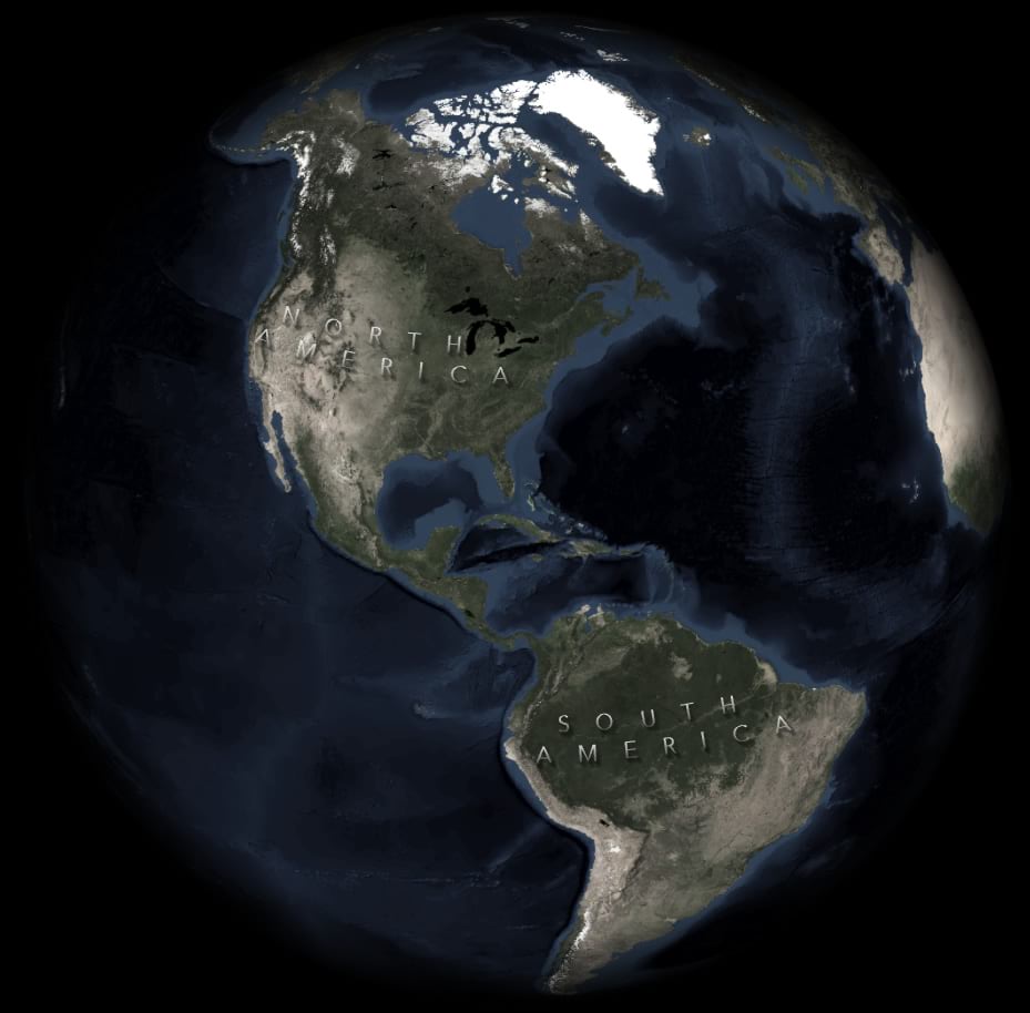
			"keyword": [
				"cartography",
				"labels",
				"label",
				"glowing",
				"shaded",
				"light",
				"shadow",
				"glass",
				"glassy",
				"terrain",
				"text",
				"type",
				"typography",
				"John Nelson"
			],
			"issued": "2019-03-19T15:41:45.000Z",
			"modified": "2025-10-15T18:10:41.000Z",
			"publisher": {
				"name": "Esri Styles"
			},
			"contactPoint": {
				"@type": "vcard:Contact",
				"fn": "JohnMNelson_esristyles",
				"hasEmail": "mailto:SymbolAdvisoryBoard@esri.com"
			},
			"accessLevel": "public",
			"spatial": "",
			"license": "<p><img style='background-color:rgb(255, 255, 255); border:0px solid currentcolor; box-sizing:border-box; color:rgb(74, 74, 74); display:inline; font-family:&quot;Avenir Next W01&quot;, &quot;Avenir Next W00&quot;, &quot;Avenir Next&quot;, Avenir, &quot;Helvetica Neue&quot;, sans-serif; font-size:16px; font-style:normal; font-variant-caps:normal; font-variant-ligatures:normal; font-weight:400; height:auto; letter-spacing:normal; max-width:100%; text-align:start; text-decoration-color:initial; text-decoration-style:initial; text-indent:0px; text-transform:none; word-spacing:0px;' src='https://downloads.esri.com/blogs/arcgisonline/esrilogo_new.png' width='113' height='39' /><span style='background-color:rgb(255,255,255); color:rgb(74,74,74); font-family:&quot;Avenir Next W01&quot;, &quot;Avenir Next W00&quot;, &quot;Avenir Next&quot;, Avenir, &quot;Helvetica Neue&quot;, sans-serif; font-size:16px;'><span style='border:0px solid currentcolor; box-sizing:border-box; font-style:normal; font-variant-caps:normal; font-variant-ligatures:normal; font-weight:400; letter-spacing:normal; line-height:1.5; text-align:start; text-decoration-color:initial; text-decoration-style:initial; text-indent:0px; text-transform:none; word-spacing:0px;'>This work is licensed under the Esri Master License Agreement.</span></span><br /><a style='border:0px solid currentcolor; box-sizing:border-box; color:rgb(0, 97, 155); font-family:inherit; line-height:1.5; text-decoration:none;' target='_blank' href='https://goto.arcgis.com/termsofuse/viewsummary' rel='nofollow ugc noopener noreferrer'><strong>View Summary</strong></a>&nbsp;|&nbsp;<a style='border:0px solid currentcolor; box-sizing:border-box; color:rgb(0, 97, 155); font-family:inherit; line-height:1.5; text-decoration:none;' target='_blank' href='https://goto.arcgis.com/termsofuse/viewtermsofuse' rel='nofollow ugc noopener noreferrer'><strong>View Terms of Use</strong></a></p>",
			"distribution": [
				{
					"@type": "dcat:Distribution",
					"title": "ArcGIS Hub Dataset",
					"format": "Web Page",
					"mediaType": "text/html",
					"accessURL": "https://www.cacgeoportal.com/content/esri-styles::illuminated-labels-for-arcgis-pro-text"
				}
			],
			"theme": ""
		},
		{
			"@type": "dcat:Dataset",
			"identifier": "https://www.arcgis.com/home/item.html?id=191ef05f8bd844c68eee365ada32561b",
			"landingPage": "https://www.cacgeoportal.com/content/esri-styles::george-washington-style-for-arcgis-pro",
			"title": "George Washington style for ArcGIS Pro",
			"description": "<div>Did you know that George Washington <a href='http://www.slate.com/blogs/the_vault/2016/02/15/maps_made_by_george_washington_longtime_surveyor_and_cartographer.html' target='_blank'>was a cartographer</a>? He was a surveyor and map maker in his early years, and continued to make his own maps for practical purposes throughout his life. Cool, right?</div><div><br /></div><div><font size='5'>George's Style</font></div><div>Here is a map he made of his farm, just dripping with hand-wrought charm:</div><div><img alt='' src='https://www.esri.com/arcgis-blog/wp-content/uploads/2018/02/GeorgeWashingtonsFarm.jpg' /><br /></div><div>The ArcGIS Pro style available here is compiled of material textures and George's hand-drawn elements sampled from this very map. That means, when you use it, your map is wrought in the very hand of George Washington. What a time to be alive.</div><div>Check out these examples that <a href='https://twitter.com/EEijkelenboom/status/966264771711586304' target='_blank'>Ernst Eijkelenboom</a> whipped up of his native Netherlands...</div><div><img alt='' src='https://www.esri.com/arcgis-blog/wp-content/uploads/2018/02/Ernst.jpg' /><br /></div><div>Glorious.</div><div><br /></div><div><font size='5'>What You Get</font></div><div>Are you ready to cartographicize like the first president of the United States? Here's what you'll find in the style...</div><div><img alt='' src='https://www.esri.com/arcgis-blog/wp-content/uploads/2018/02/StylePoints.png' /><br /></div><div><img alt='' src='https://www.esri.com/arcgis-blog/wp-content/uploads/2018/02/StyleLines.png' /><br /></div><div><img alt='' src='https://www.esri.com/arcgis-blog/wp-content/uploads/2018/02/StylePolys.png' /><br /></div><div><br /></div><div><font size='5'>How to Install?</font></div><div>Save this style file somewhere on your computer. Then, in Pro, open up the Catalog view, and expand the Style category. Right-click, and choose “Add.” Then just browse to where you saved George Washington. Pow! You’ll be whipping up maps that look like they were scribed by the right hand (I surmise, based on the way his trees lean) of George, himself.<br /></div><div><img alt='' src='https://www.esri.com/arcgis-blog/wp-content/uploads/2018/02/Add.png' /><br /></div><div><br /></div><div>If you would like to make your own styles, based on the texture images I extracted from George’s map, then you can have at them <a href='https://www.dropbox.com/s/186yj4jtayk1jbf/GeorgeWashingtonMapTextures.zip?dl=0' target='_blank'>here</a>.<br /></div><div><br /></div><div>Happy Presidential Throwback Mapping! <a href='https://twitter.com/John_M_Nelson' target='_blank'>John Nelson</a></div>",
			"keyword": [
				"vintage",
				"historic",
				"hand",
				"retro",
				"cartographic",
				"cartography",
				"draft",
				"survey",
				"history",
				"president",
				"George Washington",
				"surveyor",
				"classic",
				"stylx",
				"stylex"
			],
			"issued": "2018-05-30T15:46:24.000Z",
			"modified": "2025-10-15T18:09:42.000Z",
			"publisher": {
				"name": "Esri Styles"
			},
			"contactPoint": {
				"@type": "vcard:Contact",
				"fn": "JohnMNelson_esristyles",
				"hasEmail": "mailto:SymbolAdvisoryBoard@esri.com"
			},
			"accessLevel": "public",
			"spatial": "",
			"license": "<p><img style='background-color:rgb(255, 255, 255); border:0px solid currentcolor; box-sizing:border-box; color:rgb(74, 74, 74); display:inline; font-family:&quot;Avenir Next W01&quot;, &quot;Avenir Next W00&quot;, &quot;Avenir Next&quot;, Avenir, &quot;Helvetica Neue&quot;, sans-serif; font-size:16px; font-style:normal; font-variant-caps:normal; font-variant-ligatures:normal; font-weight:400; height:auto; letter-spacing:normal; max-width:100%; text-align:start; text-decoration-color:initial; text-decoration-style:initial; text-indent:0px; text-transform:none; word-spacing:0px;' src='https://downloads.esri.com/blogs/arcgisonline/esrilogo_new.png' width='113' height='39' /><span style='background-color:rgb(255,255,255); color:rgb(74,74,74); font-family:&quot;Avenir Next W01&quot;, &quot;Avenir Next W00&quot;, &quot;Avenir Next&quot;, Avenir, &quot;Helvetica Neue&quot;, sans-serif; font-size:16px;'><span style='border:0px solid currentcolor; box-sizing:border-box; font-style:normal; font-variant-caps:normal; font-variant-ligatures:normal; font-weight:400; letter-spacing:normal; line-height:1.5; text-align:start; text-decoration-color:initial; text-decoration-style:initial; text-indent:0px; text-transform:none; word-spacing:0px;'>This work is licensed under the Esri Master License Agreement.</span></span><br /><a style='border:0px solid currentcolor; box-sizing:border-box; color:rgb(0, 97, 155); font-family:inherit; line-height:1.5; text-decoration:none;' target='_blank' href='https://goto.arcgis.com/termsofuse/viewsummary' rel='nofollow ugc noopener noreferrer'><strong>View Summary</strong></a>&nbsp;|&nbsp;<a style='border:0px solid currentcolor; box-sizing:border-box; color:rgb(0, 97, 155); font-family:inherit; line-height:1.5; text-decoration:none;' target='_blank' href='https://goto.arcgis.com/termsofuse/viewtermsofuse' rel='nofollow ugc noopener noreferrer'><strong>View Terms of Use</strong></a></p>",
			"distribution": [
				{
					"@type": "dcat:Distribution",
					"title": "ArcGIS Hub Dataset",
					"format": "Web Page",
					"mediaType": "text/html",
					"accessURL": "https://www.cacgeoportal.com/content/esri-styles::george-washington-style-for-arcgis-pro"
				}
			],
			"theme": ""
		},
		{
			"@type": "dcat:Dataset",
			"identifier": "https://www.arcgis.com/home/item.html?id=998442e7b1e943e592b67ec03091fcbe",
			"landingPage": "https://www.cacgeoportal.com/content/esri-styles::glassy-north-arrows-for-arcgis-pro",
			"title": "Glassy North Arrows for ArcGIS Pro",
			"description": "<p>This style for ArcGIS Pro contains four north arrows. They have a glassy semitransparent white appearance with a shadow effect for better visibility over highly textured surfaces while muted enough to provide balance.</p><p>Before you use a north arrow, though, <a target='_blank' href='https://www.youtube.com/watch?v=xGEEfT1JS6w' rel='nofollow ugc noopener noreferrer'>ask yourself if your map really needs one</a>.</p><div>Plus they're a bit of fun sizzle.</div><div><img src='https://adventuresinmapping.files.wordpress.com/2020/09/glassynortharrowsgallery.jpg?w=1024' /><br />&nbsp;</div><div>Will they look good over your map? Maybe! I wouldn't try them over a solid basemap though. They will look pretty bad probably. They are intended for the busy high contrast varied hues of an imagery basemap. But of course you will do what you feel is right, which may include not using them for <i>any</i> map.</div><div>There is an arrowhead style north arrow and a cardinal ring arrow. These are standard north arrow shapes available in ArcGIS Pro, but given the glassy appearance. A stylized \"N\" and a minimalist arrow were drawn as custom SVGs then added to ArcGIS Pro and given the glassy appearance.</div><div>Enjoy! John Nelson</div>",
			"keyword": [
				"North",
				"North Arrow",
				"Arrow",
				"Cardinal",
				"Semitransparent",
				"White",
				"Shadow",
				"modern",
				"modernist",
				"glassy",
				"realistic",
				"firefly",
				"terrain",
				"John Nelson",
				"stylx",
				"stylex"
			],
			"issued": "2020-09-24T20:15:12.000Z",
			"modified": "2025-10-15T18:07:27.000Z",
			"publisher": {
				"name": "Esri Styles"
			},
			"contactPoint": {
				"@type": "vcard:Contact",
				"fn": "JohnMNelson_esristyles",
				"hasEmail": "mailto:SymbolAdvisoryBoard@esri.com"
			},
			"accessLevel": "public",
			"spatial": "",
			"license": "<p><img style='background-color:rgb(255, 255, 255); border:0px solid currentcolor; box-sizing:border-box; color:rgb(74, 74, 74); display:inline; font-family:&quot;Avenir Next W01&quot;, &quot;Avenir Next W00&quot;, &quot;Avenir Next&quot;, Avenir, &quot;Helvetica Neue&quot;, sans-serif; font-size:16px; font-style:normal; font-variant-caps:normal; font-variant-ligatures:normal; font-weight:400; height:auto; letter-spacing:normal; max-width:100%; text-align:start; text-decoration-color:initial; text-decoration-style:initial; text-indent:0px; text-transform:none; word-spacing:0px;' src='https://downloads.esri.com/blogs/arcgisonline/esrilogo_new.png' width='113' height='39' /><span style='background-color:rgb(255,255,255); color:rgb(74,74,74); font-family:&quot;Avenir Next W01&quot;, &quot;Avenir Next W00&quot;, &quot;Avenir Next&quot;, Avenir, &quot;Helvetica Neue&quot;, sans-serif; font-size:16px;'><span style='border:0px solid currentcolor; box-sizing:border-box; font-style:normal; font-variant-caps:normal; font-variant-ligatures:normal; font-weight:400; letter-spacing:normal; line-height:1.5; text-align:start; text-decoration-color:initial; text-decoration-style:initial; text-indent:0px; text-transform:none; word-spacing:0px;'>This work is licensed under the Esri Master License Agreement.</span></span><br /><a style='border:0px solid currentcolor; box-sizing:border-box; color:rgb(0, 97, 155); font-family:inherit; line-height:1.5; text-decoration:none;' target='_blank' href='https://goto.arcgis.com/termsofuse/viewsummary' rel='nofollow ugc noopener noreferrer'><strong>View Summary</strong></a>&nbsp;|&nbsp;<a style='border:0px solid currentcolor; box-sizing:border-box; color:rgb(0, 97, 155); font-family:inherit; line-height:1.5; text-decoration:none;' target='_blank' href='https://goto.arcgis.com/termsofuse/viewtermsofuse' rel='nofollow ugc noopener noreferrer'><strong>View Terms of Use</strong></a></p>",
			"distribution": [
				{
					"@type": "dcat:Distribution",
					"title": "ArcGIS Hub Dataset",
					"format": "Web Page",
					"mediaType": "text/html",
					"accessURL": "https://www.cacgeoportal.com/content/esri-styles::glassy-north-arrows-for-arcgis-pro"
				}
			],
			"theme": ""
		},
		{
			"@type": "dcat:Dataset",
			"identifier": "https://www.arcgis.com/home/item.html?id=7e397116b3404b48bd29e46e9e87efd7",
			"landingPage": "https://www.cacgeoportal.com/content/esri-styles::new-amsterdam-style-for-arcgis-pro",
			"title": "New Amsterdam style for ArcGIS Pro",
			"description": "<div>Inspired by the book, <i>Dirkzwager’s Guide to the New-Waterway, Rotterdam, Dordrecht, Europoort and Botlek for 1978</i>, this style re-creates its crisp modernist colors balanced with charming hand-drawn landcover features and incorporates the tangible variability of print ink and aged paper.</div><div>I was shown a wonderful example, provided by Eelco Berghuis, which was a gift from his grandfather.</div><div>So I sampled colors and created fill and line symbol features with a print-like texture and bleed. When applied (admittedly pretty haphazardly) to New York City (New Amsterdam), for example, the style looks like this...</div><div><img src='https://adventuresinmapping.files.wordpress.com/2018/09/harborstyle2.jpg?w=1000' /><br />&nbsp;</div><div><img src='https://adventuresinmapping.files.wordpress.com/2018/09/harborstyle.jpg?w=1000' /><br />&nbsp;</div><div>And here are the style elements that comprise it...</div><div><img src='https://adventuresinmapping.files.wordpress.com/2018/09/newamsterdamstyleitems.png' /><br />&nbsp;</div><div>Find this and other styles by browsing <a target='_blank' href='https://esri-styles.maps.arcgis.com/home/gallery.html?sortField=relevance&amp;sortOrder=desc&amp;searchTerm=John+Nelson' rel='nofollow ugc noopener noreferrer'>this gallery</a>. Happy Harbor Mapping! John Nelson</div>",
			"keyword": [
				"nautical",
				"cartography",
				"vintage",
				"paper",
				"engineering",
				"planning",
				"chart",
				"John Nelson",
				"stylx",
				"stylex",
				"colorful",
				"retro",
				"modernist",
				"minimalist",
				"Dutch",
				"Netherlands",
				"port",
				"shipping",
				"vessels",
				"oceans"
			],
			"issued": "2018-09-26T14:52:58.000Z",
			"modified": "2025-10-15T18:04:58.000Z",
			"publisher": {
				"name": "Esri Styles"
			},
			"contactPoint": {
				"@type": "vcard:Contact",
				"fn": "JohnMNelson_esristyles",
				"hasEmail": "mailto:SymbolAdvisoryBoard@esri.com"
			},
			"accessLevel": "public",
			"spatial": "",
			"license": "<p><img style='background-color:rgb(255, 255, 255); border:0px solid currentcolor; box-sizing:border-box; color:rgb(74, 74, 74); display:inline; font-family:&quot;Avenir Next W01&quot;, &quot;Avenir Next W00&quot;, &quot;Avenir Next&quot;, Avenir, &quot;Helvetica Neue&quot;, sans-serif; font-size:16px; font-style:normal; font-variant-caps:normal; font-variant-ligatures:normal; font-weight:400; height:auto; letter-spacing:normal; max-width:100%; text-align:start; text-decoration-color:initial; text-decoration-style:initial; text-indent:0px; text-transform:none; word-spacing:0px;' src='https://downloads.esri.com/blogs/arcgisonline/esrilogo_new.png' width='113' height='39' /><span style='background-color:rgb(255,255,255); color:rgb(74,74,74); font-family:&quot;Avenir Next W01&quot;, &quot;Avenir Next W00&quot;, &quot;Avenir Next&quot;, Avenir, &quot;Helvetica Neue&quot;, sans-serif; font-size:16px;'><span style='border:0px solid currentcolor; box-sizing:border-box; font-style:normal; font-variant-caps:normal; font-variant-ligatures:normal; font-weight:400; letter-spacing:normal; line-height:1.5; text-align:start; text-decoration-color:initial; text-decoration-style:initial; text-indent:0px; text-transform:none; word-spacing:0px;'>This work is licensed under the Esri Master License Agreement.</span></span><br /><a style='border:0px solid currentcolor; box-sizing:border-box; color:rgb(0, 97, 155); font-family:inherit; line-height:1.5; text-decoration:none;' target='_blank' href='https://goto.arcgis.com/termsofuse/viewsummary' rel='nofollow ugc noopener noreferrer'><strong>View Summary</strong></a>&nbsp;|&nbsp;<a style='border:0px solid currentcolor; box-sizing:border-box; color:rgb(0, 97, 155); font-family:inherit; line-height:1.5; text-decoration:none;' target='_blank' href='https://goto.arcgis.com/termsofuse/viewtermsofuse' rel='nofollow ugc noopener noreferrer'><strong>View Terms of Use</strong></a></p>",
			"distribution": [
				{
					"@type": "dcat:Distribution",
					"title": "ArcGIS Hub Dataset",
					"format": "Web Page",
					"mediaType": "text/html",
					"accessURL": "https://www.cacgeoportal.com/content/esri-styles::new-amsterdam-style-for-arcgis-pro"
				}
			],
			"theme": ""
		},
		{
			"@type": "dcat:Dataset",
			"identifier": "https://www.arcgis.com/home/item.html?id=f25e23a34ba245c98a3791e0a661f19b",
			"landingPage": "https://www.cacgeoportal.com/content/esri-styles::felt-style-for-arcgis-pro",
			"title": "Felt style for ArcGIS Pro",
			"description": "I'd like you to make downloading, implementing, and sharing the output of, this felt-tastic style your new highest priority.<div>So what do you get when you download this style, besides a rush of craft-induced adrenaline? These symbols...</div><div><img alt='' src='https://www.esri.com/arcgis-blog/wp-content/uploads/2019/07/Swatch.png' /><br /></div><div><br /></div><div>I've seeded the style with some pre-colored symbols but each and every one of these felty symbols can be dyed whatever color you want in the symbology panel. Here are some example maps using this style...</div><div><img alt='' src='https://adventuresinmapping.files.wordpress.com/2019/07/fullervolcano.jpg' /><br /></div><div><img alt='' src='https://adventuresinmapping.files.wordpress.com/2019/07/craterlake.jpg' /><br /></div><div><img alt='' src='https://adventuresinmapping.files.wordpress.com/2019/07/grandcanyonelevation.jpg' /><br /></div><div><img alt='' src='https://adventuresinmapping.files.wordpress.com/2019/07/landforms.jpg' /><br /></div><div>Happy Mapping! <a href='https://twitter.com/John_M_Nelson' target='_blank'>John Nelson</a></div>",
			"keyword": [
				"cartography",
				"arcgis pro",
				"tactile",
				"texture",
				"fun",
				"craft",
				"felt",
				"wool",
				"stitched",
				"embroidered",
				"John Nelson",
				"stylx",
				"stylex",
				"sewn",
				"sewing",
				"layers",
				"skeuomorphism",
				"skeuomorphic"
			],
			"issued": "2019-07-30T20:16:47.000Z",
			"modified": "2025-10-15T17:58:33.000Z",
			"publisher": {
				"name": "Esri Styles"
			},
			"contactPoint": {
				"@type": "vcard:Contact",
				"fn": "JohnMNelson_esristyles",
				"hasEmail": "mailto:SymbolAdvisoryBoard@esri.com"
			},
			"accessLevel": "public",
			"spatial": "",
			"license": "<p><img style='background-color:rgb(255, 255, 255); border:0px solid currentcolor; box-sizing:border-box; color:rgb(74, 74, 74); display:inline; font-family:&quot;Avenir Next W01&quot;, &quot;Avenir Next W00&quot;, &quot;Avenir Next&quot;, Avenir, &quot;Helvetica Neue&quot;, sans-serif; font-size:16px; font-style:normal; font-variant-caps:normal; font-variant-ligatures:normal; font-weight:400; height:auto; letter-spacing:normal; max-width:100%; text-align:start; text-decoration-color:initial; text-decoration-style:initial; text-indent:0px; text-transform:none; word-spacing:0px;' src='https://downloads.esri.com/blogs/arcgisonline/esrilogo_new.png' width='113' height='39' /><span style='background-color:rgb(255,255,255); color:rgb(74,74,74); font-family:&quot;Avenir Next W01&quot;, &quot;Avenir Next W00&quot;, &quot;Avenir Next&quot;, Avenir, &quot;Helvetica Neue&quot;, sans-serif; font-size:16px;'><span style='border:0px solid currentcolor; box-sizing:border-box; font-style:normal; font-variant-caps:normal; font-variant-ligatures:normal; font-weight:400; letter-spacing:normal; line-height:1.5; text-align:start; text-decoration-color:initial; text-decoration-style:initial; text-indent:0px; text-transform:none; word-spacing:0px;'>This work is licensed under the Esri Master License Agreement.</span></span><br /><a style='border:0px solid currentcolor; box-sizing:border-box; color:rgb(0, 97, 155); font-family:inherit; line-height:1.5; text-decoration:none;' target='_blank' href='https://goto.arcgis.com/termsofuse/viewsummary' rel='nofollow ugc noopener noreferrer'><strong>View Summary</strong></a>&nbsp;|&nbsp;<a style='border:0px solid currentcolor; box-sizing:border-box; color:rgb(0, 97, 155); font-family:inherit; line-height:1.5; text-decoration:none;' target='_blank' href='https://goto.arcgis.com/termsofuse/viewtermsofuse' rel='nofollow ugc noopener noreferrer'><strong>View Terms of Use</strong></a></p>",
			"distribution": [
				{
					"@type": "dcat:Distribution",
					"title": "ArcGIS Hub Dataset",
					"format": "Web Page",
					"mediaType": "text/html",
					"accessURL": "https://www.cacgeoportal.com/content/esri-styles::felt-style-for-arcgis-pro"
				}
			],
			"theme": ""
		},
		{
			"@type": "dcat:Dataset",
			"identifier": "https://www.arcgis.com/home/item.html?id=6c01b3d015ce40eca7846941d6313fe8",
			"landingPage": "https://www.cacgeoportal.com/content/esri-styles::paper-cut-style-for-arcgis-pro",
			"title": "Paper Cut style for ArcGIS Pro",
			"description": "<div>This style consists of two, and only two, symbols. One pin point symbol and one paper polygon symbol.<br /></div><div><img src='https://adventuresinmapping.files.wordpress.com/2020/01/pinandpaper.jpg?w=519' /><br /></div><div><br /></div><div>But they can be dynamically colored in the symbology panel. Here's a <a href='https://youtu.be/6yyRaNiicpU' target='_blank' rel='nofollow ugc noopener noreferrer'>one-minute how to</a>.</div><div><br /></div><div><img src='https://adventuresinmapping.files.wordpress.com/2020/01/paperandpins.jpg' /><br /></div><div><br /></div><div><img src='https://www.esri.com/arcgis-blog/wp-content/uploads/2019/09/WizardIsland.jpg' /><br /></div><div><br /></div><img src='https://www.esri.com/arcgis-blog/wp-content/uploads/2019/09/StHelens.jpg' /><div><br /></div><div><img src='https://www.esri.com/arcgis-blog/wp-content/uploads/2019/09/GrandCanyon.jpg' /><br /></div>",
			"keyword": [
				"cartography",
				"tactile",
				"paper",
				"John Nelson",
				"cardboard",
				"layered",
				"stylx",
				"stylex",
				"wood",
				"woodcut"
			],
			"issued": "2019-09-24T14:34:53.000Z",
			"modified": "2025-10-15T17:57:32.000Z",
			"publisher": {
				"name": "Esri Styles"
			},
			"contactPoint": {
				"@type": "vcard:Contact",
				"fn": "JohnMNelson_esristyles",
				"hasEmail": "mailto:SymbolAdvisoryBoard@esri.com"
			},
			"accessLevel": "public",
			"spatial": "",
			"license": "<p><img style='background-color:rgb(255, 255, 255); border:0px solid currentcolor; box-sizing:border-box; color:rgb(74, 74, 74); display:inline; font-family:&quot;Avenir Next W01&quot;, &quot;Avenir Next W00&quot;, &quot;Avenir Next&quot;, Avenir, &quot;Helvetica Neue&quot;, sans-serif; font-size:16px; font-style:normal; font-variant-caps:normal; font-variant-ligatures:normal; font-weight:400; height:auto; letter-spacing:normal; max-width:100%; text-align:start; text-decoration-color:initial; text-decoration-style:initial; text-indent:0px; text-transform:none; word-spacing:0px;' src='https://downloads.esri.com/blogs/arcgisonline/esrilogo_new.png' width='113' height='39' /><span style='background-color:rgb(255,255,255); color:rgb(74,74,74); font-family:&quot;Avenir Next W01&quot;, &quot;Avenir Next W00&quot;, &quot;Avenir Next&quot;, Avenir, &quot;Helvetica Neue&quot;, sans-serif; font-size:16px;'><span style='border:0px solid currentcolor; box-sizing:border-box; font-style:normal; font-variant-caps:normal; font-variant-ligatures:normal; font-weight:400; letter-spacing:normal; line-height:1.5; text-align:start; text-decoration-color:initial; text-decoration-style:initial; text-indent:0px; text-transform:none; word-spacing:0px;'>This work is licensed under the Esri Master License Agreement.</span></span><br /><a style='border:0px solid currentcolor; box-sizing:border-box; color:rgb(0, 97, 155); font-family:inherit; line-height:1.5; text-decoration:none;' target='_blank' href='https://goto.arcgis.com/termsofuse/viewsummary' rel='nofollow ugc noopener noreferrer'><strong>View Summary</strong></a>&nbsp;|&nbsp;<a style='border:0px solid currentcolor; box-sizing:border-box; color:rgb(0, 97, 155); font-family:inherit; line-height:1.5; text-decoration:none;' target='_blank' href='https://goto.arcgis.com/termsofuse/viewtermsofuse' rel='nofollow ugc noopener noreferrer'><strong>View Terms of Use</strong></a></p>",
			"distribution": [
				{
					"@type": "dcat:Distribution",
					"title": "ArcGIS Hub Dataset",
					"format": "Web Page",
					"mediaType": "text/html",
					"accessURL": "https://www.cacgeoportal.com/content/esri-styles::paper-cut-style-for-arcgis-pro"
				}
			],
			"theme": ""
		},
		{
			"@type": "dcat:Dataset",
			"identifier": "https://www.arcgis.com/home/item.html?id=16d986275e62408fa1027dee5b257028",
			"landingPage": "https://www.cacgeoportal.com/content/esri-styles::cross-stitch-style-for-arcgis-pro",
			"title": "Cross Stitch style for ArcGIS Pro",
			"description": "<p>Sometimes you just want to thread the needle of plausible cartography and make scientific maps in the most charming homespun manner possible. <a target='_blank' href='https://www.youtube.com/watch?v=pUgjMFyxdTA' rel='nofollow ugc noopener noreferrer'>Here is a video</a> walking through how this style was created using ArcGIS PRo stymbology.</p><div><img src='https://adventuresinmapping.files.wordpress.com/2020/03/world-landforms.jpg' /><br />&nbsp;</div><div><img src='https://adventuresinmapping.files.wordpress.com/2020/03/usa.jpg' /><br />&nbsp;</div><div><img src='https://adventuresinmapping.files.wordpress.com/2020/03/mi_geology.jpg' /><br />&nbsp;</div><div><img src='https://adventuresinmapping.files.wordpress.com/2020/03/mi-hydrology.jpg' /><br />&nbsp;</div><div><img src='https://adventuresinmapping.files.wordpress.com/2020/03/corinelandcover.jpg' /><br />&nbsp;</div><div><img src='https://adventuresinmapping.files.wordpress.com/2020/03/hoopstretchersatlanticbathy.jpg' /><br />&nbsp;</div><div><img src='https://adventuresinmapping.files.wordpress.com/2020/03/hoopstretchermthood.jpg' /><br />&nbsp;</div><div><img src='https://adventuresinmapping.files.wordpress.com/2020/03/hoopstretcheritaly.jpg' /><br />&nbsp;</div><div><img src='https://adventuresinmapping.files.wordpress.com/2020/03/hoopstretcheraus.jpg' /><br />&nbsp;</div><div>Here are a couple frame images if you want to add them atop your ArcGIS Pro layout:</div><div><img src='https://adventuresinmapping.files.wordpress.com/2020/04/hoopstretcher.png' /><br />&nbsp;</div><div><img src='https://adventuresinmapping.files.wordpress.com/2019/07/frame.png' /><br />&nbsp;</div>",
			"keyword": [
				"Cartography",
				"stitch",
				"stitching",
				"skeuomorphic",
				"thread",
				"needlepoint",
				"cross stitch",
				"cross-stitch",
				"tapestry",
				"John Nelson",
				"stylx",
				"stylex"
			],
			"issued": "2020-04-16T17:58:05.000Z",
			"modified": "2025-10-15T17:55:27.000Z",
			"publisher": {
				"name": "Esri Styles"
			},
			"contactPoint": {
				"@type": "vcard:Contact",
				"fn": "JohnMNelson_esristyles",
				"hasEmail": "mailto:SymbolAdvisoryBoard@esri.com"
			},
			"accessLevel": "public",
			"spatial": "",
			"license": "<p><img style='background-color:rgb(255, 255, 255); border:0px solid currentcolor; box-sizing:border-box; color:rgb(74, 74, 74); display:inline; font-family:&quot;Avenir Next W01&quot;, &quot;Avenir Next W00&quot;, &quot;Avenir Next&quot;, Avenir, &quot;Helvetica Neue&quot;, sans-serif; font-size:16px; font-style:normal; font-variant-caps:normal; font-variant-ligatures:normal; font-weight:400; height:auto; letter-spacing:normal; max-width:100%; text-align:start; text-decoration-color:initial; text-decoration-style:initial; text-indent:0px; text-transform:none; word-spacing:0px;' src='https://downloads.esri.com/blogs/arcgisonline/esrilogo_new.png' width='113' height='39' /><span style='background-color:rgb(255,255,255); color:rgb(74,74,74); font-family:&quot;Avenir Next W01&quot;, &quot;Avenir Next W00&quot;, &quot;Avenir Next&quot;, Avenir, &quot;Helvetica Neue&quot;, sans-serif; font-size:16px;'><span style='border:0px solid currentcolor; box-sizing:border-box; font-style:normal; font-variant-caps:normal; font-variant-ligatures:normal; font-weight:400; letter-spacing:normal; line-height:1.5; text-align:start; text-decoration-color:initial; text-decoration-style:initial; text-indent:0px; text-transform:none; word-spacing:0px;'>This work is licensed under the Esri Master License Agreement.</span></span><br /><a style='border:0px solid currentcolor; box-sizing:border-box; color:rgb(0, 97, 155); font-family:inherit; line-height:1.5; text-decoration:none;' target='_blank' href='https://goto.arcgis.com/termsofuse/viewsummary' rel='nofollow ugc noopener noreferrer'><strong>View Summary</strong></a>&nbsp;|&nbsp;<a style='border:0px solid currentcolor; box-sizing:border-box; color:rgb(0, 97, 155); font-family:inherit; line-height:1.5; text-decoration:none;' target='_blank' href='https://goto.arcgis.com/termsofuse/viewtermsofuse' rel='nofollow ugc noopener noreferrer'><strong>View Terms of Use</strong></a></p>",
			"distribution": [
				{
					"@type": "dcat:Distribution",
					"title": "ArcGIS Hub Dataset",
					"format": "Web Page",
					"mediaType": "text/html",
					"accessURL": "https://www.cacgeoportal.com/content/esri-styles::cross-stitch-style-for-arcgis-pro"
				}
			],
			"theme": ""
		},
		{
			"@type": "dcat:Dataset",
			"identifier": "https://www.arcgis.com/home/item.html?id=236a170ca687438d83fef046297d243f",
			"landingPage": "https://www.cacgeoportal.com/content/esri-styles::pen-and-ink-style-for-arcgis-pro",
			"title": "Pen and Ink style for ArcGIS Pro",
			"description": "<div><p style='box-sizing:border-box; margin-top:10px; margin-bottom:20px; max-width:946.667px; width:946.667px; padding-left:60.4167px; padding-right:60.4167px; font-family:&quot;Avenir Next W01&quot;, &quot;Avenir Next W00&quot;, &quot;Avenir Next&quot;, Avenir, &quot;Helvetica Neue&quot;, Helvetica, Arial, sans-serif; font-size:20px; margin-left:auto !important; margin-right:auto !important;'>Everybody just loves a pen and ink stipple effect. It’s charming, it’s warm, it’s handsome, it’s tactile. It says, say, want to sit on the couch and I’ll read to you from your well-worn copy of <a href='https://en.wikipedia.org/wiki/Where_the_Sidewalk_Ends' style='box-sizing:border-box; color:rgb(0, 121, 193); text-decoration-line:none;' target='_blank' rel='nofollow ugc noopener noreferrer'>Where the Sidewalk Ends</a>?</p><p style='box-sizing:border-box; margin-top:10px; margin-bottom:20px; max-width:946.667px; width:946.667px; padding-left:60.4167px; padding-right:60.4167px; font-family:&quot;Avenir Next W01&quot;, &quot;Avenir Next W00&quot;, &quot;Avenir Next&quot;, Avenir, &quot;Helvetica Neue&quot;, Helvetica, Arial, sans-serif; font-size:20px; margin-left:auto !important; margin-right:auto !important;'>I’ve tried out the stipple effect in maps (<a href='https://www.esri.com/arcgis-blog/products/mapping/mapping/digital-to-hand/' style='box-sizing:border-box; color:rgb(0, 121, 193); text-decoration-line:none;' target='_blank' rel='nofollow ugc noopener noreferrer'>here</a> and <a href='https://adventuresinmapping.com/2017/12/18/hillshade-by-hand/' style='box-sizing:border-box; color:rgb(0, 121, 193); text-decoration-line:none;' target='_blank' rel='nofollow ugc noopener noreferrer'>here</a>) that I’ve hand-drawn (yes, and so should you!) as well as dipped my toe into creating a digital effect (<a href='https://www.esri.com/arcgis-blog/products/mapping/mapping/mega-easy-coastal-stipple-effect/' style='box-sizing:border-box; color:rgb(0, 121, 193); text-decoration-line:none;' target='_blank' rel='nofollow ugc noopener noreferrer'>here</a> and <a href='https://www.esri.com/arcgis-blog/products/mapping/mapping/hand-to-digital/' style='box-sizing:border-box; color:rgb(0, 121, 193); text-decoration-line:none;' target='_blank' rel='nofollow ugc noopener noreferrer'>here</a>), and found that it gives a richness of clarity and depth. Then a few days ago I saw <a href='https://twitter.com/mollyyelk/status/1251986606300553218' style='box-sizing:border-box; color:rgb(0, 121, 193); text-decoration-line:none;' target='_blank' rel='nofollow ugc noopener noreferrer'>this wonderful hand stippled map</a> drawn by Molly Elkins, on Twitter. The simple beauty of her map motivated me to go back to the inkwell and get an honest to goodness pen and ink style together for <a href='https://www.esri.com/en-us/arcgis/products/arcgis-pro/overview' style='box-sizing:border-box; color:rgb(0, 121, 193); text-decoration-line:none;' target='_blank' rel='nofollow ugc noopener noreferrer'>ArcGIS Pro</a>.</p><p style='box-sizing:border-box; margin-top:10px; margin-bottom:20px; max-width:946.667px; width:946.667px; padding-left:60.4167px; padding-right:60.4167px; font-family:&quot;Avenir Next W01&quot;, &quot;Avenir Next W00&quot;, &quot;Avenir Next&quot;, Avenir, &quot;Helvetica Neue&quot;, Helvetica, Arial, sans-serif; font-size:20px; margin-left:auto !important; margin-right:auto !important;'>Here are some examples...</p></div><img src='https://adventuresinmapping.files.wordpress.com/2020/05/spilhaus.jpg' /><div><img src='https://adventuresinmapping.files.wordpress.com/2020/05/spilhausdata.jpg' /><br /></div><div><img src='https://adventuresinmapping.files.wordpress.com/2020/05/currentsdetailc.jpg' /><br /></div><div><img src='https://adventuresinmapping.files.wordpress.com/2020/05/currentsdetailb.jpg' /><br /></div><div><img src='https://adventuresinmapping.files.wordpress.com/2020/05/currentsdetaila.jpg' /><br /></div><div><img src='https://adventuresinmapping.files.wordpress.com/2020/05/nyc.jpg' /><br /></div><div><img src='https://adventuresinmapping.files.wordpress.com/2020/05/states.jpg' /><br /></div><div><img src='https://adventuresinmapping.files.wordpress.com/2020/05/columbiariver.jpg' /><br /></div><div><img src='https://adventuresinmapping.files.wordpress.com/2020/05/hoodriver.jpg' /><br /></div><div><img src='https://adventuresinmapping.files.wordpress.com/2020/05/greatlakes.jpg' /><br /></div><div><img src='https://adventuresinmapping.files.wordpress.com/2020/05/underseacables.jpg' /><br /></div><div><img src='https://adventuresinmapping.files.wordpress.com/2020/05/craterlakedetailstipple.jpg' /><br /></div><div><span style='font-family:&quot;Avenir Next W01&quot;, &quot;Avenir Next W00&quot;, &quot;Avenir Next&quot;, Avenir, &quot;Helvetica Neue&quot;, Helvetica, Arial, sans-serif; font-size:20px;'><br /></span></div><div><span style='font-family:&quot;Avenir Next W01&quot;, &quot;Avenir Next W00&quot;, &quot;Avenir Next&quot;, Avenir, &quot;Helvetica Neue&quot;, Helvetica, Arial, sans-serif; font-size:20px;'>Here's what's in the style...</span><br /></div><div><img src='https://adventuresinmapping.files.wordpress.com/2020/05/penandinkstyle.png' /><br /></div>",
			"keyword": [
				"cartography",
				"ink",
				"realism",
				"skeuomorphism",
				"paper",
				"stipple",
				"shading",
				"hand drawn",
				"manual",
				"John Nelson",
				"cartographic",
				"hand",
				"pen",
				"blue",
				"red",
				"black",
				"stylx",
				"stylex"
			],
			"issued": "2020-05-14T18:29:10.000Z",
			"modified": "2025-10-15T17:52:25.000Z",
			"publisher": {
				"name": "Esri Styles"
			},
			"contactPoint": {
				"@type": "vcard:Contact",
				"fn": "JohnMNelson_esristyles",
				"hasEmail": "mailto:SymbolAdvisoryBoard@esri.com"
			},
			"accessLevel": "public",
			"spatial": "",
			"license": "<p><img style='background-color:rgb(255, 255, 255); border:0px solid currentcolor; box-sizing:border-box; color:rgb(74, 74, 74); display:inline; font-family:&quot;Avenir Next W01&quot;, &quot;Avenir Next W00&quot;, &quot;Avenir Next&quot;, Avenir, &quot;Helvetica Neue&quot;, sans-serif; font-size:16px; font-style:normal; font-variant-caps:normal; font-variant-ligatures:normal; font-weight:400; height:auto; letter-spacing:normal; max-width:100%; text-align:start; text-decoration-color:initial; text-decoration-style:initial; text-indent:0px; text-transform:none; word-spacing:0px;' src='https://downloads.esri.com/blogs/arcgisonline/esrilogo_new.png' width='113' height='39' /><span style='background-color:rgb(255,255,255); color:rgb(74,74,74); font-family:&quot;Avenir Next W01&quot;, &quot;Avenir Next W00&quot;, &quot;Avenir Next&quot;, Avenir, &quot;Helvetica Neue&quot;, sans-serif; font-size:16px;'><span style='border:0px solid currentcolor; box-sizing:border-box; font-style:normal; font-variant-caps:normal; font-variant-ligatures:normal; font-weight:400; letter-spacing:normal; line-height:1.5; text-align:start; text-decoration-color:initial; text-decoration-style:initial; text-indent:0px; text-transform:none; word-spacing:0px;'>This work is licensed under the Esri Master License Agreement.</span></span><br /><a style='border:0px solid currentcolor; box-sizing:border-box; color:rgb(0, 97, 155); font-family:inherit; line-height:1.5; text-decoration:none;' target='_blank' href='https://goto.arcgis.com/termsofuse/viewsummary' rel='nofollow ugc noopener noreferrer'><strong>View Summary</strong></a>&nbsp;|&nbsp;<a style='border:0px solid currentcolor; box-sizing:border-box; color:rgb(0, 97, 155); font-family:inherit; line-height:1.5; text-decoration:none;' target='_blank' href='https://goto.arcgis.com/termsofuse/viewtermsofuse' rel='nofollow ugc noopener noreferrer'><strong>View Terms of Use</strong></a></p>",
			"distribution": [
				{
					"@type": "dcat:Distribution",
					"title": "ArcGIS Hub Dataset",
					"format": "Web Page",
					"mediaType": "text/html",
					"accessURL": "https://www.cacgeoportal.com/content/esri-styles::pen-and-ink-style-for-arcgis-pro"
				}
			],
			"theme": ""
		},
		{
			"@type": "dcat:Dataset",
			"identifier": "https://www.arcgis.com/home/item.html?id=1f25b31793cd4e7391b0cd51b9b79783",
			"landingPage": "https://www.cacgeoportal.com/content/esri-styles::imhof-style-for-arcgis-pro",
			"title": "Imhof style for ArcGIS Pro",
			"description": "Created to honor the impressionistic atmospheric quality of <a href='https://www.google.com/search?rlz=1C1GGRV_enUS751US751&amp;biw=1920&amp;bih=1087&amp;tbm=isch&amp;sa=1&amp;ei=cpyFW5PYHYGS0PEP-_m6yA4&amp;q=imhof+map&amp;oq=imhof+map&amp;gs_l=img.3...5182.5375.0.5619.3.3.0.0.0.0.199.199.0j1.1.0....0...1c.1.64.img..2.0.0....0.cj4pfICmAAs' rel='nofollow ugc' target='_blank'>the work of</a> Swiss topographic painter and cartographer, <a href='https://en.wikipedia.org/wiki/Eduard_Imhof' rel='nofollow ugc' target='_blank'>Eduard Imhof</a>. These symbols and palettes allow for the application of an homage aesthetic when applied to layered hillshades and digital elevation models. An accompanying how-to resource is forthcoming.<div>In the meantime, the Hillshade color scheme is intended to be applied to a traditional hillshade layer and a multidirectional hillshade layer. The Mist color scheme is intended to be applied to a DEM layer. When viewed in concert with an imagery basemap, the hues and opacities combine to create a distinctive quality.</div><div><img alt='' src='https://i0.wp.com/adventuresinmapping.files.wordpress.com/2018/06/ingredients.jpg' /><br /></div><div><img alt='' src='https://i2.wp.com/adventuresinmapping.files.wordpress.com/2018/06/layerscombinedwithvectors.jpg?ssl=1&amp;w=800' /><br /></div><div>Here it is at a broader scale...</div><div><img alt='' src='https://i2.wp.com/adventuresinmapping.files.wordpress.com/2018/08/1.jpg?ssl=1&amp;w=800' /><br /></div><div>Here is a map that uses the Area of Interest, Mask, and Locator layers...</div><div><img alt='' src='https://i2.wp.com/adventuresinmapping.files.wordpress.com/2018/08/switzerland1.jpg?ssl=1&amp;w=800' /><br /></div><div><img alt='' src='https://i2.wp.com/adventuresinmapping.files.wordpress.com/2018/08/inset.jpg?ssl=1&amp;w=800' /><br /></div><div><br /></div><div>Contents:</div><div><img alt='' src='https://adventuresinmapping.files.wordpress.com/2020/01/imhofstylesheet.png' /></div><div><br /></div><div>Alternatively, you can <a href='https://nation.maps.arcgis.com/home/item.html?id=626ee6fcbce548fba82181f0bb67148b' rel='nofollow ugc' target='_blank'>download an ArcGIS Pro project</a> with the data and styles already implemented, and you can just start cranking away at Imhofs.</div><div><br /></div><div>Happy Topographic Painting! <a href='https://twitter.com/John_M_Nelson' rel='nofollow ugc' target='_blank'>John Nelson</a></div>",
			"keyword": [
				"hillshade",
				"swiss",
				"topography",
				"terrain",
				"DEM",
				"elevation",
				"color",
				"cartography",
				"physical",
				"Imhof",
				"midcentury",
				"modern",
				"mountain",
				"stylx",
				"stylex"
			],
			"issued": "2018-08-28T18:43:20.000Z",
			"modified": "2025-10-15T17:39:22.000Z",
			"publisher": {
				"name": "Esri Styles"
			},
			"contactPoint": {
				"@type": "vcard:Contact",
				"fn": "JohnMNelson_esristyles",
				"hasEmail": "mailto:SymbolAdvisoryBoard@esri.com"
			},
			"accessLevel": "public",
			"spatial": "",
			"license": "<p><img style='background-color:rgb(255, 255, 255); border:0px solid currentcolor; box-sizing:border-box; color:rgb(74, 74, 74); display:inline; font-family:&quot;Avenir Next W01&quot;, &quot;Avenir Next W00&quot;, &quot;Avenir Next&quot;, Avenir, &quot;Helvetica Neue&quot;, sans-serif; font-size:16px; font-style:normal; font-variant-caps:normal; font-variant-ligatures:normal; font-weight:400; height:auto; letter-spacing:normal; max-width:100%; text-align:start; text-decoration-color:initial; text-decoration-style:initial; text-indent:0px; text-transform:none; word-spacing:0px;' src='https://downloads.esri.com/blogs/arcgisonline/esrilogo_new.png' width='113' height='39' /><span style='background-color:rgb(255,255,255); color:rgb(74,74,74); font-family:&quot;Avenir Next W01&quot;, &quot;Avenir Next W00&quot;, &quot;Avenir Next&quot;, Avenir, &quot;Helvetica Neue&quot;, sans-serif; font-size:16px;'><span style='border:0px solid currentcolor; box-sizing:border-box; font-style:normal; font-variant-caps:normal; font-variant-ligatures:normal; font-weight:400; letter-spacing:normal; line-height:1.5; text-align:start; text-decoration-color:initial; text-decoration-style:initial; text-indent:0px; text-transform:none; word-spacing:0px;'>This work is licensed under the Esri Master License Agreement.</span></span><br /><a style='border:0px solid currentcolor; box-sizing:border-box; color:rgb(0, 97, 155); font-family:inherit; line-height:1.5; text-decoration:none;' target='_blank' href='https://goto.arcgis.com/termsofuse/viewsummary' rel='nofollow ugc noopener noreferrer'><strong>View Summary</strong></a>&nbsp;|&nbsp;<a style='border:0px solid currentcolor; box-sizing:border-box; color:rgb(0, 97, 155); font-family:inherit; line-height:1.5; text-decoration:none;' target='_blank' href='https://goto.arcgis.com/termsofuse/viewtermsofuse' rel='nofollow ugc noopener noreferrer'><strong>View Terms of Use</strong></a></p>",
			"distribution": [
				{
					"@type": "dcat:Distribution",
					"title": "ArcGIS Hub Dataset",
					"format": "Web Page",
					"mediaType": "text/html",
					"accessURL": "https://www.cacgeoportal.com/content/esri-styles::imhof-style-for-arcgis-pro"
				}
			],
			"theme": ""
		},
		{
			"@type": "dcat:Dataset",
			"identifier": "https://www.arcgis.com/home/item.html?id=936edb7f57334763a8247d1019a9de51",
			"landingPage": "https://www.cacgeoportal.com/content/esri-styles::watercolor-style-for-arcgis-pro",
			"title": "Watercolor style for ArcGIS Pro",
			"description": "Watercolor maps are beautiful. Maps made in ArcGIS Pro can use a watercolor style to look realistically watercolory. Therefore, according to the transitive property, we can say that these maps may be beautiful.<div>There are many utilities for a style like this. Mapping local parks and communities, creating your own vector basemaps, transforming digital features into plausibly tangible art, or just getting inspired by the combined wonder of geography and texture.<br /><div>Here are some example swatches of the point, line, and polygon styles available herein.</div><div><img alt='' src='https://www.esri.com/arcgis-blog/wp-content/uploads/2018/05/StylePoints.jpg' /><br /></div><div><img alt='' src='https://www.esri.com/arcgis-blog/wp-content/uploads/2018/05/StyleLines.jpg' /><br /></div><div><img alt='' src='https://www.esri.com/arcgis-blog/wp-content/uploads/2018/05/StylePolygons-1.jpg' /><br /></div><div>Here are a couple examples of their use in Pro:</div><div><img alt='' src='https://www.esri.com/arcgis-blog/wp-content/uploads/2018/05/NewYork.jpg' /><br /></div></div><div><img alt='' src='https://www.esri.com/arcgis-blog/wp-content/uploads/2018/05/Aspect.jpg' /><br /></div><div><br /></div><div>Happy watercoloring! <a href='https://twitter.com/John_M_Nelson' target='_blank'>John Nelson</a></div>",
			"keyword": [
				"cartographic",
				"cartography",
				"texture",
				"picture",
				"artistic",
				"design",
				"paint",
				"style",
				"draw",
				"hand",
				"painting",
				"watercolor",
				"paper",
				"colorful",
				"art",
				"colors",
				"pencil",
				"sketch",
				"stylx",
				"stylex",
				"John Nelson"
			],
			"issued": "2018-05-22T14:19:45.000Z",
			"modified": "2025-10-15T17:38:20.000Z",
			"publisher": {
				"name": "Esri Styles"
			},
			"contactPoint": {
				"@type": "vcard:Contact",
				"fn": "JohnMNelson_esristyles",
				"hasEmail": "mailto:SymbolAdvisoryBoard@esri.com"
			},
			"accessLevel": "public",
			"spatial": "",
			"license": "<p><img style='background-color:rgb(255, 255, 255); border:0px solid currentcolor; box-sizing:border-box; color:rgb(74, 74, 74); display:inline; font-family:&quot;Avenir Next W01&quot;, &quot;Avenir Next W00&quot;, &quot;Avenir Next&quot;, Avenir, &quot;Helvetica Neue&quot;, sans-serif; font-size:16px; font-style:normal; font-variant-caps:normal; font-variant-ligatures:normal; font-weight:400; height:auto; letter-spacing:normal; max-width:100%; text-align:start; text-decoration-color:initial; text-decoration-style:initial; text-indent:0px; text-transform:none; word-spacing:0px;' src='https://downloads.esri.com/blogs/arcgisonline/esrilogo_new.png' width='113' height='39' /><span style='background-color:rgb(255,255,255); color:rgb(74,74,74); font-family:&quot;Avenir Next W01&quot;, &quot;Avenir Next W00&quot;, &quot;Avenir Next&quot;, Avenir, &quot;Helvetica Neue&quot;, sans-serif; font-size:16px;'><span style='border:0px solid currentcolor; box-sizing:border-box; font-style:normal; font-variant-caps:normal; font-variant-ligatures:normal; font-weight:400; letter-spacing:normal; line-height:1.5; text-align:start; text-decoration-color:initial; text-decoration-style:initial; text-indent:0px; text-transform:none; word-spacing:0px;'>This work is licensed under the Esri Master License Agreement.</span></span><br /><a style='border:0px solid currentcolor; box-sizing:border-box; color:rgb(0, 97, 155); font-family:inherit; line-height:1.5; text-decoration:none;' target='_blank' href='https://goto.arcgis.com/termsofuse/viewsummary' rel='nofollow ugc noopener noreferrer'><strong>View Summary</strong></a>&nbsp;|&nbsp;<a style='border:0px solid currentcolor; box-sizing:border-box; color:rgb(0, 97, 155); font-family:inherit; line-height:1.5; text-decoration:none;' target='_blank' href='https://goto.arcgis.com/termsofuse/viewtermsofuse' rel='nofollow ugc noopener noreferrer'><strong>View Terms of Use</strong></a></p>",
			"distribution": [
				{
					"@type": "dcat:Distribution",
					"title": "ArcGIS Hub Dataset",
					"format": "Web Page",
					"mediaType": "text/html",
					"accessURL": "https://www.cacgeoportal.com/content/esri-styles::watercolor-style-for-arcgis-pro"
				}
			],
			"theme": ""
		},
		{
			"@type": "dcat:Dataset",
			"identifier": "https://www.arcgis.com/home/item.html?id=50e61e4c8ee442c6b4d83ca54897a2d5",
			"landingPage": "https://www.cacgeoportal.com/content/esri-styles::wpa-poster-style-for-arcgis-pro",
			"title": "WPA Poster style for ArcGIS Pro",
			"description": "<div><div><font size='3'><span style='font-family:&quot;Avenir Next W01&quot;, &quot;Avenir Next W00&quot;, &quot;Avenir Next&quot;, Avenir, &quot;Helvetica Neue&quot;, Helvetica, Arial, sans-serif;'>You’ll be hard pressed to find a current-day national park art poster that </span><em>isn’t</em><span style='font-family:&quot;Avenir Next W01&quot;, &quot;Avenir Next W00&quot;, &quot;Avenir Next&quot;, Avenir, &quot;Helvetica Neue&quot;, Helvetica, Arial, sans-serif;'> designed in the </span></font><a href='https://www.loc.gov/pictures/search/?q=park&amp;co=wpapos' target='_blank' rel='nofollow ugc noopener noreferrer'>WPA Poster</a><font size='3'><span style='font-family:&quot;Avenir Next W01&quot;, &quot;Avenir Next W00&quot;, &quot;Avenir Next&quot;, Avenir, &quot;Helvetica Neue&quot;, Helvetica, Arial, sans-serif;'> aesthetic (there’s also a joyous cottage industry of </span><a href='https://www.instagram.com/subparparks/' style='box-sizing:border-box; color:rgb(0, 121, 193); text-decoration-line:none; font-family:&quot;Avenir Next W01&quot;, &quot;Avenir Next W00&quot;, &quot;Avenir Next&quot;, Avenir, &quot;Helvetica Neue&quot;, Helvetica, Arial, sans-serif;' target='_blank' rel='nofollow ugc noopener noreferrer'>parody posters</a><span style='font-family:&quot;Avenir Next W01&quot;, &quot;Avenir Next W00&quot;, &quot;Avenir Next&quot;, Avenir, &quot;Helvetica Neue&quot;, Helvetica, Arial, sans-serif;'> that cite negative yelp reviews). Not wanting to feel left out, here are some maps made in ArcGIS Pro</span><span style='font-family:&quot;Avenir Next W01&quot;, &quot;Avenir Next W00&quot;, &quot;Avenir Next&quot;, Avenir, &quot;Helvetica Neue&quot;, Helvetica, Arial, sans-serif;'>, echoing that design sensibility.</span></font></div></div><div><br /></div>Here are some examples using Corine Land Cover vector data:<div><img src='https://adventuresinmapping.files.wordpress.com/2020/12/rotterdamsmall.jpg' /><br /><div><img src='https://adventuresinmapping.files.wordpress.com/2020/12/skanesweden_small.jpg' /><br /></div><div><img src='https://adventuresinmapping.files.wordpress.com/2020/12/edinburgh_small.jpg' /><br /></div><div><br /></div><div>Here are the components of this style:</div><div><img src='https://adventuresinmapping.files.wordpress.com/2020/12/wpa_style_sample.png' /><br /></div></div>",
			"keyword": [
				"graphic design",
				"creative",
				"john nelson",
				"poster",
				"national parks",
				"print",
				"skeuomorphic",
				"John Nelson",
				"stylx",
				"stylex",
				"vintage",
				"paper",
				"NPS"
			],
			"issued": "2020-12-07T21:25:47.000Z",
			"modified": "2025-10-15T17:37:53.000Z",
			"publisher": {
				"name": "Esri Styles"
			},
			"contactPoint": {
				"@type": "vcard:Contact",
				"fn": "JohnMNelson_esristyles",
				"hasEmail": "mailto:SymbolAdvisoryBoard@esri.com"
			},
			"accessLevel": "public",
			"spatial": "",
			"license": "<p><img style='background-color:rgb(255, 255, 255); border:0px solid currentcolor; box-sizing:border-box; color:rgb(74, 74, 74); display:inline; font-family:&quot;Avenir Next W01&quot;, &quot;Avenir Next W00&quot;, &quot;Avenir Next&quot;, Avenir, &quot;Helvetica Neue&quot;, sans-serif; font-size:16px; font-style:normal; font-variant-caps:normal; font-variant-ligatures:normal; font-weight:400; height:auto; letter-spacing:normal; max-width:100%; text-align:start; text-decoration-color:initial; text-decoration-style:initial; text-indent:0px; text-transform:none; word-spacing:0px;' src='https://downloads.esri.com/blogs/arcgisonline/esrilogo_new.png' width='113' height='39' /><span style='background-color:rgb(255,255,255); color:rgb(74,74,74); font-family:&quot;Avenir Next W01&quot;, &quot;Avenir Next W00&quot;, &quot;Avenir Next&quot;, Avenir, &quot;Helvetica Neue&quot;, sans-serif; font-size:16px;'><span style='border:0px solid currentcolor; box-sizing:border-box; font-style:normal; font-variant-caps:normal; font-variant-ligatures:normal; font-weight:400; letter-spacing:normal; line-height:1.5; text-align:start; text-decoration-color:initial; text-decoration-style:initial; text-indent:0px; text-transform:none; word-spacing:0px;'>This work is licensed under the Esri Master License Agreement.</span></span><br /><a style='border:0px solid currentcolor; box-sizing:border-box; color:rgb(0, 97, 155); font-family:inherit; line-height:1.5; text-decoration:none;' target='_blank' href='https://goto.arcgis.com/termsofuse/viewsummary' rel='nofollow ugc noopener noreferrer'><strong>View Summary</strong></a>&nbsp;|&nbsp;<a style='border:0px solid currentcolor; box-sizing:border-box; color:rgb(0, 97, 155); font-family:inherit; line-height:1.5; text-decoration:none;' target='_blank' href='https://goto.arcgis.com/termsofuse/viewtermsofuse' rel='nofollow ugc noopener noreferrer'><strong>View Terms of Use</strong></a></p>",
			"distribution": [
				{
					"@type": "dcat:Distribution",
					"title": "ArcGIS Hub Dataset",
					"format": "Web Page",
					"mediaType": "text/html",
					"accessURL": "https://www.cacgeoportal.com/content/esri-styles::wpa-poster-style-for-arcgis-pro"
				}
			],
			"theme": ""
		},
		{
			"@type": "dcat:Dataset",
			"identifier": "https://www.arcgis.com/home/item.html?id=58e11ce83ae64dcf87b084dd3b9bbcd2",
			"landingPage": "https://www.cacgeoportal.com/content/esri-styles::pirate-map-style-for-arcgis-pro",
			"title": "Pirate Map style for ArcGIS Pro",
			"description": "<font size='3'>Yarrrrrrrr maps are too crisp and clean! You need a hand-painted grubby tattered treasure map from antiquity to make yer point. Download this here style for ArrrrrrcGIS Pro and be off to makin dern-near realistic maps ready for an eager public (or set designerrrr).</font><div><font size='3'>To be used in conjunction with these tattered paper assets, available </font><a href='https://www.esri.com/arcgis-blog/products/arcgis-pro/mapping/tattered-map-sandwich/' target='_blank' rel='nofollow ugc noopener noreferrer'>here</a> (seriously, it's a pretty important bit)<font size='3'>. Or you can use them with an assortment of paper textures, available in Living Atlas </font><a href='https://livingatlas.arcgis.com/en/browse/?q=paper%20texture%20overlay#q=paper+texture+overlay&amp;d=2&amp;categories=Vector+Tiles' target='_blank' rel='nofollow ugc noopener noreferrer'>here</a><font size='3'>.<br /></font><div><img src='https://adventuresinmapping.files.wordpress.com/2019/02/map1.jpg?w=800' /><font size='3'><br /></font></div><div><img src='https://adventuresinmapping.files.wordpress.com/2019/02/map2.jpg?w=800' /><br /></div><div><img src='https://adventuresinmapping.files.wordpress.com/2019/02/stylecontactprint.png' /><br /></div><div>Also, there's two cool hand-inked looking north arrows in the style. You can see them in the sample maps above.</div><div><br /></div><div>Happy Mapping! <a href='https://twitter.com/John_M_Nelson' target='_blank' rel='nofollow ugc noopener noreferrer'>John Nelson</a></div></div>",
			"keyword": [
				"cartography",
				"paint",
				"painted",
				"paper",
				"vintage",
				"retro",
				"pirate",
				"old",
				"tattered",
				"ripped",
				"watercolor",
				"pencil",
				"ink",
				"pen",
				"John Nelson",
				"stylx",
				"stylex",
				"nautical",
				"oceans"
			],
			"issued": "2019-02-21T16:26:20.000Z",
			"modified": "2025-10-15T17:35:39.000Z",
			"publisher": {
				"name": "Esri Styles"
			},
			"contactPoint": {
				"@type": "vcard:Contact",
				"fn": "JohnMNelson_esristyles",
				"hasEmail": "mailto:SymbolAdvisoryBoard@esri.com"
			},
			"accessLevel": "public",
			"spatial": "",
			"license": "<p><img style='background-color:rgb(255, 255, 255); border:0px solid currentcolor; box-sizing:border-box; color:rgb(74, 74, 74); display:inline; font-family:&quot;Avenir Next W01&quot;, &quot;Avenir Next W00&quot;, &quot;Avenir Next&quot;, Avenir, &quot;Helvetica Neue&quot;, sans-serif; font-size:16px; font-style:normal; font-variant-caps:normal; font-variant-ligatures:normal; font-weight:400; height:auto; letter-spacing:normal; max-width:100%; text-align:start; text-decoration-color:initial; text-decoration-style:initial; text-indent:0px; text-transform:none; word-spacing:0px;' src='https://downloads.esri.com/blogs/arcgisonline/esrilogo_new.png' width='113' height='39' /><span style='background-color:rgb(255,255,255); color:rgb(74,74,74); font-family:&quot;Avenir Next W01&quot;, &quot;Avenir Next W00&quot;, &quot;Avenir Next&quot;, Avenir, &quot;Helvetica Neue&quot;, sans-serif; font-size:16px;'><span style='border:0px solid currentcolor; box-sizing:border-box; font-style:normal; font-variant-caps:normal; font-variant-ligatures:normal; font-weight:400; letter-spacing:normal; line-height:1.5; text-align:start; text-decoration-color:initial; text-decoration-style:initial; text-indent:0px; text-transform:none; word-spacing:0px;'>This work is licensed under the Esri Master License Agreement.</span></span><br /><a style='border:0px solid currentcolor; box-sizing:border-box; color:rgb(0, 97, 155); font-family:inherit; line-height:1.5; text-decoration:none;' target='_blank' href='https://goto.arcgis.com/termsofuse/viewsummary' rel='nofollow ugc noopener noreferrer'><strong>View Summary</strong></a>&nbsp;|&nbsp;<a style='border:0px solid currentcolor; box-sizing:border-box; color:rgb(0, 97, 155); font-family:inherit; line-height:1.5; text-decoration:none;' target='_blank' href='https://goto.arcgis.com/termsofuse/viewtermsofuse' rel='nofollow ugc noopener noreferrer'><strong>View Terms of Use</strong></a></p>",
			"distribution": [
				{
					"@type": "dcat:Distribution",
					"title": "ArcGIS Hub Dataset",
					"format": "Web Page",
					"mediaType": "text/html",
					"accessURL": "https://www.cacgeoportal.com/content/esri-styles::pirate-map-style-for-arcgis-pro"
				}
			],
			"theme": ""
		},
		{
			"@type": "dcat:Dataset",
			"identifier": "https://www.arcgis.com/home/item.html?id=2a9fc732c5d24fe3865d2c04ff72d8cd",
			"landingPage": "https://www.cacgeoportal.com/content/esri-styles::plastic-brick-style-for-arcgis-pro",
			"title": "Plastic Brick style for ArcGIS Pro",
			"description": "<div>Everything is awesome!</div>Of course I don't need to convince you of the charm, educational utility, considered minimalism, and pure joy that Lego brings to the world. So why would I need to convince you that making maps in a Lego aesthetic is worth your while?<div>This ArcGIS Pro style makes any vector point, line, or polygon layer look like a grid of little plastic nobly studs, ready to capture eyeballs and whip up unbridled excitement for skeuomorphic cartography! Plus it always re-sorts itself as you zoom in and out, always looking nice and blocky.</div><div>Created in collaboration with <a href='https://warrenrdavison.wixsite.com/maps' target='_blank'>Warren Davison</a>, this style is ready to assemble your map into little Lego wonders.</div><div>Here are some snapshots for you to peruse.</div><div><br /></div><div><img alt='' src='https://adventuresinmapping.files.wordpress.com/2019/06/riverstoo.jpg' /><br /></div><div><img alt='' src='https://adventuresinmapping.files.wordpress.com/2019/06/legostyle.jpg' /><br /></div><div><img alt='' src='https://adventuresinmapping.files.wordpress.com/2019/06/goode.jpg' /><br /></div><div><img alt='' src='https://adventuresinmapping.files.wordpress.com/2019/06/rivers.jpg' /><br /></div><div><img alt='' src='https://adventuresinmapping.files.wordpress.com/2019/06/craigslist.jpg' /><br /></div><div><br /></div><div>Based mainly on these two texture overlays (sitting atop a dynamically colorable background element:</div><div><img alt='' src='https://adventuresinmapping.files.wordpress.com/2019/06/squarestud.png' /> <img alt='' src='https://adventuresinmapping.files.wordpress.com/2019/06/roundstud.png' /><br /></div><div><br /></div><div>Happy assembling! <a href='https://twitter.com/John_M_Nelson' target='_blank'>John Nelson</a></div>",
			"keyword": [
				"lego",
				"cartography",
				"education",
				"legos",
				"bricks",
				"toy",
				"fun",
				"realistic",
				"John Nelson",
				"plastic",
				"colors",
				"colorful",
				"stylx",
				"stylex"
			],
			"issued": "2019-06-06T15:44:27.000Z",
			"modified": "2025-10-15T17:34:59.000Z",
			"publisher": {
				"name": "Esri Styles"
			},
			"contactPoint": {
				"@type": "vcard:Contact",
				"fn": "JohnMNelson_esristyles",
				"hasEmail": "mailto:SymbolAdvisoryBoard@esri.com"
			},
			"accessLevel": "public",
			"spatial": "",
			"license": "<p><img style='background-color:rgb(255, 255, 255); border:0px solid currentcolor; box-sizing:border-box; color:rgb(74, 74, 74); display:inline; font-family:&quot;Avenir Next W01&quot;, &quot;Avenir Next W00&quot;, &quot;Avenir Next&quot;, Avenir, &quot;Helvetica Neue&quot;, sans-serif; font-size:16px; font-style:normal; font-variant-caps:normal; font-variant-ligatures:normal; font-weight:400; height:auto; letter-spacing:normal; max-width:100%; text-align:start; text-decoration-color:initial; text-decoration-style:initial; text-indent:0px; text-transform:none; word-spacing:0px;' src='https://downloads.esri.com/blogs/arcgisonline/esrilogo_new.png' width='113' height='39' /><span style='background-color:rgb(255,255,255); color:rgb(74,74,74); font-family:&quot;Avenir Next W01&quot;, &quot;Avenir Next W00&quot;, &quot;Avenir Next&quot;, Avenir, &quot;Helvetica Neue&quot;, sans-serif; font-size:16px;'><span style='border:0px solid currentcolor; box-sizing:border-box; font-style:normal; font-variant-caps:normal; font-variant-ligatures:normal; font-weight:400; letter-spacing:normal; line-height:1.5; text-align:start; text-decoration-color:initial; text-decoration-style:initial; text-indent:0px; text-transform:none; word-spacing:0px;'>This work is licensed under the Esri Master License Agreement.</span></span><br /><a style='border:0px solid currentcolor; box-sizing:border-box; color:rgb(0, 97, 155); font-family:inherit; line-height:1.5; text-decoration:none;' target='_blank' href='https://goto.arcgis.com/termsofuse/viewsummary' rel='nofollow ugc noopener noreferrer'><strong>View Summary</strong></a>&nbsp;|&nbsp;<a style='border:0px solid currentcolor; box-sizing:border-box; color:rgb(0, 97, 155); font-family:inherit; line-height:1.5; text-decoration:none;' target='_blank' href='https://goto.arcgis.com/termsofuse/viewtermsofuse' rel='nofollow ugc noopener noreferrer'><strong>View Terms of Use</strong></a></p>",
			"distribution": [
				{
					"@type": "dcat:Distribution",
					"title": "ArcGIS Hub Dataset",
					"format": "Web Page",
					"mediaType": "text/html",
					"accessURL": "https://www.cacgeoportal.com/content/esri-styles::plastic-brick-style-for-arcgis-pro"
				}
			],
			"theme": ""
		},
		{
			"@type": "dcat:Dataset",
			"identifier": "https://www.arcgis.com/home/item.html?id=93a6d9ea3b54478193ba566ab9d8b748",
			"landingPage": "https://www.cacgeoportal.com/content/esri-styles::firefly-style-for-arcgis-pro",
			"title": "Firefly style for ArcGIS Pro",
			"description": "This style comprises 20 distinct hues, plus a white version, of the firefly symbol family for points, lines, and polygons.<div>Points have two flavors of symbols. One is a standard radial opacity decay with a molten white core. The other is a variant with a shimmer effect, if that's what you need.</div><div><img src='https://www.esri.com/arcgis-blog/wp-content/uploads/2018/03/FireflyPolyInner.jpg' /><br /></div><div>Line symbols are available in solid or dashed. Lines are a stack of colorized semitransparent strokes beneath a white stroke, to create a glow effect.</div><div>Polygons are also available in two versions. One version applies the glow to the perimeter of the polygon in both inner and outer directions, with a semi-transparent fill. This is effective for non-adjacent polygons. The alternate version only applies an inner glow, to prevent blending and overlapping of adjacent polygons.</div><div>This is an early version of these symbols and only the points respond to color selection.<br /></div><div><br /></div><div>Learn how to install this style by visiting <a href='https://blogs.esri.com/esri/arcgis/2018/03/07/steal-this-firefly-style-pack-please/' target='_blank' rel='nofollow ugc noopener noreferrer'>this</a> salacious blog post.</div><div><br /></div><div>Learn more about Firefly Cartography <a href='https://nation.maps.arcgis.com/apps/Cascade/index.html?appid=bf439954e2b64d418aedd2fe11217d83' target='_blank' rel='nofollow ugc noopener noreferrer'>here</a>.</div><div><br /></div><div>Happy Firefly Mapping! <a href='https://twitter.com/John_M_Nelson' target='_blank' rel='nofollow ugc noopener noreferrer'>John</a></div><div><br /></div><div><img src='https://www.esri.com/arcgis-blog/wp-content/uploads/2018/03/FireflyStyle.png' /><br /></div>",
			"keyword": [
				"Firefly",
				"style",
				"stylex",
				"symbol",
				"Symbology",
				"ArcGIS Pro",
				"glow",
				"transparency",
				"lightsaber",
				"fire",
				"stylx",
				"John Nelson"
			],
			"issued": "2018-03-09T00:49:20.000Z",
			"modified": "2025-10-15T17:34:40.000Z",
			"publisher": {
				"name": "Esri Styles"
			},
			"contactPoint": {
				"@type": "vcard:Contact",
				"fn": "JohnMNelson_esristyles",
				"hasEmail": "mailto:SymbolAdvisoryBoard@esri.com"
			},
			"accessLevel": "public",
			"spatial": "",
			"license": "<p><img style='background-color:rgb(255, 255, 255); border:0px solid currentcolor; box-sizing:border-box; color:rgb(74, 74, 74); display:inline; font-family:&quot;Avenir Next W01&quot;, &quot;Avenir Next W00&quot;, &quot;Avenir Next&quot;, Avenir, &quot;Helvetica Neue&quot;, sans-serif; font-size:16px; font-style:normal; font-variant-caps:normal; font-variant-ligatures:normal; font-weight:400; height:auto; letter-spacing:normal; max-width:100%; text-align:start; text-decoration-color:initial; text-decoration-style:initial; text-indent:0px; text-transform:none; word-spacing:0px;' src='https://downloads.esri.com/blogs/arcgisonline/esrilogo_new.png' width='113' height='39' /><span style='background-color:rgb(255,255,255); color:rgb(74,74,74); font-family:&quot;Avenir Next W01&quot;, &quot;Avenir Next W00&quot;, &quot;Avenir Next&quot;, Avenir, &quot;Helvetica Neue&quot;, sans-serif; font-size:16px;'><span style='border:0px solid currentcolor; box-sizing:border-box; font-style:normal; font-variant-caps:normal; font-variant-ligatures:normal; font-weight:400; letter-spacing:normal; line-height:1.5; text-align:start; text-decoration-color:initial; text-decoration-style:initial; text-indent:0px; text-transform:none; word-spacing:0px;'>This work is licensed under the Esri Master License Agreement.</span></span><br /><a style='border:0px solid currentcolor; box-sizing:border-box; color:rgb(0, 97, 155); font-family:inherit; line-height:1.5; text-decoration:none;' target='_blank' href='https://goto.arcgis.com/termsofuse/viewsummary' rel='nofollow ugc noopener noreferrer'><strong>View Summary</strong></a>&nbsp;|&nbsp;<a style='border:0px solid currentcolor; box-sizing:border-box; color:rgb(0, 97, 155); font-family:inherit; line-height:1.5; text-decoration:none;' target='_blank' href='https://goto.arcgis.com/termsofuse/viewtermsofuse' rel='nofollow ugc noopener noreferrer'><strong>View Terms of Use</strong></a></p>",
			"distribution": [
				{
					"@type": "dcat:Distribution",
					"title": "ArcGIS Hub Dataset",
					"format": "Web Page",
					"mediaType": "text/html",
					"accessURL": "https://www.cacgeoportal.com/content/esri-styles::firefly-style-for-arcgis-pro"
				}
			],
			"theme": ""
		},
		{
			"@type": "dcat:Dataset",
			"identifier": "https://www.arcgis.com/home/item.html?id=12431f51f19e4d2582eefcdc76392f87&sublayer=5",
			"landingPage": "https://www.cacgeoportal.com/datasets/esri::landscape-1",
			"title": "Landscape",
			"description": "<p><span style='font-family:&quot;Avenir Next W01&quot;, &quot;Avenir Next W00&quot;, &quot;Avenir Next&quot;, Avenir, &quot;Helvetica Neue&quot;, sans-serif; font-size:17px;'>This layer features your special areas of interest (AOIs) that have been contributed to Esri Community Maps using the&nbsp;</span><a style='color:rgb(0, 121, 193); font-family:&quot;Avenir Next W01&quot;, &quot;Avenir Next W00&quot;, &quot;Avenir Next&quot;, Avenir, &quot;Helvetica Neue&quot;, Helvetica, Arial, sans-serif !important; font-size:17px; text-decoration-line:none;' target='_blank' href='https://www.sweet.esriuk.com/index.html?app=c3391f4b100f4fea83d6dc578d001aad.UOZTG4Ew0HhBdmyN' rel='nofollow ugc noopener noreferrer'><strong>Community Maps Editor app</strong></a><span style='font-family:&quot;Avenir Next W01&quot;, &quot;Avenir Next W00&quot;, &quot;Avenir Next&quot;, Avenir, &quot;Helvetica Neue&quot;, sans-serif; font-size:17px;'>. The data that is accepted by Esri will be included in selected Esri basemaps, including our suite of Esri Vector Basemaps, and made available through this layer to export and use offline.&nbsp;</span></p><div style='font-family:&quot;Avenir Next W01&quot;, &quot;Avenir Next W00&quot;, &quot;Avenir Next&quot;, Avenir, &quot;Helvetica Neue&quot;, Helvetica, Arial, sans-serif !important; font-size:17px;'><br />&nbsp;</div><div style='font-family:&quot;Avenir Next W01&quot;, &quot;Avenir Next W00&quot;, &quot;Avenir Next&quot;, Avenir, &quot;Helvetica Neue&quot;, Helvetica, Arial, sans-serif !important; font-size:17px;'><span style='font-family:&quot;Avenir Next W01&quot;, &quot;Avenir Next W00&quot;, &quot;Avenir Next&quot;, Avenir, &quot;Helvetica Neue&quot;, sans-serif;'><strong>Export Data</strong></span></div><div style='font-family:&quot;Avenir Next W01&quot;, &quot;Avenir Next W00&quot;, &quot;Avenir Next&quot;, Avenir, &quot;Helvetica Neue&quot;, Helvetica, Arial, sans-serif !important; font-size:17px;'><span style='font-family:&quot;Avenir Next W01&quot;, &quot;Avenir Next W00&quot;, &quot;Avenir Next&quot;, Avenir, &quot;Helvetica Neue&quot;, sans-serif;'>The contributed data is available for contributors and other users to export (or extract) and re-use for their own purposes.&nbsp; Users can export the full layer from the ArcGIS Online item details page by clicking the&nbsp;<strong>Export Data</strong> button&nbsp;and selecting one of the supported formats (e.g. shapefile, or file geodatabase (FGDB)).&nbsp;&nbsp;</span></div><div style='font-family:&quot;Avenir Next W01&quot;, &quot;Avenir Next W00&quot;, &quot;Avenir Next&quot;, Avenir, &quot;Helvetica Neue&quot;, Helvetica, Arial, sans-serif !important; font-size:17px;'>&nbsp;</div><div style='font-family:&quot;Avenir Next W01&quot;, &quot;Avenir Next W00&quot;, &quot;Avenir Next&quot;, Avenir, &quot;Helvetica Neue&quot;, Helvetica, Arial, sans-serif !important; font-size:17px;'><span style='font-family:&quot;Avenir Next W01&quot;, &quot;Avenir Next W00&quot;, &quot;Avenir Next&quot;, Avenir, &quot;Helvetica Neue&quot;, sans-serif;'>In ArcGIS Pro, from your <i>group </i>content<i> - Community Maps Editor</i>, bring the AOI's for Download layer into a pro map and <strong>export</strong> the AOI's you are interested in using. To display this data with proper symbology and metadata in ArcGIS Pro, you can download and use&nbsp;</span><a target='_blank' href='https://esri.maps.arcgis.com/home/item.html?id=b49abbdb034d4f29ae491052372daaf0' rel='nofollow ugc noopener noreferrer'><strong>this layer file</strong></a><span style='font-family:&quot;Avenir Next W01&quot;, &quot;Avenir Next W00&quot;, &quot;Avenir Next&quot;, Avenir, &quot;Helvetica Neue&quot;, sans-serif;'>.</span></div><div style='font-family:&quot;Avenir Next W01&quot;, &quot;Avenir Next W00&quot;, &quot;Avenir Next&quot;, Avenir, &quot;Helvetica Neue&quot;, Helvetica, Arial, sans-serif !important; font-size:17px;'><br />&nbsp;</div><div style='font-family:&quot;Avenir Next W01&quot;, &quot;Avenir Next W00&quot;, &quot;Avenir Next&quot;, Avenir, &quot;Helvetica Neue&quot;, Helvetica, Arial, sans-serif !important; font-size:17px;'><span style='font-family:&quot;Avenir Next W01&quot;, &quot;Avenir Next W00&quot;, &quot;Avenir Next&quot;, Avenir, &quot;Helvetica Neue&quot;, sans-serif;'><strong>Data Usage</strong></span></div><div style='font-family:&quot;Avenir Next W01&quot;, &quot;Avenir Next W00&quot;, &quot;Avenir Next&quot;, Avenir, &quot;Helvetica Neue&quot;, Helvetica, Arial, sans-serif !important; font-size:17px;'><span style='font-family:&quot;Avenir Next W01&quot;, &quot;Avenir Next W00&quot;, &quot;Avenir Next&quot;, Avenir, &quot;Helvetica Neue&quot;, sans-serif;'>The data contributed through the Community Maps Editor app is primarily intended for use in the Esri Basemaps.&nbsp; Esri reviews the contents of the contributed data and either accept or reject the data for use in the basemaps weekly.&nbsp; <strong>Accepted features will be added to the Esri basemaps in the subsequent update</strong> and will remain in the app for the contributor or others to edit over time.&nbsp; <strong>Rejected features will be removed from the app.</strong></span></div><div style='font-family:&quot;Avenir Next W01&quot;, &quot;Avenir Next W00&quot;, &quot;Avenir Next&quot;, Avenir, &quot;Helvetica Neue&quot;, Helvetica, Arial, sans-serif !important; font-size:17px;'><br />&nbsp;</div><div style='font-family:&quot;Avenir Next W01&quot;, &quot;Avenir Next W00&quot;, &quot;Avenir Next&quot;, Avenir, &quot;Helvetica Neue&quot;, Helvetica, Arial, sans-serif !important; font-size:17px;'><span style='font-family:&quot;Avenir Next W01&quot;, &quot;Avenir Next W00&quot;, &quot;Avenir Next&quot;, Avenir, &quot;Helvetica Neue&quot;, sans-serif;'>Esri Community Maps Contributors and other ArcGIS Online users can download accepted features from this layer for their internal use or map publishing, subject to&nbsp;the terms of use below.</span></div>",
			"keyword": [
				"Community Maps Editor",
				"Esri Community Maps",
				"Area of Interest",
				"AOI",
				"Export",
				"CME",
				"Open Data"
			],
			"issued": "2019-02-01T23:28:40.000Z",
			"modified": "2026-11-11T00:59:35.954Z",
			"publisher": {
				"name": "Esri"
			},
			"contactPoint": {
				"@type": "vcard:Contact",
				"fn": "esri_ecm",
				"hasEmail": "{{orgContactEmail}}"
			},
			"accessLevel": "public",
			"spatial": "-157.9523,-41.3013,175.5372,61.6121",
			"license": "https://creativecommons.org/licenses/by/4.0",
			"distribution": [
				{
					"@type": "dcat:Distribution",
					"title": "ArcGIS Hub Dataset",
					"format": "Web Page",
					"mediaType": "text/html",
					"accessURL": "https://www.cacgeoportal.com/datasets/esri::landscape-1"
				},
				{
					"@type": "dcat:Distribution",
					"title": "ArcGIS GeoService",
					"format": "ArcGIS GeoServices REST API",
					"mediaType": "application/json",
					"accessURL": "https://services.arcgis.com/P3ePLMYs2RVChkJx/arcgis/rest/services/Esri_Community_Maps_AOIs/FeatureServer/5"
				},
				{
					"@type": "dcat:Distribution",
					"title": "CSV",
					"format": "CSV",
					"mediaType": "text/csv",
					"accessURL": "https://www.cacgeoportal.com/api/download/v1/items/12431f51f19e4d2582eefcdc76392f87/csv?layers=5"
				},
				{
					"@type": "dcat:Distribution",
					"title": "Shapefile",
					"format": "ZIP",
					"mediaType": "application/zip",
					"accessURL": "https://www.cacgeoportal.com/api/download/v1/items/12431f51f19e4d2582eefcdc76392f87/shapefile?layers=5"
				},
				{
					"@type": "dcat:Distribution",
					"title": "GeoJSON",
					"format": "GeoJSON",
					"mediaType": "application/vnd.geo+json",
					"accessURL": "https://www.cacgeoportal.com/api/download/v1/items/12431f51f19e4d2582eefcdc76392f87/geojson?layers=5"
				},
				{
					"@type": "dcat:Distribution",
					"title": "KML",
					"format": "KML",
					"mediaType": "application/vnd.google-earth.kml+xml",
					"accessURL": "https://www.cacgeoportal.com/api/download/v1/items/12431f51f19e4d2582eefcdc76392f87/kml?layers=5"
				},
				{
					"@type": "dcat:Distribution",
					"title": "File Geodatabase",
					"format": "ZIP",
					"mediaType": "application/zip",
					"accessURL": "https://www.cacgeoportal.com/api/download/v1/items/12431f51f19e4d2582eefcdc76392f87/filegdb?layers=5"
				},
				{
					"@type": "dcat:Distribution",
					"title": "Feature Collection",
					"format": "TXT",
					"mediaType": "text/plain",
					"accessURL": "https://www.cacgeoportal.com/api/download/v1/items/12431f51f19e4d2582eefcdc76392f87/featureCollection?layers=5"
				},
				{
					"@type": "dcat:Distribution",
					"title": "Excel",
					"format": "XLSX",
					"mediaType": "application/vnd.ms-excel",
					"accessURL": "https://www.cacgeoportal.com/api/download/v1/items/12431f51f19e4d2582eefcdc76392f87/excel?layers=5"
				},
				{
					"@type": "dcat:Distribution",
					"title": "GeoPackage",
					"format": "GPKG",
					"mediaType": "application/geopackage+sqlite3",
					"accessURL": "https://www.cacgeoportal.com/api/download/v1/items/12431f51f19e4d2582eefcdc76392f87/geoPackage?layers=5"
				},
				{
					"@type": "dcat:Distribution",
					"title": "SQLite Geodatabase",
					"format": "GDB",
					"mediaType": "application/geopackage+sqlite3",
					"accessURL": "https://www.cacgeoportal.com/api/download/v1/items/12431f51f19e4d2582eefcdc76392f87/sqlite?layers=5"
				}
			],
			"theme": [
				"geospatial"
			]
		},
		{
			"@type": "dcat:Dataset",
			"identifier": "https://www.arcgis.com/home/item.html?id=87abe491604e45629e562903450947b7",
			"landingPage": "https://www.cacgeoportal.com/content/esri-styles::hachure-style-for-arcgis-pro",
			"title": "Hachure style for ArcGIS Pro",
			"description": "The hachure cartographic technique sketches downhill lines along bands of equal elevation to create a topographic effect. This is a rather vintage technique, giving way in the digital age to hillshading. But, shoot, there is just something wonderful about a hachured map. It has a wonderful textural quality and effectively and efficiently conveys topographic aspect and slope. This style is in a manner in keeping with that retro hand-drawn aesthetic, with inky colors, wavy-hand linework, and grainy sketchy downhill strokes.<div>The hachures themselves are available in a few flavors ranging from simple sketched contour lines to densely packed hachures for an almost fur-like surface. Eh, why not? Also available are a handful of tuft-like point features and a few vintage polygon fills like parchment and foxed atlas paper.</div><div>Let your inner cARRRRRRtographer run wild.</div><div>Thanks to cartographer Jared Fischer, of the Dept. of the Interior, for his collaboration and inspiration along the way.<br /></div><div><img alt='' src='https://adventuresinmapping.files.wordpress.com/2018/01/usa_contig.jpg?w=600' /><br /><img alt='' src='https://adventuresinmapping.files.wordpress.com/2018/01/juneau.jpg?w=600' /><br /><img alt='' src='https://adventuresinmapping.files.wordpress.com/2018/01/vancouver.jpg?w=600' /><br /><img alt='' src='https://adventuresinmapping.files.wordpress.com/2018/01/rubbleatlantic.jpg?w=600' /><br />Find more, larger, examples <a href='https://adventuresinmapping.com/2018/01/26/experimenting-with-vintage-contour-textures/' target='_blank'>here</a>.<br />Happy Hachure Mapping! <a href='https://twitter.com/John_M_Nelson' target='_blank'>John Nelson</a></div>",
			"keyword": [
				"vintage",
				"cartography",
				"elevation",
				"contour",
				"mountain",
				"bathymetry",
				"depth",
				"isoline",
				"historic",
				"retro",
				"terrain",
				"texture",
				"realistic",
				"paper",
				"John Nelson",
				"stylx",
				"stylex"
			],
			"issued": "2018-05-29T14:59:59.000Z",
			"modified": "2025-10-15T17:33:54.000Z",
			"publisher": {
				"name": "Esri Styles"
			},
			"contactPoint": {
				"@type": "vcard:Contact",
				"fn": "JohnMNelson_esristyles",
				"hasEmail": "mailto:SymbolAdvisoryBoard@esri.com"
			},
			"accessLevel": "public",
			"spatial": "",
			"license": "<p><img style='background-color:rgb(255, 255, 255); border:0px solid currentcolor; box-sizing:border-box; color:rgb(74, 74, 74); display:inline; font-family:&quot;Avenir Next W01&quot;, &quot;Avenir Next W00&quot;, &quot;Avenir Next&quot;, Avenir, &quot;Helvetica Neue&quot;, sans-serif; font-size:16px; font-style:normal; font-variant-caps:normal; font-variant-ligatures:normal; font-weight:400; height:auto; letter-spacing:normal; max-width:100%; text-align:start; text-decoration-color:initial; text-decoration-style:initial; text-indent:0px; text-transform:none; word-spacing:0px;' src='https://downloads.esri.com/blogs/arcgisonline/esrilogo_new.png' width='113' height='39' /><span style='background-color:rgb(255,255,255); color:rgb(74,74,74); font-family:&quot;Avenir Next W01&quot;, &quot;Avenir Next W00&quot;, &quot;Avenir Next&quot;, Avenir, &quot;Helvetica Neue&quot;, sans-serif; font-size:16px;'><span style='border:0px solid currentcolor; box-sizing:border-box; font-style:normal; font-variant-caps:normal; font-variant-ligatures:normal; font-weight:400; letter-spacing:normal; line-height:1.5; text-align:start; text-decoration-color:initial; text-decoration-style:initial; text-indent:0px; text-transform:none; word-spacing:0px;'>This work is licensed under the Esri Master License Agreement.</span></span><br /><a style='border:0px solid currentcolor; box-sizing:border-box; color:rgb(0, 97, 155); font-family:inherit; line-height:1.5; text-decoration:none;' target='_blank' href='https://goto.arcgis.com/termsofuse/viewsummary' rel='nofollow ugc noopener noreferrer'><strong>View Summary</strong></a>&nbsp;|&nbsp;<a style='border:0px solid currentcolor; box-sizing:border-box; color:rgb(0, 97, 155); font-family:inherit; line-height:1.5; text-decoration:none;' target='_blank' href='https://goto.arcgis.com/termsofuse/viewtermsofuse' rel='nofollow ugc noopener noreferrer'><strong>View Terms of Use</strong></a></p>",
			"distribution": [
				{
					"@type": "dcat:Distribution",
					"title": "ArcGIS Hub Dataset",
					"format": "Web Page",
					"mediaType": "text/html",
					"accessURL": "https://www.cacgeoportal.com/content/esri-styles::hachure-style-for-arcgis-pro"
				}
			],
			"theme": ""
		},
		{
			"@type": "dcat:Dataset",
			"identifier": "https://www.arcgis.com/home/item.html?id=0ca1526cfa254f4e9d4b1392b343861d",
			"landingPage": "https://www.cacgeoportal.com/content/esri-styles::my-precious-style-for-arcgis-pro",
			"title": "My Precious style for ArcGIS Pro",
			"description": "May this style be a light to you in dark places when all other light goes out.<div><img alt='' src='https://adventuresinmapping.files.wordpress.com/2020/03/northamerica.jpg' /><br /></div><div><img alt='' src='https://adventuresinmapping.files.wordpress.com/2020/03/centralamerica.jpg' /><br /></div><div><img alt='' src='https://adventuresinmapping.files.wordpress.com/2020/03/mediterranean.jpg' /><br /></div><div><img alt='' src='https://adventuresinmapping.files.wordpress.com/2020/03/africa.jpg' /><br /></div><div><img alt='' src='https://adventuresinmapping.files.wordpress.com/2020/03/asia.jpg' /><br /></div><div><img alt='' src='https://adventuresinmapping.files.wordpress.com/2020/03/eastasia.jpg' /><br /></div><div><br /></div><div>Here is a shortcut through the Mines of Moria to an <a href='https://nation.maps.arcgis.com/home/item.html?id=078117764aa548d18159acba30ca7e18' rel='nofollow ugc' target='_blank'>ArcGIS Pro</a> project with all this data and styles all set up and ready to go.<br /></div><div><br /></div><div>Happy Fantasy Mapping! <a href='https://twitter.com/John_M_Nelson' rel='nofollow ugc' target='_blank'>John Nelson</a></div>",
			"keyword": [
				"Fantasy",
				"Hand Drawn",
				"Cartography",
				"John Nelson",
				"lotr",
				"style",
				"styles",
				"fiction",
				"illustration",
				"publishing",
				"stylx",
				"stylex"
			],
			"issued": "2018-09-11T13:16:46.000Z",
			"modified": "2025-10-15T17:33:08.000Z",
			"publisher": {
				"name": "Esri Styles"
			},
			"contactPoint": {
				"@type": "vcard:Contact",
				"fn": "JohnMNelson_esristyles",
				"hasEmail": "mailto:SymbolAdvisoryBoard@esri.com"
			},
			"accessLevel": "public",
			"spatial": "",
			"license": "<p><img style='background-color:rgb(255, 255, 255); border:0px solid currentcolor; box-sizing:border-box; color:rgb(74, 74, 74); display:inline; font-family:&quot;Avenir Next W01&quot;, &quot;Avenir Next W00&quot;, &quot;Avenir Next&quot;, Avenir, &quot;Helvetica Neue&quot;, sans-serif; font-size:16px; font-style:normal; font-variant-caps:normal; font-variant-ligatures:normal; font-weight:400; height:auto; letter-spacing:normal; max-width:100%; text-align:start; text-decoration-color:initial; text-decoration-style:initial; text-indent:0px; text-transform:none; word-spacing:0px;' src='https://downloads.esri.com/blogs/arcgisonline/esrilogo_new.png' width='113' height='39' /><span style='background-color:rgb(255,255,255); color:rgb(74,74,74); font-family:&quot;Avenir Next W01&quot;, &quot;Avenir Next W00&quot;, &quot;Avenir Next&quot;, Avenir, &quot;Helvetica Neue&quot;, sans-serif; font-size:16px;'><span style='border:0px solid currentcolor; box-sizing:border-box; font-style:normal; font-variant-caps:normal; font-variant-ligatures:normal; font-weight:400; letter-spacing:normal; line-height:1.5; text-align:start; text-decoration-color:initial; text-decoration-style:initial; text-indent:0px; text-transform:none; word-spacing:0px;'>This work is licensed under the Esri Master License Agreement.</span></span><br /><a style='border:0px solid currentcolor; box-sizing:border-box; color:rgb(0, 97, 155); font-family:inherit; line-height:1.5; text-decoration:none;' target='_blank' href='https://goto.arcgis.com/termsofuse/viewsummary' rel='nofollow ugc noopener noreferrer'><strong>View Summary</strong></a>&nbsp;|&nbsp;<a style='border:0px solid currentcolor; box-sizing:border-box; color:rgb(0, 97, 155); font-family:inherit; line-height:1.5; text-decoration:none;' target='_blank' href='https://goto.arcgis.com/termsofuse/viewtermsofuse' rel='nofollow ugc noopener noreferrer'><strong>View Terms of Use</strong></a></p>",
			"distribution": [
				{
					"@type": "dcat:Distribution",
					"title": "ArcGIS Hub Dataset",
					"format": "Web Page",
					"mediaType": "text/html",
					"accessURL": "https://www.cacgeoportal.com/content/esri-styles::my-precious-style-for-arcgis-pro"
				}
			],
			"theme": ""
		},
		{
			"@type": "dcat:Dataset",
			"identifier": "https://www.arcgis.com/home/item.html?id=a8588e0401e246469260f03ee44d69f1",
			"landingPage": "https://www.cacgeoportal.com/maps/nation::vintage-shaded-relief",
			"title": "Vintage Shaded Relief",
			"description": "Created in the method described here: <a href='https://www.esri.com/arcgis-blog/products/arcgis-online/mapping/vintage-shaded-relief-basemap/' target='_blank' rel='nofollow ugc noopener noreferrer'>https://www.esri.com/arcgis-blog/products/arcgis-online/mapping/vintage-shaded-relief-basemap/</a>. Scintillating backstory here: <a href='https://www.esri.com/arcgis-blog/products/arcgis-pro/mapping/how-to-smash-vintage-hillshade-into-modern-imagery/' target='_blank' rel='nofollow ugc noopener noreferrer'>https://www.esri.com/arcgis-blog/products/arcgis-pro/mapping/how-to-smash-vintage-hillshade-into-modern-imagery/</a><div><br /><div>This basemap extends from zoom levels 0 - 9, though levels 8 and 9 are pixelated and primarily intended to be a transitional hand-off to a small scale tile set, like World Imagery. See this transition in the example web map here: <a href='https://nation.maps.arcgis.com/home/webmap/viewer.html?webmap=ccbfec91e19d4f9fb0769af361c31516' target='_blank' rel='nofollow ugc noopener noreferrer'>https://nation.maps.arcgis.com/home/webmap/viewer.html?webmap=ccbfec91e19d4f9fb0769af361c31516</a></div><div><br /><div><div>The hillshade is an extract of the darkest and lightest tones in this vintage mid-century shaded relief plate hand painted by Kenneth Townsend. Mid-tones are transparent to permit a visual pass-through of an underlying satellite imagery layer. Another, unaltered, instance of this shaded relief plate is shown at 80% transparency to provide painterly hues and texture. Mr. Townsend's source plate is available as a georeferenced TIFF file at <a href='https://www.shadedreliefarchive.com/world_townsend1.html' target='_blank' rel='nofollow ugc noopener noreferrer'>https://www.shadedreliefarchive.com/world_townsend1.html</a></div><div><br /></div><div>Learn more about this, and other, shaded relief via the archive, maintained by Tom Patterson and Bernhard Jenny, here: <a href='https://www.shadedreliefarchive.com/about.html' target='_blank' rel='nofollow ugc noopener noreferrer'>https://www.shadedreliefarchive.com/about.html</a></div><div><br /></div><div>The underlying satellite imagery is derived from the NASA blue marble project's Visible Earth mosaics of cloud-free imagery, available here: <a href='https://visibleearth.nasa.gov/view.php?id=73826' target='_blank' rel='nofollow ugc noopener noreferrer'>https://visibleearth.nasa.gov/view.php?id=73826</a></div></div></div><div><br /></div><div>Cartographic layers, such as the oceans overlay, graticule, and lakes and rivers, are a combination of custom layers and content sourced from <a href='https://naturalearthdata.com/downloads/' target='_blank' rel='nofollow ugc noopener noreferrer'>Natural Earth</a>. Their pencil strokes and paper texture backgrounds can be found in the ArcGIS Pro Watercolor style, available here: <a href='https://esri-styles.maps.arcgis.com/home/item.html?id=936edb7f57334763a8247d1019a9de51' target='_blank' rel='nofollow ugc noopener noreferrer'>https://esri-styles.maps.arcgis.com/home/item.html?id=936edb7f57334763a8247d1019a9de51</a><br /></div><div><br /></div><div>Happy Vintage Basemapping! <a href='https://twitter.com/John_M_Nelson' target='_blank' rel='nofollow ugc noopener noreferrer'>John Nelson</a></div></div>",
			"keyword": [
				"shaded relief",
				"elevation",
				"cartography",
				"physical",
				"hillshade",
				"vintage"
			],
			"issued": "2019-02-14T20:22:24.000Z",
			"modified": "2025-10-10T00:22:31.000Z",
			"publisher": {
				"name": "ArcGIS Maps for the Nation"
			},
			"contactPoint": {
				"@type": "vcard:Contact",
				"fn": "j_nelson",
				"hasEmail": "mailto:jherries@esri.com"
			},
			"accessLevel": "public",
			"spatial": "-180.0000,-89.0000,180.0000,89.0000",
			"license": "<p><img style='background-color:rgb(255, 255, 255); border:0px solid currentcolor; box-sizing:border-box; color:rgb(74, 74, 74); display:inline; font-family:&quot;Avenir Next&quot;, Avenir, &quot;Helvetica Neue&quot;, sans-serif; font-size:16px; font-style:normal; font-variant-caps:normal; font-variant-ligatures:normal; font-weight:400; height:auto; letter-spacing:normal; max-width:100%; text-align:start; text-decoration-color:initial; text-decoration-style:initial; text-indent:0px; text-transform:none; word-spacing:0px;' src='https://downloads.esri.com/blogs/arcgisonline/esrilogo_new.png' width='113' height='39' /><span style='background-color:rgb(255,255,255); color:rgb(74,74,74); font-family:&quot;Avenir Next&quot;, Avenir, &quot;Helvetica Neue&quot;, sans-serif; font-size:16px;'><span style='display:inline !important; float:none; font-style:normal; font-variant-caps:normal; font-variant-ligatures:normal; font-weight:400; letter-spacing:normal; text-align:start; text-decoration-color:initial; text-decoration-style:initial; text-indent:0px; text-transform:none; word-spacing:0px;'> This work is licensed under the Esri Master License Agreement.</span></span><br /><a style='border:0px solid currentcolor; box-sizing:border-box; color:rgb(0, 97, 155); font-family:inherit; line-height:1.5; text-decoration:none;' target='_blank' href='https://goto.arcgis.com/termsofuse/viewsummary' rel='nofollow ugc noopener noreferrer'><strong>View Summary</strong></a>&nbsp;|&nbsp;<a style='border:0px solid currentcolor; box-sizing:border-box; color:rgb(0, 97, 155); font-family:inherit; line-height:1.5; text-decoration:none;' target='_blank' href='https://goto.arcgis.com/termsofuse/viewtermsofuse' rel='nofollow ugc noopener noreferrer'><strong>View Terms of Use</strong></a></p>",
			"distribution": [
				{
					"@type": "dcat:Distribution",
					"title": "ArcGIS Hub Dataset",
					"format": "Web Page",
					"mediaType": "text/html",
					"accessURL": "https://www.cacgeoportal.com/maps/nation::vintage-shaded-relief"
				},
				{
					"@type": "dcat:Distribution",
					"title": "ArcGIS GeoService",
					"format": "ArcGIS GeoServices REST API",
					"mediaType": "application/json",
					"accessURL": "https://tiles.arcgis.com/tiles/nGt4QxSblgDfeJn9/arcgis/rest/services/VintageShadedRelief/MapServer"
				}
			],
			"theme": [
				"geospatial"
			]
		},
		{
			"@type": "dcat:Dataset",
			"identifier": "https://www.arcgis.com/home/item.html?id=a8588e0401e246469260f03ee44d69f1&sublayer=0",
			"landingPage": "https://www.cacgeoportal.com/content/nation::scales",
			"title": "Scales",
			"description": "Created in the method described here: <a href='https://www.esri.com/arcgis-blog/products/arcgis-online/mapping/vintage-shaded-relief-basemap/' target='_blank' rel='nofollow ugc noopener noreferrer'>https://www.esri.com/arcgis-blog/products/arcgis-online/mapping/vintage-shaded-relief-basemap/</a>. Scintillating backstory here: <a href='https://www.esri.com/arcgis-blog/products/arcgis-pro/mapping/how-to-smash-vintage-hillshade-into-modern-imagery/' target='_blank' rel='nofollow ugc noopener noreferrer'>https://www.esri.com/arcgis-blog/products/arcgis-pro/mapping/how-to-smash-vintage-hillshade-into-modern-imagery/</a><div><br /><div>This basemap extends from zoom levels 0 - 9, though levels 8 and 9 are pixelated and primarily intended to be a transitional hand-off to a small scale tile set, like World Imagery. See this transition in the example web map here: <a href='https://nation.maps.arcgis.com/home/webmap/viewer.html?webmap=ccbfec91e19d4f9fb0769af361c31516' target='_blank' rel='nofollow ugc noopener noreferrer'>https://nation.maps.arcgis.com/home/webmap/viewer.html?webmap=ccbfec91e19d4f9fb0769af361c31516</a></div><div><br /><div><div>The hillshade is an extract of the darkest and lightest tones in this vintage mid-century shaded relief plate hand painted by Kenneth Townsend. Mid-tones are transparent to permit a visual pass-through of an underlying satellite imagery layer. Another, unaltered, instance of this shaded relief plate is shown at 80% transparency to provide painterly hues and texture. Mr. Townsend's source plate is available as a georeferenced TIFF file at <a href='https://www.shadedreliefarchive.com/world_townsend1.html' target='_blank' rel='nofollow ugc noopener noreferrer'>https://www.shadedreliefarchive.com/world_townsend1.html</a></div><div><br /></div><div>Learn more about this, and other, shaded relief via the archive, maintained by Tom Patterson and Bernhard Jenny, here: <a href='https://www.shadedreliefarchive.com/about.html' target='_blank' rel='nofollow ugc noopener noreferrer'>https://www.shadedreliefarchive.com/about.html</a></div><div><br /></div><div>The underlying satellite imagery is derived from the NASA blue marble project's Visible Earth mosaics of cloud-free imagery, available here: <a href='https://visibleearth.nasa.gov/view.php?id=73826' target='_blank' rel='nofollow ugc noopener noreferrer'>https://visibleearth.nasa.gov/view.php?id=73826</a></div></div></div><div><br /></div><div>Cartographic layers, such as the oceans overlay, graticule, and lakes and rivers, are a combination of custom layers and content sourced from <a href='https://naturalearthdata.com/downloads/' target='_blank' rel='nofollow ugc noopener noreferrer'>Natural Earth</a>. Their pencil strokes and paper texture backgrounds can be found in the ArcGIS Pro Watercolor style, available here: <a href='https://esri-styles.maps.arcgis.com/home/item.html?id=936edb7f57334763a8247d1019a9de51' target='_blank' rel='nofollow ugc noopener noreferrer'>https://esri-styles.maps.arcgis.com/home/item.html?id=936edb7f57334763a8247d1019a9de51</a><br /></div><div><br /></div><div>Happy Vintage Basemapping! <a href='https://twitter.com/John_M_Nelson' target='_blank' rel='nofollow ugc noopener noreferrer'>John Nelson</a></div></div>",
			"keyword": [
				"shaded relief",
				"elevation",
				"cartography",
				"physical",
				"hillshade",
				"vintage"
			],
			"issued": "2019-02-14T20:22:24.000Z",
			"modified": "2025-10-10T00:22:31.000Z",
			"publisher": {
				"name": "ArcGIS Maps for the Nation"
			},
			"contactPoint": {
				"@type": "vcard:Contact",
				"fn": "j_nelson",
				"hasEmail": "mailto:jherries@esri.com"
			},
			"accessLevel": "public",
			"spatial": "-180.0000,-89.0000,180.0000,89.0000",
			"license": "<p><img style='background-color:rgb(255, 255, 255); border:0px solid currentcolor; box-sizing:border-box; color:rgb(74, 74, 74); display:inline; font-family:&quot;Avenir Next&quot;, Avenir, &quot;Helvetica Neue&quot;, sans-serif; font-size:16px; font-style:normal; font-variant-caps:normal; font-variant-ligatures:normal; font-weight:400; height:auto; letter-spacing:normal; max-width:100%; text-align:start; text-decoration-color:initial; text-decoration-style:initial; text-indent:0px; text-transform:none; word-spacing:0px;' src='https://downloads.esri.com/blogs/arcgisonline/esrilogo_new.png' width='113' height='39' /><span style='background-color:rgb(255,255,255); color:rgb(74,74,74); font-family:&quot;Avenir Next&quot;, Avenir, &quot;Helvetica Neue&quot;, sans-serif; font-size:16px;'><span style='display:inline !important; float:none; font-style:normal; font-variant-caps:normal; font-variant-ligatures:normal; font-weight:400; letter-spacing:normal; text-align:start; text-decoration-color:initial; text-decoration-style:initial; text-indent:0px; text-transform:none; word-spacing:0px;'> This work is licensed under the Esri Master License Agreement.</span></span><br /><a style='border:0px solid currentcolor; box-sizing:border-box; color:rgb(0, 97, 155); font-family:inherit; line-height:1.5; text-decoration:none;' target='_blank' href='https://goto.arcgis.com/termsofuse/viewsummary' rel='nofollow ugc noopener noreferrer'><strong>View Summary</strong></a>&nbsp;|&nbsp;<a style='border:0px solid currentcolor; box-sizing:border-box; color:rgb(0, 97, 155); font-family:inherit; line-height:1.5; text-decoration:none;' target='_blank' href='https://goto.arcgis.com/termsofuse/viewtermsofuse' rel='nofollow ugc noopener noreferrer'><strong>View Terms of Use</strong></a></p>",
			"distribution": [
				{
					"@type": "dcat:Distribution",
					"title": "ArcGIS Hub Dataset",
					"format": "Web Page",
					"mediaType": "text/html",
					"accessURL": "https://www.cacgeoportal.com/content/nation::scales"
				},
				{
					"@type": "dcat:Distribution",
					"title": "ArcGIS GeoService",
					"format": "ArcGIS GeoServices REST API",
					"mediaType": "application/json",
					"accessURL": "https://tiles.arcgis.com/tiles/nGt4QxSblgDfeJn9/arcgis/rest/services/VintageShadedRelief/MapServer/0"
				}
			],
			"theme": [
				"geospatial"
			]
		},
		{
			"@type": "dcat:Dataset",
			"identifier": "https://www.arcgis.com/home/item.html?id=a8588e0401e246469260f03ee44d69f1&sublayer=1",
			"landingPage": "https://www.cacgeoportal.com/content/nation::global",
			"title": "Global",
			"description": "Created in the method described here: <a href='https://www.esri.com/arcgis-blog/products/arcgis-online/mapping/vintage-shaded-relief-basemap/' target='_blank' rel='nofollow ugc noopener noreferrer'>https://www.esri.com/arcgis-blog/products/arcgis-online/mapping/vintage-shaded-relief-basemap/</a>. Scintillating backstory here: <a href='https://www.esri.com/arcgis-blog/products/arcgis-pro/mapping/how-to-smash-vintage-hillshade-into-modern-imagery/' target='_blank' rel='nofollow ugc noopener noreferrer'>https://www.esri.com/arcgis-blog/products/arcgis-pro/mapping/how-to-smash-vintage-hillshade-into-modern-imagery/</a><div><br /><div>This basemap extends from zoom levels 0 - 9, though levels 8 and 9 are pixelated and primarily intended to be a transitional hand-off to a small scale tile set, like World Imagery. See this transition in the example web map here: <a href='https://nation.maps.arcgis.com/home/webmap/viewer.html?webmap=ccbfec91e19d4f9fb0769af361c31516' target='_blank' rel='nofollow ugc noopener noreferrer'>https://nation.maps.arcgis.com/home/webmap/viewer.html?webmap=ccbfec91e19d4f9fb0769af361c31516</a></div><div><br /><div><div>The hillshade is an extract of the darkest and lightest tones in this vintage mid-century shaded relief plate hand painted by Kenneth Townsend. Mid-tones are transparent to permit a visual pass-through of an underlying satellite imagery layer. Another, unaltered, instance of this shaded relief plate is shown at 80% transparency to provide painterly hues and texture. Mr. Townsend's source plate is available as a georeferenced TIFF file at <a href='https://www.shadedreliefarchive.com/world_townsend1.html' target='_blank' rel='nofollow ugc noopener noreferrer'>https://www.shadedreliefarchive.com/world_townsend1.html</a></div><div><br /></div><div>Learn more about this, and other, shaded relief via the archive, maintained by Tom Patterson and Bernhard Jenny, here: <a href='https://www.shadedreliefarchive.com/about.html' target='_blank' rel='nofollow ugc noopener noreferrer'>https://www.shadedreliefarchive.com/about.html</a></div><div><br /></div><div>The underlying satellite imagery is derived from the NASA blue marble project's Visible Earth mosaics of cloud-free imagery, available here: <a href='https://visibleearth.nasa.gov/view.php?id=73826' target='_blank' rel='nofollow ugc noopener noreferrer'>https://visibleearth.nasa.gov/view.php?id=73826</a></div></div></div><div><br /></div><div>Cartographic layers, such as the oceans overlay, graticule, and lakes and rivers, are a combination of custom layers and content sourced from <a href='https://naturalearthdata.com/downloads/' target='_blank' rel='nofollow ugc noopener noreferrer'>Natural Earth</a>. Their pencil strokes and paper texture backgrounds can be found in the ArcGIS Pro Watercolor style, available here: <a href='https://esri-styles.maps.arcgis.com/home/item.html?id=936edb7f57334763a8247d1019a9de51' target='_blank' rel='nofollow ugc noopener noreferrer'>https://esri-styles.maps.arcgis.com/home/item.html?id=936edb7f57334763a8247d1019a9de51</a><br /></div><div><br /></div><div>Happy Vintage Basemapping! <a href='https://twitter.com/John_M_Nelson' target='_blank' rel='nofollow ugc noopener noreferrer'>John Nelson</a></div></div>",
			"keyword": [
				"shaded relief",
				"elevation",
				"cartography",
				"physical",
				"hillshade",
				"vintage"
			],
			"issued": "2019-02-14T20:22:24.000Z",
			"modified": "2025-10-10T00:22:31.000Z",
			"publisher": {
				"name": "ArcGIS Maps for the Nation"
			},
			"contactPoint": {
				"@type": "vcard:Contact",
				"fn": "j_nelson",
				"hasEmail": "mailto:jherries@esri.com"
			},
			"accessLevel": "public",
			"spatial": "-180.0000,-89.0000,180.0000,89.0000",
			"license": "<p><img style='background-color:rgb(255, 255, 255); border:0px solid currentcolor; box-sizing:border-box; color:rgb(74, 74, 74); display:inline; font-family:&quot;Avenir Next&quot;, Avenir, &quot;Helvetica Neue&quot;, sans-serif; font-size:16px; font-style:normal; font-variant-caps:normal; font-variant-ligatures:normal; font-weight:400; height:auto; letter-spacing:normal; max-width:100%; text-align:start; text-decoration-color:initial; text-decoration-style:initial; text-indent:0px; text-transform:none; word-spacing:0px;' src='https://downloads.esri.com/blogs/arcgisonline/esrilogo_new.png' width='113' height='39' /><span style='background-color:rgb(255,255,255); color:rgb(74,74,74); font-family:&quot;Avenir Next&quot;, Avenir, &quot;Helvetica Neue&quot;, sans-serif; font-size:16px;'><span style='display:inline !important; float:none; font-style:normal; font-variant-caps:normal; font-variant-ligatures:normal; font-weight:400; letter-spacing:normal; text-align:start; text-decoration-color:initial; text-decoration-style:initial; text-indent:0px; text-transform:none; word-spacing:0px;'> This work is licensed under the Esri Master License Agreement.</span></span><br /><a style='border:0px solid currentcolor; box-sizing:border-box; color:rgb(0, 97, 155); font-family:inherit; line-height:1.5; text-decoration:none;' target='_blank' href='https://goto.arcgis.com/termsofuse/viewsummary' rel='nofollow ugc noopener noreferrer'><strong>View Summary</strong></a>&nbsp;|&nbsp;<a style='border:0px solid currentcolor; box-sizing:border-box; color:rgb(0, 97, 155); font-family:inherit; line-height:1.5; text-decoration:none;' target='_blank' href='https://goto.arcgis.com/termsofuse/viewtermsofuse' rel='nofollow ugc noopener noreferrer'><strong>View Terms of Use</strong></a></p>",
			"distribution": [
				{
					"@type": "dcat:Distribution",
					"title": "ArcGIS Hub Dataset",
					"format": "Web Page",
					"mediaType": "text/html",
					"accessURL": "https://www.cacgeoportal.com/content/nation::global"
				},
				{
					"@type": "dcat:Distribution",
					"title": "ArcGIS GeoService",
					"format": "ArcGIS GeoServices REST API",
					"mediaType": "application/json",
					"accessURL": "https://tiles.arcgis.com/tiles/nGt4QxSblgDfeJn9/arcgis/rest/services/VintageShadedRelief/MapServer/1"
				}
			],
			"theme": [
				"geospatial"
			]
		},
		{
			"@type": "dcat:Dataset",
			"identifier": "https://www.arcgis.com/home/item.html?id=a8588e0401e246469260f03ee44d69f1&sublayer=10",
			"landingPage": "https://www.cacgeoportal.com/datasets/nation::ne-10m-glaciated-areas",
			"title": "ne 10m glaciated areas",
			"description": "Created in the method described here: <a href='https://www.esri.com/arcgis-blog/products/arcgis-online/mapping/vintage-shaded-relief-basemap/' target='_blank' rel='nofollow ugc noopener noreferrer'>https://www.esri.com/arcgis-blog/products/arcgis-online/mapping/vintage-shaded-relief-basemap/</a>. Scintillating backstory here: <a href='https://www.esri.com/arcgis-blog/products/arcgis-pro/mapping/how-to-smash-vintage-hillshade-into-modern-imagery/' target='_blank' rel='nofollow ugc noopener noreferrer'>https://www.esri.com/arcgis-blog/products/arcgis-pro/mapping/how-to-smash-vintage-hillshade-into-modern-imagery/</a><div><br /><div>This basemap extends from zoom levels 0 - 9, though levels 8 and 9 are pixelated and primarily intended to be a transitional hand-off to a small scale tile set, like World Imagery. See this transition in the example web map here: <a href='https://nation.maps.arcgis.com/home/webmap/viewer.html?webmap=ccbfec91e19d4f9fb0769af361c31516' target='_blank' rel='nofollow ugc noopener noreferrer'>https://nation.maps.arcgis.com/home/webmap/viewer.html?webmap=ccbfec91e19d4f9fb0769af361c31516</a></div><div><br /><div><div>The hillshade is an extract of the darkest and lightest tones in this vintage mid-century shaded relief plate hand painted by Kenneth Townsend. Mid-tones are transparent to permit a visual pass-through of an underlying satellite imagery layer. Another, unaltered, instance of this shaded relief plate is shown at 80% transparency to provide painterly hues and texture. Mr. Townsend's source plate is available as a georeferenced TIFF file at <a href='https://www.shadedreliefarchive.com/world_townsend1.html' target='_blank' rel='nofollow ugc noopener noreferrer'>https://www.shadedreliefarchive.com/world_townsend1.html</a></div><div><br /></div><div>Learn more about this, and other, shaded relief via the archive, maintained by Tom Patterson and Bernhard Jenny, here: <a href='https://www.shadedreliefarchive.com/about.html' target='_blank' rel='nofollow ugc noopener noreferrer'>https://www.shadedreliefarchive.com/about.html</a></div><div><br /></div><div>The underlying satellite imagery is derived from the NASA blue marble project's Visible Earth mosaics of cloud-free imagery, available here: <a href='https://visibleearth.nasa.gov/view.php?id=73826' target='_blank' rel='nofollow ugc noopener noreferrer'>https://visibleearth.nasa.gov/view.php?id=73826</a></div></div></div><div><br /></div><div>Cartographic layers, such as the oceans overlay, graticule, and lakes and rivers, are a combination of custom layers and content sourced from <a href='https://naturalearthdata.com/downloads/' target='_blank' rel='nofollow ugc noopener noreferrer'>Natural Earth</a>. Their pencil strokes and paper texture backgrounds can be found in the ArcGIS Pro Watercolor style, available here: <a href='https://esri-styles.maps.arcgis.com/home/item.html?id=936edb7f57334763a8247d1019a9de51' target='_blank' rel='nofollow ugc noopener noreferrer'>https://esri-styles.maps.arcgis.com/home/item.html?id=936edb7f57334763a8247d1019a9de51</a><br /></div><div><br /></div><div>Happy Vintage Basemapping! <a href='https://twitter.com/John_M_Nelson' target='_blank' rel='nofollow ugc noopener noreferrer'>John Nelson</a></div></div>",
			"keyword": [
				"shaded relief",
				"elevation",
				"cartography",
				"physical",
				"hillshade",
				"vintage"
			],
			"issued": "2019-02-14T20:22:24.000Z",
			"modified": "2025-10-10T00:22:31.000Z",
			"publisher": {
				"name": "ArcGIS Maps for the Nation"
			},
			"contactPoint": {
				"@type": "vcard:Contact",
				"fn": "j_nelson",
				"hasEmail": "mailto:jherries@esri.com"
			},
			"accessLevel": "public",
			"spatial": "-180.0000,-89.0000,180.0000,83.5576",
			"license": "<p><img style='background-color:rgb(255, 255, 255); border:0px solid currentcolor; box-sizing:border-box; color:rgb(74, 74, 74); display:inline; font-family:&quot;Avenir Next&quot;, Avenir, &quot;Helvetica Neue&quot;, sans-serif; font-size:16px; font-style:normal; font-variant-caps:normal; font-variant-ligatures:normal; font-weight:400; height:auto; letter-spacing:normal; max-width:100%; text-align:start; text-decoration-color:initial; text-decoration-style:initial; text-indent:0px; text-transform:none; word-spacing:0px;' src='https://downloads.esri.com/blogs/arcgisonline/esrilogo_new.png' width='113' height='39' /><span style='background-color:rgb(255,255,255); color:rgb(74,74,74); font-family:&quot;Avenir Next&quot;, Avenir, &quot;Helvetica Neue&quot;, sans-serif; font-size:16px;'><span style='display:inline !important; float:none; font-style:normal; font-variant-caps:normal; font-variant-ligatures:normal; font-weight:400; letter-spacing:normal; text-align:start; text-decoration-color:initial; text-decoration-style:initial; text-indent:0px; text-transform:none; word-spacing:0px;'> This work is licensed under the Esri Master License Agreement.</span></span><br /><a style='border:0px solid currentcolor; box-sizing:border-box; color:rgb(0, 97, 155); font-family:inherit; line-height:1.5; text-decoration:none;' target='_blank' href='https://goto.arcgis.com/termsofuse/viewsummary' rel='nofollow ugc noopener noreferrer'><strong>View Summary</strong></a>&nbsp;|&nbsp;<a style='border:0px solid currentcolor; box-sizing:border-box; color:rgb(0, 97, 155); font-family:inherit; line-height:1.5; text-decoration:none;' target='_blank' href='https://goto.arcgis.com/termsofuse/viewtermsofuse' rel='nofollow ugc noopener noreferrer'><strong>View Terms of Use</strong></a></p>",
			"distribution": [
				{
					"@type": "dcat:Distribution",
					"title": "ArcGIS Hub Dataset",
					"format": "Web Page",
					"mediaType": "text/html",
					"accessURL": "https://www.cacgeoportal.com/datasets/nation::ne-10m-glaciated-areas"
				},
				{
					"@type": "dcat:Distribution",
					"title": "ArcGIS GeoService",
					"format": "ArcGIS GeoServices REST API",
					"mediaType": "application/json",
					"accessURL": "https://tiles.arcgis.com/tiles/nGt4QxSblgDfeJn9/arcgis/rest/services/VintageShadedRelief/MapServer/10"
				}
			],
			"theme": [
				"geospatial"
			]
		},
		{
			"@type": "dcat:Dataset",
			"identifier": "https://www.arcgis.com/home/item.html?id=a8588e0401e246469260f03ee44d69f1&sublayer=11",
			"landingPage": "https://www.cacgeoportal.com/datasets/nation::ne-50m-glaciated-areas",
			"title": "ne 50m glaciated areas",
			"description": "Created in the method described here: <a href='https://www.esri.com/arcgis-blog/products/arcgis-online/mapping/vintage-shaded-relief-basemap/' target='_blank' rel='nofollow ugc noopener noreferrer'>https://www.esri.com/arcgis-blog/products/arcgis-online/mapping/vintage-shaded-relief-basemap/</a>. Scintillating backstory here: <a href='https://www.esri.com/arcgis-blog/products/arcgis-pro/mapping/how-to-smash-vintage-hillshade-into-modern-imagery/' target='_blank' rel='nofollow ugc noopener noreferrer'>https://www.esri.com/arcgis-blog/products/arcgis-pro/mapping/how-to-smash-vintage-hillshade-into-modern-imagery/</a><div><br /><div>This basemap extends from zoom levels 0 - 9, though levels 8 and 9 are pixelated and primarily intended to be a transitional hand-off to a small scale tile set, like World Imagery. See this transition in the example web map here: <a href='https://nation.maps.arcgis.com/home/webmap/viewer.html?webmap=ccbfec91e19d4f9fb0769af361c31516' target='_blank' rel='nofollow ugc noopener noreferrer'>https://nation.maps.arcgis.com/home/webmap/viewer.html?webmap=ccbfec91e19d4f9fb0769af361c31516</a></div><div><br /><div><div>The hillshade is an extract of the darkest and lightest tones in this vintage mid-century shaded relief plate hand painted by Kenneth Townsend. Mid-tones are transparent to permit a visual pass-through of an underlying satellite imagery layer. Another, unaltered, instance of this shaded relief plate is shown at 80% transparency to provide painterly hues and texture. Mr. Townsend's source plate is available as a georeferenced TIFF file at <a href='https://www.shadedreliefarchive.com/world_townsend1.html' target='_blank' rel='nofollow ugc noopener noreferrer'>https://www.shadedreliefarchive.com/world_townsend1.html</a></div><div><br /></div><div>Learn more about this, and other, shaded relief via the archive, maintained by Tom Patterson and Bernhard Jenny, here: <a href='https://www.shadedreliefarchive.com/about.html' target='_blank' rel='nofollow ugc noopener noreferrer'>https://www.shadedreliefarchive.com/about.html</a></div><div><br /></div><div>The underlying satellite imagery is derived from the NASA blue marble project's Visible Earth mosaics of cloud-free imagery, available here: <a href='https://visibleearth.nasa.gov/view.php?id=73826' target='_blank' rel='nofollow ugc noopener noreferrer'>https://visibleearth.nasa.gov/view.php?id=73826</a></div></div></div><div><br /></div><div>Cartographic layers, such as the oceans overlay, graticule, and lakes and rivers, are a combination of custom layers and content sourced from <a href='https://naturalearthdata.com/downloads/' target='_blank' rel='nofollow ugc noopener noreferrer'>Natural Earth</a>. Their pencil strokes and paper texture backgrounds can be found in the ArcGIS Pro Watercolor style, available here: <a href='https://esri-styles.maps.arcgis.com/home/item.html?id=936edb7f57334763a8247d1019a9de51' target='_blank' rel='nofollow ugc noopener noreferrer'>https://esri-styles.maps.arcgis.com/home/item.html?id=936edb7f57334763a8247d1019a9de51</a><br /></div><div><br /></div><div>Happy Vintage Basemapping! <a href='https://twitter.com/John_M_Nelson' target='_blank' rel='nofollow ugc noopener noreferrer'>John Nelson</a></div></div>",
			"keyword": [
				"shaded relief",
				"elevation",
				"cartography",
				"physical",
				"hillshade",
				"vintage"
			],
			"issued": "2019-02-14T20:22:24.000Z",
			"modified": "2025-10-10T00:22:31.000Z",
			"publisher": {
				"name": "ArcGIS Maps for the Nation"
			},
			"contactPoint": {
				"@type": "vcard:Contact",
				"fn": "j_nelson",
				"hasEmail": "mailto:jherries@esri.com"
			},
			"accessLevel": "public",
			"spatial": "-180.0000,-89.0000,180.0000,83.5587",
			"license": "<p><img style='background-color:rgb(255, 255, 255); border:0px solid currentcolor; box-sizing:border-box; color:rgb(74, 74, 74); display:inline; font-family:&quot;Avenir Next&quot;, Avenir, &quot;Helvetica Neue&quot;, sans-serif; font-size:16px; font-style:normal; font-variant-caps:normal; font-variant-ligatures:normal; font-weight:400; height:auto; letter-spacing:normal; max-width:100%; text-align:start; text-decoration-color:initial; text-decoration-style:initial; text-indent:0px; text-transform:none; word-spacing:0px;' src='https://downloads.esri.com/blogs/arcgisonline/esrilogo_new.png' width='113' height='39' /><span style='background-color:rgb(255,255,255); color:rgb(74,74,74); font-family:&quot;Avenir Next&quot;, Avenir, &quot;Helvetica Neue&quot;, sans-serif; font-size:16px;'><span style='display:inline !important; float:none; font-style:normal; font-variant-caps:normal; font-variant-ligatures:normal; font-weight:400; letter-spacing:normal; text-align:start; text-decoration-color:initial; text-decoration-style:initial; text-indent:0px; text-transform:none; word-spacing:0px;'> This work is licensed under the Esri Master License Agreement.</span></span><br /><a style='border:0px solid currentcolor; box-sizing:border-box; color:rgb(0, 97, 155); font-family:inherit; line-height:1.5; text-decoration:none;' target='_blank' href='https://goto.arcgis.com/termsofuse/viewsummary' rel='nofollow ugc noopener noreferrer'><strong>View Summary</strong></a>&nbsp;|&nbsp;<a style='border:0px solid currentcolor; box-sizing:border-box; color:rgb(0, 97, 155); font-family:inherit; line-height:1.5; text-decoration:none;' target='_blank' href='https://goto.arcgis.com/termsofuse/viewtermsofuse' rel='nofollow ugc noopener noreferrer'><strong>View Terms of Use</strong></a></p>",
			"distribution": [
				{
					"@type": "dcat:Distribution",
					"title": "ArcGIS Hub Dataset",
					"format": "Web Page",
					"mediaType": "text/html",
					"accessURL": "https://www.cacgeoportal.com/datasets/nation::ne-50m-glaciated-areas"
				},
				{
					"@type": "dcat:Distribution",
					"title": "ArcGIS GeoService",
					"format": "ArcGIS GeoServices REST API",
					"mediaType": "application/json",
					"accessURL": "https://tiles.arcgis.com/tiles/nGt4QxSblgDfeJn9/arcgis/rest/services/VintageShadedRelief/MapServer/11"
				}
			],
			"theme": [
				"geospatial"
			]
		},
		{
			"@type": "dcat:Dataset",
			"identifier": "https://www.arcgis.com/home/item.html?id=a8588e0401e246469260f03ee44d69f1&sublayer=12",
			"landingPage": "https://www.cacgeoportal.com/maps/nation::world-townsend-hillshade",
			"title": "World Townsend Hillshade",
			"description": "Created in the method described here: <a href='https://www.esri.com/arcgis-blog/products/arcgis-online/mapping/vintage-shaded-relief-basemap/' target='_blank' rel='nofollow ugc noopener noreferrer'>https://www.esri.com/arcgis-blog/products/arcgis-online/mapping/vintage-shaded-relief-basemap/</a>. Scintillating backstory here: <a href='https://www.esri.com/arcgis-blog/products/arcgis-pro/mapping/how-to-smash-vintage-hillshade-into-modern-imagery/' target='_blank' rel='nofollow ugc noopener noreferrer'>https://www.esri.com/arcgis-blog/products/arcgis-pro/mapping/how-to-smash-vintage-hillshade-into-modern-imagery/</a><div><br /><div>This basemap extends from zoom levels 0 - 9, though levels 8 and 9 are pixelated and primarily intended to be a transitional hand-off to a small scale tile set, like World Imagery. See this transition in the example web map here: <a href='https://nation.maps.arcgis.com/home/webmap/viewer.html?webmap=ccbfec91e19d4f9fb0769af361c31516' target='_blank' rel='nofollow ugc noopener noreferrer'>https://nation.maps.arcgis.com/home/webmap/viewer.html?webmap=ccbfec91e19d4f9fb0769af361c31516</a></div><div><br /><div><div>The hillshade is an extract of the darkest and lightest tones in this vintage mid-century shaded relief plate hand painted by Kenneth Townsend. Mid-tones are transparent to permit a visual pass-through of an underlying satellite imagery layer. Another, unaltered, instance of this shaded relief plate is shown at 80% transparency to provide painterly hues and texture. Mr. Townsend's source plate is available as a georeferenced TIFF file at <a href='https://www.shadedreliefarchive.com/world_townsend1.html' target='_blank' rel='nofollow ugc noopener noreferrer'>https://www.shadedreliefarchive.com/world_townsend1.html</a></div><div><br /></div><div>Learn more about this, and other, shaded relief via the archive, maintained by Tom Patterson and Bernhard Jenny, here: <a href='https://www.shadedreliefarchive.com/about.html' target='_blank' rel='nofollow ugc noopener noreferrer'>https://www.shadedreliefarchive.com/about.html</a></div><div><br /></div><div>The underlying satellite imagery is derived from the NASA blue marble project's Visible Earth mosaics of cloud-free imagery, available here: <a href='https://visibleearth.nasa.gov/view.php?id=73826' target='_blank' rel='nofollow ugc noopener noreferrer'>https://visibleearth.nasa.gov/view.php?id=73826</a></div></div></div><div><br /></div><div>Cartographic layers, such as the oceans overlay, graticule, and lakes and rivers, are a combination of custom layers and content sourced from <a href='https://naturalearthdata.com/downloads/' target='_blank' rel='nofollow ugc noopener noreferrer'>Natural Earth</a>. Their pencil strokes and paper texture backgrounds can be found in the ArcGIS Pro Watercolor style, available here: <a href='https://esri-styles.maps.arcgis.com/home/item.html?id=936edb7f57334763a8247d1019a9de51' target='_blank' rel='nofollow ugc noopener noreferrer'>https://esri-styles.maps.arcgis.com/home/item.html?id=936edb7f57334763a8247d1019a9de51</a><br /></div><div><br /></div><div>Happy Vintage Basemapping! <a href='https://twitter.com/John_M_Nelson' target='_blank' rel='nofollow ugc noopener noreferrer'>John Nelson</a></div></div>",
			"keyword": [
				"shaded relief",
				"elevation",
				"cartography",
				"physical",
				"hillshade",
				"vintage"
			],
			"issued": "2019-02-14T20:22:24.000Z",
			"modified": "2025-10-10T00:22:31.000Z",
			"publisher": {
				"name": "ArcGIS Maps for the Nation"
			},
			"contactPoint": {
				"@type": "vcard:Contact",
				"fn": "j_nelson",
				"hasEmail": "mailto:jherries@esri.com"
			},
			"accessLevel": "public",
			"spatial": "-179.7966,-89.0000,179.7535,89.0000",
			"license": "<p><img style='background-color:rgb(255, 255, 255); border:0px solid currentcolor; box-sizing:border-box; color:rgb(74, 74, 74); display:inline; font-family:&quot;Avenir Next&quot;, Avenir, &quot;Helvetica Neue&quot;, sans-serif; font-size:16px; font-style:normal; font-variant-caps:normal; font-variant-ligatures:normal; font-weight:400; height:auto; letter-spacing:normal; max-width:100%; text-align:start; text-decoration-color:initial; text-decoration-style:initial; text-indent:0px; text-transform:none; word-spacing:0px;' src='https://downloads.esri.com/blogs/arcgisonline/esrilogo_new.png' width='113' height='39' /><span style='background-color:rgb(255,255,255); color:rgb(74,74,74); font-family:&quot;Avenir Next&quot;, Avenir, &quot;Helvetica Neue&quot;, sans-serif; font-size:16px;'><span style='display:inline !important; float:none; font-style:normal; font-variant-caps:normal; font-variant-ligatures:normal; font-weight:400; letter-spacing:normal; text-align:start; text-decoration-color:initial; text-decoration-style:initial; text-indent:0px; text-transform:none; word-spacing:0px;'> This work is licensed under the Esri Master License Agreement.</span></span><br /><a style='border:0px solid currentcolor; box-sizing:border-box; color:rgb(0, 97, 155); font-family:inherit; line-height:1.5; text-decoration:none;' target='_blank' href='https://goto.arcgis.com/termsofuse/viewsummary' rel='nofollow ugc noopener noreferrer'><strong>View Summary</strong></a>&nbsp;|&nbsp;<a style='border:0px solid currentcolor; box-sizing:border-box; color:rgb(0, 97, 155); font-family:inherit; line-height:1.5; text-decoration:none;' target='_blank' href='https://goto.arcgis.com/termsofuse/viewtermsofuse' rel='nofollow ugc noopener noreferrer'><strong>View Terms of Use</strong></a></p>",
			"distribution": [
				{
					"@type": "dcat:Distribution",
					"title": "ArcGIS Hub Dataset",
					"format": "Web Page",
					"mediaType": "text/html",
					"accessURL": "https://www.cacgeoportal.com/maps/nation::world-townsend-hillshade"
				},
				{
					"@type": "dcat:Distribution",
					"title": "ArcGIS GeoService",
					"format": "ArcGIS GeoServices REST API",
					"mediaType": "application/json",
					"accessURL": "https://tiles.arcgis.com/tiles/nGt4QxSblgDfeJn9/arcgis/rest/services/VintageShadedRelief/MapServer/12"
				}
			],
			"theme": [
				"geospatial"
			]
		},
		{
			"@type": "dcat:Dataset",
			"identifier": "https://www.arcgis.com/home/item.html?id=a8588e0401e246469260f03ee44d69f1&sublayer=13",
			"landingPage": "https://www.cacgeoportal.com/maps/nation::world-townsend-original",
			"title": "World Townsend Original",
			"description": "Created in the method described here: <a href='https://www.esri.com/arcgis-blog/products/arcgis-online/mapping/vintage-shaded-relief-basemap/' target='_blank' rel='nofollow ugc noopener noreferrer'>https://www.esri.com/arcgis-blog/products/arcgis-online/mapping/vintage-shaded-relief-basemap/</a>. Scintillating backstory here: <a href='https://www.esri.com/arcgis-blog/products/arcgis-pro/mapping/how-to-smash-vintage-hillshade-into-modern-imagery/' target='_blank' rel='nofollow ugc noopener noreferrer'>https://www.esri.com/arcgis-blog/products/arcgis-pro/mapping/how-to-smash-vintage-hillshade-into-modern-imagery/</a><div><br /><div>This basemap extends from zoom levels 0 - 9, though levels 8 and 9 are pixelated and primarily intended to be a transitional hand-off to a small scale tile set, like World Imagery. See this transition in the example web map here: <a href='https://nation.maps.arcgis.com/home/webmap/viewer.html?webmap=ccbfec91e19d4f9fb0769af361c31516' target='_blank' rel='nofollow ugc noopener noreferrer'>https://nation.maps.arcgis.com/home/webmap/viewer.html?webmap=ccbfec91e19d4f9fb0769af361c31516</a></div><div><br /><div><div>The hillshade is an extract of the darkest and lightest tones in this vintage mid-century shaded relief plate hand painted by Kenneth Townsend. Mid-tones are transparent to permit a visual pass-through of an underlying satellite imagery layer. Another, unaltered, instance of this shaded relief plate is shown at 80% transparency to provide painterly hues and texture. Mr. Townsend's source plate is available as a georeferenced TIFF file at <a href='https://www.shadedreliefarchive.com/world_townsend1.html' target='_blank' rel='nofollow ugc noopener noreferrer'>https://www.shadedreliefarchive.com/world_townsend1.html</a></div><div><br /></div><div>Learn more about this, and other, shaded relief via the archive, maintained by Tom Patterson and Bernhard Jenny, here: <a href='https://www.shadedreliefarchive.com/about.html' target='_blank' rel='nofollow ugc noopener noreferrer'>https://www.shadedreliefarchive.com/about.html</a></div><div><br /></div><div>The underlying satellite imagery is derived from the NASA blue marble project's Visible Earth mosaics of cloud-free imagery, available here: <a href='https://visibleearth.nasa.gov/view.php?id=73826' target='_blank' rel='nofollow ugc noopener noreferrer'>https://visibleearth.nasa.gov/view.php?id=73826</a></div></div></div><div><br /></div><div>Cartographic layers, such as the oceans overlay, graticule, and lakes and rivers, are a combination of custom layers and content sourced from <a href='https://naturalearthdata.com/downloads/' target='_blank' rel='nofollow ugc noopener noreferrer'>Natural Earth</a>. Their pencil strokes and paper texture backgrounds can be found in the ArcGIS Pro Watercolor style, available here: <a href='https://esri-styles.maps.arcgis.com/home/item.html?id=936edb7f57334763a8247d1019a9de51' target='_blank' rel='nofollow ugc noopener noreferrer'>https://esri-styles.maps.arcgis.com/home/item.html?id=936edb7f57334763a8247d1019a9de51</a><br /></div><div><br /></div><div>Happy Vintage Basemapping! <a href='https://twitter.com/John_M_Nelson' target='_blank' rel='nofollow ugc noopener noreferrer'>John Nelson</a></div></div>",
			"keyword": [
				"shaded relief",
				"elevation",
				"cartography",
				"physical",
				"hillshade",
				"vintage"
			],
			"issued": "2019-02-14T20:22:24.000Z",
			"modified": "2025-10-10T00:22:31.000Z",
			"publisher": {
				"name": "ArcGIS Maps for the Nation"
			},
			"contactPoint": {
				"@type": "vcard:Contact",
				"fn": "j_nelson",
				"hasEmail": "mailto:jherries@esri.com"
			},
			"accessLevel": "public",
			"spatial": "-179.7966,-89.0000,179.7535,89.0000",
			"license": "<p><img style='background-color:rgb(255, 255, 255); border:0px solid currentcolor; box-sizing:border-box; color:rgb(74, 74, 74); display:inline; font-family:&quot;Avenir Next&quot;, Avenir, &quot;Helvetica Neue&quot;, sans-serif; font-size:16px; font-style:normal; font-variant-caps:normal; font-variant-ligatures:normal; font-weight:400; height:auto; letter-spacing:normal; max-width:100%; text-align:start; text-decoration-color:initial; text-decoration-style:initial; text-indent:0px; text-transform:none; word-spacing:0px;' src='https://downloads.esri.com/blogs/arcgisonline/esrilogo_new.png' width='113' height='39' /><span style='background-color:rgb(255,255,255); color:rgb(74,74,74); font-family:&quot;Avenir Next&quot;, Avenir, &quot;Helvetica Neue&quot;, sans-serif; font-size:16px;'><span style='display:inline !important; float:none; font-style:normal; font-variant-caps:normal; font-variant-ligatures:normal; font-weight:400; letter-spacing:normal; text-align:start; text-decoration-color:initial; text-decoration-style:initial; text-indent:0px; text-transform:none; word-spacing:0px;'> This work is licensed under the Esri Master License Agreement.</span></span><br /><a style='border:0px solid currentcolor; box-sizing:border-box; color:rgb(0, 97, 155); font-family:inherit; line-height:1.5; text-decoration:none;' target='_blank' href='https://goto.arcgis.com/termsofuse/viewsummary' rel='nofollow ugc noopener noreferrer'><strong>View Summary</strong></a>&nbsp;|&nbsp;<a style='border:0px solid currentcolor; box-sizing:border-box; color:rgb(0, 97, 155); font-family:inherit; line-height:1.5; text-decoration:none;' target='_blank' href='https://goto.arcgis.com/termsofuse/viewtermsofuse' rel='nofollow ugc noopener noreferrer'><strong>View Terms of Use</strong></a></p>",
			"distribution": [
				{
					"@type": "dcat:Distribution",
					"title": "ArcGIS Hub Dataset",
					"format": "Web Page",
					"mediaType": "text/html",
					"accessURL": "https://www.cacgeoportal.com/maps/nation::world-townsend-original"
				},
				{
					"@type": "dcat:Distribution",
					"title": "ArcGIS GeoService",
					"format": "ArcGIS GeoServices REST API",
					"mediaType": "application/json",
					"accessURL": "https://tiles.arcgis.com/tiles/nGt4QxSblgDfeJn9/arcgis/rest/services/VintageShadedRelief/MapServer/13"
				}
			],
			"theme": [
				"geospatial"
			]
		},
		{
			"@type": "dcat:Dataset",
			"identifier": "https://www.arcgis.com/home/item.html?id=a8588e0401e246469260f03ee44d69f1&sublayer=14",
			"landingPage": "https://www.cacgeoportal.com/maps/nation::nasa-imagery",
			"title": "NASA Imagery",
			"description": "Created in the method described here: <a href='https://www.esri.com/arcgis-blog/products/arcgis-online/mapping/vintage-shaded-relief-basemap/' target='_blank' rel='nofollow ugc noopener noreferrer'>https://www.esri.com/arcgis-blog/products/arcgis-online/mapping/vintage-shaded-relief-basemap/</a>. Scintillating backstory here: <a href='https://www.esri.com/arcgis-blog/products/arcgis-pro/mapping/how-to-smash-vintage-hillshade-into-modern-imagery/' target='_blank' rel='nofollow ugc noopener noreferrer'>https://www.esri.com/arcgis-blog/products/arcgis-pro/mapping/how-to-smash-vintage-hillshade-into-modern-imagery/</a><div><br /><div>This basemap extends from zoom levels 0 - 9, though levels 8 and 9 are pixelated and primarily intended to be a transitional hand-off to a small scale tile set, like World Imagery. See this transition in the example web map here: <a href='https://nation.maps.arcgis.com/home/webmap/viewer.html?webmap=ccbfec91e19d4f9fb0769af361c31516' target='_blank' rel='nofollow ugc noopener noreferrer'>https://nation.maps.arcgis.com/home/webmap/viewer.html?webmap=ccbfec91e19d4f9fb0769af361c31516</a></div><div><br /><div><div>The hillshade is an extract of the darkest and lightest tones in this vintage mid-century shaded relief plate hand painted by Kenneth Townsend. Mid-tones are transparent to permit a visual pass-through of an underlying satellite imagery layer. Another, unaltered, instance of this shaded relief plate is shown at 80% transparency to provide painterly hues and texture. Mr. Townsend's source plate is available as a georeferenced TIFF file at <a href='https://www.shadedreliefarchive.com/world_townsend1.html' target='_blank' rel='nofollow ugc noopener noreferrer'>https://www.shadedreliefarchive.com/world_townsend1.html</a></div><div><br /></div><div>Learn more about this, and other, shaded relief via the archive, maintained by Tom Patterson and Bernhard Jenny, here: <a href='https://www.shadedreliefarchive.com/about.html' target='_blank' rel='nofollow ugc noopener noreferrer'>https://www.shadedreliefarchive.com/about.html</a></div><div><br /></div><div>The underlying satellite imagery is derived from the NASA blue marble project's Visible Earth mosaics of cloud-free imagery, available here: <a href='https://visibleearth.nasa.gov/view.php?id=73826' target='_blank' rel='nofollow ugc noopener noreferrer'>https://visibleearth.nasa.gov/view.php?id=73826</a></div></div></div><div><br /></div><div>Cartographic layers, such as the oceans overlay, graticule, and lakes and rivers, are a combination of custom layers and content sourced from <a href='https://naturalearthdata.com/downloads/' target='_blank' rel='nofollow ugc noopener noreferrer'>Natural Earth</a>. Their pencil strokes and paper texture backgrounds can be found in the ArcGIS Pro Watercolor style, available here: <a href='https://esri-styles.maps.arcgis.com/home/item.html?id=936edb7f57334763a8247d1019a9de51' target='_blank' rel='nofollow ugc noopener noreferrer'>https://esri-styles.maps.arcgis.com/home/item.html?id=936edb7f57334763a8247d1019a9de51</a><br /></div><div><br /></div><div>Happy Vintage Basemapping! <a href='https://twitter.com/John_M_Nelson' target='_blank' rel='nofollow ugc noopener noreferrer'>John Nelson</a></div></div>",
			"keyword": [
				"shaded relief",
				"elevation",
				"cartography",
				"physical",
				"hillshade",
				"vintage"
			],
			"issued": "2019-02-14T20:22:24.000Z",
			"modified": "2025-10-10T00:22:31.000Z",
			"publisher": {
				"name": "ArcGIS Maps for the Nation"
			},
			"contactPoint": {
				"@type": "vcard:Contact",
				"fn": "j_nelson",
				"hasEmail": "mailto:jherries@esri.com"
			},
			"accessLevel": "public",
			"spatial": "-180.0000,-89.0000,180.0000,89.0000",
			"license": "<p><img style='background-color:rgb(255, 255, 255); border:0px solid currentcolor; box-sizing:border-box; color:rgb(74, 74, 74); display:inline; font-family:&quot;Avenir Next&quot;, Avenir, &quot;Helvetica Neue&quot;, sans-serif; font-size:16px; font-style:normal; font-variant-caps:normal; font-variant-ligatures:normal; font-weight:400; height:auto; letter-spacing:normal; max-width:100%; text-align:start; text-decoration-color:initial; text-decoration-style:initial; text-indent:0px; text-transform:none; word-spacing:0px;' src='https://downloads.esri.com/blogs/arcgisonline/esrilogo_new.png' width='113' height='39' /><span style='background-color:rgb(255,255,255); color:rgb(74,74,74); font-family:&quot;Avenir Next&quot;, Avenir, &quot;Helvetica Neue&quot;, sans-serif; font-size:16px;'><span style='display:inline !important; float:none; font-style:normal; font-variant-caps:normal; font-variant-ligatures:normal; font-weight:400; letter-spacing:normal; text-align:start; text-decoration-color:initial; text-decoration-style:initial; text-indent:0px; text-transform:none; word-spacing:0px;'> This work is licensed under the Esri Master License Agreement.</span></span><br /><a style='border:0px solid currentcolor; box-sizing:border-box; color:rgb(0, 97, 155); font-family:inherit; line-height:1.5; text-decoration:none;' target='_blank' href='https://goto.arcgis.com/termsofuse/viewsummary' rel='nofollow ugc noopener noreferrer'><strong>View Summary</strong></a>&nbsp;|&nbsp;<a style='border:0px solid currentcolor; box-sizing:border-box; color:rgb(0, 97, 155); font-family:inherit; line-height:1.5; text-decoration:none;' target='_blank' href='https://goto.arcgis.com/termsofuse/viewtermsofuse' rel='nofollow ugc noopener noreferrer'><strong>View Terms of Use</strong></a></p>",
			"distribution": [
				{
					"@type": "dcat:Distribution",
					"title": "ArcGIS Hub Dataset",
					"format": "Web Page",
					"mediaType": "text/html",
					"accessURL": "https://www.cacgeoportal.com/maps/nation::nasa-imagery"
				},
				{
					"@type": "dcat:Distribution",
					"title": "ArcGIS GeoService",
					"format": "ArcGIS GeoServices REST API",
					"mediaType": "application/json",
					"accessURL": "https://tiles.arcgis.com/tiles/nGt4QxSblgDfeJn9/arcgis/rest/services/VintageShadedRelief/MapServer/14"
				}
			],
			"theme": [
				"geospatial"
			]
		},
		{
			"@type": "dcat:Dataset",
			"identifier": "https://www.arcgis.com/home/item.html?id=a8588e0401e246469260f03ee44d69f1&sublayer=15",
			"landingPage": "https://www.cacgeoportal.com/content/nation::broad",
			"title": "Broad",
			"description": "Created in the method described here: <a href='https://www.esri.com/arcgis-blog/products/arcgis-online/mapping/vintage-shaded-relief-basemap/' target='_blank' rel='nofollow ugc noopener noreferrer'>https://www.esri.com/arcgis-blog/products/arcgis-online/mapping/vintage-shaded-relief-basemap/</a>. Scintillating backstory here: <a href='https://www.esri.com/arcgis-blog/products/arcgis-pro/mapping/how-to-smash-vintage-hillshade-into-modern-imagery/' target='_blank' rel='nofollow ugc noopener noreferrer'>https://www.esri.com/arcgis-blog/products/arcgis-pro/mapping/how-to-smash-vintage-hillshade-into-modern-imagery/</a><div><br /><div>This basemap extends from zoom levels 0 - 9, though levels 8 and 9 are pixelated and primarily intended to be a transitional hand-off to a small scale tile set, like World Imagery. See this transition in the example web map here: <a href='https://nation.maps.arcgis.com/home/webmap/viewer.html?webmap=ccbfec91e19d4f9fb0769af361c31516' target='_blank' rel='nofollow ugc noopener noreferrer'>https://nation.maps.arcgis.com/home/webmap/viewer.html?webmap=ccbfec91e19d4f9fb0769af361c31516</a></div><div><br /><div><div>The hillshade is an extract of the darkest and lightest tones in this vintage mid-century shaded relief plate hand painted by Kenneth Townsend. Mid-tones are transparent to permit a visual pass-through of an underlying satellite imagery layer. Another, unaltered, instance of this shaded relief plate is shown at 80% transparency to provide painterly hues and texture. Mr. Townsend's source plate is available as a georeferenced TIFF file at <a href='https://www.shadedreliefarchive.com/world_townsend1.html' target='_blank' rel='nofollow ugc noopener noreferrer'>https://www.shadedreliefarchive.com/world_townsend1.html</a></div><div><br /></div><div>Learn more about this, and other, shaded relief via the archive, maintained by Tom Patterson and Bernhard Jenny, here: <a href='https://www.shadedreliefarchive.com/about.html' target='_blank' rel='nofollow ugc noopener noreferrer'>https://www.shadedreliefarchive.com/about.html</a></div><div><br /></div><div>The underlying satellite imagery is derived from the NASA blue marble project's Visible Earth mosaics of cloud-free imagery, available here: <a href='https://visibleearth.nasa.gov/view.php?id=73826' target='_blank' rel='nofollow ugc noopener noreferrer'>https://visibleearth.nasa.gov/view.php?id=73826</a></div></div></div><div><br /></div><div>Cartographic layers, such as the oceans overlay, graticule, and lakes and rivers, are a combination of custom layers and content sourced from <a href='https://naturalearthdata.com/downloads/' target='_blank' rel='nofollow ugc noopener noreferrer'>Natural Earth</a>. Their pencil strokes and paper texture backgrounds can be found in the ArcGIS Pro Watercolor style, available here: <a href='https://esri-styles.maps.arcgis.com/home/item.html?id=936edb7f57334763a8247d1019a9de51' target='_blank' rel='nofollow ugc noopener noreferrer'>https://esri-styles.maps.arcgis.com/home/item.html?id=936edb7f57334763a8247d1019a9de51</a><br /></div><div><br /></div><div>Happy Vintage Basemapping! <a href='https://twitter.com/John_M_Nelson' target='_blank' rel='nofollow ugc noopener noreferrer'>John Nelson</a></div></div>",
			"keyword": [
				"shaded relief",
				"elevation",
				"cartography",
				"physical",
				"hillshade",
				"vintage"
			],
			"issued": "2019-02-14T20:22:24.000Z",
			"modified": "2025-10-10T00:22:31.000Z",
			"publisher": {
				"name": "ArcGIS Maps for the Nation"
			},
			"contactPoint": {
				"@type": "vcard:Contact",
				"fn": "j_nelson",
				"hasEmail": "mailto:jherries@esri.com"
			},
			"accessLevel": "public",
			"spatial": "-180.0000,-89.0000,180.0000,89.0000",
			"license": "<p><img style='background-color:rgb(255, 255, 255); border:0px solid currentcolor; box-sizing:border-box; color:rgb(74, 74, 74); display:inline; font-family:&quot;Avenir Next&quot;, Avenir, &quot;Helvetica Neue&quot;, sans-serif; font-size:16px; font-style:normal; font-variant-caps:normal; font-variant-ligatures:normal; font-weight:400; height:auto; letter-spacing:normal; max-width:100%; text-align:start; text-decoration-color:initial; text-decoration-style:initial; text-indent:0px; text-transform:none; word-spacing:0px;' src='https://downloads.esri.com/blogs/arcgisonline/esrilogo_new.png' width='113' height='39' /><span style='background-color:rgb(255,255,255); color:rgb(74,74,74); font-family:&quot;Avenir Next&quot;, Avenir, &quot;Helvetica Neue&quot;, sans-serif; font-size:16px;'><span style='display:inline !important; float:none; font-style:normal; font-variant-caps:normal; font-variant-ligatures:normal; font-weight:400; letter-spacing:normal; text-align:start; text-decoration-color:initial; text-decoration-style:initial; text-indent:0px; text-transform:none; word-spacing:0px;'> This work is licensed under the Esri Master License Agreement.</span></span><br /><a style='border:0px solid currentcolor; box-sizing:border-box; color:rgb(0, 97, 155); font-family:inherit; line-height:1.5; text-decoration:none;' target='_blank' href='https://goto.arcgis.com/termsofuse/viewsummary' rel='nofollow ugc noopener noreferrer'><strong>View Summary</strong></a>&nbsp;|&nbsp;<a style='border:0px solid currentcolor; box-sizing:border-box; color:rgb(0, 97, 155); font-family:inherit; line-height:1.5; text-decoration:none;' target='_blank' href='https://goto.arcgis.com/termsofuse/viewtermsofuse' rel='nofollow ugc noopener noreferrer'><strong>View Terms of Use</strong></a></p>",
			"distribution": [
				{
					"@type": "dcat:Distribution",
					"title": "ArcGIS Hub Dataset",
					"format": "Web Page",
					"mediaType": "text/html",
					"accessURL": "https://www.cacgeoportal.com/content/nation::broad"
				},
				{
					"@type": "dcat:Distribution",
					"title": "ArcGIS GeoService",
					"format": "ArcGIS GeoServices REST API",
					"mediaType": "application/json",
					"accessURL": "https://tiles.arcgis.com/tiles/nGt4QxSblgDfeJn9/arcgis/rest/services/VintageShadedRelief/MapServer/15"
				}
			],
			"theme": [
				"geospatial"
			]
		},
		{
			"@type": "dcat:Dataset",
			"identifier": "https://www.arcgis.com/home/item.html?id=a8588e0401e246469260f03ee44d69f1&sublayer=16",
			"landingPage": "https://www.cacgeoportal.com/datasets/nation::equatorsingleline",
			"title": "EquatorSingleLine",
			"description": "Created in the method described here: <a href='https://www.esri.com/arcgis-blog/products/arcgis-online/mapping/vintage-shaded-relief-basemap/' target='_blank' rel='nofollow ugc noopener noreferrer'>https://www.esri.com/arcgis-blog/products/arcgis-online/mapping/vintage-shaded-relief-basemap/</a>. Scintillating backstory here: <a href='https://www.esri.com/arcgis-blog/products/arcgis-pro/mapping/how-to-smash-vintage-hillshade-into-modern-imagery/' target='_blank' rel='nofollow ugc noopener noreferrer'>https://www.esri.com/arcgis-blog/products/arcgis-pro/mapping/how-to-smash-vintage-hillshade-into-modern-imagery/</a><div><br /><div>This basemap extends from zoom levels 0 - 9, though levels 8 and 9 are pixelated and primarily intended to be a transitional hand-off to a small scale tile set, like World Imagery. See this transition in the example web map here: <a href='https://nation.maps.arcgis.com/home/webmap/viewer.html?webmap=ccbfec91e19d4f9fb0769af361c31516' target='_blank' rel='nofollow ugc noopener noreferrer'>https://nation.maps.arcgis.com/home/webmap/viewer.html?webmap=ccbfec91e19d4f9fb0769af361c31516</a></div><div><br /><div><div>The hillshade is an extract of the darkest and lightest tones in this vintage mid-century shaded relief plate hand painted by Kenneth Townsend. Mid-tones are transparent to permit a visual pass-through of an underlying satellite imagery layer. Another, unaltered, instance of this shaded relief plate is shown at 80% transparency to provide painterly hues and texture. Mr. Townsend's source plate is available as a georeferenced TIFF file at <a href='https://www.shadedreliefarchive.com/world_townsend1.html' target='_blank' rel='nofollow ugc noopener noreferrer'>https://www.shadedreliefarchive.com/world_townsend1.html</a></div><div><br /></div><div>Learn more about this, and other, shaded relief via the archive, maintained by Tom Patterson and Bernhard Jenny, here: <a href='https://www.shadedreliefarchive.com/about.html' target='_blank' rel='nofollow ugc noopener noreferrer'>https://www.shadedreliefarchive.com/about.html</a></div><div><br /></div><div>The underlying satellite imagery is derived from the NASA blue marble project's Visible Earth mosaics of cloud-free imagery, available here: <a href='https://visibleearth.nasa.gov/view.php?id=73826' target='_blank' rel='nofollow ugc noopener noreferrer'>https://visibleearth.nasa.gov/view.php?id=73826</a></div></div></div><div><br /></div><div>Cartographic layers, such as the oceans overlay, graticule, and lakes and rivers, are a combination of custom layers and content sourced from <a href='https://naturalearthdata.com/downloads/' target='_blank' rel='nofollow ugc noopener noreferrer'>Natural Earth</a>. Their pencil strokes and paper texture backgrounds can be found in the ArcGIS Pro Watercolor style, available here: <a href='https://esri-styles.maps.arcgis.com/home/item.html?id=936edb7f57334763a8247d1019a9de51' target='_blank' rel='nofollow ugc noopener noreferrer'>https://esri-styles.maps.arcgis.com/home/item.html?id=936edb7f57334763a8247d1019a9de51</a><br /></div><div><br /></div><div>Happy Vintage Basemapping! <a href='https://twitter.com/John_M_Nelson' target='_blank' rel='nofollow ugc noopener noreferrer'>John Nelson</a></div></div>",
			"keyword": [
				"shaded relief",
				"elevation",
				"cartography",
				"physical",
				"hillshade",
				"vintage"
			],
			"issued": "2019-02-14T20:22:24.000Z",
			"modified": "2025-10-10T00:22:31.000Z",
			"publisher": {
				"name": "ArcGIS Maps for the Nation"
			},
			"contactPoint": {
				"@type": "vcard:Contact",
				"fn": "j_nelson",
				"hasEmail": "mailto:jherries@esri.com"
			},
			"accessLevel": "public",
			"spatial": "-180.0000,0.0000,180.0000,0.0000",
			"license": "<p><img style='background-color:rgb(255, 255, 255); border:0px solid currentcolor; box-sizing:border-box; color:rgb(74, 74, 74); display:inline; font-family:&quot;Avenir Next&quot;, Avenir, &quot;Helvetica Neue&quot;, sans-serif; font-size:16px; font-style:normal; font-variant-caps:normal; font-variant-ligatures:normal; font-weight:400; height:auto; letter-spacing:normal; max-width:100%; text-align:start; text-decoration-color:initial; text-decoration-style:initial; text-indent:0px; text-transform:none; word-spacing:0px;' src='https://downloads.esri.com/blogs/arcgisonline/esrilogo_new.png' width='113' height='39' /><span style='background-color:rgb(255,255,255); color:rgb(74,74,74); font-family:&quot;Avenir Next&quot;, Avenir, &quot;Helvetica Neue&quot;, sans-serif; font-size:16px;'><span style='display:inline !important; float:none; font-style:normal; font-variant-caps:normal; font-variant-ligatures:normal; font-weight:400; letter-spacing:normal; text-align:start; text-decoration-color:initial; text-decoration-style:initial; text-indent:0px; text-transform:none; word-spacing:0px;'> This work is licensed under the Esri Master License Agreement.</span></span><br /><a style='border:0px solid currentcolor; box-sizing:border-box; color:rgb(0, 97, 155); font-family:inherit; line-height:1.5; text-decoration:none;' target='_blank' href='https://goto.arcgis.com/termsofuse/viewsummary' rel='nofollow ugc noopener noreferrer'><strong>View Summary</strong></a>&nbsp;|&nbsp;<a style='border:0px solid currentcolor; box-sizing:border-box; color:rgb(0, 97, 155); font-family:inherit; line-height:1.5; text-decoration:none;' target='_blank' href='https://goto.arcgis.com/termsofuse/viewtermsofuse' rel='nofollow ugc noopener noreferrer'><strong>View Terms of Use</strong></a></p>",
			"distribution": [
				{
					"@type": "dcat:Distribution",
					"title": "ArcGIS Hub Dataset",
					"format": "Web Page",
					"mediaType": "text/html",
					"accessURL": "https://www.cacgeoportal.com/datasets/nation::equatorsingleline"
				},
				{
					"@type": "dcat:Distribution",
					"title": "ArcGIS GeoService",
					"format": "ArcGIS GeoServices REST API",
					"mediaType": "application/json",
					"accessURL": "https://tiles.arcgis.com/tiles/nGt4QxSblgDfeJn9/arcgis/rest/services/VintageShadedRelief/MapServer/16"
				}
			],
			"theme": [
				"geospatial"
			]
		},
		{
			"@type": "dcat:Dataset",
			"identifier": "https://www.arcgis.com/home/item.html?id=a8588e0401e246469260f03ee44d69f1&sublayer=17",
			"landingPage": "https://www.cacgeoportal.com/datasets/nation::latlongoceans-10-dissolved",
			"title": "LatLongOceans 10 dissolved",
			"description": "Created in the method described here: <a href='https://www.esri.com/arcgis-blog/products/arcgis-online/mapping/vintage-shaded-relief-basemap/' target='_blank' rel='nofollow ugc noopener noreferrer'>https://www.esri.com/arcgis-blog/products/arcgis-online/mapping/vintage-shaded-relief-basemap/</a>. Scintillating backstory here: <a href='https://www.esri.com/arcgis-blog/products/arcgis-pro/mapping/how-to-smash-vintage-hillshade-into-modern-imagery/' target='_blank' rel='nofollow ugc noopener noreferrer'>https://www.esri.com/arcgis-blog/products/arcgis-pro/mapping/how-to-smash-vintage-hillshade-into-modern-imagery/</a><div><br /><div>This basemap extends from zoom levels 0 - 9, though levels 8 and 9 are pixelated and primarily intended to be a transitional hand-off to a small scale tile set, like World Imagery. See this transition in the example web map here: <a href='https://nation.maps.arcgis.com/home/webmap/viewer.html?webmap=ccbfec91e19d4f9fb0769af361c31516' target='_blank' rel='nofollow ugc noopener noreferrer'>https://nation.maps.arcgis.com/home/webmap/viewer.html?webmap=ccbfec91e19d4f9fb0769af361c31516</a></div><div><br /><div><div>The hillshade is an extract of the darkest and lightest tones in this vintage mid-century shaded relief plate hand painted by Kenneth Townsend. Mid-tones are transparent to permit a visual pass-through of an underlying satellite imagery layer. Another, unaltered, instance of this shaded relief plate is shown at 80% transparency to provide painterly hues and texture. Mr. Townsend's source plate is available as a georeferenced TIFF file at <a href='https://www.shadedreliefarchive.com/world_townsend1.html' target='_blank' rel='nofollow ugc noopener noreferrer'>https://www.shadedreliefarchive.com/world_townsend1.html</a></div><div><br /></div><div>Learn more about this, and other, shaded relief via the archive, maintained by Tom Patterson and Bernhard Jenny, here: <a href='https://www.shadedreliefarchive.com/about.html' target='_blank' rel='nofollow ugc noopener noreferrer'>https://www.shadedreliefarchive.com/about.html</a></div><div><br /></div><div>The underlying satellite imagery is derived from the NASA blue marble project's Visible Earth mosaics of cloud-free imagery, available here: <a href='https://visibleearth.nasa.gov/view.php?id=73826' target='_blank' rel='nofollow ugc noopener noreferrer'>https://visibleearth.nasa.gov/view.php?id=73826</a></div></div></div><div><br /></div><div>Cartographic layers, such as the oceans overlay, graticule, and lakes and rivers, are a combination of custom layers and content sourced from <a href='https://naturalearthdata.com/downloads/' target='_blank' rel='nofollow ugc noopener noreferrer'>Natural Earth</a>. Their pencil strokes and paper texture backgrounds can be found in the ArcGIS Pro Watercolor style, available here: <a href='https://esri-styles.maps.arcgis.com/home/item.html?id=936edb7f57334763a8247d1019a9de51' target='_blank' rel='nofollow ugc noopener noreferrer'>https://esri-styles.maps.arcgis.com/home/item.html?id=936edb7f57334763a8247d1019a9de51</a><br /></div><div><br /></div><div>Happy Vintage Basemapping! <a href='https://twitter.com/John_M_Nelson' target='_blank' rel='nofollow ugc noopener noreferrer'>John Nelson</a></div></div>",
			"keyword": [
				"shaded relief",
				"elevation",
				"cartography",
				"physical",
				"hillshade",
				"vintage"
			],
			"issued": "2019-02-14T20:22:24.000Z",
			"modified": "2025-10-10T00:22:31.000Z",
			"publisher": {
				"name": "ArcGIS Maps for the Nation"
			},
			"contactPoint": {
				"@type": "vcard:Contact",
				"fn": "j_nelson",
				"hasEmail": "mailto:jherries@esri.com"
			},
			"accessLevel": "public",
			"spatial": "-180.0000,-85.1956,180.0000,89.0000",
			"license": "<p><img style='background-color:rgb(255, 255, 255); border:0px solid currentcolor; box-sizing:border-box; color:rgb(74, 74, 74); display:inline; font-family:&quot;Avenir Next&quot;, Avenir, &quot;Helvetica Neue&quot;, sans-serif; font-size:16px; font-style:normal; font-variant-caps:normal; font-variant-ligatures:normal; font-weight:400; height:auto; letter-spacing:normal; max-width:100%; text-align:start; text-decoration-color:initial; text-decoration-style:initial; text-indent:0px; text-transform:none; word-spacing:0px;' src='https://downloads.esri.com/blogs/arcgisonline/esrilogo_new.png' width='113' height='39' /><span style='background-color:rgb(255,255,255); color:rgb(74,74,74); font-family:&quot;Avenir Next&quot;, Avenir, &quot;Helvetica Neue&quot;, sans-serif; font-size:16px;'><span style='display:inline !important; float:none; font-style:normal; font-variant-caps:normal; font-variant-ligatures:normal; font-weight:400; letter-spacing:normal; text-align:start; text-decoration-color:initial; text-decoration-style:initial; text-indent:0px; text-transform:none; word-spacing:0px;'> This work is licensed under the Esri Master License Agreement.</span></span><br /><a style='border:0px solid currentcolor; box-sizing:border-box; color:rgb(0, 97, 155); font-family:inherit; line-height:1.5; text-decoration:none;' target='_blank' href='https://goto.arcgis.com/termsofuse/viewsummary' rel='nofollow ugc noopener noreferrer'><strong>View Summary</strong></a>&nbsp;|&nbsp;<a style='border:0px solid currentcolor; box-sizing:border-box; color:rgb(0, 97, 155); font-family:inherit; line-height:1.5; text-decoration:none;' target='_blank' href='https://goto.arcgis.com/termsofuse/viewtermsofuse' rel='nofollow ugc noopener noreferrer'><strong>View Terms of Use</strong></a></p>",
			"distribution": [
				{
					"@type": "dcat:Distribution",
					"title": "ArcGIS Hub Dataset",
					"format": "Web Page",
					"mediaType": "text/html",
					"accessURL": "https://www.cacgeoportal.com/datasets/nation::latlongoceans-10-dissolved"
				},
				{
					"@type": "dcat:Distribution",
					"title": "ArcGIS GeoService",
					"format": "ArcGIS GeoServices REST API",
					"mediaType": "application/json",
					"accessURL": "https://tiles.arcgis.com/tiles/nGt4QxSblgDfeJn9/arcgis/rest/services/VintageShadedRelief/MapServer/17"
				}
			],
			"theme": [
				"geospatial"
			]
		},
		{
			"@type": "dcat:Dataset",
			"identifier": "https://www.arcgis.com/home/item.html?id=a8588e0401e246469260f03ee44d69f1&sublayer=18",
			"landingPage": "https://www.cacgeoportal.com/datasets/nation::ne-110m-lakes",
			"title": "ne 110m lakes",
			"description": "Created in the method described here: <a href='https://www.esri.com/arcgis-blog/products/arcgis-online/mapping/vintage-shaded-relief-basemap/' target='_blank' rel='nofollow ugc noopener noreferrer'>https://www.esri.com/arcgis-blog/products/arcgis-online/mapping/vintage-shaded-relief-basemap/</a>. Scintillating backstory here: <a href='https://www.esri.com/arcgis-blog/products/arcgis-pro/mapping/how-to-smash-vintage-hillshade-into-modern-imagery/' target='_blank' rel='nofollow ugc noopener noreferrer'>https://www.esri.com/arcgis-blog/products/arcgis-pro/mapping/how-to-smash-vintage-hillshade-into-modern-imagery/</a><div><br /><div>This basemap extends from zoom levels 0 - 9, though levels 8 and 9 are pixelated and primarily intended to be a transitional hand-off to a small scale tile set, like World Imagery. See this transition in the example web map here: <a href='https://nation.maps.arcgis.com/home/webmap/viewer.html?webmap=ccbfec91e19d4f9fb0769af361c31516' target='_blank' rel='nofollow ugc noopener noreferrer'>https://nation.maps.arcgis.com/home/webmap/viewer.html?webmap=ccbfec91e19d4f9fb0769af361c31516</a></div><div><br /><div><div>The hillshade is an extract of the darkest and lightest tones in this vintage mid-century shaded relief plate hand painted by Kenneth Townsend. Mid-tones are transparent to permit a visual pass-through of an underlying satellite imagery layer. Another, unaltered, instance of this shaded relief plate is shown at 80% transparency to provide painterly hues and texture. Mr. Townsend's source plate is available as a georeferenced TIFF file at <a href='https://www.shadedreliefarchive.com/world_townsend1.html' target='_blank' rel='nofollow ugc noopener noreferrer'>https://www.shadedreliefarchive.com/world_townsend1.html</a></div><div><br /></div><div>Learn more about this, and other, shaded relief via the archive, maintained by Tom Patterson and Bernhard Jenny, here: <a href='https://www.shadedreliefarchive.com/about.html' target='_blank' rel='nofollow ugc noopener noreferrer'>https://www.shadedreliefarchive.com/about.html</a></div><div><br /></div><div>The underlying satellite imagery is derived from the NASA blue marble project's Visible Earth mosaics of cloud-free imagery, available here: <a href='https://visibleearth.nasa.gov/view.php?id=73826' target='_blank' rel='nofollow ugc noopener noreferrer'>https://visibleearth.nasa.gov/view.php?id=73826</a></div></div></div><div><br /></div><div>Cartographic layers, such as the oceans overlay, graticule, and lakes and rivers, are a combination of custom layers and content sourced from <a href='https://naturalearthdata.com/downloads/' target='_blank' rel='nofollow ugc noopener noreferrer'>Natural Earth</a>. Their pencil strokes and paper texture backgrounds can be found in the ArcGIS Pro Watercolor style, available here: <a href='https://esri-styles.maps.arcgis.com/home/item.html?id=936edb7f57334763a8247d1019a9de51' target='_blank' rel='nofollow ugc noopener noreferrer'>https://esri-styles.maps.arcgis.com/home/item.html?id=936edb7f57334763a8247d1019a9de51</a><br /></div><div><br /></div><div>Happy Vintage Basemapping! <a href='https://twitter.com/John_M_Nelson' target='_blank' rel='nofollow ugc noopener noreferrer'>John Nelson</a></div></div>",
			"keyword": [
				"shaded relief",
				"elevation",
				"cartography",
				"physical",
				"hillshade",
				"vintage"
			],
			"issued": "2019-02-14T20:22:24.000Z",
			"modified": "2025-10-10T00:22:31.000Z",
			"publisher": {
				"name": "ArcGIS Maps for the Nation"
			},
			"contactPoint": {
				"@type": "vcard:Contact",
				"fn": "j_nelson",
				"hasEmail": "mailto:jherries@esri.com"
			},
			"accessLevel": "public",
			"spatial": "-124.9536,-16.5364,109.9298,66.9693",
			"license": "<p><img style='background-color:rgb(255, 255, 255); border:0px solid currentcolor; box-sizing:border-box; color:rgb(74, 74, 74); display:inline; font-family:&quot;Avenir Next&quot;, Avenir, &quot;Helvetica Neue&quot;, sans-serif; font-size:16px; font-style:normal; font-variant-caps:normal; font-variant-ligatures:normal; font-weight:400; height:auto; letter-spacing:normal; max-width:100%; text-align:start; text-decoration-color:initial; text-decoration-style:initial; text-indent:0px; text-transform:none; word-spacing:0px;' src='https://downloads.esri.com/blogs/arcgisonline/esrilogo_new.png' width='113' height='39' /><span style='background-color:rgb(255,255,255); color:rgb(74,74,74); font-family:&quot;Avenir Next&quot;, Avenir, &quot;Helvetica Neue&quot;, sans-serif; font-size:16px;'><span style='display:inline !important; float:none; font-style:normal; font-variant-caps:normal; font-variant-ligatures:normal; font-weight:400; letter-spacing:normal; text-align:start; text-decoration-color:initial; text-decoration-style:initial; text-indent:0px; text-transform:none; word-spacing:0px;'> This work is licensed under the Esri Master License Agreement.</span></span><br /><a style='border:0px solid currentcolor; box-sizing:border-box; color:rgb(0, 97, 155); font-family:inherit; line-height:1.5; text-decoration:none;' target='_blank' href='https://goto.arcgis.com/termsofuse/viewsummary' rel='nofollow ugc noopener noreferrer'><strong>View Summary</strong></a>&nbsp;|&nbsp;<a style='border:0px solid currentcolor; box-sizing:border-box; color:rgb(0, 97, 155); font-family:inherit; line-height:1.5; text-decoration:none;' target='_blank' href='https://goto.arcgis.com/termsofuse/viewtermsofuse' rel='nofollow ugc noopener noreferrer'><strong>View Terms of Use</strong></a></p>",
			"distribution": [
				{
					"@type": "dcat:Distribution",
					"title": "ArcGIS Hub Dataset",
					"format": "Web Page",
					"mediaType": "text/html",
					"accessURL": "https://www.cacgeoportal.com/datasets/nation::ne-110m-lakes"
				},
				{
					"@type": "dcat:Distribution",
					"title": "ArcGIS GeoService",
					"format": "ArcGIS GeoServices REST API",
					"mediaType": "application/json",
					"accessURL": "https://tiles.arcgis.com/tiles/nGt4QxSblgDfeJn9/arcgis/rest/services/VintageShadedRelief/MapServer/18"
				}
			],
			"theme": [
				"geospatial"
			]
		},
		{
			"@type": "dcat:Dataset",
			"identifier": "https://www.arcgis.com/home/item.html?id=a8588e0401e246469260f03ee44d69f1&sublayer=19",
			"landingPage": "https://www.cacgeoportal.com/datasets/nation::ne-110m-rivers-lake-centerlines",
			"title": "ne 110m rivers lake centerlines",
			"description": "Created in the method described here: <a href='https://www.esri.com/arcgis-blog/products/arcgis-online/mapping/vintage-shaded-relief-basemap/' target='_blank' rel='nofollow ugc noopener noreferrer'>https://www.esri.com/arcgis-blog/products/arcgis-online/mapping/vintage-shaded-relief-basemap/</a>. Scintillating backstory here: <a href='https://www.esri.com/arcgis-blog/products/arcgis-pro/mapping/how-to-smash-vintage-hillshade-into-modern-imagery/' target='_blank' rel='nofollow ugc noopener noreferrer'>https://www.esri.com/arcgis-blog/products/arcgis-pro/mapping/how-to-smash-vintage-hillshade-into-modern-imagery/</a><div><br /><div>This basemap extends from zoom levels 0 - 9, though levels 8 and 9 are pixelated and primarily intended to be a transitional hand-off to a small scale tile set, like World Imagery. See this transition in the example web map here: <a href='https://nation.maps.arcgis.com/home/webmap/viewer.html?webmap=ccbfec91e19d4f9fb0769af361c31516' target='_blank' rel='nofollow ugc noopener noreferrer'>https://nation.maps.arcgis.com/home/webmap/viewer.html?webmap=ccbfec91e19d4f9fb0769af361c31516</a></div><div><br /><div><div>The hillshade is an extract of the darkest and lightest tones in this vintage mid-century shaded relief plate hand painted by Kenneth Townsend. Mid-tones are transparent to permit a visual pass-through of an underlying satellite imagery layer. Another, unaltered, instance of this shaded relief plate is shown at 80% transparency to provide painterly hues and texture. Mr. Townsend's source plate is available as a georeferenced TIFF file at <a href='https://www.shadedreliefarchive.com/world_townsend1.html' target='_blank' rel='nofollow ugc noopener noreferrer'>https://www.shadedreliefarchive.com/world_townsend1.html</a></div><div><br /></div><div>Learn more about this, and other, shaded relief via the archive, maintained by Tom Patterson and Bernhard Jenny, here: <a href='https://www.shadedreliefarchive.com/about.html' target='_blank' rel='nofollow ugc noopener noreferrer'>https://www.shadedreliefarchive.com/about.html</a></div><div><br /></div><div>The underlying satellite imagery is derived from the NASA blue marble project's Visible Earth mosaics of cloud-free imagery, available here: <a href='https://visibleearth.nasa.gov/view.php?id=73826' target='_blank' rel='nofollow ugc noopener noreferrer'>https://visibleearth.nasa.gov/view.php?id=73826</a></div></div></div><div><br /></div><div>Cartographic layers, such as the oceans overlay, graticule, and lakes and rivers, are a combination of custom layers and content sourced from <a href='https://naturalearthdata.com/downloads/' target='_blank' rel='nofollow ugc noopener noreferrer'>Natural Earth</a>. Their pencil strokes and paper texture backgrounds can be found in the ArcGIS Pro Watercolor style, available here: <a href='https://esri-styles.maps.arcgis.com/home/item.html?id=936edb7f57334763a8247d1019a9de51' target='_blank' rel='nofollow ugc noopener noreferrer'>https://esri-styles.maps.arcgis.com/home/item.html?id=936edb7f57334763a8247d1019a9de51</a><br /></div><div><br /></div><div>Happy Vintage Basemapping! <a href='https://twitter.com/John_M_Nelson' target='_blank' rel='nofollow ugc noopener noreferrer'>John Nelson</a></div></div>",
			"keyword": [
				"shaded relief",
				"elevation",
				"cartography",
				"physical",
				"hillshade",
				"vintage"
			],
			"issued": "2019-02-14T20:22:24.000Z",
			"modified": "2025-10-10T00:22:31.000Z",
			"publisher": {
				"name": "ArcGIS Maps for the Nation"
			},
			"contactPoint": {
				"@type": "vcard:Contact",
				"fn": "j_nelson",
				"hasEmail": "mailto:jherries@esri.com"
			},
			"accessLevel": "public",
			"spatial": "-135.3134,-33.9936,129.9560,72.9065",
			"license": "<p><img style='background-color:rgb(255, 255, 255); border:0px solid currentcolor; box-sizing:border-box; color:rgb(74, 74, 74); display:inline; font-family:&quot;Avenir Next&quot;, Avenir, &quot;Helvetica Neue&quot;, sans-serif; font-size:16px; font-style:normal; font-variant-caps:normal; font-variant-ligatures:normal; font-weight:400; height:auto; letter-spacing:normal; max-width:100%; text-align:start; text-decoration-color:initial; text-decoration-style:initial; text-indent:0px; text-transform:none; word-spacing:0px;' src='https://downloads.esri.com/blogs/arcgisonline/esrilogo_new.png' width='113' height='39' /><span style='background-color:rgb(255,255,255); color:rgb(74,74,74); font-family:&quot;Avenir Next&quot;, Avenir, &quot;Helvetica Neue&quot;, sans-serif; font-size:16px;'><span style='display:inline !important; float:none; font-style:normal; font-variant-caps:normal; font-variant-ligatures:normal; font-weight:400; letter-spacing:normal; text-align:start; text-decoration-color:initial; text-decoration-style:initial; text-indent:0px; text-transform:none; word-spacing:0px;'> This work is licensed under the Esri Master License Agreement.</span></span><br /><a style='border:0px solid currentcolor; box-sizing:border-box; color:rgb(0, 97, 155); font-family:inherit; line-height:1.5; text-decoration:none;' target='_blank' href='https://goto.arcgis.com/termsofuse/viewsummary' rel='nofollow ugc noopener noreferrer'><strong>View Summary</strong></a>&nbsp;|&nbsp;<a style='border:0px solid currentcolor; box-sizing:border-box; color:rgb(0, 97, 155); font-family:inherit; line-height:1.5; text-decoration:none;' target='_blank' href='https://goto.arcgis.com/termsofuse/viewtermsofuse' rel='nofollow ugc noopener noreferrer'><strong>View Terms of Use</strong></a></p>",
			"distribution": [
				{
					"@type": "dcat:Distribution",
					"title": "ArcGIS Hub Dataset",
					"format": "Web Page",
					"mediaType": "text/html",
					"accessURL": "https://www.cacgeoportal.com/datasets/nation::ne-110m-rivers-lake-centerlines"
				},
				{
					"@type": "dcat:Distribution",
					"title": "ArcGIS GeoService",
					"format": "ArcGIS GeoServices REST API",
					"mediaType": "application/json",
					"accessURL": "https://tiles.arcgis.com/tiles/nGt4QxSblgDfeJn9/arcgis/rest/services/VintageShadedRelief/MapServer/19"
				}
			],
			"theme": [
				"geospatial"
			]
		},
		{
			"@type": "dcat:Dataset",
			"identifier": "https://www.arcgis.com/home/item.html?id=a8588e0401e246469260f03ee44d69f1&sublayer=2",
			"landingPage": "https://www.cacgeoportal.com/datasets/nation::equatorsingleline",
			"title": "EquatorSingleLine",
			"description": "Created in the method described here: <a href='https://www.esri.com/arcgis-blog/products/arcgis-online/mapping/vintage-shaded-relief-basemap/' target='_blank' rel='nofollow ugc noopener noreferrer'>https://www.esri.com/arcgis-blog/products/arcgis-online/mapping/vintage-shaded-relief-basemap/</a>. Scintillating backstory here: <a href='https://www.esri.com/arcgis-blog/products/arcgis-pro/mapping/how-to-smash-vintage-hillshade-into-modern-imagery/' target='_blank' rel='nofollow ugc noopener noreferrer'>https://www.esri.com/arcgis-blog/products/arcgis-pro/mapping/how-to-smash-vintage-hillshade-into-modern-imagery/</a><div><br /><div>This basemap extends from zoom levels 0 - 9, though levels 8 and 9 are pixelated and primarily intended to be a transitional hand-off to a small scale tile set, like World Imagery. See this transition in the example web map here: <a href='https://nation.maps.arcgis.com/home/webmap/viewer.html?webmap=ccbfec91e19d4f9fb0769af361c31516' target='_blank' rel='nofollow ugc noopener noreferrer'>https://nation.maps.arcgis.com/home/webmap/viewer.html?webmap=ccbfec91e19d4f9fb0769af361c31516</a></div><div><br /><div><div>The hillshade is an extract of the darkest and lightest tones in this vintage mid-century shaded relief plate hand painted by Kenneth Townsend. Mid-tones are transparent to permit a visual pass-through of an underlying satellite imagery layer. Another, unaltered, instance of this shaded relief plate is shown at 80% transparency to provide painterly hues and texture. Mr. Townsend's source plate is available as a georeferenced TIFF file at <a href='https://www.shadedreliefarchive.com/world_townsend1.html' target='_blank' rel='nofollow ugc noopener noreferrer'>https://www.shadedreliefarchive.com/world_townsend1.html</a></div><div><br /></div><div>Learn more about this, and other, shaded relief via the archive, maintained by Tom Patterson and Bernhard Jenny, here: <a href='https://www.shadedreliefarchive.com/about.html' target='_blank' rel='nofollow ugc noopener noreferrer'>https://www.shadedreliefarchive.com/about.html</a></div><div><br /></div><div>The underlying satellite imagery is derived from the NASA blue marble project's Visible Earth mosaics of cloud-free imagery, available here: <a href='https://visibleearth.nasa.gov/view.php?id=73826' target='_blank' rel='nofollow ugc noopener noreferrer'>https://visibleearth.nasa.gov/view.php?id=73826</a></div></div></div><div><br /></div><div>Cartographic layers, such as the oceans overlay, graticule, and lakes and rivers, are a combination of custom layers and content sourced from <a href='https://naturalearthdata.com/downloads/' target='_blank' rel='nofollow ugc noopener noreferrer'>Natural Earth</a>. Their pencil strokes and paper texture backgrounds can be found in the ArcGIS Pro Watercolor style, available here: <a href='https://esri-styles.maps.arcgis.com/home/item.html?id=936edb7f57334763a8247d1019a9de51' target='_blank' rel='nofollow ugc noopener noreferrer'>https://esri-styles.maps.arcgis.com/home/item.html?id=936edb7f57334763a8247d1019a9de51</a><br /></div><div><br /></div><div>Happy Vintage Basemapping! <a href='https://twitter.com/John_M_Nelson' target='_blank' rel='nofollow ugc noopener noreferrer'>John Nelson</a></div></div>",
			"keyword": [
				"shaded relief",
				"elevation",
				"cartography",
				"physical",
				"hillshade",
				"vintage"
			],
			"issued": "2019-02-14T20:22:24.000Z",
			"modified": "2025-10-10T00:22:31.000Z",
			"publisher": {
				"name": "ArcGIS Maps for the Nation"
			},
			"contactPoint": {
				"@type": "vcard:Contact",
				"fn": "j_nelson",
				"hasEmail": "mailto:jherries@esri.com"
			},
			"accessLevel": "public",
			"spatial": "-180.0000,0.0000,180.0000,0.0000",
			"license": "<p><img style='background-color:rgb(255, 255, 255); border:0px solid currentcolor; box-sizing:border-box; color:rgb(74, 74, 74); display:inline; font-family:&quot;Avenir Next&quot;, Avenir, &quot;Helvetica Neue&quot;, sans-serif; font-size:16px; font-style:normal; font-variant-caps:normal; font-variant-ligatures:normal; font-weight:400; height:auto; letter-spacing:normal; max-width:100%; text-align:start; text-decoration-color:initial; text-decoration-style:initial; text-indent:0px; text-transform:none; word-spacing:0px;' src='https://downloads.esri.com/blogs/arcgisonline/esrilogo_new.png' width='113' height='39' /><span style='background-color:rgb(255,255,255); color:rgb(74,74,74); font-family:&quot;Avenir Next&quot;, Avenir, &quot;Helvetica Neue&quot;, sans-serif; font-size:16px;'><span style='display:inline !important; float:none; font-style:normal; font-variant-caps:normal; font-variant-ligatures:normal; font-weight:400; letter-spacing:normal; text-align:start; text-decoration-color:initial; text-decoration-style:initial; text-indent:0px; text-transform:none; word-spacing:0px;'> This work is licensed under the Esri Master License Agreement.</span></span><br /><a style='border:0px solid currentcolor; box-sizing:border-box; color:rgb(0, 97, 155); font-family:inherit; line-height:1.5; text-decoration:none;' target='_blank' href='https://goto.arcgis.com/termsofuse/viewsummary' rel='nofollow ugc noopener noreferrer'><strong>View Summary</strong></a>&nbsp;|&nbsp;<a style='border:0px solid currentcolor; box-sizing:border-box; color:rgb(0, 97, 155); font-family:inherit; line-height:1.5; text-decoration:none;' target='_blank' href='https://goto.arcgis.com/termsofuse/viewtermsofuse' rel='nofollow ugc noopener noreferrer'><strong>View Terms of Use</strong></a></p>",
			"distribution": [
				{
					"@type": "dcat:Distribution",
					"title": "ArcGIS Hub Dataset",
					"format": "Web Page",
					"mediaType": "text/html",
					"accessURL": "https://www.cacgeoportal.com/datasets/nation::equatorsingleline"
				},
				{
					"@type": "dcat:Distribution",
					"title": "ArcGIS GeoService",
					"format": "ArcGIS GeoServices REST API",
					"mediaType": "application/json",
					"accessURL": "https://tiles.arcgis.com/tiles/nGt4QxSblgDfeJn9/arcgis/rest/services/VintageShadedRelief/MapServer/2"
				}
			],
			"theme": [
				"geospatial"
			]
		},
		{
			"@type": "dcat:Dataset",
			"identifier": "https://www.arcgis.com/home/item.html?id=12431f51f19e4d2582eefcdc76392f87&sublayer=6",
			"landingPage": "https://www.cacgeoportal.com/datasets/esri::sports",
			"title": "Sports",
			"description": "<p><span style='font-family:&quot;Avenir Next W01&quot;, &quot;Avenir Next W00&quot;, &quot;Avenir Next&quot;, Avenir, &quot;Helvetica Neue&quot;, sans-serif; font-size:17px;'>This layer features your special areas of interest (AOIs) that have been contributed to Esri Community Maps using the&nbsp;</span><a style='color:rgb(0, 121, 193); font-family:&quot;Avenir Next W01&quot;, &quot;Avenir Next W00&quot;, &quot;Avenir Next&quot;, Avenir, &quot;Helvetica Neue&quot;, Helvetica, Arial, sans-serif !important; font-size:17px; text-decoration-line:none;' target='_blank' href='https://www.sweet.esriuk.com/index.html?app=c3391f4b100f4fea83d6dc578d001aad.UOZTG4Ew0HhBdmyN' rel='nofollow ugc noopener noreferrer'><strong>Community Maps Editor app</strong></a><span style='font-family:&quot;Avenir Next W01&quot;, &quot;Avenir Next W00&quot;, &quot;Avenir Next&quot;, Avenir, &quot;Helvetica Neue&quot;, sans-serif; font-size:17px;'>. The data that is accepted by Esri will be included in selected Esri basemaps, including our suite of Esri Vector Basemaps, and made available through this layer to export and use offline.&nbsp;</span></p><div style='font-family:&quot;Avenir Next W01&quot;, &quot;Avenir Next W00&quot;, &quot;Avenir Next&quot;, Avenir, &quot;Helvetica Neue&quot;, Helvetica, Arial, sans-serif !important; font-size:17px;'><br />&nbsp;</div><div style='font-family:&quot;Avenir Next W01&quot;, &quot;Avenir Next W00&quot;, &quot;Avenir Next&quot;, Avenir, &quot;Helvetica Neue&quot;, Helvetica, Arial, sans-serif !important; font-size:17px;'><span style='font-family:&quot;Avenir Next W01&quot;, &quot;Avenir Next W00&quot;, &quot;Avenir Next&quot;, Avenir, &quot;Helvetica Neue&quot;, sans-serif;'><strong>Export Data</strong></span></div><div style='font-family:&quot;Avenir Next W01&quot;, &quot;Avenir Next W00&quot;, &quot;Avenir Next&quot;, Avenir, &quot;Helvetica Neue&quot;, Helvetica, Arial, sans-serif !important; font-size:17px;'><span style='font-family:&quot;Avenir Next W01&quot;, &quot;Avenir Next W00&quot;, &quot;Avenir Next&quot;, Avenir, &quot;Helvetica Neue&quot;, sans-serif;'>The contributed data is available for contributors and other users to export (or extract) and re-use for their own purposes.&nbsp; Users can export the full layer from the ArcGIS Online item details page by clicking the&nbsp;<strong>Export Data</strong> button&nbsp;and selecting one of the supported formats (e.g. shapefile, or file geodatabase (FGDB)).&nbsp;&nbsp;</span></div><div style='font-family:&quot;Avenir Next W01&quot;, &quot;Avenir Next W00&quot;, &quot;Avenir Next&quot;, Avenir, &quot;Helvetica Neue&quot;, Helvetica, Arial, sans-serif !important; font-size:17px;'>&nbsp;</div><div style='font-family:&quot;Avenir Next W01&quot;, &quot;Avenir Next W00&quot;, &quot;Avenir Next&quot;, Avenir, &quot;Helvetica Neue&quot;, Helvetica, Arial, sans-serif !important; font-size:17px;'><span style='font-family:&quot;Avenir Next W01&quot;, &quot;Avenir Next W00&quot;, &quot;Avenir Next&quot;, Avenir, &quot;Helvetica Neue&quot;, sans-serif;'>In ArcGIS Pro, from your <i>group </i>content<i> - Community Maps Editor</i>, bring the AOI's for Download layer into a pro map and <strong>export</strong> the AOI's you are interested in using. To display this data with proper symbology and metadata in ArcGIS Pro, you can download and use&nbsp;</span><a target='_blank' href='https://esri.maps.arcgis.com/home/item.html?id=b49abbdb034d4f29ae491052372daaf0' rel='nofollow ugc noopener noreferrer'><strong>this layer file</strong></a><span style='font-family:&quot;Avenir Next W01&quot;, &quot;Avenir Next W00&quot;, &quot;Avenir Next&quot;, Avenir, &quot;Helvetica Neue&quot;, sans-serif;'>.</span></div><div style='font-family:&quot;Avenir Next W01&quot;, &quot;Avenir Next W00&quot;, &quot;Avenir Next&quot;, Avenir, &quot;Helvetica Neue&quot;, Helvetica, Arial, sans-serif !important; font-size:17px;'><br />&nbsp;</div><div style='font-family:&quot;Avenir Next W01&quot;, &quot;Avenir Next W00&quot;, &quot;Avenir Next&quot;, Avenir, &quot;Helvetica Neue&quot;, Helvetica, Arial, sans-serif !important; font-size:17px;'><span style='font-family:&quot;Avenir Next W01&quot;, &quot;Avenir Next W00&quot;, &quot;Avenir Next&quot;, Avenir, &quot;Helvetica Neue&quot;, sans-serif;'><strong>Data Usage</strong></span></div><div style='font-family:&quot;Avenir Next W01&quot;, &quot;Avenir Next W00&quot;, &quot;Avenir Next&quot;, Avenir, &quot;Helvetica Neue&quot;, Helvetica, Arial, sans-serif !important; font-size:17px;'><span style='font-family:&quot;Avenir Next W01&quot;, &quot;Avenir Next W00&quot;, &quot;Avenir Next&quot;, Avenir, &quot;Helvetica Neue&quot;, sans-serif;'>The data contributed through the Community Maps Editor app is primarily intended for use in the Esri Basemaps.&nbsp; Esri reviews the contents of the contributed data and either accept or reject the data for use in the basemaps weekly.&nbsp; <strong>Accepted features will be added to the Esri basemaps in the subsequent update</strong> and will remain in the app for the contributor or others to edit over time.&nbsp; <strong>Rejected features will be removed from the app.</strong></span></div><div style='font-family:&quot;Avenir Next W01&quot;, &quot;Avenir Next W00&quot;, &quot;Avenir Next&quot;, Avenir, &quot;Helvetica Neue&quot;, Helvetica, Arial, sans-serif !important; font-size:17px;'><br />&nbsp;</div><div style='font-family:&quot;Avenir Next W01&quot;, &quot;Avenir Next W00&quot;, &quot;Avenir Next&quot;, Avenir, &quot;Helvetica Neue&quot;, Helvetica, Arial, sans-serif !important; font-size:17px;'><span style='font-family:&quot;Avenir Next W01&quot;, &quot;Avenir Next W00&quot;, &quot;Avenir Next&quot;, Avenir, &quot;Helvetica Neue&quot;, sans-serif;'>Esri Community Maps Contributors and other ArcGIS Online users can download accepted features from this layer for their internal use or map publishing, subject to&nbsp;the terms of use below.</span></div>",
			"keyword": [
				"Community Maps Editor",
				"Esri Community Maps",
				"Area of Interest",
				"AOI",
				"Export",
				"CME",
				"Open Data"
			],
			"issued": "2019-02-01T23:28:40.000Z",
			"modified": "2026-11-11T00:59:46.068Z",
			"publisher": {
				"name": "Esri"
			},
			"contactPoint": {
				"@type": "vcard:Contact",
				"fn": "esri_ecm",
				"hasEmail": "{{orgContactEmail}}"
			},
			"accessLevel": "public",
			"spatial": "-157.8662,-41.3010,175.5355,61.6119",
			"license": "https://creativecommons.org/licenses/by/4.0",
			"distribution": [
				{
					"@type": "dcat:Distribution",
					"title": "ArcGIS Hub Dataset",
					"format": "Web Page",
					"mediaType": "text/html",
					"accessURL": "https://www.cacgeoportal.com/datasets/esri::sports"
				},
				{
					"@type": "dcat:Distribution",
					"title": "ArcGIS GeoService",
					"format": "ArcGIS GeoServices REST API",
					"mediaType": "application/json",
					"accessURL": "https://services.arcgis.com/P3ePLMYs2RVChkJx/arcgis/rest/services/Esri_Community_Maps_AOIs/FeatureServer/6"
				},
				{
					"@type": "dcat:Distribution",
					"title": "CSV",
					"format": "CSV",
					"mediaType": "text/csv",
					"accessURL": "https://www.cacgeoportal.com/api/download/v1/items/12431f51f19e4d2582eefcdc76392f87/csv?layers=6"
				},
				{
					"@type": "dcat:Distribution",
					"title": "Shapefile",
					"format": "ZIP",
					"mediaType": "application/zip",
					"accessURL": "https://www.cacgeoportal.com/api/download/v1/items/12431f51f19e4d2582eefcdc76392f87/shapefile?layers=6"
				},
				{
					"@type": "dcat:Distribution",
					"title": "GeoJSON",
					"format": "GeoJSON",
					"mediaType": "application/vnd.geo+json",
					"accessURL": "https://www.cacgeoportal.com/api/download/v1/items/12431f51f19e4d2582eefcdc76392f87/geojson?layers=6"
				},
				{
					"@type": "dcat:Distribution",
					"title": "KML",
					"format": "KML",
					"mediaType": "application/vnd.google-earth.kml+xml",
					"accessURL": "https://www.cacgeoportal.com/api/download/v1/items/12431f51f19e4d2582eefcdc76392f87/kml?layers=6"
				},
				{
					"@type": "dcat:Distribution",
					"title": "File Geodatabase",
					"format": "ZIP",
					"mediaType": "application/zip",
					"accessURL": "https://www.cacgeoportal.com/api/download/v1/items/12431f51f19e4d2582eefcdc76392f87/filegdb?layers=6"
				},
				{
					"@type": "dcat:Distribution",
					"title": "Feature Collection",
					"format": "TXT",
					"mediaType": "text/plain",
					"accessURL": "https://www.cacgeoportal.com/api/download/v1/items/12431f51f19e4d2582eefcdc76392f87/featureCollection?layers=6"
				},
				{
					"@type": "dcat:Distribution",
					"title": "Excel",
					"format": "XLSX",
					"mediaType": "application/vnd.ms-excel",
					"accessURL": "https://www.cacgeoportal.com/api/download/v1/items/12431f51f19e4d2582eefcdc76392f87/excel?layers=6"
				},
				{
					"@type": "dcat:Distribution",
					"title": "GeoPackage",
					"format": "GPKG",
					"mediaType": "application/geopackage+sqlite3",
					"accessURL": "https://www.cacgeoportal.com/api/download/v1/items/12431f51f19e4d2582eefcdc76392f87/geoPackage?layers=6"
				},
				{
					"@type": "dcat:Distribution",
					"title": "SQLite Geodatabase",
					"format": "GDB",
					"mediaType": "application/geopackage+sqlite3",
					"accessURL": "https://www.cacgeoportal.com/api/download/v1/items/12431f51f19e4d2582eefcdc76392f87/sqlite?layers=6"
				}
			],
			"theme": [
				"geospatial"
			]
		},
		{
			"@type": "dcat:Dataset",
			"identifier": "https://www.arcgis.com/home/item.html?id=a8588e0401e246469260f03ee44d69f1&sublayer=20",
			"landingPage": "https://www.cacgeoportal.com/datasets/nation::ne-10m-rivers-lake-centerlines",
			"title": "ne 10m rivers lake centerlines",
			"description": "Created in the method described here: <a href='https://www.esri.com/arcgis-blog/products/arcgis-online/mapping/vintage-shaded-relief-basemap/' target='_blank' rel='nofollow ugc noopener noreferrer'>https://www.esri.com/arcgis-blog/products/arcgis-online/mapping/vintage-shaded-relief-basemap/</a>. Scintillating backstory here: <a href='https://www.esri.com/arcgis-blog/products/arcgis-pro/mapping/how-to-smash-vintage-hillshade-into-modern-imagery/' target='_blank' rel='nofollow ugc noopener noreferrer'>https://www.esri.com/arcgis-blog/products/arcgis-pro/mapping/how-to-smash-vintage-hillshade-into-modern-imagery/</a><div><br /><div>This basemap extends from zoom levels 0 - 9, though levels 8 and 9 are pixelated and primarily intended to be a transitional hand-off to a small scale tile set, like World Imagery. See this transition in the example web map here: <a href='https://nation.maps.arcgis.com/home/webmap/viewer.html?webmap=ccbfec91e19d4f9fb0769af361c31516' target='_blank' rel='nofollow ugc noopener noreferrer'>https://nation.maps.arcgis.com/home/webmap/viewer.html?webmap=ccbfec91e19d4f9fb0769af361c31516</a></div><div><br /><div><div>The hillshade is an extract of the darkest and lightest tones in this vintage mid-century shaded relief plate hand painted by Kenneth Townsend. Mid-tones are transparent to permit a visual pass-through of an underlying satellite imagery layer. Another, unaltered, instance of this shaded relief plate is shown at 80% transparency to provide painterly hues and texture. Mr. Townsend's source plate is available as a georeferenced TIFF file at <a href='https://www.shadedreliefarchive.com/world_townsend1.html' target='_blank' rel='nofollow ugc noopener noreferrer'>https://www.shadedreliefarchive.com/world_townsend1.html</a></div><div><br /></div><div>Learn more about this, and other, shaded relief via the archive, maintained by Tom Patterson and Bernhard Jenny, here: <a href='https://www.shadedreliefarchive.com/about.html' target='_blank' rel='nofollow ugc noopener noreferrer'>https://www.shadedreliefarchive.com/about.html</a></div><div><br /></div><div>The underlying satellite imagery is derived from the NASA blue marble project's Visible Earth mosaics of cloud-free imagery, available here: <a href='https://visibleearth.nasa.gov/view.php?id=73826' target='_blank' rel='nofollow ugc noopener noreferrer'>https://visibleearth.nasa.gov/view.php?id=73826</a></div></div></div><div><br /></div><div>Cartographic layers, such as the oceans overlay, graticule, and lakes and rivers, are a combination of custom layers and content sourced from <a href='https://naturalearthdata.com/downloads/' target='_blank' rel='nofollow ugc noopener noreferrer'>Natural Earth</a>. Their pencil strokes and paper texture backgrounds can be found in the ArcGIS Pro Watercolor style, available here: <a href='https://esri-styles.maps.arcgis.com/home/item.html?id=936edb7f57334763a8247d1019a9de51' target='_blank' rel='nofollow ugc noopener noreferrer'>https://esri-styles.maps.arcgis.com/home/item.html?id=936edb7f57334763a8247d1019a9de51</a><br /></div><div><br /></div><div>Happy Vintage Basemapping! <a href='https://twitter.com/John_M_Nelson' target='_blank' rel='nofollow ugc noopener noreferrer'>John Nelson</a></div></div>",
			"keyword": [
				"shaded relief",
				"elevation",
				"cartography",
				"physical",
				"hillshade",
				"vintage"
			],
			"issued": "2019-02-14T20:22:24.000Z",
			"modified": "2025-10-10T00:22:31.000Z",
			"publisher": {
				"name": "ArcGIS Maps for the Nation"
			},
			"contactPoint": {
				"@type": "vcard:Contact",
				"fn": "j_nelson",
				"hasEmail": "mailto:jherries@esri.com"
			},
			"accessLevel": "public",
			"spatial": "-164.9035,-52.1577,177.5204,75.7935",
			"license": "<p><img style='background-color:rgb(255, 255, 255); border:0px solid currentcolor; box-sizing:border-box; color:rgb(74, 74, 74); display:inline; font-family:&quot;Avenir Next&quot;, Avenir, &quot;Helvetica Neue&quot;, sans-serif; font-size:16px; font-style:normal; font-variant-caps:normal; font-variant-ligatures:normal; font-weight:400; height:auto; letter-spacing:normal; max-width:100%; text-align:start; text-decoration-color:initial; text-decoration-style:initial; text-indent:0px; text-transform:none; word-spacing:0px;' src='https://downloads.esri.com/blogs/arcgisonline/esrilogo_new.png' width='113' height='39' /><span style='background-color:rgb(255,255,255); color:rgb(74,74,74); font-family:&quot;Avenir Next&quot;, Avenir, &quot;Helvetica Neue&quot;, sans-serif; font-size:16px;'><span style='display:inline !important; float:none; font-style:normal; font-variant-caps:normal; font-variant-ligatures:normal; font-weight:400; letter-spacing:normal; text-align:start; text-decoration-color:initial; text-decoration-style:initial; text-indent:0px; text-transform:none; word-spacing:0px;'> This work is licensed under the Esri Master License Agreement.</span></span><br /><a style='border:0px solid currentcolor; box-sizing:border-box; color:rgb(0, 97, 155); font-family:inherit; line-height:1.5; text-decoration:none;' target='_blank' href='https://goto.arcgis.com/termsofuse/viewsummary' rel='nofollow ugc noopener noreferrer'><strong>View Summary</strong></a>&nbsp;|&nbsp;<a style='border:0px solid currentcolor; box-sizing:border-box; color:rgb(0, 97, 155); font-family:inherit; line-height:1.5; text-decoration:none;' target='_blank' href='https://goto.arcgis.com/termsofuse/viewtermsofuse' rel='nofollow ugc noopener noreferrer'><strong>View Terms of Use</strong></a></p>",
			"distribution": [
				{
					"@type": "dcat:Distribution",
					"title": "ArcGIS Hub Dataset",
					"format": "Web Page",
					"mediaType": "text/html",
					"accessURL": "https://www.cacgeoportal.com/datasets/nation::ne-10m-rivers-lake-centerlines"
				},
				{
					"@type": "dcat:Distribution",
					"title": "ArcGIS GeoService",
					"format": "ArcGIS GeoServices REST API",
					"mediaType": "application/json",
					"accessURL": "https://tiles.arcgis.com/tiles/nGt4QxSblgDfeJn9/arcgis/rest/services/VintageShadedRelief/MapServer/20"
				}
			],
			"theme": [
				"geospatial"
			]
		},
		{
			"@type": "dcat:Dataset",
			"identifier": "https://www.arcgis.com/home/item.html?id=a8588e0401e246469260f03ee44d69f1&sublayer=21",
			"landingPage": "https://www.cacgeoportal.com/datasets/nation::landgeneralizedsinglepartgreatlakes",
			"title": "LandGeneralizedSinglepartGreatLakes",
			"description": "Created in the method described here: <a href='https://www.esri.com/arcgis-blog/products/arcgis-online/mapping/vintage-shaded-relief-basemap/' target='_blank' rel='nofollow ugc noopener noreferrer'>https://www.esri.com/arcgis-blog/products/arcgis-online/mapping/vintage-shaded-relief-basemap/</a>. Scintillating backstory here: <a href='https://www.esri.com/arcgis-blog/products/arcgis-pro/mapping/how-to-smash-vintage-hillshade-into-modern-imagery/' target='_blank' rel='nofollow ugc noopener noreferrer'>https://www.esri.com/arcgis-blog/products/arcgis-pro/mapping/how-to-smash-vintage-hillshade-into-modern-imagery/</a><div><br /><div>This basemap extends from zoom levels 0 - 9, though levels 8 and 9 are pixelated and primarily intended to be a transitional hand-off to a small scale tile set, like World Imagery. See this transition in the example web map here: <a href='https://nation.maps.arcgis.com/home/webmap/viewer.html?webmap=ccbfec91e19d4f9fb0769af361c31516' target='_blank' rel='nofollow ugc noopener noreferrer'>https://nation.maps.arcgis.com/home/webmap/viewer.html?webmap=ccbfec91e19d4f9fb0769af361c31516</a></div><div><br /><div><div>The hillshade is an extract of the darkest and lightest tones in this vintage mid-century shaded relief plate hand painted by Kenneth Townsend. Mid-tones are transparent to permit a visual pass-through of an underlying satellite imagery layer. Another, unaltered, instance of this shaded relief plate is shown at 80% transparency to provide painterly hues and texture. Mr. Townsend's source plate is available as a georeferenced TIFF file at <a href='https://www.shadedreliefarchive.com/world_townsend1.html' target='_blank' rel='nofollow ugc noopener noreferrer'>https://www.shadedreliefarchive.com/world_townsend1.html</a></div><div><br /></div><div>Learn more about this, and other, shaded relief via the archive, maintained by Tom Patterson and Bernhard Jenny, here: <a href='https://www.shadedreliefarchive.com/about.html' target='_blank' rel='nofollow ugc noopener noreferrer'>https://www.shadedreliefarchive.com/about.html</a></div><div><br /></div><div>The underlying satellite imagery is derived from the NASA blue marble project's Visible Earth mosaics of cloud-free imagery, available here: <a href='https://visibleearth.nasa.gov/view.php?id=73826' target='_blank' rel='nofollow ugc noopener noreferrer'>https://visibleearth.nasa.gov/view.php?id=73826</a></div></div></div><div><br /></div><div>Cartographic layers, such as the oceans overlay, graticule, and lakes and rivers, are a combination of custom layers and content sourced from <a href='https://naturalearthdata.com/downloads/' target='_blank' rel='nofollow ugc noopener noreferrer'>Natural Earth</a>. Their pencil strokes and paper texture backgrounds can be found in the ArcGIS Pro Watercolor style, available here: <a href='https://esri-styles.maps.arcgis.com/home/item.html?id=936edb7f57334763a8247d1019a9de51' target='_blank' rel='nofollow ugc noopener noreferrer'>https://esri-styles.maps.arcgis.com/home/item.html?id=936edb7f57334763a8247d1019a9de51</a><br /></div><div><br /></div><div>Happy Vintage Basemapping! <a href='https://twitter.com/John_M_Nelson' target='_blank' rel='nofollow ugc noopener noreferrer'>John Nelson</a></div></div>",
			"keyword": [
				"shaded relief",
				"elevation",
				"cartography",
				"physical",
				"hillshade",
				"vintage"
			],
			"issued": "2019-02-14T20:22:24.000Z",
			"modified": "2025-10-10T00:22:31.000Z",
			"publisher": {
				"name": "ArcGIS Maps for the Nation"
			},
			"contactPoint": {
				"@type": "vcard:Contact",
				"fn": "j_nelson",
				"hasEmail": "mailto:jherries@esri.com"
			},
			"accessLevel": "public",
			"spatial": "-180.0000,-89.0000,180.0000,83.6341",
			"license": "<p><img style='background-color:rgb(255, 255, 255); border:0px solid currentcolor; box-sizing:border-box; color:rgb(74, 74, 74); display:inline; font-family:&quot;Avenir Next&quot;, Avenir, &quot;Helvetica Neue&quot;, sans-serif; font-size:16px; font-style:normal; font-variant-caps:normal; font-variant-ligatures:normal; font-weight:400; height:auto; letter-spacing:normal; max-width:100%; text-align:start; text-decoration-color:initial; text-decoration-style:initial; text-indent:0px; text-transform:none; word-spacing:0px;' src='https://downloads.esri.com/blogs/arcgisonline/esrilogo_new.png' width='113' height='39' /><span style='background-color:rgb(255,255,255); color:rgb(74,74,74); font-family:&quot;Avenir Next&quot;, Avenir, &quot;Helvetica Neue&quot;, sans-serif; font-size:16px;'><span style='display:inline !important; float:none; font-style:normal; font-variant-caps:normal; font-variant-ligatures:normal; font-weight:400; letter-spacing:normal; text-align:start; text-decoration-color:initial; text-decoration-style:initial; text-indent:0px; text-transform:none; word-spacing:0px;'> This work is licensed under the Esri Master License Agreement.</span></span><br /><a style='border:0px solid currentcolor; box-sizing:border-box; color:rgb(0, 97, 155); font-family:inherit; line-height:1.5; text-decoration:none;' target='_blank' href='https://goto.arcgis.com/termsofuse/viewsummary' rel='nofollow ugc noopener noreferrer'><strong>View Summary</strong></a>&nbsp;|&nbsp;<a style='border:0px solid currentcolor; box-sizing:border-box; color:rgb(0, 97, 155); font-family:inherit; line-height:1.5; text-decoration:none;' target='_blank' href='https://goto.arcgis.com/termsofuse/viewtermsofuse' rel='nofollow ugc noopener noreferrer'><strong>View Terms of Use</strong></a></p>",
			"distribution": [
				{
					"@type": "dcat:Distribution",
					"title": "ArcGIS Hub Dataset",
					"format": "Web Page",
					"mediaType": "text/html",
					"accessURL": "https://www.cacgeoportal.com/datasets/nation::landgeneralizedsinglepartgreatlakes"
				},
				{
					"@type": "dcat:Distribution",
					"title": "ArcGIS GeoService",
					"format": "ArcGIS GeoServices REST API",
					"mediaType": "application/json",
					"accessURL": "https://tiles.arcgis.com/tiles/nGt4QxSblgDfeJn9/arcgis/rest/services/VintageShadedRelief/MapServer/21"
				}
			],
			"theme": [
				"geospatial"
			]
		},
		{
			"@type": "dcat:Dataset",
			"identifier": "https://www.arcgis.com/home/item.html?id=a8588e0401e246469260f03ee44d69f1&sublayer=22",
			"landingPage": "https://www.cacgeoportal.com/datasets/nation::ne-10m-lakes",
			"title": "ne 10m lakes",
			"description": "Created in the method described here: <a href='https://www.esri.com/arcgis-blog/products/arcgis-online/mapping/vintage-shaded-relief-basemap/' target='_blank' rel='nofollow ugc noopener noreferrer'>https://www.esri.com/arcgis-blog/products/arcgis-online/mapping/vintage-shaded-relief-basemap/</a>. Scintillating backstory here: <a href='https://www.esri.com/arcgis-blog/products/arcgis-pro/mapping/how-to-smash-vintage-hillshade-into-modern-imagery/' target='_blank' rel='nofollow ugc noopener noreferrer'>https://www.esri.com/arcgis-blog/products/arcgis-pro/mapping/how-to-smash-vintage-hillshade-into-modern-imagery/</a><div><br /><div>This basemap extends from zoom levels 0 - 9, though levels 8 and 9 are pixelated and primarily intended to be a transitional hand-off to a small scale tile set, like World Imagery. See this transition in the example web map here: <a href='https://nation.maps.arcgis.com/home/webmap/viewer.html?webmap=ccbfec91e19d4f9fb0769af361c31516' target='_blank' rel='nofollow ugc noopener noreferrer'>https://nation.maps.arcgis.com/home/webmap/viewer.html?webmap=ccbfec91e19d4f9fb0769af361c31516</a></div><div><br /><div><div>The hillshade is an extract of the darkest and lightest tones in this vintage mid-century shaded relief plate hand painted by Kenneth Townsend. Mid-tones are transparent to permit a visual pass-through of an underlying satellite imagery layer. Another, unaltered, instance of this shaded relief plate is shown at 80% transparency to provide painterly hues and texture. Mr. Townsend's source plate is available as a georeferenced TIFF file at <a href='https://www.shadedreliefarchive.com/world_townsend1.html' target='_blank' rel='nofollow ugc noopener noreferrer'>https://www.shadedreliefarchive.com/world_townsend1.html</a></div><div><br /></div><div>Learn more about this, and other, shaded relief via the archive, maintained by Tom Patterson and Bernhard Jenny, here: <a href='https://www.shadedreliefarchive.com/about.html' target='_blank' rel='nofollow ugc noopener noreferrer'>https://www.shadedreliefarchive.com/about.html</a></div><div><br /></div><div>The underlying satellite imagery is derived from the NASA blue marble project's Visible Earth mosaics of cloud-free imagery, available here: <a href='https://visibleearth.nasa.gov/view.php?id=73826' target='_blank' rel='nofollow ugc noopener noreferrer'>https://visibleearth.nasa.gov/view.php?id=73826</a></div></div></div><div><br /></div><div>Cartographic layers, such as the oceans overlay, graticule, and lakes and rivers, are a combination of custom layers and content sourced from <a href='https://naturalearthdata.com/downloads/' target='_blank' rel='nofollow ugc noopener noreferrer'>Natural Earth</a>. Their pencil strokes and paper texture backgrounds can be found in the ArcGIS Pro Watercolor style, available here: <a href='https://esri-styles.maps.arcgis.com/home/item.html?id=936edb7f57334763a8247d1019a9de51' target='_blank' rel='nofollow ugc noopener noreferrer'>https://esri-styles.maps.arcgis.com/home/item.html?id=936edb7f57334763a8247d1019a9de51</a><br /></div><div><br /></div><div>Happy Vintage Basemapping! <a href='https://twitter.com/John_M_Nelson' target='_blank' rel='nofollow ugc noopener noreferrer'>John Nelson</a></div></div>",
			"keyword": [
				"shaded relief",
				"elevation",
				"cartography",
				"physical",
				"hillshade",
				"vintage"
			],
			"issued": "2019-02-14T20:22:24.000Z",
			"modified": "2025-10-10T00:22:31.000Z",
			"publisher": {
				"name": "ArcGIS Maps for the Nation"
			},
			"contactPoint": {
				"@type": "vcard:Contact",
				"fn": "j_nelson",
				"hasEmail": "mailto:jherries@esri.com"
			},
			"accessLevel": "public",
			"spatial": "-165.9656,-50.6697,177.1544,81.9552",
			"license": "<p><img style='background-color:rgb(255, 255, 255); border:0px solid currentcolor; box-sizing:border-box; color:rgb(74, 74, 74); display:inline; font-family:&quot;Avenir Next&quot;, Avenir, &quot;Helvetica Neue&quot;, sans-serif; font-size:16px; font-style:normal; font-variant-caps:normal; font-variant-ligatures:normal; font-weight:400; height:auto; letter-spacing:normal; max-width:100%; text-align:start; text-decoration-color:initial; text-decoration-style:initial; text-indent:0px; text-transform:none; word-spacing:0px;' src='https://downloads.esri.com/blogs/arcgisonline/esrilogo_new.png' width='113' height='39' /><span style='background-color:rgb(255,255,255); color:rgb(74,74,74); font-family:&quot;Avenir Next&quot;, Avenir, &quot;Helvetica Neue&quot;, sans-serif; font-size:16px;'><span style='display:inline !important; float:none; font-style:normal; font-variant-caps:normal; font-variant-ligatures:normal; font-weight:400; letter-spacing:normal; text-align:start; text-decoration-color:initial; text-decoration-style:initial; text-indent:0px; text-transform:none; word-spacing:0px;'> This work is licensed under the Esri Master License Agreement.</span></span><br /><a style='border:0px solid currentcolor; box-sizing:border-box; color:rgb(0, 97, 155); font-family:inherit; line-height:1.5; text-decoration:none;' target='_blank' href='https://goto.arcgis.com/termsofuse/viewsummary' rel='nofollow ugc noopener noreferrer'><strong>View Summary</strong></a>&nbsp;|&nbsp;<a style='border:0px solid currentcolor; box-sizing:border-box; color:rgb(0, 97, 155); font-family:inherit; line-height:1.5; text-decoration:none;' target='_blank' href='https://goto.arcgis.com/termsofuse/viewtermsofuse' rel='nofollow ugc noopener noreferrer'><strong>View Terms of Use</strong></a></p>",
			"distribution": [
				{
					"@type": "dcat:Distribution",
					"title": "ArcGIS Hub Dataset",
					"format": "Web Page",
					"mediaType": "text/html",
					"accessURL": "https://www.cacgeoportal.com/datasets/nation::ne-10m-lakes"
				},
				{
					"@type": "dcat:Distribution",
					"title": "ArcGIS GeoService",
					"format": "ArcGIS GeoServices REST API",
					"mediaType": "application/json",
					"accessURL": "https://tiles.arcgis.com/tiles/nGt4QxSblgDfeJn9/arcgis/rest/services/VintageShadedRelief/MapServer/22"
				}
			],
			"theme": [
				"geospatial"
			]
		},
		{
			"@type": "dcat:Dataset",
			"identifier": "https://www.arcgis.com/home/item.html?id=a8588e0401e246469260f03ee44d69f1&sublayer=23",
			"landingPage": "https://www.cacgeoportal.com/datasets/nation::oceans-overlay",
			"title": "Oceans Overlay",
			"description": "Created in the method described here: <a href='https://www.esri.com/arcgis-blog/products/arcgis-online/mapping/vintage-shaded-relief-basemap/' target='_blank' rel='nofollow ugc noopener noreferrer'>https://www.esri.com/arcgis-blog/products/arcgis-online/mapping/vintage-shaded-relief-basemap/</a>. Scintillating backstory here: <a href='https://www.esri.com/arcgis-blog/products/arcgis-pro/mapping/how-to-smash-vintage-hillshade-into-modern-imagery/' target='_blank' rel='nofollow ugc noopener noreferrer'>https://www.esri.com/arcgis-blog/products/arcgis-pro/mapping/how-to-smash-vintage-hillshade-into-modern-imagery/</a><div><br /><div>This basemap extends from zoom levels 0 - 9, though levels 8 and 9 are pixelated and primarily intended to be a transitional hand-off to a small scale tile set, like World Imagery. See this transition in the example web map here: <a href='https://nation.maps.arcgis.com/home/webmap/viewer.html?webmap=ccbfec91e19d4f9fb0769af361c31516' target='_blank' rel='nofollow ugc noopener noreferrer'>https://nation.maps.arcgis.com/home/webmap/viewer.html?webmap=ccbfec91e19d4f9fb0769af361c31516</a></div><div><br /><div><div>The hillshade is an extract of the darkest and lightest tones in this vintage mid-century shaded relief plate hand painted by Kenneth Townsend. Mid-tones are transparent to permit a visual pass-through of an underlying satellite imagery layer. Another, unaltered, instance of this shaded relief plate is shown at 80% transparency to provide painterly hues and texture. Mr. Townsend's source plate is available as a georeferenced TIFF file at <a href='https://www.shadedreliefarchive.com/world_townsend1.html' target='_blank' rel='nofollow ugc noopener noreferrer'>https://www.shadedreliefarchive.com/world_townsend1.html</a></div><div><br /></div><div>Learn more about this, and other, shaded relief via the archive, maintained by Tom Patterson and Bernhard Jenny, here: <a href='https://www.shadedreliefarchive.com/about.html' target='_blank' rel='nofollow ugc noopener noreferrer'>https://www.shadedreliefarchive.com/about.html</a></div><div><br /></div><div>The underlying satellite imagery is derived from the NASA blue marble project's Visible Earth mosaics of cloud-free imagery, available here: <a href='https://visibleearth.nasa.gov/view.php?id=73826' target='_blank' rel='nofollow ugc noopener noreferrer'>https://visibleearth.nasa.gov/view.php?id=73826</a></div></div></div><div><br /></div><div>Cartographic layers, such as the oceans overlay, graticule, and lakes and rivers, are a combination of custom layers and content sourced from <a href='https://naturalearthdata.com/downloads/' target='_blank' rel='nofollow ugc noopener noreferrer'>Natural Earth</a>. Their pencil strokes and paper texture backgrounds can be found in the ArcGIS Pro Watercolor style, available here: <a href='https://esri-styles.maps.arcgis.com/home/item.html?id=936edb7f57334763a8247d1019a9de51' target='_blank' rel='nofollow ugc noopener noreferrer'>https://esri-styles.maps.arcgis.com/home/item.html?id=936edb7f57334763a8247d1019a9de51</a><br /></div><div><br /></div><div>Happy Vintage Basemapping! <a href='https://twitter.com/John_M_Nelson' target='_blank' rel='nofollow ugc noopener noreferrer'>John Nelson</a></div></div>",
			"keyword": [
				"shaded relief",
				"elevation",
				"cartography",
				"physical",
				"hillshade",
				"vintage"
			],
			"issued": "2019-02-14T20:22:24.000Z",
			"modified": "2025-10-10T00:22:31.000Z",
			"publisher": {
				"name": "ArcGIS Maps for the Nation"
			},
			"contactPoint": {
				"@type": "vcard:Contact",
				"fn": "j_nelson",
				"hasEmail": "mailto:jherries@esri.com"
			},
			"accessLevel": "public",
			"spatial": "-180.0000,-85.2219,180.0000,89.0000",
			"license": "<p><img style='background-color:rgb(255, 255, 255); border:0px solid currentcolor; box-sizing:border-box; color:rgb(74, 74, 74); display:inline; font-family:&quot;Avenir Next&quot;, Avenir, &quot;Helvetica Neue&quot;, sans-serif; font-size:16px; font-style:normal; font-variant-caps:normal; font-variant-ligatures:normal; font-weight:400; height:auto; letter-spacing:normal; max-width:100%; text-align:start; text-decoration-color:initial; text-decoration-style:initial; text-indent:0px; text-transform:none; word-spacing:0px;' src='https://downloads.esri.com/blogs/arcgisonline/esrilogo_new.png' width='113' height='39' /><span style='background-color:rgb(255,255,255); color:rgb(74,74,74); font-family:&quot;Avenir Next&quot;, Avenir, &quot;Helvetica Neue&quot;, sans-serif; font-size:16px;'><span style='display:inline !important; float:none; font-style:normal; font-variant-caps:normal; font-variant-ligatures:normal; font-weight:400; letter-spacing:normal; text-align:start; text-decoration-color:initial; text-decoration-style:initial; text-indent:0px; text-transform:none; word-spacing:0px;'> This work is licensed under the Esri Master License Agreement.</span></span><br /><a style='border:0px solid currentcolor; box-sizing:border-box; color:rgb(0, 97, 155); font-family:inherit; line-height:1.5; text-decoration:none;' target='_blank' href='https://goto.arcgis.com/termsofuse/viewsummary' rel='nofollow ugc noopener noreferrer'><strong>View Summary</strong></a>&nbsp;|&nbsp;<a style='border:0px solid currentcolor; box-sizing:border-box; color:rgb(0, 97, 155); font-family:inherit; line-height:1.5; text-decoration:none;' target='_blank' href='https://goto.arcgis.com/termsofuse/viewtermsofuse' rel='nofollow ugc noopener noreferrer'><strong>View Terms of Use</strong></a></p>",
			"distribution": [
				{
					"@type": "dcat:Distribution",
					"title": "ArcGIS Hub Dataset",
					"format": "Web Page",
					"mediaType": "text/html",
					"accessURL": "https://www.cacgeoportal.com/datasets/nation::oceans-overlay"
				},
				{
					"@type": "dcat:Distribution",
					"title": "ArcGIS GeoService",
					"format": "ArcGIS GeoServices REST API",
					"mediaType": "application/json",
					"accessURL": "https://tiles.arcgis.com/tiles/nGt4QxSblgDfeJn9/arcgis/rest/services/VintageShadedRelief/MapServer/23"
				}
			],
			"theme": [
				"geospatial"
			]
		},
		{
			"@type": "dcat:Dataset",
			"identifier": "https://www.arcgis.com/home/item.html?id=a8588e0401e246469260f03ee44d69f1&sublayer=24",
			"landingPage": "https://www.cacgeoportal.com/datasets/nation::ne-10m-glaciated-areas",
			"title": "ne 10m glaciated areas",
			"description": "Created in the method described here: <a href='https://www.esri.com/arcgis-blog/products/arcgis-online/mapping/vintage-shaded-relief-basemap/' target='_blank' rel='nofollow ugc noopener noreferrer'>https://www.esri.com/arcgis-blog/products/arcgis-online/mapping/vintage-shaded-relief-basemap/</a>. Scintillating backstory here: <a href='https://www.esri.com/arcgis-blog/products/arcgis-pro/mapping/how-to-smash-vintage-hillshade-into-modern-imagery/' target='_blank' rel='nofollow ugc noopener noreferrer'>https://www.esri.com/arcgis-blog/products/arcgis-pro/mapping/how-to-smash-vintage-hillshade-into-modern-imagery/</a><div><br /><div>This basemap extends from zoom levels 0 - 9, though levels 8 and 9 are pixelated and primarily intended to be a transitional hand-off to a small scale tile set, like World Imagery. See this transition in the example web map here: <a href='https://nation.maps.arcgis.com/home/webmap/viewer.html?webmap=ccbfec91e19d4f9fb0769af361c31516' target='_blank' rel='nofollow ugc noopener noreferrer'>https://nation.maps.arcgis.com/home/webmap/viewer.html?webmap=ccbfec91e19d4f9fb0769af361c31516</a></div><div><br /><div><div>The hillshade is an extract of the darkest and lightest tones in this vintage mid-century shaded relief plate hand painted by Kenneth Townsend. Mid-tones are transparent to permit a visual pass-through of an underlying satellite imagery layer. Another, unaltered, instance of this shaded relief plate is shown at 80% transparency to provide painterly hues and texture. Mr. Townsend's source plate is available as a georeferenced TIFF file at <a href='https://www.shadedreliefarchive.com/world_townsend1.html' target='_blank' rel='nofollow ugc noopener noreferrer'>https://www.shadedreliefarchive.com/world_townsend1.html</a></div><div><br /></div><div>Learn more about this, and other, shaded relief via the archive, maintained by Tom Patterson and Bernhard Jenny, here: <a href='https://www.shadedreliefarchive.com/about.html' target='_blank' rel='nofollow ugc noopener noreferrer'>https://www.shadedreliefarchive.com/about.html</a></div><div><br /></div><div>The underlying satellite imagery is derived from the NASA blue marble project's Visible Earth mosaics of cloud-free imagery, available here: <a href='https://visibleearth.nasa.gov/view.php?id=73826' target='_blank' rel='nofollow ugc noopener noreferrer'>https://visibleearth.nasa.gov/view.php?id=73826</a></div></div></div><div><br /></div><div>Cartographic layers, such as the oceans overlay, graticule, and lakes and rivers, are a combination of custom layers and content sourced from <a href='https://naturalearthdata.com/downloads/' target='_blank' rel='nofollow ugc noopener noreferrer'>Natural Earth</a>. Their pencil strokes and paper texture backgrounds can be found in the ArcGIS Pro Watercolor style, available here: <a href='https://esri-styles.maps.arcgis.com/home/item.html?id=936edb7f57334763a8247d1019a9de51' target='_blank' rel='nofollow ugc noopener noreferrer'>https://esri-styles.maps.arcgis.com/home/item.html?id=936edb7f57334763a8247d1019a9de51</a><br /></div><div><br /></div><div>Happy Vintage Basemapping! <a href='https://twitter.com/John_M_Nelson' target='_blank' rel='nofollow ugc noopener noreferrer'>John Nelson</a></div></div>",
			"keyword": [
				"shaded relief",
				"elevation",
				"cartography",
				"physical",
				"hillshade",
				"vintage"
			],
			"issued": "2019-02-14T20:22:24.000Z",
			"modified": "2025-10-10T00:22:31.000Z",
			"publisher": {
				"name": "ArcGIS Maps for the Nation"
			},
			"contactPoint": {
				"@type": "vcard:Contact",
				"fn": "j_nelson",
				"hasEmail": "mailto:jherries@esri.com"
			},
			"accessLevel": "public",
			"spatial": "-180.0000,-89.0000,180.0000,83.5576",
			"license": "<p><img style='background-color:rgb(255, 255, 255); border:0px solid currentcolor; box-sizing:border-box; color:rgb(74, 74, 74); display:inline; font-family:&quot;Avenir Next&quot;, Avenir, &quot;Helvetica Neue&quot;, sans-serif; font-size:16px; font-style:normal; font-variant-caps:normal; font-variant-ligatures:normal; font-weight:400; height:auto; letter-spacing:normal; max-width:100%; text-align:start; text-decoration-color:initial; text-decoration-style:initial; text-indent:0px; text-transform:none; word-spacing:0px;' src='https://downloads.esri.com/blogs/arcgisonline/esrilogo_new.png' width='113' height='39' /><span style='background-color:rgb(255,255,255); color:rgb(74,74,74); font-family:&quot;Avenir Next&quot;, Avenir, &quot;Helvetica Neue&quot;, sans-serif; font-size:16px;'><span style='display:inline !important; float:none; font-style:normal; font-variant-caps:normal; font-variant-ligatures:normal; font-weight:400; letter-spacing:normal; text-align:start; text-decoration-color:initial; text-decoration-style:initial; text-indent:0px; text-transform:none; word-spacing:0px;'> This work is licensed under the Esri Master License Agreement.</span></span><br /><a style='border:0px solid currentcolor; box-sizing:border-box; color:rgb(0, 97, 155); font-family:inherit; line-height:1.5; text-decoration:none;' target='_blank' href='https://goto.arcgis.com/termsofuse/viewsummary' rel='nofollow ugc noopener noreferrer'><strong>View Summary</strong></a>&nbsp;|&nbsp;<a style='border:0px solid currentcolor; box-sizing:border-box; color:rgb(0, 97, 155); font-family:inherit; line-height:1.5; text-decoration:none;' target='_blank' href='https://goto.arcgis.com/termsofuse/viewtermsofuse' rel='nofollow ugc noopener noreferrer'><strong>View Terms of Use</strong></a></p>",
			"distribution": [
				{
					"@type": "dcat:Distribution",
					"title": "ArcGIS Hub Dataset",
					"format": "Web Page",
					"mediaType": "text/html",
					"accessURL": "https://www.cacgeoportal.com/datasets/nation::ne-10m-glaciated-areas"
				},
				{
					"@type": "dcat:Distribution",
					"title": "ArcGIS GeoService",
					"format": "ArcGIS GeoServices REST API",
					"mediaType": "application/json",
					"accessURL": "https://tiles.arcgis.com/tiles/nGt4QxSblgDfeJn9/arcgis/rest/services/VintageShadedRelief/MapServer/24"
				}
			],
			"theme": [
				"geospatial"
			]
		},
		{
			"@type": "dcat:Dataset",
			"identifier": "https://www.arcgis.com/home/item.html?id=a8588e0401e246469260f03ee44d69f1&sublayer=25",
			"landingPage": "https://www.cacgeoportal.com/datasets/nation::ne-50m-glaciated-areas",
			"title": "ne 50m glaciated areas",
			"description": "Created in the method described here: <a href='https://www.esri.com/arcgis-blog/products/arcgis-online/mapping/vintage-shaded-relief-basemap/' target='_blank' rel='nofollow ugc noopener noreferrer'>https://www.esri.com/arcgis-blog/products/arcgis-online/mapping/vintage-shaded-relief-basemap/</a>. Scintillating backstory here: <a href='https://www.esri.com/arcgis-blog/products/arcgis-pro/mapping/how-to-smash-vintage-hillshade-into-modern-imagery/' target='_blank' rel='nofollow ugc noopener noreferrer'>https://www.esri.com/arcgis-blog/products/arcgis-pro/mapping/how-to-smash-vintage-hillshade-into-modern-imagery/</a><div><br /><div>This basemap extends from zoom levels 0 - 9, though levels 8 and 9 are pixelated and primarily intended to be a transitional hand-off to a small scale tile set, like World Imagery. See this transition in the example web map here: <a href='https://nation.maps.arcgis.com/home/webmap/viewer.html?webmap=ccbfec91e19d4f9fb0769af361c31516' target='_blank' rel='nofollow ugc noopener noreferrer'>https://nation.maps.arcgis.com/home/webmap/viewer.html?webmap=ccbfec91e19d4f9fb0769af361c31516</a></div><div><br /><div><div>The hillshade is an extract of the darkest and lightest tones in this vintage mid-century shaded relief plate hand painted by Kenneth Townsend. Mid-tones are transparent to permit a visual pass-through of an underlying satellite imagery layer. Another, unaltered, instance of this shaded relief plate is shown at 80% transparency to provide painterly hues and texture. Mr. Townsend's source plate is available as a georeferenced TIFF file at <a href='https://www.shadedreliefarchive.com/world_townsend1.html' target='_blank' rel='nofollow ugc noopener noreferrer'>https://www.shadedreliefarchive.com/world_townsend1.html</a></div><div><br /></div><div>Learn more about this, and other, shaded relief via the archive, maintained by Tom Patterson and Bernhard Jenny, here: <a href='https://www.shadedreliefarchive.com/about.html' target='_blank' rel='nofollow ugc noopener noreferrer'>https://www.shadedreliefarchive.com/about.html</a></div><div><br /></div><div>The underlying satellite imagery is derived from the NASA blue marble project's Visible Earth mosaics of cloud-free imagery, available here: <a href='https://visibleearth.nasa.gov/view.php?id=73826' target='_blank' rel='nofollow ugc noopener noreferrer'>https://visibleearth.nasa.gov/view.php?id=73826</a></div></div></div><div><br /></div><div>Cartographic layers, such as the oceans overlay, graticule, and lakes and rivers, are a combination of custom layers and content sourced from <a href='https://naturalearthdata.com/downloads/' target='_blank' rel='nofollow ugc noopener noreferrer'>Natural Earth</a>. Their pencil strokes and paper texture backgrounds can be found in the ArcGIS Pro Watercolor style, available here: <a href='https://esri-styles.maps.arcgis.com/home/item.html?id=936edb7f57334763a8247d1019a9de51' target='_blank' rel='nofollow ugc noopener noreferrer'>https://esri-styles.maps.arcgis.com/home/item.html?id=936edb7f57334763a8247d1019a9de51</a><br /></div><div><br /></div><div>Happy Vintage Basemapping! <a href='https://twitter.com/John_M_Nelson' target='_blank' rel='nofollow ugc noopener noreferrer'>John Nelson</a></div></div>",
			"keyword": [
				"shaded relief",
				"elevation",
				"cartography",
				"physical",
				"hillshade",
				"vintage"
			],
			"issued": "2019-02-14T20:22:24.000Z",
			"modified": "2025-10-10T00:22:31.000Z",
			"publisher": {
				"name": "ArcGIS Maps for the Nation"
			},
			"contactPoint": {
				"@type": "vcard:Contact",
				"fn": "j_nelson",
				"hasEmail": "mailto:jherries@esri.com"
			},
			"accessLevel": "public",
			"spatial": "-180.0000,-89.0000,180.0000,83.5587",
			"license": "<p><img style='background-color:rgb(255, 255, 255); border:0px solid currentcolor; box-sizing:border-box; color:rgb(74, 74, 74); display:inline; font-family:&quot;Avenir Next&quot;, Avenir, &quot;Helvetica Neue&quot;, sans-serif; font-size:16px; font-style:normal; font-variant-caps:normal; font-variant-ligatures:normal; font-weight:400; height:auto; letter-spacing:normal; max-width:100%; text-align:start; text-decoration-color:initial; text-decoration-style:initial; text-indent:0px; text-transform:none; word-spacing:0px;' src='https://downloads.esri.com/blogs/arcgisonline/esrilogo_new.png' width='113' height='39' /><span style='background-color:rgb(255,255,255); color:rgb(74,74,74); font-family:&quot;Avenir Next&quot;, Avenir, &quot;Helvetica Neue&quot;, sans-serif; font-size:16px;'><span style='display:inline !important; float:none; font-style:normal; font-variant-caps:normal; font-variant-ligatures:normal; font-weight:400; letter-spacing:normal; text-align:start; text-decoration-color:initial; text-decoration-style:initial; text-indent:0px; text-transform:none; word-spacing:0px;'> This work is licensed under the Esri Master License Agreement.</span></span><br /><a style='border:0px solid currentcolor; box-sizing:border-box; color:rgb(0, 97, 155); font-family:inherit; line-height:1.5; text-decoration:none;' target='_blank' href='https://goto.arcgis.com/termsofuse/viewsummary' rel='nofollow ugc noopener noreferrer'><strong>View Summary</strong></a>&nbsp;|&nbsp;<a style='border:0px solid currentcolor; box-sizing:border-box; color:rgb(0, 97, 155); font-family:inherit; line-height:1.5; text-decoration:none;' target='_blank' href='https://goto.arcgis.com/termsofuse/viewtermsofuse' rel='nofollow ugc noopener noreferrer'><strong>View Terms of Use</strong></a></p>",
			"distribution": [
				{
					"@type": "dcat:Distribution",
					"title": "ArcGIS Hub Dataset",
					"format": "Web Page",
					"mediaType": "text/html",
					"accessURL": "https://www.cacgeoportal.com/datasets/nation::ne-50m-glaciated-areas"
				},
				{
					"@type": "dcat:Distribution",
					"title": "ArcGIS GeoService",
					"format": "ArcGIS GeoServices REST API",
					"mediaType": "application/json",
					"accessURL": "https://tiles.arcgis.com/tiles/nGt4QxSblgDfeJn9/arcgis/rest/services/VintageShadedRelief/MapServer/25"
				}
			],
			"theme": [
				"geospatial"
			]
		},
		{
			"@type": "dcat:Dataset",
			"identifier": "https://www.arcgis.com/home/item.html?id=a8588e0401e246469260f03ee44d69f1&sublayer=26",
			"landingPage": "https://www.cacgeoportal.com/maps/nation::world-townsend-hillshade",
			"title": "World Townsend Hillshade",
			"description": "Created in the method described here: <a href='https://www.esri.com/arcgis-blog/products/arcgis-online/mapping/vintage-shaded-relief-basemap/' target='_blank' rel='nofollow ugc noopener noreferrer'>https://www.esri.com/arcgis-blog/products/arcgis-online/mapping/vintage-shaded-relief-basemap/</a>. Scintillating backstory here: <a href='https://www.esri.com/arcgis-blog/products/arcgis-pro/mapping/how-to-smash-vintage-hillshade-into-modern-imagery/' target='_blank' rel='nofollow ugc noopener noreferrer'>https://www.esri.com/arcgis-blog/products/arcgis-pro/mapping/how-to-smash-vintage-hillshade-into-modern-imagery/</a><div><br /><div>This basemap extends from zoom levels 0 - 9, though levels 8 and 9 are pixelated and primarily intended to be a transitional hand-off to a small scale tile set, like World Imagery. See this transition in the example web map here: <a href='https://nation.maps.arcgis.com/home/webmap/viewer.html?webmap=ccbfec91e19d4f9fb0769af361c31516' target='_blank' rel='nofollow ugc noopener noreferrer'>https://nation.maps.arcgis.com/home/webmap/viewer.html?webmap=ccbfec91e19d4f9fb0769af361c31516</a></div><div><br /><div><div>The hillshade is an extract of the darkest and lightest tones in this vintage mid-century shaded relief plate hand painted by Kenneth Townsend. Mid-tones are transparent to permit a visual pass-through of an underlying satellite imagery layer. Another, unaltered, instance of this shaded relief plate is shown at 80% transparency to provide painterly hues and texture. Mr. Townsend's source plate is available as a georeferenced TIFF file at <a href='https://www.shadedreliefarchive.com/world_townsend1.html' target='_blank' rel='nofollow ugc noopener noreferrer'>https://www.shadedreliefarchive.com/world_townsend1.html</a></div><div><br /></div><div>Learn more about this, and other, shaded relief via the archive, maintained by Tom Patterson and Bernhard Jenny, here: <a href='https://www.shadedreliefarchive.com/about.html' target='_blank' rel='nofollow ugc noopener noreferrer'>https://www.shadedreliefarchive.com/about.html</a></div><div><br /></div><div>The underlying satellite imagery is derived from the NASA blue marble project's Visible Earth mosaics of cloud-free imagery, available here: <a href='https://visibleearth.nasa.gov/view.php?id=73826' target='_blank' rel='nofollow ugc noopener noreferrer'>https://visibleearth.nasa.gov/view.php?id=73826</a></div></div></div><div><br /></div><div>Cartographic layers, such as the oceans overlay, graticule, and lakes and rivers, are a combination of custom layers and content sourced from <a href='https://naturalearthdata.com/downloads/' target='_blank' rel='nofollow ugc noopener noreferrer'>Natural Earth</a>. Their pencil strokes and paper texture backgrounds can be found in the ArcGIS Pro Watercolor style, available here: <a href='https://esri-styles.maps.arcgis.com/home/item.html?id=936edb7f57334763a8247d1019a9de51' target='_blank' rel='nofollow ugc noopener noreferrer'>https://esri-styles.maps.arcgis.com/home/item.html?id=936edb7f57334763a8247d1019a9de51</a><br /></div><div><br /></div><div>Happy Vintage Basemapping! <a href='https://twitter.com/John_M_Nelson' target='_blank' rel='nofollow ugc noopener noreferrer'>John Nelson</a></div></div>",
			"keyword": [
				"shaded relief",
				"elevation",
				"cartography",
				"physical",
				"hillshade",
				"vintage"
			],
			"issued": "2019-02-14T20:22:24.000Z",
			"modified": "2025-10-10T00:22:31.000Z",
			"publisher": {
				"name": "ArcGIS Maps for the Nation"
			},
			"contactPoint": {
				"@type": "vcard:Contact",
				"fn": "j_nelson",
				"hasEmail": "mailto:jherries@esri.com"
			},
			"accessLevel": "public",
			"spatial": "-179.7966,-89.0000,179.7535,89.0000",
			"license": "<p><img style='background-color:rgb(255, 255, 255); border:0px solid currentcolor; box-sizing:border-box; color:rgb(74, 74, 74); display:inline; font-family:&quot;Avenir Next&quot;, Avenir, &quot;Helvetica Neue&quot;, sans-serif; font-size:16px; font-style:normal; font-variant-caps:normal; font-variant-ligatures:normal; font-weight:400; height:auto; letter-spacing:normal; max-width:100%; text-align:start; text-decoration-color:initial; text-decoration-style:initial; text-indent:0px; text-transform:none; word-spacing:0px;' src='https://downloads.esri.com/blogs/arcgisonline/esrilogo_new.png' width='113' height='39' /><span style='background-color:rgb(255,255,255); color:rgb(74,74,74); font-family:&quot;Avenir Next&quot;, Avenir, &quot;Helvetica Neue&quot;, sans-serif; font-size:16px;'><span style='display:inline !important; float:none; font-style:normal; font-variant-caps:normal; font-variant-ligatures:normal; font-weight:400; letter-spacing:normal; text-align:start; text-decoration-color:initial; text-decoration-style:initial; text-indent:0px; text-transform:none; word-spacing:0px;'> This work is licensed under the Esri Master License Agreement.</span></span><br /><a style='border:0px solid currentcolor; box-sizing:border-box; color:rgb(0, 97, 155); font-family:inherit; line-height:1.5; text-decoration:none;' target='_blank' href='https://goto.arcgis.com/termsofuse/viewsummary' rel='nofollow ugc noopener noreferrer'><strong>View Summary</strong></a>&nbsp;|&nbsp;<a style='border:0px solid currentcolor; box-sizing:border-box; color:rgb(0, 97, 155); font-family:inherit; line-height:1.5; text-decoration:none;' target='_blank' href='https://goto.arcgis.com/termsofuse/viewtermsofuse' rel='nofollow ugc noopener noreferrer'><strong>View Terms of Use</strong></a></p>",
			"distribution": [
				{
					"@type": "dcat:Distribution",
					"title": "ArcGIS Hub Dataset",
					"format": "Web Page",
					"mediaType": "text/html",
					"accessURL": "https://www.cacgeoportal.com/maps/nation::world-townsend-hillshade"
				},
				{
					"@type": "dcat:Distribution",
					"title": "ArcGIS GeoService",
					"format": "ArcGIS GeoServices REST API",
					"mediaType": "application/json",
					"accessURL": "https://tiles.arcgis.com/tiles/nGt4QxSblgDfeJn9/arcgis/rest/services/VintageShadedRelief/MapServer/26"
				}
			],
			"theme": [
				"geospatial"
			]
		},
		{
			"@type": "dcat:Dataset",
			"identifier": "https://www.arcgis.com/home/item.html?id=a8588e0401e246469260f03ee44d69f1&sublayer=27",
			"landingPage": "https://www.cacgeoportal.com/maps/nation::world-townsend-original",
			"title": "World Townsend Original",
			"description": "Created in the method described here: <a href='https://www.esri.com/arcgis-blog/products/arcgis-online/mapping/vintage-shaded-relief-basemap/' target='_blank' rel='nofollow ugc noopener noreferrer'>https://www.esri.com/arcgis-blog/products/arcgis-online/mapping/vintage-shaded-relief-basemap/</a>. Scintillating backstory here: <a href='https://www.esri.com/arcgis-blog/products/arcgis-pro/mapping/how-to-smash-vintage-hillshade-into-modern-imagery/' target='_blank' rel='nofollow ugc noopener noreferrer'>https://www.esri.com/arcgis-blog/products/arcgis-pro/mapping/how-to-smash-vintage-hillshade-into-modern-imagery/</a><div><br /><div>This basemap extends from zoom levels 0 - 9, though levels 8 and 9 are pixelated and primarily intended to be a transitional hand-off to a small scale tile set, like World Imagery. See this transition in the example web map here: <a href='https://nation.maps.arcgis.com/home/webmap/viewer.html?webmap=ccbfec91e19d4f9fb0769af361c31516' target='_blank' rel='nofollow ugc noopener noreferrer'>https://nation.maps.arcgis.com/home/webmap/viewer.html?webmap=ccbfec91e19d4f9fb0769af361c31516</a></div><div><br /><div><div>The hillshade is an extract of the darkest and lightest tones in this vintage mid-century shaded relief plate hand painted by Kenneth Townsend. Mid-tones are transparent to permit a visual pass-through of an underlying satellite imagery layer. Another, unaltered, instance of this shaded relief plate is shown at 80% transparency to provide painterly hues and texture. Mr. Townsend's source plate is available as a georeferenced TIFF file at <a href='https://www.shadedreliefarchive.com/world_townsend1.html' target='_blank' rel='nofollow ugc noopener noreferrer'>https://www.shadedreliefarchive.com/world_townsend1.html</a></div><div><br /></div><div>Learn more about this, and other, shaded relief via the archive, maintained by Tom Patterson and Bernhard Jenny, here: <a href='https://www.shadedreliefarchive.com/about.html' target='_blank' rel='nofollow ugc noopener noreferrer'>https://www.shadedreliefarchive.com/about.html</a></div><div><br /></div><div>The underlying satellite imagery is derived from the NASA blue marble project's Visible Earth mosaics of cloud-free imagery, available here: <a href='https://visibleearth.nasa.gov/view.php?id=73826' target='_blank' rel='nofollow ugc noopener noreferrer'>https://visibleearth.nasa.gov/view.php?id=73826</a></div></div></div><div><br /></div><div>Cartographic layers, such as the oceans overlay, graticule, and lakes and rivers, are a combination of custom layers and content sourced from <a href='https://naturalearthdata.com/downloads/' target='_blank' rel='nofollow ugc noopener noreferrer'>Natural Earth</a>. Their pencil strokes and paper texture backgrounds can be found in the ArcGIS Pro Watercolor style, available here: <a href='https://esri-styles.maps.arcgis.com/home/item.html?id=936edb7f57334763a8247d1019a9de51' target='_blank' rel='nofollow ugc noopener noreferrer'>https://esri-styles.maps.arcgis.com/home/item.html?id=936edb7f57334763a8247d1019a9de51</a><br /></div><div><br /></div><div>Happy Vintage Basemapping! <a href='https://twitter.com/John_M_Nelson' target='_blank' rel='nofollow ugc noopener noreferrer'>John Nelson</a></div></div>",
			"keyword": [
				"shaded relief",
				"elevation",
				"cartography",
				"physical",
				"hillshade",
				"vintage"
			],
			"issued": "2019-02-14T20:22:24.000Z",
			"modified": "2025-10-10T00:22:31.000Z",
			"publisher": {
				"name": "ArcGIS Maps for the Nation"
			},
			"contactPoint": {
				"@type": "vcard:Contact",
				"fn": "j_nelson",
				"hasEmail": "mailto:jherries@esri.com"
			},
			"accessLevel": "public",
			"spatial": "-179.7966,-89.0000,179.7535,89.0000",
			"license": "<p><img style='background-color:rgb(255, 255, 255); border:0px solid currentcolor; box-sizing:border-box; color:rgb(74, 74, 74); display:inline; font-family:&quot;Avenir Next&quot;, Avenir, &quot;Helvetica Neue&quot;, sans-serif; font-size:16px; font-style:normal; font-variant-caps:normal; font-variant-ligatures:normal; font-weight:400; height:auto; letter-spacing:normal; max-width:100%; text-align:start; text-decoration-color:initial; text-decoration-style:initial; text-indent:0px; text-transform:none; word-spacing:0px;' src='https://downloads.esri.com/blogs/arcgisonline/esrilogo_new.png' width='113' height='39' /><span style='background-color:rgb(255,255,255); color:rgb(74,74,74); font-family:&quot;Avenir Next&quot;, Avenir, &quot;Helvetica Neue&quot;, sans-serif; font-size:16px;'><span style='display:inline !important; float:none; font-style:normal; font-variant-caps:normal; font-variant-ligatures:normal; font-weight:400; letter-spacing:normal; text-align:start; text-decoration-color:initial; text-decoration-style:initial; text-indent:0px; text-transform:none; word-spacing:0px;'> This work is licensed under the Esri Master License Agreement.</span></span><br /><a style='border:0px solid currentcolor; box-sizing:border-box; color:rgb(0, 97, 155); font-family:inherit; line-height:1.5; text-decoration:none;' target='_blank' href='https://goto.arcgis.com/termsofuse/viewsummary' rel='nofollow ugc noopener noreferrer'><strong>View Summary</strong></a>&nbsp;|&nbsp;<a style='border:0px solid currentcolor; box-sizing:border-box; color:rgb(0, 97, 155); font-family:inherit; line-height:1.5; text-decoration:none;' target='_blank' href='https://goto.arcgis.com/termsofuse/viewtermsofuse' rel='nofollow ugc noopener noreferrer'><strong>View Terms of Use</strong></a></p>",
			"distribution": [
				{
					"@type": "dcat:Distribution",
					"title": "ArcGIS Hub Dataset",
					"format": "Web Page",
					"mediaType": "text/html",
					"accessURL": "https://www.cacgeoportal.com/maps/nation::world-townsend-original"
				},
				{
					"@type": "dcat:Distribution",
					"title": "ArcGIS GeoService",
					"format": "ArcGIS GeoServices REST API",
					"mediaType": "application/json",
					"accessURL": "https://tiles.arcgis.com/tiles/nGt4QxSblgDfeJn9/arcgis/rest/services/VintageShadedRelief/MapServer/27"
				}
			],
			"theme": [
				"geospatial"
			]
		},
		{
			"@type": "dcat:Dataset",
			"identifier": "https://www.arcgis.com/home/item.html?id=a8588e0401e246469260f03ee44d69f1&sublayer=28",
			"landingPage": "https://www.cacgeoportal.com/maps/nation::nasa-imagery",
			"title": "NASA Imagery",
			"description": "Created in the method described here: <a href='https://www.esri.com/arcgis-blog/products/arcgis-online/mapping/vintage-shaded-relief-basemap/' target='_blank' rel='nofollow ugc noopener noreferrer'>https://www.esri.com/arcgis-blog/products/arcgis-online/mapping/vintage-shaded-relief-basemap/</a>. Scintillating backstory here: <a href='https://www.esri.com/arcgis-blog/products/arcgis-pro/mapping/how-to-smash-vintage-hillshade-into-modern-imagery/' target='_blank' rel='nofollow ugc noopener noreferrer'>https://www.esri.com/arcgis-blog/products/arcgis-pro/mapping/how-to-smash-vintage-hillshade-into-modern-imagery/</a><div><br /><div>This basemap extends from zoom levels 0 - 9, though levels 8 and 9 are pixelated and primarily intended to be a transitional hand-off to a small scale tile set, like World Imagery. See this transition in the example web map here: <a href='https://nation.maps.arcgis.com/home/webmap/viewer.html?webmap=ccbfec91e19d4f9fb0769af361c31516' target='_blank' rel='nofollow ugc noopener noreferrer'>https://nation.maps.arcgis.com/home/webmap/viewer.html?webmap=ccbfec91e19d4f9fb0769af361c31516</a></div><div><br /><div><div>The hillshade is an extract of the darkest and lightest tones in this vintage mid-century shaded relief plate hand painted by Kenneth Townsend. Mid-tones are transparent to permit a visual pass-through of an underlying satellite imagery layer. Another, unaltered, instance of this shaded relief plate is shown at 80% transparency to provide painterly hues and texture. Mr. Townsend's source plate is available as a georeferenced TIFF file at <a href='https://www.shadedreliefarchive.com/world_townsend1.html' target='_blank' rel='nofollow ugc noopener noreferrer'>https://www.shadedreliefarchive.com/world_townsend1.html</a></div><div><br /></div><div>Learn more about this, and other, shaded relief via the archive, maintained by Tom Patterson and Bernhard Jenny, here: <a href='https://www.shadedreliefarchive.com/about.html' target='_blank' rel='nofollow ugc noopener noreferrer'>https://www.shadedreliefarchive.com/about.html</a></div><div><br /></div><div>The underlying satellite imagery is derived from the NASA blue marble project's Visible Earth mosaics of cloud-free imagery, available here: <a href='https://visibleearth.nasa.gov/view.php?id=73826' target='_blank' rel='nofollow ugc noopener noreferrer'>https://visibleearth.nasa.gov/view.php?id=73826</a></div></div></div><div><br /></div><div>Cartographic layers, such as the oceans overlay, graticule, and lakes and rivers, are a combination of custom layers and content sourced from <a href='https://naturalearthdata.com/downloads/' target='_blank' rel='nofollow ugc noopener noreferrer'>Natural Earth</a>. Their pencil strokes and paper texture backgrounds can be found in the ArcGIS Pro Watercolor style, available here: <a href='https://esri-styles.maps.arcgis.com/home/item.html?id=936edb7f57334763a8247d1019a9de51' target='_blank' rel='nofollow ugc noopener noreferrer'>https://esri-styles.maps.arcgis.com/home/item.html?id=936edb7f57334763a8247d1019a9de51</a><br /></div><div><br /></div><div>Happy Vintage Basemapping! <a href='https://twitter.com/John_M_Nelson' target='_blank' rel='nofollow ugc noopener noreferrer'>John Nelson</a></div></div>",
			"keyword": [
				"shaded relief",
				"elevation",
				"cartography",
				"physical",
				"hillshade",
				"vintage"
			],
			"issued": "2019-02-14T20:22:24.000Z",
			"modified": "2025-10-10T00:22:31.000Z",
			"publisher": {
				"name": "ArcGIS Maps for the Nation"
			},
			"contactPoint": {
				"@type": "vcard:Contact",
				"fn": "j_nelson",
				"hasEmail": "mailto:jherries@esri.com"
			},
			"accessLevel": "public",
			"spatial": "-180.0000,-89.0000,180.0000,89.0000",
			"license": "<p><img style='background-color:rgb(255, 255, 255); border:0px solid currentcolor; box-sizing:border-box; color:rgb(74, 74, 74); display:inline; font-family:&quot;Avenir Next&quot;, Avenir, &quot;Helvetica Neue&quot;, sans-serif; font-size:16px; font-style:normal; font-variant-caps:normal; font-variant-ligatures:normal; font-weight:400; height:auto; letter-spacing:normal; max-width:100%; text-align:start; text-decoration-color:initial; text-decoration-style:initial; text-indent:0px; text-transform:none; word-spacing:0px;' src='https://downloads.esri.com/blogs/arcgisonline/esrilogo_new.png' width='113' height='39' /><span style='background-color:rgb(255,255,255); color:rgb(74,74,74); font-family:&quot;Avenir Next&quot;, Avenir, &quot;Helvetica Neue&quot;, sans-serif; font-size:16px;'><span style='display:inline !important; float:none; font-style:normal; font-variant-caps:normal; font-variant-ligatures:normal; font-weight:400; letter-spacing:normal; text-align:start; text-decoration-color:initial; text-decoration-style:initial; text-indent:0px; text-transform:none; word-spacing:0px;'> This work is licensed under the Esri Master License Agreement.</span></span><br /><a style='border:0px solid currentcolor; box-sizing:border-box; color:rgb(0, 97, 155); font-family:inherit; line-height:1.5; text-decoration:none;' target='_blank' href='https://goto.arcgis.com/termsofuse/viewsummary' rel='nofollow ugc noopener noreferrer'><strong>View Summary</strong></a>&nbsp;|&nbsp;<a style='border:0px solid currentcolor; box-sizing:border-box; color:rgb(0, 97, 155); font-family:inherit; line-height:1.5; text-decoration:none;' target='_blank' href='https://goto.arcgis.com/termsofuse/viewtermsofuse' rel='nofollow ugc noopener noreferrer'><strong>View Terms of Use</strong></a></p>",
			"distribution": [
				{
					"@type": "dcat:Distribution",
					"title": "ArcGIS Hub Dataset",
					"format": "Web Page",
					"mediaType": "text/html",
					"accessURL": "https://www.cacgeoportal.com/maps/nation::nasa-imagery"
				},
				{
					"@type": "dcat:Distribution",
					"title": "ArcGIS GeoService",
					"format": "ArcGIS GeoServices REST API",
					"mediaType": "application/json",
					"accessURL": "https://tiles.arcgis.com/tiles/nGt4QxSblgDfeJn9/arcgis/rest/services/VintageShadedRelief/MapServer/28"
				}
			],
			"theme": [
				"geospatial"
			]
		},
		{
			"@type": "dcat:Dataset",
			"identifier": "https://www.arcgis.com/home/item.html?id=a8588e0401e246469260f03ee44d69f1&sublayer=29",
			"landingPage": "https://www.cacgeoportal.com/content/nation::moderate",
			"title": "Moderate",
			"description": "Created in the method described here: <a href='https://www.esri.com/arcgis-blog/products/arcgis-online/mapping/vintage-shaded-relief-basemap/' target='_blank' rel='nofollow ugc noopener noreferrer'>https://www.esri.com/arcgis-blog/products/arcgis-online/mapping/vintage-shaded-relief-basemap/</a>. Scintillating backstory here: <a href='https://www.esri.com/arcgis-blog/products/arcgis-pro/mapping/how-to-smash-vintage-hillshade-into-modern-imagery/' target='_blank' rel='nofollow ugc noopener noreferrer'>https://www.esri.com/arcgis-blog/products/arcgis-pro/mapping/how-to-smash-vintage-hillshade-into-modern-imagery/</a><div><br /><div>This basemap extends from zoom levels 0 - 9, though levels 8 and 9 are pixelated and primarily intended to be a transitional hand-off to a small scale tile set, like World Imagery. See this transition in the example web map here: <a href='https://nation.maps.arcgis.com/home/webmap/viewer.html?webmap=ccbfec91e19d4f9fb0769af361c31516' target='_blank' rel='nofollow ugc noopener noreferrer'>https://nation.maps.arcgis.com/home/webmap/viewer.html?webmap=ccbfec91e19d4f9fb0769af361c31516</a></div><div><br /><div><div>The hillshade is an extract of the darkest and lightest tones in this vintage mid-century shaded relief plate hand painted by Kenneth Townsend. Mid-tones are transparent to permit a visual pass-through of an underlying satellite imagery layer. Another, unaltered, instance of this shaded relief plate is shown at 80% transparency to provide painterly hues and texture. Mr. Townsend's source plate is available as a georeferenced TIFF file at <a href='https://www.shadedreliefarchive.com/world_townsend1.html' target='_blank' rel='nofollow ugc noopener noreferrer'>https://www.shadedreliefarchive.com/world_townsend1.html</a></div><div><br /></div><div>Learn more about this, and other, shaded relief via the archive, maintained by Tom Patterson and Bernhard Jenny, here: <a href='https://www.shadedreliefarchive.com/about.html' target='_blank' rel='nofollow ugc noopener noreferrer'>https://www.shadedreliefarchive.com/about.html</a></div><div><br /></div><div>The underlying satellite imagery is derived from the NASA blue marble project's Visible Earth mosaics of cloud-free imagery, available here: <a href='https://visibleearth.nasa.gov/view.php?id=73826' target='_blank' rel='nofollow ugc noopener noreferrer'>https://visibleearth.nasa.gov/view.php?id=73826</a></div></div></div><div><br /></div><div>Cartographic layers, such as the oceans overlay, graticule, and lakes and rivers, are a combination of custom layers and content sourced from <a href='https://naturalearthdata.com/downloads/' target='_blank' rel='nofollow ugc noopener noreferrer'>Natural Earth</a>. Their pencil strokes and paper texture backgrounds can be found in the ArcGIS Pro Watercolor style, available here: <a href='https://esri-styles.maps.arcgis.com/home/item.html?id=936edb7f57334763a8247d1019a9de51' target='_blank' rel='nofollow ugc noopener noreferrer'>https://esri-styles.maps.arcgis.com/home/item.html?id=936edb7f57334763a8247d1019a9de51</a><br /></div><div><br /></div><div>Happy Vintage Basemapping! <a href='https://twitter.com/John_M_Nelson' target='_blank' rel='nofollow ugc noopener noreferrer'>John Nelson</a></div></div>",
			"keyword": [
				"shaded relief",
				"elevation",
				"cartography",
				"physical",
				"hillshade",
				"vintage"
			],
			"issued": "2019-02-14T20:22:24.000Z",
			"modified": "2025-10-10T00:22:31.000Z",
			"publisher": {
				"name": "ArcGIS Maps for the Nation"
			},
			"contactPoint": {
				"@type": "vcard:Contact",
				"fn": "j_nelson",
				"hasEmail": "mailto:jherries@esri.com"
			},
			"accessLevel": "public",
			"spatial": "-180.0000,-89.0000,180.0000,89.0000",
			"license": "<p><img style='background-color:rgb(255, 255, 255); border:0px solid currentcolor; box-sizing:border-box; color:rgb(74, 74, 74); display:inline; font-family:&quot;Avenir Next&quot;, Avenir, &quot;Helvetica Neue&quot;, sans-serif; font-size:16px; font-style:normal; font-variant-caps:normal; font-variant-ligatures:normal; font-weight:400; height:auto; letter-spacing:normal; max-width:100%; text-align:start; text-decoration-color:initial; text-decoration-style:initial; text-indent:0px; text-transform:none; word-spacing:0px;' src='https://downloads.esri.com/blogs/arcgisonline/esrilogo_new.png' width='113' height='39' /><span style='background-color:rgb(255,255,255); color:rgb(74,74,74); font-family:&quot;Avenir Next&quot;, Avenir, &quot;Helvetica Neue&quot;, sans-serif; font-size:16px;'><span style='display:inline !important; float:none; font-style:normal; font-variant-caps:normal; font-variant-ligatures:normal; font-weight:400; letter-spacing:normal; text-align:start; text-decoration-color:initial; text-decoration-style:initial; text-indent:0px; text-transform:none; word-spacing:0px;'> This work is licensed under the Esri Master License Agreement.</span></span><br /><a style='border:0px solid currentcolor; box-sizing:border-box; color:rgb(0, 97, 155); font-family:inherit; line-height:1.5; text-decoration:none;' target='_blank' href='https://goto.arcgis.com/termsofuse/viewsummary' rel='nofollow ugc noopener noreferrer'><strong>View Summary</strong></a>&nbsp;|&nbsp;<a style='border:0px solid currentcolor; box-sizing:border-box; color:rgb(0, 97, 155); font-family:inherit; line-height:1.5; text-decoration:none;' target='_blank' href='https://goto.arcgis.com/termsofuse/viewtermsofuse' rel='nofollow ugc noopener noreferrer'><strong>View Terms of Use</strong></a></p>",
			"distribution": [
				{
					"@type": "dcat:Distribution",
					"title": "ArcGIS Hub Dataset",
					"format": "Web Page",
					"mediaType": "text/html",
					"accessURL": "https://www.cacgeoportal.com/content/nation::moderate"
				},
				{
					"@type": "dcat:Distribution",
					"title": "ArcGIS GeoService",
					"format": "ArcGIS GeoServices REST API",
					"mediaType": "application/json",
					"accessURL": "https://tiles.arcgis.com/tiles/nGt4QxSblgDfeJn9/arcgis/rest/services/VintageShadedRelief/MapServer/29"
				}
			],
			"theme": [
				"geospatial"
			]
		},
		{
			"@type": "dcat:Dataset",
			"identifier": "https://www.arcgis.com/home/item.html?id=a8588e0401e246469260f03ee44d69f1&sublayer=3",
			"landingPage": "https://www.cacgeoportal.com/datasets/nation::latlongoceans-10-dissolved",
			"title": "LatLongOceans 10 dissolved",
			"description": "Created in the method described here: <a href='https://www.esri.com/arcgis-blog/products/arcgis-online/mapping/vintage-shaded-relief-basemap/' target='_blank' rel='nofollow ugc noopener noreferrer'>https://www.esri.com/arcgis-blog/products/arcgis-online/mapping/vintage-shaded-relief-basemap/</a>. Scintillating backstory here: <a href='https://www.esri.com/arcgis-blog/products/arcgis-pro/mapping/how-to-smash-vintage-hillshade-into-modern-imagery/' target='_blank' rel='nofollow ugc noopener noreferrer'>https://www.esri.com/arcgis-blog/products/arcgis-pro/mapping/how-to-smash-vintage-hillshade-into-modern-imagery/</a><div><br /><div>This basemap extends from zoom levels 0 - 9, though levels 8 and 9 are pixelated and primarily intended to be a transitional hand-off to a small scale tile set, like World Imagery. See this transition in the example web map here: <a href='https://nation.maps.arcgis.com/home/webmap/viewer.html?webmap=ccbfec91e19d4f9fb0769af361c31516' target='_blank' rel='nofollow ugc noopener noreferrer'>https://nation.maps.arcgis.com/home/webmap/viewer.html?webmap=ccbfec91e19d4f9fb0769af361c31516</a></div><div><br /><div><div>The hillshade is an extract of the darkest and lightest tones in this vintage mid-century shaded relief plate hand painted by Kenneth Townsend. Mid-tones are transparent to permit a visual pass-through of an underlying satellite imagery layer. Another, unaltered, instance of this shaded relief plate is shown at 80% transparency to provide painterly hues and texture. Mr. Townsend's source plate is available as a georeferenced TIFF file at <a href='https://www.shadedreliefarchive.com/world_townsend1.html' target='_blank' rel='nofollow ugc noopener noreferrer'>https://www.shadedreliefarchive.com/world_townsend1.html</a></div><div><br /></div><div>Learn more about this, and other, shaded relief via the archive, maintained by Tom Patterson and Bernhard Jenny, here: <a href='https://www.shadedreliefarchive.com/about.html' target='_blank' rel='nofollow ugc noopener noreferrer'>https://www.shadedreliefarchive.com/about.html</a></div><div><br /></div><div>The underlying satellite imagery is derived from the NASA blue marble project's Visible Earth mosaics of cloud-free imagery, available here: <a href='https://visibleearth.nasa.gov/view.php?id=73826' target='_blank' rel='nofollow ugc noopener noreferrer'>https://visibleearth.nasa.gov/view.php?id=73826</a></div></div></div><div><br /></div><div>Cartographic layers, such as the oceans overlay, graticule, and lakes and rivers, are a combination of custom layers and content sourced from <a href='https://naturalearthdata.com/downloads/' target='_blank' rel='nofollow ugc noopener noreferrer'>Natural Earth</a>. Their pencil strokes and paper texture backgrounds can be found in the ArcGIS Pro Watercolor style, available here: <a href='https://esri-styles.maps.arcgis.com/home/item.html?id=936edb7f57334763a8247d1019a9de51' target='_blank' rel='nofollow ugc noopener noreferrer'>https://esri-styles.maps.arcgis.com/home/item.html?id=936edb7f57334763a8247d1019a9de51</a><br /></div><div><br /></div><div>Happy Vintage Basemapping! <a href='https://twitter.com/John_M_Nelson' target='_blank' rel='nofollow ugc noopener noreferrer'>John Nelson</a></div></div>",
			"keyword": [
				"shaded relief",
				"elevation",
				"cartography",
				"physical",
				"hillshade",
				"vintage"
			],
			"issued": "2019-02-14T20:22:24.000Z",
			"modified": "2025-10-10T00:22:31.000Z",
			"publisher": {
				"name": "ArcGIS Maps for the Nation"
			},
			"contactPoint": {
				"@type": "vcard:Contact",
				"fn": "j_nelson",
				"hasEmail": "mailto:jherries@esri.com"
			},
			"accessLevel": "public",
			"spatial": "-180.0000,-85.1956,180.0000,89.0000",
			"license": "<p><img style='background-color:rgb(255, 255, 255); border:0px solid currentcolor; box-sizing:border-box; color:rgb(74, 74, 74); display:inline; font-family:&quot;Avenir Next&quot;, Avenir, &quot;Helvetica Neue&quot;, sans-serif; font-size:16px; font-style:normal; font-variant-caps:normal; font-variant-ligatures:normal; font-weight:400; height:auto; letter-spacing:normal; max-width:100%; text-align:start; text-decoration-color:initial; text-decoration-style:initial; text-indent:0px; text-transform:none; word-spacing:0px;' src='https://downloads.esri.com/blogs/arcgisonline/esrilogo_new.png' width='113' height='39' /><span style='background-color:rgb(255,255,255); color:rgb(74,74,74); font-family:&quot;Avenir Next&quot;, Avenir, &quot;Helvetica Neue&quot;, sans-serif; font-size:16px;'><span style='display:inline !important; float:none; font-style:normal; font-variant-caps:normal; font-variant-ligatures:normal; font-weight:400; letter-spacing:normal; text-align:start; text-decoration-color:initial; text-decoration-style:initial; text-indent:0px; text-transform:none; word-spacing:0px;'> This work is licensed under the Esri Master License Agreement.</span></span><br /><a style='border:0px solid currentcolor; box-sizing:border-box; color:rgb(0, 97, 155); font-family:inherit; line-height:1.5; text-decoration:none;' target='_blank' href='https://goto.arcgis.com/termsofuse/viewsummary' rel='nofollow ugc noopener noreferrer'><strong>View Summary</strong></a>&nbsp;|&nbsp;<a style='border:0px solid currentcolor; box-sizing:border-box; color:rgb(0, 97, 155); font-family:inherit; line-height:1.5; text-decoration:none;' target='_blank' href='https://goto.arcgis.com/termsofuse/viewtermsofuse' rel='nofollow ugc noopener noreferrer'><strong>View Terms of Use</strong></a></p>",
			"distribution": [
				{
					"@type": "dcat:Distribution",
					"title": "ArcGIS Hub Dataset",
					"format": "Web Page",
					"mediaType": "text/html",
					"accessURL": "https://www.cacgeoportal.com/datasets/nation::latlongoceans-10-dissolved"
				},
				{
					"@type": "dcat:Distribution",
					"title": "ArcGIS GeoService",
					"format": "ArcGIS GeoServices REST API",
					"mediaType": "application/json",
					"accessURL": "https://tiles.arcgis.com/tiles/nGt4QxSblgDfeJn9/arcgis/rest/services/VintageShadedRelief/MapServer/3"
				}
			],
			"theme": [
				"geospatial"
			]
		},
		{
			"@type": "dcat:Dataset",
			"identifier": "https://www.arcgis.com/home/item.html?id=12431f51f19e4d2582eefcdc76392f87&sublayer=7",
			"landingPage": "https://www.cacgeoportal.com/datasets/esri::area-of-interest",
			"title": "Area of Interest",
			"description": "<p><span style='font-family:&quot;Avenir Next W01&quot;, &quot;Avenir Next W00&quot;, &quot;Avenir Next&quot;, Avenir, &quot;Helvetica Neue&quot;, sans-serif; font-size:17px;'>This layer features your special areas of interest (AOIs) that have been contributed to Esri Community Maps using the&nbsp;</span><a style='color:rgb(0, 121, 193); font-family:&quot;Avenir Next W01&quot;, &quot;Avenir Next W00&quot;, &quot;Avenir Next&quot;, Avenir, &quot;Helvetica Neue&quot;, Helvetica, Arial, sans-serif !important; font-size:17px; text-decoration-line:none;' target='_blank' href='https://www.sweet.esriuk.com/index.html?app=c3391f4b100f4fea83d6dc578d001aad.UOZTG4Ew0HhBdmyN' rel='nofollow ugc noopener noreferrer'><strong>Community Maps Editor app</strong></a><span style='font-family:&quot;Avenir Next W01&quot;, &quot;Avenir Next W00&quot;, &quot;Avenir Next&quot;, Avenir, &quot;Helvetica Neue&quot;, sans-serif; font-size:17px;'>. The data that is accepted by Esri will be included in selected Esri basemaps, including our suite of Esri Vector Basemaps, and made available through this layer to export and use offline.&nbsp;</span></p><div style='font-family:&quot;Avenir Next W01&quot;, &quot;Avenir Next W00&quot;, &quot;Avenir Next&quot;, Avenir, &quot;Helvetica Neue&quot;, Helvetica, Arial, sans-serif !important; font-size:17px;'><br />&nbsp;</div><div style='font-family:&quot;Avenir Next W01&quot;, &quot;Avenir Next W00&quot;, &quot;Avenir Next&quot;, Avenir, &quot;Helvetica Neue&quot;, Helvetica, Arial, sans-serif !important; font-size:17px;'><span style='font-family:&quot;Avenir Next W01&quot;, &quot;Avenir Next W00&quot;, &quot;Avenir Next&quot;, Avenir, &quot;Helvetica Neue&quot;, sans-serif;'><strong>Export Data</strong></span></div><div style='font-family:&quot;Avenir Next W01&quot;, &quot;Avenir Next W00&quot;, &quot;Avenir Next&quot;, Avenir, &quot;Helvetica Neue&quot;, Helvetica, Arial, sans-serif !important; font-size:17px;'><span style='font-family:&quot;Avenir Next W01&quot;, &quot;Avenir Next W00&quot;, &quot;Avenir Next&quot;, Avenir, &quot;Helvetica Neue&quot;, sans-serif;'>The contributed data is available for contributors and other users to export (or extract) and re-use for their own purposes.&nbsp; Users can export the full layer from the ArcGIS Online item details page by clicking the&nbsp;<strong>Export Data</strong> button&nbsp;and selecting one of the supported formats (e.g. shapefile, or file geodatabase (FGDB)).&nbsp;&nbsp;</span></div><div style='font-family:&quot;Avenir Next W01&quot;, &quot;Avenir Next W00&quot;, &quot;Avenir Next&quot;, Avenir, &quot;Helvetica Neue&quot;, Helvetica, Arial, sans-serif !important; font-size:17px;'>&nbsp;</div><div style='font-family:&quot;Avenir Next W01&quot;, &quot;Avenir Next W00&quot;, &quot;Avenir Next&quot;, Avenir, &quot;Helvetica Neue&quot;, Helvetica, Arial, sans-serif !important; font-size:17px;'><span style='font-family:&quot;Avenir Next W01&quot;, &quot;Avenir Next W00&quot;, &quot;Avenir Next&quot;, Avenir, &quot;Helvetica Neue&quot;, sans-serif;'>In ArcGIS Pro, from your <i>group </i>content<i> - Community Maps Editor</i>, bring the AOI's for Download layer into a pro map and <strong>export</strong> the AOI's you are interested in using. To display this data with proper symbology and metadata in ArcGIS Pro, you can download and use&nbsp;</span><a target='_blank' href='https://esri.maps.arcgis.com/home/item.html?id=b49abbdb034d4f29ae491052372daaf0' rel='nofollow ugc noopener noreferrer'><strong>this layer file</strong></a><span style='font-family:&quot;Avenir Next W01&quot;, &quot;Avenir Next W00&quot;, &quot;Avenir Next&quot;, Avenir, &quot;Helvetica Neue&quot;, sans-serif;'>.</span></div><div style='font-family:&quot;Avenir Next W01&quot;, &quot;Avenir Next W00&quot;, &quot;Avenir Next&quot;, Avenir, &quot;Helvetica Neue&quot;, Helvetica, Arial, sans-serif !important; font-size:17px;'><br />&nbsp;</div><div style='font-family:&quot;Avenir Next W01&quot;, &quot;Avenir Next W00&quot;, &quot;Avenir Next&quot;, Avenir, &quot;Helvetica Neue&quot;, Helvetica, Arial, sans-serif !important; font-size:17px;'><span style='font-family:&quot;Avenir Next W01&quot;, &quot;Avenir Next W00&quot;, &quot;Avenir Next&quot;, Avenir, &quot;Helvetica Neue&quot;, sans-serif;'><strong>Data Usage</strong></span></div><div style='font-family:&quot;Avenir Next W01&quot;, &quot;Avenir Next W00&quot;, &quot;Avenir Next&quot;, Avenir, &quot;Helvetica Neue&quot;, Helvetica, Arial, sans-serif !important; font-size:17px;'><span style='font-family:&quot;Avenir Next W01&quot;, &quot;Avenir Next W00&quot;, &quot;Avenir Next&quot;, Avenir, &quot;Helvetica Neue&quot;, sans-serif;'>The data contributed through the Community Maps Editor app is primarily intended for use in the Esri Basemaps.&nbsp; Esri reviews the contents of the contributed data and either accept or reject the data for use in the basemaps weekly.&nbsp; <strong>Accepted features will be added to the Esri basemaps in the subsequent update</strong> and will remain in the app for the contributor or others to edit over time.&nbsp; <strong>Rejected features will be removed from the app.</strong></span></div><div style='font-family:&quot;Avenir Next W01&quot;, &quot;Avenir Next W00&quot;, &quot;Avenir Next&quot;, Avenir, &quot;Helvetica Neue&quot;, Helvetica, Arial, sans-serif !important; font-size:17px;'><br />&nbsp;</div><div style='font-family:&quot;Avenir Next W01&quot;, &quot;Avenir Next W00&quot;, &quot;Avenir Next&quot;, Avenir, &quot;Helvetica Neue&quot;, Helvetica, Arial, sans-serif !important; font-size:17px;'><span style='font-family:&quot;Avenir Next W01&quot;, &quot;Avenir Next W00&quot;, &quot;Avenir Next&quot;, Avenir, &quot;Helvetica Neue&quot;, sans-serif;'>Esri Community Maps Contributors and other ArcGIS Online users can download accepted features from this layer for their internal use or map publishing, subject to&nbsp;the terms of use below.</span></div>",
			"keyword": [
				"Community Maps Editor",
				"Esri Community Maps",
				"Area of Interest",
				"AOI",
				"Export",
				"CME",
				"Open Data"
			],
			"issued": "2019-02-01T23:28:40.000Z",
			"modified": "2026-11-11T00:59:48.260Z",
			"publisher": {
				"name": "Esri"
			},
			"contactPoint": {
				"@type": "vcard:Contact",
				"fn": "esri_ecm",
				"hasEmail": "{{orgContactEmail}}"
			},
			"accessLevel": "public",
			"spatial": "-157.9558,-41.3282,175.5372,61.6134",
			"license": "https://creativecommons.org/licenses/by/4.0",
			"distribution": [
				{
					"@type": "dcat:Distribution",
					"title": "ArcGIS Hub Dataset",
					"format": "Web Page",
					"mediaType": "text/html",
					"accessURL": "https://www.cacgeoportal.com/datasets/esri::area-of-interest"
				},
				{
					"@type": "dcat:Distribution",
					"title": "ArcGIS GeoService",
					"format": "ArcGIS GeoServices REST API",
					"mediaType": "application/json",
					"accessURL": "https://services.arcgis.com/P3ePLMYs2RVChkJx/arcgis/rest/services/Esri_Community_Maps_AOIs/FeatureServer/7"
				},
				{
					"@type": "dcat:Distribution",
					"title": "CSV",
					"format": "CSV",
					"mediaType": "text/csv",
					"accessURL": "https://www.cacgeoportal.com/api/download/v1/items/12431f51f19e4d2582eefcdc76392f87/csv?layers=7"
				},
				{
					"@type": "dcat:Distribution",
					"title": "Shapefile",
					"format": "ZIP",
					"mediaType": "application/zip",
					"accessURL": "https://www.cacgeoportal.com/api/download/v1/items/12431f51f19e4d2582eefcdc76392f87/shapefile?layers=7"
				},
				{
					"@type": "dcat:Distribution",
					"title": "GeoJSON",
					"format": "GeoJSON",
					"mediaType": "application/vnd.geo+json",
					"accessURL": "https://www.cacgeoportal.com/api/download/v1/items/12431f51f19e4d2582eefcdc76392f87/geojson?layers=7"
				},
				{
					"@type": "dcat:Distribution",
					"title": "KML",
					"format": "KML",
					"mediaType": "application/vnd.google-earth.kml+xml",
					"accessURL": "https://www.cacgeoportal.com/api/download/v1/items/12431f51f19e4d2582eefcdc76392f87/kml?layers=7"
				},
				{
					"@type": "dcat:Distribution",
					"title": "File Geodatabase",
					"format": "ZIP",
					"mediaType": "application/zip",
					"accessURL": "https://www.cacgeoportal.com/api/download/v1/items/12431f51f19e4d2582eefcdc76392f87/filegdb?layers=7"
				},
				{
					"@type": "dcat:Distribution",
					"title": "Feature Collection",
					"format": "TXT",
					"mediaType": "text/plain",
					"accessURL": "https://www.cacgeoportal.com/api/download/v1/items/12431f51f19e4d2582eefcdc76392f87/featureCollection?layers=7"
				},
				{
					"@type": "dcat:Distribution",
					"title": "Excel",
					"format": "XLSX",
					"mediaType": "application/vnd.ms-excel",
					"accessURL": "https://www.cacgeoportal.com/api/download/v1/items/12431f51f19e4d2582eefcdc76392f87/excel?layers=7"
				},
				{
					"@type": "dcat:Distribution",
					"title": "GeoPackage",
					"format": "GPKG",
					"mediaType": "application/geopackage+sqlite3",
					"accessURL": "https://www.cacgeoportal.com/api/download/v1/items/12431f51f19e4d2582eefcdc76392f87/geoPackage?layers=7"
				},
				{
					"@type": "dcat:Distribution",
					"title": "SQLite Geodatabase",
					"format": "GDB",
					"mediaType": "application/geopackage+sqlite3",
					"accessURL": "https://www.cacgeoportal.com/api/download/v1/items/12431f51f19e4d2582eefcdc76392f87/sqlite?layers=7"
				}
			],
			"theme": [
				"geospatial"
			]
		},
		{
			"@type": "dcat:Dataset",
			"identifier": "https://www.arcgis.com/home/item.html?id=ae78aeb913a343d69e950b53e29076f7",
			"landingPage": "https://www.cacgeoportal.com/maps/UNEP-WCMC::wdpa-world-database-of-protected-areas",
			"title": "WDPA - World Database of Protected Areas",
			"description": "<p style='margin-top:0px; margin-bottom:1.5rem; font-family:&apos;Avenir Next W01&apos;, &apos;Avenir Next W00&apos;, &apos;Avenir Next&apos;, Avenir, &apos;Helvetica Neue&apos;, sans-serif; font-size:16px;'>The World Database on Protected and Conserved Areas (WDPCA) is a joint product of UNEP and IUCN, managed by UNEP-WCMC, working with governments and other data providers. The database stores information on the global distribution of terrestrial, inland water and marine protected areas and other effective area-based conservation measures (OECMs). The WDPCA combines the formerly separate World Database on Protected Areas (WDPA) and World Database on Other Effective Area-based Conservation Measures (WD-OECM).</p>\n\n<p style='margin-top:0px; margin-bottom:1.5rem; font-family:&apos;Avenir Next W01&apos;, &apos;Avenir Next W00&apos;, &apos;Avenir Next&apos;, Avenir, &apos;Helvetica Neue&apos;, sans-serif; font-size:16px;'>The database contains data on protected areas and OECMs designated at the national level and under regional and international conventions and agreements, in addition to those recognised through other means. The WDPCA adopts the definitions of a protected area used by IUCN and the Convention on Biological Diversity (CBD), and the definition of an OECM adopted by Parties to the CBD.</p>\n\n<p style='margin-top:0px; margin-bottom:1.5rem; font-family:&apos;Avenir Next W01&apos;, &apos;Avenir Next W00&apos;, &apos;Avenir Next&apos;, Avenir, &apos;Helvetica Neue&apos;, sans-serif; font-size:16px;'>A User Manual (UNEP-WCMC 2026) is provided with the dataset. This includes a description of the attribute table and guide to interpreting its fields. The WDPCA can be viewed at, and downloaded from, Protected Planet (<a href='https://www.protectedplanet.net/' rel='nofollow ugc'>https://www.protectedplanet.net/</a>) or from IBAT for commercial purposes (<a href='https://www.ibat-alliance.org/' rel='nofollow ugc'>https://www.ibat-alliance.org/</a>).</p>\n\n<p style='margin-top:0px; margin-bottom:1.5rem; font-family:&apos;Avenir Next W01&apos;, &apos;Avenir Next W00&apos;, &apos;Avenir Next&apos;, Avenir, &apos;Helvetica Neue&apos;, sans-serif; font-size:16px;'>A new version is published each month. The latest version is available from <a href='https://www.protectedplanet.net/' rel='nofollow ugc'>https://www.protectedplanet.net/</a>.</p>\n\n<p style='margin-top:0px; margin-bottom:1.5rem; font-family:&apos;Avenir Next W01&apos;, &apos;Avenir Next W00&apos;, &apos;Avenir Next&apos;, Avenir, &apos;Helvetica Neue&apos;, sans-serif; font-size:16px;'>World Database of Protected Areas query:</p>\n\n<p style='margin-top:0px; margin-bottom:1.5rem; font-family:&apos;Avenir Next W01&apos;, &apos;Avenir Next W00&apos;, &apos;Avenir Next&apos;, Avenir, &apos;Helvetica Neue&apos;, sans-serif; font-size:16px;'><i>All of these expressions must be true:</i></p>\n\n<div style='margin:0px 0px 0px 1em; padding:0px; font-family:&apos;Avenir Next W01&apos;, &apos;Avenir Next W00&apos;, &apos;Avenir Next&apos;, Avenir, &apos;Helvetica Neue&apos;, sans-serif; font-size:14px;'>Site Type is 'PA'</div>",
			"keyword": [
				"Protected areas",
				"other effective area-based conservation measures",
				"OECMs",
				"protected and conserved areas",
				"WDPA"
			],
			"issued": "2019-09-12T16:39:42.000Z",
			"modified": "2026-10-01T00:00:00.000Z",
			"publisher": {
				"name": "UN Environment Programme World Conservation Monitoring Centre (UNEP-WCMC)"
			},
			"contactPoint": {
				"@type": "vcard:Contact",
				"fn": "UNEP-WCMC-Publisher",
				"hasEmail": "mailto:  info@unep-wcmc.org"
			},
			"accessLevel": "public",
			"spatial": "-180.0000,-89.0000,180.0000,89.0000",
			"license": "<p><b>No commercial use:</b> Neither (a) the WDPCA Materials and the GD-PAME Materials nor (b) any work derived from or based upon the WDPCA Materials and the GD-PAME Materials (“Derivative Works”) may be put to Commercial Use without the prior written permission of UNEP-WCMC. For the purposes of these Terms and Conditions, “Commercial Use” means a) any use by, on behalf of, or to inform or assist the activities of, a commercial entity (an entity that operates 'for profit') or b) use by any individual or non-profit entity for the purposes of revenue generation. For commercial uses, please go to the IBAT website: <a href='https://www.ibat-alliance.org/' rel='nofollow ugc'>https://www.ibat-alliance.org/</a>. For the avoidance of doubt, UNEP-WCMC reserves the right to determine whether a particular use of the WDPCA and GD-PAME Materials constitutes a Commercial Use or otherwise.</p>  <p><b>No Sub-licensing or Redistribution of WDPCA and GD-PAME Data:</b> The WDPCA Materials may not be sub-licensed in whole or in part including within Derivative Works without the prior written permission of UNEP-WCMC. You may not redistribute the WDPCA or Data contained in the WDPCA in whole or in part by any means including (but not limited to) electronic formats such as web downloads, through web services, through interactive web maps (including mobile applications) that grant users download access, KML Files or through file transfer protocols. If you know of others who wish to use the WDPCA Data please refer them to <a href='https://www.protectedplanet.net/' rel='nofollow ugc'>ProtectedPlanet.net</a>. If you wish to provide a service through which the WDPCA Data are downloadable or otherwise made available for redistribution you must contact <a href='mailto:pca@unep-wcmc.org' rel='nofollow ugc'>pca@unep-wcmc.org</a> for permission and further guidance.</p>",
			"distribution": [
				{
					"@type": "dcat:Distribution",
					"title": "ArcGIS Hub Dataset",
					"format": "Web Page",
					"mediaType": "text/html",
					"accessURL": "https://www.cacgeoportal.com/maps/UNEP-WCMC::wdpa-world-database-of-protected-areas"
				},
				{
					"@type": "dcat:Distribution",
					"title": "ArcGIS GeoService",
					"format": "ArcGIS GeoServices REST API",
					"mediaType": "application/json",
					"accessURL": "https://services5.arcgis.com/Mj0hjvkNtV7NRhA7/arcgis/rest/services/WDPA_v0/FeatureServer"
				},
				{
					"@type": "dcat:Distribution",
					"title": "Protected Planet",
					"format": null,
					"accessURL": "https://www.protectedplanet.net/",
					"description": null
				},
				{
					"@type": "dcat:Distribution",
					"title": "WDPCA web feature service",
					"format": null,
					"accessURL": "https://data-gis.unep-wcmc.org/server/rest/services/ProtectedPlanet/WDPCA/FeatureServer",
					"description": null
				}
			],
			"theme": [
				"geospatial"
			]
		},
		{
			"@type": "dcat:Dataset",
			"identifier": "https://www.arcgis.com/home/item.html?id=ae78aeb913a343d69e950b53e29076f7&sublayer=0",
			"landingPage": "https://www.cacgeoportal.com/datasets/UNEP-WCMC::wdpa-point-latest",
			"title": "WDPA point Latest",
			"description": "<p style='margin-top:0px; margin-bottom:1.5rem; font-family:&apos;Avenir Next W01&apos;, &apos;Avenir Next W00&apos;, &apos;Avenir Next&apos;, Avenir, &apos;Helvetica Neue&apos;, sans-serif; font-size:16px;'>The World Database on Protected and Conserved Areas (WDPCA) is a joint product of UNEP and IUCN, managed by UNEP-WCMC, working with governments and other data providers. The database stores information on the global distribution of terrestrial, inland water and marine protected areas and other effective area-based conservation measures (OECMs). The WDPCA combines the formerly separate World Database on Protected Areas (WDPA) and World Database on Other Effective Area-based Conservation Measures (WD-OECM).</p>\n\n<p style='margin-top:0px; margin-bottom:1.5rem; font-family:&apos;Avenir Next W01&apos;, &apos;Avenir Next W00&apos;, &apos;Avenir Next&apos;, Avenir, &apos;Helvetica Neue&apos;, sans-serif; font-size:16px;'>The database contains data on protected areas and OECMs designated at the national level and under regional and international conventions and agreements, in addition to those recognised through other means. The WDPCA adopts the definitions of a protected area used by IUCN and the Convention on Biological Diversity (CBD), and the definition of an OECM adopted by Parties to the CBD.</p>\n\n<p style='margin-top:0px; margin-bottom:1.5rem; font-family:&apos;Avenir Next W01&apos;, &apos;Avenir Next W00&apos;, &apos;Avenir Next&apos;, Avenir, &apos;Helvetica Neue&apos;, sans-serif; font-size:16px;'>A User Manual (UNEP-WCMC 2026) is provided with the dataset. This includes a description of the attribute table and guide to interpreting its fields. The WDPCA can be viewed at, and downloaded from, Protected Planet (<a href='https://www.protectedplanet.net/' rel='nofollow ugc'>https://www.protectedplanet.net/</a>) or from IBAT for commercial purposes (<a href='https://www.ibat-alliance.org/' rel='nofollow ugc'>https://www.ibat-alliance.org/</a>).</p>\n\n<p style='margin-top:0px; margin-bottom:1.5rem; font-family:&apos;Avenir Next W01&apos;, &apos;Avenir Next W00&apos;, &apos;Avenir Next&apos;, Avenir, &apos;Helvetica Neue&apos;, sans-serif; font-size:16px;'>A new version is published each month. The latest version is available from <a href='https://www.protectedplanet.net/' rel='nofollow ugc'>https://www.protectedplanet.net/</a>.</p>\n\n<p style='margin-top:0px; margin-bottom:1.5rem; font-family:&apos;Avenir Next W01&apos;, &apos;Avenir Next W00&apos;, &apos;Avenir Next&apos;, Avenir, &apos;Helvetica Neue&apos;, sans-serif; font-size:16px;'>World Database of Protected Areas query:</p>\n\n<p style='margin-top:0px; margin-bottom:1.5rem; font-family:&apos;Avenir Next W01&apos;, &apos;Avenir Next W00&apos;, &apos;Avenir Next&apos;, Avenir, &apos;Helvetica Neue&apos;, sans-serif; font-size:16px;'><i>All of these expressions must be true:</i></p>\n\n<div style='margin:0px 0px 0px 1em; padding:0px; font-family:&apos;Avenir Next W01&apos;, &apos;Avenir Next W00&apos;, &apos;Avenir Next&apos;, Avenir, &apos;Helvetica Neue&apos;, sans-serif; font-size:14px;'>Site Type is 'PA'</div>",
			"keyword": [
				"Protected areas",
				"other effective area-based conservation measures",
				"OECMs",
				"protected and conserved areas",
				"WDPA"
			],
			"issued": "2019-09-12T16:39:42.000Z",
			"modified": "2026-10-01T00:00:00.000Z",
			"publisher": {
				"name": "UN Environment Programme World Conservation Monitoring Centre (UNEP-WCMC)"
			},
			"contactPoint": {
				"@type": "vcard:Contact",
				"fn": "UNEP-WCMC-Publisher",
				"hasEmail": "mailto:  info@unep-wcmc.org"
			},
			"accessLevel": "public",
			"spatial": "-180.0000,-89.0000,180.0000,89.0000",
			"license": "<p><b>No commercial use:</b> Neither (a) the WDPCA Materials and the GD-PAME Materials nor (b) any work derived from or based upon the WDPCA Materials and the GD-PAME Materials (“Derivative Works”) may be put to Commercial Use without the prior written permission of UNEP-WCMC. For the purposes of these Terms and Conditions, “Commercial Use” means a) any use by, on behalf of, or to inform or assist the activities of, a commercial entity (an entity that operates 'for profit') or b) use by any individual or non-profit entity for the purposes of revenue generation. For commercial uses, please go to the IBAT website: <a href='https://www.ibat-alliance.org/' rel='nofollow ugc'>https://www.ibat-alliance.org/</a>. For the avoidance of doubt, UNEP-WCMC reserves the right to determine whether a particular use of the WDPCA and GD-PAME Materials constitutes a Commercial Use or otherwise.</p>  <p><b>No Sub-licensing or Redistribution of WDPCA and GD-PAME Data:</b> The WDPCA Materials may not be sub-licensed in whole or in part including within Derivative Works without the prior written permission of UNEP-WCMC. You may not redistribute the WDPCA or Data contained in the WDPCA in whole or in part by any means including (but not limited to) electronic formats such as web downloads, through web services, through interactive web maps (including mobile applications) that grant users download access, KML Files or through file transfer protocols. If you know of others who wish to use the WDPCA Data please refer them to <a href='https://www.protectedplanet.net/' rel='nofollow ugc'>ProtectedPlanet.net</a>. If you wish to provide a service through which the WDPCA Data are downloadable or otherwise made available for redistribution you must contact <a href='mailto:pca@unep-wcmc.org' rel='nofollow ugc'>pca@unep-wcmc.org</a> for permission and further guidance.</p>",
			"distribution": [
				{
					"@type": "dcat:Distribution",
					"title": "ArcGIS Hub Dataset",
					"format": "Web Page",
					"mediaType": "text/html",
					"accessURL": "https://www.cacgeoportal.com/datasets/UNEP-WCMC::wdpa-point-latest"
				},
				{
					"@type": "dcat:Distribution",
					"title": "ArcGIS GeoService",
					"format": "ArcGIS GeoServices REST API",
					"mediaType": "application/json",
					"accessURL": "https://services5.arcgis.com/Mj0hjvkNtV7NRhA7/arcgis/rest/services/WDPA_v0/FeatureServer/0"
				},
				{
					"@type": "dcat:Distribution",
					"title": "CSV",
					"format": "CSV",
					"mediaType": "text/csv",
					"accessURL": "https://www.cacgeoportal.com/api/download/v1/items/ae78aeb913a343d69e950b53e29076f7/csv?layers=0"
				},
				{
					"@type": "dcat:Distribution",
					"title": "Shapefile",
					"format": "ZIP",
					"mediaType": "application/zip",
					"accessURL": "https://www.cacgeoportal.com/api/download/v1/items/ae78aeb913a343d69e950b53e29076f7/shapefile?layers=0"
				},
				{
					"@type": "dcat:Distribution",
					"title": "GeoJSON",
					"format": "GeoJSON",
					"mediaType": "application/vnd.geo+json",
					"accessURL": "https://www.cacgeoportal.com/api/download/v1/items/ae78aeb913a343d69e950b53e29076f7/geojson?layers=0"
				},
				{
					"@type": "dcat:Distribution",
					"title": "KML",
					"format": "KML",
					"mediaType": "application/vnd.google-earth.kml+xml",
					"accessURL": "https://www.cacgeoportal.com/api/download/v1/items/ae78aeb913a343d69e950b53e29076f7/kml?layers=0"
				},
				{
					"@type": "dcat:Distribution",
					"title": "File Geodatabase",
					"format": "ZIP",
					"mediaType": "application/zip",
					"accessURL": "https://www.cacgeoportal.com/api/download/v1/items/ae78aeb913a343d69e950b53e29076f7/filegdb?layers=0"
				},
				{
					"@type": "dcat:Distribution",
					"title": "Feature Collection",
					"format": "TXT",
					"mediaType": "text/plain",
					"accessURL": "https://www.cacgeoportal.com/api/download/v1/items/ae78aeb913a343d69e950b53e29076f7/featureCollection?layers=0"
				},
				{
					"@type": "dcat:Distribution",
					"title": "Excel",
					"format": "XLSX",
					"mediaType": "application/vnd.ms-excel",
					"accessURL": "https://www.cacgeoportal.com/api/download/v1/items/ae78aeb913a343d69e950b53e29076f7/excel?layers=0"
				},
				{
					"@type": "dcat:Distribution",
					"title": "GeoPackage",
					"format": "GPKG",
					"mediaType": "application/geopackage+sqlite3",
					"accessURL": "https://www.cacgeoportal.com/api/download/v1/items/ae78aeb913a343d69e950b53e29076f7/geoPackage?layers=0"
				},
				{
					"@type": "dcat:Distribution",
					"title": "SQLite Geodatabase",
					"format": "GDB",
					"mediaType": "application/geopackage+sqlite3",
					"accessURL": "https://www.cacgeoportal.com/api/download/v1/items/ae78aeb913a343d69e950b53e29076f7/sqlite?layers=0"
				},
				{
					"@type": "dcat:Distribution",
					"title": "Protected Planet",
					"format": null,
					"accessURL": "https://www.protectedplanet.net/",
					"description": null
				},
				{
					"@type": "dcat:Distribution",
					"title": "WDPCA web feature service",
					"format": null,
					"accessURL": "https://data-gis.unep-wcmc.org/server/rest/services/ProtectedPlanet/WDPCA/FeatureServer",
					"description": null
				}
			],
			"theme": [
				"geospatial"
			]
		},
		{
			"@type": "dcat:Dataset",
			"identifier": "https://www.arcgis.com/home/item.html?id=ae78aeb913a343d69e950b53e29076f7&sublayer=1",
			"landingPage": "https://www.cacgeoportal.com/datasets/UNEP-WCMC::wdpa-poly-latest",
			"title": "WDPA poly Latest",
			"description": "<p style='margin-top:0px; margin-bottom:1.5rem; font-family:&apos;Avenir Next W01&apos;, &apos;Avenir Next W00&apos;, &apos;Avenir Next&apos;, Avenir, &apos;Helvetica Neue&apos;, sans-serif; font-size:16px;'>The World Database on Protected and Conserved Areas (WDPCA) is a joint product of UNEP and IUCN, managed by UNEP-WCMC, working with governments and other data providers. The database stores information on the global distribution of terrestrial, inland water and marine protected areas and other effective area-based conservation measures (OECMs). The WDPCA combines the formerly separate World Database on Protected Areas (WDPA) and World Database on Other Effective Area-based Conservation Measures (WD-OECM).</p>\n\n<p style='margin-top:0px; margin-bottom:1.5rem; font-family:&apos;Avenir Next W01&apos;, &apos;Avenir Next W00&apos;, &apos;Avenir Next&apos;, Avenir, &apos;Helvetica Neue&apos;, sans-serif; font-size:16px;'>The database contains data on protected areas and OECMs designated at the national level and under regional and international conventions and agreements, in addition to those recognised through other means. The WDPCA adopts the definitions of a protected area used by IUCN and the Convention on Biological Diversity (CBD), and the definition of an OECM adopted by Parties to the CBD.</p>\n\n<p style='margin-top:0px; margin-bottom:1.5rem; font-family:&apos;Avenir Next W01&apos;, &apos;Avenir Next W00&apos;, &apos;Avenir Next&apos;, Avenir, &apos;Helvetica Neue&apos;, sans-serif; font-size:16px;'>A User Manual (UNEP-WCMC 2026) is provided with the dataset. This includes a description of the attribute table and guide to interpreting its fields. The WDPCA can be viewed at, and downloaded from, Protected Planet (<a href='https://www.protectedplanet.net/' rel='nofollow ugc'>https://www.protectedplanet.net/</a>) or from IBAT for commercial purposes (<a href='https://www.ibat-alliance.org/' rel='nofollow ugc'>https://www.ibat-alliance.org/</a>).</p>\n\n<p style='margin-top:0px; margin-bottom:1.5rem; font-family:&apos;Avenir Next W01&apos;, &apos;Avenir Next W00&apos;, &apos;Avenir Next&apos;, Avenir, &apos;Helvetica Neue&apos;, sans-serif; font-size:16px;'>A new version is published each month. The latest version is available from <a href='https://www.protectedplanet.net/' rel='nofollow ugc'>https://www.protectedplanet.net/</a>.</p>\n\n<p style='margin-top:0px; margin-bottom:1.5rem; font-family:&apos;Avenir Next W01&apos;, &apos;Avenir Next W00&apos;, &apos;Avenir Next&apos;, Avenir, &apos;Helvetica Neue&apos;, sans-serif; font-size:16px;'>World Database of Protected Areas query:</p>\n\n<p style='margin-top:0px; margin-bottom:1.5rem; font-family:&apos;Avenir Next W01&apos;, &apos;Avenir Next W00&apos;, &apos;Avenir Next&apos;, Avenir, &apos;Helvetica Neue&apos;, sans-serif; font-size:16px;'><i>All of these expressions must be true:</i></p>\n\n<div style='margin:0px 0px 0px 1em; padding:0px; font-family:&apos;Avenir Next W01&apos;, &apos;Avenir Next W00&apos;, &apos;Avenir Next&apos;, Avenir, &apos;Helvetica Neue&apos;, sans-serif; font-size:14px;'>Site Type is 'PA'</div>",
			"keyword": [
				"Protected areas",
				"other effective area-based conservation measures",
				"OECMs",
				"protected and conserved areas",
				"WDPA"
			],
			"issued": "2019-09-12T16:39:42.000Z",
			"modified": "2026-10-01T00:00:00.000Z",
			"publisher": {
				"name": "UN Environment Programme World Conservation Monitoring Centre (UNEP-WCMC)"
			},
			"contactPoint": {
				"@type": "vcard:Contact",
				"fn": "UNEP-WCMC-Publisher",
				"hasEmail": "mailto:  info@unep-wcmc.org"
			},
			"accessLevel": "public",
			"spatial": "-179.9900,-84.9900,179.9900,84.9900",
			"license": "<p><b>No commercial use:</b> Neither (a) the WDPCA Materials and the GD-PAME Materials nor (b) any work derived from or based upon the WDPCA Materials and the GD-PAME Materials (“Derivative Works”) may be put to Commercial Use without the prior written permission of UNEP-WCMC. For the purposes of these Terms and Conditions, “Commercial Use” means a) any use by, on behalf of, or to inform or assist the activities of, a commercial entity (an entity that operates 'for profit') or b) use by any individual or non-profit entity for the purposes of revenue generation. For commercial uses, please go to the IBAT website: <a href='https://www.ibat-alliance.org/' rel='nofollow ugc'>https://www.ibat-alliance.org/</a>. For the avoidance of doubt, UNEP-WCMC reserves the right to determine whether a particular use of the WDPCA and GD-PAME Materials constitutes a Commercial Use or otherwise.</p>  <p><b>No Sub-licensing or Redistribution of WDPCA and GD-PAME Data:</b> The WDPCA Materials may not be sub-licensed in whole or in part including within Derivative Works without the prior written permission of UNEP-WCMC. You may not redistribute the WDPCA or Data contained in the WDPCA in whole or in part by any means including (but not limited to) electronic formats such as web downloads, through web services, through interactive web maps (including mobile applications) that grant users download access, KML Files or through file transfer protocols. If you know of others who wish to use the WDPCA Data please refer them to <a href='https://www.protectedplanet.net/' rel='nofollow ugc'>ProtectedPlanet.net</a>. If you wish to provide a service through which the WDPCA Data are downloadable or otherwise made available for redistribution you must contact <a href='mailto:pca@unep-wcmc.org' rel='nofollow ugc'>pca@unep-wcmc.org</a> for permission and further guidance.</p>",
			"distribution": [
				{
					"@type": "dcat:Distribution",
					"title": "ArcGIS Hub Dataset",
					"format": "Web Page",
					"mediaType": "text/html",
					"accessURL": "https://www.cacgeoportal.com/datasets/UNEP-WCMC::wdpa-poly-latest"
				},
				{
					"@type": "dcat:Distribution",
					"title": "ArcGIS GeoService",
					"format": "ArcGIS GeoServices REST API",
					"mediaType": "application/json",
					"accessURL": "https://services5.arcgis.com/Mj0hjvkNtV7NRhA7/arcgis/rest/services/WDPA_v0/FeatureServer/1"
				},
				{
					"@type": "dcat:Distribution",
					"title": "CSV",
					"format": "CSV",
					"mediaType": "text/csv",
					"accessURL": "https://www.cacgeoportal.com/api/download/v1/items/ae78aeb913a343d69e950b53e29076f7/csv?layers=1"
				},
				{
					"@type": "dcat:Distribution",
					"title": "Shapefile",
					"format": "ZIP",
					"mediaType": "application/zip",
					"accessURL": "https://www.cacgeoportal.com/api/download/v1/items/ae78aeb913a343d69e950b53e29076f7/shapefile?layers=1"
				},
				{
					"@type": "dcat:Distribution",
					"title": "GeoJSON",
					"format": "GeoJSON",
					"mediaType": "application/vnd.geo+json",
					"accessURL": "https://www.cacgeoportal.com/api/download/v1/items/ae78aeb913a343d69e950b53e29076f7/geojson?layers=1"
				},
				{
					"@type": "dcat:Distribution",
					"title": "KML",
					"format": "KML",
					"mediaType": "application/vnd.google-earth.kml+xml",
					"accessURL": "https://www.cacgeoportal.com/api/download/v1/items/ae78aeb913a343d69e950b53e29076f7/kml?layers=1"
				},
				{
					"@type": "dcat:Distribution",
					"title": "File Geodatabase",
					"format": "ZIP",
					"mediaType": "application/zip",
					"accessURL": "https://www.cacgeoportal.com/api/download/v1/items/ae78aeb913a343d69e950b53e29076f7/filegdb?layers=1"
				},
				{
					"@type": "dcat:Distribution",
					"title": "Feature Collection",
					"format": "TXT",
					"mediaType": "text/plain",
					"accessURL": "https://www.cacgeoportal.com/api/download/v1/items/ae78aeb913a343d69e950b53e29076f7/featureCollection?layers=1"
				},
				{
					"@type": "dcat:Distribution",
					"title": "Excel",
					"format": "XLSX",
					"mediaType": "application/vnd.ms-excel",
					"accessURL": "https://www.cacgeoportal.com/api/download/v1/items/ae78aeb913a343d69e950b53e29076f7/excel?layers=1"
				},
				{
					"@type": "dcat:Distribution",
					"title": "GeoPackage",
					"format": "GPKG",
					"mediaType": "application/geopackage+sqlite3",
					"accessURL": "https://www.cacgeoportal.com/api/download/v1/items/ae78aeb913a343d69e950b53e29076f7/geoPackage?layers=1"
				},
				{
					"@type": "dcat:Distribution",
					"title": "SQLite Geodatabase",
					"format": "GDB",
					"mediaType": "application/geopackage+sqlite3",
					"accessURL": "https://www.cacgeoportal.com/api/download/v1/items/ae78aeb913a343d69e950b53e29076f7/sqlite?layers=1"
				},
				{
					"@type": "dcat:Distribution",
					"title": "Protected Planet",
					"format": null,
					"accessURL": "https://www.protectedplanet.net/",
					"description": null
				},
				{
					"@type": "dcat:Distribution",
					"title": "WDPCA web feature service",
					"format": null,
					"accessURL": "https://data-gis.unep-wcmc.org/server/rest/services/ProtectedPlanet/WDPCA/FeatureServer",
					"description": null
				}
			],
			"theme": [
				"geospatial"
			]
		},
		{
			"@type": "dcat:Dataset",
			"identifier": "https://www.arcgis.com/home/item.html?id=ae78aeb913a343d69e950b53e29076f7&sublayer=2",
			"landingPage": "https://www.cacgeoportal.com/datasets/UNEP-WCMC::wdpa-source-latest-4",
			"title": "WDPA source Latest",
			"description": "<p style='margin-top:0px; margin-bottom:1.5rem; font-family:&apos;Avenir Next W01&apos;, &apos;Avenir Next W00&apos;, &apos;Avenir Next&apos;, Avenir, &apos;Helvetica Neue&apos;, sans-serif; font-size:16px;'>The World Database on Protected and Conserved Areas (WDPCA) is a joint product of UNEP and IUCN, managed by UNEP-WCMC, working with governments and other data providers. The database stores information on the global distribution of terrestrial, inland water and marine protected areas and other effective area-based conservation measures (OECMs). The WDPCA combines the formerly separate World Database on Protected Areas (WDPA) and World Database on Other Effective Area-based Conservation Measures (WD-OECM).</p>\n\n<p style='margin-top:0px; margin-bottom:1.5rem; font-family:&apos;Avenir Next W01&apos;, &apos;Avenir Next W00&apos;, &apos;Avenir Next&apos;, Avenir, &apos;Helvetica Neue&apos;, sans-serif; font-size:16px;'>The database contains data on protected areas and OECMs designated at the national level and under regional and international conventions and agreements, in addition to those recognised through other means. The WDPCA adopts the definitions of a protected area used by IUCN and the Convention on Biological Diversity (CBD), and the definition of an OECM adopted by Parties to the CBD.</p>\n\n<p style='margin-top:0px; margin-bottom:1.5rem; font-family:&apos;Avenir Next W01&apos;, &apos;Avenir Next W00&apos;, &apos;Avenir Next&apos;, Avenir, &apos;Helvetica Neue&apos;, sans-serif; font-size:16px;'>A User Manual (UNEP-WCMC 2026) is provided with the dataset. This includes a description of the attribute table and guide to interpreting its fields. The WDPCA can be viewed at, and downloaded from, Protected Planet (<a href='https://www.protectedplanet.net/' rel='nofollow ugc'>https://www.protectedplanet.net/</a>) or from IBAT for commercial purposes (<a href='https://www.ibat-alliance.org/' rel='nofollow ugc'>https://www.ibat-alliance.org/</a>).</p>\n\n<p style='margin-top:0px; margin-bottom:1.5rem; font-family:&apos;Avenir Next W01&apos;, &apos;Avenir Next W00&apos;, &apos;Avenir Next&apos;, Avenir, &apos;Helvetica Neue&apos;, sans-serif; font-size:16px;'>A new version is published each month. The latest version is available from <a href='https://www.protectedplanet.net/' rel='nofollow ugc'>https://www.protectedplanet.net/</a>.</p>\n\n<p style='margin-top:0px; margin-bottom:1.5rem; font-family:&apos;Avenir Next W01&apos;, &apos;Avenir Next W00&apos;, &apos;Avenir Next&apos;, Avenir, &apos;Helvetica Neue&apos;, sans-serif; font-size:16px;'>World Database of Protected Areas query:</p>\n\n<p style='margin-top:0px; margin-bottom:1.5rem; font-family:&apos;Avenir Next W01&apos;, &apos;Avenir Next W00&apos;, &apos;Avenir Next&apos;, Avenir, &apos;Helvetica Neue&apos;, sans-serif; font-size:16px;'><i>All of these expressions must be true:</i></p>\n\n<div style='margin:0px 0px 0px 1em; padding:0px; font-family:&apos;Avenir Next W01&apos;, &apos;Avenir Next W00&apos;, &apos;Avenir Next&apos;, Avenir, &apos;Helvetica Neue&apos;, sans-serif; font-size:14px;'>Site Type is 'PA'</div>",
			"keyword": [
				"Protected areas",
				"other effective area-based conservation measures",
				"OECMs",
				"protected and conserved areas",
				"WDPA"
			],
			"issued": "2019-09-12T16:39:42.000Z",
			"modified": "2026-10-01T00:00:00.000Z",
			"publisher": {
				"name": "UN Environment Programme World Conservation Monitoring Centre (UNEP-WCMC)"
			},
			"contactPoint": {
				"@type": "vcard:Contact",
				"fn": "UNEP-WCMC-Publisher",
				"hasEmail": "mailto:  info@unep-wcmc.org"
			},
			"accessLevel": "public",
			"spatial": "-180.0000,-89.0000,180.0000,89.0000",
			"license": "<p><b>No commercial use:</b> Neither (a) the WDPCA Materials and the GD-PAME Materials nor (b) any work derived from or based upon the WDPCA Materials and the GD-PAME Materials (“Derivative Works”) may be put to Commercial Use without the prior written permission of UNEP-WCMC. For the purposes of these Terms and Conditions, “Commercial Use” means a) any use by, on behalf of, or to inform or assist the activities of, a commercial entity (an entity that operates 'for profit') or b) use by any individual or non-profit entity for the purposes of revenue generation. For commercial uses, please go to the IBAT website: <a href='https://www.ibat-alliance.org/' rel='nofollow ugc'>https://www.ibat-alliance.org/</a>. For the avoidance of doubt, UNEP-WCMC reserves the right to determine whether a particular use of the WDPCA and GD-PAME Materials constitutes a Commercial Use or otherwise.</p>  <p><b>No Sub-licensing or Redistribution of WDPCA and GD-PAME Data:</b> The WDPCA Materials may not be sub-licensed in whole or in part including within Derivative Works without the prior written permission of UNEP-WCMC. You may not redistribute the WDPCA or Data contained in the WDPCA in whole or in part by any means including (but not limited to) electronic formats such as web downloads, through web services, through interactive web maps (including mobile applications) that grant users download access, KML Files or through file transfer protocols. If you know of others who wish to use the WDPCA Data please refer them to <a href='https://www.protectedplanet.net/' rel='nofollow ugc'>ProtectedPlanet.net</a>. If you wish to provide a service through which the WDPCA Data are downloadable or otherwise made available for redistribution you must contact <a href='mailto:pca@unep-wcmc.org' rel='nofollow ugc'>pca@unep-wcmc.org</a> for permission and further guidance.</p>",
			"distribution": [
				{
					"@type": "dcat:Distribution",
					"title": "ArcGIS Hub Dataset",
					"format": "Web Page",
					"mediaType": "text/html",
					"accessURL": "https://www.cacgeoportal.com/datasets/UNEP-WCMC::wdpa-source-latest-4"
				},
				{
					"@type": "dcat:Distribution",
					"title": "ArcGIS GeoService",
					"format": "ArcGIS GeoServices REST API",
					"mediaType": "application/json",
					"accessURL": "https://services5.arcgis.com/Mj0hjvkNtV7NRhA7/arcgis/rest/services/WDPA_v0/FeatureServer/2"
				},
				{
					"@type": "dcat:Distribution",
					"title": "CSV",
					"format": "CSV",
					"mediaType": "text/csv",
					"accessURL": "https://www.cacgeoportal.com/api/download/v1/items/ae78aeb913a343d69e950b53e29076f7/csv?layers=2"
				},
				{
					"@type": "dcat:Distribution",
					"title": "Shapefile",
					"format": "ZIP",
					"mediaType": "application/zip",
					"accessURL": "https://www.cacgeoportal.com/api/download/v1/items/ae78aeb913a343d69e950b53e29076f7/shapefile?layers=2"
				},
				{
					"@type": "dcat:Distribution",
					"title": "GeoJSON",
					"format": "GeoJSON",
					"mediaType": "application/vnd.geo+json",
					"accessURL": "https://www.cacgeoportal.com/api/download/v1/items/ae78aeb913a343d69e950b53e29076f7/geojson?layers=2"
				},
				{
					"@type": "dcat:Distribution",
					"title": "KML",
					"format": "KML",
					"mediaType": "application/vnd.google-earth.kml+xml",
					"accessURL": "https://www.cacgeoportal.com/api/download/v1/items/ae78aeb913a343d69e950b53e29076f7/kml?layers=2"
				},
				{
					"@type": "dcat:Distribution",
					"title": "File Geodatabase",
					"format": "ZIP",
					"mediaType": "application/zip",
					"accessURL": "https://www.cacgeoportal.com/api/download/v1/items/ae78aeb913a343d69e950b53e29076f7/filegdb?layers=2"
				},
				{
					"@type": "dcat:Distribution",
					"title": "Feature Collection",
					"format": "TXT",
					"mediaType": "text/plain",
					"accessURL": "https://www.cacgeoportal.com/api/download/v1/items/ae78aeb913a343d69e950b53e29076f7/featureCollection?layers=2"
				},
				{
					"@type": "dcat:Distribution",
					"title": "Excel",
					"format": "XLSX",
					"mediaType": "application/vnd.ms-excel",
					"accessURL": "https://www.cacgeoportal.com/api/download/v1/items/ae78aeb913a343d69e950b53e29076f7/excel?layers=2"
				},
				{
					"@type": "dcat:Distribution",
					"title": "GeoPackage",
					"format": "GPKG",
					"mediaType": "application/geopackage+sqlite3",
					"accessURL": "https://www.cacgeoportal.com/api/download/v1/items/ae78aeb913a343d69e950b53e29076f7/geoPackage?layers=2"
				},
				{
					"@type": "dcat:Distribution",
					"title": "SQLite Geodatabase",
					"format": "GDB",
					"mediaType": "application/geopackage+sqlite3",
					"accessURL": "https://www.cacgeoportal.com/api/download/v1/items/ae78aeb913a343d69e950b53e29076f7/sqlite?layers=2"
				},
				{
					"@type": "dcat:Distribution",
					"title": "Protected Planet",
					"format": null,
					"accessURL": "https://www.protectedplanet.net/",
					"description": null
				},
				{
					"@type": "dcat:Distribution",
					"title": "WDPCA web feature service",
					"format": null,
					"accessURL": "https://data-gis.unep-wcmc.org/server/rest/services/ProtectedPlanet/WDPCA/FeatureServer",
					"description": null
				}
			],
			"theme": [
				"geospatial"
			]
		},
		{
			"@type": "dcat:Dataset",
			"identifier": "https://www.arcgis.com/home/item.html?id=23bfebaa3e8a4f6e84ebb0a3b2cf7574",
			"landingPage": "https://www.cacgeoportal.com/pages/cacgeoportal::community-1",
			"title": "Community",
			"description": "{{description}}",
			"keyword": [
				""
			],
			"issued": "2024-04-21T14:57:05.000Z",
			"modified": "2026-11-06T13:20:09.000Z",
			"publisher": {
				"name": "Central Asia and the Caucasus GeoPortal"
			},
			"contactPoint": {
				"@type": "vcard:Contact",
				"fn": "productengineer_cac",
				"hasEmail": "mailto:cacgeoportal@esri.com"
			},
			"accessLevel": "public",
			"spatial": "25.5177,34.9321,44.9267,42.0223",
			"license": "",
			"distribution": [
				{
					"@type": "dcat:Distribution",
					"title": "ArcGIS Hub Dataset",
					"format": "Web Page",
					"mediaType": "text/html",
					"accessURL": "https://www.cacgeoportal.com/pages/cacgeoportal::community-1"
				}
			],
			"theme": [
				"geospatial"
			]
		},
		{
			"@type": "dcat:Dataset",
			"identifier": "https://www.arcgis.com/home/item.html?id=65d9ccbf6d454f49b5984472ab569dd0",
			"landingPage": "https://www.cacgeoportal.com/content/cacgeoportal::central-asia-and-caucasus-geoportal",
			"title": "Central Asia and Caucasus GeoPortal",
			"description": "Esri is the pioneering technology company behind the world-leading ArcGIS software. With over 50 years of dedication to geospatial technology, we are passionate about empowering individuals and organizations to harness the power of GIS. Our commitment goes beyond software — we believe in creating partnerships and enabling geospatial knowledge for everyone. <div><br /></div><div>Our mission is to support and advance the use of geospatial technology to address real-world challenges. That’s why we back community GIS platforms like GeoPortal. We provide the tools and resources needed to solve geospatial problems and make a positive impact on communities and the environment.</div>",
			"keyword": [
				"Hub Site"
			],
			"issued": "2024-04-21T14:57:11.000Z",
			"modified": "2026-11-06T13:07:55.000Z",
			"publisher": {
				"name": "Central Asia and the Caucasus GeoPortal"
			},
			"contactPoint": {
				"@type": "vcard:Contact",
				"fn": "productengineer_cac",
				"hasEmail": "mailto:cacgeoportal@esri.com"
			},
			"accessLevel": "public",
			"spatial": "25.5177,34.9321,44.9267,42.0223",
			"license": "",
			"distribution": [
				{
					"@type": "dcat:Distribution",
					"title": "ArcGIS Hub Dataset",
					"format": "Web Page",
					"mediaType": "text/html",
					"accessURL": "https://www.cacgeoportal.com/content/cacgeoportal::central-asia-and-caucasus-geoportal"
				},
				{
					"@type": "dcat:Distribution",
					"title": "ArcGIS GeoService",
					"format": "ArcGIS GeoServices REST API",
					"mediaType": "application/json",
					"accessURL": "https://www.cacgeoportal.com"
				}
			],
			"theme": [
				"geospatial"
			]
		},
		{
			"@type": "dcat:Dataset",
			"identifier": "https://www.arcgis.com/home/item.html?id=59403010eeff4d1bb838ca58d4dcb16c",
			"landingPage": "https://www.cacgeoportal.com/maps/esri2::day-night-terminator",
			"title": "Day/Night Terminator",
			"description": "<div>A layer item maintained by a Live Feed routine that regularly computes the approximate location of the Sun, perpendicular to the planet, using the current UTC date and time. Watch as the Sun, Day/Night Terminator, and Horizon pass over your map, highlighting what areas are in dusk, darkness, and dawn. Terminator Polygons include a <a target='_blank' href='https://developers.arcgis.com/rest/geoenrichment/api-reference/enrich.htm' rel='nofollow ugc noopener noreferrer'><strong>GeoEnriched</strong></a> attribute containing the approximate Total Population experiencing twilight or darkness.</div><div>&nbsp;</div><div>Originally inspired by <a target='_blank' href='https://www.arcgis.com/home/item.html?id=6c65b0f17ffc4bfdb71f60ca64d40bcc' rel='nofollow ugc noopener noreferrer'><strong>Jim Blaney's JSAPI item</strong></a>, the data is maintained by a modified Python routine adapted from John Gravois' GitHub JSAPI \"<a target='_blank' href='https://github.com/jgravois/midnight-commander' rel='nofollow ugc noopener noreferrer'><strong>midnight-commander</strong></a>\" project. Small corrections and enhancements provide the Sub-Solar Point (Sun's location on the planet), the Horizon line (mid-line of the Sun that meets the horizon), and the Twilight features showing dusk and dawn as the Sun reflects light in the atmosphere. Enhanced ares known as the Golden Hour are also shown.</div><div>&nbsp;</div><div><a target='_blank' href='https://photoephemeris.com/en/articles/magical-gold-and-blue-confusion-in-the-twilight-zone/' rel='nofollow ugc noopener noreferrer'><strong>Golden Hour</strong></a>, a magical time just prior to when the Sun crosses the Horizon at Dusk or just after the Sun rises from Dawn.</div><ul><li><div><i><strong>Golden Hour</strong></i> is the 6 degrees before the Sun enters or 6 degrees after the Sun exists Twilight. This is where the Sun's light takes on a softer glow favored by Photographers everywhere!</div><div>&nbsp;</div></li><li><div><i><strong>Extended Golden Hour</strong></i> is an addition 4 degrees on top of the Golden Hour. That can help ease the transition from 'harsh' to 'sweet' lighting.</div></li></ul><div>&nbsp;</div><div><a target='_blank' href='https://en.wikipedia.org/wiki/Twilight' rel='nofollow ugc noopener noreferrer'><strong>Twilight</strong></a>, also known as Dawn and Dusk, is the visible reflective light in the atmosphere as the Sun dips below (Dusk) or approaches (Dawn) the Horizon. Three stages of Twilight are classified at 6 degree increments, producing various shades of darkness and vibrant colors.</div><div><ul><li><i><strong>Civil Twilight</strong></i> is the first stage as the Sun moves below the Horizon (Dusk) or the last as the Sun approaches the Horizon (Dawn). Enough natural light exists for people to see without needing artificial light. Celestial objects are not yet visible.<br />&nbsp;</li><li><i><strong>Nautical Twilight</strong></i> is the second stage. Artificial light is now helpful and Celestial objects can be seen with ease. Ships find it difficult to navigate by the Horizon.<br />&nbsp;</li><li><i><strong>Astronomical Twilight </strong></i>is the last stage before darkness sets in. Only distant clouds are a glow on the Horizon with bright stars in full view.</li></ul></div><div>&nbsp;</div><div><span style='font-size:medium;'><strong>What can I do with this layer?</strong></span></div><div><ul><li>A continually updated visual representation of this daily cycle provides an additional source of information for planners and decision makers that operate in an environment that is impacted by the day/night cycle. This may include logistics and fleet management, maritime, law enforcement, as well as other first responders who are engaged in search and rescue operations where daylight is critical to mission execution.</li><li>Example item using Terminator to blend the <a target='_blank' href='https://www.arcgis.com/home/item.html?id=d7f7f8d1b5ef45f586a8ae7e33e508c7' rel='nofollow ugc noopener noreferrer'><strong>Earth at Night</strong></a> tile image.</li></ul><p>&nbsp;</p><p><span style='font-size:medium;'><strong>Source:</strong></span></p></div><div><ul><li>Calculation for the <a target='_blank' href='https://en.wikipedia.org/wiki/Position_of_the_Sun' rel='nofollow ugc noopener noreferrer'><strong>Position of the Sun</strong></a> (declination angle of the Sun)</li><li>Alternate calculation for <a target='_blank' href='https://en.wikipedia.org/wiki/Equation_of_time' rel='nofollow ugc noopener noreferrer'><strong>Equation of time</strong></a> (used to compute Sun's position)</li><li>Reference details for <a target='_blank' href='https://en.wikipedia.org/wiki/Twilight' rel='nofollow ugc noopener noreferrer'><strong>Twilight</strong></a> and <a target='_blank' href='https://photoephemeris.com/en/articles/magical-gold-and-blue-confusion-in-the-twilight-zone/' rel='nofollow ugc noopener noreferrer'><strong>Golden Hour</strong></a></li></ul><div>&nbsp;</div><div><strong>Update Frequency:</strong>  Every 10 minutes (at 5, 15, 25, ...) using the <a target='_blank' href='https://www.esriurl.com/LiveFeed' rel='nofollow ugc noopener noreferrer'><strong>Aggregated Live Feed Methodology</strong></a></div><div>&nbsp;</div><div><strong>Area Covered:</strong> The world</div><div>&nbsp;</div><div><div><strong>Coordinate System</strong>: GCS_WGS_1984, wkid: 4326, with Latitude limited to ±87.5 degrees for maximum compatibility.<br />&nbsp;</div><p><strong>Layers:</strong></p></div><div><ul><li><i>Celestial Bodies</i>: Point layer containing current location of the Sun as it passes directly overhead, perpendicular to the planet.</li><li><i>Horizon</i>: Polyline layer containing the mid-line of the Sun as it sets on the horizon.</li><li><i>Terminator</i>: Polygon layer containing the 6 degree transitions from sunlight to civil, nautical, and astronomical <a target='_blank' href='https://en.wikipedia.org/wiki/Twilight' rel='nofollow ugc noopener noreferrer'><strong>Twilight</strong></a> (dawn and dusk) plus areas experiencing the dark of night. Golden and Extended Golden Hour features have been added to expand the 6 and 10 degrees above the Horizon to portray events just prior to Dusk and just after Dawn. Records also include output from ArcGIS Online <a target='_blank' href='https://developers.arcgis.com/rest/geoenrichment/api-reference/enrich.htm' rel='nofollow ugc noopener noreferrer'><strong>GeoEnrichment</strong></a> attribute field \"<i><strong>KeyGlobalFacts.TOTPOP</strong></i>\" containing the approximate Total Population covered by each Polygon.</li></ul><div>&nbsp;</div><div><strong>Sample</strong>: See <a target='_blank' href='https://livingatlasoftheworld.s3.amazonaws.com/Resources/DayNightTerminator_ByDayForYear.mp4' rel='nofollow ugc noopener noreferrer'><strong>animation of data</strong></a> mapped at midnight each day for one year.</div><div>&nbsp;</div><div><span style='font-size:24px;'>Revisions</span></div><ul><li><div><strong>October 29, 2026</strong>: Updated ‘Terminator’ layer to include <i>Golden Hour</i> and <i>Ext Golden Hour</i> Polygons.</div></li><li><div><strong>February 18, 2026</strong>: Update to Layer Popups to enhance presentation of information.</div></li><li><div><strong>July 30, 2025</strong>: Reduced Cache Control to 2 minutes down from 5 minutes. More frequent delivery for Map Layer refresh!</div></li></ul><div><p>&nbsp;</p><p><span style='color:#696969;'><i>This layer is provided for informational purposes and is not monitored 24/7 for accuracy and currency.</i></span></p><p>If you would like to be alerted to potential issues or simply see when this Service will update next, please visit our <a target='_blank' href='https://livingatlas.arcgis.com/livefeeds-status/' rel='nofollow ugc noopener noreferrer'><strong>Live Feed Status</strong></a> Page!</p></div></div></div>",
			"keyword": [
				"Terminator",
				"esri_environment",
				"Live Feeds",
				"Day Night Terminator"
			],
			"issued": "2022-09-02T23:52:03.000Z",
			"modified": "2026-10-29T23:35:19.000Z",
			"publisher": {
				"name": "Esri"
			},
			"contactPoint": {
				"@type": "vcard:Contact",
				"fn": "esri_livefeeds2",
				"hasEmail": "{{orgContactEmail}}"
			},
			"accessLevel": "public",
			"spatial": "-180.0000,-85.0000,180.0000,85.0000",
			"license": "<img src='https://downloads.esri.com/blogs/arcgisonline/esrilogo_new.png' /> This work is licensed under the Esri Master License Agreement.<br /><div><a href='https://goto.arcgis.com/termsofuse/viewsummary' target='_blank' rel='nofollow ugc noopener noreferrer'><b>View Summary</b></a> | <a href='https://goto.arcgis.com/termsofuse/viewtermsofuse' target='_blank' rel='nofollow ugc noopener noreferrer'><b>View Terms of Use</b></a></div>",
			"distribution": [
				{
					"@type": "dcat:Distribution",
					"title": "ArcGIS Hub Dataset",
					"format": "Web Page",
					"mediaType": "text/html",
					"accessURL": "https://www.cacgeoportal.com/maps/esri2::day-night-terminator"
				},
				{
					"@type": "dcat:Distribution",
					"title": "ArcGIS GeoService",
					"format": "ArcGIS GeoServices REST API",
					"mediaType": "application/json",
					"accessURL": "https://services9.arcgis.com/RHVPKKiFTONKtxq3/arcgis/rest/services/Day_Night_Terminator/FeatureServer"
				}
			],
			"theme": [
				"geospatial"
			]
		},
		{
			"@type": "dcat:Dataset",
			"identifier": "https://www.arcgis.com/home/item.html?id=59403010eeff4d1bb838ca58d4dcb16c&sublayer=0",
			"landingPage": "https://www.cacgeoportal.com/datasets/esri2::celestialbodies",
			"title": "CelestialBodies",
			"description": "<div>A layer item maintained by a Live Feed routine that regularly computes the approximate location of the Sun, perpendicular to the planet, using the current UTC date and time. Watch as the Sun, Day/Night Terminator, and Horizon pass over your map, highlighting what areas are in dusk, darkness, and dawn. Terminator Polygons include a <a target='_blank' href='https://developers.arcgis.com/rest/geoenrichment/api-reference/enrich.htm' rel='nofollow ugc noopener noreferrer'><strong>GeoEnriched</strong></a> attribute containing the approximate Total Population experiencing twilight or darkness.</div><div>&nbsp;</div><div>Originally inspired by <a target='_blank' href='https://www.arcgis.com/home/item.html?id=6c65b0f17ffc4bfdb71f60ca64d40bcc' rel='nofollow ugc noopener noreferrer'><strong>Jim Blaney's JSAPI item</strong></a>, the data is maintained by a modified Python routine adapted from John Gravois' GitHub JSAPI \"<a target='_blank' href='https://github.com/jgravois/midnight-commander' rel='nofollow ugc noopener noreferrer'><strong>midnight-commander</strong></a>\" project. Small corrections and enhancements provide the Sub-Solar Point (Sun's location on the planet), the Horizon line (mid-line of the Sun that meets the horizon), and the Twilight features showing dusk and dawn as the Sun reflects light in the atmosphere. Enhanced ares known as the Golden Hour are also shown.</div><div>&nbsp;</div><div><a target='_blank' href='https://photoephemeris.com/en/articles/magical-gold-and-blue-confusion-in-the-twilight-zone/' rel='nofollow ugc noopener noreferrer'><strong>Golden Hour</strong></a>, a magical time just prior to when the Sun crosses the Horizon at Dusk or just after the Sun rises from Dawn.</div><ul><li><div><i><strong>Golden Hour</strong></i> is the 6 degrees before the Sun enters or 6 degrees after the Sun exists Twilight. This is where the Sun's light takes on a softer glow favored by Photographers everywhere!</div><div>&nbsp;</div></li><li><div><i><strong>Extended Golden Hour</strong></i> is an addition 4 degrees on top of the Golden Hour. That can help ease the transition from 'harsh' to 'sweet' lighting.</div></li></ul><div>&nbsp;</div><div><a target='_blank' href='https://en.wikipedia.org/wiki/Twilight' rel='nofollow ugc noopener noreferrer'><strong>Twilight</strong></a>, also known as Dawn and Dusk, is the visible reflective light in the atmosphere as the Sun dips below (Dusk) or approaches (Dawn) the Horizon. Three stages of Twilight are classified at 6 degree increments, producing various shades of darkness and vibrant colors.</div><div><ul><li><i><strong>Civil Twilight</strong></i> is the first stage as the Sun moves below the Horizon (Dusk) or the last as the Sun approaches the Horizon (Dawn). Enough natural light exists for people to see without needing artificial light. Celestial objects are not yet visible.<br />&nbsp;</li><li><i><strong>Nautical Twilight</strong></i> is the second stage. Artificial light is now helpful and Celestial objects can be seen with ease. Ships find it difficult to navigate by the Horizon.<br />&nbsp;</li><li><i><strong>Astronomical Twilight </strong></i>is the last stage before darkness sets in. Only distant clouds are a glow on the Horizon with bright stars in full view.</li></ul></div><div>&nbsp;</div><div><span style='font-size:medium;'><strong>What can I do with this layer?</strong></span></div><div><ul><li>A continually updated visual representation of this daily cycle provides an additional source of information for planners and decision makers that operate in an environment that is impacted by the day/night cycle. This may include logistics and fleet management, maritime, law enforcement, as well as other first responders who are engaged in search and rescue operations where daylight is critical to mission execution.</li><li>Example item using Terminator to blend the <a target='_blank' href='https://www.arcgis.com/home/item.html?id=d7f7f8d1b5ef45f586a8ae7e33e508c7' rel='nofollow ugc noopener noreferrer'><strong>Earth at Night</strong></a> tile image.</li></ul><p>&nbsp;</p><p><span style='font-size:medium;'><strong>Source:</strong></span></p></div><div><ul><li>Calculation for the <a target='_blank' href='https://en.wikipedia.org/wiki/Position_of_the_Sun' rel='nofollow ugc noopener noreferrer'><strong>Position of the Sun</strong></a> (declination angle of the Sun)</li><li>Alternate calculation for <a target='_blank' href='https://en.wikipedia.org/wiki/Equation_of_time' rel='nofollow ugc noopener noreferrer'><strong>Equation of time</strong></a> (used to compute Sun's position)</li><li>Reference details for <a target='_blank' href='https://en.wikipedia.org/wiki/Twilight' rel='nofollow ugc noopener noreferrer'><strong>Twilight</strong></a> and <a target='_blank' href='https://photoephemeris.com/en/articles/magical-gold-and-blue-confusion-in-the-twilight-zone/' rel='nofollow ugc noopener noreferrer'><strong>Golden Hour</strong></a></li></ul><div>&nbsp;</div><div><strong>Update Frequency:</strong>  Every 10 minutes (at 5, 15, 25, ...) using the <a target='_blank' href='https://www.esriurl.com/LiveFeed' rel='nofollow ugc noopener noreferrer'><strong>Aggregated Live Feed Methodology</strong></a></div><div>&nbsp;</div><div><strong>Area Covered:</strong> The world</div><div>&nbsp;</div><div><div><strong>Coordinate System</strong>: GCS_WGS_1984, wkid: 4326, with Latitude limited to ±87.5 degrees for maximum compatibility.<br />&nbsp;</div><p><strong>Layers:</strong></p></div><div><ul><li><i>Celestial Bodies</i>: Point layer containing current location of the Sun as it passes directly overhead, perpendicular to the planet.</li><li><i>Horizon</i>: Polyline layer containing the mid-line of the Sun as it sets on the horizon.</li><li><i>Terminator</i>: Polygon layer containing the 6 degree transitions from sunlight to civil, nautical, and astronomical <a target='_blank' href='https://en.wikipedia.org/wiki/Twilight' rel='nofollow ugc noopener noreferrer'><strong>Twilight</strong></a> (dawn and dusk) plus areas experiencing the dark of night. Golden and Extended Golden Hour features have been added to expand the 6 and 10 degrees above the Horizon to portray events just prior to Dusk and just after Dawn. Records also include output from ArcGIS Online <a target='_blank' href='https://developers.arcgis.com/rest/geoenrichment/api-reference/enrich.htm' rel='nofollow ugc noopener noreferrer'><strong>GeoEnrichment</strong></a> attribute field \"<i><strong>KeyGlobalFacts.TOTPOP</strong></i>\" containing the approximate Total Population covered by each Polygon.</li></ul><div>&nbsp;</div><div><strong>Sample</strong>: See <a target='_blank' href='https://livingatlasoftheworld.s3.amazonaws.com/Resources/DayNightTerminator_ByDayForYear.mp4' rel='nofollow ugc noopener noreferrer'><strong>animation of data</strong></a> mapped at midnight each day for one year.</div><div>&nbsp;</div><div><span style='font-size:24px;'>Revisions</span></div><ul><li><div><strong>October 29, 2026</strong>: Updated ‘Terminator’ layer to include <i>Golden Hour</i> and <i>Ext Golden Hour</i> Polygons.</div></li><li><div><strong>February 18, 2026</strong>: Update to Layer Popups to enhance presentation of information.</div></li><li><div><strong>July 30, 2025</strong>: Reduced Cache Control to 2 minutes down from 5 minutes. More frequent delivery for Map Layer refresh!</div></li></ul><div><p>&nbsp;</p><p><span style='color:#696969;'><i>This layer is provided for informational purposes and is not monitored 24/7 for accuracy and currency.</i></span></p><p>If you would like to be alerted to potential issues or simply see when this Service will update next, please visit our <a target='_blank' href='https://livingatlas.arcgis.com/livefeeds-status/' rel='nofollow ugc noopener noreferrer'><strong>Live Feed Status</strong></a> Page!</p></div></div></div>",
			"keyword": [
				"Terminator",
				"esri_environment",
				"Live Feeds",
				"Day Night Terminator"
			],
			"issued": "2022-09-02T23:52:03.000Z",
			"modified": "2026-11-11T13:54:28.658Z",
			"publisher": {
				"name": "Esri"
			},
			"contactPoint": {
				"@type": "vcard:Contact",
				"fn": "esri_livefeeds2",
				"hasEmail": "{{orgContactEmail}}"
			},
			"accessLevel": "public",
			"spatial": "-145.3038,-13.2108,-145.3038,-13.2108",
			"license": "<img src='https://downloads.esri.com/blogs/arcgisonline/esrilogo_new.png' /> This work is licensed under the Esri Master License Agreement.<br /><div><a href='https://goto.arcgis.com/termsofuse/viewsummary' target='_blank' rel='nofollow ugc noopener noreferrer'><b>View Summary</b></a> | <a href='https://goto.arcgis.com/termsofuse/viewtermsofuse' target='_blank' rel='nofollow ugc noopener noreferrer'><b>View Terms of Use</b></a></div>",
			"distribution": [
				{
					"@type": "dcat:Distribution",
					"title": "ArcGIS Hub Dataset",
					"format": "Web Page",
					"mediaType": "text/html",
					"accessURL": "https://www.cacgeoportal.com/datasets/esri2::celestialbodies"
				},
				{
					"@type": "dcat:Distribution",
					"title": "ArcGIS GeoService",
					"format": "ArcGIS GeoServices REST API",
					"mediaType": "application/json",
					"accessURL": "https://services9.arcgis.com/RHVPKKiFTONKtxq3/arcgis/rest/services/Day_Night_Terminator/FeatureServer/0"
				},
				{
					"@type": "dcat:Distribution",
					"title": "CSV",
					"format": "CSV",
					"mediaType": "text/csv",
					"accessURL": "https://www.cacgeoportal.com/api/download/v1/items/59403010eeff4d1bb838ca58d4dcb16c/csv?layers=0"
				},
				{
					"@type": "dcat:Distribution",
					"title": "Shapefile",
					"format": "ZIP",
					"mediaType": "application/zip",
					"accessURL": "https://www.cacgeoportal.com/api/download/v1/items/59403010eeff4d1bb838ca58d4dcb16c/shapefile?layers=0"
				},
				{
					"@type": "dcat:Distribution",
					"title": "GeoJSON",
					"format": "GeoJSON",
					"mediaType": "application/vnd.geo+json",
					"accessURL": "https://www.cacgeoportal.com/api/download/v1/items/59403010eeff4d1bb838ca58d4dcb16c/geojson?layers=0"
				},
				{
					"@type": "dcat:Distribution",
					"title": "KML",
					"format": "KML",
					"mediaType": "application/vnd.google-earth.kml+xml",
					"accessURL": "https://www.cacgeoportal.com/api/download/v1/items/59403010eeff4d1bb838ca58d4dcb16c/kml?layers=0"
				},
				{
					"@type": "dcat:Distribution",
					"title": "File Geodatabase",
					"format": "ZIP",
					"mediaType": "application/zip",
					"accessURL": "https://www.cacgeoportal.com/api/download/v1/items/59403010eeff4d1bb838ca58d4dcb16c/filegdb?layers=0"
				},
				{
					"@type": "dcat:Distribution",
					"title": "Feature Collection",
					"format": "TXT",
					"mediaType": "text/plain",
					"accessURL": "https://www.cacgeoportal.com/api/download/v1/items/59403010eeff4d1bb838ca58d4dcb16c/featureCollection?layers=0"
				},
				{
					"@type": "dcat:Distribution",
					"title": "Excel",
					"format": "XLSX",
					"mediaType": "application/vnd.ms-excel",
					"accessURL": "https://www.cacgeoportal.com/api/download/v1/items/59403010eeff4d1bb838ca58d4dcb16c/excel?layers=0"
				},
				{
					"@type": "dcat:Distribution",
					"title": "GeoPackage",
					"format": "GPKG",
					"mediaType": "application/geopackage+sqlite3",
					"accessURL": "https://www.cacgeoportal.com/api/download/v1/items/59403010eeff4d1bb838ca58d4dcb16c/geoPackage?layers=0"
				},
				{
					"@type": "dcat:Distribution",
					"title": "SQLite Geodatabase",
					"format": "GDB",
					"mediaType": "application/geopackage+sqlite3",
					"accessURL": "https://www.cacgeoportal.com/api/download/v1/items/59403010eeff4d1bb838ca58d4dcb16c/sqlite?layers=0"
				}
			],
			"theme": [
				"geospatial"
			]
		},
		{
			"@type": "dcat:Dataset",
			"identifier": "https://www.arcgis.com/home/item.html?id=59403010eeff4d1bb838ca58d4dcb16c&sublayer=1",
			"landingPage": "https://www.cacgeoportal.com/datasets/esri2::horizon",
			"title": "Horizon",
			"description": "<div>A layer item maintained by a Live Feed routine that regularly computes the approximate location of the Sun, perpendicular to the planet, using the current UTC date and time. Watch as the Sun, Day/Night Terminator, and Horizon pass over your map, highlighting what areas are in dusk, darkness, and dawn. Terminator Polygons include a <a target='_blank' href='https://developers.arcgis.com/rest/geoenrichment/api-reference/enrich.htm' rel='nofollow ugc noopener noreferrer'><strong>GeoEnriched</strong></a> attribute containing the approximate Total Population experiencing twilight or darkness.</div><div>&nbsp;</div><div>Originally inspired by <a target='_blank' href='https://www.arcgis.com/home/item.html?id=6c65b0f17ffc4bfdb71f60ca64d40bcc' rel='nofollow ugc noopener noreferrer'><strong>Jim Blaney's JSAPI item</strong></a>, the data is maintained by a modified Python routine adapted from John Gravois' GitHub JSAPI \"<a target='_blank' href='https://github.com/jgravois/midnight-commander' rel='nofollow ugc noopener noreferrer'><strong>midnight-commander</strong></a>\" project. Small corrections and enhancements provide the Sub-Solar Point (Sun's location on the planet), the Horizon line (mid-line of the Sun that meets the horizon), and the Twilight features showing dusk and dawn as the Sun reflects light in the atmosphere. Enhanced ares known as the Golden Hour are also shown.</div><div>&nbsp;</div><div><a target='_blank' href='https://photoephemeris.com/en/articles/magical-gold-and-blue-confusion-in-the-twilight-zone/' rel='nofollow ugc noopener noreferrer'><strong>Golden Hour</strong></a>, a magical time just prior to when the Sun crosses the Horizon at Dusk or just after the Sun rises from Dawn.</div><ul><li><div><i><strong>Golden Hour</strong></i> is the 6 degrees before the Sun enters or 6 degrees after the Sun exists Twilight. This is where the Sun's light takes on a softer glow favored by Photographers everywhere!</div><div>&nbsp;</div></li><li><div><i><strong>Extended Golden Hour</strong></i> is an addition 4 degrees on top of the Golden Hour. That can help ease the transition from 'harsh' to 'sweet' lighting.</div></li></ul><div>&nbsp;</div><div><a target='_blank' href='https://en.wikipedia.org/wiki/Twilight' rel='nofollow ugc noopener noreferrer'><strong>Twilight</strong></a>, also known as Dawn and Dusk, is the visible reflective light in the atmosphere as the Sun dips below (Dusk) or approaches (Dawn) the Horizon. Three stages of Twilight are classified at 6 degree increments, producing various shades of darkness and vibrant colors.</div><div><ul><li><i><strong>Civil Twilight</strong></i> is the first stage as the Sun moves below the Horizon (Dusk) or the last as the Sun approaches the Horizon (Dawn). Enough natural light exists for people to see without needing artificial light. Celestial objects are not yet visible.<br />&nbsp;</li><li><i><strong>Nautical Twilight</strong></i> is the second stage. Artificial light is now helpful and Celestial objects can be seen with ease. Ships find it difficult to navigate by the Horizon.<br />&nbsp;</li><li><i><strong>Astronomical Twilight </strong></i>is the last stage before darkness sets in. Only distant clouds are a glow on the Horizon with bright stars in full view.</li></ul></div><div>&nbsp;</div><div><span style='font-size:medium;'><strong>What can I do with this layer?</strong></span></div><div><ul><li>A continually updated visual representation of this daily cycle provides an additional source of information for planners and decision makers that operate in an environment that is impacted by the day/night cycle. This may include logistics and fleet management, maritime, law enforcement, as well as other first responders who are engaged in search and rescue operations where daylight is critical to mission execution.</li><li>Example item using Terminator to blend the <a target='_blank' href='https://www.arcgis.com/home/item.html?id=d7f7f8d1b5ef45f586a8ae7e33e508c7' rel='nofollow ugc noopener noreferrer'><strong>Earth at Night</strong></a> tile image.</li></ul><p>&nbsp;</p><p><span style='font-size:medium;'><strong>Source:</strong></span></p></div><div><ul><li>Calculation for the <a target='_blank' href='https://en.wikipedia.org/wiki/Position_of_the_Sun' rel='nofollow ugc noopener noreferrer'><strong>Position of the Sun</strong></a> (declination angle of the Sun)</li><li>Alternate calculation for <a target='_blank' href='https://en.wikipedia.org/wiki/Equation_of_time' rel='nofollow ugc noopener noreferrer'><strong>Equation of time</strong></a> (used to compute Sun's position)</li><li>Reference details for <a target='_blank' href='https://en.wikipedia.org/wiki/Twilight' rel='nofollow ugc noopener noreferrer'><strong>Twilight</strong></a> and <a target='_blank' href='https://photoephemeris.com/en/articles/magical-gold-and-blue-confusion-in-the-twilight-zone/' rel='nofollow ugc noopener noreferrer'><strong>Golden Hour</strong></a></li></ul><div>&nbsp;</div><div><strong>Update Frequency:</strong>  Every 10 minutes (at 5, 15, 25, ...) using the <a target='_blank' href='https://www.esriurl.com/LiveFeed' rel='nofollow ugc noopener noreferrer'><strong>Aggregated Live Feed Methodology</strong></a></div><div>&nbsp;</div><div><strong>Area Covered:</strong> The world</div><div>&nbsp;</div><div><div><strong>Coordinate System</strong>: GCS_WGS_1984, wkid: 4326, with Latitude limited to ±87.5 degrees for maximum compatibility.<br />&nbsp;</div><p><strong>Layers:</strong></p></div><div><ul><li><i>Celestial Bodies</i>: Point layer containing current location of the Sun as it passes directly overhead, perpendicular to the planet.</li><li><i>Horizon</i>: Polyline layer containing the mid-line of the Sun as it sets on the horizon.</li><li><i>Terminator</i>: Polygon layer containing the 6 degree transitions from sunlight to civil, nautical, and astronomical <a target='_blank' href='https://en.wikipedia.org/wiki/Twilight' rel='nofollow ugc noopener noreferrer'><strong>Twilight</strong></a> (dawn and dusk) plus areas experiencing the dark of night. Golden and Extended Golden Hour features have been added to expand the 6 and 10 degrees above the Horizon to portray events just prior to Dusk and just after Dawn. Records also include output from ArcGIS Online <a target='_blank' href='https://developers.arcgis.com/rest/geoenrichment/api-reference/enrich.htm' rel='nofollow ugc noopener noreferrer'><strong>GeoEnrichment</strong></a> attribute field \"<i><strong>KeyGlobalFacts.TOTPOP</strong></i>\" containing the approximate Total Population covered by each Polygon.</li></ul><div>&nbsp;</div><div><strong>Sample</strong>: See <a target='_blank' href='https://livingatlasoftheworld.s3.amazonaws.com/Resources/DayNightTerminator_ByDayForYear.mp4' rel='nofollow ugc noopener noreferrer'><strong>animation of data</strong></a> mapped at midnight each day for one year.</div><div>&nbsp;</div><div><span style='font-size:24px;'>Revisions</span></div><ul><li><div><strong>October 29, 2026</strong>: Updated ‘Terminator’ layer to include <i>Golden Hour</i> and <i>Ext Golden Hour</i> Polygons.</div></li><li><div><strong>February 18, 2026</strong>: Update to Layer Popups to enhance presentation of information.</div></li><li><div><strong>July 30, 2025</strong>: Reduced Cache Control to 2 minutes down from 5 minutes. More frequent delivery for Map Layer refresh!</div></li></ul><div><p>&nbsp;</p><p><span style='color:#696969;'><i>This layer is provided for informational purposes and is not monitored 24/7 for accuracy and currency.</i></span></p><p>If you would like to be alerted to potential issues or simply see when this Service will update next, please visit our <a target='_blank' href='https://livingatlas.arcgis.com/livefeeds-status/' rel='nofollow ugc noopener noreferrer'><strong>Live Feed Status</strong></a> Page!</p></div></div></div>",
			"keyword": [
				"Terminator",
				"esri_environment",
				"Live Feeds",
				"Day Night Terminator"
			],
			"issued": "2022-09-02T23:52:03.000Z",
			"modified": "2026-11-11T13:54:28.658Z",
			"publisher": {
				"name": "Esri"
			},
			"contactPoint": {
				"@type": "vcard:Contact",
				"fn": "esri_livefeeds2",
				"hasEmail": "{{orgContactEmail}}"
			},
			"accessLevel": "public",
			"spatial": "-180.0000,-76.7890,180.0000,76.7890",
			"license": "<img src='https://downloads.esri.com/blogs/arcgisonline/esrilogo_new.png' /> This work is licensed under the Esri Master License Agreement.<br /><div><a href='https://goto.arcgis.com/termsofuse/viewsummary' target='_blank' rel='nofollow ugc noopener noreferrer'><b>View Summary</b></a> | <a href='https://goto.arcgis.com/termsofuse/viewtermsofuse' target='_blank' rel='nofollow ugc noopener noreferrer'><b>View Terms of Use</b></a></div>",
			"distribution": [
				{
					"@type": "dcat:Distribution",
					"title": "ArcGIS Hub Dataset",
					"format": "Web Page",
					"mediaType": "text/html",
					"accessURL": "https://www.cacgeoportal.com/datasets/esri2::horizon"
				},
				{
					"@type": "dcat:Distribution",
					"title": "ArcGIS GeoService",
					"format": "ArcGIS GeoServices REST API",
					"mediaType": "application/json",
					"accessURL": "https://services9.arcgis.com/RHVPKKiFTONKtxq3/arcgis/rest/services/Day_Night_Terminator/FeatureServer/1"
				},
				{
					"@type": "dcat:Distribution",
					"title": "CSV",
					"format": "CSV",
					"mediaType": "text/csv",
					"accessURL": "https://www.cacgeoportal.com/api/download/v1/items/59403010eeff4d1bb838ca58d4dcb16c/csv?layers=1"
				},
				{
					"@type": "dcat:Distribution",
					"title": "Shapefile",
					"format": "ZIP",
					"mediaType": "application/zip",
					"accessURL": "https://www.cacgeoportal.com/api/download/v1/items/59403010eeff4d1bb838ca58d4dcb16c/shapefile?layers=1"
				},
				{
					"@type": "dcat:Distribution",
					"title": "GeoJSON",
					"format": "GeoJSON",
					"mediaType": "application/vnd.geo+json",
					"accessURL": "https://www.cacgeoportal.com/api/download/v1/items/59403010eeff4d1bb838ca58d4dcb16c/geojson?layers=1"
				},
				{
					"@type": "dcat:Distribution",
					"title": "KML",
					"format": "KML",
					"mediaType": "application/vnd.google-earth.kml+xml",
					"accessURL": "https://www.cacgeoportal.com/api/download/v1/items/59403010eeff4d1bb838ca58d4dcb16c/kml?layers=1"
				},
				{
					"@type": "dcat:Distribution",
					"title": "File Geodatabase",
					"format": "ZIP",
					"mediaType": "application/zip",
					"accessURL": "https://www.cacgeoportal.com/api/download/v1/items/59403010eeff4d1bb838ca58d4dcb16c/filegdb?layers=1"
				},
				{
					"@type": "dcat:Distribution",
					"title": "Feature Collection",
					"format": "TXT",
					"mediaType": "text/plain",
					"accessURL": "https://www.cacgeoportal.com/api/download/v1/items/59403010eeff4d1bb838ca58d4dcb16c/featureCollection?layers=1"
				},
				{
					"@type": "dcat:Distribution",
					"title": "Excel",
					"format": "XLSX",
					"mediaType": "application/vnd.ms-excel",
					"accessURL": "https://www.cacgeoportal.com/api/download/v1/items/59403010eeff4d1bb838ca58d4dcb16c/excel?layers=1"
				},
				{
					"@type": "dcat:Distribution",
					"title": "GeoPackage",
					"format": "GPKG",
					"mediaType": "application/geopackage+sqlite3",
					"accessURL": "https://www.cacgeoportal.com/api/download/v1/items/59403010eeff4d1bb838ca58d4dcb16c/geoPackage?layers=1"
				},
				{
					"@type": "dcat:Distribution",
					"title": "SQLite Geodatabase",
					"format": "GDB",
					"mediaType": "application/geopackage+sqlite3",
					"accessURL": "https://www.cacgeoportal.com/api/download/v1/items/59403010eeff4d1bb838ca58d4dcb16c/sqlite?layers=1"
				}
			],
			"theme": [
				"geospatial"
			]
		},
		{
			"@type": "dcat:Dataset",
			"identifier": "https://www.arcgis.com/home/item.html?id=59403010eeff4d1bb838ca58d4dcb16c&sublayer=2",
			"landingPage": "https://www.cacgeoportal.com/datasets/esri2::terminator",
			"title": "Terminator",
			"description": "<div>A layer item maintained by a Live Feed routine that regularly computes the approximate location of the Sun, perpendicular to the planet, using the current UTC date and time. Watch as the Sun, Day/Night Terminator, and Horizon pass over your map, highlighting what areas are in dusk, darkness, and dawn. Terminator Polygons include a <a target='_blank' href='https://developers.arcgis.com/rest/geoenrichment/api-reference/enrich.htm' rel='nofollow ugc noopener noreferrer'><strong>GeoEnriched</strong></a> attribute containing the approximate Total Population experiencing twilight or darkness.</div><div>&nbsp;</div><div>Originally inspired by <a target='_blank' href='https://www.arcgis.com/home/item.html?id=6c65b0f17ffc4bfdb71f60ca64d40bcc' rel='nofollow ugc noopener noreferrer'><strong>Jim Blaney's JSAPI item</strong></a>, the data is maintained by a modified Python routine adapted from John Gravois' GitHub JSAPI \"<a target='_blank' href='https://github.com/jgravois/midnight-commander' rel='nofollow ugc noopener noreferrer'><strong>midnight-commander</strong></a>\" project. Small corrections and enhancements provide the Sub-Solar Point (Sun's location on the planet), the Horizon line (mid-line of the Sun that meets the horizon), and the Twilight features showing dusk and dawn as the Sun reflects light in the atmosphere. Enhanced ares known as the Golden Hour are also shown.</div><div>&nbsp;</div><div><a target='_blank' href='https://photoephemeris.com/en/articles/magical-gold-and-blue-confusion-in-the-twilight-zone/' rel='nofollow ugc noopener noreferrer'><strong>Golden Hour</strong></a>, a magical time just prior to when the Sun crosses the Horizon at Dusk or just after the Sun rises from Dawn.</div><ul><li><div><i><strong>Golden Hour</strong></i> is the 6 degrees before the Sun enters or 6 degrees after the Sun exists Twilight. This is where the Sun's light takes on a softer glow favored by Photographers everywhere!</div><div>&nbsp;</div></li><li><div><i><strong>Extended Golden Hour</strong></i> is an addition 4 degrees on top of the Golden Hour. That can help ease the transition from 'harsh' to 'sweet' lighting.</div></li></ul><div>&nbsp;</div><div><a target='_blank' href='https://en.wikipedia.org/wiki/Twilight' rel='nofollow ugc noopener noreferrer'><strong>Twilight</strong></a>, also known as Dawn and Dusk, is the visible reflective light in the atmosphere as the Sun dips below (Dusk) or approaches (Dawn) the Horizon. Three stages of Twilight are classified at 6 degree increments, producing various shades of darkness and vibrant colors.</div><div><ul><li><i><strong>Civil Twilight</strong></i> is the first stage as the Sun moves below the Horizon (Dusk) or the last as the Sun approaches the Horizon (Dawn). Enough natural light exists for people to see without needing artificial light. Celestial objects are not yet visible.<br />&nbsp;</li><li><i><strong>Nautical Twilight</strong></i> is the second stage. Artificial light is now helpful and Celestial objects can be seen with ease. Ships find it difficult to navigate by the Horizon.<br />&nbsp;</li><li><i><strong>Astronomical Twilight </strong></i>is the last stage before darkness sets in. Only distant clouds are a glow on the Horizon with bright stars in full view.</li></ul></div><div>&nbsp;</div><div><span style='font-size:medium;'><strong>What can I do with this layer?</strong></span></div><div><ul><li>A continually updated visual representation of this daily cycle provides an additional source of information for planners and decision makers that operate in an environment that is impacted by the day/night cycle. This may include logistics and fleet management, maritime, law enforcement, as well as other first responders who are engaged in search and rescue operations where daylight is critical to mission execution.</li><li>Example item using Terminator to blend the <a target='_blank' href='https://www.arcgis.com/home/item.html?id=d7f7f8d1b5ef45f586a8ae7e33e508c7' rel='nofollow ugc noopener noreferrer'><strong>Earth at Night</strong></a> tile image.</li></ul><p>&nbsp;</p><p><span style='font-size:medium;'><strong>Source:</strong></span></p></div><div><ul><li>Calculation for the <a target='_blank' href='https://en.wikipedia.org/wiki/Position_of_the_Sun' rel='nofollow ugc noopener noreferrer'><strong>Position of the Sun</strong></a> (declination angle of the Sun)</li><li>Alternate calculation for <a target='_blank' href='https://en.wikipedia.org/wiki/Equation_of_time' rel='nofollow ugc noopener noreferrer'><strong>Equation of time</strong></a> (used to compute Sun's position)</li><li>Reference details for <a target='_blank' href='https://en.wikipedia.org/wiki/Twilight' rel='nofollow ugc noopener noreferrer'><strong>Twilight</strong></a> and <a target='_blank' href='https://photoephemeris.com/en/articles/magical-gold-and-blue-confusion-in-the-twilight-zone/' rel='nofollow ugc noopener noreferrer'><strong>Golden Hour</strong></a></li></ul><div>&nbsp;</div><div><strong>Update Frequency:</strong>  Every 10 minutes (at 5, 15, 25, ...) using the <a target='_blank' href='https://www.esriurl.com/LiveFeed' rel='nofollow ugc noopener noreferrer'><strong>Aggregated Live Feed Methodology</strong></a></div><div>&nbsp;</div><div><strong>Area Covered:</strong> The world</div><div>&nbsp;</div><div><div><strong>Coordinate System</strong>: GCS_WGS_1984, wkid: 4326, with Latitude limited to ±87.5 degrees for maximum compatibility.<br />&nbsp;</div><p><strong>Layers:</strong></p></div><div><ul><li><i>Celestial Bodies</i>: Point layer containing current location of the Sun as it passes directly overhead, perpendicular to the planet.</li><li><i>Horizon</i>: Polyline layer containing the mid-line of the Sun as it sets on the horizon.</li><li><i>Terminator</i>: Polygon layer containing the 6 degree transitions from sunlight to civil, nautical, and astronomical <a target='_blank' href='https://en.wikipedia.org/wiki/Twilight' rel='nofollow ugc noopener noreferrer'><strong>Twilight</strong></a> (dawn and dusk) plus areas experiencing the dark of night. Golden and Extended Golden Hour features have been added to expand the 6 and 10 degrees above the Horizon to portray events just prior to Dusk and just after Dawn. Records also include output from ArcGIS Online <a target='_blank' href='https://developers.arcgis.com/rest/geoenrichment/api-reference/enrich.htm' rel='nofollow ugc noopener noreferrer'><strong>GeoEnrichment</strong></a> attribute field \"<i><strong>KeyGlobalFacts.TOTPOP</strong></i>\" containing the approximate Total Population covered by each Polygon.</li></ul><div>&nbsp;</div><div><strong>Sample</strong>: See <a target='_blank' href='https://livingatlasoftheworld.s3.amazonaws.com/Resources/DayNightTerminator_ByDayForYear.mp4' rel='nofollow ugc noopener noreferrer'><strong>animation of data</strong></a> mapped at midnight each day for one year.</div><div>&nbsp;</div><div><span style='font-size:24px;'>Revisions</span></div><ul><li><div><strong>October 29, 2026</strong>: Updated ‘Terminator’ layer to include <i>Golden Hour</i> and <i>Ext Golden Hour</i> Polygons.</div></li><li><div><strong>February 18, 2026</strong>: Update to Layer Popups to enhance presentation of information.</div></li><li><div><strong>July 30, 2025</strong>: Reduced Cache Control to 2 minutes down from 5 minutes. More frequent delivery for Map Layer refresh!</div></li></ul><div><p>&nbsp;</p><p><span style='color:#696969;'><i>This layer is provided for informational purposes and is not monitored 24/7 for accuracy and currency.</i></span></p><p>If you would like to be alerted to potential issues or simply see when this Service will update next, please visit our <a target='_blank' href='https://livingatlas.arcgis.com/livefeeds-status/' rel='nofollow ugc noopener noreferrer'><strong>Live Feed Status</strong></a> Page!</p></div></div></div>",
			"keyword": [
				"Terminator",
				"esri_environment",
				"Live Feeds",
				"Day Night Terminator"
			],
			"issued": "2022-09-02T23:52:03.000Z",
			"modified": "2026-11-11T13:54:28.658Z",
			"publisher": {
				"name": "Esri"
			},
			"contactPoint": {
				"@type": "vcard:Contact",
				"fn": "esri_livefeeds2",
				"hasEmail": "{{orgContactEmail}}"
			},
			"accessLevel": "public",
			"spatial": "-180.0000,-85.0000,180.0000,85.0000",
			"license": "<img src='https://downloads.esri.com/blogs/arcgisonline/esrilogo_new.png' /> This work is licensed under the Esri Master License Agreement.<br /><div><a href='https://goto.arcgis.com/termsofuse/viewsummary' target='_blank' rel='nofollow ugc noopener noreferrer'><b>View Summary</b></a> | <a href='https://goto.arcgis.com/termsofuse/viewtermsofuse' target='_blank' rel='nofollow ugc noopener noreferrer'><b>View Terms of Use</b></a></div>",
			"distribution": [
				{
					"@type": "dcat:Distribution",
					"title": "ArcGIS Hub Dataset",
					"format": "Web Page",
					"mediaType": "text/html",
					"accessURL": "https://www.cacgeoportal.com/datasets/esri2::terminator"
				},
				{
					"@type": "dcat:Distribution",
					"title": "ArcGIS GeoService",
					"format": "ArcGIS GeoServices REST API",
					"mediaType": "application/json",
					"accessURL": "https://services9.arcgis.com/RHVPKKiFTONKtxq3/arcgis/rest/services/Day_Night_Terminator/FeatureServer/2"
				},
				{
					"@type": "dcat:Distribution",
					"title": "CSV",
					"format": "CSV",
					"mediaType": "text/csv",
					"accessURL": "https://www.cacgeoportal.com/api/download/v1/items/59403010eeff4d1bb838ca58d4dcb16c/csv?layers=2"
				},
				{
					"@type": "dcat:Distribution",
					"title": "Shapefile",
					"format": "ZIP",
					"mediaType": "application/zip",
					"accessURL": "https://www.cacgeoportal.com/api/download/v1/items/59403010eeff4d1bb838ca58d4dcb16c/shapefile?layers=2"
				},
				{
					"@type": "dcat:Distribution",
					"title": "GeoJSON",
					"format": "GeoJSON",
					"mediaType": "application/vnd.geo+json",
					"accessURL": "https://www.cacgeoportal.com/api/download/v1/items/59403010eeff4d1bb838ca58d4dcb16c/geojson?layers=2"
				},
				{
					"@type": "dcat:Distribution",
					"title": "KML",
					"format": "KML",
					"mediaType": "application/vnd.google-earth.kml+xml",
					"accessURL": "https://www.cacgeoportal.com/api/download/v1/items/59403010eeff4d1bb838ca58d4dcb16c/kml?layers=2"
				},
				{
					"@type": "dcat:Distribution",
					"title": "File Geodatabase",
					"format": "ZIP",
					"mediaType": "application/zip",
					"accessURL": "https://www.cacgeoportal.com/api/download/v1/items/59403010eeff4d1bb838ca58d4dcb16c/filegdb?layers=2"
				},
				{
					"@type": "dcat:Distribution",
					"title": "Feature Collection",
					"format": "TXT",
					"mediaType": "text/plain",
					"accessURL": "https://www.cacgeoportal.com/api/download/v1/items/59403010eeff4d1bb838ca58d4dcb16c/featureCollection?layers=2"
				},
				{
					"@type": "dcat:Distribution",
					"title": "Excel",
					"format": "XLSX",
					"mediaType": "application/vnd.ms-excel",
					"accessURL": "https://www.cacgeoportal.com/api/download/v1/items/59403010eeff4d1bb838ca58d4dcb16c/excel?layers=2"
				},
				{
					"@type": "dcat:Distribution",
					"title": "GeoPackage",
					"format": "GPKG",
					"mediaType": "application/geopackage+sqlite3",
					"accessURL": "https://www.cacgeoportal.com/api/download/v1/items/59403010eeff4d1bb838ca58d4dcb16c/geoPackage?layers=2"
				},
				{
					"@type": "dcat:Distribution",
					"title": "SQLite Geodatabase",
					"format": "GDB",
					"mediaType": "application/geopackage+sqlite3",
					"accessURL": "https://www.cacgeoportal.com/api/download/v1/items/59403010eeff4d1bb838ca58d4dcb16c/sqlite?layers=2"
				}
			],
			"theme": [
				"geospatial"
			]
		},
		{
			"@type": "dcat:Dataset",
			"identifier": "https://www.arcgis.com/home/item.html?id=3af669838f594b378f90c10f98e46a7f",
			"landingPage": "https://www.cacgeoportal.com/maps/esri::world-elevation-coverage-map",
			"title": "World Elevation Coverage Map",
			"description": "<div><p style='margin-bottom:12.0pt; margin-right:0in; margin-top:12.0pt;'>World Elevation layers are compiled from many authoritative data providers, and are updated quarterly. This map shows the extent of the various datasets comprising the World Elevation dynamic (<a target='_blank' href='https://www.arcgis.com/home/item.html?id=58a541efc59545e6b7137f961d7de883' rel='nofollow ugc noopener noreferrer'>Terrain</a>,<a target='_blank' href='https://www.arcgis.com/home/item.html?id=c753e5bfadb54d46b69c3e68922483bc' rel='nofollow ugc noopener noreferrer'>TopoBathy</a>) and tiled (<a target='_blank' href='https://www.arcgis.com/home/item.html?id=7029fb60158543ad845c7e1527af11e4' rel='nofollow ugc noopener noreferrer'>Terrain 3D</a>, <a target='_blank' href='https://www.arcgis.com/home/item.html?id=0c69ba5a5d254118841d43f03aa3e97d' rel='nofollow ugc noopener noreferrer'>TopoBathy 3D</a>, <a target='_blank' href='https://www.arcgis.com/home/item.html?id=1b243539f4514b6ba35e7d995890db1d' rel='nofollow ugc noopener noreferrer'>World Hillshade</a>, <a target='_blank' href='https://www.arcgis.com/home/item.html?id=428539ef9cab4017b69d15a40a9ee98b' rel='nofollow ugc noopener noreferrer'>World Hillshade (Dark)</a>) services.</p><p style='margin-bottom:12.0pt; margin-right:0in; margin-top:12.0pt;'>The tiled services (<a target='_blank' href='https://www.arcgis.com/home/item.html?id=7029fb60158543ad845c7e1527af11e4' rel='nofollow ugc noopener noreferrer'>Terrain 3D</a>,<a target='_blank' href='https://www.arcgis.com/home/item.html?id=0c69ba5a5d254118841d43f03aa3e97d' rel='nofollow ugc noopener noreferrer'> TopoBathy 3D</a>, <a target='_blank' href='https://www.arcgis.com/home/item.html?id=1b243539f4514b6ba35e7d995890db1d' rel='nofollow ugc noopener noreferrer'>World Hillshade</a>, <a target='_blank' href='https://www.arcgis.com/home/item.html?id=428539ef9cab4017b69d15a40a9ee98b' rel='nofollow ugc noopener noreferrer'>World Hillshade (Dark)</a>) also include an additional data source from <a target='_blank' href='https://www.arcgis.com/apps/mapviewer/index.html?webmap=2daa50a1091b4395925e816a8bb05ae0' rel='nofollow ugc noopener noreferrer'>Vantor's Precision3D</a> covering parts of the globe.</p><p style='margin-bottom:12.0pt; margin-right:0in; margin-top:12.0pt;'><strong>Note: </strong><a target='_blank' href='https://developers.arcgis.com/rest/elevation/' rel='nofollow ugc noopener noreferrer'>ArcGIS Elevation service</a>, <a target='_blank' href='https://www.arcgis.com/home/item.html?id=09ae40dd6766478bb7de3c557c1421cb' rel='nofollow ugc noopener noreferrer'>Terrain 3D (for Export)</a> and <a target='_blank' href='https://www.arcgis.com/home/item.html?id=2ed76fcfac0a405e821aca0568ab41cd' rel='nofollow ugc noopener noreferrer'>TopoBathy 3D (for Export)</a> does not include Vantor Precision3D and Airbus WorldDEM4Ortho.</p><p style='line-height:115%; margin-bottom:8.0pt;'>To view the all the sources in a table format, check out <a target='_blank' href='https://www.arcgis.com/home/item.html?id=a183c04c3d9f40349ca87b555efb3180' rel='nofollow ugc noopener noreferrer'>World Elevation Data Sources Table</a>.</p><p style='margin-bottom:12.0pt; margin-right:0in; margin-top:12.0pt;'>Topography sources listed in the table are part of <a target='_blank' href='https://www.arcgis.com/home/item.html?id=58a541efc59545e6b7137f961d7de883' rel='nofollow ugc noopener noreferrer'>Terrain</a>, <a target='_blank' href='https://www.arcgis.com/home/item.html?id=c753e5bfadb54d46b69c3e68922483bc' rel='nofollow ugc noopener noreferrer'>TopoBathy</a>, <a target='_blank' href='https://www.arcgis.com/home/item.html?id=7029fb60158543ad845c7e1527af11e4' rel='nofollow ugc noopener noreferrer'>Terrain 3D</a>, <a target='_blank' href='https://www.arcgis.com/home/item.html?id=0c69ba5a5d254118841d43f03aa3e97d' rel='nofollow ugc noopener noreferrer'>TopoBathy 3D</a>, <a target='_blank' href='https://www.arcgis.com/home/item.html?id=1b243539f4514b6ba35e7d995890db1d' rel='nofollow ugc noopener noreferrer'>World Hillshade</a> and <a target='_blank' href='https://www.arcgis.com/home/item.html?id=428539ef9cab4017b69d15a40a9ee98b' rel='nofollow ugc noopener noreferrer'>World Hillshade (Dark)</a>, while bathymetry sources are part of <a target='_blank' href='https://www.arcgis.com/home/item.html?id=c753e5bfadb54d46b69c3e68922483bc' rel='nofollow ugc noopener noreferrer'>TopoBathy</a> and <a target='_blank' href='https://www.arcgis.com/home/item.html?id=0c69ba5a5d254118841d43f03aa3e97d' rel='nofollow ugc noopener noreferrer'>TopoBathy 3D</a> only.</p><p style='line-height:18.0pt;'>Check out <a target='_blank' href='https://www.arcgis.com/home/group.html?id=bbc5f50839094e9d8dc5255b6a7783dd#overview' rel='nofollow ugc noopener noreferrer'>elevation layers</a>&nbsp;group for all the elevation content available to ArcGIS users.</p><p><span style='font-size:14px;'><strong>Disclaimer</strong>: Data sources are not to be used for navigation/safety at sea and in air.</span></p></div><div><p style='margin-bottom:12.0pt; margin-right:0in; margin-top:12.0pt;'>&nbsp;</p></div>",
			"keyword": [
				"NED",
				"SRTM",
				"GMTED",
				"EGM2008",
				"DEM",
				"land",
				"topography",
				"bathymetry",
				"ocean",
				"coverage map",
				"hillshade",
				"slope",
				"aspect",
				"elevation",
				"esri_elevation",
				"landscape",
				"world_elevation",
				"world elevation",
				"multidirectional",
				"multi-directional",
				"DTM",
				"WorldDEM"
			],
			"issued": "2014-04-10T22:42:00.000Z",
			"modified": "2026-10-29T15:43:27.000Z",
			"publisher": {
				"name": "Esri"
			},
			"contactPoint": {
				"@type": "vcard:Contact",
				"fn": "esri",
				"hasEmail": "{{orgContactEmail}}"
			},
			"accessLevel": "public",
			"spatial": "-180.0000,-89.0000,180.0000,89.0000",
			"license": "<img alt='' src='https://downloads.esri.com/blogs/arcgisonline/esrilogo_new.png' /> This work is licensed under the Esri Master License Agreement.<br /><div><a href='https://goto.arcgis.com/termsofuse/viewsummary' target='_blank' rel='nofollow ugc noopener noreferrer'><b>View Summary</b></a> | <a href='https://goto.arcgis.com/termsofuse/viewtermsofuse' target='_blank' rel='nofollow ugc noopener noreferrer'><b>View Terms of Use</b></a></div>",
			"distribution": [
				{
					"@type": "dcat:Distribution",
					"title": "ArcGIS Hub Dataset",
					"format": "Web Page",
					"mediaType": "text/html",
					"accessURL": "https://www.cacgeoportal.com/maps/esri::world-elevation-coverage-map"
				},
				{
					"@type": "dcat:Distribution",
					"title": "ArcGIS GeoService",
					"format": "ArcGIS GeoServices REST API",
					"mediaType": "application/json",
					"accessURL": "https://elevation.arcgis.com/arcgis/rest/services/WorldElevation/DataExtents/MapServer"
				}
			],
			"theme": [
				"geospatial"
			]
		},
		{
			"@type": "dcat:Dataset",
			"identifier": "https://www.arcgis.com/home/item.html?id=3af669838f594b378f90c10f98e46a7f&sublayer=0",
			"landingPage": "https://www.cacgeoportal.com/datasets/esri::1m-or-better-1",
			"title": "1m or better",
			"description": "<div><p style='margin-bottom:12.0pt; margin-right:0in; margin-top:12.0pt;'>World Elevation layers are compiled from many authoritative data providers, and are updated quarterly. This map shows the extent of the various datasets comprising the World Elevation dynamic (<a target='_blank' href='https://www.arcgis.com/home/item.html?id=58a541efc59545e6b7137f961d7de883' rel='nofollow ugc noopener noreferrer'>Terrain</a>,<a target='_blank' href='https://www.arcgis.com/home/item.html?id=c753e5bfadb54d46b69c3e68922483bc' rel='nofollow ugc noopener noreferrer'>TopoBathy</a>) and tiled (<a target='_blank' href='https://www.arcgis.com/home/item.html?id=7029fb60158543ad845c7e1527af11e4' rel='nofollow ugc noopener noreferrer'>Terrain 3D</a>, <a target='_blank' href='https://www.arcgis.com/home/item.html?id=0c69ba5a5d254118841d43f03aa3e97d' rel='nofollow ugc noopener noreferrer'>TopoBathy 3D</a>, <a target='_blank' href='https://www.arcgis.com/home/item.html?id=1b243539f4514b6ba35e7d995890db1d' rel='nofollow ugc noopener noreferrer'>World Hillshade</a>, <a target='_blank' href='https://www.arcgis.com/home/item.html?id=428539ef9cab4017b69d15a40a9ee98b' rel='nofollow ugc noopener noreferrer'>World Hillshade (Dark)</a>) services.</p><p style='margin-bottom:12.0pt; margin-right:0in; margin-top:12.0pt;'>The tiled services (<a target='_blank' href='https://www.arcgis.com/home/item.html?id=7029fb60158543ad845c7e1527af11e4' rel='nofollow ugc noopener noreferrer'>Terrain 3D</a>,<a target='_blank' href='https://www.arcgis.com/home/item.html?id=0c69ba5a5d254118841d43f03aa3e97d' rel='nofollow ugc noopener noreferrer'> TopoBathy 3D</a>, <a target='_blank' href='https://www.arcgis.com/home/item.html?id=1b243539f4514b6ba35e7d995890db1d' rel='nofollow ugc noopener noreferrer'>World Hillshade</a>, <a target='_blank' href='https://www.arcgis.com/home/item.html?id=428539ef9cab4017b69d15a40a9ee98b' rel='nofollow ugc noopener noreferrer'>World Hillshade (Dark)</a>) also include an additional data source from <a target='_blank' href='https://www.arcgis.com/apps/mapviewer/index.html?webmap=2daa50a1091b4395925e816a8bb05ae0' rel='nofollow ugc noopener noreferrer'>Vantor's Precision3D</a> covering parts of the globe.</p><p style='margin-bottom:12.0pt; margin-right:0in; margin-top:12.0pt;'><strong>Note: </strong><a target='_blank' href='https://developers.arcgis.com/rest/elevation/' rel='nofollow ugc noopener noreferrer'>ArcGIS Elevation service</a>, <a target='_blank' href='https://www.arcgis.com/home/item.html?id=09ae40dd6766478bb7de3c557c1421cb' rel='nofollow ugc noopener noreferrer'>Terrain 3D (for Export)</a> and <a target='_blank' href='https://www.arcgis.com/home/item.html?id=2ed76fcfac0a405e821aca0568ab41cd' rel='nofollow ugc noopener noreferrer'>TopoBathy 3D (for Export)</a> does not include Vantor Precision3D and Airbus WorldDEM4Ortho.</p><p style='line-height:115%; margin-bottom:8.0pt;'>To view the all the sources in a table format, check out <a target='_blank' href='https://www.arcgis.com/home/item.html?id=a183c04c3d9f40349ca87b555efb3180' rel='nofollow ugc noopener noreferrer'>World Elevation Data Sources Table</a>.</p><p style='margin-bottom:12.0pt; margin-right:0in; margin-top:12.0pt;'>Topography sources listed in the table are part of <a target='_blank' href='https://www.arcgis.com/home/item.html?id=58a541efc59545e6b7137f961d7de883' rel='nofollow ugc noopener noreferrer'>Terrain</a>, <a target='_blank' href='https://www.arcgis.com/home/item.html?id=c753e5bfadb54d46b69c3e68922483bc' rel='nofollow ugc noopener noreferrer'>TopoBathy</a>, <a target='_blank' href='https://www.arcgis.com/home/item.html?id=7029fb60158543ad845c7e1527af11e4' rel='nofollow ugc noopener noreferrer'>Terrain 3D</a>, <a target='_blank' href='https://www.arcgis.com/home/item.html?id=0c69ba5a5d254118841d43f03aa3e97d' rel='nofollow ugc noopener noreferrer'>TopoBathy 3D</a>, <a target='_blank' href='https://www.arcgis.com/home/item.html?id=1b243539f4514b6ba35e7d995890db1d' rel='nofollow ugc noopener noreferrer'>World Hillshade</a> and <a target='_blank' href='https://www.arcgis.com/home/item.html?id=428539ef9cab4017b69d15a40a9ee98b' rel='nofollow ugc noopener noreferrer'>World Hillshade (Dark)</a>, while bathymetry sources are part of <a target='_blank' href='https://www.arcgis.com/home/item.html?id=c753e5bfadb54d46b69c3e68922483bc' rel='nofollow ugc noopener noreferrer'>TopoBathy</a> and <a target='_blank' href='https://www.arcgis.com/home/item.html?id=0c69ba5a5d254118841d43f03aa3e97d' rel='nofollow ugc noopener noreferrer'>TopoBathy 3D</a> only.</p><p style='line-height:18.0pt;'>Check out <a target='_blank' href='https://www.arcgis.com/home/group.html?id=bbc5f50839094e9d8dc5255b6a7783dd#overview' rel='nofollow ugc noopener noreferrer'>elevation layers</a>&nbsp;group for all the elevation content available to ArcGIS users.</p><p><span style='font-size:14px;'><strong>Disclaimer</strong>: Data sources are not to be used for navigation/safety at sea and in air.</span></p></div><div><p style='margin-bottom:12.0pt; margin-right:0in; margin-top:12.0pt;'>&nbsp;</p></div>",
			"keyword": [
				"NED",
				"SRTM",
				"GMTED",
				"EGM2008",
				"DEM",
				"land",
				"topography",
				"bathymetry",
				"ocean",
				"coverage map",
				"hillshade",
				"slope",
				"aspect",
				"elevation",
				"esri_elevation",
				"landscape",
				"world_elevation",
				"world elevation",
				"multidirectional",
				"multi-directional",
				"DTM",
				"WorldDEM"
			],
			"issued": "2014-04-10T22:42:00.000Z",
			"modified": "2026-10-29T15:43:27.000Z",
			"publisher": {
				"name": "Esri"
			},
			"contactPoint": {
				"@type": "vcard:Contact",
				"fn": "esri",
				"hasEmail": "{{orgContactEmail}}"
			},
			"accessLevel": "public",
			"spatial": "-180.0000,-89.0000,180.0000,89.0000",
			"license": "<img alt='' src='https://downloads.esri.com/blogs/arcgisonline/esrilogo_new.png' /> This work is licensed under the Esri Master License Agreement.<br /><div><a href='https://goto.arcgis.com/termsofuse/viewsummary' target='_blank' rel='nofollow ugc noopener noreferrer'><b>View Summary</b></a> | <a href='https://goto.arcgis.com/termsofuse/viewtermsofuse' target='_blank' rel='nofollow ugc noopener noreferrer'><b>View Terms of Use</b></a></div>",
			"distribution": [
				{
					"@type": "dcat:Distribution",
					"title": "ArcGIS Hub Dataset",
					"format": "Web Page",
					"mediaType": "text/html",
					"accessURL": "https://www.cacgeoportal.com/datasets/esri::1m-or-better-1"
				},
				{
					"@type": "dcat:Distribution",
					"title": "ArcGIS GeoService",
					"format": "ArcGIS GeoServices REST API",
					"mediaType": "application/json",
					"accessURL": "https://elevation.arcgis.com/arcgis/rest/services/WorldElevation/DataExtents/MapServer/0"
				},
				{
					"@type": "dcat:Distribution",
					"title": "CSV",
					"format": "CSV",
					"mediaType": "text/csv",
					"accessURL": "https://www.cacgeoportal.com/api/download/v1/items/3af669838f594b378f90c10f98e46a7f/csv?layers=0"
				},
				{
					"@type": "dcat:Distribution",
					"title": "Shapefile",
					"format": "ZIP",
					"mediaType": "application/zip",
					"accessURL": "https://www.cacgeoportal.com/api/download/v1/items/3af669838f594b378f90c10f98e46a7f/shapefile?layers=0"
				},
				{
					"@type": "dcat:Distribution",
					"title": "GeoJSON",
					"format": "GeoJSON",
					"mediaType": "application/vnd.geo+json",
					"accessURL": "https://www.cacgeoportal.com/api/download/v1/items/3af669838f594b378f90c10f98e46a7f/geojson?layers=0"
				},
				{
					"@type": "dcat:Distribution",
					"title": "KML",
					"format": "KML",
					"mediaType": "application/vnd.google-earth.kml+xml",
					"accessURL": "https://www.cacgeoportal.com/api/download/v1/items/3af669838f594b378f90c10f98e46a7f/kml?layers=0"
				}
			],
			"theme": [
				"geospatial"
			]
		},
		{
			"@type": "dcat:Dataset",
			"identifier": "https://www.arcgis.com/home/item.html?id=3af669838f594b378f90c10f98e46a7f&sublayer=1",
			"landingPage": "https://www.cacgeoportal.com/datasets/esri::2-6m-1",
			"title": "2-6m",
			"description": "<div><p style='margin-bottom:12.0pt; margin-right:0in; margin-top:12.0pt;'>World Elevation layers are compiled from many authoritative data providers, and are updated quarterly. This map shows the extent of the various datasets comprising the World Elevation dynamic (<a target='_blank' href='https://www.arcgis.com/home/item.html?id=58a541efc59545e6b7137f961d7de883' rel='nofollow ugc noopener noreferrer'>Terrain</a>,<a target='_blank' href='https://www.arcgis.com/home/item.html?id=c753e5bfadb54d46b69c3e68922483bc' rel='nofollow ugc noopener noreferrer'>TopoBathy</a>) and tiled (<a target='_blank' href='https://www.arcgis.com/home/item.html?id=7029fb60158543ad845c7e1527af11e4' rel='nofollow ugc noopener noreferrer'>Terrain 3D</a>, <a target='_blank' href='https://www.arcgis.com/home/item.html?id=0c69ba5a5d254118841d43f03aa3e97d' rel='nofollow ugc noopener noreferrer'>TopoBathy 3D</a>, <a target='_blank' href='https://www.arcgis.com/home/item.html?id=1b243539f4514b6ba35e7d995890db1d' rel='nofollow ugc noopener noreferrer'>World Hillshade</a>, <a target='_blank' href='https://www.arcgis.com/home/item.html?id=428539ef9cab4017b69d15a40a9ee98b' rel='nofollow ugc noopener noreferrer'>World Hillshade (Dark)</a>) services.</p><p style='margin-bottom:12.0pt; margin-right:0in; margin-top:12.0pt;'>The tiled services (<a target='_blank' href='https://www.arcgis.com/home/item.html?id=7029fb60158543ad845c7e1527af11e4' rel='nofollow ugc noopener noreferrer'>Terrain 3D</a>,<a target='_blank' href='https://www.arcgis.com/home/item.html?id=0c69ba5a5d254118841d43f03aa3e97d' rel='nofollow ugc noopener noreferrer'> TopoBathy 3D</a>, <a target='_blank' href='https://www.arcgis.com/home/item.html?id=1b243539f4514b6ba35e7d995890db1d' rel='nofollow ugc noopener noreferrer'>World Hillshade</a>, <a target='_blank' href='https://www.arcgis.com/home/item.html?id=428539ef9cab4017b69d15a40a9ee98b' rel='nofollow ugc noopener noreferrer'>World Hillshade (Dark)</a>) also include an additional data source from <a target='_blank' href='https://www.arcgis.com/apps/mapviewer/index.html?webmap=2daa50a1091b4395925e816a8bb05ae0' rel='nofollow ugc noopener noreferrer'>Vantor's Precision3D</a> covering parts of the globe.</p><p style='margin-bottom:12.0pt; margin-right:0in; margin-top:12.0pt;'><strong>Note: </strong><a target='_blank' href='https://developers.arcgis.com/rest/elevation/' rel='nofollow ugc noopener noreferrer'>ArcGIS Elevation service</a>, <a target='_blank' href='https://www.arcgis.com/home/item.html?id=09ae40dd6766478bb7de3c557c1421cb' rel='nofollow ugc noopener noreferrer'>Terrain 3D (for Export)</a> and <a target='_blank' href='https://www.arcgis.com/home/item.html?id=2ed76fcfac0a405e821aca0568ab41cd' rel='nofollow ugc noopener noreferrer'>TopoBathy 3D (for Export)</a> does not include Vantor Precision3D and Airbus WorldDEM4Ortho.</p><p style='line-height:115%; margin-bottom:8.0pt;'>To view the all the sources in a table format, check out <a target='_blank' href='https://www.arcgis.com/home/item.html?id=a183c04c3d9f40349ca87b555efb3180' rel='nofollow ugc noopener noreferrer'>World Elevation Data Sources Table</a>.</p><p style='margin-bottom:12.0pt; margin-right:0in; margin-top:12.0pt;'>Topography sources listed in the table are part of <a target='_blank' href='https://www.arcgis.com/home/item.html?id=58a541efc59545e6b7137f961d7de883' rel='nofollow ugc noopener noreferrer'>Terrain</a>, <a target='_blank' href='https://www.arcgis.com/home/item.html?id=c753e5bfadb54d46b69c3e68922483bc' rel='nofollow ugc noopener noreferrer'>TopoBathy</a>, <a target='_blank' href='https://www.arcgis.com/home/item.html?id=7029fb60158543ad845c7e1527af11e4' rel='nofollow ugc noopener noreferrer'>Terrain 3D</a>, <a target='_blank' href='https://www.arcgis.com/home/item.html?id=0c69ba5a5d254118841d43f03aa3e97d' rel='nofollow ugc noopener noreferrer'>TopoBathy 3D</a>, <a target='_blank' href='https://www.arcgis.com/home/item.html?id=1b243539f4514b6ba35e7d995890db1d' rel='nofollow ugc noopener noreferrer'>World Hillshade</a> and <a target='_blank' href='https://www.arcgis.com/home/item.html?id=428539ef9cab4017b69d15a40a9ee98b' rel='nofollow ugc noopener noreferrer'>World Hillshade (Dark)</a>, while bathymetry sources are part of <a target='_blank' href='https://www.arcgis.com/home/item.html?id=c753e5bfadb54d46b69c3e68922483bc' rel='nofollow ugc noopener noreferrer'>TopoBathy</a> and <a target='_blank' href='https://www.arcgis.com/home/item.html?id=0c69ba5a5d254118841d43f03aa3e97d' rel='nofollow ugc noopener noreferrer'>TopoBathy 3D</a> only.</p><p style='line-height:18.0pt;'>Check out <a target='_blank' href='https://www.arcgis.com/home/group.html?id=bbc5f50839094e9d8dc5255b6a7783dd#overview' rel='nofollow ugc noopener noreferrer'>elevation layers</a>&nbsp;group for all the elevation content available to ArcGIS users.</p><p><span style='font-size:14px;'><strong>Disclaimer</strong>: Data sources are not to be used for navigation/safety at sea and in air.</span></p></div><div><p style='margin-bottom:12.0pt; margin-right:0in; margin-top:12.0pt;'>&nbsp;</p></div>",
			"keyword": [
				"NED",
				"SRTM",
				"GMTED",
				"EGM2008",
				"DEM",
				"land",
				"topography",
				"bathymetry",
				"ocean",
				"coverage map",
				"hillshade",
				"slope",
				"aspect",
				"elevation",
				"esri_elevation",
				"landscape",
				"world_elevation",
				"world elevation",
				"multidirectional",
				"multi-directional",
				"DTM",
				"WorldDEM"
			],
			"issued": "2014-04-10T22:42:00.000Z",
			"modified": "2026-10-29T15:43:27.000Z",
			"publisher": {
				"name": "Esri"
			},
			"contactPoint": {
				"@type": "vcard:Contact",
				"fn": "esri",
				"hasEmail": "{{orgContactEmail}}"
			},
			"accessLevel": "public",
			"spatial": "-180.0000,-89.0000,180.0000,89.0000",
			"license": "<img alt='' src='https://downloads.esri.com/blogs/arcgisonline/esrilogo_new.png' /> This work is licensed under the Esri Master License Agreement.<br /><div><a href='https://goto.arcgis.com/termsofuse/viewsummary' target='_blank' rel='nofollow ugc noopener noreferrer'><b>View Summary</b></a> | <a href='https://goto.arcgis.com/termsofuse/viewtermsofuse' target='_blank' rel='nofollow ugc noopener noreferrer'><b>View Terms of Use</b></a></div>",
			"distribution": [
				{
					"@type": "dcat:Distribution",
					"title": "ArcGIS Hub Dataset",
					"format": "Web Page",
					"mediaType": "text/html",
					"accessURL": "https://www.cacgeoportal.com/datasets/esri::2-6m-1"
				},
				{
					"@type": "dcat:Distribution",
					"title": "ArcGIS GeoService",
					"format": "ArcGIS GeoServices REST API",
					"mediaType": "application/json",
					"accessURL": "https://elevation.arcgis.com/arcgis/rest/services/WorldElevation/DataExtents/MapServer/1"
				},
				{
					"@type": "dcat:Distribution",
					"title": "CSV",
					"format": "CSV",
					"mediaType": "text/csv",
					"accessURL": "https://www.cacgeoportal.com/api/download/v1/items/3af669838f594b378f90c10f98e46a7f/csv?layers=1"
				},
				{
					"@type": "dcat:Distribution",
					"title": "Shapefile",
					"format": "ZIP",
					"mediaType": "application/zip",
					"accessURL": "https://www.cacgeoportal.com/api/download/v1/items/3af669838f594b378f90c10f98e46a7f/shapefile?layers=1"
				},
				{
					"@type": "dcat:Distribution",
					"title": "GeoJSON",
					"format": "GeoJSON",
					"mediaType": "application/vnd.geo+json",
					"accessURL": "https://www.cacgeoportal.com/api/download/v1/items/3af669838f594b378f90c10f98e46a7f/geojson?layers=1"
				},
				{
					"@type": "dcat:Distribution",
					"title": "KML",
					"format": "KML",
					"mediaType": "application/vnd.google-earth.kml+xml",
					"accessURL": "https://www.cacgeoportal.com/api/download/v1/items/3af669838f594b378f90c10f98e46a7f/kml?layers=1"
				}
			],
			"theme": [
				"geospatial"
			]
		},
		{
			"@type": "dcat:Dataset",
			"identifier": "https://www.arcgis.com/home/item.html?id=3af669838f594b378f90c10f98e46a7f&sublayer=10",
			"landingPage": "https://www.cacgeoportal.com/datasets/esri::1000m",
			"title": "1000m",
			"description": "<div><p style='margin-bottom:12.0pt; margin-right:0in; margin-top:12.0pt;'>World Elevation layers are compiled from many authoritative data providers, and are updated quarterly. This map shows the extent of the various datasets comprising the World Elevation dynamic (<a target='_blank' href='https://www.arcgis.com/home/item.html?id=58a541efc59545e6b7137f961d7de883' rel='nofollow ugc noopener noreferrer'>Terrain</a>,<a target='_blank' href='https://www.arcgis.com/home/item.html?id=c753e5bfadb54d46b69c3e68922483bc' rel='nofollow ugc noopener noreferrer'>TopoBathy</a>) and tiled (<a target='_blank' href='https://www.arcgis.com/home/item.html?id=7029fb60158543ad845c7e1527af11e4' rel='nofollow ugc noopener noreferrer'>Terrain 3D</a>, <a target='_blank' href='https://www.arcgis.com/home/item.html?id=0c69ba5a5d254118841d43f03aa3e97d' rel='nofollow ugc noopener noreferrer'>TopoBathy 3D</a>, <a target='_blank' href='https://www.arcgis.com/home/item.html?id=1b243539f4514b6ba35e7d995890db1d' rel='nofollow ugc noopener noreferrer'>World Hillshade</a>, <a target='_blank' href='https://www.arcgis.com/home/item.html?id=428539ef9cab4017b69d15a40a9ee98b' rel='nofollow ugc noopener noreferrer'>World Hillshade (Dark)</a>) services.</p><p style='margin-bottom:12.0pt; margin-right:0in; margin-top:12.0pt;'>The tiled services (<a target='_blank' href='https://www.arcgis.com/home/item.html?id=7029fb60158543ad845c7e1527af11e4' rel='nofollow ugc noopener noreferrer'>Terrain 3D</a>,<a target='_blank' href='https://www.arcgis.com/home/item.html?id=0c69ba5a5d254118841d43f03aa3e97d' rel='nofollow ugc noopener noreferrer'> TopoBathy 3D</a>, <a target='_blank' href='https://www.arcgis.com/home/item.html?id=1b243539f4514b6ba35e7d995890db1d' rel='nofollow ugc noopener noreferrer'>World Hillshade</a>, <a target='_blank' href='https://www.arcgis.com/home/item.html?id=428539ef9cab4017b69d15a40a9ee98b' rel='nofollow ugc noopener noreferrer'>World Hillshade (Dark)</a>) also include an additional data source from <a target='_blank' href='https://www.arcgis.com/apps/mapviewer/index.html?webmap=2daa50a1091b4395925e816a8bb05ae0' rel='nofollow ugc noopener noreferrer'>Vantor's Precision3D</a> covering parts of the globe.</p><p style='margin-bottom:12.0pt; margin-right:0in; margin-top:12.0pt;'><strong>Note: </strong><a target='_blank' href='https://developers.arcgis.com/rest/elevation/' rel='nofollow ugc noopener noreferrer'>ArcGIS Elevation service</a>, <a target='_blank' href='https://www.arcgis.com/home/item.html?id=09ae40dd6766478bb7de3c557c1421cb' rel='nofollow ugc noopener noreferrer'>Terrain 3D (for Export)</a> and <a target='_blank' href='https://www.arcgis.com/home/item.html?id=2ed76fcfac0a405e821aca0568ab41cd' rel='nofollow ugc noopener noreferrer'>TopoBathy 3D (for Export)</a> does not include Vantor Precision3D and Airbus WorldDEM4Ortho.</p><p style='line-height:115%; margin-bottom:8.0pt;'>To view the all the sources in a table format, check out <a target='_blank' href='https://www.arcgis.com/home/item.html?id=a183c04c3d9f40349ca87b555efb3180' rel='nofollow ugc noopener noreferrer'>World Elevation Data Sources Table</a>.</p><p style='margin-bottom:12.0pt; margin-right:0in; margin-top:12.0pt;'>Topography sources listed in the table are part of <a target='_blank' href='https://www.arcgis.com/home/item.html?id=58a541efc59545e6b7137f961d7de883' rel='nofollow ugc noopener noreferrer'>Terrain</a>, <a target='_blank' href='https://www.arcgis.com/home/item.html?id=c753e5bfadb54d46b69c3e68922483bc' rel='nofollow ugc noopener noreferrer'>TopoBathy</a>, <a target='_blank' href='https://www.arcgis.com/home/item.html?id=7029fb60158543ad845c7e1527af11e4' rel='nofollow ugc noopener noreferrer'>Terrain 3D</a>, <a target='_blank' href='https://www.arcgis.com/home/item.html?id=0c69ba5a5d254118841d43f03aa3e97d' rel='nofollow ugc noopener noreferrer'>TopoBathy 3D</a>, <a target='_blank' href='https://www.arcgis.com/home/item.html?id=1b243539f4514b6ba35e7d995890db1d' rel='nofollow ugc noopener noreferrer'>World Hillshade</a> and <a target='_blank' href='https://www.arcgis.com/home/item.html?id=428539ef9cab4017b69d15a40a9ee98b' rel='nofollow ugc noopener noreferrer'>World Hillshade (Dark)</a>, while bathymetry sources are part of <a target='_blank' href='https://www.arcgis.com/home/item.html?id=c753e5bfadb54d46b69c3e68922483bc' rel='nofollow ugc noopener noreferrer'>TopoBathy</a> and <a target='_blank' href='https://www.arcgis.com/home/item.html?id=0c69ba5a5d254118841d43f03aa3e97d' rel='nofollow ugc noopener noreferrer'>TopoBathy 3D</a> only.</p><p style='line-height:18.0pt;'>Check out <a target='_blank' href='https://www.arcgis.com/home/group.html?id=bbc5f50839094e9d8dc5255b6a7783dd#overview' rel='nofollow ugc noopener noreferrer'>elevation layers</a>&nbsp;group for all the elevation content available to ArcGIS users.</p><p><span style='font-size:14px;'><strong>Disclaimer</strong>: Data sources are not to be used for navigation/safety at sea and in air.</span></p></div><div><p style='margin-bottom:12.0pt; margin-right:0in; margin-top:12.0pt;'>&nbsp;</p></div>",
			"keyword": [
				"NED",
				"SRTM",
				"GMTED",
				"EGM2008",
				"DEM",
				"land",
				"topography",
				"bathymetry",
				"ocean",
				"coverage map",
				"hillshade",
				"slope",
				"aspect",
				"elevation",
				"esri_elevation",
				"landscape",
				"world_elevation",
				"world elevation",
				"multidirectional",
				"multi-directional",
				"DTM",
				"WorldDEM"
			],
			"issued": "2014-04-10T22:42:00.000Z",
			"modified": "2026-10-29T15:43:27.000Z",
			"publisher": {
				"name": "Esri"
			},
			"contactPoint": {
				"@type": "vcard:Contact",
				"fn": "esri",
				"hasEmail": "{{orgContactEmail}}"
			},
			"accessLevel": "public",
			"spatial": "-180.0000,-89.0000,180.0000,89.0000",
			"license": "<img alt='' src='https://downloads.esri.com/blogs/arcgisonline/esrilogo_new.png' /> This work is licensed under the Esri Master License Agreement.<br /><div><a href='https://goto.arcgis.com/termsofuse/viewsummary' target='_blank' rel='nofollow ugc noopener noreferrer'><b>View Summary</b></a> | <a href='https://goto.arcgis.com/termsofuse/viewtermsofuse' target='_blank' rel='nofollow ugc noopener noreferrer'><b>View Terms of Use</b></a></div>",
			"distribution": [
				{
					"@type": "dcat:Distribution",
					"title": "ArcGIS Hub Dataset",
					"format": "Web Page",
					"mediaType": "text/html",
					"accessURL": "https://www.cacgeoportal.com/datasets/esri::1000m"
				},
				{
					"@type": "dcat:Distribution",
					"title": "ArcGIS GeoService",
					"format": "ArcGIS GeoServices REST API",
					"mediaType": "application/json",
					"accessURL": "https://elevation.arcgis.com/arcgis/rest/services/WorldElevation/DataExtents/MapServer/10"
				},
				{
					"@type": "dcat:Distribution",
					"title": "CSV",
					"format": "CSV",
					"mediaType": "text/csv",
					"accessURL": "https://www.cacgeoportal.com/api/download/v1/items/3af669838f594b378f90c10f98e46a7f/csv?layers=10"
				},
				{
					"@type": "dcat:Distribution",
					"title": "Shapefile",
					"format": "ZIP",
					"mediaType": "application/zip",
					"accessURL": "https://www.cacgeoportal.com/api/download/v1/items/3af669838f594b378f90c10f98e46a7f/shapefile?layers=10"
				},
				{
					"@type": "dcat:Distribution",
					"title": "GeoJSON",
					"format": "GeoJSON",
					"mediaType": "application/vnd.geo+json",
					"accessURL": "https://www.cacgeoportal.com/api/download/v1/items/3af669838f594b378f90c10f98e46a7f/geojson?layers=10"
				},
				{
					"@type": "dcat:Distribution",
					"title": "KML",
					"format": "KML",
					"mediaType": "application/vnd.google-earth.kml+xml",
					"accessURL": "https://www.cacgeoportal.com/api/download/v1/items/3af669838f594b378f90c10f98e46a7f/kml?layers=10"
				}
			],
			"theme": [
				"geospatial"
			]
		},
		{
			"@type": "dcat:Dataset",
			"identifier": "https://www.arcgis.com/home/item.html?id=3af669838f594b378f90c10f98e46a7f&sublayer=2",
			"landingPage": "https://www.cacgeoportal.com/datasets/esri::10m-1",
			"title": "10m",
			"description": "<div><p style='margin-bottom:12.0pt; margin-right:0in; margin-top:12.0pt;'>World Elevation layers are compiled from many authoritative data providers, and are updated quarterly. This map shows the extent of the various datasets comprising the World Elevation dynamic (<a target='_blank' href='https://www.arcgis.com/home/item.html?id=58a541efc59545e6b7137f961d7de883' rel='nofollow ugc noopener noreferrer'>Terrain</a>,<a target='_blank' href='https://www.arcgis.com/home/item.html?id=c753e5bfadb54d46b69c3e68922483bc' rel='nofollow ugc noopener noreferrer'>TopoBathy</a>) and tiled (<a target='_blank' href='https://www.arcgis.com/home/item.html?id=7029fb60158543ad845c7e1527af11e4' rel='nofollow ugc noopener noreferrer'>Terrain 3D</a>, <a target='_blank' href='https://www.arcgis.com/home/item.html?id=0c69ba5a5d254118841d43f03aa3e97d' rel='nofollow ugc noopener noreferrer'>TopoBathy 3D</a>, <a target='_blank' href='https://www.arcgis.com/home/item.html?id=1b243539f4514b6ba35e7d995890db1d' rel='nofollow ugc noopener noreferrer'>World Hillshade</a>, <a target='_blank' href='https://www.arcgis.com/home/item.html?id=428539ef9cab4017b69d15a40a9ee98b' rel='nofollow ugc noopener noreferrer'>World Hillshade (Dark)</a>) services.</p><p style='margin-bottom:12.0pt; margin-right:0in; margin-top:12.0pt;'>The tiled services (<a target='_blank' href='https://www.arcgis.com/home/item.html?id=7029fb60158543ad845c7e1527af11e4' rel='nofollow ugc noopener noreferrer'>Terrain 3D</a>,<a target='_blank' href='https://www.arcgis.com/home/item.html?id=0c69ba5a5d254118841d43f03aa3e97d' rel='nofollow ugc noopener noreferrer'> TopoBathy 3D</a>, <a target='_blank' href='https://www.arcgis.com/home/item.html?id=1b243539f4514b6ba35e7d995890db1d' rel='nofollow ugc noopener noreferrer'>World Hillshade</a>, <a target='_blank' href='https://www.arcgis.com/home/item.html?id=428539ef9cab4017b69d15a40a9ee98b' rel='nofollow ugc noopener noreferrer'>World Hillshade (Dark)</a>) also include an additional data source from <a target='_blank' href='https://www.arcgis.com/apps/mapviewer/index.html?webmap=2daa50a1091b4395925e816a8bb05ae0' rel='nofollow ugc noopener noreferrer'>Vantor's Precision3D</a> covering parts of the globe.</p><p style='margin-bottom:12.0pt; margin-right:0in; margin-top:12.0pt;'><strong>Note: </strong><a target='_blank' href='https://developers.arcgis.com/rest/elevation/' rel='nofollow ugc noopener noreferrer'>ArcGIS Elevation service</a>, <a target='_blank' href='https://www.arcgis.com/home/item.html?id=09ae40dd6766478bb7de3c557c1421cb' rel='nofollow ugc noopener noreferrer'>Terrain 3D (for Export)</a> and <a target='_blank' href='https://www.arcgis.com/home/item.html?id=2ed76fcfac0a405e821aca0568ab41cd' rel='nofollow ugc noopener noreferrer'>TopoBathy 3D (for Export)</a> does not include Vantor Precision3D and Airbus WorldDEM4Ortho.</p><p style='line-height:115%; margin-bottom:8.0pt;'>To view the all the sources in a table format, check out <a target='_blank' href='https://www.arcgis.com/home/item.html?id=a183c04c3d9f40349ca87b555efb3180' rel='nofollow ugc noopener noreferrer'>World Elevation Data Sources Table</a>.</p><p style='margin-bottom:12.0pt; margin-right:0in; margin-top:12.0pt;'>Topography sources listed in the table are part of <a target='_blank' href='https://www.arcgis.com/home/item.html?id=58a541efc59545e6b7137f961d7de883' rel='nofollow ugc noopener noreferrer'>Terrain</a>, <a target='_blank' href='https://www.arcgis.com/home/item.html?id=c753e5bfadb54d46b69c3e68922483bc' rel='nofollow ugc noopener noreferrer'>TopoBathy</a>, <a target='_blank' href='https://www.arcgis.com/home/item.html?id=7029fb60158543ad845c7e1527af11e4' rel='nofollow ugc noopener noreferrer'>Terrain 3D</a>, <a target='_blank' href='https://www.arcgis.com/home/item.html?id=0c69ba5a5d254118841d43f03aa3e97d' rel='nofollow ugc noopener noreferrer'>TopoBathy 3D</a>, <a target='_blank' href='https://www.arcgis.com/home/item.html?id=1b243539f4514b6ba35e7d995890db1d' rel='nofollow ugc noopener noreferrer'>World Hillshade</a> and <a target='_blank' href='https://www.arcgis.com/home/item.html?id=428539ef9cab4017b69d15a40a9ee98b' rel='nofollow ugc noopener noreferrer'>World Hillshade (Dark)</a>, while bathymetry sources are part of <a target='_blank' href='https://www.arcgis.com/home/item.html?id=c753e5bfadb54d46b69c3e68922483bc' rel='nofollow ugc noopener noreferrer'>TopoBathy</a> and <a target='_blank' href='https://www.arcgis.com/home/item.html?id=0c69ba5a5d254118841d43f03aa3e97d' rel='nofollow ugc noopener noreferrer'>TopoBathy 3D</a> only.</p><p style='line-height:18.0pt;'>Check out <a target='_blank' href='https://www.arcgis.com/home/group.html?id=bbc5f50839094e9d8dc5255b6a7783dd#overview' rel='nofollow ugc noopener noreferrer'>elevation layers</a>&nbsp;group for all the elevation content available to ArcGIS users.</p><p><span style='font-size:14px;'><strong>Disclaimer</strong>: Data sources are not to be used for navigation/safety at sea and in air.</span></p></div><div><p style='margin-bottom:12.0pt; margin-right:0in; margin-top:12.0pt;'>&nbsp;</p></div>",
			"keyword": [
				"NED",
				"SRTM",
				"GMTED",
				"EGM2008",
				"DEM",
				"land",
				"topography",
				"bathymetry",
				"ocean",
				"coverage map",
				"hillshade",
				"slope",
				"aspect",
				"elevation",
				"esri_elevation",
				"landscape",
				"world_elevation",
				"world elevation",
				"multidirectional",
				"multi-directional",
				"DTM",
				"WorldDEM"
			],
			"issued": "2014-04-10T22:42:00.000Z",
			"modified": "2026-10-29T15:43:27.000Z",
			"publisher": {
				"name": "Esri"
			},
			"contactPoint": {
				"@type": "vcard:Contact",
				"fn": "esri",
				"hasEmail": "{{orgContactEmail}}"
			},
			"accessLevel": "public",
			"spatial": "-180.0000,-89.0000,180.0000,89.0000",
			"license": "<img alt='' src='https://downloads.esri.com/blogs/arcgisonline/esrilogo_new.png' /> This work is licensed under the Esri Master License Agreement.<br /><div><a href='https://goto.arcgis.com/termsofuse/viewsummary' target='_blank' rel='nofollow ugc noopener noreferrer'><b>View Summary</b></a> | <a href='https://goto.arcgis.com/termsofuse/viewtermsofuse' target='_blank' rel='nofollow ugc noopener noreferrer'><b>View Terms of Use</b></a></div>",
			"distribution": [
				{
					"@type": "dcat:Distribution",
					"title": "ArcGIS Hub Dataset",
					"format": "Web Page",
					"mediaType": "text/html",
					"accessURL": "https://www.cacgeoportal.com/datasets/esri::10m-1"
				},
				{
					"@type": "dcat:Distribution",
					"title": "ArcGIS GeoService",
					"format": "ArcGIS GeoServices REST API",
					"mediaType": "application/json",
					"accessURL": "https://elevation.arcgis.com/arcgis/rest/services/WorldElevation/DataExtents/MapServer/2"
				},
				{
					"@type": "dcat:Distribution",
					"title": "CSV",
					"format": "CSV",
					"mediaType": "text/csv",
					"accessURL": "https://www.cacgeoportal.com/api/download/v1/items/3af669838f594b378f90c10f98e46a7f/csv?layers=2"
				},
				{
					"@type": "dcat:Distribution",
					"title": "Shapefile",
					"format": "ZIP",
					"mediaType": "application/zip",
					"accessURL": "https://www.cacgeoportal.com/api/download/v1/items/3af669838f594b378f90c10f98e46a7f/shapefile?layers=2"
				},
				{
					"@type": "dcat:Distribution",
					"title": "GeoJSON",
					"format": "GeoJSON",
					"mediaType": "application/vnd.geo+json",
					"accessURL": "https://www.cacgeoportal.com/api/download/v1/items/3af669838f594b378f90c10f98e46a7f/geojson?layers=2"
				},
				{
					"@type": "dcat:Distribution",
					"title": "KML",
					"format": "KML",
					"mediaType": "application/vnd.google-earth.kml+xml",
					"accessURL": "https://www.cacgeoportal.com/api/download/v1/items/3af669838f594b378f90c10f98e46a7f/kml?layers=2"
				}
			],
			"theme": [
				"geospatial"
			]
		},
		{
			"@type": "dcat:Dataset",
			"identifier": "https://www.arcgis.com/home/item.html?id=3af669838f594b378f90c10f98e46a7f&sublayer=3",
			"landingPage": "https://www.cacgeoportal.com/datasets/esri::25m-1",
			"title": "25m",
			"description": "<div><p style='margin-bottom:12.0pt; margin-right:0in; margin-top:12.0pt;'>World Elevation layers are compiled from many authoritative data providers, and are updated quarterly. This map shows the extent of the various datasets comprising the World Elevation dynamic (<a target='_blank' href='https://www.arcgis.com/home/item.html?id=58a541efc59545e6b7137f961d7de883' rel='nofollow ugc noopener noreferrer'>Terrain</a>,<a target='_blank' href='https://www.arcgis.com/home/item.html?id=c753e5bfadb54d46b69c3e68922483bc' rel='nofollow ugc noopener noreferrer'>TopoBathy</a>) and tiled (<a target='_blank' href='https://www.arcgis.com/home/item.html?id=7029fb60158543ad845c7e1527af11e4' rel='nofollow ugc noopener noreferrer'>Terrain 3D</a>, <a target='_blank' href='https://www.arcgis.com/home/item.html?id=0c69ba5a5d254118841d43f03aa3e97d' rel='nofollow ugc noopener noreferrer'>TopoBathy 3D</a>, <a target='_blank' href='https://www.arcgis.com/home/item.html?id=1b243539f4514b6ba35e7d995890db1d' rel='nofollow ugc noopener noreferrer'>World Hillshade</a>, <a target='_blank' href='https://www.arcgis.com/home/item.html?id=428539ef9cab4017b69d15a40a9ee98b' rel='nofollow ugc noopener noreferrer'>World Hillshade (Dark)</a>) services.</p><p style='margin-bottom:12.0pt; margin-right:0in; margin-top:12.0pt;'>The tiled services (<a target='_blank' href='https://www.arcgis.com/home/item.html?id=7029fb60158543ad845c7e1527af11e4' rel='nofollow ugc noopener noreferrer'>Terrain 3D</a>,<a target='_blank' href='https://www.arcgis.com/home/item.html?id=0c69ba5a5d254118841d43f03aa3e97d' rel='nofollow ugc noopener noreferrer'> TopoBathy 3D</a>, <a target='_blank' href='https://www.arcgis.com/home/item.html?id=1b243539f4514b6ba35e7d995890db1d' rel='nofollow ugc noopener noreferrer'>World Hillshade</a>, <a target='_blank' href='https://www.arcgis.com/home/item.html?id=428539ef9cab4017b69d15a40a9ee98b' rel='nofollow ugc noopener noreferrer'>World Hillshade (Dark)</a>) also include an additional data source from <a target='_blank' href='https://www.arcgis.com/apps/mapviewer/index.html?webmap=2daa50a1091b4395925e816a8bb05ae0' rel='nofollow ugc noopener noreferrer'>Vantor's Precision3D</a> covering parts of the globe.</p><p style='margin-bottom:12.0pt; margin-right:0in; margin-top:12.0pt;'><strong>Note: </strong><a target='_blank' href='https://developers.arcgis.com/rest/elevation/' rel='nofollow ugc noopener noreferrer'>ArcGIS Elevation service</a>, <a target='_blank' href='https://www.arcgis.com/home/item.html?id=09ae40dd6766478bb7de3c557c1421cb' rel='nofollow ugc noopener noreferrer'>Terrain 3D (for Export)</a> and <a target='_blank' href='https://www.arcgis.com/home/item.html?id=2ed76fcfac0a405e821aca0568ab41cd' rel='nofollow ugc noopener noreferrer'>TopoBathy 3D (for Export)</a> does not include Vantor Precision3D and Airbus WorldDEM4Ortho.</p><p style='line-height:115%; margin-bottom:8.0pt;'>To view the all the sources in a table format, check out <a target='_blank' href='https://www.arcgis.com/home/item.html?id=a183c04c3d9f40349ca87b555efb3180' rel='nofollow ugc noopener noreferrer'>World Elevation Data Sources Table</a>.</p><p style='margin-bottom:12.0pt; margin-right:0in; margin-top:12.0pt;'>Topography sources listed in the table are part of <a target='_blank' href='https://www.arcgis.com/home/item.html?id=58a541efc59545e6b7137f961d7de883' rel='nofollow ugc noopener noreferrer'>Terrain</a>, <a target='_blank' href='https://www.arcgis.com/home/item.html?id=c753e5bfadb54d46b69c3e68922483bc' rel='nofollow ugc noopener noreferrer'>TopoBathy</a>, <a target='_blank' href='https://www.arcgis.com/home/item.html?id=7029fb60158543ad845c7e1527af11e4' rel='nofollow ugc noopener noreferrer'>Terrain 3D</a>, <a target='_blank' href='https://www.arcgis.com/home/item.html?id=0c69ba5a5d254118841d43f03aa3e97d' rel='nofollow ugc noopener noreferrer'>TopoBathy 3D</a>, <a target='_blank' href='https://www.arcgis.com/home/item.html?id=1b243539f4514b6ba35e7d995890db1d' rel='nofollow ugc noopener noreferrer'>World Hillshade</a> and <a target='_blank' href='https://www.arcgis.com/home/item.html?id=428539ef9cab4017b69d15a40a9ee98b' rel='nofollow ugc noopener noreferrer'>World Hillshade (Dark)</a>, while bathymetry sources are part of <a target='_blank' href='https://www.arcgis.com/home/item.html?id=c753e5bfadb54d46b69c3e68922483bc' rel='nofollow ugc noopener noreferrer'>TopoBathy</a> and <a target='_blank' href='https://www.arcgis.com/home/item.html?id=0c69ba5a5d254118841d43f03aa3e97d' rel='nofollow ugc noopener noreferrer'>TopoBathy 3D</a> only.</p><p style='line-height:18.0pt;'>Check out <a target='_blank' href='https://www.arcgis.com/home/group.html?id=bbc5f50839094e9d8dc5255b6a7783dd#overview' rel='nofollow ugc noopener noreferrer'>elevation layers</a>&nbsp;group for all the elevation content available to ArcGIS users.</p><p><span style='font-size:14px;'><strong>Disclaimer</strong>: Data sources are not to be used for navigation/safety at sea and in air.</span></p></div><div><p style='margin-bottom:12.0pt; margin-right:0in; margin-top:12.0pt;'>&nbsp;</p></div>",
			"keyword": [
				"NED",
				"SRTM",
				"GMTED",
				"EGM2008",
				"DEM",
				"land",
				"topography",
				"bathymetry",
				"ocean",
				"coverage map",
				"hillshade",
				"slope",
				"aspect",
				"elevation",
				"esri_elevation",
				"landscape",
				"world_elevation",
				"world elevation",
				"multidirectional",
				"multi-directional",
				"DTM",
				"WorldDEM"
			],
			"issued": "2014-04-10T22:42:00.000Z",
			"modified": "2026-10-29T15:43:27.000Z",
			"publisher": {
				"name": "Esri"
			},
			"contactPoint": {
				"@type": "vcard:Contact",
				"fn": "esri",
				"hasEmail": "{{orgContactEmail}}"
			},
			"accessLevel": "public",
			"spatial": "-180.0000,-89.0000,180.0000,89.0000",
			"license": "<img alt='' src='https://downloads.esri.com/blogs/arcgisonline/esrilogo_new.png' /> This work is licensed under the Esri Master License Agreement.<br /><div><a href='https://goto.arcgis.com/termsofuse/viewsummary' target='_blank' rel='nofollow ugc noopener noreferrer'><b>View Summary</b></a> | <a href='https://goto.arcgis.com/termsofuse/viewtermsofuse' target='_blank' rel='nofollow ugc noopener noreferrer'><b>View Terms of Use</b></a></div>",
			"distribution": [
				{
					"@type": "dcat:Distribution",
					"title": "ArcGIS Hub Dataset",
					"format": "Web Page",
					"mediaType": "text/html",
					"accessURL": "https://www.cacgeoportal.com/datasets/esri::25m-1"
				},
				{
					"@type": "dcat:Distribution",
					"title": "ArcGIS GeoService",
					"format": "ArcGIS GeoServices REST API",
					"mediaType": "application/json",
					"accessURL": "https://elevation.arcgis.com/arcgis/rest/services/WorldElevation/DataExtents/MapServer/3"
				},
				{
					"@type": "dcat:Distribution",
					"title": "CSV",
					"format": "CSV",
					"mediaType": "text/csv",
					"accessURL": "https://www.cacgeoportal.com/api/download/v1/items/3af669838f594b378f90c10f98e46a7f/csv?layers=3"
				},
				{
					"@type": "dcat:Distribution",
					"title": "Shapefile",
					"format": "ZIP",
					"mediaType": "application/zip",
					"accessURL": "https://www.cacgeoportal.com/api/download/v1/items/3af669838f594b378f90c10f98e46a7f/shapefile?layers=3"
				},
				{
					"@type": "dcat:Distribution",
					"title": "GeoJSON",
					"format": "GeoJSON",
					"mediaType": "application/vnd.geo+json",
					"accessURL": "https://www.cacgeoportal.com/api/download/v1/items/3af669838f594b378f90c10f98e46a7f/geojson?layers=3"
				},
				{
					"@type": "dcat:Distribution",
					"title": "KML",
					"format": "KML",
					"mediaType": "application/vnd.google-earth.kml+xml",
					"accessURL": "https://www.cacgeoportal.com/api/download/v1/items/3af669838f594b378f90c10f98e46a7f/kml?layers=3"
				}
			],
			"theme": [
				"geospatial"
			]
		},
		{
			"@type": "dcat:Dataset",
			"identifier": "https://www.arcgis.com/home/item.html?id=3af669838f594b378f90c10f98e46a7f&sublayer=4",
			"landingPage": "https://www.cacgeoportal.com/datasets/esri::30m-1",
			"title": "30m",
			"description": "<div><p style='margin-bottom:12.0pt; margin-right:0in; margin-top:12.0pt;'>World Elevation layers are compiled from many authoritative data providers, and are updated quarterly. This map shows the extent of the various datasets comprising the World Elevation dynamic (<a target='_blank' href='https://www.arcgis.com/home/item.html?id=58a541efc59545e6b7137f961d7de883' rel='nofollow ugc noopener noreferrer'>Terrain</a>,<a target='_blank' href='https://www.arcgis.com/home/item.html?id=c753e5bfadb54d46b69c3e68922483bc' rel='nofollow ugc noopener noreferrer'>TopoBathy</a>) and tiled (<a target='_blank' href='https://www.arcgis.com/home/item.html?id=7029fb60158543ad845c7e1527af11e4' rel='nofollow ugc noopener noreferrer'>Terrain 3D</a>, <a target='_blank' href='https://www.arcgis.com/home/item.html?id=0c69ba5a5d254118841d43f03aa3e97d' rel='nofollow ugc noopener noreferrer'>TopoBathy 3D</a>, <a target='_blank' href='https://www.arcgis.com/home/item.html?id=1b243539f4514b6ba35e7d995890db1d' rel='nofollow ugc noopener noreferrer'>World Hillshade</a>, <a target='_blank' href='https://www.arcgis.com/home/item.html?id=428539ef9cab4017b69d15a40a9ee98b' rel='nofollow ugc noopener noreferrer'>World Hillshade (Dark)</a>) services.</p><p style='margin-bottom:12.0pt; margin-right:0in; margin-top:12.0pt;'>The tiled services (<a target='_blank' href='https://www.arcgis.com/home/item.html?id=7029fb60158543ad845c7e1527af11e4' rel='nofollow ugc noopener noreferrer'>Terrain 3D</a>,<a target='_blank' href='https://www.arcgis.com/home/item.html?id=0c69ba5a5d254118841d43f03aa3e97d' rel='nofollow ugc noopener noreferrer'> TopoBathy 3D</a>, <a target='_blank' href='https://www.arcgis.com/home/item.html?id=1b243539f4514b6ba35e7d995890db1d' rel='nofollow ugc noopener noreferrer'>World Hillshade</a>, <a target='_blank' href='https://www.arcgis.com/home/item.html?id=428539ef9cab4017b69d15a40a9ee98b' rel='nofollow ugc noopener noreferrer'>World Hillshade (Dark)</a>) also include an additional data source from <a target='_blank' href='https://www.arcgis.com/apps/mapviewer/index.html?webmap=2daa50a1091b4395925e816a8bb05ae0' rel='nofollow ugc noopener noreferrer'>Vantor's Precision3D</a> covering parts of the globe.</p><p style='margin-bottom:12.0pt; margin-right:0in; margin-top:12.0pt;'><strong>Note: </strong><a target='_blank' href='https://developers.arcgis.com/rest/elevation/' rel='nofollow ugc noopener noreferrer'>ArcGIS Elevation service</a>, <a target='_blank' href='https://www.arcgis.com/home/item.html?id=09ae40dd6766478bb7de3c557c1421cb' rel='nofollow ugc noopener noreferrer'>Terrain 3D (for Export)</a> and <a target='_blank' href='https://www.arcgis.com/home/item.html?id=2ed76fcfac0a405e821aca0568ab41cd' rel='nofollow ugc noopener noreferrer'>TopoBathy 3D (for Export)</a> does not include Vantor Precision3D and Airbus WorldDEM4Ortho.</p><p style='line-height:115%; margin-bottom:8.0pt;'>To view the all the sources in a table format, check out <a target='_blank' href='https://www.arcgis.com/home/item.html?id=a183c04c3d9f40349ca87b555efb3180' rel='nofollow ugc noopener noreferrer'>World Elevation Data Sources Table</a>.</p><p style='margin-bottom:12.0pt; margin-right:0in; margin-top:12.0pt;'>Topography sources listed in the table are part of <a target='_blank' href='https://www.arcgis.com/home/item.html?id=58a541efc59545e6b7137f961d7de883' rel='nofollow ugc noopener noreferrer'>Terrain</a>, <a target='_blank' href='https://www.arcgis.com/home/item.html?id=c753e5bfadb54d46b69c3e68922483bc' rel='nofollow ugc noopener noreferrer'>TopoBathy</a>, <a target='_blank' href='https://www.arcgis.com/home/item.html?id=7029fb60158543ad845c7e1527af11e4' rel='nofollow ugc noopener noreferrer'>Terrain 3D</a>, <a target='_blank' href='https://www.arcgis.com/home/item.html?id=0c69ba5a5d254118841d43f03aa3e97d' rel='nofollow ugc noopener noreferrer'>TopoBathy 3D</a>, <a target='_blank' href='https://www.arcgis.com/home/item.html?id=1b243539f4514b6ba35e7d995890db1d' rel='nofollow ugc noopener noreferrer'>World Hillshade</a> and <a target='_blank' href='https://www.arcgis.com/home/item.html?id=428539ef9cab4017b69d15a40a9ee98b' rel='nofollow ugc noopener noreferrer'>World Hillshade (Dark)</a>, while bathymetry sources are part of <a target='_blank' href='https://www.arcgis.com/home/item.html?id=c753e5bfadb54d46b69c3e68922483bc' rel='nofollow ugc noopener noreferrer'>TopoBathy</a> and <a target='_blank' href='https://www.arcgis.com/home/item.html?id=0c69ba5a5d254118841d43f03aa3e97d' rel='nofollow ugc noopener noreferrer'>TopoBathy 3D</a> only.</p><p style='line-height:18.0pt;'>Check out <a target='_blank' href='https://www.arcgis.com/home/group.html?id=bbc5f50839094e9d8dc5255b6a7783dd#overview' rel='nofollow ugc noopener noreferrer'>elevation layers</a>&nbsp;group for all the elevation content available to ArcGIS users.</p><p><span style='font-size:14px;'><strong>Disclaimer</strong>: Data sources are not to be used for navigation/safety at sea and in air.</span></p></div><div><p style='margin-bottom:12.0pt; margin-right:0in; margin-top:12.0pt;'>&nbsp;</p></div>",
			"keyword": [
				"NED",
				"SRTM",
				"GMTED",
				"EGM2008",
				"DEM",
				"land",
				"topography",
				"bathymetry",
				"ocean",
				"coverage map",
				"hillshade",
				"slope",
				"aspect",
				"elevation",
				"esri_elevation",
				"landscape",
				"world_elevation",
				"world elevation",
				"multidirectional",
				"multi-directional",
				"DTM",
				"WorldDEM"
			],
			"issued": "2014-04-10T22:42:00.000Z",
			"modified": "2026-10-29T15:43:27.000Z",
			"publisher": {
				"name": "Esri"
			},
			"contactPoint": {
				"@type": "vcard:Contact",
				"fn": "esri",
				"hasEmail": "{{orgContactEmail}}"
			},
			"accessLevel": "public",
			"spatial": "-180.0000,-89.0000,180.0000,89.0000",
			"license": "<img alt='' src='https://downloads.esri.com/blogs/arcgisonline/esrilogo_new.png' /> This work is licensed under the Esri Master License Agreement.<br /><div><a href='https://goto.arcgis.com/termsofuse/viewsummary' target='_blank' rel='nofollow ugc noopener noreferrer'><b>View Summary</b></a> | <a href='https://goto.arcgis.com/termsofuse/viewtermsofuse' target='_blank' rel='nofollow ugc noopener noreferrer'><b>View Terms of Use</b></a></div>",
			"distribution": [
				{
					"@type": "dcat:Distribution",
					"title": "ArcGIS Hub Dataset",
					"format": "Web Page",
					"mediaType": "text/html",
					"accessURL": "https://www.cacgeoportal.com/datasets/esri::30m-1"
				},
				{
					"@type": "dcat:Distribution",
					"title": "ArcGIS GeoService",
					"format": "ArcGIS GeoServices REST API",
					"mediaType": "application/json",
					"accessURL": "https://elevation.arcgis.com/arcgis/rest/services/WorldElevation/DataExtents/MapServer/4"
				},
				{
					"@type": "dcat:Distribution",
					"title": "CSV",
					"format": "CSV",
					"mediaType": "text/csv",
					"accessURL": "https://www.cacgeoportal.com/api/download/v1/items/3af669838f594b378f90c10f98e46a7f/csv?layers=4"
				},
				{
					"@type": "dcat:Distribution",
					"title": "Shapefile",
					"format": "ZIP",
					"mediaType": "application/zip",
					"accessURL": "https://www.cacgeoportal.com/api/download/v1/items/3af669838f594b378f90c10f98e46a7f/shapefile?layers=4"
				},
				{
					"@type": "dcat:Distribution",
					"title": "GeoJSON",
					"format": "GeoJSON",
					"mediaType": "application/vnd.geo+json",
					"accessURL": "https://www.cacgeoportal.com/api/download/v1/items/3af669838f594b378f90c10f98e46a7f/geojson?layers=4"
				},
				{
					"@type": "dcat:Distribution",
					"title": "KML",
					"format": "KML",
					"mediaType": "application/vnd.google-earth.kml+xml",
					"accessURL": "https://www.cacgeoportal.com/api/download/v1/items/3af669838f594b378f90c10f98e46a7f/kml?layers=4"
				}
			],
			"theme": [
				"geospatial"
			]
		},
		{
			"@type": "dcat:Dataset",
			"identifier": "https://www.arcgis.com/home/item.html?id=3af669838f594b378f90c10f98e46a7f&sublayer=5",
			"landingPage": "https://www.cacgeoportal.com/datasets/esri::50-60m-1",
			"title": "50-60m",
			"description": "<div><p style='margin-bottom:12.0pt; margin-right:0in; margin-top:12.0pt;'>World Elevation layers are compiled from many authoritative data providers, and are updated quarterly. This map shows the extent of the various datasets comprising the World Elevation dynamic (<a target='_blank' href='https://www.arcgis.com/home/item.html?id=58a541efc59545e6b7137f961d7de883' rel='nofollow ugc noopener noreferrer'>Terrain</a>,<a target='_blank' href='https://www.arcgis.com/home/item.html?id=c753e5bfadb54d46b69c3e68922483bc' rel='nofollow ugc noopener noreferrer'>TopoBathy</a>) and tiled (<a target='_blank' href='https://www.arcgis.com/home/item.html?id=7029fb60158543ad845c7e1527af11e4' rel='nofollow ugc noopener noreferrer'>Terrain 3D</a>, <a target='_blank' href='https://www.arcgis.com/home/item.html?id=0c69ba5a5d254118841d43f03aa3e97d' rel='nofollow ugc noopener noreferrer'>TopoBathy 3D</a>, <a target='_blank' href='https://www.arcgis.com/home/item.html?id=1b243539f4514b6ba35e7d995890db1d' rel='nofollow ugc noopener noreferrer'>World Hillshade</a>, <a target='_blank' href='https://www.arcgis.com/home/item.html?id=428539ef9cab4017b69d15a40a9ee98b' rel='nofollow ugc noopener noreferrer'>World Hillshade (Dark)</a>) services.</p><p style='margin-bottom:12.0pt; margin-right:0in; margin-top:12.0pt;'>The tiled services (<a target='_blank' href='https://www.arcgis.com/home/item.html?id=7029fb60158543ad845c7e1527af11e4' rel='nofollow ugc noopener noreferrer'>Terrain 3D</a>,<a target='_blank' href='https://www.arcgis.com/home/item.html?id=0c69ba5a5d254118841d43f03aa3e97d' rel='nofollow ugc noopener noreferrer'> TopoBathy 3D</a>, <a target='_blank' href='https://www.arcgis.com/home/item.html?id=1b243539f4514b6ba35e7d995890db1d' rel='nofollow ugc noopener noreferrer'>World Hillshade</a>, <a target='_blank' href='https://www.arcgis.com/home/item.html?id=428539ef9cab4017b69d15a40a9ee98b' rel='nofollow ugc noopener noreferrer'>World Hillshade (Dark)</a>) also include an additional data source from <a target='_blank' href='https://www.arcgis.com/apps/mapviewer/index.html?webmap=2daa50a1091b4395925e816a8bb05ae0' rel='nofollow ugc noopener noreferrer'>Vantor's Precision3D</a> covering parts of the globe.</p><p style='margin-bottom:12.0pt; margin-right:0in; margin-top:12.0pt;'><strong>Note: </strong><a target='_blank' href='https://developers.arcgis.com/rest/elevation/' rel='nofollow ugc noopener noreferrer'>ArcGIS Elevation service</a>, <a target='_blank' href='https://www.arcgis.com/home/item.html?id=09ae40dd6766478bb7de3c557c1421cb' rel='nofollow ugc noopener noreferrer'>Terrain 3D (for Export)</a> and <a target='_blank' href='https://www.arcgis.com/home/item.html?id=2ed76fcfac0a405e821aca0568ab41cd' rel='nofollow ugc noopener noreferrer'>TopoBathy 3D (for Export)</a> does not include Vantor Precision3D and Airbus WorldDEM4Ortho.</p><p style='line-height:115%; margin-bottom:8.0pt;'>To view the all the sources in a table format, check out <a target='_blank' href='https://www.arcgis.com/home/item.html?id=a183c04c3d9f40349ca87b555efb3180' rel='nofollow ugc noopener noreferrer'>World Elevation Data Sources Table</a>.</p><p style='margin-bottom:12.0pt; margin-right:0in; margin-top:12.0pt;'>Topography sources listed in the table are part of <a target='_blank' href='https://www.arcgis.com/home/item.html?id=58a541efc59545e6b7137f961d7de883' rel='nofollow ugc noopener noreferrer'>Terrain</a>, <a target='_blank' href='https://www.arcgis.com/home/item.html?id=c753e5bfadb54d46b69c3e68922483bc' rel='nofollow ugc noopener noreferrer'>TopoBathy</a>, <a target='_blank' href='https://www.arcgis.com/home/item.html?id=7029fb60158543ad845c7e1527af11e4' rel='nofollow ugc noopener noreferrer'>Terrain 3D</a>, <a target='_blank' href='https://www.arcgis.com/home/item.html?id=0c69ba5a5d254118841d43f03aa3e97d' rel='nofollow ugc noopener noreferrer'>TopoBathy 3D</a>, <a target='_blank' href='https://www.arcgis.com/home/item.html?id=1b243539f4514b6ba35e7d995890db1d' rel='nofollow ugc noopener noreferrer'>World Hillshade</a> and <a target='_blank' href='https://www.arcgis.com/home/item.html?id=428539ef9cab4017b69d15a40a9ee98b' rel='nofollow ugc noopener noreferrer'>World Hillshade (Dark)</a>, while bathymetry sources are part of <a target='_blank' href='https://www.arcgis.com/home/item.html?id=c753e5bfadb54d46b69c3e68922483bc' rel='nofollow ugc noopener noreferrer'>TopoBathy</a> and <a target='_blank' href='https://www.arcgis.com/home/item.html?id=0c69ba5a5d254118841d43f03aa3e97d' rel='nofollow ugc noopener noreferrer'>TopoBathy 3D</a> only.</p><p style='line-height:18.0pt;'>Check out <a target='_blank' href='https://www.arcgis.com/home/group.html?id=bbc5f50839094e9d8dc5255b6a7783dd#overview' rel='nofollow ugc noopener noreferrer'>elevation layers</a>&nbsp;group for all the elevation content available to ArcGIS users.</p><p><span style='font-size:14px;'><strong>Disclaimer</strong>: Data sources are not to be used for navigation/safety at sea and in air.</span></p></div><div><p style='margin-bottom:12.0pt; margin-right:0in; margin-top:12.0pt;'>&nbsp;</p></div>",
			"keyword": [
				"NED",
				"SRTM",
				"GMTED",
				"EGM2008",
				"DEM",
				"land",
				"topography",
				"bathymetry",
				"ocean",
				"coverage map",
				"hillshade",
				"slope",
				"aspect",
				"elevation",
				"esri_elevation",
				"landscape",
				"world_elevation",
				"world elevation",
				"multidirectional",
				"multi-directional",
				"DTM",
				"WorldDEM"
			],
			"issued": "2014-04-10T22:42:00.000Z",
			"modified": "2026-10-29T15:43:27.000Z",
			"publisher": {
				"name": "Esri"
			},
			"contactPoint": {
				"@type": "vcard:Contact",
				"fn": "esri",
				"hasEmail": "{{orgContactEmail}}"
			},
			"accessLevel": "public",
			"spatial": "-180.0000,-89.0000,180.0000,89.0000",
			"license": "<img alt='' src='https://downloads.esri.com/blogs/arcgisonline/esrilogo_new.png' /> This work is licensed under the Esri Master License Agreement.<br /><div><a href='https://goto.arcgis.com/termsofuse/viewsummary' target='_blank' rel='nofollow ugc noopener noreferrer'><b>View Summary</b></a> | <a href='https://goto.arcgis.com/termsofuse/viewtermsofuse' target='_blank' rel='nofollow ugc noopener noreferrer'><b>View Terms of Use</b></a></div>",
			"distribution": [
				{
					"@type": "dcat:Distribution",
					"title": "ArcGIS Hub Dataset",
					"format": "Web Page",
					"mediaType": "text/html",
					"accessURL": "https://www.cacgeoportal.com/datasets/esri::50-60m-1"
				},
				{
					"@type": "dcat:Distribution",
					"title": "ArcGIS GeoService",
					"format": "ArcGIS GeoServices REST API",
					"mediaType": "application/json",
					"accessURL": "https://elevation.arcgis.com/arcgis/rest/services/WorldElevation/DataExtents/MapServer/5"
				},
				{
					"@type": "dcat:Distribution",
					"title": "CSV",
					"format": "CSV",
					"mediaType": "text/csv",
					"accessURL": "https://www.cacgeoportal.com/api/download/v1/items/3af669838f594b378f90c10f98e46a7f/csv?layers=5"
				},
				{
					"@type": "dcat:Distribution",
					"title": "Shapefile",
					"format": "ZIP",
					"mediaType": "application/zip",
					"accessURL": "https://www.cacgeoportal.com/api/download/v1/items/3af669838f594b378f90c10f98e46a7f/shapefile?layers=5"
				},
				{
					"@type": "dcat:Distribution",
					"title": "GeoJSON",
					"format": "GeoJSON",
					"mediaType": "application/vnd.geo+json",
					"accessURL": "https://www.cacgeoportal.com/api/download/v1/items/3af669838f594b378f90c10f98e46a7f/geojson?layers=5"
				},
				{
					"@type": "dcat:Distribution",
					"title": "KML",
					"format": "KML",
					"mediaType": "application/vnd.google-earth.kml+xml",
					"accessURL": "https://www.cacgeoportal.com/api/download/v1/items/3af669838f594b378f90c10f98e46a7f/kml?layers=5"
				}
			],
			"theme": [
				"geospatial"
			]
		},
		{
			"@type": "dcat:Dataset",
			"identifier": "https://www.arcgis.com/home/item.html?id=3af669838f594b378f90c10f98e46a7f&sublayer=6",
			"landingPage": "https://www.cacgeoportal.com/datasets/esri::90m-1",
			"title": "90m",
			"description": "<div><p style='margin-bottom:12.0pt; margin-right:0in; margin-top:12.0pt;'>World Elevation layers are compiled from many authoritative data providers, and are updated quarterly. This map shows the extent of the various datasets comprising the World Elevation dynamic (<a target='_blank' href='https://www.arcgis.com/home/item.html?id=58a541efc59545e6b7137f961d7de883' rel='nofollow ugc noopener noreferrer'>Terrain</a>,<a target='_blank' href='https://www.arcgis.com/home/item.html?id=c753e5bfadb54d46b69c3e68922483bc' rel='nofollow ugc noopener noreferrer'>TopoBathy</a>) and tiled (<a target='_blank' href='https://www.arcgis.com/home/item.html?id=7029fb60158543ad845c7e1527af11e4' rel='nofollow ugc noopener noreferrer'>Terrain 3D</a>, <a target='_blank' href='https://www.arcgis.com/home/item.html?id=0c69ba5a5d254118841d43f03aa3e97d' rel='nofollow ugc noopener noreferrer'>TopoBathy 3D</a>, <a target='_blank' href='https://www.arcgis.com/home/item.html?id=1b243539f4514b6ba35e7d995890db1d' rel='nofollow ugc noopener noreferrer'>World Hillshade</a>, <a target='_blank' href='https://www.arcgis.com/home/item.html?id=428539ef9cab4017b69d15a40a9ee98b' rel='nofollow ugc noopener noreferrer'>World Hillshade (Dark)</a>) services.</p><p style='margin-bottom:12.0pt; margin-right:0in; margin-top:12.0pt;'>The tiled services (<a target='_blank' href='https://www.arcgis.com/home/item.html?id=7029fb60158543ad845c7e1527af11e4' rel='nofollow ugc noopener noreferrer'>Terrain 3D</a>,<a target='_blank' href='https://www.arcgis.com/home/item.html?id=0c69ba5a5d254118841d43f03aa3e97d' rel='nofollow ugc noopener noreferrer'> TopoBathy 3D</a>, <a target='_blank' href='https://www.arcgis.com/home/item.html?id=1b243539f4514b6ba35e7d995890db1d' rel='nofollow ugc noopener noreferrer'>World Hillshade</a>, <a target='_blank' href='https://www.arcgis.com/home/item.html?id=428539ef9cab4017b69d15a40a9ee98b' rel='nofollow ugc noopener noreferrer'>World Hillshade (Dark)</a>) also include an additional data source from <a target='_blank' href='https://www.arcgis.com/apps/mapviewer/index.html?webmap=2daa50a1091b4395925e816a8bb05ae0' rel='nofollow ugc noopener noreferrer'>Vantor's Precision3D</a> covering parts of the globe.</p><p style='margin-bottom:12.0pt; margin-right:0in; margin-top:12.0pt;'><strong>Note: </strong><a target='_blank' href='https://developers.arcgis.com/rest/elevation/' rel='nofollow ugc noopener noreferrer'>ArcGIS Elevation service</a>, <a target='_blank' href='https://www.arcgis.com/home/item.html?id=09ae40dd6766478bb7de3c557c1421cb' rel='nofollow ugc noopener noreferrer'>Terrain 3D (for Export)</a> and <a target='_blank' href='https://www.arcgis.com/home/item.html?id=2ed76fcfac0a405e821aca0568ab41cd' rel='nofollow ugc noopener noreferrer'>TopoBathy 3D (for Export)</a> does not include Vantor Precision3D and Airbus WorldDEM4Ortho.</p><p style='line-height:115%; margin-bottom:8.0pt;'>To view the all the sources in a table format, check out <a target='_blank' href='https://www.arcgis.com/home/item.html?id=a183c04c3d9f40349ca87b555efb3180' rel='nofollow ugc noopener noreferrer'>World Elevation Data Sources Table</a>.</p><p style='margin-bottom:12.0pt; margin-right:0in; margin-top:12.0pt;'>Topography sources listed in the table are part of <a target='_blank' href='https://www.arcgis.com/home/item.html?id=58a541efc59545e6b7137f961d7de883' rel='nofollow ugc noopener noreferrer'>Terrain</a>, <a target='_blank' href='https://www.arcgis.com/home/item.html?id=c753e5bfadb54d46b69c3e68922483bc' rel='nofollow ugc noopener noreferrer'>TopoBathy</a>, <a target='_blank' href='https://www.arcgis.com/home/item.html?id=7029fb60158543ad845c7e1527af11e4' rel='nofollow ugc noopener noreferrer'>Terrain 3D</a>, <a target='_blank' href='https://www.arcgis.com/home/item.html?id=0c69ba5a5d254118841d43f03aa3e97d' rel='nofollow ugc noopener noreferrer'>TopoBathy 3D</a>, <a target='_blank' href='https://www.arcgis.com/home/item.html?id=1b243539f4514b6ba35e7d995890db1d' rel='nofollow ugc noopener noreferrer'>World Hillshade</a> and <a target='_blank' href='https://www.arcgis.com/home/item.html?id=428539ef9cab4017b69d15a40a9ee98b' rel='nofollow ugc noopener noreferrer'>World Hillshade (Dark)</a>, while bathymetry sources are part of <a target='_blank' href='https://www.arcgis.com/home/item.html?id=c753e5bfadb54d46b69c3e68922483bc' rel='nofollow ugc noopener noreferrer'>TopoBathy</a> and <a target='_blank' href='https://www.arcgis.com/home/item.html?id=0c69ba5a5d254118841d43f03aa3e97d' rel='nofollow ugc noopener noreferrer'>TopoBathy 3D</a> only.</p><p style='line-height:18.0pt;'>Check out <a target='_blank' href='https://www.arcgis.com/home/group.html?id=bbc5f50839094e9d8dc5255b6a7783dd#overview' rel='nofollow ugc noopener noreferrer'>elevation layers</a>&nbsp;group for all the elevation content available to ArcGIS users.</p><p><span style='font-size:14px;'><strong>Disclaimer</strong>: Data sources are not to be used for navigation/safety at sea and in air.</span></p></div><div><p style='margin-bottom:12.0pt; margin-right:0in; margin-top:12.0pt;'>&nbsp;</p></div>",
			"keyword": [
				"NED",
				"SRTM",
				"GMTED",
				"EGM2008",
				"DEM",
				"land",
				"topography",
				"bathymetry",
				"ocean",
				"coverage map",
				"hillshade",
				"slope",
				"aspect",
				"elevation",
				"esri_elevation",
				"landscape",
				"world_elevation",
				"world elevation",
				"multidirectional",
				"multi-directional",
				"DTM",
				"WorldDEM"
			],
			"issued": "2014-04-10T22:42:00.000Z",
			"modified": "2026-10-29T15:43:27.000Z",
			"publisher": {
				"name": "Esri"
			},
			"contactPoint": {
				"@type": "vcard:Contact",
				"fn": "esri",
				"hasEmail": "{{orgContactEmail}}"
			},
			"accessLevel": "public",
			"spatial": "-180.0000,-89.0000,180.0000,89.0000",
			"license": "<img alt='' src='https://downloads.esri.com/blogs/arcgisonline/esrilogo_new.png' /> This work is licensed under the Esri Master License Agreement.<br /><div><a href='https://goto.arcgis.com/termsofuse/viewsummary' target='_blank' rel='nofollow ugc noopener noreferrer'><b>View Summary</b></a> | <a href='https://goto.arcgis.com/termsofuse/viewtermsofuse' target='_blank' rel='nofollow ugc noopener noreferrer'><b>View Terms of Use</b></a></div>",
			"distribution": [
				{
					"@type": "dcat:Distribution",
					"title": "ArcGIS Hub Dataset",
					"format": "Web Page",
					"mediaType": "text/html",
					"accessURL": "https://www.cacgeoportal.com/datasets/esri::90m-1"
				},
				{
					"@type": "dcat:Distribution",
					"title": "ArcGIS GeoService",
					"format": "ArcGIS GeoServices REST API",
					"mediaType": "application/json",
					"accessURL": "https://elevation.arcgis.com/arcgis/rest/services/WorldElevation/DataExtents/MapServer/6"
				},
				{
					"@type": "dcat:Distribution",
					"title": "CSV",
					"format": "CSV",
					"mediaType": "text/csv",
					"accessURL": "https://www.cacgeoportal.com/api/download/v1/items/3af669838f594b378f90c10f98e46a7f/csv?layers=6"
				},
				{
					"@type": "dcat:Distribution",
					"title": "Shapefile",
					"format": "ZIP",
					"mediaType": "application/zip",
					"accessURL": "https://www.cacgeoportal.com/api/download/v1/items/3af669838f594b378f90c10f98e46a7f/shapefile?layers=6"
				},
				{
					"@type": "dcat:Distribution",
					"title": "GeoJSON",
					"format": "GeoJSON",
					"mediaType": "application/vnd.geo+json",
					"accessURL": "https://www.cacgeoportal.com/api/download/v1/items/3af669838f594b378f90c10f98e46a7f/geojson?layers=6"
				},
				{
					"@type": "dcat:Distribution",
					"title": "KML",
					"format": "KML",
					"mediaType": "application/vnd.google-earth.kml+xml",
					"accessURL": "https://www.cacgeoportal.com/api/download/v1/items/3af669838f594b378f90c10f98e46a7f/kml?layers=6"
				}
			],
			"theme": [
				"geospatial"
			]
		},
		{
			"@type": "dcat:Dataset",
			"identifier": "https://www.arcgis.com/home/item.html?id=3af669838f594b378f90c10f98e46a7f&sublayer=7",
			"landingPage": "https://www.cacgeoportal.com/datasets/esri::150m-1",
			"title": "150m",
			"description": "<div><p style='margin-bottom:12.0pt; margin-right:0in; margin-top:12.0pt;'>World Elevation layers are compiled from many authoritative data providers, and are updated quarterly. This map shows the extent of the various datasets comprising the World Elevation dynamic (<a target='_blank' href='https://www.arcgis.com/home/item.html?id=58a541efc59545e6b7137f961d7de883' rel='nofollow ugc noopener noreferrer'>Terrain</a>,<a target='_blank' href='https://www.arcgis.com/home/item.html?id=c753e5bfadb54d46b69c3e68922483bc' rel='nofollow ugc noopener noreferrer'>TopoBathy</a>) and tiled (<a target='_blank' href='https://www.arcgis.com/home/item.html?id=7029fb60158543ad845c7e1527af11e4' rel='nofollow ugc noopener noreferrer'>Terrain 3D</a>, <a target='_blank' href='https://www.arcgis.com/home/item.html?id=0c69ba5a5d254118841d43f03aa3e97d' rel='nofollow ugc noopener noreferrer'>TopoBathy 3D</a>, <a target='_blank' href='https://www.arcgis.com/home/item.html?id=1b243539f4514b6ba35e7d995890db1d' rel='nofollow ugc noopener noreferrer'>World Hillshade</a>, <a target='_blank' href='https://www.arcgis.com/home/item.html?id=428539ef9cab4017b69d15a40a9ee98b' rel='nofollow ugc noopener noreferrer'>World Hillshade (Dark)</a>) services.</p><p style='margin-bottom:12.0pt; margin-right:0in; margin-top:12.0pt;'>The tiled services (<a target='_blank' href='https://www.arcgis.com/home/item.html?id=7029fb60158543ad845c7e1527af11e4' rel='nofollow ugc noopener noreferrer'>Terrain 3D</a>,<a target='_blank' href='https://www.arcgis.com/home/item.html?id=0c69ba5a5d254118841d43f03aa3e97d' rel='nofollow ugc noopener noreferrer'> TopoBathy 3D</a>, <a target='_blank' href='https://www.arcgis.com/home/item.html?id=1b243539f4514b6ba35e7d995890db1d' rel='nofollow ugc noopener noreferrer'>World Hillshade</a>, <a target='_blank' href='https://www.arcgis.com/home/item.html?id=428539ef9cab4017b69d15a40a9ee98b' rel='nofollow ugc noopener noreferrer'>World Hillshade (Dark)</a>) also include an additional data source from <a target='_blank' href='https://www.arcgis.com/apps/mapviewer/index.html?webmap=2daa50a1091b4395925e816a8bb05ae0' rel='nofollow ugc noopener noreferrer'>Vantor's Precision3D</a> covering parts of the globe.</p><p style='margin-bottom:12.0pt; margin-right:0in; margin-top:12.0pt;'><strong>Note: </strong><a target='_blank' href='https://developers.arcgis.com/rest/elevation/' rel='nofollow ugc noopener noreferrer'>ArcGIS Elevation service</a>, <a target='_blank' href='https://www.arcgis.com/home/item.html?id=09ae40dd6766478bb7de3c557c1421cb' rel='nofollow ugc noopener noreferrer'>Terrain 3D (for Export)</a> and <a target='_blank' href='https://www.arcgis.com/home/item.html?id=2ed76fcfac0a405e821aca0568ab41cd' rel='nofollow ugc noopener noreferrer'>TopoBathy 3D (for Export)</a> does not include Vantor Precision3D and Airbus WorldDEM4Ortho.</p><p style='line-height:115%; margin-bottom:8.0pt;'>To view the all the sources in a table format, check out <a target='_blank' href='https://www.arcgis.com/home/item.html?id=a183c04c3d9f40349ca87b555efb3180' rel='nofollow ugc noopener noreferrer'>World Elevation Data Sources Table</a>.</p><p style='margin-bottom:12.0pt; margin-right:0in; margin-top:12.0pt;'>Topography sources listed in the table are part of <a target='_blank' href='https://www.arcgis.com/home/item.html?id=58a541efc59545e6b7137f961d7de883' rel='nofollow ugc noopener noreferrer'>Terrain</a>, <a target='_blank' href='https://www.arcgis.com/home/item.html?id=c753e5bfadb54d46b69c3e68922483bc' rel='nofollow ugc noopener noreferrer'>TopoBathy</a>, <a target='_blank' href='https://www.arcgis.com/home/item.html?id=7029fb60158543ad845c7e1527af11e4' rel='nofollow ugc noopener noreferrer'>Terrain 3D</a>, <a target='_blank' href='https://www.arcgis.com/home/item.html?id=0c69ba5a5d254118841d43f03aa3e97d' rel='nofollow ugc noopener noreferrer'>TopoBathy 3D</a>, <a target='_blank' href='https://www.arcgis.com/home/item.html?id=1b243539f4514b6ba35e7d995890db1d' rel='nofollow ugc noopener noreferrer'>World Hillshade</a> and <a target='_blank' href='https://www.arcgis.com/home/item.html?id=428539ef9cab4017b69d15a40a9ee98b' rel='nofollow ugc noopener noreferrer'>World Hillshade (Dark)</a>, while bathymetry sources are part of <a target='_blank' href='https://www.arcgis.com/home/item.html?id=c753e5bfadb54d46b69c3e68922483bc' rel='nofollow ugc noopener noreferrer'>TopoBathy</a> and <a target='_blank' href='https://www.arcgis.com/home/item.html?id=0c69ba5a5d254118841d43f03aa3e97d' rel='nofollow ugc noopener noreferrer'>TopoBathy 3D</a> only.</p><p style='line-height:18.0pt;'>Check out <a target='_blank' href='https://www.arcgis.com/home/group.html?id=bbc5f50839094e9d8dc5255b6a7783dd#overview' rel='nofollow ugc noopener noreferrer'>elevation layers</a>&nbsp;group for all the elevation content available to ArcGIS users.</p><p><span style='font-size:14px;'><strong>Disclaimer</strong>: Data sources are not to be used for navigation/safety at sea and in air.</span></p></div><div><p style='margin-bottom:12.0pt; margin-right:0in; margin-top:12.0pt;'>&nbsp;</p></div>",
			"keyword": [
				"NED",
				"SRTM",
				"GMTED",
				"EGM2008",
				"DEM",
				"land",
				"topography",
				"bathymetry",
				"ocean",
				"coverage map",
				"hillshade",
				"slope",
				"aspect",
				"elevation",
				"esri_elevation",
				"landscape",
				"world_elevation",
				"world elevation",
				"multidirectional",
				"multi-directional",
				"DTM",
				"WorldDEM"
			],
			"issued": "2014-04-10T22:42:00.000Z",
			"modified": "2026-10-29T15:43:27.000Z",
			"publisher": {
				"name": "Esri"
			},
			"contactPoint": {
				"@type": "vcard:Contact",
				"fn": "esri",
				"hasEmail": "{{orgContactEmail}}"
			},
			"accessLevel": "public",
			"spatial": "-180.0000,-89.0000,180.0000,89.0000",
			"license": "<img alt='' src='https://downloads.esri.com/blogs/arcgisonline/esrilogo_new.png' /> This work is licensed under the Esri Master License Agreement.<br /><div><a href='https://goto.arcgis.com/termsofuse/viewsummary' target='_blank' rel='nofollow ugc noopener noreferrer'><b>View Summary</b></a> | <a href='https://goto.arcgis.com/termsofuse/viewtermsofuse' target='_blank' rel='nofollow ugc noopener noreferrer'><b>View Terms of Use</b></a></div>",
			"distribution": [
				{
					"@type": "dcat:Distribution",
					"title": "ArcGIS Hub Dataset",
					"format": "Web Page",
					"mediaType": "text/html",
					"accessURL": "https://www.cacgeoportal.com/datasets/esri::150m-1"
				},
				{
					"@type": "dcat:Distribution",
					"title": "ArcGIS GeoService",
					"format": "ArcGIS GeoServices REST API",
					"mediaType": "application/json",
					"accessURL": "https://elevation.arcgis.com/arcgis/rest/services/WorldElevation/DataExtents/MapServer/7"
				},
				{
					"@type": "dcat:Distribution",
					"title": "CSV",
					"format": "CSV",
					"mediaType": "text/csv",
					"accessURL": "https://www.cacgeoportal.com/api/download/v1/items/3af669838f594b378f90c10f98e46a7f/csv?layers=7"
				},
				{
					"@type": "dcat:Distribution",
					"title": "Shapefile",
					"format": "ZIP",
					"mediaType": "application/zip",
					"accessURL": "https://www.cacgeoportal.com/api/download/v1/items/3af669838f594b378f90c10f98e46a7f/shapefile?layers=7"
				},
				{
					"@type": "dcat:Distribution",
					"title": "GeoJSON",
					"format": "GeoJSON",
					"mediaType": "application/vnd.geo+json",
					"accessURL": "https://www.cacgeoportal.com/api/download/v1/items/3af669838f594b378f90c10f98e46a7f/geojson?layers=7"
				},
				{
					"@type": "dcat:Distribution",
					"title": "KML",
					"format": "KML",
					"mediaType": "application/vnd.google-earth.kml+xml",
					"accessURL": "https://www.cacgeoportal.com/api/download/v1/items/3af669838f594b378f90c10f98e46a7f/kml?layers=7"
				}
			],
			"theme": [
				"geospatial"
			]
		},
		{
			"@type": "dcat:Dataset",
			"identifier": "https://www.arcgis.com/home/item.html?id=3af669838f594b378f90c10f98e46a7f&sublayer=8",
			"landingPage": "https://www.cacgeoportal.com/datasets/esri::250m-1",
			"title": "250m",
			"description": "<div><p style='margin-bottom:12.0pt; margin-right:0in; margin-top:12.0pt;'>World Elevation layers are compiled from many authoritative data providers, and are updated quarterly. This map shows the extent of the various datasets comprising the World Elevation dynamic (<a target='_blank' href='https://www.arcgis.com/home/item.html?id=58a541efc59545e6b7137f961d7de883' rel='nofollow ugc noopener noreferrer'>Terrain</a>,<a target='_blank' href='https://www.arcgis.com/home/item.html?id=c753e5bfadb54d46b69c3e68922483bc' rel='nofollow ugc noopener noreferrer'>TopoBathy</a>) and tiled (<a target='_blank' href='https://www.arcgis.com/home/item.html?id=7029fb60158543ad845c7e1527af11e4' rel='nofollow ugc noopener noreferrer'>Terrain 3D</a>, <a target='_blank' href='https://www.arcgis.com/home/item.html?id=0c69ba5a5d254118841d43f03aa3e97d' rel='nofollow ugc noopener noreferrer'>TopoBathy 3D</a>, <a target='_blank' href='https://www.arcgis.com/home/item.html?id=1b243539f4514b6ba35e7d995890db1d' rel='nofollow ugc noopener noreferrer'>World Hillshade</a>, <a target='_blank' href='https://www.arcgis.com/home/item.html?id=428539ef9cab4017b69d15a40a9ee98b' rel='nofollow ugc noopener noreferrer'>World Hillshade (Dark)</a>) services.</p><p style='margin-bottom:12.0pt; margin-right:0in; margin-top:12.0pt;'>The tiled services (<a target='_blank' href='https://www.arcgis.com/home/item.html?id=7029fb60158543ad845c7e1527af11e4' rel='nofollow ugc noopener noreferrer'>Terrain 3D</a>,<a target='_blank' href='https://www.arcgis.com/home/item.html?id=0c69ba5a5d254118841d43f03aa3e97d' rel='nofollow ugc noopener noreferrer'> TopoBathy 3D</a>, <a target='_blank' href='https://www.arcgis.com/home/item.html?id=1b243539f4514b6ba35e7d995890db1d' rel='nofollow ugc noopener noreferrer'>World Hillshade</a>, <a target='_blank' href='https://www.arcgis.com/home/item.html?id=428539ef9cab4017b69d15a40a9ee98b' rel='nofollow ugc noopener noreferrer'>World Hillshade (Dark)</a>) also include an additional data source from <a target='_blank' href='https://www.arcgis.com/apps/mapviewer/index.html?webmap=2daa50a1091b4395925e816a8bb05ae0' rel='nofollow ugc noopener noreferrer'>Vantor's Precision3D</a> covering parts of the globe.</p><p style='margin-bottom:12.0pt; margin-right:0in; margin-top:12.0pt;'><strong>Note: </strong><a target='_blank' href='https://developers.arcgis.com/rest/elevation/' rel='nofollow ugc noopener noreferrer'>ArcGIS Elevation service</a>, <a target='_blank' href='https://www.arcgis.com/home/item.html?id=09ae40dd6766478bb7de3c557c1421cb' rel='nofollow ugc noopener noreferrer'>Terrain 3D (for Export)</a> and <a target='_blank' href='https://www.arcgis.com/home/item.html?id=2ed76fcfac0a405e821aca0568ab41cd' rel='nofollow ugc noopener noreferrer'>TopoBathy 3D (for Export)</a> does not include Vantor Precision3D and Airbus WorldDEM4Ortho.</p><p style='line-height:115%; margin-bottom:8.0pt;'>To view the all the sources in a table format, check out <a target='_blank' href='https://www.arcgis.com/home/item.html?id=a183c04c3d9f40349ca87b555efb3180' rel='nofollow ugc noopener noreferrer'>World Elevation Data Sources Table</a>.</p><p style='margin-bottom:12.0pt; margin-right:0in; margin-top:12.0pt;'>Topography sources listed in the table are part of <a target='_blank' href='https://www.arcgis.com/home/item.html?id=58a541efc59545e6b7137f961d7de883' rel='nofollow ugc noopener noreferrer'>Terrain</a>, <a target='_blank' href='https://www.arcgis.com/home/item.html?id=c753e5bfadb54d46b69c3e68922483bc' rel='nofollow ugc noopener noreferrer'>TopoBathy</a>, <a target='_blank' href='https://www.arcgis.com/home/item.html?id=7029fb60158543ad845c7e1527af11e4' rel='nofollow ugc noopener noreferrer'>Terrain 3D</a>, <a target='_blank' href='https://www.arcgis.com/home/item.html?id=0c69ba5a5d254118841d43f03aa3e97d' rel='nofollow ugc noopener noreferrer'>TopoBathy 3D</a>, <a target='_blank' href='https://www.arcgis.com/home/item.html?id=1b243539f4514b6ba35e7d995890db1d' rel='nofollow ugc noopener noreferrer'>World Hillshade</a> and <a target='_blank' href='https://www.arcgis.com/home/item.html?id=428539ef9cab4017b69d15a40a9ee98b' rel='nofollow ugc noopener noreferrer'>World Hillshade (Dark)</a>, while bathymetry sources are part of <a target='_blank' href='https://www.arcgis.com/home/item.html?id=c753e5bfadb54d46b69c3e68922483bc' rel='nofollow ugc noopener noreferrer'>TopoBathy</a> and <a target='_blank' href='https://www.arcgis.com/home/item.html?id=0c69ba5a5d254118841d43f03aa3e97d' rel='nofollow ugc noopener noreferrer'>TopoBathy 3D</a> only.</p><p style='line-height:18.0pt;'>Check out <a target='_blank' href='https://www.arcgis.com/home/group.html?id=bbc5f50839094e9d8dc5255b6a7783dd#overview' rel='nofollow ugc noopener noreferrer'>elevation layers</a>&nbsp;group for all the elevation content available to ArcGIS users.</p><p><span style='font-size:14px;'><strong>Disclaimer</strong>: Data sources are not to be used for navigation/safety at sea and in air.</span></p></div><div><p style='margin-bottom:12.0pt; margin-right:0in; margin-top:12.0pt;'>&nbsp;</p></div>",
			"keyword": [
				"NED",
				"SRTM",
				"GMTED",
				"EGM2008",
				"DEM",
				"land",
				"topography",
				"bathymetry",
				"ocean",
				"coverage map",
				"hillshade",
				"slope",
				"aspect",
				"elevation",
				"esri_elevation",
				"landscape",
				"world_elevation",
				"world elevation",
				"multidirectional",
				"multi-directional",
				"DTM",
				"WorldDEM"
			],
			"issued": "2014-04-10T22:42:00.000Z",
			"modified": "2026-10-29T15:43:27.000Z",
			"publisher": {
				"name": "Esri"
			},
			"contactPoint": {
				"@type": "vcard:Contact",
				"fn": "esri",
				"hasEmail": "{{orgContactEmail}}"
			},
			"accessLevel": "public",
			"spatial": "-180.0000,-89.0000,180.0000,89.0000",
			"license": "<img alt='' src='https://downloads.esri.com/blogs/arcgisonline/esrilogo_new.png' /> This work is licensed under the Esri Master License Agreement.<br /><div><a href='https://goto.arcgis.com/termsofuse/viewsummary' target='_blank' rel='nofollow ugc noopener noreferrer'><b>View Summary</b></a> | <a href='https://goto.arcgis.com/termsofuse/viewtermsofuse' target='_blank' rel='nofollow ugc noopener noreferrer'><b>View Terms of Use</b></a></div>",
			"distribution": [
				{
					"@type": "dcat:Distribution",
					"title": "ArcGIS Hub Dataset",
					"format": "Web Page",
					"mediaType": "text/html",
					"accessURL": "https://www.cacgeoportal.com/datasets/esri::250m-1"
				},
				{
					"@type": "dcat:Distribution",
					"title": "ArcGIS GeoService",
					"format": "ArcGIS GeoServices REST API",
					"mediaType": "application/json",
					"accessURL": "https://elevation.arcgis.com/arcgis/rest/services/WorldElevation/DataExtents/MapServer/8"
				},
				{
					"@type": "dcat:Distribution",
					"title": "CSV",
					"format": "CSV",
					"mediaType": "text/csv",
					"accessURL": "https://www.cacgeoportal.com/api/download/v1/items/3af669838f594b378f90c10f98e46a7f/csv?layers=8"
				},
				{
					"@type": "dcat:Distribution",
					"title": "Shapefile",
					"format": "ZIP",
					"mediaType": "application/zip",
					"accessURL": "https://www.cacgeoportal.com/api/download/v1/items/3af669838f594b378f90c10f98e46a7f/shapefile?layers=8"
				},
				{
					"@type": "dcat:Distribution",
					"title": "GeoJSON",
					"format": "GeoJSON",
					"mediaType": "application/vnd.geo+json",
					"accessURL": "https://www.cacgeoportal.com/api/download/v1/items/3af669838f594b378f90c10f98e46a7f/geojson?layers=8"
				},
				{
					"@type": "dcat:Distribution",
					"title": "KML",
					"format": "KML",
					"mediaType": "application/vnd.google-earth.kml+xml",
					"accessURL": "https://www.cacgeoportal.com/api/download/v1/items/3af669838f594b378f90c10f98e46a7f/kml?layers=8"
				}
			],
			"theme": [
				"geospatial"
			]
		},
		{
			"@type": "dcat:Dataset",
			"identifier": "https://www.arcgis.com/home/item.html?id=3af669838f594b378f90c10f98e46a7f&sublayer=9",
			"landingPage": "https://www.cacgeoportal.com/datasets/esri::500m-1",
			"title": "500m",
			"description": "<div><p style='margin-bottom:12.0pt; margin-right:0in; margin-top:12.0pt;'>World Elevation layers are compiled from many authoritative data providers, and are updated quarterly. This map shows the extent of the various datasets comprising the World Elevation dynamic (<a target='_blank' href='https://www.arcgis.com/home/item.html?id=58a541efc59545e6b7137f961d7de883' rel='nofollow ugc noopener noreferrer'>Terrain</a>,<a target='_blank' href='https://www.arcgis.com/home/item.html?id=c753e5bfadb54d46b69c3e68922483bc' rel='nofollow ugc noopener noreferrer'>TopoBathy</a>) and tiled (<a target='_blank' href='https://www.arcgis.com/home/item.html?id=7029fb60158543ad845c7e1527af11e4' rel='nofollow ugc noopener noreferrer'>Terrain 3D</a>, <a target='_blank' href='https://www.arcgis.com/home/item.html?id=0c69ba5a5d254118841d43f03aa3e97d' rel='nofollow ugc noopener noreferrer'>TopoBathy 3D</a>, <a target='_blank' href='https://www.arcgis.com/home/item.html?id=1b243539f4514b6ba35e7d995890db1d' rel='nofollow ugc noopener noreferrer'>World Hillshade</a>, <a target='_blank' href='https://www.arcgis.com/home/item.html?id=428539ef9cab4017b69d15a40a9ee98b' rel='nofollow ugc noopener noreferrer'>World Hillshade (Dark)</a>) services.</p><p style='margin-bottom:12.0pt; margin-right:0in; margin-top:12.0pt;'>The tiled services (<a target='_blank' href='https://www.arcgis.com/home/item.html?id=7029fb60158543ad845c7e1527af11e4' rel='nofollow ugc noopener noreferrer'>Terrain 3D</a>,<a target='_blank' href='https://www.arcgis.com/home/item.html?id=0c69ba5a5d254118841d43f03aa3e97d' rel='nofollow ugc noopener noreferrer'> TopoBathy 3D</a>, <a target='_blank' href='https://www.arcgis.com/home/item.html?id=1b243539f4514b6ba35e7d995890db1d' rel='nofollow ugc noopener noreferrer'>World Hillshade</a>, <a target='_blank' href='https://www.arcgis.com/home/item.html?id=428539ef9cab4017b69d15a40a9ee98b' rel='nofollow ugc noopener noreferrer'>World Hillshade (Dark)</a>) also include an additional data source from <a target='_blank' href='https://www.arcgis.com/apps/mapviewer/index.html?webmap=2daa50a1091b4395925e816a8bb05ae0' rel='nofollow ugc noopener noreferrer'>Vantor's Precision3D</a> covering parts of the globe.</p><p style='margin-bottom:12.0pt; margin-right:0in; margin-top:12.0pt;'><strong>Note: </strong><a target='_blank' href='https://developers.arcgis.com/rest/elevation/' rel='nofollow ugc noopener noreferrer'>ArcGIS Elevation service</a>, <a target='_blank' href='https://www.arcgis.com/home/item.html?id=09ae40dd6766478bb7de3c557c1421cb' rel='nofollow ugc noopener noreferrer'>Terrain 3D (for Export)</a> and <a target='_blank' href='https://www.arcgis.com/home/item.html?id=2ed76fcfac0a405e821aca0568ab41cd' rel='nofollow ugc noopener noreferrer'>TopoBathy 3D (for Export)</a> does not include Vantor Precision3D and Airbus WorldDEM4Ortho.</p><p style='line-height:115%; margin-bottom:8.0pt;'>To view the all the sources in a table format, check out <a target='_blank' href='https://www.arcgis.com/home/item.html?id=a183c04c3d9f40349ca87b555efb3180' rel='nofollow ugc noopener noreferrer'>World Elevation Data Sources Table</a>.</p><p style='margin-bottom:12.0pt; margin-right:0in; margin-top:12.0pt;'>Topography sources listed in the table are part of <a target='_blank' href='https://www.arcgis.com/home/item.html?id=58a541efc59545e6b7137f961d7de883' rel='nofollow ugc noopener noreferrer'>Terrain</a>, <a target='_blank' href='https://www.arcgis.com/home/item.html?id=c753e5bfadb54d46b69c3e68922483bc' rel='nofollow ugc noopener noreferrer'>TopoBathy</a>, <a target='_blank' href='https://www.arcgis.com/home/item.html?id=7029fb60158543ad845c7e1527af11e4' rel='nofollow ugc noopener noreferrer'>Terrain 3D</a>, <a target='_blank' href='https://www.arcgis.com/home/item.html?id=0c69ba5a5d254118841d43f03aa3e97d' rel='nofollow ugc noopener noreferrer'>TopoBathy 3D</a>, <a target='_blank' href='https://www.arcgis.com/home/item.html?id=1b243539f4514b6ba35e7d995890db1d' rel='nofollow ugc noopener noreferrer'>World Hillshade</a> and <a target='_blank' href='https://www.arcgis.com/home/item.html?id=428539ef9cab4017b69d15a40a9ee98b' rel='nofollow ugc noopener noreferrer'>World Hillshade (Dark)</a>, while bathymetry sources are part of <a target='_blank' href='https://www.arcgis.com/home/item.html?id=c753e5bfadb54d46b69c3e68922483bc' rel='nofollow ugc noopener noreferrer'>TopoBathy</a> and <a target='_blank' href='https://www.arcgis.com/home/item.html?id=0c69ba5a5d254118841d43f03aa3e97d' rel='nofollow ugc noopener noreferrer'>TopoBathy 3D</a> only.</p><p style='line-height:18.0pt;'>Check out <a target='_blank' href='https://www.arcgis.com/home/group.html?id=bbc5f50839094e9d8dc5255b6a7783dd#overview' rel='nofollow ugc noopener noreferrer'>elevation layers</a>&nbsp;group for all the elevation content available to ArcGIS users.</p><p><span style='font-size:14px;'><strong>Disclaimer</strong>: Data sources are not to be used for navigation/safety at sea and in air.</span></p></div><div><p style='margin-bottom:12.0pt; margin-right:0in; margin-top:12.0pt;'>&nbsp;</p></div>",
			"keyword": [
				"NED",
				"SRTM",
				"GMTED",
				"EGM2008",
				"DEM",
				"land",
				"topography",
				"bathymetry",
				"ocean",
				"coverage map",
				"hillshade",
				"slope",
				"aspect",
				"elevation",
				"esri_elevation",
				"landscape",
				"world_elevation",
				"world elevation",
				"multidirectional",
				"multi-directional",
				"DTM",
				"WorldDEM"
			],
			"issued": "2014-04-10T22:42:00.000Z",
			"modified": "2026-10-29T15:43:27.000Z",
			"publisher": {
				"name": "Esri"
			},
			"contactPoint": {
				"@type": "vcard:Contact",
				"fn": "esri",
				"hasEmail": "{{orgContactEmail}}"
			},
			"accessLevel": "public",
			"spatial": "-180.0000,-89.0000,180.0000,89.0000",
			"license": "<img alt='' src='https://downloads.esri.com/blogs/arcgisonline/esrilogo_new.png' /> This work is licensed under the Esri Master License Agreement.<br /><div><a href='https://goto.arcgis.com/termsofuse/viewsummary' target='_blank' rel='nofollow ugc noopener noreferrer'><b>View Summary</b></a> | <a href='https://goto.arcgis.com/termsofuse/viewtermsofuse' target='_blank' rel='nofollow ugc noopener noreferrer'><b>View Terms of Use</b></a></div>",
			"distribution": [
				{
					"@type": "dcat:Distribution",
					"title": "ArcGIS Hub Dataset",
					"format": "Web Page",
					"mediaType": "text/html",
					"accessURL": "https://www.cacgeoportal.com/datasets/esri::500m-1"
				},
				{
					"@type": "dcat:Distribution",
					"title": "ArcGIS GeoService",
					"format": "ArcGIS GeoServices REST API",
					"mediaType": "application/json",
					"accessURL": "https://elevation.arcgis.com/arcgis/rest/services/WorldElevation/DataExtents/MapServer/9"
				},
				{
					"@type": "dcat:Distribution",
					"title": "CSV",
					"format": "CSV",
					"mediaType": "text/csv",
					"accessURL": "https://www.cacgeoportal.com/api/download/v1/items/3af669838f594b378f90c10f98e46a7f/csv?layers=9"
				},
				{
					"@type": "dcat:Distribution",
					"title": "Shapefile",
					"format": "ZIP",
					"mediaType": "application/zip",
					"accessURL": "https://www.cacgeoportal.com/api/download/v1/items/3af669838f594b378f90c10f98e46a7f/shapefile?layers=9"
				},
				{
					"@type": "dcat:Distribution",
					"title": "GeoJSON",
					"format": "GeoJSON",
					"mediaType": "application/vnd.geo+json",
					"accessURL": "https://www.cacgeoportal.com/api/download/v1/items/3af669838f594b378f90c10f98e46a7f/geojson?layers=9"
				},
				{
					"@type": "dcat:Distribution",
					"title": "KML",
					"format": "KML",
					"mediaType": "application/vnd.google-earth.kml+xml",
					"accessURL": "https://www.cacgeoportal.com/api/download/v1/items/3af669838f594b378f90c10f98e46a7f/kml?layers=9"
				}
			],
			"theme": [
				"geospatial"
			]
		},
		{
			"@type": "dcat:Dataset",
			"identifier": "https://www.arcgis.com/home/item.html?id=0383ba18906149e3bd2a0975a0afdb8e",
			"landingPage": "https://www.cacgeoportal.com/datasets/esri::ground-surface-elevation-30m",
			"title": "Ground Surface Elevation - 30m",
			"description": "<div style='margin:0px; padding:0px;'><div style='margin:0px; padding:0px;'><div style='margin:0px; padding:0px;'><p style='margin-bottom:0pt;'>This dynamic image\nservice provides numeric values representing ground surface heights, based on a\ndigital terrain model (DTM). Heights are orthometric (sea level = 0), and water\nbodies that are above sea level have approximated nominal water heights.</p></div><div style='margin:0px; padding:0px;'></div><div style='margin:0px; padding:0px;'><br /></div><div style='margin:0px; padding:0px;'><font size='4'>What can you do with this layer?</font><br /></div><div style='margin:0px; padding:0px;'><br /></div><div style='margin:0px; padding:0px;'><b>Use for Visualization:</b> This layer is generally not\noptimal for direct visualization. By default, 32 bit floating point values are\nreturned, resulting in higher bandwidth requirements. Therefore, usage should\nbe limited to applications requiring elevation data values. Alternatively,\nclient applications can select from numerous additional functions, applied on\nthe server, that return rendered data. For visualizations such as hillshade, slope, consider using the appropriate server-side\nfunction defined on this service.</div><div style='margin:0px; padding:0px;'>\n\n<p style='margin:12pt 0in;'><b>Use for Analysis:</b><span> </span>Yes. This layer provides data\nas floating point elevation values suitable for use in analysis.</p>\n\n<p><b>NOTE:</b><span> </span>The image\nservice uses North America Albers Equal Area Conic projection (WKID: 102008) and\nresamples the data dynamically to the requested projection, extent and pixel\nsize. For analyses requiring the highest accuracy, when using ArcGIS Desktop,\nyou will need to use native coordinates (GCS_North_American_1983, WKID: 4269) and\nspecify the native resolutions (0.0002777777777779 degrees) as the cell size\ngeoprocessing environment setting and ensure that the request is aligned with\nthe source pixels.</p>\n\n<p style='margin:12pt 0in;'><b>Server Functions:</b><span> </span>This layer has server\nfunctions defined for the following elevation derivatives:</p><ul>\n <li>Slope Degrees</li>\n <li>Slope Percentage</li>\n <li>Aspect</li>\n <li>Hillshade</li>\n <li>Slope Degrees\n     Map</li></ul><div><p style='margin-top:0in; background-image:initial; background-position:initial; background-size:initial; background-repeat:initial; background-attachment:initial; background-origin:initial; background-clip:initial;'><b>Data Sources:</b> The data for this layer comes from 3DEP 1 arc-second dataset\nfrom the <a href='https://www.usgs.gov/3dep' target='_blank' rel='nofollow ugc noopener noreferrer'>USGS's 3D Elevation Program</a> with original\nsource data in its native coordinate system.</p><p style='margin-top:0in; background-image:initial; background-position:initial; background-size:initial; background-repeat:initial; background-attachment:initial; background-origin:initial; background-clip:initial;'><b>Data Coverage:</b> The dataset covers the\nconterminous United States, Hawaii, Alaska, Puerto Rico, Territorial Islands of\nthe United States; Canada and Mexico.</p></div></div></div><div style='margin:0px; padding:0px;'>\n\n<p style='margin-bottom:0pt;'>This layer has query,\nidentify, and export image services available.  The layer is restricted to\na 24,000 x 24,000 pixel limit. </p>\n\n<p style='margin-bottom:0pt;'>This layer is part of\na larger collection of <a href='https://www.arcgis.com/home/group.html?owner=esri&amp;title=Elevation%20Layers' target='_blank' rel='nofollow ugc noopener noreferrer'>elevation layers</a> that you can use\nto perform a variety of mapping analysis tasks. </p></div></div>",
			"keyword": [
				"Elevation",
				"land",
				"esri_elevation",
				"USGS",
				"3DEP",
				"seamless",
				"Standard DEMs"
			],
			"issued": "2013-07-04T19:29:39.000Z",
			"modified": "2023-06-29T03:19:23.000Z",
			"publisher": {
				"name": "Esri"
			},
			"contactPoint": {
				"@type": "vcard:Contact",
				"fn": "esri_elevation",
				"hasEmail": "{{orgContactEmail}}"
			},
			"accessLevel": "public",
			"spatial": "-180.0000,-68.7410,180.0000,80.5273",
			"license": "<img alt='' src='https://downloads.esri.com/blogs/arcgisonline/esrilogo_new.png' />This work is licensed under the Esri Master License Agreement. <br /><div><a href='https://goto.arcgis.com/termsofuse/viewsummary' target='_blank' rel='nofollow ugc noopener noreferrer'><b>View Summary</b></a> | <a href='https://goto.arcgis.com/termsofuse/viewtermsofuse' target='_blank' rel='nofollow ugc noopener noreferrer'><b>View Terms of Use</b></a> </div><div><span style='line-height: 16.05px;'><br /></span></div><div><font color='#b22222'>Important Note:</font> This item requires an ArcGIS Online organizational subscription or an ArcGIS Developer account and does not consume credits. To access this item, you'll need to do one of the following: </div><div><ul><li>Sign in with an account that is a member of an organizational subscription </li><li>Sign in with a developer account </li><li><a href='https://goto.arcgis.com/termsofuse/registeranapplication' target='_blank' rel='nofollow ugc noopener noreferrer'>Register an application</a> and use your application's credentials.</li></ul>If you don't have an account, you can sign up for a <a href='https://goto.arcgis.com/features/trial' target='_blank' rel='nofollow ugc noopener noreferrer'>free trial of ArcGIS</a> or a <a href='https://goto.arcgis.com/developers/signup' target='_blank' rel='nofollow ugc noopener noreferrer'>free ArcGIS Developer account</a>.</div>",
			"distribution": [
				{
					"@type": "dcat:Distribution",
					"title": "ArcGIS Hub Dataset",
					"format": "Web Page",
					"mediaType": "text/html",
					"accessURL": "https://www.cacgeoportal.com/datasets/esri::ground-surface-elevation-30m"
				},
				{
					"@type": "dcat:Distribution",
					"title": "ArcGIS GeoService",
					"format": "ArcGIS GeoServices REST API",
					"mediaType": "application/json",
					"accessURL": "https://elevation.arcgis.com/arcgis/rest/services/NED30m/ImageServer"
				}
			],
			"theme": [
				"geospatial"
			]
		},
		{
			"@type": "dcat:Dataset",
			"identifier": "https://www.arcgis.com/home/item.html?id=ad7e1f1787814a2abd5557ad24a66b22",
			"landingPage": "https://www.cacgeoportal.com/datasets/esri::topobathy-elevation-tinted-hillshade",
			"title": "TopoBathy Elevation Tinted Hillshade",
			"description": "This map provides an elevation tinted hillshade surface generated dynamically using a chain of server-side functions applied to the <a href='https://www.arcgis.com/home/item.html?id=c753e5bfadb54d46b69c3e68922483bc' target='_blank'>TopoBathy layer</a>. A tinted hillshade is a combination of a hillshaded result from the TopoBathy service, fused with a colormap applied to the same TopoBathy service to represent elevation. The hillshading is based on a solar altitude angle of 45 degrees, and solar aspect angle of 315 degrees. The z factor is varied based on scale so that a suitable hillshade is visible at all scales.<div><br /></div><div><img alt='' src='https://downloads.esri.com/esri_content_doc/landscape/TopoBathyElevationTintLegend_V7b.png' /><br /><div><br /></div><div><div><font size='4'>What can you do with this layer?</font></div><div><font size='4'><br /></font></div><div><b>Use for Visualization:</b>  Yes. This is appropriate for visualizing the shape and height of the terrain at a range of map scales. The image service can be added to applications or maps to enhance a users’ contextual understanding.  </div><div><br /></div><div><b>Use for Analysis:</b>  No. </div><div><br /></div><div>To learn more about the technique used in this map to fuse the elevation tint with hillshade, refer <a href='https://www.cartogis.org/docs/proceedings/2012/Nagi_AutoCarto2012.pdf' target='_blank'>NAGI fusion method</a>.</div><div><p style='margin-top:12.0pt;margin-right:0in;margin-bottom:\n12.0pt;margin-left:0in'><span style='line-height: 115%;'>For more details such as Data\nSources, Mosaic method used in this layer, please see the </span><a href='https://www.arcgis.com/home/item.html?id=c753e5bfadb54d46b69c3e68922483bc' target='_blank'><span style='line-height: 115%;'>TopoBathy layer</span></a><span style='line-height: 115%;'><span style='orphans: 2; text-align: start; widows: 2; text-decoration-style: initial; text-decoration-color: initial; float: none;'>.</span> This layer\nallows query, identify, and export image requests. The layer is restricted to a\n5,000 x 5,000 pixel limit in a single export image request.</span></p>\n\n<p style='margin: 0in 0in 0.0001pt; text-decoration-style: initial; text-decoration-color: initial; background-image: initial; background-position: initial; background-size: initial; background-repeat: initial; background-attachment: initial; background-origin: initial; background-clip: initial;'>This layer is part of a larger collection of <a href='https://www.arcgis.com/home/group.html?owner=esri&amp;title=Elevation%20Layers' style='' target='_blank'>elevation layers</a> that you can use to perform a variety\nof mapping analysis tasks.</p></div></div></div>",
			"keyword": [
				"DEM",
				"Elevation",
				"land",
				"topography",
				"bathymetry",
				"ocean",
				"tinted hillshade",
				"NAGI Fusion",
				"esri_elevation",
				"world_elevation",
				"world elevation"
			],
			"issued": "2014-04-10T17:53:10.000Z",
			"modified": "2024-04-05T03:22:22.000Z",
			"publisher": {
				"name": "Esri"
			},
			"contactPoint": {
				"@type": "vcard:Contact",
				"fn": "esri_elevation",
				"hasEmail": "{{orgContactEmail}}"
			},
			"accessLevel": "public",
			"spatial": "-180.0000,-89.0000,180.0000,85.0511",
			"license": "<img alt='' src='https://downloads.esri.com/blogs/arcgisonline/esrilogo_new.png' />This work is licensed under the Esri Master License Agreement. <br /><div><a href='https://goto.arcgis.com/termsofuse/viewsummary' target='_blank'><b>View Summary</b></a> | <a href='https://goto.arcgis.com/termsofuse/viewtermsofuse' target='_blank'><b>View Terms of Use</b></a> </div><div><span style='line-height: 16.05px;'><br /></span></div><div><font color='#b22222'>Important Note:</font> This item requires an ArcGIS Online organizational subscription or an ArcGIS Developer account and does not consume credits. To access this item, you'll need to do one of the following: </div><div><ul><li>Sign in with an account that is a member of an organizational subscription </li><li>Sign in with a developer account </li><li><a href='https://goto.arcgis.com/termsofuse/registeranapplication' target='_blank'>Register an application</a> and use your application's credentials.</li></ul>If you don't have an account, you can sign up for a <a href='https://goto.arcgis.com/features/trial' target='_blank'>free trial of ArcGIS</a> or a <a href='https://goto.arcgis.com/developers/signup' target='_blank'>free ArcGIS Developer account</a>.</div>",
			"distribution": [
				{
					"@type": "dcat:Distribution",
					"title": "ArcGIS Hub Dataset",
					"format": "Web Page",
					"mediaType": "text/html",
					"accessURL": "https://www.cacgeoportal.com/datasets/esri::topobathy-elevation-tinted-hillshade"
				},
				{
					"@type": "dcat:Distribution",
					"title": "ArcGIS GeoService",
					"format": "ArcGIS GeoServices REST API",
					"mediaType": "application/json",
					"accessURL": "https://elevation.arcgis.com/arcgis/rest/services/WorldElevation/TopoBathy/ImageServer"
				}
			],
			"theme": [
				"geospatial"
			]
		},
		{
			"@type": "dcat:Dataset",
			"identifier": "https://www.arcgis.com/home/item.html?id=c753e5bfadb54d46b69c3e68922483bc",
			"landingPage": "https://www.cacgeoportal.com/datasets/esri::topobathy",
			"title": "TopoBathy",
			"description": "<div>This dynamic World Elevation TopoBathy service combines topography (land elevation) and bathymetry (water depths) around the world. Heights are based on multiple sources and are orthometric (sea level = 0, and bathymetric values are negative downward from sea level). The source data of land elevation in this service is same as in the <a href='https://www.arcgis.com/home/item.html?id=58a541efc59545e6b7137f961d7de883' target='_blank' rel='nofollow ugc noopener noreferrer'>Terrain layer</a>. When possible, the water areas are represented by the best available bathymetry. </div><div><br /></div><div><font size='4'>What can you do with this layer?</font></div><div><br /></div><div><b>Use for Visualization:</b>  This layer is generally not optimal for direct visualization. By default, 32 bit floating point values are returned, resulting in higher bandwidth requirements. Therefore, usage should be limited to applications requiring elevation data values. Alternatively, client applications can select additional functions, applied on the server, that return rendered data. For visualizations such as <a href='https://www.arcgis.com/home/item.html?id=1a914d579fba422585270ac1b927357f' target='_blank' rel='nofollow ugc noopener noreferrer'>hillshade </a>or <a href='https://www.arcgis.com/home/item.html?id=ad7e1f1787814a2abd5557ad24a66b22' target='_blank' rel='nofollow ugc noopener noreferrer'>elevation tinted hillshade</a>, consider using the appropriate server-side function defined on this service.  </div><div><br /></div><div><b>Use for Analysis:</b>  Yes. This layer provides data as floating point elevation values suitable for use in analysis.  </div><div><br /></div><div><b><span style='background-image:initial; background-position:initial; background-size:initial; background-repeat:initial; background-attachment:initial; background-origin:initial; background-clip:initial;'>NOTE:</span> </b>This image services\ncombine data from different sources and resample the data dynamically to the\nrequested projection, extent and pixel size. For analyses using ArcGIS Desktop,\nyou can filter a dataset, specify the projection, extent and cell size using\nthe <a href='https://pro.arcgis.com/en/pro-app/tool-reference/data-management/make-image-server-layer.htm' rel='nofollow ugc'>Make\nImage Server Layer</a> geoprocessing tool. </div><div><span style='background-image:initial; background-position:initial; background-size:initial; background-repeat:initial; background-attachment:initial; background-origin:initial; background-clip:initial;'><b><br /></b></span></div><div><span style='background-image:initial; background-position:initial; background-size:initial; background-repeat:initial; background-attachment:initial; background-origin:initial; background-clip:initial;'><b>Server Functions:</b></span><span style='background-image:initial; background-position:initial; background-size:initial; background-repeat:initial; background-attachment:initial; background-origin:initial; background-clip:initial;'><b> </b>This layer has server functions defined for the following\nelevation derivatives. In ArcGIS desktop, server function can be invoked from\nLayer Properties - Processing Templates.</span><br /></div><div><p style='margin:12pt 0in; background-image:initial; background-position:initial; background-size:initial; background-repeat:initial; background-attachment:initial; background-origin:initial; background-clip:initial;'></p>\n\n<ul>\n <li>Slope Degrees</li>\n <li>Slope Percentage</li>\n <li><a href='https://www.arcgis.com/home/item.html?id=1a914d579fba422585270ac1b927357f' rel='nofollow ugc'>Hillshade</a></li>\n <li>Multi-Directional Hillshade</li>\n <li><a href='https://www.arcgis.com/home/item.html?id=ad7e1f1787814a2abd5557ad24a66b22' rel='nofollow ugc'>Elevation\n     Tinted Hillshade</a></li><li>Slope Map</li></ul></div><div><div><div style='text-align:center;'><img src='https://downloads.esri.com/esri_content_doc/landscape/TopoBathy.png' /><br /></div></div></div><div style='text-align:center;'><br /></div><div style='text-align:center;'><div style='text-align:left;'><p style='margin-bottom:0in; margin-bottom:.0001pt;'><span style='background-image:initial; background-position:initial; background-size:initial; background-repeat:initial; background-attachment:initial; background-origin:initial; background-clip:initial;'><b>Data Sources and Coverage:</b></span><span style='background-image:initial; background-position:initial; background-size:initial; background-repeat:initial; background-attachment:initial; background-origin:initial; background-clip:initial;'> This layer is compiled from a variety of best\navailable sources from several data providers. To see the coverage and extents of\nvarious datasets comprising this service in an interactive map, see </span><span style='background-image:initial; background-position:initial; background-size:initial; background-repeat:initial; background-attachment:initial; background-origin:initial; background-clip:initial;'><a href='https://www.arcgis.com/home/item.html?id=3af669838f594b378f90c10f98e46a7f' target='_blank' rel='nofollow ugc noopener noreferrer'>Elevation Coverage Map</a></span><span style='background-image:initial; background-position:initial; background-size:initial; background-repeat:initial; background-attachment:initial; background-origin:initial; background-clip:initial;'>.</span></p><p style='margin-bottom:0in; margin-bottom:.0001pt;'><b><br /></b></p><p style='margin-bottom:0in; margin-bottom:.0001pt;'><b>Mosaic Method:</b> This image service uses a default mosaic method of &quot;By Attribute”, using Field 'Best' and target of 0. Each of the rasters has been attributed with ‘Best’ field value that is generally a function of the pixel size such that higher resolution datasets are displayed at higher priority. Other mosaic methods can be set, but care should be taken as the order of the rasters may change. Where required, queries can also be set to display only specific datasets such as only NED or the lock raster mosaic rule used to lock to a specific dataset.<br /></p></div><div style='text-align:left;'><span><br /></span></div><div style='text-align:left;'><b>Accuracy:</b>  The accuracy of these services will vary as a function of location and data source.  Please refer to the metadata available in the services, and follow the links to the original sources for further details. An estimate of CE90 and LE90 is included as attributes, <span style='text-align:center;'>where available.</span></div><div style='text-align:left;'><div><br /></div><div>This layer allows query, identify, and export image requests. The layer is restricted to a 5,000 x 5,000 pixel limit in a single request. </div><div><div style='margin:0px; padding:0px;'><p style='margin-bottom:0pt;'>This layer is part of a larger collection of <a href='https://www.arcgis.com/home/group.html?owner=esri&amp;title=Elevation%20Layers' target='_blank' rel='nofollow ugc noopener noreferrer'>elevation layers</a> that you can use to perform a variety of mapping analysis tasks.</p><p style='margin-bottom:0pt;'><br /></p></div><div style='margin:0px; padding:0px;'><div style='margin:0px; padding:0px;'><p><b>Disclaimer: </b>Bathymetry data sources are not to be used for navigation/safety at sea.<br /></p></div></div></div></div></div>",
			"keyword": [
				"DEM",
				"Elevation",
				"land",
				"topography",
				"bathymetry",
				"ocean",
				"esri_elevation",
				"world_elevation",
				"world elevation",
				"DTM",
				"slope",
				"aspect",
				"multidirectional",
				"multi-directional",
				"hillshade"
			],
			"issued": "2014-04-10T17:52:14.000Z",
			"modified": "2024-04-05T03:22:17.000Z",
			"publisher": {
				"name": "Esri"
			},
			"contactPoint": {
				"@type": "vcard:Contact",
				"fn": "esri_elevation",
				"hasEmail": "{{orgContactEmail}}"
			},
			"accessLevel": "public",
			"spatial": "-180.0000,-85.0511,180.0000,85.0511",
			"license": "<img alt='' src='https://downloads.esri.com/blogs/arcgisonline/esrilogo_new.png' />This work is licensed under the Esri Master License Agreement. <br /><div><a href='https://goto.arcgis.com/termsofuse/viewsummary' target='_blank' rel='nofollow ugc noopener noreferrer'><b>View Summary</b></a> | <a href='https://goto.arcgis.com/termsofuse/viewtermsofuse' target='_blank' rel='nofollow ugc noopener noreferrer'><b>View Terms of Use</b></a> </div><div><span style='line-height: 16.05px;'><br /></span></div><div><font color='#b22222'>Important Note:</font> This item requires an ArcGIS Online organizational subscription or an ArcGIS Developer account and does not consume credits. To access this item, you'll need to do one of the following: </div><div><ul><li>Sign in with an account that is a member of an organizational subscription </li><li>Sign in with a developer account </li><li><a href='https://goto.arcgis.com/termsofuse/registeranapplication' target='_blank' rel='nofollow ugc noopener noreferrer'>Register an application</a> and use your application's credentials.</li></ul>If you don't have an account, you can sign up for a <a href='https://goto.arcgis.com/features/trial' target='_blank' rel='nofollow ugc noopener noreferrer'>free trial of ArcGIS</a> or a <a href='https://goto.arcgis.com/developers/signup' target='_blank' rel='nofollow ugc noopener noreferrer'>free ArcGIS Developer account</a>.</div>",

			"distribution": [
				{
					"@type": "dcat:Distribution",
					"title": "ArcGIS Hub Dataset",
					"format": "Web Page",
					"mediaType": "text/html",
					"accessURL": "https://www.cacgeoportal.com/datasets/esri::topobathy"
				},
				{
					"@type": "dcat:Distribution",
					"title": "ArcGIS GeoService",
					"format": "ArcGIS GeoServices REST API",
					"mediaType": "application/json",
					"accessURL": "https://elevation.arcgis.com/arcgis/rest/services/WorldElevation/TopoBathy/ImageServer"
				}
			],
			"theme": [
				"geospatial"
			]
		},
		{
			"@type": "dcat:Dataset",
			"identifier": "https://www.arcgis.com/home/item.html?id=304e82c39ca14273b41c26f07e692e93",
			"landingPage": "https://www.cacgeoportal.com/datasets/esri::terrain-slope-percent",
			"title": "Terrain: Slope Percent",
			"description": "<p style='background-image:initial; background-position:initial; background-size:initial; background-repeat:initial; background-attachment:initial; background-origin:initial; background-clip:initial;'>This layer provides slope percent rise values calculated\ndynamically from the elevation data (within the current extents) using the\nserver-side slope function applied to the <a href='https://www.arcgis.com/home/item.html?id=58a541efc59545e6b7137f961d7de883' target='_blank' rel='nofollow ugc noopener noreferrer'>Terrain layer</a>. Percent of\nslope is determined by dividing the amount of elevation change by the\namount of horizontal distance covered (sometimes referred to as &quot;the rise\ndivided by the run&quot;), and then multiplying the result by 100. The values\nrange from 0 to essentially infinity. When the slope angle equals 45 degrees,\nthe rise is equal to the run. Expressed as a percentage, the slope of this\nangle is 100 percent. As the slope approaches vertical (90 degrees), the\npercentage slope approaches infinity.</p>\n\n<p style='background-image:initial; background-position:initial; background-size:initial; background-repeat:initial; background-attachment:initial; background-origin:initial; background-clip:initial;'><b>WARNING: </b>Slope is computed in the projection specified by the client software. The server resamples the elevation data to the requested projection and pixel size and then computes slope. Slope should be requested in a projection that maintains correct scale in x and y directions for the area of interest. Using geographic coordinates will give incorrect results. For the WGS84 Mercator and WGS Web Mercator (auxiliary sphere) projections used by many web applications, a correction factor has been included to correct for latitude-dependent scale changes.<br /></p><div><br /></div><div><div><font size='4'>What can you do with this layer?</font></div><div><font size='4'><b><br /></b></font></div><div><b>Use for Visualization:</b>  No. This image service provides numeric values indicating terrain characteristics.  Due to the limited range of values, this service is not generally appropriate for visual interpretation, unless the client application applies an additional color map. </div><div><br /></div><div><b>Use for Analysis:</b>  Yes. This layer provides numeric values indicating slope percent, calculated based on the defined cell size. Cell size has an effect on the slope values.</div><div><br /></div><div><p style='margin:12pt 0in;'>For more details such as Data Sources, Mosaic method used in this layer, please see the <a href='https://www.arcgis.com/home/item.html?id=58a541efc59545e6b7137f961d7de883' target='_blank' rel='nofollow ugc noopener noreferrer'>Terrain layer</a>. This layer allows query, identify, and export image requests. The layer is restricted to a 5,000 x 5,000 pixel limit in a single export image request.</p><p style='margin:0in 0in 0.0001pt; background-image:initial; background-position:initial; background-size:initial; background-repeat:initial; background-attachment:initial; background-origin:initial; background-clip:initial;'>This layer is part of a larger collection of <a href='https://www.arcgis.com/home/group.html?owner=esri&amp;title=Elevation%20Layers' target='_blank' rel='nofollow ugc noopener noreferrer'>elevation layers</a> that you can use to perform a variety of mapping analysis tasks.</p></div></div><div><br /><br /></div>",
			"keyword": [
				"DEM",
				"Elevation",
				"land",
				"topography",
				"slope percent",
				"esri_elevation",
				"landscape",
				"world_elevation",
				"world elevation"
			],
			"issued": "2022-10-03T18:58:30.000Z",
			"modified": "2024-04-05T03:22:30.000Z",
			"publisher": {
				"name": "Esri"
			},
			"contactPoint": {
				"@type": "vcard:Contact",
				"fn": "esri",
				"hasEmail": "{{orgContactEmail}}"
			},
			"accessLevel": "public",
			"spatial": "-180.0000,-85.0511,180.0000,85.0511",
			"license": "<img src='https://downloads.esri.com/blogs/arcgisonline/esrilogo_new.png' />This work is licensed under the Esri Master License Agreement.<br /><div><a href='https://goto.arcgis.com/termsofuse/viewsummary' target='_blank' rel='nofollow ugc noopener noreferrer'><b>View Summary</b></a> | <a href='https://goto.arcgis.com/termsofuse/viewtermsofuse' target='_blank' rel='nofollow ugc noopener noreferrer'><b>View Terms of Use</b></a></div><div><br /></div><div><font color='#b22222'>Important Note:</font> This item requires an ArcGIS Online organizational subscription or an ArcGIS Developer account and does not consume credits. To access this item, you'll need to do one of the following:</div><div><ul><li>Sign in with an account that is a member of an organizational subscription</li><li>Sign in with a developer account</li><li><a href='https://goto.arcgis.com/termsofuse/registeranapplication' target='_blank' rel='nofollow ugc noopener noreferrer'>Register an application</a> and use your application's credentials.</li></ul>If you don't have an account, you can sign up for a <a href='https://goto.arcgis.com/features/trial' target='_blank' rel='nofollow ugc noopener noreferrer'>free trial of ArcGIS</a> or a <a href='https://goto.arcgis.com/developers/signup' target='_blank' rel='nofollow ugc noopener noreferrer'>free ArcGIS Developer account</a>.</div>",
			"distribution": [
				{
					"@type": "dcat:Distribution",
					"title": "ArcGIS Hub Dataset",
					"format": "Web Page",
					"mediaType": "text/html",
					"accessURL": "https://www.cacgeoportal.com/datasets/esri::terrain-slope-percent"
				},
				{
					"@type": "dcat:Distribution",
					"title": "ArcGIS GeoService",
					"format": "ArcGIS GeoServices REST API",
					"mediaType": "application/json",
					"accessURL": "https://elevation.arcgis.com/arcgis/rest/services/WorldElevation/Terrain/ImageServer"
				}
			],
			"theme": [
				"geospatial"
			]
		},
		{
			"@type": "dcat:Dataset",
			"identifier": "https://www.arcgis.com/home/item.html?id=a1ba14d09df14f42ad6ca3c4bcebf3b4",
			"landingPage": "https://www.cacgeoportal.com/datasets/esri::terrain-slope-map",
			"title": "Terrain: Slope Map",
			"description": "<span style='line-height: 115%;'>This map provides a\ncolorized representation of slope, generated dynamically using server-side slope\nfunction on Terrain service. The degree of\nslope steepness is depicted by light to dark colors - flat surfaces as gray, shallow\nslopes as light yellow, moderate slopes as light orange and steep slopes as\nred-brown. <span style='line-height: 115%;'><span style='line-height: 115%;'>A scaling is applied to\nslope values to generate appropriate visualization at each map scale.  </span></span>This service should only be used for\nvisualization, such as a base layer in applications or maps. </span><div><div><br /></div><div><img alt='' src='https://downloads.esri.com/esri_content_doc/landscape/SlopeMapLegend_V7b.png' /></div><div><br /></div><div>If access to <span style='line-height: 17.25px;'>non-scaled </span>slope values is required, use the <a href='https://www.arcgis.com/home/item.html?id=af25a795273440deb449b336543602be' target='_blank' rel='nofollow ugc noopener noreferrer'>Slope Degrees</a> or Slope percent functions, which return values from 0 to 90 degrees, or 0 to 1000%, respectively.<br /><div><br /></div><div><div><font size='4'>What can you do with this layer?</font></div><div><br /></div><div><b>Use for Visualization:</b> Yes. This colorized slope\nis appropriate for visualizing the steepness of the terrain at all map scales.\nThis layer can be added to applications or maps to enhance contextual\nunderstanding. </div><div><br /></div><div><b>Use for Analysis:  </b>No.  8 bit color values\nreturned by this service represent scaled slope values. For analysis with non-scaled values, use the <a href='https://www.arcgis.com/home/item.html?id=af25a795273440deb449b336543602be' target='_blank' rel='nofollow ugc noopener noreferrer'><span style='background-color: rgb(255, 255, 255);'>Slope Degrees</span></a> or Slope percent functions.</div><div><br /></div><div><p style='margin-top:12.0pt;margin-right:0in;margin-bottom:\n12.0pt;margin-left:0in'><span style='line-height: 115%;'>For more details such as Data\nSources, Mosaic method used in this layer, please see the <a href='https://www.arcgis.com/home/item.html?id=58a541efc59545e6b7137f961d7de883' style='' target='_blank' rel='nofollow ugc noopener noreferrer'>Terrain layer</a>. This layer allows query, identify, and\nexport image requests. The layer is restricted to a 5,000 x 5,000 pixel limit\nin a single export image request.</span></p>\n\n<p style='margin: 0in 0in 0.0001pt; text-decoration-style: initial; text-decoration-color: initial; background-image: initial; background-position: initial; background-size: initial; background-repeat: initial; background-attachment: initial; background-origin: initial; background-clip: initial;'>This layer is part of a larger collection of <a href='https://www.arcgis.com/home/group.html?owner=esri&amp;title=Elevation%20Layers' style='' target='_blank' rel='nofollow ugc noopener noreferrer'>elevation layers</a> that you can use to perform a variety\nof mapping analysis tasks.</p></div></div></div></div>",
			"keyword": [
				"DEM",
				"Elevation",
				"land",
				"topography",
				"slope map",
				"esri_elevation",
				"landscape",
				"world_elevation",
				"world elevation"
			],
			"issued": "2013-12-30T23:05:03.000Z",
			"modified": "2024-04-05T03:22:03.000Z",
			"publisher": {
				"name": "Esri"
			},
			"contactPoint": {
				"@type": "vcard:Contact",
				"fn": "esri_elevation",
				"hasEmail": "{{orgContactEmail}}"
			},
			"accessLevel": "public",
			"spatial": "-180.0000,-89.0000,180.0000,85.0511",
			"license": "<img alt='' src='https://downloads.esri.com/blogs/arcgisonline/esrilogo_new.png' />This work is licensed under the Esri Master License Agreement. <br /><div><a href='https://goto.arcgis.com/termsofuse/viewsummary' target='_blank'><b>View Summary</b></a> | <a href='https://goto.arcgis.com/termsofuse/viewtermsofuse' target='_blank'><b>View Terms of Use</b></a> </div><div><span style='line-height: 16.05px;'><br /></span></div><div><font color='#b22222'>Important Note:</font> This item requires an ArcGIS Online organizational subscription or an ArcGIS Developer account and does not consume credits. To access this item, you'll need to do one of the following: </div><div><ul><li>Sign in with an account that is a member of an organizational subscription </li><li>Sign in with a developer account </li><li><a href='https://goto.arcgis.com/termsofuse/registeranapplication' target='_blank'>Register an application</a> and use your application's credentials.</li></ul>If you don't have an account, you can sign up for a <a href='https://goto.arcgis.com/features/trial' target='_blank'>free trial of ArcGIS</a> or a <a href='https://goto.arcgis.com/developers/signup' target='_blank'>free ArcGIS Developer account</a>.</div>",
			"distribution": [
				{
					"@type": "dcat:Distribution",
					"title": "ArcGIS Hub Dataset",
					"format": "Web Page",
					"mediaType": "text/html",
					"accessURL": "https://www.cacgeoportal.com/datasets/esri::terrain-slope-map"
				},
				{
					"@type": "dcat:Distribution",
					"title": "ArcGIS GeoService",
					"format": "ArcGIS GeoServices REST API",
					"mediaType": "application/json",
					"accessURL": "https://elevation.arcgis.com/arcgis/rest/services/WorldElevation/Terrain/ImageServer"
				}
			],
			"theme": [
				"geospatial"
			]
		},
		{
			"@type": "dcat:Dataset",
			"identifier": "https://www.arcgis.com/home/item.html?id=af25a795273440deb449b336543602be",
			"landingPage": "https://www.cacgeoportal.com/datasets/esri::terrain-slope-in-degrees",
			"title": "Terrain: Slope in Degrees",
			"description": "This layer provides slope values calculated dynamically from the elevation data (within the current extents) using the<span style='background-color: rgb(255, 255, 255);'> server-side slope function </span>applied to a <a href='https://www.arcgis.com/home/item.html?id=58a541efc59545e6b7137f961d7de883' target='_blank' rel='nofollow ugc noopener noreferrer'>Terrain layer</a>. The values are integer and represent the angle of the downward sloping terrain (0 to 90 degrees).  Note slope is a function of the pixel size of the request, so at smaller scales the slope values are smaller as pixel sizes increase.  <div><br /></div><div><b>WARNING: </b>Slope is computed in the projection specified by the client software. The server resamples the elevation data to the requested projection and pixel size and then computes slope. Slope should be requested in a projection that maintains correct scale in x and y directions for the area of interest. Using geographic coordinates will give incorrect results. For the WGS84 Mercator and WGS Web Mercator (auxiliary sphere) projections used by many web applications, a correction factor has been included to correct for latitude-dependent scale changes.<br /></div><div><br /></div><div><div><font size='4'>What can you do with this layer?</font></div><div><font size='4'><b><br /></b></font></div><div><b>Use for Visualization:</b>  No. This image service provides numeric values indicating terrain characteristics.  Due to the limited range of values, this service is not generally appropriate for visual interpretation, unless the client application applies an additional color map. For use in visualization, use the <a href='https://www.arcgis.com/home/item.html?id=a1ba14d09df14f42ad6ca3c4bcebf3b4' target='_blank' rel='nofollow ugc noopener noreferrer'>Terrain: Slope Map</a>. </div><div><br /></div><div><b>Use for Analysis:</b>  Yes. This layer provides numeric values indicating the average slope angle within a raster cell, calculated based on the defined cell size. Cell size has an effect on the slope values.</div><div><br /></div><div><p style='margin-top:12.0pt;margin-right:0in;margin-bottom:\n12.0pt;margin-left:0in'><span style='line-height: 115%;'>For more details such as Data\nSources, Mosaic method used in this layer, please see the <a href='https://www.arcgis.com/home/item.html?id=58a541efc59545e6b7137f961d7de883' style='' target='_blank' rel='nofollow ugc noopener noreferrer'>Terrain layer</a>. This layer allows query, identify, and\nexport image requests. The layer is restricted to a 5,000 x 5,000 pixel limit\nin a single export image request.</span></p>\n\n<p style='margin: 0in 0in 0.0001pt; text-decoration-style: initial; text-decoration-color: initial; background-image: initial; background-position: initial; background-size: initial; background-repeat: initial; background-attachment: initial; background-origin: initial; background-clip: initial;'>This layer is part of a larger collection of <a href='https://www.arcgis.com/home/group.html?owner=esri&amp;title=Elevation%20Layers' style='' target='_blank' rel='nofollow ugc noopener noreferrer'>elevation layers</a> that you can use to perform a variety\nof mapping analysis tasks.</p><br /></div></div>",
			"keyword": [
				"DEM",
				"Elevation",
				"land",
				"topography",
				"slope degrees",
				"esri_elevation",
				"landscape",
				"world_elevation",
				"world elevation",
				"DTM"
			],
			"issued": "2014-04-10T17:52:30.000Z",
			"modified": "2024-04-05T03:22:09.000Z",
			"publisher": {
				"name": "Esri"
			},
			"contactPoint": {
				"@type": "vcard:Contact",
				"fn": "esri",
				"hasEmail": "{{orgContactEmail}}"
			},
			"accessLevel": "public",
			"spatial": "-180.0000,-89.0000,180.0000,85.0511",
			"license": "<img alt='' src='https://downloads.esri.com/blogs/arcgisonline/esrilogo_new.png' />This work is licensed under the Esri Master License Agreement. <br /><div><a href='https://goto.arcgis.com/termsofuse/viewsummary' target='_blank'><b>View Summary</b></a> | <a href='https://goto.arcgis.com/termsofuse/viewtermsofuse' target='_blank'><b>View Terms of Use</b></a> </div><div><span style='line-height: 16.05px;'><br /></span></div><div><font color='#b22222'>Important Note:</font> This item requires an ArcGIS Online organizational subscription or an ArcGIS Developer account and does not consume credits. To access this item, you'll need to do one of the following: </div><div><ul><li>Sign in with an account that is a member of an organizational subscription </li><li>Sign in with a developer account </li><li><a href='https://goto.arcgis.com/termsofuse/registeranapplication' target='_blank'>Register an application</a> and use your application's credentials.</li></ul>If you don't have an account, you can sign up for a <a href='https://goto.arcgis.com/features/trial' target='_blank'>free trial of ArcGIS</a> or a <a href='https://goto.arcgis.com/developers/signup' target='_blank'>free ArcGIS Developer account</a>.</div>",
			"distribution": [
				{
					"@type": "dcat:Distribution",
					"title": "ArcGIS Hub Dataset",
					"format": "Web Page",
					"mediaType": "text/html",
					"accessURL": "https://www.cacgeoportal.com/datasets/esri::terrain-slope-in-degrees"
				},
				{
					"@type": "dcat:Distribution",
					"title": "ArcGIS GeoService",
					"format": "ArcGIS GeoServices REST API",
					"mediaType": "application/json",
					"accessURL": "https://elevation.arcgis.com/arcgis/rest/services/WorldElevation/Terrain/ImageServer"
				}
			],
			"theme": [
				"geospatial"
			]
		},
		{
			"@type": "dcat:Dataset",
			"identifier": "https://www.arcgis.com/home/item.html?id=3cedfc19d7b941d89ee15b0e2f454070",
			"landingPage": "https://www.cacgeoportal.com/datasets/esri::terrain-multi-directional-hillshade-1",
			"title": "Terrain: Multi-Directional Hillshade",
			"description": "This map provides a hillshaded surface generated dynamically using a multi-directional hillshade server-side custom function on the World Elevation <a href='https://www.arcgis.com/home/item.html?id=58a541efc59545e6b7137f961d7de883' rel='nofollow ugc' style='' target='_blank'><span style='background-image:initial; background-position:initial; background-size:initial; background-repeat:initial; background-attachment:initial; background-origin:initial; background-clip:initial;'>Terrain layer</span></a>. This algorithm computes hillshade from six different directions, where each hillshade is multiplied by a weight and thereafter the sum of all is normalized to produce the final output. The z factor is varied based on scale so that a suitable hillshade is visible at all scales. This layer is useful for visualization of the Terrain because it is easy to interpret and use as a base layer in applications and maps.<div>For more information about uses, refer <a href='https://blogs.esri.com/esri/arcgis/2014/07/14/introducing-esris-next-generation-hillshade/' rel='nofollow ugc' target='_blank'>Introducing Esri’s Next Generation Hillshade</a>.<div><br /></div><div><div><font size='4'>What can you do with this layer?</font></div><div><font size='4'><br /></font></div><div><b>Use for Visualization:</b> Yes. Multi-Directional Hillshade provides a quick indication of the shape of the terrain at a range of map scales. The image service can be added to web applications or other maps to enhance contextual understanding.<br /></div><div><br /></div><div><b>Use for Analysis:</b> No. A hillshade is generally not used for analysis.</div></div><div><br /></div><div><b>Note:</b> If you intend to use\nit as basemap, consider using the tiled version of this service i.e. <a href='https://www.arcgis.com/home/item.html?id=1b243539f4514b6ba35e7d995890db1d' rel='nofollow ugc' style=''>World\nHillshade</a>, which provides fast and performant rendering.</div><div><br /></div><div><span style='background-image: initial; background-position: initial; background-size: initial; background-repeat: initial; background-attachment: initial; background-origin: initial; background-clip: initial;'><b>Data Sources and Coverage:</b></span><span style='background-image: initial; background-position: initial; background-size: initial; background-repeat: initial; background-attachment: initial; background-origin: initial; background-clip: initial;'> This layer is compiled from a variety of best available sources from several data providers. To see the coverage and extents of various datasets comprising this service in an interactive map, see </span><span style='background-image: initial; background-position: initial; background-size: initial; background-repeat: initial; background-attachment: initial; background-origin: initial; background-clip: initial;'><a href='https://www.arcgis.com/home/item.html?id=3af669838f594b378f90c10f98e46a7f' rel='nofollow ugc' target='_blank'>Elevation Coverage Map</a></span><span style='background-image: initial; background-position: initial; background-size: initial; background-repeat: initial; background-attachment: initial; background-origin: initial; background-clip: initial;'>.</span><br /></div><div><br /></div><div>This layer is part of a larger collection of <a href='https://www.arcgis.com/home/group.html?owner=esri&amp;title=Elevation%20Layers' rel='nofollow ugc' target='_blank'>elevation layers</a> that you can use to perform a variety of mapping analysis tasks.</div></div>",
			"keyword": [
				"DEM",
				"Elevation",
				"land",
				"topography",
				"hillshade",
				"esri_elevation",
				"world_elevation",
				"world elevation"
			],
			"issued": "2014-06-24T22:52:39.000Z",
			"modified": "2024-04-05T03:22:25.000Z",
			"publisher": {
				"name": "Esri"
			},
			"contactPoint": {
				"@type": "vcard:Contact",
				"fn": "esri",
				"hasEmail": "{{orgContactEmail}}"
			},
			"accessLevel": "public",
			"spatial": "-180.0000,-85.0511,-180.0000,85.0511",
			"license": "<img alt='' src='https://downloads.esri.com/blogs/arcgisonline/esrilogo_new.png' />This work is licensed under the Esri Master License Agreement. <br /><div><a href='https://goto.arcgis.com/termsofuse/viewsummary' target='_blank'><b>View Summary</b></a> | <a href='https://goto.arcgis.com/termsofuse/viewtermsofuse' target='_blank'><b>View Terms of Use</b></a> </div><div><span style='line-height: 16.05px;'><br /></span></div><div><font color='#b22222'>Important Note:</font> This item requires an ArcGIS Online organizational subscription or an ArcGIS Developer account and does not consume credits. To access this item, you'll need to do one of the following: </div><div><ul><li>Sign in with an account that is a member of an organizational subscription </li><li>Sign in with a developer account </li><li><a href='https://goto.arcgis.com/termsofuse/registeranapplication' target='_blank'>Register an application</a> and use your application's credentials.</li></ul>If you don't have an account, you can sign up for a <a href='https://goto.arcgis.com/features/trial' target='_blank'>free trial of ArcGIS</a> or a <a href='https://goto.arcgis.com/developers/signup' target='_blank'>free ArcGIS Developer account</a>.</div>",
			"distribution": [
				{
					"@type": "dcat:Distribution",
					"title": "ArcGIS Hub Dataset",
					"format": "Web Page",
					"mediaType": "text/html",
					"accessURL": "https://www.cacgeoportal.com/datasets/esri::terrain-multi-directional-hillshade-1"
				},
				{
					"@type": "dcat:Distribution",
					"title": "ArcGIS GeoService",
					"format": "ArcGIS GeoServices REST API",
					"mediaType": "application/json",
					"accessURL": "https://elevation.arcgis.com/arcgis/rest/services/WorldElevation/Terrain/ImageServer"
				}
			],
			"theme": [
				"geospatial"
			]
		},
		{
			"@type": "dcat:Dataset",
			"identifier": "https://www.arcgis.com/home/item.html?id=c3587bd89d474dff8d306fefdc295083",
			"landingPage": "https://www.cacgeoportal.com/datasets/esri::terrain-hillshade-1",
			"title": "Terrain: Hillshade",
			"description": "This map provides a hillshaded surface (single band grayscale image) generated dynamically using the hillshade<span style='background-color: rgb(255, 255, 255);'> server-side function</span> on the <a href='https://www.arcgis.com/home/item.html?id=58a541efc59545e6b7137f961d7de883' target='_blank' rel='nofollow ugc noopener noreferrer'>Terrain layer</a>. The hillshading is based on a solar altitude angle of 45 degrees, and solar aspect angle of 315 degrees. The z factor is varied based on scale so that a suitable hillshade is visible at all scales. This layer is useful for simple visualization of the Terrain because it is easy to interpret and use as a base layer in applications and maps. <div><br /></div><div><div><font size='4'>What can you do with this layer?</font></div><div><font size='4'><b><br /></b></font></div><div><b>Use for Visualization: </b> Yes. Hillshade provides a quick indication of the shape of the terrain at a range of map scales. The image service can be added to web applications or other maps to enhance contextual understanding. </div><div><br /></div><div><b>Use for Analysis:</b>  No. A hillshade is generally not used for analysis. </div><div><br /></div><div><p style='margin-top:12.0pt;margin-right:0in;margin-bottom:\n12.0pt;margin-left:0in'><span style='line-height: 115%;'>For more details such as Data\nSources, Mosaic method used in this layer, please see the <a href='https://www.arcgis.com/home/item.html?id=58a541efc59545e6b7137f961d7de883' style='' target='_blank' rel='nofollow ugc noopener noreferrer'>Terrain layer</a>. This layer allows query, identify, and\nexport image requests. The layer is restricted to a 5,000 x 5,000 pixel limit\nin a single export image request.</span></p>\n\n<p style='margin: 0in 0in 0.0001pt; text-decoration-style: initial; text-decoration-color: initial; background-image: initial; background-position: initial; background-size: initial; background-repeat: initial; background-attachment: initial; background-origin: initial; background-clip: initial;'>This layer is part of a larger collection of <a href='https://www.arcgis.com/home/group.html?owner=esri&amp;title=Elevation%20Layers' style='' target='_blank' rel='nofollow ugc noopener noreferrer'>elevation layers</a> that you can use to perform a variety\nof mapping analysis tasks.</p><br /></div></div>",
			"keyword": [
				"DEM",
				"Elevation",
				"land",
				"topography",
				"hillshade",
				"esri_elevation",
				"world_elevation",
				"world elevation"
			],
			"issued": "2013-12-30T23:15:12.000Z",
			"modified": "2024-04-05T03:22:01.000Z",
			"publisher": {
				"name": "Esri"
			},
			"contactPoint": {
				"@type": "vcard:Contact",
				"fn": "esri",
				"hasEmail": "{{orgContactEmail}}"
			},
			"accessLevel": "public",
			"spatial": "-180.0000,-89.0000,180.0000,85.0511",
			"license": "<img alt='' src='https://downloads.esri.com/blogs/arcgisonline/esrilogo_new.png' />This work is licensed under the Esri Master License Agreement. <br /><div><a href='https://goto.arcgis.com/termsofuse/viewsummary' target='_blank'><b>View Summary</b></a> | <a href='https://goto.arcgis.com/termsofuse/viewtermsofuse' target='_blank'><b>View Terms of Use</b></a> </div><div><span style='line-height: 16.05px;'><br /></span></div><div><font color='#b22222'>Important Note:</font> This item requires an ArcGIS Online organizational subscription or an ArcGIS Developer account and does not consume credits. To access this item, you'll need to do one of the following: </div><div><ul><li>Sign in with an account that is a member of an organizational subscription </li><li>Sign in with a developer account </li><li><a href='https://goto.arcgis.com/termsofuse/registeranapplication' target='_blank'>Register an application</a> and use your application's credentials.</li></ul>If you don't have an account, you can sign up for a <a href='https://goto.arcgis.com/features/trial' target='_blank'>free trial of ArcGIS</a> or a <a href='https://goto.arcgis.com/developers/signup' target='_blank'>free ArcGIS Developer account</a>.</div>",
			"distribution": [
				{
					"@type": "dcat:Distribution",
					"title": "ArcGIS Hub Dataset",
					"format": "Web Page",
					"mediaType": "text/html",
					"accessURL": "https://www.cacgeoportal.com/datasets/esri::terrain-hillshade-1"
				},
				{
					"@type": "dcat:Distribution",
					"title": "ArcGIS GeoService",
					"format": "ArcGIS GeoServices REST API",
					"mediaType": "application/json",
					"accessURL": "https://elevation.arcgis.com/arcgis/rest/services/WorldElevation/Terrain/ImageServer"
				}
			],
			"theme": [
				"geospatial"
			]
		},
		{
			"@type": "dcat:Dataset",
			"identifier": "https://www.arcgis.com/home/item.html?id=2729e694b9b34738a59075aed367dedd",
			"landingPage": "https://www.cacgeoportal.com/datasets/esri::terrain-elevation-tinted-hillshade-1",
			"title": "Terrain: Elevation Tinted Hillshade",
			"description": "This map provides an elevation tinted hillshade surface generated dynamically using a chain of <span style='background-color:rgb(255, 255, 255);'>server-side functions </span>on a <a href='https://www.arcgis.com/home/item.html?id=58a541efc59545e6b7137f961d7de883' rel='nofollow ugc' target='_blank'>Terrain layer</a>. A tinted hillshade is a combination of a hillshade applied to the Terrain, fused to a colormap applied to the same Terrain to represent elevation. The hillshading is based on a solar altitude angle of 45 degrees, and solar aspect angle of 315 degrees.  The z factor is varied based on scale so that a suitable hillshade is visible at all scales. <div><br /></div><div><img src='https://downloads.esri.com/esri_content_doc/landscape/DTMElevTintLegend_V8_wCorrectLabel.png' /><br /><div><br /></div><div><div><font size='4'>What can you do with this layer?</font></div><div><b><br /></b></div><div><b>Use for Visualization:</b>  Yes. This is appropriate for visualizing the shape and height of the terrain at a range of map scales.  The image service can be added to applications or maps to enhance a users’ contextual understanding.  </div><div><br /></div><div><b>Use for Analysis:</b>  No. </div><div><br /></div><div>To learn more about the technique used in this map to fuse the elevation tint with hillshade, refer <a href='https://www.cartogis.org/docs/proceedings/2012/Nagi_AutoCarto2012.pdf' rel='nofollow ugc' target='_blank'>NAGI fusion method</a>.</div><div><br /></div><div><p style='background-image:initial; background-position:initial; background-size:initial; background-repeat:initial; background-attachment:initial; background-origin:initial; background-clip:initial;'></p><p style='margin-top:12.0pt; margin-right:0in; margin-bottom:12.0pt; margin-left:0in;'><span>For more details such as Data\nSources, Mosaic method used in this layer, please see the <a href='https://www.arcgis.com/home/item.html?id=58a541efc59545e6b7137f961d7de883' rel='nofollow ugc' target='_blank'>Terrain layer</a>. This layer allows query, identify, and\nexport image requests. The layer is restricted to a 5,000 x 5,000 pixel limit\nin a single export image request.</span></p>\n\n<p style='margin:0in 0in 0.0001pt; text-decoration-style:initial; text-decoration-color:initial; background-image:initial; background-position:initial; background-size:initial; background-repeat:initial; background-attachment:initial; background-origin:initial; background-clip:initial;'>This layer is part of a larger collection of <a href='https://www.arcgis.com/home/group.html?owner=esri&amp;title=Elevation%20Layers' rel='nofollow ugc' target='_blank'>elevation layers</a> that you can use to perform a variety\nof mapping analysis tasks.</p><br /><p></p></div></div></div>",
			"keyword": [
				"DEM",
				"Elevation",
				"esri_elevation",
				"land",
				"topography",
				"topographic",
				"elevation tinted hillshade",
				"NAGI Fusion",
				"world_elevation",
				"world elevation"
			],
			"issued": "2013-12-30T22:39:45.000Z",
			"modified": "2024-04-05T03:22:06.000Z",
			"publisher": {
				"name": "Esri"
			},
			"contactPoint": {
				"@type": "vcard:Contact",
				"fn": "esri_elevation",
				"hasEmail": "{{orgContactEmail}}"
			},
			"accessLevel": "public",
			"spatial": "-180.0000,-89.0000,180.0000,85.0511",
			"license": "<img alt='' src='https://downloads.esri.com/blogs/arcgisonline/esrilogo_new.png' />This work is licensed under the Esri Master License Agreement. <br /><div><a href='https://goto.arcgis.com/termsofuse/viewsummary' target='_blank'><b>View Summary</b></a> | <a href='https://goto.arcgis.com/termsofuse/viewtermsofuse' target='_blank'><b>View Terms of Use</b></a> </div><div><span style='line-height: 16.05px;'><br /></span></div><div><font color='#b22222'>Important Note:</font> This item requires an ArcGIS Online organizational subscription or an ArcGIS Developer account and does not consume credits. To access this item, you'll need to do one of the following: </div><div><ul><li>Sign in with an account that is a member of an organizational subscription </li><li>Sign in with a developer account </li><li><a href='https://goto.arcgis.com/termsofuse/registeranapplication' target='_blank'>Register an application</a> and use your application's credentials.</li></ul>If you don't have an account, you can sign up for a <a href='https://goto.arcgis.com/features/trial' target='_blank'>free trial of ArcGIS</a> or a <a href='https://goto.arcgis.com/developers/signup' target='_blank'>free ArcGIS Developer account</a>.</div>",
			"distribution": [
				{
					"@type": "dcat:Distribution",
					"title": "ArcGIS Hub Dataset",
					"format": "Web Page",
					"mediaType": "text/html",
					"accessURL": "https://www.cacgeoportal.com/datasets/esri::terrain-elevation-tinted-hillshade-1"
				},
				{
					"@type": "dcat:Distribution",
					"title": "ArcGIS GeoService",
					"format": "ArcGIS GeoServices REST API",
					"mediaType": "application/json",
					"accessURL": "https://elevation.arcgis.com/arcgis/rest/services/WorldElevation/Terrain/ImageServer"
				}
			],
			"theme": [
				"geospatial"
			]
		},
		{
			"@type": "dcat:Dataset",
			"identifier": "https://www.arcgis.com/home/item.html?id=f513ac256fbe48f091b53182190a7d35",
			"landingPage": "https://www.cacgeoportal.com/datasets/esri::terrain-dark-multi-directional-hillshade",
			"title": "Terrain: Dark Multi-Directional Hillshade",
			"description": "<p><span style='background-image:initial; background-position:initial; background-size:initial; background-repeat:initial; background-attachment:initial; background-origin:initial; background-clip:initial;'>This map provides\na darker version of multi-directional hillshade<span>, </span>generated dynamically using a server-side\ncustom function<span> </span>on the<span> World Elevation </span></span><a href='https://www.arcgis.com/home/item.html?id=58a541efc59545e6b7137f961d7de883' rel='nofollow ugc' target='_blank'><span style='background-image:initial; background-position:initial; background-size:initial; background-repeat:initial; background-attachment:initial; background-origin:initial; background-clip:initial;'>Terrain layer</span></a><span style='background-image:initial; background-position:initial; background-size:initial; background-repeat:initial; background-attachment:initial; background-origin:initial; background-clip:initial;'>. It complements the lighter version of </span><span style='background-image:initial; background-position:initial; background-size:initial; background-repeat:initial; background-attachment:initial; background-origin:initial; background-clip:initial;'><a href='https://www.arcgis.com/home/item.html?id=3cedfc19d7b941d89ee15b0e2f454070' rel='nofollow ugc' target='_blank'>Multi-Directional Hillshade function</a>. The z factor is varied based on scale to\ngenerate an appropriate visualization at all scales. This layer is useful for\nvisualization of the Terrain and is suitable to use as backdrop for thematic\ncontent in web applications and maps.</span></p><p><span style='background-image:initial; background-position:initial; background-size:initial; background-repeat:initial; background-attachment:initial; background-origin:initial; background-clip:initial;'>For more information about uses, refer <a href='https://www.esri.com/arcgis-blog/products/arcgis-living-atlas/mapping/introducing-dark-hillshade/' rel='nofollow ugc' target='_blank'>Introducing Dark Hillshade</a>.<br /></span></p>\n\n<p style='background-image:initial; background-position:initial; background-size:initial; background-repeat:initial; background-attachment:initial; background-origin:initial; background-clip:initial;'><font size='4'>What can you do with this layer?</font></p>\n\n<p style='background-image:initial; background-position:initial; background-size:initial; background-repeat:initial; background-attachment:initial; background-origin:initial; background-clip:initial;'><b>Use for Visualization:</b><span> </span>Yes. Dark Multi-Directional Hillshade provides a quick\nindication of the shape of the terrain at a range of map scales. The image\nservice can be added to web applications or other maps to enhance contextual\nunderstanding. <br /></p><p style='background-image:initial; background-position:initial; background-size:initial; background-repeat:initial; background-attachment:initial; background-origin:initial; background-clip:initial;'><span style='font-size:10.5pt; font-family:&quot;Lucida Sans Unicode&quot;,sans-serif; color:#4D4D4D;'></span></p>\n\n<p style='background-image:initial; background-position:initial; background-size:initial; background-repeat:initial; background-attachment:initial; background-origin:initial; background-clip:initial;'><b>Use for Analysis:</b><span> </span>No. A hillshade is generally\nnot used for analysis.<br /></p><p style='background-image:initial; background-position:initial; background-size:initial; background-repeat:initial; background-attachment:initial; background-origin:initial; background-clip:initial;'><b>Note:</b> If you intend\nto use it as basemap, consider using the tiled version of this service i.e. <a href='https://www.arcgis.com/home/item.html?id=428539ef9cab4017b69d15a40a9ee98b' rel='nofollow ugc' style=''>World\nHillshade (Dark)</a>, which provides fast and performant rendering.<font color='#4d4d4d'><span style='font-size:10.5pt;'></span></font></p>\n\n<p style='margin-bottom:0in; margin-bottom:.0001pt;'><span style='background-image:initial; background-position:initial; background-size:initial; background-repeat:initial; background-attachment:initial; background-origin:initial; background-clip:initial;'><b>Data Sources and Coverage:</b></span><span style='background-image:initial; background-position:initial; background-size:initial; background-repeat:initial; background-attachment:initial; background-origin:initial; background-clip:initial;'> This layer is compiled from a variety of best available sources from several data providers. To see the coverage and extents of various datasets comprising this service in an interactive map, see </span><span style='background-image:initial; background-position:initial; background-size:initial; background-repeat:initial; background-attachment:initial; background-origin:initial; background-clip:initial;'><a href='https://www.arcgis.com/home/item.html?id=3af669838f594b378f90c10f98e46a7f' rel='nofollow ugc' target='_blank'>Elevation Coverage Map</a></span><span style='background-image:initial; background-position:initial; background-size:initial; background-repeat:initial; background-attachment:initial; background-origin:initial; background-clip:initial;'>.</span><br /></p><p style='margin-bottom:0in; margin-bottom:.0001pt;'><br /></p><p style='margin-bottom:0in; margin-bottom:.0001pt;'>This layer is part of a larger collection of <a href='https://www.arcgis.com/home/group.html?owner=esri&amp;title=Elevation%20Layers' rel='nofollow ugc' target='_blank'>elevation layers</a> that you can use to perform a variety of\nmapping analysis tasks.<br /></p>",
			"keyword": [
				"DEM",
				"Elevation",
				"land",
				"topography",
				"hillshade",
				"esri_elevation",
				"world_elevation",
				"world elevation",
				"dark",
				"multi-directional",
				"multidirectional"
			],
			"issued": "2018-11-02T03:50:50.000Z",
			"modified": "2024-04-05T03:22:27.000Z",
			"publisher": {
				"name": "Esri"
			},
			"contactPoint": {
				"@type": "vcard:Contact",
				"fn": "esri",
				"hasEmail": "{{orgContactEmail}}"
			},
			"accessLevel": "public",
			"spatial": "-180.0000,-85.0511,180.0000,85.0511",
			"license": "<img alt='' src='https://downloads.esri.com/blogs/arcgisonline/esrilogo_new.png' />This work is licensed under the Esri Master License Agreement. <br /><div><a href='https://goto.arcgis.com/termsofuse/viewsummary' rel='nofollow ugc' target='_blank'><b>View Summary</b></a> | <a href='https://goto.arcgis.com/termsofuse/viewtermsofuse' rel='nofollow ugc' target='_blank'><b>View Terms of Use</b></a> </div><div><span style=''><font color='#b22222'><br /></font></span></div><div><font color='#b22222'>Important Note:</font> This item requires an ArcGIS Online organizational subscription or an ArcGIS Developer account and does not consume credits. To access this item, you'll need to do one of the following:<br /></div><div><ul><li>Sign in with an account that is a member of an organizational subscription </li><li>Sign in with a developer account </li><li><a href='https://goto.arcgis.com/termsofuse/registeranapplication' rel='nofollow ugc' target='_blank'>Register an application</a> and use your application's credentials.</li></ul>If you don't have an account, you can sign up for a <a href='https://goto.arcgis.com/features/trial' rel='nofollow ugc' target='_blank'>free trial of ArcGIS</a> or a <a href='https://goto.arcgis.com/developers/signup' rel='nofollow ugc' target='_blank'>free ArcGIS Developer account</a>.</div>",
			"distribution": [
				{
					"@type": "dcat:Distribution",
					"title": "ArcGIS Hub Dataset",
					"format": "Web Page",
					"mediaType": "text/html",
					"accessURL": "https://www.cacgeoportal.com/datasets/esri::terrain-dark-multi-directional-hillshade"
				},
				{
					"@type": "dcat:Distribution",
					"title": "ArcGIS GeoService",
					"format": "ArcGIS GeoServices REST API",
					"mediaType": "application/json",
					"accessURL": "https://elevation.arcgis.com/arcgis/rest/services/WorldElevation/Terrain/ImageServer"
				}
			],
			"theme": [
				"geospatial"
			]
		},
		{
			"@type": "dcat:Dataset",
			"identifier": "https://www.arcgis.com/home/item.html?id=63fe6ad86c3d4536a3c44a0fbad0045e",
			"landingPage": "https://www.cacgeoportal.com/datasets/esri::terrain-aspect-map-1",
			"title": "Terrain: Aspect Map",
			"description": "<div><span style='line-height: 1.4142;'>This map provides a\ncolorized representation of aspect, generated dynamically using the server-side\naspect function on the Terrain service. The orientation of the downward sloping\nterrain (0° – 360°) is indicated by different colors, rotating from green (North)\nto blue (East), to magenta (South) to orange (West).  Flat areas having no down slope direction are\ngiven a value of 361° and rendered as gray. This service can be used for\nvisualization or analysis. </span></div><div><span style='line-height: 1.4142;'><br /></span></div><div><div><img alt='' src='https://downloads.esri.com/esri_content_doc/landscape/AspectMapLegendPie_V7b.png' /></div><div><div><br /></div><div>If you require access to numeric (float) aspect values, use the <a href='https://www.arcgis.com/home/item.html?id=9c426279db0e42559e947321b34bf1cd' target='_blank' rel='nofollow ugc noopener noreferrer'>Terrain: Aspect layer</a>, which returns orientation values from 0 to 360 degrees. <br /></div><div><br /></div><div><div><font size='4'>What can you do with this layer?</font></div><div><br /></div><div><b>Use for Visualization:</b>  Yes. This colorized aspect map is appropriate for visualizing\nthe downslope direction of the terrain. This layer can be added to applications\nor maps to enhance contextual understanding.<br /></div><p style='margin: 12pt 0in; line-height: 18pt; background-image: initial; background-position: initial; background-size: initial; background-repeat: initial; background-attachment: initial; background-origin: initial; background-clip: initial;'></p><div><b>Use for Analysis:</b>  Yes.  8 bit color values\nreturned by this service represent integer aspect values. For float values, use the <a href='https://www.arcgis.com/home/item.html?id=9c426279db0e42559e947321b34bf1cd' target='_blank' rel='nofollow ugc noopener noreferrer'>Terrain: Aspect layer</a>.<br /></div><div><br /></div><div>For more details such as Data\nSources, Mosaic method used in this layer, please see the <a href='https://www.arcgis.com/home/item.html?id=58a541efc59545e6b7137f961d7de883' target='_blank' rel='nofollow ugc noopener noreferrer'>Terrain layer</a>. This layer allows query, identify, and\nexport image requests. The layer is restricted to a 5,000 x 5,000 pixel limit\nin a single export image request.<br /></div><div><p style='background-image: initial; background-position: initial; background-size: initial; background-repeat: initial; background-attachment: initial; background-origin: initial; background-clip: initial;'>\n\n</p><p style='margin: 0in 0in 0.0001pt; background-image: initial; background-position: initial; background-size: initial; background-repeat: initial; background-attachment: initial; background-origin: initial; background-clip: initial;'>This layer is part of a larger collection of <a href='https://www.arcgis.com/home/group.html?owner=esri&amp;title=Elevation%20Layers' style='' target='_blank' rel='nofollow ugc noopener noreferrer'>elevation layers</a> that you can use to perform a variety\nof mapping analysis tasks.</p></div></div></div></div>",
			"keyword": [
				"DEM",
				"Elevation",
				"land",
				"topography",
				"aspect",
				"esri_elevation",
				"landscape",
				"world_elevation",
				"world elevation"
			],
			"issued": "2013-12-30T23:18:32.000Z",
			"modified": "2024-04-05T03:21:58.000Z",
			"publisher": {
				"name": "Esri"
			},
			"contactPoint": {
				"@type": "vcard:Contact",
				"fn": "esri",
				"hasEmail": "{{orgContactEmail}}"
			},
			"accessLevel": "public",
			"spatial": "-180.0000,-89.0000,180.0000,85.0511",
			"license": "<img alt='' src='https://downloads.esri.com/blogs/arcgisonline/esrilogo_new.png' />This work is licensed under the Esri Master License Agreement. <br /><div><a href='https://goto.arcgis.com/termsofuse/viewsummary' target='_blank' rel='nofollow ugc noopener noreferrer'><b>View Summary</b></a> | <a href='https://goto.arcgis.com/termsofuse/viewtermsofuse' target='_blank' rel='nofollow ugc noopener noreferrer'><b>View Terms of Use</b></a> </div><div><span style='line-height: 16.05px;'><br /></span></div><div><font color='#b22222'>Important Note:</font> This item requires an ArcGIS Online organizational subscription or an ArcGIS Developer account and does not consume credits. To access this item, you'll need to do one of the following: </div><div><ul><li>Sign in with an account that is a member of an organizational subscription </li><li>Sign in with a developer account </li><li><a href='https://goto.arcgis.com/termsofuse/registeranapplication' target='_blank' rel='nofollow ugc noopener noreferrer'>Register an application</a> and use your application's credentials.</li></ul>If you don't have an account, you can sign up for a <a href='https://goto.arcgis.com/features/trial' target='_blank' rel='nofollow ugc noopener noreferrer'>free trial of ArcGIS</a> or a <a href='https://goto.arcgis.com/developers/signup' target='_blank' rel='nofollow ugc noopener noreferrer'>free ArcGIS Developer account</a>.</div>",
			"distribution": [
				{
					"@type": "dcat:Distribution",
					"title": "ArcGIS Hub Dataset",
					"format": "Web Page",
					"mediaType": "text/html",
					"accessURL": "https://www.cacgeoportal.com/datasets/esri::terrain-aspect-map-1"
				},
				{
					"@type": "dcat:Distribution",
					"title": "ArcGIS GeoService",
					"format": "ArcGIS GeoServices REST API",
					"mediaType": "application/json",
					"accessURL": "https://elevation.arcgis.com/arcgis/rest/services/WorldElevation/Terrain/ImageServer"
				}
			],
			"theme": [
				"geospatial"
			]
		},
		{
			"@type": "dcat:Dataset",
			"identifier": "https://www.arcgis.com/home/item.html?id=9c426279db0e42559e947321b34bf1cd",
			"landingPage": "https://www.cacgeoportal.com/datasets/esri::terrain-aspect",
			"title": "Terrain: Aspect",
			"description": "<div>This layer provides aspect values calculated dynamically using th<span style='background-color: rgb(255, 255, 255);'>e server-side aspect function </span>applied to a <a href='https://www.arcgis.com/home/item.html?id=58a541efc59545e6b7137f961d7de883' target='_blank' rel='nofollow ugc noopener noreferrer'>Terrain layer</a>. The values are float, and represent the orientation of the downward sloping terrain in degrees (0 to 359.9), clockwise from north. Cells in the input raster that are flat with zero slope are assigned an aspect of -1.</div><div><br /></div><div><b>WARNING:</b> Aspect is computed in the projection specified by the client software. The server resamples the data to the required projection and then computes aspect. The default projection for web applications is Mercator in which scale increases equally in x and y by latitude, so aspect computations are not affected. Using geographic coordinates will give distorted results.  It is advised to check the client application projection prior to obtaining aspect values. </div><div><br /></div><div><div><font size='4'>What can you do with this layer?</font></div><div><br /></div><div><b>Use for Visualization:</b>  No. This layer provides numeric values indicating terrain characteristics, and is not generally appropriate for visual interpretation, unless the client application applies an additional color map. For visualization use the <a href='https://www.arcgis.com/home/item.html?id=63fe6ad86c3d4536a3c44a0fbad0045e' style='outline: none !important;' target='_blank' rel='nofollow ugc noopener noreferrer'>Terrain: Aspect Map</a>.</div><div><br /></div><div><b>Use for Analysis:</b>  Yes. This layer provides numeric values indicating the orientation of the terrain within a raster cell, calculated based on the defined cell size.</div><div><br /></div><div>For more details such as Data Sources, Mosaic method used in this layer, please see the <a href='https://www.arcgis.com/home/item.html?id=58a541efc59545e6b7137f961d7de883' target='_blank' rel='nofollow ugc noopener noreferrer'>Terrain layer</a>.</div></div><div><div style='margin: 0px; padding: 0px;'><p style='margin-bottom: 0pt;'>This layer is part of a larger collection of <a href='https://www.arcgis.com/home/group.html?owner=esri&amp;title=Elevation%20Layers' target='_blank' rel='nofollow ugc noopener noreferrer'>elevation layers</a> that you can use to perform a variety of mapping analysis tasks.</p></div></div>",
			"keyword": [
				"DEM",
				"Elevation",
				"land",
				"topography",
				"aspect",
				"esri_elevation",
				"landscape",
				"world_elevation",
				"world elevation"
			],
			"issued": "2014-04-10T17:52:26.000Z",
			"modified": "2024-04-05T03:22:11.000Z",
			"publisher": {
				"name": "Esri"
			},
			"contactPoint": {
				"@type": "vcard:Contact",
				"fn": "esri_elevation",
				"hasEmail": "{{orgContactEmail}}"
			},
			"accessLevel": "public",
			"spatial": "-180.0000,-89.0000,180.0000,85.0511",
			"license": "<img alt='' src='https://downloads.esri.com/blogs/arcgisonline/esrilogo_new.png' />This work is licensed under the Esri Master License Agreement. <br /><div><a href='https://goto.arcgis.com/termsofuse/viewsummary' target='_blank' rel='nofollow ugc noopener noreferrer'><b>View Summary</b></a> | <a href='https://goto.arcgis.com/termsofuse/viewtermsofuse' target='_blank' rel='nofollow ugc noopener noreferrer'><b>View Terms of Use</b></a> </div><div><span style='line-height: 16.05px;'><br /></span></div><div><font color='#b22222'>Important Note:</font> This item requires an ArcGIS Online organizational subscription or an ArcGIS Developer account and does not consume credits. To access this item, you'll need to do one of the following: </div><div><ul><li>Sign in with an account that is a member of an organizational subscription </li><li>Sign in with a developer account </li><li><a href='https://goto.arcgis.com/termsofuse/registeranapplication' target='_blank' rel='nofollow ugc noopener noreferrer'>Register an application</a> and use your application's credentials.</li></ul>If you don't have an account, you can sign up for a <a href='https://goto.arcgis.com/features/trial' target='_blank' rel='nofollow ugc noopener noreferrer'>free trial of ArcGIS</a> or a <a href='https://goto.arcgis.com/developers/signup' target='_blank' rel='nofollow ugc noopener noreferrer'>free ArcGIS Developer account</a>.</div>",
			"distribution": [
				{
					"@type": "dcat:Distribution",
					"title": "ArcGIS Hub Dataset",
					"format": "Web Page",
					"mediaType": "text/html",
					"accessURL": "https://www.cacgeoportal.com/datasets/esri::terrain-aspect"
				},
				{
					"@type": "dcat:Distribution",
					"title": "ArcGIS GeoService",
					"format": "ArcGIS GeoServices REST API",
					"mediaType": "application/json",
					"accessURL": "https://elevation.arcgis.com/arcgis/rest/services/WorldElevation/Terrain/ImageServer"
				}
			],
			"theme": [
				"geospatial"
			]
		},
		{
			"@type": "dcat:Dataset",
			"identifier": "https://www.arcgis.com/home/item.html?id=58a541efc59545e6b7137f961d7de883",
			"landingPage": "https://www.cacgeoportal.com/datasets/esri::terrain",
			"title": "Terrain",
			"description": "<p>This dynamic World Elevation Terrain service provides numeric values representing ground surface heights, based on a digital terrain model (DTM). The ground heights are based on multiple sources. Heights are orthometric (sea level = 0), and water bodies that are above sea level have approximated nominal water heights.</p><p><font size='4'>What can you do with this layer?</font></p><p><b>Use for Visualization:</b> This layer is generally not optimal for direct visualization. By default, 32 bit floating point values are returned, resulting in higher bandwidth requirements. Therefore, usage should be limited to applications requiring elevation data values. Alternatively, client applications can select from numerous additional functions, applied on the server, that return rendered data. For visualizations such as <a href='https://www.arcgis.com/home/item.html?id=3cedfc19d7b941d89ee15b0e2f454070' target='_blank' rel='nofollow ugc noopener noreferrer'>multi-directional hillshade</a>, <a href='https://www.arcgis.com/home/item.html?id=c3587bd89d474dff8d306fefdc295083' target='_blank' rel='nofollow ugc noopener noreferrer'>hillshade</a>, <a href='https://www.arcgis.com/home/item.html?id=2729e694b9b34738a59075aed367dedd' target='_blank' rel='nofollow ugc noopener noreferrer'>elevation tinted hillshade</a>, and <a href='https://www.arcgis.com/home/item.html?id=a1ba14d09df14f42ad6ca3c4bcebf3b4' target='_blank' rel='nofollow ugc noopener noreferrer'>slope</a>, consider using the appropriate server-side function defined on this service.</p><p><b>Use for Analysis:</b> Yes. This layer provides data as floating point elevation values suitable for use in analysis.</p><p><b><span style='background-image:initial; background-position:initial; background-size:initial; background-repeat:initial; background-attachment:initial; background-origin:initial; background-clip:initial;'>Note:</span> </b>This image services\ncombine data from different sources and resample the data dynamically to the\nrequested projection, extent and pixel size. For analyses using ArcGIS Desktop,\nyou can filter a dataset, specify the projection, extent and cell size using\nthe <a href='https://pro.arcgis.com/en/pro-app/tool-reference/data-management/make-image-server-layer.htm' rel='nofollow ugc'>Make\nImage Server Layer</a> geoprocessing tool.<br /></p><p style='margin:12pt 0in; background-image:initial; background-position:initial; background-size:initial; background-repeat:initial; background-attachment:initial; background-origin:initial; background-clip:initial;'><span style='background-image:initial; background-position:initial; background-size:initial; background-repeat:initial; background-attachment:initial; background-origin:initial; background-clip:initial;'><b>Server Functions:</b></span><span style='background-image:initial; background-position:initial; background-size:initial; background-repeat:initial; background-attachment:initial; background-origin:initial; background-clip:initial;'> This layer has server functions defined for the following\nelevation derivatives. In ArcGIS desktop, server function can be invoked from\nLayer Properties - Processing Templates.</span></p><p>\n\n</p><ul>\n <li><a href='https://www.arcgis.com/home/item.html?id=af25a795273440deb449b336543602be' rel='nofollow ugc'>Slope\n     Degrees</a></li>\n <li><a href='https://www.arcgis.com/home/item.html?id=304e82c39ca14273b41c26f07e692e93' target='_blank' rel='nofollow ugc noopener noreferrer'>Slope Percent</a><br /></li>\n <li><a href='https://www.arcgis.com/home/item.html?id=9c426279db0e42559e947321b34bf1cd' rel='nofollow ugc'>Aspect</a></li>\n <li><a href='https://www.arcgis.com/home/item.html?id=2f88233f9ed54ea5ad78113061453b8a' rel='nofollow ugc'>Ellipsoidal\n     height</a></li>\n <li><a href='https://www.arcgis.com/home/item.html?id=c3587bd89d474dff8d306fefdc295083' rel='nofollow ugc'>Hillshade</a></li>\n <li><a href='https://www.arcgis.com/home/item.html?id=3cedfc19d7b941d89ee15b0e2f454070' rel='nofollow ugc'>Multi-Directional\n     Hillshade</a></li>\n <li><a href='https://www.arcgis.com/home/item.html?id=f513ac256fbe48f091b53182190a7d35' rel='nofollow ugc'>Dark\n     Multi-Directional Hillshade</a></li>\n <li><a href='https://www.arcgis.com/home/item.html?id=2729e694b9b34738a59075aed367dedd' rel='nofollow ugc'>Elevation\n     Tinted Hillshade</a></li>\n <li><a href='https://www.arcgis.com/home/item.html?id=a1ba14d09df14f42ad6ca3c4bcebf3b4' rel='nofollow ugc'>Slope\n     Map</a></li>\n <li><a href='https://www.arcgis.com/home/item.html?id=63fe6ad86c3d4536a3c44a0fbad0045e' rel='nofollow ugc'>Aspect\n     Map</a><font color='#4d4d4d'><span style='font-size:10.5pt;'></span></font></li>\n</ul><p></p><div><img src='https://downloads.esri.com/esri_content_doc/landscape/ElevBanner2.png' /><br /></div><div><div><p style='margin-bottom:0in; margin-bottom:.0001pt;'><span style='background-image:initial; background-position:initial; background-size:initial; background-repeat:initial; background-attachment:initial; background-origin:initial; background-clip:initial;'><b>Data Sources and Coverage:</b></span><span style='background-image:initial; background-position:initial; background-size:initial; background-repeat:initial; background-attachment:initial; background-origin:initial; background-clip:initial;'> This layer is compiled from a variety of best\navailable sources from several data providers. To see the coverage and extents of\nvarious datasets comprising this service in an interactive map, see </span><span style='background-image:initial; background-position:initial; background-size:initial; background-repeat:initial; background-attachment:initial; background-origin:initial; background-clip:initial;'><a href='https://www.arcgis.com/home/item.html?id=3af669838f594b378f90c10f98e46a7f' target='_blank' rel='nofollow ugc noopener noreferrer'>Elevation Coverage Map</a></span><span style='background-image:initial; background-position:initial; background-size:initial; background-repeat:initial; background-attachment:initial; background-origin:initial; background-clip:initial;'>.</span><span style='font-family:Arial, sans-serif; background-image:initial; background-position:initial; background-size:initial; background-repeat:initial; background-attachment:initial; background-origin:initial; background-clip:initial;'></span></p></div><div><b><br /></b></div><div><div><b>Mosaic Method:</b> This image service uses a default mosaic method of &quot;By Attribute”, using Field 'Best' and target of 0. Each of the rasters has been attributed with ‘Best’ field value that is generally a function of the pixel size such that higher resolution datasets are displayed at higher priority. Other mosaic methods can be set, but care should be taken as the order of the rasters may change. Where required, queries can also be set to display only specific datasets such as only NED or the lock raster mosaic rule used to lock to a specific dataset.<br /></div></div></div><div><br /></div><div><div><b>Accuracy:</b> The accuracy of these services will vary as a function of location and data source. Please refer to the metadata available in the services, and follow the links to the original sources for further details. An estimate of CE90 and LE90 are included as attributes, <span style='background-image:initial; background-position:initial; background-size:initial; background-repeat:initial; background-attachment:initial; background-origin:initial; background-clip:initial;'>where available.</span></div><div><br /></div><div>This layer allows query, identify, and export image requests. The layer is restricted to a 5,000 x 5,000 pixel limit in a single request.</div><div><br /></div><div>This layer is part of a larger collection of <a href='https://www.arcgis.com/home/group.html?owner=esri&amp;title=Elevation%20Layers' target='_blank' rel='nofollow ugc noopener noreferrer'>elevation layers</a> that you can use to perform a variety of mapping analysis tasks.</div></div>",
			"keyword": [
				"DEM",
				"Elevation",
				"land",
				"topography",
				"esri_elevation",
				"world_elevation",
				"world elevation",
				"DTM",
				"slope",
				"aspect",
				"multidirectional",
				"multi-directional",
				"hillshade",
				"bare earth"
			],
			"issued": "2013-07-04T19:32:39.000Z",
			"modified": "2024-04-05T03:21:55.000Z",
			"publisher": {
				"name": "Esri"
			},
			"contactPoint": {
				"@type": "vcard:Contact",
				"fn": "esri_elevation",
				"hasEmail": "{{orgContactEmail}}"
			},
			"accessLevel": "public",
			"spatial": "-180.0000,-89.0000,180.0000,85.0511",
			"license": "<img alt='' src='https://downloads.esri.com/blogs/arcgisonline/esrilogo_new.png' />This work is licensed under the Esri Master License Agreement. <br /><div><a href='https://goto.arcgis.com/termsofuse/viewsummary' target='_blank' rel='nofollow ugc noopener noreferrer'><b>View Summary</b></a> | <a href='https://goto.arcgis.com/termsofuse/viewtermsofuse' target='_blank' rel='nofollow ugc noopener noreferrer'><b>View Terms of Use</b></a> </div><div><span style='line-height: 16.05px;'><br /></span></div><div><font color='#b22222'>Important Note:</font> This item requires an ArcGIS Online organizational subscription or an ArcGIS Developer account and does not consume credits. To access this item, you'll need to do one of the following: </div><div><ul><li>Sign in with an account that is a member of an organizational subscription </li><li>Sign in with a developer account </li><li><a href='https://goto.arcgis.com/termsofuse/registeranapplication' target='_blank' rel='nofollow ugc noopener noreferrer'>Register an application</a> and use your application's credentials.</li></ul>If you don't have an account, you can sign up for a <a href='https://goto.arcgis.com/features/trial' target='_blank' rel='nofollow ugc noopener noreferrer'>free trial of ArcGIS</a> or a <a href='https://goto.arcgis.com/developers/signup' target='_blank' rel='nofollow ugc noopener noreferrer'>free ArcGIS Developer account</a>.</div>",
			"distribution": [
				{
					"@type": "dcat:Distribution",
					"title": "ArcGIS Hub Dataset",
					"format": "Web Page",
					"mediaType": "text/html",
					"accessURL": "https://www.cacgeoportal.com/datasets/esri::terrain"
				},
				{
					"@type": "dcat:Distribution",
					"title": "ArcGIS GeoService",
					"format": "ArcGIS GeoServices REST API",
					"mediaType": "application/json",
					"accessURL": "https://elevation.arcgis.com/arcgis/rest/services/WorldElevation/Terrain/ImageServer"
				}
			],
			"theme": [
				"geospatial"
			]
		},
		{
			"@type": "dcat:Dataset",
			"identifier": "https://www.arcgis.com/home/item.html?id=898f58f2ee824b3c97bae0698563a4b3",
			"landingPage": "https://www.cacgeoportal.com/maps/898f58f2ee824b3c97bae0698563a4b3",
			"title": "{{name}}",
			"description": "{{description}}",
			"keyword": [
				"basemap",
				"esri_basemap",
				"world",
				"global",
				"imagery",
				"satellite",
				"aerial",
				"community",
				"community basemap",
				"orthophotos",
				"AFA250_base",
				"maps",
				"baseimagery",
				"current",
				"WGS84",
				"GCS",
				"basemap imagery",
				"wkid 4326",
				"wi"
			],
			"issued": "2016-06-13T19:24:08.000Z",
			"modified": "{{modified:toISO}}",
			"publisher": {
				"name": "{{source}}"
			},
			"contactPoint": {
				"@type": "vcard:Contact",
				"fn": "esri",
				"hasEmail": "{{orgContactEmail}}"
			},
			"accessLevel": "public",
			"spatial": "",
			"license": "<p><img src='https://downloads.esri.com/blogs/arcgisonline/esrilogo_new.png' /> This work is licensed under the Esri Master License Agreement.</p><div><a target='_blank' href='https://goto.arcgis.com/termsofuse/viewsummary' rel='nofollow ugc noopener noreferrer'><strong>View Summary</strong></a>&nbsp;|&nbsp;<a target='_blank' href='https://goto.arcgis.com/termsofuse/viewtermsofuse' rel='nofollow ugc noopener noreferrer'><strong>View Terms of Use</strong></a></div><div>&nbsp;</div><div><strong>Export:</strong>&nbsp;This layer is not intended to be used to export tiles for offline.&nbsp;&nbsp;</div>",
			"distribution": [
				{
					"@type": "dcat:Distribution",
					"title": "ArcGIS Hub Dataset",
					"format": "Web Page",
					"mediaType": "text/html",
					"accessURL": "https://www.cacgeoportal.com/maps/898f58f2ee824b3c97bae0698563a4b3"
				}
			],
			"theme": ""
		},
		{
			"@type": "dcat:Dataset",
			"identifier": "https://www.arcgis.com/home/item.html?id=a66bfb7dd3b14228bf7ba42b138fe2ea",
			"landingPage": "https://www.cacgeoportal.com/maps/a66bfb7dd3b14228bf7ba42b138fe2ea",
			"title": "{{name}}",
			"description": "{{description}}",
			"keyword": [
				"basemap",
				"imagery",
				"Esri Basemaps",
				"Firefly Imagery",
				"esriFirefly",
				"baseimagery",
				"fly",
				"global",
				"raster"
			],
			"issued": "2018-05-16T17:24:56.000Z",
			"modified": "{{modified:toISO}}",
			"publisher": {
				"name": "{{source}}"
			},
			"contactPoint": {
				"@type": "vcard:Contact",
				"fn": "esri",
				"hasEmail": "{{orgContactEmail}}"
			},
			"accessLevel": "public",
			"spatial": "",
			"license": "<p><img src='https://downloads.esri.com/blogs/arcgisonline/esrilogo_new.png' /> This work is licensed under the Esri Master License Agreement.</p><div><a target='_blank' href='https://goto.arcgis.com/termsofuse/viewsummary' rel='nofollow ugc noopener noreferrer'><strong>View Summary</strong></a>&nbsp;|&nbsp;<a target='_blank' href='https://goto.arcgis.com/termsofuse/viewtermsofuse' rel='nofollow ugc noopener noreferrer'><strong>View Terms of Use</strong></a></div><div>&nbsp;</div><div><strong>Export:</strong>&nbsp;This layer is not intended to be used to export tiles for offline.</div>",
			"distribution": [
				{
					"@type": "dcat:Distribution",
					"title": "ArcGIS Hub Dataset",
					"format": "Web Page",
					"mediaType": "text/html",
					"accessURL": "https://www.cacgeoportal.com/maps/a66bfb7dd3b14228bf7ba42b138fe2ea"
				}
			],
			"theme": ""
		},
		{
			"@type": "dcat:Dataset",
			"identifier": "https://www.arcgis.com/home/item.html?id=10df2279f9684e4a9f6a7f08febac2a9",
			"landingPage": "https://www.cacgeoportal.com/maps/esri::world-imagery",
			"title": "World Imagery",
			"description": "<p>World Imagery provides one meter or better satellite and aerial imagery for most of the world’s landmass and lower resolution satellite imagery worldwide. The map is currently comprised of the following sources:</p><ul><li>Worldwide 15-m resolution TerraColor imagery at small and medium map scales.</li><li>Vantor imagery basemap products around the world: Vivid Premium at 15-cm HD resolution for select metropolitan areas, Vivid Advanced 30-cm HD for more than 1,000 metropolitan areas, and Vivid Standard from 1.2-m to 0.6-cm resolution for the most of the world, with 30-cm HD across the United States and parts of Western Europe. More information on the Vantor products is included below.&nbsp;</li><li>High-resolution aerial photography contributed by the GIS User Community. This imagery ranges from 30-cm to 3-cm resolution. You can contribute your imagery to this map and have it served by Esri via the&nbsp;<a target='_blank' href='https://livingatlas.arcgis.com/en/participate/#v=community&amp;subTab=what-to-contribute' rel='nofollow ugc noopener noreferrer'>Community Maps Program</a>.<br />&nbsp;</li></ul><p><span style='font-size:large;'>Vantor Basemap Products</span></p><p>Vivid Premium</p><p>Provides committed image currency in a high-resolution, high-quality image layer over defined metropolitan and high-interest areas across the globe. The product provides 15-cm HD resolution imagery.</p><p>Vivid Advanced</p><p>Provides committed image currency in a high-resolution, high-quality image layer over defined metropolitan and high-interest areas across the globe. The product includes a mix of native 30-cm and 30-cm HD resolution imagery.</p><p>Vivid Standard</p><p>Provides a visually consistent and continuous image layer over large areas through advanced image mosaicking techniques, including tonal balancing and seamline blending across thousands of image strips. Available from 1.2-m down to 30-cm HD.&nbsp;&nbsp;</p><div><a target='_blank' href='https://blog.maxar.com/leading-the-industry/2020/introducing-hd-see-more-do-more-with-high-definition-imagery' rel='nofollow ugc noopener noreferrer'>More on Vantor HD.</a></div><div>&nbsp;</div><div><span style='font-size:large;'>Imagery Updates</span><br />You can use the <a target='_blank' href='https://livingatlas.arcgis.com/wayback/#mapCenter=10.41504%2C17.77096%2C2&amp;mode=updates' rel='nofollow ugc noopener noreferrer'>Updates Mode</a> in the World Imagery Wayback app to learn more about recent and pending updates. Accessing this information requires a user login with an ArcGIS organizational account.</div><div>&nbsp;</div><div><span style='font-size:large;'>Citations</span><br />This layer includes imagery provider, collection date, resolution,&nbsp;accuracy, and source of the imagery. With the Identify tool in ArcGIS Desktop or the ArcGIS Online Map Viewer&nbsp;you can see imagery citations. Citations returned apply only to the available imagery at that location and scale. You may need to zoom in to view the best available imagery. Citations can also be accessed in the&nbsp;<a target='_blank' href='https://www.arcgis.com/home/item.html?id=c03a526d94704bfb839445e80de95495' rel='nofollow ugc noopener noreferrer'>World Imagery with Metadata web map</a>.</div><div>&nbsp;</div><div><span style='font-size:large;'>Use</span><br />You can add this layer to the ArcGIS Online Map Viewer, ArcGIS Desktop, or ArcGIS Pro. To view this layer with a useful reference overlay, open the&nbsp;<a target='_blank' href='https://www.arcgis.com/home/item.html?id=28f49811a6974659988fd279de5ce39f' rel='nofollow ugc noopener noreferrer'>Imagery Hybrid</a>&nbsp;web map.</div><div>&nbsp;</div><div><span style='font-size:large;'>Feedback</span><br />Have you ever seen a problem in the Esri World Imagery Map that you wanted to report? &nbsp;You can use the&nbsp;<a target='_blank' href='https://www.arcgis.com/home/item.html?id=ebdfa4146680410bb952c7d532ea5407' rel='nofollow ugc noopener noreferrer'>Imagery Map Feedback web map</a>&nbsp;to provide comments on issues. The feedback will be reviewed by the ArcGIS Online team and considered for one of our updates.</div><div>&nbsp;</div><div style='background-color:rgb(255, 255, 255); border:0px solid currentcolor; box-sizing:border-box; color:rgb(74, 74, 74); font-family:&quot;Avenir Next&quot;, Avenir, &quot;Helvetica Neue&quot;, sans-serif; font-size:16px; font-style:normal; font-variant-caps:normal; font-variant-ligatures:normal; font-weight:400; letter-spacing:normal; line-height:1.5; text-align:start; text-decoration-color:initial; text-decoration-style:initial; text-indent:0px; text-transform:none; word-spacing:0px;'><span style='font-size:large;'>Need Imagery?</span></div><div style='background-color:rgb(255, 255, 255); border:0px solid currentcolor; box-sizing:border-box; color:rgb(74, 74, 74); font-family:&quot;Avenir Next&quot;, Avenir, &quot;Helvetica Neue&quot;, sans-serif; font-size:16px; font-style:normal; font-variant-caps:normal; font-variant-ligatures:normal; font-weight:400; letter-spacing:normal; line-height:1.5; text-align:start; text-decoration-color:initial; text-decoration-style:initial; text-indent:0px; text-transform:none; word-spacing:0px;'>If you need to access more recent or higher resolution imagery, you can quickly discover, order, and access imagery in the <a style='border:0px solid currentcolor; box-sizing:border-box; color:rgb(0, 97, 155); font-family:inherit; line-height:1.5; text-decoration:none;' target='_blank' href='https://www.esri.com/arcgis-blog/products/arcgis-online/imagery/access-commercial-imagery-in-arcgis' rel='nofollow ugc noopener noreferrer'>Content Store for ArcGIS</a>&nbsp;app.</div><div style='background-color:rgb(255, 255, 255); border:0px solid currentcolor; box-sizing:border-box; color:rgb(74, 74, 74); font-family:&quot;Avenir Next&quot;, Avenir, &quot;Helvetica Neue&quot;, sans-serif; font-size:16px; font-style:normal; font-variant-caps:normal; font-variant-ligatures:normal; font-weight:400; letter-spacing:normal; line-height:1.5; text-align:start; text-decoration-color:initial; text-decoration-style:initial; text-indent:0px; text-transform:none; word-spacing:0px;'><ol><li><a style='border:0px solid currentcolor; box-sizing:border-box; color:rgb(0, 97, 155); font-family:inherit; line-height:1.5; text-decoration:none;' target='_blank' href='https://www.esri.com/arcgis-blog/products/arcgis-online/imagery/access-commercial-imagery-in-arcgis' rel='nofollow ugc noopener noreferrer'>Learn More</a></li><li><a style='border:0px solid currentcolor; box-sizing:border-box; color:rgb(0, 97, 155); font-family:inherit; line-height:1.5; text-decoration:none;' target='_blank' href='https://www.esri.com/en-us/arcgis-marketplace/listing/products/8632a64a287a4232ba44930e2d213e6b' rel='nofollow ugc noopener noreferrer'>Get Access</a></li><li><a style='border:0px solid currentcolor; box-sizing:border-box; color:rgb(0, 97, 155); font-family:inherit; line-height:1.5; text-decoration:none;' target='_blank' href='https://contentstore.skywatch.com/' rel='nofollow ugc noopener noreferrer'>Open App</a></li></ol></div>",
			"keyword": [
				"world",
				"imagery",
				"basemap",
				"satellite",
				"aerial",
				"community",
				"community basemap",
				"orthophotos",
				"esri_basemap"
			],
			"issued": "2009-12-12T19:01:57.000Z",
			"modified": "2026-10-29T15:27:50.000Z",
			"publisher": {
				"name": "Esri"
			},
			"contactPoint": {
				"@type": "vcard:Contact",
				"fn": "esri",
				"hasEmail": "{{orgContactEmail}}"
			},
			"accessLevel": "public",
			"spatial": "-180.0000,-85.0000,180.0000,85.0000",
			"license": "<p><img src='https://downloads.esri.com/blogs/arcgisonline/esrilogo_new.png' /> This work is licensed under the Esri Master License Agreement.</p><div><a target='_blank' href='https://goto.arcgis.com/termsofuse/viewsummary' rel='nofollow ugc noopener noreferrer'><strong>View Summary</strong></a> | <a target='_blank' href='https://goto.arcgis.com/termsofuse/viewtermsofuse' rel='nofollow ugc noopener noreferrer'><strong>View Terms of Use</strong></a></div><div>&nbsp;</div><div><div><strong>Export:</strong> This layer is not intended to be used to export tiles for offline.&nbsp; If you would like to export imagery for offline use in ArcGIS applications, you may use the&nbsp;<a target='_blank' href='https://www.arcgis.com/home/item.html?id=226d23f076da478bba4589e7eae95952' rel='nofollow ugc noopener noreferrer'>World Imagery (for Export)</a>&nbsp;layer, which is intended for this purpose.</div><div>&nbsp;</div><div><strong>Data Collection and Editing:</strong> This layer may be used in various ArcGIS apps to support data collection and editing, with the results used internally or shared with others, as described for these&nbsp;<a target='_blank' href='https://www.arcgis.com/home/item.html?id=8e90a00a0a6845a49262e0b756f57a10' rel='nofollow ugc noopener noreferrer'>use cases</a>.</div></div>",
			"distribution": [
				{
					"@type": "dcat:Distribution",
					"title": "ArcGIS Hub Dataset",
					"format": "Web Page",
					"mediaType": "text/html",
					"accessURL": "https://www.cacgeoportal.com/maps/esri::world-imagery"
				},
				{
					"@type": "dcat:Distribution",
					"title": "ArcGIS GeoService",
					"format": "ArcGIS GeoServices REST API",
					"mediaType": "application/json",
					"accessURL": "https://services.arcgisonline.com/ArcGIS/rest/services/World_Imagery/MapServer"
				}
			],
			"theme": [
				"geospatial"
			]
		},
		{
			"@type": "dcat:Dataset",
			"identifier": "https://www.arcgis.com/home/item.html?id=10df2279f9684e4a9f6a7f08febac2a9&sublayer=0",
			"landingPage": "https://www.cacgeoportal.com/datasets/esri::world-imagery",
			"title": "World Imagery",
			"description": "<p>World Imagery provides one meter or better satellite and aerial imagery for most of the world’s landmass and lower resolution satellite imagery worldwide. The map is currently comprised of the following sources:</p><ul><li>Worldwide 15-m resolution TerraColor imagery at small and medium map scales.</li><li>Vantor imagery basemap products around the world: Vivid Premium at 15-cm HD resolution for select metropolitan areas, Vivid Advanced 30-cm HD for more than 1,000 metropolitan areas, and Vivid Standard from 1.2-m to 0.6-cm resolution for the most of the world, with 30-cm HD across the United States and parts of Western Europe. More information on the Vantor products is included below.&nbsp;</li><li>High-resolution aerial photography contributed by the GIS User Community. This imagery ranges from 30-cm to 3-cm resolution. You can contribute your imagery to this map and have it served by Esri via the&nbsp;<a target='_blank' href='https://livingatlas.arcgis.com/en/participate/#v=community&amp;subTab=what-to-contribute' rel='nofollow ugc noopener noreferrer'>Community Maps Program</a>.<br />&nbsp;</li></ul><p><span style='font-size:large;'>Vantor Basemap Products</span></p><p>Vivid Premium</p><p>Provides committed image currency in a high-resolution, high-quality image layer over defined metropolitan and high-interest areas across the globe. The product provides 15-cm HD resolution imagery.</p><p>Vivid Advanced</p><p>Provides committed image currency in a high-resolution, high-quality image layer over defined metropolitan and high-interest areas across the globe. The product includes a mix of native 30-cm and 30-cm HD resolution imagery.</p><p>Vivid Standard</p><p>Provides a visually consistent and continuous image layer over large areas through advanced image mosaicking techniques, including tonal balancing and seamline blending across thousands of image strips. Available from 1.2-m down to 30-cm HD.&nbsp;&nbsp;</p><div><a target='_blank' href='https://blog.maxar.com/leading-the-industry/2020/introducing-hd-see-more-do-more-with-high-definition-imagery' rel='nofollow ugc noopener noreferrer'>More on Vantor HD.</a></div><div>&nbsp;</div><div><span style='font-size:large;'>Imagery Updates</span><br />You can use the <a target='_blank' href='https://livingatlas.arcgis.com/wayback/#mapCenter=10.41504%2C17.77096%2C2&amp;mode=updates' rel='nofollow ugc noopener noreferrer'>Updates Mode</a> in the World Imagery Wayback app to learn more about recent and pending updates. Accessing this information requires a user login with an ArcGIS organizational account.</div><div>&nbsp;</div><div><span style='font-size:large;'>Citations</span><br />This layer includes imagery provider, collection date, resolution,&nbsp;accuracy, and source of the imagery. With the Identify tool in ArcGIS Desktop or the ArcGIS Online Map Viewer&nbsp;you can see imagery citations. Citations returned apply only to the available imagery at that location and scale. You may need to zoom in to view the best available imagery. Citations can also be accessed in the&nbsp;<a target='_blank' href='https://www.arcgis.com/home/item.html?id=c03a526d94704bfb839445e80de95495' rel='nofollow ugc noopener noreferrer'>World Imagery with Metadata web map</a>.</div><div>&nbsp;</div><div><span style='font-size:large;'>Use</span><br />You can add this layer to the ArcGIS Online Map Viewer, ArcGIS Desktop, or ArcGIS Pro. To view this layer with a useful reference overlay, open the&nbsp;<a target='_blank' href='https://www.arcgis.com/home/item.html?id=28f49811a6974659988fd279de5ce39f' rel='nofollow ugc noopener noreferrer'>Imagery Hybrid</a>&nbsp;web map.</div><div>&nbsp;</div><div><span style='font-size:large;'>Feedback</span><br />Have you ever seen a problem in the Esri World Imagery Map that you wanted to report? &nbsp;You can use the&nbsp;<a target='_blank' href='https://www.arcgis.com/home/item.html?id=ebdfa4146680410bb952c7d532ea5407' rel='nofollow ugc noopener noreferrer'>Imagery Map Feedback web map</a>&nbsp;to provide comments on issues. The feedback will be reviewed by the ArcGIS Online team and considered for one of our updates.</div><div>&nbsp;</div><div style='background-color:rgb(255, 255, 255); border:0px solid currentcolor; box-sizing:border-box; color:rgb(74, 74, 74); font-family:&quot;Avenir Next&quot;, Avenir, &quot;Helvetica Neue&quot;, sans-serif; font-size:16px; font-style:normal; font-variant-caps:normal; font-variant-ligatures:normal; font-weight:400; letter-spacing:normal; line-height:1.5; text-align:start; text-decoration-color:initial; text-decoration-style:initial; text-indent:0px; text-transform:none; word-spacing:0px;'><span style='font-size:large;'>Need Imagery?</span></div><div style='background-color:rgb(255, 255, 255); border:0px solid currentcolor; box-sizing:border-box; color:rgb(74, 74, 74); font-family:&quot;Avenir Next&quot;, Avenir, &quot;Helvetica Neue&quot;, sans-serif; font-size:16px; font-style:normal; font-variant-caps:normal; font-variant-ligatures:normal; font-weight:400; letter-spacing:normal; line-height:1.5; text-align:start; text-decoration-color:initial; text-decoration-style:initial; text-indent:0px; text-transform:none; word-spacing:0px;'>If you need to access more recent or higher resolution imagery, you can quickly discover, order, and access imagery in the <a style='border:0px solid currentcolor; box-sizing:border-box; color:rgb(0, 97, 155); font-family:inherit; line-height:1.5; text-decoration:none;' target='_blank' href='https://www.esri.com/arcgis-blog/products/arcgis-online/imagery/access-commercial-imagery-in-arcgis' rel='nofollow ugc noopener noreferrer'>Content Store for ArcGIS</a>&nbsp;app.</div><div style='background-color:rgb(255, 255, 255); border:0px solid currentcolor; box-sizing:border-box; color:rgb(74, 74, 74); font-family:&quot;Avenir Next&quot;, Avenir, &quot;Helvetica Neue&quot;, sans-serif; font-size:16px; font-style:normal; font-variant-caps:normal; font-variant-ligatures:normal; font-weight:400; letter-spacing:normal; line-height:1.5; text-align:start; text-decoration-color:initial; text-decoration-style:initial; text-indent:0px; text-transform:none; word-spacing:0px;'><ol><li><a style='border:0px solid currentcolor; box-sizing:border-box; color:rgb(0, 97, 155); font-family:inherit; line-height:1.5; text-decoration:none;' target='_blank' href='https://www.esri.com/arcgis-blog/products/arcgis-online/imagery/access-commercial-imagery-in-arcgis' rel='nofollow ugc noopener noreferrer'>Learn More</a></li><li><a style='border:0px solid currentcolor; box-sizing:border-box; color:rgb(0, 97, 155); font-family:inherit; line-height:1.5; text-decoration:none;' target='_blank' href='https://www.esri.com/en-us/arcgis-marketplace/listing/products/8632a64a287a4232ba44930e2d213e6b' rel='nofollow ugc noopener noreferrer'>Get Access</a></li><li><a style='border:0px solid currentcolor; box-sizing:border-box; color:rgb(0, 97, 155); font-family:inherit; line-height:1.5; text-decoration:none;' target='_blank' href='https://contentstore.skywatch.com/' rel='nofollow ugc noopener noreferrer'>Open App</a></li></ol></div>",
			"keyword": [
				"world",
				"imagery",
				"basemap",
				"satellite",
				"aerial",
				"community",
				"community basemap",
				"orthophotos",
				"esri_basemap"
			],
			"issued": "2009-12-12T19:01:57.000Z",
			"modified": "2026-10-29T15:27:50.000Z",
			"publisher": {
				"name": "Esri"
			},
			"contactPoint": {
				"@type": "vcard:Contact",
				"fn": "esri",
				"hasEmail": "{{orgContactEmail}}"
			},
			"accessLevel": "public",
			"spatial": "-180.0000,-85.0511,180.0000,85.0511",
			"license": "<p><img src='https://downloads.esri.com/blogs/arcgisonline/esrilogo_new.png' /> This work is licensed under the Esri Master License Agreement.</p><div><a target='_blank' href='https://goto.arcgis.com/termsofuse/viewsummary' rel='nofollow ugc noopener noreferrer'><strong>View Summary</strong></a> | <a target='_blank' href='https://goto.arcgis.com/termsofuse/viewtermsofuse' rel='nofollow ugc noopener noreferrer'><strong>View Terms of Use</strong></a></div><div>&nbsp;</div><div><div><strong>Export:</strong> This layer is not intended to be used to export tiles for offline.&nbsp; If you would like to export imagery for offline use in ArcGIS applications, you may use the&nbsp;<a target='_blank' href='https://www.arcgis.com/home/item.html?id=226d23f076da478bba4589e7eae95952' rel='nofollow ugc noopener noreferrer'>World Imagery (for Export)</a>&nbsp;layer, which is intended for this purpose.</div><div>&nbsp;</div><div><strong>Data Collection and Editing:</strong> This layer may be used in various ArcGIS apps to support data collection and editing, with the results used internally or shared with others, as described for these&nbsp;<a target='_blank' href='https://www.arcgis.com/home/item.html?id=8e90a00a0a6845a49262e0b756f57a10' rel='nofollow ugc noopener noreferrer'>use cases</a>.</div></div>",
			"distribution": [
				{
					"@type": "dcat:Distribution",
					"title": "ArcGIS Hub Dataset",
					"format": "Web Page",
					"mediaType": "text/html",
					"accessURL": "https://www.cacgeoportal.com/datasets/esri::world-imagery"
				},
				{
					"@type": "dcat:Distribution",
					"title": "ArcGIS GeoService",
					"format": "ArcGIS GeoServices REST API",
					"mediaType": "application/json",
					"accessURL": "https://services.arcgisonline.com/ArcGIS/rest/services/World_Imagery/MapServer/0"
				},
				{
					"@type": "dcat:Distribution",
					"title": "CSV",
					"format": "CSV",
					"mediaType": "text/csv",
					"accessURL": "https://www.cacgeoportal.com/api/download/v1/items/10df2279f9684e4a9f6a7f08febac2a9/csv?layers=0"
				},
				{
					"@type": "dcat:Distribution",
					"title": "Shapefile",
					"format": "ZIP",
					"mediaType": "application/zip",
					"accessURL": "https://www.cacgeoportal.com/api/download/v1/items/10df2279f9684e4a9f6a7f08febac2a9/shapefile?layers=0"
				},
				{
					"@type": "dcat:Distribution",
					"title": "GeoJSON",
					"format": "GeoJSON",
					"mediaType": "application/vnd.geo+json",
					"accessURL": "https://www.cacgeoportal.com/api/download/v1/items/10df2279f9684e4a9f6a7f08febac2a9/geojson?layers=0"
				},
				{
					"@type": "dcat:Distribution",
					"title": "KML",
					"format": "KML",
					"mediaType": "application/vnd.google-earth.kml+xml",
					"accessURL": "https://www.cacgeoportal.com/api/download/v1/items/10df2279f9684e4a9f6a7f08febac2a9/kml?layers=0"
				}
			],
			"theme": [
				"geospatial"
			]
		},
		{
			"@type": "dcat:Dataset",
			"identifier": "https://www.arcgis.com/home/item.html?id=10df2279f9684e4a9f6a7f08febac2a9&sublayer=1",
			"landingPage": "https://www.cacgeoportal.com/datasets/esri::low-resolution-15m-imagery",
			"title": "Low Resolution 15m Imagery",
			"description": "<p>World Imagery provides one meter or better satellite and aerial imagery for most of the world’s landmass and lower resolution satellite imagery worldwide. The map is currently comprised of the following sources:</p><ul><li>Worldwide 15-m resolution TerraColor imagery at small and medium map scales.</li><li>Vantor imagery basemap products around the world: Vivid Premium at 15-cm HD resolution for select metropolitan areas, Vivid Advanced 30-cm HD for more than 1,000 metropolitan areas, and Vivid Standard from 1.2-m to 0.6-cm resolution for the most of the world, with 30-cm HD across the United States and parts of Western Europe. More information on the Vantor products is included below.&nbsp;</li><li>High-resolution aerial photography contributed by the GIS User Community. This imagery ranges from 30-cm to 3-cm resolution. You can contribute your imagery to this map and have it served by Esri via the&nbsp;<a target='_blank' href='https://livingatlas.arcgis.com/en/participate/#v=community&amp;subTab=what-to-contribute' rel='nofollow ugc noopener noreferrer'>Community Maps Program</a>.<br />&nbsp;</li></ul><p><span style='font-size:large;'>Vantor Basemap Products</span></p><p>Vivid Premium</p><p>Provides committed image currency in a high-resolution, high-quality image layer over defined metropolitan and high-interest areas across the globe. The product provides 15-cm HD resolution imagery.</p><p>Vivid Advanced</p><p>Provides committed image currency in a high-resolution, high-quality image layer over defined metropolitan and high-interest areas across the globe. The product includes a mix of native 30-cm and 30-cm HD resolution imagery.</p><p>Vivid Standard</p><p>Provides a visually consistent and continuous image layer over large areas through advanced image mosaicking techniques, including tonal balancing and seamline blending across thousands of image strips. Available from 1.2-m down to 30-cm HD.&nbsp;&nbsp;</p><div><a target='_blank' href='https://blog.maxar.com/leading-the-industry/2020/introducing-hd-see-more-do-more-with-high-definition-imagery' rel='nofollow ugc noopener noreferrer'>More on Vantor HD.</a></div><div>&nbsp;</div><div><span style='font-size:large;'>Imagery Updates</span><br />You can use the <a target='_blank' href='https://livingatlas.arcgis.com/wayback/#mapCenter=10.41504%2C17.77096%2C2&amp;mode=updates' rel='nofollow ugc noopener noreferrer'>Updates Mode</a> in the World Imagery Wayback app to learn more about recent and pending updates. Accessing this information requires a user login with an ArcGIS organizational account.</div><div>&nbsp;</div><div><span style='font-size:large;'>Citations</span><br />This layer includes imagery provider, collection date, resolution,&nbsp;accuracy, and source of the imagery. With the Identify tool in ArcGIS Desktop or the ArcGIS Online Map Viewer&nbsp;you can see imagery citations. Citations returned apply only to the available imagery at that location and scale. You may need to zoom in to view the best available imagery. Citations can also be accessed in the&nbsp;<a target='_blank' href='https://www.arcgis.com/home/item.html?id=c03a526d94704bfb839445e80de95495' rel='nofollow ugc noopener noreferrer'>World Imagery with Metadata web map</a>.</div><div>&nbsp;</div><div><span style='font-size:large;'>Use</span><br />You can add this layer to the ArcGIS Online Map Viewer, ArcGIS Desktop, or ArcGIS Pro. To view this layer with a useful reference overlay, open the&nbsp;<a target='_blank' href='https://www.arcgis.com/home/item.html?id=28f49811a6974659988fd279de5ce39f' rel='nofollow ugc noopener noreferrer'>Imagery Hybrid</a>&nbsp;web map.</div><div>&nbsp;</div><div><span style='font-size:large;'>Feedback</span><br />Have you ever seen a problem in the Esri World Imagery Map that you wanted to report? &nbsp;You can use the&nbsp;<a target='_blank' href='https://www.arcgis.com/home/item.html?id=ebdfa4146680410bb952c7d532ea5407' rel='nofollow ugc noopener noreferrer'>Imagery Map Feedback web map</a>&nbsp;to provide comments on issues. The feedback will be reviewed by the ArcGIS Online team and considered for one of our updates.</div><div>&nbsp;</div><div style='background-color:rgb(255, 255, 255); border:0px solid currentcolor; box-sizing:border-box; color:rgb(74, 74, 74); font-family:&quot;Avenir Next&quot;, Avenir, &quot;Helvetica Neue&quot;, sans-serif; font-size:16px; font-style:normal; font-variant-caps:normal; font-variant-ligatures:normal; font-weight:400; letter-spacing:normal; line-height:1.5; text-align:start; text-decoration-color:initial; text-decoration-style:initial; text-indent:0px; text-transform:none; word-spacing:0px;'><span style='font-size:large;'>Need Imagery?</span></div><div style='background-color:rgb(255, 255, 255); border:0px solid currentcolor; box-sizing:border-box; color:rgb(74, 74, 74); font-family:&quot;Avenir Next&quot;, Avenir, &quot;Helvetica Neue&quot;, sans-serif; font-size:16px; font-style:normal; font-variant-caps:normal; font-variant-ligatures:normal; font-weight:400; letter-spacing:normal; line-height:1.5; text-align:start; text-decoration-color:initial; text-decoration-style:initial; text-indent:0px; text-transform:none; word-spacing:0px;'>If you need to access more recent or higher resolution imagery, you can quickly discover, order, and access imagery in the <a style='border:0px solid currentcolor; box-sizing:border-box; color:rgb(0, 97, 155); font-family:inherit; line-height:1.5; text-decoration:none;' target='_blank' href='https://www.esri.com/arcgis-blog/products/arcgis-online/imagery/access-commercial-imagery-in-arcgis' rel='nofollow ugc noopener noreferrer'>Content Store for ArcGIS</a>&nbsp;app.</div><div style='background-color:rgb(255, 255, 255); border:0px solid currentcolor; box-sizing:border-box; color:rgb(74, 74, 74); font-family:&quot;Avenir Next&quot;, Avenir, &quot;Helvetica Neue&quot;, sans-serif; font-size:16px; font-style:normal; font-variant-caps:normal; font-variant-ligatures:normal; font-weight:400; letter-spacing:normal; line-height:1.5; text-align:start; text-decoration-color:initial; text-decoration-style:initial; text-indent:0px; text-transform:none; word-spacing:0px;'><ol><li><a style='border:0px solid currentcolor; box-sizing:border-box; color:rgb(0, 97, 155); font-family:inherit; line-height:1.5; text-decoration:none;' target='_blank' href='https://www.esri.com/arcgis-blog/products/arcgis-online/imagery/access-commercial-imagery-in-arcgis' rel='nofollow ugc noopener noreferrer'>Learn More</a></li><li><a style='border:0px solid currentcolor; box-sizing:border-box; color:rgb(0, 97, 155); font-family:inherit; line-height:1.5; text-decoration:none;' target='_blank' href='https://www.esri.com/en-us/arcgis-marketplace/listing/products/8632a64a287a4232ba44930e2d213e6b' rel='nofollow ugc noopener noreferrer'>Get Access</a></li><li><a style='border:0px solid currentcolor; box-sizing:border-box; color:rgb(0, 97, 155); font-family:inherit; line-height:1.5; text-decoration:none;' target='_blank' href='https://contentstore.skywatch.com/' rel='nofollow ugc noopener noreferrer'>Open App</a></li></ol></div>",
			"keyword": [
				"world",
				"imagery",
				"basemap",
				"satellite",
				"aerial",
				"community",
				"community basemap",
				"orthophotos",
				"esri_basemap"
			],
			"issued": "2009-12-12T19:01:57.000Z",
			"modified": "2026-10-29T15:27:50.000Z",
			"publisher": {
				"name": "Esri"
			},
			"contactPoint": {
				"@type": "vcard:Contact",
				"fn": "esri",
				"hasEmail": "{{orgContactEmail}}"
			},
			"accessLevel": "public",
			"spatial": "-180.0000,-85.0511,180.0000,85.0511",
			"license": "<p><img src='https://downloads.esri.com/blogs/arcgisonline/esrilogo_new.png' /> This work is licensed under the Esri Master License Agreement.</p><div><a target='_blank' href='https://goto.arcgis.com/termsofuse/viewsummary' rel='nofollow ugc noopener noreferrer'><strong>View Summary</strong></a> | <a target='_blank' href='https://goto.arcgis.com/termsofuse/viewtermsofuse' rel='nofollow ugc noopener noreferrer'><strong>View Terms of Use</strong></a></div><div>&nbsp;</div><div><div><strong>Export:</strong> This layer is not intended to be used to export tiles for offline.&nbsp; If you would like to export imagery for offline use in ArcGIS applications, you may use the&nbsp;<a target='_blank' href='https://www.arcgis.com/home/item.html?id=226d23f076da478bba4589e7eae95952' rel='nofollow ugc noopener noreferrer'>World Imagery (for Export)</a>&nbsp;layer, which is intended for this purpose.</div><div>&nbsp;</div><div><strong>Data Collection and Editing:</strong> This layer may be used in various ArcGIS apps to support data collection and editing, with the results used internally or shared with others, as described for these&nbsp;<a target='_blank' href='https://www.arcgis.com/home/item.html?id=8e90a00a0a6845a49262e0b756f57a10' rel='nofollow ugc noopener noreferrer'>use cases</a>.</div></div>",
			"distribution": [
				{
					"@type": "dcat:Distribution",
					"title": "ArcGIS Hub Dataset",
					"format": "Web Page",
					"mediaType": "text/html",
					"accessURL": "https://www.cacgeoportal.com/datasets/esri::low-resolution-15m-imagery"
				},
				{
					"@type": "dcat:Distribution",
					"title": "ArcGIS GeoService",
					"format": "ArcGIS GeoServices REST API",
					"mediaType": "application/json",
					"accessURL": "https://services.arcgisonline.com/ArcGIS/rest/services/World_Imagery/MapServer/1"
				},
				{
					"@type": "dcat:Distribution",
					"title": "CSV",
					"format": "CSV",
					"mediaType": "text/csv",
					"accessURL": "https://www.cacgeoportal.com/api/download/v1/items/10df2279f9684e4a9f6a7f08febac2a9/csv?layers=1"
				},
				{
					"@type": "dcat:Distribution",
					"title": "Shapefile",
					"format": "ZIP",
					"mediaType": "application/zip",
					"accessURL": "https://www.cacgeoportal.com/api/download/v1/items/10df2279f9684e4a9f6a7f08febac2a9/shapefile?layers=1"
				},
				{
					"@type": "dcat:Distribution",
					"title": "GeoJSON",
					"format": "GeoJSON",
					"mediaType": "application/vnd.geo+json",
					"accessURL": "https://www.cacgeoportal.com/api/download/v1/items/10df2279f9684e4a9f6a7f08febac2a9/geojson?layers=1"
				},
				{
					"@type": "dcat:Distribution",
					"title": "KML",
					"format": "KML",
					"mediaType": "application/vnd.google-earth.kml+xml",
					"accessURL": "https://www.cacgeoportal.com/api/download/v1/items/10df2279f9684e4a9f6a7f08febac2a9/kml?layers=1"
				}
			],
			"theme": [
				"geospatial"
			]
		},
		{
			"@type": "dcat:Dataset",
			"identifier": "https://www.arcgis.com/home/item.html?id=10df2279f9684e4a9f6a7f08febac2a9&sublayer=10",
			"landingPage": "https://www.cacgeoportal.com/datasets/esri::60cm-resolution-metadata-114",
			"title": "60cm Resolution Metadata",
			"description": "<p>World Imagery provides one meter or better satellite and aerial imagery for most of the world’s landmass and lower resolution satellite imagery worldwide. The map is currently comprised of the following sources:</p><ul><li>Worldwide 15-m resolution TerraColor imagery at small and medium map scales.</li><li>Vantor imagery basemap products around the world: Vivid Premium at 15-cm HD resolution for select metropolitan areas, Vivid Advanced 30-cm HD for more than 1,000 metropolitan areas, and Vivid Standard from 1.2-m to 0.6-cm resolution for the most of the world, with 30-cm HD across the United States and parts of Western Europe. More information on the Vantor products is included below.&nbsp;</li><li>High-resolution aerial photography contributed by the GIS User Community. This imagery ranges from 30-cm to 3-cm resolution. You can contribute your imagery to this map and have it served by Esri via the&nbsp;<a target='_blank' href='https://livingatlas.arcgis.com/en/participate/#v=community&amp;subTab=what-to-contribute' rel='nofollow ugc noopener noreferrer'>Community Maps Program</a>.<br />&nbsp;</li></ul><p><span style='font-size:large;'>Vantor Basemap Products</span></p><p>Vivid Premium</p><p>Provides committed image currency in a high-resolution, high-quality image layer over defined metropolitan and high-interest areas across the globe. The product provides 15-cm HD resolution imagery.</p><p>Vivid Advanced</p><p>Provides committed image currency in a high-resolution, high-quality image layer over defined metropolitan and high-interest areas across the globe. The product includes a mix of native 30-cm and 30-cm HD resolution imagery.</p><p>Vivid Standard</p><p>Provides a visually consistent and continuous image layer over large areas through advanced image mosaicking techniques, including tonal balancing and seamline blending across thousands of image strips. Available from 1.2-m down to 30-cm HD.&nbsp;&nbsp;</p><div><a target='_blank' href='https://blog.maxar.com/leading-the-industry/2020/introducing-hd-see-more-do-more-with-high-definition-imagery' rel='nofollow ugc noopener noreferrer'>More on Vantor HD.</a></div><div>&nbsp;</div><div><span style='font-size:large;'>Imagery Updates</span><br />You can use the <a target='_blank' href='https://livingatlas.arcgis.com/wayback/#mapCenter=10.41504%2C17.77096%2C2&amp;mode=updates' rel='nofollow ugc noopener noreferrer'>Updates Mode</a> in the World Imagery Wayback app to learn more about recent and pending updates. Accessing this information requires a user login with an ArcGIS organizational account.</div><div>&nbsp;</div><div><span style='font-size:large;'>Citations</span><br />This layer includes imagery provider, collection date, resolution,&nbsp;accuracy, and source of the imagery. With the Identify tool in ArcGIS Desktop or the ArcGIS Online Map Viewer&nbsp;you can see imagery citations. Citations returned apply only to the available imagery at that location and scale. You may need to zoom in to view the best available imagery. Citations can also be accessed in the&nbsp;<a target='_blank' href='https://www.arcgis.com/home/item.html?id=c03a526d94704bfb839445e80de95495' rel='nofollow ugc noopener noreferrer'>World Imagery with Metadata web map</a>.</div><div>&nbsp;</div><div><span style='font-size:large;'>Use</span><br />You can add this layer to the ArcGIS Online Map Viewer, ArcGIS Desktop, or ArcGIS Pro. To view this layer with a useful reference overlay, open the&nbsp;<a target='_blank' href='https://www.arcgis.com/home/item.html?id=28f49811a6974659988fd279de5ce39f' rel='nofollow ugc noopener noreferrer'>Imagery Hybrid</a>&nbsp;web map.</div><div>&nbsp;</div><div><span style='font-size:large;'>Feedback</span><br />Have you ever seen a problem in the Esri World Imagery Map that you wanted to report? &nbsp;You can use the&nbsp;<a target='_blank' href='https://www.arcgis.com/home/item.html?id=ebdfa4146680410bb952c7d532ea5407' rel='nofollow ugc noopener noreferrer'>Imagery Map Feedback web map</a>&nbsp;to provide comments on issues. The feedback will be reviewed by the ArcGIS Online team and considered for one of our updates.</div><div>&nbsp;</div><div style='background-color:rgb(255, 255, 255); border:0px solid currentcolor; box-sizing:border-box; color:rgb(74, 74, 74); font-family:&quot;Avenir Next&quot;, Avenir, &quot;Helvetica Neue&quot;, sans-serif; font-size:16px; font-style:normal; font-variant-caps:normal; font-variant-ligatures:normal; font-weight:400; letter-spacing:normal; line-height:1.5; text-align:start; text-decoration-color:initial; text-decoration-style:initial; text-indent:0px; text-transform:none; word-spacing:0px;'><span style='font-size:large;'>Need Imagery?</span></div><div style='background-color:rgb(255, 255, 255); border:0px solid currentcolor; box-sizing:border-box; color:rgb(74, 74, 74); font-family:&quot;Avenir Next&quot;, Avenir, &quot;Helvetica Neue&quot;, sans-serif; font-size:16px; font-style:normal; font-variant-caps:normal; font-variant-ligatures:normal; font-weight:400; letter-spacing:normal; line-height:1.5; text-align:start; text-decoration-color:initial; text-decoration-style:initial; text-indent:0px; text-transform:none; word-spacing:0px;'>If you need to access more recent or higher resolution imagery, you can quickly discover, order, and access imagery in the <a style='border:0px solid currentcolor; box-sizing:border-box; color:rgb(0, 97, 155); font-family:inherit; line-height:1.5; text-decoration:none;' target='_blank' href='https://www.esri.com/arcgis-blog/products/arcgis-online/imagery/access-commercial-imagery-in-arcgis' rel='nofollow ugc noopener noreferrer'>Content Store for ArcGIS</a>&nbsp;app.</div><div style='background-color:rgb(255, 255, 255); border:0px solid currentcolor; box-sizing:border-box; color:rgb(74, 74, 74); font-family:&quot;Avenir Next&quot;, Avenir, &quot;Helvetica Neue&quot;, sans-serif; font-size:16px; font-style:normal; font-variant-caps:normal; font-variant-ligatures:normal; font-weight:400; letter-spacing:normal; line-height:1.5; text-align:start; text-decoration-color:initial; text-decoration-style:initial; text-indent:0px; text-transform:none; word-spacing:0px;'><ol><li><a style='border:0px solid currentcolor; box-sizing:border-box; color:rgb(0, 97, 155); font-family:inherit; line-height:1.5; text-decoration:none;' target='_blank' href='https://www.esri.com/arcgis-blog/products/arcgis-online/imagery/access-commercial-imagery-in-arcgis' rel='nofollow ugc noopener noreferrer'>Learn More</a></li><li><a style='border:0px solid currentcolor; box-sizing:border-box; color:rgb(0, 97, 155); font-family:inherit; line-height:1.5; text-decoration:none;' target='_blank' href='https://www.esri.com/en-us/arcgis-marketplace/listing/products/8632a64a287a4232ba44930e2d213e6b' rel='nofollow ugc noopener noreferrer'>Get Access</a></li><li><a style='border:0px solid currentcolor; box-sizing:border-box; color:rgb(0, 97, 155); font-family:inherit; line-height:1.5; text-decoration:none;' target='_blank' href='https://contentstore.skywatch.com/' rel='nofollow ugc noopener noreferrer'>Open App</a></li></ol></div>",
			"keyword": [
				"world",
				"imagery",
				"basemap",
				"satellite",
				"aerial",
				"community",
				"community basemap",
				"orthophotos",
				"esri_basemap"
			],
			"issued": "2009-12-12T19:01:57.000Z",
			"modified": "2026-10-29T15:27:50.000Z",
			"publisher": {
				"name": "Esri"
			},
			"contactPoint": {
				"@type": "vcard:Contact",
				"fn": "esri",
				"hasEmail": "{{orgContactEmail}}"
			},
			"accessLevel": "public",
			"spatial": "-180.0000,-85.0511,180.0000,85.0511",
			"license": "<p><img src='https://downloads.esri.com/blogs/arcgisonline/esrilogo_new.png' /> This work is licensed under the Esri Master License Agreement.</p><div><a target='_blank' href='https://goto.arcgis.com/termsofuse/viewsummary' rel='nofollow ugc noopener noreferrer'><strong>View Summary</strong></a> | <a target='_blank' href='https://goto.arcgis.com/termsofuse/viewtermsofuse' rel='nofollow ugc noopener noreferrer'><strong>View Terms of Use</strong></a></div><div>&nbsp;</div><div><div><strong>Export:</strong> This layer is not intended to be used to export tiles for offline.&nbsp; If you would like to export imagery for offline use in ArcGIS applications, you may use the&nbsp;<a target='_blank' href='https://www.arcgis.com/home/item.html?id=226d23f076da478bba4589e7eae95952' rel='nofollow ugc noopener noreferrer'>World Imagery (for Export)</a>&nbsp;layer, which is intended for this purpose.</div><div>&nbsp;</div><div><strong>Data Collection and Editing:</strong> This layer may be used in various ArcGIS apps to support data collection and editing, with the results used internally or shared with others, as described for these&nbsp;<a target='_blank' href='https://www.arcgis.com/home/item.html?id=8e90a00a0a6845a49262e0b756f57a10' rel='nofollow ugc noopener noreferrer'>use cases</a>.</div></div>",
			"distribution": [
				{
					"@type": "dcat:Distribution",
					"title": "ArcGIS Hub Dataset",
					"format": "Web Page",
					"mediaType": "text/html",
					"accessURL": "https://www.cacgeoportal.com/datasets/esri::60cm-resolution-metadata-114"
				},
				{
					"@type": "dcat:Distribution",
					"title": "ArcGIS GeoService",
					"format": "ArcGIS GeoServices REST API",
					"mediaType": "application/json",
					"accessURL": "https://services.arcgisonline.com/ArcGIS/rest/services/World_Imagery/MapServer/10"
				},
				{
					"@type": "dcat:Distribution",
					"title": "CSV",
					"format": "CSV",
					"mediaType": "text/csv",
					"accessURL": "https://www.cacgeoportal.com/api/download/v1/items/10df2279f9684e4a9f6a7f08febac2a9/csv?layers=10"
				},
				{
					"@type": "dcat:Distribution",
					"title": "Shapefile",
					"format": "ZIP",
					"mediaType": "application/zip",
					"accessURL": "https://www.cacgeoportal.com/api/download/v1/items/10df2279f9684e4a9f6a7f08febac2a9/shapefile?layers=10"
				},
				{
					"@type": "dcat:Distribution",
					"title": "GeoJSON",
					"format": "GeoJSON",
					"mediaType": "application/vnd.geo+json",
					"accessURL": "https://www.cacgeoportal.com/api/download/v1/items/10df2279f9684e4a9f6a7f08febac2a9/geojson?layers=10"
				},
				{
					"@type": "dcat:Distribution",
					"title": "KML",
					"format": "KML",
					"mediaType": "application/vnd.google-earth.kml+xml",
					"accessURL": "https://www.cacgeoportal.com/api/download/v1/items/10df2279f9684e4a9f6a7f08febac2a9/kml?layers=10"
				}
			],
			"theme": [
				"geospatial"
			]
		},
		{
			"@type": "dcat:Dataset",
			"identifier": "https://www.arcgis.com/home/item.html?id=10df2279f9684e4a9f6a7f08febac2a9&sublayer=11",
			"landingPage": "https://www.cacgeoportal.com/datasets/esri::1-2m-resolution-metadata-114",
			"title": "1.2m Resolution Metadata",
			"description": "<p>World Imagery provides one meter or better satellite and aerial imagery for most of the world’s landmass and lower resolution satellite imagery worldwide. The map is currently comprised of the following sources:</p><ul><li>Worldwide 15-m resolution TerraColor imagery at small and medium map scales.</li><li>Vantor imagery basemap products around the world: Vivid Premium at 15-cm HD resolution for select metropolitan areas, Vivid Advanced 30-cm HD for more than 1,000 metropolitan areas, and Vivid Standard from 1.2-m to 0.6-cm resolution for the most of the world, with 30-cm HD across the United States and parts of Western Europe. More information on the Vantor products is included below.&nbsp;</li><li>High-resolution aerial photography contributed by the GIS User Community. This imagery ranges from 30-cm to 3-cm resolution. You can contribute your imagery to this map and have it served by Esri via the&nbsp;<a target='_blank' href='https://livingatlas.arcgis.com/en/participate/#v=community&amp;subTab=what-to-contribute' rel='nofollow ugc noopener noreferrer'>Community Maps Program</a>.<br />&nbsp;</li></ul><p><span style='font-size:large;'>Vantor Basemap Products</span></p><p>Vivid Premium</p><p>Provides committed image currency in a high-resolution, high-quality image layer over defined metropolitan and high-interest areas across the globe. The product provides 15-cm HD resolution imagery.</p><p>Vivid Advanced</p><p>Provides committed image currency in a high-resolution, high-quality image layer over defined metropolitan and high-interest areas across the globe. The product includes a mix of native 30-cm and 30-cm HD resolution imagery.</p><p>Vivid Standard</p><p>Provides a visually consistent and continuous image layer over large areas through advanced image mosaicking techniques, including tonal balancing and seamline blending across thousands of image strips. Available from 1.2-m down to 30-cm HD.&nbsp;&nbsp;</p><div><a target='_blank' href='https://blog.maxar.com/leading-the-industry/2020/introducing-hd-see-more-do-more-with-high-definition-imagery' rel='nofollow ugc noopener noreferrer'>More on Vantor HD.</a></div><div>&nbsp;</div><div><span style='font-size:large;'>Imagery Updates</span><br />You can use the <a target='_blank' href='https://livingatlas.arcgis.com/wayback/#mapCenter=10.41504%2C17.77096%2C2&amp;mode=updates' rel='nofollow ugc noopener noreferrer'>Updates Mode</a> in the World Imagery Wayback app to learn more about recent and pending updates. Accessing this information requires a user login with an ArcGIS organizational account.</div><div>&nbsp;</div><div><span style='font-size:large;'>Citations</span><br />This layer includes imagery provider, collection date, resolution,&nbsp;accuracy, and source of the imagery. With the Identify tool in ArcGIS Desktop or the ArcGIS Online Map Viewer&nbsp;you can see imagery citations. Citations returned apply only to the available imagery at that location and scale. You may need to zoom in to view the best available imagery. Citations can also be accessed in the&nbsp;<a target='_blank' href='https://www.arcgis.com/home/item.html?id=c03a526d94704bfb839445e80de95495' rel='nofollow ugc noopener noreferrer'>World Imagery with Metadata web map</a>.</div><div>&nbsp;</div><div><span style='font-size:large;'>Use</span><br />You can add this layer to the ArcGIS Online Map Viewer, ArcGIS Desktop, or ArcGIS Pro. To view this layer with a useful reference overlay, open the&nbsp;<a target='_blank' href='https://www.arcgis.com/home/item.html?id=28f49811a6974659988fd279de5ce39f' rel='nofollow ugc noopener noreferrer'>Imagery Hybrid</a>&nbsp;web map.</div><div>&nbsp;</div><div><span style='font-size:large;'>Feedback</span><br />Have you ever seen a problem in the Esri World Imagery Map that you wanted to report? &nbsp;You can use the&nbsp;<a target='_blank' href='https://www.arcgis.com/home/item.html?id=ebdfa4146680410bb952c7d532ea5407' rel='nofollow ugc noopener noreferrer'>Imagery Map Feedback web map</a>&nbsp;to provide comments on issues. The feedback will be reviewed by the ArcGIS Online team and considered for one of our updates.</div><div>&nbsp;</div><div style='background-color:rgb(255, 255, 255); border:0px solid currentcolor; box-sizing:border-box; color:rgb(74, 74, 74); font-family:&quot;Avenir Next&quot;, Avenir, &quot;Helvetica Neue&quot;, sans-serif; font-size:16px; font-style:normal; font-variant-caps:normal; font-variant-ligatures:normal; font-weight:400; letter-spacing:normal; line-height:1.5; text-align:start; text-decoration-color:initial; text-decoration-style:initial; text-indent:0px; text-transform:none; word-spacing:0px;'><span style='font-size:large;'>Need Imagery?</span></div><div style='background-color:rgb(255, 255, 255); border:0px solid currentcolor; box-sizing:border-box; color:rgb(74, 74, 74); font-family:&quot;Avenir Next&quot;, Avenir, &quot;Helvetica Neue&quot;, sans-serif; font-size:16px; font-style:normal; font-variant-caps:normal; font-variant-ligatures:normal; font-weight:400; letter-spacing:normal; line-height:1.5; text-align:start; text-decoration-color:initial; text-decoration-style:initial; text-indent:0px; text-transform:none; word-spacing:0px;'>If you need to access more recent or higher resolution imagery, you can quickly discover, order, and access imagery in the <a style='border:0px solid currentcolor; box-sizing:border-box; color:rgb(0, 97, 155); font-family:inherit; line-height:1.5; text-decoration:none;' target='_blank' href='https://www.esri.com/arcgis-blog/products/arcgis-online/imagery/access-commercial-imagery-in-arcgis' rel='nofollow ugc noopener noreferrer'>Content Store for ArcGIS</a>&nbsp;app.</div><div style='background-color:rgb(255, 255, 255); border:0px solid currentcolor; box-sizing:border-box; color:rgb(74, 74, 74); font-family:&quot;Avenir Next&quot;, Avenir, &quot;Helvetica Neue&quot;, sans-serif; font-size:16px; font-style:normal; font-variant-caps:normal; font-variant-ligatures:normal; font-weight:400; letter-spacing:normal; line-height:1.5; text-align:start; text-decoration-color:initial; text-decoration-style:initial; text-indent:0px; text-transform:none; word-spacing:0px;'><ol><li><a style='border:0px solid currentcolor; box-sizing:border-box; color:rgb(0, 97, 155); font-family:inherit; line-height:1.5; text-decoration:none;' target='_blank' href='https://www.esri.com/arcgis-blog/products/arcgis-online/imagery/access-commercial-imagery-in-arcgis' rel='nofollow ugc noopener noreferrer'>Learn More</a></li><li><a style='border:0px solid currentcolor; box-sizing:border-box; color:rgb(0, 97, 155); font-family:inherit; line-height:1.5; text-decoration:none;' target='_blank' href='https://www.esri.com/en-us/arcgis-marketplace/listing/products/8632a64a287a4232ba44930e2d213e6b' rel='nofollow ugc noopener noreferrer'>Get Access</a></li><li><a style='border:0px solid currentcolor; box-sizing:border-box; color:rgb(0, 97, 155); font-family:inherit; line-height:1.5; text-decoration:none;' target='_blank' href='https://contentstore.skywatch.com/' rel='nofollow ugc noopener noreferrer'>Open App</a></li></ol></div>",
			"keyword": [
				"world",
				"imagery",
				"basemap",
				"satellite",
				"aerial",
				"community",
				"community basemap",
				"orthophotos",
				"esri_basemap"
			],
			"issued": "2009-12-12T19:01:57.000Z",
			"modified": "2026-10-29T15:27:50.000Z",
			"publisher": {
				"name": "Esri"
			},
			"contactPoint": {
				"@type": "vcard:Contact",
				"fn": "esri",
				"hasEmail": "{{orgContactEmail}}"
			},
			"accessLevel": "public",
			"spatial": "-180.0000,-85.0511,180.0000,85.0511",
			"license": "<p><img src='https://downloads.esri.com/blogs/arcgisonline/esrilogo_new.png' /> This work is licensed under the Esri Master License Agreement.</p><div><a target='_blank' href='https://goto.arcgis.com/termsofuse/viewsummary' rel='nofollow ugc noopener noreferrer'><strong>View Summary</strong></a> | <a target='_blank' href='https://goto.arcgis.com/termsofuse/viewtermsofuse' rel='nofollow ugc noopener noreferrer'><strong>View Terms of Use</strong></a></div><div>&nbsp;</div><div><div><strong>Export:</strong> This layer is not intended to be used to export tiles for offline.&nbsp; If you would like to export imagery for offline use in ArcGIS applications, you may use the&nbsp;<a target='_blank' href='https://www.arcgis.com/home/item.html?id=226d23f076da478bba4589e7eae95952' rel='nofollow ugc noopener noreferrer'>World Imagery (for Export)</a>&nbsp;layer, which is intended for this purpose.</div><div>&nbsp;</div><div><strong>Data Collection and Editing:</strong> This layer may be used in various ArcGIS apps to support data collection and editing, with the results used internally or shared with others, as described for these&nbsp;<a target='_blank' href='https://www.arcgis.com/home/item.html?id=8e90a00a0a6845a49262e0b756f57a10' rel='nofollow ugc noopener noreferrer'>use cases</a>.</div></div>",
			"distribution": [
				{
					"@type": "dcat:Distribution",
					"title": "ArcGIS Hub Dataset",
					"format": "Web Page",
					"mediaType": "text/html",
					"accessURL": "https://www.cacgeoportal.com/datasets/esri::1-2m-resolution-metadata-114"
				},
				{
					"@type": "dcat:Distribution",
					"title": "ArcGIS GeoService",
					"format": "ArcGIS GeoServices REST API",
					"mediaType": "application/json",
					"accessURL": "https://services.arcgisonline.com/ArcGIS/rest/services/World_Imagery/MapServer/11"
				},
				{
					"@type": "dcat:Distribution",
					"title": "CSV",
					"format": "CSV",
					"mediaType": "text/csv",
					"accessURL": "https://www.cacgeoportal.com/api/download/v1/items/10df2279f9684e4a9f6a7f08febac2a9/csv?layers=11"
				},
				{
					"@type": "dcat:Distribution",
					"title": "Shapefile",
					"format": "ZIP",
					"mediaType": "application/zip",
					"accessURL": "https://www.cacgeoportal.com/api/download/v1/items/10df2279f9684e4a9f6a7f08febac2a9/shapefile?layers=11"
				},
				{
					"@type": "dcat:Distribution",
					"title": "GeoJSON",
					"format": "GeoJSON",
					"mediaType": "application/vnd.geo+json",
					"accessURL": "https://www.cacgeoportal.com/api/download/v1/items/10df2279f9684e4a9f6a7f08febac2a9/geojson?layers=11"
				},
				{
					"@type": "dcat:Distribution",
					"title": "KML",
					"format": "KML",
					"mediaType": "application/vnd.google-earth.kml+xml",
					"accessURL": "https://www.cacgeoportal.com/api/download/v1/items/10df2279f9684e4a9f6a7f08febac2a9/kml?layers=11"
				}
			],
			"theme": [
				"geospatial"
			]
		},
		{
			"@type": "dcat:Dataset",
			"identifier": "https://www.arcgis.com/home/item.html?id=10df2279f9684e4a9f6a7f08febac2a9&sublayer=12",
			"landingPage": "https://www.cacgeoportal.com/datasets/esri::2-4m-resolution-metadata-114",
			"title": "2.4m Resolution Metadata",
			"description": "<p>World Imagery provides one meter or better satellite and aerial imagery for most of the world’s landmass and lower resolution satellite imagery worldwide. The map is currently comprised of the following sources:</p><ul><li>Worldwide 15-m resolution TerraColor imagery at small and medium map scales.</li><li>Vantor imagery basemap products around the world: Vivid Premium at 15-cm HD resolution for select metropolitan areas, Vivid Advanced 30-cm HD for more than 1,000 metropolitan areas, and Vivid Standard from 1.2-m to 0.6-cm resolution for the most of the world, with 30-cm HD across the United States and parts of Western Europe. More information on the Vantor products is included below.&nbsp;</li><li>High-resolution aerial photography contributed by the GIS User Community. This imagery ranges from 30-cm to 3-cm resolution. You can contribute your imagery to this map and have it served by Esri via the&nbsp;<a target='_blank' href='https://livingatlas.arcgis.com/en/participate/#v=community&amp;subTab=what-to-contribute' rel='nofollow ugc noopener noreferrer'>Community Maps Program</a>.<br />&nbsp;</li></ul><p><span style='font-size:large;'>Vantor Basemap Products</span></p><p>Vivid Premium</p><p>Provides committed image currency in a high-resolution, high-quality image layer over defined metropolitan and high-interest areas across the globe. The product provides 15-cm HD resolution imagery.</p><p>Vivid Advanced</p><p>Provides committed image currency in a high-resolution, high-quality image layer over defined metropolitan and high-interest areas across the globe. The product includes a mix of native 30-cm and 30-cm HD resolution imagery.</p><p>Vivid Standard</p><p>Provides a visually consistent and continuous image layer over large areas through advanced image mosaicking techniques, including tonal balancing and seamline blending across thousands of image strips. Available from 1.2-m down to 30-cm HD.&nbsp;&nbsp;</p><div><a target='_blank' href='https://blog.maxar.com/leading-the-industry/2020/introducing-hd-see-more-do-more-with-high-definition-imagery' rel='nofollow ugc noopener noreferrer'>More on Vantor HD.</a></div><div>&nbsp;</div><div><span style='font-size:large;'>Imagery Updates</span><br />You can use the <a target='_blank' href='https://livingatlas.arcgis.com/wayback/#mapCenter=10.41504%2C17.77096%2C2&amp;mode=updates' rel='nofollow ugc noopener noreferrer'>Updates Mode</a> in the World Imagery Wayback app to learn more about recent and pending updates. Accessing this information requires a user login with an ArcGIS organizational account.</div><div>&nbsp;</div><div><span style='font-size:large;'>Citations</span><br />This layer includes imagery provider, collection date, resolution,&nbsp;accuracy, and source of the imagery. With the Identify tool in ArcGIS Desktop or the ArcGIS Online Map Viewer&nbsp;you can see imagery citations. Citations returned apply only to the available imagery at that location and scale. You may need to zoom in to view the best available imagery. Citations can also be accessed in the&nbsp;<a target='_blank' href='https://www.arcgis.com/home/item.html?id=c03a526d94704bfb839445e80de95495' rel='nofollow ugc noopener noreferrer'>World Imagery with Metadata web map</a>.</div><div>&nbsp;</div><div><span style='font-size:large;'>Use</span><br />You can add this layer to the ArcGIS Online Map Viewer, ArcGIS Desktop, or ArcGIS Pro. To view this layer with a useful reference overlay, open the&nbsp;<a target='_blank' href='https://www.arcgis.com/home/item.html?id=28f49811a6974659988fd279de5ce39f' rel='nofollow ugc noopener noreferrer'>Imagery Hybrid</a>&nbsp;web map.</div><div>&nbsp;</div><div><span style='font-size:large;'>Feedback</span><br />Have you ever seen a problem in the Esri World Imagery Map that you wanted to report? &nbsp;You can use the&nbsp;<a target='_blank' href='https://www.arcgis.com/home/item.html?id=ebdfa4146680410bb952c7d532ea5407' rel='nofollow ugc noopener noreferrer'>Imagery Map Feedback web map</a>&nbsp;to provide comments on issues. The feedback will be reviewed by the ArcGIS Online team and considered for one of our updates.</div><div>&nbsp;</div><div style='background-color:rgb(255, 255, 255); border:0px solid currentcolor; box-sizing:border-box; color:rgb(74, 74, 74); font-family:&quot;Avenir Next&quot;, Avenir, &quot;Helvetica Neue&quot;, sans-serif; font-size:16px; font-style:normal; font-variant-caps:normal; font-variant-ligatures:normal; font-weight:400; letter-spacing:normal; line-height:1.5; text-align:start; text-decoration-color:initial; text-decoration-style:initial; text-indent:0px; text-transform:none; word-spacing:0px;'><span style='font-size:large;'>Need Imagery?</span></div><div style='background-color:rgb(255, 255, 255); border:0px solid currentcolor; box-sizing:border-box; color:rgb(74, 74, 74); font-family:&quot;Avenir Next&quot;, Avenir, &quot;Helvetica Neue&quot;, sans-serif; font-size:16px; font-style:normal; font-variant-caps:normal; font-variant-ligatures:normal; font-weight:400; letter-spacing:normal; line-height:1.5; text-align:start; text-decoration-color:initial; text-decoration-style:initial; text-indent:0px; text-transform:none; word-spacing:0px;'>If you need to access more recent or higher resolution imagery, you can quickly discover, order, and access imagery in the <a style='border:0px solid currentcolor; box-sizing:border-box; color:rgb(0, 97, 155); font-family:inherit; line-height:1.5; text-decoration:none;' target='_blank' href='https://www.esri.com/arcgis-blog/products/arcgis-online/imagery/access-commercial-imagery-in-arcgis' rel='nofollow ugc noopener noreferrer'>Content Store for ArcGIS</a>&nbsp;app.</div><div style='background-color:rgb(255, 255, 255); border:0px solid currentcolor; box-sizing:border-box; color:rgb(74, 74, 74); font-family:&quot;Avenir Next&quot;, Avenir, &quot;Helvetica Neue&quot;, sans-serif; font-size:16px; font-style:normal; font-variant-caps:normal; font-variant-ligatures:normal; font-weight:400; letter-spacing:normal; line-height:1.5; text-align:start; text-decoration-color:initial; text-decoration-style:initial; text-indent:0px; text-transform:none; word-spacing:0px;'><ol><li><a style='border:0px solid currentcolor; box-sizing:border-box; color:rgb(0, 97, 155); font-family:inherit; line-height:1.5; text-decoration:none;' target='_blank' href='https://www.esri.com/arcgis-blog/products/arcgis-online/imagery/access-commercial-imagery-in-arcgis' rel='nofollow ugc noopener noreferrer'>Learn More</a></li><li><a style='border:0px solid currentcolor; box-sizing:border-box; color:rgb(0, 97, 155); font-family:inherit; line-height:1.5; text-decoration:none;' target='_blank' href='https://www.esri.com/en-us/arcgis-marketplace/listing/products/8632a64a287a4232ba44930e2d213e6b' rel='nofollow ugc noopener noreferrer'>Get Access</a></li><li><a style='border:0px solid currentcolor; box-sizing:border-box; color:rgb(0, 97, 155); font-family:inherit; line-height:1.5; text-decoration:none;' target='_blank' href='https://contentstore.skywatch.com/' rel='nofollow ugc noopener noreferrer'>Open App</a></li></ol></div>",
			"keyword": [
				"world",
				"imagery",
				"basemap",
				"satellite",
				"aerial",
				"community",
				"community basemap",
				"orthophotos",
				"esri_basemap"
			],
			"issued": "2009-12-12T19:01:57.000Z",
			"modified": "2026-10-29T15:27:50.000Z",
			"publisher": {
				"name": "Esri"
			},
			"contactPoint": {
				"@type": "vcard:Contact",
				"fn": "esri",
				"hasEmail": "{{orgContactEmail}}"
			},
			"accessLevel": "public",
			"spatial": "-180.0000,-85.0511,180.0000,85.0511",
			"license": "<p><img src='https://downloads.esri.com/blogs/arcgisonline/esrilogo_new.png' /> This work is licensed under the Esri Master License Agreement.</p><div><a target='_blank' href='https://goto.arcgis.com/termsofuse/viewsummary' rel='nofollow ugc noopener noreferrer'><strong>View Summary</strong></a> | <a target='_blank' href='https://goto.arcgis.com/termsofuse/viewtermsofuse' rel='nofollow ugc noopener noreferrer'><strong>View Terms of Use</strong></a></div><div>&nbsp;</div><div><div><strong>Export:</strong> This layer is not intended to be used to export tiles for offline.&nbsp; If you would like to export imagery for offline use in ArcGIS applications, you may use the&nbsp;<a target='_blank' href='https://www.arcgis.com/home/item.html?id=226d23f076da478bba4589e7eae95952' rel='nofollow ugc noopener noreferrer'>World Imagery (for Export)</a>&nbsp;layer, which is intended for this purpose.</div><div>&nbsp;</div><div><strong>Data Collection and Editing:</strong> This layer may be used in various ArcGIS apps to support data collection and editing, with the results used internally or shared with others, as described for these&nbsp;<a target='_blank' href='https://www.arcgis.com/home/item.html?id=8e90a00a0a6845a49262e0b756f57a10' rel='nofollow ugc noopener noreferrer'>use cases</a>.</div></div>",
			"distribution": [
				{
					"@type": "dcat:Distribution",
					"title": "ArcGIS Hub Dataset",
					"format": "Web Page",
					"mediaType": "text/html",
					"accessURL": "https://www.cacgeoportal.com/datasets/esri::2-4m-resolution-metadata-114"
				},
				{
					"@type": "dcat:Distribution",
					"title": "ArcGIS GeoService",
					"format": "ArcGIS GeoServices REST API",
					"mediaType": "application/json",
					"accessURL": "https://services.arcgisonline.com/ArcGIS/rest/services/World_Imagery/MapServer/12"
				},
				{
					"@type": "dcat:Distribution",
					"title": "CSV",
					"format": "CSV",
					"mediaType": "text/csv",
					"accessURL": "https://www.cacgeoportal.com/api/download/v1/items/10df2279f9684e4a9f6a7f08febac2a9/csv?layers=12"
				},
				{
					"@type": "dcat:Distribution",
					"title": "Shapefile",
					"format": "ZIP",
					"mediaType": "application/zip",
					"accessURL": "https://www.cacgeoportal.com/api/download/v1/items/10df2279f9684e4a9f6a7f08febac2a9/shapefile?layers=12"
				},
				{
					"@type": "dcat:Distribution",
					"title": "GeoJSON",
					"format": "GeoJSON",
					"mediaType": "application/vnd.geo+json",
					"accessURL": "https://www.cacgeoportal.com/api/download/v1/items/10df2279f9684e4a9f6a7f08febac2a9/geojson?layers=12"
				},
				{
					"@type": "dcat:Distribution",
					"title": "KML",
					"format": "KML",
					"mediaType": "application/vnd.google-earth.kml+xml",
					"accessURL": "https://www.cacgeoportal.com/api/download/v1/items/10df2279f9684e4a9f6a7f08febac2a9/kml?layers=12"
				}
			],
			"theme": [
				"geospatial"
			]
		},
		{
			"@type": "dcat:Dataset",
			"identifier": "https://www.arcgis.com/home/item.html?id=10df2279f9684e4a9f6a7f08febac2a9&sublayer=13",
			"landingPage": "https://www.cacgeoportal.com/datasets/esri::4-8m-resolution-metadata-114",
			"title": "4.8m Resolution Metadata",
			"description": "<p>World Imagery provides one meter or better satellite and aerial imagery for most of the world’s landmass and lower resolution satellite imagery worldwide. The map is currently comprised of the following sources:</p><ul><li>Worldwide 15-m resolution TerraColor imagery at small and medium map scales.</li><li>Vantor imagery basemap products around the world: Vivid Premium at 15-cm HD resolution for select metropolitan areas, Vivid Advanced 30-cm HD for more than 1,000 metropolitan areas, and Vivid Standard from 1.2-m to 0.6-cm resolution for the most of the world, with 30-cm HD across the United States and parts of Western Europe. More information on the Vantor products is included below.&nbsp;</li><li>High-resolution aerial photography contributed by the GIS User Community. This imagery ranges from 30-cm to 3-cm resolution. You can contribute your imagery to this map and have it served by Esri via the&nbsp;<a target='_blank' href='https://livingatlas.arcgis.com/en/participate/#v=community&amp;subTab=what-to-contribute' rel='nofollow ugc noopener noreferrer'>Community Maps Program</a>.<br />&nbsp;</li></ul><p><span style='font-size:large;'>Vantor Basemap Products</span></p><p>Vivid Premium</p><p>Provides committed image currency in a high-resolution, high-quality image layer over defined metropolitan and high-interest areas across the globe. The product provides 15-cm HD resolution imagery.</p><p>Vivid Advanced</p><p>Provides committed image currency in a high-resolution, high-quality image layer over defined metropolitan and high-interest areas across the globe. The product includes a mix of native 30-cm and 30-cm HD resolution imagery.</p><p>Vivid Standard</p><p>Provides a visually consistent and continuous image layer over large areas through advanced image mosaicking techniques, including tonal balancing and seamline blending across thousands of image strips. Available from 1.2-m down to 30-cm HD.&nbsp;&nbsp;</p><div><a target='_blank' href='https://blog.maxar.com/leading-the-industry/2020/introducing-hd-see-more-do-more-with-high-definition-imagery' rel='nofollow ugc noopener noreferrer'>More on Vantor HD.</a></div><div>&nbsp;</div><div><span style='font-size:large;'>Imagery Updates</span><br />You can use the <a target='_blank' href='https://livingatlas.arcgis.com/wayback/#mapCenter=10.41504%2C17.77096%2C2&amp;mode=updates' rel='nofollow ugc noopener noreferrer'>Updates Mode</a> in the World Imagery Wayback app to learn more about recent and pending updates. Accessing this information requires a user login with an ArcGIS organizational account.</div><div>&nbsp;</div><div><span style='font-size:large;'>Citations</span><br />This layer includes imagery provider, collection date, resolution,&nbsp;accuracy, and source of the imagery. With the Identify tool in ArcGIS Desktop or the ArcGIS Online Map Viewer&nbsp;you can see imagery citations. Citations returned apply only to the available imagery at that location and scale. You may need to zoom in to view the best available imagery. Citations can also be accessed in the&nbsp;<a target='_blank' href='https://www.arcgis.com/home/item.html?id=c03a526d94704bfb839445e80de95495' rel='nofollow ugc noopener noreferrer'>World Imagery with Metadata web map</a>.</div><div>&nbsp;</div><div><span style='font-size:large;'>Use</span><br />You can add this layer to the ArcGIS Online Map Viewer, ArcGIS Desktop, or ArcGIS Pro. To view this layer with a useful reference overlay, open the&nbsp;<a target='_blank' href='https://www.arcgis.com/home/item.html?id=28f49811a6974659988fd279de5ce39f' rel='nofollow ugc noopener noreferrer'>Imagery Hybrid</a>&nbsp;web map.</div><div>&nbsp;</div><div><span style='font-size:large;'>Feedback</span><br />Have you ever seen a problem in the Esri World Imagery Map that you wanted to report? &nbsp;You can use the&nbsp;<a target='_blank' href='https://www.arcgis.com/home/item.html?id=ebdfa4146680410bb952c7d532ea5407' rel='nofollow ugc noopener noreferrer'>Imagery Map Feedback web map</a>&nbsp;to provide comments on issues. The feedback will be reviewed by the ArcGIS Online team and considered for one of our updates.</div><div>&nbsp;</div><div style='background-color:rgb(255, 255, 255); border:0px solid currentcolor; box-sizing:border-box; color:rgb(74, 74, 74); font-family:&quot;Avenir Next&quot;, Avenir, &quot;Helvetica Neue&quot;, sans-serif; font-size:16px; font-style:normal; font-variant-caps:normal; font-variant-ligatures:normal; font-weight:400; letter-spacing:normal; line-height:1.5; text-align:start; text-decoration-color:initial; text-decoration-style:initial; text-indent:0px; text-transform:none; word-spacing:0px;'><span style='font-size:large;'>Need Imagery?</span></div><div style='background-color:rgb(255, 255, 255); border:0px solid currentcolor; box-sizing:border-box; color:rgb(74, 74, 74); font-family:&quot;Avenir Next&quot;, Avenir, &quot;Helvetica Neue&quot;, sans-serif; font-size:16px; font-style:normal; font-variant-caps:normal; font-variant-ligatures:normal; font-weight:400; letter-spacing:normal; line-height:1.5; text-align:start; text-decoration-color:initial; text-decoration-style:initial; text-indent:0px; text-transform:none; word-spacing:0px;'>If you need to access more recent or higher resolution imagery, you can quickly discover, order, and access imagery in the <a style='border:0px solid currentcolor; box-sizing:border-box; color:rgb(0, 97, 155); font-family:inherit; line-height:1.5; text-decoration:none;' target='_blank' href='https://www.esri.com/arcgis-blog/products/arcgis-online/imagery/access-commercial-imagery-in-arcgis' rel='nofollow ugc noopener noreferrer'>Content Store for ArcGIS</a>&nbsp;app.</div><div style='background-color:rgb(255, 255, 255); border:0px solid currentcolor; box-sizing:border-box; color:rgb(74, 74, 74); font-family:&quot;Avenir Next&quot;, Avenir, &quot;Helvetica Neue&quot;, sans-serif; font-size:16px; font-style:normal; font-variant-caps:normal; font-variant-ligatures:normal; font-weight:400; letter-spacing:normal; line-height:1.5; text-align:start; text-decoration-color:initial; text-decoration-style:initial; text-indent:0px; text-transform:none; word-spacing:0px;'><ol><li><a style='border:0px solid currentcolor; box-sizing:border-box; color:rgb(0, 97, 155); font-family:inherit; line-height:1.5; text-decoration:none;' target='_blank' href='https://www.esri.com/arcgis-blog/products/arcgis-online/imagery/access-commercial-imagery-in-arcgis' rel='nofollow ugc noopener noreferrer'>Learn More</a></li><li><a style='border:0px solid currentcolor; box-sizing:border-box; color:rgb(0, 97, 155); font-family:inherit; line-height:1.5; text-decoration:none;' target='_blank' href='https://www.esri.com/en-us/arcgis-marketplace/listing/products/8632a64a287a4232ba44930e2d213e6b' rel='nofollow ugc noopener noreferrer'>Get Access</a></li><li><a style='border:0px solid currentcolor; box-sizing:border-box; color:rgb(0, 97, 155); font-family:inherit; line-height:1.5; text-decoration:none;' target='_blank' href='https://contentstore.skywatch.com/' rel='nofollow ugc noopener noreferrer'>Open App</a></li></ol></div>",
			"keyword": [
				"world",
				"imagery",
				"basemap",
				"satellite",
				"aerial",
				"community",
				"community basemap",
				"orthophotos",
				"esri_basemap"
			],
			"issued": "2009-12-12T19:01:57.000Z",
			"modified": "2026-10-29T15:27:50.000Z",
			"publisher": {
				"name": "Esri"
			},
			"contactPoint": {
				"@type": "vcard:Contact",
				"fn": "esri",
				"hasEmail": "{{orgContactEmail}}"
			},
			"accessLevel": "public",
			"spatial": "-180.0000,-85.0511,180.0000,85.0511",
			"license": "<p><img src='https://downloads.esri.com/blogs/arcgisonline/esrilogo_new.png' /> This work is licensed under the Esri Master License Agreement.</p><div><a target='_blank' href='https://goto.arcgis.com/termsofuse/viewsummary' rel='nofollow ugc noopener noreferrer'><strong>View Summary</strong></a> | <a target='_blank' href='https://goto.arcgis.com/termsofuse/viewtermsofuse' rel='nofollow ugc noopener noreferrer'><strong>View Terms of Use</strong></a></div><div>&nbsp;</div><div><div><strong>Export:</strong> This layer is not intended to be used to export tiles for offline.&nbsp; If you would like to export imagery for offline use in ArcGIS applications, you may use the&nbsp;<a target='_blank' href='https://www.arcgis.com/home/item.html?id=226d23f076da478bba4589e7eae95952' rel='nofollow ugc noopener noreferrer'>World Imagery (for Export)</a>&nbsp;layer, which is intended for this purpose.</div><div>&nbsp;</div><div><strong>Data Collection and Editing:</strong> This layer may be used in various ArcGIS apps to support data collection and editing, with the results used internally or shared with others, as described for these&nbsp;<a target='_blank' href='https://www.arcgis.com/home/item.html?id=8e90a00a0a6845a49262e0b756f57a10' rel='nofollow ugc noopener noreferrer'>use cases</a>.</div></div>",
			"distribution": [
				{
					"@type": "dcat:Distribution",
					"title": "ArcGIS Hub Dataset",
					"format": "Web Page",
					"mediaType": "text/html",
					"accessURL": "https://www.cacgeoportal.com/datasets/esri::4-8m-resolution-metadata-114"
				},
				{
					"@type": "dcat:Distribution",
					"title": "ArcGIS GeoService",
					"format": "ArcGIS GeoServices REST API",
					"mediaType": "application/json",
					"accessURL": "https://services.arcgisonline.com/ArcGIS/rest/services/World_Imagery/MapServer/13"
				},
				{
					"@type": "dcat:Distribution",
					"title": "CSV",
					"format": "CSV",
					"mediaType": "text/csv",
					"accessURL": "https://www.cacgeoportal.com/api/download/v1/items/10df2279f9684e4a9f6a7f08febac2a9/csv?layers=13"
				},
				{
					"@type": "dcat:Distribution",
					"title": "Shapefile",
					"format": "ZIP",
					"mediaType": "application/zip",
					"accessURL": "https://www.cacgeoportal.com/api/download/v1/items/10df2279f9684e4a9f6a7f08febac2a9/shapefile?layers=13"
				},
				{
					"@type": "dcat:Distribution",
					"title": "GeoJSON",
					"format": "GeoJSON",
					"mediaType": "application/vnd.geo+json",
					"accessURL": "https://www.cacgeoportal.com/api/download/v1/items/10df2279f9684e4a9f6a7f08febac2a9/geojson?layers=13"
				},
				{
					"@type": "dcat:Distribution",
					"title": "KML",
					"format": "KML",
					"mediaType": "application/vnd.google-earth.kml+xml",
					"accessURL": "https://www.cacgeoportal.com/api/download/v1/items/10df2279f9684e4a9f6a7f08febac2a9/kml?layers=13"
				}
			],
			"theme": [
				"geospatial"
			]
		},
		{
			"@type": "dcat:Dataset",
			"identifier": "https://www.arcgis.com/home/item.html?id=10df2279f9684e4a9f6a7f08febac2a9&sublayer=14",
			"landingPage": "https://www.cacgeoportal.com/datasets/esri::9-6m-resolution-metadata-114",
			"title": "9.6m Resolution Metadata",
			"description": "<p>World Imagery provides one meter or better satellite and aerial imagery for most of the world’s landmass and lower resolution satellite imagery worldwide. The map is currently comprised of the following sources:</p><ul><li>Worldwide 15-m resolution TerraColor imagery at small and medium map scales.</li><li>Vantor imagery basemap products around the world: Vivid Premium at 15-cm HD resolution for select metropolitan areas, Vivid Advanced 30-cm HD for more than 1,000 metropolitan areas, and Vivid Standard from 1.2-m to 0.6-cm resolution for the most of the world, with 30-cm HD across the United States and parts of Western Europe. More information on the Vantor products is included below.&nbsp;</li><li>High-resolution aerial photography contributed by the GIS User Community. This imagery ranges from 30-cm to 3-cm resolution. You can contribute your imagery to this map and have it served by Esri via the&nbsp;<a target='_blank' href='https://livingatlas.arcgis.com/en/participate/#v=community&amp;subTab=what-to-contribute' rel='nofollow ugc noopener noreferrer'>Community Maps Program</a>.<br />&nbsp;</li></ul><p><span style='font-size:large;'>Vantor Basemap Products</span></p><p>Vivid Premium</p><p>Provides committed image currency in a high-resolution, high-quality image layer over defined metropolitan and high-interest areas across the globe. The product provides 15-cm HD resolution imagery.</p><p>Vivid Advanced</p><p>Provides committed image currency in a high-resolution, high-quality image layer over defined metropolitan and high-interest areas across the globe. The product includes a mix of native 30-cm and 30-cm HD resolution imagery.</p><p>Vivid Standard</p><p>Provides a visually consistent and continuous image layer over large areas through advanced image mosaicking techniques, including tonal balancing and seamline blending across thousands of image strips. Available from 1.2-m down to 30-cm HD.&nbsp;&nbsp;</p><div><a target='_blank' href='https://blog.maxar.com/leading-the-industry/2020/introducing-hd-see-more-do-more-with-high-definition-imagery' rel='nofollow ugc noopener noreferrer'>More on Vantor HD.</a></div><div>&nbsp;</div><div><span style='font-size:large;'>Imagery Updates</span><br />You can use the <a target='_blank' href='https://livingatlas.arcgis.com/wayback/#mapCenter=10.41504%2C17.77096%2C2&amp;mode=updates' rel='nofollow ugc noopener noreferrer'>Updates Mode</a> in the World Imagery Wayback app to learn more about recent and pending updates. Accessing this information requires a user login with an ArcGIS organizational account.</div><div>&nbsp;</div><div><span style='font-size:large;'>Citations</span><br />This layer includes imagery provider, collection date, resolution,&nbsp;accuracy, and source of the imagery. With the Identify tool in ArcGIS Desktop or the ArcGIS Online Map Viewer&nbsp;you can see imagery citations. Citations returned apply only to the available imagery at that location and scale. You may need to zoom in to view the best available imagery. Citations can also be accessed in the&nbsp;<a target='_blank' href='https://www.arcgis.com/home/item.html?id=c03a526d94704bfb839445e80de95495' rel='nofollow ugc noopener noreferrer'>World Imagery with Metadata web map</a>.</div><div>&nbsp;</div><div><span style='font-size:large;'>Use</span><br />You can add this layer to the ArcGIS Online Map Viewer, ArcGIS Desktop, or ArcGIS Pro. To view this layer with a useful reference overlay, open the&nbsp;<a target='_blank' href='https://www.arcgis.com/home/item.html?id=28f49811a6974659988fd279de5ce39f' rel='nofollow ugc noopener noreferrer'>Imagery Hybrid</a>&nbsp;web map.</div><div>&nbsp;</div><div><span style='font-size:large;'>Feedback</span><br />Have you ever seen a problem in the Esri World Imagery Map that you wanted to report? &nbsp;You can use the&nbsp;<a target='_blank' href='https://www.arcgis.com/home/item.html?id=ebdfa4146680410bb952c7d532ea5407' rel='nofollow ugc noopener noreferrer'>Imagery Map Feedback web map</a>&nbsp;to provide comments on issues. The feedback will be reviewed by the ArcGIS Online team and considered for one of our updates.</div><div>&nbsp;</div><div style='background-color:rgb(255, 255, 255); border:0px solid currentcolor; box-sizing:border-box; color:rgb(74, 74, 74); font-family:&quot;Avenir Next&quot;, Avenir, &quot;Helvetica Neue&quot;, sans-serif; font-size:16px; font-style:normal; font-variant-caps:normal; font-variant-ligatures:normal; font-weight:400; letter-spacing:normal; line-height:1.5; text-align:start; text-decoration-color:initial; text-decoration-style:initial; text-indent:0px; text-transform:none; word-spacing:0px;'><span style='font-size:large;'>Need Imagery?</span></div><div style='background-color:rgb(255, 255, 255); border:0px solid currentcolor; box-sizing:border-box; color:rgb(74, 74, 74); font-family:&quot;Avenir Next&quot;, Avenir, &quot;Helvetica Neue&quot;, sans-serif; font-size:16px; font-style:normal; font-variant-caps:normal; font-variant-ligatures:normal; font-weight:400; letter-spacing:normal; line-height:1.5; text-align:start; text-decoration-color:initial; text-decoration-style:initial; text-indent:0px; text-transform:none; word-spacing:0px;'>If you need to access more recent or higher resolution imagery, you can quickly discover, order, and access imagery in the <a style='border:0px solid currentcolor; box-sizing:border-box; color:rgb(0, 97, 155); font-family:inherit; line-height:1.5; text-decoration:none;' target='_blank' href='https://www.esri.com/arcgis-blog/products/arcgis-online/imagery/access-commercial-imagery-in-arcgis' rel='nofollow ugc noopener noreferrer'>Content Store for ArcGIS</a>&nbsp;app.</div><div style='background-color:rgb(255, 255, 255); border:0px solid currentcolor; box-sizing:border-box; color:rgb(74, 74, 74); font-family:&quot;Avenir Next&quot;, Avenir, &quot;Helvetica Neue&quot;, sans-serif; font-size:16px; font-style:normal; font-variant-caps:normal; font-variant-ligatures:normal; font-weight:400; letter-spacing:normal; line-height:1.5; text-align:start; text-decoration-color:initial; text-decoration-style:initial; text-indent:0px; text-transform:none; word-spacing:0px;'><ol><li><a style='border:0px solid currentcolor; box-sizing:border-box; color:rgb(0, 97, 155); font-family:inherit; line-height:1.5; text-decoration:none;' target='_blank' href='https://www.esri.com/arcgis-blog/products/arcgis-online/imagery/access-commercial-imagery-in-arcgis' rel='nofollow ugc noopener noreferrer'>Learn More</a></li><li><a style='border:0px solid currentcolor; box-sizing:border-box; color:rgb(0, 97, 155); font-family:inherit; line-height:1.5; text-decoration:none;' target='_blank' href='https://www.esri.com/en-us/arcgis-marketplace/listing/products/8632a64a287a4232ba44930e2d213e6b' rel='nofollow ugc noopener noreferrer'>Get Access</a></li><li><a style='border:0px solid currentcolor; box-sizing:border-box; color:rgb(0, 97, 155); font-family:inherit; line-height:1.5; text-decoration:none;' target='_blank' href='https://contentstore.skywatch.com/' rel='nofollow ugc noopener noreferrer'>Open App</a></li></ol></div>",
			"keyword": [
				"world",
				"imagery",
				"basemap",
				"satellite",
				"aerial",
				"community",
				"community basemap",
				"orthophotos",
				"esri_basemap"
			],
			"issued": "2009-12-12T19:01:57.000Z",
			"modified": "2026-10-29T15:27:50.000Z",
			"publisher": {
				"name": "Esri"
			},
			"contactPoint": {
				"@type": "vcard:Contact",
				"fn": "esri",
				"hasEmail": "{{orgContactEmail}}"
			},
			"accessLevel": "public",
			"spatial": "-180.0000,-85.0511,180.0000,85.0511",
			"license": "<p><img src='https://downloads.esri.com/blogs/arcgisonline/esrilogo_new.png' /> This work is licensed under the Esri Master License Agreement.</p><div><a target='_blank' href='https://goto.arcgis.com/termsofuse/viewsummary' rel='nofollow ugc noopener noreferrer'><strong>View Summary</strong></a> | <a target='_blank' href='https://goto.arcgis.com/termsofuse/viewtermsofuse' rel='nofollow ugc noopener noreferrer'><strong>View Terms of Use</strong></a></div><div>&nbsp;</div><div><div><strong>Export:</strong> This layer is not intended to be used to export tiles for offline.&nbsp; If you would like to export imagery for offline use in ArcGIS applications, you may use the&nbsp;<a target='_blank' href='https://www.arcgis.com/home/item.html?id=226d23f076da478bba4589e7eae95952' rel='nofollow ugc noopener noreferrer'>World Imagery (for Export)</a>&nbsp;layer, which is intended for this purpose.</div><div>&nbsp;</div><div><strong>Data Collection and Editing:</strong> This layer may be used in various ArcGIS apps to support data collection and editing, with the results used internally or shared with others, as described for these&nbsp;<a target='_blank' href='https://www.arcgis.com/home/item.html?id=8e90a00a0a6845a49262e0b756f57a10' rel='nofollow ugc noopener noreferrer'>use cases</a>.</div></div>",
			"distribution": [
				{
					"@type": "dcat:Distribution",
					"title": "ArcGIS Hub Dataset",
					"format": "Web Page",
					"mediaType": "text/html",
					"accessURL": "https://www.cacgeoportal.com/datasets/esri::9-6m-resolution-metadata-114"
				},
				{
					"@type": "dcat:Distribution",
					"title": "ArcGIS GeoService",
					"format": "ArcGIS GeoServices REST API",
					"mediaType": "application/json",
					"accessURL": "https://services.arcgisonline.com/ArcGIS/rest/services/World_Imagery/MapServer/14"
				},
				{
					"@type": "dcat:Distribution",
					"title": "CSV",
					"format": "CSV",
					"mediaType": "text/csv",
					"accessURL": "https://www.cacgeoportal.com/api/download/v1/items/10df2279f9684e4a9f6a7f08febac2a9/csv?layers=14"
				},
				{
					"@type": "dcat:Distribution",
					"title": "Shapefile",
					"format": "ZIP",
					"mediaType": "application/zip",
					"accessURL": "https://www.cacgeoportal.com/api/download/v1/items/10df2279f9684e4a9f6a7f08febac2a9/shapefile?layers=14"
				},
				{
					"@type": "dcat:Distribution",
					"title": "GeoJSON",
					"format": "GeoJSON",
					"mediaType": "application/vnd.geo+json",
					"accessURL": "https://www.cacgeoportal.com/api/download/v1/items/10df2279f9684e4a9f6a7f08febac2a9/geojson?layers=14"
				},
				{
					"@type": "dcat:Distribution",
					"title": "KML",
					"format": "KML",
					"mediaType": "application/vnd.google-earth.kml+xml",
					"accessURL": "https://www.cacgeoportal.com/api/download/v1/items/10df2279f9684e4a9f6a7f08febac2a9/kml?layers=14"
				}
			],
			"theme": [
				"geospatial"
			]
		},
		{
			"@type": "dcat:Dataset",
			"identifier": "https://www.arcgis.com/home/item.html?id=10df2279f9684e4a9f6a7f08febac2a9&sublayer=15",
			"landingPage": "https://www.cacgeoportal.com/datasets/esri::19m-resolution-metadata-114",
			"title": "19m Resolution Metadata",
			"description": "<p>World Imagery provides one meter or better satellite and aerial imagery for most of the world’s landmass and lower resolution satellite imagery worldwide. The map is currently comprised of the following sources:</p><ul><li>Worldwide 15-m resolution TerraColor imagery at small and medium map scales.</li><li>Vantor imagery basemap products around the world: Vivid Premium at 15-cm HD resolution for select metropolitan areas, Vivid Advanced 30-cm HD for more than 1,000 metropolitan areas, and Vivid Standard from 1.2-m to 0.6-cm resolution for the most of the world, with 30-cm HD across the United States and parts of Western Europe. More information on the Vantor products is included below.&nbsp;</li><li>High-resolution aerial photography contributed by the GIS User Community. This imagery ranges from 30-cm to 3-cm resolution. You can contribute your imagery to this map and have it served by Esri via the&nbsp;<a target='_blank' href='https://livingatlas.arcgis.com/en/participate/#v=community&amp;subTab=what-to-contribute' rel='nofollow ugc noopener noreferrer'>Community Maps Program</a>.<br />&nbsp;</li></ul><p><span style='font-size:large;'>Vantor Basemap Products</span></p><p>Vivid Premium</p><p>Provides committed image currency in a high-resolution, high-quality image layer over defined metropolitan and high-interest areas across the globe. The product provides 15-cm HD resolution imagery.</p><p>Vivid Advanced</p><p>Provides committed image currency in a high-resolution, high-quality image layer over defined metropolitan and high-interest areas across the globe. The product includes a mix of native 30-cm and 30-cm HD resolution imagery.</p><p>Vivid Standard</p><p>Provides a visually consistent and continuous image layer over large areas through advanced image mosaicking techniques, including tonal balancing and seamline blending across thousands of image strips. Available from 1.2-m down to 30-cm HD.&nbsp;&nbsp;</p><div><a target='_blank' href='https://blog.maxar.com/leading-the-industry/2020/introducing-hd-see-more-do-more-with-high-definition-imagery' rel='nofollow ugc noopener noreferrer'>More on Vantor HD.</a></div><div>&nbsp;</div><div><span style='font-size:large;'>Imagery Updates</span><br />You can use the <a target='_blank' href='https://livingatlas.arcgis.com/wayback/#mapCenter=10.41504%2C17.77096%2C2&amp;mode=updates' rel='nofollow ugc noopener noreferrer'>Updates Mode</a> in the World Imagery Wayback app to learn more about recent and pending updates. Accessing this information requires a user login with an ArcGIS organizational account.</div><div>&nbsp;</div><div><span style='font-size:large;'>Citations</span><br />This layer includes imagery provider, collection date, resolution,&nbsp;accuracy, and source of the imagery. With the Identify tool in ArcGIS Desktop or the ArcGIS Online Map Viewer&nbsp;you can see imagery citations. Citations returned apply only to the available imagery at that location and scale. You may need to zoom in to view the best available imagery. Citations can also be accessed in the&nbsp;<a target='_blank' href='https://www.arcgis.com/home/item.html?id=c03a526d94704bfb839445e80de95495' rel='nofollow ugc noopener noreferrer'>World Imagery with Metadata web map</a>.</div><div>&nbsp;</div><div><span style='font-size:large;'>Use</span><br />You can add this layer to the ArcGIS Online Map Viewer, ArcGIS Desktop, or ArcGIS Pro. To view this layer with a useful reference overlay, open the&nbsp;<a target='_blank' href='https://www.arcgis.com/home/item.html?id=28f49811a6974659988fd279de5ce39f' rel='nofollow ugc noopener noreferrer'>Imagery Hybrid</a>&nbsp;web map.</div><div>&nbsp;</div><div><span style='font-size:large;'>Feedback</span><br />Have you ever seen a problem in the Esri World Imagery Map that you wanted to report? &nbsp;You can use the&nbsp;<a target='_blank' href='https://www.arcgis.com/home/item.html?id=ebdfa4146680410bb952c7d532ea5407' rel='nofollow ugc noopener noreferrer'>Imagery Map Feedback web map</a>&nbsp;to provide comments on issues. The feedback will be reviewed by the ArcGIS Online team and considered for one of our updates.</div><div>&nbsp;</div><div style='background-color:rgb(255, 255, 255); border:0px solid currentcolor; box-sizing:border-box; color:rgb(74, 74, 74); font-family:&quot;Avenir Next&quot;, Avenir, &quot;Helvetica Neue&quot;, sans-serif; font-size:16px; font-style:normal; font-variant-caps:normal; font-variant-ligatures:normal; font-weight:400; letter-spacing:normal; line-height:1.5; text-align:start; text-decoration-color:initial; text-decoration-style:initial; text-indent:0px; text-transform:none; word-spacing:0px;'><span style='font-size:large;'>Need Imagery?</span></div><div style='background-color:rgb(255, 255, 255); border:0px solid currentcolor; box-sizing:border-box; color:rgb(74, 74, 74); font-family:&quot;Avenir Next&quot;, Avenir, &quot;Helvetica Neue&quot;, sans-serif; font-size:16px; font-style:normal; font-variant-caps:normal; font-variant-ligatures:normal; font-weight:400; letter-spacing:normal; line-height:1.5; text-align:start; text-decoration-color:initial; text-decoration-style:initial; text-indent:0px; text-transform:none; word-spacing:0px;'>If you need to access more recent or higher resolution imagery, you can quickly discover, order, and access imagery in the <a style='border:0px solid currentcolor; box-sizing:border-box; color:rgb(0, 97, 155); font-family:inherit; line-height:1.5; text-decoration:none;' target='_blank' href='https://www.esri.com/arcgis-blog/products/arcgis-online/imagery/access-commercial-imagery-in-arcgis' rel='nofollow ugc noopener noreferrer'>Content Store for ArcGIS</a>&nbsp;app.</div><div style='background-color:rgb(255, 255, 255); border:0px solid currentcolor; box-sizing:border-box; color:rgb(74, 74, 74); font-family:&quot;Avenir Next&quot;, Avenir, &quot;Helvetica Neue&quot;, sans-serif; font-size:16px; font-style:normal; font-variant-caps:normal; font-variant-ligatures:normal; font-weight:400; letter-spacing:normal; line-height:1.5; text-align:start; text-decoration-color:initial; text-decoration-style:initial; text-indent:0px; text-transform:none; word-spacing:0px;'><ol><li><a style='border:0px solid currentcolor; box-sizing:border-box; color:rgb(0, 97, 155); font-family:inherit; line-height:1.5; text-decoration:none;' target='_blank' href='https://www.esri.com/arcgis-blog/products/arcgis-online/imagery/access-commercial-imagery-in-arcgis' rel='nofollow ugc noopener noreferrer'>Learn More</a></li><li><a style='border:0px solid currentcolor; box-sizing:border-box; color:rgb(0, 97, 155); font-family:inherit; line-height:1.5; text-decoration:none;' target='_blank' href='https://www.esri.com/en-us/arcgis-marketplace/listing/products/8632a64a287a4232ba44930e2d213e6b' rel='nofollow ugc noopener noreferrer'>Get Access</a></li><li><a style='border:0px solid currentcolor; box-sizing:border-box; color:rgb(0, 97, 155); font-family:inherit; line-height:1.5; text-decoration:none;' target='_blank' href='https://contentstore.skywatch.com/' rel='nofollow ugc noopener noreferrer'>Open App</a></li></ol></div>",
			"keyword": [
				"world",
				"imagery",
				"basemap",
				"satellite",
				"aerial",
				"community",
				"community basemap",
				"orthophotos",
				"esri_basemap"
			],
			"issued": "2009-12-12T19:01:57.000Z",
			"modified": "2026-10-29T15:27:50.000Z",
			"publisher": {
				"name": "Esri"
			},
			"contactPoint": {
				"@type": "vcard:Contact",
				"fn": "esri",
				"hasEmail": "{{orgContactEmail}}"
			},
			"accessLevel": "public",
			"spatial": "-180.0000,-85.0511,180.0000,85.0511",
			"license": "<p><img src='https://downloads.esri.com/blogs/arcgisonline/esrilogo_new.png' /> This work is licensed under the Esri Master License Agreement.</p><div><a target='_blank' href='https://goto.arcgis.com/termsofuse/viewsummary' rel='nofollow ugc noopener noreferrer'><strong>View Summary</strong></a> | <a target='_blank' href='https://goto.arcgis.com/termsofuse/viewtermsofuse' rel='nofollow ugc noopener noreferrer'><strong>View Terms of Use</strong></a></div><div>&nbsp;</div><div><div><strong>Export:</strong> This layer is not intended to be used to export tiles for offline.&nbsp; If you would like to export imagery for offline use in ArcGIS applications, you may use the&nbsp;<a target='_blank' href='https://www.arcgis.com/home/item.html?id=226d23f076da478bba4589e7eae95952' rel='nofollow ugc noopener noreferrer'>World Imagery (for Export)</a>&nbsp;layer, which is intended for this purpose.</div><div>&nbsp;</div><div><strong>Data Collection and Editing:</strong> This layer may be used in various ArcGIS apps to support data collection and editing, with the results used internally or shared with others, as described for these&nbsp;<a target='_blank' href='https://www.arcgis.com/home/item.html?id=8e90a00a0a6845a49262e0b756f57a10' rel='nofollow ugc noopener noreferrer'>use cases</a>.</div></div>",
			"distribution": [
				{
					"@type": "dcat:Distribution",
					"title": "ArcGIS Hub Dataset",
					"format": "Web Page",
					"mediaType": "text/html",
					"accessURL": "https://www.cacgeoportal.com/datasets/esri::19m-resolution-metadata-114"
				},
				{
					"@type": "dcat:Distribution",
					"title": "ArcGIS GeoService",
					"format": "ArcGIS GeoServices REST API",
					"mediaType": "application/json",
					"accessURL": "https://services.arcgisonline.com/ArcGIS/rest/services/World_Imagery/MapServer/15"
				},
				{
					"@type": "dcat:Distribution",
					"title": "CSV",
					"format": "CSV",
					"mediaType": "text/csv",
					"accessURL": "https://www.cacgeoportal.com/api/download/v1/items/10df2279f9684e4a9f6a7f08febac2a9/csv?layers=15"
				},
				{
					"@type": "dcat:Distribution",
					"title": "Shapefile",
					"format": "ZIP",
					"mediaType": "application/zip",
					"accessURL": "https://www.cacgeoportal.com/api/download/v1/items/10df2279f9684e4a9f6a7f08febac2a9/shapefile?layers=15"
				},
				{
					"@type": "dcat:Distribution",
					"title": "GeoJSON",
					"format": "GeoJSON",
					"mediaType": "application/vnd.geo+json",
					"accessURL": "https://www.cacgeoportal.com/api/download/v1/items/10df2279f9684e4a9f6a7f08febac2a9/geojson?layers=15"
				},
				{
					"@type": "dcat:Distribution",
					"title": "KML",
					"format": "KML",
					"mediaType": "application/vnd.google-earth.kml+xml",
					"accessURL": "https://www.cacgeoportal.com/api/download/v1/items/10df2279f9684e4a9f6a7f08febac2a9/kml?layers=15"
				}
			],
			"theme": [
				"geospatial"
			]
		},
		{
			"@type": "dcat:Dataset",
			"identifier": "https://www.arcgis.com/home/item.html?id=10df2279f9684e4a9f6a7f08febac2a9&sublayer=16",
			"landingPage": "https://www.cacgeoportal.com/datasets/esri::38m-resolution-metadata-113",
			"title": "38m Resolution Metadata",
			"description": "<p>World Imagery provides one meter or better satellite and aerial imagery for most of the world’s landmass and lower resolution satellite imagery worldwide. The map is currently comprised of the following sources:</p><ul><li>Worldwide 15-m resolution TerraColor imagery at small and medium map scales.</li><li>Vantor imagery basemap products around the world: Vivid Premium at 15-cm HD resolution for select metropolitan areas, Vivid Advanced 30-cm HD for more than 1,000 metropolitan areas, and Vivid Standard from 1.2-m to 0.6-cm resolution for the most of the world, with 30-cm HD across the United States and parts of Western Europe. More information on the Vantor products is included below.&nbsp;</li><li>High-resolution aerial photography contributed by the GIS User Community. This imagery ranges from 30-cm to 3-cm resolution. You can contribute your imagery to this map and have it served by Esri via the&nbsp;<a target='_blank' href='https://livingatlas.arcgis.com/en/participate/#v=community&amp;subTab=what-to-contribute' rel='nofollow ugc noopener noreferrer'>Community Maps Program</a>.<br />&nbsp;</li></ul><p><span style='font-size:large;'>Vantor Basemap Products</span></p><p>Vivid Premium</p><p>Provides committed image currency in a high-resolution, high-quality image layer over defined metropolitan and high-interest areas across the globe. The product provides 15-cm HD resolution imagery.</p><p>Vivid Advanced</p><p>Provides committed image currency in a high-resolution, high-quality image layer over defined metropolitan and high-interest areas across the globe. The product includes a mix of native 30-cm and 30-cm HD resolution imagery.</p><p>Vivid Standard</p><p>Provides a visually consistent and continuous image layer over large areas through advanced image mosaicking techniques, including tonal balancing and seamline blending across thousands of image strips. Available from 1.2-m down to 30-cm HD.&nbsp;&nbsp;</p><div><a target='_blank' href='https://blog.maxar.com/leading-the-industry/2020/introducing-hd-see-more-do-more-with-high-definition-imagery' rel='nofollow ugc noopener noreferrer'>More on Vantor HD.</a></div><div>&nbsp;</div><div><span style='font-size:large;'>Imagery Updates</span><br />You can use the <a target='_blank' href='https://livingatlas.arcgis.com/wayback/#mapCenter=10.41504%2C17.77096%2C2&amp;mode=updates' rel='nofollow ugc noopener noreferrer'>Updates Mode</a> in the World Imagery Wayback app to learn more about recent and pending updates. Accessing this information requires a user login with an ArcGIS organizational account.</div><div>&nbsp;</div><div><span style='font-size:large;'>Citations</span><br />This layer includes imagery provider, collection date, resolution,&nbsp;accuracy, and source of the imagery. With the Identify tool in ArcGIS Desktop or the ArcGIS Online Map Viewer&nbsp;you can see imagery citations. Citations returned apply only to the available imagery at that location and scale. You may need to zoom in to view the best available imagery. Citations can also be accessed in the&nbsp;<a target='_blank' href='https://www.arcgis.com/home/item.html?id=c03a526d94704bfb839445e80de95495' rel='nofollow ugc noopener noreferrer'>World Imagery with Metadata web map</a>.</div><div>&nbsp;</div><div><span style='font-size:large;'>Use</span><br />You can add this layer to the ArcGIS Online Map Viewer, ArcGIS Desktop, or ArcGIS Pro. To view this layer with a useful reference overlay, open the&nbsp;<a target='_blank' href='https://www.arcgis.com/home/item.html?id=28f49811a6974659988fd279de5ce39f' rel='nofollow ugc noopener noreferrer'>Imagery Hybrid</a>&nbsp;web map.</div><div>&nbsp;</div><div><span style='font-size:large;'>Feedback</span><br />Have you ever seen a problem in the Esri World Imagery Map that you wanted to report? &nbsp;You can use the&nbsp;<a target='_blank' href='https://www.arcgis.com/home/item.html?id=ebdfa4146680410bb952c7d532ea5407' rel='nofollow ugc noopener noreferrer'>Imagery Map Feedback web map</a>&nbsp;to provide comments on issues. The feedback will be reviewed by the ArcGIS Online team and considered for one of our updates.</div><div>&nbsp;</div><div style='background-color:rgb(255, 255, 255); border:0px solid currentcolor; box-sizing:border-box; color:rgb(74, 74, 74); font-family:&quot;Avenir Next&quot;, Avenir, &quot;Helvetica Neue&quot;, sans-serif; font-size:16px; font-style:normal; font-variant-caps:normal; font-variant-ligatures:normal; font-weight:400; letter-spacing:normal; line-height:1.5; text-align:start; text-decoration-color:initial; text-decoration-style:initial; text-indent:0px; text-transform:none; word-spacing:0px;'><span style='font-size:large;'>Need Imagery?</span></div><div style='background-color:rgb(255, 255, 255); border:0px solid currentcolor; box-sizing:border-box; color:rgb(74, 74, 74); font-family:&quot;Avenir Next&quot;, Avenir, &quot;Helvetica Neue&quot;, sans-serif; font-size:16px; font-style:normal; font-variant-caps:normal; font-variant-ligatures:normal; font-weight:400; letter-spacing:normal; line-height:1.5; text-align:start; text-decoration-color:initial; text-decoration-style:initial; text-indent:0px; text-transform:none; word-spacing:0px;'>If you need to access more recent or higher resolution imagery, you can quickly discover, order, and access imagery in the <a style='border:0px solid currentcolor; box-sizing:border-box; color:rgb(0, 97, 155); font-family:inherit; line-height:1.5; text-decoration:none;' target='_blank' href='https://www.esri.com/arcgis-blog/products/arcgis-online/imagery/access-commercial-imagery-in-arcgis' rel='nofollow ugc noopener noreferrer'>Content Store for ArcGIS</a>&nbsp;app.</div><div style='background-color:rgb(255, 255, 255); border:0px solid currentcolor; box-sizing:border-box; color:rgb(74, 74, 74); font-family:&quot;Avenir Next&quot;, Avenir, &quot;Helvetica Neue&quot;, sans-serif; font-size:16px; font-style:normal; font-variant-caps:normal; font-variant-ligatures:normal; font-weight:400; letter-spacing:normal; line-height:1.5; text-align:start; text-decoration-color:initial; text-decoration-style:initial; text-indent:0px; text-transform:none; word-spacing:0px;'><ol><li><a style='border:0px solid currentcolor; box-sizing:border-box; color:rgb(0, 97, 155); font-family:inherit; line-height:1.5; text-decoration:none;' target='_blank' href='https://www.esri.com/arcgis-blog/products/arcgis-online/imagery/access-commercial-imagery-in-arcgis' rel='nofollow ugc noopener noreferrer'>Learn More</a></li><li><a style='border:0px solid currentcolor; box-sizing:border-box; color:rgb(0, 97, 155); font-family:inherit; line-height:1.5; text-decoration:none;' target='_blank' href='https://www.esri.com/en-us/arcgis-marketplace/listing/products/8632a64a287a4232ba44930e2d213e6b' rel='nofollow ugc noopener noreferrer'>Get Access</a></li><li><a style='border:0px solid currentcolor; box-sizing:border-box; color:rgb(0, 97, 155); font-family:inherit; line-height:1.5; text-decoration:none;' target='_blank' href='https://contentstore.skywatch.com/' rel='nofollow ugc noopener noreferrer'>Open App</a></li></ol></div>",
			"keyword": [
				"world",
				"imagery",
				"basemap",
				"satellite",
				"aerial",
				"community",
				"community basemap",
				"orthophotos",
				"esri_basemap"
			],
			"issued": "2009-12-12T19:01:57.000Z",
			"modified": "2026-10-29T15:27:50.000Z",
			"publisher": {
				"name": "Esri"
			},
			"contactPoint": {
				"@type": "vcard:Contact",
				"fn": "esri",
				"hasEmail": "{{orgContactEmail}}"
			},
			"accessLevel": "public",
			"spatial": "-180.0000,-85.0511,180.0000,85.0511",
			"license": "<p><img src='https://downloads.esri.com/blogs/arcgisonline/esrilogo_new.png' /> This work is licensed under the Esri Master License Agreement.</p><div><a target='_blank' href='https://goto.arcgis.com/termsofuse/viewsummary' rel='nofollow ugc noopener noreferrer'><strong>View Summary</strong></a> | <a target='_blank' href='https://goto.arcgis.com/termsofuse/viewtermsofuse' rel='nofollow ugc noopener noreferrer'><strong>View Terms of Use</strong></a></div><div>&nbsp;</div><div><div><strong>Export:</strong> This layer is not intended to be used to export tiles for offline.&nbsp; If you would like to export imagery for offline use in ArcGIS applications, you may use the&nbsp;<a target='_blank' href='https://www.arcgis.com/home/item.html?id=226d23f076da478bba4589e7eae95952' rel='nofollow ugc noopener noreferrer'>World Imagery (for Export)</a>&nbsp;layer, which is intended for this purpose.</div><div>&nbsp;</div><div><strong>Data Collection and Editing:</strong> This layer may be used in various ArcGIS apps to support data collection and editing, with the results used internally or shared with others, as described for these&nbsp;<a target='_blank' href='https://www.arcgis.com/home/item.html?id=8e90a00a0a6845a49262e0b756f57a10' rel='nofollow ugc noopener noreferrer'>use cases</a>.</div></div>",
			"distribution": [
				{
					"@type": "dcat:Distribution",
					"title": "ArcGIS Hub Dataset",
					"format": "Web Page",
					"mediaType": "text/html",
					"accessURL": "https://www.cacgeoportal.com/datasets/esri::38m-resolution-metadata-113"
				},
				{
					"@type": "dcat:Distribution",
					"title": "ArcGIS GeoService",
					"format": "ArcGIS GeoServices REST API",
					"mediaType": "application/json",
					"accessURL": "https://services.arcgisonline.com/ArcGIS/rest/services/World_Imagery/MapServer/16"
				},
				{
					"@type": "dcat:Distribution",
					"title": "CSV",
					"format": "CSV",
					"mediaType": "text/csv",
					"accessURL": "https://www.cacgeoportal.com/api/download/v1/items/10df2279f9684e4a9f6a7f08febac2a9/csv?layers=16"
				},
				{
					"@type": "dcat:Distribution",
					"title": "Shapefile",
					"format": "ZIP",
					"mediaType": "application/zip",
					"accessURL": "https://www.cacgeoportal.com/api/download/v1/items/10df2279f9684e4a9f6a7f08febac2a9/shapefile?layers=16"
				},
				{
					"@type": "dcat:Distribution",
					"title": "GeoJSON",
					"format": "GeoJSON",
					"mediaType": "application/vnd.geo+json",
					"accessURL": "https://www.cacgeoportal.com/api/download/v1/items/10df2279f9684e4a9f6a7f08febac2a9/geojson?layers=16"
				},
				{
					"@type": "dcat:Distribution",
					"title": "KML",
					"format": "KML",
					"mediaType": "application/vnd.google-earth.kml+xml",
					"accessURL": "https://www.cacgeoportal.com/api/download/v1/items/10df2279f9684e4a9f6a7f08febac2a9/kml?layers=16"
				}
			],
			"theme": [
				"geospatial"
			]
		},
		{
			"@type": "dcat:Dataset",
			"identifier": "https://www.arcgis.com/home/item.html?id=10df2279f9684e4a9f6a7f08febac2a9&sublayer=17",
			"landingPage": "https://www.cacgeoportal.com/datasets/esri::75m-resolution-metadata-114",
			"title": "75m Resolution Metadata",
			"description": "<p>World Imagery provides one meter or better satellite and aerial imagery for most of the world’s landmass and lower resolution satellite imagery worldwide. The map is currently comprised of the following sources:</p><ul><li>Worldwide 15-m resolution TerraColor imagery at small and medium map scales.</li><li>Vantor imagery basemap products around the world: Vivid Premium at 15-cm HD resolution for select metropolitan areas, Vivid Advanced 30-cm HD for more than 1,000 metropolitan areas, and Vivid Standard from 1.2-m to 0.6-cm resolution for the most of the world, with 30-cm HD across the United States and parts of Western Europe. More information on the Vantor products is included below.&nbsp;</li><li>High-resolution aerial photography contributed by the GIS User Community. This imagery ranges from 30-cm to 3-cm resolution. You can contribute your imagery to this map and have it served by Esri via the&nbsp;<a target='_blank' href='https://livingatlas.arcgis.com/en/participate/#v=community&amp;subTab=what-to-contribute' rel='nofollow ugc noopener noreferrer'>Community Maps Program</a>.<br />&nbsp;</li></ul><p><span style='font-size:large;'>Vantor Basemap Products</span></p><p>Vivid Premium</p><p>Provides committed image currency in a high-resolution, high-quality image layer over defined metropolitan and high-interest areas across the globe. The product provides 15-cm HD resolution imagery.</p><p>Vivid Advanced</p><p>Provides committed image currency in a high-resolution, high-quality image layer over defined metropolitan and high-interest areas across the globe. The product includes a mix of native 30-cm and 30-cm HD resolution imagery.</p><p>Vivid Standard</p><p>Provides a visually consistent and continuous image layer over large areas through advanced image mosaicking techniques, including tonal balancing and seamline blending across thousands of image strips. Available from 1.2-m down to 30-cm HD.&nbsp;&nbsp;</p><div><a target='_blank' href='https://blog.maxar.com/leading-the-industry/2020/introducing-hd-see-more-do-more-with-high-definition-imagery' rel='nofollow ugc noopener noreferrer'>More on Vantor HD.</a></div><div>&nbsp;</div><div><span style='font-size:large;'>Imagery Updates</span><br />You can use the <a target='_blank' href='https://livingatlas.arcgis.com/wayback/#mapCenter=10.41504%2C17.77096%2C2&amp;mode=updates' rel='nofollow ugc noopener noreferrer'>Updates Mode</a> in the World Imagery Wayback app to learn more about recent and pending updates. Accessing this information requires a user login with an ArcGIS organizational account.</div><div>&nbsp;</div><div><span style='font-size:large;'>Citations</span><br />This layer includes imagery provider, collection date, resolution,&nbsp;accuracy, and source of the imagery. With the Identify tool in ArcGIS Desktop or the ArcGIS Online Map Viewer&nbsp;you can see imagery citations. Citations returned apply only to the available imagery at that location and scale. You may need to zoom in to view the best available imagery. Citations can also be accessed in the&nbsp;<a target='_blank' href='https://www.arcgis.com/home/item.html?id=c03a526d94704bfb839445e80de95495' rel='nofollow ugc noopener noreferrer'>World Imagery with Metadata web map</a>.</div><div>&nbsp;</div><div><span style='font-size:large;'>Use</span><br />You can add this layer to the ArcGIS Online Map Viewer, ArcGIS Desktop, or ArcGIS Pro. To view this layer with a useful reference overlay, open the&nbsp;<a target='_blank' href='https://www.arcgis.com/home/item.html?id=28f49811a6974659988fd279de5ce39f' rel='nofollow ugc noopener noreferrer'>Imagery Hybrid</a>&nbsp;web map.</div><div>&nbsp;</div><div><span style='font-size:large;'>Feedback</span><br />Have you ever seen a problem in the Esri World Imagery Map that you wanted to report? &nbsp;You can use the&nbsp;<a target='_blank' href='https://www.arcgis.com/home/item.html?id=ebdfa4146680410bb952c7d532ea5407' rel='nofollow ugc noopener noreferrer'>Imagery Map Feedback web map</a>&nbsp;to provide comments on issues. The feedback will be reviewed by the ArcGIS Online team and considered for one of our updates.</div><div>&nbsp;</div><div style='background-color:rgb(255, 255, 255); border:0px solid currentcolor; box-sizing:border-box; color:rgb(74, 74, 74); font-family:&quot;Avenir Next&quot;, Avenir, &quot;Helvetica Neue&quot;, sans-serif; font-size:16px; font-style:normal; font-variant-caps:normal; font-variant-ligatures:normal; font-weight:400; letter-spacing:normal; line-height:1.5; text-align:start; text-decoration-color:initial; text-decoration-style:initial; text-indent:0px; text-transform:none; word-spacing:0px;'><span style='font-size:large;'>Need Imagery?</span></div><div style='background-color:rgb(255, 255, 255); border:0px solid currentcolor; box-sizing:border-box; color:rgb(74, 74, 74); font-family:&quot;Avenir Next&quot;, Avenir, &quot;Helvetica Neue&quot;, sans-serif; font-size:16px; font-style:normal; font-variant-caps:normal; font-variant-ligatures:normal; font-weight:400; letter-spacing:normal; line-height:1.5; text-align:start; text-decoration-color:initial; text-decoration-style:initial; text-indent:0px; text-transform:none; word-spacing:0px;'>If you need to access more recent or higher resolution imagery, you can quickly discover, order, and access imagery in the <a style='border:0px solid currentcolor; box-sizing:border-box; color:rgb(0, 97, 155); font-family:inherit; line-height:1.5; text-decoration:none;' target='_blank' href='https://www.esri.com/arcgis-blog/products/arcgis-online/imagery/access-commercial-imagery-in-arcgis' rel='nofollow ugc noopener noreferrer'>Content Store for ArcGIS</a>&nbsp;app.</div><div style='background-color:rgb(255, 255, 255); border:0px solid currentcolor; box-sizing:border-box; color:rgb(74, 74, 74); font-family:&quot;Avenir Next&quot;, Avenir, &quot;Helvetica Neue&quot;, sans-serif; font-size:16px; font-style:normal; font-variant-caps:normal; font-variant-ligatures:normal; font-weight:400; letter-spacing:normal; line-height:1.5; text-align:start; text-decoration-color:initial; text-decoration-style:initial; text-indent:0px; text-transform:none; word-spacing:0px;'><ol><li><a style='border:0px solid currentcolor; box-sizing:border-box; color:rgb(0, 97, 155); font-family:inherit; line-height:1.5; text-decoration:none;' target='_blank' href='https://www.esri.com/arcgis-blog/products/arcgis-online/imagery/access-commercial-imagery-in-arcgis' rel='nofollow ugc noopener noreferrer'>Learn More</a></li><li><a style='border:0px solid currentcolor; box-sizing:border-box; color:rgb(0, 97, 155); font-family:inherit; line-height:1.5; text-decoration:none;' target='_blank' href='https://www.esri.com/en-us/arcgis-marketplace/listing/products/8632a64a287a4232ba44930e2d213e6b' rel='nofollow ugc noopener noreferrer'>Get Access</a></li><li><a style='border:0px solid currentcolor; box-sizing:border-box; color:rgb(0, 97, 155); font-family:inherit; line-height:1.5; text-decoration:none;' target='_blank' href='https://contentstore.skywatch.com/' rel='nofollow ugc noopener noreferrer'>Open App</a></li></ol></div>",
			"keyword": [
				"world",
				"imagery",
				"basemap",
				"satellite",
				"aerial",
				"community",
				"community basemap",
				"orthophotos",
				"esri_basemap"
			],
			"issued": "2009-12-12T19:01:57.000Z",
			"modified": "2026-10-29T15:27:50.000Z",
			"publisher": {
				"name": "Esri"
			},
			"contactPoint": {
				"@type": "vcard:Contact",
				"fn": "esri",
				"hasEmail": "{{orgContactEmail}}"
			},
			"accessLevel": "public",
			"spatial": "-180.0000,-85.0511,180.0000,85.0511",
			"license": "<p><img src='https://downloads.esri.com/blogs/arcgisonline/esrilogo_new.png' /> This work is licensed under the Esri Master License Agreement.</p><div><a target='_blank' href='https://goto.arcgis.com/termsofuse/viewsummary' rel='nofollow ugc noopener noreferrer'><strong>View Summary</strong></a> | <a target='_blank' href='https://goto.arcgis.com/termsofuse/viewtermsofuse' rel='nofollow ugc noopener noreferrer'><strong>View Terms of Use</strong></a></div><div>&nbsp;</div><div><div><strong>Export:</strong> This layer is not intended to be used to export tiles for offline.&nbsp; If you would like to export imagery for offline use in ArcGIS applications, you may use the&nbsp;<a target='_blank' href='https://www.arcgis.com/home/item.html?id=226d23f076da478bba4589e7eae95952' rel='nofollow ugc noopener noreferrer'>World Imagery (for Export)</a>&nbsp;layer, which is intended for this purpose.</div><div>&nbsp;</div><div><strong>Data Collection and Editing:</strong> This layer may be used in various ArcGIS apps to support data collection and editing, with the results used internally or shared with others, as described for these&nbsp;<a target='_blank' href='https://www.arcgis.com/home/item.html?id=8e90a00a0a6845a49262e0b756f57a10' rel='nofollow ugc noopener noreferrer'>use cases</a>.</div></div>",
			"distribution": [
				{
					"@type": "dcat:Distribution",
					"title": "ArcGIS Hub Dataset",
					"format": "Web Page",
					"mediaType": "text/html",
					"accessURL": "https://www.cacgeoportal.com/datasets/esri::75m-resolution-metadata-114"
				},
				{
					"@type": "dcat:Distribution",
					"title": "ArcGIS GeoService",
					"format": "ArcGIS GeoServices REST API",
					"mediaType": "application/json",
					"accessURL": "https://services.arcgisonline.com/ArcGIS/rest/services/World_Imagery/MapServer/17"
				},
				{
					"@type": "dcat:Distribution",
					"title": "CSV",
					"format": "CSV",
					"mediaType": "text/csv",
					"accessURL": "https://www.cacgeoportal.com/api/download/v1/items/10df2279f9684e4a9f6a7f08febac2a9/csv?layers=17"
				},
				{
					"@type": "dcat:Distribution",
					"title": "Shapefile",
					"format": "ZIP",
					"mediaType": "application/zip",
					"accessURL": "https://www.cacgeoportal.com/api/download/v1/items/10df2279f9684e4a9f6a7f08febac2a9/shapefile?layers=17"
				},
				{
					"@type": "dcat:Distribution",
					"title": "GeoJSON",
					"format": "GeoJSON",
					"mediaType": "application/vnd.geo+json",
					"accessURL": "https://www.cacgeoportal.com/api/download/v1/items/10df2279f9684e4a9f6a7f08febac2a9/geojson?layers=17"
				},
				{
					"@type": "dcat:Distribution",
					"title": "KML",
					"format": "KML",
					"mediaType": "application/vnd.google-earth.kml+xml",
					"accessURL": "https://www.cacgeoportal.com/api/download/v1/items/10df2279f9684e4a9f6a7f08febac2a9/kml?layers=17"
				}
			],
			"theme": [
				"geospatial"
			]
		},
		{
			"@type": "dcat:Dataset",
			"identifier": "https://www.arcgis.com/home/item.html?id=10df2279f9684e4a9f6a7f08febac2a9&sublayer=18",
			"landingPage": "https://www.cacgeoportal.com/datasets/esri::150m-resolution-metadata-114",
			"title": "150m Resolution Metadata",
			"description": "<p>World Imagery provides one meter or better satellite and aerial imagery for most of the world’s landmass and lower resolution satellite imagery worldwide. The map is currently comprised of the following sources:</p><ul><li>Worldwide 15-m resolution TerraColor imagery at small and medium map scales.</li><li>Vantor imagery basemap products around the world: Vivid Premium at 15-cm HD resolution for select metropolitan areas, Vivid Advanced 30-cm HD for more than 1,000 metropolitan areas, and Vivid Standard from 1.2-m to 0.6-cm resolution for the most of the world, with 30-cm HD across the United States and parts of Western Europe. More information on the Vantor products is included below.&nbsp;</li><li>High-resolution aerial photography contributed by the GIS User Community. This imagery ranges from 30-cm to 3-cm resolution. You can contribute your imagery to this map and have it served by Esri via the&nbsp;<a target='_blank' href='https://livingatlas.arcgis.com/en/participate/#v=community&amp;subTab=what-to-contribute' rel='nofollow ugc noopener noreferrer'>Community Maps Program</a>.<br />&nbsp;</li></ul><p><span style='font-size:large;'>Vantor Basemap Products</span></p><p>Vivid Premium</p><p>Provides committed image currency in a high-resolution, high-quality image layer over defined metropolitan and high-interest areas across the globe. The product provides 15-cm HD resolution imagery.</p><p>Vivid Advanced</p><p>Provides committed image currency in a high-resolution, high-quality image layer over defined metropolitan and high-interest areas across the globe. The product includes a mix of native 30-cm and 30-cm HD resolution imagery.</p><p>Vivid Standard</p><p>Provides a visually consistent and continuous image layer over large areas through advanced image mosaicking techniques, including tonal balancing and seamline blending across thousands of image strips. Available from 1.2-m down to 30-cm HD.&nbsp;&nbsp;</p><div><a target='_blank' href='https://blog.maxar.com/leading-the-industry/2020/introducing-hd-see-more-do-more-with-high-definition-imagery' rel='nofollow ugc noopener noreferrer'>More on Vantor HD.</a></div><div>&nbsp;</div><div><span style='font-size:large;'>Imagery Updates</span><br />You can use the <a target='_blank' href='https://livingatlas.arcgis.com/wayback/#mapCenter=10.41504%2C17.77096%2C2&amp;mode=updates' rel='nofollow ugc noopener noreferrer'>Updates Mode</a> in the World Imagery Wayback app to learn more about recent and pending updates. Accessing this information requires a user login with an ArcGIS organizational account.</div><div>&nbsp;</div><div><span style='font-size:large;'>Citations</span><br />This layer includes imagery provider, collection date, resolution,&nbsp;accuracy, and source of the imagery. With the Identify tool in ArcGIS Desktop or the ArcGIS Online Map Viewer&nbsp;you can see imagery citations. Citations returned apply only to the available imagery at that location and scale. You may need to zoom in to view the best available imagery. Citations can also be accessed in the&nbsp;<a target='_blank' href='https://www.arcgis.com/home/item.html?id=c03a526d94704bfb839445e80de95495' rel='nofollow ugc noopener noreferrer'>World Imagery with Metadata web map</a>.</div><div>&nbsp;</div><div><span style='font-size:large;'>Use</span><br />You can add this layer to the ArcGIS Online Map Viewer, ArcGIS Desktop, or ArcGIS Pro. To view this layer with a useful reference overlay, open the&nbsp;<a target='_blank' href='https://www.arcgis.com/home/item.html?id=28f49811a6974659988fd279de5ce39f' rel='nofollow ugc noopener noreferrer'>Imagery Hybrid</a>&nbsp;web map.</div><div>&nbsp;</div><div><span style='font-size:large;'>Feedback</span><br />Have you ever seen a problem in the Esri World Imagery Map that you wanted to report? &nbsp;You can use the&nbsp;<a target='_blank' href='https://www.arcgis.com/home/item.html?id=ebdfa4146680410bb952c7d532ea5407' rel='nofollow ugc noopener noreferrer'>Imagery Map Feedback web map</a>&nbsp;to provide comments on issues. The feedback will be reviewed by the ArcGIS Online team and considered for one of our updates.</div><div>&nbsp;</div><div style='background-color:rgb(255, 255, 255); border:0px solid currentcolor; box-sizing:border-box; color:rgb(74, 74, 74); font-family:&quot;Avenir Next&quot;, Avenir, &quot;Helvetica Neue&quot;, sans-serif; font-size:16px; font-style:normal; font-variant-caps:normal; font-variant-ligatures:normal; font-weight:400; letter-spacing:normal; line-height:1.5; text-align:start; text-decoration-color:initial; text-decoration-style:initial; text-indent:0px; text-transform:none; word-spacing:0px;'><span style='font-size:large;'>Need Imagery?</span></div><div style='background-color:rgb(255, 255, 255); border:0px solid currentcolor; box-sizing:border-box; color:rgb(74, 74, 74); font-family:&quot;Avenir Next&quot;, Avenir, &quot;Helvetica Neue&quot;, sans-serif; font-size:16px; font-style:normal; font-variant-caps:normal; font-variant-ligatures:normal; font-weight:400; letter-spacing:normal; line-height:1.5; text-align:start; text-decoration-color:initial; text-decoration-style:initial; text-indent:0px; text-transform:none; word-spacing:0px;'>If you need to access more recent or higher resolution imagery, you can quickly discover, order, and access imagery in the <a style='border:0px solid currentcolor; box-sizing:border-box; color:rgb(0, 97, 155); font-family:inherit; line-height:1.5; text-decoration:none;' target='_blank' href='https://www.esri.com/arcgis-blog/products/arcgis-online/imagery/access-commercial-imagery-in-arcgis' rel='nofollow ugc noopener noreferrer'>Content Store for ArcGIS</a>&nbsp;app.</div><div style='background-color:rgb(255, 255, 255); border:0px solid currentcolor; box-sizing:border-box; color:rgb(74, 74, 74); font-family:&quot;Avenir Next&quot;, Avenir, &quot;Helvetica Neue&quot;, sans-serif; font-size:16px; font-style:normal; font-variant-caps:normal; font-variant-ligatures:normal; font-weight:400; letter-spacing:normal; line-height:1.5; text-align:start; text-decoration-color:initial; text-decoration-style:initial; text-indent:0px; text-transform:none; word-spacing:0px;'><ol><li><a style='border:0px solid currentcolor; box-sizing:border-box; color:rgb(0, 97, 155); font-family:inherit; line-height:1.5; text-decoration:none;' target='_blank' href='https://www.esri.com/arcgis-blog/products/arcgis-online/imagery/access-commercial-imagery-in-arcgis' rel='nofollow ugc noopener noreferrer'>Learn More</a></li><li><a style='border:0px solid currentcolor; box-sizing:border-box; color:rgb(0, 97, 155); font-family:inherit; line-height:1.5; text-decoration:none;' target='_blank' href='https://www.esri.com/en-us/arcgis-marketplace/listing/products/8632a64a287a4232ba44930e2d213e6b' rel='nofollow ugc noopener noreferrer'>Get Access</a></li><li><a style='border:0px solid currentcolor; box-sizing:border-box; color:rgb(0, 97, 155); font-family:inherit; line-height:1.5; text-decoration:none;' target='_blank' href='https://contentstore.skywatch.com/' rel='nofollow ugc noopener noreferrer'>Open App</a></li></ol></div>",
			"keyword": [
				"world",
				"imagery",
				"basemap",
				"satellite",
				"aerial",
				"community",
				"community basemap",
				"orthophotos",
				"esri_basemap"
			],
			"issued": "2009-12-12T19:01:57.000Z",
			"modified": "2026-10-29T15:27:50.000Z",
			"publisher": {
				"name": "Esri"
			},
			"contactPoint": {
				"@type": "vcard:Contact",
				"fn": "esri",
				"hasEmail": "{{orgContactEmail}}"
			},
			"accessLevel": "public",
			"spatial": "-180.0000,-85.0511,180.0000,85.0511",
			"license": "<p><img src='https://downloads.esri.com/blogs/arcgisonline/esrilogo_new.png' /> This work is licensed under the Esri Master License Agreement.</p><div><a target='_blank' href='https://goto.arcgis.com/termsofuse/viewsummary' rel='nofollow ugc noopener noreferrer'><strong>View Summary</strong></a> | <a target='_blank' href='https://goto.arcgis.com/termsofuse/viewtermsofuse' rel='nofollow ugc noopener noreferrer'><strong>View Terms of Use</strong></a></div><div>&nbsp;</div><div><div><strong>Export:</strong> This layer is not intended to be used to export tiles for offline.&nbsp; If you would like to export imagery for offline use in ArcGIS applications, you may use the&nbsp;<a target='_blank' href='https://www.arcgis.com/home/item.html?id=226d23f076da478bba4589e7eae95952' rel='nofollow ugc noopener noreferrer'>World Imagery (for Export)</a>&nbsp;layer, which is intended for this purpose.</div><div>&nbsp;</div><div><strong>Data Collection and Editing:</strong> This layer may be used in various ArcGIS apps to support data collection and editing, with the results used internally or shared with others, as described for these&nbsp;<a target='_blank' href='https://www.arcgis.com/home/item.html?id=8e90a00a0a6845a49262e0b756f57a10' rel='nofollow ugc noopener noreferrer'>use cases</a>.</div></div>",
			"distribution": [
				{
					"@type": "dcat:Distribution",
					"title": "ArcGIS Hub Dataset",
					"format": "Web Page",
					"mediaType": "text/html",
					"accessURL": "https://www.cacgeoportal.com/datasets/esri::150m-resolution-metadata-114"
				},
				{
					"@type": "dcat:Distribution",
					"title": "ArcGIS GeoService",
					"format": "ArcGIS GeoServices REST API",
					"mediaType": "application/json",
					"accessURL": "https://services.arcgisonline.com/ArcGIS/rest/services/World_Imagery/MapServer/18"
				},
				{
					"@type": "dcat:Distribution",
					"title": "CSV",
					"format": "CSV",
					"mediaType": "text/csv",
					"accessURL": "https://www.cacgeoportal.com/api/download/v1/items/10df2279f9684e4a9f6a7f08febac2a9/csv?layers=18"
				},
				{
					"@type": "dcat:Distribution",
					"title": "Shapefile",
					"format": "ZIP",
					"mediaType": "application/zip",
					"accessURL": "https://www.cacgeoportal.com/api/download/v1/items/10df2279f9684e4a9f6a7f08febac2a9/shapefile?layers=18"
				},
				{
					"@type": "dcat:Distribution",
					"title": "GeoJSON",
					"format": "GeoJSON",
					"mediaType": "application/vnd.geo+json",
					"accessURL": "https://www.cacgeoportal.com/api/download/v1/items/10df2279f9684e4a9f6a7f08febac2a9/geojson?layers=18"
				},
				{
					"@type": "dcat:Distribution",
					"title": "KML",
					"format": "KML",
					"mediaType": "application/vnd.google-earth.kml+xml",
					"accessURL": "https://www.cacgeoportal.com/api/download/v1/items/10df2279f9684e4a9f6a7f08febac2a9/kml?layers=18"
				}
			],
			"theme": [
				"geospatial"
			]
		},
		{
			"@type": "dcat:Dataset",
			"identifier": "https://www.arcgis.com/home/item.html?id=10df2279f9684e4a9f6a7f08febac2a9&sublayer=2",
			"landingPage": "https://www.cacgeoportal.com/datasets/esri::high-resolution-60cm-imagery",
			"title": "High Resolution 60cm Imagery",
			"description": "<p>World Imagery provides one meter or better satellite and aerial imagery for most of the world’s landmass and lower resolution satellite imagery worldwide. The map is currently comprised of the following sources:</p><ul><li>Worldwide 15-m resolution TerraColor imagery at small and medium map scales.</li><li>Vantor imagery basemap products around the world: Vivid Premium at 15-cm HD resolution for select metropolitan areas, Vivid Advanced 30-cm HD for more than 1,000 metropolitan areas, and Vivid Standard from 1.2-m to 0.6-cm resolution for the most of the world, with 30-cm HD across the United States and parts of Western Europe. More information on the Vantor products is included below.&nbsp;</li><li>High-resolution aerial photography contributed by the GIS User Community. This imagery ranges from 30-cm to 3-cm resolution. You can contribute your imagery to this map and have it served by Esri via the&nbsp;<a target='_blank' href='https://livingatlas.arcgis.com/en/participate/#v=community&amp;subTab=what-to-contribute' rel='nofollow ugc noopener noreferrer'>Community Maps Program</a>.<br />&nbsp;</li></ul><p><span style='font-size:large;'>Vantor Basemap Products</span></p><p>Vivid Premium</p><p>Provides committed image currency in a high-resolution, high-quality image layer over defined metropolitan and high-interest areas across the globe. The product provides 15-cm HD resolution imagery.</p><p>Vivid Advanced</p><p>Provides committed image currency in a high-resolution, high-quality image layer over defined metropolitan and high-interest areas across the globe. The product includes a mix of native 30-cm and 30-cm HD resolution imagery.</p><p>Vivid Standard</p><p>Provides a visually consistent and continuous image layer over large areas through advanced image mosaicking techniques, including tonal balancing and seamline blending across thousands of image strips. Available from 1.2-m down to 30-cm HD.&nbsp;&nbsp;</p><div><a target='_blank' href='https://blog.maxar.com/leading-the-industry/2020/introducing-hd-see-more-do-more-with-high-definition-imagery' rel='nofollow ugc noopener noreferrer'>More on Vantor HD.</a></div><div>&nbsp;</div><div><span style='font-size:large;'>Imagery Updates</span><br />You can use the <a target='_blank' href='https://livingatlas.arcgis.com/wayback/#mapCenter=10.41504%2C17.77096%2C2&amp;mode=updates' rel='nofollow ugc noopener noreferrer'>Updates Mode</a> in the World Imagery Wayback app to learn more about recent and pending updates. Accessing this information requires a user login with an ArcGIS organizational account.</div><div>&nbsp;</div><div><span style='font-size:large;'>Citations</span><br />This layer includes imagery provider, collection date, resolution,&nbsp;accuracy, and source of the imagery. With the Identify tool in ArcGIS Desktop or the ArcGIS Online Map Viewer&nbsp;you can see imagery citations. Citations returned apply only to the available imagery at that location and scale. You may need to zoom in to view the best available imagery. Citations can also be accessed in the&nbsp;<a target='_blank' href='https://www.arcgis.com/home/item.html?id=c03a526d94704bfb839445e80de95495' rel='nofollow ugc noopener noreferrer'>World Imagery with Metadata web map</a>.</div><div>&nbsp;</div><div><span style='font-size:large;'>Use</span><br />You can add this layer to the ArcGIS Online Map Viewer, ArcGIS Desktop, or ArcGIS Pro. To view this layer with a useful reference overlay, open the&nbsp;<a target='_blank' href='https://www.arcgis.com/home/item.html?id=28f49811a6974659988fd279de5ce39f' rel='nofollow ugc noopener noreferrer'>Imagery Hybrid</a>&nbsp;web map.</div><div>&nbsp;</div><div><span style='font-size:large;'>Feedback</span><br />Have you ever seen a problem in the Esri World Imagery Map that you wanted to report? &nbsp;You can use the&nbsp;<a target='_blank' href='https://www.arcgis.com/home/item.html?id=ebdfa4146680410bb952c7d532ea5407' rel='nofollow ugc noopener noreferrer'>Imagery Map Feedback web map</a>&nbsp;to provide comments on issues. The feedback will be reviewed by the ArcGIS Online team and considered for one of our updates.</div><div>&nbsp;</div><div style='background-color:rgb(255, 255, 255); border:0px solid currentcolor; box-sizing:border-box; color:rgb(74, 74, 74); font-family:&quot;Avenir Next&quot;, Avenir, &quot;Helvetica Neue&quot;, sans-serif; font-size:16px; font-style:normal; font-variant-caps:normal; font-variant-ligatures:normal; font-weight:400; letter-spacing:normal; line-height:1.5; text-align:start; text-decoration-color:initial; text-decoration-style:initial; text-indent:0px; text-transform:none; word-spacing:0px;'><span style='font-size:large;'>Need Imagery?</span></div><div style='background-color:rgb(255, 255, 255); border:0px solid currentcolor; box-sizing:border-box; color:rgb(74, 74, 74); font-family:&quot;Avenir Next&quot;, Avenir, &quot;Helvetica Neue&quot;, sans-serif; font-size:16px; font-style:normal; font-variant-caps:normal; font-variant-ligatures:normal; font-weight:400; letter-spacing:normal; line-height:1.5; text-align:start; text-decoration-color:initial; text-decoration-style:initial; text-indent:0px; text-transform:none; word-spacing:0px;'>If you need to access more recent or higher resolution imagery, you can quickly discover, order, and access imagery in the <a style='border:0px solid currentcolor; box-sizing:border-box; color:rgb(0, 97, 155); font-family:inherit; line-height:1.5; text-decoration:none;' target='_blank' href='https://www.esri.com/arcgis-blog/products/arcgis-online/imagery/access-commercial-imagery-in-arcgis' rel='nofollow ugc noopener noreferrer'>Content Store for ArcGIS</a>&nbsp;app.</div><div style='background-color:rgb(255, 255, 255); border:0px solid currentcolor; box-sizing:border-box; color:rgb(74, 74, 74); font-family:&quot;Avenir Next&quot;, Avenir, &quot;Helvetica Neue&quot;, sans-serif; font-size:16px; font-style:normal; font-variant-caps:normal; font-variant-ligatures:normal; font-weight:400; letter-spacing:normal; line-height:1.5; text-align:start; text-decoration-color:initial; text-decoration-style:initial; text-indent:0px; text-transform:none; word-spacing:0px;'><ol><li><a style='border:0px solid currentcolor; box-sizing:border-box; color:rgb(0, 97, 155); font-family:inherit; line-height:1.5; text-decoration:none;' target='_blank' href='https://www.esri.com/arcgis-blog/products/arcgis-online/imagery/access-commercial-imagery-in-arcgis' rel='nofollow ugc noopener noreferrer'>Learn More</a></li><li><a style='border:0px solid currentcolor; box-sizing:border-box; color:rgb(0, 97, 155); font-family:inherit; line-height:1.5; text-decoration:none;' target='_blank' href='https://www.esri.com/en-us/arcgis-marketplace/listing/products/8632a64a287a4232ba44930e2d213e6b' rel='nofollow ugc noopener noreferrer'>Get Access</a></li><li><a style='border:0px solid currentcolor; box-sizing:border-box; color:rgb(0, 97, 155); font-family:inherit; line-height:1.5; text-decoration:none;' target='_blank' href='https://contentstore.skywatch.com/' rel='nofollow ugc noopener noreferrer'>Open App</a></li></ol></div>",
			"keyword": [
				"world",
				"imagery",
				"basemap",
				"satellite",
				"aerial",
				"community",
				"community basemap",
				"orthophotos",
				"esri_basemap"
			],
			"issued": "2009-12-12T19:01:57.000Z",
			"modified": "2026-10-29T15:27:50.000Z",
			"publisher": {
				"name": "Esri"
			},
			"contactPoint": {
				"@type": "vcard:Contact",
				"fn": "esri",
				"hasEmail": "{{orgContactEmail}}"
			},
			"accessLevel": "public",
			"spatial": "-180.0000,-85.0511,180.0000,85.0511",
			"license": "<p><img src='https://downloads.esri.com/blogs/arcgisonline/esrilogo_new.png' /> This work is licensed under the Esri Master License Agreement.</p><div><a target='_blank' href='https://goto.arcgis.com/termsofuse/viewsummary' rel='nofollow ugc noopener noreferrer'><strong>View Summary</strong></a> | <a target='_blank' href='https://goto.arcgis.com/termsofuse/viewtermsofuse' rel='nofollow ugc noopener noreferrer'><strong>View Terms of Use</strong></a></div><div>&nbsp;</div><div><div><strong>Export:</strong> This layer is not intended to be used to export tiles for offline.&nbsp; If you would like to export imagery for offline use in ArcGIS applications, you may use the&nbsp;<a target='_blank' href='https://www.arcgis.com/home/item.html?id=226d23f076da478bba4589e7eae95952' rel='nofollow ugc noopener noreferrer'>World Imagery (for Export)</a>&nbsp;layer, which is intended for this purpose.</div><div>&nbsp;</div><div><strong>Data Collection and Editing:</strong> This layer may be used in various ArcGIS apps to support data collection and editing, with the results used internally or shared with others, as described for these&nbsp;<a target='_blank' href='https://www.arcgis.com/home/item.html?id=8e90a00a0a6845a49262e0b756f57a10' rel='nofollow ugc noopener noreferrer'>use cases</a>.</div></div>",
			"distribution": [
				{
					"@type": "dcat:Distribution",
					"title": "ArcGIS Hub Dataset",
					"format": "Web Page",
					"mediaType": "text/html",
					"accessURL": "https://www.cacgeoportal.com/datasets/esri::high-resolution-60cm-imagery"
				},
				{
					"@type": "dcat:Distribution",
					"title": "ArcGIS GeoService",
					"format": "ArcGIS GeoServices REST API",
					"mediaType": "application/json",
					"accessURL": "https://services.arcgisonline.com/ArcGIS/rest/services/World_Imagery/MapServer/2"
				},
				{
					"@type": "dcat:Distribution",
					"title": "CSV",
					"format": "CSV",
					"mediaType": "text/csv",
					"accessURL": "https://www.cacgeoportal.com/api/download/v1/items/10df2279f9684e4a9f6a7f08febac2a9/csv?layers=2"
				},
				{
					"@type": "dcat:Distribution",
					"title": "Shapefile",
					"format": "ZIP",
					"mediaType": "application/zip",
					"accessURL": "https://www.cacgeoportal.com/api/download/v1/items/10df2279f9684e4a9f6a7f08febac2a9/shapefile?layers=2"
				},
				{
					"@type": "dcat:Distribution",
					"title": "GeoJSON",
					"format": "GeoJSON",
					"mediaType": "application/vnd.geo+json",
					"accessURL": "https://www.cacgeoportal.com/api/download/v1/items/10df2279f9684e4a9f6a7f08febac2a9/geojson?layers=2"
				},
				{
					"@type": "dcat:Distribution",
					"title": "KML",
					"format": "KML",
					"mediaType": "application/vnd.google-earth.kml+xml",
					"accessURL": "https://www.cacgeoportal.com/api/download/v1/items/10df2279f9684e4a9f6a7f08febac2a9/kml?layers=2"
				}
			],
			"theme": [
				"geospatial"
			]
		},
		{
			"@type": "dcat:Dataset",
			"identifier": "https://www.arcgis.com/home/item.html?id=10df2279f9684e4a9f6a7f08febac2a9&sublayer=3",
			"landingPage": "https://www.cacgeoportal.com/datasets/esri::high-resolution-30cm-imagery",
			"title": "High Resolution 30cm Imagery",
			"description": "<p>World Imagery provides one meter or better satellite and aerial imagery for most of the world’s landmass and lower resolution satellite imagery worldwide. The map is currently comprised of the following sources:</p><ul><li>Worldwide 15-m resolution TerraColor imagery at small and medium map scales.</li><li>Vantor imagery basemap products around the world: Vivid Premium at 15-cm HD resolution for select metropolitan areas, Vivid Advanced 30-cm HD for more than 1,000 metropolitan areas, and Vivid Standard from 1.2-m to 0.6-cm resolution for the most of the world, with 30-cm HD across the United States and parts of Western Europe. More information on the Vantor products is included below.&nbsp;</li><li>High-resolution aerial photography contributed by the GIS User Community. This imagery ranges from 30-cm to 3-cm resolution. You can contribute your imagery to this map and have it served by Esri via the&nbsp;<a target='_blank' href='https://livingatlas.arcgis.com/en/participate/#v=community&amp;subTab=what-to-contribute' rel='nofollow ugc noopener noreferrer'>Community Maps Program</a>.<br />&nbsp;</li></ul><p><span style='font-size:large;'>Vantor Basemap Products</span></p><p>Vivid Premium</p><p>Provides committed image currency in a high-resolution, high-quality image layer over defined metropolitan and high-interest areas across the globe. The product provides 15-cm HD resolution imagery.</p><p>Vivid Advanced</p><p>Provides committed image currency in a high-resolution, high-quality image layer over defined metropolitan and high-interest areas across the globe. The product includes a mix of native 30-cm and 30-cm HD resolution imagery.</p><p>Vivid Standard</p><p>Provides a visually consistent and continuous image layer over large areas through advanced image mosaicking techniques, including tonal balancing and seamline blending across thousands of image strips. Available from 1.2-m down to 30-cm HD.&nbsp;&nbsp;</p><div><a target='_blank' href='https://blog.maxar.com/leading-the-industry/2020/introducing-hd-see-more-do-more-with-high-definition-imagery' rel='nofollow ugc noopener noreferrer'>More on Vantor HD.</a></div><div>&nbsp;</div><div><span style='font-size:large;'>Imagery Updates</span><br />You can use the <a target='_blank' href='https://livingatlas.arcgis.com/wayback/#mapCenter=10.41504%2C17.77096%2C2&amp;mode=updates' rel='nofollow ugc noopener noreferrer'>Updates Mode</a> in the World Imagery Wayback app to learn more about recent and pending updates. Accessing this information requires a user login with an ArcGIS organizational account.</div><div>&nbsp;</div><div><span style='font-size:large;'>Citations</span><br />This layer includes imagery provider, collection date, resolution,&nbsp;accuracy, and source of the imagery. With the Identify tool in ArcGIS Desktop or the ArcGIS Online Map Viewer&nbsp;you can see imagery citations. Citations returned apply only to the available imagery at that location and scale. You may need to zoom in to view the best available imagery. Citations can also be accessed in the&nbsp;<a target='_blank' href='https://www.arcgis.com/home/item.html?id=c03a526d94704bfb839445e80de95495' rel='nofollow ugc noopener noreferrer'>World Imagery with Metadata web map</a>.</div><div>&nbsp;</div><div><span style='font-size:large;'>Use</span><br />You can add this layer to the ArcGIS Online Map Viewer, ArcGIS Desktop, or ArcGIS Pro. To view this layer with a useful reference overlay, open the&nbsp;<a target='_blank' href='https://www.arcgis.com/home/item.html?id=28f49811a6974659988fd279de5ce39f' rel='nofollow ugc noopener noreferrer'>Imagery Hybrid</a>&nbsp;web map.</div><div>&nbsp;</div><div><span style='font-size:large;'>Feedback</span><br />Have you ever seen a problem in the Esri World Imagery Map that you wanted to report? &nbsp;You can use the&nbsp;<a target='_blank' href='https://www.arcgis.com/home/item.html?id=ebdfa4146680410bb952c7d532ea5407' rel='nofollow ugc noopener noreferrer'>Imagery Map Feedback web map</a>&nbsp;to provide comments on issues. The feedback will be reviewed by the ArcGIS Online team and considered for one of our updates.</div><div>&nbsp;</div><div style='background-color:rgb(255, 255, 255); border:0px solid currentcolor; box-sizing:border-box; color:rgb(74, 74, 74); font-family:&quot;Avenir Next&quot;, Avenir, &quot;Helvetica Neue&quot;, sans-serif; font-size:16px; font-style:normal; font-variant-caps:normal; font-variant-ligatures:normal; font-weight:400; letter-spacing:normal; line-height:1.5; text-align:start; text-decoration-color:initial; text-decoration-style:initial; text-indent:0px; text-transform:none; word-spacing:0px;'><span style='font-size:large;'>Need Imagery?</span></div><div style='background-color:rgb(255, 255, 255); border:0px solid currentcolor; box-sizing:border-box; color:rgb(74, 74, 74); font-family:&quot;Avenir Next&quot;, Avenir, &quot;Helvetica Neue&quot;, sans-serif; font-size:16px; font-style:normal; font-variant-caps:normal; font-variant-ligatures:normal; font-weight:400; letter-spacing:normal; line-height:1.5; text-align:start; text-decoration-color:initial; text-decoration-style:initial; text-indent:0px; text-transform:none; word-spacing:0px;'>If you need to access more recent or higher resolution imagery, you can quickly discover, order, and access imagery in the <a style='border:0px solid currentcolor; box-sizing:border-box; color:rgb(0, 97, 155); font-family:inherit; line-height:1.5; text-decoration:none;' target='_blank' href='https://www.esri.com/arcgis-blog/products/arcgis-online/imagery/access-commercial-imagery-in-arcgis' rel='nofollow ugc noopener noreferrer'>Content Store for ArcGIS</a>&nbsp;app.</div><div style='background-color:rgb(255, 255, 255); border:0px solid currentcolor; box-sizing:border-box; color:rgb(74, 74, 74); font-family:&quot;Avenir Next&quot;, Avenir, &quot;Helvetica Neue&quot;, sans-serif; font-size:16px; font-style:normal; font-variant-caps:normal; font-variant-ligatures:normal; font-weight:400; letter-spacing:normal; line-height:1.5; text-align:start; text-decoration-color:initial; text-decoration-style:initial; text-indent:0px; text-transform:none; word-spacing:0px;'><ol><li><a style='border:0px solid currentcolor; box-sizing:border-box; color:rgb(0, 97, 155); font-family:inherit; line-height:1.5; text-decoration:none;' target='_blank' href='https://www.esri.com/arcgis-blog/products/arcgis-online/imagery/access-commercial-imagery-in-arcgis' rel='nofollow ugc noopener noreferrer'>Learn More</a></li><li><a style='border:0px solid currentcolor; box-sizing:border-box; color:rgb(0, 97, 155); font-family:inherit; line-height:1.5; text-decoration:none;' target='_blank' href='https://www.esri.com/en-us/arcgis-marketplace/listing/products/8632a64a287a4232ba44930e2d213e6b' rel='nofollow ugc noopener noreferrer'>Get Access</a></li><li><a style='border:0px solid currentcolor; box-sizing:border-box; color:rgb(0, 97, 155); font-family:inherit; line-height:1.5; text-decoration:none;' target='_blank' href='https://contentstore.skywatch.com/' rel='nofollow ugc noopener noreferrer'>Open App</a></li></ol></div>",
			"keyword": [
				"world",
				"imagery",
				"basemap",
				"satellite",
				"aerial",
				"community",
				"community basemap",
				"orthophotos",
				"esri_basemap"
			],
			"issued": "2009-12-12T19:01:57.000Z",
			"modified": "2026-10-29T15:27:50.000Z",
			"publisher": {
				"name": "Esri"
			},
			"contactPoint": {
				"@type": "vcard:Contact",
				"fn": "esri",
				"hasEmail": "{{orgContactEmail}}"
			},
			"accessLevel": "public",
			"spatial": "-180.0000,-85.0511,180.0000,85.0511",
			"license": "<p><img src='https://downloads.esri.com/blogs/arcgisonline/esrilogo_new.png' /> This work is licensed under the Esri Master License Agreement.</p><div><a target='_blank' href='https://goto.arcgis.com/termsofuse/viewsummary' rel='nofollow ugc noopener noreferrer'><strong>View Summary</strong></a> | <a target='_blank' href='https://goto.arcgis.com/termsofuse/viewtermsofuse' rel='nofollow ugc noopener noreferrer'><strong>View Terms of Use</strong></a></div><div>&nbsp;</div><div><div><strong>Export:</strong> This layer is not intended to be used to export tiles for offline.&nbsp; If you would like to export imagery for offline use in ArcGIS applications, you may use the&nbsp;<a target='_blank' href='https://www.arcgis.com/home/item.html?id=226d23f076da478bba4589e7eae95952' rel='nofollow ugc noopener noreferrer'>World Imagery (for Export)</a>&nbsp;layer, which is intended for this purpose.</div><div>&nbsp;</div><div><strong>Data Collection and Editing:</strong> This layer may be used in various ArcGIS apps to support data collection and editing, with the results used internally or shared with others, as described for these&nbsp;<a target='_blank' href='https://www.arcgis.com/home/item.html?id=8e90a00a0a6845a49262e0b756f57a10' rel='nofollow ugc noopener noreferrer'>use cases</a>.</div></div>",
			"distribution": [
				{
					"@type": "dcat:Distribution",
					"title": "ArcGIS Hub Dataset",
					"format": "Web Page",
					"mediaType": "text/html",
					"accessURL": "https://www.cacgeoportal.com/datasets/esri::high-resolution-30cm-imagery"
				},
				{
					"@type": "dcat:Distribution",
					"title": "ArcGIS GeoService",
					"format": "ArcGIS GeoServices REST API",
					"mediaType": "application/json",
					"accessURL": "https://services.arcgisonline.com/ArcGIS/rest/services/World_Imagery/MapServer/3"
				},
				{
					"@type": "dcat:Distribution",
					"title": "CSV",
					"format": "CSV",
					"mediaType": "text/csv",
					"accessURL": "https://www.cacgeoportal.com/api/download/v1/items/10df2279f9684e4a9f6a7f08febac2a9/csv?layers=3"
				},
				{
					"@type": "dcat:Distribution",
					"title": "Shapefile",
					"format": "ZIP",
					"mediaType": "application/zip",
					"accessURL": "https://www.cacgeoportal.com/api/download/v1/items/10df2279f9684e4a9f6a7f08febac2a9/shapefile?layers=3"
				},
				{
					"@type": "dcat:Distribution",
					"title": "GeoJSON",
					"format": "GeoJSON",
					"mediaType": "application/vnd.geo+json",
					"accessURL": "https://www.cacgeoportal.com/api/download/v1/items/10df2279f9684e4a9f6a7f08febac2a9/geojson?layers=3"
				},
				{
					"@type": "dcat:Distribution",
					"title": "KML",
					"format": "KML",
					"mediaType": "application/vnd.google-earth.kml+xml",
					"accessURL": "https://www.cacgeoportal.com/api/download/v1/items/10df2279f9684e4a9f6a7f08febac2a9/kml?layers=3"
				}
			],
			"theme": [
				"geospatial"
			]
		},
		{
			"@type": "dcat:Dataset",
			"identifier": "https://www.arcgis.com/home/item.html?id=10df2279f9684e4a9f6a7f08febac2a9&sublayer=4",
			"landingPage": "https://www.cacgeoportal.com/datasets/esri::citations",
			"title": "Citations",
			"description": "<p>World Imagery provides one meter or better satellite and aerial imagery for most of the world’s landmass and lower resolution satellite imagery worldwide. The map is currently comprised of the following sources:</p><ul><li>Worldwide 15-m resolution TerraColor imagery at small and medium map scales.</li><li>Vantor imagery basemap products around the world: Vivid Premium at 15-cm HD resolution for select metropolitan areas, Vivid Advanced 30-cm HD for more than 1,000 metropolitan areas, and Vivid Standard from 1.2-m to 0.6-cm resolution for the most of the world, with 30-cm HD across the United States and parts of Western Europe. More information on the Vantor products is included below.&nbsp;</li><li>High-resolution aerial photography contributed by the GIS User Community. This imagery ranges from 30-cm to 3-cm resolution. You can contribute your imagery to this map and have it served by Esri via the&nbsp;<a target='_blank' href='https://livingatlas.arcgis.com/en/participate/#v=community&amp;subTab=what-to-contribute' rel='nofollow ugc noopener noreferrer'>Community Maps Program</a>.<br />&nbsp;</li></ul><p><span style='font-size:large;'>Vantor Basemap Products</span></p><p>Vivid Premium</p><p>Provides committed image currency in a high-resolution, high-quality image layer over defined metropolitan and high-interest areas across the globe. The product provides 15-cm HD resolution imagery.</p><p>Vivid Advanced</p><p>Provides committed image currency in a high-resolution, high-quality image layer over defined metropolitan and high-interest areas across the globe. The product includes a mix of native 30-cm and 30-cm HD resolution imagery.</p><p>Vivid Standard</p><p>Provides a visually consistent and continuous image layer over large areas through advanced image mosaicking techniques, including tonal balancing and seamline blending across thousands of image strips. Available from 1.2-m down to 30-cm HD.&nbsp;&nbsp;</p><div><a target='_blank' href='https://blog.maxar.com/leading-the-industry/2020/introducing-hd-see-more-do-more-with-high-definition-imagery' rel='nofollow ugc noopener noreferrer'>More on Vantor HD.</a></div><div>&nbsp;</div><div><span style='font-size:large;'>Imagery Updates</span><br />You can use the <a target='_blank' href='https://livingatlas.arcgis.com/wayback/#mapCenter=10.41504%2C17.77096%2C2&amp;mode=updates' rel='nofollow ugc noopener noreferrer'>Updates Mode</a> in the World Imagery Wayback app to learn more about recent and pending updates. Accessing this information requires a user login with an ArcGIS organizational account.</div><div>&nbsp;</div><div><span style='font-size:large;'>Citations</span><br />This layer includes imagery provider, collection date, resolution,&nbsp;accuracy, and source of the imagery. With the Identify tool in ArcGIS Desktop or the ArcGIS Online Map Viewer&nbsp;you can see imagery citations. Citations returned apply only to the available imagery at that location and scale. You may need to zoom in to view the best available imagery. Citations can also be accessed in the&nbsp;<a target='_blank' href='https://www.arcgis.com/home/item.html?id=c03a526d94704bfb839445e80de95495' rel='nofollow ugc noopener noreferrer'>World Imagery with Metadata web map</a>.</div><div>&nbsp;</div><div><span style='font-size:large;'>Use</span><br />You can add this layer to the ArcGIS Online Map Viewer, ArcGIS Desktop, or ArcGIS Pro. To view this layer with a useful reference overlay, open the&nbsp;<a target='_blank' href='https://www.arcgis.com/home/item.html?id=28f49811a6974659988fd279de5ce39f' rel='nofollow ugc noopener noreferrer'>Imagery Hybrid</a>&nbsp;web map.</div><div>&nbsp;</div><div><span style='font-size:large;'>Feedback</span><br />Have you ever seen a problem in the Esri World Imagery Map that you wanted to report? &nbsp;You can use the&nbsp;<a target='_blank' href='https://www.arcgis.com/home/item.html?id=ebdfa4146680410bb952c7d532ea5407' rel='nofollow ugc noopener noreferrer'>Imagery Map Feedback web map</a>&nbsp;to provide comments on issues. The feedback will be reviewed by the ArcGIS Online team and considered for one of our updates.</div><div>&nbsp;</div><div style='background-color:rgb(255, 255, 255); border:0px solid currentcolor; box-sizing:border-box; color:rgb(74, 74, 74); font-family:&quot;Avenir Next&quot;, Avenir, &quot;Helvetica Neue&quot;, sans-serif; font-size:16px; font-style:normal; font-variant-caps:normal; font-variant-ligatures:normal; font-weight:400; letter-spacing:normal; line-height:1.5; text-align:start; text-decoration-color:initial; text-decoration-style:initial; text-indent:0px; text-transform:none; word-spacing:0px;'><span style='font-size:large;'>Need Imagery?</span></div><div style='background-color:rgb(255, 255, 255); border:0px solid currentcolor; box-sizing:border-box; color:rgb(74, 74, 74); font-family:&quot;Avenir Next&quot;, Avenir, &quot;Helvetica Neue&quot;, sans-serif; font-size:16px; font-style:normal; font-variant-caps:normal; font-variant-ligatures:normal; font-weight:400; letter-spacing:normal; line-height:1.5; text-align:start; text-decoration-color:initial; text-decoration-style:initial; text-indent:0px; text-transform:none; word-spacing:0px;'>If you need to access more recent or higher resolution imagery, you can quickly discover, order, and access imagery in the <a style='border:0px solid currentcolor; box-sizing:border-box; color:rgb(0, 97, 155); font-family:inherit; line-height:1.5; text-decoration:none;' target='_blank' href='https://www.esri.com/arcgis-blog/products/arcgis-online/imagery/access-commercial-imagery-in-arcgis' rel='nofollow ugc noopener noreferrer'>Content Store for ArcGIS</a>&nbsp;app.</div><div style='background-color:rgb(255, 255, 255); border:0px solid currentcolor; box-sizing:border-box; color:rgb(74, 74, 74); font-family:&quot;Avenir Next&quot;, Avenir, &quot;Helvetica Neue&quot;, sans-serif; font-size:16px; font-style:normal; font-variant-caps:normal; font-variant-ligatures:normal; font-weight:400; letter-spacing:normal; line-height:1.5; text-align:start; text-decoration-color:initial; text-decoration-style:initial; text-indent:0px; text-transform:none; word-spacing:0px;'><ol><li><a style='border:0px solid currentcolor; box-sizing:border-box; color:rgb(0, 97, 155); font-family:inherit; line-height:1.5; text-decoration:none;' target='_blank' href='https://www.esri.com/arcgis-blog/products/arcgis-online/imagery/access-commercial-imagery-in-arcgis' rel='nofollow ugc noopener noreferrer'>Learn More</a></li><li><a style='border:0px solid currentcolor; box-sizing:border-box; color:rgb(0, 97, 155); font-family:inherit; line-height:1.5; text-decoration:none;' target='_blank' href='https://www.esri.com/en-us/arcgis-marketplace/listing/products/8632a64a287a4232ba44930e2d213e6b' rel='nofollow ugc noopener noreferrer'>Get Access</a></li><li><a style='border:0px solid currentcolor; box-sizing:border-box; color:rgb(0, 97, 155); font-family:inherit; line-height:1.5; text-decoration:none;' target='_blank' href='https://contentstore.skywatch.com/' rel='nofollow ugc noopener noreferrer'>Open App</a></li></ol></div>",
			"keyword": [
				"world",
				"imagery",
				"basemap",
				"satellite",
				"aerial",
				"community",
				"community basemap",
				"orthophotos",
				"esri_basemap"
			],
			"issued": "2009-12-12T19:01:57.000Z",
			"modified": "2026-10-29T15:27:50.000Z",
			"publisher": {
				"name": "Esri"
			},
			"contactPoint": {
				"@type": "vcard:Contact",
				"fn": "esri",
				"hasEmail": "{{orgContactEmail}}"
			},
			"accessLevel": "public",
			"spatial": "-180.0000,-85.0511,180.0000,85.0511",
			"license": "<p><img src='https://downloads.esri.com/blogs/arcgisonline/esrilogo_new.png' /> This work is licensed under the Esri Master License Agreement.</p><div><a target='_blank' href='https://goto.arcgis.com/termsofuse/viewsummary' rel='nofollow ugc noopener noreferrer'><strong>View Summary</strong></a> | <a target='_blank' href='https://goto.arcgis.com/termsofuse/viewtermsofuse' rel='nofollow ugc noopener noreferrer'><strong>View Terms of Use</strong></a></div><div>&nbsp;</div><div><div><strong>Export:</strong> This layer is not intended to be used to export tiles for offline.&nbsp; If you would like to export imagery for offline use in ArcGIS applications, you may use the&nbsp;<a target='_blank' href='https://www.arcgis.com/home/item.html?id=226d23f076da478bba4589e7eae95952' rel='nofollow ugc noopener noreferrer'>World Imagery (for Export)</a>&nbsp;layer, which is intended for this purpose.</div><div>&nbsp;</div><div><strong>Data Collection and Editing:</strong> This layer may be used in various ArcGIS apps to support data collection and editing, with the results used internally or shared with others, as described for these&nbsp;<a target='_blank' href='https://www.arcgis.com/home/item.html?id=8e90a00a0a6845a49262e0b756f57a10' rel='nofollow ugc noopener noreferrer'>use cases</a>.</div></div>",
			"distribution": [
				{
					"@type": "dcat:Distribution",
					"title": "ArcGIS Hub Dataset",
					"format": "Web Page",
					"mediaType": "text/html",
					"accessURL": "https://www.cacgeoportal.com/datasets/esri::citations"
				},
				{
					"@type": "dcat:Distribution",
					"title": "ArcGIS GeoService",
					"format": "ArcGIS GeoServices REST API",
					"mediaType": "application/json",
					"accessURL": "https://services.arcgisonline.com/ArcGIS/rest/services/World_Imagery/MapServer/4"
				},
				{
					"@type": "dcat:Distribution",
					"title": "CSV",
					"format": "CSV",
					"mediaType": "text/csv",
					"accessURL": "https://www.cacgeoportal.com/api/download/v1/items/10df2279f9684e4a9f6a7f08febac2a9/csv?layers=4"
				},
				{
					"@type": "dcat:Distribution",
					"title": "Shapefile",
					"format": "ZIP",
					"mediaType": "application/zip",
					"accessURL": "https://www.cacgeoportal.com/api/download/v1/items/10df2279f9684e4a9f6a7f08febac2a9/shapefile?layers=4"
				},
				{
					"@type": "dcat:Distribution",
					"title": "GeoJSON",
					"format": "GeoJSON",
					"mediaType": "application/vnd.geo+json",
					"accessURL": "https://www.cacgeoportal.com/api/download/v1/items/10df2279f9684e4a9f6a7f08febac2a9/geojson?layers=4"
				},
				{
					"@type": "dcat:Distribution",
					"title": "KML",
					"format": "KML",
					"mediaType": "application/vnd.google-earth.kml+xml",
					"accessURL": "https://www.cacgeoportal.com/api/download/v1/items/10df2279f9684e4a9f6a7f08febac2a9/kml?layers=4"
				}
			],
			"theme": [
				"geospatial"
			]
		},
		{
			"@type": "dcat:Dataset",
			"identifier": "https://www.arcgis.com/home/item.html?id=10df2279f9684e4a9f6a7f08febac2a9&sublayer=5",
			"landingPage": "https://www.cacgeoportal.com/datasets/esri::1-9cm-resolution-metadata-114",
			"title": "1.9cm Resolution Metadata",
			"description": "<p>World Imagery provides one meter or better satellite and aerial imagery for most of the world’s landmass and lower resolution satellite imagery worldwide. The map is currently comprised of the following sources:</p><ul><li>Worldwide 15-m resolution TerraColor imagery at small and medium map scales.</li><li>Vantor imagery basemap products around the world: Vivid Premium at 15-cm HD resolution for select metropolitan areas, Vivid Advanced 30-cm HD for more than 1,000 metropolitan areas, and Vivid Standard from 1.2-m to 0.6-cm resolution for the most of the world, with 30-cm HD across the United States and parts of Western Europe. More information on the Vantor products is included below.&nbsp;</li><li>High-resolution aerial photography contributed by the GIS User Community. This imagery ranges from 30-cm to 3-cm resolution. You can contribute your imagery to this map and have it served by Esri via the&nbsp;<a target='_blank' href='https://livingatlas.arcgis.com/en/participate/#v=community&amp;subTab=what-to-contribute' rel='nofollow ugc noopener noreferrer'>Community Maps Program</a>.<br />&nbsp;</li></ul><p><span style='font-size:large;'>Vantor Basemap Products</span></p><p>Vivid Premium</p><p>Provides committed image currency in a high-resolution, high-quality image layer over defined metropolitan and high-interest areas across the globe. The product provides 15-cm HD resolution imagery.</p><p>Vivid Advanced</p><p>Provides committed image currency in a high-resolution, high-quality image layer over defined metropolitan and high-interest areas across the globe. The product includes a mix of native 30-cm and 30-cm HD resolution imagery.</p><p>Vivid Standard</p><p>Provides a visually consistent and continuous image layer over large areas through advanced image mosaicking techniques, including tonal balancing and seamline blending across thousands of image strips. Available from 1.2-m down to 30-cm HD.&nbsp;&nbsp;</p><div><a target='_blank' href='https://blog.maxar.com/leading-the-industry/2020/introducing-hd-see-more-do-more-with-high-definition-imagery' rel='nofollow ugc noopener noreferrer'>More on Vantor HD.</a></div><div>&nbsp;</div><div><span style='font-size:large;'>Imagery Updates</span><br />You can use the <a target='_blank' href='https://livingatlas.arcgis.com/wayback/#mapCenter=10.41504%2C17.77096%2C2&amp;mode=updates' rel='nofollow ugc noopener noreferrer'>Updates Mode</a> in the World Imagery Wayback app to learn more about recent and pending updates. Accessing this information requires a user login with an ArcGIS organizational account.</div><div>&nbsp;</div><div><span style='font-size:large;'>Citations</span><br />This layer includes imagery provider, collection date, resolution,&nbsp;accuracy, and source of the imagery. With the Identify tool in ArcGIS Desktop or the ArcGIS Online Map Viewer&nbsp;you can see imagery citations. Citations returned apply only to the available imagery at that location and scale. You may need to zoom in to view the best available imagery. Citations can also be accessed in the&nbsp;<a target='_blank' href='https://www.arcgis.com/home/item.html?id=c03a526d94704bfb839445e80de95495' rel='nofollow ugc noopener noreferrer'>World Imagery with Metadata web map</a>.</div><div>&nbsp;</div><div><span style='font-size:large;'>Use</span><br />You can add this layer to the ArcGIS Online Map Viewer, ArcGIS Desktop, or ArcGIS Pro. To view this layer with a useful reference overlay, open the&nbsp;<a target='_blank' href='https://www.arcgis.com/home/item.html?id=28f49811a6974659988fd279de5ce39f' rel='nofollow ugc noopener noreferrer'>Imagery Hybrid</a>&nbsp;web map.</div><div>&nbsp;</div><div><span style='font-size:large;'>Feedback</span><br />Have you ever seen a problem in the Esri World Imagery Map that you wanted to report? &nbsp;You can use the&nbsp;<a target='_blank' href='https://www.arcgis.com/home/item.html?id=ebdfa4146680410bb952c7d532ea5407' rel='nofollow ugc noopener noreferrer'>Imagery Map Feedback web map</a>&nbsp;to provide comments on issues. The feedback will be reviewed by the ArcGIS Online team and considered for one of our updates.</div><div>&nbsp;</div><div style='background-color:rgb(255, 255, 255); border:0px solid currentcolor; box-sizing:border-box; color:rgb(74, 74, 74); font-family:&quot;Avenir Next&quot;, Avenir, &quot;Helvetica Neue&quot;, sans-serif; font-size:16px; font-style:normal; font-variant-caps:normal; font-variant-ligatures:normal; font-weight:400; letter-spacing:normal; line-height:1.5; text-align:start; text-decoration-color:initial; text-decoration-style:initial; text-indent:0px; text-transform:none; word-spacing:0px;'><span style='font-size:large;'>Need Imagery?</span></div><div style='background-color:rgb(255, 255, 255); border:0px solid currentcolor; box-sizing:border-box; color:rgb(74, 74, 74); font-family:&quot;Avenir Next&quot;, Avenir, &quot;Helvetica Neue&quot;, sans-serif; font-size:16px; font-style:normal; font-variant-caps:normal; font-variant-ligatures:normal; font-weight:400; letter-spacing:normal; line-height:1.5; text-align:start; text-decoration-color:initial; text-decoration-style:initial; text-indent:0px; text-transform:none; word-spacing:0px;'>If you need to access more recent or higher resolution imagery, you can quickly discover, order, and access imagery in the <a style='border:0px solid currentcolor; box-sizing:border-box; color:rgb(0, 97, 155); font-family:inherit; line-height:1.5; text-decoration:none;' target='_blank' href='https://www.esri.com/arcgis-blog/products/arcgis-online/imagery/access-commercial-imagery-in-arcgis' rel='nofollow ugc noopener noreferrer'>Content Store for ArcGIS</a>&nbsp;app.</div><div style='background-color:rgb(255, 255, 255); border:0px solid currentcolor; box-sizing:border-box; color:rgb(74, 74, 74); font-family:&quot;Avenir Next&quot;, Avenir, &quot;Helvetica Neue&quot;, sans-serif; font-size:16px; font-style:normal; font-variant-caps:normal; font-variant-ligatures:normal; font-weight:400; letter-spacing:normal; line-height:1.5; text-align:start; text-decoration-color:initial; text-decoration-style:initial; text-indent:0px; text-transform:none; word-spacing:0px;'><ol><li><a style='border:0px solid currentcolor; box-sizing:border-box; color:rgb(0, 97, 155); font-family:inherit; line-height:1.5; text-decoration:none;' target='_blank' href='https://www.esri.com/arcgis-blog/products/arcgis-online/imagery/access-commercial-imagery-in-arcgis' rel='nofollow ugc noopener noreferrer'>Learn More</a></li><li><a style='border:0px solid currentcolor; box-sizing:border-box; color:rgb(0, 97, 155); font-family:inherit; line-height:1.5; text-decoration:none;' target='_blank' href='https://www.esri.com/en-us/arcgis-marketplace/listing/products/8632a64a287a4232ba44930e2d213e6b' rel='nofollow ugc noopener noreferrer'>Get Access</a></li><li><a style='border:0px solid currentcolor; box-sizing:border-box; color:rgb(0, 97, 155); font-family:inherit; line-height:1.5; text-decoration:none;' target='_blank' href='https://contentstore.skywatch.com/' rel='nofollow ugc noopener noreferrer'>Open App</a></li></ol></div>",
			"keyword": [
				"world",
				"imagery",
				"basemap",
				"satellite",
				"aerial",
				"community",
				"community basemap",
				"orthophotos",
				"esri_basemap"
			],
			"issued": "2009-12-12T19:01:57.000Z",
			"modified": "2026-10-29T15:27:50.000Z",
			"publisher": {
				"name": "Esri"
			},
			"contactPoint": {
				"@type": "vcard:Contact",
				"fn": "esri",
				"hasEmail": "{{orgContactEmail}}"
			},
			"accessLevel": "public",
			"spatial": "-180.0000,-85.0511,180.0000,85.0511",
			"license": "<p><img src='https://downloads.esri.com/blogs/arcgisonline/esrilogo_new.png' /> This work is licensed under the Esri Master License Agreement.</p><div><a target='_blank' href='https://goto.arcgis.com/termsofuse/viewsummary' rel='nofollow ugc noopener noreferrer'><strong>View Summary</strong></a> | <a target='_blank' href='https://goto.arcgis.com/termsofuse/viewtermsofuse' rel='nofollow ugc noopener noreferrer'><strong>View Terms of Use</strong></a></div><div>&nbsp;</div><div><div><strong>Export:</strong> This layer is not intended to be used to export tiles for offline.&nbsp; If you would like to export imagery for offline use in ArcGIS applications, you may use the&nbsp;<a target='_blank' href='https://www.arcgis.com/home/item.html?id=226d23f076da478bba4589e7eae95952' rel='nofollow ugc noopener noreferrer'>World Imagery (for Export)</a>&nbsp;layer, which is intended for this purpose.</div><div>&nbsp;</div><div><strong>Data Collection and Editing:</strong> This layer may be used in various ArcGIS apps to support data collection and editing, with the results used internally or shared with others, as described for these&nbsp;<a target='_blank' href='https://www.arcgis.com/home/item.html?id=8e90a00a0a6845a49262e0b756f57a10' rel='nofollow ugc noopener noreferrer'>use cases</a>.</div></div>",
			"distribution": [
				{
					"@type": "dcat:Distribution",
					"title": "ArcGIS Hub Dataset",
					"format": "Web Page",
					"mediaType": "text/html",
					"accessURL": "https://www.cacgeoportal.com/datasets/esri::1-9cm-resolution-metadata-114"
				},
				{
					"@type": "dcat:Distribution",
					"title": "ArcGIS GeoService",
					"format": "ArcGIS GeoServices REST API",
					"mediaType": "application/json",
					"accessURL": "https://services.arcgisonline.com/ArcGIS/rest/services/World_Imagery/MapServer/5"
				},
				{
					"@type": "dcat:Distribution",
					"title": "CSV",
					"format": "CSV",
					"mediaType": "text/csv",
					"accessURL": "https://www.cacgeoportal.com/api/download/v1/items/10df2279f9684e4a9f6a7f08febac2a9/csv?layers=5"
				},
				{
					"@type": "dcat:Distribution",
					"title": "Shapefile",
					"format": "ZIP",
					"mediaType": "application/zip",
					"accessURL": "https://www.cacgeoportal.com/api/download/v1/items/10df2279f9684e4a9f6a7f08febac2a9/shapefile?layers=5"
				},
				{
					"@type": "dcat:Distribution",
					"title": "GeoJSON",
					"format": "GeoJSON",
					"mediaType": "application/vnd.geo+json",
					"accessURL": "https://www.cacgeoportal.com/api/download/v1/items/10df2279f9684e4a9f6a7f08febac2a9/geojson?layers=5"
				},
				{
					"@type": "dcat:Distribution",
					"title": "KML",
					"format": "KML",
					"mediaType": "application/vnd.google-earth.kml+xml",
					"accessURL": "https://www.cacgeoportal.com/api/download/v1/items/10df2279f9684e4a9f6a7f08febac2a9/kml?layers=5"
				}
			],
			"theme": [
				"geospatial"
			]
		},
		{
			"@type": "dcat:Dataset",
			"identifier": "https://www.arcgis.com/home/item.html?id=10df2279f9684e4a9f6a7f08febac2a9&sublayer=6",
			"landingPage": "https://www.cacgeoportal.com/datasets/esri::3-7cm-resolution-metadata-114",
			"title": "3.7cm Resolution Metadata",
			"description": "<p>World Imagery provides one meter or better satellite and aerial imagery for most of the world’s landmass and lower resolution satellite imagery worldwide. The map is currently comprised of the following sources:</p><ul><li>Worldwide 15-m resolution TerraColor imagery at small and medium map scales.</li><li>Vantor imagery basemap products around the world: Vivid Premium at 15-cm HD resolution for select metropolitan areas, Vivid Advanced 30-cm HD for more than 1,000 metropolitan areas, and Vivid Standard from 1.2-m to 0.6-cm resolution for the most of the world, with 30-cm HD across the United States and parts of Western Europe. More information on the Vantor products is included below.&nbsp;</li><li>High-resolution aerial photography contributed by the GIS User Community. This imagery ranges from 30-cm to 3-cm resolution. You can contribute your imagery to this map and have it served by Esri via the&nbsp;<a target='_blank' href='https://livingatlas.arcgis.com/en/participate/#v=community&amp;subTab=what-to-contribute' rel='nofollow ugc noopener noreferrer'>Community Maps Program</a>.<br />&nbsp;</li></ul><p><span style='font-size:large;'>Vantor Basemap Products</span></p><p>Vivid Premium</p><p>Provides committed image currency in a high-resolution, high-quality image layer over defined metropolitan and high-interest areas across the globe. The product provides 15-cm HD resolution imagery.</p><p>Vivid Advanced</p><p>Provides committed image currency in a high-resolution, high-quality image layer over defined metropolitan and high-interest areas across the globe. The product includes a mix of native 30-cm and 30-cm HD resolution imagery.</p><p>Vivid Standard</p><p>Provides a visually consistent and continuous image layer over large areas through advanced image mosaicking techniques, including tonal balancing and seamline blending across thousands of image strips. Available from 1.2-m down to 30-cm HD.&nbsp;&nbsp;</p><div><a target='_blank' href='https://blog.maxar.com/leading-the-industry/2020/introducing-hd-see-more-do-more-with-high-definition-imagery' rel='nofollow ugc noopener noreferrer'>More on Vantor HD.</a></div><div>&nbsp;</div><div><span style='font-size:large;'>Imagery Updates</span><br />You can use the <a target='_blank' href='https://livingatlas.arcgis.com/wayback/#mapCenter=10.41504%2C17.77096%2C2&amp;mode=updates' rel='nofollow ugc noopener noreferrer'>Updates Mode</a> in the World Imagery Wayback app to learn more about recent and pending updates. Accessing this information requires a user login with an ArcGIS organizational account.</div><div>&nbsp;</div><div><span style='font-size:large;'>Citations</span><br />This layer includes imagery provider, collection date, resolution,&nbsp;accuracy, and source of the imagery. With the Identify tool in ArcGIS Desktop or the ArcGIS Online Map Viewer&nbsp;you can see imagery citations. Citations returned apply only to the available imagery at that location and scale. You may need to zoom in to view the best available imagery. Citations can also be accessed in the&nbsp;<a target='_blank' href='https://www.arcgis.com/home/item.html?id=c03a526d94704bfb839445e80de95495' rel='nofollow ugc noopener noreferrer'>World Imagery with Metadata web map</a>.</div><div>&nbsp;</div><div><span style='font-size:large;'>Use</span><br />You can add this layer to the ArcGIS Online Map Viewer, ArcGIS Desktop, or ArcGIS Pro. To view this layer with a useful reference overlay, open the&nbsp;<a target='_blank' href='https://www.arcgis.com/home/item.html?id=28f49811a6974659988fd279de5ce39f' rel='nofollow ugc noopener noreferrer'>Imagery Hybrid</a>&nbsp;web map.</div><div>&nbsp;</div><div><span style='font-size:large;'>Feedback</span><br />Have you ever seen a problem in the Esri World Imagery Map that you wanted to report? &nbsp;You can use the&nbsp;<a target='_blank' href='https://www.arcgis.com/home/item.html?id=ebdfa4146680410bb952c7d532ea5407' rel='nofollow ugc noopener noreferrer'>Imagery Map Feedback web map</a>&nbsp;to provide comments on issues. The feedback will be reviewed by the ArcGIS Online team and considered for one of our updates.</div><div>&nbsp;</div><div style='background-color:rgb(255, 255, 255); border:0px solid currentcolor; box-sizing:border-box; color:rgb(74, 74, 74); font-family:&quot;Avenir Next&quot;, Avenir, &quot;Helvetica Neue&quot;, sans-serif; font-size:16px; font-style:normal; font-variant-caps:normal; font-variant-ligatures:normal; font-weight:400; letter-spacing:normal; line-height:1.5; text-align:start; text-decoration-color:initial; text-decoration-style:initial; text-indent:0px; text-transform:none; word-spacing:0px;'><span style='font-size:large;'>Need Imagery?</span></div><div style='background-color:rgb(255, 255, 255); border:0px solid currentcolor; box-sizing:border-box; color:rgb(74, 74, 74); font-family:&quot;Avenir Next&quot;, Avenir, &quot;Helvetica Neue&quot;, sans-serif; font-size:16px; font-style:normal; font-variant-caps:normal; font-variant-ligatures:normal; font-weight:400; letter-spacing:normal; line-height:1.5; text-align:start; text-decoration-color:initial; text-decoration-style:initial; text-indent:0px; text-transform:none; word-spacing:0px;'>If you need to access more recent or higher resolution imagery, you can quickly discover, order, and access imagery in the <a style='border:0px solid currentcolor; box-sizing:border-box; color:rgb(0, 97, 155); font-family:inherit; line-height:1.5; text-decoration:none;' target='_blank' href='https://www.esri.com/arcgis-blog/products/arcgis-online/imagery/access-commercial-imagery-in-arcgis' rel='nofollow ugc noopener noreferrer'>Content Store for ArcGIS</a>&nbsp;app.</div><div style='background-color:rgb(255, 255, 255); border:0px solid currentcolor; box-sizing:border-box; color:rgb(74, 74, 74); font-family:&quot;Avenir Next&quot;, Avenir, &quot;Helvetica Neue&quot;, sans-serif; font-size:16px; font-style:normal; font-variant-caps:normal; font-variant-ligatures:normal; font-weight:400; letter-spacing:normal; line-height:1.5; text-align:start; text-decoration-color:initial; text-decoration-style:initial; text-indent:0px; text-transform:none; word-spacing:0px;'><ol><li><a style='border:0px solid currentcolor; box-sizing:border-box; color:rgb(0, 97, 155); font-family:inherit; line-height:1.5; text-decoration:none;' target='_blank' href='https://www.esri.com/arcgis-blog/products/arcgis-online/imagery/access-commercial-imagery-in-arcgis' rel='nofollow ugc noopener noreferrer'>Learn More</a></li><li><a style='border:0px solid currentcolor; box-sizing:border-box; color:rgb(0, 97, 155); font-family:inherit; line-height:1.5; text-decoration:none;' target='_blank' href='https://www.esri.com/en-us/arcgis-marketplace/listing/products/8632a64a287a4232ba44930e2d213e6b' rel='nofollow ugc noopener noreferrer'>Get Access</a></li><li><a style='border:0px solid currentcolor; box-sizing:border-box; color:rgb(0, 97, 155); font-family:inherit; line-height:1.5; text-decoration:none;' target='_blank' href='https://contentstore.skywatch.com/' rel='nofollow ugc noopener noreferrer'>Open App</a></li></ol></div>",
			"keyword": [
				"world",
				"imagery",
				"basemap",
				"satellite",
				"aerial",
				"community",
				"community basemap",
				"orthophotos",
				"esri_basemap"
			],
			"issued": "2009-12-12T19:01:57.000Z",
			"modified": "2026-10-29T15:27:50.000Z",
			"publisher": {
				"name": "Esri"
			},
			"contactPoint": {
				"@type": "vcard:Contact",
				"fn": "esri",
				"hasEmail": "{{orgContactEmail}}"
			},
			"accessLevel": "public",
			"spatial": "-180.0000,-85.0511,180.0000,85.0511",
			"license": "<p><img src='https://downloads.esri.com/blogs/arcgisonline/esrilogo_new.png' /> This work is licensed under the Esri Master License Agreement.</p><div><a target='_blank' href='https://goto.arcgis.com/termsofuse/viewsummary' rel='nofollow ugc noopener noreferrer'><strong>View Summary</strong></a> | <a target='_blank' href='https://goto.arcgis.com/termsofuse/viewtermsofuse' rel='nofollow ugc noopener noreferrer'><strong>View Terms of Use</strong></a></div><div>&nbsp;</div><div><div><strong>Export:</strong> This layer is not intended to be used to export tiles for offline.&nbsp; If you would like to export imagery for offline use in ArcGIS applications, you may use the&nbsp;<a target='_blank' href='https://www.arcgis.com/home/item.html?id=226d23f076da478bba4589e7eae95952' rel='nofollow ugc noopener noreferrer'>World Imagery (for Export)</a>&nbsp;layer, which is intended for this purpose.</div><div>&nbsp;</div><div><strong>Data Collection and Editing:</strong> This layer may be used in various ArcGIS apps to support data collection and editing, with the results used internally or shared with others, as described for these&nbsp;<a target='_blank' href='https://www.arcgis.com/home/item.html?id=8e90a00a0a6845a49262e0b756f57a10' rel='nofollow ugc noopener noreferrer'>use cases</a>.</div></div>",
			"distribution": [
				{
					"@type": "dcat:Distribution",
					"title": "ArcGIS Hub Dataset",
					"format": "Web Page",
					"mediaType": "text/html",
					"accessURL": "https://www.cacgeoportal.com/datasets/esri::3-7cm-resolution-metadata-114"
				},
				{
					"@type": "dcat:Distribution",
					"title": "ArcGIS GeoService",
					"format": "ArcGIS GeoServices REST API",
					"mediaType": "application/json",
					"accessURL": "https://services.arcgisonline.com/ArcGIS/rest/services/World_Imagery/MapServer/6"
				},
				{
					"@type": "dcat:Distribution",
					"title": "CSV",
					"format": "CSV",
					"mediaType": "text/csv",
					"accessURL": "https://www.cacgeoportal.com/api/download/v1/items/10df2279f9684e4a9f6a7f08febac2a9/csv?layers=6"
				},
				{
					"@type": "dcat:Distribution",
					"title": "Shapefile",
					"format": "ZIP",
					"mediaType": "application/zip",
					"accessURL": "https://www.cacgeoportal.com/api/download/v1/items/10df2279f9684e4a9f6a7f08febac2a9/shapefile?layers=6"
				},
				{
					"@type": "dcat:Distribution",
					"title": "GeoJSON",
					"format": "GeoJSON",
					"mediaType": "application/vnd.geo+json",
					"accessURL": "https://www.cacgeoportal.com/api/download/v1/items/10df2279f9684e4a9f6a7f08febac2a9/geojson?layers=6"
				},
				{
					"@type": "dcat:Distribution",
					"title": "KML",
					"format": "KML",
					"mediaType": "application/vnd.google-earth.kml+xml",
					"accessURL": "https://www.cacgeoportal.com/api/download/v1/items/10df2279f9684e4a9f6a7f08febac2a9/kml?layers=6"
				}
			],
			"theme": [
				"geospatial"
			]
		},
		{
			"@type": "dcat:Dataset",
			"identifier": "https://www.arcgis.com/home/item.html?id=10df2279f9684e4a9f6a7f08febac2a9&sublayer=7",
			"landingPage": "https://www.cacgeoportal.com/datasets/esri::7-5cm-resolution-metadata-114",
			"title": "7.5cm Resolution Metadata",
			"description": "<p>World Imagery provides one meter or better satellite and aerial imagery for most of the world’s landmass and lower resolution satellite imagery worldwide. The map is currently comprised of the following sources:</p><ul><li>Worldwide 15-m resolution TerraColor imagery at small and medium map scales.</li><li>Vantor imagery basemap products around the world: Vivid Premium at 15-cm HD resolution for select metropolitan areas, Vivid Advanced 30-cm HD for more than 1,000 metropolitan areas, and Vivid Standard from 1.2-m to 0.6-cm resolution for the most of the world, with 30-cm HD across the United States and parts of Western Europe. More information on the Vantor products is included below.&nbsp;</li><li>High-resolution aerial photography contributed by the GIS User Community. This imagery ranges from 30-cm to 3-cm resolution. You can contribute your imagery to this map and have it served by Esri via the&nbsp;<a target='_blank' href='https://livingatlas.arcgis.com/en/participate/#v=community&amp;subTab=what-to-contribute' rel='nofollow ugc noopener noreferrer'>Community Maps Program</a>.<br />&nbsp;</li></ul><p><span style='font-size:large;'>Vantor Basemap Products</span></p><p>Vivid Premium</p><p>Provides committed image currency in a high-resolution, high-quality image layer over defined metropolitan and high-interest areas across the globe. The product provides 15-cm HD resolution imagery.</p><p>Vivid Advanced</p><p>Provides committed image currency in a high-resolution, high-quality image layer over defined metropolitan and high-interest areas across the globe. The product includes a mix of native 30-cm and 30-cm HD resolution imagery.</p><p>Vivid Standard</p><p>Provides a visually consistent and continuous image layer over large areas through advanced image mosaicking techniques, including tonal balancing and seamline blending across thousands of image strips. Available from 1.2-m down to 30-cm HD.&nbsp;&nbsp;</p><div><a target='_blank' href='https://blog.maxar.com/leading-the-industry/2020/introducing-hd-see-more-do-more-with-high-definition-imagery' rel='nofollow ugc noopener noreferrer'>More on Vantor HD.</a></div><div>&nbsp;</div><div><span style='font-size:large;'>Imagery Updates</span><br />You can use the <a target='_blank' href='https://livingatlas.arcgis.com/wayback/#mapCenter=10.41504%2C17.77096%2C2&amp;mode=updates' rel='nofollow ugc noopener noreferrer'>Updates Mode</a> in the World Imagery Wayback app to learn more about recent and pending updates. Accessing this information requires a user login with an ArcGIS organizational account.</div><div>&nbsp;</div><div><span style='font-size:large;'>Citations</span><br />This layer includes imagery provider, collection date, resolution,&nbsp;accuracy, and source of the imagery. With the Identify tool in ArcGIS Desktop or the ArcGIS Online Map Viewer&nbsp;you can see imagery citations. Citations returned apply only to the available imagery at that location and scale. You may need to zoom in to view the best available imagery. Citations can also be accessed in the&nbsp;<a target='_blank' href='https://www.arcgis.com/home/item.html?id=c03a526d94704bfb839445e80de95495' rel='nofollow ugc noopener noreferrer'>World Imagery with Metadata web map</a>.</div><div>&nbsp;</div><div><span style='font-size:large;'>Use</span><br />You can add this layer to the ArcGIS Online Map Viewer, ArcGIS Desktop, or ArcGIS Pro. To view this layer with a useful reference overlay, open the&nbsp;<a target='_blank' href='https://www.arcgis.com/home/item.html?id=28f49811a6974659988fd279de5ce39f' rel='nofollow ugc noopener noreferrer'>Imagery Hybrid</a>&nbsp;web map.</div><div>&nbsp;</div><div><span style='font-size:large;'>Feedback</span><br />Have you ever seen a problem in the Esri World Imagery Map that you wanted to report? &nbsp;You can use the&nbsp;<a target='_blank' href='https://www.arcgis.com/home/item.html?id=ebdfa4146680410bb952c7d532ea5407' rel='nofollow ugc noopener noreferrer'>Imagery Map Feedback web map</a>&nbsp;to provide comments on issues. The feedback will be reviewed by the ArcGIS Online team and considered for one of our updates.</div><div>&nbsp;</div><div style='background-color:rgb(255, 255, 255); border:0px solid currentcolor; box-sizing:border-box; color:rgb(74, 74, 74); font-family:&quot;Avenir Next&quot;, Avenir, &quot;Helvetica Neue&quot;, sans-serif; font-size:16px; font-style:normal; font-variant-caps:normal; font-variant-ligatures:normal; font-weight:400; letter-spacing:normal; line-height:1.5; text-align:start; text-decoration-color:initial; text-decoration-style:initial; text-indent:0px; text-transform:none; word-spacing:0px;'><span style='font-size:large;'>Need Imagery?</span></div><div style='background-color:rgb(255, 255, 255); border:0px solid currentcolor; box-sizing:border-box; color:rgb(74, 74, 74); font-family:&quot;Avenir Next&quot;, Avenir, &quot;Helvetica Neue&quot;, sans-serif; font-size:16px; font-style:normal; font-variant-caps:normal; font-variant-ligatures:normal; font-weight:400; letter-spacing:normal; line-height:1.5; text-align:start; text-decoration-color:initial; text-decoration-style:initial; text-indent:0px; text-transform:none; word-spacing:0px;'>If you need to access more recent or higher resolution imagery, you can quickly discover, order, and access imagery in the <a style='border:0px solid currentcolor; box-sizing:border-box; color:rgb(0, 97, 155); font-family:inherit; line-height:1.5; text-decoration:none;' target='_blank' href='https://www.esri.com/arcgis-blog/products/arcgis-online/imagery/access-commercial-imagery-in-arcgis' rel='nofollow ugc noopener noreferrer'>Content Store for ArcGIS</a>&nbsp;app.</div><div style='background-color:rgb(255, 255, 255); border:0px solid currentcolor; box-sizing:border-box; color:rgb(74, 74, 74); font-family:&quot;Avenir Next&quot;, Avenir, &quot;Helvetica Neue&quot;, sans-serif; font-size:16px; font-style:normal; font-variant-caps:normal; font-variant-ligatures:normal; font-weight:400; letter-spacing:normal; line-height:1.5; text-align:start; text-decoration-color:initial; text-decoration-style:initial; text-indent:0px; text-transform:none; word-spacing:0px;'><ol><li><a style='border:0px solid currentcolor; box-sizing:border-box; color:rgb(0, 97, 155); font-family:inherit; line-height:1.5; text-decoration:none;' target='_blank' href='https://www.esri.com/arcgis-blog/products/arcgis-online/imagery/access-commercial-imagery-in-arcgis' rel='nofollow ugc noopener noreferrer'>Learn More</a></li><li><a style='border:0px solid currentcolor; box-sizing:border-box; color:rgb(0, 97, 155); font-family:inherit; line-height:1.5; text-decoration:none;' target='_blank' href='https://www.esri.com/en-us/arcgis-marketplace/listing/products/8632a64a287a4232ba44930e2d213e6b' rel='nofollow ugc noopener noreferrer'>Get Access</a></li><li><a style='border:0px solid currentcolor; box-sizing:border-box; color:rgb(0, 97, 155); font-family:inherit; line-height:1.5; text-decoration:none;' target='_blank' href='https://contentstore.skywatch.com/' rel='nofollow ugc noopener noreferrer'>Open App</a></li></ol></div>",
			"keyword": [
				"world",
				"imagery",
				"basemap",
				"satellite",
				"aerial",
				"community",
				"community basemap",
				"orthophotos",
				"esri_basemap"
			],
			"issued": "2009-12-12T19:01:57.000Z",
			"modified": "2026-10-29T15:27:50.000Z",
			"publisher": {
				"name": "Esri"
			},
			"contactPoint": {
				"@type": "vcard:Contact",
				"fn": "esri",
				"hasEmail": "{{orgContactEmail}}"
			},
			"accessLevel": "public",
			"spatial": "-180.0000,-85.0511,180.0000,85.0511",
			"license": "<p><img src='https://downloads.esri.com/blogs/arcgisonline/esrilogo_new.png' /> This work is licensed under the Esri Master License Agreement.</p><div><a target='_blank' href='https://goto.arcgis.com/termsofuse/viewsummary' rel='nofollow ugc noopener noreferrer'><strong>View Summary</strong></a> | <a target='_blank' href='https://goto.arcgis.com/termsofuse/viewtermsofuse' rel='nofollow ugc noopener noreferrer'><strong>View Terms of Use</strong></a></div><div>&nbsp;</div><div><div><strong>Export:</strong> This layer is not intended to be used to export tiles for offline.&nbsp; If you would like to export imagery for offline use in ArcGIS applications, you may use the&nbsp;<a target='_blank' href='https://www.arcgis.com/home/item.html?id=226d23f076da478bba4589e7eae95952' rel='nofollow ugc noopener noreferrer'>World Imagery (for Export)</a>&nbsp;layer, which is intended for this purpose.</div><div>&nbsp;</div><div><strong>Data Collection and Editing:</strong> This layer may be used in various ArcGIS apps to support data collection and editing, with the results used internally or shared with others, as described for these&nbsp;<a target='_blank' href='https://www.arcgis.com/home/item.html?id=8e90a00a0a6845a49262e0b756f57a10' rel='nofollow ugc noopener noreferrer'>use cases</a>.</div></div>",
			"distribution": [
				{
					"@type": "dcat:Distribution",
					"title": "ArcGIS Hub Dataset",
					"format": "Web Page",
					"mediaType": "text/html",
					"accessURL": "https://www.cacgeoportal.com/datasets/esri::7-5cm-resolution-metadata-114"
				},
				{
					"@type": "dcat:Distribution",
					"title": "ArcGIS GeoService",
					"format": "ArcGIS GeoServices REST API",
					"mediaType": "application/json",
					"accessURL": "https://services.arcgisonline.com/ArcGIS/rest/services/World_Imagery/MapServer/7"
				},
				{
					"@type": "dcat:Distribution",
					"title": "CSV",
					"format": "CSV",
					"mediaType": "text/csv",
					"accessURL": "https://www.cacgeoportal.com/api/download/v1/items/10df2279f9684e4a9f6a7f08febac2a9/csv?layers=7"
				},
				{
					"@type": "dcat:Distribution",
					"title": "Shapefile",
					"format": "ZIP",
					"mediaType": "application/zip",
					"accessURL": "https://www.cacgeoportal.com/api/download/v1/items/10df2279f9684e4a9f6a7f08febac2a9/shapefile?layers=7"
				},
				{
					"@type": "dcat:Distribution",
					"title": "GeoJSON",
					"format": "GeoJSON",
					"mediaType": "application/vnd.geo+json",
					"accessURL": "https://www.cacgeoportal.com/api/download/v1/items/10df2279f9684e4a9f6a7f08febac2a9/geojson?layers=7"
				},
				{
					"@type": "dcat:Distribution",
					"title": "KML",
					"format": "KML",
					"mediaType": "application/vnd.google-earth.kml+xml",
					"accessURL": "https://www.cacgeoportal.com/api/download/v1/items/10df2279f9684e4a9f6a7f08febac2a9/kml?layers=7"
				}
			],
			"theme": [
				"geospatial"
			]
		},
		{
			"@type": "dcat:Dataset",
			"identifier": "https://www.arcgis.com/home/item.html?id=10df2279f9684e4a9f6a7f08febac2a9&sublayer=8",
			"landingPage": "https://www.cacgeoportal.com/datasets/esri::15cm-resolution-metadata-114",
			"title": "15cm Resolution Metadata",
			"description": "<p>World Imagery provides one meter or better satellite and aerial imagery for most of the world’s landmass and lower resolution satellite imagery worldwide. The map is currently comprised of the following sources:</p><ul><li>Worldwide 15-m resolution TerraColor imagery at small and medium map scales.</li><li>Vantor imagery basemap products around the world: Vivid Premium at 15-cm HD resolution for select metropolitan areas, Vivid Advanced 30-cm HD for more than 1,000 metropolitan areas, and Vivid Standard from 1.2-m to 0.6-cm resolution for the most of the world, with 30-cm HD across the United States and parts of Western Europe. More information on the Vantor products is included below.&nbsp;</li><li>High-resolution aerial photography contributed by the GIS User Community. This imagery ranges from 30-cm to 3-cm resolution. You can contribute your imagery to this map and have it served by Esri via the&nbsp;<a target='_blank' href='https://livingatlas.arcgis.com/en/participate/#v=community&amp;subTab=what-to-contribute' rel='nofollow ugc noopener noreferrer'>Community Maps Program</a>.<br />&nbsp;</li></ul><p><span style='font-size:large;'>Vantor Basemap Products</span></p><p>Vivid Premium</p><p>Provides committed image currency in a high-resolution, high-quality image layer over defined metropolitan and high-interest areas across the globe. The product provides 15-cm HD resolution imagery.</p><p>Vivid Advanced</p><p>Provides committed image currency in a high-resolution, high-quality image layer over defined metropolitan and high-interest areas across the globe. The product includes a mix of native 30-cm and 30-cm HD resolution imagery.</p><p>Vivid Standard</p><p>Provides a visually consistent and continuous image layer over large areas through advanced image mosaicking techniques, including tonal balancing and seamline blending across thousands of image strips. Available from 1.2-m down to 30-cm HD.&nbsp;&nbsp;</p><div><a target='_blank' href='https://blog.maxar.com/leading-the-industry/2020/introducing-hd-see-more-do-more-with-high-definition-imagery' rel='nofollow ugc noopener noreferrer'>More on Vantor HD.</a></div><div>&nbsp;</div><div><span style='font-size:large;'>Imagery Updates</span><br />You can use the <a target='_blank' href='https://livingatlas.arcgis.com/wayback/#mapCenter=10.41504%2C17.77096%2C2&amp;mode=updates' rel='nofollow ugc noopener noreferrer'>Updates Mode</a> in the World Imagery Wayback app to learn more about recent and pending updates. Accessing this information requires a user login with an ArcGIS organizational account.</div><div>&nbsp;</div><div><span style='font-size:large;'>Citations</span><br />This layer includes imagery provider, collection date, resolution,&nbsp;accuracy, and source of the imagery. With the Identify tool in ArcGIS Desktop or the ArcGIS Online Map Viewer&nbsp;you can see imagery citations. Citations returned apply only to the available imagery at that location and scale. You may need to zoom in to view the best available imagery. Citations can also be accessed in the&nbsp;<a target='_blank' href='https://www.arcgis.com/home/item.html?id=c03a526d94704bfb839445e80de95495' rel='nofollow ugc noopener noreferrer'>World Imagery with Metadata web map</a>.</div><div>&nbsp;</div><div><span style='font-size:large;'>Use</span><br />You can add this layer to the ArcGIS Online Map Viewer, ArcGIS Desktop, or ArcGIS Pro. To view this layer with a useful reference overlay, open the&nbsp;<a target='_blank' href='https://www.arcgis.com/home/item.html?id=28f49811a6974659988fd279de5ce39f' rel='nofollow ugc noopener noreferrer'>Imagery Hybrid</a>&nbsp;web map.</div><div>&nbsp;</div><div><span style='font-size:large;'>Feedback</span><br />Have you ever seen a problem in the Esri World Imagery Map that you wanted to report? &nbsp;You can use the&nbsp;<a target='_blank' href='https://www.arcgis.com/home/item.html?id=ebdfa4146680410bb952c7d532ea5407' rel='nofollow ugc noopener noreferrer'>Imagery Map Feedback web map</a>&nbsp;to provide comments on issues. The feedback will be reviewed by the ArcGIS Online team and considered for one of our updates.</div><div>&nbsp;</div><div style='background-color:rgb(255, 255, 255); border:0px solid currentcolor; box-sizing:border-box; color:rgb(74, 74, 74); font-family:&quot;Avenir Next&quot;, Avenir, &quot;Helvetica Neue&quot;, sans-serif; font-size:16px; font-style:normal; font-variant-caps:normal; font-variant-ligatures:normal; font-weight:400; letter-spacing:normal; line-height:1.5; text-align:start; text-decoration-color:initial; text-decoration-style:initial; text-indent:0px; text-transform:none; word-spacing:0px;'><span style='font-size:large;'>Need Imagery?</span></div><div style='background-color:rgb(255, 255, 255); border:0px solid currentcolor; box-sizing:border-box; color:rgb(74, 74, 74); font-family:&quot;Avenir Next&quot;, Avenir, &quot;Helvetica Neue&quot;, sans-serif; font-size:16px; font-style:normal; font-variant-caps:normal; font-variant-ligatures:normal; font-weight:400; letter-spacing:normal; line-height:1.5; text-align:start; text-decoration-color:initial; text-decoration-style:initial; text-indent:0px; text-transform:none; word-spacing:0px;'>If you need to access more recent or higher resolution imagery, you can quickly discover, order, and access imagery in the <a style='border:0px solid currentcolor; box-sizing:border-box; color:rgb(0, 97, 155); font-family:inherit; line-height:1.5; text-decoration:none;' target='_blank' href='https://www.esri.com/arcgis-blog/products/arcgis-online/imagery/access-commercial-imagery-in-arcgis' rel='nofollow ugc noopener noreferrer'>Content Store for ArcGIS</a>&nbsp;app.</div><div style='background-color:rgb(255, 255, 255); border:0px solid currentcolor; box-sizing:border-box; color:rgb(74, 74, 74); font-family:&quot;Avenir Next&quot;, Avenir, &quot;Helvetica Neue&quot;, sans-serif; font-size:16px; font-style:normal; font-variant-caps:normal; font-variant-ligatures:normal; font-weight:400; letter-spacing:normal; line-height:1.5; text-align:start; text-decoration-color:initial; text-decoration-style:initial; text-indent:0px; text-transform:none; word-spacing:0px;'><ol><li><a style='border:0px solid currentcolor; box-sizing:border-box; color:rgb(0, 97, 155); font-family:inherit; line-height:1.5; text-decoration:none;' target='_blank' href='https://www.esri.com/arcgis-blog/products/arcgis-online/imagery/access-commercial-imagery-in-arcgis' rel='nofollow ugc noopener noreferrer'>Learn More</a></li><li><a style='border:0px solid currentcolor; box-sizing:border-box; color:rgb(0, 97, 155); font-family:inherit; line-height:1.5; text-decoration:none;' target='_blank' href='https://www.esri.com/en-us/arcgis-marketplace/listing/products/8632a64a287a4232ba44930e2d213e6b' rel='nofollow ugc noopener noreferrer'>Get Access</a></li><li><a style='border:0px solid currentcolor; box-sizing:border-box; color:rgb(0, 97, 155); font-family:inherit; line-height:1.5; text-decoration:none;' target='_blank' href='https://contentstore.skywatch.com/' rel='nofollow ugc noopener noreferrer'>Open App</a></li></ol></div>",
			"keyword": [
				"world",
				"imagery",
				"basemap",
				"satellite",
				"aerial",
				"community",
				"community basemap",
				"orthophotos",
				"esri_basemap"
			],
			"issued": "2009-12-12T19:01:57.000Z",
			"modified": "2026-10-29T15:27:50.000Z",
			"publisher": {
				"name": "Esri"
			},
			"contactPoint": {
				"@type": "vcard:Contact",
				"fn": "esri",
				"hasEmail": "{{orgContactEmail}}"
			},
			"accessLevel": "public",
			"spatial": "-180.0000,-85.0511,180.0000,85.0511",
			"license": "<p><img src='https://downloads.esri.com/blogs/arcgisonline/esrilogo_new.png' /> This work is licensed under the Esri Master License Agreement.</p><div><a target='_blank' href='https://goto.arcgis.com/termsofuse/viewsummary' rel='nofollow ugc noopener noreferrer'><strong>View Summary</strong></a> | <a target='_blank' href='https://goto.arcgis.com/termsofuse/viewtermsofuse' rel='nofollow ugc noopener noreferrer'><strong>View Terms of Use</strong></a></div><div>&nbsp;</div><div><div><strong>Export:</strong> This layer is not intended to be used to export tiles for offline.&nbsp; If you would like to export imagery for offline use in ArcGIS applications, you may use the&nbsp;<a target='_blank' href='https://www.arcgis.com/home/item.html?id=226d23f076da478bba4589e7eae95952' rel='nofollow ugc noopener noreferrer'>World Imagery (for Export)</a>&nbsp;layer, which is intended for this purpose.</div><div>&nbsp;</div><div><strong>Data Collection and Editing:</strong> This layer may be used in various ArcGIS apps to support data collection and editing, with the results used internally or shared with others, as described for these&nbsp;<a target='_blank' href='https://www.arcgis.com/home/item.html?id=8e90a00a0a6845a49262e0b756f57a10' rel='nofollow ugc noopener noreferrer'>use cases</a>.</div></div>",
			"distribution": [
				{
					"@type": "dcat:Distribution",
					"title": "ArcGIS Hub Dataset",
					"format": "Web Page",
					"mediaType": "text/html",
					"accessURL": "https://www.cacgeoportal.com/datasets/esri::15cm-resolution-metadata-114"
				},
				{
					"@type": "dcat:Distribution",
					"title": "ArcGIS GeoService",
					"format": "ArcGIS GeoServices REST API",
					"mediaType": "application/json",
					"accessURL": "https://services.arcgisonline.com/ArcGIS/rest/services/World_Imagery/MapServer/8"
				},
				{
					"@type": "dcat:Distribution",
					"title": "CSV",
					"format": "CSV",
					"mediaType": "text/csv",
					"accessURL": "https://www.cacgeoportal.com/api/download/v1/items/10df2279f9684e4a9f6a7f08febac2a9/csv?layers=8"
				},
				{
					"@type": "dcat:Distribution",
					"title": "Shapefile",
					"format": "ZIP",
					"mediaType": "application/zip",
					"accessURL": "https://www.cacgeoportal.com/api/download/v1/items/10df2279f9684e4a9f6a7f08febac2a9/shapefile?layers=8"
				},
				{
					"@type": "dcat:Distribution",
					"title": "GeoJSON",
					"format": "GeoJSON",
					"mediaType": "application/vnd.geo+json",
					"accessURL": "https://www.cacgeoportal.com/api/download/v1/items/10df2279f9684e4a9f6a7f08febac2a9/geojson?layers=8"
				},
				{
					"@type": "dcat:Distribution",
					"title": "KML",
					"format": "KML",
					"mediaType": "application/vnd.google-earth.kml+xml",
					"accessURL": "https://www.cacgeoportal.com/api/download/v1/items/10df2279f9684e4a9f6a7f08febac2a9/kml?layers=8"
				}
			],
			"theme": [
				"geospatial"
			]
		},
		{
			"@type": "dcat:Dataset",
			"identifier": "https://www.arcgis.com/home/item.html?id=10df2279f9684e4a9f6a7f08febac2a9&sublayer=9",
			"landingPage": "https://www.cacgeoportal.com/datasets/esri::30cm-resolution-metadata-114",
			"title": "30cm Resolution Metadata",
			"description": "<p>World Imagery provides one meter or better satellite and aerial imagery for most of the world’s landmass and lower resolution satellite imagery worldwide. The map is currently comprised of the following sources:</p><ul><li>Worldwide 15-m resolution TerraColor imagery at small and medium map scales.</li><li>Vantor imagery basemap products around the world: Vivid Premium at 15-cm HD resolution for select metropolitan areas, Vivid Advanced 30-cm HD for more than 1,000 metropolitan areas, and Vivid Standard from 1.2-m to 0.6-cm resolution for the most of the world, with 30-cm HD across the United States and parts of Western Europe. More information on the Vantor products is included below.&nbsp;</li><li>High-resolution aerial photography contributed by the GIS User Community. This imagery ranges from 30-cm to 3-cm resolution. You can contribute your imagery to this map and have it served by Esri via the&nbsp;<a target='_blank' href='https://livingatlas.arcgis.com/en/participate/#v=community&amp;subTab=what-to-contribute' rel='nofollow ugc noopener noreferrer'>Community Maps Program</a>.<br />&nbsp;</li></ul><p><span style='font-size:large;'>Vantor Basemap Products</span></p><p>Vivid Premium</p><p>Provides committed image currency in a high-resolution, high-quality image layer over defined metropolitan and high-interest areas across the globe. The product provides 15-cm HD resolution imagery.</p><p>Vivid Advanced</p><p>Provides committed image currency in a high-resolution, high-quality image layer over defined metropolitan and high-interest areas across the globe. The product includes a mix of native 30-cm and 30-cm HD resolution imagery.</p><p>Vivid Standard</p><p>Provides a visually consistent and continuous image layer over large areas through advanced image mosaicking techniques, including tonal balancing and seamline blending across thousands of image strips. Available from 1.2-m down to 30-cm HD.&nbsp;&nbsp;</p><div><a target='_blank' href='https://blog.maxar.com/leading-the-industry/2020/introducing-hd-see-more-do-more-with-high-definition-imagery' rel='nofollow ugc noopener noreferrer'>More on Vantor HD.</a></div><div>&nbsp;</div><div><span style='font-size:large;'>Imagery Updates</span><br />You can use the <a target='_blank' href='https://livingatlas.arcgis.com/wayback/#mapCenter=10.41504%2C17.77096%2C2&amp;mode=updates' rel='nofollow ugc noopener noreferrer'>Updates Mode</a> in the World Imagery Wayback app to learn more about recent and pending updates. Accessing this information requires a user login with an ArcGIS organizational account.</div><div>&nbsp;</div><div><span style='font-size:large;'>Citations</span><br />This layer includes imagery provider, collection date, resolution,&nbsp;accuracy, and source of the imagery. With the Identify tool in ArcGIS Desktop or the ArcGIS Online Map Viewer&nbsp;you can see imagery citations. Citations returned apply only to the available imagery at that location and scale. You may need to zoom in to view the best available imagery. Citations can also be accessed in the&nbsp;<a target='_blank' href='https://www.arcgis.com/home/item.html?id=c03a526d94704bfb839445e80de95495' rel='nofollow ugc noopener noreferrer'>World Imagery with Metadata web map</a>.</div><div>&nbsp;</div><div><span style='font-size:large;'>Use</span><br />You can add this layer to the ArcGIS Online Map Viewer, ArcGIS Desktop, or ArcGIS Pro. To view this layer with a useful reference overlay, open the&nbsp;<a target='_blank' href='https://www.arcgis.com/home/item.html?id=28f49811a6974659988fd279de5ce39f' rel='nofollow ugc noopener noreferrer'>Imagery Hybrid</a>&nbsp;web map.</div><div>&nbsp;</div><div><span style='font-size:large;'>Feedback</span><br />Have you ever seen a problem in the Esri World Imagery Map that you wanted to report? &nbsp;You can use the&nbsp;<a target='_blank' href='https://www.arcgis.com/home/item.html?id=ebdfa4146680410bb952c7d532ea5407' rel='nofollow ugc noopener noreferrer'>Imagery Map Feedback web map</a>&nbsp;to provide comments on issues. The feedback will be reviewed by the ArcGIS Online team and considered for one of our updates.</div><div>&nbsp;</div><div style='background-color:rgb(255, 255, 255); border:0px solid currentcolor; box-sizing:border-box; color:rgb(74, 74, 74); font-family:&quot;Avenir Next&quot;, Avenir, &quot;Helvetica Neue&quot;, sans-serif; font-size:16px; font-style:normal; font-variant-caps:normal; font-variant-ligatures:normal; font-weight:400; letter-spacing:normal; line-height:1.5; text-align:start; text-decoration-color:initial; text-decoration-style:initial; text-indent:0px; text-transform:none; word-spacing:0px;'><span style='font-size:large;'>Need Imagery?</span></div><div style='background-color:rgb(255, 255, 255); border:0px solid currentcolor; box-sizing:border-box; color:rgb(74, 74, 74); font-family:&quot;Avenir Next&quot;, Avenir, &quot;Helvetica Neue&quot;, sans-serif; font-size:16px; font-style:normal; font-variant-caps:normal; font-variant-ligatures:normal; font-weight:400; letter-spacing:normal; line-height:1.5; text-align:start; text-decoration-color:initial; text-decoration-style:initial; text-indent:0px; text-transform:none; word-spacing:0px;'>If you need to access more recent or higher resolution imagery, you can quickly discover, order, and access imagery in the <a style='border:0px solid currentcolor; box-sizing:border-box; color:rgb(0, 97, 155); font-family:inherit; line-height:1.5; text-decoration:none;' target='_blank' href='https://www.esri.com/arcgis-blog/products/arcgis-online/imagery/access-commercial-imagery-in-arcgis' rel='nofollow ugc noopener noreferrer'>Content Store for ArcGIS</a>&nbsp;app.</div><div style='background-color:rgb(255, 255, 255); border:0px solid currentcolor; box-sizing:border-box; color:rgb(74, 74, 74); font-family:&quot;Avenir Next&quot;, Avenir, &quot;Helvetica Neue&quot;, sans-serif; font-size:16px; font-style:normal; font-variant-caps:normal; font-variant-ligatures:normal; font-weight:400; letter-spacing:normal; line-height:1.5; text-align:start; text-decoration-color:initial; text-decoration-style:initial; text-indent:0px; text-transform:none; word-spacing:0px;'><ol><li><a style='border:0px solid currentcolor; box-sizing:border-box; color:rgb(0, 97, 155); font-family:inherit; line-height:1.5; text-decoration:none;' target='_blank' href='https://www.esri.com/arcgis-blog/products/arcgis-online/imagery/access-commercial-imagery-in-arcgis' rel='nofollow ugc noopener noreferrer'>Learn More</a></li><li><a style='border:0px solid currentcolor; box-sizing:border-box; color:rgb(0, 97, 155); font-family:inherit; line-height:1.5; text-decoration:none;' target='_blank' href='https://www.esri.com/en-us/arcgis-marketplace/listing/products/8632a64a287a4232ba44930e2d213e6b' rel='nofollow ugc noopener noreferrer'>Get Access</a></li><li><a style='border:0px solid currentcolor; box-sizing:border-box; color:rgb(0, 97, 155); font-family:inherit; line-height:1.5; text-decoration:none;' target='_blank' href='https://contentstore.skywatch.com/' rel='nofollow ugc noopener noreferrer'>Open App</a></li></ol></div>",
			"keyword": [
				"world",
				"imagery",
				"basemap",
				"satellite",
				"aerial",
				"community",
				"community basemap",
				"orthophotos",
				"esri_basemap"
			],
			"issued": "2009-12-12T19:01:57.000Z",
			"modified": "2026-10-29T15:27:50.000Z",
			"publisher": {
				"name": "Esri"
			},
			"contactPoint": {
				"@type": "vcard:Contact",
				"fn": "esri",
				"hasEmail": "{{orgContactEmail}}"
			},
			"accessLevel": "public",
			"spatial": "-180.0000,-85.0511,180.0000,85.0511",
			"license": "<p><img src='https://downloads.esri.com/blogs/arcgisonline/esrilogo_new.png' /> This work is licensed under the Esri Master License Agreement.</p><div><a target='_blank' href='https://goto.arcgis.com/termsofuse/viewsummary' rel='nofollow ugc noopener noreferrer'><strong>View Summary</strong></a> | <a target='_blank' href='https://goto.arcgis.com/termsofuse/viewtermsofuse' rel='nofollow ugc noopener noreferrer'><strong>View Terms of Use</strong></a></div><div>&nbsp;</div><div><div><strong>Export:</strong> This layer is not intended to be used to export tiles for offline.&nbsp; If you would like to export imagery for offline use in ArcGIS applications, you may use the&nbsp;<a target='_blank' href='https://www.arcgis.com/home/item.html?id=226d23f076da478bba4589e7eae95952' rel='nofollow ugc noopener noreferrer'>World Imagery (for Export)</a>&nbsp;layer, which is intended for this purpose.</div><div>&nbsp;</div><div><strong>Data Collection and Editing:</strong> This layer may be used in various ArcGIS apps to support data collection and editing, with the results used internally or shared with others, as described for these&nbsp;<a target='_blank' href='https://www.arcgis.com/home/item.html?id=8e90a00a0a6845a49262e0b756f57a10' rel='nofollow ugc noopener noreferrer'>use cases</a>.</div></div>",
			"distribution": [
				{
					"@type": "dcat:Distribution",
					"title": "ArcGIS Hub Dataset",
					"format": "Web Page",
					"mediaType": "text/html",
					"accessURL": "https://www.cacgeoportal.com/datasets/esri::30cm-resolution-metadata-114"
				},
				{
					"@type": "dcat:Distribution",
					"title": "ArcGIS GeoService",
					"format": "ArcGIS GeoServices REST API",
					"mediaType": "application/json",
					"accessURL": "https://services.arcgisonline.com/ArcGIS/rest/services/World_Imagery/MapServer/9"
				},
				{
					"@type": "dcat:Distribution",
					"title": "CSV",
					"format": "CSV",
					"mediaType": "text/csv",
					"accessURL": "https://www.cacgeoportal.com/api/download/v1/items/10df2279f9684e4a9f6a7f08febac2a9/csv?layers=9"
				},
				{
					"@type": "dcat:Distribution",
					"title": "Shapefile",
					"format": "ZIP",
					"mediaType": "application/zip",
					"accessURL": "https://www.cacgeoportal.com/api/download/v1/items/10df2279f9684e4a9f6a7f08febac2a9/shapefile?layers=9"
				},
				{
					"@type": "dcat:Distribution",
					"title": "GeoJSON",
					"format": "GeoJSON",
					"mediaType": "application/vnd.geo+json",
					"accessURL": "https://www.cacgeoportal.com/api/download/v1/items/10df2279f9684e4a9f6a7f08febac2a9/geojson?layers=9"
				},
				{
					"@type": "dcat:Distribution",
					"title": "KML",
					"format": "KML",
					"mediaType": "application/vnd.google-earth.kml+xml",
					"accessURL": "https://www.cacgeoportal.com/api/download/v1/items/10df2279f9684e4a9f6a7f08febac2a9/kml?layers=9"
				}
			],
			"theme": [
				"geospatial"
			]
		},
		{
			"@type": "dcat:Dataset",
			"identifier": "https://www.arcgis.com/home/item.html?id=7dc6cea0b1764a1f9af2e679f642f0f5",
			"landingPage": "https://www.cacgeoportal.com/maps/esri::world-topographic-map-1",
			"title": "World Topographic Map",
			"description": "<p style='margin-top:0px; margin-bottom:1.55rem; padding:0px; line-height:1.5em;'>This <span style='line-height:26.35px;'>vector tile layer presents the </span><b>World Topographic Map</b> style (<span style='line-height:26.35px;'>World Edition) and </span>provides a basemap for the world, symbolized with a classic Esri topographic map style.  This layer includes highways, major roads, minor roads, railways, water features, cities, parks, landmarks, building footprints, and administrative boundaries, designed for use with <a href='https://www.arcgis.com/home/item.html?id=1b243539f4514b6ba35e7d995890db1d' target='_blank' rel='nofollow ugc noopener noreferrer'>World Hillshade</a> for added context. This vector tile layer provides unique capabilities for customization, high-resolution display, and use in mobile devices.</p><div>This vector tile layer is built using the same data sources used for other Esri Vector Basemaps. For details on data sources contributed by the GIS community, view the map of <a href='https://goto.arcgis.com/vectorbasemaps/community' target='_blank' rel='nofollow ugc noopener noreferrer'>Community Maps Basemap Contributors</a>. Esri Vector Basemaps are updated monthly.</div><div><br /></div><div>This layer is used in the <a href='https://www.arcgis.com/home/item.html?id=67372ff42cd145319639a99152b15bc3' style='line-height:1.38462;' target='_blank' rel='nofollow ugc noopener noreferrer'>Topographic</a> web map included in ArcGIS Living Atlas of the World.</div><div><div style='margin:0px; padding:0px;'><span style='line-height:1.38462;'><div style='margin:0px; padding:0px;'><br /></div><div style='margin:0px; padding:0px;'>See the <a href='https://www.arcgis.com/home/group.html?id=30de8da907d240a0bccd5ad3ff25ef4a' target='_blank' rel='nofollow ugc noopener noreferrer'>Vector Basemaps</a> group for other vector tile layers, including <a href='https://www.arcgis.com/home/item.html?id=18d32a699af64bfba4e78eba5a4dd705' target='_blank' rel='nofollow ugc noopener noreferrer'>Topographic (with Contours and Hillshade)</a> <b>multisource</b> tile layer.</div><div style='margin:0px; padding:0px;'><span style='font-family:&quot;Avenir Next W01&quot;, &quot;Avenir Next W00&quot;, &quot;Avenir Next&quot;, Avenir, &quot;Helvetica Neue&quot;, sans-serif; font-size:16px;'><br /></span></div><div style='margin:0px; padding:0px;'><div><font size='4'>Customize this Style</font></div><div><br /></div></div></span></div></div><p style='margin-top:0px; margin-bottom:1.55rem; padding:0px; line-height:1.5em;'>Learn more about customizing this vector basemap style using the <a href='https://vtse.arcgis.com/' target='_blank' rel='nofollow ugc noopener noreferrer'>Vector Tile Style Editor</a>. Additional details are available in <a href='https://www.esri.com/arcgis-blog/?s=#&amp;tag=basemaps' target='_blank' rel='nofollow ugc noopener noreferrer'>ArcGIS Online Blogs</a> and the <a href='https://www.arcgis.com/home/item.html?id=c908722b0841404ba6a87d6221f201e4' target='_blank' rel='nofollow ugc noopener noreferrer'>Esri Vector Basemaps Reference Document</a>.</p>",
			"keyword": [
				"basemap",
				"Esri Basemaps",
				"Topographic",
				"esriTopographic",
				"wma",
				"vector",
				"World"
			],
			"issued": "2017-10-26T17:05:43.000Z",
			"modified": "2026-10-23T02:12:18.000Z",
			"publisher": {
				"name": "Esri"
			},
			"contactPoint": {
				"@type": "vcard:Contact",
				"fn": "esri_vector",
				"hasEmail": "{{orgContactEmail}}"
			},
			"accessLevel": "public",
			"spatial": "-180.0000,-85.0000,180.0000,85.0000",
			"license": "<div><img src='https://downloads.esri.com/blogs/arcgisonline/esrilogo_new.png' /> This work is licensed under the Esri Master License Agreement.<br /><div><a href='https://goto.arcgis.com/termsofuse/viewsummary' target='_blank' rel='nofollow ugc noopener noreferrer'><b>View Summary</b></a> | <b><a href='https://goto.arcgis.com/termsofuse/viewtermsofuse' target='_blank' rel='nofollow ugc noopener noreferrer'>View Terms of Use</a></b></div><div><br /></div><div>Alignment of boundaries is a presentation of the feature provided by our data vendors and does not imply endorsement by Esri or any governing authority.<br /></div><div><br /></div><div>For details on data sources contributed by the GIS community, view the map of <a href='https://goto.arcgis.com/vectorbasemaps/community' target='_blank' rel='nofollow ugc noopener noreferrer'>Community Maps Basemap Contributors</a>.<br /></div><div><br /></div><div><span style='line-height:1.38462;'>Fonts available for use in the style resource directory are under the </span><a href='https://scripts.sil.org/cms/scripts/page.php?site_id=nrsi&amp;id=OFL_web' style='line-height:26.35px;' target='_blank' rel='nofollow ugc noopener noreferrer'>OFL, Open Font License.</a></div></div>",
			"distribution": [
				{
					"@type": "dcat:Distribution",
					"title": "ArcGIS Hub Dataset",
					"format": "Web Page",
					"mediaType": "text/html",
					"accessURL": "https://www.cacgeoportal.com/maps/esri::world-topographic-map-1"
				},
				{
					"@type": "dcat:Distribution",
					"title": "ArcGIS GeoService",
					"format": "ArcGIS GeoServices REST API",
					"mediaType": "application/json",
					"accessURL": "https://basemaps.arcgis.com/arcgis/rest/services/World_Basemap_v2/VectorTileServer"
				}
			],
			"theme": [
				"geospatial"
			]
		},
		{
			"@type": "dcat:Dataset",
			"identifier": "https://www.arcgis.com/home/item.html?id=33064a20de0c48d2bb61efa8faca93a8",
			"landingPage": "https://www.cacgeoportal.com/maps/esri::world-terrain-base",
			"title": "World Terrain Base",
			"description": "<p style='margin-top:0px; margin-bottom:1.55rem; padding:0px; line-height:1.5em;'>This <span style='line-height:26.35px;'>vector tile layer presents the </span><b>World Terrain Base</b> style (<span style='line-height:26.35px;'>World Edition) and </span>provides a detailed basemap for the world symbolized with water and land fills, water lines and roads. The minimal features and styling is designed to draw attention to your thematic content.  This layer is designed to be used with <a href='https://www.arcgis.com/home/item.html?id=14fbc125ccc9488888b014db09f35f67' target='_blank' rel='nofollow ugc noopener noreferrer'>World Terrain Reference</a> and <a href='https://www.arcgis.com/home/item.html?id=1b243539f4514b6ba35e7d995890db1d' target='_blank' rel='nofollow ugc noopener noreferrer'>World Hillshade</a>. This vector tile layer provides unique capabilities for customization, high-resolution display, and use in mobile devices.</p><div>This vector tile layer is built using the same data sources used for other Esri Vector Basemaps. For details on data sources contributed by the GIS community, view the map of <a href='https://goto.arcgis.com/vectorbasemaps/community' target='_blank' rel='nofollow ugc noopener noreferrer'>Community Maps Basemap Contributors</a>. Esri Vector Basemaps are updated monthly.</div><div><br /></div><div>This layer is used in the <a href='https://www.arcgis.com/home/item.html?id=a52ab98763904006aa382d90e906fdd5' target='_blank' rel='nofollow ugc noopener noreferrer'>Terrain with Labels</a> web map included in ArcGIS Living Atlas of the World.</div><div><div style='margin:0px; padding:0px;'><span style='line-height:1.38462;'><div style='margin:0px; padding:0px;'><br /></div><div style='margin:0px; padding:0px;'>See the <a href='https://www.arcgis.com/home/group.html?id=30de8da907d240a0bccd5ad3ff25ef4a' target='_blank' rel='nofollow ugc noopener noreferrer'>Vector Basemaps</a> group for other vector tile layers. </div><div style='margin:0px; padding:0px;'><span style='font-family:&quot;Avenir Next W01&quot;, &quot;Avenir Next W00&quot;, &quot;Avenir Next&quot;, Avenir, &quot;Helvetica Neue&quot;, sans-serif; font-size:16px;'><br /></span></div><div style='margin:0px; padding:0px;'><div><font size='4'>Customize this Style</font></div><div><br /></div><div>Learn more about customizing this vector basemap style using the <a href='https://vtse.arcgis.com/' target='_blank' rel='nofollow ugc noopener noreferrer'>Vector Tile Style Editor</a>. Additional details are available in <a href='https://www.esri.com/arcgis-blog/?s=#&amp;tag=basemaps' target='_blank' rel='nofollow ugc noopener noreferrer'>ArcGIS Online Blogs</a> and the <a href='https://www.arcgis.com/home/item.html?id=c908722b0841404ba6a87d6221f201e4' target='_blank' rel='nofollow ugc noopener noreferrer'>Esri Vector Basemaps Reference Document</a>.</div></div></span></div></div>",
			"keyword": [
				"basemap",
				"Esri Basemaps",
				"Terrain",
				"esriTerrainbase",
				"wma",
				"vector",
				"vector",
				"World"
			],
			"issued": "2017-10-26T17:05:30.000Z",
			"modified": "2026-10-23T02:11:48.000Z",
			"publisher": {
				"name": "Esri"
			},
			"contactPoint": {
				"@type": "vcard:Contact",
				"fn": "esri_vector",
				"hasEmail": "{{orgContactEmail}}"
			},
			"accessLevel": "public",
			"spatial": "-180.0000,-85.0000,180.0000,85.0000",
			"license": "<div><img src='https://downloads.esri.com/blogs/arcgisonline/esrilogo_new.png' /> This work is licensed under the Esri Master License Agreement.<br /><div><a href='https://goto.arcgis.com/termsofuse/viewsummary' target='_blank' rel='nofollow ugc noopener noreferrer'><b>View Summary</b></a> | <b><a href='https://goto.arcgis.com/termsofuse/viewtermsofuse' target='_blank' rel='nofollow ugc noopener noreferrer'>View Terms of Use</a></b></div><div><br /></div><div>Alignment of boundaries is a presentation of the feature provided by our data vendors and does not imply endorsement by Esri or any governing authority.<br /></div><div><br /></div><div>For details on data sources contributed by the GIS community, view the map of <a href='https://goto.arcgis.com/vectorbasemaps/community' target='_blank' rel='nofollow ugc noopener noreferrer'>Community Maps Basemap Contributors</a>.<br /></div><div><br /></div><div><span style='line-height:1.38462;'>Fonts available for use in the style resource directory are under the </span><a href='https://scripts.sil.org/cms/scripts/page.php?site_id=nrsi&amp;id=OFL_web' style='line-height:26.35px;' target='_blank' rel='nofollow ugc noopener noreferrer'>OFL, Open Font License.</a></div></div>",
			"distribution": [
				{
					"@type": "dcat:Distribution",
					"title": "ArcGIS Hub Dataset",
					"format": "Web Page",
					"mediaType": "text/html",
					"accessURL": "https://www.cacgeoportal.com/maps/esri::world-terrain-base"
				},
				{
					"@type": "dcat:Distribution",
					"title": "ArcGIS GeoService",
					"format": "ArcGIS GeoServices REST API",
					"mediaType": "application/json",
					"accessURL": "https://basemaps.arcgis.com/arcgis/rest/services/World_Basemap_v2/VectorTileServer"
				}
			],
			"theme": [
				"geospatial"
			]
		},
		{
			"@type": "dcat:Dataset",
			"identifier": "https://www.arcgis.com/home/item.html?id=b266e6d17fc345b498345613930fbd76",
			"landingPage": "https://www.cacgeoportal.com/maps/esri::world-street-map-with-relief",
			"title": "World Street Map (with Relief)",
			"description": "<p style='margin-top:0px; margin-bottom:1.55rem; padding:0px;'>This <span style='line-height:26.35px;'>vector tile layer presents the </span><b>World Street Map (with Relief) </b>style (<span style='line-height:26.35px;'>World Edition) and </span><span style='line-height:1.38462;'><span style='line-height:26.35px;'>provides </span>a basemap for the world, symbolized with a classic Esri street map style. This comprehensive street map includes highways, major roads, minor roads, railways, water features, cities, parks, landmarks, building footprints, and administrative boundaries. This map is designed to be used with </span><a href='https://www.arcgis.com/home/item.html?id=1b243539f4514b6ba35e7d995890db1d' target='_blank' rel='nofollow ugc noopener noreferrer'>World Hillshade</a>. This vector tile layer provides unique capabilities for customization, high-resolution display, and use in mobile devices.</p><div>This vector tile layer is built using the same data sources used for other Esri Vector Basemaps. For details on data sources contributed by the GIS community, view the map of <a href='https://goto.arcgis.com/vectorbasemaps/community' target='_blank' rel='nofollow ugc noopener noreferrer'>Community Maps Basemap Contributors</a>. Esri Vector Basemaps are updated monthly.</div><div><br /></div><div>This layer is used in the <a href='https://www.arcgis.com/home/item.html?id=00f90f3f3c9141e4bea329679b257142' target='_blank' rel='nofollow ugc noopener noreferrer'>Streets (with Relief)</a> web map included in ArcGIS Living Atlas of the World.</div><div><div style='margin:0px; padding:0px;'><span style='line-height:1.38462;'><div style='margin:0px; padding:0px;'><br /></div><div style='margin:0px; padding:0px;'>See the <a href='https://www.arcgis.com/home/group.html?id=30de8da907d240a0bccd5ad3ff25ef4a' target='_blank' rel='nofollow ugc noopener noreferrer'>Vector Basemaps</a> group for other vector tile layers. </div><div style='margin:0px; padding:0px;'><span style='font-family:&quot;Avenir Next W01&quot;, &quot;Avenir Next W00&quot;, &quot;Avenir Next&quot;, Avenir, &quot;Helvetica Neue&quot;, sans-serif; font-size:16px;'><br /></span></div><div style='margin:0px; padding:0px;'><div><font size='4'>Customize this Style</font></div><div><br /></div><div>Learn more about customizing this vector basemap style using the <a href='https://vtse.arcgis.com/' target='_blank' rel='nofollow ugc noopener noreferrer'>Vector Tile Style Editor</a>. Additional details are available in <a href='https://www.esri.com/arcgis-blog/?s=#&amp;tag=basemaps' target='_blank' rel='nofollow ugc noopener noreferrer'>ArcGIS Online Blogs</a> and the <a href='https://www.arcgis.com/home/item.html?id=c908722b0841404ba6a87d6221f201e4' target='_blank' rel='nofollow ugc noopener noreferrer'>Esri Vector Basemaps Reference Document</a>.</div></div></span></div></div>",
			"keyword": [
				"basemap",
				"Esri Basemaps",
				"Streets with Relief",
				"esriStreetsrelief",
				"wma",
				"vector",
				"World"
			],
			"issued": "2017-10-26T17:05:15.000Z",
			"modified": "2026-10-23T02:11:37.000Z",
			"publisher": {
				"name": "Esri"
			},
			"contactPoint": {
				"@type": "vcard:Contact",
				"fn": "esri_vector",
				"hasEmail": "{{orgContactEmail}}"
			},
			"accessLevel": "public",
			"spatial": "-180.0000,-85.0000,180.0000,85.0000",
			"license": "<div><img src='https://downloads.esri.com/blogs/arcgisonline/esrilogo_new.png' /> This work is licensed under the Esri Master License Agreement.<br /><div><a href='https://goto.arcgis.com/termsofuse/viewsummary' target='_blank' rel='nofollow ugc noopener noreferrer'><b>View Summary</b></a> | <b><a href='https://goto.arcgis.com/termsofuse/viewtermsofuse' target='_blank' rel='nofollow ugc noopener noreferrer'>View Terms of Use</a></b></div><div><br /></div><div>Alignment of boundaries is a presentation of the feature provided by our data vendors and does not imply endorsement by Esri or any governing authority.<br /></div><div><br /></div><div>For details on data sources contributed by the GIS community, view the map of <a href='https://goto.arcgis.com/vectorbasemaps/community' target='_blank' rel='nofollow ugc noopener noreferrer'>Community Maps Basemap Contributors</a>.<br /></div><div><br /></div><div><span style='line-height:1.38462;'>Fonts available for use in the style resource directory are under the </span><a href='https://scripts.sil.org/cms/scripts/page.php?site_id=nrsi&amp;id=OFL_web' style='line-height:26.35px;' target='_blank' rel='nofollow ugc noopener noreferrer'>OFL, Open Font License.</a></div></div>",
			"distribution": [
				{
					"@type": "dcat:Distribution",
					"title": "ArcGIS Hub Dataset",
					"format": "Web Page",
					"mediaType": "text/html",
					"accessURL": "https://www.cacgeoportal.com/maps/esri::world-street-map-with-relief"
				},
				{
					"@type": "dcat:Distribution",
					"title": "ArcGIS GeoService",
					"format": "ArcGIS GeoServices REST API",
					"mediaType": "application/json",
					"accessURL": "https://basemaps.arcgis.com/arcgis/rest/services/World_Basemap_v2/VectorTileServer"
				}
			],
			"theme": [
				"geospatial"
			]
		},
		{
			"@type": "dcat:Dataset",
			"identifier": "https://www.arcgis.com/home/item.html?id=86f556a2d1fd468181855a35e344567f",
			"landingPage": "https://www.cacgeoportal.com/maps/esri::world-street-map-night",
			"title": "World Street Map (Night)",
			"description": "<p style='margin-top:0px; margin-bottom:1.55rem; padding:0px; line-height:1.5em;'>This <span style='line-height:26.35px;'>vector tile layer presents the </span><b>World Street Map (Night)</b> style (<span style='line-height:26.35px;'>World Edition) and provides </span>a basemap for the world, symbolized with a custom street map style that is designed for use at night or in other low-light environments. This comprehensive street map includes highways, major roads, minor roads, railways, water features, cities, parks, landmarks, building footprints, and administrative boundaries. This vector tile layer provides unique capabilities for customization, high-resolution display, and use in mobile devices.</p><div>This vector tile layer is built using the same data sources used for other Esri Vector Basemaps. For details on data sources contributed by the GIS community, view the map of <a href='https://goto.arcgis.com/vectorbasemaps/community' target='_blank' rel='nofollow ugc noopener noreferrer'>Community Maps Basemap Contributors</a>. Esri Vector Basemaps are updated monthly.</div><div><br /></div><div>This layer is used in the <a href='https://www.arcgis.com/home/item.html?id=7e2b9be8a9c94e45b7f87857d8d168d6' target='_blank' rel='nofollow ugc noopener noreferrer'>Streets (Night)</a><span style='line-height:19.38px;'> </span> web map included in ArcGIS Living Atlas of the World.</div><div><div style='margin:0px; padding:0px;'><span style='line-height:1.38462;'><div style='margin:0px; padding:0px;'><br /></div><div style='margin:0px; padding:0px;'>See the <a href='https://www.arcgis.com/home/group.html?id=30de8da907d240a0bccd5ad3ff25ef4a' target='_blank' rel='nofollow ugc noopener noreferrer'>Vector Basemaps</a> group for other vector tile layers. </div><div style='margin:0px; padding:0px;'><span style='font-family:&quot;Avenir Next W01&quot;, &quot;Avenir Next W00&quot;, &quot;Avenir Next&quot;, Avenir, &quot;Helvetica Neue&quot;, sans-serif; font-size:16px;'><br /></span></div><div style='margin:0px; padding:0px;'><div><font size='4'>Customize this Style</font></div><div><br /></div><div>Learn more about customizing this vector basemap style using the <a href='https://vtse.arcgis.com/' target='_blank' rel='nofollow ugc noopener noreferrer'>Vector Tile Style Editor</a>. Additional details are available in <a href='https://www.esri.com/arcgis-blog/?s=#&amp;tag=basemaps' target='_blank' rel='nofollow ugc noopener noreferrer'>ArcGIS Online Blogs</a> and the <a href='https://www.arcgis.com/home/item.html?id=c908722b0841404ba6a87d6221f201e4' target='_blank' rel='nofollow ugc noopener noreferrer'>Esri Vector Basemaps Reference Document</a>.</div></div></span></div></div>",
			"keyword": [
				"basemap",
				"Esri Basemaps",
				"Streets Night",
				"esriStreetsnight",
				"wma",
				"vector",
				"World"
			],
			"issued": "2017-10-26T17:05:08.000Z",
			"modified": "2026-10-23T02:11:17.000Z",
			"publisher": {
				"name": "Esri"
			},
			"contactPoint": {
				"@type": "vcard:Contact",
				"fn": "esri_vector",
				"hasEmail": "{{orgContactEmail}}"
			},
			"accessLevel": "public",
			"spatial": "-180.0000,-85.0000,180.0000,85.0000",
			"license": "<div><img src='https://downloads.esri.com/blogs/arcgisonline/esrilogo_new.png' /> This work is licensed under the Esri Master License Agreement.<br /><div><a href='https://goto.arcgis.com/termsofuse/viewsummary' target='_blank' rel='nofollow ugc noopener noreferrer'><b>View Summary</b></a> | <b><a href='https://goto.arcgis.com/termsofuse/viewtermsofuse' target='_blank' rel='nofollow ugc noopener noreferrer'>View Terms of Use</a></b></div><div><br /></div><div>Alignment of boundaries is a presentation of the feature provided by our data vendors and does not imply endorsement by Esri or any governing authority.<br /></div><div><br /></div><div>For details on data sources contributed by the GIS community, view the map of <a href='https://goto.arcgis.com/vectorbasemaps/community' target='_blank' rel='nofollow ugc noopener noreferrer'>Community Maps Basemap Contributors</a>.<br /></div><div><br /></div><div><span style='line-height:1.38462;'>Fonts available for use in the style resource directory are under the </span><a href='https://scripts.sil.org/cms/scripts/page.php?site_id=nrsi&amp;id=OFL_web' style='line-height:26.35px;' target='_blank' rel='nofollow ugc noopener noreferrer'>OFL, Open Font License.</a></div></div>",
			"distribution": [
				{
					"@type": "dcat:Distribution",
					"title": "ArcGIS Hub Dataset",
					"format": "Web Page",
					"mediaType": "text/html",
					"accessURL": "https://www.cacgeoportal.com/maps/esri::world-street-map-night"
				},
				{
					"@type": "dcat:Distribution",
					"title": "ArcGIS GeoService",
					"format": "ArcGIS GeoServices REST API",
					"mediaType": "application/json",
					"accessURL": "https://basemaps.arcgis.com/arcgis/rest/services/World_Basemap_v2/VectorTileServer"
				}
			],
			"theme": [
				"geospatial"
			]
		},
		{
			"@type": "dcat:Dataset",
			"identifier": "https://www.arcgis.com/home/item.html?id=177e576ca3c94d5890dc3c790b29c1be",
			"landingPage": "https://www.cacgeoportal.com/maps/esri::world-navigation-map-places",
			"title": "World Navigation Map (Places)",
			"description": "<div><div style='margin:0px; padding:0px;'>This <span style='line-height:26.35px;'>vector tile layer presents the <b>World Navigation Map (Places) </b></span>style (<span style='line-height:26.35px;'>World Edition) and provides </span>a basemap for the world, featuring a Navigation style designed for use during the day in mobile devices with the additional content of global Places. These shops, services, restaurants, attractions, and other points of interest are displayed with icons and labels. This comprehensive street map includes highways, major roads, minor roads, railways, water features, cities, parks, landmarks, building footprints, and administrative boundaries. This vector tile layer provides unique capabilities for customization, high-resolution display, and use in mobile devices.</div><div><br /></div><div>This vector tile layer is built using the same data sources used for other Esri Vector Basemaps. For details on data sources contributed by the GIS community, view the map of <a href='https://goto.arcgis.com/vectorbasemaps/community' target='_blank' rel='nofollow ugc noopener noreferrer'>Community Maps Basemap Contributors</a>. Esri Vector Basemaps are updated monthly.</div></div><div><br /></div><div><div>The Places data sources in this map include:</div><ul><li>United States and Canada:  SafeGraph</li><li>rest of the World:  TomTom</li></ul><div><br /></div><div>This layer is used in the <a href='https://www.arcgis.com/home/item.html?id=d0b60b0ca45249b1a40e933993282850' target='_blank' rel='nofollow ugc noopener noreferrer'>Navigation (Places)</a> web map included in ArcGIS Living Atlas of the World.</div></div><div><div style='margin:0px; padding:0px;'><br /></div><div style='margin:0px; padding:0px;'>See the <a href='https://www.arcgis.com/home/group.html?id=30de8da907d240a0bccd5ad3ff25ef4a' target='_blank' rel='nofollow ugc noopener noreferrer'>Vector Basemaps</a> group for other vector tile layers. </div><div style='margin:0px; padding:0px;'><span style='font-family:&quot;Avenir Next W01&quot;, &quot;Avenir Next W00&quot;, &quot;Avenir Next&quot;, Avenir, &quot;Helvetica Neue&quot;, sans-serif; font-size:16px;'><br /></span></div><div style='margin:0px; padding:0px;'><div><font size='4'>Customize this Style</font></div><div><br /></div><div>Learn more about customizing this vector basemap style using the <a href='https://vtse.arcgis.com/' target='_blank' rel='nofollow ugc noopener noreferrer'>Vector Tile Style Editor</a>. Additional details are available in <a href='https://www.esri.com/arcgis-blog/?s=#&amp;tag=basemaps' target='_blank' rel='nofollow ugc noopener noreferrer'>ArcGIS Online Blogs</a> and the <a href='https://www.arcgis.com/home/item.html?id=c908722b0841404ba6a87d6221f201e4' target='_blank' rel='nofollow ugc noopener noreferrer'>Esri Vector Basemaps Reference Document</a>.</div></div></div>",
			"keyword": [
				"basemap",
				"Esri Basemaps",
				"Navigation",
				"esriNavigationPlaces",
				"wma",
				"vector",
				"places"
			],
			"issued": "2023-05-09T08:31:33.000Z",
			"modified": "2026-10-23T02:10:36.000Z",
			"publisher": {
				"name": "Esri"
			},
			"contactPoint": {
				"@type": "vcard:Contact",
				"fn": "esri_vector",
				"hasEmail": "{{orgContactEmail}}"
			},
			"accessLevel": "public",
			"spatial": "-140.0000,-60.0000,140.0000,60.0000",
			"license": "<img src='https://downloads.esri.com/blogs/arcgisonline/esrilogo_new.png' /> This work is licensed under the Esri Master License Agreement.<br /><div><a href='https://goto.arcgis.com/termsofuse/viewsummary' target='_blank' rel='nofollow ugc noopener noreferrer'><b>View Summary</b></a> | <b><a href='https://goto.arcgis.com/termsofuse/viewtermsofuse' target='_blank' rel='nofollow ugc noopener noreferrer'>View Terms of Use</a></b></div><div><br /></div><div>Alignment of boundaries is a presentation of the feature provided by our data vendors and does not imply endorsement by Esri or any governing authority.<br /></div><div><br /></div><div>For details on data sources contributed by the GIS community, view the map of <a href='https://goto.arcgis.com/vectorbasemaps/community' target='_blank' rel='nofollow ugc noopener noreferrer'>Community Maps Basemap Contributors</a>.<br /></div><div><br /></div><div><span style='line-height:1.38462;'>Fonts available for use in the style resource directory are under the </span><a href='https://scripts.sil.org/cms/scripts/page.php?site_id=nrsi&amp;id=OFL_web' style='line-height:26.35px;' target='_blank' rel='nofollow ugc noopener noreferrer'>OFL, Open Font License.</a></div><div><div style='margin-bottom:0.75rem; display:inherit; font-family:&quot;Avenir Next W01&quot;, &quot;Avenir Next W00&quot;, &quot;Avenir Next&quot;, Avenir, &quot;Helvetica Neue&quot;, sans-serif; font-size:16px;'></div></div>",
			"distribution": [
				{
					"@type": "dcat:Distribution",
					"title": "ArcGIS Hub Dataset",
					"format": "Web Page",
					"mediaType": "text/html",
					"accessURL": "https://www.cacgeoportal.com/maps/esri::world-navigation-map-places"
				},
				{
					"@type": "dcat:Distribution",
					"title": "ArcGIS GeoService",
					"format": "ArcGIS GeoServices REST API",
					"mediaType": "application/json",
					"accessURL": "https://basemaps.arcgis.com/arcgis/rest/services/World_Basemap_v2/VectorTileServer"
				}
			],
			"theme": [
				"geospatial"
			]
		},
		{
			"@type": "dcat:Dataset",
			"identifier": "https://www.arcgis.com/home/item.html?id=72be31d1fa6a42fc895d9a3c0fd8aeef",
			"landingPage": "https://www.cacgeoportal.com/maps/esri::world-navigation-map-local-language",
			"title": "World Navigation Map (Local Language)",
			"description": "This <span style='line-height:26.35px;'>vector tile layer presents the <b>World Navigation Map (Local Language) </b></span>style (<span style='line-height:26.35px;'>World Edition) and provides </span>a basemap for the world, featuring a Navigation style designed for use during the day in mobile devices. This comprehensive street map includes highways, major roads, minor roads, railways, water features, cities, parks, landmarks, building footprints, and administrative boundaries. This style includes cities, parks, landuse, and road labels displayed with local language in certain areas. This vector tile layer provides unique capabilities for customization, high-resolution display, and use in mobile devices.<div><br /></div><div>This vector tile layer is built using the same data sources used for other Esri Vector Basemaps. For details on data sources contributed by the GIS community, view the map of <a href='https://goto.arcgis.com/vectorbasemaps/community' target='_blank' rel='nofollow ugc noopener noreferrer'>Community Maps Basemap Contributors</a>. Esri Vector Basemaps are updated monthly.</div><div><br /></div><div>This layer is used in the <a href='https://www.arcgis.com/home/item.html?id=bc19c34549de4000bcd91cef929420dc' target='_blank' rel='nofollow ugc noopener noreferrer'>Navigation (Local Language)</a> web map included in ArcGIS Living Atlas of the World.</div><div><div style='margin:0px; padding:0px;'><span style='line-height:1.38462;'><div style='margin:0px; padding:0px;'><br /></div><div style='margin:0px; padding:0px;'>See the <a href='https://www.arcgis.com/home/group.html?id=30de8da907d240a0bccd5ad3ff25ef4a' target='_blank' rel='nofollow ugc noopener noreferrer'>Vector Basemaps</a> group for other vector tile layers. </div><div style='margin:0px; padding:0px;'><span style='font-family:&quot;Avenir Next W01&quot;, &quot;Avenir Next W00&quot;, &quot;Avenir Next&quot;, Avenir, &quot;Helvetica Neue&quot;, sans-serif; font-size:16px;'><br /></span></div><div style='margin:0px; padding:0px;'><div><font size='4'>Customize this Style</font></div><div><br /></div><div>Learn more about customizing this vector basemap style using the <a href='https://vtse.arcgis.com/' target='_blank' rel='nofollow ugc noopener noreferrer'>Vector Tile Style Editor</a>. Additional details are available in <a href='https://www.esri.com/arcgis-blog/?s=#&amp;tag=basemaps' target='_blank' rel='nofollow ugc noopener noreferrer'>ArcGIS Online Blogs</a> and the <a href='https://www.arcgis.com/home/item.html?id=c908722b0841404ba6a87d6221f201e4' target='_blank' rel='nofollow ugc noopener noreferrer'>Esri Vector Basemaps Reference Document</a>.</div></div></span></div></div>",
			"keyword": [
				"basemap",
				"Esri Basemaps",
				"Navigation",
				"esriNavigationLocal",
				"wma",
				"vector",
				"World"
			],
			"issued": "2018-04-09T08:37:01.000Z",
			"modified": "2026-10-23T02:10:33.000Z",
			"publisher": {
				"name": "Esri"
			},
			"contactPoint": {
				"@type": "vcard:Contact",
				"fn": "esri_vector",
				"hasEmail": "{{orgContactEmail}}"
			},
			"accessLevel": "public",
			"spatial": "-180.0000,-85.0000,180.0000,85.0000",
			"license": "<div><img src='https://downloads.esri.com/blogs/arcgisonline/esrilogo_new.png' /> This work is licensed under the Esri Master License Agreement.<br /><div><a href='https://goto.arcgis.com/termsofuse/viewsummary' target='_blank' rel='nofollow ugc noopener noreferrer'><b>View Summary</b></a> | <b><a href='https://goto.arcgis.com/termsofuse/viewtermsofuse' target='_blank' rel='nofollow ugc noopener noreferrer'>View Terms of Use</a></b></div><div><br /></div><div>Alignment of boundaries is a presentation of the feature provided by our data vendors and does not imply endorsement by Esri or any governing authority.<br /></div><div><br /></div><div>For details on data sources contributed by the GIS community, view the map of <a href='https://goto.arcgis.com/vectorbasemaps/community' target='_blank' rel='nofollow ugc noopener noreferrer'>Community Maps Basemap Contributors</a>.<br /></div><div><br /></div><div><span style='line-height:1.38462;'>Fonts available for use in the style resource directory are under the </span><a href='https://scripts.sil.org/cms/scripts/page.php?site_id=nrsi&amp;id=OFL_web' style='line-height:26.35px;' target='_blank' rel='nofollow ugc noopener noreferrer'>OFL, Open Font License.</a></div></div>",
			"distribution": [
				{
					"@type": "dcat:Distribution",
					"title": "ArcGIS Hub Dataset",
					"format": "Web Page",
					"mediaType": "text/html",
					"accessURL": "https://www.cacgeoportal.com/maps/esri::world-navigation-map-local-language"
				},
				{
					"@type": "dcat:Distribution",
					"title": "ArcGIS GeoService",
					"format": "ArcGIS GeoServices REST API",
					"mediaType": "application/json",
					"accessURL": "https://basemaps.arcgis.com/arcgis/rest/services/World_Basemap_v2/VectorTileServer"
				}
			],
			"theme": [
				"geospatial"
			]
		},
		{
			"@type": "dcat:Dataset",
			"identifier": "https://www.arcgis.com/home/item.html?id=b69e76a446ac479998ff31de839ba323",
			"landingPage": "https://www.cacgeoportal.com/maps/esri::world-navigation-map-dark",
			"title": "World Navigation Map (Dark)",
			"description": "<div><div style='margin-bottom:3rem;'><div style='max-width:100%; display:inherit;'>This <span style='line-height:26.35px;'>vector tile layer presents the <b>World Navigation Map (Dark) </b></span>style (<span style='line-height:26.35px;'>World Edition) and provides </span>a basemap for the world, featuring a 'dark mode' version of the Navigation vector basemap. This comprehensive street map includes highways, major roads, minor roads, railways, water features, cities, parks, landmarks, building footprints, and administrative boundaries. It is designed to be an alternative for low light conditions, or for users who prefer to work with a darker basemap. This vector tile layer provides unique capabilities for customization, high-resolution display, and use in mobile devices.</div><div><br /></div><div>This vector tile layer is built using the same data sources used for other Esri Vector Basemaps. For details on data sources contributed by the GIS community, view the map of <a href='https://goto.arcgis.com/vectorbasemaps/community' target='_blank' rel='nofollow ugc noopener noreferrer'>Community Maps Basemap Contributors</a>. Esri Vector Basemaps are updated monthly.</div><div><br /></div><div>This layer is used in the <a href='https://www.arcgis.com/home/item.html?id=459cc334740944d38580455a0a777a24' target='_blank' rel='nofollow ugc noopener noreferrer'>Navigation (Dark)</a> web map included in ArcGIS Living Atlas of the World.</div><div><div style='margin:0px; padding:0px;'><span style='line-height:1.38462;'><div style='margin:0px; padding:0px;'><br /></div><div style='margin:0px; padding:0px;'>See the <a href='https://www.arcgis.com/home/group.html?id=30de8da907d240a0bccd5ad3ff25ef4a' target='_blank' rel='nofollow ugc noopener noreferrer'>Vector Basemaps</a> group for other vector tile layers. </div><div style='margin:0px; padding:0px;'><span style='font-family:&quot;Avenir Next W01&quot;, &quot;Avenir Next W00&quot;, &quot;Avenir Next&quot;, Avenir, &quot;Helvetica Neue&quot;, sans-serif; font-size:16px;'><br /></span></div><div style='margin:0px; padding:0px;'><div><font size='4'>Customize this Style</font></div><div><br /></div><div>Learn more about customizing this vector basemap style using the <a href='https://vtse.arcgis.com/' target='_blank' rel='nofollow ugc noopener noreferrer'>Vector Tile Style Editor</a>. Additional details are available in <a href='https://www.esri.com/arcgis-blog/?s=#&amp;tag=basemaps' target='_blank' rel='nofollow ugc noopener noreferrer'>ArcGIS Online Blogs</a> and the <a href='https://www.arcgis.com/home/item.html?id=c908722b0841404ba6a87d6221f201e4' target='_blank' rel='nofollow ugc noopener noreferrer'>Esri Vector Basemaps Reference Document</a>.</div></div></span></div></div><div><div style='font-family:&quot;Avenir Next W01&quot;, &quot;Avenir Next W00&quot;, &quot;Avenir Next&quot;, Avenir, &quot;Helvetica Neue&quot;, sans-serif; font-size:16px; margin-bottom:3rem; display:inherit;'><div style='display:inherit;'></div></div></div></div></div><div style='margin-bottom:3rem; display:inherit; font-family:&quot;Avenir Next W01&quot;, &quot;Avenir Next W00&quot;, &quot;Avenir Next&quot;, Avenir, &quot;Helvetica Neue&quot;, sans-serif; font-size:16px;'><div style='display:inherit;'></div></div>",
			"keyword": [
				"basemap",
				"Esri Basemaps",
				"Navigation Dark",
				"esriNavigationdark",
				"wma",
				"vector",
				"World"
			],
			"issued": "2019-05-06T17:21:34.000Z",
			"modified": "2026-10-23T02:10:28.000Z",
			"publisher": {
				"name": "Esri"
			},
			"contactPoint": {
				"@type": "vcard:Contact",
				"fn": "esri_vector",
				"hasEmail": "{{orgContactEmail}}"
			},
			"accessLevel": "public",
			"spatial": "-180.0000,-85.0000,180.0000,85.0000",
			"license": "<img src='https://downloads.esri.com/blogs/arcgisonline/esrilogo_new.png' /> This work is licensed under the Esri Master License Agreement.<br /><div><a href='https://goto.arcgis.com/termsofuse/viewsummary' target='_blank' rel='nofollow ugc noopener noreferrer'><b>View Summary</b></a> | <b><a href='https://goto.arcgis.com/termsofuse/viewtermsofuse' target='_blank' rel='nofollow ugc noopener noreferrer'>View Terms of Use</a></b></div><div><br /></div><div>Alignment of boundaries is a presentation of the feature provided by our data vendors and does not imply endorsement by Esri or any governing authority.<br /></div><div><br /></div><div>For details on data sources contributed by the GIS community, view the map of <a href='https://goto.arcgis.com/vectorbasemaps/community' target='_blank' rel='nofollow ugc noopener noreferrer'>Community Maps Basemap Contributors</a>.<br /></div><div><br /></div><div><span style='line-height:1.38462;'>Fonts available for use in the style resource directory are under the </span><a href='https://scripts.sil.org/cms/scripts/page.php?site_id=nrsi&amp;id=OFL_web' style='line-height:26.35px;' target='_blank' rel='nofollow ugc noopener noreferrer'>OFL, Open Font License.</a></div>",
			"distribution": [
				{
					"@type": "dcat:Distribution",
					"title": "ArcGIS Hub Dataset",
					"format": "Web Page",
					"mediaType": "text/html",
					"accessURL": "https://www.cacgeoportal.com/maps/esri::world-navigation-map-dark"
				},
				{
					"@type": "dcat:Distribution",
					"title": "ArcGIS GeoService",
					"format": "ArcGIS GeoServices REST API",
					"mediaType": "application/json",
					"accessURL": "https://basemaps.arcgis.com/arcgis/rest/services/World_Basemap_v2/VectorTileServer"
				}
			],
			"theme": [
				"geospatial"
			]
		},
		{
			"@type": "dcat:Dataset",
			"identifier": "https://www.arcgis.com/home/item.html?id=63c47b7177f946b49902c24129b87252",
			"landingPage": "https://www.cacgeoportal.com/maps/esri::world-navigation-map",
			"title": "World Navigation Map",
			"description": "<div style='margin:0px; padding:0px;'><div style='margin:0px; padding:0px;'>This <span style='line-height:26.35px;'>vector tile layer presents the <b>World Navigation Map </b></span>style (<span style='line-height:26.35px;'>World Edition) and provides </span>a basemap for the world, featuring a Navigation style designed for use during the day in mobile devices. This comprehensive street map includes highways, major roads, minor roads, railways, water features, cities, parks, landmarks, building footprints, and administrative boundaries. This vector tile layer provides unique capabilities for customization, high-resolution display, and use in mobile devices.</div><div><br /></div><div>This vector tile layer is built using the same data sources used for other Esri Vector Basemaps. For details on data sources contributed by the GIS community, view the map of <a href='https://goto.arcgis.com/vectorbasemaps/community' target='_blank' rel='nofollow ugc noopener noreferrer'>Community Maps Basemap Contributors</a>. Esri Vector Basemaps are updated monthly.</div><div><br /></div><div>This layer is used in the <a href='https://www.arcgis.com/home/item.html?id=c50de463235e4161b206d000587af18b' target='_blank' rel='nofollow ugc noopener noreferrer'>Navigation</a> web map included in ArcGIS Living Atlas of the World.</div><div><div style='margin:0px; padding:0px;'><span style='line-height:1.38462;'><div style='margin:0px; padding:0px;'><br /></div><div style='margin:0px; padding:0px;'>See the <a href='https://www.arcgis.com/home/group.html?id=30de8da907d240a0bccd5ad3ff25ef4a' target='_blank' rel='nofollow ugc noopener noreferrer'>Vector Basemaps</a> group for other vector tile layers. </div><div style='margin:0px; padding:0px;'><span style='font-family:&quot;Avenir Next W01&quot;, &quot;Avenir Next W00&quot;, &quot;Avenir Next&quot;, Avenir, &quot;Helvetica Neue&quot;, sans-serif; font-size:16px;'><br /></span></div><div style='margin:0px; padding:0px;'><div><font size='4'>Customize this Style</font></div><div><br /></div><div>Learn more about customizing this vector basemap style using the <a href='https://vtse.arcgis.com/' target='_blank' rel='nofollow ugc noopener noreferrer'>Vector Tile Style Editor</a>. Additional details are available in <a href='https://www.esri.com/arcgis-blog/?s=#&amp;tag=basemaps' target='_blank' rel='nofollow ugc noopener noreferrer'>ArcGIS Online Blogs</a> and the <a href='https://www.arcgis.com/home/item.html?id=c908722b0841404ba6a87d6221f201e4' target='_blank' rel='nofollow ugc noopener noreferrer'>Esri Vector Basemaps Reference Document</a>.</div></div></span></div></div></div>",
			"keyword": [
				"basemap",
				"Esri Basemaps",
				"Navigation",
				"esriNavigation",
				"wma",
				"vector",
				"World"
			],
			"issued": "2017-10-26T17:04:59.000Z",
			"modified": "2026-10-23T02:10:15.000Z",
			"publisher": {
				"name": "Esri"
			},
			"contactPoint": {
				"@type": "vcard:Contact",
				"fn": "esri_vector",
				"hasEmail": "{{orgContactEmail}}"
			},
			"accessLevel": "public",
			"spatial": "-180.0000,-85.0000,180.0000,85.0000",
			"license": "<div><img src='https://downloads.esri.com/blogs/arcgisonline/esrilogo_new.png' /> This work is licensed under the Esri Master License Agreement.<br /><div><a href='https://goto.arcgis.com/termsofuse/viewsummary' target='_blank' rel='nofollow ugc noopener noreferrer'><b>View Summary</b></a> | <b><a href='https://goto.arcgis.com/termsofuse/viewtermsofuse' target='_blank' rel='nofollow ugc noopener noreferrer'>View Terms of Use</a></b></div><div><br /></div><div>Alignment of boundaries is a presentation of the feature provided by our data vendors and does not imply endorsement by Esri or any governing authority.<br /></div><div><br /></div><div>For details on data sources contributed by the GIS community, view the map of <a href='https://goto.arcgis.com/vectorbasemaps/community' target='_blank' rel='nofollow ugc noopener noreferrer'>Community Maps Basemap Contributors</a>.<br /></div><div><br /></div><div><span style='line-height:1.38462;'>Fonts available for use in the style resource directory are under the </span><a href='https://scripts.sil.org/cms/scripts/page.php?site_id=nrsi&amp;id=OFL_web' style='line-height:26.35px;' target='_blank' rel='nofollow ugc noopener noreferrer'>OFL, Open Font License.</a></div></div>",
			"distribution": [
				{
					"@type": "dcat:Distribution",
					"title": "ArcGIS Hub Dataset",
					"format": "Web Page",
					"mediaType": "text/html",
					"accessURL": "https://www.cacgeoportal.com/maps/esri::world-navigation-map"
				},
				{
					"@type": "dcat:Distribution",
					"title": "ArcGIS GeoService",
					"format": "ArcGIS GeoServices REST API",
					"mediaType": "application/json",
					"accessURL": "https://basemaps.arcgis.com/arcgis/rest/services/World_Basemap_v2/VectorTileServer"
				}
			],
			"theme": [
				"geospatial"
			]
		},
		{
			"@type": "dcat:Dataset",
			"identifier": "https://www.arcgis.com/home/item.html?id=75f4dfdff19e445395653121a95a85db",
			"landingPage": "https://www.cacgeoportal.com/maps/esri::nova",
			"title": "Nova",
			"description": "This vector tile layer presents the <b>Nova</b> style (World Edition) and provides a detailed basemap for the world, featuring a dark background with glowing blue symbology. The Nova map uses color scheme, with a grid pattern across the ocean and stripes or square stippled patterns for land use features visible at larger scales. The colors are reminiscent of science-fiction shows, where one is looking at a map of the world on a 'head's up' device or a map that would be projected from a transparent glass wall. Additional graphics in the oceans presents a futuristic user interface. The futuristic and less terrestrial feel theme continues with the geometric patterns, starburst city dot symbols, and cool color scheme. The fonts displayed are clean and squarish (san serif) with a futuristic, science-fiction, or high technology appearance. This vector tile layer provides unique capabilities for customization, high-resolution display, and use in mobile devices.<div><br /></div><div>This vector tile layer is built using the same data sources used for other Esri Vector Basemaps. For details on data sources contributed by the GIS community, view the map of <a href='https://goto.arcgis.com/vectorbasemaps/community' target='_blank' rel='nofollow ugc noopener noreferrer'>Community Maps Basemap Contributors</a>. Esri Vector Basemaps are updated monthly.</div><div><br /></div><div>This layer is used in the <a href='https://www.arcgis.com/home/item.html?id=8d91bd39e873417ea21673e0fee87604' target='_blank' rel='nofollow ugc noopener noreferrer'>Nova Map</a> web map included in ArcGIS Living Atlas of the World.</div><div><div style='margin:0px; padding:0px;'><span style='line-height:1.38462;'><div style='margin:0px; padding:0px;'><br /></div><div style='margin:0px; padding:0px;'>See the <a href='https://www.arcgis.com/home/group.html?id=30de8da907d240a0bccd5ad3ff25ef4a' target='_blank' rel='nofollow ugc noopener noreferrer'>Vector Basemaps</a> group for other vector tile layers. </div><div style='margin:0px; padding:0px;'><span style='font-family:&quot;Avenir Next W01&quot;, &quot;Avenir Next W00&quot;, &quot;Avenir Next&quot;, Avenir, &quot;Helvetica Neue&quot;, sans-serif; font-size:16px;'><br /></span></div><div style='margin:0px; padding:0px;'><div><font size='4'>Customize this Style</font></div><div><br /></div><div>Learn more about customizing this vector basemap style using the <a href='https://vtse.arcgis.com/' target='_blank' rel='nofollow ugc noopener noreferrer'>Vector Tile Style Editor</a>. Additional details are available in <a href='https://www.esri.com/arcgis-blog/?s=#&amp;tag=basemaps' target='_blank' rel='nofollow ugc noopener noreferrer'>ArcGIS Online Blogs</a> and the <a href='https://www.arcgis.com/home/item.html?id=c908722b0841404ba6a87d6221f201e4' target='_blank' rel='nofollow ugc noopener noreferrer'>Esri Vector Basemaps Reference Document</a>.</div></div></span></div></div>",
			"keyword": [
				"basemap",
				"Esri Basemaps",
				"Nova",
				"esriNova",
				"wma",
				"vector",
				"World"
			],
			"issued": "2017-11-06T05:53:30.000Z",
			"modified": "2026-10-23T02:07:54.000Z",
			"publisher": {
				"name": "Esri"
			},
			"contactPoint": {
				"@type": "vcard:Contact",
				"fn": "esri_vector",
				"hasEmail": "{{orgContactEmail}}"
			},
			"accessLevel": "public",
			"spatial": "-180.0000,-85.0000,180.0000,85.0000",
			"license": "<div><img src='https://downloads.esri.com/blogs/arcgisonline/esrilogo_new.png' /> This work is licensed under the Esri Master License Agreement.<br /><div><a href='https://goto.arcgis.com/termsofuse/viewsummary' target='_blank' rel='nofollow ugc noopener noreferrer'><b>View Summary</b></a> | <b><a href='https://goto.arcgis.com/termsofuse/viewtermsofuse' target='_blank' rel='nofollow ugc noopener noreferrer'>View Terms of Use</a></b></div><div><br /></div><div>Alignment of boundaries is a presentation of the feature provided by our data vendors and does not imply endorsement by Esri or any governing authority.<br /></div><div><br /></div><div>For details on data sources contributed by the GIS community, view the map of <a href='https://goto.arcgis.com/vectorbasemaps/community' target='_blank' rel='nofollow ugc noopener noreferrer'>Community Maps Basemap Contributors</a>.<br /></div><div><br /></div><div><span style='line-height:1.38462;'>Fonts available for use in the style resource directory are under the </span><a href='https://scripts.sil.org/cms/scripts/page.php?site_id=nrsi&amp;id=OFL_web' style='line-height:26.35px;' target='_blank' rel='nofollow ugc noopener noreferrer'>OFL, Open Font License.</a></div></div>",
			"distribution": [
				{
					"@type": "dcat:Distribution",
					"title": "ArcGIS Hub Dataset",
					"format": "Web Page",
					"mediaType": "text/html",
					"accessURL": "https://www.cacgeoportal.com/maps/esri::nova"
				},
				{
					"@type": "dcat:Distribution",
					"title": "ArcGIS GeoService",
					"format": "ArcGIS GeoServices REST API",
					"mediaType": "application/json",
					"accessURL": "https://basemaps.arcgis.com/arcgis/rest/services/World_Basemap_v2/VectorTileServer"
				}
			],
			"theme": [
				"geospatial"
			]
		},
		{
			"@type": "dcat:Dataset",
			"identifier": "https://www.arcgis.com/home/item.html?id=3d1a30626bbc46c582f148b9252676ce",
			"landingPage": "https://www.cacgeoportal.com/maps/esri::national-geographic-style",
			"title": "National Geographic Style",
			"description": "This vector tile layer presents the <b>National Geographic Style </b>(World Edition) and provides a detailed basemap for the world, designed as a reference map that includes administrative boundaries, cities, protected areas, highways, roads, railways, water features, buildings, and landmarks, overlaid on shaded relief and a colorized physical ecosystems base for added context to conservation and biodiversity topics. Alignment of boundaries is a presentation of the feature provided by our data vendors and does not imply endorsement by Esri, National Geographic or any governing authority. <span style='font-family:inherit;'>The map was developed by Esri and reflects a distinctive National Geographic Society cartographic style in a multi-scale reference map of the world. NGS provided guidance and design feedback throughout the process. Special thanks to the National Geographic Cartography Team for their support and guidance</span><span style='font-family:inherit;'>!</span><span style='font-family:inherit;'> </span><span style='font-family:inherit;'>Content does not reflect National Geographic's current map policy. </span><span style='font-family:inherit;'>This vector tile layer provides unique capabilities for customization, high-resolution display, and use in mobile devices.</span><div><br /></div><div>This vector tile layer is built using the same data sources used for other Esri Vector Basemaps. For details on data sources contributed by the GIS community, view the map of <a href='https://goto.arcgis.com/vectorbasemaps/community' target='_blank' rel='nofollow ugc noopener noreferrer'>Community Maps Basemap Contributors</a>. Esri Vector Basemaps are updated monthly.</div><div><br /></div><div>This layer is used in the <a href='https://www.arcgis.com/home/item.html?id=f33a34de3a294590ab48f246e99958c9' target='_blank' rel='nofollow ugc noopener noreferrer'>National Geographic Style Map</a> web map included in ArcGIS Living Atlas of the World.</div><div><div style='margin:0px; padding:0px;'><span style='line-height:1.38462;'><div style='margin:0px; padding:0px;'><br /></div><div style='margin:0px; padding:0px;'>See the <a href='https://www.arcgis.com/home/group.html?id=30de8da907d240a0bccd5ad3ff25ef4a' target='_blank' rel='nofollow ugc noopener noreferrer'>Vector Basemaps</a> group for other vector tile layers. </div><div style='margin:0px; padding:0px;'><span style='font-family:&quot;Avenir Next W01&quot;, &quot;Avenir Next W00&quot;, &quot;Avenir Next&quot;, Avenir, &quot;Helvetica Neue&quot;, sans-serif; font-size:16px;'><br /></span></div><div style='margin:0px; padding:0px;'><div><font size='4'>Customize this Style</font></div><div><br /></div><div>Learn more about customizing this vector basemap style using the <a href='https://vtse.arcgis.com/' target='_blank' rel='nofollow ugc noopener noreferrer'>Vector Tile Style Editor</a>. Additional details are available in <a href='https://www.esri.com/arcgis-blog/?s=#&amp;tag=basemaps' target='_blank' rel='nofollow ugc noopener noreferrer'>ArcGIS Online Blogs</a> and the <a href='https://www.arcgis.com/home/item.html?id=c908722b0841404ba6a87d6221f201e4' target='_blank' rel='nofollow ugc noopener noreferrer'>Esri Vector Basemaps Reference Document</a>.</div></div></span></div></div>",
			"keyword": [
				"basemap",
				"Esri Basemaps",
				"National Geographic Style",
				"esriNatgeostyle",
				"wma",
				"vector",
				"World"
			],
			"issued": "2018-05-04T21:57:43.000Z",
			"modified": "2026-10-23T02:06:35.000Z",
			"publisher": {
				"name": "Esri"
			},
			"contactPoint": {
				"@type": "vcard:Contact",
				"fn": "esri_vector",
				"hasEmail": "{{orgContactEmail}}"
			},
			"accessLevel": "public",
			"spatial": "-180.0000,-85.0000,180.0000,85.0000",
			"license": "<img src='https://downloads.esri.com/blogs/arcgisonline/esrilogo_new.png' /> This work is licensed under the Esri Master License Agreement.<br /><div><a href='https://goto.arcgis.com/termsofuse/viewsummary' target='_blank' rel='nofollow ugc noopener noreferrer'><b>View Summary</b></a> | <b><a href='https://goto.arcgis.com/termsofuse/viewtermsofuse' target='_blank' rel='nofollow ugc noopener noreferrer'>View Terms of Use</a></b></div><div><br /></div><div>Alignment of boundaries is a presentation of the feature provided by our data vendors and does not imply endorsement by Esri, National Geographic, or any governing authority.<br /></div><div><br /></div><div>For details on data sources contributed by the GIS community, view the map of <a href='https://goto.arcgis.com/vectorbasemaps/community' target='_blank' rel='nofollow ugc noopener noreferrer'>Community Maps Basemap Contributors</a>.<br /></div><div><br /></div><div><span style='line-height:1.38462;'>Fonts available for use in the style resource directory are under the </span><a href='https://scripts.sil.org/cms/scripts/page.php?site_id=nrsi&amp;id=OFL_web' style='line-height:26.35px;' target='_blank' rel='nofollow ugc noopener noreferrer'>OFL, Open Font License.</a></div>",
			"distribution": [
				{
					"@type": "dcat:Distribution",
					"title": "ArcGIS Hub Dataset",
					"format": "Web Page",
					"mediaType": "text/html",
					"accessURL": "https://www.cacgeoportal.com/maps/esri::national-geographic-style"
				},
				{
					"@type": "dcat:Distribution",
					"title": "ArcGIS GeoService",
					"format": "ArcGIS GeoServices REST API",
					"mediaType": "application/json",
					"accessURL": "https://basemaps.arcgis.com/arcgis/rest/services/World_Basemap_v2/VectorTileServer"
				}
			],
			"theme": [
				"geospatial"
			]
		},
		{
			"@type": "dcat:Dataset",
			"identifier": "https://www.arcgis.com/home/item.html?id=effe3475f05a4d608e66fd6eeb2113c0",
			"landingPage": "https://www.cacgeoportal.com/maps/esri::modern-antique",
			"title": "Modern Antique",
			"description": "<div>This vector tile layer presents the <b>Modern Antique</b> style (World Edition) and provides a detailed basemap for the world, symbolized with a unique antique styled map, with a modern flair -- including the benefit of multi-scale mapping. The comprehensive map data includes highways, major roads, minor roads, railways, water features, cities, parks, landmarks, building footprints, and administrative boundaries. This vector tile layer provides unique capabilities for customization, high-resolution display, and use in mobile devices.</div><div><br /></div><div>This vector tile layer is built using the same data sources used for other Esri Vector Basemaps. For details on data sources contributed by the GIS community, view the map of <a href='https://goto.arcgis.com/vectorbasemaps/community' target='_blank' rel='nofollow ugc noopener noreferrer'>Community Maps Basemap Contributors</a>. Esri Vector Basemaps are updated monthly.</div><div><br /></div><div>This layer is used in the <a href='https://www.arcgis.com/home/item.html?id=f35ef07c9ed24020aadd65c8a65d3754' target='_blank' rel='nofollow ugc noopener noreferrer'>Modern Antique Map</a> web map included in ArcGIS Living Atlas of the World.</div><div><div style='margin:0px; padding:0px;'><span style='line-height:1.38462;'><div style='margin:0px; padding:0px;'><br /></div><div style='margin:0px; padding:0px;'>See the <a href='https://www.arcgis.com/home/group.html?id=30de8da907d240a0bccd5ad3ff25ef4a' target='_blank' rel='nofollow ugc noopener noreferrer'>Vector Basemaps</a> group for other vector tile layers. </div><div style='margin:0px; padding:0px;'><span style='font-family:&quot;Avenir Next W01&quot;, &quot;Avenir Next W00&quot;, &quot;Avenir Next&quot;, Avenir, &quot;Helvetica Neue&quot;, sans-serif; font-size:16px;'><br /></span></div><div style='margin:0px; padding:0px;'><div><font size='4'>Customize this Style</font></div><div><br /></div><div>Learn more about customizing this vector basemap style using the <a href='https://vtse.arcgis.com/' target='_blank' rel='nofollow ugc noopener noreferrer'>Vector Tile Style Editor</a>. Additional details are available in <a href='https://www.esri.com/arcgis-blog/?s=#&amp;tag=basemaps' target='_blank' rel='nofollow ugc noopener noreferrer'>ArcGIS Online Blogs</a> and the <a href='https://www.arcgis.com/home/item.html?id=c908722b0841404ba6a87d6221f201e4' target='_blank' rel='nofollow ugc noopener noreferrer'>Esri Vector Basemaps Reference Document</a>.</div></div></span></div></div>",
			"keyword": [
				"basemap",
				"Esri Basemaps",
				"Modern Antique",
				"esriModernantique",
				"wma",
				"vector",
				"World"
			],
			"issued": "2017-11-06T05:53:18.000Z",
			"modified": "2026-10-23T02:06:19.000Z",
			"publisher": {
				"name": "Esri"
			},
			"contactPoint": {
				"@type": "vcard:Contact",
				"fn": "esri_vector",
				"hasEmail": "{{orgContactEmail}}"
			},
			"accessLevel": "public",
			"spatial": "-180.0000,-85.0000,180.0000,85.0000",
			"license": "<div><img src='https://downloads.esri.com/blogs/arcgisonline/esrilogo_new.png' /> This work is licensed under the Esri Master License Agreement.<br /><div><a href='https://goto.arcgis.com/termsofuse/viewsummary' target='_blank' rel='nofollow ugc noopener noreferrer'><b>View Summary</b></a> | <b><a href='https://goto.arcgis.com/termsofuse/viewtermsofuse' target='_blank' rel='nofollow ugc noopener noreferrer'>View Terms of Use</a></b></div><div><br /></div><div>Alignment of boundaries is a presentation of the feature provided by our data vendors and does not imply endorsement by Esri or any governing authority.<br /></div><div><br /></div><div>For details on data sources contributed by the GIS community, view the map of <a href='https://goto.arcgis.com/vectorbasemaps/community' target='_blank' rel='nofollow ugc noopener noreferrer'>Community Maps Basemap Contributors</a>.<br /></div><div><br /></div><div><span style='line-height:1.38462;'>Fonts available for use in the style resource directory are under the </span><a href='https://scripts.sil.org/cms/scripts/page.php?site_id=nrsi&amp;id=OFL_web' style='line-height:26.35px;' target='_blank' rel='nofollow ugc noopener noreferrer'>OFL, Open Font License.</a></div></div>",
			"distribution": [
				{
					"@type": "dcat:Distribution",
					"title": "ArcGIS Hub Dataset",
					"format": "Web Page",
					"mediaType": "text/html",
					"accessURL": "https://www.cacgeoportal.com/maps/esri::modern-antique"
				},
				{
					"@type": "dcat:Distribution",
					"title": "ArcGIS GeoService",
					"format": "ArcGIS GeoServices REST API",
					"mediaType": "application/json",
					"accessURL": "https://basemaps.arcgis.com/arcgis/rest/services/World_Basemap_v2/VectorTileServer"
				}
			],
			"theme": [
				"geospatial"
			]
		},
		{
			"@type": "dcat:Dataset",
			"identifier": "https://www.arcgis.com/home/item.html?id=7675d44bb1e4428aa2c30a9b68f97822",
			"landingPage": "https://www.cacgeoportal.com/maps/esri::mid-century",
			"title": "Mid-Century",
			"description": "This vector tile layer presents the <b>Mid-Century</b> style (World Edition) and provides a detailed basemap for the world, symbolized with a unique &quot;Mid-Century&quot; styled map. It takes its inspiration from the art and advertising of the 1950's with unique fonts. The symbols for cities and capitals have an atomic slant to them. The comprehensive map data includes highways, major roads, minor roads, railways, water features, cities, parks, landmarks, building footprints, and administrative boundaries. This vector tile layer provides unique capabilities for customization, high-resolution display, and use in mobile devices.<div><br /></div><div>This vector tile layer is built using the same data sources used for other Esri Vector Basemaps. For details on data sources contributed by the GIS community, view the map of <a href='https://goto.arcgis.com/vectorbasemaps/community' target='_blank' rel='nofollow ugc noopener noreferrer'>Community Maps Basemap Contributors</a>. Esri Vector Basemaps are updated monthly.</div><div><br /></div><div>This layer is used in the <a href='https://www.arcgis.com/home/item.html?id=867895a71a1840399476fc717e76bb43' target='_blank' rel='nofollow ugc noopener noreferrer'>Mid-Century Map</a> web map included in ArcGIS Living Atlas of the World.</div><div><div style='margin:0px; padding:0px;'><span style='line-height:1.38462;'><div style='margin:0px; padding:0px;'><br /></div><div style='margin:0px; padding:0px;'>See the <a href='https://www.arcgis.com/home/group.html?id=30de8da907d240a0bccd5ad3ff25ef4a' target='_blank' rel='nofollow ugc noopener noreferrer'>Vector Basemaps</a> group for other vector tile layers. </div><div style='margin:0px; padding:0px;'><span style='font-family:&quot;Avenir Next W01&quot;, &quot;Avenir Next W00&quot;, &quot;Avenir Next&quot;, Avenir, &quot;Helvetica Neue&quot;, sans-serif; font-size:16px;'><br /></span></div><div style='margin:0px; padding:0px;'><div><font size='4'>Customize this Style</font></div><div><br /></div><div>Learn more about customizing this vector basemap style using the <a href='https://vtse.arcgis.com/' target='_blank' rel='nofollow ugc noopener noreferrer'>Vector Tile Style Editor</a>. Additional details are available in <a href='https://www.esri.com/arcgis-blog/?s=#&amp;tag=basemaps' target='_blank' rel='nofollow ugc noopener noreferrer'>ArcGIS Online Blogs</a> and the <a href='https://www.arcgis.com/home/item.html?id=c908722b0841404ba6a87d6221f201e4' target='_blank' rel='nofollow ugc noopener noreferrer'>Esri Vector Basemaps Reference Document</a>.</div></div></span></div></div>",
			"keyword": [
				"basemap",
				"Esri Basemaps",
				"Mid-Century",
				"esriMidcentury",
				"wma",
				"vector",
				"World"
			],
			"issued": "2017-11-06T05:55:57.000Z",
			"modified": "2026-10-23T02:06:01.000Z",
			"publisher": {
				"name": "Esri"
			},
			"contactPoint": {
				"@type": "vcard:Contact",
				"fn": "esri_vector",
				"hasEmail": "{{orgContactEmail}}"
			},
			"accessLevel": "public",
			"spatial": "-180.0000,-85.0000,180.0000,85.0000",
			"license": "<div><img src='https://downloads.esri.com/blogs/arcgisonline/esrilogo_new.png' /> This work is licensed under the Esri Master License Agreement.<br /><div><a href='https://goto.arcgis.com/termsofuse/viewsummary' target='_blank' rel='nofollow ugc noopener noreferrer'><b>View Summary</b></a> | <b><a href='https://goto.arcgis.com/termsofuse/viewtermsofuse' target='_blank' rel='nofollow ugc noopener noreferrer'>View Terms of Use</a></b></div><div><br /></div><div>Alignment of boundaries is a presentation of the feature provided by our data vendors and does not imply endorsement by Esri or any governing authority.<br /></div><div><br /></div><div>For details on data sources contributed by the GIS community, view the map of <a href='https://goto.arcgis.com/vectorbasemaps/community' target='_blank' rel='nofollow ugc noopener noreferrer'>Community Maps Basemap Contributors</a>.<br /></div><div><br /></div><div><span style='line-height:1.38462;'>Fonts available for use in the style resource directory are under the </span><a href='https://scripts.sil.org/cms/scripts/page.php?site_id=nrsi&amp;id=OFL_web' style='line-height:26.35px;' target='_blank' rel='nofollow ugc noopener noreferrer'>OFL, Open Font License.</a></div></div>",
			"distribution": [
				{
					"@type": "dcat:Distribution",
					"title": "ArcGIS Hub Dataset",
					"format": "Web Page",
					"mediaType": "text/html",
					"accessURL": "https://www.cacgeoportal.com/maps/esri::mid-century"
				},
				{
					"@type": "dcat:Distribution",
					"title": "ArcGIS GeoService",
					"format": "ArcGIS GeoServices REST API",
					"mediaType": "application/json",
					"accessURL": "https://basemaps.arcgis.com/arcgis/rest/services/World_Basemap_v2/VectorTileServer"
				}
			],
			"theme": [
				"geospatial"
			]
		},
		{
			"@type": "dcat:Dataset",
			"identifier": "https://www.arcgis.com/home/item.html?id=1768e8369a214dfab4e2167d5c5f2454",
			"landingPage": "https://www.cacgeoportal.com/maps/esri::light-gray-canvas-reference",
			"title": "Light Gray Canvas Reference",
			"description": "<p style='margin-top:0px; margin-bottom:1.55rem; line-height:1.5em; padding:0px;'>This vector tile layer presents the <b>Light Gray Canvas Reference</b> style (World Edition) and provides a detailed reference overlay for the world symbolized with labels and features that is designed to draw attention to your thematic content. The map includes populated places. The layer is designed for use with the <a href='https://www.arcgis.com/home/item.html?id=291da5eab3a0412593b66d384379f89f' target='_blank' rel='nofollow ugc noopener noreferrer'>Light Gray Base</a>. This vector tile layer provides unique capabilities for customization, high-resolution display, and use in mobile devices.</p><div style='max-width:100%; overflow:auto; display:inherit;'><div style='max-width:100%;'><div style='max-width:100%;'><div style='max-width:100%;'>This vector tile layer is built using the same data sources used for other Esri Vector Basemaps. For details on data sources contributed by the GIS community, view the map of <a href='https://goto.arcgis.com/vectorbasemaps/community' target='_blank' rel='nofollow ugc noopener noreferrer'>Community Maps Basemap Contributors</a>. Esri Vector Basemaps are updated monthly.</div><div style='max-width:100%;'><br /></div><div style='max-width:100%;'>This layer is used in the <span style='line-height:22px;'><a href='https://www.arcgis.com/home/item.html?id=979c6cc89af9449cbeb5342a439c6a76' target='_blank' rel='nofollow ugc noopener noreferrer'>Light Gray Canvas</a></span> web map included in ArcGIS Living Atlas of the World.</div><div style='max-width:100%;'><br /></div><div style='max-width:100%;'>See the <a href='https://www.arcgis.com/home/group.html?id=30de8da907d240a0bccd5ad3ff25ef4a' target='_blank' rel='nofollow ugc noopener noreferrer'>Vector Basemaps</a> group for other vector tile layers. </div><div style='max-width:100%;'><br /></div><div style='max-width:100%;'><div style='margin:0px; padding:0px;'><div><font size='4'>Customize this Style</font></div><div><br /></div><div>Learn more about customizing this vector basemap style using the <a href='https://vtse.arcgis.com/' target='_blank' rel='nofollow ugc noopener noreferrer'>Vector Tile Style Editor</a>. Additional details are available in <a href='https://www.esri.com/arcgis-blog/?s=#&amp;tag=basemaps' target='_blank' rel='nofollow ugc noopener noreferrer'>ArcGIS Online Blogs</a> and the <a href='https://www.arcgis.com/home/item.html?id=c908722b0841404ba6a87d6221f201e4' target='_blank' rel='nofollow ugc noopener noreferrer'>Esri Vector Basemaps Reference Document</a>.</div></div></div></div></div></div>",
			"keyword": [
				"basemap",
				"Esri Basemaps",
				"Light Gray Canvas",
				"esriLightgrayreference",
				"wma",
				"vector",
				"World"
			],
			"issued": "2017-10-26T17:04:38.000Z",
			"modified": "2026-10-23T02:05:48.000Z",
			"publisher": {
				"name": "Esri"
			},
			"contactPoint": {
				"@type": "vcard:Contact",
				"fn": "esri_vector",
				"hasEmail": "{{orgContactEmail}}"
			},
			"accessLevel": "public",
			"spatial": "-180.0000,-85.0000,180.0000,85.0000",
			"license": "<div><img src='https://downloads.esri.com/blogs/arcgisonline/esrilogo_new.png' /> This work is licensed under the Esri Master License Agreement.<br /><div><a href='https://goto.arcgis.com/termsofuse/viewsummary' target='_blank' rel='nofollow ugc noopener noreferrer'><b>View Summary</b></a> | <b><a href='https://goto.arcgis.com/termsofuse/viewtermsofuse' target='_blank' rel='nofollow ugc noopener noreferrer'>View Terms of Use</a></b></div><div><br /></div><div>Alignment of boundaries is a presentation of the feature provided by our data vendors and does not imply endorsement by Esri or any governing authority.<br /></div><div><br /></div><div>For details on data sources contributed by the GIS community, view the map of <a href='https://goto.arcgis.com/vectorbasemaps/community' target='_blank' rel='nofollow ugc noopener noreferrer'>Community Maps Basemap Contributors</a>.<br /></div><div><br /></div><div><span style='line-height:1.38462;'>Fonts available for use in the style resource directory are under the </span><a href='https://scripts.sil.org/cms/scripts/page.php?site_id=nrsi&amp;id=OFL_web' style='line-height:26.35px;' target='_blank' rel='nofollow ugc noopener noreferrer'>OFL, Open Font License.</a></div></div>",
			"distribution": [
				{
					"@type": "dcat:Distribution",
					"title": "ArcGIS Hub Dataset",
					"format": "Web Page",
					"mediaType": "text/html",
					"accessURL": "https://www.cacgeoportal.com/maps/esri::light-gray-canvas-reference"
				},
				{
					"@type": "dcat:Distribution",
					"title": "ArcGIS GeoService",
					"format": "ArcGIS GeoServices REST API",
					"mediaType": "application/json",
					"accessURL": "https://basemaps.arcgis.com/arcgis/rest/services/World_Basemap_v2/VectorTileServer"
				}
			],
			"theme": [
				"geospatial"
			]
		},
		{
			"@type": "dcat:Dataset",
			"identifier": "https://www.arcgis.com/home/item.html?id=86265e5a4bbb4187a59719cf134e0018",
			"landingPage": "https://www.cacgeoportal.com/maps/esri::imagery-hybrid-1",
			"title": "Imagery Hybrid",
			"description": "<p style='padding:0px;'>This web map contains the new <a href='https://www.arcgis.com/home/item.html?id=af6063d6906c4eb589dfe03819610660' target='_blank'>Hybrid Reference Layer</a><font><span style='background-color:rgb(255, 255, 255);'> vector tile layer, which is designed to be used to overlay imagery.  </span></font>The vector tile layer is similar in content and style to the popular <a href='https://www.arcgis.com/home/item.html?id=716b600dbbac433faa4bec9220c76b3a' target='_blank'>Imagery with Labels</a> map, which is delivered as a map service with raster tiles, with additional labels for transportation features.<br /></p><p style='padding:0px;'>The 'Imagery with Labels' basemap contains the <a href='https://www.arcgis.com/home/item.html?id=10df2279f9684e4a9f6a7f08febac2a9' target='_self'>World Imagery map service</a> and the <a href='https://www.arcgis.com/home/item.html?id=a842e359856a4365b1ddf8cc34fde079' target='_self'>World Boundaries and Places map service</a>, so when you use that basemap you get boundaries and places, but you don't get highways and streets at small scales or street labels at large scale.</p><p style='padding:0px;'><font><span style='background-color:rgb(255, 255, 255);'>If you prefer a map that uses raster tiles for both boundary and transportation features, you can use the </span></font><a href='https://www.arcgis.com/home/item.html?id=d802f08316e84c6592ef681c50178f17' target='_blank'>Imagery with Labels and Transportation</a> map.</p>",
			"keyword": [
				"Imagery Hybrid. world",
				"imagery",
				"transportation",
				"hybrid",
				"satellite",
				"air photos",
				"world imagery",
				"satellite imagery",
				"air photographs",
				"air photography",
				"roads",
				"streets",
				"labels",
				"ILT",
				"baseimagery",
				"basemap",
				"current",
				"boundaries",
				"esriHybrid",
				"esriImagery",
				"Esri Basemaps",
				"Imagery",
				"Hybrid Reference"
			],
			"issued": "2013-03-29T00:28:37.000Z",
			"modified": "2026-10-23T02:05:00.000Z",
			"publisher": {
				"name": "Esri"
			},
			"contactPoint": {
				"@type": "vcard:Contact",
				"fn": "esri",
				"hasEmail": "{{orgContactEmail}}"
			},
			"accessLevel": "public",
			"spatial": "-127.2217,-44.7155,65.6104,68.8477",
			"license": "<p><img src='https://downloads.esri.com/blogs/arcgisonline/esrilogo_new.png' /> This work is licensed under the Esri Master License Agreement.</p><div><a target='_blank' href='https://goto.arcgis.com/termsofuse/viewsummary' rel='nofollow ugc noopener noreferrer'><strong>View Summary</strong></a> | <a target='_blank' href='https://goto.arcgis.com/termsofuse/viewtermsofuse' rel='nofollow ugc noopener noreferrer'><strong>View Terms of Use</strong></a></div>",
			"distribution": [
				{
					"@type": "dcat:Distribution",
					"title": "ArcGIS Hub Dataset",
					"format": "Web Page",
					"mediaType": "text/html",
					"accessURL": "https://www.cacgeoportal.com/maps/esri::imagery-hybrid-1"
				}
			],
			"theme": [
				"geospatial"
			]
		},
		{
			"@type": "dcat:Dataset",
			"identifier": "https://www.arcgis.com/home/item.html?id=ba52238d338745b1a355407ec9df6768",
			"landingPage": "https://www.cacgeoportal.com/maps/esri::human-geography-label",
			"title": "Human Geography Label",
			"description": "<div>This vector tile layer presents the <b>Human Geography Label</b> style (World Edition) and provides a detailed vector basemap for world labels designed to draw attention to your thematic content.  This is similar in content and style to the popular Light Gray Canvas map. The map includes labels for highways, major roads, minor roads, water features, cities, landmarks, and administrative boundaries. This vector tile layer provides unique capabilities for customization, high-resolution display, and use in mobile devices.</div><div><div><div style='max-width:100%;'><br /></div><div style='max-width:100%;'><div>This vector tile layer is built using the same data sources used for other Esri Vector Basemaps. For details on data sources contributed by the GIS community, view the map of <a href='https://goto.arcgis.com/vectorbasemaps/community' target='_blank' rel='nofollow ugc noopener noreferrer'>Community Maps Basemap Contributors</a>. Esri Vector Basemaps are updated monthly.</div><div><br /></div><div>This layer is used in the <a href='https://www.arcgis.com/home/item.html?id=3582b744bba84668b52a16b0b6942544' target='_blank' rel='nofollow ugc noopener noreferrer'>Human Geography Map</a> web map included in ArcGIS Living Atlas of the World.</div><div><div style='margin:0px; padding:0px;'><span style='line-height:1.38462;'><div style='margin:0px; padding:0px;'><br /></div><div style='margin:0px; padding:0px;'>See the <a href='https://www.arcgis.com/home/group.html?id=30de8da907d240a0bccd5ad3ff25ef4a' target='_blank' rel='nofollow ugc noopener noreferrer'>Vector Basemaps</a> group for other vector tile layers. </div></span></div></div></div><div style='max-width:100%; overflow:auto; padding-bottom:0.375rem; display:inherit;'><div style='max-width:100%;'><br /></div><div style='max-width:100%;'><div style='margin:0px; padding:0px;'><div><font size='4'>Customize this Style</font></div><div><br /></div><div>Learn more about customizing this vector basemap style using the <a href='https://vtse.arcgis.com/' target='_blank' rel='nofollow ugc noopener noreferrer'>Vector Tile Style Editor</a>. Additional details are available in <a href='https://www.esri.com/arcgis-blog/?s=#&amp;tag=basemaps' target='_blank' rel='nofollow ugc noopener noreferrer'>ArcGIS Online Blogs</a> and the <a href='https://www.arcgis.com/home/item.html?id=c908722b0841404ba6a87d6221f201e4' target='_blank' rel='nofollow ugc noopener noreferrer'>Esri Vector Basemaps Reference Document</a>.</div></div></div></div></div></div>",
			"keyword": [
				"basemap",
				"Esri Basemaps",
				"Human Geography",
				"esriHumangeographylabel",
				"wma",
				"vector",
				"World"
			],
			"issued": "2017-11-03T14:34:24.000Z",
			"modified": "2026-10-23T02:04:11.000Z",
			"publisher": {
				"name": "Esri"
			},
			"contactPoint": {
				"@type": "vcard:Contact",
				"fn": "esri_vector",
				"hasEmail": "{{orgContactEmail}}"
			},
			"accessLevel": "public",
			"spatial": "-180.0000,-85.0000,180.0000,85.0000",
			"license": "<div><img src='https://downloads.esri.com/blogs/arcgisonline/esrilogo_new.png' /> This work is licensed under the Esri Master License Agreement.<br /><div><a href='https://goto.arcgis.com/termsofuse/viewsummary' target='_blank' rel='nofollow ugc noopener noreferrer'><b>View Summary</b></a> | <b><a href='https://goto.arcgis.com/termsofuse/viewtermsofuse' target='_blank' rel='nofollow ugc noopener noreferrer'>View Terms of Use</a></b></div><div><br /></div><div>Alignment of boundaries is a presentation of the feature provided by our data vendors and does not imply endorsement by Esri or any governing authority.<br /></div><div><br /></div><div>For details on data sources contributed by the GIS community, view the map of <a href='https://goto.arcgis.com/vectorbasemaps/community' target='_blank' rel='nofollow ugc noopener noreferrer'>Community Maps Basemap Contributors</a>.<br /></div><div><br /></div><div><span style='line-height:1.38462;'>Fonts available for use in the style resource directory are under the </span><a href='https://scripts.sil.org/cms/scripts/page.php?site_id=nrsi&amp;id=OFL_web' style='line-height:26.35px;' target='_blank' rel='nofollow ugc noopener noreferrer'>OFL, Open Font License.</a></div></div>",
			"distribution": [
				{
					"@type": "dcat:Distribution",
					"title": "ArcGIS Hub Dataset",
					"format": "Web Page",
					"mediaType": "text/html",
					"accessURL": "https://www.cacgeoportal.com/maps/esri::human-geography-label"
				},
				{
					"@type": "dcat:Distribution",
					"title": "ArcGIS GeoService",
					"format": "ArcGIS GeoServices REST API",
					"mediaType": "application/json",
					"accessURL": "https://basemaps.arcgis.com/arcgis/rest/services/World_Basemap_v2/VectorTileServer"
				}
			],
			"theme": [
				"geospatial"
			]
		},
		{
			"@type": "dcat:Dataset",
			"identifier": "https://www.arcgis.com/home/item.html?id=97fa1365da1e43eabb90d0364326bc2d",
			"landingPage": "https://www.cacgeoportal.com/maps/esri::human-geography-detail",
			"title": "Human Geography Detail",
			"description": "<div>This vector tile layer presents the <b>Human Geography Detail </b>style (World Edition) and provides a detailed basemap with a monochromatic style and content adjusted to support Human Geography information. This layer is a detailed reference layer including administrative boundaries, roads and highways. The map includes highways, major roads, minor roads, railways, water features, building footprints, and administrative boundaries. This vector tile layer provides unique capabilities for customization, high-resolution display, and use in mobile devices.</div><div><div><div style='max-width:100%;'><br /></div><div style='max-width:100%;'><div>This vector tile layer is built using the same data sources used for other Esri Vector Basemaps. For details on data sources contributed by the GIS community, view the map of <a href='https://goto.arcgis.com/vectorbasemaps/community' target='_blank' rel='nofollow ugc noopener noreferrer'>Community Maps Basemap Contributors</a>. Esri Vector Basemaps are updated monthly.</div><div><br /></div><div>This layer is used in the <a href='https://www.arcgis.com/home/item.html?id=3582b744bba84668b52a16b0b6942544' target='_blank' rel='nofollow ugc noopener noreferrer'>Human Geography Map</a> web map included in ArcGIS Living Atlas of the World.</div><div><div style='margin:0px; padding:0px;'><span style='line-height:1.38462;'><div style='margin:0px; padding:0px;'><br /></div><div style='margin:0px; padding:0px;'>See the <a href='https://www.arcgis.com/home/group.html?id=30de8da907d240a0bccd5ad3ff25ef4a' target='_blank' rel='nofollow ugc noopener noreferrer'>Vector Basemaps</a> group for other vector tile layers. </div></span></div></div></div><div style='max-width:100%; overflow:auto; padding-bottom:0.375rem; display:inherit;'><div style='max-width:100%;'><br /></div><div style='max-width:100%;'><div style='margin:0px; padding:0px;'><div><font size='4'>Customize this Style</font></div><div><br /></div><div>Learn more about customizing this vector basemap style using the <a href='https://vtse.arcgis.com/' target='_blank' rel='nofollow ugc noopener noreferrer'>Vector Tile Style Editor</a>. Additional details are available in <a href='https://www.esri.com/arcgis-blog/?s=#&amp;tag=basemaps' target='_blank' rel='nofollow ugc noopener noreferrer'>ArcGIS Online Blogs</a> and the <a href='https://www.arcgis.com/home/item.html?id=c908722b0841404ba6a87d6221f201e4' target='_blank' rel='nofollow ugc noopener noreferrer'>Esri Vector Basemaps Reference Document</a>.</div></div></div></div></div></div>",
			"keyword": [
				"basemap",
				"Esri Basemaps",
				"Human Geography",
				"esriHumangeographydetail",
				"wma",
				"vector",
				"World"
			],
			"issued": "2017-11-03T14:34:52.000Z",
			"modified": "2026-10-23T02:04:03.000Z",
			"publisher": {
				"name": "Esri"
			},
			"contactPoint": {
				"@type": "vcard:Contact",
				"fn": "esri_vector",
				"hasEmail": "{{orgContactEmail}}"
			},
			"accessLevel": "public",
			"spatial": "-180.0000,-85.0000,180.0000,85.0000",
			"license": "<div><img src='https://downloads.esri.com/blogs/arcgisonline/esrilogo_new.png' /> This work is licensed under the Esri Master License Agreement.<br /><div><a href='https://goto.arcgis.com/termsofuse/viewsummary' target='_blank' rel='nofollow ugc noopener noreferrer'><b>View Summary</b></a> | <b><a href='https://goto.arcgis.com/termsofuse/viewtermsofuse' target='_blank' rel='nofollow ugc noopener noreferrer'>View Terms of Use</a></b></div><div><br /></div><div>Alignment of boundaries is a presentation of the feature provided by our data vendors and does not imply endorsement by Esri or any governing authority.<br /></div><div><br /></div><div>For details on data sources contributed by the GIS community, view the map of <a href='https://goto.arcgis.com/vectorbasemaps/community' target='_blank' rel='nofollow ugc noopener noreferrer'>Community Maps Basemap Contributors</a>.<br /></div><div><br /></div><div><span style='line-height:1.38462;'>Fonts available for use in the style resource directory are under the </span><a href='https://scripts.sil.org/cms/scripts/page.php?site_id=nrsi&amp;id=OFL_web' style='line-height:26.35px;' target='_blank' rel='nofollow ugc noopener noreferrer'>OFL, Open Font License.</a></div></div>",
			"distribution": [
				{
					"@type": "dcat:Distribution",
					"title": "ArcGIS Hub Dataset",
					"format": "Web Page",
					"mediaType": "text/html",
					"accessURL": "https://www.cacgeoportal.com/maps/esri::human-geography-detail"
				},
				{
					"@type": "dcat:Distribution",
					"title": "ArcGIS GeoService",
					"format": "ArcGIS GeoServices REST API",
					"mediaType": "application/json",
					"accessURL": "https://basemaps.arcgis.com/arcgis/rest/services/World_Basemap_v2/VectorTileServer"
				}
			],
			"theme": [
				"geospatial"
			]
		},
		{
			"@type": "dcat:Dataset",
			"identifier": "https://www.arcgis.com/home/item.html?id=4a3922d6d15f405d8c2b7a448a7fbad2",
			"landingPage": "https://www.cacgeoportal.com/maps/esri::human-geography-dark-label",
			"title": "Human Geography Dark Label",
			"description": "<div>This vector tile layer presents the <b>Human Geography Dark Label</b> style (World Edition) and provides a detailed vector basemap for the world with a dark monochromatic style and content adjusted to support Human Geography information. The map includes labels for highways, major roads, minor roads, railways, water features, building footprints, and administrative boundaries. <span style='line-height:16.05px;'>It is designed to be used with the <a href='https://www.arcgis.com/home/item.html?id=1ddbb25aa29c4811aaadd94de469856a' target='_blank' rel='nofollow ugc noopener noreferrer'>Human Geography Dark Detail</a> and <a href='https://www.arcgis.com/home/item.html?id=d7397603e9274052808839b70812be50' style='color:rgb(0, 97, 155); text-decoration-line:none; font-family:&quot;Avenir Next W01&quot;, &quot;Avenir Next W00&quot;, &quot;Avenir Next&quot;, Avenir, &quot;Helvetica Neue&quot;, sans-serif;' target='_blank' rel='nofollow ugc noopener noreferrer'>Human Geography Dark Base</a> layers. </span>Learn more about this basemap's design from the cartographic designer in this <a href='https://www.esri.com/arcgis-blog/products/mapping/mapping/a-dark-version-of-the-human-geography-basemap/' target='_blank' rel='nofollow ugc noopener noreferrer'>blog</a>. This vector tile layer provides unique capabilities for customization, high-resolution display, and use in mobile devices.</div><div><div style='max-width:100%;'><br /></div><div style='max-width:100%;'><div>This vector tile layer is built using the same data sources used for other Esri Vector Basemaps. For details on data sources contributed by the GIS community, view the map of <a href='https://goto.arcgis.com/vectorbasemaps/community' target='_blank' rel='nofollow ugc noopener noreferrer'>Community Maps Basemap Contributors</a>. Esri Vector Basemaps are updated monthly.</div><div><br /></div><div>This layer is used in the <a href='https://www.arcgis.com/home/item.html?id=4f2e99ba65e34bb8af49733d9778fb8e' target='_blank' rel='nofollow ugc noopener noreferrer'>Human Geography Dark Map</a> web map included in ArcGIS Living Atlas of the World.</div><div><div style='margin:0px; padding:0px;'><span style='line-height:1.38462;'><div style='margin:0px; padding:0px;'><br /></div><div style='margin:0px; padding:0px;'>See the <a href='https://www.arcgis.com/home/group.html?id=30de8da907d240a0bccd5ad3ff25ef4a' target='_blank' rel='nofollow ugc noopener noreferrer'>Vector Basemaps</a> group for other vector tile layers. </div></span></div></div></div><div style='max-width:100%; overflow:auto; padding-bottom:0.375rem; display:inherit;'><div style='max-width:100%;'><br /></div><div style='max-width:100%;'><div style='margin:0px; padding:0px;'><div><font size='4'>Customize this Style</font></div><div><br /></div><div>Learn more about customizing this vector basemap style using the <a href='https://vtse.arcgis.com/' target='_blank' rel='nofollow ugc noopener noreferrer'>Vector Tile Style Editor</a>. Additional details are available in <a href='https://www.esri.com/arcgis-blog/?s=#&amp;tag=basemaps' target='_blank' rel='nofollow ugc noopener noreferrer'>ArcGIS Online Blogs</a> and the <a href='https://www.arcgis.com/home/item.html?id=c908722b0841404ba6a87d6221f201e4' target='_blank' rel='nofollow ugc noopener noreferrer'>Esri Vector Basemaps Reference Document</a>.</div></div></div></div></div>",
			"keyword": [
				"basemap",
				"Esri Basemaps",
				"Human Geography Dark",
				"esriHumangeographydarklabel",
				"wma",
				"vector",
				"World"
			],
			"issued": "2017-11-03T14:33:39.000Z",
			"modified": "2026-10-23T02:03:45.000Z",
			"publisher": {
				"name": "Esri"
			},
			"contactPoint": {
				"@type": "vcard:Contact",
				"fn": "esri_vector",
				"hasEmail": "{{orgContactEmail}}"
			},
			"accessLevel": "public",
			"spatial": "-180.0000,-85.0000,180.0000,85.0000",
			"license": "<div><img src='https://downloads.esri.com/blogs/arcgisonline/esrilogo_new.png' /> This work is licensed under the Esri Master License Agreement.<br /><div><a href='https://goto.arcgis.com/termsofuse/viewsummary' target='_blank' rel='nofollow ugc noopener noreferrer'><b>View Summary</b></a> | <b><a href='https://goto.arcgis.com/termsofuse/viewtermsofuse' target='_blank' rel='nofollow ugc noopener noreferrer'>View Terms of Use</a></b></div><div><br /></div><div>Alignment of boundaries is a presentation of the feature provided by our data vendors and does not imply endorsement by Esri or any governing authority.<br /></div><div><br /></div><div>For details on data sources contributed by the GIS community, view the map of <a href='https://goto.arcgis.com/vectorbasemaps/community' target='_blank' rel='nofollow ugc noopener noreferrer'>Community Maps Basemap Contributors</a>.<br /></div><div><br /></div><div><span style='line-height:1.38462;'>Fonts available for use in the style resource directory are under the </span><a href='https://scripts.sil.org/cms/scripts/page.php?site_id=nrsi&amp;id=OFL_web' style='line-height:26.35px;' target='_blank' rel='nofollow ugc noopener noreferrer'>OFL, Open Font License.</a></div></div>",
			"distribution": [
				{
					"@type": "dcat:Distribution",
					"title": "ArcGIS Hub Dataset",
					"format": "Web Page",
					"mediaType": "text/html",
					"accessURL": "https://www.cacgeoportal.com/maps/esri::human-geography-dark-label"
				},
				{
					"@type": "dcat:Distribution",
					"title": "ArcGIS GeoService",
					"format": "ArcGIS GeoServices REST API",
					"mediaType": "application/json",
					"accessURL": "https://basemaps.arcgis.com/arcgis/rest/services/World_Basemap_v2/VectorTileServer"
				}
			],
			"theme": [
				"geospatial"
			]
		},
		{
			"@type": "dcat:Dataset",
			"identifier": "https://www.arcgis.com/home/item.html?id=c11ce4f7801740b2905eb03ddc963ac8",
			"landingPage": "https://www.cacgeoportal.com/maps/esri::dark-gray-canvas-2",
			"title": "Dark Gray Canvas",
			"description": "<p style='margin-top:0px; margin-bottom:1.55rem; line-height:1.5em; padding:0px;'>This vector tile layer presents the <b>Dark Gray Canvas </b>style (World Edition) and provides a detailed vector basemap for the world symbolized with a dark gray, neutral background style with minimal colors, labels, and features that is designed to draw attention to your thematic content. The map includes highways, major roads, minor roads, railways, water features, cities, parks, landmarks, building footprints, and administrative boundaries.  This vector tile layer provides unique capabilities for customization, high-resolution display, and use in mobile devices.</p><p style='margin-top:0px; margin-bottom:1.55rem; line-height:1.5em; padding:0px;'>This vector tile layer is built using the same data sources used for other Esri Vector Basemaps. For details on data sources contributed by the GIS community, view the map of <a href='https://goto.arcgis.com/vectorbasemaps/community' target='_blank' rel='nofollow ugc noopener noreferrer'>Community Maps Basemap Contributors</a>. Esri Vector Basemaps are updated monthly.</p><p style='margin-top:0px; margin-bottom:1.55rem; line-height:1.5em; padding:0px;'>See the <a href='https://www.arcgis.com/home/group.html?id=30de8da907d240a0bccd5ad3ff25ef4a' target='_blank' rel='nofollow ugc noopener noreferrer'>Vector Basemaps</a> group for other vector tile layers. </p><div style='max-width:100%;'><div style='margin:0px; padding:0px;'><div><font size='4'>Customize this Style</font></div><div><br /></div><div>Learn more about customizing this vector basemap style using the <a href='https://vtse.arcgis.com/' target='_blank' rel='nofollow ugc noopener noreferrer'>Vector Tile Style Editor</a>. Additional details are available in <a href='https://www.esri.com/arcgis-blog/?s=#&amp;tag=basemaps' target='_blank' rel='nofollow ugc noopener noreferrer'>ArcGIS Online Blogs</a> and the <a href='https://www.arcgis.com/home/item.html?id=c908722b0841404ba6a87d6221f201e4' target='_blank' rel='nofollow ugc noopener noreferrer'>Esri Vector Basemaps Reference Document</a>.</div></div></div>",
			"keyword": [
				"basemap",
				"Esri Basemaps",
				"Dark Gray Canvas",
				"esriCanvasdark",
				"wma",
				"vector",
				"World"
			],
			"issued": "2017-10-26T17:04:01.000Z",
			"modified": "2026-10-23T02:01:58.000Z",
			"publisher": {
				"name": "Esri"
			},
			"contactPoint": {
				"@type": "vcard:Contact",
				"fn": "esri_vector",
				"hasEmail": "{{orgContactEmail}}"
			},
			"accessLevel": "public",
			"spatial": "-180.0000,-85.0000,180.0000,85.0000",
			"license": "<div><img src='https://downloads.esri.com/blogs/arcgisonline/esrilogo_new.png' /> This work is licensed under the Esri Master License Agreement.<br /><div><a href='https://goto.arcgis.com/termsofuse/viewsummary' target='_blank' rel='nofollow ugc noopener noreferrer'><b>View Summary</b></a> | <b><a href='https://goto.arcgis.com/termsofuse/viewtermsofuse' target='_blank' rel='nofollow ugc noopener noreferrer'>View Terms of Use</a></b></div><div><br /></div><div>Alignment of boundaries is a presentation of the feature provided by our data vendors and does not imply endorsement by Esri or any governing authority.<br /></div><div><br /></div><div>For details on data sources contributed by the GIS community, view the map of <a href='https://goto.arcgis.com/vectorbasemaps/community' target='_blank' rel='nofollow ugc noopener noreferrer'>Community Maps Basemap Contributors</a>.<br /></div><div><br /></div><div><span style='line-height:1.38462;'>Fonts available for use in the style resource directory are under the </span><a href='https://scripts.sil.org/cms/scripts/page.php?site_id=nrsi&amp;id=OFL_web' style='line-height:26.35px;' target='_blank' rel='nofollow ugc noopener noreferrer'>OFL, Open Font License.</a></div></div>",
			"distribution": [
				{
					"@type": "dcat:Distribution",
					"title": "ArcGIS Hub Dataset",
					"format": "Web Page",
					"mediaType": "text/html",
					"accessURL": "https://www.cacgeoportal.com/maps/esri::dark-gray-canvas-2"
				},
				{
					"@type": "dcat:Distribution",
					"title": "ArcGIS GeoService",
					"format": "ArcGIS GeoServices REST API",
					"mediaType": "application/json",
					"accessURL": "https://basemaps.arcgis.com/arcgis/rest/services/World_Basemap_v2/VectorTileServer"
				}
			],
			"theme": [
				"geospatial"
			]
		},
		{
			"@type": "dcat:Dataset",
			"identifier": "https://www.arcgis.com/home/item.html?id=358ec1e175ea41c3bf5c68f0da11ae2b",
			"landingPage": "https://www.cacgeoportal.com/maps/esri::dark-gray-canvas",
			"title": "Dark Gray Canvas",
			"description": "This <b>Dark Gray Canvas</b> (World Edition) web map provides a detailed vector basemap for the world symbolized with a dark gray, neutral background style with minimal colors, labels, and features that is designed to draw attention to your thematic content. <span style='line-height:1.38462;'>This map includes highways, major roads, minor roads, railways, water features, cities, parks, landmarks, building footprints, and administrative boundaries. </span><div><div><br /></div><div>This basemap, included in the ArcGIS Living Atlas of the World, uses the <a href='https://www.arcgis.com/home/item.html?id=5e9b3685f4c24d8781073dd928ebda50' target='_blank' rel='nofollow ugc noopener noreferrer'>Dark Gray Canvas Base</a> and <a href='https://www.arcgis.com/home/item.html?id=747cb7a5329c478cbe6981076cc879c5' target='_blank' rel='nofollow ugc noopener noreferrer'>Dark Gray Canvas Reference</a> vector tile layers. </div><div><br /></div><div>The vector tile layers in this web map are built using the same data sources used for other Esri Vector Basemaps. For details on data sources contributed by the GIS community, view the map of <a href='https://goto.arcgis.com/vectorbasemaps/community' target='_blank' rel='nofollow ugc noopener noreferrer'>Community Maps Basemap Contributors</a>. Esri Vector Basemaps are updated monthly.<br /><br /></div><div><font size='4'>Use this Map</font></div><div><font size='3'><br /></font></div><div>This map is designed to be used as a basemap for overlaying other layers of information or as a stand-alone reference map.  You can add layers to this web map and save as your own map.  If you like, you can add this web map to a custom basemap gallery for others in your organization to use in creating web maps.  If you would like to add this map as a layer in other maps you are creating, you may use the layer items referenced in this map.</div></div>",
			"keyword": [
				"basemap",
				"Esri Basemaps",
				"Dark Gray Canvas",
				"esriDarkgraybase",
				"esriDarkgrayreference",
				"wma",
				"vector",
				"World"
			],
			"issued": "2015-11-13T23:37:28.000Z",
			"modified": "2026-10-23T02:01:52.000Z",
			"publisher": {
				"name": "Esri"
			},
			"contactPoint": {
				"@type": "vcard:Contact",
				"fn": "esri_vector",
				"hasEmail": "{{orgContactEmail}}"
			},
			"accessLevel": "public",
			"spatial": "-173.3731,-7.4496,86.2559,79.1217",
			"license": "<img src='https://downloads.esri.com/blogs/arcgisonline/esrilogo_new.png' /> This work is licensed under the Esri Master License Agreement.<br /><div><a href='https://goto.arcgis.com/termsofuse/viewsummary' target='_blank' rel='nofollow ugc noopener noreferrer'><b>View Summary</b></a> | <b><a href='https://goto.arcgis.com/termsofuse/viewtermsofuse' target='_blank' rel='nofollow ugc noopener noreferrer'>View Terms of Use</a></b></div><div><br /></div><div>Alignment of boundaries is a presentation of the feature provided by our data vendors and does not imply endorsement by Esri or any governing authority.<br /></div><div><br /></div><div>For details on data sources contributed by the GIS community, view the map of <a href='https://goto.arcgis.com/vectorbasemaps/community' target='_blank' rel='nofollow ugc noopener noreferrer'>Community Maps Basemap Contributors</a>.</div>",
			"distribution": [
				{
					"@type": "dcat:Distribution",
					"title": "ArcGIS Hub Dataset",
					"format": "Web Page",
					"mediaType": "text/html",
					"accessURL": "https://www.cacgeoportal.com/maps/esri::dark-gray-canvas"
				}
			],
			"theme": [
				"geospatial"
			]
		},
		{
			"@type": "dcat:Dataset",
			"identifier": "https://www.arcgis.com/home/item.html?id=273bf8d5c8ac400183fc24e109d20bcf",
			"landingPage": "https://www.cacgeoportal.com/maps/esri::community",
			"title": "Community",
			"description": "<div style='max-width:100%;'><div>This vector tile layer presents the <b>Community </b>style (World Edition) and provides a detailed basemap for the world, uniquely symbolized and optimized to display special areas of interest (AOIs) that have been created and edited by <a href='https://communitymaps.arcgis.com/' target='_blank' rel='nofollow ugc noopener noreferrer'>Community Maps contributors</a>. These special areas of interest include landscaping features such as grass, trees, and rock and sports amenities like tennis courts, football and baseball field lines, and more. This vector tile layer provides unique capabilities for customization, high-resolution display, and use in mobile devices.</div><div><br /></div></div><div style='max-width:100%;'><div style='max-width:100%;'>This vector tile layer is built using the same data sources used for other Esri Vector Basemaps. For details on data sources contributed by the GIS community, view the map of <a href='https://goto.arcgis.com/vectorbasemaps/community' target='_blank' rel='nofollow ugc noopener noreferrer'>Community Maps Basemap Contributors</a>. Esri Vector Basemaps are updated monthly.</div><div style='max-width:100%;'><br /></div><div style='max-width:100%;'>This layer is used in the <a href='https://www.arcgis.com/home/item.html?id=e64f06e8d912465a96f9ea9bfdb72676' target='_blank' rel='nofollow ugc noopener noreferrer'>Community Map</a> web map included in ArcGIS Living Atlas of the World.</div><div style='max-width:100%;'><br /></div><div style='max-width:100%;'>See the <a href='https://www.arcgis.com/home/group.html?id=30de8da907d240a0bccd5ad3ff25ef4a' target='_blank' rel='nofollow ugc noopener noreferrer'>Vector Basemaps</a> group for other vector tile layers. </div><div style='max-width:100%;'><br /></div><div style='max-width:100%;'><div style='margin:0px; padding:0px;'><div><font size='4'>Customize this Style</font></div><div><br /></div><div>Learn more about customizing this vector basemap style using the <a href='https://vtse.arcgis.com/' target='_blank' rel='nofollow ugc noopener noreferrer'>Vector Tile Style Editor</a>. Additional details are available in <a href='https://www.esri.com/arcgis-blog/?s=#&amp;tag=basemaps' target='_blank' rel='nofollow ugc noopener noreferrer'>ArcGIS Online Blogs</a> and the <a href='https://www.arcgis.com/home/item.html?id=c908722b0841404ba6a87d6221f201e4' target='_blank' rel='nofollow ugc noopener noreferrer'>Esri Vector Basemaps Reference Document</a>.</div></div></div></div>",
			"keyword": [
				"basemap",
				"Esri Basemaps",
				"Community",
				"esriCommunity",
				"wma",
				"vector",
				"World"
			],
			"issued": "2019-01-31T02:05:38.000Z",
			"modified": "2026-10-23T02:01:29.000Z",
			"publisher": {
				"name": "Esri"
			},
			"contactPoint": {
				"@type": "vcard:Contact",
				"fn": "esri_vector",
				"hasEmail": "{{orgContactEmail}}"
			},
			"accessLevel": "public",
			"spatial": "-180.0000,-85.0000,180.0000,85.0000",
			"license": "<img src='https://downloads.esri.com/blogs/arcgisonline/esrilogo_new.png' /> This work is licensed under the Esri Master License Agreement.<br /><div><a href='https://goto.arcgis.com/termsofuse/viewsummary' target='_blank' rel='nofollow ugc noopener noreferrer'><b>View Summary</b></a> | <b><a href='https://goto.arcgis.com/termsofuse/viewtermsofuse' target='_blank' rel='nofollow ugc noopener noreferrer'>View Terms of Use</a></b></div><div><br /></div><div>Alignment of boundaries is a presentation of the feature provided by our data vendors and does not imply endorsement by Esri or any governing authority.<br /></div><div><br /></div><div>For details on data sources contributed by the GIS community, view the map of <a href='https://goto.arcgis.com/vectorbasemaps/community' target='_blank' rel='nofollow ugc noopener noreferrer'>Community Maps Basemap Contributors</a>.<br /></div><div><br /></div><div><span style='line-height:1.38462;'>Fonts available for use in the style resource directory are under the </span><a href='https://scripts.sil.org/cms/scripts/page.php?site_id=nrsi&amp;id=OFL_web' style='line-height:26.35px;' target='_blank' rel='nofollow ugc noopener noreferrer'>OFL, Open Font License.</a></div>",
			"distribution": [
				{
					"@type": "dcat:Distribution",
					"title": "ArcGIS Hub Dataset",
					"format": "Web Page",
					"mediaType": "text/html",
					"accessURL": "https://www.cacgeoportal.com/maps/esri::community"
				},
				{
					"@type": "dcat:Distribution",
					"title": "ArcGIS GeoService",
					"format": "ArcGIS GeoServices REST API",
					"mediaType": "application/json",
					"accessURL": "https://basemaps.arcgis.com/arcgis/rest/services/World_Basemap_v2/VectorTileServer"
				}
			],
			"theme": [
				"geospatial"
			]
		},
		{
			"@type": "dcat:Dataset",
			"identifier": "https://www.arcgis.com/home/item.html?id=1c365daf37a744fbad748b67aa69dac8",
			"landingPage": "https://www.cacgeoportal.com/maps/esri::charted-territory",
			"title": "Charted Territory",
			"description": "<div>This <span style='line-height:26.35px;'>vector tile layer presents the </span><b>Charted Territory</b> style (<span style='line-height:26.35px;'>World Edition) and provides a customized world basemap </span>uniquely <span style='line-height:26.35px;'>symbolized. </span><span style='line-height:1.38462;'>It takes its inspiration from a printed atlas plate and pull-down scholastic classroom maps.  The map emphasizes the geographic and political features in the design. The use of country level polygons are preassigned with eight different colors.  It also includes the global graticule features as well as landform labels of physical features.  This map is designed to be used with </span><a href='https://www.arcgis.com/home/item.html?id=1b243539f4514b6ba35e7d995890db1d' target='_blank' rel='nofollow ugc noopener noreferrer'>World Hillshade</a>. This vector tile layer provides unique capabilities for customization, high-resolution display, and use in mobile devices.</div><div><br /></div><div>This vector tile layer is built using the same data sources used for other Esri Vector Basemaps. For details on data sources contributed by the GIS community, view the map of <a href='https://goto.arcgis.com/vectorbasemaps/community' target='_blank' rel='nofollow ugc noopener noreferrer'>Community Maps Basemap Contributors</a>. Esri Vector Basemaps are updated monthly.</div><div><br /></div><div>This layer is used in the <a href='https://www.arcgis.com/home/item.html?id=d582a9e953c44c09bb998c7d9b66f8d4' target='_blank' rel='nofollow ugc noopener noreferrer'>Charted Territory Map</a> web map included in ArcGIS Living Atlas of the World.</div><div><div style='margin:0px; padding:0px;'><span style='line-height:1.38462;'><div style='margin:0px; padding:0px;'><br /></div><div style='margin:0px; padding:0px;'>See the <a href='https://www.arcgis.com/home/group.html?id=30de8da907d240a0bccd5ad3ff25ef4a' target='_blank' rel='nofollow ugc noopener noreferrer'>Vector Basemaps</a> group for other vector tile layers. </div><div style='margin:0px; padding:0px;'><span style='font-family:&quot;Avenir Next W01&quot;, &quot;Avenir Next W00&quot;, &quot;Avenir Next&quot;, Avenir, &quot;Helvetica Neue&quot;, sans-serif; font-size:16px;'><br /></span></div><div style='margin:0px; padding:0px;'><div><font size='4'>Customize this Style</font></div><div><br /></div><div>Learn more about customizing this vector basemap style using the <a href='https://vtse.arcgis.com/' target='_blank' rel='nofollow ugc noopener noreferrer'>Vector Tile Style Editor</a>. Additional details are available in <a href='https://www.esri.com/arcgis-blog/?s=#&amp;tag=basemaps' target='_blank' rel='nofollow ugc noopener noreferrer'>ArcGIS Online Blogs</a> and the <a href='https://www.arcgis.com/home/item.html?id=c908722b0841404ba6a87d6221f201e4' target='_blank' rel='nofollow ugc noopener noreferrer'>Esri Vector Basemaps Reference Document</a>.</div></div></span></div></div>",
			"keyword": [
				"basemap",
				"Esri Basemaps",
				"Charted Territory",
				"esriChartedterritory",
				"wma",
				"vector",
				"World"
			],
			"issued": "2018-05-25T22:48:07.000Z",
			"modified": "2026-10-23T02:00:56.000Z",
			"publisher": {
				"name": "Esri"
			},
			"contactPoint": {
				"@type": "vcard:Contact",
				"fn": "esri_vector",
				"hasEmail": "{{orgContactEmail}}"
			},
			"accessLevel": "public",
			"spatial": "-180.0000,-85.0000,180.0000,85.0000",
			"license": "<div><img src='https://downloads.esri.com/blogs/arcgisonline/esrilogo_new.png' /> This work is licensed under the Esri Master License Agreement.<br /><div><a href='https://goto.arcgis.com/termsofuse/viewsummary' target='_blank' rel='nofollow ugc noopener noreferrer'><b>View Summary</b></a> | <b><a href='https://goto.arcgis.com/termsofuse/viewtermsofuse' target='_blank' rel='nofollow ugc noopener noreferrer'>View Terms of Use</a></b></div><div><br /></div><div>Alignment of boundaries is a presentation of the feature provided by our data vendors and does not imply endorsement by Esri or any governing authority.<br /></div><div><br /></div><div>For details on data sources contributed by the GIS community, view the map of <a href='https://goto.arcgis.com/vectorbasemaps/community' target='_blank' rel='nofollow ugc noopener noreferrer'>Community Maps Basemap Contributors</a>.<br /></div><div><br /></div><div><span style='line-height:1.38462;'>Fonts available for use in the style resource directory are under the </span><a href='https://scripts.sil.org/cms/scripts/page.php?site_id=nrsi&amp;id=OFL_web' style='line-height:26.35px;' target='_blank' rel='nofollow ugc noopener noreferrer'>OFL, Open Font License.</a></div></div>",
			"distribution": [
				{
					"@type": "dcat:Distribution",
					"title": "ArcGIS Hub Dataset",
					"format": "Web Page",
					"mediaType": "text/html",
					"accessURL": "https://www.cacgeoportal.com/maps/esri::charted-territory"
				},
				{
					"@type": "dcat:Distribution",
					"title": "ArcGIS GeoService",
					"format": "ArcGIS GeoServices REST API",
					"mediaType": "application/json",
					"accessURL": "https://basemaps.arcgis.com/arcgis/rest/services/World_Basemap_v2/VectorTileServer"
				}
			],
			"theme": [
				"geospatial"
			]
		},
		{
			"@type": "dcat:Dataset",
			"identifier": "https://www.arcgis.com/home/item.html?id=f975b762b9ca447cb4b7dd1438133d09",
			"landingPage": "https://www.cacgeoportal.com/maps/LandscapeTeam::named-landforms-of-the-world-v2-1",
			"title": "Named Landforms of the World v2",
			"description": "<div>Named Landforms of the World version 2 (NLWv2) contains four sub-layers representing geomorphological landforms, provinces, divisions, and their respective cartographic boundaries. The latter supports map making, while the first three represent basic units, such as landforms, which comprise provinces, and provinces comprise divisions. NLW is a substantial update to&nbsp;<a target='_blank' href='https://www.arcgis.com/home/item.html?id=3760a3c1b848410e974f35eea533d9e8' rel='nofollow ugc noopener noreferrer'>World Named Landforms</a>&nbsp;in both compilation method and the attributes that describe each landform.</div><div>&nbsp;</div><div>For more details, please refer to our paper,&nbsp;<a target='_blank' href='https://www.tandfonline.com/doi/full/10.1080/24694452.2023.2200548' rel='nofollow ugc noopener noreferrer'>Named Landforms of the World: A Geomorphological and Physiographic Compilation</a>, in Annals of the American Association of Geographers.<br />&nbsp;</div><div><strong>July 2, 2025: </strong>We have made <strong>Named Landforms of the World v3 (NLWv3) available. </strong>Please explore this<strong> </strong><a target='_blank' href='https://www.arcgis.com/home/group.html?id=70a40b00d5e14af4bac4621fd4453df1#overview' rel='nofollow ugc noopener noreferrer'><strong>group containing all of the layers and data</strong></a><strong>. </strong>NLWv2 will remain available.</div><div>&nbsp;</div><div>Landforms are commonly defined as natural features on the surface of the Earth. The National Geographic Society specifies terrain as the basis for landforms and lists four major types:&nbsp; mountains, hills, plateaus, and plains. Here, however, we define landforms in a richer way that includes properties relating to underlying geologic structure, erosional and depositional character, and tectonic setting and processes. These characteristics were asserted by Dr. Richard E. Murphy in 1968 in his map, titled&nbsp;<a target='_blank' href='https://www.tandfonline.com/doi/abs/10.1111/j.1467-8306.1968.tb01643.x' rel='nofollow ugc noopener noreferrer'>Landforms of the World</a>. We blended Murphy\"s definition for landforms with the work E.M. Bridges, who in his 1990 book,&nbsp;<a target='_blank' href='https://www.amazon.com/World-Geomorphology-M-Bridges/dp/0521289653' rel='nofollow ugc noopener noreferrer'>World Geomorphology</a>, provided a globally consistent description of geomorphological divisions, provinces, and sections to give names to the landform regions of the world.</div><div>&nbsp;</div><figure><figure><figure><figure><figure><table><tr><th><span style='font-weight:normal;'>Attribute</span></th><th><span style='font-weight:normal;'>Description</span></th></tr><tbody><tr><td>Bridges Full Name</td><td>Full name from E.M. Bridges\" 1990 \"<a target='_blank' href='https://www.cambridge.org/core/books/world-geomorphology/0DBC1BDC025FEA3286E67008CEBC717D' rel='nofollow ugc noopener noreferrer'>World Geomorphology</a>\" Division and if present province and section - intended for labeling print maps of small extents.<br />&nbsp;</td></tr><tr><td>Bridges Division</td><td>Geomorphological Division as described in E.M. Bridges\" 1990 \"World Geomorphology\" - All Landforms have a division assigned, i.e., no nulls.<br />&nbsp;</td></tr><tr><td>Bridges Province</td><td>Geomorphological Province&nbsp; as described in E.M. Bridges\" 1990 \"World Geomorphology\" - Not all divisions are subdivided into provinces.<br />&nbsp;</td></tr><tr><td>Bridges Section</td><td>Geomorphological Section&nbsp; as described in E.M. Bridges\" 1990 \"World Geomorphology\" - Not all provinces are subdivided into sections.</td></tr><tr><td>Structure</td><td>Landform Structure as described in Richard E. Murphy\"s 1968 \"Landforms of the World\" map. Coded Value Domain. Values include:&nbsp;<br />&nbsp; - Alpine Systems:&nbsp;Area of mountains formed by orogenic (collisions of tectonic plates) processes in the past 350 to 500 million years.&nbsp;<br />&nbsp; - Caledonian/Hercynian Shield Remnants: Area of mountains formed by orogenic (collisions of tectonic plates) processes 350 to 500 million years ago.&nbsp;<br />&nbsp; - Gondwana or Laurasian Shields: Area underlaid by mostly crystalline rock formations fromed&nbsp; one billion or more years ago and unbroken by tectonic processes.<br />&nbsp; - Rifted Shield Areas: fractures or spreading along or adjacent to tectonic plate edges.&nbsp;<br />&nbsp; - Isolated Volcanic Areas: volcanic activity occurring outside of Alpine Systems and Rifted Shields.&nbsp;<br />&nbsp; - Sedimentary:&nbsp;Areas of deposition occurring within the past 2.5 million years&nbsp;</td></tr><tr><td>Moist or Dry</td><td>Landform Erosional/Depositional variable as described in Richard E. Murphy\"s 1968 \"Landforms of the World\" map.&nbsp;Coded Value Domain.&nbsp; Values include:<br />&nbsp; - Moist: where annual aridity index is 1.0 or higher, which implies precipitation is absorbed or lost via runoff.<br />&nbsp; - Dry: where annual aridity index is less than 1.0, which implies more precipitation evaporates before it can be absorbed or lost via runoff.&nbsp;</td></tr><tr><td>Topographic</td><td>Landform Topographic type variable as described in Richard E. Murphy\"s 1968 \"Landforms of the World\" map.&nbsp; Karagulle et. al. 2017 - based on rich morphometric characteristics. Coded Value Domain. Values include:&nbsp;<br />&nbsp; - Plains:&nbsp;Areas with less than 90-meters of relief and slopes under 20%.&nbsp;&nbsp;<br />&nbsp; - Hills:&nbsp;Areas with 90- to 300-meters of local relief.<br />&nbsp; - Mountains:&nbsp;Areas with over 300-meters of relief<br />&nbsp; - High Tablelands: Areas with over 300-meters of relief and 50% of highest elevation areas are of gentle slope.<br />&nbsp; - Depressions or Basins:&nbsp;Areas of land surrounded land of higher elevation.&nbsp;</td></tr><tr><td>Glaciation Type</td><td>Landform Erosional/Depositional variable as described in Richard E. Murphy\"s 1968 \"Landforms of the World\" map. Values include:&nbsp;<br />&nbsp; -&nbsp;Wisconsin/Wurm Glacial Extent:&nbsp;Areas of most recent glaciation which formed 115,000 years ago and ended 11,000 years ago.<br />&nbsp; - Pre-Wisconsin/Wurm Glacial Extent:&nbsp;Areas subjected only to glaciation prior to 140,000 years ago.&nbsp;</td></tr><tr><td>Continent</td><td>Assigned by Author during data compilation.<br />&nbsp;</td></tr><tr><td>Bridges Short Name</td><td>The name of the smallest of Division, Province, or Section containing this landform feature.<br />&nbsp;</td></tr><tr><td>Murphy Landform Code</td><td>Combination of Richard E. Murphy\"s 1968 \"Landforms of the World\" variables expressed as a 3- or 4- letter notation. Used to label medium scale maps.<br />&nbsp;</td></tr><tr><td>Area_Geo</td><td>Geodesic area in km2.<br />&nbsp;</td></tr><tr><td>Primary Plate</td><td>Name of tectonic plate that either completely underlays this landform feature or underlays the largest portion of the landform\"s area.</td></tr><tr><td>Secondary Plate</td><td>When a landform is underlaid by two or more tectonic plates, this is the plate that underlays the second largest area.</td></tr><tr><td>3rd Plate</td><td>When a landform is underlaid by three or more tectonic plates, this is the plate that underlays the third largest area.</td></tr><tr><td>4th Plate</td><td>When a landform is underlaid by four or more tectonic plates, this is the plate that underlays the fourth largest area.</td></tr><tr><td>5th Plate</td><td>When a landform is underlaid by five tectonic plates, this is the plate that underlays the fifth largest area.</td></tr><tr><td>Notes</td><td>Contains standard text to convey additional tectonic process characteristics.&nbsp;<br />&nbsp;</td></tr><tr><td>Tectonic Process</td><td>Assigns values of orogenic, rift zone, or above subducting plate.&nbsp;</td></tr></tbody></table></figure></figure></figure></figure></figure><div>&nbsp;</div><div>These data are also available as an ArcGIS Pro Map Package:&nbsp;<a target='_blank' href='https://www.arcgis.com/home/item.html?id=5208d3526b15444cadc58be47643b22e' rel='nofollow ugc noopener noreferrer'>Named_Landforms_of_the_World_v2.0.mpkx</a>.</div><div>These data supersede the earlier v1.0:&nbsp;<a target='_blank' href='https://www.arcgis.com/home/item.html?id=3760a3c1b848410e974f35eea533d9e8' rel='nofollow ugc noopener noreferrer'>World Named Landforms</a>.</div><div><br />&nbsp;</div><div><strong>Change Log:</strong></div><figure><figure><figure><figure><figure><table><tr><th><span style='font-weight:normal;'>Date</span></th><th><span style='font-weight:normal;'>Description of Change</span></th></tr><tbody><tr><td>July 20, 2022</td><td>Corrected spelling of Guiana from incorrect representation, \"Guyana\", used by Bridges.</td></tr><tr><td>July 27, 2022</td><td>Corrected Structure coded value domain value, changing \"Caledonian/Hercynian Shield\" to \"Caledonian , Hercynian, or Appalachian Remnants\".</td></tr></tbody></table></figure></figure></figure></figure></figure><div><br />&nbsp;</div><div><br />&nbsp;</div><div><strong>Cite as:</strong></div><div>&nbsp;</div><div>Frye, C., Sayre R., Pippi, M.,&nbsp; Karagulle, Murphy, A., D. Soller, D.R., Gilbert, M., and Richards, J., 2022. Named Landforms of the World.&nbsp;<a target='_blank' href='https://dx.doi.org/10.13140/RG.2.2.33178.93129' rel='nofollow ugc noopener noreferrer'>DOI: 10.13140/RG.2.2.33178.93129</a>. Accessed on: &lt;day/month/year&gt;</div><div>&nbsp;</div><div><strong>Sources:&nbsp;</strong></div><div><ul><li>Berry, Brian J.L. , Approaches to Regional Analysis: A Synthesis, Annals of the Association of American Geographers, Vol. 54, No. 1 (Mar., 1964, pp.&nbsp; 2-11) University of Chicago</li><li>Bridges, E.M., World Geomorphology, Cambridge, UK: Cambridge University Press, 1990.</li><li>Murphy, Richard E., The science reports of the Tohoku University, 7th series, Geography,20(2),213-220 (1971-03)</li><li>Sayre, R., J. Dangermond, C. Frye, R. Vaughan, P. Aniello, S. Breyer, D. Cribbs, D. Hopkins, R. Nauman, W. Derrenbacher, D. Wright, C. Brown, C. Convis, J. Smith, L. Benson, D. Paco VanSistine, H. Warner, J. Cress, J. Danielson, S. Hamann, T. Cecere, A. Reddy, D. Burton, A. Grosse, D. True, M. Metzger, J. Hartmann, N. Moosdorf, H. Dürr, M. Paganini, P. DeFourny, O. Arino, S. Maynard, M. Anderson, and P. Comer. 2014. A New Map of Global Ecological Land Units — An Ecophysiographic Stratification Approach. Washington, DC: Association of American Geographers. 46 pages.</li></ul><div>Contact: <a>Charlie Frye, Chief Cartographer, Esri</a>.</div></div>",
			"keyword": [
				"Landform",
				"Section",
				"Province",
				"Division",
				"Geomorphology",
				"Physiographic",
				"Physical Geography",
				"Orogeny",
				"Subduction",
				"Rift",
				"Glaciation"
			],
			"issued": "2021-12-07T19:48:43.000Z",
			"modified": "2026-10-19T23:30:39.000Z",
			"publisher": {
				"name": "Living Atlas – Landscape Content "
			},
			"contactPoint": {
				"@type": "vcard:Contact",
				"fn": "cfrye_landscape",
				"hasEmail": "mailto:cfrye@esri.com"
			},
			"accessLevel": "public",
			"spatial": "-180.0000,-55.9178,179.9985,83.6233",
			"license": "https://creativecommons.org/licenses/by/4.0",
			"distribution": [
				{
					"@type": "dcat:Distribution",
					"title": "ArcGIS Hub Dataset",
					"format": "Web Page",
					"mediaType": "text/html",
					"accessURL": "https://www.cacgeoportal.com/maps/LandscapeTeam::named-landforms-of-the-world-v2-1"
				},
				{
					"@type": "dcat:Distribution",
					"title": "ArcGIS GeoService",
					"format": "ArcGIS GeoServices REST API",
					"mediaType": "application/json",
					"accessURL": "https://services1.arcgis.com/pf6KDbd8NVL1IUHa/arcgis/rest/services/Named_Landforms_of_the_World_v2/FeatureServer"
				}
			],
			"theme": [
				"geospatial"
			]
		},
		{
			"@type": "dcat:Dataset",
			"identifier": "https://www.arcgis.com/home/item.html?id=f975b762b9ca447cb4b7dd1438133d09&sublayer=0",
			"landingPage": "https://www.cacgeoportal.com/datasets/LandscapeTeam::boundaries-2",
			"title": "Boundaries",
			"description": "<div>Named Landforms of the World version 2 (NLWv2) contains four sub-layers representing geomorphological landforms, provinces, divisions, and their respective cartographic boundaries. The latter supports map making, while the first three represent basic units, such as landforms, which comprise provinces, and provinces comprise divisions. NLW is a substantial update to&nbsp;<a target='_blank' href='https://www.arcgis.com/home/item.html?id=3760a3c1b848410e974f35eea533d9e8' rel='nofollow ugc noopener noreferrer'>World Named Landforms</a>&nbsp;in both compilation method and the attributes that describe each landform.</div><div>&nbsp;</div><div>For more details, please refer to our paper,&nbsp;<a target='_blank' href='https://www.tandfonline.com/doi/full/10.1080/24694452.2023.2200548' rel='nofollow ugc noopener noreferrer'>Named Landforms of the World: A Geomorphological and Physiographic Compilation</a>, in Annals of the American Association of Geographers.<br />&nbsp;</div><div><strong>July 2, 2025: </strong>We have made <strong>Named Landforms of the World v3 (NLWv3) available. </strong>Please explore this<strong> </strong><a target='_blank' href='https://www.arcgis.com/home/group.html?id=70a40b00d5e14af4bac4621fd4453df1#overview' rel='nofollow ugc noopener noreferrer'><strong>group containing all of the layers and data</strong></a><strong>. </strong>NLWv2 will remain available.</div><div>&nbsp;</div><div>Landforms are commonly defined as natural features on the surface of the Earth. The National Geographic Society specifies terrain as the basis for landforms and lists four major types:&nbsp; mountains, hills, plateaus, and plains. Here, however, we define landforms in a richer way that includes properties relating to underlying geologic structure, erosional and depositional character, and tectonic setting and processes. These characteristics were asserted by Dr. Richard E. Murphy in 1968 in his map, titled&nbsp;<a target='_blank' href='https://www.tandfonline.com/doi/abs/10.1111/j.1467-8306.1968.tb01643.x' rel='nofollow ugc noopener noreferrer'>Landforms of the World</a>. We blended Murphy\"s definition for landforms with the work E.M. Bridges, who in his 1990 book,&nbsp;<a target='_blank' href='https://www.amazon.com/World-Geomorphology-M-Bridges/dp/0521289653' rel='nofollow ugc noopener noreferrer'>World Geomorphology</a>, provided a globally consistent description of geomorphological divisions, provinces, and sections to give names to the landform regions of the world.</div><div>&nbsp;</div><figure><figure><figure><figure><figure><table><tr><th><span style='font-weight:normal;'>Attribute</span></th><th><span style='font-weight:normal;'>Description</span></th></tr><tbody><tr><td>Bridges Full Name</td><td>Full name from E.M. Bridges\" 1990 \"<a target='_blank' href='https://www.cambridge.org/core/books/world-geomorphology/0DBC1BDC025FEA3286E67008CEBC717D' rel='nofollow ugc noopener noreferrer'>World Geomorphology</a>\" Division and if present province and section - intended for labeling print maps of small extents.<br />&nbsp;</td></tr><tr><td>Bridges Division</td><td>Geomorphological Division as described in E.M. Bridges\" 1990 \"World Geomorphology\" - All Landforms have a division assigned, i.e., no nulls.<br />&nbsp;</td></tr><tr><td>Bridges Province</td><td>Geomorphological Province&nbsp; as described in E.M. Bridges\" 1990 \"World Geomorphology\" - Not all divisions are subdivided into provinces.<br />&nbsp;</td></tr><tr><td>Bridges Section</td><td>Geomorphological Section&nbsp; as described in E.M. Bridges\" 1990 \"World Geomorphology\" - Not all provinces are subdivided into sections.</td></tr><tr><td>Structure</td><td>Landform Structure as described in Richard E. Murphy\"s 1968 \"Landforms of the World\" map. Coded Value Domain. Values include:&nbsp;<br />&nbsp; - Alpine Systems:&nbsp;Area of mountains formed by orogenic (collisions of tectonic plates) processes in the past 350 to 500 million years.&nbsp;<br />&nbsp; - Caledonian/Hercynian Shield Remnants: Area of mountains formed by orogenic (collisions of tectonic plates) processes 350 to 500 million years ago.&nbsp;<br />&nbsp; - Gondwana or Laurasian Shields: Area underlaid by mostly crystalline rock formations fromed&nbsp; one billion or more years ago and unbroken by tectonic processes.<br />&nbsp; - Rifted Shield Areas: fractures or spreading along or adjacent to tectonic plate edges.&nbsp;<br />&nbsp; - Isolated Volcanic Areas: volcanic activity occurring outside of Alpine Systems and Rifted Shields.&nbsp;<br />&nbsp; - Sedimentary:&nbsp;Areas of deposition occurring within the past 2.5 million years&nbsp;</td></tr><tr><td>Moist or Dry</td><td>Landform Erosional/Depositional variable as described in Richard E. Murphy\"s 1968 \"Landforms of the World\" map.&nbsp;Coded Value Domain.&nbsp; Values include:<br />&nbsp; - Moist: where annual aridity index is 1.0 or higher, which implies precipitation is absorbed or lost via runoff.<br />&nbsp; - Dry: where annual aridity index is less than 1.0, which implies more precipitation evaporates before it can be absorbed or lost via runoff.&nbsp;</td></tr><tr><td>Topographic</td><td>Landform Topographic type variable as described in Richard E. Murphy\"s 1968 \"Landforms of the World\" map.&nbsp; Karagulle et. al. 2017 - based on rich morphometric characteristics. Coded Value Domain. Values include:&nbsp;<br />&nbsp; - Plains:&nbsp;Areas with less than 90-meters of relief and slopes under 20%.&nbsp;&nbsp;<br />&nbsp; - Hills:&nbsp;Areas with 90- to 300-meters of local relief.<br />&nbsp; - Mountains:&nbsp;Areas with over 300-meters of relief<br />&nbsp; - High Tablelands: Areas with over 300-meters of relief and 50% of highest elevation areas are of gentle slope.<br />&nbsp; - Depressions or Basins:&nbsp;Areas of land surrounded land of higher elevation.&nbsp;</td></tr><tr><td>Glaciation Type</td><td>Landform Erosional/Depositional variable as described in Richard E. Murphy\"s 1968 \"Landforms of the World\" map. Values include:&nbsp;<br />&nbsp; -&nbsp;Wisconsin/Wurm Glacial Extent:&nbsp;Areas of most recent glaciation which formed 115,000 years ago and ended 11,000 years ago.<br />&nbsp; - Pre-Wisconsin/Wurm Glacial Extent:&nbsp;Areas subjected only to glaciation prior to 140,000 years ago.&nbsp;</td></tr><tr><td>Continent</td><td>Assigned by Author during data compilation.<br />&nbsp;</td></tr><tr><td>Bridges Short Name</td><td>The name of the smallest of Division, Province, or Section containing this landform feature.<br />&nbsp;</td></tr><tr><td>Murphy Landform Code</td><td>Combination of Richard E. Murphy\"s 1968 \"Landforms of the World\" variables expressed as a 3- or 4- letter notation. Used to label medium scale maps.<br />&nbsp;</td></tr><tr><td>Area_Geo</td><td>Geodesic area in km2.<br />&nbsp;</td></tr><tr><td>Primary Plate</td><td>Name of tectonic plate that either completely underlays this landform feature or underlays the largest portion of the landform\"s area.</td></tr><tr><td>Secondary Plate</td><td>When a landform is underlaid by two or more tectonic plates, this is the plate that underlays the second largest area.</td></tr><tr><td>3rd Plate</td><td>When a landform is underlaid by three or more tectonic plates, this is the plate that underlays the third largest area.</td></tr><tr><td>4th Plate</td><td>When a landform is underlaid by four or more tectonic plates, this is the plate that underlays the fourth largest area.</td></tr><tr><td>5th Plate</td><td>When a landform is underlaid by five tectonic plates, this is the plate that underlays the fifth largest area.</td></tr><tr><td>Notes</td><td>Contains standard text to convey additional tectonic process characteristics.&nbsp;<br />&nbsp;</td></tr><tr><td>Tectonic Process</td><td>Assigns values of orogenic, rift zone, or above subducting plate.&nbsp;</td></tr></tbody></table></figure></figure></figure></figure></figure><div>&nbsp;</div><div>These data are also available as an ArcGIS Pro Map Package:&nbsp;<a target='_blank' href='https://www.arcgis.com/home/item.html?id=5208d3526b15444cadc58be47643b22e' rel='nofollow ugc noopener noreferrer'>Named_Landforms_of_the_World_v2.0.mpkx</a>.</div><div>These data supersede the earlier v1.0:&nbsp;<a target='_blank' href='https://www.arcgis.com/home/item.html?id=3760a3c1b848410e974f35eea533d9e8' rel='nofollow ugc noopener noreferrer'>World Named Landforms</a>.</div><div><br />&nbsp;</div><div><strong>Change Log:</strong></div><figure><figure><figure><figure><figure><table><tr><th><span style='font-weight:normal;'>Date</span></th><th><span style='font-weight:normal;'>Description of Change</span></th></tr><tbody><tr><td>July 20, 2022</td><td>Corrected spelling of Guiana from incorrect representation, \"Guyana\", used by Bridges.</td></tr><tr><td>July 27, 2022</td><td>Corrected Structure coded value domain value, changing \"Caledonian/Hercynian Shield\" to \"Caledonian , Hercynian, or Appalachian Remnants\".</td></tr></tbody></table></figure></figure></figure></figure></figure><div><br />&nbsp;</div><div><br />&nbsp;</div><div><strong>Cite as:</strong></div><div>&nbsp;</div><div>Frye, C., Sayre R., Pippi, M.,&nbsp; Karagulle, Murphy, A., D. Soller, D.R., Gilbert, M., and Richards, J., 2022. Named Landforms of the World.&nbsp;<a target='_blank' href='https://dx.doi.org/10.13140/RG.2.2.33178.93129' rel='nofollow ugc noopener noreferrer'>DOI: 10.13140/RG.2.2.33178.93129</a>. Accessed on: &lt;day/month/year&gt;</div><div>&nbsp;</div><div><strong>Sources:&nbsp;</strong></div><div><ul><li>Berry, Brian J.L. , Approaches to Regional Analysis: A Synthesis, Annals of the Association of American Geographers, Vol. 54, No. 1 (Mar., 1964, pp.&nbsp; 2-11) University of Chicago</li><li>Bridges, E.M., World Geomorphology, Cambridge, UK: Cambridge University Press, 1990.</li><li>Murphy, Richard E., The science reports of the Tohoku University, 7th series, Geography,20(2),213-220 (1971-03)</li><li>Sayre, R., J. Dangermond, C. Frye, R. Vaughan, P. Aniello, S. Breyer, D. Cribbs, D. Hopkins, R. Nauman, W. Derrenbacher, D. Wright, C. Brown, C. Convis, J. Smith, L. Benson, D. Paco VanSistine, H. Warner, J. Cress, J. Danielson, S. Hamann, T. Cecere, A. Reddy, D. Burton, A. Grosse, D. True, M. Metzger, J. Hartmann, N. Moosdorf, H. Dürr, M. Paganini, P. DeFourny, O. Arino, S. Maynard, M. Anderson, and P. Comer. 2014. A New Map of Global Ecological Land Units — An Ecophysiographic Stratification Approach. Washington, DC: Association of American Geographers. 46 pages.</li></ul><div>Contact: <a>Charlie Frye, Chief Cartographer, Esri</a>.</div></div>",
			"keyword": [
				"Landform",
				"Section",
				"Province",
				"Division",
				"Geomorphology",
				"Physiographic",
				"Physical Geography",
				"Orogeny",
				"Subduction",
				"Rift",
				"Glaciation"
			],
			"issued": "2021-12-07T19:48:43.000Z",
			"modified": "2026-08-19T22:26:03.539Z",
			"publisher": {
				"name": "Living Atlas – Landscape Content "
			},
			"contactPoint": {
				"@type": "vcard:Contact",
				"fn": "cfrye_landscape",
				"hasEmail": "mailto:cfrye@esri.com"
			},
			"accessLevel": "public",
			"spatial": "-180.0000,-55.9178,179.9985,83.6233",
			"license": "https://creativecommons.org/licenses/by/4.0",
			"distribution": [
				{
					"@type": "dcat:Distribution",
					"title": "ArcGIS Hub Dataset",
					"format": "Web Page",
					"mediaType": "text/html",
					"accessURL": "https://www.cacgeoportal.com/datasets/LandscapeTeam::boundaries-2"
				},
				{
					"@type": "dcat:Distribution",
					"title": "ArcGIS GeoService",
					"format": "ArcGIS GeoServices REST API",
					"mediaType": "application/json",
					"accessURL": "https://services1.arcgis.com/pf6KDbd8NVL1IUHa/arcgis/rest/services/Named_Landforms_of_the_World_v2/FeatureServer/0"
				},
				{
					"@type": "dcat:Distribution",
					"title": "CSV",
					"format": "CSV",
					"mediaType": "text/csv",
					"accessURL": "https://www.cacgeoportal.com/api/download/v1/items/f975b762b9ca447cb4b7dd1438133d09/csv?layers=0"
				},
				{
					"@type": "dcat:Distribution",
					"title": "Shapefile",
					"format": "ZIP",
					"mediaType": "application/zip",
					"accessURL": "https://www.cacgeoportal.com/api/download/v1/items/f975b762b9ca447cb4b7dd1438133d09/shapefile?layers=0"
				},
				{
					"@type": "dcat:Distribution",
					"title": "GeoJSON",
					"format": "GeoJSON",
					"mediaType": "application/vnd.geo+json",
					"accessURL": "https://www.cacgeoportal.com/api/download/v1/items/f975b762b9ca447cb4b7dd1438133d09/geojson?layers=0"
				},
				{
					"@type": "dcat:Distribution",
					"title": "KML",
					"format": "KML",
					"mediaType": "application/vnd.google-earth.kml+xml",
					"accessURL": "https://www.cacgeoportal.com/api/download/v1/items/f975b762b9ca447cb4b7dd1438133d09/kml?layers=0"
				},
				{
					"@type": "dcat:Distribution",
					"title": "File Geodatabase",
					"format": "ZIP",
					"mediaType": "application/zip",
					"accessURL": "https://www.cacgeoportal.com/api/download/v1/items/f975b762b9ca447cb4b7dd1438133d09/filegdb?layers=0"
				},
				{
					"@type": "dcat:Distribution",
					"title": "Feature Collection",
					"format": "TXT",
					"mediaType": "text/plain",
					"accessURL": "https://www.cacgeoportal.com/api/download/v1/items/f975b762b9ca447cb4b7dd1438133d09/featureCollection?layers=0"
				},
				{
					"@type": "dcat:Distribution",
					"title": "Excel",
					"format": "XLSX",
					"mediaType": "application/vnd.ms-excel",
					"accessURL": "https://www.cacgeoportal.com/api/download/v1/items/f975b762b9ca447cb4b7dd1438133d09/excel?layers=0"
				},
				{
					"@type": "dcat:Distribution",
					"title": "GeoPackage",
					"format": "GPKG",
					"mediaType": "application/geopackage+sqlite3",
					"accessURL": "https://www.cacgeoportal.com/api/download/v1/items/f975b762b9ca447cb4b7dd1438133d09/geoPackage?layers=0"
				},
				{
					"@type": "dcat:Distribution",
					"title": "SQLite Geodatabase",
					"format": "GDB",
					"mediaType": "application/geopackage+sqlite3",
					"accessURL": "https://www.cacgeoportal.com/api/download/v1/items/f975b762b9ca447cb4b7dd1438133d09/sqlite?layers=0"
				}
			],
			"theme": [
				"geospatial"
			]
		},
		{
			"@type": "dcat:Dataset",
			"identifier": "https://www.arcgis.com/home/item.html?id=f975b762b9ca447cb4b7dd1438133d09&sublayer=1",
			"landingPage": "https://www.cacgeoportal.com/datasets/LandscapeTeam::bridges-divisions-1",
			"title": "Bridges Divisions",
			"description": "<div>Named Landforms of the World version 2 (NLWv2) contains four sub-layers representing geomorphological landforms, provinces, divisions, and their respective cartographic boundaries. The latter supports map making, while the first three represent basic units, such as landforms, which comprise provinces, and provinces comprise divisions. NLW is a substantial update to&nbsp;<a target='_blank' href='https://www.arcgis.com/home/item.html?id=3760a3c1b848410e974f35eea533d9e8' rel='nofollow ugc noopener noreferrer'>World Named Landforms</a>&nbsp;in both compilation method and the attributes that describe each landform.</div><div>&nbsp;</div><div>For more details, please refer to our paper,&nbsp;<a target='_blank' href='https://www.tandfonline.com/doi/full/10.1080/24694452.2023.2200548' rel='nofollow ugc noopener noreferrer'>Named Landforms of the World: A Geomorphological and Physiographic Compilation</a>, in Annals of the American Association of Geographers.<br />&nbsp;</div><div><strong>July 2, 2025: </strong>We have made <strong>Named Landforms of the World v3 (NLWv3) available. </strong>Please explore this<strong> </strong><a target='_blank' href='https://www.arcgis.com/home/group.html?id=70a40b00d5e14af4bac4621fd4453df1#overview' rel='nofollow ugc noopener noreferrer'><strong>group containing all of the layers and data</strong></a><strong>. </strong>NLWv2 will remain available.</div><div>&nbsp;</div><div>Landforms are commonly defined as natural features on the surface of the Earth. The National Geographic Society specifies terrain as the basis for landforms and lists four major types:&nbsp; mountains, hills, plateaus, and plains. Here, however, we define landforms in a richer way that includes properties relating to underlying geologic structure, erosional and depositional character, and tectonic setting and processes. These characteristics were asserted by Dr. Richard E. Murphy in 1968 in his map, titled&nbsp;<a target='_blank' href='https://www.tandfonline.com/doi/abs/10.1111/j.1467-8306.1968.tb01643.x' rel='nofollow ugc noopener noreferrer'>Landforms of the World</a>. We blended Murphy\"s definition for landforms with the work E.M. Bridges, who in his 1990 book,&nbsp;<a target='_blank' href='https://www.amazon.com/World-Geomorphology-M-Bridges/dp/0521289653' rel='nofollow ugc noopener noreferrer'>World Geomorphology</a>, provided a globally consistent description of geomorphological divisions, provinces, and sections to give names to the landform regions of the world.</div><div>&nbsp;</div><figure><figure><figure><figure><figure><table><tr><th><span style='font-weight:normal;'>Attribute</span></th><th><span style='font-weight:normal;'>Description</span></th></tr><tbody><tr><td>Bridges Full Name</td><td>Full name from E.M. Bridges\" 1990 \"<a target='_blank' href='https://www.cambridge.org/core/books/world-geomorphology/0DBC1BDC025FEA3286E67008CEBC717D' rel='nofollow ugc noopener noreferrer'>World Geomorphology</a>\" Division and if present province and section - intended for labeling print maps of small extents.<br />&nbsp;</td></tr><tr><td>Bridges Division</td><td>Geomorphological Division as described in E.M. Bridges\" 1990 \"World Geomorphology\" - All Landforms have a division assigned, i.e., no nulls.<br />&nbsp;</td></tr><tr><td>Bridges Province</td><td>Geomorphological Province&nbsp; as described in E.M. Bridges\" 1990 \"World Geomorphology\" - Not all divisions are subdivided into provinces.<br />&nbsp;</td></tr><tr><td>Bridges Section</td><td>Geomorphological Section&nbsp; as described in E.M. Bridges\" 1990 \"World Geomorphology\" - Not all provinces are subdivided into sections.</td></tr><tr><td>Structure</td><td>Landform Structure as described in Richard E. Murphy\"s 1968 \"Landforms of the World\" map. Coded Value Domain. Values include:&nbsp;<br />&nbsp; - Alpine Systems:&nbsp;Area of mountains formed by orogenic (collisions of tectonic plates) processes in the past 350 to 500 million years.&nbsp;<br />&nbsp; - Caledonian/Hercynian Shield Remnants: Area of mountains formed by orogenic (collisions of tectonic plates) processes 350 to 500 million years ago.&nbsp;<br />&nbsp; - Gondwana or Laurasian Shields: Area underlaid by mostly crystalline rock formations fromed&nbsp; one billion or more years ago and unbroken by tectonic processes.<br />&nbsp; - Rifted Shield Areas: fractures or spreading along or adjacent to tectonic plate edges.&nbsp;<br />&nbsp; - Isolated Volcanic Areas: volcanic activity occurring outside of Alpine Systems and Rifted Shields.&nbsp;<br />&nbsp; - Sedimentary:&nbsp;Areas of deposition occurring within the past 2.5 million years&nbsp;</td></tr><tr><td>Moist or Dry</td><td>Landform Erosional/Depositional variable as described in Richard E. Murphy\"s 1968 \"Landforms of the World\" map.&nbsp;Coded Value Domain.&nbsp; Values include:<br />&nbsp; - Moist: where annual aridity index is 1.0 or higher, which implies precipitation is absorbed or lost via runoff.<br />&nbsp; - Dry: where annual aridity index is less than 1.0, which implies more precipitation evaporates before it can be absorbed or lost via runoff.&nbsp;</td></tr><tr><td>Topographic</td><td>Landform Topographic type variable as described in Richard E. Murphy\"s 1968 \"Landforms of the World\" map.&nbsp; Karagulle et. al. 2017 - based on rich morphometric characteristics. Coded Value Domain. Values include:&nbsp;<br />&nbsp; - Plains:&nbsp;Areas with less than 90-meters of relief and slopes under 20%.&nbsp;&nbsp;<br />&nbsp; - Hills:&nbsp;Areas with 90- to 300-meters of local relief.<br />&nbsp; - Mountains:&nbsp;Areas with over 300-meters of relief<br />&nbsp; - High Tablelands: Areas with over 300-meters of relief and 50% of highest elevation areas are of gentle slope.<br />&nbsp; - Depressions or Basins:&nbsp;Areas of land surrounded land of higher elevation.&nbsp;</td></tr><tr><td>Glaciation Type</td><td>Landform Erosional/Depositional variable as described in Richard E. Murphy\"s 1968 \"Landforms of the World\" map. Values include:&nbsp;<br />&nbsp; -&nbsp;Wisconsin/Wurm Glacial Extent:&nbsp;Areas of most recent glaciation which formed 115,000 years ago and ended 11,000 years ago.<br />&nbsp; - Pre-Wisconsin/Wurm Glacial Extent:&nbsp;Areas subjected only to glaciation prior to 140,000 years ago.&nbsp;</td></tr><tr><td>Continent</td><td>Assigned by Author during data compilation.<br />&nbsp;</td></tr><tr><td>Bridges Short Name</td><td>The name of the smallest of Division, Province, or Section containing this landform feature.<br />&nbsp;</td></tr><tr><td>Murphy Landform Code</td><td>Combination of Richard E. Murphy\"s 1968 \"Landforms of the World\" variables expressed as a 3- or 4- letter notation. Used to label medium scale maps.<br />&nbsp;</td></tr><tr><td>Area_Geo</td><td>Geodesic area in km2.<br />&nbsp;</td></tr><tr><td>Primary Plate</td><td>Name of tectonic plate that either completely underlays this landform feature or underlays the largest portion of the landform\"s area.</td></tr><tr><td>Secondary Plate</td><td>When a landform is underlaid by two or more tectonic plates, this is the plate that underlays the second largest area.</td></tr><tr><td>3rd Plate</td><td>When a landform is underlaid by three or more tectonic plates, this is the plate that underlays the third largest area.</td></tr><tr><td>4th Plate</td><td>When a landform is underlaid by four or more tectonic plates, this is the plate that underlays the fourth largest area.</td></tr><tr><td>5th Plate</td><td>When a landform is underlaid by five tectonic plates, this is the plate that underlays the fifth largest area.</td></tr><tr><td>Notes</td><td>Contains standard text to convey additional tectonic process characteristics.&nbsp;<br />&nbsp;</td></tr><tr><td>Tectonic Process</td><td>Assigns values of orogenic, rift zone, or above subducting plate.&nbsp;</td></tr></tbody></table></figure></figure></figure></figure></figure><div>&nbsp;</div><div>These data are also available as an ArcGIS Pro Map Package:&nbsp;<a target='_blank' href='https://www.arcgis.com/home/item.html?id=5208d3526b15444cadc58be47643b22e' rel='nofollow ugc noopener noreferrer'>Named_Landforms_of_the_World_v2.0.mpkx</a>.</div><div>These data supersede the earlier v1.0:&nbsp;<a target='_blank' href='https://www.arcgis.com/home/item.html?id=3760a3c1b848410e974f35eea533d9e8' rel='nofollow ugc noopener noreferrer'>World Named Landforms</a>.</div><div><br />&nbsp;</div><div><strong>Change Log:</strong></div><figure><figure><figure><figure><figure><table><tr><th><span style='font-weight:normal;'>Date</span></th><th><span style='font-weight:normal;'>Description of Change</span></th></tr><tbody><tr><td>July 20, 2022</td><td>Corrected spelling of Guiana from incorrect representation, \"Guyana\", used by Bridges.</td></tr><tr><td>July 27, 2022</td><td>Corrected Structure coded value domain value, changing \"Caledonian/Hercynian Shield\" to \"Caledonian , Hercynian, or Appalachian Remnants\".</td></tr></tbody></table></figure></figure></figure></figure></figure><div><br />&nbsp;</div><div><br />&nbsp;</div><div><strong>Cite as:</strong></div><div>&nbsp;</div><div>Frye, C., Sayre R., Pippi, M.,&nbsp; Karagulle, Murphy, A., D. Soller, D.R., Gilbert, M., and Richards, J., 2022. Named Landforms of the World.&nbsp;<a target='_blank' href='https://dx.doi.org/10.13140/RG.2.2.33178.93129' rel='nofollow ugc noopener noreferrer'>DOI: 10.13140/RG.2.2.33178.93129</a>. Accessed on: &lt;day/month/year&gt;</div><div>&nbsp;</div><div><strong>Sources:&nbsp;</strong></div><div><ul><li>Berry, Brian J.L. , Approaches to Regional Analysis: A Synthesis, Annals of the Association of American Geographers, Vol. 54, No. 1 (Mar., 1964, pp.&nbsp; 2-11) University of Chicago</li><li>Bridges, E.M., World Geomorphology, Cambridge, UK: Cambridge University Press, 1990.</li><li>Murphy, Richard E., The science reports of the Tohoku University, 7th series, Geography,20(2),213-220 (1971-03)</li><li>Sayre, R., J. Dangermond, C. Frye, R. Vaughan, P. Aniello, S. Breyer, D. Cribbs, D. Hopkins, R. Nauman, W. Derrenbacher, D. Wright, C. Brown, C. Convis, J. Smith, L. Benson, D. Paco VanSistine, H. Warner, J. Cress, J. Danielson, S. Hamann, T. Cecere, A. Reddy, D. Burton, A. Grosse, D. True, M. Metzger, J. Hartmann, N. Moosdorf, H. Dürr, M. Paganini, P. DeFourny, O. Arino, S. Maynard, M. Anderson, and P. Comer. 2014. A New Map of Global Ecological Land Units — An Ecophysiographic Stratification Approach. Washington, DC: Association of American Geographers. 46 pages.</li></ul><div>Contact: <a>Charlie Frye, Chief Cartographer, Esri</a>.</div></div>",
			"keyword": [
				"Landform",
				"Section",
				"Province",
				"Division",
				"Geomorphology",
				"Physiographic",
				"Physical Geography",
				"Orogeny",
				"Subduction",
				"Rift",
				"Glaciation"
			],
			"issued": "2021-12-07T19:48:43.000Z",
			"modified": "2026-08-19T22:29:48.958Z",
			"publisher": {
				"name": "Living Atlas – Landscape Content "
			},
			"contactPoint": {
				"@type": "vcard:Contact",
				"fn": "cfrye_landscape",
				"hasEmail": "mailto:cfrye@esri.com"
			},
			"accessLevel": "public",
			"spatial": "-180.0000,-55.9178,179.9985,83.6233",
			"license": "https://creativecommons.org/licenses/by/4.0",
			"distribution": [
				{
					"@type": "dcat:Distribution",
					"title": "ArcGIS Hub Dataset",
					"format": "Web Page",
					"mediaType": "text/html",
					"accessURL": "https://www.cacgeoportal.com/datasets/LandscapeTeam::bridges-divisions-1"
				},
				{
					"@type": "dcat:Distribution",
					"title": "ArcGIS GeoService",
					"format": "ArcGIS GeoServices REST API",
					"mediaType": "application/json",
					"accessURL": "https://services1.arcgis.com/pf6KDbd8NVL1IUHa/arcgis/rest/services/Named_Landforms_of_the_World_v2/FeatureServer/1"
				},
				{
					"@type": "dcat:Distribution",
					"title": "CSV",
					"format": "CSV",
					"mediaType": "text/csv",
					"accessURL": "https://www.cacgeoportal.com/api/download/v1/items/f975b762b9ca447cb4b7dd1438133d09/csv?layers=1"
				},
				{
					"@type": "dcat:Distribution",
					"title": "Shapefile",
					"format": "ZIP",
					"mediaType": "application/zip",
					"accessURL": "https://www.cacgeoportal.com/api/download/v1/items/f975b762b9ca447cb4b7dd1438133d09/shapefile?layers=1"
				},
				{
					"@type": "dcat:Distribution",
					"title": "GeoJSON",
					"format": "GeoJSON",
					"mediaType": "application/vnd.geo+json",
					"accessURL": "https://www.cacgeoportal.com/api/download/v1/items/f975b762b9ca447cb4b7dd1438133d09/geojson?layers=1"
				},
				{
					"@type": "dcat:Distribution",
					"title": "KML",
					"format": "KML",
					"mediaType": "application/vnd.google-earth.kml+xml",
					"accessURL": "https://www.cacgeoportal.com/api/download/v1/items/f975b762b9ca447cb4b7dd1438133d09/kml?layers=1"
				},
				{
					"@type": "dcat:Distribution",
					"title": "File Geodatabase",
					"format": "ZIP",
					"mediaType": "application/zip",
					"accessURL": "https://www.cacgeoportal.com/api/download/v1/items/f975b762b9ca447cb4b7dd1438133d09/filegdb?layers=1"
				},
				{
					"@type": "dcat:Distribution",
					"title": "Feature Collection",
					"format": "TXT",
					"mediaType": "text/plain",
					"accessURL": "https://www.cacgeoportal.com/api/download/v1/items/f975b762b9ca447cb4b7dd1438133d09/featureCollection?layers=1"
				},
				{
					"@type": "dcat:Distribution",
					"title": "Excel",
					"format": "XLSX",
					"mediaType": "application/vnd.ms-excel",
					"accessURL": "https://www.cacgeoportal.com/api/download/v1/items/f975b762b9ca447cb4b7dd1438133d09/excel?layers=1"
				},
				{
					"@type": "dcat:Distribution",
					"title": "GeoPackage",
					"format": "GPKG",
					"mediaType": "application/geopackage+sqlite3",
					"accessURL": "https://www.cacgeoportal.com/api/download/v1/items/f975b762b9ca447cb4b7dd1438133d09/geoPackage?layers=1"
				},
				{
					"@type": "dcat:Distribution",
					"title": "SQLite Geodatabase",
					"format": "GDB",
					"mediaType": "application/geopackage+sqlite3",
					"accessURL": "https://www.cacgeoportal.com/api/download/v1/items/f975b762b9ca447cb4b7dd1438133d09/sqlite?layers=1"
				}
			],
			"theme": [
				"geospatial"
			]
		},
		{
			"@type": "dcat:Dataset",
			"identifier": "https://www.arcgis.com/home/item.html?id=f975b762b9ca447cb4b7dd1438133d09&sublayer=14",
			"landingPage": "https://www.cacgeoportal.com/datasets/LandscapeTeam::murphy-landforms-1",
			"title": "Murphy Landforms",
			"description": "<div>Named Landforms of the World version 2 (NLWv2) contains four sub-layers representing geomorphological landforms, provinces, divisions, and their respective cartographic boundaries. The latter supports map making, while the first three represent basic units, such as landforms, which comprise provinces, and provinces comprise divisions. NLW is a substantial update to&nbsp;<a target='_blank' href='https://www.arcgis.com/home/item.html?id=3760a3c1b848410e974f35eea533d9e8' rel='nofollow ugc noopener noreferrer'>World Named Landforms</a>&nbsp;in both compilation method and the attributes that describe each landform.</div><div>&nbsp;</div><div>For more details, please refer to our paper,&nbsp;<a target='_blank' href='https://www.tandfonline.com/doi/full/10.1080/24694452.2023.2200548' rel='nofollow ugc noopener noreferrer'>Named Landforms of the World: A Geomorphological and Physiographic Compilation</a>, in Annals of the American Association of Geographers.<br />&nbsp;</div><div><strong>July 2, 2025: </strong>We have made <strong>Named Landforms of the World v3 (NLWv3) available. </strong>Please explore this<strong> </strong><a target='_blank' href='https://www.arcgis.com/home/group.html?id=70a40b00d5e14af4bac4621fd4453df1#overview' rel='nofollow ugc noopener noreferrer'><strong>group containing all of the layers and data</strong></a><strong>. </strong>NLWv2 will remain available.</div><div>&nbsp;</div><div>Landforms are commonly defined as natural features on the surface of the Earth. The National Geographic Society specifies terrain as the basis for landforms and lists four major types:&nbsp; mountains, hills, plateaus, and plains. Here, however, we define landforms in a richer way that includes properties relating to underlying geologic structure, erosional and depositional character, and tectonic setting and processes. These characteristics were asserted by Dr. Richard E. Murphy in 1968 in his map, titled&nbsp;<a target='_blank' href='https://www.tandfonline.com/doi/abs/10.1111/j.1467-8306.1968.tb01643.x' rel='nofollow ugc noopener noreferrer'>Landforms of the World</a>. We blended Murphy\"s definition for landforms with the work E.M. Bridges, who in his 1990 book,&nbsp;<a target='_blank' href='https://www.amazon.com/World-Geomorphology-M-Bridges/dp/0521289653' rel='nofollow ugc noopener noreferrer'>World Geomorphology</a>, provided a globally consistent description of geomorphological divisions, provinces, and sections to give names to the landform regions of the world.</div><div>&nbsp;</div><figure><figure><figure><figure><figure><table><tr><th><span style='font-weight:normal;'>Attribute</span></th><th><span style='font-weight:normal;'>Description</span></th></tr><tbody><tr><td>Bridges Full Name</td><td>Full name from E.M. Bridges\" 1990 \"<a target='_blank' href='https://www.cambridge.org/core/books/world-geomorphology/0DBC1BDC025FEA3286E67008CEBC717D' rel='nofollow ugc noopener noreferrer'>World Geomorphology</a>\" Division and if present province and section - intended for labeling print maps of small extents.<br />&nbsp;</td></tr><tr><td>Bridges Division</td><td>Geomorphological Division as described in E.M. Bridges\" 1990 \"World Geomorphology\" - All Landforms have a division assigned, i.e., no nulls.<br />&nbsp;</td></tr><tr><td>Bridges Province</td><td>Geomorphological Province&nbsp; as described in E.M. Bridges\" 1990 \"World Geomorphology\" - Not all divisions are subdivided into provinces.<br />&nbsp;</td></tr><tr><td>Bridges Section</td><td>Geomorphological Section&nbsp; as described in E.M. Bridges\" 1990 \"World Geomorphology\" - Not all provinces are subdivided into sections.</td></tr><tr><td>Structure</td><td>Landform Structure as described in Richard E. Murphy\"s 1968 \"Landforms of the World\" map. Coded Value Domain. Values include:&nbsp;<br />&nbsp; - Alpine Systems:&nbsp;Area of mountains formed by orogenic (collisions of tectonic plates) processes in the past 350 to 500 million years.&nbsp;<br />&nbsp; - Caledonian/Hercynian Shield Remnants: Area of mountains formed by orogenic (collisions of tectonic plates) processes 350 to 500 million years ago.&nbsp;<br />&nbsp; - Gondwana or Laurasian Shields: Area underlaid by mostly crystalline rock formations fromed&nbsp; one billion or more years ago and unbroken by tectonic processes.<br />&nbsp; - Rifted Shield Areas: fractures or spreading along or adjacent to tectonic plate edges.&nbsp;<br />&nbsp; - Isolated Volcanic Areas: volcanic activity occurring outside of Alpine Systems and Rifted Shields.&nbsp;<br />&nbsp; - Sedimentary:&nbsp;Areas of deposition occurring within the past 2.5 million years&nbsp;</td></tr><tr><td>Moist or Dry</td><td>Landform Erosional/Depositional variable as described in Richard E. Murphy\"s 1968 \"Landforms of the World\" map.&nbsp;Coded Value Domain.&nbsp; Values include:<br />&nbsp; - Moist: where annual aridity index is 1.0 or higher, which implies precipitation is absorbed or lost via runoff.<br />&nbsp; - Dry: where annual aridity index is less than 1.0, which implies more precipitation evaporates before it can be absorbed or lost via runoff.&nbsp;</td></tr><tr><td>Topographic</td><td>Landform Topographic type variable as described in Richard E. Murphy\"s 1968 \"Landforms of the World\" map.&nbsp; Karagulle et. al. 2017 - based on rich morphometric characteristics. Coded Value Domain. Values include:&nbsp;<br />&nbsp; - Plains:&nbsp;Areas with less than 90-meters of relief and slopes under 20%.&nbsp;&nbsp;<br />&nbsp; - Hills:&nbsp;Areas with 90- to 300-meters of local relief.<br />&nbsp; - Mountains:&nbsp;Areas with over 300-meters of relief<br />&nbsp; - High Tablelands: Areas with over 300-meters of relief and 50% of highest elevation areas are of gentle slope.<br />&nbsp; - Depressions or Basins:&nbsp;Areas of land surrounded land of higher elevation.&nbsp;</td></tr><tr><td>Glaciation Type</td><td>Landform Erosional/Depositional variable as described in Richard E. Murphy\"s 1968 \"Landforms of the World\" map. Values include:&nbsp;<br />&nbsp; -&nbsp;Wisconsin/Wurm Glacial Extent:&nbsp;Areas of most recent glaciation which formed 115,000 years ago and ended 11,000 years ago.<br />&nbsp; - Pre-Wisconsin/Wurm Glacial Extent:&nbsp;Areas subjected only to glaciation prior to 140,000 years ago.&nbsp;</td></tr><tr><td>Continent</td><td>Assigned by Author during data compilation.<br />&nbsp;</td></tr><tr><td>Bridges Short Name</td><td>The name of the smallest of Division, Province, or Section containing this landform feature.<br />&nbsp;</td></tr><tr><td>Murphy Landform Code</td><td>Combination of Richard E. Murphy\"s 1968 \"Landforms of the World\" variables expressed as a 3- or 4- letter notation. Used to label medium scale maps.<br />&nbsp;</td></tr><tr><td>Area_Geo</td><td>Geodesic area in km2.<br />&nbsp;</td></tr><tr><td>Primary Plate</td><td>Name of tectonic plate that either completely underlays this landform feature or underlays the largest portion of the landform\"s area.</td></tr><tr><td>Secondary Plate</td><td>When a landform is underlaid by two or more tectonic plates, this is the plate that underlays the second largest area.</td></tr><tr><td>3rd Plate</td><td>When a landform is underlaid by three or more tectonic plates, this is the plate that underlays the third largest area.</td></tr><tr><td>4th Plate</td><td>When a landform is underlaid by four or more tectonic plates, this is the plate that underlays the fourth largest area.</td></tr><tr><td>5th Plate</td><td>When a landform is underlaid by five tectonic plates, this is the plate that underlays the fifth largest area.</td></tr><tr><td>Notes</td><td>Contains standard text to convey additional tectonic process characteristics.&nbsp;<br />&nbsp;</td></tr><tr><td>Tectonic Process</td><td>Assigns values of orogenic, rift zone, or above subducting plate.&nbsp;</td></tr></tbody></table></figure></figure></figure></figure></figure><div>&nbsp;</div><div>These data are also available as an ArcGIS Pro Map Package:&nbsp;<a target='_blank' href='https://www.arcgis.com/home/item.html?id=5208d3526b15444cadc58be47643b22e' rel='nofollow ugc noopener noreferrer'>Named_Landforms_of_the_World_v2.0.mpkx</a>.</div><div>These data supersede the earlier v1.0:&nbsp;<a target='_blank' href='https://www.arcgis.com/home/item.html?id=3760a3c1b848410e974f35eea533d9e8' rel='nofollow ugc noopener noreferrer'>World Named Landforms</a>.</div><div><br />&nbsp;</div><div><strong>Change Log:</strong></div><figure><figure><figure><figure><figure><table><tr><th><span style='font-weight:normal;'>Date</span></th><th><span style='font-weight:normal;'>Description of Change</span></th></tr><tbody><tr><td>July 20, 2022</td><td>Corrected spelling of Guiana from incorrect representation, \"Guyana\", used by Bridges.</td></tr><tr><td>July 27, 2022</td><td>Corrected Structure coded value domain value, changing \"Caledonian/Hercynian Shield\" to \"Caledonian , Hercynian, or Appalachian Remnants\".</td></tr></tbody></table></figure></figure></figure></figure></figure><div><br />&nbsp;</div><div><br />&nbsp;</div><div><strong>Cite as:</strong></div><div>&nbsp;</div><div>Frye, C., Sayre R., Pippi, M.,&nbsp; Karagulle, Murphy, A., D. Soller, D.R., Gilbert, M., and Richards, J., 2022. Named Landforms of the World.&nbsp;<a target='_blank' href='https://dx.doi.org/10.13140/RG.2.2.33178.93129' rel='nofollow ugc noopener noreferrer'>DOI: 10.13140/RG.2.2.33178.93129</a>. Accessed on: &lt;day/month/year&gt;</div><div>&nbsp;</div><div><strong>Sources:&nbsp;</strong></div><div><ul><li>Berry, Brian J.L. , Approaches to Regional Analysis: A Synthesis, Annals of the Association of American Geographers, Vol. 54, No. 1 (Mar., 1964, pp.&nbsp; 2-11) University of Chicago</li><li>Bridges, E.M., World Geomorphology, Cambridge, UK: Cambridge University Press, 1990.</li><li>Murphy, Richard E., The science reports of the Tohoku University, 7th series, Geography,20(2),213-220 (1971-03)</li><li>Sayre, R., J. Dangermond, C. Frye, R. Vaughan, P. Aniello, S. Breyer, D. Cribbs, D. Hopkins, R. Nauman, W. Derrenbacher, D. Wright, C. Brown, C. Convis, J. Smith, L. Benson, D. Paco VanSistine, H. Warner, J. Cress, J. Danielson, S. Hamann, T. Cecere, A. Reddy, D. Burton, A. Grosse, D. True, M. Metzger, J. Hartmann, N. Moosdorf, H. Dürr, M. Paganini, P. DeFourny, O. Arino, S. Maynard, M. Anderson, and P. Comer. 2014. A New Map of Global Ecological Land Units — An Ecophysiographic Stratification Approach. Washington, DC: Association of American Geographers. 46 pages.</li></ul><div>Contact: <a>Charlie Frye, Chief Cartographer, Esri</a>.</div></div>",
			"keyword": [
				"Landform",
				"Section",
				"Province",
				"Division",
				"Geomorphology",
				"Physiographic",
				"Physical Geography",
				"Orogeny",
				"Subduction",
				"Rift",
				"Glaciation"
			],
			"issued": "2021-12-07T19:48:43.000Z",
			"modified": "2026-10-07T17:36:45.285Z",
			"publisher": {
				"name": "Living Atlas – Landscape Content "
			},
			"contactPoint": {
				"@type": "vcard:Contact",
				"fn": "cfrye_landscape",
				"hasEmail": "mailto:cfrye@esri.com"
			},
			"accessLevel": "public",
			"spatial": "-180.0000,-55.9178,179.9985,83.6233",
			"license": "https://creativecommons.org/licenses/by/4.0",
			"distribution": [
				{
					"@type": "dcat:Distribution",
					"title": "ArcGIS Hub Dataset",
					"format": "Web Page",
					"mediaType": "text/html",
					"accessURL": "https://www.cacgeoportal.com/datasets/LandscapeTeam::murphy-landforms-1"
				},
				{
					"@type": "dcat:Distribution",
					"title": "ArcGIS GeoService",
					"format": "ArcGIS GeoServices REST API",
					"mediaType": "application/json",
					"accessURL": "https://services1.arcgis.com/pf6KDbd8NVL1IUHa/arcgis/rest/services/Named_Landforms_of_the_World_v2/FeatureServer/14"
				},
				{
					"@type": "dcat:Distribution",
					"title": "CSV",
					"format": "CSV",
					"mediaType": "text/csv",
					"accessURL": "https://www.cacgeoportal.com/api/download/v1/items/f975b762b9ca447cb4b7dd1438133d09/csv?layers=14"
				},
				{
					"@type": "dcat:Distribution",
					"title": "Shapefile",
					"format": "ZIP",
					"mediaType": "application/zip",
					"accessURL": "https://www.cacgeoportal.com/api/download/v1/items/f975b762b9ca447cb4b7dd1438133d09/shapefile?layers=14"
				},
				{
					"@type": "dcat:Distribution",
					"title": "GeoJSON",
					"format": "GeoJSON",
					"mediaType": "application/vnd.geo+json",
					"accessURL": "https://www.cacgeoportal.com/api/download/v1/items/f975b762b9ca447cb4b7dd1438133d09/geojson?layers=14"
				},
				{
					"@type": "dcat:Distribution",
					"title": "KML",
					"format": "KML",
					"mediaType": "application/vnd.google-earth.kml+xml",
					"accessURL": "https://www.cacgeoportal.com/api/download/v1/items/f975b762b9ca447cb4b7dd1438133d09/kml?layers=14"
				},
				{
					"@type": "dcat:Distribution",
					"title": "File Geodatabase",
					"format": "ZIP",
					"mediaType": "application/zip",
					"accessURL": "https://www.cacgeoportal.com/api/download/v1/items/f975b762b9ca447cb4b7dd1438133d09/filegdb?layers=14"
				},
				{
					"@type": "dcat:Distribution",
					"title": "Feature Collection",
					"format": "TXT",
					"mediaType": "text/plain",
					"accessURL": "https://www.cacgeoportal.com/api/download/v1/items/f975b762b9ca447cb4b7dd1438133d09/featureCollection?layers=14"
				},
				{
					"@type": "dcat:Distribution",
					"title": "Excel",
					"format": "XLSX",
					"mediaType": "application/vnd.ms-excel",
					"accessURL": "https://www.cacgeoportal.com/api/download/v1/items/f975b762b9ca447cb4b7dd1438133d09/excel?layers=14"
				},
				{
					"@type": "dcat:Distribution",
					"title": "GeoPackage",
					"format": "GPKG",
					"mediaType": "application/geopackage+sqlite3",
					"accessURL": "https://www.cacgeoportal.com/api/download/v1/items/f975b762b9ca447cb4b7dd1438133d09/geoPackage?layers=14"
				},
				{
					"@type": "dcat:Distribution",
					"title": "SQLite Geodatabase",
					"format": "GDB",
					"mediaType": "application/geopackage+sqlite3",
					"accessURL": "https://www.cacgeoportal.com/api/download/v1/items/f975b762b9ca447cb4b7dd1438133d09/sqlite?layers=14"
				}
			],
			"theme": [
				"geospatial"
			]
		},
		{
			"@type": "dcat:Dataset",
			"identifier": "https://www.arcgis.com/home/item.html?id=f975b762b9ca447cb4b7dd1438133d09&sublayer=2",
			"landingPage": "https://www.cacgeoportal.com/datasets/LandscapeTeam::bridges-provinces-1",
			"title": "Bridges Provinces",
			"description": "<div>Named Landforms of the World version 2 (NLWv2) contains four sub-layers representing geomorphological landforms, provinces, divisions, and their respective cartographic boundaries. The latter supports map making, while the first three represent basic units, such as landforms, which comprise provinces, and provinces comprise divisions. NLW is a substantial update to&nbsp;<a target='_blank' href='https://www.arcgis.com/home/item.html?id=3760a3c1b848410e974f35eea533d9e8' rel='nofollow ugc noopener noreferrer'>World Named Landforms</a>&nbsp;in both compilation method and the attributes that describe each landform.</div><div>&nbsp;</div><div>For more details, please refer to our paper,&nbsp;<a target='_blank' href='https://www.tandfonline.com/doi/full/10.1080/24694452.2023.2200548' rel='nofollow ugc noopener noreferrer'>Named Landforms of the World: A Geomorphological and Physiographic Compilation</a>, in Annals of the American Association of Geographers.<br />&nbsp;</div><div><strong>July 2, 2025: </strong>We have made <strong>Named Landforms of the World v3 (NLWv3) available. </strong>Please explore this<strong> </strong><a target='_blank' href='https://www.arcgis.com/home/group.html?id=70a40b00d5e14af4bac4621fd4453df1#overview' rel='nofollow ugc noopener noreferrer'><strong>group containing all of the layers and data</strong></a><strong>. </strong>NLWv2 will remain available.</div><div>&nbsp;</div><div>Landforms are commonly defined as natural features on the surface of the Earth. The National Geographic Society specifies terrain as the basis for landforms and lists four major types:&nbsp; mountains, hills, plateaus, and plains. Here, however, we define landforms in a richer way that includes properties relating to underlying geologic structure, erosional and depositional character, and tectonic setting and processes. These characteristics were asserted by Dr. Richard E. Murphy in 1968 in his map, titled&nbsp;<a target='_blank' href='https://www.tandfonline.com/doi/abs/10.1111/j.1467-8306.1968.tb01643.x' rel='nofollow ugc noopener noreferrer'>Landforms of the World</a>. We blended Murphy\"s definition for landforms with the work E.M. Bridges, who in his 1990 book,&nbsp;<a target='_blank' href='https://www.amazon.com/World-Geomorphology-M-Bridges/dp/0521289653' rel='nofollow ugc noopener noreferrer'>World Geomorphology</a>, provided a globally consistent description of geomorphological divisions, provinces, and sections to give names to the landform regions of the world.</div><div>&nbsp;</div><figure><figure><figure><figure><figure><table><tr><th><span style='font-weight:normal;'>Attribute</span></th><th><span style='font-weight:normal;'>Description</span></th></tr><tbody><tr><td>Bridges Full Name</td><td>Full name from E.M. Bridges\" 1990 \"<a target='_blank' href='https://www.cambridge.org/core/books/world-geomorphology/0DBC1BDC025FEA3286E67008CEBC717D' rel='nofollow ugc noopener noreferrer'>World Geomorphology</a>\" Division and if present province and section - intended for labeling print maps of small extents.<br />&nbsp;</td></tr><tr><td>Bridges Division</td><td>Geomorphological Division as described in E.M. Bridges\" 1990 \"World Geomorphology\" - All Landforms have a division assigned, i.e., no nulls.<br />&nbsp;</td></tr><tr><td>Bridges Province</td><td>Geomorphological Province&nbsp; as described in E.M. Bridges\" 1990 \"World Geomorphology\" - Not all divisions are subdivided into provinces.<br />&nbsp;</td></tr><tr><td>Bridges Section</td><td>Geomorphological Section&nbsp; as described in E.M. Bridges\" 1990 \"World Geomorphology\" - Not all provinces are subdivided into sections.</td></tr><tr><td>Structure</td><td>Landform Structure as described in Richard E. Murphy\"s 1968 \"Landforms of the World\" map. Coded Value Domain. Values include:&nbsp;<br />&nbsp; - Alpine Systems:&nbsp;Area of mountains formed by orogenic (collisions of tectonic plates) processes in the past 350 to 500 million years.&nbsp;<br />&nbsp; - Caledonian/Hercynian Shield Remnants: Area of mountains formed by orogenic (collisions of tectonic plates) processes 350 to 500 million years ago.&nbsp;<br />&nbsp; - Gondwana or Laurasian Shields: Area underlaid by mostly crystalline rock formations fromed&nbsp; one billion or more years ago and unbroken by tectonic processes.<br />&nbsp; - Rifted Shield Areas: fractures or spreading along or adjacent to tectonic plate edges.&nbsp;<br />&nbsp; - Isolated Volcanic Areas: volcanic activity occurring outside of Alpine Systems and Rifted Shields.&nbsp;<br />&nbsp; - Sedimentary:&nbsp;Areas of deposition occurring within the past 2.5 million years&nbsp;</td></tr><tr><td>Moist or Dry</td><td>Landform Erosional/Depositional variable as described in Richard E. Murphy\"s 1968 \"Landforms of the World\" map.&nbsp;Coded Value Domain.&nbsp; Values include:<br />&nbsp; - Moist: where annual aridity index is 1.0 or higher, which implies precipitation is absorbed or lost via runoff.<br />&nbsp; - Dry: where annual aridity index is less than 1.0, which implies more precipitation evaporates before it can be absorbed or lost via runoff.&nbsp;</td></tr><tr><td>Topographic</td><td>Landform Topographic type variable as described in Richard E. Murphy\"s 1968 \"Landforms of the World\" map.&nbsp; Karagulle et. al. 2017 - based on rich morphometric characteristics. Coded Value Domain. Values include:&nbsp;<br />&nbsp; - Plains:&nbsp;Areas with less than 90-meters of relief and slopes under 20%.&nbsp;&nbsp;<br />&nbsp; - Hills:&nbsp;Areas with 90- to 300-meters of local relief.<br />&nbsp; - Mountains:&nbsp;Areas with over 300-meters of relief<br />&nbsp; - High Tablelands: Areas with over 300-meters of relief and 50% of highest elevation areas are of gentle slope.<br />&nbsp; - Depressions or Basins:&nbsp;Areas of land surrounded land of higher elevation.&nbsp;</td></tr><tr><td>Glaciation Type</td><td>Landform Erosional/Depositional variable as described in Richard E. Murphy\"s 1968 \"Landforms of the World\" map. Values include:&nbsp;<br />&nbsp; -&nbsp;Wisconsin/Wurm Glacial Extent:&nbsp;Areas of most recent glaciation which formed 115,000 years ago and ended 11,000 years ago.<br />&nbsp; - Pre-Wisconsin/Wurm Glacial Extent:&nbsp;Areas subjected only to glaciation prior to 140,000 years ago.&nbsp;</td></tr><tr><td>Continent</td><td>Assigned by Author during data compilation.<br />&nbsp;</td></tr><tr><td>Bridges Short Name</td><td>The name of the smallest of Division, Province, or Section containing this landform feature.<br />&nbsp;</td></tr><tr><td>Murphy Landform Code</td><td>Combination of Richard E. Murphy\"s 1968 \"Landforms of the World\" variables expressed as a 3- or 4- letter notation. Used to label medium scale maps.<br />&nbsp;</td></tr><tr><td>Area_Geo</td><td>Geodesic area in km2.<br />&nbsp;</td></tr><tr><td>Primary Plate</td><td>Name of tectonic plate that either completely underlays this landform feature or underlays the largest portion of the landform\"s area.</td></tr><tr><td>Secondary Plate</td><td>When a landform is underlaid by two or more tectonic plates, this is the plate that underlays the second largest area.</td></tr><tr><td>3rd Plate</td><td>When a landform is underlaid by three or more tectonic plates, this is the plate that underlays the third largest area.</td></tr><tr><td>4th Plate</td><td>When a landform is underlaid by four or more tectonic plates, this is the plate that underlays the fourth largest area.</td></tr><tr><td>5th Plate</td><td>When a landform is underlaid by five tectonic plates, this is the plate that underlays the fifth largest area.</td></tr><tr><td>Notes</td><td>Contains standard text to convey additional tectonic process characteristics.&nbsp;<br />&nbsp;</td></tr><tr><td>Tectonic Process</td><td>Assigns values of orogenic, rift zone, or above subducting plate.&nbsp;</td></tr></tbody></table></figure></figure></figure></figure></figure><div>&nbsp;</div><div>These data are also available as an ArcGIS Pro Map Package:&nbsp;<a target='_blank' href='https://www.arcgis.com/home/item.html?id=5208d3526b15444cadc58be47643b22e' rel='nofollow ugc noopener noreferrer'>Named_Landforms_of_the_World_v2.0.mpkx</a>.</div><div>These data supersede the earlier v1.0:&nbsp;<a target='_blank' href='https://www.arcgis.com/home/item.html?id=3760a3c1b848410e974f35eea533d9e8' rel='nofollow ugc noopener noreferrer'>World Named Landforms</a>.</div><div><br />&nbsp;</div><div><strong>Change Log:</strong></div><figure><figure><figure><figure><figure><table><tr><th><span style='font-weight:normal;'>Date</span></th><th><span style='font-weight:normal;'>Description of Change</span></th></tr><tbody><tr><td>July 20, 2022</td><td>Corrected spelling of Guiana from incorrect representation, \"Guyana\", used by Bridges.</td></tr><tr><td>July 27, 2022</td><td>Corrected Structure coded value domain value, changing \"Caledonian/Hercynian Shield\" to \"Caledonian , Hercynian, or Appalachian Remnants\".</td></tr></tbody></table></figure></figure></figure></figure></figure><div><br />&nbsp;</div><div><br />&nbsp;</div><div><strong>Cite as:</strong></div><div>&nbsp;</div><div>Frye, C., Sayre R., Pippi, M.,&nbsp; Karagulle, Murphy, A., D. Soller, D.R., Gilbert, M., and Richards, J., 2022. Named Landforms of the World.&nbsp;<a target='_blank' href='https://dx.doi.org/10.13140/RG.2.2.33178.93129' rel='nofollow ugc noopener noreferrer'>DOI: 10.13140/RG.2.2.33178.93129</a>. Accessed on: &lt;day/month/year&gt;</div><div>&nbsp;</div><div><strong>Sources:&nbsp;</strong></div><div><ul><li>Berry, Brian J.L. , Approaches to Regional Analysis: A Synthesis, Annals of the Association of American Geographers, Vol. 54, No. 1 (Mar., 1964, pp.&nbsp; 2-11) University of Chicago</li><li>Bridges, E.M., World Geomorphology, Cambridge, UK: Cambridge University Press, 1990.</li><li>Murphy, Richard E., The science reports of the Tohoku University, 7th series, Geography,20(2),213-220 (1971-03)</li><li>Sayre, R., J. Dangermond, C. Frye, R. Vaughan, P. Aniello, S. Breyer, D. Cribbs, D. Hopkins, R. Nauman, W. Derrenbacher, D. Wright, C. Brown, C. Convis, J. Smith, L. Benson, D. Paco VanSistine, H. Warner, J. Cress, J. Danielson, S. Hamann, T. Cecere, A. Reddy, D. Burton, A. Grosse, D. True, M. Metzger, J. Hartmann, N. Moosdorf, H. Dürr, M. Paganini, P. DeFourny, O. Arino, S. Maynard, M. Anderson, and P. Comer. 2014. A New Map of Global Ecological Land Units — An Ecophysiographic Stratification Approach. Washington, DC: Association of American Geographers. 46 pages.</li></ul><div>Contact: <a>Charlie Frye, Chief Cartographer, Esri</a>.</div></div>",
			"keyword": [
				"Landform",
				"Section",
				"Province",
				"Division",
				"Geomorphology",
				"Physiographic",
				"Physical Geography",
				"Orogeny",
				"Subduction",
				"Rift",
				"Glaciation"
			],
			"issued": "2021-12-07T19:48:43.000Z",
			"modified": "2026-08-19T22:29:06.668Z",
			"publisher": {
				"name": "Living Atlas – Landscape Content "
			},
			"contactPoint": {
				"@type": "vcard:Contact",
				"fn": "cfrye_landscape",
				"hasEmail": "mailto:cfrye@esri.com"
			},
			"accessLevel": "public",
			"spatial": "-180.0000,-55.9178,179.9985,83.6233",
			"license": "https://creativecommons.org/licenses/by/4.0",
			"distribution": [
				{
					"@type": "dcat:Distribution",
					"title": "ArcGIS Hub Dataset",
					"format": "Web Page",
					"mediaType": "text/html",
					"accessURL": "https://www.cacgeoportal.com/datasets/LandscapeTeam::bridges-provinces-1"
				},
				{
					"@type": "dcat:Distribution",
					"title": "ArcGIS GeoService",
					"format": "ArcGIS GeoServices REST API",
					"mediaType": "application/json",
					"accessURL": "https://services1.arcgis.com/pf6KDbd8NVL1IUHa/arcgis/rest/services/Named_Landforms_of_the_World_v2/FeatureServer/2"
				},
				{
					"@type": "dcat:Distribution",
					"title": "CSV",
					"format": "CSV",
					"mediaType": "text/csv",
					"accessURL": "https://www.cacgeoportal.com/api/download/v1/items/f975b762b9ca447cb4b7dd1438133d09/csv?layers=2"
				},
				{
					"@type": "dcat:Distribution",
					"title": "Shapefile",
					"format": "ZIP",
					"mediaType": "application/zip",
					"accessURL": "https://www.cacgeoportal.com/api/download/v1/items/f975b762b9ca447cb4b7dd1438133d09/shapefile?layers=2"
				},
				{
					"@type": "dcat:Distribution",
					"title": "GeoJSON",
					"format": "GeoJSON",
					"mediaType": "application/vnd.geo+json",
					"accessURL": "https://www.cacgeoportal.com/api/download/v1/items/f975b762b9ca447cb4b7dd1438133d09/geojson?layers=2"
				},
				{
					"@type": "dcat:Distribution",
					"title": "KML",
					"format": "KML",
					"mediaType": "application/vnd.google-earth.kml+xml",
					"accessURL": "https://www.cacgeoportal.com/api/download/v1/items/f975b762b9ca447cb4b7dd1438133d09/kml?layers=2"
				},
				{
					"@type": "dcat:Distribution",
					"title": "File Geodatabase",
					"format": "ZIP",
					"mediaType": "application/zip",
					"accessURL": "https://www.cacgeoportal.com/api/download/v1/items/f975b762b9ca447cb4b7dd1438133d09/filegdb?layers=2"
				},
				{
					"@type": "dcat:Distribution",
					"title": "Feature Collection",
					"format": "TXT",
					"mediaType": "text/plain",
					"accessURL": "https://www.cacgeoportal.com/api/download/v1/items/f975b762b9ca447cb4b7dd1438133d09/featureCollection?layers=2"
				},
				{
					"@type": "dcat:Distribution",
					"title": "Excel",
					"format": "XLSX",
					"mediaType": "application/vnd.ms-excel",
					"accessURL": "https://www.cacgeoportal.com/api/download/v1/items/f975b762b9ca447cb4b7dd1438133d09/excel?layers=2"
				},
				{
					"@type": "dcat:Distribution",
					"title": "GeoPackage",
					"format": "GPKG",
					"mediaType": "application/geopackage+sqlite3",
					"accessURL": "https://www.cacgeoportal.com/api/download/v1/items/f975b762b9ca447cb4b7dd1438133d09/geoPackage?layers=2"
				},
				{
					"@type": "dcat:Distribution",
					"title": "SQLite Geodatabase",
					"format": "GDB",
					"mediaType": "application/geopackage+sqlite3",
					"accessURL": "https://www.cacgeoportal.com/api/download/v1/items/f975b762b9ca447cb4b7dd1438133d09/sqlite?layers=2"
				}
			],
			"theme": [
				"geospatial"
			]
		},
		{
			"@type": "dcat:Dataset",
			"identifier": "https://www.arcgis.com/home/item.html?id=d2d3f7c4378f4040a7199d9aee9562e7&sublayer=12",
			"landingPage": "https://www.cacgeoportal.com/content/cacgeoportal-hub::действующие-контракты",
			"title": "Действующие контракты",
			"description": "{{description}}",
			"keyword": [
				"minerals",
				"kazakhstan",
				"subsoil",
				"subsoil use",
				"geology",
				"полезные ископаемые",
				"недропользование",
				"недра",
				"казахстан",
				"геология"
			],
			"issued": "2024-05-23T05:28:02.000Z",
			"modified": "2024-05-23T12:31:33.000Z",
			"publisher": {
				"name": "Central Asia and Caucasus GeoPortal Hub Community"
			},
			"contactPoint": {
				"@type": "vcard:Contact",
				"fn": "v.ragulin",
				"hasEmail": "{{orgContactEmail}}"
			},
			"accessLevel": "public",
			"spatial": "47.8754,39.8998,88.1226,54.9814",
			"license": "",
			"distribution": [
				{
					"@type": "dcat:Distribution",
					"title": "ArcGIS Hub Dataset",
					"format": "Web Page",
					"mediaType": "text/html",
					"accessURL": "https://www.cacgeoportal.com/content/cacgeoportal-hub::действующие-контракты"
				},
				{
					"@type": "dcat:Distribution",
					"title": "ArcGIS GeoService",
					"format": "ArcGIS GeoServices REST API",
					"mediaType": "application/json",
					"accessURL": "https://gis.geology.gov.kz/arcgis/rest/services/Public/Portal/MapServer/12"
				},
				{
					"@type": "dcat:Distribution",
					"title": "CSV",
					"format": "CSV",
					"mediaType": "text/csv",
					"accessURL": "https://www.cacgeoportal.com/api/download/v1/items/d2d3f7c4378f4040a7199d9aee9562e7/csv?layers=12"
				},
				{
					"@type": "dcat:Distribution",
					"title": "Shapefile",
					"format": "ZIP",
					"mediaType": "application/zip",
					"accessURL": "https://www.cacgeoportal.com/api/download/v1/items/d2d3f7c4378f4040a7199d9aee9562e7/shapefile?layers=12"
				},
				{
					"@type": "dcat:Distribution",
					"title": "GeoJSON",
					"format": "GeoJSON",
					"mediaType": "application/vnd.geo+json",
					"accessURL": "https://www.cacgeoportal.com/api/download/v1/items/d2d3f7c4378f4040a7199d9aee9562e7/geojson?layers=12"
				},
				{
					"@type": "dcat:Distribution",
					"title": "KML",
					"format": "KML",
					"mediaType": "application/vnd.google-earth.kml+xml",
					"accessURL": "https://www.cacgeoportal.com/api/download/v1/items/d2d3f7c4378f4040a7199d9aee9562e7/kml?layers=12"
				}
			],
			"theme": [
				"geospatial"
			]
		},
		{
			"@type": "dcat:Dataset",
			"identifier": "https://www.arcgis.com/home/item.html?id=d2d3f7c4378f4040a7199d9aee9562e7&sublayer=13",
			"landingPage": "https://www.cacgeoportal.com/datasets/cacgeoportal-hub::скважины-подземных-вод",
			"title": "Скважины подземных вод",
			"description": "{{description}}",
			"keyword": [
				"minerals",
				"kazakhstan",
				"subsoil",
				"subsoil use",
				"geology",
				"полезные ископаемые",
				"недропользование",
				"недра",
				"казахстан",
				"геология"
			],
			"issued": "2024-05-23T05:28:02.000Z",
			"modified": "2024-05-23T12:31:33.000Z",
			"publisher": {
				"name": "Central Asia and Caucasus GeoPortal Hub Community"
			},
			"contactPoint": {
				"@type": "vcard:Contact",
				"fn": "v.ragulin",
				"hasEmail": "{{orgContactEmail}}"
			},
			"accessLevel": "public",
			"spatial": "68.2222,42.6002,83.0208,51.1292",
			"license": "",
			"distribution": [
				{
					"@type": "dcat:Distribution",
					"title": "ArcGIS Hub Dataset",
					"format": "Web Page",
					"mediaType": "text/html",
					"accessURL": "https://www.cacgeoportal.com/datasets/cacgeoportal-hub::скважины-подземных-вод"
				},
				{
					"@type": "dcat:Distribution",
					"title": "ArcGIS GeoService",
					"format": "ArcGIS GeoServices REST API",
					"mediaType": "application/json",
					"accessURL": "https://gis.geology.gov.kz/arcgis/rest/services/Public/Portal/MapServer/13"
				},
				{
					"@type": "dcat:Distribution",
					"title": "CSV",
					"format": "CSV",
					"mediaType": "text/csv",
					"accessURL": "https://www.cacgeoportal.com/api/download/v1/items/d2d3f7c4378f4040a7199d9aee9562e7/csv?layers=13"
				},
				{
					"@type": "dcat:Distribution",
					"title": "Shapefile",
					"format": "ZIP",
					"mediaType": "application/zip",
					"accessURL": "https://www.cacgeoportal.com/api/download/v1/items/d2d3f7c4378f4040a7199d9aee9562e7/shapefile?layers=13"
				},
				{
					"@type": "dcat:Distribution",
					"title": "GeoJSON",
					"format": "GeoJSON",
					"mediaType": "application/vnd.geo+json",
					"accessURL": "https://www.cacgeoportal.com/api/download/v1/items/d2d3f7c4378f4040a7199d9aee9562e7/geojson?layers=13"
				},
				{
					"@type": "dcat:Distribution",
					"title": "KML",
					"format": "KML",
					"mediaType": "application/vnd.google-earth.kml+xml",
					"accessURL": "https://www.cacgeoportal.com/api/download/v1/items/d2d3f7c4378f4040a7199d9aee9562e7/kml?layers=13"
				}
			],
			"theme": [
				"geospatial"
			]
		},
		{
			"@type": "dcat:Dataset",
			"identifier": "https://www.arcgis.com/home/item.html?id=d2d3f7c4378f4040a7199d9aee9562e7&sublayer=14",
			"landingPage": "https://www.cacgeoportal.com/datasets/cacgeoportal-hub::подземные-воды-1",
			"title": "Подземные воды",
			"description": "{{description}}",
			"keyword": [
				"minerals",
				"kazakhstan",
				"subsoil",
				"subsoil use",
				"geology",
				"полезные ископаемые",
				"недропользование",
				"недра",
				"казахстан",
				"геология"
			],
			"issued": "2024-05-23T05:28:02.000Z",
			"modified": "2024-05-23T12:31:33.000Z",
			"publisher": {
				"name": "Central Asia and Caucasus GeoPortal Hub Community"
			},
			"contactPoint": {
				"@type": "vcard:Contact",
				"fn": "v.ragulin",
				"hasEmail": "{{orgContactEmail}}"
			},
			"accessLevel": "public",
			"spatial": "47.8754,39.8998,88.1226,54.9814",
			"license": "",
			"distribution": [
				{
					"@type": "dcat:Distribution",
					"title": "ArcGIS Hub Dataset",
					"format": "Web Page",
					"mediaType": "text/html",
					"accessURL": "https://www.cacgeoportal.com/datasets/cacgeoportal-hub::подземные-воды-1"
				},
				{
					"@type": "dcat:Distribution",
					"title": "ArcGIS GeoService",
					"format": "ArcGIS GeoServices REST API",
					"mediaType": "application/json",
					"accessURL": "https://gis.geology.gov.kz/arcgis/rest/services/Public/Portal/MapServer/14"
				},
				{
					"@type": "dcat:Distribution",
					"title": "CSV",
					"format": "CSV",
					"mediaType": "text/csv",
					"accessURL": "https://www.cacgeoportal.com/api/download/v1/items/d2d3f7c4378f4040a7199d9aee9562e7/csv?layers=14"
				},
				{
					"@type": "dcat:Distribution",
					"title": "Shapefile",
					"format": "ZIP",
					"mediaType": "application/zip",
					"accessURL": "https://www.cacgeoportal.com/api/download/v1/items/d2d3f7c4378f4040a7199d9aee9562e7/shapefile?layers=14"
				},
				{
					"@type": "dcat:Distribution",
					"title": "GeoJSON",
					"format": "GeoJSON",
					"mediaType": "application/vnd.geo+json",
					"accessURL": "https://www.cacgeoportal.com/api/download/v1/items/d2d3f7c4378f4040a7199d9aee9562e7/geojson?layers=14"
				},
				{
					"@type": "dcat:Distribution",
					"title": "KML",
					"format": "KML",
					"mediaType": "application/vnd.google-earth.kml+xml",
					"accessURL": "https://www.cacgeoportal.com/api/download/v1/items/d2d3f7c4378f4040a7199d9aee9562e7/kml?layers=14"
				}
			],
			"theme": [
				"geospatial"
			]
		},
		{
			"@type": "dcat:Dataset",
			"identifier": "https://www.arcgis.com/home/item.html?id=d2d3f7c4378f4040a7199d9aee9562e7&sublayer=15",
			"landingPage": "https://www.cacgeoportal.com/content/cacgeoportal-hub::аукцион-по-пв",
			"title": "Аукцион по ПВ",
			"description": "{{description}}",
			"keyword": [
				"minerals",
				"kazakhstan",
				"subsoil",
				"subsoil use",
				"geology",
				"полезные ископаемые",
				"недропользование",
				"недра",
				"казахстан",
				"геология"
			],
			"issued": "2024-05-23T05:28:02.000Z",
			"modified": "2024-05-23T12:31:33.000Z",
			"publisher": {
				"name": "Central Asia and Caucasus GeoPortal Hub Community"
			},
			"contactPoint": {
				"@type": "vcard:Contact",
				"fn": "v.ragulin",
				"hasEmail": "{{orgContactEmail}}"
			},
			"accessLevel": "public",
			"spatial": "44.2232,39.0103,89.3134,55.4770",
			"license": "",
			"distribution": [
				{
					"@type": "dcat:Distribution",
					"title": "ArcGIS Hub Dataset",
					"format": "Web Page",
					"mediaType": "text/html",
					"accessURL": "https://www.cacgeoportal.com/content/cacgeoportal-hub::аукцион-по-пв"
				},
				{
					"@type": "dcat:Distribution",
					"title": "ArcGIS GeoService",
					"format": "ArcGIS GeoServices REST API",
					"mediaType": "application/json",
					"accessURL": "https://gis.geology.gov.kz/arcgis/rest/services/Public/Portal/MapServer/15"
				},
				{
					"@type": "dcat:Distribution",
					"title": "CSV",
					"format": "CSV",
					"mediaType": "text/csv",
					"accessURL": "https://www.cacgeoportal.com/api/download/v1/items/d2d3f7c4378f4040a7199d9aee9562e7/csv?layers=15"
				},
				{
					"@type": "dcat:Distribution",
					"title": "Shapefile",
					"format": "ZIP",
					"mediaType": "application/zip",
					"accessURL": "https://www.cacgeoportal.com/api/download/v1/items/d2d3f7c4378f4040a7199d9aee9562e7/shapefile?layers=15"
				},
				{
					"@type": "dcat:Distribution",
					"title": "GeoJSON",
					"format": "GeoJSON",
					"mediaType": "application/vnd.geo+json",
					"accessURL": "https://www.cacgeoportal.com/api/download/v1/items/d2d3f7c4378f4040a7199d9aee9562e7/geojson?layers=15"
				},
				{
					"@type": "dcat:Distribution",
					"title": "KML",
					"format": "KML",
					"mediaType": "application/vnd.google-earth.kml+xml",
					"accessURL": "https://www.cacgeoportal.com/api/download/v1/items/d2d3f7c4378f4040a7199d9aee9562e7/kml?layers=15"
				}
			],
			"theme": [
				"geospatial"
			]
		},
		{
			"@type": "dcat:Dataset",
			"identifier": "https://www.arcgis.com/home/item.html?id=d2d3f7c4378f4040a7199d9aee9562e7&sublayer=16",
			"landingPage": "https://www.cacgeoportal.com/content/cacgeoportal-hub::углеводородное-сырье-увс",
			"title": "Углеводородное сырье (УВС)",
			"description": "{{description}}",
			"keyword": [
				"minerals",
				"kazakhstan",
				"subsoil",
				"subsoil use",
				"geology",
				"полезные ископаемые",
				"недропользование",
				"недра",
				"казахстан",
				"геология"
			],
			"issued": "2024-05-23T05:28:02.000Z",
			"modified": "2024-05-23T12:31:33.000Z",
			"publisher": {
				"name": "Central Asia and Caucasus GeoPortal Hub Community"
			},
			"contactPoint": {
				"@type": "vcard:Contact",
				"fn": "v.ragulin",
				"hasEmail": "{{orgContactEmail}}"
			},
			"accessLevel": "public",
			"spatial": "-180.0000,-89.0000,180.0000,89.0000",
			"license": "",
			"distribution": [
				{
					"@type": "dcat:Distribution",
					"title": "ArcGIS Hub Dataset",
					"format": "Web Page",
					"mediaType": "text/html",
					"accessURL": "https://www.cacgeoportal.com/content/cacgeoportal-hub::углеводородное-сырье-увс"
				},
				{
					"@type": "dcat:Distribution",
					"title": "ArcGIS GeoService",
					"format": "ArcGIS GeoServices REST API",
					"mediaType": "application/json",
					"accessURL": "https://gis.geology.gov.kz/arcgis/rest/services/Public/Portal/MapServer/16"
				},
				{
					"@type": "dcat:Distribution",
					"title": "CSV",
					"format": "CSV",
					"mediaType": "text/csv",
					"accessURL": "https://www.cacgeoportal.com/api/download/v1/items/d2d3f7c4378f4040a7199d9aee9562e7/csv?layers=16"
				},
				{
					"@type": "dcat:Distribution",
					"title": "Shapefile",
					"format": "ZIP",
					"mediaType": "application/zip",
					"accessURL": "https://www.cacgeoportal.com/api/download/v1/items/d2d3f7c4378f4040a7199d9aee9562e7/shapefile?layers=16"
				},
				{
					"@type": "dcat:Distribution",
					"title": "GeoJSON",
					"format": "GeoJSON",
					"mediaType": "application/vnd.geo+json",
					"accessURL": "https://www.cacgeoportal.com/api/download/v1/items/d2d3f7c4378f4040a7199d9aee9562e7/geojson?layers=16"
				},
				{
					"@type": "dcat:Distribution",
					"title": "KML",
					"format": "KML",
					"mediaType": "application/vnd.google-earth.kml+xml",
					"accessURL": "https://www.cacgeoportal.com/api/download/v1/items/d2d3f7c4378f4040a7199d9aee9562e7/kml?layers=16"
				}
			],
			"theme": [
				"geospatial"
			]
		},
		{
			"@type": "dcat:Dataset",
			"identifier": "https://www.arcgis.com/home/item.html?id=d2d3f7c4378f4040a7199d9aee9562e7&sublayer=17",
			"landingPage": "https://www.cacgeoportal.com/datasets/cacgeoportal-hub::контрактные-территории",
			"title": "Контрактные территории",
			"description": "{{description}}",
			"keyword": [
				"minerals",
				"kazakhstan",
				"subsoil",
				"subsoil use",
				"geology",
				"полезные ископаемые",
				"недропользование",
				"недра",
				"казахстан",
				"геология"
			],
			"issued": "2024-05-23T05:28:02.000Z",
			"modified": "2024-05-23T12:31:33.000Z",
			"publisher": {
				"name": "Central Asia and Caucasus GeoPortal Hub Community"
			},
			"contactPoint": {
				"@type": "vcard:Contact",
				"fn": "v.ragulin",
				"hasEmail": "{{orgContactEmail}}"
			},
			"accessLevel": "public",
			"spatial": "45.1495,40.0464,87.6981,54.3674",
			"license": "",
			"distribution": [
				{
					"@type": "dcat:Distribution",
					"title": "ArcGIS Hub Dataset",
					"format": "Web Page",
					"mediaType": "text/html",
					"accessURL": "https://www.cacgeoportal.com/datasets/cacgeoportal-hub::контрактные-территории"
				},
				{
					"@type": "dcat:Distribution",
					"title": "ArcGIS GeoService",
					"format": "ArcGIS GeoServices REST API",
					"mediaType": "application/json",
					"accessURL": "https://gis.geology.gov.kz/arcgis/rest/services/Public/Portal/MapServer/17"
				},
				{
					"@type": "dcat:Distribution",
					"title": "CSV",
					"format": "CSV",
					"mediaType": "text/csv",
					"accessURL": "https://www.cacgeoportal.com/api/download/v1/items/d2d3f7c4378f4040a7199d9aee9562e7/csv?layers=17"
				},
				{
					"@type": "dcat:Distribution",
					"title": "Shapefile",
					"format": "ZIP",
					"mediaType": "application/zip",
					"accessURL": "https://www.cacgeoportal.com/api/download/v1/items/d2d3f7c4378f4040a7199d9aee9562e7/shapefile?layers=17"
				},
				{
					"@type": "dcat:Distribution",
					"title": "GeoJSON",
					"format": "GeoJSON",
					"mediaType": "application/vnd.geo+json",
					"accessURL": "https://www.cacgeoportal.com/api/download/v1/items/d2d3f7c4378f4040a7199d9aee9562e7/geojson?layers=17"
				},
				{
					"@type": "dcat:Distribution",
					"title": "KML",
					"format": "KML",
					"mediaType": "application/vnd.google-earth.kml+xml",
					"accessURL": "https://www.cacgeoportal.com/api/download/v1/items/d2d3f7c4378f4040a7199d9aee9562e7/kml?layers=17"
				}
			],
			"theme": [
				"geospatial"
			]
		},
		{
			"@type": "dcat:Dataset",
			"identifier": "https://www.arcgis.com/home/item.html?id=d2d3f7c4378f4040a7199d9aee9562e7&sublayer=18",
			"landingPage": "https://www.cacgeoportal.com/datasets/cacgeoportal-hub::на-стадии-оформления",
			"title": "На стадии оформления",
			"description": "{{description}}",
			"keyword": [
				"minerals",
				"kazakhstan",
				"subsoil",
				"subsoil use",
				"geology",
				"полезные ископаемые",
				"недропользование",
				"недра",
				"казахстан",
				"геология"
			],
			"issued": "2024-05-23T05:28:02.000Z",
			"modified": "2024-05-23T12:31:33.000Z",
			"publisher": {
				"name": "Central Asia and Caucasus GeoPortal Hub Community"
			},
			"contactPoint": {
				"@type": "vcard:Contact",
				"fn": "v.ragulin",
				"hasEmail": "{{orgContactEmail}}"
			},
			"accessLevel": "public",
			"spatial": "-180.0000,-89.0000,180.0000,89.0000",
			"license": "",
			"distribution": [
				{
					"@type": "dcat:Distribution",
					"title": "ArcGIS Hub Dataset",
					"format": "Web Page",
					"mediaType": "text/html",
					"accessURL": "https://www.cacgeoportal.com/datasets/cacgeoportal-hub::на-стадии-оформления"
				},
				{
					"@type": "dcat:Distribution",
					"title": "ArcGIS GeoService",
					"format": "ArcGIS GeoServices REST API",
					"mediaType": "application/json",
					"accessURL": "https://gis.geology.gov.kz/arcgis/rest/services/Public/Portal/MapServer/18"
				},
				{
					"@type": "dcat:Distribution",
					"title": "CSV",
					"format": "CSV",
					"mediaType": "text/csv",
					"accessURL": "https://www.cacgeoportal.com/api/download/v1/items/d2d3f7c4378f4040a7199d9aee9562e7/csv?layers=18"
				},
				{
					"@type": "dcat:Distribution",
					"title": "Shapefile",
					"format": "ZIP",
					"mediaType": "application/zip",
					"accessURL": "https://www.cacgeoportal.com/api/download/v1/items/d2d3f7c4378f4040a7199d9aee9562e7/shapefile?layers=18"
				},
				{
					"@type": "dcat:Distribution",
					"title": "GeoJSON",
					"format": "GeoJSON",
					"mediaType": "application/vnd.geo+json",
					"accessURL": "https://www.cacgeoportal.com/api/download/v1/items/d2d3f7c4378f4040a7199d9aee9562e7/geojson?layers=18"
				},
				{
					"@type": "dcat:Distribution",
					"title": "KML",
					"format": "KML",
					"mediaType": "application/vnd.google-earth.kml+xml",
					"accessURL": "https://www.cacgeoportal.com/api/download/v1/items/d2d3f7c4378f4040a7199d9aee9562e7/kml?layers=18"
				}
			],
			"theme": [
				"geospatial"
			]
		},
		{
			"@type": "dcat:Dataset",
			"identifier": "https://www.arcgis.com/home/item.html?id=d2d3f7c4378f4040a7199d9aee9562e7&sublayer=19",
			"landingPage": "https://www.cacgeoportal.com/content/cacgeoportal-hub::конкурс-по-увс",
			"title": "Конкурс по УВС",
			"description": "{{description}}",
			"keyword": [
				"minerals",
				"kazakhstan",
				"subsoil",
				"subsoil use",
				"geology",
				"полезные ископаемые",
				"недропользование",
				"недра",
				"казахстан",
				"геология"
			],
			"issued": "2024-05-23T05:28:02.000Z",
			"modified": "2024-05-23T12:31:33.000Z",
			"publisher": {
				"name": "Central Asia and Caucasus GeoPortal Hub Community"
			},
			"contactPoint": {
				"@type": "vcard:Contact",
				"fn": "v.ragulin",
				"hasEmail": "{{orgContactEmail}}"
			},
			"accessLevel": "public",
			"spatial": "44.2232,39.0103,89.3134,55.4770",
			"license": "",
			"distribution": [
				{
					"@type": "dcat:Distribution",
					"title": "ArcGIS Hub Dataset",
					"format": "Web Page",
					"mediaType": "text/html",
					"accessURL": "https://www.cacgeoportal.com/content/cacgeoportal-hub::конкурс-по-увс"
				},
				{
					"@type": "dcat:Distribution",
					"title": "ArcGIS GeoService",
					"format": "ArcGIS GeoServices REST API",
					"mediaType": "application/json",
					"accessURL": "https://gis.geology.gov.kz/arcgis/rest/services/Public/Portal/MapServer/19"
				},
				{
					"@type": "dcat:Distribution",
					"title": "CSV",
					"format": "CSV",
					"mediaType": "text/csv",
					"accessURL": "https://www.cacgeoportal.com/api/download/v1/items/d2d3f7c4378f4040a7199d9aee9562e7/csv?layers=19"
				},
				{
					"@type": "dcat:Distribution",
					"title": "Shapefile",
					"format": "ZIP",
					"mediaType": "application/zip",
					"accessURL": "https://www.cacgeoportal.com/api/download/v1/items/d2d3f7c4378f4040a7199d9aee9562e7/shapefile?layers=19"
				},
				{
					"@type": "dcat:Distribution",
					"title": "GeoJSON",
					"format": "GeoJSON",
					"mediaType": "application/vnd.geo+json",
					"accessURL": "https://www.cacgeoportal.com/api/download/v1/items/d2d3f7c4378f4040a7199d9aee9562e7/geojson?layers=19"
				},
				{
					"@type": "dcat:Distribution",
					"title": "KML",
					"format": "KML",
					"mediaType": "application/vnd.google-earth.kml+xml",
					"accessURL": "https://www.cacgeoportal.com/api/download/v1/items/d2d3f7c4378f4040a7199d9aee9562e7/kml?layers=19"
				}
			],
			"theme": [
				"geospatial"
			]
		},
		{
			"@type": "dcat:Dataset",
			"identifier": "https://www.arcgis.com/home/item.html?id=d2d3f7c4378f4040a7199d9aee9562e7&sublayer=2",
			"landingPage": "https://www.cacgeoportal.com/datasets/cacgeoportal-hub::на-стадии-оформления-1",
			"title": "На стадии оформления",
			"description": "{{description}}",
			"keyword": [
				"minerals",
				"kazakhstan",
				"subsoil",
				"subsoil use",
				"geology",
				"полезные ископаемые",
				"недропользование",
				"недра",
				"казахстан",
				"геология"
			],
			"issued": "2024-05-23T05:28:02.000Z",
			"modified": "2024-05-23T12:31:33.000Z",
			"publisher": {
				"name": "Central Asia and Caucasus GeoPortal Hub Community"
			},
			"contactPoint": {
				"@type": "vcard:Contact",
				"fn": "v.ragulin",
				"hasEmail": "{{orgContactEmail}}"
			},
			"accessLevel": "public",
			"spatial": "50.5891,40.3556,86.2659,53.4575",
			"license": "",
			"distribution": [
				{
					"@type": "dcat:Distribution",
					"title": "ArcGIS Hub Dataset",
					"format": "Web Page",
					"mediaType": "text/html",
					"accessURL": "https://www.cacgeoportal.com/datasets/cacgeoportal-hub::на-стадии-оформления-1"
				},
				{
					"@type": "dcat:Distribution",
					"title": "ArcGIS GeoService",
					"format": "ArcGIS GeoServices REST API",
					"mediaType": "application/json",
					"accessURL": "https://gis.geology.gov.kz/arcgis/rest/services/Public/Portal/MapServer/2"
				},
				{
					"@type": "dcat:Distribution",
					"title": "CSV",
					"format": "CSV",
					"mediaType": "text/csv",
					"accessURL": "https://www.cacgeoportal.com/api/download/v1/items/d2d3f7c4378f4040a7199d9aee9562e7/csv?layers=2"
				},
				{
					"@type": "dcat:Distribution",
					"title": "Shapefile",
					"format": "ZIP",
					"mediaType": "application/zip",
					"accessURL": "https://www.cacgeoportal.com/api/download/v1/items/d2d3f7c4378f4040a7199d9aee9562e7/shapefile?layers=2"
				},
				{
					"@type": "dcat:Distribution",
					"title": "GeoJSON",
					"format": "GeoJSON",
					"mediaType": "application/vnd.geo+json",
					"accessURL": "https://www.cacgeoportal.com/api/download/v1/items/d2d3f7c4378f4040a7199d9aee9562e7/geojson?layers=2"
				},
				{
					"@type": "dcat:Distribution",
					"title": "KML",
					"format": "KML",
					"mediaType": "application/vnd.google-earth.kml+xml",
					"accessURL": "https://www.cacgeoportal.com/api/download/v1/items/d2d3f7c4378f4040a7199d9aee9562e7/kml?layers=2"
				}
			],
			"theme": [
				"geospatial"
			]
		},
		{
			"@type": "dcat:Dataset",
			"identifier": "https://www.arcgis.com/home/item.html?id=d2d3f7c4378f4040a7199d9aee9562e7&sublayer=20",
			"landingPage": "https://www.cacgeoportal.com/datasets/cacgeoportal-hub::государственное-геологическое-изучение-недр",
			"title": "Государственное Геологическое Изучение Недр",
			"description": "{{description}}",
			"keyword": [
				"minerals",
				"kazakhstan",
				"subsoil",
				"subsoil use",
				"geology",
				"полезные ископаемые",
				"недропользование",
				"недра",
				"казахстан",
				"геология"
			],
			"issued": "2024-05-23T05:28:02.000Z",
			"modified": "2024-05-23T12:31:33.000Z",
			"publisher": {
				"name": "Central Asia and Caucasus GeoPortal Hub Community"
			},
			"contactPoint": {
				"@type": "vcard:Contact",
				"fn": "v.ragulin",
				"hasEmail": "{{orgContactEmail}}"
			},
			"accessLevel": "public",
			"spatial": "47.3160,40.1116,86.6064,53.9576",
			"license": "",
			"distribution": [
				{
					"@type": "dcat:Distribution",
					"title": "ArcGIS Hub Dataset",
					"format": "Web Page",
					"mediaType": "text/html",
					"accessURL": "https://www.cacgeoportal.com/datasets/cacgeoportal-hub::государственное-геологическое-изучение-недр"
				},
				{
					"@type": "dcat:Distribution",
					"title": "ArcGIS GeoService",
					"format": "ArcGIS GeoServices REST API",
					"mediaType": "application/json",
					"accessURL": "https://gis.geology.gov.kz/arcgis/rest/services/Public/Portal/MapServer/20"
				},
				{
					"@type": "dcat:Distribution",
					"title": "CSV",
					"format": "CSV",
					"mediaType": "text/csv",
					"accessURL": "https://www.cacgeoportal.com/api/download/v1/items/d2d3f7c4378f4040a7199d9aee9562e7/csv?layers=20"
				},
				{
					"@type": "dcat:Distribution",
					"title": "Shapefile",
					"format": "ZIP",
					"mediaType": "application/zip",
					"accessURL": "https://www.cacgeoportal.com/api/download/v1/items/d2d3f7c4378f4040a7199d9aee9562e7/shapefile?layers=20"
				},
				{
					"@type": "dcat:Distribution",
					"title": "GeoJSON",
					"format": "GeoJSON",
					"mediaType": "application/vnd.geo+json",
					"accessURL": "https://www.cacgeoportal.com/api/download/v1/items/d2d3f7c4378f4040a7199d9aee9562e7/geojson?layers=20"
				},
				{
					"@type": "dcat:Distribution",
					"title": "KML",
					"format": "KML",
					"mediaType": "application/vnd.google-earth.kml+xml",
					"accessURL": "https://www.cacgeoportal.com/api/download/v1/items/d2d3f7c4378f4040a7199d9aee9562e7/kml?layers=20"
				}
			],
			"theme": [
				"geospatial"
			]
		},
		{
			"@type": "dcat:Dataset",
			"identifier": "https://www.arcgis.com/home/item.html?id=d2d3f7c4378f4040a7199d9aee9562e7&sublayer=21",
			"landingPage": "https://www.cacgeoportal.com/content/cacgeoportal-hub::общераспространенные-полезные-ископаемые-опи-",
			"title": "Общераспространенные полезные ископаемые (ОПИ) ",
			"description": "{{description}}",
			"keyword": [
				"minerals",
				"kazakhstan",
				"subsoil",
				"subsoil use",
				"geology",
				"полезные ископаемые",
				"недропользование",
				"недра",
				"казахстан",
				"геология"
			],
			"issued": "2024-05-23T05:28:02.000Z",
			"modified": "2024-05-23T12:31:33.000Z",
			"publisher": {
				"name": "Central Asia and Caucasus GeoPortal Hub Community"
			},
			"contactPoint": {
				"@type": "vcard:Contact",
				"fn": "v.ragulin",
				"hasEmail": "{{orgContactEmail}}"
			},
			"accessLevel": "public",
			"spatial": "49.0095,41.0506,86.4561,54.9964",
			"license": "",
			"distribution": [
				{
					"@type": "dcat:Distribution",
					"title": "ArcGIS Hub Dataset",
					"format": "Web Page",
					"mediaType": "text/html",
					"accessURL": "https://www.cacgeoportal.com/content/cacgeoportal-hub::общераспространенные-полезные-ископаемые-опи-"
				},
				{
					"@type": "dcat:Distribution",
					"title": "ArcGIS GeoService",
					"format": "ArcGIS GeoServices REST API",
					"mediaType": "application/json",
					"accessURL": "https://gis.geology.gov.kz/arcgis/rest/services/Public/Portal/MapServer/21"
				},
				{
					"@type": "dcat:Distribution",
					"title": "CSV",
					"format": "CSV",
					"mediaType": "text/csv",
					"accessURL": "https://www.cacgeoportal.com/api/download/v1/items/d2d3f7c4378f4040a7199d9aee9562e7/csv?layers=21"
				},
				{
					"@type": "dcat:Distribution",
					"title": "Shapefile",
					"format": "ZIP",
					"mediaType": "application/zip",
					"accessURL": "https://www.cacgeoportal.com/api/download/v1/items/d2d3f7c4378f4040a7199d9aee9562e7/shapefile?layers=21"
				},
				{
					"@type": "dcat:Distribution",
					"title": "GeoJSON",
					"format": "GeoJSON",
					"mediaType": "application/vnd.geo+json",
					"accessURL": "https://www.cacgeoportal.com/api/download/v1/items/d2d3f7c4378f4040a7199d9aee9562e7/geojson?layers=21"
				},
				{
					"@type": "dcat:Distribution",
					"title": "KML",
					"format": "KML",
					"mediaType": "application/vnd.google-earth.kml+xml",
					"accessURL": "https://www.cacgeoportal.com/api/download/v1/items/d2d3f7c4378f4040a7199d9aee9562e7/kml?layers=21"
				}
			],
			"theme": [
				"geospatial"
			]
		},
		{
			"@type": "dcat:Dataset",
			"identifier": "https://www.arcgis.com/home/item.html?id=d2d3f7c4378f4040a7199d9aee9562e7&sublayer=22",
			"landingPage": "https://www.cacgeoportal.com/content/cacgeoportal-hub::мд-востказнедра",
			"title": "МД \"Востказнедра\"",
			"description": "{{description}}",
			"keyword": [
				"minerals",
				"kazakhstan",
				"subsoil",
				"subsoil use",
				"geology",
				"полезные ископаемые",
				"недропользование",
				"недра",
				"казахстан",
				"геология"
			],
			"issued": "2024-05-23T05:28:02.000Z",
			"modified": "2024-05-23T12:31:33.000Z",
			"publisher": {
				"name": "Central Asia and Caucasus GeoPortal Hub Community"
			},
			"contactPoint": {
				"@type": "vcard:Contact",
				"fn": "v.ragulin",
				"hasEmail": "{{orgContactEmail}}"
			},
			"accessLevel": "public",
			"spatial": "78.0137,45.9797,86.4561,50.9206",
			"license": "",
			"distribution": [
				{
					"@type": "dcat:Distribution",
					"title": "ArcGIS Hub Dataset",
					"format": "Web Page",
					"mediaType": "text/html",
					"accessURL": "https://www.cacgeoportal.com/content/cacgeoportal-hub::мд-востказнедра"
				},
				{
					"@type": "dcat:Distribution",
					"title": "ArcGIS GeoService",
					"format": "ArcGIS GeoServices REST API",
					"mediaType": "application/json",
					"accessURL": "https://gis.geology.gov.kz/arcgis/rest/services/Public/Portal/MapServer/22"
				},
				{
					"@type": "dcat:Distribution",
					"title": "CSV",
					"format": "CSV",
					"mediaType": "text/csv",
					"accessURL": "https://www.cacgeoportal.com/api/download/v1/items/d2d3f7c4378f4040a7199d9aee9562e7/csv?layers=22"
				},
				{
					"@type": "dcat:Distribution",
					"title": "Shapefile",
					"format": "ZIP",
					"mediaType": "application/zip",
					"accessURL": "https://www.cacgeoportal.com/api/download/v1/items/d2d3f7c4378f4040a7199d9aee9562e7/shapefile?layers=22"
				},
				{
					"@type": "dcat:Distribution",
					"title": "GeoJSON",
					"format": "GeoJSON",
					"mediaType": "application/vnd.geo+json",
					"accessURL": "https://www.cacgeoportal.com/api/download/v1/items/d2d3f7c4378f4040a7199d9aee9562e7/geojson?layers=22"
				},
				{
					"@type": "dcat:Distribution",
					"title": "KML",
					"format": "KML",
					"mediaType": "application/vnd.google-earth.kml+xml",
					"accessURL": "https://www.cacgeoportal.com/api/download/v1/items/d2d3f7c4378f4040a7199d9aee9562e7/kml?layers=22"
				}
			],
			"theme": [
				"geospatial"
			]
		},
		{
			"@type": "dcat:Dataset",
			"identifier": "https://www.arcgis.com/home/item.html?id=d2d3f7c4378f4040a7199d9aee9562e7&sublayer=23",
			"landingPage": "https://www.cacgeoportal.com/datasets/cacgeoportal-hub::контрактные-территории-1",
			"title": "Контрактные территории",
			"description": "{{description}}",
			"keyword": [
				"minerals",
				"kazakhstan",
				"subsoil",
				"subsoil use",
				"geology",
				"полезные ископаемые",
				"недропользование",
				"недра",
				"казахстан",
				"геология"
			],
			"issued": "2024-05-23T05:28:02.000Z",
			"modified": "2024-05-23T12:31:33.000Z",
			"publisher": {
				"name": "Central Asia and Caucasus GeoPortal Hub Community"
			},
			"contactPoint": {
				"@type": "vcard:Contact",
				"fn": "v.ragulin",
				"hasEmail": "{{orgContactEmail}}"
			},
			"accessLevel": "public",
			"spatial": "78.0137,45.9797,86.4561,50.9206",
			"license": "",
			"distribution": [
				{
					"@type": "dcat:Distribution",
					"title": "ArcGIS Hub Dataset",
					"format": "Web Page",
					"mediaType": "text/html",
					"accessURL": "https://www.cacgeoportal.com/datasets/cacgeoportal-hub::контрактные-территории-1"
				},
				{
					"@type": "dcat:Distribution",
					"title": "ArcGIS GeoService",
					"format": "ArcGIS GeoServices REST API",
					"mediaType": "application/json",
					"accessURL": "https://gis.geology.gov.kz/arcgis/rest/services/Public/Portal/MapServer/23"
				},
				{
					"@type": "dcat:Distribution",
					"title": "CSV",
					"format": "CSV",
					"mediaType": "text/csv",
					"accessURL": "https://www.cacgeoportal.com/api/download/v1/items/d2d3f7c4378f4040a7199d9aee9562e7/csv?layers=23"
				},
				{
					"@type": "dcat:Distribution",
					"title": "Shapefile",
					"format": "ZIP",
					"mediaType": "application/zip",
					"accessURL": "https://www.cacgeoportal.com/api/download/v1/items/d2d3f7c4378f4040a7199d9aee9562e7/shapefile?layers=23"
				},
				{
					"@type": "dcat:Distribution",
					"title": "GeoJSON",
					"format": "GeoJSON",
					"mediaType": "application/vnd.geo+json",
					"accessURL": "https://www.cacgeoportal.com/api/download/v1/items/d2d3f7c4378f4040a7199d9aee9562e7/geojson?layers=23"
				},
				{
					"@type": "dcat:Distribution",
					"title": "KML",
					"format": "KML",
					"mediaType": "application/vnd.google-earth.kml+xml",
					"accessURL": "https://www.cacgeoportal.com/api/download/v1/items/d2d3f7c4378f4040a7199d9aee9562e7/kml?layers=23"
				}
			],
			"theme": [
				"geospatial"
			]
		},
		{
			"@type": "dcat:Dataset",
			"identifier": "https://www.arcgis.com/home/item.html?id=d2d3f7c4378f4040a7199d9aee9562e7&sublayer=24",
			"landingPage": "https://www.cacgeoportal.com/datasets/cacgeoportal-hub::на-стадии-оформления-2",
			"title": "На стадии оформления",
			"description": "{{description}}",
			"keyword": [
				"minerals",
				"kazakhstan",
				"subsoil",
				"subsoil use",
				"geology",
				"полезные ископаемые",
				"недропользование",
				"недра",
				"казахстан",
				"геология"
			],
			"issued": "2024-05-23T05:28:02.000Z",
			"modified": "2024-05-23T12:31:33.000Z",
			"publisher": {
				"name": "Central Asia and Caucasus GeoPortal Hub Community"
			},
			"contactPoint": {
				"@type": "vcard:Contact",
				"fn": "v.ragulin",
				"hasEmail": "{{orgContactEmail}}"
			},
			"accessLevel": "public",
			"spatial": "81.6269,49.6867,81.6317,49.6883",
			"license": "",
			"distribution": [
				{
					"@type": "dcat:Distribution",
					"title": "ArcGIS Hub Dataset",
					"format": "Web Page",
					"mediaType": "text/html",
					"accessURL": "https://www.cacgeoportal.com/datasets/cacgeoportal-hub::на-стадии-оформления-2"
				},
				{
					"@type": "dcat:Distribution",
					"title": "ArcGIS GeoService",
					"format": "ArcGIS GeoServices REST API",
					"mediaType": "application/json",
					"accessURL": "https://gis.geology.gov.kz/arcgis/rest/services/Public/Portal/MapServer/24"
				},
				{
					"@type": "dcat:Distribution",
					"title": "CSV",
					"format": "CSV",
					"mediaType": "text/csv",
					"accessURL": "https://www.cacgeoportal.com/api/download/v1/items/d2d3f7c4378f4040a7199d9aee9562e7/csv?layers=24"
				},
				{
					"@type": "dcat:Distribution",
					"title": "Shapefile",
					"format": "ZIP",
					"mediaType": "application/zip",
					"accessURL": "https://www.cacgeoportal.com/api/download/v1/items/d2d3f7c4378f4040a7199d9aee9562e7/shapefile?layers=24"
				},
				{
					"@type": "dcat:Distribution",
					"title": "GeoJSON",
					"format": "GeoJSON",
					"mediaType": "application/vnd.geo+json",
					"accessURL": "https://www.cacgeoportal.com/api/download/v1/items/d2d3f7c4378f4040a7199d9aee9562e7/geojson?layers=24"
				},
				{
					"@type": "dcat:Distribution",
					"title": "KML",
					"format": "KML",
					"mediaType": "application/vnd.google-earth.kml+xml",
					"accessURL": "https://www.cacgeoportal.com/api/download/v1/items/d2d3f7c4378f4040a7199d9aee9562e7/kml?layers=24"
				}
			],
			"theme": [
				"geospatial"
			]
		},
		{
			"@type": "dcat:Dataset",
			"identifier": "https://www.arcgis.com/home/item.html?id=d2d3f7c4378f4040a7199d9aee9562e7&sublayer=25",
			"landingPage": "https://www.cacgeoportal.com/content/cacgeoportal-hub::мд-севказнедра",
			"title": "МД \"Севказнедра\"",
			"description": "{{description}}",
			"keyword": [
				"minerals",
				"kazakhstan",
				"subsoil",
				"subsoil use",
				"geology",
				"полезные ископаемые",
				"недропользование",
				"недра",
				"казахстан",
				"геология"
			],
			"issued": "2024-05-23T05:28:02.000Z",
			"modified": "2024-05-23T12:31:33.000Z",
			"publisher": {
				"name": "Central Asia and Caucasus GeoPortal Hub Community"
			},
			"contactPoint": {
				"@type": "vcard:Contact",
				"fn": "v.ragulin",
				"hasEmail": "{{orgContactEmail}}"
			},
			"accessLevel": "public",
			"spatial": "61.0289,50.1536,73.4790,54.9964",
			"license": "",
			"distribution": [
				{
					"@type": "dcat:Distribution",
					"title": "ArcGIS Hub Dataset",
					"format": "Web Page",
					"mediaType": "text/html",
					"accessURL": "https://www.cacgeoportal.com/content/cacgeoportal-hub::мд-севказнедра"
				},
				{
					"@type": "dcat:Distribution",
					"title": "ArcGIS GeoService",
					"format": "ArcGIS GeoServices REST API",
					"mediaType": "application/json",
					"accessURL": "https://gis.geology.gov.kz/arcgis/rest/services/Public/Portal/MapServer/25"
				},
				{
					"@type": "dcat:Distribution",
					"title": "CSV",
					"format": "CSV",
					"mediaType": "text/csv",
					"accessURL": "https://www.cacgeoportal.com/api/download/v1/items/d2d3f7c4378f4040a7199d9aee9562e7/csv?layers=25"
				},
				{
					"@type": "dcat:Distribution",
					"title": "Shapefile",
					"format": "ZIP",
					"mediaType": "application/zip",
					"accessURL": "https://www.cacgeoportal.com/api/download/v1/items/d2d3f7c4378f4040a7199d9aee9562e7/shapefile?layers=25"
				},
				{
					"@type": "dcat:Distribution",
					"title": "GeoJSON",
					"format": "GeoJSON",
					"mediaType": "application/vnd.geo+json",
					"accessURL": "https://www.cacgeoportal.com/api/download/v1/items/d2d3f7c4378f4040a7199d9aee9562e7/geojson?layers=25"
				},
				{
					"@type": "dcat:Distribution",
					"title": "KML",
					"format": "KML",
					"mediaType": "application/vnd.google-earth.kml+xml",
					"accessURL": "https://www.cacgeoportal.com/api/download/v1/items/d2d3f7c4378f4040a7199d9aee9562e7/kml?layers=25"
				}
			],
			"theme": [
				"geospatial"
			]
		},
		{
			"@type": "dcat:Dataset",
			"identifier": "https://www.arcgis.com/home/item.html?id=d2d3f7c4378f4040a7199d9aee9562e7&sublayer=26",
			"landingPage": "https://www.cacgeoportal.com/datasets/cacgeoportal-hub::контрактные-территории-2",
			"title": "Контрактные территории",
			"description": "{{description}}",
			"keyword": [
				"minerals",
				"kazakhstan",
				"subsoil",
				"subsoil use",
				"geology",
				"полезные ископаемые",
				"недропользование",
				"недра",
				"казахстан",
				"геология"
			],
			"issued": "2024-05-23T05:28:02.000Z",
			"modified": "2024-05-23T12:31:33.000Z",
			"publisher": {
				"name": "Central Asia and Caucasus GeoPortal Hub Community"
			},
			"contactPoint": {
				"@type": "vcard:Contact",
				"fn": "v.ragulin",
				"hasEmail": "{{orgContactEmail}}"
			},
			"accessLevel": "public",
			"spatial": "61.0289,50.1536,73.4790,54.9964",
			"license": "",
			"distribution": [
				{
					"@type": "dcat:Distribution",
					"title": "ArcGIS Hub Dataset",
					"format": "Web Page",
					"mediaType": "text/html",
					"accessURL": "https://www.cacgeoportal.com/datasets/cacgeoportal-hub::контрактные-территории-2"
				},
				{
					"@type": "dcat:Distribution",
					"title": "ArcGIS GeoService",
					"format": "ArcGIS GeoServices REST API",
					"mediaType": "application/json",
					"accessURL": "https://gis.geology.gov.kz/arcgis/rest/services/Public/Portal/MapServer/26"
				},
				{
					"@type": "dcat:Distribution",
					"title": "CSV",
					"format": "CSV",
					"mediaType": "text/csv",
					"accessURL": "https://www.cacgeoportal.com/api/download/v1/items/d2d3f7c4378f4040a7199d9aee9562e7/csv?layers=26"
				},
				{
					"@type": "dcat:Distribution",
					"title": "Shapefile",
					"format": "ZIP",
					"mediaType": "application/zip",
					"accessURL": "https://www.cacgeoportal.com/api/download/v1/items/d2d3f7c4378f4040a7199d9aee9562e7/shapefile?layers=26"
				},
				{
					"@type": "dcat:Distribution",
					"title": "GeoJSON",
					"format": "GeoJSON",
					"mediaType": "application/vnd.geo+json",
					"accessURL": "https://www.cacgeoportal.com/api/download/v1/items/d2d3f7c4378f4040a7199d9aee9562e7/geojson?layers=26"
				},
				{
					"@type": "dcat:Distribution",
					"title": "KML",
					"format": "KML",
					"mediaType": "application/vnd.google-earth.kml+xml",
					"accessURL": "https://www.cacgeoportal.com/api/download/v1/items/d2d3f7c4378f4040a7199d9aee9562e7/kml?layers=26"
				}
			],
			"theme": [
				"geospatial"
			]
		},
		{
			"@type": "dcat:Dataset",
			"identifier": "https://www.arcgis.com/home/item.html?id=d2d3f7c4378f4040a7199d9aee9562e7&sublayer=27",
			"landingPage": "https://www.cacgeoportal.com/datasets/cacgeoportal-hub::на-стадии-оформления-3",
			"title": "На стадии оформления",
			"description": "{{description}}",
			"keyword": [
				"minerals",
				"kazakhstan",
				"subsoil",
				"subsoil use",
				"geology",
				"полезные ископаемые",
				"недропользование",
				"недра",
				"казахстан",
				"геология"
			],
			"issued": "2024-05-23T05:28:02.000Z",
			"modified": "2024-05-23T12:31:33.000Z",
			"publisher": {
				"name": "Central Asia and Caucasus GeoPortal Hub Community"
			},
			"contactPoint": {
				"@type": "vcard:Contact",
				"fn": "v.ragulin",
				"hasEmail": "{{orgContactEmail}}"
			},
			"accessLevel": "public",
			"spatial": "70.2704,52.7638,70.2772,52.7672",
			"license": "",
			"distribution": [
				{
					"@type": "dcat:Distribution",
					"title": "ArcGIS Hub Dataset",
					"format": "Web Page",
					"mediaType": "text/html",
					"accessURL": "https://www.cacgeoportal.com/datasets/cacgeoportal-hub::на-стадии-оформления-3"
				},
				{
					"@type": "dcat:Distribution",
					"title": "ArcGIS GeoService",
					"format": "ArcGIS GeoServices REST API",
					"mediaType": "application/json",
					"accessURL": "https://gis.geology.gov.kz/arcgis/rest/services/Public/Portal/MapServer/27"
				},
				{
					"@type": "dcat:Distribution",
					"title": "CSV",
					"format": "CSV",
					"mediaType": "text/csv",
					"accessURL": "https://www.cacgeoportal.com/api/download/v1/items/d2d3f7c4378f4040a7199d9aee9562e7/csv?layers=27"
				},
				{
					"@type": "dcat:Distribution",
					"title": "Shapefile",
					"format": "ZIP",
					"mediaType": "application/zip",
					"accessURL": "https://www.cacgeoportal.com/api/download/v1/items/d2d3f7c4378f4040a7199d9aee9562e7/shapefile?layers=27"
				},
				{
					"@type": "dcat:Distribution",
					"title": "GeoJSON",
					"format": "GeoJSON",
					"mediaType": "application/vnd.geo+json",
					"accessURL": "https://www.cacgeoportal.com/api/download/v1/items/d2d3f7c4378f4040a7199d9aee9562e7/geojson?layers=27"
				},
				{
					"@type": "dcat:Distribution",
					"title": "KML",
					"format": "KML",
					"mediaType": "application/vnd.google-earth.kml+xml",
					"accessURL": "https://www.cacgeoportal.com/api/download/v1/items/d2d3f7c4378f4040a7199d9aee9562e7/kml?layers=27"
				}
			],
			"theme": [
				"geospatial"
			]
		},
		{
			"@type": "dcat:Dataset",
			"identifier": "https://www.arcgis.com/home/item.html?id=d2d3f7c4378f4040a7199d9aee9562e7&sublayer=28",
			"landingPage": "https://www.cacgeoportal.com/content/cacgeoportal-hub::мд-центрказнедра",
			"title": "МД \"Центрказнедра\"",
			"description": "{{description}}",
			"keyword": [
				"minerals",
				"kazakhstan",
				"subsoil",
				"subsoil use",
				"geology",
				"полезные ископаемые",
				"недропользование",
				"недра",
				"казахстан",
				"геология"
			],
			"issued": "2024-05-23T05:28:02.000Z",
			"modified": "2024-05-23T12:31:33.000Z",
			"publisher": {
				"name": "Central Asia and Caucasus GeoPortal Hub Community"
			},
			"contactPoint": {
				"@type": "vcard:Contact",
				"fn": "v.ragulin",
				"hasEmail": "{{orgContactEmail}}"
			},
			"accessLevel": "public",
			"spatial": "67.0933,46.2763,78.5553,53.7226",
			"license": "",
			"distribution": [
				{
					"@type": "dcat:Distribution",
					"title": "ArcGIS Hub Dataset",
					"format": "Web Page",
					"mediaType": "text/html",
					"accessURL": "https://www.cacgeoportal.com/content/cacgeoportal-hub::мд-центрказнедра"
				},
				{
					"@type": "dcat:Distribution",
					"title": "ArcGIS GeoService",
					"format": "ArcGIS GeoServices REST API",
					"mediaType": "application/json",
					"accessURL": "https://gis.geology.gov.kz/arcgis/rest/services/Public/Portal/MapServer/28"
				},
				{
					"@type": "dcat:Distribution",
					"title": "CSV",
					"format": "CSV",
					"mediaType": "text/csv",
					"accessURL": "https://www.cacgeoportal.com/api/download/v1/items/d2d3f7c4378f4040a7199d9aee9562e7/csv?layers=28"
				},
				{
					"@type": "dcat:Distribution",
					"title": "Shapefile",
					"format": "ZIP",
					"mediaType": "application/zip",
					"accessURL": "https://www.cacgeoportal.com/api/download/v1/items/d2d3f7c4378f4040a7199d9aee9562e7/shapefile?layers=28"
				},
				{
					"@type": "dcat:Distribution",
					"title": "GeoJSON",
					"format": "GeoJSON",
					"mediaType": "application/vnd.geo+json",
					"accessURL": "https://www.cacgeoportal.com/api/download/v1/items/d2d3f7c4378f4040a7199d9aee9562e7/geojson?layers=28"
				},
				{
					"@type": "dcat:Distribution",
					"title": "KML",
					"format": "KML",
					"mediaType": "application/vnd.google-earth.kml+xml",
					"accessURL": "https://www.cacgeoportal.com/api/download/v1/items/d2d3f7c4378f4040a7199d9aee9562e7/kml?layers=28"
				}
			],
			"theme": [
				"geospatial"
			]
		},
		{
			"@type": "dcat:Dataset",
			"identifier": "https://www.arcgis.com/home/item.html?id=d2d3f7c4378f4040a7199d9aee9562e7&sublayer=29",
			"landingPage": "https://www.cacgeoportal.com/datasets/cacgeoportal-hub::контрактные-территории-3",
			"title": "Контрактные территории",
			"description": "{{description}}",
			"keyword": [
				"minerals",
				"kazakhstan",
				"subsoil",
				"subsoil use",
				"geology",
				"полезные ископаемые",
				"недропользование",
				"недра",
				"казахстан",
				"геология"
			],
			"issued": "2024-05-23T05:28:02.000Z",
			"modified": "2024-05-23T12:31:33.000Z",
			"publisher": {
				"name": "Central Asia and Caucasus GeoPortal Hub Community"
			},
			"contactPoint": {
				"@type": "vcard:Contact",
				"fn": "v.ragulin",
				"hasEmail": "{{orgContactEmail}}"
			},
			"accessLevel": "public",
			"spatial": "67.0933,46.2763,78.5553,53.7226",
			"license": "",
			"distribution": [
				{
					"@type": "dcat:Distribution",
					"title": "ArcGIS Hub Dataset",
					"format": "Web Page",
					"mediaType": "text/html",
					"accessURL": "https://www.cacgeoportal.com/datasets/cacgeoportal-hub::контрактные-территории-3"
				},
				{
					"@type": "dcat:Distribution",
					"title": "ArcGIS GeoService",
					"format": "ArcGIS GeoServices REST API",
					"mediaType": "application/json",
					"accessURL": "https://gis.geology.gov.kz/arcgis/rest/services/Public/Portal/MapServer/29"
				},
				{
					"@type": "dcat:Distribution",
					"title": "CSV",
					"format": "CSV",
					"mediaType": "text/csv",
					"accessURL": "https://www.cacgeoportal.com/api/download/v1/items/d2d3f7c4378f4040a7199d9aee9562e7/csv?layers=29"
				},
				{
					"@type": "dcat:Distribution",
					"title": "Shapefile",
					"format": "ZIP",
					"mediaType": "application/zip",
					"accessURL": "https://www.cacgeoportal.com/api/download/v1/items/d2d3f7c4378f4040a7199d9aee9562e7/shapefile?layers=29"
				},
				{
					"@type": "dcat:Distribution",
					"title": "GeoJSON",
					"format": "GeoJSON",
					"mediaType": "application/vnd.geo+json",
					"accessURL": "https://www.cacgeoportal.com/api/download/v1/items/d2d3f7c4378f4040a7199d9aee9562e7/geojson?layers=29"
				},
				{
					"@type": "dcat:Distribution",
					"title": "KML",
					"format": "KML",
					"mediaType": "application/vnd.google-earth.kml+xml",
					"accessURL": "https://www.cacgeoportal.com/api/download/v1/items/d2d3f7c4378f4040a7199d9aee9562e7/kml?layers=29"
				}
			],
			"theme": [
				"geospatial"
			]
		},
		{
			"@type": "dcat:Dataset",
			"identifier": "https://www.arcgis.com/home/item.html?id=d2d3f7c4378f4040a7199d9aee9562e7&sublayer=3",
			"landingPage": "https://www.cacgeoportal.com/content/cacgeoportal-hub::участки-предоставляемые-в-упрощенном-порядке",
			"title": "Участки, предоставляемые в упрощенном порядке",
			"description": "{{description}}",
			"keyword": [
				"minerals",
				"kazakhstan",
				"subsoil",
				"subsoil use",
				"geology",
				"полезные ископаемые",
				"недропользование",
				"недра",
				"казахстан",
				"геология"
			],
			"issued": "2024-05-23T05:28:02.000Z",
			"modified": "2024-05-23T12:31:33.000Z",
			"publisher": {
				"name": "Central Asia and Caucasus GeoPortal Hub Community"
			},
			"contactPoint": {
				"@type": "vcard:Contact",
				"fn": "v.ragulin",
				"hasEmail": "{{orgContactEmail}}"
			},
			"accessLevel": "public",
			"spatial": "-180.0000,-89.0000,180.0000,89.0000",
			"license": "",
			"distribution": [
				{
					"@type": "dcat:Distribution",
					"title": "ArcGIS Hub Dataset",
					"format": "Web Page",
					"mediaType": "text/html",
					"accessURL": "https://www.cacgeoportal.com/content/cacgeoportal-hub::участки-предоставляемые-в-упрощенном-порядке"
				},
				{
					"@type": "dcat:Distribution",
					"title": "ArcGIS GeoService",
					"format": "ArcGIS GeoServices REST API",
					"mediaType": "application/json",
					"accessURL": "https://gis.geology.gov.kz/arcgis/rest/services/Public/Portal/MapServer/3"
				},
				{
					"@type": "dcat:Distribution",
					"title": "CSV",
					"format": "CSV",
					"mediaType": "text/csv",
					"accessURL": "https://www.cacgeoportal.com/api/download/v1/items/d2d3f7c4378f4040a7199d9aee9562e7/csv?layers=3"
				},
				{
					"@type": "dcat:Distribution",
					"title": "Shapefile",
					"format": "ZIP",
					"mediaType": "application/zip",
					"accessURL": "https://www.cacgeoportal.com/api/download/v1/items/d2d3f7c4378f4040a7199d9aee9562e7/shapefile?layers=3"
				},
				{
					"@type": "dcat:Distribution",
					"title": "GeoJSON",
					"format": "GeoJSON",
					"mediaType": "application/vnd.geo+json",
					"accessURL": "https://www.cacgeoportal.com/api/download/v1/items/d2d3f7c4378f4040a7199d9aee9562e7/geojson?layers=3"
				},
				{
					"@type": "dcat:Distribution",
					"title": "KML",
					"format": "KML",
					"mediaType": "application/vnd.google-earth.kml+xml",
					"accessURL": "https://www.cacgeoportal.com/api/download/v1/items/d2d3f7c4378f4040a7199d9aee9562e7/kml?layers=3"
				}
			],
			"theme": [
				"geospatial"
			]
		},
		{
			"@type": "dcat:Dataset",
			"identifier": "https://www.arcgis.com/home/item.html?id=d2d3f7c4378f4040a7199d9aee9562e7&sublayer=30",
			"landingPage": "https://www.cacgeoportal.com/datasets/cacgeoportal-hub::на-стадии-оформления-4",
			"title": "На стадии оформления",
			"description": "{{description}}",
			"keyword": [
				"minerals",
				"kazakhstan",
				"subsoil",
				"subsoil use",
				"geology",
				"полезные ископаемые",
				"недропользование",
				"недра",
				"казахстан",
				"геология"
			],
			"issued": "2024-05-23T05:28:02.000Z",
			"modified": "2024-05-23T12:31:33.000Z",
			"publisher": {
				"name": "Central Asia and Caucasus GeoPortal Hub Community"
			},
			"contactPoint": {
				"@type": "vcard:Contact",
				"fn": "v.ragulin",
				"hasEmail": "{{orgContactEmail}}"
			},
			"accessLevel": "public",
			"spatial": "71.4343,50.0082,76.8671,52.0807",
			"license": "",
			"distribution": [
				{
					"@type": "dcat:Distribution",
					"title": "ArcGIS Hub Dataset",
					"format": "Web Page",
					"mediaType": "text/html",
					"accessURL": "https://www.cacgeoportal.com/datasets/cacgeoportal-hub::на-стадии-оформления-4"
				},
				{
					"@type": "dcat:Distribution",
					"title": "ArcGIS GeoService",
					"format": "ArcGIS GeoServices REST API",
					"mediaType": "application/json",
					"accessURL": "https://gis.geology.gov.kz/arcgis/rest/services/Public/Portal/MapServer/30"
				},
				{
					"@type": "dcat:Distribution",
					"title": "CSV",
					"format": "CSV",
					"mediaType": "text/csv",
					"accessURL": "https://www.cacgeoportal.com/api/download/v1/items/d2d3f7c4378f4040a7199d9aee9562e7/csv?layers=30"
				},
				{
					"@type": "dcat:Distribution",
					"title": "Shapefile",
					"format": "ZIP",
					"mediaType": "application/zip",
					"accessURL": "https://www.cacgeoportal.com/api/download/v1/items/d2d3f7c4378f4040a7199d9aee9562e7/shapefile?layers=30"
				},
				{
					"@type": "dcat:Distribution",
					"title": "GeoJSON",
					"format": "GeoJSON",
					"mediaType": "application/vnd.geo+json",
					"accessURL": "https://www.cacgeoportal.com/api/download/v1/items/d2d3f7c4378f4040a7199d9aee9562e7/geojson?layers=30"
				},
				{
					"@type": "dcat:Distribution",
					"title": "KML",
					"format": "KML",
					"mediaType": "application/vnd.google-earth.kml+xml",
					"accessURL": "https://www.cacgeoportal.com/api/download/v1/items/d2d3f7c4378f4040a7199d9aee9562e7/kml?layers=30"
				}
			],
			"theme": [
				"geospatial"
			]
		},
		{
			"@type": "dcat:Dataset",
			"identifier": "https://www.arcgis.com/home/item.html?id=d2d3f7c4378f4040a7199d9aee9562e7&sublayer=31",
			"landingPage": "https://www.cacgeoportal.com/content/cacgeoportal-hub::мд-запказнедра",
			"title": "МД \"Запказнедра\"",
			"description": "{{description}}",
			"keyword": [
				"minerals",
				"kazakhstan",
				"subsoil",
				"subsoil use",
				"geology",
				"полезные ископаемые",
				"недропользование",
				"недра",
				"казахстан",
				"геология"
			],
			"issued": "2024-05-23T05:28:02.000Z",
			"modified": "2024-05-23T12:31:33.000Z",
			"publisher": {
				"name": "Central Asia and Caucasus GeoPortal Hub Community"
			},
			"contactPoint": {
				"@type": "vcard:Contact",
				"fn": "v.ragulin",
				"hasEmail": "{{orgContactEmail}}"
			},
			"accessLevel": "public",
			"spatial": "49.0095,42.8746,60.7609,51.5772",
			"license": "",
			"distribution": [
				{
					"@type": "dcat:Distribution",
					"title": "ArcGIS Hub Dataset",
					"format": "Web Page",
					"mediaType": "text/html",
					"accessURL": "https://www.cacgeoportal.com/content/cacgeoportal-hub::мд-запказнедра"
				},
				{
					"@type": "dcat:Distribution",
					"title": "ArcGIS GeoService",
					"format": "ArcGIS GeoServices REST API",
					"mediaType": "application/json",
					"accessURL": "https://gis.geology.gov.kz/arcgis/rest/services/Public/Portal/MapServer/31"
				},
				{
					"@type": "dcat:Distribution",
					"title": "CSV",
					"format": "CSV",
					"mediaType": "text/csv",
					"accessURL": "https://www.cacgeoportal.com/api/download/v1/items/d2d3f7c4378f4040a7199d9aee9562e7/csv?layers=31"
				},
				{
					"@type": "dcat:Distribution",
					"title": "Shapefile",
					"format": "ZIP",
					"mediaType": "application/zip",
					"accessURL": "https://www.cacgeoportal.com/api/download/v1/items/d2d3f7c4378f4040a7199d9aee9562e7/shapefile?layers=31"
				},
				{
					"@type": "dcat:Distribution",
					"title": "GeoJSON",
					"format": "GeoJSON",
					"mediaType": "application/vnd.geo+json",
					"accessURL": "https://www.cacgeoportal.com/api/download/v1/items/d2d3f7c4378f4040a7199d9aee9562e7/geojson?layers=31"
				},
				{
					"@type": "dcat:Distribution",
					"title": "KML",
					"format": "KML",
					"mediaType": "application/vnd.google-earth.kml+xml",
					"accessURL": "https://www.cacgeoportal.com/api/download/v1/items/d2d3f7c4378f4040a7199d9aee9562e7/kml?layers=31"
				}
			],
			"theme": [
				"geospatial"
			]
		},
		{
			"@type": "dcat:Dataset",
			"identifier": "https://www.arcgis.com/home/item.html?id=d2d3f7c4378f4040a7199d9aee9562e7&sublayer=32",
			"landingPage": "https://www.cacgeoportal.com/datasets/cacgeoportal-hub::контрактные-территории-4",
			"title": "Контрактные территории",
			"description": "{{description}}",
			"keyword": [
				"minerals",
				"kazakhstan",
				"subsoil",
				"subsoil use",
				"geology",
				"полезные ископаемые",
				"недропользование",
				"недра",
				"казахстан",
				"геология"
			],
			"issued": "2024-05-23T05:28:02.000Z",
			"modified": "2024-05-23T12:31:33.000Z",
			"publisher": {
				"name": "Central Asia and Caucasus GeoPortal Hub Community"
			},
			"contactPoint": {
				"@type": "vcard:Contact",
				"fn": "v.ragulin",
				"hasEmail": "{{orgContactEmail}}"
			},
			"accessLevel": "public",
			"spatial": "49.0095,43.0150,60.7609,51.5772",
			"license": "",
			"distribution": [
				{
					"@type": "dcat:Distribution",
					"title": "ArcGIS Hub Dataset",
					"format": "Web Page",
					"mediaType": "text/html",
					"accessURL": "https://www.cacgeoportal.com/datasets/cacgeoportal-hub::контрактные-территории-4"
				},
				{
					"@type": "dcat:Distribution",
					"title": "ArcGIS GeoService",
					"format": "ArcGIS GeoServices REST API",
					"mediaType": "application/json",
					"accessURL": "https://gis.geology.gov.kz/arcgis/rest/services/Public/Portal/MapServer/32"
				},
				{
					"@type": "dcat:Distribution",
					"title": "CSV",
					"format": "CSV",
					"mediaType": "text/csv",
					"accessURL": "https://www.cacgeoportal.com/api/download/v1/items/d2d3f7c4378f4040a7199d9aee9562e7/csv?layers=32"
				},
				{
					"@type": "dcat:Distribution",
					"title": "Shapefile",
					"format": "ZIP",
					"mediaType": "application/zip",
					"accessURL": "https://www.cacgeoportal.com/api/download/v1/items/d2d3f7c4378f4040a7199d9aee9562e7/shapefile?layers=32"
				},
				{
					"@type": "dcat:Distribution",
					"title": "GeoJSON",
					"format": "GeoJSON",
					"mediaType": "application/vnd.geo+json",
					"accessURL": "https://www.cacgeoportal.com/api/download/v1/items/d2d3f7c4378f4040a7199d9aee9562e7/geojson?layers=32"
				},
				{
					"@type": "dcat:Distribution",
					"title": "KML",
					"format": "KML",
					"mediaType": "application/vnd.google-earth.kml+xml",
					"accessURL": "https://www.cacgeoportal.com/api/download/v1/items/d2d3f7c4378f4040a7199d9aee9562e7/kml?layers=32"
				}
			],
			"theme": [
				"geospatial"
			]
		},
		{
			"@type": "dcat:Dataset",
			"identifier": "https://www.arcgis.com/home/item.html?id=d2d3f7c4378f4040a7199d9aee9562e7&sublayer=33",
			"landingPage": "https://www.cacgeoportal.com/datasets/cacgeoportal-hub::на-стадии-оформления-5",
			"title": "На стадии оформления",
			"description": "{{description}}",
			"keyword": [
				"minerals",
				"kazakhstan",
				"subsoil",
				"subsoil use",
				"geology",
				"полезные ископаемые",
				"недропользование",
				"недра",
				"казахстан",
				"геология"
			],
			"issued": "2024-05-23T05:28:02.000Z",
			"modified": "2024-05-23T12:31:33.000Z",
			"publisher": {
				"name": "Central Asia and Caucasus GeoPortal Hub Community"
			},
			"contactPoint": {
				"@type": "vcard:Contact",
				"fn": "v.ragulin",
				"hasEmail": "{{orgContactEmail}}"
			},
			"accessLevel": "public",
			"spatial": "50.3098,42.8746,59.7083,51.4896",
			"license": "",
			"distribution": [
				{
					"@type": "dcat:Distribution",
					"title": "ArcGIS Hub Dataset",
					"format": "Web Page",
					"mediaType": "text/html",
					"accessURL": "https://www.cacgeoportal.com/datasets/cacgeoportal-hub::на-стадии-оформления-5"
				},
				{
					"@type": "dcat:Distribution",
					"title": "ArcGIS GeoService",
					"format": "ArcGIS GeoServices REST API",
					"mediaType": "application/json",
					"accessURL": "https://gis.geology.gov.kz/arcgis/rest/services/Public/Portal/MapServer/33"
				},
				{
					"@type": "dcat:Distribution",
					"title": "CSV",
					"format": "CSV",
					"mediaType": "text/csv",
					"accessURL": "https://www.cacgeoportal.com/api/download/v1/items/d2d3f7c4378f4040a7199d9aee9562e7/csv?layers=33"
				},
				{
					"@type": "dcat:Distribution",
					"title": "Shapefile",
					"format": "ZIP",
					"mediaType": "application/zip",
					"accessURL": "https://www.cacgeoportal.com/api/download/v1/items/d2d3f7c4378f4040a7199d9aee9562e7/shapefile?layers=33"
				},
				{
					"@type": "dcat:Distribution",
					"title": "GeoJSON",
					"format": "GeoJSON",
					"mediaType": "application/vnd.geo+json",
					"accessURL": "https://www.cacgeoportal.com/api/download/v1/items/d2d3f7c4378f4040a7199d9aee9562e7/geojson?layers=33"
				},
				{
					"@type": "dcat:Distribution",
					"title": "KML",
					"format": "KML",
					"mediaType": "application/vnd.google-earth.kml+xml",
					"accessURL": "https://www.cacgeoportal.com/api/download/v1/items/d2d3f7c4378f4040a7199d9aee9562e7/kml?layers=33"
				}
			],
			"theme": [
				"geospatial"
			]
		},
		{
			"@type": "dcat:Dataset",
			"identifier": "https://www.arcgis.com/home/item.html?id=d2d3f7c4378f4040a7199d9aee9562e7&sublayer=34",
			"landingPage": "https://www.cacgeoportal.com/content/cacgeoportal-hub::мд-южказнедра",
			"title": "МД \"Южказнедра\"",
			"description": "{{description}}",
			"keyword": [
				"minerals",
				"kazakhstan",
				"subsoil",
				"subsoil use",
				"geology",
				"полезные ископаемые",
				"недропользование",
				"недра",
				"казахстан",
				"геология"
			],
			"issued": "2024-05-23T05:28:02.000Z",
			"modified": "2024-05-23T12:31:33.000Z",
			"publisher": {
				"name": "Central Asia and Caucasus GeoPortal Hub Community"
			},
			"contactPoint": {
				"@type": "vcard:Contact",
				"fn": "v.ragulin",
				"hasEmail": "{{orgContactEmail}}"
			},
			"accessLevel": "public",
			"spatial": "61.6069,41.0506,82.3789,46.9961",
			"license": "",
			"distribution": [
				{
					"@type": "dcat:Distribution",
					"title": "ArcGIS Hub Dataset",
					"format": "Web Page",
					"mediaType": "text/html",
					"accessURL": "https://www.cacgeoportal.com/content/cacgeoportal-hub::мд-южказнедра"
				},
				{
					"@type": "dcat:Distribution",
					"title": "ArcGIS GeoService",
					"format": "ArcGIS GeoServices REST API",
					"mediaType": "application/json",
					"accessURL": "https://gis.geology.gov.kz/arcgis/rest/services/Public/Portal/MapServer/34"
				},
				{
					"@type": "dcat:Distribution",
					"title": "CSV",
					"format": "CSV",
					"mediaType": "text/csv",
					"accessURL": "https://www.cacgeoportal.com/api/download/v1/items/d2d3f7c4378f4040a7199d9aee9562e7/csv?layers=34"
				},
				{
					"@type": "dcat:Distribution",
					"title": "Shapefile",
					"format": "ZIP",
					"mediaType": "application/zip",
					"accessURL": "https://www.cacgeoportal.com/api/download/v1/items/d2d3f7c4378f4040a7199d9aee9562e7/shapefile?layers=34"
				},
				{
					"@type": "dcat:Distribution",
					"title": "GeoJSON",
					"format": "GeoJSON",
					"mediaType": "application/vnd.geo+json",
					"accessURL": "https://www.cacgeoportal.com/api/download/v1/items/d2d3f7c4378f4040a7199d9aee9562e7/geojson?layers=34"
				},
				{
					"@type": "dcat:Distribution",
					"title": "KML",
					"format": "KML",
					"mediaType": "application/vnd.google-earth.kml+xml",
					"accessURL": "https://www.cacgeoportal.com/api/download/v1/items/d2d3f7c4378f4040a7199d9aee9562e7/kml?layers=34"
				}
			],
			"theme": [
				"geospatial"
			]
		},
		{
			"@type": "dcat:Dataset",
			"identifier": "https://www.arcgis.com/home/item.html?id=d2d3f7c4378f4040a7199d9aee9562e7&sublayer=35",
			"landingPage": "https://www.cacgeoportal.com/datasets/cacgeoportal-hub::контрактные-территории-5",
			"title": "Контрактные территории",
			"description": "{{description}}",
			"keyword": [
				"minerals",
				"kazakhstan",
				"subsoil",
				"subsoil use",
				"geology",
				"полезные ископаемые",
				"недропользование",
				"недра",
				"казахстан",
				"геология"
			],
			"issued": "2024-05-23T05:28:02.000Z",
			"modified": "2024-05-23T12:31:33.000Z",
			"publisher": {
				"name": "Central Asia and Caucasus GeoPortal Hub Community"
			},
			"contactPoint": {
				"@type": "vcard:Contact",
				"fn": "v.ragulin",
				"hasEmail": "{{orgContactEmail}}"
			},
			"accessLevel": "public",
			"spatial": "61.6069,41.0506,82.3789,46.9961",
			"license": "",
			"distribution": [
				{
					"@type": "dcat:Distribution",
					"title": "ArcGIS Hub Dataset",
					"format": "Web Page",
					"mediaType": "text/html",
					"accessURL": "https://www.cacgeoportal.com/datasets/cacgeoportal-hub::контрактные-территории-5"
				},
				{
					"@type": "dcat:Distribution",
					"title": "ArcGIS GeoService",
					"format": "ArcGIS GeoServices REST API",
					"mediaType": "application/json",
					"accessURL": "https://gis.geology.gov.kz/arcgis/rest/services/Public/Portal/MapServer/35"
				},
				{
					"@type": "dcat:Distribution",
					"title": "CSV",
					"format": "CSV",
					"mediaType": "text/csv",
					"accessURL": "https://www.cacgeoportal.com/api/download/v1/items/d2d3f7c4378f4040a7199d9aee9562e7/csv?layers=35"
				},
				{
					"@type": "dcat:Distribution",
					"title": "Shapefile",
					"format": "ZIP",
					"mediaType": "application/zip",
					"accessURL": "https://www.cacgeoportal.com/api/download/v1/items/d2d3f7c4378f4040a7199d9aee9562e7/shapefile?layers=35"
				},
				{
					"@type": "dcat:Distribution",
					"title": "GeoJSON",
					"format": "GeoJSON",
					"mediaType": "application/vnd.geo+json",
					"accessURL": "https://www.cacgeoportal.com/api/download/v1/items/d2d3f7c4378f4040a7199d9aee9562e7/geojson?layers=35"
				},
				{
					"@type": "dcat:Distribution",
					"title": "KML",
					"format": "KML",
					"mediaType": "application/vnd.google-earth.kml+xml",
					"accessURL": "https://www.cacgeoportal.com/api/download/v1/items/d2d3f7c4378f4040a7199d9aee9562e7/kml?layers=35"
				}
			],
			"theme": [
				"geospatial"
			]
		},
		{
			"@type": "dcat:Dataset",
			"identifier": "https://www.arcgis.com/home/item.html?id=d2d3f7c4378f4040a7199d9aee9562e7&sublayer=36",
			"landingPage": "https://www.cacgeoportal.com/content/cacgeoportal-hub::вспомогательные-слои",
			"title": "Вспомогательные слои",
			"description": "{{description}}",
			"keyword": [
				"minerals",
				"kazakhstan",
				"subsoil",
				"subsoil use",
				"geology",
				"полезные ископаемые",
				"недропользование",
				"недра",
				"казахстан",
				"геология"
			],
			"issued": "2024-05-23T05:28:02.000Z",
			"modified": "2024-05-23T12:31:33.000Z",
			"publisher": {
				"name": "Central Asia and Caucasus GeoPortal Hub Community"
			},
			"contactPoint": {
				"@type": "vcard:Contact",
				"fn": "v.ragulin",
				"hasEmail": "{{orgContactEmail}}"
			},
			"accessLevel": "public",
			"spatial": "34.6816,37.2607,95.4255,57.1826",
			"license": "",
			"distribution": [
				{
					"@type": "dcat:Distribution",
					"title": "ArcGIS Hub Dataset",
					"format": "Web Page",
					"mediaType": "text/html",
					"accessURL": "https://www.cacgeoportal.com/content/cacgeoportal-hub::вспомогательные-слои"
				},
				{
					"@type": "dcat:Distribution",
					"title": "ArcGIS GeoService",
					"format": "ArcGIS GeoServices REST API",
					"mediaType": "application/json",
					"accessURL": "https://gis.geology.gov.kz/arcgis/rest/services/Public/Portal/MapServer/36"
				},
				{
					"@type": "dcat:Distribution",
					"title": "CSV",
					"format": "CSV",
					"mediaType": "text/csv",
					"accessURL": "https://www.cacgeoportal.com/api/download/v1/items/d2d3f7c4378f4040a7199d9aee9562e7/csv?layers=36"
				},
				{
					"@type": "dcat:Distribution",
					"title": "Shapefile",
					"format": "ZIP",
					"mediaType": "application/zip",
					"accessURL": "https://www.cacgeoportal.com/api/download/v1/items/d2d3f7c4378f4040a7199d9aee9562e7/shapefile?layers=36"
				},
				{
					"@type": "dcat:Distribution",
					"title": "GeoJSON",
					"format": "GeoJSON",
					"mediaType": "application/vnd.geo+json",
					"accessURL": "https://www.cacgeoportal.com/api/download/v1/items/d2d3f7c4378f4040a7199d9aee9562e7/geojson?layers=36"
				},
				{
					"@type": "dcat:Distribution",
					"title": "KML",
					"format": "KML",
					"mediaType": "application/vnd.google-earth.kml+xml",
					"accessURL": "https://www.cacgeoportal.com/api/download/v1/items/d2d3f7c4378f4040a7199d9aee9562e7/kml?layers=36"
				}
			],
			"theme": [
				"geospatial"
			]
		},
		{
			"@type": "dcat:Dataset",
			"identifier": "https://www.arcgis.com/home/item.html?id=d2d3f7c4378f4040a7199d9aee9562e7&sublayer=37",
			"landingPage": "https://www.cacgeoportal.com/content/cacgeoportal-hub::границы",
			"title": "Границы",
			"description": "{{description}}",
			"keyword": [
				"minerals",
				"kazakhstan",
				"subsoil",
				"subsoil use",
				"geology",
				"полезные ископаемые",
				"недропользование",
				"недра",
				"казахстан",
				"геология"
			],
			"issued": "2024-05-23T05:28:02.000Z",
			"modified": "2024-05-23T12:31:33.000Z",
			"publisher": {
				"name": "Central Asia and Caucasus GeoPortal Hub Community"
			},
			"contactPoint": {
				"@type": "vcard:Contact",
				"fn": "v.ragulin",
				"hasEmail": "{{orgContactEmail}}"
			},
			"accessLevel": "public",
			"spatial": "44.2232,38.9908,89.3402,55.4770",
			"license": "",
			"distribution": [
				{
					"@type": "dcat:Distribution",
					"title": "ArcGIS Hub Dataset",
					"format": "Web Page",
					"mediaType": "text/html",
					"accessURL": "https://www.cacgeoportal.com/content/cacgeoportal-hub::границы"
				},
				{
					"@type": "dcat:Distribution",
					"title": "ArcGIS GeoService",
					"format": "ArcGIS GeoServices REST API",
					"mediaType": "application/json",
					"accessURL": "https://gis.geology.gov.kz/arcgis/rest/services/Public/Portal/MapServer/37"
				},
				{
					"@type": "dcat:Distribution",
					"title": "CSV",
					"format": "CSV",
					"mediaType": "text/csv",
					"accessURL": "https://www.cacgeoportal.com/api/download/v1/items/d2d3f7c4378f4040a7199d9aee9562e7/csv?layers=37"
				},
				{
					"@type": "dcat:Distribution",
					"title": "Shapefile",
					"format": "ZIP",
					"mediaType": "application/zip",
					"accessURL": "https://www.cacgeoportal.com/api/download/v1/items/d2d3f7c4378f4040a7199d9aee9562e7/shapefile?layers=37"
				},
				{
					"@type": "dcat:Distribution",
					"title": "GeoJSON",
					"format": "GeoJSON",
					"mediaType": "application/vnd.geo+json",
					"accessURL": "https://www.cacgeoportal.com/api/download/v1/items/d2d3f7c4378f4040a7199d9aee9562e7/geojson?layers=37"
				},
				{
					"@type": "dcat:Distribution",
					"title": "KML",
					"format": "KML",
					"mediaType": "application/vnd.google-earth.kml+xml",
					"accessURL": "https://www.cacgeoportal.com/api/download/v1/items/d2d3f7c4378f4040a7199d9aee9562e7/kml?layers=37"
				}
			],
			"theme": [
				"geospatial"
			]
		},
		{
			"@type": "dcat:Dataset",
			"identifier": "https://www.arcgis.com/home/item.html?id=d2d3f7c4378f4040a7199d9aee9562e7&sublayer=38",
			"landingPage": "https://www.cacgeoportal.com/datasets/cacgeoportal-hub::границы-рк",
			"title": "Границы РК",
			"description": "{{description}}",
			"keyword": [
				"minerals",
				"kazakhstan",
				"subsoil",
				"subsoil use",
				"geology",
				"полезные ископаемые",
				"недропользование",
				"недра",
				"казахстан",
				"геология"
			],
			"issued": "2024-05-23T05:28:02.000Z",
			"modified": "2024-05-23T12:31:33.000Z",
			"publisher": {
				"name": "Central Asia and Caucasus GeoPortal Hub Community"
			},
			"contactPoint": {
				"@type": "vcard:Contact",
				"fn": "v.ragulin",
				"hasEmail": "{{orgContactEmail}}"
			},
			"accessLevel": "public",
			"spatial": "44.2301,38.9908,89.3339,55.4644",
			"license": "",
			"distribution": [
				{
					"@type": "dcat:Distribution",
					"title": "ArcGIS Hub Dataset",
					"format": "Web Page",
					"mediaType": "text/html",
					"accessURL": "https://www.cacgeoportal.com/datasets/cacgeoportal-hub::границы-рк"
				},
				{
					"@type": "dcat:Distribution",
					"title": "ArcGIS GeoService",
					"format": "ArcGIS GeoServices REST API",
					"mediaType": "application/json",
					"accessURL": "https://gis.geology.gov.kz/arcgis/rest/services/Public/Portal/MapServer/38"
				},
				{
					"@type": "dcat:Distribution",
					"title": "CSV",
					"format": "CSV",
					"mediaType": "text/csv",
					"accessURL": "https://www.cacgeoportal.com/api/download/v1/items/d2d3f7c4378f4040a7199d9aee9562e7/csv?layers=38"
				},
				{
					"@type": "dcat:Distribution",
					"title": "Shapefile",
					"format": "ZIP",
					"mediaType": "application/zip",
					"accessURL": "https://www.cacgeoportal.com/api/download/v1/items/d2d3f7c4378f4040a7199d9aee9562e7/shapefile?layers=38"
				},
				{
					"@type": "dcat:Distribution",
					"title": "GeoJSON",
					"format": "GeoJSON",
					"mediaType": "application/vnd.geo+json",
					"accessURL": "https://www.cacgeoportal.com/api/download/v1/items/d2d3f7c4378f4040a7199d9aee9562e7/geojson?layers=38"
				},
				{
					"@type": "dcat:Distribution",
					"title": "KML",
					"format": "KML",
					"mediaType": "application/vnd.google-earth.kml+xml",
					"accessURL": "https://www.cacgeoportal.com/api/download/v1/items/d2d3f7c4378f4040a7199d9aee9562e7/kml?layers=38"
				}
			],
			"theme": [
				"geospatial"
			]
		},
		{
			"@type": "dcat:Dataset",
			"identifier": "https://www.arcgis.com/home/item.html?id=d2d3f7c4378f4040a7199d9aee9562e7&sublayer=39",
			"landingPage": "https://www.cacgeoportal.com/datasets/cacgeoportal-hub::границы-областей",
			"title": "Границы областей",
			"description": "{{description}}",
			"keyword": [
				"minerals",
				"kazakhstan",
				"subsoil",
				"subsoil use",
				"geology",
				"полезные ископаемые",
				"недропользование",
				"недра",
				"казахстан",
				"геология"
			],
			"issued": "2024-05-23T05:28:02.000Z",
			"modified": "2024-05-23T12:31:33.000Z",
			"publisher": {
				"name": "Central Asia and Caucasus GeoPortal Hub Community"
			},
			"contactPoint": {
				"@type": "vcard:Contact",
				"fn": "v.ragulin",
				"hasEmail": "{{orgContactEmail}}"
			},
			"accessLevel": "public",
			"spatial": "45.0732,40.9912,85.0178,54.6344",
			"license": "",
			"distribution": [
				{
					"@type": "dcat:Distribution",
					"title": "ArcGIS Hub Dataset",
					"format": "Web Page",
					"mediaType": "text/html",
					"accessURL": "https://www.cacgeoportal.com/datasets/cacgeoportal-hub::границы-областей"
				},
				{
					"@type": "dcat:Distribution",
					"title": "ArcGIS GeoService",
					"format": "ArcGIS GeoServices REST API",
					"mediaType": "application/json",
					"accessURL": "https://gis.geology.gov.kz/arcgis/rest/services/Public/Portal/MapServer/39"
				},
				{
					"@type": "dcat:Distribution",
					"title": "CSV",
					"format": "CSV",
					"mediaType": "text/csv",
					"accessURL": "https://www.cacgeoportal.com/api/download/v1/items/d2d3f7c4378f4040a7199d9aee9562e7/csv?layers=39"
				},
				{
					"@type": "dcat:Distribution",
					"title": "Shapefile",
					"format": "ZIP",
					"mediaType": "application/zip",
					"accessURL": "https://www.cacgeoportal.com/api/download/v1/items/d2d3f7c4378f4040a7199d9aee9562e7/shapefile?layers=39"
				},
				{
					"@type": "dcat:Distribution",
					"title": "GeoJSON",
					"format": "GeoJSON",
					"mediaType": "application/vnd.geo+json",
					"accessURL": "https://www.cacgeoportal.com/api/download/v1/items/d2d3f7c4378f4040a7199d9aee9562e7/geojson?layers=39"
				},
				{
					"@type": "dcat:Distribution",
					"title": "KML",
					"format": "KML",
					"mediaType": "application/vnd.google-earth.kml+xml",
					"accessURL": "https://www.cacgeoportal.com/api/download/v1/items/d2d3f7c4378f4040a7199d9aee9562e7/kml?layers=39"
				}
			],
			"theme": [
				"geospatial"
			]
		},
		{
			"@type": "dcat:Dataset",
			"identifier": "https://www.arcgis.com/home/item.html?id=d2d3f7c4378f4040a7199d9aee9562e7&sublayer=4",
			"landingPage": "https://www.cacgeoportal.com/datasets/cacgeoportal-hub::по-поступившим-заявкам",
			"title": "По поступившим заявкам",
			"description": "{{description}}",
			"keyword": [
				"minerals",
				"kazakhstan",
				"subsoil",
				"subsoil use",
				"geology",
				"полезные ископаемые",
				"недропользование",
				"недра",
				"казахстан",
				"геология"
			],
			"issued": "2024-05-23T05:28:02.000Z",
			"modified": "2024-05-23T12:31:33.000Z",
			"publisher": {
				"name": "Central Asia and Caucasus GeoPortal Hub Community"
			},
			"contactPoint": {
				"@type": "vcard:Contact",
				"fn": "v.ragulin",
				"hasEmail": "{{orgContactEmail}}"
			},
			"accessLevel": "public",
			"spatial": "-180.0000,-89.0000,180.0000,89.0000",
			"license": "",
			"distribution": [
				{
					"@type": "dcat:Distribution",
					"title": "ArcGIS Hub Dataset",
					"format": "Web Page",
					"mediaType": "text/html",
					"accessURL": "https://www.cacgeoportal.com/datasets/cacgeoportal-hub::по-поступившим-заявкам"
				},
				{
					"@type": "dcat:Distribution",
					"title": "ArcGIS GeoService",
					"format": "ArcGIS GeoServices REST API",
					"mediaType": "application/json",
					"accessURL": "https://gis.geology.gov.kz/arcgis/rest/services/Public/Portal/MapServer/4"
				},
				{
					"@type": "dcat:Distribution",
					"title": "CSV",
					"format": "CSV",
					"mediaType": "text/csv",
					"accessURL": "https://www.cacgeoportal.com/api/download/v1/items/d2d3f7c4378f4040a7199d9aee9562e7/csv?layers=4"
				},
				{
					"@type": "dcat:Distribution",
					"title": "Shapefile",
					"format": "ZIP",
					"mediaType": "application/zip",
					"accessURL": "https://www.cacgeoportal.com/api/download/v1/items/d2d3f7c4378f4040a7199d9aee9562e7/shapefile?layers=4"
				},
				{
					"@type": "dcat:Distribution",
					"title": "GeoJSON",
					"format": "GeoJSON",
					"mediaType": "application/vnd.geo+json",
					"accessURL": "https://www.cacgeoportal.com/api/download/v1/items/d2d3f7c4378f4040a7199d9aee9562e7/geojson?layers=4"
				},
				{
					"@type": "dcat:Distribution",
					"title": "KML",
					"format": "KML",
					"mediaType": "application/vnd.google-earth.kml+xml",
					"accessURL": "https://www.cacgeoportal.com/api/download/v1/items/d2d3f7c4378f4040a7199d9aee9562e7/kml?layers=4"
				}
			],
			"theme": [
				"geospatial"
			]
		},
		{
			"@type": "dcat:Dataset",
			"identifier": "https://www.arcgis.com/home/item.html?id=d2d3f7c4378f4040a7199d9aee9562e7&sublayer=40",
			"landingPage": "https://www.cacgeoportal.com/datasets/cacgeoportal-hub::межрегиональные-департаменты",
			"title": "Межрегиональные департаменты",
			"description": "{{description}}",
			"keyword": [
				"minerals",
				"kazakhstan",
				"subsoil",
				"subsoil use",
				"geology",
				"полезные ископаемые",
				"недропользование",
				"недра",
				"казахстан",
				"геология"
			],
			"issued": "2024-05-23T05:28:02.000Z",
			"modified": "2024-05-23T12:31:33.000Z",
			"publisher": {
				"name": "Central Asia and Caucasus GeoPortal Hub Community"
			},
			"contactPoint": {
				"@type": "vcard:Contact",
				"fn": "v.ragulin",
				"hasEmail": "{{orgContactEmail}}"
			},
			"accessLevel": "public",
			"spatial": "44.2232,39.0103,89.3134,55.4770",
			"license": "",
			"distribution": [
				{
					"@type": "dcat:Distribution",
					"title": "ArcGIS Hub Dataset",
					"format": "Web Page",
					"mediaType": "text/html",
					"accessURL": "https://www.cacgeoportal.com/datasets/cacgeoportal-hub::межрегиональные-департаменты"
				},
				{
					"@type": "dcat:Distribution",
					"title": "ArcGIS GeoService",
					"format": "ArcGIS GeoServices REST API",
					"mediaType": "application/json",
					"accessURL": "https://gis.geology.gov.kz/arcgis/rest/services/Public/Portal/MapServer/40"
				},
				{
					"@type": "dcat:Distribution",
					"title": "CSV",
					"format": "CSV",
					"mediaType": "text/csv",
					"accessURL": "https://www.cacgeoportal.com/api/download/v1/items/d2d3f7c4378f4040a7199d9aee9562e7/csv?layers=40"
				},
				{
					"@type": "dcat:Distribution",
					"title": "Shapefile",
					"format": "ZIP",
					"mediaType": "application/zip",
					"accessURL": "https://www.cacgeoportal.com/api/download/v1/items/d2d3f7c4378f4040a7199d9aee9562e7/shapefile?layers=40"
				},
				{
					"@type": "dcat:Distribution",
					"title": "GeoJSON",
					"format": "GeoJSON",
					"mediaType": "application/vnd.geo+json",
					"accessURL": "https://www.cacgeoportal.com/api/download/v1/items/d2d3f7c4378f4040a7199d9aee9562e7/geojson?layers=40"
				},
				{
					"@type": "dcat:Distribution",
					"title": "KML",
					"format": "KML",
					"mediaType": "application/vnd.google-earth.kml+xml",
					"accessURL": "https://www.cacgeoportal.com/api/download/v1/items/d2d3f7c4378f4040a7199d9aee9562e7/kml?layers=40"
				}
			],
			"theme": [
				"geospatial"
			]
		},
		{
			"@type": "dcat:Dataset",
			"identifier": "https://www.arcgis.com/home/item.html?id=d2d3f7c4378f4040a7199d9aee9562e7&sublayer=41",
			"landingPage": "https://www.cacgeoportal.com/content/cacgeoportal-hub::разграфка",
			"title": "Разграфка",
			"description": "{{description}}",
			"keyword": [
				"minerals",
				"kazakhstan",
				"subsoil",
				"subsoil use",
				"geology",
				"полезные ископаемые",
				"недропользование",
				"недра",
				"казахстан",
				"геология"
			],
			"issued": "2024-05-23T05:28:02.000Z",
			"modified": "2024-05-23T12:31:33.000Z",
			"publisher": {
				"name": "Central Asia and Caucasus GeoPortal Hub Community"
			},
			"contactPoint": {
				"@type": "vcard:Contact",
				"fn": "v.ragulin",
				"hasEmail": "{{orgContactEmail}}"
			},
			"accessLevel": "public",
			"spatial": "34.6816,37.2607,95.4255,57.1826",
			"license": "",
			"distribution": [
				{
					"@type": "dcat:Distribution",
					"title": "ArcGIS Hub Dataset",
					"format": "Web Page",
					"mediaType": "text/html",
					"accessURL": "https://www.cacgeoportal.com/content/cacgeoportal-hub::разграфка"
				},
				{
					"@type": "dcat:Distribution",
					"title": "ArcGIS GeoService",
					"format": "ArcGIS GeoServices REST API",
					"mediaType": "application/json",
					"accessURL": "https://gis.geology.gov.kz/arcgis/rest/services/Public/Portal/MapServer/41"
				},
				{
					"@type": "dcat:Distribution",
					"title": "CSV",
					"format": "CSV",
					"mediaType": "text/csv",
					"accessURL": "https://www.cacgeoportal.com/api/download/v1/items/d2d3f7c4378f4040a7199d9aee9562e7/csv?layers=41"
				},
				{
					"@type": "dcat:Distribution",
					"title": "Shapefile",
					"format": "ZIP",
					"mediaType": "application/zip",
					"accessURL": "https://www.cacgeoportal.com/api/download/v1/items/d2d3f7c4378f4040a7199d9aee9562e7/shapefile?layers=41"
				},
				{
					"@type": "dcat:Distribution",
					"title": "GeoJSON",
					"format": "GeoJSON",
					"mediaType": "application/vnd.geo+json",
					"accessURL": "https://www.cacgeoportal.com/api/download/v1/items/d2d3f7c4378f4040a7199d9aee9562e7/geojson?layers=41"
				},
				{
					"@type": "dcat:Distribution",
					"title": "KML",
					"format": "KML",
					"mediaType": "application/vnd.google-earth.kml+xml",
					"accessURL": "https://www.cacgeoportal.com/api/download/v1/items/d2d3f7c4378f4040a7199d9aee9562e7/kml?layers=41"
				}
			],
			"theme": [
				"geospatial"
			]
		},
		{
			"@type": "dcat:Dataset",
			"identifier": "https://www.arcgis.com/home/item.html?id=d2d3f7c4378f4040a7199d9aee9562e7&sublayer=42",
			"landingPage": "https://www.cacgeoportal.com/datasets/cacgeoportal-hub::масштаб-1100000",
			"title": "Масштаб 1:100000",
			"description": "{{description}}",
			"keyword": [
				"minerals",
				"kazakhstan",
				"subsoil",
				"subsoil use",
				"geology",
				"полезные ископаемые",
				"недропользование",
				"недра",
				"казахстан",
				"геология"
			],
			"issued": "2024-05-23T05:28:02.000Z",
			"modified": "2024-05-23T12:31:33.000Z",
			"publisher": {
				"name": "Central Asia and Caucasus GeoPortal Hub Community"
			},
			"contactPoint": {
				"@type": "vcard:Contact",
				"fn": "v.ragulin",
				"hasEmail": "{{orgContactEmail}}"
			},
			"accessLevel": "public",
			"spatial": "42.9474,38.2162,91.3586,56.3915",
			"license": "",
			"distribution": [
				{
					"@type": "dcat:Distribution",
					"title": "ArcGIS Hub Dataset",
					"format": "Web Page",
					"mediaType": "text/html",
					"accessURL": "https://www.cacgeoportal.com/datasets/cacgeoportal-hub::масштаб-1100000"
				},
				{
					"@type": "dcat:Distribution",
					"title": "ArcGIS GeoService",
					"format": "ArcGIS GeoServices REST API",
					"mediaType": "application/json",
					"accessURL": "https://gis.geology.gov.kz/arcgis/rest/services/Public/Portal/MapServer/42"
				},
				{
					"@type": "dcat:Distribution",
					"title": "CSV",
					"format": "CSV",
					"mediaType": "text/csv",
					"accessURL": "https://www.cacgeoportal.com/api/download/v1/items/d2d3f7c4378f4040a7199d9aee9562e7/csv?layers=42"
				},
				{
					"@type": "dcat:Distribution",
					"title": "Shapefile",
					"format": "ZIP",
					"mediaType": "application/zip",
					"accessURL": "https://www.cacgeoportal.com/api/download/v1/items/d2d3f7c4378f4040a7199d9aee9562e7/shapefile?layers=42"
				},
				{
					"@type": "dcat:Distribution",
					"title": "GeoJSON",
					"format": "GeoJSON",
					"mediaType": "application/vnd.geo+json",
					"accessURL": "https://www.cacgeoportal.com/api/download/v1/items/d2d3f7c4378f4040a7199d9aee9562e7/geojson?layers=42"
				},
				{
					"@type": "dcat:Distribution",
					"title": "KML",
					"format": "KML",
					"mediaType": "application/vnd.google-earth.kml+xml",
					"accessURL": "https://www.cacgeoportal.com/api/download/v1/items/d2d3f7c4378f4040a7199d9aee9562e7/kml?layers=42"
				}
			],
			"theme": [
				"geospatial"
			]
		},
		{
			"@type": "dcat:Dataset",
			"identifier": "https://www.arcgis.com/home/item.html?id=d2d3f7c4378f4040a7199d9aee9562e7&sublayer=43",
			"landingPage": "https://www.cacgeoportal.com/datasets/cacgeoportal-hub::масштаб-1200000",
			"title": "Масштаб 1:200000",
			"description": "{{description}}",
			"keyword": [
				"minerals",
				"kazakhstan",
				"subsoil",
				"subsoil use",
				"geology",
				"полезные ископаемые",
				"недропользование",
				"недра",
				"казахстан",
				"геология"
			],
			"issued": "2024-05-23T05:28:02.000Z",
			"modified": "2024-05-23T12:31:33.000Z",
			"publisher": {
				"name": "Central Asia and Caucasus GeoPortal Hub Community"
			},
			"contactPoint": {
				"@type": "vcard:Contact",
				"fn": "v.ragulin",
				"hasEmail": "{{orgContactEmail}}"
			},
			"accessLevel": "public",
			"spatial": "43.2516,38.3143,90.5215,56.0587",
			"license": "",
			"distribution": [
				{
					"@type": "dcat:Distribution",
					"title": "ArcGIS Hub Dataset",
					"format": "Web Page",
					"mediaType": "text/html",
					"accessURL": "https://www.cacgeoportal.com/datasets/cacgeoportal-hub::масштаб-1200000"
				},
				{
					"@type": "dcat:Distribution",
					"title": "ArcGIS GeoService",
					"format": "ArcGIS GeoServices REST API",
					"mediaType": "application/json",
					"accessURL": "https://gis.geology.gov.kz/arcgis/rest/services/Public/Portal/MapServer/43"
				},
				{
					"@type": "dcat:Distribution",
					"title": "CSV",
					"format": "CSV",
					"mediaType": "text/csv",
					"accessURL": "https://www.cacgeoportal.com/api/download/v1/items/d2d3f7c4378f4040a7199d9aee9562e7/csv?layers=43"
				},
				{
					"@type": "dcat:Distribution",
					"title": "Shapefile",
					"format": "ZIP",
					"mediaType": "application/zip",
					"accessURL": "https://www.cacgeoportal.com/api/download/v1/items/d2d3f7c4378f4040a7199d9aee9562e7/shapefile?layers=43"
				},
				{
					"@type": "dcat:Distribution",
					"title": "GeoJSON",
					"format": "GeoJSON",
					"mediaType": "application/vnd.geo+json",
					"accessURL": "https://www.cacgeoportal.com/api/download/v1/items/d2d3f7c4378f4040a7199d9aee9562e7/geojson?layers=43"
				},
				{
					"@type": "dcat:Distribution",
					"title": "KML",
					"format": "KML",
					"mediaType": "application/vnd.google-earth.kml+xml",
					"accessURL": "https://www.cacgeoportal.com/api/download/v1/items/d2d3f7c4378f4040a7199d9aee9562e7/kml?layers=43"
				}
			],
			"theme": [
				"geospatial"
			]
		},
		{
			"@type": "dcat:Dataset",
			"identifier": "https://www.arcgis.com/home/item.html?id=d2d3f7c4378f4040a7199d9aee9562e7&sublayer=44",
			"landingPage": "https://www.cacgeoportal.com/datasets/cacgeoportal-hub::масштаб-1500000",
			"title": "Масштаб 1:500000",
			"description": "{{description}}",
			"keyword": [
				"minerals",
				"kazakhstan",
				"subsoil",
				"subsoil use",
				"geology",
				"полезные ископаемые",
				"недропользование",
				"недра",
				"казахстан",
				"геология"
			],
			"issued": "2024-05-23T05:28:02.000Z",
			"modified": "2024-05-23T12:31:33.000Z",
			"publisher": {
				"name": "Central Asia and Caucasus GeoPortal Hub Community"
			},
			"contactPoint": {
				"@type": "vcard:Contact",
				"fn": "v.ragulin",
				"hasEmail": "{{orgContactEmail}}"
			},
			"accessLevel": "public",
			"spatial": "41.0998,37.9341,93.1088,56.5269",
			"license": "",
			"distribution": [
				{
					"@type": "dcat:Distribution",
					"title": "ArcGIS Hub Dataset",
					"format": "Web Page",
					"mediaType": "text/html",
					"accessURL": "https://www.cacgeoportal.com/datasets/cacgeoportal-hub::масштаб-1500000"
				},
				{
					"@type": "dcat:Distribution",
					"title": "ArcGIS GeoService",
					"format": "ArcGIS GeoServices REST API",
					"mediaType": "application/json",
					"accessURL": "https://gis.geology.gov.kz/arcgis/rest/services/Public/Portal/MapServer/44"
				},
				{
					"@type": "dcat:Distribution",
					"title": "CSV",
					"format": "CSV",
					"mediaType": "text/csv",
					"accessURL": "https://www.cacgeoportal.com/api/download/v1/items/d2d3f7c4378f4040a7199d9aee9562e7/csv?layers=44"
				},
				{
					"@type": "dcat:Distribution",
					"title": "Shapefile",
					"format": "ZIP",
					"mediaType": "application/zip",
					"accessURL": "https://www.cacgeoportal.com/api/download/v1/items/d2d3f7c4378f4040a7199d9aee9562e7/shapefile?layers=44"
				},
				{
					"@type": "dcat:Distribution",
					"title": "GeoJSON",
					"format": "GeoJSON",
					"mediaType": "application/vnd.geo+json",
					"accessURL": "https://www.cacgeoportal.com/api/download/v1/items/d2d3f7c4378f4040a7199d9aee9562e7/geojson?layers=44"
				},
				{
					"@type": "dcat:Distribution",
					"title": "KML",
					"format": "KML",
					"mediaType": "application/vnd.google-earth.kml+xml",
					"accessURL": "https://www.cacgeoportal.com/api/download/v1/items/d2d3f7c4378f4040a7199d9aee9562e7/kml?layers=44"
				}
			],
			"theme": [
				"geospatial"
			]
		},
		{
			"@type": "dcat:Dataset",
			"identifier": "https://www.arcgis.com/home/item.html?id=d2d3f7c4378f4040a7199d9aee9562e7&sublayer=45",
			"landingPage": "https://www.cacgeoportal.com/datasets/cacgeoportal-hub::масштаб-11000000",
			"title": "Масштаб 1:1000000",
			"description": "{{description}}",
			"keyword": [
				"minerals",
				"kazakhstan",
				"subsoil",
				"subsoil use",
				"geology",
				"полезные ископаемые",
				"недропользование",
				"недра",
				"казахстан",
				"геология"
			],
			"issued": "2024-05-23T05:28:02.000Z",
			"modified": "2024-05-23T12:31:33.000Z",
			"publisher": {
				"name": "Central Asia and Caucasus GeoPortal Hub Community"
			},
			"contactPoint": {
				"@type": "vcard:Contact",
				"fn": "v.ragulin",
				"hasEmail": "{{orgContactEmail}}"
			},
			"accessLevel": "public",
			"spatial": "34.6816,37.2607,95.4255,57.1826",
			"license": "",
			"distribution": [
				{
					"@type": "dcat:Distribution",
					"title": "ArcGIS Hub Dataset",
					"format": "Web Page",
					"mediaType": "text/html",
					"accessURL": "https://www.cacgeoportal.com/datasets/cacgeoportal-hub::масштаб-11000000"
				},
				{
					"@type": "dcat:Distribution",
					"title": "ArcGIS GeoService",
					"format": "ArcGIS GeoServices REST API",
					"mediaType": "application/json",
					"accessURL": "https://gis.geology.gov.kz/arcgis/rest/services/Public/Portal/MapServer/45"
				},
				{
					"@type": "dcat:Distribution",
					"title": "CSV",
					"format": "CSV",
					"mediaType": "text/csv",
					"accessURL": "https://www.cacgeoportal.com/api/download/v1/items/d2d3f7c4378f4040a7199d9aee9562e7/csv?layers=45"
				},
				{
					"@type": "dcat:Distribution",
					"title": "Shapefile",
					"format": "ZIP",
					"mediaType": "application/zip",
					"accessURL": "https://www.cacgeoportal.com/api/download/v1/items/d2d3f7c4378f4040a7199d9aee9562e7/shapefile?layers=45"
				},
				{
					"@type": "dcat:Distribution",
					"title": "GeoJSON",
					"format": "GeoJSON",
					"mediaType": "application/vnd.geo+json",
					"accessURL": "https://www.cacgeoportal.com/api/download/v1/items/d2d3f7c4378f4040a7199d9aee9562e7/geojson?layers=45"
				},
				{
					"@type": "dcat:Distribution",
					"title": "KML",
					"format": "KML",
					"mediaType": "application/vnd.google-earth.kml+xml",
					"accessURL": "https://www.cacgeoportal.com/api/download/v1/items/d2d3f7c4378f4040a7199d9aee9562e7/kml?layers=45"
				}
			],
			"theme": [
				"geospatial"
			]
		},
		{
			"@type": "dcat:Dataset",
			"identifier": "https://www.arcgis.com/home/item.html?id=d2d3f7c4378f4040a7199d9aee9562e7&sublayer=46",
			"landingPage": "https://www.cacgeoportal.com/datasets/cacgeoportal-hub::письменные-разрешения",
			"title": "Письменные разрешения",
			"description": "{{description}}",
			"keyword": [
				"minerals",
				"kazakhstan",
				"subsoil",
				"subsoil use",
				"geology",
				"полезные ископаемые",
				"недропользование",
				"недра",
				"казахстан",
				"геология"
			],
			"issued": "2024-05-23T05:28:02.000Z",
			"modified": "2024-05-23T12:31:33.000Z",
			"publisher": {
				"name": "Central Asia and Caucasus GeoPortal Hub Community"
			},
			"contactPoint": {
				"@type": "vcard:Contact",
				"fn": "v.ragulin",
				"hasEmail": "{{orgContactEmail}}"
			},
			"accessLevel": "public",
			"spatial": "54.3206,47.1311,85.2167,55.2490",
			"license": "",
			"distribution": [
				{
					"@type": "dcat:Distribution",
					"title": "ArcGIS Hub Dataset",
					"format": "Web Page",
					"mediaType": "text/html",
					"accessURL": "https://www.cacgeoportal.com/datasets/cacgeoportal-hub::письменные-разрешения"
				},
				{
					"@type": "dcat:Distribution",
					"title": "ArcGIS GeoService",
					"format": "ArcGIS GeoServices REST API",
					"mediaType": "application/json",
					"accessURL": "https://gis.geology.gov.kz/arcgis/rest/services/Public/Portal/MapServer/46"
				},
				{
					"@type": "dcat:Distribution",
					"title": "CSV",
					"format": "CSV",
					"mediaType": "text/csv",
					"accessURL": "https://www.cacgeoportal.com/api/download/v1/items/d2d3f7c4378f4040a7199d9aee9562e7/csv?layers=46"
				},
				{
					"@type": "dcat:Distribution",
					"title": "Shapefile",
					"format": "ZIP",
					"mediaType": "application/zip",
					"accessURL": "https://www.cacgeoportal.com/api/download/v1/items/d2d3f7c4378f4040a7199d9aee9562e7/shapefile?layers=46"
				},
				{
					"@type": "dcat:Distribution",
					"title": "GeoJSON",
					"format": "GeoJSON",
					"mediaType": "application/vnd.geo+json",
					"accessURL": "https://www.cacgeoportal.com/api/download/v1/items/d2d3f7c4378f4040a7199d9aee9562e7/geojson?layers=46"
				},
				{
					"@type": "dcat:Distribution",
					"title": "KML",
					"format": "KML",
					"mediaType": "application/vnd.google-earth.kml+xml",
					"accessURL": "https://www.cacgeoportal.com/api/download/v1/items/d2d3f7c4378f4040a7199d9aee9562e7/kml?layers=46"
				}
			],
			"theme": [
				"geospatial"
			]
		},
		{
			"@type": "dcat:Dataset",
			"identifier": "https://www.arcgis.com/home/item.html?id=d2d3f7c4378f4040a7199d9aee9562e7&sublayer=47",
			"landingPage": "https://www.cacgeoportal.com/datasets/cacgeoportal-hub::не-связанное-с-недропользованием",
			"title": "Не связанное с недропользованием",
			"description": "{{description}}",
			"keyword": [
				"minerals",
				"kazakhstan",
				"subsoil",
				"subsoil use",
				"geology",
				"полезные ископаемые",
				"недропользование",
				"недра",
				"казахстан",
				"геология"
			],
			"issued": "2024-05-23T05:28:02.000Z",
			"modified": "2024-05-23T12:31:33.000Z",
			"publisher": {
				"name": "Central Asia and Caucasus GeoPortal Hub Community"
			},
			"contactPoint": {
				"@type": "vcard:Contact",
				"fn": "v.ragulin",
				"hasEmail": "{{orgContactEmail}}"
			},
			"accessLevel": "public",
			"spatial": "78.4964,49.8658,82.8257,50.7644",
			"license": "",
			"distribution": [
				{
					"@type": "dcat:Distribution",
					"title": "ArcGIS Hub Dataset",
					"format": "Web Page",
					"mediaType": "text/html",
					"accessURL": "https://www.cacgeoportal.com/datasets/cacgeoportal-hub::не-связанное-с-недропользованием"
				},
				{
					"@type": "dcat:Distribution",
					"title": "ArcGIS GeoService",
					"format": "ArcGIS GeoServices REST API",
					"mediaType": "application/json",
					"accessURL": "https://gis.geology.gov.kz/arcgis/rest/services/Public/Portal/MapServer/47"
				},
				{
					"@type": "dcat:Distribution",
					"title": "CSV",
					"format": "CSV",
					"mediaType": "text/csv",
					"accessURL": "https://www.cacgeoportal.com/api/download/v1/items/d2d3f7c4378f4040a7199d9aee9562e7/csv?layers=47"
				},
				{
					"@type": "dcat:Distribution",
					"title": "Shapefile",
					"format": "ZIP",
					"mediaType": "application/zip",
					"accessURL": "https://www.cacgeoportal.com/api/download/v1/items/d2d3f7c4378f4040a7199d9aee9562e7/shapefile?layers=47"
				},
				{
					"@type": "dcat:Distribution",
					"title": "GeoJSON",
					"format": "GeoJSON",
					"mediaType": "application/vnd.geo+json",
					"accessURL": "https://www.cacgeoportal.com/api/download/v1/items/d2d3f7c4378f4040a7199d9aee9562e7/geojson?layers=47"
				},
				{
					"@type": "dcat:Distribution",
					"title": "KML",
					"format": "KML",
					"mediaType": "application/vnd.google-earth.kml+xml",
					"accessURL": "https://www.cacgeoportal.com/api/download/v1/items/d2d3f7c4378f4040a7199d9aee9562e7/kml?layers=47"
				}
			],
			"theme": [
				"geospatial"
			]
		},
		{
			"@type": "dcat:Dataset",
			"identifier": "https://www.arcgis.com/home/item.html?id=d2d3f7c4378f4040a7199d9aee9562e7&sublayer=5",
			"landingPage": "https://www.cacgeoportal.com/datasets/cacgeoportal-hub::на-аукцион",
			"title": "На аукцион",
			"description": "{{description}}",
			"keyword": [
				"minerals",
				"kazakhstan",
				"subsoil",
				"subsoil use",
				"geology",
				"полезные ископаемые",
				"недропользование",
				"недра",
				"казахстан",
				"геология"
			],
			"issued": "2024-05-23T05:28:02.000Z",
			"modified": "2024-05-23T12:31:33.000Z",
			"publisher": {
				"name": "Central Asia and Caucasus GeoPortal Hub Community"
			},
			"contactPoint": {
				"@type": "vcard:Contact",
				"fn": "v.ragulin",
				"hasEmail": "{{orgContactEmail}}"
			},
			"accessLevel": "public",
			"spatial": "-180.0000,-89.0000,180.0000,89.0000",
			"license": "",
			"distribution": [
				{
					"@type": "dcat:Distribution",
					"title": "ArcGIS Hub Dataset",
					"format": "Web Page",
					"mediaType": "text/html",
					"accessURL": "https://www.cacgeoportal.com/datasets/cacgeoportal-hub::на-аукцион"
				},
				{
					"@type": "dcat:Distribution",
					"title": "ArcGIS GeoService",
					"format": "ArcGIS GeoServices REST API",
					"mediaType": "application/json",
					"accessURL": "https://gis.geology.gov.kz/arcgis/rest/services/Public/Portal/MapServer/5"
				},
				{
					"@type": "dcat:Distribution",
					"title": "CSV",
					"format": "CSV",
					"mediaType": "text/csv",
					"accessURL": "https://www.cacgeoportal.com/api/download/v1/items/d2d3f7c4378f4040a7199d9aee9562e7/csv?layers=5"
				},
				{
					"@type": "dcat:Distribution",
					"title": "Shapefile",
					"format": "ZIP",
					"mediaType": "application/zip",
					"accessURL": "https://www.cacgeoportal.com/api/download/v1/items/d2d3f7c4378f4040a7199d9aee9562e7/shapefile?layers=5"
				},
				{
					"@type": "dcat:Distribution",
					"title": "GeoJSON",
					"format": "GeoJSON",
					"mediaType": "application/vnd.geo+json",
					"accessURL": "https://www.cacgeoportal.com/api/download/v1/items/d2d3f7c4378f4040a7199d9aee9562e7/geojson?layers=5"
				},
				{
					"@type": "dcat:Distribution",
					"title": "KML",
					"format": "KML",
					"mediaType": "application/vnd.google-earth.kml+xml",
					"accessURL": "https://www.cacgeoportal.com/api/download/v1/items/d2d3f7c4378f4040a7199d9aee9562e7/kml?layers=5"
				}
			],
			"theme": [
				"geospatial"
			]
		},
		{
			"@type": "dcat:Dataset",
			"identifier": "https://www.arcgis.com/home/item.html?id=d2d3f7c4378f4040a7199d9aee9562e7&sublayer=6",
			"landingPage": "https://www.cacgeoportal.com/datasets/cacgeoportal-hub::занято",
			"title": "Занято",
			"description": "{{description}}",
			"keyword": [
				"minerals",
				"kazakhstan",
				"subsoil",
				"subsoil use",
				"geology",
				"полезные ископаемые",
				"недропользование",
				"недра",
				"казахстан",
				"геология"
			],
			"issued": "2024-05-23T05:28:02.000Z",
			"modified": "2024-05-23T12:31:33.000Z",
			"publisher": {
				"name": "Central Asia and Caucasus GeoPortal Hub Community"
			},
			"contactPoint": {
				"@type": "vcard:Contact",
				"fn": "v.ragulin",
				"hasEmail": "{{orgContactEmail}}"
			},
			"accessLevel": "public",
			"spatial": "66.6644,46.7316,87.2522,53.1109",
			"license": "",
			"distribution": [
				{
					"@type": "dcat:Distribution",
					"title": "ArcGIS Hub Dataset",
					"format": "Web Page",
					"mediaType": "text/html",
					"accessURL": "https://www.cacgeoportal.com/datasets/cacgeoportal-hub::занято"
				},
				{
					"@type": "dcat:Distribution",
					"title": "ArcGIS GeoService",
					"format": "ArcGIS GeoServices REST API",
					"mediaType": "application/json",
					"accessURL": "https://gis.geology.gov.kz/arcgis/rest/services/Public/Portal/MapServer/6"
				},
				{
					"@type": "dcat:Distribution",
					"title": "CSV",
					"format": "CSV",
					"mediaType": "text/csv",
					"accessURL": "https://www.cacgeoportal.com/api/download/v1/items/d2d3f7c4378f4040a7199d9aee9562e7/csv?layers=6"
				},
				{
					"@type": "dcat:Distribution",
					"title": "Shapefile",
					"format": "ZIP",
					"mediaType": "application/zip",
					"accessURL": "https://www.cacgeoportal.com/api/download/v1/items/d2d3f7c4378f4040a7199d9aee9562e7/shapefile?layers=6"
				},
				{
					"@type": "dcat:Distribution",
					"title": "GeoJSON",
					"format": "GeoJSON",
					"mediaType": "application/vnd.geo+json",
					"accessURL": "https://www.cacgeoportal.com/api/download/v1/items/d2d3f7c4378f4040a7199d9aee9562e7/geojson?layers=6"
				},
				{
					"@type": "dcat:Distribution",
					"title": "KML",
					"format": "KML",
					"mediaType": "application/vnd.google-earth.kml+xml",
					"accessURL": "https://www.cacgeoportal.com/api/download/v1/items/d2d3f7c4378f4040a7199d9aee9562e7/kml?layers=6"
				}
			],
			"theme": [
				"geospatial"
			]
		},
		{
			"@type": "dcat:Dataset",
			"identifier": "https://www.arcgis.com/home/item.html?id=d2d3f7c4378f4040a7199d9aee9562e7&sublayer=7",
			"landingPage": "https://www.cacgeoportal.com/datasets/cacgeoportal-hub::слабоизученные-участки-недр",
			"title": "Слабоизученные участки недр",
			"description": "{{description}}",
			"keyword": [
				"minerals",
				"kazakhstan",
				"subsoil",
				"subsoil use",
				"geology",
				"полезные ископаемые",
				"недропользование",
				"недра",
				"казахстан",
				"геология"
			],
			"issued": "2024-05-23T05:28:02.000Z",
			"modified": "2024-05-23T12:31:33.000Z",
			"publisher": {
				"name": "Central Asia and Caucasus GeoPortal Hub Community"
			},
			"contactPoint": {
				"@type": "vcard:Contact",
				"fn": "v.ragulin",
				"hasEmail": "{{orgContactEmail}}"
			},
			"accessLevel": "public",
			"spatial": "65.4581,46.5955,87.7852,53.1353",
			"license": "",
			"distribution": [
				{
					"@type": "dcat:Distribution",
					"title": "ArcGIS Hub Dataset",
					"format": "Web Page",
					"mediaType": "text/html",
					"accessURL": "https://www.cacgeoportal.com/datasets/cacgeoportal-hub::слабоизученные-участки-недр"
				},
				{
					"@type": "dcat:Distribution",
					"title": "ArcGIS GeoService",
					"format": "ArcGIS GeoServices REST API",
					"mediaType": "application/json",
					"accessURL": "https://gis.geology.gov.kz/arcgis/rest/services/Public/Portal/MapServer/7"
				},
				{
					"@type": "dcat:Distribution",
					"title": "CSV",
					"format": "CSV",
					"mediaType": "text/csv",
					"accessURL": "https://www.cacgeoportal.com/api/download/v1/items/d2d3f7c4378f4040a7199d9aee9562e7/csv?layers=7"
				},
				{
					"@type": "dcat:Distribution",
					"title": "Shapefile",
					"format": "ZIP",
					"mediaType": "application/zip",
					"accessURL": "https://www.cacgeoportal.com/api/download/v1/items/d2d3f7c4378f4040a7199d9aee9562e7/shapefile?layers=7"
				},
				{
					"@type": "dcat:Distribution",
					"title": "GeoJSON",
					"format": "GeoJSON",
					"mediaType": "application/vnd.geo+json",
					"accessURL": "https://www.cacgeoportal.com/api/download/v1/items/d2d3f7c4378f4040a7199d9aee9562e7/geojson?layers=7"
				},
				{
					"@type": "dcat:Distribution",
					"title": "KML",
					"format": "KML",
					"mediaType": "application/vnd.google-earth.kml+xml",
					"accessURL": "https://www.cacgeoportal.com/api/download/v1/items/d2d3f7c4378f4040a7199d9aee9562e7/kml?layers=7"
				}
			],
			"theme": [
				"geospatial"
			]
		},
		{
			"@type": "dcat:Dataset",
			"identifier": "https://www.arcgis.com/home/item.html?id=d2d3f7c4378f4040a7199d9aee9562e7&sublayer=8",
			"landingPage": "https://www.cacgeoportal.com/content/cacgeoportal-hub::аукцион-",
			"title": "Аукцион ",
			"description": "{{description}}",
			"keyword": [
				"minerals",
				"kazakhstan",
				"subsoil",
				"subsoil use",
				"geology",
				"полезные ископаемые",
				"недропользование",
				"недра",
				"казахстан",
				"геология"
			],
			"issued": "2024-05-23T05:28:02.000Z",
			"modified": "2024-05-23T12:31:33.000Z",
			"publisher": {
				"name": "Central Asia and Caucasus GeoPortal Hub Community"
			},
			"contactPoint": {
				"@type": "vcard:Contact",
				"fn": "v.ragulin",
				"hasEmail": "{{orgContactEmail}}"
			},
			"accessLevel": "public",
			"spatial": "-180.0000,-89.0000,180.0000,89.0000",
			"license": "",
			"distribution": [
				{
					"@type": "dcat:Distribution",
					"title": "ArcGIS Hub Dataset",
					"format": "Web Page",
					"mediaType": "text/html",
					"accessURL": "https://www.cacgeoportal.com/content/cacgeoportal-hub::аукцион-"
				},
				{
					"@type": "dcat:Distribution",
					"title": "ArcGIS GeoService",
					"format": "ArcGIS GeoServices REST API",
					"mediaType": "application/json",
					"accessURL": "https://gis.geology.gov.kz/arcgis/rest/services/Public/Portal/MapServer/8"
				},
				{
					"@type": "dcat:Distribution",
					"title": "CSV",
					"format": "CSV",
					"mediaType": "text/csv",
					"accessURL": "https://www.cacgeoportal.com/api/download/v1/items/d2d3f7c4378f4040a7199d9aee9562e7/csv?layers=8"
				},
				{
					"@type": "dcat:Distribution",
					"title": "Shapefile",
					"format": "ZIP",
					"mediaType": "application/zip",
					"accessURL": "https://www.cacgeoportal.com/api/download/v1/items/d2d3f7c4378f4040a7199d9aee9562e7/shapefile?layers=8"
				},
				{
					"@type": "dcat:Distribution",
					"title": "GeoJSON",
					"format": "GeoJSON",
					"mediaType": "application/vnd.geo+json",
					"accessURL": "https://www.cacgeoportal.com/api/download/v1/items/d2d3f7c4378f4040a7199d9aee9562e7/geojson?layers=8"
				},
				{
					"@type": "dcat:Distribution",
					"title": "KML",
					"format": "KML",
					"mediaType": "application/vnd.google-earth.kml+xml",
					"accessURL": "https://www.cacgeoportal.com/api/download/v1/items/d2d3f7c4378f4040a7199d9aee9562e7/kml?layers=8"
				}
			],
			"theme": [
				"geospatial"
			]
		},
		{
			"@type": "dcat:Dataset",
			"identifier": "https://www.arcgis.com/home/item.html?id=d2d3f7c4378f4040a7199d9aee9562e7&sublayer=9",
			"landingPage": "https://www.cacgeoportal.com/datasets/cacgeoportal-hub::на-аукцион-полигон",
			"title": "на аукцион (полигон)",
			"description": "{{description}}",
			"keyword": [
				"minerals",
				"kazakhstan",
				"subsoil",
				"subsoil use",
				"geology",
				"полезные ископаемые",
				"недропользование",
				"недра",
				"казахстан",
				"геология"
			],
			"issued": "2024-05-23T05:28:02.000Z",
			"modified": "2024-05-23T12:31:33.000Z",
			"publisher": {
				"name": "Central Asia and Caucasus GeoPortal Hub Community"
			},
			"contactPoint": {
				"@type": "vcard:Contact",
				"fn": "v.ragulin",
				"hasEmail": "{{orgContactEmail}}"
			},
			"accessLevel": "public",
			"spatial": "-180.0000,-89.0000,180.0000,89.0000",
			"license": "",
			"distribution": [
				{
					"@type": "dcat:Distribution",
					"title": "ArcGIS Hub Dataset",
					"format": "Web Page",
					"mediaType": "text/html",
					"accessURL": "https://www.cacgeoportal.com/datasets/cacgeoportal-hub::на-аукцион-полигон"
				},
				{
					"@type": "dcat:Distribution",
					"title": "ArcGIS GeoService",
					"format": "ArcGIS GeoServices REST API",
					"mediaType": "application/json",
					"accessURL": "https://gis.geology.gov.kz/arcgis/rest/services/Public/Portal/MapServer/9"
				},
				{
					"@type": "dcat:Distribution",
					"title": "CSV",
					"format": "CSV",
					"mediaType": "text/csv",
					"accessURL": "https://www.cacgeoportal.com/api/download/v1/items/d2d3f7c4378f4040a7199d9aee9562e7/csv?layers=9"
				},
				{
					"@type": "dcat:Distribution",
					"title": "Shapefile",
					"format": "ZIP",
					"mediaType": "application/zip",
					"accessURL": "https://www.cacgeoportal.com/api/download/v1/items/d2d3f7c4378f4040a7199d9aee9562e7/shapefile?layers=9"
				},
				{
					"@type": "dcat:Distribution",
					"title": "GeoJSON",
					"format": "GeoJSON",
					"mediaType": "application/vnd.geo+json",
					"accessURL": "https://www.cacgeoportal.com/api/download/v1/items/d2d3f7c4378f4040a7199d9aee9562e7/geojson?layers=9"
				},
				{
					"@type": "dcat:Distribution",
					"title": "KML",
					"format": "KML",
					"mediaType": "application/vnd.google-earth.kml+xml",
					"accessURL": "https://www.cacgeoportal.com/api/download/v1/items/d2d3f7c4378f4040a7199d9aee9562e7/kml?layers=9"
				}
			],
			"theme": [
				"geospatial"
			]
		},
		{
			"@type": "dcat:Dataset",
			"identifier": "https://www.arcgis.com/home/item.html?id=22944d1557664a4b840a017e558edc75",
			"landingPage": "https://www.cacgeoportal.com/maps/cacgeoportal-hub::бланковка-map-template",
			"title": "Бланковка (Map template)",
			"description": "{{description}}",
			"keyword": [
				"geology",
				"kazakhstan",
				"Mineral resources",
				"subsoil use",
				"геология",
				"казахстан",
				"полезные ископаемые",
				"недропользование"
			],
			"issued": "2024-05-23T05:24:44.000Z",
			"modified": "2024-05-23T12:27:56.000Z",
			"publisher": {
				"name": "Central Asia and Caucasus GeoPortal Hub Community"
			},
			"contactPoint": {
				"@type": "vcard:Contact",
				"fn": "v.ragulin",
				"hasEmail": "{{orgContactEmail}}"
			},
			"accessLevel": "public",
			"spatial": "46.3333,40.5000,87.3333,55.5000",
			"license": "",
			"distribution": [
				{
					"@type": "dcat:Distribution",
					"title": "ArcGIS Hub Dataset",
					"format": "Web Page",
					"mediaType": "text/html",
					"accessURL": "https://www.cacgeoportal.com/maps/cacgeoportal-hub::бланковка-map-template"
				},
				{
					"@type": "dcat:Distribution",
					"title": "ArcGIS GeoService",
					"format": "ArcGIS GeoServices REST API",
					"mediaType": "application/json",
					"accessURL": "https://gis.geology.gov.kz/arcgis/rest/services/Public/Block_Identy/MapServer"
				}
			],
			"theme": [
				"geospatial"
			]
		},
		{
			"@type": "dcat:Dataset",
			"identifier": "https://www.arcgis.com/home/item.html?id=22944d1557664a4b840a017e558edc75&sublayer=0",
			"landingPage": "https://www.cacgeoportal.com/datasets/cacgeoportal-hub::секция-10х10",
			"title": "Секция (10х10)",
			"description": "{{description}}",
			"keyword": [
				"geology",
				"kazakhstan",
				"Mineral resources",
				"subsoil use",
				"геология",
				"казахстан",
				"полезные ископаемые",
				"недропользование"
			],
			"issued": "2024-05-23T05:24:44.000Z",
			"modified": "2024-05-23T12:27:56.000Z",
			"publisher": {
				"name": "Central Asia and Caucasus GeoPortal Hub Community"
			},
			"contactPoint": {
				"@type": "vcard:Contact",
				"fn": "v.ragulin",
				"hasEmail": "{{orgContactEmail}}"
			},
			"accessLevel": "public",
			"spatial": "46.3333,40.5000,87.3333,55.5000",
			"license": "",
			"distribution": [
				{
					"@type": "dcat:Distribution",
					"title": "ArcGIS Hub Dataset",
					"format": "Web Page",
					"mediaType": "text/html",
					"accessURL": "https://www.cacgeoportal.com/datasets/cacgeoportal-hub::секция-10х10"
				},
				{
					"@type": "dcat:Distribution",
					"title": "ArcGIS GeoService",
					"format": "ArcGIS GeoServices REST API",
					"mediaType": "application/json",
					"accessURL": "https://gis.geology.gov.kz/arcgis/rest/services/Public/Block_Identy/MapServer/0"
				},
				{
					"@type": "dcat:Distribution",
					"title": "CSV",
					"format": "CSV",
					"mediaType": "text/csv",
					"accessURL": "https://www.cacgeoportal.com/api/download/v1/items/22944d1557664a4b840a017e558edc75/csv?layers=0"
				},
				{
					"@type": "dcat:Distribution",
					"title": "Shapefile",
					"format": "ZIP",
					"mediaType": "application/zip",
					"accessURL": "https://www.cacgeoportal.com/api/download/v1/items/22944d1557664a4b840a017e558edc75/shapefile?layers=0"
				},
				{
					"@type": "dcat:Distribution",
					"title": "GeoJSON",
					"format": "GeoJSON",
					"mediaType": "application/vnd.geo+json",
					"accessURL": "https://www.cacgeoportal.com/api/download/v1/items/22944d1557664a4b840a017e558edc75/geojson?layers=0"
				},
				{
					"@type": "dcat:Distribution",
					"title": "KML",
					"format": "KML",
					"mediaType": "application/vnd.google-earth.kml+xml",
					"accessURL": "https://www.cacgeoportal.com/api/download/v1/items/22944d1557664a4b840a017e558edc75/kml?layers=0"
				}
			],
			"theme": [
				"geospatial"
			]
		},
		{
			"@type": "dcat:Dataset",
			"identifier": "https://www.arcgis.com/home/item.html?id=22944d1557664a4b840a017e558edc75&sublayer=1",
			"landingPage": "https://www.cacgeoportal.com/datasets/cacgeoportal-hub::секция-kсkm-10х10",
			"title": "Секция KСKM (10х10)",
			"description": "{{description}}",
			"keyword": [
				"geology",
				"kazakhstan",
				"Mineral resources",
				"subsoil use",
				"геология",
				"казахстан",
				"полезные ископаемые",
				"недропользование"
			],
			"issued": "2024-05-23T05:24:44.000Z",
			"modified": "2024-05-23T12:27:56.000Z",
			"publisher": {
				"name": "Central Asia and Caucasus GeoPortal Hub Community"
			},
			"contactPoint": {
				"@type": "vcard:Contact",
				"fn": "v.ragulin",
				"hasEmail": "{{orgContactEmail}}"
			},
			"accessLevel": "public",
			"spatial": "48.8333,41.5000,54.0000,47.1667",
			"license": "",
			"distribution": [
				{
					"@type": "dcat:Distribution",
					"title": "ArcGIS Hub Dataset",
					"format": "Web Page",
					"mediaType": "text/html",
					"accessURL": "https://www.cacgeoportal.com/datasets/cacgeoportal-hub::секция-kсkm-10х10"
				},
				{
					"@type": "dcat:Distribution",
					"title": "ArcGIS GeoService",
					"format": "ArcGIS GeoServices REST API",
					"mediaType": "application/json",
					"accessURL": "https://gis.geology.gov.kz/arcgis/rest/services/Public/Block_Identy/MapServer/1"
				},
				{
					"@type": "dcat:Distribution",
					"title": "CSV",
					"format": "CSV",
					"mediaType": "text/csv",
					"accessURL": "https://www.cacgeoportal.com/api/download/v1/items/22944d1557664a4b840a017e558edc75/csv?layers=1"
				},
				{
					"@type": "dcat:Distribution",
					"title": "Shapefile",
					"format": "ZIP",
					"mediaType": "application/zip",
					"accessURL": "https://www.cacgeoportal.com/api/download/v1/items/22944d1557664a4b840a017e558edc75/shapefile?layers=1"
				},
				{
					"@type": "dcat:Distribution",
					"title": "GeoJSON",
					"format": "GeoJSON",
					"mediaType": "application/vnd.geo+json",
					"accessURL": "https://www.cacgeoportal.com/api/download/v1/items/22944d1557664a4b840a017e558edc75/geojson?layers=1"
				},
				{
					"@type": "dcat:Distribution",
					"title": "KML",
					"format": "KML",
					"mediaType": "application/vnd.google-earth.kml+xml",
					"accessURL": "https://www.cacgeoportal.com/api/download/v1/items/22944d1557664a4b840a017e558edc75/kml?layers=1"
				}
			],
			"theme": [
				"geospatial"
			]
		},
		{
			"@type": "dcat:Dataset",
			"identifier": "https://www.arcgis.com/home/item.html?id=22944d1557664a4b840a017e558edc75&sublayer=2",
			"landingPage": "https://www.cacgeoportal.com/datasets/cacgeoportal-hub::подсекция-5х5",
			"title": "Подсекция (5х5)",
			"description": "{{description}}",
			"keyword": [
				"geology",
				"kazakhstan",
				"Mineral resources",
				"subsoil use",
				"геология",
				"казахстан",
				"полезные ископаемые",
				"недропользование"
			],
			"issued": "2024-05-23T05:24:44.000Z",
			"modified": "2024-05-23T12:27:56.000Z",
			"publisher": {
				"name": "Central Asia and Caucasus GeoPortal Hub Community"
			},
			"contactPoint": {
				"@type": "vcard:Contact",
				"fn": "v.ragulin",
				"hasEmail": "{{orgContactEmail}}"
			},
			"accessLevel": "public",
			"spatial": "46.4167,40.5000,87.3333,55.5000",
			"license": "",
			"distribution": [
				{
					"@type": "dcat:Distribution",
					"title": "ArcGIS Hub Dataset",
					"format": "Web Page",
					"mediaType": "text/html",
					"accessURL": "https://www.cacgeoportal.com/datasets/cacgeoportal-hub::подсекция-5х5"
				},
				{
					"@type": "dcat:Distribution",
					"title": "ArcGIS GeoService",
					"format": "ArcGIS GeoServices REST API",
					"mediaType": "application/json",
					"accessURL": "https://gis.geology.gov.kz/arcgis/rest/services/Public/Block_Identy/MapServer/2"
				},
				{
					"@type": "dcat:Distribution",
					"title": "CSV",
					"format": "CSV",
					"mediaType": "text/csv",
					"accessURL": "https://www.cacgeoportal.com/api/download/v1/items/22944d1557664a4b840a017e558edc75/csv?layers=2"
				},
				{
					"@type": "dcat:Distribution",
					"title": "Shapefile",
					"format": "ZIP",
					"mediaType": "application/zip",
					"accessURL": "https://www.cacgeoportal.com/api/download/v1/items/22944d1557664a4b840a017e558edc75/shapefile?layers=2"
				},
				{
					"@type": "dcat:Distribution",
					"title": "GeoJSON",
					"format": "GeoJSON",
					"mediaType": "application/vnd.geo+json",
					"accessURL": "https://www.cacgeoportal.com/api/download/v1/items/22944d1557664a4b840a017e558edc75/geojson?layers=2"
				},
				{
					"@type": "dcat:Distribution",
					"title": "KML",
					"format": "KML",
					"mediaType": "application/vnd.google-earth.kml+xml",
					"accessURL": "https://www.cacgeoportal.com/api/download/v1/items/22944d1557664a4b840a017e558edc75/kml?layers=2"
				}
			],
			"theme": [
				"geospatial"
			]
		},
		{
			"@type": "dcat:Dataset",
			"identifier": "https://www.arcgis.com/home/item.html?id=22944d1557664a4b840a017e558edc75&sublayer=3",
			"landingPage": "https://www.cacgeoportal.com/datasets/cacgeoportal-hub::подсекция-kсkm-5х5",
			"title": "Подсекция KСKM (5х5)",
			"description": "{{description}}",
			"keyword": [
				"geology",
				"kazakhstan",
				"Mineral resources",
				"subsoil use",
				"геология",
				"казахстан",
				"полезные ископаемые",
				"недропользование"
			],
			"issued": "2024-05-23T05:24:44.000Z",
			"modified": "2024-05-23T12:27:56.000Z",
			"publisher": {
				"name": "Central Asia and Caucasus GeoPortal Hub Community"
			},
			"contactPoint": {
				"@type": "vcard:Contact",
				"fn": "v.ragulin",
				"hasEmail": "{{orgContactEmail}}"
			},
			"accessLevel": "public",
			"spatial": "48.9167,41.5000,54.0000,47.1667",
			"license": "",
			"distribution": [
				{
					"@type": "dcat:Distribution",
					"title": "ArcGIS Hub Dataset",
					"format": "Web Page",
					"mediaType": "text/html",
					"accessURL": "https://www.cacgeoportal.com/datasets/cacgeoportal-hub::подсекция-kсkm-5х5"
				},
				{
					"@type": "dcat:Distribution",
					"title": "ArcGIS GeoService",
					"format": "ArcGIS GeoServices REST API",
					"mediaType": "application/json",
					"accessURL": "https://gis.geology.gov.kz/arcgis/rest/services/Public/Block_Identy/MapServer/3"
				},
				{
					"@type": "dcat:Distribution",
					"title": "CSV",
					"format": "CSV",
					"mediaType": "text/csv",
					"accessURL": "https://www.cacgeoportal.com/api/download/v1/items/22944d1557664a4b840a017e558edc75/csv?layers=3"
				},
				{
					"@type": "dcat:Distribution",
					"title": "Shapefile",
					"format": "ZIP",
					"mediaType": "application/zip",
					"accessURL": "https://www.cacgeoportal.com/api/download/v1/items/22944d1557664a4b840a017e558edc75/shapefile?layers=3"
				},
				{
					"@type": "dcat:Distribution",
					"title": "GeoJSON",
					"format": "GeoJSON",
					"mediaType": "application/vnd.geo+json",
					"accessURL": "https://www.cacgeoportal.com/api/download/v1/items/22944d1557664a4b840a017e558edc75/geojson?layers=3"
				},
				{
					"@type": "dcat:Distribution",
					"title": "KML",
					"format": "KML",
					"mediaType": "application/vnd.google-earth.kml+xml",
					"accessURL": "https://www.cacgeoportal.com/api/download/v1/items/22944d1557664a4b840a017e558edc75/kml?layers=3"
				}
			],
			"theme": [
				"geospatial"
			]
		},
		{
			"@type": "dcat:Dataset",
			"identifier": "https://www.arcgis.com/home/item.html?id=22944d1557664a4b840a017e558edc75&sublayer=4",
			"landingPage": "https://www.cacgeoportal.com/datasets/cacgeoportal-hub::блок-1х1",
			"title": "Блок (1х1)",
			"description": "{{description}}",
			"keyword": [
				"geology",
				"kazakhstan",
				"Mineral resources",
				"subsoil use",
				"геология",
				"казахстан",
				"полезные ископаемые",
				"недропользование"
			],
			"issued": "2024-05-23T05:24:44.000Z",
			"modified": "2024-05-23T12:27:56.000Z",
			"publisher": {
				"name": "Central Asia and Caucasus GeoPortal Hub Community"
			},
			"contactPoint": {
				"@type": "vcard:Contact",
				"fn": "v.ragulin",
				"hasEmail": "{{orgContactEmail}}"
			},
			"accessLevel": "public",
			"spatial": "46.4833,40.5667,87.3167,55.4500",
			"license": "",
			"distribution": [
				{
					"@type": "dcat:Distribution",
					"title": "ArcGIS Hub Dataset",
					"format": "Web Page",
					"mediaType": "text/html",
					"accessURL": "https://www.cacgeoportal.com/datasets/cacgeoportal-hub::блок-1х1"
				},
				{
					"@type": "dcat:Distribution",
					"title": "ArcGIS GeoService",
					"format": "ArcGIS GeoServices REST API",
					"mediaType": "application/json",
					"accessURL": "https://gis.geology.gov.kz/arcgis/rest/services/Public/Block_Identy/MapServer/4"
				},
				{
					"@type": "dcat:Distribution",
					"title": "CSV",
					"format": "CSV",
					"mediaType": "text/csv",
					"accessURL": "https://www.cacgeoportal.com/api/download/v1/items/22944d1557664a4b840a017e558edc75/csv?layers=4"
				},
				{
					"@type": "dcat:Distribution",
					"title": "Shapefile",
					"format": "ZIP",
					"mediaType": "application/zip",
					"accessURL": "https://www.cacgeoportal.com/api/download/v1/items/22944d1557664a4b840a017e558edc75/shapefile?layers=4"
				},
				{
					"@type": "dcat:Distribution",
					"title": "GeoJSON",
					"format": "GeoJSON",
					"mediaType": "application/vnd.geo+json",
					"accessURL": "https://www.cacgeoportal.com/api/download/v1/items/22944d1557664a4b840a017e558edc75/geojson?layers=4"
				},
				{
					"@type": "dcat:Distribution",
					"title": "KML",
					"format": "KML",
					"mediaType": "application/vnd.google-earth.kml+xml",
					"accessURL": "https://www.cacgeoportal.com/api/download/v1/items/22944d1557664a4b840a017e558edc75/kml?layers=4"
				}
			],
			"theme": [
				"geospatial"
			]
		},
		{
			"@type": "dcat:Dataset",
			"identifier": "https://www.arcgis.com/home/item.html?id=22944d1557664a4b840a017e558edc75&sublayer=5",
			"landingPage": "https://www.cacgeoportal.com/datasets/cacgeoportal-hub::блок-kсkm-1х1",
			"title": "Блок KСKM (1х1)",
			"description": "{{description}}",
			"keyword": [
				"geology",
				"kazakhstan",
				"Mineral resources",
				"subsoil use",
				"геология",
				"казахстан",
				"полезные ископаемые",
				"недропользование"
			],
			"issued": "2024-05-23T05:24:44.000Z",
			"modified": "2024-05-23T12:27:56.000Z",
			"publisher": {
				"name": "Central Asia and Caucasus GeoPortal Hub Community"
			},
			"contactPoint": {
				"@type": "vcard:Contact",
				"fn": "v.ragulin",
				"hasEmail": "{{orgContactEmail}}"
			},
			"accessLevel": "public",
			"spatial": "48.9833,41.5333,54.0000,47.1333",
			"license": "",
			"distribution": [
				{
					"@type": "dcat:Distribution",
					"title": "ArcGIS Hub Dataset",
					"format": "Web Page",
					"mediaType": "text/html",
					"accessURL": "https://www.cacgeoportal.com/datasets/cacgeoportal-hub::блок-kсkm-1х1"
				},
				{
					"@type": "dcat:Distribution",
					"title": "ArcGIS GeoService",
					"format": "ArcGIS GeoServices REST API",
					"mediaType": "application/json",
					"accessURL": "https://gis.geology.gov.kz/arcgis/rest/services/Public/Block_Identy/MapServer/5"
				},
				{
					"@type": "dcat:Distribution",
					"title": "CSV",
					"format": "CSV",
					"mediaType": "text/csv",
					"accessURL": "https://www.cacgeoportal.com/api/download/v1/items/22944d1557664a4b840a017e558edc75/csv?layers=5"
				},
				{
					"@type": "dcat:Distribution",
					"title": "Shapefile",
					"format": "ZIP",
					"mediaType": "application/zip",
					"accessURL": "https://www.cacgeoportal.com/api/download/v1/items/22944d1557664a4b840a017e558edc75/shapefile?layers=5"
				},
				{
					"@type": "dcat:Distribution",
					"title": "GeoJSON",
					"format": "GeoJSON",
					"mediaType": "application/vnd.geo+json",
					"accessURL": "https://www.cacgeoportal.com/api/download/v1/items/22944d1557664a4b840a017e558edc75/geojson?layers=5"
				},
				{
					"@type": "dcat:Distribution",
					"title": "KML",
					"format": "KML",
					"mediaType": "application/vnd.google-earth.kml+xml",
					"accessURL": "https://www.cacgeoportal.com/api/download/v1/items/22944d1557664a4b840a017e558edc75/kml?layers=5"
				}
			],
			"theme": [
				"geospatial"
			]
		},
		{
			"@type": "dcat:Dataset",
			"identifier": "https://www.arcgis.com/home/item.html?id=99fae6e496754e989a64c9e610b157d1",
			"landingPage": "https://www.cacgeoportal.com/pages/cacgeoportal::community-gallery",
			"title": "community-gallery",
			"description": "{{description}}",
			"keyword": [
				""
			],
			"issued": "2024-05-23T04:44:53.000Z",
			"modified": "2024-05-23T04:52:17.000Z",
			"publisher": {
				"name": "Central Asia and the Caucasus GeoPortal"
			},
			"contactPoint": {
				"@type": "vcard:Contact",
				"fn": "productengineer_cac",
				"hasEmail": "mailto:cacgeoportal@esri.com"
			},
			"accessLevel": "public",
			"spatial": "",
			"license": "",
			"distribution": [
				{
					"@type": "dcat:Distribution",
					"title": "ArcGIS Hub Dataset",
					"format": "Web Page",
					"mediaType": "text/html",
					"accessURL": "https://www.cacgeoportal.com/pages/cacgeoportal::community-gallery"
				}
			],
			"theme": ""
		},
		{
			"@type": "dcat:Dataset",
			"identifier": "https://www.arcgis.com/home/item.html?id=11dd5a36861a43c1b6c6ad04a7df1ddd",
			"landingPage": "https://www.cacgeoportal.com/apps/cacgeoportal-hub::панель-мониторинга-дтп-в-казахстане-road-traffic-accidents-in-kazakhstan-официальное-приложение",
			"title": "Панель мониторинга ДТП в Казахстане (Road traffic accidents in Kazakhstan)  Официальное приложение",
			"description": "<h2 style='font-weight:400; margin:0px; font-size:1.25rem; box-sizing:border-box; border-width:0px; border-style:solid; border-color:rgb(229, 231, 235); display:flex; color:rgb(51, 65, 85); font-family:ui-sans-serif, system-ui, sans-serif, &quot;Apple Color Emoji&quot;, &quot;Segoe UI Emoji&quot;, &quot;Segoe UI Symbol&quot;, &quot;Noto Color Emoji&quot;; text-align:justify; background-color:rgb(248, 250, 252);'>Карта аварийности (ДТП) в Республике Казахстан</h2><p style='margin-top:0px; margin-bottom:0px; font-size:medium; box-sizing:border-box; border-width:0px; border-style:solid; border-color:rgb(229, 231, 235); color:rgb(51, 65, 85); font-family:ui-sans-serif, system-ui, sans-serif, &quot;Apple Color Emoji&quot;, &quot;Segoe UI Emoji&quot;, &quot;Segoe UI Symbol&quot;, &quot;Noto Color Emoji&quot;; text-align:justify; background-color:rgb(248, 250, 252);'>Официальный государственный ресурс Комитет по правовой статистике и специальным учетам Генеральной прокуратуры Республики Казахстан. Система накапливает данные о ДТП с привязкой к их местоположению, что позволяет проводить аналитическую работу, например выявлять наиболее опасные участки, при этом можно посмотреть статистику аварийности на любой месяц и год.</p><div style='font-family:&quot;Avenir Next W01&quot;, &quot;Avenir Next W00&quot;, &quot;Avenir Next&quot;, Avenir, &quot;Helvetica Neue&quot;, sans-serif; font-size:16px;'><span style='font-family:ui-sans-serif, system-ui, sans-serif, &quot;Apple Color Emoji&quot;, &quot;Segoe UI Emoji&quot;, &quot;Segoe UI Symbol&quot;, &quot;Noto Color Emoji&quot;; color:rgb(51, 65, 85); font-size:medium; text-align:justify; background-color:rgb(248, 250, 252);'><br /></span></div><div style='font-family:&quot;Avenir Next W01&quot;, &quot;Avenir Next W00&quot;, &quot;Avenir Next&quot;, Avenir, &quot;Helvetica Neue&quot;, sans-serif; font-size:16px;'><h2 style='font-weight:400; margin:0px; font-size:1.25rem; box-sizing:border-box; border-width:0px; border-style:solid; border-color:rgb(229, 231, 235); display:flex; color:rgb(51, 65, 85); font-family:ui-sans-serif, system-ui, sans-serif, &quot;Apple Color Emoji&quot;, &quot;Segoe UI Emoji&quot;, &quot;Segoe UI Symbol&quot;, &quot;Noto Color Emoji&quot;; text-align:justify; background-color:rgb(248, 250, 252);'>Map of Accidents (Road Traffic Accidents) in the Republic of Kazakhstan</h2><p style='margin-top:0px; margin-bottom:0px; box-sizing:border-box; border-width:0px; border-style:solid; border-color:rgb(229, 231, 235); color:rgb(51, 65, 85); font-family:ui-sans-serif, system-ui, sans-serif, &quot;Apple Color Emoji&quot;, &quot;Segoe UI Emoji&quot;, &quot;Segoe UI Symbol&quot;, &quot;Noto Color Emoji&quot;; font-size:medium; text-align:justify; background-color:rgb(248, 250, 252);'>Official government resource of the Committee on Legal Statistics and Special Accounts of the Prosecutor General's Office of the Republic of Kazakhstan. The system accumulates data on road accidents with reference to their location, which makes it possible to carry out analytical work, for example, to identify the most dangerous areas, while you can see the accident statistics for any month and year.</p><p style='margin-top:0px; margin-bottom:0px; box-sizing:border-box; border-width:0px; border-style:solid; border-color:rgb(229, 231, 235); color:rgb(51, 65, 85); font-family:ui-sans-serif, system-ui, sans-serif, &quot;Apple Color Emoji&quot;, &quot;Segoe UI Emoji&quot;, &quot;Segoe UI Symbol&quot;, &quot;Noto Color Emoji&quot;; font-size:medium; text-align:justify; background-color:rgb(248, 250, 252);'><br /></p><h2 style='font-weight:400; margin:0px; font-size:1.25rem; box-sizing:border-box; border-width:0px; border-style:solid; border-color:rgb(229, 231, 235); display:flex; color:rgb(51, 65, 85); font-family:ui-sans-serif, system-ui, sans-serif, &quot;Apple Color Emoji&quot;, &quot;Segoe UI Emoji&quot;, &quot;Segoe UI Symbol&quot;, &quot;Noto Color Emoji&quot;; text-align:justify; background-color:rgb(248, 250, 252);'>Қазақстан Республикасындағы апаттық картасы (ЖКО).</h2><p style='margin-top:0px; margin-bottom:0px; box-sizing:border-box; border-width:0px; border-style:solid; border-color:rgb(229, 231, 235); color:rgb(51, 65, 85); font-family:ui-sans-serif, system-ui, sans-serif, &quot;Apple Color Emoji&quot;, &quot;Segoe UI Emoji&quot;, &quot;Segoe UI Symbol&quot;, &quot;Noto Color Emoji&quot;; font-size:medium; text-align:justify; background-color:rgb(248, 250, 252);'>Қазақстан Республикасы Бас прокуратурасының Құқықтық статистика және арнайы есепке алу жөніндегі комитетінің ресми мемлекеттік ресурсы. Жүйе ЖКО болған жеріне байланысты олар туралы деректерді жинақтайды, бұл аналитикалық жұмысты жүргізуге, мысалы, ең қауіпті аймақтарды анықтауға мүмкіндік береді, және бұл ретте кез келген ай мен жылдағы ЖКО статистикасын көруге болады.</p><p style='margin-top:0px; margin-bottom:0px; box-sizing:border-box; border-width:0px; border-style:solid; border-color:rgb(229, 231, 235); color:rgb(51, 65, 85); font-family:ui-sans-serif, system-ui, sans-serif, &quot;Apple Color Emoji&quot;, &quot;Segoe UI Emoji&quot;, &quot;Segoe UI Symbol&quot;, &quot;Noto Color Emoji&quot;; font-size:medium; text-align:justify; background-color:rgb(248, 250, 252);'><br /></p><p style='margin-top:0px; margin-bottom:0px; box-sizing:border-box; border-width:0px; border-style:solid; border-color:rgb(229, 231, 235); color:rgb(51, 65, 85); font-family:ui-sans-serif, system-ui, sans-serif, &quot;Apple Color Emoji&quot;, &quot;Segoe UI Emoji&quot;, &quot;Segoe UI Symbol&quot;, &quot;Noto Color Emoji&quot;; font-size:medium; text-align:justify; background-color:rgb(248, 250, 252);'><a href='https://cacgeoportal-hub.maps.arcgis.com/home/item.html?id=cafc299219a44a279d7957ffdc9e1de5' target='_blank' rel='nofollow ugc noopener noreferrer'><b>Ссылка на сервис с данными</b></a><br /></p></div>",
			"keyword": [
				"Kazakhstan",
				"accidents",
				"safety",
				"transport",
				"ДТП"
			],
			"issued": "2024-05-22T12:55:54.000Z",
			"modified": "2024-05-22T12:57:59.000Z",
			"publisher": {
				"name": "Central Asia and Caucasus GeoPortal Hub Community"
			},
			"contactPoint": {
				"@type": "vcard:Contact",
				"fn": "dataplus_kn",
				"hasEmail": "{{orgContactEmail}}"
			},
			"accessLevel": "public",
			"spatial": "",
			"license": "",
			"distribution": [
				{
					"@type": "dcat:Distribution",
					"title": "ArcGIS Hub Dataset",
					"format": "Web Page",
					"mediaType": "text/html",
					"accessURL": "https://www.cacgeoportal.com/apps/cacgeoportal-hub::панель-мониторинга-дтп-в-казахстане-road-traffic-accidents-in-kazakhstan-официальное-приложение"
				},
				{
					"@type": "dcat:Distribution",
					"title": "ArcGIS GeoService",
					"format": "ArcGIS GeoServices REST API",
					"mediaType": "application/json",
					"accessURL": "https://gis.kgp.kz/arcgis/apps/experiencebuilder/experience/?id=c048e1f975084dc1957108c00c9fb4d7&page=%D0%BA%D0%B0%D1%80%D1%82%D0%B0-%D0%B0%D0%B2%D1%80%D0%B8%D0%B9%D0%BD%D0%BE%D1%81%D1%82%D0%B8"
				}
			],
			"theme": ""
		},
		{
			"@type": "dcat:Dataset",
			"identifier": "https://www.arcgis.com/home/item.html?id=cafc299219a44a279d7957ffdc9e1de5",
			"landingPage": "https://www.cacgeoportal.com/maps/cacgeoportal-hub::дтп-в-казахстане-road-traffic-accidents-in-kazakhstan-сервис-с-данными-",
			"title": "ДТП в Казахстане (Road traffic accidents in Kazakhstan)  Сервис с данными ",
			"description": "<h2 style='box-sizing:border-box; border-width:0px; border-style:solid; border-color:rgb(229, 231, 235); font-size:1.25rem; margin:0px; display:flex; color:rgb(51, 65, 85); font-family:ui-sans-serif, system-ui, sans-serif, &quot;Apple Color Emoji&quot;, &quot;Segoe UI Emoji&quot;, &quot;Segoe UI Symbol&quot;, &quot;Noto Color Emoji&quot;; text-align:justify; background-color:rgb(248, 250, 252);'>Карта аварийности (ДТП) в Республике Казахстан</h2><p style='box-sizing:border-box; border-width:0px; border-style:solid; border-color:rgb(229, 231, 235); margin-top:0px; margin-bottom:0px; color:rgb(51, 65, 85); font-family:ui-sans-serif, system-ui, sans-serif, &quot;Apple Color Emoji&quot;, &quot;Segoe UI Emoji&quot;, &quot;Segoe UI Symbol&quot;, &quot;Noto Color Emoji&quot;; font-size:medium; text-align:justify; background-color:rgb(248, 250, 252);'>Официальный государственный ресурс Комитет по правовой статистике и специальным учетам Генеральной прокуратуры Республики Казахстан. Система накапливает данные о ДТП с привязкой к их местоположению, что позволяет проводить аналитическую работу, например выявлять наиболее опасные участки, при этом можно посмотреть статистику аварийности на любой месяц и год.</p><div><span style='color:rgb(51, 65, 85); font-family:ui-sans-serif, system-ui, sans-serif, &quot;Apple Color Emoji&quot;, &quot;Segoe UI Emoji&quot;, &quot;Segoe UI Symbol&quot;, &quot;Noto Color Emoji&quot;; font-size:medium; text-align:justify; background-color:rgb(248, 250, 252);'><br /></span></div><div><h2 style='box-sizing:border-box; border-width:0px; border-style:solid; border-color:rgb(229, 231, 235); font-size:1.25rem; margin:0px; display:flex; color:rgb(51, 65, 85); font-family:ui-sans-serif, system-ui, sans-serif, &quot;Apple Color Emoji&quot;, &quot;Segoe UI Emoji&quot;, &quot;Segoe UI Symbol&quot;, &quot;Noto Color Emoji&quot;; text-align:justify; background-color:rgb(248, 250, 252);'>Map of Accidents (Road Traffic Accidents) in the Republic of Kazakhstan</h2><p style='box-sizing:border-box; border-width:0px; border-style:solid; border-color:rgb(229, 231, 235); margin-top:0px; margin-bottom:0px; color:rgb(51, 65, 85); font-family:ui-sans-serif, system-ui, sans-serif, &quot;Apple Color Emoji&quot;, &quot;Segoe UI Emoji&quot;, &quot;Segoe UI Symbol&quot;, &quot;Noto Color Emoji&quot;; font-size:medium; text-align:justify; background-color:rgb(248, 250, 252);'>Official government resource of the Committee on Legal Statistics and Special Accounts of the Prosecutor General's Office of the Republic of Kazakhstan. The system accumulates data on road accidents with reference to their location, which makes it possible to carry out analytical work, for example, to identify the most dangerous areas, while you can see the accident statistics for any month and year.</p><p style='box-sizing:border-box; border-width:0px; border-style:solid; border-color:rgb(229, 231, 235); margin-top:0px; margin-bottom:0px; color:rgb(51, 65, 85); font-family:ui-sans-serif, system-ui, sans-serif, &quot;Apple Color Emoji&quot;, &quot;Segoe UI Emoji&quot;, &quot;Segoe UI Symbol&quot;, &quot;Noto Color Emoji&quot;; font-size:medium; text-align:justify; background-color:rgb(248, 250, 252);'><br /></p><h2 style='box-sizing:border-box; border-width:0px; border-style:solid; border-color:rgb(229, 231, 235); font-size:1.25rem; margin:0px; display:flex; color:rgb(51, 65, 85); font-family:ui-sans-serif, system-ui, sans-serif, &quot;Apple Color Emoji&quot;, &quot;Segoe UI Emoji&quot;, &quot;Segoe UI Symbol&quot;, &quot;Noto Color Emoji&quot;; text-align:justify; background-color:rgb(248, 250, 252);'>Қазақстан Республикасындағы апаттық картасы (ЖКО).</h2><p style='box-sizing:border-box; border-width:0px; border-style:solid; border-color:rgb(229, 231, 235); margin-top:0px; margin-bottom:0px; color:rgb(51, 65, 85); font-family:ui-sans-serif, system-ui, sans-serif, &quot;Apple Color Emoji&quot;, &quot;Segoe UI Emoji&quot;, &quot;Segoe UI Symbol&quot;, &quot;Noto Color Emoji&quot;; font-size:medium; text-align:justify; background-color:rgb(248, 250, 252);'>Қазақстан Республикасы Бас прокуратурасының Құқықтық статистика және арнайы есепке алу жөніндегі комитетінің ресми мемлекеттік ресурсы. Жүйе ЖКО болған жеріне байланысты олар туралы деректерді жинақтайды, бұл аналитикалық жұмысты жүргізуге, мысалы, ең қауіпті аймақтарды анықтауға мүмкіндік береді, және бұл ретте кез келген ай мен жылдағы ЖКО статистикасын көруге болады.</p><p style='box-sizing:border-box; border-width:0px; border-style:solid; border-color:rgb(229, 231, 235); margin-top:0px; margin-bottom:0px; color:rgb(51, 65, 85); font-family:ui-sans-serif, system-ui, sans-serif, &quot;Apple Color Emoji&quot;, &quot;Segoe UI Emoji&quot;, &quot;Segoe UI Symbol&quot;, &quot;Noto Color Emoji&quot;; font-size:medium; text-align:justify; background-color:rgb(248, 250, 252);'><br /></p><p style='box-sizing:border-box; border-width:0px; border-style:solid; border-color:rgb(229, 231, 235); margin-top:0px; margin-bottom:0px; color:rgb(51, 65, 85); font-family:ui-sans-serif, system-ui, sans-serif, &quot;Apple Color Emoji&quot;, &quot;Segoe UI Emoji&quot;, &quot;Segoe UI Symbol&quot;, &quot;Noto Color Emoji&quot;; font-size:medium; text-align:justify; background-color:rgb(248, 250, 252);'><a href='https://gis.kgp.kz/arcgis/apps/experiencebuilder/experience/?id=c048e1f975084dc1957108c00c9fb4d7&amp;page=%D0%BA%D0%B0%D1%80%D1%82%D0%B0-%D0%B0%D0%B2%D1%80%D0%B8%D0%B9%D0%BD%D0%BE%D1%81%D1%82%D0%B8' target='_blank' rel='nofollow ugc noopener noreferrer'><b>Официальное приложение</b></a><br /></p></div>",
			"keyword": [
				"КПСиСУ",
				"ДТП",
				"Казахстан",
				"Kazakhstan",
				"accidents",
				"transport",
				"safety"
			],
			"issued": "2024-05-21T13:41:03.000Z",
			"modified": "2024-05-22T11:49:10.000Z",
			"publisher": {
				"name": "Central Asia and Caucasus GeoPortal Hub Community"
			},
			"contactPoint": {
				"@type": "vcard:Contact",
				"fn": "dataplus_kn",
				"hasEmail": "{{orgContactEmail}}"
			},
			"accessLevel": "public",
			"spatial": "46.4932,40.5686,87.3156,55.4422",
			"license": "",
			"distribution": [
				{
					"@type": "dcat:Distribution",
					"title": "ArcGIS Hub Dataset",
					"format": "Web Page",
					"mediaType": "text/html",
					"accessURL": "https://www.cacgeoportal.com/maps/cacgeoportal-hub::дтп-в-казахстане-road-traffic-accidents-in-kazakhstan-сервис-с-данными-"
				},
				{
					"@type": "dcat:Distribution",
					"title": "ArcGIS GeoService",
					"format": "ArcGIS GeoServices REST API",
					"mediaType": "application/json",
					"accessURL": "https://gis.kgp.kz/arcgis/rest/services/KPSSU/DTP/FeatureServer"
				}
			],
			"theme": [
				"geospatial"
			]
		},
		{
			"@type": "dcat:Dataset",
			"identifier": "https://www.arcgis.com/home/item.html?id=cafc299219a44a279d7957ffdc9e1de5&sublayer=0",
			"landingPage": "https://www.cacgeoportal.com/datasets/cacgeoportal-hub::дтп",
			"title": "ДТП",
			"description": "<h2 style='box-sizing:border-box; border-width:0px; border-style:solid; border-color:rgb(229, 231, 235); font-size:1.25rem; margin:0px; display:flex; color:rgb(51, 65, 85); font-family:ui-sans-serif, system-ui, sans-serif, &quot;Apple Color Emoji&quot;, &quot;Segoe UI Emoji&quot;, &quot;Segoe UI Symbol&quot;, &quot;Noto Color Emoji&quot;; text-align:justify; background-color:rgb(248, 250, 252);'>Карта аварийности (ДТП) в Республике Казахстан</h2><p style='box-sizing:border-box; border-width:0px; border-style:solid; border-color:rgb(229, 231, 235); margin-top:0px; margin-bottom:0px; color:rgb(51, 65, 85); font-family:ui-sans-serif, system-ui, sans-serif, &quot;Apple Color Emoji&quot;, &quot;Segoe UI Emoji&quot;, &quot;Segoe UI Symbol&quot;, &quot;Noto Color Emoji&quot;; font-size:medium; text-align:justify; background-color:rgb(248, 250, 252);'>Официальный государственный ресурс Комитет по правовой статистике и специальным учетам Генеральной прокуратуры Республики Казахстан. Система накапливает данные о ДТП с привязкой к их местоположению, что позволяет проводить аналитическую работу, например выявлять наиболее опасные участки, при этом можно посмотреть статистику аварийности на любой месяц и год.</p><div><span style='color:rgb(51, 65, 85); font-family:ui-sans-serif, system-ui, sans-serif, &quot;Apple Color Emoji&quot;, &quot;Segoe UI Emoji&quot;, &quot;Segoe UI Symbol&quot;, &quot;Noto Color Emoji&quot;; font-size:medium; text-align:justify; background-color:rgb(248, 250, 252);'><br /></span></div><div><h2 style='box-sizing:border-box; border-width:0px; border-style:solid; border-color:rgb(229, 231, 235); font-size:1.25rem; margin:0px; display:flex; color:rgb(51, 65, 85); font-family:ui-sans-serif, system-ui, sans-serif, &quot;Apple Color Emoji&quot;, &quot;Segoe UI Emoji&quot;, &quot;Segoe UI Symbol&quot;, &quot;Noto Color Emoji&quot;; text-align:justify; background-color:rgb(248, 250, 252);'>Map of Accidents (Road Traffic Accidents) in the Republic of Kazakhstan</h2><p style='box-sizing:border-box; border-width:0px; border-style:solid; border-color:rgb(229, 231, 235); margin-top:0px; margin-bottom:0px; color:rgb(51, 65, 85); font-family:ui-sans-serif, system-ui, sans-serif, &quot;Apple Color Emoji&quot;, &quot;Segoe UI Emoji&quot;, &quot;Segoe UI Symbol&quot;, &quot;Noto Color Emoji&quot;; font-size:medium; text-align:justify; background-color:rgb(248, 250, 252);'>Official government resource of the Committee on Legal Statistics and Special Accounts of the Prosecutor General's Office of the Republic of Kazakhstan. The system accumulates data on road accidents with reference to their location, which makes it possible to carry out analytical work, for example, to identify the most dangerous areas, while you can see the accident statistics for any month and year.</p><p style='box-sizing:border-box; border-width:0px; border-style:solid; border-color:rgb(229, 231, 235); margin-top:0px; margin-bottom:0px; color:rgb(51, 65, 85); font-family:ui-sans-serif, system-ui, sans-serif, &quot;Apple Color Emoji&quot;, &quot;Segoe UI Emoji&quot;, &quot;Segoe UI Symbol&quot;, &quot;Noto Color Emoji&quot;; font-size:medium; text-align:justify; background-color:rgb(248, 250, 252);'><br /></p><h2 style='box-sizing:border-box; border-width:0px; border-style:solid; border-color:rgb(229, 231, 235); font-size:1.25rem; margin:0px; display:flex; color:rgb(51, 65, 85); font-family:ui-sans-serif, system-ui, sans-serif, &quot;Apple Color Emoji&quot;, &quot;Segoe UI Emoji&quot;, &quot;Segoe UI Symbol&quot;, &quot;Noto Color Emoji&quot;; text-align:justify; background-color:rgb(248, 250, 252);'>Қазақстан Республикасындағы апаттық картасы (ЖКО).</h2><p style='box-sizing:border-box; border-width:0px; border-style:solid; border-color:rgb(229, 231, 235); margin-top:0px; margin-bottom:0px; color:rgb(51, 65, 85); font-family:ui-sans-serif, system-ui, sans-serif, &quot;Apple Color Emoji&quot;, &quot;Segoe UI Emoji&quot;, &quot;Segoe UI Symbol&quot;, &quot;Noto Color Emoji&quot;; font-size:medium; text-align:justify; background-color:rgb(248, 250, 252);'>Қазақстан Республикасы Бас прокуратурасының Құқықтық статистика және арнайы есепке алу жөніндегі комитетінің ресми мемлекеттік ресурсы. Жүйе ЖКО болған жеріне байланысты олар туралы деректерді жинақтайды, бұл аналитикалық жұмысты жүргізуге, мысалы, ең қауіпті аймақтарды анықтауға мүмкіндік береді, және бұл ретте кез келген ай мен жылдағы ЖКО статистикасын көруге болады.</p><p style='box-sizing:border-box; border-width:0px; border-style:solid; border-color:rgb(229, 231, 235); margin-top:0px; margin-bottom:0px; color:rgb(51, 65, 85); font-family:ui-sans-serif, system-ui, sans-serif, &quot;Apple Color Emoji&quot;, &quot;Segoe UI Emoji&quot;, &quot;Segoe UI Symbol&quot;, &quot;Noto Color Emoji&quot;; font-size:medium; text-align:justify; background-color:rgb(248, 250, 252);'><br /></p><p style='box-sizing:border-box; border-width:0px; border-style:solid; border-color:rgb(229, 231, 235); margin-top:0px; margin-bottom:0px; color:rgb(51, 65, 85); font-family:ui-sans-serif, system-ui, sans-serif, &quot;Apple Color Emoji&quot;, &quot;Segoe UI Emoji&quot;, &quot;Segoe UI Symbol&quot;, &quot;Noto Color Emoji&quot;; font-size:medium; text-align:justify; background-color:rgb(248, 250, 252);'><a href='https://gis.kgp.kz/arcgis/apps/experiencebuilder/experience/?id=c048e1f975084dc1957108c00c9fb4d7&amp;page=%D0%BA%D0%B0%D1%80%D1%82%D0%B0-%D0%B0%D0%B2%D1%80%D0%B8%D0%B9%D0%BD%D0%BE%D1%81%D1%82%D0%B8' target='_blank' rel='nofollow ugc noopener noreferrer'><b>Официальное приложение</b></a><br /></p></div>",
			"keyword": [
				"КПСиСУ",
				"ДТП",
				"Казахстан",
				"Kazakhstan",
				"accidents",
				"transport",
				"safety"
			],
			"issued": "2024-05-21T13:41:03.000Z",
			"modified": "2024-05-22T11:49:10.000Z",
			"publisher": {
				"name": "Central Asia and Caucasus GeoPortal Hub Community"
			},
			"contactPoint": {
				"@type": "vcard:Contact",
				"fn": "dataplus_kn",
				"hasEmail": "{{orgContactEmail}}"
			},
			"accessLevel": "public",
			"spatial": "76.8948,43.2190,76.8948,43.2190",
			"license": "",
			"distribution": [
				{
					"@type": "dcat:Distribution",
					"title": "ArcGIS Hub Dataset",
					"format": "Web Page",
					"mediaType": "text/html",
					"accessURL": "https://www.cacgeoportal.com/datasets/cacgeoportal-hub::дтп"
				},
				{
					"@type": "dcat:Distribution",
					"title": "ArcGIS GeoService",
					"format": "ArcGIS GeoServices REST API",
					"mediaType": "application/json",
					"accessURL": "https://gis.kgp.kz/arcgis/rest/services/KPSSU/DTP/FeatureServer/0"
				},
				{
					"@type": "dcat:Distribution",
					"title": "CSV",
					"format": "CSV",
					"mediaType": "text/csv",
					"accessURL": "https://www.cacgeoportal.com/api/download/v1/items/cafc299219a44a279d7957ffdc9e1de5/csv?layers=0"
				},
				{
					"@type": "dcat:Distribution",
					"title": "Shapefile",
					"format": "ZIP",
					"mediaType": "application/zip",
					"accessURL": "https://www.cacgeoportal.com/api/download/v1/items/cafc299219a44a279d7957ffdc9e1de5/shapefile?layers=0"
				},
				{
					"@type": "dcat:Distribution",
					"title": "GeoJSON",
					"format": "GeoJSON",
					"mediaType": "application/vnd.geo+json",
					"accessURL": "https://www.cacgeoportal.com/api/download/v1/items/cafc299219a44a279d7957ffdc9e1de5/geojson?layers=0"
				},
				{
					"@type": "dcat:Distribution",
					"title": "KML",
					"format": "KML",
					"mediaType": "application/vnd.google-earth.kml+xml",
					"accessURL": "https://www.cacgeoportal.com/api/download/v1/items/cafc299219a44a279d7957ffdc9e1de5/kml?layers=0"
				}
			],
			"theme": [
				"geospatial"
			]
		},
		{
			"@type": "dcat:Dataset",
			"identifier": "https://www.arcgis.com/home/item.html?id=cafc299219a44a279d7957ffdc9e1de5&sublayer=1",
			"landingPage": "https://www.cacgeoportal.com/datasets/cacgeoportal-hub::аварийные-участки",
			"title": "аварийные участки",
			"description": "<h2 style='box-sizing:border-box; border-width:0px; border-style:solid; border-color:rgb(229, 231, 235); font-size:1.25rem; margin:0px; display:flex; color:rgb(51, 65, 85); font-family:ui-sans-serif, system-ui, sans-serif, &quot;Apple Color Emoji&quot;, &quot;Segoe UI Emoji&quot;, &quot;Segoe UI Symbol&quot;, &quot;Noto Color Emoji&quot;; text-align:justify; background-color:rgb(248, 250, 252);'>Карта аварийности (ДТП) в Республике Казахстан</h2><p style='box-sizing:border-box; border-width:0px; border-style:solid; border-color:rgb(229, 231, 235); margin-top:0px; margin-bottom:0px; color:rgb(51, 65, 85); font-family:ui-sans-serif, system-ui, sans-serif, &quot;Apple Color Emoji&quot;, &quot;Segoe UI Emoji&quot;, &quot;Segoe UI Symbol&quot;, &quot;Noto Color Emoji&quot;; font-size:medium; text-align:justify; background-color:rgb(248, 250, 252);'>Официальный государственный ресурс Комитет по правовой статистике и специальным учетам Генеральной прокуратуры Республики Казахстан. Система накапливает данные о ДТП с привязкой к их местоположению, что позволяет проводить аналитическую работу, например выявлять наиболее опасные участки, при этом можно посмотреть статистику аварийности на любой месяц и год.</p><div><span style='color:rgb(51, 65, 85); font-family:ui-sans-serif, system-ui, sans-serif, &quot;Apple Color Emoji&quot;, &quot;Segoe UI Emoji&quot;, &quot;Segoe UI Symbol&quot;, &quot;Noto Color Emoji&quot;; font-size:medium; text-align:justify; background-color:rgb(248, 250, 252);'><br /></span></div><div><h2 style='box-sizing:border-box; border-width:0px; border-style:solid; border-color:rgb(229, 231, 235); font-size:1.25rem; margin:0px; display:flex; color:rgb(51, 65, 85); font-family:ui-sans-serif, system-ui, sans-serif, &quot;Apple Color Emoji&quot;, &quot;Segoe UI Emoji&quot;, &quot;Segoe UI Symbol&quot;, &quot;Noto Color Emoji&quot;; text-align:justify; background-color:rgb(248, 250, 252);'>Map of Accidents (Road Traffic Accidents) in the Republic of Kazakhstan</h2><p style='box-sizing:border-box; border-width:0px; border-style:solid; border-color:rgb(229, 231, 235); margin-top:0px; margin-bottom:0px; color:rgb(51, 65, 85); font-family:ui-sans-serif, system-ui, sans-serif, &quot;Apple Color Emoji&quot;, &quot;Segoe UI Emoji&quot;, &quot;Segoe UI Symbol&quot;, &quot;Noto Color Emoji&quot;; font-size:medium; text-align:justify; background-color:rgb(248, 250, 252);'>Official government resource of the Committee on Legal Statistics and Special Accounts of the Prosecutor General's Office of the Republic of Kazakhstan. The system accumulates data on road accidents with reference to their location, which makes it possible to carry out analytical work, for example, to identify the most dangerous areas, while you can see the accident statistics for any month and year.</p><p style='box-sizing:border-box; border-width:0px; border-style:solid; border-color:rgb(229, 231, 235); margin-top:0px; margin-bottom:0px; color:rgb(51, 65, 85); font-family:ui-sans-serif, system-ui, sans-serif, &quot;Apple Color Emoji&quot;, &quot;Segoe UI Emoji&quot;, &quot;Segoe UI Symbol&quot;, &quot;Noto Color Emoji&quot;; font-size:medium; text-align:justify; background-color:rgb(248, 250, 252);'><br /></p><h2 style='box-sizing:border-box; border-width:0px; border-style:solid; border-color:rgb(229, 231, 235); font-size:1.25rem; margin:0px; display:flex; color:rgb(51, 65, 85); font-family:ui-sans-serif, system-ui, sans-serif, &quot;Apple Color Emoji&quot;, &quot;Segoe UI Emoji&quot;, &quot;Segoe UI Symbol&quot;, &quot;Noto Color Emoji&quot;; text-align:justify; background-color:rgb(248, 250, 252);'>Қазақстан Республикасындағы апаттық картасы (ЖКО).</h2><p style='box-sizing:border-box; border-width:0px; border-style:solid; border-color:rgb(229, 231, 235); margin-top:0px; margin-bottom:0px; color:rgb(51, 65, 85); font-family:ui-sans-serif, system-ui, sans-serif, &quot;Apple Color Emoji&quot;, &quot;Segoe UI Emoji&quot;, &quot;Segoe UI Symbol&quot;, &quot;Noto Color Emoji&quot;; font-size:medium; text-align:justify; background-color:rgb(248, 250, 252);'>Қазақстан Республикасы Бас прокуратурасының Құқықтық статистика және арнайы есепке алу жөніндегі комитетінің ресми мемлекеттік ресурсы. Жүйе ЖКО болған жеріне байланысты олар туралы деректерді жинақтайды, бұл аналитикалық жұмысты жүргізуге, мысалы, ең қауіпті аймақтарды анықтауға мүмкіндік береді, және бұл ретте кез келген ай мен жылдағы ЖКО статистикасын көруге болады.</p><p style='box-sizing:border-box; border-width:0px; border-style:solid; border-color:rgb(229, 231, 235); margin-top:0px; margin-bottom:0px; color:rgb(51, 65, 85); font-family:ui-sans-serif, system-ui, sans-serif, &quot;Apple Color Emoji&quot;, &quot;Segoe UI Emoji&quot;, &quot;Segoe UI Symbol&quot;, &quot;Noto Color Emoji&quot;; font-size:medium; text-align:justify; background-color:rgb(248, 250, 252);'><br /></p><p style='box-sizing:border-box; border-width:0px; border-style:solid; border-color:rgb(229, 231, 235); margin-top:0px; margin-bottom:0px; color:rgb(51, 65, 85); font-family:ui-sans-serif, system-ui, sans-serif, &quot;Apple Color Emoji&quot;, &quot;Segoe UI Emoji&quot;, &quot;Segoe UI Symbol&quot;, &quot;Noto Color Emoji&quot;; font-size:medium; text-align:justify; background-color:rgb(248, 250, 252);'><a href='https://gis.kgp.kz/arcgis/apps/experiencebuilder/experience/?id=c048e1f975084dc1957108c00c9fb4d7&amp;page=%D0%BA%D0%B0%D1%80%D1%82%D0%B0-%D0%B0%D0%B2%D1%80%D0%B8%D0%B9%D0%BD%D0%BE%D1%81%D1%82%D0%B8' target='_blank' rel='nofollow ugc noopener noreferrer'><b>Официальное приложение</b></a><br /></p></div>",
			"keyword": [
				"КПСиСУ",
				"ДТП",
				"Казахстан",
				"Kazakhstan",
				"accidents",
				"transport",
				"safety"
			],
			"issued": "2024-05-21T13:41:03.000Z",
			"modified": "2024-05-22T11:49:10.000Z",
			"publisher": {
				"name": "Central Asia and Caucasus GeoPortal Hub Community"
			},
			"contactPoint": {
				"@type": "vcard:Contact",
				"fn": "dataplus_kn",
				"hasEmail": "{{orgContactEmail}}"
			},
			"accessLevel": "public",
			"spatial": "50.9201,41.3248,85.8333,54.9553",
			"license": "",
			"distribution": [
				{
					"@type": "dcat:Distribution",
					"title": "ArcGIS Hub Dataset",
					"format": "Web Page",
					"mediaType": "text/html",
					"accessURL": "https://www.cacgeoportal.com/datasets/cacgeoportal-hub::аварийные-участки"
				},
				{
					"@type": "dcat:Distribution",
					"title": "ArcGIS GeoService",
					"format": "ArcGIS GeoServices REST API",
					"mediaType": "application/json",
					"accessURL": "https://gis.kgp.kz/arcgis/rest/services/KPSSU/DTP/FeatureServer/1"
				},
				{
					"@type": "dcat:Distribution",
					"title": "CSV",
					"format": "CSV",
					"mediaType": "text/csv",
					"accessURL": "https://www.cacgeoportal.com/api/download/v1/items/cafc299219a44a279d7957ffdc9e1de5/csv?layers=1"
				},
				{
					"@type": "dcat:Distribution",
					"title": "Shapefile",
					"format": "ZIP",
					"mediaType": "application/zip",
					"accessURL": "https://www.cacgeoportal.com/api/download/v1/items/cafc299219a44a279d7957ffdc9e1de5/shapefile?layers=1"
				},
				{
					"@type": "dcat:Distribution",
					"title": "GeoJSON",
					"format": "GeoJSON",
					"mediaType": "application/vnd.geo+json",
					"accessURL": "https://www.cacgeoportal.com/api/download/v1/items/cafc299219a44a279d7957ffdc9e1de5/geojson?layers=1"
				},
				{
					"@type": "dcat:Distribution",
					"title": "KML",
					"format": "KML",
					"mediaType": "application/vnd.google-earth.kml+xml",
					"accessURL": "https://www.cacgeoportal.com/api/download/v1/items/cafc299219a44a279d7957ffdc9e1de5/kml?layers=1"
				}
			],
			"theme": [
				"geospatial"
			]
		},
		{
			"@type": "dcat:Dataset",
			"identifier": "https://www.arcgis.com/home/item.html?id=cafc299219a44a279d7957ffdc9e1de5&sublayer=2",
			"landingPage": "https://www.cacgeoportal.com/datasets/cacgeoportal-hub::area-dtp",
			"title": "Area dtp",
			"description": "<h2 style='box-sizing:border-box; border-width:0px; border-style:solid; border-color:rgb(229, 231, 235); font-size:1.25rem; margin:0px; display:flex; color:rgb(51, 65, 85); font-family:ui-sans-serif, system-ui, sans-serif, &quot;Apple Color Emoji&quot;, &quot;Segoe UI Emoji&quot;, &quot;Segoe UI Symbol&quot;, &quot;Noto Color Emoji&quot;; text-align:justify; background-color:rgb(248, 250, 252);'>Карта аварийности (ДТП) в Республике Казахстан</h2><p style='box-sizing:border-box; border-width:0px; border-style:solid; border-color:rgb(229, 231, 235); margin-top:0px; margin-bottom:0px; color:rgb(51, 65, 85); font-family:ui-sans-serif, system-ui, sans-serif, &quot;Apple Color Emoji&quot;, &quot;Segoe UI Emoji&quot;, &quot;Segoe UI Symbol&quot;, &quot;Noto Color Emoji&quot;; font-size:medium; text-align:justify; background-color:rgb(248, 250, 252);'>Официальный государственный ресурс Комитет по правовой статистике и специальным учетам Генеральной прокуратуры Республики Казахстан. Система накапливает данные о ДТП с привязкой к их местоположению, что позволяет проводить аналитическую работу, например выявлять наиболее опасные участки, при этом можно посмотреть статистику аварийности на любой месяц и год.</p><div><span style='color:rgb(51, 65, 85); font-family:ui-sans-serif, system-ui, sans-serif, &quot;Apple Color Emoji&quot;, &quot;Segoe UI Emoji&quot;, &quot;Segoe UI Symbol&quot;, &quot;Noto Color Emoji&quot;; font-size:medium; text-align:justify; background-color:rgb(248, 250, 252);'><br /></span></div><div><h2 style='box-sizing:border-box; border-width:0px; border-style:solid; border-color:rgb(229, 231, 235); font-size:1.25rem; margin:0px; display:flex; color:rgb(51, 65, 85); font-family:ui-sans-serif, system-ui, sans-serif, &quot;Apple Color Emoji&quot;, &quot;Segoe UI Emoji&quot;, &quot;Segoe UI Symbol&quot;, &quot;Noto Color Emoji&quot;; text-align:justify; background-color:rgb(248, 250, 252);'>Map of Accidents (Road Traffic Accidents) in the Republic of Kazakhstan</h2><p style='box-sizing:border-box; border-width:0px; border-style:solid; border-color:rgb(229, 231, 235); margin-top:0px; margin-bottom:0px; color:rgb(51, 65, 85); font-family:ui-sans-serif, system-ui, sans-serif, &quot;Apple Color Emoji&quot;, &quot;Segoe UI Emoji&quot;, &quot;Segoe UI Symbol&quot;, &quot;Noto Color Emoji&quot;; font-size:medium; text-align:justify; background-color:rgb(248, 250, 252);'>Official government resource of the Committee on Legal Statistics and Special Accounts of the Prosecutor General's Office of the Republic of Kazakhstan. The system accumulates data on road accidents with reference to their location, which makes it possible to carry out analytical work, for example, to identify the most dangerous areas, while you can see the accident statistics for any month and year.</p><p style='box-sizing:border-box; border-width:0px; border-style:solid; border-color:rgb(229, 231, 235); margin-top:0px; margin-bottom:0px; color:rgb(51, 65, 85); font-family:ui-sans-serif, system-ui, sans-serif, &quot;Apple Color Emoji&quot;, &quot;Segoe UI Emoji&quot;, &quot;Segoe UI Symbol&quot;, &quot;Noto Color Emoji&quot;; font-size:medium; text-align:justify; background-color:rgb(248, 250, 252);'><br /></p><h2 style='box-sizing:border-box; border-width:0px; border-style:solid; border-color:rgb(229, 231, 235); font-size:1.25rem; margin:0px; display:flex; color:rgb(51, 65, 85); font-family:ui-sans-serif, system-ui, sans-serif, &quot;Apple Color Emoji&quot;, &quot;Segoe UI Emoji&quot;, &quot;Segoe UI Symbol&quot;, &quot;Noto Color Emoji&quot;; text-align:justify; background-color:rgb(248, 250, 252);'>Қазақстан Республикасындағы апаттық картасы (ЖКО).</h2><p style='box-sizing:border-box; border-width:0px; border-style:solid; border-color:rgb(229, 231, 235); margin-top:0px; margin-bottom:0px; color:rgb(51, 65, 85); font-family:ui-sans-serif, system-ui, sans-serif, &quot;Apple Color Emoji&quot;, &quot;Segoe UI Emoji&quot;, &quot;Segoe UI Symbol&quot;, &quot;Noto Color Emoji&quot;; font-size:medium; text-align:justify; background-color:rgb(248, 250, 252);'>Қазақстан Республикасы Бас прокуратурасының Құқықтық статистика және арнайы есепке алу жөніндегі комитетінің ресми мемлекеттік ресурсы. Жүйе ЖКО болған жеріне байланысты олар туралы деректерді жинақтайды, бұл аналитикалық жұмысты жүргізуге, мысалы, ең қауіпті аймақтарды анықтауға мүмкіндік береді, және бұл ретте кез келген ай мен жылдағы ЖКО статистикасын көруге болады.</p><p style='box-sizing:border-box; border-width:0px; border-style:solid; border-color:rgb(229, 231, 235); margin-top:0px; margin-bottom:0px; color:rgb(51, 65, 85); font-family:ui-sans-serif, system-ui, sans-serif, &quot;Apple Color Emoji&quot;, &quot;Segoe UI Emoji&quot;, &quot;Segoe UI Symbol&quot;, &quot;Noto Color Emoji&quot;; font-size:medium; text-align:justify; background-color:rgb(248, 250, 252);'><br /></p><p style='box-sizing:border-box; border-width:0px; border-style:solid; border-color:rgb(229, 231, 235); margin-top:0px; margin-bottom:0px; color:rgb(51, 65, 85); font-family:ui-sans-serif, system-ui, sans-serif, &quot;Apple Color Emoji&quot;, &quot;Segoe UI Emoji&quot;, &quot;Segoe UI Symbol&quot;, &quot;Noto Color Emoji&quot;; font-size:medium; text-align:justify; background-color:rgb(248, 250, 252);'><a href='https://gis.kgp.kz/arcgis/apps/experiencebuilder/experience/?id=c048e1f975084dc1957108c00c9fb4d7&amp;page=%D0%BA%D0%B0%D1%80%D1%82%D0%B0-%D0%B0%D0%B2%D1%80%D0%B8%D0%B9%D0%BD%D0%BE%D1%81%D1%82%D0%B8' target='_blank' rel='nofollow ugc noopener noreferrer'><b>Официальное приложение</b></a><br /></p></div>",
			"keyword": [
				"КПСиСУ",
				"ДТП",
				"Казахстан",
				"Kazakhstan",
				"accidents",
				"transport",
				"safety"
			],
			"issued": "2024-05-21T13:41:03.000Z",
			"modified": "2024-05-22T11:49:10.000Z",
			"publisher": {
				"name": "Central Asia and Caucasus GeoPortal Hub Community"
			},
			"contactPoint": {
				"@type": "vcard:Contact",
				"fn": "dataplus_kn",
				"hasEmail": "{{orgContactEmail}}"
			},
			"accessLevel": "public",
			"spatial": "46.4932,40.5686,87.3156,55.4422",
			"license": "",
			"distribution": [
				{
					"@type": "dcat:Distribution",
					"title": "ArcGIS Hub Dataset",
					"format": "Web Page",
					"mediaType": "text/html",
					"accessURL": "https://www.cacgeoportal.com/datasets/cacgeoportal-hub::area-dtp"
				},
				{
					"@type": "dcat:Distribution",
					"title": "ArcGIS GeoService",
					"format": "ArcGIS GeoServices REST API",
					"mediaType": "application/json",
					"accessURL": "https://gis.kgp.kz/arcgis/rest/services/KPSSU/DTP/FeatureServer/2"
				},
				{
					"@type": "dcat:Distribution",
					"title": "CSV",
					"format": "CSV",
					"mediaType": "text/csv",
					"accessURL": "https://www.cacgeoportal.com/api/download/v1/items/cafc299219a44a279d7957ffdc9e1de5/csv?layers=2"
				},
				{
					"@type": "dcat:Distribution",
					"title": "Shapefile",
					"format": "ZIP",
					"mediaType": "application/zip",
					"accessURL": "https://www.cacgeoportal.com/api/download/v1/items/cafc299219a44a279d7957ffdc9e1de5/shapefile?layers=2"
				},
				{
					"@type": "dcat:Distribution",
					"title": "GeoJSON",
					"format": "GeoJSON",
					"mediaType": "application/vnd.geo+json",
					"accessURL": "https://www.cacgeoportal.com/api/download/v1/items/cafc299219a44a279d7957ffdc9e1de5/geojson?layers=2"
				},
				{
					"@type": "dcat:Distribution",
					"title": "KML",
					"format": "KML",
					"mediaType": "application/vnd.google-earth.kml+xml",
					"accessURL": "https://www.cacgeoportal.com/api/download/v1/items/cafc299219a44a279d7957ffdc9e1de5/kml?layers=2"
				}
			],
			"theme": [
				"geospatial"
			]
		},
		{
			"@type": "dcat:Dataset",
			"identifier": "https://www.arcgis.com/home/item.html?id=c0542c2d68f944a796adea3c80f70206",
			"landingPage": "https://www.cacgeoportal.com/apps/cacgeoportal::user-stories",
			"title": "User Stories",
			"description": "",
			"keyword": [
				"Community"
			],
			"issued": "2024-05-02T14:28:02.000Z",
			"modified": "2024-05-22T05:49:51.000Z",
			"publisher": {
				"name": "Central Asia and the Caucasus GeoPortal"
			},
			"contactPoint": {
				"@type": "vcard:Contact",
				"fn": "productengineer_cac",
				"hasEmail": "mailto:cacgeoportal@esri.com"
			},
			"accessLevel": "public",
			"spatial": "",
			"license": "",
			"distribution": [
				{
					"@type": "dcat:Distribution",
					"title": "ArcGIS Hub Dataset",
					"format": "Web Page",
					"mediaType": "text/html",
					"accessURL": "https://www.cacgeoportal.com/apps/cacgeoportal::user-stories"
				},
				{
					"@type": "dcat:Distribution",
					"title": "ArcGIS GeoService",
					"format": "ArcGIS GeoServices REST API",
					"mediaType": "application/json",
					"accessURL": "https://cacgeoportal.maps.arcgis.com/apps/instant/filtergallery/index.html?appid=c0542c2d68f944a796adea3c80f70206"
				}
			],
			"theme": ""
		},
		{
			"@type": "dcat:Dataset",
			"identifier": "https://www.arcgis.com/home/item.html?id=c053024c920048e1b6d227f65c0783d1",
			"landingPage": "https://www.cacgeoportal.com/maps/cacgeoportal::visual-comparison-of-land-cover-2020-and-land-cover-2050",
			"title": "Visual Comparison of Land Cover 2020 and Land Cover 2050",
			"description": "This Web Map is for the visual compariosn of 2020 Land cover and 2050 Land cover for the Central Asia and Caucasus Region. <div><br /><div><a href='https://www.arcgis.com/home/item.html?id=e28b7e1da5414010ba4f47dd5a3c3ebb' target='_blank' rel='nofollow ugc noopener noreferrer'>2020 Land Cover map</a> for the Central Asia and Cauasus from the WorldCover Consortium and European Space Agency. The map contains 11 different land cover classes at 10 m resolution. </div></div><div><br /></div><div><a href='https://www.arcgis.com/home/item.html?id=afeaa714dd8b4553bc92898002abf145' target='_blank' rel='nofollow ugc noopener noreferrer'>2050  Predicted Land Cover</a><span style='font-family:&quot;Avenir Next W01&quot;, &quot;Avenir Next W00&quot;, &quot;Avenir Next&quot;, Avenir, &quot;Helvetica Neue&quot;, sans-serif; font-size:16px;'> for each country, generated by Clark Labs. The predictions were modeled at country level and brought together into a single world map </span><span style='font-family:&quot;Avenir Next W01&quot;, &quot;Avenir Next W00&quot;, &quot;Avenir Next&quot;, Avenir, &quot;Helvetica Neue&quot;, sans-serif; font-size:16px;'>at a pixel resolution of 300m.</span></div>",
			"keyword": [
				"sentinel-2",
				"land cover",
				"landcover",
				"WorldCover",
				"environment",
				"esri_environment",
				"landcover2050",
				"landcover2020"
			],
			"issued": "2024-04-05T18:04:40.000Z",
			"modified": "2024-05-17T04:31:08.000Z",
			"publisher": {
				"name": "Central Asia and the Caucasus GeoPortal"
			},
			"contactPoint": {
				"@type": "vcard:Contact",
				"fn": "dkaragulle_cacgeoportal",
				"hasEmail": "mailto:cacgeoportal@esri.com"
			},
			"accessLevel": "public",
			"spatial": "25.7739,31.0529,105.0952,56.9689",
			"license": "<img src='https://downloads.esri.com/blogs/arcgisonline/esrilogo_new.png' style='max-width:100%; height:auto; font-family:&quot;Avenir Next W01&quot;, &quot;Avenir Next W00&quot;, &quot;Avenir Next&quot;, Avenir, &quot;Helvetica Neue&quot;, sans-serif; font-size:16px;' /><span style='font-family:&quot;Avenir Next W01&quot;, &quot;Avenir Next W00&quot;, &quot;Avenir Next&quot;, Avenir, &quot;Helvetica Neue&quot;, sans-serif; font-size:16px;'> This work is licensed under the Esri Master License Agreement.</span><br /><div style='font-family:&quot;Avenir Next W01&quot;, &quot;Avenir Next W00&quot;, &quot;Avenir Next&quot;, Avenir, &quot;Helvetica Neue&quot;, sans-serif; font-size:16px;'><a href='https://goto.arcgis.com/termsofuse/viewsummary' style='color:rgb(0, 97, 155); text-decoration-line:none;' target='_blank' rel='nofollow ugc noopener noreferrer'><b>View Summary</b></a> | <a href='https://goto.arcgis.com/termsofuse/viewtermsofuse' style='color:rgb(0, 97, 155); text-decoration-line:none;' target='_blank' rel='nofollow ugc noopener noreferrer'><b>View Terms of Use</b></a></div>",
			"distribution": [
				{
					"@type": "dcat:Distribution",
					"title": "ArcGIS Hub Dataset",
					"format": "Web Page",
					"mediaType": "text/html",
					"accessURL": "https://www.cacgeoportal.com/maps/cacgeoportal::visual-comparison-of-land-cover-2020-and-land-cover-2050"
				}
			],
			"theme": [
				"geospatial"
			]
		},
		{
			"@type": "dcat:Dataset",
			"identifier": "https://www.arcgis.com/home/item.html?id=daf91080afc343008a0a94b8e6c13143",
			"landingPage": "https://www.cacgeoportal.com/maps/cacgeoportal::central-asia-and-caucasus-current-weather-and-wind-station-data",
			"title": "Central Asia and Caucasus Current Weather and Wind Station Data",
			"description": "This Live Web Map is a subset of Global <a href='https://www.arcgis.com/home/item.html?id=cb1886ff0a9d4156ba4d2fadd7e8a139#' target='_blank' rel='nofollow ugc noopener noreferrer'>Current Weather and Wind Station Data</a> hosted feature service. <div><span style='font-family:&quot;Avenir Next W01&quot;, &quot;Avenir Next W00&quot;, &quot;Avenir Next&quot;, Avenir, &quot;Helvetica Neue&quot;, sans-serif; font-size:16px;'><br /></span></div><div><span style='font-family:&quot;Avenir Next W01&quot;, &quot;Avenir Next W00&quot;, &quot;Avenir Next&quot;, Avenir, &quot;Helvetica Neue&quot;, sans-serif; font-size:16px;'>The Current Weather Conditions layer is created from hourly </span><a href='https://aviationweather.gov/data/metar/' style='font-family:inherit; font-size:16px; color:rgb(0, 97, 155); text-decoration-line:none;' target='_blank' rel='nofollow ugc noopener noreferrer'>METAR</a><span style='font-family:&quot;Avenir Next W01&quot;, &quot;Avenir Next W00&quot;, &quot;Avenir Next&quot;, Avenir, &quot;Helvetica Neue&quot;, sans-serif; font-size:16px;'> and </span><a href='https://www.ndbc.noaa.gov/rss_access.shtml' style='font-family:inherit; font-size:16px; color:rgb(0, 97, 155); text-decoration-line:none;' target='_blank' rel='nofollow ugc noopener noreferrer'>buoy</a><span style='font-family:&quot;Avenir Next W01&quot;, &quot;Avenir Next W00&quot;, &quot;Avenir Next&quot;, Avenir, &quot;Helvetica Neue&quot;, sans-serif; font-size:16px;'> data provided from NOAA.</span><div><div style='font-family:&quot;Avenir Next W01&quot;, &quot;Avenir Next W00&quot;, &quot;Avenir Next&quot;, Avenir, &quot;Helvetica Neue&quot;, sans-serif; font-size:16px;'><br /></div><span style='font-family:&quot;Avenir Next W01&quot;, &quot;Avenir Next W00&quot;, &quot;Avenir Next&quot;, Avenir, &quot;Helvetica Neue&quot;, sans-serif; font-size:16px;'>A typical METeorological Aerodrome Report (METAR), also known as an aviation routine weather report, contains several weather variables for each land-based station location, including:</span><br /><div style='font-family:&quot;Avenir Next W01&quot;, &quot;Avenir Next W00&quot;, &quot;Avenir Next&quot;, Avenir, &quot;Helvetica Neue&quot;, sans-serif; font-size:16px;'><ul><li>temperature</li><li>dew point</li><li>wind speed</li><li>gust and direction</li><li>precipitation</li><li>cloud cover and heights</li><li>visibility</li><li>barometric pressure</li></ul>A METAR may also contain information on precipitation amounts, lightning, and other information that would be of interest to pilots or meteorologists such as a PIlot REPort (PIREP). In addition, a short period textual forecast called a TREND may be added at the end of the METAR, likely covering changes in weather conditions for two hours following the observation.</div><br /><div style='font-family:&quot;Avenir Next W01&quot;, &quot;Avenir Next W00&quot;, &quot;Avenir Next&quot;, Avenir, &quot;Helvetica Neue&quot;, sans-serif; font-size:16px;'>This layer also includes information from moored weather buoys from the <a href='https://www.ndbc.noaa.gov/' style='color:rgb(0, 97, 155); text-decoration-line:none; font-family:inherit;' target='_blank' rel='nofollow ugc noopener noreferrer'>National Data Buoy Center</a>. A typical buoy reading contains data for:</div><div style='font-family:&quot;Avenir Next W01&quot;, &quot;Avenir Next W00&quot;, &quot;Avenir Next&quot;, Avenir, &quot;Helvetica Neue&quot;, sans-serif; font-size:16px;'><ul><li>air temperature</li><li>water temperature<br /></li><li>dew point</li><li>wind speed and direction</li><li>wave speed and direction</li><li>visibility</li><li>tide height</li><li>barometric pressure</li></ul><span style='font-family:inherit; font-weight:bold;'>Source</span></div><div style='font-family:&quot;Avenir Next W01&quot;, &quot;Avenir Next W00&quot;, &quot;Avenir Next&quot;, Avenir, &quot;Helvetica Neue&quot;, sans-serif; font-size:16px;'><ul><li>METAR Stations: <a href='https://aviationweather.gov/data/cache/metars.cache.csv' style='color:rgb(0, 97, 155); text-decoration-line:none; font-family:inherit;' target='_blank' rel='nofollow ugc noopener noreferrer'>https://aviationweather.gov/data/cache/metars.cache.csv</a></li><li>Ocean BUOYS: <a href='https://www.ndbc.noaa.gov/data/latest_obs/latest_obs.txt' style='color:rgb(0, 97, 155); text-decoration-line:none; font-family:inherit;' target='_blank' rel='nofollow ugc noopener noreferrer'>https://www.ndbc.noaa.gov/data/latest_obs/latest_obs.txt</a></li></ul></div><div style='font-family:&quot;Avenir Next W01&quot;, &quot;Avenir Next W00&quot;, &quot;Avenir Next&quot;, Avenir, &quot;Helvetica Neue&quot;, sans-serif; font-size:16px;'><span style='font-family:inherit; font-weight:bold;'>Update Frequency</span></div><div style='font-family:&quot;Avenir Next W01&quot;, &quot;Avenir Next W00&quot;, &quot;Avenir Next&quot;, Avenir, &quot;Helvetica Neue&quot;, sans-serif; font-size:16px;'><ul><li>Check for updates every 5 minutes using the <a href='https://www.esriurl.com/LiveFeed' style='color:rgb(0, 97, 155); text-decoration-line:none; font-family:inherit;' target='_blank' rel='nofollow ugc noopener noreferrer'>Aggregated Live Feeds methodology</a></li></ul></div><div style='font-family:&quot;Avenir Next W01&quot;, &quot;Avenir Next W00&quot;, &quot;Avenir Next&quot;, Avenir, &quot;Helvetica Neue&quot;, sans-serif; font-size:16px;'><span style='font-family:inherit; font-weight:bold;'>Area Covered</span></div><div style='font-family:&quot;Avenir Next W01&quot;, &quot;Avenir Next W00&quot;, &quot;Avenir Next&quot;, Avenir, &quot;Helvetica Neue&quot;, sans-serif; font-size:16px;'><ul><li>World</li></ul></div><div style='font-family:&quot;Avenir Next W01&quot;, &quot;Avenir Next W00&quot;, &quot;Avenir Next&quot;, Avenir, &quot;Helvetica Neue&quot;, sans-serif; font-size:16px;'><span style='font-family:inherit; font-weight:bold;'>Default Symbology</span><br /></div><div style='font-family:&quot;Avenir Next W01&quot;, &quot;Avenir Next W00&quot;, &quot;Avenir Next&quot;, Avenir, &quot;Helvetica Neue&quot;, sans-serif; font-size:16px;'><ul><li>The default symbology uses the <a href='https://en.wikipedia.org/wiki/Beaufort_scale' style='color:rgb(0, 97, 155); text-decoration-line:none; font-family:inherit;' target='_blank' rel='nofollow ugc noopener noreferrer'>Beaufort Scale</a> to display wind speed and direction over land and ocean surfaces. However, it is easy to customize the display to a variety of single and multi-variate map displays by using the <a href='https://doc.arcgis.com/en/arcgis-online/create-maps/change-style.htm' style='color:rgb(0, 97, 155); text-decoration-line:none; font-family:inherit;' target='_blank' rel='nofollow ugc noopener noreferrer'>Change Style</a> function in ArcGIS Online or in Desktop.</li></ul><div style='font-family:inherit;'><span style='font-family:inherit; font-weight:bold;'>Alternate Symbology</span></div><div style='font-family:inherit;'><ul><li>Aviation focused Feature Layer item, <a href='https://www.arcgis.com/home/item.html?id=e2705f47e2ef49c981bbd8e64245329f' style='color:rgb(0, 97, 155); text-decoration-line:none; font-family:inherit;' target='_blank' rel='nofollow ugc noopener noreferrer'>Current Weather Station Data by Flight Category</a>, that symbolizes on the Flight Category field.<br /></li></ul></div></div><div style='font-family:&quot;Avenir Next W01&quot;, &quot;Avenir Next W00&quot;, &quot;Avenir Next&quot;, Avenir, &quot;Helvetica Neue&quot;, sans-serif; font-size:16px;'><span style='font-size:medium;'>What can you do with this layer?</span><br /></div><div style='font-family:&quot;Avenir Next W01&quot;, &quot;Avenir Next W00&quot;, &quot;Avenir Next&quot;, Avenir, &quot;Helvetica Neue&quot;, sans-serif; font-size:16px;'><ul><li>The layer can also be added to the “Latest” layer of any of the National Weather Service forecast maps to provide complete US gridded data with individual point locations.</li><li>Create a <a href='https://learn.arcgis.com/en/projects/predict-weather-with-real-time-data/lessons/predict-weather.htm' style='color:rgb(0, 97, 155); text-decoration-line:none; font-family:inherit;' target='_blank' rel='nofollow ugc noopener noreferrer'>contoured weather map</a> using spatial interpolation in ArcGIS Online.</li></ul><div style='font-family:inherit;'><div style='font-family:inherit;'><div style='font-family:inherit;'><div style='font-family:inherit;'><font size='5' style='font-family:inherit;'>Revisions</font></div><div style='font-family:inherit;'><ul><li><span style='font-family:inherit; font-weight:bold;'>Aug 12, 2022</span>: Added field 'Flight Category' to Stations Layer. Enhanced update workflow to improve stability and update frequency.</li><li><span style='font-family:inherit; font-weight:bold;'>Aug 7, 2023</span>: Update to 'Buoy' layer expanding 'station_id' field from 5 characters to 7 in response to upcoming <span style='font-family:inherit; font-weight:bold;'><a href='https://www.weather.gov/media/notification/pdf_2023_24/scn23-85_ndbc_web_file_format_change.pdf' style='color:rgb(0, 97, 155); text-decoration-line:none; font-family:inherit;' target='_blank' rel='nofollow ugc noopener noreferrer'>Change Notice</a></span>.</li><li><span style='font-family:inherit; font-weight:bold;'>Dec 21, 2023</span>: Updated METAR links in this item description.<br /></li></ul><div style='font-family:inherit;'><br /></div></div></div></div></div><span style='font-family:inherit; color:rgb(128, 128, 128);'>This map is provided for informational purposes and is not monitored 24/7 for accuracy and currency.</span><div style='font-family:inherit;'><br /></div>If you would like to be alerted to potential issues or simply see when this Service will update next, please visit our <a href='https://livingatlas.arcgis.com/livefeeds-status/' style='color:rgb(0, 97, 155); text-decoration-line:none; font-family:inherit;' target='_blank' rel='nofollow ugc noopener noreferrer'>Live Feed Status</a> Page!</div></div></div>",
			"keyword": [
				"earth observations",
				"hosted",
				"esri_environment",
				"NOAA_METAR_current_wind_speed_direction",
				"livefeeds",
				"Live Feeds"
			],
			"issued": "2024-03-29T19:20:34.000Z",
			"modified": "2024-05-17T04:27:26.000Z",
			"publisher": {
				"name": "Central Asia and the Caucasus GeoPortal"
			},
			"contactPoint": {
				"@type": "vcard:Contact",
				"fn": "dkaragulle_cacgeoportal",
				"hasEmail": "mailto:cacgeoportal@esri.com"
			},
			"accessLevel": "public",
			"spatial": "25.0117,31.8815,104.3330,57.4947",
			"license": "<img src='https://downloads.esri.com/blogs/arcgisonline/esrilogo_new.png' style='max-width:100%; height:auto; font-family:&quot;Avenir Next W01&quot;, &quot;Avenir Next W00&quot;, &quot;Avenir Next&quot;, Avenir, &quot;Helvetica Neue&quot;, sans-serif; font-size:16px;' /><span style='font-family:&quot;Avenir Next W01&quot;, &quot;Avenir Next W00&quot;, &quot;Avenir Next&quot;, Avenir, &quot;Helvetica Neue&quot;, sans-serif; font-size:16px;'> This work is licensed under the Esri Master License Agreement.</span><br /><div style='font-family:&quot;Avenir Next W01&quot;, &quot;Avenir Next W00&quot;, &quot;Avenir Next&quot;, Avenir, &quot;Helvetica Neue&quot;, sans-serif; font-size:16px;'><a href='https://goto.arcgis.com/termsofuse/viewsummary' style='color:rgb(0, 97, 155); text-decoration-line:none;' target='_blank' rel='nofollow ugc noopener noreferrer'><b>View Summary</b></a> | <a href='https://goto.arcgis.com/termsofuse/viewtermsofuse' style='color:rgb(0, 97, 155); text-decoration-line:none;' target='_blank' rel='nofollow ugc noopener noreferrer'><b>View Terms of Use</b></a></div>",
			"distribution": [
				{
					"@type": "dcat:Distribution",
					"title": "ArcGIS Hub Dataset",
					"format": "Web Page",
					"mediaType": "text/html",
					"accessURL": "https://www.cacgeoportal.com/maps/cacgeoportal::central-asia-and-caucasus-current-weather-and-wind-station-data"
				}
			],
			"theme": [
				"geospatial"
			]
		},
		{
			"@type": "dcat:Dataset",
			"identifier": "https://www.arcgis.com/home/item.html?id=d971271023704d5d8231c7d8643b8f0c",
			"landingPage": "https://www.cacgeoportal.com/maps/cacgeoportal::osm-central-asia-and-caucasus",
			"title": "OSM Central Asia and Caucasus",
			"description": "",
			"keyword": [
				"OSM",
				"Map",
				"Data",
				"OpenStreetMaps",
				"Open Street Map"
			],
			"issued": "2024-05-16T19:39:38.000Z",
			"modified": "2024-05-17T02:50:47.000Z",
			"publisher": {
				"name": "Central Asia and the Caucasus GeoPortal"
			},
			"contactPoint": {
				"@type": "vcard:Contact",
				"fn": "productengineer_cac",
				"hasEmail": "mailto:cacgeoportal@esri.com"
			},
			"accessLevel": "public",
			"spatial": "42.1323,29.8081,88.4507,57.6136",
			"license": "",
			"distribution": [
				{
					"@type": "dcat:Distribution",
					"title": "ArcGIS Hub Dataset",
					"format": "Web Page",
					"mediaType": "text/html",
					"accessURL": "https://www.cacgeoportal.com/maps/cacgeoportal::osm-central-asia-and-caucasus"
				}
			],
			"theme": [
				"geospatial"
			]
		},
		{
			"@type": "dcat:Dataset",
			"identifier": "https://www.arcgis.com/home/item.html?id=d9efed498bcc46449dfe726fb6814334",
			"landingPage": "https://www.cacgeoportal.com/maps/cacgeoportal::openstreetmap-leisure-areas-for-central-asia-and-caucasus-region",
			"title": "OpenStreetMap Leisure Areas for Central Asia and Caucasus Region",
			"description": "<div style='font-family:&quot;Avenir Next W01&quot;, &quot;Avenir Next W00&quot;, &quot;Avenir Next&quot;, Avenir, &quot;Helvetica Neue&quot;, sans-serif; font-size:16px;'><font style='font-family:inherit;'><span style='font-family:inherit; font-size:17px;'>This Web Map is a subset of </span></font><a href='https://www.arcgis.com/apps/mapviewer/index.html?layers=1dc17bdb92e8426baac5d7fa66350a9b' target='_blank' rel='nofollow ugc noopener noreferrer'>OpenStreetMap Leisure Areas for Asia Feature Layer </a>to <font style='font-family:inherit;'><span style='font-family:inherit; font-size:17px;'>focus on Central Asia and Caucasus Region. </span></font></div><div style='font-family:&quot;Avenir Next W01&quot;, &quot;Avenir Next W00&quot;, &quot;Avenir Next&quot;, Avenir, &quot;Helvetica Neue&quot;, sans-serif; font-size:16px;'><span style='font-family:inherit; font-size:17px;'><br /></span></div><span style='font-family:&quot;Avenir Next W01&quot;, &quot;Avenir Next W00&quot;, &quot;Avenir Next&quot;, Avenir, &quot;Helvetica Neue&quot;, sans-serif; font-size:17px;'>If you would like to access the data please use </span><a href='https://www.arcgis.com/apps/mapviewer/index.html?layers=1dc17bdb92e8426baac5d7fa66350a9b' target='_blank' rel='nofollow ugc noopener noreferrer'>the feature layer </a><span style='font-family:&quot;Avenir Next W01&quot;, &quot;Avenir Next W00&quot;, &quot;Avenir Next&quot;, Avenir, &quot;Helvetica Neue&quot;, sans-serif; font-size:17px;'>that provides access to OpenStreetMap. </span><span style='font-family:&quot;Avenir Next W01&quot;, &quot;Avenir Next W00&quot;, &quot;Avenir Next&quot;, Avenir, &quot;Helvetica Neue&quot;, sans-serif; font-size:17px;'>This feature layer provides access to OpenStreetMap (OSM) </span><span style='font-family:&quot;Avenir Next W01&quot;, &quot;Avenir Next W00&quot;, &quot;Avenir Next&quot;, Avenir, &quot;Helvetica Neue&quot;, sans-serif; font-size:17px;'>leisure areas </span><font style='font-family:&quot;Avenir Next W01&quot;, &quot;Avenir Next W00&quot;, &quot;Avenir Next&quot;, Avenir, &quot;Helvetica Neue&quot;, sans-serif; font-size:16px;'><span style='font-family:inherit; font-size:17px;'>data for Asia, which is </span></font><b>updated every 15 minutes</b><font style='font-family:&quot;Avenir Next W01&quot;, &quot;Avenir Next W00&quot;, &quot;Avenir Next&quot;, Avenir, &quot;Helvetica Neue&quot;, sans-serif; font-size:16px;'><span style='font-family:inherit; font-size:17px;'> with the latest edits. This </span></font><a href='https://doc.arcgis.com/en/arcgis-online/share-maps/about-sharing-feature-layer-data-as-copies.htm' style='color:rgb(0, 121, 193); text-decoration-line:none; font-family:&quot;Avenir Next W01&quot;, &quot;Avenir Next W00&quot;, &quot;Avenir Next&quot;, Avenir, &quot;Helvetica Neue&quot;, sans-serif; font-size:16px;' target='_blank' rel='nofollow ugc noopener noreferrer'>hosted feature layer view</a><span style='font-family:&quot;Avenir Next W01&quot;, &quot;Avenir Next W00&quot;, &quot;Avenir Next&quot;, Avenir, &quot;Helvetica Neue&quot;, sans-serif; font-size:17px;'> is referencing a hosted feature layer of OSM polygon (closed way) data in ArcGIS Online that is updated with minutely diffs from the OSM planet file.  This feature </span><span style='font-family:&quot;Avenir Next W01&quot;, &quot;Avenir Next W00&quot;, &quot;Avenir Next&quot;, Avenir, &quot;Helvetica Neue&quot;, sans-serif; font-size:17px;'>layer view</span><span style='font-family:&quot;Avenir Next W01&quot;, &quot;Avenir Next W00&quot;, &quot;Avenir Next&quot;, Avenir, &quot;Helvetica Neue&quot;, sans-serif; font-size:17px;'> includes leisure </span><span style='font-family:&quot;Avenir Next W01&quot;, &quot;Avenir Next W00&quot;, &quot;Avenir Next&quot;, Avenir, &quot;Helvetica Neue&quot;, sans-serif; font-size:17px;'>features defined as a query against the hosted feature layer (i.e. </span><span style='font-family:&quot;Avenir Next W01&quot;, &quot;Avenir Next W00&quot;, &quot;Avenir Next&quot;, Avenir, &quot;Helvetica Neue&quot;, sans-serif; font-size:17px;'>leisure </span><span style='font-family:&quot;Avenir Next W01&quot;, &quot;Avenir Next W00&quot;, &quot;Avenir Next&quot;, Avenir, &quot;Helvetica Neue&quot;, sans-serif; font-size:17px;'>is not blank).</span><div style='font-family:&quot;Avenir Next W01&quot;, &quot;Avenir Next W00&quot;, &quot;Avenir Next&quot;, Avenir, &quot;Helvetica Neue&quot;, sans-serif; font-size:16px;'><font style='font-family:inherit;'><span style='font-family:inherit; font-size:17px;'><br /></span></font></div><div style='font-family:&quot;Avenir Next W01&quot;, &quot;Avenir Next W00&quot;, &quot;Avenir Next&quot;, Avenir, &quot;Helvetica Neue&quot;, sans-serif; font-size:16px;'><font style='font-family:inherit;'><span style='font-family:inherit; font-size:17px;'>In OSM, a </span></font><font style='font-family:inherit;'><font style='font-family:inherit;'><font style='font-family:inherit;'><span style='font-family:inherit; font-size:17px;'>leisure area </span><span style='font-family:inherit; font-size:17px;'>is a </span></font><font style='font-family:inherit;'><font style='font-family:inherit;'><span style='font-family:inherit; font-size:17px;'>place where people go in their spare time</span></font><font style='font-family:inherit;'><span style='font-family:inherit; font-size:17px;'>.  These features are identified with a </span></font></font></font></font><font style='font-family:inherit;'><a href='https://wiki.openstreetmap.org/wiki/Key:leisure' style='color:rgb(0, 121, 193); text-decoration-line:none; font-family:inherit;' target='_blank' rel='nofollow ugc noopener noreferrer'>leisure tag</a><font style='font-family:inherit;'><span style='font-family:inherit; font-size:17px;'>.  There are thousands of different tag values for </span></font><span style='font-family:inherit; font-size:17px;'>leisure </span><font style='font-family:inherit;'><span style='font-family:inherit; font-size:17px;'>used in the OSM database.  In this feature layer, unique symbols are used for several of the most popular </span></font><span style='font-family:inherit; font-size:17px;'>leisure </span><font style='font-family:inherit;'><span style='font-family:inherit; font-size:17px;'>types, while lesser used types are grouped in an &quot;other&quot; category.</span></font><br /></font><div style='font-family:inherit;'><span style='font-family:&quot;Avenir Next W01&quot;, &quot;Avenir Next W00&quot;, &quot;Avenir Next&quot;, Avenir, &quot;Helvetica Neue&quot;, Helvetica, Arial, sans-serif; font-size:17px;'><br /></span></div><div style='font-family:inherit;'><span style='font-family:&quot;Avenir Next W01&quot;, &quot;Avenir Next W00&quot;, &quot;Avenir Next&quot;, Avenir, &quot;Helvetica Neue&quot;, Helvetica, Arial, sans-serif; font-size:17px;'>Zoom in to large scales (e.g. </span><span style='font-family:&quot;Avenir Next W01&quot;, &quot;Avenir Next W00&quot;, &quot;Avenir Next&quot;, Avenir, &quot;Helvetica Neue&quot;, Helvetica, Arial, sans-serif; font-size:17px;'>City level or 1:80k scale</span><span style='font-family:&quot;Avenir Next W01&quot;, &quot;Avenir Next W00&quot;, &quot;Avenir Next&quot;, Avenir, &quot;Helvetica Neue&quot;, Helvetica, Arial, sans-serif; font-size:17px;'>) to see the </span><span style='font-family:&quot;Avenir Next&quot;, Avenir, &quot;Helvetica Neue&quot;, Helvetica, Arial, sans-serif; font-size:17px;'>leisure area </span><span style='font-family:&quot;Avenir Next W01&quot;, &quot;Avenir Next W00&quot;, &quot;Avenir Next&quot;, Avenir, &quot;Helvetica Neue&quot;, Helvetica, Arial, sans-serif; font-size:17px;'>features display.  </span><span style='font-family:&quot;Avenir Next W01&quot;, &quot;Avenir Next W00&quot;, &quot;Avenir Next&quot;, Avenir, &quot;Helvetica Neue&quot;, Helvetica, Arial, sans-serif; font-size:17px;'>You can click on a feature to get the name of the </span><span style='font-family:&quot;Avenir Next&quot;, Avenir, &quot;Helvetica Neue&quot;, Helvetica, Arial, sans-serif; font-size:17px;'>leisure area </span><span style='font-family:&quot;Avenir Next W01&quot;, &quot;Avenir Next W00&quot;, &quot;Avenir Next&quot;, Avenir, &quot;Helvetica Neue&quot;, Helvetica, Arial, sans-serif; font-size:17px;'>(if available).  The name of the </span><span style='font-family:&quot;Avenir Next&quot;, Avenir, &quot;Helvetica Neue&quot;, Helvetica, Arial, sans-serif; font-size:17px;'>leisure area </span><span style='font-family:&quot;Avenir Next W01&quot;, &quot;Avenir Next W00&quot;, &quot;Avenir Next&quot;, Avenir, &quot;Helvetica Neue&quot;, Helvetica, Arial, sans-serif; font-size:17px;'>will display by default at large scales (e.g. Street level of 1:5k scale).  Labels can be turned off in your map if you prefer.</span></div></div>",
			"keyword": [
				"v2",
				"world",
				"OpenStreetMap_v2",
				"OSM",
				"OpenStreetMap",
				"Open Street Map",
				"osm",
				"Asia",
				"CentralAsia",
				"caucasus",
				"leisureareas"
			],
			"issued": "2024-05-16T21:11:40.000Z",
			"modified": "2024-05-16T22:19:08.000Z",
			"publisher": {
				"name": "Central Asia and the Caucasus GeoPortal"
			},
			"contactPoint": {
				"@type": "vcard:Contact",
				"fn": "dkaragulle_cacgeoportal",
				"hasEmail": "mailto:cacgeoportal@esri.com"
			},
			"accessLevel": "public",
			"spatial": "71.3933,51.1549,71.4640,51.1964",
			"license": "https://opendatacommons.org/licenses/odbl/summary",
			"distribution": [
				{
					"@type": "dcat:Distribution",
					"title": "ArcGIS Hub Dataset",
					"format": "Web Page",
					"mediaType": "text/html",
					"accessURL": "https://www.cacgeoportal.com/maps/cacgeoportal::openstreetmap-leisure-areas-for-central-asia-and-caucasus-region"
				}
			],
			"theme": [
				"geospatial"
			]
		},
		{
			"@type": "dcat:Dataset",
			"identifier": "https://www.arcgis.com/home/item.html?id=67eed2620c0f4277b0ad8f307b4a2c7f",
			"landingPage": "https://www.cacgeoportal.com/maps/cacgeoportal::openstreetmap-point-of-interest-poi-for-central-asia-and-caucasus-region",
			"title": "OpenStreetMap point of interest (POI)  for Central Asia and Caucasus Region",
			"description": "<div style='font-family:&quot;Avenir Next W01&quot;, &quot;Avenir Next W00&quot;, &quot;Avenir Next&quot;, Avenir, &quot;Helvetica Neue&quot;, sans-serif; font-size:16px;'><font style='font-family:inherit;'><span style='font-family:inherit; font-size:17px;'>This Web Map is a subset of </span></font><a href='https://www.arcgis.com/apps/mapviewer/index.html?layers=5f8e756d22be46bfb61f239f99f1f131' target='_blank' rel='nofollow ugc noopener noreferrer'>OpenStreetMap POI for Asia Feature Layer  </a>to <font style='font-family:inherit;'><span style='font-family:inherit; font-size:17px;'>focus on Central Asia and Caucasus Region. </span></font></div><div style='font-family:&quot;Avenir Next W01&quot;, &quot;Avenir Next W00&quot;, &quot;Avenir Next&quot;, Avenir, &quot;Helvetica Neue&quot;, sans-serif; font-size:16px;'><span style='font-family:inherit; font-size:17px;'><br /></span></div><span style='font-family:&quot;Avenir Next W01&quot;, &quot;Avenir Next W00&quot;, &quot;Avenir Next&quot;, Avenir, &quot;Helvetica Neue&quot;, sans-serif; font-size:17px;'>If you would like to access the data please use </span><a href='https://www.arcgis.com/apps/mapviewer/index.html?layers=5f8e756d22be46bfb61f239f99f1f131' target='_blank' rel='nofollow ugc noopener noreferrer'>the feature layer </a><span style='font-family:&quot;Avenir Next W01&quot;, &quot;Avenir Next W00&quot;, &quot;Avenir Next&quot;, Avenir, &quot;Helvetica Neue&quot;, sans-serif; font-size:17px;'>that provides access to OpenStreetMap. </span><span style='font-family:&quot;Avenir Next W01&quot;, &quot;Avenir Next W00&quot;, &quot;Avenir Next&quot;, Avenir, &quot;Helvetica Neue&quot;, sans-serif; font-size:17px;'>This feature layer provides access to OpenStreetMap (OSM) point of interest (</span><span style='font-family:&quot;Avenir Next W01&quot;, &quot;Avenir Next W00&quot;, &quot;Avenir Next&quot;, Avenir, &quot;Helvetica Neue&quot;, sans-serif; font-size:17px;'>POI) </span><span style='font-family:&quot;Avenir Next W01&quot;, &quot;Avenir Next W00&quot;, &quot;Avenir Next&quot;, Avenir, &quot;Helvetica Neue&quot;, sans-serif; font-size:17px;'>data for Asia, which is <b>updated every 1-2 minutes</b> with the latest edits<b>.</b> This </span><a href='https://doc.arcgis.com/en/arcgis-online/share-maps/about-sharing-feature-layer-data-as-copies.htm' style='color:rgb(0, 121, 193); text-decoration-line:none; font-family:&quot;Avenir Next W01&quot;, &quot;Avenir Next W00&quot;, &quot;Avenir Next&quot;, Avenir, &quot;Helvetica Neue&quot;, sans-serif; font-size:16px;' target='_blank' rel='nofollow ugc noopener noreferrer'>hosted feature layer view</a><span style='font-family:&quot;Avenir Next W01&quot;, &quot;Avenir Next W00&quot;, &quot;Avenir Next&quot;, Avenir, &quot;Helvetica Neue&quot;, sans-serif; font-size:17px;'> is referencing a hosted feature layer of OSM point (node) data in ArcGIS Online that is updated with minutely diffs from the OSM planet file. The layer includes POIs with a large number of tags, including </span><a href='https://wiki.openstreetmap.org/wiki/Key:amenity' style='color:rgb(0, 121, 193); text-decoration-line:none; font-family:inherit; font-size:16px;' target='_blank' rel='nofollow ugc noopener noreferrer'>amenity</a><span style='font-family:&quot;Avenir Next W01&quot;, &quot;Avenir Next W00&quot;, &quot;Avenir Next&quot;, Avenir, &quot;Helvetica Neue&quot;, sans-serif; font-size:16px;'>, </span><font style='font-family:inherit; font-size:16px;'><font style='font-family:inherit;'><a href='https://wiki.openstreetmap.org/wiki/Key:shop' style='color:rgb(0, 121, 193); text-decoration-line:none; font-family:inherit;' target='_blank' rel='nofollow ugc noopener noreferrer'>shop</a>,<span style='font-family:inherit;'> </span></font></font><a href='https://wiki.openstreetmap.org/wiki/Key:tourism' style='color:rgb(0, 121, 193); text-decoration-line:none; font-family:inherit; font-size:16px;' target='_blank' rel='nofollow ugc noopener noreferrer'>tourism</a><span style='font-family:&quot;Avenir Next W01&quot;, &quot;Avenir Next W00&quot;, &quot;Avenir Next&quot;, Avenir, &quot;Helvetica Neue&quot;, sans-serif; font-size:17px;'>, and several more.</span><div style='font-family:&quot;Avenir Next W01&quot;, &quot;Avenir Next W00&quot;, &quot;Avenir Next&quot;, Avenir, &quot;Helvetica Neue&quot;, sans-serif; font-size:16px;'><div style='font-family:inherit;'><span style='font-family:&quot;Avenir Next W01&quot;, &quot;Avenir Next W00&quot;, &quot;Avenir Next&quot;, Avenir, &quot;Helvetica Neue&quot;, Helvetica, Arial, sans-serif; font-size:17px;'><br /></span></div><div style='font-family:inherit;'><span style='font-family:&quot;Avenir Next W01&quot;, &quot;Avenir Next W00&quot;, &quot;Avenir Next&quot;, Avenir, &quot;Helvetica Neue&quot;, Helvetica, Arial, sans-serif; font-size:17px;'>Zoom in to large scales (e.g. City level or 1:80k scale) to see the POI features display.  </span><span style='font-family:&quot;Avenir Next W01&quot;, &quot;Avenir Next W00&quot;, &quot;Avenir Next&quot;, Avenir, &quot;Helvetica Neue&quot;, Helvetica, Arial, sans-serif; font-size:17px;'>You can click on the feature to get the name of the POI.  The name of the POI will display by default at very large scales (e.g. Building level of 1:2k scale).  Labels can be turned off in your map if you prefer.</span></div><div><span style='font-family:&quot;Avenir Next W01&quot;, &quot;Avenir Next W00&quot;, &quot;Avenir Next&quot;, Avenir, &quot;Helvetica Neue&quot;, Helvetica, Arial, sans-serif; font-size:17px;'><br /></span></div></div>",
			"keyword": [
				"v2",
				"world",
				"OpenStreetMap_v2",
				"OSM",
				"OpenStreetMap",
				"Open Street Map",
				"osm",
				"Asia",
				"CentralAsia",
				"caucasus",
				"POI"
			],
			"issued": "2024-05-16T21:13:38.000Z",
			"modified": "2024-05-16T22:16:59.000Z",
			"publisher": {
				"name": "Central Asia and the Caucasus GeoPortal"
			},
			"contactPoint": {
				"@type": "vcard:Contact",
				"fn": "dkaragulle_cacgeoportal",
				"hasEmail": "mailto:cacgeoportal@esri.com"
			},
			"accessLevel": "public",
			"spatial": "71.3933,51.1549,71.4640,51.1964",
			"license": "https://opendatacommons.org/licenses/odbl/summary",
			"distribution": [
				{
					"@type": "dcat:Distribution",
					"title": "ArcGIS Hub Dataset",
					"format": "Web Page",
					"mediaType": "text/html",
					"accessURL": "https://www.cacgeoportal.com/maps/cacgeoportal::openstreetmap-point-of-interest-poi-for-central-asia-and-caucasus-region"
				}
			],
			"theme": [
				"geospatial"
			]
		},
		{
			"@type": "dcat:Dataset",
			"identifier": "https://www.arcgis.com/home/item.html?id=1c4119fc10ed41f2a7fe810536e405cd",
			"landingPage": "https://www.cacgeoportal.com/maps/cacgeoportal::openstreetmap-medical-facilities-for-central-asia-and-caucasus-region",
			"title": "OpenStreetMap Medical Facilities for Central Asia and Caucasus Region",
			"description": "<div style='font-family:&quot;Avenir Next W01&quot;, &quot;Avenir Next W00&quot;, &quot;Avenir Next&quot;, Avenir, &quot;Helvetica Neue&quot;, sans-serif; font-size:16px;'><font style='font-family:inherit;'><span style='font-family:inherit; font-size:17px;'>This Web Map is a subset of </span></font><a href='https://www.arcgis.com/apps/mapviewer/index.html?layers=5105161f86a54ae1b398160a8fbe31a2' target='_blank' rel='nofollow ugc noopener noreferrer'>OpenStreetMap Medical Facilities for Asia Feature Layer  </a>to <font style='font-family:inherit;'><span style='font-family:inherit; font-size:17px;'>focus on Central Asia and Caucasus Region. </span></font></div><div style='font-family:&quot;Avenir Next W01&quot;, &quot;Avenir Next W00&quot;, &quot;Avenir Next&quot;, Avenir, &quot;Helvetica Neue&quot;, sans-serif; font-size:16px;'><span style='font-family:inherit; font-size:17px;'><br /></span></div><span style='font-family:&quot;Avenir Next W01&quot;, &quot;Avenir Next W00&quot;, &quot;Avenir Next&quot;, Avenir, &quot;Helvetica Neue&quot;, sans-serif; font-size:17px;'>If you would like to access the data please use </span><a href='https://www.arcgis.com/apps/mapviewer/index.html?layers=5105161f86a54ae1b398160a8fbe31a2' target='_blank' rel='nofollow ugc noopener noreferrer'>the feature layer </a><span style='font-family:&quot;Avenir Next W01&quot;, &quot;Avenir Next W00&quot;, &quot;Avenir Next&quot;, Avenir, &quot;Helvetica Neue&quot;, sans-serif; font-size:17px;'>that provides access to OpenStreetMap. </span><span style='font-family:&quot;Avenir Next W01&quot;, &quot;Avenir Next W00&quot;, &quot;Avenir Next&quot;, Avenir, &quot;Helvetica Neue&quot;, sans-serif; font-size:17px;'>This feature layer provides access to OpenStreetMap (OSM) <b>point </b></span><font style='font-family:&quot;Avenir Next W01&quot;, &quot;Avenir Next W00&quot;, &quot;Avenir Next&quot;, Avenir, &quot;Helvetica Neue&quot;, sans-serif; font-size:16px;'><span style='font-family:inherit; font-size:17px;'><b>data of medical facilities</b> for Asia, which is </span></font><b>updated every 15 minutes</b><font style='font-family:&quot;Avenir Next W01&quot;, &quot;Avenir Next W00&quot;, &quot;Avenir Next&quot;, Avenir, &quot;Helvetica Neue&quot;, sans-serif; font-size:16px;'><span style='font-family:inherit; font-size:17px;'> with the latest edits.</span></font><b> </b><font style='font-family:&quot;Avenir Next W01&quot;, &quot;Avenir Next W00&quot;, &quot;Avenir Next&quot;, Avenir, &quot;Helvetica Neue&quot;, sans-serif; font-size:16px;'><span style='font-family:inherit; font-size:17px;'>This </span></font><a href='https://doc.arcgis.com/en/arcgis-online/share-maps/about-sharing-feature-layer-data-as-copies.htm' style='color:rgb(0, 121, 193); text-decoration-line:none; font-family:&quot;Avenir Next W01&quot;, &quot;Avenir Next W00&quot;, &quot;Avenir Next&quot;, Avenir, &quot;Helvetica Neue&quot;, sans-serif; font-size:16px;' target='_blank' rel='nofollow ugc noopener noreferrer'>hosted feature layer view</a><span style='font-family:&quot;Avenir Next W01&quot;, &quot;Avenir Next W00&quot;, &quot;Avenir Next&quot;, Avenir, &quot;Helvetica Neue&quot;, sans-serif; font-size:17px;'> is referencing a hosted feature layer of OSM point (node) data in ArcGIS Online that is updated with minutely diffs from the OSM planet file.  This feature </span><span style='font-family:&quot;Avenir Next W01&quot;, &quot;Avenir Next W00&quot;, &quot;Avenir Next&quot;, Avenir, &quot;Helvetica Neue&quot;, sans-serif; font-size:17px;'>layer view</span><span style='font-family:&quot;Avenir Next W01&quot;, &quot;Avenir Next W00&quot;, &quot;Avenir Next&quot;, Avenir, &quot;Helvetica Neue&quot;, sans-serif; font-size:17px;'> includes amenity </span><span style='font-family:&quot;Avenir Next W01&quot;, &quot;Avenir Next W00&quot;, &quot;Avenir Next&quot;, Avenir, &quot;Helvetica Neue&quot;, sans-serif; font-size:17px;'>features defined as a query against the hosted feature layer where the <b>a</b></span><span style='font-family:&quot;Avenir Next W01&quot;, &quot;Avenir Next W00&quot;, &quot;Avenir Next&quot;, Avenir, &quot;Helvetica Neue&quot;, sans-serif; font-size:17px;'><b>menity </b>value is any of '</span><span style='font-family:&quot;Avenir Next W01&quot;, &quot;Avenir Next W00&quot;, &quot;Avenir Next&quot;, Avenir, &quot;Helvetica Neue&quot;, sans-serif; font-size:17px;'><b>hospital</b>', '</span><span style='font-family:&quot;Avenir Next W01&quot;, &quot;Avenir Next W00&quot;, &quot;Avenir Next&quot;, Avenir, &quot;Helvetica Neue&quot;, sans-serif; font-size:17px;'><b>clinic</b>', '</span><span style='font-family:&quot;Avenir Next W01&quot;, &quot;Avenir Next W00&quot;, &quot;Avenir Next&quot;, Avenir, &quot;Helvetica Neue&quot;, sans-serif; font-size:17px;'><b>doctors</b>', or '</span><span style='font-family:&quot;Avenir Next W01&quot;, &quot;Avenir Next W00&quot;, &quot;Avenir Next&quot;, Avenir, &quot;Helvetica Neue&quot;, sans-serif; font-size:17px;'><b>pharmacy</b>'.</span><div style='font-family:&quot;Avenir Next W01&quot;, &quot;Avenir Next W00&quot;, &quot;Avenir Next&quot;, Avenir, &quot;Helvetica Neue&quot;, sans-serif; font-size:16px;'><span style='font-family:inherit; font-size:17px;'><br /></span><div style='font-family:inherit;'><font style='font-family:inherit;'><span style='font-family:inherit; font-size:17px;'>In OSM, amenities are </span></font><font style='font-family:inherit;'><span style='font-family:inherit; font-size:17px;'><b>useful and important facilities</b> for visitors and residents, such as hospitals and clinics.  These features are identified with an </span></font><a href='https://wiki.openstreetmap.org/wiki/Key:amenity' style='color:rgb(0, 121, 193); text-decoration-line:none; font-family:inherit;' target='_blank' rel='nofollow ugc noopener noreferrer'>amenity tag</a><font style='font-family:inherit;'><span style='font-family:inherit; font-size:17px;'>.  There are thousands of different tag values used in the OSM database.  In this feature layer, unique symbols are used for the most common amenity tags used for medical facilities.<br /></span></font><div style='font-family:inherit;'><span style='font-family:&quot;Avenir Next W01&quot;, &quot;Avenir Next W00&quot;, &quot;Avenir Next&quot;, Avenir, &quot;Helvetica Neue&quot;, Helvetica, Arial, sans-serif; font-size:17px;'><br /></span></div><div style='font-family:inherit;'><span style='font-family:&quot;Avenir Next W01&quot;, &quot;Avenir Next W00&quot;, &quot;Avenir Next&quot;, Avenir, &quot;Helvetica Neue&quot;, Helvetica, Arial, sans-serif; font-size:17px;'>Zoom in to large scales (e.g. </span><span style='font-family:&quot;Avenir Next W01&quot;, &quot;Avenir Next W00&quot;, &quot;Avenir Next&quot;, Avenir, &quot;Helvetica Neue&quot;, Helvetica, Arial, sans-serif; font-size:17px;'>Neighborhood level or 1:20k scale</span><span style='font-family:&quot;Avenir Next W01&quot;, &quot;Avenir Next W00&quot;, &quot;Avenir Next&quot;, Avenir, &quot;Helvetica Neue&quot;, Helvetica, Arial, sans-serif; font-size:17px;'>) to see the amenity features display.  </span><span style='font-family:&quot;Avenir Next W01&quot;, &quot;Avenir Next W00&quot;, &quot;Avenir Next&quot;, Avenir, &quot;Helvetica Neue&quot;, Helvetica, Arial, sans-serif; font-size:17px;'>You can click on a feature to get the name of the amenity.  The name of the amenity will display by default at very large scales (e.g. Building level of 1:2k scale).  Labels can be turned off in your map if you prefer.</span></div></div></div>",
			"keyword": [
				"v2",
				"world",
				"OpenStreetMap_v2",
				"OSM",
				"OpenStreetMap",
				"Open Street Map",
				"osm",
				"Asia",
				"CentralAsia",
				"caucasus",
				"medicalfacilities"
			],
			"issued": "2024-05-16T21:18:15.000Z",
			"modified": "2024-05-16T22:13:29.000Z",
			"publisher": {
				"name": "Central Asia and the Caucasus GeoPortal"
			},
			"contactPoint": {
				"@type": "vcard:Contact",
				"fn": "dkaragulle_cacgeoportal",
				"hasEmail": "mailto:cacgeoportal@esri.com"
			},
			"accessLevel": "public",
			"spatial": "71.3621,51.0982,71.5035,51.1811",
			"license": "https://opendatacommons.org/licenses/odbl/summary",
			"distribution": [
				{
					"@type": "dcat:Distribution",
					"title": "ArcGIS Hub Dataset",
					"format": "Web Page",
					"mediaType": "text/html",
					"accessURL": "https://www.cacgeoportal.com/maps/cacgeoportal::openstreetmap-medical-facilities-for-central-asia-and-caucasus-region"
				}
			],
			"theme": [
				"geospatial"
			]
		},
		{
			"@type": "dcat:Dataset",
			"identifier": "https://www.arcgis.com/home/item.html?id=72ccf5fd3a6e486e8900bb203779c69f",
			"landingPage": "https://www.cacgeoportal.com/maps/cacgeoportal::openstreetmap-waterways-for-central-asia-and-caucasus-region",
			"title": "OpenStreetMap Waterways for Central Asia and Caucasus Region",
			"description": "<div style='font-family:&quot;Avenir Next W01&quot;, &quot;Avenir Next W00&quot;, &quot;Avenir Next&quot;, Avenir, &quot;Helvetica Neue&quot;, sans-serif; font-size:16px;'><font style='font-family:inherit;'><span style='font-family:inherit; font-size:17px;'>This Web Map is a subset of </span></font><a href='https://www.arcgis.com/apps/mapviewer/index.html?layers=3b89b8d6cb2f4183b8a45defc06dc66b' target='_blank' rel='nofollow ugc noopener noreferrer'>OpenStreetMap Waterways for Asia Feature Layer </a>to <font style='font-family:inherit;'><span style='font-family:inherit; font-size:17px;'>focus on Central Asia and Caucasus Region. </span></font></div><div style='font-family:&quot;Avenir Next W01&quot;, &quot;Avenir Next W00&quot;, &quot;Avenir Next&quot;, Avenir, &quot;Helvetica Neue&quot;, sans-serif; font-size:16px;'><span style='font-family:inherit; font-size:17px;'><br /></span></div><span style='font-family:&quot;Avenir Next W01&quot;, &quot;Avenir Next W00&quot;, &quot;Avenir Next&quot;, Avenir, &quot;Helvetica Neue&quot;, sans-serif; font-size:17px;'>If you would like to access the data please use </span><a href='https://www.arcgis.com/apps/mapviewer/index.html?layers=3b89b8d6cb2f4183b8a45defc06dc66b' target='_blank' rel='nofollow ugc noopener noreferrer'>the feature layer </a><span style='font-family:&quot;Avenir Next W01&quot;, &quot;Avenir Next W00&quot;, &quot;Avenir Next&quot;, Avenir, &quot;Helvetica Neue&quot;, sans-serif; font-size:17px;'>that provides access to OpenStreetMap. </span><span style='font-family:&quot;Avenir Next W01&quot;, &quot;Avenir Next W00&quot;, &quot;Avenir Next&quot;, Avenir, &quot;Helvetica Neue&quot;, sans-serif; font-size:17px;'>This feature layer provides access to OpenStreetMap (OSM) </span><span style='font-family:&quot;Avenir Next W01&quot;, &quot;Avenir Next W00&quot;, &quot;Avenir Next&quot;, Avenir, &quot;Helvetica Neue&quot;, sans-serif; font-size:17px;'>waterways </span><font style='font-family:&quot;Avenir Next W01&quot;, &quot;Avenir Next W00&quot;, &quot;Avenir Next&quot;, Avenir, &quot;Helvetica Neue&quot;, sans-serif; font-size:16px;'><span style='font-family:inherit; font-size:17px;'>data for Asia, which is </span></font><b>updated every 15 minutes</b><font style='font-family:&quot;Avenir Next W01&quot;, &quot;Avenir Next W00&quot;, &quot;Avenir Next&quot;, Avenir, &quot;Helvetica Neue&quot;, sans-serif; font-size:16px;'><span style='font-family:inherit; font-size:17px;'> with the latest edits. This </span></font><a href='https://doc.arcgis.com/en/arcgis-online/share-maps/about-sharing-feature-layer-data-as-copies.htm' style='color:rgb(0, 121, 193); text-decoration-line:none; font-family:&quot;Avenir Next W01&quot;, &quot;Avenir Next W00&quot;, &quot;Avenir Next&quot;, Avenir, &quot;Helvetica Neue&quot;, sans-serif; font-size:16px;' target='_blank' rel='nofollow ugc noopener noreferrer'>hosted feature layer view</a><span style='font-family:&quot;Avenir Next W01&quot;, &quot;Avenir Next W00&quot;, &quot;Avenir Next&quot;, Avenir, &quot;Helvetica Neue&quot;, sans-serif; font-size:17px;'> is referencing a hosted feature layer of OSM line (way) data in ArcGIS Online that is updated with minutely diffs from the OSM planet file.  This feature </span><span style='font-family:&quot;Avenir Next W01&quot;, &quot;Avenir Next W00&quot;, &quot;Avenir Next&quot;, Avenir, &quot;Helvetica Neue&quot;, sans-serif; font-size:17px;'>layer view</span><span style='font-family:&quot;Avenir Next W01&quot;, &quot;Avenir Next W00&quot;, &quot;Avenir Next&quot;, Avenir, &quot;Helvetica Neue&quot;, sans-serif; font-size:17px;'> includes waterway </span><span style='font-family:&quot;Avenir Next W01&quot;, &quot;Avenir Next W00&quot;, &quot;Avenir Next&quot;, Avenir, &quot;Helvetica Neue&quot;, sans-serif; font-size:17px;'>features defined as a query against the hosted feature layer (i.e. waterway is not blank).</span><div style='font-family:&quot;Avenir Next W01&quot;, &quot;Avenir Next W00&quot;, &quot;Avenir Next&quot;, Avenir, &quot;Helvetica Neue&quot;, sans-serif; font-size:16px;'><font style='font-family:inherit;'><span style='font-family:inherit; font-size:17px;'><br /></span></font></div><div style='font-family:&quot;Avenir Next W01&quot;, &quot;Avenir Next W00&quot;, &quot;Avenir Next&quot;, Avenir, &quot;Helvetica Neue&quot;, sans-serif; font-size:16px;'><font style='font-family:inherit;'><span style='font-family:inherit; font-size:17px;'>In OSM, a waterway </span></font><font style='font-family:inherit;'><font style='font-family:inherit;'><font style='font-family:inherit;'><span style='font-family:inherit; font-size:17px;'>describes rivers, streams and ditches with a flow of water from one place to another</span></font><font style='font-family:inherit;'><span style='font-family:inherit; font-size:17px;'>.  These features are identified with a </span></font></font></font><font style='font-family:inherit;'><a href='https://wiki.openstreetmap.org/wiki/Key:waterway' style='color:rgb(0, 121, 193); text-decoration-line:none; font-family:inherit;' target='_blank' rel='nofollow ugc noopener noreferrer'>waterway tag</a><span style='font-family:inherit; font-size:17px;'>.  There are hundreds of different tag values for waterway used in the OSM database.  In this feature layer, unique symbols are used for several of the most popular waterway types, while lesser used types are grouped in an &quot;other&quot; category.<br /></span></font><div style='font-family:inherit;'><span style='font-family:&quot;Avenir Next W01&quot;, &quot;Avenir Next W00&quot;, &quot;Avenir Next&quot;, Avenir, &quot;Helvetica Neue&quot;, Helvetica, Arial, sans-serif; font-size:17px;'><br /></span></div><div style='font-family:inherit;'><span style='font-family:&quot;Avenir Next W01&quot;, &quot;Avenir Next W00&quot;, &quot;Avenir Next&quot;, Avenir, &quot;Helvetica Neue&quot;, Helvetica, Arial, sans-serif; font-size:17px;'>Zoom in to large scales (e.g. </span><span style='font-family:&quot;Avenir Next W01&quot;, &quot;Avenir Next W00&quot;, &quot;Avenir Next&quot;, Avenir, &quot;Helvetica Neue&quot;, Helvetica, Arial, sans-serif; font-size:17px;'>City level or 1:80k scale</span><span style='font-family:&quot;Avenir Next W01&quot;, &quot;Avenir Next W00&quot;, &quot;Avenir Next&quot;, Avenir, &quot;Helvetica Neue&quot;, Helvetica, Arial, sans-serif; font-size:17px;'>) to see the waterway features display.  </span><span style='font-family:&quot;Avenir Next W01&quot;, &quot;Avenir Next W00&quot;, &quot;Avenir Next&quot;, Avenir, &quot;Helvetica Neue&quot;, Helvetica, Arial, sans-serif; font-size:17px;'>You can click on </span><span style='font-family:&quot;Avenir Next W01&quot;, &quot;Avenir Next W00&quot;, &quot;Avenir Next&quot;, Avenir, &quot;Helvetica Neue&quot;, Helvetica, Arial, sans-serif; font-size:17px;'>a </span><span style='font-family:&quot;Avenir Next W01&quot;, &quot;Avenir Next W00&quot;, &quot;Avenir Next&quot;, Avenir, &quot;Helvetica Neue&quot;, Helvetica, Arial, sans-serif; font-size:17px;'>feature to get the name of the waterway (if available).  The name of the waterway will display by default at large scales (e.g. Street level of 1:5k scale).  Labels can be turned off in your map if you prefer.</span></div></div>",
			"keyword": [
				"v2",
				"world",
				"OpenStreetMap_v2",
				"OSM",
				"OpenStreetMap",
				"Open Street Map",
				"osm",
				"Asia",
				"CentralAsia",
				"caucasus",
				"waterways"
			],
			"issued": "2024-05-16T21:15:55.000Z",
			"modified": "2024-05-16T22:11:24.000Z",
			"publisher": {
				"name": "Central Asia and the Caucasus GeoPortal"
			},
			"contactPoint": {
				"@type": "vcard:Contact",
				"fn": "dkaragulle_cacgeoportal",
				"hasEmail": "mailto:cacgeoportal@esri.com"
			},
			"accessLevel": "public",
			"spatial": "71.1515,50.9820,71.7173,51.3137",
			"license": "https://opendatacommons.org/licenses/odbl/summary",
			"distribution": [
				{
					"@type": "dcat:Distribution",
					"title": "ArcGIS Hub Dataset",
					"format": "Web Page",
					"mediaType": "text/html",
					"accessURL": "https://www.cacgeoportal.com/maps/cacgeoportal::openstreetmap-waterways-for-central-asia-and-caucasus-region"
				}
			],
			"theme": [
				"geospatial"
			]
		},
		{
			"@type": "dcat:Dataset",
			"identifier": "https://www.arcgis.com/home/item.html?id=cfeb23a39dde4a07a98775f124792c6e",
			"landingPage": "https://www.cacgeoportal.com/maps/cacgeoportal::openstreetmap-shops-for-central-asia-and-caucasus-region",
			"title": "OpenStreetMap Shops for Central Asia and Caucasus Region",
			"description": "<div style='font-family:&quot;Avenir Next W01&quot;, &quot;Avenir Next W00&quot;, &quot;Avenir Next&quot;, Avenir, &quot;Helvetica Neue&quot;, sans-serif; font-size:16px;'><font style='font-family:inherit;'><span style='font-family:inherit; font-size:17px;'>This Web Map is a subset of </span></font><a href='https://www.arcgis.com/apps/mapviewer/index.html?layers=42dae4008c8d4083be8794e48c616f2b' target='_blank' rel='nofollow ugc noopener noreferrer'>OpenStreetMap Shops for Asia Feature Layer  </a>to <font style='font-family:inherit;'><span style='font-family:inherit; font-size:17px;'>focus on Central Asia and Caucasus Region. </span></font></div><div style='font-family:&quot;Avenir Next W01&quot;, &quot;Avenir Next W00&quot;, &quot;Avenir Next&quot;, Avenir, &quot;Helvetica Neue&quot;, sans-serif; font-size:16px;'><span style='font-family:inherit; font-size:17px;'><br /></span></div><span style='font-family:&quot;Avenir Next W01&quot;, &quot;Avenir Next W00&quot;, &quot;Avenir Next&quot;, Avenir, &quot;Helvetica Neue&quot;, sans-serif; font-size:17px;'>If you would like to access the data please use </span><a href='https://www.arcgis.com/apps/mapviewer/index.html?layers=42dae4008c8d4083be8794e48c616f2b' target='_blank' rel='nofollow ugc noopener noreferrer'>the feature layer </a><span style='font-family:&quot;Avenir Next W01&quot;, &quot;Avenir Next W00&quot;, &quot;Avenir Next&quot;, Avenir, &quot;Helvetica Neue&quot;, sans-serif; font-size:17px;'>that provides access to OpenStreetMap. </span><span style='font-family:&quot;Avenir Next W01&quot;, &quot;Avenir Next W00&quot;, &quot;Avenir Next&quot;, Avenir, &quot;Helvetica Neue&quot;, sans-serif; font-size:17px;'>This feature layer provides access to OpenStreetMap (OSM) </span><span style='font-family:&quot;Avenir Next W01&quot;, &quot;Avenir Next W00&quot;, &quot;Avenir Next&quot;, Avenir, &quot;Helvetica Neue&quot;, sans-serif; font-size:17px;'>shops </span><font style='font-family:&quot;Avenir Next W01&quot;, &quot;Avenir Next W00&quot;, &quot;Avenir Next&quot;, Avenir, &quot;Helvetica Neue&quot;, sans-serif; font-size:16px;'><span style='font-family:inherit; font-size:17px;'>data for Asia, which is </span></font><b>updated every 5 minutes</b><font style='font-family:&quot;Avenir Next W01&quot;, &quot;Avenir Next W00&quot;, &quot;Avenir Next&quot;, Avenir, &quot;Helvetica Neue&quot;, sans-serif; font-size:16px;'><span style='font-family:inherit; font-size:17px;'> with the latest edits.</span></font><b> </b><font style='font-family:&quot;Avenir Next W01&quot;, &quot;Avenir Next W00&quot;, &quot;Avenir Next&quot;, Avenir, &quot;Helvetica Neue&quot;, sans-serif; font-size:16px;'><span style='font-family:inherit; font-size:17px;'>This </span></font><a href='https://doc.arcgis.com/en/arcgis-online/share-maps/about-sharing-feature-layer-data-as-copies.htm' style='color:rgb(0, 121, 193); text-decoration-line:none; font-family:&quot;Avenir Next W01&quot;, &quot;Avenir Next W00&quot;, &quot;Avenir Next&quot;, Avenir, &quot;Helvetica Neue&quot;, sans-serif; font-size:16px;' target='_blank' rel='nofollow ugc noopener noreferrer'>hosted feature layer view</a><span style='font-family:&quot;Avenir Next W01&quot;, &quot;Avenir Next W00&quot;, &quot;Avenir Next&quot;, Avenir, &quot;Helvetica Neue&quot;, sans-serif; font-size:17px;'> is referencing a hosted feature layer of OSM point (node) data in ArcGIS Online that is updated with minutely diffs from the OSM planet file.  This feature </span><span style='font-family:&quot;Avenir Next W01&quot;, &quot;Avenir Next W00&quot;, &quot;Avenir Next&quot;, Avenir, &quot;Helvetica Neue&quot;, sans-serif; font-size:17px;'>layer view</span><span style='font-family:&quot;Avenir Next W01&quot;, &quot;Avenir Next W00&quot;, &quot;Avenir Next&quot;, Avenir, &quot;Helvetica Neue&quot;, sans-serif; font-size:17px;'> includes shop </span><span style='font-family:&quot;Avenir Next W01&quot;, &quot;Avenir Next W00&quot;, &quot;Avenir Next&quot;, Avenir, &quot;Helvetica Neue&quot;, sans-serif; font-size:17px;'>features defined as a query against the hosted feature layer (i.e. shop is not blank).</span><div style='font-family:&quot;Avenir Next W01&quot;, &quot;Avenir Next W00&quot;, &quot;Avenir Next&quot;, Avenir, &quot;Helvetica Neue&quot;, sans-serif; font-size:16px;'><font style='font-family:inherit;'><span style='font-family:inherit; font-size:17px;'><br /></span></font></div><div style='font-family:&quot;Avenir Next W01&quot;, &quot;Avenir Next W00&quot;, &quot;Avenir Next&quot;, Avenir, &quot;Helvetica Neue&quot;, sans-serif; font-size:16px;'><font style='font-family:inherit;'><span style='font-family:inherit; font-size:17px;'>In OSM, a shop is </span></font><font style='font-family:inherit;'><font style='font-family:inherit;'><span style='font-family:inherit; font-size:17px;'>a<b> place selling retail products or services</b></span></font><font style='font-family:inherit;'><span style='font-family:inherit; font-size:17px;'>, such as a supermarket, bakery, or florist.  These features are identified with a </span></font></font><font style='font-family:inherit;'><a href='https://wiki.openstreetmap.org/wiki/Key:shop' style='color:rgb(0, 121, 193); text-decoration-line:none; font-family:inherit;' target='_blank' rel='nofollow ugc noopener noreferrer'>shop tag</a><span style='font-family:inherit; font-size:17px;'>.  There are thousands of different tag values for shop used in the OSM database.  In this feature layer, unique symbols are used for several of the most popular shop types, while lesser used types are grouped in an &quot;other&quot; category.<br /></span></font><div style='font-family:inherit;'><span style='font-family:&quot;Avenir Next W01&quot;, &quot;Avenir Next W00&quot;, &quot;Avenir Next&quot;, Avenir, &quot;Helvetica Neue&quot;, Helvetica, Arial, sans-serif; font-size:17px;'><br /></span></div><div style='font-family:inherit;'><span style='font-family:&quot;Avenir Next W01&quot;, &quot;Avenir Next W00&quot;, &quot;Avenir Next&quot;, Avenir, &quot;Helvetica Neue&quot;, Helvetica, Arial, sans-serif; font-size:17px;'>Zoom in to large scales (e.g. Neighborhood level or 1:80k scale) to see the shop features display.  </span><span style='font-family:&quot;Avenir Next W01&quot;, &quot;Avenir Next W00&quot;, &quot;Avenir Next&quot;, Avenir, &quot;Helvetica Neue&quot;, Helvetica, Arial, sans-serif; font-size:17px;'>You can click on the feature to get the name of the shop.  The name of the shop will display by default at very large scales (e.g. Building level of 1:2k scale).  Labels can be turned off in your map if you prefer.</span></div></div><div style='font-family:&quot;Avenir Next W01&quot;, &quot;Avenir Next W00&quot;, &quot;Avenir Next&quot;, Avenir, &quot;Helvetica Neue&quot;, sans-serif; font-size:16px;'><span style='font-family:&quot;Avenir Next W01&quot;, &quot;Avenir Next W00&quot;, &quot;Avenir Next&quot;, Avenir, &quot;Helvetica Neue&quot;, Helvetica, Arial, sans-serif; font-size:17px;'><br /></span></div><div style='font-family:&quot;Avenir Next W01&quot;, &quot;Avenir Next W00&quot;, &quot;Avenir Next&quot;, Avenir, &quot;Helvetica Neue&quot;, sans-serif; font-size:16px;'><span style='font-family:&quot;Avenir Next W01&quot;, &quot;Avenir Next W00&quot;, &quot;Avenir Next&quot;, Avenir, &quot;Helvetica Neue&quot;, Helvetica, Arial, sans-serif; font-size:17px;'><b>Create New Layer</b></span></div><div style='font-family:&quot;Avenir Next W01&quot;, &quot;Avenir Next W00&quot;, &quot;Avenir Next&quot;, Avenir, &quot;Helvetica Neue&quot;, sans-serif; font-size:16px;'><span style='font-family:&quot;Avenir Next W01&quot;, &quot;Avenir Next W00&quot;, &quot;Avenir Next&quot;, Avenir, &quot;Helvetica Neue&quot;, Helvetica, Arial, sans-serif; font-size:17px;'>If you would like to create a more focused version of this shop layer displaying just one or two shop types, you can do that easily!  Just add the layer to a map, copy the layer in the content window, add a filter to the new layer (e.g. shop is jewelry), rename the layer as appropriate, and save layer.  You can also change the layer symbols or popup if you like.  Esri may publish a few such layers (e.g. supermarket or convenience shop) that are ready to use, but not for every type of shop.</span></div><div style='font-family:&quot;Avenir Next W01&quot;, &quot;Avenir Next W00&quot;, &quot;Avenir Next&quot;, Avenir, &quot;Helvetica Neue&quot;, sans-serif; font-size:16px;'><span style='font-family:&quot;Avenir Next W01&quot;, &quot;Avenir Next W00&quot;, &quot;Avenir Next&quot;, Avenir, &quot;Helvetica Neue&quot;, Helvetica, Arial, sans-serif; font-size:17px;'><br /></span></div><div style='font-family:&quot;Avenir Next W01&quot;, &quot;Avenir Next W00&quot;, &quot;Avenir Next&quot;, Avenir, &quot;Helvetica Neue&quot;, sans-serif; font-size:16px;'><span style='font-family:&quot;Avenir Next W01&quot;, &quot;Avenir Next W00&quot;, &quot;Avenir Next&quot;, Avenir, &quot;Helvetica Neue&quot;, Helvetica, Arial, sans-serif; font-size:17px;'><b><i>Important Note</i></b>: if you do create a new layer, it should be provided under the same Terms of Use and include the same Credits as this layer.  You can copy and paste the Terms of Use and Credits info below in the new Item page as needed.</span></div>",
			"keyword": [
				"v2",
				"world",
				"OpenStreetMap_v2",
				"OSM",
				"OpenStreetMap",
				"Open Street Map",
				"osm",
				"Asia",
				"CentralAsia",
				"caucasus",
				"shops"
			],
			"issued": "2024-05-16T21:20:26.000Z",
			"modified": "2024-05-16T22:07:40.000Z",
			"publisher": {
				"name": "Central Asia and the Caucasus GeoPortal"
			},
			"contactPoint": {
				"@type": "vcard:Contact",
				"fn": "dkaragulle_cacgeoportal",
				"hasEmail": "mailto:cacgeoportal@esri.com"
			},
			"accessLevel": "public",
			"spatial": "71.3621,51.0982,71.5035,51.1811",
			"license": "https://opendatacommons.org/licenses/odbl/summary",
			"distribution": [
				{
					"@type": "dcat:Distribution",
					"title": "ArcGIS Hub Dataset",
					"format": "Web Page",
					"mediaType": "text/html",
					"accessURL": "https://www.cacgeoportal.com/maps/cacgeoportal::openstreetmap-shops-for-central-asia-and-caucasus-region"
				}
			],
			"theme": [
				"geospatial"
			]
		},
		{
			"@type": "dcat:Dataset",
			"identifier": "https://www.arcgis.com/home/item.html?id=21bc97ff81a54c3daf2e45565d036e30",
			"landingPage": "https://www.cacgeoportal.com/maps/cacgeoportal::openstreetmap-tourist-attractions-for-central-asia-and-caucasus-region",
			"title": "OpenStreetMap Tourist Attractions for Central Asia and Caucasus Region",
			"description": "<div style='font-family:&quot;Avenir Next W01&quot;, &quot;Avenir Next W00&quot;, &quot;Avenir Next&quot;, Avenir, &quot;Helvetica Neue&quot;, sans-serif; font-size:16px;'><font style='font-family:inherit;'><span style='font-family:inherit; font-size:17px;'>This Web Map is a subset of </span></font><a href='https://www.arcgis.com/apps/mapviewer/index.html?layers=2ebdbdd8bc9046a680c8a977949ff2e0' target='_blank' rel='nofollow ugc noopener noreferrer'>OpenStreetMap Tourist Attractions for Asia Feature Layer </a>to <font style='font-family:inherit;'><span style='font-family:inherit; font-size:17px;'>focus on Central Asia and Caucasus Region. </span></font></div><div style='font-family:&quot;Avenir Next W01&quot;, &quot;Avenir Next W00&quot;, &quot;Avenir Next&quot;, Avenir, &quot;Helvetica Neue&quot;, sans-serif; font-size:16px;'><span style='font-family:inherit; font-size:17px;'><br /></span></div><span style='font-family:&quot;Avenir Next W01&quot;, &quot;Avenir Next W00&quot;, &quot;Avenir Next&quot;, Avenir, &quot;Helvetica Neue&quot;, sans-serif; font-size:17px;'>If you would like to access the data please use </span><a href='https://www.arcgis.com/apps/mapviewer/index.html?layers=2ebdbdd8bc9046a680c8a977949ff2e0' target='_blank' rel='nofollow ugc noopener noreferrer'>the feature layer </a><span style='font-family:&quot;Avenir Next W01&quot;, &quot;Avenir Next W00&quot;, &quot;Avenir Next&quot;, Avenir, &quot;Helvetica Neue&quot;, sans-serif; font-size:17px;'>that provides access to OpenStreetMap. </span><span style='font-family:&quot;Avenir Next W01&quot;, &quot;Avenir Next W00&quot;, &quot;Avenir Next&quot;, Avenir, &quot;Helvetica Neue&quot;, sans-serif; font-size:17px;'>This feature layer provides access to OpenStreetMap (OSM) </span><span style='font-family:&quot;Avenir Next W01&quot;, &quot;Avenir Next W00&quot;, &quot;Avenir Next&quot;, Avenir, &quot;Helvetica Neue&quot;, sans-serif; font-size:17px;'><b>tourist attraction point </b></span><font style='font-family:&quot;Avenir Next W01&quot;, &quot;Avenir Next W00&quot;, &quot;Avenir Next&quot;, Avenir, &quot;Helvetica Neue&quot;, sans-serif; font-size:16px;'><span style='font-family:inherit; font-size:17px;'><b>data</b> for Asia, which is </span></font><b>updated every 5 minutes</b><font style='font-family:&quot;Avenir Next W01&quot;, &quot;Avenir Next W00&quot;, &quot;Avenir Next&quot;, Avenir, &quot;Helvetica Neue&quot;, sans-serif; font-size:16px;'><span style='font-family:inherit; font-size:17px;'> with the latest edits.</span></font><b> </b><font style='font-family:&quot;Avenir Next W01&quot;, &quot;Avenir Next W00&quot;, &quot;Avenir Next&quot;, Avenir, &quot;Helvetica Neue&quot;, sans-serif; font-size:16px;'><span style='font-family:inherit; font-size:17px;'>This </span></font><a href='https://doc.arcgis.com/en/arcgis-online/share-maps/about-sharing-feature-layer-data-as-copies.htm' style='color:rgb(0, 121, 193); text-decoration-line:none; font-family:&quot;Avenir Next W01&quot;, &quot;Avenir Next W00&quot;, &quot;Avenir Next&quot;, Avenir, &quot;Helvetica Neue&quot;, sans-serif; font-size:16px;' target='_blank' rel='nofollow ugc noopener noreferrer'>hosted feature layer view</a><span style='font-family:&quot;Avenir Next W01&quot;, &quot;Avenir Next W00&quot;, &quot;Avenir Next&quot;, Avenir, &quot;Helvetica Neue&quot;, sans-serif; font-size:17px;'> is referencing a hosted feature layer of OSM point (node) data in ArcGIS Online that is updated with minutely diffs from the OSM planet file.  This feature </span><span style='font-family:&quot;Avenir Next W01&quot;, &quot;Avenir Next W00&quot;, &quot;Avenir Next&quot;, Avenir, &quot;Helvetica Neue&quot;, sans-serif; font-size:17px;'>layer view</span><span style='font-family:&quot;Avenir Next W01&quot;, &quot;Avenir Next W00&quot;, &quot;Avenir Next&quot;, Avenir, &quot;Helvetica Neue&quot;, sans-serif; font-size:17px;'> includes tourism </span><span style='font-family:&quot;Avenir Next W01&quot;, &quot;Avenir Next W00&quot;, &quot;Avenir Next&quot;, Avenir, &quot;Helvetica Neue&quot;, sans-serif; font-size:17px;'>features defined as a query against the hosted feature layer (i.e. tourism is not blank).</span><div style='font-family:&quot;Avenir Next W01&quot;, &quot;Avenir Next W00&quot;, &quot;Avenir Next&quot;, Avenir, &quot;Helvetica Neue&quot;, sans-serif; font-size:16px;'><br /></div><div style='font-family:&quot;Avenir Next W01&quot;, &quot;Avenir Next W00&quot;, &quot;Avenir Next&quot;, Avenir, &quot;Helvetica Neue&quot;, sans-serif; font-size:16px;'><font style='font-family:inherit;'><span style='font-family:inherit;'>In OSM, tourism features are <b>places and things of specific interest to tourists</b> including places to see, places to stay, things and places providing information and support to tourists.  These features are identified with a </span><a href='https://wiki.openstreetmap.org/wiki/Key:tourism' style='color:rgb(0, 121, 193); text-decoration-line:none; font-family:inherit;' target='_blank' rel='nofollow ugc noopener noreferrer'>tourism tag</a><span style='font-family:inherit;'>.  There are hundreds of different tag values used in the OSM database.  In this feature layer, unique symbols are used for several of the most popular tourism types, while lesser used types are grouped in an &quot;other&quot; category.</span></font><br /></div><div style='font-family:&quot;Avenir Next W01&quot;, &quot;Avenir Next W00&quot;, &quot;Avenir Next&quot;, Avenir, &quot;Helvetica Neue&quot;, sans-serif; font-size:16px;'><div style='font-family:inherit;'><span style='font-family:&quot;Avenir Next W01&quot;, &quot;Avenir Next W00&quot;, &quot;Avenir Next&quot;, Avenir, &quot;Helvetica Neue&quot;, Helvetica, Arial, sans-serif; font-size:17px;'><br /></span></div><div style='font-family:inherit;'><span style='font-family:&quot;Avenir Next W01&quot;, &quot;Avenir Next W00&quot;, &quot;Avenir Next&quot;, Avenir, &quot;Helvetica Neue&quot;, Helvetica, Arial, sans-serif; font-size:17px;'>Zoom in to large scales (e.g. Cities level or 1:160k scale) to see the tourism features display.  </span><span style='font-family:&quot;Avenir Next W01&quot;, &quot;Avenir Next W00&quot;, &quot;Avenir Next&quot;, Avenir, &quot;Helvetica Neue&quot;, Helvetica, Arial, sans-serif; font-size:17px;'>You can click on </span><span style='font-family:&quot;Avenir Next W01&quot;, &quot;Avenir Next W00&quot;, &quot;Avenir Next&quot;, Avenir, &quot;Helvetica Neue&quot;, Helvetica, Arial, sans-serif; font-size:17px;'>a </span><span style='font-family:&quot;Avenir Next W01&quot;, &quot;Avenir Next W00&quot;, &quot;Avenir Next&quot;, Avenir, &quot;Helvetica Neue&quot;, Helvetica, Arial, sans-serif; font-size:17px;'>feature to get the name of the tourism feature.  The name of the feature will display by default at very large scales (e.g. Building level of 1:2k scale).  Labels can be turned off in your map if you prefer.</span></div></div><div style='font-family:&quot;Avenir Next W01&quot;, &quot;Avenir Next W00&quot;, &quot;Avenir Next&quot;, Avenir, &quot;Helvetica Neue&quot;, sans-serif; font-size:16px;'><span style='font-family:&quot;Avenir Next W01&quot;, &quot;Avenir Next W00&quot;, &quot;Avenir Next&quot;, Avenir, &quot;Helvetica Neue&quot;, Helvetica, Arial, sans-serif; font-size:17px;'><br /></span></div><div style='font-family:&quot;Avenir Next W01&quot;, &quot;Avenir Next W00&quot;, &quot;Avenir Next&quot;, Avenir, &quot;Helvetica Neue&quot;, sans-serif; font-size:16px;'><span style='font-family:&quot;Avenir Next W01&quot;, &quot;Avenir Next W00&quot;, &quot;Avenir Next&quot;, Avenir, &quot;Helvetica Neue&quot;, Helvetica, Arial, sans-serif; font-size:17px;'><b>Create New Layer</b></span></div><div style='font-family:&quot;Avenir Next W01&quot;, &quot;Avenir Next W00&quot;, &quot;Avenir Next&quot;, Avenir, &quot;Helvetica Neue&quot;, sans-serif; font-size:16px;'><span style='font-family:&quot;Avenir Next W01&quot;, &quot;Avenir Next W00&quot;, &quot;Avenir Next&quot;, Avenir, &quot;Helvetica Neue&quot;, Helvetica, Arial, sans-serif; font-size:17px;'>If you would like to create a more focused version of this tourism layer displaying just one or two tourism types, you can do that easily!  Just add the layer to a map, copy the layer in the content window, add a filter to the new layer (e.g. tourism is ruin), rename the layer as appropriate, and save layer.  You can also change the layer symbols or popup if you like.</span></div><div style='font-family:&quot;Avenir Next W01&quot;, &quot;Avenir Next W00&quot;, &quot;Avenir Next&quot;, Avenir, &quot;Helvetica Neue&quot;, sans-serif; font-size:16px;'><span style='font-family:&quot;Avenir Next W01&quot;, &quot;Avenir Next W00&quot;, &quot;Avenir Next&quot;, Avenir, &quot;Helvetica Neue&quot;, Helvetica, Arial, sans-serif; font-size:17px;'><br /></span></div><div style='font-family:&quot;Avenir Next W01&quot;, &quot;Avenir Next W00&quot;, &quot;Avenir Next&quot;, Avenir, &quot;Helvetica Neue&quot;, sans-serif; font-size:16px;'><span style='font-family:&quot;Avenir Next W01&quot;, &quot;Avenir Next W00&quot;, &quot;Avenir Next&quot;, Avenir, &quot;Helvetica Neue&quot;, Helvetica, Arial, sans-serif; font-size:17px;'><b><i>Important Note</i></b>: if you do create a new layer, it should be provided under the same Terms of Use and include the same Credits as this layer.  You can copy and paste the Terms of Use and Credits info below in the new Item page as needed.</span></div>",
			"keyword": [
				"v2",
				"world",
				"OpenStreetMap_v2",
				"OSM",
				"OpenStreetMap",
				"Open Street Map",
				"osm",
				"Asia",
				"CentralAsia",
				"caucasus",
				"touristattractions"
			],
			"issued": "2024-05-16T21:09:42.000Z",
			"modified": "2024-05-16T22:02:58.000Z",
			"publisher": {
				"name": "Central Asia and the Caucasus GeoPortal"
			},
			"contactPoint": {
				"@type": "vcard:Contact",
				"fn": "dkaragulle_cacgeoportal",
				"hasEmail": "mailto:cacgeoportal@esri.com"
			},
			"accessLevel": "public",
			"spatial": "71.3933,51.1549,71.4640,51.1964",
			"license": "https://opendatacommons.org/licenses/odbl/summary",
			"distribution": [
				{
					"@type": "dcat:Distribution",
					"title": "ArcGIS Hub Dataset",
					"format": "Web Page",
					"mediaType": "text/html",
					"accessURL": "https://www.cacgeoportal.com/maps/cacgeoportal::openstreetmap-tourist-attractions-for-central-asia-and-caucasus-region"
				}
			],
			"theme": [
				"geospatial"
			]
		},
		{
			"@type": "dcat:Dataset",
			"identifier": "https://www.arcgis.com/home/item.html?id=57ef4a227aad4c56af24536754910fa0",
			"landingPage": "https://www.cacgeoportal.com/maps/cacgeoportal::openstreetmap-amenities-for-central-asia-and-caucasus-region",
			"title": "OpenStreetMap Amenities for Central Asia and Caucasus Region",
			"description": "<div style='font-family:&quot;Avenir Next W01&quot;, &quot;Avenir Next W00&quot;, &quot;Avenir Next&quot;, Avenir, &quot;Helvetica Neue&quot;, sans-serif; font-size:16px;'><font style='font-family:inherit;'><span style='font-family:inherit; font-size:17px;'>This Web Map is a subset of </span></font><a href='https://www.arcgis.com/apps/mapviewer/index.html?layers=6ca5c7e7d3ab42b59c3b0796b81b8805' target='_blank' rel='nofollow ugc noopener noreferrer'>OpenStreetMap Amenities for Asia Feature Layer  </a>to <font style='font-family:inherit;'><span style='font-family:inherit; font-size:17px;'>focus on Central Asia and Caucasus Region. </span></font></div><div style='font-family:&quot;Avenir Next W01&quot;, &quot;Avenir Next W00&quot;, &quot;Avenir Next&quot;, Avenir, &quot;Helvetica Neue&quot;, sans-serif; font-size:16px;'><span style='font-size:17px;'><br /></span></div><span style='font-family:&quot;Avenir Next W01&quot;, &quot;Avenir Next W00&quot;, &quot;Avenir Next&quot;, Avenir, &quot;Helvetica Neue&quot;, sans-serif; font-size:17px;'>If you would like to access the data please use </span><a href='https://www.arcgis.com/apps/mapviewer/index.html?layers=6ca5c7e7d3ab42b59c3b0796b81b8805' target='_blank' rel='nofollow ugc noopener noreferrer'>the feature layer </a><span style='font-family:&quot;Avenir Next W01&quot;, &quot;Avenir Next W00&quot;, &quot;Avenir Next&quot;, Avenir, &quot;Helvetica Neue&quot;, sans-serif; font-size:17px;'>that provides access to OpenStreetMap. </span><span style='font-family:&quot;Avenir Next W01&quot;, &quot;Avenir Next W00&quot;, &quot;Avenir Next&quot;, Avenir, &quot;Helvetica Neue&quot;, sans-serif; font-size:17px;'>This feature layer provides access to OpenStreetMap (OSM) </span><span style='font-family:&quot;Avenir Next W01&quot;, &quot;Avenir Next W00&quot;, &quot;Avenir Next&quot;, Avenir, &quot;Helvetica Neue&quot;, sans-serif; font-size:17px;'>amenity </span><font style='font-family:&quot;Avenir Next W01&quot;, &quot;Avenir Next W00&quot;, &quot;Avenir Next&quot;, Avenir, &quot;Helvetica Neue&quot;, sans-serif; font-size:16px;'><span style='font-family:inherit; font-size:17px;'>data for Asia, which is </span></font><b>updated every 5 minutes</b><font style='font-family:&quot;Avenir Next W01&quot;, &quot;Avenir Next W00&quot;, &quot;Avenir Next&quot;, Avenir, &quot;Helvetica Neue&quot;, sans-serif; font-size:16px;'><span style='font-family:inherit; font-size:17px;'> with the latest edits.</span></font><b> </b><font style='font-family:&quot;Avenir Next W01&quot;, &quot;Avenir Next W00&quot;, &quot;Avenir Next&quot;, Avenir, &quot;Helvetica Neue&quot;, sans-serif; font-size:16px;'><span style='font-family:inherit; font-size:17px;'>This </span></font><a href='https://doc.arcgis.com/en/arcgis-online/share-maps/about-sharing-feature-layer-data-as-copies.htm' style='color:rgb(0, 121, 193); text-decoration-line:none; font-family:&quot;Avenir Next W01&quot;, &quot;Avenir Next W00&quot;, &quot;Avenir Next&quot;, Avenir, &quot;Helvetica Neue&quot;, sans-serif; font-size:16px;' target='_blank' rel='nofollow ugc noopener noreferrer'>hosted feature layer view</a><span style='font-family:&quot;Avenir Next W01&quot;, &quot;Avenir Next W00&quot;, &quot;Avenir Next&quot;, Avenir, &quot;Helvetica Neue&quot;, sans-serif; font-size:17px;'> is referencing a hosted feature layer of OSM point (node) data in ArcGIS Online that is updated with minutely diffs from the OSM planet file.  This feature </span><span style='font-family:&quot;Avenir Next W01&quot;, &quot;Avenir Next W00&quot;, &quot;Avenir Next&quot;, Avenir, &quot;Helvetica Neue&quot;, sans-serif; font-size:17px;'>layer view</span><span style='font-family:&quot;Avenir Next W01&quot;, &quot;Avenir Next W00&quot;, &quot;Avenir Next&quot;, Avenir, &quot;Helvetica Neue&quot;, sans-serif; font-size:17px;'> includes amenity </span><span style='font-family:&quot;Avenir Next W01&quot;, &quot;Avenir Next W00&quot;, &quot;Avenir Next&quot;, Avenir, &quot;Helvetica Neue&quot;, sans-serif; font-size:17px;'>features defined as a query against the hosted feature layer (i.e. amenity is not blank).</span><div style='font-family:&quot;Avenir Next W01&quot;, &quot;Avenir Next W00&quot;, &quot;Avenir Next&quot;, Avenir, &quot;Helvetica Neue&quot;, sans-serif; font-size:16px;'><font style='font-family:inherit;'><span style='font-family:inherit; font-size:17px;'><br /></span></font></div><div style='font-family:&quot;Avenir Next W01&quot;, &quot;Avenir Next W00&quot;, &quot;Avenir Next&quot;, Avenir, &quot;Helvetica Neue&quot;, sans-serif; font-size:16px;'><font style='font-family:inherit;'><span style='font-family:inherit; font-size:17px;'>In OSM, amenities are </span></font><font style='font-family:inherit;'><span style='font-family:inherit; font-size:17px;'><b>useful and important facilities</b> for visitors and residents, such as places of worship, restaurants, banks, and schools.  These features are identified with an </span></font><a href='https://wiki.openstreetmap.org/wiki/Key:amenity' style='color:rgb(0, 121, 193); text-decoration-line:none; font-family:inherit;' target='_blank' rel='nofollow ugc noopener noreferrer'>amenity tag</a><font style='font-family:inherit;'><span style='font-family:inherit; font-size:17px;'>.  There are thousands of different tag values used in the OSM database.  In this feature layer, unique symbols are used for several of the most popular amenity types, while lesser used types are grouped in an &quot;other&quot; category.<br /></span></font><div style='font-family:inherit;'><span style='font-family:&quot;Avenir Next W01&quot;, &quot;Avenir Next W00&quot;, &quot;Avenir Next&quot;, Avenir, &quot;Helvetica Neue&quot;, Helvetica, Arial, sans-serif; font-size:17px;'><br /></span></div><div style='font-family:inherit;'><span style='font-family:&quot;Avenir Next W01&quot;, &quot;Avenir Next W00&quot;, &quot;Avenir Next&quot;, Avenir, &quot;Helvetica Neue&quot;, Helvetica, Arial, sans-serif; font-size:17px;'>Zoom in to large scales (e.g. </span><span style='font-family:&quot;Avenir Next W01&quot;, &quot;Avenir Next W00&quot;, &quot;Avenir Next&quot;, Avenir, &quot;Helvetica Neue&quot;, Helvetica, Arial, sans-serif; font-size:17px;'>City level or 1:80k scale</span><span style='font-family:&quot;Avenir Next W01&quot;, &quot;Avenir Next W00&quot;, &quot;Avenir Next&quot;, Avenir, &quot;Helvetica Neue&quot;, Helvetica, Arial, sans-serif; font-size:17px;'>) to see the amenity features display.  </span><span style='font-family:&quot;Avenir Next W01&quot;, &quot;Avenir Next W00&quot;, &quot;Avenir Next&quot;, Avenir, &quot;Helvetica Neue&quot;, Helvetica, Arial, sans-serif; font-size:17px;'>You can click on a feature to get the name of the amenity.  The name of the amenity will display by default at very large scales (e.g. Building level of 1:2k scale).  Labels can be turned off in your map if you prefer.</span></div></div><div style='font-family:&quot;Avenir Next W01&quot;, &quot;Avenir Next W00&quot;, &quot;Avenir Next&quot;, Avenir, &quot;Helvetica Neue&quot;, sans-serif; font-size:16px;'><span style='font-family:&quot;Avenir Next W01&quot;, &quot;Avenir Next W00&quot;, &quot;Avenir Next&quot;, Avenir, &quot;Helvetica Neue&quot;, Helvetica, Arial, sans-serif; font-size:17px;'><br /></span></div><div style='font-family:&quot;Avenir Next W01&quot;, &quot;Avenir Next W00&quot;, &quot;Avenir Next&quot;, Avenir, &quot;Helvetica Neue&quot;, sans-serif; font-size:16px;'><span style='font-family:&quot;Avenir Next W01&quot;, &quot;Avenir Next W00&quot;, &quot;Avenir Next&quot;, Avenir, &quot;Helvetica Neue&quot;, Helvetica, Arial, sans-serif; font-size:17px;'><b>Create New Layer</b></span></div><div style='font-family:&quot;Avenir Next W01&quot;, &quot;Avenir Next W00&quot;, &quot;Avenir Next&quot;, Avenir, &quot;Helvetica Neue&quot;, sans-serif; font-size:16px;'><span style='font-family:&quot;Avenir Next W01&quot;, &quot;Avenir Next W00&quot;, &quot;Avenir Next&quot;, Avenir, &quot;Helvetica Neue&quot;, Helvetica, Arial, sans-serif; font-size:17px;'>If you would like to create a more focused version of this amenity layer displaying just one or two amenity types, you can do that easily!  Just add the layer to a map, copy the layer in the content window, add a filter to the new layer (e.g. amenity is fire station), rename the layer as appropriate, and save layer.  You can also change the layer symbols or popup if you like.  Esri will publish a few such layers (e.g. </span><span style='font-family:&quot;Avenir Next W01&quot;, &quot;Avenir Next W00&quot;, &quot;Avenir Next&quot;, Avenir, &quot;Helvetica Neue&quot;, Helvetica, Arial, sans-serif; font-size:17px;'>Schools, </span><span style='font-family:&quot;Avenir Next W01&quot;, &quot;Avenir Next W00&quot;, &quot;Avenir Next&quot;, Avenir, &quot;Helvetica Neue&quot;, Helvetica, Arial, sans-serif; font-size:17px;'>Medical Facilities</span><span style='font-family:&quot;Avenir Next W01&quot;, &quot;Avenir Next W00&quot;, &quot;Avenir Next&quot;, Avenir, &quot;Helvetica Neue&quot;, Helvetica, Arial, sans-serif; font-size:17px;'>, </span><span style='font-family:&quot;Avenir Next W01&quot;, &quot;Avenir Next W00&quot;, &quot;Avenir Next&quot;, Avenir, &quot;Helvetica Neue&quot;, Helvetica, Arial, sans-serif; font-size:17px;'>and Places of Worship) that are ready to use, but not for every type of amenity.</span></div><div style='font-family:&quot;Avenir Next W01&quot;, &quot;Avenir Next W00&quot;, &quot;Avenir Next&quot;, Avenir, &quot;Helvetica Neue&quot;, sans-serif; font-size:16px;'><span style='font-family:&quot;Avenir Next W01&quot;, &quot;Avenir Next W00&quot;, &quot;Avenir Next&quot;, Avenir, &quot;Helvetica Neue&quot;, Helvetica, Arial, sans-serif; font-size:17px;'><br /></span></div><div style='font-family:&quot;Avenir Next W01&quot;, &quot;Avenir Next W00&quot;, &quot;Avenir Next&quot;, Avenir, &quot;Helvetica Neue&quot;, sans-serif; font-size:16px;'><span style='font-family:&quot;Avenir Next W01&quot;, &quot;Avenir Next W00&quot;, &quot;Avenir Next&quot;, Avenir, &quot;Helvetica Neue&quot;, Helvetica, Arial, sans-serif; font-size:17px;'><b><i>Important Note</i></b>: if you do create a new layer, it should be provided under the same Terms of Use and include the same Credits as this layer.  You can copy and paste the Terms of Use and Credits info below in the new Item page as needed.</span></div>",
			"keyword": [
				"v2",
				"world",
				"OpenStreetMap_v2",
				"OSM",
				"OpenStreetMap",
				"Open Street Map",
				"osm",
				"Asia",
				"CentralAsia",
				"caucasus",
				"amenities"
			],
			"issued": "2024-05-16T21:03:34.000Z",
			"modified": "2024-05-16T21:06:43.000Z",
			"publisher": {
				"name": "Central Asia and the Caucasus GeoPortal"
			},
			"contactPoint": {
				"@type": "vcard:Contact",
				"fn": "dkaragulle_cacgeoportal",
				"hasEmail": "mailto:cacgeoportal@esri.com"
			},
			"accessLevel": "public",
			"spatial": "71.3933,51.1549,71.4640,51.1964",
			"license": "https://opendatacommons.org/licenses/odbl/summary",
			"distribution": [
				{
					"@type": "dcat:Distribution",
					"title": "ArcGIS Hub Dataset",
					"format": "Web Page",
					"mediaType": "text/html",
					"accessURL": "https://www.cacgeoportal.com/maps/cacgeoportal::openstreetmap-amenities-for-central-asia-and-caucasus-region"
				}
			],
			"theme": [
				"geospatial"
			]
		},
		{
			"@type": "dcat:Dataset",
			"identifier": "https://www.arcgis.com/home/item.html?id=300cbb716e8346d88b2f9f49f1d9cfd4",
			"landingPage": "https://www.cacgeoportal.com/maps/cacgeoportal::openstreetmap-educational-establishments-for-central-asia-and-caucasus-region",
			"title": "OpenStreetMap Educational Establishments for Central Asia and Caucasus Region",
			"description": "<div><font face='Avenir Next W01, Avenir Next W00, Avenir Next, Avenir, Helvetica Neue, sans-serif'><span style='font-size:17px;'>This Web Map is a subset of </span></font><a href='https://www.arcgis.com/apps/mapviewer/index.html?layers=ad28378feb604ad2ba7262c57f28f6a4' target='_blank' rel='nofollow ugc noopener noreferrer'>OpenStreetMap Educational Establishments for Asia Feature Layer  </a>to <font face='Avenir Next W01, Avenir Next W00, Avenir Next, Avenir, Helvetica Neue, sans-serif'><span style='font-size:17px;'>focus on Central Asia and Caucasus Region. </span></font></div><div><span style='font-family:&quot;Avenir Next W01&quot;, &quot;Avenir Next W00&quot;, &quot;Avenir Next&quot;, Avenir, &quot;Helvetica Neue&quot;, sans-serif; font-size:17px;'><br /></span></div><span style='font-family:&quot;Avenir Next W01&quot;, &quot;Avenir Next W00&quot;, &quot;Avenir Next&quot;, Avenir, &quot;Helvetica Neue&quot;, sans-serif; font-size:17px;'>If you would like to access the data please use </span><a href='https://www.arcgis.com/apps/mapviewer/index.html?layers=ad28378feb604ad2ba7262c57f28f6a4' target='_blank' rel='nofollow ugc noopener noreferrer'>the feature layer </a><span style='font-family:&quot;Avenir Next W01&quot;, &quot;Avenir Next W00&quot;, &quot;Avenir Next&quot;, Avenir, &quot;Helvetica Neue&quot;, sans-serif; font-size:17px;'>that provides access to OpenStreetMap. </span><span style='font-family:&quot;Avenir Next W01&quot;, &quot;Avenir Next W00&quot;, &quot;Avenir Next&quot;, Avenir, &quot;Helvetica Neue&quot;, sans-serif; font-size:17px;'>This feature layer provides access to OpenStreetMap (OSM) <b>educational establishment point </b></span><font style='font-family:&quot;Avenir Next W01&quot;, &quot;Avenir Next W00&quot;, &quot;Avenir Next&quot;, Avenir, &quot;Helvetica Neue&quot;, sans-serif; font-size:16px;'><span style='font-family:inherit; font-size:17px;'><b>data </b>for Asia, which is </span></font><b>updated every 15 minutes</b><font style='font-family:&quot;Avenir Next W01&quot;, &quot;Avenir Next W00&quot;, &quot;Avenir Next&quot;, Avenir, &quot;Helvetica Neue&quot;, sans-serif; font-size:16px;'><span style='font-family:inherit; font-size:17px;'> with the latest edits.</span></font><b> </b><font style='font-family:&quot;Avenir Next W01&quot;, &quot;Avenir Next W00&quot;, &quot;Avenir Next&quot;, Avenir, &quot;Helvetica Neue&quot;, sans-serif; font-size:16px;'><span style='font-family:inherit; font-size:17px;'>This </span></font><a href='https://doc.arcgis.com/en/arcgis-online/share-maps/about-sharing-feature-layer-data-as-copies.htm' style='color:rgb(0, 121, 193); text-decoration-line:none; font-family:&quot;Avenir Next W01&quot;, &quot;Avenir Next W00&quot;, &quot;Avenir Next&quot;, Avenir, &quot;Helvetica Neue&quot;, sans-serif; font-size:16px;' target='_blank' rel='nofollow ugc noopener noreferrer'>hosted feature layer view</a><span style='font-family:&quot;Avenir Next W01&quot;, &quot;Avenir Next W00&quot;, &quot;Avenir Next&quot;, Avenir, &quot;Helvetica Neue&quot;, sans-serif; font-size:17px;'> is referencing a hosted feature layer of OSM point (node) data in ArcGIS Online that is updated with minutely diffs from the OSM planet file.  This feature </span><span style='font-family:&quot;Avenir Next W01&quot;, &quot;Avenir Next W00&quot;, &quot;Avenir Next&quot;, Avenir, &quot;Helvetica Neue&quot;, sans-serif; font-size:17px;'>layer view</span><span style='font-family:&quot;Avenir Next W01&quot;, &quot;Avenir Next W00&quot;, &quot;Avenir Next&quot;, Avenir, &quot;Helvetica Neue&quot;, sans-serif; font-size:17px;'> includes amenity </span><span style='font-family:&quot;Avenir Next W01&quot;, &quot;Avenir Next W00&quot;, &quot;Avenir Next&quot;, Avenir, &quot;Helvetica Neue&quot;, sans-serif; font-size:17px;'>features defined as a query against the hosted feature layer where the <b>a</b></span><span style='font-family:&quot;Avenir Next W01&quot;, &quot;Avenir Next W00&quot;, &quot;Avenir Next&quot;, Avenir, &quot;Helvetica Neue&quot;, sans-serif; font-size:17px;'><b>menity </b>value </span><span style='font-family:&quot;Avenir Next W01&quot;, &quot;Avenir Next W00&quot;, &quot;Avenir Next&quot;, Avenir, &quot;Helvetica Neue&quot;, sans-serif; font-size:17px;'>is any of </span><span style='font-family:&quot;Avenir Next W01&quot;, &quot;Avenir Next W00&quot;, &quot;Avenir Next&quot;, Avenir, &quot;Helvetica Neue&quot;, sans-serif; font-size:17px;'>'</span><span style='font-family:&quot;Avenir Next W01&quot;, &quot;Avenir Next W00&quot;, &quot;Avenir Next&quot;, Avenir, &quot;Helvetica Neue&quot;, sans-serif; font-size:17px;'><b>school</b>', '<b>university</b>', '<b>college</b>', or '</span><span style='font-family:&quot;Avenir Next W01&quot;, &quot;Avenir Next W00&quot;, &quot;Avenir Next&quot;, Avenir, &quot;Helvetica Neue&quot;, sans-serif; font-size:17px;'><b>kindergarten</b>'.</span><div style='font-family:&quot;Avenir Next W01&quot;, &quot;Avenir Next W00&quot;, &quot;Avenir Next&quot;, Avenir, &quot;Helvetica Neue&quot;, sans-serif; font-size:16px;'><span style='font-family:inherit; font-size:17px;'><br /></span><div style='font-family:inherit;'><font style='font-family:inherit;'><span style='font-family:inherit; font-size:17px;'>In OSM, amenities are </span></font><font style='font-family:inherit;'><span style='font-family:inherit; font-size:17px;'><b>useful and important facilities</b> for visitors and residents, such as schools and universities.  These features are identified with an </span></font><a href='https://wiki.openstreetmap.org/wiki/Key:amenity' style='color:rgb(0, 121, 193); text-decoration-line:none; font-family:inherit;' target='_blank' rel='nofollow ugc noopener noreferrer'>amenity tag</a><span style='font-family:inherit; font-size:17px;'>.  </span><span style='font-family:inherit; font-size:17px;'>In OSM, </span><a href='https://wiki.openstreetmap.org/wiki/Tag:amenity%3Dschool' style='color:rgb(0, 121, 193); text-decoration-line:none; font-family:inherit;' target='_blank' rel='nofollow ugc noopener noreferrer'>amenity=school</a><span style='font-family:inherit; font-size:17px;'> is used to identify a place where pupils, normally between the ages of about 6 and 18 are taught under the supervision of teachers. This includes primary and secondary schools. See </span><a href='https://wiki.openstreetmap.org/wiki/Tag:amenity%3Dcollege' style='color:rgb(0, 121, 193); text-decoration-line:none; font-family:inherit;' target='_blank' rel='nofollow ugc noopener noreferrer'>amenity=college</a><span style='font-family:inherit; font-size:17px;'>, </span><a href='https://wiki.openstreetmap.org/wiki/Tag:amenity%3Duniversity' style='color:rgb(0, 121, 193); text-decoration-line:none; font-family:inherit;' target='_blank' rel='nofollow ugc noopener noreferrer'>amenity=university</a>, and <a href='https://wiki.openstreetmap.org/wiki/Tag:amenity%3Dkindergarten' style='color:rgb(0, 121, 193); text-decoration-line:none; font-family:inherit;' target='_blank' rel='nofollow ugc noopener noreferrer'>amenity=kindergarten</a><span style='font-family:inherit; font-size:17px;'> for </span><span style='font-family:inherit; font-size:17px;'>other educational establishments.</span></div><div style='font-family:inherit;'><div style='font-family:inherit;'><span style='font-family:&quot;Avenir Next W01&quot;, &quot;Avenir Next W00&quot;, &quot;Avenir Next&quot;, Avenir, &quot;Helvetica Neue&quot;, Helvetica, Arial, sans-serif; font-size:17px;'><br /></span></div><div style='font-family:inherit;'><span style='font-family:&quot;Avenir Next W01&quot;, &quot;Avenir Next W00&quot;, &quot;Avenir Next&quot;, Avenir, &quot;Helvetica Neue&quot;, Helvetica, Arial, sans-serif; font-size:17px;'>Zoom in to large scales (e.g. </span><span style='font-family:&quot;Avenir Next W01&quot;, &quot;Avenir Next W00&quot;, &quot;Avenir Next&quot;, Avenir, &quot;Helvetica Neue&quot;, Helvetica, Arial, sans-serif; font-size:17px;'>Cities level or 1:160k scale</span><span style='font-family:&quot;Avenir Next W01&quot;, &quot;Avenir Next W00&quot;, &quot;Avenir Next&quot;, Avenir, &quot;Helvetica Neue&quot;, Helvetica, Arial, sans-serif; font-size:17px;'>) to see the educational features display.  </span><span style='font-family:&quot;Avenir Next W01&quot;, &quot;Avenir Next W00&quot;, &quot;Avenir Next&quot;, Avenir, &quot;Helvetica Neue&quot;, Helvetica, Arial, sans-serif; font-size:17px;'>You can click on </span><span style='font-family:&quot;Avenir Next W01&quot;, &quot;Avenir Next W00&quot;, &quot;Avenir Next&quot;, Avenir, &quot;Helvetica Neue&quot;, Helvetica, Arial, sans-serif; font-size:17px;'>a </span><span style='font-family:&quot;Avenir Next W01&quot;, &quot;Avenir Next W00&quot;, &quot;Avenir Next&quot;, Avenir, &quot;Helvetica Neue&quot;, Helvetica, Arial, sans-serif; font-size:17px;'>feature to get the name and any other available attributes of the feature.  The name of the feature will display by default at very large scales (e.g. Building level of 1:2k scale).  Labels can be turned off in your map if you prefer.</span></div></div></div>",
			"keyword": [
				"v2",
				"world",
				"OpenStreetMap_v2",
				"OSM",
				"OpenStreetMap",
				"Open Street Map",
				"osm",
				"Asia",
				"CentralAsia",
				"caucasus",
				"educational"
			],
			"issued": "2024-05-16T20:52:29.000Z",
			"modified": "2024-05-16T21:00:24.000Z",
			"publisher": {
				"name": "Central Asia and the Caucasus GeoPortal"
			},
			"contactPoint": {
				"@type": "vcard:Contact",
				"fn": "dkaragulle_cacgeoportal",
				"hasEmail": "mailto:cacgeoportal@esri.com"
			},
			"accessLevel": "public",
			"spatial": "71.3933,51.1549,71.4640,51.1964",
			"license": "https://opendatacommons.org/licenses/odbl/summary",
			"distribution": [
				{
					"@type": "dcat:Distribution",
					"title": "ArcGIS Hub Dataset",
					"format": "Web Page",
					"mediaType": "text/html",
					"accessURL": "https://www.cacgeoportal.com/maps/cacgeoportal::openstreetmap-educational-establishments-for-central-asia-and-caucasus-region"
				}
			],
			"theme": [
				"geospatial"
			]
		},
		{
			"@type": "dcat:Dataset",
			"identifier": "https://www.arcgis.com/home/item.html?id=1dd93e83762f47fe940e8bda96d416d1",
			"landingPage": "https://www.cacgeoportal.com/maps/cacgeoportal::openstreetmap-highways-for-central-asia-and-caucasus-region",
			"title": "OpenStreetMap Highways for Central Asia and Caucasus Region",
			"description": "<div><font face='Avenir Next W01, Avenir Next W00, Avenir Next, Avenir, Helvetica Neue, sans-serif'><span style='font-size:17px;'>This Web Map is a subset of </span></font><a href='https://www.arcgis.com/home/item.html?id=a9f8d83a69fc4f2c92e5f83f87df6aaf' target='_blank' rel='nofollow ugc noopener noreferrer'>OpenStreetMap Highways for Asia Feature Layer  </a>to <font face='Avenir Next W01, Avenir Next W00, Avenir Next, Avenir, Helvetica Neue, sans-serif'><span style='font-size:17px;'>focus on Central Asia and Caucasus Region. </span></font></div><div><span style='font-family:&quot;Avenir Next W01&quot;, &quot;Avenir Next W00&quot;, &quot;Avenir Next&quot;, Avenir, &quot;Helvetica Neue&quot;, sans-serif; font-size:17px;'><br /></span></div><span style='font-family:&quot;Avenir Next W01&quot;, &quot;Avenir Next W00&quot;, &quot;Avenir Next&quot;, Avenir, &quot;Helvetica Neue&quot;, sans-serif; font-size:17px;'>If you would like to access the data please use </span><a href='https://www.arcgis.com/home/item.html?id=a9f8d83a69fc4f2c92e5f83f87df6aaf' target='_blank' rel='nofollow ugc noopener noreferrer'>the feature layer </a><span style='font-family:&quot;Avenir Next W01&quot;, &quot;Avenir Next W00&quot;, &quot;Avenir Next&quot;, Avenir, &quot;Helvetica Neue&quot;, sans-serif; font-size:17px;'>that provides access to OpenStreetMap. </span><span style='font-family:&quot;Avenir Next W01&quot;, &quot;Avenir Next W00&quot;, &quot;Avenir Next&quot;, Avenir, &quot;Helvetica Neue&quot;, sans-serif; font-size:17px;'>This feature layer provides access to OpenStreetMap (OSM) </span><span style='font-family:&quot;Avenir Next W01&quot;, &quot;Avenir Next W00&quot;, &quot;Avenir Next&quot;, Avenir, &quot;Helvetica Neue&quot;, sans-serif; font-size:17px;'>highways </span><span style='font-family:&quot;Avenir Next W01&quot;, &quot;Avenir Next W00&quot;, &quot;Avenir Next&quot;, Avenir, &quot;Helvetica Neue&quot;, sans-serif; font-size:17px;'>data for Asia, which is <b>updated every 5 minutes</b> with the latest edits. This </span><a href='https://doc.arcgis.com/en/arcgis-online/share-maps/about-sharing-feature-layer-data-as-copies.htm' style='color:rgb(0, 121, 193); text-decoration-line:none; font-family:&quot;Avenir Next W01&quot;, &quot;Avenir Next W00&quot;, &quot;Avenir Next&quot;, Avenir, &quot;Helvetica Neue&quot;, sans-serif; font-size:16px;' target='_blank' rel='nofollow ugc noopener noreferrer'>hosted feature layer view</a><span style='font-family:&quot;Avenir Next W01&quot;, &quot;Avenir Next W00&quot;, &quot;Avenir Next&quot;, Avenir, &quot;Helvetica Neue&quot;, sans-serif; font-size:17px;'> is referencing a hosted feature layer of OSM line (way) data in ArcGIS Online that is updated with minutely diffs from the OSM planet file.  This feature </span><span style='font-family:&quot;Avenir Next W01&quot;, &quot;Avenir Next W00&quot;, &quot;Avenir Next&quot;, Avenir, &quot;Helvetica Neue&quot;, sans-serif; font-size:17px;'>layer view</span><span style='font-family:&quot;Avenir Next W01&quot;, &quot;Avenir Next W00&quot;, &quot;Avenir Next&quot;, Avenir, &quot;Helvetica Neue&quot;, sans-serif; font-size:17px;'> includes </span><span style='font-family:&quot;Avenir Next W01&quot;, &quot;Avenir Next W00&quot;, &quot;Avenir Next&quot;, Avenir, &quot;Helvetica Neue&quot;, sans-serif; font-size:17px;'>highway </span><span style='font-family:&quot;Avenir Next W01&quot;, &quot;Avenir Next W00&quot;, &quot;Avenir Next&quot;, Avenir, &quot;Helvetica Neue&quot;, sans-serif; font-size:17px;'>features defined as a query against the hosted feature layer (i.e. </span><span style='font-family:&quot;Avenir Next W01&quot;, &quot;Avenir Next W00&quot;, &quot;Avenir Next&quot;, Avenir, &quot;Helvetica Neue&quot;, sans-serif; font-size:17px;'>highway </span><span style='font-family:&quot;Avenir Next W01&quot;, &quot;Avenir Next W00&quot;, &quot;Avenir Next&quot;, Avenir, &quot;Helvetica Neue&quot;, sans-serif; font-size:17px;'>is not blank).</span><div style='font-family:&quot;Avenir Next W01&quot;, &quot;Avenir Next W00&quot;, &quot;Avenir Next&quot;, Avenir, &quot;Helvetica Neue&quot;, sans-serif; font-size:16px;'><font style='font-family:inherit;'><span style='font-family:inherit; font-size:17px;'><br /></span></font></div><div style='font-family:&quot;Avenir Next W01&quot;, &quot;Avenir Next W00&quot;, &quot;Avenir Next&quot;, Avenir, &quot;Helvetica Neue&quot;, sans-serif; font-size:16px;'><font style='font-family:inherit;'><span style='font-family:inherit; font-size:17px;'>In OSM, a </span></font><font style='font-family:inherit;'><font style='font-family:inherit;'><font style='font-family:inherit;'><b><span style='font-family:inherit; font-size:17px;'>highway </span><span style='font-family:inherit; font-size:17px;'>describes </span></b></font><font style='font-family:inherit;'><font style='font-family:inherit;'><span style='font-family:inherit; font-size:17px;'><b>any kind of motorway, road, street or path</b></span></font><font style='font-family:inherit;'><span style='font-family:inherit; font-size:17px;'>.  These features are identified with a </span></font></font></font></font><font style='font-family:inherit;'><a href='https://wiki.openstreetmap.org/wiki/Key:highway' style='color:rgb(0, 121, 193); text-decoration-line:none; font-family:inherit;' target='_blank' rel='nofollow ugc noopener noreferrer'>highway tag</a><span style='font-family:inherit; font-size:17px;'>.  There are hundreds of different tag values for highway used in the OSM database.  In this feature layer, unique symbols are used for several of the most popular </span><span style='font-family:inherit; font-size:17px;'>highway </span><span style='font-family:inherit; font-size:17px;'>types, while lesser used types are grouped in an &quot;other&quot; category.<br /></span></font><div style='font-family:inherit;'><span style='font-family:&quot;Avenir Next W01&quot;, &quot;Avenir Next W00&quot;, &quot;Avenir Next&quot;, Avenir, &quot;Helvetica Neue&quot;, Helvetica, Arial, sans-serif; font-size:17px;'><br /></span></div><div style='font-family:inherit;'><span style='font-family:&quot;Avenir Next W01&quot;, &quot;Avenir Next W00&quot;, &quot;Avenir Next&quot;, Avenir, &quot;Helvetica Neue&quot;, Helvetica, Arial, sans-serif; font-size:17px;'>Zoom in to large scales (e.g. Streets level or 1:20k scale) to see the </span><span style='font-family:&quot;Avenir Next&quot;, Avenir, &quot;Helvetica Neue&quot;, Helvetica, Arial, sans-serif; font-size:17px;'>highway </span><span style='font-family:&quot;Avenir Next W01&quot;, &quot;Avenir Next W00&quot;, &quot;Avenir Next&quot;, Avenir, &quot;Helvetica Neue&quot;, Helvetica, Arial, sans-serif; font-size:17px;'>features display.  </span><span style='font-family:&quot;Avenir Next W01&quot;, &quot;Avenir Next W00&quot;, &quot;Avenir Next&quot;, Avenir, &quot;Helvetica Neue&quot;, Helvetica, Arial, sans-serif; font-size:17px;'>You can click on </span><span style='font-family:&quot;Avenir Next W01&quot;, &quot;Avenir Next W00&quot;, &quot;Avenir Next&quot;, Avenir, &quot;Helvetica Neue&quot;, Helvetica, Arial, sans-serif; font-size:17px;'>a </span><span style='font-family:&quot;Avenir Next W01&quot;, &quot;Avenir Next W00&quot;, &quot;Avenir Next&quot;, Avenir, &quot;Helvetica Neue&quot;, Helvetica, Arial, sans-serif; font-size:17px;'>feature to get the name of the </span><span style='font-family:&quot;Avenir Next&quot;, Avenir, &quot;Helvetica Neue&quot;, Helvetica, Arial, sans-serif; font-size:17px;'>highway </span><span style='font-family:&quot;Avenir Next W01&quot;, &quot;Avenir Next W00&quot;, &quot;Avenir Next&quot;, Avenir, &quot;Helvetica Neue&quot;, Helvetica, Arial, sans-serif; font-size:17px;'>(if available).  The name of the </span><span style='font-family:&quot;Avenir Next&quot;, Avenir, &quot;Helvetica Neue&quot;, Helvetica, Arial, sans-serif; font-size:17px;'>highway </span><span style='font-family:&quot;Avenir Next W01&quot;, &quot;Avenir Next W00&quot;, &quot;Avenir Next&quot;, Avenir, &quot;Helvetica Neue&quot;, Helvetica, Arial, sans-serif; font-size:17px;'>will display by default at large scales (e.g. Street level of 1:5k scale).  Labels can be turned off in your map if you prefer.</span></div></div><div style='font-family:&quot;Avenir Next W01&quot;, &quot;Avenir Next W00&quot;, &quot;Avenir Next&quot;, Avenir, &quot;Helvetica Neue&quot;, sans-serif; font-size:16px;'><span style='font-family:&quot;Avenir Next W01&quot;, &quot;Avenir Next W00&quot;, &quot;Avenir Next&quot;, Avenir, &quot;Helvetica Neue&quot;, Helvetica, Arial, sans-serif; font-size:17px;'><br /></span></div><div style='font-family:&quot;Avenir Next W01&quot;, &quot;Avenir Next W00&quot;, &quot;Avenir Next&quot;, Avenir, &quot;Helvetica Neue&quot;, sans-serif; font-size:16px;'><span style='font-family:&quot;Avenir Next W01&quot;, &quot;Avenir Next W00&quot;, &quot;Avenir Next&quot;, Avenir, &quot;Helvetica Neue&quot;, Helvetica, Arial, sans-serif; font-size:17px;'><b>Create New Layer</b></span></div><div style='font-family:&quot;Avenir Next W01&quot;, &quot;Avenir Next W00&quot;, &quot;Avenir Next&quot;, Avenir, &quot;Helvetica Neue&quot;, sans-serif; font-size:16px;'><span style='font-family:&quot;Avenir Next W01&quot;, &quot;Avenir Next W00&quot;, &quot;Avenir Next&quot;, Avenir, &quot;Helvetica Neue&quot;, Helvetica, Arial, sans-serif; font-size:17px;'>If you would like to create a more focused version of this </span><span style='font-family:&quot;Avenir Next&quot;, Avenir, &quot;Helvetica Neue&quot;, Helvetica, Arial, sans-serif; font-size:17px;'>highway </span><span style='font-family:&quot;Avenir Next W01&quot;, &quot;Avenir Next W00&quot;, &quot;Avenir Next&quot;, Avenir, &quot;Helvetica Neue&quot;, Helvetica, Arial, sans-serif; font-size:17px;'>layer displaying just one or two </span><span style='font-family:&quot;Avenir Next&quot;, Avenir, &quot;Helvetica Neue&quot;, Helvetica, Arial, sans-serif; font-size:17px;'>highway </span><span style='font-family:&quot;Avenir Next W01&quot;, &quot;Avenir Next W00&quot;, &quot;Avenir Next&quot;, Avenir, &quot;Helvetica Neue&quot;, Helvetica, Arial, sans-serif; font-size:17px;'>types, you can do that easily!  Just add the layer to a map, copy the layer in the content window, add a filter to the new layer (e.g. </span><span style='font-family:&quot;Avenir Next&quot;, Avenir, &quot;Helvetica Neue&quot;, Helvetica, Arial, sans-serif; font-size:17px;'>highway </span><span style='font-family:&quot;Avenir Next W01&quot;, &quot;Avenir Next W00&quot;, &quot;Avenir Next&quot;, Avenir, &quot;Helvetica Neue&quot;, Helvetica, Arial, sans-serif; font-size:17px;'>is path), rename the layer as appropriate, and save layer.  You can also change the layer symbols or popup if you like.  Esri may publish a few such layers (e.g. cycleway and pedestrian) that are ready to use, but not for every type of </span><span style='font-family:&quot;Avenir Next&quot;, Avenir, &quot;Helvetica Neue&quot;, Helvetica, Arial, sans-serif; font-size:17px;'>highway</span><span style='font-family:&quot;Avenir Next W01&quot;, &quot;Avenir Next W00&quot;, &quot;Avenir Next&quot;, Avenir, &quot;Helvetica Neue&quot;, Helvetica, Arial, sans-serif; font-size:17px;'>.</span></div><div style='font-family:&quot;Avenir Next W01&quot;, &quot;Avenir Next W00&quot;, &quot;Avenir Next&quot;, Avenir, &quot;Helvetica Neue&quot;, sans-serif; font-size:16px;'><span style='font-family:&quot;Avenir Next W01&quot;, &quot;Avenir Next W00&quot;, &quot;Avenir Next&quot;, Avenir, &quot;Helvetica Neue&quot;, Helvetica, Arial, sans-serif; font-size:17px;'><br /></span></div><div style='font-family:&quot;Avenir Next W01&quot;, &quot;Avenir Next W00&quot;, &quot;Avenir Next&quot;, Avenir, &quot;Helvetica Neue&quot;, sans-serif; font-size:16px;'><span style='font-family:&quot;Avenir Next W01&quot;, &quot;Avenir Next W00&quot;, &quot;Avenir Next&quot;, Avenir, &quot;Helvetica Neue&quot;, Helvetica, Arial, sans-serif; font-size:17px;'><b><i>Important Note</i></b>: if you do create a new layer, it should be provided under the same Terms of Use and include the same Credits as this layer.  You can copy and paste the Terms of Use and Credits info below in the new Item page as needed.</span></div>",
			"keyword": [
				"v2",
				"world",
				"OpenStreetMap_v2",
				"OSM",
				"OpenStreetMap",
				"Open Street Map",
				"osm",
				"Asia",
				"highways",
				"CentralAsia",
				"caucasus"
			],
			"issued": "2024-05-16T20:39:03.000Z",
			"modified": "2024-05-16T20:43:44.000Z",
			"publisher": {
				"name": "Central Asia and the Caucasus GeoPortal"
			},
			"contactPoint": {
				"@type": "vcard:Contact",
				"fn": "dkaragulle_cacgeoportal",
				"hasEmail": "mailto:cacgeoportal@esri.com"
			},
			"accessLevel": "public",
			"spatial": "71.3933,51.1549,71.4640,51.1964",
			"license": "https://opendatacommons.org/licenses/odbl/summary",
			"distribution": [
				{
					"@type": "dcat:Distribution",
					"title": "ArcGIS Hub Dataset",
					"format": "Web Page",
					"mediaType": "text/html",
					"accessURL": "https://www.cacgeoportal.com/maps/cacgeoportal::openstreetmap-highways-for-central-asia-and-caucasus-region"
				}
			],
			"theme": [
				"geospatial"
			]
		},
		{
			"@type": "dcat:Dataset",
			"identifier": "https://www.arcgis.com/home/item.html?id=a23192f04aaa4cb6a95ce3236c53616c",
			"landingPage": "https://www.cacgeoportal.com/maps/cacgeoportal::openstreetmap-buildings-for-central-asia-and-caucasus-region",
			"title": "OpenStreetMap Buildings for Central Asia and Caucasus Region",
			"description": "<div><font face='Avenir Next W01, Avenir Next W00, Avenir Next, Avenir, Helvetica Neue, sans-serif'><span style='font-size:17px;'>This Web Map is a subset of </span></font><a href='https://www.arcgis.com/home/item.html?id=19c06ba44c4b40528c0bdf7f9d58cf65' target='_blank' rel='nofollow ugc noopener noreferrer'>Open Street Maps Buildings for Asia Feature Layer </a> to <font face='Avenir Next W01, Avenir Next W00, Avenir Next, Avenir, Helvetica Neue, sans-serif'><span style='font-size:17px;'>focus on Central Asia and Caucasus Region. </span></font></div><div><span style='font-family:&quot;Avenir Next W01&quot;, &quot;Avenir Next W00&quot;, &quot;Avenir Next&quot;, Avenir, &quot;Helvetica Neue&quot;, sans-serif; font-size:17px;'><br /></span></div><span style='font-family:&quot;Avenir Next W01&quot;, &quot;Avenir Next W00&quot;, &quot;Avenir Next&quot;, Avenir, &quot;Helvetica Neue&quot;, sans-serif; font-size:17px;'>If you would like to access the data please use </span><a href='https://www.arcgis.com/home/item.html?id=19c06ba44c4b40528c0bdf7f9d58cf65' target='_blank' rel='nofollow ugc noopener noreferrer'>the feature layer </a><span style='font-family:&quot;Avenir Next W01&quot;, &quot;Avenir Next W00&quot;, &quot;Avenir Next&quot;, Avenir, &quot;Helvetica Neue&quot;, sans-serif; font-size:17px;'>that provides access to OpenStreetMap. </span><span style='font-family:&quot;Avenir Next W01&quot;, &quot;Avenir Next W00&quot;, &quot;Avenir Next&quot;, Avenir, &quot;Helvetica Neue&quot;, sans-serif; font-size:17px;'>This feature layer provides access to OpenStreetMap (OSM) </span><span style='font-family:&quot;Avenir Next W01&quot;, &quot;Avenir Next W00&quot;, &quot;Avenir Next&quot;, Avenir, &quot;Helvetica Neue&quot;, sans-serif; font-size:16px;'>building</span><span style='font-family:&quot;Avenir Next W01&quot;, &quot;Avenir Next W00&quot;, &quot;Avenir Next&quot;, Avenir, &quot;Helvetica Neue&quot;, sans-serif; font-size:17px;'>s </span><span style='font-family:inherit; font-size:17px;'>data for Asia, which is </span><b>updated every 1 minute</b><span style='font-family:inherit; font-size:17px;'> with the latest edits. This </span><a href='https://doc.arcgis.com/en/arcgis-online/share-maps/about-sharing-feature-layer-data-as-copies.htm' style='color:rgb(0, 121, 193); text-decoration-line:none; font-family:&quot;Avenir Next W01&quot;, &quot;Avenir Next W00&quot;, &quot;Avenir Next&quot;, Avenir, &quot;Helvetica Neue&quot;, sans-serif; font-size:16px;' target='_blank' rel='nofollow ugc noopener noreferrer'>hosted feature layer view</a><span style='font-family:&quot;Avenir Next W01&quot;, &quot;Avenir Next W00&quot;, &quot;Avenir Next&quot;, Avenir, &quot;Helvetica Neue&quot;, sans-serif; font-size:17px;'> is referencing a hosted feature layer of OSM polygon (closed way) data in ArcGIS Online that is updated with minutely diffs from the OSM planet file.  This feature </span><span style='font-family:&quot;Avenir Next W01&quot;, &quot;Avenir Next W00&quot;, &quot;Avenir Next&quot;, Avenir, &quot;Helvetica Neue&quot;, sans-serif; font-size:17px;'>layer view</span><span style='font-family:&quot;Avenir Next W01&quot;, &quot;Avenir Next W00&quot;, &quot;Avenir Next&quot;, Avenir, &quot;Helvetica Neue&quot;, sans-serif; font-size:17px;'> includes </span><span style='font-family:&quot;Avenir Next W01&quot;, &quot;Avenir Next W00&quot;, &quot;Avenir Next&quot;, Avenir, &quot;Helvetica Neue&quot;, sans-serif; font-size:16px;'>building </span><span style='font-family:&quot;Avenir Next W01&quot;, &quot;Avenir Next W00&quot;, &quot;Avenir Next&quot;, Avenir, &quot;Helvetica Neue&quot;, sans-serif; font-size:17px;'>features defined as a query against the hosted feature layer (i.e. </span><span style='font-family:&quot;Avenir Next W01&quot;, &quot;Avenir Next W00&quot;, &quot;Avenir Next&quot;, Avenir, &quot;Helvetica Neue&quot;, sans-serif; font-size:16px;'>building </span><span style='font-family:&quot;Avenir Next W01&quot;, &quot;Avenir Next W00&quot;, &quot;Avenir Next&quot;, Avenir, &quot;Helvetica Neue&quot;, sans-serif; font-size:17px;'>is not blank).</span><div style='font-family:&quot;Avenir Next W01&quot;, &quot;Avenir Next W00&quot;, &quot;Avenir Next&quot;, Avenir, &quot;Helvetica Neue&quot;, sans-serif; font-size:16px;'><font style='font-family:inherit;'><span style='font-family:inherit; font-size:17px;'><br /></span></font></div><div style='font-family:&quot;Avenir Next W01&quot;, &quot;Avenir Next W00&quot;, &quot;Avenir Next&quot;, Avenir, &quot;Helvetica Neue&quot;, sans-serif; font-size:16px;'><font style='font-family:inherit;'><span style='font-family:inherit; font-size:17px;'>In OSM, </span></font><font style='font-family:inherit;'><font style='font-family:inherit;'><font style='font-family:inherit;'><font style='font-family:inherit;'><font style='font-family:inherit;'><span style='font-family:inherit; font-size:17px;'>a building is a man-made structure with a roof, standing more or less permanently in one place</span></font><font style='font-family:inherit;'><span style='font-family:inherit; font-size:17px;'>.  These features are identified with a </span></font></font></font></font></font><font style='font-family:inherit;'><font style='font-family:inherit;'><a href='https://wiki.openstreetmap.org/wiki/Key:building' style='color:rgb(0, 121, 193); text-decoration-line:none; font-family:inherit;' target='_blank' rel='nofollow ugc noopener noreferrer'>building tag</a><span style='font-family:inherit; font-size:17px;'>.  There are thousands of different tag values for </span></font><font style='font-family:inherit;'><span style='font-family:inherit; font-size:17px;'>building </span><span style='font-family:inherit; font-size:17px;'>used in the OSM database.  In this feature layer, unique symbols are used for several of the most popular </span></font><font style='font-family:inherit;'><span style='font-family:inherit; font-size:17px;'>building </span><span style='font-family:inherit; font-size:17px;'>types, while lesser used types are grouped in an &quot;other&quot; category.</span></font><br /></font><div style='font-family:inherit;'><span style='font-family:&quot;Avenir Next W01&quot;, &quot;Avenir Next W00&quot;, &quot;Avenir Next&quot;, Avenir, &quot;Helvetica Neue&quot;, Helvetica, Arial, sans-serif; font-size:17px;'><br /></span></div><div style='font-family:inherit;'><span style='font-family:&quot;Avenir Next W01&quot;, &quot;Avenir Next W00&quot;, &quot;Avenir Next&quot;, Avenir, &quot;Helvetica Neue&quot;, Helvetica, Arial, sans-serif; font-size:17px;'>Zoom in to large scales (e.g. </span><span style='font-family:&quot;Avenir Next W01&quot;, &quot;Avenir Next W00&quot;, &quot;Avenir Next&quot;, Avenir, &quot;Helvetica Neue&quot;, Helvetica, Arial, sans-serif; font-size:17px;'>Streets level or 1:10k scale</span><span style='font-family:&quot;Avenir Next W01&quot;, &quot;Avenir Next W00&quot;, &quot;Avenir Next&quot;, Avenir, &quot;Helvetica Neue&quot;, Helvetica, Arial, sans-serif; font-size:17px;'>) to see the </span><span style='font-family:&quot;Avenir Next&quot;, Avenir, &quot;Helvetica Neue&quot;, Helvetica, Arial, sans-serif; font-size:17px;'>building </span><span style='font-family:&quot;Avenir Next W01&quot;, &quot;Avenir Next W00&quot;, &quot;Avenir Next&quot;, Avenir, &quot;Helvetica Neue&quot;, Helvetica, Arial, sans-serif; font-size:17px;'>features display.  </span><span style='font-family:&quot;Avenir Next W01&quot;, &quot;Avenir Next W00&quot;, &quot;Avenir Next&quot;, Avenir, &quot;Helvetica Neue&quot;, Helvetica, Arial, sans-serif; font-size:17px;'>You can click on </span><span style='font-family:&quot;Avenir Next W01&quot;, &quot;Avenir Next W00&quot;, &quot;Avenir Next&quot;, Avenir, &quot;Helvetica Neue&quot;, Helvetica, Arial, sans-serif; font-size:17px;'>a </span><span style='font-family:&quot;Avenir Next W01&quot;, &quot;Avenir Next W00&quot;, &quot;Avenir Next&quot;, Avenir, &quot;Helvetica Neue&quot;, Helvetica, Arial, sans-serif; font-size:17px;'>feature to get the name of the </span><span style='font-family:&quot;Avenir Next&quot;, Avenir, &quot;Helvetica Neue&quot;, Helvetica, Arial, sans-serif; font-size:17px;'>building</span><span style='font-family:&quot;Avenir Next&quot;, Avenir, &quot;Helvetica Neue&quot;, Helvetica, Arial, sans-serif; font-size:17px;'> </span><span style='font-family:&quot;Avenir Next W01&quot;, &quot;Avenir Next W00&quot;, &quot;Avenir Next&quot;, Avenir, &quot;Helvetica Neue&quot;, Helvetica, Arial, sans-serif; font-size:17px;'>(if available).  The name of the </span><span style='font-family:&quot;Avenir Next&quot;, Avenir, &quot;Helvetica Neue&quot;, Helvetica, Arial, sans-serif; font-size:17px;'>building</span><span style='font-family:&quot;Avenir Next&quot;, Avenir, &quot;Helvetica Neue&quot;, Helvetica, Arial, sans-serif; font-size:17px;'> </span><span style='font-family:&quot;Avenir Next W01&quot;, &quot;Avenir Next W00&quot;, &quot;Avenir Next&quot;, Avenir, &quot;Helvetica Neue&quot;, Helvetica, Arial, sans-serif; font-size:17px;'>will display by default at large scales (e.g. Street level of 1:5k scale).  Labels can be turned off in your map if you prefer.</span></div></div><div style='font-family:&quot;Avenir Next W01&quot;, &quot;Avenir Next W00&quot;, &quot;Avenir Next&quot;, Avenir, &quot;Helvetica Neue&quot;, sans-serif; font-size:16px;'><span style='font-family:&quot;Avenir Next W01&quot;, &quot;Avenir Next W00&quot;, &quot;Avenir Next&quot;, Avenir, &quot;Helvetica Neue&quot;, Helvetica, Arial, sans-serif; font-size:17px;'><br /></span></div><div style='font-family:&quot;Avenir Next W01&quot;, &quot;Avenir Next W00&quot;, &quot;Avenir Next&quot;, Avenir, &quot;Helvetica Neue&quot;, sans-serif; font-size:16px;'><span style='font-family:&quot;Avenir Next W01&quot;, &quot;Avenir Next W00&quot;, &quot;Avenir Next&quot;, Avenir, &quot;Helvetica Neue&quot;, Helvetica, Arial, sans-serif; font-size:17px;'><b>Create New Layer</b></span></div><div style='font-family:&quot;Avenir Next W01&quot;, &quot;Avenir Next W00&quot;, &quot;Avenir Next&quot;, Avenir, &quot;Helvetica Neue&quot;, sans-serif; font-size:16px;'><span style='font-family:&quot;Avenir Next W01&quot;, &quot;Avenir Next W00&quot;, &quot;Avenir Next&quot;, Avenir, &quot;Helvetica Neue&quot;, Helvetica, Arial, sans-serif; font-size:17px;'>If you would like to create a more focused version of this </span><span style='font-family:&quot;Avenir Next&quot;, Avenir, &quot;Helvetica Neue&quot;, Helvetica, Arial, sans-serif; font-size:17px;'>buildings</span><span style='font-family:&quot;Avenir Next&quot;, Avenir, &quot;Helvetica Neue&quot;, Helvetica, Arial, sans-serif; font-size:17px;'> </span><span style='font-family:&quot;Avenir Next W01&quot;, &quot;Avenir Next W00&quot;, &quot;Avenir Next&quot;, Avenir, &quot;Helvetica Neue&quot;, Helvetica, Arial, sans-serif; font-size:17px;'>layer displaying just one or two </span><span style='font-family:&quot;Avenir Next&quot;, Avenir, &quot;Helvetica Neue&quot;, Helvetica, Arial, sans-serif; font-size:17px;'>building </span><span style='font-family:&quot;Avenir Next W01&quot;, &quot;Avenir Next W00&quot;, &quot;Avenir Next&quot;, Avenir, &quot;Helvetica Neue&quot;, Helvetica, Arial, sans-serif; font-size:17px;'>types, you can do that easily!  Just add the layer to a map, copy the layer in the content window, add a filter to the new layer (e.g. </span><span style='font-family:inherit; font-size:17px;'>building is apartments</span><span style='font-family:&quot;Avenir Next W01&quot;, &quot;Avenir Next W00&quot;, &quot;Avenir Next&quot;, Avenir, &quot;Helvetica Neue&quot;, Helvetica, Arial, sans-serif; font-size:17px;'>), rename the layer as appropriate, and save layer.  You can also change the layer symbols or popup if you like.  Esri may publish a few such layers (e.g. parks) that are ready to use, but not for every type of </span><span style='font-family:&quot;Avenir Next&quot;, Avenir, &quot;Helvetica Neue&quot;, Helvetica, Arial, sans-serif; font-size:17px;'>building</span><span style='font-family:&quot;Avenir Next W01&quot;, &quot;Avenir Next W00&quot;, &quot;Avenir Next&quot;, Avenir, &quot;Helvetica Neue&quot;, Helvetica, Arial, sans-serif; font-size:17px;'>.</span></div><div style='font-family:&quot;Avenir Next W01&quot;, &quot;Avenir Next W00&quot;, &quot;Avenir Next&quot;, Avenir, &quot;Helvetica Neue&quot;, sans-serif; font-size:16px;'><span style='font-family:&quot;Avenir Next W01&quot;, &quot;Avenir Next W00&quot;, &quot;Avenir Next&quot;, Avenir, &quot;Helvetica Neue&quot;, Helvetica, Arial, sans-serif; font-size:17px;'><br /></span></div><div style='font-family:&quot;Avenir Next W01&quot;, &quot;Avenir Next W00&quot;, &quot;Avenir Next&quot;, Avenir, &quot;Helvetica Neue&quot;, sans-serif; font-size:16px;'><span style='font-family:&quot;Avenir Next W01&quot;, &quot;Avenir Next W00&quot;, &quot;Avenir Next&quot;, Avenir, &quot;Helvetica Neue&quot;, Helvetica, Arial, sans-serif; font-size:17px;'><b><i>Important Note</i></b>: if you do create a new layer, it should be provided under the same Terms of Use and include the same Credits as this layer.  You can copy and paste the Terms of Use and Credits info below in the new Item page as needed.</span></div>",
			"keyword": [
				"v2",
				"world",
				"OpenStreetMap_v2",
				"OSM",
				"OpenStreetMap",
				"Open Street Map",
				"osm",
				"Asia",
				"buildings"
			],
			"issued": "2024-05-16T20:02:33.000Z",
			"modified": "2024-05-16T20:40:07.000Z",
			"publisher": {
				"name": "Central Asia and the Caucasus GeoPortal"
			},
			"contactPoint": {
				"@type": "vcard:Contact",
				"fn": "dkaragulle_cacgeoportal",
				"hasEmail": "mailto:cacgeoportal@esri.com"
			},
			"accessLevel": "public",
			"spatial": "71.3933,51.1549,71.4640,51.1964",
			"license": "https://opendatacommons.org/licenses/odbl/summary",
			"distribution": [
				{
					"@type": "dcat:Distribution",
					"title": "ArcGIS Hub Dataset",
					"format": "Web Page",
					"mediaType": "text/html",
					"accessURL": "https://www.cacgeoportal.com/maps/cacgeoportal::openstreetmap-buildings-for-central-asia-and-caucasus-region"
				}
			],
			"theme": [
				"geospatial"
			]
		},
		{
			"@type": "dcat:Dataset",
			"identifier": "https://www.arcgis.com/home/item.html?id=0e954b8190ad4926a35305da2d35fbae",
			"landingPage": "https://www.cacgeoportal.com/maps/cacgeoportal::openstreetmap-landuse-areas-for-central-asia-and-caucasus-region",
			"title": "OpenStreetMap Landuse Areas for Central Asia and Caucasus Region",
			"description": "<div><font face='Avenir Next W01, Avenir Next W00, Avenir Next, Avenir, Helvetica Neue, sans-serif'><span style='font-size:17px;'>This Web Map is a subset of </span></font><a href='https://www.arcgis.com/home/item.html?id=69ff44dc0a9f4ac49079f8cc4510a411' target='_blank' rel='nofollow ugc noopener noreferrer'>Open Street Maps for Asia Feature Layer </a> to <font face='Avenir Next W01, Avenir Next W00, Avenir Next, Avenir, Helvetica Neue, sans-serif'><span style='font-size:17px;'>focus on Central Asia and Caucasus Region. </span></font></div><div><span style='font-family:&quot;Avenir Next W01&quot;, &quot;Avenir Next W00&quot;, &quot;Avenir Next&quot;, Avenir, &quot;Helvetica Neue&quot;, sans-serif; font-size:17px;'><br /></span></div><div><span style='font-family:&quot;Avenir Next W01&quot;, &quot;Avenir Next W00&quot;, &quot;Avenir Next&quot;, Avenir, &quot;Helvetica Neue&quot;, sans-serif; font-size:17px;'>If you would like to access the data please use </span><a href='https://www.arcgis.com/home/item.html?id=69ff44dc0a9f4ac49079f8cc4510a411' target='_blank' rel='nofollow ugc noopener noreferrer'>the feature layer </a><span style='font-family:&quot;Avenir Next W01&quot;, &quot;Avenir Next W00&quot;, &quot;Avenir Next&quot;, Avenir, &quot;Helvetica Neue&quot;, sans-serif; font-size:17px;'>that provides access to OpenStreetMap (OSM) </span><span style='font-family:&quot;Avenir Next W01&quot;, &quot;Avenir Next W00&quot;, &quot;Avenir Next&quot;, Avenir, &quot;Helvetica Neue&quot;, sans-serif; font-size:16px;'>landuse </span><span style='font-family:&quot;Avenir Next W01&quot;, &quot;Avenir Next W00&quot;, &quot;Avenir Next&quot;, Avenir, &quot;Helvetica Neue&quot;, sans-serif; font-size:17px;'>areas </span><font style='font-family:&quot;Avenir Next W01&quot;, &quot;Avenir Next W00&quot;, &quot;Avenir Next&quot;, Avenir, &quot;Helvetica Neue&quot;, sans-serif; font-size:16px;'><span style='font-family:inherit; font-size:17px;'>data for Asia, which is </span></font><b>updated every 15 minutes</b><font style='font-family:&quot;Avenir Next W01&quot;, &quot;Avenir Next W00&quot;, &quot;Avenir Next&quot;, Avenir, &quot;Helvetica Neue&quot;, sans-serif; font-size:16px;'><span style='font-family:inherit; font-size:17px;'> with the latest edits. This </span></font><a href='https://doc.arcgis.com/en/arcgis-online/share-maps/about-sharing-feature-layer-data-as-copies.htm' style='color:rgb(0, 121, 193); text-decoration-line:none; font-family:&quot;Avenir Next W01&quot;, &quot;Avenir Next W00&quot;, &quot;Avenir Next&quot;, Avenir, &quot;Helvetica Neue&quot;, sans-serif; font-size:16px;' target='_blank' rel='nofollow ugc noopener noreferrer'>hosted feature layer view</a><span style='font-family:&quot;Avenir Next W01&quot;, &quot;Avenir Next W00&quot;, &quot;Avenir Next&quot;, Avenir, &quot;Helvetica Neue&quot;, sans-serif; font-size:17px;'> is referencing a hosted feature layer of OSM polygon (closed way) data in ArcGIS Online that is updated with minutely diffs from the OSM planet file.  This feature </span><span style='font-family:&quot;Avenir Next W01&quot;, &quot;Avenir Next W00&quot;, &quot;Avenir Next&quot;, Avenir, &quot;Helvetica Neue&quot;, sans-serif; font-size:17px;'>layer view</span><span style='font-family:&quot;Avenir Next W01&quot;, &quot;Avenir Next W00&quot;, &quot;Avenir Next&quot;, Avenir, &quot;Helvetica Neue&quot;, sans-serif; font-size:17px;'> includes </span><span style='font-family:&quot;Avenir Next W01&quot;, &quot;Avenir Next W00&quot;, &quot;Avenir Next&quot;, Avenir, &quot;Helvetica Neue&quot;, sans-serif; font-size:16px;'>landuse </span><span style='font-family:&quot;Avenir Next W01&quot;, &quot;Avenir Next W00&quot;, &quot;Avenir Next&quot;, Avenir, &quot;Helvetica Neue&quot;, sans-serif; font-size:17px;'>features defined as a query against the hosted feature layer (i.e. </span><span style='font-family:&quot;Avenir Next W01&quot;, &quot;Avenir Next W00&quot;, &quot;Avenir Next&quot;, Avenir, &quot;Helvetica Neue&quot;, sans-serif; font-size:16px;'>landuse </span><span style='font-family:&quot;Avenir Next W01&quot;, &quot;Avenir Next W00&quot;, &quot;Avenir Next&quot;, Avenir, &quot;Helvetica Neue&quot;, sans-serif; font-size:17px;'>is not blank).</span><br /></div><div style='font-family:&quot;Avenir Next W01&quot;, &quot;Avenir Next W00&quot;, &quot;Avenir Next&quot;, Avenir, &quot;Helvetica Neue&quot;, sans-serif; font-size:16px;'><font style='font-family:inherit;'><span style='font-family:inherit; font-size:17px;'><br /></span></font></div><div style='font-family:&quot;Avenir Next W01&quot;, &quot;Avenir Next W00&quot;, &quot;Avenir Next&quot;, Avenir, &quot;Helvetica Neue&quot;, sans-serif; font-size:16px;'><font style='font-family:inherit;'><span style='font-family:inherit; font-size:17px;'>In OSM, </span></font><font style='font-family:inherit;'><font style='font-family:inherit;'><font style='font-family:inherit;'>landuse </font><font style='font-family:inherit;'><font style='font-family:inherit;'><font style='font-family:inherit;'><span style='font-family:inherit; font-size:17px;'>describes the primary use of land by humans</span></font><font style='font-family:inherit;'><span style='font-family:inherit; font-size:17px;'>.  These features are identified with a </span></font></font></font></font></font><font style='font-family:inherit;'><font style='font-family:inherit;'><a href='https://wiki.openstreetmap.org/wiki/Key:landuse' style='color:rgb(0, 121, 193); text-decoration-line:none; font-family:inherit;' target='_blank' rel='nofollow ugc noopener noreferrer'>landuse tag</a><span style='font-family:inherit; font-size:17px;'>.  There are thousands of different tag values for </span></font><font style='font-family:inherit;'>landuse <span style='font-family:inherit; font-size:17px;'>used in the OSM database.  In this feature layer, unique symbols are used for several of the most popular </span></font><font style='font-family:inherit;'>landuse <span style='font-family:inherit; font-size:17px;'>types, while lesser used types are grouped in an &quot;other&quot; category.</span></font><br /></font><div style='font-family:inherit;'><span style='font-family:&quot;Avenir Next W01&quot;, &quot;Avenir Next W00&quot;, &quot;Avenir Next&quot;, Avenir, &quot;Helvetica Neue&quot;, Helvetica, Arial, sans-serif; font-size:17px;'><br /></span></div><div style='font-family:inherit;'><span style='font-family:&quot;Avenir Next W01&quot;, &quot;Avenir Next W00&quot;, &quot;Avenir Next&quot;, Avenir, &quot;Helvetica Neue&quot;, Helvetica, Arial, sans-serif; font-size:17px;'>Zoom in to large scales (e.g. City level or 1:80k scale) to see the </span><span style='font-family:&quot;Avenir Next&quot;, Avenir, &quot;Helvetica Neue&quot;, Helvetica, Arial, sans-serif;'>landuse</span><span style='font-family:&quot;Avenir Next&quot;, Avenir, &quot;Helvetica Neue&quot;, Helvetica, Arial, sans-serif;'> </span><span style='font-family:&quot;Avenir Next&quot;, Avenir, &quot;Helvetica Neue&quot;, Helvetica, Arial, sans-serif; font-size:17px;'>area </span><span style='font-family:&quot;Avenir Next W01&quot;, &quot;Avenir Next W00&quot;, &quot;Avenir Next&quot;, Avenir, &quot;Helvetica Neue&quot;, Helvetica, Arial, sans-serif; font-size:17px;'>features display.  </span><span style='font-family:&quot;Avenir Next W01&quot;, &quot;Avenir Next W00&quot;, &quot;Avenir Next&quot;, Avenir, &quot;Helvetica Neue&quot;, Helvetica, Arial, sans-serif; font-size:17px;'>You can click on </span><span style='font-family:&quot;Avenir Next W01&quot;, &quot;Avenir Next W00&quot;, &quot;Avenir Next&quot;, Avenir, &quot;Helvetica Neue&quot;, Helvetica, Arial, sans-serif; font-size:17px;'>a </span><span style='font-family:&quot;Avenir Next W01&quot;, &quot;Avenir Next W00&quot;, &quot;Avenir Next&quot;, Avenir, &quot;Helvetica Neue&quot;, Helvetica, Arial, sans-serif; font-size:17px;'>feature to get the name of the </span><span style='font-family:&quot;Avenir Next&quot;, Avenir, &quot;Helvetica Neue&quot;, Helvetica, Arial, sans-serif;'>landuse</span><span style='font-family:&quot;Avenir Next&quot;, Avenir, &quot;Helvetica Neue&quot;, Helvetica, Arial, sans-serif;'> </span><span style='font-family:&quot;Avenir Next&quot;, Avenir, &quot;Helvetica Neue&quot;, Helvetica, Arial, sans-serif; font-size:17px;'>area </span><span style='font-family:&quot;Avenir Next W01&quot;, &quot;Avenir Next W00&quot;, &quot;Avenir Next&quot;, Avenir, &quot;Helvetica Neue&quot;, Helvetica, Arial, sans-serif; font-size:17px;'>(if available).  The name of the </span><span style='font-family:&quot;Avenir Next&quot;, Avenir, &quot;Helvetica Neue&quot;, Helvetica, Arial, sans-serif;'>landuse</span><span style='font-family:&quot;Avenir Next&quot;, Avenir, &quot;Helvetica Neue&quot;, Helvetica, Arial, sans-serif;'> </span><span style='font-family:&quot;Avenir Next&quot;, Avenir, &quot;Helvetica Neue&quot;, Helvetica, Arial, sans-serif; font-size:17px;'>area </span><span style='font-family:&quot;Avenir Next W01&quot;, &quot;Avenir Next W00&quot;, &quot;Avenir Next&quot;, Avenir, &quot;Helvetica Neue&quot;, Helvetica, Arial, sans-serif; font-size:17px;'>will display by default at large scales (e.g. Street level of 1:5k scale).  Labels can be turned off in your map if you prefer.</span></div></div><div style='font-family:&quot;Avenir Next W01&quot;, &quot;Avenir Next W00&quot;, &quot;Avenir Next&quot;, Avenir, &quot;Helvetica Neue&quot;, sans-serif; font-size:16px;'><span style='font-family:&quot;Avenir Next W01&quot;, &quot;Avenir Next W00&quot;, &quot;Avenir Next&quot;, Avenir, &quot;Helvetica Neue&quot;, Helvetica, Arial, sans-serif; font-size:17px;'><br /></span></div><div style='font-family:&quot;Avenir Next W01&quot;, &quot;Avenir Next W00&quot;, &quot;Avenir Next&quot;, Avenir, &quot;Helvetica Neue&quot;, sans-serif; font-size:16px;'><span style='font-family:&quot;Avenir Next W01&quot;, &quot;Avenir Next W00&quot;, &quot;Avenir Next&quot;, Avenir, &quot;Helvetica Neue&quot;, Helvetica, Arial, sans-serif; font-size:17px;'><b>Create New Layer</b></span></div><div style='font-family:&quot;Avenir Next W01&quot;, &quot;Avenir Next W00&quot;, &quot;Avenir Next&quot;, Avenir, &quot;Helvetica Neue&quot;, sans-serif; font-size:16px;'><span style='font-family:&quot;Avenir Next W01&quot;, &quot;Avenir Next W00&quot;, &quot;Avenir Next&quot;, Avenir, &quot;Helvetica Neue&quot;, Helvetica, Arial, sans-serif; font-size:17px;'>If you would like to create a more focused version of this </span><span style='font-family:&quot;Avenir Next&quot;, Avenir, &quot;Helvetica Neue&quot;, Helvetica, Arial, sans-serif;'>landuse</span><span style='font-family:&quot;Avenir Next&quot;, Avenir, &quot;Helvetica Neue&quot;, Helvetica, Arial, sans-serif;'> </span><span style='font-family:&quot;Avenir Next&quot;, Avenir, &quot;Helvetica Neue&quot;, Helvetica, Arial, sans-serif; font-size:17px;'>areas </span><span style='font-family:&quot;Avenir Next W01&quot;, &quot;Avenir Next W00&quot;, &quot;Avenir Next&quot;, Avenir, &quot;Helvetica Neue&quot;, Helvetica, Arial, sans-serif; font-size:17px;'>layer displaying just one or two </span><span style='font-family:&quot;Avenir Next&quot;, Avenir, &quot;Helvetica Neue&quot;, Helvetica, Arial, sans-serif;'>landuse</span><span style='font-family:&quot;Avenir Next&quot;, Avenir, &quot;Helvetica Neue&quot;, Helvetica, Arial, sans-serif;'> </span><span style='font-family:&quot;Avenir Next W01&quot;, &quot;Avenir Next W00&quot;, &quot;Avenir Next&quot;, Avenir, &quot;Helvetica Neue&quot;, Helvetica, Arial, sans-serif; font-size:17px;'>types, you can do that easily!  Just add the layer to a map, copy the layer in the content window, add a filter to the new layer (e.g. </span><span style='font-family:&quot;Avenir Next&quot;, Avenir, &quot;Helvetica Neue&quot;, Helvetica, Arial, sans-serif;'>landuse</span><span style='font-family:&quot;Avenir Next&quot;, Avenir, &quot;Helvetica Neue&quot;, Helvetica, Arial, sans-serif;'> </span><span style='font-family:&quot;Avenir Next W01&quot;, &quot;Avenir Next W00&quot;, &quot;Avenir Next&quot;, Avenir, &quot;Helvetica Neue&quot;, Helvetica, Arial, sans-serif; font-size:17px;'>is commercial), rename the layer as appropriate, and save layer.  You can also change the layer symbols or popup if you like.  Esri may publish a few such layers (e.g. residential, forest) that are ready to use, but not for every type of </span><span style='font-family:&quot;Avenir Next&quot;, Avenir, &quot;Helvetica Neue&quot;, Helvetica, Arial, sans-serif;'>landuse</span><span style='font-family:&quot;Avenir Next&quot;, Avenir, &quot;Helvetica Neue&quot;, Helvetica, Arial, sans-serif;'> </span><span style='font-family:&quot;Avenir Next&quot;, Avenir, &quot;Helvetica Neue&quot;, Helvetica, Arial, sans-serif; font-size:17px;'>area</span><span style='font-family:&quot;Avenir Next W01&quot;, &quot;Avenir Next W00&quot;, &quot;Avenir Next&quot;, Avenir, &quot;Helvetica Neue&quot;, Helvetica, Arial, sans-serif; font-size:17px;'>.</span></div><div style='font-family:&quot;Avenir Next W01&quot;, &quot;Avenir Next W00&quot;, &quot;Avenir Next&quot;, Avenir, &quot;Helvetica Neue&quot;, sans-serif; font-size:16px;'><span style='font-family:&quot;Avenir Next W01&quot;, &quot;Avenir Next W00&quot;, &quot;Avenir Next&quot;, Avenir, &quot;Helvetica Neue&quot;, Helvetica, Arial, sans-serif; font-size:17px;'><br /></span></div><div style='font-family:&quot;Avenir Next W01&quot;, &quot;Avenir Next W00&quot;, &quot;Avenir Next&quot;, Avenir, &quot;Helvetica Neue&quot;, sans-serif; font-size:16px;'><span style='font-family:&quot;Avenir Next W01&quot;, &quot;Avenir Next W00&quot;, &quot;Avenir Next&quot;, Avenir, &quot;Helvetica Neue&quot;, Helvetica, Arial, sans-serif; font-size:17px;'><b><i>Important Note</i></b>: if you do create a new layer, it should be provided under the same Terms of Use and include the same Credits as this layer.  You can copy and paste the Terms of Use and Credits info below in the new Item page as needed.</span></div>",
			"keyword": [
				"v2",
				"world",
				"OpenStreetMap_v2",
				"OSM",
				"OpenStreetMap",
				"Open Street Map",
				"osm",
				"landuse",
				"Asia"
			],
			"issued": "2024-05-16T19:46:04.000Z",
			"modified": "2024-05-16T20:00:14.000Z",
			"publisher": {
				"name": "Central Asia and the Caucasus GeoPortal"
			},
			"contactPoint": {
				"@type": "vcard:Contact",
				"fn": "dkaragulle_cacgeoportal",
				"hasEmail": "mailto:cacgeoportal@esri.com"
			},
			"accessLevel": "public",
			"spatial": "71.3844,51.1570,71.4551,51.1984",
			"license": "https://opendatacommons.org/licenses/odbl/summary",
			"distribution": [
				{
					"@type": "dcat:Distribution",
					"title": "ArcGIS Hub Dataset",
					"format": "Web Page",
					"mediaType": "text/html",
					"accessURL": "https://www.cacgeoportal.com/maps/cacgeoportal::openstreetmap-landuse-areas-for-central-asia-and-caucasus-region"
				}
			],
			"theme": [
				"geospatial"
			]
		},
		{
			"@type": "dcat:Dataset",
			"identifier": "https://www.arcgis.com/home/item.html?id=d81ca8afd48d4a36886cca4889b08c63",
			"landingPage": "https://www.cacgeoportal.com/apps/cacgeoportal::cacgeoportal-living-atlas-content",
			"title": "CACGeoportal Living Atlas Content",
			"description": "<p><em><strong> Central Asia and Caucasus countries included (1st story map);</strong></em></p><p><strong>Uzbekistan, Kazakhstan, the Kyrgyz Republic, Tajikistan and Turkmenistan, Azerbaijan, Armenia and Georgia.</strong></p><p>The map portfolio contains information from:</p><p>Federal sources - USGS, EPA, NOAA, NWS, NWC, FCC, USDOT, CEQ,  DEP, and DOE </p><p>Maps are Compiled and Published by Esri.</p>",
			"keyword": [
				"environment",
				"livingatlas",
				"wildfires",
				"sentinel2",
				"landcover",
				"landforms"
			],
			"issued": "2024-04-05T00:18:23.000Z",
			"modified": "2024-05-07T14:14:47.000Z",
			"publisher": {
				"name": "Central Asia and the Caucasus GeoPortal"
			},
			"contactPoint": {
				"@type": "vcard:Contact",
				"fn": "dkaragulle_cacgeoportal",
				"hasEmail": "mailto:cacgeoportal@esri.com"
			},
			"accessLevel": "public",
			"spatial": "",
			"license": "<img src='https://downloads.esri.com/blogs/arcgisonline/esrilogo_new.png' style='max-width:100%; height:auto; font-family:&quot;Avenir Next W01&quot;, &quot;Avenir Next W00&quot;, &quot;Avenir Next&quot;, Avenir, &quot;Helvetica Neue&quot;, sans-serif; font-size:16px;' /><span style='font-family:&quot;Avenir Next W01&quot;, &quot;Avenir Next W00&quot;, &quot;Avenir Next&quot;, Avenir, &quot;Helvetica Neue&quot;, sans-serif; font-size:16px;'> This work is licensed under the Esri Master License Agreement.</span><br /><div style='font-family:&quot;Avenir Next W01&quot;, &quot;Avenir Next W00&quot;, &quot;Avenir Next&quot;, Avenir, &quot;Helvetica Neue&quot;, sans-serif; font-size:16px;'><a href='https://goto.arcgis.com/termsofuse/viewsummary' style='color:rgb(0, 97, 155); text-decoration-line:none;' target='_blank' rel='nofollow ugc noopener noreferrer'><b>View Summary</b></a> | <a href='https://goto.arcgis.com/termsofuse/viewtermsofuse' style='color:rgb(0, 97, 155); text-decoration-line:none;' target='_blank' rel='nofollow ugc noopener noreferrer'><b>View Terms of Use</b></a></div>",
			"distribution": [
				{
					"@type": "dcat:Distribution",
					"title": "ArcGIS Hub Dataset",
					"format": "Web Page",
					"mediaType": "text/html",
					"accessURL": "https://www.cacgeoportal.com/apps/cacgeoportal::cacgeoportal-living-atlas-content"
				},
				{
					"@type": "dcat:Distribution",
					"title": "ArcGIS GeoService",
					"format": "ArcGIS GeoServices REST API",
					"mediaType": "application/json",
					"accessURL": "https://storymaps.arcgis.com/collections/d81ca8afd48d4a36886cca4889b08c63"
				}
			],
			"theme": ""
		},
		{
			"@type": "dcat:Dataset",
			"identifier": "https://www.arcgis.com/home/item.html?id=27dca573fbe24f9995cc7bb16dadb954",
			"landingPage": "https://www.cacgeoportal.com/apps/cacgeoportal::canopy-height-2020-1",
			"title": "Canopy Height 2020",
			"description": "<p>Mapping the canopy height is important for understanding potential biodiversity, ecosystem function, or loss of carbon biomass due to deforestation, development, or fires.  </p><p>Scientists at ETH Zurich created a method to estimate canopy height using the best available LiDAR from space and airborne sensors, including the&nbsp;<a target='_blank' href='https://gedi.umd.edu/' rel='nofollow ugc noopener noreferrer'><span>&nbsp;</span>Global Ecosystem Dynamics Investigation (GEDI)<span>&nbsp;</span></a>&nbsp;on board the International Space Station.<br /><br />These LiDAR observations were used as ground truth data to train a deep convolutional neural network to regress canopy height from Sentinel-​2 images at a 10 m spatial resolution. The accuracy of the vegetation height is ± 5 m.</p><p>You can see more information about this map below.</p>",
			"keyword": [
				""
			],
			"issued": "2024-05-07T14:11:14.000Z",
			"modified": "2024-05-07T14:14:13.000Z",
			"publisher": {
				"name": "Central Asia and the Caucasus GeoPortal"
			},
			"contactPoint": {
				"@type": "vcard:Contact",
				"fn": "dkaragulle_cacgeoportal",
				"hasEmail": "mailto:cacgeoportal@esri.com"
			},
			"accessLevel": "public",
			"spatial": "",
			"license": "",
			"distribution": [
				{
					"@type": "dcat:Distribution",
					"title": "ArcGIS Hub Dataset",
					"format": "Web Page",
					"mediaType": "text/html",
					"accessURL": "https://www.cacgeoportal.com/apps/cacgeoportal::canopy-height-2020-1"
				},
				{
					"@type": "dcat:Distribution",
					"title": "ArcGIS GeoService",
					"format": "ArcGIS GeoServices REST API",
					"mediaType": "application/json",
					"accessURL": "https://storymaps.arcgis.com/stories/27dca573fbe24f9995cc7bb16dadb954"
				}
			],
			"theme": ""
		},
		{
			"@type": "dcat:Dataset",
			"identifier": "https://www.arcgis.com/home/item.html?id=7f823eb2061e41c28ed77042dd58c50e",
			"landingPage": "https://www.cacgeoportal.com/apps/cacgeoportal::biomass-1",
			"title": "Biomass",
			"description": "<p>Plants play a central role in the <a href='https://en.wikipedia.org/wiki/Carbon_cycle' target='_blank' rel='nofollow ugc noopener noreferrer'> carbon cycle </a> by absorbing carbon dioxide from the atmosphere and incorporating it in the structure of the plant. </p><p>Globally living plants contain 500 billion metric tons of carbon, more than 60 times the amount of carbon released to the atmosphere by humans each year. </p><p>Understanding the distribution of the carbon stored in living plants, known as&nbsp;<a target='_blank' href='https://en.wikipedia.org/wiki/Biomass_(ecology)' rel='nofollow ugc noopener noreferrer'><span>&nbsp;</span>biomass<span>&nbsp;</span></a>, is key to estimating the effects of land use change on the&nbsp;climate.<br /><br /></p>",
			"keyword": [
				""
			],
			"issued": "2024-04-05T06:35:03.000Z",
			"modified": "2024-05-07T14:10:09.000Z",
			"publisher": {
				"name": "Central Asia and the Caucasus GeoPortal"
			},
			"contactPoint": {
				"@type": "vcard:Contact",
				"fn": "dkaragulle_cacgeoportal",
				"hasEmail": "mailto:cacgeoportal@esri.com"
			},
			"accessLevel": "public",
			"spatial": "",
			"license": "",
			"distribution": [
				{
					"@type": "dcat:Distribution",
					"title": "ArcGIS Hub Dataset",
					"format": "Web Page",
					"mediaType": "text/html",
					"accessURL": "https://www.cacgeoportal.com/apps/cacgeoportal::biomass-1"
				},
				{
					"@type": "dcat:Distribution",
					"title": "ArcGIS GeoService",
					"format": "ArcGIS GeoServices REST API",
					"mediaType": "application/json",
					"accessURL": "https://storymaps.arcgis.com/stories/7f823eb2061e41c28ed77042dd58c50e"
				}
			],
			"theme": ""
		},
		{
			"@type": "dcat:Dataset",
			"identifier": "https://www.arcgis.com/home/item.html?id=3a752eb34c3d44c3bb546516f7511e9c",
			"landingPage": "https://www.cacgeoportal.com/maps/cacgeoportal::above-and-below-ground-biomass-carbon-tonnes-ha",
			"title": "Above and below ground biomass carbon (tonnes/ha)",
			"description": "This Web Map is a subset of <a href='https://cacgeoportal.maps.arcgis.com/home/item.html?id=f797683411784e73975736cf4d1f3f22#' style='text-overflow:ellipsis; margin:0px; border-bottom:1px solid transparent;' rel='nofollow ugc'>Above and below ground biomass carbon (tonnes/ha)</a><div><font size='3'><br /></font><div><div style='font-family:&quot;Avenir Next W01&quot;, &quot;Avenir Next W00&quot;, &quot;Avenir Next&quot;, Avenir, &quot;Helvetica Neue&quot;, sans-serif; font-size:16px;'><p style='margin-top:0px; margin-bottom:0.0001pt;'>This dataset represents above- and below-ground terrestrial carbon storage (tonnes (t) of C per hectare (ha)) for circa 2010.</p><p style='margin-top:0px; margin-bottom:0.0001pt;'><br /></p><p style='margin-top:0px; margin-bottom:0.0001pt;'><b>This layer supports analysis but, if needed, a direct download of the data can be accessed </b><a href='https://datadownload-production.s3.amazonaws.com/WCMC_carbon_tonnes_per_ha.zip' style='color:rgb(0, 97, 155); text-decoration-line:none; font-family:inherit;' target='_blank' rel='nofollow ugc noopener noreferrer'>here</a>.</p><p style='margin-top:0px; margin-bottom:0.0001pt;'><br /></p><p style='margin-top:0px; margin-bottom:0.0001pt;'>The dataset was constructed by combining the most reliable publicly available datasets and overlying them with the ESA CCI landcover map for the year 2010 [ESA, 2017], assigning to each grid cell the corresponding above-ground biomass value from the biomass map that was most appropriate for the grid cell’s landcover type.</p><p style='margin-top:0px; margin-bottom:0.0001pt;'><br /></p><p style='margin-top:0px; margin-bottom:0.0001pt;'>Input carbon datasets were identified through a literature review of existing datasets on biomass carbon in terrestrial ecosystems published in peer-reviewed literature. To determine which datasets to combine to produce the global carbon density map, identified datasets were evaluated based on resolution, accuracy, biomass definition and reference date (see table 1 for further information on datasets selected).</p><p style='margin-top:0px; margin-bottom:0.0001pt;'><br /></p><p style='margin-top:0px; margin-bottom:0.0001pt;'></p><table border='1' cellpadding='0' cellspacing='0' style='margin-bottom:1.5rem; width:1004px; border-collapse:collapse; border-spacing:0px; border:none; font-size:0.875rem;'><tbody><tr style='border-bottom:1px solid rgb(204, 204, 204);'><td style='border:1pt solid windowtext; padding:0cm 5.4pt; width:84.65pt;' valign='top' width='113'><p style='margin-top:0px; margin-bottom:0.0001pt; text-align:center;'><b><span style='font-family:inherit; font-size:9pt;'>Dataset</span></b></p></td><td style='border-left:none; border-right:1pt solid windowtext; padding:0cm 5.4pt; width:34.4pt; border-top:1pt solid windowtext; border-bottom:1pt solid windowtext; border-image:initial;' valign='top' width='46'><p style='margin-top:0px; margin-bottom:0.0001pt; text-align:center;'><b><span style='font-family:inherit; font-size:9pt;'>Scope</span></b></p></td><td style='border-left:none; border-right:1pt solid windowtext; padding:0cm 5.4pt; width:55.4pt; border-top:1pt solid windowtext; border-bottom:1pt solid windowtext; border-image:initial;' valign='top' width='74'><p style='margin-top:0px; margin-bottom:0.0001pt; text-align:center;'><b><span style='font-family:inherit; font-size:9pt;'>Year</span></b></p></td><td style='border-left:none; border-right:1pt solid windowtext; padding:0cm 5.4pt; width:50.9pt; border-top:1pt solid windowtext; border-bottom:1pt solid windowtext; border-image:initial;' valign='top' width='68'><p style='margin-top:0px; margin-bottom:0.0001pt; text-align:center;'><b><span style='font-family:inherit; font-size:9pt;'>Resolution</span></b></p></td><td style='border-left:none; border-right:1pt solid windowtext; padding:0cm 5.4pt; width:143.5pt; border-top:1pt solid windowtext; border-bottom:1pt solid windowtext; border-image:initial;' valign='top' width='191'><p style='margin-top:0px; margin-bottom:0.0001pt; text-align:center;'><b><span style='font-family:inherit; font-size:9pt;'>Definition</span></b></p></td></tr><tr style='border-bottom:1px solid rgb(204, 204, 204);'><td style='border-left:1pt solid windowtext; border-right:1pt solid windowtext; padding:0cm 5.4pt; width:84.65pt; border-bottom:1pt solid windowtext; border-image:initial; border-top:none;' width='113'><p style='margin-top:0px; margin-bottom:0.0001pt; text-align:justify;'><span style='font-family:inherit; font-size:9pt;'>Santoro et al. 2018</span></p></td><td style='border-left:none; border-right:1pt solid windowtext; padding:0cm 5.4pt; width:34.4pt; border-top:none; border-bottom:1pt solid windowtext;' width='46'><p style='margin-top:0px; margin-bottom:0.0001pt; text-align:center;'><span style='font-family:inherit; font-size:9pt;'>Global</span></p></td><td style='border-left:none; border-right:1pt solid windowtext; padding:0cm 5.4pt; width:55.4pt; border-top:none; border-bottom:1pt solid windowtext;' width='74'><p style='margin-top:0px; margin-bottom:0.0001pt; text-align:center;'><span style='font-family:inherit; font-size:9pt;'>2010</span></p></td><td style='border-left:none; border-right:1pt solid windowtext; padding:0cm 5.4pt; width:50.9pt; border-top:none; border-bottom:1pt solid windowtext;' width='68'><p style='margin-top:0px; margin-bottom:0.0001pt; text-align:center;'><span style='font-family:inherit; font-size:9pt;'>100 m</span></p></td><td style='border-left:none; border-right:1pt solid windowtext; padding:0cm 5.4pt; width:143.5pt; border-top:none; border-bottom:1pt solid windowtext;' valign='top' width='191'><p style='margin-top:0px; margin-bottom:0.0001pt;'><span style='font-family:inherit; font-size:9pt;'>Above-ground woody biomass for trees that are &gt;10 cm diameter-at-breast-height, masked to Landsat-derived canopy cover for 2010; biomass is expressed as oven-dry weight of the woody parts (stem, bark, branches and twigs) of all living trees excluding stump and roots.</span></p></td></tr><tr style='border-bottom:1px solid rgb(204, 204, 204);'><td style='border-left:1pt solid windowtext; border-right:1pt solid windowtext; padding:0cm 5.4pt; width:84.65pt; border-bottom:1pt solid windowtext; border-image:initial; border-top:none;' width='113'><p style='margin-top:0px; margin-bottom:0.0001pt; text-align:justify;'><span style='font-family:inherit; font-size:9pt;'>Xia et al. 2014</span></p></td><td style='border-left:none; border-right:1pt solid windowtext; padding:0cm 5.4pt; width:34.4pt; border-top:none; border-bottom:1pt solid windowtext;' width='46'><p style='margin-top:0px; margin-bottom:0.0001pt; text-align:center;'><span style='font-family:inherit; font-size:9pt;'>Global</span></p></td><td style='border-left:none; border-right:1pt solid windowtext; padding:0cm 5.4pt; width:55.4pt; border-top:none; border-bottom:1pt solid windowtext;' width='74'><p style='margin-top:0px; margin-bottom:0.0001pt; text-align:center;'><span style='font-family:inherit; font-size:9pt;'>1982-2006</span></p></td><td style='border-left:none; border-right:1pt solid windowtext; padding:0cm 5.4pt; width:50.9pt; border-top:none; border-bottom:1pt solid windowtext;' width='68'><p style='margin-top:0px; margin-bottom:0.0001pt; text-align:center;'><span style='font-family:inherit; font-size:9pt;'>8 km</span></p></td><td style='border-left:none; border-right:1pt solid windowtext; padding:0cm 5.4pt; width:143.5pt; border-top:none; border-bottom:1pt solid windowtext;' valign='top' width='191'><p style='margin-top:0px; margin-bottom:0.0001pt;'><span style='font-family:inherit; font-size:9pt;'>Above-ground grassland biomass.</span></p></td></tr><tr style='border-bottom:1px solid rgb(204, 204, 204);'><td style='border-left:1pt solid windowtext; border-right:1pt solid windowtext; padding:0cm 5.4pt; width:84.65pt; border-bottom:1pt solid windowtext; border-image:initial; border-top:none;' width='113'><p style='margin-top:0px; margin-bottom:0.0001pt; text-align:justify;'><span style='font-family:inherit; font-size:9pt;'>Bouvet et al. 2018</span></p></td><td style='border-left:none; border-right:1pt solid windowtext; padding:0cm 5.4pt; width:34.4pt; border-top:none; border-bottom:1pt solid windowtext;' width='46'><p style='margin-top:0px; margin-bottom:0.0001pt; text-align:center;'><span style='font-family:inherit; font-size:9pt;'>Africa</span></p></td><td style='border-left:none; border-right:1pt solid windowtext; padding:0cm 5.4pt; width:55.4pt; border-top:none; border-bottom:1pt solid windowtext;' width='74'><p style='margin-top:0px; margin-bottom:0.0001pt; text-align:center;'><span style='font-family:inherit; font-size:9pt;'>2010</span></p></td><td style='border-left:none; border-right:1pt solid windowtext; padding:0cm 5.4pt; width:50.9pt; border-top:none; border-bottom:1pt solid windowtext;' width='68'><p style='margin-top:0px; margin-bottom:0.0001pt; text-align:center;'><span style='font-family:inherit; font-size:9pt;'>25 m</span></p></td><td style='border-left:none; border-right:1pt solid windowtext; padding:0cm 5.4pt; width:143.5pt; border-top:none; border-bottom:1pt solid windowtext;' valign='top' width='191'><p style='margin-top:0px; margin-bottom:0.0001pt;'><span style='font-family:inherit; font-size:9pt;'>Above-ground woodland and savannah biomass; low woody biomass areas, which therefore exclude dense forests and deserts.</span></p></td></tr><tr style='border-bottom:none;'><td style='border-left:1pt solid windowtext; border-right:1pt solid windowtext; padding:0cm 5.4pt; width:84.65pt; border-bottom:1pt solid windowtext; border-image:initial; border-top:none;' width='113'><p style='margin-top:0px; margin-bottom:0.0001pt;'><span style='font-family:inherit; font-size:9pt;'>Spawn et al. 2017</span></p></td><td style='border-left:none; border-right:1pt solid windowtext; padding:0cm 5.4pt; width:34.4pt; border-top:none; border-bottom:1pt solid windowtext;' width='46'><p style='margin-top:0px; margin-bottom:0.0001pt; text-align:center;'><span style='font-family:inherit; font-size:9pt;'>Global</span></p></td><td style='border-left:none; border-right:1pt solid windowtext; padding:0cm 5.4pt; width:55.4pt; border-top:none; border-bottom:1pt solid windowtext;' width='74'><p style='margin-top:0px; margin-bottom:0.0001pt; text-align:center;'><span style='font-family:inherit; font-size:9pt;'>2010</span></p></td><td style='border-left:none; border-right:1pt solid windowtext; padding:0cm 5.4pt; width:50.9pt; border-top:none; border-bottom:1pt solid windowtext;' width='68'><p style='margin-top:0px; margin-bottom:0.0001pt; text-align:center;'><span style='font-family:inherit; font-size:9pt;'>300 m</span></p></td><td style='border-left:none; border-right:1pt solid windowtext; padding:0cm 5.4pt; width:143.5pt; border-top:none; border-bottom:1pt solid windowtext;' valign='top' width='191'><p style='margin-top:0px; margin-bottom:0.0001pt;'><span style='font-family:inherit; font-size:9pt;'>Synthetic, global above- and below-ground biomass maps that combine recently released satellite-based data of standing forest biomass with novel estimates for non-forest biomass stocks.</span></p></td></tr></tbody></table><br /><p style='margin-top:0px; margin-bottom:0px;'></p><p style='margin-top:0px; margin-bottom:0.0001pt;'></p><p style='margin-top:0px; margin-bottom:0.0001pt;'>After aggregating each selected dataset to a nominal scale of 300 m resolution, forest categories in the CCI ESA 2010 landcover dataset were used to extract above-ground biomass from Santoro et al. 2018 for forest areas. Woodland and savanna biomass were then incorporated for Africa from Bouvet et al. 2018., and from Santoro et al. 2018 for areas outside of Africa and outside of forest. Biomass from croplands, sparse vegetation and grassland landcover classes from CCI ESA, in addition to shrubland areas outside Africa missing from Santoro et al. 2018, were extracted from were extracted from Xia et al. 2014. and Spawn et al. 2017 averaged by ecological zone for each landcover type.</p><p style='margin-top:0px; margin-bottom:0.0001pt;'><br /></p><p style='margin-top:0px; margin-bottom:0.0001pt;'>Below-ground biomass were added using root-to-shoot ratios from the 2006 IPCC guidelines for National Greenhouse Gas Inventories (IPCC, 2006). No below-ground values were assigned to croplands as ratios were unavailable. Above- and below-ground biomass were then summed together and multiplied by 0.5 to convert to carbon, generating a single above-and-below-ground biomass carbon layer.</p><p style='margin-top:0px; margin-bottom:0.0001pt;'><br /></p><br /><p style='margin-top:0px; margin-bottom:0px;'></p><p style='margin-top:0px; margin-bottom:0.0001pt;'></p><p style='margin-top:0px; margin-bottom:0.0001pt;'>This dataset has not been validated.</p></div></div></div>",
			"keyword": [
				"landscape6",
				"landscape",
				"esri_landscape",
				"landcover",
				"ecology"
			],
			"issued": "2024-04-05T06:26:05.000Z",
			"modified": "2024-05-01T18:50:13.000Z",
			"publisher": {
				"name": "Central Asia and the Caucasus GeoPortal"
			},
			"contactPoint": {
				"@type": "vcard:Contact",
				"fn": "dkaragulle_cacgeoportal",
				"hasEmail": "mailto:cacgeoportal@esri.com"
			},
			"accessLevel": "public",
			"spatial": "39.8213,31.4982,89.5235,55.5250",
			"license": "<img src='https://downloads.esri.com/blogs/arcgisonline/esrilogo_new.png' style='max-width:100%; height:auto; font-family:&quot;Avenir Next W01&quot;, &quot;Avenir Next W00&quot;, &quot;Avenir Next&quot;, Avenir, &quot;Helvetica Neue&quot;, sans-serif; font-size:16px;' /><span style='font-family:&quot;Avenir Next W01&quot;, &quot;Avenir Next W00&quot;, &quot;Avenir Next&quot;, Avenir, &quot;Helvetica Neue&quot;, sans-serif; font-size:16px;'>This work is licensed under the Esri Master License Agreement.</span><br /><div style='font-family:&quot;Avenir Next W01&quot;, &quot;Avenir Next W00&quot;, &quot;Avenir Next&quot;, Avenir, &quot;Helvetica Neue&quot;, sans-serif; font-size:16px;'><a href='https://goto.arcgis.com/termsofuse/viewsummary' style='color:rgb(0, 97, 155); text-decoration-line:none;' target='_blank' rel='nofollow ugc noopener noreferrer'><b>View Summary</b></a> | <a href='https://goto.arcgis.com/termsofuse/viewtermsofuse' style='color:rgb(0, 97, 155); text-decoration-line:none;' target='_blank' rel='nofollow ugc noopener noreferrer'><b>View Terms of Use</b></a></div><div style='font-family:&quot;Avenir Next W01&quot;, &quot;Avenir Next W00&quot;, &quot;Avenir Next&quot;, Avenir, &quot;Helvetica Neue&quot;, sans-serif; font-size:16px;'><br /></div><div style='font-family:&quot;Avenir Next W01&quot;, &quot;Avenir Next W00&quot;, &quot;Avenir Next&quot;, Avenir, &quot;Helvetica Neue&quot;, sans-serif; font-size:16px;'><font color='#b22222'>Important Note:</font> This item requires an ArcGIS Online organizational subscription or an ArcGIS Developer account and does not consume credits. To access this item, you'll need to do one of the following:</div><div style='font-family:&quot;Avenir Next W01&quot;, &quot;Avenir Next W00&quot;, &quot;Avenir Next&quot;, Avenir, &quot;Helvetica Neue&quot;, sans-serif; font-size:16px;'><ul><li>Sign in with an account that is a member of an organizational subscription</li><li>Sign in with a developer account</li><li><a href='https://goto.arcgis.com/termsofuse/registeranapplication' style='color:rgb(0, 97, 155); text-decoration-line:none;' target='_blank' rel='nofollow ugc noopener noreferrer'>Register an application</a> and use your application's credentials.</li></ul>If you don't have an account, you can sign up for a <a href='https://goto.arcgis.com/features/trial' style='color:rgb(0, 97, 155); text-decoration-line:none;' target='_blank' rel='nofollow ugc noopener noreferrer'>free trial of ArcGIS</a> or a <a href='https://goto.arcgis.com/developers/signup' style='color:rgb(0, 97, 155); text-decoration-line:none;' target='_blank' rel='nofollow ugc noopener noreferrer'>free ArcGIS Developer account</a>.</div>",
			"distribution": [
				{
					"@type": "dcat:Distribution",
					"title": "ArcGIS Hub Dataset",
					"format": "Web Page",
					"mediaType": "text/html",
					"accessURL": "https://www.cacgeoportal.com/maps/cacgeoportal::above-and-below-ground-biomass-carbon-tonnes-ha"
				}
			],
			"theme": [
				"geospatial"
			]
		},
		{
			"@type": "dcat:Dataset",
			"identifier": "https://www.arcgis.com/home/item.html?id=e080266017a04416b46730852788892d",
			"landingPage": "https://www.cacgeoportal.com/maps/cacgeoportal::elevation-gmted",
			"title": "Elevation GMTED",
			"description": "This Web Map is a subset of <a href='https://www.arcgis.com/home/item.html?id=e393da08765940e49e27e30e1df02b58' target='_blank' rel='nofollow ugc noopener noreferrer'>World Elevatuon GMTED image service.</a><div><br /></div><div><div style='font-family:&quot;Avenir Next W01&quot;, &quot;Avenir Next W00&quot;, &quot;Avenir Next&quot;, Avenir, &quot;Helvetica Neue&quot;, sans-serif; font-size:16px;'>The Global Multi-resolution Terrain Elevation Data 2010 (GMTED2010) dataset provides a 7.5 arcsecond (approximately 250 meter resolution) digital elevation model with world-wide coverage at a resolution suitable for regional to continental scale analyses. </div><div style='font-family:&quot;Avenir Next W01&quot;, &quot;Avenir Next W00&quot;, &quot;Avenir Next&quot;, Avenir, &quot;Helvetica Neue&quot;, sans-serif; font-size:16px;'><br /></div><div style='font-family:&quot;Avenir Next W01&quot;, &quot;Avenir Next W00&quot;, &quot;Avenir Next&quot;, Avenir, &quot;Helvetica Neue&quot;, sans-serif; font-size:16px;'><font size='4' style='font-family:inherit;'>Dataset Summary</font></div><div style='font-family:&quot;Avenir Next W01&quot;, &quot;Avenir Next W00&quot;, &quot;Avenir Next&quot;, Avenir, &quot;Helvetica Neue&quot;, sans-serif; font-size:16px;'><br /></div><div style='font-family:&quot;Avenir Next W01&quot;, &quot;Avenir Next W00&quot;, &quot;Avenir Next&quot;, Avenir, &quot;Helvetica Neue&quot;, sans-serif; font-size:16px;'>This layer provides access to a 250m cell-sized raster created from the <a href='https://topotools.cr.usgs.gov/gmted_viewer/' style='color:rgb(0, 97, 155); text-decoration-line:none; font-family:inherit;' target='_blank' rel='nofollow ugc noopener noreferrer'>Global Multi-resolution Terrain Elevation Data 2010</a> 7.5 arcsecond mean elevation product. The dataset represents a compilation and synthesis of 11 different existing raster data sources. The data were published in 2011 by the USGS and the National Geospatial-Intelligence Agency.<br /></div><div style='font-family:&quot;Avenir Next W01&quot;, &quot;Avenir Next W00&quot;, &quot;Avenir Next&quot;, Avenir, &quot;Helvetica Neue&quot;, sans-serif; font-size:16px;'><span style='font-family:inherit;'><br /></span></div><div style='font-family:&quot;Avenir Next W01&quot;, &quot;Avenir Next W00&quot;, &quot;Avenir Next&quot;, Avenir, &quot;Helvetica Neue&quot;, sans-serif; font-size:16px;'><span style='font-family:inherit;'>The dataset is documented in the publication: </span></div><div style='font-family:&quot;Avenir Next W01&quot;, &quot;Avenir Next W00&quot;, &quot;Avenir Next&quot;, Avenir, &quot;Helvetica Neue&quot;, sans-serif; font-size:16px;'><a href='https://pubs.usgs.gov/of/2011/1073/' style='color:rgb(0, 97, 155); text-decoration-line:none; font-family:inherit;' target='_blank' rel='nofollow ugc noopener noreferrer'>Danielson and Gesch. 2011. Global Multi-resolution Terrain Elevation Data 2010 (GMTED2010). U.S. Geological Survey Open-File Report 2011–1073, 26 p.</a></div><div style='font-family:&quot;Avenir Next W01&quot;, &quot;Avenir Next W00&quot;, &quot;Avenir Next&quot;, Avenir, &quot;Helvetica Neue&quot;, sans-serif; font-size:16px;'><br /></div><div style='font-family:&quot;Avenir Next W01&quot;, &quot;Avenir Next W00&quot;, &quot;Avenir Next&quot;, Avenir, &quot;Helvetica Neue&quot;, sans-serif; font-size:16px;'><div style='font-family:inherit; margin:0px; padding:0px;'>The source data for this layer are available <a href='https://topotools.cr.usgs.gov/gmted_viewer/' style='color:rgb(0, 97, 155); text-decoration-line:none; font-family:inherit;' target='_blank' rel='nofollow ugc noopener noreferrer'>here</a>.</div><div style='font-family:inherit; margin:0px; padding:0px;'><br /></div><div style='font-family:inherit; margin:0px; padding:0px;'><div style='font-family:inherit; margin:0px; padding:0px;'><div style='font-family:inherit; margin:0px; padding:0px;'>This layer is part of a larger collection of <a href='https://www.arcgis.com/home/group.html?owner=esri&amp;title=Landscape%20Layers&amp;start=131&amp;q=' style='color:rgb(0, 97, 155); text-decoration-line:none; font-family:inherit;' target='_blank' rel='nofollow ugc noopener noreferrer'>landscape layers</a> that you can use to perform a wide variety of mapping and analysis tasks.</div><div style='font-family:inherit; margin:0px; padding:0px;'><br /></div><div style='font-family:inherit; margin:0px; padding:0px;'>The <a href='https://doc.arcgis.com/en/living-atlas/#s=0&amp;n=0&amp;d=1&amp;col=&amp;fs=0&amp;fn=30&amp;npp=120&amp;subCat=0' style='color:rgb(0, 97, 155); text-decoration-line:none; font-family:inherit;' target='_blank' rel='nofollow ugc noopener noreferrer'>Living Atlas of the World</a> provides an easy way to explore the landscape layers and many other beautiful and authoritative maps on hundreds of topics.</div><div style='font-family:inherit; margin:0px; padding:0px;'><br /></div><div style='font-family:inherit; margin:0px; padding:0px;'><div style='font-family:inherit; font-size:12.7273px; margin:0px; padding:0px;'><a href='https://geonet.esri.com/' style='color:rgb(0, 97, 155); text-decoration-line:none; font-family:inherit;' target='_blank' rel='nofollow ugc noopener noreferrer'>Geonet</a> is a good resource for learning more about landscape layers and the Living Atlas of the World. To get started see the <a href='https://geonet.esri.com/groups/livingatlas?sr=search&amp;searchId=ec0b33d6-14bb-4319-8ad5-38961b68610e&amp;searchIndex=0' style='color:rgb(0, 97, 155); text-decoration-line:none; font-family:inherit;' target='_blank' rel='nofollow ugc noopener noreferrer'>Living Atlas Discussion Group</a>.</div><div style='font-family:inherit; font-size:12.7273px; margin:0px; padding:0px;'><br /></div><div style='font-family:inherit; font-size:12.7273px; margin:0px; padding:0px;'>The <a href='https://goto.arcgisonline.com/arcgis/Ecological_Land_Units/RolloutBlog' style='color:rgb(0, 97, 155); text-decoration-line:none; font-family:inherit;' target='_blank' rel='nofollow ugc noopener noreferrer'>Esri Insider Blog</a> provides an introduction to the Ecophysiographic Mapping project.</div></div></div></div></div></div>",
			"keyword": [
				"Esri",
				"USGS",
				"elevation",
				"gmted"
			],
			"issued": "2024-04-19T17:12:36.000Z",
			"modified": "2024-04-19T17:20:20.000Z",
			"publisher": {
				"name": "Central Asia and the Caucasus GeoPortal"
			},
			"contactPoint": {
				"@type": "vcard:Contact",
				"fn": "dkaragulle_cacgeoportal",
				"hasEmail": "mailto:cacgeoportal@esri.com"
			},
			"accessLevel": "public",
			"spatial": "46.5694,27.6291,84.5821,55.9394",
			"license": "<img src='https://downloads.esri.com/blogs/arcgisonline/esrilogo_new.png' style='max-width:100%; height:auto; font-family:&quot;Avenir Next W01&quot;, &quot;Avenir Next W00&quot;, &quot;Avenir Next&quot;, Avenir, &quot;Helvetica Neue&quot;, sans-serif; font-size:16px;' /><span style='font-family:&quot;Avenir Next W01&quot;, &quot;Avenir Next W00&quot;, &quot;Avenir Next&quot;, Avenir, &quot;Helvetica Neue&quot;, sans-serif; font-size:16px;'>This work is licensed under the Esri Master License Agreement.</span><br /><div style='font-family:&quot;Avenir Next W01&quot;, &quot;Avenir Next W00&quot;, &quot;Avenir Next&quot;, Avenir, &quot;Helvetica Neue&quot;, sans-serif; font-size:16px;'><a href='https://goto.arcgis.com/termsofuse/viewsummary' style='color:rgb(0, 97, 155); text-decoration-line:none;' target='_blank' rel='nofollow ugc noopener noreferrer'><b>View Summary</b></a> | <a href='https://goto.arcgis.com/termsofuse/viewtermsofuse' style='color:rgb(0, 97, 155); text-decoration-line:none;' target='_blank' rel='nofollow ugc noopener noreferrer'><b>View Terms of Use</b></a></div><div style='font-family:&quot;Avenir Next W01&quot;, &quot;Avenir Next W00&quot;, &quot;Avenir Next&quot;, Avenir, &quot;Helvetica Neue&quot;, sans-serif; font-size:16px;'><br /></div><div style='font-family:&quot;Avenir Next W01&quot;, &quot;Avenir Next W00&quot;, &quot;Avenir Next&quot;, Avenir, &quot;Helvetica Neue&quot;, sans-serif; font-size:16px;'><font color='#b22222'>Important Note:</font> This item requires an ArcGIS Online organizational subscription or an ArcGIS Developer account and does not consume credits. To access this item, you'll need to do one of the following:</div><div style='font-family:&quot;Avenir Next W01&quot;, &quot;Avenir Next W00&quot;, &quot;Avenir Next&quot;, Avenir, &quot;Helvetica Neue&quot;, sans-serif; font-size:16px;'><ul><li>Sign in with an account that is a member of an organizational subscription</li><li>Sign in with a developer account</li><li><a href='https://goto.arcgis.com/termsofuse/registeranapplication' style='color:rgb(0, 97, 155); text-decoration-line:none;' target='_blank' rel='nofollow ugc noopener noreferrer'>Register an application</a> and use your application's credentials.</li></ul>If you don't have an account, you can sign up for a <a href='https://goto.arcgis.com/features/trial' style='color:rgb(0, 97, 155); text-decoration-line:none;' target='_blank' rel='nofollow ugc noopener noreferrer'>free trial of ArcGIS</a> or a <a href='https://goto.arcgis.com/developers/signup' style='color:rgb(0, 97, 155); text-decoration-line:none;' target='_blank' rel='nofollow ugc noopener noreferrer'>free ArcGIS Developer account</a>.</div>",
			"distribution": [
				{
					"@type": "dcat:Distribution",
					"title": "ArcGIS Hub Dataset",
					"format": "Web Page",
					"mediaType": "text/html",
					"accessURL": "https://www.cacgeoportal.com/maps/cacgeoportal::elevation-gmted"
				}
			],
			"theme": [
				"geospatial"
			]
		},
		{
			"@type": "dcat:Dataset",
			"identifier": "https://www.arcgis.com/home/item.html?id=1949fa2d637048d5917619729a2a0229",
			"landingPage": "https://www.cacgeoportal.com/apps/cacgeoportal::wayback-imagery-and-today-imagery-for-central-asia-and-caucasus-1",
			"title": "Wayback Imagery and Today Imagery for Central Asia and Caucasus",
			"description": "<div style='font-family:&quot;Avenir Next W01&quot;, &quot;Avenir Next W00&quot;, &quot;Avenir Next&quot;, Avenir, &quot;Helvetica Neue&quot;, sans-serif; font-size:16px;'><font size='3' style='font-family:inherit;'>This map features a selection of World Imagery (Wayback) layers from the past 6 years, which reveal different versions of the World Imagery basemap for Central Asia and Caucasus over that time. The map contains a few bookmarks for areas that show significant change, as well as a presentation.  </font></div><div style='font-family:&quot;Avenir Next W01&quot;, &quot;Avenir Next W00&quot;, &quot;Avenir Next&quot;, Avenir, &quot;Helvetica Neue&quot;, sans-serif; font-size:16px;'><font size='3' style='font-family:inherit;'><br /></font></div><font style='font-family:&quot;Avenir Next W01&quot;, &quot;Avenir Next W00&quot;, &quot;Avenir Next&quot;, Avenir, &quot;Helvetica Neue&quot;, sans-serif; font-size:16px;'>This custom web map was generated from Wayback layers selected in the </font><a href='https://livingatlas.arcgis.com/wayback/' style='color:rgb(0, 97, 155); text-decoration-line:none; font-family:&quot;Avenir Next W01&quot;, &quot;Avenir Next W00&quot;, &quot;Avenir Next&quot;, Avenir, &quot;Helvetica Neue&quot;, sans-serif; font-size:16px;' target='_blank' rel='nofollow ugc noopener noreferrer'>World Imagery Wayback app</a><font style='font-family:&quot;Avenir Next W01&quot;, &quot;Avenir Next W00&quot;, &quot;Avenir Next&quot;, Avenir, &quot;Helvetica Neue&quot;, sans-serif; font-size:16px;'>. Wayback imagery is a digital archive of the World Imagery basemap, enabling users to access different versions of World Imagery captured over the years. Each Wayback layer in this web map represents World Imagery as it existed on the date specified.</font>",
			"keyword": [
				"wayback",
				"imagery",
				"central asia"
			],
			"issued": "2024-04-07T03:03:19.000Z",
			"modified": "2024-04-19T16:55:30.000Z",
			"publisher": {
				"name": "Central Asia and the Caucasus GeoPortal"
			},
			"contactPoint": {
				"@type": "vcard:Contact",
				"fn": "dkaragulle_cacgeoportal",
				"hasEmail": "mailto:cacgeoportal@esri.com"
			},
			"accessLevel": "public",
			"spatial": "",
			"license": "<img src='https://downloads.esri.com/blogs/arcgisonline/esrilogo_new.png' style='max-width:100%; height:auto; font-family:&quot;Avenir Next W01&quot;, &quot;Avenir Next W00&quot;, &quot;Avenir Next&quot;, Avenir, &quot;Helvetica Neue&quot;, sans-serif; font-size:16px;' /><span style='font-family:&quot;Avenir Next W01&quot;, &quot;Avenir Next W00&quot;, &quot;Avenir Next&quot;, Avenir, &quot;Helvetica Neue&quot;, sans-serif; font-size:16px;'> This work is licensed under the Esri Master License Agreement.</span><br /><div style='font-family:&quot;Avenir Next W01&quot;, &quot;Avenir Next W00&quot;, &quot;Avenir Next&quot;, Avenir, &quot;Helvetica Neue&quot;, sans-serif; font-size:16px;'><a href='https://goto.arcgis.com/termsofuse/viewsummary' style='color:rgb(0, 97, 155); text-decoration-line:none;' target='_blank' rel='nofollow ugc noopener noreferrer'><b>View Summary</b></a> | <a href='https://goto.arcgis.com/termsofuse/viewtermsofuse' style='color:rgb(0, 97, 155); text-decoration-line:none;' target='_blank' rel='nofollow ugc noopener noreferrer'><b>View Terms of Use</b></a></div>",
			"distribution": [
				{
					"@type": "dcat:Distribution",
					"title": "ArcGIS Hub Dataset",
					"format": "Web Page",
					"mediaType": "text/html",
					"accessURL": "https://www.cacgeoportal.com/apps/cacgeoportal::wayback-imagery-and-today-imagery-for-central-asia-and-caucasus-1"
				},
				{
					"@type": "dcat:Distribution",
					"title": "ArcGIS GeoService",
					"format": "ArcGIS GeoServices REST API",
					"mediaType": "application/json",
					"accessURL": "https://cacgeoportal.maps.arcgis.com/apps/instant/media/index.html?appid=1949fa2d637048d5917619729a2a0229"
				}
			],
			"theme": ""
		},
		{
			"@type": "dcat:Dataset",
			"identifier": "https://www.arcgis.com/home/item.html?id=9eaa252e879a44abbedb8ec02b55ea2e",
			"landingPage": "https://www.cacgeoportal.com/maps/cacgeoportal::satellite-viirs-thermal-hotspots-and-fire-activity",
			"title": "Satellite (VIIRS) Thermal Hotspots and Fire Activity",
			"description": "This live Web Map is a subset of Global <a href='https://www.arcgis.com/home/item.html?id=dece90af1a0242dcbf0ca36d30276aa3' target='_blank' rel='nofollow ugc noopener noreferrer'>Satellite (VIIRS) Thermal Hotspots and Fire Activity</a><div><br /><div><div style='font-family:&quot;Avenir Next W01&quot;, &quot;Avenir Next W00&quot;, &quot;Avenir Next&quot;, Avenir, &quot;Helvetica Neue&quot;, sans-serif; font-size:16px;'>This layer presents detectable thermal activity from VIIRS satellites for the last 7 days. VIIRS Thermal Hotspots and Fire Activity is a product of NASA’s Land, Atmosphere Near real-time Capability for EOS (LANCE) Earth Observation Data, part of NASA's Earth Science Data.</div><div style='font-family:&quot;Avenir Next W01&quot;, &quot;Avenir Next W00&quot;, &quot;Avenir Next&quot;, Avenir, &quot;Helvetica Neue&quot;, sans-serif; font-size:16px;'><br /></div><div style='font-family:&quot;Avenir Next W01&quot;, &quot;Avenir Next W00&quot;, &quot;Avenir Next&quot;, Avenir, &quot;Helvetica Neue&quot;, sans-serif; font-size:16px;'><div style='font-family:inherit;'><p style='margin-top:0px; margin-bottom:1.5rem;'><b>Consumption Best Practices:</b></p><ul><li>As a service that is subject to very high usage, ensure peak performance and accessibility of your maps and apps by avoiding the use of non-cacheable relative Date/Time field filters. To accommodate filtering events by Date/Time, we suggest using the included &quot;Age&quot; fields that maintain the number of days or hours since a record was created or last modified, compared to the last service update. These queries fully support the ability to cache a response, allowing common query results to be efficiently provided to users in a high demand service environment.</li><li>When ingesting this service in your applications, avoid using <a href='https://en.wikipedia.org/wiki/POST_(HTTP)' style='color:rgb(0, 97, 155); text-decoration-line:none; font-family:inherit;' target='_blank' rel='nofollow ugc noopener noreferrer'>POST</a> requests whenever possible. These requests can compromise performance and scalability during periods of high usage because they too are not cacheable.</li></ul></div></div><span style='font-family:&quot;Avenir Next W01&quot;, &quot;Avenir Next W00&quot;, &quot;Avenir Next&quot;, Avenir, &quot;Helvetica Neue&quot;, sans-serif; font-size:16px; font-weight:bold;'>Source: </span><span style='font-family:&quot;Avenir Next W01&quot;, &quot;Avenir Next W00&quot;, &quot;Avenir Next&quot;, Avenir, &quot;Helvetica Neue&quot;, sans-serif; font-size:16px;'>NASA LANCE - VNP14IMG_NRT active fire detection - World</span><br /><span style='font-family:&quot;Avenir Next W01&quot;, &quot;Avenir Next W00&quot;, &quot;Avenir Next&quot;, Avenir, &quot;Helvetica Neue&quot;, sans-serif; font-size:16px; font-weight:bold;'>Scale/Resolution:</span><span style='font-family:&quot;Avenir Next W01&quot;, &quot;Avenir Next W00&quot;, &quot;Avenir Next&quot;, Avenir, &quot;Helvetica Neue&quot;, sans-serif; font-size:16px;'> 375-meter</span><br /><span style='font-family:&quot;Avenir Next W01&quot;, &quot;Avenir Next W00&quot;, &quot;Avenir Next&quot;, Avenir, &quot;Helvetica Neue&quot;, sans-serif; font-size:16px; font-weight:bold;'>Update Frequency:</span><span style='font-family:&quot;Avenir Next W01&quot;, &quot;Avenir Next W00&quot;, &quot;Avenir Next&quot;, Avenir, &quot;Helvetica Neue&quot;, sans-serif; font-size:16px;'> Hourly using the aggregated live feed methodology</span><br /><span style='font-family:&quot;Avenir Next W01&quot;, &quot;Avenir Next W00&quot;, &quot;Avenir Next&quot;, Avenir, &quot;Helvetica Neue&quot;, sans-serif; font-size:16px; font-weight:bold;'>Area Covered:</span><span style='font-family:&quot;Avenir Next W01&quot;, &quot;Avenir Next W00&quot;, &quot;Avenir Next&quot;, Avenir, &quot;Helvetica Neue&quot;, sans-serif; font-size:16px;'> World</span><br /><br /><span style='font-family:&quot;Avenir Next W01&quot;, &quot;Avenir Next W00&quot;, &quot;Avenir Next&quot;, Avenir, &quot;Helvetica Neue&quot;, sans-serif; font-size:16px; font-weight:bold;'>What can I do with this layer?</span><br /><span style='font-family:&quot;Avenir Next W01&quot;, &quot;Avenir Next W00&quot;, &quot;Avenir Next&quot;, Avenir, &quot;Helvetica Neue&quot;, sans-serif; font-size:16px;'>This layer represents the most frequently updated and most detailed global remotely sensed wildfire information. Detection attributes include time, location, and intensity. It can be used to track the location of fires from the recent past, a few hours up to seven days behind real time. This layer also shows the location of wildfire over the past 7 days as a time-enabled service so that the progress of fires over that timeframe can be reproduced as an animation.</span><br /><br /><span style='font-family:&quot;Avenir Next W01&quot;, &quot;Avenir Next W00&quot;, &quot;Avenir Next&quot;, Avenir, &quot;Helvetica Neue&quot;, sans-serif; font-size:16px;'>The VIIRS thermal activity layer can be used to visualize and assess wildfires worldwide. However, it should be noted that this dataset contains many “false positives” (e.g., oil/natural gas wells or volcanoes) since the satellite will detect any large thermal signal.</span><br /><br /><span style='font-family:&quot;Avenir Next W01&quot;, &quot;Avenir Next W00&quot;, &quot;Avenir Next&quot;, Avenir, &quot;Helvetica Neue&quot;, sans-serif; font-size:16px;'>Fire points in this service are generally available within 3 1/4 hours after detection by a VIIRS device. LANCE estimates availability at around 3 hours after detection, and esri livefeeds updates this feature layer every 15 minutes from LANCE.</span><br /><br /><span style='font-family:&quot;Avenir Next W01&quot;, &quot;Avenir Next W00&quot;, &quot;Avenir Next&quot;, Avenir, &quot;Helvetica Neue&quot;, sans-serif; font-size:16px;'>Even though these data display as point features, each point in fact represents a pixel that is &gt;= 375 m high and wide. A point feature means somewhere in this pixel at least one &quot;hot&quot; spot was detected which may be a fire.</span><br /><br /><span style='font-family:&quot;Avenir Next W01&quot;, &quot;Avenir Next W00&quot;, &quot;Avenir Next&quot;, Avenir, &quot;Helvetica Neue&quot;, sans-serif; font-size:16px;'>VIIRS is a scanning radiometer device aboard the Suomi NPP, NOAA-20, and NOAA-21 satellites that collects imagery and radiometric measurements of the land, atmosphere, cryosphere, and oceans in several visible and infrared bands. The VIIRS Thermal Hotspots and Fire Activity layer is a livefeed from a subset of the overall VIIRS imagery, in particular from NASA's VNP14IMG_NRT active fire detection product. The downloads are automatically downloaded from LANCE, NASA's near real time data and imagery site, every 15 minutes.</span><br /><br /><span style='font-family:&quot;Avenir Next W01&quot;, &quot;Avenir Next W00&quot;, &quot;Avenir Next&quot;, Avenir, &quot;Helvetica Neue&quot;, sans-serif; font-size:16px;'>The 375-m data complements the 1-km Moderate Resolution Imaging Spectroradiometer (MODIS) Thermal Hotspots and Fire Activity layer; they both show good agreement in hotspot detection but the improved spatial resolution of the 375 m data provides a greater response over fires of relatively small areas and provides improved mapping of large fire perimeters.</span><br /><br /><font size='4' style='font-family:&quot;Avenir Next W01&quot;, &quot;Avenir Next W00&quot;, &quot;Avenir Next&quot;, Avenir, &quot;Helvetica Neue&quot;, sans-serif;'>Attribute information</font><br /><ul><li><span style='font-family:inherit; font-weight:bold;'>Latitude and Longitude:</span> The center point location of the 375 m (approximately) pixel flagged as containing one or more fires/hotspots.</li><li><span style='font-family:inherit; font-weight:bold;'>Satellite:</span> Whether the detection was picked up by the Suomi NPP satellite (N) or NOAA-20 satellite (1) or NOAA-21 satellite (2). For best results, use the virtual field <span style='font-family:inherit; font-style:italic;'>WhichSatellite</span>, redefined by an arcade expression, that gives the complete satellite name.</li><li><span style='font-family:inherit; font-weight:bold;'>Confidence:</span> The detection confidence is a quality flag of the individual hotspot/active fire pixel. This value is based on a collection of intermediate algorithm quantities used in the detection process. It is intended to help users gauge the quality of individual hotspot/fire pixels. Confidence values are set to low, nominal and high. Low confidence daytime fire pixels are typically associated with areas of sun glint and lower relative temperature anomaly (&lt;15K) in the mid-infrared channel I4. Nominal confidence pixels are those free of potential sun glint contamination during the day and marked by strong (&gt;15K) temperature anomaly in either day or nighttime data. High confidence fire pixels are associated with day or nighttime saturated pixels.</li><li>Please note: Low confidence nighttime pixels occur only over the geographic area extending from 11 deg E to 110 deg W and 7 deg N to 55 deg S. This area describes the region of influence of the South Atlantic Magnetic Anomaly which can cause spurious brightness temperatures in the mid-infrared channel I4 leading to potential false positive alarms. These have been removed from the NRT data distributed by FIRMS.</li><li><span style='font-family:inherit; font-weight:bold;'>FRP:</span> Fire Radiative Power. Depicts the pixel-integrated fire radiative power in MW (MegaWatts). FRP provides information on the measured radiant heat output of detected fires. The amount of radiant heat energy liberated per unit time (the Fire Radiative Power) is thought to be related to the rate at which fuel is being consumed (Wooster et. al. (2005)).</li><li><span style='font-family:inherit; font-weight:bold;'>DayNight:</span> D = Daytime fire, N = Nighttime fire</li><li><span style='font-family:inherit; font-weight:bold;'>Hours Old</span>: Derived field that provides age of record in hours between Acquisition date/time and latest update date/time. 0 = less than 1 hour ago, 1 = less than 2 hours ago, 2 = less than 3 hours ago, and so on.</li></ul><div style='font-family:&quot;Avenir Next W01&quot;, &quot;Avenir Next W00&quot;, &quot;Avenir Next&quot;, Avenir, &quot;Helvetica Neue&quot;, sans-serif; font-size:16px;'><br /></div><div style='font-family:&quot;Avenir Next W01&quot;, &quot;Avenir Next W00&quot;, &quot;Avenir Next&quot;, Avenir, &quot;Helvetica Neue&quot;, sans-serif; font-size:16px;'>Additional information can be found on the NASA FIRMS site <a href='https://earthdata.nasa.gov/faq/firms-faq' style='color:rgb(0, 97, 155); text-decoration-line:none; font-family:inherit;' target='_blank' rel='nofollow ugc noopener noreferrer'><font size='3' style='font-family:inherit;'>FAQ</font></a>.<br /><br /><span style='font-family:inherit; font-weight:bold;'>Note about near real time data:</span><br />Near real time data is not checked thoroughly before it's posted on LANCE or downloaded and posted to the Living Atlas. NASA's goal is to get vital fire information to its customers within three hours of observation time. However, the data is screened by a confidence algorithm which seeks to help users gauge the quality of individual hotspot/fire points. Low confidence daytime fire pixels are typically associated with areas of sun glint and lower relative temperature anomaly (&lt;15K) in the mid-infrared channel I4. Medium confidence pixels are those free of potential sun glint contamination during the day and marked by strong (&gt;15K) temperature anomaly in either day or nighttime data. High confidence fire pixels are associated with day or nighttime saturated pixels.<br /></div><div style='font-family:&quot;Avenir Next W01&quot;, &quot;Avenir Next W00&quot;, &quot;Avenir Next&quot;, Avenir, &quot;Helvetica Neue&quot;, sans-serif; font-size:16px;'><br /></div><div style='font-family:&quot;Avenir Next W01&quot;, &quot;Avenir Next W00&quot;, &quot;Avenir Next&quot;, Avenir, &quot;Helvetica Neue&quot;, sans-serif; font-size:16px;'><font size='5' style='font-family:inherit;'>Revisions</font></div><div style='font-family:&quot;Avenir Next W01&quot;, &quot;Avenir Next W00&quot;, &quot;Avenir Next&quot;, Avenir, &quot;Helvetica Neue&quot;, sans-serif; font-size:16px;'><ul><li><span style='font-family:inherit; font-weight:bold;'>March 7, 2024</span>: Updated to include source data from NOAA-21 Satellite.<br /><span style='font-family:inherit; font-weight:bold;'></span></li><li><span style='font-family:inherit; font-weight:bold;'>September 15, 2022</span>: Updated to include 'Hours_Old' field. Time series has been disabled by default, but still available.<br /><span style='font-family:inherit; font-weight:bold;'></span></li><li><span style='font-family:inherit; font-weight:bold;'>July 5, 2022</span>: Terms of Use updated to Esri Master License Agreement, no longer stating that a subscription is required!<br /></li></ul></div><div style='font-family:&quot;Avenir Next W01&quot;, &quot;Avenir Next W00&quot;, &quot;Avenir Next&quot;, Avenir, &quot;Helvetica Neue&quot;, sans-serif; font-size:16px;'>This layer is provided for informational purposes and is not monitored 24/7 for accuracy and currency.<div style='font-family:inherit;'><br /></div>If you would like to be alerted to potential issues or simply see when this Service will update next, please visit our <a href='https://livingatlas.arcgis.com/livefeeds-status/' style='color:rgb(0, 97, 155); text-decoration-line:none; font-family:inherit;' target='_blank' rel='nofollow ugc noopener noreferrer'>Live Feed Status</a> Page!</div></div></div>",
			"keyword": [
				"viirs",
				"fire",
				"fires",
				"LANCE",
				"FIRMS",
				"NOAA20",
				"NOAA-20",
				"SuomiNPP",
				"Suomi NPP",
				"SNPP",
				"hotspot",
				"hotspots",
				"hot spot",
				"hot spots",
				"detections",
				"detection",
				"VNP14IMG_NRT",
				"thermal",
				"EOS",
				"NASA",
				"wildfire",
				"hosted",
				"environment",
				"esri_environment",
				"earth observations"
			],
			"issued": "2024-03-29T18:40:42.000Z",
			"modified": "2024-04-19T16:47:23.000Z",
			"publisher": {
				"name": "Central Asia and the Caucasus GeoPortal"
			},
			"contactPoint": {
				"@type": "vcard:Contact",
				"fn": "dkaragulle_cacgeoportal",
				"hasEmail": "mailto:cacgeoportal@esri.com"
			},
			"accessLevel": "public",
			"spatial": "56.3008,39.8205,72.0991,46.9684",
			"license": "<img src='https://downloads.esri.com/blogs/arcgisonline/esrilogo_new.png' style='max-width:100%; height:auto; font-family:&quot;Avenir Next W01&quot;, &quot;Avenir Next W00&quot;, &quot;Avenir Next&quot;, Avenir, &quot;Helvetica Neue&quot;, sans-serif; font-size:16px;' /><span style='font-family:&quot;Avenir Next W01&quot;, &quot;Avenir Next W00&quot;, &quot;Avenir Next&quot;, Avenir, &quot;Helvetica Neue&quot;, sans-serif; font-size:16px;'> This work is licensed under the Esri Master License Agreement.</span><br /><div style='font-family:&quot;Avenir Next W01&quot;, &quot;Avenir Next W00&quot;, &quot;Avenir Next&quot;, Avenir, &quot;Helvetica Neue&quot;, sans-serif; font-size:16px;'><a href='https://goto.arcgis.com/termsofuse/viewsummary' style='color:rgb(0, 97, 155); text-decoration-line:none;' target='_blank' rel='nofollow ugc noopener noreferrer'><b>View Summary</b></a> | <a href='https://goto.arcgis.com/termsofuse/viewtermsofuse' style='color:rgb(0, 97, 155); text-decoration-line:none;' target='_blank' rel='nofollow ugc noopener noreferrer'><b>View Terms of Use</b></a></div>",
			"distribution": [
				{
					"@type": "dcat:Distribution",
					"title": "ArcGIS Hub Dataset",
					"format": "Web Page",
					"mediaType": "text/html",
					"accessURL": "https://www.cacgeoportal.com/maps/cacgeoportal::satellite-viirs-thermal-hotspots-and-fire-activity"
				}
			],
			"theme": [
				"geospatial"
			]
		},
		{
			"@type": "dcat:Dataset",
			"identifier": "https://www.arcgis.com/home/item.html?id=bb0e4bcd891c4679881f80997c9b8871",
			"landingPage": "https://www.cacgeoportal.com/maps/cacgeoportal::land-cover-1992-2020",
			"title": "Land Cover 1992-2020",
			"description": "<font size='3'>This webmap is a subset of Global Landcover 1992 - 2020 Image Layer. You can access the source data from<a href='https://arcgis.com/home/item.html?id=1453082255024699af55c960bc3dc1fe' target='_blank' rel='nofollow ugc noopener noreferrer'> here. </a></font><div><font size='3'><br /></font></div><div><div style='font-family:&quot;Avenir Next W01&quot;, &quot;Avenir Next W00&quot;, &quot;Avenir Next&quot;, Avenir, &quot;Helvetica Neue&quot;, sans-serif;'><font size='3'>This layer is a time series of the annual ESA CCI (Climate Change Initiative) land cover maps of the world. ESA has produced land cover maps for the years 1992-2020. These are available at the <a href='https://climate.esa.int/en/' style='color:rgb(0, 97, 155); text-decoration-line:none; font-family:inherit;' target='_blank' rel='nofollow ugc noopener noreferrer'>European Space Agency Climate Change Initiative website</a>.</font></div><div style='font-family:&quot;Avenir Next W01&quot;, &quot;Avenir Next W00&quot;, &quot;Avenir Next&quot;, Avenir, &quot;Helvetica Neue&quot;, sans-serif; font-size:16px;'><br /></div><div style='font-family:&quot;Avenir Next W01&quot;, &quot;Avenir Next W00&quot;, &quot;Avenir Next&quot;, Avenir, &quot;Helvetica Neue&quot;, sans-serif; font-size:16px;'><span style='font-family:inherit; font-weight:bold;'>Time Extent: </span>1992-2020<br /><span style='font-family:inherit; font-weight:bold;'>Cell Size: </span>300 meter<br /><span style='font-family:inherit; font-weight:bold;'>Source Type:</span> Thematic<br /><span style='font-family:inherit; font-weight:bold;'>Pixel Type:</span> 8 Bit Unsigned<br /><span style='font-family:inherit; font-weight:bold;'>Data Projection: </span>GCS WGS84<br /><span style='font-family:inherit; font-weight:bold;'>Mosaic Projection:</span> Web Mercator Auxiliary Sphere<br /><span style='font-family:inherit; font-weight:bold;'>Extent: </span>Global<br /><span style='font-family:inherit; font-weight:bold;'>Source:</span> ESA Climate Change Initiative<br /><span style='font-family:inherit; font-weight:bold;'>Update Cycle:</span> Annual until 2020, no updates thereafter<br /></div><div style='font-family:&quot;Avenir Next W01&quot;, &quot;Avenir Next W00&quot;, &quot;Avenir Next&quot;, Avenir, &quot;Helvetica Neue&quot;, sans-serif; font-size:16px;'><br /></div><div style='font-family:&quot;Avenir Next W01&quot;, &quot;Avenir Next W00&quot;, &quot;Avenir Next&quot;, Avenir, &quot;Helvetica Neue&quot;, sans-serif; font-size:16px;'><font size='4' style='font-family:inherit;'><b>What can you do with this layer?</b></font><br /><br />This layer may be added to ArcGIS Online maps and applications and shown in a time series to watch a &quot;time lapse&quot; view of land cover change since 1992 for any part of the world. The same behavior exists when the layer is added to ArcGIS Pro.<br /><br />In addition to displaying all layers in a series, this layer may be queried so that only one year is displayed in a map. <br /><br />This layer can be used in analysis. For example, the layer may be added to ArcGIS Pro with a query set to display just one year. Then, an area count of land cover types may be produced for a feature dataset using the zonal statistics tool. Statistics may be compared with the statistics from other years to show a trend.<br /><br />To sum up area by land cover using this service, or any other analysis, be sure to use an equal area projection, such as Albers or <a href='https://desktop.arcgis.com/en/arcmap/latest/map/projections/equal-earth.htm' style='color:rgb(0, 97, 155); text-decoration-line:none; font-family:inherit;' target='_blank' rel='nofollow ugc noopener noreferrer'>Equal Earth</a>.<br /></div><div style='font-family:&quot;Avenir Next W01&quot;, &quot;Avenir Next W00&quot;, &quot;Avenir Next&quot;, Avenir, &quot;Helvetica Neue&quot;, sans-serif; font-size:16px;'><br /></div><div style='font-family:&quot;Avenir Next W01&quot;, &quot;Avenir Next W00&quot;, &quot;Avenir Next&quot;, Avenir, &quot;Helvetica Neue&quot;, sans-serif; font-size:16px;'><span style='font-family:inherit; font-weight:bold;'><font size='4' style='font-family:inherit;'>Different Classifications Available to Map</font><br /></span></div><div style='font-family:&quot;Avenir Next W01&quot;, &quot;Avenir Next W00&quot;, &quot;Avenir Next&quot;, Avenir, &quot;Helvetica Neue&quot;, sans-serif; font-size:16px;'><br /></div><div style='font-family:&quot;Avenir Next W01&quot;, &quot;Avenir Next W00&quot;, &quot;Avenir Next&quot;, Avenir, &quot;Helvetica Neue&quot;, sans-serif; font-size:16px;'>Five processing templates are included in this layer. The processing templates may be used to display a smaller set of land cover classes.<br /><i><br />Cartographic Renderer (Default Template)</i><br />Displays all ESA CCI land cover classes.*<br /><br /><i>Forested lands Template</i><br />The forested lands template shows only forested lands (classes 50-90).<br /><br /><i>Urban Lands Template</i><br />The urban lands template shows only urban areas (class 190).<br /><br /><i>Converted Lands Template</i><br />The converted lands template shows only urban lands and lands converted to agriculture (classes 10-40 and 190).</div><div style='font-family:&quot;Avenir Next W01&quot;, &quot;Avenir Next W00&quot;, &quot;Avenir Next&quot;, Avenir, &quot;Helvetica Neue&quot;, sans-serif; font-size:16px;'><br /></div><div style='font-family:&quot;Avenir Next W01&quot;, &quot;Avenir Next W00&quot;, &quot;Avenir Next&quot;, Avenir, &quot;Helvetica Neue&quot;, sans-serif; font-size:16px;'><i>Simplified Renderer</i><br />Displays the map in ten simple classes which match the ten simplified classes used in 2050 Land Cover projections from Clark University.<br /></div><div style='font-family:&quot;Avenir Next W01&quot;, &quot;Avenir Next W00&quot;, &quot;Avenir Next&quot;, Avenir, &quot;Helvetica Neue&quot;, sans-serif; font-size:16px;'><br /></div><div style='font-family:&quot;Avenir Next W01&quot;, &quot;Avenir Next W00&quot;, &quot;Avenir Next&quot;, Avenir, &quot;Helvetica Neue&quot;, sans-serif; font-size:16px;'>Any of these variables can be displayed or analyzed by selecting their processing template. In ArcGIS Online, select the Image Display Options on the layer. Then pull down the list of variables from the Renderer options. Click Apply and Close. In ArcGIS Pro, go into the Layer Properties. Select Processing Templates from the left hand menu. From the Processing Template pull down menu, select the variable to display.<br /></div><div style='font-family:&quot;Avenir Next W01&quot;, &quot;Avenir Next W00&quot;, &quot;Avenir Next&quot;, Avenir, &quot;Helvetica Neue&quot;, sans-serif; font-size:16px;'><br /></div><div style='font-family:&quot;Avenir Next W01&quot;, &quot;Avenir Next W00&quot;, &quot;Avenir Next&quot;, Avenir, &quot;Helvetica Neue&quot;, sans-serif; font-size:16px;'><span style='font-family:inherit; font-weight:bold;'>Using Time</span><br />By default, the map will display as a time series animation, one year per frame. A time slider will appear when you add this layer to your map. To see the most current data, move the time slider until you see the most current year.<br /></div><div style='font-family:&quot;Avenir Next W01&quot;, &quot;Avenir Next W00&quot;, &quot;Avenir Next&quot;, Avenir, &quot;Helvetica Neue&quot;, sans-serif; font-size:16px;'><br /></div><div style='font-family:&quot;Avenir Next W01&quot;, &quot;Avenir Next W00&quot;, &quot;Avenir Next&quot;, Avenir, &quot;Helvetica Neue&quot;, sans-serif; font-size:16px;'>In addition to displaying the past quarter century of land cover maps as an animation, this time series can also display just one year of data by use of a definition query. For a step by step example using ArcGIS Pro on how to display just one year of this layer, as well as to compare one year to another, see the blog called <a href='https://www.esri.com/arcgis-blog/products/arcgis-pro/water/changing-hydrology-calculating-impervious-surface-change-with-arcgis-pro/' style='color:rgb(0, 97, 155); text-decoration-line:none; font-family:inherit;' target='_blank' rel='nofollow ugc noopener noreferrer'>Calculating Impervious Surface Change</a>.<br /><br /><span style='font-family:inherit; font-weight:bold;'>Hierarchical Classification</span><br />Land cover types are defined using the land cover classification (LCCS) developed by the United Nations, FAO. It is designed to be as compatible as possible with other products, namely GLCC2000, GlobCover 2005 and 2009.<br /></div><div style='font-family:&quot;Avenir Next W01&quot;, &quot;Avenir Next W00&quot;, &quot;Avenir Next&quot;, Avenir, &quot;Helvetica Neue&quot;, sans-serif; font-size:16px;'><br /></div><div style='font-family:&quot;Avenir Next W01&quot;, &quot;Avenir Next W00&quot;, &quot;Avenir Next&quot;, Avenir, &quot;Helvetica Neue&quot;, sans-serif; font-size:16px;'>This is a heirarchical classification system. For example, class 60 means &quot;closed to open&quot; canopy broadleaved deciduous tree cover. But in some places a more specific type of broadleaved deciduous tree cover may be available. In that case, a more specific code 61 or 62 may be used which specifies &quot;open&quot; (61) or &quot;closed&quot; (62) cover.<br /></div><div style='font-family:&quot;Avenir Next W01&quot;, &quot;Avenir Next W00&quot;, &quot;Avenir Next&quot;, Avenir, &quot;Helvetica Neue&quot;, sans-serif; font-size:16px;'><br /></div><div style='font-family:&quot;Avenir Next W01&quot;, &quot;Avenir Next W00&quot;, &quot;Avenir Next&quot;, Avenir, &quot;Helvetica Neue&quot;, sans-serif; font-size:16px;'><span style='font-family:inherit; font-weight:bold;'>Land Cover Processing</span></div><div style='font-family:&quot;Avenir Next W01&quot;, &quot;Avenir Next W00&quot;, &quot;Avenir Next&quot;, Avenir, &quot;Helvetica Neue&quot;, sans-serif; font-size:16px;'>To provide consistency over time, these maps are produced from baseline land cover maps, and are revised for changes each year depending on the best available satellite data from each period in time. These revisions were made from AVHRR 1km time series from 1992 to 1999, SPOT-VGT time series between 1999 and 2013, and PROBA-V data for years 2013, 2014 and 2015. When MERIS FR or PROBA-V time series are available, changes detected at 1 km are re-mapped at 300 m. The last step consists in back- and up-dating the 10-year baseline LC map to produce the 24 annual LC maps from 1992 to 2015.<br /><br /><span style='font-family:inherit; font-weight:bold;'>Source data</span><br />The datasets behind this layer were extracted from NetCDF files and TIFF files produced by ESA. Years 1992-2015 were acquired from ESA CCI LC version 2.0.7 in TIFF format, and years 2016-2018 were acquired from version 2.1.1 in NetCDF format. These are downloadable from ESA with an account, after agreeing to their terms of use. https://maps.elie.ucl.ac.be/CCI/viewer/download.php<br /></div><div style='font-family:&quot;Avenir Next W01&quot;, &quot;Avenir Next W00&quot;, &quot;Avenir Next&quot;, Avenir, &quot;Helvetica Neue&quot;, sans-serif; font-size:16px;'><br /></div><div style='font-family:&quot;Avenir Next W01&quot;, &quot;Avenir Next W00&quot;, &quot;Avenir Next&quot;, Avenir, &quot;Helvetica Neue&quot;, sans-serif; font-size:16px;'><b>Citation</b></div><div style='font-family:&quot;Avenir Next W01&quot;, &quot;Avenir Next W00&quot;, &quot;Avenir Next&quot;, Avenir, &quot;Helvetica Neue&quot;, sans-serif; font-size:16px;'>ESA. Land Cover CCI Product User Guide Version 2. Tech. Rep. (2017). Available at: <a href='https://maps.elie.ucl.ac.be/CCI/viewer/download/ESACCI-LC-Ph2-PUGv2_2.0.pdf' style='color:rgb(0, 97, 155); text-decoration-line:none; font-family:inherit;' target='_blank' rel='nofollow ugc noopener noreferrer'>maps.elie.ucl.ac.be/CCI/viewer/download/ESACCI-LC-Ph2-PUGv2_2.0.pdf</a><br /></div><div style='font-family:&quot;Avenir Next W01&quot;, &quot;Avenir Next W00&quot;, &quot;Avenir Next&quot;, Avenir, &quot;Helvetica Neue&quot;, sans-serif; font-size:16px;'><div style='font-family:inherit;'><br /></div><div style='font-family:inherit;'><span style='font-family:inherit; font-weight:bold;'>More technical documentation on the source datasets is available here:</span></div><div style='font-family:inherit;'><a href='https://cds.climate.copernicus.eu/cdsapp#!/dataset/satellite-land-cover?tab=doc' style='color:rgb(0, 97, 155); text-decoration-line:none; font-family:inherit;' target='_blank' rel='nofollow ugc noopener noreferrer'>https://cds.climate.copernicus.eu/cdsapp#!/dataset/satellite-land-cover?tab=doc</a></div></div><div style='font-family:&quot;Avenir Next W01&quot;, &quot;Avenir Next W00&quot;, &quot;Avenir Next&quot;, Avenir, &quot;Helvetica Neue&quot;, sans-serif; font-size:16px;'><br /></div><div style='font-family:&quot;Avenir Next W01&quot;, &quot;Avenir Next W00&quot;, &quot;Avenir Next&quot;, Avenir, &quot;Helvetica Neue&quot;, sans-serif; font-size:16px;'><span style='font-family:inherit; font-weight:bold;'>*Index of all classes in this layer:</span><br /><br />10    Cropland, rainfed<br />11    Herbaceous cover<br />12    Tree or shrub cover<br />20    Cropland, irrigated or post-flooding<br />30    Mosaic cropland (&gt;50%) / natural vegetation (tree, shrub, herbaceous cover) (&lt;50%)<br />40    Mosaic natural vegetation (tree, shrub, herbaceous cover) (&gt;50%) / cropland (&lt;50%)<br />50    Tree cover, broadleaved, evergreen, closed to open (&gt;15%)<br />60    Tree cover, broadleaved, deciduous, closed to open (&gt;15%)<br />61    Tree cover, broadleaved, deciduous, closed (&gt;40%)<br />62    Tree cover, broadleaved, deciduous, open (15-40%)<br />70    Tree cover, needleleaved, evergreen, closed to open (&gt;15%)<br />71    Tree cover, needleleaved, evergreen, closed (&gt;40%)<br />72    Tree cover, needleleaved, evergreen, open (15-40%)<br />80    Tree cover, needleleaved, deciduous, closed to open (&gt;15%)<br />81    Tree cover, needleleaved, deciduous, closed (&gt;40%)<br />82    Tree cover, needleleaved, deciduous, open (15-40%)<br />90    Tree cover, mixed leaf type (broadleaved and needleleaved)<br />100    Mosaic tree and shrub (&gt;50%) / herbaceous cover (&lt;50%)<br />110    Mosaic herbaceous cover (&gt;50%) / tree and shrub (&lt;50%)<br />120    Shrubland<br />121    Shrubland evergreen<br />122    Shrubland deciduous<br />130    Grassland<br />140    Lichens and mosses<br />150    Sparse vegetation (tree, shrub, herbaceous cover) (&lt;15%)<br />151    Sparse tree (&lt;15%)<br />152    Sparse shrub (&lt;15%)<br />153    Sparse herbaceous cover (&lt;15%)<br />160    Tree cover, flooded, fresh or brakish water<br />170    Tree cover, flooded, saline water<br />180    Shrub or herbaceous cover, flooded, fresh/saline/brakish water<br />190    Urban areas<br />200    Bare areas<br />201    Consolidated bare areas<br />202    Unconsolidated bare areas<br />210    Water bodies</div></div>",
			"keyword": [
				"esri_environment",
				"environment",
				"earthobs3",
				"esa",
				"cci",
				"time series",
				"time-series",
				"animation",
				"agriculture",
				"forest",
				"forests",
				"grassland",
				"grasslands",
				"urban",
				"land cover",
				"landcover",
				"climate change",
				"climate change initiative",
				"forested",
				"converted",
				"cropland",
				"herbaceous",
				"european space agency",
				"shrubland"
			],
			"issued": "2024-03-29T18:27:03.000Z",
			"modified": "2024-04-19T16:35:20.000Z",
			"publisher": {
				"name": "Central Asia and the Caucasus GeoPortal"
			},
			"contactPoint": {
				"@type": "vcard:Contact",
				"fn": "dkaragulle_cacgeoportal",
				"hasEmail": "mailto:cacgeoportal@esri.com"
			},
			"accessLevel": "public",
			"spatial": "20.0679,10.4059,112.7046,66.2333",
			"license": "<img src='https://downloads.esri.com/blogs/arcgisonline/esrilogo_new.png' style='max-width:100%; height:auto; font-family:&quot;Avenir Next W01&quot;, &quot;Avenir Next W00&quot;, &quot;Avenir Next&quot;, Avenir, &quot;Helvetica Neue&quot;, sans-serif; font-size:16px;' /><span style='font-family:&quot;Avenir Next W01&quot;, &quot;Avenir Next W00&quot;, &quot;Avenir Next&quot;, Avenir, &quot;Helvetica Neue&quot;, sans-serif; font-size:16px;'>This work is licensed under the Esri Master License Agreement.</span><br /><div style='font-family:&quot;Avenir Next W01&quot;, &quot;Avenir Next W00&quot;, &quot;Avenir Next&quot;, Avenir, &quot;Helvetica Neue&quot;, sans-serif; font-size:16px;'><a href='https://goto.arcgis.com/termsofuse/viewsummary' style='color:rgb(0, 97, 155); text-decoration-line:none;' target='_blank' rel='nofollow ugc noopener noreferrer'><b>View Summary</b></a> | <a href='https://goto.arcgis.com/termsofuse/viewtermsofuse' style='color:rgb(0, 94, 149);' target='_blank' rel='nofollow ugc noopener noreferrer'><b>View Terms of Use</b></a></div><div style='font-family:&quot;Avenir Next W01&quot;, &quot;Avenir Next W00&quot;, &quot;Avenir Next&quot;, Avenir, &quot;Helvetica Neue&quot;, sans-serif; font-size:16px;'><br /></div><div style='font-family:&quot;Avenir Next W01&quot;, &quot;Avenir Next W00&quot;, &quot;Avenir Next&quot;, Avenir, &quot;Helvetica Neue&quot;, sans-serif; font-size:16px;'><font color='#b22222'>Important Note:</font> This item requires an ArcGIS Online organizational subscription or an ArcGIS Developer account and does not consume credits. To access this item, you'll need to do one of the following:</div><div style='font-family:&quot;Avenir Next W01&quot;, &quot;Avenir Next W00&quot;, &quot;Avenir Next&quot;, Avenir, &quot;Helvetica Neue&quot;, sans-serif; font-size:16px;'><ul><li>Sign in with an account that is a member of an organizational subscription</li><li>Sign in with a developer account</li><li><a href='https://goto.arcgis.com/termsofuse/registeranapplication' style='color:rgb(0, 97, 155); text-decoration-line:none;' target='_blank' rel='nofollow ugc noopener noreferrer'>Register an application</a> and use your application's credentials.</li></ul>If you don't have an account, you can sign up for a <a href='https://goto.arcgis.com/features/trial' style='color:rgb(0, 97, 155); text-decoration-line:none;' target='_blank' rel='nofollow ugc noopener noreferrer'>free trial of ArcGIS</a> or a <a href='https://goto.arcgis.com/developers/signup' style='color:rgb(0, 97, 155); text-decoration-line:none;' target='_blank' rel='nofollow ugc noopener noreferrer'>free ArcGIS Developer account</a>.</div>",
			"distribution": [
				{
					"@type": "dcat:Distribution",
					"title": "ArcGIS Hub Dataset",
					"format": "Web Page",
					"mediaType": "text/html",
					"accessURL": "https://www.cacgeoportal.com/maps/cacgeoportal::land-cover-1992-2020"
				}
			],
			"theme": [
				"geospatial"
			]
		},
		{
			"@type": "dcat:Dataset",
			"identifier": "https://www.arcgis.com/home/item.html?id=66cbecb0fed249cfaaa66593605553bb",
			"landingPage": "https://www.cacgeoportal.com/maps/cacgeoportal::central-asia-and-caucasus-landmarks",
			"title": "Central Asia and Caucasus Landmarks",
			"description": "<span style='background-color:rgb(255, 255, 255);'><font size='3'><span style='font-family:&quot;Avenir Next W01&quot;, &quot;Avenir Next W00&quot;, &quot;Avenir Next&quot;, Avenir, &quot;Helvetica Neue&quot;, sans-serif;'>This scene presents </span><span style='font-family:&quot;Avenir Next W01&quot;, &quot;Avenir Next W00&quot;, &quot;Avenir Next&quot;, Avenir, &quot;Helvetica Neue&quot;, sans-serif;'>a collection of major landmarks in Central Asia and Caucasus</span><span style='font-family:&quot;Avenir Next W01&quot;, &quot;Avenir Next W00&quot;, &quot;Avenir Next&quot;, Avenir, &quot;Helvetica Neue&quot;, sans-serif;'>, featuring the </span></font></span><a href='https://www.arcgis.com/home/item.html?id=10df2279f9684e4a9f6a7f08febac2a9' target='_blank' rel='nofollow ugc noopener noreferrer'>World Imagery basemap</a><span style='background-color:rgb(255, 255, 255);'><font size='3'><span style='font-family:&quot;Avenir Next W01&quot;, &quot;Avenir Next W00&quot;, &quot;Avenir Next&quot;, Avenir, &quot;Helvetica Neue&quot;, sans-serif;'> along with </span></font></span><a href='https://www.arcgis.com/home/item.html?id=7029fb60158543ad845c7e1527af11e4' target='_blank' rel='nofollow ugc noopener noreferrer'>Terrain 3D layer</a><span style='background-color:rgb(255, 255, 255);'><font size='3'><span style='font-family:&quot;Avenir Next W01&quot;, &quot;Avenir Next W00&quot;, &quot;Avenir Next&quot;, Avenir, &quot;Helvetica Neue&quot;, sans-serif;'>. You can click on the slides in the scene to explore them, and navigate the scene for each landmark to see different perspectives.</span></font></span><div><span style='background-color:rgb(255, 255, 255);'><font size='3'><br /></font></span></div><div><span style='background-color:rgb(255, 255, 255);'><font size='3'>Landmarks are selected from </font></span><a href='https://whc.unesco.org/en/list/#transboundary' target='_blank' rel='nofollow ugc noopener noreferrer'>Cultural and Natural World Heritage List of UNESCO</a></div><div><div style='font-family:&quot;Avenir Next W01&quot;, &quot;Avenir Next W00&quot;, &quot;Avenir Next&quot;, Avenir, &quot;Helvetica Neue&quot;, Helvetica, Arial, sans-serif !important;'><span style='background-color:rgb(255, 255, 255);'><font size='3'><br /></font></span></div><div style='font-family:&quot;Avenir Next W01&quot;, &quot;Avenir Next W00&quot;, &quot;Avenir Next&quot;, Avenir, &quot;Helvetica Neue&quot;, Helvetica, Arial, sans-serif !important;'><span style='background-color:rgb(255, 255, 255);'><font size='3'>What other places do you find interesting?  You can create a new scene with your own favorites places.  Feel free to add comments below regarding your favorite places and I will check them out and perhaps add them to the scene.</font></span></div></div>",
			"keyword": [
				"Natural Wonders",
				"World Heritage",
				"imagery",
				"elevation",
				"terrain"
			],
			"issued": "2024-04-09T21:48:12.000Z",
			"modified": "2024-04-19T16:33:31.000Z",
			"publisher": {
				"name": "Central Asia and the Caucasus GeoPortal"
			},
			"contactPoint": {
				"@type": "vcard:Contact",
				"fn": "dkaragulle_cacgeoportal",
				"hasEmail": "mailto:cacgeoportal@esri.com"
			},
			"accessLevel": "public",
			"spatial": "",
			"license": "<img src='https://downloads.esri.com/blogs/arcgisonline/esrilogo_new.png' style='max-width:100%; height:auto; font-family:&quot;Avenir Next W01&quot;, &quot;Avenir Next W00&quot;, &quot;Avenir Next&quot;, Avenir, &quot;Helvetica Neue&quot;, sans-serif; font-size:16px;' /><span style='font-family:&quot;Avenir Next W01&quot;, &quot;Avenir Next W00&quot;, &quot;Avenir Next&quot;, Avenir, &quot;Helvetica Neue&quot;, sans-serif; font-size:16px;'> This work is licensed under the Esri Master License Agreement.</span><br /><div style='font-family:&quot;Avenir Next W01&quot;, &quot;Avenir Next W00&quot;, &quot;Avenir Next&quot;, Avenir, &quot;Helvetica Neue&quot;, sans-serif; font-size:16px;'><a href='https://goto.arcgis.com/termsofuse/viewsummary' style='color:rgb(0, 97, 155); text-decoration-line:none;' target='_blank' rel='nofollow ugc noopener noreferrer'><b>View Summary</b></a> | <a href='https://goto.arcgis.com/termsofuse/viewtermsofuse' style='color:rgb(0, 97, 155); text-decoration-line:none;' target='_blank' rel='nofollow ugc noopener noreferrer'><b>View Terms of Use</b></a></div>",
			"distribution": [
				{
					"@type": "dcat:Distribution",
					"title": "ArcGIS Hub Dataset",
					"format": "Web Page",
					"mediaType": "text/html",
					"accessURL": "https://www.cacgeoportal.com/maps/cacgeoportal::central-asia-and-caucasus-landmarks"
				}
			],
			"theme": ""
		},
		{
			"@type": "dcat:Dataset",
			"identifier": "https://www.arcgis.com/home/item.html?id=f43ae42b50d7413f8db1326e0352ef6a",
			"landingPage": "https://www.cacgeoportal.com/maps/cacgeoportal::bioclimate",
			"title": "Bioclimate",
			"description": "This web map is a subset of <a href='https://www.arcgis.com/home/item.html?id=5826b14592ab4ebc99574919165bd860' target='_blank' rel='nofollow ugc noopener noreferrer'>World Bioclimate Image Layer.</a><div><br /></div><div style='font-family:&quot;Avenir Next W01&quot;, &quot;Avenir Next W00&quot;, &quot;Avenir Next&quot;, Avenir, &quot;Helvetica Neue&quot;, sans-serif; font-size:16px;'>Climate plays a major role in determining the distribution of plants and animals. <a href='https://en.wikipedia.org/wiki/Bioclimatology' style='color:rgb(0, 97, 155); text-decoration-line:none; font-family:inherit;' target='_blank' rel='nofollow ugc noopener noreferrer'>Bioclimatology</a>, the study of climate as it affects and is affected by living organisms, is key to understanding the patterns of forests and deserts on the landscape, where productive agricultural lands may be found, and how changes in the climate will affect rare species. </div><div style='font-family:&quot;Avenir Next W01&quot;, &quot;Avenir Next W00&quot;, &quot;Avenir Next&quot;, Avenir, &quot;Helvetica Neue&quot;, sans-serif; font-size:16px;'><br /></div><div style='font-family:&quot;Avenir Next W01&quot;, &quot;Avenir Next W00&quot;, &quot;Avenir Next&quot;, Avenir, &quot;Helvetica Neue&quot;, sans-serif; font-size:16px;'>This layer is part of the Ecophysiographic Project and is one of the four input layers used to create the <a href='https://www.arcgis.com/home/item.html?id=e55c8b1919854715a0d0ca5762c4dec9' style='color:rgb(0, 97, 155); text-decoration-line:none; font-family:inherit;' target='_blank' rel='nofollow ugc noopener noreferrer'>World Ecological Land Units Map</a>.<br /></div><div style='font-family:&quot;Avenir Next W01&quot;, &quot;Avenir Next W00&quot;, &quot;Avenir Next&quot;, Avenir, &quot;Helvetica Neue&quot;, sans-serif; font-size:16px;'><br /></div><div style='font-family:&quot;Avenir Next W01&quot;, &quot;Avenir Next W00&quot;, &quot;Avenir Next&quot;, Avenir, &quot;Helvetica Neue&quot;, sans-serif; font-size:16px;'><font size='4' style='font-family:inherit;'>Dataset Summary </font></div><div style='font-family:&quot;Avenir Next W01&quot;, &quot;Avenir Next W00&quot;, &quot;Avenir Next&quot;, Avenir, &quot;Helvetica Neue&quot;, sans-serif; font-size:16px;'><br /></div><div style='font-family:&quot;Avenir Next W01&quot;, &quot;Avenir Next W00&quot;, &quot;Avenir Next&quot;, Avenir, &quot;Helvetica Neue&quot;, sans-serif; font-size:16px;'>This layer provides access to a 250m cell-sized raster with a bioclimatic stratification. The source dataset was a 30-arcsecond resolution raster (equivalent to 0.86 km2 at the equator or about a 920m pixel size). </div><div style='font-family:&quot;Avenir Next W01&quot;, &quot;Avenir Next W00&quot;, &quot;Avenir Next&quot;, Avenir, &quot;Helvetica Neue&quot;, sans-serif; font-size:16px;'><br /></div><div style='font-family:&quot;Avenir Next W01&quot;, &quot;Avenir Next W00&quot;, &quot;Avenir Next&quot;, Avenir, &quot;Helvetica Neue&quot;, sans-serif; font-size:16px;'>The layer has the following attributes: </div><div style='font-family:&quot;Avenir Next W01&quot;, &quot;Avenir Next W00&quot;, &quot;Avenir Next&quot;, Avenir, &quot;Helvetica Neue&quot;, sans-serif; font-size:16px;'><br /></div><div style='font-family:&quot;Avenir Next W01&quot;, &quot;Avenir Next W00&quot;, &quot;Avenir Next&quot;, Avenir, &quot;Helvetica Neue&quot;, sans-serif; font-size:16px;'><i><font color='#8b0000' style='font-family:inherit;'><b>Temperature Description </b></font></i>- Seven classes based on the number of growing degree days (the monthly mean temperature multiplied by number of days in the month summed for all months). The 1950 to 2000 monthly average temperature was used to calculate growing degree days. Values in this field and associated number of growing degree days are:</div><div style='font-family:&quot;Avenir Next W01&quot;, &quot;Avenir Next W00&quot;, &quot;Avenir Next&quot;, Avenir, &quot;Helvetica Neue&quot;, sans-serif; font-size:16px;'><span style='font-family:inherit; font-size:12.7273px;'><br /></span></div><div style='font-family:&quot;Avenir Next W01&quot;, &quot;Avenir Next W00&quot;, &quot;Avenir Next&quot;, Avenir, &quot;Helvetica Neue&quot;, sans-serif; font-size:16px;'><table border='1' cellpadding='0' cellspacing='0' style='margin-bottom:1.5rem; width:1004px; border-collapse:collapse; border-spacing:0px; border:none; font-size:0.875rem;'><tbody><tr style='border-bottom:1px solid rgb(204, 204, 204);'><td style='border-width:1pt 1pt 1.5pt; border-style:solid; border-color:rgb(153, 153, 153) rgb(153, 153, 153) rgb(102, 102, 102); padding:0in 5.4pt; width:148.25pt;' valign='top' width='198'><p style='margin-top:0px; margin-bottom:1.5rem; text-align:center;'><b><font size='2' style='font-family:inherit;'>Temperature Description</font></b></p></td><td style='border-width:1pt 1pt 1.5pt 1px; border-style:solid solid solid none; border-color:rgb(153, 153, 153) rgb(153, 153, 153) rgb(102, 102, 102) rgb(204, 204, 204); padding:0in 5.4pt; width:130.5pt;' valign='top' width='174'><p style='margin-top:0px; margin-bottom:1.5rem; text-align:center;'><b><font size='2' style='font-family:inherit;'>Growing Degree Days</font></b></p></td></tr><tr style='border-bottom:1px solid rgb(204, 204, 204);'><td style='border-left:1pt solid rgb(153, 153, 153); border-right:1pt solid rgb(153, 153, 153); padding:0in 5.4pt; width:148.25pt; border-top-style:none; border-bottom:1pt solid rgb(153, 153, 153);' valign='top' width='198'><p style='margin-top:0px; margin-bottom:1.5rem;'><b><font size='2' style='font-family:inherit;'>Very Hot</font></b></p></td><td style='border-left:1px none rgb(204, 204, 204); border-right:1pt solid rgb(153, 153, 153); padding:0in 5.4pt; width:130.5pt; border-top-style:none; border-bottom:1pt solid rgb(153, 153, 153);' valign='top' width='174'><p style='margin-top:0px; margin-bottom:1.5rem; text-align:center;'><span style='font-family:inherit; color:rgb(38, 38, 38);'><font size='2' style='font-family:inherit;'>9,000 – 13,500</font></span></p></td></tr><tr style='border-bottom:1px solid rgb(204, 204, 204);'><td style='border-left:1pt solid rgb(153, 153, 153); border-right:1pt solid rgb(153, 153, 153); padding:0in 5.4pt; width:148.25pt; border-top-style:none; border-bottom:1pt solid rgb(153, 153, 153);' valign='top' width='198'><p style='margin-top:0px; margin-bottom:1.5rem;'><b><font size='2' style='font-family:inherit;'>Hot</font></b></p></td><td style='border-left:1px none rgb(204, 204, 204); border-right:1pt solid rgb(153, 153, 153); padding:0in 5.4pt; width:130.5pt; border-top-style:none; border-bottom:1pt solid rgb(153, 153, 153);' valign='top' width='174'><p style='margin-top:0px; margin-bottom:1.5rem; text-align:center;'><span style='font-family:inherit; color:rgb(38, 38, 38);'><font size='2' style='font-family:inherit;'>7,000 – 9,000</font></span></p></td></tr><tr style='border-bottom:1px solid rgb(204, 204, 204);'><td style='border-left:1pt solid rgb(153, 153, 153); border-right:1pt solid rgb(153, 153, 153); padding:0in 5.4pt; width:148.25pt; border-top-style:none; border-bottom:1pt solid rgb(153, 153, 153);' valign='top' width='198'><p style='margin-top:0px; margin-bottom:1.5rem;'><b><font size='2' style='font-family:inherit;'>Warm</font></b></p></td><td style='border-left:1px none rgb(204, 204, 204); border-right:1pt solid rgb(153, 153, 153); padding:0in 5.4pt; width:130.5pt; border-top-style:none; border-bottom:1pt solid rgb(153, 153, 153);' valign='top' width='174'><p style='margin-top:0px; margin-bottom:1.5rem; text-align:center;'><span style='font-family:inherit; color:rgb(38, 38, 38);'><font size='2' style='font-family:inherit;'>4,500 – 7,000</font></span></p></td></tr><tr style='border-bottom:1px solid rgb(204, 204, 204);'><td style='border-left:1pt solid rgb(153, 153, 153); border-right:1pt solid rgb(153, 153, 153); padding:0in 5.4pt; width:148.25pt; border-top-style:none; border-bottom:1pt solid rgb(153, 153, 153);' valign='top' width='198'><p style='margin-top:0px; margin-bottom:1.5rem;'><b><font size='2' style='font-family:inherit;'>Cool</font></b></p></td><td style='border-left:1px none rgb(204, 204, 204); border-right:1pt solid rgb(153, 153, 153); padding:0in 5.4pt; width:130.5pt; border-top-style:none; border-bottom:1pt solid rgb(153, 153, 153);' valign='top' width='174'><p style='margin-top:0px; margin-bottom:1.5rem; text-align:center;'><span style='font-family:inherit; color:rgb(38, 38, 38);'><font size='2' style='font-family:inherit;'>2,500 – 4,500</font></span></p></td></tr><tr style='border-bottom:1px solid rgb(204, 204, 204);'><td style='border-left:1pt solid rgb(153, 153, 153); border-right:1pt solid rgb(153, 153, 153); padding:0in 5.4pt; width:148.25pt; border-top-style:none; border-bottom:1pt solid rgb(153, 153, 153);' valign='top' width='198'><p style='margin-top:0px; margin-bottom:1.5rem;'><b><font size='2' style='font-family:inherit;'>Cold</font></b></p></td><td style='border-left:1px none rgb(204, 204, 204); border-right:1pt solid rgb(153, 153, 153); padding:0in 5.4pt; width:130.5pt; border-top-style:none; border-bottom:1pt solid rgb(153, 153, 153);' valign='top' width='174'><p style='margin-top:0px; margin-bottom:1.5rem; text-align:center;'><span style='font-family:inherit; color:rgb(38, 38, 38);'><font size='2' style='font-family:inherit;'>1,000 – 2,500</font></span></p></td></tr><tr style='border-bottom:1px solid rgb(204, 204, 204);'><td style='border-left:1pt solid rgb(153, 153, 153); border-right:1pt solid rgb(153, 153, 153); padding:0in 5.4pt; width:148.25pt; border-top-style:none; border-bottom:1pt solid rgb(153, 153, 153);' valign='top' width='198'><p style='margin-top:0px; margin-bottom:1.5rem;'><b><font size='2' style='font-family:inherit;'>Very Cold</font></b></p></td><td style='border-left:1px none rgb(204, 204, 204); border-right:1pt solid rgb(153, 153, 153); padding:0in 5.4pt; width:130.5pt; border-top-style:none; border-bottom:1pt solid rgb(153, 153, 153);' valign='top' width='174'><p style='margin-top:0px; margin-bottom:1.5rem; text-align:center;'><span style='font-family:inherit; color:rgb(38, 38, 38);'><font size='2' style='font-family:inherit;'>300 – 1,000</font></span></p></td></tr><tr style='border-bottom:none;'><td style='border-left:1pt solid rgb(153, 153, 153); border-right:1pt solid rgb(153, 153, 153); padding:0in 5.4pt; width:148.25pt; border-top-style:none; border-bottom:1pt solid rgb(153, 153, 153);' valign='top' width='198'><p style='margin-top:0px; margin-bottom:1.5rem;'><b><span style='font-family:inherit; color:rgb(38, 38, 38);'><font size='2' style='font-family:inherit;'>Arctic</font></span></b></p></td><td style='border-left:1px none rgb(204, 204, 204); border-right:1pt solid rgb(153, 153, 153); padding:0in 5.4pt; width:130.5pt; border-top-style:none; border-bottom:1pt solid rgb(153, 153, 153);' valign='top' width='174'><p style='margin-top:0px; margin-bottom:1.5rem; text-align:center;'><span style='font-family:inherit; color:rgb(38, 38, 38);'><font size='2' style='font-family:inherit;'>0 - 300</font></span></p></td></tr></tbody></table></div><div style='font-family:&quot;Avenir Next W01&quot;, &quot;Avenir Next W00&quot;, &quot;Avenir Next&quot;, Avenir, &quot;Helvetica Neue&quot;, sans-serif; font-size:16px;'><span style='font-family:inherit; font-size:12.7273px;'><br /></span></div><div style='font-family:&quot;Avenir Next W01&quot;, &quot;Avenir Next W00&quot;, &quot;Avenir Next&quot;, Avenir, &quot;Helvetica Neue&quot;, sans-serif; font-size:16px;'><i><b><font color='#8b0000' style='font-family:inherit;'>Aridity Description</font></b></i><font color='#000000' style='font-family:inherit; font-size:12.7273px;'> </font>- Six classes based on an index of aridity calculated by dividing precipitation by evapotranspiration. Precipitation and evapotranspiration are average values from 1950 to 2000.<font color='#000000' style='font-family:inherit; font-size:12.7273px;'><br /></font></div><div style='font-family:&quot;Avenir Next W01&quot;, &quot;Avenir Next W00&quot;, &quot;Avenir Next&quot;, Avenir, &quot;Helvetica Neue&quot;, sans-serif; font-size:16px;'><br /></div><div style='font-family:&quot;Avenir Next W01&quot;, &quot;Avenir Next W00&quot;, &quot;Avenir Next&quot;, Avenir, &quot;Helvetica Neue&quot;, sans-serif; font-size:16px;'><table border='1' cellpadding='0' cellspacing='0' style='margin-bottom:1.5rem; width:1004px; border-collapse:collapse; border-spacing:0px; border:none; font-size:0.875rem;'><tbody><tr style='border-bottom:1px solid rgb(204, 204, 204);'><td style='border-width:1pt 1pt 1.5pt; border-style:solid; border-color:rgb(153, 153, 153) rgb(153, 153, 153) rgb(102, 102, 102); padding:0in 5.4pt; width:148.25pt;' valign='bottom' width='198'><p style='margin-top:0px; margin-bottom:1.5rem; text-align:center;'><b>Aridity Description</b></p></td><td style='border-width:1pt 1pt 1.5pt 1px; border-style:solid solid solid none; border-color:rgb(153, 153, 153) rgb(153, 153, 153) rgb(102, 102, 102) rgb(204, 204, 204); padding:0in 5.4pt; width:130.5pt;' valign='bottom' width='174'><p style='margin-top:0px; margin-bottom:1.5rem; text-align:center;'><b>Aridity Index</b></p></td></tr><tr style='border-bottom:1px solid rgb(204, 204, 204);'><td style='border-left:1pt solid rgb(153, 153, 153); border-right:1pt solid rgb(153, 153, 153); padding:0in 5.4pt; width:148.25pt; border-top-style:none; border-bottom:1pt solid rgb(153, 153, 153);' valign='bottom' width='198'><p style='margin-top:0px; margin-bottom:1.5rem; text-align:center;'><b>Very Wet</b></p></td><td style='border-left:1px none rgb(204, 204, 204); border-right:1pt solid rgb(153, 153, 153); padding:0in 5.4pt; width:130.5pt; border-top-style:none; border-bottom:1pt solid rgb(153, 153, 153);' valign='bottom' width='174'><p style='margin-top:0px; margin-bottom:1.5rem; text-align:center;'><span style='font-family:inherit; color:rgb(38, 38, 38);'>1.5 – 70</span></p></td></tr><tr style='border-bottom:1px solid rgb(204, 204, 204);'><td style='border-left:1pt solid rgb(153, 153, 153); border-right:1pt solid rgb(153, 153, 153); padding:0in 5.4pt; width:148.25pt; border-top-style:none; border-bottom:1pt solid rgb(153, 153, 153);' valign='bottom' width='198'><p style='margin-top:0px; margin-bottom:1.5rem; text-align:center;'><b>Wet</b></p></td><td style='border-left:1px none rgb(204, 204, 204); border-right:1pt solid rgb(153, 153, 153); padding:0in 5.4pt; width:130.5pt; border-top-style:none; border-bottom:1pt solid rgb(153, 153, 153);' valign='bottom' width='174'><p style='margin-top:0px; margin-bottom:1.5rem; text-align:center;'><span style='font-family:inherit; color:rgb(38, 38, 38);'>1.0 – 1.5</span></p></td></tr><tr style='border-bottom:1px solid rgb(204, 204, 204);'><td style='border-left:1pt solid rgb(153, 153, 153); border-right:1pt solid rgb(153, 153, 153); padding:0in 5.4pt; width:148.25pt; border-top-style:none; border-bottom:1pt solid rgb(153, 153, 153);' valign='bottom' width='198'><p style='margin-top:0px; margin-bottom:1.5rem; text-align:center;'><b>Moist</b></p></td><td style='border-left:1px none rgb(204, 204, 204); border-right:1pt solid rgb(153, 153, 153); padding:0in 5.4pt; width:130.5pt; border-top-style:none; border-bottom:1pt solid rgb(153, 153, 153);' valign='bottom' width='174'><p style='margin-top:0px; margin-bottom:1.5rem; text-align:center;'><span style='font-family:inherit; color:rgb(38, 38, 38);'>0.6 – 1.0</span></p></td></tr><tr style='border-bottom:1px solid rgb(204, 204, 204);'><td style='border-left:1pt solid rgb(153, 153, 153); border-right:1pt solid rgb(153, 153, 153); padding:0in 5.4pt; width:148.25pt; border-top-style:none; border-bottom:1pt solid rgb(153, 153, 153);' valign='bottom' width='198'><p style='margin-top:0px; margin-bottom:1.5rem; text-align:center;'><b>Semi-dry</b></p></td><td style='border-left:1px none rgb(204, 204, 204); border-right:1pt solid rgb(153, 153, 153); padding:0in 5.4pt; width:130.5pt; border-top-style:none; border-bottom:1pt solid rgb(153, 153, 153);' valign='bottom' width='174'><p style='margin-top:0px; margin-bottom:1.5rem; text-align:center;'><span style='font-family:inherit; color:rgb(38, 38, 38);'>0.3 – 0.6</span></p></td></tr><tr style='border-bottom:1px solid rgb(204, 204, 204);'><td style='border-left:1pt solid rgb(153, 153, 153); border-right:1pt solid rgb(153, 153, 153); padding:0in 5.4pt; width:148.25pt; border-top-style:none; border-bottom:1pt solid rgb(153, 153, 153);' valign='bottom' width='198'><p style='margin-top:0px; margin-bottom:1.5rem; text-align:center;'><b>Dry</b></p></td><td style='border-left:1px none rgb(204, 204, 204); border-right:1pt solid rgb(153, 153, 153); padding:0in 5.4pt; width:130.5pt; border-top-style:none; border-bottom:1pt solid rgb(153, 153, 153);' valign='bottom' width='174'><p style='margin-top:0px; margin-bottom:1.5rem; text-align:center;'><span style='font-family:inherit; color:rgb(38, 38, 38);'>0.1 – 0.3</span></p></td></tr><tr style='border-bottom:none;'><td style='border-left:1pt solid rgb(153, 153, 153); border-right:1pt solid rgb(153, 153, 153); padding:0in 5.4pt; width:148.25pt; border-top-style:none; border-bottom:1pt solid rgb(153, 153, 153);' valign='bottom' width='198'><p style='margin-top:0px; margin-bottom:1.5rem; text-align:center;'><b>Very Dry</b></p></td><td style='border-left:1px none rgb(204, 204, 204); border-right:1pt solid rgb(153, 153, 153); padding:0in 5.4pt; width:130.5pt; border-top-style:none; border-bottom:1pt solid rgb(153, 153, 153);' valign='bottom' width='174'><p style='margin-top:0px; margin-bottom:1.5rem; text-align:center;'><span style='font-family:inherit; color:rgb(38, 38, 38);'>0.01 – 0.1</span></p></td></tr></tbody></table></div><div style='font-family:&quot;Avenir Next W01&quot;, &quot;Avenir Next W00&quot;, &quot;Avenir Next&quot;, Avenir, &quot;Helvetica Neue&quot;, sans-serif; font-size:16px;'><span style='font-family:inherit; font-size:12.7273px;'><i><b><font color='#8b0000' style='font-family:inherit;'><br /></font></b></i></span></div><div style='font-family:&quot;Avenir Next W01&quot;, &quot;Avenir Next W00&quot;, &quot;Avenir Next&quot;, Avenir, &quot;Helvetica Neue&quot;, sans-serif; font-size:16px;'><b><i><font color='#8b0000' style='font-family:inherit;'>Bioclimate Class</font></i></b> - a 2-part description that combines the value of the Temperature Description field and the Aridity Description field. The alias for this field is ELU Bioclimate Reclass. </div><div style='font-family:&quot;Avenir Next W01&quot;, &quot;Avenir Next W00&quot;, &quot;Avenir Next&quot;, Avenir, &quot;Helvetica Neue&quot;, sans-serif; font-size:16px;'><br /></div><div style='font-family:&quot;Avenir Next W01&quot;, &quot;Avenir Next W00&quot;, &quot;Avenir Next&quot;, Avenir, &quot;Helvetica Neue&quot;, sans-serif; font-size:16px;'>This layer was created by modifying the dataset documented in the publication: <br /></div><div style='font-family:&quot;Avenir Next W01&quot;, &quot;Avenir Next W00&quot;, &quot;Avenir Next&quot;, Avenir, &quot;Helvetica Neue&quot;, sans-serif; font-size:16px;'><a href='https://www.earthobservations.org/documents/cop/bi_geobon/outreach/201211_Metzger_GEB_inpress_1.pdf' style='color:rgb(0, 97, 155); text-decoration-line:none; font-family:inherit;' target='_blank' rel='nofollow ugc noopener noreferrer'>Metzger and others</a>. 2012. A high-resolution bioclimate map of the world: a unifying framework for global biodiversity research and monitoring. </div><div style='font-family:&quot;Avenir Next W01&quot;, &quot;Avenir Next W00&quot;, &quot;Avenir Next&quot;, Avenir, &quot;Helvetica Neue&quot;, sans-serif; font-size:16px;'><br /></div><div style='font-family:&quot;Avenir Next W01&quot;, &quot;Avenir Next W00&quot;, &quot;Avenir Next&quot;, Avenir, &quot;Helvetica Neue&quot;, sans-serif; font-size:16px;'><font size='4' style='font-family:inherit;'>What can you do with this layer? </font></div><div style='font-family:&quot;Avenir Next W01&quot;, &quot;Avenir Next W00&quot;, &quot;Avenir Next&quot;, Avenir, &quot;Helvetica Neue&quot;, sans-serif; font-size:16px;'><br /></div><div style='font-family:&quot;Avenir Next W01&quot;, &quot;Avenir Next W00&quot;, &quot;Avenir Next&quot;, Avenir, &quot;Helvetica Neue&quot;, sans-serif; font-size:16px;'>This layer is suitable for both visualization and analysis. It can be used in ArcGIS Online in web maps and applications and can be used in ArcGIS Desktop.</div><div style='font-family:&quot;Avenir Next W01&quot;, &quot;Avenir Next W00&quot;, &quot;Avenir Next&quot;, Avenir, &quot;Helvetica Neue&quot;, sans-serif; font-size:16px;'><br /><div style='font-family:inherit; margin:0px; padding:0px;'>This layer has <a href='https://resources.arcgis.com/en/help/main/10.2/index.html#//00sp00000007000000' style='color:rgb(0, 97, 155); text-decoration-line:none; font-family:inherit;' target='_blank' rel='nofollow ugc noopener noreferrer'>query</a>, <a href='https://resources.arcgis.com/en/help/main/10.2/index.html#//00s500000010000000' style='color:rgb(0, 97, 155); text-decoration-line:none; font-family:inherit;' target='_blank' rel='nofollow ugc noopener noreferrer'>identify</a>, and <a href='https://resources.arcgis.com/en/help/main/10.2/index.html#/Downloading_data_from_an_image_service/00sp00000016000000/' style='color:rgb(0, 97, 155); text-decoration-line:none; font-family:inherit;' target='_blank' rel='nofollow ugc noopener noreferrer'>export</a> image services available. This layer is restricted to a maximum area of 16,000 x 16,000 pixels - an area 4,000 kilometers on a side or an area approximately the size of Europe. </div><div style='font-family:inherit; margin:0px; padding:0px;'><br /></div><div style='font-family:inherit; margin:0px; padding:0px;'>A service is available providing access to the data table associated with this layer. The data table services can be used by developers to quickly and efficiently query the data and to create custom applications. For more information see the <a href='https://www.arcgis.com/home/item.html?id=5c321f97872b4643a0f061e9781991cf' style='color:rgb(0, 97, 155); text-decoration-line:none; font-family:inherit;' target='_blank' rel='nofollow ugc noopener noreferrer'>World Ecophysiographic Tables</a>.<br /></div><div style='font-family:inherit; margin:0px; padding:0px;'><br /></div><div style='font-family:inherit; margin:0px; padding:0px;'>This layer is part of a larger collection of <a href='https://www.arcgis.com/home/group.html?owner=esri&amp;title=Landscape%20Layers&amp;start=131&amp;q=' style='color:rgb(0, 97, 155); text-decoration-line:none; font-family:inherit;' target='_blank' rel='nofollow ugc noopener noreferrer'>landscape layers</a> that you can use to perform a wide variety of mapping and analysis tasks.</div><div style='font-family:inherit; margin:0px; padding:0px;'><br /></div><div style='font-family:inherit; margin:0px; padding:0px;'>The <a href='https://doc.arcgis.com/en/living-atlas/#s=0&amp;n=0&amp;d=1&amp;col=&amp;fs=0&amp;fn=30&amp;npp=120&amp;subCat=0' style='color:rgb(0, 97, 155); text-decoration-line:none; font-family:inherit;' target='_blank' rel='nofollow ugc noopener noreferrer'>Living Atlas of the World</a> provides an easy way to explore the landscape layers and many other beautiful and authoritative maps on hundreds of topics.</div><div style='font-family:inherit; margin:0px; padding:0px;'><br /></div><div style='font-family:inherit; margin:0px; padding:0px;'><div style='font-family:inherit; font-size:12.7273px; margin:0px; padding:0px;'><a href='https://geonet.esri.com/' style='color:rgb(0, 97, 155); text-decoration-line:none; font-family:inherit;' target='_blank' rel='nofollow ugc noopener noreferrer'>Geonet</a> is a good resource for learning more about landscape layers and the Living Atlas of the World. To get started see the <a href='https://geonet.esri.com/groups/livingatlas?sr=search&amp;searchId=ec0b33d6-14bb-4319-8ad5-38961b68610e&amp;searchIndex=0' style='color:rgb(0, 97, 155); text-decoration-line:none; font-family:inherit;' target='_blank' rel='nofollow ugc noopener noreferrer'>Living Atlas Discussion Group</a>.</div><div style='font-family:inherit; font-size:12.7273px; margin:0px; padding:0px;'><br /></div></div></div><div><span style='font-family:inherit; font-size:12.7273px;'>The </span><a href='https://goto.arcgisonline.com/arcgis/Ecological_Land_Units/RolloutBlog' style='font-family:inherit; font-size:12.7273px; color:rgb(0, 97, 155); text-decoration-line:none;' target='_blank' rel='nofollow ugc noopener noreferrer'>Esri Insider Blog</a><span style='font-family:inherit; font-size:12.7273px;'> provides an introduction to the Ecophysiographic Mapping project.</span> </div>",
			"keyword": [
				"ecophysiography",
				"landscape6",
				"esri_landscape",
				"climate",
				"landscape"
			],
			"issued": "2024-04-07T04:13:23.000Z",
			"modified": "2024-04-16T23:30:51.000Z",
			"publisher": {
				"name": "Central Asia and the Caucasus GeoPortal"
			},
			"contactPoint": {
				"@type": "vcard:Contact",
				"fn": "dkaragulle_cacgeoportal",
				"hasEmail": "mailto:cacgeoportal@esri.com"
			},
			"accessLevel": "public",
			"spatial": "40.6714,30.8963,85.5396,51.4086",
			"license": "<img src='https://downloads.esri.com/blogs/arcgisonline/esrilogo_new.png' style='max-width:100%; height:auto; font-family:&quot;Avenir Next W01&quot;, &quot;Avenir Next W00&quot;, &quot;Avenir Next&quot;, Avenir, &quot;Helvetica Neue&quot;, sans-serif; font-size:16px;' /><span style='font-family:&quot;Avenir Next W01&quot;, &quot;Avenir Next W00&quot;, &quot;Avenir Next&quot;, Avenir, &quot;Helvetica Neue&quot;, sans-serif; font-size:16px;'>This work is licensed under the Esri Master License Agreement.</span><br /><div style='font-family:&quot;Avenir Next W01&quot;, &quot;Avenir Next W00&quot;, &quot;Avenir Next&quot;, Avenir, &quot;Helvetica Neue&quot;, sans-serif; font-size:16px;'><a href='https://goto.arcgis.com/termsofuse/viewsummary' style='color:rgb(0, 97, 155); text-decoration-line:none;' target='_blank' rel='nofollow ugc noopener noreferrer'><b>View Summary</b></a> | <a href='https://goto.arcgis.com/termsofuse/viewtermsofuse' style='color:rgb(0, 97, 155); text-decoration-line:none;' target='_blank' rel='nofollow ugc noopener noreferrer'><b>View Terms of Use</b></a></div><div style='font-family:&quot;Avenir Next W01&quot;, &quot;Avenir Next W00&quot;, &quot;Avenir Next&quot;, Avenir, &quot;Helvetica Neue&quot;, sans-serif; font-size:16px;'><br /></div><div style='font-family:&quot;Avenir Next W01&quot;, &quot;Avenir Next W00&quot;, &quot;Avenir Next&quot;, Avenir, &quot;Helvetica Neue&quot;, sans-serif; font-size:16px;'><font color='#b22222'>Important Note:</font> This item requires an ArcGIS Online organizational subscription or an ArcGIS Developer account and does not consume credits. To access this item, you'll need to do one of the following:</div><div style='font-family:&quot;Avenir Next W01&quot;, &quot;Avenir Next W00&quot;, &quot;Avenir Next&quot;, Avenir, &quot;Helvetica Neue&quot;, sans-serif; font-size:16px;'><ul><li>Sign in with an account that is a member of an organizational subscription</li><li>Sign in with a developer account</li><li><a href='https://goto.arcgis.com/termsofuse/registeranapplication' style='color:rgb(0, 97, 155); text-decoration-line:none;' target='_blank' rel='nofollow ugc noopener noreferrer'>Register an application</a> and use your application's credentials.</li></ul>If you don't have an account, you can sign up for a <a href='https://goto.arcgis.com/features/trial' style='color:rgb(0, 97, 155); text-decoration-line:none;' target='_blank' rel='nofollow ugc noopener noreferrer'>free trial of ArcGIS</a> or a <a href='https://goto.arcgis.com/developers/signup' style='color:rgb(0, 97, 155); text-decoration-line:none;' target='_blank' rel='nofollow ugc noopener noreferrer'>free ArcGIS Developer account</a>.</div>",
			"distribution": [
				{
					"@type": "dcat:Distribution",
					"title": "ArcGIS Hub Dataset",
					"format": "Web Page",
					"mediaType": "text/html",
					"accessURL": "https://www.cacgeoportal.com/maps/cacgeoportal::bioclimate"
				}
			],
			"theme": [
				"geospatial"
			]
		},
		{
			"@type": "dcat:Dataset",
			"identifier": "https://www.arcgis.com/home/item.html?id=5bd6e5628c1f4e7594491598359c4d0a",
			"landingPage": "https://www.cacgeoportal.com/maps/cacgeoportal::modern-antique-map",
			"title": "Modern Antique Map",
			"description": "This web map is a subset of <a href='https://www.arcgis.com/home/item.html?id=f35ef07c9ed24020aadd65c8a65d3754' target='_blank' rel='nofollow ugc noopener noreferrer'>Modern Antique Map</a><div><br /></div><div><div style='font-family:&quot;Avenir Next W01&quot;, &quot;Avenir Next W00&quot;, &quot;Avenir Next&quot;, Avenir, &quot;Helvetica Neue&quot;, sans-serif; font-size:16px;'>This web map provides a customized vector layer for the world symbolized with a unique antique styled map, with a modern flair -- including the benefit of multi-scale mapping. This web map is built using the same data sources used for the <a href='https://www.arcgis.com/home/item.html?id=6f65bc1351b7411588a8cb43fe23dad7' style='color:rgb(0, 97, 155); text-decoration-line:none; font-family:inherit;' target='_blank' rel='nofollow ugc noopener noreferrer'>World Topographic Map</a> and other Esri basemaps.  The comprehensive map data includes highways, major roads, minor roads, railways, water features, cities, parks, landmarks, building footprints, and administrative boundaries. </div><div style='font-family:&quot;Avenir Next W01&quot;, &quot;Avenir Next W00&quot;, &quot;Avenir Next&quot;, Avenir, &quot;Helvetica Neue&quot;, sans-serif; font-size:16px;'><font size='3' style='font-family:inherit;'><br /></font></div><div style='font-family:&quot;Avenir Next W01&quot;, &quot;Avenir Next W00&quot;, &quot;Avenir Next&quot;, Avenir, &quot;Helvetica Neue&quot;, sans-serif; font-size:16px;'><font size='3' style='font-family:inherit;'>Use this Map</font></div><div style='font-family:&quot;Avenir Next W01&quot;, &quot;Avenir Next W00&quot;, &quot;Avenir Next&quot;, Avenir, &quot;Helvetica Neue&quot;, sans-serif; font-size:16px;'><br /></div><div style='font-family:&quot;Avenir Next W01&quot;, &quot;Avenir Next W00&quot;, &quot;Avenir Next&quot;, Avenir, &quot;Helvetica Neue&quot;, sans-serif; font-size:16px;'>This map is designed to be used as a basemap for overlaying other layers of information or as a stand-alone reference map.  You can add layers to this web map and save as your own map.  If you like, you can add this web map to a custom basemap gallery for others in your organization to use in creating web maps.  If you would like to add this map as a layer in other maps you are creating, you may use the tile layer item referenced in this map.</div><div style='font-family:&quot;Avenir Next W01&quot;, &quot;Avenir Next W00&quot;, &quot;Avenir Next&quot;, Avenir, &quot;Helvetica Neue&quot;, sans-serif; font-size:16px;'><br /></div><div style='font-family:&quot;Avenir Next W01&quot;, &quot;Avenir Next W00&quot;, &quot;Avenir Next&quot;, Avenir, &quot;Helvetica Neue&quot;, sans-serif; font-size:16px;'><font size='3' style='font-family:inherit;'>Customize this Map</font></div><div style='font-family:&quot;Avenir Next W01&quot;, &quot;Avenir Next W00&quot;, &quot;Avenir Next&quot;, Avenir, &quot;Helvetica Neue&quot;, sans-serif; font-size:16px;'><font size='3' style='font-family:inherit;'><br /></font></div><div style='font-family:&quot;Avenir Next W01&quot;, &quot;Avenir Next W00&quot;, &quot;Avenir Next&quot;, Avenir, &quot;Helvetica Neue&quot;, sans-serif; font-size:16px;'>Because this map contains a vector tile layer, you can customize the map to change its content and symbology.  You are able to turn on and off layers, change symbols for layers, switch to alternate local language (in some areas), and refine the treatment of disputed boundaries.   For details on how to customize this map, please refer to the <a href='https://www.arcgis.com/home/item.html?id=c908722b0841404ba6a87d6221f201e4' style='color:rgb(0, 97, 155); text-decoration-line:none; font-family:inherit;' target='_blank' rel='nofollow ugc noopener noreferrer'>Esri Vector Basemap Reference Document (v2)</a> and vector basemap articles on the <a href='https://www.esri.com/arcgis-blog/?s=#vector+basemaps' style='color:rgb(0, 97, 155); text-decoration-line:none; font-family:inherit;' target='_blank' rel='nofollow ugc noopener noreferrer'>ArcGIS Online Blog</a>.</div><div style='font-family:&quot;Avenir Next W01&quot;, &quot;Avenir Next W00&quot;, &quot;Avenir Next&quot;, Avenir, &quot;Helvetica Neue&quot;, sans-serif; font-size:16px;'><br /></div><div style='font-family:&quot;Avenir Next W01&quot;, &quot;Avenir Next W00&quot;, &quot;Avenir Next&quot;, Avenir, &quot;Helvetica Neue&quot;, sans-serif; font-size:16px;'>This map was designed and created by Cindy Prostak.</div></div>",
			"keyword": [
				"vector",
				"multidirectional hillshade",
				"esri_basemap",
				"custom",
				"antique",
				"modern",
				"style",
				"unique",
				"basemap",
				"sample",
				"Cindy Prostak"
			],
			"issued": "2024-04-03T21:19:11.000Z",
			"modified": "2024-04-14T03:03:21.000Z",
			"publisher": {
				"name": "Central Asia and the Caucasus GeoPortal"
			},
			"contactPoint": {
				"@type": "vcard:Contact",
				"fn": "dkaragulle_cacgeoportal",
				"hasEmail": "mailto:cacgeoportal@esri.com"
			},
			"accessLevel": "public",
			"spatial": "22.7486,7.8462,115.3853,65.1665",
			"license": "<img src='https://downloads.esri.com/blogs/arcgisonline/esrilogo_new.png' style='max-width:100%; height:auto; font-family:&quot;Avenir Next W01&quot;, &quot;Avenir Next W00&quot;, &quot;Avenir Next&quot;, Avenir, &quot;Helvetica Neue&quot;, sans-serif; font-size:16px;' /><span style='font-family:&quot;Avenir Next W01&quot;, &quot;Avenir Next W00&quot;, &quot;Avenir Next&quot;, Avenir, &quot;Helvetica Neue&quot;, sans-serif; font-size:16px;'> This work is licensed under the Esri Master License Agreement.</span><br /><div style='font-family:&quot;Avenir Next W01&quot;, &quot;Avenir Next W00&quot;, &quot;Avenir Next&quot;, Avenir, &quot;Helvetica Neue&quot;, sans-serif; font-size:16px;'><a href='https://goto.arcgis.com/termsofuse/viewsummary' style='color:rgb(0, 97, 155); text-decoration-line:none;' target='_blank' rel='nofollow ugc noopener noreferrer'><b>View Summary</b></a> | <b><a href='https://goto.arcgis.com/termsofuse/viewtermsofuse' style='color:rgb(0, 97, 155); text-decoration-line:none;' target='_blank' rel='nofollow ugc noopener noreferrer'>View Terms of Use</a></b></div><div style='font-family:&quot;Avenir Next W01&quot;, &quot;Avenir Next W00&quot;, &quot;Avenir Next&quot;, Avenir, &quot;Helvetica Neue&quot;, sans-serif; font-size:16px;'><br /></div><div style='font-family:&quot;Avenir Next W01&quot;, &quot;Avenir Next W00&quot;, &quot;Avenir Next&quot;, Avenir, &quot;Helvetica Neue&quot;, sans-serif; font-size:16px;'>Alignment of boundaries is a presentation of the feature provided by our data vendors and does not imply endorsement by Esri or any governing authority.</div>",
			"distribution": [
				{
					"@type": "dcat:Distribution",
					"title": "ArcGIS Hub Dataset",
					"format": "Web Page",
					"mediaType": "text/html",
					"accessURL": "https://www.cacgeoportal.com/maps/cacgeoportal::modern-antique-map"
				}
			],
			"theme": [
				"geospatial"
			]
		},
		{
			"@type": "dcat:Dataset",
			"identifier": "https://www.arcgis.com/home/item.html?id=0d7870b282e345859ccf1a85af5cadc4",
			"landingPage": "https://www.cacgeoportal.com/maps/cacgeoportal::sentinel-2-views",
			"title": "Sentinel-2 Views",
			"description": "This web map is a subset of <a href='https://www.arcgis.com/home/item.html?id=fd61b9e0c69c4e14bebd50a9a968348c' target='_blank' rel='nofollow ugc noopener noreferrer'>Sentinel-2 Views</a>. <div><br /><div><p style='margin-top:0px; margin-bottom:1.5rem; font-family:&quot;Avenir Next W01&quot;, &quot;Avenir Next W00&quot;, &quot;Avenir Next&quot;, Avenir, &quot;Helvetica Neue&quot;, sans-serif; font-size:16px;'><font size='3' style='font-family:inherit;'>Sentinel-2, 10, 20, and 60m Multispectral, Multitemporal, 13-band imagery is rendered on-the-fly and available for visualization and analytics.  This imagery layer pulls directly from the <a href='https://registry.opendata.aws/sentinel-2/' style='color:rgb(0, 97, 155); text-decoration-line:none; font-family:inherit;' target='_blank' rel='nofollow ugc noopener noreferrer'>Sentinel-2 on AWS</a> collection and is updated daily with new imagery.</font></p><p style='margin-top:0px; margin-bottom:1.5rem; font-family:&quot;Avenir Next W01&quot;, &quot;Avenir Next W00&quot;, &quot;Avenir Next&quot;, Avenir, &quot;Helvetica Neue&quot;, sans-serif; font-size:16px;'><font size='3' style='font-family:inherit;'>This imagery layer can be applied across a number of industries, scientific disciplines, and management practices.  Some applications include, but are not limited to, land cover and environmental monitoring, climate change, deforestation, disaster and emergency management, national security, plant health and precision agriculture, forest monitoring, watershed analysis and runoff predictions, land-use planning, tracking urban expansion, highlighting burned areas and estimating fire severity.<br /></font></p><p style='margin-top:0px; margin-bottom:1.5rem; font-family:&quot;Avenir Next W01&quot;, &quot;Avenir Next W00&quot;, &quot;Avenir Next&quot;, Avenir, &quot;Helvetica Neue&quot;, sans-serif; font-size:16px;'><font size='3' style='font-family:inherit;'>Geographic Coverage<br /></font></p><p style='margin-top:0px; margin-bottom:0px; font-family:&quot;Avenir Next W01&quot;, &quot;Avenir Next W00&quot;, &quot;Avenir Next&quot;, Avenir, &quot;Helvetica Neue&quot;, sans-serif; font-size:16px;'></p><ul><li><font size='3' style='font-family:inherit;'>Global</font></li><li><font size='3' style='font-family:inherit;'>Continental land masses from 65.4° South to 72.1° North, with these special guidelines:</font></li><ul><li><font size='3' style='font-family:inherit;'>All coastal waters up to 20 km from the shore</font></li><li><font size='3' style='font-family:inherit;'>All islands greater than 100 km2</font></li><li><font size='3' style='font-family:inherit;'>All EU islands</font></li><li><font size='3' style='font-family:inherit;'>All closed seas (e.g. Caspian Sea)</font></li><li><font size='3' style='font-family:inherit;'>The Mediterranean Sea</font></li><li><font size='3' style='font-family:inherit;'>Note: Areas of interest going beyond the Mission baseline (as laid out in the <a href='https://esamultimedia.esa.int/docs/GMES/Sentinel-2_MRD.pdf' style='color:rgb(0, 97, 155); text-decoration-line:none; font-family:inherit;' target='_blank' rel='nofollow ugc noopener noreferrer'>Mission Requirements Document</a>) will be assessed, and may be added to the baseline if sufficient resources are identified.</font></li></ul></ul><p style='margin-top:0px; margin-bottom:0px; font-family:&quot;Avenir Next W01&quot;, &quot;Avenir Next W00&quot;, &quot;Avenir Next&quot;, Avenir, &quot;Helvetica Neue&quot;, sans-serif; font-size:16px;'></p><p style='margin-top:0px; margin-bottom:1.5rem; font-family:&quot;Avenir Next W01&quot;, &quot;Avenir Next W00&quot;, &quot;Avenir Next&quot;, Avenir, &quot;Helvetica Neue&quot;, sans-serif; font-size:16px;'><font size='3' style='font-family:inherit;'>Temporal Coverage<br /></font></p><p style='margin-top:0px; margin-bottom:0px; font-family:&quot;Avenir Next W01&quot;, &quot;Avenir Next W00&quot;, &quot;Avenir Next&quot;, Avenir, &quot;Helvetica Neue&quot;, sans-serif; font-size:16px;'></p><ul><li><font size='3' style='font-family:inherit;'>The revisit time for each point on Earth is every 5 days.<br /></font></li><li><font size='3' style='font-family:inherit;'>This layer is updated daily with new imagery.<br /></font></li><li><font size='3' style='font-family:inherit;'>This imagery layer is designed to include imagery collected within the past 14 months.  Custom Image Services can be created for access to images older than 14 months.<br /></font></li><li><font size='3' style='font-family:inherit;'>The number of images available will vary depending on location.<br /></font></li></ul><p style='margin-top:0px; margin-bottom:0px; font-family:&quot;Avenir Next W01&quot;, &quot;Avenir Next W00&quot;, &quot;Avenir Next&quot;, Avenir, &quot;Helvetica Neue&quot;, sans-serif; font-size:16px;'></p><p style='margin-top:0px; margin-bottom:1.5rem; font-family:&quot;Avenir Next W01&quot;, &quot;Avenir Next W00&quot;, &quot;Avenir Next&quot;, Avenir, &quot;Helvetica Neue&quot;, sans-serif; font-size:16px;'><font size='3' style='font-family:inherit;'>Image Selection/Filtering<br /></font></p><p style='margin-top:0px; margin-bottom:0px; font-family:&quot;Avenir Next W01&quot;, &quot;Avenir Next W00&quot;, &quot;Avenir Next&quot;, Avenir, &quot;Helvetica Neue&quot;, sans-serif; font-size:16px;'></p><ul><li><font size='3' style='font-family:inherit;'>The most recent and cloud free images are displayed by default.<br /></font></li><li><font size='3' style='font-family:inherit;'>Any image available, within the past 14 months, can be displayed via custom filtering.<br /></font></li><li><font size='3' style='font-family:inherit;'>Filtering can be done based on attributes such as Acquisition Date, Estimated Cloud Cover, and Tile ID.<br /></font></li><li><font size='3' style='font-family:inherit;'>Tile_ID is computed as [year][month][day]T[hours][minutes][seconds]_<span style='font-family:inherit; background-image:initial; background-position:initial; background-size:initial; background-repeat:initial; background-attachment:initial; background-origin:initial; background-clip:initial;'>[UTMcode][latitudeband][square]_[sequence]</span>. <a href='https://sentinel-pds.s3-website.eu-central-1.amazonaws.com/' style='color:rgb(0, 97, 155); text-decoration-line:none; font-family:inherit;' target='_blank' rel='nofollow ugc noopener noreferrer'>More…</a><br /></font></li><ul><li><font size='3' style='font-family:inherit;'>NOTE:  Not using filters, and loading the entire archive, may affect performance.</font></li></ul></ul><p style='margin-top:0px; margin-bottom:0px; font-family:&quot;Avenir Next W01&quot;, &quot;Avenir Next W00&quot;, &quot;Avenir Next&quot;, Avenir, &quot;Helvetica Neue&quot;, sans-serif; font-size:16px;'></p><p style='margin-top:0px; margin-bottom:1.5rem; font-family:&quot;Avenir Next W01&quot;, &quot;Avenir Next W00&quot;, &quot;Avenir Next&quot;, Avenir, &quot;Helvetica Neue&quot;, sans-serif; font-size:16px;'><font size='3' style='font-family:inherit;'>Analysis Ready<br /></font></p><p style='margin-top:0px; margin-bottom:0px; font-family:&quot;Avenir Next W01&quot;, &quot;Avenir Next W00&quot;, &quot;Avenir Next&quot;, Avenir, &quot;Helvetica Neue&quot;, sans-serif; font-size:16px;'></p><ul><li><font size='3' style='font-family:inherit;'>This imagery layer is analysis ready with TOA correction applied.<br /></font></li></ul><p style='margin-top:0px; margin-bottom:0px; font-family:&quot;Avenir Next W01&quot;, &quot;Avenir Next W00&quot;, &quot;Avenir Next&quot;, Avenir, &quot;Helvetica Neue&quot;, sans-serif; font-size:16px;'></p><p style='margin-top:0px; margin-bottom:1.5rem; font-family:&quot;Avenir Next W01&quot;, &quot;Avenir Next W00&quot;, &quot;Avenir Next&quot;, Avenir, &quot;Helvetica Neue&quot;, sans-serif; font-size:16px;'><font size='3' style='font-family:inherit;'>Visual Rendering<br /></font></p><p style='margin-top:0px; margin-bottom:0px; font-family:&quot;Avenir Next W01&quot;, &quot;Avenir Next W00&quot;, &quot;Avenir Next&quot;, Avenir, &quot;Helvetica Neue&quot;, sans-serif; font-size:16px;'></p><ul><li><font size='3' style='font-family:inherit;'>Default rendering is Natural Color (bands 4,3,2) with Dynamic Range Adjustment (DRA).<br /></font></li><li><font size='3' style='font-family:inherit;'>The DRA version of each layer enables visualization of the full dynamic range of the images.<br /></font></li><li><font size='3' style='font-family:inherit;'>Rendering (or display) of band combinations and calculated indices is done on-the-fly from the source images via Raster Functions.<br /></font></li><li><font size='3' style='font-family:inherit;'>Various pre-defined Raster Functions can be selected or custom functions created.<br /></font></li><li><font size='3' style='font-family:inherit;'>Available renderings include:  <a href='https://www.arcgis.com/home/item.html?id=1f650908c00c42338aa3da3d654dfe59' style='color:rgb(0, 97, 155); text-decoration-line:none; font-family:inherit;' target='_blank' rel='nofollow ugc noopener noreferrer'>Agriculture with DRA</a>, <a href='https://www.arcgis.com/home/item.html?id=5ff454d2e9ea420ba1f810076ce70ec2' style='color:rgb(0, 97, 155); text-decoration-line:none; font-family:inherit;' target='_blank' rel='nofollow ugc noopener noreferrer'>Bathymetric with DRA</a>, <a href='https://www.arcgis.com/home/item.html?id=2658178ff00e440aae303452bfcec6cf' style='color:rgb(0, 97, 155); text-decoration-line:none; font-family:inherit;' target='_blank' rel='nofollow ugc noopener noreferrer'>Color-Infrared with DRA</a>, <a href='https://www.arcgis.com/home/item.html?id=41c1069f84eb40ff90940c0299f31c77' style='color:rgb(0, 97, 155); text-decoration-line:none; font-family:inherit;' target='_blank' rel='nofollow ugc noopener noreferrer'>Natural Color with DRA</a>, <a href='https://www.arcgis.com/home/item.html?id=972c8f73028a4a358160e449d458bdf7' style='color:rgb(0, 97, 155); text-decoration-line:none; font-family:inherit;' target='_blank' rel='nofollow ugc noopener noreferrer'>Short-wave Infrared with DRA</a>, <a href='https://www.arcgis.com/home/item.html?id=b9701ce2f0184c058ad132d28f0495b9' style='color:rgb(0, 97, 155); text-decoration-line:none; font-family:inherit;' target='_blank' rel='nofollow ugc noopener noreferrer'>Geology with DRA</a>, <a href='https://www.arcgis.com/home/item.html?id=c9fe8496820442c08a531fb20c0cded6' style='color:rgb(0, 97, 155); text-decoration-line:none; font-family:inherit;' target='_blank' rel='nofollow ugc noopener noreferrer'>NDMI Colorized</a>, <a href='https://www.arcgis.com/home/item.html?id=3cf4e98f035e47279091dc74d43392a5' style='color:rgb(0, 97, 155); text-decoration-line:none; font-family:inherit;' target='_blank' rel='nofollow ugc noopener noreferrer'>Normalized Difference Built-Up Index (NDBI)</a>, <a href='https://www.arcgis.com/home/item.html?id=112db40d3640473aacb0d1f891462496' style='color:rgb(0, 97, 155); text-decoration-line:none; font-family:inherit;' target='_blank' rel='nofollow ugc noopener noreferrer'>NDWI Raw</a>, <a href='https://www.arcgis.com/home/item.html?id=69478c5dc15a4b128d36de858602e275' style='color:rgb(0, 97, 155); text-decoration-line:none; font-family:inherit;' target='_blank' rel='nofollow ugc noopener noreferrer'>NDWI - with VRE Raw</a>, <a href='https://www.arcgis.com/home/item.html?id=807d13b07c95425a99b9559d7c6d8579' style='color:rgb(0, 97, 155); text-decoration-line:none; font-family:inherit;' target='_blank' rel='nofollow ugc noopener noreferrer'>NDVI – with VRE Raw (NDRE)</a>, <a href='https://www.arcgis.com/home/item.html?id=d74d10dc48444cf5bbbc48faecd65442' style='color:rgb(0, 97, 155); text-decoration-line:none; font-family:inherit;' target='_blank' rel='nofollow ugc noopener noreferrer'>NDVI - VRE only Raw</a>, <a href='https://www.arcgis.com/home/item.html?id=1e5fe250cdb8444c9d8b16bb14bd1140' style='color:rgb(0, 97, 155); text-decoration-line:none; font-family:inherit;' target='_blank' rel='nofollow ugc noopener noreferrer'>NDVI Raw</a>, <a href='https://www.arcgis.com/home/item.html?id=5cbafcf777e845129771e601701aaae7' style='color:rgb(0, 97, 155); text-decoration-line:none; font-family:inherit;' target='_blank' rel='nofollow ugc noopener noreferrer'>Normalized Burn Ratio</a>, <a href='https://www.arcgis.com/home/item.html?id=dccafe125bbe4e2bb3315393acbd4701' style='color:rgb(0, 97, 155); text-decoration-line:none; font-family:inherit;' target='_blank' rel='nofollow ugc noopener noreferrer'>NDVI Colormap</a>.</font></li></ul><p style='margin-top:0px; margin-bottom:0px; font-family:&quot;Avenir Next W01&quot;, &quot;Avenir Next W00&quot;, &quot;Avenir Next&quot;, Avenir, &quot;Helvetica Neue&quot;, sans-serif; font-size:16px;'></p><p style='margin-top:0px; margin-bottom:1.5rem; font-family:&quot;Avenir Next W01&quot;, &quot;Avenir Next W00&quot;, &quot;Avenir Next&quot;, Avenir, &quot;Helvetica Neue&quot;, sans-serif; font-size:16px;'><font size='3' style='font-family:inherit;'>Multispectral Bands<br /></font></p><table border='1' cellpadding='0' cellspacing='0' style='margin-bottom:1.5rem; width:530.75pt; border-collapse:collapse; border-spacing:0px; border:none; font-size:0.875rem; font-family:&quot;Avenir Next W01&quot;, &quot;Avenir Next W00&quot;, &quot;Avenir Next&quot;, Avenir, &quot;Helvetica Neue&quot;, sans-serif;' width='708'><tbody><tr style='border-bottom:1px solid rgb(204, 204, 204); height:15pt;'><td style='border:1pt solid windowtext; padding:0in 5.4pt; height:15pt;' valign='bottom'><p style='margin-top:0px; margin-bottom:0.0001pt; text-align:center;'><font size='3' style='font-family:inherit;'>Band</font></p></td><td style='border-left:none; border-right:1pt solid windowtext; padding:0in 5.4pt; width:249.6pt; border-top:1pt solid windowtext; border-bottom:1pt solid windowtext; border-image:initial; height:15pt;' valign='bottom' width='333'><p style='margin-top:0px; margin-bottom:0.0001pt; text-align:center;'><font size='3' style='font-family:inherit;'>Description</font></p></td><td style='border-left:none; border-right:1pt solid windowtext; padding:0in 5.4pt; width:2in; border-top:1pt solid windowtext; border-bottom:1pt solid windowtext; border-image:initial; height:15pt;' valign='bottom' width='192'><p style='margin-top:0px; margin-bottom:0.0001pt; text-align:center;'><font size='3' style='font-family:inherit;'>Wavelength (µm)</font></p></td><td style='border-left:none; border-right:1pt solid windowtext; padding:0in 5.4pt; width:103.5pt; border-top:1pt solid windowtext; border-bottom:1pt solid windowtext; border-image:initial; height:15pt;' valign='bottom' width='138'><p style='margin-top:0px; margin-bottom:0.0001pt; text-align:center;'><font size='3' style='font-family:inherit;'>Resolution (m)</font></p></td></tr><tr style='border-bottom:1px solid rgb(204, 204, 204); height:15pt;'><td style='border-left:1pt solid windowtext; border-right:1pt solid windowtext; padding:0in 5.4pt; border-bottom:1pt solid windowtext; border-image:initial; border-top:none; height:15pt;' valign='bottom'><p style='margin-top:0px; margin-bottom:0.0001pt; text-align:center;'><font size='3' style='font-family:inherit;'>1</font></p></td><td style='border-left:none; border-right:1pt solid windowtext; padding:0in 5.4pt; width:249.6pt; border-top:none; border-bottom:1pt solid windowtext; height:15pt;' valign='bottom' width='333'><p style='margin-top:0px; margin-bottom:0.0001pt;'><font size='3' style='font-family:inherit;'>Coastal aerosol</font></p></td><td style='border-left:none; border-right:1pt solid windowtext; padding:0in 5.4pt; width:2in; border-top:none; border-bottom:1pt solid windowtext; height:15pt;' valign='bottom' width='192'><p style='margin-top:0px; margin-bottom:0.0001pt; text-align:center;'><font size='3' style='font-family:inherit;'>0.433 - 0.453</font></p></td><td style='border-left:none; border-right:1pt solid windowtext; padding:0in 5.4pt; width:103.5pt; border-top:none; border-bottom:1pt solid windowtext; height:15pt;' valign='bottom' width='138'><p style='margin-top:0px; margin-bottom:0.0001pt; text-align:center;'><font size='3' style='font-family:inherit;'>60</font></p></td></tr><tr style='border-bottom:1px solid rgb(204, 204, 204); height:15pt;'><td style='border-left:1pt solid windowtext; border-right:1pt solid windowtext; padding:0in 5.4pt; border-bottom:1pt solid windowtext; border-image:initial; border-top:none; height:15pt;' valign='bottom'><p style='margin-top:0px; margin-bottom:0.0001pt; text-align:center;'><font size='3' style='font-family:inherit;'>2</font></p></td><td style='border-left:none; border-right:1pt solid windowtext; padding:0in 5.4pt; width:249.6pt; border-top:none; border-bottom:1pt solid windowtext; height:15pt;' valign='bottom' width='333'><p style='margin-top:0px; margin-bottom:0.0001pt;'><font size='3' style='font-family:inherit;'>Blue</font></p></td><td style='border-left:none; border-right:1pt solid windowtext; padding:0in 5.4pt; width:2in; border-top:none; border-bottom:1pt solid windowtext; height:15pt;' valign='bottom' width='192'><p style='margin-top:0px; margin-bottom:0.0001pt; text-align:center;'><font size='3' style='font-family:inherit;'>0.458 - 0.523</font></p></td><td style='border-left:none; border-right:1pt solid windowtext; padding:0in 5.4pt; width:103.5pt; border-top:none; border-bottom:1pt solid windowtext; height:15pt;' valign='bottom' width='138'><p style='margin-top:0px; margin-bottom:0.0001pt; text-align:center;'><font size='3' style='font-family:inherit;'>10</font></p></td></tr><tr style='border-bottom:1px solid rgb(204, 204, 204); height:15pt;'><td style='border-left:1pt solid windowtext; border-right:1pt solid windowtext; padding:0in 5.4pt; border-bottom:1pt solid windowtext; border-image:initial; border-top:none; height:15pt;' valign='bottom'><p style='margin-top:0px; margin-bottom:0.0001pt; text-align:center;'><font size='3' style='font-family:inherit;'>3</font></p></td><td style='border-left:none; border-right:1pt solid windowtext; padding:0in 5.4pt; width:249.6pt; border-top:none; border-bottom:1pt solid windowtext; height:15pt;' valign='bottom' width='333'><p style='margin-top:0px; margin-bottom:0.0001pt;'><font size='3' style='font-family:inherit;'>Green</font></p></td><td style='border-left:none; border-right:1pt solid windowtext; padding:0in 5.4pt; width:2in; border-top:none; border-bottom:1pt solid windowtext; height:15pt;' valign='bottom' width='192'><p style='margin-top:0px; margin-bottom:0.0001pt; text-align:center;'><font size='3' style='font-family:inherit;'>0.543 - 0.578</font></p></td><td style='border-left:none; border-right:1pt solid windowtext; padding:0in 5.4pt; width:103.5pt; border-top:none; border-bottom:1pt solid windowtext; height:15pt;' valign='bottom' width='138'><p style='margin-top:0px; margin-bottom:0.0001pt; text-align:center;'><font size='3' style='font-family:inherit;'>10</font></p></td></tr><tr style='border-bottom:1px solid rgb(204, 204, 204); height:15pt;'><td style='border-left:1pt solid windowtext; border-right:1pt solid windowtext; padding:0in 5.4pt; border-bottom:1pt solid windowtext; border-image:initial; border-top:none; height:15pt;' valign='bottom'><p style='margin-top:0px; margin-bottom:0.0001pt; text-align:center;'><font size='3' style='font-family:inherit;'>4</font></p></td><td style='border-left:none; border-right:1pt solid windowtext; padding:0in 5.4pt; width:249.6pt; border-top:none; border-bottom:1pt solid windowtext; height:15pt;' valign='bottom' width='333'><p style='margin-top:0px; margin-bottom:0.0001pt;'><font size='3' style='font-family:inherit;'>Red</font></p></td><td style='border-left:none; border-right:1pt solid windowtext; padding:0in 5.4pt; width:2in; border-top:none; border-bottom:1pt solid windowtext; height:15pt;' valign='bottom' width='192'><p style='margin-top:0px; margin-bottom:0.0001pt; text-align:center;'><font size='3' style='font-family:inherit;'>0.650 - 0.680</font></p></td><td style='border-left:none; border-right:1pt solid windowtext; padding:0in 5.4pt; width:103.5pt; border-top:none; border-bottom:1pt solid windowtext; height:15pt;' valign='bottom' width='138'><p style='margin-top:0px; margin-bottom:0.0001pt; text-align:center;'><font size='3' style='font-family:inherit;'>10</font></p></td></tr><tr style='border-bottom:1px solid rgb(204, 204, 204); height:15pt;'><td style='border-left:1pt solid windowtext; border-right:1pt solid windowtext; padding:0in 5.4pt; border-bottom:1pt solid windowtext; border-image:initial; border-top:none; height:15pt;' valign='bottom'><p style='margin-top:0px; margin-bottom:0.0001pt; text-align:center;'><font size='3' style='font-family:inherit;'>5</font></p></td><td style='border-left:none; border-right:1pt solid windowtext; padding:0in 5.4pt; width:249.6pt; border-top:none; border-bottom:1pt solid windowtext; height:15pt;' valign='bottom' width='333'><p style='margin-top:0px; margin-bottom:0.0001pt;'><font size='3' style='font-family:inherit;'>Vegetation Red Edge</font></p></td><td style='border-left:none; border-right:1pt solid windowtext; padding:0in 5.4pt; width:2in; border-top:none; border-bottom:1pt solid windowtext; height:15pt;' valign='bottom' width='192'><p style='margin-top:0px; margin-bottom:0.0001pt; text-align:center;'><font size='3' style='font-family:inherit;'>0.698 - 0.713</font></p></td><td style='border-left:none; border-right:1pt solid windowtext; padding:0in 5.4pt; width:103.5pt; border-top:none; border-bottom:1pt solid windowtext; height:15pt;' valign='bottom' width='138'><p style='margin-top:0px; margin-bottom:0.0001pt; text-align:center;'><font size='3' style='font-family:inherit;'>20</font></p></td></tr><tr style='border-bottom:1px solid rgb(204, 204, 204); height:15pt;'><td style='border-left:1pt solid windowtext; border-right:1pt solid windowtext; padding:0in 5.4pt; border-bottom:1pt solid windowtext; border-image:initial; border-top:none; height:15pt;' valign='bottom'><p style='margin-top:0px; margin-bottom:0.0001pt; text-align:center;'><font size='3' style='font-family:inherit;'>6</font></p></td><td style='border-left:none; border-right:1pt solid windowtext; padding:0in 5.4pt; width:249.6pt; border-top:none; border-bottom:1pt solid windowtext; height:15pt;' valign='bottom' width='333'><p style='margin-top:0px; margin-bottom:0.0001pt;'><font size='3' style='font-family:inherit;'>Vegetation Red Edge</font></p></td><td style='border-left:none; border-right:1pt solid windowtext; padding:0in 5.4pt; width:2in; border-top:none; border-bottom:1pt solid windowtext; height:15pt;' valign='bottom' width='192'><p style='margin-top:0px; margin-bottom:0.0001pt; text-align:center;'><font size='3' style='font-family:inherit;'>0.733 - 0.748</font></p></td><td style='border-left:none; border-right:1pt solid windowtext; padding:0in 5.4pt; width:103.5pt; border-top:none; border-bottom:1pt solid windowtext; height:15pt;' valign='bottom' width='138'><p style='margin-top:0px; margin-bottom:0.0001pt; text-align:center;'><font size='3' style='font-family:inherit;'>20</font></p></td></tr><tr style='border-bottom:1px solid rgb(204, 204, 204); height:15pt;'><td style='border-left:1pt solid windowtext; border-right:1pt solid windowtext; padding:0in 5.4pt; border-bottom:1pt solid windowtext; border-image:initial; border-top:none; height:15pt;' valign='bottom'><p style='margin-top:0px; margin-bottom:0.0001pt; text-align:center;'><font size='3' style='font-family:inherit;'>7</font></p></td><td style='border-left:none; border-right:1pt solid windowtext; padding:0in 5.4pt; width:249.6pt; border-top:none; border-bottom:1pt solid windowtext; height:15pt;' valign='bottom' width='333'><p style='margin-top:0px; margin-bottom:0.0001pt;'><font size='3' style='font-family:inherit;'>Vegetation Red Edge</font></p></td><td style='border-left:none; border-right:1pt solid windowtext; padding:0in 5.4pt; width:2in; border-top:none; border-bottom:1pt solid windowtext; height:15pt;' valign='bottom' width='192'><p style='margin-top:0px; margin-bottom:0.0001pt; text-align:center;'><font size='3' style='font-family:inherit;'>0.773 - 0.793</font></p></td><td style='border-left:none; border-right:1pt solid windowtext; padding:0in 5.4pt; width:103.5pt; border-top:none; border-bottom:1pt solid windowtext; height:15pt;' valign='bottom' width='138'><p style='margin-top:0px; margin-bottom:0.0001pt; text-align:center;'><font size='3' style='font-family:inherit;'>20</font></p></td></tr><tr style='border-bottom:1px solid rgb(204, 204, 204); height:15pt;'><td style='border-left:1pt solid windowtext; border-right:1pt solid windowtext; padding:0in 5.4pt; border-bottom:1pt solid windowtext; border-image:initial; border-top:none; height:15pt;' valign='bottom'><p style='margin-top:0px; margin-bottom:0.0001pt; text-align:center;'><font size='3' style='font-family:inherit;'>8</font></p></td><td style='border-left:none; border-right:1pt solid windowtext; padding:0in 5.4pt; width:249.6pt; border-top:none; border-bottom:1pt solid windowtext; height:15pt;' valign='bottom' width='333'><p style='margin-top:0px; margin-bottom:0.0001pt;'><font size='3' style='font-family:inherit;'>NIR</font></p></td><td style='border-left:none; border-right:1pt solid windowtext; padding:0in 5.4pt; width:2in; border-top:none; border-bottom:1pt solid windowtext; height:15pt;' valign='bottom' width='192'><p style='margin-top:0px; margin-bottom:0.0001pt; text-align:center;'><font size='3' style='font-family:inherit;'>0.785 - 0.900</font></p></td><td style='border-left:none; border-right:1pt solid windowtext; padding:0in 5.4pt; width:103.5pt; border-top:none; border-bottom:1pt solid windowtext; height:15pt;' valign='bottom' width='138'><p style='margin-top:0px; margin-bottom:0.0001pt; text-align:center;'><font size='3' style='font-family:inherit;'>10</font></p></td></tr><tr style='border-bottom:1px solid rgb(204, 204, 204); height:15pt;'><td style='border-left:1pt solid windowtext; border-right:1pt solid windowtext; padding:0in 5.4pt; border-bottom:1pt solid windowtext; border-image:initial; border-top:none; height:15pt;' valign='bottom'><p style='margin-top:0px; margin-bottom:0.0001pt; text-align:center;'><font size='3' style='font-family:inherit;'>8A</font></p></td><td style='border-left:none; border-right:1pt solid windowtext; padding:0in 5.4pt; width:249.6pt; border-top:none; border-bottom:1pt solid windowtext; height:15pt;' valign='bottom' width='333'><p style='margin-top:0px; margin-bottom:0.0001pt;'><font size='3' style='font-family:inherit;'>Narrow NIR</font></p></td><td style='border-left:none; border-right:1pt solid windowtext; padding:0in 5.4pt; width:2in; border-top:none; border-bottom:1pt solid windowtext; height:15pt;' valign='bottom' width='192'><p style='margin-top:0px; margin-bottom:0.0001pt; text-align:center;'><font size='3' style='font-family:inherit;'>0.855 - 0.875</font></p></td><td style='border-left:none; border-right:1pt solid windowtext; padding:0in 5.4pt; width:103.5pt; border-top:none; border-bottom:1pt solid windowtext; height:15pt;' valign='bottom' width='138'><p style='margin-top:0px; margin-bottom:0.0001pt; text-align:center;'><font size='3' style='font-family:inherit;'>20</font></p></td></tr><tr style='border-bottom:1px solid rgb(204, 204, 204); height:15pt;'><td style='border-left:1pt solid windowtext; border-right:1pt solid windowtext; padding:0in 5.4pt; border-bottom:1pt solid windowtext; border-image:initial; border-top:none; height:15pt;' valign='bottom'><p style='margin-top:0px; margin-bottom:0.0001pt; text-align:center;'><font size='3' style='font-family:inherit;'>9</font></p></td><td style='border-left:none; border-right:1pt solid windowtext; padding:0in 5.4pt; width:249.6pt; border-top:none; border-bottom:1pt solid windowtext; height:15pt;' valign='bottom' width='333'><p style='margin-top:0px; margin-bottom:0.0001pt;'><font size='3' style='font-family:inherit;'>Water vapour</font></p></td><td style='border-left:none; border-right:1pt solid windowtext; padding:0in 5.4pt; width:2in; border-top:none; border-bottom:1pt solid windowtext; height:15pt;' valign='bottom' width='192'><p style='margin-top:0px; margin-bottom:0.0001pt; text-align:center;'><font size='3' style='font-family:inherit;'>0.935 - 0.955</font></p></td><td style='border-left:none; border-right:1pt solid windowtext; padding:0in 5.4pt; width:103.5pt; border-top:none; border-bottom:1pt solid windowtext; height:15pt;' valign='bottom' width='138'><p style='margin-top:0px; margin-bottom:0.0001pt; text-align:center;'><font size='3' style='font-family:inherit;'>60</font></p></td></tr><tr style='border-bottom:1px solid rgb(204, 204, 204); height:15pt;'><td style='border-left:1pt solid windowtext; border-right:1pt solid windowtext; padding:0in 5.4pt; border-bottom:1pt solid windowtext; border-image:initial; border-top:none; height:15pt;' valign='bottom'><p style='margin-top:0px; margin-bottom:0.0001pt; text-align:center;'><font size='3' style='font-family:inherit;'>10</font></p></td><td style='border-left:none; border-right:1pt solid windowtext; padding:0in 5.4pt; width:249.6pt; border-top:none; border-bottom:1pt solid windowtext; height:15pt;' valign='bottom' width='333'><p style='margin-top:0px; margin-bottom:0.0001pt;'><font size='3' style='font-family:inherit;'>SWIR – Cirrus</font></p></td><td style='border-left:none; border-right:1pt solid windowtext; padding:0in 5.4pt; width:2in; border-top:none; border-bottom:1pt solid windowtext; height:15pt;' valign='bottom' width='192'><p style='margin-top:0px; margin-bottom:0.0001pt; text-align:center;'><font size='3' style='font-family:inherit;'>1.365 - 1.385</font></p></td><td style='border-left:none; border-right:1pt solid windowtext; padding:0in 5.4pt; width:103.5pt; border-top:none; border-bottom:1pt solid windowtext; height:15pt;' valign='bottom' width='138'><p style='margin-top:0px; margin-bottom:0.0001pt; text-align:center;'><font size='3' style='font-family:inherit;'>60</font></p></td></tr><tr style='border-bottom:1px solid rgb(204, 204, 204); height:15pt;'><td style='border-left:1pt solid windowtext; border-right:1pt solid windowtext; padding:0in 5.4pt; border-bottom:1pt solid windowtext; border-image:initial; border-top:none; height:15pt;' valign='bottom'><p style='margin-top:0px; margin-bottom:0.0001pt; text-align:center;'><font size='3' style='font-family:inherit;'>11</font></p></td><td style='border-left:none; border-right:1pt solid windowtext; padding:0in 5.4pt; width:249.6pt; border-top:none; border-bottom:1pt solid windowtext; height:15pt;' valign='bottom' width='333'><p style='margin-top:0px; margin-bottom:0.0001pt;'><font size='3' style='font-family:inherit;'>SWIR-1</font></p></td><td style='border-left:none; border-right:1pt solid windowtext; padding:0in 5.4pt; width:2in; border-top:none; border-bottom:1pt solid windowtext; height:15pt;' valign='bottom' width='192'><p style='margin-top:0px; margin-bottom:0.0001pt; text-align:center;'><font size='3' style='font-family:inherit;'>1.565 - 1.655</font></p></td><td style='border-left:none; border-right:1pt solid windowtext; padding:0in 5.4pt; width:103.5pt; border-top:none; border-bottom:1pt solid windowtext; height:15pt;' valign='bottom' width='138'><p style='margin-top:0px; margin-bottom:0.0001pt; text-align:center;'><font size='3' style='font-family:inherit;'>20</font></p></td></tr><tr style='border-bottom:none; height:15pt;'><td style='border-left:1pt solid windowtext; border-right:1pt solid windowtext; padding:0in 5.4pt; border-bottom:1pt solid windowtext; border-image:initial; border-top:none; height:15pt;' valign='bottom'><p style='margin-top:0px; margin-bottom:0.0001pt; text-align:center;'><font size='3' style='font-family:inherit;'>12</font></p></td><td style='border-left:none; border-right:1pt solid windowtext; padding:0in 5.4pt; width:249.6pt; border-top:none; border-bottom:1pt solid windowtext; height:15pt;' valign='bottom' width='333'><p style='margin-top:0px; margin-bottom:0.0001pt;'><font size='3' style='font-family:inherit;'>SWIR-2</font></p></td><td style='border-left:none; border-right:1pt solid windowtext; padding:0in 5.4pt; width:2in; border-top:none; border-bottom:1pt solid windowtext; height:15pt;' valign='bottom' width='192'><p style='margin-top:0px; margin-bottom:0.0001pt; text-align:center;'><font size='3' style='font-family:inherit;'>2.100 - 2.280</font></p></td><td style='border-left:none; border-right:1pt solid windowtext; padding:0in 5.4pt; width:103.5pt; border-top:none; border-bottom:1pt solid windowtext; height:15pt;' valign='bottom' width='138'><p style='margin-top:0px; margin-bottom:0.0001pt; text-align:center;'><font size='3' style='font-family:inherit;'>20</font></p></td></tr></tbody></table><p style='margin-top:0px; margin-bottom:1.5rem; font-family:&quot;Avenir Next W01&quot;, &quot;Avenir Next W00&quot;, &quot;Avenir Next&quot;, Avenir, &quot;Helvetica Neue&quot;, sans-serif; font-size:16px;'><font size='3' style='font-family:inherit;'>Additional Notes<br /></font></p><ul><li><font size='3' style='font-family:inherit;'>Overviews exist with a spatial resolution of 150m and are updated every quarter based on the best and latest imagery available at that time.</font></li><li><font size='3' style='font-family:inherit;'>To work with source images at all scales, the ‘Lock Raster’ functionality is available.<br /></font></li><ul><li><font size='3' style='font-family:inherit;'>NOTE:  ‘Lock Raster’ should only be used on the layer for short periods of time, as the imagery and associated record Object IDs may change daily.</font></li></ul><li><font size='3' style='font-family:inherit;'>This ArcGIS Server dynamic imagery layer can be used in Web Maps and ArcGIS Desktop as well as Web and Mobile applications using the REST based Image services API.</font></li><li><font size='3' style='font-family:inherit;'>Images can be exported up to a maximum of 4,000 columns x 4,000 rows per request.</font></li></ul><p style='margin-top:0px; margin-bottom:1.5rem; font-family:&quot;Avenir Next W01&quot;, &quot;Avenir Next W00&quot;, &quot;Avenir Next&quot;, Avenir, &quot;Helvetica Neue&quot;, sans-serif; font-size:16px;'><font size='3' style='font-family:inherit;'>Data Source</font></p><p style='margin-top:0px; margin-bottom:1.5rem; font-family:&quot;Avenir Next W01&quot;, &quot;Avenir Next W00&quot;, &quot;Avenir Next&quot;, Avenir, &quot;Helvetica Neue&quot;, sans-serif; font-size:16px;'><font size='3' style='font-family:inherit;'>Sentinel-2 imagery is the result of close collaboration between the (European Space Agency) ESA, the European Commission and USGS. Data is hosted by the Amazon Web Services as part of their <a href='https://registry.opendata.aws/' style='color:rgb(0, 97, 155); text-decoration-line:none; font-family:inherit;' target='_blank' rel='nofollow ugc noopener noreferrer'>Registry of Open Data</a>. Users can access the imagery from <a href='https://registry.opendata.aws/sentinel-2/' style='color:rgb(0, 97, 155); text-decoration-line:none; font-family:inherit;' target='_blank' rel='nofollow ugc noopener noreferrer'>Sentinel-2 on AWS</a> , or alternatively access <a href='https://landsatlook.usgs.gov/sentinel2/' style='color:rgb(0, 97, 155); text-decoration-line:none; font-family:inherit;' target='_blank' rel='nofollow ugc noopener noreferrer'>Sentinel2Look Viewer</a>, <a href='https://earthexplorer.usgs.gov/' style='color:rgb(0, 97, 155); text-decoration-line:none; font-family:inherit;' target='_blank' rel='nofollow ugc noopener noreferrer'>EarthExplorer</a> or the <a href='https://scihub.copernicus.eu/' style='color:rgb(0, 97, 155); text-decoration-line:none; font-family:inherit;' target='_blank' rel='nofollow ugc noopener noreferrer'>Copernicus Open Access Hub</a> to download the scenes.<br /></font></p><p style='margin-top:0px; margin-bottom:1.5rem; font-family:&quot;Avenir Next W01&quot;, &quot;Avenir Next W00&quot;, &quot;Avenir Next&quot;, Avenir, &quot;Helvetica Neue&quot;, sans-serif; font-size:16px;'><font size='3' style='font-family:inherit;'>For information on Sentinel-2 imagery, see <a href='https://sentinel.esa.int/web/sentinel/missions/sentinel-2' style='color:rgb(0, 97, 155); text-decoration-line:none; font-family:inherit;' target='_blank' rel='nofollow ugc noopener noreferrer'>Sentinel-2</a>.</font></p></div></div>",
			"keyword": [
				"sentinel",
				"imagery",
				"multispectral",
				"temporal",
				"amazon",
				"MS",
				"esa",
				"sentinel on aws",
				"sentinel2",
				"sentinel2 on aws",
				"sentinel2 views",
				"sentinel-2",
				"beta"
			],
			"issued": "2024-04-02T02:18:00.000Z",
			"modified": "2024-04-13T02:06:00.000Z",
			"publisher": {
				"name": "Central Asia and the Caucasus GeoPortal"
			},
			"contactPoint": {
				"@type": "vcard:Contact",
				"fn": "dkaragulle_cacgeoportal",
				"hasEmail": "mailto:cacgeoportal@esri.com"
			},
			"accessLevel": "public",
			"spatial": "39.5253,26.6177,85.8437,55.5222",
			"license": "<div style='font-family:&quot;Avenir Next W01&quot;, &quot;Avenir Next W00&quot;, &quot;Avenir Next&quot;, Avenir, &quot;Helvetica Neue&quot;, sans-serif; font-size:16px;'>The Sentinel-2 data available through this service is licensed under the Copernicus Open Access Hub Terms and Conditions. Esri services are licensed under the Esri Master License Agreement.</div><div style='font-family:&quot;Avenir Next W01&quot;, &quot;Avenir Next W00&quot;, &quot;Avenir Next&quot;, Avenir, &quot;Helvetica Neue&quot;, sans-serif; font-size:16px;'><br /></div><div style='font-family:&quot;Avenir Next W01&quot;, &quot;Avenir Next W00&quot;, &quot;Avenir Next&quot;, Avenir, &quot;Helvetica Neue&quot;, sans-serif; font-size:16px;'><a href='https://scihub.copernicus.eu/twiki/do/view/SciHubWebPortal/TermsConditions' style='color:rgb(0, 97, 155); text-decoration-line:none;' target='_blank' rel='nofollow ugc noopener noreferrer'><b>View Sentinel-2 Terms of Use</b></a> | <a href='https://goto.arcgis.com/termsofuse/viewsummary' style='color:rgb(0, 97, 155); text-decoration-line:none;' target='_blank' rel='nofollow ugc noopener noreferrer'><b>View Summary</b></a> | <a href='https://goto.arcgis.com/termsofuse/viewtermsofuse' style='color:rgb(0, 97, 155); text-decoration-line:none;' target='_blank' rel='nofollow ugc noopener noreferrer'><b>View Esri Terms of Use</b></a></div><div style='font-family:&quot;Avenir Next W01&quot;, &quot;Avenir Next W00&quot;, &quot;Avenir Next&quot;, Avenir, &quot;Helvetica Neue&quot;, sans-serif; font-size:16px;'><br /></div><div style='font-family:&quot;Avenir Next W01&quot;, &quot;Avenir Next W00&quot;, &quot;Avenir Next&quot;, Avenir, &quot;Helvetica Neue&quot;, sans-serif; font-size:16px;'><font color='#b22222'>Important Note:</font> This item is in <a href='https://goto.arcgis.com/termsofuse/beta' style='color:rgb(0, 97, 155); text-decoration-line:none;' target='_blank' rel='nofollow ugc noopener noreferrer'>beta</a> and is not intended for use in production applications.</div><div style='font-family:&quot;Avenir Next W01&quot;, &quot;Avenir Next W00&quot;, &quot;Avenir Next&quot;, Avenir, &quot;Helvetica Neue&quot;, sans-serif; font-size:16px;'><br /></div><div style='font-family:&quot;Avenir Next W01&quot;, &quot;Avenir Next W00&quot;, &quot;Avenir Next&quot;, Avenir, &quot;Helvetica Neue&quot;, sans-serif; font-size:16px;'><font color='#b22222'>Important Note:</font> This item requires an ArcGIS Online organizational subscription or an ArcGIS Developer account and does not consume credits. To access this item, you'll need to do one of the following:</div><div style='font-family:&quot;Avenir Next W01&quot;, &quot;Avenir Next W00&quot;, &quot;Avenir Next&quot;, Avenir, &quot;Helvetica Neue&quot;, sans-serif; font-size:16px;'><ul><li>Sign in with an account that is a member of an organizational subscription</li><li>Sign in with a developer account</li><li><a href='https://goto.arcgis.com/termsofuse/registeranapplication' style='color:rgb(0, 97, 155); text-decoration-line:none;' target='_blank' rel='nofollow ugc noopener noreferrer'>Register an application</a> and use your application's credentials.</li></ul>If you don't have an account, you can sign up for a <a href='https://goto.arcgis.com/features/trial' style='color:rgb(0, 97, 155); text-decoration-line:none;' target='_blank' rel='nofollow ugc noopener noreferrer'>free trial of ArcGIS</a> or a <a href='https://goto.arcgis.com/developers/signup' style='color:rgb(0, 97, 155); text-decoration-line:none;' target='_blank' rel='nofollow ugc noopener noreferrer'>free ArcGIS Developer account</a>.</div>",
			"distribution": [
				{
					"@type": "dcat:Distribution",
					"title": "ArcGIS Hub Dataset",
					"format": "Web Page",
					"mediaType": "text/html",
					"accessURL": "https://www.cacgeoportal.com/maps/cacgeoportal::sentinel-2-views"
				}
			],
			"theme": [
				"geospatial"
			]
		},
		{
			"@type": "dcat:Dataset",
			"identifier": "https://www.arcgis.com/home/item.html?id=27b1925ba4c847959e1cdc25dddbaeae",
			"landingPage": "https://www.cacgeoportal.com/maps/cacgeoportal::recent-earthquakes",
			"title": "Recent Earthquakes",
			"description": "This live webmap is a subset of Global <a href='https://www.arcgis.com/home/item.html?id=9e2f2b544c954fda9cd13b7f3e6eebce#' target='_blank' rel='nofollow ugc noopener noreferrer'>Recent Earthquakes</a> feature layer.<div><br /></div><div><div style='font-family:&quot;Avenir Next W01&quot;, &quot;Avenir Next W00&quot;, &quot;Avenir Next&quot;, Avenir, &quot;Helvetica Neue&quot;, sans-serif; font-size:16px;'>This Web Map displays earthquakes by magnitude, this service also provide earthquake impact details. Impact is measured by population as well as models for economic and fatality loss. For more details, see: <span style='font-family:inherit; font-weight:bold;'><a href='https://earthquake.usgs.gov/earthquakes/pager' style='color:rgb(0, 97, 155); text-decoration-line:none; font-family:inherit;' target='_blank' rel='nofollow ugc noopener noreferrer'>PAGER Alerts</a></span>.<br /></div><div style='font-family:&quot;Avenir Next W01&quot;, &quot;Avenir Next W00&quot;, &quot;Avenir Next&quot;, Avenir, &quot;Helvetica Neue&quot;, sans-serif; font-size:16px;'><br /></div><div style='font-family:&quot;Avenir Next W01&quot;, &quot;Avenir Next W00&quot;, &quot;Avenir Next&quot;, Avenir, &quot;Helvetica Neue&quot;, sans-serif; font-size:16px;'><p style='margin-top:0px; margin-bottom:1.5rem;'><b>Consumption Best Practices:</b></p><ul><li>As a service that is subject to very high usage, ensure peak performance and accessibility of your maps and apps by avoiding the use of non-cache-able relative Date/Time field filters. To accommodate filtering events by Date/Time, we suggest using the included &quot;Age&quot; fields that maintain the number of days or hours since a record was created or last modified, compared to the last service update. These queries fully support the ability to cache a response, allowing common query results to be efficiently provided to users in a high demand service environment.</li><li>When ingesting this service in your applications, avoid using <a href='https://en.wikipedia.org/wiki/POST_(HTTP)' style='color:rgb(0, 97, 155); text-decoration-line:none; font-family:inherit;' target='_blank' rel='nofollow ugc noopener noreferrer'><span style='font-family:inherit; font-weight:bold;'>POST</span></a> requests whenever possible. These requests can compromise performance and scalability during periods of high usage because they too are not cache-able.<br /></li></ul></div><b>Update Frequency: </b><span style='font-family:&quot;Avenir Next W01&quot;, &quot;Avenir Next W00&quot;, &quot;Avenir Next&quot;, Avenir, &quot;Helvetica Neue&quot;, sans-serif; font-size:16px;'>Events are updated as frequently as every 5 minutes and are available up to 30 days with the following exceptions:</span><br /><ul><li>Events with a Magnitude LESS than 4.5 are retained for 7 days</li><li>Events with a Significance value, 'sig' field, of 600 or higher are retained for 90 days<br /></li></ul><span style='font-family:&quot;Avenir Next W01&quot;, &quot;Avenir Next W00&quot;, &quot;Avenir Next&quot;, Avenir, &quot;Helvetica Neue&quot;, sans-serif; font-size:16px;'>In addition to event points, ShakeMaps are also provided. These have been dissolved by Shake Intensity to reduce the Layer Complexity.</span><br /><br /><span style='font-family:&quot;Avenir Next W01&quot;, &quot;Avenir Next W00&quot;, &quot;Avenir Next&quot;, Avenir, &quot;Helvetica Neue&quot;, sans-serif; font-size:16px;'>The specific layers provided in this service have been Time Enabled and include:</span><ul><li><b>Events by Magnitude:</b> The event’s seismic magnitude value.</li><ul><li><b>Contains PAGER Alert Level:</b> USGS PAGER (Prompt Assessment of Global Earthquakes for Response) system provides an automated impact level assignment that estimates fatality and economic loss.</li><li><b>Contains Significance Level:</b> An event’s significance is determined by factors like magnitude, max MMI, ‘felt’ reports, and estimated impact.</li></ul><li><b>Shake Intensity:</b> The Instrumental Intensity or Modified Mercalli Intensity (MMI) for available events.</li></ul><div style='font-family:&quot;Avenir Next W01&quot;, &quot;Avenir Next W00&quot;, &quot;Avenir Next&quot;, Avenir, &quot;Helvetica Neue&quot;, sans-serif; font-size:16px;'>For field terms and technical details, see: <a href='https://earthquake.usgs.gov/data/comcat/data-eventterms.php' style='color:rgb(0, 97, 155); text-decoration-line:none; font-family:inherit;' target='_blank' rel='nofollow ugc noopener noreferrer'><span style='font-family:inherit; font-weight:bold;'>ComCat Documentation</span></a></div><div style='font-family:&quot;Avenir Next W01&quot;, &quot;Avenir Next W00&quot;, &quot;Avenir Next&quot;, Avenir, &quot;Helvetica Neue&quot;, sans-serif; font-size:16px;'><br /></div><div style='font-family:&quot;Avenir Next W01&quot;, &quot;Avenir Next W00&quot;, &quot;Avenir Next&quot;, Avenir, &quot;Helvetica Neue&quot;, sans-serif; font-size:16px;'><font size='5' style='font-family:inherit;'>Alternate Symbologies</font></div><div style='font-family:&quot;Avenir Next W01&quot;, &quot;Avenir Next W00&quot;, &quot;Avenir Next&quot;, Avenir, &quot;Helvetica Neue&quot;, sans-serif; font-size:16px;'><ul><li>Visit the <a href='https://www.arcgis.com/home/item.html?id=5b564bbefa2c482982de7f092dc4f9c9' style='color:rgb(0, 97, 155); text-decoration-line:none; font-family:inherit;' target='_blank' rel='nofollow ugc noopener noreferrer'><span style='font-family:inherit; font-weight:bold;'>Classic USGS Feature Layer</span></a> item for a Rainbow view of Shakemap features.</li></ul><div style='font-family:inherit;'><font size='5' style='font-family:inherit;'>Revisions</font></div><div style='font-family:inherit;'><ul><li><span style='font-family:inherit; font-weight:bold;'>Feb 13, 2024</span>: Updated feed logic to remove Superseded events<br /></li></ul></div></div><div style='font-family:&quot;Avenir Next W01&quot;, &quot;Avenir Next W00&quot;, &quot;Avenir Next&quot;, Avenir, &quot;Helvetica Neue&quot;, sans-serif; font-size:16px;'><span style='font-family:inherit; font-style:italic;'><span style='font-family:inherit; color:rgb(128, 128, 128);'>This map is provided for informational purposes and is not monitored 24/7 for accuracy and currency. Always refer to <a href='https://www.usgs.gov/natural-hazards/earthquake-hazards/earthquakes' style='color:rgb(0, 97, 155); text-decoration-line:none; font-family:inherit;' target='_blank' rel='nofollow ugc noopener noreferrer'><span style='font-family:inherit; font-weight:bold;'>USGS</span></a> source for official guidance.</span></span><div style='font-family:inherit;'><br /></div>If you would like to be alerted to potential issues or simply see when this Service will update next, please visit our <a href='https://livingatlas.arcgis.com/livefeeds-status/' style='color:rgb(0, 97, 155); text-decoration-line:none; font-family:inherit;' target='_blank' rel='nofollow ugc noopener noreferrer'><span style='font-family:inherit; font-weight:bold;'>Live Feed Status</span></a> Page!</div></div>",
			"keyword": [
				"Esri",
				"USGS",
				"Earthquake",
				"Shakemap",
				"PAGER",
				"Live Feed",
				"Live Feeds",
				"earth observations",
				"hazards"
			],
			"issued": "2024-03-29T18:38:03.000Z",
			"modified": "2024-04-13T01:55:57.000Z",
			"publisher": {
				"name": "Central Asia and the Caucasus GeoPortal"
			},
			"contactPoint": {
				"@type": "vcard:Contact",
				"fn": "dkaragulle_cacgeoportal",
				"hasEmail": "mailto:cacgeoportal@esri.com"
			},
			"accessLevel": "public",
			"spatial": "62.4336,31.3669,85.5928,46.5846",
			"license": "<img src='https://downloads.esri.com/blogs/arcgisonline/esrilogo_new.png' style='max-width:100%; height:auto; font-family:&quot;Avenir Next W01&quot;, &quot;Avenir Next W00&quot;, &quot;Avenir Next&quot;, Avenir, &quot;Helvetica Neue&quot;, sans-serif; font-size:16px;' /><span style='font-family:&quot;Avenir Next W01&quot;, &quot;Avenir Next W00&quot;, &quot;Avenir Next&quot;, Avenir, &quot;Helvetica Neue&quot;, sans-serif; font-size:16px;'> This work is licensed under the Esri Master License Agreement.</span><br /><div style='font-family:&quot;Avenir Next W01&quot;, &quot;Avenir Next W00&quot;, &quot;Avenir Next&quot;, Avenir, &quot;Helvetica Neue&quot;, sans-serif; font-size:16px;'><a href='https://goto.arcgis.com/termsofuse/viewsummary' style='color:rgb(0, 97, 155); text-decoration-line:none;' target='_blank' rel='nofollow ugc noopener noreferrer'><b>View Summary</b></a> | <a href='https://goto.arcgis.com/termsofuse/viewtermsofuse' style='color:rgb(0, 97, 155); text-decoration-line:none;' target='_blank' rel='nofollow ugc noopener noreferrer'><b>View Terms of Use</b></a></div>",
			"distribution": [
				{
					"@type": "dcat:Distribution",
					"title": "ArcGIS Hub Dataset",
					"format": "Web Page",
					"mediaType": "text/html",
					"accessURL": "https://www.cacgeoportal.com/maps/cacgeoportal::recent-earthquakes"
				}
			],
			"theme": [
				"geospatial"
			]
		},
		{
			"@type": "dcat:Dataset",
			"identifier": "https://www.arcgis.com/home/item.html?id=2c72a4ca8d4b491894ebd55e8d344481",
			"landingPage": "https://www.cacgeoportal.com/maps/cacgeoportal::populated-footprints-2020",
			"title": "Populated Footprints 2020",
			"description": "<div>This layer is a subset of World <a href='https://www.arcgis.com/home/item.html?id=564afc8398874a659e6bd964ce783f1d' target='_blank' rel='nofollow ugc noopener noreferrer'>Populated Footprint in 2020</a> Tile Image Layer.</div><div style='font-family:&quot;Avenir Next W01&quot;, &quot;Avenir Next W00&quot;, &quot;Avenir Next&quot;, Avenir, &quot;Helvetica Neue&quot;, sans-serif; font-size:16px;'><br /></div><div style='font-family:&quot;Avenir Next W01&quot;, &quot;Avenir Next W00&quot;, &quot;Avenir Next&quot;, Avenir, &quot;Helvetica Neue&quot;, sans-serif; font-size:16px;'>This layer represents an estimate of the footprint of human settlement in 2020. It is intended as a fast-drawing cartographic layer to augment base maps and to focus a map reader's attention on the location of human population. This layer is not intended for analysis.</div><div style='font-family:&quot;Avenir Next W01&quot;, &quot;Avenir Next W00&quot;, &quot;Avenir Next&quot;, Avenir, &quot;Helvetica Neue&quot;, sans-serif; font-size:16px;'><br /></div><div style='font-family:&quot;Avenir Next W01&quot;, &quot;Avenir Next W00&quot;, &quot;Avenir Next&quot;, Avenir, &quot;Helvetica Neue&quot;, sans-serif; font-size:16px;'>This layer was derived from the 2020 slice of the <a href='https://livingatlas.arcgis.com/en/browse/?q=worldpop%20density#d=2&amp;q=WorldPop%20Density' style='color:rgb(0, 97, 155); text-decoration-line:none; font-family:inherit;' target='_blank' rel='nofollow ugc noopener noreferrer'>WorldPop Population Density 2000-2020 100m and 1km layers</a>. WorldPop <a href='https://journals.plos.org/plosone/article?id=10.1371%2fjournal.pone.0107042&amp;msclkid=e680f12ec18d11ec9d35ec3fdcf85b40' style='color:rgb(0, 97, 155); text-decoration-line:none; font-family:inherit;' target='_blank' rel='nofollow ugc noopener noreferrer'>modeled</a> this population footprint based on imagery datasets and population data from national statistical organizations and the United Nations. Zooming in to very large scales will often show discrepancies between reality and this or any model. Like all data sources imagery and population counts are subject to many types of error, thus this gridded footprint contains errors of omission and commission. The imagery base maps available in ArcGIS Online were not used in WorldPop's model. Imagery only informs the model of characteristics that indicate a potential for settlement, and cannot intrinsically indicate whether any or how many people live in a building. </div><div style='font-family:&quot;Avenir Next W01&quot;, &quot;Avenir Next W00&quot;, &quot;Avenir Next&quot;, Avenir, &quot;Helvetica Neue&quot;, sans-serif; font-size:16px;'><br /></div><div style='font-family:&quot;Avenir Next W01&quot;, &quot;Avenir Next W00&quot;, &quot;Avenir Next&quot;, Avenir, &quot;Helvetica Neue&quot;, sans-serif; font-size:16px;'>Also see the <a href='https://arcgis-content.maps.arcgis.com/home/item.html?id=dece835b488a468788729b78479790d7' style='color:rgb(0, 97, 155); text-decoration-line:none; font-family:inherit;' target='_blank' rel='nofollow ugc noopener noreferrer'>Urban Density Footprint layer</a>, which like this layer, is intended to provide a fast-drawing cartographic context for urban populations.</div><div style='font-family:&quot;Avenir Next W01&quot;, &quot;Avenir Next W00&quot;, &quot;Avenir Next&quot;, Avenir, &quot;Helvetica Neue&quot;, sans-serif; font-size:16px;'><br /></div><div style='font-family:&quot;Avenir Next W01&quot;, &quot;Avenir Next W00&quot;, &quot;Avenir Next&quot;, Avenir, &quot;Helvetica Neue&quot;, sans-serif; font-size:16px;'>The following processing steps were used to produce this layer in ArcGIS Pro:<br /></div><div style='font-family:&quot;Avenir Next W01&quot;, &quot;Avenir Next W00&quot;, &quot;Avenir Next&quot;, Avenir, &quot;Helvetica Neue&quot;, sans-serif; font-size:16px;'><br /></div><div style='font-family:&quot;Avenir Next W01&quot;, &quot;Avenir Next W00&quot;, &quot;Avenir Next&quot;, Avenir, &quot;Helvetica Neue&quot;, sans-serif; font-size:16px;'><div style='font-family:inherit;'>1. <a href='https://pro.arcgis.com/en/pro-app/2.8/tool-reference/spatial-analyst/int.htm' style='color:rgb(0, 97, 155); text-decoration-line:none; font-family:inherit;' target='_blank' rel='nofollow ugc noopener noreferrer'>Int tool (Spatial Analyst)</a> to truncate double precision values; all values less than 0.99 become 0.</div><div style='font-family:inherit;'>2. <a href='https://pro.arcgis.com/en/pro-app/2.8/tool-reference/spatial-analyst/reclassify.htm' style='color:rgb(0, 97, 155); text-decoration-line:none; font-family:inherit;' target='_blank' rel='nofollow ugc noopener noreferrer'>Reclassify tool</a> (Spatial Analyst) to set values 0 through 14 to NoData (Null) and all other values become <b>1</b>. The figure of 14 was empirically derived as a good balance between reducing errors of commission, i.e., false-positive cells with lower values, while not introducing errors of omission by eliminating obviously populated cells.</div><div style='font-family:inherit;'>3. <a href='https://pro.arcgis.com/en/pro-app/2.8/tool-reference/data-management/copy-raster.htm' style='color:rgb(0, 97, 155); text-decoration-line:none; font-family:inherit;' target='_blank' rel='nofollow ugc noopener noreferrer'>Copy Raster tool</a> with Output Coordinate System environment set to Web Mercator, bit depth to 1 bit, and NoData Value to 0.<br /></div><div style='font-family:inherit;'><br /></div><div style='font-family:inherit;'>Source:</div><div style='font-family:inherit;'><ul><li><font style='font-family:inherit;'><span style='font-family:inherit; font-size:16px;'><a href='https://worldpop.maps.arcgis.com/home/item.html?id=c90197b8948948d7b2194e1b03b11d1e' style='color:rgb(0, 97, 155); text-decoration-line:none; font-family:inherit;' target='_blank' rel='nofollow ugc noopener noreferrer'>WorldPop Population Density 2000-2020 100m</a>, which is created from WorldPop (www.worldpop.org - School of Geography and Environmental Science, University of Southampton; Department of Geography and Geosciences, University of Louisville; Departement de Geographie, Universite de Namur) and Center for International Earth Science Information Network (CIESIN), Columbia University (2018). Global High Resolution Population Denominators Project - Funded by The Bill and Melinda Gates Foundation. </span></font>The DOI for the original WorldPop.org total population population data<span style='font-size:16px;'> is </span><a href='https://www.worldpop.org/doi/10.5258/SOTON/WP00645' style='color:rgb(0, 121, 193); text-decoration-line:none; font-size:16px;' target='_blank' rel='nofollow ugc noopener noreferrer'>10.5258/SOTON/WP00645</a><span style='font-size:16px;'>.</span></li></ul></div></div>",
			"keyword": [
				"Population",
				"Population Footprint",
				"Settlement",
				"Human Settlement",
				"Human Footprint"
			],
			"issued": "2024-03-29T18:44:48.000Z",
			"modified": "2024-04-13T01:55:13.000Z",
			"publisher": {
				"name": "Central Asia and the Caucasus GeoPortal"
			},
			"contactPoint": {
				"@type": "vcard:Contact",
				"fn": "dkaragulle_cacgeoportal",
				"hasEmail": "mailto:cacgeoportal@esri.com"
			},
			"accessLevel": "public",
			"spatial": "38.1294,28.7235,84.4478,56.8455",
			"license": "https://creativecommons.org/licenses/by/4.0",
			"distribution": [
				{
					"@type": "dcat:Distribution",
					"title": "ArcGIS Hub Dataset",
					"format": "Web Page",
					"mediaType": "text/html",
					"accessURL": "https://www.cacgeoportal.com/maps/cacgeoportal::populated-footprints-2020"
				}
			],
			"theme": [
				"geospatial"
			]
		},
		{
			"@type": "dcat:Dataset",
			"identifier": "https://www.arcgis.com/home/item.html?id=ac28e7cd6042441a96959455f82461e0",
			"landingPage": "https://www.cacgeoportal.com/maps/cacgeoportal::openaq-recent-conditions-in-air-quality",
			"title": "OpenAQ Recent Conditions in Air Quality",
			"description": "<div>This live Web Map is a subset of Global <a href='https://cacgeoportal.maps.arcgis.com/home/item.html?id=8dcf5d4e124f480fa8c529fbe25ba04e#' style='text-overflow:ellipsis; margin:0px; border-bottom:1px solid transparent;' rel='nofollow ugc'>OpenAQ Recent Conditions in Air Quality</a> live feature service. </div><div style='font-family:&quot;Avenir Next W01&quot;, &quot;Avenir Next W00&quot;, &quot;Avenir Next&quot;, Avenir, &quot;Helvetica Neue&quot;, sans-serif; font-size:16px;'><br /></div><div style='font-family:&quot;Avenir Next W01&quot;, &quot;Avenir Next W00&quot;, &quot;Avenir Next&quot;, Avenir, &quot;Helvetica Neue&quot;, sans-serif; font-size:16px;'>Every day activities such as driving, burning coal for electricity, wildfires, running factories, even cooking and cleaning, release particles into the air. Besides being an irritant, small particles of 10, 2.5, 1 micrometers (PM10, PM2.5, PM1) or less are a health hazard since they can get deep into the respiratory system and damage the delicate tissues.<br /></div><div style='font-family:&quot;Avenir Next W01&quot;, &quot;Avenir Next W00&quot;, &quot;Avenir Next&quot;, Avenir, &quot;Helvetica Neue&quot;, sans-serif; font-size:16px;'><br /></div><span style='font-family:&quot;Avenir Next W01&quot;, &quot;Avenir Next W00&quot;, &quot;Avenir Next&quot;, Avenir, &quot;Helvetica Neue&quot;, sans-serif; font-size:16px;'>The exposure of populations to high levels of small particles increases the risk of respiratory and cardiovascular illnesses. The </span><a href='https://apps.who.int/iris/bitstream/handle/10665/69477/WHO_SDE_PHE_OEH_06.02_eng.pdf;jsessionid=899EE66D4431ABD26FE179B38FFB326D?sequence=1' style='color:rgb(0, 97, 155); text-decoration-line:none; font-family:&quot;Avenir Next W01&quot;, &quot;Avenir Next W00&quot;, &quot;Avenir Next&quot;, Avenir, &quot;Helvetica Neue&quot;, sans-serif; font-size:16px;' target='_blank' rel='nofollow ugc noopener noreferrer'>World Health Organization (WHO) guidelines</a><span style='font-family:&quot;Avenir Next W01&quot;, &quot;Avenir Next W00&quot;, &quot;Avenir Next&quot;, Avenir, &quot;Helvetica Neue&quot;, sans-serif; font-size:16px;'> provide long-term and short-term exposure limits to PM10 and PM2.5:</span><br /><div style='font-family:&quot;Avenir Next W01&quot;, &quot;Avenir Next W00&quot;, &quot;Avenir Next&quot;, Avenir, &quot;Helvetica Neue&quot;, sans-serif; font-size:16px;'><div style='font-family:inherit;'><ul><li>Long-term: PM10 20 µg/m³ annual mean and PM2.5 10 µg/m³</li><li>Short-term: PM10 50 µg/m³ 24-hour mean and PM2.5 25 µg/m³</li></ul><div style='font-family:inherit;'>Exposure to PM10 and PM2.5 above these limits may significantly impact human health.</div></div></div><div style='font-family:&quot;Avenir Next W01&quot;, &quot;Avenir Next W00&quot;, &quot;Avenir Next&quot;, Avenir, &quot;Helvetica Neue&quot;, sans-serif; font-size:16px;'><br /></div><div style='font-family:&quot;Avenir Next W01&quot;, &quot;Avenir Next W00&quot;, &quot;Avenir Next&quot;, Avenir, &quot;Helvetica Neue&quot;, sans-serif; font-size:16px;'>The <a href='https://www.arcgis.com/home/item.html?id=8dcf5d4e124f480fa8c529fbe25ba04e' style='color:rgb(0, 97, 155); text-decoration-line:none; font-family:inherit;' target='_blank' rel='nofollow ugc noopener noreferrer'>OpenAQ Recent Conditions in Air Quality</a> layers show the latest mass concentrations and particulate count for PM2.5, PM10, and PM1 of the stations in the OpenAQ data set with at least one value reported in the past 30 days.<br /></div><div style='font-family:&quot;Avenir Next W01&quot;, &quot;Avenir Next W00&quot;, &quot;Avenir Next&quot;, Avenir, &quot;Helvetica Neue&quot;, sans-serif; font-size:16px;'><br /></div><div style='font-family:&quot;Avenir Next W01&quot;, &quot;Avenir Next W00&quot;, &quot;Avenir Next&quot;, Avenir, &quot;Helvetica Neue&quot;, sans-serif; font-size:16px;'><span style='font-family:inherit; font-weight:bold;'>Source: </span>The source information is the <a href='https://openaq.org/' style='color:rgb(0, 97, 155); text-decoration-line:none; font-family:inherit;' target='_blank' rel='nofollow ugc noopener noreferrer'>OpenAQ community</a> which reports measured concentrations (µg/m³) and particle matter count (particles/cm³) on a global scale by aggregating station data from national networks of air quality.</div><div style='font-family:&quot;Avenir Next W01&quot;, &quot;Avenir Next W00&quot;, &quot;Avenir Next&quot;, Avenir, &quot;Helvetica Neue&quot;, sans-serif; font-size:16px;'><br /></div><div style='font-family:&quot;Avenir Next W01&quot;, &quot;Avenir Next W00&quot;, &quot;Avenir Next&quot;, Avenir, &quot;Helvetica Neue&quot;, sans-serif; font-size:16px;'><span style='font-family:inherit; font-weight:bold;'>Update Frequency: </span>It is updated every hour using the <a href='https://www.esriurl.com/LiveFeed' style='color:rgb(0, 97, 155); text-decoration-line:none; font-family:inherit;' target='_blank' rel='nofollow ugc noopener noreferrer'>Aggregated Live Feed (ALF)</a> methodology.</div><div style='font-family:&quot;Avenir Next W01&quot;, &quot;Avenir Next W00&quot;, &quot;Avenir Next&quot;, Avenir, &quot;Helvetica Neue&quot;, sans-serif; font-size:16px;'><br /></div><div style='font-family:&quot;Avenir Next W01&quot;, &quot;Avenir Next W00&quot;, &quot;Avenir Next&quot;, Avenir, &quot;Helvetica Neue&quot;, sans-serif; font-size:16px;'><span style='font-family:inherit; font-weight:bold;'>Area Covered: </span>Global</div><div style='font-family:&quot;Avenir Next W01&quot;, &quot;Avenir Next W00&quot;, &quot;Avenir Next&quot;, Avenir, &quot;Helvetica Neue&quot;, sans-serif; font-size:16px;'><br /></div><div style='font-family:&quot;Avenir Next W01&quot;, &quot;Avenir Next W00&quot;, &quot;Avenir Next&quot;, Avenir, &quot;Helvetica Neue&quot;, sans-serif; font-size:16px;'><div style='font-family:inherit;'><font color='#696969' size='5' style='font-family:inherit;'>Revisions</font></div><div style='font-family:inherit;'><ul><li><span style='font-family:inherit; font-weight:bold;'>Jan 18, 2024</span>: Update to feed routine that allows stations w/o an identifier.<br /><font size='3' style='font-family:inherit;'><span style='font-family:inherit; font-weight:bold;'></span></font></li><li><font size='3' style='font-family:inherit;'><span style='font-family:inherit; font-weight:bold;'>Jun 23, 2023</span>: Added new fields: Location ID, Station URL; Provider, and Instrument names. The live feed routine was updated to increase reliability and improve the overall update process.</font><font size='3' style='font-family:inherit;'><span style='font-family:inherit; font-weight:bold;'></span></font></li><li><font size='3' style='font-family:inherit;'><span style='font-family:inherit; font-weight:bold;'>Jul 21, 2022</span>: Added service to <a href='https://livingatlas.arcgis.com/livefeeds-status/' style='color:rgb(0, 97, 155); text-decoration-line:none; font-family:inherit;' target='_blank' rel='nofollow ugc noopener noreferrer'>Live Feed Status</a> Page for active monitoring!<br /><span style='font-family:inherit; font-weight:bold;'></span></font></li><li><font size='3' style='font-family:inherit;'><span style='font-family:inherit; font-weight:bold;'>Feb 8, 2022</span>: Update of live feed routine to use OpenAQ API v2:</font><ul><li><font size='3' style='font-family:inherit;'>Addition of PM10 and PM1 layers.</font></li><li><font size='3' style='font-family:inherit;'>Values of particle matter count (particles/cm³) to all layers.</font></li><li><font size='3' style='font-family:inherit;'>Update of field labels.</font></li><li><font size='3' style='font-family:inherit;'>Removal of <span style='font-family:inherit; font-style:italic;'>SourceName </span>field.<br /></font></li></ul><font size='3' style='font-family:inherit;'><span style='font-family:inherit; font-weight:bold;'></span></font></li><li><font size='3' style='font-family:inherit;'><span style='font-family:inherit; font-weight:bold;'>Feb 5, 2020</span>: Official release of Feature Service offering.</font></li></ul><div style='font-family:inherit;'><font size='3' style='font-family:inherit;'>This layer is provided for informational purposes and is not monitored 24/7 for accuracy and currency.</font><div style='font-family:inherit;'><font size='3' style='font-family:inherit;'><br /></font></div><font size='3' style='font-family:inherit;'>If you would like to be alerted to potential issues or simply see when this Service will update next, please visit our <a href='https://livingatlas.arcgis.com/livefeeds-status/' style='color:rgb(0, 97, 155); text-decoration-line:none; font-family:inherit;' target='_blank' rel='nofollow ugc noopener noreferrer'>Live Feed Status</a> Page!</font></div></div></div>",
			"keyword": [
				"Air Quality",
				"PM2.5",
				"Global",
				"livefeeds2",
				"earth observations",
				"environment",
				"esri_environment",
				"OpenAQ",
				"Open AQ",
				"PM10",
				"PM1"
			],
			"issued": "2024-04-02T02:26:57.000Z",
			"modified": "2024-04-13T01:50:40.000Z",
			"publisher": {
				"name": "Central Asia and the Caucasus GeoPortal"
			},
			"contactPoint": {
				"@type": "vcard:Contact",
				"fn": "dkaragulle_cacgeoportal",
				"hasEmail": "mailto:cacgeoportal@esri.com"
			},
			"accessLevel": "public",
			"spatial": "66.0490,38.4275,73.9482,42.1835",
			"license": "<img src='https://downloads.esri.com/blogs/arcgisonline/esrilogo_new.png' style='max-width:100%; height:auto; font-family:&quot;Avenir Next W01&quot;, &quot;Avenir Next W00&quot;, &quot;Avenir Next&quot;, Avenir, &quot;Helvetica Neue&quot;, sans-serif; font-size:16px;' /><span style='font-family:&quot;Avenir Next W01&quot;, &quot;Avenir Next W00&quot;, &quot;Avenir Next&quot;, Avenir, &quot;Helvetica Neue&quot;, sans-serif; font-size:16px;'> This work is licensed under the Esri Master License Agreement.</span><br /><div style='font-family:&quot;Avenir Next W01&quot;, &quot;Avenir Next W00&quot;, &quot;Avenir Next&quot;, Avenir, &quot;Helvetica Neue&quot;, sans-serif; font-size:16px;'><a href='https://goto.arcgis.com/termsofuse/viewsummary' style='color:rgb(0, 97, 155); text-decoration-line:none;' target='_blank' rel='nofollow ugc noopener noreferrer'><b>View Summary</b></a> | <a href='https://goto.arcgis.com/termsofuse/viewtermsofuse' style='color:rgb(0, 94, 149);' target='_blank' rel='nofollow ugc noopener noreferrer'><b>View Terms of Use</b></a></div>",
			"distribution": [
				{
					"@type": "dcat:Distribution",
					"title": "ArcGIS Hub Dataset",
					"format": "Web Page",
					"mediaType": "text/html",
					"accessURL": "https://www.cacgeoportal.com/maps/cacgeoportal::openaq-recent-conditions-in-air-quality"
				}
			],
			"theme": [
				"geospatial"
			]
		},
		{
			"@type": "dcat:Dataset",
			"identifier": "https://www.arcgis.com/home/item.html?id=6a37e5e185d04f5184140cc53d86602a",
			"landingPage": "https://www.cacgeoportal.com/maps/cacgeoportal::landforms",
			"title": "Landforms",
			"description": "<div>This layer is subset of  <a href='https://www.arcgis.com/home/item.html?id=cd817a746aa7437cbd72a6d39cdb4559' target='_blank' rel='nofollow ugc noopener noreferrer'>World Ecological Facets Landform Classes</a> Image Layer. </div><div style='font-family:&quot;Avenir Next W01&quot;, &quot;Avenir Next W00&quot;, &quot;Avenir Next&quot;, Avenir, &quot;Helvetica Neue&quot;, sans-serif; font-size:16px;'><br /></div><div style='font-family:&quot;Avenir Next W01&quot;, &quot;Avenir Next W00&quot;, &quot;Avenir Next&quot;, Avenir, &quot;Helvetica Neue&quot;, sans-serif; font-size:16px;'>Landforms are large recognizable features such as mountains, hills and plains; they are an important determinant of ecological character, habitat definition and terrain analysis. Landforms are important to the distribution of life in natural systems and are the basis for opportunities in built systems, and therefore landforms play a useful role in all natural science <span style='font-family:inherit;'>fields of study </span><span style='font-family:inherit;'>and planning disciplines.</span></div><div style='font-family:&quot;Avenir Next W01&quot;, &quot;Avenir Next W00&quot;, &quot;Avenir Next&quot;, Avenir, &quot;Helvetica Neue&quot;, sans-serif; font-size:16px;'><span style='font-family:inherit;'><br /></span></div><div style='font-family:&quot;Avenir Next W01&quot;, &quot;Avenir Next W00&quot;, &quot;Avenir Next&quot;, Avenir, &quot;Helvetica Neue&quot;, sans-serif; font-size:16px;'><span style='font-family:inherit;'><div style='font-family:&quot;Avenir Next W01&quot;, &quot;Avenir Next W00&quot;, &quot;Avenir Next&quot;, Avenir, &quot;Helvetica Neue&quot;, Helvetica, Arial, sans-serif; font-size:17px; text-align:center;'><font size='4' style='font-family:inherit;'><b>Dataset Summary</b></font></div><div style='font-family:&quot;Avenir Next W01&quot;, &quot;Avenir Next W00&quot;, &quot;Avenir Next&quot;, Avenir, &quot;Helvetica Neue&quot;, Helvetica, Arial, sans-serif; font-size:17px;'><b>Phenomenon Mapped:</b> Landforms<br /></div><div style='font-family:&quot;Avenir Next W01&quot;, &quot;Avenir Next W00&quot;, &quot;Avenir Next&quot;, Avenir, &quot;Helvetica Neue&quot;, Helvetica, Arial, sans-serif; font-size:17px;'><div style='font-family:inherit;'><b>Units:</b> Meters</div><div style='font-family:inherit;'><b>Cell Size:</b> <span style='font-family:inherit; font-size:15.3333px;'>231.91560581932</span> meters</div><div style='font-family:inherit;'><b>Source Type:</b> Thematic</div><div style='font-family:inherit;'><b>Pixel Type:</b> 8-bit unsigned integer</div><div style='font-family:inherit;'><b>Data Coordinate System:</b> WGS 1984</div><div style='font-family:inherit;'><b>Mosaic Projection:</b> Web Mercator Auxiliary Sphere</div><div style='font-family:inherit;'><b>Extent:</b> Global</div><div style='font-family:inherit;'><b>Source:</b> Esri</div><div style='font-family:inherit;'><b>Publication Date:</b> May 2016</div><div style='font-family:inherit;'><b>ArcGIS Server URL:</b> https://landscape7.arcgis.com/arcgis/</div><div style='font-family:inherit;'><br /></div></div></span></div><div style='font-family:&quot;Avenir Next W01&quot;, &quot;Avenir Next W00&quot;, &quot;Avenir Next&quot;, Avenir, &quot;Helvetica Neue&quot;, sans-serif; font-size:16px;'><div style='font-family:&quot;Avenir Next W01&quot;, &quot;Avenir Next W00&quot;, &quot;Avenir Next&quot;, Avenir, &quot;Helvetica Neue&quot;, Helvetica, Arial, sans-serif; font-size:17px; margin:0px; padding:0px;'><span style='font-family:inherit;'>In February 2017, Esri updated the <span style='font-family:Calibri, &quot;sans-serif&quot;; font-size:11pt;'><span style='font-family:Helvetica, sans-serif; font-size:13pt;'>World Landforms - Improved Hammond Method </span></span>service with two display functions: Ecological Land Units landform classes and Ecological Facets landform classes. This layer represents Ecological Facets landform classes. You can view the Ecological Land Units landform classes by choosing Image Display, and changing the Renderer. </span></div><div style='font-family:&quot;Avenir Next W01&quot;, &quot;Avenir Next W00&quot;, &quot;Avenir Next&quot;, Avenir, &quot;Helvetica Neue&quot;, Helvetica, Arial, sans-serif; font-size:17px; margin:0px; padding:0px;'><span style='font-family:inherit;'><br /></span></div><div style='font-family:inherit; margin:0px; padding:0px;'></div><div style='font-family:&quot;Avenir Next W01&quot;, &quot;Avenir Next W00&quot;, &quot;Avenir Next&quot;, Avenir, &quot;Helvetica Neue&quot;, Helvetica, Arial, sans-serif; font-size:17px; margin:0px; padding:0px;'>This layer was produced using the I<span style='font-family:inherit; color:rgb(77, 77, 77);'>mproved Hammond Landform Classification Algorithm produced by Esri in 2016. </span></div><div style='font-family:inherit; margin:0px; padding:0px;'><font color='#4d4d4d' style='font-family:inherit;'><span style='font-family:inherit; font-size:17px;'>This algorithm published and described by Karagulle et al. 2017: Modeling global Hammond landform regions from 250-m elevation data in </span></font><a href='https://onlinelibrary.wiley.com/doi/abs/10.1111/tgis.12265' style='color:rgb(0, 97, 155); text-decoration-line:none; font-family:inherit;' target='_blank' rel='nofollow ugc noopener noreferrer'>Transactions in GIS</a><font color='#4d4d4d' style='font-family:inherit;'><span style='font-family:inherit; font-size:17px;'>.</span></font><br /></div><div style='font-family:inherit; margin:0px; padding:0px;'><font color='#4d4d4d' style='font-family:inherit;'><span style='font-family:inherit; font-size:17px;'><br /></span></font></div><div style='font-family:&quot;Avenir Next W01&quot;, &quot;Avenir Next W00&quot;, &quot;Avenir Next&quot;, Avenir, &quot;Helvetica Neue&quot;, Helvetica, Arial, sans-serif; font-size:17px; margin:0px; padding:0px;'><span style='font-family:inherit; color:rgb(77, 77, 77);'>The algorithm, which is based on the most recent work in this area by </span><font color='#4d4d4d' style='font-family:inherit;'><span style='font-family:inherit;'>Morgan, J. &amp;  Lesh, A. 2005: <i>Developing Landform Maps Using Esri’s Model Builder</i>., </span>Esri converted Morgan’s model into a Python script and revised it to work on global 250-meter resolution </font><a href='https://topotools.cr.usgs.gov/gmted_viewer/' style='color:rgb(33, 117, 155); text-decoration-line:none; font-family:inherit;' target='_blank' rel='nofollow ugc noopener noreferrer'>GMTED2010</a><font color='#4d4d4d' style='font-family:inherit;'> elevation data. <span style='font-family:inherit;'>Hammond’s landform classification characterizes regions rather than identifying individual features, thus, this layer contains sixteen classes of landforms:</span></font></div></div><div style='font-family:&quot;Avenir Next W01&quot;, &quot;Avenir Next W00&quot;, &quot;Avenir Next&quot;, Avenir, &quot;Helvetica Neue&quot;, sans-serif; font-size:16px;'><div style='font-family:inherit;'><ul><li><span style='font-family:inherit;'>Nearly flat plains</span><br /></li><li><span style='font-family:inherit;'>Smooth plains with some local relief</span><br /></li><li><span style='font-family:inherit;'>Irregular plains with moderate relief </span><br /></li><li><span style='font-family:inherit;'>Irregular plains with low hills</span><br /></li><li><span style='font-family:inherit;'>Scattered moderate hills</span><br /></li><li><span style='font-family:inherit;'>Scattered high hills</span><br /></li><li><span style='font-family:inherit;'>Scattered low mountains</span><br /></li><li><span style='font-family:inherit;'>Scattered high mountains</span><br /></li><li><span style='font-family:inherit;'>Moderate hills</span><br /></li><li><span style='font-family:inherit;'>High hills </span><br /></li><li><span style='font-family:inherit;'>Tablelands with moderate relief</span><br /></li><li><span style='font-family:inherit;'>Tablelands with considerable relief</span><br /></li><li><span style='font-family:inherit;'>Tablelands with high relief </span><br /></li><li><span style='font-family:inherit;'>Tablelands with very high relief </span><br /></li><li><span style='font-family:inherit;'>Low mountains</span><br /></li><li><span style='font-family:inherit;'>High mountains</span><br /></li></ul></div></div><div style='font-family:&quot;Avenir Next W01&quot;, &quot;Avenir Next W00&quot;, &quot;Avenir Next&quot;, Avenir, &quot;Helvetica Neue&quot;, sans-serif; font-size:16px;'>To produce these classes, Esri staff first projected the 250-meter resolution GMTED elevation data to the World Equidistant Cylindrical coordinate system. Each cell in this dataset was assigned three characteristics:  slope based on 3-km neighborhood, relief based on 6 km neighborhood, and profile based on 6-km neighborhood. The last step was to overlay the combination of these three characteristics with areas that are exclusively plains. <br /></div><div style='font-family:&quot;Avenir Next W01&quot;, &quot;Avenir Next W00&quot;, &quot;Avenir Next&quot;, Avenir, &quot;Helvetica Neue&quot;, sans-serif; font-size:16px;'><br /></div><div style='font-family:&quot;Avenir Next W01&quot;, &quot;Avenir Next W00&quot;, &quot;Avenir Next&quot;, Avenir, &quot;Helvetica Neue&quot;, sans-serif; font-size:16px;'><b>Slope </b>is the percentage of the 3-km neighborhood occupied by gentle slope. Hammond specified 8% as the threshold for gentle slope. Slope is used to define how flat or steep the terrain is. Slope was classified into one of four classes: <br /></div><div style='font-family:&quot;Avenir Next W01&quot;, &quot;Avenir Next W00&quot;, &quot;Avenir Next&quot;, Avenir, &quot;Helvetica Neue&quot;, sans-serif; font-size:16px;'><br /></div><div style='font-family:&quot;Avenir Next W01&quot;, &quot;Avenir Next W00&quot;, &quot;Avenir Next&quot;, Avenir, &quot;Helvetica Neue&quot;, sans-serif; font-size:16px;'><table border='1' cellpadding='0' cellspacing='0' style='margin-bottom:1.5rem; width:1004px; border-collapse:collapse; border-spacing:0px; border:none; font-size:0.875rem;'><tbody><tr style='border-bottom:1px solid rgb(204, 204, 204);'><td style='border:1pt solid windowtext; padding:0in 5.4pt; width:125.75pt;' valign='top' width='210'><p style='margin-top:0px; margin-bottom:0.0001pt;'><span style='font-family:inherit; color:rgb(77, 77, 77);'><font size='2' style='font-family:inherit;'>Percent of neighborhood over 8% of slope</font></span></p></td><td style='border-left:none; border-right:1pt solid windowtext; padding:0in 5.4pt; width:0.75in; border-top:1pt solid windowtext; border-bottom:1pt solid windowtext; border-image:initial;' valign='top' width='90'><p style='margin-top:0px; margin-bottom:0.0001pt;'><span style='font-family:inherit; color:rgb(77, 77, 77);'><font size='2' style='font-family:inherit;'>Slope Classes</font></span></p></td></tr><tr style='border-bottom:1px solid rgb(204, 204, 204);'><td style='border-left:1pt solid windowtext; border-right:1pt solid windowtext; padding:0in 5.4pt; width:125.75pt; border-bottom:1pt solid windowtext; border-image:initial; border-top:none;' valign='top' width='210'><p style='margin-top:0px; margin-bottom:0.0001pt;'><span style='font-family:inherit; color:rgb(77, 77, 77);'><font size='2' style='font-family:inherit;'>0 - 20%</font></span></p></td><td style='border-left:none; border-right:1pt solid windowtext; padding:0in 5.4pt; width:0.75in; border-top:none; border-bottom:1pt solid windowtext;' valign='top' width='90'><p style='margin-top:0px; margin-bottom:0.0001pt; text-align:center;'><span style='font-family:inherit; color:rgb(77, 77, 77);'><font size='2' style='font-family:inherit;'>400</font></span></p></td></tr><tr style='border-bottom:1px solid rgb(204, 204, 204);'><td style='border-left:1pt solid windowtext; border-right:1pt solid windowtext; padding:0in 5.4pt; width:125.75pt; border-bottom:1pt solid windowtext; border-image:initial; border-top:none;' valign='top' width='210'><p style='margin-top:0px; margin-bottom:0.0001pt;'><span style='font-family:inherit; color:rgb(77, 77, 77);'><font size='2' style='font-family:inherit;'>21% -50%</font></span></p></td><td style='border-left:none; border-right:1pt solid windowtext; padding:0in 5.4pt; width:0.75in; border-top:none; border-bottom:1pt solid windowtext;' valign='top' width='90'><p style='margin-top:0px; margin-bottom:0.0001pt; text-align:center;'><span style='font-family:inherit; color:rgb(77, 77, 77);'><font size='2' style='font-family:inherit;'>300</font></span></p></td></tr><tr style='border-bottom:1px solid rgb(204, 204, 204);'><td style='border-left:1pt solid windowtext; border-right:1pt solid windowtext; padding:0in 5.4pt; width:125.75pt; border-bottom:1pt solid windowtext; border-image:initial; border-top:none;' valign='top' width='210'><p style='margin-top:0px; margin-bottom:0.0001pt;'><span style='font-family:inherit; color:rgb(77, 77, 77);'><font size='2' style='font-family:inherit;'>51% - 80%</font></span></p></td><td style='border-left:none; border-right:1pt solid windowtext; padding:0in 5.4pt; width:0.75in; border-top:none; border-bottom:1pt solid windowtext;' valign='top' width='90'><p style='margin-top:0px; margin-bottom:0.0001pt; text-align:center;'><span style='font-family:inherit; color:rgb(77, 77, 77);'><font size='2' style='font-family:inherit;'>200</font></span></p></td></tr><tr style='border-bottom:none;'><td style='border-left:1pt solid windowtext; border-right:1pt solid windowtext; padding:0in 5.4pt; width:125.75pt; border-bottom:1pt solid windowtext; border-image:initial; border-top:none;' valign='top' width='210'><p style='margin-top:0px; margin-bottom:0.0001pt;'><span style='font-family:inherit; color:rgb(77, 77, 77);'><font size='2' style='font-family:inherit;'>&gt;81% </font></span></p></td><td style='border-left:none; border-right:1pt solid windowtext; padding:0in 5.4pt; width:0.75in; border-top:none; border-bottom:1pt solid windowtext;' valign='top' width='90'><p style='margin-top:0px; margin-bottom:0.0001pt; text-align:center;'><span style='font-family:inherit; color:rgb(77, 77, 77);'><font size='2' style='font-family:inherit;'>100</font><font style='font-family:inherit; font-size:10.5pt;'></font></span></p></td></tr></tbody></table><br /></div><div style='font-family:&quot;Avenir Next W01&quot;, &quot;Avenir Next W00&quot;, &quot;Avenir Next&quot;, Avenir, &quot;Helvetica Neue&quot;, sans-serif; font-size:16px;'><b>Local Relief</b> is the difference between the maximum and minimum elevation within in the 6-km neighborhood. Local relief is used to define terrain how rugged or the complexity of the terrain's texture. Relief was assigned one of six classes:</div><div style='font-family:&quot;Avenir Next W01&quot;, &quot;Avenir Next W00&quot;, &quot;Avenir Next&quot;, Avenir, &quot;Helvetica Neue&quot;, sans-serif; font-size:16px;'><br /></div><div style='font-family:&quot;Avenir Next W01&quot;, &quot;Avenir Next W00&quot;, &quot;Avenir Next&quot;, Avenir, &quot;Helvetica Neue&quot;, sans-serif; font-size:16px;'><table border='1' cellpadding='0' cellspacing='0' style='margin-bottom:1.5rem; width:1004px; border-collapse:collapse; border-spacing:0px; border:none; font-size:0.875rem;'><tbody><tr style='border-bottom:1px solid rgb(204, 204, 204); height:17.1pt;'><td style='border:1pt solid windowtext; padding:0in 5.4pt; width:149.95pt; height:17.1pt;' valign='top' width='250'><p style='margin-top:0px; margin-bottom:0.0001pt; text-align:justify;'><span style='font-family:inherit; color:rgb(77, 77, 77);'><font size='2' style='font-family:inherit;'>Change in elevation</font></span></p></td><td style='border-left:none; border-right:1pt solid windowtext; padding:0in 5.4pt; width:93.95pt; border-top:1pt solid windowtext; border-bottom:1pt solid windowtext; border-image:initial; height:17.1pt;' valign='top' width='157'><p style='margin-top:0px; margin-bottom:0.0001pt;'><span style='font-family:inherit; color:rgb(77, 77, 77);'><font size='2' style='font-family:inherit;'>Relief Class ID</font></span></p></td></tr><tr style='border-bottom:1px solid rgb(204, 204, 204); height:13.45pt;'><td style='border-left:1pt solid windowtext; border-right:1pt solid windowtext; padding:0in 5.4pt; width:149.95pt; border-bottom:1pt solid windowtext; border-image:initial; border-top:none; height:13.45pt;' valign='top' width='250'><p style='margin-top:0px; margin-bottom:0.0001pt; text-align:justify;'><span style='font-family:inherit; color:rgb(77, 77, 77);'><font size='2' style='font-family:inherit;'>0 – 30 meters</font></span></p></td><td style='border-left:none; border-right:1pt solid windowtext; padding:0in 5.4pt; width:93.95pt; border-top:none; border-bottom:1pt solid windowtext; height:13.45pt;' valign='top' width='157'><p style='margin-top:0px; margin-bottom:0.0001pt; text-align:center;'><span style='font-family:inherit; color:rgb(77, 77, 77);'><font size='2' style='font-family:inherit;'>10</font></span></p></td></tr><tr style='border-bottom:1px solid rgb(204, 204, 204); height:17.1pt;'><td style='border-left:1pt solid windowtext; border-right:1pt solid windowtext; padding:0in 5.4pt; width:149.95pt; border-bottom:1pt solid windowtext; border-image:initial; border-top:none; height:17.1pt;' valign='top' width='250'><p style='margin-top:0px; margin-bottom:0.0001pt; text-align:justify;'><span style='font-family:inherit; color:rgb(77, 77, 77);'><font size='2' style='font-family:inherit;'>31 meter – 90 meters</font></span></p></td><td style='border-left:none; border-right:1pt solid windowtext; padding:0in 5.4pt; width:93.95pt; border-top:none; border-bottom:1pt solid windowtext; height:17.1pt;' valign='top' width='157'><p style='margin-top:0px; margin-bottom:0.0001pt; text-align:center;'><span style='font-family:inherit; color:rgb(77, 77, 77);'><font size='2' style='font-family:inherit;'>20</font></span></p></td></tr><tr style='border-bottom:1px solid rgb(204, 204, 204); height:17.1pt;'><td style='border-left:1pt solid windowtext; border-right:1pt solid windowtext; padding:0in 5.4pt; width:149.95pt; border-bottom:1pt solid windowtext; border-image:initial; border-top:none; height:17.1pt;' valign='top' width='250'><p style='margin-top:0px; margin-bottom:0.0001pt; text-align:justify;'><span style='font-family:inherit; color:rgb(77, 77, 77);'><font size='2' style='font-family:inherit;'>91 meter – 150 meters</font></span></p></td><td style='border-left:none; border-right:1pt solid windowtext; padding:0in 5.4pt; width:93.95pt; border-top:none; border-bottom:1pt solid windowtext; height:17.1pt;' valign='top' width='157'><p style='margin-top:0px; margin-bottom:0.0001pt; text-align:center;'><span style='font-family:inherit; color:rgb(77, 77, 77);'><font size='2' style='font-family:inherit;'>30</font></span></p></td></tr><tr style='border-bottom:1px solid rgb(204, 204, 204); height:17.1pt;'><td style='border-left:1pt solid windowtext; border-right:1pt solid windowtext; padding:0in 5.4pt; width:149.95pt; border-bottom:1pt solid windowtext; border-image:initial; border-top:none; height:17.1pt;' valign='top' width='250'><p style='margin-top:0px; margin-bottom:0.0001pt; text-align:justify;'><span style='font-family:inherit; color:rgb(77, 77, 77);'><font size='2' style='font-family:inherit;'>151 meter – 300 meters</font></span></p></td><td style='border-left:none; border-right:1pt solid windowtext; padding:0in 5.4pt; width:93.95pt; border-top:none; border-bottom:1pt solid windowtext; height:17.1pt;' valign='top' width='157'><p style='margin-top:0px; margin-bottom:0.0001pt; text-align:center;'><span style='font-family:inherit; color:rgb(77, 77, 77);'><font size='2' style='font-family:inherit;'>40</font></span></p></td></tr><tr style='border-bottom:1px solid rgb(204, 204, 204); height:17.1pt;'><td style='border-left:1pt solid windowtext; border-right:1pt solid windowtext; padding:0in 5.4pt; width:149.95pt; border-bottom:1pt solid windowtext; border-image:initial; border-top:none; height:17.1pt;' valign='top' width='250'><p style='margin-top:0px; margin-bottom:0.0001pt; text-align:justify;'><span style='font-family:inherit; color:rgb(77, 77, 77);'><font size='2' style='font-family:inherit;'>301 meter – 900 meters</font></span></p></td><td style='border-left:none; border-right:1pt solid windowtext; padding:0in 5.4pt; width:93.95pt; border-top:none; border-bottom:1pt solid windowtext; height:17.1pt;' valign='top' width='157'><p style='margin-top:0px; margin-bottom:0.0001pt; text-align:center;'><span style='font-family:inherit; color:rgb(77, 77, 77);'><font size='2' style='font-family:inherit;'>50</font></span></p></td></tr><tr style='border-bottom:none; height:17.1pt;'><td style='border-left:1pt solid windowtext; border-right:1pt solid windowtext; padding:0in 5.4pt; width:149.95pt; border-bottom:1pt solid windowtext; border-image:initial; border-top:none; height:17.1pt;' valign='top' width='250'><p style='margin-top:0px; margin-bottom:0.0001pt; text-align:justify;'><span style='font-family:inherit; color:rgb(77, 77, 77);'><font size='2' style='font-family:inherit;'>&gt;900 meters</font></span></p></td><td style='border-left:none; border-right:1pt solid windowtext; padding:0in 5.4pt; width:93.95pt; border-top:none; border-bottom:1pt solid windowtext; height:17.1pt;' valign='top' width='157'><p style='margin-top:0px; margin-bottom:0.0001pt; text-align:center;'><span style='font-family:inherit; color:rgb(77, 77, 77);'><font size='2' style='font-family:inherit;'>60</font></span></p></td></tr></tbody></table></div><div style='font-family:&quot;Avenir Next W01&quot;, &quot;Avenir Next W00&quot;, &quot;Avenir Next&quot;, Avenir, &quot;Helvetica Neue&quot;, sans-serif; font-size:16px;'><br /></div><div style='font-family:&quot;Avenir Next W01&quot;, &quot;Avenir Next W00&quot;, &quot;Avenir Next&quot;, Avenir, &quot;Helvetica Neue&quot;, sans-serif; font-size:16px;'>The combination of slope and relief begin to define terrain as mountains, hills and plains. However, the difference between mountains or hills and tablelands cannot be distinguished using only these parameters. <br /></div><div style='font-family:&quot;Avenir Next W01&quot;, &quot;Avenir Next W00&quot;, &quot;Avenir Next&quot;, Avenir, &quot;Helvetica Neue&quot;, sans-serif; font-size:16px;'><br /></div><div style='font-family:&quot;Avenir Next W01&quot;, &quot;Avenir Next W00&quot;, &quot;Avenir Next&quot;, Avenir, &quot;Helvetica Neue&quot;, sans-serif; font-size:16px;'><b>Profile</b> is used to determine tableland areas. Profile identifies neighborhoods with upland and lowland areas, and calculates the percent area of gently sloping terrain within those upland and lowland areas. A 6-km circular neighborhood was used to calculate the profile parameter. Upland/lowland is determined by the difference between average local relief and elevation. In the 6-km neighborhood window, if the difference between maximum elevation and cell’s elevation is smaller than half of the local relief it’s an upland. If the difference between maximum elevation and cell’s elevation is larger than half of the local relief it’s a lowland.  Profile was assigned one of five classes:<br /></div><div style='font-family:&quot;Avenir Next W01&quot;, &quot;Avenir Next W00&quot;, &quot;Avenir Next&quot;, Avenir, &quot;Helvetica Neue&quot;, sans-serif; font-size:16px;'><br /></div><div style='font-family:&quot;Avenir Next W01&quot;, &quot;Avenir Next W00&quot;, &quot;Avenir Next&quot;, Avenir, &quot;Helvetica Neue&quot;, sans-serif; font-size:16px;'><table border='1' cellpadding='0' cellspacing='0' style='margin-bottom:1.5rem; width:1004px; border-collapse:collapse; border-spacing:0px; border:none; font-size:0.875rem;'><tbody><tr style='border-bottom:1px solid rgb(204, 204, 204);'><td style='border:1pt solid windowtext; padding:0in 5.4pt; width:233.75pt;' valign='top' width='390'><p style='margin-top:0px; margin-bottom:0.0001pt; text-align:center;'><span style='font-family:inherit; color:rgb(77, 77, 77);'><font size='2' style='font-family:inherit;'>Percent of neighborhood over 8% slope in upland or lowland areas</font></span></p></td><td style='border-left:none; border-right:1pt solid windowtext; padding:0in 5.4pt; width:77.65pt; border-top:1pt solid windowtext; border-bottom:1pt solid windowtext; border-image:initial;' valign='top' width='129'><p style='margin-top:0px; margin-bottom:0.0001pt;'><span style='font-family:inherit; color:rgb(77, 77, 77);'><font size='2' style='font-family:inherit;'>Profile Class</font></span></p></td></tr><tr style='border-bottom:1px solid rgb(204, 204, 204);'><td style='border-left:1pt solid windowtext; border-right:1pt solid windowtext; padding:0in 5.4pt; width:233.75pt; border-bottom:1pt solid windowtext; border-image:initial; border-top:none;' valign='top' width='390'><p style='margin-top:0px; margin-bottom:0.0001pt;'><span style='font-family:inherit; color:rgb(77, 77, 77);'><font size='2' style='font-family:inherit;'>Less than 50% gentle slope is in upland or lowland</font></span></p></td><td style='border-left:none; border-right:1pt solid windowtext; padding:0in 5.4pt; width:77.65pt; border-top:none; border-bottom:1pt solid windowtext;' valign='top' width='129'><p style='margin-top:0px; margin-bottom:0.0001pt; text-align:center;'><span style='font-family:inherit; color:rgb(77, 77, 77);'><font size='2' style='font-family:inherit;'>0</font></span></p></td></tr><tr style='border-bottom:1px solid rgb(204, 204, 204);'><td style='border-left:1pt solid windowtext; border-right:1pt solid windowtext; padding:0in 5.4pt; width:233.75pt; border-bottom:1pt solid windowtext; border-image:initial; border-top:none;' valign='top' width='390'><p style='margin-top:0px; margin-bottom:0.0001pt;'><span style='font-family:inherit; color:rgb(77, 77, 77);'><font size='2' style='font-family:inherit;'>More than 75% of gentle slope is in lowland</font></span></p></td><td style='border-left:none; border-right:1pt solid windowtext; padding:0in 5.4pt; width:77.65pt; border-top:none; border-bottom:1pt solid windowtext;' valign='top' width='129'><p style='margin-top:0px; margin-bottom:0.0001pt; text-align:center;'><span style='font-family:inherit; color:rgb(77, 77, 77);'><font size='2' style='font-family:inherit;'>1</font></span></p></td></tr><tr style='border-bottom:1px solid rgb(204, 204, 204);'><td style='border-left:1pt solid windowtext; border-right:1pt solid windowtext; padding:0in 5.4pt; width:233.75pt; border-bottom:1pt solid windowtext; border-image:initial; border-top:none;' valign='top' width='390'><p style='margin-top:0px; margin-bottom:0.0001pt;'><span style='font-family:inherit; color:rgb(77, 77, 77);'><font size='2' style='font-family:inherit;'>50%-75% of gentle slope is in lowland</font></span></p></td><td style='border-left:none; border-right:1pt solid windowtext; padding:0in 5.4pt; width:77.65pt; border-top:none; border-bottom:1pt solid windowtext;' valign='top' width='129'><p style='margin-top:0px; margin-bottom:0.0001pt; text-align:center;'><span style='font-family:inherit; color:rgb(77, 77, 77);'><font size='2' style='font-family:inherit;'>2</font></span></p></td></tr><tr style='border-bottom:1px solid rgb(204, 204, 204);'><td style='border-left:1pt solid windowtext; border-right:1pt solid windowtext; padding:0in 5.4pt; width:233.75pt; border-bottom:1pt solid windowtext; border-image:initial; border-top:none;' valign='top' width='390'><p style='margin-top:0px; margin-bottom:0.0001pt;'><span style='font-family:inherit; color:rgb(77, 77, 77);'><font size='2' style='font-family:inherit;'>50-75% of gentle slope is in upland</font></span></p></td><td style='border-left:none; border-right:1pt solid windowtext; padding:0in 5.4pt; width:77.65pt; border-top:none; border-bottom:1pt solid windowtext;' valign='top' width='129'><p style='margin-top:0px; margin-bottom:0.0001pt; text-align:center;'><span style='font-family:inherit; color:rgb(77, 77, 77);'><font size='2' style='font-family:inherit;'>3</font></span></p></td></tr><tr style='border-bottom:none;'><td style='border-left:1pt solid windowtext; border-right:1pt solid windowtext; padding:0in 5.4pt; width:233.75pt; border-bottom:1pt solid windowtext; border-image:initial; border-top:none;' valign='top' width='390'><p style='margin-top:0px; margin-bottom:0.0001pt;'><span style='font-family:inherit; color:rgb(77, 77, 77);'><font size='2' style='font-family:inherit;'>More than 75% of gentle slope is in upland</font></span></p></td><td style='border-left:none; border-right:1pt solid windowtext; padding:0in 5.4pt; width:77.65pt; border-top:none; border-bottom:1pt solid windowtext;' valign='top' width='129'><p style='margin-top:0px; margin-bottom:0.0001pt; text-align:center;'><span style='font-family:inherit; color:rgb(77, 77, 77);'><font size='2' style='font-family:inherit;'>4</font><span style='font-family:inherit;'></span></span></p></td></tr></tbody></table></div><div style='font-family:&quot;Avenir Next W01&quot;, &quot;Avenir Next W00&quot;, &quot;Avenir Next&quot;, Avenir, &quot;Helvetica Neue&quot;, sans-serif; font-size:16px;'><br /></div><div style='font-family:&quot;Avenir Next W01&quot;, &quot;Avenir Next W00&quot;, &quot;Avenir Next&quot;, Avenir, &quot;Helvetica Neue&quot;, sans-serif; font-size:16px;'><span style='font-family:inherit;'>Early reviewers of the resulting classes noted one confusing outcome</span><span style='font-family:inherit;'>, which was that </span><span style='font-family:inherit;'>areas were classified as &quot;plains with low mountains&quot;, or &quot;plains with hills&quot; were often mostly plains, and the hills or mountains were part of an adjacent set of exclusively identified hills or mountains. To address this areas that are exclusively plains were produced, and used to override these confusing areas. The hills and mountains within those areas were converted to their respective landform class.</span><br /></div><div style='font-family:&quot;Avenir Next W01&quot;, &quot;Avenir Next W00&quot;, &quot;Avenir Next&quot;, Avenir, &quot;Helvetica Neue&quot;, sans-serif; font-size:16px;'><span style='font-family:inherit;'><br /></span></div><div style='font-family:&quot;Avenir Next W01&quot;, &quot;Avenir Next W00&quot;, &quot;Avenir Next&quot;, Avenir, &quot;Helvetica Neue&quot;, sans-serif; font-size:16px;'>The combination of slope, relief and profile merged with the areas of plains, can be better understood using the following diagram, which uses the colors in this layer to show which classes are present and what parameter values produced them:<br /></div><div style='font-family:&quot;Avenir Next W01&quot;, &quot;Avenir Next W00&quot;, &quot;Avenir Next&quot;, Avenir, &quot;Helvetica Neue&quot;, sans-serif; font-size:16px;'><br /></div><div style='font-family:&quot;Avenir Next W01&quot;, &quot;Avenir Next W00&quot;, &quot;Avenir Next&quot;, Avenir, &quot;Helvetica Neue&quot;, sans-serif; font-size:16px;'><img alt='Hammond Classification by parameter' src='https://downloads2.esri.com/esri_content_doc/landscape/hammondclasses.gif' style='max-width:100%; height:auto;' /><br /></div><div style='font-family:&quot;Avenir Next W01&quot;, &quot;Avenir Next W00&quot;, &quot;Avenir Next&quot;, Avenir, &quot;Helvetica Neue&quot;, sans-serif; font-size:16px;'><br /></div><div style='font-family:&quot;Avenir Next W01&quot;, &quot;Avenir Next W00&quot;, &quot;Avenir Next&quot;, Avenir, &quot;Helvetica Neue&quot;, sans-serif; font-size:16px; text-align:center;'><b><br /></b></div><div style='font-family:&quot;Avenir Next W01&quot;, &quot;Avenir Next W00&quot;, &quot;Avenir Next&quot;, Avenir, &quot;Helvetica Neue&quot;, sans-serif; font-size:16px; text-align:center;'><font size='4' style='font-family:inherit;'><b>What can you do with this layer?</b></font></div><div style='font-family:&quot;Avenir Next W01&quot;, &quot;Avenir Next W00&quot;, &quot;Avenir Next&quot;, Avenir, &quot;Helvetica Neue&quot;, sans-serif; font-size:16px;'><br /></div><div style='font-family:&quot;Avenir Next W01&quot;, &quot;Avenir Next W00&quot;, &quot;Avenir Next&quot;, Avenir, &quot;Helvetica Neue&quot;, sans-serif; font-size:16px;'><div style='font-family:inherit; margin:0px; padding:0px;'>This layer is suitable for both visualization and analysis. It can be used in ArcGIS Online in web maps and applications and can be used in ArcGIS Desktop. </div><div style='font-family:inherit; margin:0px; padding:0px;'><div style='font-family:inherit; margin:0px; padding:0px;'><div style='font-family:inherit; margin:0px; padding:0px;'><div style='font-family:inherit;'><br /></div><div style='font-family:inherit;'><div style='font-family:inherit; margin:0px; padding:0px;'>This layer is part of a larger collection of <a href='https://www.arcgis.com/home/group.html?owner=esri&amp;title=Landscape%20Layers&amp;start=131&amp;q=' style='color:rgb(0, 97, 155); text-decoration-line:none; font-family:inherit;' target='_blank' rel='nofollow ugc noopener noreferrer'>landscape layers</a> that you can use to perform a wide variety of mapping and analysis tasks.</div><div style='font-family:inherit; margin:0px; padding:0px;'><br /></div><div style='font-family:inherit; margin:0px; padding:0px;'>The <a href='https://doc.arcgis.com/en/living-atlas/#s=0&amp;n=0&amp;d=1&amp;col=&amp;fs=0&amp;fn=30&amp;npp=120&amp;subCat=0' style='color:rgb(0, 97, 155); text-decoration-line:none; font-family:inherit;' target='_blank' rel='nofollow ugc noopener noreferrer'>Living Atlas of the World</a> provides an easy way to explore the landscape layers and many other beautiful and authoritative maps on hundreds of topics.</div><div style='font-family:inherit; margin:0px; padding:0px;'><br /></div><div style='font-family:inherit; margin:0px; padding:0px;'><div style='font-family:inherit; margin:0px; padding:0px;'><a href='https://geonet.esri.com/' style='color:rgb(0, 97, 155); text-decoration-line:none; font-family:inherit;' target='_blank' rel='nofollow ugc noopener noreferrer'>Geonet</a> is a good resource for learning more about landscape layers and the Living Atlas of the World. To get started see the <a href='https://geonet.esri.com/groups/livingatlas?sr=search&amp;searchId=ec0b33d6-14bb-4319-8ad5-38961b68610e&amp;searchIndex=0' style='color:rgb(0, 97, 155); text-decoration-line:none; font-family:inherit;' target='_blank' rel='nofollow ugc noopener noreferrer'>Living Atlas Discussion Group</a>.</div><div style='font-family:inherit; margin:0px; padding:0px;'><br /></div><div style='font-family:inherit; margin:0px; padding:0px;'>The <a href='https://goto.arcgisonline.com/arcgis/Ecological_Land_Units/RolloutBlog' style='color:rgb(0, 97, 155); text-decoration-line:none; font-family:inherit;' target='_blank' rel='nofollow ugc noopener noreferrer'>Esri Insider Blog</a> provides an introduction to the Ecophysiographic Mapping project.</div></div></div></div></div></div></div>",
			"keyword": [
				"esri_landscape",
				"landscape7",
				"ecophysiography",
				"landscape",
				"elevation"
			],
			"issued": "2024-03-29T18:29:29.000Z",
			"modified": "2024-04-13T01:48:33.000Z",
			"publisher": {
				"name": "Central Asia and the Caucasus GeoPortal"
			},
			"contactPoint": {
				"@type": "vcard:Contact",
				"fn": "dkaragulle_cacgeoportal",
				"hasEmail": "mailto:cacgeoportal@esri.com"
			},
			"accessLevel": "public",
			"spatial": "31.9771,29.9779,95.1704,57.6243",
			"license": "<img src='https://downloads.esri.com/blogs/arcgisonline/esrilogo_new.png' style='max-width:100%; height:auto; font-family:&quot;Avenir Next W01&quot;, &quot;Avenir Next W00&quot;, &quot;Avenir Next&quot;, Avenir, &quot;Helvetica Neue&quot;, sans-serif; font-size:16px;' /><span style='font-family:&quot;Avenir Next W01&quot;, &quot;Avenir Next W00&quot;, &quot;Avenir Next&quot;, Avenir, &quot;Helvetica Neue&quot;, sans-serif; font-size:16px;'>This work is licensed under the Esri Master License Agreement.</span><br /><div style='font-family:&quot;Avenir Next W01&quot;, &quot;Avenir Next W00&quot;, &quot;Avenir Next&quot;, Avenir, &quot;Helvetica Neue&quot;, sans-serif; font-size:16px;'><a href='https://goto.arcgis.com/termsofuse/viewsummary' style='color:rgb(0, 97, 155); text-decoration-line:none;' target='_blank' rel='nofollow ugc noopener noreferrer'><b>View Summary</b></a> | <a href='https://goto.arcgis.com/termsofuse/viewtermsofuse' style='color:rgb(0, 97, 155); text-decoration-line:none;' target='_blank' rel='nofollow ugc noopener noreferrer'><b>View Terms of Use</b></a></div><div style='font-family:&quot;Avenir Next W01&quot;, &quot;Avenir Next W00&quot;, &quot;Avenir Next&quot;, Avenir, &quot;Helvetica Neue&quot;, sans-serif; font-size:16px;'><br /></div><div style='font-family:&quot;Avenir Next W01&quot;, &quot;Avenir Next W00&quot;, &quot;Avenir Next&quot;, Avenir, &quot;Helvetica Neue&quot;, sans-serif; font-size:16px;'><font color='#b22222'>Important Note:</font> This item requires an ArcGIS Online organizational subscription or an ArcGIS Developer account and does not consume credits. To access this item, you'll need to do one of the following:</div><div style='font-family:&quot;Avenir Next W01&quot;, &quot;Avenir Next W00&quot;, &quot;Avenir Next&quot;, Avenir, &quot;Helvetica Neue&quot;, sans-serif; font-size:16px;'><ul><li>Sign in with an account that is a member of an organizational subscription</li><li>Sign in with a developer account</li><li><a href='https://goto.arcgis.com/termsofuse/registeranapplication' style='color:rgb(0, 97, 155); text-decoration-line:none;' target='_blank' rel='nofollow ugc noopener noreferrer'>Register an application</a> and use your application's credentials.</li></ul>If you don't have an account, you can sign up for a <a href='https://goto.arcgis.com/features/trial' style='color:rgb(0, 97, 155); text-decoration-line:none;' target='_blank' rel='nofollow ugc noopener noreferrer'>free trial of ArcGIS</a> or a <a href='https://goto.arcgis.com/developers/signup' style='color:rgb(0, 97, 155); text-decoration-line:none;' target='_blank' rel='nofollow ugc noopener noreferrer'>free ArcGIS Developer account</a>.</div>",
			"distribution": [
				{
					"@type": "dcat:Distribution",
					"title": "ArcGIS Hub Dataset",
					"format": "Web Page",
					"mediaType": "text/html",
					"accessURL": "https://www.cacgeoportal.com/maps/cacgeoportal::landforms"
				}
			],
			"theme": [
				"geospatial"
			]
		},
		{
			"@type": "dcat:Dataset",
			"identifier": "https://www.arcgis.com/home/item.html?id=5693254a273241e68805d3ca41b25b8d",
			"landingPage": "https://www.cacgeoportal.com/maps/cacgeoportal::canopy-height-2020",
			"title": "Canopy Height 2020",
			"description": "This web map is a subset of <a href='https://www.arcgis.com/home/item.html?id=2a3dfb00c2c6425f85bd70da420d58eb' target='_blank' rel='nofollow ugc noopener noreferrer'>Global Canopy Height 2020</a> Image Layer. <div><br /></div><div><div style='font-family:&quot;Avenir Next W01&quot;, &quot;Avenir Next W00&quot;, &quot;Avenir Next&quot;, Avenir, &quot;Helvetica Neue&quot;, sans-serif; font-size:16px;'>Many maps provide details of land classification types such as grassland, scrub, or tree cover. However, the total amount of biomass in these areas can vary greatly. Better mapping of the canopy height is important for understanding potential biodiversity, ecosystem function, or loss of carbon biomass due to deforestation, development, or fires.  Scientists at ETH Zurich created a method to estimate canopy height using the best available LiDAR from space and airborne sensors, including the <a href='https://gedi.umd.edu/' style='color:rgb(0, 97, 155); text-decoration-line:none; font-family:inherit;' target='_blank' rel='nofollow ugc noopener noreferrer'>Global Ecosystem Dynamics Investigation (GEDI)</a> on board the International Space Station.<br /></div><div style='font-family:&quot;Avenir Next W01&quot;, &quot;Avenir Next W00&quot;, &quot;Avenir Next&quot;, Avenir, &quot;Helvetica Neue&quot;, sans-serif; font-size:16px;'><br /></div><div style='font-family:&quot;Avenir Next W01&quot;, &quot;Avenir Next W00&quot;, &quot;Avenir Next&quot;, Avenir, &quot;Helvetica Neue&quot;, sans-serif; font-size:16px;'>These LiDAR observations were used as ground truth data to train a deep convolutional neural network to regress canopy height from Sentinel-​2 images at a 10 m spatial resolution. The accuracy of the vegetation height is ± 5 m.<br /><br />This map was financed in a partnership with Barry Callebaut AG, the world's largest chocolate maker, to better allow companies to track deforestation in their supply chains. The intent is objective, highly automated tool to guide sustainable agribusiness.<br /></div><div style='font-family:&quot;Avenir Next W01&quot;, &quot;Avenir Next W00&quot;, &quot;Avenir Next&quot;, Avenir, &quot;Helvetica Neue&quot;, sans-serif; font-size:16px;'><br /></div><div style='font-family:&quot;Avenir Next W01&quot;, &quot;Avenir Next W00&quot;, &quot;Avenir Next&quot;, Avenir, &quot;Helvetica Neue&quot;, sans-serif; font-size:16px;'>More about this project may be read at ETH Zurich website <a href='https://prs.igp.ethz.ch/research/current_projects/automated_large-scale_high_carbon_stock.html' style='color:rgb(0, 97, 155); text-decoration-line:none; font-family:inherit;' target='_blank' rel='nofollow ugc noopener noreferrer'>here: https://prs.igp.ethz.ch/research/current_projects/automated_large-scale_high_carbon_stock.html</a></div></div>",
			"keyword": [
				"Sentinel",
				"Forestry",
				"Height",
				"Vegetation",
				"Forest",
				"Canopy",
				"Deforestation",
				"global",
				"world",
				"carbon",
				"trees",
				"tree",
				"tree cover",
				"esri_environment",
				"environment"
			],
			"issued": "2024-04-02T01:42:38.000Z",
			"modified": "2024-04-13T01:47:15.000Z",
			"publisher": {
				"name": "Central Asia and the Caucasus GeoPortal"
			},
			"contactPoint": {
				"@type": "vcard:Contact",
				"fn": "dkaragulle_cacgeoportal",
				"hasEmail": "mailto:cacgeoportal@esri.com"
			},
			"accessLevel": "public",
			"spatial": "35.5298,29.9169,98.7231,57.5866",
			"license": "https://creativecommons.org/licenses/by/4.0",
			"distribution": [
				{
					"@type": "dcat:Distribution",
					"title": "ArcGIS Hub Dataset",
					"format": "Web Page",
					"mediaType": "text/html",
					"accessURL": "https://www.cacgeoportal.com/maps/cacgeoportal::canopy-height-2020"
				}
			],
			"theme": [
				"geospatial"
			]
		},
		{
			"@type": "dcat:Dataset",
			"identifier": "https://www.arcgis.com/home/item.html?id=0ed943ab7484457e999cb57315492f6a",
			"landingPage": "https://www.cacgeoportal.com/apps/cacgeoportal::current-weather-conditions",
			"title": "Current Weather Conditions",
			"description": "<p>This current weather and wind map is updated from data provided by the National Oceanic and Atmospheric Administration (NOAA). Although the data includes approximately 11 weather variables for each location, the symbols on the map represent wind speed and direction. Click on the arrows for additional information.</p><p>For more information see below</p>",
			"keyword": [
				""
			],
			"issued": "2024-04-05T05:57:25.000Z",
			"modified": "2024-04-13T01:40:15.000Z",
			"publisher": {
				"name": "Central Asia and the Caucasus GeoPortal"
			},
			"contactPoint": {
				"@type": "vcard:Contact",
				"fn": "dkaragulle_cacgeoportal",
				"hasEmail": "mailto:cacgeoportal@esri.com"
			},
			"accessLevel": "public",
			"spatial": "",
			"license": "",
			"distribution": [
				{
					"@type": "dcat:Distribution",
					"title": "ArcGIS Hub Dataset",
					"format": "Web Page",
					"mediaType": "text/html",
					"accessURL": "https://www.cacgeoportal.com/apps/cacgeoportal::current-weather-conditions"
				},
				{
					"@type": "dcat:Distribution",
					"title": "ArcGIS GeoService",
					"format": "ArcGIS GeoServices REST API",
					"mediaType": "application/json",
					"accessURL": "https://storymaps.arcgis.com/stories/0ed943ab7484457e999cb57315492f6a"
				}
			],
			"theme": ""
		},
		{
			"@type": "dcat:Dataset",
			"identifier": "https://www.arcgis.com/home/item.html?id=c0dc5d2adf6e456db80147a60a2774d7",
			"landingPage": "https://www.cacgeoportal.com/apps/cacgeoportal::bioclimates",
			"title": "Bioclimates",
			"description": "<p>Climate plays a major role in determining the distribution of plants and animals. <a href='https://en.wikipedia.org/wiki/Bioclimatology' target='_blank' rel='nofollow ugc noopener noreferrer'> Bioclimatology </a>, the study of climate as it affects and is affected by living organisms, is key to understanding the patterns of forests and deserts on the landscape, where productive agricultural lands may be found, and how changes in the climate will affect rare species. </p><p>This layer provides access to a 250m cell-sized raster with a bioclimatic stratification.</p><p>You can have more information from below. </p>",
			"keyword": [
				""
			],
			"issued": "2024-04-07T04:20:54.000Z",
			"modified": "2024-04-12T22:03:06.000Z",
			"publisher": {
				"name": "Central Asia and the Caucasus GeoPortal"
			},
			"contactPoint": {
				"@type": "vcard:Contact",
				"fn": "dkaragulle_cacgeoportal",
				"hasEmail": "mailto:cacgeoportal@esri.com"
			},
			"accessLevel": "public",
			"spatial": "",
			"license": "",
			"distribution": [
				{
					"@type": "dcat:Distribution",
					"title": "ArcGIS Hub Dataset",
					"format": "Web Page",
					"mediaType": "text/html",
					"accessURL": "https://www.cacgeoportal.com/apps/cacgeoportal::bioclimates"
				},
				{
					"@type": "dcat:Distribution",
					"title": "ArcGIS GeoService",
					"format": "ArcGIS GeoServices REST API",
					"mediaType": "application/json",
					"accessURL": "https://storymaps.arcgis.com/stories/c0dc5d2adf6e456db80147a60a2774d7"
				}
			],
			"theme": ""
		},
		{
			"@type": "dcat:Dataset",
			"identifier": "https://www.arcgis.com/home/item.html?id=e360e0cba30c4094bb7923dd3e31a0cc",
			"landingPage": "https://www.cacgeoportal.com/apps/cacgeoportal::central-asia-and-caucasus-recent-earthquakes-1",
			"title": "Central Asia and Caucasus Recent Earthquakes",
			"description": "<p>This map shows earthquakes by magnitude, and also provides earthquake impact details. Impact is measured relative to population and takes into account economic and fatality loss. Data from the <strong>U.S. Geological Survey</strong> is used to update this map every five minutes. Significant earthquakes remain on the map for 30 days.</p><p>Zoom into larger earthquakes to see representation of shake intensity zones from light to extreme.</p><p>Networks of linked sensors enable us to continually monitor—and map—earthquakes across the Pacific Region</p>",
			"keyword": [
				""
			],
			"issued": "2024-04-05T05:51:00.000Z",
			"modified": "2024-04-11T23:00:56.000Z",
			"publisher": {
				"name": "Central Asia and the Caucasus GeoPortal"
			},
			"contactPoint": {
				"@type": "vcard:Contact",
				"fn": "dkaragulle_cacgeoportal",
				"hasEmail": "mailto:cacgeoportal@esri.com"
			},
			"accessLevel": "public",
			"spatial": "",
			"license": "",
			"distribution": [
				{
					"@type": "dcat:Distribution",
					"title": "ArcGIS Hub Dataset",
					"format": "Web Page",
					"mediaType": "text/html",
					"accessURL": "https://www.cacgeoportal.com/apps/cacgeoportal::central-asia-and-caucasus-recent-earthquakes-1"
				},
				{
					"@type": "dcat:Distribution",
					"title": "ArcGIS GeoService",
					"format": "ArcGIS GeoServices REST API",
					"mediaType": "application/json",
					"accessURL": "https://storymaps.arcgis.com/stories/e360e0cba30c4094bb7923dd3e31a0cc"
				}
			],
			"theme": ""
		},
		{
			"@type": "dcat:Dataset",
			"identifier": "https://www.arcgis.com/home/item.html?id=5f66718ee10f4f4f8d92d2c6d0088c82",
			"landingPage": "https://www.cacgeoportal.com/apps/cacgeoportal::central-asia-and-caucasus-populated-footprint-2020",
			"title": "Central Asia and Caucasus Populated Footprint 2020",
			"description": "<p>This map shows populated footprint in 2020 is derived from WorldPop 100m and 1km resolution sources and represents a density of 14 people per square km. and higher.</p><p>You can access more information baout this map from below map. </p>",
			"keyword": [
				""
			],
			"issued": "2024-04-05T06:04:30.000Z",
			"modified": "2024-04-11T23:00:08.000Z",
			"publisher": {
				"name": "Central Asia and the Caucasus GeoPortal"
			},
			"contactPoint": {
				"@type": "vcard:Contact",
				"fn": "dkaragulle_cacgeoportal",
				"hasEmail": "mailto:cacgeoportal@esri.com"
			},
			"accessLevel": "public",
			"spatial": "",
			"license": "",
			"distribution": [
				{
					"@type": "dcat:Distribution",
					"title": "ArcGIS Hub Dataset",
					"format": "Web Page",
					"mediaType": "text/html",
					"accessURL": "https://www.cacgeoportal.com/apps/cacgeoportal::central-asia-and-caucasus-populated-footprint-2020"
				},
				{
					"@type": "dcat:Distribution",
					"title": "ArcGIS GeoService",
					"format": "ArcGIS GeoServices REST API",
					"mediaType": "application/json",
					"accessURL": "https://storymaps.arcgis.com/stories/5f66718ee10f4f4f8d92d2c6d0088c82"
				}
			],
			"theme": ""
		},
		{
			"@type": "dcat:Dataset",
			"identifier": "https://www.arcgis.com/home/item.html?id=083ed729d7bc4c1d8de6e82d4319d687",
			"landingPage": "https://www.cacgeoportal.com/apps/cacgeoportal::central-asia-and-caucasus-openstreetmap-highways",
			"title": "Central Asia and Caucasus OpenStreetMap Highways",
			"description": "<p>This map shows OpenStreetMap (OSM) highways data for Central Asia and Pacific Region, which is <strong>updated every 5 minutes</strong> with the latest edits. In OSM, a <strong>highway describes any kind of motorway, road, street or path. </strong></p><p>Zoom in to large scales (e.g. Streets level or 1:20k scale) to see the&nbsp;highway&nbsp;features display.&nbsp;&nbsp;You can click on&nbsp;a&nbsp;feature to get the name of the&nbsp;highway&nbsp;(if available).&nbsp;&nbsp;</p><p>You can access the feature service and have more information about this map from below. </p>",
			"keyword": [
				""
			],
			"issued": "2024-04-07T04:28:40.000Z",
			"modified": "2024-04-11T22:59:42.000Z",
			"publisher": {
				"name": "Central Asia and the Caucasus GeoPortal"
			},
			"contactPoint": {
				"@type": "vcard:Contact",
				"fn": "dkaragulle_cacgeoportal",
				"hasEmail": "mailto:cacgeoportal@esri.com"
			},
			"accessLevel": "public",
			"spatial": "",
			"license": "",
			"distribution": [
				{
					"@type": "dcat:Distribution",
					"title": "ArcGIS Hub Dataset",
					"format": "Web Page",
					"mediaType": "text/html",
					"accessURL": "https://www.cacgeoportal.com/apps/cacgeoportal::central-asia-and-caucasus-openstreetmap-highways"
				},
				{
					"@type": "dcat:Distribution",
					"title": "ArcGIS GeoService",
					"format": "ArcGIS GeoServices REST API",
					"mediaType": "application/json",
					"accessURL": "https://storymaps.arcgis.com/stories/083ed729d7bc4c1d8de6e82d4319d687"
				}
			],
			"theme": ""
		},
		{
			"@type": "dcat:Dataset",
			"identifier": "https://www.arcgis.com/home/item.html?id=8818a7b8f5854e179b357b9159ff2f23",
			"landingPage": "https://www.cacgeoportal.com/apps/cacgeoportal::central-asia-and-caucasus-openaq-recent-conditions-in-air-quality",
			"title": "Central Asia and Caucasus OpenAQ Recent Conditions in Air Quality",
			"description": "<p>Every day activities such as driving, burning coal for electricity, wildfires, running factories, even cooking and cleaning, release particles into the air. </p><p>Besides being an irritant, small particles of 10, 2.5, 1 micrometers (PM10, PM2.5, PM1) or less are a health hazard since they can get deep into the respiratory system and damage the delicate tissues.</p><p></p>",
			"keyword": [
				""
			],
			"issued": "2024-04-07T05:04:51.000Z",
			"modified": "2024-04-11T22:59:06.000Z",
			"publisher": {
				"name": "Central Asia and the Caucasus GeoPortal"
			},
			"contactPoint": {
				"@type": "vcard:Contact",
				"fn": "dkaragulle_cacgeoportal",
				"hasEmail": "mailto:cacgeoportal@esri.com"
			},
			"accessLevel": "public",
			"spatial": "",
			"license": "",
			"distribution": [
				{
					"@type": "dcat:Distribution",
					"title": "ArcGIS Hub Dataset",
					"format": "Web Page",
					"mediaType": "text/html",
					"accessURL": "https://www.cacgeoportal.com/apps/cacgeoportal::central-asia-and-caucasus-openaq-recent-conditions-in-air-quality"
				},
				{
					"@type": "dcat:Distribution",
					"title": "ArcGIS GeoService",
					"format": "ArcGIS GeoServices REST API",
					"mediaType": "application/json",
					"accessURL": "https://storymaps.arcgis.com/stories/8818a7b8f5854e179b357b9159ff2f23"
				}
			],
			"theme": ""
		},
		{
			"@type": "dcat:Dataset",
			"identifier": "https://www.arcgis.com/home/item.html?id=a4bde55b3ff843128d8f96b4de375601",
			"landingPage": "https://www.cacgeoportal.com/apps/cacgeoportal::central-asia-and-caucasus-landforms",
			"title": "Central Asia and Caucasus Landforms",
			"description": "<p>Landforms are large recognizable features such as mountains, hills and plains; they are an important determinant of ecological character, habitat definition and terrain analysis. </p><p>Landforms are important to the distribution of life in natural systems and are the basis for opportunities in built systems, and therefore landforms play a useful role in all natural science&nbsp;fields of study&nbsp;and planning disciplines.</p><p>You can access more information below. </p>",
			"keyword": [
				""
			],
			"issued": "2024-04-05T05:36:56.000Z",
			"modified": "2024-04-11T22:58:40.000Z",
			"publisher": {
				"name": "Central Asia and the Caucasus GeoPortal"
			},
			"contactPoint": {
				"@type": "vcard:Contact",
				"fn": "dkaragulle_cacgeoportal",
				"hasEmail": "mailto:cacgeoportal@esri.com"
			},
			"accessLevel": "public",
			"spatial": "",
			"license": "",
			"distribution": [
				{
					"@type": "dcat:Distribution",
					"title": "ArcGIS Hub Dataset",
					"format": "Web Page",
					"mediaType": "text/html",
					"accessURL": "https://www.cacgeoportal.com/apps/cacgeoportal::central-asia-and-caucasus-landforms"
				},
				{
					"@type": "dcat:Distribution",
					"title": "ArcGIS GeoService",
					"format": "ArcGIS GeoServices REST API",
					"mediaType": "application/json",
					"accessURL": "https://storymaps.arcgis.com/stories/a4bde55b3ff843128d8f96b4de375601"
				}
			],
			"theme": ""
		},
		{
			"@type": "dcat:Dataset",
			"identifier": "https://www.arcgis.com/home/item.html?id=e8587a79d98d4869aa7417378b0039da",
			"landingPage": "https://www.cacgeoportal.com/apps/cacgeoportal::central-asia-and-caucasus-land-cover-2020-vs-predicted-land-cover-2050",
			"title": "Central Asia and Caucasus Land Cover 2020 vs Predicted Land Cover 2050",
			"description": "<p><a href='https://www.arcgis.com/home/item.html?id=e28b7e1da5414010ba4f47dd5a3c3ebb' target='_blank' rel='nofollow ugc noopener noreferrer'>2020 Land Cover map</a> for the Central Asia and Cauasus from the WorldCover Consortium and European Space Agency. The map contains 11 different land cover classes at 10 m resolution. Please click on the map to see the pop-up for more information. </p><p></p><p></p>",
			"keyword": [
				""
			],
			"issued": "2024-04-05T19:57:07.000Z",
			"modified": "2024-04-11T22:58:23.000Z",
			"publisher": {
				"name": "Central Asia and the Caucasus GeoPortal"
			},
			"contactPoint": {
				"@type": "vcard:Contact",
				"fn": "dkaragulle_cacgeoportal",
				"hasEmail": "mailto:cacgeoportal@esri.com"
			},
			"accessLevel": "public",
			"spatial": "",
			"license": "",
			"distribution": [
				{
					"@type": "dcat:Distribution",
					"title": "ArcGIS Hub Dataset",
					"format": "Web Page",
					"mediaType": "text/html",
					"accessURL": "https://www.cacgeoportal.com/apps/cacgeoportal::central-asia-and-caucasus-land-cover-2020-vs-predicted-land-cover-2050"
				},
				{
					"@type": "dcat:Distribution",
					"title": "ArcGIS GeoService",
					"format": "ArcGIS GeoServices REST API",
					"mediaType": "application/json",
					"accessURL": "https://storymaps.arcgis.com/stories/e8587a79d98d4869aa7417378b0039da"
				}
			],
			"theme": ""
		},
		{
			"@type": "dcat:Dataset",
			"identifier": "https://www.arcgis.com/home/item.html?id=19a080b87434446e87bfd3dafbec8f4c",
			"landingPage": "https://www.cacgeoportal.com/apps/cacgeoportal::central-asia-and-caucasus-land-cover-2020-land-cover-2050",
			"title": "Central Asia and Caucasus Land Cover 2020 Land Cover 2050",
			"description": "",
			"keyword": [
				"mangrove",
				"mangroves",
				"sentinel-2",
				"sentinel-1",
				"land cover",
				"landcover",
				"WorldCover",
				"ESA",
				"environment",
				"esri_environment",
				"hosted"
			],
			"issued": "2024-04-05T19:17:45.000Z",
			"modified": "2024-04-11T22:58:12.000Z",
			"publisher": {
				"name": "Central Asia and the Caucasus GeoPortal"
			},
			"contactPoint": {
				"@type": "vcard:Contact",
				"fn": "dkaragulle_cacgeoportal",
				"hasEmail": "mailto:cacgeoportal@esri.com"
			},
			"accessLevel": "public",
			"spatial": "",
			"license": "",
			"distribution": [
				{
					"@type": "dcat:Distribution",
					"title": "ArcGIS Hub Dataset",
					"format": "Web Page",
					"mediaType": "text/html",
					"accessURL": "https://www.cacgeoportal.com/apps/cacgeoportal::central-asia-and-caucasus-land-cover-2020-land-cover-2050"
				},
				{
					"@type": "dcat:Distribution",
					"title": "ArcGIS GeoService",
					"format": "ArcGIS GeoServices REST API",
					"mediaType": "application/json",
					"accessURL": "https://cacgeoportal.maps.arcgis.com/apps/instant/media/index.html?appid=19a080b87434446e87bfd3dafbec8f4c"
				}
			],
			"theme": ""
		},
		{
			"@type": "dcat:Dataset",
			"identifier": "https://www.arcgis.com/home/item.html?id=d5b79c40671243b8ab9317edf008c8e9",
			"landingPage": "https://www.cacgeoportal.com/apps/cacgeoportal::central-asia-and-caucasus-canopy-height-2020",
			"title": "Central Asia and Caucasus Canopy Height 2020",
			"description": "<p>Mapping the canopy height is important for understanding potential biodiversity, ecosystem function, or loss of carbon biomass due to deforestation, development, or fires.  </p><p>Scientists at ETH Zurich created a method to estimate canopy height using the best available LiDAR from space and airborne sensors, including the <a href='https://gedi.umd.edu/' target='_blank' rel='nofollow ugc noopener noreferrer'>Global Ecosystem Dynamics Investigation (GEDI)</a> on board the International Space Station.<br /><br />These LiDAR observations were used as ground truth data to train a deep convolutional neural network to regress canopy height from Sentinel-​2 images at a 10 m spatial resolution. The accuracy of the vegetation height is ± 5 m.</p><p>You can see more information about this map below.</p>",
			"keyword": [
				""
			],
			"issued": "2024-04-07T04:52:12.000Z",
			"modified": "2024-04-11T22:56:23.000Z",
			"publisher": {
				"name": "Central Asia and the Caucasus GeoPortal"
			},
			"contactPoint": {
				"@type": "vcard:Contact",
				"fn": "dkaragulle_cacgeoportal",
				"hasEmail": "mailto:cacgeoportal@esri.com"
			},
			"accessLevel": "public",
			"spatial": "",
			"license": "",
			"distribution": [
				{
					"@type": "dcat:Distribution",
					"title": "ArcGIS Hub Dataset",
					"format": "Web Page",
					"mediaType": "text/html",
					"accessURL": "https://www.cacgeoportal.com/apps/cacgeoportal::central-asia-and-caucasus-canopy-height-2020"
				},
				{
					"@type": "dcat:Distribution",
					"title": "ArcGIS GeoService",
					"format": "ArcGIS GeoServices REST API",
					"mediaType": "application/json",
					"accessURL": "https://storymaps.arcgis.com/stories/d5b79c40671243b8ab9317edf008c8e9"
				}
			],
			"theme": ""
		},
		{
			"@type": "dcat:Dataset",
			"identifier": "https://www.arcgis.com/home/item.html?id=ec58ca85b06c4f04adf3c14322b4de38&sublayer=0",
			"landingPage": "https://www.cacgeoportal.com/datasets/cacgeoportal::central-asia-caucasus-boundary-mask",
			"title": "Central Asia Caucasus Boundary mask",
			"description": "<p style='margin-top:0px; margin-bottom:1.5rem; font-family:&quot;Avenir Next W01&quot;, &quot;Avenir Next W00&quot;, &quot;Avenir Next&quot;, Avenir, &quot;Helvetica Neue&quot;, sans-serif; font-size:16px;'>This layer provides 2023 boundaries for the the countries within Central Asia and Caucasus region and it's a subset of <a href='https://www.arcgis.com/home/item.html?id=74572bf865fc4025978dea11507adc96' style='color:rgb(0, 97, 155); text-decoration-line:none; font-family:&quot;Avenir Next&quot;, Avenir, &quot;Helvetica Neue&quot;, Helvetica, Arial, sans-serif; font-size:15px;' target='_blank' rel='nofollow ugc noopener noreferrer'>World Country Boundaries. </a></p><p style='margin-top:0px; margin-bottom:1.5rem; font-family:&quot;Avenir Next W01&quot;, &quot;Avenir Next W00&quot;, &quot;Avenir Next&quot;, Avenir, &quot;Helvetica Neue&quot;, sans-serif; font-size:16px;'><span style='font-family:inherit;'>Central Asia and Caucasus countries included:</span></p><p style='margin-top:0px; margin-bottom:1.5rem; font-family:&quot;Avenir Next W01&quot;, &quot;Avenir Next W00&quot;, &quot;Avenir Next&quot;, Avenir, &quot;Helvetica Neue&quot;, sans-serif; font-size:16px;'><span style='font-family:inherit;'>Uzbekistan, Kazakhstan, the Kyrgyz Republic, Tajikistan and Turkmenistan, Azerbaijan, Armenia and Georgia.</span></p><p style='margin-top:0px; margin-bottom:1.5rem; font-family:&quot;Avenir Next W01&quot;, &quot;Avenir Next W00&quot;, &quot;Avenir Next&quot;, Avenir, &quot;Helvetica Neue&quot;, sans-serif; font-size:16px;'>The layer is designed to be used for <a href='https://doc.arcgis.com/en/arcgis-online/get-started/get-started-with-mv.htm' style='color:rgb(0, 97, 155); text-decoration-line:none; font-family:inherit;' target='_blank' rel='nofollow ugc noopener noreferrer'>mapping</a> and<font style='font-family:inherit;'> </font><a href='https://doc.arcgis.com/en/arcgis-online/use-maps/perform-analysis.htm' style='color:rgb(0, 121, 193); text-decoration-line:none; font-family:inherit;' target='_blank' rel='nofollow ugc noopener noreferrer'>analysis</a>. It <font style='font-family:inherit;'>can be enriched with additional attributes using </font><a href='https://doc.arcgis.com/en/arcgis-online/analyze/enrich-layer.htm' style='color:rgb(0, 97, 155); text-decoration-line:none; font-family:inherit;' target='_blank' rel='nofollow ugc noopener noreferrer'>data enrichment tools</a><font style='font-family:inherit;'> in ArcGIS Online.</font></p><p style='margin-top:0px; margin-bottom:1.5rem; font-family:&quot;Avenir Next W01&quot;, &quot;Avenir Next W00&quot;, &quot;Avenir Next&quot;, Avenir, &quot;Helvetica Neue&quot;, sans-serif; font-size:16px;'><span style='font-family:inherit;'>Data use </span><span style='font-family:inherit;'>December 2022 </span><span style='font-family:inherit;'>source from Garmin International, Inc and were published in May 2023. A new layer will be published in 12-18 months.</span></p><p style='margin-top:0px; margin-bottom:1.5rem; font-family:&quot;Avenir Next W01&quot;, &quot;Avenir Next W00&quot;, &quot;Avenir Next&quot;, Avenir, &quot;Helvetica Neue&quot;, sans-serif; font-size:16px;'><span style='font-family:inherit;'></span></p><p style='margin-top:0px; margin-bottom:1.5rem; font-family:&quot;Avenir Next W01&quot;, &quot;Avenir Next W00&quot;, &quot;Avenir Next&quot;, Avenir, &quot;Helvetica Neue&quot;, sans-serif; font-size:16px;'>Other administrative boundaries for this country are also available.</p><ul><li><a href='https://www.arcgis.com/home/item.html?id=b8870e2ec82e425cbd133ededb765fb5' style='color:rgb(0, 97, 155); text-decoration-line:none; font-family:inherit;' target='_blank' rel='nofollow ugc noopener noreferrer'>Region</a><br /></li><li><a href='https://www.arcgis.com/home/item.html?id=74572bf865fc4025978dea11507adc96' style='color:rgb(0, 97, 155); text-decoration-line:none; font-family:inherit;' target='_blank' rel='nofollow ugc noopener noreferrer'>Country</a><br /></li><li><a href='https://www.arcgis.com/home/item.html?id=aea2e79e00de4ec7963b9d76fbcb02a7' style='color:rgb(0, 97, 155); text-decoration-line:none; font-family:inherit;' target='_blank' rel='nofollow ugc noopener noreferrer'>First Order Administrative Division</a></li></ul>",
			"keyword": [
				"polygon",
				"boundary",
				"boundaries",
				"administrative division",
				"analysis ready",
				"WO",
				"WOR",
				"World",
				"WOR_Boundaries_2023"
			],
			"issued": "2024-04-10T19:50:12.000Z",
			"modified": "2024-04-13T01:37:54.326Z",
			"publisher": {
				"name": "Central Asia and the Caucasus GeoPortal"
			},
			"contactPoint": {
				"@type": "vcard:Contact",
				"fn": "dkaragulle_cacgeoportal",
				"hasEmail": "mailto:cacgeoportal@esri.com"
			},
			"accessLevel": "public",
			"spatial": "40.0068,35.1277,87.3165,55.4413",
			"license": "<img src='https://downloads.esri.com/blogs/arcgisonline/esrilogo_new.png' style='max-width:100%; height:auto; font-family:&quot;Avenir Next W01&quot;, &quot;Avenir Next W00&quot;, &quot;Avenir Next&quot;, Avenir, &quot;Helvetica Neue&quot;, sans-serif; font-size:16px;' /><span style='font-family:&quot;Avenir Next W01&quot;, &quot;Avenir Next W00&quot;, &quot;Avenir Next&quot;, Avenir, &quot;Helvetica Neue&quot;, sans-serif; font-size:16px;'> This work is licensed under the Esri Master License Agreement.</span><br /><div style='font-family:&quot;Avenir Next W01&quot;, &quot;Avenir Next W00&quot;, &quot;Avenir Next&quot;, Avenir, &quot;Helvetica Neue&quot;, sans-serif; font-size:16px;'><a href='https://goto.arcgis.com/termsofuse/viewsummary' style='color:rgb(0, 97, 155); text-decoration-line:none;' target='_blank' rel='nofollow ugc noopener noreferrer'><b>View Summary</b></a> | <a href='https://goto.arcgis.com/termsofuse/viewtermsofuse' style='color:rgb(0, 97, 155); text-decoration-line:none;' target='_blank' rel='nofollow ugc noopener noreferrer'><b>View Terms of Use</b></a></div>",
			"distribution": [
				{
					"@type": "dcat:Distribution",
					"title": "ArcGIS Hub Dataset",
					"format": "Web Page",
					"mediaType": "text/html",
					"accessURL": "https://www.cacgeoportal.com/datasets/cacgeoportal::central-asia-caucasus-boundary-mask"
				},
				{
					"@type": "dcat:Distribution",
					"title": "ArcGIS GeoService",
					"format": "ArcGIS GeoServices REST API",
					"mediaType": "application/json",
					"accessURL": "https://services8.arcgis.com/GyR85gR88mMqIY4t/arcgis/rest/services/Central%20Asia%20Caucasus%20Boundary%20Mask/FeatureServer/0"
				},
				{
					"@type": "dcat:Distribution",
					"title": "CSV",
					"format": "CSV",
					"mediaType": "text/csv",
					"accessURL": "https://www.cacgeoportal.com/api/download/v1/items/ec58ca85b06c4f04adf3c14322b4de38/csv?layers=0"
				},
				{
					"@type": "dcat:Distribution",
					"title": "Shapefile",
					"format": "ZIP",
					"mediaType": "application/zip",
					"accessURL": "https://www.cacgeoportal.com/api/download/v1/items/ec58ca85b06c4f04adf3c14322b4de38/shapefile?layers=0"
				},
				{
					"@type": "dcat:Distribution",
					"title": "GeoJSON",
					"format": "GeoJSON",
					"mediaType": "application/vnd.geo+json",
					"accessURL": "https://www.cacgeoportal.com/api/download/v1/items/ec58ca85b06c4f04adf3c14322b4de38/geojson?layers=0"
				},
				{
					"@type": "dcat:Distribution",
					"title": "KML",
					"format": "KML",
					"mediaType": "application/vnd.google-earth.kml+xml",
					"accessURL": "https://www.cacgeoportal.com/api/download/v1/items/ec58ca85b06c4f04adf3c14322b4de38/kml?layers=0"
				}
			],
			"theme": [
				"geospatial"
			]
		},
		{
			"@type": "dcat:Dataset",
			"identifier": "https://www.arcgis.com/home/item.html?id=a8588e0401e246469260f03ee44d69f1&sublayer=30",
			"landingPage": "https://www.cacgeoportal.com/datasets/nation::equatorsingleline",
			"title": "EquatorSingleLine",
			"description": "Created in the method described here: <a href='https://www.esri.com/arcgis-blog/products/arcgis-online/mapping/vintage-shaded-relief-basemap/' target='_blank' rel='nofollow ugc noopener noreferrer'>https://www.esri.com/arcgis-blog/products/arcgis-online/mapping/vintage-shaded-relief-basemap/</a>. Scintillating backstory here: <a href='https://www.esri.com/arcgis-blog/products/arcgis-pro/mapping/how-to-smash-vintage-hillshade-into-modern-imagery/' target='_blank' rel='nofollow ugc noopener noreferrer'>https://www.esri.com/arcgis-blog/products/arcgis-pro/mapping/how-to-smash-vintage-hillshade-into-modern-imagery/</a><div><br /><div>This basemap extends from zoom levels 0 - 9, though levels 8 and 9 are pixelated and primarily intended to be a transitional hand-off to a small scale tile set, like World Imagery. See this transition in the example web map here: <a href='https://nation.maps.arcgis.com/home/webmap/viewer.html?webmap=ccbfec91e19d4f9fb0769af361c31516' target='_blank' rel='nofollow ugc noopener noreferrer'>https://nation.maps.arcgis.com/home/webmap/viewer.html?webmap=ccbfec91e19d4f9fb0769af361c31516</a></div><div><br /><div><div>The hillshade is an extract of the darkest and lightest tones in this vintage mid-century shaded relief plate hand painted by Kenneth Townsend. Mid-tones are transparent to permit a visual pass-through of an underlying satellite imagery layer. Another, unaltered, instance of this shaded relief plate is shown at 80% transparency to provide painterly hues and texture. Mr. Townsend's source plate is available as a georeferenced TIFF file at <a href='https://www.shadedreliefarchive.com/world_townsend1.html' target='_blank' rel='nofollow ugc noopener noreferrer'>https://www.shadedreliefarchive.com/world_townsend1.html</a></div><div><br /></div><div>Learn more about this, and other, shaded relief via the archive, maintained by Tom Patterson and Bernhard Jenny, here: <a href='https://www.shadedreliefarchive.com/about.html' target='_blank' rel='nofollow ugc noopener noreferrer'>https://www.shadedreliefarchive.com/about.html</a></div><div><br /></div><div>The underlying satellite imagery is derived from the NASA blue marble project's Visible Earth mosaics of cloud-free imagery, available here: <a href='https://visibleearth.nasa.gov/view.php?id=73826' target='_blank' rel='nofollow ugc noopener noreferrer'>https://visibleearth.nasa.gov/view.php?id=73826</a></div></div></div><div><br /></div><div>Cartographic layers, such as the oceans overlay, graticule, and lakes and rivers, are a combination of custom layers and content sourced from <a href='https://naturalearthdata.com/downloads/' target='_blank' rel='nofollow ugc noopener noreferrer'>Natural Earth</a>. Their pencil strokes and paper texture backgrounds can be found in the ArcGIS Pro Watercolor style, available here: <a href='https://esri-styles.maps.arcgis.com/home/item.html?id=936edb7f57334763a8247d1019a9de51' target='_blank' rel='nofollow ugc noopener noreferrer'>https://esri-styles.maps.arcgis.com/home/item.html?id=936edb7f57334763a8247d1019a9de51</a><br /></div><div><br /></div><div>Happy Vintage Basemapping! <a href='https://twitter.com/John_M_Nelson' target='_blank' rel='nofollow ugc noopener noreferrer'>John Nelson</a></div></div>",
			"keyword": [
				"shaded relief",
				"elevation",
				"cartography",
				"physical",
				"hillshade",
				"vintage"
			],
			"issued": "2019-02-14T20:22:24.000Z",
			"modified": "2025-10-10T00:22:31.000Z",
			"publisher": {
				"name": "ArcGIS Maps for the Nation"
			},
			"contactPoint": {
				"@type": "vcard:Contact",
				"fn": "j_nelson",
				"hasEmail": "mailto:jherries@esri.com"
			},
			"accessLevel": "public",
			"spatial": "-180.0000,0.0000,180.0000,0.0000",
			"license": "<p><img style='background-color:rgb(255, 255, 255); border:0px solid currentcolor; box-sizing:border-box; color:rgb(74, 74, 74); display:inline; font-family:&quot;Avenir Next&quot;, Avenir, &quot;Helvetica Neue&quot;, sans-serif; font-size:16px; font-style:normal; font-variant-caps:normal; font-variant-ligatures:normal; font-weight:400; height:auto; letter-spacing:normal; max-width:100%; text-align:start; text-decoration-color:initial; text-decoration-style:initial; text-indent:0px; text-transform:none; word-spacing:0px;' src='https://downloads.esri.com/blogs/arcgisonline/esrilogo_new.png' width='113' height='39' /><span style='background-color:rgb(255,255,255); color:rgb(74,74,74); font-family:&quot;Avenir Next&quot;, Avenir, &quot;Helvetica Neue&quot;, sans-serif; font-size:16px;'><span style='display:inline !important; float:none; font-style:normal; font-variant-caps:normal; font-variant-ligatures:normal; font-weight:400; letter-spacing:normal; text-align:start; text-decoration-color:initial; text-decoration-style:initial; text-indent:0px; text-transform:none; word-spacing:0px;'> This work is licensed under the Esri Master License Agreement.</span></span><br /><a style='border:0px solid currentcolor; box-sizing:border-box; color:rgb(0, 97, 155); font-family:inherit; line-height:1.5; text-decoration:none;' target='_blank' href='https://goto.arcgis.com/termsofuse/viewsummary' rel='nofollow ugc noopener noreferrer'><strong>View Summary</strong></a>&nbsp;|&nbsp;<a style='border:0px solid currentcolor; box-sizing:border-box; color:rgb(0, 97, 155); font-family:inherit; line-height:1.5; text-decoration:none;' target='_blank' href='https://goto.arcgis.com/termsofuse/viewtermsofuse' rel='nofollow ugc noopener noreferrer'><strong>View Terms of Use</strong></a></p>",
			"distribution": [
				{
					"@type": "dcat:Distribution",
					"title": "ArcGIS Hub Dataset",
					"format": "Web Page",
					"mediaType": "text/html",
					"accessURL": "https://www.cacgeoportal.com/datasets/nation::equatorsingleline"
				},
				{
					"@type": "dcat:Distribution",
					"title": "ArcGIS GeoService",
					"format": "ArcGIS GeoServices REST API",
					"mediaType": "application/json",
					"accessURL": "https://tiles.arcgis.com/tiles/nGt4QxSblgDfeJn9/arcgis/rest/services/VintageShadedRelief/MapServer/30"
				}
			],
			"theme": [
				"geospatial"
			]
		},
		{
			"@type": "dcat:Dataset",
			"identifier": "https://www.arcgis.com/home/item.html?id=a8588e0401e246469260f03ee44d69f1&sublayer=31",
			"landingPage": "https://www.cacgeoportal.com/content/nation::cartographic-overlays",
			"title": "Cartographic Overlays",
			"description": "Created in the method described here: <a href='https://www.esri.com/arcgis-blog/products/arcgis-online/mapping/vintage-shaded-relief-basemap/' target='_blank' rel='nofollow ugc noopener noreferrer'>https://www.esri.com/arcgis-blog/products/arcgis-online/mapping/vintage-shaded-relief-basemap/</a>. Scintillating backstory here: <a href='https://www.esri.com/arcgis-blog/products/arcgis-pro/mapping/how-to-smash-vintage-hillshade-into-modern-imagery/' target='_blank' rel='nofollow ugc noopener noreferrer'>https://www.esri.com/arcgis-blog/products/arcgis-pro/mapping/how-to-smash-vintage-hillshade-into-modern-imagery/</a><div><br /><div>This basemap extends from zoom levels 0 - 9, though levels 8 and 9 are pixelated and primarily intended to be a transitional hand-off to a small scale tile set, like World Imagery. See this transition in the example web map here: <a href='https://nation.maps.arcgis.com/home/webmap/viewer.html?webmap=ccbfec91e19d4f9fb0769af361c31516' target='_blank' rel='nofollow ugc noopener noreferrer'>https://nation.maps.arcgis.com/home/webmap/viewer.html?webmap=ccbfec91e19d4f9fb0769af361c31516</a></div><div><br /><div><div>The hillshade is an extract of the darkest and lightest tones in this vintage mid-century shaded relief plate hand painted by Kenneth Townsend. Mid-tones are transparent to permit a visual pass-through of an underlying satellite imagery layer. Another, unaltered, instance of this shaded relief plate is shown at 80% transparency to provide painterly hues and texture. Mr. Townsend's source plate is available as a georeferenced TIFF file at <a href='https://www.shadedreliefarchive.com/world_townsend1.html' target='_blank' rel='nofollow ugc noopener noreferrer'>https://www.shadedreliefarchive.com/world_townsend1.html</a></div><div><br /></div><div>Learn more about this, and other, shaded relief via the archive, maintained by Tom Patterson and Bernhard Jenny, here: <a href='https://www.shadedreliefarchive.com/about.html' target='_blank' rel='nofollow ugc noopener noreferrer'>https://www.shadedreliefarchive.com/about.html</a></div><div><br /></div><div>The underlying satellite imagery is derived from the NASA blue marble project's Visible Earth mosaics of cloud-free imagery, available here: <a href='https://visibleearth.nasa.gov/view.php?id=73826' target='_blank' rel='nofollow ugc noopener noreferrer'>https://visibleearth.nasa.gov/view.php?id=73826</a></div></div></div><div><br /></div><div>Cartographic layers, such as the oceans overlay, graticule, and lakes and rivers, are a combination of custom layers and content sourced from <a href='https://naturalearthdata.com/downloads/' target='_blank' rel='nofollow ugc noopener noreferrer'>Natural Earth</a>. Their pencil strokes and paper texture backgrounds can be found in the ArcGIS Pro Watercolor style, available here: <a href='https://esri-styles.maps.arcgis.com/home/item.html?id=936edb7f57334763a8247d1019a9de51' target='_blank' rel='nofollow ugc noopener noreferrer'>https://esri-styles.maps.arcgis.com/home/item.html?id=936edb7f57334763a8247d1019a9de51</a><br /></div><div><br /></div><div>Happy Vintage Basemapping! <a href='https://twitter.com/John_M_Nelson' target='_blank' rel='nofollow ugc noopener noreferrer'>John Nelson</a></div></div>",
			"keyword": [
				"shaded relief",
				"elevation",
				"cartography",
				"physical",
				"hillshade",
				"vintage"
			],
			"issued": "2019-02-14T20:22:24.000Z",
			"modified": "2025-10-10T00:22:31.000Z",
			"publisher": {
				"name": "ArcGIS Maps for the Nation"
			},
			"contactPoint": {
				"@type": "vcard:Contact",
				"fn": "j_nelson",
				"hasEmail": "mailto:jherries@esri.com"
			},
			"accessLevel": "public",
			"spatial": "-180.0000,-89.0000,180.0000,89.0000",
			"license": "<p><img style='background-color:rgb(255, 255, 255); border:0px solid currentcolor; box-sizing:border-box; color:rgb(74, 74, 74); display:inline; font-family:&quot;Avenir Next&quot;, Avenir, &quot;Helvetica Neue&quot;, sans-serif; font-size:16px; font-style:normal; font-variant-caps:normal; font-variant-ligatures:normal; font-weight:400; height:auto; letter-spacing:normal; max-width:100%; text-align:start; text-decoration-color:initial; text-decoration-style:initial; text-indent:0px; text-transform:none; word-spacing:0px;' src='https://downloads.esri.com/blogs/arcgisonline/esrilogo_new.png' width='113' height='39' /><span style='background-color:rgb(255,255,255); color:rgb(74,74,74); font-family:&quot;Avenir Next&quot;, Avenir, &quot;Helvetica Neue&quot;, sans-serif; font-size:16px;'><span style='display:inline !important; float:none; font-style:normal; font-variant-caps:normal; font-variant-ligatures:normal; font-weight:400; letter-spacing:normal; text-align:start; text-decoration-color:initial; text-decoration-style:initial; text-indent:0px; text-transform:none; word-spacing:0px;'> This work is licensed under the Esri Master License Agreement.</span></span><br /><a style='border:0px solid currentcolor; box-sizing:border-box; color:rgb(0, 97, 155); font-family:inherit; line-height:1.5; text-decoration:none;' target='_blank' href='https://goto.arcgis.com/termsofuse/viewsummary' rel='nofollow ugc noopener noreferrer'><strong>View Summary</strong></a>&nbsp;|&nbsp;<a style='border:0px solid currentcolor; box-sizing:border-box; color:rgb(0, 97, 155); font-family:inherit; line-height:1.5; text-decoration:none;' target='_blank' href='https://goto.arcgis.com/termsofuse/viewtermsofuse' rel='nofollow ugc noopener noreferrer'><strong>View Terms of Use</strong></a></p>",
			"distribution": [
				{
					"@type": "dcat:Distribution",
					"title": "ArcGIS Hub Dataset",
					"format": "Web Page",
					"mediaType": "text/html",
					"accessURL": "https://www.cacgeoportal.com/content/nation::cartographic-overlays"
				},
				{
					"@type": "dcat:Distribution",
					"title": "ArcGIS GeoService",
					"format": "ArcGIS GeoServices REST API",
					"mediaType": "application/json",
					"accessURL": "https://tiles.arcgis.com/tiles/nGt4QxSblgDfeJn9/arcgis/rest/services/VintageShadedRelief/MapServer/31"
				}
			],
			"theme": [
				"geospatial"
			]
		},
		{
			"@type": "dcat:Dataset",
			"identifier": "https://www.arcgis.com/home/item.html?id=a8588e0401e246469260f03ee44d69f1&sublayer=32",
			"landingPage": "https://www.cacgeoportal.com/datasets/nation::latlongoceans-10-dissolved",
			"title": "LatLongOceans 10 dissolved",
			"description": "Created in the method described here: <a href='https://www.esri.com/arcgis-blog/products/arcgis-online/mapping/vintage-shaded-relief-basemap/' target='_blank' rel='nofollow ugc noopener noreferrer'>https://www.esri.com/arcgis-blog/products/arcgis-online/mapping/vintage-shaded-relief-basemap/</a>. Scintillating backstory here: <a href='https://www.esri.com/arcgis-blog/products/arcgis-pro/mapping/how-to-smash-vintage-hillshade-into-modern-imagery/' target='_blank' rel='nofollow ugc noopener noreferrer'>https://www.esri.com/arcgis-blog/products/arcgis-pro/mapping/how-to-smash-vintage-hillshade-into-modern-imagery/</a><div><br /><div>This basemap extends from zoom levels 0 - 9, though levels 8 and 9 are pixelated and primarily intended to be a transitional hand-off to a small scale tile set, like World Imagery. See this transition in the example web map here: <a href='https://nation.maps.arcgis.com/home/webmap/viewer.html?webmap=ccbfec91e19d4f9fb0769af361c31516' target='_blank' rel='nofollow ugc noopener noreferrer'>https://nation.maps.arcgis.com/home/webmap/viewer.html?webmap=ccbfec91e19d4f9fb0769af361c31516</a></div><div><br /><div><div>The hillshade is an extract of the darkest and lightest tones in this vintage mid-century shaded relief plate hand painted by Kenneth Townsend. Mid-tones are transparent to permit a visual pass-through of an underlying satellite imagery layer. Another, unaltered, instance of this shaded relief plate is shown at 80% transparency to provide painterly hues and texture. Mr. Townsend's source plate is available as a georeferenced TIFF file at <a href='https://www.shadedreliefarchive.com/world_townsend1.html' target='_blank' rel='nofollow ugc noopener noreferrer'>https://www.shadedreliefarchive.com/world_townsend1.html</a></div><div><br /></div><div>Learn more about this, and other, shaded relief via the archive, maintained by Tom Patterson and Bernhard Jenny, here: <a href='https://www.shadedreliefarchive.com/about.html' target='_blank' rel='nofollow ugc noopener noreferrer'>https://www.shadedreliefarchive.com/about.html</a></div><div><br /></div><div>The underlying satellite imagery is derived from the NASA blue marble project's Visible Earth mosaics of cloud-free imagery, available here: <a href='https://visibleearth.nasa.gov/view.php?id=73826' target='_blank' rel='nofollow ugc noopener noreferrer'>https://visibleearth.nasa.gov/view.php?id=73826</a></div></div></div><div><br /></div><div>Cartographic layers, such as the oceans overlay, graticule, and lakes and rivers, are a combination of custom layers and content sourced from <a href='https://naturalearthdata.com/downloads/' target='_blank' rel='nofollow ugc noopener noreferrer'>Natural Earth</a>. Their pencil strokes and paper texture backgrounds can be found in the ArcGIS Pro Watercolor style, available here: <a href='https://esri-styles.maps.arcgis.com/home/item.html?id=936edb7f57334763a8247d1019a9de51' target='_blank' rel='nofollow ugc noopener noreferrer'>https://esri-styles.maps.arcgis.com/home/item.html?id=936edb7f57334763a8247d1019a9de51</a><br /></div><div><br /></div><div>Happy Vintage Basemapping! <a href='https://twitter.com/John_M_Nelson' target='_blank' rel='nofollow ugc noopener noreferrer'>John Nelson</a></div></div>",
			"keyword": [
				"shaded relief",
				"elevation",
				"cartography",
				"physical",
				"hillshade",
				"vintage"
			],
			"issued": "2019-02-14T20:22:24.000Z",
			"modified": "2025-10-10T00:22:31.000Z",
			"publisher": {
				"name": "ArcGIS Maps for the Nation"
			},
			"contactPoint": {
				"@type": "vcard:Contact",
				"fn": "j_nelson",
				"hasEmail": "mailto:jherries@esri.com"
			},
			"accessLevel": "public",
			"spatial": "-180.0000,-85.1956,180.0000,89.0000",
			"license": "<p><img style='background-color:rgb(255, 255, 255); border:0px solid currentcolor; box-sizing:border-box; color:rgb(74, 74, 74); display:inline; font-family:&quot;Avenir Next&quot;, Avenir, &quot;Helvetica Neue&quot;, sans-serif; font-size:16px; font-style:normal; font-variant-caps:normal; font-variant-ligatures:normal; font-weight:400; height:auto; letter-spacing:normal; max-width:100%; text-align:start; text-decoration-color:initial; text-decoration-style:initial; text-indent:0px; text-transform:none; word-spacing:0px;' src='https://downloads.esri.com/blogs/arcgisonline/esrilogo_new.png' width='113' height='39' /><span style='background-color:rgb(255,255,255); color:rgb(74,74,74); font-family:&quot;Avenir Next&quot;, Avenir, &quot;Helvetica Neue&quot;, sans-serif; font-size:16px;'><span style='display:inline !important; float:none; font-style:normal; font-variant-caps:normal; font-variant-ligatures:normal; font-weight:400; letter-spacing:normal; text-align:start; text-decoration-color:initial; text-decoration-style:initial; text-indent:0px; text-transform:none; word-spacing:0px;'> This work is licensed under the Esri Master License Agreement.</span></span><br /><a style='border:0px solid currentcolor; box-sizing:border-box; color:rgb(0, 97, 155); font-family:inherit; line-height:1.5; text-decoration:none;' target='_blank' href='https://goto.arcgis.com/termsofuse/viewsummary' rel='nofollow ugc noopener noreferrer'><strong>View Summary</strong></a>&nbsp;|&nbsp;<a style='border:0px solid currentcolor; box-sizing:border-box; color:rgb(0, 97, 155); font-family:inherit; line-height:1.5; text-decoration:none;' target='_blank' href='https://goto.arcgis.com/termsofuse/viewtermsofuse' rel='nofollow ugc noopener noreferrer'><strong>View Terms of Use</strong></a></p>",
			"distribution": [
				{
					"@type": "dcat:Distribution",
					"title": "ArcGIS Hub Dataset",
					"format": "Web Page",
					"mediaType": "text/html",
					"accessURL": "https://www.cacgeoportal.com/datasets/nation::latlongoceans-10-dissolved"
				},
				{
					"@type": "dcat:Distribution",
					"title": "ArcGIS GeoService",
					"format": "ArcGIS GeoServices REST API",
					"mediaType": "application/json",
					"accessURL": "https://tiles.arcgis.com/tiles/nGt4QxSblgDfeJn9/arcgis/rest/services/VintageShadedRelief/MapServer/32"
				}
			],
			"theme": [
				"geospatial"
			]
		},
		{
			"@type": "dcat:Dataset",
			"identifier": "https://www.arcgis.com/home/item.html?id=a8588e0401e246469260f03ee44d69f1&sublayer=33",
			"landingPage": "https://www.cacgeoportal.com/datasets/nation::ne-50m-antarctic-ice-shelves-polys",
			"title": "ne 50m antarctic ice shelves polys",
			"description": "Created in the method described here: <a href='https://www.esri.com/arcgis-blog/products/arcgis-online/mapping/vintage-shaded-relief-basemap/' target='_blank' rel='nofollow ugc noopener noreferrer'>https://www.esri.com/arcgis-blog/products/arcgis-online/mapping/vintage-shaded-relief-basemap/</a>. Scintillating backstory here: <a href='https://www.esri.com/arcgis-blog/products/arcgis-pro/mapping/how-to-smash-vintage-hillshade-into-modern-imagery/' target='_blank' rel='nofollow ugc noopener noreferrer'>https://www.esri.com/arcgis-blog/products/arcgis-pro/mapping/how-to-smash-vintage-hillshade-into-modern-imagery/</a><div><br /><div>This basemap extends from zoom levels 0 - 9, though levels 8 and 9 are pixelated and primarily intended to be a transitional hand-off to a small scale tile set, like World Imagery. See this transition in the example web map here: <a href='https://nation.maps.arcgis.com/home/webmap/viewer.html?webmap=ccbfec91e19d4f9fb0769af361c31516' target='_blank' rel='nofollow ugc noopener noreferrer'>https://nation.maps.arcgis.com/home/webmap/viewer.html?webmap=ccbfec91e19d4f9fb0769af361c31516</a></div><div><br /><div><div>The hillshade is an extract of the darkest and lightest tones in this vintage mid-century shaded relief plate hand painted by Kenneth Townsend. Mid-tones are transparent to permit a visual pass-through of an underlying satellite imagery layer. Another, unaltered, instance of this shaded relief plate is shown at 80% transparency to provide painterly hues and texture. Mr. Townsend's source plate is available as a georeferenced TIFF file at <a href='https://www.shadedreliefarchive.com/world_townsend1.html' target='_blank' rel='nofollow ugc noopener noreferrer'>https://www.shadedreliefarchive.com/world_townsend1.html</a></div><div><br /></div><div>Learn more about this, and other, shaded relief via the archive, maintained by Tom Patterson and Bernhard Jenny, here: <a href='https://www.shadedreliefarchive.com/about.html' target='_blank' rel='nofollow ugc noopener noreferrer'>https://www.shadedreliefarchive.com/about.html</a></div><div><br /></div><div>The underlying satellite imagery is derived from the NASA blue marble project's Visible Earth mosaics of cloud-free imagery, available here: <a href='https://visibleearth.nasa.gov/view.php?id=73826' target='_blank' rel='nofollow ugc noopener noreferrer'>https://visibleearth.nasa.gov/view.php?id=73826</a></div></div></div><div><br /></div><div>Cartographic layers, such as the oceans overlay, graticule, and lakes and rivers, are a combination of custom layers and content sourced from <a href='https://naturalearthdata.com/downloads/' target='_blank' rel='nofollow ugc noopener noreferrer'>Natural Earth</a>. Their pencil strokes and paper texture backgrounds can be found in the ArcGIS Pro Watercolor style, available here: <a href='https://esri-styles.maps.arcgis.com/home/item.html?id=936edb7f57334763a8247d1019a9de51' target='_blank' rel='nofollow ugc noopener noreferrer'>https://esri-styles.maps.arcgis.com/home/item.html?id=936edb7f57334763a8247d1019a9de51</a><br /></div><div><br /></div><div>Happy Vintage Basemapping! <a href='https://twitter.com/John_M_Nelson' target='_blank' rel='nofollow ugc noopener noreferrer'>John Nelson</a></div></div>",
			"keyword": [
				"shaded relief",
				"elevation",
				"cartography",
				"physical",
				"hillshade",
				"vintage"
			],
			"issued": "2019-02-14T20:22:24.000Z",
			"modified": "2025-10-10T00:22:31.000Z",
			"publisher": {
				"name": "ArcGIS Maps for the Nation"
			},
			"contactPoint": {
				"@type": "vcard:Contact",
				"fn": "j_nelson",
				"hasEmail": "mailto:jherries@esri.com"
			},
			"accessLevel": "public",
			"spatial": "-180.0000,-85.1922,179.9999,-64.7679",
			"license": "<p><img style='background-color:rgb(255, 255, 255); border:0px solid currentcolor; box-sizing:border-box; color:rgb(74, 74, 74); display:inline; font-family:&quot;Avenir Next&quot;, Avenir, &quot;Helvetica Neue&quot;, sans-serif; font-size:16px; font-style:normal; font-variant-caps:normal; font-variant-ligatures:normal; font-weight:400; height:auto; letter-spacing:normal; max-width:100%; text-align:start; text-decoration-color:initial; text-decoration-style:initial; text-indent:0px; text-transform:none; word-spacing:0px;' src='https://downloads.esri.com/blogs/arcgisonline/esrilogo_new.png' width='113' height='39' /><span style='background-color:rgb(255,255,255); color:rgb(74,74,74); font-family:&quot;Avenir Next&quot;, Avenir, &quot;Helvetica Neue&quot;, sans-serif; font-size:16px;'><span style='display:inline !important; float:none; font-style:normal; font-variant-caps:normal; font-variant-ligatures:normal; font-weight:400; letter-spacing:normal; text-align:start; text-decoration-color:initial; text-decoration-style:initial; text-indent:0px; text-transform:none; word-spacing:0px;'> This work is licensed under the Esri Master License Agreement.</span></span><br /><a style='border:0px solid currentcolor; box-sizing:border-box; color:rgb(0, 97, 155); font-family:inherit; line-height:1.5; text-decoration:none;' target='_blank' href='https://goto.arcgis.com/termsofuse/viewsummary' rel='nofollow ugc noopener noreferrer'><strong>View Summary</strong></a>&nbsp;|&nbsp;<a style='border:0px solid currentcolor; box-sizing:border-box; color:rgb(0, 97, 155); font-family:inherit; line-height:1.5; text-decoration:none;' target='_blank' href='https://goto.arcgis.com/termsofuse/viewtermsofuse' rel='nofollow ugc noopener noreferrer'><strong>View Terms of Use</strong></a></p>",
			"distribution": [
				{
					"@type": "dcat:Distribution",
					"title": "ArcGIS Hub Dataset",
					"format": "Web Page",
					"mediaType": "text/html",
					"accessURL": "https://www.cacgeoportal.com/datasets/nation::ne-50m-antarctic-ice-shelves-polys"
				},
				{
					"@type": "dcat:Distribution",
					"title": "ArcGIS GeoService",
					"format": "ArcGIS GeoServices REST API",
					"mediaType": "application/json",
					"accessURL": "https://tiles.arcgis.com/tiles/nGt4QxSblgDfeJn9/arcgis/rest/services/VintageShadedRelief/MapServer/33"
				}
			],
			"theme": [
				"geospatial"
			]
		},
		{
			"@type": "dcat:Dataset",
			"identifier": "https://www.arcgis.com/home/item.html?id=a8588e0401e246469260f03ee44d69f1&sublayer=34",
			"landingPage": "https://www.cacgeoportal.com/datasets/nation::ne-10m-lakes",
			"title": "ne 10m lakes",
			"description": "Created in the method described here: <a href='https://www.esri.com/arcgis-blog/products/arcgis-online/mapping/vintage-shaded-relief-basemap/' target='_blank' rel='nofollow ugc noopener noreferrer'>https://www.esri.com/arcgis-blog/products/arcgis-online/mapping/vintage-shaded-relief-basemap/</a>. Scintillating backstory here: <a href='https://www.esri.com/arcgis-blog/products/arcgis-pro/mapping/how-to-smash-vintage-hillshade-into-modern-imagery/' target='_blank' rel='nofollow ugc noopener noreferrer'>https://www.esri.com/arcgis-blog/products/arcgis-pro/mapping/how-to-smash-vintage-hillshade-into-modern-imagery/</a><div><br /><div>This basemap extends from zoom levels 0 - 9, though levels 8 and 9 are pixelated and primarily intended to be a transitional hand-off to a small scale tile set, like World Imagery. See this transition in the example web map here: <a href='https://nation.maps.arcgis.com/home/webmap/viewer.html?webmap=ccbfec91e19d4f9fb0769af361c31516' target='_blank' rel='nofollow ugc noopener noreferrer'>https://nation.maps.arcgis.com/home/webmap/viewer.html?webmap=ccbfec91e19d4f9fb0769af361c31516</a></div><div><br /><div><div>The hillshade is an extract of the darkest and lightest tones in this vintage mid-century shaded relief plate hand painted by Kenneth Townsend. Mid-tones are transparent to permit a visual pass-through of an underlying satellite imagery layer. Another, unaltered, instance of this shaded relief plate is shown at 80% transparency to provide painterly hues and texture. Mr. Townsend's source plate is available as a georeferenced TIFF file at <a href='https://www.shadedreliefarchive.com/world_townsend1.html' target='_blank' rel='nofollow ugc noopener noreferrer'>https://www.shadedreliefarchive.com/world_townsend1.html</a></div><div><br /></div><div>Learn more about this, and other, shaded relief via the archive, maintained by Tom Patterson and Bernhard Jenny, here: <a href='https://www.shadedreliefarchive.com/about.html' target='_blank' rel='nofollow ugc noopener noreferrer'>https://www.shadedreliefarchive.com/about.html</a></div><div><br /></div><div>The underlying satellite imagery is derived from the NASA blue marble project's Visible Earth mosaics of cloud-free imagery, available here: <a href='https://visibleearth.nasa.gov/view.php?id=73826' target='_blank' rel='nofollow ugc noopener noreferrer'>https://visibleearth.nasa.gov/view.php?id=73826</a></div></div></div><div><br /></div><div>Cartographic layers, such as the oceans overlay, graticule, and lakes and rivers, are a combination of custom layers and content sourced from <a href='https://naturalearthdata.com/downloads/' target='_blank' rel='nofollow ugc noopener noreferrer'>Natural Earth</a>. Their pencil strokes and paper texture backgrounds can be found in the ArcGIS Pro Watercolor style, available here: <a href='https://esri-styles.maps.arcgis.com/home/item.html?id=936edb7f57334763a8247d1019a9de51' target='_blank' rel='nofollow ugc noopener noreferrer'>https://esri-styles.maps.arcgis.com/home/item.html?id=936edb7f57334763a8247d1019a9de51</a><br /></div><div><br /></div><div>Happy Vintage Basemapping! <a href='https://twitter.com/John_M_Nelson' target='_blank' rel='nofollow ugc noopener noreferrer'>John Nelson</a></div></div>",
			"keyword": [
				"shaded relief",
				"elevation",
				"cartography",
				"physical",
				"hillshade",
				"vintage"
			],
			"issued": "2019-02-14T20:22:24.000Z",
			"modified": "2025-10-10T00:22:31.000Z",
			"publisher": {
				"name": "ArcGIS Maps for the Nation"
			},
			"contactPoint": {
				"@type": "vcard:Contact",
				"fn": "j_nelson",
				"hasEmail": "mailto:jherries@esri.com"
			},
			"accessLevel": "public",
			"spatial": "-165.9656,-50.6697,177.1544,81.9552",
			"license": "<p><img style='background-color:rgb(255, 255, 255); border:0px solid currentcolor; box-sizing:border-box; color:rgb(74, 74, 74); display:inline; font-family:&quot;Avenir Next&quot;, Avenir, &quot;Helvetica Neue&quot;, sans-serif; font-size:16px; font-style:normal; font-variant-caps:normal; font-variant-ligatures:normal; font-weight:400; height:auto; letter-spacing:normal; max-width:100%; text-align:start; text-decoration-color:initial; text-decoration-style:initial; text-indent:0px; text-transform:none; word-spacing:0px;' src='https://downloads.esri.com/blogs/arcgisonline/esrilogo_new.png' width='113' height='39' /><span style='background-color:rgb(255,255,255); color:rgb(74,74,74); font-family:&quot;Avenir Next&quot;, Avenir, &quot;Helvetica Neue&quot;, sans-serif; font-size:16px;'><span style='display:inline !important; float:none; font-style:normal; font-variant-caps:normal; font-variant-ligatures:normal; font-weight:400; letter-spacing:normal; text-align:start; text-decoration-color:initial; text-decoration-style:initial; text-indent:0px; text-transform:none; word-spacing:0px;'> This work is licensed under the Esri Master License Agreement.</span></span><br /><a style='border:0px solid currentcolor; box-sizing:border-box; color:rgb(0, 97, 155); font-family:inherit; line-height:1.5; text-decoration:none;' target='_blank' href='https://goto.arcgis.com/termsofuse/viewsummary' rel='nofollow ugc noopener noreferrer'><strong>View Summary</strong></a>&nbsp;|&nbsp;<a style='border:0px solid currentcolor; box-sizing:border-box; color:rgb(0, 97, 155); font-family:inherit; line-height:1.5; text-decoration:none;' target='_blank' href='https://goto.arcgis.com/termsofuse/viewtermsofuse' rel='nofollow ugc noopener noreferrer'><strong>View Terms of Use</strong></a></p>",
			"distribution": [
				{
					"@type": "dcat:Distribution",
					"title": "ArcGIS Hub Dataset",
					"format": "Web Page",
					"mediaType": "text/html",
					"accessURL": "https://www.cacgeoportal.com/datasets/nation::ne-10m-lakes"
				},
				{
					"@type": "dcat:Distribution",
					"title": "ArcGIS GeoService",
					"format": "ArcGIS GeoServices REST API",
					"mediaType": "application/json",
					"accessURL": "https://tiles.arcgis.com/tiles/nGt4QxSblgDfeJn9/arcgis/rest/services/VintageShadedRelief/MapServer/34"
				}
			],
			"theme": [
				"geospatial"
			]
		},
		{
			"@type": "dcat:Dataset",
			"identifier": "https://www.arcgis.com/home/item.html?id=a8588e0401e246469260f03ee44d69f1&sublayer=35",
			"landingPage": "https://www.cacgeoportal.com/datasets/nation::ne-110m-rivers-lake-centerlines",
			"title": "ne 110m rivers lake centerlines",
			"description": "Created in the method described here: <a href='https://www.esri.com/arcgis-blog/products/arcgis-online/mapping/vintage-shaded-relief-basemap/' target='_blank' rel='nofollow ugc noopener noreferrer'>https://www.esri.com/arcgis-blog/products/arcgis-online/mapping/vintage-shaded-relief-basemap/</a>. Scintillating backstory here: <a href='https://www.esri.com/arcgis-blog/products/arcgis-pro/mapping/how-to-smash-vintage-hillshade-into-modern-imagery/' target='_blank' rel='nofollow ugc noopener noreferrer'>https://www.esri.com/arcgis-blog/products/arcgis-pro/mapping/how-to-smash-vintage-hillshade-into-modern-imagery/</a><div><br /><div>This basemap extends from zoom levels 0 - 9, though levels 8 and 9 are pixelated and primarily intended to be a transitional hand-off to a small scale tile set, like World Imagery. See this transition in the example web map here: <a href='https://nation.maps.arcgis.com/home/webmap/viewer.html?webmap=ccbfec91e19d4f9fb0769af361c31516' target='_blank' rel='nofollow ugc noopener noreferrer'>https://nation.maps.arcgis.com/home/webmap/viewer.html?webmap=ccbfec91e19d4f9fb0769af361c31516</a></div><div><br /><div><div>The hillshade is an extract of the darkest and lightest tones in this vintage mid-century shaded relief plate hand painted by Kenneth Townsend. Mid-tones are transparent to permit a visual pass-through of an underlying satellite imagery layer. Another, unaltered, instance of this shaded relief plate is shown at 80% transparency to provide painterly hues and texture. Mr. Townsend's source plate is available as a georeferenced TIFF file at <a href='https://www.shadedreliefarchive.com/world_townsend1.html' target='_blank' rel='nofollow ugc noopener noreferrer'>https://www.shadedreliefarchive.com/world_townsend1.html</a></div><div><br /></div><div>Learn more about this, and other, shaded relief via the archive, maintained by Tom Patterson and Bernhard Jenny, here: <a href='https://www.shadedreliefarchive.com/about.html' target='_blank' rel='nofollow ugc noopener noreferrer'>https://www.shadedreliefarchive.com/about.html</a></div><div><br /></div><div>The underlying satellite imagery is derived from the NASA blue marble project's Visible Earth mosaics of cloud-free imagery, available here: <a href='https://visibleearth.nasa.gov/view.php?id=73826' target='_blank' rel='nofollow ugc noopener noreferrer'>https://visibleearth.nasa.gov/view.php?id=73826</a></div></div></div><div><br /></div><div>Cartographic layers, such as the oceans overlay, graticule, and lakes and rivers, are a combination of custom layers and content sourced from <a href='https://naturalearthdata.com/downloads/' target='_blank' rel='nofollow ugc noopener noreferrer'>Natural Earth</a>. Their pencil strokes and paper texture backgrounds can be found in the ArcGIS Pro Watercolor style, available here: <a href='https://esri-styles.maps.arcgis.com/home/item.html?id=936edb7f57334763a8247d1019a9de51' target='_blank' rel='nofollow ugc noopener noreferrer'>https://esri-styles.maps.arcgis.com/home/item.html?id=936edb7f57334763a8247d1019a9de51</a><br /></div><div><br /></div><div>Happy Vintage Basemapping! <a href='https://twitter.com/John_M_Nelson' target='_blank' rel='nofollow ugc noopener noreferrer'>John Nelson</a></div></div>",
			"keyword": [
				"shaded relief",
				"elevation",
				"cartography",
				"physical",
				"hillshade",
				"vintage"
			],
			"issued": "2019-02-14T20:22:24.000Z",
			"modified": "2025-10-10T00:22:31.000Z",
			"publisher": {
				"name": "ArcGIS Maps for the Nation"
			},
			"contactPoint": {
				"@type": "vcard:Contact",
				"fn": "j_nelson",
				"hasEmail": "mailto:jherries@esri.com"
			},
			"accessLevel": "public",
			"spatial": "-135.3134,-33.9936,129.9560,72.9065",
			"license": "<p><img style='background-color:rgb(255, 255, 255); border:0px solid currentcolor; box-sizing:border-box; color:rgb(74, 74, 74); display:inline; font-family:&quot;Avenir Next&quot;, Avenir, &quot;Helvetica Neue&quot;, sans-serif; font-size:16px; font-style:normal; font-variant-caps:normal; font-variant-ligatures:normal; font-weight:400; height:auto; letter-spacing:normal; max-width:100%; text-align:start; text-decoration-color:initial; text-decoration-style:initial; text-indent:0px; text-transform:none; word-spacing:0px;' src='https://downloads.esri.com/blogs/arcgisonline/esrilogo_new.png' width='113' height='39' /><span style='background-color:rgb(255,255,255); color:rgb(74,74,74); font-family:&quot;Avenir Next&quot;, Avenir, &quot;Helvetica Neue&quot;, sans-serif; font-size:16px;'><span style='display:inline !important; float:none; font-style:normal; font-variant-caps:normal; font-variant-ligatures:normal; font-weight:400; letter-spacing:normal; text-align:start; text-decoration-color:initial; text-decoration-style:initial; text-indent:0px; text-transform:none; word-spacing:0px;'> This work is licensed under the Esri Master License Agreement.</span></span><br /><a style='border:0px solid currentcolor; box-sizing:border-box; color:rgb(0, 97, 155); font-family:inherit; line-height:1.5; text-decoration:none;' target='_blank' href='https://goto.arcgis.com/termsofuse/viewsummary' rel='nofollow ugc noopener noreferrer'><strong>View Summary</strong></a>&nbsp;|&nbsp;<a style='border:0px solid currentcolor; box-sizing:border-box; color:rgb(0, 97, 155); font-family:inherit; line-height:1.5; text-decoration:none;' target='_blank' href='https://goto.arcgis.com/termsofuse/viewtermsofuse' rel='nofollow ugc noopener noreferrer'><strong>View Terms of Use</strong></a></p>",
			"distribution": [
				{
					"@type": "dcat:Distribution",
					"title": "ArcGIS Hub Dataset",
					"format": "Web Page",
					"mediaType": "text/html",
					"accessURL": "https://www.cacgeoportal.com/datasets/nation::ne-110m-rivers-lake-centerlines"
				},
				{
					"@type": "dcat:Distribution",
					"title": "ArcGIS GeoService",
					"format": "ArcGIS GeoServices REST API",
					"mediaType": "application/json",
					"accessURL": "https://tiles.arcgis.com/tiles/nGt4QxSblgDfeJn9/arcgis/rest/services/VintageShadedRelief/MapServer/35"
				}
			],
			"theme": [
				"geospatial"
			]
		},
		{
			"@type": "dcat:Dataset",
			"identifier": "https://www.arcgis.com/home/item.html?id=a8588e0401e246469260f03ee44d69f1&sublayer=36",
			"landingPage": "https://www.cacgeoportal.com/datasets/nation::ne-10m-rivers-lake-centerlines",
			"title": "ne 10m rivers lake centerlines",
			"description": "Created in the method described here: <a href='https://www.esri.com/arcgis-blog/products/arcgis-online/mapping/vintage-shaded-relief-basemap/' target='_blank' rel='nofollow ugc noopener noreferrer'>https://www.esri.com/arcgis-blog/products/arcgis-online/mapping/vintage-shaded-relief-basemap/</a>. Scintillating backstory here: <a href='https://www.esri.com/arcgis-blog/products/arcgis-pro/mapping/how-to-smash-vintage-hillshade-into-modern-imagery/' target='_blank' rel='nofollow ugc noopener noreferrer'>https://www.esri.com/arcgis-blog/products/arcgis-pro/mapping/how-to-smash-vintage-hillshade-into-modern-imagery/</a><div><br /><div>This basemap extends from zoom levels 0 - 9, though levels 8 and 9 are pixelated and primarily intended to be a transitional hand-off to a small scale tile set, like World Imagery. See this transition in the example web map here: <a href='https://nation.maps.arcgis.com/home/webmap/viewer.html?webmap=ccbfec91e19d4f9fb0769af361c31516' target='_blank' rel='nofollow ugc noopener noreferrer'>https://nation.maps.arcgis.com/home/webmap/viewer.html?webmap=ccbfec91e19d4f9fb0769af361c31516</a></div><div><br /><div><div>The hillshade is an extract of the darkest and lightest tones in this vintage mid-century shaded relief plate hand painted by Kenneth Townsend. Mid-tones are transparent to permit a visual pass-through of an underlying satellite imagery layer. Another, unaltered, instance of this shaded relief plate is shown at 80% transparency to provide painterly hues and texture. Mr. Townsend's source plate is available as a georeferenced TIFF file at <a href='https://www.shadedreliefarchive.com/world_townsend1.html' target='_blank' rel='nofollow ugc noopener noreferrer'>https://www.shadedreliefarchive.com/world_townsend1.html</a></div><div><br /></div><div>Learn more about this, and other, shaded relief via the archive, maintained by Tom Patterson and Bernhard Jenny, here: <a href='https://www.shadedreliefarchive.com/about.html' target='_blank' rel='nofollow ugc noopener noreferrer'>https://www.shadedreliefarchive.com/about.html</a></div><div><br /></div><div>The underlying satellite imagery is derived from the NASA blue marble project's Visible Earth mosaics of cloud-free imagery, available here: <a href='https://visibleearth.nasa.gov/view.php?id=73826' target='_blank' rel='nofollow ugc noopener noreferrer'>https://visibleearth.nasa.gov/view.php?id=73826</a></div></div></div><div><br /></div><div>Cartographic layers, such as the oceans overlay, graticule, and lakes and rivers, are a combination of custom layers and content sourced from <a href='https://naturalearthdata.com/downloads/' target='_blank' rel='nofollow ugc noopener noreferrer'>Natural Earth</a>. Their pencil strokes and paper texture backgrounds can be found in the ArcGIS Pro Watercolor style, available here: <a href='https://esri-styles.maps.arcgis.com/home/item.html?id=936edb7f57334763a8247d1019a9de51' target='_blank' rel='nofollow ugc noopener noreferrer'>https://esri-styles.maps.arcgis.com/home/item.html?id=936edb7f57334763a8247d1019a9de51</a><br /></div><div><br /></div><div>Happy Vintage Basemapping! <a href='https://twitter.com/John_M_Nelson' target='_blank' rel='nofollow ugc noopener noreferrer'>John Nelson</a></div></div>",
			"keyword": [
				"shaded relief",
				"elevation",
				"cartography",
				"physical",
				"hillshade",
				"vintage"
			],
			"issued": "2019-02-14T20:22:24.000Z",
			"modified": "2025-10-10T00:22:31.000Z",
			"publisher": {
				"name": "ArcGIS Maps for the Nation"
			},
			"contactPoint": {
				"@type": "vcard:Contact",
				"fn": "j_nelson",
				"hasEmail": "mailto:jherries@esri.com"
			},
			"accessLevel": "public",
			"spatial": "-164.9035,-52.1577,177.5204,75.7935",
			"license": "<p><img style='background-color:rgb(255, 255, 255); border:0px solid currentcolor; box-sizing:border-box; color:rgb(74, 74, 74); display:inline; font-family:&quot;Avenir Next&quot;, Avenir, &quot;Helvetica Neue&quot;, sans-serif; font-size:16px; font-style:normal; font-variant-caps:normal; font-variant-ligatures:normal; font-weight:400; height:auto; letter-spacing:normal; max-width:100%; text-align:start; text-decoration-color:initial; text-decoration-style:initial; text-indent:0px; text-transform:none; word-spacing:0px;' src='https://downloads.esri.com/blogs/arcgisonline/esrilogo_new.png' width='113' height='39' /><span style='background-color:rgb(255,255,255); color:rgb(74,74,74); font-family:&quot;Avenir Next&quot;, Avenir, &quot;Helvetica Neue&quot;, sans-serif; font-size:16px;'><span style='display:inline !important; float:none; font-style:normal; font-variant-caps:normal; font-variant-ligatures:normal; font-weight:400; letter-spacing:normal; text-align:start; text-decoration-color:initial; text-decoration-style:initial; text-indent:0px; text-transform:none; word-spacing:0px;'> This work is licensed under the Esri Master License Agreement.</span></span><br /><a style='border:0px solid currentcolor; box-sizing:border-box; color:rgb(0, 97, 155); font-family:inherit; line-height:1.5; text-decoration:none;' target='_blank' href='https://goto.arcgis.com/termsofuse/viewsummary' rel='nofollow ugc noopener noreferrer'><strong>View Summary</strong></a>&nbsp;|&nbsp;<a style='border:0px solid currentcolor; box-sizing:border-box; color:rgb(0, 97, 155); font-family:inherit; line-height:1.5; text-decoration:none;' target='_blank' href='https://goto.arcgis.com/termsofuse/viewtermsofuse' rel='nofollow ugc noopener noreferrer'><strong>View Terms of Use</strong></a></p>",
			"distribution": [
				{
					"@type": "dcat:Distribution",
					"title": "ArcGIS Hub Dataset",
					"format": "Web Page",
					"mediaType": "text/html",
					"accessURL": "https://www.cacgeoportal.com/datasets/nation::ne-10m-rivers-lake-centerlines"
				},
				{
					"@type": "dcat:Distribution",
					"title": "ArcGIS GeoService",
					"format": "ArcGIS GeoServices REST API",
					"mediaType": "application/json",
					"accessURL": "https://tiles.arcgis.com/tiles/nGt4QxSblgDfeJn9/arcgis/rest/services/VintageShadedRelief/MapServer/36"
				}
			],
			"theme": [
				"geospatial"
			]
		},
		{
			"@type": "dcat:Dataset",
			"identifier": "https://www.arcgis.com/home/item.html?id=a8588e0401e246469260f03ee44d69f1&sublayer=37",
			"landingPage": "https://www.cacgeoportal.com/datasets/nation::landgeneralizedsinglepartgreatlakes",
			"title": "LandGeneralizedSinglepartGreatLakes",
			"description": "Created in the method described here: <a href='https://www.esri.com/arcgis-blog/products/arcgis-online/mapping/vintage-shaded-relief-basemap/' target='_blank' rel='nofollow ugc noopener noreferrer'>https://www.esri.com/arcgis-blog/products/arcgis-online/mapping/vintage-shaded-relief-basemap/</a>. Scintillating backstory here: <a href='https://www.esri.com/arcgis-blog/products/arcgis-pro/mapping/how-to-smash-vintage-hillshade-into-modern-imagery/' target='_blank' rel='nofollow ugc noopener noreferrer'>https://www.esri.com/arcgis-blog/products/arcgis-pro/mapping/how-to-smash-vintage-hillshade-into-modern-imagery/</a><div><br /><div>This basemap extends from zoom levels 0 - 9, though levels 8 and 9 are pixelated and primarily intended to be a transitional hand-off to a small scale tile set, like World Imagery. See this transition in the example web map here: <a href='https://nation.maps.arcgis.com/home/webmap/viewer.html?webmap=ccbfec91e19d4f9fb0769af361c31516' target='_blank' rel='nofollow ugc noopener noreferrer'>https://nation.maps.arcgis.com/home/webmap/viewer.html?webmap=ccbfec91e19d4f9fb0769af361c31516</a></div><div><br /><div><div>The hillshade is an extract of the darkest and lightest tones in this vintage mid-century shaded relief plate hand painted by Kenneth Townsend. Mid-tones are transparent to permit a visual pass-through of an underlying satellite imagery layer. Another, unaltered, instance of this shaded relief plate is shown at 80% transparency to provide painterly hues and texture. Mr. Townsend's source plate is available as a georeferenced TIFF file at <a href='https://www.shadedreliefarchive.com/world_townsend1.html' target='_blank' rel='nofollow ugc noopener noreferrer'>https://www.shadedreliefarchive.com/world_townsend1.html</a></div><div><br /></div><div>Learn more about this, and other, shaded relief via the archive, maintained by Tom Patterson and Bernhard Jenny, here: <a href='https://www.shadedreliefarchive.com/about.html' target='_blank' rel='nofollow ugc noopener noreferrer'>https://www.shadedreliefarchive.com/about.html</a></div><div><br /></div><div>The underlying satellite imagery is derived from the NASA blue marble project's Visible Earth mosaics of cloud-free imagery, available here: <a href='https://visibleearth.nasa.gov/view.php?id=73826' target='_blank' rel='nofollow ugc noopener noreferrer'>https://visibleearth.nasa.gov/view.php?id=73826</a></div></div></div><div><br /></div><div>Cartographic layers, such as the oceans overlay, graticule, and lakes and rivers, are a combination of custom layers and content sourced from <a href='https://naturalearthdata.com/downloads/' target='_blank' rel='nofollow ugc noopener noreferrer'>Natural Earth</a>. Their pencil strokes and paper texture backgrounds can be found in the ArcGIS Pro Watercolor style, available here: <a href='https://esri-styles.maps.arcgis.com/home/item.html?id=936edb7f57334763a8247d1019a9de51' target='_blank' rel='nofollow ugc noopener noreferrer'>https://esri-styles.maps.arcgis.com/home/item.html?id=936edb7f57334763a8247d1019a9de51</a><br /></div><div><br /></div><div>Happy Vintage Basemapping! <a href='https://twitter.com/John_M_Nelson' target='_blank' rel='nofollow ugc noopener noreferrer'>John Nelson</a></div></div>",
			"keyword": [
				"shaded relief",
				"elevation",
				"cartography",
				"physical",
				"hillshade",
				"vintage"
			],
			"issued": "2019-02-14T20:22:24.000Z",
			"modified": "2025-10-10T00:22:31.000Z",
			"publisher": {
				"name": "ArcGIS Maps for the Nation"
			},
			"contactPoint": {
				"@type": "vcard:Contact",
				"fn": "j_nelson",
				"hasEmail": "mailto:jherries@esri.com"
			},
			"accessLevel": "public",
			"spatial": "-180.0000,-89.0000,180.0000,83.6341",
			"license": "<p><img style='background-color:rgb(255, 255, 255); border:0px solid currentcolor; box-sizing:border-box; color:rgb(74, 74, 74); display:inline; font-family:&quot;Avenir Next&quot;, Avenir, &quot;Helvetica Neue&quot;, sans-serif; font-size:16px; font-style:normal; font-variant-caps:normal; font-variant-ligatures:normal; font-weight:400; height:auto; letter-spacing:normal; max-width:100%; text-align:start; text-decoration-color:initial; text-decoration-style:initial; text-indent:0px; text-transform:none; word-spacing:0px;' src='https://downloads.esri.com/blogs/arcgisonline/esrilogo_new.png' width='113' height='39' /><span style='background-color:rgb(255,255,255); color:rgb(74,74,74); font-family:&quot;Avenir Next&quot;, Avenir, &quot;Helvetica Neue&quot;, sans-serif; font-size:16px;'><span style='display:inline !important; float:none; font-style:normal; font-variant-caps:normal; font-variant-ligatures:normal; font-weight:400; letter-spacing:normal; text-align:start; text-decoration-color:initial; text-decoration-style:initial; text-indent:0px; text-transform:none; word-spacing:0px;'> This work is licensed under the Esri Master License Agreement.</span></span><br /><a style='border:0px solid currentcolor; box-sizing:border-box; color:rgb(0, 97, 155); font-family:inherit; line-height:1.5; text-decoration:none;' target='_blank' href='https://goto.arcgis.com/termsofuse/viewsummary' rel='nofollow ugc noopener noreferrer'><strong>View Summary</strong></a>&nbsp;|&nbsp;<a style='border:0px solid currentcolor; box-sizing:border-box; color:rgb(0, 97, 155); font-family:inherit; line-height:1.5; text-decoration:none;' target='_blank' href='https://goto.arcgis.com/termsofuse/viewtermsofuse' rel='nofollow ugc noopener noreferrer'><strong>View Terms of Use</strong></a></p>",
			"distribution": [
				{
					"@type": "dcat:Distribution",
					"title": "ArcGIS Hub Dataset",
					"format": "Web Page",
					"mediaType": "text/html",
					"accessURL": "https://www.cacgeoportal.com/datasets/nation::landgeneralizedsinglepartgreatlakes"
				},
				{
					"@type": "dcat:Distribution",
					"title": "ArcGIS GeoService",
					"format": "ArcGIS GeoServices REST API",
					"mediaType": "application/json",
					"accessURL": "https://tiles.arcgis.com/tiles/nGt4QxSblgDfeJn9/arcgis/rest/services/VintageShadedRelief/MapServer/37"
				}
			],
			"theme": [
				"geospatial"
			]
		},
		{
			"@type": "dcat:Dataset",
			"identifier": "https://www.arcgis.com/home/item.html?id=a8588e0401e246469260f03ee44d69f1&sublayer=38",
			"landingPage": "https://www.cacgeoportal.com/datasets/nation::oceans-overlay",
			"title": "Oceans Overlay",
			"description": "Created in the method described here: <a href='https://www.esri.com/arcgis-blog/products/arcgis-online/mapping/vintage-shaded-relief-basemap/' target='_blank' rel='nofollow ugc noopener noreferrer'>https://www.esri.com/arcgis-blog/products/arcgis-online/mapping/vintage-shaded-relief-basemap/</a>. Scintillating backstory here: <a href='https://www.esri.com/arcgis-blog/products/arcgis-pro/mapping/how-to-smash-vintage-hillshade-into-modern-imagery/' target='_blank' rel='nofollow ugc noopener noreferrer'>https://www.esri.com/arcgis-blog/products/arcgis-pro/mapping/how-to-smash-vintage-hillshade-into-modern-imagery/</a><div><br /><div>This basemap extends from zoom levels 0 - 9, though levels 8 and 9 are pixelated and primarily intended to be a transitional hand-off to a small scale tile set, like World Imagery. See this transition in the example web map here: <a href='https://nation.maps.arcgis.com/home/webmap/viewer.html?webmap=ccbfec91e19d4f9fb0769af361c31516' target='_blank' rel='nofollow ugc noopener noreferrer'>https://nation.maps.arcgis.com/home/webmap/viewer.html?webmap=ccbfec91e19d4f9fb0769af361c31516</a></div><div><br /><div><div>The hillshade is an extract of the darkest and lightest tones in this vintage mid-century shaded relief plate hand painted by Kenneth Townsend. Mid-tones are transparent to permit a visual pass-through of an underlying satellite imagery layer. Another, unaltered, instance of this shaded relief plate is shown at 80% transparency to provide painterly hues and texture. Mr. Townsend's source plate is available as a georeferenced TIFF file at <a href='https://www.shadedreliefarchive.com/world_townsend1.html' target='_blank' rel='nofollow ugc noopener noreferrer'>https://www.shadedreliefarchive.com/world_townsend1.html</a></div><div><br /></div><div>Learn more about this, and other, shaded relief via the archive, maintained by Tom Patterson and Bernhard Jenny, here: <a href='https://www.shadedreliefarchive.com/about.html' target='_blank' rel='nofollow ugc noopener noreferrer'>https://www.shadedreliefarchive.com/about.html</a></div><div><br /></div><div>The underlying satellite imagery is derived from the NASA blue marble project's Visible Earth mosaics of cloud-free imagery, available here: <a href='https://visibleearth.nasa.gov/view.php?id=73826' target='_blank' rel='nofollow ugc noopener noreferrer'>https://visibleearth.nasa.gov/view.php?id=73826</a></div></div></div><div><br /></div><div>Cartographic layers, such as the oceans overlay, graticule, and lakes and rivers, are a combination of custom layers and content sourced from <a href='https://naturalearthdata.com/downloads/' target='_blank' rel='nofollow ugc noopener noreferrer'>Natural Earth</a>. Their pencil strokes and paper texture backgrounds can be found in the ArcGIS Pro Watercolor style, available here: <a href='https://esri-styles.maps.arcgis.com/home/item.html?id=936edb7f57334763a8247d1019a9de51' target='_blank' rel='nofollow ugc noopener noreferrer'>https://esri-styles.maps.arcgis.com/home/item.html?id=936edb7f57334763a8247d1019a9de51</a><br /></div><div><br /></div><div>Happy Vintage Basemapping! <a href='https://twitter.com/John_M_Nelson' target='_blank' rel='nofollow ugc noopener noreferrer'>John Nelson</a></div></div>",
			"keyword": [
				"shaded relief",
				"elevation",
				"cartography",
				"physical",
				"hillshade",
				"vintage"
			],
			"issued": "2019-02-14T20:22:24.000Z",
			"modified": "2025-10-10T00:22:31.000Z",
			"publisher": {
				"name": "ArcGIS Maps for the Nation"
			},
			"contactPoint": {
				"@type": "vcard:Contact",
				"fn": "j_nelson",
				"hasEmail": "mailto:jherries@esri.com"
			},
			"accessLevel": "public",
			"spatial": "-180.0000,-85.2219,180.0000,89.0000",
			"license": "<p><img style='background-color:rgb(255, 255, 255); border:0px solid currentcolor; box-sizing:border-box; color:rgb(74, 74, 74); display:inline; font-family:&quot;Avenir Next&quot;, Avenir, &quot;Helvetica Neue&quot;, sans-serif; font-size:16px; font-style:normal; font-variant-caps:normal; font-variant-ligatures:normal; font-weight:400; height:auto; letter-spacing:normal; max-width:100%; text-align:start; text-decoration-color:initial; text-decoration-style:initial; text-indent:0px; text-transform:none; word-spacing:0px;' src='https://downloads.esri.com/blogs/arcgisonline/esrilogo_new.png' width='113' height='39' /><span style='background-color:rgb(255,255,255); color:rgb(74,74,74); font-family:&quot;Avenir Next&quot;, Avenir, &quot;Helvetica Neue&quot;, sans-serif; font-size:16px;'><span style='display:inline !important; float:none; font-style:normal; font-variant-caps:normal; font-variant-ligatures:normal; font-weight:400; letter-spacing:normal; text-align:start; text-decoration-color:initial; text-decoration-style:initial; text-indent:0px; text-transform:none; word-spacing:0px;'> This work is licensed under the Esri Master License Agreement.</span></span><br /><a style='border:0px solid currentcolor; box-sizing:border-box; color:rgb(0, 97, 155); font-family:inherit; line-height:1.5; text-decoration:none;' target='_blank' href='https://goto.arcgis.com/termsofuse/viewsummary' rel='nofollow ugc noopener noreferrer'><strong>View Summary</strong></a>&nbsp;|&nbsp;<a style='border:0px solid currentcolor; box-sizing:border-box; color:rgb(0, 97, 155); font-family:inherit; line-height:1.5; text-decoration:none;' target='_blank' href='https://goto.arcgis.com/termsofuse/viewtermsofuse' rel='nofollow ugc noopener noreferrer'><strong>View Terms of Use</strong></a></p>",
			"distribution": [
				{
					"@type": "dcat:Distribution",
					"title": "ArcGIS Hub Dataset",
					"format": "Web Page",
					"mediaType": "text/html",
					"accessURL": "https://www.cacgeoportal.com/datasets/nation::oceans-overlay"
				},
				{
					"@type": "dcat:Distribution",
					"title": "ArcGIS GeoService",
					"format": "ArcGIS GeoServices REST API",
					"mediaType": "application/json",
					"accessURL": "https://tiles.arcgis.com/tiles/nGt4QxSblgDfeJn9/arcgis/rest/services/VintageShadedRelief/MapServer/38"
				}
			],
			"theme": [
				"geospatial"
			]
		},
		{
			"@type": "dcat:Dataset",
			"identifier": "https://www.arcgis.com/home/item.html?id=a8588e0401e246469260f03ee44d69f1&sublayer=39",
			"landingPage": "https://www.cacgeoportal.com/datasets/nation::ne-50m-glaciated-areas",
			"title": "ne 50m glaciated areas",
			"description": "Created in the method described here: <a href='https://www.esri.com/arcgis-blog/products/arcgis-online/mapping/vintage-shaded-relief-basemap/' target='_blank' rel='nofollow ugc noopener noreferrer'>https://www.esri.com/arcgis-blog/products/arcgis-online/mapping/vintage-shaded-relief-basemap/</a>. Scintillating backstory here: <a href='https://www.esri.com/arcgis-blog/products/arcgis-pro/mapping/how-to-smash-vintage-hillshade-into-modern-imagery/' target='_blank' rel='nofollow ugc noopener noreferrer'>https://www.esri.com/arcgis-blog/products/arcgis-pro/mapping/how-to-smash-vintage-hillshade-into-modern-imagery/</a><div><br /><div>This basemap extends from zoom levels 0 - 9, though levels 8 and 9 are pixelated and primarily intended to be a transitional hand-off to a small scale tile set, like World Imagery. See this transition in the example web map here: <a href='https://nation.maps.arcgis.com/home/webmap/viewer.html?webmap=ccbfec91e19d4f9fb0769af361c31516' target='_blank' rel='nofollow ugc noopener noreferrer'>https://nation.maps.arcgis.com/home/webmap/viewer.html?webmap=ccbfec91e19d4f9fb0769af361c31516</a></div><div><br /><div><div>The hillshade is an extract of the darkest and lightest tones in this vintage mid-century shaded relief plate hand painted by Kenneth Townsend. Mid-tones are transparent to permit a visual pass-through of an underlying satellite imagery layer. Another, unaltered, instance of this shaded relief plate is shown at 80% transparency to provide painterly hues and texture. Mr. Townsend's source plate is available as a georeferenced TIFF file at <a href='https://www.shadedreliefarchive.com/world_townsend1.html' target='_blank' rel='nofollow ugc noopener noreferrer'>https://www.shadedreliefarchive.com/world_townsend1.html</a></div><div><br /></div><div>Learn more about this, and other, shaded relief via the archive, maintained by Tom Patterson and Bernhard Jenny, here: <a href='https://www.shadedreliefarchive.com/about.html' target='_blank' rel='nofollow ugc noopener noreferrer'>https://www.shadedreliefarchive.com/about.html</a></div><div><br /></div><div>The underlying satellite imagery is derived from the NASA blue marble project's Visible Earth mosaics of cloud-free imagery, available here: <a href='https://visibleearth.nasa.gov/view.php?id=73826' target='_blank' rel='nofollow ugc noopener noreferrer'>https://visibleearth.nasa.gov/view.php?id=73826</a></div></div></div><div><br /></div><div>Cartographic layers, such as the oceans overlay, graticule, and lakes and rivers, are a combination of custom layers and content sourced from <a href='https://naturalearthdata.com/downloads/' target='_blank' rel='nofollow ugc noopener noreferrer'>Natural Earth</a>. Their pencil strokes and paper texture backgrounds can be found in the ArcGIS Pro Watercolor style, available here: <a href='https://esri-styles.maps.arcgis.com/home/item.html?id=936edb7f57334763a8247d1019a9de51' target='_blank' rel='nofollow ugc noopener noreferrer'>https://esri-styles.maps.arcgis.com/home/item.html?id=936edb7f57334763a8247d1019a9de51</a><br /></div><div><br /></div><div>Happy Vintage Basemapping! <a href='https://twitter.com/John_M_Nelson' target='_blank' rel='nofollow ugc noopener noreferrer'>John Nelson</a></div></div>",
			"keyword": [
				"shaded relief",
				"elevation",
				"cartography",
				"physical",
				"hillshade",
				"vintage"
			],
			"issued": "2019-02-14T20:22:24.000Z",
			"modified": "2025-10-10T00:22:31.000Z",
			"publisher": {
				"name": "ArcGIS Maps for the Nation"
			},
			"contactPoint": {
				"@type": "vcard:Contact",
				"fn": "j_nelson",
				"hasEmail": "mailto:jherries@esri.com"
			},
			"accessLevel": "public",
			"spatial": "-180.0000,-89.0000,180.0000,83.5587",
			"license": "<p><img style='background-color:rgb(255, 255, 255); border:0px solid currentcolor; box-sizing:border-box; color:rgb(74, 74, 74); display:inline; font-family:&quot;Avenir Next&quot;, Avenir, &quot;Helvetica Neue&quot;, sans-serif; font-size:16px; font-style:normal; font-variant-caps:normal; font-variant-ligatures:normal; font-weight:400; height:auto; letter-spacing:normal; max-width:100%; text-align:start; text-decoration-color:initial; text-decoration-style:initial; text-indent:0px; text-transform:none; word-spacing:0px;' src='https://downloads.esri.com/blogs/arcgisonline/esrilogo_new.png' width='113' height='39' /><span style='background-color:rgb(255,255,255); color:rgb(74,74,74); font-family:&quot;Avenir Next&quot;, Avenir, &quot;Helvetica Neue&quot;, sans-serif; font-size:16px;'><span style='display:inline !important; float:none; font-style:normal; font-variant-caps:normal; font-variant-ligatures:normal; font-weight:400; letter-spacing:normal; text-align:start; text-decoration-color:initial; text-decoration-style:initial; text-indent:0px; text-transform:none; word-spacing:0px;'> This work is licensed under the Esri Master License Agreement.</span></span><br /><a style='border:0px solid currentcolor; box-sizing:border-box; color:rgb(0, 97, 155); font-family:inherit; line-height:1.5; text-decoration:none;' target='_blank' href='https://goto.arcgis.com/termsofuse/viewsummary' rel='nofollow ugc noopener noreferrer'><strong>View Summary</strong></a>&nbsp;|&nbsp;<a style='border:0px solid currentcolor; box-sizing:border-box; color:rgb(0, 97, 155); font-family:inherit; line-height:1.5; text-decoration:none;' target='_blank' href='https://goto.arcgis.com/termsofuse/viewtermsofuse' rel='nofollow ugc noopener noreferrer'><strong>View Terms of Use</strong></a></p>",
			"distribution": [
				{
					"@type": "dcat:Distribution",
					"title": "ArcGIS Hub Dataset",
					"format": "Web Page",
					"mediaType": "text/html",
					"accessURL": "https://www.cacgeoportal.com/datasets/nation::ne-50m-glaciated-areas"
				},
				{
					"@type": "dcat:Distribution",
					"title": "ArcGIS GeoService",
					"format": "ArcGIS GeoServices REST API",
					"mediaType": "application/json",
					"accessURL": "https://tiles.arcgis.com/tiles/nGt4QxSblgDfeJn9/arcgis/rest/services/VintageShadedRelief/MapServer/39"
				}
			],
			"theme": [
				"geospatial"
			]
		},
		{
			"@type": "dcat:Dataset",
			"identifier": "https://www.arcgis.com/home/item.html?id=a8588e0401e246469260f03ee44d69f1&sublayer=4",
			"landingPage": "https://www.cacgeoportal.com/datasets/nation::ne-110m-lakes",
			"title": "ne 110m lakes",
			"description": "Created in the method described here: <a href='https://www.esri.com/arcgis-blog/products/arcgis-online/mapping/vintage-shaded-relief-basemap/' target='_blank' rel='nofollow ugc noopener noreferrer'>https://www.esri.com/arcgis-blog/products/arcgis-online/mapping/vintage-shaded-relief-basemap/</a>. Scintillating backstory here: <a href='https://www.esri.com/arcgis-blog/products/arcgis-pro/mapping/how-to-smash-vintage-hillshade-into-modern-imagery/' target='_blank' rel='nofollow ugc noopener noreferrer'>https://www.esri.com/arcgis-blog/products/arcgis-pro/mapping/how-to-smash-vintage-hillshade-into-modern-imagery/</a><div><br /><div>This basemap extends from zoom levels 0 - 9, though levels 8 and 9 are pixelated and primarily intended to be a transitional hand-off to a small scale tile set, like World Imagery. See this transition in the example web map here: <a href='https://nation.maps.arcgis.com/home/webmap/viewer.html?webmap=ccbfec91e19d4f9fb0769af361c31516' target='_blank' rel='nofollow ugc noopener noreferrer'>https://nation.maps.arcgis.com/home/webmap/viewer.html?webmap=ccbfec91e19d4f9fb0769af361c31516</a></div><div><br /><div><div>The hillshade is an extract of the darkest and lightest tones in this vintage mid-century shaded relief plate hand painted by Kenneth Townsend. Mid-tones are transparent to permit a visual pass-through of an underlying satellite imagery layer. Another, unaltered, instance of this shaded relief plate is shown at 80% transparency to provide painterly hues and texture. Mr. Townsend's source plate is available as a georeferenced TIFF file at <a href='https://www.shadedreliefarchive.com/world_townsend1.html' target='_blank' rel='nofollow ugc noopener noreferrer'>https://www.shadedreliefarchive.com/world_townsend1.html</a></div><div><br /></div><div>Learn more about this, and other, shaded relief via the archive, maintained by Tom Patterson and Bernhard Jenny, here: <a href='https://www.shadedreliefarchive.com/about.html' target='_blank' rel='nofollow ugc noopener noreferrer'>https://www.shadedreliefarchive.com/about.html</a></div><div><br /></div><div>The underlying satellite imagery is derived from the NASA blue marble project's Visible Earth mosaics of cloud-free imagery, available here: <a href='https://visibleearth.nasa.gov/view.php?id=73826' target='_blank' rel='nofollow ugc noopener noreferrer'>https://visibleearth.nasa.gov/view.php?id=73826</a></div></div></div><div><br /></div><div>Cartographic layers, such as the oceans overlay, graticule, and lakes and rivers, are a combination of custom layers and content sourced from <a href='https://naturalearthdata.com/downloads/' target='_blank' rel='nofollow ugc noopener noreferrer'>Natural Earth</a>. Their pencil strokes and paper texture backgrounds can be found in the ArcGIS Pro Watercolor style, available here: <a href='https://esri-styles.maps.arcgis.com/home/item.html?id=936edb7f57334763a8247d1019a9de51' target='_blank' rel='nofollow ugc noopener noreferrer'>https://esri-styles.maps.arcgis.com/home/item.html?id=936edb7f57334763a8247d1019a9de51</a><br /></div><div><br /></div><div>Happy Vintage Basemapping! <a href='https://twitter.com/John_M_Nelson' target='_blank' rel='nofollow ugc noopener noreferrer'>John Nelson</a></div></div>",
			"keyword": [
				"shaded relief",
				"elevation",
				"cartography",
				"physical",
				"hillshade",
				"vintage"
			],
			"issued": "2019-02-14T20:22:24.000Z",
			"modified": "2025-10-10T00:22:31.000Z",
			"publisher": {
				"name": "ArcGIS Maps for the Nation"
			},
			"contactPoint": {
				"@type": "vcard:Contact",
				"fn": "j_nelson",
				"hasEmail": "mailto:jherries@esri.com"
			},
			"accessLevel": "public",
			"spatial": "-124.9536,-16.5364,109.9298,66.9693",
			"license": "<p><img style='background-color:rgb(255, 255, 255); border:0px solid currentcolor; box-sizing:border-box; color:rgb(74, 74, 74); display:inline; font-family:&quot;Avenir Next&quot;, Avenir, &quot;Helvetica Neue&quot;, sans-serif; font-size:16px; font-style:normal; font-variant-caps:normal; font-variant-ligatures:normal; font-weight:400; height:auto; letter-spacing:normal; max-width:100%; text-align:start; text-decoration-color:initial; text-decoration-style:initial; text-indent:0px; text-transform:none; word-spacing:0px;' src='https://downloads.esri.com/blogs/arcgisonline/esrilogo_new.png' width='113' height='39' /><span style='background-color:rgb(255,255,255); color:rgb(74,74,74); font-family:&quot;Avenir Next&quot;, Avenir, &quot;Helvetica Neue&quot;, sans-serif; font-size:16px;'><span style='display:inline !important; float:none; font-style:normal; font-variant-caps:normal; font-variant-ligatures:normal; font-weight:400; letter-spacing:normal; text-align:start; text-decoration-color:initial; text-decoration-style:initial; text-indent:0px; text-transform:none; word-spacing:0px;'> This work is licensed under the Esri Master License Agreement.</span></span><br /><a style='border:0px solid currentcolor; box-sizing:border-box; color:rgb(0, 97, 155); font-family:inherit; line-height:1.5; text-decoration:none;' target='_blank' href='https://goto.arcgis.com/termsofuse/viewsummary' rel='nofollow ugc noopener noreferrer'><strong>View Summary</strong></a>&nbsp;|&nbsp;<a style='border:0px solid currentcolor; box-sizing:border-box; color:rgb(0, 97, 155); font-family:inherit; line-height:1.5; text-decoration:none;' target='_blank' href='https://goto.arcgis.com/termsofuse/viewtermsofuse' rel='nofollow ugc noopener noreferrer'><strong>View Terms of Use</strong></a></p>",
			"distribution": [
				{
					"@type": "dcat:Distribution",
					"title": "ArcGIS Hub Dataset",
					"format": "Web Page",
					"mediaType": "text/html",
					"accessURL": "https://www.cacgeoportal.com/datasets/nation::ne-110m-lakes"
				},
				{
					"@type": "dcat:Distribution",
					"title": "ArcGIS GeoService",
					"format": "ArcGIS GeoServices REST API",
					"mediaType": "application/json",
					"accessURL": "https://tiles.arcgis.com/tiles/nGt4QxSblgDfeJn9/arcgis/rest/services/VintageShadedRelief/MapServer/4"
				}
			],
			"theme": [
				"geospatial"
			]
		},
		{
			"@type": "dcat:Dataset",
			"identifier": "https://www.arcgis.com/home/item.html?id=a8588e0401e246469260f03ee44d69f1&sublayer=40",
			"landingPage": "https://www.cacgeoportal.com/maps/nation::world-townsend-hillshade",
			"title": "World Townsend Hillshade",
			"description": "Created in the method described here: <a href='https://www.esri.com/arcgis-blog/products/arcgis-online/mapping/vintage-shaded-relief-basemap/' target='_blank' rel='nofollow ugc noopener noreferrer'>https://www.esri.com/arcgis-blog/products/arcgis-online/mapping/vintage-shaded-relief-basemap/</a>. Scintillating backstory here: <a href='https://www.esri.com/arcgis-blog/products/arcgis-pro/mapping/how-to-smash-vintage-hillshade-into-modern-imagery/' target='_blank' rel='nofollow ugc noopener noreferrer'>https://www.esri.com/arcgis-blog/products/arcgis-pro/mapping/how-to-smash-vintage-hillshade-into-modern-imagery/</a><div><br /><div>This basemap extends from zoom levels 0 - 9, though levels 8 and 9 are pixelated and primarily intended to be a transitional hand-off to a small scale tile set, like World Imagery. See this transition in the example web map here: <a href='https://nation.maps.arcgis.com/home/webmap/viewer.html?webmap=ccbfec91e19d4f9fb0769af361c31516' target='_blank' rel='nofollow ugc noopener noreferrer'>https://nation.maps.arcgis.com/home/webmap/viewer.html?webmap=ccbfec91e19d4f9fb0769af361c31516</a></div><div><br /><div><div>The hillshade is an extract of the darkest and lightest tones in this vintage mid-century shaded relief plate hand painted by Kenneth Townsend. Mid-tones are transparent to permit a visual pass-through of an underlying satellite imagery layer. Another, unaltered, instance of this shaded relief plate is shown at 80% transparency to provide painterly hues and texture. Mr. Townsend's source plate is available as a georeferenced TIFF file at <a href='https://www.shadedreliefarchive.com/world_townsend1.html' target='_blank' rel='nofollow ugc noopener noreferrer'>https://www.shadedreliefarchive.com/world_townsend1.html</a></div><div><br /></div><div>Learn more about this, and other, shaded relief via the archive, maintained by Tom Patterson and Bernhard Jenny, here: <a href='https://www.shadedreliefarchive.com/about.html' target='_blank' rel='nofollow ugc noopener noreferrer'>https://www.shadedreliefarchive.com/about.html</a></div><div><br /></div><div>The underlying satellite imagery is derived from the NASA blue marble project's Visible Earth mosaics of cloud-free imagery, available here: <a href='https://visibleearth.nasa.gov/view.php?id=73826' target='_blank' rel='nofollow ugc noopener noreferrer'>https://visibleearth.nasa.gov/view.php?id=73826</a></div></div></div><div><br /></div><div>Cartographic layers, such as the oceans overlay, graticule, and lakes and rivers, are a combination of custom layers and content sourced from <a href='https://naturalearthdata.com/downloads/' target='_blank' rel='nofollow ugc noopener noreferrer'>Natural Earth</a>. Their pencil strokes and paper texture backgrounds can be found in the ArcGIS Pro Watercolor style, available here: <a href='https://esri-styles.maps.arcgis.com/home/item.html?id=936edb7f57334763a8247d1019a9de51' target='_blank' rel='nofollow ugc noopener noreferrer'>https://esri-styles.maps.arcgis.com/home/item.html?id=936edb7f57334763a8247d1019a9de51</a><br /></div><div><br /></div><div>Happy Vintage Basemapping! <a href='https://twitter.com/John_M_Nelson' target='_blank' rel='nofollow ugc noopener noreferrer'>John Nelson</a></div></div>",
			"keyword": [
				"shaded relief",
				"elevation",
				"cartography",
				"physical",
				"hillshade",
				"vintage"
			],
			"issued": "2019-02-14T20:22:24.000Z",
			"modified": "2025-10-10T00:22:31.000Z",
			"publisher": {
				"name": "ArcGIS Maps for the Nation"
			},
			"contactPoint": {
				"@type": "vcard:Contact",
				"fn": "j_nelson",
				"hasEmail": "mailto:jherries@esri.com"
			},
			"accessLevel": "public",
			"spatial": "-179.7966,-89.0000,179.7535,89.0000",
			"license": "<p><img style='background-color:rgb(255, 255, 255); border:0px solid currentcolor; box-sizing:border-box; color:rgb(74, 74, 74); display:inline; font-family:&quot;Avenir Next&quot;, Avenir, &quot;Helvetica Neue&quot;, sans-serif; font-size:16px; font-style:normal; font-variant-caps:normal; font-variant-ligatures:normal; font-weight:400; height:auto; letter-spacing:normal; max-width:100%; text-align:start; text-decoration-color:initial; text-decoration-style:initial; text-indent:0px; text-transform:none; word-spacing:0px;' src='https://downloads.esri.com/blogs/arcgisonline/esrilogo_new.png' width='113' height='39' /><span style='background-color:rgb(255,255,255); color:rgb(74,74,74); font-family:&quot;Avenir Next&quot;, Avenir, &quot;Helvetica Neue&quot;, sans-serif; font-size:16px;'><span style='display:inline !important; float:none; font-style:normal; font-variant-caps:normal; font-variant-ligatures:normal; font-weight:400; letter-spacing:normal; text-align:start; text-decoration-color:initial; text-decoration-style:initial; text-indent:0px; text-transform:none; word-spacing:0px;'> This work is licensed under the Esri Master License Agreement.</span></span><br /><a style='border:0px solid currentcolor; box-sizing:border-box; color:rgb(0, 97, 155); font-family:inherit; line-height:1.5; text-decoration:none;' target='_blank' href='https://goto.arcgis.com/termsofuse/viewsummary' rel='nofollow ugc noopener noreferrer'><strong>View Summary</strong></a>&nbsp;|&nbsp;<a style='border:0px solid currentcolor; box-sizing:border-box; color:rgb(0, 97, 155); font-family:inherit; line-height:1.5; text-decoration:none;' target='_blank' href='https://goto.arcgis.com/termsofuse/viewtermsofuse' rel='nofollow ugc noopener noreferrer'><strong>View Terms of Use</strong></a></p>",
			"distribution": [
				{
					"@type": "dcat:Distribution",
					"title": "ArcGIS Hub Dataset",
					"format": "Web Page",
					"mediaType": "text/html",
					"accessURL": "https://www.cacgeoportal.com/maps/nation::world-townsend-hillshade"
				},
				{
					"@type": "dcat:Distribution",
					"title": "ArcGIS GeoService",
					"format": "ArcGIS GeoServices REST API",
					"mediaType": "application/json",
					"accessURL": "https://tiles.arcgis.com/tiles/nGt4QxSblgDfeJn9/arcgis/rest/services/VintageShadedRelief/MapServer/40"
				}
			],
			"theme": [
				"geospatial"
			]
		},
		{
			"@type": "dcat:Dataset",
			"identifier": "https://www.arcgis.com/home/item.html?id=a8588e0401e246469260f03ee44d69f1&sublayer=41",
			"landingPage": "https://www.cacgeoportal.com/maps/nation::world-townsend-original",
			"title": "World Townsend Original",
			"description": "Created in the method described here: <a href='https://www.esri.com/arcgis-blog/products/arcgis-online/mapping/vintage-shaded-relief-basemap/' target='_blank' rel='nofollow ugc noopener noreferrer'>https://www.esri.com/arcgis-blog/products/arcgis-online/mapping/vintage-shaded-relief-basemap/</a>. Scintillating backstory here: <a href='https://www.esri.com/arcgis-blog/products/arcgis-pro/mapping/how-to-smash-vintage-hillshade-into-modern-imagery/' target='_blank' rel='nofollow ugc noopener noreferrer'>https://www.esri.com/arcgis-blog/products/arcgis-pro/mapping/how-to-smash-vintage-hillshade-into-modern-imagery/</a><div><br /><div>This basemap extends from zoom levels 0 - 9, though levels 8 and 9 are pixelated and primarily intended to be a transitional hand-off to a small scale tile set, like World Imagery. See this transition in the example web map here: <a href='https://nation.maps.arcgis.com/home/webmap/viewer.html?webmap=ccbfec91e19d4f9fb0769af361c31516' target='_blank' rel='nofollow ugc noopener noreferrer'>https://nation.maps.arcgis.com/home/webmap/viewer.html?webmap=ccbfec91e19d4f9fb0769af361c31516</a></div><div><br /><div><div>The hillshade is an extract of the darkest and lightest tones in this vintage mid-century shaded relief plate hand painted by Kenneth Townsend. Mid-tones are transparent to permit a visual pass-through of an underlying satellite imagery layer. Another, unaltered, instance of this shaded relief plate is shown at 80% transparency to provide painterly hues and texture. Mr. Townsend's source plate is available as a georeferenced TIFF file at <a href='https://www.shadedreliefarchive.com/world_townsend1.html' target='_blank' rel='nofollow ugc noopener noreferrer'>https://www.shadedreliefarchive.com/world_townsend1.html</a></div><div><br /></div><div>Learn more about this, and other, shaded relief via the archive, maintained by Tom Patterson and Bernhard Jenny, here: <a href='https://www.shadedreliefarchive.com/about.html' target='_blank' rel='nofollow ugc noopener noreferrer'>https://www.shadedreliefarchive.com/about.html</a></div><div><br /></div><div>The underlying satellite imagery is derived from the NASA blue marble project's Visible Earth mosaics of cloud-free imagery, available here: <a href='https://visibleearth.nasa.gov/view.php?id=73826' target='_blank' rel='nofollow ugc noopener noreferrer'>https://visibleearth.nasa.gov/view.php?id=73826</a></div></div></div><div><br /></div><div>Cartographic layers, such as the oceans overlay, graticule, and lakes and rivers, are a combination of custom layers and content sourced from <a href='https://naturalearthdata.com/downloads/' target='_blank' rel='nofollow ugc noopener noreferrer'>Natural Earth</a>. Their pencil strokes and paper texture backgrounds can be found in the ArcGIS Pro Watercolor style, available here: <a href='https://esri-styles.maps.arcgis.com/home/item.html?id=936edb7f57334763a8247d1019a9de51' target='_blank' rel='nofollow ugc noopener noreferrer'>https://esri-styles.maps.arcgis.com/home/item.html?id=936edb7f57334763a8247d1019a9de51</a><br /></div><div><br /></div><div>Happy Vintage Basemapping! <a href='https://twitter.com/John_M_Nelson' target='_blank' rel='nofollow ugc noopener noreferrer'>John Nelson</a></div></div>",
			"keyword": [
				"shaded relief",
				"elevation",
				"cartography",
				"physical",
				"hillshade",
				"vintage"
			],
			"issued": "2019-02-14T20:22:24.000Z",
			"modified": "2025-10-10T00:22:31.000Z",
			"publisher": {
				"name": "ArcGIS Maps for the Nation"
			},
			"contactPoint": {
				"@type": "vcard:Contact",
				"fn": "j_nelson",
				"hasEmail": "mailto:jherries@esri.com"
			},
			"accessLevel": "public",
			"spatial": "-179.7966,-89.0000,179.7535,89.0000",
			"license": "<p><img style='background-color:rgb(255, 255, 255); border:0px solid currentcolor; box-sizing:border-box; color:rgb(74, 74, 74); display:inline; font-family:&quot;Avenir Next&quot;, Avenir, &quot;Helvetica Neue&quot;, sans-serif; font-size:16px; font-style:normal; font-variant-caps:normal; font-variant-ligatures:normal; font-weight:400; height:auto; letter-spacing:normal; max-width:100%; text-align:start; text-decoration-color:initial; text-decoration-style:initial; text-indent:0px; text-transform:none; word-spacing:0px;' src='https://downloads.esri.com/blogs/arcgisonline/esrilogo_new.png' width='113' height='39' /><span style='background-color:rgb(255,255,255); color:rgb(74,74,74); font-family:&quot;Avenir Next&quot;, Avenir, &quot;Helvetica Neue&quot;, sans-serif; font-size:16px;'><span style='display:inline !important; float:none; font-style:normal; font-variant-caps:normal; font-variant-ligatures:normal; font-weight:400; letter-spacing:normal; text-align:start; text-decoration-color:initial; text-decoration-style:initial; text-indent:0px; text-transform:none; word-spacing:0px;'> This work is licensed under the Esri Master License Agreement.</span></span><br /><a style='border:0px solid currentcolor; box-sizing:border-box; color:rgb(0, 97, 155); font-family:inherit; line-height:1.5; text-decoration:none;' target='_blank' href='https://goto.arcgis.com/termsofuse/viewsummary' rel='nofollow ugc noopener noreferrer'><strong>View Summary</strong></a>&nbsp;|&nbsp;<a style='border:0px solid currentcolor; box-sizing:border-box; color:rgb(0, 97, 155); font-family:inherit; line-height:1.5; text-decoration:none;' target='_blank' href='https://goto.arcgis.com/termsofuse/viewtermsofuse' rel='nofollow ugc noopener noreferrer'><strong>View Terms of Use</strong></a></p>",
			"distribution": [
				{
					"@type": "dcat:Distribution",
					"title": "ArcGIS Hub Dataset",
					"format": "Web Page",
					"mediaType": "text/html",
					"accessURL": "https://www.cacgeoportal.com/maps/nation::world-townsend-original"
				},
				{
					"@type": "dcat:Distribution",
					"title": "ArcGIS GeoService",
					"format": "ArcGIS GeoServices REST API",
					"mediaType": "application/json",
					"accessURL": "https://tiles.arcgis.com/tiles/nGt4QxSblgDfeJn9/arcgis/rest/services/VintageShadedRelief/MapServer/41"
				}
			],
			"theme": [
				"geospatial"
			]
		},
		{
			"@type": "dcat:Dataset",
			"identifier": "https://www.arcgis.com/home/item.html?id=a8588e0401e246469260f03ee44d69f1&sublayer=42",
			"landingPage": "https://www.cacgeoportal.com/content/nation::detailed-imagery",
			"title": "Detailed Imagery",
			"description": "Created in the method described here: <a href='https://www.esri.com/arcgis-blog/products/arcgis-online/mapping/vintage-shaded-relief-basemap/' target='_blank' rel='nofollow ugc noopener noreferrer'>https://www.esri.com/arcgis-blog/products/arcgis-online/mapping/vintage-shaded-relief-basemap/</a>. Scintillating backstory here: <a href='https://www.esri.com/arcgis-blog/products/arcgis-pro/mapping/how-to-smash-vintage-hillshade-into-modern-imagery/' target='_blank' rel='nofollow ugc noopener noreferrer'>https://www.esri.com/arcgis-blog/products/arcgis-pro/mapping/how-to-smash-vintage-hillshade-into-modern-imagery/</a><div><br /><div>This basemap extends from zoom levels 0 - 9, though levels 8 and 9 are pixelated and primarily intended to be a transitional hand-off to a small scale tile set, like World Imagery. See this transition in the example web map here: <a href='https://nation.maps.arcgis.com/home/webmap/viewer.html?webmap=ccbfec91e19d4f9fb0769af361c31516' target='_blank' rel='nofollow ugc noopener noreferrer'>https://nation.maps.arcgis.com/home/webmap/viewer.html?webmap=ccbfec91e19d4f9fb0769af361c31516</a></div><div><br /><div><div>The hillshade is an extract of the darkest and lightest tones in this vintage mid-century shaded relief plate hand painted by Kenneth Townsend. Mid-tones are transparent to permit a visual pass-through of an underlying satellite imagery layer. Another, unaltered, instance of this shaded relief plate is shown at 80% transparency to provide painterly hues and texture. Mr. Townsend's source plate is available as a georeferenced TIFF file at <a href='https://www.shadedreliefarchive.com/world_townsend1.html' target='_blank' rel='nofollow ugc noopener noreferrer'>https://www.shadedreliefarchive.com/world_townsend1.html</a></div><div><br /></div><div>Learn more about this, and other, shaded relief via the archive, maintained by Tom Patterson and Bernhard Jenny, here: <a href='https://www.shadedreliefarchive.com/about.html' target='_blank' rel='nofollow ugc noopener noreferrer'>https://www.shadedreliefarchive.com/about.html</a></div><div><br /></div><div>The underlying satellite imagery is derived from the NASA blue marble project's Visible Earth mosaics of cloud-free imagery, available here: <a href='https://visibleearth.nasa.gov/view.php?id=73826' target='_blank' rel='nofollow ugc noopener noreferrer'>https://visibleearth.nasa.gov/view.php?id=73826</a></div></div></div><div><br /></div><div>Cartographic layers, such as the oceans overlay, graticule, and lakes and rivers, are a combination of custom layers and content sourced from <a href='https://naturalearthdata.com/downloads/' target='_blank' rel='nofollow ugc noopener noreferrer'>Natural Earth</a>. Their pencil strokes and paper texture backgrounds can be found in the ArcGIS Pro Watercolor style, available here: <a href='https://esri-styles.maps.arcgis.com/home/item.html?id=936edb7f57334763a8247d1019a9de51' target='_blank' rel='nofollow ugc noopener noreferrer'>https://esri-styles.maps.arcgis.com/home/item.html?id=936edb7f57334763a8247d1019a9de51</a><br /></div><div><br /></div><div>Happy Vintage Basemapping! <a href='https://twitter.com/John_M_Nelson' target='_blank' rel='nofollow ugc noopener noreferrer'>John Nelson</a></div></div>",
			"keyword": [
				"shaded relief",
				"elevation",
				"cartography",
				"physical",
				"hillshade",
				"vintage"
			],
			"issued": "2019-02-14T20:22:24.000Z",
			"modified": "2025-10-10T00:22:31.000Z",
			"publisher": {
				"name": "ArcGIS Maps for the Nation"
			},
			"contactPoint": {
				"@type": "vcard:Contact",
				"fn": "j_nelson",
				"hasEmail": "mailto:jherries@esri.com"
			},
			"accessLevel": "public",
			"spatial": "-180.0000,-89.0000,180.0000,89.0000",
			"license": "<p><img style='background-color:rgb(255, 255, 255); border:0px solid currentcolor; box-sizing:border-box; color:rgb(74, 74, 74); display:inline; font-family:&quot;Avenir Next&quot;, Avenir, &quot;Helvetica Neue&quot;, sans-serif; font-size:16px; font-style:normal; font-variant-caps:normal; font-variant-ligatures:normal; font-weight:400; height:auto; letter-spacing:normal; max-width:100%; text-align:start; text-decoration-color:initial; text-decoration-style:initial; text-indent:0px; text-transform:none; word-spacing:0px;' src='https://downloads.esri.com/blogs/arcgisonline/esrilogo_new.png' width='113' height='39' /><span style='background-color:rgb(255,255,255); color:rgb(74,74,74); font-family:&quot;Avenir Next&quot;, Avenir, &quot;Helvetica Neue&quot;, sans-serif; font-size:16px;'><span style='display:inline !important; float:none; font-style:normal; font-variant-caps:normal; font-variant-ligatures:normal; font-weight:400; letter-spacing:normal; text-align:start; text-decoration-color:initial; text-decoration-style:initial; text-indent:0px; text-transform:none; word-spacing:0px;'> This work is licensed under the Esri Master License Agreement.</span></span><br /><a style='border:0px solid currentcolor; box-sizing:border-box; color:rgb(0, 97, 155); font-family:inherit; line-height:1.5; text-decoration:none;' target='_blank' href='https://goto.arcgis.com/termsofuse/viewsummary' rel='nofollow ugc noopener noreferrer'><strong>View Summary</strong></a>&nbsp;|&nbsp;<a style='border:0px solid currentcolor; box-sizing:border-box; color:rgb(0, 97, 155); font-family:inherit; line-height:1.5; text-decoration:none;' target='_blank' href='https://goto.arcgis.com/termsofuse/viewtermsofuse' rel='nofollow ugc noopener noreferrer'><strong>View Terms of Use</strong></a></p>",
			"distribution": [
				{
					"@type": "dcat:Distribution",
					"title": "ArcGIS Hub Dataset",
					"format": "Web Page",
					"mediaType": "text/html",
					"accessURL": "https://www.cacgeoportal.com/content/nation::detailed-imagery"
				},
				{
					"@type": "dcat:Distribution",
					"title": "ArcGIS GeoService",
					"format": "ArcGIS GeoServices REST API",
					"mediaType": "application/json",
					"accessURL": "https://tiles.arcgis.com/tiles/nGt4QxSblgDfeJn9/arcgis/rest/services/VintageShadedRelief/MapServer/42"
				}
			],
			"theme": [
				"geospatial"
			]
		},
		{
			"@type": "dcat:Dataset",
			"identifier": "https://www.arcgis.com/home/item.html?id=a8588e0401e246469260f03ee44d69f1&sublayer=43",
			"landingPage": "https://www.cacgeoportal.com/maps/nation::world-topo-bathy-200410-3x21600x21600-a11-jpg",
			"title": "world.topo.bathy.200410.3x21600x21600.A11.jpg",
			"description": "Created in the method described here: <a href='https://www.esri.com/arcgis-blog/products/arcgis-online/mapping/vintage-shaded-relief-basemap/' target='_blank' rel='nofollow ugc noopener noreferrer'>https://www.esri.com/arcgis-blog/products/arcgis-online/mapping/vintage-shaded-relief-basemap/</a>. Scintillating backstory here: <a href='https://www.esri.com/arcgis-blog/products/arcgis-pro/mapping/how-to-smash-vintage-hillshade-into-modern-imagery/' target='_blank' rel='nofollow ugc noopener noreferrer'>https://www.esri.com/arcgis-blog/products/arcgis-pro/mapping/how-to-smash-vintage-hillshade-into-modern-imagery/</a><div><br /><div>This basemap extends from zoom levels 0 - 9, though levels 8 and 9 are pixelated and primarily intended to be a transitional hand-off to a small scale tile set, like World Imagery. See this transition in the example web map here: <a href='https://nation.maps.arcgis.com/home/webmap/viewer.html?webmap=ccbfec91e19d4f9fb0769af361c31516' target='_blank' rel='nofollow ugc noopener noreferrer'>https://nation.maps.arcgis.com/home/webmap/viewer.html?webmap=ccbfec91e19d4f9fb0769af361c31516</a></div><div><br /><div><div>The hillshade is an extract of the darkest and lightest tones in this vintage mid-century shaded relief plate hand painted by Kenneth Townsend. Mid-tones are transparent to permit a visual pass-through of an underlying satellite imagery layer. Another, unaltered, instance of this shaded relief plate is shown at 80% transparency to provide painterly hues and texture. Mr. Townsend's source plate is available as a georeferenced TIFF file at <a href='https://www.shadedreliefarchive.com/world_townsend1.html' target='_blank' rel='nofollow ugc noopener noreferrer'>https://www.shadedreliefarchive.com/world_townsend1.html</a></div><div><br /></div><div>Learn more about this, and other, shaded relief via the archive, maintained by Tom Patterson and Bernhard Jenny, here: <a href='https://www.shadedreliefarchive.com/about.html' target='_blank' rel='nofollow ugc noopener noreferrer'>https://www.shadedreliefarchive.com/about.html</a></div><div><br /></div><div>The underlying satellite imagery is derived from the NASA blue marble project's Visible Earth mosaics of cloud-free imagery, available here: <a href='https://visibleearth.nasa.gov/view.php?id=73826' target='_blank' rel='nofollow ugc noopener noreferrer'>https://visibleearth.nasa.gov/view.php?id=73826</a></div></div></div><div><br /></div><div>Cartographic layers, such as the oceans overlay, graticule, and lakes and rivers, are a combination of custom layers and content sourced from <a href='https://naturalearthdata.com/downloads/' target='_blank' rel='nofollow ugc noopener noreferrer'>Natural Earth</a>. Their pencil strokes and paper texture backgrounds can be found in the ArcGIS Pro Watercolor style, available here: <a href='https://esri-styles.maps.arcgis.com/home/item.html?id=936edb7f57334763a8247d1019a9de51' target='_blank' rel='nofollow ugc noopener noreferrer'>https://esri-styles.maps.arcgis.com/home/item.html?id=936edb7f57334763a8247d1019a9de51</a><br /></div><div><br /></div><div>Happy Vintage Basemapping! <a href='https://twitter.com/John_M_Nelson' target='_blank' rel='nofollow ugc noopener noreferrer'>John Nelson</a></div></div>",
			"keyword": [
				"shaded relief",
				"elevation",
				"cartography",
				"physical",
				"hillshade",
				"vintage"
			],
			"issued": "2019-02-14T20:22:24.000Z",
			"modified": "2025-10-10T00:22:31.000Z",
			"publisher": {
				"name": "ArcGIS Maps for the Nation"
			},
			"contactPoint": {
				"@type": "vcard:Contact",
				"fn": "j_nelson",
				"hasEmail": "mailto:jherries@esri.com"
			},
			"accessLevel": "public",
			"spatial": "-180.0000,0.0021,180.0000,89.0000",
			"license": "<p><img style='background-color:rgb(255, 255, 255); border:0px solid currentcolor; box-sizing:border-box; color:rgb(74, 74, 74); display:inline; font-family:&quot;Avenir Next&quot;, Avenir, &quot;Helvetica Neue&quot;, sans-serif; font-size:16px; font-style:normal; font-variant-caps:normal; font-variant-ligatures:normal; font-weight:400; height:auto; letter-spacing:normal; max-width:100%; text-align:start; text-decoration-color:initial; text-decoration-style:initial; text-indent:0px; text-transform:none; word-spacing:0px;' src='https://downloads.esri.com/blogs/arcgisonline/esrilogo_new.png' width='113' height='39' /><span style='background-color:rgb(255,255,255); color:rgb(74,74,74); font-family:&quot;Avenir Next&quot;, Avenir, &quot;Helvetica Neue&quot;, sans-serif; font-size:16px;'><span style='display:inline !important; float:none; font-style:normal; font-variant-caps:normal; font-variant-ligatures:normal; font-weight:400; letter-spacing:normal; text-align:start; text-decoration-color:initial; text-decoration-style:initial; text-indent:0px; text-transform:none; word-spacing:0px;'> This work is licensed under the Esri Master License Agreement.</span></span><br /><a style='border:0px solid currentcolor; box-sizing:border-box; color:rgb(0, 97, 155); font-family:inherit; line-height:1.5; text-decoration:none;' target='_blank' href='https://goto.arcgis.com/termsofuse/viewsummary' rel='nofollow ugc noopener noreferrer'><strong>View Summary</strong></a>&nbsp;|&nbsp;<a style='border:0px solid currentcolor; box-sizing:border-box; color:rgb(0, 97, 155); font-family:inherit; line-height:1.5; text-decoration:none;' target='_blank' href='https://goto.arcgis.com/termsofuse/viewtermsofuse' rel='nofollow ugc noopener noreferrer'><strong>View Terms of Use</strong></a></p>",
			"distribution": [
				{
					"@type": "dcat:Distribution",
					"title": "ArcGIS Hub Dataset",
					"format": "Web Page",
					"mediaType": "text/html",
					"accessURL": "https://www.cacgeoportal.com/maps/nation::world-topo-bathy-200410-3x21600x21600-a11-jpg"
				},
				{
					"@type": "dcat:Distribution",
					"title": "ArcGIS GeoService",
					"format": "ArcGIS GeoServices REST API",
					"mediaType": "application/json",
					"accessURL": "https://tiles.arcgis.com/tiles/nGt4QxSblgDfeJn9/arcgis/rest/services/VintageShadedRelief/MapServer/43"
				}
			],
			"theme": [
				"geospatial"
			]
		},
		{
			"@type": "dcat:Dataset",
			"identifier": "https://www.arcgis.com/home/item.html?id=a8588e0401e246469260f03ee44d69f1&sublayer=44",
			"landingPage": "https://www.cacgeoportal.com/maps/nation::world-topo-bathy-200410-3x21600x21600-a21-jpg",
			"title": "world.topo.bathy.200410.3x21600x21600.A21.jpg",
			"description": "Created in the method described here: <a href='https://www.esri.com/arcgis-blog/products/arcgis-online/mapping/vintage-shaded-relief-basemap/' target='_blank' rel='nofollow ugc noopener noreferrer'>https://www.esri.com/arcgis-blog/products/arcgis-online/mapping/vintage-shaded-relief-basemap/</a>. Scintillating backstory here: <a href='https://www.esri.com/arcgis-blog/products/arcgis-pro/mapping/how-to-smash-vintage-hillshade-into-modern-imagery/' target='_blank' rel='nofollow ugc noopener noreferrer'>https://www.esri.com/arcgis-blog/products/arcgis-pro/mapping/how-to-smash-vintage-hillshade-into-modern-imagery/</a><div><br /><div>This basemap extends from zoom levels 0 - 9, though levels 8 and 9 are pixelated and primarily intended to be a transitional hand-off to a small scale tile set, like World Imagery. See this transition in the example web map here: <a href='https://nation.maps.arcgis.com/home/webmap/viewer.html?webmap=ccbfec91e19d4f9fb0769af361c31516' target='_blank' rel='nofollow ugc noopener noreferrer'>https://nation.maps.arcgis.com/home/webmap/viewer.html?webmap=ccbfec91e19d4f9fb0769af361c31516</a></div><div><br /><div><div>The hillshade is an extract of the darkest and lightest tones in this vintage mid-century shaded relief plate hand painted by Kenneth Townsend. Mid-tones are transparent to permit a visual pass-through of an underlying satellite imagery layer. Another, unaltered, instance of this shaded relief plate is shown at 80% transparency to provide painterly hues and texture. Mr. Townsend's source plate is available as a georeferenced TIFF file at <a href='https://www.shadedreliefarchive.com/world_townsend1.html' target='_blank' rel='nofollow ugc noopener noreferrer'>https://www.shadedreliefarchive.com/world_townsend1.html</a></div><div><br /></div><div>Learn more about this, and other, shaded relief via the archive, maintained by Tom Patterson and Bernhard Jenny, here: <a href='https://www.shadedreliefarchive.com/about.html' target='_blank' rel='nofollow ugc noopener noreferrer'>https://www.shadedreliefarchive.com/about.html</a></div><div><br /></div><div>The underlying satellite imagery is derived from the NASA blue marble project's Visible Earth mosaics of cloud-free imagery, available here: <a href='https://visibleearth.nasa.gov/view.php?id=73826' target='_blank' rel='nofollow ugc noopener noreferrer'>https://visibleearth.nasa.gov/view.php?id=73826</a></div></div></div><div><br /></div><div>Cartographic layers, such as the oceans overlay, graticule, and lakes and rivers, are a combination of custom layers and content sourced from <a href='https://naturalearthdata.com/downloads/' target='_blank' rel='nofollow ugc noopener noreferrer'>Natural Earth</a>. Their pencil strokes and paper texture backgrounds can be found in the ArcGIS Pro Watercolor style, available here: <a href='https://esri-styles.maps.arcgis.com/home/item.html?id=936edb7f57334763a8247d1019a9de51' target='_blank' rel='nofollow ugc noopener noreferrer'>https://esri-styles.maps.arcgis.com/home/item.html?id=936edb7f57334763a8247d1019a9de51</a><br /></div><div><br /></div><div>Happy Vintage Basemapping! <a href='https://twitter.com/John_M_Nelson' target='_blank' rel='nofollow ugc noopener noreferrer'>John Nelson</a></div></div>",
			"keyword": [
				"shaded relief",
				"elevation",
				"cartography",
				"physical",
				"hillshade",
				"vintage"
			],
			"issued": "2019-02-14T20:22:24.000Z",
			"modified": "2025-10-10T00:22:31.000Z",
			"publisher": {
				"name": "ArcGIS Maps for the Nation"
			},
			"contactPoint": {
				"@type": "vcard:Contact",
				"fn": "j_nelson",
				"hasEmail": "mailto:jherries@esri.com"
			},
			"accessLevel": "public",
			"spatial": "-180.0000,-89.0000,180.0000,0.0009",
			"license": "<p><img style='background-color:rgb(255, 255, 255); border:0px solid currentcolor; box-sizing:border-box; color:rgb(74, 74, 74); display:inline; font-family:&quot;Avenir Next&quot;, Avenir, &quot;Helvetica Neue&quot;, sans-serif; font-size:16px; font-style:normal; font-variant-caps:normal; font-variant-ligatures:normal; font-weight:400; height:auto; letter-spacing:normal; max-width:100%; text-align:start; text-decoration-color:initial; text-decoration-style:initial; text-indent:0px; text-transform:none; word-spacing:0px;' src='https://downloads.esri.com/blogs/arcgisonline/esrilogo_new.png' width='113' height='39' /><span style='background-color:rgb(255,255,255); color:rgb(74,74,74); font-family:&quot;Avenir Next&quot;, Avenir, &quot;Helvetica Neue&quot;, sans-serif; font-size:16px;'><span style='display:inline !important; float:none; font-style:normal; font-variant-caps:normal; font-variant-ligatures:normal; font-weight:400; letter-spacing:normal; text-align:start; text-decoration-color:initial; text-decoration-style:initial; text-indent:0px; text-transform:none; word-spacing:0px;'> This work is licensed under the Esri Master License Agreement.</span></span><br /><a style='border:0px solid currentcolor; box-sizing:border-box; color:rgb(0, 97, 155); font-family:inherit; line-height:1.5; text-decoration:none;' target='_blank' href='https://goto.arcgis.com/termsofuse/viewsummary' rel='nofollow ugc noopener noreferrer'><strong>View Summary</strong></a>&nbsp;|&nbsp;<a style='border:0px solid currentcolor; box-sizing:border-box; color:rgb(0, 97, 155); font-family:inherit; line-height:1.5; text-decoration:none;' target='_blank' href='https://goto.arcgis.com/termsofuse/viewtermsofuse' rel='nofollow ugc noopener noreferrer'><strong>View Terms of Use</strong></a></p>",
			"distribution": [
				{
					"@type": "dcat:Distribution",
					"title": "ArcGIS Hub Dataset",
					"format": "Web Page",
					"mediaType": "text/html",
					"accessURL": "https://www.cacgeoportal.com/maps/nation::world-topo-bathy-200410-3x21600x21600-a21-jpg"
				},
				{
					"@type": "dcat:Distribution",
					"title": "ArcGIS GeoService",
					"format": "ArcGIS GeoServices REST API",
					"mediaType": "application/json",
					"accessURL": "https://tiles.arcgis.com/tiles/nGt4QxSblgDfeJn9/arcgis/rest/services/VintageShadedRelief/MapServer/44"
				}
			],
			"theme": [
				"geospatial"
			]
		},
		{
			"@type": "dcat:Dataset",
			"identifier": "https://www.arcgis.com/home/item.html?id=a8588e0401e246469260f03ee44d69f1&sublayer=45",
			"landingPage": "https://www.cacgeoportal.com/maps/nation::world-topo-bathy-200410-3x21600x21600-b11-jpg",
			"title": "world.topo.bathy.200410.3x21600x21600.B11.jpg",
			"description": "Created in the method described here: <a href='https://www.esri.com/arcgis-blog/products/arcgis-online/mapping/vintage-shaded-relief-basemap/' target='_blank' rel='nofollow ugc noopener noreferrer'>https://www.esri.com/arcgis-blog/products/arcgis-online/mapping/vintage-shaded-relief-basemap/</a>. Scintillating backstory here: <a href='https://www.esri.com/arcgis-blog/products/arcgis-pro/mapping/how-to-smash-vintage-hillshade-into-modern-imagery/' target='_blank' rel='nofollow ugc noopener noreferrer'>https://www.esri.com/arcgis-blog/products/arcgis-pro/mapping/how-to-smash-vintage-hillshade-into-modern-imagery/</a><div><br /><div>This basemap extends from zoom levels 0 - 9, though levels 8 and 9 are pixelated and primarily intended to be a transitional hand-off to a small scale tile set, like World Imagery. See this transition in the example web map here: <a href='https://nation.maps.arcgis.com/home/webmap/viewer.html?webmap=ccbfec91e19d4f9fb0769af361c31516' target='_blank' rel='nofollow ugc noopener noreferrer'>https://nation.maps.arcgis.com/home/webmap/viewer.html?webmap=ccbfec91e19d4f9fb0769af361c31516</a></div><div><br /><div><div>The hillshade is an extract of the darkest and lightest tones in this vintage mid-century shaded relief plate hand painted by Kenneth Townsend. Mid-tones are transparent to permit a visual pass-through of an underlying satellite imagery layer. Another, unaltered, instance of this shaded relief plate is shown at 80% transparency to provide painterly hues and texture. Mr. Townsend's source plate is available as a georeferenced TIFF file at <a href='https://www.shadedreliefarchive.com/world_townsend1.html' target='_blank' rel='nofollow ugc noopener noreferrer'>https://www.shadedreliefarchive.com/world_townsend1.html</a></div><div><br /></div><div>Learn more about this, and other, shaded relief via the archive, maintained by Tom Patterson and Bernhard Jenny, here: <a href='https://www.shadedreliefarchive.com/about.html' target='_blank' rel='nofollow ugc noopener noreferrer'>https://www.shadedreliefarchive.com/about.html</a></div><div><br /></div><div>The underlying satellite imagery is derived from the NASA blue marble project's Visible Earth mosaics of cloud-free imagery, available here: <a href='https://visibleearth.nasa.gov/view.php?id=73826' target='_blank' rel='nofollow ugc noopener noreferrer'>https://visibleearth.nasa.gov/view.php?id=73826</a></div></div></div><div><br /></div><div>Cartographic layers, such as the oceans overlay, graticule, and lakes and rivers, are a combination of custom layers and content sourced from <a href='https://naturalearthdata.com/downloads/' target='_blank' rel='nofollow ugc noopener noreferrer'>Natural Earth</a>. Their pencil strokes and paper texture backgrounds can be found in the ArcGIS Pro Watercolor style, available here: <a href='https://esri-styles.maps.arcgis.com/home/item.html?id=936edb7f57334763a8247d1019a9de51' target='_blank' rel='nofollow ugc noopener noreferrer'>https://esri-styles.maps.arcgis.com/home/item.html?id=936edb7f57334763a8247d1019a9de51</a><br /></div><div><br /></div><div>Happy Vintage Basemapping! <a href='https://twitter.com/John_M_Nelson' target='_blank' rel='nofollow ugc noopener noreferrer'>John Nelson</a></div></div>",
			"keyword": [
				"shaded relief",
				"elevation",
				"cartography",
				"physical",
				"hillshade",
				"vintage"
			],
			"issued": "2019-02-14T20:22:24.000Z",
			"modified": "2025-10-10T00:22:31.000Z",
			"publisher": {
				"name": "ArcGIS Maps for the Nation"
			},
			"contactPoint": {
				"@type": "vcard:Contact",
				"fn": "j_nelson",
				"hasEmail": "mailto:jherries@esri.com"
			},
			"accessLevel": "public",
			"spatial": "-90.0021,0.0021,-0.0021,89.0000",
			"license": "<p><img style='background-color:rgb(255, 255, 255); border:0px solid currentcolor; box-sizing:border-box; color:rgb(74, 74, 74); display:inline; font-family:&quot;Avenir Next&quot;, Avenir, &quot;Helvetica Neue&quot;, sans-serif; font-size:16px; font-style:normal; font-variant-caps:normal; font-variant-ligatures:normal; font-weight:400; height:auto; letter-spacing:normal; max-width:100%; text-align:start; text-decoration-color:initial; text-decoration-style:initial; text-indent:0px; text-transform:none; word-spacing:0px;' src='https://downloads.esri.com/blogs/arcgisonline/esrilogo_new.png' width='113' height='39' /><span style='background-color:rgb(255,255,255); color:rgb(74,74,74); font-family:&quot;Avenir Next&quot;, Avenir, &quot;Helvetica Neue&quot;, sans-serif; font-size:16px;'><span style='display:inline !important; float:none; font-style:normal; font-variant-caps:normal; font-variant-ligatures:normal; font-weight:400; letter-spacing:normal; text-align:start; text-decoration-color:initial; text-decoration-style:initial; text-indent:0px; text-transform:none; word-spacing:0px;'> This work is licensed under the Esri Master License Agreement.</span></span><br /><a style='border:0px solid currentcolor; box-sizing:border-box; color:rgb(0, 97, 155); font-family:inherit; line-height:1.5; text-decoration:none;' target='_blank' href='https://goto.arcgis.com/termsofuse/viewsummary' rel='nofollow ugc noopener noreferrer'><strong>View Summary</strong></a>&nbsp;|&nbsp;<a style='border:0px solid currentcolor; box-sizing:border-box; color:rgb(0, 97, 155); font-family:inherit; line-height:1.5; text-decoration:none;' target='_blank' href='https://goto.arcgis.com/termsofuse/viewtermsofuse' rel='nofollow ugc noopener noreferrer'><strong>View Terms of Use</strong></a></p>",
			"distribution": [
				{
					"@type": "dcat:Distribution",
					"title": "ArcGIS Hub Dataset",
					"format": "Web Page",
					"mediaType": "text/html",
					"accessURL": "https://www.cacgeoportal.com/maps/nation::world-topo-bathy-200410-3x21600x21600-b11-jpg"
				},
				{
					"@type": "dcat:Distribution",
					"title": "ArcGIS GeoService",
					"format": "ArcGIS GeoServices REST API",
					"mediaType": "application/json",
					"accessURL": "https://tiles.arcgis.com/tiles/nGt4QxSblgDfeJn9/arcgis/rest/services/VintageShadedRelief/MapServer/45"
				}
			],
			"theme": [
				"geospatial"
			]
		},
		{
			"@type": "dcat:Dataset",
			"identifier": "https://www.arcgis.com/home/item.html?id=a8588e0401e246469260f03ee44d69f1&sublayer=46",
			"landingPage": "https://www.cacgeoportal.com/maps/nation::world-topo-bathy-200410-3x21600x21600-b21-jpg",
			"title": "world.topo.bathy.200410.3x21600x21600.B21.jpg",
			"description": "Created in the method described here: <a href='https://www.esri.com/arcgis-blog/products/arcgis-online/mapping/vintage-shaded-relief-basemap/' target='_blank' rel='nofollow ugc noopener noreferrer'>https://www.esri.com/arcgis-blog/products/arcgis-online/mapping/vintage-shaded-relief-basemap/</a>. Scintillating backstory here: <a href='https://www.esri.com/arcgis-blog/products/arcgis-pro/mapping/how-to-smash-vintage-hillshade-into-modern-imagery/' target='_blank' rel='nofollow ugc noopener noreferrer'>https://www.esri.com/arcgis-blog/products/arcgis-pro/mapping/how-to-smash-vintage-hillshade-into-modern-imagery/</a><div><br /><div>This basemap extends from zoom levels 0 - 9, though levels 8 and 9 are pixelated and primarily intended to be a transitional hand-off to a small scale tile set, like World Imagery. See this transition in the example web map here: <a href='https://nation.maps.arcgis.com/home/webmap/viewer.html?webmap=ccbfec91e19d4f9fb0769af361c31516' target='_blank' rel='nofollow ugc noopener noreferrer'>https://nation.maps.arcgis.com/home/webmap/viewer.html?webmap=ccbfec91e19d4f9fb0769af361c31516</a></div><div><br /><div><div>The hillshade is an extract of the darkest and lightest tones in this vintage mid-century shaded relief plate hand painted by Kenneth Townsend. Mid-tones are transparent to permit a visual pass-through of an underlying satellite imagery layer. Another, unaltered, instance of this shaded relief plate is shown at 80% transparency to provide painterly hues and texture. Mr. Townsend's source plate is available as a georeferenced TIFF file at <a href='https://www.shadedreliefarchive.com/world_townsend1.html' target='_blank' rel='nofollow ugc noopener noreferrer'>https://www.shadedreliefarchive.com/world_townsend1.html</a></div><div><br /></div><div>Learn more about this, and other, shaded relief via the archive, maintained by Tom Patterson and Bernhard Jenny, here: <a href='https://www.shadedreliefarchive.com/about.html' target='_blank' rel='nofollow ugc noopener noreferrer'>https://www.shadedreliefarchive.com/about.html</a></div><div><br /></div><div>The underlying satellite imagery is derived from the NASA blue marble project's Visible Earth mosaics of cloud-free imagery, available here: <a href='https://visibleearth.nasa.gov/view.php?id=73826' target='_blank' rel='nofollow ugc noopener noreferrer'>https://visibleearth.nasa.gov/view.php?id=73826</a></div></div></div><div><br /></div><div>Cartographic layers, such as the oceans overlay, graticule, and lakes and rivers, are a combination of custom layers and content sourced from <a href='https://naturalearthdata.com/downloads/' target='_blank' rel='nofollow ugc noopener noreferrer'>Natural Earth</a>. Their pencil strokes and paper texture backgrounds can be found in the ArcGIS Pro Watercolor style, available here: <a href='https://esri-styles.maps.arcgis.com/home/item.html?id=936edb7f57334763a8247d1019a9de51' target='_blank' rel='nofollow ugc noopener noreferrer'>https://esri-styles.maps.arcgis.com/home/item.html?id=936edb7f57334763a8247d1019a9de51</a><br /></div><div><br /></div><div>Happy Vintage Basemapping! <a href='https://twitter.com/John_M_Nelson' target='_blank' rel='nofollow ugc noopener noreferrer'>John Nelson</a></div></div>",
			"keyword": [
				"shaded relief",
				"elevation",
				"cartography",
				"physical",
				"hillshade",
				"vintage"
			],
			"issued": "2019-02-14T20:22:24.000Z",
			"modified": "2025-10-10T00:22:31.000Z",
			"publisher": {
				"name": "ArcGIS Maps for the Nation"
			},
			"contactPoint": {
				"@type": "vcard:Contact",
				"fn": "j_nelson",
				"hasEmail": "mailto:jherries@esri.com"
			},
			"accessLevel": "public",
			"spatial": "-90.0021,-89.0000,-0.0032,0.0009",
			"license": "<p><img style='background-color:rgb(255, 255, 255); border:0px solid currentcolor; box-sizing:border-box; color:rgb(74, 74, 74); display:inline; font-family:&quot;Avenir Next&quot;, Avenir, &quot;Helvetica Neue&quot;, sans-serif; font-size:16px; font-style:normal; font-variant-caps:normal; font-variant-ligatures:normal; font-weight:400; height:auto; letter-spacing:normal; max-width:100%; text-align:start; text-decoration-color:initial; text-decoration-style:initial; text-indent:0px; text-transform:none; word-spacing:0px;' src='https://downloads.esri.com/blogs/arcgisonline/esrilogo_new.png' width='113' height='39' /><span style='background-color:rgb(255,255,255); color:rgb(74,74,74); font-family:&quot;Avenir Next&quot;, Avenir, &quot;Helvetica Neue&quot;, sans-serif; font-size:16px;'><span style='display:inline !important; float:none; font-style:normal; font-variant-caps:normal; font-variant-ligatures:normal; font-weight:400; letter-spacing:normal; text-align:start; text-decoration-color:initial; text-decoration-style:initial; text-indent:0px; text-transform:none; word-spacing:0px;'> This work is licensed under the Esri Master License Agreement.</span></span><br /><a style='border:0px solid currentcolor; box-sizing:border-box; color:rgb(0, 97, 155); font-family:inherit; line-height:1.5; text-decoration:none;' target='_blank' href='https://goto.arcgis.com/termsofuse/viewsummary' rel='nofollow ugc noopener noreferrer'><strong>View Summary</strong></a>&nbsp;|&nbsp;<a style='border:0px solid currentcolor; box-sizing:border-box; color:rgb(0, 97, 155); font-family:inherit; line-height:1.5; text-decoration:none;' target='_blank' href='https://goto.arcgis.com/termsofuse/viewtermsofuse' rel='nofollow ugc noopener noreferrer'><strong>View Terms of Use</strong></a></p>",
			"distribution": [
				{
					"@type": "dcat:Distribution",
					"title": "ArcGIS Hub Dataset",
					"format": "Web Page",
					"mediaType": "text/html",
					"accessURL": "https://www.cacgeoportal.com/maps/nation::world-topo-bathy-200410-3x21600x21600-b21-jpg"
				},
				{
					"@type": "dcat:Distribution",
					"title": "ArcGIS GeoService",
					"format": "ArcGIS GeoServices REST API",
					"mediaType": "application/json",
					"accessURL": "https://tiles.arcgis.com/tiles/nGt4QxSblgDfeJn9/arcgis/rest/services/VintageShadedRelief/MapServer/46"
				}
			],
			"theme": [
				"geospatial"
			]
		},
		{
			"@type": "dcat:Dataset",
			"identifier": "https://www.arcgis.com/home/item.html?id=a8588e0401e246469260f03ee44d69f1&sublayer=47",
			"landingPage": "https://www.cacgeoportal.com/maps/nation::world-topo-bathy-200410-3x21600x21600-c21-jpg",
			"title": "world.topo.bathy.200410.3x21600x21600.C21.jpg",
			"description": "Created in the method described here: <a href='https://www.esri.com/arcgis-blog/products/arcgis-online/mapping/vintage-shaded-relief-basemap/' target='_blank' rel='nofollow ugc noopener noreferrer'>https://www.esri.com/arcgis-blog/products/arcgis-online/mapping/vintage-shaded-relief-basemap/</a>. Scintillating backstory here: <a href='https://www.esri.com/arcgis-blog/products/arcgis-pro/mapping/how-to-smash-vintage-hillshade-into-modern-imagery/' target='_blank' rel='nofollow ugc noopener noreferrer'>https://www.esri.com/arcgis-blog/products/arcgis-pro/mapping/how-to-smash-vintage-hillshade-into-modern-imagery/</a><div><br /><div>This basemap extends from zoom levels 0 - 9, though levels 8 and 9 are pixelated and primarily intended to be a transitional hand-off to a small scale tile set, like World Imagery. See this transition in the example web map here: <a href='https://nation.maps.arcgis.com/home/webmap/viewer.html?webmap=ccbfec91e19d4f9fb0769af361c31516' target='_blank' rel='nofollow ugc noopener noreferrer'>https://nation.maps.arcgis.com/home/webmap/viewer.html?webmap=ccbfec91e19d4f9fb0769af361c31516</a></div><div><br /><div><div>The hillshade is an extract of the darkest and lightest tones in this vintage mid-century shaded relief plate hand painted by Kenneth Townsend. Mid-tones are transparent to permit a visual pass-through of an underlying satellite imagery layer. Another, unaltered, instance of this shaded relief plate is shown at 80% transparency to provide painterly hues and texture. Mr. Townsend's source plate is available as a georeferenced TIFF file at <a href='https://www.shadedreliefarchive.com/world_townsend1.html' target='_blank' rel='nofollow ugc noopener noreferrer'>https://www.shadedreliefarchive.com/world_townsend1.html</a></div><div><br /></div><div>Learn more about this, and other, shaded relief via the archive, maintained by Tom Patterson and Bernhard Jenny, here: <a href='https://www.shadedreliefarchive.com/about.html' target='_blank' rel='nofollow ugc noopener noreferrer'>https://www.shadedreliefarchive.com/about.html</a></div><div><br /></div><div>The underlying satellite imagery is derived from the NASA blue marble project's Visible Earth mosaics of cloud-free imagery, available here: <a href='https://visibleearth.nasa.gov/view.php?id=73826' target='_blank' rel='nofollow ugc noopener noreferrer'>https://visibleearth.nasa.gov/view.php?id=73826</a></div></div></div><div><br /></div><div>Cartographic layers, such as the oceans overlay, graticule, and lakes and rivers, are a combination of custom layers and content sourced from <a href='https://naturalearthdata.com/downloads/' target='_blank' rel='nofollow ugc noopener noreferrer'>Natural Earth</a>. Their pencil strokes and paper texture backgrounds can be found in the ArcGIS Pro Watercolor style, available here: <a href='https://esri-styles.maps.arcgis.com/home/item.html?id=936edb7f57334763a8247d1019a9de51' target='_blank' rel='nofollow ugc noopener noreferrer'>https://esri-styles.maps.arcgis.com/home/item.html?id=936edb7f57334763a8247d1019a9de51</a><br /></div><div><br /></div><div>Happy Vintage Basemapping! <a href='https://twitter.com/John_M_Nelson' target='_blank' rel='nofollow ugc noopener noreferrer'>John Nelson</a></div></div>",
			"keyword": [
				"shaded relief",
				"elevation",
				"cartography",
				"physical",
				"hillshade",
				"vintage"
			],
			"issued": "2019-02-14T20:22:24.000Z",
			"modified": "2025-10-10T00:22:31.000Z",
			"publisher": {
				"name": "ArcGIS Maps for the Nation"
			},
			"contactPoint": {
				"@type": "vcard:Contact",
				"fn": "j_nelson",
				"hasEmail": "mailto:jherries@esri.com"
			},
			"accessLevel": "public",
			"spatial": "-0.0021,-89.0000,89.9968,0.0009",
			"license": "<p><img style='background-color:rgb(255, 255, 255); border:0px solid currentcolor; box-sizing:border-box; color:rgb(74, 74, 74); display:inline; font-family:&quot;Avenir Next&quot;, Avenir, &quot;Helvetica Neue&quot;, sans-serif; font-size:16px; font-style:normal; font-variant-caps:normal; font-variant-ligatures:normal; font-weight:400; height:auto; letter-spacing:normal; max-width:100%; text-align:start; text-decoration-color:initial; text-decoration-style:initial; text-indent:0px; text-transform:none; word-spacing:0px;' src='https://downloads.esri.com/blogs/arcgisonline/esrilogo_new.png' width='113' height='39' /><span style='background-color:rgb(255,255,255); color:rgb(74,74,74); font-family:&quot;Avenir Next&quot;, Avenir, &quot;Helvetica Neue&quot;, sans-serif; font-size:16px;'><span style='display:inline !important; float:none; font-style:normal; font-variant-caps:normal; font-variant-ligatures:normal; font-weight:400; letter-spacing:normal; text-align:start; text-decoration-color:initial; text-decoration-style:initial; text-indent:0px; text-transform:none; word-spacing:0px;'> This work is licensed under the Esri Master License Agreement.</span></span><br /><a style='border:0px solid currentcolor; box-sizing:border-box; color:rgb(0, 97, 155); font-family:inherit; line-height:1.5; text-decoration:none;' target='_blank' href='https://goto.arcgis.com/termsofuse/viewsummary' rel='nofollow ugc noopener noreferrer'><strong>View Summary</strong></a>&nbsp;|&nbsp;<a style='border:0px solid currentcolor; box-sizing:border-box; color:rgb(0, 97, 155); font-family:inherit; line-height:1.5; text-decoration:none;' target='_blank' href='https://goto.arcgis.com/termsofuse/viewtermsofuse' rel='nofollow ugc noopener noreferrer'><strong>View Terms of Use</strong></a></p>",
			"distribution": [
				{
					"@type": "dcat:Distribution",
					"title": "ArcGIS Hub Dataset",
					"format": "Web Page",
					"mediaType": "text/html",
					"accessURL": "https://www.cacgeoportal.com/maps/nation::world-topo-bathy-200410-3x21600x21600-c21-jpg"
				},
				{
					"@type": "dcat:Distribution",
					"title": "ArcGIS GeoService",
					"format": "ArcGIS GeoServices REST API",
					"mediaType": "application/json",
					"accessURL": "https://tiles.arcgis.com/tiles/nGt4QxSblgDfeJn9/arcgis/rest/services/VintageShadedRelief/MapServer/47"
				}
			],
			"theme": [
				"geospatial"
			]
		},
		{
			"@type": "dcat:Dataset",
			"identifier": "https://www.arcgis.com/home/item.html?id=a8588e0401e246469260f03ee44d69f1&sublayer=48",
			"landingPage": "https://www.cacgeoportal.com/maps/nation::world-topo-bathy-200410-3x21600x21600-d11-jpg",
			"title": "world.topo.bathy.200410.3x21600x21600.D11.jpg",
			"description": "Created in the method described here: <a href='https://www.esri.com/arcgis-blog/products/arcgis-online/mapping/vintage-shaded-relief-basemap/' target='_blank' rel='nofollow ugc noopener noreferrer'>https://www.esri.com/arcgis-blog/products/arcgis-online/mapping/vintage-shaded-relief-basemap/</a>. Scintillating backstory here: <a href='https://www.esri.com/arcgis-blog/products/arcgis-pro/mapping/how-to-smash-vintage-hillshade-into-modern-imagery/' target='_blank' rel='nofollow ugc noopener noreferrer'>https://www.esri.com/arcgis-blog/products/arcgis-pro/mapping/how-to-smash-vintage-hillshade-into-modern-imagery/</a><div><br /><div>This basemap extends from zoom levels 0 - 9, though levels 8 and 9 are pixelated and primarily intended to be a transitional hand-off to a small scale tile set, like World Imagery. See this transition in the example web map here: <a href='https://nation.maps.arcgis.com/home/webmap/viewer.html?webmap=ccbfec91e19d4f9fb0769af361c31516' target='_blank' rel='nofollow ugc noopener noreferrer'>https://nation.maps.arcgis.com/home/webmap/viewer.html?webmap=ccbfec91e19d4f9fb0769af361c31516</a></div><div><br /><div><div>The hillshade is an extract of the darkest and lightest tones in this vintage mid-century shaded relief plate hand painted by Kenneth Townsend. Mid-tones are transparent to permit a visual pass-through of an underlying satellite imagery layer. Another, unaltered, instance of this shaded relief plate is shown at 80% transparency to provide painterly hues and texture. Mr. Townsend's source plate is available as a georeferenced TIFF file at <a href='https://www.shadedreliefarchive.com/world_townsend1.html' target='_blank' rel='nofollow ugc noopener noreferrer'>https://www.shadedreliefarchive.com/world_townsend1.html</a></div><div><br /></div><div>Learn more about this, and other, shaded relief via the archive, maintained by Tom Patterson and Bernhard Jenny, here: <a href='https://www.shadedreliefarchive.com/about.html' target='_blank' rel='nofollow ugc noopener noreferrer'>https://www.shadedreliefarchive.com/about.html</a></div><div><br /></div><div>The underlying satellite imagery is derived from the NASA blue marble project's Visible Earth mosaics of cloud-free imagery, available here: <a href='https://visibleearth.nasa.gov/view.php?id=73826' target='_blank' rel='nofollow ugc noopener noreferrer'>https://visibleearth.nasa.gov/view.php?id=73826</a></div></div></div><div><br /></div><div>Cartographic layers, such as the oceans overlay, graticule, and lakes and rivers, are a combination of custom layers and content sourced from <a href='https://naturalearthdata.com/downloads/' target='_blank' rel='nofollow ugc noopener noreferrer'>Natural Earth</a>. Their pencil strokes and paper texture backgrounds can be found in the ArcGIS Pro Watercolor style, available here: <a href='https://esri-styles.maps.arcgis.com/home/item.html?id=936edb7f57334763a8247d1019a9de51' target='_blank' rel='nofollow ugc noopener noreferrer'>https://esri-styles.maps.arcgis.com/home/item.html?id=936edb7f57334763a8247d1019a9de51</a><br /></div><div><br /></div><div>Happy Vintage Basemapping! <a href='https://twitter.com/John_M_Nelson' target='_blank' rel='nofollow ugc noopener noreferrer'>John Nelson</a></div></div>",
			"keyword": [
				"shaded relief",
				"elevation",
				"cartography",
				"physical",
				"hillshade",
				"vintage"
			],
			"issued": "2019-02-14T20:22:24.000Z",
			"modified": "2025-10-10T00:22:31.000Z",
			"publisher": {
				"name": "ArcGIS Maps for the Nation"
			},
			"contactPoint": {
				"@type": "vcard:Contact",
				"fn": "j_nelson",
				"hasEmail": "mailto:jherries@esri.com"
			},
			"accessLevel": "public",
			"spatial": "89.9979,0.0021,179.9968,89.0000",
			"license": "<p><img style='background-color:rgb(255, 255, 255); border:0px solid currentcolor; box-sizing:border-box; color:rgb(74, 74, 74); display:inline; font-family:&quot;Avenir Next&quot;, Avenir, &quot;Helvetica Neue&quot;, sans-serif; font-size:16px; font-style:normal; font-variant-caps:normal; font-variant-ligatures:normal; font-weight:400; height:auto; letter-spacing:normal; max-width:100%; text-align:start; text-decoration-color:initial; text-decoration-style:initial; text-indent:0px; text-transform:none; word-spacing:0px;' src='https://downloads.esri.com/blogs/arcgisonline/esrilogo_new.png' width='113' height='39' /><span style='background-color:rgb(255,255,255); color:rgb(74,74,74); font-family:&quot;Avenir Next&quot;, Avenir, &quot;Helvetica Neue&quot;, sans-serif; font-size:16px;'><span style='display:inline !important; float:none; font-style:normal; font-variant-caps:normal; font-variant-ligatures:normal; font-weight:400; letter-spacing:normal; text-align:start; text-decoration-color:initial; text-decoration-style:initial; text-indent:0px; text-transform:none; word-spacing:0px;'> This work is licensed under the Esri Master License Agreement.</span></span><br /><a style='border:0px solid currentcolor; box-sizing:border-box; color:rgb(0, 97, 155); font-family:inherit; line-height:1.5; text-decoration:none;' target='_blank' href='https://goto.arcgis.com/termsofuse/viewsummary' rel='nofollow ugc noopener noreferrer'><strong>View Summary</strong></a>&nbsp;|&nbsp;<a style='border:0px solid currentcolor; box-sizing:border-box; color:rgb(0, 97, 155); font-family:inherit; line-height:1.5; text-decoration:none;' target='_blank' href='https://goto.arcgis.com/termsofuse/viewtermsofuse' rel='nofollow ugc noopener noreferrer'><strong>View Terms of Use</strong></a></p>",
			"distribution": [
				{
					"@type": "dcat:Distribution",
					"title": "ArcGIS Hub Dataset",
					"format": "Web Page",
					"mediaType": "text/html",
					"accessURL": "https://www.cacgeoportal.com/maps/nation::world-topo-bathy-200410-3x21600x21600-d11-jpg"
				},
				{
					"@type": "dcat:Distribution",
					"title": "ArcGIS GeoService",
					"format": "ArcGIS GeoServices REST API",
					"mediaType": "application/json",
					"accessURL": "https://tiles.arcgis.com/tiles/nGt4QxSblgDfeJn9/arcgis/rest/services/VintageShadedRelief/MapServer/48"
				}
			],
			"theme": [
				"geospatial"
			]
		},
		{
			"@type": "dcat:Dataset",
			"identifier": "https://www.arcgis.com/home/item.html?id=a8588e0401e246469260f03ee44d69f1&sublayer=49",
			"landingPage": "https://www.cacgeoportal.com/maps/nation::world-topo-bathy-200410-3x21600x21600-d21-jpg",
			"title": "world.topo.bathy.200410.3x21600x21600.D21.jpg",
			"description": "Created in the method described here: <a href='https://www.esri.com/arcgis-blog/products/arcgis-online/mapping/vintage-shaded-relief-basemap/' target='_blank' rel='nofollow ugc noopener noreferrer'>https://www.esri.com/arcgis-blog/products/arcgis-online/mapping/vintage-shaded-relief-basemap/</a>. Scintillating backstory here: <a href='https://www.esri.com/arcgis-blog/products/arcgis-pro/mapping/how-to-smash-vintage-hillshade-into-modern-imagery/' target='_blank' rel='nofollow ugc noopener noreferrer'>https://www.esri.com/arcgis-blog/products/arcgis-pro/mapping/how-to-smash-vintage-hillshade-into-modern-imagery/</a><div><br /><div>This basemap extends from zoom levels 0 - 9, though levels 8 and 9 are pixelated and primarily intended to be a transitional hand-off to a small scale tile set, like World Imagery. See this transition in the example web map here: <a href='https://nation.maps.arcgis.com/home/webmap/viewer.html?webmap=ccbfec91e19d4f9fb0769af361c31516' target='_blank' rel='nofollow ugc noopener noreferrer'>https://nation.maps.arcgis.com/home/webmap/viewer.html?webmap=ccbfec91e19d4f9fb0769af361c31516</a></div><div><br /><div><div>The hillshade is an extract of the darkest and lightest tones in this vintage mid-century shaded relief plate hand painted by Kenneth Townsend. Mid-tones are transparent to permit a visual pass-through of an underlying satellite imagery layer. Another, unaltered, instance of this shaded relief plate is shown at 80% transparency to provide painterly hues and texture. Mr. Townsend's source plate is available as a georeferenced TIFF file at <a href='https://www.shadedreliefarchive.com/world_townsend1.html' target='_blank' rel='nofollow ugc noopener noreferrer'>https://www.shadedreliefarchive.com/world_townsend1.html</a></div><div><br /></div><div>Learn more about this, and other, shaded relief via the archive, maintained by Tom Patterson and Bernhard Jenny, here: <a href='https://www.shadedreliefarchive.com/about.html' target='_blank' rel='nofollow ugc noopener noreferrer'>https://www.shadedreliefarchive.com/about.html</a></div><div><br /></div><div>The underlying satellite imagery is derived from the NASA blue marble project's Visible Earth mosaics of cloud-free imagery, available here: <a href='https://visibleearth.nasa.gov/view.php?id=73826' target='_blank' rel='nofollow ugc noopener noreferrer'>https://visibleearth.nasa.gov/view.php?id=73826</a></div></div></div><div><br /></div><div>Cartographic layers, such as the oceans overlay, graticule, and lakes and rivers, are a combination of custom layers and content sourced from <a href='https://naturalearthdata.com/downloads/' target='_blank' rel='nofollow ugc noopener noreferrer'>Natural Earth</a>. Their pencil strokes and paper texture backgrounds can be found in the ArcGIS Pro Watercolor style, available here: <a href='https://esri-styles.maps.arcgis.com/home/item.html?id=936edb7f57334763a8247d1019a9de51' target='_blank' rel='nofollow ugc noopener noreferrer'>https://esri-styles.maps.arcgis.com/home/item.html?id=936edb7f57334763a8247d1019a9de51</a><br /></div><div><br /></div><div>Happy Vintage Basemapping! <a href='https://twitter.com/John_M_Nelson' target='_blank' rel='nofollow ugc noopener noreferrer'>John Nelson</a></div></div>",
			"keyword": [
				"shaded relief",
				"elevation",
				"cartography",
				"physical",
				"hillshade",
				"vintage"
			],
			"issued": "2019-02-14T20:22:24.000Z",
			"modified": "2025-10-10T00:22:31.000Z",
			"publisher": {
				"name": "ArcGIS Maps for the Nation"
			},
			"contactPoint": {
				"@type": "vcard:Contact",
				"fn": "j_nelson",
				"hasEmail": "mailto:jherries@esri.com"
			},
			"accessLevel": "public",
			"spatial": "89.9979,-89.0000,179.9968,0.0009",
			"license": "<p><img style='background-color:rgb(255, 255, 255); border:0px solid currentcolor; box-sizing:border-box; color:rgb(74, 74, 74); display:inline; font-family:&quot;Avenir Next&quot;, Avenir, &quot;Helvetica Neue&quot;, sans-serif; font-size:16px; font-style:normal; font-variant-caps:normal; font-variant-ligatures:normal; font-weight:400; height:auto; letter-spacing:normal; max-width:100%; text-align:start; text-decoration-color:initial; text-decoration-style:initial; text-indent:0px; text-transform:none; word-spacing:0px;' src='https://downloads.esri.com/blogs/arcgisonline/esrilogo_new.png' width='113' height='39' /><span style='background-color:rgb(255,255,255); color:rgb(74,74,74); font-family:&quot;Avenir Next&quot;, Avenir, &quot;Helvetica Neue&quot;, sans-serif; font-size:16px;'><span style='display:inline !important; float:none; font-style:normal; font-variant-caps:normal; font-variant-ligatures:normal; font-weight:400; letter-spacing:normal; text-align:start; text-decoration-color:initial; text-decoration-style:initial; text-indent:0px; text-transform:none; word-spacing:0px;'> This work is licensed under the Esri Master License Agreement.</span></span><br /><a style='border:0px solid currentcolor; box-sizing:border-box; color:rgb(0, 97, 155); font-family:inherit; line-height:1.5; text-decoration:none;' target='_blank' href='https://goto.arcgis.com/termsofuse/viewsummary' rel='nofollow ugc noopener noreferrer'><strong>View Summary</strong></a>&nbsp;|&nbsp;<a style='border:0px solid currentcolor; box-sizing:border-box; color:rgb(0, 97, 155); font-family:inherit; line-height:1.5; text-decoration:none;' target='_blank' href='https://goto.arcgis.com/termsofuse/viewtermsofuse' rel='nofollow ugc noopener noreferrer'><strong>View Terms of Use</strong></a></p>",
			"distribution": [
				{
					"@type": "dcat:Distribution",
					"title": "ArcGIS Hub Dataset",
					"format": "Web Page",
					"mediaType": "text/html",
					"accessURL": "https://www.cacgeoportal.com/maps/nation::world-topo-bathy-200410-3x21600x21600-d21-jpg"
				},
				{
					"@type": "dcat:Distribution",
					"title": "ArcGIS GeoService",
					"format": "ArcGIS GeoServices REST API",
					"mediaType": "application/json",
					"accessURL": "https://tiles.arcgis.com/tiles/nGt4QxSblgDfeJn9/arcgis/rest/services/VintageShadedRelief/MapServer/49"
				}
			],
			"theme": [
				"geospatial"
			]
		},
		{
			"@type": "dcat:Dataset",
			"identifier": "https://www.arcgis.com/home/item.html?id=a8588e0401e246469260f03ee44d69f1&sublayer=5",
			"landingPage": "https://www.cacgeoportal.com/datasets/nation::ne-110m-rivers-lake-centerlines",
			"title": "ne 110m rivers lake centerlines",
			"description": "Created in the method described here: <a href='https://www.esri.com/arcgis-blog/products/arcgis-online/mapping/vintage-shaded-relief-basemap/' target='_blank' rel='nofollow ugc noopener noreferrer'>https://www.esri.com/arcgis-blog/products/arcgis-online/mapping/vintage-shaded-relief-basemap/</a>. Scintillating backstory here: <a href='https://www.esri.com/arcgis-blog/products/arcgis-pro/mapping/how-to-smash-vintage-hillshade-into-modern-imagery/' target='_blank' rel='nofollow ugc noopener noreferrer'>https://www.esri.com/arcgis-blog/products/arcgis-pro/mapping/how-to-smash-vintage-hillshade-into-modern-imagery/</a><div><br /><div>This basemap extends from zoom levels 0 - 9, though levels 8 and 9 are pixelated and primarily intended to be a transitional hand-off to a small scale tile set, like World Imagery. See this transition in the example web map here: <a href='https://nation.maps.arcgis.com/home/webmap/viewer.html?webmap=ccbfec91e19d4f9fb0769af361c31516' target='_blank' rel='nofollow ugc noopener noreferrer'>https://nation.maps.arcgis.com/home/webmap/viewer.html?webmap=ccbfec91e19d4f9fb0769af361c31516</a></div><div><br /><div><div>The hillshade is an extract of the darkest and lightest tones in this vintage mid-century shaded relief plate hand painted by Kenneth Townsend. Mid-tones are transparent to permit a visual pass-through of an underlying satellite imagery layer. Another, unaltered, instance of this shaded relief plate is shown at 80% transparency to provide painterly hues and texture. Mr. Townsend's source plate is available as a georeferenced TIFF file at <a href='https://www.shadedreliefarchive.com/world_townsend1.html' target='_blank' rel='nofollow ugc noopener noreferrer'>https://www.shadedreliefarchive.com/world_townsend1.html</a></div><div><br /></div><div>Learn more about this, and other, shaded relief via the archive, maintained by Tom Patterson and Bernhard Jenny, here: <a href='https://www.shadedreliefarchive.com/about.html' target='_blank' rel='nofollow ugc noopener noreferrer'>https://www.shadedreliefarchive.com/about.html</a></div><div><br /></div><div>The underlying satellite imagery is derived from the NASA blue marble project's Visible Earth mosaics of cloud-free imagery, available here: <a href='https://visibleearth.nasa.gov/view.php?id=73826' target='_blank' rel='nofollow ugc noopener noreferrer'>https://visibleearth.nasa.gov/view.php?id=73826</a></div></div></div><div><br /></div><div>Cartographic layers, such as the oceans overlay, graticule, and lakes and rivers, are a combination of custom layers and content sourced from <a href='https://naturalearthdata.com/downloads/' target='_blank' rel='nofollow ugc noopener noreferrer'>Natural Earth</a>. Their pencil strokes and paper texture backgrounds can be found in the ArcGIS Pro Watercolor style, available here: <a href='https://esri-styles.maps.arcgis.com/home/item.html?id=936edb7f57334763a8247d1019a9de51' target='_blank' rel='nofollow ugc noopener noreferrer'>https://esri-styles.maps.arcgis.com/home/item.html?id=936edb7f57334763a8247d1019a9de51</a><br /></div><div><br /></div><div>Happy Vintage Basemapping! <a href='https://twitter.com/John_M_Nelson' target='_blank' rel='nofollow ugc noopener noreferrer'>John Nelson</a></div></div>",
			"keyword": [
				"shaded relief",
				"elevation",
				"cartography",
				"physical",
				"hillshade",
				"vintage"
			],
			"issued": "2019-02-14T20:22:24.000Z",
			"modified": "2025-10-10T00:22:31.000Z",
			"publisher": {
				"name": "ArcGIS Maps for the Nation"
			},
			"contactPoint": {
				"@type": "vcard:Contact",
				"fn": "j_nelson",
				"hasEmail": "mailto:jherries@esri.com"
			},
			"accessLevel": "public",
			"spatial": "-135.3134,-33.9936,129.9560,72.9065",
			"license": "<p><img style='background-color:rgb(255, 255, 255); border:0px solid currentcolor; box-sizing:border-box; color:rgb(74, 74, 74); display:inline; font-family:&quot;Avenir Next&quot;, Avenir, &quot;Helvetica Neue&quot;, sans-serif; font-size:16px; font-style:normal; font-variant-caps:normal; font-variant-ligatures:normal; font-weight:400; height:auto; letter-spacing:normal; max-width:100%; text-align:start; text-decoration-color:initial; text-decoration-style:initial; text-indent:0px; text-transform:none; word-spacing:0px;' src='https://downloads.esri.com/blogs/arcgisonline/esrilogo_new.png' width='113' height='39' /><span style='background-color:rgb(255,255,255); color:rgb(74,74,74); font-family:&quot;Avenir Next&quot;, Avenir, &quot;Helvetica Neue&quot;, sans-serif; font-size:16px;'><span style='display:inline !important; float:none; font-style:normal; font-variant-caps:normal; font-variant-ligatures:normal; font-weight:400; letter-spacing:normal; text-align:start; text-decoration-color:initial; text-decoration-style:initial; text-indent:0px; text-transform:none; word-spacing:0px;'> This work is licensed under the Esri Master License Agreement.</span></span><br /><a style='border:0px solid currentcolor; box-sizing:border-box; color:rgb(0, 97, 155); font-family:inherit; line-height:1.5; text-decoration:none;' target='_blank' href='https://goto.arcgis.com/termsofuse/viewsummary' rel='nofollow ugc noopener noreferrer'><strong>View Summary</strong></a>&nbsp;|&nbsp;<a style='border:0px solid currentcolor; box-sizing:border-box; color:rgb(0, 97, 155); font-family:inherit; line-height:1.5; text-decoration:none;' target='_blank' href='https://goto.arcgis.com/termsofuse/viewtermsofuse' rel='nofollow ugc noopener noreferrer'><strong>View Terms of Use</strong></a></p>",
			"distribution": [
				{
					"@type": "dcat:Distribution",
					"title": "ArcGIS Hub Dataset",
					"format": "Web Page",
					"mediaType": "text/html",
					"accessURL": "https://www.cacgeoportal.com/datasets/nation::ne-110m-rivers-lake-centerlines"
				},
				{
					"@type": "dcat:Distribution",
					"title": "ArcGIS GeoService",
					"format": "ArcGIS GeoServices REST API",
					"mediaType": "application/json",
					"accessURL": "https://tiles.arcgis.com/tiles/nGt4QxSblgDfeJn9/arcgis/rest/services/VintageShadedRelief/MapServer/5"
				}
			],
			"theme": [
				"geospatial"
			]
		},
		{
			"@type": "dcat:Dataset",
			"identifier": "https://www.arcgis.com/home/item.html?id=a8588e0401e246469260f03ee44d69f1&sublayer=50",
			"landingPage": "https://www.cacgeoportal.com/maps/nation::world-topo-bathy-200410-3x21600x21600-jpg",
			"title": "world.topo.bathy.200410.3x21600x21600.jpg",
			"description": "Created in the method described here: <a href='https://www.esri.com/arcgis-blog/products/arcgis-online/mapping/vintage-shaded-relief-basemap/' target='_blank' rel='nofollow ugc noopener noreferrer'>https://www.esri.com/arcgis-blog/products/arcgis-online/mapping/vintage-shaded-relief-basemap/</a>. Scintillating backstory here: <a href='https://www.esri.com/arcgis-blog/products/arcgis-pro/mapping/how-to-smash-vintage-hillshade-into-modern-imagery/' target='_blank' rel='nofollow ugc noopener noreferrer'>https://www.esri.com/arcgis-blog/products/arcgis-pro/mapping/how-to-smash-vintage-hillshade-into-modern-imagery/</a><div><br /><div>This basemap extends from zoom levels 0 - 9, though levels 8 and 9 are pixelated and primarily intended to be a transitional hand-off to a small scale tile set, like World Imagery. See this transition in the example web map here: <a href='https://nation.maps.arcgis.com/home/webmap/viewer.html?webmap=ccbfec91e19d4f9fb0769af361c31516' target='_blank' rel='nofollow ugc noopener noreferrer'>https://nation.maps.arcgis.com/home/webmap/viewer.html?webmap=ccbfec91e19d4f9fb0769af361c31516</a></div><div><br /><div><div>The hillshade is an extract of the darkest and lightest tones in this vintage mid-century shaded relief plate hand painted by Kenneth Townsend. Mid-tones are transparent to permit a visual pass-through of an underlying satellite imagery layer. Another, unaltered, instance of this shaded relief plate is shown at 80% transparency to provide painterly hues and texture. Mr. Townsend's source plate is available as a georeferenced TIFF file at <a href='https://www.shadedreliefarchive.com/world_townsend1.html' target='_blank' rel='nofollow ugc noopener noreferrer'>https://www.shadedreliefarchive.com/world_townsend1.html</a></div><div><br /></div><div>Learn more about this, and other, shaded relief via the archive, maintained by Tom Patterson and Bernhard Jenny, here: <a href='https://www.shadedreliefarchive.com/about.html' target='_blank' rel='nofollow ugc noopener noreferrer'>https://www.shadedreliefarchive.com/about.html</a></div><div><br /></div><div>The underlying satellite imagery is derived from the NASA blue marble project's Visible Earth mosaics of cloud-free imagery, available here: <a href='https://visibleearth.nasa.gov/view.php?id=73826' target='_blank' rel='nofollow ugc noopener noreferrer'>https://visibleearth.nasa.gov/view.php?id=73826</a></div></div></div><div><br /></div><div>Cartographic layers, such as the oceans overlay, graticule, and lakes and rivers, are a combination of custom layers and content sourced from <a href='https://naturalearthdata.com/downloads/' target='_blank' rel='nofollow ugc noopener noreferrer'>Natural Earth</a>. Their pencil strokes and paper texture backgrounds can be found in the ArcGIS Pro Watercolor style, available here: <a href='https://esri-styles.maps.arcgis.com/home/item.html?id=936edb7f57334763a8247d1019a9de51' target='_blank' rel='nofollow ugc noopener noreferrer'>https://esri-styles.maps.arcgis.com/home/item.html?id=936edb7f57334763a8247d1019a9de51</a><br /></div><div><br /></div><div>Happy Vintage Basemapping! <a href='https://twitter.com/John_M_Nelson' target='_blank' rel='nofollow ugc noopener noreferrer'>John Nelson</a></div></div>",
			"keyword": [
				"shaded relief",
				"elevation",
				"cartography",
				"physical",
				"hillshade",
				"vintage"
			],
			"issued": "2019-02-14T20:22:24.000Z",
			"modified": "2025-10-10T00:22:31.000Z",
			"publisher": {
				"name": "ArcGIS Maps for the Nation"
			},
			"contactPoint": {
				"@type": "vcard:Contact",
				"fn": "j_nelson",
				"hasEmail": "mailto:jherries@esri.com"
			},
			"accessLevel": "public",
			"spatial": "-0.0021,0.0021,89.9979,89.0000",
			"license": "<p><img style='background-color:rgb(255, 255, 255); border:0px solid currentcolor; box-sizing:border-box; color:rgb(74, 74, 74); display:inline; font-family:&quot;Avenir Next&quot;, Avenir, &quot;Helvetica Neue&quot;, sans-serif; font-size:16px; font-style:normal; font-variant-caps:normal; font-variant-ligatures:normal; font-weight:400; height:auto; letter-spacing:normal; max-width:100%; text-align:start; text-decoration-color:initial; text-decoration-style:initial; text-indent:0px; text-transform:none; word-spacing:0px;' src='https://downloads.esri.com/blogs/arcgisonline/esrilogo_new.png' width='113' height='39' /><span style='background-color:rgb(255,255,255); color:rgb(74,74,74); font-family:&quot;Avenir Next&quot;, Avenir, &quot;Helvetica Neue&quot;, sans-serif; font-size:16px;'><span style='display:inline !important; float:none; font-style:normal; font-variant-caps:normal; font-variant-ligatures:normal; font-weight:400; letter-spacing:normal; text-align:start; text-decoration-color:initial; text-decoration-style:initial; text-indent:0px; text-transform:none; word-spacing:0px;'> This work is licensed under the Esri Master License Agreement.</span></span><br /><a style='border:0px solid currentcolor; box-sizing:border-box; color:rgb(0, 97, 155); font-family:inherit; line-height:1.5; text-decoration:none;' target='_blank' href='https://goto.arcgis.com/termsofuse/viewsummary' rel='nofollow ugc noopener noreferrer'><strong>View Summary</strong></a>&nbsp;|&nbsp;<a style='border:0px solid currentcolor; box-sizing:border-box; color:rgb(0, 97, 155); font-family:inherit; line-height:1.5; text-decoration:none;' target='_blank' href='https://goto.arcgis.com/termsofuse/viewtermsofuse' rel='nofollow ugc noopener noreferrer'><strong>View Terms of Use</strong></a></p>",
			"distribution": [
				{
					"@type": "dcat:Distribution",
					"title": "ArcGIS Hub Dataset",
					"format": "Web Page",
					"mediaType": "text/html",
					"accessURL": "https://www.cacgeoportal.com/maps/nation::world-topo-bathy-200410-3x21600x21600-jpg"
				},
				{
					"@type": "dcat:Distribution",
					"title": "ArcGIS GeoService",
					"format": "ArcGIS GeoServices REST API",
					"mediaType": "application/json",
					"accessURL": "https://tiles.arcgis.com/tiles/nGt4QxSblgDfeJn9/arcgis/rest/services/VintageShadedRelief/MapServer/50"
				}
			],
			"theme": [
				"geospatial"
			]
		},
		{
			"@type": "dcat:Dataset",
			"identifier": "https://www.arcgis.com/home/item.html?id=a8588e0401e246469260f03ee44d69f1&sublayer=51",
			"landingPage": "https://www.cacgeoportal.com/maps/nation::nasa-imagery",
			"title": "NASA Imagery",
			"description": "Created in the method described here: <a href='https://www.esri.com/arcgis-blog/products/arcgis-online/mapping/vintage-shaded-relief-basemap/' target='_blank' rel='nofollow ugc noopener noreferrer'>https://www.esri.com/arcgis-blog/products/arcgis-online/mapping/vintage-shaded-relief-basemap/</a>. Scintillating backstory here: <a href='https://www.esri.com/arcgis-blog/products/arcgis-pro/mapping/how-to-smash-vintage-hillshade-into-modern-imagery/' target='_blank' rel='nofollow ugc noopener noreferrer'>https://www.esri.com/arcgis-blog/products/arcgis-pro/mapping/how-to-smash-vintage-hillshade-into-modern-imagery/</a><div><br /><div>This basemap extends from zoom levels 0 - 9, though levels 8 and 9 are pixelated and primarily intended to be a transitional hand-off to a small scale tile set, like World Imagery. See this transition in the example web map here: <a href='https://nation.maps.arcgis.com/home/webmap/viewer.html?webmap=ccbfec91e19d4f9fb0769af361c31516' target='_blank' rel='nofollow ugc noopener noreferrer'>https://nation.maps.arcgis.com/home/webmap/viewer.html?webmap=ccbfec91e19d4f9fb0769af361c31516</a></div><div><br /><div><div>The hillshade is an extract of the darkest and lightest tones in this vintage mid-century shaded relief plate hand painted by Kenneth Townsend. Mid-tones are transparent to permit a visual pass-through of an underlying satellite imagery layer. Another, unaltered, instance of this shaded relief plate is shown at 80% transparency to provide painterly hues and texture. Mr. Townsend's source plate is available as a georeferenced TIFF file at <a href='https://www.shadedreliefarchive.com/world_townsend1.html' target='_blank' rel='nofollow ugc noopener noreferrer'>https://www.shadedreliefarchive.com/world_townsend1.html</a></div><div><br /></div><div>Learn more about this, and other, shaded relief via the archive, maintained by Tom Patterson and Bernhard Jenny, here: <a href='https://www.shadedreliefarchive.com/about.html' target='_blank' rel='nofollow ugc noopener noreferrer'>https://www.shadedreliefarchive.com/about.html</a></div><div><br /></div><div>The underlying satellite imagery is derived from the NASA blue marble project's Visible Earth mosaics of cloud-free imagery, available here: <a href='https://visibleearth.nasa.gov/view.php?id=73826' target='_blank' rel='nofollow ugc noopener noreferrer'>https://visibleearth.nasa.gov/view.php?id=73826</a></div></div></div><div><br /></div><div>Cartographic layers, such as the oceans overlay, graticule, and lakes and rivers, are a combination of custom layers and content sourced from <a href='https://naturalearthdata.com/downloads/' target='_blank' rel='nofollow ugc noopener noreferrer'>Natural Earth</a>. Their pencil strokes and paper texture backgrounds can be found in the ArcGIS Pro Watercolor style, available here: <a href='https://esri-styles.maps.arcgis.com/home/item.html?id=936edb7f57334763a8247d1019a9de51' target='_blank' rel='nofollow ugc noopener noreferrer'>https://esri-styles.maps.arcgis.com/home/item.html?id=936edb7f57334763a8247d1019a9de51</a><br /></div><div><br /></div><div>Happy Vintage Basemapping! <a href='https://twitter.com/John_M_Nelson' target='_blank' rel='nofollow ugc noopener noreferrer'>John Nelson</a></div></div>",
			"keyword": [
				"shaded relief",
				"elevation",
				"cartography",
				"physical",
				"hillshade",
				"vintage"
			],
			"issued": "2019-02-14T20:22:24.000Z",
			"modified": "2025-10-10T00:22:31.000Z",
			"publisher": {
				"name": "ArcGIS Maps for the Nation"
			},
			"contactPoint": {
				"@type": "vcard:Contact",
				"fn": "j_nelson",
				"hasEmail": "mailto:jherries@esri.com"
			},
			"accessLevel": "public",
			"spatial": "-180.0000,-89.0000,180.0000,89.0000",
			"license": "<p><img style='background-color:rgb(255, 255, 255); border:0px solid currentcolor; box-sizing:border-box; color:rgb(74, 74, 74); display:inline; font-family:&quot;Avenir Next&quot;, Avenir, &quot;Helvetica Neue&quot;, sans-serif; font-size:16px; font-style:normal; font-variant-caps:normal; font-variant-ligatures:normal; font-weight:400; height:auto; letter-spacing:normal; max-width:100%; text-align:start; text-decoration-color:initial; text-decoration-style:initial; text-indent:0px; text-transform:none; word-spacing:0px;' src='https://downloads.esri.com/blogs/arcgisonline/esrilogo_new.png' width='113' height='39' /><span style='background-color:rgb(255,255,255); color:rgb(74,74,74); font-family:&quot;Avenir Next&quot;, Avenir, &quot;Helvetica Neue&quot;, sans-serif; font-size:16px;'><span style='display:inline !important; float:none; font-style:normal; font-variant-caps:normal; font-variant-ligatures:normal; font-weight:400; letter-spacing:normal; text-align:start; text-decoration-color:initial; text-decoration-style:initial; text-indent:0px; text-transform:none; word-spacing:0px;'> This work is licensed under the Esri Master License Agreement.</span></span><br /><a style='border:0px solid currentcolor; box-sizing:border-box; color:rgb(0, 97, 155); font-family:inherit; line-height:1.5; text-decoration:none;' target='_blank' href='https://goto.arcgis.com/termsofuse/viewsummary' rel='nofollow ugc noopener noreferrer'><strong>View Summary</strong></a>&nbsp;|&nbsp;<a style='border:0px solid currentcolor; box-sizing:border-box; color:rgb(0, 97, 155); font-family:inherit; line-height:1.5; text-decoration:none;' target='_blank' href='https://goto.arcgis.com/termsofuse/viewtermsofuse' rel='nofollow ugc noopener noreferrer'><strong>View Terms of Use</strong></a></p>",
			"distribution": [
				{
					"@type": "dcat:Distribution",
					"title": "ArcGIS Hub Dataset",
					"format": "Web Page",
					"mediaType": "text/html",
					"accessURL": "https://www.cacgeoportal.com/maps/nation::nasa-imagery"
				},
				{
					"@type": "dcat:Distribution",
					"title": "ArcGIS GeoService",
					"format": "ArcGIS GeoServices REST API",
					"mediaType": "application/json",
					"accessURL": "https://tiles.arcgis.com/tiles/nGt4QxSblgDfeJn9/arcgis/rest/services/VintageShadedRelief/MapServer/51"
				}
			],
			"theme": [
				"geospatial"
			]
		},
		{
			"@type": "dcat:Dataset",
			"identifier": "https://www.arcgis.com/home/item.html?id=a8588e0401e246469260f03ee44d69f1&sublayer=52",
			"landingPage": "https://www.cacgeoportal.com/datasets/nation::globalbackground",
			"title": "GlobalBackground",
			"description": "Created in the method described here: <a href='https://www.esri.com/arcgis-blog/products/arcgis-online/mapping/vintage-shaded-relief-basemap/' target='_blank' rel='nofollow ugc noopener noreferrer'>https://www.esri.com/arcgis-blog/products/arcgis-online/mapping/vintage-shaded-relief-basemap/</a>. Scintillating backstory here: <a href='https://www.esri.com/arcgis-blog/products/arcgis-pro/mapping/how-to-smash-vintage-hillshade-into-modern-imagery/' target='_blank' rel='nofollow ugc noopener noreferrer'>https://www.esri.com/arcgis-blog/products/arcgis-pro/mapping/how-to-smash-vintage-hillshade-into-modern-imagery/</a><div><br /><div>This basemap extends from zoom levels 0 - 9, though levels 8 and 9 are pixelated and primarily intended to be a transitional hand-off to a small scale tile set, like World Imagery. See this transition in the example web map here: <a href='https://nation.maps.arcgis.com/home/webmap/viewer.html?webmap=ccbfec91e19d4f9fb0769af361c31516' target='_blank' rel='nofollow ugc noopener noreferrer'>https://nation.maps.arcgis.com/home/webmap/viewer.html?webmap=ccbfec91e19d4f9fb0769af361c31516</a></div><div><br /><div><div>The hillshade is an extract of the darkest and lightest tones in this vintage mid-century shaded relief plate hand painted by Kenneth Townsend. Mid-tones are transparent to permit a visual pass-through of an underlying satellite imagery layer. Another, unaltered, instance of this shaded relief plate is shown at 80% transparency to provide painterly hues and texture. Mr. Townsend's source plate is available as a georeferenced TIFF file at <a href='https://www.shadedreliefarchive.com/world_townsend1.html' target='_blank' rel='nofollow ugc noopener noreferrer'>https://www.shadedreliefarchive.com/world_townsend1.html</a></div><div><br /></div><div>Learn more about this, and other, shaded relief via the archive, maintained by Tom Patterson and Bernhard Jenny, here: <a href='https://www.shadedreliefarchive.com/about.html' target='_blank' rel='nofollow ugc noopener noreferrer'>https://www.shadedreliefarchive.com/about.html</a></div><div><br /></div><div>The underlying satellite imagery is derived from the NASA blue marble project's Visible Earth mosaics of cloud-free imagery, available here: <a href='https://visibleearth.nasa.gov/view.php?id=73826' target='_blank' rel='nofollow ugc noopener noreferrer'>https://visibleearth.nasa.gov/view.php?id=73826</a></div></div></div><div><br /></div><div>Cartographic layers, such as the oceans overlay, graticule, and lakes and rivers, are a combination of custom layers and content sourced from <a href='https://naturalearthdata.com/downloads/' target='_blank' rel='nofollow ugc noopener noreferrer'>Natural Earth</a>. Their pencil strokes and paper texture backgrounds can be found in the ArcGIS Pro Watercolor style, available here: <a href='https://esri-styles.maps.arcgis.com/home/item.html?id=936edb7f57334763a8247d1019a9de51' target='_blank' rel='nofollow ugc noopener noreferrer'>https://esri-styles.maps.arcgis.com/home/item.html?id=936edb7f57334763a8247d1019a9de51</a><br /></div><div><br /></div><div>Happy Vintage Basemapping! <a href='https://twitter.com/John_M_Nelson' target='_blank' rel='nofollow ugc noopener noreferrer'>John Nelson</a></div></div>",
			"keyword": [
				"shaded relief",
				"elevation",
				"cartography",
				"physical",
				"hillshade",
				"vintage"
			],
			"issued": "2019-02-14T20:22:24.000Z",
			"modified": "2025-10-10T00:22:31.000Z",
			"publisher": {
				"name": "ArcGIS Maps for the Nation"
			},
			"contactPoint": {
				"@type": "vcard:Contact",
				"fn": "j_nelson",
				"hasEmail": "mailto:jherries@esri.com"
			},
			"accessLevel": "public",
			"spatial": "-180.0000,-89.0000,180.0000,89.0000",
			"license": "<p><img style='background-color:rgb(255, 255, 255); border:0px solid currentcolor; box-sizing:border-box; color:rgb(74, 74, 74); display:inline; font-family:&quot;Avenir Next&quot;, Avenir, &quot;Helvetica Neue&quot;, sans-serif; font-size:16px; font-style:normal; font-variant-caps:normal; font-variant-ligatures:normal; font-weight:400; height:auto; letter-spacing:normal; max-width:100%; text-align:start; text-decoration-color:initial; text-decoration-style:initial; text-indent:0px; text-transform:none; word-spacing:0px;' src='https://downloads.esri.com/blogs/arcgisonline/esrilogo_new.png' width='113' height='39' /><span style='background-color:rgb(255,255,255); color:rgb(74,74,74); font-family:&quot;Avenir Next&quot;, Avenir, &quot;Helvetica Neue&quot;, sans-serif; font-size:16px;'><span style='display:inline !important; float:none; font-style:normal; font-variant-caps:normal; font-variant-ligatures:normal; font-weight:400; letter-spacing:normal; text-align:start; text-decoration-color:initial; text-decoration-style:initial; text-indent:0px; text-transform:none; word-spacing:0px;'> This work is licensed under the Esri Master License Agreement.</span></span><br /><a style='border:0px solid currentcolor; box-sizing:border-box; color:rgb(0, 97, 155); font-family:inherit; line-height:1.5; text-decoration:none;' target='_blank' href='https://goto.arcgis.com/termsofuse/viewsummary' rel='nofollow ugc noopener noreferrer'><strong>View Summary</strong></a>&nbsp;|&nbsp;<a style='border:0px solid currentcolor; box-sizing:border-box; color:rgb(0, 97, 155); font-family:inherit; line-height:1.5; text-decoration:none;' target='_blank' href='https://goto.arcgis.com/termsofuse/viewtermsofuse' rel='nofollow ugc noopener noreferrer'><strong>View Terms of Use</strong></a></p>",
			"distribution": [
				{
					"@type": "dcat:Distribution",
					"title": "ArcGIS Hub Dataset",
					"format": "Web Page",
					"mediaType": "text/html",
					"accessURL": "https://www.cacgeoportal.com/datasets/nation::globalbackground"
				},
				{
					"@type": "dcat:Distribution",
					"title": "ArcGIS GeoService",
					"format": "ArcGIS GeoServices REST API",
					"mediaType": "application/json",
					"accessURL": "https://tiles.arcgis.com/tiles/nGt4QxSblgDfeJn9/arcgis/rest/services/VintageShadedRelief/MapServer/52"
				}
			],
			"theme": [
				"geospatial"
			]
		},
		{
			"@type": "dcat:Dataset",
			"identifier": "https://www.arcgis.com/home/item.html?id=a8588e0401e246469260f03ee44d69f1&sublayer=53",
			"landingPage": "https://www.cacgeoportal.com/content/nation::close",
			"title": "Close",
			"description": "Created in the method described here: <a href='https://www.esri.com/arcgis-blog/products/arcgis-online/mapping/vintage-shaded-relief-basemap/' target='_blank' rel='nofollow ugc noopener noreferrer'>https://www.esri.com/arcgis-blog/products/arcgis-online/mapping/vintage-shaded-relief-basemap/</a>. Scintillating backstory here: <a href='https://www.esri.com/arcgis-blog/products/arcgis-pro/mapping/how-to-smash-vintage-hillshade-into-modern-imagery/' target='_blank' rel='nofollow ugc noopener noreferrer'>https://www.esri.com/arcgis-blog/products/arcgis-pro/mapping/how-to-smash-vintage-hillshade-into-modern-imagery/</a><div><br /><div>This basemap extends from zoom levels 0 - 9, though levels 8 and 9 are pixelated and primarily intended to be a transitional hand-off to a small scale tile set, like World Imagery. See this transition in the example web map here: <a href='https://nation.maps.arcgis.com/home/webmap/viewer.html?webmap=ccbfec91e19d4f9fb0769af361c31516' target='_blank' rel='nofollow ugc noopener noreferrer'>https://nation.maps.arcgis.com/home/webmap/viewer.html?webmap=ccbfec91e19d4f9fb0769af361c31516</a></div><div><br /><div><div>The hillshade is an extract of the darkest and lightest tones in this vintage mid-century shaded relief plate hand painted by Kenneth Townsend. Mid-tones are transparent to permit a visual pass-through of an underlying satellite imagery layer. Another, unaltered, instance of this shaded relief plate is shown at 80% transparency to provide painterly hues and texture. Mr. Townsend's source plate is available as a georeferenced TIFF file at <a href='https://www.shadedreliefarchive.com/world_townsend1.html' target='_blank' rel='nofollow ugc noopener noreferrer'>https://www.shadedreliefarchive.com/world_townsend1.html</a></div><div><br /></div><div>Learn more about this, and other, shaded relief via the archive, maintained by Tom Patterson and Bernhard Jenny, here: <a href='https://www.shadedreliefarchive.com/about.html' target='_blank' rel='nofollow ugc noopener noreferrer'>https://www.shadedreliefarchive.com/about.html</a></div><div><br /></div><div>The underlying satellite imagery is derived from the NASA blue marble project's Visible Earth mosaics of cloud-free imagery, available here: <a href='https://visibleearth.nasa.gov/view.php?id=73826' target='_blank' rel='nofollow ugc noopener noreferrer'>https://visibleearth.nasa.gov/view.php?id=73826</a></div></div></div><div><br /></div><div>Cartographic layers, such as the oceans overlay, graticule, and lakes and rivers, are a combination of custom layers and content sourced from <a href='https://naturalearthdata.com/downloads/' target='_blank' rel='nofollow ugc noopener noreferrer'>Natural Earth</a>. Their pencil strokes and paper texture backgrounds can be found in the ArcGIS Pro Watercolor style, available here: <a href='https://esri-styles.maps.arcgis.com/home/item.html?id=936edb7f57334763a8247d1019a9de51' target='_blank' rel='nofollow ugc noopener noreferrer'>https://esri-styles.maps.arcgis.com/home/item.html?id=936edb7f57334763a8247d1019a9de51</a><br /></div><div><br /></div><div>Happy Vintage Basemapping! <a href='https://twitter.com/John_M_Nelson' target='_blank' rel='nofollow ugc noopener noreferrer'>John Nelson</a></div></div>",
			"keyword": [
				"shaded relief",
				"elevation",
				"cartography",
				"physical",
				"hillshade",
				"vintage"
			],
			"issued": "2019-02-14T20:22:24.000Z",
			"modified": "2025-10-10T00:22:31.000Z",
			"publisher": {
				"name": "ArcGIS Maps for the Nation"
			},
			"contactPoint": {
				"@type": "vcard:Contact",
				"fn": "j_nelson",
				"hasEmail": "mailto:jherries@esri.com"
			},
			"accessLevel": "public",
			"spatial": "-180.0000,-89.0000,180.0000,89.0000",
			"license": "<p><img style='background-color:rgb(255, 255, 255); border:0px solid currentcolor; box-sizing:border-box; color:rgb(74, 74, 74); display:inline; font-family:&quot;Avenir Next&quot;, Avenir, &quot;Helvetica Neue&quot;, sans-serif; font-size:16px; font-style:normal; font-variant-caps:normal; font-variant-ligatures:normal; font-weight:400; height:auto; letter-spacing:normal; max-width:100%; text-align:start; text-decoration-color:initial; text-decoration-style:initial; text-indent:0px; text-transform:none; word-spacing:0px;' src='https://downloads.esri.com/blogs/arcgisonline/esrilogo_new.png' width='113' height='39' /><span style='background-color:rgb(255,255,255); color:rgb(74,74,74); font-family:&quot;Avenir Next&quot;, Avenir, &quot;Helvetica Neue&quot;, sans-serif; font-size:16px;'><span style='display:inline !important; float:none; font-style:normal; font-variant-caps:normal; font-variant-ligatures:normal; font-weight:400; letter-spacing:normal; text-align:start; text-decoration-color:initial; text-decoration-style:initial; text-indent:0px; text-transform:none; word-spacing:0px;'> This work is licensed under the Esri Master License Agreement.</span></span><br /><a style='border:0px solid currentcolor; box-sizing:border-box; color:rgb(0, 97, 155); font-family:inherit; line-height:1.5; text-decoration:none;' target='_blank' href='https://goto.arcgis.com/termsofuse/viewsummary' rel='nofollow ugc noopener noreferrer'><strong>View Summary</strong></a>&nbsp;|&nbsp;<a style='border:0px solid currentcolor; box-sizing:border-box; color:rgb(0, 97, 155); font-family:inherit; line-height:1.5; text-decoration:none;' target='_blank' href='https://goto.arcgis.com/termsofuse/viewtermsofuse' rel='nofollow ugc noopener noreferrer'><strong>View Terms of Use</strong></a></p>",
			"distribution": [
				{
					"@type": "dcat:Distribution",
					"title": "ArcGIS Hub Dataset",
					"format": "Web Page",
					"mediaType": "text/html",
					"accessURL": "https://www.cacgeoportal.com/content/nation::close"
				},
				{
					"@type": "dcat:Distribution",
					"title": "ArcGIS GeoService",
					"format": "ArcGIS GeoServices REST API",
					"mediaType": "application/json",
					"accessURL": "https://tiles.arcgis.com/tiles/nGt4QxSblgDfeJn9/arcgis/rest/services/VintageShadedRelief/MapServer/53"
				}
			],
			"theme": [
				"geospatial"
			]
		},
		{
			"@type": "dcat:Dataset",
			"identifier": "https://www.arcgis.com/home/item.html?id=a8588e0401e246469260f03ee44d69f1&sublayer=54",
			"landingPage": "https://www.cacgeoportal.com/datasets/nation::latlongoceans-10-dissolved",
			"title": "LatLongOceans 10 dissolved",
			"description": "Created in the method described here: <a href='https://www.esri.com/arcgis-blog/products/arcgis-online/mapping/vintage-shaded-relief-basemap/' target='_blank' rel='nofollow ugc noopener noreferrer'>https://www.esri.com/arcgis-blog/products/arcgis-online/mapping/vintage-shaded-relief-basemap/</a>. Scintillating backstory here: <a href='https://www.esri.com/arcgis-blog/products/arcgis-pro/mapping/how-to-smash-vintage-hillshade-into-modern-imagery/' target='_blank' rel='nofollow ugc noopener noreferrer'>https://www.esri.com/arcgis-blog/products/arcgis-pro/mapping/how-to-smash-vintage-hillshade-into-modern-imagery/</a><div><br /><div>This basemap extends from zoom levels 0 - 9, though levels 8 and 9 are pixelated and primarily intended to be a transitional hand-off to a small scale tile set, like World Imagery. See this transition in the example web map here: <a href='https://nation.maps.arcgis.com/home/webmap/viewer.html?webmap=ccbfec91e19d4f9fb0769af361c31516' target='_blank' rel='nofollow ugc noopener noreferrer'>https://nation.maps.arcgis.com/home/webmap/viewer.html?webmap=ccbfec91e19d4f9fb0769af361c31516</a></div><div><br /><div><div>The hillshade is an extract of the darkest and lightest tones in this vintage mid-century shaded relief plate hand painted by Kenneth Townsend. Mid-tones are transparent to permit a visual pass-through of an underlying satellite imagery layer. Another, unaltered, instance of this shaded relief plate is shown at 80% transparency to provide painterly hues and texture. Mr. Townsend's source plate is available as a georeferenced TIFF file at <a href='https://www.shadedreliefarchive.com/world_townsend1.html' target='_blank' rel='nofollow ugc noopener noreferrer'>https://www.shadedreliefarchive.com/world_townsend1.html</a></div><div><br /></div><div>Learn more about this, and other, shaded relief via the archive, maintained by Tom Patterson and Bernhard Jenny, here: <a href='https://www.shadedreliefarchive.com/about.html' target='_blank' rel='nofollow ugc noopener noreferrer'>https://www.shadedreliefarchive.com/about.html</a></div><div><br /></div><div>The underlying satellite imagery is derived from the NASA blue marble project's Visible Earth mosaics of cloud-free imagery, available here: <a href='https://visibleearth.nasa.gov/view.php?id=73826' target='_blank' rel='nofollow ugc noopener noreferrer'>https://visibleearth.nasa.gov/view.php?id=73826</a></div></div></div><div><br /></div><div>Cartographic layers, such as the oceans overlay, graticule, and lakes and rivers, are a combination of custom layers and content sourced from <a href='https://naturalearthdata.com/downloads/' target='_blank' rel='nofollow ugc noopener noreferrer'>Natural Earth</a>. Their pencil strokes and paper texture backgrounds can be found in the ArcGIS Pro Watercolor style, available here: <a href='https://esri-styles.maps.arcgis.com/home/item.html?id=936edb7f57334763a8247d1019a9de51' target='_blank' rel='nofollow ugc noopener noreferrer'>https://esri-styles.maps.arcgis.com/home/item.html?id=936edb7f57334763a8247d1019a9de51</a><br /></div><div><br /></div><div>Happy Vintage Basemapping! <a href='https://twitter.com/John_M_Nelson' target='_blank' rel='nofollow ugc noopener noreferrer'>John Nelson</a></div></div>",
			"keyword": [
				"shaded relief",
				"elevation",
				"cartography",
				"physical",
				"hillshade",
				"vintage"
			],
			"issued": "2019-02-14T20:22:24.000Z",
			"modified": "2025-10-10T00:22:31.000Z",
			"publisher": {
				"name": "ArcGIS Maps for the Nation"
			},
			"contactPoint": {
				"@type": "vcard:Contact",
				"fn": "j_nelson",
				"hasEmail": "mailto:jherries@esri.com"
			},
			"accessLevel": "public",
			"spatial": "-180.0000,-85.1956,180.0000,89.0000",
			"license": "<p><img style='background-color:rgb(255, 255, 255); border:0px solid currentcolor; box-sizing:border-box; color:rgb(74, 74, 74); display:inline; font-family:&quot;Avenir Next&quot;, Avenir, &quot;Helvetica Neue&quot;, sans-serif; font-size:16px; font-style:normal; font-variant-caps:normal; font-variant-ligatures:normal; font-weight:400; height:auto; letter-spacing:normal; max-width:100%; text-align:start; text-decoration-color:initial; text-decoration-style:initial; text-indent:0px; text-transform:none; word-spacing:0px;' src='https://downloads.esri.com/blogs/arcgisonline/esrilogo_new.png' width='113' height='39' /><span style='background-color:rgb(255,255,255); color:rgb(74,74,74); font-family:&quot;Avenir Next&quot;, Avenir, &quot;Helvetica Neue&quot;, sans-serif; font-size:16px;'><span style='display:inline !important; float:none; font-style:normal; font-variant-caps:normal; font-variant-ligatures:normal; font-weight:400; letter-spacing:normal; text-align:start; text-decoration-color:initial; text-decoration-style:initial; text-indent:0px; text-transform:none; word-spacing:0px;'> This work is licensed under the Esri Master License Agreement.</span></span><br /><a style='border:0px solid currentcolor; box-sizing:border-box; color:rgb(0, 97, 155); font-family:inherit; line-height:1.5; text-decoration:none;' target='_blank' href='https://goto.arcgis.com/termsofuse/viewsummary' rel='nofollow ugc noopener noreferrer'><strong>View Summary</strong></a>&nbsp;|&nbsp;<a style='border:0px solid currentcolor; box-sizing:border-box; color:rgb(0, 97, 155); font-family:inherit; line-height:1.5; text-decoration:none;' target='_blank' href='https://goto.arcgis.com/termsofuse/viewtermsofuse' rel='nofollow ugc noopener noreferrer'><strong>View Terms of Use</strong></a></p>",
			"distribution": [
				{
					"@type": "dcat:Distribution",
					"title": "ArcGIS Hub Dataset",
					"format": "Web Page",
					"mediaType": "text/html",
					"accessURL": "https://www.cacgeoportal.com/datasets/nation::latlongoceans-10-dissolved"
				},
				{
					"@type": "dcat:Distribution",
					"title": "ArcGIS GeoService",
					"format": "ArcGIS GeoServices REST API",
					"mediaType": "application/json",
					"accessURL": "https://tiles.arcgis.com/tiles/nGt4QxSblgDfeJn9/arcgis/rest/services/VintageShadedRelief/MapServer/54"
				}
			],
			"theme": [
				"geospatial"
			]
		},
		{
			"@type": "dcat:Dataset",
			"identifier": "https://www.arcgis.com/home/item.html?id=a8588e0401e246469260f03ee44d69f1&sublayer=55",
			"landingPage": "https://www.cacgeoportal.com/datasets/nation::ne-10m-lakes",
			"title": "ne 10m lakes",
			"description": "Created in the method described here: <a href='https://www.esri.com/arcgis-blog/products/arcgis-online/mapping/vintage-shaded-relief-basemap/' target='_blank' rel='nofollow ugc noopener noreferrer'>https://www.esri.com/arcgis-blog/products/arcgis-online/mapping/vintage-shaded-relief-basemap/</a>. Scintillating backstory here: <a href='https://www.esri.com/arcgis-blog/products/arcgis-pro/mapping/how-to-smash-vintage-hillshade-into-modern-imagery/' target='_blank' rel='nofollow ugc noopener noreferrer'>https://www.esri.com/arcgis-blog/products/arcgis-pro/mapping/how-to-smash-vintage-hillshade-into-modern-imagery/</a><div><br /><div>This basemap extends from zoom levels 0 - 9, though levels 8 and 9 are pixelated and primarily intended to be a transitional hand-off to a small scale tile set, like World Imagery. See this transition in the example web map here: <a href='https://nation.maps.arcgis.com/home/webmap/viewer.html?webmap=ccbfec91e19d4f9fb0769af361c31516' target='_blank' rel='nofollow ugc noopener noreferrer'>https://nation.maps.arcgis.com/home/webmap/viewer.html?webmap=ccbfec91e19d4f9fb0769af361c31516</a></div><div><br /><div><div>The hillshade is an extract of the darkest and lightest tones in this vintage mid-century shaded relief plate hand painted by Kenneth Townsend. Mid-tones are transparent to permit a visual pass-through of an underlying satellite imagery layer. Another, unaltered, instance of this shaded relief plate is shown at 80% transparency to provide painterly hues and texture. Mr. Townsend's source plate is available as a georeferenced TIFF file at <a href='https://www.shadedreliefarchive.com/world_townsend1.html' target='_blank' rel='nofollow ugc noopener noreferrer'>https://www.shadedreliefarchive.com/world_townsend1.html</a></div><div><br /></div><div>Learn more about this, and other, shaded relief via the archive, maintained by Tom Patterson and Bernhard Jenny, here: <a href='https://www.shadedreliefarchive.com/about.html' target='_blank' rel='nofollow ugc noopener noreferrer'>https://www.shadedreliefarchive.com/about.html</a></div><div><br /></div><div>The underlying satellite imagery is derived from the NASA blue marble project's Visible Earth mosaics of cloud-free imagery, available here: <a href='https://visibleearth.nasa.gov/view.php?id=73826' target='_blank' rel='nofollow ugc noopener noreferrer'>https://visibleearth.nasa.gov/view.php?id=73826</a></div></div></div><div><br /></div><div>Cartographic layers, such as the oceans overlay, graticule, and lakes and rivers, are a combination of custom layers and content sourced from <a href='https://naturalearthdata.com/downloads/' target='_blank' rel='nofollow ugc noopener noreferrer'>Natural Earth</a>. Their pencil strokes and paper texture backgrounds can be found in the ArcGIS Pro Watercolor style, available here: <a href='https://esri-styles.maps.arcgis.com/home/item.html?id=936edb7f57334763a8247d1019a9de51' target='_blank' rel='nofollow ugc noopener noreferrer'>https://esri-styles.maps.arcgis.com/home/item.html?id=936edb7f57334763a8247d1019a9de51</a><br /></div><div><br /></div><div>Happy Vintage Basemapping! <a href='https://twitter.com/John_M_Nelson' target='_blank' rel='nofollow ugc noopener noreferrer'>John Nelson</a></div></div>",
			"keyword": [
				"shaded relief",
				"elevation",
				"cartography",
				"physical",
				"hillshade",
				"vintage"
			],
			"issued": "2019-02-14T20:22:24.000Z",
			"modified": "2025-10-10T00:22:31.000Z",
			"publisher": {
				"name": "ArcGIS Maps for the Nation"
			},
			"contactPoint": {
				"@type": "vcard:Contact",
				"fn": "j_nelson",
				"hasEmail": "mailto:jherries@esri.com"
			},
			"accessLevel": "public",
			"spatial": "-165.9656,-50.6697,177.1544,81.9552",
			"license": "<p><img style='background-color:rgb(255, 255, 255); border:0px solid currentcolor; box-sizing:border-box; color:rgb(74, 74, 74); display:inline; font-family:&quot;Avenir Next&quot;, Avenir, &quot;Helvetica Neue&quot;, sans-serif; font-size:16px; font-style:normal; font-variant-caps:normal; font-variant-ligatures:normal; font-weight:400; height:auto; letter-spacing:normal; max-width:100%; text-align:start; text-decoration-color:initial; text-decoration-style:initial; text-indent:0px; text-transform:none; word-spacing:0px;' src='https://downloads.esri.com/blogs/arcgisonline/esrilogo_new.png' width='113' height='39' /><span style='background-color:rgb(255,255,255); color:rgb(74,74,74); font-family:&quot;Avenir Next&quot;, Avenir, &quot;Helvetica Neue&quot;, sans-serif; font-size:16px;'><span style='display:inline !important; float:none; font-style:normal; font-variant-caps:normal; font-variant-ligatures:normal; font-weight:400; letter-spacing:normal; text-align:start; text-decoration-color:initial; text-decoration-style:initial; text-indent:0px; text-transform:none; word-spacing:0px;'> This work is licensed under the Esri Master License Agreement.</span></span><br /><a style='border:0px solid currentcolor; box-sizing:border-box; color:rgb(0, 97, 155); font-family:inherit; line-height:1.5; text-decoration:none;' target='_blank' href='https://goto.arcgis.com/termsofuse/viewsummary' rel='nofollow ugc noopener noreferrer'><strong>View Summary</strong></a>&nbsp;|&nbsp;<a style='border:0px solid currentcolor; box-sizing:border-box; color:rgb(0, 97, 155); font-family:inherit; line-height:1.5; text-decoration:none;' target='_blank' href='https://goto.arcgis.com/termsofuse/viewtermsofuse' rel='nofollow ugc noopener noreferrer'><strong>View Terms of Use</strong></a></p>",
			"distribution": [
				{
					"@type": "dcat:Distribution",
					"title": "ArcGIS Hub Dataset",
					"format": "Web Page",
					"mediaType": "text/html",
					"accessURL": "https://www.cacgeoportal.com/datasets/nation::ne-10m-lakes"
				},
				{
					"@type": "dcat:Distribution",
					"title": "ArcGIS GeoService",
					"format": "ArcGIS GeoServices REST API",
					"mediaType": "application/json",
					"accessURL": "https://tiles.arcgis.com/tiles/nGt4QxSblgDfeJn9/arcgis/rest/services/VintageShadedRelief/MapServer/55"
				}
			],
			"theme": [
				"geospatial"
			]
		},
		{
			"@type": "dcat:Dataset",
			"identifier": "https://www.arcgis.com/home/item.html?id=a8588e0401e246469260f03ee44d69f1&sublayer=56",
			"landingPage": "https://www.cacgeoportal.com/datasets/nation::ne-110m-rivers-lake-centerlines-1",
			"title": "ne 110m rivers lake centerlines",
			"description": "Created in the method described here: <a href='https://www.esri.com/arcgis-blog/products/arcgis-online/mapping/vintage-shaded-relief-basemap/' target='_blank' rel='nofollow ugc noopener noreferrer'>https://www.esri.com/arcgis-blog/products/arcgis-online/mapping/vintage-shaded-relief-basemap/</a>. Scintillating backstory here: <a href='https://www.esri.com/arcgis-blog/products/arcgis-pro/mapping/how-to-smash-vintage-hillshade-into-modern-imagery/' target='_blank' rel='nofollow ugc noopener noreferrer'>https://www.esri.com/arcgis-blog/products/arcgis-pro/mapping/how-to-smash-vintage-hillshade-into-modern-imagery/</a><div><br /><div>This basemap extends from zoom levels 0 - 9, though levels 8 and 9 are pixelated and primarily intended to be a transitional hand-off to a small scale tile set, like World Imagery. See this transition in the example web map here: <a href='https://nation.maps.arcgis.com/home/webmap/viewer.html?webmap=ccbfec91e19d4f9fb0769af361c31516' target='_blank' rel='nofollow ugc noopener noreferrer'>https://nation.maps.arcgis.com/home/webmap/viewer.html?webmap=ccbfec91e19d4f9fb0769af361c31516</a></div><div><br /><div><div>The hillshade is an extract of the darkest and lightest tones in this vintage mid-century shaded relief plate hand painted by Kenneth Townsend. Mid-tones are transparent to permit a visual pass-through of an underlying satellite imagery layer. Another, unaltered, instance of this shaded relief plate is shown at 80% transparency to provide painterly hues and texture. Mr. Townsend's source plate is available as a georeferenced TIFF file at <a href='https://www.shadedreliefarchive.com/world_townsend1.html' target='_blank' rel='nofollow ugc noopener noreferrer'>https://www.shadedreliefarchive.com/world_townsend1.html</a></div><div><br /></div><div>Learn more about this, and other, shaded relief via the archive, maintained by Tom Patterson and Bernhard Jenny, here: <a href='https://www.shadedreliefarchive.com/about.html' target='_blank' rel='nofollow ugc noopener noreferrer'>https://www.shadedreliefarchive.com/about.html</a></div><div><br /></div><div>The underlying satellite imagery is derived from the NASA blue marble project's Visible Earth mosaics of cloud-free imagery, available here: <a href='https://visibleearth.nasa.gov/view.php?id=73826' target='_blank' rel='nofollow ugc noopener noreferrer'>https://visibleearth.nasa.gov/view.php?id=73826</a></div></div></div><div><br /></div><div>Cartographic layers, such as the oceans overlay, graticule, and lakes and rivers, are a combination of custom layers and content sourced from <a href='https://naturalearthdata.com/downloads/' target='_blank' rel='nofollow ugc noopener noreferrer'>Natural Earth</a>. Their pencil strokes and paper texture backgrounds can be found in the ArcGIS Pro Watercolor style, available here: <a href='https://esri-styles.maps.arcgis.com/home/item.html?id=936edb7f57334763a8247d1019a9de51' target='_blank' rel='nofollow ugc noopener noreferrer'>https://esri-styles.maps.arcgis.com/home/item.html?id=936edb7f57334763a8247d1019a9de51</a><br /></div><div><br /></div><div>Happy Vintage Basemapping! <a href='https://twitter.com/John_M_Nelson' target='_blank' rel='nofollow ugc noopener noreferrer'>John Nelson</a></div></div>",
			"keyword": [
				"shaded relief",
				"elevation",
				"cartography",
				"physical",
				"hillshade",
				"vintage"
			],
			"issued": "2019-02-14T20:22:24.000Z",
			"modified": "2025-10-10T00:22:31.000Z",
			"publisher": {
				"name": "ArcGIS Maps for the Nation"
			},
			"contactPoint": {
				"@type": "vcard:Contact",
				"fn": "j_nelson",
				"hasEmail": "mailto:jherries@esri.com"
			},
			"accessLevel": "public",
			"spatial": "-135.3134,-33.9936,129.9560,72.9065",
			"license": "<p><img style='background-color:rgb(255, 255, 255); border:0px solid currentcolor; box-sizing:border-box; color:rgb(74, 74, 74); display:inline; font-family:&quot;Avenir Next&quot;, Avenir, &quot;Helvetica Neue&quot;, sans-serif; font-size:16px; font-style:normal; font-variant-caps:normal; font-variant-ligatures:normal; font-weight:400; height:auto; letter-spacing:normal; max-width:100%; text-align:start; text-decoration-color:initial; text-decoration-style:initial; text-indent:0px; text-transform:none; word-spacing:0px;' src='https://downloads.esri.com/blogs/arcgisonline/esrilogo_new.png' width='113' height='39' /><span style='background-color:rgb(255,255,255); color:rgb(74,74,74); font-family:&quot;Avenir Next&quot;, Avenir, &quot;Helvetica Neue&quot;, sans-serif; font-size:16px;'><span style='display:inline !important; float:none; font-style:normal; font-variant-caps:normal; font-variant-ligatures:normal; font-weight:400; letter-spacing:normal; text-align:start; text-decoration-color:initial; text-decoration-style:initial; text-indent:0px; text-transform:none; word-spacing:0px;'> This work is licensed under the Esri Master License Agreement.</span></span><br /><a style='border:0px solid currentcolor; box-sizing:border-box; color:rgb(0, 97, 155); font-family:inherit; line-height:1.5; text-decoration:none;' target='_blank' href='https://goto.arcgis.com/termsofuse/viewsummary' rel='nofollow ugc noopener noreferrer'><strong>View Summary</strong></a>&nbsp;|&nbsp;<a style='border:0px solid currentcolor; box-sizing:border-box; color:rgb(0, 97, 155); font-family:inherit; line-height:1.5; text-decoration:none;' target='_blank' href='https://goto.arcgis.com/termsofuse/viewtermsofuse' rel='nofollow ugc noopener noreferrer'><strong>View Terms of Use</strong></a></p>",
			"distribution": [
				{
					"@type": "dcat:Distribution",
					"title": "ArcGIS Hub Dataset",
					"format": "Web Page",
					"mediaType": "text/html",
					"accessURL": "https://www.cacgeoportal.com/datasets/nation::ne-110m-rivers-lake-centerlines-1"
				},
				{
					"@type": "dcat:Distribution",
					"title": "ArcGIS GeoService",
					"format": "ArcGIS GeoServices REST API",
					"mediaType": "application/json",
					"accessURL": "https://tiles.arcgis.com/tiles/nGt4QxSblgDfeJn9/arcgis/rest/services/VintageShadedRelief/MapServer/56"
				}
			],
			"theme": [
				"geospatial"
			]
		},
		{
			"@type": "dcat:Dataset",
			"identifier": "https://www.arcgis.com/home/item.html?id=a8588e0401e246469260f03ee44d69f1&sublayer=57",
			"landingPage": "https://www.cacgeoportal.com/datasets/nation::ne-10m-rivers-lake-centerlines",
			"title": "ne 10m rivers lake centerlines",
			"description": "Created in the method described here: <a href='https://www.esri.com/arcgis-blog/products/arcgis-online/mapping/vintage-shaded-relief-basemap/' target='_blank' rel='nofollow ugc noopener noreferrer'>https://www.esri.com/arcgis-blog/products/arcgis-online/mapping/vintage-shaded-relief-basemap/</a>. Scintillating backstory here: <a href='https://www.esri.com/arcgis-blog/products/arcgis-pro/mapping/how-to-smash-vintage-hillshade-into-modern-imagery/' target='_blank' rel='nofollow ugc noopener noreferrer'>https://www.esri.com/arcgis-blog/products/arcgis-pro/mapping/how-to-smash-vintage-hillshade-into-modern-imagery/</a><div><br /><div>This basemap extends from zoom levels 0 - 9, though levels 8 and 9 are pixelated and primarily intended to be a transitional hand-off to a small scale tile set, like World Imagery. See this transition in the example web map here: <a href='https://nation.maps.arcgis.com/home/webmap/viewer.html?webmap=ccbfec91e19d4f9fb0769af361c31516' target='_blank' rel='nofollow ugc noopener noreferrer'>https://nation.maps.arcgis.com/home/webmap/viewer.html?webmap=ccbfec91e19d4f9fb0769af361c31516</a></div><div><br /><div><div>The hillshade is an extract of the darkest and lightest tones in this vintage mid-century shaded relief plate hand painted by Kenneth Townsend. Mid-tones are transparent to permit a visual pass-through of an underlying satellite imagery layer. Another, unaltered, instance of this shaded relief plate is shown at 80% transparency to provide painterly hues and texture. Mr. Townsend's source plate is available as a georeferenced TIFF file at <a href='https://www.shadedreliefarchive.com/world_townsend1.html' target='_blank' rel='nofollow ugc noopener noreferrer'>https://www.shadedreliefarchive.com/world_townsend1.html</a></div><div><br /></div><div>Learn more about this, and other, shaded relief via the archive, maintained by Tom Patterson and Bernhard Jenny, here: <a href='https://www.shadedreliefarchive.com/about.html' target='_blank' rel='nofollow ugc noopener noreferrer'>https://www.shadedreliefarchive.com/about.html</a></div><div><br /></div><div>The underlying satellite imagery is derived from the NASA blue marble project's Visible Earth mosaics of cloud-free imagery, available here: <a href='https://visibleearth.nasa.gov/view.php?id=73826' target='_blank' rel='nofollow ugc noopener noreferrer'>https://visibleearth.nasa.gov/view.php?id=73826</a></div></div></div><div><br /></div><div>Cartographic layers, such as the oceans overlay, graticule, and lakes and rivers, are a combination of custom layers and content sourced from <a href='https://naturalearthdata.com/downloads/' target='_blank' rel='nofollow ugc noopener noreferrer'>Natural Earth</a>. Their pencil strokes and paper texture backgrounds can be found in the ArcGIS Pro Watercolor style, available here: <a href='https://esri-styles.maps.arcgis.com/home/item.html?id=936edb7f57334763a8247d1019a9de51' target='_blank' rel='nofollow ugc noopener noreferrer'>https://esri-styles.maps.arcgis.com/home/item.html?id=936edb7f57334763a8247d1019a9de51</a><br /></div><div><br /></div><div>Happy Vintage Basemapping! <a href='https://twitter.com/John_M_Nelson' target='_blank' rel='nofollow ugc noopener noreferrer'>John Nelson</a></div></div>",
			"keyword": [
				"shaded relief",
				"elevation",
				"cartography",
				"physical",
				"hillshade",
				"vintage"
			],
			"issued": "2019-02-14T20:22:24.000Z",
			"modified": "2025-10-10T00:22:31.000Z",
			"publisher": {
				"name": "ArcGIS Maps for the Nation"
			},
			"contactPoint": {
				"@type": "vcard:Contact",
				"fn": "j_nelson",
				"hasEmail": "mailto:jherries@esri.com"
			},
			"accessLevel": "public",
			"spatial": "-164.9035,-52.1577,177.5204,75.7935",
			"license": "<p><img style='background-color:rgb(255, 255, 255); border:0px solid currentcolor; box-sizing:border-box; color:rgb(74, 74, 74); display:inline; font-family:&quot;Avenir Next&quot;, Avenir, &quot;Helvetica Neue&quot;, sans-serif; font-size:16px; font-style:normal; font-variant-caps:normal; font-variant-ligatures:normal; font-weight:400; height:auto; letter-spacing:normal; max-width:100%; text-align:start; text-decoration-color:initial; text-decoration-style:initial; text-indent:0px; text-transform:none; word-spacing:0px;' src='https://downloads.esri.com/blogs/arcgisonline/esrilogo_new.png' width='113' height='39' /><span style='background-color:rgb(255,255,255); color:rgb(74,74,74); font-family:&quot;Avenir Next&quot;, Avenir, &quot;Helvetica Neue&quot;, sans-serif; font-size:16px;'><span style='display:inline !important; float:none; font-style:normal; font-variant-caps:normal; font-variant-ligatures:normal; font-weight:400; letter-spacing:normal; text-align:start; text-decoration-color:initial; text-decoration-style:initial; text-indent:0px; text-transform:none; word-spacing:0px;'> This work is licensed under the Esri Master License Agreement.</span></span><br /><a style='border:0px solid currentcolor; box-sizing:border-box; color:rgb(0, 97, 155); font-family:inherit; line-height:1.5; text-decoration:none;' target='_blank' href='https://goto.arcgis.com/termsofuse/viewsummary' rel='nofollow ugc noopener noreferrer'><strong>View Summary</strong></a>&nbsp;|&nbsp;<a style='border:0px solid currentcolor; box-sizing:border-box; color:rgb(0, 97, 155); font-family:inherit; line-height:1.5; text-decoration:none;' target='_blank' href='https://goto.arcgis.com/termsofuse/viewtermsofuse' rel='nofollow ugc noopener noreferrer'><strong>View Terms of Use</strong></a></p>",
			"distribution": [
				{
					"@type": "dcat:Distribution",
					"title": "ArcGIS Hub Dataset",
					"format": "Web Page",
					"mediaType": "text/html",
					"accessURL": "https://www.cacgeoportal.com/datasets/nation::ne-10m-rivers-lake-centerlines"
				},
				{
					"@type": "dcat:Distribution",
					"title": "ArcGIS GeoService",
					"format": "ArcGIS GeoServices REST API",
					"mediaType": "application/json",
					"accessURL": "https://tiles.arcgis.com/tiles/nGt4QxSblgDfeJn9/arcgis/rest/services/VintageShadedRelief/MapServer/57"
				}
			],
			"theme": [
				"geospatial"
			]
		},
		{
			"@type": "dcat:Dataset",
			"identifier": "https://www.arcgis.com/home/item.html?id=a8588e0401e246469260f03ee44d69f1&sublayer=58",
			"landingPage": "https://www.cacgeoportal.com/datasets/nation::landgeneralizedsinglepartgreatlakes",
			"title": "LandGeneralizedSinglepartGreatLakes",
			"description": "Created in the method described here: <a href='https://www.esri.com/arcgis-blog/products/arcgis-online/mapping/vintage-shaded-relief-basemap/' target='_blank' rel='nofollow ugc noopener noreferrer'>https://www.esri.com/arcgis-blog/products/arcgis-online/mapping/vintage-shaded-relief-basemap/</a>. Scintillating backstory here: <a href='https://www.esri.com/arcgis-blog/products/arcgis-pro/mapping/how-to-smash-vintage-hillshade-into-modern-imagery/' target='_blank' rel='nofollow ugc noopener noreferrer'>https://www.esri.com/arcgis-blog/products/arcgis-pro/mapping/how-to-smash-vintage-hillshade-into-modern-imagery/</a><div><br /><div>This basemap extends from zoom levels 0 - 9, though levels 8 and 9 are pixelated and primarily intended to be a transitional hand-off to a small scale tile set, like World Imagery. See this transition in the example web map here: <a href='https://nation.maps.arcgis.com/home/webmap/viewer.html?webmap=ccbfec91e19d4f9fb0769af361c31516' target='_blank' rel='nofollow ugc noopener noreferrer'>https://nation.maps.arcgis.com/home/webmap/viewer.html?webmap=ccbfec91e19d4f9fb0769af361c31516</a></div><div><br /><div><div>The hillshade is an extract of the darkest and lightest tones in this vintage mid-century shaded relief plate hand painted by Kenneth Townsend. Mid-tones are transparent to permit a visual pass-through of an underlying satellite imagery layer. Another, unaltered, instance of this shaded relief plate is shown at 80% transparency to provide painterly hues and texture. Mr. Townsend's source plate is available as a georeferenced TIFF file at <a href='https://www.shadedreliefarchive.com/world_townsend1.html' target='_blank' rel='nofollow ugc noopener noreferrer'>https://www.shadedreliefarchive.com/world_townsend1.html</a></div><div><br /></div><div>Learn more about this, and other, shaded relief via the archive, maintained by Tom Patterson and Bernhard Jenny, here: <a href='https://www.shadedreliefarchive.com/about.html' target='_blank' rel='nofollow ugc noopener noreferrer'>https://www.shadedreliefarchive.com/about.html</a></div><div><br /></div><div>The underlying satellite imagery is derived from the NASA blue marble project's Visible Earth mosaics of cloud-free imagery, available here: <a href='https://visibleearth.nasa.gov/view.php?id=73826' target='_blank' rel='nofollow ugc noopener noreferrer'>https://visibleearth.nasa.gov/view.php?id=73826</a></div></div></div><div><br /></div><div>Cartographic layers, such as the oceans overlay, graticule, and lakes and rivers, are a combination of custom layers and content sourced from <a href='https://naturalearthdata.com/downloads/' target='_blank' rel='nofollow ugc noopener noreferrer'>Natural Earth</a>. Their pencil strokes and paper texture backgrounds can be found in the ArcGIS Pro Watercolor style, available here: <a href='https://esri-styles.maps.arcgis.com/home/item.html?id=936edb7f57334763a8247d1019a9de51' target='_blank' rel='nofollow ugc noopener noreferrer'>https://esri-styles.maps.arcgis.com/home/item.html?id=936edb7f57334763a8247d1019a9de51</a><br /></div><div><br /></div><div>Happy Vintage Basemapping! <a href='https://twitter.com/John_M_Nelson' target='_blank' rel='nofollow ugc noopener noreferrer'>John Nelson</a></div></div>",
			"keyword": [
				"shaded relief",
				"elevation",
				"cartography",
				"physical",
				"hillshade",
				"vintage"
			],
			"issued": "2019-02-14T20:22:24.000Z",
			"modified": "2025-10-10T00:22:31.000Z",
			"publisher": {
				"name": "ArcGIS Maps for the Nation"
			},
			"contactPoint": {
				"@type": "vcard:Contact",
				"fn": "j_nelson",
				"hasEmail": "mailto:jherries@esri.com"
			},
			"accessLevel": "public",
			"spatial": "-180.0000,-89.0000,180.0000,83.6341",
			"license": "<p><img style='background-color:rgb(255, 255, 255); border:0px solid currentcolor; box-sizing:border-box; color:rgb(74, 74, 74); display:inline; font-family:&quot;Avenir Next&quot;, Avenir, &quot;Helvetica Neue&quot;, sans-serif; font-size:16px; font-style:normal; font-variant-caps:normal; font-variant-ligatures:normal; font-weight:400; height:auto; letter-spacing:normal; max-width:100%; text-align:start; text-decoration-color:initial; text-decoration-style:initial; text-indent:0px; text-transform:none; word-spacing:0px;' src='https://downloads.esri.com/blogs/arcgisonline/esrilogo_new.png' width='113' height='39' /><span style='background-color:rgb(255,255,255); color:rgb(74,74,74); font-family:&quot;Avenir Next&quot;, Avenir, &quot;Helvetica Neue&quot;, sans-serif; font-size:16px;'><span style='display:inline !important; float:none; font-style:normal; font-variant-caps:normal; font-variant-ligatures:normal; font-weight:400; letter-spacing:normal; text-align:start; text-decoration-color:initial; text-decoration-style:initial; text-indent:0px; text-transform:none; word-spacing:0px;'> This work is licensed under the Esri Master License Agreement.</span></span><br /><a style='border:0px solid currentcolor; box-sizing:border-box; color:rgb(0, 97, 155); font-family:inherit; line-height:1.5; text-decoration:none;' target='_blank' href='https://goto.arcgis.com/termsofuse/viewsummary' rel='nofollow ugc noopener noreferrer'><strong>View Summary</strong></a>&nbsp;|&nbsp;<a style='border:0px solid currentcolor; box-sizing:border-box; color:rgb(0, 97, 155); font-family:inherit; line-height:1.5; text-decoration:none;' target='_blank' href='https://goto.arcgis.com/termsofuse/viewtermsofuse' rel='nofollow ugc noopener noreferrer'><strong>View Terms of Use</strong></a></p>",
			"distribution": [
				{
					"@type": "dcat:Distribution",
					"title": "ArcGIS Hub Dataset",
					"format": "Web Page",
					"mediaType": "text/html",
					"accessURL": "https://www.cacgeoportal.com/datasets/nation::landgeneralizedsinglepartgreatlakes"
				},
				{
					"@type": "dcat:Distribution",
					"title": "ArcGIS GeoService",
					"format": "ArcGIS GeoServices REST API",
					"mediaType": "application/json",
					"accessURL": "https://tiles.arcgis.com/tiles/nGt4QxSblgDfeJn9/arcgis/rest/services/VintageShadedRelief/MapServer/58"
				}
			],
			"theme": [
				"geospatial"
			]
		},
		{
			"@type": "dcat:Dataset",
			"identifier": "https://www.arcgis.com/home/item.html?id=a8588e0401e246469260f03ee44d69f1&sublayer=59",
			"landingPage": "https://www.cacgeoportal.com/datasets/nation::ne-10m-ocean",
			"title": "ne 10m ocean",
			"description": "Created in the method described here: <a href='https://www.esri.com/arcgis-blog/products/arcgis-online/mapping/vintage-shaded-relief-basemap/' target='_blank' rel='nofollow ugc noopener noreferrer'>https://www.esri.com/arcgis-blog/products/arcgis-online/mapping/vintage-shaded-relief-basemap/</a>. Scintillating backstory here: <a href='https://www.esri.com/arcgis-blog/products/arcgis-pro/mapping/how-to-smash-vintage-hillshade-into-modern-imagery/' target='_blank' rel='nofollow ugc noopener noreferrer'>https://www.esri.com/arcgis-blog/products/arcgis-pro/mapping/how-to-smash-vintage-hillshade-into-modern-imagery/</a><div><br /><div>This basemap extends from zoom levels 0 - 9, though levels 8 and 9 are pixelated and primarily intended to be a transitional hand-off to a small scale tile set, like World Imagery. See this transition in the example web map here: <a href='https://nation.maps.arcgis.com/home/webmap/viewer.html?webmap=ccbfec91e19d4f9fb0769af361c31516' target='_blank' rel='nofollow ugc noopener noreferrer'>https://nation.maps.arcgis.com/home/webmap/viewer.html?webmap=ccbfec91e19d4f9fb0769af361c31516</a></div><div><br /><div><div>The hillshade is an extract of the darkest and lightest tones in this vintage mid-century shaded relief plate hand painted by Kenneth Townsend. Mid-tones are transparent to permit a visual pass-through of an underlying satellite imagery layer. Another, unaltered, instance of this shaded relief plate is shown at 80% transparency to provide painterly hues and texture. Mr. Townsend's source plate is available as a georeferenced TIFF file at <a href='https://www.shadedreliefarchive.com/world_townsend1.html' target='_blank' rel='nofollow ugc noopener noreferrer'>https://www.shadedreliefarchive.com/world_townsend1.html</a></div><div><br /></div><div>Learn more about this, and other, shaded relief via the archive, maintained by Tom Patterson and Bernhard Jenny, here: <a href='https://www.shadedreliefarchive.com/about.html' target='_blank' rel='nofollow ugc noopener noreferrer'>https://www.shadedreliefarchive.com/about.html</a></div><div><br /></div><div>The underlying satellite imagery is derived from the NASA blue marble project's Visible Earth mosaics of cloud-free imagery, available here: <a href='https://visibleearth.nasa.gov/view.php?id=73826' target='_blank' rel='nofollow ugc noopener noreferrer'>https://visibleearth.nasa.gov/view.php?id=73826</a></div></div></div><div><br /></div><div>Cartographic layers, such as the oceans overlay, graticule, and lakes and rivers, are a combination of custom layers and content sourced from <a href='https://naturalearthdata.com/downloads/' target='_blank' rel='nofollow ugc noopener noreferrer'>Natural Earth</a>. Their pencil strokes and paper texture backgrounds can be found in the ArcGIS Pro Watercolor style, available here: <a href='https://esri-styles.maps.arcgis.com/home/item.html?id=936edb7f57334763a8247d1019a9de51' target='_blank' rel='nofollow ugc noopener noreferrer'>https://esri-styles.maps.arcgis.com/home/item.html?id=936edb7f57334763a8247d1019a9de51</a><br /></div><div><br /></div><div>Happy Vintage Basemapping! <a href='https://twitter.com/John_M_Nelson' target='_blank' rel='nofollow ugc noopener noreferrer'>John Nelson</a></div></div>",
			"keyword": [
				"shaded relief",
				"elevation",
				"cartography",
				"physical",
				"hillshade",
				"vintage"
			],
			"issued": "2019-02-14T20:22:24.000Z",
			"modified": "2025-10-10T00:22:31.000Z",
			"publisher": {
				"name": "ArcGIS Maps for the Nation"
			},
			"contactPoint": {
				"@type": "vcard:Contact",
				"fn": "j_nelson",
				"hasEmail": "mailto:jherries@esri.com"
			},
			"accessLevel": "public",
			"spatial": "-180.0000,-85.2219,180.0000,89.0000",
			"license": "<p><img style='background-color:rgb(255, 255, 255); border:0px solid currentcolor; box-sizing:border-box; color:rgb(74, 74, 74); display:inline; font-family:&quot;Avenir Next&quot;, Avenir, &quot;Helvetica Neue&quot;, sans-serif; font-size:16px; font-style:normal; font-variant-caps:normal; font-variant-ligatures:normal; font-weight:400; height:auto; letter-spacing:normal; max-width:100%; text-align:start; text-decoration-color:initial; text-decoration-style:initial; text-indent:0px; text-transform:none; word-spacing:0px;' src='https://downloads.esri.com/blogs/arcgisonline/esrilogo_new.png' width='113' height='39' /><span style='background-color:rgb(255,255,255); color:rgb(74,74,74); font-family:&quot;Avenir Next&quot;, Avenir, &quot;Helvetica Neue&quot;, sans-serif; font-size:16px;'><span style='display:inline !important; float:none; font-style:normal; font-variant-caps:normal; font-variant-ligatures:normal; font-weight:400; letter-spacing:normal; text-align:start; text-decoration-color:initial; text-decoration-style:initial; text-indent:0px; text-transform:none; word-spacing:0px;'> This work is licensed under the Esri Master License Agreement.</span></span><br /><a style='border:0px solid currentcolor; box-sizing:border-box; color:rgb(0, 97, 155); font-family:inherit; line-height:1.5; text-decoration:none;' target='_blank' href='https://goto.arcgis.com/termsofuse/viewsummary' rel='nofollow ugc noopener noreferrer'><strong>View Summary</strong></a>&nbsp;|&nbsp;<a style='border:0px solid currentcolor; box-sizing:border-box; color:rgb(0, 97, 155); font-family:inherit; line-height:1.5; text-decoration:none;' target='_blank' href='https://goto.arcgis.com/termsofuse/viewtermsofuse' rel='nofollow ugc noopener noreferrer'><strong>View Terms of Use</strong></a></p>",
			"distribution": [
				{
					"@type": "dcat:Distribution",
					"title": "ArcGIS Hub Dataset",
					"format": "Web Page",
					"mediaType": "text/html",
					"accessURL": "https://www.cacgeoportal.com/datasets/nation::ne-10m-ocean"
				},
				{
					"@type": "dcat:Distribution",
					"title": "ArcGIS GeoService",
					"format": "ArcGIS GeoServices REST API",
					"mediaType": "application/json",
					"accessURL": "https://tiles.arcgis.com/tiles/nGt4QxSblgDfeJn9/arcgis/rest/services/VintageShadedRelief/MapServer/59"
				}
			],
			"theme": [
				"geospatial"
			]
		},
		{
			"@type": "dcat:Dataset",
			"identifier": "https://www.arcgis.com/home/item.html?id=a8588e0401e246469260f03ee44d69f1&sublayer=6",
			"landingPage": "https://www.cacgeoportal.com/datasets/nation::ne-10m-rivers-lake-centerlines",
			"title": "ne 10m rivers lake centerlines",
			"description": "Created in the method described here: <a href='https://www.esri.com/arcgis-blog/products/arcgis-online/mapping/vintage-shaded-relief-basemap/' target='_blank' rel='nofollow ugc noopener noreferrer'>https://www.esri.com/arcgis-blog/products/arcgis-online/mapping/vintage-shaded-relief-basemap/</a>. Scintillating backstory here: <a href='https://www.esri.com/arcgis-blog/products/arcgis-pro/mapping/how-to-smash-vintage-hillshade-into-modern-imagery/' target='_blank' rel='nofollow ugc noopener noreferrer'>https://www.esri.com/arcgis-blog/products/arcgis-pro/mapping/how-to-smash-vintage-hillshade-into-modern-imagery/</a><div><br /><div>This basemap extends from zoom levels 0 - 9, though levels 8 and 9 are pixelated and primarily intended to be a transitional hand-off to a small scale tile set, like World Imagery. See this transition in the example web map here: <a href='https://nation.maps.arcgis.com/home/webmap/viewer.html?webmap=ccbfec91e19d4f9fb0769af361c31516' target='_blank' rel='nofollow ugc noopener noreferrer'>https://nation.maps.arcgis.com/home/webmap/viewer.html?webmap=ccbfec91e19d4f9fb0769af361c31516</a></div><div><br /><div><div>The hillshade is an extract of the darkest and lightest tones in this vintage mid-century shaded relief plate hand painted by Kenneth Townsend. Mid-tones are transparent to permit a visual pass-through of an underlying satellite imagery layer. Another, unaltered, instance of this shaded relief plate is shown at 80% transparency to provide painterly hues and texture. Mr. Townsend's source plate is available as a georeferenced TIFF file at <a href='https://www.shadedreliefarchive.com/world_townsend1.html' target='_blank' rel='nofollow ugc noopener noreferrer'>https://www.shadedreliefarchive.com/world_townsend1.html</a></div><div><br /></div><div>Learn more about this, and other, shaded relief via the archive, maintained by Tom Patterson and Bernhard Jenny, here: <a href='https://www.shadedreliefarchive.com/about.html' target='_blank' rel='nofollow ugc noopener noreferrer'>https://www.shadedreliefarchive.com/about.html</a></div><div><br /></div><div>The underlying satellite imagery is derived from the NASA blue marble project's Visible Earth mosaics of cloud-free imagery, available here: <a href='https://visibleearth.nasa.gov/view.php?id=73826' target='_blank' rel='nofollow ugc noopener noreferrer'>https://visibleearth.nasa.gov/view.php?id=73826</a></div></div></div><div><br /></div><div>Cartographic layers, such as the oceans overlay, graticule, and lakes and rivers, are a combination of custom layers and content sourced from <a href='https://naturalearthdata.com/downloads/' target='_blank' rel='nofollow ugc noopener noreferrer'>Natural Earth</a>. Their pencil strokes and paper texture backgrounds can be found in the ArcGIS Pro Watercolor style, available here: <a href='https://esri-styles.maps.arcgis.com/home/item.html?id=936edb7f57334763a8247d1019a9de51' target='_blank' rel='nofollow ugc noopener noreferrer'>https://esri-styles.maps.arcgis.com/home/item.html?id=936edb7f57334763a8247d1019a9de51</a><br /></div><div><br /></div><div>Happy Vintage Basemapping! <a href='https://twitter.com/John_M_Nelson' target='_blank' rel='nofollow ugc noopener noreferrer'>John Nelson</a></div></div>",
			"keyword": [
				"shaded relief",
				"elevation",
				"cartography",
				"physical",
				"hillshade",
				"vintage"
			],
			"issued": "2019-02-14T20:22:24.000Z",
			"modified": "2025-10-10T00:22:31.000Z",
			"publisher": {
				"name": "ArcGIS Maps for the Nation"
			},
			"contactPoint": {
				"@type": "vcard:Contact",
				"fn": "j_nelson",
				"hasEmail": "mailto:jherries@esri.com"
			},
			"accessLevel": "public",
			"spatial": "-164.9035,-52.1577,177.5204,75.7935",
			"license": "<p><img style='background-color:rgb(255, 255, 255); border:0px solid currentcolor; box-sizing:border-box; color:rgb(74, 74, 74); display:inline; font-family:&quot;Avenir Next&quot;, Avenir, &quot;Helvetica Neue&quot;, sans-serif; font-size:16px; font-style:normal; font-variant-caps:normal; font-variant-ligatures:normal; font-weight:400; height:auto; letter-spacing:normal; max-width:100%; text-align:start; text-decoration-color:initial; text-decoration-style:initial; text-indent:0px; text-transform:none; word-spacing:0px;' src='https://downloads.esri.com/blogs/arcgisonline/esrilogo_new.png' width='113' height='39' /><span style='background-color:rgb(255,255,255); color:rgb(74,74,74); font-family:&quot;Avenir Next&quot;, Avenir, &quot;Helvetica Neue&quot;, sans-serif; font-size:16px;'><span style='display:inline !important; float:none; font-style:normal; font-variant-caps:normal; font-variant-ligatures:normal; font-weight:400; letter-spacing:normal; text-align:start; text-decoration-color:initial; text-decoration-style:initial; text-indent:0px; text-transform:none; word-spacing:0px;'> This work is licensed under the Esri Master License Agreement.</span></span><br /><a style='border:0px solid currentcolor; box-sizing:border-box; color:rgb(0, 97, 155); font-family:inherit; line-height:1.5; text-decoration:none;' target='_blank' href='https://goto.arcgis.com/termsofuse/viewsummary' rel='nofollow ugc noopener noreferrer'><strong>View Summary</strong></a>&nbsp;|&nbsp;<a style='border:0px solid currentcolor; box-sizing:border-box; color:rgb(0, 97, 155); font-family:inherit; line-height:1.5; text-decoration:none;' target='_blank' href='https://goto.arcgis.com/termsofuse/viewtermsofuse' rel='nofollow ugc noopener noreferrer'><strong>View Terms of Use</strong></a></p>",
			"distribution": [
				{
					"@type": "dcat:Distribution",
					"title": "ArcGIS Hub Dataset",
					"format": "Web Page",
					"mediaType": "text/html",
					"accessURL": "https://www.cacgeoportal.com/datasets/nation::ne-10m-rivers-lake-centerlines"
				},
				{
					"@type": "dcat:Distribution",
					"title": "ArcGIS GeoService",
					"format": "ArcGIS GeoServices REST API",
					"mediaType": "application/json",
					"accessURL": "https://tiles.arcgis.com/tiles/nGt4QxSblgDfeJn9/arcgis/rest/services/VintageShadedRelief/MapServer/6"
				}
			],
			"theme": [
				"geospatial"
			]
		},
		{
			"@type": "dcat:Dataset",
			"identifier": "https://www.arcgis.com/home/item.html?id=a8588e0401e246469260f03ee44d69f1&sublayer=60",
			"landingPage": "https://www.cacgeoportal.com/datasets/nation::oceans-overlay",
			"title": "Oceans Overlay",
			"description": "Created in the method described here: <a href='https://www.esri.com/arcgis-blog/products/arcgis-online/mapping/vintage-shaded-relief-basemap/' target='_blank' rel='nofollow ugc noopener noreferrer'>https://www.esri.com/arcgis-blog/products/arcgis-online/mapping/vintage-shaded-relief-basemap/</a>. Scintillating backstory here: <a href='https://www.esri.com/arcgis-blog/products/arcgis-pro/mapping/how-to-smash-vintage-hillshade-into-modern-imagery/' target='_blank' rel='nofollow ugc noopener noreferrer'>https://www.esri.com/arcgis-blog/products/arcgis-pro/mapping/how-to-smash-vintage-hillshade-into-modern-imagery/</a><div><br /><div>This basemap extends from zoom levels 0 - 9, though levels 8 and 9 are pixelated and primarily intended to be a transitional hand-off to a small scale tile set, like World Imagery. See this transition in the example web map here: <a href='https://nation.maps.arcgis.com/home/webmap/viewer.html?webmap=ccbfec91e19d4f9fb0769af361c31516' target='_blank' rel='nofollow ugc noopener noreferrer'>https://nation.maps.arcgis.com/home/webmap/viewer.html?webmap=ccbfec91e19d4f9fb0769af361c31516</a></div><div><br /><div><div>The hillshade is an extract of the darkest and lightest tones in this vintage mid-century shaded relief plate hand painted by Kenneth Townsend. Mid-tones are transparent to permit a visual pass-through of an underlying satellite imagery layer. Another, unaltered, instance of this shaded relief plate is shown at 80% transparency to provide painterly hues and texture. Mr. Townsend's source plate is available as a georeferenced TIFF file at <a href='https://www.shadedreliefarchive.com/world_townsend1.html' target='_blank' rel='nofollow ugc noopener noreferrer'>https://www.shadedreliefarchive.com/world_townsend1.html</a></div><div><br /></div><div>Learn more about this, and other, shaded relief via the archive, maintained by Tom Patterson and Bernhard Jenny, here: <a href='https://www.shadedreliefarchive.com/about.html' target='_blank' rel='nofollow ugc noopener noreferrer'>https://www.shadedreliefarchive.com/about.html</a></div><div><br /></div><div>The underlying satellite imagery is derived from the NASA blue marble project's Visible Earth mosaics of cloud-free imagery, available here: <a href='https://visibleearth.nasa.gov/view.php?id=73826' target='_blank' rel='nofollow ugc noopener noreferrer'>https://visibleearth.nasa.gov/view.php?id=73826</a></div></div></div><div><br /></div><div>Cartographic layers, such as the oceans overlay, graticule, and lakes and rivers, are a combination of custom layers and content sourced from <a href='https://naturalearthdata.com/downloads/' target='_blank' rel='nofollow ugc noopener noreferrer'>Natural Earth</a>. Their pencil strokes and paper texture backgrounds can be found in the ArcGIS Pro Watercolor style, available here: <a href='https://esri-styles.maps.arcgis.com/home/item.html?id=936edb7f57334763a8247d1019a9de51' target='_blank' rel='nofollow ugc noopener noreferrer'>https://esri-styles.maps.arcgis.com/home/item.html?id=936edb7f57334763a8247d1019a9de51</a><br /></div><div><br /></div><div>Happy Vintage Basemapping! <a href='https://twitter.com/John_M_Nelson' target='_blank' rel='nofollow ugc noopener noreferrer'>John Nelson</a></div></div>",
			"keyword": [
				"shaded relief",
				"elevation",
				"cartography",
				"physical",
				"hillshade",
				"vintage"
			],
			"issued": "2019-02-14T20:22:24.000Z",
			"modified": "2025-10-10T00:22:31.000Z",
			"publisher": {
				"name": "ArcGIS Maps for the Nation"
			},
			"contactPoint": {
				"@type": "vcard:Contact",
				"fn": "j_nelson",
				"hasEmail": "mailto:jherries@esri.com"
			},
			"accessLevel": "public",
			"spatial": "-180.0000,-85.2219,180.0000,89.0000",
			"license": "<p><img style='background-color:rgb(255, 255, 255); border:0px solid currentcolor; box-sizing:border-box; color:rgb(74, 74, 74); display:inline; font-family:&quot;Avenir Next&quot;, Avenir, &quot;Helvetica Neue&quot;, sans-serif; font-size:16px; font-style:normal; font-variant-caps:normal; font-variant-ligatures:normal; font-weight:400; height:auto; letter-spacing:normal; max-width:100%; text-align:start; text-decoration-color:initial; text-decoration-style:initial; text-indent:0px; text-transform:none; word-spacing:0px;' src='https://downloads.esri.com/blogs/arcgisonline/esrilogo_new.png' width='113' height='39' /><span style='background-color:rgb(255,255,255); color:rgb(74,74,74); font-family:&quot;Avenir Next&quot;, Avenir, &quot;Helvetica Neue&quot;, sans-serif; font-size:16px;'><span style='display:inline !important; float:none; font-style:normal; font-variant-caps:normal; font-variant-ligatures:normal; font-weight:400; letter-spacing:normal; text-align:start; text-decoration-color:initial; text-decoration-style:initial; text-indent:0px; text-transform:none; word-spacing:0px;'> This work is licensed under the Esri Master License Agreement.</span></span><br /><a style='border:0px solid currentcolor; box-sizing:border-box; color:rgb(0, 97, 155); font-family:inherit; line-height:1.5; text-decoration:none;' target='_blank' href='https://goto.arcgis.com/termsofuse/viewsummary' rel='nofollow ugc noopener noreferrer'><strong>View Summary</strong></a>&nbsp;|&nbsp;<a style='border:0px solid currentcolor; box-sizing:border-box; color:rgb(0, 97, 155); font-family:inherit; line-height:1.5; text-decoration:none;' target='_blank' href='https://goto.arcgis.com/termsofuse/viewtermsofuse' rel='nofollow ugc noopener noreferrer'><strong>View Terms of Use</strong></a></p>",
			"distribution": [
				{
					"@type": "dcat:Distribution",
					"title": "ArcGIS Hub Dataset",
					"format": "Web Page",
					"mediaType": "text/html",
					"accessURL": "https://www.cacgeoportal.com/datasets/nation::oceans-overlay"
				},
				{
					"@type": "dcat:Distribution",
					"title": "ArcGIS GeoService",
					"format": "ArcGIS GeoServices REST API",
					"mediaType": "application/json",
					"accessURL": "https://tiles.arcgis.com/tiles/nGt4QxSblgDfeJn9/arcgis/rest/services/VintageShadedRelief/MapServer/60"
				}
			],
			"theme": [
				"geospatial"
			]
		},
		{
			"@type": "dcat:Dataset",
			"identifier": "https://www.arcgis.com/home/item.html?id=a8588e0401e246469260f03ee44d69f1&sublayer=61",
			"landingPage": "https://www.cacgeoportal.com/datasets/nation::ne-10m-glaciated-areas",
			"title": "ne 10m glaciated areas",
			"description": "Created in the method described here: <a href='https://www.esri.com/arcgis-blog/products/arcgis-online/mapping/vintage-shaded-relief-basemap/' target='_blank' rel='nofollow ugc noopener noreferrer'>https://www.esri.com/arcgis-blog/products/arcgis-online/mapping/vintage-shaded-relief-basemap/</a>. Scintillating backstory here: <a href='https://www.esri.com/arcgis-blog/products/arcgis-pro/mapping/how-to-smash-vintage-hillshade-into-modern-imagery/' target='_blank' rel='nofollow ugc noopener noreferrer'>https://www.esri.com/arcgis-blog/products/arcgis-pro/mapping/how-to-smash-vintage-hillshade-into-modern-imagery/</a><div><br /><div>This basemap extends from zoom levels 0 - 9, though levels 8 and 9 are pixelated and primarily intended to be a transitional hand-off to a small scale tile set, like World Imagery. See this transition in the example web map here: <a href='https://nation.maps.arcgis.com/home/webmap/viewer.html?webmap=ccbfec91e19d4f9fb0769af361c31516' target='_blank' rel='nofollow ugc noopener noreferrer'>https://nation.maps.arcgis.com/home/webmap/viewer.html?webmap=ccbfec91e19d4f9fb0769af361c31516</a></div><div><br /><div><div>The hillshade is an extract of the darkest and lightest tones in this vintage mid-century shaded relief plate hand painted by Kenneth Townsend. Mid-tones are transparent to permit a visual pass-through of an underlying satellite imagery layer. Another, unaltered, instance of this shaded relief plate is shown at 80% transparency to provide painterly hues and texture. Mr. Townsend's source plate is available as a georeferenced TIFF file at <a href='https://www.shadedreliefarchive.com/world_townsend1.html' target='_blank' rel='nofollow ugc noopener noreferrer'>https://www.shadedreliefarchive.com/world_townsend1.html</a></div><div><br /></div><div>Learn more about this, and other, shaded relief via the archive, maintained by Tom Patterson and Bernhard Jenny, here: <a href='https://www.shadedreliefarchive.com/about.html' target='_blank' rel='nofollow ugc noopener noreferrer'>https://www.shadedreliefarchive.com/about.html</a></div><div><br /></div><div>The underlying satellite imagery is derived from the NASA blue marble project's Visible Earth mosaics of cloud-free imagery, available here: <a href='https://visibleearth.nasa.gov/view.php?id=73826' target='_blank' rel='nofollow ugc noopener noreferrer'>https://visibleearth.nasa.gov/view.php?id=73826</a></div></div></div><div><br /></div><div>Cartographic layers, such as the oceans overlay, graticule, and lakes and rivers, are a combination of custom layers and content sourced from <a href='https://naturalearthdata.com/downloads/' target='_blank' rel='nofollow ugc noopener noreferrer'>Natural Earth</a>. Their pencil strokes and paper texture backgrounds can be found in the ArcGIS Pro Watercolor style, available here: <a href='https://esri-styles.maps.arcgis.com/home/item.html?id=936edb7f57334763a8247d1019a9de51' target='_blank' rel='nofollow ugc noopener noreferrer'>https://esri-styles.maps.arcgis.com/home/item.html?id=936edb7f57334763a8247d1019a9de51</a><br /></div><div><br /></div><div>Happy Vintage Basemapping! <a href='https://twitter.com/John_M_Nelson' target='_blank' rel='nofollow ugc noopener noreferrer'>John Nelson</a></div></div>",
			"keyword": [
				"shaded relief",
				"elevation",
				"cartography",
				"physical",
				"hillshade",
				"vintage"
			],
			"issued": "2019-02-14T20:22:24.000Z",
			"modified": "2025-10-10T00:22:31.000Z",
			"publisher": {
				"name": "ArcGIS Maps for the Nation"
			},
			"contactPoint": {
				"@type": "vcard:Contact",
				"fn": "j_nelson",
				"hasEmail": "mailto:jherries@esri.com"
			},
			"accessLevel": "public",
			"spatial": "-180.0000,-89.0000,180.0000,83.5576",
			"license": "<p><img style='background-color:rgb(255, 255, 255); border:0px solid currentcolor; box-sizing:border-box; color:rgb(74, 74, 74); display:inline; font-family:&quot;Avenir Next&quot;, Avenir, &quot;Helvetica Neue&quot;, sans-serif; font-size:16px; font-style:normal; font-variant-caps:normal; font-variant-ligatures:normal; font-weight:400; height:auto; letter-spacing:normal; max-width:100%; text-align:start; text-decoration-color:initial; text-decoration-style:initial; text-indent:0px; text-transform:none; word-spacing:0px;' src='https://downloads.esri.com/blogs/arcgisonline/esrilogo_new.png' width='113' height='39' /><span style='background-color:rgb(255,255,255); color:rgb(74,74,74); font-family:&quot;Avenir Next&quot;, Avenir, &quot;Helvetica Neue&quot;, sans-serif; font-size:16px;'><span style='display:inline !important; float:none; font-style:normal; font-variant-caps:normal; font-variant-ligatures:normal; font-weight:400; letter-spacing:normal; text-align:start; text-decoration-color:initial; text-decoration-style:initial; text-indent:0px; text-transform:none; word-spacing:0px;'> This work is licensed under the Esri Master License Agreement.</span></span><br /><a style='border:0px solid currentcolor; box-sizing:border-box; color:rgb(0, 97, 155); font-family:inherit; line-height:1.5; text-decoration:none;' target='_blank' href='https://goto.arcgis.com/termsofuse/viewsummary' rel='nofollow ugc noopener noreferrer'><strong>View Summary</strong></a>&nbsp;|&nbsp;<a style='border:0px solid currentcolor; box-sizing:border-box; color:rgb(0, 97, 155); font-family:inherit; line-height:1.5; text-decoration:none;' target='_blank' href='https://goto.arcgis.com/termsofuse/viewtermsofuse' rel='nofollow ugc noopener noreferrer'><strong>View Terms of Use</strong></a></p>",
			"distribution": [
				{
					"@type": "dcat:Distribution",
					"title": "ArcGIS Hub Dataset",
					"format": "Web Page",
					"mediaType": "text/html",
					"accessURL": "https://www.cacgeoportal.com/datasets/nation::ne-10m-glaciated-areas"
				},
				{
					"@type": "dcat:Distribution",
					"title": "ArcGIS GeoService",
					"format": "ArcGIS GeoServices REST API",
					"mediaType": "application/json",
					"accessURL": "https://tiles.arcgis.com/tiles/nGt4QxSblgDfeJn9/arcgis/rest/services/VintageShadedRelief/MapServer/61"
				}
			],
			"theme": [
				"geospatial"
			]
		},
		{
			"@type": "dcat:Dataset",
			"identifier": "https://www.arcgis.com/home/item.html?id=a8588e0401e246469260f03ee44d69f1&sublayer=62",
			"landingPage": "https://www.cacgeoportal.com/maps/nation::world-townsend-hillshade",
			"title": "World Townsend Hillshade",
			"description": "Created in the method described here: <a href='https://www.esri.com/arcgis-blog/products/arcgis-online/mapping/vintage-shaded-relief-basemap/' target='_blank' rel='nofollow ugc noopener noreferrer'>https://www.esri.com/arcgis-blog/products/arcgis-online/mapping/vintage-shaded-relief-basemap/</a>. Scintillating backstory here: <a href='https://www.esri.com/arcgis-blog/products/arcgis-pro/mapping/how-to-smash-vintage-hillshade-into-modern-imagery/' target='_blank' rel='nofollow ugc noopener noreferrer'>https://www.esri.com/arcgis-blog/products/arcgis-pro/mapping/how-to-smash-vintage-hillshade-into-modern-imagery/</a><div><br /><div>This basemap extends from zoom levels 0 - 9, though levels 8 and 9 are pixelated and primarily intended to be a transitional hand-off to a small scale tile set, like World Imagery. See this transition in the example web map here: <a href='https://nation.maps.arcgis.com/home/webmap/viewer.html?webmap=ccbfec91e19d4f9fb0769af361c31516' target='_blank' rel='nofollow ugc noopener noreferrer'>https://nation.maps.arcgis.com/home/webmap/viewer.html?webmap=ccbfec91e19d4f9fb0769af361c31516</a></div><div><br /><div><div>The hillshade is an extract of the darkest and lightest tones in this vintage mid-century shaded relief plate hand painted by Kenneth Townsend. Mid-tones are transparent to permit a visual pass-through of an underlying satellite imagery layer. Another, unaltered, instance of this shaded relief plate is shown at 80% transparency to provide painterly hues and texture. Mr. Townsend's source plate is available as a georeferenced TIFF file at <a href='https://www.shadedreliefarchive.com/world_townsend1.html' target='_blank' rel='nofollow ugc noopener noreferrer'>https://www.shadedreliefarchive.com/world_townsend1.html</a></div><div><br /></div><div>Learn more about this, and other, shaded relief via the archive, maintained by Tom Patterson and Bernhard Jenny, here: <a href='https://www.shadedreliefarchive.com/about.html' target='_blank' rel='nofollow ugc noopener noreferrer'>https://www.shadedreliefarchive.com/about.html</a></div><div><br /></div><div>The underlying satellite imagery is derived from the NASA blue marble project's Visible Earth mosaics of cloud-free imagery, available here: <a href='https://visibleearth.nasa.gov/view.php?id=73826' target='_blank' rel='nofollow ugc noopener noreferrer'>https://visibleearth.nasa.gov/view.php?id=73826</a></div></div></div><div><br /></div><div>Cartographic layers, such as the oceans overlay, graticule, and lakes and rivers, are a combination of custom layers and content sourced from <a href='https://naturalearthdata.com/downloads/' target='_blank' rel='nofollow ugc noopener noreferrer'>Natural Earth</a>. Their pencil strokes and paper texture backgrounds can be found in the ArcGIS Pro Watercolor style, available here: <a href='https://esri-styles.maps.arcgis.com/home/item.html?id=936edb7f57334763a8247d1019a9de51' target='_blank' rel='nofollow ugc noopener noreferrer'>https://esri-styles.maps.arcgis.com/home/item.html?id=936edb7f57334763a8247d1019a9de51</a><br /></div><div><br /></div><div>Happy Vintage Basemapping! <a href='https://twitter.com/John_M_Nelson' target='_blank' rel='nofollow ugc noopener noreferrer'>John Nelson</a></div></div>",
			"keyword": [
				"shaded relief",
				"elevation",
				"cartography",
				"physical",
				"hillshade",
				"vintage"
			],
			"issued": "2019-02-14T20:22:24.000Z",
			"modified": "2025-10-10T00:22:31.000Z",
			"publisher": {
				"name": "ArcGIS Maps for the Nation"
			},
			"contactPoint": {
				"@type": "vcard:Contact",
				"fn": "j_nelson",
				"hasEmail": "mailto:jherries@esri.com"
			},
			"accessLevel": "public",
			"spatial": "-179.7966,-89.0000,179.7535,89.0000",
			"license": "<p><img style='background-color:rgb(255, 255, 255); border:0px solid currentcolor; box-sizing:border-box; color:rgb(74, 74, 74); display:inline; font-family:&quot;Avenir Next&quot;, Avenir, &quot;Helvetica Neue&quot;, sans-serif; font-size:16px; font-style:normal; font-variant-caps:normal; font-variant-ligatures:normal; font-weight:400; height:auto; letter-spacing:normal; max-width:100%; text-align:start; text-decoration-color:initial; text-decoration-style:initial; text-indent:0px; text-transform:none; word-spacing:0px;' src='https://downloads.esri.com/blogs/arcgisonline/esrilogo_new.png' width='113' height='39' /><span style='background-color:rgb(255,255,255); color:rgb(74,74,74); font-family:&quot;Avenir Next&quot;, Avenir, &quot;Helvetica Neue&quot;, sans-serif; font-size:16px;'><span style='display:inline !important; float:none; font-style:normal; font-variant-caps:normal; font-variant-ligatures:normal; font-weight:400; letter-spacing:normal; text-align:start; text-decoration-color:initial; text-decoration-style:initial; text-indent:0px; text-transform:none; word-spacing:0px;'> This work is licensed under the Esri Master License Agreement.</span></span><br /><a style='border:0px solid currentcolor; box-sizing:border-box; color:rgb(0, 97, 155); font-family:inherit; line-height:1.5; text-decoration:none;' target='_blank' href='https://goto.arcgis.com/termsofuse/viewsummary' rel='nofollow ugc noopener noreferrer'><strong>View Summary</strong></a>&nbsp;|&nbsp;<a style='border:0px solid currentcolor; box-sizing:border-box; color:rgb(0, 97, 155); font-family:inherit; line-height:1.5; text-decoration:none;' target='_blank' href='https://goto.arcgis.com/termsofuse/viewtermsofuse' rel='nofollow ugc noopener noreferrer'><strong>View Terms of Use</strong></a></p>",
			"distribution": [
				{
					"@type": "dcat:Distribution",
					"title": "ArcGIS Hub Dataset",
					"format": "Web Page",
					"mediaType": "text/html",
					"accessURL": "https://www.cacgeoportal.com/maps/nation::world-townsend-hillshade"
				},
				{
					"@type": "dcat:Distribution",
					"title": "ArcGIS GeoService",
					"format": "ArcGIS GeoServices REST API",
					"mediaType": "application/json",
					"accessURL": "https://tiles.arcgis.com/tiles/nGt4QxSblgDfeJn9/arcgis/rest/services/VintageShadedRelief/MapServer/62"
				}
			],
			"theme": [
				"geospatial"
			]
		},
		{
			"@type": "dcat:Dataset",
			"identifier": "https://www.arcgis.com/home/item.html?id=a8588e0401e246469260f03ee44d69f1&sublayer=63",
			"landingPage": "https://www.cacgeoportal.com/maps/nation::hillshade-gebco-08-rev-elev-21600x10800-png",
			"title": "Hillshade gebco 08 rev elev 21600x10800.png",
			"description": "Created in the method described here: <a href='https://www.esri.com/arcgis-blog/products/arcgis-online/mapping/vintage-shaded-relief-basemap/' target='_blank' rel='nofollow ugc noopener noreferrer'>https://www.esri.com/arcgis-blog/products/arcgis-online/mapping/vintage-shaded-relief-basemap/</a>. Scintillating backstory here: <a href='https://www.esri.com/arcgis-blog/products/arcgis-pro/mapping/how-to-smash-vintage-hillshade-into-modern-imagery/' target='_blank' rel='nofollow ugc noopener noreferrer'>https://www.esri.com/arcgis-blog/products/arcgis-pro/mapping/how-to-smash-vintage-hillshade-into-modern-imagery/</a><div><br /><div>This basemap extends from zoom levels 0 - 9, though levels 8 and 9 are pixelated and primarily intended to be a transitional hand-off to a small scale tile set, like World Imagery. See this transition in the example web map here: <a href='https://nation.maps.arcgis.com/home/webmap/viewer.html?webmap=ccbfec91e19d4f9fb0769af361c31516' target='_blank' rel='nofollow ugc noopener noreferrer'>https://nation.maps.arcgis.com/home/webmap/viewer.html?webmap=ccbfec91e19d4f9fb0769af361c31516</a></div><div><br /><div><div>The hillshade is an extract of the darkest and lightest tones in this vintage mid-century shaded relief plate hand painted by Kenneth Townsend. Mid-tones are transparent to permit a visual pass-through of an underlying satellite imagery layer. Another, unaltered, instance of this shaded relief plate is shown at 80% transparency to provide painterly hues and texture. Mr. Townsend's source plate is available as a georeferenced TIFF file at <a href='https://www.shadedreliefarchive.com/world_townsend1.html' target='_blank' rel='nofollow ugc noopener noreferrer'>https://www.shadedreliefarchive.com/world_townsend1.html</a></div><div><br /></div><div>Learn more about this, and other, shaded relief via the archive, maintained by Tom Patterson and Bernhard Jenny, here: <a href='https://www.shadedreliefarchive.com/about.html' target='_blank' rel='nofollow ugc noopener noreferrer'>https://www.shadedreliefarchive.com/about.html</a></div><div><br /></div><div>The underlying satellite imagery is derived from the NASA blue marble project's Visible Earth mosaics of cloud-free imagery, available here: <a href='https://visibleearth.nasa.gov/view.php?id=73826' target='_blank' rel='nofollow ugc noopener noreferrer'>https://visibleearth.nasa.gov/view.php?id=73826</a></div></div></div><div><br /></div><div>Cartographic layers, such as the oceans overlay, graticule, and lakes and rivers, are a combination of custom layers and content sourced from <a href='https://naturalearthdata.com/downloads/' target='_blank' rel='nofollow ugc noopener noreferrer'>Natural Earth</a>. Their pencil strokes and paper texture backgrounds can be found in the ArcGIS Pro Watercolor style, available here: <a href='https://esri-styles.maps.arcgis.com/home/item.html?id=936edb7f57334763a8247d1019a9de51' target='_blank' rel='nofollow ugc noopener noreferrer'>https://esri-styles.maps.arcgis.com/home/item.html?id=936edb7f57334763a8247d1019a9de51</a><br /></div><div><br /></div><div>Happy Vintage Basemapping! <a href='https://twitter.com/John_M_Nelson' target='_blank' rel='nofollow ugc noopener noreferrer'>John Nelson</a></div></div>",
			"keyword": [
				"shaded relief",
				"elevation",
				"cartography",
				"physical",
				"hillshade",
				"vintage"
			],
			"issued": "2019-02-14T20:22:24.000Z",
			"modified": "2025-10-10T00:22:31.000Z",
			"publisher": {
				"name": "ArcGIS Maps for the Nation"
			},
			"contactPoint": {
				"@type": "vcard:Contact",
				"fn": "j_nelson",
				"hasEmail": "mailto:jherries@esri.com"
			},
			"accessLevel": "public",
			"spatial": "-180.0000,-89.0000,180.0000,89.0000",
			"license": "<p><img style='background-color:rgb(255, 255, 255); border:0px solid currentcolor; box-sizing:border-box; color:rgb(74, 74, 74); display:inline; font-family:&quot;Avenir Next&quot;, Avenir, &quot;Helvetica Neue&quot;, sans-serif; font-size:16px; font-style:normal; font-variant-caps:normal; font-variant-ligatures:normal; font-weight:400; height:auto; letter-spacing:normal; max-width:100%; text-align:start; text-decoration-color:initial; text-decoration-style:initial; text-indent:0px; text-transform:none; word-spacing:0px;' src='https://downloads.esri.com/blogs/arcgisonline/esrilogo_new.png' width='113' height='39' /><span style='background-color:rgb(255,255,255); color:rgb(74,74,74); font-family:&quot;Avenir Next&quot;, Avenir, &quot;Helvetica Neue&quot;, sans-serif; font-size:16px;'><span style='display:inline !important; float:none; font-style:normal; font-variant-caps:normal; font-variant-ligatures:normal; font-weight:400; letter-spacing:normal; text-align:start; text-decoration-color:initial; text-decoration-style:initial; text-indent:0px; text-transform:none; word-spacing:0px;'> This work is licensed under the Esri Master License Agreement.</span></span><br /><a style='border:0px solid currentcolor; box-sizing:border-box; color:rgb(0, 97, 155); font-family:inherit; line-height:1.5; text-decoration:none;' target='_blank' href='https://goto.arcgis.com/termsofuse/viewsummary' rel='nofollow ugc noopener noreferrer'><strong>View Summary</strong></a>&nbsp;|&nbsp;<a style='border:0px solid currentcolor; box-sizing:border-box; color:rgb(0, 97, 155); font-family:inherit; line-height:1.5; text-decoration:none;' target='_blank' href='https://goto.arcgis.com/termsofuse/viewtermsofuse' rel='nofollow ugc noopener noreferrer'><strong>View Terms of Use</strong></a></p>",
			"distribution": [
				{
					"@type": "dcat:Distribution",
					"title": "ArcGIS Hub Dataset",
					"format": "Web Page",
					"mediaType": "text/html",
					"accessURL": "https://www.cacgeoportal.com/maps/nation::hillshade-gebco-08-rev-elev-21600x10800-png"
				},
				{
					"@type": "dcat:Distribution",
					"title": "ArcGIS GeoService",
					"format": "ArcGIS GeoServices REST API",
					"mediaType": "application/json",
					"accessURL": "https://tiles.arcgis.com/tiles/nGt4QxSblgDfeJn9/arcgis/rest/services/VintageShadedRelief/MapServer/63"
				}
			],
			"theme": [
				"geospatial"
			]
		},
		{
			"@type": "dcat:Dataset",
			"identifier": "https://www.arcgis.com/home/item.html?id=a8588e0401e246469260f03ee44d69f1&sublayer=64",
			"landingPage": "https://www.cacgeoportal.com/maps/nation::world-townsend-original",
			"title": "World Townsend Original",
			"description": "Created in the method described here: <a href='https://www.esri.com/arcgis-blog/products/arcgis-online/mapping/vintage-shaded-relief-basemap/' target='_blank' rel='nofollow ugc noopener noreferrer'>https://www.esri.com/arcgis-blog/products/arcgis-online/mapping/vintage-shaded-relief-basemap/</a>. Scintillating backstory here: <a href='https://www.esri.com/arcgis-blog/products/arcgis-pro/mapping/how-to-smash-vintage-hillshade-into-modern-imagery/' target='_blank' rel='nofollow ugc noopener noreferrer'>https://www.esri.com/arcgis-blog/products/arcgis-pro/mapping/how-to-smash-vintage-hillshade-into-modern-imagery/</a><div><br /><div>This basemap extends from zoom levels 0 - 9, though levels 8 and 9 are pixelated and primarily intended to be a transitional hand-off to a small scale tile set, like World Imagery. See this transition in the example web map here: <a href='https://nation.maps.arcgis.com/home/webmap/viewer.html?webmap=ccbfec91e19d4f9fb0769af361c31516' target='_blank' rel='nofollow ugc noopener noreferrer'>https://nation.maps.arcgis.com/home/webmap/viewer.html?webmap=ccbfec91e19d4f9fb0769af361c31516</a></div><div><br /><div><div>The hillshade is an extract of the darkest and lightest tones in this vintage mid-century shaded relief plate hand painted by Kenneth Townsend. Mid-tones are transparent to permit a visual pass-through of an underlying satellite imagery layer. Another, unaltered, instance of this shaded relief plate is shown at 80% transparency to provide painterly hues and texture. Mr. Townsend's source plate is available as a georeferenced TIFF file at <a href='https://www.shadedreliefarchive.com/world_townsend1.html' target='_blank' rel='nofollow ugc noopener noreferrer'>https://www.shadedreliefarchive.com/world_townsend1.html</a></div><div><br /></div><div>Learn more about this, and other, shaded relief via the archive, maintained by Tom Patterson and Bernhard Jenny, here: <a href='https://www.shadedreliefarchive.com/about.html' target='_blank' rel='nofollow ugc noopener noreferrer'>https://www.shadedreliefarchive.com/about.html</a></div><div><br /></div><div>The underlying satellite imagery is derived from the NASA blue marble project's Visible Earth mosaics of cloud-free imagery, available here: <a href='https://visibleearth.nasa.gov/view.php?id=73826' target='_blank' rel='nofollow ugc noopener noreferrer'>https://visibleearth.nasa.gov/view.php?id=73826</a></div></div></div><div><br /></div><div>Cartographic layers, such as the oceans overlay, graticule, and lakes and rivers, are a combination of custom layers and content sourced from <a href='https://naturalearthdata.com/downloads/' target='_blank' rel='nofollow ugc noopener noreferrer'>Natural Earth</a>. Their pencil strokes and paper texture backgrounds can be found in the ArcGIS Pro Watercolor style, available here: <a href='https://esri-styles.maps.arcgis.com/home/item.html?id=936edb7f57334763a8247d1019a9de51' target='_blank' rel='nofollow ugc noopener noreferrer'>https://esri-styles.maps.arcgis.com/home/item.html?id=936edb7f57334763a8247d1019a9de51</a><br /></div><div><br /></div><div>Happy Vintage Basemapping! <a href='https://twitter.com/John_M_Nelson' target='_blank' rel='nofollow ugc noopener noreferrer'>John Nelson</a></div></div>",
			"keyword": [
				"shaded relief",
				"elevation",
				"cartography",
				"physical",
				"hillshade",
				"vintage"
			],
			"issued": "2019-02-14T20:22:24.000Z",
			"modified": "2025-10-10T00:22:31.000Z",
			"publisher": {
				"name": "ArcGIS Maps for the Nation"
			},
			"contactPoint": {
				"@type": "vcard:Contact",
				"fn": "j_nelson",
				"hasEmail": "mailto:jherries@esri.com"
			},
			"accessLevel": "public",
			"spatial": "-179.7966,-89.0000,179.7535,89.0000",
			"license": "<p><img style='background-color:rgb(255, 255, 255); border:0px solid currentcolor; box-sizing:border-box; color:rgb(74, 74, 74); display:inline; font-family:&quot;Avenir Next&quot;, Avenir, &quot;Helvetica Neue&quot;, sans-serif; font-size:16px; font-style:normal; font-variant-caps:normal; font-variant-ligatures:normal; font-weight:400; height:auto; letter-spacing:normal; max-width:100%; text-align:start; text-decoration-color:initial; text-decoration-style:initial; text-indent:0px; text-transform:none; word-spacing:0px;' src='https://downloads.esri.com/blogs/arcgisonline/esrilogo_new.png' width='113' height='39' /><span style='background-color:rgb(255,255,255); color:rgb(74,74,74); font-family:&quot;Avenir Next&quot;, Avenir, &quot;Helvetica Neue&quot;, sans-serif; font-size:16px;'><span style='display:inline !important; float:none; font-style:normal; font-variant-caps:normal; font-variant-ligatures:normal; font-weight:400; letter-spacing:normal; text-align:start; text-decoration-color:initial; text-decoration-style:initial; text-indent:0px; text-transform:none; word-spacing:0px;'> This work is licensed under the Esri Master License Agreement.</span></span><br /><a style='border:0px solid currentcolor; box-sizing:border-box; color:rgb(0, 97, 155); font-family:inherit; line-height:1.5; text-decoration:none;' target='_blank' href='https://goto.arcgis.com/termsofuse/viewsummary' rel='nofollow ugc noopener noreferrer'><strong>View Summary</strong></a>&nbsp;|&nbsp;<a style='border:0px solid currentcolor; box-sizing:border-box; color:rgb(0, 97, 155); font-family:inherit; line-height:1.5; text-decoration:none;' target='_blank' href='https://goto.arcgis.com/termsofuse/viewtermsofuse' rel='nofollow ugc noopener noreferrer'><strong>View Terms of Use</strong></a></p>",
			"distribution": [
				{
					"@type": "dcat:Distribution",
					"title": "ArcGIS Hub Dataset",
					"format": "Web Page",
					"mediaType": "text/html",
					"accessURL": "https://www.cacgeoportal.com/maps/nation::world-townsend-original"
				},
				{
					"@type": "dcat:Distribution",
					"title": "ArcGIS GeoService",
					"format": "ArcGIS GeoServices REST API",
					"mediaType": "application/json",
					"accessURL": "https://tiles.arcgis.com/tiles/nGt4QxSblgDfeJn9/arcgis/rest/services/VintageShadedRelief/MapServer/64"
				}
			],
			"theme": [
				"geospatial"
			]
		},
		{
			"@type": "dcat:Dataset",
			"identifier": "https://www.arcgis.com/home/item.html?id=a8588e0401e246469260f03ee44d69f1&sublayer=65",
			"landingPage": "https://www.cacgeoportal.com/content/nation::detailed-imagery",
			"title": "Detailed Imagery",
			"description": "Created in the method described here: <a href='https://www.esri.com/arcgis-blog/products/arcgis-online/mapping/vintage-shaded-relief-basemap/' target='_blank' rel='nofollow ugc noopener noreferrer'>https://www.esri.com/arcgis-blog/products/arcgis-online/mapping/vintage-shaded-relief-basemap/</a>. Scintillating backstory here: <a href='https://www.esri.com/arcgis-blog/products/arcgis-pro/mapping/how-to-smash-vintage-hillshade-into-modern-imagery/' target='_blank' rel='nofollow ugc noopener noreferrer'>https://www.esri.com/arcgis-blog/products/arcgis-pro/mapping/how-to-smash-vintage-hillshade-into-modern-imagery/</a><div><br /><div>This basemap extends from zoom levels 0 - 9, though levels 8 and 9 are pixelated and primarily intended to be a transitional hand-off to a small scale tile set, like World Imagery. See this transition in the example web map here: <a href='https://nation.maps.arcgis.com/home/webmap/viewer.html?webmap=ccbfec91e19d4f9fb0769af361c31516' target='_blank' rel='nofollow ugc noopener noreferrer'>https://nation.maps.arcgis.com/home/webmap/viewer.html?webmap=ccbfec91e19d4f9fb0769af361c31516</a></div><div><br /><div><div>The hillshade is an extract of the darkest and lightest tones in this vintage mid-century shaded relief plate hand painted by Kenneth Townsend. Mid-tones are transparent to permit a visual pass-through of an underlying satellite imagery layer. Another, unaltered, instance of this shaded relief plate is shown at 80% transparency to provide painterly hues and texture. Mr. Townsend's source plate is available as a georeferenced TIFF file at <a href='https://www.shadedreliefarchive.com/world_townsend1.html' target='_blank' rel='nofollow ugc noopener noreferrer'>https://www.shadedreliefarchive.com/world_townsend1.html</a></div><div><br /></div><div>Learn more about this, and other, shaded relief via the archive, maintained by Tom Patterson and Bernhard Jenny, here: <a href='https://www.shadedreliefarchive.com/about.html' target='_blank' rel='nofollow ugc noopener noreferrer'>https://www.shadedreliefarchive.com/about.html</a></div><div><br /></div><div>The underlying satellite imagery is derived from the NASA blue marble project's Visible Earth mosaics of cloud-free imagery, available here: <a href='https://visibleearth.nasa.gov/view.php?id=73826' target='_blank' rel='nofollow ugc noopener noreferrer'>https://visibleearth.nasa.gov/view.php?id=73826</a></div></div></div><div><br /></div><div>Cartographic layers, such as the oceans overlay, graticule, and lakes and rivers, are a combination of custom layers and content sourced from <a href='https://naturalearthdata.com/downloads/' target='_blank' rel='nofollow ugc noopener noreferrer'>Natural Earth</a>. Their pencil strokes and paper texture backgrounds can be found in the ArcGIS Pro Watercolor style, available here: <a href='https://esri-styles.maps.arcgis.com/home/item.html?id=936edb7f57334763a8247d1019a9de51' target='_blank' rel='nofollow ugc noopener noreferrer'>https://esri-styles.maps.arcgis.com/home/item.html?id=936edb7f57334763a8247d1019a9de51</a><br /></div><div><br /></div><div>Happy Vintage Basemapping! <a href='https://twitter.com/John_M_Nelson' target='_blank' rel='nofollow ugc noopener noreferrer'>John Nelson</a></div></div>",
			"keyword": [
				"shaded relief",
				"elevation",
				"cartography",
				"physical",
				"hillshade",
				"vintage"
			],
			"issued": "2019-02-14T20:22:24.000Z",
			"modified": "2025-10-10T00:22:31.000Z",
			"publisher": {
				"name": "ArcGIS Maps for the Nation"
			},
			"contactPoint": {
				"@type": "vcard:Contact",
				"fn": "j_nelson",
				"hasEmail": "mailto:jherries@esri.com"
			},
			"accessLevel": "public",
			"spatial": "-180.0000,-89.0000,180.0000,89.0000",
			"license": "<p><img style='background-color:rgb(255, 255, 255); border:0px solid currentcolor; box-sizing:border-box; color:rgb(74, 74, 74); display:inline; font-family:&quot;Avenir Next&quot;, Avenir, &quot;Helvetica Neue&quot;, sans-serif; font-size:16px; font-style:normal; font-variant-caps:normal; font-variant-ligatures:normal; font-weight:400; height:auto; letter-spacing:normal; max-width:100%; text-align:start; text-decoration-color:initial; text-decoration-style:initial; text-indent:0px; text-transform:none; word-spacing:0px;' src='https://downloads.esri.com/blogs/arcgisonline/esrilogo_new.png' width='113' height='39' /><span style='background-color:rgb(255,255,255); color:rgb(74,74,74); font-family:&quot;Avenir Next&quot;, Avenir, &quot;Helvetica Neue&quot;, sans-serif; font-size:16px;'><span style='display:inline !important; float:none; font-style:normal; font-variant-caps:normal; font-variant-ligatures:normal; font-weight:400; letter-spacing:normal; text-align:start; text-decoration-color:initial; text-decoration-style:initial; text-indent:0px; text-transform:none; word-spacing:0px;'> This work is licensed under the Esri Master License Agreement.</span></span><br /><a style='border:0px solid currentcolor; box-sizing:border-box; color:rgb(0, 97, 155); font-family:inherit; line-height:1.5; text-decoration:none;' target='_blank' href='https://goto.arcgis.com/termsofuse/viewsummary' rel='nofollow ugc noopener noreferrer'><strong>View Summary</strong></a>&nbsp;|&nbsp;<a style='border:0px solid currentcolor; box-sizing:border-box; color:rgb(0, 97, 155); font-family:inherit; line-height:1.5; text-decoration:none;' target='_blank' href='https://goto.arcgis.com/termsofuse/viewtermsofuse' rel='nofollow ugc noopener noreferrer'><strong>View Terms of Use</strong></a></p>",
			"distribution": [
				{
					"@type": "dcat:Distribution",
					"title": "ArcGIS Hub Dataset",
					"format": "Web Page",
					"mediaType": "text/html",
					"accessURL": "https://www.cacgeoportal.com/content/nation::detailed-imagery"
				},
				{
					"@type": "dcat:Distribution",
					"title": "ArcGIS GeoService",
					"format": "ArcGIS GeoServices REST API",
					"mediaType": "application/json",
					"accessURL": "https://tiles.arcgis.com/tiles/nGt4QxSblgDfeJn9/arcgis/rest/services/VintageShadedRelief/MapServer/65"
				}
			],
			"theme": [
				"geospatial"
			]
		},
		{
			"@type": "dcat:Dataset",
			"identifier": "https://www.arcgis.com/home/item.html?id=a8588e0401e246469260f03ee44d69f1&sublayer=66",
			"landingPage": "https://www.cacgeoportal.com/maps/nation::world-topo-bathy-200410-3x21600x21600-a11-jpg",
			"title": "world.topo.bathy.200410.3x21600x21600.A11.jpg",
			"description": "Created in the method described here: <a href='https://www.esri.com/arcgis-blog/products/arcgis-online/mapping/vintage-shaded-relief-basemap/' target='_blank' rel='nofollow ugc noopener noreferrer'>https://www.esri.com/arcgis-blog/products/arcgis-online/mapping/vintage-shaded-relief-basemap/</a>. Scintillating backstory here: <a href='https://www.esri.com/arcgis-blog/products/arcgis-pro/mapping/how-to-smash-vintage-hillshade-into-modern-imagery/' target='_blank' rel='nofollow ugc noopener noreferrer'>https://www.esri.com/arcgis-blog/products/arcgis-pro/mapping/how-to-smash-vintage-hillshade-into-modern-imagery/</a><div><br /><div>This basemap extends from zoom levels 0 - 9, though levels 8 and 9 are pixelated and primarily intended to be a transitional hand-off to a small scale tile set, like World Imagery. See this transition in the example web map here: <a href='https://nation.maps.arcgis.com/home/webmap/viewer.html?webmap=ccbfec91e19d4f9fb0769af361c31516' target='_blank' rel='nofollow ugc noopener noreferrer'>https://nation.maps.arcgis.com/home/webmap/viewer.html?webmap=ccbfec91e19d4f9fb0769af361c31516</a></div><div><br /><div><div>The hillshade is an extract of the darkest and lightest tones in this vintage mid-century shaded relief plate hand painted by Kenneth Townsend. Mid-tones are transparent to permit a visual pass-through of an underlying satellite imagery layer. Another, unaltered, instance of this shaded relief plate is shown at 80% transparency to provide painterly hues and texture. Mr. Townsend's source plate is available as a georeferenced TIFF file at <a href='https://www.shadedreliefarchive.com/world_townsend1.html' target='_blank' rel='nofollow ugc noopener noreferrer'>https://www.shadedreliefarchive.com/world_townsend1.html</a></div><div><br /></div><div>Learn more about this, and other, shaded relief via the archive, maintained by Tom Patterson and Bernhard Jenny, here: <a href='https://www.shadedreliefarchive.com/about.html' target='_blank' rel='nofollow ugc noopener noreferrer'>https://www.shadedreliefarchive.com/about.html</a></div><div><br /></div><div>The underlying satellite imagery is derived from the NASA blue marble project's Visible Earth mosaics of cloud-free imagery, available here: <a href='https://visibleearth.nasa.gov/view.php?id=73826' target='_blank' rel='nofollow ugc noopener noreferrer'>https://visibleearth.nasa.gov/view.php?id=73826</a></div></div></div><div><br /></div><div>Cartographic layers, such as the oceans overlay, graticule, and lakes and rivers, are a combination of custom layers and content sourced from <a href='https://naturalearthdata.com/downloads/' target='_blank' rel='nofollow ugc noopener noreferrer'>Natural Earth</a>. Their pencil strokes and paper texture backgrounds can be found in the ArcGIS Pro Watercolor style, available here: <a href='https://esri-styles.maps.arcgis.com/home/item.html?id=936edb7f57334763a8247d1019a9de51' target='_blank' rel='nofollow ugc noopener noreferrer'>https://esri-styles.maps.arcgis.com/home/item.html?id=936edb7f57334763a8247d1019a9de51</a><br /></div><div><br /></div><div>Happy Vintage Basemapping! <a href='https://twitter.com/John_M_Nelson' target='_blank' rel='nofollow ugc noopener noreferrer'>John Nelson</a></div></div>",
			"keyword": [
				"shaded relief",
				"elevation",
				"cartography",
				"physical",
				"hillshade",
				"vintage"
			],
			"issued": "2019-02-14T20:22:24.000Z",
			"modified": "2025-10-10T00:22:31.000Z",
			"publisher": {
				"name": "ArcGIS Maps for the Nation"
			},
			"contactPoint": {
				"@type": "vcard:Contact",
				"fn": "j_nelson",
				"hasEmail": "mailto:jherries@esri.com"
			},
			"accessLevel": "public",
			"spatial": "-180.0000,0.0021,180.0000,89.0000",
			"license": "<p><img style='background-color:rgb(255, 255, 255); border:0px solid currentcolor; box-sizing:border-box; color:rgb(74, 74, 74); display:inline; font-family:&quot;Avenir Next&quot;, Avenir, &quot;Helvetica Neue&quot;, sans-serif; font-size:16px; font-style:normal; font-variant-caps:normal; font-variant-ligatures:normal; font-weight:400; height:auto; letter-spacing:normal; max-width:100%; text-align:start; text-decoration-color:initial; text-decoration-style:initial; text-indent:0px; text-transform:none; word-spacing:0px;' src='https://downloads.esri.com/blogs/arcgisonline/esrilogo_new.png' width='113' height='39' /><span style='background-color:rgb(255,255,255); color:rgb(74,74,74); font-family:&quot;Avenir Next&quot;, Avenir, &quot;Helvetica Neue&quot;, sans-serif; font-size:16px;'><span style='display:inline !important; float:none; font-style:normal; font-variant-caps:normal; font-variant-ligatures:normal; font-weight:400; letter-spacing:normal; text-align:start; text-decoration-color:initial; text-decoration-style:initial; text-indent:0px; text-transform:none; word-spacing:0px;'> This work is licensed under the Esri Master License Agreement.</span></span><br /><a style='border:0px solid currentcolor; box-sizing:border-box; color:rgb(0, 97, 155); font-family:inherit; line-height:1.5; text-decoration:none;' target='_blank' href='https://goto.arcgis.com/termsofuse/viewsummary' rel='nofollow ugc noopener noreferrer'><strong>View Summary</strong></a>&nbsp;|&nbsp;<a style='border:0px solid currentcolor; box-sizing:border-box; color:rgb(0, 97, 155); font-family:inherit; line-height:1.5; text-decoration:none;' target='_blank' href='https://goto.arcgis.com/termsofuse/viewtermsofuse' rel='nofollow ugc noopener noreferrer'><strong>View Terms of Use</strong></a></p>",
			"distribution": [
				{
					"@type": "dcat:Distribution",
					"title": "ArcGIS Hub Dataset",
					"format": "Web Page",
					"mediaType": "text/html",
					"accessURL": "https://www.cacgeoportal.com/maps/nation::world-topo-bathy-200410-3x21600x21600-a11-jpg"
				},
				{
					"@type": "dcat:Distribution",
					"title": "ArcGIS GeoService",
					"format": "ArcGIS GeoServices REST API",
					"mediaType": "application/json",
					"accessURL": "https://tiles.arcgis.com/tiles/nGt4QxSblgDfeJn9/arcgis/rest/services/VintageShadedRelief/MapServer/66"
				}
			],
			"theme": [
				"geospatial"
			]
		},
		{
			"@type": "dcat:Dataset",
			"identifier": "https://www.arcgis.com/home/item.html?id=a8588e0401e246469260f03ee44d69f1&sublayer=67",
			"landingPage": "https://www.cacgeoportal.com/maps/nation::world-topo-bathy-200410-3x21600x21600-a21-jpg",
			"title": "world.topo.bathy.200410.3x21600x21600.A21.jpg",
			"description": "Created in the method described here: <a href='https://www.esri.com/arcgis-blog/products/arcgis-online/mapping/vintage-shaded-relief-basemap/' target='_blank' rel='nofollow ugc noopener noreferrer'>https://www.esri.com/arcgis-blog/products/arcgis-online/mapping/vintage-shaded-relief-basemap/</a>. Scintillating backstory here: <a href='https://www.esri.com/arcgis-blog/products/arcgis-pro/mapping/how-to-smash-vintage-hillshade-into-modern-imagery/' target='_blank' rel='nofollow ugc noopener noreferrer'>https://www.esri.com/arcgis-blog/products/arcgis-pro/mapping/how-to-smash-vintage-hillshade-into-modern-imagery/</a><div><br /><div>This basemap extends from zoom levels 0 - 9, though levels 8 and 9 are pixelated and primarily intended to be a transitional hand-off to a small scale tile set, like World Imagery. See this transition in the example web map here: <a href='https://nation.maps.arcgis.com/home/webmap/viewer.html?webmap=ccbfec91e19d4f9fb0769af361c31516' target='_blank' rel='nofollow ugc noopener noreferrer'>https://nation.maps.arcgis.com/home/webmap/viewer.html?webmap=ccbfec91e19d4f9fb0769af361c31516</a></div><div><br /><div><div>The hillshade is an extract of the darkest and lightest tones in this vintage mid-century shaded relief plate hand painted by Kenneth Townsend. Mid-tones are transparent to permit a visual pass-through of an underlying satellite imagery layer. Another, unaltered, instance of this shaded relief plate is shown at 80% transparency to provide painterly hues and texture. Mr. Townsend's source plate is available as a georeferenced TIFF file at <a href='https://www.shadedreliefarchive.com/world_townsend1.html' target='_blank' rel='nofollow ugc noopener noreferrer'>https://www.shadedreliefarchive.com/world_townsend1.html</a></div><div><br /></div><div>Learn more about this, and other, shaded relief via the archive, maintained by Tom Patterson and Bernhard Jenny, here: <a href='https://www.shadedreliefarchive.com/about.html' target='_blank' rel='nofollow ugc noopener noreferrer'>https://www.shadedreliefarchive.com/about.html</a></div><div><br /></div><div>The underlying satellite imagery is derived from the NASA blue marble project's Visible Earth mosaics of cloud-free imagery, available here: <a href='https://visibleearth.nasa.gov/view.php?id=73826' target='_blank' rel='nofollow ugc noopener noreferrer'>https://visibleearth.nasa.gov/view.php?id=73826</a></div></div></div><div><br /></div><div>Cartographic layers, such as the oceans overlay, graticule, and lakes and rivers, are a combination of custom layers and content sourced from <a href='https://naturalearthdata.com/downloads/' target='_blank' rel='nofollow ugc noopener noreferrer'>Natural Earth</a>. Their pencil strokes and paper texture backgrounds can be found in the ArcGIS Pro Watercolor style, available here: <a href='https://esri-styles.maps.arcgis.com/home/item.html?id=936edb7f57334763a8247d1019a9de51' target='_blank' rel='nofollow ugc noopener noreferrer'>https://esri-styles.maps.arcgis.com/home/item.html?id=936edb7f57334763a8247d1019a9de51</a><br /></div><div><br /></div><div>Happy Vintage Basemapping! <a href='https://twitter.com/John_M_Nelson' target='_blank' rel='nofollow ugc noopener noreferrer'>John Nelson</a></div></div>",
			"keyword": [
				"shaded relief",
				"elevation",
				"cartography",
				"physical",
				"hillshade",
				"vintage"
			],
			"issued": "2019-02-14T20:22:24.000Z",
			"modified": "2025-10-10T00:22:31.000Z",
			"publisher": {
				"name": "ArcGIS Maps for the Nation"
			},
			"contactPoint": {
				"@type": "vcard:Contact",
				"fn": "j_nelson",
				"hasEmail": "mailto:jherries@esri.com"
			},
			"accessLevel": "public",
			"spatial": "-180.0000,-89.0000,180.0000,0.0009",
			"license": "<p><img style='background-color:rgb(255, 255, 255); border:0px solid currentcolor; box-sizing:border-box; color:rgb(74, 74, 74); display:inline; font-family:&quot;Avenir Next&quot;, Avenir, &quot;Helvetica Neue&quot;, sans-serif; font-size:16px; font-style:normal; font-variant-caps:normal; font-variant-ligatures:normal; font-weight:400; height:auto; letter-spacing:normal; max-width:100%; text-align:start; text-decoration-color:initial; text-decoration-style:initial; text-indent:0px; text-transform:none; word-spacing:0px;' src='https://downloads.esri.com/blogs/arcgisonline/esrilogo_new.png' width='113' height='39' /><span style='background-color:rgb(255,255,255); color:rgb(74,74,74); font-family:&quot;Avenir Next&quot;, Avenir, &quot;Helvetica Neue&quot;, sans-serif; font-size:16px;'><span style='display:inline !important; float:none; font-style:normal; font-variant-caps:normal; font-variant-ligatures:normal; font-weight:400; letter-spacing:normal; text-align:start; text-decoration-color:initial; text-decoration-style:initial; text-indent:0px; text-transform:none; word-spacing:0px;'> This work is licensed under the Esri Master License Agreement.</span></span><br /><a style='border:0px solid currentcolor; box-sizing:border-box; color:rgb(0, 97, 155); font-family:inherit; line-height:1.5; text-decoration:none;' target='_blank' href='https://goto.arcgis.com/termsofuse/viewsummary' rel='nofollow ugc noopener noreferrer'><strong>View Summary</strong></a>&nbsp;|&nbsp;<a style='border:0px solid currentcolor; box-sizing:border-box; color:rgb(0, 97, 155); font-family:inherit; line-height:1.5; text-decoration:none;' target='_blank' href='https://goto.arcgis.com/termsofuse/viewtermsofuse' rel='nofollow ugc noopener noreferrer'><strong>View Terms of Use</strong></a></p>",
			"distribution": [
				{
					"@type": "dcat:Distribution",
					"title": "ArcGIS Hub Dataset",
					"format": "Web Page",
					"mediaType": "text/html",
					"accessURL": "https://www.cacgeoportal.com/maps/nation::world-topo-bathy-200410-3x21600x21600-a21-jpg"
				},
				{
					"@type": "dcat:Distribution",
					"title": "ArcGIS GeoService",
					"format": "ArcGIS GeoServices REST API",
					"mediaType": "application/json",
					"accessURL": "https://tiles.arcgis.com/tiles/nGt4QxSblgDfeJn9/arcgis/rest/services/VintageShadedRelief/MapServer/67"
				}
			],
			"theme": [
				"geospatial"
			]
		},
		{
			"@type": "dcat:Dataset",
			"identifier": "https://www.arcgis.com/home/item.html?id=a8588e0401e246469260f03ee44d69f1&sublayer=68",
			"landingPage": "https://www.cacgeoportal.com/maps/nation::world-topo-bathy-200410-3x21600x21600-b11-jpg",
			"title": "world.topo.bathy.200410.3x21600x21600.B11.jpg",
			"description": "Created in the method described here: <a href='https://www.esri.com/arcgis-blog/products/arcgis-online/mapping/vintage-shaded-relief-basemap/' target='_blank' rel='nofollow ugc noopener noreferrer'>https://www.esri.com/arcgis-blog/products/arcgis-online/mapping/vintage-shaded-relief-basemap/</a>. Scintillating backstory here: <a href='https://www.esri.com/arcgis-blog/products/arcgis-pro/mapping/how-to-smash-vintage-hillshade-into-modern-imagery/' target='_blank' rel='nofollow ugc noopener noreferrer'>https://www.esri.com/arcgis-blog/products/arcgis-pro/mapping/how-to-smash-vintage-hillshade-into-modern-imagery/</a><div><br /><div>This basemap extends from zoom levels 0 - 9, though levels 8 and 9 are pixelated and primarily intended to be a transitional hand-off to a small scale tile set, like World Imagery. See this transition in the example web map here: <a href='https://nation.maps.arcgis.com/home/webmap/viewer.html?webmap=ccbfec91e19d4f9fb0769af361c31516' target='_blank' rel='nofollow ugc noopener noreferrer'>https://nation.maps.arcgis.com/home/webmap/viewer.html?webmap=ccbfec91e19d4f9fb0769af361c31516</a></div><div><br /><div><div>The hillshade is an extract of the darkest and lightest tones in this vintage mid-century shaded relief plate hand painted by Kenneth Townsend. Mid-tones are transparent to permit a visual pass-through of an underlying satellite imagery layer. Another, unaltered, instance of this shaded relief plate is shown at 80% transparency to provide painterly hues and texture. Mr. Townsend's source plate is available as a georeferenced TIFF file at <a href='https://www.shadedreliefarchive.com/world_townsend1.html' target='_blank' rel='nofollow ugc noopener noreferrer'>https://www.shadedreliefarchive.com/world_townsend1.html</a></div><div><br /></div><div>Learn more about this, and other, shaded relief via the archive, maintained by Tom Patterson and Bernhard Jenny, here: <a href='https://www.shadedreliefarchive.com/about.html' target='_blank' rel='nofollow ugc noopener noreferrer'>https://www.shadedreliefarchive.com/about.html</a></div><div><br /></div><div>The underlying satellite imagery is derived from the NASA blue marble project's Visible Earth mosaics of cloud-free imagery, available here: <a href='https://visibleearth.nasa.gov/view.php?id=73826' target='_blank' rel='nofollow ugc noopener noreferrer'>https://visibleearth.nasa.gov/view.php?id=73826</a></div></div></div><div><br /></div><div>Cartographic layers, such as the oceans overlay, graticule, and lakes and rivers, are a combination of custom layers and content sourced from <a href='https://naturalearthdata.com/downloads/' target='_blank' rel='nofollow ugc noopener noreferrer'>Natural Earth</a>. Their pencil strokes and paper texture backgrounds can be found in the ArcGIS Pro Watercolor style, available here: <a href='https://esri-styles.maps.arcgis.com/home/item.html?id=936edb7f57334763a8247d1019a9de51' target='_blank' rel='nofollow ugc noopener noreferrer'>https://esri-styles.maps.arcgis.com/home/item.html?id=936edb7f57334763a8247d1019a9de51</a><br /></div><div><br /></div><div>Happy Vintage Basemapping! <a href='https://twitter.com/John_M_Nelson' target='_blank' rel='nofollow ugc noopener noreferrer'>John Nelson</a></div></div>",
			"keyword": [
				"shaded relief",
				"elevation",
				"cartography",
				"physical",
				"hillshade",
				"vintage"
			],
			"issued": "2019-02-14T20:22:24.000Z",
			"modified": "2025-10-10T00:22:31.000Z",
			"publisher": {
				"name": "ArcGIS Maps for the Nation"
			},
			"contactPoint": {
				"@type": "vcard:Contact",
				"fn": "j_nelson",
				"hasEmail": "mailto:jherries@esri.com"
			},
			"accessLevel": "public",
			"spatial": "-90.0021,0.0021,-0.0021,89.0000",
			"license": "<p><img style='background-color:rgb(255, 255, 255); border:0px solid currentcolor; box-sizing:border-box; color:rgb(74, 74, 74); display:inline; font-family:&quot;Avenir Next&quot;, Avenir, &quot;Helvetica Neue&quot;, sans-serif; font-size:16px; font-style:normal; font-variant-caps:normal; font-variant-ligatures:normal; font-weight:400; height:auto; letter-spacing:normal; max-width:100%; text-align:start; text-decoration-color:initial; text-decoration-style:initial; text-indent:0px; text-transform:none; word-spacing:0px;' src='https://downloads.esri.com/blogs/arcgisonline/esrilogo_new.png' width='113' height='39' /><span style='background-color:rgb(255,255,255); color:rgb(74,74,74); font-family:&quot;Avenir Next&quot;, Avenir, &quot;Helvetica Neue&quot;, sans-serif; font-size:16px;'><span style='display:inline !important; float:none; font-style:normal; font-variant-caps:normal; font-variant-ligatures:normal; font-weight:400; letter-spacing:normal; text-align:start; text-decoration-color:initial; text-decoration-style:initial; text-indent:0px; text-transform:none; word-spacing:0px;'> This work is licensed under the Esri Master License Agreement.</span></span><br /><a style='border:0px solid currentcolor; box-sizing:border-box; color:rgb(0, 97, 155); font-family:inherit; line-height:1.5; text-decoration:none;' target='_blank' href='https://goto.arcgis.com/termsofuse/viewsummary' rel='nofollow ugc noopener noreferrer'><strong>View Summary</strong></a>&nbsp;|&nbsp;<a style='border:0px solid currentcolor; box-sizing:border-box; color:rgb(0, 97, 155); font-family:inherit; line-height:1.5; text-decoration:none;' target='_blank' href='https://goto.arcgis.com/termsofuse/viewtermsofuse' rel='nofollow ugc noopener noreferrer'><strong>View Terms of Use</strong></a></p>",
			"distribution": [
				{
					"@type": "dcat:Distribution",
					"title": "ArcGIS Hub Dataset",
					"format": "Web Page",
					"mediaType": "text/html",
					"accessURL": "https://www.cacgeoportal.com/maps/nation::world-topo-bathy-200410-3x21600x21600-b11-jpg"
				},
				{
					"@type": "dcat:Distribution",
					"title": "ArcGIS GeoService",
					"format": "ArcGIS GeoServices REST API",
					"mediaType": "application/json",
					"accessURL": "https://tiles.arcgis.com/tiles/nGt4QxSblgDfeJn9/arcgis/rest/services/VintageShadedRelief/MapServer/68"
				}
			],
			"theme": [
				"geospatial"
			]
		},
		{
			"@type": "dcat:Dataset",
			"identifier": "https://www.arcgis.com/home/item.html?id=a8588e0401e246469260f03ee44d69f1&sublayer=69",
			"landingPage": "https://www.cacgeoportal.com/maps/nation::world-topo-bathy-200410-3x21600x21600-b21-jpg",
			"title": "world.topo.bathy.200410.3x21600x21600.B21.jpg",
			"description": "Created in the method described here: <a href='https://www.esri.com/arcgis-blog/products/arcgis-online/mapping/vintage-shaded-relief-basemap/' target='_blank' rel='nofollow ugc noopener noreferrer'>https://www.esri.com/arcgis-blog/products/arcgis-online/mapping/vintage-shaded-relief-basemap/</a>. Scintillating backstory here: <a href='https://www.esri.com/arcgis-blog/products/arcgis-pro/mapping/how-to-smash-vintage-hillshade-into-modern-imagery/' target='_blank' rel='nofollow ugc noopener noreferrer'>https://www.esri.com/arcgis-blog/products/arcgis-pro/mapping/how-to-smash-vintage-hillshade-into-modern-imagery/</a><div><br /><div>This basemap extends from zoom levels 0 - 9, though levels 8 and 9 are pixelated and primarily intended to be a transitional hand-off to a small scale tile set, like World Imagery. See this transition in the example web map here: <a href='https://nation.maps.arcgis.com/home/webmap/viewer.html?webmap=ccbfec91e19d4f9fb0769af361c31516' target='_blank' rel='nofollow ugc noopener noreferrer'>https://nation.maps.arcgis.com/home/webmap/viewer.html?webmap=ccbfec91e19d4f9fb0769af361c31516</a></div><div><br /><div><div>The hillshade is an extract of the darkest and lightest tones in this vintage mid-century shaded relief plate hand painted by Kenneth Townsend. Mid-tones are transparent to permit a visual pass-through of an underlying satellite imagery layer. Another, unaltered, instance of this shaded relief plate is shown at 80% transparency to provide painterly hues and texture. Mr. Townsend's source plate is available as a georeferenced TIFF file at <a href='https://www.shadedreliefarchive.com/world_townsend1.html' target='_blank' rel='nofollow ugc noopener noreferrer'>https://www.shadedreliefarchive.com/world_townsend1.html</a></div><div><br /></div><div>Learn more about this, and other, shaded relief via the archive, maintained by Tom Patterson and Bernhard Jenny, here: <a href='https://www.shadedreliefarchive.com/about.html' target='_blank' rel='nofollow ugc noopener noreferrer'>https://www.shadedreliefarchive.com/about.html</a></div><div><br /></div><div>The underlying satellite imagery is derived from the NASA blue marble project's Visible Earth mosaics of cloud-free imagery, available here: <a href='https://visibleearth.nasa.gov/view.php?id=73826' target='_blank' rel='nofollow ugc noopener noreferrer'>https://visibleearth.nasa.gov/view.php?id=73826</a></div></div></div><div><br /></div><div>Cartographic layers, such as the oceans overlay, graticule, and lakes and rivers, are a combination of custom layers and content sourced from <a href='https://naturalearthdata.com/downloads/' target='_blank' rel='nofollow ugc noopener noreferrer'>Natural Earth</a>. Their pencil strokes and paper texture backgrounds can be found in the ArcGIS Pro Watercolor style, available here: <a href='https://esri-styles.maps.arcgis.com/home/item.html?id=936edb7f57334763a8247d1019a9de51' target='_blank' rel='nofollow ugc noopener noreferrer'>https://esri-styles.maps.arcgis.com/home/item.html?id=936edb7f57334763a8247d1019a9de51</a><br /></div><div><br /></div><div>Happy Vintage Basemapping! <a href='https://twitter.com/John_M_Nelson' target='_blank' rel='nofollow ugc noopener noreferrer'>John Nelson</a></div></div>",
			"keyword": [
				"shaded relief",
				"elevation",
				"cartography",
				"physical",
				"hillshade",
				"vintage"
			],
			"issued": "2019-02-14T20:22:24.000Z",
			"modified": "2025-10-10T00:22:31.000Z",
			"publisher": {
				"name": "ArcGIS Maps for the Nation"
			},
			"contactPoint": {
				"@type": "vcard:Contact",
				"fn": "j_nelson",
				"hasEmail": "mailto:jherries@esri.com"
			},
			"accessLevel": "public",
			"spatial": "-90.0021,-89.0000,-0.0032,0.0009",
			"license": "<p><img style='background-color:rgb(255, 255, 255); border:0px solid currentcolor; box-sizing:border-box; color:rgb(74, 74, 74); display:inline; font-family:&quot;Avenir Next&quot;, Avenir, &quot;Helvetica Neue&quot;, sans-serif; font-size:16px; font-style:normal; font-variant-caps:normal; font-variant-ligatures:normal; font-weight:400; height:auto; letter-spacing:normal; max-width:100%; text-align:start; text-decoration-color:initial; text-decoration-style:initial; text-indent:0px; text-transform:none; word-spacing:0px;' src='https://downloads.esri.com/blogs/arcgisonline/esrilogo_new.png' width='113' height='39' /><span style='background-color:rgb(255,255,255); color:rgb(74,74,74); font-family:&quot;Avenir Next&quot;, Avenir, &quot;Helvetica Neue&quot;, sans-serif; font-size:16px;'><span style='display:inline !important; float:none; font-style:normal; font-variant-caps:normal; font-variant-ligatures:normal; font-weight:400; letter-spacing:normal; text-align:start; text-decoration-color:initial; text-decoration-style:initial; text-indent:0px; text-transform:none; word-spacing:0px;'> This work is licensed under the Esri Master License Agreement.</span></span><br /><a style='border:0px solid currentcolor; box-sizing:border-box; color:rgb(0, 97, 155); font-family:inherit; line-height:1.5; text-decoration:none;' target='_blank' href='https://goto.arcgis.com/termsofuse/viewsummary' rel='nofollow ugc noopener noreferrer'><strong>View Summary</strong></a>&nbsp;|&nbsp;<a style='border:0px solid currentcolor; box-sizing:border-box; color:rgb(0, 97, 155); font-family:inherit; line-height:1.5; text-decoration:none;' target='_blank' href='https://goto.arcgis.com/termsofuse/viewtermsofuse' rel='nofollow ugc noopener noreferrer'><strong>View Terms of Use</strong></a></p>",
			"distribution": [
				{
					"@type": "dcat:Distribution",
					"title": "ArcGIS Hub Dataset",
					"format": "Web Page",
					"mediaType": "text/html",
					"accessURL": "https://www.cacgeoportal.com/maps/nation::world-topo-bathy-200410-3x21600x21600-b21-jpg"
				},
				{
					"@type": "dcat:Distribution",
					"title": "ArcGIS GeoService",
					"format": "ArcGIS GeoServices REST API",
					"mediaType": "application/json",
					"accessURL": "https://tiles.arcgis.com/tiles/nGt4QxSblgDfeJn9/arcgis/rest/services/VintageShadedRelief/MapServer/69"
				}
			],
			"theme": [
				"geospatial"
			]
		},
		{
			"@type": "dcat:Dataset",
			"identifier": "https://www.arcgis.com/home/item.html?id=a8588e0401e246469260f03ee44d69f1&sublayer=7",
			"landingPage": "https://www.cacgeoportal.com/datasets/nation::landgeneralizedsinglepartgreatlakes",
			"title": "LandGeneralizedSinglepartGreatLakes",
			"description": "Created in the method described here: <a href='https://www.esri.com/arcgis-blog/products/arcgis-online/mapping/vintage-shaded-relief-basemap/' target='_blank' rel='nofollow ugc noopener noreferrer'>https://www.esri.com/arcgis-blog/products/arcgis-online/mapping/vintage-shaded-relief-basemap/</a>. Scintillating backstory here: <a href='https://www.esri.com/arcgis-blog/products/arcgis-pro/mapping/how-to-smash-vintage-hillshade-into-modern-imagery/' target='_blank' rel='nofollow ugc noopener noreferrer'>https://www.esri.com/arcgis-blog/products/arcgis-pro/mapping/how-to-smash-vintage-hillshade-into-modern-imagery/</a><div><br /><div>This basemap extends from zoom levels 0 - 9, though levels 8 and 9 are pixelated and primarily intended to be a transitional hand-off to a small scale tile set, like World Imagery. See this transition in the example web map here: <a href='https://nation.maps.arcgis.com/home/webmap/viewer.html?webmap=ccbfec91e19d4f9fb0769af361c31516' target='_blank' rel='nofollow ugc noopener noreferrer'>https://nation.maps.arcgis.com/home/webmap/viewer.html?webmap=ccbfec91e19d4f9fb0769af361c31516</a></div><div><br /><div><div>The hillshade is an extract of the darkest and lightest tones in this vintage mid-century shaded relief plate hand painted by Kenneth Townsend. Mid-tones are transparent to permit a visual pass-through of an underlying satellite imagery layer. Another, unaltered, instance of this shaded relief plate is shown at 80% transparency to provide painterly hues and texture. Mr. Townsend's source plate is available as a georeferenced TIFF file at <a href='https://www.shadedreliefarchive.com/world_townsend1.html' target='_blank' rel='nofollow ugc noopener noreferrer'>https://www.shadedreliefarchive.com/world_townsend1.html</a></div><div><br /></div><div>Learn more about this, and other, shaded relief via the archive, maintained by Tom Patterson and Bernhard Jenny, here: <a href='https://www.shadedreliefarchive.com/about.html' target='_blank' rel='nofollow ugc noopener noreferrer'>https://www.shadedreliefarchive.com/about.html</a></div><div><br /></div><div>The underlying satellite imagery is derived from the NASA blue marble project's Visible Earth mosaics of cloud-free imagery, available here: <a href='https://visibleearth.nasa.gov/view.php?id=73826' target='_blank' rel='nofollow ugc noopener noreferrer'>https://visibleearth.nasa.gov/view.php?id=73826</a></div></div></div><div><br /></div><div>Cartographic layers, such as the oceans overlay, graticule, and lakes and rivers, are a combination of custom layers and content sourced from <a href='https://naturalearthdata.com/downloads/' target='_blank' rel='nofollow ugc noopener noreferrer'>Natural Earth</a>. Their pencil strokes and paper texture backgrounds can be found in the ArcGIS Pro Watercolor style, available here: <a href='https://esri-styles.maps.arcgis.com/home/item.html?id=936edb7f57334763a8247d1019a9de51' target='_blank' rel='nofollow ugc noopener noreferrer'>https://esri-styles.maps.arcgis.com/home/item.html?id=936edb7f57334763a8247d1019a9de51</a><br /></div><div><br /></div><div>Happy Vintage Basemapping! <a href='https://twitter.com/John_M_Nelson' target='_blank' rel='nofollow ugc noopener noreferrer'>John Nelson</a></div></div>",
			"keyword": [
				"shaded relief",
				"elevation",
				"cartography",
				"physical",
				"hillshade",
				"vintage"
			],
			"issued": "2019-02-14T20:22:24.000Z",
			"modified": "2025-10-10T00:22:31.000Z",
			"publisher": {
				"name": "ArcGIS Maps for the Nation"
			},
			"contactPoint": {
				"@type": "vcard:Contact",
				"fn": "j_nelson",
				"hasEmail": "mailto:jherries@esri.com"
			},
			"accessLevel": "public",
			"spatial": "-180.0000,-89.0000,180.0000,83.6341",
			"license": "<p><img style='background-color:rgb(255, 255, 255); border:0px solid currentcolor; box-sizing:border-box; color:rgb(74, 74, 74); display:inline; font-family:&quot;Avenir Next&quot;, Avenir, &quot;Helvetica Neue&quot;, sans-serif; font-size:16px; font-style:normal; font-variant-caps:normal; font-variant-ligatures:normal; font-weight:400; height:auto; letter-spacing:normal; max-width:100%; text-align:start; text-decoration-color:initial; text-decoration-style:initial; text-indent:0px; text-transform:none; word-spacing:0px;' src='https://downloads.esri.com/blogs/arcgisonline/esrilogo_new.png' width='113' height='39' /><span style='background-color:rgb(255,255,255); color:rgb(74,74,74); font-family:&quot;Avenir Next&quot;, Avenir, &quot;Helvetica Neue&quot;, sans-serif; font-size:16px;'><span style='display:inline !important; float:none; font-style:normal; font-variant-caps:normal; font-variant-ligatures:normal; font-weight:400; letter-spacing:normal; text-align:start; text-decoration-color:initial; text-decoration-style:initial; text-indent:0px; text-transform:none; word-spacing:0px;'> This work is licensed under the Esri Master License Agreement.</span></span><br /><a style='border:0px solid currentcolor; box-sizing:border-box; color:rgb(0, 97, 155); font-family:inherit; line-height:1.5; text-decoration:none;' target='_blank' href='https://goto.arcgis.com/termsofuse/viewsummary' rel='nofollow ugc noopener noreferrer'><strong>View Summary</strong></a>&nbsp;|&nbsp;<a style='border:0px solid currentcolor; box-sizing:border-box; color:rgb(0, 97, 155); font-family:inherit; line-height:1.5; text-decoration:none;' target='_blank' href='https://goto.arcgis.com/termsofuse/viewtermsofuse' rel='nofollow ugc noopener noreferrer'><strong>View Terms of Use</strong></a></p>",
			"distribution": [
				{
					"@type": "dcat:Distribution",
					"title": "ArcGIS Hub Dataset",
					"format": "Web Page",
					"mediaType": "text/html",
					"accessURL": "https://www.cacgeoportal.com/datasets/nation::landgeneralizedsinglepartgreatlakes"
				},
				{
					"@type": "dcat:Distribution",
					"title": "ArcGIS GeoService",
					"format": "ArcGIS GeoServices REST API",
					"mediaType": "application/json",
					"accessURL": "https://tiles.arcgis.com/tiles/nGt4QxSblgDfeJn9/arcgis/rest/services/VintageShadedRelief/MapServer/7"
				}
			],
			"theme": [
				"geospatial"
			]
		},
		{
			"@type": "dcat:Dataset",
			"identifier": "https://www.arcgis.com/home/item.html?id=a8588e0401e246469260f03ee44d69f1&sublayer=70",
			"landingPage": "https://www.cacgeoportal.com/maps/nation::world-topo-bathy-200410-3x21600x21600-c21-jpg",
			"title": "world.topo.bathy.200410.3x21600x21600.C21.jpg",
			"description": "Created in the method described here: <a href='https://www.esri.com/arcgis-blog/products/arcgis-online/mapping/vintage-shaded-relief-basemap/' target='_blank' rel='nofollow ugc noopener noreferrer'>https://www.esri.com/arcgis-blog/products/arcgis-online/mapping/vintage-shaded-relief-basemap/</a>. Scintillating backstory here: <a href='https://www.esri.com/arcgis-blog/products/arcgis-pro/mapping/how-to-smash-vintage-hillshade-into-modern-imagery/' target='_blank' rel='nofollow ugc noopener noreferrer'>https://www.esri.com/arcgis-blog/products/arcgis-pro/mapping/how-to-smash-vintage-hillshade-into-modern-imagery/</a><div><br /><div>This basemap extends from zoom levels 0 - 9, though levels 8 and 9 are pixelated and primarily intended to be a transitional hand-off to a small scale tile set, like World Imagery. See this transition in the example web map here: <a href='https://nation.maps.arcgis.com/home/webmap/viewer.html?webmap=ccbfec91e19d4f9fb0769af361c31516' target='_blank' rel='nofollow ugc noopener noreferrer'>https://nation.maps.arcgis.com/home/webmap/viewer.html?webmap=ccbfec91e19d4f9fb0769af361c31516</a></div><div><br /><div><div>The hillshade is an extract of the darkest and lightest tones in this vintage mid-century shaded relief plate hand painted by Kenneth Townsend. Mid-tones are transparent to permit a visual pass-through of an underlying satellite imagery layer. Another, unaltered, instance of this shaded relief plate is shown at 80% transparency to provide painterly hues and texture. Mr. Townsend's source plate is available as a georeferenced TIFF file at <a href='https://www.shadedreliefarchive.com/world_townsend1.html' target='_blank' rel='nofollow ugc noopener noreferrer'>https://www.shadedreliefarchive.com/world_townsend1.html</a></div><div><br /></div><div>Learn more about this, and other, shaded relief via the archive, maintained by Tom Patterson and Bernhard Jenny, here: <a href='https://www.shadedreliefarchive.com/about.html' target='_blank' rel='nofollow ugc noopener noreferrer'>https://www.shadedreliefarchive.com/about.html</a></div><div><br /></div><div>The underlying satellite imagery is derived from the NASA blue marble project's Visible Earth mosaics of cloud-free imagery, available here: <a href='https://visibleearth.nasa.gov/view.php?id=73826' target='_blank' rel='nofollow ugc noopener noreferrer'>https://visibleearth.nasa.gov/view.php?id=73826</a></div></div></div><div><br /></div><div>Cartographic layers, such as the oceans overlay, graticule, and lakes and rivers, are a combination of custom layers and content sourced from <a href='https://naturalearthdata.com/downloads/' target='_blank' rel='nofollow ugc noopener noreferrer'>Natural Earth</a>. Their pencil strokes and paper texture backgrounds can be found in the ArcGIS Pro Watercolor style, available here: <a href='https://esri-styles.maps.arcgis.com/home/item.html?id=936edb7f57334763a8247d1019a9de51' target='_blank' rel='nofollow ugc noopener noreferrer'>https://esri-styles.maps.arcgis.com/home/item.html?id=936edb7f57334763a8247d1019a9de51</a><br /></div><div><br /></div><div>Happy Vintage Basemapping! <a href='https://twitter.com/John_M_Nelson' target='_blank' rel='nofollow ugc noopener noreferrer'>John Nelson</a></div></div>",
			"keyword": [
				"shaded relief",
				"elevation",
				"cartography",
				"physical",
				"hillshade",
				"vintage"
			],
			"issued": "2019-02-14T20:22:24.000Z",
			"modified": "2025-10-10T00:22:31.000Z",
			"publisher": {
				"name": "ArcGIS Maps for the Nation"
			},
			"contactPoint": {
				"@type": "vcard:Contact",
				"fn": "j_nelson",
				"hasEmail": "mailto:jherries@esri.com"
			},
			"accessLevel": "public",
			"spatial": "-0.0021,-89.0000,89.9968,0.0009",
			"license": "<p><img style='background-color:rgb(255, 255, 255); border:0px solid currentcolor; box-sizing:border-box; color:rgb(74, 74, 74); display:inline; font-family:&quot;Avenir Next&quot;, Avenir, &quot;Helvetica Neue&quot;, sans-serif; font-size:16px; font-style:normal; font-variant-caps:normal; font-variant-ligatures:normal; font-weight:400; height:auto; letter-spacing:normal; max-width:100%; text-align:start; text-decoration-color:initial; text-decoration-style:initial; text-indent:0px; text-transform:none; word-spacing:0px;' src='https://downloads.esri.com/blogs/arcgisonline/esrilogo_new.png' width='113' height='39' /><span style='background-color:rgb(255,255,255); color:rgb(74,74,74); font-family:&quot;Avenir Next&quot;, Avenir, &quot;Helvetica Neue&quot;, sans-serif; font-size:16px;'><span style='display:inline !important; float:none; font-style:normal; font-variant-caps:normal; font-variant-ligatures:normal; font-weight:400; letter-spacing:normal; text-align:start; text-decoration-color:initial; text-decoration-style:initial; text-indent:0px; text-transform:none; word-spacing:0px;'> This work is licensed under the Esri Master License Agreement.</span></span><br /><a style='border:0px solid currentcolor; box-sizing:border-box; color:rgb(0, 97, 155); font-family:inherit; line-height:1.5; text-decoration:none;' target='_blank' href='https://goto.arcgis.com/termsofuse/viewsummary' rel='nofollow ugc noopener noreferrer'><strong>View Summary</strong></a>&nbsp;|&nbsp;<a style='border:0px solid currentcolor; box-sizing:border-box; color:rgb(0, 97, 155); font-family:inherit; line-height:1.5; text-decoration:none;' target='_blank' href='https://goto.arcgis.com/termsofuse/viewtermsofuse' rel='nofollow ugc noopener noreferrer'><strong>View Terms of Use</strong></a></p>",
			"distribution": [
				{
					"@type": "dcat:Distribution",
					"title": "ArcGIS Hub Dataset",
					"format": "Web Page",
					"mediaType": "text/html",
					"accessURL": "https://www.cacgeoportal.com/maps/nation::world-topo-bathy-200410-3x21600x21600-c21-jpg"
				},
				{
					"@type": "dcat:Distribution",
					"title": "ArcGIS GeoService",
					"format": "ArcGIS GeoServices REST API",
					"mediaType": "application/json",
					"accessURL": "https://tiles.arcgis.com/tiles/nGt4QxSblgDfeJn9/arcgis/rest/services/VintageShadedRelief/MapServer/70"
				}
			],
			"theme": [
				"geospatial"
			]
		},
		{
			"@type": "dcat:Dataset",
			"identifier": "https://www.arcgis.com/home/item.html?id=a8588e0401e246469260f03ee44d69f1&sublayer=71",
			"landingPage": "https://www.cacgeoportal.com/maps/nation::world-topo-bathy-200410-3x21600x21600-d11-jpg",
			"title": "world.topo.bathy.200410.3x21600x21600.D11.jpg",
			"description": "Created in the method described here: <a href='https://www.esri.com/arcgis-blog/products/arcgis-online/mapping/vintage-shaded-relief-basemap/' target='_blank' rel='nofollow ugc noopener noreferrer'>https://www.esri.com/arcgis-blog/products/arcgis-online/mapping/vintage-shaded-relief-basemap/</a>. Scintillating backstory here: <a href='https://www.esri.com/arcgis-blog/products/arcgis-pro/mapping/how-to-smash-vintage-hillshade-into-modern-imagery/' target='_blank' rel='nofollow ugc noopener noreferrer'>https://www.esri.com/arcgis-blog/products/arcgis-pro/mapping/how-to-smash-vintage-hillshade-into-modern-imagery/</a><div><br /><div>This basemap extends from zoom levels 0 - 9, though levels 8 and 9 are pixelated and primarily intended to be a transitional hand-off to a small scale tile set, like World Imagery. See this transition in the example web map here: <a href='https://nation.maps.arcgis.com/home/webmap/viewer.html?webmap=ccbfec91e19d4f9fb0769af361c31516' target='_blank' rel='nofollow ugc noopener noreferrer'>https://nation.maps.arcgis.com/home/webmap/viewer.html?webmap=ccbfec91e19d4f9fb0769af361c31516</a></div><div><br /><div><div>The hillshade is an extract of the darkest and lightest tones in this vintage mid-century shaded relief plate hand painted by Kenneth Townsend. Mid-tones are transparent to permit a visual pass-through of an underlying satellite imagery layer. Another, unaltered, instance of this shaded relief plate is shown at 80% transparency to provide painterly hues and texture. Mr. Townsend's source plate is available as a georeferenced TIFF file at <a href='https://www.shadedreliefarchive.com/world_townsend1.html' target='_blank' rel='nofollow ugc noopener noreferrer'>https://www.shadedreliefarchive.com/world_townsend1.html</a></div><div><br /></div><div>Learn more about this, and other, shaded relief via the archive, maintained by Tom Patterson and Bernhard Jenny, here: <a href='https://www.shadedreliefarchive.com/about.html' target='_blank' rel='nofollow ugc noopener noreferrer'>https://www.shadedreliefarchive.com/about.html</a></div><div><br /></div><div>The underlying satellite imagery is derived from the NASA blue marble project's Visible Earth mosaics of cloud-free imagery, available here: <a href='https://visibleearth.nasa.gov/view.php?id=73826' target='_blank' rel='nofollow ugc noopener noreferrer'>https://visibleearth.nasa.gov/view.php?id=73826</a></div></div></div><div><br /></div><div>Cartographic layers, such as the oceans overlay, graticule, and lakes and rivers, are a combination of custom layers and content sourced from <a href='https://naturalearthdata.com/downloads/' target='_blank' rel='nofollow ugc noopener noreferrer'>Natural Earth</a>. Their pencil strokes and paper texture backgrounds can be found in the ArcGIS Pro Watercolor style, available here: <a href='https://esri-styles.maps.arcgis.com/home/item.html?id=936edb7f57334763a8247d1019a9de51' target='_blank' rel='nofollow ugc noopener noreferrer'>https://esri-styles.maps.arcgis.com/home/item.html?id=936edb7f57334763a8247d1019a9de51</a><br /></div><div><br /></div><div>Happy Vintage Basemapping! <a href='https://twitter.com/John_M_Nelson' target='_blank' rel='nofollow ugc noopener noreferrer'>John Nelson</a></div></div>",
			"keyword": [
				"shaded relief",
				"elevation",
				"cartography",
				"physical",
				"hillshade",
				"vintage"
			],
			"issued": "2019-02-14T20:22:24.000Z",
			"modified": "2025-10-10T00:22:31.000Z",
			"publisher": {
				"name": "ArcGIS Maps for the Nation"
			},
			"contactPoint": {
				"@type": "vcard:Contact",
				"fn": "j_nelson",
				"hasEmail": "mailto:jherries@esri.com"
			},
			"accessLevel": "public",
			"spatial": "89.9979,0.0021,179.9968,89.0000",
			"license": "<p><img style='background-color:rgb(255, 255, 255); border:0px solid currentcolor; box-sizing:border-box; color:rgb(74, 74, 74); display:inline; font-family:&quot;Avenir Next&quot;, Avenir, &quot;Helvetica Neue&quot;, sans-serif; font-size:16px; font-style:normal; font-variant-caps:normal; font-variant-ligatures:normal; font-weight:400; height:auto; letter-spacing:normal; max-width:100%; text-align:start; text-decoration-color:initial; text-decoration-style:initial; text-indent:0px; text-transform:none; word-spacing:0px;' src='https://downloads.esri.com/blogs/arcgisonline/esrilogo_new.png' width='113' height='39' /><span style='background-color:rgb(255,255,255); color:rgb(74,74,74); font-family:&quot;Avenir Next&quot;, Avenir, &quot;Helvetica Neue&quot;, sans-serif; font-size:16px;'><span style='display:inline !important; float:none; font-style:normal; font-variant-caps:normal; font-variant-ligatures:normal; font-weight:400; letter-spacing:normal; text-align:start; text-decoration-color:initial; text-decoration-style:initial; text-indent:0px; text-transform:none; word-spacing:0px;'> This work is licensed under the Esri Master License Agreement.</span></span><br /><a style='border:0px solid currentcolor; box-sizing:border-box; color:rgb(0, 97, 155); font-family:inherit; line-height:1.5; text-decoration:none;' target='_blank' href='https://goto.arcgis.com/termsofuse/viewsummary' rel='nofollow ugc noopener noreferrer'><strong>View Summary</strong></a>&nbsp;|&nbsp;<a style='border:0px solid currentcolor; box-sizing:border-box; color:rgb(0, 97, 155); font-family:inherit; line-height:1.5; text-decoration:none;' target='_blank' href='https://goto.arcgis.com/termsofuse/viewtermsofuse' rel='nofollow ugc noopener noreferrer'><strong>View Terms of Use</strong></a></p>",
			"distribution": [
				{
					"@type": "dcat:Distribution",
					"title": "ArcGIS Hub Dataset",
					"format": "Web Page",
					"mediaType": "text/html",
					"accessURL": "https://www.cacgeoportal.com/maps/nation::world-topo-bathy-200410-3x21600x21600-d11-jpg"
				},
				{
					"@type": "dcat:Distribution",
					"title": "ArcGIS GeoService",
					"format": "ArcGIS GeoServices REST API",
					"mediaType": "application/json",
					"accessURL": "https://tiles.arcgis.com/tiles/nGt4QxSblgDfeJn9/arcgis/rest/services/VintageShadedRelief/MapServer/71"
				}
			],
			"theme": [
				"geospatial"
			]
		},
		{
			"@type": "dcat:Dataset",
			"identifier": "https://www.arcgis.com/home/item.html?id=a8588e0401e246469260f03ee44d69f1&sublayer=72",
			"landingPage": "https://www.cacgeoportal.com/maps/nation::world-topo-bathy-200410-3x21600x21600-d21-jpg",
			"title": "world.topo.bathy.200410.3x21600x21600.D21.jpg",
			"description": "Created in the method described here: <a href='https://www.esri.com/arcgis-blog/products/arcgis-online/mapping/vintage-shaded-relief-basemap/' target='_blank' rel='nofollow ugc noopener noreferrer'>https://www.esri.com/arcgis-blog/products/arcgis-online/mapping/vintage-shaded-relief-basemap/</a>. Scintillating backstory here: <a href='https://www.esri.com/arcgis-blog/products/arcgis-pro/mapping/how-to-smash-vintage-hillshade-into-modern-imagery/' target='_blank' rel='nofollow ugc noopener noreferrer'>https://www.esri.com/arcgis-blog/products/arcgis-pro/mapping/how-to-smash-vintage-hillshade-into-modern-imagery/</a><div><br /><div>This basemap extends from zoom levels 0 - 9, though levels 8 and 9 are pixelated and primarily intended to be a transitional hand-off to a small scale tile set, like World Imagery. See this transition in the example web map here: <a href='https://nation.maps.arcgis.com/home/webmap/viewer.html?webmap=ccbfec91e19d4f9fb0769af361c31516' target='_blank' rel='nofollow ugc noopener noreferrer'>https://nation.maps.arcgis.com/home/webmap/viewer.html?webmap=ccbfec91e19d4f9fb0769af361c31516</a></div><div><br /><div><div>The hillshade is an extract of the darkest and lightest tones in this vintage mid-century shaded relief plate hand painted by Kenneth Townsend. Mid-tones are transparent to permit a visual pass-through of an underlying satellite imagery layer. Another, unaltered, instance of this shaded relief plate is shown at 80% transparency to provide painterly hues and texture. Mr. Townsend's source plate is available as a georeferenced TIFF file at <a href='https://www.shadedreliefarchive.com/world_townsend1.html' target='_blank' rel='nofollow ugc noopener noreferrer'>https://www.shadedreliefarchive.com/world_townsend1.html</a></div><div><br /></div><div>Learn more about this, and other, shaded relief via the archive, maintained by Tom Patterson and Bernhard Jenny, here: <a href='https://www.shadedreliefarchive.com/about.html' target='_blank' rel='nofollow ugc noopener noreferrer'>https://www.shadedreliefarchive.com/about.html</a></div><div><br /></div><div>The underlying satellite imagery is derived from the NASA blue marble project's Visible Earth mosaics of cloud-free imagery, available here: <a href='https://visibleearth.nasa.gov/view.php?id=73826' target='_blank' rel='nofollow ugc noopener noreferrer'>https://visibleearth.nasa.gov/view.php?id=73826</a></div></div></div><div><br /></div><div>Cartographic layers, such as the oceans overlay, graticule, and lakes and rivers, are a combination of custom layers and content sourced from <a href='https://naturalearthdata.com/downloads/' target='_blank' rel='nofollow ugc noopener noreferrer'>Natural Earth</a>. Their pencil strokes and paper texture backgrounds can be found in the ArcGIS Pro Watercolor style, available here: <a href='https://esri-styles.maps.arcgis.com/home/item.html?id=936edb7f57334763a8247d1019a9de51' target='_blank' rel='nofollow ugc noopener noreferrer'>https://esri-styles.maps.arcgis.com/home/item.html?id=936edb7f57334763a8247d1019a9de51</a><br /></div><div><br /></div><div>Happy Vintage Basemapping! <a href='https://twitter.com/John_M_Nelson' target='_blank' rel='nofollow ugc noopener noreferrer'>John Nelson</a></div></div>",
			"keyword": [
				"shaded relief",
				"elevation",
				"cartography",
				"physical",
				"hillshade",
				"vintage"
			],
			"issued": "2019-02-14T20:22:24.000Z",
			"modified": "2025-10-10T00:22:31.000Z",
			"publisher": {
				"name": "ArcGIS Maps for the Nation"
			},
			"contactPoint": {
				"@type": "vcard:Contact",
				"fn": "j_nelson",
				"hasEmail": "mailto:jherries@esri.com"
			},
			"accessLevel": "public",
			"spatial": "89.9979,-89.0000,179.9968,0.0009",
			"license": "<p><img style='background-color:rgb(255, 255, 255); border:0px solid currentcolor; box-sizing:border-box; color:rgb(74, 74, 74); display:inline; font-family:&quot;Avenir Next&quot;, Avenir, &quot;Helvetica Neue&quot;, sans-serif; font-size:16px; font-style:normal; font-variant-caps:normal; font-variant-ligatures:normal; font-weight:400; height:auto; letter-spacing:normal; max-width:100%; text-align:start; text-decoration-color:initial; text-decoration-style:initial; text-indent:0px; text-transform:none; word-spacing:0px;' src='https://downloads.esri.com/blogs/arcgisonline/esrilogo_new.png' width='113' height='39' /><span style='background-color:rgb(255,255,255); color:rgb(74,74,74); font-family:&quot;Avenir Next&quot;, Avenir, &quot;Helvetica Neue&quot;, sans-serif; font-size:16px;'><span style='display:inline !important; float:none; font-style:normal; font-variant-caps:normal; font-variant-ligatures:normal; font-weight:400; letter-spacing:normal; text-align:start; text-decoration-color:initial; text-decoration-style:initial; text-indent:0px; text-transform:none; word-spacing:0px;'> This work is licensed under the Esri Master License Agreement.</span></span><br /><a style='border:0px solid currentcolor; box-sizing:border-box; color:rgb(0, 97, 155); font-family:inherit; line-height:1.5; text-decoration:none;' target='_blank' href='https://goto.arcgis.com/termsofuse/viewsummary' rel='nofollow ugc noopener noreferrer'><strong>View Summary</strong></a>&nbsp;|&nbsp;<a style='border:0px solid currentcolor; box-sizing:border-box; color:rgb(0, 97, 155); font-family:inherit; line-height:1.5; text-decoration:none;' target='_blank' href='https://goto.arcgis.com/termsofuse/viewtermsofuse' rel='nofollow ugc noopener noreferrer'><strong>View Terms of Use</strong></a></p>",
			"distribution": [
				{
					"@type": "dcat:Distribution",
					"title": "ArcGIS Hub Dataset",
					"format": "Web Page",
					"mediaType": "text/html",
					"accessURL": "https://www.cacgeoportal.com/maps/nation::world-topo-bathy-200410-3x21600x21600-d21-jpg"
				},
				{
					"@type": "dcat:Distribution",
					"title": "ArcGIS GeoService",
					"format": "ArcGIS GeoServices REST API",
					"mediaType": "application/json",
					"accessURL": "https://tiles.arcgis.com/tiles/nGt4QxSblgDfeJn9/arcgis/rest/services/VintageShadedRelief/MapServer/72"
				}
			],
			"theme": [
				"geospatial"
			]
		},
		{
			"@type": "dcat:Dataset",
			"identifier": "https://www.arcgis.com/home/item.html?id=a8588e0401e246469260f03ee44d69f1&sublayer=73",
			"landingPage": "https://www.cacgeoportal.com/maps/nation::world-topo-bathy-200410-3x21600x21600-jpg",
			"title": "world.topo.bathy.200410.3x21600x21600.jpg",
			"description": "Created in the method described here: <a href='https://www.esri.com/arcgis-blog/products/arcgis-online/mapping/vintage-shaded-relief-basemap/' target='_blank' rel='nofollow ugc noopener noreferrer'>https://www.esri.com/arcgis-blog/products/arcgis-online/mapping/vintage-shaded-relief-basemap/</a>. Scintillating backstory here: <a href='https://www.esri.com/arcgis-blog/products/arcgis-pro/mapping/how-to-smash-vintage-hillshade-into-modern-imagery/' target='_blank' rel='nofollow ugc noopener noreferrer'>https://www.esri.com/arcgis-blog/products/arcgis-pro/mapping/how-to-smash-vintage-hillshade-into-modern-imagery/</a><div><br /><div>This basemap extends from zoom levels 0 - 9, though levels 8 and 9 are pixelated and primarily intended to be a transitional hand-off to a small scale tile set, like World Imagery. See this transition in the example web map here: <a href='https://nation.maps.arcgis.com/home/webmap/viewer.html?webmap=ccbfec91e19d4f9fb0769af361c31516' target='_blank' rel='nofollow ugc noopener noreferrer'>https://nation.maps.arcgis.com/home/webmap/viewer.html?webmap=ccbfec91e19d4f9fb0769af361c31516</a></div><div><br /><div><div>The hillshade is an extract of the darkest and lightest tones in this vintage mid-century shaded relief plate hand painted by Kenneth Townsend. Mid-tones are transparent to permit a visual pass-through of an underlying satellite imagery layer. Another, unaltered, instance of this shaded relief plate is shown at 80% transparency to provide painterly hues and texture. Mr. Townsend's source plate is available as a georeferenced TIFF file at <a href='https://www.shadedreliefarchive.com/world_townsend1.html' target='_blank' rel='nofollow ugc noopener noreferrer'>https://www.shadedreliefarchive.com/world_townsend1.html</a></div><div><br /></div><div>Learn more about this, and other, shaded relief via the archive, maintained by Tom Patterson and Bernhard Jenny, here: <a href='https://www.shadedreliefarchive.com/about.html' target='_blank' rel='nofollow ugc noopener noreferrer'>https://www.shadedreliefarchive.com/about.html</a></div><div><br /></div><div>The underlying satellite imagery is derived from the NASA blue marble project's Visible Earth mosaics of cloud-free imagery, available here: <a href='https://visibleearth.nasa.gov/view.php?id=73826' target='_blank' rel='nofollow ugc noopener noreferrer'>https://visibleearth.nasa.gov/view.php?id=73826</a></div></div></div><div><br /></div><div>Cartographic layers, such as the oceans overlay, graticule, and lakes and rivers, are a combination of custom layers and content sourced from <a href='https://naturalearthdata.com/downloads/' target='_blank' rel='nofollow ugc noopener noreferrer'>Natural Earth</a>. Their pencil strokes and paper texture backgrounds can be found in the ArcGIS Pro Watercolor style, available here: <a href='https://esri-styles.maps.arcgis.com/home/item.html?id=936edb7f57334763a8247d1019a9de51' target='_blank' rel='nofollow ugc noopener noreferrer'>https://esri-styles.maps.arcgis.com/home/item.html?id=936edb7f57334763a8247d1019a9de51</a><br /></div><div><br /></div><div>Happy Vintage Basemapping! <a href='https://twitter.com/John_M_Nelson' target='_blank' rel='nofollow ugc noopener noreferrer'>John Nelson</a></div></div>",
			"keyword": [
				"shaded relief",
				"elevation",
				"cartography",
				"physical",
				"hillshade",
				"vintage"
			],
			"issued": "2019-02-14T20:22:24.000Z",
			"modified": "2025-10-10T00:22:31.000Z",
			"publisher": {
				"name": "ArcGIS Maps for the Nation"
			},
			"contactPoint": {
				"@type": "vcard:Contact",
				"fn": "j_nelson",
				"hasEmail": "mailto:jherries@esri.com"
			},
			"accessLevel": "public",
			"spatial": "-0.0021,0.0021,89.9979,89.0000",
			"license": "<p><img style='background-color:rgb(255, 255, 255); border:0px solid currentcolor; box-sizing:border-box; color:rgb(74, 74, 74); display:inline; font-family:&quot;Avenir Next&quot;, Avenir, &quot;Helvetica Neue&quot;, sans-serif; font-size:16px; font-style:normal; font-variant-caps:normal; font-variant-ligatures:normal; font-weight:400; height:auto; letter-spacing:normal; max-width:100%; text-align:start; text-decoration-color:initial; text-decoration-style:initial; text-indent:0px; text-transform:none; word-spacing:0px;' src='https://downloads.esri.com/blogs/arcgisonline/esrilogo_new.png' width='113' height='39' /><span style='background-color:rgb(255,255,255); color:rgb(74,74,74); font-family:&quot;Avenir Next&quot;, Avenir, &quot;Helvetica Neue&quot;, sans-serif; font-size:16px;'><span style='display:inline !important; float:none; font-style:normal; font-variant-caps:normal; font-variant-ligatures:normal; font-weight:400; letter-spacing:normal; text-align:start; text-decoration-color:initial; text-decoration-style:initial; text-indent:0px; text-transform:none; word-spacing:0px;'> This work is licensed under the Esri Master License Agreement.</span></span><br /><a style='border:0px solid currentcolor; box-sizing:border-box; color:rgb(0, 97, 155); font-family:inherit; line-height:1.5; text-decoration:none;' target='_blank' href='https://goto.arcgis.com/termsofuse/viewsummary' rel='nofollow ugc noopener noreferrer'><strong>View Summary</strong></a>&nbsp;|&nbsp;<a style='border:0px solid currentcolor; box-sizing:border-box; color:rgb(0, 97, 155); font-family:inherit; line-height:1.5; text-decoration:none;' target='_blank' href='https://goto.arcgis.com/termsofuse/viewtermsofuse' rel='nofollow ugc noopener noreferrer'><strong>View Terms of Use</strong></a></p>",
			"distribution": [
				{
					"@type": "dcat:Distribution",
					"title": "ArcGIS Hub Dataset",
					"format": "Web Page",
					"mediaType": "text/html",
					"accessURL": "https://www.cacgeoportal.com/maps/nation::world-topo-bathy-200410-3x21600x21600-jpg"
				},
				{
					"@type": "dcat:Distribution",
					"title": "ArcGIS GeoService",
					"format": "ArcGIS GeoServices REST API",
					"mediaType": "application/json",
					"accessURL": "https://tiles.arcgis.com/tiles/nGt4QxSblgDfeJn9/arcgis/rest/services/VintageShadedRelief/MapServer/73"
				}
			],
			"theme": [
				"geospatial"
			]
		},
		{
			"@type": "dcat:Dataset",
			"identifier": "https://www.arcgis.com/home/item.html?id=a8588e0401e246469260f03ee44d69f1&sublayer=74",
			"landingPage": "https://www.cacgeoportal.com/maps/nation::nasa-imagery-1",
			"title": "NASA Imagery",
			"description": "Created in the method described here: <a href='https://www.esri.com/arcgis-blog/products/arcgis-online/mapping/vintage-shaded-relief-basemap/' target='_blank' rel='nofollow ugc noopener noreferrer'>https://www.esri.com/arcgis-blog/products/arcgis-online/mapping/vintage-shaded-relief-basemap/</a>. Scintillating backstory here: <a href='https://www.esri.com/arcgis-blog/products/arcgis-pro/mapping/how-to-smash-vintage-hillshade-into-modern-imagery/' target='_blank' rel='nofollow ugc noopener noreferrer'>https://www.esri.com/arcgis-blog/products/arcgis-pro/mapping/how-to-smash-vintage-hillshade-into-modern-imagery/</a><div><br /><div>This basemap extends from zoom levels 0 - 9, though levels 8 and 9 are pixelated and primarily intended to be a transitional hand-off to a small scale tile set, like World Imagery. See this transition in the example web map here: <a href='https://nation.maps.arcgis.com/home/webmap/viewer.html?webmap=ccbfec91e19d4f9fb0769af361c31516' target='_blank' rel='nofollow ugc noopener noreferrer'>https://nation.maps.arcgis.com/home/webmap/viewer.html?webmap=ccbfec91e19d4f9fb0769af361c31516</a></div><div><br /><div><div>The hillshade is an extract of the darkest and lightest tones in this vintage mid-century shaded relief plate hand painted by Kenneth Townsend. Mid-tones are transparent to permit a visual pass-through of an underlying satellite imagery layer. Another, unaltered, instance of this shaded relief plate is shown at 80% transparency to provide painterly hues and texture. Mr. Townsend's source plate is available as a georeferenced TIFF file at <a href='https://www.shadedreliefarchive.com/world_townsend1.html' target='_blank' rel='nofollow ugc noopener noreferrer'>https://www.shadedreliefarchive.com/world_townsend1.html</a></div><div><br /></div><div>Learn more about this, and other, shaded relief via the archive, maintained by Tom Patterson and Bernhard Jenny, here: <a href='https://www.shadedreliefarchive.com/about.html' target='_blank' rel='nofollow ugc noopener noreferrer'>https://www.shadedreliefarchive.com/about.html</a></div><div><br /></div><div>The underlying satellite imagery is derived from the NASA blue marble project's Visible Earth mosaics of cloud-free imagery, available here: <a href='https://visibleearth.nasa.gov/view.php?id=73826' target='_blank' rel='nofollow ugc noopener noreferrer'>https://visibleearth.nasa.gov/view.php?id=73826</a></div></div></div><div><br /></div><div>Cartographic layers, such as the oceans overlay, graticule, and lakes and rivers, are a combination of custom layers and content sourced from <a href='https://naturalearthdata.com/downloads/' target='_blank' rel='nofollow ugc noopener noreferrer'>Natural Earth</a>. Their pencil strokes and paper texture backgrounds can be found in the ArcGIS Pro Watercolor style, available here: <a href='https://esri-styles.maps.arcgis.com/home/item.html?id=936edb7f57334763a8247d1019a9de51' target='_blank' rel='nofollow ugc noopener noreferrer'>https://esri-styles.maps.arcgis.com/home/item.html?id=936edb7f57334763a8247d1019a9de51</a><br /></div><div><br /></div><div>Happy Vintage Basemapping! <a href='https://twitter.com/John_M_Nelson' target='_blank' rel='nofollow ugc noopener noreferrer'>John Nelson</a></div></div>",
			"keyword": [
				"shaded relief",
				"elevation",
				"cartography",
				"physical",
				"hillshade",
				"vintage"
			],
			"issued": "2019-02-14T20:22:24.000Z",
			"modified": "2025-10-10T00:22:31.000Z",
			"publisher": {
				"name": "ArcGIS Maps for the Nation"
			},
			"contactPoint": {
				"@type": "vcard:Contact",
				"fn": "j_nelson",
				"hasEmail": "mailto:jherries@esri.com"
			},
			"accessLevel": "public",
			"spatial": "-180.0000,-89.0000,180.0000,89.0000",
			"license": "<p><img style='background-color:rgb(255, 255, 255); border:0px solid currentcolor; box-sizing:border-box; color:rgb(74, 74, 74); display:inline; font-family:&quot;Avenir Next&quot;, Avenir, &quot;Helvetica Neue&quot;, sans-serif; font-size:16px; font-style:normal; font-variant-caps:normal; font-variant-ligatures:normal; font-weight:400; height:auto; letter-spacing:normal; max-width:100%; text-align:start; text-decoration-color:initial; text-decoration-style:initial; text-indent:0px; text-transform:none; word-spacing:0px;' src='https://downloads.esri.com/blogs/arcgisonline/esrilogo_new.png' width='113' height='39' /><span style='background-color:rgb(255,255,255); color:rgb(74,74,74); font-family:&quot;Avenir Next&quot;, Avenir, &quot;Helvetica Neue&quot;, sans-serif; font-size:16px;'><span style='display:inline !important; float:none; font-style:normal; font-variant-caps:normal; font-variant-ligatures:normal; font-weight:400; letter-spacing:normal; text-align:start; text-decoration-color:initial; text-decoration-style:initial; text-indent:0px; text-transform:none; word-spacing:0px;'> This work is licensed under the Esri Master License Agreement.</span></span><br /><a style='border:0px solid currentcolor; box-sizing:border-box; color:rgb(0, 97, 155); font-family:inherit; line-height:1.5; text-decoration:none;' target='_blank' href='https://goto.arcgis.com/termsofuse/viewsummary' rel='nofollow ugc noopener noreferrer'><strong>View Summary</strong></a>&nbsp;|&nbsp;<a style='border:0px solid currentcolor; box-sizing:border-box; color:rgb(0, 97, 155); font-family:inherit; line-height:1.5; text-decoration:none;' target='_blank' href='https://goto.arcgis.com/termsofuse/viewtermsofuse' rel='nofollow ugc noopener noreferrer'><strong>View Terms of Use</strong></a></p>",
			"distribution": [
				{
					"@type": "dcat:Distribution",
					"title": "ArcGIS Hub Dataset",
					"format": "Web Page",
					"mediaType": "text/html",
					"accessURL": "https://www.cacgeoportal.com/maps/nation::nasa-imagery-1"
				},
				{
					"@type": "dcat:Distribution",
					"title": "ArcGIS GeoService",
					"format": "ArcGIS GeoServices REST API",
					"mediaType": "application/json",
					"accessURL": "https://tiles.arcgis.com/tiles/nGt4QxSblgDfeJn9/arcgis/rest/services/VintageShadedRelief/MapServer/74"
				}
			],
			"theme": [
				"geospatial"
			]
		},
		{
			"@type": "dcat:Dataset",
			"identifier": "https://www.arcgis.com/home/item.html?id=a8588e0401e246469260f03ee44d69f1&sublayer=8",
			"landingPage": "https://www.cacgeoportal.com/datasets/nation::ne-10m-lakes",
			"title": "ne 10m lakes",
			"description": "Created in the method described here: <a href='https://www.esri.com/arcgis-blog/products/arcgis-online/mapping/vintage-shaded-relief-basemap/' target='_blank' rel='nofollow ugc noopener noreferrer'>https://www.esri.com/arcgis-blog/products/arcgis-online/mapping/vintage-shaded-relief-basemap/</a>. Scintillating backstory here: <a href='https://www.esri.com/arcgis-blog/products/arcgis-pro/mapping/how-to-smash-vintage-hillshade-into-modern-imagery/' target='_blank' rel='nofollow ugc noopener noreferrer'>https://www.esri.com/arcgis-blog/products/arcgis-pro/mapping/how-to-smash-vintage-hillshade-into-modern-imagery/</a><div><br /><div>This basemap extends from zoom levels 0 - 9, though levels 8 and 9 are pixelated and primarily intended to be a transitional hand-off to a small scale tile set, like World Imagery. See this transition in the example web map here: <a href='https://nation.maps.arcgis.com/home/webmap/viewer.html?webmap=ccbfec91e19d4f9fb0769af361c31516' target='_blank' rel='nofollow ugc noopener noreferrer'>https://nation.maps.arcgis.com/home/webmap/viewer.html?webmap=ccbfec91e19d4f9fb0769af361c31516</a></div><div><br /><div><div>The hillshade is an extract of the darkest and lightest tones in this vintage mid-century shaded relief plate hand painted by Kenneth Townsend. Mid-tones are transparent to permit a visual pass-through of an underlying satellite imagery layer. Another, unaltered, instance of this shaded relief plate is shown at 80% transparency to provide painterly hues and texture. Mr. Townsend's source plate is available as a georeferenced TIFF file at <a href='https://www.shadedreliefarchive.com/world_townsend1.html' target='_blank' rel='nofollow ugc noopener noreferrer'>https://www.shadedreliefarchive.com/world_townsend1.html</a></div><div><br /></div><div>Learn more about this, and other, shaded relief via the archive, maintained by Tom Patterson and Bernhard Jenny, here: <a href='https://www.shadedreliefarchive.com/about.html' target='_blank' rel='nofollow ugc noopener noreferrer'>https://www.shadedreliefarchive.com/about.html</a></div><div><br /></div><div>The underlying satellite imagery is derived from the NASA blue marble project's Visible Earth mosaics of cloud-free imagery, available here: <a href='https://visibleearth.nasa.gov/view.php?id=73826' target='_blank' rel='nofollow ugc noopener noreferrer'>https://visibleearth.nasa.gov/view.php?id=73826</a></div></div></div><div><br /></div><div>Cartographic layers, such as the oceans overlay, graticule, and lakes and rivers, are a combination of custom layers and content sourced from <a href='https://naturalearthdata.com/downloads/' target='_blank' rel='nofollow ugc noopener noreferrer'>Natural Earth</a>. Their pencil strokes and paper texture backgrounds can be found in the ArcGIS Pro Watercolor style, available here: <a href='https://esri-styles.maps.arcgis.com/home/item.html?id=936edb7f57334763a8247d1019a9de51' target='_blank' rel='nofollow ugc noopener noreferrer'>https://esri-styles.maps.arcgis.com/home/item.html?id=936edb7f57334763a8247d1019a9de51</a><br /></div><div><br /></div><div>Happy Vintage Basemapping! <a href='https://twitter.com/John_M_Nelson' target='_blank' rel='nofollow ugc noopener noreferrer'>John Nelson</a></div></div>",
			"keyword": [
				"shaded relief",
				"elevation",
				"cartography",
				"physical",
				"hillshade",
				"vintage"
			],
			"issued": "2019-02-14T20:22:24.000Z",
			"modified": "2025-10-10T00:22:31.000Z",
			"publisher": {
				"name": "ArcGIS Maps for the Nation"
			},
			"contactPoint": {
				"@type": "vcard:Contact",
				"fn": "j_nelson",
				"hasEmail": "mailto:jherries@esri.com"
			},
			"accessLevel": "public",
			"spatial": "-165.9656,-50.6697,177.1544,81.9552",
			"license": "<p><img style='background-color:rgb(255, 255, 255); border:0px solid currentcolor; box-sizing:border-box; color:rgb(74, 74, 74); display:inline; font-family:&quot;Avenir Next&quot;, Avenir, &quot;Helvetica Neue&quot;, sans-serif; font-size:16px; font-style:normal; font-variant-caps:normal; font-variant-ligatures:normal; font-weight:400; height:auto; letter-spacing:normal; max-width:100%; text-align:start; text-decoration-color:initial; text-decoration-style:initial; text-indent:0px; text-transform:none; word-spacing:0px;' src='https://downloads.esri.com/blogs/arcgisonline/esrilogo_new.png' width='113' height='39' /><span style='background-color:rgb(255,255,255); color:rgb(74,74,74); font-family:&quot;Avenir Next&quot;, Avenir, &quot;Helvetica Neue&quot;, sans-serif; font-size:16px;'><span style='display:inline !important; float:none; font-style:normal; font-variant-caps:normal; font-variant-ligatures:normal; font-weight:400; letter-spacing:normal; text-align:start; text-decoration-color:initial; text-decoration-style:initial; text-indent:0px; text-transform:none; word-spacing:0px;'> This work is licensed under the Esri Master License Agreement.</span></span><br /><a style='border:0px solid currentcolor; box-sizing:border-box; color:rgb(0, 97, 155); font-family:inherit; line-height:1.5; text-decoration:none;' target='_blank' href='https://goto.arcgis.com/termsofuse/viewsummary' rel='nofollow ugc noopener noreferrer'><strong>View Summary</strong></a>&nbsp;|&nbsp;<a style='border:0px solid currentcolor; box-sizing:border-box; color:rgb(0, 97, 155); font-family:inherit; line-height:1.5; text-decoration:none;' target='_blank' href='https://goto.arcgis.com/termsofuse/viewtermsofuse' rel='nofollow ugc noopener noreferrer'><strong>View Terms of Use</strong></a></p>",
			"distribution": [
				{
					"@type": "dcat:Distribution",
					"title": "ArcGIS Hub Dataset",
					"format": "Web Page",
					"mediaType": "text/html",
					"accessURL": "https://www.cacgeoportal.com/datasets/nation::ne-10m-lakes"
				},
				{
					"@type": "dcat:Distribution",
					"title": "ArcGIS GeoService",
					"format": "ArcGIS GeoServices REST API",
					"mediaType": "application/json",
					"accessURL": "https://tiles.arcgis.com/tiles/nGt4QxSblgDfeJn9/arcgis/rest/services/VintageShadedRelief/MapServer/8"
				}
			],
			"theme": [
				"geospatial"
			]
		},
		{
			"@type": "dcat:Dataset",
			"identifier": "https://www.arcgis.com/home/item.html?id=a8588e0401e246469260f03ee44d69f1&sublayer=9",
			"landingPage": "https://www.cacgeoportal.com/datasets/nation::oceans-overlay",
			"title": "Oceans Overlay",
			"description": "Created in the method described here: <a href='https://www.esri.com/arcgis-blog/products/arcgis-online/mapping/vintage-shaded-relief-basemap/' target='_blank' rel='nofollow ugc noopener noreferrer'>https://www.esri.com/arcgis-blog/products/arcgis-online/mapping/vintage-shaded-relief-basemap/</a>. Scintillating backstory here: <a href='https://www.esri.com/arcgis-blog/products/arcgis-pro/mapping/how-to-smash-vintage-hillshade-into-modern-imagery/' target='_blank' rel='nofollow ugc noopener noreferrer'>https://www.esri.com/arcgis-blog/products/arcgis-pro/mapping/how-to-smash-vintage-hillshade-into-modern-imagery/</a><div><br /><div>This basemap extends from zoom levels 0 - 9, though levels 8 and 9 are pixelated and primarily intended to be a transitional hand-off to a small scale tile set, like World Imagery. See this transition in the example web map here: <a href='https://nation.maps.arcgis.com/home/webmap/viewer.html?webmap=ccbfec91e19d4f9fb0769af361c31516' target='_blank' rel='nofollow ugc noopener noreferrer'>https://nation.maps.arcgis.com/home/webmap/viewer.html?webmap=ccbfec91e19d4f9fb0769af361c31516</a></div><div><br /><div><div>The hillshade is an extract of the darkest and lightest tones in this vintage mid-century shaded relief plate hand painted by Kenneth Townsend. Mid-tones are transparent to permit a visual pass-through of an underlying satellite imagery layer. Another, unaltered, instance of this shaded relief plate is shown at 80% transparency to provide painterly hues and texture. Mr. Townsend's source plate is available as a georeferenced TIFF file at <a href='https://www.shadedreliefarchive.com/world_townsend1.html' target='_blank' rel='nofollow ugc noopener noreferrer'>https://www.shadedreliefarchive.com/world_townsend1.html</a></div><div><br /></div><div>Learn more about this, and other, shaded relief via the archive, maintained by Tom Patterson and Bernhard Jenny, here: <a href='https://www.shadedreliefarchive.com/about.html' target='_blank' rel='nofollow ugc noopener noreferrer'>https://www.shadedreliefarchive.com/about.html</a></div><div><br /></div><div>The underlying satellite imagery is derived from the NASA blue marble project's Visible Earth mosaics of cloud-free imagery, available here: <a href='https://visibleearth.nasa.gov/view.php?id=73826' target='_blank' rel='nofollow ugc noopener noreferrer'>https://visibleearth.nasa.gov/view.php?id=73826</a></div></div></div><div><br /></div><div>Cartographic layers, such as the oceans overlay, graticule, and lakes and rivers, are a combination of custom layers and content sourced from <a href='https://naturalearthdata.com/downloads/' target='_blank' rel='nofollow ugc noopener noreferrer'>Natural Earth</a>. Their pencil strokes and paper texture backgrounds can be found in the ArcGIS Pro Watercolor style, available here: <a href='https://esri-styles.maps.arcgis.com/home/item.html?id=936edb7f57334763a8247d1019a9de51' target='_blank' rel='nofollow ugc noopener noreferrer'>https://esri-styles.maps.arcgis.com/home/item.html?id=936edb7f57334763a8247d1019a9de51</a><br /></div><div><br /></div><div>Happy Vintage Basemapping! <a href='https://twitter.com/John_M_Nelson' target='_blank' rel='nofollow ugc noopener noreferrer'>John Nelson</a></div></div>",
			"keyword": [
				"shaded relief",
				"elevation",
				"cartography",
				"physical",
				"hillshade",
				"vintage"
			],
			"issued": "2019-02-14T20:22:24.000Z",
			"modified": "2025-10-10T00:22:31.000Z",
			"publisher": {
				"name": "ArcGIS Maps for the Nation"
			},
			"contactPoint": {
				"@type": "vcard:Contact",
				"fn": "j_nelson",
				"hasEmail": "mailto:jherries@esri.com"
			},
			"accessLevel": "public",
			"spatial": "-180.0000,-85.2219,180.0000,89.0000",
			"license": "<p><img style='background-color:rgb(255, 255, 255); border:0px solid currentcolor; box-sizing:border-box; color:rgb(74, 74, 74); display:inline; font-family:&quot;Avenir Next&quot;, Avenir, &quot;Helvetica Neue&quot;, sans-serif; font-size:16px; font-style:normal; font-variant-caps:normal; font-variant-ligatures:normal; font-weight:400; height:auto; letter-spacing:normal; max-width:100%; text-align:start; text-decoration-color:initial; text-decoration-style:initial; text-indent:0px; text-transform:none; word-spacing:0px;' src='https://downloads.esri.com/blogs/arcgisonline/esrilogo_new.png' width='113' height='39' /><span style='background-color:rgb(255,255,255); color:rgb(74,74,74); font-family:&quot;Avenir Next&quot;, Avenir, &quot;Helvetica Neue&quot;, sans-serif; font-size:16px;'><span style='display:inline !important; float:none; font-style:normal; font-variant-caps:normal; font-variant-ligatures:normal; font-weight:400; letter-spacing:normal; text-align:start; text-decoration-color:initial; text-decoration-style:initial; text-indent:0px; text-transform:none; word-spacing:0px;'> This work is licensed under the Esri Master License Agreement.</span></span><br /><a style='border:0px solid currentcolor; box-sizing:border-box; color:rgb(0, 97, 155); font-family:inherit; line-height:1.5; text-decoration:none;' target='_blank' href='https://goto.arcgis.com/termsofuse/viewsummary' rel='nofollow ugc noopener noreferrer'><strong>View Summary</strong></a>&nbsp;|&nbsp;<a style='border:0px solid currentcolor; box-sizing:border-box; color:rgb(0, 97, 155); font-family:inherit; line-height:1.5; text-decoration:none;' target='_blank' href='https://goto.arcgis.com/termsofuse/viewtermsofuse' rel='nofollow ugc noopener noreferrer'><strong>View Terms of Use</strong></a></p>",
			"distribution": [
				{
					"@type": "dcat:Distribution",
					"title": "ArcGIS Hub Dataset",
					"format": "Web Page",
					"mediaType": "text/html",
					"accessURL": "https://www.cacgeoportal.com/datasets/nation::oceans-overlay"
				},
				{
					"@type": "dcat:Distribution",
					"title": "ArcGIS GeoService",
					"format": "ArcGIS GeoServices REST API",
					"mediaType": "application/json",
					"accessURL": "https://tiles.arcgis.com/tiles/nGt4QxSblgDfeJn9/arcgis/rest/services/VintageShadedRelief/MapServer/9"
				}
			],
			"theme": [
				"geospatial"
			]
		},
		{
			"@type": "dcat:Dataset",
			"identifier": "https://www.arcgis.com/home/item.html?id=ec6a5a3eae714910a7de3db3d3dc9d9c",
			"landingPage": "https://www.cacgeoportal.com/maps/nation::vibrant-basemap-tiles",
			"title": "Vibrant Basemap Tiles",
			"description": "<p><span style='font-family:&quot;Avenir Next W01&quot;, &quot;Avenir Next W00&quot;, &quot;Avenir Next&quot;, Avenir, &quot;Helvetica Neue&quot;, sans-serif; font-size:16px;'>This basemap was designed with the Vizzuality team for use in the Half-Earth Project globe. The saturated palette and rich landcover tones are meant to engage an audience and to provide the sense that the earth is a charming and beautiful place worthy of thoughtful stewardship. As you zoom in, the saturated basemap is slowly replaced by imagery.</span></p><p><span style='font-family:Avenir Next W01, Avenir Next W00, Avenir Next, Avenir, Helvetica Neue, sans-serif; font-size:16px;'>This basemap is the major component of the&nbsp;</span><a target='_blank' href='https://nation.maps.arcgis.com/home/item.html?id=d27a3805595e4bb598678f2dc3b1fca3' rel='nofollow ugc noopener noreferrer'>Vibrant Map</a><span style='font-family:Avenir Next W01, Avenir Next W00, Avenir Next, Avenir, Helvetica Neue, sans-serif; font-size:16px;'>. The Vibrant Map is configured to use these basemap tiles from global to regional extents, then transition to&nbsp;</span><span style='font-family:&quot;Avenir Next W01&quot;, &quot;Avenir Next W00&quot;, &quot;Avenir Next&quot;, Avenir, &quot;Helvetica Neue&quot;, sans-serif; font-size:16px;'>Esri's World Imagery basemap tiles for a seamless transition from small to large scale.</span></p><p>Find more information about this basemap, and its contributing data, here:&nbsp;<a style='color:rgb(0, 121, 193); font-family:inherit; text-decoration-line:none;' target='_blank' href='https://www.esri.com/arcgis-blog/products/arcgis-pro/mapping/creating-the-half-earth-vibrant-basemap/' rel='nofollow ugc noopener noreferrer'>https://www.esri.com/arcgis-blog/products/arcgis-pro/mapping/creating-the-half-earth-vibrant-basemap/</a></p><div><div style='font-family:&quot;Avenir Next W01&quot;, &quot;Avenir Next W00&quot;, &quot;Avenir Next&quot;, Avenir, &quot;Helvetica Neue&quot;, sans-serif; font-size:16px;'>Learn more about the Half-Earth Project&nbsp;<a style='color:rgb(0, 121, 193); font-family:inherit; text-decoration-line:none;' target='_blank' href='https://www.half-earthproject.org/' rel='nofollow ugc noopener noreferrer'>here</a>&nbsp;and explore highlighted areas of biodiversity&nbsp;<a target='_blank' href='https://eowilsonfoundation.org/what-is-the-half-earth-project/' rel='nofollow ugc noopener noreferrer'>here</a>.</div><div style='font-family:&quot;Avenir Next W01&quot;, &quot;Avenir Next W00&quot;, &quot;Avenir Next&quot;, Avenir, &quot;Helvetica Neue&quot;, sans-serif; font-size:16px;'>&nbsp;</div><div style='font-family:&quot;Avenir Next W01&quot;, &quot;Avenir Next W00&quot;, &quot;Avenir Next&quot;, Avenir, &quot;Helvetica Neue&quot;, sans-serif; font-size:16px;'>Happy Mapping!&nbsp;<a style='color:rgb(0, 121, 193); font-family:inherit; text-decoration-line:none;' target='_blank' href='https://twitter.com/John_M_Nelson' rel='nofollow ugc noopener noreferrer'>John</a></div></div>",
			"keyword": [
				"HalfEarth",
				"cartography",
				"basemap",
				"vibrant",
				"physical",
				"landforms",
				"imagery",
				"landcover",
				"physiographic",
				"topographic",
				"natural"
			],
			"issued": "2019-08-09T14:31:52.000Z",
			"modified": "2025-10-10T00:22:22.000Z",
			"publisher": {
				"name": "ArcGIS Maps for the Nation"
			},
			"contactPoint": {
				"@type": "vcard:Contact",
				"fn": "j_nelson",
				"hasEmail": "mailto:jherries@esri.com"
			},
			"accessLevel": "public",
			"spatial": "179.9955,-89.0000,-179.9995,89.0000",
			"license": "<p><img style='background-color:rgb(255, 255, 255); border:0px solid currentcolor; box-sizing:border-box; color:rgb(74, 74, 74); display:inline; font-family:&quot;Avenir Next&quot;, Avenir, &quot;Helvetica Neue&quot;, sans-serif; font-size:16px; font-style:normal; font-variant-caps:normal; font-variant-ligatures:normal; font-weight:400; height:auto; letter-spacing:normal; max-width:100%; text-align:start; text-decoration-color:initial; text-decoration-style:initial; text-indent:0px; text-transform:none; word-spacing:0px;' src='https://downloads.esri.com/blogs/arcgisonline/esrilogo_new.png' width='113' height='39' /><span style='background-color:rgb(255,255,255); color:rgb(74,74,74); font-family:&quot;Avenir Next&quot;, Avenir, &quot;Helvetica Neue&quot;, sans-serif; font-size:16px;'><span style='display:inline !important; float:none; font-style:normal; font-variant-caps:normal; font-variant-ligatures:normal; font-weight:400; letter-spacing:normal; text-align:start; text-decoration-color:initial; text-decoration-style:initial; text-indent:0px; text-transform:none; word-spacing:0px;'> This work is licensed under the Esri Master License Agreement.</span></span><br /><a style='border:0px solid currentcolor; box-sizing:border-box; color:rgb(0, 97, 155); font-family:inherit; line-height:1.5; text-decoration:none;' target='_blank' href='https://goto.arcgis.com/termsofuse/viewsummary' rel='nofollow ugc noopener noreferrer'><strong>View Summary</strong></a>&nbsp;|&nbsp;<a style='border:0px solid currentcolor; box-sizing:border-box; color:rgb(0, 97, 155); font-family:inherit; line-height:1.5; text-decoration:none;' target='_blank' href='https://goto.arcgis.com/termsofuse/viewtermsofuse' rel='nofollow ugc noopener noreferrer'><strong>View Terms of Use</strong></a></p>",
			"distribution": [
				{
					"@type": "dcat:Distribution",
					"title": "ArcGIS Hub Dataset",
					"format": "Web Page",
					"mediaType": "text/html",
					"accessURL": "https://www.cacgeoportal.com/maps/nation::vibrant-basemap-tiles"
				},
				{
					"@type": "dcat:Distribution",
					"title": "ArcGIS GeoService",
					"format": "ArcGIS GeoServices REST API",
					"mediaType": "application/json",
					"accessURL": "https://tiles.arcgis.com/tiles/nGt4QxSblgDfeJn9/arcgis/rest/services/Vibrant/MapServer"
				}
			],
			"theme": [
				"geospatial"
			]
		},
		{
			"@type": "dcat:Dataset",
			"identifier": "https://www.arcgis.com/home/item.html?id=ec6a5a3eae714910a7de3db3d3dc9d9c&sublayer=0",
			"landingPage": "https://www.cacgeoportal.com/content/nation::l0-l2-1",
			"title": "L0-L2",
			"description": "<p><span style='font-family:&quot;Avenir Next W01&quot;, &quot;Avenir Next W00&quot;, &quot;Avenir Next&quot;, Avenir, &quot;Helvetica Neue&quot;, sans-serif; font-size:16px;'>This basemap was designed with the Vizzuality team for use in the Half-Earth Project globe. The saturated palette and rich landcover tones are meant to engage an audience and to provide the sense that the earth is a charming and beautiful place worthy of thoughtful stewardship. As you zoom in, the saturated basemap is slowly replaced by imagery.</span></p><p><span style='font-family:Avenir Next W01, Avenir Next W00, Avenir Next, Avenir, Helvetica Neue, sans-serif; font-size:16px;'>This basemap is the major component of the&nbsp;</span><a target='_blank' href='https://nation.maps.arcgis.com/home/item.html?id=d27a3805595e4bb598678f2dc3b1fca3' rel='nofollow ugc noopener noreferrer'>Vibrant Map</a><span style='font-family:Avenir Next W01, Avenir Next W00, Avenir Next, Avenir, Helvetica Neue, sans-serif; font-size:16px;'>. The Vibrant Map is configured to use these basemap tiles from global to regional extents, then transition to&nbsp;</span><span style='font-family:&quot;Avenir Next W01&quot;, &quot;Avenir Next W00&quot;, &quot;Avenir Next&quot;, Avenir, &quot;Helvetica Neue&quot;, sans-serif; font-size:16px;'>Esri's World Imagery basemap tiles for a seamless transition from small to large scale.</span></p><p>Find more information about this basemap, and its contributing data, here:&nbsp;<a style='color:rgb(0, 121, 193); font-family:inherit; text-decoration-line:none;' target='_blank' href='https://www.esri.com/arcgis-blog/products/arcgis-pro/mapping/creating-the-half-earth-vibrant-basemap/' rel='nofollow ugc noopener noreferrer'>https://www.esri.com/arcgis-blog/products/arcgis-pro/mapping/creating-the-half-earth-vibrant-basemap/</a></p><div><div style='font-family:&quot;Avenir Next W01&quot;, &quot;Avenir Next W00&quot;, &quot;Avenir Next&quot;, Avenir, &quot;Helvetica Neue&quot;, sans-serif; font-size:16px;'>Learn more about the Half-Earth Project&nbsp;<a style='color:rgb(0, 121, 193); font-family:inherit; text-decoration-line:none;' target='_blank' href='https://www.half-earthproject.org/' rel='nofollow ugc noopener noreferrer'>here</a>&nbsp;and explore highlighted areas of biodiversity&nbsp;<a target='_blank' href='https://eowilsonfoundation.org/what-is-the-half-earth-project/' rel='nofollow ugc noopener noreferrer'>here</a>.</div><div style='font-family:&quot;Avenir Next W01&quot;, &quot;Avenir Next W00&quot;, &quot;Avenir Next&quot;, Avenir, &quot;Helvetica Neue&quot;, sans-serif; font-size:16px;'>&nbsp;</div><div style='font-family:&quot;Avenir Next W01&quot;, &quot;Avenir Next W00&quot;, &quot;Avenir Next&quot;, Avenir, &quot;Helvetica Neue&quot;, sans-serif; font-size:16px;'>Happy Mapping!&nbsp;<a style='color:rgb(0, 121, 193); font-family:inherit; text-decoration-line:none;' target='_blank' href='https://twitter.com/John_M_Nelson' rel='nofollow ugc noopener noreferrer'>John</a></div></div>",
			"keyword": [
				"HalfEarth",
				"cartography",
				"basemap",
				"vibrant",
				"physical",
				"landforms",
				"imagery",
				"landcover",
				"physiographic",
				"topographic",
				"natural"
			],
			"issued": "2019-08-09T14:31:52.000Z",
			"modified": "2025-10-10T00:22:22.000Z",
			"publisher": {
				"name": "ArcGIS Maps for the Nation"
			},
			"contactPoint": {
				"@type": "vcard:Contact",
				"fn": "j_nelson",
				"hasEmail": "mailto:jherries@esri.com"
			},
			"accessLevel": "public",
			"spatial": "179.9955,-89.0000,-179.9995,89.0000",
			"license": "<p><img style='background-color:rgb(255, 255, 255); border:0px solid currentcolor; box-sizing:border-box; color:rgb(74, 74, 74); display:inline; font-family:&quot;Avenir Next&quot;, Avenir, &quot;Helvetica Neue&quot;, sans-serif; font-size:16px; font-style:normal; font-variant-caps:normal; font-variant-ligatures:normal; font-weight:400; height:auto; letter-spacing:normal; max-width:100%; text-align:start; text-decoration-color:initial; text-decoration-style:initial; text-indent:0px; text-transform:none; word-spacing:0px;' src='https://downloads.esri.com/blogs/arcgisonline/esrilogo_new.png' width='113' height='39' /><span style='background-color:rgb(255,255,255); color:rgb(74,74,74); font-family:&quot;Avenir Next&quot;, Avenir, &quot;Helvetica Neue&quot;, sans-serif; font-size:16px;'><span style='display:inline !important; float:none; font-style:normal; font-variant-caps:normal; font-variant-ligatures:normal; font-weight:400; letter-spacing:normal; text-align:start; text-decoration-color:initial; text-decoration-style:initial; text-indent:0px; text-transform:none; word-spacing:0px;'> This work is licensed under the Esri Master License Agreement.</span></span><br /><a style='border:0px solid currentcolor; box-sizing:border-box; color:rgb(0, 97, 155); font-family:inherit; line-height:1.5; text-decoration:none;' target='_blank' href='https://goto.arcgis.com/termsofuse/viewsummary' rel='nofollow ugc noopener noreferrer'><strong>View Summary</strong></a>&nbsp;|&nbsp;<a style='border:0px solid currentcolor; box-sizing:border-box; color:rgb(0, 97, 155); font-family:inherit; line-height:1.5; text-decoration:none;' target='_blank' href='https://goto.arcgis.com/termsofuse/viewtermsofuse' rel='nofollow ugc noopener noreferrer'><strong>View Terms of Use</strong></a></p>",
			"distribution": [
				{
					"@type": "dcat:Distribution",
					"title": "ArcGIS Hub Dataset",
					"format": "Web Page",
					"mediaType": "text/html",
					"accessURL": "https://www.cacgeoportal.com/content/nation::l0-l2-1"
				},
				{
					"@type": "dcat:Distribution",
					"title": "ArcGIS GeoService",
					"format": "ArcGIS GeoServices REST API",
					"mediaType": "application/json",
					"accessURL": "https://tiles.arcgis.com/tiles/nGt4QxSblgDfeJn9/arcgis/rest/services/Vibrant/MapServer/0"
				}
			],
			"theme": [
				"geospatial"
			]
		},
		{
			"@type": "dcat:Dataset",
			"identifier": "https://www.arcgis.com/home/item.html?id=ec6a5a3eae714910a7de3db3d3dc9d9c&sublayer=1",
			"landingPage": "https://www.cacgeoportal.com/datasets/nation::coastlinenoantarcticsmooth",
			"title": "CoastlineNoAntarcticSmooth",
			"description": "<p><span style='font-family:&quot;Avenir Next W01&quot;, &quot;Avenir Next W00&quot;, &quot;Avenir Next&quot;, Avenir, &quot;Helvetica Neue&quot;, sans-serif; font-size:16px;'>This basemap was designed with the Vizzuality team for use in the Half-Earth Project globe. The saturated palette and rich landcover tones are meant to engage an audience and to provide the sense that the earth is a charming and beautiful place worthy of thoughtful stewardship. As you zoom in, the saturated basemap is slowly replaced by imagery.</span></p><p><span style='font-family:Avenir Next W01, Avenir Next W00, Avenir Next, Avenir, Helvetica Neue, sans-serif; font-size:16px;'>This basemap is the major component of the&nbsp;</span><a target='_blank' href='https://nation.maps.arcgis.com/home/item.html?id=d27a3805595e4bb598678f2dc3b1fca3' rel='nofollow ugc noopener noreferrer'>Vibrant Map</a><span style='font-family:Avenir Next W01, Avenir Next W00, Avenir Next, Avenir, Helvetica Neue, sans-serif; font-size:16px;'>. The Vibrant Map is configured to use these basemap tiles from global to regional extents, then transition to&nbsp;</span><span style='font-family:&quot;Avenir Next W01&quot;, &quot;Avenir Next W00&quot;, &quot;Avenir Next&quot;, Avenir, &quot;Helvetica Neue&quot;, sans-serif; font-size:16px;'>Esri's World Imagery basemap tiles for a seamless transition from small to large scale.</span></p><p>Find more information about this basemap, and its contributing data, here:&nbsp;<a style='color:rgb(0, 121, 193); font-family:inherit; text-decoration-line:none;' target='_blank' href='https://www.esri.com/arcgis-blog/products/arcgis-pro/mapping/creating-the-half-earth-vibrant-basemap/' rel='nofollow ugc noopener noreferrer'>https://www.esri.com/arcgis-blog/products/arcgis-pro/mapping/creating-the-half-earth-vibrant-basemap/</a></p><div><div style='font-family:&quot;Avenir Next W01&quot;, &quot;Avenir Next W00&quot;, &quot;Avenir Next&quot;, Avenir, &quot;Helvetica Neue&quot;, sans-serif; font-size:16px;'>Learn more about the Half-Earth Project&nbsp;<a style='color:rgb(0, 121, 193); font-family:inherit; text-decoration-line:none;' target='_blank' href='https://www.half-earthproject.org/' rel='nofollow ugc noopener noreferrer'>here</a>&nbsp;and explore highlighted areas of biodiversity&nbsp;<a target='_blank' href='https://eowilsonfoundation.org/what-is-the-half-earth-project/' rel='nofollow ugc noopener noreferrer'>here</a>.</div><div style='font-family:&quot;Avenir Next W01&quot;, &quot;Avenir Next W00&quot;, &quot;Avenir Next&quot;, Avenir, &quot;Helvetica Neue&quot;, sans-serif; font-size:16px;'>&nbsp;</div><div style='font-family:&quot;Avenir Next W01&quot;, &quot;Avenir Next W00&quot;, &quot;Avenir Next&quot;, Avenir, &quot;Helvetica Neue&quot;, sans-serif; font-size:16px;'>Happy Mapping!&nbsp;<a style='color:rgb(0, 121, 193); font-family:inherit; text-decoration-line:none;' target='_blank' href='https://twitter.com/John_M_Nelson' rel='nofollow ugc noopener noreferrer'>John</a></div></div>",
			"keyword": [
				"HalfEarth",
				"cartography",
				"basemap",
				"vibrant",
				"physical",
				"landforms",
				"imagery",
				"landcover",
				"physiographic",
				"topographic",
				"natural"
			],
			"issued": "2019-08-09T14:31:52.000Z",
			"modified": "2025-10-10T00:22:22.000Z",
			"publisher": {
				"name": "ArcGIS Maps for the Nation"
			},
			"contactPoint": {
				"@type": "vcard:Contact",
				"fn": "j_nelson",
				"hasEmail": "mailto:jherries@esri.com"
			},
			"accessLevel": "public",
			"spatial": "179.9955,-89.0000,-179.9995,89.0000",
			"license": "<p><img style='background-color:rgb(255, 255, 255); border:0px solid currentcolor; box-sizing:border-box; color:rgb(74, 74, 74); display:inline; font-family:&quot;Avenir Next&quot;, Avenir, &quot;Helvetica Neue&quot;, sans-serif; font-size:16px; font-style:normal; font-variant-caps:normal; font-variant-ligatures:normal; font-weight:400; height:auto; letter-spacing:normal; max-width:100%; text-align:start; text-decoration-color:initial; text-decoration-style:initial; text-indent:0px; text-transform:none; word-spacing:0px;' src='https://downloads.esri.com/blogs/arcgisonline/esrilogo_new.png' width='113' height='39' /><span style='background-color:rgb(255,255,255); color:rgb(74,74,74); font-family:&quot;Avenir Next&quot;, Avenir, &quot;Helvetica Neue&quot;, sans-serif; font-size:16px;'><span style='display:inline !important; float:none; font-style:normal; font-variant-caps:normal; font-variant-ligatures:normal; font-weight:400; letter-spacing:normal; text-align:start; text-decoration-color:initial; text-decoration-style:initial; text-indent:0px; text-transform:none; word-spacing:0px;'> This work is licensed under the Esri Master License Agreement.</span></span><br /><a style='border:0px solid currentcolor; box-sizing:border-box; color:rgb(0, 97, 155); font-family:inherit; line-height:1.5; text-decoration:none;' target='_blank' href='https://goto.arcgis.com/termsofuse/viewsummary' rel='nofollow ugc noopener noreferrer'><strong>View Summary</strong></a>&nbsp;|&nbsp;<a style='border:0px solid currentcolor; box-sizing:border-box; color:rgb(0, 97, 155); font-family:inherit; line-height:1.5; text-decoration:none;' target='_blank' href='https://goto.arcgis.com/termsofuse/viewtermsofuse' rel='nofollow ugc noopener noreferrer'><strong>View Terms of Use</strong></a></p>",
			"distribution": [
				{
					"@type": "dcat:Distribution",
					"title": "ArcGIS Hub Dataset",
					"format": "Web Page",
					"mediaType": "text/html",
					"accessURL": "https://www.cacgeoportal.com/datasets/nation::coastlinenoantarcticsmooth"
				},
				{
					"@type": "dcat:Distribution",
					"title": "ArcGIS GeoService",
					"format": "ArcGIS GeoServices REST API",
					"mediaType": "application/json",
					"accessURL": "https://tiles.arcgis.com/tiles/nGt4QxSblgDfeJn9/arcgis/rest/services/Vibrant/MapServer/1"
				}
			],
			"theme": [
				"geospatial"
			]
		},
		{
			"@type": "dcat:Dataset",
			"identifier": "https://www.arcgis.com/home/item.html?id=ec6a5a3eae714910a7de3db3d3dc9d9c&sublayer=10",
			"landingPage": "https://www.cacgeoportal.com/maps/nation::desert-patch",
			"title": "Desert Patch",
			"description": "<p><span style='font-family:&quot;Avenir Next W01&quot;, &quot;Avenir Next W00&quot;, &quot;Avenir Next&quot;, Avenir, &quot;Helvetica Neue&quot;, sans-serif; font-size:16px;'>This basemap was designed with the Vizzuality team for use in the Half-Earth Project globe. The saturated palette and rich landcover tones are meant to engage an audience and to provide the sense that the earth is a charming and beautiful place worthy of thoughtful stewardship. As you zoom in, the saturated basemap is slowly replaced by imagery.</span></p><p><span style='font-family:Avenir Next W01, Avenir Next W00, Avenir Next, Avenir, Helvetica Neue, sans-serif; font-size:16px;'>This basemap is the major component of the&nbsp;</span><a target='_blank' href='https://nation.maps.arcgis.com/home/item.html?id=d27a3805595e4bb598678f2dc3b1fca3' rel='nofollow ugc noopener noreferrer'>Vibrant Map</a><span style='font-family:Avenir Next W01, Avenir Next W00, Avenir Next, Avenir, Helvetica Neue, sans-serif; font-size:16px;'>. The Vibrant Map is configured to use these basemap tiles from global to regional extents, then transition to&nbsp;</span><span style='font-family:&quot;Avenir Next W01&quot;, &quot;Avenir Next W00&quot;, &quot;Avenir Next&quot;, Avenir, &quot;Helvetica Neue&quot;, sans-serif; font-size:16px;'>Esri's World Imagery basemap tiles for a seamless transition from small to large scale.</span></p><p>Find more information about this basemap, and its contributing data, here:&nbsp;<a style='color:rgb(0, 121, 193); font-family:inherit; text-decoration-line:none;' target='_blank' href='https://www.esri.com/arcgis-blog/products/arcgis-pro/mapping/creating-the-half-earth-vibrant-basemap/' rel='nofollow ugc noopener noreferrer'>https://www.esri.com/arcgis-blog/products/arcgis-pro/mapping/creating-the-half-earth-vibrant-basemap/</a></p><div><div style='font-family:&quot;Avenir Next W01&quot;, &quot;Avenir Next W00&quot;, &quot;Avenir Next&quot;, Avenir, &quot;Helvetica Neue&quot;, sans-serif; font-size:16px;'>Learn more about the Half-Earth Project&nbsp;<a style='color:rgb(0, 121, 193); font-family:inherit; text-decoration-line:none;' target='_blank' href='https://www.half-earthproject.org/' rel='nofollow ugc noopener noreferrer'>here</a>&nbsp;and explore highlighted areas of biodiversity&nbsp;<a target='_blank' href='https://eowilsonfoundation.org/what-is-the-half-earth-project/' rel='nofollow ugc noopener noreferrer'>here</a>.</div><div style='font-family:&quot;Avenir Next W01&quot;, &quot;Avenir Next W00&quot;, &quot;Avenir Next&quot;, Avenir, &quot;Helvetica Neue&quot;, sans-serif; font-size:16px;'>&nbsp;</div><div style='font-family:&quot;Avenir Next W01&quot;, &quot;Avenir Next W00&quot;, &quot;Avenir Next&quot;, Avenir, &quot;Helvetica Neue&quot;, sans-serif; font-size:16px;'>Happy Mapping!&nbsp;<a style='color:rgb(0, 121, 193); font-family:inherit; text-decoration-line:none;' target='_blank' href='https://twitter.com/John_M_Nelson' rel='nofollow ugc noopener noreferrer'>John</a></div></div>",
			"keyword": [
				"HalfEarth",
				"cartography",
				"basemap",
				"vibrant",
				"physical",
				"landforms",
				"imagery",
				"landcover",
				"physiographic",
				"topographic",
				"natural"
			],
			"issued": "2019-08-09T14:31:52.000Z",
			"modified": "2025-10-10T00:22:22.000Z",
			"publisher": {
				"name": "ArcGIS Maps for the Nation"
			},
			"contactPoint": {
				"@type": "vcard:Contact",
				"fn": "j_nelson",
				"hasEmail": "mailto:jherries@esri.com"
			},
			"accessLevel": "public",
			"spatial": "179.9955,-89.0000,-179.9995,89.0000",
			"license": "<p><img style='background-color:rgb(255, 255, 255); border:0px solid currentcolor; box-sizing:border-box; color:rgb(74, 74, 74); display:inline; font-family:&quot;Avenir Next&quot;, Avenir, &quot;Helvetica Neue&quot;, sans-serif; font-size:16px; font-style:normal; font-variant-caps:normal; font-variant-ligatures:normal; font-weight:400; height:auto; letter-spacing:normal; max-width:100%; text-align:start; text-decoration-color:initial; text-decoration-style:initial; text-indent:0px; text-transform:none; word-spacing:0px;' src='https://downloads.esri.com/blogs/arcgisonline/esrilogo_new.png' width='113' height='39' /><span style='background-color:rgb(255,255,255); color:rgb(74,74,74); font-family:&quot;Avenir Next&quot;, Avenir, &quot;Helvetica Neue&quot;, sans-serif; font-size:16px;'><span style='display:inline !important; float:none; font-style:normal; font-variant-caps:normal; font-variant-ligatures:normal; font-weight:400; letter-spacing:normal; text-align:start; text-decoration-color:initial; text-decoration-style:initial; text-indent:0px; text-transform:none; word-spacing:0px;'> This work is licensed under the Esri Master License Agreement.</span></span><br /><a style='border:0px solid currentcolor; box-sizing:border-box; color:rgb(0, 97, 155); font-family:inherit; line-height:1.5; text-decoration:none;' target='_blank' href='https://goto.arcgis.com/termsofuse/viewsummary' rel='nofollow ugc noopener noreferrer'><strong>View Summary</strong></a>&nbsp;|&nbsp;<a style='border:0px solid currentcolor; box-sizing:border-box; color:rgb(0, 97, 155); font-family:inherit; line-height:1.5; text-decoration:none;' target='_blank' href='https://goto.arcgis.com/termsofuse/viewtermsofuse' rel='nofollow ugc noopener noreferrer'><strong>View Terms of Use</strong></a></p>",
			"distribution": [
				{
					"@type": "dcat:Distribution",
					"title": "ArcGIS Hub Dataset",
					"format": "Web Page",
					"mediaType": "text/html",
					"accessURL": "https://www.cacgeoportal.com/maps/nation::desert-patch"
				},
				{
					"@type": "dcat:Distribution",
					"title": "ArcGIS GeoService",
					"format": "ArcGIS GeoServices REST API",
					"mediaType": "application/json",
					"accessURL": "https://tiles.arcgis.com/tiles/nGt4QxSblgDfeJn9/arcgis/rest/services/Vibrant/MapServer/10"
				}
			],
			"theme": [
				"geospatial"
			]
		},
		{
			"@type": "dcat:Dataset",
			"identifier": "https://www.arcgis.com/home/item.html?id=ec6a5a3eae714910a7de3db3d3dc9d9c&sublayer=100",
			"landingPage": "https://www.cacgeoportal.com/datasets/nation::boundary",
			"title": "Boundary",
			"description": "<p><span style='font-family:&quot;Avenir Next W01&quot;, &quot;Avenir Next W00&quot;, &quot;Avenir Next&quot;, Avenir, &quot;Helvetica Neue&quot;, sans-serif; font-size:16px;'>This basemap was designed with the Vizzuality team for use in the Half-Earth Project globe. The saturated palette and rich landcover tones are meant to engage an audience and to provide the sense that the earth is a charming and beautiful place worthy of thoughtful stewardship. As you zoom in, the saturated basemap is slowly replaced by imagery.</span></p><p><span style='font-family:Avenir Next W01, Avenir Next W00, Avenir Next, Avenir, Helvetica Neue, sans-serif; font-size:16px;'>This basemap is the major component of the&nbsp;</span><a target='_blank' href='https://nation.maps.arcgis.com/home/item.html?id=d27a3805595e4bb598678f2dc3b1fca3' rel='nofollow ugc noopener noreferrer'>Vibrant Map</a><span style='font-family:Avenir Next W01, Avenir Next W00, Avenir Next, Avenir, Helvetica Neue, sans-serif; font-size:16px;'>. The Vibrant Map is configured to use these basemap tiles from global to regional extents, then transition to&nbsp;</span><span style='font-family:&quot;Avenir Next W01&quot;, &quot;Avenir Next W00&quot;, &quot;Avenir Next&quot;, Avenir, &quot;Helvetica Neue&quot;, sans-serif; font-size:16px;'>Esri's World Imagery basemap tiles for a seamless transition from small to large scale.</span></p><p>Find more information about this basemap, and its contributing data, here:&nbsp;<a style='color:rgb(0, 121, 193); font-family:inherit; text-decoration-line:none;' target='_blank' href='https://www.esri.com/arcgis-blog/products/arcgis-pro/mapping/creating-the-half-earth-vibrant-basemap/' rel='nofollow ugc noopener noreferrer'>https://www.esri.com/arcgis-blog/products/arcgis-pro/mapping/creating-the-half-earth-vibrant-basemap/</a></p><div><div style='font-family:&quot;Avenir Next W01&quot;, &quot;Avenir Next W00&quot;, &quot;Avenir Next&quot;, Avenir, &quot;Helvetica Neue&quot;, sans-serif; font-size:16px;'>Learn more about the Half-Earth Project&nbsp;<a style='color:rgb(0, 121, 193); font-family:inherit; text-decoration-line:none;' target='_blank' href='https://www.half-earthproject.org/' rel='nofollow ugc noopener noreferrer'>here</a>&nbsp;and explore highlighted areas of biodiversity&nbsp;<a target='_blank' href='https://eowilsonfoundation.org/what-is-the-half-earth-project/' rel='nofollow ugc noopener noreferrer'>here</a>.</div><div style='font-family:&quot;Avenir Next W01&quot;, &quot;Avenir Next W00&quot;, &quot;Avenir Next&quot;, Avenir, &quot;Helvetica Neue&quot;, sans-serif; font-size:16px;'>&nbsp;</div><div style='font-family:&quot;Avenir Next W01&quot;, &quot;Avenir Next W00&quot;, &quot;Avenir Next&quot;, Avenir, &quot;Helvetica Neue&quot;, sans-serif; font-size:16px;'>Happy Mapping!&nbsp;<a style='color:rgb(0, 121, 193); font-family:inherit; text-decoration-line:none;' target='_blank' href='https://twitter.com/John_M_Nelson' rel='nofollow ugc noopener noreferrer'>John</a></div></div>",
			"keyword": [
				"HalfEarth",
				"cartography",
				"basemap",
				"vibrant",
				"physical",
				"landforms",
				"imagery",
				"landcover",
				"physiographic",
				"topographic",
				"natural"
			],
			"issued": "2019-08-09T14:31:52.000Z",
			"modified": "2025-10-10T00:22:22.000Z",
			"publisher": {
				"name": "ArcGIS Maps for the Nation"
			},
			"contactPoint": {
				"@type": "vcard:Contact",
				"fn": "j_nelson",
				"hasEmail": "mailto:jherries@esri.com"
			},
			"accessLevel": "public",
			"spatial": "179.9955,-89.0000,-179.9995,89.0000",
			"license": "<p><img style='background-color:rgb(255, 255, 255); border:0px solid currentcolor; box-sizing:border-box; color:rgb(74, 74, 74); display:inline; font-family:&quot;Avenir Next&quot;, Avenir, &quot;Helvetica Neue&quot;, sans-serif; font-size:16px; font-style:normal; font-variant-caps:normal; font-variant-ligatures:normal; font-weight:400; height:auto; letter-spacing:normal; max-width:100%; text-align:start; text-decoration-color:initial; text-decoration-style:initial; text-indent:0px; text-transform:none; word-spacing:0px;' src='https://downloads.esri.com/blogs/arcgisonline/esrilogo_new.png' width='113' height='39' /><span style='background-color:rgb(255,255,255); color:rgb(74,74,74); font-family:&quot;Avenir Next&quot;, Avenir, &quot;Helvetica Neue&quot;, sans-serif; font-size:16px;'><span style='display:inline !important; float:none; font-style:normal; font-variant-caps:normal; font-variant-ligatures:normal; font-weight:400; letter-spacing:normal; text-align:start; text-decoration-color:initial; text-decoration-style:initial; text-indent:0px; text-transform:none; word-spacing:0px;'> This work is licensed under the Esri Master License Agreement.</span></span><br /><a style='border:0px solid currentcolor; box-sizing:border-box; color:rgb(0, 97, 155); font-family:inherit; line-height:1.5; text-decoration:none;' target='_blank' href='https://goto.arcgis.com/termsofuse/viewsummary' rel='nofollow ugc noopener noreferrer'><strong>View Summary</strong></a>&nbsp;|&nbsp;<a style='border:0px solid currentcolor; box-sizing:border-box; color:rgb(0, 97, 155); font-family:inherit; line-height:1.5; text-decoration:none;' target='_blank' href='https://goto.arcgis.com/termsofuse/viewtermsofuse' rel='nofollow ugc noopener noreferrer'><strong>View Terms of Use</strong></a></p>",
			"distribution": [
				{
					"@type": "dcat:Distribution",
					"title": "ArcGIS Hub Dataset",
					"format": "Web Page",
					"mediaType": "text/html",
					"accessURL": "https://www.cacgeoportal.com/datasets/nation::boundary"
				},
				{
					"@type": "dcat:Distribution",
					"title": "ArcGIS GeoService",
					"format": "ArcGIS GeoServices REST API",
					"mediaType": "application/json",
					"accessURL": "https://tiles.arcgis.com/tiles/nGt4QxSblgDfeJn9/arcgis/rest/services/Vibrant/MapServer/100"
				}
			],
			"theme": [
				"geospatial"
			]
		},
		{
			"@type": "dcat:Dataset",
			"identifier": "https://www.arcgis.com/home/item.html?id=ec6a5a3eae714910a7de3db3d3dc9d9c&sublayer=101",
			"landingPage": "https://www.cacgeoportal.com/datasets/nation::footprint",
			"title": "Footprint",
			"description": "<p><span style='font-family:&quot;Avenir Next W01&quot;, &quot;Avenir Next W00&quot;, &quot;Avenir Next&quot;, Avenir, &quot;Helvetica Neue&quot;, sans-serif; font-size:16px;'>This basemap was designed with the Vizzuality team for use in the Half-Earth Project globe. The saturated palette and rich landcover tones are meant to engage an audience and to provide the sense that the earth is a charming and beautiful place worthy of thoughtful stewardship. As you zoom in, the saturated basemap is slowly replaced by imagery.</span></p><p><span style='font-family:Avenir Next W01, Avenir Next W00, Avenir Next, Avenir, Helvetica Neue, sans-serif; font-size:16px;'>This basemap is the major component of the&nbsp;</span><a target='_blank' href='https://nation.maps.arcgis.com/home/item.html?id=d27a3805595e4bb598678f2dc3b1fca3' rel='nofollow ugc noopener noreferrer'>Vibrant Map</a><span style='font-family:Avenir Next W01, Avenir Next W00, Avenir Next, Avenir, Helvetica Neue, sans-serif; font-size:16px;'>. The Vibrant Map is configured to use these basemap tiles from global to regional extents, then transition to&nbsp;</span><span style='font-family:&quot;Avenir Next W01&quot;, &quot;Avenir Next W00&quot;, &quot;Avenir Next&quot;, Avenir, &quot;Helvetica Neue&quot;, sans-serif; font-size:16px;'>Esri's World Imagery basemap tiles for a seamless transition from small to large scale.</span></p><p>Find more information about this basemap, and its contributing data, here:&nbsp;<a style='color:rgb(0, 121, 193); font-family:inherit; text-decoration-line:none;' target='_blank' href='https://www.esri.com/arcgis-blog/products/arcgis-pro/mapping/creating-the-half-earth-vibrant-basemap/' rel='nofollow ugc noopener noreferrer'>https://www.esri.com/arcgis-blog/products/arcgis-pro/mapping/creating-the-half-earth-vibrant-basemap/</a></p><div><div style='font-family:&quot;Avenir Next W01&quot;, &quot;Avenir Next W00&quot;, &quot;Avenir Next&quot;, Avenir, &quot;Helvetica Neue&quot;, sans-serif; font-size:16px;'>Learn more about the Half-Earth Project&nbsp;<a style='color:rgb(0, 121, 193); font-family:inherit; text-decoration-line:none;' target='_blank' href='https://www.half-earthproject.org/' rel='nofollow ugc noopener noreferrer'>here</a>&nbsp;and explore highlighted areas of biodiversity&nbsp;<a target='_blank' href='https://eowilsonfoundation.org/what-is-the-half-earth-project/' rel='nofollow ugc noopener noreferrer'>here</a>.</div><div style='font-family:&quot;Avenir Next W01&quot;, &quot;Avenir Next W00&quot;, &quot;Avenir Next&quot;, Avenir, &quot;Helvetica Neue&quot;, sans-serif; font-size:16px;'>&nbsp;</div><div style='font-family:&quot;Avenir Next W01&quot;, &quot;Avenir Next W00&quot;, &quot;Avenir Next&quot;, Avenir, &quot;Helvetica Neue&quot;, sans-serif; font-size:16px;'>Happy Mapping!&nbsp;<a style='color:rgb(0, 121, 193); font-family:inherit; text-decoration-line:none;' target='_blank' href='https://twitter.com/John_M_Nelson' rel='nofollow ugc noopener noreferrer'>John</a></div></div>",
			"keyword": [
				"HalfEarth",
				"cartography",
				"basemap",
				"vibrant",
				"physical",
				"landforms",
				"imagery",
				"landcover",
				"physiographic",
				"topographic",
				"natural"
			],
			"issued": "2019-08-09T14:31:52.000Z",
			"modified": "2025-10-10T00:22:22.000Z",
			"publisher": {
				"name": "ArcGIS Maps for the Nation"
			},
			"contactPoint": {
				"@type": "vcard:Contact",
				"fn": "j_nelson",
				"hasEmail": "mailto:jherries@esri.com"
			},
			"accessLevel": "public",
			"spatial": "179.9955,-89.0000,-179.9995,89.0000",
			"license": "<p><img style='background-color:rgb(255, 255, 255); border:0px solid currentcolor; box-sizing:border-box; color:rgb(74, 74, 74); display:inline; font-family:&quot;Avenir Next&quot;, Avenir, &quot;Helvetica Neue&quot;, sans-serif; font-size:16px; font-style:normal; font-variant-caps:normal; font-variant-ligatures:normal; font-weight:400; height:auto; letter-spacing:normal; max-width:100%; text-align:start; text-decoration-color:initial; text-decoration-style:initial; text-indent:0px; text-transform:none; word-spacing:0px;' src='https://downloads.esri.com/blogs/arcgisonline/esrilogo_new.png' width='113' height='39' /><span style='background-color:rgb(255,255,255); color:rgb(74,74,74); font-family:&quot;Avenir Next&quot;, Avenir, &quot;Helvetica Neue&quot;, sans-serif; font-size:16px;'><span style='display:inline !important; float:none; font-style:normal; font-variant-caps:normal; font-variant-ligatures:normal; font-weight:400; letter-spacing:normal; text-align:start; text-decoration-color:initial; text-decoration-style:initial; text-indent:0px; text-transform:none; word-spacing:0px;'> This work is licensed under the Esri Master License Agreement.</span></span><br /><a style='border:0px solid currentcolor; box-sizing:border-box; color:rgb(0, 97, 155); font-family:inherit; line-height:1.5; text-decoration:none;' target='_blank' href='https://goto.arcgis.com/termsofuse/viewsummary' rel='nofollow ugc noopener noreferrer'><strong>View Summary</strong></a>&nbsp;|&nbsp;<a style='border:0px solid currentcolor; box-sizing:border-box; color:rgb(0, 97, 155); font-family:inherit; line-height:1.5; text-decoration:none;' target='_blank' href='https://goto.arcgis.com/termsofuse/viewtermsofuse' rel='nofollow ugc noopener noreferrer'><strong>View Terms of Use</strong></a></p>",
			"distribution": [
				{
					"@type": "dcat:Distribution",
					"title": "ArcGIS Hub Dataset",
					"format": "Web Page",
					"mediaType": "text/html",
					"accessURL": "https://www.cacgeoportal.com/datasets/nation::footprint"
				},
				{
					"@type": "dcat:Distribution",
					"title": "ArcGIS GeoService",
					"format": "ArcGIS GeoServices REST API",
					"mediaType": "application/json",
					"accessURL": "https://tiles.arcgis.com/tiles/nGt4QxSblgDfeJn9/arcgis/rest/services/Vibrant/MapServer/101"
				}
			],
			"theme": [
				"geospatial"
			]
		},
		{
			"@type": "dcat:Dataset",
			"identifier": "https://www.arcgis.com/home/item.html?id=ec6a5a3eae714910a7de3db3d3dc9d9c&sublayer=102",
			"landingPage": "https://www.cacgeoportal.com/maps/nation::image",
			"title": "Image",
			"description": "<p><span style='font-family:&quot;Avenir Next W01&quot;, &quot;Avenir Next W00&quot;, &quot;Avenir Next&quot;, Avenir, &quot;Helvetica Neue&quot;, sans-serif; font-size:16px;'>This basemap was designed with the Vizzuality team for use in the Half-Earth Project globe. The saturated palette and rich landcover tones are meant to engage an audience and to provide the sense that the earth is a charming and beautiful place worthy of thoughtful stewardship. As you zoom in, the saturated basemap is slowly replaced by imagery.</span></p><p><span style='font-family:Avenir Next W01, Avenir Next W00, Avenir Next, Avenir, Helvetica Neue, sans-serif; font-size:16px;'>This basemap is the major component of the&nbsp;</span><a target='_blank' href='https://nation.maps.arcgis.com/home/item.html?id=d27a3805595e4bb598678f2dc3b1fca3' rel='nofollow ugc noopener noreferrer'>Vibrant Map</a><span style='font-family:Avenir Next W01, Avenir Next W00, Avenir Next, Avenir, Helvetica Neue, sans-serif; font-size:16px;'>. The Vibrant Map is configured to use these basemap tiles from global to regional extents, then transition to&nbsp;</span><span style='font-family:&quot;Avenir Next W01&quot;, &quot;Avenir Next W00&quot;, &quot;Avenir Next&quot;, Avenir, &quot;Helvetica Neue&quot;, sans-serif; font-size:16px;'>Esri's World Imagery basemap tiles for a seamless transition from small to large scale.</span></p><p>Find more information about this basemap, and its contributing data, here:&nbsp;<a style='color:rgb(0, 121, 193); font-family:inherit; text-decoration-line:none;' target='_blank' href='https://www.esri.com/arcgis-blog/products/arcgis-pro/mapping/creating-the-half-earth-vibrant-basemap/' rel='nofollow ugc noopener noreferrer'>https://www.esri.com/arcgis-blog/products/arcgis-pro/mapping/creating-the-half-earth-vibrant-basemap/</a></p><div><div style='font-family:&quot;Avenir Next W01&quot;, &quot;Avenir Next W00&quot;, &quot;Avenir Next&quot;, Avenir, &quot;Helvetica Neue&quot;, sans-serif; font-size:16px;'>Learn more about the Half-Earth Project&nbsp;<a style='color:rgb(0, 121, 193); font-family:inherit; text-decoration-line:none;' target='_blank' href='https://www.half-earthproject.org/' rel='nofollow ugc noopener noreferrer'>here</a>&nbsp;and explore highlighted areas of biodiversity&nbsp;<a target='_blank' href='https://eowilsonfoundation.org/what-is-the-half-earth-project/' rel='nofollow ugc noopener noreferrer'>here</a>.</div><div style='font-family:&quot;Avenir Next W01&quot;, &quot;Avenir Next W00&quot;, &quot;Avenir Next&quot;, Avenir, &quot;Helvetica Neue&quot;, sans-serif; font-size:16px;'>&nbsp;</div><div style='font-family:&quot;Avenir Next W01&quot;, &quot;Avenir Next W00&quot;, &quot;Avenir Next&quot;, Avenir, &quot;Helvetica Neue&quot;, sans-serif; font-size:16px;'>Happy Mapping!&nbsp;<a style='color:rgb(0, 121, 193); font-family:inherit; text-decoration-line:none;' target='_blank' href='https://twitter.com/John_M_Nelson' rel='nofollow ugc noopener noreferrer'>John</a></div></div>",
			"keyword": [
				"HalfEarth",
				"cartography",
				"basemap",
				"vibrant",
				"physical",
				"landforms",
				"imagery",
				"landcover",
				"physiographic",
				"topographic",
				"natural"
			],
			"issued": "2019-08-09T14:31:52.000Z",
			"modified": "2025-10-10T00:22:22.000Z",
			"publisher": {
				"name": "ArcGIS Maps for the Nation"
			},
			"contactPoint": {
				"@type": "vcard:Contact",
				"fn": "j_nelson",
				"hasEmail": "mailto:jherries@esri.com"
			},
			"accessLevel": "public",
			"spatial": "179.9955,-89.0000,-179.9995,89.0000",
			"license": "<p><img style='background-color:rgb(255, 255, 255); border:0px solid currentcolor; box-sizing:border-box; color:rgb(74, 74, 74); display:inline; font-family:&quot;Avenir Next&quot;, Avenir, &quot;Helvetica Neue&quot;, sans-serif; font-size:16px; font-style:normal; font-variant-caps:normal; font-variant-ligatures:normal; font-weight:400; height:auto; letter-spacing:normal; max-width:100%; text-align:start; text-decoration-color:initial; text-decoration-style:initial; text-indent:0px; text-transform:none; word-spacing:0px;' src='https://downloads.esri.com/blogs/arcgisonline/esrilogo_new.png' width='113' height='39' /><span style='background-color:rgb(255,255,255); color:rgb(74,74,74); font-family:&quot;Avenir Next&quot;, Avenir, &quot;Helvetica Neue&quot;, sans-serif; font-size:16px;'><span style='display:inline !important; float:none; font-style:normal; font-variant-caps:normal; font-variant-ligatures:normal; font-weight:400; letter-spacing:normal; text-align:start; text-decoration-color:initial; text-decoration-style:initial; text-indent:0px; text-transform:none; word-spacing:0px;'> This work is licensed under the Esri Master License Agreement.</span></span><br /><a style='border:0px solid currentcolor; box-sizing:border-box; color:rgb(0, 97, 155); font-family:inherit; line-height:1.5; text-decoration:none;' target='_blank' href='https://goto.arcgis.com/termsofuse/viewsummary' rel='nofollow ugc noopener noreferrer'><strong>View Summary</strong></a>&nbsp;|&nbsp;<a style='border:0px solid currentcolor; box-sizing:border-box; color:rgb(0, 97, 155); font-family:inherit; line-height:1.5; text-decoration:none;' target='_blank' href='https://goto.arcgis.com/termsofuse/viewtermsofuse' rel='nofollow ugc noopener noreferrer'><strong>View Terms of Use</strong></a></p>",
			"distribution": [
				{
					"@type": "dcat:Distribution",
					"title": "ArcGIS Hub Dataset",
					"format": "Web Page",
					"mediaType": "text/html",
					"accessURL": "https://www.cacgeoportal.com/maps/nation::image"
				},
				{
					"@type": "dcat:Distribution",
					"title": "ArcGIS GeoService",
					"format": "ArcGIS GeoServices REST API",
					"mediaType": "application/json",
					"accessURL": "https://tiles.arcgis.com/tiles/nGt4QxSblgDfeJn9/arcgis/rest/services/Vibrant/MapServer/102"
				}
			],
			"theme": [
				"geospatial"
			]
		},
		{
			"@type": "dcat:Dataset",
			"identifier": "https://www.arcgis.com/home/item.html?id=ec6a5a3eae714910a7de3db3d3dc9d9c&sublayer=103",
			"landingPage": "https://www.cacgeoportal.com/maps/nation::desert-patch",
			"title": "Desert Patch",
			"description": "<p><span style='font-family:&quot;Avenir Next W01&quot;, &quot;Avenir Next W00&quot;, &quot;Avenir Next&quot;, Avenir, &quot;Helvetica Neue&quot;, sans-serif; font-size:16px;'>This basemap was designed with the Vizzuality team for use in the Half-Earth Project globe. The saturated palette and rich landcover tones are meant to engage an audience and to provide the sense that the earth is a charming and beautiful place worthy of thoughtful stewardship. As you zoom in, the saturated basemap is slowly replaced by imagery.</span></p><p><span style='font-family:Avenir Next W01, Avenir Next W00, Avenir Next, Avenir, Helvetica Neue, sans-serif; font-size:16px;'>This basemap is the major component of the&nbsp;</span><a target='_blank' href='https://nation.maps.arcgis.com/home/item.html?id=d27a3805595e4bb598678f2dc3b1fca3' rel='nofollow ugc noopener noreferrer'>Vibrant Map</a><span style='font-family:Avenir Next W01, Avenir Next W00, Avenir Next, Avenir, Helvetica Neue, sans-serif; font-size:16px;'>. The Vibrant Map is configured to use these basemap tiles from global to regional extents, then transition to&nbsp;</span><span style='font-family:&quot;Avenir Next W01&quot;, &quot;Avenir Next W00&quot;, &quot;Avenir Next&quot;, Avenir, &quot;Helvetica Neue&quot;, sans-serif; font-size:16px;'>Esri's World Imagery basemap tiles for a seamless transition from small to large scale.</span></p><p>Find more information about this basemap, and its contributing data, here:&nbsp;<a style='color:rgb(0, 121, 193); font-family:inherit; text-decoration-line:none;' target='_blank' href='https://www.esri.com/arcgis-blog/products/arcgis-pro/mapping/creating-the-half-earth-vibrant-basemap/' rel='nofollow ugc noopener noreferrer'>https://www.esri.com/arcgis-blog/products/arcgis-pro/mapping/creating-the-half-earth-vibrant-basemap/</a></p><div><div style='font-family:&quot;Avenir Next W01&quot;, &quot;Avenir Next W00&quot;, &quot;Avenir Next&quot;, Avenir, &quot;Helvetica Neue&quot;, sans-serif; font-size:16px;'>Learn more about the Half-Earth Project&nbsp;<a style='color:rgb(0, 121, 193); font-family:inherit; text-decoration-line:none;' target='_blank' href='https://www.half-earthproject.org/' rel='nofollow ugc noopener noreferrer'>here</a>&nbsp;and explore highlighted areas of biodiversity&nbsp;<a target='_blank' href='https://eowilsonfoundation.org/what-is-the-half-earth-project/' rel='nofollow ugc noopener noreferrer'>here</a>.</div><div style='font-family:&quot;Avenir Next W01&quot;, &quot;Avenir Next W00&quot;, &quot;Avenir Next&quot;, Avenir, &quot;Helvetica Neue&quot;, sans-serif; font-size:16px;'>&nbsp;</div><div style='font-family:&quot;Avenir Next W01&quot;, &quot;Avenir Next W00&quot;, &quot;Avenir Next&quot;, Avenir, &quot;Helvetica Neue&quot;, sans-serif; font-size:16px;'>Happy Mapping!&nbsp;<a style='color:rgb(0, 121, 193); font-family:inherit; text-decoration-line:none;' target='_blank' href='https://twitter.com/John_M_Nelson' rel='nofollow ugc noopener noreferrer'>John</a></div></div>",
			"keyword": [
				"HalfEarth",
				"cartography",
				"basemap",
				"vibrant",
				"physical",
				"landforms",
				"imagery",
				"landcover",
				"physiographic",
				"topographic",
				"natural"
			],
			"issued": "2019-08-09T14:31:52.000Z",
			"modified": "2025-10-10T00:22:22.000Z",
			"publisher": {
				"name": "ArcGIS Maps for the Nation"
			},
			"contactPoint": {
				"@type": "vcard:Contact",
				"fn": "j_nelson",
				"hasEmail": "mailto:jherries@esri.com"
			},
			"accessLevel": "public",
			"spatial": "179.9955,-89.0000,-179.9995,89.0000",
			"license": "<p><img style='background-color:rgb(255, 255, 255); border:0px solid currentcolor; box-sizing:border-box; color:rgb(74, 74, 74); display:inline; font-family:&quot;Avenir Next&quot;, Avenir, &quot;Helvetica Neue&quot;, sans-serif; font-size:16px; font-style:normal; font-variant-caps:normal; font-variant-ligatures:normal; font-weight:400; height:auto; letter-spacing:normal; max-width:100%; text-align:start; text-decoration-color:initial; text-decoration-style:initial; text-indent:0px; text-transform:none; word-spacing:0px;' src='https://downloads.esri.com/blogs/arcgisonline/esrilogo_new.png' width='113' height='39' /><span style='background-color:rgb(255,255,255); color:rgb(74,74,74); font-family:&quot;Avenir Next&quot;, Avenir, &quot;Helvetica Neue&quot;, sans-serif; font-size:16px;'><span style='display:inline !important; float:none; font-style:normal; font-variant-caps:normal; font-variant-ligatures:normal; font-weight:400; letter-spacing:normal; text-align:start; text-decoration-color:initial; text-decoration-style:initial; text-indent:0px; text-transform:none; word-spacing:0px;'> This work is licensed under the Esri Master License Agreement.</span></span><br /><a style='border:0px solid currentcolor; box-sizing:border-box; color:rgb(0, 97, 155); font-family:inherit; line-height:1.5; text-decoration:none;' target='_blank' href='https://goto.arcgis.com/termsofuse/viewsummary' rel='nofollow ugc noopener noreferrer'><strong>View Summary</strong></a>&nbsp;|&nbsp;<a style='border:0px solid currentcolor; box-sizing:border-box; color:rgb(0, 97, 155); font-family:inherit; line-height:1.5; text-decoration:none;' target='_blank' href='https://goto.arcgis.com/termsofuse/viewtermsofuse' rel='nofollow ugc noopener noreferrer'><strong>View Terms of Use</strong></a></p>",
			"distribution": [
				{
					"@type": "dcat:Distribution",
					"title": "ArcGIS Hub Dataset",
					"format": "Web Page",
					"mediaType": "text/html",
					"accessURL": "https://www.cacgeoportal.com/maps/nation::desert-patch"
				},
				{
					"@type": "dcat:Distribution",
					"title": "ArcGIS GeoService",
					"format": "ArcGIS GeoServices REST API",
					"mediaType": "application/json",
					"accessURL": "https://tiles.arcgis.com/tiles/nGt4QxSblgDfeJn9/arcgis/rest/services/Vibrant/MapServer/103"
				}
			],
			"theme": [
				"geospatial"
			]
		},
		{
			"@type": "dcat:Dataset",
			"identifier": "https://www.arcgis.com/home/item.html?id=ec6a5a3eae714910a7de3db3d3dc9d9c&sublayer=104",
			"landingPage": "https://www.cacgeoportal.com/maps/nation::jungle-patch",
			"title": "Jungle Patch",
			"description": "<p><span style='font-family:&quot;Avenir Next W01&quot;, &quot;Avenir Next W00&quot;, &quot;Avenir Next&quot;, Avenir, &quot;Helvetica Neue&quot;, sans-serif; font-size:16px;'>This basemap was designed with the Vizzuality team for use in the Half-Earth Project globe. The saturated palette and rich landcover tones are meant to engage an audience and to provide the sense that the earth is a charming and beautiful place worthy of thoughtful stewardship. As you zoom in, the saturated basemap is slowly replaced by imagery.</span></p><p><span style='font-family:Avenir Next W01, Avenir Next W00, Avenir Next, Avenir, Helvetica Neue, sans-serif; font-size:16px;'>This basemap is the major component of the&nbsp;</span><a target='_blank' href='https://nation.maps.arcgis.com/home/item.html?id=d27a3805595e4bb598678f2dc3b1fca3' rel='nofollow ugc noopener noreferrer'>Vibrant Map</a><span style='font-family:Avenir Next W01, Avenir Next W00, Avenir Next, Avenir, Helvetica Neue, sans-serif; font-size:16px;'>. The Vibrant Map is configured to use these basemap tiles from global to regional extents, then transition to&nbsp;</span><span style='font-family:&quot;Avenir Next W01&quot;, &quot;Avenir Next W00&quot;, &quot;Avenir Next&quot;, Avenir, &quot;Helvetica Neue&quot;, sans-serif; font-size:16px;'>Esri's World Imagery basemap tiles for a seamless transition from small to large scale.</span></p><p>Find more information about this basemap, and its contributing data, here:&nbsp;<a style='color:rgb(0, 121, 193); font-family:inherit; text-decoration-line:none;' target='_blank' href='https://www.esri.com/arcgis-blog/products/arcgis-pro/mapping/creating-the-half-earth-vibrant-basemap/' rel='nofollow ugc noopener noreferrer'>https://www.esri.com/arcgis-blog/products/arcgis-pro/mapping/creating-the-half-earth-vibrant-basemap/</a></p><div><div style='font-family:&quot;Avenir Next W01&quot;, &quot;Avenir Next W00&quot;, &quot;Avenir Next&quot;, Avenir, &quot;Helvetica Neue&quot;, sans-serif; font-size:16px;'>Learn more about the Half-Earth Project&nbsp;<a style='color:rgb(0, 121, 193); font-family:inherit; text-decoration-line:none;' target='_blank' href='https://www.half-earthproject.org/' rel='nofollow ugc noopener noreferrer'>here</a>&nbsp;and explore highlighted areas of biodiversity&nbsp;<a target='_blank' href='https://eowilsonfoundation.org/what-is-the-half-earth-project/' rel='nofollow ugc noopener noreferrer'>here</a>.</div><div style='font-family:&quot;Avenir Next W01&quot;, &quot;Avenir Next W00&quot;, &quot;Avenir Next&quot;, Avenir, &quot;Helvetica Neue&quot;, sans-serif; font-size:16px;'>&nbsp;</div><div style='font-family:&quot;Avenir Next W01&quot;, &quot;Avenir Next W00&quot;, &quot;Avenir Next&quot;, Avenir, &quot;Helvetica Neue&quot;, sans-serif; font-size:16px;'>Happy Mapping!&nbsp;<a style='color:rgb(0, 121, 193); font-family:inherit; text-decoration-line:none;' target='_blank' href='https://twitter.com/John_M_Nelson' rel='nofollow ugc noopener noreferrer'>John</a></div></div>",
			"keyword": [
				"HalfEarth",
				"cartography",
				"basemap",
				"vibrant",
				"physical",
				"landforms",
				"imagery",
				"landcover",
				"physiographic",
				"topographic",
				"natural"
			],
			"issued": "2019-08-09T14:31:52.000Z",
			"modified": "2025-10-10T00:22:22.000Z",
			"publisher": {
				"name": "ArcGIS Maps for the Nation"
			},
			"contactPoint": {
				"@type": "vcard:Contact",
				"fn": "j_nelson",
				"hasEmail": "mailto:jherries@esri.com"
			},
			"accessLevel": "public",
			"spatial": "179.9955,-89.0000,-179.9995,89.0000",
			"license": "<p><img style='background-color:rgb(255, 255, 255); border:0px solid currentcolor; box-sizing:border-box; color:rgb(74, 74, 74); display:inline; font-family:&quot;Avenir Next&quot;, Avenir, &quot;Helvetica Neue&quot;, sans-serif; font-size:16px; font-style:normal; font-variant-caps:normal; font-variant-ligatures:normal; font-weight:400; height:auto; letter-spacing:normal; max-width:100%; text-align:start; text-decoration-color:initial; text-decoration-style:initial; text-indent:0px; text-transform:none; word-spacing:0px;' src='https://downloads.esri.com/blogs/arcgisonline/esrilogo_new.png' width='113' height='39' /><span style='background-color:rgb(255,255,255); color:rgb(74,74,74); font-family:&quot;Avenir Next&quot;, Avenir, &quot;Helvetica Neue&quot;, sans-serif; font-size:16px;'><span style='display:inline !important; float:none; font-style:normal; font-variant-caps:normal; font-variant-ligatures:normal; font-weight:400; letter-spacing:normal; text-align:start; text-decoration-color:initial; text-decoration-style:initial; text-indent:0px; text-transform:none; word-spacing:0px;'> This work is licensed under the Esri Master License Agreement.</span></span><br /><a style='border:0px solid currentcolor; box-sizing:border-box; color:rgb(0, 97, 155); font-family:inherit; line-height:1.5; text-decoration:none;' target='_blank' href='https://goto.arcgis.com/termsofuse/viewsummary' rel='nofollow ugc noopener noreferrer'><strong>View Summary</strong></a>&nbsp;|&nbsp;<a style='border:0px solid currentcolor; box-sizing:border-box; color:rgb(0, 97, 155); font-family:inherit; line-height:1.5; text-decoration:none;' target='_blank' href='https://goto.arcgis.com/termsofuse/viewtermsofuse' rel='nofollow ugc noopener noreferrer'><strong>View Terms of Use</strong></a></p>",
			"distribution": [
				{
					"@type": "dcat:Distribution",
					"title": "ArcGIS Hub Dataset",
					"format": "Web Page",
					"mediaType": "text/html",
					"accessURL": "https://www.cacgeoportal.com/maps/nation::jungle-patch"
				},
				{
					"@type": "dcat:Distribution",
					"title": "ArcGIS GeoService",
					"format": "ArcGIS GeoServices REST API",
					"mediaType": "application/json",
					"accessURL": "https://tiles.arcgis.com/tiles/nGt4QxSblgDfeJn9/arcgis/rest/services/Vibrant/MapServer/104"
				}
			],
			"theme": [
				"geospatial"
			]
		},
		{
			"@type": "dcat:Dataset",
			"identifier": "https://www.arcgis.com/home/item.html?id=ec6a5a3eae714910a7de3db3d3dc9d9c&sublayer=105",
			"landingPage": "https://www.cacgeoportal.com/datasets/nation::qattaradepression",
			"title": "QattaraDepression",
			"description": "<p><span style='font-family:&quot;Avenir Next W01&quot;, &quot;Avenir Next W00&quot;, &quot;Avenir Next&quot;, Avenir, &quot;Helvetica Neue&quot;, sans-serif; font-size:16px;'>This basemap was designed with the Vizzuality team for use in the Half-Earth Project globe. The saturated palette and rich landcover tones are meant to engage an audience and to provide the sense that the earth is a charming and beautiful place worthy of thoughtful stewardship. As you zoom in, the saturated basemap is slowly replaced by imagery.</span></p><p><span style='font-family:Avenir Next W01, Avenir Next W00, Avenir Next, Avenir, Helvetica Neue, sans-serif; font-size:16px;'>This basemap is the major component of the&nbsp;</span><a target='_blank' href='https://nation.maps.arcgis.com/home/item.html?id=d27a3805595e4bb598678f2dc3b1fca3' rel='nofollow ugc noopener noreferrer'>Vibrant Map</a><span style='font-family:Avenir Next W01, Avenir Next W00, Avenir Next, Avenir, Helvetica Neue, sans-serif; font-size:16px;'>. The Vibrant Map is configured to use these basemap tiles from global to regional extents, then transition to&nbsp;</span><span style='font-family:&quot;Avenir Next W01&quot;, &quot;Avenir Next W00&quot;, &quot;Avenir Next&quot;, Avenir, &quot;Helvetica Neue&quot;, sans-serif; font-size:16px;'>Esri's World Imagery basemap tiles for a seamless transition from small to large scale.</span></p><p>Find more information about this basemap, and its contributing data, here:&nbsp;<a style='color:rgb(0, 121, 193); font-family:inherit; text-decoration-line:none;' target='_blank' href='https://www.esri.com/arcgis-blog/products/arcgis-pro/mapping/creating-the-half-earth-vibrant-basemap/' rel='nofollow ugc noopener noreferrer'>https://www.esri.com/arcgis-blog/products/arcgis-pro/mapping/creating-the-half-earth-vibrant-basemap/</a></p><div><div style='font-family:&quot;Avenir Next W01&quot;, &quot;Avenir Next W00&quot;, &quot;Avenir Next&quot;, Avenir, &quot;Helvetica Neue&quot;, sans-serif; font-size:16px;'>Learn more about the Half-Earth Project&nbsp;<a style='color:rgb(0, 121, 193); font-family:inherit; text-decoration-line:none;' target='_blank' href='https://www.half-earthproject.org/' rel='nofollow ugc noopener noreferrer'>here</a>&nbsp;and explore highlighted areas of biodiversity&nbsp;<a target='_blank' href='https://eowilsonfoundation.org/what-is-the-half-earth-project/' rel='nofollow ugc noopener noreferrer'>here</a>.</div><div style='font-family:&quot;Avenir Next W01&quot;, &quot;Avenir Next W00&quot;, &quot;Avenir Next&quot;, Avenir, &quot;Helvetica Neue&quot;, sans-serif; font-size:16px;'>&nbsp;</div><div style='font-family:&quot;Avenir Next W01&quot;, &quot;Avenir Next W00&quot;, &quot;Avenir Next&quot;, Avenir, &quot;Helvetica Neue&quot;, sans-serif; font-size:16px;'>Happy Mapping!&nbsp;<a style='color:rgb(0, 121, 193); font-family:inherit; text-decoration-line:none;' target='_blank' href='https://twitter.com/John_M_Nelson' rel='nofollow ugc noopener noreferrer'>John</a></div></div>",
			"keyword": [
				"HalfEarth",
				"cartography",
				"basemap",
				"vibrant",
				"physical",
				"landforms",
				"imagery",
				"landcover",
				"physiographic",
				"topographic",
				"natural"
			],
			"issued": "2019-08-09T14:31:52.000Z",
			"modified": "2025-10-10T00:22:22.000Z",
			"publisher": {
				"name": "ArcGIS Maps for the Nation"
			},
			"contactPoint": {
				"@type": "vcard:Contact",
				"fn": "j_nelson",
				"hasEmail": "mailto:jherries@esri.com"
			},
			"accessLevel": "public",
			"spatial": "179.9955,-89.0000,-179.9995,89.0000",
			"license": "<p><img style='background-color:rgb(255, 255, 255); border:0px solid currentcolor; box-sizing:border-box; color:rgb(74, 74, 74); display:inline; font-family:&quot;Avenir Next&quot;, Avenir, &quot;Helvetica Neue&quot;, sans-serif; font-size:16px; font-style:normal; font-variant-caps:normal; font-variant-ligatures:normal; font-weight:400; height:auto; letter-spacing:normal; max-width:100%; text-align:start; text-decoration-color:initial; text-decoration-style:initial; text-indent:0px; text-transform:none; word-spacing:0px;' src='https://downloads.esri.com/blogs/arcgisonline/esrilogo_new.png' width='113' height='39' /><span style='background-color:rgb(255,255,255); color:rgb(74,74,74); font-family:&quot;Avenir Next&quot;, Avenir, &quot;Helvetica Neue&quot;, sans-serif; font-size:16px;'><span style='display:inline !important; float:none; font-style:normal; font-variant-caps:normal; font-variant-ligatures:normal; font-weight:400; letter-spacing:normal; text-align:start; text-decoration-color:initial; text-decoration-style:initial; text-indent:0px; text-transform:none; word-spacing:0px;'> This work is licensed under the Esri Master License Agreement.</span></span><br /><a style='border:0px solid currentcolor; box-sizing:border-box; color:rgb(0, 97, 155); font-family:inherit; line-height:1.5; text-decoration:none;' target='_blank' href='https://goto.arcgis.com/termsofuse/viewsummary' rel='nofollow ugc noopener noreferrer'><strong>View Summary</strong></a>&nbsp;|&nbsp;<a style='border:0px solid currentcolor; box-sizing:border-box; color:rgb(0, 97, 155); font-family:inherit; line-height:1.5; text-decoration:none;' target='_blank' href='https://goto.arcgis.com/termsofuse/viewtermsofuse' rel='nofollow ugc noopener noreferrer'><strong>View Terms of Use</strong></a></p>",
			"distribution": [
				{
					"@type": "dcat:Distribution",
					"title": "ArcGIS Hub Dataset",
					"format": "Web Page",
					"mediaType": "text/html",
					"accessURL": "https://www.cacgeoportal.com/datasets/nation::qattaradepression"
				},
				{
					"@type": "dcat:Distribution",
					"title": "ArcGIS GeoService",
					"format": "ArcGIS GeoServices REST API",
					"mediaType": "application/json",
					"accessURL": "https://tiles.arcgis.com/tiles/nGt4QxSblgDfeJn9/arcgis/rest/services/Vibrant/MapServer/105"
				}
			],
			"theme": [
				"geospatial"
			]
		},
		{
			"@type": "dcat:Dataset",
			"identifier": "https://www.arcgis.com/home/item.html?id=ec6a5a3eae714910a7de3db3d3dc9d9c&sublayer=106",
			"landingPage": "https://www.cacgeoportal.com/maps/nation::world-ecological-units-fine",
			"title": "World Ecological Units Fine",
			"description": "<p><span style='font-family:&quot;Avenir Next W01&quot;, &quot;Avenir Next W00&quot;, &quot;Avenir Next&quot;, Avenir, &quot;Helvetica Neue&quot;, sans-serif; font-size:16px;'>This basemap was designed with the Vizzuality team for use in the Half-Earth Project globe. The saturated palette and rich landcover tones are meant to engage an audience and to provide the sense that the earth is a charming and beautiful place worthy of thoughtful stewardship. As you zoom in, the saturated basemap is slowly replaced by imagery.</span></p><p><span style='font-family:Avenir Next W01, Avenir Next W00, Avenir Next, Avenir, Helvetica Neue, sans-serif; font-size:16px;'>This basemap is the major component of the&nbsp;</span><a target='_blank' href='https://nation.maps.arcgis.com/home/item.html?id=d27a3805595e4bb598678f2dc3b1fca3' rel='nofollow ugc noopener noreferrer'>Vibrant Map</a><span style='font-family:Avenir Next W01, Avenir Next W00, Avenir Next, Avenir, Helvetica Neue, sans-serif; font-size:16px;'>. The Vibrant Map is configured to use these basemap tiles from global to regional extents, then transition to&nbsp;</span><span style='font-family:&quot;Avenir Next W01&quot;, &quot;Avenir Next W00&quot;, &quot;Avenir Next&quot;, Avenir, &quot;Helvetica Neue&quot;, sans-serif; font-size:16px;'>Esri's World Imagery basemap tiles for a seamless transition from small to large scale.</span></p><p>Find more information about this basemap, and its contributing data, here:&nbsp;<a style='color:rgb(0, 121, 193); font-family:inherit; text-decoration-line:none;' target='_blank' href='https://www.esri.com/arcgis-blog/products/arcgis-pro/mapping/creating-the-half-earth-vibrant-basemap/' rel='nofollow ugc noopener noreferrer'>https://www.esri.com/arcgis-blog/products/arcgis-pro/mapping/creating-the-half-earth-vibrant-basemap/</a></p><div><div style='font-family:&quot;Avenir Next W01&quot;, &quot;Avenir Next W00&quot;, &quot;Avenir Next&quot;, Avenir, &quot;Helvetica Neue&quot;, sans-serif; font-size:16px;'>Learn more about the Half-Earth Project&nbsp;<a style='color:rgb(0, 121, 193); font-family:inherit; text-decoration-line:none;' target='_blank' href='https://www.half-earthproject.org/' rel='nofollow ugc noopener noreferrer'>here</a>&nbsp;and explore highlighted areas of biodiversity&nbsp;<a target='_blank' href='https://eowilsonfoundation.org/what-is-the-half-earth-project/' rel='nofollow ugc noopener noreferrer'>here</a>.</div><div style='font-family:&quot;Avenir Next W01&quot;, &quot;Avenir Next W00&quot;, &quot;Avenir Next&quot;, Avenir, &quot;Helvetica Neue&quot;, sans-serif; font-size:16px;'>&nbsp;</div><div style='font-family:&quot;Avenir Next W01&quot;, &quot;Avenir Next W00&quot;, &quot;Avenir Next&quot;, Avenir, &quot;Helvetica Neue&quot;, sans-serif; font-size:16px;'>Happy Mapping!&nbsp;<a style='color:rgb(0, 121, 193); font-family:inherit; text-decoration-line:none;' target='_blank' href='https://twitter.com/John_M_Nelson' rel='nofollow ugc noopener noreferrer'>John</a></div></div>",
			"keyword": [
				"HalfEarth",
				"cartography",
				"basemap",
				"vibrant",
				"physical",
				"landforms",
				"imagery",
				"landcover",
				"physiographic",
				"topographic",
				"natural"
			],
			"issued": "2019-08-09T14:31:52.000Z",
			"modified": "2025-10-10T00:22:22.000Z",
			"publisher": {
				"name": "ArcGIS Maps for the Nation"
			},
			"contactPoint": {
				"@type": "vcard:Contact",
				"fn": "j_nelson",
				"hasEmail": "mailto:jherries@esri.com"
			},
			"accessLevel": "public",
			"spatial": "179.9955,-89.0000,-179.9995,89.0000",
			"license": "<p><img style='background-color:rgb(255, 255, 255); border:0px solid currentcolor; box-sizing:border-box; color:rgb(74, 74, 74); display:inline; font-family:&quot;Avenir Next&quot;, Avenir, &quot;Helvetica Neue&quot;, sans-serif; font-size:16px; font-style:normal; font-variant-caps:normal; font-variant-ligatures:normal; font-weight:400; height:auto; letter-spacing:normal; max-width:100%; text-align:start; text-decoration-color:initial; text-decoration-style:initial; text-indent:0px; text-transform:none; word-spacing:0px;' src='https://downloads.esri.com/blogs/arcgisonline/esrilogo_new.png' width='113' height='39' /><span style='background-color:rgb(255,255,255); color:rgb(74,74,74); font-family:&quot;Avenir Next&quot;, Avenir, &quot;Helvetica Neue&quot;, sans-serif; font-size:16px;'><span style='display:inline !important; float:none; font-style:normal; font-variant-caps:normal; font-variant-ligatures:normal; font-weight:400; letter-spacing:normal; text-align:start; text-decoration-color:initial; text-decoration-style:initial; text-indent:0px; text-transform:none; word-spacing:0px;'> This work is licensed under the Esri Master License Agreement.</span></span><br /><a style='border:0px solid currentcolor; box-sizing:border-box; color:rgb(0, 97, 155); font-family:inherit; line-height:1.5; text-decoration:none;' target='_blank' href='https://goto.arcgis.com/termsofuse/viewsummary' rel='nofollow ugc noopener noreferrer'><strong>View Summary</strong></a>&nbsp;|&nbsp;<a style='border:0px solid currentcolor; box-sizing:border-box; color:rgb(0, 97, 155); font-family:inherit; line-height:1.5; text-decoration:none;' target='_blank' href='https://goto.arcgis.com/termsofuse/viewtermsofuse' rel='nofollow ugc noopener noreferrer'><strong>View Terms of Use</strong></a></p>",
			"distribution": [
				{
					"@type": "dcat:Distribution",
					"title": "ArcGIS Hub Dataset",
					"format": "Web Page",
					"mediaType": "text/html",
					"accessURL": "https://www.cacgeoportal.com/maps/nation::world-ecological-units-fine"
				},
				{
					"@type": "dcat:Distribution",
					"title": "ArcGIS GeoService",
					"format": "ArcGIS GeoServices REST API",
					"mediaType": "application/json",
					"accessURL": "https://tiles.arcgis.com/tiles/nGt4QxSblgDfeJn9/arcgis/rest/services/Vibrant/MapServer/106"
				}
			],
			"theme": [
				"geospatial"
			]
		},
		{
			"@type": "dcat:Dataset",
			"identifier": "https://www.arcgis.com/home/item.html?id=ec6a5a3eae714910a7de3db3d3dc9d9c&sublayer=107",
			"landingPage": "https://www.cacgeoportal.com/datasets/nation::desert-overlay-mask-out",
			"title": "Desert Overlay Mask Out",
			"description": "<p><span style='font-family:&quot;Avenir Next W01&quot;, &quot;Avenir Next W00&quot;, &quot;Avenir Next&quot;, Avenir, &quot;Helvetica Neue&quot;, sans-serif; font-size:16px;'>This basemap was designed with the Vizzuality team for use in the Half-Earth Project globe. The saturated palette and rich landcover tones are meant to engage an audience and to provide the sense that the earth is a charming and beautiful place worthy of thoughtful stewardship. As you zoom in, the saturated basemap is slowly replaced by imagery.</span></p><p><span style='font-family:Avenir Next W01, Avenir Next W00, Avenir Next, Avenir, Helvetica Neue, sans-serif; font-size:16px;'>This basemap is the major component of the&nbsp;</span><a target='_blank' href='https://nation.maps.arcgis.com/home/item.html?id=d27a3805595e4bb598678f2dc3b1fca3' rel='nofollow ugc noopener noreferrer'>Vibrant Map</a><span style='font-family:Avenir Next W01, Avenir Next W00, Avenir Next, Avenir, Helvetica Neue, sans-serif; font-size:16px;'>. The Vibrant Map is configured to use these basemap tiles from global to regional extents, then transition to&nbsp;</span><span style='font-family:&quot;Avenir Next W01&quot;, &quot;Avenir Next W00&quot;, &quot;Avenir Next&quot;, Avenir, &quot;Helvetica Neue&quot;, sans-serif; font-size:16px;'>Esri's World Imagery basemap tiles for a seamless transition from small to large scale.</span></p><p>Find more information about this basemap, and its contributing data, here:&nbsp;<a style='color:rgb(0, 121, 193); font-family:inherit; text-decoration-line:none;' target='_blank' href='https://www.esri.com/arcgis-blog/products/arcgis-pro/mapping/creating-the-half-earth-vibrant-basemap/' rel='nofollow ugc noopener noreferrer'>https://www.esri.com/arcgis-blog/products/arcgis-pro/mapping/creating-the-half-earth-vibrant-basemap/</a></p><div><div style='font-family:&quot;Avenir Next W01&quot;, &quot;Avenir Next W00&quot;, &quot;Avenir Next&quot;, Avenir, &quot;Helvetica Neue&quot;, sans-serif; font-size:16px;'>Learn more about the Half-Earth Project&nbsp;<a style='color:rgb(0, 121, 193); font-family:inherit; text-decoration-line:none;' target='_blank' href='https://www.half-earthproject.org/' rel='nofollow ugc noopener noreferrer'>here</a>&nbsp;and explore highlighted areas of biodiversity&nbsp;<a target='_blank' href='https://eowilsonfoundation.org/what-is-the-half-earth-project/' rel='nofollow ugc noopener noreferrer'>here</a>.</div><div style='font-family:&quot;Avenir Next W01&quot;, &quot;Avenir Next W00&quot;, &quot;Avenir Next&quot;, Avenir, &quot;Helvetica Neue&quot;, sans-serif; font-size:16px;'>&nbsp;</div><div style='font-family:&quot;Avenir Next W01&quot;, &quot;Avenir Next W00&quot;, &quot;Avenir Next&quot;, Avenir, &quot;Helvetica Neue&quot;, sans-serif; font-size:16px;'>Happy Mapping!&nbsp;<a style='color:rgb(0, 121, 193); font-family:inherit; text-decoration-line:none;' target='_blank' href='https://twitter.com/John_M_Nelson' rel='nofollow ugc noopener noreferrer'>John</a></div></div>",
			"keyword": [
				"HalfEarth",
				"cartography",
				"basemap",
				"vibrant",
				"physical",
				"landforms",
				"imagery",
				"landcover",
				"physiographic",
				"topographic",
				"natural"
			],
			"issued": "2019-08-09T14:31:52.000Z",
			"modified": "2025-10-10T00:22:22.000Z",
			"publisher": {
				"name": "ArcGIS Maps for the Nation"
			},
			"contactPoint": {
				"@type": "vcard:Contact",
				"fn": "j_nelson",
				"hasEmail": "mailto:jherries@esri.com"
			},
			"accessLevel": "public",
			"spatial": "179.9955,-89.0000,-179.9995,89.0000",
			"license": "<p><img style='background-color:rgb(255, 255, 255); border:0px solid currentcolor; box-sizing:border-box; color:rgb(74, 74, 74); display:inline; font-family:&quot;Avenir Next&quot;, Avenir, &quot;Helvetica Neue&quot;, sans-serif; font-size:16px; font-style:normal; font-variant-caps:normal; font-variant-ligatures:normal; font-weight:400; height:auto; letter-spacing:normal; max-width:100%; text-align:start; text-decoration-color:initial; text-decoration-style:initial; text-indent:0px; text-transform:none; word-spacing:0px;' src='https://downloads.esri.com/blogs/arcgisonline/esrilogo_new.png' width='113' height='39' /><span style='background-color:rgb(255,255,255); color:rgb(74,74,74); font-family:&quot;Avenir Next&quot;, Avenir, &quot;Helvetica Neue&quot;, sans-serif; font-size:16px;'><span style='display:inline !important; float:none; font-style:normal; font-variant-caps:normal; font-variant-ligatures:normal; font-weight:400; letter-spacing:normal; text-align:start; text-decoration-color:initial; text-decoration-style:initial; text-indent:0px; text-transform:none; word-spacing:0px;'> This work is licensed under the Esri Master License Agreement.</span></span><br /><a style='border:0px solid currentcolor; box-sizing:border-box; color:rgb(0, 97, 155); font-family:inherit; line-height:1.5; text-decoration:none;' target='_blank' href='https://goto.arcgis.com/termsofuse/viewsummary' rel='nofollow ugc noopener noreferrer'><strong>View Summary</strong></a>&nbsp;|&nbsp;<a style='border:0px solid currentcolor; box-sizing:border-box; color:rgb(0, 97, 155); font-family:inherit; line-height:1.5; text-decoration:none;' target='_blank' href='https://goto.arcgis.com/termsofuse/viewtermsofuse' rel='nofollow ugc noopener noreferrer'><strong>View Terms of Use</strong></a></p>",
			"distribution": [
				{
					"@type": "dcat:Distribution",
					"title": "ArcGIS Hub Dataset",
					"format": "Web Page",
					"mediaType": "text/html",
					"accessURL": "https://www.cacgeoportal.com/datasets/nation::desert-overlay-mask-out"
				},
				{
					"@type": "dcat:Distribution",
					"title": "ArcGIS GeoService",
					"format": "ArcGIS GeoServices REST API",
					"mediaType": "application/json",
					"accessURL": "https://tiles.arcgis.com/tiles/nGt4QxSblgDfeJn9/arcgis/rest/services/Vibrant/MapServer/107"
				}
			],
			"theme": [
				"geospatial"
			]
		},
		{
			"@type": "dcat:Dataset",
			"identifier": "https://www.arcgis.com/home/item.html?id=ec6a5a3eae714910a7de3db3d3dc9d9c&sublayer=108",
			"landingPage": "https://www.cacgeoportal.com/datasets/nation::oceans-mask-out-1",
			"title": "Oceans Mask Out",
			"description": "<p><span style='font-family:&quot;Avenir Next W01&quot;, &quot;Avenir Next W00&quot;, &quot;Avenir Next&quot;, Avenir, &quot;Helvetica Neue&quot;, sans-serif; font-size:16px;'>This basemap was designed with the Vizzuality team for use in the Half-Earth Project globe. The saturated palette and rich landcover tones are meant to engage an audience and to provide the sense that the earth is a charming and beautiful place worthy of thoughtful stewardship. As you zoom in, the saturated basemap is slowly replaced by imagery.</span></p><p><span style='font-family:Avenir Next W01, Avenir Next W00, Avenir Next, Avenir, Helvetica Neue, sans-serif; font-size:16px;'>This basemap is the major component of the&nbsp;</span><a target='_blank' href='https://nation.maps.arcgis.com/home/item.html?id=d27a3805595e4bb598678f2dc3b1fca3' rel='nofollow ugc noopener noreferrer'>Vibrant Map</a><span style='font-family:Avenir Next W01, Avenir Next W00, Avenir Next, Avenir, Helvetica Neue, sans-serif; font-size:16px;'>. The Vibrant Map is configured to use these basemap tiles from global to regional extents, then transition to&nbsp;</span><span style='font-family:&quot;Avenir Next W01&quot;, &quot;Avenir Next W00&quot;, &quot;Avenir Next&quot;, Avenir, &quot;Helvetica Neue&quot;, sans-serif; font-size:16px;'>Esri's World Imagery basemap tiles for a seamless transition from small to large scale.</span></p><p>Find more information about this basemap, and its contributing data, here:&nbsp;<a style='color:rgb(0, 121, 193); font-family:inherit; text-decoration-line:none;' target='_blank' href='https://www.esri.com/arcgis-blog/products/arcgis-pro/mapping/creating-the-half-earth-vibrant-basemap/' rel='nofollow ugc noopener noreferrer'>https://www.esri.com/arcgis-blog/products/arcgis-pro/mapping/creating-the-half-earth-vibrant-basemap/</a></p><div><div style='font-family:&quot;Avenir Next W01&quot;, &quot;Avenir Next W00&quot;, &quot;Avenir Next&quot;, Avenir, &quot;Helvetica Neue&quot;, sans-serif; font-size:16px;'>Learn more about the Half-Earth Project&nbsp;<a style='color:rgb(0, 121, 193); font-family:inherit; text-decoration-line:none;' target='_blank' href='https://www.half-earthproject.org/' rel='nofollow ugc noopener noreferrer'>here</a>&nbsp;and explore highlighted areas of biodiversity&nbsp;<a target='_blank' href='https://eowilsonfoundation.org/what-is-the-half-earth-project/' rel='nofollow ugc noopener noreferrer'>here</a>.</div><div style='font-family:&quot;Avenir Next W01&quot;, &quot;Avenir Next W00&quot;, &quot;Avenir Next&quot;, Avenir, &quot;Helvetica Neue&quot;, sans-serif; font-size:16px;'>&nbsp;</div><div style='font-family:&quot;Avenir Next W01&quot;, &quot;Avenir Next W00&quot;, &quot;Avenir Next&quot;, Avenir, &quot;Helvetica Neue&quot;, sans-serif; font-size:16px;'>Happy Mapping!&nbsp;<a style='color:rgb(0, 121, 193); font-family:inherit; text-decoration-line:none;' target='_blank' href='https://twitter.com/John_M_Nelson' rel='nofollow ugc noopener noreferrer'>John</a></div></div>",
			"keyword": [
				"HalfEarth",
				"cartography",
				"basemap",
				"vibrant",
				"physical",
				"landforms",
				"imagery",
				"landcover",
				"physiographic",
				"topographic",
				"natural"
			],
			"issued": "2019-08-09T14:31:52.000Z",
			"modified": "2025-10-10T00:22:22.000Z",
			"publisher": {
				"name": "ArcGIS Maps for the Nation"
			},
			"contactPoint": {
				"@type": "vcard:Contact",
				"fn": "j_nelson",
				"hasEmail": "mailto:jherries@esri.com"
			},
			"accessLevel": "public",
			"spatial": "179.9955,-89.0000,-179.9995,89.0000",
			"license": "<p><img style='background-color:rgb(255, 255, 255); border:0px solid currentcolor; box-sizing:border-box; color:rgb(74, 74, 74); display:inline; font-family:&quot;Avenir Next&quot;, Avenir, &quot;Helvetica Neue&quot;, sans-serif; font-size:16px; font-style:normal; font-variant-caps:normal; font-variant-ligatures:normal; font-weight:400; height:auto; letter-spacing:normal; max-width:100%; text-align:start; text-decoration-color:initial; text-decoration-style:initial; text-indent:0px; text-transform:none; word-spacing:0px;' src='https://downloads.esri.com/blogs/arcgisonline/esrilogo_new.png' width='113' height='39' /><span style='background-color:rgb(255,255,255); color:rgb(74,74,74); font-family:&quot;Avenir Next&quot;, Avenir, &quot;Helvetica Neue&quot;, sans-serif; font-size:16px;'><span style='display:inline !important; float:none; font-style:normal; font-variant-caps:normal; font-variant-ligatures:normal; font-weight:400; letter-spacing:normal; text-align:start; text-decoration-color:initial; text-decoration-style:initial; text-indent:0px; text-transform:none; word-spacing:0px;'> This work is licensed under the Esri Master License Agreement.</span></span><br /><a style='border:0px solid currentcolor; box-sizing:border-box; color:rgb(0, 97, 155); font-family:inherit; line-height:1.5; text-decoration:none;' target='_blank' href='https://goto.arcgis.com/termsofuse/viewsummary' rel='nofollow ugc noopener noreferrer'><strong>View Summary</strong></a>&nbsp;|&nbsp;<a style='border:0px solid currentcolor; box-sizing:border-box; color:rgb(0, 97, 155); font-family:inherit; line-height:1.5; text-decoration:none;' target='_blank' href='https://goto.arcgis.com/termsofuse/viewtermsofuse' rel='nofollow ugc noopener noreferrer'><strong>View Terms of Use</strong></a></p>",
			"distribution": [
				{
					"@type": "dcat:Distribution",
					"title": "ArcGIS Hub Dataset",
					"format": "Web Page",
					"mediaType": "text/html",
					"accessURL": "https://www.cacgeoportal.com/datasets/nation::oceans-mask-out-1"
				},
				{
					"@type": "dcat:Distribution",
					"title": "ArcGIS GeoService",
					"format": "ArcGIS GeoServices REST API",
					"mediaType": "application/json",
					"accessURL": "https://tiles.arcgis.com/tiles/nGt4QxSblgDfeJn9/arcgis/rest/services/Vibrant/MapServer/108"
				}
			],
			"theme": [
				"geospatial"
			]
		},
		{
			"@type": "dcat:Dataset",
			"identifier": "https://www.arcgis.com/home/item.html?id=ec6a5a3eae714910a7de3db3d3dc9d9c&sublayer=109",
			"landingPage": "https://www.cacgeoportal.com/datasets/nation::land-mask-out-1",
			"title": "Land Mask Out",
			"description": "<p><span style='font-family:&quot;Avenir Next W01&quot;, &quot;Avenir Next W00&quot;, &quot;Avenir Next&quot;, Avenir, &quot;Helvetica Neue&quot;, sans-serif; font-size:16px;'>This basemap was designed with the Vizzuality team for use in the Half-Earth Project globe. The saturated palette and rich landcover tones are meant to engage an audience and to provide the sense that the earth is a charming and beautiful place worthy of thoughtful stewardship. As you zoom in, the saturated basemap is slowly replaced by imagery.</span></p><p><span style='font-family:Avenir Next W01, Avenir Next W00, Avenir Next, Avenir, Helvetica Neue, sans-serif; font-size:16px;'>This basemap is the major component of the&nbsp;</span><a target='_blank' href='https://nation.maps.arcgis.com/home/item.html?id=d27a3805595e4bb598678f2dc3b1fca3' rel='nofollow ugc noopener noreferrer'>Vibrant Map</a><span style='font-family:Avenir Next W01, Avenir Next W00, Avenir Next, Avenir, Helvetica Neue, sans-serif; font-size:16px;'>. The Vibrant Map is configured to use these basemap tiles from global to regional extents, then transition to&nbsp;</span><span style='font-family:&quot;Avenir Next W01&quot;, &quot;Avenir Next W00&quot;, &quot;Avenir Next&quot;, Avenir, &quot;Helvetica Neue&quot;, sans-serif; font-size:16px;'>Esri's World Imagery basemap tiles for a seamless transition from small to large scale.</span></p><p>Find more information about this basemap, and its contributing data, here:&nbsp;<a style='color:rgb(0, 121, 193); font-family:inherit; text-decoration-line:none;' target='_blank' href='https://www.esri.com/arcgis-blog/products/arcgis-pro/mapping/creating-the-half-earth-vibrant-basemap/' rel='nofollow ugc noopener noreferrer'>https://www.esri.com/arcgis-blog/products/arcgis-pro/mapping/creating-the-half-earth-vibrant-basemap/</a></p><div><div style='font-family:&quot;Avenir Next W01&quot;, &quot;Avenir Next W00&quot;, &quot;Avenir Next&quot;, Avenir, &quot;Helvetica Neue&quot;, sans-serif; font-size:16px;'>Learn more about the Half-Earth Project&nbsp;<a style='color:rgb(0, 121, 193); font-family:inherit; text-decoration-line:none;' target='_blank' href='https://www.half-earthproject.org/' rel='nofollow ugc noopener noreferrer'>here</a>&nbsp;and explore highlighted areas of biodiversity&nbsp;<a target='_blank' href='https://eowilsonfoundation.org/what-is-the-half-earth-project/' rel='nofollow ugc noopener noreferrer'>here</a>.</div><div style='font-family:&quot;Avenir Next W01&quot;, &quot;Avenir Next W00&quot;, &quot;Avenir Next&quot;, Avenir, &quot;Helvetica Neue&quot;, sans-serif; font-size:16px;'>&nbsp;</div><div style='font-family:&quot;Avenir Next W01&quot;, &quot;Avenir Next W00&quot;, &quot;Avenir Next&quot;, Avenir, &quot;Helvetica Neue&quot;, sans-serif; font-size:16px;'>Happy Mapping!&nbsp;<a style='color:rgb(0, 121, 193); font-family:inherit; text-decoration-line:none;' target='_blank' href='https://twitter.com/John_M_Nelson' rel='nofollow ugc noopener noreferrer'>John</a></div></div>",
			"keyword": [
				"HalfEarth",
				"cartography",
				"basemap",
				"vibrant",
				"physical",
				"landforms",
				"imagery",
				"landcover",
				"physiographic",
				"topographic",
				"natural"
			],
			"issued": "2019-08-09T14:31:52.000Z",
			"modified": "2025-10-10T00:22:22.000Z",
			"publisher": {
				"name": "ArcGIS Maps for the Nation"
			},
			"contactPoint": {
				"@type": "vcard:Contact",
				"fn": "j_nelson",
				"hasEmail": "mailto:jherries@esri.com"
			},
			"accessLevel": "public",
			"spatial": "179.9955,-89.0000,-179.9995,89.0000",
			"license": "<p><img style='background-color:rgb(255, 255, 255); border:0px solid currentcolor; box-sizing:border-box; color:rgb(74, 74, 74); display:inline; font-family:&quot;Avenir Next&quot;, Avenir, &quot;Helvetica Neue&quot;, sans-serif; font-size:16px; font-style:normal; font-variant-caps:normal; font-variant-ligatures:normal; font-weight:400; height:auto; letter-spacing:normal; max-width:100%; text-align:start; text-decoration-color:initial; text-decoration-style:initial; text-indent:0px; text-transform:none; word-spacing:0px;' src='https://downloads.esri.com/blogs/arcgisonline/esrilogo_new.png' width='113' height='39' /><span style='background-color:rgb(255,255,255); color:rgb(74,74,74); font-family:&quot;Avenir Next&quot;, Avenir, &quot;Helvetica Neue&quot;, sans-serif; font-size:16px;'><span style='display:inline !important; float:none; font-style:normal; font-variant-caps:normal; font-variant-ligatures:normal; font-weight:400; letter-spacing:normal; text-align:start; text-decoration-color:initial; text-decoration-style:initial; text-indent:0px; text-transform:none; word-spacing:0px;'> This work is licensed under the Esri Master License Agreement.</span></span><br /><a style='border:0px solid currentcolor; box-sizing:border-box; color:rgb(0, 97, 155); font-family:inherit; line-height:1.5; text-decoration:none;' target='_blank' href='https://goto.arcgis.com/termsofuse/viewsummary' rel='nofollow ugc noopener noreferrer'><strong>View Summary</strong></a>&nbsp;|&nbsp;<a style='border:0px solid currentcolor; box-sizing:border-box; color:rgb(0, 97, 155); font-family:inherit; line-height:1.5; text-decoration:none;' target='_blank' href='https://goto.arcgis.com/termsofuse/viewtermsofuse' rel='nofollow ugc noopener noreferrer'><strong>View Terms of Use</strong></a></p>",
			"distribution": [
				{
					"@type": "dcat:Distribution",
					"title": "ArcGIS Hub Dataset",
					"format": "Web Page",
					"mediaType": "text/html",
					"accessURL": "https://www.cacgeoportal.com/datasets/nation::land-mask-out-1"
				},
				{
					"@type": "dcat:Distribution",
					"title": "ArcGIS GeoService",
					"format": "ArcGIS GeoServices REST API",
					"mediaType": "application/json",
					"accessURL": "https://tiles.arcgis.com/tiles/nGt4QxSblgDfeJn9/arcgis/rest/services/Vibrant/MapServer/109"
				}
			],
			"theme": [
				"geospatial"
			]
		},
		{
			"@type": "dcat:Dataset",
			"identifier": "https://www.arcgis.com/home/item.html?id=ec6a5a3eae714910a7de3db3d3dc9d9c&sublayer=11",
			"landingPage": "https://www.cacgeoportal.com/maps/nation::jungle-patch",
			"title": "Jungle Patch",
			"description": "<p><span style='font-family:&quot;Avenir Next W01&quot;, &quot;Avenir Next W00&quot;, &quot;Avenir Next&quot;, Avenir, &quot;Helvetica Neue&quot;, sans-serif; font-size:16px;'>This basemap was designed with the Vizzuality team for use in the Half-Earth Project globe. The saturated palette and rich landcover tones are meant to engage an audience and to provide the sense that the earth is a charming and beautiful place worthy of thoughtful stewardship. As you zoom in, the saturated basemap is slowly replaced by imagery.</span></p><p><span style='font-family:Avenir Next W01, Avenir Next W00, Avenir Next, Avenir, Helvetica Neue, sans-serif; font-size:16px;'>This basemap is the major component of the&nbsp;</span><a target='_blank' href='https://nation.maps.arcgis.com/home/item.html?id=d27a3805595e4bb598678f2dc3b1fca3' rel='nofollow ugc noopener noreferrer'>Vibrant Map</a><span style='font-family:Avenir Next W01, Avenir Next W00, Avenir Next, Avenir, Helvetica Neue, sans-serif; font-size:16px;'>. The Vibrant Map is configured to use these basemap tiles from global to regional extents, then transition to&nbsp;</span><span style='font-family:&quot;Avenir Next W01&quot;, &quot;Avenir Next W00&quot;, &quot;Avenir Next&quot;, Avenir, &quot;Helvetica Neue&quot;, sans-serif; font-size:16px;'>Esri's World Imagery basemap tiles for a seamless transition from small to large scale.</span></p><p>Find more information about this basemap, and its contributing data, here:&nbsp;<a style='color:rgb(0, 121, 193); font-family:inherit; text-decoration-line:none;' target='_blank' href='https://www.esri.com/arcgis-blog/products/arcgis-pro/mapping/creating-the-half-earth-vibrant-basemap/' rel='nofollow ugc noopener noreferrer'>https://www.esri.com/arcgis-blog/products/arcgis-pro/mapping/creating-the-half-earth-vibrant-basemap/</a></p><div><div style='font-family:&quot;Avenir Next W01&quot;, &quot;Avenir Next W00&quot;, &quot;Avenir Next&quot;, Avenir, &quot;Helvetica Neue&quot;, sans-serif; font-size:16px;'>Learn more about the Half-Earth Project&nbsp;<a style='color:rgb(0, 121, 193); font-family:inherit; text-decoration-line:none;' target='_blank' href='https://www.half-earthproject.org/' rel='nofollow ugc noopener noreferrer'>here</a>&nbsp;and explore highlighted areas of biodiversity&nbsp;<a target='_blank' href='https://eowilsonfoundation.org/what-is-the-half-earth-project/' rel='nofollow ugc noopener noreferrer'>here</a>.</div><div style='font-family:&quot;Avenir Next W01&quot;, &quot;Avenir Next W00&quot;, &quot;Avenir Next&quot;, Avenir, &quot;Helvetica Neue&quot;, sans-serif; font-size:16px;'>&nbsp;</div><div style='font-family:&quot;Avenir Next W01&quot;, &quot;Avenir Next W00&quot;, &quot;Avenir Next&quot;, Avenir, &quot;Helvetica Neue&quot;, sans-serif; font-size:16px;'>Happy Mapping!&nbsp;<a style='color:rgb(0, 121, 193); font-family:inherit; text-decoration-line:none;' target='_blank' href='https://twitter.com/John_M_Nelson' rel='nofollow ugc noopener noreferrer'>John</a></div></div>",
			"keyword": [
				"HalfEarth",
				"cartography",
				"basemap",
				"vibrant",
				"physical",
				"landforms",
				"imagery",
				"landcover",
				"physiographic",
				"topographic",
				"natural"
			],
			"issued": "2019-08-09T14:31:52.000Z",
			"modified": "2025-10-10T00:22:22.000Z",
			"publisher": {
				"name": "ArcGIS Maps for the Nation"
			},
			"contactPoint": {
				"@type": "vcard:Contact",
				"fn": "j_nelson",
				"hasEmail": "mailto:jherries@esri.com"
			},
			"accessLevel": "public",
			"spatial": "179.9955,-89.0000,-179.9995,89.0000",
			"license": "<p><img style='background-color:rgb(255, 255, 255); border:0px solid currentcolor; box-sizing:border-box; color:rgb(74, 74, 74); display:inline; font-family:&quot;Avenir Next&quot;, Avenir, &quot;Helvetica Neue&quot;, sans-serif; font-size:16px; font-style:normal; font-variant-caps:normal; font-variant-ligatures:normal; font-weight:400; height:auto; letter-spacing:normal; max-width:100%; text-align:start; text-decoration-color:initial; text-decoration-style:initial; text-indent:0px; text-transform:none; word-spacing:0px;' src='https://downloads.esri.com/blogs/arcgisonline/esrilogo_new.png' width='113' height='39' /><span style='background-color:rgb(255,255,255); color:rgb(74,74,74); font-family:&quot;Avenir Next&quot;, Avenir, &quot;Helvetica Neue&quot;, sans-serif; font-size:16px;'><span style='display:inline !important; float:none; font-style:normal; font-variant-caps:normal; font-variant-ligatures:normal; font-weight:400; letter-spacing:normal; text-align:start; text-decoration-color:initial; text-decoration-style:initial; text-indent:0px; text-transform:none; word-spacing:0px;'> This work is licensed under the Esri Master License Agreement.</span></span><br /><a style='border:0px solid currentcolor; box-sizing:border-box; color:rgb(0, 97, 155); font-family:inherit; line-height:1.5; text-decoration:none;' target='_blank' href='https://goto.arcgis.com/termsofuse/viewsummary' rel='nofollow ugc noopener noreferrer'><strong>View Summary</strong></a>&nbsp;|&nbsp;<a style='border:0px solid currentcolor; box-sizing:border-box; color:rgb(0, 97, 155); font-family:inherit; line-height:1.5; text-decoration:none;' target='_blank' href='https://goto.arcgis.com/termsofuse/viewtermsofuse' rel='nofollow ugc noopener noreferrer'><strong>View Terms of Use</strong></a></p>",
			"distribution": [
				{
					"@type": "dcat:Distribution",
					"title": "ArcGIS Hub Dataset",
					"format": "Web Page",
					"mediaType": "text/html",
					"accessURL": "https://www.cacgeoportal.com/maps/nation::jungle-patch"
				},
				{
					"@type": "dcat:Distribution",
					"title": "ArcGIS GeoService",
					"format": "ArcGIS GeoServices REST API",
					"mediaType": "application/json",
					"accessURL": "https://tiles.arcgis.com/tiles/nGt4QxSblgDfeJn9/arcgis/rest/services/Vibrant/MapServer/11"
				}
			],
			"theme": [
				"geospatial"
			]
		},
		{
			"@type": "dcat:Dataset",
			"identifier": "https://www.arcgis.com/home/item.html?id=ec6a5a3eae714910a7de3db3d3dc9d9c&sublayer=110",
			"landingPage": "https://www.cacgeoportal.com/datasets/nation::glaciers-mask-out-1",
			"title": "Glaciers Mask Out",
			"description": "<p><span style='font-family:&quot;Avenir Next W01&quot;, &quot;Avenir Next W00&quot;, &quot;Avenir Next&quot;, Avenir, &quot;Helvetica Neue&quot;, sans-serif; font-size:16px;'>This basemap was designed with the Vizzuality team for use in the Half-Earth Project globe. The saturated palette and rich landcover tones are meant to engage an audience and to provide the sense that the earth is a charming and beautiful place worthy of thoughtful stewardship. As you zoom in, the saturated basemap is slowly replaced by imagery.</span></p><p><span style='font-family:Avenir Next W01, Avenir Next W00, Avenir Next, Avenir, Helvetica Neue, sans-serif; font-size:16px;'>This basemap is the major component of the&nbsp;</span><a target='_blank' href='https://nation.maps.arcgis.com/home/item.html?id=d27a3805595e4bb598678f2dc3b1fca3' rel='nofollow ugc noopener noreferrer'>Vibrant Map</a><span style='font-family:Avenir Next W01, Avenir Next W00, Avenir Next, Avenir, Helvetica Neue, sans-serif; font-size:16px;'>. The Vibrant Map is configured to use these basemap tiles from global to regional extents, then transition to&nbsp;</span><span style='font-family:&quot;Avenir Next W01&quot;, &quot;Avenir Next W00&quot;, &quot;Avenir Next&quot;, Avenir, &quot;Helvetica Neue&quot;, sans-serif; font-size:16px;'>Esri's World Imagery basemap tiles for a seamless transition from small to large scale.</span></p><p>Find more information about this basemap, and its contributing data, here:&nbsp;<a style='color:rgb(0, 121, 193); font-family:inherit; text-decoration-line:none;' target='_blank' href='https://www.esri.com/arcgis-blog/products/arcgis-pro/mapping/creating-the-half-earth-vibrant-basemap/' rel='nofollow ugc noopener noreferrer'>https://www.esri.com/arcgis-blog/products/arcgis-pro/mapping/creating-the-half-earth-vibrant-basemap/</a></p><div><div style='font-family:&quot;Avenir Next W01&quot;, &quot;Avenir Next W00&quot;, &quot;Avenir Next&quot;, Avenir, &quot;Helvetica Neue&quot;, sans-serif; font-size:16px;'>Learn more about the Half-Earth Project&nbsp;<a style='color:rgb(0, 121, 193); font-family:inherit; text-decoration-line:none;' target='_blank' href='https://www.half-earthproject.org/' rel='nofollow ugc noopener noreferrer'>here</a>&nbsp;and explore highlighted areas of biodiversity&nbsp;<a target='_blank' href='https://eowilsonfoundation.org/what-is-the-half-earth-project/' rel='nofollow ugc noopener noreferrer'>here</a>.</div><div style='font-family:&quot;Avenir Next W01&quot;, &quot;Avenir Next W00&quot;, &quot;Avenir Next&quot;, Avenir, &quot;Helvetica Neue&quot;, sans-serif; font-size:16px;'>&nbsp;</div><div style='font-family:&quot;Avenir Next W01&quot;, &quot;Avenir Next W00&quot;, &quot;Avenir Next&quot;, Avenir, &quot;Helvetica Neue&quot;, sans-serif; font-size:16px;'>Happy Mapping!&nbsp;<a style='color:rgb(0, 121, 193); font-family:inherit; text-decoration-line:none;' target='_blank' href='https://twitter.com/John_M_Nelson' rel='nofollow ugc noopener noreferrer'>John</a></div></div>",
			"keyword": [
				"HalfEarth",
				"cartography",
				"basemap",
				"vibrant",
				"physical",
				"landforms",
				"imagery",
				"landcover",
				"physiographic",
				"topographic",
				"natural"
			],
			"issued": "2019-08-09T14:31:52.000Z",
			"modified": "2025-10-10T00:22:22.000Z",
			"publisher": {
				"name": "ArcGIS Maps for the Nation"
			},
			"contactPoint": {
				"@type": "vcard:Contact",
				"fn": "j_nelson",
				"hasEmail": "mailto:jherries@esri.com"
			},
			"accessLevel": "public",
			"spatial": "179.9955,-89.0000,-179.9995,89.0000",
			"license": "<p><img style='background-color:rgb(255, 255, 255); border:0px solid currentcolor; box-sizing:border-box; color:rgb(74, 74, 74); display:inline; font-family:&quot;Avenir Next&quot;, Avenir, &quot;Helvetica Neue&quot;, sans-serif; font-size:16px; font-style:normal; font-variant-caps:normal; font-variant-ligatures:normal; font-weight:400; height:auto; letter-spacing:normal; max-width:100%; text-align:start; text-decoration-color:initial; text-decoration-style:initial; text-indent:0px; text-transform:none; word-spacing:0px;' src='https://downloads.esri.com/blogs/arcgisonline/esrilogo_new.png' width='113' height='39' /><span style='background-color:rgb(255,255,255); color:rgb(74,74,74); font-family:&quot;Avenir Next&quot;, Avenir, &quot;Helvetica Neue&quot;, sans-serif; font-size:16px;'><span style='display:inline !important; float:none; font-style:normal; font-variant-caps:normal; font-variant-ligatures:normal; font-weight:400; letter-spacing:normal; text-align:start; text-decoration-color:initial; text-decoration-style:initial; text-indent:0px; text-transform:none; word-spacing:0px;'> This work is licensed under the Esri Master License Agreement.</span></span><br /><a style='border:0px solid currentcolor; box-sizing:border-box; color:rgb(0, 97, 155); font-family:inherit; line-height:1.5; text-decoration:none;' target='_blank' href='https://goto.arcgis.com/termsofuse/viewsummary' rel='nofollow ugc noopener noreferrer'><strong>View Summary</strong></a>&nbsp;|&nbsp;<a style='border:0px solid currentcolor; box-sizing:border-box; color:rgb(0, 97, 155); font-family:inherit; line-height:1.5; text-decoration:none;' target='_blank' href='https://goto.arcgis.com/termsofuse/viewtermsofuse' rel='nofollow ugc noopener noreferrer'><strong>View Terms of Use</strong></a></p>",
			"distribution": [
				{
					"@type": "dcat:Distribution",
					"title": "ArcGIS Hub Dataset",
					"format": "Web Page",
					"mediaType": "text/html",
					"accessURL": "https://www.cacgeoportal.com/datasets/nation::glaciers-mask-out-1"
				},
				{
					"@type": "dcat:Distribution",
					"title": "ArcGIS GeoService",
					"format": "ArcGIS GeoServices REST API",
					"mediaType": "application/json",
					"accessURL": "https://tiles.arcgis.com/tiles/nGt4QxSblgDfeJn9/arcgis/rest/services/Vibrant/MapServer/110"
				}
			],
			"theme": [
				"geospatial"
			]
		},
		{
			"@type": "dcat:Dataset",
			"identifier": "https://www.arcgis.com/home/item.html?id=ec6a5a3eae714910a7de3db3d3dc9d9c&sublayer=111",
			"landingPage": "https://www.cacgeoportal.com/datasets/nation::not-glaciers-mask-out-1",
			"title": "Not-Glaciers Mask Out",
			"description": "<p><span style='font-family:&quot;Avenir Next W01&quot;, &quot;Avenir Next W00&quot;, &quot;Avenir Next&quot;, Avenir, &quot;Helvetica Neue&quot;, sans-serif; font-size:16px;'>This basemap was designed with the Vizzuality team for use in the Half-Earth Project globe. The saturated palette and rich landcover tones are meant to engage an audience and to provide the sense that the earth is a charming and beautiful place worthy of thoughtful stewardship. As you zoom in, the saturated basemap is slowly replaced by imagery.</span></p><p><span style='font-family:Avenir Next W01, Avenir Next W00, Avenir Next, Avenir, Helvetica Neue, sans-serif; font-size:16px;'>This basemap is the major component of the&nbsp;</span><a target='_blank' href='https://nation.maps.arcgis.com/home/item.html?id=d27a3805595e4bb598678f2dc3b1fca3' rel='nofollow ugc noopener noreferrer'>Vibrant Map</a><span style='font-family:Avenir Next W01, Avenir Next W00, Avenir Next, Avenir, Helvetica Neue, sans-serif; font-size:16px;'>. The Vibrant Map is configured to use these basemap tiles from global to regional extents, then transition to&nbsp;</span><span style='font-family:&quot;Avenir Next W01&quot;, &quot;Avenir Next W00&quot;, &quot;Avenir Next&quot;, Avenir, &quot;Helvetica Neue&quot;, sans-serif; font-size:16px;'>Esri's World Imagery basemap tiles for a seamless transition from small to large scale.</span></p><p>Find more information about this basemap, and its contributing data, here:&nbsp;<a style='color:rgb(0, 121, 193); font-family:inherit; text-decoration-line:none;' target='_blank' href='https://www.esri.com/arcgis-blog/products/arcgis-pro/mapping/creating-the-half-earth-vibrant-basemap/' rel='nofollow ugc noopener noreferrer'>https://www.esri.com/arcgis-blog/products/arcgis-pro/mapping/creating-the-half-earth-vibrant-basemap/</a></p><div><div style='font-family:&quot;Avenir Next W01&quot;, &quot;Avenir Next W00&quot;, &quot;Avenir Next&quot;, Avenir, &quot;Helvetica Neue&quot;, sans-serif; font-size:16px;'>Learn more about the Half-Earth Project&nbsp;<a style='color:rgb(0, 121, 193); font-family:inherit; text-decoration-line:none;' target='_blank' href='https://www.half-earthproject.org/' rel='nofollow ugc noopener noreferrer'>here</a>&nbsp;and explore highlighted areas of biodiversity&nbsp;<a target='_blank' href='https://eowilsonfoundation.org/what-is-the-half-earth-project/' rel='nofollow ugc noopener noreferrer'>here</a>.</div><div style='font-family:&quot;Avenir Next W01&quot;, &quot;Avenir Next W00&quot;, &quot;Avenir Next&quot;, Avenir, &quot;Helvetica Neue&quot;, sans-serif; font-size:16px;'>&nbsp;</div><div style='font-family:&quot;Avenir Next W01&quot;, &quot;Avenir Next W00&quot;, &quot;Avenir Next&quot;, Avenir, &quot;Helvetica Neue&quot;, sans-serif; font-size:16px;'>Happy Mapping!&nbsp;<a style='color:rgb(0, 121, 193); font-family:inherit; text-decoration-line:none;' target='_blank' href='https://twitter.com/John_M_Nelson' rel='nofollow ugc noopener noreferrer'>John</a></div></div>",
			"keyword": [
				"HalfEarth",
				"cartography",
				"basemap",
				"vibrant",
				"physical",
				"landforms",
				"imagery",
				"landcover",
				"physiographic",
				"topographic",
				"natural"
			],
			"issued": "2019-08-09T14:31:52.000Z",
			"modified": "2025-10-10T00:22:22.000Z",
			"publisher": {
				"name": "ArcGIS Maps for the Nation"
			},
			"contactPoint": {
				"@type": "vcard:Contact",
				"fn": "j_nelson",
				"hasEmail": "mailto:jherries@esri.com"
			},
			"accessLevel": "public",
			"spatial": "179.9955,-89.0000,-179.9995,89.0000",
			"license": "<p><img style='background-color:rgb(255, 255, 255); border:0px solid currentcolor; box-sizing:border-box; color:rgb(74, 74, 74); display:inline; font-family:&quot;Avenir Next&quot;, Avenir, &quot;Helvetica Neue&quot;, sans-serif; font-size:16px; font-style:normal; font-variant-caps:normal; font-variant-ligatures:normal; font-weight:400; height:auto; letter-spacing:normal; max-width:100%; text-align:start; text-decoration-color:initial; text-decoration-style:initial; text-indent:0px; text-transform:none; word-spacing:0px;' src='https://downloads.esri.com/blogs/arcgisonline/esrilogo_new.png' width='113' height='39' /><span style='background-color:rgb(255,255,255); color:rgb(74,74,74); font-family:&quot;Avenir Next&quot;, Avenir, &quot;Helvetica Neue&quot;, sans-serif; font-size:16px;'><span style='display:inline !important; float:none; font-style:normal; font-variant-caps:normal; font-variant-ligatures:normal; font-weight:400; letter-spacing:normal; text-align:start; text-decoration-color:initial; text-decoration-style:initial; text-indent:0px; text-transform:none; word-spacing:0px;'> This work is licensed under the Esri Master License Agreement.</span></span><br /><a style='border:0px solid currentcolor; box-sizing:border-box; color:rgb(0, 97, 155); font-family:inherit; line-height:1.5; text-decoration:none;' target='_blank' href='https://goto.arcgis.com/termsofuse/viewsummary' rel='nofollow ugc noopener noreferrer'><strong>View Summary</strong></a>&nbsp;|&nbsp;<a style='border:0px solid currentcolor; box-sizing:border-box; color:rgb(0, 97, 155); font-family:inherit; line-height:1.5; text-decoration:none;' target='_blank' href='https://goto.arcgis.com/termsofuse/viewtermsofuse' rel='nofollow ugc noopener noreferrer'><strong>View Terms of Use</strong></a></p>",
			"distribution": [
				{
					"@type": "dcat:Distribution",
					"title": "ArcGIS Hub Dataset",
					"format": "Web Page",
					"mediaType": "text/html",
					"accessURL": "https://www.cacgeoportal.com/datasets/nation::not-glaciers-mask-out-1"
				},
				{
					"@type": "dcat:Distribution",
					"title": "ArcGIS GeoService",
					"format": "ArcGIS GeoServices REST API",
					"mediaType": "application/json",
					"accessURL": "https://tiles.arcgis.com/tiles/nGt4QxSblgDfeJn9/arcgis/rest/services/Vibrant/MapServer/111"
				}
			],
			"theme": [
				"geospatial"
			]
		},
		{
			"@type": "dcat:Dataset",
			"identifier": "https://www.arcgis.com/home/item.html?id=ec6a5a3eae714910a7de3db3d3dc9d9c&sublayer=12",
			"landingPage": "https://www.cacgeoportal.com/datasets/nation::qattaradepression",
			"title": "QattaraDepression",
			"description": "<p><span style='font-family:&quot;Avenir Next W01&quot;, &quot;Avenir Next W00&quot;, &quot;Avenir Next&quot;, Avenir, &quot;Helvetica Neue&quot;, sans-serif; font-size:16px;'>This basemap was designed with the Vizzuality team for use in the Half-Earth Project globe. The saturated palette and rich landcover tones are meant to engage an audience and to provide the sense that the earth is a charming and beautiful place worthy of thoughtful stewardship. As you zoom in, the saturated basemap is slowly replaced by imagery.</span></p><p><span style='font-family:Avenir Next W01, Avenir Next W00, Avenir Next, Avenir, Helvetica Neue, sans-serif; font-size:16px;'>This basemap is the major component of the&nbsp;</span><a target='_blank' href='https://nation.maps.arcgis.com/home/item.html?id=d27a3805595e4bb598678f2dc3b1fca3' rel='nofollow ugc noopener noreferrer'>Vibrant Map</a><span style='font-family:Avenir Next W01, Avenir Next W00, Avenir Next, Avenir, Helvetica Neue, sans-serif; font-size:16px;'>. The Vibrant Map is configured to use these basemap tiles from global to regional extents, then transition to&nbsp;</span><span style='font-family:&quot;Avenir Next W01&quot;, &quot;Avenir Next W00&quot;, &quot;Avenir Next&quot;, Avenir, &quot;Helvetica Neue&quot;, sans-serif; font-size:16px;'>Esri's World Imagery basemap tiles for a seamless transition from small to large scale.</span></p><p>Find more information about this basemap, and its contributing data, here:&nbsp;<a style='color:rgb(0, 121, 193); font-family:inherit; text-decoration-line:none;' target='_blank' href='https://www.esri.com/arcgis-blog/products/arcgis-pro/mapping/creating-the-half-earth-vibrant-basemap/' rel='nofollow ugc noopener noreferrer'>https://www.esri.com/arcgis-blog/products/arcgis-pro/mapping/creating-the-half-earth-vibrant-basemap/</a></p><div><div style='font-family:&quot;Avenir Next W01&quot;, &quot;Avenir Next W00&quot;, &quot;Avenir Next&quot;, Avenir, &quot;Helvetica Neue&quot;, sans-serif; font-size:16px;'>Learn more about the Half-Earth Project&nbsp;<a style='color:rgb(0, 121, 193); font-family:inherit; text-decoration-line:none;' target='_blank' href='https://www.half-earthproject.org/' rel='nofollow ugc noopener noreferrer'>here</a>&nbsp;and explore highlighted areas of biodiversity&nbsp;<a target='_blank' href='https://eowilsonfoundation.org/what-is-the-half-earth-project/' rel='nofollow ugc noopener noreferrer'>here</a>.</div><div style='font-family:&quot;Avenir Next W01&quot;, &quot;Avenir Next W00&quot;, &quot;Avenir Next&quot;, Avenir, &quot;Helvetica Neue&quot;, sans-serif; font-size:16px;'>&nbsp;</div><div style='font-family:&quot;Avenir Next W01&quot;, &quot;Avenir Next W00&quot;, &quot;Avenir Next&quot;, Avenir, &quot;Helvetica Neue&quot;, sans-serif; font-size:16px;'>Happy Mapping!&nbsp;<a style='color:rgb(0, 121, 193); font-family:inherit; text-decoration-line:none;' target='_blank' href='https://twitter.com/John_M_Nelson' rel='nofollow ugc noopener noreferrer'>John</a></div></div>",
			"keyword": [
				"HalfEarth",
				"cartography",
				"basemap",
				"vibrant",
				"physical",
				"landforms",
				"imagery",
				"landcover",
				"physiographic",
				"topographic",
				"natural"
			],
			"issued": "2019-08-09T14:31:52.000Z",
			"modified": "2025-10-10T00:22:22.000Z",
			"publisher": {
				"name": "ArcGIS Maps for the Nation"
			},
			"contactPoint": {
				"@type": "vcard:Contact",
				"fn": "j_nelson",
				"hasEmail": "mailto:jherries@esri.com"
			},
			"accessLevel": "public",
			"spatial": "179.9955,-89.0000,-179.9995,89.0000",
			"license": "<p><img style='background-color:rgb(255, 255, 255); border:0px solid currentcolor; box-sizing:border-box; color:rgb(74, 74, 74); display:inline; font-family:&quot;Avenir Next&quot;, Avenir, &quot;Helvetica Neue&quot;, sans-serif; font-size:16px; font-style:normal; font-variant-caps:normal; font-variant-ligatures:normal; font-weight:400; height:auto; letter-spacing:normal; max-width:100%; text-align:start; text-decoration-color:initial; text-decoration-style:initial; text-indent:0px; text-transform:none; word-spacing:0px;' src='https://downloads.esri.com/blogs/arcgisonline/esrilogo_new.png' width='113' height='39' /><span style='background-color:rgb(255,255,255); color:rgb(74,74,74); font-family:&quot;Avenir Next&quot;, Avenir, &quot;Helvetica Neue&quot;, sans-serif; font-size:16px;'><span style='display:inline !important; float:none; font-style:normal; font-variant-caps:normal; font-variant-ligatures:normal; font-weight:400; letter-spacing:normal; text-align:start; text-decoration-color:initial; text-decoration-style:initial; text-indent:0px; text-transform:none; word-spacing:0px;'> This work is licensed under the Esri Master License Agreement.</span></span><br /><a style='border:0px solid currentcolor; box-sizing:border-box; color:rgb(0, 97, 155); font-family:inherit; line-height:1.5; text-decoration:none;' target='_blank' href='https://goto.arcgis.com/termsofuse/viewsummary' rel='nofollow ugc noopener noreferrer'><strong>View Summary</strong></a>&nbsp;|&nbsp;<a style='border:0px solid currentcolor; box-sizing:border-box; color:rgb(0, 97, 155); font-family:inherit; line-height:1.5; text-decoration:none;' target='_blank' href='https://goto.arcgis.com/termsofuse/viewtermsofuse' rel='nofollow ugc noopener noreferrer'><strong>View Terms of Use</strong></a></p>",
			"distribution": [
				{
					"@type": "dcat:Distribution",
					"title": "ArcGIS Hub Dataset",
					"format": "Web Page",
					"mediaType": "text/html",
					"accessURL": "https://www.cacgeoportal.com/datasets/nation::qattaradepression"
				},
				{
					"@type": "dcat:Distribution",
					"title": "ArcGIS GeoService",
					"format": "ArcGIS GeoServices REST API",
					"mediaType": "application/json",
					"accessURL": "https://tiles.arcgis.com/tiles/nGt4QxSblgDfeJn9/arcgis/rest/services/Vibrant/MapServer/12"
				}
			],
			"theme": [
				"geospatial"
			]
		},
		{
			"@type": "dcat:Dataset",
			"identifier": "https://www.arcgis.com/home/item.html?id=ec6a5a3eae714910a7de3db3d3dc9d9c&sublayer=13",
			"landingPage": "https://www.cacgeoportal.com/maps/nation::world-ecological-units-course-3",
			"title": "World Ecological Units Course",
			"description": "<p><span style='font-family:&quot;Avenir Next W01&quot;, &quot;Avenir Next W00&quot;, &quot;Avenir Next&quot;, Avenir, &quot;Helvetica Neue&quot;, sans-serif; font-size:16px;'>This basemap was designed with the Vizzuality team for use in the Half-Earth Project globe. The saturated palette and rich landcover tones are meant to engage an audience and to provide the sense that the earth is a charming and beautiful place worthy of thoughtful stewardship. As you zoom in, the saturated basemap is slowly replaced by imagery.</span></p><p><span style='font-family:Avenir Next W01, Avenir Next W00, Avenir Next, Avenir, Helvetica Neue, sans-serif; font-size:16px;'>This basemap is the major component of the&nbsp;</span><a target='_blank' href='https://nation.maps.arcgis.com/home/item.html?id=d27a3805595e4bb598678f2dc3b1fca3' rel='nofollow ugc noopener noreferrer'>Vibrant Map</a><span style='font-family:Avenir Next W01, Avenir Next W00, Avenir Next, Avenir, Helvetica Neue, sans-serif; font-size:16px;'>. The Vibrant Map is configured to use these basemap tiles from global to regional extents, then transition to&nbsp;</span><span style='font-family:&quot;Avenir Next W01&quot;, &quot;Avenir Next W00&quot;, &quot;Avenir Next&quot;, Avenir, &quot;Helvetica Neue&quot;, sans-serif; font-size:16px;'>Esri's World Imagery basemap tiles for a seamless transition from small to large scale.</span></p><p>Find more information about this basemap, and its contributing data, here:&nbsp;<a style='color:rgb(0, 121, 193); font-family:inherit; text-decoration-line:none;' target='_blank' href='https://www.esri.com/arcgis-blog/products/arcgis-pro/mapping/creating-the-half-earth-vibrant-basemap/' rel='nofollow ugc noopener noreferrer'>https://www.esri.com/arcgis-blog/products/arcgis-pro/mapping/creating-the-half-earth-vibrant-basemap/</a></p><div><div style='font-family:&quot;Avenir Next W01&quot;, &quot;Avenir Next W00&quot;, &quot;Avenir Next&quot;, Avenir, &quot;Helvetica Neue&quot;, sans-serif; font-size:16px;'>Learn more about the Half-Earth Project&nbsp;<a style='color:rgb(0, 121, 193); font-family:inherit; text-decoration-line:none;' target='_blank' href='https://www.half-earthproject.org/' rel='nofollow ugc noopener noreferrer'>here</a>&nbsp;and explore highlighted areas of biodiversity&nbsp;<a target='_blank' href='https://eowilsonfoundation.org/what-is-the-half-earth-project/' rel='nofollow ugc noopener noreferrer'>here</a>.</div><div style='font-family:&quot;Avenir Next W01&quot;, &quot;Avenir Next W00&quot;, &quot;Avenir Next&quot;, Avenir, &quot;Helvetica Neue&quot;, sans-serif; font-size:16px;'>&nbsp;</div><div style='font-family:&quot;Avenir Next W01&quot;, &quot;Avenir Next W00&quot;, &quot;Avenir Next&quot;, Avenir, &quot;Helvetica Neue&quot;, sans-serif; font-size:16px;'>Happy Mapping!&nbsp;<a style='color:rgb(0, 121, 193); font-family:inherit; text-decoration-line:none;' target='_blank' href='https://twitter.com/John_M_Nelson' rel='nofollow ugc noopener noreferrer'>John</a></div></div>",
			"keyword": [
				"HalfEarth",
				"cartography",
				"basemap",
				"vibrant",
				"physical",
				"landforms",
				"imagery",
				"landcover",
				"physiographic",
				"topographic",
				"natural"
			],
			"issued": "2019-08-09T14:31:52.000Z",
			"modified": "2025-10-10T00:22:22.000Z",
			"publisher": {
				"name": "ArcGIS Maps for the Nation"
			},
			"contactPoint": {
				"@type": "vcard:Contact",
				"fn": "j_nelson",
				"hasEmail": "mailto:jherries@esri.com"
			},
			"accessLevel": "public",
			"spatial": "179.9955,-89.0000,-179.9995,89.0000",
			"license": "<p><img style='background-color:rgb(255, 255, 255); border:0px solid currentcolor; box-sizing:border-box; color:rgb(74, 74, 74); display:inline; font-family:&quot;Avenir Next&quot;, Avenir, &quot;Helvetica Neue&quot;, sans-serif; font-size:16px; font-style:normal; font-variant-caps:normal; font-variant-ligatures:normal; font-weight:400; height:auto; letter-spacing:normal; max-width:100%; text-align:start; text-decoration-color:initial; text-decoration-style:initial; text-indent:0px; text-transform:none; word-spacing:0px;' src='https://downloads.esri.com/blogs/arcgisonline/esrilogo_new.png' width='113' height='39' /><span style='background-color:rgb(255,255,255); color:rgb(74,74,74); font-family:&quot;Avenir Next&quot;, Avenir, &quot;Helvetica Neue&quot;, sans-serif; font-size:16px;'><span style='display:inline !important; float:none; font-style:normal; font-variant-caps:normal; font-variant-ligatures:normal; font-weight:400; letter-spacing:normal; text-align:start; text-decoration-color:initial; text-decoration-style:initial; text-indent:0px; text-transform:none; word-spacing:0px;'> This work is licensed under the Esri Master License Agreement.</span></span><br /><a style='border:0px solid currentcolor; box-sizing:border-box; color:rgb(0, 97, 155); font-family:inherit; line-height:1.5; text-decoration:none;' target='_blank' href='https://goto.arcgis.com/termsofuse/viewsummary' rel='nofollow ugc noopener noreferrer'><strong>View Summary</strong></a>&nbsp;|&nbsp;<a style='border:0px solid currentcolor; box-sizing:border-box; color:rgb(0, 97, 155); font-family:inherit; line-height:1.5; text-decoration:none;' target='_blank' href='https://goto.arcgis.com/termsofuse/viewtermsofuse' rel='nofollow ugc noopener noreferrer'><strong>View Terms of Use</strong></a></p>",
			"distribution": [
				{
					"@type": "dcat:Distribution",
					"title": "ArcGIS Hub Dataset",
					"format": "Web Page",
					"mediaType": "text/html",
					"accessURL": "https://www.cacgeoportal.com/maps/nation::world-ecological-units-course-3"
				},
				{
					"@type": "dcat:Distribution",
					"title": "ArcGIS GeoService",
					"format": "ArcGIS GeoServices REST API",
					"mediaType": "application/json",
					"accessURL": "https://tiles.arcgis.com/tiles/nGt4QxSblgDfeJn9/arcgis/rest/services/Vibrant/MapServer/13"
				}
			],
			"theme": [
				"geospatial"
			]
		},
		{
			"@type": "dcat:Dataset",
			"identifier": "https://www.arcgis.com/home/item.html?id=ec6a5a3eae714910a7de3db3d3dc9d9c&sublayer=14",
			"landingPage": "https://www.cacgeoportal.com/content/nation::l3-l4",
			"title": "L3-L4",
			"description": "<p><span style='font-family:&quot;Avenir Next W01&quot;, &quot;Avenir Next W00&quot;, &quot;Avenir Next&quot;, Avenir, &quot;Helvetica Neue&quot;, sans-serif; font-size:16px;'>This basemap was designed with the Vizzuality team for use in the Half-Earth Project globe. The saturated palette and rich landcover tones are meant to engage an audience and to provide the sense that the earth is a charming and beautiful place worthy of thoughtful stewardship. As you zoom in, the saturated basemap is slowly replaced by imagery.</span></p><p><span style='font-family:Avenir Next W01, Avenir Next W00, Avenir Next, Avenir, Helvetica Neue, sans-serif; font-size:16px;'>This basemap is the major component of the&nbsp;</span><a target='_blank' href='https://nation.maps.arcgis.com/home/item.html?id=d27a3805595e4bb598678f2dc3b1fca3' rel='nofollow ugc noopener noreferrer'>Vibrant Map</a><span style='font-family:Avenir Next W01, Avenir Next W00, Avenir Next, Avenir, Helvetica Neue, sans-serif; font-size:16px;'>. The Vibrant Map is configured to use these basemap tiles from global to regional extents, then transition to&nbsp;</span><span style='font-family:&quot;Avenir Next W01&quot;, &quot;Avenir Next W00&quot;, &quot;Avenir Next&quot;, Avenir, &quot;Helvetica Neue&quot;, sans-serif; font-size:16px;'>Esri's World Imagery basemap tiles for a seamless transition from small to large scale.</span></p><p>Find more information about this basemap, and its contributing data, here:&nbsp;<a style='color:rgb(0, 121, 193); font-family:inherit; text-decoration-line:none;' target='_blank' href='https://www.esri.com/arcgis-blog/products/arcgis-pro/mapping/creating-the-half-earth-vibrant-basemap/' rel='nofollow ugc noopener noreferrer'>https://www.esri.com/arcgis-blog/products/arcgis-pro/mapping/creating-the-half-earth-vibrant-basemap/</a></p><div><div style='font-family:&quot;Avenir Next W01&quot;, &quot;Avenir Next W00&quot;, &quot;Avenir Next&quot;, Avenir, &quot;Helvetica Neue&quot;, sans-serif; font-size:16px;'>Learn more about the Half-Earth Project&nbsp;<a style='color:rgb(0, 121, 193); font-family:inherit; text-decoration-line:none;' target='_blank' href='https://www.half-earthproject.org/' rel='nofollow ugc noopener noreferrer'>here</a>&nbsp;and explore highlighted areas of biodiversity&nbsp;<a target='_blank' href='https://eowilsonfoundation.org/what-is-the-half-earth-project/' rel='nofollow ugc noopener noreferrer'>here</a>.</div><div style='font-family:&quot;Avenir Next W01&quot;, &quot;Avenir Next W00&quot;, &quot;Avenir Next&quot;, Avenir, &quot;Helvetica Neue&quot;, sans-serif; font-size:16px;'>&nbsp;</div><div style='font-family:&quot;Avenir Next W01&quot;, &quot;Avenir Next W00&quot;, &quot;Avenir Next&quot;, Avenir, &quot;Helvetica Neue&quot;, sans-serif; font-size:16px;'>Happy Mapping!&nbsp;<a style='color:rgb(0, 121, 193); font-family:inherit; text-decoration-line:none;' target='_blank' href='https://twitter.com/John_M_Nelson' rel='nofollow ugc noopener noreferrer'>John</a></div></div>",
			"keyword": [
				"HalfEarth",
				"cartography",
				"basemap",
				"vibrant",
				"physical",
				"landforms",
				"imagery",
				"landcover",
				"physiographic",
				"topographic",
				"natural"
			],
			"issued": "2019-08-09T14:31:52.000Z",
			"modified": "2025-10-10T00:22:22.000Z",
			"publisher": {
				"name": "ArcGIS Maps for the Nation"
			},
			"contactPoint": {
				"@type": "vcard:Contact",
				"fn": "j_nelson",
				"hasEmail": "mailto:jherries@esri.com"
			},
			"accessLevel": "public",
			"spatial": "179.9955,-89.0000,-179.9995,89.0000",
			"license": "<p><img style='background-color:rgb(255, 255, 255); border:0px solid currentcolor; box-sizing:border-box; color:rgb(74, 74, 74); display:inline; font-family:&quot;Avenir Next&quot;, Avenir, &quot;Helvetica Neue&quot;, sans-serif; font-size:16px; font-style:normal; font-variant-caps:normal; font-variant-ligatures:normal; font-weight:400; height:auto; letter-spacing:normal; max-width:100%; text-align:start; text-decoration-color:initial; text-decoration-style:initial; text-indent:0px; text-transform:none; word-spacing:0px;' src='https://downloads.esri.com/blogs/arcgisonline/esrilogo_new.png' width='113' height='39' /><span style='background-color:rgb(255,255,255); color:rgb(74,74,74); font-family:&quot;Avenir Next&quot;, Avenir, &quot;Helvetica Neue&quot;, sans-serif; font-size:16px;'><span style='display:inline !important; float:none; font-style:normal; font-variant-caps:normal; font-variant-ligatures:normal; font-weight:400; letter-spacing:normal; text-align:start; text-decoration-color:initial; text-decoration-style:initial; text-indent:0px; text-transform:none; word-spacing:0px;'> This work is licensed under the Esri Master License Agreement.</span></span><br /><a style='border:0px solid currentcolor; box-sizing:border-box; color:rgb(0, 97, 155); font-family:inherit; line-height:1.5; text-decoration:none;' target='_blank' href='https://goto.arcgis.com/termsofuse/viewsummary' rel='nofollow ugc noopener noreferrer'><strong>View Summary</strong></a>&nbsp;|&nbsp;<a style='border:0px solid currentcolor; box-sizing:border-box; color:rgb(0, 97, 155); font-family:inherit; line-height:1.5; text-decoration:none;' target='_blank' href='https://goto.arcgis.com/termsofuse/viewtermsofuse' rel='nofollow ugc noopener noreferrer'><strong>View Terms of Use</strong></a></p>",
			"distribution": [
				{
					"@type": "dcat:Distribution",
					"title": "ArcGIS Hub Dataset",
					"format": "Web Page",
					"mediaType": "text/html",
					"accessURL": "https://www.cacgeoportal.com/content/nation::l3-l4"
				},
				{
					"@type": "dcat:Distribution",
					"title": "ArcGIS GeoService",
					"format": "ArcGIS GeoServices REST API",
					"mediaType": "application/json",
					"accessURL": "https://tiles.arcgis.com/tiles/nGt4QxSblgDfeJn9/arcgis/rest/services/Vibrant/MapServer/14"
				}
			],
			"theme": [
				"geospatial"
			]
		},
		{
			"@type": "dcat:Dataset",
			"identifier": "https://www.arcgis.com/home/item.html?id=ec6a5a3eae714910a7de3db3d3dc9d9c&sublayer=15",
			"landingPage": "https://www.cacgeoportal.com/datasets/nation::coastlinenoantarcticsmooth",
			"title": "CoastlineNoAntarcticSmooth",
			"description": "<p><span style='font-family:&quot;Avenir Next W01&quot;, &quot;Avenir Next W00&quot;, &quot;Avenir Next&quot;, Avenir, &quot;Helvetica Neue&quot;, sans-serif; font-size:16px;'>This basemap was designed with the Vizzuality team for use in the Half-Earth Project globe. The saturated palette and rich landcover tones are meant to engage an audience and to provide the sense that the earth is a charming and beautiful place worthy of thoughtful stewardship. As you zoom in, the saturated basemap is slowly replaced by imagery.</span></p><p><span style='font-family:Avenir Next W01, Avenir Next W00, Avenir Next, Avenir, Helvetica Neue, sans-serif; font-size:16px;'>This basemap is the major component of the&nbsp;</span><a target='_blank' href='https://nation.maps.arcgis.com/home/item.html?id=d27a3805595e4bb598678f2dc3b1fca3' rel='nofollow ugc noopener noreferrer'>Vibrant Map</a><span style='font-family:Avenir Next W01, Avenir Next W00, Avenir Next, Avenir, Helvetica Neue, sans-serif; font-size:16px;'>. The Vibrant Map is configured to use these basemap tiles from global to regional extents, then transition to&nbsp;</span><span style='font-family:&quot;Avenir Next W01&quot;, &quot;Avenir Next W00&quot;, &quot;Avenir Next&quot;, Avenir, &quot;Helvetica Neue&quot;, sans-serif; font-size:16px;'>Esri's World Imagery basemap tiles for a seamless transition from small to large scale.</span></p><p>Find more information about this basemap, and its contributing data, here:&nbsp;<a style='color:rgb(0, 121, 193); font-family:inherit; text-decoration-line:none;' target='_blank' href='https://www.esri.com/arcgis-blog/products/arcgis-pro/mapping/creating-the-half-earth-vibrant-basemap/' rel='nofollow ugc noopener noreferrer'>https://www.esri.com/arcgis-blog/products/arcgis-pro/mapping/creating-the-half-earth-vibrant-basemap/</a></p><div><div style='font-family:&quot;Avenir Next W01&quot;, &quot;Avenir Next W00&quot;, &quot;Avenir Next&quot;, Avenir, &quot;Helvetica Neue&quot;, sans-serif; font-size:16px;'>Learn more about the Half-Earth Project&nbsp;<a style='color:rgb(0, 121, 193); font-family:inherit; text-decoration-line:none;' target='_blank' href='https://www.half-earthproject.org/' rel='nofollow ugc noopener noreferrer'>here</a>&nbsp;and explore highlighted areas of biodiversity&nbsp;<a target='_blank' href='https://eowilsonfoundation.org/what-is-the-half-earth-project/' rel='nofollow ugc noopener noreferrer'>here</a>.</div><div style='font-family:&quot;Avenir Next W01&quot;, &quot;Avenir Next W00&quot;, &quot;Avenir Next&quot;, Avenir, &quot;Helvetica Neue&quot;, sans-serif; font-size:16px;'>&nbsp;</div><div style='font-family:&quot;Avenir Next W01&quot;, &quot;Avenir Next W00&quot;, &quot;Avenir Next&quot;, Avenir, &quot;Helvetica Neue&quot;, sans-serif; font-size:16px;'>Happy Mapping!&nbsp;<a style='color:rgb(0, 121, 193); font-family:inherit; text-decoration-line:none;' target='_blank' href='https://twitter.com/John_M_Nelson' rel='nofollow ugc noopener noreferrer'>John</a></div></div>",
			"keyword": [
				"HalfEarth",
				"cartography",
				"basemap",
				"vibrant",
				"physical",
				"landforms",
				"imagery",
				"landcover",
				"physiographic",
				"topographic",
				"natural"
			],
			"issued": "2019-08-09T14:31:52.000Z",
			"modified": "2025-10-10T00:22:22.000Z",
			"publisher": {
				"name": "ArcGIS Maps for the Nation"
			},
			"contactPoint": {
				"@type": "vcard:Contact",
				"fn": "j_nelson",
				"hasEmail": "mailto:jherries@esri.com"
			},
			"accessLevel": "public",
			"spatial": "179.9955,-89.0000,-179.9995,89.0000",
			"license": "<p><img style='background-color:rgb(255, 255, 255); border:0px solid currentcolor; box-sizing:border-box; color:rgb(74, 74, 74); display:inline; font-family:&quot;Avenir Next&quot;, Avenir, &quot;Helvetica Neue&quot;, sans-serif; font-size:16px; font-style:normal; font-variant-caps:normal; font-variant-ligatures:normal; font-weight:400; height:auto; letter-spacing:normal; max-width:100%; text-align:start; text-decoration-color:initial; text-decoration-style:initial; text-indent:0px; text-transform:none; word-spacing:0px;' src='https://downloads.esri.com/blogs/arcgisonline/esrilogo_new.png' width='113' height='39' /><span style='background-color:rgb(255,255,255); color:rgb(74,74,74); font-family:&quot;Avenir Next&quot;, Avenir, &quot;Helvetica Neue&quot;, sans-serif; font-size:16px;'><span style='display:inline !important; float:none; font-style:normal; font-variant-caps:normal; font-variant-ligatures:normal; font-weight:400; letter-spacing:normal; text-align:start; text-decoration-color:initial; text-decoration-style:initial; text-indent:0px; text-transform:none; word-spacing:0px;'> This work is licensed under the Esri Master License Agreement.</span></span><br /><a style='border:0px solid currentcolor; box-sizing:border-box; color:rgb(0, 97, 155); font-family:inherit; line-height:1.5; text-decoration:none;' target='_blank' href='https://goto.arcgis.com/termsofuse/viewsummary' rel='nofollow ugc noopener noreferrer'><strong>View Summary</strong></a>&nbsp;|&nbsp;<a style='border:0px solid currentcolor; box-sizing:border-box; color:rgb(0, 97, 155); font-family:inherit; line-height:1.5; text-decoration:none;' target='_blank' href='https://goto.arcgis.com/termsofuse/viewtermsofuse' rel='nofollow ugc noopener noreferrer'><strong>View Terms of Use</strong></a></p>",
			"distribution": [
				{
					"@type": "dcat:Distribution",
					"title": "ArcGIS Hub Dataset",
					"format": "Web Page",
					"mediaType": "text/html",
					"accessURL": "https://www.cacgeoportal.com/datasets/nation::coastlinenoantarcticsmooth"
				},
				{
					"@type": "dcat:Distribution",
					"title": "ArcGIS GeoService",
					"format": "ArcGIS GeoServices REST API",
					"mediaType": "application/json",
					"accessURL": "https://tiles.arcgis.com/tiles/nGt4QxSblgDfeJn9/arcgis/rest/services/Vibrant/MapServer/15"
				}
			],
			"theme": [
				"geospatial"
			]
		},
		{
			"@type": "dcat:Dataset",
			"identifier": "https://www.arcgis.com/home/item.html?id=ec6a5a3eae714910a7de3db3d3dc9d9c&sublayer=16",
			"landingPage": "https://www.cacgeoportal.com/content/nation::hillshade-zoomed-out-1",
			"title": "Hillshade Zoomed Out",
			"description": "<p><span style='font-family:&quot;Avenir Next W01&quot;, &quot;Avenir Next W00&quot;, &quot;Avenir Next&quot;, Avenir, &quot;Helvetica Neue&quot;, sans-serif; font-size:16px;'>This basemap was designed with the Vizzuality team for use in the Half-Earth Project globe. The saturated palette and rich landcover tones are meant to engage an audience and to provide the sense that the earth is a charming and beautiful place worthy of thoughtful stewardship. As you zoom in, the saturated basemap is slowly replaced by imagery.</span></p><p><span style='font-family:Avenir Next W01, Avenir Next W00, Avenir Next, Avenir, Helvetica Neue, sans-serif; font-size:16px;'>This basemap is the major component of the&nbsp;</span><a target='_blank' href='https://nation.maps.arcgis.com/home/item.html?id=d27a3805595e4bb598678f2dc3b1fca3' rel='nofollow ugc noopener noreferrer'>Vibrant Map</a><span style='font-family:Avenir Next W01, Avenir Next W00, Avenir Next, Avenir, Helvetica Neue, sans-serif; font-size:16px;'>. The Vibrant Map is configured to use these basemap tiles from global to regional extents, then transition to&nbsp;</span><span style='font-family:&quot;Avenir Next W01&quot;, &quot;Avenir Next W00&quot;, &quot;Avenir Next&quot;, Avenir, &quot;Helvetica Neue&quot;, sans-serif; font-size:16px;'>Esri's World Imagery basemap tiles for a seamless transition from small to large scale.</span></p><p>Find more information about this basemap, and its contributing data, here:&nbsp;<a style='color:rgb(0, 121, 193); font-family:inherit; text-decoration-line:none;' target='_blank' href='https://www.esri.com/arcgis-blog/products/arcgis-pro/mapping/creating-the-half-earth-vibrant-basemap/' rel='nofollow ugc noopener noreferrer'>https://www.esri.com/arcgis-blog/products/arcgis-pro/mapping/creating-the-half-earth-vibrant-basemap/</a></p><div><div style='font-family:&quot;Avenir Next W01&quot;, &quot;Avenir Next W00&quot;, &quot;Avenir Next&quot;, Avenir, &quot;Helvetica Neue&quot;, sans-serif; font-size:16px;'>Learn more about the Half-Earth Project&nbsp;<a style='color:rgb(0, 121, 193); font-family:inherit; text-decoration-line:none;' target='_blank' href='https://www.half-earthproject.org/' rel='nofollow ugc noopener noreferrer'>here</a>&nbsp;and explore highlighted areas of biodiversity&nbsp;<a target='_blank' href='https://eowilsonfoundation.org/what-is-the-half-earth-project/' rel='nofollow ugc noopener noreferrer'>here</a>.</div><div style='font-family:&quot;Avenir Next W01&quot;, &quot;Avenir Next W00&quot;, &quot;Avenir Next&quot;, Avenir, &quot;Helvetica Neue&quot;, sans-serif; font-size:16px;'>&nbsp;</div><div style='font-family:&quot;Avenir Next W01&quot;, &quot;Avenir Next W00&quot;, &quot;Avenir Next&quot;, Avenir, &quot;Helvetica Neue&quot;, sans-serif; font-size:16px;'>Happy Mapping!&nbsp;<a style='color:rgb(0, 121, 193); font-family:inherit; text-decoration-line:none;' target='_blank' href='https://twitter.com/John_M_Nelson' rel='nofollow ugc noopener noreferrer'>John</a></div></div>",
			"keyword": [
				"HalfEarth",
				"cartography",
				"basemap",
				"vibrant",
				"physical",
				"landforms",
				"imagery",
				"landcover",
				"physiographic",
				"topographic",
				"natural"
			],
			"issued": "2019-08-09T14:31:52.000Z",
			"modified": "2025-10-10T00:22:22.000Z",
			"publisher": {
				"name": "ArcGIS Maps for the Nation"
			},
			"contactPoint": {
				"@type": "vcard:Contact",
				"fn": "j_nelson",
				"hasEmail": "mailto:jherries@esri.com"
			},
			"accessLevel": "public",
			"spatial": "179.9955,-89.0000,-179.9995,89.0000",
			"license": "<p><img style='background-color:rgb(255, 255, 255); border:0px solid currentcolor; box-sizing:border-box; color:rgb(74, 74, 74); display:inline; font-family:&quot;Avenir Next&quot;, Avenir, &quot;Helvetica Neue&quot;, sans-serif; font-size:16px; font-style:normal; font-variant-caps:normal; font-variant-ligatures:normal; font-weight:400; height:auto; letter-spacing:normal; max-width:100%; text-align:start; text-decoration-color:initial; text-decoration-style:initial; text-indent:0px; text-transform:none; word-spacing:0px;' src='https://downloads.esri.com/blogs/arcgisonline/esrilogo_new.png' width='113' height='39' /><span style='background-color:rgb(255,255,255); color:rgb(74,74,74); font-family:&quot;Avenir Next&quot;, Avenir, &quot;Helvetica Neue&quot;, sans-serif; font-size:16px;'><span style='display:inline !important; float:none; font-style:normal; font-variant-caps:normal; font-variant-ligatures:normal; font-weight:400; letter-spacing:normal; text-align:start; text-decoration-color:initial; text-decoration-style:initial; text-indent:0px; text-transform:none; word-spacing:0px;'> This work is licensed under the Esri Master License Agreement.</span></span><br /><a style='border:0px solid currentcolor; box-sizing:border-box; color:rgb(0, 97, 155); font-family:inherit; line-height:1.5; text-decoration:none;' target='_blank' href='https://goto.arcgis.com/termsofuse/viewsummary' rel='nofollow ugc noopener noreferrer'><strong>View Summary</strong></a>&nbsp;|&nbsp;<a style='border:0px solid currentcolor; box-sizing:border-box; color:rgb(0, 97, 155); font-family:inherit; line-height:1.5; text-decoration:none;' target='_blank' href='https://goto.arcgis.com/termsofuse/viewtermsofuse' rel='nofollow ugc noopener noreferrer'><strong>View Terms of Use</strong></a></p>",
			"distribution": [
				{
					"@type": "dcat:Distribution",
					"title": "ArcGIS Hub Dataset",
					"format": "Web Page",
					"mediaType": "text/html",
					"accessURL": "https://www.cacgeoportal.com/content/nation::hillshade-zoomed-out-1"
				},
				{
					"@type": "dcat:Distribution",
					"title": "ArcGIS GeoService",
					"format": "ArcGIS GeoServices REST API",
					"mediaType": "application/json",
					"accessURL": "https://tiles.arcgis.com/tiles/nGt4QxSblgDfeJn9/arcgis/rest/services/Vibrant/MapServer/16"
				}
			],
			"theme": [
				"geospatial"
			]
		},
		{
			"@type": "dcat:Dataset",
			"identifier": "https://www.arcgis.com/home/item.html?id=d5cc675abf1f43e68f644842848ab435",
			"landingPage": "https://www.cacgeoportal.com/pages/cacgeoportal::user-story-competition",
			"title": "User Story Competition",
			"description": "{{description}}",
			"keyword": [
				""
			],
			"issued": "2026-03-30T13:05:25.000Z",
			"modified": "2026-10-15T13:22:54.000Z",
			"publisher": {
				"name": "Central Asia and the Caucasus GeoPortal"
			},
			"contactPoint": {
				"@type": "vcard:Contact",
				"fn": "konstantin_cacgeoportal",
				"hasEmail": "mailto:cacgeoportal@esri.com"
			},
			"accessLevel": "public",
			"spatial": "",
			"license": "",
			"distribution": [
				{
					"@type": "dcat:Distribution",
					"title": "ArcGIS Hub Dataset",
					"format": "Web Page",
					"mediaType": "text/html",
					"accessURL": "https://www.cacgeoportal.com/pages/cacgeoportal::user-story-competition"
				}
			],
			"theme": ""
		},
		{
			"@type": "dcat:Dataset",
			"identifier": "https://www.arcgis.com/home/item.html?id=ec6a5a3eae714910a7de3db3d3dc9d9c&sublayer=17",
			"landingPage": "https://www.cacgeoportal.com/maps/nation::ice-hillshade-zoomed-out-b-1",
			"title": "Ice Hillshade Zoomed Out B",
			"description": "<p><span style='font-family:&quot;Avenir Next W01&quot;, &quot;Avenir Next W00&quot;, &quot;Avenir Next&quot;, Avenir, &quot;Helvetica Neue&quot;, sans-serif; font-size:16px;'>This basemap was designed with the Vizzuality team for use in the Half-Earth Project globe. The saturated palette and rich landcover tones are meant to engage an audience and to provide the sense that the earth is a charming and beautiful place worthy of thoughtful stewardship. As you zoom in, the saturated basemap is slowly replaced by imagery.</span></p><p><span style='font-family:Avenir Next W01, Avenir Next W00, Avenir Next, Avenir, Helvetica Neue, sans-serif; font-size:16px;'>This basemap is the major component of the&nbsp;</span><a target='_blank' href='https://nation.maps.arcgis.com/home/item.html?id=d27a3805595e4bb598678f2dc3b1fca3' rel='nofollow ugc noopener noreferrer'>Vibrant Map</a><span style='font-family:Avenir Next W01, Avenir Next W00, Avenir Next, Avenir, Helvetica Neue, sans-serif; font-size:16px;'>. The Vibrant Map is configured to use these basemap tiles from global to regional extents, then transition to&nbsp;</span><span style='font-family:&quot;Avenir Next W01&quot;, &quot;Avenir Next W00&quot;, &quot;Avenir Next&quot;, Avenir, &quot;Helvetica Neue&quot;, sans-serif; font-size:16px;'>Esri's World Imagery basemap tiles for a seamless transition from small to large scale.</span></p><p>Find more information about this basemap, and its contributing data, here:&nbsp;<a style='color:rgb(0, 121, 193); font-family:inherit; text-decoration-line:none;' target='_blank' href='https://www.esri.com/arcgis-blog/products/arcgis-pro/mapping/creating-the-half-earth-vibrant-basemap/' rel='nofollow ugc noopener noreferrer'>https://www.esri.com/arcgis-blog/products/arcgis-pro/mapping/creating-the-half-earth-vibrant-basemap/</a></p><div><div style='font-family:&quot;Avenir Next W01&quot;, &quot;Avenir Next W00&quot;, &quot;Avenir Next&quot;, Avenir, &quot;Helvetica Neue&quot;, sans-serif; font-size:16px;'>Learn more about the Half-Earth Project&nbsp;<a style='color:rgb(0, 121, 193); font-family:inherit; text-decoration-line:none;' target='_blank' href='https://www.half-earthproject.org/' rel='nofollow ugc noopener noreferrer'>here</a>&nbsp;and explore highlighted areas of biodiversity&nbsp;<a target='_blank' href='https://eowilsonfoundation.org/what-is-the-half-earth-project/' rel='nofollow ugc noopener noreferrer'>here</a>.</div><div style='font-family:&quot;Avenir Next W01&quot;, &quot;Avenir Next W00&quot;, &quot;Avenir Next&quot;, Avenir, &quot;Helvetica Neue&quot;, sans-serif; font-size:16px;'>&nbsp;</div><div style='font-family:&quot;Avenir Next W01&quot;, &quot;Avenir Next W00&quot;, &quot;Avenir Next&quot;, Avenir, &quot;Helvetica Neue&quot;, sans-serif; font-size:16px;'>Happy Mapping!&nbsp;<a style='color:rgb(0, 121, 193); font-family:inherit; text-decoration-line:none;' target='_blank' href='https://twitter.com/John_M_Nelson' rel='nofollow ugc noopener noreferrer'>John</a></div></div>",
			"keyword": [
				"HalfEarth",
				"cartography",
				"basemap",
				"vibrant",
				"physical",
				"landforms",
				"imagery",
				"landcover",
				"physiographic",
				"topographic",
				"natural"
			],
			"issued": "2019-08-09T14:31:52.000Z",
			"modified": "2025-10-10T00:22:22.000Z",
			"publisher": {
				"name": "ArcGIS Maps for the Nation"
			},
			"contactPoint": {
				"@type": "vcard:Contact",
				"fn": "j_nelson",
				"hasEmail": "mailto:jherries@esri.com"
			},
			"accessLevel": "public",
			"spatial": "179.9955,-89.0000,-179.9995,89.0000",
			"license": "<p><img style='background-color:rgb(255, 255, 255); border:0px solid currentcolor; box-sizing:border-box; color:rgb(74, 74, 74); display:inline; font-family:&quot;Avenir Next&quot;, Avenir, &quot;Helvetica Neue&quot;, sans-serif; font-size:16px; font-style:normal; font-variant-caps:normal; font-variant-ligatures:normal; font-weight:400; height:auto; letter-spacing:normal; max-width:100%; text-align:start; text-decoration-color:initial; text-decoration-style:initial; text-indent:0px; text-transform:none; word-spacing:0px;' src='https://downloads.esri.com/blogs/arcgisonline/esrilogo_new.png' width='113' height='39' /><span style='background-color:rgb(255,255,255); color:rgb(74,74,74); font-family:&quot;Avenir Next&quot;, Avenir, &quot;Helvetica Neue&quot;, sans-serif; font-size:16px;'><span style='display:inline !important; float:none; font-style:normal; font-variant-caps:normal; font-variant-ligatures:normal; font-weight:400; letter-spacing:normal; text-align:start; text-decoration-color:initial; text-decoration-style:initial; text-indent:0px; text-transform:none; word-spacing:0px;'> This work is licensed under the Esri Master License Agreement.</span></span><br /><a style='border:0px solid currentcolor; box-sizing:border-box; color:rgb(0, 97, 155); font-family:inherit; line-height:1.5; text-decoration:none;' target='_blank' href='https://goto.arcgis.com/termsofuse/viewsummary' rel='nofollow ugc noopener noreferrer'><strong>View Summary</strong></a>&nbsp;|&nbsp;<a style='border:0px solid currentcolor; box-sizing:border-box; color:rgb(0, 97, 155); font-family:inherit; line-height:1.5; text-decoration:none;' target='_blank' href='https://goto.arcgis.com/termsofuse/viewtermsofuse' rel='nofollow ugc noopener noreferrer'><strong>View Terms of Use</strong></a></p>",
			"distribution": [
				{
					"@type": "dcat:Distribution",
					"title": "ArcGIS Hub Dataset",
					"format": "Web Page",
					"mediaType": "text/html",
					"accessURL": "https://www.cacgeoportal.com/maps/nation::ice-hillshade-zoomed-out-b-1"
				},
				{
					"@type": "dcat:Distribution",
					"title": "ArcGIS GeoService",
					"format": "ArcGIS GeoServices REST API",
					"mediaType": "application/json",
					"accessURL": "https://tiles.arcgis.com/tiles/nGt4QxSblgDfeJn9/arcgis/rest/services/Vibrant/MapServer/17"
				}
			],
			"theme": [
				"geospatial"
			]
		},
		{
			"@type": "dcat:Dataset",
			"identifier": "https://www.arcgis.com/home/item.html?id=ec6a5a3eae714910a7de3db3d3dc9d9c&sublayer=18",
			"landingPage": "https://www.cacgeoportal.com/maps/nation::ice-hillshade-zoomed-out-a-1",
			"title": "Ice Hillshade Zoomed Out A",
			"description": "<p><span style='font-family:&quot;Avenir Next W01&quot;, &quot;Avenir Next W00&quot;, &quot;Avenir Next&quot;, Avenir, &quot;Helvetica Neue&quot;, sans-serif; font-size:16px;'>This basemap was designed with the Vizzuality team for use in the Half-Earth Project globe. The saturated palette and rich landcover tones are meant to engage an audience and to provide the sense that the earth is a charming and beautiful place worthy of thoughtful stewardship. As you zoom in, the saturated basemap is slowly replaced by imagery.</span></p><p><span style='font-family:Avenir Next W01, Avenir Next W00, Avenir Next, Avenir, Helvetica Neue, sans-serif; font-size:16px;'>This basemap is the major component of the&nbsp;</span><a target='_blank' href='https://nation.maps.arcgis.com/home/item.html?id=d27a3805595e4bb598678f2dc3b1fca3' rel='nofollow ugc noopener noreferrer'>Vibrant Map</a><span style='font-family:Avenir Next W01, Avenir Next W00, Avenir Next, Avenir, Helvetica Neue, sans-serif; font-size:16px;'>. The Vibrant Map is configured to use these basemap tiles from global to regional extents, then transition to&nbsp;</span><span style='font-family:&quot;Avenir Next W01&quot;, &quot;Avenir Next W00&quot;, &quot;Avenir Next&quot;, Avenir, &quot;Helvetica Neue&quot;, sans-serif; font-size:16px;'>Esri's World Imagery basemap tiles for a seamless transition from small to large scale.</span></p><p>Find more information about this basemap, and its contributing data, here:&nbsp;<a style='color:rgb(0, 121, 193); font-family:inherit; text-decoration-line:none;' target='_blank' href='https://www.esri.com/arcgis-blog/products/arcgis-pro/mapping/creating-the-half-earth-vibrant-basemap/' rel='nofollow ugc noopener noreferrer'>https://www.esri.com/arcgis-blog/products/arcgis-pro/mapping/creating-the-half-earth-vibrant-basemap/</a></p><div><div style='font-family:&quot;Avenir Next W01&quot;, &quot;Avenir Next W00&quot;, &quot;Avenir Next&quot;, Avenir, &quot;Helvetica Neue&quot;, sans-serif; font-size:16px;'>Learn more about the Half-Earth Project&nbsp;<a style='color:rgb(0, 121, 193); font-family:inherit; text-decoration-line:none;' target='_blank' href='https://www.half-earthproject.org/' rel='nofollow ugc noopener noreferrer'>here</a>&nbsp;and explore highlighted areas of biodiversity&nbsp;<a target='_blank' href='https://eowilsonfoundation.org/what-is-the-half-earth-project/' rel='nofollow ugc noopener noreferrer'>here</a>.</div><div style='font-family:&quot;Avenir Next W01&quot;, &quot;Avenir Next W00&quot;, &quot;Avenir Next&quot;, Avenir, &quot;Helvetica Neue&quot;, sans-serif; font-size:16px;'>&nbsp;</div><div style='font-family:&quot;Avenir Next W01&quot;, &quot;Avenir Next W00&quot;, &quot;Avenir Next&quot;, Avenir, &quot;Helvetica Neue&quot;, sans-serif; font-size:16px;'>Happy Mapping!&nbsp;<a style='color:rgb(0, 121, 193); font-family:inherit; text-decoration-line:none;' target='_blank' href='https://twitter.com/John_M_Nelson' rel='nofollow ugc noopener noreferrer'>John</a></div></div>",
			"keyword": [
				"HalfEarth",
				"cartography",
				"basemap",
				"vibrant",
				"physical",
				"landforms",
				"imagery",
				"landcover",
				"physiographic",
				"topographic",
				"natural"
			],
			"issued": "2019-08-09T14:31:52.000Z",
			"modified": "2025-10-10T00:22:22.000Z",
			"publisher": {
				"name": "ArcGIS Maps for the Nation"
			},
			"contactPoint": {
				"@type": "vcard:Contact",
				"fn": "j_nelson",
				"hasEmail": "mailto:jherries@esri.com"
			},
			"accessLevel": "public",
			"spatial": "179.9955,-89.0000,-179.9995,89.0000",
			"license": "<p><img style='background-color:rgb(255, 255, 255); border:0px solid currentcolor; box-sizing:border-box; color:rgb(74, 74, 74); display:inline; font-family:&quot;Avenir Next&quot;, Avenir, &quot;Helvetica Neue&quot;, sans-serif; font-size:16px; font-style:normal; font-variant-caps:normal; font-variant-ligatures:normal; font-weight:400; height:auto; letter-spacing:normal; max-width:100%; text-align:start; text-decoration-color:initial; text-decoration-style:initial; text-indent:0px; text-transform:none; word-spacing:0px;' src='https://downloads.esri.com/blogs/arcgisonline/esrilogo_new.png' width='113' height='39' /><span style='background-color:rgb(255,255,255); color:rgb(74,74,74); font-family:&quot;Avenir Next&quot;, Avenir, &quot;Helvetica Neue&quot;, sans-serif; font-size:16px;'><span style='display:inline !important; float:none; font-style:normal; font-variant-caps:normal; font-variant-ligatures:normal; font-weight:400; letter-spacing:normal; text-align:start; text-decoration-color:initial; text-decoration-style:initial; text-indent:0px; text-transform:none; word-spacing:0px;'> This work is licensed under the Esri Master License Agreement.</span></span><br /><a style='border:0px solid currentcolor; box-sizing:border-box; color:rgb(0, 97, 155); font-family:inherit; line-height:1.5; text-decoration:none;' target='_blank' href='https://goto.arcgis.com/termsofuse/viewsummary' rel='nofollow ugc noopener noreferrer'><strong>View Summary</strong></a>&nbsp;|&nbsp;<a style='border:0px solid currentcolor; box-sizing:border-box; color:rgb(0, 97, 155); font-family:inherit; line-height:1.5; text-decoration:none;' target='_blank' href='https://goto.arcgis.com/termsofuse/viewtermsofuse' rel='nofollow ugc noopener noreferrer'><strong>View Terms of Use</strong></a></p>",
			"distribution": [
				{
					"@type": "dcat:Distribution",
					"title": "ArcGIS Hub Dataset",
					"format": "Web Page",
					"mediaType": "text/html",
					"accessURL": "https://www.cacgeoportal.com/maps/nation::ice-hillshade-zoomed-out-a-1"
				},
				{
					"@type": "dcat:Distribution",
					"title": "ArcGIS GeoService",
					"format": "ArcGIS GeoServices REST API",
					"mediaType": "application/json",
					"accessURL": "https://tiles.arcgis.com/tiles/nGt4QxSblgDfeJn9/arcgis/rest/services/Vibrant/MapServer/18"
				}
			],
			"theme": [
				"geospatial"
			]
		},
		{
			"@type": "dcat:Dataset",
			"identifier": "https://www.arcgis.com/home/item.html?id=ec6a5a3eae714910a7de3db3d3dc9d9c&sublayer=19",
			"landingPage": "https://www.cacgeoportal.com/maps/nation::hillshade-zoomed-out-b-1",
			"title": "Hillshade Zoomed Out B",
			"description": "<p><span style='font-family:&quot;Avenir Next W01&quot;, &quot;Avenir Next W00&quot;, &quot;Avenir Next&quot;, Avenir, &quot;Helvetica Neue&quot;, sans-serif; font-size:16px;'>This basemap was designed with the Vizzuality team for use in the Half-Earth Project globe. The saturated palette and rich landcover tones are meant to engage an audience and to provide the sense that the earth is a charming and beautiful place worthy of thoughtful stewardship. As you zoom in, the saturated basemap is slowly replaced by imagery.</span></p><p><span style='font-family:Avenir Next W01, Avenir Next W00, Avenir Next, Avenir, Helvetica Neue, sans-serif; font-size:16px;'>This basemap is the major component of the&nbsp;</span><a target='_blank' href='https://nation.maps.arcgis.com/home/item.html?id=d27a3805595e4bb598678f2dc3b1fca3' rel='nofollow ugc noopener noreferrer'>Vibrant Map</a><span style='font-family:Avenir Next W01, Avenir Next W00, Avenir Next, Avenir, Helvetica Neue, sans-serif; font-size:16px;'>. The Vibrant Map is configured to use these basemap tiles from global to regional extents, then transition to&nbsp;</span><span style='font-family:&quot;Avenir Next W01&quot;, &quot;Avenir Next W00&quot;, &quot;Avenir Next&quot;, Avenir, &quot;Helvetica Neue&quot;, sans-serif; font-size:16px;'>Esri's World Imagery basemap tiles for a seamless transition from small to large scale.</span></p><p>Find more information about this basemap, and its contributing data, here:&nbsp;<a style='color:rgb(0, 121, 193); font-family:inherit; text-decoration-line:none;' target='_blank' href='https://www.esri.com/arcgis-blog/products/arcgis-pro/mapping/creating-the-half-earth-vibrant-basemap/' rel='nofollow ugc noopener noreferrer'>https://www.esri.com/arcgis-blog/products/arcgis-pro/mapping/creating-the-half-earth-vibrant-basemap/</a></p><div><div style='font-family:&quot;Avenir Next W01&quot;, &quot;Avenir Next W00&quot;, &quot;Avenir Next&quot;, Avenir, &quot;Helvetica Neue&quot;, sans-serif; font-size:16px;'>Learn more about the Half-Earth Project&nbsp;<a style='color:rgb(0, 121, 193); font-family:inherit; text-decoration-line:none;' target='_blank' href='https://www.half-earthproject.org/' rel='nofollow ugc noopener noreferrer'>here</a>&nbsp;and explore highlighted areas of biodiversity&nbsp;<a target='_blank' href='https://eowilsonfoundation.org/what-is-the-half-earth-project/' rel='nofollow ugc noopener noreferrer'>here</a>.</div><div style='font-family:&quot;Avenir Next W01&quot;, &quot;Avenir Next W00&quot;, &quot;Avenir Next&quot;, Avenir, &quot;Helvetica Neue&quot;, sans-serif; font-size:16px;'>&nbsp;</div><div style='font-family:&quot;Avenir Next W01&quot;, &quot;Avenir Next W00&quot;, &quot;Avenir Next&quot;, Avenir, &quot;Helvetica Neue&quot;, sans-serif; font-size:16px;'>Happy Mapping!&nbsp;<a style='color:rgb(0, 121, 193); font-family:inherit; text-decoration-line:none;' target='_blank' href='https://twitter.com/John_M_Nelson' rel='nofollow ugc noopener noreferrer'>John</a></div></div>",
			"keyword": [
				"HalfEarth",
				"cartography",
				"basemap",
				"vibrant",
				"physical",
				"landforms",
				"imagery",
				"landcover",
				"physiographic",
				"topographic",
				"natural"
			],
			"issued": "2019-08-09T14:31:52.000Z",
			"modified": "2025-10-10T00:22:22.000Z",
			"publisher": {
				"name": "ArcGIS Maps for the Nation"
			},
			"contactPoint": {
				"@type": "vcard:Contact",
				"fn": "j_nelson",
				"hasEmail": "mailto:jherries@esri.com"
			},
			"accessLevel": "public",
			"spatial": "179.9955,-89.0000,-179.9995,89.0000",
			"license": "<p><img style='background-color:rgb(255, 255, 255); border:0px solid currentcolor; box-sizing:border-box; color:rgb(74, 74, 74); display:inline; font-family:&quot;Avenir Next&quot;, Avenir, &quot;Helvetica Neue&quot;, sans-serif; font-size:16px; font-style:normal; font-variant-caps:normal; font-variant-ligatures:normal; font-weight:400; height:auto; letter-spacing:normal; max-width:100%; text-align:start; text-decoration-color:initial; text-decoration-style:initial; text-indent:0px; text-transform:none; word-spacing:0px;' src='https://downloads.esri.com/blogs/arcgisonline/esrilogo_new.png' width='113' height='39' /><span style='background-color:rgb(255,255,255); color:rgb(74,74,74); font-family:&quot;Avenir Next&quot;, Avenir, &quot;Helvetica Neue&quot;, sans-serif; font-size:16px;'><span style='display:inline !important; float:none; font-style:normal; font-variant-caps:normal; font-variant-ligatures:normal; font-weight:400; letter-spacing:normal; text-align:start; text-decoration-color:initial; text-decoration-style:initial; text-indent:0px; text-transform:none; word-spacing:0px;'> This work is licensed under the Esri Master License Agreement.</span></span><br /><a style='border:0px solid currentcolor; box-sizing:border-box; color:rgb(0, 97, 155); font-family:inherit; line-height:1.5; text-decoration:none;' target='_blank' href='https://goto.arcgis.com/termsofuse/viewsummary' rel='nofollow ugc noopener noreferrer'><strong>View Summary</strong></a>&nbsp;|&nbsp;<a style='border:0px solid currentcolor; box-sizing:border-box; color:rgb(0, 97, 155); font-family:inherit; line-height:1.5; text-decoration:none;' target='_blank' href='https://goto.arcgis.com/termsofuse/viewtermsofuse' rel='nofollow ugc noopener noreferrer'><strong>View Terms of Use</strong></a></p>",
			"distribution": [
				{
					"@type": "dcat:Distribution",
					"title": "ArcGIS Hub Dataset",
					"format": "Web Page",
					"mediaType": "text/html",
					"accessURL": "https://www.cacgeoportal.com/maps/nation::hillshade-zoomed-out-b-1"
				},
				{
					"@type": "dcat:Distribution",
					"title": "ArcGIS GeoService",
					"format": "ArcGIS GeoServices REST API",
					"mediaType": "application/json",
					"accessURL": "https://tiles.arcgis.com/tiles/nGt4QxSblgDfeJn9/arcgis/rest/services/Vibrant/MapServer/19"
				}
			],
			"theme": [
				"geospatial"
			]
		},
		{
			"@type": "dcat:Dataset",
			"identifier": "https://www.arcgis.com/home/item.html?id=ec6a5a3eae714910a7de3db3d3dc9d9c&sublayer=2",
			"landingPage": "https://www.cacgeoportal.com/content/nation::hillshade-zoomed-out-2",
			"title": "Hillshade Zoomed Out",
			"description": "<p><span style='font-family:&quot;Avenir Next W01&quot;, &quot;Avenir Next W00&quot;, &quot;Avenir Next&quot;, Avenir, &quot;Helvetica Neue&quot;, sans-serif; font-size:16px;'>This basemap was designed with the Vizzuality team for use in the Half-Earth Project globe. The saturated palette and rich landcover tones are meant to engage an audience and to provide the sense that the earth is a charming and beautiful place worthy of thoughtful stewardship. As you zoom in, the saturated basemap is slowly replaced by imagery.</span></p><p><span style='font-family:Avenir Next W01, Avenir Next W00, Avenir Next, Avenir, Helvetica Neue, sans-serif; font-size:16px;'>This basemap is the major component of the&nbsp;</span><a target='_blank' href='https://nation.maps.arcgis.com/home/item.html?id=d27a3805595e4bb598678f2dc3b1fca3' rel='nofollow ugc noopener noreferrer'>Vibrant Map</a><span style='font-family:Avenir Next W01, Avenir Next W00, Avenir Next, Avenir, Helvetica Neue, sans-serif; font-size:16px;'>. The Vibrant Map is configured to use these basemap tiles from global to regional extents, then transition to&nbsp;</span><span style='font-family:&quot;Avenir Next W01&quot;, &quot;Avenir Next W00&quot;, &quot;Avenir Next&quot;, Avenir, &quot;Helvetica Neue&quot;, sans-serif; font-size:16px;'>Esri's World Imagery basemap tiles for a seamless transition from small to large scale.</span></p><p>Find more information about this basemap, and its contributing data, here:&nbsp;<a style='color:rgb(0, 121, 193); font-family:inherit; text-decoration-line:none;' target='_blank' href='https://www.esri.com/arcgis-blog/products/arcgis-pro/mapping/creating-the-half-earth-vibrant-basemap/' rel='nofollow ugc noopener noreferrer'>https://www.esri.com/arcgis-blog/products/arcgis-pro/mapping/creating-the-half-earth-vibrant-basemap/</a></p><div><div style='font-family:&quot;Avenir Next W01&quot;, &quot;Avenir Next W00&quot;, &quot;Avenir Next&quot;, Avenir, &quot;Helvetica Neue&quot;, sans-serif; font-size:16px;'>Learn more about the Half-Earth Project&nbsp;<a style='color:rgb(0, 121, 193); font-family:inherit; text-decoration-line:none;' target='_blank' href='https://www.half-earthproject.org/' rel='nofollow ugc noopener noreferrer'>here</a>&nbsp;and explore highlighted areas of biodiversity&nbsp;<a target='_blank' href='https://eowilsonfoundation.org/what-is-the-half-earth-project/' rel='nofollow ugc noopener noreferrer'>here</a>.</div><div style='font-family:&quot;Avenir Next W01&quot;, &quot;Avenir Next W00&quot;, &quot;Avenir Next&quot;, Avenir, &quot;Helvetica Neue&quot;, sans-serif; font-size:16px;'>&nbsp;</div><div style='font-family:&quot;Avenir Next W01&quot;, &quot;Avenir Next W00&quot;, &quot;Avenir Next&quot;, Avenir, &quot;Helvetica Neue&quot;, sans-serif; font-size:16px;'>Happy Mapping!&nbsp;<a style='color:rgb(0, 121, 193); font-family:inherit; text-decoration-line:none;' target='_blank' href='https://twitter.com/John_M_Nelson' rel='nofollow ugc noopener noreferrer'>John</a></div></div>",
			"keyword": [
				"HalfEarth",
				"cartography",
				"basemap",
				"vibrant",
				"physical",
				"landforms",
				"imagery",
				"landcover",
				"physiographic",
				"topographic",
				"natural"
			],
			"issued": "2019-08-09T14:31:52.000Z",
			"modified": "2025-10-10T00:22:22.000Z",
			"publisher": {
				"name": "ArcGIS Maps for the Nation"
			},
			"contactPoint": {
				"@type": "vcard:Contact",
				"fn": "j_nelson",
				"hasEmail": "mailto:jherries@esri.com"
			},
			"accessLevel": "public",
			"spatial": "179.9955,-89.0000,-179.9995,89.0000",
			"license": "<p><img style='background-color:rgb(255, 255, 255); border:0px solid currentcolor; box-sizing:border-box; color:rgb(74, 74, 74); display:inline; font-family:&quot;Avenir Next&quot;, Avenir, &quot;Helvetica Neue&quot;, sans-serif; font-size:16px; font-style:normal; font-variant-caps:normal; font-variant-ligatures:normal; font-weight:400; height:auto; letter-spacing:normal; max-width:100%; text-align:start; text-decoration-color:initial; text-decoration-style:initial; text-indent:0px; text-transform:none; word-spacing:0px;' src='https://downloads.esri.com/blogs/arcgisonline/esrilogo_new.png' width='113' height='39' /><span style='background-color:rgb(255,255,255); color:rgb(74,74,74); font-family:&quot;Avenir Next&quot;, Avenir, &quot;Helvetica Neue&quot;, sans-serif; font-size:16px;'><span style='display:inline !important; float:none; font-style:normal; font-variant-caps:normal; font-variant-ligatures:normal; font-weight:400; letter-spacing:normal; text-align:start; text-decoration-color:initial; text-decoration-style:initial; text-indent:0px; text-transform:none; word-spacing:0px;'> This work is licensed under the Esri Master License Agreement.</span></span><br /><a style='border:0px solid currentcolor; box-sizing:border-box; color:rgb(0, 97, 155); font-family:inherit; line-height:1.5; text-decoration:none;' target='_blank' href='https://goto.arcgis.com/termsofuse/viewsummary' rel='nofollow ugc noopener noreferrer'><strong>View Summary</strong></a>&nbsp;|&nbsp;<a style='border:0px solid currentcolor; box-sizing:border-box; color:rgb(0, 97, 155); font-family:inherit; line-height:1.5; text-decoration:none;' target='_blank' href='https://goto.arcgis.com/termsofuse/viewtermsofuse' rel='nofollow ugc noopener noreferrer'><strong>View Terms of Use</strong></a></p>",
			"distribution": [
				{
					"@type": "dcat:Distribution",
					"title": "ArcGIS Hub Dataset",
					"format": "Web Page",
					"mediaType": "text/html",
					"accessURL": "https://www.cacgeoportal.com/content/nation::hillshade-zoomed-out-2"
				},
				{
					"@type": "dcat:Distribution",
					"title": "ArcGIS GeoService",
					"format": "ArcGIS GeoServices REST API",
					"mediaType": "application/json",
					"accessURL": "https://tiles.arcgis.com/tiles/nGt4QxSblgDfeJn9/arcgis/rest/services/Vibrant/MapServer/2"
				}
			],
			"theme": [
				"geospatial"
			]
		},
		{
			"@type": "dcat:Dataset",
			"identifier": "https://www.arcgis.com/home/item.html?id=ec6a5a3eae714910a7de3db3d3dc9d9c&sublayer=20",
			"landingPage": "https://www.cacgeoportal.com/maps/nation::hillshade-zoomed-out-a-1",
			"title": "Hillshade Zoomed Out A",
			"description": "<p><span style='font-family:&quot;Avenir Next W01&quot;, &quot;Avenir Next W00&quot;, &quot;Avenir Next&quot;, Avenir, &quot;Helvetica Neue&quot;, sans-serif; font-size:16px;'>This basemap was designed with the Vizzuality team for use in the Half-Earth Project globe. The saturated palette and rich landcover tones are meant to engage an audience and to provide the sense that the earth is a charming and beautiful place worthy of thoughtful stewardship. As you zoom in, the saturated basemap is slowly replaced by imagery.</span></p><p><span style='font-family:Avenir Next W01, Avenir Next W00, Avenir Next, Avenir, Helvetica Neue, sans-serif; font-size:16px;'>This basemap is the major component of the&nbsp;</span><a target='_blank' href='https://nation.maps.arcgis.com/home/item.html?id=d27a3805595e4bb598678f2dc3b1fca3' rel='nofollow ugc noopener noreferrer'>Vibrant Map</a><span style='font-family:Avenir Next W01, Avenir Next W00, Avenir Next, Avenir, Helvetica Neue, sans-serif; font-size:16px;'>. The Vibrant Map is configured to use these basemap tiles from global to regional extents, then transition to&nbsp;</span><span style='font-family:&quot;Avenir Next W01&quot;, &quot;Avenir Next W00&quot;, &quot;Avenir Next&quot;, Avenir, &quot;Helvetica Neue&quot;, sans-serif; font-size:16px;'>Esri's World Imagery basemap tiles for a seamless transition from small to large scale.</span></p><p>Find more information about this basemap, and its contributing data, here:&nbsp;<a style='color:rgb(0, 121, 193); font-family:inherit; text-decoration-line:none;' target='_blank' href='https://www.esri.com/arcgis-blog/products/arcgis-pro/mapping/creating-the-half-earth-vibrant-basemap/' rel='nofollow ugc noopener noreferrer'>https://www.esri.com/arcgis-blog/products/arcgis-pro/mapping/creating-the-half-earth-vibrant-basemap/</a></p><div><div style='font-family:&quot;Avenir Next W01&quot;, &quot;Avenir Next W00&quot;, &quot;Avenir Next&quot;, Avenir, &quot;Helvetica Neue&quot;, sans-serif; font-size:16px;'>Learn more about the Half-Earth Project&nbsp;<a style='color:rgb(0, 121, 193); font-family:inherit; text-decoration-line:none;' target='_blank' href='https://www.half-earthproject.org/' rel='nofollow ugc noopener noreferrer'>here</a>&nbsp;and explore highlighted areas of biodiversity&nbsp;<a target='_blank' href='https://eowilsonfoundation.org/what-is-the-half-earth-project/' rel='nofollow ugc noopener noreferrer'>here</a>.</div><div style='font-family:&quot;Avenir Next W01&quot;, &quot;Avenir Next W00&quot;, &quot;Avenir Next&quot;, Avenir, &quot;Helvetica Neue&quot;, sans-serif; font-size:16px;'>&nbsp;</div><div style='font-family:&quot;Avenir Next W01&quot;, &quot;Avenir Next W00&quot;, &quot;Avenir Next&quot;, Avenir, &quot;Helvetica Neue&quot;, sans-serif; font-size:16px;'>Happy Mapping!&nbsp;<a style='color:rgb(0, 121, 193); font-family:inherit; text-decoration-line:none;' target='_blank' href='https://twitter.com/John_M_Nelson' rel='nofollow ugc noopener noreferrer'>John</a></div></div>",
			"keyword": [
				"HalfEarth",
				"cartography",
				"basemap",
				"vibrant",
				"physical",
				"landforms",
				"imagery",
				"landcover",
				"physiographic",
				"topographic",
				"natural"
			],
			"issued": "2019-08-09T14:31:52.000Z",
			"modified": "2025-10-10T00:22:22.000Z",
			"publisher": {
				"name": "ArcGIS Maps for the Nation"
			},
			"contactPoint": {
				"@type": "vcard:Contact",
				"fn": "j_nelson",
				"hasEmail": "mailto:jherries@esri.com"
			},
			"accessLevel": "public",
			"spatial": "179.9955,-89.0000,-179.9995,89.0000",
			"license": "<p><img style='background-color:rgb(255, 255, 255); border:0px solid currentcolor; box-sizing:border-box; color:rgb(74, 74, 74); display:inline; font-family:&quot;Avenir Next&quot;, Avenir, &quot;Helvetica Neue&quot;, sans-serif; font-size:16px; font-style:normal; font-variant-caps:normal; font-variant-ligatures:normal; font-weight:400; height:auto; letter-spacing:normal; max-width:100%; text-align:start; text-decoration-color:initial; text-decoration-style:initial; text-indent:0px; text-transform:none; word-spacing:0px;' src='https://downloads.esri.com/blogs/arcgisonline/esrilogo_new.png' width='113' height='39' /><span style='background-color:rgb(255,255,255); color:rgb(74,74,74); font-family:&quot;Avenir Next&quot;, Avenir, &quot;Helvetica Neue&quot;, sans-serif; font-size:16px;'><span style='display:inline !important; float:none; font-style:normal; font-variant-caps:normal; font-variant-ligatures:normal; font-weight:400; letter-spacing:normal; text-align:start; text-decoration-color:initial; text-decoration-style:initial; text-indent:0px; text-transform:none; word-spacing:0px;'> This work is licensed under the Esri Master License Agreement.</span></span><br /><a style='border:0px solid currentcolor; box-sizing:border-box; color:rgb(0, 97, 155); font-family:inherit; line-height:1.5; text-decoration:none;' target='_blank' href='https://goto.arcgis.com/termsofuse/viewsummary' rel='nofollow ugc noopener noreferrer'><strong>View Summary</strong></a>&nbsp;|&nbsp;<a style='border:0px solid currentcolor; box-sizing:border-box; color:rgb(0, 97, 155); font-family:inherit; line-height:1.5; text-decoration:none;' target='_blank' href='https://goto.arcgis.com/termsofuse/viewtermsofuse' rel='nofollow ugc noopener noreferrer'><strong>View Terms of Use</strong></a></p>",
			"distribution": [
				{
					"@type": "dcat:Distribution",
					"title": "ArcGIS Hub Dataset",
					"format": "Web Page",
					"mediaType": "text/html",
					"accessURL": "https://www.cacgeoportal.com/maps/nation::hillshade-zoomed-out-a-1"
				},
				{
					"@type": "dcat:Distribution",
					"title": "ArcGIS GeoService",
					"format": "ArcGIS GeoServices REST API",
					"mediaType": "application/json",
					"accessURL": "https://tiles.arcgis.com/tiles/nGt4QxSblgDfeJn9/arcgis/rest/services/Vibrant/MapServer/20"
				}
			],
			"theme": [
				"geospatial"
			]
		},
		{
			"@type": "dcat:Dataset",
			"identifier": "https://www.arcgis.com/home/item.html?id=ec6a5a3eae714910a7de3db3d3dc9d9c&sublayer=21",
			"landingPage": "https://www.cacgeoportal.com/maps/nation::bathy-1",
			"title": "bathy",
			"description": "<p><span style='font-family:&quot;Avenir Next W01&quot;, &quot;Avenir Next W00&quot;, &quot;Avenir Next&quot;, Avenir, &quot;Helvetica Neue&quot;, sans-serif; font-size:16px;'>This basemap was designed with the Vizzuality team for use in the Half-Earth Project globe. The saturated palette and rich landcover tones are meant to engage an audience and to provide the sense that the earth is a charming and beautiful place worthy of thoughtful stewardship. As you zoom in, the saturated basemap is slowly replaced by imagery.</span></p><p><span style='font-family:Avenir Next W01, Avenir Next W00, Avenir Next, Avenir, Helvetica Neue, sans-serif; font-size:16px;'>This basemap is the major component of the&nbsp;</span><a target='_blank' href='https://nation.maps.arcgis.com/home/item.html?id=d27a3805595e4bb598678f2dc3b1fca3' rel='nofollow ugc noopener noreferrer'>Vibrant Map</a><span style='font-family:Avenir Next W01, Avenir Next W00, Avenir Next, Avenir, Helvetica Neue, sans-serif; font-size:16px;'>. The Vibrant Map is configured to use these basemap tiles from global to regional extents, then transition to&nbsp;</span><span style='font-family:&quot;Avenir Next W01&quot;, &quot;Avenir Next W00&quot;, &quot;Avenir Next&quot;, Avenir, &quot;Helvetica Neue&quot;, sans-serif; font-size:16px;'>Esri's World Imagery basemap tiles for a seamless transition from small to large scale.</span></p><p>Find more information about this basemap, and its contributing data, here:&nbsp;<a style='color:rgb(0, 121, 193); font-family:inherit; text-decoration-line:none;' target='_blank' href='https://www.esri.com/arcgis-blog/products/arcgis-pro/mapping/creating-the-half-earth-vibrant-basemap/' rel='nofollow ugc noopener noreferrer'>https://www.esri.com/arcgis-blog/products/arcgis-pro/mapping/creating-the-half-earth-vibrant-basemap/</a></p><div><div style='font-family:&quot;Avenir Next W01&quot;, &quot;Avenir Next W00&quot;, &quot;Avenir Next&quot;, Avenir, &quot;Helvetica Neue&quot;, sans-serif; font-size:16px;'>Learn more about the Half-Earth Project&nbsp;<a style='color:rgb(0, 121, 193); font-family:inherit; text-decoration-line:none;' target='_blank' href='https://www.half-earthproject.org/' rel='nofollow ugc noopener noreferrer'>here</a>&nbsp;and explore highlighted areas of biodiversity&nbsp;<a target='_blank' href='https://eowilsonfoundation.org/what-is-the-half-earth-project/' rel='nofollow ugc noopener noreferrer'>here</a>.</div><div style='font-family:&quot;Avenir Next W01&quot;, &quot;Avenir Next W00&quot;, &quot;Avenir Next&quot;, Avenir, &quot;Helvetica Neue&quot;, sans-serif; font-size:16px;'>&nbsp;</div><div style='font-family:&quot;Avenir Next W01&quot;, &quot;Avenir Next W00&quot;, &quot;Avenir Next&quot;, Avenir, &quot;Helvetica Neue&quot;, sans-serif; font-size:16px;'>Happy Mapping!&nbsp;<a style='color:rgb(0, 121, 193); font-family:inherit; text-decoration-line:none;' target='_blank' href='https://twitter.com/John_M_Nelson' rel='nofollow ugc noopener noreferrer'>John</a></div></div>",
			"keyword": [
				"HalfEarth",
				"cartography",
				"basemap",
				"vibrant",
				"physical",
				"landforms",
				"imagery",
				"landcover",
				"physiographic",
				"topographic",
				"natural"
			],
			"issued": "2019-08-09T14:31:52.000Z",
			"modified": "2025-10-10T00:22:22.000Z",
			"publisher": {
				"name": "ArcGIS Maps for the Nation"
			},
			"contactPoint": {
				"@type": "vcard:Contact",
				"fn": "j_nelson",
				"hasEmail": "mailto:jherries@esri.com"
			},
			"accessLevel": "public",
			"spatial": "179.9955,-89.0000,-179.9995,89.0000",
			"license": "<p><img style='background-color:rgb(255, 255, 255); border:0px solid currentcolor; box-sizing:border-box; color:rgb(74, 74, 74); display:inline; font-family:&quot;Avenir Next&quot;, Avenir, &quot;Helvetica Neue&quot;, sans-serif; font-size:16px; font-style:normal; font-variant-caps:normal; font-variant-ligatures:normal; font-weight:400; height:auto; letter-spacing:normal; max-width:100%; text-align:start; text-decoration-color:initial; text-decoration-style:initial; text-indent:0px; text-transform:none; word-spacing:0px;' src='https://downloads.esri.com/blogs/arcgisonline/esrilogo_new.png' width='113' height='39' /><span style='background-color:rgb(255,255,255); color:rgb(74,74,74); font-family:&quot;Avenir Next&quot;, Avenir, &quot;Helvetica Neue&quot;, sans-serif; font-size:16px;'><span style='display:inline !important; float:none; font-style:normal; font-variant-caps:normal; font-variant-ligatures:normal; font-weight:400; letter-spacing:normal; text-align:start; text-decoration-color:initial; text-decoration-style:initial; text-indent:0px; text-transform:none; word-spacing:0px;'> This work is licensed under the Esri Master License Agreement.</span></span><br /><a style='border:0px solid currentcolor; box-sizing:border-box; color:rgb(0, 97, 155); font-family:inherit; line-height:1.5; text-decoration:none;' target='_blank' href='https://goto.arcgis.com/termsofuse/viewsummary' rel='nofollow ugc noopener noreferrer'><strong>View Summary</strong></a>&nbsp;|&nbsp;<a style='border:0px solid currentcolor; box-sizing:border-box; color:rgb(0, 97, 155); font-family:inherit; line-height:1.5; text-decoration:none;' target='_blank' href='https://goto.arcgis.com/termsofuse/viewtermsofuse' rel='nofollow ugc noopener noreferrer'><strong>View Terms of Use</strong></a></p>",
			"distribution": [
				{
					"@type": "dcat:Distribution",
					"title": "ArcGIS Hub Dataset",
					"format": "Web Page",
					"mediaType": "text/html",
					"accessURL": "https://www.cacgeoportal.com/maps/nation::bathy-1"
				},
				{
					"@type": "dcat:Distribution",
					"title": "ArcGIS GeoService",
					"format": "ArcGIS GeoServices REST API",
					"mediaType": "application/json",
					"accessURL": "https://tiles.arcgis.com/tiles/nGt4QxSblgDfeJn9/arcgis/rest/services/Vibrant/MapServer/21"
				}
			],
			"theme": [
				"geospatial"
			]
		},
		{
			"@type": "dcat:Dataset",
			"identifier": "https://www.arcgis.com/home/item.html?id=ec6a5a3eae714910a7de3db3d3dc9d9c&sublayer=22",
			"landingPage": "https://www.cacgeoportal.com/datasets/nation::lakes-undefined",
			"title": "Lakes",
			"description": "<p><span style='font-family:&quot;Avenir Next W01&quot;, &quot;Avenir Next W00&quot;, &quot;Avenir Next&quot;, Avenir, &quot;Helvetica Neue&quot;, sans-serif; font-size:16px;'>This basemap was designed with the Vizzuality team for use in the Half-Earth Project globe. The saturated palette and rich landcover tones are meant to engage an audience and to provide the sense that the earth is a charming and beautiful place worthy of thoughtful stewardship. As you zoom in, the saturated basemap is slowly replaced by imagery.</span></p><p><span style='font-family:Avenir Next W01, Avenir Next W00, Avenir Next, Avenir, Helvetica Neue, sans-serif; font-size:16px;'>This basemap is the major component of the&nbsp;</span><a target='_blank' href='https://nation.maps.arcgis.com/home/item.html?id=d27a3805595e4bb598678f2dc3b1fca3' rel='nofollow ugc noopener noreferrer'>Vibrant Map</a><span style='font-family:Avenir Next W01, Avenir Next W00, Avenir Next, Avenir, Helvetica Neue, sans-serif; font-size:16px;'>. The Vibrant Map is configured to use these basemap tiles from global to regional extents, then transition to&nbsp;</span><span style='font-family:&quot;Avenir Next W01&quot;, &quot;Avenir Next W00&quot;, &quot;Avenir Next&quot;, Avenir, &quot;Helvetica Neue&quot;, sans-serif; font-size:16px;'>Esri's World Imagery basemap tiles for a seamless transition from small to large scale.</span></p><p>Find more information about this basemap, and its contributing data, here:&nbsp;<a style='color:rgb(0, 121, 193); font-family:inherit; text-decoration-line:none;' target='_blank' href='https://www.esri.com/arcgis-blog/products/arcgis-pro/mapping/creating-the-half-earth-vibrant-basemap/' rel='nofollow ugc noopener noreferrer'>https://www.esri.com/arcgis-blog/products/arcgis-pro/mapping/creating-the-half-earth-vibrant-basemap/</a></p><div><div style='font-family:&quot;Avenir Next W01&quot;, &quot;Avenir Next W00&quot;, &quot;Avenir Next&quot;, Avenir, &quot;Helvetica Neue&quot;, sans-serif; font-size:16px;'>Learn more about the Half-Earth Project&nbsp;<a style='color:rgb(0, 121, 193); font-family:inherit; text-decoration-line:none;' target='_blank' href='https://www.half-earthproject.org/' rel='nofollow ugc noopener noreferrer'>here</a>&nbsp;and explore highlighted areas of biodiversity&nbsp;<a target='_blank' href='https://eowilsonfoundation.org/what-is-the-half-earth-project/' rel='nofollow ugc noopener noreferrer'>here</a>.</div><div style='font-family:&quot;Avenir Next W01&quot;, &quot;Avenir Next W00&quot;, &quot;Avenir Next&quot;, Avenir, &quot;Helvetica Neue&quot;, sans-serif; font-size:16px;'>&nbsp;</div><div style='font-family:&quot;Avenir Next W01&quot;, &quot;Avenir Next W00&quot;, &quot;Avenir Next&quot;, Avenir, &quot;Helvetica Neue&quot;, sans-serif; font-size:16px;'>Happy Mapping!&nbsp;<a style='color:rgb(0, 121, 193); font-family:inherit; text-decoration-line:none;' target='_blank' href='https://twitter.com/John_M_Nelson' rel='nofollow ugc noopener noreferrer'>John</a></div></div>",
			"keyword": [
				"HalfEarth",
				"cartography",
				"basemap",
				"vibrant",
				"physical",
				"landforms",
				"imagery",
				"landcover",
				"physiographic",
				"topographic",
				"natural"
			],
			"issued": "2019-08-09T14:31:52.000Z",
			"modified": "2025-10-10T00:22:22.000Z",
			"publisher": {
				"name": "ArcGIS Maps for the Nation"
			},
			"contactPoint": {
				"@type": "vcard:Contact",
				"fn": "j_nelson",
				"hasEmail": "mailto:jherries@esri.com"
			},
			"accessLevel": "public",
			"spatial": "179.9955,-89.0000,-179.9995,89.0000",
			"license": "<p><img style='background-color:rgb(255, 255, 255); border:0px solid currentcolor; box-sizing:border-box; color:rgb(74, 74, 74); display:inline; font-family:&quot;Avenir Next&quot;, Avenir, &quot;Helvetica Neue&quot;, sans-serif; font-size:16px; font-style:normal; font-variant-caps:normal; font-variant-ligatures:normal; font-weight:400; height:auto; letter-spacing:normal; max-width:100%; text-align:start; text-decoration-color:initial; text-decoration-style:initial; text-indent:0px; text-transform:none; word-spacing:0px;' src='https://downloads.esri.com/blogs/arcgisonline/esrilogo_new.png' width='113' height='39' /><span style='background-color:rgb(255,255,255); color:rgb(74,74,74); font-family:&quot;Avenir Next&quot;, Avenir, &quot;Helvetica Neue&quot;, sans-serif; font-size:16px;'><span style='display:inline !important; float:none; font-style:normal; font-variant-caps:normal; font-variant-ligatures:normal; font-weight:400; letter-spacing:normal; text-align:start; text-decoration-color:initial; text-decoration-style:initial; text-indent:0px; text-transform:none; word-spacing:0px;'> This work is licensed under the Esri Master License Agreement.</span></span><br /><a style='border:0px solid currentcolor; box-sizing:border-box; color:rgb(0, 97, 155); font-family:inherit; line-height:1.5; text-decoration:none;' target='_blank' href='https://goto.arcgis.com/termsofuse/viewsummary' rel='nofollow ugc noopener noreferrer'><strong>View Summary</strong></a>&nbsp;|&nbsp;<a style='border:0px solid currentcolor; box-sizing:border-box; color:rgb(0, 97, 155); font-family:inherit; line-height:1.5; text-decoration:none;' target='_blank' href='https://goto.arcgis.com/termsofuse/viewtermsofuse' rel='nofollow ugc noopener noreferrer'><strong>View Terms of Use</strong></a></p>",
			"distribution": [
				{
					"@type": "dcat:Distribution",
					"title": "ArcGIS Hub Dataset",
					"format": "Web Page",
					"mediaType": "text/html",
					"accessURL": "https://www.cacgeoportal.com/datasets/nation::lakes-undefined"
				},
				{
					"@type": "dcat:Distribution",
					"title": "ArcGIS GeoService",
					"format": "ArcGIS GeoServices REST API",
					"mediaType": "application/json",
					"accessURL": "https://tiles.arcgis.com/tiles/nGt4QxSblgDfeJn9/arcgis/rest/services/Vibrant/MapServer/22"
				}
			],
			"theme": [
				"geospatial"
			]
		},
		{
			"@type": "dcat:Dataset",
			"identifier": "https://www.arcgis.com/home/item.html?id=ec6a5a3eae714910a7de3db3d3dc9d9c&sublayer=23",
			"landingPage": "https://www.cacgeoportal.com/datasets/nation::antarctic-cover",
			"title": "Antarctic Cover",
			"description": "<p><span style='font-family:&quot;Avenir Next W01&quot;, &quot;Avenir Next W00&quot;, &quot;Avenir Next&quot;, Avenir, &quot;Helvetica Neue&quot;, sans-serif; font-size:16px;'>This basemap was designed with the Vizzuality team for use in the Half-Earth Project globe. The saturated palette and rich landcover tones are meant to engage an audience and to provide the sense that the earth is a charming and beautiful place worthy of thoughtful stewardship. As you zoom in, the saturated basemap is slowly replaced by imagery.</span></p><p><span style='font-family:Avenir Next W01, Avenir Next W00, Avenir Next, Avenir, Helvetica Neue, sans-serif; font-size:16px;'>This basemap is the major component of the&nbsp;</span><a target='_blank' href='https://nation.maps.arcgis.com/home/item.html?id=d27a3805595e4bb598678f2dc3b1fca3' rel='nofollow ugc noopener noreferrer'>Vibrant Map</a><span style='font-family:Avenir Next W01, Avenir Next W00, Avenir Next, Avenir, Helvetica Neue, sans-serif; font-size:16px;'>. The Vibrant Map is configured to use these basemap tiles from global to regional extents, then transition to&nbsp;</span><span style='font-family:&quot;Avenir Next W01&quot;, &quot;Avenir Next W00&quot;, &quot;Avenir Next&quot;, Avenir, &quot;Helvetica Neue&quot;, sans-serif; font-size:16px;'>Esri's World Imagery basemap tiles for a seamless transition from small to large scale.</span></p><p>Find more information about this basemap, and its contributing data, here:&nbsp;<a style='color:rgb(0, 121, 193); font-family:inherit; text-decoration-line:none;' target='_blank' href='https://www.esri.com/arcgis-blog/products/arcgis-pro/mapping/creating-the-half-earth-vibrant-basemap/' rel='nofollow ugc noopener noreferrer'>https://www.esri.com/arcgis-blog/products/arcgis-pro/mapping/creating-the-half-earth-vibrant-basemap/</a></p><div><div style='font-family:&quot;Avenir Next W01&quot;, &quot;Avenir Next W00&quot;, &quot;Avenir Next&quot;, Avenir, &quot;Helvetica Neue&quot;, sans-serif; font-size:16px;'>Learn more about the Half-Earth Project&nbsp;<a style='color:rgb(0, 121, 193); font-family:inherit; text-decoration-line:none;' target='_blank' href='https://www.half-earthproject.org/' rel='nofollow ugc noopener noreferrer'>here</a>&nbsp;and explore highlighted areas of biodiversity&nbsp;<a target='_blank' href='https://eowilsonfoundation.org/what-is-the-half-earth-project/' rel='nofollow ugc noopener noreferrer'>here</a>.</div><div style='font-family:&quot;Avenir Next W01&quot;, &quot;Avenir Next W00&quot;, &quot;Avenir Next&quot;, Avenir, &quot;Helvetica Neue&quot;, sans-serif; font-size:16px;'>&nbsp;</div><div style='font-family:&quot;Avenir Next W01&quot;, &quot;Avenir Next W00&quot;, &quot;Avenir Next&quot;, Avenir, &quot;Helvetica Neue&quot;, sans-serif; font-size:16px;'>Happy Mapping!&nbsp;<a style='color:rgb(0, 121, 193); font-family:inherit; text-decoration-line:none;' target='_blank' href='https://twitter.com/John_M_Nelson' rel='nofollow ugc noopener noreferrer'>John</a></div></div>",
			"keyword": [
				"HalfEarth",
				"cartography",
				"basemap",
				"vibrant",
				"physical",
				"landforms",
				"imagery",
				"landcover",
				"physiographic",
				"topographic",
				"natural"
			],
			"issued": "2019-08-09T14:31:52.000Z",
			"modified": "2025-10-10T00:22:22.000Z",
			"publisher": {
				"name": "ArcGIS Maps for the Nation"
			},
			"contactPoint": {
				"@type": "vcard:Contact",
				"fn": "j_nelson",
				"hasEmail": "mailto:jherries@esri.com"
			},
			"accessLevel": "public",
			"spatial": "179.9955,-89.0000,-179.9995,89.0000",
			"license": "<p><img style='background-color:rgb(255, 255, 255); border:0px solid currentcolor; box-sizing:border-box; color:rgb(74, 74, 74); display:inline; font-family:&quot;Avenir Next&quot;, Avenir, &quot;Helvetica Neue&quot;, sans-serif; font-size:16px; font-style:normal; font-variant-caps:normal; font-variant-ligatures:normal; font-weight:400; height:auto; letter-spacing:normal; max-width:100%; text-align:start; text-decoration-color:initial; text-decoration-style:initial; text-indent:0px; text-transform:none; word-spacing:0px;' src='https://downloads.esri.com/blogs/arcgisonline/esrilogo_new.png' width='113' height='39' /><span style='background-color:rgb(255,255,255); color:rgb(74,74,74); font-family:&quot;Avenir Next&quot;, Avenir, &quot;Helvetica Neue&quot;, sans-serif; font-size:16px;'><span style='display:inline !important; float:none; font-style:normal; font-variant-caps:normal; font-variant-ligatures:normal; font-weight:400; letter-spacing:normal; text-align:start; text-decoration-color:initial; text-decoration-style:initial; text-indent:0px; text-transform:none; word-spacing:0px;'> This work is licensed under the Esri Master License Agreement.</span></span><br /><a style='border:0px solid currentcolor; box-sizing:border-box; color:rgb(0, 97, 155); font-family:inherit; line-height:1.5; text-decoration:none;' target='_blank' href='https://goto.arcgis.com/termsofuse/viewsummary' rel='nofollow ugc noopener noreferrer'><strong>View Summary</strong></a>&nbsp;|&nbsp;<a style='border:0px solid currentcolor; box-sizing:border-box; color:rgb(0, 97, 155); font-family:inherit; line-height:1.5; text-decoration:none;' target='_blank' href='https://goto.arcgis.com/termsofuse/viewtermsofuse' rel='nofollow ugc noopener noreferrer'><strong>View Terms of Use</strong></a></p>",
			"distribution": [
				{
					"@type": "dcat:Distribution",
					"title": "ArcGIS Hub Dataset",
					"format": "Web Page",
					"mediaType": "text/html",
					"accessURL": "https://www.cacgeoportal.com/datasets/nation::antarctic-cover"
				},
				{
					"@type": "dcat:Distribution",
					"title": "ArcGIS GeoService",
					"format": "ArcGIS GeoServices REST API",
					"mediaType": "application/json",
					"accessURL": "https://tiles.arcgis.com/tiles/nGt4QxSblgDfeJn9/arcgis/rest/services/Vibrant/MapServer/23"
				}
			],
			"theme": [
				"geospatial"
			]
		},
		{
			"@type": "dcat:Dataset",
			"identifier": "https://www.arcgis.com/home/item.html?id=ec6a5a3eae714910a7de3db3d3dc9d9c&sublayer=24",
			"landingPage": "https://www.cacgeoportal.com/maps/nation::desert-patch",
			"title": "Desert Patch",
			"description": "<p><span style='font-family:&quot;Avenir Next W01&quot;, &quot;Avenir Next W00&quot;, &quot;Avenir Next&quot;, Avenir, &quot;Helvetica Neue&quot;, sans-serif; font-size:16px;'>This basemap was designed with the Vizzuality team for use in the Half-Earth Project globe. The saturated palette and rich landcover tones are meant to engage an audience and to provide the sense that the earth is a charming and beautiful place worthy of thoughtful stewardship. As you zoom in, the saturated basemap is slowly replaced by imagery.</span></p><p><span style='font-family:Avenir Next W01, Avenir Next W00, Avenir Next, Avenir, Helvetica Neue, sans-serif; font-size:16px;'>This basemap is the major component of the&nbsp;</span><a target='_blank' href='https://nation.maps.arcgis.com/home/item.html?id=d27a3805595e4bb598678f2dc3b1fca3' rel='nofollow ugc noopener noreferrer'>Vibrant Map</a><span style='font-family:Avenir Next W01, Avenir Next W00, Avenir Next, Avenir, Helvetica Neue, sans-serif; font-size:16px;'>. The Vibrant Map is configured to use these basemap tiles from global to regional extents, then transition to&nbsp;</span><span style='font-family:&quot;Avenir Next W01&quot;, &quot;Avenir Next W00&quot;, &quot;Avenir Next&quot;, Avenir, &quot;Helvetica Neue&quot;, sans-serif; font-size:16px;'>Esri's World Imagery basemap tiles for a seamless transition from small to large scale.</span></p><p>Find more information about this basemap, and its contributing data, here:&nbsp;<a style='color:rgb(0, 121, 193); font-family:inherit; text-decoration-line:none;' target='_blank' href='https://www.esri.com/arcgis-blog/products/arcgis-pro/mapping/creating-the-half-earth-vibrant-basemap/' rel='nofollow ugc noopener noreferrer'>https://www.esri.com/arcgis-blog/products/arcgis-pro/mapping/creating-the-half-earth-vibrant-basemap/</a></p><div><div style='font-family:&quot;Avenir Next W01&quot;, &quot;Avenir Next W00&quot;, &quot;Avenir Next&quot;, Avenir, &quot;Helvetica Neue&quot;, sans-serif; font-size:16px;'>Learn more about the Half-Earth Project&nbsp;<a style='color:rgb(0, 121, 193); font-family:inherit; text-decoration-line:none;' target='_blank' href='https://www.half-earthproject.org/' rel='nofollow ugc noopener noreferrer'>here</a>&nbsp;and explore highlighted areas of biodiversity&nbsp;<a target='_blank' href='https://eowilsonfoundation.org/what-is-the-half-earth-project/' rel='nofollow ugc noopener noreferrer'>here</a>.</div><div style='font-family:&quot;Avenir Next W01&quot;, &quot;Avenir Next W00&quot;, &quot;Avenir Next&quot;, Avenir, &quot;Helvetica Neue&quot;, sans-serif; font-size:16px;'>&nbsp;</div><div style='font-family:&quot;Avenir Next W01&quot;, &quot;Avenir Next W00&quot;, &quot;Avenir Next&quot;, Avenir, &quot;Helvetica Neue&quot;, sans-serif; font-size:16px;'>Happy Mapping!&nbsp;<a style='color:rgb(0, 121, 193); font-family:inherit; text-decoration-line:none;' target='_blank' href='https://twitter.com/John_M_Nelson' rel='nofollow ugc noopener noreferrer'>John</a></div></div>",
			"keyword": [
				"HalfEarth",
				"cartography",
				"basemap",
				"vibrant",
				"physical",
				"landforms",
				"imagery",
				"landcover",
				"physiographic",
				"topographic",
				"natural"
			],
			"issued": "2019-08-09T14:31:52.000Z",
			"modified": "2025-10-10T00:22:22.000Z",
			"publisher": {
				"name": "ArcGIS Maps for the Nation"
			},
			"contactPoint": {
				"@type": "vcard:Contact",
				"fn": "j_nelson",
				"hasEmail": "mailto:jherries@esri.com"
			},
			"accessLevel": "public",
			"spatial": "179.9955,-89.0000,-179.9995,89.0000",
			"license": "<p><img style='background-color:rgb(255, 255, 255); border:0px solid currentcolor; box-sizing:border-box; color:rgb(74, 74, 74); display:inline; font-family:&quot;Avenir Next&quot;, Avenir, &quot;Helvetica Neue&quot;, sans-serif; font-size:16px; font-style:normal; font-variant-caps:normal; font-variant-ligatures:normal; font-weight:400; height:auto; letter-spacing:normal; max-width:100%; text-align:start; text-decoration-color:initial; text-decoration-style:initial; text-indent:0px; text-transform:none; word-spacing:0px;' src='https://downloads.esri.com/blogs/arcgisonline/esrilogo_new.png' width='113' height='39' /><span style='background-color:rgb(255,255,255); color:rgb(74,74,74); font-family:&quot;Avenir Next&quot;, Avenir, &quot;Helvetica Neue&quot;, sans-serif; font-size:16px;'><span style='display:inline !important; float:none; font-style:normal; font-variant-caps:normal; font-variant-ligatures:normal; font-weight:400; letter-spacing:normal; text-align:start; text-decoration-color:initial; text-decoration-style:initial; text-indent:0px; text-transform:none; word-spacing:0px;'> This work is licensed under the Esri Master License Agreement.</span></span><br /><a style='border:0px solid currentcolor; box-sizing:border-box; color:rgb(0, 97, 155); font-family:inherit; line-height:1.5; text-decoration:none;' target='_blank' href='https://goto.arcgis.com/termsofuse/viewsummary' rel='nofollow ugc noopener noreferrer'><strong>View Summary</strong></a>&nbsp;|&nbsp;<a style='border:0px solid currentcolor; box-sizing:border-box; color:rgb(0, 97, 155); font-family:inherit; line-height:1.5; text-decoration:none;' target='_blank' href='https://goto.arcgis.com/termsofuse/viewtermsofuse' rel='nofollow ugc noopener noreferrer'><strong>View Terms of Use</strong></a></p>",
			"distribution": [
				{
					"@type": "dcat:Distribution",
					"title": "ArcGIS Hub Dataset",
					"format": "Web Page",
					"mediaType": "text/html",
					"accessURL": "https://www.cacgeoportal.com/maps/nation::desert-patch"
				},
				{
					"@type": "dcat:Distribution",
					"title": "ArcGIS GeoService",
					"format": "ArcGIS GeoServices REST API",
					"mediaType": "application/json",
					"accessURL": "https://tiles.arcgis.com/tiles/nGt4QxSblgDfeJn9/arcgis/rest/services/Vibrant/MapServer/24"
				}
			],
			"theme": [
				"geospatial"
			]
		},
		{
			"@type": "dcat:Dataset",
			"identifier": "https://www.arcgis.com/home/item.html?id=ec6a5a3eae714910a7de3db3d3dc9d9c&sublayer=25",
			"landingPage": "https://www.cacgeoportal.com/maps/nation::jungle-patch",
			"title": "Jungle Patch",
			"description": "<p><span style='font-family:&quot;Avenir Next W01&quot;, &quot;Avenir Next W00&quot;, &quot;Avenir Next&quot;, Avenir, &quot;Helvetica Neue&quot;, sans-serif; font-size:16px;'>This basemap was designed with the Vizzuality team for use in the Half-Earth Project globe. The saturated palette and rich landcover tones are meant to engage an audience and to provide the sense that the earth is a charming and beautiful place worthy of thoughtful stewardship. As you zoom in, the saturated basemap is slowly replaced by imagery.</span></p><p><span style='font-family:Avenir Next W01, Avenir Next W00, Avenir Next, Avenir, Helvetica Neue, sans-serif; font-size:16px;'>This basemap is the major component of the&nbsp;</span><a target='_blank' href='https://nation.maps.arcgis.com/home/item.html?id=d27a3805595e4bb598678f2dc3b1fca3' rel='nofollow ugc noopener noreferrer'>Vibrant Map</a><span style='font-family:Avenir Next W01, Avenir Next W00, Avenir Next, Avenir, Helvetica Neue, sans-serif; font-size:16px;'>. The Vibrant Map is configured to use these basemap tiles from global to regional extents, then transition to&nbsp;</span><span style='font-family:&quot;Avenir Next W01&quot;, &quot;Avenir Next W00&quot;, &quot;Avenir Next&quot;, Avenir, &quot;Helvetica Neue&quot;, sans-serif; font-size:16px;'>Esri's World Imagery basemap tiles for a seamless transition from small to large scale.</span></p><p>Find more information about this basemap, and its contributing data, here:&nbsp;<a style='color:rgb(0, 121, 193); font-family:inherit; text-decoration-line:none;' target='_blank' href='https://www.esri.com/arcgis-blog/products/arcgis-pro/mapping/creating-the-half-earth-vibrant-basemap/' rel='nofollow ugc noopener noreferrer'>https://www.esri.com/arcgis-blog/products/arcgis-pro/mapping/creating-the-half-earth-vibrant-basemap/</a></p><div><div style='font-family:&quot;Avenir Next W01&quot;, &quot;Avenir Next W00&quot;, &quot;Avenir Next&quot;, Avenir, &quot;Helvetica Neue&quot;, sans-serif; font-size:16px;'>Learn more about the Half-Earth Project&nbsp;<a style='color:rgb(0, 121, 193); font-family:inherit; text-decoration-line:none;' target='_blank' href='https://www.half-earthproject.org/' rel='nofollow ugc noopener noreferrer'>here</a>&nbsp;and explore highlighted areas of biodiversity&nbsp;<a target='_blank' href='https://eowilsonfoundation.org/what-is-the-half-earth-project/' rel='nofollow ugc noopener noreferrer'>here</a>.</div><div style='font-family:&quot;Avenir Next W01&quot;, &quot;Avenir Next W00&quot;, &quot;Avenir Next&quot;, Avenir, &quot;Helvetica Neue&quot;, sans-serif; font-size:16px;'>&nbsp;</div><div style='font-family:&quot;Avenir Next W01&quot;, &quot;Avenir Next W00&quot;, &quot;Avenir Next&quot;, Avenir, &quot;Helvetica Neue&quot;, sans-serif; font-size:16px;'>Happy Mapping!&nbsp;<a style='color:rgb(0, 121, 193); font-family:inherit; text-decoration-line:none;' target='_blank' href='https://twitter.com/John_M_Nelson' rel='nofollow ugc noopener noreferrer'>John</a></div></div>",
			"keyword": [
				"HalfEarth",
				"cartography",
				"basemap",
				"vibrant",
				"physical",
				"landforms",
				"imagery",
				"landcover",
				"physiographic",
				"topographic",
				"natural"
			],
			"issued": "2019-08-09T14:31:52.000Z",
			"modified": "2025-10-10T00:22:22.000Z",
			"publisher": {
				"name": "ArcGIS Maps for the Nation"
			},
			"contactPoint": {
				"@type": "vcard:Contact",
				"fn": "j_nelson",
				"hasEmail": "mailto:jherries@esri.com"
			},
			"accessLevel": "public",
			"spatial": "179.9955,-89.0000,-179.9995,89.0000",
			"license": "<p><img style='background-color:rgb(255, 255, 255); border:0px solid currentcolor; box-sizing:border-box; color:rgb(74, 74, 74); display:inline; font-family:&quot;Avenir Next&quot;, Avenir, &quot;Helvetica Neue&quot;, sans-serif; font-size:16px; font-style:normal; font-variant-caps:normal; font-variant-ligatures:normal; font-weight:400; height:auto; letter-spacing:normal; max-width:100%; text-align:start; text-decoration-color:initial; text-decoration-style:initial; text-indent:0px; text-transform:none; word-spacing:0px;' src='https://downloads.esri.com/blogs/arcgisonline/esrilogo_new.png' width='113' height='39' /><span style='background-color:rgb(255,255,255); color:rgb(74,74,74); font-family:&quot;Avenir Next&quot;, Avenir, &quot;Helvetica Neue&quot;, sans-serif; font-size:16px;'><span style='display:inline !important; float:none; font-style:normal; font-variant-caps:normal; font-variant-ligatures:normal; font-weight:400; letter-spacing:normal; text-align:start; text-decoration-color:initial; text-decoration-style:initial; text-indent:0px; text-transform:none; word-spacing:0px;'> This work is licensed under the Esri Master License Agreement.</span></span><br /><a style='border:0px solid currentcolor; box-sizing:border-box; color:rgb(0, 97, 155); font-family:inherit; line-height:1.5; text-decoration:none;' target='_blank' href='https://goto.arcgis.com/termsofuse/viewsummary' rel='nofollow ugc noopener noreferrer'><strong>View Summary</strong></a>&nbsp;|&nbsp;<a style='border:0px solid currentcolor; box-sizing:border-box; color:rgb(0, 97, 155); font-family:inherit; line-height:1.5; text-decoration:none;' target='_blank' href='https://goto.arcgis.com/termsofuse/viewtermsofuse' rel='nofollow ugc noopener noreferrer'><strong>View Terms of Use</strong></a></p>",
			"distribution": [
				{
					"@type": "dcat:Distribution",
					"title": "ArcGIS Hub Dataset",
					"format": "Web Page",
					"mediaType": "text/html",
					"accessURL": "https://www.cacgeoportal.com/maps/nation::jungle-patch"
				},
				{
					"@type": "dcat:Distribution",
					"title": "ArcGIS GeoService",
					"format": "ArcGIS GeoServices REST API",
					"mediaType": "application/json",
					"accessURL": "https://tiles.arcgis.com/tiles/nGt4QxSblgDfeJn9/arcgis/rest/services/Vibrant/MapServer/25"
				}
			],
			"theme": [
				"geospatial"
			]
		},
		{
			"@type": "dcat:Dataset",
			"identifier": "https://www.arcgis.com/home/item.html?id=ec6a5a3eae714910a7de3db3d3dc9d9c&sublayer=26",
			"landingPage": "https://www.cacgeoportal.com/datasets/nation::qattaradepression",
			"title": "QattaraDepression",
			"description": "<p><span style='font-family:&quot;Avenir Next W01&quot;, &quot;Avenir Next W00&quot;, &quot;Avenir Next&quot;, Avenir, &quot;Helvetica Neue&quot;, sans-serif; font-size:16px;'>This basemap was designed with the Vizzuality team for use in the Half-Earth Project globe. The saturated palette and rich landcover tones are meant to engage an audience and to provide the sense that the earth is a charming and beautiful place worthy of thoughtful stewardship. As you zoom in, the saturated basemap is slowly replaced by imagery.</span></p><p><span style='font-family:Avenir Next W01, Avenir Next W00, Avenir Next, Avenir, Helvetica Neue, sans-serif; font-size:16px;'>This basemap is the major component of the&nbsp;</span><a target='_blank' href='https://nation.maps.arcgis.com/home/item.html?id=d27a3805595e4bb598678f2dc3b1fca3' rel='nofollow ugc noopener noreferrer'>Vibrant Map</a><span style='font-family:Avenir Next W01, Avenir Next W00, Avenir Next, Avenir, Helvetica Neue, sans-serif; font-size:16px;'>. The Vibrant Map is configured to use these basemap tiles from global to regional extents, then transition to&nbsp;</span><span style='font-family:&quot;Avenir Next W01&quot;, &quot;Avenir Next W00&quot;, &quot;Avenir Next&quot;, Avenir, &quot;Helvetica Neue&quot;, sans-serif; font-size:16px;'>Esri's World Imagery basemap tiles for a seamless transition from small to large scale.</span></p><p>Find more information about this basemap, and its contributing data, here:&nbsp;<a style='color:rgb(0, 121, 193); font-family:inherit; text-decoration-line:none;' target='_blank' href='https://www.esri.com/arcgis-blog/products/arcgis-pro/mapping/creating-the-half-earth-vibrant-basemap/' rel='nofollow ugc noopener noreferrer'>https://www.esri.com/arcgis-blog/products/arcgis-pro/mapping/creating-the-half-earth-vibrant-basemap/</a></p><div><div style='font-family:&quot;Avenir Next W01&quot;, &quot;Avenir Next W00&quot;, &quot;Avenir Next&quot;, Avenir, &quot;Helvetica Neue&quot;, sans-serif; font-size:16px;'>Learn more about the Half-Earth Project&nbsp;<a style='color:rgb(0, 121, 193); font-family:inherit; text-decoration-line:none;' target='_blank' href='https://www.half-earthproject.org/' rel='nofollow ugc noopener noreferrer'>here</a>&nbsp;and explore highlighted areas of biodiversity&nbsp;<a target='_blank' href='https://eowilsonfoundation.org/what-is-the-half-earth-project/' rel='nofollow ugc noopener noreferrer'>here</a>.</div><div style='font-family:&quot;Avenir Next W01&quot;, &quot;Avenir Next W00&quot;, &quot;Avenir Next&quot;, Avenir, &quot;Helvetica Neue&quot;, sans-serif; font-size:16px;'>&nbsp;</div><div style='font-family:&quot;Avenir Next W01&quot;, &quot;Avenir Next W00&quot;, &quot;Avenir Next&quot;, Avenir, &quot;Helvetica Neue&quot;, sans-serif; font-size:16px;'>Happy Mapping!&nbsp;<a style='color:rgb(0, 121, 193); font-family:inherit; text-decoration-line:none;' target='_blank' href='https://twitter.com/John_M_Nelson' rel='nofollow ugc noopener noreferrer'>John</a></div></div>",
			"keyword": [
				"HalfEarth",
				"cartography",
				"basemap",
				"vibrant",
				"physical",
				"landforms",
				"imagery",
				"landcover",
				"physiographic",
				"topographic",
				"natural"
			],
			"issued": "2019-08-09T14:31:52.000Z",
			"modified": "2025-10-10T00:22:22.000Z",
			"publisher": {
				"name": "ArcGIS Maps for the Nation"
			},
			"contactPoint": {
				"@type": "vcard:Contact",
				"fn": "j_nelson",
				"hasEmail": "mailto:jherries@esri.com"
			},
			"accessLevel": "public",
			"spatial": "179.9955,-89.0000,-179.9995,89.0000",
			"license": "<p><img style='background-color:rgb(255, 255, 255); border:0px solid currentcolor; box-sizing:border-box; color:rgb(74, 74, 74); display:inline; font-family:&quot;Avenir Next&quot;, Avenir, &quot;Helvetica Neue&quot;, sans-serif; font-size:16px; font-style:normal; font-variant-caps:normal; font-variant-ligatures:normal; font-weight:400; height:auto; letter-spacing:normal; max-width:100%; text-align:start; text-decoration-color:initial; text-decoration-style:initial; text-indent:0px; text-transform:none; word-spacing:0px;' src='https://downloads.esri.com/blogs/arcgisonline/esrilogo_new.png' width='113' height='39' /><span style='background-color:rgb(255,255,255); color:rgb(74,74,74); font-family:&quot;Avenir Next&quot;, Avenir, &quot;Helvetica Neue&quot;, sans-serif; font-size:16px;'><span style='display:inline !important; float:none; font-style:normal; font-variant-caps:normal; font-variant-ligatures:normal; font-weight:400; letter-spacing:normal; text-align:start; text-decoration-color:initial; text-decoration-style:initial; text-indent:0px; text-transform:none; word-spacing:0px;'> This work is licensed under the Esri Master License Agreement.</span></span><br /><a style='border:0px solid currentcolor; box-sizing:border-box; color:rgb(0, 97, 155); font-family:inherit; line-height:1.5; text-decoration:none;' target='_blank' href='https://goto.arcgis.com/termsofuse/viewsummary' rel='nofollow ugc noopener noreferrer'><strong>View Summary</strong></a>&nbsp;|&nbsp;<a style='border:0px solid currentcolor; box-sizing:border-box; color:rgb(0, 97, 155); font-family:inherit; line-height:1.5; text-decoration:none;' target='_blank' href='https://goto.arcgis.com/termsofuse/viewtermsofuse' rel='nofollow ugc noopener noreferrer'><strong>View Terms of Use</strong></a></p>",
			"distribution": [
				{
					"@type": "dcat:Distribution",
					"title": "ArcGIS Hub Dataset",
					"format": "Web Page",
					"mediaType": "text/html",
					"accessURL": "https://www.cacgeoportal.com/datasets/nation::qattaradepression"
				},
				{
					"@type": "dcat:Distribution",
					"title": "ArcGIS GeoService",
					"format": "ArcGIS GeoServices REST API",
					"mediaType": "application/json",
					"accessURL": "https://tiles.arcgis.com/tiles/nGt4QxSblgDfeJn9/arcgis/rest/services/Vibrant/MapServer/26"
				}
			],
			"theme": [
				"geospatial"
			]
		},
		{
			"@type": "dcat:Dataset",
			"identifier": "https://www.arcgis.com/home/item.html?id=ec6a5a3eae714910a7de3db3d3dc9d9c&sublayer=27",
			"landingPage": "https://www.cacgeoportal.com/maps/nation::world-ecological-units-course-2",
			"title": "World Ecological Units Course",
			"description": "<p><span style='font-family:&quot;Avenir Next W01&quot;, &quot;Avenir Next W00&quot;, &quot;Avenir Next&quot;, Avenir, &quot;Helvetica Neue&quot;, sans-serif; font-size:16px;'>This basemap was designed with the Vizzuality team for use in the Half-Earth Project globe. The saturated palette and rich landcover tones are meant to engage an audience and to provide the sense that the earth is a charming and beautiful place worthy of thoughtful stewardship. As you zoom in, the saturated basemap is slowly replaced by imagery.</span></p><p><span style='font-family:Avenir Next W01, Avenir Next W00, Avenir Next, Avenir, Helvetica Neue, sans-serif; font-size:16px;'>This basemap is the major component of the&nbsp;</span><a target='_blank' href='https://nation.maps.arcgis.com/home/item.html?id=d27a3805595e4bb598678f2dc3b1fca3' rel='nofollow ugc noopener noreferrer'>Vibrant Map</a><span style='font-family:Avenir Next W01, Avenir Next W00, Avenir Next, Avenir, Helvetica Neue, sans-serif; font-size:16px;'>. The Vibrant Map is configured to use these basemap tiles from global to regional extents, then transition to&nbsp;</span><span style='font-family:&quot;Avenir Next W01&quot;, &quot;Avenir Next W00&quot;, &quot;Avenir Next&quot;, Avenir, &quot;Helvetica Neue&quot;, sans-serif; font-size:16px;'>Esri's World Imagery basemap tiles for a seamless transition from small to large scale.</span></p><p>Find more information about this basemap, and its contributing data, here:&nbsp;<a style='color:rgb(0, 121, 193); font-family:inherit; text-decoration-line:none;' target='_blank' href='https://www.esri.com/arcgis-blog/products/arcgis-pro/mapping/creating-the-half-earth-vibrant-basemap/' rel='nofollow ugc noopener noreferrer'>https://www.esri.com/arcgis-blog/products/arcgis-pro/mapping/creating-the-half-earth-vibrant-basemap/</a></p><div><div style='font-family:&quot;Avenir Next W01&quot;, &quot;Avenir Next W00&quot;, &quot;Avenir Next&quot;, Avenir, &quot;Helvetica Neue&quot;, sans-serif; font-size:16px;'>Learn more about the Half-Earth Project&nbsp;<a style='color:rgb(0, 121, 193); font-family:inherit; text-decoration-line:none;' target='_blank' href='https://www.half-earthproject.org/' rel='nofollow ugc noopener noreferrer'>here</a>&nbsp;and explore highlighted areas of biodiversity&nbsp;<a target='_blank' href='https://eowilsonfoundation.org/what-is-the-half-earth-project/' rel='nofollow ugc noopener noreferrer'>here</a>.</div><div style='font-family:&quot;Avenir Next W01&quot;, &quot;Avenir Next W00&quot;, &quot;Avenir Next&quot;, Avenir, &quot;Helvetica Neue&quot;, sans-serif; font-size:16px;'>&nbsp;</div><div style='font-family:&quot;Avenir Next W01&quot;, &quot;Avenir Next W00&quot;, &quot;Avenir Next&quot;, Avenir, &quot;Helvetica Neue&quot;, sans-serif; font-size:16px;'>Happy Mapping!&nbsp;<a style='color:rgb(0, 121, 193); font-family:inherit; text-decoration-line:none;' target='_blank' href='https://twitter.com/John_M_Nelson' rel='nofollow ugc noopener noreferrer'>John</a></div></div>",
			"keyword": [
				"HalfEarth",
				"cartography",
				"basemap",
				"vibrant",
				"physical",
				"landforms",
				"imagery",
				"landcover",
				"physiographic",
				"topographic",
				"natural"
			],
			"issued": "2019-08-09T14:31:52.000Z",
			"modified": "2025-10-10T00:22:22.000Z",
			"publisher": {
				"name": "ArcGIS Maps for the Nation"
			},
			"contactPoint": {
				"@type": "vcard:Contact",
				"fn": "j_nelson",
				"hasEmail": "mailto:jherries@esri.com"
			},
			"accessLevel": "public",
			"spatial": "179.9955,-89.0000,-179.9995,89.0000",
			"license": "<p><img style='background-color:rgb(255, 255, 255); border:0px solid currentcolor; box-sizing:border-box; color:rgb(74, 74, 74); display:inline; font-family:&quot;Avenir Next&quot;, Avenir, &quot;Helvetica Neue&quot;, sans-serif; font-size:16px; font-style:normal; font-variant-caps:normal; font-variant-ligatures:normal; font-weight:400; height:auto; letter-spacing:normal; max-width:100%; text-align:start; text-decoration-color:initial; text-decoration-style:initial; text-indent:0px; text-transform:none; word-spacing:0px;' src='https://downloads.esri.com/blogs/arcgisonline/esrilogo_new.png' width='113' height='39' /><span style='background-color:rgb(255,255,255); color:rgb(74,74,74); font-family:&quot;Avenir Next&quot;, Avenir, &quot;Helvetica Neue&quot;, sans-serif; font-size:16px;'><span style='display:inline !important; float:none; font-style:normal; font-variant-caps:normal; font-variant-ligatures:normal; font-weight:400; letter-spacing:normal; text-align:start; text-decoration-color:initial; text-decoration-style:initial; text-indent:0px; text-transform:none; word-spacing:0px;'> This work is licensed under the Esri Master License Agreement.</span></span><br /><a style='border:0px solid currentcolor; box-sizing:border-box; color:rgb(0, 97, 155); font-family:inherit; line-height:1.5; text-decoration:none;' target='_blank' href='https://goto.arcgis.com/termsofuse/viewsummary' rel='nofollow ugc noopener noreferrer'><strong>View Summary</strong></a>&nbsp;|&nbsp;<a style='border:0px solid currentcolor; box-sizing:border-box; color:rgb(0, 97, 155); font-family:inherit; line-height:1.5; text-decoration:none;' target='_blank' href='https://goto.arcgis.com/termsofuse/viewtermsofuse' rel='nofollow ugc noopener noreferrer'><strong>View Terms of Use</strong></a></p>",
			"distribution": [
				{
					"@type": "dcat:Distribution",
					"title": "ArcGIS Hub Dataset",
					"format": "Web Page",
					"mediaType": "text/html",
					"accessURL": "https://www.cacgeoportal.com/maps/nation::world-ecological-units-course-2"
				},
				{
					"@type": "dcat:Distribution",
					"title": "ArcGIS GeoService",
					"format": "ArcGIS GeoServices REST API",
					"mediaType": "application/json",
					"accessURL": "https://tiles.arcgis.com/tiles/nGt4QxSblgDfeJn9/arcgis/rest/services/Vibrant/MapServer/27"
				}
			],
			"theme": [
				"geospatial"
			]
		},
		{
			"@type": "dcat:Dataset",
			"identifier": "https://www.arcgis.com/home/item.html?id=ec6a5a3eae714910a7de3db3d3dc9d9c&sublayer=28",
			"landingPage": "https://www.cacgeoportal.com/content/nation::l5",
			"title": "L5",
			"description": "<p><span style='font-family:&quot;Avenir Next W01&quot;, &quot;Avenir Next W00&quot;, &quot;Avenir Next&quot;, Avenir, &quot;Helvetica Neue&quot;, sans-serif; font-size:16px;'>This basemap was designed with the Vizzuality team for use in the Half-Earth Project globe. The saturated palette and rich landcover tones are meant to engage an audience and to provide the sense that the earth is a charming and beautiful place worthy of thoughtful stewardship. As you zoom in, the saturated basemap is slowly replaced by imagery.</span></p><p><span style='font-family:Avenir Next W01, Avenir Next W00, Avenir Next, Avenir, Helvetica Neue, sans-serif; font-size:16px;'>This basemap is the major component of the&nbsp;</span><a target='_blank' href='https://nation.maps.arcgis.com/home/item.html?id=d27a3805595e4bb598678f2dc3b1fca3' rel='nofollow ugc noopener noreferrer'>Vibrant Map</a><span style='font-family:Avenir Next W01, Avenir Next W00, Avenir Next, Avenir, Helvetica Neue, sans-serif; font-size:16px;'>. The Vibrant Map is configured to use these basemap tiles from global to regional extents, then transition to&nbsp;</span><span style='font-family:&quot;Avenir Next W01&quot;, &quot;Avenir Next W00&quot;, &quot;Avenir Next&quot;, Avenir, &quot;Helvetica Neue&quot;, sans-serif; font-size:16px;'>Esri's World Imagery basemap tiles for a seamless transition from small to large scale.</span></p><p>Find more information about this basemap, and its contributing data, here:&nbsp;<a style='color:rgb(0, 121, 193); font-family:inherit; text-decoration-line:none;' target='_blank' href='https://www.esri.com/arcgis-blog/products/arcgis-pro/mapping/creating-the-half-earth-vibrant-basemap/' rel='nofollow ugc noopener noreferrer'>https://www.esri.com/arcgis-blog/products/arcgis-pro/mapping/creating-the-half-earth-vibrant-basemap/</a></p><div><div style='font-family:&quot;Avenir Next W01&quot;, &quot;Avenir Next W00&quot;, &quot;Avenir Next&quot;, Avenir, &quot;Helvetica Neue&quot;, sans-serif; font-size:16px;'>Learn more about the Half-Earth Project&nbsp;<a style='color:rgb(0, 121, 193); font-family:inherit; text-decoration-line:none;' target='_blank' href='https://www.half-earthproject.org/' rel='nofollow ugc noopener noreferrer'>here</a>&nbsp;and explore highlighted areas of biodiversity&nbsp;<a target='_blank' href='https://eowilsonfoundation.org/what-is-the-half-earth-project/' rel='nofollow ugc noopener noreferrer'>here</a>.</div><div style='font-family:&quot;Avenir Next W01&quot;, &quot;Avenir Next W00&quot;, &quot;Avenir Next&quot;, Avenir, &quot;Helvetica Neue&quot;, sans-serif; font-size:16px;'>&nbsp;</div><div style='font-family:&quot;Avenir Next W01&quot;, &quot;Avenir Next W00&quot;, &quot;Avenir Next&quot;, Avenir, &quot;Helvetica Neue&quot;, sans-serif; font-size:16px;'>Happy Mapping!&nbsp;<a style='color:rgb(0, 121, 193); font-family:inherit; text-decoration-line:none;' target='_blank' href='https://twitter.com/John_M_Nelson' rel='nofollow ugc noopener noreferrer'>John</a></div></div>",
			"keyword": [
				"HalfEarth",
				"cartography",
				"basemap",
				"vibrant",
				"physical",
				"landforms",
				"imagery",
				"landcover",
				"physiographic",
				"topographic",
				"natural"
			],
			"issued": "2019-08-09T14:31:52.000Z",
			"modified": "2025-10-10T00:22:22.000Z",
			"publisher": {
				"name": "ArcGIS Maps for the Nation"
			},
			"contactPoint": {
				"@type": "vcard:Contact",
				"fn": "j_nelson",
				"hasEmail": "mailto:jherries@esri.com"
			},
			"accessLevel": "public",
			"spatial": "179.9955,-89.0000,-179.9995,89.0000",
			"license": "<p><img style='background-color:rgb(255, 255, 255); border:0px solid currentcolor; box-sizing:border-box; color:rgb(74, 74, 74); display:inline; font-family:&quot;Avenir Next&quot;, Avenir, &quot;Helvetica Neue&quot;, sans-serif; font-size:16px; font-style:normal; font-variant-caps:normal; font-variant-ligatures:normal; font-weight:400; height:auto; letter-spacing:normal; max-width:100%; text-align:start; text-decoration-color:initial; text-decoration-style:initial; text-indent:0px; text-transform:none; word-spacing:0px;' src='https://downloads.esri.com/blogs/arcgisonline/esrilogo_new.png' width='113' height='39' /><span style='background-color:rgb(255,255,255); color:rgb(74,74,74); font-family:&quot;Avenir Next&quot;, Avenir, &quot;Helvetica Neue&quot;, sans-serif; font-size:16px;'><span style='display:inline !important; float:none; font-style:normal; font-variant-caps:normal; font-variant-ligatures:normal; font-weight:400; letter-spacing:normal; text-align:start; text-decoration-color:initial; text-decoration-style:initial; text-indent:0px; text-transform:none; word-spacing:0px;'> This work is licensed under the Esri Master License Agreement.</span></span><br /><a style='border:0px solid currentcolor; box-sizing:border-box; color:rgb(0, 97, 155); font-family:inherit; line-height:1.5; text-decoration:none;' target='_blank' href='https://goto.arcgis.com/termsofuse/viewsummary' rel='nofollow ugc noopener noreferrer'><strong>View Summary</strong></a>&nbsp;|&nbsp;<a style='border:0px solid currentcolor; box-sizing:border-box; color:rgb(0, 97, 155); font-family:inherit; line-height:1.5; text-decoration:none;' target='_blank' href='https://goto.arcgis.com/termsofuse/viewtermsofuse' rel='nofollow ugc noopener noreferrer'><strong>View Terms of Use</strong></a></p>",
			"distribution": [
				{
					"@type": "dcat:Distribution",
					"title": "ArcGIS Hub Dataset",
					"format": "Web Page",
					"mediaType": "text/html",
					"accessURL": "https://www.cacgeoportal.com/content/nation::l5"
				},
				{
					"@type": "dcat:Distribution",
					"title": "ArcGIS GeoService",
					"format": "ArcGIS GeoServices REST API",
					"mediaType": "application/json",
					"accessURL": "https://tiles.arcgis.com/tiles/nGt4QxSblgDfeJn9/arcgis/rest/services/Vibrant/MapServer/28"
				}
			],
			"theme": [
				"geospatial"
			]
		},
		{
			"@type": "dcat:Dataset",
			"identifier": "https://www.arcgis.com/home/item.html?id=ec6a5a3eae714910a7de3db3d3dc9d9c&sublayer=29",
			"landingPage": "https://www.cacgeoportal.com/datasets/nation::coastlinenoantarcticsmooth",
			"title": "CoastlineNoAntarcticSmooth",
			"description": "<p><span style='font-family:&quot;Avenir Next W01&quot;, &quot;Avenir Next W00&quot;, &quot;Avenir Next&quot;, Avenir, &quot;Helvetica Neue&quot;, sans-serif; font-size:16px;'>This basemap was designed with the Vizzuality team for use in the Half-Earth Project globe. The saturated palette and rich landcover tones are meant to engage an audience and to provide the sense that the earth is a charming and beautiful place worthy of thoughtful stewardship. As you zoom in, the saturated basemap is slowly replaced by imagery.</span></p><p><span style='font-family:Avenir Next W01, Avenir Next W00, Avenir Next, Avenir, Helvetica Neue, sans-serif; font-size:16px;'>This basemap is the major component of the&nbsp;</span><a target='_blank' href='https://nation.maps.arcgis.com/home/item.html?id=d27a3805595e4bb598678f2dc3b1fca3' rel='nofollow ugc noopener noreferrer'>Vibrant Map</a><span style='font-family:Avenir Next W01, Avenir Next W00, Avenir Next, Avenir, Helvetica Neue, sans-serif; font-size:16px;'>. The Vibrant Map is configured to use these basemap tiles from global to regional extents, then transition to&nbsp;</span><span style='font-family:&quot;Avenir Next W01&quot;, &quot;Avenir Next W00&quot;, &quot;Avenir Next&quot;, Avenir, &quot;Helvetica Neue&quot;, sans-serif; font-size:16px;'>Esri's World Imagery basemap tiles for a seamless transition from small to large scale.</span></p><p>Find more information about this basemap, and its contributing data, here:&nbsp;<a style='color:rgb(0, 121, 193); font-family:inherit; text-decoration-line:none;' target='_blank' href='https://www.esri.com/arcgis-blog/products/arcgis-pro/mapping/creating-the-half-earth-vibrant-basemap/' rel='nofollow ugc noopener noreferrer'>https://www.esri.com/arcgis-blog/products/arcgis-pro/mapping/creating-the-half-earth-vibrant-basemap/</a></p><div><div style='font-family:&quot;Avenir Next W01&quot;, &quot;Avenir Next W00&quot;, &quot;Avenir Next&quot;, Avenir, &quot;Helvetica Neue&quot;, sans-serif; font-size:16px;'>Learn more about the Half-Earth Project&nbsp;<a style='color:rgb(0, 121, 193); font-family:inherit; text-decoration-line:none;' target='_blank' href='https://www.half-earthproject.org/' rel='nofollow ugc noopener noreferrer'>here</a>&nbsp;and explore highlighted areas of biodiversity&nbsp;<a target='_blank' href='https://eowilsonfoundation.org/what-is-the-half-earth-project/' rel='nofollow ugc noopener noreferrer'>here</a>.</div><div style='font-family:&quot;Avenir Next W01&quot;, &quot;Avenir Next W00&quot;, &quot;Avenir Next&quot;, Avenir, &quot;Helvetica Neue&quot;, sans-serif; font-size:16px;'>&nbsp;</div><div style='font-family:&quot;Avenir Next W01&quot;, &quot;Avenir Next W00&quot;, &quot;Avenir Next&quot;, Avenir, &quot;Helvetica Neue&quot;, sans-serif; font-size:16px;'>Happy Mapping!&nbsp;<a style='color:rgb(0, 121, 193); font-family:inherit; text-decoration-line:none;' target='_blank' href='https://twitter.com/John_M_Nelson' rel='nofollow ugc noopener noreferrer'>John</a></div></div>",
			"keyword": [
				"HalfEarth",
				"cartography",
				"basemap",
				"vibrant",
				"physical",
				"landforms",
				"imagery",
				"landcover",
				"physiographic",
				"topographic",
				"natural"
			],
			"issued": "2019-08-09T14:31:52.000Z",
			"modified": "2025-10-10T00:22:22.000Z",
			"publisher": {
				"name": "ArcGIS Maps for the Nation"
			},
			"contactPoint": {
				"@type": "vcard:Contact",
				"fn": "j_nelson",
				"hasEmail": "mailto:jherries@esri.com"
			},
			"accessLevel": "public",
			"spatial": "179.9955,-89.0000,-179.9995,89.0000",
			"license": "<p><img style='background-color:rgb(255, 255, 255); border:0px solid currentcolor; box-sizing:border-box; color:rgb(74, 74, 74); display:inline; font-family:&quot;Avenir Next&quot;, Avenir, &quot;Helvetica Neue&quot;, sans-serif; font-size:16px; font-style:normal; font-variant-caps:normal; font-variant-ligatures:normal; font-weight:400; height:auto; letter-spacing:normal; max-width:100%; text-align:start; text-decoration-color:initial; text-decoration-style:initial; text-indent:0px; text-transform:none; word-spacing:0px;' src='https://downloads.esri.com/blogs/arcgisonline/esrilogo_new.png' width='113' height='39' /><span style='background-color:rgb(255,255,255); color:rgb(74,74,74); font-family:&quot;Avenir Next&quot;, Avenir, &quot;Helvetica Neue&quot;, sans-serif; font-size:16px;'><span style='display:inline !important; float:none; font-style:normal; font-variant-caps:normal; font-variant-ligatures:normal; font-weight:400; letter-spacing:normal; text-align:start; text-decoration-color:initial; text-decoration-style:initial; text-indent:0px; text-transform:none; word-spacing:0px;'> This work is licensed under the Esri Master License Agreement.</span></span><br /><a style='border:0px solid currentcolor; box-sizing:border-box; color:rgb(0, 97, 155); font-family:inherit; line-height:1.5; text-decoration:none;' target='_blank' href='https://goto.arcgis.com/termsofuse/viewsummary' rel='nofollow ugc noopener noreferrer'><strong>View Summary</strong></a>&nbsp;|&nbsp;<a style='border:0px solid currentcolor; box-sizing:border-box; color:rgb(0, 97, 155); font-family:inherit; line-height:1.5; text-decoration:none;' target='_blank' href='https://goto.arcgis.com/termsofuse/viewtermsofuse' rel='nofollow ugc noopener noreferrer'><strong>View Terms of Use</strong></a></p>",
			"distribution": [
				{
					"@type": "dcat:Distribution",
					"title": "ArcGIS Hub Dataset",
					"format": "Web Page",
					"mediaType": "text/html",
					"accessURL": "https://www.cacgeoportal.com/datasets/nation::coastlinenoantarcticsmooth"
				},
				{
					"@type": "dcat:Distribution",
					"title": "ArcGIS GeoService",
					"format": "ArcGIS GeoServices REST API",
					"mediaType": "application/json",
					"accessURL": "https://tiles.arcgis.com/tiles/nGt4QxSblgDfeJn9/arcgis/rest/services/Vibrant/MapServer/29"
				}
			],
			"theme": [
				"geospatial"
			]
		},
		{
			"@type": "dcat:Dataset",
			"identifier": "https://www.arcgis.com/home/item.html?id=ec6a5a3eae714910a7de3db3d3dc9d9c&sublayer=3",
			"landingPage": "https://www.cacgeoportal.com/maps/nation::ice-hillshade-zoomed-out-b-2",
			"title": "Ice Hillshade Zoomed Out B",
			"description": "<p><span style='font-family:&quot;Avenir Next W01&quot;, &quot;Avenir Next W00&quot;, &quot;Avenir Next&quot;, Avenir, &quot;Helvetica Neue&quot;, sans-serif; font-size:16px;'>This basemap was designed with the Vizzuality team for use in the Half-Earth Project globe. The saturated palette and rich landcover tones are meant to engage an audience and to provide the sense that the earth is a charming and beautiful place worthy of thoughtful stewardship. As you zoom in, the saturated basemap is slowly replaced by imagery.</span></p><p><span style='font-family:Avenir Next W01, Avenir Next W00, Avenir Next, Avenir, Helvetica Neue, sans-serif; font-size:16px;'>This basemap is the major component of the&nbsp;</span><a target='_blank' href='https://nation.maps.arcgis.com/home/item.html?id=d27a3805595e4bb598678f2dc3b1fca3' rel='nofollow ugc noopener noreferrer'>Vibrant Map</a><span style='font-family:Avenir Next W01, Avenir Next W00, Avenir Next, Avenir, Helvetica Neue, sans-serif; font-size:16px;'>. The Vibrant Map is configured to use these basemap tiles from global to regional extents, then transition to&nbsp;</span><span style='font-family:&quot;Avenir Next W01&quot;, &quot;Avenir Next W00&quot;, &quot;Avenir Next&quot;, Avenir, &quot;Helvetica Neue&quot;, sans-serif; font-size:16px;'>Esri's World Imagery basemap tiles for a seamless transition from small to large scale.</span></p><p>Find more information about this basemap, and its contributing data, here:&nbsp;<a style='color:rgb(0, 121, 193); font-family:inherit; text-decoration-line:none;' target='_blank' href='https://www.esri.com/arcgis-blog/products/arcgis-pro/mapping/creating-the-half-earth-vibrant-basemap/' rel='nofollow ugc noopener noreferrer'>https://www.esri.com/arcgis-blog/products/arcgis-pro/mapping/creating-the-half-earth-vibrant-basemap/</a></p><div><div style='font-family:&quot;Avenir Next W01&quot;, &quot;Avenir Next W00&quot;, &quot;Avenir Next&quot;, Avenir, &quot;Helvetica Neue&quot;, sans-serif; font-size:16px;'>Learn more about the Half-Earth Project&nbsp;<a style='color:rgb(0, 121, 193); font-family:inherit; text-decoration-line:none;' target='_blank' href='https://www.half-earthproject.org/' rel='nofollow ugc noopener noreferrer'>here</a>&nbsp;and explore highlighted areas of biodiversity&nbsp;<a target='_blank' href='https://eowilsonfoundation.org/what-is-the-half-earth-project/' rel='nofollow ugc noopener noreferrer'>here</a>.</div><div style='font-family:&quot;Avenir Next W01&quot;, &quot;Avenir Next W00&quot;, &quot;Avenir Next&quot;, Avenir, &quot;Helvetica Neue&quot;, sans-serif; font-size:16px;'>&nbsp;</div><div style='font-family:&quot;Avenir Next W01&quot;, &quot;Avenir Next W00&quot;, &quot;Avenir Next&quot;, Avenir, &quot;Helvetica Neue&quot;, sans-serif; font-size:16px;'>Happy Mapping!&nbsp;<a style='color:rgb(0, 121, 193); font-family:inherit; text-decoration-line:none;' target='_blank' href='https://twitter.com/John_M_Nelson' rel='nofollow ugc noopener noreferrer'>John</a></div></div>",
			"keyword": [
				"HalfEarth",
				"cartography",
				"basemap",
				"vibrant",
				"physical",
				"landforms",
				"imagery",
				"landcover",
				"physiographic",
				"topographic",
				"natural"
			],
			"issued": "2019-08-09T14:31:52.000Z",
			"modified": "2025-10-10T00:22:22.000Z",
			"publisher": {
				"name": "ArcGIS Maps for the Nation"
			},
			"contactPoint": {
				"@type": "vcard:Contact",
				"fn": "j_nelson",
				"hasEmail": "mailto:jherries@esri.com"
			},
			"accessLevel": "public",
			"spatial": "179.9955,-89.0000,-179.9995,89.0000",
			"license": "<p><img style='background-color:rgb(255, 255, 255); border:0px solid currentcolor; box-sizing:border-box; color:rgb(74, 74, 74); display:inline; font-family:&quot;Avenir Next&quot;, Avenir, &quot;Helvetica Neue&quot;, sans-serif; font-size:16px; font-style:normal; font-variant-caps:normal; font-variant-ligatures:normal; font-weight:400; height:auto; letter-spacing:normal; max-width:100%; text-align:start; text-decoration-color:initial; text-decoration-style:initial; text-indent:0px; text-transform:none; word-spacing:0px;' src='https://downloads.esri.com/blogs/arcgisonline/esrilogo_new.png' width='113' height='39' /><span style='background-color:rgb(255,255,255); color:rgb(74,74,74); font-family:&quot;Avenir Next&quot;, Avenir, &quot;Helvetica Neue&quot;, sans-serif; font-size:16px;'><span style='display:inline !important; float:none; font-style:normal; font-variant-caps:normal; font-variant-ligatures:normal; font-weight:400; letter-spacing:normal; text-align:start; text-decoration-color:initial; text-decoration-style:initial; text-indent:0px; text-transform:none; word-spacing:0px;'> This work is licensed under the Esri Master License Agreement.</span></span><br /><a style='border:0px solid currentcolor; box-sizing:border-box; color:rgb(0, 97, 155); font-family:inherit; line-height:1.5; text-decoration:none;' target='_blank' href='https://goto.arcgis.com/termsofuse/viewsummary' rel='nofollow ugc noopener noreferrer'><strong>View Summary</strong></a>&nbsp;|&nbsp;<a style='border:0px solid currentcolor; box-sizing:border-box; color:rgb(0, 97, 155); font-family:inherit; line-height:1.5; text-decoration:none;' target='_blank' href='https://goto.arcgis.com/termsofuse/viewtermsofuse' rel='nofollow ugc noopener noreferrer'><strong>View Terms of Use</strong></a></p>",
			"distribution": [
				{
					"@type": "dcat:Distribution",
					"title": "ArcGIS Hub Dataset",
					"format": "Web Page",
					"mediaType": "text/html",
					"accessURL": "https://www.cacgeoportal.com/maps/nation::ice-hillshade-zoomed-out-b-2"
				},
				{
					"@type": "dcat:Distribution",
					"title": "ArcGIS GeoService",
					"format": "ArcGIS GeoServices REST API",
					"mediaType": "application/json",
					"accessURL": "https://tiles.arcgis.com/tiles/nGt4QxSblgDfeJn9/arcgis/rest/services/Vibrant/MapServer/3"
				}
			],
			"theme": [
				"geospatial"
			]
		},
		{
			"@type": "dcat:Dataset",
			"identifier": "https://www.arcgis.com/home/item.html?id=ec6a5a3eae714910a7de3db3d3dc9d9c&sublayer=30",
			"landingPage": "https://www.cacgeoportal.com/content/nation::hillshade-zoomed-in",
			"title": "Hillshade Zoomed In",
			"description": "<p><span style='font-family:&quot;Avenir Next W01&quot;, &quot;Avenir Next W00&quot;, &quot;Avenir Next&quot;, Avenir, &quot;Helvetica Neue&quot;, sans-serif; font-size:16px;'>This basemap was designed with the Vizzuality team for use in the Half-Earth Project globe. The saturated palette and rich landcover tones are meant to engage an audience and to provide the sense that the earth is a charming and beautiful place worthy of thoughtful stewardship. As you zoom in, the saturated basemap is slowly replaced by imagery.</span></p><p><span style='font-family:Avenir Next W01, Avenir Next W00, Avenir Next, Avenir, Helvetica Neue, sans-serif; font-size:16px;'>This basemap is the major component of the&nbsp;</span><a target='_blank' href='https://nation.maps.arcgis.com/home/item.html?id=d27a3805595e4bb598678f2dc3b1fca3' rel='nofollow ugc noopener noreferrer'>Vibrant Map</a><span style='font-family:Avenir Next W01, Avenir Next W00, Avenir Next, Avenir, Helvetica Neue, sans-serif; font-size:16px;'>. The Vibrant Map is configured to use these basemap tiles from global to regional extents, then transition to&nbsp;</span><span style='font-family:&quot;Avenir Next W01&quot;, &quot;Avenir Next W00&quot;, &quot;Avenir Next&quot;, Avenir, &quot;Helvetica Neue&quot;, sans-serif; font-size:16px;'>Esri's World Imagery basemap tiles for a seamless transition from small to large scale.</span></p><p>Find more information about this basemap, and its contributing data, here:&nbsp;<a style='color:rgb(0, 121, 193); font-family:inherit; text-decoration-line:none;' target='_blank' href='https://www.esri.com/arcgis-blog/products/arcgis-pro/mapping/creating-the-half-earth-vibrant-basemap/' rel='nofollow ugc noopener noreferrer'>https://www.esri.com/arcgis-blog/products/arcgis-pro/mapping/creating-the-half-earth-vibrant-basemap/</a></p><div><div style='font-family:&quot;Avenir Next W01&quot;, &quot;Avenir Next W00&quot;, &quot;Avenir Next&quot;, Avenir, &quot;Helvetica Neue&quot;, sans-serif; font-size:16px;'>Learn more about the Half-Earth Project&nbsp;<a style='color:rgb(0, 121, 193); font-family:inherit; text-decoration-line:none;' target='_blank' href='https://www.half-earthproject.org/' rel='nofollow ugc noopener noreferrer'>here</a>&nbsp;and explore highlighted areas of biodiversity&nbsp;<a target='_blank' href='https://eowilsonfoundation.org/what-is-the-half-earth-project/' rel='nofollow ugc noopener noreferrer'>here</a>.</div><div style='font-family:&quot;Avenir Next W01&quot;, &quot;Avenir Next W00&quot;, &quot;Avenir Next&quot;, Avenir, &quot;Helvetica Neue&quot;, sans-serif; font-size:16px;'>&nbsp;</div><div style='font-family:&quot;Avenir Next W01&quot;, &quot;Avenir Next W00&quot;, &quot;Avenir Next&quot;, Avenir, &quot;Helvetica Neue&quot;, sans-serif; font-size:16px;'>Happy Mapping!&nbsp;<a style='color:rgb(0, 121, 193); font-family:inherit; text-decoration-line:none;' target='_blank' href='https://twitter.com/John_M_Nelson' rel='nofollow ugc noopener noreferrer'>John</a></div></div>",
			"keyword": [
				"HalfEarth",
				"cartography",
				"basemap",
				"vibrant",
				"physical",
				"landforms",
				"imagery",
				"landcover",
				"physiographic",
				"topographic",
				"natural"
			],
			"issued": "2019-08-09T14:31:52.000Z",
			"modified": "2025-10-10T00:22:22.000Z",
			"publisher": {
				"name": "ArcGIS Maps for the Nation"
			},
			"contactPoint": {
				"@type": "vcard:Contact",
				"fn": "j_nelson",
				"hasEmail": "mailto:jherries@esri.com"
			},
			"accessLevel": "public",
			"spatial": "179.9955,-89.0000,-179.9995,89.0000",
			"license": "<p><img style='background-color:rgb(255, 255, 255); border:0px solid currentcolor; box-sizing:border-box; color:rgb(74, 74, 74); display:inline; font-family:&quot;Avenir Next&quot;, Avenir, &quot;Helvetica Neue&quot;, sans-serif; font-size:16px; font-style:normal; font-variant-caps:normal; font-variant-ligatures:normal; font-weight:400; height:auto; letter-spacing:normal; max-width:100%; text-align:start; text-decoration-color:initial; text-decoration-style:initial; text-indent:0px; text-transform:none; word-spacing:0px;' src='https://downloads.esri.com/blogs/arcgisonline/esrilogo_new.png' width='113' height='39' /><span style='background-color:rgb(255,255,255); color:rgb(74,74,74); font-family:&quot;Avenir Next&quot;, Avenir, &quot;Helvetica Neue&quot;, sans-serif; font-size:16px;'><span style='display:inline !important; float:none; font-style:normal; font-variant-caps:normal; font-variant-ligatures:normal; font-weight:400; letter-spacing:normal; text-align:start; text-decoration-color:initial; text-decoration-style:initial; text-indent:0px; text-transform:none; word-spacing:0px;'> This work is licensed under the Esri Master License Agreement.</span></span><br /><a style='border:0px solid currentcolor; box-sizing:border-box; color:rgb(0, 97, 155); font-family:inherit; line-height:1.5; text-decoration:none;' target='_blank' href='https://goto.arcgis.com/termsofuse/viewsummary' rel='nofollow ugc noopener noreferrer'><strong>View Summary</strong></a>&nbsp;|&nbsp;<a style='border:0px solid currentcolor; box-sizing:border-box; color:rgb(0, 97, 155); font-family:inherit; line-height:1.5; text-decoration:none;' target='_blank' href='https://goto.arcgis.com/termsofuse/viewtermsofuse' rel='nofollow ugc noopener noreferrer'><strong>View Terms of Use</strong></a></p>",
			"distribution": [
				{
					"@type": "dcat:Distribution",
					"title": "ArcGIS Hub Dataset",
					"format": "Web Page",
					"mediaType": "text/html",
					"accessURL": "https://www.cacgeoportal.com/content/nation::hillshade-zoomed-in"
				},
				{
					"@type": "dcat:Distribution",
					"title": "ArcGIS GeoService",
					"format": "ArcGIS GeoServices REST API",
					"mediaType": "application/json",
					"accessURL": "https://tiles.arcgis.com/tiles/nGt4QxSblgDfeJn9/arcgis/rest/services/Vibrant/MapServer/30"
				}
			],
			"theme": [
				"geospatial"
			]
		},
		{
			"@type": "dcat:Dataset",
			"identifier": "https://www.arcgis.com/home/item.html?id=ec6a5a3eae714910a7de3db3d3dc9d9c&sublayer=31",
			"landingPage": "https://www.cacgeoportal.com/maps/nation::ice-hillshade",
			"title": "Ice Hillshade",
			"description": "<p><span style='font-family:&quot;Avenir Next W01&quot;, &quot;Avenir Next W00&quot;, &quot;Avenir Next&quot;, Avenir, &quot;Helvetica Neue&quot;, sans-serif; font-size:16px;'>This basemap was designed with the Vizzuality team for use in the Half-Earth Project globe. The saturated palette and rich landcover tones are meant to engage an audience and to provide the sense that the earth is a charming and beautiful place worthy of thoughtful stewardship. As you zoom in, the saturated basemap is slowly replaced by imagery.</span></p><p><span style='font-family:Avenir Next W01, Avenir Next W00, Avenir Next, Avenir, Helvetica Neue, sans-serif; font-size:16px;'>This basemap is the major component of the&nbsp;</span><a target='_blank' href='https://nation.maps.arcgis.com/home/item.html?id=d27a3805595e4bb598678f2dc3b1fca3' rel='nofollow ugc noopener noreferrer'>Vibrant Map</a><span style='font-family:Avenir Next W01, Avenir Next W00, Avenir Next, Avenir, Helvetica Neue, sans-serif; font-size:16px;'>. The Vibrant Map is configured to use these basemap tiles from global to regional extents, then transition to&nbsp;</span><span style='font-family:&quot;Avenir Next W01&quot;, &quot;Avenir Next W00&quot;, &quot;Avenir Next&quot;, Avenir, &quot;Helvetica Neue&quot;, sans-serif; font-size:16px;'>Esri's World Imagery basemap tiles for a seamless transition from small to large scale.</span></p><p>Find more information about this basemap, and its contributing data, here:&nbsp;<a style='color:rgb(0, 121, 193); font-family:inherit; text-decoration-line:none;' target='_blank' href='https://www.esri.com/arcgis-blog/products/arcgis-pro/mapping/creating-the-half-earth-vibrant-basemap/' rel='nofollow ugc noopener noreferrer'>https://www.esri.com/arcgis-blog/products/arcgis-pro/mapping/creating-the-half-earth-vibrant-basemap/</a></p><div><div style='font-family:&quot;Avenir Next W01&quot;, &quot;Avenir Next W00&quot;, &quot;Avenir Next&quot;, Avenir, &quot;Helvetica Neue&quot;, sans-serif; font-size:16px;'>Learn more about the Half-Earth Project&nbsp;<a style='color:rgb(0, 121, 193); font-family:inherit; text-decoration-line:none;' target='_blank' href='https://www.half-earthproject.org/' rel='nofollow ugc noopener noreferrer'>here</a>&nbsp;and explore highlighted areas of biodiversity&nbsp;<a target='_blank' href='https://eowilsonfoundation.org/what-is-the-half-earth-project/' rel='nofollow ugc noopener noreferrer'>here</a>.</div><div style='font-family:&quot;Avenir Next W01&quot;, &quot;Avenir Next W00&quot;, &quot;Avenir Next&quot;, Avenir, &quot;Helvetica Neue&quot;, sans-serif; font-size:16px;'>&nbsp;</div><div style='font-family:&quot;Avenir Next W01&quot;, &quot;Avenir Next W00&quot;, &quot;Avenir Next&quot;, Avenir, &quot;Helvetica Neue&quot;, sans-serif; font-size:16px;'>Happy Mapping!&nbsp;<a style='color:rgb(0, 121, 193); font-family:inherit; text-decoration-line:none;' target='_blank' href='https://twitter.com/John_M_Nelson' rel='nofollow ugc noopener noreferrer'>John</a></div></div>",
			"keyword": [
				"HalfEarth",
				"cartography",
				"basemap",
				"vibrant",
				"physical",
				"landforms",
				"imagery",
				"landcover",
				"physiographic",
				"topographic",
				"natural"
			],
			"issued": "2019-08-09T14:31:52.000Z",
			"modified": "2025-10-10T00:22:22.000Z",
			"publisher": {
				"name": "ArcGIS Maps for the Nation"
			},
			"contactPoint": {
				"@type": "vcard:Contact",
				"fn": "j_nelson",
				"hasEmail": "mailto:jherries@esri.com"
			},
			"accessLevel": "public",
			"spatial": "179.9955,-89.0000,-179.9995,89.0000",
			"license": "<p><img style='background-color:rgb(255, 255, 255); border:0px solid currentcolor; box-sizing:border-box; color:rgb(74, 74, 74); display:inline; font-family:&quot;Avenir Next&quot;, Avenir, &quot;Helvetica Neue&quot;, sans-serif; font-size:16px; font-style:normal; font-variant-caps:normal; font-variant-ligatures:normal; font-weight:400; height:auto; letter-spacing:normal; max-width:100%; text-align:start; text-decoration-color:initial; text-decoration-style:initial; text-indent:0px; text-transform:none; word-spacing:0px;' src='https://downloads.esri.com/blogs/arcgisonline/esrilogo_new.png' width='113' height='39' /><span style='background-color:rgb(255,255,255); color:rgb(74,74,74); font-family:&quot;Avenir Next&quot;, Avenir, &quot;Helvetica Neue&quot;, sans-serif; font-size:16px;'><span style='display:inline !important; float:none; font-style:normal; font-variant-caps:normal; font-variant-ligatures:normal; font-weight:400; letter-spacing:normal; text-align:start; text-decoration-color:initial; text-decoration-style:initial; text-indent:0px; text-transform:none; word-spacing:0px;'> This work is licensed under the Esri Master License Agreement.</span></span><br /><a style='border:0px solid currentcolor; box-sizing:border-box; color:rgb(0, 97, 155); font-family:inherit; line-height:1.5; text-decoration:none;' target='_blank' href='https://goto.arcgis.com/termsofuse/viewsummary' rel='nofollow ugc noopener noreferrer'><strong>View Summary</strong></a>&nbsp;|&nbsp;<a style='border:0px solid currentcolor; box-sizing:border-box; color:rgb(0, 97, 155); font-family:inherit; line-height:1.5; text-decoration:none;' target='_blank' href='https://goto.arcgis.com/termsofuse/viewtermsofuse' rel='nofollow ugc noopener noreferrer'><strong>View Terms of Use</strong></a></p>",
			"distribution": [
				{
					"@type": "dcat:Distribution",
					"title": "ArcGIS Hub Dataset",
					"format": "Web Page",
					"mediaType": "text/html",
					"accessURL": "https://www.cacgeoportal.com/maps/nation::ice-hillshade"
				},
				{
					"@type": "dcat:Distribution",
					"title": "ArcGIS GeoService",
					"format": "ArcGIS GeoServices REST API",
					"mediaType": "application/json",
					"accessURL": "https://tiles.arcgis.com/tiles/nGt4QxSblgDfeJn9/arcgis/rest/services/Vibrant/MapServer/31"
				}
			],
			"theme": [
				"geospatial"
			]
		},
		{
			"@type": "dcat:Dataset",
			"identifier": "https://www.arcgis.com/home/item.html?id=ec6a5a3eae714910a7de3db3d3dc9d9c&sublayer=32",
			"landingPage": "https://www.cacgeoportal.com/maps/nation::hillshade-c",
			"title": "Hillshade C",
			"description": "<p><span style='font-family:&quot;Avenir Next W01&quot;, &quot;Avenir Next W00&quot;, &quot;Avenir Next&quot;, Avenir, &quot;Helvetica Neue&quot;, sans-serif; font-size:16px;'>This basemap was designed with the Vizzuality team for use in the Half-Earth Project globe. The saturated palette and rich landcover tones are meant to engage an audience and to provide the sense that the earth is a charming and beautiful place worthy of thoughtful stewardship. As you zoom in, the saturated basemap is slowly replaced by imagery.</span></p><p><span style='font-family:Avenir Next W01, Avenir Next W00, Avenir Next, Avenir, Helvetica Neue, sans-serif; font-size:16px;'>This basemap is the major component of the&nbsp;</span><a target='_blank' href='https://nation.maps.arcgis.com/home/item.html?id=d27a3805595e4bb598678f2dc3b1fca3' rel='nofollow ugc noopener noreferrer'>Vibrant Map</a><span style='font-family:Avenir Next W01, Avenir Next W00, Avenir Next, Avenir, Helvetica Neue, sans-serif; font-size:16px;'>. The Vibrant Map is configured to use these basemap tiles from global to regional extents, then transition to&nbsp;</span><span style='font-family:&quot;Avenir Next W01&quot;, &quot;Avenir Next W00&quot;, &quot;Avenir Next&quot;, Avenir, &quot;Helvetica Neue&quot;, sans-serif; font-size:16px;'>Esri's World Imagery basemap tiles for a seamless transition from small to large scale.</span></p><p>Find more information about this basemap, and its contributing data, here:&nbsp;<a style='color:rgb(0, 121, 193); font-family:inherit; text-decoration-line:none;' target='_blank' href='https://www.esri.com/arcgis-blog/products/arcgis-pro/mapping/creating-the-half-earth-vibrant-basemap/' rel='nofollow ugc noopener noreferrer'>https://www.esri.com/arcgis-blog/products/arcgis-pro/mapping/creating-the-half-earth-vibrant-basemap/</a></p><div><div style='font-family:&quot;Avenir Next W01&quot;, &quot;Avenir Next W00&quot;, &quot;Avenir Next&quot;, Avenir, &quot;Helvetica Neue&quot;, sans-serif; font-size:16px;'>Learn more about the Half-Earth Project&nbsp;<a style='color:rgb(0, 121, 193); font-family:inherit; text-decoration-line:none;' target='_blank' href='https://www.half-earthproject.org/' rel='nofollow ugc noopener noreferrer'>here</a>&nbsp;and explore highlighted areas of biodiversity&nbsp;<a target='_blank' href='https://eowilsonfoundation.org/what-is-the-half-earth-project/' rel='nofollow ugc noopener noreferrer'>here</a>.</div><div style='font-family:&quot;Avenir Next W01&quot;, &quot;Avenir Next W00&quot;, &quot;Avenir Next&quot;, Avenir, &quot;Helvetica Neue&quot;, sans-serif; font-size:16px;'>&nbsp;</div><div style='font-family:&quot;Avenir Next W01&quot;, &quot;Avenir Next W00&quot;, &quot;Avenir Next&quot;, Avenir, &quot;Helvetica Neue&quot;, sans-serif; font-size:16px;'>Happy Mapping!&nbsp;<a style='color:rgb(0, 121, 193); font-family:inherit; text-decoration-line:none;' target='_blank' href='https://twitter.com/John_M_Nelson' rel='nofollow ugc noopener noreferrer'>John</a></div></div>",
			"keyword": [
				"HalfEarth",
				"cartography",
				"basemap",
				"vibrant",
				"physical",
				"landforms",
				"imagery",
				"landcover",
				"physiographic",
				"topographic",
				"natural"
			],
			"issued": "2019-08-09T14:31:52.000Z",
			"modified": "2025-10-10T00:22:22.000Z",
			"publisher": {
				"name": "ArcGIS Maps for the Nation"
			},
			"contactPoint": {
				"@type": "vcard:Contact",
				"fn": "j_nelson",
				"hasEmail": "mailto:jherries@esri.com"
			},
			"accessLevel": "public",
			"spatial": "179.9955,-89.0000,-179.9995,89.0000",
			"license": "<p><img style='background-color:rgb(255, 255, 255); border:0px solid currentcolor; box-sizing:border-box; color:rgb(74, 74, 74); display:inline; font-family:&quot;Avenir Next&quot;, Avenir, &quot;Helvetica Neue&quot;, sans-serif; font-size:16px; font-style:normal; font-variant-caps:normal; font-variant-ligatures:normal; font-weight:400; height:auto; letter-spacing:normal; max-width:100%; text-align:start; text-decoration-color:initial; text-decoration-style:initial; text-indent:0px; text-transform:none; word-spacing:0px;' src='https://downloads.esri.com/blogs/arcgisonline/esrilogo_new.png' width='113' height='39' /><span style='background-color:rgb(255,255,255); color:rgb(74,74,74); font-family:&quot;Avenir Next&quot;, Avenir, &quot;Helvetica Neue&quot;, sans-serif; font-size:16px;'><span style='display:inline !important; float:none; font-style:normal; font-variant-caps:normal; font-variant-ligatures:normal; font-weight:400; letter-spacing:normal; text-align:start; text-decoration-color:initial; text-decoration-style:initial; text-indent:0px; text-transform:none; word-spacing:0px;'> This work is licensed under the Esri Master License Agreement.</span></span><br /><a style='border:0px solid currentcolor; box-sizing:border-box; color:rgb(0, 97, 155); font-family:inherit; line-height:1.5; text-decoration:none;' target='_blank' href='https://goto.arcgis.com/termsofuse/viewsummary' rel='nofollow ugc noopener noreferrer'><strong>View Summary</strong></a>&nbsp;|&nbsp;<a style='border:0px solid currentcolor; box-sizing:border-box; color:rgb(0, 97, 155); font-family:inherit; line-height:1.5; text-decoration:none;' target='_blank' href='https://goto.arcgis.com/termsofuse/viewtermsofuse' rel='nofollow ugc noopener noreferrer'><strong>View Terms of Use</strong></a></p>",
			"distribution": [
				{
					"@type": "dcat:Distribution",
					"title": "ArcGIS Hub Dataset",
					"format": "Web Page",
					"mediaType": "text/html",
					"accessURL": "https://www.cacgeoportal.com/maps/nation::hillshade-c"
				},
				{
					"@type": "dcat:Distribution",
					"title": "ArcGIS GeoService",
					"format": "ArcGIS GeoServices REST API",
					"mediaType": "application/json",
					"accessURL": "https://tiles.arcgis.com/tiles/nGt4QxSblgDfeJn9/arcgis/rest/services/Vibrant/MapServer/32"
				}
			],
			"theme": [
				"geospatial"
			]
		},
		{
			"@type": "dcat:Dataset",
			"identifier": "https://www.arcgis.com/home/item.html?id=ec6a5a3eae714910a7de3db3d3dc9d9c&sublayer=33",
			"landingPage": "https://www.cacgeoportal.com/maps/nation::hillshade-b",
			"title": "Hillshade B",
			"description": "<p><span style='font-family:&quot;Avenir Next W01&quot;, &quot;Avenir Next W00&quot;, &quot;Avenir Next&quot;, Avenir, &quot;Helvetica Neue&quot;, sans-serif; font-size:16px;'>This basemap was designed with the Vizzuality team for use in the Half-Earth Project globe. The saturated palette and rich landcover tones are meant to engage an audience and to provide the sense that the earth is a charming and beautiful place worthy of thoughtful stewardship. As you zoom in, the saturated basemap is slowly replaced by imagery.</span></p><p><span style='font-family:Avenir Next W01, Avenir Next W00, Avenir Next, Avenir, Helvetica Neue, sans-serif; font-size:16px;'>This basemap is the major component of the&nbsp;</span><a target='_blank' href='https://nation.maps.arcgis.com/home/item.html?id=d27a3805595e4bb598678f2dc3b1fca3' rel='nofollow ugc noopener noreferrer'>Vibrant Map</a><span style='font-family:Avenir Next W01, Avenir Next W00, Avenir Next, Avenir, Helvetica Neue, sans-serif; font-size:16px;'>. The Vibrant Map is configured to use these basemap tiles from global to regional extents, then transition to&nbsp;</span><span style='font-family:&quot;Avenir Next W01&quot;, &quot;Avenir Next W00&quot;, &quot;Avenir Next&quot;, Avenir, &quot;Helvetica Neue&quot;, sans-serif; font-size:16px;'>Esri's World Imagery basemap tiles for a seamless transition from small to large scale.</span></p><p>Find more information about this basemap, and its contributing data, here:&nbsp;<a style='color:rgb(0, 121, 193); font-family:inherit; text-decoration-line:none;' target='_blank' href='https://www.esri.com/arcgis-blog/products/arcgis-pro/mapping/creating-the-half-earth-vibrant-basemap/' rel='nofollow ugc noopener noreferrer'>https://www.esri.com/arcgis-blog/products/arcgis-pro/mapping/creating-the-half-earth-vibrant-basemap/</a></p><div><div style='font-family:&quot;Avenir Next W01&quot;, &quot;Avenir Next W00&quot;, &quot;Avenir Next&quot;, Avenir, &quot;Helvetica Neue&quot;, sans-serif; font-size:16px;'>Learn more about the Half-Earth Project&nbsp;<a style='color:rgb(0, 121, 193); font-family:inherit; text-decoration-line:none;' target='_blank' href='https://www.half-earthproject.org/' rel='nofollow ugc noopener noreferrer'>here</a>&nbsp;and explore highlighted areas of biodiversity&nbsp;<a target='_blank' href='https://eowilsonfoundation.org/what-is-the-half-earth-project/' rel='nofollow ugc noopener noreferrer'>here</a>.</div><div style='font-family:&quot;Avenir Next W01&quot;, &quot;Avenir Next W00&quot;, &quot;Avenir Next&quot;, Avenir, &quot;Helvetica Neue&quot;, sans-serif; font-size:16px;'>&nbsp;</div><div style='font-family:&quot;Avenir Next W01&quot;, &quot;Avenir Next W00&quot;, &quot;Avenir Next&quot;, Avenir, &quot;Helvetica Neue&quot;, sans-serif; font-size:16px;'>Happy Mapping!&nbsp;<a style='color:rgb(0, 121, 193); font-family:inherit; text-decoration-line:none;' target='_blank' href='https://twitter.com/John_M_Nelson' rel='nofollow ugc noopener noreferrer'>John</a></div></div>",
			"keyword": [
				"HalfEarth",
				"cartography",
				"basemap",
				"vibrant",
				"physical",
				"landforms",
				"imagery",
				"landcover",
				"physiographic",
				"topographic",
				"natural"
			],
			"issued": "2019-08-09T14:31:52.000Z",
			"modified": "2025-10-10T00:22:22.000Z",
			"publisher": {
				"name": "ArcGIS Maps for the Nation"
			},
			"contactPoint": {
				"@type": "vcard:Contact",
				"fn": "j_nelson",
				"hasEmail": "mailto:jherries@esri.com"
			},
			"accessLevel": "public",
			"spatial": "179.9955,-89.0000,-179.9995,89.0000",
			"license": "<p><img style='background-color:rgb(255, 255, 255); border:0px solid currentcolor; box-sizing:border-box; color:rgb(74, 74, 74); display:inline; font-family:&quot;Avenir Next&quot;, Avenir, &quot;Helvetica Neue&quot;, sans-serif; font-size:16px; font-style:normal; font-variant-caps:normal; font-variant-ligatures:normal; font-weight:400; height:auto; letter-spacing:normal; max-width:100%; text-align:start; text-decoration-color:initial; text-decoration-style:initial; text-indent:0px; text-transform:none; word-spacing:0px;' src='https://downloads.esri.com/blogs/arcgisonline/esrilogo_new.png' width='113' height='39' /><span style='background-color:rgb(255,255,255); color:rgb(74,74,74); font-family:&quot;Avenir Next&quot;, Avenir, &quot;Helvetica Neue&quot;, sans-serif; font-size:16px;'><span style='display:inline !important; float:none; font-style:normal; font-variant-caps:normal; font-variant-ligatures:normal; font-weight:400; letter-spacing:normal; text-align:start; text-decoration-color:initial; text-decoration-style:initial; text-indent:0px; text-transform:none; word-spacing:0px;'> This work is licensed under the Esri Master License Agreement.</span></span><br /><a style='border:0px solid currentcolor; box-sizing:border-box; color:rgb(0, 97, 155); font-family:inherit; line-height:1.5; text-decoration:none;' target='_blank' href='https://goto.arcgis.com/termsofuse/viewsummary' rel='nofollow ugc noopener noreferrer'><strong>View Summary</strong></a>&nbsp;|&nbsp;<a style='border:0px solid currentcolor; box-sizing:border-box; color:rgb(0, 97, 155); font-family:inherit; line-height:1.5; text-decoration:none;' target='_blank' href='https://goto.arcgis.com/termsofuse/viewtermsofuse' rel='nofollow ugc noopener noreferrer'><strong>View Terms of Use</strong></a></p>",
			"distribution": [
				{
					"@type": "dcat:Distribution",
					"title": "ArcGIS Hub Dataset",
					"format": "Web Page",
					"mediaType": "text/html",
					"accessURL": "https://www.cacgeoportal.com/maps/nation::hillshade-b"
				},
				{
					"@type": "dcat:Distribution",
					"title": "ArcGIS GeoService",
					"format": "ArcGIS GeoServices REST API",
					"mediaType": "application/json",
					"accessURL": "https://tiles.arcgis.com/tiles/nGt4QxSblgDfeJn9/arcgis/rest/services/Vibrant/MapServer/33"
				}
			],
			"theme": [
				"geospatial"
			]
		},
		{
			"@type": "dcat:Dataset",
			"identifier": "https://www.arcgis.com/home/item.html?id=ec6a5a3eae714910a7de3db3d3dc9d9c&sublayer=34",
			"landingPage": "https://www.cacgeoportal.com/maps/nation::hillshade-a",
			"title": "Hillshade A",
			"description": "<p><span style='font-family:&quot;Avenir Next W01&quot;, &quot;Avenir Next W00&quot;, &quot;Avenir Next&quot;, Avenir, &quot;Helvetica Neue&quot;, sans-serif; font-size:16px;'>This basemap was designed with the Vizzuality team for use in the Half-Earth Project globe. The saturated palette and rich landcover tones are meant to engage an audience and to provide the sense that the earth is a charming and beautiful place worthy of thoughtful stewardship. As you zoom in, the saturated basemap is slowly replaced by imagery.</span></p><p><span style='font-family:Avenir Next W01, Avenir Next W00, Avenir Next, Avenir, Helvetica Neue, sans-serif; font-size:16px;'>This basemap is the major component of the&nbsp;</span><a target='_blank' href='https://nation.maps.arcgis.com/home/item.html?id=d27a3805595e4bb598678f2dc3b1fca3' rel='nofollow ugc noopener noreferrer'>Vibrant Map</a><span style='font-family:Avenir Next W01, Avenir Next W00, Avenir Next, Avenir, Helvetica Neue, sans-serif; font-size:16px;'>. The Vibrant Map is configured to use these basemap tiles from global to regional extents, then transition to&nbsp;</span><span style='font-family:&quot;Avenir Next W01&quot;, &quot;Avenir Next W00&quot;, &quot;Avenir Next&quot;, Avenir, &quot;Helvetica Neue&quot;, sans-serif; font-size:16px;'>Esri's World Imagery basemap tiles for a seamless transition from small to large scale.</span></p><p>Find more information about this basemap, and its contributing data, here:&nbsp;<a style='color:rgb(0, 121, 193); font-family:inherit; text-decoration-line:none;' target='_blank' href='https://www.esri.com/arcgis-blog/products/arcgis-pro/mapping/creating-the-half-earth-vibrant-basemap/' rel='nofollow ugc noopener noreferrer'>https://www.esri.com/arcgis-blog/products/arcgis-pro/mapping/creating-the-half-earth-vibrant-basemap/</a></p><div><div style='font-family:&quot;Avenir Next W01&quot;, &quot;Avenir Next W00&quot;, &quot;Avenir Next&quot;, Avenir, &quot;Helvetica Neue&quot;, sans-serif; font-size:16px;'>Learn more about the Half-Earth Project&nbsp;<a style='color:rgb(0, 121, 193); font-family:inherit; text-decoration-line:none;' target='_blank' href='https://www.half-earthproject.org/' rel='nofollow ugc noopener noreferrer'>here</a>&nbsp;and explore highlighted areas of biodiversity&nbsp;<a target='_blank' href='https://eowilsonfoundation.org/what-is-the-half-earth-project/' rel='nofollow ugc noopener noreferrer'>here</a>.</div><div style='font-family:&quot;Avenir Next W01&quot;, &quot;Avenir Next W00&quot;, &quot;Avenir Next&quot;, Avenir, &quot;Helvetica Neue&quot;, sans-serif; font-size:16px;'>&nbsp;</div><div style='font-family:&quot;Avenir Next W01&quot;, &quot;Avenir Next W00&quot;, &quot;Avenir Next&quot;, Avenir, &quot;Helvetica Neue&quot;, sans-serif; font-size:16px;'>Happy Mapping!&nbsp;<a style='color:rgb(0, 121, 193); font-family:inherit; text-decoration-line:none;' target='_blank' href='https://twitter.com/John_M_Nelson' rel='nofollow ugc noopener noreferrer'>John</a></div></div>",
			"keyword": [
				"HalfEarth",
				"cartography",
				"basemap",
				"vibrant",
				"physical",
				"landforms",
				"imagery",
				"landcover",
				"physiographic",
				"topographic",
				"natural"
			],
			"issued": "2019-08-09T14:31:52.000Z",
			"modified": "2025-10-10T00:22:22.000Z",
			"publisher": {
				"name": "ArcGIS Maps for the Nation"
			},
			"contactPoint": {
				"@type": "vcard:Contact",
				"fn": "j_nelson",
				"hasEmail": "mailto:jherries@esri.com"
			},
			"accessLevel": "public",
			"spatial": "179.9955,-89.0000,-179.9995,89.0000",
			"license": "<p><img style='background-color:rgb(255, 255, 255); border:0px solid currentcolor; box-sizing:border-box; color:rgb(74, 74, 74); display:inline; font-family:&quot;Avenir Next&quot;, Avenir, &quot;Helvetica Neue&quot;, sans-serif; font-size:16px; font-style:normal; font-variant-caps:normal; font-variant-ligatures:normal; font-weight:400; height:auto; letter-spacing:normal; max-width:100%; text-align:start; text-decoration-color:initial; text-decoration-style:initial; text-indent:0px; text-transform:none; word-spacing:0px;' src='https://downloads.esri.com/blogs/arcgisonline/esrilogo_new.png' width='113' height='39' /><span style='background-color:rgb(255,255,255); color:rgb(74,74,74); font-family:&quot;Avenir Next&quot;, Avenir, &quot;Helvetica Neue&quot;, sans-serif; font-size:16px;'><span style='display:inline !important; float:none; font-style:normal; font-variant-caps:normal; font-variant-ligatures:normal; font-weight:400; letter-spacing:normal; text-align:start; text-decoration-color:initial; text-decoration-style:initial; text-indent:0px; text-transform:none; word-spacing:0px;'> This work is licensed under the Esri Master License Agreement.</span></span><br /><a style='border:0px solid currentcolor; box-sizing:border-box; color:rgb(0, 97, 155); font-family:inherit; line-height:1.5; text-decoration:none;' target='_blank' href='https://goto.arcgis.com/termsofuse/viewsummary' rel='nofollow ugc noopener noreferrer'><strong>View Summary</strong></a>&nbsp;|&nbsp;<a style='border:0px solid currentcolor; box-sizing:border-box; color:rgb(0, 97, 155); font-family:inherit; line-height:1.5; text-decoration:none;' target='_blank' href='https://goto.arcgis.com/termsofuse/viewtermsofuse' rel='nofollow ugc noopener noreferrer'><strong>View Terms of Use</strong></a></p>",
			"distribution": [
				{
					"@type": "dcat:Distribution",
					"title": "ArcGIS Hub Dataset",
					"format": "Web Page",
					"mediaType": "text/html",
					"accessURL": "https://www.cacgeoportal.com/maps/nation::hillshade-a"
				},
				{
					"@type": "dcat:Distribution",
					"title": "ArcGIS GeoService",
					"format": "ArcGIS GeoServices REST API",
					"mediaType": "application/json",
					"accessURL": "https://tiles.arcgis.com/tiles/nGt4QxSblgDfeJn9/arcgis/rest/services/Vibrant/MapServer/34"
				}
			],
			"theme": [
				"geospatial"
			]
		},
		{
			"@type": "dcat:Dataset",
			"identifier": "https://www.arcgis.com/home/item.html?id=ec6a5a3eae714910a7de3db3d3dc9d9c&sublayer=35",
			"landingPage": "https://www.cacgeoportal.com/maps/nation::bathy-1",
			"title": "bathy",
			"description": "<p><span style='font-family:&quot;Avenir Next W01&quot;, &quot;Avenir Next W00&quot;, &quot;Avenir Next&quot;, Avenir, &quot;Helvetica Neue&quot;, sans-serif; font-size:16px;'>This basemap was designed with the Vizzuality team for use in the Half-Earth Project globe. The saturated palette and rich landcover tones are meant to engage an audience and to provide the sense that the earth is a charming and beautiful place worthy of thoughtful stewardship. As you zoom in, the saturated basemap is slowly replaced by imagery.</span></p><p><span style='font-family:Avenir Next W01, Avenir Next W00, Avenir Next, Avenir, Helvetica Neue, sans-serif; font-size:16px;'>This basemap is the major component of the&nbsp;</span><a target='_blank' href='https://nation.maps.arcgis.com/home/item.html?id=d27a3805595e4bb598678f2dc3b1fca3' rel='nofollow ugc noopener noreferrer'>Vibrant Map</a><span style='font-family:Avenir Next W01, Avenir Next W00, Avenir Next, Avenir, Helvetica Neue, sans-serif; font-size:16px;'>. The Vibrant Map is configured to use these basemap tiles from global to regional extents, then transition to&nbsp;</span><span style='font-family:&quot;Avenir Next W01&quot;, &quot;Avenir Next W00&quot;, &quot;Avenir Next&quot;, Avenir, &quot;Helvetica Neue&quot;, sans-serif; font-size:16px;'>Esri's World Imagery basemap tiles for a seamless transition from small to large scale.</span></p><p>Find more information about this basemap, and its contributing data, here:&nbsp;<a style='color:rgb(0, 121, 193); font-family:inherit; text-decoration-line:none;' target='_blank' href='https://www.esri.com/arcgis-blog/products/arcgis-pro/mapping/creating-the-half-earth-vibrant-basemap/' rel='nofollow ugc noopener noreferrer'>https://www.esri.com/arcgis-blog/products/arcgis-pro/mapping/creating-the-half-earth-vibrant-basemap/</a></p><div><div style='font-family:&quot;Avenir Next W01&quot;, &quot;Avenir Next W00&quot;, &quot;Avenir Next&quot;, Avenir, &quot;Helvetica Neue&quot;, sans-serif; font-size:16px;'>Learn more about the Half-Earth Project&nbsp;<a style='color:rgb(0, 121, 193); font-family:inherit; text-decoration-line:none;' target='_blank' href='https://www.half-earthproject.org/' rel='nofollow ugc noopener noreferrer'>here</a>&nbsp;and explore highlighted areas of biodiversity&nbsp;<a target='_blank' href='https://eowilsonfoundation.org/what-is-the-half-earth-project/' rel='nofollow ugc noopener noreferrer'>here</a>.</div><div style='font-family:&quot;Avenir Next W01&quot;, &quot;Avenir Next W00&quot;, &quot;Avenir Next&quot;, Avenir, &quot;Helvetica Neue&quot;, sans-serif; font-size:16px;'>&nbsp;</div><div style='font-family:&quot;Avenir Next W01&quot;, &quot;Avenir Next W00&quot;, &quot;Avenir Next&quot;, Avenir, &quot;Helvetica Neue&quot;, sans-serif; font-size:16px;'>Happy Mapping!&nbsp;<a style='color:rgb(0, 121, 193); font-family:inherit; text-decoration-line:none;' target='_blank' href='https://twitter.com/John_M_Nelson' rel='nofollow ugc noopener noreferrer'>John</a></div></div>",
			"keyword": [
				"HalfEarth",
				"cartography",
				"basemap",
				"vibrant",
				"physical",
				"landforms",
				"imagery",
				"landcover",
				"physiographic",
				"topographic",
				"natural"
			],
			"issued": "2019-08-09T14:31:52.000Z",
			"modified": "2025-10-10T00:22:22.000Z",
			"publisher": {
				"name": "ArcGIS Maps for the Nation"
			},
			"contactPoint": {
				"@type": "vcard:Contact",
				"fn": "j_nelson",
				"hasEmail": "mailto:jherries@esri.com"
			},
			"accessLevel": "public",
			"spatial": "179.9955,-89.0000,-179.9995,89.0000",
			"license": "<p><img style='background-color:rgb(255, 255, 255); border:0px solid currentcolor; box-sizing:border-box; color:rgb(74, 74, 74); display:inline; font-family:&quot;Avenir Next&quot;, Avenir, &quot;Helvetica Neue&quot;, sans-serif; font-size:16px; font-style:normal; font-variant-caps:normal; font-variant-ligatures:normal; font-weight:400; height:auto; letter-spacing:normal; max-width:100%; text-align:start; text-decoration-color:initial; text-decoration-style:initial; text-indent:0px; text-transform:none; word-spacing:0px;' src='https://downloads.esri.com/blogs/arcgisonline/esrilogo_new.png' width='113' height='39' /><span style='background-color:rgb(255,255,255); color:rgb(74,74,74); font-family:&quot;Avenir Next&quot;, Avenir, &quot;Helvetica Neue&quot;, sans-serif; font-size:16px;'><span style='display:inline !important; float:none; font-style:normal; font-variant-caps:normal; font-variant-ligatures:normal; font-weight:400; letter-spacing:normal; text-align:start; text-decoration-color:initial; text-decoration-style:initial; text-indent:0px; text-transform:none; word-spacing:0px;'> This work is licensed under the Esri Master License Agreement.</span></span><br /><a style='border:0px solid currentcolor; box-sizing:border-box; color:rgb(0, 97, 155); font-family:inherit; line-height:1.5; text-decoration:none;' target='_blank' href='https://goto.arcgis.com/termsofuse/viewsummary' rel='nofollow ugc noopener noreferrer'><strong>View Summary</strong></a>&nbsp;|&nbsp;<a style='border:0px solid currentcolor; box-sizing:border-box; color:rgb(0, 97, 155); font-family:inherit; line-height:1.5; text-decoration:none;' target='_blank' href='https://goto.arcgis.com/termsofuse/viewtermsofuse' rel='nofollow ugc noopener noreferrer'><strong>View Terms of Use</strong></a></p>",
			"distribution": [
				{
					"@type": "dcat:Distribution",
					"title": "ArcGIS Hub Dataset",
					"format": "Web Page",
					"mediaType": "text/html",
					"accessURL": "https://www.cacgeoportal.com/maps/nation::bathy-1"
				},
				{
					"@type": "dcat:Distribution",
					"title": "ArcGIS GeoService",
					"format": "ArcGIS GeoServices REST API",
					"mediaType": "application/json",
					"accessURL": "https://tiles.arcgis.com/tiles/nGt4QxSblgDfeJn9/arcgis/rest/services/Vibrant/MapServer/35"
				}
			],
			"theme": [
				"geospatial"
			]
		},
		{
			"@type": "dcat:Dataset",
			"identifier": "https://www.arcgis.com/home/item.html?id=41597245552743d5910de614d47e748c",
			"landingPage": "https://www.cacgeoportal.com/maps/esri::world-street-map-with-relief-wgs84",
			"title": "World Street Map (with Relief - WGS84)",
			"description": "<div>This vector tile layer presents the<b> </b><font face='Avenir Next W01, Avenir Next W00, Avenir Next, Avenir, Helvetica Neue, sans-serif'><span style='font-size:16px;'><b>World Street Map (with Relief - WGS84)</b> style (World Edition) and provides a basemap for the world, symbolized with a classic Esri street map style. This comprehensive street map includes highways, major roads, minor roads, railways, water features, cities, parks, landmarks, building footprints, and administrative boundaries. Additionally, this layer is designed for use with </span></font><a href='https://www.arcgis.com/home/item.html?id=abb42430fb5e4841b0d92eec3882946a' target='_blank' rel='nofollow ugc noopener noreferrer'>World Hillshade (WGS84)</a>. This vector tile layer provides unique capabilities for customization and high-resolution display, and use in mobile devices.</div><div><br /></div><div><div>This vector tile layer is built using the same data sources used for other Esri Vector Basemaps. For details on data sources contributed by the GIS community, view the map of <a href='https://goto.arcgis.com/vectorbasemaps/community' target='_blank' rel='nofollow ugc noopener noreferrer'>Community Maps Basemap Contributors</a>. Esri Vector Basemaps (WGS84) are updated quarterly.</div><div><br /></div><div>This layer is used in the <a href='https://www.arcgis.com/home/item.html?id=810753c5730e4003b6bdd05615515091' target='_blank' rel='nofollow ugc noopener noreferrer'>Streets (with Relief - WGS84)</a> web map included in ArcGIS Living Atlas of the World.</div><div><div style='margin:0px; padding:0px;'><span style='line-height:1.38462;'><div style='margin:0px; padding:0px;'><br /></div></span></div></div></div><div>Check out other WGS84 basemaps in the <a href='https://www.arcgis.com/home/group.html?id=4c790318395940c18a16e8acd721de25#overview' target='_blank' rel='nofollow ugc noopener noreferrer'>World Basemaps (WGS84)</a> group. <div><br /><div><div><font face='inherit' size='4'>Customize this Style</font></div><div><br /></div><div>Learn more about customizing this vector basemap style using the <a href='https://vtse.arcgis.com/' target='_blank' rel='nofollow ugc noopener noreferrer'>Vector Tile Style Editor</a>. Additional details are available in <a href='https://www.esri.com/arcgis-blog/?s=#&amp;tag=basemaps' target='_blank' rel='nofollow ugc noopener noreferrer'>ArcGIS Online Blogs</a> and the <a href='https://www.arcgis.com/home/item.html?id=c908722b0841404ba6a87d6221f201e4' target='_blank' rel='nofollow ugc noopener noreferrer'>Esri Vector Basemaps Reference Document</a>.</div><div><br /></div><div><font size='4'>Precise Tile Registration</font></div><div><br /></div><div>The map uses the improved tiling scheme “WGS84 Geographic, Version 2” to ensure proper tile positioning at higher resolutions (neighborhood level and beyond). The new tiling scheme is much more precise than tiling schemes of the legacy basemaps Esri released years ago. We recommend that you start using this new basemap for any new web maps in WGS84 that you plan to author. Due to the number of differences between the old and new tiling schemes, some web clients will not be able to overlay tile layers in the old and new tiling schemes in one web map.</div></div></div></div>",
			"keyword": [
				"basemap",
				"Esri Basemaps",
				"Streets with Relief",
				"esriStreetsrelief",
				"gcs",
				"vector",
				"World"
			],
			"issued": "2017-10-26T17:13:31.000Z",
			"modified": "2026-10-07T18:39:45.000Z",
			"publisher": {
				"name": "Esri"
			},
			"contactPoint": {
				"@type": "vcard:Contact",
				"fn": "esri_vector",
				"hasEmail": "{{orgContactEmail}}"
			},
			"accessLevel": "public",
			"spatial": "-140.0000,-60.0000,140.0000,60.0000",
			"license": "<div><img src='https://downloads.esri.com/blogs/arcgisonline/esrilogo_new.png' /> This work is licensed under the Esri Master License Agreement.<br /><div><a href='https://goto.arcgis.com/termsofuse/viewsummary' target='_blank' rel='nofollow ugc noopener noreferrer'><b>View Summary</b></a> | <b><a href='https://goto.arcgis.com/termsofuse/viewtermsofuse' target='_blank' rel='nofollow ugc noopener noreferrer'>View Terms of Use</a></b></div><div><br /></div><div>Alignment of boundaries is a presentation of the feature provided by our data vendors and does not imply endorsement by Esri or any governing authority.<br /></div><div><br /></div><div>For details on data sources contributed by the GIS community, view the map of <a href='https://goto.arcgis.com/vectorbasemaps/community' target='_blank' rel='nofollow ugc noopener noreferrer'>Community Maps Basemap Contributors</a>.<br /></div><div><br /></div><div><span style='line-height:1.38462;'>Fonts available for use in the style resource directory are under the </span><a href='https://scripts.sil.org/cms/scripts/page.php?site_id=nrsi&amp;id=OFL_web' style='line-height:26.35px;' target='_blank' rel='nofollow ugc noopener noreferrer'>OFL, Open Font License.</a></div></div>",
			"distribution": [
				{
					"@type": "dcat:Distribution",
					"title": "ArcGIS Hub Dataset",
					"format": "Web Page",
					"mediaType": "text/html",
					"accessURL": "https://www.cacgeoportal.com/maps/esri::world-street-map-with-relief-wgs84"
				},
				{
					"@type": "dcat:Distribution",
					"title": "ArcGIS GeoService",
					"format": "ArcGIS GeoServices REST API",
					"mediaType": "application/json",
					"accessURL": "https://basemaps.arcgis.com/arcgis/rest/services/World_Basemap_GCS_v2/VectorTileServer"
				}
			],
			"theme": [
				"geospatial"
			]
		},
		{
			"@type": "dcat:Dataset",
			"identifier": "https://www.arcgis.com/home/item.html?id=ec6a5a3eae714910a7de3db3d3dc9d9c&sublayer=36",
			"landingPage": "https://www.cacgeoportal.com/datasets/nation::lakes-undefined",
			"title": "Lakes",
			"description": "<p><span style='font-family:&quot;Avenir Next W01&quot;, &quot;Avenir Next W00&quot;, &quot;Avenir Next&quot;, Avenir, &quot;Helvetica Neue&quot;, sans-serif; font-size:16px;'>This basemap was designed with the Vizzuality team for use in the Half-Earth Project globe. The saturated palette and rich landcover tones are meant to engage an audience and to provide the sense that the earth is a charming and beautiful place worthy of thoughtful stewardship. As you zoom in, the saturated basemap is slowly replaced by imagery.</span></p><p><span style='font-family:Avenir Next W01, Avenir Next W00, Avenir Next, Avenir, Helvetica Neue, sans-serif; font-size:16px;'>This basemap is the major component of the&nbsp;</span><a target='_blank' href='https://nation.maps.arcgis.com/home/item.html?id=d27a3805595e4bb598678f2dc3b1fca3' rel='nofollow ugc noopener noreferrer'>Vibrant Map</a><span style='font-family:Avenir Next W01, Avenir Next W00, Avenir Next, Avenir, Helvetica Neue, sans-serif; font-size:16px;'>. The Vibrant Map is configured to use these basemap tiles from global to regional extents, then transition to&nbsp;</span><span style='font-family:&quot;Avenir Next W01&quot;, &quot;Avenir Next W00&quot;, &quot;Avenir Next&quot;, Avenir, &quot;Helvetica Neue&quot;, sans-serif; font-size:16px;'>Esri's World Imagery basemap tiles for a seamless transition from small to large scale.</span></p><p>Find more information about this basemap, and its contributing data, here:&nbsp;<a style='color:rgb(0, 121, 193); font-family:inherit; text-decoration-line:none;' target='_blank' href='https://www.esri.com/arcgis-blog/products/arcgis-pro/mapping/creating-the-half-earth-vibrant-basemap/' rel='nofollow ugc noopener noreferrer'>https://www.esri.com/arcgis-blog/products/arcgis-pro/mapping/creating-the-half-earth-vibrant-basemap/</a></p><div><div style='font-family:&quot;Avenir Next W01&quot;, &quot;Avenir Next W00&quot;, &quot;Avenir Next&quot;, Avenir, &quot;Helvetica Neue&quot;, sans-serif; font-size:16px;'>Learn more about the Half-Earth Project&nbsp;<a style='color:rgb(0, 121, 193); font-family:inherit; text-decoration-line:none;' target='_blank' href='https://www.half-earthproject.org/' rel='nofollow ugc noopener noreferrer'>here</a>&nbsp;and explore highlighted areas of biodiversity&nbsp;<a target='_blank' href='https://eowilsonfoundation.org/what-is-the-half-earth-project/' rel='nofollow ugc noopener noreferrer'>here</a>.</div><div style='font-family:&quot;Avenir Next W01&quot;, &quot;Avenir Next W00&quot;, &quot;Avenir Next&quot;, Avenir, &quot;Helvetica Neue&quot;, sans-serif; font-size:16px;'>&nbsp;</div><div style='font-family:&quot;Avenir Next W01&quot;, &quot;Avenir Next W00&quot;, &quot;Avenir Next&quot;, Avenir, &quot;Helvetica Neue&quot;, sans-serif; font-size:16px;'>Happy Mapping!&nbsp;<a style='color:rgb(0, 121, 193); font-family:inherit; text-decoration-line:none;' target='_blank' href='https://twitter.com/John_M_Nelson' rel='nofollow ugc noopener noreferrer'>John</a></div></div>",
			"keyword": [
				"HalfEarth",
				"cartography",
				"basemap",
				"vibrant",
				"physical",
				"landforms",
				"imagery",
				"landcover",
				"physiographic",
				"topographic",
				"natural"
			],
			"issued": "2019-08-09T14:31:52.000Z",
			"modified": "2025-10-10T00:22:22.000Z",
			"publisher": {
				"name": "ArcGIS Maps for the Nation"
			},
			"contactPoint": {
				"@type": "vcard:Contact",
				"fn": "j_nelson",
				"hasEmail": "mailto:jherries@esri.com"
			},
			"accessLevel": "public",
			"spatial": "179.9955,-89.0000,-179.9995,89.0000",
			"license": "<p><img style='background-color:rgb(255, 255, 255); border:0px solid currentcolor; box-sizing:border-box; color:rgb(74, 74, 74); display:inline; font-family:&quot;Avenir Next&quot;, Avenir, &quot;Helvetica Neue&quot;, sans-serif; font-size:16px; font-style:normal; font-variant-caps:normal; font-variant-ligatures:normal; font-weight:400; height:auto; letter-spacing:normal; max-width:100%; text-align:start; text-decoration-color:initial; text-decoration-style:initial; text-indent:0px; text-transform:none; word-spacing:0px;' src='https://downloads.esri.com/blogs/arcgisonline/esrilogo_new.png' width='113' height='39' /><span style='background-color:rgb(255,255,255); color:rgb(74,74,74); font-family:&quot;Avenir Next&quot;, Avenir, &quot;Helvetica Neue&quot;, sans-serif; font-size:16px;'><span style='display:inline !important; float:none; font-style:normal; font-variant-caps:normal; font-variant-ligatures:normal; font-weight:400; letter-spacing:normal; text-align:start; text-decoration-color:initial; text-decoration-style:initial; text-indent:0px; text-transform:none; word-spacing:0px;'> This work is licensed under the Esri Master License Agreement.</span></span><br /><a style='border:0px solid currentcolor; box-sizing:border-box; color:rgb(0, 97, 155); font-family:inherit; line-height:1.5; text-decoration:none;' target='_blank' href='https://goto.arcgis.com/termsofuse/viewsummary' rel='nofollow ugc noopener noreferrer'><strong>View Summary</strong></a>&nbsp;|&nbsp;<a style='border:0px solid currentcolor; box-sizing:border-box; color:rgb(0, 97, 155); font-family:inherit; line-height:1.5; text-decoration:none;' target='_blank' href='https://goto.arcgis.com/termsofuse/viewtermsofuse' rel='nofollow ugc noopener noreferrer'><strong>View Terms of Use</strong></a></p>",
			"distribution": [
				{
					"@type": "dcat:Distribution",
					"title": "ArcGIS Hub Dataset",
					"format": "Web Page",
					"mediaType": "text/html",
					"accessURL": "https://www.cacgeoportal.com/datasets/nation::lakes-undefined"
				},
				{
					"@type": "dcat:Distribution",
					"title": "ArcGIS GeoService",
					"format": "ArcGIS GeoServices REST API",
					"mediaType": "application/json",
					"accessURL": "https://tiles.arcgis.com/tiles/nGt4QxSblgDfeJn9/arcgis/rest/services/Vibrant/MapServer/36"
				}
			],
			"theme": [
				"geospatial"
			]
		},
		{
			"@type": "dcat:Dataset",
			"identifier": "https://www.arcgis.com/home/item.html?id=ec6a5a3eae714910a7de3db3d3dc9d9c&sublayer=37",
			"landingPage": "https://www.cacgeoportal.com/content/nation::tc-nextgen-150m-geotiff",
			"title": "TC NextGen 150m GeoTIFF",
			"description": "<p><span style='font-family:&quot;Avenir Next W01&quot;, &quot;Avenir Next W00&quot;, &quot;Avenir Next&quot;, Avenir, &quot;Helvetica Neue&quot;, sans-serif; font-size:16px;'>This basemap was designed with the Vizzuality team for use in the Half-Earth Project globe. The saturated palette and rich landcover tones are meant to engage an audience and to provide the sense that the earth is a charming and beautiful place worthy of thoughtful stewardship. As you zoom in, the saturated basemap is slowly replaced by imagery.</span></p><p><span style='font-family:Avenir Next W01, Avenir Next W00, Avenir Next, Avenir, Helvetica Neue, sans-serif; font-size:16px;'>This basemap is the major component of the&nbsp;</span><a target='_blank' href='https://nation.maps.arcgis.com/home/item.html?id=d27a3805595e4bb598678f2dc3b1fca3' rel='nofollow ugc noopener noreferrer'>Vibrant Map</a><span style='font-family:Avenir Next W01, Avenir Next W00, Avenir Next, Avenir, Helvetica Neue, sans-serif; font-size:16px;'>. The Vibrant Map is configured to use these basemap tiles from global to regional extents, then transition to&nbsp;</span><span style='font-family:&quot;Avenir Next W01&quot;, &quot;Avenir Next W00&quot;, &quot;Avenir Next&quot;, Avenir, &quot;Helvetica Neue&quot;, sans-serif; font-size:16px;'>Esri's World Imagery basemap tiles for a seamless transition from small to large scale.</span></p><p>Find more information about this basemap, and its contributing data, here:&nbsp;<a style='color:rgb(0, 121, 193); font-family:inherit; text-decoration-line:none;' target='_blank' href='https://www.esri.com/arcgis-blog/products/arcgis-pro/mapping/creating-the-half-earth-vibrant-basemap/' rel='nofollow ugc noopener noreferrer'>https://www.esri.com/arcgis-blog/products/arcgis-pro/mapping/creating-the-half-earth-vibrant-basemap/</a></p><div><div style='font-family:&quot;Avenir Next W01&quot;, &quot;Avenir Next W00&quot;, &quot;Avenir Next&quot;, Avenir, &quot;Helvetica Neue&quot;, sans-serif; font-size:16px;'>Learn more about the Half-Earth Project&nbsp;<a style='color:rgb(0, 121, 193); font-family:inherit; text-decoration-line:none;' target='_blank' href='https://www.half-earthproject.org/' rel='nofollow ugc noopener noreferrer'>here</a>&nbsp;and explore highlighted areas of biodiversity&nbsp;<a target='_blank' href='https://eowilsonfoundation.org/what-is-the-half-earth-project/' rel='nofollow ugc noopener noreferrer'>here</a>.</div><div style='font-family:&quot;Avenir Next W01&quot;, &quot;Avenir Next W00&quot;, &quot;Avenir Next&quot;, Avenir, &quot;Helvetica Neue&quot;, sans-serif; font-size:16px;'>&nbsp;</div><div style='font-family:&quot;Avenir Next W01&quot;, &quot;Avenir Next W00&quot;, &quot;Avenir Next&quot;, Avenir, &quot;Helvetica Neue&quot;, sans-serif; font-size:16px;'>Happy Mapping!&nbsp;<a style='color:rgb(0, 121, 193); font-family:inherit; text-decoration-line:none;' target='_blank' href='https://twitter.com/John_M_Nelson' rel='nofollow ugc noopener noreferrer'>John</a></div></div>",
			"keyword": [
				"HalfEarth",
				"cartography",
				"basemap",
				"vibrant",
				"physical",
				"landforms",
				"imagery",
				"landcover",
				"physiographic",
				"topographic",
				"natural"
			],
			"issued": "2019-08-09T14:31:52.000Z",
			"modified": "2025-10-10T00:22:22.000Z",
			"publisher": {
				"name": "ArcGIS Maps for the Nation"
			},
			"contactPoint": {
				"@type": "vcard:Contact",
				"fn": "j_nelson",
				"hasEmail": "mailto:jherries@esri.com"
			},
			"accessLevel": "public",
			"spatial": "179.9955,-89.0000,-179.9995,89.0000",
			"license": "<p><img style='background-color:rgb(255, 255, 255); border:0px solid currentcolor; box-sizing:border-box; color:rgb(74, 74, 74); display:inline; font-family:&quot;Avenir Next&quot;, Avenir, &quot;Helvetica Neue&quot;, sans-serif; font-size:16px; font-style:normal; font-variant-caps:normal; font-variant-ligatures:normal; font-weight:400; height:auto; letter-spacing:normal; max-width:100%; text-align:start; text-decoration-color:initial; text-decoration-style:initial; text-indent:0px; text-transform:none; word-spacing:0px;' src='https://downloads.esri.com/blogs/arcgisonline/esrilogo_new.png' width='113' height='39' /><span style='background-color:rgb(255,255,255); color:rgb(74,74,74); font-family:&quot;Avenir Next&quot;, Avenir, &quot;Helvetica Neue&quot;, sans-serif; font-size:16px;'><span style='display:inline !important; float:none; font-style:normal; font-variant-caps:normal; font-variant-ligatures:normal; font-weight:400; letter-spacing:normal; text-align:start; text-decoration-color:initial; text-decoration-style:initial; text-indent:0px; text-transform:none; word-spacing:0px;'> This work is licensed under the Esri Master License Agreement.</span></span><br /><a style='border:0px solid currentcolor; box-sizing:border-box; color:rgb(0, 97, 155); font-family:inherit; line-height:1.5; text-decoration:none;' target='_blank' href='https://goto.arcgis.com/termsofuse/viewsummary' rel='nofollow ugc noopener noreferrer'><strong>View Summary</strong></a>&nbsp;|&nbsp;<a style='border:0px solid currentcolor; box-sizing:border-box; color:rgb(0, 97, 155); font-family:inherit; line-height:1.5; text-decoration:none;' target='_blank' href='https://goto.arcgis.com/termsofuse/viewtermsofuse' rel='nofollow ugc noopener noreferrer'><strong>View Terms of Use</strong></a></p>",
			"distribution": [
				{
					"@type": "dcat:Distribution",
					"title": "ArcGIS Hub Dataset",
					"format": "Web Page",
					"mediaType": "text/html",
					"accessURL": "https://www.cacgeoportal.com/content/nation::tc-nextgen-150m-geotiff"
				},
				{
					"@type": "dcat:Distribution",
					"title": "ArcGIS GeoService",
					"format": "ArcGIS GeoServices REST API",
					"mediaType": "application/json",
					"accessURL": "https://tiles.arcgis.com/tiles/nGt4QxSblgDfeJn9/arcgis/rest/services/Vibrant/MapServer/37"
				}
			],
			"theme": [
				"geospatial"
			]
		},
		{
			"@type": "dcat:Dataset",
			"identifier": "https://www.arcgis.com/home/item.html?id=ec6a5a3eae714910a7de3db3d3dc9d9c&sublayer=38",
			"landingPage": "https://www.cacgeoportal.com/datasets/nation::boundary",
			"title": "Boundary",
			"description": "<p><span style='font-family:&quot;Avenir Next W01&quot;, &quot;Avenir Next W00&quot;, &quot;Avenir Next&quot;, Avenir, &quot;Helvetica Neue&quot;, sans-serif; font-size:16px;'>This basemap was designed with the Vizzuality team for use in the Half-Earth Project globe. The saturated palette and rich landcover tones are meant to engage an audience and to provide the sense that the earth is a charming and beautiful place worthy of thoughtful stewardship. As you zoom in, the saturated basemap is slowly replaced by imagery.</span></p><p><span style='font-family:Avenir Next W01, Avenir Next W00, Avenir Next, Avenir, Helvetica Neue, sans-serif; font-size:16px;'>This basemap is the major component of the&nbsp;</span><a target='_blank' href='https://nation.maps.arcgis.com/home/item.html?id=d27a3805595e4bb598678f2dc3b1fca3' rel='nofollow ugc noopener noreferrer'>Vibrant Map</a><span style='font-family:Avenir Next W01, Avenir Next W00, Avenir Next, Avenir, Helvetica Neue, sans-serif; font-size:16px;'>. The Vibrant Map is configured to use these basemap tiles from global to regional extents, then transition to&nbsp;</span><span style='font-family:&quot;Avenir Next W01&quot;, &quot;Avenir Next W00&quot;, &quot;Avenir Next&quot;, Avenir, &quot;Helvetica Neue&quot;, sans-serif; font-size:16px;'>Esri's World Imagery basemap tiles for a seamless transition from small to large scale.</span></p><p>Find more information about this basemap, and its contributing data, here:&nbsp;<a style='color:rgb(0, 121, 193); font-family:inherit; text-decoration-line:none;' target='_blank' href='https://www.esri.com/arcgis-blog/products/arcgis-pro/mapping/creating-the-half-earth-vibrant-basemap/' rel='nofollow ugc noopener noreferrer'>https://www.esri.com/arcgis-blog/products/arcgis-pro/mapping/creating-the-half-earth-vibrant-basemap/</a></p><div><div style='font-family:&quot;Avenir Next W01&quot;, &quot;Avenir Next W00&quot;, &quot;Avenir Next&quot;, Avenir, &quot;Helvetica Neue&quot;, sans-serif; font-size:16px;'>Learn more about the Half-Earth Project&nbsp;<a style='color:rgb(0, 121, 193); font-family:inherit; text-decoration-line:none;' target='_blank' href='https://www.half-earthproject.org/' rel='nofollow ugc noopener noreferrer'>here</a>&nbsp;and explore highlighted areas of biodiversity&nbsp;<a target='_blank' href='https://eowilsonfoundation.org/what-is-the-half-earth-project/' rel='nofollow ugc noopener noreferrer'>here</a>.</div><div style='font-family:&quot;Avenir Next W01&quot;, &quot;Avenir Next W00&quot;, &quot;Avenir Next&quot;, Avenir, &quot;Helvetica Neue&quot;, sans-serif; font-size:16px;'>&nbsp;</div><div style='font-family:&quot;Avenir Next W01&quot;, &quot;Avenir Next W00&quot;, &quot;Avenir Next&quot;, Avenir, &quot;Helvetica Neue&quot;, sans-serif; font-size:16px;'>Happy Mapping!&nbsp;<a style='color:rgb(0, 121, 193); font-family:inherit; text-decoration-line:none;' target='_blank' href='https://twitter.com/John_M_Nelson' rel='nofollow ugc noopener noreferrer'>John</a></div></div>",
			"keyword": [
				"HalfEarth",
				"cartography",
				"basemap",
				"vibrant",
				"physical",
				"landforms",
				"imagery",
				"landcover",
				"physiographic",
				"topographic",
				"natural"
			],
			"issued": "2019-08-09T14:31:52.000Z",
			"modified": "2025-10-10T00:22:22.000Z",
			"publisher": {
				"name": "ArcGIS Maps for the Nation"
			},
			"contactPoint": {
				"@type": "vcard:Contact",
				"fn": "j_nelson",
				"hasEmail": "mailto:jherries@esri.com"
			},
			"accessLevel": "public",
			"spatial": "179.9955,-89.0000,-179.9995,89.0000",
			"license": "<p><img style='background-color:rgb(255, 255, 255); border:0px solid currentcolor; box-sizing:border-box; color:rgb(74, 74, 74); display:inline; font-family:&quot;Avenir Next&quot;, Avenir, &quot;Helvetica Neue&quot;, sans-serif; font-size:16px; font-style:normal; font-variant-caps:normal; font-variant-ligatures:normal; font-weight:400; height:auto; letter-spacing:normal; max-width:100%; text-align:start; text-decoration-color:initial; text-decoration-style:initial; text-indent:0px; text-transform:none; word-spacing:0px;' src='https://downloads.esri.com/blogs/arcgisonline/esrilogo_new.png' width='113' height='39' /><span style='background-color:rgb(255,255,255); color:rgb(74,74,74); font-family:&quot;Avenir Next&quot;, Avenir, &quot;Helvetica Neue&quot;, sans-serif; font-size:16px;'><span style='display:inline !important; float:none; font-style:normal; font-variant-caps:normal; font-variant-ligatures:normal; font-weight:400; letter-spacing:normal; text-align:start; text-decoration-color:initial; text-decoration-style:initial; text-indent:0px; text-transform:none; word-spacing:0px;'> This work is licensed under the Esri Master License Agreement.</span></span><br /><a style='border:0px solid currentcolor; box-sizing:border-box; color:rgb(0, 97, 155); font-family:inherit; line-height:1.5; text-decoration:none;' target='_blank' href='https://goto.arcgis.com/termsofuse/viewsummary' rel='nofollow ugc noopener noreferrer'><strong>View Summary</strong></a>&nbsp;|&nbsp;<a style='border:0px solid currentcolor; box-sizing:border-box; color:rgb(0, 97, 155); font-family:inherit; line-height:1.5; text-decoration:none;' target='_blank' href='https://goto.arcgis.com/termsofuse/viewtermsofuse' rel='nofollow ugc noopener noreferrer'><strong>View Terms of Use</strong></a></p>",
			"distribution": [
				{
					"@type": "dcat:Distribution",
					"title": "ArcGIS Hub Dataset",
					"format": "Web Page",
					"mediaType": "text/html",
					"accessURL": "https://www.cacgeoportal.com/datasets/nation::boundary"
				},
				{
					"@type": "dcat:Distribution",
					"title": "ArcGIS GeoService",
					"format": "ArcGIS GeoServices REST API",
					"mediaType": "application/json",
					"accessURL": "https://tiles.arcgis.com/tiles/nGt4QxSblgDfeJn9/arcgis/rest/services/Vibrant/MapServer/38"
				}
			],
			"theme": [
				"geospatial"
			]
		},
		{
			"@type": "dcat:Dataset",
			"identifier": "https://www.arcgis.com/home/item.html?id=ec6a5a3eae714910a7de3db3d3dc9d9c&sublayer=39",
			"landingPage": "https://www.cacgeoportal.com/datasets/nation::footprint",
			"title": "Footprint",
			"description": "<p><span style='font-family:&quot;Avenir Next W01&quot;, &quot;Avenir Next W00&quot;, &quot;Avenir Next&quot;, Avenir, &quot;Helvetica Neue&quot;, sans-serif; font-size:16px;'>This basemap was designed with the Vizzuality team for use in the Half-Earth Project globe. The saturated palette and rich landcover tones are meant to engage an audience and to provide the sense that the earth is a charming and beautiful place worthy of thoughtful stewardship. As you zoom in, the saturated basemap is slowly replaced by imagery.</span></p><p><span style='font-family:Avenir Next W01, Avenir Next W00, Avenir Next, Avenir, Helvetica Neue, sans-serif; font-size:16px;'>This basemap is the major component of the&nbsp;</span><a target='_blank' href='https://nation.maps.arcgis.com/home/item.html?id=d27a3805595e4bb598678f2dc3b1fca3' rel='nofollow ugc noopener noreferrer'>Vibrant Map</a><span style='font-family:Avenir Next W01, Avenir Next W00, Avenir Next, Avenir, Helvetica Neue, sans-serif; font-size:16px;'>. The Vibrant Map is configured to use these basemap tiles from global to regional extents, then transition to&nbsp;</span><span style='font-family:&quot;Avenir Next W01&quot;, &quot;Avenir Next W00&quot;, &quot;Avenir Next&quot;, Avenir, &quot;Helvetica Neue&quot;, sans-serif; font-size:16px;'>Esri's World Imagery basemap tiles for a seamless transition from small to large scale.</span></p><p>Find more information about this basemap, and its contributing data, here:&nbsp;<a style='color:rgb(0, 121, 193); font-family:inherit; text-decoration-line:none;' target='_blank' href='https://www.esri.com/arcgis-blog/products/arcgis-pro/mapping/creating-the-half-earth-vibrant-basemap/' rel='nofollow ugc noopener noreferrer'>https://www.esri.com/arcgis-blog/products/arcgis-pro/mapping/creating-the-half-earth-vibrant-basemap/</a></p><div><div style='font-family:&quot;Avenir Next W01&quot;, &quot;Avenir Next W00&quot;, &quot;Avenir Next&quot;, Avenir, &quot;Helvetica Neue&quot;, sans-serif; font-size:16px;'>Learn more about the Half-Earth Project&nbsp;<a style='color:rgb(0, 121, 193); font-family:inherit; text-decoration-line:none;' target='_blank' href='https://www.half-earthproject.org/' rel='nofollow ugc noopener noreferrer'>here</a>&nbsp;and explore highlighted areas of biodiversity&nbsp;<a target='_blank' href='https://eowilsonfoundation.org/what-is-the-half-earth-project/' rel='nofollow ugc noopener noreferrer'>here</a>.</div><div style='font-family:&quot;Avenir Next W01&quot;, &quot;Avenir Next W00&quot;, &quot;Avenir Next&quot;, Avenir, &quot;Helvetica Neue&quot;, sans-serif; font-size:16px;'>&nbsp;</div><div style='font-family:&quot;Avenir Next W01&quot;, &quot;Avenir Next W00&quot;, &quot;Avenir Next&quot;, Avenir, &quot;Helvetica Neue&quot;, sans-serif; font-size:16px;'>Happy Mapping!&nbsp;<a style='color:rgb(0, 121, 193); font-family:inherit; text-decoration-line:none;' target='_blank' href='https://twitter.com/John_M_Nelson' rel='nofollow ugc noopener noreferrer'>John</a></div></div>",
			"keyword": [
				"HalfEarth",
				"cartography",
				"basemap",
				"vibrant",
				"physical",
				"landforms",
				"imagery",
				"landcover",
				"physiographic",
				"topographic",
				"natural"
			],
			"issued": "2019-08-09T14:31:52.000Z",
			"modified": "2025-10-10T00:22:22.000Z",
			"publisher": {
				"name": "ArcGIS Maps for the Nation"
			},
			"contactPoint": {
				"@type": "vcard:Contact",
				"fn": "j_nelson",
				"hasEmail": "mailto:jherries@esri.com"
			},
			"accessLevel": "public",
			"spatial": "179.9955,-89.0000,-179.9995,89.0000",
			"license": "<p><img style='background-color:rgb(255, 255, 255); border:0px solid currentcolor; box-sizing:border-box; color:rgb(74, 74, 74); display:inline; font-family:&quot;Avenir Next&quot;, Avenir, &quot;Helvetica Neue&quot;, sans-serif; font-size:16px; font-style:normal; font-variant-caps:normal; font-variant-ligatures:normal; font-weight:400; height:auto; letter-spacing:normal; max-width:100%; text-align:start; text-decoration-color:initial; text-decoration-style:initial; text-indent:0px; text-transform:none; word-spacing:0px;' src='https://downloads.esri.com/blogs/arcgisonline/esrilogo_new.png' width='113' height='39' /><span style='background-color:rgb(255,255,255); color:rgb(74,74,74); font-family:&quot;Avenir Next&quot;, Avenir, &quot;Helvetica Neue&quot;, sans-serif; font-size:16px;'><span style='display:inline !important; float:none; font-style:normal; font-variant-caps:normal; font-variant-ligatures:normal; font-weight:400; letter-spacing:normal; text-align:start; text-decoration-color:initial; text-decoration-style:initial; text-indent:0px; text-transform:none; word-spacing:0px;'> This work is licensed under the Esri Master License Agreement.</span></span><br /><a style='border:0px solid currentcolor; box-sizing:border-box; color:rgb(0, 97, 155); font-family:inherit; line-height:1.5; text-decoration:none;' target='_blank' href='https://goto.arcgis.com/termsofuse/viewsummary' rel='nofollow ugc noopener noreferrer'><strong>View Summary</strong></a>&nbsp;|&nbsp;<a style='border:0px solid currentcolor; box-sizing:border-box; color:rgb(0, 97, 155); font-family:inherit; line-height:1.5; text-decoration:none;' target='_blank' href='https://goto.arcgis.com/termsofuse/viewtermsofuse' rel='nofollow ugc noopener noreferrer'><strong>View Terms of Use</strong></a></p>",
			"distribution": [
				{
					"@type": "dcat:Distribution",
					"title": "ArcGIS Hub Dataset",
					"format": "Web Page",
					"mediaType": "text/html",
					"accessURL": "https://www.cacgeoportal.com/datasets/nation::footprint"
				},
				{
					"@type": "dcat:Distribution",
					"title": "ArcGIS GeoService",
					"format": "ArcGIS GeoServices REST API",
					"mediaType": "application/json",
					"accessURL": "https://tiles.arcgis.com/tiles/nGt4QxSblgDfeJn9/arcgis/rest/services/Vibrant/MapServer/39"
				}
			],
			"theme": [
				"geospatial"
			]
		},
		{
			"@type": "dcat:Dataset",
			"identifier": "https://www.arcgis.com/home/item.html?id=ec6a5a3eae714910a7de3db3d3dc9d9c&sublayer=4",
			"landingPage": "https://www.cacgeoportal.com/maps/nation::ice-hillshade-zoomed-out-a-2",
			"title": "Ice Hillshade Zoomed Out A",
			"description": "<p><span style='font-family:&quot;Avenir Next W01&quot;, &quot;Avenir Next W00&quot;, &quot;Avenir Next&quot;, Avenir, &quot;Helvetica Neue&quot;, sans-serif; font-size:16px;'>This basemap was designed with the Vizzuality team for use in the Half-Earth Project globe. The saturated palette and rich landcover tones are meant to engage an audience and to provide the sense that the earth is a charming and beautiful place worthy of thoughtful stewardship. As you zoom in, the saturated basemap is slowly replaced by imagery.</span></p><p><span style='font-family:Avenir Next W01, Avenir Next W00, Avenir Next, Avenir, Helvetica Neue, sans-serif; font-size:16px;'>This basemap is the major component of the&nbsp;</span><a target='_blank' href='https://nation.maps.arcgis.com/home/item.html?id=d27a3805595e4bb598678f2dc3b1fca3' rel='nofollow ugc noopener noreferrer'>Vibrant Map</a><span style='font-family:Avenir Next W01, Avenir Next W00, Avenir Next, Avenir, Helvetica Neue, sans-serif; font-size:16px;'>. The Vibrant Map is configured to use these basemap tiles from global to regional extents, then transition to&nbsp;</span><span style='font-family:&quot;Avenir Next W01&quot;, &quot;Avenir Next W00&quot;, &quot;Avenir Next&quot;, Avenir, &quot;Helvetica Neue&quot;, sans-serif; font-size:16px;'>Esri's World Imagery basemap tiles for a seamless transition from small to large scale.</span></p><p>Find more information about this basemap, and its contributing data, here:&nbsp;<a style='color:rgb(0, 121, 193); font-family:inherit; text-decoration-line:none;' target='_blank' href='https://www.esri.com/arcgis-blog/products/arcgis-pro/mapping/creating-the-half-earth-vibrant-basemap/' rel='nofollow ugc noopener noreferrer'>https://www.esri.com/arcgis-blog/products/arcgis-pro/mapping/creating-the-half-earth-vibrant-basemap/</a></p><div><div style='font-family:&quot;Avenir Next W01&quot;, &quot;Avenir Next W00&quot;, &quot;Avenir Next&quot;, Avenir, &quot;Helvetica Neue&quot;, sans-serif; font-size:16px;'>Learn more about the Half-Earth Project&nbsp;<a style='color:rgb(0, 121, 193); font-family:inherit; text-decoration-line:none;' target='_blank' href='https://www.half-earthproject.org/' rel='nofollow ugc noopener noreferrer'>here</a>&nbsp;and explore highlighted areas of biodiversity&nbsp;<a target='_blank' href='https://eowilsonfoundation.org/what-is-the-half-earth-project/' rel='nofollow ugc noopener noreferrer'>here</a>.</div><div style='font-family:&quot;Avenir Next W01&quot;, &quot;Avenir Next W00&quot;, &quot;Avenir Next&quot;, Avenir, &quot;Helvetica Neue&quot;, sans-serif; font-size:16px;'>&nbsp;</div><div style='font-family:&quot;Avenir Next W01&quot;, &quot;Avenir Next W00&quot;, &quot;Avenir Next&quot;, Avenir, &quot;Helvetica Neue&quot;, sans-serif; font-size:16px;'>Happy Mapping!&nbsp;<a style='color:rgb(0, 121, 193); font-family:inherit; text-decoration-line:none;' target='_blank' href='https://twitter.com/John_M_Nelson' rel='nofollow ugc noopener noreferrer'>John</a></div></div>",
			"keyword": [
				"HalfEarth",
				"cartography",
				"basemap",
				"vibrant",
				"physical",
				"landforms",
				"imagery",
				"landcover",
				"physiographic",
				"topographic",
				"natural"
			],
			"issued": "2019-08-09T14:31:52.000Z",
			"modified": "2025-10-10T00:22:22.000Z",
			"publisher": {
				"name": "ArcGIS Maps for the Nation"
			},
			"contactPoint": {
				"@type": "vcard:Contact",
				"fn": "j_nelson",
				"hasEmail": "mailto:jherries@esri.com"
			},
			"accessLevel": "public",
			"spatial": "179.9955,-89.0000,-179.9995,89.0000",
			"license": "<p><img style='background-color:rgb(255, 255, 255); border:0px solid currentcolor; box-sizing:border-box; color:rgb(74, 74, 74); display:inline; font-family:&quot;Avenir Next&quot;, Avenir, &quot;Helvetica Neue&quot;, sans-serif; font-size:16px; font-style:normal; font-variant-caps:normal; font-variant-ligatures:normal; font-weight:400; height:auto; letter-spacing:normal; max-width:100%; text-align:start; text-decoration-color:initial; text-decoration-style:initial; text-indent:0px; text-transform:none; word-spacing:0px;' src='https://downloads.esri.com/blogs/arcgisonline/esrilogo_new.png' width='113' height='39' /><span style='background-color:rgb(255,255,255); color:rgb(74,74,74); font-family:&quot;Avenir Next&quot;, Avenir, &quot;Helvetica Neue&quot;, sans-serif; font-size:16px;'><span style='display:inline !important; float:none; font-style:normal; font-variant-caps:normal; font-variant-ligatures:normal; font-weight:400; letter-spacing:normal; text-align:start; text-decoration-color:initial; text-decoration-style:initial; text-indent:0px; text-transform:none; word-spacing:0px;'> This work is licensed under the Esri Master License Agreement.</span></span><br /><a style='border:0px solid currentcolor; box-sizing:border-box; color:rgb(0, 97, 155); font-family:inherit; line-height:1.5; text-decoration:none;' target='_blank' href='https://goto.arcgis.com/termsofuse/viewsummary' rel='nofollow ugc noopener noreferrer'><strong>View Summary</strong></a>&nbsp;|&nbsp;<a style='border:0px solid currentcolor; box-sizing:border-box; color:rgb(0, 97, 155); font-family:inherit; line-height:1.5; text-decoration:none;' target='_blank' href='https://goto.arcgis.com/termsofuse/viewtermsofuse' rel='nofollow ugc noopener noreferrer'><strong>View Terms of Use</strong></a></p>",
			"distribution": [
				{
					"@type": "dcat:Distribution",
					"title": "ArcGIS Hub Dataset",
					"format": "Web Page",
					"mediaType": "text/html",
					"accessURL": "https://www.cacgeoportal.com/maps/nation::ice-hillshade-zoomed-out-a-2"
				},
				{
					"@type": "dcat:Distribution",
					"title": "ArcGIS GeoService",
					"format": "ArcGIS GeoServices REST API",
					"mediaType": "application/json",
					"accessURL": "https://tiles.arcgis.com/tiles/nGt4QxSblgDfeJn9/arcgis/rest/services/Vibrant/MapServer/4"
				}
			],
			"theme": [
				"geospatial"
			]
		},
		{
			"@type": "dcat:Dataset",
			"identifier": "https://www.arcgis.com/home/item.html?id=ec6a5a3eae714910a7de3db3d3dc9d9c&sublayer=40",
			"landingPage": "https://www.cacgeoportal.com/maps/nation::image",
			"title": "Image",
			"description": "<p><span style='font-family:&quot;Avenir Next W01&quot;, &quot;Avenir Next W00&quot;, &quot;Avenir Next&quot;, Avenir, &quot;Helvetica Neue&quot;, sans-serif; font-size:16px;'>This basemap was designed with the Vizzuality team for use in the Half-Earth Project globe. The saturated palette and rich landcover tones are meant to engage an audience and to provide the sense that the earth is a charming and beautiful place worthy of thoughtful stewardship. As you zoom in, the saturated basemap is slowly replaced by imagery.</span></p><p><span style='font-family:Avenir Next W01, Avenir Next W00, Avenir Next, Avenir, Helvetica Neue, sans-serif; font-size:16px;'>This basemap is the major component of the&nbsp;</span><a target='_blank' href='https://nation.maps.arcgis.com/home/item.html?id=d27a3805595e4bb598678f2dc3b1fca3' rel='nofollow ugc noopener noreferrer'>Vibrant Map</a><span style='font-family:Avenir Next W01, Avenir Next W00, Avenir Next, Avenir, Helvetica Neue, sans-serif; font-size:16px;'>. The Vibrant Map is configured to use these basemap tiles from global to regional extents, then transition to&nbsp;</span><span style='font-family:&quot;Avenir Next W01&quot;, &quot;Avenir Next W00&quot;, &quot;Avenir Next&quot;, Avenir, &quot;Helvetica Neue&quot;, sans-serif; font-size:16px;'>Esri's World Imagery basemap tiles for a seamless transition from small to large scale.</span></p><p>Find more information about this basemap, and its contributing data, here:&nbsp;<a style='color:rgb(0, 121, 193); font-family:inherit; text-decoration-line:none;' target='_blank' href='https://www.esri.com/arcgis-blog/products/arcgis-pro/mapping/creating-the-half-earth-vibrant-basemap/' rel='nofollow ugc noopener noreferrer'>https://www.esri.com/arcgis-blog/products/arcgis-pro/mapping/creating-the-half-earth-vibrant-basemap/</a></p><div><div style='font-family:&quot;Avenir Next W01&quot;, &quot;Avenir Next W00&quot;, &quot;Avenir Next&quot;, Avenir, &quot;Helvetica Neue&quot;, sans-serif; font-size:16px;'>Learn more about the Half-Earth Project&nbsp;<a style='color:rgb(0, 121, 193); font-family:inherit; text-decoration-line:none;' target='_blank' href='https://www.half-earthproject.org/' rel='nofollow ugc noopener noreferrer'>here</a>&nbsp;and explore highlighted areas of biodiversity&nbsp;<a target='_blank' href='https://eowilsonfoundation.org/what-is-the-half-earth-project/' rel='nofollow ugc noopener noreferrer'>here</a>.</div><div style='font-family:&quot;Avenir Next W01&quot;, &quot;Avenir Next W00&quot;, &quot;Avenir Next&quot;, Avenir, &quot;Helvetica Neue&quot;, sans-serif; font-size:16px;'>&nbsp;</div><div style='font-family:&quot;Avenir Next W01&quot;, &quot;Avenir Next W00&quot;, &quot;Avenir Next&quot;, Avenir, &quot;Helvetica Neue&quot;, sans-serif; font-size:16px;'>Happy Mapping!&nbsp;<a style='color:rgb(0, 121, 193); font-family:inherit; text-decoration-line:none;' target='_blank' href='https://twitter.com/John_M_Nelson' rel='nofollow ugc noopener noreferrer'>John</a></div></div>",
			"keyword": [
				"HalfEarth",
				"cartography",
				"basemap",
				"vibrant",
				"physical",
				"landforms",
				"imagery",
				"landcover",
				"physiographic",
				"topographic",
				"natural"
			],
			"issued": "2019-08-09T14:31:52.000Z",
			"modified": "2025-10-10T00:22:22.000Z",
			"publisher": {
				"name": "ArcGIS Maps for the Nation"
			},
			"contactPoint": {
				"@type": "vcard:Contact",
				"fn": "j_nelson",
				"hasEmail": "mailto:jherries@esri.com"
			},
			"accessLevel": "public",
			"spatial": "179.9955,-89.0000,-179.9995,89.0000",
			"license": "<p><img style='background-color:rgb(255, 255, 255); border:0px solid currentcolor; box-sizing:border-box; color:rgb(74, 74, 74); display:inline; font-family:&quot;Avenir Next&quot;, Avenir, &quot;Helvetica Neue&quot;, sans-serif; font-size:16px; font-style:normal; font-variant-caps:normal; font-variant-ligatures:normal; font-weight:400; height:auto; letter-spacing:normal; max-width:100%; text-align:start; text-decoration-color:initial; text-decoration-style:initial; text-indent:0px; text-transform:none; word-spacing:0px;' src='https://downloads.esri.com/blogs/arcgisonline/esrilogo_new.png' width='113' height='39' /><span style='background-color:rgb(255,255,255); color:rgb(74,74,74); font-family:&quot;Avenir Next&quot;, Avenir, &quot;Helvetica Neue&quot;, sans-serif; font-size:16px;'><span style='display:inline !important; float:none; font-style:normal; font-variant-caps:normal; font-variant-ligatures:normal; font-weight:400; letter-spacing:normal; text-align:start; text-decoration-color:initial; text-decoration-style:initial; text-indent:0px; text-transform:none; word-spacing:0px;'> This work is licensed under the Esri Master License Agreement.</span></span><br /><a style='border:0px solid currentcolor; box-sizing:border-box; color:rgb(0, 97, 155); font-family:inherit; line-height:1.5; text-decoration:none;' target='_blank' href='https://goto.arcgis.com/termsofuse/viewsummary' rel='nofollow ugc noopener noreferrer'><strong>View Summary</strong></a>&nbsp;|&nbsp;<a style='border:0px solid currentcolor; box-sizing:border-box; color:rgb(0, 97, 155); font-family:inherit; line-height:1.5; text-decoration:none;' target='_blank' href='https://goto.arcgis.com/termsofuse/viewtermsofuse' rel='nofollow ugc noopener noreferrer'><strong>View Terms of Use</strong></a></p>",
			"distribution": [
				{
					"@type": "dcat:Distribution",
					"title": "ArcGIS Hub Dataset",
					"format": "Web Page",
					"mediaType": "text/html",
					"accessURL": "https://www.cacgeoportal.com/maps/nation::image"
				},
				{
					"@type": "dcat:Distribution",
					"title": "ArcGIS GeoService",
					"format": "ArcGIS GeoServices REST API",
					"mediaType": "application/json",
					"accessURL": "https://tiles.arcgis.com/tiles/nGt4QxSblgDfeJn9/arcgis/rest/services/Vibrant/MapServer/40"
				}
			],
			"theme": [
				"geospatial"
			]
		},
		{
			"@type": "dcat:Dataset",
			"identifier": "https://www.arcgis.com/home/item.html?id=cc8072363d614d96b08b2361a09979a5",
			"landingPage": "https://www.cacgeoportal.com/maps/esri::world-street-map-wgs84",
			"title": "World Street Map (WGS84)",
			"description": "<div><div style='max-width:100%;'>This vector tile layer presents the <b>World Street Map (WGS84)</b> style (World Edition) and provides a basemap for the world, symbolized with a classic Esri street map style. This comprehensive street map includes highways, major roads, minor roads, railways, water features, cities, parks, landmarks, building footprints, and administrative boundaries. This vector tile layer provides unique capabilities for customization and high-resolution display, and use in mobile devices.</div><div style='max-width:100%;'><div><br /></div><div>This vector tile layer is built using the same data sources used for other Esri Vector Basemaps. For details on data sources contributed by the GIS community, view the map of <a href='https://goto.arcgis.com/vectorbasemaps/community' target='_blank' rel='nofollow ugc noopener noreferrer'>Community Maps Basemap Contributors</a>. Esri Vector Basemaps (WGS84) are updated quarterly.</div><div><br /></div><div>This layer is used in the <a href='https://www.arcgis.com/home/item.html?id=8dda0e7b5e2d4fafa80132d59122268c' target='_blank' rel='nofollow ugc noopener noreferrer'>Streets (WGS84)</a> web map included in ArcGIS Living Atlas of the World.</div><div><div style='margin:0px; padding:0px;'><span style='line-height:1.38462;'><div style='margin:0px; padding:0px;'><br /></div></span></div></div></div></div><div>Check out other WGS84 basemaps in the <a href='https://www.arcgis.com/home/group.html?id=4c790318395940c18a16e8acd721de25#overview' target='_blank' rel='nofollow ugc noopener noreferrer'>World Basemaps (WGS84)</a> group. <div><br /><div><div><font face='inherit' size='4'>Customize this Style</font></div><div><br /></div><div>Learn more about customizing this vector basemap style using the <a href='https://vtse.arcgis.com/' target='_blank' rel='nofollow ugc noopener noreferrer'>Vector Tile Style Editor</a>. Additional details are available in <a href='https://www.esri.com/arcgis-blog/?s=#&amp;tag=basemaps' target='_blank' rel='nofollow ugc noopener noreferrer'>ArcGIS Online Blogs</a> and the <a href='https://www.arcgis.com/home/item.html?id=c908722b0841404ba6a87d6221f201e4' target='_blank' rel='nofollow ugc noopener noreferrer'>Esri Vector Basemaps Reference Document</a>.</div><div><br /></div><div><font size='4'>Precise Tile Registration</font></div><div><br /></div><div>The map uses the improved tiling scheme “WGS84 Geographic, Version 2” to ensure proper tile positioning at higher resolutions (neighborhood level and beyond). The new tiling scheme is much more precise than tiling schemes of the legacy basemaps Esri released years ago. We recommend that you start using this new basemap for any new web maps in WGS84 that you plan to author. Due to the number of differences between the old and new tiling schemes, some web clients will not be able to overlay tile layers in the old and new tiling schemes in one web map.</div></div></div></div>",
			"keyword": [
				"basemap",
				"Esri Basemaps",
				"Streets",
				"esriStreets",
				"gcs",
				"vector",
				"World"
			],
			"issued": "2017-10-26T17:13:04.000Z",
			"modified": "2026-10-07T18:37:40.000Z",
			"publisher": {
				"name": "Esri"
			},
			"contactPoint": {
				"@type": "vcard:Contact",
				"fn": "esri_vector",
				"hasEmail": "{{orgContactEmail}}"
			},
			"accessLevel": "public",
			"spatial": "-140.0000,-60.0000,140.0000,60.0000",
			"license": "<div><img src='https://downloads.esri.com/blogs/arcgisonline/esrilogo_new.png' /> This work is licensed under the Esri Master License Agreement.<br /><div><a href='https://goto.arcgis.com/termsofuse/viewsummary' target='_blank' rel='nofollow ugc noopener noreferrer'><b>View Summary</b></a> | <b><a href='https://goto.arcgis.com/termsofuse/viewtermsofuse' target='_blank' rel='nofollow ugc noopener noreferrer'>View Terms of Use</a></b></div><div><br /></div><div>Alignment of boundaries is a presentation of the feature provided by our data vendors and does not imply endorsement by Esri or any governing authority.<br /></div><div><br /></div><div>For details on data sources contributed by the GIS community, view the map of <a href='https://goto.arcgis.com/vectorbasemaps/community' target='_blank' rel='nofollow ugc noopener noreferrer'>Community Maps Basemap Contributors</a>.<br /></div><div><br /></div><div><span style='line-height:1.38462;'>Fonts available for use in the style resource directory are under the </span><a href='https://scripts.sil.org/cms/scripts/page.php?site_id=nrsi&amp;id=OFL_web' style='line-height:26.35px;' target='_blank' rel='nofollow ugc noopener noreferrer'>OFL, Open Font License.</a></div></div>",
			"distribution": [
				{
					"@type": "dcat:Distribution",
					"title": "ArcGIS Hub Dataset",
					"format": "Web Page",
					"mediaType": "text/html",
					"accessURL": "https://www.cacgeoportal.com/maps/esri::world-street-map-wgs84"
				},
				{
					"@type": "dcat:Distribution",
					"title": "ArcGIS GeoService",
					"format": "ArcGIS GeoServices REST API",
					"mediaType": "application/json",
					"accessURL": "https://basemaps.arcgis.com/arcgis/rest/services/World_Basemap_GCS_v2/VectorTileServer"
				}
			],
			"theme": [
				"geospatial"
			]
		},
		{
			"@type": "dcat:Dataset",
			"identifier": "https://www.arcgis.com/home/item.html?id=0560e29930dc4d5ebeb58c635c0909c9",
			"landingPage": "https://www.cacgeoportal.com/maps/esri::topographic-2",
			"title": "Topographic",
			"description": "<p>This 3D basemap presents Overture Maps Foundation (OMF) data and other data sources in a topographic style and is hosted by Esri.</p><p>Esri created the <a target='_blank' href='https://www.arcgis.com/home/item.html?id=b83b2e21338a48c6b0735466a5b7d8cb' rel='nofollow ugc noopener noreferrer'>Places and Labels</a>, <a target='_blank' href='https://www.arcgis.com/home/item.html?id=1bb46484c2174872a46507c60781175c' rel='nofollow ugc noopener noreferrer'>Trees</a>, and the <a target='_blank' href='https://www.arcgis.com/home/item.html?id=d309c87e9f8c46a0af638d0533193e9b' rel='nofollow ugc noopener noreferrer'>Topographic </a>layers from the <a target='_blank' href='https://docs.overturemaps.org/release-calendar/' rel='nofollow ugc noopener noreferrer'>latest version of Overture data</a>, and presents global data that has been processed by Esri. Esri created the layers using data from the Overture Maps Foundation which is supported by Meta, Microsoft, Amazon, TomTom, Esri and <a target='_blank' href='https://overturemaps.org/' rel='nofollow ugc noopener noreferrer'>other members</a>. Overture includes open data from many sources, including <a target='_blank' href='https://www.openstreetmap.org/' rel='nofollow ugc noopener noreferrer'>OpenStreetMap</a> (OSM).</p><p style='background-color:rgb(255, 255, 255); border:0px solid currentcolor; box-sizing:border-box; color:rgb(74, 74, 74); font-family:&quot;Avenir Next&quot;, Avenir, &quot;Helvetica Neue&quot;, sans-serif; font-size:16px; font-style:normal; font-variant-caps:normal; font-variant-ligatures:normal; font-weight:400; letter-spacing:normal; margin:0px 0px 1rem; text-align:start; text-decoration-color:initial; text-decoration-style:initial; text-indent:0px; text-transform:none; word-spacing:0px;'><a style='border:0px solid currentcolor; box-sizing:border-box; color:rgb(0, 97, 155); font-family:inherit; line-height:1.5; text-decoration:none;' target='_blank' href='https://www.arcgis.com/home/item.html?id=b8fec5af7dfe4866b1b8ac2d2800f282' rel='nofollow ugc noopener noreferrer'><span style='font-family:inherit;'><span style='border:0px solid currentcolor; box-sizing:border-box; line-height:1.5;'>Esri 3D Buildings</span></span></a><span style='font-family:inherit;'><span style='border:0px solid currentcolor; box-sizing:border-box; line-height:1.5;'> is a global </span></span><a style='border:0px solid currentcolor; box-sizing:border-box; color:rgb(0, 97, 155); font-family:inherit; line-height:1.5; text-decoration:none;' target='_blank' href='https://doc.arcgis.com/en/arcgis-online/reference/scene-layers.htm' rel='nofollow ugc noopener noreferrer'><span style='font-family:inherit;'><span style='border:0px solid currentcolor; box-sizing:border-box; line-height:1.5;'>3D object layer</span></span></a><span style='font-family:inherit;'><span style='border:0px solid currentcolor; box-sizing:border-box; line-height:1.5;'> that includes</span></span> commercial 3D buildings data acquired from TomTom and Vantor, in addition to Esri Community Maps and <a style='border:0px solid currentcolor; box-sizing:border-box; color:rgb(0, 97, 155); font-family:inherit; line-height:1.5; text-decoration:none;' target='_blank' href='https://www.overturemaps.org/' rel='nofollow ugc noopener noreferrer'>Overture Maps Foundation</a> data. The Esri 3D Buildings layer is an alternative to the OpenStreetMap (OSM) 3D Buildings layer, particularly for areas where the OSM data is missing accurate 3D attributes.</p><p style='background-color:rgb(255, 255, 255); border:0px solid currentcolor; box-sizing:border-box; color:rgb(74, 74, 74); font-family:&quot;Avenir Next&quot;, Avenir, &quot;Helvetica Neue&quot;, sans-serif; font-size:16px; font-style:normal; font-variant-caps:normal; font-variant-ligatures:normal; font-weight:400; letter-spacing:normal; margin:0px 0px 1rem; text-align:start; text-decoration-color:initial; text-decoration-style:initial; text-indent:0px; text-transform:none; word-spacing:0px;'>Overture Maps is a collaborative project to create reliable, easy-to-use, and interoperable open map data. Member companies work to bring together the best available open datasets, and the resulting data can be <a style='border:0px solid currentcolor; box-sizing:border-box; color:rgb(0, 97, 155); font-family:inherit; line-height:1.5; text-decoration:none;' target='_blank' href='https://docs.overturemaps.org/getting-data/' rel='nofollow ugc noopener noreferrer'>downloaded from Microsoft Azure or Amazon S3</a>. Esri is a member of the OMF project and is excited to make this 3D web scene available to the ArcGIS user community.</p>",
			"keyword": [
				"3D basemap",
				"3D",
				"Esri Basemaps",
				"Open Basemaps",
				"3D Buildings",
				"3D Labels",
				"3D Trees",
				"Topographic",
				"esri3dbuildings",
				"open3ddarklabels",
				"openTopographic3d",
				"open3dtrees"
			],
			"issued": "2023-05-11T21:09:45.000Z",
			"modified": "2026-10-07T18:24:07.000Z",
			"publisher": {
				"name": "Esri"
			},
			"contactPoint": {
				"@type": "vcard:Contact",
				"fn": "esri",
				"hasEmail": "{{orgContactEmail}}"
			},
			"accessLevel": "public",
			"spatial": "-180.0000,-85.0511,180.0000,85.0511",
			"license": "<p><img style='background-color:rgb(255, 255, 255); border:0px solid currentcolor; box-sizing:border-box; color:rgb(74, 74, 74); display:inline; font-family:&quot;Avenir Next W01&quot;, &quot;Avenir Next W00&quot;, &quot;Avenir Next&quot;, Avenir, &quot;Helvetica Neue&quot;, sans-serif; font-size:16px; font-style:normal; font-variant-caps:normal; font-variant-ligatures:normal; font-weight:400; height:auto; letter-spacing:normal; max-width:100%; text-align:start; text-decoration-color:initial; text-decoration-style:initial; text-indent:0px; text-transform:none; word-spacing:0px;' src='https://downloads.esri.com/blogs/arcgisonline/esrilogo_new.png' width='113' height='43' /><span style='background-color:rgb(255,255,255); color:rgb(74,74,74); font-family:&quot;Avenir Next W01&quot;, &quot;Avenir Next W00&quot;, &quot;Avenir Next&quot;, Avenir, &quot;Helvetica Neue&quot;, sans-serif; font-size:16px;'><span style='border:0px solid currentcolor; box-sizing:border-box; font-style:normal; font-variant-caps:normal; font-variant-ligatures:normal; font-weight:400; letter-spacing:normal; line-height:1.5; text-align:start; text-decoration-color:initial; text-decoration-style:initial; text-indent:0px; text-transform:none; word-spacing:0px;'> &nbsp;This work is licensed under the Esri Master License Agreement.</span></span><br /><br /><a style='background-color:rgb(255, 255, 255); border:0px solid currentcolor; box-sizing:border-box; color:rgb(0, 97, 155); font-family:&quot;Avenir Next&quot;, Avenir, &quot;Helvetica Neue&quot;, sans-serif; font-size:16px; font-style:normal; font-variant-caps:normal; font-variant-ligatures:normal; font-weight:400; letter-spacing:normal; line-height:1.5; text-align:start; text-decoration:none; text-indent:0px; text-transform:none; word-spacing:0px;' target='_blank' href='https://goto.arcgis.com/termsofuse/viewsummary' rel='nofollow ugc noopener noreferrer'><strong>View Summary</strong></a><span style='background-color:rgb(255,255,255); color:rgb(74,74,74); font-family:&quot;Avenir Next&quot;, Avenir, &quot;Helvetica Neue&quot;, sans-serif; font-size:16px;'><span style='display:inline !important; float:none; font-style:normal; font-variant-caps:normal; font-variant-ligatures:normal; font-weight:400; letter-spacing:normal; text-align:start; text-decoration-color:initial; text-decoration-style:initial; text-indent:0px; text-transform:none; word-spacing:0px;'>&nbsp;|&nbsp;</span></span><a style='background-color:rgb(255, 255, 255); border:0px solid currentcolor; box-sizing:border-box; color:rgb(0, 97, 155); font-family:&quot;Avenir Next&quot;, Avenir, &quot;Helvetica Neue&quot;, sans-serif; font-size:16px; font-style:normal; font-variant-caps:normal; font-variant-ligatures:normal; font-weight:400; letter-spacing:normal; line-height:1.5; text-align:start; text-decoration:none; text-indent:0px; text-transform:none; word-spacing:0px;' target='_blank' href='https://goto.arcgis.com/termsofuse/viewtermsofuse' rel='nofollow ugc noopener noreferrer'><strong>View Terms of Use</strong></a></p>",
			"distribution": [
				{
					"@type": "dcat:Distribution",
					"title": "ArcGIS Hub Dataset",
					"format": "Web Page",
					"mediaType": "text/html",
					"accessURL": "https://www.cacgeoportal.com/maps/esri::topographic-2"
				}
			],
			"theme": [
				"geospatial"
			]
		},
		{
			"@type": "dcat:Dataset",
			"identifier": "https://www.arcgis.com/home/item.html?id=8a4efa2c20484ec9b4557895e65736ff",
			"landingPage": "https://www.cacgeoportal.com/maps/esri::streets-dark",
			"title": "Streets (Dark)",
			"description": "<p>This 3D basemap presents Overture Maps Foundation (OMF) data and other data sources in a dark street map style and is hosted by Esri.</p><p>Esri created the <a target='_blank' href='https://www.arcgis.com/home/item.html?id=bce02f8a3a5048688a64f0e6d5f139c7' rel='nofollow ugc noopener noreferrer'>Places and Labels</a> and the <a target='_blank' href='https://www.arcgis.com/home/item.html?id=9a8a322ab26f412fa4c299039f441ad7' rel='nofollow ugc noopener noreferrer'>Streets Dark</a> layers from the <a target='_blank' href='https://docs.overturemaps.org/getting-data/' rel='nofollow ugc noopener noreferrer'>latest version of Overture data</a>, and presents global data that has been processed by Esri. Esri created the layers using data from the Overture Maps Foundation which is supported by Meta, Microsoft, Amazon, TomTom, Esri and <a target='_blank' href='https://overturemaps.org/' rel='nofollow ugc noopener noreferrer'>other members</a>. Overture includes open data from many sources, including <a target='_blank' href='https://www.openstreetmap.org/' rel='nofollow ugc noopener noreferrer'>OpenStreetMap</a> (OSM).</p><p style='background-color:rgb(255, 255, 255); border:0px solid currentcolor; box-sizing:border-box; color:rgb(74, 74, 74); font-family:&quot;Avenir Next&quot;, Avenir, &quot;Helvetica Neue&quot;, sans-serif; font-size:16px; font-style:normal; font-variant-caps:normal; font-variant-ligatures:normal; font-weight:400; letter-spacing:normal; margin:0px 0px 1rem; text-align:start; text-decoration-color:initial; text-decoration-style:initial; text-indent:0px; text-transform:none; word-spacing:0px;'><a style='border:0px solid currentcolor; box-sizing:border-box; color:rgb(0, 97, 155); font-family:inherit; line-height:1.5; text-decoration:none;' target='_blank' href='https://www.arcgis.com/home/item.html?id=b8fec5af7dfe4866b1b8ac2d2800f282' rel='nofollow ugc noopener noreferrer'><span style='font-family:inherit;'><span style='border:0px solid currentcolor; box-sizing:border-box; line-height:1.5;'>Esri 3D Buildings</span></span></a><span style='font-family:inherit;'><span style='border:0px solid currentcolor; box-sizing:border-box; line-height:1.5;'> is a global </span></span><a style='border:0px solid currentcolor; box-sizing:border-box; color:rgb(0, 97, 155); font-family:inherit; line-height:1.5; text-decoration:none;' target='_blank' href='https://doc.arcgis.com/en/arcgis-online/reference/scene-layers.htm' rel='nofollow ugc noopener noreferrer'><span style='font-family:inherit;'><span style='border:0px solid currentcolor; box-sizing:border-box; line-height:1.5;'>3D object layer</span></span></a><span style='font-family:inherit;'><span style='border:0px solid currentcolor; box-sizing:border-box; line-height:1.5;'> that includes</span></span> commercial 3D buildings data acquired from TomTom and Vantor, in addition to Esri Community Maps and <a style='border:0px solid currentcolor; box-sizing:border-box; color:rgb(0, 97, 155); font-family:inherit; line-height:1.5; text-decoration:none;' target='_blank' href='https://www.overturemaps.org/' rel='nofollow ugc noopener noreferrer'>Overture Maps Foundation</a> data. The Esri 3D Buildings layer is an alternative to the OpenStreetMap (OSM) 3D Buildings layer, particularly for areas where the OSM data is missing accurate 3D attributes.</p><p style='background-color:rgb(255, 255, 255); border:0px solid currentcolor; box-sizing:border-box; color:rgb(74, 74, 74); font-family:&quot;Avenir Next&quot;, Avenir, &quot;Helvetica Neue&quot;, sans-serif; font-size:16px; font-style:normal; font-variant-caps:normal; font-variant-ligatures:normal; font-weight:400; letter-spacing:normal; margin:0px 0px 1rem; text-align:start; text-decoration-color:initial; text-decoration-style:initial; text-indent:0px; text-transform:none; word-spacing:0px;'>Overture Maps is a collaborative project to create reliable, easy-to-use, and interoperable open map data. Member companies work to bring together the best available open datasets, and the resulting data can be <a style='border:0px solid currentcolor; box-sizing:border-box; color:rgb(0, 97, 155); font-family:inherit; line-height:1.5; text-decoration:none;' target='_blank' href='https://docs.overturemaps.org/getting-data/' rel='nofollow ugc noopener noreferrer'>downloaded from Microsoft Azure or Amazon S3</a>. Esri is a member of the OMF project and is excited to make this 3D web scene available to the ArcGIS user community.</p>",
			"keyword": [
				"3D basemap",
				"3D",
				"Esri Basemaps",
				"Open Basemaps",
				"3D Buildings",
				"3D Labels",
				"Streets Night",
				"esri3dbuildings",
				"open3dlightlabels",
				"openStreetsnight3d"
			],
			"issued": "2023-07-07T20:48:46.000Z",
			"modified": "2026-10-07T18:23:07.000Z",
			"publisher": {
				"name": "Esri"
			},
			"contactPoint": {
				"@type": "vcard:Contact",
				"fn": "esri",
				"hasEmail": "{{orgContactEmail}}"
			},
			"accessLevel": "public",
			"spatial": "-180.0000,-85.0511,180.0000,85.0511",
			"license": "<p><img style='background-color:rgb(255, 255, 255); border:0px solid currentcolor; box-sizing:border-box; color:rgb(74, 74, 74); display:inline; font-family:&quot;Avenir Next W01&quot;, &quot;Avenir Next W00&quot;, &quot;Avenir Next&quot;, Avenir, &quot;Helvetica Neue&quot;, sans-serif; font-size:16px; font-style:normal; font-variant-caps:normal; font-variant-ligatures:normal; font-weight:400; height:auto; letter-spacing:normal; max-width:100%; text-align:start; text-decoration-color:initial; text-decoration-style:initial; text-indent:0px; text-transform:none; word-spacing:0px;' src='https://downloads.esri.com/blogs/arcgisonline/esrilogo_new.png' width='113' height='43' /><span style='background-color:rgb(255,255,255); color:rgb(74,74,74); font-family:&quot;Avenir Next W01&quot;, &quot;Avenir Next W00&quot;, &quot;Avenir Next&quot;, Avenir, &quot;Helvetica Neue&quot;, sans-serif; font-size:16px;'><span style='border:0px solid currentcolor; box-sizing:border-box; font-style:normal; font-variant-caps:normal; font-variant-ligatures:normal; font-weight:400; letter-spacing:normal; line-height:1.5; text-align:start; text-decoration-color:initial; text-decoration-style:initial; text-indent:0px; text-transform:none; word-spacing:0px;'> &nbsp;This work is licensed under the Esri Master License Agreement.</span></span><br /><br /><a style='background-color:rgb(255, 255, 255); border:0px solid currentcolor; box-sizing:border-box; color:rgb(0, 97, 155); font-family:&quot;Avenir Next&quot;, Avenir, &quot;Helvetica Neue&quot;, sans-serif; font-size:16px; font-style:normal; font-variant-caps:normal; font-variant-ligatures:normal; font-weight:400; letter-spacing:normal; line-height:1.5; text-align:start; text-decoration:none; text-indent:0px; text-transform:none; word-spacing:0px;' target='_blank' href='https://goto.arcgis.com/termsofuse/viewsummary' rel='nofollow ugc noopener noreferrer'><strong>View Summary</strong></a><span style='background-color:rgb(255,255,255); color:rgb(74,74,74); font-family:&quot;Avenir Next&quot;, Avenir, &quot;Helvetica Neue&quot;, sans-serif; font-size:16px;'><span style='display:inline !important; float:none; font-style:normal; font-variant-caps:normal; font-variant-ligatures:normal; font-weight:400; letter-spacing:normal; text-align:start; text-decoration-color:initial; text-decoration-style:initial; text-indent:0px; text-transform:none; word-spacing:0px;'>&nbsp;|&nbsp;</span></span><a style='background-color:rgb(255, 255, 255); border:0px solid currentcolor; box-sizing:border-box; color:rgb(0, 97, 155); font-family:&quot;Avenir Next&quot;, Avenir, &quot;Helvetica Neue&quot;, sans-serif; font-size:16px; font-style:normal; font-variant-caps:normal; font-variant-ligatures:normal; font-weight:400; letter-spacing:normal; line-height:1.5; text-align:start; text-decoration:none; text-indent:0px; text-transform:none; word-spacing:0px;' target='_blank' href='https://goto.arcgis.com/termsofuse/viewtermsofuse' rel='nofollow ugc noopener noreferrer'><strong>View Terms of Use</strong></a></p>",
			"distribution": [
				{
					"@type": "dcat:Distribution",
					"title": "ArcGIS Hub Dataset",
					"format": "Web Page",
					"mediaType": "text/html",
					"accessURL": "https://www.cacgeoportal.com/maps/esri::streets-dark"
				}
			],
			"theme": [
				"geospatial"
			]
		},
		{
			"@type": "dcat:Dataset",
			"identifier": "https://www.arcgis.com/home/item.html?id=1754f80e7e6644e28ce0c4d35066e392",
			"landingPage": "https://www.cacgeoportal.com/maps/esri::streets-7",
			"title": "Streets",
			"description": "<p>This 3D basemap presents Overture Maps Foundation (OMF) data and other data sources in a street map style and is hosted by Esri.</p><p>Esri created the <a target='_blank' href='https://www.arcgis.com/home/item.html?id=b83b2e21338a48c6b0735466a5b7d8cb' rel='nofollow ugc noopener noreferrer'>Places and Labels</a> and the <a target='_blank' href='https://www.arcgis.com/home/item.html?id=204b38a0b9b24b0fac373167db16c5cd' rel='nofollow ugc noopener noreferrer'>Streets </a>layers from the <a target='_blank' href='https://docs.overturemaps.org/release-calendar/' rel='nofollow ugc noopener noreferrer'>latest version of Overture data</a>, and presents global data that has been processed by Esri. Esri created the layers using data from the Overture Maps Foundation which is supported by Meta, Microsoft, Amazon, TomTom, Esri and <a target='_blank' href='https://overturemaps.org/' rel='nofollow ugc noopener noreferrer'>other members</a>. Overture includes open data from many sources, including <a target='_blank' href='https://www.openstreetmap.org/' rel='nofollow ugc noopener noreferrer'>OpenStreetMap</a> (OSM).</p><p style='background-color:rgb(255, 255, 255); border:0px solid currentcolor; box-sizing:border-box; color:rgb(74, 74, 74); font-family:&quot;Avenir Next&quot;, Avenir, &quot;Helvetica Neue&quot;, sans-serif; font-size:16px; font-style:normal; font-variant-caps:normal; font-variant-ligatures:normal; font-weight:400; letter-spacing:normal; margin:0px 0px 1rem; text-align:start; text-decoration-color:initial; text-decoration-style:initial; text-indent:0px; text-transform:none; word-spacing:0px;'><a style='border:0px solid currentcolor; box-sizing:border-box; color:rgb(0, 97, 155); font-family:inherit; line-height:1.5; text-decoration:none;' target='_blank' href='https://www.arcgis.com/home/item.html?id=b8fec5af7dfe4866b1b8ac2d2800f282' rel='nofollow ugc noopener noreferrer'><span style='font-family:inherit;'><span style='border:0px solid currentcolor; box-sizing:border-box; line-height:1.5;'>Esri 3D Buildings</span></span></a><span style='font-family:inherit;'><span style='border:0px solid currentcolor; box-sizing:border-box; line-height:1.5;'> is a global </span></span><a style='border:0px solid currentcolor; box-sizing:border-box; color:rgb(0, 97, 155); font-family:inherit; line-height:1.5; text-decoration:none;' target='_blank' href='https://doc.arcgis.com/en/arcgis-online/reference/scene-layers.htm' rel='nofollow ugc noopener noreferrer'><span style='font-family:inherit;'><span style='border:0px solid currentcolor; box-sizing:border-box; line-height:1.5;'>3D object layer</span></span></a><span style='font-family:inherit;'><span style='border:0px solid currentcolor; box-sizing:border-box; line-height:1.5;'> that includes</span></span> commercial 3D buildings data acquired from TomTom and Vantor, in addition to Esri Community Maps and <a style='border:0px solid currentcolor; box-sizing:border-box; color:rgb(0, 97, 155); font-family:inherit; line-height:1.5; text-decoration:none;' target='_blank' href='https://www.overturemaps.org/' rel='nofollow ugc noopener noreferrer'>Overture Maps Foundation</a> data. The Esri 3D Buildings layer is an alternative to the OpenStreetMap (OSM) 3D Buildings layer, particularly for areas where the OSM data is missing accurate 3D attributes.</p><p style='background-color:rgb(255, 255, 255); border:0px solid currentcolor; box-sizing:border-box; color:rgb(74, 74, 74); font-family:&quot;Avenir Next&quot;, Avenir, &quot;Helvetica Neue&quot;, sans-serif; font-size:16px; font-style:normal; font-variant-caps:normal; font-variant-ligatures:normal; font-weight:400; letter-spacing:normal; margin:0px 0px 1rem; text-align:start; text-decoration-color:initial; text-decoration-style:initial; text-indent:0px; text-transform:none; word-spacing:0px;'>Overture Maps is a collaborative project to create reliable, easy-to-use, and interoperable open map data. Member companies work to bring together the best available open datasets, and the resulting data can be <a style='border:0px solid currentcolor; box-sizing:border-box; color:rgb(0, 97, 155); font-family:inherit; line-height:1.5; text-decoration:none;' target='_blank' href='https://docs.overturemaps.org/getting-data/' rel='nofollow ugc noopener noreferrer'>downloaded from Microsoft Azure or Amazon S3</a>. Esri is a member of the OMF project and is excited to make this 3D web scene available to the ArcGIS user community.</p>",
			"keyword": [
				"3D basemap",
				"3D",
				"Esri Basemaps",
				"Open Basemaps",
				"3D Buildings",
				"3D Labels",
				"Streets",
				"esri3dbuildings",
				"open3ddarklabels",
				"openStreets3d"
			],
			"issued": "2023-07-07T20:48:42.000Z",
			"modified": "2026-10-07T18:23:01.000Z",
			"publisher": {
				"name": "Esri"
			},
			"contactPoint": {
				"@type": "vcard:Contact",
				"fn": "esri",
				"hasEmail": "{{orgContactEmail}}"
			},
			"accessLevel": "public",
			"spatial": "-180.0000,-85.0511,180.0000,85.0511",
			"license": "<p><img style='background-color:rgb(255, 255, 255); border:0px solid currentcolor; box-sizing:border-box; color:rgb(74, 74, 74); display:inline; font-family:&quot;Avenir Next W01&quot;, &quot;Avenir Next W00&quot;, &quot;Avenir Next&quot;, Avenir, &quot;Helvetica Neue&quot;, sans-serif; font-size:16px; font-style:normal; font-variant-caps:normal; font-variant-ligatures:normal; font-weight:400; height:auto; letter-spacing:normal; max-width:100%; text-align:start; text-decoration-color:initial; text-decoration-style:initial; text-indent:0px; text-transform:none; word-spacing:0px;' src='https://downloads.esri.com/blogs/arcgisonline/esrilogo_new.png' width='113' height='43' /><span style='background-color:rgb(255,255,255); color:rgb(74,74,74); font-family:&quot;Avenir Next W01&quot;, &quot;Avenir Next W00&quot;, &quot;Avenir Next&quot;, Avenir, &quot;Helvetica Neue&quot;, sans-serif; font-size:16px;'><span style='border:0px solid currentcolor; box-sizing:border-box; font-style:normal; font-variant-caps:normal; font-variant-ligatures:normal; font-weight:400; letter-spacing:normal; line-height:1.5; text-align:start; text-decoration-color:initial; text-decoration-style:initial; text-indent:0px; text-transform:none; word-spacing:0px;'> &nbsp;This work is licensed under the Esri Master License Agreement.</span></span><br /><br /><a style='background-color:rgb(255, 255, 255); border:0px solid currentcolor; box-sizing:border-box; color:rgb(0, 97, 155); font-family:&quot;Avenir Next&quot;, Avenir, &quot;Helvetica Neue&quot;, sans-serif; font-size:16px; font-style:normal; font-variant-caps:normal; font-variant-ligatures:normal; font-weight:400; letter-spacing:normal; line-height:1.5; text-align:start; text-decoration:none; text-indent:0px; text-transform:none; word-spacing:0px;' target='_blank' href='https://goto.arcgis.com/termsofuse/viewsummary' rel='nofollow ugc noopener noreferrer'><strong>View Summary</strong></a><span style='background-color:rgb(255,255,255); color:rgb(74,74,74); font-family:&quot;Avenir Next&quot;, Avenir, &quot;Helvetica Neue&quot;, sans-serif; font-size:16px;'><span style='display:inline !important; float:none; font-style:normal; font-variant-caps:normal; font-variant-ligatures:normal; font-weight:400; letter-spacing:normal; text-align:start; text-decoration-color:initial; text-decoration-style:initial; text-indent:0px; text-transform:none; word-spacing:0px;'>&nbsp;|&nbsp;</span></span><a style='background-color:rgb(255, 255, 255); border:0px solid currentcolor; box-sizing:border-box; color:rgb(0, 97, 155); font-family:&quot;Avenir Next&quot;, Avenir, &quot;Helvetica Neue&quot;, sans-serif; font-size:16px; font-style:normal; font-variant-caps:normal; font-variant-ligatures:normal; font-weight:400; letter-spacing:normal; line-height:1.5; text-align:start; text-decoration:none; text-indent:0px; text-transform:none; word-spacing:0px;' target='_blank' href='https://goto.arcgis.com/termsofuse/viewtermsofuse' rel='nofollow ugc noopener noreferrer'><strong>View Terms of Use</strong></a></p>",
			"distribution": [
				{
					"@type": "dcat:Distribution",
					"title": "ArcGIS Hub Dataset",
					"format": "Web Page",
					"mediaType": "text/html",
					"accessURL": "https://www.cacgeoportal.com/maps/esri::streets-7"
				}
			],
			"theme": [
				"geospatial"
			]
		},
		{
			"@type": "dcat:Dataset",
			"identifier": "https://www.arcgis.com/home/item.html?id=5a1365328b4943f09a54cf5fd1205707",
			"landingPage": "https://www.cacgeoportal.com/maps/esri::navigation-dark-1",
			"title": "Navigation (Dark)",
			"description": "<p>This 3D basemap presents Overture Maps Foundation (OMF) data and other data sources in a dark navigation style and is hosted by Esri.</p><p>Esri created the <a target='_blank' href='https://www.arcgis.com/home/item.html?id=bce02f8a3a5048688a64f0e6d5f139c7' rel='nofollow ugc noopener noreferrer'>Places and Labels</a> and the <a target='_blank' href='https://www.arcgis.com/home/item.html?id=6a8f24366a8b42abb2535d8f14777768' rel='nofollow ugc noopener noreferrer'>Navigation Dark</a> layers from the <a target='_blank' href='https://docs.overturemaps.org/release-calendar/' rel='nofollow ugc noopener noreferrer'>latest version of Overture data</a>, and presents global data that has been processed by Esri. Esri created the layers using data from the Overture Maps Foundation which is supported by Meta, Microsoft, Amazon, TomTom, Esri and <a target='_blank' href='https://overturemaps.org/' rel='nofollow ugc noopener noreferrer'>other members</a>. Overture includes open data from many sources, including <a target='_blank' href='https://www.openstreetmap.org/' rel='nofollow ugc noopener noreferrer'>OpenStreetMap</a> (OSM).</p><p style='background-color:rgb(255, 255, 255); border:0px solid currentcolor; box-sizing:border-box; color:rgb(74, 74, 74); font-family:&quot;Avenir Next&quot;, Avenir, &quot;Helvetica Neue&quot;, sans-serif; font-size:16px; font-style:normal; font-variant-caps:normal; font-variant-ligatures:normal; font-weight:400; letter-spacing:normal; margin:0px 0px 1rem; text-align:start; text-decoration-color:initial; text-decoration-style:initial; text-indent:0px; text-transform:none; word-spacing:0px;'><a style='border:0px solid currentcolor; box-sizing:border-box; color:rgb(0, 97, 155); font-family:inherit; line-height:1.5; text-decoration:none;' target='_blank' href='https://www.arcgis.com/home/item.html?id=b8fec5af7dfe4866b1b8ac2d2800f282' rel='nofollow ugc noopener noreferrer'><span style='font-family:inherit;'><span style='border:0px solid currentcolor; box-sizing:border-box; line-height:1.5;'>Esri 3D Buildings</span></span></a><span style='font-family:inherit;'><span style='border:0px solid currentcolor; box-sizing:border-box; line-height:1.5;'> is a global </span></span><a style='border:0px solid currentcolor; box-sizing:border-box; color:rgb(0, 97, 155); font-family:inherit; line-height:1.5; text-decoration:none;' target='_blank' href='https://doc.arcgis.com/en/arcgis-online/reference/scene-layers.htm' rel='nofollow ugc noopener noreferrer'><span style='font-family:inherit;'><span style='border:0px solid currentcolor; box-sizing:border-box; line-height:1.5;'>3D object layer</span></span></a><span style='font-family:inherit;'><span style='border:0px solid currentcolor; box-sizing:border-box; line-height:1.5;'> that includes</span></span> commercial 3D buildings data acquired from TomTom and Vantor, in addition to Esri Community Maps and <a style='border:0px solid currentcolor; box-sizing:border-box; color:rgb(0, 97, 155); font-family:inherit; line-height:1.5; text-decoration:none;' target='_blank' href='https://www.overturemaps.org/' rel='nofollow ugc noopener noreferrer'>Overture Maps Foundation</a> data. The Esri 3D Buildings layer is an alternative to the OpenStreetMap (OSM) 3D Buildings layer, particularly for areas where the OSM data is missing accurate 3D attributes.</p><p style='background-color:rgb(255, 255, 255); border:0px solid currentcolor; box-sizing:border-box; color:rgb(74, 74, 74); font-family:&quot;Avenir Next&quot;, Avenir, &quot;Helvetica Neue&quot;, sans-serif; font-size:16px; font-style:normal; font-variant-caps:normal; font-variant-ligatures:normal; font-weight:400; letter-spacing:normal; margin:0px 0px 1rem; text-align:start; text-decoration-color:initial; text-decoration-style:initial; text-indent:0px; text-transform:none; word-spacing:0px;'>Overture Maps is a collaborative project to create reliable, easy-to-use, and interoperable open map data. Member companies work to bring together the best available open datasets, and the resulting data can be <a style='border:0px solid currentcolor; box-sizing:border-box; color:rgb(0, 97, 155); font-family:inherit; line-height:1.5; text-decoration:none;' target='_blank' href='https://docs.overturemaps.org/getting-data/' rel='nofollow ugc noopener noreferrer'>downloaded from Microsoft Azure or Amazon S3</a>. Esri is a member of the OMF project and is excited to make this 3D web scene available to the ArcGIS user community.</p>",
			"keyword": [
				"3D basemap",
				"3D",
				"Esri Basemaps",
				"Open Basemaps",
				"3D Buildings",
				"3D Labels",
				"Navigation Dark",
				"esri3dbuildings",
				"open3dlightlabels",
				"openNavigationdark3d"
			],
			"issued": "2023-05-11T21:09:41.000Z",
			"modified": "2026-10-07T18:15:53.000Z",
			"publisher": {
				"name": "Esri"
			},
			"contactPoint": {
				"@type": "vcard:Contact",
				"fn": "esri",
				"hasEmail": "{{orgContactEmail}}"
			},
			"accessLevel": "public",
			"spatial": "-180.0000,-85.0511,180.0000,85.0511",
			"license": "<p><img style='background-color:rgb(255, 255, 255); border:0px solid currentcolor; box-sizing:border-box; color:rgb(74, 74, 74); display:inline; font-family:&quot;Avenir Next W01&quot;, &quot;Avenir Next W00&quot;, &quot;Avenir Next&quot;, Avenir, &quot;Helvetica Neue&quot;, sans-serif; font-size:16px; font-style:normal; font-variant-caps:normal; font-variant-ligatures:normal; font-weight:400; height:auto; letter-spacing:normal; max-width:100%; text-align:start; text-decoration-color:initial; text-decoration-style:initial; text-indent:0px; text-transform:none; word-spacing:0px;' src='https://downloads.esri.com/blogs/arcgisonline/esrilogo_new.png' width='113' height='43' /><span style='background-color:rgb(255,255,255); color:rgb(74,74,74); font-family:&quot;Avenir Next W01&quot;, &quot;Avenir Next W00&quot;, &quot;Avenir Next&quot;, Avenir, &quot;Helvetica Neue&quot;, sans-serif; font-size:16px;'><span style='border:0px solid currentcolor; box-sizing:border-box; font-style:normal; font-variant-caps:normal; font-variant-ligatures:normal; font-weight:400; letter-spacing:normal; line-height:1.5; text-align:start; text-decoration-color:initial; text-decoration-style:initial; text-indent:0px; text-transform:none; word-spacing:0px;'> &nbsp;This work is licensed under the Esri Master License Agreement.</span></span><br /><br /><a style='background-color:rgb(255, 255, 255); border:0px solid currentcolor; box-sizing:border-box; color:rgb(0, 97, 155); font-family:&quot;Avenir Next&quot;, Avenir, &quot;Helvetica Neue&quot;, sans-serif; font-size:16px; font-style:normal; font-variant-caps:normal; font-variant-ligatures:normal; font-weight:400; letter-spacing:normal; line-height:1.5; text-align:start; text-decoration:none; text-indent:0px; text-transform:none; word-spacing:0px;' target='_blank' href='https://goto.arcgis.com/termsofuse/viewsummary' rel='nofollow ugc noopener noreferrer'><strong>View Summary</strong></a><span style='background-color:rgb(255,255,255); color:rgb(74,74,74); font-family:&quot;Avenir Next&quot;, Avenir, &quot;Helvetica Neue&quot;, sans-serif; font-size:16px;'><span style='display:inline !important; float:none; font-style:normal; font-variant-caps:normal; font-variant-ligatures:normal; font-weight:400; letter-spacing:normal; text-align:start; text-decoration-color:initial; text-decoration-style:initial; text-indent:0px; text-transform:none; word-spacing:0px;'>&nbsp;|&nbsp;</span></span><a style='background-color:rgb(255, 255, 255); border:0px solid currentcolor; box-sizing:border-box; color:rgb(0, 97, 155); font-family:&quot;Avenir Next&quot;, Avenir, &quot;Helvetica Neue&quot;, sans-serif; font-size:16px; font-style:normal; font-variant-caps:normal; font-variant-ligatures:normal; font-weight:400; letter-spacing:normal; line-height:1.5; text-align:start; text-decoration:none; text-indent:0px; text-transform:none; word-spacing:0px;' target='_blank' href='https://goto.arcgis.com/termsofuse/viewtermsofuse' rel='nofollow ugc noopener noreferrer'><strong>View Terms of Use</strong></a></p>",
			"distribution": [
				{
					"@type": "dcat:Distribution",
					"title": "ArcGIS Hub Dataset",
					"format": "Web Page",
					"mediaType": "text/html",
					"accessURL": "https://www.cacgeoportal.com/maps/esri::navigation-dark-1"
				}
			],
			"theme": [
				"geospatial"
			]
		},
		{
			"@type": "dcat:Dataset",
			"identifier": "https://www.arcgis.com/home/item.html?id=00a5f468dda941d7bf0b51c144aae3f0",
			"landingPage": "https://www.cacgeoportal.com/maps/esri::navigation-4",
			"title": "Navigation",
			"description": "<p>This 3D basemap presents Overture Maps Foundation (OMF) data and other data sources in a navigation style and is hosted by Esri.</p><p>Esri created the <a target='_blank' href='https://www.arcgis.com/home/item.html?id=b83b2e21338a48c6b0735466a5b7d8cb' rel='nofollow ugc noopener noreferrer'>Places and Labels</a> and the <a target='_blank' href='https://www.arcgis.com/home/item.html?id=dbcfc899c38945d5b42416329e31df2a' rel='nofollow ugc noopener noreferrer'>Navigation </a>layers from the <a target='_blank' href='https://docs.overturemaps.org/release-calendar/' rel='nofollow ugc noopener noreferrer'>latest version of Overture data</a>, and presents global data that has been processed by Esri. Esri created the layers using data from the Overture Maps Foundation which is supported by Meta, Microsoft, Amazon, TomTom, Esri and <a target='_blank' href='https://overturemaps.org/' rel='nofollow ugc noopener noreferrer'>other members</a>. Overture includes open data from many sources, including <a target='_blank' href='https://www.openstreetmap.org/' rel='nofollow ugc noopener noreferrer'>OpenStreetMap</a> (OSM).</p><p style='background-color:rgb(255, 255, 255); border:0px solid currentcolor; box-sizing:border-box; color:rgb(74, 74, 74); font-family:&quot;Avenir Next&quot;, Avenir, &quot;Helvetica Neue&quot;, sans-serif; font-size:16px; font-style:normal; font-variant-caps:normal; font-variant-ligatures:normal; font-weight:400; letter-spacing:normal; margin:0px 0px 1rem; text-align:start; text-decoration-color:initial; text-decoration-style:initial; text-indent:0px; text-transform:none; word-spacing:0px;'><a style='border:0px solid currentcolor; box-sizing:border-box; color:rgb(0, 97, 155); font-family:inherit; line-height:1.5; text-decoration:none;' target='_blank' href='https://www.arcgis.com/home/item.html?id=b8fec5af7dfe4866b1b8ac2d2800f282' rel='nofollow ugc noopener noreferrer'><span style='font-family:inherit;'><span style='border:0px solid currentcolor; box-sizing:border-box; line-height:1.5;'>Esri 3D Buildings</span></span></a><span style='font-family:inherit;'><span style='border:0px solid currentcolor; box-sizing:border-box; line-height:1.5;'> is a global </span></span><a style='border:0px solid currentcolor; box-sizing:border-box; color:rgb(0, 97, 155); font-family:inherit; line-height:1.5; text-decoration:none;' target='_blank' href='https://doc.arcgis.com/en/arcgis-online/reference/scene-layers.htm' rel='nofollow ugc noopener noreferrer'><span style='font-family:inherit;'><span style='border:0px solid currentcolor; box-sizing:border-box; line-height:1.5;'>3D object layer</span></span></a><span style='font-family:inherit;'><span style='border:0px solid currentcolor; box-sizing:border-box; line-height:1.5;'> that includes</span></span> commercial 3D buildings data acquired from TomTom and Vantor, in addition to Esri Community Maps and <a style='border:0px solid currentcolor; box-sizing:border-box; color:rgb(0, 97, 155); font-family:inherit; line-height:1.5; text-decoration:none;' target='_blank' href='https://www.overturemaps.org/' rel='nofollow ugc noopener noreferrer'>Overture Maps Foundation</a> data. The Esri 3D Buildings layer is an alternative to the OpenStreetMap (OSM) 3D Buildings layer, particularly for areas where the OSM data is missing accurate 3D attributes.</p><p style='background-color:rgb(255, 255, 255); border:0px solid currentcolor; box-sizing:border-box; color:rgb(74, 74, 74); font-family:&quot;Avenir Next&quot;, Avenir, &quot;Helvetica Neue&quot;, sans-serif; font-size:16px; font-style:normal; font-variant-caps:normal; font-variant-ligatures:normal; font-weight:400; letter-spacing:normal; margin:0px 0px 1rem; text-align:start; text-decoration-color:initial; text-decoration-style:initial; text-indent:0px; text-transform:none; word-spacing:0px;'>Overture Maps is a collaborative project to create reliable, easy-to-use, and interoperable open map data. Member companies work to bring together the best available open datasets, and the resulting data can be <a style='border:0px solid currentcolor; box-sizing:border-box; color:rgb(0, 97, 155); font-family:inherit; line-height:1.5; text-decoration:none;' target='_blank' href='https://docs.overturemaps.org/getting-data/' rel='nofollow ugc noopener noreferrer'>downloaded from Microsoft Azure or Amazon S3</a>. Esri is a member of the OMF project and is excited to make this 3D web scene available to the ArcGIS user community.</p>",
			"keyword": [
				"3D basemap",
				"3D",
				"Esri Basemaps",
				"Open Basemaps",
				"3D Buildings",
				"3D Labels",
				"Navigation",
				"esri3dbuildings",
				"open3ddarklabels",
				"openNavigation3d"
			],
			"issued": "2023-05-11T21:09:36.000Z",
			"modified": "2026-10-07T18:15:29.000Z",
			"publisher": {
				"name": "Esri"
			},
			"contactPoint": {
				"@type": "vcard:Contact",
				"fn": "esri",
				"hasEmail": "{{orgContactEmail}}"
			},
			"accessLevel": "public",
			"spatial": "-180.0000,-85.0511,180.0000,85.0511",
			"license": "<p><img style='background-color:rgb(255, 255, 255); border:0px solid currentcolor; box-sizing:border-box; color:rgb(74, 74, 74); display:inline; font-family:&quot;Avenir Next W01&quot;, &quot;Avenir Next W00&quot;, &quot;Avenir Next&quot;, Avenir, &quot;Helvetica Neue&quot;, sans-serif; font-size:16px; font-style:normal; font-variant-caps:normal; font-variant-ligatures:normal; font-weight:400; height:auto; letter-spacing:normal; max-width:100%; text-align:start; text-decoration-color:initial; text-decoration-style:initial; text-indent:0px; text-transform:none; word-spacing:0px;' src='https://downloads.esri.com/blogs/arcgisonline/esrilogo_new.png' width='113' height='43' /><span style='background-color:rgb(255,255,255); color:rgb(74,74,74); font-family:&quot;Avenir Next W01&quot;, &quot;Avenir Next W00&quot;, &quot;Avenir Next&quot;, Avenir, &quot;Helvetica Neue&quot;, sans-serif; font-size:16px;'><span style='border:0px solid currentcolor; box-sizing:border-box; font-style:normal; font-variant-caps:normal; font-variant-ligatures:normal; font-weight:400; letter-spacing:normal; line-height:1.5; text-align:start; text-decoration-color:initial; text-decoration-style:initial; text-indent:0px; text-transform:none; word-spacing:0px;'> &nbsp;This work is licensed under the Esri Master License Agreement.</span></span><br /><br /><a style='background-color:rgb(255, 255, 255); border:0px solid currentcolor; box-sizing:border-box; color:rgb(0, 97, 155); font-family:&quot;Avenir Next&quot;, Avenir, &quot;Helvetica Neue&quot;, sans-serif; font-size:16px; font-style:normal; font-variant-caps:normal; font-variant-ligatures:normal; font-weight:400; letter-spacing:normal; line-height:1.5; text-align:start; text-decoration:none; text-indent:0px; text-transform:none; word-spacing:0px;' target='_blank' href='https://goto.arcgis.com/termsofuse/viewsummary' rel='nofollow ugc noopener noreferrer'><strong>View Summary</strong></a><span style='background-color:rgb(255,255,255); color:rgb(74,74,74); font-family:&quot;Avenir Next&quot;, Avenir, &quot;Helvetica Neue&quot;, sans-serif; font-size:16px;'><span style='display:inline !important; float:none; font-style:normal; font-variant-caps:normal; font-variant-ligatures:normal; font-weight:400; letter-spacing:normal; text-align:start; text-decoration-color:initial; text-decoration-style:initial; text-indent:0px; text-transform:none; word-spacing:0px;'>&nbsp;|&nbsp;</span></span><a style='background-color:rgb(255, 255, 255); border:0px solid currentcolor; box-sizing:border-box; color:rgb(0, 97, 155); font-family:&quot;Avenir Next&quot;, Avenir, &quot;Helvetica Neue&quot;, sans-serif; font-size:16px; font-style:normal; font-variant-caps:normal; font-variant-ligatures:normal; font-weight:400; letter-spacing:normal; line-height:1.5; text-align:start; text-decoration:none; text-indent:0px; text-transform:none; word-spacing:0px;' target='_blank' href='https://goto.arcgis.com/termsofuse/viewtermsofuse' rel='nofollow ugc noopener noreferrer'><strong>View Terms of Use</strong></a></p>",
			"distribution": [
				{
					"@type": "dcat:Distribution",
					"title": "ArcGIS Hub Dataset",
					"format": "Web Page",
					"mediaType": "text/html",
					"accessURL": "https://www.cacgeoportal.com/maps/esri::navigation-4"
				}
			],
			"theme": [
				"geospatial"
			]
		},
		{
			"@type": "dcat:Dataset",
			"identifier": "https://www.arcgis.com/home/item.html?id=35cdf329d663403b99df27d6ca5fa38d",
			"landingPage": "https://www.cacgeoportal.com/maps/esri::light-gray-canvas-10",
			"title": "Light Gray Canvas",
			"description": "<p>This 3D basemap presents Overture Maps Foundation (OMF) data and other data sources in a light gray canvas style and is hosted by Esri.</p><p>Esri created the <a target='_blank' href='https://www.arcgis.com/home/item.html?id=b83b2e21338a48c6b0735466a5b7d8cb' rel='nofollow ugc noopener noreferrer'>Places and Labels</a> and the <a target='_blank' href='https://www.arcgis.com/home/item.html?id=75610658508d4d6e99298abaac8aff62' rel='nofollow ugc noopener noreferrer'>Light Gray Canvas</a> layers from the <a target='_blank' href='https://docs.overturemaps.org/release-calendar/' rel='nofollow ugc noopener noreferrer'>latest version of Overture data</a>, and presents global data that has been processed by Esri. Esri created the layers using data from the Overture Maps Foundation which is supported by Meta, Microsoft, Amazon, TomTom, Esri and <a target='_blank' href='https://overturemaps.org/' rel='nofollow ugc noopener noreferrer'>other members</a>. Overture includes open data from many sources, including <a target='_blank' href='https://www.openstreetmap.org/' rel='nofollow ugc noopener noreferrer'>OpenStreetMap</a> (OSM).</p><p style='background-color:rgb(255, 255, 255); border:0px solid currentcolor; box-sizing:border-box; color:rgb(74, 74, 74); font-family:&quot;Avenir Next&quot;, Avenir, &quot;Helvetica Neue&quot;, sans-serif; font-size:16px; font-style:normal; font-variant-caps:normal; font-variant-ligatures:normal; font-weight:400; letter-spacing:normal; margin:0px 0px 1rem; text-align:start; text-decoration-color:initial; text-decoration-style:initial; text-indent:0px; text-transform:none; word-spacing:0px;'><a style='border:0px solid currentcolor; box-sizing:border-box; color:rgb(0, 97, 155); font-family:inherit; line-height:1.5; text-decoration:none;' target='_blank' href='https://www.arcgis.com/home/item.html?id=b8fec5af7dfe4866b1b8ac2d2800f282' rel='nofollow ugc noopener noreferrer'><span style='font-family:inherit;'><span style='border:0px solid currentcolor; box-sizing:border-box; line-height:1.5;'>Esri 3D Buildings</span></span></a><span style='font-family:inherit;'><span style='border:0px solid currentcolor; box-sizing:border-box; line-height:1.5;'> is a global </span></span><a style='border:0px solid currentcolor; box-sizing:border-box; color:rgb(0, 97, 155); font-family:inherit; line-height:1.5; text-decoration:none;' target='_blank' href='https://doc.arcgis.com/en/arcgis-online/reference/scene-layers.htm' rel='nofollow ugc noopener noreferrer'><span style='font-family:inherit;'><span style='border:0px solid currentcolor; box-sizing:border-box; line-height:1.5;'>3D object layer</span></span></a><span style='font-family:inherit;'><span style='border:0px solid currentcolor; box-sizing:border-box; line-height:1.5;'> that includes</span></span> commercial 3D buildings data acquired from TomTom and Vantor, in addition to Esri Community Maps and <a style='border:0px solid currentcolor; box-sizing:border-box; color:rgb(0, 97, 155); font-family:inherit; line-height:1.5; text-decoration:none;' target='_blank' href='https://www.overturemaps.org/' rel='nofollow ugc noopener noreferrer'>Overture Maps Foundation</a> data. The Esri 3D Buildings layer is an alternative to the OpenStreetMap (OSM) 3D Buildings layer, particularly for areas where the OSM data is missing accurate 3D attributes.</p><p style='background-color:rgb(255, 255, 255); border:0px solid currentcolor; box-sizing:border-box; color:rgb(74, 74, 74); font-family:&quot;Avenir Next&quot;, Avenir, &quot;Helvetica Neue&quot;, sans-serif; font-size:16px; font-style:normal; font-variant-caps:normal; font-variant-ligatures:normal; font-weight:400; letter-spacing:normal; margin:0px 0px 1rem; text-align:start; text-decoration-color:initial; text-decoration-style:initial; text-indent:0px; text-transform:none; word-spacing:0px;'>Overture Maps is a collaborative project to create reliable, easy-to-use, and interoperable open map data. Member companies work to bring together the best available open datasets, and the resulting data can be <a style='border:0px solid currentcolor; box-sizing:border-box; color:rgb(0, 97, 155); font-family:inherit; line-height:1.5; text-decoration:none;' target='_blank' href='https://docs.overturemaps.org/getting-data/' rel='nofollow ugc noopener noreferrer'>downloaded from Microsoft Azure or Amazon S3</a>. Esri is a member of the OMF project and is excited to make this 3D web scene available to the ArcGIS user community.</p>",
			"keyword": [
				"3D basemap",
				"3D",
				"Esri Basemaps",
				"Open Basemaps",
				"3D Buildings",
				"3D Labels",
				"Light Gray Canvas",
				"esri3dbuildings",
				"open3ddarklabels",
				"openLightgray3d"
			],
			"issued": "2023-07-07T20:48:30.000Z",
			"modified": "2026-10-07T18:10:01.000Z",
			"publisher": {
				"name": "Esri"
			},
			"contactPoint": {
				"@type": "vcard:Contact",
				"fn": "esri",
				"hasEmail": "{{orgContactEmail}}"
			},
			"accessLevel": "public",
			"spatial": "-180.0000,-85.0511,180.0000,85.0511",
			"license": "<p><img style='background-color:rgb(255, 255, 255); border:0px solid currentcolor; box-sizing:border-box; color:rgb(74, 74, 74); display:inline; font-family:&quot;Avenir Next W01&quot;, &quot;Avenir Next W00&quot;, &quot;Avenir Next&quot;, Avenir, &quot;Helvetica Neue&quot;, sans-serif; font-size:16px; font-style:normal; font-variant-caps:normal; font-variant-ligatures:normal; font-weight:400; height:auto; letter-spacing:normal; max-width:100%; text-align:start; text-decoration-color:initial; text-decoration-style:initial; text-indent:0px; text-transform:none; word-spacing:0px;' src='https://downloads.esri.com/blogs/arcgisonline/esrilogo_new.png' width='113' height='43' /><span style='background-color:rgb(255,255,255); color:rgb(74,74,74); font-family:&quot;Avenir Next W01&quot;, &quot;Avenir Next W00&quot;, &quot;Avenir Next&quot;, Avenir, &quot;Helvetica Neue&quot;, sans-serif; font-size:16px;'><span style='border:0px solid currentcolor; box-sizing:border-box; font-style:normal; font-variant-caps:normal; font-variant-ligatures:normal; font-weight:400; letter-spacing:normal; line-height:1.5; text-align:start; text-decoration-color:initial; text-decoration-style:initial; text-indent:0px; text-transform:none; word-spacing:0px;'> &nbsp;This work is licensed under the Esri Master License Agreement.</span></span><br /><br /><a style='background-color:rgb(255, 255, 255); border:0px solid currentcolor; box-sizing:border-box; color:rgb(0, 97, 155); font-family:&quot;Avenir Next&quot;, Avenir, &quot;Helvetica Neue&quot;, sans-serif; font-size:16px; font-style:normal; font-variant-caps:normal; font-variant-ligatures:normal; font-weight:400; letter-spacing:normal; line-height:1.5; text-align:start; text-decoration:none; text-indent:0px; text-transform:none; word-spacing:0px;' target='_blank' href='https://goto.arcgis.com/termsofuse/viewsummary' rel='nofollow ugc noopener noreferrer'><strong>View Summary</strong></a><span style='background-color:rgb(255,255,255); color:rgb(74,74,74); font-family:&quot;Avenir Next&quot;, Avenir, &quot;Helvetica Neue&quot;, sans-serif; font-size:16px;'><span style='display:inline !important; float:none; font-style:normal; font-variant-caps:normal; font-variant-ligatures:normal; font-weight:400; letter-spacing:normal; text-align:start; text-decoration-color:initial; text-decoration-style:initial; text-indent:0px; text-transform:none; word-spacing:0px;'>&nbsp;|&nbsp;</span></span><a style='background-color:rgb(255, 255, 255); border:0px solid currentcolor; box-sizing:border-box; color:rgb(0, 97, 155); font-family:&quot;Avenir Next&quot;, Avenir, &quot;Helvetica Neue&quot;, sans-serif; font-size:16px; font-style:normal; font-variant-caps:normal; font-variant-ligatures:normal; font-weight:400; letter-spacing:normal; line-height:1.5; text-align:start; text-decoration:none; text-indent:0px; text-transform:none; word-spacing:0px;' target='_blank' href='https://goto.arcgis.com/termsofuse/viewtermsofuse' rel='nofollow ugc noopener noreferrer'><strong>View Terms of Use</strong></a></p>",
			"distribution": [
				{
					"@type": "dcat:Distribution",
					"title": "ArcGIS Hub Dataset",
					"format": "Web Page",
					"mediaType": "text/html",
					"accessURL": "https://www.cacgeoportal.com/maps/esri::light-gray-canvas-10"
				}
			],
			"theme": [
				"geospatial"
			]
		},
		{
			"@type": "dcat:Dataset",
			"identifier": "https://www.arcgis.com/home/item.html?id=a70340a048224752915ddbed9d2101a7",
			"landingPage": "https://www.cacgeoportal.com/maps/esri::hybrid-reference-layer-wgs84",
			"title": "Hybrid Reference Layer (WGS84)",
			"description": "<div><div><div style='font-family:inherit;'>This vector tile layer presents <b>Hybrid Reference Layer (WGS84) </b>style (World Edition) and provides a detailed reference layer for the world, designed to be overlaid on imagery.  The reference layer includes highways, major roads, minor roads, railways, water features, cities, parks, landmarks, and administrative boundaries. The layer is designed for use with <a href='https://www.arcgis.com/home/item.html?id=898f58f2ee824b3c97bae0698563a4b3' target='_blank' rel='nofollow ugc noopener noreferrer'>World Imagery (WGS84)</a>. This vector tile layer provides unique capabilities for customization and high-resolution display<span style='font-family:&quot;Avenir Next W01&quot;, &quot;Avenir Next W00&quot;, &quot;Avenir Next&quot;, Avenir, &quot;Helvetica Neue&quot;, sans-serif; font-size:16px;'>, and use in mobile devices.</span></div><div style='font-family:inherit;'><span style='font-family:&quot;Avenir Next W01&quot;, &quot;Avenir Next W00&quot;, &quot;Avenir Next&quot;, Avenir, &quot;Helvetica Neue&quot;, sans-serif; font-size:16px;'><br /></span></div><div style='font-family:inherit;'><div style='font-family:inherit; max-width:100%;'><div style='font-family:inherit; font-size:16px;'><div style='font-family:inherit;'>This vector tile layer is built using the same data sources used for other Esri Vector Basemaps. For details on data sources contributed by the GIS community, view the map of <a href='https://goto.arcgis.com/vectorbasemaps/community' target='_blank' rel='nofollow ugc noopener noreferrer'>Community Maps Basemap Contributors</a> Esri Vector Basemaps (WGS84) are updated quarterly.</div><div style='font-family:inherit;'><br /></div><div style='font-family:inherit;'>This layer is used in the <a href='https://www.arcgis.com/home/item.html?id=4c2b44abaa4841d08c938f4bbb548561' target='_blank' rel='nofollow ugc noopener noreferrer'>Imagery Hybrid (WGS84)</a><span style='font-size:15px;'> </span>web map included in ArcGIS Living Atlas of the World.</div><div style='font-family:inherit;'><div style='font-family:inherit; margin:0px; padding:0px;'><span style='font-family:inherit; line-height:1.38462;'><div style='font-family:inherit; margin:0px; padding:0px;'><br /></div></span></div></div></div></div></div></div></div><div><div style='font-family:inherit; font-size:16px;'><div style='font-size:15px;'>Check out other WGS84 basemaps in the <a href='https://www.arcgis.com/home/group.html?id=4c790318395940c18a16e8acd721de25#overview' target='_blank' rel='nofollow ugc noopener noreferrer'>World Basemaps (WGS84)</a> group. </div><div style='font-family:&quot;Avenir Next W01&quot;, &quot;Avenir Next W00&quot;, &quot;Avenir Next&quot;, Avenir, &quot;Helvetica Neue&quot;, sans-serif;'><br /></div><div style='font-family:&quot;Avenir Next W01&quot;, &quot;Avenir Next W00&quot;, &quot;Avenir Next&quot;, Avenir, &quot;Helvetica Neue&quot;, sans-serif;'><div style='font-family:inherit;'><font size='4' style='font-family:inherit;'>Customize this Style</font></div><div style='font-family:inherit;'><br /></div><div style='font-family:inherit;'>Learn more about customizing this vector basemap style using the <a href='https://vtse.arcgis.com/' target='_blank' rel='nofollow ugc noopener noreferrer'>Vector Tile Style Editor</a>. Additional details are available in <a href='https://www.esri.com/arcgis-blog/?s=#&amp;tag=basemaps' target='_blank' rel='nofollow ugc noopener noreferrer'>ArcGIS Online Blogs</a> and the <a href='https://www.arcgis.com/home/item.html?id=c908722b0841404ba6a87d6221f201e4' target='_blank' rel='nofollow ugc noopener noreferrer'>Esri Vector Basemaps Reference Document</a>.</div><div style='font-family:inherit;'><b><br /></b></div><div style='font-family:&quot;Avenir Next&quot;, Avenir, &quot;Helvetica Neue&quot;, Helvetica, Arial, sans-serif; font-size:15px;'><font size='4'>Precise Tile Registration</font></div><div style='font-family:inherit;'><br /></div><div style='font-family:inherit;'>The map uses the improved tiling scheme “WGS84 Geographic, Version 2” to ensure proper tile positioning at higher resolutions (neighborhood level and beyond). The new tiling scheme is much more precise than tiling schemes of the legacy basemaps Esri released years ago. We recommend that you start using this new basemap for any new web maps in WGS84 that you plan to author. Due to the number of differences between the old and new tiling schemes, some web clients will not be able to overlay tile layers in the old and new tiling schemes in one web map.</div></div></div></div>",
			"keyword": [
				"basemap",
				"Esri Basemaps",
				"Hybrid Reference",
				"esriHybrid",
				"gcs",
				"vector",
				"World"
			],
			"issued": "2017-10-26T17:13:12.000Z",
			"modified": "2026-10-07T18:09:15.000Z",
			"publisher": {
				"name": "Esri"
			},
			"contactPoint": {
				"@type": "vcard:Contact",
				"fn": "esri_vector",
				"hasEmail": "{{orgContactEmail}}"
			},
			"accessLevel": "public",
			"spatial": "-140.0000,-60.0000,140.0000,60.0000",
			"license": "<div><img src='https://downloads.esri.com/blogs/arcgisonline/esrilogo_new.png' /> This work is licensed under the Esri Master License Agreement.<br /><div><a href='https://goto.arcgis.com/termsofuse/viewsummary' target='_blank' rel='nofollow ugc noopener noreferrer'><b>View Summary</b></a> | <b><a href='https://goto.arcgis.com/termsofuse/viewtermsofuse' target='_blank' rel='nofollow ugc noopener noreferrer'>View Terms of Use</a></b></div><div><br /></div><div>Alignment of boundaries is a presentation of the feature provided by our data vendors and does not imply endorsement by Esri or any governing authority.<br /></div><div><br /></div><div>For details on data sources contributed by the GIS community, view the map of <a href='https://goto.arcgis.com/vectorbasemaps/community' target='_blank' rel='nofollow ugc noopener noreferrer'>Community Maps Basemap Contributors</a>.<br /></div><div><br /></div><div><span style='line-height:1.38462;'>Fonts available for use in the style resource directory are under the </span><a href='https://scripts.sil.org/cms/scripts/page.php?site_id=nrsi&amp;id=OFL_web' style='line-height:26.35px;' target='_blank' rel='nofollow ugc noopener noreferrer'>OFL, Open Font License.</a></div></div>",
			"distribution": [
				{
					"@type": "dcat:Distribution",
					"title": "ArcGIS Hub Dataset",
					"format": "Web Page",
					"mediaType": "text/html",
					"accessURL": "https://www.cacgeoportal.com/maps/esri::hybrid-reference-layer-wgs84"
				},
				{
					"@type": "dcat:Distribution",
					"title": "ArcGIS GeoService",
					"format": "ArcGIS GeoServices REST API",
					"mediaType": "application/json",
					"accessURL": "https://basemaps.arcgis.com/arcgis/rest/services/World_Basemap_GCS_v2/VectorTileServer"
				}
			],
			"theme": [
				"geospatial"
			]
		},
		{
			"@type": "dcat:Dataset",
			"identifier": "https://www.arcgis.com/home/item.html?id=a8b7322a5fe94002bb0f5e0eeb0c5c18",
			"landingPage": "https://www.cacgeoportal.com/maps/esri::dark-gray-canvas-8",
			"title": "Dark Gray Canvas",
			"description": "<p>This 3D basemap presents Overture Maps Foundation (OMF) data and other data sources in a dark gray canvas style and is hosted by Esri.</p><p>Esri created the <a target='_blank' href='https://www.arcgis.com/home/item.html?id=bce02f8a3a5048688a64f0e6d5f139c7' rel='nofollow ugc noopener noreferrer'>Places and Labels</a> and the <a target='_blank' href='https://www.arcgis.com/home/item.html?id=e6b230fe483b43f390a7e767731d52d6' rel='nofollow ugc noopener noreferrer'>Dark Gray Canvas</a> layers from the <a target='_blank' href='https://docs.overturemaps.org/release-calendar/' rel='nofollow ugc noopener noreferrer'>latest version of Overture data</a>, and presents global data that has been processed by Esri. Esri created the layers using data from the Overture Maps Foundation which is supported by Meta, Microsoft, Amazon, TomTom, Esri and <a target='_blank' href='https://overturemaps.org/' rel='nofollow ugc noopener noreferrer'>other members</a>. Overture includes open data from many sources, including <a target='_blank' href='https://www.openstreetmap.org/' rel='nofollow ugc noopener noreferrer'>OpenStreetMap</a> (OSM).</p><p><a target='_blank' href='https://www.arcgis.com/home/item.html?id=b8fec5af7dfe4866b1b8ac2d2800f282' rel='nofollow ugc noopener noreferrer'><span>Esri 3D Buildings</span></a><span> is a global </span><a target='_blank' href='https://doc.arcgis.com/en/arcgis-online/reference/scene-layers.htm' rel='nofollow ugc noopener noreferrer'><span>3D object layer</span></a><span> that includes</span> commercial 3D buildings data acquired from TomTom and Vantor, in addition to Esri Community Maps and <a target='_blank' href='https://www.overturemaps.org/' rel='nofollow ugc noopener noreferrer'>Overture Maps Foundation</a> data. The Esri 3D Buildings layer is an alternative to the OpenStreetMap (OSM) 3D Buildings layer, particularly for areas where the OSM data is missing accurate 3D attributes.</p><p>Overture Maps is a collaborative project to create reliable, easy-to-use, and interoperable open map data. Member companies work to bring together the best available open datasets, and the resulting data can be <a target='_blank' href='https://docs.overturemaps.org/getting-data/' rel='nofollow ugc noopener noreferrer'>downloaded from Microsoft Azure or Amazon S3</a>. Esri is a member of the OMF project and is excited to make this 3D web scene available to the ArcGIS user community.</p>",
			"keyword": [
				"3D basemap",
				"3D",
				"Esri Basemaps",
				"Open Basemaps",
				"3D Buildings",
				"3D Labels",
				"Dark Gray Canvas",
				"esri3dbuildings",
				"openDarkgray3d",
				"open3dlightlabels"
			],
			"issued": "2023-07-07T20:48:24.000Z",
			"modified": "2026-10-07T18:00:47.000Z",
			"publisher": {
				"name": "Esri"
			},
			"contactPoint": {
				"@type": "vcard:Contact",
				"fn": "esri",
				"hasEmail": "{{orgContactEmail}}"
			},
			"accessLevel": "public",
			"spatial": "-180.0000,-85.0511,180.0000,85.0511",
			"license": "<p><img style='background-color:rgb(255, 255, 255); border:0px solid currentcolor; box-sizing:border-box; color:rgb(74, 74, 74); display:inline; font-family:&quot;Avenir Next W01&quot;, &quot;Avenir Next W00&quot;, &quot;Avenir Next&quot;, Avenir, &quot;Helvetica Neue&quot;, sans-serif; font-size:16px; font-style:normal; font-variant-caps:normal; font-variant-ligatures:normal; font-weight:400; height:auto; letter-spacing:normal; max-width:100%; text-align:start; text-decoration-color:initial; text-decoration-style:initial; text-indent:0px; text-transform:none; word-spacing:0px;' src='https://downloads.esri.com/blogs/arcgisonline/esrilogo_new.png' width='113' height='43' /><span style='background-color:rgb(255,255,255); color:rgb(74,74,74); font-family:&quot;Avenir Next W01&quot;, &quot;Avenir Next W00&quot;, &quot;Avenir Next&quot;, Avenir, &quot;Helvetica Neue&quot;, sans-serif; font-size:16px;'><span style='border:0px solid currentcolor; box-sizing:border-box; font-style:normal; font-variant-caps:normal; font-variant-ligatures:normal; font-weight:400; letter-spacing:normal; line-height:1.5; text-align:start; text-decoration-color:initial; text-decoration-style:initial; text-indent:0px; text-transform:none; word-spacing:0px;'> &nbsp;This work is licensed under the Esri Master License Agreement.</span></span><br /><br /><a style='background-color:rgb(255, 255, 255); border:0px solid currentcolor; box-sizing:border-box; color:rgb(0, 97, 155); font-family:&quot;Avenir Next&quot;, Avenir, &quot;Helvetica Neue&quot;, sans-serif; font-size:16px; font-style:normal; font-variant-caps:normal; font-variant-ligatures:normal; font-weight:400; letter-spacing:normal; line-height:1.5; text-align:start; text-decoration:none; text-indent:0px; text-transform:none; word-spacing:0px;' target='_blank' href='https://goto.arcgis.com/termsofuse/viewsummary' rel='nofollow ugc noopener noreferrer'><strong>View Summary</strong></a><span style='background-color:rgb(255,255,255); color:rgb(74,74,74); font-family:&quot;Avenir Next&quot;, Avenir, &quot;Helvetica Neue&quot;, sans-serif; font-size:16px;'><span style='display:inline !important; float:none; font-style:normal; font-variant-caps:normal; font-variant-ligatures:normal; font-weight:400; letter-spacing:normal; text-align:start; text-decoration-color:initial; text-decoration-style:initial; text-indent:0px; text-transform:none; word-spacing:0px;'>&nbsp;|&nbsp;</span></span><a style='background-color:rgb(255, 255, 255); border:0px solid currentcolor; box-sizing:border-box; color:rgb(0, 97, 155); font-family:&quot;Avenir Next&quot;, Avenir, &quot;Helvetica Neue&quot;, sans-serif; font-size:16px; font-style:normal; font-variant-caps:normal; font-variant-ligatures:normal; font-weight:400; letter-spacing:normal; line-height:1.5; text-align:start; text-decoration:none; text-indent:0px; text-transform:none; word-spacing:0px;' target='_blank' href='https://goto.arcgis.com/termsofuse/viewtermsofuse' rel='nofollow ugc noopener noreferrer'><strong>View Terms of Use</strong></a></p>",
			"distribution": [
				{
					"@type": "dcat:Distribution",
					"title": "ArcGIS Hub Dataset",
					"format": "Web Page",
					"mediaType": "text/html",
					"accessURL": "https://www.cacgeoportal.com/maps/esri::dark-gray-canvas-8"
				}
			],
			"theme": [
				"geospatial"
			]
		},
		{
			"@type": "dcat:Dataset",
			"identifier": "https://www.arcgis.com/home/item.html?id=1c071fcf8ff2448599b0547116e2de55",
			"landingPage": "https://www.cacgeoportal.com/maps/esri::openstreetmap-style-2",
			"title": "OpenStreetMap Style",
			"description": "<p>This 3D basemap presents Overture Maps Foundation (OMF) data in the OpenStreetMap cartographic style and is hosted by Esri.</p><p>Esri created the <a target='_blank' href='https://www.arcgis.com/home/item.html?id=b83b2e21338a48c6b0735466a5b7d8cb' rel='nofollow ugc noopener noreferrer'>Places and Labels</a>, <a target='_blank' href='https://www.arcgis.com/home/item.html?id=1bb46484c2174872a46507c60781175c' rel='nofollow ugc noopener noreferrer'>Trees</a>, and the <a target='_blank' href='https://www.arcgis.com/home/item.html?id=4694cc30a67a434f80d09e557e74413d' rel='nofollow ugc noopener noreferrer'>OpenStreetMap Style</a> layers from the <a target='_blank' href='https://docs.overturemaps.org/release-calendar/' rel='nofollow ugc noopener noreferrer'>latest version of Overture data</a>, and presents global data that has been processed by Esri. Esri created the layers using data from the Overture Maps Foundation which is supported by Meta, Microsoft, Amazon, TomTom, Esri and <a target='_blank' href='https://overturemaps.org/' rel='nofollow ugc noopener noreferrer'>other members</a>. Overture includes open data from many sources, including <a target='_blank' href='https://www.openstreetmap.org/' rel='nofollow ugc noopener noreferrer'>OpenStreetMap</a> (OSM).</p><p><a target='_blank' href='https://www.arcgis.com/home/item.html?id=c444b24b184c4523a5dc96248bfea4e1' rel='nofollow ugc noopener noreferrer'><span>Open 3D Buildings</span></a><span> is a global </span><a target='_blank' href='https://doc.arcgis.com/en/arcgis-online/reference/scene-layers.htm' rel='nofollow ugc noopener noreferrer'><span>3D object layer</span></a><span> that presents</span> open buildings data that has been processed and hosted by Esri. Esri created this buildings layer using data from the Overture Maps Foundation which is supported by Meta, Microsoft, Amazon, TomTom, Esri and other members. Overture includes data from many sources, including OpenStreetMap (OSM). The buildings layer will be updated each month with the <a target='_blank' href='https://docs.overturemaps.org/release-calendar/' rel='nofollow ugc noopener noreferrer'>latest version of Overture data</a>, which includes the latest updates from OSM, Esri Community Maps, and other sources.</p><p>Overture Maps is a collaborative project to create reliable, easy-to-use, and interoperable open map data. Member companies work to bring together the best available open datasets, and the resulting data can be <a target='_blank' href='https://docs.overturemaps.org/getting-data/' rel='nofollow ugc noopener noreferrer'>downloaded from Microsoft Azure or Amazon S3</a>. Esri is a member of the OMF project and is excited to make this 3D web scene available to the ArcGIS user community.</p>",
			"keyword": [
				"3D basemap",
				"3D",
				"Esri Basemaps",
				"Open Basemaps",
				"3D Buildings",
				"3D Labels",
				"3D Trees",
				"OpenStreetMapStyle",
				"open3dbuildings",
				"open3dtrees",
				"open3ddarklabels",
				"openOpenstreetmap3d"
			],
			"issued": "2023-07-07T20:48:38.000Z",
			"modified": "2026-10-02T02:35:29.000Z",
			"publisher": {
				"name": "Esri"
			},
			"contactPoint": {
				"@type": "vcard:Contact",
				"fn": "esri",
				"hasEmail": "{{orgContactEmail}}"
			},
			"accessLevel": "public",
			"spatial": "-180.0000,-85.0511,180.0000,85.0511",
			"license": "<p><img style='background-color:rgb(255, 255, 255); border:0px solid currentcolor; box-sizing:border-box; color:rgb(74, 74, 74); display:inline; font-family:&quot;Avenir Next W01&quot;, &quot;Avenir Next W00&quot;, &quot;Avenir Next&quot;, Avenir, &quot;Helvetica Neue&quot;, sans-serif; font-size:16px; font-style:normal; font-variant-caps:normal; font-variant-ligatures:normal; font-weight:400; height:auto; letter-spacing:normal; max-width:100%; text-align:start; text-decoration-color:initial; text-decoration-style:initial; text-indent:0px; text-transform:none; word-spacing:0px;' src='https://downloads.esri.com/blogs/arcgisonline/esrilogo_new.png' width='113' height='43' /><span style='background-color:rgb(255,255,255); color:rgb(74,74,74); font-family:&quot;Avenir Next W01&quot;, &quot;Avenir Next W00&quot;, &quot;Avenir Next&quot;, Avenir, &quot;Helvetica Neue&quot;, sans-serif; font-size:16px;'><span style='border:0px solid currentcolor; box-sizing:border-box; font-style:normal; font-variant-caps:normal; font-variant-ligatures:normal; font-weight:400; letter-spacing:normal; line-height:1.5; text-align:start; text-decoration-color:initial; text-decoration-style:initial; text-indent:0px; text-transform:none; word-spacing:0px;'> &nbsp;This work is licensed under the Esri Master License Agreement.</span></span><br /><br /><a style='background-color:rgb(255, 255, 255); border:0px solid currentcolor; box-sizing:border-box; color:rgb(0, 97, 155); font-family:&quot;Avenir Next&quot;, Avenir, &quot;Helvetica Neue&quot;, sans-serif; font-size:16px; font-style:normal; font-variant-caps:normal; font-variant-ligatures:normal; font-weight:400; letter-spacing:normal; line-height:1.5; text-align:start; text-decoration:none; text-indent:0px; text-transform:none; word-spacing:0px;' target='_blank' href='https://goto.arcgis.com/termsofuse/viewsummary' rel='nofollow ugc noopener noreferrer'><strong>View Summary</strong></a><span style='background-color:rgb(255,255,255); color:rgb(74,74,74); font-family:&quot;Avenir Next&quot;, Avenir, &quot;Helvetica Neue&quot;, sans-serif; font-size:16px;'><span style='display:inline !important; float:none; font-style:normal; font-variant-caps:normal; font-variant-ligatures:normal; font-weight:400; letter-spacing:normal; text-align:start; text-decoration-color:initial; text-decoration-style:initial; text-indent:0px; text-transform:none; word-spacing:0px;'>&nbsp;|&nbsp;</span></span><a style='background-color:rgb(255, 255, 255); border:0px solid currentcolor; box-sizing:border-box; color:rgb(0, 97, 155); font-family:&quot;Avenir Next&quot;, Avenir, &quot;Helvetica Neue&quot;, sans-serif; font-size:16px; font-style:normal; font-variant-caps:normal; font-variant-ligatures:normal; font-weight:400; letter-spacing:normal; line-height:1.5; text-align:start; text-decoration:none; text-indent:0px; text-transform:none; word-spacing:0px;' target='_blank' href='https://goto.arcgis.com/termsofuse/viewtermsofuse' rel='nofollow ugc noopener noreferrer'><strong>View Terms of Use</strong></a></p>",
			"distribution": [
				{
					"@type": "dcat:Distribution",
					"title": "ArcGIS Hub Dataset",
					"format": "Web Page",
					"mediaType": "text/html",
					"accessURL": "https://www.cacgeoportal.com/maps/esri::openstreetmap-style-2"
				}
			],
			"theme": [
				"geospatial"
			]
		},
		{
			"@type": "dcat:Dataset",
			"identifier": "https://www.arcgis.com/home/item.html?id=6f63152d50264ab09609fc9a149d3dd6",
			"landingPage": "https://www.cacgeoportal.com/apps/cacgeoportal::от-сценария-к-действию",
			"title": "От сценария к действию",
			"description": "<p>Вода - один из самых мощных и непредсказуемых природных факторов, способных за считанные часы изменить привычный ландшафт и образ жизни людей. Наводнения и паводки ежегодно наносят колоссальный ущерб инфраструктуре, сельскому хозяйству и экосистемам, затрагивая как густонаселённые города, так и удалённые территории.</p><p>С одним из таких катастрофических проявлений сил природы столкнулся Казахстан весной 2024 года.</p><p></p>",
			"keyword": [
				""
			],
			"issued": "2026-03-17T10:12:25.000Z",
			"modified": "2026-09-17T12:00:58.000Z",
			"publisher": {
				"name": "Central Asia and the Caucasus GeoPortal"
			},
			"contactPoint": {
				"@type": "vcard:Contact",
				"fn": "vragulin_cacgeoportal2",
				"hasEmail": "mailto:cacgeoportal@esri.com"
			},
			"accessLevel": "public",
			"spatial": "",
			"license": "",
			"distribution": [
				{
					"@type": "dcat:Distribution",
					"title": "ArcGIS Hub Dataset",
					"format": "Web Page",
					"mediaType": "text/html",
					"accessURL": "https://www.cacgeoportal.com/apps/cacgeoportal::от-сценария-к-действию"
				},
				{
					"@type": "dcat:Distribution",
					"title": "ArcGIS GeoService",
					"format": "ArcGIS GeoServices REST API",
					"mediaType": "application/json",
					"accessURL": "https://storymaps.arcgis.com/stories/6f63152d50264ab09609fc9a149d3dd6"
				}
			],
			"theme": ""
		},
		{
			"@type": "dcat:Dataset",
			"identifier": "https://www.arcgis.com/home/item.html?id=d053e72aabfd4c5ab4139c3829c1e11c&sublayer=0",
			"landingPage": "https://www.cacgeoportal.com/datasets/fedmaps::historical-hurricane-tracks",
			"title": "Historical Hurricane Tracks",
			"description": "<div style='text-align:center;'><span style='font-family:Avenir Next W01, Avenir Next W00, Avenir Next, Avenir, Helvetica Neue, sans-serif; font-size:x-large;'>Historical Hurricane Tracks</span></div><div>&nbsp;</div><p><span style='font-family:Avenir Next W01, Avenir Next W00, Avenir Next, Avenir, Helvetica Neue, sans-serif; font-size:large;'>This feature layer, utilizing data from the National Oceanic and Atmospheric Administration (NOAA), displays global hurricane tracks from 1842-2026.&nbsp;According to&nbsp;</span><a style='color:rgb(0, 121, 193); font-family:&quot;Avenir Next W01&quot;, &quot;Avenir Next W00&quot;, &quot;Avenir Next&quot;, Avenir, &quot;Helvetica Neue&quot;, sans-serif; font-size:16px; text-decoration-line:none;' target='_blank' href='https://oceanservice.noaa.gov/facts/hurricane.html' rel='nofollow ugc noopener noreferrer'><span style='font-size:large;'><font style='font-family:inherit;'>NOAA</font></span></a><span style='font-size:large;'><font style='font-family:&quot;Avenir Next W01&quot;, &quot;Avenir Next W00&quot;, &quot;Avenir Next&quot;, Avenir, &quot;Helvetica Neue&quot;, sans-serif;'>, “a</font></span><span style='font-family:&quot;Avenir Next W01&quot;, &quot;Avenir Next W00&quot;, &quot;Avenir Next&quot;, Avenir, &quot;Helvetica Neue&quot;, sans-serif; font-size:large;'>&nbsp;tropical cyclone is a rotating low-pressure weather system that has organized thunderstorms but no fronts (a boundary separating two air masses of different densities). Tropical cyclones with maximum sustained surface winds of less than 39 miles per hour (mph) are called tropical depressions. Those with maximum sustained winds of 39 mph or higher are called tropical storms.&nbsp;When a storm's maximum sustained winds reach 74 mph, it is called a hurricane.”</span></p><div><div style='font-family:inherit; text-align:center;'><img src='https://fedmaps.maps.arcgis.com/sharing/rest/content/items/f7eb224969da4486a34b58ebce797f90/data' alt='USDOC NOAA Historical Hurricane Tracks _ 800x400 _ screen capture' /></div><div style='font-family:inherit; text-align:center;'><span style='font-size:large;'><font style='font-family:inherit;'><i>Hurricane Andrew (1992)</i></font></span></div><div style='font-family:inherit;'><span style='font-family:inherit; font-size:large;'><strong>Data currency:</strong> February 27,&nbsp;</span><span style='font-size:large;'>2026</span></div><div style='font-family:inherit;'><span style='font-size:large;'><font style='font-family:inherit;'><strong>Data source:</strong>&nbsp;</font></span><a style='color:rgb(0, 121, 193); font-family:inherit; font-size:large; text-decoration-line:none;' target='_blank' href='https://www.ncei.noaa.gov/products/international-best-track-archive' rel='nofollow ugc noopener noreferrer'><font style='font-family:inherit;'>International Best Track Archive for Climate Stewardship (IBTrACS)</font></a></div><div style='font-family:inherit;'><span style='font-size:large;'><font style='font-family:inherit;'><strong>Data modification:</strong>&nbsp;Field added - Hurricane Date</font></span></div><div><div style='font-family:inherit;'><span style='font-size:large;'><font style='font-family:inherit;'><strong>For more information</strong>:&nbsp;</font></span><a target='_blank' href='https://www.ncei.noaa.gov/products/international-best-track-archive' rel='nofollow ugc noopener noreferrer'><span style='font-size:large;'><font style='font-family:inherit;'>International Best Track Archive for Climate Stewardship (IBTrACS)</font></span></a></div><div><span style='font-size:large;'><strong>Support documentation:&nbsp;</strong></span><a target='_blank' href='https://www.ncei.noaa.gov/sites/default/files/2021-07/IBTrACS_v04_column_documentation.pdf' rel='nofollow ugc noopener noreferrer'><span style='font-size:large;'>IBTrACS v04 column documentation</span></a></div><div style='font-family:inherit;'><span style='font-size:large;'><strong>For feedback, please contact:</strong>&nbsp;</span><a style='color:rgb(0, 121, 193); font-family:inherit; text-decoration-line:none;' href='mailto:ArcGIScomNationalMaps@esri.com' target='_blank' rel='nofollow ugc noopener noreferrer'><span style='font-size:large;'>ArcGIScomNationalMaps@esri.com</span></a></div><div style='font-family:inherit; font-size:large;'>&nbsp;</div><div style='font-family:inherit; text-align:center;'><span style='font-size:x-large;'><font>National Oceanic and Atmospheric Administration&nbsp;(NOAA)</font></span></div><div style='font-family:inherit; font-size:large; text-align:center;'>&nbsp;</div><div><span style='font-family:Avenir Next W01, Avenir Next W00, Avenir Next, Avenir, Helvetica Neue, sans-serif; font-size:large;'><font>Per&nbsp;</font></span><a target='_blank' href='https://www.noaa.gov/about-our-agency' rel='nofollow ugc noopener noreferrer'><span style='font-size:large;'><font>NOAA</font></span></a><span style='font-family:Avenir Next W01, Avenir Next W00, Avenir Next, Avenir, Helvetica Neue, sans-serif; font-size:large;'><font>, its mission is \"To understand and predict changes in climate, weather, ocean, and coasts, to share that knowledge and information with others, and to conserve and manage coastal and marine ecosystems and resources.\"</font></span></div><div style='font-family:inherit;'><div style='font-family:inherit; margin:0px; padding:0px;'>&nbsp;</div></div></div></div>",
			"keyword": [
				"hurricane",
				"Hurricanes",
				"NOAA",
				"National Oceanic and Atmospheric Administration",
				"National Ocean Service",
				"tropical depression",
				"thunderstorm",
				"U.S. Department of Commerce",
				"Department of Commerce",
				"NOS",
				"tropical storm",
				"cyclone"
			],
			"issued": "2021-01-28T20:29:44.000Z",
			"modified": "2026-09-11T12:47:30.102Z",
			"publisher": {
				"name": "Esri U.S. Federal Datasets"
			},
			"contactPoint": {
				"@type": "vcard:Contact",
				"fn": "Federal_User_Community",
				"hasEmail": "mailto:a2@esri.com"
			},
			"accessLevel": "public",
			"spatial": "-180.0000,-68.5000,180.0000,83.0000",
			"license": "<p style='margin-top:0px; margin-bottom:1.5rem; font-family:&quot;Avenir Next W01&quot;, &quot;Avenir Next W00&quot;, &quot;Avenir Next&quot;, Avenir, &quot;Helvetica Neue&quot;, sans-serif; font-size:16px;'><font size='4'><img alt='Esri logo' src='https://downloads.esri.com/blogs/arcgisonline/esrilogo_new.png' style='max-width:100%; height:auto; font-family:&quot;Avenir Next&quot;, Avenir, &quot;Helvetica Neue&quot;, Helvetica, Arial, sans-serif;' />This work is licensed under <font color='#444444'>the Esri</font> Master License Agreement.</font></p><p style='margin-top:0px; margin-bottom:1.5rem; font-family:&quot;Avenir Next W01&quot;, &quot;Avenir Next W00&quot;, &quot;Avenir Next&quot;, Avenir, &quot;Helvetica Neue&quot;, sans-serif; font-size:16px; padding:0px;'><font size='4'><a href='https://links.esri.com/tou_summary' style='color:rgb(0, 121, 193); text-decoration-line:none; font-family:&quot;Avenir Next&quot;, Avenir, &quot;Helvetica Neue&quot;, Helvetica, Arial, sans-serif;' target='_blank' rel='nofollow ugc noopener noreferrer'>View Summary</a> | <a href='https://links.esri.com/agol_tou' style='color:rgb(0, 121, 193); text-decoration-line:none; font-family:&quot;Avenir Next&quot;, Avenir, &quot;Helvetica Neue&quot;, Helvetica, Arial, sans-serif;' target='_blank' rel='nofollow ugc noopener noreferrer'>View Terms of Use</a></font></p>",
			"distribution": [
				{
					"@type": "dcat:Distribution",
					"title": "ArcGIS Hub Dataset",
					"format": "Web Page",
					"mediaType": "text/html",
					"accessURL": "https://www.cacgeoportal.com/datasets/fedmaps::historical-hurricane-tracks"
				},
				{
					"@type": "dcat:Distribution",
					"title": "ArcGIS GeoService",
					"format": "ArcGIS GeoServices REST API",
					"mediaType": "application/json",
					"accessURL": "https://services2.arcgis.com/FiaPA4ga0iQKduv3/arcgis/rest/services/IBTrACS_ALL_list_v04r00_lines_1/FeatureServer/0"
				},
				{
					"@type": "dcat:Distribution",
					"title": "CSV",
					"format": "CSV",
					"mediaType": "text/csv",
					"accessURL": "https://www.cacgeoportal.com/api/download/v1/items/d053e72aabfd4c5ab4139c3829c1e11c/csv?layers=0"
				},
				{
					"@type": "dcat:Distribution",
					"title": "Shapefile",
					"format": "ZIP",
					"mediaType": "application/zip",
					"accessURL": "https://www.cacgeoportal.com/api/download/v1/items/d053e72aabfd4c5ab4139c3829c1e11c/shapefile?layers=0"
				},
				{
					"@type": "dcat:Distribution",
					"title": "GeoJSON",
					"format": "GeoJSON",
					"mediaType": "application/vnd.geo+json",
					"accessURL": "https://www.cacgeoportal.com/api/download/v1/items/d053e72aabfd4c5ab4139c3829c1e11c/geojson?layers=0"
				},
				{
					"@type": "dcat:Distribution",
					"title": "KML",
					"format": "KML",
					"mediaType": "application/vnd.google-earth.kml+xml",
					"accessURL": "https://www.cacgeoportal.com/api/download/v1/items/d053e72aabfd4c5ab4139c3829c1e11c/kml?layers=0"
				},
				{
					"@type": "dcat:Distribution",
					"title": "File Geodatabase",
					"format": "ZIP",
					"mediaType": "application/zip",
					"accessURL": "https://www.cacgeoportal.com/api/download/v1/items/d053e72aabfd4c5ab4139c3829c1e11c/filegdb?layers=0"
				},
				{
					"@type": "dcat:Distribution",
					"title": "Feature Collection",
					"format": "TXT",
					"mediaType": "text/plain",
					"accessURL": "https://www.cacgeoportal.com/api/download/v1/items/d053e72aabfd4c5ab4139c3829c1e11c/featureCollection?layers=0"
				},
				{
					"@type": "dcat:Distribution",
					"title": "Excel",
					"format": "XLSX",
					"mediaType": "application/vnd.ms-excel",
					"accessURL": "https://www.cacgeoportal.com/api/download/v1/items/d053e72aabfd4c5ab4139c3829c1e11c/excel?layers=0"
				},
				{
					"@type": "dcat:Distribution",
					"title": "GeoPackage",
					"format": "GPKG",
					"mediaType": "application/geopackage+sqlite3",
					"accessURL": "https://www.cacgeoportal.com/api/download/v1/items/d053e72aabfd4c5ab4139c3829c1e11c/geoPackage?layers=0"
				},
				{
					"@type": "dcat:Distribution",
					"title": "SQLite Geodatabase",
					"format": "GDB",
					"mediaType": "application/geopackage+sqlite3",
					"accessURL": "https://www.cacgeoportal.com/api/download/v1/items/d053e72aabfd4c5ab4139c3829c1e11c/sqlite?layers=0"
				}
			],
			"theme": [
				"geospatial"
			]
		},
		{
			"@type": "dcat:Dataset",
			"identifier": "https://www.arcgis.com/home/item.html?id=79461a1ec0974301bde274177c7108bd&sublayer=0",
			"landingPage": "https://www.cacgeoportal.com/datasets/esri2::global-earthquake-archive",
			"title": "Global Earthquake Archive",
			"description": "<p><span>The US Geological Survey maintains official records of earthquake\nactivity from around the globe. This layer displays all earthquakes since 1900\nwith a magnitude 4.0 or greater, and updates once a day. For more recent activity,\nplease see the <a href='https://arcgis.com/home/item.html?id=9e2f2b544c954fda9cd13b7f3e6eebce' rel='nofollow ugc'>Recent\nEarthquakes layer</a> that updates every 5 minutes. </span></p>\n\n<p style='background:white;'><span style='color:black;'>Data\nsource: original data is accessed </span><a href='https://earthquake.usgs.gov/earthquakes/search/' target='_blank' rel='nofollow ugc noopener noreferrer'><font size='3'>here </font></a><span style='color:black;'>and updated using the</span><span style='color:#4C4C4C;'>\n<a href='https://www.arcgis.com/home/item.html?id=d45f80eb53c748e7aa3d938a46b48836' rel='nofollow ugc'>OverwriteFS</a>\ntool </span><span style='color:black;'>in ArcGIS Online. The full\ndocumentation for all of the fields can be found on the <a href='https://earthquake.usgs.gov/data/comcat/data-eventterms.php' rel='nofollow ugc'>USGS ComCat</a>\nsite. For more information, please see the <a href='https://earthquake.usgs.gov/data/pager/' rel='nofollow ugc'>USGS PAGER</a> program.</span></p><div style='color:rgb(105, 105, 105); font-family:&quot;Avenir Next W01&quot;, &quot;Avenir Next W00&quot;, &quot;Avenir Next&quot;, Avenir, &quot;Helvetica Neue&quot;, sans-serif;'><font size='5'>Revisions</font></div><div style='color:rgb(105, 105, 105); font-family:&quot;Avenir Next W01&quot;, &quot;Avenir Next W00&quot;, &quot;Avenir Next&quot;, Avenir, &quot;Helvetica Neue&quot;, sans-serif; font-size:16px;'><ul><li><b>June 13, 2022:</b> Updated service with Z Coordinates set to 0 due to limitation on the negative Z value range for online services. This change allows users to support analytics and export for local client consumption. Depth can be leveraged by using the elevation field. Anticipating online enhancements, we set the custom projection to support the change in the Z value range. Refined the schema to improve efficiency. Layer has been Time-Enabled to allow for Time Series display, but disabled by default. Data download has now been enabled.</li><li><b>May 5, 2023: </b>Updated service with four duplicated fields to match the Recent Earthquake Service's data schema. Depth, Event Time, Event Type, TZ are the duplicated fields. </li></ul></div>\n\n<p><span style='color:black; background:white;'>This map is\nprovided for informational purposes and is not monitored 24/7 for accuracy and\ncurrency. Always refer to </span><span style='color:gray; background:white;'><a href='https://www.usgs.gov/natural-hazards/earthquake-hazards/earthquakes' target='_blank' rel='nofollow ugc noopener noreferrer'><span style='color:#0079C1; text-decoration:none;'>USGS</span></a> </span><span style='color:black; background:white;'>source for official guidance.</span></p>",
			"keyword": [
				"livefeeds",
				"usgs",
				"earthquakes",
				"esri_environment",
				"environment",
				"Live Feeds",
				"hosted"
			],
			"issued": "2021-12-16T01:56:27.000Z",
			"modified": "2026-11-10T22:34:15.500Z",
			"publisher": {
				"name": "Esri"
			},
			"contactPoint": {
				"@type": "vcard:Contact",
				"fn": "esri_livefeeds2",
				"hasEmail": "{{orgContactEmail}}"
			},
			"accessLevel": "public",
			"spatial": "-179.9997,-84.4220,179.9997,87.3860",
			"license": "<img src='https://downloads.esri.com/blogs/arcgisonline/esrilogo_new.png' /> This work is licensed under the Esri Master License Agreement.<br /><div><a href='https://goto.arcgis.com/termsofuse/viewsummary' target='_blank' rel='nofollow ugc noopener noreferrer'><b>View Summary</b></a> | <a href='https://goto.arcgis.com/termsofuse/viewtermsofuse' target='_blank' rel='nofollow ugc noopener noreferrer'><b>View Terms of Use</b></a></div>",
			"distribution": [
				{
					"@type": "dcat:Distribution",
					"title": "ArcGIS Hub Dataset",
					"format": "Web Page",
					"mediaType": "text/html",
					"accessURL": "https://www.cacgeoportal.com/datasets/esri2::global-earthquake-archive"
				},
				{
					"@type": "dcat:Distribution",
					"title": "ArcGIS GeoService",
					"format": "ArcGIS GeoServices REST API",
					"mediaType": "application/json",
					"accessURL": "https://services9.arcgis.com/RHVPKKiFTONKtxq3/arcgis/rest/services/Historical_Quakes/FeatureServer/0"
				},
				{
					"@type": "dcat:Distribution",
					"title": "CSV",
					"format": "CSV",
					"mediaType": "text/csv",
					"accessURL": "https://www.cacgeoportal.com/api/download/v1/items/79461a1ec0974301bde274177c7108bd/csv?layers=0"
				},
				{
					"@type": "dcat:Distribution",
					"title": "Shapefile",
					"format": "ZIP",
					"mediaType": "application/zip",
					"accessURL": "https://www.cacgeoportal.com/api/download/v1/items/79461a1ec0974301bde274177c7108bd/shapefile?layers=0"
				},
				{
					"@type": "dcat:Distribution",
					"title": "GeoJSON",
					"format": "GeoJSON",
					"mediaType": "application/vnd.geo+json",
					"accessURL": "https://www.cacgeoportal.com/api/download/v1/items/79461a1ec0974301bde274177c7108bd/geojson?layers=0"
				},
				{
					"@type": "dcat:Distribution",
					"title": "KML",
					"format": "KML",
					"mediaType": "application/vnd.google-earth.kml+xml",
					"accessURL": "https://www.cacgeoportal.com/api/download/v1/items/79461a1ec0974301bde274177c7108bd/kml?layers=0"
				},
				{
					"@type": "dcat:Distribution",
					"title": "File Geodatabase",
					"format": "ZIP",
					"mediaType": "application/zip",
					"accessURL": "https://www.cacgeoportal.com/api/download/v1/items/79461a1ec0974301bde274177c7108bd/filegdb?layers=0"
				},
				{
					"@type": "dcat:Distribution",
					"title": "Feature Collection",
					"format": "TXT",
					"mediaType": "text/plain",
					"accessURL": "https://www.cacgeoportal.com/api/download/v1/items/79461a1ec0974301bde274177c7108bd/featureCollection?layers=0"
				},
				{
					"@type": "dcat:Distribution",
					"title": "Excel",
					"format": "XLSX",
					"mediaType": "application/vnd.ms-excel",
					"accessURL": "https://www.cacgeoportal.com/api/download/v1/items/79461a1ec0974301bde274177c7108bd/excel?layers=0"
				},
				{
					"@type": "dcat:Distribution",
					"title": "GeoPackage",
					"format": "GPKG",
					"mediaType": "application/geopackage+sqlite3",
					"accessURL": "https://www.cacgeoportal.com/api/download/v1/items/79461a1ec0974301bde274177c7108bd/geoPackage?layers=0"
				},
				{
					"@type": "dcat:Distribution",
					"title": "SQLite Geodatabase",
					"format": "GDB",
					"mediaType": "application/geopackage+sqlite3",
					"accessURL": "https://www.cacgeoportal.com/api/download/v1/items/79461a1ec0974301bde274177c7108bd/sqlite?layers=0"
				}
			],
			"theme": [
				"geospatial"
			]
		},
		{
			"@type": "dcat:Dataset",
			"identifier": "https://www.arcgis.com/home/item.html?id=58d77b24469d4f30b5f68973deb65599",
			"landingPage": "https://www.cacgeoportal.com/content/esri::tree-point-classification",
			"title": "Tree Point Classification",
			"description": "<p style='margin-bottom:0px; margin-top:0px; text-align:left;'><span style='font-size:16px;'>Classifying trees from point cloud data is useful in applications such as high-quality 3D basemap creation, urban planning, and forestry workflows.&nbsp;Trees have a complex geometrical structure that is hard to capture using traditional means. Deep learning models are highly capable of learning these complex structures and giving superior results.</span></p><p style='background-color:transparent; font-family:&quot;Avenir Next W01&quot;, &quot;Avenir Next W00&quot;, &quot;Avenir Next&quot;, Avenir, &quot;Helvetica Neue&quot;, sans-serif; margin-bottom:0pt; margin-top:0pt;'><br />&nbsp;</p><p style='background-color:transparent; font-family:&quot;Avenir Next W01&quot;, &quot;Avenir Next W00&quot;, &quot;Avenir Next&quot;, Avenir, &quot;Helvetica Neue&quot;, sans-serif; margin-bottom:0pt; margin-top:0pt;'><span style='font-size:large;'><font style='font-family:inherit;'><strong>Using the model</strong></font></span><br /><span style='font-size:16px;'><font style='text-align:justify;'>Follow the&nbsp;</font></span><a target='_blank' href='https://doc.arcgis.com/en/pretrained-models/latest/point-cloud/using-tree-point-classification.htm' rel='nofollow ugc noopener noreferrer'>guide</a><span style='font-size:16px;'><font style='text-align:justify;'>&nbsp;to use the model.&nbsp;</font></span><font style='font-family:inherit; font-size:16px; text-align:justify;'>The model can be used with the&nbsp;</font><a style='font-family:inherit;' target='_blank' href='https://doc.arcgis.com/en/arcgis-solutions/reference/introduction-to-3d-basemaps.htm' rel='nofollow ugc noopener noreferrer'><font style='font-family:inherit; font-size:16px; text-align:justify;'>3D Basemaps solution</font></a><font style='font-family:inherit; font-size:16px; text-align:justify;'>&nbsp;and ArcGIS Pro's&nbsp;</font><a style='font-size:16px; text-align:justify;' target='_blank' href='https://pro.arcgis.com/en/pro-app/latest/tool-reference/3d-analyst/classify-point-cloud-using-trained-model.htm' rel='nofollow ugc noopener noreferrer'>Classify Point Cloud Using Trained Model</a><font style='font-family:inherit; font-size:16px; text-align:justify;'>&nbsp;tool.&nbsp;</font><span style='font-size:16px;'><font style='background-color:transparent; text-align:justify;'>Before using this model,</font></span><font style='background-color:transparent; font-size:16px; text-align:justify;'>&nbsp;ensure that the supported deep learning frameworks&nbsp;</font><span style='font-size:17px;'><font style='background-color:transparent;'><span style='text-align:justify;'>libraries&nbsp;</span></font></span><font style='background-color:transparent; font-size:16px; text-align:justify;'>are installed.</font><span style='font-size:16px;'><font style='background-color:transparent;'><span style='text-align:justify;'>&nbsp;</span></font></span><span style='font-size:medium;'><font style='background-color:transparent;'><span style='text-align:justify;'>For more details, check&nbsp;</span></font></span><a target='_blank' href='https://github.com/esri/deep-learning-frameworks' rel='nofollow ugc noopener noreferrer'><span style='font-size:medium;'><font style='background-color:transparent;'><span style='text-align:justify;'>Deep Learning Libraries Installer for ArcGIS</span></font></span></a><span style='font-size:medium;'><font style='background-color:transparent;'><span style='text-align:justify;'>.</span></font></span></p><div style='font-family:&quot;Avenir Next W01&quot;, &quot;Avenir Next W00&quot;, &quot;Avenir Next&quot;, Avenir, &quot;Helvetica Neue&quot;, sans-serif; text-align:justify;'><div style='font-family:inherit;'><p style='background-color:transparent; margin-bottom:0pt; margin-top:0pt;'><br />&nbsp;</p><p style='background-color:transparent; margin-bottom:0pt; margin-top:0pt;'><span style='font-size:large;'><font style='font-family:inherit; text-align:start;'><strong>Input</strong></font></span><br /><span style='background-color:transparent; font-size:16px;'><font style='font-family:inherit; text-align:start;'>The model accepts unclassified point clouds with the attributes: X, Y, Z, and Number of Returns.</font></span></p></div></div><p style='font-family:&quot;Avenir Next W01&quot;, &quot;Avenir Next W00&quot;, &quot;Avenir Next&quot;, Avenir, &quot;Helvetica Neue&quot;, sans-serif; font-size:16px; margin-bottom:1.5rem; margin-top:0px; text-align:left;'><br />Note: This model is trained to work on unclassified point clouds that are in a projected coordinate system, where the units of X, Y, and Z are based on the metric system of measurement. If the dataset is in degrees or feet, it needs to be re-projected accordingly.&nbsp;</p><p style='font-family:&quot;Avenir Next W01&quot;, &quot;Avenir Next W00&quot;, &quot;Avenir Next&quot;, Avenir, &quot;Helvetica Neue&quot;, sans-serif; font-size:16px; margin-bottom:1.5rem; margin-top:0px; text-align:left;'><font style='font-family:inherit;'>The provided deep learning model was trained using a training dataset with the full set of points. Therefore, it is important to make the full set of points available to the neural network while&nbsp;</font>predicting - allowing it to&nbsp;better discriminate points of 'class of interest' versus background points.&nbsp;<span style='text-align:justify;'>It is recommended to use 'selective/target classification' and 'class preservation' functionalities during prediction to have better control over the classification.</span></p><p style='font-family:&quot;Avenir Next W01&quot;, &quot;Avenir Next W00&quot;, &quot;Avenir Next&quot;, Avenir, &quot;Helvetica Neue&quot;, sans-serif; font-size:16px; margin-bottom:0px; margin-top:0px; text-align:left;'>This model was trained on airborne lidar datasets and is expected to perform best with similar datasets. Classification of terrestrial point cloud datasets may work but has not been validated. For such cases, this pre-trained model may be fine-tuned to save on cost, time and compute resources while improving accuracy.&nbsp; When fine-tuning this model, the target training data characteristics such as class structure, maximum number of points per block, and extra attributes should match those of the data originally used for training this model (see Training data section below).<br />&nbsp;</p><p style='margin-bottom:0px; margin-top:0px; text-align:left;'>&nbsp;</p><p style='margin-bottom:0px; margin-top:0px; text-align:left;'><span style='font-size:large;'><strong>Output</strong></span><br /><span style='background-color:transparent; font-size:16px;'><span style='font-weight:400; text-align:justify;'><strong>The model will classify the point cloud into the following 2 classes with their meaning as&nbsp;</strong></span></span><font style='background-color:transparent; font-family:inherit; font-size:16px; font-weight:400;'><strong>defined by the American Society for Photogrammetry and Remote Sensing (ASPRS) described below</strong></font><span style='background-color:transparent; font-size:medium;'><span style='font-weight:400;'><strong>:</strong></span></span></p><p style='margin-bottom:0px; margin-top:0px; text-align:left;'><br />&nbsp;</p><p>&nbsp;</p><p>&nbsp;</p><div style='font-family:inherit; font-size:16px; text-align:justify;'><figure><table style='background-color:transparent; border-collapse:collapse; border-spacing:0px; border:1px solid rgb(204, 204, 204); font-family:&quot;Helvetica Neue&quot;, Helvetica, Arial, sans-serif; font-size:14px; margin-bottom:0px; text-align:start;' cellpadding='2' border='1'><tbody><tr style='border-bottom:1px solid rgb(204, 204, 204); box-sizing:border-box; height:23px;'><td style='border-left:1px solid rgb(204, 204, 204); border-right:1px solid rgb(204, 204, 204); box-sizing:border-box; height:23px; padding:0px; width:32.7188px;'>&nbsp; &nbsp;0&nbsp;</td><td style='border-left:1px solid rgb(204, 204, 204); border-right:1px solid rgb(204, 204, 204); box-sizing:border-box; height:23px; padding:0px; width:159.766px;'>&nbsp; &nbsp; &nbsp; Background</td></tr><tr style='border-bottom-style:none; box-sizing:border-box; height:23.5px;'><td style='border-left:1px solid rgb(204, 204, 204); border-right:1px solid rgb(204, 204, 204); box-sizing:border-box; height:23.5px; padding:0px; width:32.7188px;'>&nbsp; &nbsp;5</td><td style='border-left:1px solid rgb(204, 204, 204); border-right:1px solid rgb(204, 204, 204); box-sizing:border-box; height:23.5px; padding:0px; width:159.766px;'><span style='box-sizing:border-box;'>Trees / High-</span>vegetation</td></tr></tbody></table></figure></div><p style='font-family:&quot;Avenir Next W01&quot;, &quot;Avenir Next W00&quot;, &quot;Avenir Next&quot;, Avenir, &quot;Helvetica Neue&quot;, sans-serif; margin-bottom:0px; margin-top:0px; text-align:justify;'><br />&nbsp;</p><p style='font-family:&quot;Avenir Next W01&quot;, &quot;Avenir Next W00&quot;, &quot;Avenir Next&quot;, Avenir, &quot;Helvetica Neue&quot;, sans-serif; margin-bottom:0px; margin-top:0px; text-align:justify;'><span style='font-size:large;'><strong>Applicable geographies</strong></span><br /><span style='font-size:16px;'>This model is expected to work well in all regions globally, with an exception of mountainous regions. However, results can vary for datasets that are statistically dissimilar to training data.</span></p><p style='font-family:&quot;Avenir Next W01&quot;, &quot;Avenir Next W00&quot;, &quot;Avenir Next&quot;, Avenir, &quot;Helvetica Neue&quot;, sans-serif; margin-bottom:0px; margin-top:0px; text-align:justify;'><br />&nbsp;</p><p style='font-family:&quot;Avenir Next W01&quot;, &quot;Avenir Next W00&quot;, &quot;Avenir Next&quot;, Avenir, &quot;Helvetica Neue&quot;, sans-serif; margin-bottom:0px; margin-top:0px; text-align:justify;'><span style='font-size:large;'><strong>Model architecture</strong></span><br /><span style='font-size:16px;'>This model uses the&nbsp;</span><a style='font-family:inherit; font-size:16px;' target='_blank' href='https://developers.arcgis.com/python/guide/point-cloud-segmentation-using-pointcnn/' rel='nofollow ugc noopener noreferrer'>PointCNN</a><span style='font-size:16px;'>&nbsp;model architecture implemented in&nbsp;</span><a style='font-family:inherit; font-size:16px;' target='_blank' href='https://developers.arcgis.com/python/' rel='nofollow ugc noopener noreferrer'>ArcGIS API for Python</a><span style='font-size:16px;'>.</span></p><p style='font-family:&quot;Avenir Next W01&quot;, &quot;Avenir Next W00&quot;, &quot;Avenir Next&quot;, Avenir, &quot;Helvetica Neue&quot;, sans-serif; margin-bottom:0px; margin-top:0px; text-align:justify;'><br />&nbsp;</p><p style='font-family:&quot;Avenir Next W01&quot;, &quot;Avenir Next W00&quot;, &quot;Avenir Next&quot;, Avenir, &quot;Helvetica Neue&quot;, sans-serif; margin-bottom:0px; margin-top:0px; text-align:justify;'><span style='font-size:large;'><strong>Accuracy metrics</strong></span><br /><span style='font-size:16px;'><span style='text-align:left;'>The table below summarizes the accuracy of the predictions on the validation dataset.</span></span></p><p style='font-family:&quot;Avenir Next W01&quot;, &quot;Avenir Next W00&quot;, &quot;Avenir Next&quot;, Avenir, &quot;Helvetica Neue&quot;, sans-serif; margin-bottom:0px; margin-top:0px; text-align:justify;'><br />&nbsp;</p><p style='font-family:&quot;Avenir Next W01&quot;, &quot;Avenir Next W00&quot;, &quot;Avenir Next&quot;, Avenir, &quot;Helvetica Neue&quot;, sans-serif; font-size:16px; margin-bottom:0px; margin-top:0px; text-align:justify;'>&nbsp;</p><figure><table style='background-color:transparent; border-collapse:collapse; border-spacing:0px; border:1px solid rgb(204, 204, 204); font-family:&quot;Helvetica Neue&quot;, Helvetica, Arial, sans-serif; font-size:14px; margin-bottom:1.5rem;' cellpadding='2' border='1'><tbody><tr style='border-bottom:1px solid rgb(204, 204, 204); box-sizing:border-box; height:23px;'><td style='border-left:1px solid rgb(204, 204, 204); border-right:1px solid rgb(204, 204, 204); box-sizing:border-box; height:23px; padding:0px; width:182px;'>&nbsp; &nbsp; &nbsp; &nbsp; &nbsp; &nbsp; &nbsp; &nbsp; &nbsp; &nbsp; &nbsp; &nbsp; &nbsp;Class</td><td style='border-left:1px solid rgb(204, 204, 204); border-right:1px solid rgb(204, 204, 204); box-sizing:border-box; height:23px; padding:0px; width:75px;'>&nbsp; Precision</td><td style='border-left:1px solid rgb(204, 204, 204); border-right:1px solid rgb(204, 204, 204); box-sizing:border-box; height:23px; padding:0px; width:76px;'>&nbsp; &nbsp; &nbsp;Recall</td><td style='border-left:1px solid rgb(204, 204, 204); border-right:1px solid rgb(204, 204, 204); box-sizing:border-box; height:23px; padding:0px; width:75.4688px;'>&nbsp;&nbsp;F1-score</td></tr><tr style='border-bottom-style:none; box-sizing:border-box; height:33.5px;'><td style='border-left:1px solid rgb(204, 204, 204); border-right:1px solid rgb(204, 204, 204); box-sizing:border-box; height:33.5px; padding:0px; width:182px;'>&nbsp; Trees / High-vegetation (5)</td><td style='border-left:1px solid rgb(204, 204, 204); border-right:1px solid rgb(204, 204, 204); box-sizing:border-box; height:33.5px; padding:0px; width:75px;'>&nbsp; 0.975374</td><td style='border-left:1px solid rgb(204, 204, 204); border-right:1px solid rgb(204, 204, 204); box-sizing:border-box; height:33.5px; padding:0px; width:76px;'>&nbsp; 0.965929</td><td style='border-left:1px solid rgb(204, 204, 204); border-right:1px solid rgb(204, 204, 204); box-sizing:border-box; height:33.5px; padding:0px; width:75.4688px;'>&nbsp; 0.970628</td></tr></tbody></table></figure><div style='font-family:&quot;Avenir Next W01&quot;, &quot;Avenir Next W00&quot;, &quot;Avenir Next&quot;, Avenir, &quot;Helvetica Neue&quot;, sans-serif; text-align:justify;'><div style='text-align:start;'><div style='margin-bottom:3rem;'><div style='display:inherit; max-width:100%;'><div style='text-align:justify;'><div style='font-family:inherit;'><span style='font-size:large;'><font style='font-family:inherit;'><strong>Training data</strong></font></span><br /><font style='font-family:inherit; font-size:16px;'>This model is trained on a subset of UK Environment Agency's open dataset.&nbsp;</font><span style='font-size:16px;'>The training data used has the following characteristics:</span></div><div style='font-family:inherit;'><br />&nbsp;</div><div style='font-family:inherit;'><figure><table style='background-color:transparent; border-collapse:collapse; border-spacing:0px; border:1px solid rgb(204, 204, 204); font-family:&quot;Helvetica Neue&quot;, Helvetica, Arial, sans-serif; font-size:14px; margin-bottom:1.5rem; text-align:start;' cellpadding='2' border='1'><tbody><tr style='border-bottom:1px solid rgb(204, 204, 204); box-sizing:border-box;'><td style='border-left:1px solid rgb(204, 204, 204); border-right:1px solid rgb(204, 204, 204); box-sizing:border-box; padding:0px; width:176px;'>&nbsp;X, Y and Z linear unit</td><td style='border-left:1px solid rgb(204, 204, 204); border-right:1px solid rgb(204, 204, 204); box-sizing:border-box; padding:0px; width:145px;'>&nbsp; &nbsp; &nbsp; &nbsp; &nbsp; &nbsp; &nbsp; &nbsp;&nbsp;meter</td></tr><tr style='border-bottom:1px solid rgb(204, 204, 204); box-sizing:border-box;'><td style='border-left:1px solid rgb(204, 204, 204); border-right:1px solid rgb(204, 204, 204); box-sizing:border-box; padding:0px; width:176px;'>&nbsp;Z range</td><td style='border-left:1px solid rgb(204, 204, 204); border-right:1px solid rgb(204, 204, 204); box-sizing:border-box; padding:0px; width:145px;'>&nbsp;&nbsp;-19.29 m to 314.23 m</td></tr><tr style='border-bottom:1px solid rgb(204, 204, 204); box-sizing:border-box;'><td style='border-left:1px solid rgb(204, 204, 204); border-right:1px solid rgb(204, 204, 204); box-sizing:border-box; padding:0px; width:176px;'>&nbsp;Number of Returns</td><td style='border-left:1px solid rgb(204, 204, 204); border-right:1px solid rgb(204, 204, 204); box-sizing:border-box; padding:0px; width:145px;'>&nbsp; &nbsp; &nbsp; &nbsp; &nbsp; &nbsp; &nbsp; &nbsp;1 to 5</td></tr><tr style='border-bottom:1px solid rgb(204, 204, 204); box-sizing:border-box;'><td style='border-left:1px solid rgb(204, 204, 204); border-right:1px solid rgb(204, 204, 204); box-sizing:border-box; padding:0px; width:176px;'>&nbsp;Intensity</td><td style='border-left:1px solid rgb(204, 204, 204); border-right:1px solid rgb(204, 204, 204); box-sizing:border-box; padding:0px; width:145px;'>&nbsp; &nbsp; &nbsp; &nbsp; &nbsp; &nbsp;&nbsp;1 to 4092</td></tr><tr style='border-bottom:1px solid rgb(204, 204, 204); box-sizing:border-box;'><td style='border-left:1px solid rgb(204, 204, 204); border-right:1px solid rgb(204, 204, 204); box-sizing:border-box; padding:0px; width:176px;'>&nbsp;Point spacing</td><td style='border-left:1px solid rgb(204, 204, 204); border-right:1px solid rgb(204, 204, 204); box-sizing:border-box; padding:0px; width:145px;'>&nbsp; &nbsp; &nbsp; &nbsp; &nbsp; &nbsp; &nbsp;&nbsp;0.6 ± 0.3</td></tr><tr style='border-bottom:1px solid rgb(204, 204, 204); box-sizing:border-box;'><td style='border-left:1px solid rgb(204, 204, 204); border-right:1px solid rgb(204, 204, 204); box-sizing:border-box; padding:0px; width:176px;'>&nbsp;Scan angle</td><td style='border-left:1px solid rgb(204, 204, 204); border-right:1px solid rgb(204, 204, 204); box-sizing:border-box; padding:0px; width:145px;'>&nbsp; &nbsp; &nbsp; &nbsp; &nbsp; &nbsp; &nbsp;-23 to +23</td></tr><tr style='border-bottom:1px solid rgb(204, 204, 204); box-sizing:border-box;'><td style='border-left:1px solid rgb(204, 204, 204); border-right:1px solid rgb(204, 204, 204); box-sizing:border-box; padding:0px; width:176px;'>&nbsp;Maximum points per block</td><td style='border-left:1px solid rgb(204, 204, 204); border-right:1px solid rgb(204, 204, 204); box-sizing:border-box; padding:0px; width:145px;'>&nbsp; &nbsp; &nbsp; &nbsp; &nbsp; &nbsp; &nbsp; &nbsp; 8192</td></tr><tr style='border-bottom:1px solid rgb(204, 204, 204); box-sizing:border-box;'><td style='border-left:1px solid rgb(204, 204, 204); border-right:1px solid rgb(204, 204, 204); box-sizing:border-box; padding:0px; width:176px;'>&nbsp;Extra attributes</td><td style='border-left:1px solid rgb(204, 204, 204); border-right:1px solid rgb(204, 204, 204); box-sizing:border-box; padding:0px; width:145px;'>&nbsp; &nbsp; Number of Returns</td></tr><tr style='border-bottom-style:none; box-sizing:border-box;'><td style='border-left:1px solid rgb(204, 204, 204); border-right:1px solid rgb(204, 204, 204); box-sizing:border-box; padding:0px; width:176px;'>&nbsp;Class structure</td><td style='border-left:1px solid rgb(204, 204, 204); border-right:1px solid rgb(204, 204, 204); box-sizing:border-box; padding:0px; width:145px;'>&nbsp; &nbsp; &nbsp; &nbsp; &nbsp; &nbsp; &nbsp; &nbsp; [0, 5]</td></tr></tbody></table></figure><div style='box-sizing:border-box; font-family:&quot;Helvetica Neue&quot;, Helvetica, Arial, sans-serif; height:4px; margin:0px; padding:0px; text-align:start; width:323px;'><span style='font-size:large;'><strong>Sample results</strong></span><br /><span style='font-size:16px;'>Here are a few results from the model.</span></div></div></div></div></div></div></div><p style='font-family:&quot;Avenir Next W01&quot;, &quot;Avenir Next W00&quot;, &quot;Avenir Next&quot;, Avenir, &quot;Helvetica Neue&quot;, sans-serif; font-size:16px; margin-bottom:1.5rem; margin-top:0px; text-align:center;'><img src='https://esri.maps.arcgis.com/sharing/rest/content/items/b23396346f9c4e8f9194927a280980f5/data' alt='Figure1' /><br />&nbsp;</p><p style='font-family:&quot;Avenir Next W01&quot;, &quot;Avenir Next W00&quot;, &quot;Avenir Next&quot;, Avenir, &quot;Helvetica Neue&quot;, sans-serif; font-size:16px; margin-bottom:1.5rem; margin-top:0px; text-align:center;'><br />&nbsp;</p><p style='font-family:&quot;Avenir Next W01&quot;, &quot;Avenir Next W00&quot;, &quot;Avenir Next&quot;, Avenir, &quot;Helvetica Neue&quot;, sans-serif; font-size:16px; margin-bottom:1.5rem; margin-top:0px; text-align:center;'><img src='https://esri.maps.arcgis.com/sharing/rest/content/items/e821663542114012b66f66583a33ec2c/data' alt='Figure2' /><br />&nbsp;</p><p style='font-family:&quot;Avenir Next W01&quot;, &quot;Avenir Next W00&quot;, &quot;Avenir Next&quot;, Avenir, &quot;Helvetica Neue&quot;, sans-serif; font-size:16px; margin-bottom:1.5rem; margin-top:0px; text-align:center;'>&nbsp;</p>",
			"keyword": [
				"dlpk",
				"tree point",
				"point cloud",
				"deep learning",
				"urban planning",
				"pointcnn",
				"living atlas",
				"LivingAtlasDLPK"
			],
			"issued": "2020-10-08T05:22:32.000Z",
			"modified": "2026-09-01T08:34:27.000Z",
			"publisher": {
				"name": "Esri"
			},
			"contactPoint": {
				"@type": "vcard:Contact",
				"fn": "esri_analytics",
				"hasEmail": "{{orgContactEmail}}"
			},
			"accessLevel": "public",
			"spatial": "-180.0000,-58.5659,180.0000,71.9991",
			"license": "<p><img src='https://downloads.esri.com/blogs/arcgisonline/esrilogo_new.png' /> &nbsp;This work is licensed under the Esri Master License Agreement<p><a target='_blank' href='https://goto.arcgis.com/termsofuse/viewsummary' rel='nofollow ugc noopener noreferrer'><strong>View Summary | <a target='_blank' href='https://goto.arcgis.com/termsofuse/viewtermsofuse' rel='nofollow ugc noopener noreferrer'><strong>View Terms of Use</p></p></a></a></strong></strong>",
			"distribution": [
				{
					"@type": "dcat:Distribution",
					"title": "ArcGIS Hub Dataset",
					"format": "Web Page",
					"mediaType": "text/html",
					"accessURL": "https://www.cacgeoportal.com/content/esri::tree-point-classification"
				}
			],
			"theme": [
				"geospatial"
			]
		},
		{
			"@type": "dcat:Dataset",
			"identifier": "https://www.arcgis.com/home/item.html?id=afd124844ba84da69c2c533d4af10a58",
			"landingPage": "https://www.cacgeoportal.com/content/esri::land-cover-classification-sentinel-2",
			"title": "Land Cover Classification (Sentinel-2)",
			"description": "<p style='margin-bottom:0cm;'>Land cover describes the surface of the earth. Land cover maps are useful in urban planning, resource management, change detection, agriculture, and a variety of other applications in which information related to earth surface is required.&nbsp;Land cover classification is a complex&nbsp;exercise&nbsp;and is hard to capture using traditional means.&nbsp;Deep learning models are highly capable of learning these complex semantics, giving superior results.<br />&nbsp;</p><div style='text-align:left;'><p style='margin:0in 52.9pt 0.95pt 0in;'><span style='font-size:large;'><strong>Using the model</strong></span></p></div><div style='text-align:left;'><p><span style='font-size:16px;'><font style='text-align:justify;'>Follow the&nbsp;</font></span><a target='_blank' href='https://doc.arcgis.com/en/pretrained-models/latest/imagery/using-land-cover-classification-sentinel-2-.htm' rel='nofollow ugc noopener noreferrer'>guide</a><span style='font-size:16px;'><font style='text-align:justify;'>&nbsp;to use the model. Before using this model,&nbsp;</font>ensure that the supported deep learning </span><span style='font-size:17px;'>libraries&nbsp;</span><span style='font-size:16px;'>are installed.&nbsp;</span><span style='font-size:medium;'>For more details, check&nbsp;</span><a target='_blank' href='https://github.com/esri/deep-learning-frameworks' rel='nofollow ugc noopener noreferrer'><span style='font-size:medium;'>Deep Learning Libraries Installer for ArcGIS</span></a><span style='font-size:medium;'>.</span></p><p style='margin:0in 52.9pt 0.95pt 0in;'><span style='font-size:large;'><strong>Fine-tuning the model</strong></span></p><p style='font-family:&quot;Avenir Next W01&quot;, &quot;Avenir Next W00&quot;, &quot;Avenir Next&quot;, Avenir, &quot;Helvetica Neue&quot;, sans-serif; margin:0in 52.9pt 0.95pt 0in;'><span style='font-size:medium;'>This model can be fine-tuned using the Train Deep Learning Model tool. Follow the&nbsp;</span><a target='_blank' href='https://doc.arcgis.com/en/pretrained-models/latest/imagery/finetuning-the-land-cover-classification-sentinel-2-.htm' rel='nofollow ugc noopener noreferrer'>guide&nbsp;</a><span style='font-size:medium;'>to fine-tune this model.</span><br />&nbsp;</p><p style='font-family:&quot;Avenir Next W01&quot;, &quot;Avenir Next W00&quot;, &quot;Avenir Next&quot;, Avenir, &quot;Helvetica Neue&quot;, sans-serif; margin:0in 52.9pt 0.95pt 0in;'><span style='font-size:large;'><strong>Input</strong></span></p></div><div style='text-align:left;'><span style='font-size:16px;'>Raster, mosaic dataset, or image service.&nbsp;(</span><font style='font-family:&quot;Avenir Next W01&quot;, &quot;Avenir Next W00&quot;, &quot;Avenir Next&quot;, Avenir, &quot;Helvetica Neue&quot;, sans-serif; font-size:16px;'>Preferred cell size is</font><span style='font-size:16px;'>&nbsp;10 meters.)</span></div><div style='text-align:left;'><font style='font-size:16px;'>Note:&nbsp;This model is trained to work on Sentinel-2 Imagery datasets which are in WGS 1984 Web Mercator (auxiliary sphere) coordinate system (WKID 3857).</font></div><div style='text-align:left;'>&nbsp;</div><div style='text-align:left;'><span style='font-size:large;'><font style='font-size:16px;'><strong>Output</strong></font></span></div><p><span style='font-size:medium;'><span style='text-align:start;'>Classified raster with the same&nbsp;</span></span><a target='_blank' href='https://land.copernicus.eu/user-corner/technical-library/corine-land-cover-nomenclature-guidelines/html' rel='nofollow ugc noopener noreferrer'>classes</a><span style='font-size:medium;'><span style='text-align:start;'>&nbsp;as in&nbsp;</span></span><a target='_blank' href='https://land.copernicus.eu/pan-european/corine-land-cover' rel='nofollow ugc noopener noreferrer'>Corine Land Cover (CLC) 2018</a><span style='font-size:medium;'><span style='text-align:start;'>.</span></span>&nbsp;</p><div><p><span style='font-size:large;'><strong>Applicable geographies</strong></span><br /><span style='font-size:16px;'>This model is expected to work well in Europe and the United States.</span></p><div style='text-align:left;'><span style='font-size:large;'><strong>Model architecture</strong></span></div><div style='text-align:left;'><span style='font-size:16px;'>This model uses the&nbsp;</span><a style='font-family:inherit; font-size:16px;' target='_blank' href='https://developers.arcgis.com/python/guide/how-unet-works/' rel='nofollow ugc noopener noreferrer'>UNet</a><span style='font-size:16px;'>&nbsp;model architecture implemented in ArcGIS API for Python.</span></div><div style='text-align:left;'>&nbsp;</div><div style='text-align:left;'><span style='font-size:large;'><strong>Accuracy metrics</strong></span></div><div style='text-align:left;'><p><span style='font-size:16px;'>This model has an overall accuracy of 82.41% with Level-1C imagery and 84.0% with Level-2A imagery, for CLC class level 2 classification (15 classes). The table below summarizes the precision, recall and F1-score of the model on the validation dataset.</span><br /><br />&nbsp;</p><div><div style='font-family:inherit; font-size:16px;'><figure><table style='border-collapse:collapse; border-spacing:0px; border:1px solid rgb(204, 204, 204); font-size:0.875rem; margin-bottom:1.5rem;' width='731' cellpadding='0' cellspacing='0' border='0'><tbody><tr style='border-bottom:1px solid rgb(204, 204, 204); height:15pt;' height='20'><td style='border-left:1px solid rgb(204, 204, 204); border-right:1px solid rgb(204, 204, 204); height:30pt; padding:0.5rem; width:253pt;' rowspan='2' height='40' width='337'><strong>Class</strong></td><td style='border-left:1px solid rgb(204, 204, 204); border-right:1px solid rgb(204, 204, 204); padding:0.5rem; width:149pt;' colspan='3' width='199'><strong>Level-2A Imagery</strong></td><td style='border-left:1px solid rgb(204, 204, 204); border-right:1px solid rgb(204, 204, 204); padding:0.5rem; width:147pt;' colspan='3' width='195'><strong>Level-1C Imagery</strong></td></tr><tr style='border-bottom:1px solid rgb(204, 204, 204); height:15pt;' height='20'><td style='border-left:1px solid rgb(204, 204, 204); border-right:1px solid rgb(204, 204, 204); height:15pt; padding:0.5rem; width:56pt;' height='20' width='75'><strong>Precision</strong></td><td style='border-left:1px solid rgb(204, 204, 204); border-right:1px solid rgb(204, 204, 204); padding:0.5rem; width:40pt;' width='53'><strong>Recall</strong></td><td style='border-left:1px solid rgb(204, 204, 204); border-right:1px solid rgb(204, 204, 204); padding:0.5rem; width:53pt;' width='71'><strong>F1 Score</strong></td><td style='border-left:1px solid rgb(204, 204, 204); border-right:1px solid rgb(204, 204, 204); padding:0.5rem; width:56pt;' width='74'><strong>Precision</strong></td><td style='border-left:1px solid rgb(204, 204, 204); border-right:1px solid rgb(204, 204, 204); padding:0.5rem; width:38pt;' width='51'><strong>Recall</strong></td><td style='border-left:1px solid rgb(204, 204, 204); border-right:1px solid rgb(204, 204, 204); padding:0.5rem; width:53pt;' width='70'><strong>F1 Score</strong></td></tr><tr style='border-bottom:1px solid rgb(204, 204, 204); height:15pt;' height='20'><td style='border-left:1px solid rgb(204, 204, 204); border-right:1px solid rgb(204, 204, 204); height:15pt; padding:0.5rem;' height='20'>Urban fabric</td><td style='border-left:1px solid rgb(204, 204, 204); border-right:1px solid rgb(204, 204, 204); padding:0.5rem; text-align:right; width:56pt;' width='75'>0.81</td><td style='border-left:1px solid rgb(204, 204, 204); border-right:1px solid rgb(204, 204, 204); padding:0.5rem; text-align:right; width:40pt;' width='53'>0.83</td><td style='border-left:1px solid rgb(204, 204, 204); border-right:1px solid rgb(204, 204, 204); padding:0.5rem; text-align:right; width:53pt;' width='71'>0.82</td><td style='border-left:1px solid rgb(204, 204, 204); border-right:1px solid rgb(204, 204, 204); padding:0.5rem; text-align:right;'>0.82</td><td style='border-left:1px solid rgb(204, 204, 204); border-right:1px solid rgb(204, 204, 204); padding:0.5rem; text-align:right;'>0.84</td><td style='border-left:1px solid rgb(204, 204, 204); border-right:1px solid rgb(204, 204, 204); padding:0.5rem; text-align:right;'>0.83</td></tr><tr style='border-bottom:1px solid rgb(204, 204, 204); height:15pt;' height='20'><td style='border-left:1px solid rgb(204, 204, 204); border-right:1px solid rgb(204, 204, 204); height:15pt; padding:0.5rem;' height='20'>Industrial, commercial and transport units</td><td style='border-left:1px solid rgb(204, 204, 204); border-right:1px solid rgb(204, 204, 204); padding:0.5rem; text-align:right; width:56pt;' width='75'>0.74</td><td style='border-left:1px solid rgb(204, 204, 204); border-right:1px solid rgb(204, 204, 204); padding:0.5rem; text-align:right; width:40pt;' width='53'>0.65</td><td style='border-left:1px solid rgb(204, 204, 204); border-right:1px solid rgb(204, 204, 204); padding:0.5rem; text-align:right; width:53pt;' width='71'>0.69</td><td style='border-left:1px solid rgb(204, 204, 204); border-right:1px solid rgb(204, 204, 204); padding:0.5rem; text-align:right;'>0.73</td><td style='border-left:1px solid rgb(204, 204, 204); border-right:1px solid rgb(204, 204, 204); padding:0.5rem; text-align:right;'>0.66</td><td style='border-left:1px solid rgb(204, 204, 204); border-right:1px solid rgb(204, 204, 204); padding:0.5rem; text-align:right;'>0.7</td></tr><tr style='border-bottom:1px solid rgb(204, 204, 204); height:15pt;' height='20'><td style='border-left:1px solid rgb(204, 204, 204); border-right:1px solid rgb(204, 204, 204); height:15pt; padding:0.5rem;' height='20'>Mine, dump and construction sites</td><td style='border-left:1px solid rgb(204, 204, 204); border-right:1px solid rgb(204, 204, 204); padding:0.5rem; text-align:right; width:56pt;' width='75'>0.63</td><td style='border-left:1px solid rgb(204, 204, 204); border-right:1px solid rgb(204, 204, 204); padding:0.5rem; text-align:right; width:40pt;' width='53'>0.52</td><td style='border-left:1px solid rgb(204, 204, 204); border-right:1px solid rgb(204, 204, 204); padding:0.5rem; text-align:right; width:53pt;' width='71'>0.57</td><td style='border-left:1px solid rgb(204, 204, 204); border-right:1px solid rgb(204, 204, 204); padding:0.5rem; text-align:right;'>0.69</td><td style='border-left:1px solid rgb(204, 204, 204); border-right:1px solid rgb(204, 204, 204); padding:0.5rem; text-align:right;'>0.55</td><td style='border-left:1px solid rgb(204, 204, 204); border-right:1px solid rgb(204, 204, 204); padding:0.5rem; text-align:right;'>0.61</td></tr><tr style='border-bottom:1px solid rgb(204, 204, 204); height:15pt;' height='20'><td style='border-left:1px solid rgb(204, 204, 204); border-right:1px solid rgb(204, 204, 204); height:15pt; padding:0.5rem;' height='20'>Artificial, non-agricultural vegetated areas</td><td style='border-left:1px solid rgb(204, 204, 204); border-right:1px solid rgb(204, 204, 204); padding:0.5rem; text-align:right; width:56pt;' width='75'>0.70</td><td style='border-left:1px solid rgb(204, 204, 204); border-right:1px solid rgb(204, 204, 204); padding:0.5rem; text-align:right; width:40pt;' width='53'>0.46</td><td style='border-left:1px solid rgb(204, 204, 204); border-right:1px solid rgb(204, 204, 204); padding:0.5rem; text-align:right; width:53pt;' width='71'>0.55</td><td style='border-left:1px solid rgb(204, 204, 204); border-right:1px solid rgb(204, 204, 204); padding:0.5rem; text-align:right;'>0.67</td><td style='border-left:1px solid rgb(204, 204, 204); border-right:1px solid rgb(204, 204, 204); padding:0.5rem; text-align:right;'>0.47</td><td style='border-left:1px solid rgb(204, 204, 204); border-right:1px solid rgb(204, 204, 204); padding:0.5rem; text-align:right;'>0.55</td></tr><tr style='border-bottom:1px solid rgb(204, 204, 204); height:15pt;' height='20'><td style='border-left:1px solid rgb(204, 204, 204); border-right:1px solid rgb(204, 204, 204); height:15pt; padding:0.5rem;' height='20'>Arable land</td><td style='border-left:1px solid rgb(204, 204, 204); border-right:1px solid rgb(204, 204, 204); padding:0.5rem; text-align:right; width:56pt;' width='75'>0.86</td><td style='border-left:1px solid rgb(204, 204, 204); border-right:1px solid rgb(204, 204, 204); padding:0.5rem; text-align:right; width:40pt;' width='53'>0.90</td><td style='border-left:1px solid rgb(204, 204, 204); border-right:1px solid rgb(204, 204, 204); padding:0.5rem; text-align:right; width:53pt;' width='71'>0.88</td><td style='border-left:1px solid rgb(204, 204, 204); border-right:1px solid rgb(204, 204, 204); padding:0.5rem; text-align:right;'>0.86</td><td style='border-left:1px solid rgb(204, 204, 204); border-right:1px solid rgb(204, 204, 204); padding:0.5rem; text-align:right;'>0.89</td><td style='border-left:1px solid rgb(204, 204, 204); border-right:1px solid rgb(204, 204, 204); padding:0.5rem; text-align:right;'>0.87</td></tr><tr style='border-bottom:1px solid rgb(204, 204, 204); height:15pt;' height='20'><td style='border-left:1px solid rgb(204, 204, 204); border-right:1px solid rgb(204, 204, 204); height:15pt; padding:0.5rem;' height='20'>Permanent crops</td><td style='border-left:1px solid rgb(204, 204, 204); border-right:1px solid rgb(204, 204, 204); padding:0.5rem; text-align:right; width:56pt;' width='75'>0.76</td><td style='border-left:1px solid rgb(204, 204, 204); border-right:1px solid rgb(204, 204, 204); padding:0.5rem; text-align:right; width:40pt;' width='53'>0.73</td><td style='border-left:1px solid rgb(204, 204, 204); border-right:1px solid rgb(204, 204, 204); padding:0.5rem; text-align:right; width:53pt;' width='71'>0.74</td><td style='border-left:1px solid rgb(204, 204, 204); border-right:1px solid rgb(204, 204, 204); padding:0.5rem; text-align:right;'>0.75</td><td style='border-left:1px solid rgb(204, 204, 204); border-right:1px solid rgb(204, 204, 204); padding:0.5rem; text-align:right;'>0.71</td><td style='border-left:1px solid rgb(204, 204, 204); border-right:1px solid rgb(204, 204, 204); padding:0.5rem; text-align:right;'>0.73</td></tr><tr style='border-bottom:1px solid rgb(204, 204, 204); height:15pt;' height='20'><td style='border-left:1px solid rgb(204, 204, 204); border-right:1px solid rgb(204, 204, 204); height:15pt; padding:0.5rem;' height='20'>Pastures</td><td style='border-left:1px solid rgb(204, 204, 204); border-right:1px solid rgb(204, 204, 204); padding:0.5rem; text-align:right; width:56pt;' width='75'>0.75</td><td style='border-left:1px solid rgb(204, 204, 204); border-right:1px solid rgb(204, 204, 204); padding:0.5rem; text-align:right; width:40pt;' width='53'>0.71</td><td style='border-left:1px solid rgb(204, 204, 204); border-right:1px solid rgb(204, 204, 204); padding:0.5rem; text-align:right; width:53pt;' width='71'>0.73</td><td style='border-left:1px solid rgb(204, 204, 204); border-right:1px solid rgb(204, 204, 204); padding:0.5rem; text-align:right;'>0.74</td><td style='border-left:1px solid rgb(204, 204, 204); border-right:1px solid rgb(204, 204, 204); padding:0.5rem; text-align:right;'>0.71</td><td style='border-left:1px solid rgb(204, 204, 204); border-right:1px solid rgb(204, 204, 204); padding:0.5rem; text-align:right;'>0.73</td></tr><tr style='border-bottom:1px solid rgb(204, 204, 204); height:15pt;' height='20'><td style='border-left:1px solid rgb(204, 204, 204); border-right:1px solid rgb(204, 204, 204); height:15pt; padding:0.5rem;' height='20'>Heterogeneous agricultural areas</td><td style='border-left:1px solid rgb(204, 204, 204); border-right:1px solid rgb(204, 204, 204); padding:0.5rem; text-align:right; width:56pt;' width='75'>0.61</td><td style='border-left:1px solid rgb(204, 204, 204); border-right:1px solid rgb(204, 204, 204); padding:0.5rem; text-align:right; width:40pt;' width='53'>0.56</td><td style='border-left:1px solid rgb(204, 204, 204); border-right:1px solid rgb(204, 204, 204); padding:0.5rem; text-align:right; width:53pt;' width='71'>0.58</td><td style='border-left:1px solid rgb(204, 204, 204); border-right:1px solid rgb(204, 204, 204); padding:0.5rem; text-align:right;'>0.62</td><td style='border-left:1px solid rgb(204, 204, 204); border-right:1px solid rgb(204, 204, 204); padding:0.5rem; text-align:right;'>0.51</td><td style='border-left:1px solid rgb(204, 204, 204); border-right:1px solid rgb(204, 204, 204); padding:0.5rem; text-align:right;'>0.56</td></tr><tr style='border-bottom:1px solid rgb(204, 204, 204); height:15pt;' height='20'><td style='border-left:1px solid rgb(204, 204, 204); border-right:1px solid rgb(204, 204, 204); height:15pt; padding:0.5rem;' height='20'>Forests</td><td style='border-left:1px solid rgb(204, 204, 204); border-right:1px solid rgb(204, 204, 204); padding:0.5rem; text-align:right; width:56pt;' width='75'>0.88</td><td style='border-left:1px solid rgb(204, 204, 204); border-right:1px solid rgb(204, 204, 204); padding:0.5rem; text-align:right; width:40pt;' width='53'>0.93</td><td style='border-left:1px solid rgb(204, 204, 204); border-right:1px solid rgb(204, 204, 204); padding:0.5rem; text-align:right; width:53pt;' width='71'>0.90</td><td style='border-left:1px solid rgb(204, 204, 204); border-right:1px solid rgb(204, 204, 204); padding:0.5rem; text-align:right;'>0.88</td><td style='border-left:1px solid rgb(204, 204, 204); border-right:1px solid rgb(204, 204, 204); padding:0.5rem; text-align:right;'>0.92</td><td style='border-left:1px solid rgb(204, 204, 204); border-right:1px solid rgb(204, 204, 204); padding:0.5rem; text-align:right;'>0.9</td></tr><tr style='border-bottom:1px solid rgb(204, 204, 204); height:15pt;' height='20'><td style='border-left:1px solid rgb(204, 204, 204); border-right:1px solid rgb(204, 204, 204); height:15pt; padding:0.5rem;' height='20'>Scrub and/or herbaceous vegetation associations</td><td style='border-left:1px solid rgb(204, 204, 204); border-right:1px solid rgb(204, 204, 204); padding:0.5rem; text-align:right; width:56pt;' width='75'>0.74</td><td style='border-left:1px solid rgb(204, 204, 204); border-right:1px solid rgb(204, 204, 204); padding:0.5rem; text-align:right; width:40pt;' width='53'>0.69</td><td style='border-left:1px solid rgb(204, 204, 204); border-right:1px solid rgb(204, 204, 204); padding:0.5rem; text-align:right; width:53pt;' width='71'>0.72</td><td style='border-left:1px solid rgb(204, 204, 204); border-right:1px solid rgb(204, 204, 204); padding:0.5rem; text-align:right;'>0.73</td><td style='border-left:1px solid rgb(204, 204, 204); border-right:1px solid rgb(204, 204, 204); padding:0.5rem; text-align:right;'>0.67</td><td style='border-left:1px solid rgb(204, 204, 204); border-right:1px solid rgb(204, 204, 204); padding:0.5rem; text-align:right;'>0.7</td></tr><tr style='border-bottom:1px solid rgb(204, 204, 204); height:15pt;' height='20'><td style='border-left:1px solid rgb(204, 204, 204); border-right:1px solid rgb(204, 204, 204); height:15pt; padding:0.5rem;' height='20'>Open spaces with little or no vegetation</td><td style='border-left:1px solid rgb(204, 204, 204); border-right:1px solid rgb(204, 204, 204); padding:0.5rem; text-align:right; width:56pt;' width='75'>0.87</td><td style='border-left:1px solid rgb(204, 204, 204); border-right:1px solid rgb(204, 204, 204); padding:0.5rem; text-align:right; width:40pt;' width='53'>0.84</td><td style='border-left:1px solid rgb(204, 204, 204); border-right:1px solid rgb(204, 204, 204); padding:0.5rem; text-align:right; width:53pt;' width='71'>0.85</td><td style='border-left:1px solid rgb(204, 204, 204); border-right:1px solid rgb(204, 204, 204); padding:0.5rem; text-align:right;'>0.85</td><td style='border-left:1px solid rgb(204, 204, 204); border-right:1px solid rgb(204, 204, 204); padding:0.5rem; text-align:right;'>0.82</td><td style='border-left:1px solid rgb(204, 204, 204); border-right:1px solid rgb(204, 204, 204); padding:0.5rem; text-align:right;'>0.84</td></tr><tr style='border-bottom:1px solid rgb(204, 204, 204); height:29.25pt;' height='39'><td style='border-left:1px solid rgb(204, 204, 204); border-right:1px solid rgb(204, 204, 204); height:29.25pt; padding:0.5rem;' height='39'>Inland wetlands</td><td style='border-left:1px solid rgb(204, 204, 204); border-right:1px solid rgb(204, 204, 204); padding:0.5rem; text-align:right; width:56pt;' width='75'>0.81</td><td style='border-left:1px solid rgb(204, 204, 204); border-right:1px solid rgb(204, 204, 204); padding:0.5rem; text-align:right; width:40pt;' width='53'>0.78</td><td style='border-left:1px solid rgb(204, 204, 204); border-right:1px solid rgb(204, 204, 204); padding:0.5rem; text-align:right; width:53pt;' width='71'>0.80</td><td style='border-left:1px solid rgb(204, 204, 204); border-right:1px solid rgb(204, 204, 204); padding:0.5rem; text-align:right;'>0.82</td><td style='border-left:1px solid rgb(204, 204, 204); border-right:1px solid rgb(204, 204, 204); padding:0.5rem; text-align:right;'>0.77</td><td style='border-left:1px solid rgb(204, 204, 204); border-right:1px solid rgb(204, 204, 204); padding:0.5rem; text-align:right;'>0.79</td></tr><tr style='border-bottom:1px solid rgb(204, 204, 204); height:29.25pt;' height='39'><td style='border-left:1px solid rgb(204, 204, 204); border-right:1px solid rgb(204, 204, 204); height:29.25pt; padding:0.5rem;' height='39'>Maritime wetlands</td><td style='border-left:1px solid rgb(204, 204, 204); border-right:1px solid rgb(204, 204, 204); padding:0.5rem; text-align:right; width:56pt;' width='75'>0.74</td><td style='border-left:1px solid rgb(204, 204, 204); border-right:1px solid rgb(204, 204, 204); padding:0.5rem; text-align:right; width:40pt;' width='53'>0.76</td><td style='border-left:1px solid rgb(204, 204, 204); border-right:1px solid rgb(204, 204, 204); padding:0.5rem; text-align:right; width:53pt;' width='71'>0.75</td><td style='border-left:1px solid rgb(204, 204, 204); border-right:1px solid rgb(204, 204, 204); padding:0.5rem; text-align:right;'>0.87</td><td style='border-left:1px solid rgb(204, 204, 204); border-right:1px solid rgb(204, 204, 204); padding:0.5rem; text-align:right;'>0.89</td><td style='border-left:1px solid rgb(204, 204, 204); border-right:1px solid rgb(204, 204, 204); padding:0.5rem; text-align:right;'>0.88</td></tr><tr style='border-bottom:1px solid rgb(204, 204, 204); height:29.25pt;' height='39'><td style='border-left:1px solid rgb(204, 204, 204); border-right:1px solid rgb(204, 204, 204); height:29.25pt; padding:0.5rem;' height='39'>Inland waters</td><td style='border-left:1px solid rgb(204, 204, 204); border-right:1px solid rgb(204, 204, 204); padding:0.5rem; text-align:right; width:56pt;' width='75'>0.94</td><td style='border-left:1px solid rgb(204, 204, 204); border-right:1px solid rgb(204, 204, 204); padding:0.5rem; text-align:right; width:40pt;' width='53'>0.92</td><td style='border-left:1px solid rgb(204, 204, 204); border-right:1px solid rgb(204, 204, 204); padding:0.5rem; text-align:right; width:53pt;' width='71'>0.93</td><td style='border-left:1px solid rgb(204, 204, 204); border-right:1px solid rgb(204, 204, 204); padding:0.5rem; text-align:right;'>0.94</td><td style='border-left:1px solid rgb(204, 204, 204); border-right:1px solid rgb(204, 204, 204); padding:0.5rem; text-align:right;'>0.91</td><td style='border-left:1px solid rgb(204, 204, 204); border-right:1px solid rgb(204, 204, 204); padding:0.5rem; text-align:right;'>0.92</td></tr><tr style='border-bottom-style:none; height:15pt;' height='20'><td style='border-left:1px solid rgb(204, 204, 204); border-right:1px solid rgb(204, 204, 204); height:15pt; padding:0.5rem;' height='20'>Marine waters</td><td style='border-left:1px solid rgb(204, 204, 204); border-right:1px solid rgb(204, 204, 204); padding:0.5rem; text-align:right; width:56pt;' width='75'>0.98</td><td style='border-left:1px solid rgb(204, 204, 204); border-right:1px solid rgb(204, 204, 204); padding:0.5rem; text-align:right; width:40pt;' width='53'>0.99</td><td style='border-left:1px solid rgb(204, 204, 204); border-right:1px solid rgb(204, 204, 204); padding:0.5rem; text-align:right; width:53pt;' width='71'>0.98</td><td style='border-left:1px solid rgb(204, 204, 204); border-right:1px solid rgb(204, 204, 204); padding:0.5rem; text-align:right;'>0.97</td><td style='border-left:1px solid rgb(204, 204, 204); border-right:1px solid rgb(204, 204, 204); padding:0.5rem; text-align:right;'>0.98</td><td style='border-left:1px solid rgb(204, 204, 204); border-right:1px solid rgb(204, 204, 204); padding:0.5rem; text-align:right;'>0.98</td></tr></tbody></table></figure><p>&nbsp;</p></div><div><span style='font-size:medium;'>This model has an overall accuracy of 90.79% with Level-2A imagery for CLC class level 1 classification (5 classes). The table below summarizes the precision, recall and F1-score of the model on the validation dataset.</span><br />&nbsp;</div><figure><table style='border-collapse:collapse; border-spacing:0px; border:1px solid rgb(204, 204, 204); font-family:inherit; font-size:0.875rem; margin-bottom:1.5rem;' width='256' cellpadding='0' cellspacing='0' border='0'><tbody><tr style='border-bottom:1px solid rgb(204, 204, 204); height:15pt;' height='20'><td style='border-left:1px solid rgb(204, 204, 204); border-right:1px solid rgb(204, 204, 204); height:15pt; padding:0.5rem; width:48pt;' height='20' width='64'><strong>Class</strong></td><td style='border-left:1px solid rgb(204, 204, 204); border-right:1px solid rgb(204, 204, 204); padding:0.5rem; width:48pt;' width='64'><strong>Precision</strong></td><td style='border-left:1px solid rgb(204, 204, 204); border-right:1px solid rgb(204, 204, 204); padding:0.5rem; width:48pt;' width='64'><strong>Recall</strong></td><td style='border-left:1px solid rgb(204, 204, 204); border-right:1px solid rgb(204, 204, 204); padding:0.5rem; width:48pt;' width='64'><strong>F1 Score</strong></td></tr><tr style='border-bottom:1px solid rgb(204, 204, 204); height:15pt;' height='20'><td style='border-left:1px solid rgb(204, 204, 204); border-right:1px solid rgb(204, 204, 204); height:15pt; padding:0.5rem;' height='20'>Artificial surfaces</td><td style='border-left:1px solid rgb(204, 204, 204); border-right:1px solid rgb(204, 204, 204); padding:0.5rem; text-align:right;'>0.85</td><td style='border-left:1px solid rgb(204, 204, 204); border-right:1px solid rgb(204, 204, 204); padding:0.5rem; text-align:right;'>0.81</td><td style='border-left:1px solid rgb(204, 204, 204); border-right:1px solid rgb(204, 204, 204); padding:0.5rem; text-align:right;'>0.83</td></tr><tr style='border-bottom:1px solid rgb(204, 204, 204); height:15pt;' height='20'><td style='border-left:1px solid rgb(204, 204, 204); border-right:1px solid rgb(204, 204, 204); height:15pt; padding:0.5rem;' height='20'>Agricultural areas</td><td style='border-left:1px solid rgb(204, 204, 204); border-right:1px solid rgb(204, 204, 204); padding:0.5rem; text-align:right;'>0.90</td><td style='border-left:1px solid rgb(204, 204, 204); border-right:1px solid rgb(204, 204, 204); padding:0.5rem; text-align:right;'>0.91</td><td style='border-left:1px solid rgb(204, 204, 204); border-right:1px solid rgb(204, 204, 204); padding:0.5rem; text-align:right;'>0.91</td></tr><tr style='border-bottom:1px solid rgb(204, 204, 204); height:15pt;' height='20'><td style='border-left:1px solid rgb(204, 204, 204); border-right:1px solid rgb(204, 204, 204); height:15pt; padding:0.5rem;' height='20'>Forest and semi natural areas</td><td style='border-left:1px solid rgb(204, 204, 204); border-right:1px solid rgb(204, 204, 204); padding:0.5rem; text-align:right;'>0.91</td><td style='border-left:1px solid rgb(204, 204, 204); border-right:1px solid rgb(204, 204, 204); padding:0.5rem; text-align:right;'>0.92</td><td style='border-left:1px solid rgb(204, 204, 204); border-right:1px solid rgb(204, 204, 204); padding:0.5rem; text-align:right;'>0.92</td></tr><tr style='border-bottom:1px solid rgb(204, 204, 204); height:15pt;' height='20'><td style='border-left:1px solid rgb(204, 204, 204); border-right:1px solid rgb(204, 204, 204); height:15pt; padding:0.5rem;' height='20'>Wetlands</td><td style='border-left:1px solid rgb(204, 204, 204); border-right:1px solid rgb(204, 204, 204); padding:0.5rem; text-align:right;'>0.77</td><td style='border-left:1px solid rgb(204, 204, 204); border-right:1px solid rgb(204, 204, 204); padding:0.5rem; text-align:right;'>0.70</td><td style='border-left:1px solid rgb(204, 204, 204); border-right:1px solid rgb(204, 204, 204); padding:0.5rem; text-align:right;'>0.73</td></tr><tr style='border-bottom-style:none; height:15pt;' height='20'><td style='border-left:1px solid rgb(204, 204, 204); border-right:1px solid rgb(204, 204, 204); height:15pt; padding:0.5rem;' height='20'>Water bodies</td><td style='border-left:1px solid rgb(204, 204, 204); border-right:1px solid rgb(204, 204, 204); padding:0.5rem; text-align:right;'>0.96</td><td style='border-left:1px solid rgb(204, 204, 204); border-right:1px solid rgb(204, 204, 204); padding:0.5rem; text-align:right;'>0.97</td><td style='border-left:1px solid rgb(204, 204, 204); border-right:1px solid rgb(204, 204, 204); padding:0.5rem; text-align:right;'>0.96<br />&nbsp;</td></tr></tbody></table></figure></div><div><div style='font-family:&quot;Avenir Next W01&quot;, &quot;Avenir Next W00&quot;, &quot;Avenir Next&quot;, Avenir, &quot;Helvetica Neue&quot;, sans-serif; font-size:16px;'><span style='font-size:large;'><font style='font-family:inherit;'><strong>Training data</strong></font></span></div><div style='font-family:inherit; font-size:16px;'><font style='font-family:inherit;'>This model has been trained on the&nbsp;</font><a target='_blank' href='https://land.copernicus.eu/pan-european/corine-land-cover' rel='nofollow ugc noopener noreferrer'>Corine Land Cover (CLC) 2018</a><font style='font-family:inherit;'>&nbsp;with the same Sentinel 2 scenes that were used to produce the database. Scene IDs for the imagery were available in the metadata of the dataset.</font></div><p><br /><span style='font-size:large;'><strong>Sample results</strong></span><br /><span style='font-size:medium;'>Here are a few results from the model. To view more, see&nbsp;this&nbsp;</span><a target='_blank' href='https://storymaps.arcgis.com/stories/6f94130190164205961bcba69264a187' rel='nofollow ugc noopener noreferrer'>story</a><span style='font-size:medium;'>.</span></p><p style='font-size:16px; margin-bottom:1.5rem; margin-top:0px; text-align:left;'><img style='height:auto; max-width:100%;' src='https://www.arcgis.com/sharing/rest/content/items/ce7bf94c7bf6466293baf189c8b70909/data' /><br />&nbsp;</p><p style='font-size:16px; margin-bottom:1.5rem; margin-top:0px; text-align:left;'><img style='height:auto; max-width:100%;' src='https://www.arcgis.com/sharing/rest/content/items/6210f88c62304bb585f397aa485fadbe/data' width='980' /></p><p style='font-size:16px; margin-bottom:1.5rem; margin-top:0px; text-align:left;'><img style='height:auto; max-width:100%;' src='https://www.arcgis.com/sharing/rest/content/items/27616c2db0d14e86b1cd3980c29bda12/data' width='980' /><br />&nbsp;</p><p style='font-size:16px; margin-bottom:1.5rem; margin-top:0px; text-align:left;'><img style='height:auto; max-width:100%;' src='https://www.arcgis.com/sharing/rest/content/items/c1b6235ec757408c92521fffa764772e/data' width='980' /></p></div></div></div>",
			"keyword": [
				"land cover",
				"deep learning",
				"dlpk",
				"living atlas",
				"sentinel",
				"corine"
			],
			"issued": "2021-02-17T07:21:35.000Z",
			"modified": "2026-09-01T07:11:48.000Z",
			"publisher": {
				"name": "Esri"
			},
			"contactPoint": {
				"@type": "vcard:Contact",
				"fn": "esri_analytics",
				"hasEmail": "{{orgContactEmail}}"
			},
			"accessLevel": "public",
			"spatial": "-125.4371,25.0695,42.4688,65.1465",
			"license": "<p><img src='https://downloads.esri.com/blogs/arcgisonline/esrilogo_new.png' /> &nbsp;This work is licensed under the Esri Master License Agreement<p><a target='_blank' href='https://goto.arcgis.com/termsofuse/viewsummary' rel='nofollow ugc noopener noreferrer'><strong>View Summary | <a target='_blank' href='https://goto.arcgis.com/termsofuse/viewtermsofuse' rel='nofollow ugc noopener noreferrer'><strong>View Terms of Use</p></p></a></a></strong></strong>",
			"distribution": [
				{
					"@type": "dcat:Distribution",
					"title": "ArcGIS Hub Dataset",
					"format": "Web Page",
					"mediaType": "text/html",
					"accessURL": "https://www.cacgeoportal.com/content/esri::land-cover-classification-sentinel-2"
				}
			],
			"theme": [
				"geospatial"
			]
		},
		{
			"@type": "dcat:Dataset",
			"identifier": "https://www.arcgis.com/home/item.html?id=e732ee81a9c14c238a14df554a8e3225",
			"landingPage": "https://www.cacgeoportal.com/content/esri::land-cover-classification-landsat-8",
			"title": "Land Cover Classification (Landsat 8)",
			"description": "<p style='font-family:&quot;Avenir Next W01&quot;, &quot;Avenir Next W00&quot;, &quot;Avenir Next&quot;, Avenir, &quot;Helvetica Neue&quot;, sans-serif; font-size:16px; margin-bottom:1.5rem; margin-top:0px;'><font style='font-family:inherit;'>Land cover describes the surface of the earth. Land cover maps are useful in urban planning, resource management, change detection, agriculture, and a variety of other applications in which information related to earth surface is required.&nbsp;Land cover classification is a complex&nbsp;exercise&nbsp;and is hard to capture using traditional means.&nbsp;Deep learning models are highly capable of learning these complex semantics and can produce superior results.</font></p><div style='font-family:&quot;Avenir Next W01&quot;, &quot;Avenir Next W00&quot;, &quot;Avenir Next&quot;, Avenir, &quot;Helvetica Neue&quot;, sans-serif; font-size:16px;'><span style='font-size:large;'><font style='font-family:inherit;'><strong>Using the model</strong></font></span></div><div style='font-family:&quot;Avenir Next W01&quot;, &quot;Avenir Next W00&quot;, &quot;Avenir Next&quot;, Avenir, &quot;Helvetica Neue&quot;, sans-serif; font-size:16px;'><p><span style='font-size:medium;'><font style='font-family:inherit;'>Follow the&nbsp;</font></span><a target='_blank' href='https://doc.arcgis.com/en/pretrained-models/latest/imagery/using-land-cover-classification-landsat-8-.htm' rel='nofollow ugc noopener noreferrer'>guide</a><span style='font-size:medium;'><font style='font-family:inherit;'>&nbsp;to use the model<i>.&nbsp;</i>Before&nbsp;using this model,</font></span><font style='font-family:inherit;'>&nbsp;ensure that the supported deep learning&nbsp;</font><span style='font-size:17px;'><font style='font-family:inherit;'>libraries&nbsp;</font></span><font style='font-family:inherit;'>are installed.&nbsp;</font><span style='font-size:medium;'><font style='font-family:inherit;'>For more details, check&nbsp;</font></span><a style='font-family:inherit;' target='_blank' href='https://github.com/esri/deep-learning-frameworks' rel='nofollow ugc noopener noreferrer'><span style='font-size:medium;'><font style='font-family:inherit;'>Deep Learning Libraries Installer for ArcGIS</font></span></a><span style='font-size:medium;'><font style='font-family:inherit;'>.</font></span></p><p style='margin:0in 52.9pt 0.95pt 0in;'><span style='font-size:large;'><font style='font-family:inherit;'><strong>Fine-tuning the model</strong></font></span></p><p style='margin:0in 52.9pt 0.95pt 0in;'><span style='font-size:medium;'><font style='font-family:inherit;'>This model can be fine-tuned using the Train Deep Learning Model tool. Follow the&nbsp;</font></span><a target='_blank' href='https://doc.arcgis.com/en/pretrained-models/latest/imagery/finetuning-the-land-cover-classification-landsat-8-.htm' rel='nofollow ugc noopener noreferrer'>guide</a><font style='font-family:inherit;'>&nbsp;</font><span style='font-size:medium;'><font style='font-family:inherit;'>to fine-tune this model.</font></span><br />&nbsp;</p></div><div style='font-family:&quot;Avenir Next W01&quot;, &quot;Avenir Next W00&quot;, &quot;Avenir Next&quot;, Avenir, &quot;Helvetica Neue&quot;, sans-serif; font-size:16px;'><span style='font-size:large;'><font style='font-family:inherit;'><strong>Input</strong></font></span></div><div style='font-family:&quot;Avenir Next W01&quot;, &quot;Avenir Next W00&quot;, &quot;Avenir Next&quot;, Avenir, &quot;Helvetica Neue&quot;, sans-serif; font-size:16px;'><p style='margin-bottom:1.5rem; margin-top:0px; text-align:justify;'><span style='font-size:medium;'><span style='text-align:start;'>Raster</span></span>, mosaic dataset, or image service. (<font style='font-family:inherit;'>Preferred cell size is</font>&nbsp;30 meters.)</p></div><div style='font-family:&quot;Avenir Next W01&quot;, &quot;Avenir Next W00&quot;, &quot;Avenir Next&quot;, Avenir, &quot;Helvetica Neue&quot;, sans-serif; font-size:16px;'><span style='font-size:large;'><font style='font-family:inherit;'><strong>Output</strong></font></span></div><p style='font-family:&quot;Avenir Next W01&quot;, &quot;Avenir Next W00&quot;, &quot;Avenir Next&quot;, Avenir, &quot;Helvetica Neue&quot;, sans-serif; font-size:16px; margin-bottom:1.5rem; margin-top:0px; text-align:justify;'><span style='font-size:medium;'><font style='text-align:start;'>Classified raster with the same classes as in the National Land Cover Database (NLCD) 2016.</font></span><br /><span style='font-size:medium;'><font style='font-family:inherit; text-align:start;'>Note:&nbsp;</font></span><font style='text-align:start;'>The classified raster contains 20 classes based on a modified Anderson Level II classification system as used by the National Land Cover Database.</font></p><div style='font-family:&quot;Avenir Next W01&quot;, &quot;Avenir Next W00&quot;, &quot;Avenir Next&quot;, Avenir, &quot;Helvetica Neue&quot;, sans-serif; font-size:16px;'><span style='font-size:large;'><font style='font-family:inherit;'><strong>Applicable geographies</strong></font></span></div><div style='font-family:inherit;'><span style='font-size:16px;'>This model is expected to work well in the United States.</span></div><p style='font-family:&quot;Avenir Next W01&quot;, &quot;Avenir Next W00&quot;, &quot;Avenir Next&quot;, Avenir, &quot;Helvetica Neue&quot;, sans-serif; font-size:16px; margin-bottom:0px; margin-top:0px;'>&nbsp;</p><div style='font-family:&quot;Avenir Next W01&quot;, &quot;Avenir Next W00&quot;, &quot;Avenir Next&quot;, Avenir, &quot;Helvetica Neue&quot;, sans-serif; font-size:16px;'><span style='font-size:large;'><font style='font-family:inherit;'><strong>Model architecture</strong></font></span></div><div style='font-family:&quot;Avenir Next W01&quot;, &quot;Avenir Next W00&quot;, &quot;Avenir Next&quot;, Avenir, &quot;Helvetica Neue&quot;, sans-serif; font-size:16px;'><font style='font-family:inherit;'>This model uses the&nbsp;</font><a style='font-family:inherit;' target='_blank' href='https://developers.arcgis.com/python/guide/how-unet-works/' rel='nofollow ugc noopener noreferrer'><font style='font-family:inherit;'>UNet</font></a><font style='font-family:inherit;'>&nbsp;model architecture implemented in ArcGIS API for Python.</font></div><p style='font-family:&quot;Avenir Next W01&quot;, &quot;Avenir Next W00&quot;, &quot;Avenir Next&quot;, Avenir, &quot;Helvetica Neue&quot;, sans-serif; font-size:16px; margin-bottom:0px; margin-top:0px;'>&nbsp;</p><div style='font-family:&quot;Avenir Next W01&quot;, &quot;Avenir Next W00&quot;, &quot;Avenir Next&quot;, Avenir, &quot;Helvetica Neue&quot;, sans-serif; font-size:16px;'><span style='font-size:large;'><font style='font-family:inherit;'><strong>Accuracy metrics</strong></font></span></div><p style='font-family:&quot;Avenir Next W01&quot;, &quot;Avenir Next W00&quot;, &quot;Avenir Next&quot;, Avenir, &quot;Helvetica Neue&quot;, sans-serif; font-size:16px; margin-bottom:1.5rem; margin-top:0px; text-align:justify;'><font style='font-family:inherit; text-align:start;'>This model has an overall accuracy of&nbsp;77 percent.&nbsp;</font><font style='text-align:start;'>The table below summarizes the precision, recall and F1-score of the model on the validation dataset.</font></p><figure><table style='border-collapse:collapse; border-spacing:0px; border:1px solid rgb(204, 204, 204); font-family:&quot;Avenir Next W01&quot;, &quot;Avenir Next W00&quot;, &quot;Avenir Next&quot;, Avenir, &quot;Helvetica Neue&quot;, sans-serif; font-size:0.875rem; margin-bottom:1.5rem;' width='651' cellpadding='0' cellspacing='0' border='0'><tbody><tr style='border-bottom:1px solid rgb(204, 204, 204); height:30pt;' height='40'><td style='border-left:1px solid rgb(204, 204, 204); border-right:1px solid rgb(204, 204, 204); height:45pt; padding:0.5rem; width:169pt;' rowspan='2' height='60' width='225'><strong>C</strong><font style='font-family:inherit;'><strong>lass</strong></font></td><td style='border-left-style:none; border-right:1px solid rgb(204, 204, 204); padding:0.5rem; width:155pt;' colspan='3' width='206'><strong>Collection 2 Level 2 Imagery</strong></td><td style='border-left-style:none; border-right:1px solid rgb(204, 204, 204); padding:0.5rem; width:165pt;' colspan='3' width='220'><strong>Collection 1 Level 1 Imagery</strong></td></tr><tr style='border-bottom:1px solid rgb(204, 204, 204); height:15pt;' height='20'><td style='border-left-style:none; border-right:1px solid rgb(204, 204, 204); border-top-style:none; height:15pt; padding:0.5rem; width:58pt;' height='20' width='77'><strong>Precision</strong></td><td style='border-left-style:none; border-right:1px solid rgb(204, 204, 204); border-top-style:none; padding:0.5rem; width:44pt;' width='59'><strong>Recall</strong></td><td style='border-left-style:none; border-right:1px solid rgb(204, 204, 204); border-top-style:none; padding:0.5rem; width:53pt;' width='70'><strong>F1 Score</strong></td><td style='border-left-style:none; border-right:1px solid rgb(204, 204, 204); border-top-style:none; padding:0.5rem; width:61pt;' width='81'><strong>Precision</strong></td><td style='border-left-style:none; border-right:1px solid rgb(204, 204, 204); border-top-style:none; padding:0.5rem; width:41pt;' width='55'><strong>Recall</strong></td><td style='border-left-style:none; border-right:1px solid rgb(204, 204, 204); border-top-style:none; padding:0.5rem; width:63pt;' width='84'><strong>F1 Score</strong></td></tr><tr style='border-bottom:1px solid rgb(204, 204, 204); height:15pt;' height='20'><td style='border-left:1px solid rgb(204, 204, 204); border-right:1px solid rgb(204, 204, 204); border-top-style:none; height:15pt; padding:0.5rem; width:169pt;' height='20' width='225'>Open Water</td><td style='border-left-style:none; border-right:1px solid rgb(204, 204, 204); border-top-style:none; padding:0.5rem; width:58pt;' width='77'>0.96</td><td style='border-left-style:none; border-right:1px solid rgb(204, 204, 204); border-top-style:none; padding:0.5rem; width:44pt;' width='59'>0.97</td><td style='border-left-style:none; border-right:1px solid rgb(204, 204, 204); border-top-style:none; padding:0.5rem; width:53pt;' width='70'>0.96</td><td style='border-left-style:none; border-right:1px solid rgb(204, 204, 204); border-top-style:none; padding:0.5rem; width:61pt;' width='81'>0.95</td><td style='border-left-style:none; border-right:1px solid rgb(204, 204, 204); border-top-style:none; padding:0.5rem; width:41pt;' width='55'>0.97</td><td style='border-left-style:none; border-right:1px solid rgb(204, 204, 204); border-top-style:none; padding:0.5rem; width:63pt;' width='84'>0.96</td></tr><tr style='border-bottom:1px solid rgb(204, 204, 204); height:15pt;' height='20'><td style='border-left:1px solid rgb(204, 204, 204); border-right:1px solid rgb(204, 204, 204); border-top-style:none; height:15pt; padding:0.5rem; width:169pt;' height='20' width='225'>Perennial Snow/Ice</td><td style='border-left-style:none; border-right:1px solid rgb(204, 204, 204); border-top-style:none; padding:0.5rem; width:58pt;' width='77'>0.86</td><td style='border-left-style:none; border-right:1px solid rgb(204, 204, 204); border-top-style:none; padding:0.5rem; width:44pt;' width='59'>0.69</td><td style='border-left-style:none; border-right:1px solid rgb(204, 204, 204); border-top-style:none; padding:0.5rem; width:53pt;' width='70'>0.77</td><td style='border-left-style:none; border-right:1px solid rgb(204, 204, 204); border-top-style:none; padding:0.5rem; width:61pt;' width='81'>0.49</td><td style='border-left-style:none; border-right:1px solid rgb(204, 204, 204); border-top-style:none; padding:0.5rem; width:41pt;' width='55'>0.94</td><td style='border-left-style:none; border-right:1px solid rgb(204, 204, 204); border-top-style:none; padding:0.5rem; width:63pt;' width='84'>0.64</td></tr><tr style='border-bottom:1px solid rgb(204, 204, 204); height:15pt;' height='20'><td style='border-left:1px solid rgb(204, 204, 204); border-right:1px solid rgb(204, 204, 204); border-top-style:none; height:15pt; padding:0.5rem; width:169pt;' height='20' width='225'>Developed, Open Space</td><td style='border-left-style:none; border-right:1px solid rgb(204, 204, 204); border-top-style:none; padding:0.5rem; width:58pt;' width='77'>0.51</td><td style='border-left-style:none; border-right:1px solid rgb(204, 204, 204); border-top-style:none; padding:0.5rem; width:44pt;' width='59'>0.38</td><td style='border-left-style:none; border-right:1px solid rgb(204, 204, 204); border-top-style:none; padding:0.5rem; width:53pt;' width='70'>0.44</td><td style='border-left-style:none; border-right:1px solid rgb(204, 204, 204); border-top-style:none; padding:0.5rem; width:61pt;' width='81'>0.43</td><td style='border-left-style:none; border-right:1px solid rgb(204, 204, 204); border-top-style:none; padding:0.5rem; width:41pt;' width='55'>0.38</td><td style='border-left-style:none; border-right:1px solid rgb(204, 204, 204); border-top-style:none; padding:0.5rem; width:63pt;' width='84'>0.4</td></tr><tr style='border-bottom:1px solid rgb(204, 204, 204); height:15pt;' height='20'><td style='border-left:1px solid rgb(204, 204, 204); border-right:1px solid rgb(204, 204, 204); border-top-style:none; height:15pt; padding:0.5rem; width:169pt;' height='20' width='225'>Developed, Low Intensity</td><td style='border-left-style:none; border-right:1px solid rgb(204, 204, 204); border-top-style:none; padding:0.5rem; width:58pt;' width='77'>0.52</td><td style='border-left-style:none; border-right:1px solid rgb(204, 204, 204); border-top-style:none; padding:0.5rem; width:44pt;' width='59'>0.46</td><td style='border-left-style:none; border-right:1px solid rgb(204, 204, 204); border-top-style:none; padding:0.5rem; width:53pt;' width='70'>0.49</td><td style='border-left-style:none; border-right:1px solid rgb(204, 204, 204); border-top-style:none; padding:0.5rem; width:61pt;' width='81'>0.47</td><td style='border-left-style:none; border-right:1px solid rgb(204, 204, 204); border-top-style:none; padding:0.5rem; width:41pt;' width='55'>0.48</td><td style='border-left-style:none; border-right:1px solid rgb(204, 204, 204); border-top-style:none; padding:0.5rem; width:63pt;' width='84'>0.47</td></tr><tr style='border-bottom:1px solid rgb(204, 204, 204); height:15pt;' height='20'><td style='border-left:1px solid rgb(204, 204, 204); border-right:1px solid rgb(204, 204, 204); border-top-style:none; height:15pt; padding:0.5rem; width:169pt;' height='20' width='225'>Developed, Medium Intensity</td><td style='border-left-style:none; border-right:1px solid rgb(204, 204, 204); border-top-style:none; padding:0.5rem; width:58pt;' width='77'>0.54</td><td style='border-left-style:none; border-right:1px solid rgb(204, 204, 204); border-top-style:none; padding:0.5rem; width:44pt;' width='59'>0.5</td><td style='border-left-style:none; border-right:1px solid rgb(204, 204, 204); border-top-style:none; padding:0.5rem; width:53pt;' width='70'>0.52</td><td style='border-left-style:none; border-right:1px solid rgb(204, 204, 204); border-top-style:none; padding:0.5rem; width:61pt;' width='81'>0.49</td><td style='border-left-style:none; border-right:1px solid rgb(204, 204, 204); border-top-style:none; padding:0.5rem; width:41pt;' width='55'>0.54</td><td style='border-left-style:none; border-right:1px solid rgb(204, 204, 204); border-top-style:none; padding:0.5rem; width:63pt;' width='84'>0.51</td></tr><tr style='border-bottom:1px solid rgb(204, 204, 204); height:15pt;' height='20'><td style='border-left:1px solid rgb(204, 204, 204); border-right:1px solid rgb(204, 204, 204); border-top-style:none; height:15pt; padding:0.5rem; width:169pt;' height='20' width='225'>Developed, High Intensity</td><td style='border-left-style:none; border-right:1px solid rgb(204, 204, 204); border-top-style:none; padding:0.5rem; width:58pt;' width='77'>0.67</td><td style='border-left-style:none; border-right:1px solid rgb(204, 204, 204); border-top-style:none; padding:0.5rem; width:44pt;' width='59'>0.54</td><td style='border-left-style:none; border-right:1px solid rgb(204, 204, 204); border-top-style:none; padding:0.5rem; width:53pt;' width='70'>0.6</td><td style='border-left-style:none; border-right:1px solid rgb(204, 204, 204); border-top-style:none; padding:0.5rem; width:61pt;' width='81'>0.55</td><td style='border-left-style:none; border-right:1px solid rgb(204, 204, 204); border-top-style:none; padding:0.5rem; width:41pt;' width='55'>0.68</td><td style='border-left-style:none; border-right:1px solid rgb(204, 204, 204); border-top-style:none; padding:0.5rem; width:63pt;' width='84'>0.61</td></tr><tr style='border-bottom:1px solid rgb(204, 204, 204); height:15pt;' height='20'><td style='border-left:1px solid rgb(204, 204, 204); border-right:1px solid rgb(204, 204, 204); border-top-style:none; height:15pt; padding:0.5rem; width:169pt;' height='20' width='225'>Barren Land</td><td style='border-left-style:none; border-right:1px solid rgb(204, 204, 204); border-top-style:none; padding:0.5rem; width:58pt;' width='77'>0.76</td><td style='border-left-style:none; border-right:1px solid rgb(204, 204, 204); border-top-style:none; padding:0.5rem; width:44pt;' width='59'>0.59</td><td style='border-left-style:none; border-right:1px solid rgb(204, 204, 204); border-top-style:none; padding:0.5rem; width:53pt;' width='70'>0.66</td><td style='border-left-style:none; border-right:1px solid rgb(204, 204, 204); border-top-style:none; padding:0.5rem; width:61pt;' width='81'>0.6</td><td style='border-left-style:none; border-right:1px solid rgb(204, 204, 204); border-top-style:none; padding:0.5rem; width:41pt;' width='55'>0.77</td><td style='border-left-style:none; border-right:1px solid rgb(204, 204, 204); border-top-style:none; padding:0.5rem; width:63pt;' width='84'>0.68</td></tr><tr style='border-bottom:1px solid rgb(204, 204, 204); height:15pt;' height='20'><td style='border-left:1px solid rgb(204, 204, 204); border-right:1px solid rgb(204, 204, 204); border-top-style:none; height:15pt; padding:0.5rem; width:169pt;' height='20' width='225'>Deciduous Forest</td><td style='border-left-style:none; border-right:1px solid rgb(204, 204, 204); border-top-style:none; padding:0.5rem; width:58pt;' width='77'>0.74</td><td style='border-left-style:none; border-right:1px solid rgb(204, 204, 204); border-top-style:none; padding:0.5rem; width:44pt;' width='59'>0.81</td><td style='border-left-style:none; border-right:1px solid rgb(204, 204, 204); border-top-style:none; padding:0.5rem; width:53pt;' width='70'>0.78</td><td style='border-left-style:none; border-right:1px solid rgb(204, 204, 204); border-top-style:none; padding:0.5rem; width:61pt;' width='81'>0.78</td><td style='border-left-style:none; border-right:1px solid rgb(204, 204, 204); border-top-style:none; padding:0.5rem; width:41pt;' width='55'>0.76</td><td style='border-left-style:none; border-right:1px solid rgb(204, 204, 204); border-top-style:none; padding:0.5rem; width:63pt;' width='84'>0.77</td></tr><tr style='border-bottom:1px solid rgb(204, 204, 204); height:15pt;' height='20'><td style='border-left:1px solid rgb(204, 204, 204); border-right:1px solid rgb(204, 204, 204); border-top-style:none; height:15pt; padding:0.5rem; width:169pt;' height='20' width='225'>Evergreen Forest</td><td style='border-left-style:none; border-right:1px solid rgb(204, 204, 204); border-top-style:none; padding:0.5rem; width:58pt;' width='77'>0.77</td><td style='border-left-style:none; border-right:1px solid rgb(204, 204, 204); border-top-style:none; padding:0.5rem; width:44pt;' width='59'>0.82</td><td style='border-left-style:none; border-right:1px solid rgb(204, 204, 204); border-top-style:none; padding:0.5rem; width:53pt;' width='70'>0.79</td><td style='border-left-style:none; border-right:1px solid rgb(204, 204, 204); border-top-style:none; padding:0.5rem; width:61pt;' width='81'>0.8</td><td style='border-left-style:none; border-right:1px solid rgb(204, 204, 204); border-top-style:none; padding:0.5rem; width:41pt;' width='55'>0.82</td><td style='border-left-style:none; border-right:1px solid rgb(204, 204, 204); border-top-style:none; padding:0.5rem; width:63pt;' width='84'>0.81</td></tr><tr style='border-bottom:1px solid rgb(204, 204, 204); height:15pt;' height='20'><td style='border-left:1px solid rgb(204, 204, 204); border-right:1px solid rgb(204, 204, 204); border-top-style:none; height:15pt; padding:0.5rem; width:169pt;' height='20' width='225'>Mixed Forest</td><td style='border-left-style:none; border-right:1px solid rgb(204, 204, 204); border-top-style:none; padding:0.5rem; width:58pt;' width='77'>0.56</td><td style='border-left-style:none; border-right:1px solid rgb(204, 204, 204); border-top-style:none; padding:0.5rem; width:44pt;' width='59'>0.47</td><td style='border-left-style:none; border-right:1px solid rgb(204, 204, 204); border-top-style:none; padding:0.5rem; width:53pt;' width='70'>0.51</td><td style='border-left-style:none; border-right:1px solid rgb(204, 204, 204); border-top-style:none; padding:0.5rem; width:61pt;' width='81'>0.5</td><td style='border-left-style:none; border-right:1px solid rgb(204, 204, 204); border-top-style:none; padding:0.5rem; width:41pt;' width='55'>0.53</td><td style='border-left-style:none; border-right:1px solid rgb(204, 204, 204); border-top-style:none; padding:0.5rem; width:63pt;' width='84'>0.51</td></tr><tr style='border-bottom:1px solid rgb(204, 204, 204); height:15pt;' height='20'><td style='border-left:1px solid rgb(204, 204, 204); border-right:1px solid rgb(204, 204, 204); border-top-style:none; height:15pt; padding:0.5rem; width:169pt;' height='20' width='225'>Shrub/Scrub</td><td style='border-left-style:none; border-right:1px solid rgb(204, 204, 204); border-top-style:none; padding:0.5rem; width:58pt;' width='77'>0.82</td><td style='border-left-style:none; border-right:1px solid rgb(204, 204, 204); border-top-style:none; padding:0.5rem; width:44pt;' width='59'>0.82</td><td style='border-left-style:none; border-right:1px solid rgb(204, 204, 204); border-top-style:none; padding:0.5rem; width:53pt;' width='70'>0.82</td><td style='border-left-style:none; border-right:1px solid rgb(204, 204, 204); border-top-style:none; padding:0.5rem; width:61pt;' width='81'>0.84</td><td style='border-left-style:none; border-right:1px solid rgb(204, 204, 204); border-top-style:none; padding:0.5rem; width:41pt;' width='55'>0.81</td><td style='border-left-style:none; border-right:1px solid rgb(204, 204, 204); border-top-style:none; padding:0.5rem; width:63pt;' width='84'>0.83</td></tr><tr style='border-bottom:1px solid rgb(204, 204, 204); height:15pt;' height='20'><td style='border-left:1px solid rgb(204, 204, 204); border-right:1px solid rgb(204, 204, 204); border-top-style:none; height:15pt; padding:0.5rem; width:169pt;' height='20' width='225'>Herbaceous</td><td style='border-left-style:none; border-right:1px solid rgb(204, 204, 204); border-top-style:none; padding:0.5rem; width:58pt;' width='77'>0.78</td><td style='border-left-style:none; border-right:1px solid rgb(204, 204, 204); border-top-style:none; padding:0.5rem; width:44pt;' width='59'>0.74</td><td style='border-left-style:none; border-right:1px solid rgb(204, 204, 204); border-top-style:none; padding:0.5rem; width:53pt;' width='70'>0.76</td><td style='border-left-style:none; border-right:1px solid rgb(204, 204, 204); border-top-style:none; padding:0.5rem; width:61pt;' width='81'>0.79</td><td style='border-left-style:none; border-right:1px solid rgb(204, 204, 204); border-top-style:none; padding:0.5rem; width:41pt;' width='55'>0.77</td><td style='border-left-style:none; border-right:1px solid rgb(204, 204, 204); border-top-style:none; padding:0.5rem; width:63pt;' width='84'>0.78</td></tr><tr style='border-bottom:1px solid rgb(204, 204, 204); height:15pt;' height='20'><td style='border-left:1px solid rgb(204, 204, 204); border-right:1px solid rgb(204, 204, 204); border-top-style:none; height:15pt; padding:0.5rem; width:169pt;' height='20' width='225'>Hay/Pasture</td><td style='border-left-style:none; border-right:1px solid rgb(204, 204, 204); border-top-style:none; padding:0.5rem; width:58pt;' width='77'>0.7</td><td style='border-left-style:none; border-right:1px solid rgb(204, 204, 204); border-top-style:none; padding:0.5rem; width:44pt;' width='59'>0.74</td><td style='border-left-style:none; border-right:1px solid rgb(204, 204, 204); border-top-style:none; padding:0.5rem; width:53pt;' width='70'>0.72</td><td style='border-left-style:none; border-right:1px solid rgb(204, 204, 204); border-top-style:none; padding:0.5rem; width:61pt;' width='81'>0.67</td><td style='border-left-style:none; border-right:1px solid rgb(204, 204, 204); border-top-style:none; padding:0.5rem; width:41pt;' width='55'>0.75</td><td style='border-left-style:none; border-right:1px solid rgb(204, 204, 204); border-top-style:none; padding:0.5rem; width:63pt;' width='84'>0.71</td></tr><tr style='border-bottom:1px solid rgb(204, 204, 204); height:15pt;' height='20'><td style='border-left:1px solid rgb(204, 204, 204); border-right:1px solid rgb(204, 204, 204); border-top-style:none; height:15pt; padding:0.5rem; width:169pt;' height='20' width='225'>Cultivated Crops</td><td style='border-left-style:none; border-right:1px solid rgb(204, 204, 204); border-top-style:none; padding:0.5rem; width:58pt;' width='77'>0.87</td><td style='border-left-style:none; border-right:1px solid rgb(204, 204, 204); border-top-style:none; padding:0.5rem; width:44pt;' width='59'>0.91</td><td style='border-left-style:none; border-right:1px solid rgb(204, 204, 204); border-top-style:none; padding:0.5rem; width:53pt;' width='70'>0.89</td><td style='border-left-style:none; border-right:1px solid rgb(204, 204, 204); border-top-style:none; padding:0.5rem; width:61pt;' width='81'>0.91</td><td style='border-left-style:none; border-right:1px solid rgb(204, 204, 204); border-top-style:none; padding:0.5rem; width:41pt;' width='55'>0.9</td><td style='border-left-style:none; border-right:1px solid rgb(204, 204, 204); border-top-style:none; padding:0.5rem; width:63pt;' width='84'>0.9</td></tr><tr style='border-bottom:1px solid rgb(204, 204, 204); height:15pt;' height='20'><td style='border-left:1px solid rgb(204, 204, 204); border-right:1px solid rgb(204, 204, 204); border-top-style:none; height:15pt; padding:0.5rem; width:169pt;' height='20' width='225'>Woody Wetlands</td><td style='border-left-style:none; border-right:1px solid rgb(204, 204, 204); border-top-style:none; padding:0.5rem; width:58pt;' width='77'>0.7</td><td style='border-left-style:none; border-right:1px solid rgb(204, 204, 204); border-top-style:none; padding:0.5rem; width:44pt;' width='59'>0.68</td><td style='border-left-style:none; border-right:1px solid rgb(204, 204, 204); border-top-style:none; padding:0.5rem; width:53pt;' width='70'>0.69</td><td style='border-left-style:none; border-right:1px solid rgb(204, 204, 204); border-top-style:none; padding:0.5rem; width:61pt;' width='81'>0.67</td><td style='border-left-style:none; border-right:1px solid rgb(204, 204, 204); border-top-style:none; padding:0.5rem; width:41pt;' width='55'>0.68</td><td style='border-left-style:none; border-right:1px solid rgb(204, 204, 204); border-top-style:none; padding:0.5rem; width:63pt;' width='84'>0.68</td></tr><tr style='border-bottom-style:none; height:15pt;' height='20'><td style='border-left:1px solid rgb(204, 204, 204); border-right:1px solid rgb(204, 204, 204); border-top-style:none; height:15pt; padding:0.5rem; width:169pt;' height='20' width='225'>Emergent Herbaceous Wetlands</td><td style='border-left-style:none; border-right:1px solid rgb(204, 204, 204); border-top-style:none; padding:0.5rem; width:58pt;' width='77'>0.72</td><td style='border-left-style:none; border-right:1px solid rgb(204, 204, 204); border-top-style:none; padding:0.5rem; width:44pt;' width='59'>0.54</td><td style='border-left-style:none; border-right:1px solid rgb(204, 204, 204); border-top-style:none; padding:0.5rem; width:53pt;' width='70'>0.62</td><td style='border-left-style:none; border-right:1px solid rgb(204, 204, 204); border-top-style:none; padding:0.5rem; width:61pt;' width='81'>0.54</td><td style='border-left-style:none; border-right:1px solid rgb(204, 204, 204); border-top-style:none; padding:0.5rem; width:41pt;' width='55'>0.61</td><td style='border-left-style:none; border-right:1px solid rgb(204, 204, 204); border-top-style:none; padding:0.5rem; width:63pt;' width='84'>0.57</td></tr></tbody></table></figure><div style='font-family:&quot;Avenir Next W01&quot;, &quot;Avenir Next W00&quot;, &quot;Avenir Next&quot;, Avenir, &quot;Helvetica Neue&quot;, sans-serif; font-size:16px;'><br />&nbsp;</div><div style='font-family:&quot;Avenir Next W01&quot;, &quot;Avenir Next W00&quot;, &quot;Avenir Next&quot;, Avenir, &quot;Helvetica Neue&quot;, sans-serif; font-size:16px;'><span style='font-size:large;'><font style='font-family:inherit;'><strong>Training data</strong></font></span></div><div style='font-family:inherit;'><font style='font-family:inherit; font-size:16px;'>This model has been trained on the&nbsp;</font><span style='font-size:16px;'>National Land Cover Database (NLCD) 2016 with the same Landsat 8 scenes that were used to produce the database. Scene IDs for the imagery were available in the metadata of the dataset.</span><br /><br />&nbsp;</div><div style='font-family:inherit;'><div style='font-family:&quot;Avenir Next W01&quot;, &quot;Avenir Next W00&quot;, &quot;Avenir Next&quot;, Avenir, &quot;Helvetica Neue&quot;, sans-serif; font-size:16px;'><span style='font-size:large;'><font style='font-family:inherit;'><strong>Sample results</strong></font></span></div><div style='font-family:&quot;Avenir Next W01&quot;, &quot;Avenir Next W00&quot;, &quot;Avenir Next&quot;, Avenir, &quot;Helvetica Neue&quot;, sans-serif;'>Here are a few results from the model.</div></div><p style='font-family:&quot;Avenir Next W01&quot;, &quot;Avenir Next W00&quot;, &quot;Avenir Next&quot;, Avenir, &quot;Helvetica Neue&quot;, sans-serif; font-size:16px; margin-bottom:0px; margin-top:0px;'>&nbsp;</p><p style='font-family:&quot;Avenir Next W01&quot;, &quot;Avenir Next W00&quot;, &quot;Avenir Next&quot;, Avenir, &quot;Helvetica Neue&quot;, sans-serif; font-size:16px; margin-bottom:1.5rem; margin-top:0px;'><img style='font-family:&quot;Avenir Next&quot;, Avenir, &quot;Helvetica Neue&quot;, Helvetica, Arial, sans-serif; font-size:15px; height:auto; max-width:100%;' src='https://esri.maps.arcgis.com/sharing/rest/content/items/d35e8d8067de4ced91687dfc0e6721ad/data' alt='Figure 1' /></p><p style='font-family:&quot;Avenir Next W01&quot;, &quot;Avenir Next W00&quot;, &quot;Avenir Next&quot;, Avenir, &quot;Helvetica Neue&quot;, sans-serif; font-size:16px; margin-bottom:1.5rem; margin-top:0px;'><img style='font-family:&quot;Avenir Next&quot;, Avenir, &quot;Helvetica Neue&quot;, Helvetica, Arial, sans-serif; font-size:15px; height:auto; max-width:100%;' src='https://esri.maps.arcgis.com/sharing/rest/content/items/f93abb41bee64d70a6694c4331229c13/data' alt='figure2' /><br />&nbsp;</p><p style='font-family:&quot;Avenir Next W01&quot;, &quot;Avenir Next W00&quot;, &quot;Avenir Next&quot;, Avenir, &quot;Helvetica Neue&quot;, sans-serif; font-size:16px; margin-bottom:1.5rem; margin-top:0px;'><img src='https://esri.maps.arcgis.com/sharing/rest/content/items/4c7c04562cc84349b3e3a5fe07abbb06/data' alt='figure2' /><br />&nbsp;</p><p style='font-family:&quot;Avenir Next W01&quot;, &quot;Avenir Next W00&quot;, &quot;Avenir Next&quot;, Avenir, &quot;Helvetica Neue&quot;, sans-serif; font-size:16px; margin-bottom:1.5rem; margin-top:0px;'><img src='https://esri.maps.arcgis.com/sharing/rest/content/items/5a8c5fe5fa354c7f8d43eeeef05a6ce2/data' alt='figure2' /></p>",
			"keyword": [
				"dlpk",
				"landcover",
				"deep learning",
				"living atlas",
				"unet"
			],
			"issued": "2020-09-19T23:08:58.000Z",
			"modified": "2026-09-01T07:10:37.000Z",
			"publisher": {
				"name": "Esri"
			},
			"contactPoint": {
				"@type": "vcard:Contact",
				"fn": "esri_analytics",
				"hasEmail": "{{orgContactEmail}}"
			},
			"accessLevel": "public",
			"spatial": "-180.0000,-59.2767,173.3546,71.9806",
			"license": "<p><img src='https://downloads.esri.com/blogs/arcgisonline/esrilogo_new.png' /> &nbsp;This work is licensed under the Esri Master License Agreement<p><a target='_blank' href='https://goto.arcgis.com/termsofuse/viewsummary' rel='nofollow ugc noopener noreferrer'><strong>View Summary | <a target='_blank' href='https://goto.arcgis.com/termsofuse/viewtermsofuse' rel='nofollow ugc noopener noreferrer'><strong>View Terms of Use</p></p></a></a></strong></strong>",
			"distribution": [
				{
					"@type": "dcat:Distribution",
					"title": "ArcGIS Hub Dataset",
					"format": "Web Page",
					"mediaType": "text/html",
					"accessURL": "https://www.cacgeoportal.com/content/esri::land-cover-classification-landsat-8"
				}
			],
			"theme": [
				"geospatial"
			]
		},
		{
			"@type": "dcat:Dataset",
			"identifier": "https://www.arcgis.com/home/item.html?id=0ed2adbeb476430e969d5bc4261eaf06&sublayer=0",
			"landingPage": "https://www.cacgeoportal.com/datasets/0ed2adbeb476430e969d5bc4261eaf06_0",
			"title": "ACLED Conflict and Demonstrations Event Data",
			"description": "<span><div><span><p style='margin-top:0pt; margin-bottom:0pt;'><span style='font-variant-numeric:normal; font-variant-east-asian:normal; font-variant-alternates:normal; font-variant-position:normal;'>The <b>Armed Conflict Location &amp; Event Data Project (ACLED)</b> </span><span style='font-variant-numeric:normal; font-variant-east-asian:normal; font-variant-alternates:normal; font-variant-position:normal;'>is a US-registered non-profit whose mission is to provide the highest quality real-time data on political violence and demonstrations globally. </span><span style='font-variant-numeric:normal; font-variant-east-asian:normal; font-variant-alternates:normal; font-variant-position:normal;'>The information collected includes the type of event, its date, the location, the actors involved, a brief narrative summary, and any reported fatalities. ACLED users rely on our robust global dataset to support decision-making around policy and programming, accurately analyze political and country risk, support operational security planning, and improve supply chain management.</span></p><br /><p style='margin-top:0pt; margin-bottom:0pt;'><span style='font-variant-numeric:normal; font-variant-east-asian:normal; font-variant-alternates:normal; font-variant-position:normal;'>ACLED’s transparent methodology, expert team composed of 250 individuals speaking more than 70 languages, real-time coding system, and weekly update schedule are unrivaled in the field of data collection on conflict and disorder. </span></p><br /><ul><li><p style='margin-top:0pt; margin-bottom:0pt;'><span style='font-variant-numeric:normal; font-variant-east-asian:normal; font-variant-alternates:normal; font-variant-position:normal;'><b>Global Coverage:</b></span><span style='font-variant-numeric:normal; font-variant-east-asian:normal; font-variant-alternates:normal; font-variant-position:normal;'> We track political violence, demonstrations, and strategic developments around the world, covering more than 240 countries and territories.</span></p></li><li><p style='margin-top:0pt; margin-bottom:0pt;'><span style='font-variant-numeric:normal; font-variant-east-asian:normal; font-variant-alternates:normal; font-variant-position:normal;'><b>Published Weekly:</b></span><span style='font-variant-numeric:normal; font-variant-east-asian:normal; font-variant-alternates:normal; font-variant-position:normal;'> Our data are collected in real time and published weekly. It is the only dataset of its kind to provide such a high update frequency, with peer datasets most often updating monthly or yearly.</span></p></li><li><p style='margin-top:0pt; margin-bottom:0pt;'><span style='font-variant-numeric:normal; font-variant-east-asian:normal; font-variant-alternates:normal; font-variant-position:normal;'><b>Historical Data:</b></span><span style='font-variant-numeric:normal; font-variant-east-asian:normal; font-variant-alternates:normal; font-variant-position:normal;'> Our dataset contains at least two full years of data for all countries and territories, with more extensive coverage available for multiple regions.</span></p></li><li><p style='margin-top:0pt; margin-bottom:0pt;'><span style='font-variant-numeric:normal; font-variant-east-asian:normal; font-variant-alternates:normal; font-variant-position:normal;'><b>Experienced Researchers:</b></span><span style='font-variant-numeric:normal; font-variant-east-asian:normal; font-variant-alternates:normal; font-variant-position:normal;'> Our data are coded by experienced researchers with local, country, and regional expertise and language skills.</span></p></li><li><p style='margin-top:0pt; margin-bottom:0pt;'><span style='font-variant-numeric:normal; font-variant-east-asian:normal; font-variant-alternates:normal; font-variant-position:normal;'><b>Thorough Data Collection and Sourcing</b></span><span style='font-variant-numeric:normal; font-variant-east-asian:normal; font-variant-alternates:normal; font-variant-position:normal;'><b>:</b> Pulling from traditional media, reports, local partner data, and verified new media, ACLED uses a tailor-made sourcing </span><a href='https://acleddata.com/resources/#methodology' rel='nofollow ugc'><span style='font-variant-numeric:normal; font-variant-east-asian:normal; font-variant-alternates:normal; font-variant-position:normal;'>methodology</span></a><span style='font-variant-numeric:normal; font-variant-east-asian:normal; font-variant-alternates:normal; font-variant-position:normal;'> for individual regions/countries.</span></p></li><li><p style='margin-top:0pt; margin-bottom:0pt;'><span style='font-variant-numeric:normal; font-variant-east-asian:normal; font-variant-alternates:normal; font-variant-position:normal;'><b>Extensive Review Process:</b></span><span style='font-variant-numeric:normal; font-variant-east-asian:normal; font-variant-alternates:normal; font-variant-position:normal;'> Our data go through an exhaustive multi-stage quality assurance process to ensure their accuracy and reliability. This process includes both manual and automated error checking and contextual review.</span></p></li><li><p style='margin-top:0pt; margin-bottom:0pt;'><span style='font-variant-numeric:normal; font-variant-east-asian:normal; font-variant-alternates:normal; font-variant-position:normal;'><b>Clean, Standardized, and Validated:</b></span><span style='font-variant-numeric:normal; font-variant-east-asian:normal; font-variant-alternates:normal; font-variant-position:normal;'> Our data can be easily connected with internal dashboards through our API or downloaded through the Data Export Tool on our website.</span></p></li></ul></span></div><div style='background-color:rgb(255, 255, 255);'><font color='#000000' face='Arial, sans-serif'><span style='font-size:14.6667px; background-color:rgb(255, 255, 255);'><br /></span></font></div><div><p style='margin-top:0pt; margin-bottom:0pt;'><span style='font-variant-numeric:normal; font-variant-east-asian:normal; font-variant-alternates:normal; font-variant-position:normal;'><b>Resources Available on ESRI’s Living Atlas</b></span></p><font color='#000000'><p style='background-color:rgb(255, 255, 255); text-align:left; margin-top:0pt; margin-bottom:0pt;'><span style='font-family:Arial, sans-serif; font-size:11pt;'><br /></span></p></font><p style='margin-top:0pt; margin-bottom:0pt;'>ACLED data are available through the Living Atlas for the most recent 12 month period. The data are mapped to the centroid of first administrative divisions (“admin1”) within countries (e.g., states, districts, provinces) and aggregated by month. Variables in the data include:</p><span style='background-color:rgb(255, 255, 255);'><ul><li><p style='text-align:left; margin-top:0pt; margin-bottom:0pt;'><span style='font-size:11pt; font-variant-numeric:normal; font-variant-east-asian:normal; font-variant-alternates:normal; font-variant-position:normal; text-wrap:wrap;'>The number of events per admin1-month, disaggregated by event type (protests, riots, battles, violence against civilians, explosions/remote violence, and strategic developments)</span></p></li><li><p style='text-align:left; margin-top:0pt; margin-bottom:0pt;'><span style='font-size:11pt; font-variant-numeric:normal; font-variant-east-asian:normal; font-variant-alternates:normal; font-variant-position:normal; text-wrap:wrap;'>A conservative estimate of reported fatalities per admin1-month</span></p></li><li><p style='text-align:left; margin-top:0pt; margin-bottom:0pt;'><span style='font-size:11pt; font-variant-numeric:normal; font-variant-east-asian:normal; font-variant-alternates:normal; font-variant-position:normal; text-wrap:wrap;'>The total number of distinct violent actors active in the corresponding admin1 for each month</span></p></li></ul></span><div style='text-align:left;'><div style='color:rgb(76, 76, 76); background-color:rgb(255, 255, 255);'>This Living Atlas item is a <b>Feature Layer</b>, which is the primary item hosting ACLED data on the Living Atlas. This layer has a default styling according to the predominant event type for each location, mapping every month per location. </div><div style='color:rgb(76, 76, 76); background-color:rgb(255, 255, 255);'><br /></div><div><span style='color:rgb(76, 76, 76); background-color:rgb(255, 255, 255);'>For preconfigured maps with a time-slider </span><span style='color:rgb(76, 76, 76); background-color:rgb(255, 255, 255);'> </span><span style='color:rgb(76, 76, 76); background-color:rgb(255, 255, 255);'>component to account for the multiple months of data, see the </span><a href='https://acled2.maps.arcgis.com/home/item.html?id=5d149acd55c74e6cb9373c4922a10776' target='_blank' rel='nofollow ugc noopener noreferrer'>ACLED Conflict and Demonstrations Event Data Web Map</a>, which has the following styled layers:</div><div style='color:rgb(76, 76, 76); background-color:rgb(255, 255, 255);'><ul><li><b>ACLED Event Counts layer</b>: events per admin1-month, styled by predominant event type for each location.<br /></li><li><b>ACLED Violent Actors layer: </b>the number of distinct violent actors per admin1-month.</li><li><b>ACLED Fatality Estimates layer:</b> the estimated number of fatalities from political violence per admin1-month.</li></ul></div></div><div style='text-align:justify;'><p style='background-color:rgb(255, 255, 255); text-align:left; margin-top:0pt; margin-bottom:0pt;'><span style='color:rgb(0, 0, 0); font-size:11pt; font-family:Arial, sans-serif; font-weight:700; font-variant-numeric:normal; font-variant-east-asian:normal; font-variant-alternates:normal; font-variant-position:normal;'><span style='color:rgb(76, 76, 76); font-family:&quot;Avenir Next W01&quot;, &quot;Avenir Next W00&quot;, &quot;Avenir Next&quot;, Avenir, &quot;Helvetica Neue&quot;, sans-serif; font-size:16px; font-weight:400;'>These indicators are also available in the </span></span><a href='https://acled2.maps.arcgis.com/home/item.html?id=786cc0bcc0b44c558b46617ec72d2ba5' target='_blank' rel='nofollow ugc noopener noreferrer'>ACLED Conflict and Demonstrations Data Key Indicators Group Layer</a><span style='color:rgb(76, 76, 76); font-family:&quot;Avenir Next W01&quot;, &quot;Avenir Next W00&quot;, &quot;Avenir Next&quot;, Avenir, &quot;Helvetica Neue&quot;, sans-serif; font-size:16px;'>, which includes the same </span><span style='color:rgb(76, 76, 76); font-family:&quot;Avenir Next W01&quot;, &quot;Avenir Next W00&quot;, &quot;Avenir Next&quot;, Avenir, &quot;Helvetica Neue&quot;, sans-serif; font-size:16px;'>preconfigured layers but without the time-slider</span><span style='color:rgb(76, 76, 76); font-family:&quot;Avenir Next W01&quot;, &quot;Avenir Next W00&quot;, &quot;Avenir Next&quot;, Avenir, &quot;Helvetica Neue&quot;, sans-serif; font-size:16px;'> </span><span style='color:rgb(76, 76, 76); font-family:&quot;Avenir Next W01&quot;, &quot;Avenir Next W00&quot;, &quot;Avenir Next&quot;, Avenir, &quot;Helvetica Neue&quot;, sans-serif; font-size:16px;'>component or background layers.</span></p><p style='color:rgb(0, 0, 0); background-color:rgb(255, 255, 255); text-align:left; margin-top:0pt; margin-bottom:0pt;'><span style='font-size:11pt; font-family:Arial, sans-serif; font-weight:700; font-variant-numeric:normal; font-variant-east-asian:normal; font-variant-alternates:normal; font-variant-position:normal;'><br /></span></p><p style='color:rgb(0, 0, 0); background-color:rgb(255, 255, 255); text-align:left; margin-top:0pt; margin-bottom:0pt;'><span style='font-size:11pt; font-family:Arial, sans-serif; font-weight:700; font-variant-numeric:normal; font-variant-east-asian:normal; font-variant-alternates:normal; font-variant-position:normal;'>Resources Available on the ACLED Website</span></p><p style='color:rgb(0, 0, 0); background-color:rgb(255, 255, 255); text-align:left; margin-top:0pt; margin-bottom:0pt;'><span style='font-size:11pt; font-family:Arial, sans-serif; font-weight:700; font-variant-numeric:normal; font-variant-east-asian:normal; font-variant-alternates:normal; font-variant-position:normal;'><br /></span></p><p style='margin-top:0pt; margin-bottom:0pt;'><span style='font-variant-numeric:normal; font-variant-east-asian:normal; font-variant-alternates:normal; font-variant-position:normal;'>The fully disaggregated dataset is available for download on ACLED's website including:</span></p><ul><li><p style='margin-top:0pt; margin-bottom:0pt;'><span style='font-variant-numeric:normal; font-variant-east-asian:normal; font-variant-alternates:normal; font-variant-position:normal;'>Date (day, month, year)</span></p></li><li><p style='margin-top:0pt; margin-bottom:0pt;'><span style='font-variant-numeric:normal; font-variant-east-asian:normal; font-variant-alternates:normal; font-variant-position:normal;'>Actors, associated actors, and actor types</span></p></li><li><p style='margin-top:0pt; margin-bottom:0pt;'><span style='font-variant-numeric:normal; font-variant-east-asian:normal; font-variant-alternates:normal; font-variant-position:normal;'>Location information (ADMIN1, ADMIN2, ADMIN3, location and geo coordinates)</span></p></li><li><p style='margin-top:0pt; margin-bottom:0pt;'><span style='font-variant-numeric:normal; font-variant-east-asian:normal; font-variant-alternates:normal; font-variant-position:normal;'>A conservative fatality estimate</span></p></li><li><p style='margin-top:0pt; margin-bottom:0pt;'><span style='font-variant-numeric:normal; font-variant-east-asian:normal; font-variant-alternates:normal; font-variant-position:normal;'>Disorder type, event types, and sub-event types</span></p></li><li><p style='margin-top:0pt; margin-bottom:0pt;'><span style='font-variant-numeric:normal; font-variant-east-asian:normal; font-variant-alternates:normal; font-variant-position:normal;'>Tags further categorizing the data </span></p></li><li><p style='margin-top:0pt; margin-bottom:0pt;'><span style='font-variant-numeric:normal; font-variant-east-asian:normal; font-variant-alternates:normal; font-variant-position:normal;'>A notes column providing a narrative of the event </span></p></li></ul><div><br /></div><p style='margin-top:0pt; margin-bottom:0pt;'><span style='font-variant-numeric:normal; font-variant-east-asian:normal; font-variant-alternates:normal; font-variant-position:normal;'>For more information, please see the ACLED </span><a href='https://acleddata.com/acleddatanew/wp-content/uploads/2021/11/ACLED_Codebook_v1_January-2021.pdf' rel='nofollow ugc'><span style='font-variant-numeric:normal; font-variant-east-asian:normal; font-variant-alternates:normal; font-variant-position:normal;'>Codebook</span></a><span style='font-variant-numeric:normal; font-variant-east-asian:normal; font-variant-alternates:normal; font-variant-position:normal;'>. </span></p><div><br /></div><p style='margin-top:0pt; margin-bottom:0pt;'><span style='font-variant-numeric:normal; font-variant-east-asian:normal; font-variant-alternates:normal; font-variant-position:normal;'>To explore ACLED’s full dataset, please register on the ACLED </span><a href='https://acleddata.com/register/' rel='nofollow ugc'><span style='font-variant-numeric:normal; font-variant-east-asian:normal; font-variant-alternates:normal; font-variant-position:normal;'>Access Portal</span></a><span style='font-variant-numeric:normal; font-variant-east-asian:normal; font-variant-alternates:normal; font-variant-position:normal;'>, following the instructions available in this </span><a href='https://acleddata.com/acleddatanew/wp-content/uploads/2020/10/ACLED-Access-Guide_2020.pdf' rel='nofollow ugc'><span style='font-variant-numeric:normal; font-variant-east-asian:normal; font-variant-alternates:normal; font-variant-position:normal;'>Access Guide</span></a><span style='font-variant-numeric:normal; font-variant-east-asian:normal; font-variant-alternates:normal; font-variant-position:normal;'>. Upon registration, you’ll receive access to ACLED data on a limited basis. Commercial users have access to 3 free data downloads </span><span style='font-variant-numeric:normal; font-variant-east-asian:normal; font-variant-alternates:normal; font-variant-position:normal;'>company-wide</span><span style='font-variant-numeric:normal; font-variant-east-asian:normal; font-variant-alternates:normal; font-variant-position:normal;'> with access to up to one year of historical data. Public sector users have access to 6 downloads of up to three years of historical data </span><span style='font-variant-numeric:normal; font-variant-east-asian:normal; font-variant-alternates:normal; font-variant-position:normal;'>organization-wide</span><span style='font-variant-numeric:normal; font-variant-east-asian:normal; font-variant-alternates:normal; font-variant-position:normal;'>. To explore options for extended access, please reach out to our Access Team (</span><a href='mailto:access@acleddata.com' rel='nofollow ugc'><span style='font-variant-numeric:normal; font-variant-east-asian:normal; font-variant-alternates:normal; font-variant-position:normal;'>access@acleddata.com</span></a><span style='font-variant-numeric:normal; font-variant-east-asian:normal; font-variant-alternates:normal; font-variant-position:normal;'>).</span></p><div><br /></div><span style='font-variant-numeric:normal; font-variant-east-asian:normal; font-variant-alternates:normal; font-variant-position:normal;'><div><span style='font-variant-numeric:normal; font-variant-east-asian:normal; font-variant-alternates:normal; font-variant-position:normal;'>With an ACLED license, users can also leverage ACLED’s interactive </span><a href='https://acleddata.com/dashboard/#/dashboard' rel='nofollow ugc'><span style='font-variant-numeric:normal; font-variant-east-asian:normal; font-variant-alternates:normal; font-variant-position:normal;'>Global Dashboard</span></a><span style='font-variant-numeric:normal; font-variant-east-asian:normal; font-variant-alternates:normal; font-variant-position:normal;'> and check in for weekly data updates and analysis tracking key political violence and protest trends around the world. ACLED also has several analytical tools available such as our </span><a href='https://acleddata.com/early-warning/' rel='nofollow ugc'><span style='font-variant-numeric:normal; font-variant-east-asian:normal; font-variant-alternates:normal; font-variant-position:normal;'>Early Warning Dashboard</span></a><span style='font-variant-numeric:normal; font-variant-east-asian:normal; font-variant-alternates:normal; font-variant-position:normal;'>, </span><a href='https://acleddata.com/early-warning/conflict-alert-system/' rel='nofollow ugc'><span style='font-variant-numeric:normal; font-variant-east-asian:normal; font-variant-alternates:normal; font-variant-position:normal;'>Conflict Alert System (CAST)</span></a><span style='font-variant-numeric:normal; font-variant-east-asian:normal; font-variant-alternates:normal; font-variant-position:normal;'>, and </span><a href='https://acleddata.com/acled-conflict-index-mid-year-update/#downloads' rel='nofollow ugc'><span style='font-variant-numeric:normal; font-variant-east-asian:normal; font-variant-alternates:normal; font-variant-position:normal;'>Conflict Index Dashboard</span></a><span style='font-variant-numeric:normal; font-variant-east-asian:normal; font-variant-alternates:normal; font-variant-position:normal;'>.</span></div></span></div></div><br /></span>",
			"keyword": [
				"ACLED",
				"Conflict",
				"Protest",
				"Political violence"
			],
			"issued": "2024-01-25T14:29:56.000Z",
			"modified": "2026-10-27T12:30:30.803Z",
			"publisher": {
				"name": "{{source}}"
			},
			"contactPoint": {
				"@type": "vcard:Contact",
				"fn": "ACLED_Admin",
				"hasEmail": "{{orgContactEmail}}"
			},
			"accessLevel": "public",
			"spatial": "-175.2824,-53.8580,178.2908,74.9594",
			"license": "<span><span style='font-variant-numeric:normal; font-variant-east-asian:normal; font-variant-alternates:normal; font-variant-position:normal;'>By using ACLED data, you agree to abide by the </span><a href='https://acleddata.com/terms-of-use/' rel='nofollow ugc'><span style='font-variant-numeric:normal; font-variant-east-asian:normal; font-variant-alternates:normal; font-variant-position:normal;'>Terms of Use &amp; Attribution Policy</span></a><span style='font-variant-numeric:normal; font-variant-east-asian:normal; font-variant-alternates:normal; font-variant-position:normal;'>.</span></span>",
			"distribution": [
				{
					"@type": "dcat:Distribution",
					"title": "ArcGIS Hub Dataset",
					"format": "Web Page",
					"mediaType": "text/html",
					"accessURL": "https://www.cacgeoportal.com/datasets/0ed2adbeb476430e969d5bc4261eaf06_0"
				},
				{
					"@type": "dcat:Distribution",
					"title": "ArcGIS GeoService",
					"format": "ArcGIS GeoServices REST API",
					"mediaType": "application/json",
					"accessURL": "https://services8.arcgis.com/xu983xJB6fIDCjpX/arcgis/rest/services/ACLED/FeatureServer/0"
				},
				{
					"@type": "dcat:Distribution",
					"title": "CSV",
					"format": "CSV",
					"mediaType": "text/csv",
					"accessURL": "https://www.cacgeoportal.com/api/download/v1/items/0ed2adbeb476430e969d5bc4261eaf06/csv?layers=0"
				},
				{
					"@type": "dcat:Distribution",
					"title": "Shapefile",
					"format": "ZIP",
					"mediaType": "application/zip",
					"accessURL": "https://www.cacgeoportal.com/api/download/v1/items/0ed2adbeb476430e969d5bc4261eaf06/shapefile?layers=0"
				},
				{
					"@type": "dcat:Distribution",
					"title": "GeoJSON",
					"format": "GeoJSON",
					"mediaType": "application/vnd.geo+json",
					"accessURL": "https://www.cacgeoportal.com/api/download/v1/items/0ed2adbeb476430e969d5bc4261eaf06/geojson?layers=0"
				},
				{
					"@type": "dcat:Distribution",
					"title": "KML",
					"format": "KML",
					"mediaType": "application/vnd.google-earth.kml+xml",
					"accessURL": "https://www.cacgeoportal.com/api/download/v1/items/0ed2adbeb476430e969d5bc4261eaf06/kml?layers=0"
				}
			],
			"theme": [
				"geospatial"
			]
		},
		{
			"@type": "dcat:Dataset",
			"identifier": "https://www.arcgis.com/home/item.html?id=c90197b8948948d7b2194e1b03b11d1e",
			"landingPage": "https://www.cacgeoportal.com/datasets/WorldPop::worldpop-population-density-2000-2020-100m",
			"title": "WorldPop Population Density 2000-2020 100m",
			"description": "<p><span style='color:#b22222;'><strong>Retirement Notice</strong></span>: This item is in <a target='_blank' href='https://content.esri.com/support/techarticles/product-life-cycle.pdf' rel='nofollow ugc noopener noreferrer'><strong>mature support</strong></a> as of August 2026 and will retire in December 2027. Similar items are available in this <a target='_blank' href='https://www.arcgis.com/home/group.html?id=bfb8bfc29d824780b669949fb007aab3#overview' rel='nofollow ugc noopener noreferrer'>ArcGIS Online Group</a>. Esri and WorldPop recommend updating your maps and apps to use the new version.</p><p><span style='font-family:&quot;Avenir Next W01&quot;, &quot;Avenir Next W00&quot;, &quot;Avenir Next&quot;, Avenir, &quot;Helvetica Neue&quot;, sans-serif; font-size:16px;'>This layer contains&nbsp;</span><a target='_blank' href='https://www.worldpop.org' rel='nofollow ugc noopener noreferrer'>WorldPop's</a><span style='font-family:&quot;Avenir Next W01&quot;, &quot;Avenir Next W00&quot;, &quot;Avenir Next&quot;, Avenir, &quot;Helvetica Neue&quot;, sans-serif; font-size:16px;'>&nbsp;100m resolution annual estimates of population density from the year 2000 to 2020.&nbsp;</span></p><p><strong>Usage notes</strong><span style='font-family:&quot;Avenir Next W01&quot;, &quot;Avenir Next W00&quot;, &quot;Avenir Next&quot;, Avenir, &quot;Helvetica Neue&quot;, sans-serif; font-size:16px;'>:&nbsp;</span></p><ul><li><span style='font-family:&quot;Avenir Next W01&quot;, &quot;Avenir Next W00&quot;, &quot;Avenir Next&quot;, Avenir, &quot;Helvetica Neue&quot;, sans-serif; font-size:16px;'>This layer is configured to be viewed only at a scale range for large-scale maps, i.e., zoomed into small areas of the world.&nbsp;</span></li><li><span style='font-family:&quot;Avenir Next W01&quot;, &quot;Avenir Next W00&quot;, &quot;Avenir Next&quot;, Avenir, &quot;Helvetica Neue&quot;, sans-serif; font-size:16px;'>Because the underlying data for this layer is relatively large and because raster pyramids cannot accurately represent aggregated population density, there are no pyramids. Thus, this layer may at times require 10 to 15 seconds to draw.&nbsp;&nbsp;</span></li><li><span style='font-family:&quot;Avenir Next W01&quot;, &quot;Avenir Next W00&quot;, &quot;Avenir Next&quot;, Avenir, &quot;Helvetica Neue&quot;, sans-serif; font-size:medium;'>We recommend using this layer in conjunction with&nbsp;</span><a target='_blank' href='https://www.arcgis.com/home/item.html?id=38b7672a1977426caa6cf4c62e37b777' rel='nofollow ugc noopener noreferrer'><span style='font-size:medium;'>WorldPop's 1-km resolution Population Density layer</span></a><span style='font-family:&quot;Avenir Next W01&quot;, &quot;Avenir Next W00&quot;, &quot;Avenir Next&quot;, Avenir, &quot;Helvetica Neue&quot;, sans-serif; font-size:medium;'>&nbsp;to create web maps that allow users to pan and zoom to wider areas; this&nbsp;</span><a target='_blank' href='https://www.arcgis.com/home/item.html?id=f9cb5e481ecc48bfbdd6486c42e19a24' rel='nofollow ugc noopener noreferrer'><span style='font-family:&quot;Avenir Next W01&quot;, &quot;Avenir Next W00&quot;, &quot;Avenir Next&quot;, Avenir, &quot;Helvetica Neue&quot;, sans-serif; font-size:medium;'>web map</span></a><span style='font-family:&quot;Avenir Next W01&quot;, &quot;Avenir Next W00&quot;, &quot;Avenir Next&quot;, Avenir, &quot;Helvetica Neue&quot;, sans-serif; font-size:medium;'>&nbsp;contains an example of this combination.&nbsp;</span></li></ul><p>&nbsp;</p><p><span style='font-family:Avenir Next W01, Avenir Next W00, Avenir Next, Avenir, Helvetica Neue, sans-serif; font-size:16px;'>The population estimates in this layer are derived WorldPop's total population data, which use a&nbsp;</span><a target='_blank' href='https://www.worldpop.org/methods/top_down_constrained_vs_unconstrained' rel='nofollow ugc noopener noreferrer'>Top-down unconstrained method</a><span style='font-family:Avenir Next W01, Avenir Next W00, Avenir Next, Avenir, Helvetica Neue, sans-serif; font-size:16px;'>&nbsp;which estimates the total population for each cell with a Random Forest-based dasymetric model (Stevens, F. R., Gaughan, A. E., Linard, C., &amp; Tatem, A. J. (2015).&nbsp;</span><a target='_blank' href='https://journals.plos.org/plosone/article?id=10.1371%2fjournal.pone.0107042&amp;msclkid=e680f12ec18d11ec9d35ec3fdcf85b40' rel='nofollow ugc noopener noreferrer'>Disaggregating census data for population mapping using random forests with remotely-sensed and ancillary data</a><span style='font-family:Avenir Next W01, Avenir Next W00, Avenir Next, Avenir, Helvetica Neue, sans-serif; font-size:16px;'>. PloS one, 10(2), e0107042</span><span style='font-family:&quot;Avenir Next W01&quot;, &quot;Avenir Next W00&quot;, &quot;Avenir Next&quot;, Avenir, &quot;Helvetica Neue&quot;, sans-serif; font-size:16px;'>) and converts these values to population density by dividing the number of people in each pixel by the pixel surface area.&nbsp;This diagram visually describes this model that uses known populated locations to analyze imagery to find similarly populated locations.&nbsp;</span></p><p style='text-align:center;'><img src='https://data.worldpop.org/tmp/top_down_unconstrained_v1.png' alt='top down unconstrained' /><br />&nbsp;</p><p><span style='font-family:&quot;Avenir Next W01&quot;, &quot;Avenir Next W00&quot;, &quot;Avenir Next&quot;, Avenir, &quot;Helvetica Neue&quot;, sans-serif; font-size:16px;'>The DOI for the original WorldPop.org total population population data</span>&nbsp;is&nbsp;<a target='_blank' href='https://www.worldpop.org/doi/10.5258/SOTON/WP00645' rel='nofollow ugc noopener noreferrer'>10.5258/SOTON/WP00645</a>.</p><p><strong>Recommended Citation:</strong> WorldPop (www.worldpop.org - School of Geography and Environmental Science, University of Southampton; Department of Geography and Geosciences, University of Louisville; Departement de Geographie, Universite de Namur) and Center for International Earth Science Information Network (CIESIN), Columbia University (2018). Global High Resolution Population Denominators Project - Funded by The Bill and Melinda Gates Foundation. Accessed from https://worldpop.arcgis.com/arcgis/rest/services/WorldPop_Total_Population_100m/ImageServer, which was acquired from WorldPop in December 2021.</p>",
			"keyword": [
				"WorldPop",
				"worldpop_soton",
				"Dasymetric",
				"Population",
				"retiring-2027-12"
			],
			"issued": "2022-03-01T17:25:29.000Z",
			"modified": "2026-08-10T18:34:55.000Z",
			"publisher": {
				"name": "WorldPop"
			},
			"contactPoint": {
				"@type": "vcard:Contact",
				"fn": "WorldPop_Project",
				"hasEmail": "mailto:noreply@worldpop.org"
			},
			"accessLevel": "public",
			"spatial": "-180.0000,-72.0009,180.0000,83.6287",
			"license": "https://creativecommons.org/licenses/by/4.0",
			"distribution": [
				{
					"@type": "dcat:Distribution",
					"title": "ArcGIS Hub Dataset",
					"format": "Web Page",
					"mediaType": "text/html",
					"accessURL": "https://www.cacgeoportal.com/datasets/WorldPop::worldpop-population-density-2000-2020-100m"
				},
				{
					"@type": "dcat:Distribution",
					"title": "ArcGIS GeoService",
					"format": "ArcGIS GeoServices REST API",
					"mediaType": "application/json",
					"accessURL": "https://worldpop.arcgis.com/arcgis/rest/services/WorldPop_Population_Density_100m/ImageServer"
				}
			],
			"theme": [
				"geospatial"
			]
		},
		{
			"@type": "dcat:Dataset",
			"identifier": "https://www.arcgis.com/home/item.html?id=56eb0f050c61434782f008a08331d23a",
			"landingPage": "https://www.cacgeoportal.com/datasets/WorldPop::worldpop-total-population-2000-2020-1km",
			"title": "WorldPop Total Population 2000-2020 1km",
			"description": "<p><span style='color:#b22222;'><strong>Retirement Notice</strong></span>: This item is in <a target='_blank' href='https://content.esri.com/support/techarticles/product-life-cycle.pdf' rel='nofollow ugc noopener noreferrer'><strong>mature support</strong></a> as of August 2026 and will retire in December 2027. Similar items are available in this <a target='_blank' href='https://www.arcgis.com/home/group.html?id=bfb8bfc29d824780b669949fb007aab3#overview' rel='nofollow ugc noopener noreferrer'>ArcGIS Online Group</a>. Esri and WorldPop recommend updating your maps and apps to use the new version.</p><p>This layer contains&nbsp;<a target='_blank' href='https://www.worldpop.org' rel='nofollow ugc noopener noreferrer'>WorldPop's</a>&nbsp;1-km resolution annual estimates of total population from the year 2000 to 2020. WorldPop estimated the total population for each cell in this data using a random forest-based dasymetric redistribution model.&nbsp;The estimates in this layer use WorldPop's&nbsp;<a target='_blank' href='https://www.worldpop.org/methods/top_down_constrained_vs_unconstrained' rel='nofollow ugc noopener noreferrer'>Top-down unconstrained method</a>&nbsp;which estimates the total population for each cell with a Random Forest-based model. This diagram visually describes this model that uses known populated locations to analyze imagery to find similarly populated locations.&nbsp;</p><p style='text-align:center;'><img src='https://data.worldpop.org/tmp/top_down_unconstrained_v1.png' alt='Top down unconstrained method' /></p><p>The DOI for the original WorldPop.org total population data is&nbsp;<a target='_blank' href='https://www.worldpop.org/doi/10.5258/SOTON/WP00647' rel='nofollow ugc noopener noreferrer'>10.5258/SOTON/WP00647</a>.</p><p><strong>Recommended Citation:</strong> WorldPop (www.worldpop.org - School of Geography and Environmental Science, University of Southampton; Department of Geography and Geosciences, University of Louisville; Departement de Geographie, Universite de Namur) and Center for International Earth Science Information Network (CIESIN), Columbia University (2018). Global High Resolution Population Denominators Project - Funded by The Bill and Melinda Gates Foundation. Accessed from https://worldpop.arcgis.com/arcgis/rest/services/WorldPop_Total_Population_1km/ImageServer, which was acquired from&nbsp;<a target='_blank' href='https://www.worldpop.org/doi/10.5258/SOTON/WP00647' rel='nofollow ugc noopener noreferrer'>https://www.worldpop.org/doi/10.5258/SOTON/WP00647</a>&nbsp;on 15 Sep, 2021.</p>",
			"keyword": [
				"WorldPop",
				"Population",
				"Dasymetric",
				"worldpop_soton",
				"retiring-2027-12"
			],
			"issued": "2021-11-03T21:19:47.000Z",
			"modified": "2026-08-10T18:34:20.000Z",
			"publisher": {
				"name": "WorldPop"
			},
			"contactPoint": {
				"@type": "vcard:Contact",
				"fn": "WorldPop_Project",
				"hasEmail": "mailto:noreply@worldpop.org"
			},
			"accessLevel": "public",
			"spatial": "-180.0000,-72.0004,180.0000,84.0079",
			"license": "https://creativecommons.org/licenses/by/4.0",
			"distribution": [
				{
					"@type": "dcat:Distribution",
					"title": "ArcGIS Hub Dataset",
					"format": "Web Page",
					"mediaType": "text/html",
					"accessURL": "https://www.cacgeoportal.com/datasets/WorldPop::worldpop-total-population-2000-2020-1km"
				},
				{
					"@type": "dcat:Distribution",
					"title": "ArcGIS GeoService",
					"format": "ArcGIS GeoServices REST API",
					"mediaType": "application/json",
					"accessURL": "https://worldpop.arcgis.com/arcgis/rest/services/WorldPop_Total_Population_1km/ImageServer"
				}
			],
			"theme": [
				"geospatial"
			]
		},
		{
			"@type": "dcat:Dataset",
			"identifier": "https://www.arcgis.com/home/item.html?id=5826b14592ab4ebc99574919165bd860",
			"landingPage": "https://www.cacgeoportal.com/datasets/esri::world-bioclimates",
			"title": "World Bioclimates",
			"description": "<div><div>Climate plays a major role in determining the distribution of plants and animals. <a href='https://en.wikipedia.org/wiki/Bioclimatology' rel='nofollow ugc' target='_blank'>Bioclimatology</a>, the study of climate as it affects and is affected by living organisms, is key to understanding the patterns of forests and deserts on the landscape, where productive agricultural lands may be found, and how changes in the climate will affect rare species. </div><div><br /></div><div>This layer is part of the Ecophysiographic Project and is one of the four input layers used to create the <a href='https://www.arcgis.com/home/item.html?id=e55c8b1919854715a0d0ca5762c4dec9' rel='nofollow ugc' target='_blank'>World Ecological Land Units Map</a>.<br /></div><div><br /></div><div><font size='4'>Dataset Summary </font></div><div><br /></div><div>This layer provides access to a 250m cell-sized raster with a bioclimatic stratification. The source dataset was a 30-arcsecond resolution raster (equivalent to 0.86 km2 at the equator or about a 920m pixel size). </div><div><br /></div><div>The layer has the following attributes: </div><div><br /></div><div><i><font color='#8b0000'><b>Temperature Description </b></font></i>- Seven classes based on the number of growing degree days (the monthly mean temperature multiplied by number of days in the month summed for all months). The 1950 to 2000 monthly average temperature was used to calculate growing degree days. Values in this field and associated number of growing degree days are:</div><div><span style='font-size: 12.7272720336914px; line-height: 16.7142848968506px; background-color: rgb(255, 255, 255);'><br /></span></div><div><table border='1' cellpadding='0' cellspacing='0' style='border-collapse: collapse; border: none;'><tbody><tr><td style='width: 148.25pt; border-style: solid; border-color: rgb(153, 153, 153) rgb(153, 153, 153) rgb(102, 102, 102); border-width: 1pt 1pt 1.5pt; padding: 0in 5.4pt;' valign='top' width='198'><p align='center' style='text-align: center;'><b><font size='2'>Temperature Description</font></b></p></td><td style='width: 130.5pt; border-style: solid solid solid none; border-top-color: rgb(153, 153, 153); border-top-width: 1pt; border-bottom-color: rgb(102, 102, 102); border-bottom-width: 1.5pt; border-right-color: rgb(153, 153, 153); border-right-width: 1pt; padding: 0in 5.4pt;' valign='top' width='174'><p align='center' style='text-align: center;'><b><font size='2'>Growing Degree Days</font></b></p></td></tr><tr><td style='width: 148.25pt; border-style: none solid solid; border-right-color: rgb(153, 153, 153); border-bottom-color: rgb(153, 153, 153); border-left-color: rgb(153, 153, 153); border-right-width: 1pt; border-bottom-width: 1pt; border-left-width: 1pt; padding: 0in 5.4pt;' valign='top' width='198'><p><b><font size='2'>Very Hot</font></b></p></td><td style='width: 130.5pt; border-style: none solid solid none; border-bottom-color: rgb(153, 153, 153); border-bottom-width: 1pt; border-right-color: rgb(153, 153, 153); border-right-width: 1pt; padding: 0in 5.4pt;' valign='top' width='174'><p align='center' style='text-align: center;'><span style='color: rgb(38, 38, 38);'><font size='2'>9,000 – 13,500</font></span></p></td></tr><tr><td style='width: 148.25pt; border-style: none solid solid; border-right-color: rgb(153, 153, 153); border-bottom-color: rgb(153, 153, 153); border-left-color: rgb(153, 153, 153); border-right-width: 1pt; border-bottom-width: 1pt; border-left-width: 1pt; padding: 0in 5.4pt;' valign='top' width='198'><p><b><font size='2'>Hot</font></b></p></td><td style='width: 130.5pt; border-style: none solid solid none; border-bottom-color: rgb(153, 153, 153); border-bottom-width: 1pt; border-right-color: rgb(153, 153, 153); border-right-width: 1pt; padding: 0in 5.4pt;' valign='top' width='174'><p align='center' style='text-align: center;'><span style='color: rgb(38, 38, 38);'><font size='2'>7,000 – 9,000</font></span></p></td></tr><tr><td style='width: 148.25pt; border-style: none solid solid; border-right-color: rgb(153, 153, 153); border-bottom-color: rgb(153, 153, 153); border-left-color: rgb(153, 153, 153); border-right-width: 1pt; border-bottom-width: 1pt; border-left-width: 1pt; padding: 0in 5.4pt;' valign='top' width='198'><p><b><font size='2'>Warm</font></b></p></td><td style='width: 130.5pt; border-style: none solid solid none; border-bottom-color: rgb(153, 153, 153); border-bottom-width: 1pt; border-right-color: rgb(153, 153, 153); border-right-width: 1pt; padding: 0in 5.4pt;' valign='top' width='174'><p align='center' style='text-align: center;'><span style='color: rgb(38, 38, 38);'><font size='2'>4,500 – 7,000</font></span></p></td></tr><tr><td style='width: 148.25pt; border-style: none solid solid; border-right-color: rgb(153, 153, 153); border-bottom-color: rgb(153, 153, 153); border-left-color: rgb(153, 153, 153); border-right-width: 1pt; border-bottom-width: 1pt; border-left-width: 1pt; padding: 0in 5.4pt;' valign='top' width='198'><p><b><font size='2'>Cool</font></b></p></td><td style='width: 130.5pt; border-style: none solid solid none; border-bottom-color: rgb(153, 153, 153); border-bottom-width: 1pt; border-right-color: rgb(153, 153, 153); border-right-width: 1pt; padding: 0in 5.4pt;' valign='top' width='174'><p align='center' style='text-align: center;'><span style='color: rgb(38, 38, 38);'><font size='2'>2,500 – 4,500</font></span></p></td></tr><tr><td style='width: 148.25pt; border-style: none solid solid; border-right-color: rgb(153, 153, 153); border-bottom-color: rgb(153, 153, 153); border-left-color: rgb(153, 153, 153); border-right-width: 1pt; border-bottom-width: 1pt; border-left-width: 1pt; padding: 0in 5.4pt;' valign='top' width='198'><p><b><font size='2'>Cold</font></b></p></td><td style='width: 130.5pt; border-style: none solid solid none; border-bottom-color: rgb(153, 153, 153); border-bottom-width: 1pt; border-right-color: rgb(153, 153, 153); border-right-width: 1pt; padding: 0in 5.4pt;' valign='top' width='174'><p align='center' style='text-align: center;'><span style='color: rgb(38, 38, 38);'><font size='2'>1,000 – 2,500</font></span></p></td></tr><tr><td style='width: 148.25pt; border-style: none solid solid; border-right-color: rgb(153, 153, 153); border-bottom-color: rgb(153, 153, 153); border-left-color: rgb(153, 153, 153); border-right-width: 1pt; border-bottom-width: 1pt; border-left-width: 1pt; padding: 0in 5.4pt;' valign='top' width='198'><p><b><font size='2'>Very Cold</font></b></p></td><td style='width: 130.5pt; border-style: none solid solid none; border-bottom-color: rgb(153, 153, 153); border-bottom-width: 1pt; border-right-color: rgb(153, 153, 153); border-right-width: 1pt; padding: 0in 5.4pt;' valign='top' width='174'><p align='center' style='text-align: center;'><span style='color: rgb(38, 38, 38);'><font size='2'>300 – 1,000</font></span></p></td></tr><tr><td style='width: 148.25pt; border-style: none solid solid; border-right-color: rgb(153, 153, 153); border-bottom-color: rgb(153, 153, 153); border-left-color: rgb(153, 153, 153); border-right-width: 1pt; border-bottom-width: 1pt; border-left-width: 1pt; padding: 0in 5.4pt;' valign='top' width='198'><p><b><span style='color: rgb(38, 38, 38);'><font size='2'>Arctic</font></span></b></p></td><td style='width: 130.5pt; border-style: none solid solid none; border-bottom-color: rgb(153, 153, 153); border-bottom-width: 1pt; border-right-color: rgb(153, 153, 153); border-right-width: 1pt; padding: 0in 5.4pt;' valign='top' width='174'><p align='center' style='text-align: center;'><span style='color: rgb(38, 38, 38);'><font size='2'>0 - 300</font></span></p></td></tr></tbody></table></div><div><span style='font-size: 12.7272720336914px; line-height: 16.7142848968506px; background-color: rgb(255, 255, 255);'><br /></span></div><div><i><b><font color='#8b0000'>Aridity Description</font></b></i><font color='#000000' style='font-size: 12.7272720336914px; line-height: 16.7142848968506px; background-color: rgb(255, 255, 255);'> </font>- Six classes based on an index of aridity calculated by dividing precipitation by evapotranspiration. Precipitation and evapotranspiration are average values from 1950 to 2000.<font color='#000000' style='font-size: 12.7272720336914px; line-height: 16.7142848968506px; background-color: rgb(255, 255, 255);'><br /></font></div><div><br /></div><div><table border='1' cellpadding='0' cellspacing='0' style='border-collapse: collapse; border: none;'><tbody><tr><td style='width: 148.25pt; border-style: solid; border-color: rgb(153, 153, 153) rgb(153, 153, 153) rgb(102, 102, 102); border-width: 1pt 1pt 1.5pt; padding: 0in 5.4pt;' valign='bottom' width='198'><p align='center' style='text-align: center;'><b>Aridity Description</b></p></td><td style='width: 130.5pt; border-style: solid solid solid none; border-top-color: rgb(153, 153, 153); border-top-width: 1pt; border-bottom-color: rgb(102, 102, 102); border-bottom-width: 1.5pt; border-right-color: rgb(153, 153, 153); border-right-width: 1pt; padding: 0in 5.4pt;' valign='bottom' width='174'><p align='center' style='text-align: center;'><b>Aridity Index</b></p></td></tr><tr><td style='width: 148.25pt; border-style: none solid solid; border-right-color: rgb(153, 153, 153); border-bottom-color: rgb(153, 153, 153); border-left-color: rgb(153, 153, 153); border-right-width: 1pt; border-bottom-width: 1pt; border-left-width: 1pt; padding: 0in 5.4pt;' valign='bottom' width='198'><p align='center' style='text-align: center;'><b>Very Wet</b></p></td><td style='width: 130.5pt; border-style: none solid solid none; border-bottom-color: rgb(153, 153, 153); border-bottom-width: 1pt; border-right-color: rgb(153, 153, 153); border-right-width: 1pt; padding: 0in 5.4pt;' valign='bottom' width='174'><p align='center' style='text-align: center;'><span style='color: rgb(38, 38, 38);'>1.5 – 70</span></p></td></tr><tr><td style='width: 148.25pt; border-style: none solid solid; border-right-color: rgb(153, 153, 153); border-bottom-color: rgb(153, 153, 153); border-left-color: rgb(153, 153, 153); border-right-width: 1pt; border-bottom-width: 1pt; border-left-width: 1pt; padding: 0in 5.4pt;' valign='bottom' width='198'><p align='center' style='text-align: center;'><b>Wet</b></p></td><td style='width: 130.5pt; border-style: none solid solid none; border-bottom-color: rgb(153, 153, 153); border-bottom-width: 1pt; border-right-color: rgb(153, 153, 153); border-right-width: 1pt; padding: 0in 5.4pt;' valign='bottom' width='174'><p align='center' style='text-align: center;'><span style='color: rgb(38, 38, 38);'>1.0 – 1.5</span></p></td></tr><tr><td style='width: 148.25pt; border-style: none solid solid; border-right-color: rgb(153, 153, 153); border-bottom-color: rgb(153, 153, 153); border-left-color: rgb(153, 153, 153); border-right-width: 1pt; border-bottom-width: 1pt; border-left-width: 1pt; padding: 0in 5.4pt;' valign='bottom' width='198'><p align='center' style='text-align: center;'><b>Moist</b></p></td><td style='width: 130.5pt; border-style: none solid solid none; border-bottom-color: rgb(153, 153, 153); border-bottom-width: 1pt; border-right-color: rgb(153, 153, 153); border-right-width: 1pt; padding: 0in 5.4pt;' valign='bottom' width='174'><p align='center' style='text-align: center;'><span style='color: rgb(38, 38, 38);'>0.6 – 1.0</span></p></td></tr><tr><td style='width: 148.25pt; border-style: none solid solid; border-right-color: rgb(153, 153, 153); border-bottom-color: rgb(153, 153, 153); border-left-color: rgb(153, 153, 153); border-right-width: 1pt; border-bottom-width: 1pt; border-left-width: 1pt; padding: 0in 5.4pt;' valign='bottom' width='198'><p align='center' style='text-align: center;'><b>Semi-dry</b></p></td><td style='width: 130.5pt; border-style: none solid solid none; border-bottom-color: rgb(153, 153, 153); border-bottom-width: 1pt; border-right-color: rgb(153, 153, 153); border-right-width: 1pt; padding: 0in 5.4pt;' valign='bottom' width='174'><p align='center' style='text-align: center;'><span style='color: rgb(38, 38, 38);'>0.3 – 0.6</span></p></td></tr><tr><td style='width: 148.25pt; border-style: none solid solid; border-right-color: rgb(153, 153, 153); border-bottom-color: rgb(153, 153, 153); border-left-color: rgb(153, 153, 153); border-right-width: 1pt; border-bottom-width: 1pt; border-left-width: 1pt; padding: 0in 5.4pt;' valign='bottom' width='198'><p align='center' style='text-align: center;'><b>Dry</b></p></td><td style='width: 130.5pt; border-style: none solid solid none; border-bottom-color: rgb(153, 153, 153); border-bottom-width: 1pt; border-right-color: rgb(153, 153, 153); border-right-width: 1pt; padding: 0in 5.4pt;' valign='bottom' width='174'><p align='center' style='text-align: center;'><span style='color: rgb(38, 38, 38);'>0.1 – 0.3</span></p></td></tr><tr><td style='width: 148.25pt; border-style: none solid solid; border-right-color: rgb(153, 153, 153); border-bottom-color: rgb(153, 153, 153); border-left-color: rgb(153, 153, 153); border-right-width: 1pt; border-bottom-width: 1pt; border-left-width: 1pt; padding: 0in 5.4pt;' valign='bottom' width='198'><p align='center' style='text-align: center;'><b>Very Dry</b></p></td><td style='width: 130.5pt; border-style: none solid solid none; border-bottom-color: rgb(153, 153, 153); border-bottom-width: 1pt; border-right-color: rgb(153, 153, 153); border-right-width: 1pt; padding: 0in 5.4pt;' valign='bottom' width='174'><p align='center' style='text-align: center;'><span style='color: rgb(38, 38, 38);'>0.01 – 0.1</span></p></td></tr></tbody></table></div><div><span style='font-size: 12.7272720336914px; line-height: 16.7142848968506px; background-color: rgb(255, 255, 255);'><i><b><font color='#8b0000'><br /></font></b></i></span></div><div><b><i><font color='#8b0000'>Bioclimate Class</font></i></b> - a 2-part description that combines the value of the Temperature Description field and the Aridity Description field. The alias for this field is ELU Bioclimate Reclass. </div><div><br /></div><div>This layer was created by modifying the dataset documented in the publication: <br /></div><div><a href='https://www.earthobservations.org/documents/cop/bi_geobon/outreach/201211_Metzger_GEB_inpress_1.pdf' rel='nofollow ugc' target='_blank'>Metzger and others</a>. 2012. A high-resolution bioclimate map of the world: a unifying framework for global biodiversity research and monitoring. </div><div><br /></div><div><font size='4'>What can you do with this layer? </font></div><div><br /></div><div>This layer is suitable for both visualization and analysis. It can be used in ArcGIS Online in web maps and applications and can be used in ArcGIS Desktop.</div><div><br /><div style='margin: 0px; padding: 0px;'>This layer has <a href='https://resources.arcgis.com/en/help/main/10.2/index.html#//00sp00000007000000' rel='nofollow ugc' target='_blank'>query</a>, <a href='https://resources.arcgis.com/en/help/main/10.2/index.html#//00s500000010000000' rel='nofollow ugc' target='_blank'>identify</a>, and <a href='https://resources.arcgis.com/en/help/main/10.2/index.html#/Downloading_data_from_an_image_service/00sp00000016000000/' rel='nofollow ugc' target='_blank'>export</a> image services available. This layer is restricted to a maximum area of 16,000 x 16,000 pixels - an area 4,000 kilometers on a side or an area approximately the size of Europe. </div><div style='margin: 0px; padding: 0px;'><br /></div><div style='margin: 0px; padding: 0px;'>A service is available providing access to the data table associated with this layer. The data table services can be used by developers to quickly and efficiently query the data and to create custom applications. For more information see the <a href='https://www.arcgis.com/home/item.html?id=5c321f97872b4643a0f061e9781991cf' rel='nofollow ugc' target='_blank'>World Ecophysiographic Tables</a>.<br /></div><div style='margin: 0px; padding: 0px;'><br /></div><div style='margin: 0px; padding: 0px;'>This layer is part of a larger collection of <a href='https://www.arcgis.com/home/group.html?owner=esri&amp;title=Landscape%20Layers&amp;start=131&amp;q=' rel='nofollow ugc' target='_blank'>landscape layers</a> that you can use to perform a wide variety of mapping and analysis tasks.</div><div style='margin: 0px; padding: 0px;'><br /></div><div style='margin: 0px; padding: 0px;'>The <a href='https://doc.arcgis.com/en/living-atlas/#s=0&amp;n=0&amp;d=1&amp;col=&amp;fs=0&amp;fn=30&amp;npp=120&amp;subCat=0' rel='nofollow ugc' target='_blank'>Living Atlas of the World</a> provides an easy way to explore the landscape layers and many other beautiful and authoritative maps on hundreds of topics.</div><div style='margin: 0px; padding: 0px;'><br /></div><div style='margin: 0px; padding: 0px;'><div style='font-size: 12.7272720336914px; line-height: 16.7142868041992px; margin: 0px; padding: 0px;'><a href='https://geonet.esri.com' rel='nofollow ugc' target='_blank'>Geonet</a> is a good resource for learning more about landscape layers and the Living Atlas of the World. To get started see the <a href='https://geonet.esri.com/groups/livingatlas?sr=search&amp;searchId=ec0b33d6-14bb-4319-8ad5-38961b68610e&amp;searchIndex=0' rel='nofollow ugc' target='_blank'>Living Atlas Discussion Group</a>.</div><div style='font-size: 12.7272720336914px; line-height: 16.7142868041992px; margin: 0px; padding: 0px;'><br /></div><div style='font-size: 12.7272720336914px; line-height: 16.7142868041992px; margin: 0px; padding: 0px;'>The <a href='https://goto.arcgisonline.com/arcgis/Ecological_Land_Units/RolloutBlog ' rel='nofollow ugc' target='_blank'>Esri Insider Blog</a> provides an introduction to the Ecophysiographic Mapping project.</div></div></div></div>",
			"keyword": [
				"ecophysiography",
				"landscape6",
				"esri_landscape",
				"climate",
				"landscape",
				"ExU",
				"AnalysisOptimized"
			],
			"issued": "2014-12-03T19:05:06.000Z",
			"modified": "2020-08-27T00:00:43.000Z",
			"publisher": {
				"name": "Esri"
			},
			"contactPoint": {
				"@type": "vcard:Contact",
				"fn": "esri_landscape2",
				"hasEmail": "{{orgContactEmail}}"
			},
			"accessLevel": "public",
			"spatial": "-180.0000,-60.0006,-180.0000,89.0000",
			"license": "<img alt='' src='https://downloads.esri.com/blogs/arcgisonline/esrilogo_new.png' />This work is licensed under the Esri Master License Agreement. <br /><div><a href='https://goto.arcgis.com/termsofuse/viewsummary' target='_blank' rel='nofollow ugc noopener noreferrer'><b>View Summary</b></a> | <a href='https://goto.arcgis.com/termsofuse/viewtermsofuse' target='_blank' rel='nofollow ugc noopener noreferrer'><b>View Terms of Use</b></a> </div><div><span style='line-height: 16.05px;'><br /></span></div><div><font color='#b22222'>Important Note:</font> This item requires an ArcGIS Online organizational subscription or an ArcGIS Developer account and does not consume credits. To access this item, you'll need to do one of the following: </div><div><ul><li>Sign in with an account that is a member of an organizational subscription </li><li>Sign in with a developer account </li><li><a href='https://goto.arcgis.com/termsofuse/registeranapplication' target='_blank' rel='nofollow ugc noopener noreferrer'>Register an application</a> and use your application's credentials.</li></ul>If you don't have an account, you can sign up for a <a href='https://goto.arcgis.com/features/trial' target='_blank' rel='nofollow ugc noopener noreferrer'>free trial of ArcGIS</a> or a <a href='https://goto.arcgis.com/developers/signup' target='_blank' rel='nofollow ugc noopener noreferrer'>free ArcGIS Developer account</a>.</div>",
			"distribution": [
				{
					"@type": "dcat:Distribution",
					"title": "ArcGIS Hub Dataset",
					"format": "Web Page",
					"mediaType": "text/html",
					"accessURL": "https://www.cacgeoportal.com/datasets/esri::world-bioclimates"
				},
				{
					"@type": "dcat:Distribution",
					"title": "ArcGIS GeoService",
					"format": "ArcGIS GeoServices REST API",
					"mediaType": "application/json",
					"accessURL": "https://landscape6.arcgis.com/arcgis/rest/services/World_Bioclimates/ImageServer"
				}
			],
			"theme": [
				"geospatial"
			]
		},
		{
			"@type": "dcat:Dataset",
			"identifier": "https://www.arcgis.com/home/item.html?id=926a206393ec40a590d8caf29ae9a93e",
			"landingPage": "https://www.cacgeoportal.com/datasets/esri::world-terrestrial-ecosystems",
			"title": "World Terrestrial Ecosystems",
			"description": "<div>The World Terrestrial Ecosystems map classifies the world into areas of similar climate, landform, and land cover, which form the basic components of any terrestrial ecosystem structure.&nbsp;</div><div>&nbsp;</div><div>This map is important because it uses objectively derived and globally consistent data to characterize the ecosystems at a much finer spatial resolution (250-m) than existing ecoregionalizations, and a much finer thematic resolution (431 classes) than existing global land cover products.&nbsp;</div><div>&nbsp;</div><div><div>This item was updated on Apr 14, 2023 to distinguish between Boreal and Polar climate regions in the terrestrial ecosystems.&nbsp;</div></div><div>&nbsp;</div><div><div><strong>Cell Size</strong>: 250-meter&nbsp;</div><div><strong>Source Type</strong>: Thematic</div><div><strong>Pixel Type</strong>: 16 Bit Unsigned</div><div><strong>Data Projection</strong>: GCS WGS84</div><div><strong>Extent</strong>: Global</div><div><strong>Source</strong>: USGS, The Nature Conservancy, Esri</div><div><strong>Update Cycle</strong>: None</div></div><div><strong>Analysis:</strong> <a target='_blank' href='https://www.arcgis.com/home/group.html?id=55f9f38754f8438bade85c93061bd84c#overview' rel='nofollow ugc noopener noreferrer'>Analysis-Optimized</a></div><div>&nbsp;</div><div><div><span style='font-size:large;'>What can you do with this layer?</span></div><div>This map allows you to query the land surface pixels and returns the values of all the input parameters (landform type, landcover/vegetation type, climate region) and the name of the terrestrial ecosystem at that location.</div><div>&nbsp;</div><div>This layer can be used in analysis at global and local regions. However, for large scale spatial analysis, we have also provided an&nbsp;<a target='_blank' href='https://www.arcgis.com/home/item.html?id=3bfa1aa4cd9844d5a0922540210da25b' rel='nofollow ugc noopener noreferrer'>ArcGIS Pro Package</a>&nbsp;that contains the original raster data with multiple table attributes. For simple mapping applications, there is also a&nbsp;<a target='_blank' href='https://www.arcgis.com/home/item.html?id=d9434e94c817434c8448445501aee60a' rel='nofollow ugc noopener noreferrer'>raster tile layer</a>.&nbsp;</div><div>&nbsp;</div><div>This layer can be combined with the&nbsp;<a target='_blank' href='https://www.arcgis.com/home/item.html?id=ae78aeb913a343d69e950b53e29076f7' rel='nofollow ugc noopener noreferrer'>World Protected Areas Database</a>&nbsp;to assess the types of ecosystems that are protected, and progress towards meeting conservation goals. The WDPA layer updates monthly from the United Nations Environment Programme.</div><div>&nbsp;</div><p><strong>Analysis</strong></p><ul><li>In order to leverage the optimization for analysis, the capability must be enabled by your ArcGIS organization administrator. More information on enabling this feature can be found in the ‘Regional data hosting’ section of this help doc.</li><li>Optimized for analysis means this layer does not have size constraints for analysis and it is recommended for multisource analysis with other layers optimized for analysis. See the <a target='_blank' href='https://www.arcgis.com/home/group.html?id=55f9f38754f8438bade85c93061bd84c' rel='nofollow ugc noopener noreferrer'>ArcGIS Living Atlas: Analysis-Optimized Imagery Layers Group</a> for a complete list of imagery layers optimized for analysis.&nbsp;</li></ul><div>&nbsp;</div><div><span style='font-size:large;'>Developing the World Terrestrial Ecosystems</span></div><div>World Terrestrial Ecosystems map was produced by adopting and modifying the Intergovernmental Panel on Climate Change (IPCC) approach on the definition of Terrestrial Ecosystems and development of standardized global climate regions using the values of environmental moisture regime and temperature regime. We then combined the values of Global Climate Regions, Landforms and matrix-forming vegetation assemblage or land use, using the ArcGIS Combine tool (Spatial Analyst) to produce World Ecosystems Dataset. This combination resulted of 431 World Ecosystems classes.</div><div>&nbsp;</div><div>Each combination was assigned a color using an algorithm that blended traditional color schemes for each of the three components. Every pixel in this map is symbolized by a combination of values for each of these fields.</div><div>&nbsp;</div><div>The work from this collaboration is documented in the publication:</div><div><a target='_blank' href='https://www.sciencedirect.com/science/article/pii/S2351989419307231' rel='nofollow ugc noopener noreferrer'>Sayre et al. 2020.&nbsp; An assessment of the representation of ecosystems in global protected areas using new maps of World Climate Regions and World Ecosystems - Global Ecology and Conservation</a>&nbsp;&nbsp;</div><div>&nbsp;</div><div>More information about World Terrestrial Ecosystems can be found in&nbsp;<a target='_blank' href='https://storymaps.arcgis.com/stories/a4a6b1f779be4b64816d1876cfe669b9' rel='nofollow ugc noopener noreferrer'>this Story Map</a>.&nbsp;</div></div><div>&nbsp;</div><div>&nbsp;</div>",
			"keyword": [
				"esri_environment",
				"environment",
				"landscape",
				"worldecosystems",
				"terrestrialecosystems",
				"sdg15",
				"sdg",
				"landscape12",
				"ExU",
				"AnalysisOptimized"
			],
			"issued": "2020-04-02T00:35:31.000Z",
			"modified": "2026-08-07T22:37:20.000Z",
			"publisher": {
				"name": "Esri"
			},
			"contactPoint": {
				"@type": "vcard:Contact",
				"fn": "esri_landscape2",
				"hasEmail": "{{orgContactEmail}}"
			},
			"accessLevel": "public",
			"spatial": "-180.0000,-56.0000,179.9993,83.6258",
			"license": "<img src='https://downloads.esri.com/blogs/arcgisonline/esrilogo_new.png' /> This work is licensed under the Esri Master License Agreement.<br /><div><a href='https://goto.arcgis.com/termsofuse/viewsummary' rel='nofollow ugc' target='_blank'><b>View Summary</b></a> | <a href='https://goto.arcgis.com/termsofuse/viewtermsofuse' rel='nofollow ugc' target='_blank'><b>View Terms of Use</b></a></div>",
			"distribution": [
				{
					"@type": "dcat:Distribution",
					"title": "ArcGIS Hub Dataset",
					"format": "Web Page",
					"mediaType": "text/html",
					"accessURL": "https://www.cacgeoportal.com/datasets/esri::world-terrestrial-ecosystems"
				},
				{
					"@type": "dcat:Distribution",
					"title": "ArcGIS GeoService",
					"format": "ArcGIS GeoServices REST API",
					"mediaType": "application/json",
					"accessURL": "https://landscape12.arcgis.com/arcgis/rest/services/World_Terrestrial_Ecosystems/ImageServer"
				}
			],
			"theme": [
				"geospatial"
			]
		},
		{
			"@type": "dcat:Dataset",
			"identifier": "https://www.arcgis.com/home/item.html?id=fed0d0479b8146eaa6160e272426a4dd",
			"landingPage": "https://www.cacgeoportal.com/apps/arcgis-content::arcgis-to-openstreetmap",
			"title": "ArcGIS to OpenStreetMap",
			"description": "<p><span style='font-family:&quot;Avenir Next W01&quot;, &quot;Avenir Next W00&quot;, &quot;Avenir Next&quot;, Avenir, &quot;Helvetica Neue&quot;, sans-serif; font-size:16px;'>This story map describes and demonstrates how OpenStreetMap (OSM) data is accessible in ArcGIS, and how ArcGIS users can help to improve OSM with their GIS data. Learn the various ways in which you can access OSM data for your work, and how you can share data to be used in OSM.</span><br /></p><p><a href='https://www.openstreetmap.org' target='_blank' rel='nofollow ugc noopener noreferrer'>OpenStreetMap</a><font face='Avenir Next W01, Avenir Next W00, Avenir Next, Avenir, Helvetica Neue, sans-serif'><span style='font-size:16px;'> is a <b>free, editable map of the world</b> built by a community of mappers that contribute and maintain geospatial data about our world. It includes a worldwide database that is maintained by over 8 million registered users, with millions of map changes each day.  Esri provides access to OSM data to ArcGIS users in multiple ways, including hosted vector tiles, feature layers, and scene layers.</span></font><br /></p><p><font face='Avenir Next W01, Avenir Next W00, Avenir Next, Avenir, Helvetica Neue, sans-serif'><span style='font-size:16px;'>This story map shows several examples of how you can access OSM data in your work, and how ArcGIS organizations (e.g. cities, counties, states, nations) can share data they maintain (e.g. buildings, addresses, roads) to be used in OSM.  The story illustrates the <b>open data pipeline</b> between ArcGIS and OSM, where open data created and published with ArcGIS can flow to OpenStreetMap and then OSM data flows back again to ArcGIS.</span></font></p>",
			"keyword": [
				"OpenStreetMap",
				"OSM",
				"ArcGIS",
				"LOTR"
			],
			"issued": "2022-06-08T18:12:43.000Z",
			"modified": "2026-08-07T19:54:02.000Z",
			"publisher": {
				"name": "ArcGIS Living Atlas Team"
			},
			"contactPoint": {
				"@type": "vcard:Contact",
				"fn": "deane",
				"hasEmail": "{{orgContactEmail}}"
			},
			"accessLevel": "public",
			"spatial": "",
			"license": "https://creativecommons.org/licenses/by/4.0",
			"distribution": [
				{
					"@type": "dcat:Distribution",
					"title": "ArcGIS Hub Dataset",
					"format": "Web Page",
					"mediaType": "text/html",
					"accessURL": "https://www.cacgeoportal.com/apps/arcgis-content::arcgis-to-openstreetmap"
				},
				{
					"@type": "dcat:Distribution",
					"title": "ArcGIS GeoService",
					"format": "ArcGIS GeoServices REST API",
					"mediaType": "application/json",
					"accessURL": "https://storymaps.arcgis.com/stories/fed0d0479b8146eaa6160e272426a4dd"
				}
			],
			"theme": ""
		},
		{
			"@type": "dcat:Dataset",
			"identifier": "https://www.arcgis.com/home/item.html?id=c12fc31fdbf048b892dec3bb49f96f3f",
			"landingPage": "https://www.cacgeoportal.com/pages/cacgeoportal::news",
			"title": "News",
			"description": "{{description}}",
			"keyword": [
				""
			],
			"issued": "2025-12-01T09:28:38.000Z",
			"modified": "2026-08-07T19:47:03.000Z",
			"publisher": {
				"name": "Central Asia and the Caucasus GeoPortal"
			},
			"contactPoint": {
				"@type": "vcard:Contact",
				"fn": "konstantin_cacgeoportal",
				"hasEmail": "mailto:cacgeoportal@esri.com"
			},
			"accessLevel": "public",
			"spatial": "",
			"license": "",
			"distribution": [
				{
					"@type": "dcat:Distribution",
					"title": "ArcGIS Hub Dataset",
					"format": "Web Page",
					"mediaType": "text/html",
					"accessURL": "https://www.cacgeoportal.com/pages/cacgeoportal::news"
				}
			],
			"theme": ""
		},
		{
			"@type": "dcat:Dataset",
			"identifier": "https://www.arcgis.com/home/item.html?id=77bbcb86d5eb48a8adb084d499c1f7ef",
			"landingPage": "https://www.cacgeoportal.com/maps/77bbcb86d5eb48a8adb084d499c1f7ef",
			"title": "{{name}}",
			"description": "{{description}}",
			"keyword": [
				"esri_landscape",
				"landscape7",
				"ecophysiography",
				"landscape",
				"ecology",
				"landcover",
				"ExU"
			],
			"issued": "2015-07-14T21:10:57.000Z",
			"modified": "{{modified:toISO}}",
			"publisher": {
				"name": "{{source}}"
			},
			"contactPoint": {
				"@type": "vcard:Contact",
				"fn": "esri_landscape2",
				"hasEmail": "{{orgContactEmail}}"
			},
			"accessLevel": "public",
			"spatial": "",
			"license": "<img alt='' src='https://downloads.esri.com/blogs/arcgisonline/esrilogo_new.png' />This work is licensed under the Esri Master License Agreement. <br /><div><a href='https://goto.arcgis.com/termsofuse/viewsummary' target='_blank'><b>View Summary</b></a> | <a href='https://goto.arcgis.com/termsofuse/viewtermsofuse' target='_blank'><b>View Terms of Use</b></a> </div><div><span style='line-height: 16.05px;'><br /></span></div><div><font color='#b22222'>Important Note:</font> This item requires an ArcGIS Online organizational subscription or an ArcGIS Developer account and does not consume credits. To access this item, you'll need to do one of the following: </div><div><ul><li>Sign in with an account that is a member of an organizational subscription </li><li>Sign in with a developer account </li><li><a href='https://goto.arcgis.com/termsofuse/registeranapplication' target='_blank'>Register an application</a> and use your application's credentials.</li></ul>If you don't have an account, you can sign up for a <a href='https://goto.arcgis.com/features/trial' target='_blank'>free trial of ArcGIS</a> or a <a href='https://goto.arcgis.com/developers/signup' target='_blank'>free ArcGIS Developer account</a>.</div>",
			"distribution": [
				{
					"@type": "dcat:Distribution",
					"title": "ArcGIS Hub Dataset",
					"format": "Web Page",
					"mediaType": "text/html",
					"accessURL": "https://www.cacgeoportal.com/maps/77bbcb86d5eb48a8adb084d499c1f7ef"
				}
			],
			"theme": ""
		},
		{
			"@type": "dcat:Dataset",
			"identifier": "https://www.arcgis.com/home/item.html?id=cd817a746aa7437cbd72a6d39cdb4559",
			"landingPage": "https://www.cacgeoportal.com/datasets/esri::world-ecological-facets-landform-classes",
			"title": "World Ecological Facets Landform Classes",
			"description": "<div>Landforms are large recognizable features such as mountains, hills and plains; they are an important determinant of ecological character, habitat definition and terrain analysis. Landforms are important to the distribution of life in natural systems and are the basis for opportunities in built systems, and therefore landforms play a useful role in all natural science <span style='line-height: 1.38461538461538;'>fields of study </span><span style='line-height: 1.38461538461538;'>and planning disciplines.</span></div><div><span style='line-height: 1.38461538461538;'><br /></span></div><div><span style='line-height: 1.38461538461538;'><div style='font-family: &quot;Avenir Next W01&quot;, &quot;Avenir Next W00&quot;, &quot;Avenir Next&quot;, Avenir, &quot;Helvetica Neue&quot;, Helvetica, Arial, sans-serif; font-size: 17px; text-align: center;'><font size='4'><b>Dataset Summary</b></font></div><div style='font-family: &quot;Avenir Next W01&quot;, &quot;Avenir Next W00&quot;, &quot;Avenir Next&quot;, Avenir, &quot;Helvetica Neue&quot;, Helvetica, Arial, sans-serif; font-size: 17px;'><b>Phenomenon Mapped:</b> Landforms<br /></div><div style='font-family: &quot;Avenir Next W01&quot;, &quot;Avenir Next W00&quot;, &quot;Avenir Next&quot;, Avenir, &quot;Helvetica Neue&quot;, Helvetica, Arial, sans-serif; font-size: 17px;'><div><b>Units:</b> Meters</div><div><b>Cell Size:</b> <span style='background-color: rgb(255, 255, 255); font-size: 15.3333px;'>231.91560581932</span> meters</div><div><b>Source Type:</b> Thematic</div><div><b>Pixel Type:</b> 8-bit unsigned integer</div><div><b>Data Coordinate System:</b> WGS 1984</div><div><b>Mosaic Projection:</b> Web Mercator Auxiliary Sphere</div><div><b>Extent:</b> Global</div><div><b>Source:</b> Esri</div><div><b>Publication Date:</b> May 2016</div><div><b>ArcGIS Server URL:</b> https://landscape7.arcgis.com/arcgis/</div><div><br /></div></div></span></div><div><div style='font-family: &quot;Avenir Next W01&quot;, &quot;Avenir Next W00&quot;, &quot;Avenir Next&quot;, Avenir, &quot;Helvetica Neue&quot;, Helvetica, Arial, sans-serif; font-size: 17px; margin: 0px; padding: 0px;'><span style='line-height: 1.38462;'>In February 2017, Esri updated the <span style='font-size:11.0pt;font-family:&quot;Calibri&quot;,&quot;sans-serif&quot;;\nmso-fareast-font-family:Calibri;mso-fareast-theme-font:minor-latin;mso-bidi-font-family:\n&quot;Times New Roman&quot;;mso-ansi-language:EN-US;mso-fareast-language:EN-US;\nmso-bidi-language:AR-SA'><span style='font-size: 13pt; font-family: Helvetica, sans-serif; text-decoration: none;'>World Landforms -\nImproved Hammond Method </span></span>service with two display functions: Ecological Land Units landform classes and Ecological Facets landform classes. This layer represents Ecological Facets landform classes. You can view the Ecological Land Units landform classes by choosing Image Display, and changing the Renderer. </span></div><div style='font-family: &quot;Avenir Next W01&quot;, &quot;Avenir Next W00&quot;, &quot;Avenir Next&quot;, Avenir, &quot;Helvetica Neue&quot;, Helvetica, Arial, sans-serif; font-size: 17px; margin: 0px; padding: 0px;'><span style='line-height: 1.38462;'><br /></span></div><div style='margin: 0px; padding: 0px;'></div><div style='font-family: &quot;Avenir Next W01&quot;, &quot;Avenir Next W00&quot;, &quot;Avenir Next&quot;, Avenir, &quot;Helvetica Neue&quot;, Helvetica, Arial, sans-serif; font-size: 17px; margin: 0px; padding: 0px;'>This layer was produced using the I<span style='color: rgb(77, 77, 77);'>mproved Hammond Landform Classification Algorithm produced by Esri in 2016. </span></div><div style='margin: 0px; padding: 0px;'><font color='#4d4d4d' face='Avenir Next W01, Avenir Next W00, Avenir Next, Avenir, Helvetica Neue, Helvetica, Arial, sans-serif'><span style='font-size: 17px;'>This algorithm published and described by Karagulle et al. 2017: Modeling global Hammond landform regions from 250-m elevation data in </span></font><a href='https://onlinelibrary.wiley.com/doi/abs/10.1111/tgis.12265' rel='nofollow ugc' target='_blank'>Transactions in GIS</a><font color='#4d4d4d' face='Avenir Next W01, Avenir Next W00, Avenir Next, Avenir, Helvetica Neue, Helvetica, Arial, sans-serif'><span style='font-size: 17px;'>.</span></font><br /></div><div style='margin: 0px; padding: 0px;'><font color='#4d4d4d' face='Avenir Next W01, Avenir Next W00, Avenir Next, Avenir, Helvetica Neue, Helvetica, Arial, sans-serif'><span style='font-size: 17px;'><br /></span></font></div><div style='font-family: &quot;Avenir Next W01&quot;, &quot;Avenir Next W00&quot;, &quot;Avenir Next&quot;, Avenir, &quot;Helvetica Neue&quot;, Helvetica, Arial, sans-serif; font-size: 17px; margin: 0px; padding: 0px;'><span style='color: rgb(77, 77, 77);'>The algorithm, which is based on the most recent work in this area by </span><font color='#4d4d4d'><span style='background-color: rgb(255, 255, 255);'>Morgan, J. &amp;  Lesh, A. 2005: <i>Developing Landform Maps Using Esri’s Model Builder</i>., </span>Esri converted Morgan’s model into a Python script and revised it to work on global 250-meter resolution </font><a href='https://topotools.cr.usgs.gov/gmted_viewer/' rel='nofollow ugc' style='color: rgb(33, 117, 155); text-decoration: none; outline: none !important;' target='_blank'>GMTED2010</a><font color='#4d4d4d'> elevation data. <span style='background-color: rgb(255, 255, 255);'>Hammond’s landform classification characterizes regions rather than identifying individual features, thus, this layer contains sixteen classes of landforms:</span></font></div></div><div><div><ul><li><span style='line-height: 1.38461538461538;'>Nearly flat plains</span><br /></li><li><span style='line-height: 1.38461538461538;'>Smooth plains with some local relief</span><br /></li><li><span style='line-height: 1.38461538461538;'>Irregular plains with moderate relief </span><br /></li><li><span style='line-height: 1.38461538461538;'>Irregular plains with low hills</span><br /></li><li><span style='line-height: 1.38461538461538;'>Scattered moderate hills</span><br /></li><li><span style='line-height: 1.38461538461538;'>Scattered high hills</span><br /></li><li><span style='line-height: 1.38461538461538;'>Scattered low mountains</span><br /></li><li><span style='line-height: 1.38461538461538;'>Scattered high mountains</span><br /></li><li><span style='line-height: 1.38461538461538;'>Moderate hills</span><br /></li><li><span style='line-height: 1.38461538461538;'>High hills </span><br /></li><li><span style='line-height: 1.38461538461538;'>Tablelands with moderate relief</span><br /></li><li><span style='line-height: 1.38461538461538;'>Tablelands with considerable relief</span><br /></li><li><span style='line-height: 1.38461538461538;'>Tablelands with high relief </span><br /></li><li><span style='line-height: 1.38461538461538;'>Tablelands with very high relief </span><br /></li><li><span style='line-height: 1.38461538461538;'>Low mountains</span><br /></li><li><span style='line-height: 1.38461538461538;'>High mountains</span><br /></li></ul></div></div><div>To produce these classes, Esri staff first projected the 250-meter resolution GMTED elevation data to the World Equidistant Cylindrical coordinate system. Each cell in this dataset was assigned three characteristics:  slope based on 3-km neighborhood, relief based on 6 km neighborhood, and profile based on 6-km neighborhood. The last step was to overlay the combination of these three characteristics with areas that are exclusively plains. <br /></div><div><br /></div><div><b>Slope </b>is the percentage of the 3-km neighborhood occupied by gentle slope. Hammond specified 8% as the threshold for gentle slope. Slope is used to define how flat or steep the terrain is. Slope was classified into one of four classes: <br /></div><div><br /></div><div><table border='1' cellpadding='0' cellspacing='0' style='border-collapse:collapse;border:none;mso-border-alt:solid windowtext .5pt;\n mso-yfti-tbllook:1184;mso-padding-alt:0in 5.4pt 0in 5.4pt'>\n <tbody><tr>\n  <td style='width:125.75pt;border:solid windowtext 1.0pt;\n  mso-border-alt:solid windowtext .5pt;padding:0in 5.4pt 0in 5.4pt' valign='top' width='210'>\n  <p style='margin-bottom:0in;margin-bottom:.0001pt;line-height:\n  16.5pt'><span style='color: rgb(77, 77, 77);'><font size='2'>Percent of\n  neighborhood over 8% of slope</font></span></p>\n  </td>\n  <td style='width:.75in;border:solid windowtext 1.0pt;\n  border-left:none;mso-border-left-alt:solid windowtext .5pt;mso-border-alt:\n  solid windowtext .5pt;padding:0in 5.4pt 0in 5.4pt' valign='top' width='90'>\n  <p style='margin-bottom:0in;margin-bottom:.0001pt;line-height:\n  16.5pt'><span style='color: rgb(77, 77, 77);'><font size='2'>Slope Classes</font></span></p>\n  </td>\n </tr>\n <tr>\n  <td style='width:125.75pt;border:solid windowtext 1.0pt;\n  border-top:none;mso-border-top-alt:solid windowtext .5pt;mso-border-alt:solid windowtext .5pt;\n  padding:0in 5.4pt 0in 5.4pt' valign='top' width='210'>\n  <p style='margin-bottom:0in;margin-bottom:.0001pt;line-height:\n  16.5pt'><span style='color: rgb(77, 77, 77);'><font size='2'>0 - 20%</font></span></p>\n  </td>\n  <td style='width:.75in;border-top:none;border-left:none;\n  border-bottom:solid windowtext 1.0pt;border-right:solid windowtext 1.0pt;\n  mso-border-top-alt:solid windowtext .5pt;mso-border-left-alt:solid windowtext .5pt;\n  mso-border-alt:solid windowtext .5pt;padding:0in 5.4pt 0in 5.4pt' valign='top' width='90'>\n  <p align='center' style='margin-bottom:0in;margin-bottom:.0001pt;\n  text-align:center;line-height:16.5pt'><span style='color: rgb(77, 77, 77);'><font size='2'>400</font></span></p>\n  </td>\n </tr>\n <tr>\n  <td style='width:125.75pt;border:solid windowtext 1.0pt;\n  border-top:none;mso-border-top-alt:solid windowtext .5pt;mso-border-alt:solid windowtext .5pt;\n  padding:0in 5.4pt 0in 5.4pt' valign='top' width='210'>\n  <p style='margin-bottom:0in;margin-bottom:.0001pt;line-height:\n  16.5pt'><span style='color: rgb(77, 77, 77);'><font size='2'>21% -50%</font></span></p>\n  </td>\n  <td style='width:.75in;border-top:none;border-left:none;\n  border-bottom:solid windowtext 1.0pt;border-right:solid windowtext 1.0pt;\n  mso-border-top-alt:solid windowtext .5pt;mso-border-left-alt:solid windowtext .5pt;\n  mso-border-alt:solid windowtext .5pt;padding:0in 5.4pt 0in 5.4pt' valign='top' width='90'>\n  <p align='center' style='margin-bottom:0in;margin-bottom:.0001pt;\n  text-align:center;line-height:16.5pt'><span style='color: rgb(77, 77, 77);'><font size='2'>300</font></span></p>\n  </td>\n </tr>\n <tr>\n  <td style='width:125.75pt;border:solid windowtext 1.0pt;\n  border-top:none;mso-border-top-alt:solid windowtext .5pt;mso-border-alt:solid windowtext .5pt;\n  padding:0in 5.4pt 0in 5.4pt' valign='top' width='210'>\n  <p style='margin-bottom:0in;margin-bottom:.0001pt;line-height:\n  16.5pt'><span style='color: rgb(77, 77, 77);'><font size='2'>51% - 80%</font></span></p>\n  </td>\n  <td style='width:.75in;border-top:none;border-left:none;\n  border-bottom:solid windowtext 1.0pt;border-right:solid windowtext 1.0pt;\n  mso-border-top-alt:solid windowtext .5pt;mso-border-left-alt:solid windowtext .5pt;\n  mso-border-alt:solid windowtext .5pt;padding:0in 5.4pt 0in 5.4pt' valign='top' width='90'>\n  <p align='center' style='margin-bottom:0in;margin-bottom:.0001pt;\n  text-align:center;line-height:16.5pt'><span style='color: rgb(77, 77, 77);'><font size='2'>200</font></span></p>\n  </td>\n </tr>\n <tr>\n  <td style='width:125.75pt;border:solid windowtext 1.0pt;\n  border-top:none;mso-border-top-alt:solid windowtext .5pt;mso-border-alt:solid windowtext .5pt;\n  padding:0in 5.4pt 0in 5.4pt' valign='top' width='210'>\n  <p style='margin-bottom:0in;margin-bottom:.0001pt;line-height:\n  16.5pt'><span style='color: rgb(77, 77, 77);'><font size='2'>&gt;81%  </font></span></p>\n  </td>\n  <td style='width:.75in;border-top:none;border-left:none;\n  border-bottom:solid windowtext 1.0pt;border-right:solid windowtext 1.0pt;\n  mso-border-top-alt:solid windowtext .5pt;mso-border-left-alt:solid windowtext .5pt;\n  mso-border-alt:solid windowtext .5pt;padding:0in 5.4pt 0in 5.4pt' valign='top' width='90'>\n  <p align='center' style='margin-bottom:0in;margin-bottom:.0001pt;\n  text-align:center;line-height:16.5pt'><span style='color: rgb(77, 77, 77);'><font size='2'>100</font><font face='Lucida Sans Unicode, sans-serif' style='font-size: 10.5pt;'></font></span></p>\n  </td>\n </tr>\n</tbody></table><br /></div><div><b>Local Relief</b> is the difference between the maximum and minimum elevation within in the 6-km neighborhood. Local relief is used to define terrain how rugged or the complexity of the terrain's texture. Relief was assigned one of six classes:</div><div><br /></div><div><table border='1' cellpadding='0' cellspacing='0' style='border-collapse:collapse;border:none;mso-border-alt:solid windowtext .5pt;\n mso-yfti-tbllook:1184;mso-padding-alt:0in 5.4pt 0in 5.4pt'>\n <tbody><tr style='mso-yfti-irow:0;mso-yfti-firstrow:yes;height:17.1pt'>\n  <td style='width:149.95pt;border:solid windowtext 1.0pt;\n  mso-border-alt:solid windowtext .5pt;padding:0in 5.4pt 0in 5.4pt;height:17.1pt' valign='top' width='250'>\n  <p style='margin-bottom:0in;margin-bottom:.0001pt;text-align:\n  justify;line-height:16.5pt'><span style='color: rgb(77, 77, 77);'><font size='2'>Change in elevation </font></span></p>\n  </td>\n  <td style='width:93.95pt;border:solid windowtext 1.0pt;\n  border-left:none;mso-border-left-alt:solid windowtext .5pt;mso-border-alt:\n  solid windowtext .5pt;padding:0in 5.4pt 0in 5.4pt;height:17.1pt' valign='top' width='157'>\n  <p style='margin-bottom:0in;margin-bottom:.0001pt;line-height:\n  16.5pt'><span style='color: rgb(77, 77, 77);'><font size='2'>Relief Class ID</font></span></p>\n  </td>\n </tr>\n <tr style='mso-yfti-irow:1;height:13.45pt'>\n  <td style='width:149.95pt;border:solid windowtext 1.0pt;\n  border-top:none;mso-border-top-alt:solid windowtext .5pt;mso-border-alt:solid windowtext .5pt;\n  padding:0in 5.4pt 0in 5.4pt;height:13.45pt' valign='top' width='250'>\n  <p style='margin-bottom:0in;margin-bottom:.0001pt;text-align:\n  justify;line-height:16.5pt'><span style='color: rgb(77, 77, 77);'><font size='2'>0 – 30 meters</font></span></p>\n  </td>\n  <td style='width:93.95pt;border-top:none;border-left:\n  none;border-bottom:solid windowtext 1.0pt;border-right:solid windowtext 1.0pt;\n  mso-border-top-alt:solid windowtext .5pt;mso-border-left-alt:solid windowtext .5pt;\n  mso-border-alt:solid windowtext .5pt;padding:0in 5.4pt 0in 5.4pt;height:13.45pt' valign='top' width='157'>\n  <p align='center' style='margin-bottom:0in;margin-bottom:.0001pt;\n  text-align:center;line-height:16.5pt'><span style='color: rgb(77, 77, 77);'><font size='2'>10</font></span></p>\n  </td>\n </tr>\n <tr style='mso-yfti-irow:2;height:17.1pt'>\n  <td style='width:149.95pt;border:solid windowtext 1.0pt;\n  border-top:none;mso-border-top-alt:solid windowtext .5pt;mso-border-alt:solid windowtext .5pt;\n  padding:0in 5.4pt 0in 5.4pt;height:17.1pt' valign='top' width='250'>\n  <p style='margin-bottom:0in;margin-bottom:.0001pt;text-align:\n  justify;line-height:16.5pt'><span style='color: rgb(77, 77, 77);'><font size='2'>31 meter – 90 meters</font></span></p>\n  </td>\n  <td style='width:93.95pt;border-top:none;border-left:\n  none;border-bottom:solid windowtext 1.0pt;border-right:solid windowtext 1.0pt;\n  mso-border-top-alt:solid windowtext .5pt;mso-border-left-alt:solid windowtext .5pt;\n  mso-border-alt:solid windowtext .5pt;padding:0in 5.4pt 0in 5.4pt;height:17.1pt' valign='top' width='157'>\n  <p align='center' style='margin-bottom:0in;margin-bottom:.0001pt;\n  text-align:center;line-height:16.5pt'><span style='color: rgb(77, 77, 77);'><font size='2'>20</font></span></p>\n  </td>\n </tr>\n <tr style='mso-yfti-irow:3;height:17.1pt'>\n  <td style='width:149.95pt;border:solid windowtext 1.0pt;\n  border-top:none;mso-border-top-alt:solid windowtext .5pt;mso-border-alt:solid windowtext .5pt;\n  padding:0in 5.4pt 0in 5.4pt;height:17.1pt' valign='top' width='250'>\n  <p style='margin-bottom:0in;margin-bottom:.0001pt;text-align:\n  justify;line-height:16.5pt'><span style='color: rgb(77, 77, 77);'><font size='2'>91 meter – 150 meters</font></span></p>\n  </td>\n  <td style='width:93.95pt;border-top:none;border-left:\n  none;border-bottom:solid windowtext 1.0pt;border-right:solid windowtext 1.0pt;\n  mso-border-top-alt:solid windowtext .5pt;mso-border-left-alt:solid windowtext .5pt;\n  mso-border-alt:solid windowtext .5pt;padding:0in 5.4pt 0in 5.4pt;height:17.1pt' valign='top' width='157'>\n  <p align='center' style='margin-bottom:0in;margin-bottom:.0001pt;\n  text-align:center;line-height:16.5pt'><span style='color: rgb(77, 77, 77);'><font size='2'>30</font></span></p>\n  </td>\n </tr>\n <tr style='mso-yfti-irow:4;height:17.1pt'>\n  <td style='width:149.95pt;border:solid windowtext 1.0pt;\n  border-top:none;mso-border-top-alt:solid windowtext .5pt;mso-border-alt:solid windowtext .5pt;\n  padding:0in 5.4pt 0in 5.4pt;height:17.1pt' valign='top' width='250'>\n  <p style='margin-bottom:0in;margin-bottom:.0001pt;text-align:\n  justify;line-height:16.5pt'><span style='color: rgb(77, 77, 77);'><font size='2'>151 meter – 300\n  meters</font></span></p>\n  </td>\n  <td style='width:93.95pt;border-top:none;border-left:\n  none;border-bottom:solid windowtext 1.0pt;border-right:solid windowtext 1.0pt;\n  mso-border-top-alt:solid windowtext .5pt;mso-border-left-alt:solid windowtext .5pt;\n  mso-border-alt:solid windowtext .5pt;padding:0in 5.4pt 0in 5.4pt;height:17.1pt' valign='top' width='157'>\n  <p align='center' style='margin-bottom:0in;margin-bottom:.0001pt;\n  text-align:center;line-height:16.5pt'><span style='color: rgb(77, 77, 77);'><font size='2'>40</font></span></p>\n  </td>\n </tr>\n <tr style='mso-yfti-irow:5;height:17.1pt'>\n  <td style='width:149.95pt;border:solid windowtext 1.0pt;\n  border-top:none;mso-border-top-alt:solid windowtext .5pt;mso-border-alt:solid windowtext .5pt;\n  padding:0in 5.4pt 0in 5.4pt;height:17.1pt' valign='top' width='250'>\n  <p style='margin-bottom:0in;margin-bottom:.0001pt;text-align:\n  justify;line-height:16.5pt'><span style='color: rgb(77, 77, 77);'><font size='2'>301 meter – 900\n  meters</font></span></p>\n  </td>\n  <td style='width:93.95pt;border-top:none;border-left:\n  none;border-bottom:solid windowtext 1.0pt;border-right:solid windowtext 1.0pt;\n  mso-border-top-alt:solid windowtext .5pt;mso-border-left-alt:solid windowtext .5pt;\n  mso-border-alt:solid windowtext .5pt;padding:0in 5.4pt 0in 5.4pt;height:17.1pt' valign='top' width='157'>\n  <p align='center' style='margin-bottom:0in;margin-bottom:.0001pt;\n  text-align:center;line-height:16.5pt'><span style='color: rgb(77, 77, 77);'><font size='2'>50</font></span></p>\n  </td>\n </tr>\n <tr style='mso-yfti-irow:6;mso-yfti-lastrow:yes;height:17.1pt'>\n  <td style='width:149.95pt;border:solid windowtext 1.0pt;\n  border-top:none;mso-border-top-alt:solid windowtext .5pt;mso-border-alt:solid windowtext .5pt;\n  padding:0in 5.4pt 0in 5.4pt;height:17.1pt' valign='top' width='250'>\n  <p style='margin-bottom:0in;margin-bottom:.0001pt;text-align:\n  justify;line-height:16.5pt'><span style='color: rgb(77, 77, 77);'><font size='2'>&gt;900 meters</font></span></p>\n  </td>\n  <td style='width:93.95pt;border-top:none;border-left:\n  none;border-bottom:solid windowtext 1.0pt;border-right:solid windowtext 1.0pt;\n  mso-border-top-alt:solid windowtext .5pt;mso-border-left-alt:solid windowtext .5pt;\n  mso-border-alt:solid windowtext .5pt;padding:0in 5.4pt 0in 5.4pt;height:17.1pt' valign='top' width='157'>\n  <p align='center' style='margin-bottom:0in;margin-bottom:.0001pt;\n  text-align:center;line-height:16.5pt'><span style='color: rgb(77, 77, 77);'><font size='2'>60</font></span></p>\n  </td>\n </tr>\n</tbody></table></div><div><br /></div><div>The combination of slope and relief begin to define terrain as mountains, hills and plains. However, the difference between mountains or hills and tablelands cannot be distinguished using only these parameters. <br /></div><div><br /></div><div><b>Profile</b> is used to determine tableland areas. Profile identifies neighborhoods with upland and lowland areas, and calculates the percent area of gently sloping terrain within those upland and lowland areas. A 6-km circular neighborhood was used to calculate the profile parameter. Upland/lowland is determined by the difference between average local relief and elevation. In the 6-km neighborhood window, if the difference between maximum elevation and cell’s elevation is smaller than half of the local relief it’s an upland. If the difference between maximum elevation and cell’s elevation is larger than half of the local relief it’s a lowland.  Profile was assigned one of five classes:<br /></div><div><br /></div><div><table border='1' cellpadding='0' cellspacing='0' style='border-collapse:collapse;border:none;mso-border-alt:solid windowtext .5pt;\n mso-yfti-tbllook:1184;mso-padding-alt:0in 5.4pt 0in 5.4pt'>\n <tbody><tr>\n  <td style='width:233.75pt;border:solid windowtext 1.0pt;\n  mso-border-alt:solid windowtext .5pt;padding:0in 5.4pt 0in 5.4pt' valign='top' width='390'>\n  <p align='center' style='margin-bottom:0in;margin-bottom:.0001pt;\n  text-align:center;line-height:normal'><span style='color: rgb(77, 77, 77);'><font size='2'>Percent of neighborhood over 8% slope in upland or lowland\n  areas</font></span></p>\n  </td>\n  <td style='width:77.65pt;border:solid windowtext 1.0pt;\n  border-left:none;mso-border-left-alt:solid windowtext .5pt;mso-border-alt:\n  solid windowtext .5pt;padding:0in 5.4pt 0in 5.4pt' valign='top' width='129'>\n  <p style='margin-bottom:0in;margin-bottom:.0001pt;line-height:\n  normal'><span style='color: rgb(77, 77, 77);'><font size='2'>Profile Class</font></span></p>\n  </td>\n </tr>\n <tr>\n  <td style='width:233.75pt;border:solid windowtext 1.0pt;\n  border-top:none;mso-border-top-alt:solid windowtext .5pt;mso-border-alt:solid windowtext .5pt;\n  padding:0in 5.4pt 0in 5.4pt' valign='top' width='390'>\n  <p style='margin-bottom:0in;margin-bottom:.0001pt;line-height:\n  normal'><span style='color: rgb(77, 77, 77);'><font size='2'>Less than 50% gentle\n  slope is in upland or lowland</font></span></p>\n  </td>\n  <td style='width:77.65pt;border-top:none;border-left:\n  none;border-bottom:solid windowtext 1.0pt;border-right:solid windowtext 1.0pt;\n  mso-border-top-alt:solid windowtext .5pt;mso-border-left-alt:solid windowtext .5pt;\n  mso-border-alt:solid windowtext .5pt;padding:0in 5.4pt 0in 5.4pt' valign='top' width='129'>\n  <p align='center' style='margin-bottom:0in;margin-bottom:.0001pt;\n  text-align:center;line-height:normal'><span style='color: rgb(77, 77, 77);'><font size='2'>0</font></span></p>\n  </td>\n </tr>\n <tr>\n  <td style='width:233.75pt;border:solid windowtext 1.0pt;\n  border-top:none;mso-border-top-alt:solid windowtext .5pt;mso-border-alt:solid windowtext .5pt;\n  padding:0in 5.4pt 0in 5.4pt' valign='top' width='390'>\n  <p style='margin-bottom:0in;margin-bottom:.0001pt;line-height:\n  normal'><span style='color: rgb(77, 77, 77);'><font size='2'>More than 75% of\n  gentle slope is in lowland</font></span></p>\n  </td>\n  <td style='width:77.65pt;border-top:none;border-left:\n  none;border-bottom:solid windowtext 1.0pt;border-right:solid windowtext 1.0pt;\n  mso-border-top-alt:solid windowtext .5pt;mso-border-left-alt:solid windowtext .5pt;\n  mso-border-alt:solid windowtext .5pt;padding:0in 5.4pt 0in 5.4pt' valign='top' width='129'>\n  <p align='center' style='margin-bottom:0in;margin-bottom:.0001pt;\n  text-align:center;line-height:normal'><span style='color: rgb(77, 77, 77);'><font size='2'>1</font></span></p>\n  </td>\n </tr>\n <tr>\n  <td style='width:233.75pt;border:solid windowtext 1.0pt;\n  border-top:none;mso-border-top-alt:solid windowtext .5pt;mso-border-alt:solid windowtext .5pt;\n  padding:0in 5.4pt 0in 5.4pt' valign='top' width='390'>\n  <p style='margin-bottom:0in;margin-bottom:.0001pt;line-height:\n  normal'><span style='color: rgb(77, 77, 77);'><font size='2'>50%-75% of gentle\n  slope is in lowland</font></span></p>\n  </td>\n  <td style='width:77.65pt;border-top:none;border-left:\n  none;border-bottom:solid windowtext 1.0pt;border-right:solid windowtext 1.0pt;\n  mso-border-top-alt:solid windowtext .5pt;mso-border-left-alt:solid windowtext .5pt;\n  mso-border-alt:solid windowtext .5pt;padding:0in 5.4pt 0in 5.4pt' valign='top' width='129'>\n  <p align='center' style='margin-bottom:0in;margin-bottom:.0001pt;\n  text-align:center;line-height:normal'><span style='color: rgb(77, 77, 77);'><font size='2'>2</font></span></p>\n  </td>\n </tr>\n <tr>\n  <td style='width:233.75pt;border:solid windowtext 1.0pt;\n  border-top:none;mso-border-top-alt:solid windowtext .5pt;mso-border-alt:solid windowtext .5pt;\n  padding:0in 5.4pt 0in 5.4pt' valign='top' width='390'>\n  <p style='margin-bottom:0in;margin-bottom:.0001pt;line-height:\n  normal'><span style='color: rgb(77, 77, 77);'><font size='2'>50-75% of gentle\n  slope is in upland</font></span></p>\n  </td>\n  <td style='width:77.65pt;border-top:none;border-left:\n  none;border-bottom:solid windowtext 1.0pt;border-right:solid windowtext 1.0pt;\n  mso-border-top-alt:solid windowtext .5pt;mso-border-left-alt:solid windowtext .5pt;\n  mso-border-alt:solid windowtext .5pt;padding:0in 5.4pt 0in 5.4pt' valign='top' width='129'>\n  <p align='center' style='margin-bottom:0in;margin-bottom:.0001pt;\n  text-align:center;line-height:normal'><span style='color: rgb(77, 77, 77);'><font size='2'>3</font></span></p>\n  </td>\n </tr>\n <tr>\n  <td style='width:233.75pt;border:solid windowtext 1.0pt;\n  border-top:none;mso-border-top-alt:solid windowtext .5pt;mso-border-alt:solid windowtext .5pt;\n  padding:0in 5.4pt 0in 5.4pt' valign='top' width='390'>\n  <p style='margin-bottom:0in;margin-bottom:.0001pt;line-height:\n  normal'><span style='color: rgb(77, 77, 77);'><font size='2'>More than 75% of\n  gentle slope is in upland</font></span></p>\n  </td>\n  <td style='width:77.65pt;border-top:none;border-left:\n  none;border-bottom:solid windowtext 1.0pt;border-right:solid windowtext 1.0pt;\n  mso-border-top-alt:solid windowtext .5pt;mso-border-left-alt:solid windowtext .5pt;\n  mso-border-alt:solid windowtext .5pt;padding:0in 5.4pt 0in 5.4pt' valign='top' width='129'>\n  <p align='center' style='margin-bottom:0in;margin-bottom:.0001pt;\n  text-align:center;line-height:normal'><span style='color: rgb(77, 77, 77);'><font size='2'>4</font><span style='font-family: '></span></span></p>\n  </td>\n </tr>\n</tbody></table></div><div><br /></div><div><span style='line-height: 1.38461538461538;'>Early reviewers of the resulting classes noted one confusing outcome</span><span style='line-height: 1.38461538461538;'>, which was that </span><span style='line-height: 1.38461538461538;'>areas were classified as &quot;plains with low mountains&quot;, or &quot;plains with hills&quot; were often mostly plains, and the hills or mountains were part of an adjacent set of exclusively identified hills or mountains. To address this areas that are exclusively plains were produced, and used to override these confusing areas. The hills and mountains within those areas were converted to their respective landform class.</span><br /></div><div><span style='line-height: 1.38461538461538;'><br /></span></div><div>The combination of slope, relief and profile merged with the areas of plains, can be better understood using the following diagram, which uses the colors in this layer to show which classes are present and what parameter values produced them:<br /></div><div><br /></div><div><img alt='Hammond Classification by parameter' src='https://downloads2.esri.com/esri_content_doc/landscape/hammondclasses.gif' /><br /></div><div><br /></div><div style='text-align: center;'><b><br /></b></div><div style='text-align: center;'><font size='4'><b>What can you do with this layer?</b></font></div><div><br /></div><div><div style='margin: 0px; padding: 0px;'>This layer is suitable for both visualization and analysis. It can be used in ArcGIS Online in web maps and applications and can be used in ArcGIS Desktop. </div><div style='margin: 0px; padding: 0px;'><div style='margin: 0px; padding: 0px;'><div style='margin: 0px; padding: 0px;'><div><br /></div><div><div style='margin: 0px; padding: 0px;'>This layer is part of a larger collection of <a href='https://www.arcgis.com/home/group.html?owner=esri&amp;title=Landscape%20Layers&amp;start=131&amp;q=' rel='nofollow ugc' style='outline: none !important;' target='_blank'>landscape layers</a> that you can use to perform a wide variety of mapping and analysis tasks.</div><div style='margin: 0px; padding: 0px;'><br /></div><div style='margin: 0px; padding: 0px;'>The <a href='https://doc.arcgis.com/en/living-atlas/#s=0&amp;n=0&amp;d=1&amp;col=&amp;fs=0&amp;fn=30&amp;npp=120&amp;subCat=0' rel='nofollow ugc' style='outline: none !important;' target='_blank'>Living Atlas of the World</a> provides an easy way to explore the landscape layers and many other beautiful and authoritative maps on hundreds of topics.</div><div style='margin: 0px; padding: 0px;'><br /></div><div style='margin: 0px; padding: 0px;'><div style='margin: 0px; padding: 0px;'><a href='https://geonet.esri.com/' rel='nofollow ugc' style='outline: none !important;' target='_blank'>Geonet</a> is a good resource for learning more about landscape layers and the Living Atlas of the World. To get started see the <a href='https://geonet.esri.com/groups/livingatlas?sr=search&amp;searchId=ec0b33d6-14bb-4319-8ad5-38961b68610e&amp;searchIndex=0' rel='nofollow ugc' style='outline: none !important;' target='_blank'>Living Atlas Discussion Group</a>.</div><div style='margin: 0px; padding: 0px;'><br /></div><div style='margin: 0px; padding: 0px;'>The <a href='https://goto.arcgisonline.com/arcgis/Ecological_Land_Units/RolloutBlog' rel='nofollow ugc' style='outline: none !important;' target='_blank'>Esri Insider Blog</a> provides an introduction to the Ecophysiographic Mapping project.</div></div></div></div></div></div></div>",
			"keyword": [
				"esri_landscape",
				"landscape7",
				"ecophysiography",
				"landscape",
				"elevation",
				"ExU"
			],
			"issued": "2015-07-14T21:05:53.000Z",
			"modified": "2020-08-27T00:01:49.000Z",
			"publisher": {
				"name": "Esri"
			},
			"contactPoint": {
				"@type": "vcard:Contact",
				"fn": "esri_landscape2",
				"hasEmail": "{{orgContactEmail}}"
			},
			"accessLevel": "public",
			"spatial": "-180.0000,-56.0010,180.0000,83.6249",
			"license": "<img alt='' src='https://downloads.esri.com/blogs/arcgisonline/esrilogo_new.png' />This work is licensed under the Esri Master License Agreement. <br /><div><a href='https://goto.arcgis.com/termsofuse/viewsummary' target='_blank' rel='nofollow ugc noopener noreferrer'><b>View Summary</b></a> | <a href='https://goto.arcgis.com/termsofuse/viewtermsofuse' target='_blank' rel='nofollow ugc noopener noreferrer'><b>View Terms of Use</b></a> </div><div><span style='line-height: 16.05px;'><br /></span></div><div><font color='#b22222'>Important Note:</font> This item requires an ArcGIS Online organizational subscription or an ArcGIS Developer account and does not consume credits. To access this item, you'll need to do one of the following: </div><div><ul><li>Sign in with an account that is a member of an organizational subscription </li><li>Sign in with a developer account </li><li><a href='https://goto.arcgis.com/termsofuse/registeranapplication' target='_blank' rel='nofollow ugc noopener noreferrer'>Register an application</a> and use your application's credentials.</li></ul>If you don't have an account, you can sign up for a <a href='https://goto.arcgis.com/features/trial' target='_blank' rel='nofollow ugc noopener noreferrer'>free trial of ArcGIS</a> or a <a href='https://goto.arcgis.com/developers/signup' target='_blank' rel='nofollow ugc noopener noreferrer'>free ArcGIS Developer account</a>.</div>",
			"distribution": [
				{
					"@type": "dcat:Distribution",
					"title": "ArcGIS Hub Dataset",
					"format": "Web Page",
					"mediaType": "text/html",
					"accessURL": "https://www.cacgeoportal.com/datasets/esri::world-ecological-facets-landform-classes"
				},
				{
					"@type": "dcat:Distribution",
					"title": "ArcGIS GeoService",
					"format": "ArcGIS GeoServices REST API",
					"mediaType": "application/json",
					"accessURL": "https://landscape7.arcgis.com/arcgis/rest/services/World_Landforms_Improved_Hammond_Method/ImageServer"
				}
			],
			"theme": [
				"geospatial"
			]
		},
		{
			"@type": "dcat:Dataset",
			"identifier": "https://www.arcgis.com/home/item.html?id=37a384d4c1ef4f56a33a40f291a634e9&sublayer=0",
			"landingPage": "https://www.cacgeoportal.com/datasets/arcgis-content::global-active-earthquake-faults",
			"title": "Global Active Earthquake Faults",
			"description": "<p>Faults are where two pieces of Earth's crust meet and are associated with movement. Sometimes they move suddenly, generating an earthquake. According to the USGS, there are several types of faults, characterized by how the two pieces are moving relative to each other:</p><div><ul><li>Normal Fault: where the upper block moves downward relative to the lower block</li><li>Thrust Fault: where the upper block move up and over the lower block</li><li>Strike-slip: where two blocks slide past each other.&nbsp;</li></ul><div>The mapping of active faults has been done by many organizations around the world, and the&nbsp;<a target='_blank' href='https://www.globalquakemodel.org/' rel='nofollow ugc noopener noreferrer'>Global Earthquake Model Foundation</a>&nbsp;(GEM) has been aggregating that information into a single dataset, available in this layer. Additional information on the contributors can be found&nbsp;<a target='_blank' href='https://blogs.openquake.org/hazard/global-active-fault-viewer/' rel='nofollow ugc noopener noreferrer'>here</a>, along with links to the original data with more detailed movement and source information.&nbsp;</div><div>&nbsp;</div><div>Use and constraints: This layer was created for mapping purposes, not in-depth analysis.&nbsp; &nbsp;<br /><br />Expected data updates: none</div></div>",
			"keyword": [
				"geology",
				"fault",
				"earthquake"
			],
			"issued": "2020-08-05T21:12:46.000Z",
			"modified": "2026-07-22T23:34:03.124Z",
			"publisher": {
				"name": "ArcGIS Living Atlas Team"
			},
			"contactPoint": {
				"@type": "vcard:Contact",
				"fn": "dpisut_content",
				"hasEmail": "{{orgContactEmail}}"
			},
			"accessLevel": "public",
			"spatial": "-180.0000,-66.1630,180.0000,86.8050",
			"license": "https://creativecommons.org/licenses/by/4.0",
			"distribution": [
				{
					"@type": "dcat:Distribution",
					"title": "ArcGIS Hub Dataset",
					"format": "Web Page",
					"mediaType": "text/html",
					"accessURL": "https://www.cacgeoportal.com/datasets/arcgis-content::global-active-earthquake-faults"
				},
				{
					"@type": "dcat:Distribution",
					"title": "ArcGIS GeoService",
					"format": "ArcGIS GeoServices REST API",
					"mediaType": "application/json",
					"accessURL": "https://services.arcgis.com/jIL9msH9OI208GCb/arcgis/rest/services/Active_Faults/FeatureServer/0"
				},
				{
					"@type": "dcat:Distribution",
					"title": "CSV",
					"format": "CSV",
					"mediaType": "text/csv",
					"accessURL": "https://www.cacgeoportal.com/api/download/v1/items/37a384d4c1ef4f56a33a40f291a634e9/csv?layers=0"
				},
				{
					"@type": "dcat:Distribution",
					"title": "Shapefile",
					"format": "ZIP",
					"mediaType": "application/zip",
					"accessURL": "https://www.cacgeoportal.com/api/download/v1/items/37a384d4c1ef4f56a33a40f291a634e9/shapefile?layers=0"
				},
				{
					"@type": "dcat:Distribution",
					"title": "GeoJSON",
					"format": "GeoJSON",
					"mediaType": "application/vnd.geo+json",
					"accessURL": "https://www.cacgeoportal.com/api/download/v1/items/37a384d4c1ef4f56a33a40f291a634e9/geojson?layers=0"
				},
				{
					"@type": "dcat:Distribution",
					"title": "KML",
					"format": "KML",
					"mediaType": "application/vnd.google-earth.kml+xml",
					"accessURL": "https://www.cacgeoportal.com/api/download/v1/items/37a384d4c1ef4f56a33a40f291a634e9/kml?layers=0"
				}
			],
			"theme": [
				"geospatial"
			]
		},
		{
			"@type": "dcat:Dataset",
			"identifier": "https://www.arcgis.com/home/item.html?id=8f5deec9956e4a8cb1f13dfd8c0232db",
			"landingPage": "https://www.cacgeoportal.com/maps/esri2::standardized-precipitation-index-spi-recent-conditions",
			"title": "Standardized Precipitation Index (SPI) Recent Conditions",
			"description": "<div><a target='_blank' href='https://www.fao.org/land-water/water/drought/en/' rel='nofollow ugc noopener noreferrer'>Droughts</a> are natural occurring events in which dry conditions persist over time. Droughts are complex to characterize because they depend on water and energy balances at different temporal and spatial scales. The <a target='_blank' href='https://climatedataguide.ucar.edu/climate-data/standardized-precipitation-index-spi' rel='nofollow ugc noopener noreferrer'>Standardized Precipitation Index (SPI)</a> is used to analyze meteorological droughts. SPI estimates the deviation of precipitation from the long-term probability function at <a target='_blank' href='https://www.in.gov/dnr/water/water-availability-use-rights/water-resource-updates/monthly-water-resource-summary/explanation-of-standard-precipitation-index-spi/' rel='nofollow ugc noopener noreferrer'>different time scales</a> (e.g. 1, 3, 6, 9, or 12 months). SPI only uses monthly precipitation as an input, which can be helpful for characterizing meteorological droughts. Other variables should be included (e.g. temperature or evapotranspiration) in the characterization of other types of droughts (e.g. agricultural droughts).</div><div>&nbsp;</div><div>This layer shows the SPI index at different temporal periods calculated using the SPEI library in R and precipitation data from CHIRPS data set.</div><div>&nbsp;</div><div>Read more in our blogs:&nbsp;</div><ul><li><div><a target='_blank' href='https://www.esri.com/arcgis-blog/products/arcgis-living-atlas/water/water-conflicts-in-international-rivers' rel='nofollow ugc noopener noreferrer'>Water Conflicts in International Rivers</a></div></li><li><div><a target='_blank' href='https://www.esri.com/arcgis-blog/products/arcgis-living-atlas/mapping/mapping-drought-trends-in-the-u-s' rel='nofollow ugc noopener noreferrer'>Mapping Drought Trends in the U.S.</a></div></li></ul><div>&nbsp;</div><div><strong>Sources:</strong></div><div><ul><li><a target='_blank' href='https://www.chc.ucsb.edu/data' rel='nofollow ugc noopener noreferrer'>Climate Hazards Center InfraRed Precipitation with Station data (CHIRPS)</a></li><li><a target='_blank' href='https://spei.csic.es/index.html' rel='nofollow ugc noopener noreferrer'>SPEI R library</a></li></ul></div>",
			"keyword": [
				"Drought",
				"Precipitation",
				"Environment",
				"Standardized Precipitation Index",
				"SPI",
				"Live Feeds",
				"livefeeds2"
			],
			"issued": "2020-07-07T19:28:02.000Z",
			"modified": "2026-07-21T17:21:59.000Z",
			"publisher": {
				"name": "Esri"
			},
			"contactPoint": {
				"@type": "vcard:Contact",
				"fn": "esri_livefeeds2",
				"hasEmail": "{{orgContactEmail}}"
			},
			"accessLevel": "public",
			"spatial": "-180.0000,-50.0000,-179.9057,49.9360",
			"license": "<img src='https://downloads.esri.com/blogs/arcgisonline/esrilogo_new.png' /> This work is licensed under the Esri Master License Agreement.<br /><div><a href='https://goto.arcgis.com/termsofuse/viewsummary' target='_blank' rel='nofollow ugc noopener noreferrer'><b>View Summary</b></a> | <a href='https://goto.arcgis.com/termsofuse/viewtermsofuse' target='_blank' rel='nofollow ugc noopener noreferrer'><b>View Terms of Use</b></a></div>",
			"distribution": [
				{
					"@type": "dcat:Distribution",
					"title": "ArcGIS Hub Dataset",
					"format": "Web Page",
					"mediaType": "text/html",
					"accessURL": "https://www.cacgeoportal.com/maps/esri2::standardized-precipitation-index-spi-recent-conditions"
				},
				{
					"@type": "dcat:Distribution",
					"title": "ArcGIS GeoService",
					"format": "ArcGIS GeoServices REST API",
					"mediaType": "application/json",
					"accessURL": "https://services9.arcgis.com/RHVPKKiFTONKtxq3/arcgis/rest/services/SPI_recent/FeatureServer"
				}
			],
			"theme": [
				"geospatial"
			]
		},
		{
			"@type": "dcat:Dataset",
			"identifier": "https://www.arcgis.com/home/item.html?id=8f5deec9956e4a8cb1f13dfd8c0232db&sublayer=0",
			"landingPage": "https://www.cacgeoportal.com/datasets/esri2::1-month-spi",
			"title": "1-month SPI",
			"description": "<div><a target='_blank' href='https://www.fao.org/land-water/water/drought/en/' rel='nofollow ugc noopener noreferrer'>Droughts</a> are natural occurring events in which dry conditions persist over time. Droughts are complex to characterize because they depend on water and energy balances at different temporal and spatial scales. The <a target='_blank' href='https://climatedataguide.ucar.edu/climate-data/standardized-precipitation-index-spi' rel='nofollow ugc noopener noreferrer'>Standardized Precipitation Index (SPI)</a> is used to analyze meteorological droughts. SPI estimates the deviation of precipitation from the long-term probability function at <a target='_blank' href='https://www.in.gov/dnr/water/water-availability-use-rights/water-resource-updates/monthly-water-resource-summary/explanation-of-standard-precipitation-index-spi/' rel='nofollow ugc noopener noreferrer'>different time scales</a> (e.g. 1, 3, 6, 9, or 12 months). SPI only uses monthly precipitation as an input, which can be helpful for characterizing meteorological droughts. Other variables should be included (e.g. temperature or evapotranspiration) in the characterization of other types of droughts (e.g. agricultural droughts).</div><div>&nbsp;</div><div>This layer shows the SPI index at different temporal periods calculated using the SPEI library in R and precipitation data from CHIRPS data set.</div><div>&nbsp;</div><div>Read more in our blogs:&nbsp;</div><ul><li><div><a target='_blank' href='https://www.esri.com/arcgis-blog/products/arcgis-living-atlas/water/water-conflicts-in-international-rivers' rel='nofollow ugc noopener noreferrer'>Water Conflicts in International Rivers</a></div></li><li><div><a target='_blank' href='https://www.esri.com/arcgis-blog/products/arcgis-living-atlas/mapping/mapping-drought-trends-in-the-u-s' rel='nofollow ugc noopener noreferrer'>Mapping Drought Trends in the U.S.</a></div></li></ul><div>&nbsp;</div><div><strong>Sources:</strong></div><div><ul><li><a target='_blank' href='https://www.chc.ucsb.edu/data' rel='nofollow ugc noopener noreferrer'>Climate Hazards Center InfraRed Precipitation with Station data (CHIRPS)</a></li><li><a target='_blank' href='https://spei.csic.es/index.html' rel='nofollow ugc noopener noreferrer'>SPEI R library</a></li></ul></div>",
			"keyword": [
				"Drought",
				"Precipitation",
				"Environment",
				"Standardized Precipitation Index",
				"SPI",
				"Live Feeds",
				"livefeeds2"
			],
			"issued": "2020-07-07T19:28:02.000Z",
			"modified": "2026-09-01T17:44:52.221Z",
			"publisher": {
				"name": "Esri"
			},
			"contactPoint": {
				"@type": "vcard:Contact",
				"fn": "esri_livefeeds2",
				"hasEmail": "{{orgContactEmail}}"
			},
			"accessLevel": "public",
			"spatial": "-180.0000,-50.0000,-179.9057,49.9360",
			"license": "<img src='https://downloads.esri.com/blogs/arcgisonline/esrilogo_new.png' /> This work is licensed under the Esri Master License Agreement.<br /><div><a href='https://goto.arcgis.com/termsofuse/viewsummary' target='_blank' rel='nofollow ugc noopener noreferrer'><b>View Summary</b></a> | <a href='https://goto.arcgis.com/termsofuse/viewtermsofuse' target='_blank' rel='nofollow ugc noopener noreferrer'><b>View Terms of Use</b></a></div>",
			"distribution": [
				{
					"@type": "dcat:Distribution",
					"title": "ArcGIS Hub Dataset",
					"format": "Web Page",
					"mediaType": "text/html",
					"accessURL": "https://www.cacgeoportal.com/datasets/esri2::1-month-spi"
				},
				{
					"@type": "dcat:Distribution",
					"title": "ArcGIS GeoService",
					"format": "ArcGIS GeoServices REST API",
					"mediaType": "application/json",
					"accessURL": "https://services9.arcgis.com/RHVPKKiFTONKtxq3/arcgis/rest/services/SPI_recent/FeatureServer/0"
				},
				{
					"@type": "dcat:Distribution",
					"title": "CSV",
					"format": "CSV",
					"mediaType": "text/csv",
					"accessURL": "https://www.cacgeoportal.com/api/download/v1/items/8f5deec9956e4a8cb1f13dfd8c0232db/csv?layers=0"
				},
				{
					"@type": "dcat:Distribution",
					"title": "Shapefile",
					"format": "ZIP",
					"mediaType": "application/zip",
					"accessURL": "https://www.cacgeoportal.com/api/download/v1/items/8f5deec9956e4a8cb1f13dfd8c0232db/shapefile?layers=0"
				},
				{
					"@type": "dcat:Distribution",
					"title": "GeoJSON",
					"format": "GeoJSON",
					"mediaType": "application/vnd.geo+json",
					"accessURL": "https://www.cacgeoportal.com/api/download/v1/items/8f5deec9956e4a8cb1f13dfd8c0232db/geojson?layers=0"
				},
				{
					"@type": "dcat:Distribution",
					"title": "KML",
					"format": "KML",
					"mediaType": "application/vnd.google-earth.kml+xml",
					"accessURL": "https://www.cacgeoportal.com/api/download/v1/items/8f5deec9956e4a8cb1f13dfd8c0232db/kml?layers=0"
				}
			],
			"theme": [
				"geospatial"
			]
		},
		{
			"@type": "dcat:Dataset",
			"identifier": "https://www.arcgis.com/home/item.html?id=8f5deec9956e4a8cb1f13dfd8c0232db&sublayer=1",
			"landingPage": "https://www.cacgeoportal.com/datasets/esri2::3-month-spi",
			"title": "3-month SPI",
			"description": "<div><a target='_blank' href='https://www.fao.org/land-water/water/drought/en/' rel='nofollow ugc noopener noreferrer'>Droughts</a> are natural occurring events in which dry conditions persist over time. Droughts are complex to characterize because they depend on water and energy balances at different temporal and spatial scales. The <a target='_blank' href='https://climatedataguide.ucar.edu/climate-data/standardized-precipitation-index-spi' rel='nofollow ugc noopener noreferrer'>Standardized Precipitation Index (SPI)</a> is used to analyze meteorological droughts. SPI estimates the deviation of precipitation from the long-term probability function at <a target='_blank' href='https://www.in.gov/dnr/water/water-availability-use-rights/water-resource-updates/monthly-water-resource-summary/explanation-of-standard-precipitation-index-spi/' rel='nofollow ugc noopener noreferrer'>different time scales</a> (e.g. 1, 3, 6, 9, or 12 months). SPI only uses monthly precipitation as an input, which can be helpful for characterizing meteorological droughts. Other variables should be included (e.g. temperature or evapotranspiration) in the characterization of other types of droughts (e.g. agricultural droughts).</div><div>&nbsp;</div><div>This layer shows the SPI index at different temporal periods calculated using the SPEI library in R and precipitation data from CHIRPS data set.</div><div>&nbsp;</div><div>Read more in our blogs:&nbsp;</div><ul><li><div><a target='_blank' href='https://www.esri.com/arcgis-blog/products/arcgis-living-atlas/water/water-conflicts-in-international-rivers' rel='nofollow ugc noopener noreferrer'>Water Conflicts in International Rivers</a></div></li><li><div><a target='_blank' href='https://www.esri.com/arcgis-blog/products/arcgis-living-atlas/mapping/mapping-drought-trends-in-the-u-s' rel='nofollow ugc noopener noreferrer'>Mapping Drought Trends in the U.S.</a></div></li></ul><div>&nbsp;</div><div><strong>Sources:</strong></div><div><ul><li><a target='_blank' href='https://www.chc.ucsb.edu/data' rel='nofollow ugc noopener noreferrer'>Climate Hazards Center InfraRed Precipitation with Station data (CHIRPS)</a></li><li><a target='_blank' href='https://spei.csic.es/index.html' rel='nofollow ugc noopener noreferrer'>SPEI R library</a></li></ul></div>",
			"keyword": [
				"Drought",
				"Precipitation",
				"Environment",
				"Standardized Precipitation Index",
				"SPI",
				"Live Feeds",
				"livefeeds2"
			],
			"issued": "2020-07-07T19:28:02.000Z",
			"modified": "2026-09-01T17:44:52.221Z",
			"publisher": {
				"name": "Esri"
			},
			"contactPoint": {
				"@type": "vcard:Contact",
				"fn": "esri_livefeeds2",
				"hasEmail": "{{orgContactEmail}}"
			},
			"accessLevel": "public",
			"spatial": "-180.0000,-50.0000,-179.9057,49.9360",
			"license": "<img src='https://downloads.esri.com/blogs/arcgisonline/esrilogo_new.png' /> This work is licensed under the Esri Master License Agreement.<br /><div><a href='https://goto.arcgis.com/termsofuse/viewsummary' target='_blank' rel='nofollow ugc noopener noreferrer'><b>View Summary</b></a> | <a href='https://goto.arcgis.com/termsofuse/viewtermsofuse' target='_blank' rel='nofollow ugc noopener noreferrer'><b>View Terms of Use</b></a></div>",
			"distribution": [
				{
					"@type": "dcat:Distribution",
					"title": "ArcGIS Hub Dataset",
					"format": "Web Page",
					"mediaType": "text/html",
					"accessURL": "https://www.cacgeoportal.com/datasets/esri2::3-month-spi"
				},
				{
					"@type": "dcat:Distribution",
					"title": "ArcGIS GeoService",
					"format": "ArcGIS GeoServices REST API",
					"mediaType": "application/json",
					"accessURL": "https://services9.arcgis.com/RHVPKKiFTONKtxq3/arcgis/rest/services/SPI_recent/FeatureServer/1"
				},
				{
					"@type": "dcat:Distribution",
					"title": "CSV",
					"format": "CSV",
					"mediaType": "text/csv",
					"accessURL": "https://www.cacgeoportal.com/api/download/v1/items/8f5deec9956e4a8cb1f13dfd8c0232db/csv?layers=1"
				},
				{
					"@type": "dcat:Distribution",
					"title": "Shapefile",
					"format": "ZIP",
					"mediaType": "application/zip",
					"accessURL": "https://www.cacgeoportal.com/api/download/v1/items/8f5deec9956e4a8cb1f13dfd8c0232db/shapefile?layers=1"
				},
				{
					"@type": "dcat:Distribution",
					"title": "GeoJSON",
					"format": "GeoJSON",
					"mediaType": "application/vnd.geo+json",
					"accessURL": "https://www.cacgeoportal.com/api/download/v1/items/8f5deec9956e4a8cb1f13dfd8c0232db/geojson?layers=1"
				},
				{
					"@type": "dcat:Distribution",
					"title": "KML",
					"format": "KML",
					"mediaType": "application/vnd.google-earth.kml+xml",
					"accessURL": "https://www.cacgeoportal.com/api/download/v1/items/8f5deec9956e4a8cb1f13dfd8c0232db/kml?layers=1"
				}
			],
			"theme": [
				"geospatial"
			]
		},
		{
			"@type": "dcat:Dataset",
			"identifier": "https://www.arcgis.com/home/item.html?id=8f5deec9956e4a8cb1f13dfd8c0232db&sublayer=2",
			"landingPage": "https://www.cacgeoportal.com/datasets/esri2::6-month-spi",
			"title": "6-month SPI",
			"description": "<div><a target='_blank' href='https://www.fao.org/land-water/water/drought/en/' rel='nofollow ugc noopener noreferrer'>Droughts</a> are natural occurring events in which dry conditions persist over time. Droughts are complex to characterize because they depend on water and energy balances at different temporal and spatial scales. The <a target='_blank' href='https://climatedataguide.ucar.edu/climate-data/standardized-precipitation-index-spi' rel='nofollow ugc noopener noreferrer'>Standardized Precipitation Index (SPI)</a> is used to analyze meteorological droughts. SPI estimates the deviation of precipitation from the long-term probability function at <a target='_blank' href='https://www.in.gov/dnr/water/water-availability-use-rights/water-resource-updates/monthly-water-resource-summary/explanation-of-standard-precipitation-index-spi/' rel='nofollow ugc noopener noreferrer'>different time scales</a> (e.g. 1, 3, 6, 9, or 12 months). SPI only uses monthly precipitation as an input, which can be helpful for characterizing meteorological droughts. Other variables should be included (e.g. temperature or evapotranspiration) in the characterization of other types of droughts (e.g. agricultural droughts).</div><div>&nbsp;</div><div>This layer shows the SPI index at different temporal periods calculated using the SPEI library in R and precipitation data from CHIRPS data set.</div><div>&nbsp;</div><div>Read more in our blogs:&nbsp;</div><ul><li><div><a target='_blank' href='https://www.esri.com/arcgis-blog/products/arcgis-living-atlas/water/water-conflicts-in-international-rivers' rel='nofollow ugc noopener noreferrer'>Water Conflicts in International Rivers</a></div></li><li><div><a target='_blank' href='https://www.esri.com/arcgis-blog/products/arcgis-living-atlas/mapping/mapping-drought-trends-in-the-u-s' rel='nofollow ugc noopener noreferrer'>Mapping Drought Trends in the U.S.</a></div></li></ul><div>&nbsp;</div><div><strong>Sources:</strong></div><div><ul><li><a target='_blank' href='https://www.chc.ucsb.edu/data' rel='nofollow ugc noopener noreferrer'>Climate Hazards Center InfraRed Precipitation with Station data (CHIRPS)</a></li><li><a target='_blank' href='https://spei.csic.es/index.html' rel='nofollow ugc noopener noreferrer'>SPEI R library</a></li></ul></div>",
			"keyword": [
				"Drought",
				"Precipitation",
				"Environment",
				"Standardized Precipitation Index",
				"SPI",
				"Live Feeds",
				"livefeeds2"
			],
			"issued": "2020-07-07T19:28:02.000Z",
			"modified": "2026-09-01T17:44:52.221Z",
			"publisher": {
				"name": "Esri"
			},
			"contactPoint": {
				"@type": "vcard:Contact",
				"fn": "esri_livefeeds2",
				"hasEmail": "{{orgContactEmail}}"
			},
			"accessLevel": "public",
			"spatial": "-180.0000,-50.0000,-179.9057,49.9360",
			"license": "<img src='https://downloads.esri.com/blogs/arcgisonline/esrilogo_new.png' /> This work is licensed under the Esri Master License Agreement.<br /><div><a href='https://goto.arcgis.com/termsofuse/viewsummary' target='_blank' rel='nofollow ugc noopener noreferrer'><b>View Summary</b></a> | <a href='https://goto.arcgis.com/termsofuse/viewtermsofuse' target='_blank' rel='nofollow ugc noopener noreferrer'><b>View Terms of Use</b></a></div>",
			"distribution": [
				{
					"@type": "dcat:Distribution",
					"title": "ArcGIS Hub Dataset",
					"format": "Web Page",
					"mediaType": "text/html",
					"accessURL": "https://www.cacgeoportal.com/datasets/esri2::6-month-spi"
				},
				{
					"@type": "dcat:Distribution",
					"title": "ArcGIS GeoService",
					"format": "ArcGIS GeoServices REST API",
					"mediaType": "application/json",
					"accessURL": "https://services9.arcgis.com/RHVPKKiFTONKtxq3/arcgis/rest/services/SPI_recent/FeatureServer/2"
				},
				{
					"@type": "dcat:Distribution",
					"title": "CSV",
					"format": "CSV",
					"mediaType": "text/csv",
					"accessURL": "https://www.cacgeoportal.com/api/download/v1/items/8f5deec9956e4a8cb1f13dfd8c0232db/csv?layers=2"
				},
				{
					"@type": "dcat:Distribution",
					"title": "Shapefile",
					"format": "ZIP",
					"mediaType": "application/zip",
					"accessURL": "https://www.cacgeoportal.com/api/download/v1/items/8f5deec9956e4a8cb1f13dfd8c0232db/shapefile?layers=2"
				},
				{
					"@type": "dcat:Distribution",
					"title": "GeoJSON",
					"format": "GeoJSON",
					"mediaType": "application/vnd.geo+json",
					"accessURL": "https://www.cacgeoportal.com/api/download/v1/items/8f5deec9956e4a8cb1f13dfd8c0232db/geojson?layers=2"
				},
				{
					"@type": "dcat:Distribution",
					"title": "KML",
					"format": "KML",
					"mediaType": "application/vnd.google-earth.kml+xml",
					"accessURL": "https://www.cacgeoportal.com/api/download/v1/items/8f5deec9956e4a8cb1f13dfd8c0232db/kml?layers=2"
				}
			],
			"theme": [
				"geospatial"
			]
		},
		{
			"@type": "dcat:Dataset",
			"identifier": "https://www.arcgis.com/home/item.html?id=8f5deec9956e4a8cb1f13dfd8c0232db&sublayer=3",
			"landingPage": "https://www.cacgeoportal.com/datasets/esri2::9-month-spi",
			"title": "9-month SPI",
			"description": "<div><a target='_blank' href='https://www.fao.org/land-water/water/drought/en/' rel='nofollow ugc noopener noreferrer'>Droughts</a> are natural occurring events in which dry conditions persist over time. Droughts are complex to characterize because they depend on water and energy balances at different temporal and spatial scales. The <a target='_blank' href='https://climatedataguide.ucar.edu/climate-data/standardized-precipitation-index-spi' rel='nofollow ugc noopener noreferrer'>Standardized Precipitation Index (SPI)</a> is used to analyze meteorological droughts. SPI estimates the deviation of precipitation from the long-term probability function at <a target='_blank' href='https://www.in.gov/dnr/water/water-availability-use-rights/water-resource-updates/monthly-water-resource-summary/explanation-of-standard-precipitation-index-spi/' rel='nofollow ugc noopener noreferrer'>different time scales</a> (e.g. 1, 3, 6, 9, or 12 months). SPI only uses monthly precipitation as an input, which can be helpful for characterizing meteorological droughts. Other variables should be included (e.g. temperature or evapotranspiration) in the characterization of other types of droughts (e.g. agricultural droughts).</div><div>&nbsp;</div><div>This layer shows the SPI index at different temporal periods calculated using the SPEI library in R and precipitation data from CHIRPS data set.</div><div>&nbsp;</div><div>Read more in our blogs:&nbsp;</div><ul><li><div><a target='_blank' href='https://www.esri.com/arcgis-blog/products/arcgis-living-atlas/water/water-conflicts-in-international-rivers' rel='nofollow ugc noopener noreferrer'>Water Conflicts in International Rivers</a></div></li><li><div><a target='_blank' href='https://www.esri.com/arcgis-blog/products/arcgis-living-atlas/mapping/mapping-drought-trends-in-the-u-s' rel='nofollow ugc noopener noreferrer'>Mapping Drought Trends in the U.S.</a></div></li></ul><div>&nbsp;</div><div><strong>Sources:</strong></div><div><ul><li><a target='_blank' href='https://www.chc.ucsb.edu/data' rel='nofollow ugc noopener noreferrer'>Climate Hazards Center InfraRed Precipitation with Station data (CHIRPS)</a></li><li><a target='_blank' href='https://spei.csic.es/index.html' rel='nofollow ugc noopener noreferrer'>SPEI R library</a></li></ul></div>",
			"keyword": [
				"Drought",
				"Precipitation",
				"Environment",
				"Standardized Precipitation Index",
				"SPI",
				"Live Feeds",
				"livefeeds2"
			],
			"issued": "2020-07-07T19:28:02.000Z",
			"modified": "2026-09-01T17:44:52.221Z",
			"publisher": {
				"name": "Esri"
			},
			"contactPoint": {
				"@type": "vcard:Contact",
				"fn": "esri_livefeeds2",
				"hasEmail": "{{orgContactEmail}}"
			},
			"accessLevel": "public",
			"spatial": "-180.0000,-50.0000,-179.9057,49.9360",
			"license": "<img src='https://downloads.esri.com/blogs/arcgisonline/esrilogo_new.png' /> This work is licensed under the Esri Master License Agreement.<br /><div><a href='https://goto.arcgis.com/termsofuse/viewsummary' target='_blank' rel='nofollow ugc noopener noreferrer'><b>View Summary</b></a> | <a href='https://goto.arcgis.com/termsofuse/viewtermsofuse' target='_blank' rel='nofollow ugc noopener noreferrer'><b>View Terms of Use</b></a></div>",
			"distribution": [
				{
					"@type": "dcat:Distribution",
					"title": "ArcGIS Hub Dataset",
					"format": "Web Page",
					"mediaType": "text/html",
					"accessURL": "https://www.cacgeoportal.com/datasets/esri2::9-month-spi"
				},
				{
					"@type": "dcat:Distribution",
					"title": "ArcGIS GeoService",
					"format": "ArcGIS GeoServices REST API",
					"mediaType": "application/json",
					"accessURL": "https://services9.arcgis.com/RHVPKKiFTONKtxq3/arcgis/rest/services/SPI_recent/FeatureServer/3"
				},
				{
					"@type": "dcat:Distribution",
					"title": "CSV",
					"format": "CSV",
					"mediaType": "text/csv",
					"accessURL": "https://www.cacgeoportal.com/api/download/v1/items/8f5deec9956e4a8cb1f13dfd8c0232db/csv?layers=3"
				},
				{
					"@type": "dcat:Distribution",
					"title": "Shapefile",
					"format": "ZIP",
					"mediaType": "application/zip",
					"accessURL": "https://www.cacgeoportal.com/api/download/v1/items/8f5deec9956e4a8cb1f13dfd8c0232db/shapefile?layers=3"
				},
				{
					"@type": "dcat:Distribution",
					"title": "GeoJSON",
					"format": "GeoJSON",
					"mediaType": "application/vnd.geo+json",
					"accessURL": "https://www.cacgeoportal.com/api/download/v1/items/8f5deec9956e4a8cb1f13dfd8c0232db/geojson?layers=3"
				},
				{
					"@type": "dcat:Distribution",
					"title": "KML",
					"format": "KML",
					"mediaType": "application/vnd.google-earth.kml+xml",
					"accessURL": "https://www.cacgeoportal.com/api/download/v1/items/8f5deec9956e4a8cb1f13dfd8c0232db/kml?layers=3"
				}
			],
			"theme": [
				"geospatial"
			]
		},
		{
			"@type": "dcat:Dataset",
			"identifier": "https://www.arcgis.com/home/item.html?id=8f5deec9956e4a8cb1f13dfd8c0232db&sublayer=4",
			"landingPage": "https://www.cacgeoportal.com/datasets/esri2::12-month-spi",
			"title": "12-month SPI",
			"description": "<div><a target='_blank' href='https://www.fao.org/land-water/water/drought/en/' rel='nofollow ugc noopener noreferrer'>Droughts</a> are natural occurring events in which dry conditions persist over time. Droughts are complex to characterize because they depend on water and energy balances at different temporal and spatial scales. The <a target='_blank' href='https://climatedataguide.ucar.edu/climate-data/standardized-precipitation-index-spi' rel='nofollow ugc noopener noreferrer'>Standardized Precipitation Index (SPI)</a> is used to analyze meteorological droughts. SPI estimates the deviation of precipitation from the long-term probability function at <a target='_blank' href='https://www.in.gov/dnr/water/water-availability-use-rights/water-resource-updates/monthly-water-resource-summary/explanation-of-standard-precipitation-index-spi/' rel='nofollow ugc noopener noreferrer'>different time scales</a> (e.g. 1, 3, 6, 9, or 12 months). SPI only uses monthly precipitation as an input, which can be helpful for characterizing meteorological droughts. Other variables should be included (e.g. temperature or evapotranspiration) in the characterization of other types of droughts (e.g. agricultural droughts).</div><div>&nbsp;</div><div>This layer shows the SPI index at different temporal periods calculated using the SPEI library in R and precipitation data from CHIRPS data set.</div><div>&nbsp;</div><div>Read more in our blogs:&nbsp;</div><ul><li><div><a target='_blank' href='https://www.esri.com/arcgis-blog/products/arcgis-living-atlas/water/water-conflicts-in-international-rivers' rel='nofollow ugc noopener noreferrer'>Water Conflicts in International Rivers</a></div></li><li><div><a target='_blank' href='https://www.esri.com/arcgis-blog/products/arcgis-living-atlas/mapping/mapping-drought-trends-in-the-u-s' rel='nofollow ugc noopener noreferrer'>Mapping Drought Trends in the U.S.</a></div></li></ul><div>&nbsp;</div><div><strong>Sources:</strong></div><div><ul><li><a target='_blank' href='https://www.chc.ucsb.edu/data' rel='nofollow ugc noopener noreferrer'>Climate Hazards Center InfraRed Precipitation with Station data (CHIRPS)</a></li><li><a target='_blank' href='https://spei.csic.es/index.html' rel='nofollow ugc noopener noreferrer'>SPEI R library</a></li></ul></div>",
			"keyword": [
				"Drought",
				"Precipitation",
				"Environment",
				"Standardized Precipitation Index",
				"SPI",
				"Live Feeds",
				"livefeeds2"
			],
			"issued": "2020-07-07T19:28:02.000Z",
			"modified": "2026-09-01T17:44:52.221Z",
			"publisher": {
				"name": "Esri"
			},
			"contactPoint": {
				"@type": "vcard:Contact",
				"fn": "esri_livefeeds2",
				"hasEmail": "{{orgContactEmail}}"
			},
			"accessLevel": "public",
			"spatial": "-180.0000,-50.0000,-179.9057,49.9360",
			"license": "<img src='https://downloads.esri.com/blogs/arcgisonline/esrilogo_new.png' /> This work is licensed under the Esri Master License Agreement.<br /><div><a href='https://goto.arcgis.com/termsofuse/viewsummary' target='_blank' rel='nofollow ugc noopener noreferrer'><b>View Summary</b></a> | <a href='https://goto.arcgis.com/termsofuse/viewtermsofuse' target='_blank' rel='nofollow ugc noopener noreferrer'><b>View Terms of Use</b></a></div>",
			"distribution": [
				{
					"@type": "dcat:Distribution",
					"title": "ArcGIS Hub Dataset",
					"format": "Web Page",
					"mediaType": "text/html",
					"accessURL": "https://www.cacgeoportal.com/datasets/esri2::12-month-spi"
				},
				{
					"@type": "dcat:Distribution",
					"title": "ArcGIS GeoService",
					"format": "ArcGIS GeoServices REST API",
					"mediaType": "application/json",
					"accessURL": "https://services9.arcgis.com/RHVPKKiFTONKtxq3/arcgis/rest/services/SPI_recent/FeatureServer/4"
				},
				{
					"@type": "dcat:Distribution",
					"title": "CSV",
					"format": "CSV",
					"mediaType": "text/csv",
					"accessURL": "https://www.cacgeoportal.com/api/download/v1/items/8f5deec9956e4a8cb1f13dfd8c0232db/csv?layers=4"
				},
				{
					"@type": "dcat:Distribution",
					"title": "Shapefile",
					"format": "ZIP",
					"mediaType": "application/zip",
					"accessURL": "https://www.cacgeoportal.com/api/download/v1/items/8f5deec9956e4a8cb1f13dfd8c0232db/shapefile?layers=4"
				},
				{
					"@type": "dcat:Distribution",
					"title": "GeoJSON",
					"format": "GeoJSON",
					"mediaType": "application/vnd.geo+json",
					"accessURL": "https://www.cacgeoportal.com/api/download/v1/items/8f5deec9956e4a8cb1f13dfd8c0232db/geojson?layers=4"
				},
				{
					"@type": "dcat:Distribution",
					"title": "KML",
					"format": "KML",
					"mediaType": "application/vnd.google-earth.kml+xml",
					"accessURL": "https://www.cacgeoportal.com/api/download/v1/items/8f5deec9956e4a8cb1f13dfd8c0232db/kml?layers=4"
				}
			],
			"theme": [
				"geospatial"
			]
		},
		{
			"@type": "dcat:Dataset",
			"identifier": "https://www.arcgis.com/home/item.html?id=9e2f2b544c954fda9cd13b7f3e6eebce",
			"landingPage": "https://www.cacgeoportal.com/maps/esri2::recent-earthquakes",
			"title": "Recent Earthquakes",
			"description": "<div>In addition to displaying earthquakes by magnitude, this service also provide earthquake impact details. Impact is measured by population as well as models for economic and fatality loss. For more details, see: <a target='_blank' href='https://earthquake.usgs.gov/earthquakes/pager' rel='nofollow ugc noopener noreferrer'><strong>PAGER Alerts</strong></a>.&nbsp;<br />&nbsp;</div><div><p><strong>Consumption Best Practices:</strong></p><ul><li>As a service that is subject to very high usage, ensure peak performance and accessibility of your maps and apps by avoiding the use of non-cache-able relative Date/Time field filters. To accommodate filtering events by Date/Time, we suggest using the included \"Age\" fields that maintain the number of days or hours since a record was created or last modified, compared to the last service update. These queries fully support the ability to cache a response, allowing common query results to be efficiently provided to users in a high demand service environment.</li><li>When ingesting this service in your applications, avoid using <a target='_blank' href='https://en.wikipedia.org/wiki/POST_(HTTP)' rel='nofollow ugc noopener noreferrer'><strong>POST</strong></a> requests whenever possible. These requests can compromise performance and scalability during periods of high usage because they too are not cache-able.</li></ul><p>&nbsp;</p></div><p><strong>Update Frequency: </strong>Events are updated as frequently as every 5 minutes and are available up to 30 days with the following exceptions:</p><ul><li>Events with a Magnitude LESS than 4.5 are retained for 7 days</li><li>Events with a Significance value, \"sig\" field, of 600 or higher are retained for 90 days</li></ul><p>&nbsp;</p><p>In addition to event points, ShakeMaps are also provided. These have been dissolved by Shake Intensity to reduce the Layer Complexity.<br /><br />The specific layers provided in this service have been Time Enabled and include:</p><ul><li><strong>Events by Magnitude:</strong> The event’s seismic magnitude value.<ul><li><strong>Contains PAGER Alert Level:</strong> USGS PAGER (Prompt Assessment of Global Earthquakes for Response) system provides an automated impact level assignment that estimates fatality and economic loss.</li><li><strong>Contains Significance Level:</strong> An event’s significance is determined by factors like magnitude, max MMI, ‘felt’ reports, and estimated impact.</li></ul></li><li><strong>Shake Intensity:</strong> The Instrumental Intensity or Modified Mercalli Intensity (MMI) for available events.</li></ul><div>&nbsp;</div><div>For field terms and technical details, see: <a target='_blank' href='https://earthquake.usgs.gov/data/comcat/data-eventterms.php' rel='nofollow ugc noopener noreferrer'><strong>ComCat Documentation</strong></a></div><div>&nbsp;</div><div><span style='font-size:x-large;'>Alternate Symbologies</span></div><div><ul><li>Visit the <a target='_blank' href='https://www.arcgis.com/home/item.html?id=5b564bbefa2c482982de7f092dc4f9c9' rel='nofollow ugc noopener noreferrer'><strong>Classic USGS Feature Layer</strong></a> item for a Rainbow view of Shakemap features.</li></ul><p>Read more in our blog: <a target='_blank' href='https://www.esri.com/arcgis-blog/products/arcgis-living-atlas/mapping/earthquake-mapping-in-real-time-for-everyone' rel='nofollow ugc noopener noreferrer'>Live Earthquake Mapping for Everyone</a>.</p><div><span style='font-size:x-large;'>Revisions</span></div><div><ul><li><strong>Dec 22, 2025</strong>: Added ‘Hours Old’ field to Shake Intensity layer.</li><li><strong>Sep 16, 2025</strong>: Exposed ‘UniqueId’ field in Shake Intensity Polygon layer.</li><li><strong>Sep 14, 2025</strong>: Upgrade to Layer data update workflow, to improve reliability and scalability.</li><li><strong>Aug 14, 2024</strong>: Added a default Minimum scale suppression of 1:6,000,000 on Shake Intensity layer.&nbsp;</li><li><strong>Jul 11, 2024</strong>: Updated event popup, setting \"Tsunami Warning\" text to \"Alert Possible\" when flag is present. Also included hyperlink to tsunami warning center.&nbsp;</li><li><strong>Feb 13, 2024</strong>: Updated feed logic to remove Superseded events</li></ul><p>&nbsp;</p></div></div><div><p><span style='color:rgb(128,128,128);'><i>This map is provided for informational purposes and is not monitored 24/7 for accuracy and currency. Always refer to&nbsp;</i></span><a target='_blank' href='https://www.usgs.gov/natural-hazards/earthquake-hazards/earthquakes' rel='nofollow ugc noopener noreferrer'><span style='color:rgb(128,128,128);'><i><strong>USGS</strong></i></span></a><span style='color:rgb(128,128,128);'><i> source for official guidance.</i></span></p><div>&nbsp;</div><p>If you would like to be alerted to potential issues or simply see when this Service will update next, please visit our <a target='_blank' href='https://livingatlas.arcgis.com/livefeeds-status/' rel='nofollow ugc noopener noreferrer'><strong>Live Feed Status</strong></a> Page!</p></div>",
			"keyword": [
				"Esri",
				"USGS",
				"Earthquake",
				"Shakemap",
				"PAGER",
				"Live Feed",
				"Live Feeds",
				"earth observations",
				"hazards"
			],
			"issued": "2019-12-14T00:58:08.000Z",
			"modified": "2026-07-21T16:29:17.000Z",
			"publisher": {
				"name": "Esri"
			},
			"contactPoint": {
				"@type": "vcard:Contact",
				"fn": "esri_livefeeds2",
				"hasEmail": "{{orgContactEmail}}"
			},
			"accessLevel": "public",
			"spatial": "-180.0000,-66.7500,180.0000,69.4606",
			"license": "<img alt='' src='https://downloads.esri.com/blogs/arcgisonline/esrilogo_new.png' /> This work is licensed under the Esri Master License Agreement.<br /><div><a href='https://goto.arcgis.com/termsofuse/viewsummary' target='_blank' rel='nofollow ugc noopener noreferrer'><b>View Summary</b></a> | <a href='https://goto.arcgis.com/termsofuse/viewtermsofuse' target='_blank' rel='nofollow ugc noopener noreferrer'><b>View Terms of Use</b></a></div>",
			"distribution": [
				{
					"@type": "dcat:Distribution",
					"title": "ArcGIS Hub Dataset",
					"format": "Web Page",
					"mediaType": "text/html",
					"accessURL": "https://www.cacgeoportal.com/maps/esri2::recent-earthquakes"
				},
				{
					"@type": "dcat:Distribution",
					"title": "ArcGIS GeoService",
					"format": "ArcGIS GeoServices REST API",
					"mediaType": "application/json",
					"accessURL": "https://services9.arcgis.com/RHVPKKiFTONKtxq3/arcgis/rest/services/USGS_Seismic_Data_v1/FeatureServer"
				}
			],
			"theme": [
				"geospatial"
			]
		},
		{
			"@type": "dcat:Dataset",
			"identifier": "https://www.arcgis.com/home/item.html?id=9e2f2b544c954fda9cd13b7f3e6eebce&sublayer=0",
			"landingPage": "https://www.cacgeoportal.com/datasets/esri2::events-by-magnitude",
			"title": "Events by Magnitude",
			"description": "<div>In addition to displaying earthquakes by magnitude, this service also provide earthquake impact details. Impact is measured by population as well as models for economic and fatality loss. For more details, see: <a target='_blank' href='https://earthquake.usgs.gov/earthquakes/pager' rel='nofollow ugc noopener noreferrer'><strong>PAGER Alerts</strong></a>.&nbsp;<br />&nbsp;</div><div><p><strong>Consumption Best Practices:</strong></p><ul><li>As a service that is subject to very high usage, ensure peak performance and accessibility of your maps and apps by avoiding the use of non-cache-able relative Date/Time field filters. To accommodate filtering events by Date/Time, we suggest using the included \"Age\" fields that maintain the number of days or hours since a record was created or last modified, compared to the last service update. These queries fully support the ability to cache a response, allowing common query results to be efficiently provided to users in a high demand service environment.</li><li>When ingesting this service in your applications, avoid using <a target='_blank' href='https://en.wikipedia.org/wiki/POST_(HTTP)' rel='nofollow ugc noopener noreferrer'><strong>POST</strong></a> requests whenever possible. These requests can compromise performance and scalability during periods of high usage because they too are not cache-able.</li></ul><p>&nbsp;</p></div><p><strong>Update Frequency: </strong>Events are updated as frequently as every 5 minutes and are available up to 30 days with the following exceptions:</p><ul><li>Events with a Magnitude LESS than 4.5 are retained for 7 days</li><li>Events with a Significance value, \"sig\" field, of 600 or higher are retained for 90 days</li></ul><p>&nbsp;</p><p>In addition to event points, ShakeMaps are also provided. These have been dissolved by Shake Intensity to reduce the Layer Complexity.<br /><br />The specific layers provided in this service have been Time Enabled and include:</p><ul><li><strong>Events by Magnitude:</strong> The event’s seismic magnitude value.<ul><li><strong>Contains PAGER Alert Level:</strong> USGS PAGER (Prompt Assessment of Global Earthquakes for Response) system provides an automated impact level assignment that estimates fatality and economic loss.</li><li><strong>Contains Significance Level:</strong> An event’s significance is determined by factors like magnitude, max MMI, ‘felt’ reports, and estimated impact.</li></ul></li><li><strong>Shake Intensity:</strong> The Instrumental Intensity or Modified Mercalli Intensity (MMI) for available events.</li></ul><div>&nbsp;</div><div>For field terms and technical details, see: <a target='_blank' href='https://earthquake.usgs.gov/data/comcat/data-eventterms.php' rel='nofollow ugc noopener noreferrer'><strong>ComCat Documentation</strong></a></div><div>&nbsp;</div><div><span style='font-size:x-large;'>Alternate Symbologies</span></div><div><ul><li>Visit the <a target='_blank' href='https://www.arcgis.com/home/item.html?id=5b564bbefa2c482982de7f092dc4f9c9' rel='nofollow ugc noopener noreferrer'><strong>Classic USGS Feature Layer</strong></a> item for a Rainbow view of Shakemap features.</li></ul><p>Read more in our blog: <a target='_blank' href='https://www.esri.com/arcgis-blog/products/arcgis-living-atlas/mapping/earthquake-mapping-in-real-time-for-everyone' rel='nofollow ugc noopener noreferrer'>Live Earthquake Mapping for Everyone</a>.</p><div><span style='font-size:x-large;'>Revisions</span></div><div><ul><li><strong>Dec 22, 2025</strong>: Added ‘Hours Old’ field to Shake Intensity layer.</li><li><strong>Sep 16, 2025</strong>: Exposed ‘UniqueId’ field in Shake Intensity Polygon layer.</li><li><strong>Sep 14, 2025</strong>: Upgrade to Layer data update workflow, to improve reliability and scalability.</li><li><strong>Aug 14, 2024</strong>: Added a default Minimum scale suppression of 1:6,000,000 on Shake Intensity layer.&nbsp;</li><li><strong>Jul 11, 2024</strong>: Updated event popup, setting \"Tsunami Warning\" text to \"Alert Possible\" when flag is present. Also included hyperlink to tsunami warning center.&nbsp;</li><li><strong>Feb 13, 2024</strong>: Updated feed logic to remove Superseded events</li></ul><p>&nbsp;</p></div></div><div><p><span style='color:rgb(128,128,128);'><i>This map is provided for informational purposes and is not monitored 24/7 for accuracy and currency. Always refer to&nbsp;</i></span><a target='_blank' href='https://www.usgs.gov/natural-hazards/earthquake-hazards/earthquakes' rel='nofollow ugc noopener noreferrer'><span style='color:rgb(128,128,128);'><i><strong>USGS</strong></i></span></a><span style='color:rgb(128,128,128);'><i> source for official guidance.</i></span></p><div>&nbsp;</div><p>If you would like to be alerted to potential issues or simply see when this Service will update next, please visit our <a target='_blank' href='https://livingatlas.arcgis.com/livefeeds-status/' rel='nofollow ugc noopener noreferrer'><strong>Live Feed Status</strong></a> Page!</p></div>",
			"keyword": [
				"Esri",
				"USGS",
				"Earthquake",
				"Shakemap",
				"PAGER",
				"Live Feed",
				"Live Feeds",
				"earth observations",
				"hazards"
			],
			"issued": "2019-12-14T00:58:08.000Z",
			"modified": "2026-11-11T10:36:05.568Z",
			"publisher": {
				"name": "Esri"
			},
			"contactPoint": {
				"@type": "vcard:Contact",
				"fn": "esri_livefeeds2",
				"hasEmail": "{{orgContactEmail}}"
			},
			"accessLevel": "public",
			"spatial": "-179.7507,-65.0219,179.8605,69.4606",
			"license": "<img alt='' src='https://downloads.esri.com/blogs/arcgisonline/esrilogo_new.png' /> This work is licensed under the Esri Master License Agreement.<br /><div><a href='https://goto.arcgis.com/termsofuse/viewsummary' target='_blank' rel='nofollow ugc noopener noreferrer'><b>View Summary</b></a> | <a href='https://goto.arcgis.com/termsofuse/viewtermsofuse' target='_blank' rel='nofollow ugc noopener noreferrer'><b>View Terms of Use</b></a></div>",
			"distribution": [
				{
					"@type": "dcat:Distribution",
					"title": "ArcGIS Hub Dataset",
					"format": "Web Page",
					"mediaType": "text/html",
					"accessURL": "https://www.cacgeoportal.com/datasets/esri2::events-by-magnitude"
				},
				{
					"@type": "dcat:Distribution",
					"title": "ArcGIS GeoService",
					"format": "ArcGIS GeoServices REST API",
					"mediaType": "application/json",
					"accessURL": "https://services9.arcgis.com/RHVPKKiFTONKtxq3/arcgis/rest/services/USGS_Seismic_Data_v1/FeatureServer/0"
				},
				{
					"@type": "dcat:Distribution",
					"title": "CSV",
					"format": "CSV",
					"mediaType": "text/csv",
					"accessURL": "https://www.cacgeoportal.com/api/download/v1/items/9e2f2b544c954fda9cd13b7f3e6eebce/csv?layers=0"
				},
				{
					"@type": "dcat:Distribution",
					"title": "Shapefile",
					"format": "ZIP",
					"mediaType": "application/zip",
					"accessURL": "https://www.cacgeoportal.com/api/download/v1/items/9e2f2b544c954fda9cd13b7f3e6eebce/shapefile?layers=0"
				},
				{
					"@type": "dcat:Distribution",
					"title": "GeoJSON",
					"format": "GeoJSON",
					"mediaType": "application/vnd.geo+json",
					"accessURL": "https://www.cacgeoportal.com/api/download/v1/items/9e2f2b544c954fda9cd13b7f3e6eebce/geojson?layers=0"
				},
				{
					"@type": "dcat:Distribution",
					"title": "KML",
					"format": "KML",
					"mediaType": "application/vnd.google-earth.kml+xml",
					"accessURL": "https://www.cacgeoportal.com/api/download/v1/items/9e2f2b544c954fda9cd13b7f3e6eebce/kml?layers=0"
				},
				{
					"@type": "dcat:Distribution",
					"title": "File Geodatabase",
					"format": "ZIP",
					"mediaType": "application/zip",
					"accessURL": "https://www.cacgeoportal.com/api/download/v1/items/9e2f2b544c954fda9cd13b7f3e6eebce/filegdb?layers=0"
				},
				{
					"@type": "dcat:Distribution",
					"title": "Feature Collection",
					"format": "TXT",
					"mediaType": "text/plain",
					"accessURL": "https://www.cacgeoportal.com/api/download/v1/items/9e2f2b544c954fda9cd13b7f3e6eebce/featureCollection?layers=0"
				},
				{
					"@type": "dcat:Distribution",
					"title": "Excel",
					"format": "XLSX",
					"mediaType": "application/vnd.ms-excel",
					"accessURL": "https://www.cacgeoportal.com/api/download/v1/items/9e2f2b544c954fda9cd13b7f3e6eebce/excel?layers=0"
				},
				{
					"@type": "dcat:Distribution",
					"title": "GeoPackage",
					"format": "GPKG",
					"mediaType": "application/geopackage+sqlite3",
					"accessURL": "https://www.cacgeoportal.com/api/download/v1/items/9e2f2b544c954fda9cd13b7f3e6eebce/geoPackage?layers=0"
				},
				{
					"@type": "dcat:Distribution",
					"title": "SQLite Geodatabase",
					"format": "GDB",
					"mediaType": "application/geopackage+sqlite3",
					"accessURL": "https://www.cacgeoportal.com/api/download/v1/items/9e2f2b544c954fda9cd13b7f3e6eebce/sqlite?layers=0"
				}
			],
			"theme": [
				"geospatial"
			]
		},
		{
			"@type": "dcat:Dataset",
			"identifier": "https://www.arcgis.com/home/item.html?id=9e2f2b544c954fda9cd13b7f3e6eebce&sublayer=1",
			"landingPage": "https://www.cacgeoportal.com/datasets/esri2::shake-intensity-1",
			"title": "Shake Intensity",
			"description": "<div>In addition to displaying earthquakes by magnitude, this service also provide earthquake impact details. Impact is measured by population as well as models for economic and fatality loss. For more details, see: <a target='_blank' href='https://earthquake.usgs.gov/earthquakes/pager' rel='nofollow ugc noopener noreferrer'><strong>PAGER Alerts</strong></a>.&nbsp;<br />&nbsp;</div><div><p><strong>Consumption Best Practices:</strong></p><ul><li>As a service that is subject to very high usage, ensure peak performance and accessibility of your maps and apps by avoiding the use of non-cache-able relative Date/Time field filters. To accommodate filtering events by Date/Time, we suggest using the included \"Age\" fields that maintain the number of days or hours since a record was created or last modified, compared to the last service update. These queries fully support the ability to cache a response, allowing common query results to be efficiently provided to users in a high demand service environment.</li><li>When ingesting this service in your applications, avoid using <a target='_blank' href='https://en.wikipedia.org/wiki/POST_(HTTP)' rel='nofollow ugc noopener noreferrer'><strong>POST</strong></a> requests whenever possible. These requests can compromise performance and scalability during periods of high usage because they too are not cache-able.</li></ul><p>&nbsp;</p></div><p><strong>Update Frequency: </strong>Events are updated as frequently as every 5 minutes and are available up to 30 days with the following exceptions:</p><ul><li>Events with a Magnitude LESS than 4.5 are retained for 7 days</li><li>Events with a Significance value, \"sig\" field, of 600 or higher are retained for 90 days</li></ul><p>&nbsp;</p><p>In addition to event points, ShakeMaps are also provided. These have been dissolved by Shake Intensity to reduce the Layer Complexity.<br /><br />The specific layers provided in this service have been Time Enabled and include:</p><ul><li><strong>Events by Magnitude:</strong> The event’s seismic magnitude value.<ul><li><strong>Contains PAGER Alert Level:</strong> USGS PAGER (Prompt Assessment of Global Earthquakes for Response) system provides an automated impact level assignment that estimates fatality and economic loss.</li><li><strong>Contains Significance Level:</strong> An event’s significance is determined by factors like magnitude, max MMI, ‘felt’ reports, and estimated impact.</li></ul></li><li><strong>Shake Intensity:</strong> The Instrumental Intensity or Modified Mercalli Intensity (MMI) for available events.</li></ul><div>&nbsp;</div><div>For field terms and technical details, see: <a target='_blank' href='https://earthquake.usgs.gov/data/comcat/data-eventterms.php' rel='nofollow ugc noopener noreferrer'><strong>ComCat Documentation</strong></a></div><div>&nbsp;</div><div><span style='font-size:x-large;'>Alternate Symbologies</span></div><div><ul><li>Visit the <a target='_blank' href='https://www.arcgis.com/home/item.html?id=5b564bbefa2c482982de7f092dc4f9c9' rel='nofollow ugc noopener noreferrer'><strong>Classic USGS Feature Layer</strong></a> item for a Rainbow view of Shakemap features.</li></ul><p>Read more in our blog: <a target='_blank' href='https://www.esri.com/arcgis-blog/products/arcgis-living-atlas/mapping/earthquake-mapping-in-real-time-for-everyone' rel='nofollow ugc noopener noreferrer'>Live Earthquake Mapping for Everyone</a>.</p><div><span style='font-size:x-large;'>Revisions</span></div><div><ul><li><strong>Dec 22, 2025</strong>: Added ‘Hours Old’ field to Shake Intensity layer.</li><li><strong>Sep 16, 2025</strong>: Exposed ‘UniqueId’ field in Shake Intensity Polygon layer.</li><li><strong>Sep 14, 2025</strong>: Upgrade to Layer data update workflow, to improve reliability and scalability.</li><li><strong>Aug 14, 2024</strong>: Added a default Minimum scale suppression of 1:6,000,000 on Shake Intensity layer.&nbsp;</li><li><strong>Jul 11, 2024</strong>: Updated event popup, setting \"Tsunami Warning\" text to \"Alert Possible\" when flag is present. Also included hyperlink to tsunami warning center.&nbsp;</li><li><strong>Feb 13, 2024</strong>: Updated feed logic to remove Superseded events</li></ul><p>&nbsp;</p></div></div><div><p><span style='color:rgb(128,128,128);'><i>This map is provided for informational purposes and is not monitored 24/7 for accuracy and currency. Always refer to&nbsp;</i></span><a target='_blank' href='https://www.usgs.gov/natural-hazards/earthquake-hazards/earthquakes' rel='nofollow ugc noopener noreferrer'><span style='color:rgb(128,128,128);'><i><strong>USGS</strong></i></span></a><span style='color:rgb(128,128,128);'><i> source for official guidance.</i></span></p><div>&nbsp;</div><p>If you would like to be alerted to potential issues or simply see when this Service will update next, please visit our <a target='_blank' href='https://livingatlas.arcgis.com/livefeeds-status/' rel='nofollow ugc noopener noreferrer'><strong>Live Feed Status</strong></a> Page!</p></div>",
			"keyword": [
				"Esri",
				"USGS",
				"Earthquake",
				"Shakemap",
				"PAGER",
				"Live Feed",
				"Live Feeds",
				"earth observations",
				"hazards"
			],
			"issued": "2019-12-14T00:58:08.000Z",
			"modified": "2026-11-11T10:36:05.568Z",
			"publisher": {
				"name": "Esri"
			},
			"contactPoint": {
				"@type": "vcard:Contact",
				"fn": "esri_livefeeds2",
				"hasEmail": "{{orgContactEmail}}"
			},
			"accessLevel": "public",
			"spatial": "-180.0000,-66.7500,180.0000,64.8333",
			"license": "<img alt='' src='https://downloads.esri.com/blogs/arcgisonline/esrilogo_new.png' /> This work is licensed under the Esri Master License Agreement.<br /><div><a href='https://goto.arcgis.com/termsofuse/viewsummary' target='_blank' rel='nofollow ugc noopener noreferrer'><b>View Summary</b></a> | <a href='https://goto.arcgis.com/termsofuse/viewtermsofuse' target='_blank' rel='nofollow ugc noopener noreferrer'><b>View Terms of Use</b></a></div>",
			"distribution": [
				{
					"@type": "dcat:Distribution",
					"title": "ArcGIS Hub Dataset",
					"format": "Web Page",
					"mediaType": "text/html",
					"accessURL": "https://www.cacgeoportal.com/datasets/esri2::shake-intensity-1"
				},
				{
					"@type": "dcat:Distribution",
					"title": "ArcGIS GeoService",
					"format": "ArcGIS GeoServices REST API",
					"mediaType": "application/json",
					"accessURL": "https://services9.arcgis.com/RHVPKKiFTONKtxq3/arcgis/rest/services/USGS_Seismic_Data_v1/FeatureServer/1"
				},
				{
					"@type": "dcat:Distribution",
					"title": "CSV",
					"format": "CSV",
					"mediaType": "text/csv",
					"accessURL": "https://www.cacgeoportal.com/api/download/v1/items/9e2f2b544c954fda9cd13b7f3e6eebce/csv?layers=1"
				},
				{
					"@type": "dcat:Distribution",
					"title": "Shapefile",
					"format": "ZIP",
					"mediaType": "application/zip",
					"accessURL": "https://www.cacgeoportal.com/api/download/v1/items/9e2f2b544c954fda9cd13b7f3e6eebce/shapefile?layers=1"
				},
				{
					"@type": "dcat:Distribution",
					"title": "GeoJSON",
					"format": "GeoJSON",
					"mediaType": "application/vnd.geo+json",
					"accessURL": "https://www.cacgeoportal.com/api/download/v1/items/9e2f2b544c954fda9cd13b7f3e6eebce/geojson?layers=1"
				},
				{
					"@type": "dcat:Distribution",
					"title": "KML",
					"format": "KML",
					"mediaType": "application/vnd.google-earth.kml+xml",
					"accessURL": "https://www.cacgeoportal.com/api/download/v1/items/9e2f2b544c954fda9cd13b7f3e6eebce/kml?layers=1"
				},
				{
					"@type": "dcat:Distribution",
					"title": "File Geodatabase",
					"format": "ZIP",
					"mediaType": "application/zip",
					"accessURL": "https://www.cacgeoportal.com/api/download/v1/items/9e2f2b544c954fda9cd13b7f3e6eebce/filegdb?layers=1"
				},
				{
					"@type": "dcat:Distribution",
					"title": "Feature Collection",
					"format": "TXT",
					"mediaType": "text/plain",
					"accessURL": "https://www.cacgeoportal.com/api/download/v1/items/9e2f2b544c954fda9cd13b7f3e6eebce/featureCollection?layers=1"
				},
				{
					"@type": "dcat:Distribution",
					"title": "Excel",
					"format": "XLSX",
					"mediaType": "application/vnd.ms-excel",
					"accessURL": "https://www.cacgeoportal.com/api/download/v1/items/9e2f2b544c954fda9cd13b7f3e6eebce/excel?layers=1"
				},
				{
					"@type": "dcat:Distribution",
					"title": "GeoPackage",
					"format": "GPKG",
					"mediaType": "application/geopackage+sqlite3",
					"accessURL": "https://www.cacgeoportal.com/api/download/v1/items/9e2f2b544c954fda9cd13b7f3e6eebce/geoPackage?layers=1"
				},
				{
					"@type": "dcat:Distribution",
					"title": "SQLite Geodatabase",
					"format": "GDB",
					"mediaType": "application/geopackage+sqlite3",
					"accessURL": "https://www.cacgeoportal.com/api/download/v1/items/9e2f2b544c954fda9cd13b7f3e6eebce/sqlite?layers=1"
				}
			],
			"theme": [
				"geospatial"
			]
		},
		{
			"@type": "dcat:Dataset",
			"identifier": "https://www.arcgis.com/home/item.html?id=f04127460680409b8ef938f602a40d1e",
			"landingPage": "https://www.cacgeoportal.com/content/esri::world-soil-organic-carbon-0-30cm",
			"title": "World Soil Organic Carbon 0-30cm",
			"description": "<p>This layer estimates the mean of the most likely interpolated values of carbon content for every from soilgrids.org SOC layer to a depth of 30cm.&nbsp;<br /><br />&nbsp;</p><div>This layer averages most likely interpolated carbon mass from soilgrids.org to estimate a value for the top 30cm of soil. Soilgrids.org soil organic carbon datasets are expressed as mass in tenths of a gram (decigrams) per kilogram of soil overall. This has been converted to grams per kilogram for the Living Atlas. For example, in this layer, a value of 100 in the dataset means there is 100g of carbon every kilogram of soil in the 250m pixel to a depth of 30cm, or 10% carbon by mass.</div><p><br />A <a target='_blank' href='https://www.arcgis.com/home/item.html?id=e6a031f0cf634d808aea439de51126ec' rel='nofollow ugc noopener noreferrer'>0 to 200cm depth version of this layer</a> is also available.<br /><br /><strong>Variable mapped:</strong> grams of carbon per kilogram of soil (g/kg)<br /><strong>Data Projection:</strong> Goode's Homolosine (land) WKID 54052<br /><strong>Mosaic Projection:</strong> Goode's Homolosine (land) WKID 54052<br /><strong>Extent:</strong> World, except Antarctica<br /><strong>Cell Size:</strong> 250 m<br /><strong>Source Type:</strong> Scientific<br /><strong>Visible Scale:</strong> All scales are visible<br /><strong>Source:</strong> SoilGrids.org<br /><strong>Publication Date:</strong> June 14, 2021<br />&nbsp;</p><div>Read more in our blogs:</div><ul><li><div><a target='_blank' href='https://www.esri.com/arcgis-blog/products/arcgis-online/mapping/discoveries-and-revelations-exploring-the-world-soils-250m-layers' rel='nofollow ugc noopener noreferrer'>Dsicoveries and Revelations: Exploring the World Soils 250m Layers</a></div></li><li><div><a target='_blank' href='https://www.esri.com/arcgis-blog/products/arcgis-living-atlas/decision-support/getting-started-with-multidimensional-soil-layers-in-the-arcgis-living-atlas-of-the-world' rel='nofollow ugc noopener noreferrer'>Getting Started with Multidimensional Soil Layers in the ArcGIS Living Atlas of the World</a></div></li></ul><div>&nbsp;</div><div>All analysis was done in soilgrids.org own Goode's Homolosine projection (land) in ArcGIS Pro. The data were served in this same projection in ArcGIS Image for ArcGIS Online.</div><p><br />To determine the soil organic carbon to 30cm depth, we used a weighted average using the top three mean layers of soil organic carbon, weighted as follows:<br /><br />((0-5cm * 1) + (5-15cm * 2) + (15-30cm * 3))/ 6<br /><br />The output is actually converted from decigrams per kilogram (integers) to grams per kilogram (32 bit floating point) so the following formula was used:<br /><br />(0-5cm + (5-15cm * 2) + (15-30cm * 3)) / 60</p>",
			"keyword": [
				"soilgrids.org",
				"soil",
				"soils",
				"carbon",
				"organic",
				"soil carbon",
				"peat",
				"soc",
				"30cm",
				"esri_environment",
				"environment"
			],
			"issued": "2022-12-14T18:52:09.000Z",
			"modified": "2026-07-20T18:19:38.000Z",
			"publisher": {
				"name": "Esri"
			},
			"contactPoint": {
				"@type": "vcard:Contact",
				"fn": "esri_environment",
				"hasEmail": "{{orgContactEmail}}"
			},
			"accessLevel": "public",
			"spatial": "-180.0000,-55.9773,180.0000,82.7193",
			"license": "<img src='https://downloads.esri.com/blogs/arcgisonline/esrilogo_new.png' /> This work is licensed under the Esri Master License Agreement.<br /><div><a href='https://goto.arcgis.com/termsofuse/viewsummary' target='_blank' rel='nofollow ugc noopener noreferrer'><b>View Summary</b></a> | <a href='https://goto.arcgis.com/termsofuse/viewtermsofuse' target='_blank' rel='nofollow ugc noopener noreferrer'><b>View Terms of Use</b></a></div>",
			"distribution": [
				{
					"@type": "dcat:Distribution",
					"title": "ArcGIS Hub Dataset",
					"format": "Web Page",
					"mediaType": "text/html",
					"accessURL": "https://www.cacgeoportal.com/content/esri::world-soil-organic-carbon-0-30cm"
				},
				{
					"@type": "dcat:Distribution",
					"title": "ArcGIS GeoService",
					"format": "ArcGIS GeoServices REST API",
					"mediaType": "application/json",
					"accessURL": "https://tiledimageservices.arcgis.com/P3ePLMYs2RVChkJx/arcgis/rest/services/soc_mean_to_30cm_float_221214a/ImageServer"
				}
			],
			"theme": [
				"geospatial"
			]
		},
		{
			"@type": "dcat:Dataset",
			"identifier": "https://www.arcgis.com/home/item.html?id=55bc9bfbc2b341fc8b1be3936fe45f06",
			"landingPage": "https://www.cacgeoportal.com/content/esri::world-soils-250m-soil-organic-carbon",
			"title": "World Soils 250m Soil Organic Carbon",
			"description": "<div><div>Soil is the foundation of life on earth. More living things by weight live in the soil than upon it. It determines what crops we can grow, what structures we can build, what forests can take root.</div><div><br />This layer contains the chemical soil variable&nbsp;<strong>soil organic carbon</strong>&nbsp;(soc) which measures the mass of carbon in proportion to the mass of the soil.&nbsp;(mass divided by mass.)</div><div>&nbsp;</div><div>From Agriculture Victoria: Soil carbon provides a source of nutrients through mineralisation, helps to aggregate soil particles (structure) to provide resilience to physical degradation, increases microbial activity, increases water storage and availability to plants, and protects soil from erosion.</div><div>&nbsp;</div><div>This layer is a general, medium scale global predictive soil layer suitable for global mapping and decision support. In many places samples of soils do not exist so this map represents a prediction of what is most likely in that location. The predictions are made in six depth ranges by soilgrids.org, funded by&nbsp;<a target='_blank' href='https://www.isric.org/' rel='nofollow ugc noopener noreferrer'>ISRIC&nbsp;</a>based in Wageningen, Netherlands.<br />&nbsp;</div><div>Each 250m pixel contains a value predicted for that area by soilgrids.org from best available data worldwide. Data for soil organic carbon are provided at six depth ranges from the surface to 2 meters below the surface. Each variable and depth range may be accessed in the layer's multidimensional properties.</div></div><div><br /><strong>Dataset Summary</strong><br /><br /><strong>Phenomenon Mapped:</strong>&nbsp;Soil organic carbon content in the fine earth fraction in g/kg<br /><strong>Cell Size:</strong>&nbsp;250 meters<br /><strong>Pixel Type:&nbsp;</strong>32 bit float, converted from online data that is 16 Bit Unsigned Integer<br /><strong>Coordinate System:</strong>&nbsp;Web Mercator Auxiliary Sphere, projected via nearest neighbor from goode's homolosine land (250m)<br /><strong>Extent:</strong>&nbsp;World land area except Antarctica<br /><strong>Visible Scale:</strong>&nbsp;All scales are visible<br /><strong>Number of Columns and Rows:</strong>&nbsp;160300, 100498<br /><strong>Source:</strong>&nbsp;Soilgrids.org<br /><strong>Publication Date:</strong>&nbsp;May 2020</div><div><strong>Analysis:</strong> <a target='_blank' href='https://www.arcgis.com/home/group.html?id=55f9f38754f8438bade85c93061bd84c#overview' rel='nofollow ugc noopener noreferrer'>Analysis-Optimized</a></div><div>&nbsp;</div><div><p>Data from the soilgrids.org mean predictions for soc were used to create this layer.&nbsp;You may access soil organic carbon values in one of six depth ranges. To select one choose the depth variable in the multidimensional selector in your map client.<br /><br />&nbsp;</p><figure><table style='border-collapse:collapse; border-spacing:0px; border:1px solid rgb(204, 204, 204); font-family:&quot;Avenir Next W01&quot;, &quot;Avenir Next W00&quot;, &quot;Avenir Next&quot;, Avenir, &quot;Helvetica Neue&quot;, sans-serif; font-size:0.875rem; margin-bottom:1.5rem;' width='auto' cellpadding='0' cellspacing='0' border='0'><tbody><tr style='border-bottom:1px solid rgb(204, 204, 204); height:15pt;' height='20'><td style='border-left:1px solid rgb(204, 204, 204); border-right:1px solid rgb(204, 204, 204); height:15pt; padding:0.5rem; text-align:center; width:48pt;' height='20' width='64'><span style='font-size:large;'><font style='font-family:inherit;'><strong>Mean depth (cm)</strong></font></span></td><td style='border-left:1px solid rgb(204, 204, 204); border-right:1px solid rgb(204, 204, 204); padding:0.5rem; text-align:center; width:98pt;' width='75'><span style='font-size:large;'><font style='font-family:inherit;'><strong>Actual depth range of data</strong></font></span></td></tr><tr style='border-bottom:1px solid rgb(204, 204, 204); height:45pt;' height='20'><td style='border-left:1px solid rgb(204, 204, 204); border-right:1px solid rgb(204, 204, 204); height:45pt; padding:0.5rem; text-align:center;' height='20'><span style='color:#000000; font-size:medium;'><font style='font-family:inherit;'><strong>-2.5</strong></font></span></td><td style='border-left:1px solid rgb(204, 204, 204); border-right:1px solid rgb(204, 204, 204); padding:0.5rem; text-align:center;'><span style='color:#000000; font-size:medium;'><font style='font-family:inherit;'>0-5cm depth range</font></span></td></tr><tr style='border-bottom:1px solid rgb(204, 204, 204); height:45pt;' height='20'><td style='border-left:1px solid rgb(204, 204, 204); border-right:1px solid rgb(204, 204, 204); height:45pt; padding:0.5rem; text-align:center;' height='20'><span style='color:#000000; font-size:medium;'><font style='font-family:inherit;'><strong>-10</strong></font></span></td><td style='border-left:1px solid rgb(204, 204, 204); border-right:1px solid rgb(204, 204, 204); padding:0.5rem; text-align:center;'><span style='color:#000000; font-size:medium;'><font style='font-family:inherit;'>5-15cm depth range</font></span></td></tr><tr style='border-bottom:1px solid rgb(204, 204, 204); height:45pt;' height='20'><td style='border-left:1px solid rgb(204, 204, 204); border-right:1px solid rgb(204, 204, 204); height:45pt; padding:0.5rem; text-align:center;' height='20'><span style='color:#000000; font-size:medium;'><font style='font-family:inherit;'><strong>-22.5</strong></font></span></td><td style='border-left:1px solid rgb(204, 204, 204); border-right:1px solid rgb(204, 204, 204); padding:0.5rem; text-align:center;'><span style='color:#000000; font-size:medium;'><font style='font-family:inherit;'>15-30cm depth range</font></span></td></tr><tr style='border-bottom:1px solid rgb(204, 204, 204); height:30pt;' height='20'><td style='border-left:1px solid rgb(204, 204, 204); border-right:1px solid rgb(204, 204, 204); height:30pt; padding:0.5rem; text-align:center;' height='20'><span style='color:#000000; font-size:medium;'><font style='font-family:inherit;'><strong>-45</strong></font></span></td><td style='border-left:1px solid rgb(204, 204, 204); border-right:1px solid rgb(204, 204, 204); padding:0.5rem; text-align:center;'><span style='color:#000000; font-size:medium;'><font style='font-family:inherit;'>30-60cm depth range</font></span></td></tr><tr style='border-bottom:1px solid rgb(204, 204, 204); height:45pt;' height='20'><td style='border-left:1px solid rgb(204, 204, 204); border-right:1px solid rgb(204, 204, 204); height:45pt; padding:0.5rem; text-align:center;' height='20'><span style='color:#000000; font-size:medium;'><font style='font-family:inherit;'><strong>-80</strong></font></span></td><td style='border-left:1px solid rgb(204, 204, 204); border-right:1px solid rgb(204, 204, 204); padding:0.5rem; text-align:center;'><span style='color:#000000; font-size:medium;'><font style='font-family:inherit;'>60-100cm depth range</font></span></td></tr><tr style='border-bottom:1px solid rgb(204, 204, 204); height:30pt;' height='20'><td style='border-left:1px solid rgb(204, 204, 204); border-right:1px solid rgb(204, 204, 204); height:30pt; padding:0.5rem; text-align:center;' height='20'><span style='color:#000000; font-size:medium;'><font style='font-family:inherit;'><strong>-150</strong></font></span></td><td style='border-left:1px solid rgb(204, 204, 204); border-right:1px solid rgb(204, 204, 204); padding:0.5rem; text-align:center;'><span style='color:#000000; font-size:medium;'><font style='font-family:inherit;'>100-200cm depth range</font></span></td></tr></tbody></table></figure><p><strong>What can you do with this Layer?</strong><br /><br />This layer is suitable for both visualization and analysis across the ArcGIS system. This layer can be combined with your data and other layers from the ArcGIS Living Atlas of the World in ArcGIS Online and ArcGIS Pro to create powerful web maps that can be used alone or in a story map or other application.</p><div>Read more in our blogs:</div><ul><li><div><a target='_blank' href='https://www.esri.com/arcgis-blog/products/arcgis-online/mapping/discoveries-and-revelations-exploring-the-world-soils-250m-layers' rel='nofollow ugc noopener noreferrer'>Dsicoveries and Revelations: Exploring the World Soils 250m Layers</a></div></li><li><div><a target='_blank' href='https://www.esri.com/arcgis-blog/products/arcgis-living-atlas/decision-support/getting-started-with-multidimensional-soil-layers-in-the-arcgis-living-atlas-of-the-world' rel='nofollow ugc noopener noreferrer'>Getting Started with Multidimensional Soil Layers in the ArcGIS Living Atlas of the World</a></div></li></ul><p><br />Because this layer is part of the ArcGIS Living Atlas of the World it is easy to add to your map:<br /><br />&nbsp;&nbsp;&nbsp; In ArcGIS Online, you can add this layer to a map by selecting Add then Browse Living Atlas Layers. A window will open. Type \"world soils soilgrids\" in the search box and browse to the layer. Select the layer then click Add to Map.<br />&nbsp;&nbsp;&nbsp; In ArcGIS Pro, open a map and select Add Data from the Map Tab. Select Data at the top of the drop down menu. The Add Data dialog box will open on the left side of the box, expand Portal if necessary, then select Living Atlas. Type \"world soils soilgrids\" in the search box, browse to the layer then click OK.<br /><br />In ArcGIS Pro you can use the built-in raster functions or create your own to create custom extracts of the data. Imagery layers provide fast, powerful inputs to geoprocessing tools, models, or Python scripts in Pro.<br /><br />Online you can filter the layer to show subsets of the data using the filter button and the layer's built-in raster functions.<br /><br />This layer is part of the Living Atlas of the World that provides an easy way to explore the landscape layers and many other beautiful and authoritative maps on hundreds of topics.</p><p><strong>Analysis</strong></p><ul><li>In order to leverage the optimization for analysis, the capability must be enabled by your ArcGIS organization administrator. More information on enabling this feature can be found in the ‘Regional data hosting’ section of this help doc.</li><li>Optimized for analysis means this layer does not have size constraints for analysis and it is recommended for multisource analysis with other layers optimized for analysis. See the <a target='_blank' href='https://www.arcgis.com/home/group.html?id=55f9f38754f8438bade85c93061bd84c' rel='nofollow ugc noopener noreferrer'>ArcGIS Living Atlas: Analysis-Optimized Imagery Layers Group</a> for a complete list of imagery layers optimized for analysis.&nbsp;</li></ul></div><div>&nbsp;</div><div><strong>More information about soilgrids layers</strong></div><div><p><br />Answers to many questions may be found at&nbsp;<a target='_blank' href='https://www.isric.org/explore/soilgrids/faq-soilgrids' rel='nofollow ugc noopener noreferrer'>soilgrids.org (ISRIC) frequently asked questions (faq) page</a>&nbsp;about the data.<br /><br />To make this layer, Esri reprojected the expected value of ISRIC soil grids from soilgrids' source projection (goode's land WKID 54052) to web mercator projection, nearest neighbor, to facilitate online mapping. The resolution in web mercator projection is the same as the original projection, 250m. But keep in mind that the original dataset has been reprojected to make this web mercator version.<br /><br />&nbsp;</p><div>This multidimensional soil collection serves the mean or expected value for each soil variable as calculated by soilgrids.org. For all other distributions of the soil variable, be sure to&nbsp;<a target='_blank' href='https://www.isric.org/explore/soilgrids/soilgrids-access' rel='nofollow ugc noopener noreferrer'>download the data directly from soilgrids.org</a>. The data are available in VRT format and may be converted to other image formats within ArcGIS Pro.</div><div>&nbsp;</div><div><strong>Accessing this layer's companion uncertainty layer</strong></div><div><div>&nbsp;</div><div>Because data quality varies worldwide, the uncertainty of the predicted value varies worldwide. A&nbsp;<a target='_blank' href='https://www.arcgis.com/home/item.html?id=8a46539ee33a4e7f8cf78e0bebacff19' rel='nofollow ugc noopener noreferrer'>companion uncertainty layer</a>&nbsp;exists for this layer which you can use to qualify the values you see in this map for analysis. Choose a variable and depth in the multidimensional settings of your map client to access the companion uncertainty layer.</div></div></div>",
			"keyword": [
				"Raster Analysis Result",
				"Raster Function Template result",
				"soilgrids",
				"soilgrids.org",
				"ISRIC",
				"SoilGrids250m",
				"soil",
				"soils",
				"multidimensional",
				"chemical",
				"soil carbon",
				"carbon",
				"environment",
				"esri_environment",
				"AnalysisOptimized"
			],
			"issued": "2023-10-24T21:12:15.000Z",
			"modified": "2026-07-20T18:18:44.000Z",
			"publisher": {
				"name": "Esri"
			},
			"contactPoint": {
				"@type": "vcard:Contact",
				"fn": "esri_environment",
				"hasEmail": "{{orgContactEmail}}"
			},
			"accessLevel": "public",
			"spatial": "-180.0000,-55.9779,179.9999,82.7193",
			"license": "<img src='https://downloads.esri.com/blogs/arcgisonline/esrilogo_new.png' /> This work is licensed under the Esri Master License Agreement.<br /><div><a href='https://goto.arcgis.com/termsofuse/viewsummary' target='_blank' rel='nofollow ugc noopener noreferrer'><b>View Summary</b></a> | <a href='https://goto.arcgis.com/termsofuse/viewtermsofuse' target='_blank' rel='nofollow ugc noopener noreferrer'><b>View Terms of Use</b></a></div>",
			"distribution": [
				{
					"@type": "dcat:Distribution",
					"title": "ArcGIS Hub Dataset",
					"format": "Web Page",
					"mediaType": "text/html",
					"accessURL": "https://www.cacgeoportal.com/content/esri::world-soils-250m-soil-organic-carbon"
				},
				{
					"@type": "dcat:Distribution",
					"title": "ArcGIS GeoService",
					"format": "ArcGIS GeoServices REST API",
					"mediaType": "application/json",
					"accessURL": "https://tiledimageservices.arcgis.com/P3ePLMYs2RVChkJx/arcgis/rest/services/WorldSoils250mSoilOrganicCarbon/ImageServer"
				}
			],
			"theme": [
				"geospatial"
			]
		},
		{
			"@type": "dcat:Dataset",
			"identifier": "https://www.arcgis.com/home/item.html?id=c1b1a3c540f34900b0e35b1ca611f14a",
			"landingPage": "https://www.cacgeoportal.com/content/esri::world-soils-250m-percent-silt",
			"title": "World Soils 250m Percent Silt",
			"description": "<div>Soil is the foundation of life on earth. More living things by weight live in the soil than upon it. It determines what crops we can grow, what structures we can build, what forests can take root.</div><div><br />This layer contains the physical soil variable&nbsp;<strong>percent silt</strong>&nbsp;(silt).</div><div>&nbsp;</div><div>Within the subset of soil that is smaller than 2mm in size, also known as the fine earth portion, silt is defined as particles that are equal to or are between 0.002mm and 0.05mm in size. Silty soils are usually more fertile than other types of soil, with a good balance of air circulation and water retention.</div><div>&nbsp;</div><div>This layer is a general, medium scale global predictive soil layer suitable for global mapping and decision support. In many places samples of soils do not exist so this map represents a prediction of what is most likely in that location. The predictions are made in six depth ranges by soilgrids.org, funded by&nbsp;<a target='_blank' href='https://www.isric.org/' rel='nofollow ugc noopener noreferrer'>ISRIC&nbsp;</a>based in Wageningen, Netherlands.<br />&nbsp;</div><div>Each 250m pixel contains a value predicted for that area by soilgrids.org from best available data worldwide. Data for silt are provided at six depth ranges from the surface to 2 meters below the surface. Each variable and depth range may be accessed in the layer's multidimensional properties.</div><div><br /><strong>Dataset Summary</strong><br /><br /><strong>Phenomenon Mapped:</strong>&nbsp;Proportion of silt particles (≥ 0.002 mm and ≤ 0.05 mm) in the fine earth fraction in g/100g (%)<br /><strong>Cell Size:</strong>&nbsp;250 meters<br /><strong>Pixel Type:</strong>&nbsp;32 bit float, converted from online data that is 16 Bit Unsigned Integer<br /><strong>Coordinate System:</strong>&nbsp;Web Mercator Auxiliary Sphere, projected via nearest neighbor from goode's homolosine land (250m)<br /><strong>Extent:</strong>&nbsp;World land area except Antarctica<br /><strong>Visible Scale:</strong>&nbsp;All scales are visible<br /><strong>Number of Columns and Rows:</strong>&nbsp;160300, 100498<br /><strong>Source:</strong>&nbsp;Soilgrids.org<br /><strong>Publication Date:</strong>&nbsp;May 2020</div><div><strong>Analysis:</strong> <a target='_blank' href='https://www.arcgis.com/home/group.html?id=55f9f38754f8438bade85c93061bd84c#overview' rel='nofollow ugc noopener noreferrer'>Analysis-Optimized</a></div><div><br />Data from the soilgrids.org mean predictions for silt were used to create this layer.&nbsp;You may access the percent silt in one of six depth ranges. To select one choose the depth variable in the multidimensional selector in your map client.</div><div>&nbsp;</div><div><figure><table style='border-collapse:collapse; border-spacing:0px; border:1px solid rgb(204, 204, 204); font-family:&quot;Avenir Next W01&quot;, &quot;Avenir Next W00&quot;, &quot;Avenir Next&quot;, Avenir, &quot;Helvetica Neue&quot;, sans-serif; font-size:0.875rem; margin-bottom:1.5rem;' width='auto' cellpadding='0' cellspacing='0' border='0'><tbody><tr style='border-bottom:1px solid rgb(204, 204, 204); height:15pt;' height='20'><td style='border-left:1px solid rgb(204, 204, 204); border-right:1px solid rgb(204, 204, 204); height:15pt; padding:0.5rem; text-align:center; width:48pt;' height='20' width='64'><span style='font-size:large;'><font style='font-family:inherit;'><strong>Mean depth (cm)</strong></font></span></td><td style='border-left:1px solid rgb(204, 204, 204); border-right:1px solid rgb(204, 204, 204); padding:0.5rem; text-align:center; width:98pt;' width='75'><span style='font-size:large;'><font style='font-family:inherit;'><strong>Actual depth range of data</strong></font></span></td></tr><tr style='border-bottom:1px solid rgb(204, 204, 204); height:45pt;' height='20'><td style='border-left:1px solid rgb(204, 204, 204); border-right:1px solid rgb(204, 204, 204); height:45pt; padding:0.5rem; text-align:center;' height='20'><span style='color:#000000; font-size:medium;'><font style='font-family:inherit;'><strong>-2.5</strong></font></span></td><td style='border-left:1px solid rgb(204, 204, 204); border-right:1px solid rgb(204, 204, 204); padding:0.5rem; text-align:center;'><span style='color:#000000; font-size:medium;'><font style='font-family:inherit;'>0-5cm depth range</font></span></td></tr><tr style='border-bottom:1px solid rgb(204, 204, 204); height:45pt;' height='20'><td style='border-left:1px solid rgb(204, 204, 204); border-right:1px solid rgb(204, 204, 204); height:45pt; padding:0.5rem; text-align:center;' height='20'><span style='color:#000000; font-size:medium;'><font style='font-family:inherit;'><strong>-10</strong></font></span></td><td style='border-left:1px solid rgb(204, 204, 204); border-right:1px solid rgb(204, 204, 204); padding:0.5rem; text-align:center;'><span style='color:#000000; font-size:medium;'><font style='font-family:inherit;'>5-15cm depth range</font></span></td></tr><tr style='border-bottom:1px solid rgb(204, 204, 204); height:45pt;' height='20'><td style='border-left:1px solid rgb(204, 204, 204); border-right:1px solid rgb(204, 204, 204); height:45pt; padding:0.5rem; text-align:center;' height='20'><span style='color:#000000; font-size:medium;'><font style='font-family:inherit;'><strong>-22.5</strong></font></span></td><td style='border-left:1px solid rgb(204, 204, 204); border-right:1px solid rgb(204, 204, 204); padding:0.5rem; text-align:center;'><span style='color:#000000; font-size:medium;'><font style='font-family:inherit;'>15-30cm depth range</font></span></td></tr><tr style='border-bottom:1px solid rgb(204, 204, 204); height:30pt;' height='20'><td style='border-left:1px solid rgb(204, 204, 204); border-right:1px solid rgb(204, 204, 204); height:30pt; padding:0.5rem; text-align:center;' height='20'><span style='color:#000000; font-size:medium;'><font style='font-family:inherit;'><strong>-45</strong></font></span></td><td style='border-left:1px solid rgb(204, 204, 204); border-right:1px solid rgb(204, 204, 204); padding:0.5rem; text-align:center;'><span style='color:#000000; font-size:medium;'><font style='font-family:inherit;'>30-60cm depth range</font></span></td></tr><tr style='border-bottom:1px solid rgb(204, 204, 204); height:45pt;' height='20'><td style='border-left:1px solid rgb(204, 204, 204); border-right:1px solid rgb(204, 204, 204); height:45pt; padding:0.5rem; text-align:center;' height='20'><span style='color:#000000; font-size:medium;'><font style='font-family:inherit;'><strong>-80</strong></font></span></td><td style='border-left:1px solid rgb(204, 204, 204); border-right:1px solid rgb(204, 204, 204); padding:0.5rem; text-align:center;'><span style='color:#000000; font-size:medium;'><font style='font-family:inherit;'>60-100cm depth range</font></span></td></tr><tr style='border-bottom:1px solid rgb(204, 204, 204); height:30pt;' height='20'><td style='border-left:1px solid rgb(204, 204, 204); border-right:1px solid rgb(204, 204, 204); height:30pt; padding:0.5rem; text-align:center;' height='20'><span style='color:#000000; font-size:medium;'><font style='font-family:inherit;'><strong>-150</strong></font></span></td><td style='border-left:1px solid rgb(204, 204, 204); border-right:1px solid rgb(204, 204, 204); padding:0.5rem; text-align:center;'><span style='color:#000000; font-size:medium;'><font style='font-family:inherit;'>100-200cm depth range</font></span></td></tr></tbody></table></figure><p><strong>What can you do with this Layer?</strong><br /><br />This layer is suitable for both visualization and analysis across the ArcGIS system. This layer can be combined with your data and other layers from the ArcGIS Living Atlas of the World in ArcGIS Online and ArcGIS Pro to create powerful web maps that can be used alone or in a story map or other application.</p><div>Read more in our blogs:</div><ul><li><div><a target='_blank' href='https://www.esri.com/arcgis-blog/products/arcgis-online/mapping/discoveries-and-revelations-exploring-the-world-soils-250m-layers' rel='nofollow ugc noopener noreferrer'>Dsicoveries and Revelations: Exploring the World Soils 250m Layers</a></div></li><li><div><a target='_blank' href='https://www.esri.com/arcgis-blog/products/arcgis-living-atlas/decision-support/getting-started-with-multidimensional-soil-layers-in-the-arcgis-living-atlas-of-the-world' rel='nofollow ugc noopener noreferrer'>Getting Started with Multidimensional Soil Layers in the ArcGIS Living Atlas of the World</a></div></li></ul><p><br />Because this layer is part of the ArcGIS Living Atlas of the World it is easy to add to your map:<br /><br />&nbsp;&nbsp;&nbsp; In ArcGIS Online, you can add this layer to a map by selecting Add then Browse Living Atlas Layers. A window will open. Type \"world soils soilgrids\" in the search box and browse to the layer. Select the layer then click Add to Map.<br />&nbsp;&nbsp;&nbsp; In ArcGIS Pro, open a map and select Add Data from the Map Tab. Select Data at the top of the drop down menu. The Add Data dialog box will open on the left side of the box, expand Portal if necessary, then select Living Atlas. Type \"world soils soilgrids\" in the search box, browse to the layer then click OK.<br /><br />In ArcGIS Pro you can use the built-in raster functions or create your own to create custom extracts of the data. Imagery layers provide fast, powerful inputs to geoprocessing tools, models, or Python scripts in Pro.<br /><br />Online you can filter the layer to show subsets of the data using the filter button and the layer's built-in raster functions.<br /><br />This layer is part of the Living Atlas of the World that provides an easy way to explore the landscape layers and many other beautiful and authoritative maps on hundreds of topics.</p></div><div><p><strong>Analysis</strong></p><ul><li>In order to leverage the optimization for analysis, the capability must be enabled by your ArcGIS organization administrator. More information on enabling this feature can be found in the ‘Regional data hosting’ section of this help doc.</li><li>Optimized for analysis means this layer does not have size constraints for analysis and it is recommended for multisource analysis with other layers optimized for analysis. See the <a target='_blank' href='https://www.arcgis.com/home/group.html?id=55f9f38754f8438bade85c93061bd84c' rel='nofollow ugc noopener noreferrer'>ArcGIS Living Atlas: Analysis-Optimized Imagery Layers Group</a> for a complete list of imagery layers optimized for analysis.&nbsp;<br />&nbsp;</li></ul><div><strong>More information about soilgrids layers</strong></div><p><br />Answers to many questions may be found at&nbsp;<a target='_blank' href='https://www.isric.org/explore/soilgrids/faq-soilgrids' rel='nofollow ugc noopener noreferrer'>soilgrids.org (ISRIC) frequently asked questions (faq) page</a>&nbsp;about the data.<br /><br />To make this layer, Esri reprojected the expected value of ISRIC soil grids from soilgrids' source projection (goode's land WKID 54052) to web mercator projection, nearest neighbor, to facilitate online mapping. The resolution in web mercator projection is the same as the original projection, 250m. But keep in mind that the original dataset has been reprojected to make this web mercator version.<br /><br />&nbsp;</p><div>This multidimensional soil collection serves the mean or expected value for each soil variable as calculated by soilgrids.org. For all other distributions of the soil variable, be sure to&nbsp;<a target='_blank' href='https://www.isric.org/explore/soilgrids/soilgrids-access' rel='nofollow ugc noopener noreferrer'>download the data directly from soilgrids.org</a>. The data are available in VRT format and may be converted to other image formats within ArcGIS Pro.</div><div>&nbsp;</div><div><strong>Accessing this layer's companion uncertainty layer</strong></div><div><div>&nbsp;</div><div>Because data quality varies worldwide, the uncertainty of the predicted value varies worldwide. A&nbsp;<a target='_blank' href='https://www.arcgis.com/home/item.html?id=8a46539ee33a4e7f8cf78e0bebacff19' rel='nofollow ugc noopener noreferrer'>companion uncertainty layer</a>&nbsp;exists for this layer which you can use to qualify the values you see in this map for analysis. Choose a variable and depth in the multidimensional settings of your map client to access the companion uncertainty layer.</div></div></div>",
			"keyword": [
				"Raster Analysis Result",
				"Raster Function Template result",
				"soilgrids",
				"soilgrids.org",
				"ISRIC",
				"SoilGrids250m",
				"soil",
				"soils",
				"multidimensional",
				"physical",
				"silt",
				"environment",
				"esri_environment"
			],
			"issued": "2023-10-25T15:08:48.000Z",
			"modified": "2026-07-20T18:18:31.000Z",
			"publisher": {
				"name": "Esri"
			},
			"contactPoint": {
				"@type": "vcard:Contact",
				"fn": "esri_environment",
				"hasEmail": "{{orgContactEmail}}"
			},
			"accessLevel": "public",
			"spatial": "-180.0000,-55.9779,179.9999,82.7193",
			"license": "<img src='https://downloads.esri.com/blogs/arcgisonline/esrilogo_new.png' /> This work is licensed under the Esri Master License Agreement.<br /><div><a href='https://goto.arcgis.com/termsofuse/viewsummary' target='_blank' rel='nofollow ugc noopener noreferrer'><b>View Summary</b></a> | <a href='https://goto.arcgis.com/termsofuse/viewtermsofuse' target='_blank' rel='nofollow ugc noopener noreferrer'><b>View Terms of Use</b></a></div>",
			"distribution": [
				{
					"@type": "dcat:Distribution",
					"title": "ArcGIS Hub Dataset",
					"format": "Web Page",
					"mediaType": "text/html",
					"accessURL": "https://www.cacgeoportal.com/content/esri::world-soils-250m-percent-silt"
				},
				{
					"@type": "dcat:Distribution",
					"title": "ArcGIS GeoService",
					"format": "ArcGIS GeoServices REST API",
					"mediaType": "application/json",
					"accessURL": "https://tiledimageservices.arcgis.com/P3ePLMYs2RVChkJx/arcgis/rest/services/WorldSoils250mPercentSilt1/ImageServer"
				}
			],
			"theme": [
				"geospatial"
			]
		},
		{
			"@type": "dcat:Dataset",
			"identifier": "https://www.arcgis.com/home/item.html?id=84fb10f8fc914e6193a6f80b8f56fbbd",
			"landingPage": "https://www.cacgeoportal.com/content/esri::world-soils-250m-percent-sand",
			"title": "World Soils 250m Percent Sand",
			"description": "<div>Soil is the foundation of life on earth. More living things by weight live in the soil than upon it. It determines what crops we can grow, what structures we can build, what forests can take root.</div><div>&nbsp;</div><div>This layer contains the physical soil variable&nbsp;<strong>percent sand</strong>&nbsp;(sand).</div><div>&nbsp;</div><div>Within the subset of soil that is smaller than 2mm in size, also known as the fine earth portion, sand is defined as the particles that are greater than 0.05mm. Sand provides excellent aeration and drainage, but has a low capacity for holding water and nutrients.</div><div>&nbsp;</div><div>This layer is a general, medium scale global predictive soil layer suitable for global mapping and decision support. In many places samples of soils do not exist so this map represents a prediction of what is most likely in that location. The predictions are made in six depth ranges by soilgrids.org, funded by&nbsp;<a target='_blank' href='https://www.isric.org/' rel='nofollow ugc noopener noreferrer'>ISRIC&nbsp;</a>based in Wageningen, Netherlands.<br />&nbsp;</div><div>Each 250m pixel contains a value predicted for that area by soilgrids.org from best available data worldwide. Data for sand are provided at six depth ranges from the surface to 2 meters below the surface. Each variable and depth range may be accessed in the layer's multidimensional properties.</div><div><br /><strong>Dataset Summary</strong><br /><br /><strong>Phenomenon Mapped:&nbsp;</strong>Proportion of sand particles (&gt; 0.05 mm) in the fine earth fraction in g/100g (%).<br /><strong>Cell Size:</strong>&nbsp;250 meters<br /><strong>Pixel Type:</strong>&nbsp;32 bit float, converted from online data that is 16 Bit Unsigned Integer<br /><strong>Coordinate System:</strong>&nbsp;Web Mercator Auxiliary Sphere, projected via nearest neighbor from goode's homolosine land (250m)<br /><strong>Extent:</strong>&nbsp;World land area except Antarctica<br /><strong>Visible Scale:</strong>&nbsp;All scales are visible<br /><strong>Number of Columns and Rows:</strong>&nbsp;160300, 100498<br /><strong>Source:</strong>&nbsp;Soilgrids.org<br /><strong>Publication Date:</strong>&nbsp;May 2020</div><div><strong>Analysis:</strong> <a target='_blank' href='https://www.arcgis.com/home/group.html?id=55f9f38754f8438bade85c93061bd84c#overview' rel='nofollow ugc noopener noreferrer'>Analysis-Optimized</a><br /><br />Data from the soilgrids.org mean predictions for sand were used to create this layer.&nbsp;You may access the percent sand in one of six depth ranges. To select one choose the depth variable in the multidimensional selector in your map client.</div><div><p><br />&nbsp;</p><figure><table style='border-collapse:collapse; border-spacing:0px; border:1px solid rgb(204, 204, 204); font-family:&quot;Avenir Next W01&quot;, &quot;Avenir Next W00&quot;, &quot;Avenir Next&quot;, Avenir, &quot;Helvetica Neue&quot;, sans-serif; font-size:0.875rem; margin-bottom:1.5rem;' width='auto' cellpadding='0' cellspacing='0' border='0'><tbody><tr style='border-bottom:1px solid rgb(204, 204, 204); height:15pt;' height='20'><td style='border-left:1px solid rgb(204, 204, 204); border-right:1px solid rgb(204, 204, 204); height:15pt; padding:0.5rem; text-align:center; width:48pt;' height='20' width='64'><span style='font-size:large;'><font style='font-family:inherit;'><strong>Mean depth (cm)</strong></font></span></td><td style='border-left:1px solid rgb(204, 204, 204); border-right:1px solid rgb(204, 204, 204); padding:0.5rem; text-align:center; width:98pt;' width='75'><span style='font-size:large;'><font style='font-family:inherit;'><strong>Actual depth range of data</strong></font></span></td></tr><tr style='border-bottom:1px solid rgb(204, 204, 204); height:45pt;' height='20'><td style='border-left:1px solid rgb(204, 204, 204); border-right:1px solid rgb(204, 204, 204); height:45pt; padding:0.5rem; text-align:center;' height='20'><span style='color:#000000; font-size:medium;'><font style='font-family:inherit;'><strong>-2.5</strong></font></span></td><td style='border-left:1px solid rgb(204, 204, 204); border-right:1px solid rgb(204, 204, 204); padding:0.5rem; text-align:center;'><span style='color:#000000; font-size:medium;'><font style='font-family:inherit;'>0-5cm depth range</font></span></td></tr><tr style='border-bottom:1px solid rgb(204, 204, 204); height:45pt;' height='20'><td style='border-left:1px solid rgb(204, 204, 204); border-right:1px solid rgb(204, 204, 204); height:45pt; padding:0.5rem; text-align:center;' height='20'><span style='color:#000000; font-size:medium;'><font style='font-family:inherit;'><strong>-10</strong></font></span></td><td style='border-left:1px solid rgb(204, 204, 204); border-right:1px solid rgb(204, 204, 204); padding:0.5rem; text-align:center;'><span style='color:#000000; font-size:medium;'><font style='font-family:inherit;'>5-15cm depth range</font></span></td></tr><tr style='border-bottom:1px solid rgb(204, 204, 204); height:45pt;' height='20'><td style='border-left:1px solid rgb(204, 204, 204); border-right:1px solid rgb(204, 204, 204); height:45pt; padding:0.5rem; text-align:center;' height='20'><span style='color:#000000; font-size:medium;'><font style='font-family:inherit;'><strong>-22.5</strong></font></span></td><td style='border-left:1px solid rgb(204, 204, 204); border-right:1px solid rgb(204, 204, 204); padding:0.5rem; text-align:center;'><span style='color:#000000; font-size:medium;'><font style='font-family:inherit;'>15-30cm depth range</font></span></td></tr><tr style='border-bottom:1px solid rgb(204, 204, 204); height:30pt;' height='20'><td style='border-left:1px solid rgb(204, 204, 204); border-right:1px solid rgb(204, 204, 204); height:30pt; padding:0.5rem; text-align:center;' height='20'><span style='color:#000000; font-size:medium;'><font style='font-family:inherit;'><strong>-45</strong></font></span></td><td style='border-left:1px solid rgb(204, 204, 204); border-right:1px solid rgb(204, 204, 204); padding:0.5rem; text-align:center;'><span style='color:#000000; font-size:medium;'><font style='font-family:inherit;'>30-60cm depth range</font></span></td></tr><tr style='border-bottom:1px solid rgb(204, 204, 204); height:45pt;' height='20'><td style='border-left:1px solid rgb(204, 204, 204); border-right:1px solid rgb(204, 204, 204); height:45pt; padding:0.5rem; text-align:center;' height='20'><span style='color:#000000; font-size:medium;'><font style='font-family:inherit;'><strong>-80</strong></font></span></td><td style='border-left:1px solid rgb(204, 204, 204); border-right:1px solid rgb(204, 204, 204); padding:0.5rem; text-align:center;'><span style='color:#000000; font-size:medium;'><font style='font-family:inherit;'>60-100cm depth range</font></span></td></tr><tr style='border-bottom:1px solid rgb(204, 204, 204); height:30pt;' height='20'><td style='border-left:1px solid rgb(204, 204, 204); border-right:1px solid rgb(204, 204, 204); height:30pt; padding:0.5rem; text-align:center;' height='20'><span style='color:#000000; font-size:medium;'><font style='font-family:inherit;'><strong>-150</strong></font></span></td><td style='border-left:1px solid rgb(204, 204, 204); border-right:1px solid rgb(204, 204, 204); padding:0.5rem; text-align:center;'><span style='color:#000000; font-size:medium;'><font style='font-family:inherit;'>100-200cm depth range</font></span></td></tr></tbody></table></figure><p><strong>What can you do with this Layer?</strong><br /><br />This layer is suitable for both visualization and analysis across the ArcGIS system. This layer can be combined with your data and other layers from the ArcGIS Living Atlas of the World in ArcGIS Online and ArcGIS Pro to create powerful web maps that can be used alone or in a story map or other application.</p><div>Read more in our blogs:</div><ul><li><div><a target='_blank' href='https://www.esri.com/arcgis-blog/products/arcgis-online/mapping/discoveries-and-revelations-exploring-the-world-soils-250m-layers' rel='nofollow ugc noopener noreferrer'>Dsicoveries and Revelations: Exploring the World Soils 250m Layers</a></div></li><li><div><a target='_blank' href='https://www.esri.com/arcgis-blog/products/arcgis-living-atlas/decision-support/getting-started-with-multidimensional-soil-layers-in-the-arcgis-living-atlas-of-the-world' rel='nofollow ugc noopener noreferrer'>Getting Started with Multidimensional Soil Layers in the ArcGIS Living Atlas of the World</a></div></li></ul><p><br />Because this layer is part of the ArcGIS Living Atlas of the World it is easy to add to your map:<br /><br />&nbsp;&nbsp;&nbsp; In ArcGIS Online, you can add this layer to a map by selecting Add then Browse Living Atlas Layers. A window will open. Type \"world soils soilgrids\" in the search box and browse to the layer. Select the layer then click Add to Map.<br />&nbsp;&nbsp;&nbsp; In ArcGIS Pro, open a map and select Add Data from the Map Tab. Select Data at the top of the drop down menu. The Add Data dialog box will open on the left side of the box, expand Portal if necessary, then select Living Atlas. Type \"world soils soilgrids\" in the search box, browse to the layer then click OK.<br /><br />In ArcGIS Pro you can use the built-in raster functions or create your own to create custom extracts of the data. Imagery layers provide fast, powerful inputs to geoprocessing tools, models, or Python scripts in Pro.<br /><br />Online you can filter the layer to show subsets of the data using the filter button and the layer's built-in raster functions.<br /><br />This layer is part of the Living Atlas of the World that provides an easy way to explore the landscape layers and many other beautiful and authoritative maps on hundreds of topics.</p></div><div><p><strong>Analysis</strong></p><ul><li>In order to leverage the optimization for analysis, the capability must be enabled by your ArcGIS organization administrator. More information on enabling this feature can be found in the ‘Regional data hosting’ section of this help doc.</li><li>Optimized for analysis means this layer does not have size constraints for analysis and it is recommended for multisource analysis with other layers optimized for analysis. See the <a target='_blank' href='https://www.arcgis.com/home/group.html?id=55f9f38754f8438bade85c93061bd84c' rel='nofollow ugc noopener noreferrer'>ArcGIS Living Atlas: Analysis-Optimized Imagery Layers Group</a> for a complete list of imagery layers optimized for analysis.&nbsp;<br />&nbsp;</li></ul><div><strong>More information about soilgrids layers</strong></div><p><br />Answers to many questions may be found at&nbsp;<a target='_blank' href='https://www.isric.org/explore/soilgrids/faq-soilgrids' rel='nofollow ugc noopener noreferrer'>soilgrids.org (ISRIC) frequently asked questions (faq) page</a>&nbsp;about the data.<br /><br />To make this layer, Esri reprojected the expected value of ISRIC soil grids from soilgrids' source projection (goode's land WKID 54052) to web mercator projection, nearest neighbor, to facilitate online mapping. The resolution in web mercator projection is the same as the original projection, 250m. But keep in mind that the original dataset has been reprojected to make this web mercator version.<br /><br />&nbsp;</p><div>This multidimensional soil collection serves the mean or expected value for each soil variable as calculated by soilgrids.org. For all other distributions of the soil variable, be sure to&nbsp;<a target='_blank' href='https://www.isric.org/explore/soilgrids/soilgrids-access' rel='nofollow ugc noopener noreferrer'>download the data directly from soilgrids.org</a>. The data are available in VRT format and may be converted to other image formats within ArcGIS Pro.</div><div>&nbsp;</div><div><strong>Accessing this layer's companion uncertainty layer</strong></div><div><div>&nbsp;</div><div>Because data quality varies worldwide, the uncertainty of the predicted value varies worldwide. A&nbsp;<a target='_blank' href='https://www.arcgis.com/home/item.html?id=8a46539ee33a4e7f8cf78e0bebacff19' rel='nofollow ugc noopener noreferrer'>companion uncertainty layer</a>&nbsp;exists for this layer which you can use to qualify the values you see in this map for analysis. Choose a variable and depth in the multidimensional settings of your map client to access the companion uncertainty layer.</div></div></div>",
			"keyword": [
				"Raster Analysis Result",
				"Raster Function Template result",
				"soilgrids",
				"soilgrids.org",
				"ISRIC",
				"SoilGrids250m",
				"soil",
				"soils",
				"multidimensional",
				"sand",
				"physical",
				"porous",
				"environment",
				"esri_environment"
			],
			"issued": "2023-10-24T21:55:23.000Z",
			"modified": "2026-07-20T18:18:17.000Z",
			"publisher": {
				"name": "Esri"
			},
			"contactPoint": {
				"@type": "vcard:Contact",
				"fn": "esri_environment",
				"hasEmail": "{{orgContactEmail}}"
			},
			"accessLevel": "public",
			"spatial": "-180.0000,-55.9779,179.9999,82.7193",
			"license": "<img src='https://downloads.esri.com/blogs/arcgisonline/esrilogo_new.png' /> This work is licensed under the Esri Master License Agreement.<br /><div><a href='https://goto.arcgis.com/termsofuse/viewsummary' target='_blank' rel='nofollow ugc noopener noreferrer'><b>View Summary</b></a> | <a href='https://goto.arcgis.com/termsofuse/viewtermsofuse' target='_blank' rel='nofollow ugc noopener noreferrer'><b>View Terms of Use</b></a></div>",
			"distribution": [
				{
					"@type": "dcat:Distribution",
					"title": "ArcGIS Hub Dataset",
					"format": "Web Page",
					"mediaType": "text/html",
					"accessURL": "https://www.cacgeoportal.com/content/esri::world-soils-250m-percent-sand"
				},
				{
					"@type": "dcat:Distribution",
					"title": "ArcGIS GeoService",
					"format": "ArcGIS GeoServices REST API",
					"mediaType": "application/json",
					"accessURL": "https://tiledimageservices.arcgis.com/P3ePLMYs2RVChkJx/arcgis/rest/services/WorldSoils250mPercentSand/ImageServer"
				}
			],
			"theme": [
				"geospatial"
			]
		},
		{
			"@type": "dcat:Dataset",
			"identifier": "https://www.arcgis.com/home/item.html?id=1bfc47d2a0d544bea70588f81aac8afb",
			"landingPage": "https://www.cacgeoportal.com/content/esri::world-soils-250m-percent-clay",
			"title": "World Soils 250m Percent Clay",
			"description": "<div>Soil is the foundation of life on earth. More living things by weight live in the soil than upon it. It determines what crops we can grow, what structures we can build, what forests can take root.</div><div><br />This layer contains the physical soil variable&nbsp;<strong>percent clay</strong>&nbsp;(clay).</div><div>&nbsp;</div><div>Within the subset of soil that is smaller than 2mm in size, also known as the fine earth portion, clay is defined as particles that are smaller than 0.002mm, making them only visible in an electron microscope. Clay soils contain low amounts of air, and water drains through them very slowly.</div><div>&nbsp;</div><div>This layer is a general, medium scale global predictive soil layer suitable for global mapping and decision support. In many places samples of soils do not exist so this map represents a prediction of what is most likely in that location. The predictions are made in six depth ranges by soilgrids.org, funded by&nbsp;<a target='_blank' href='https://www.isric.org/' rel='nofollow ugc noopener noreferrer'>ISRIC&nbsp;</a>based in Wageningen, Netherlands.<br />&nbsp;</div><div>Each 250m pixel contains a value predicted for that area by soilgrids.org from best available data worldwide. Data for percent clay are provided at six depth ranges from the surface to 2 meters below the surface. Each variable and depth range may be accessed in the layer's multidimensional properties.</div><div><br /><strong>Dataset Summary</strong><br /><br /><strong>Phenomenon Mapped:&nbsp;</strong>Proportion of clay particles (&lt; 0.002 mm) in the fine earth fraction in g/100g (%)<br /><strong>Cell Size:</strong>&nbsp;250 meters<br /><strong>Pixel Type:</strong>&nbsp;32 bit float, converted from online data that is 16 Bit Unsigned Integer<br /><strong>Coordinate System:</strong>&nbsp;Web Mercator Auxiliary Sphere, projected via nearest neighbor from goode's homolosine land (250m)<br /><strong>Extent:</strong>&nbsp;World land area except Antarctica<br /><strong>Visible Scale:</strong>&nbsp;All scales are visible<br /><strong>Number of Columns and Rows:</strong>&nbsp;160300, 100498<br /><strong>Source:</strong>&nbsp;Soilgrids.org<br /><strong>Publication Date:</strong>&nbsp;May 2020</div><div><strong>Analysis:</strong> <a target='_blank' href='https://www.arcgis.com/home/group.html?id=55f9f38754f8438bade85c93061bd84c#overview' rel='nofollow ugc noopener noreferrer'>Analysis-Optimized</a></div><div><br />Data from the soilgrids.org mean predictions for clay were used to create this layer.&nbsp;You may access the percent clay in one of six depth ranges. To select one choose the depth variable in the multidimensional selector in your map client.</div><div>&nbsp;</div><div><figure><table style='border-collapse:collapse; border-spacing:0px; border:1px solid rgb(204, 204, 204); font-family:&quot;Avenir Next W01&quot;, &quot;Avenir Next W00&quot;, &quot;Avenir Next&quot;, Avenir, &quot;Helvetica Neue&quot;, sans-serif; font-size:0.875rem; margin-bottom:1.5rem;' width='auto' cellpadding='0' cellspacing='0' border='0'><tbody><tr style='border-bottom:1px solid rgb(204, 204, 204); height:15pt;' height='20'><td style='border-left:1px solid rgb(204, 204, 204); border-right:1px solid rgb(204, 204, 204); height:15pt; padding:0.5rem; text-align:center; width:48pt;' height='20' width='64'><span style='font-size:large;'><font style='font-family:inherit;'><strong>Mean depth (cm)</strong></font></span></td><td style='border-left:1px solid rgb(204, 204, 204); border-right:1px solid rgb(204, 204, 204); padding:0.5rem; text-align:center; width:98pt;' width='75'><span style='font-size:large;'><font style='font-family:inherit;'><strong>Actual depth range of data</strong></font></span></td></tr><tr style='border-bottom:1px solid rgb(204, 204, 204); height:45pt;' height='20'><td style='border-left:1px solid rgb(204, 204, 204); border-right:1px solid rgb(204, 204, 204); height:45pt; padding:0.5rem; text-align:center;' height='20'><span style='color:#000000; font-size:medium;'><font style='font-family:inherit;'><strong>-2.5</strong></font></span></td><td style='border-left:1px solid rgb(204, 204, 204); border-right:1px solid rgb(204, 204, 204); padding:0.5rem; text-align:center;'><span style='color:#000000; font-size:medium;'><font style='font-family:inherit;'>0-5cm depth range</font></span></td></tr><tr style='border-bottom:1px solid rgb(204, 204, 204); height:45pt;' height='20'><td style='border-left:1px solid rgb(204, 204, 204); border-right:1px solid rgb(204, 204, 204); height:45pt; padding:0.5rem; text-align:center;' height='20'><span style='color:#000000; font-size:medium;'><font style='font-family:inherit;'><strong>-10</strong></font></span></td><td style='border-left:1px solid rgb(204, 204, 204); border-right:1px solid rgb(204, 204, 204); padding:0.5rem; text-align:center;'><span style='color:#000000; font-size:medium;'><font style='font-family:inherit;'>5-15cm depth range</font></span></td></tr><tr style='border-bottom:1px solid rgb(204, 204, 204); height:45pt;' height='20'><td style='border-left:1px solid rgb(204, 204, 204); border-right:1px solid rgb(204, 204, 204); height:45pt; padding:0.5rem; text-align:center;' height='20'><span style='color:#000000; font-size:medium;'><font style='font-family:inherit;'><strong>-22.5</strong></font></span></td><td style='border-left:1px solid rgb(204, 204, 204); border-right:1px solid rgb(204, 204, 204); padding:0.5rem; text-align:center;'><span style='color:#000000; font-size:medium;'><font style='font-family:inherit;'>15-30cm depth range</font></span></td></tr><tr style='border-bottom:1px solid rgb(204, 204, 204); height:30pt;' height='20'><td style='border-left:1px solid rgb(204, 204, 204); border-right:1px solid rgb(204, 204, 204); height:30pt; padding:0.5rem; text-align:center;' height='20'><span style='color:#000000; font-size:medium;'><font style='font-family:inherit;'><strong>-45</strong></font></span></td><td style='border-left:1px solid rgb(204, 204, 204); border-right:1px solid rgb(204, 204, 204); padding:0.5rem; text-align:center;'><span style='color:#000000; font-size:medium;'><font style='font-family:inherit;'>30-60cm depth range</font></span></td></tr><tr style='border-bottom:1px solid rgb(204, 204, 204); height:45pt;' height='20'><td style='border-left:1px solid rgb(204, 204, 204); border-right:1px solid rgb(204, 204, 204); height:45pt; padding:0.5rem; text-align:center;' height='20'><span style='color:#000000; font-size:medium;'><font style='font-family:inherit;'><strong>-80</strong></font></span></td><td style='border-left:1px solid rgb(204, 204, 204); border-right:1px solid rgb(204, 204, 204); padding:0.5rem; text-align:center;'><span style='color:#000000; font-size:medium;'><font style='font-family:inherit;'>60-100cm depth range</font></span></td></tr><tr style='border-bottom:1px solid rgb(204, 204, 204); height:30pt;' height='20'><td style='border-left:1px solid rgb(204, 204, 204); border-right:1px solid rgb(204, 204, 204); height:30pt; padding:0.5rem; text-align:center;' height='20'><span style='color:#000000; font-size:medium;'><font style='font-family:inherit;'><strong>-150</strong></font></span></td><td style='border-left:1px solid rgb(204, 204, 204); border-right:1px solid rgb(204, 204, 204); padding:0.5rem; text-align:center;'><span style='color:#000000; font-size:medium;'><font style='font-family:inherit;'>100-200cm depth range</font></span></td></tr></tbody></table></figure><p><strong>What can you do with this Layer?</strong><br /><br />This layer is suitable for both visualization and analysis across the ArcGIS system. This layer can be combined with your data and other layers from the ArcGIS Living Atlas of the World in ArcGIS Online and ArcGIS Pro to create powerful web maps that can be used alone or in a story map or other application.</p><div>Read more in our blogs:</div><ul><li><div><a target='_blank' href='https://www.esri.com/arcgis-blog/products/arcgis-online/mapping/discoveries-and-revelations-exploring-the-world-soils-250m-layers' rel='nofollow ugc noopener noreferrer'>Dsicoveries and Revelations: Exploring the World Soils 250m Layers</a></div></li><li><div><a target='_blank' href='https://www.esri.com/arcgis-blog/products/arcgis-living-atlas/decision-support/getting-started-with-multidimensional-soil-layers-in-the-arcgis-living-atlas-of-the-world' rel='nofollow ugc noopener noreferrer'>Getting Started with Multidimensional Soil Layers in the ArcGIS Living Atlas of the World</a></div></li></ul><p><br />Because this layer is part of the ArcGIS Living Atlas of the World it is easy to add to your map:<br /><br />&nbsp;&nbsp;&nbsp; In ArcGIS Online, you can add this layer to a map by selecting Add then Browse Living Atlas Layers. A window will open. Type \"world soils soilgrids\" in the search box and browse to the layer. Select the layer then click Add to Map.<br />&nbsp;&nbsp;&nbsp; In ArcGIS Pro, open a map and select Add Data from the Map Tab. Select Data at the top of the drop down menu. The Add Data dialog box will open on the left side of the box, expand Portal if necessary, then select Living Atlas. Type \"world soils soilgrids\" in the search box, browse to the layer then click OK.<br /><br />In ArcGIS Pro you can use the built-in raster functions or create your own to create custom extracts of the data. Imagery layers provide fast, powerful inputs to geoprocessing tools, models, or Python scripts in Pro.<br /><br />Online you can filter the layer to show subsets of the data using the filter button and the layer's built-in raster functions.<br /><br />This layer is part of the Living Atlas of the World that provides an easy way to explore the landscape layers and many other beautiful and authoritative maps on hundreds of topics.</p></div><div><p><strong>Analysis</strong></p><ul><li>In order to leverage the optimization for analysis, the capability must be enabled by your ArcGIS organization administrator. More information on enabling this feature can be found in the ‘Regional data hosting’ section of this help doc.</li><li>Optimized for analysis means this layer does not have size constraints for analysis and it is recommended for multisource analysis with other layers optimized for analysis. See the <a target='_blank' href='https://www.arcgis.com/home/group.html?id=55f9f38754f8438bade85c93061bd84c' rel='nofollow ugc noopener noreferrer'>ArcGIS Living Atlas: Analysis-Optimized Imagery Layers Group</a> for a complete list of imagery layers optimized for analysis.&nbsp;<br />&nbsp;</li></ul><div><strong>More information about soilgrids layers</strong></div><p><br />Answers to many questions may be found at&nbsp;<a target='_blank' href='https://www.isric.org/explore/soilgrids/faq-soilgrids' rel='nofollow ugc noopener noreferrer'>soilgrids.org (ISRIC) frequently asked questions (faq) page</a>&nbsp;about the data.<br /><br />To make this layer, Esri reprojected the expected value of ISRIC soil grids from soilgrids' source projection (goode's land WKID 54052) to web mercator projection, nearest neighbor, to facilitate online mapping. The resolution in web mercator projection is the same as the original projection, 250m. But keep in mind that the original dataset has been reprojected to make this web mercator version.<br /><br />&nbsp;</p><div>This multidimensional soil collection serves the mean or expected value for each soil variable as calculated by soilgrids.org. For all other distributions of the soil variable, be sure to&nbsp;<a target='_blank' href='https://www.isric.org/explore/soilgrids/soilgrids-access' rel='nofollow ugc noopener noreferrer'>download the data directly from soilgrids.org</a>. The data are available in VRT format and may be converted to other image formats within ArcGIS Pro.</div><div>&nbsp;</div><div><strong>Accessing this layer's companion uncertainty layer</strong></div><div><div>&nbsp;</div><div>Because data quality varies worldwide, the uncertainty of the predicted value varies worldwide. A&nbsp;<a target='_blank' href='https://www.arcgis.com/home/item.html?id=8a46539ee33a4e7f8cf78e0bebacff19' rel='nofollow ugc noopener noreferrer'>companion uncertainty layer</a>&nbsp;exists for this layer which you can use to qualify the values you see in this map for analysis. Choose a variable and depth in the multidimensional settings of your map client to access the companion uncertainty layer.</div></div></div>",
			"keyword": [
				"Raster Analysis Result",
				"Raster Function Template result",
				"soilgrids",
				"soilgrids.org",
				"ISRIC",
				"SoilGrids250m",
				"soil",
				"soils",
				"multidimensional",
				"physical",
				"clay",
				"clays",
				"environment",
				"esri_environment"
			],
			"issued": "2023-10-25T14:52:30.000Z",
			"modified": "2026-07-20T18:18:01.000Z",
			"publisher": {
				"name": "Esri"
			},
			"contactPoint": {
				"@type": "vcard:Contact",
				"fn": "esri_environment",
				"hasEmail": "{{orgContactEmail}}"
			},
			"accessLevel": "public",
			"spatial": "-180.0000,-55.9779,179.9999,82.7193",
			"license": "<img src='https://downloads.esri.com/blogs/arcgisonline/esrilogo_new.png' /> This work is licensed under the Esri Master License Agreement.<br /><div><a href='https://goto.arcgis.com/termsofuse/viewsummary' target='_blank' rel='nofollow ugc noopener noreferrer'><b>View Summary</b></a> | <a href='https://goto.arcgis.com/termsofuse/viewtermsofuse' target='_blank' rel='nofollow ugc noopener noreferrer'><b>View Terms of Use</b></a></div>",
			"distribution": [
				{
					"@type": "dcat:Distribution",
					"title": "ArcGIS Hub Dataset",
					"format": "Web Page",
					"mediaType": "text/html",
					"accessURL": "https://www.cacgeoportal.com/content/esri::world-soils-250m-percent-clay"
				},
				{
					"@type": "dcat:Distribution",
					"title": "ArcGIS GeoService",
					"format": "ArcGIS GeoServices REST API",
					"mediaType": "application/json",
					"accessURL": "https://tiledimageservices.arcgis.com/P3ePLMYs2RVChkJx/arcgis/rest/services/WorldSoils250mPercentClay1/ImageServer"
				}
			],
			"theme": [
				"geospatial"
			]
		},
		{
			"@type": "dcat:Dataset",
			"identifier": "https://www.arcgis.com/home/item.html?id=efd491203720432d893f3dedf9eedf3d",
			"landingPage": "https://www.cacgeoportal.com/content/esri::world-soils-250m-organic-carbon-density",
			"title": "World Soils 250m Organic Carbon Density",
			"description": "<div><div>Soil is the foundation of life on earth. More living things by weight live in the soil than upon it. It determines what crops we can grow, what structures we can build, what forests can take root.</div><div><br />This layer contains the chemical soil variable&nbsp;<strong>organic carbon density</strong>&nbsp;(ocd) which measures carbon mass in proportion to volume of soil (mass divided by volume.)</div><div>&nbsp;</div><div>From Agriculture Victoria: Soil carbon provides a source of nutrients through mineralisation, helps to aggregate soil particles (structure) to provide resilience to physical degradation, increases microbial activity, increases water storage and availability to plants, and protects soil from erosion.</div><div>&nbsp;</div><div>This layer is a general, medium scale global predictive soil layer suitable for global mapping and decision support. In many places samples of soils do not exist so this map represents a prediction of what is most likely in that location. The predictions are made in six depth ranges by soilgrids.org, funded by&nbsp;<a target='_blank' href='https://www.isric.org/' rel='nofollow ugc noopener noreferrer'>ISRIC&nbsp;</a>based in Wageningen, Netherlands.<br />&nbsp;</div><div>Each 250m pixel contains a value predicted for that area by soilgrids.org from best available data worldwide. Data for organic carbon density are provided at six depth ranges from the surface to 2 meters below the surface. Each variable and depth range may be accessed in the layer's multidimensional properties.</div></div><div><br /><strong>Dataset Summary</strong><br /><br /><strong>Phenomenon Mapped:</strong>&nbsp;Organic carbon density in kg/m³<br /><strong>Cell Size:</strong>&nbsp;250 meters<br /><strong>Pixel Type:&nbsp;</strong>32 bit float, converted from online data that is 16 Bit Unsigned Integer<br /><strong>Coordinate System:</strong>&nbsp;Web Mercator Auxiliary Sphere, projected via nearest neighbor from goode's homolosine land (250m)<br /><strong>Extent:</strong>&nbsp;World land area except Antarctica<br /><strong>Visible Scale:</strong>&nbsp;All scales are visible<br /><strong>Number of Columns and Rows:</strong>&nbsp;160300, 100498<br /><strong>Source:</strong>&nbsp;Soilgrids.org<br /><strong>Publication Date:</strong>&nbsp;May 2020</div><div><strong>Analysis:</strong> <a target='_blank' href='https://www.arcgis.com/home/group.html?id=55f9f38754f8438bade85c93061bd84c#overview' rel='nofollow ugc noopener noreferrer'>Analysis-Optimized</a></div><div>&nbsp;</div><div><p>Data from the soilgrids.org mean predictions for ocd were used to create this layer.&nbsp;You may access organic carbon density values in one of six depth ranges. To select one choose the depth variable in the multidimensional selector in your map client.<br /><br />&nbsp;</p><figure><table style='border-collapse:collapse; border-spacing:0px; border:1px solid rgb(204, 204, 204); font-family:&quot;Avenir Next W01&quot;, &quot;Avenir Next W00&quot;, &quot;Avenir Next&quot;, Avenir, &quot;Helvetica Neue&quot;, sans-serif; font-size:0.875rem; margin-bottom:1.5rem;' width='auto' cellpadding='0' cellspacing='0' border='0'><tbody><tr style='border-bottom:1px solid rgb(204, 204, 204); height:15pt;' height='20'><td style='border-left:1px solid rgb(204, 204, 204); border-right:1px solid rgb(204, 204, 204); height:15pt; padding:0.5rem; text-align:center; width:48pt;' height='20' width='64'><span style='font-size:large;'><font style='font-family:inherit;'><strong>Mean depth (cm)</strong></font></span></td><td style='border-left:1px solid rgb(204, 204, 204); border-right:1px solid rgb(204, 204, 204); padding:0.5rem; text-align:center; width:98pt;' width='75'><span style='font-size:large;'><font style='font-family:inherit;'><strong>Actual depth range of data</strong></font></span></td></tr><tr style='border-bottom:1px solid rgb(204, 204, 204); height:45pt;' height='20'><td style='border-left:1px solid rgb(204, 204, 204); border-right:1px solid rgb(204, 204, 204); height:45pt; padding:0.5rem; text-align:center;' height='20'><span style='color:#000000; font-size:medium;'><font style='font-family:inherit;'><strong>-2.5</strong></font></span></td><td style='border-left:1px solid rgb(204, 204, 204); border-right:1px solid rgb(204, 204, 204); padding:0.5rem; text-align:center;'><span style='color:#000000; font-size:medium;'><font style='font-family:inherit;'>0-5cm depth range</font></span></td></tr><tr style='border-bottom:1px solid rgb(204, 204, 204); height:45pt;' height='20'><td style='border-left:1px solid rgb(204, 204, 204); border-right:1px solid rgb(204, 204, 204); height:45pt; padding:0.5rem; text-align:center;' height='20'><span style='color:#000000; font-size:medium;'><font style='font-family:inherit;'><strong>-10</strong></font></span></td><td style='border-left:1px solid rgb(204, 204, 204); border-right:1px solid rgb(204, 204, 204); padding:0.5rem; text-align:center;'><span style='color:#000000; font-size:medium;'><font style='font-family:inherit;'>5-15cm depth range</font></span></td></tr><tr style='border-bottom:1px solid rgb(204, 204, 204); height:45pt;' height='20'><td style='border-left:1px solid rgb(204, 204, 204); border-right:1px solid rgb(204, 204, 204); height:45pt; padding:0.5rem; text-align:center;' height='20'><span style='color:#000000; font-size:medium;'><font style='font-family:inherit;'><strong>-22.5</strong></font></span></td><td style='border-left:1px solid rgb(204, 204, 204); border-right:1px solid rgb(204, 204, 204); padding:0.5rem; text-align:center;'><span style='color:#000000; font-size:medium;'><font style='font-family:inherit;'>15-30cm depth range</font></span></td></tr><tr style='border-bottom:1px solid rgb(204, 204, 204); height:30pt;' height='20'><td style='border-left:1px solid rgb(204, 204, 204); border-right:1px solid rgb(204, 204, 204); height:30pt; padding:0.5rem; text-align:center;' height='20'><span style='color:#000000; font-size:medium;'><font style='font-family:inherit;'><strong>-45</strong></font></span></td><td style='border-left:1px solid rgb(204, 204, 204); border-right:1px solid rgb(204, 204, 204); padding:0.5rem; text-align:center;'><span style='color:#000000; font-size:medium;'><font style='font-family:inherit;'>30-60cm depth range</font></span></td></tr><tr style='border-bottom:1px solid rgb(204, 204, 204); height:45pt;' height='20'><td style='border-left:1px solid rgb(204, 204, 204); border-right:1px solid rgb(204, 204, 204); height:45pt; padding:0.5rem; text-align:center;' height='20'><span style='color:#000000; font-size:medium;'><font style='font-family:inherit;'><strong>-80</strong></font></span></td><td style='border-left:1px solid rgb(204, 204, 204); border-right:1px solid rgb(204, 204, 204); padding:0.5rem; text-align:center;'><span style='color:#000000; font-size:medium;'><font style='font-family:inherit;'>60-100cm depth range</font></span></td></tr><tr style='border-bottom:1px solid rgb(204, 204, 204); height:30pt;' height='20'><td style='border-left:1px solid rgb(204, 204, 204); border-right:1px solid rgb(204, 204, 204); height:30pt; padding:0.5rem; text-align:center;' height='20'><span style='color:#000000; font-size:medium;'><font style='font-family:inherit;'><strong>-150</strong></font></span></td><td style='border-left:1px solid rgb(204, 204, 204); border-right:1px solid rgb(204, 204, 204); padding:0.5rem; text-align:center;'><span style='color:#000000; font-size:medium;'><font style='font-family:inherit;'>100-200cm depth range</font></span></td></tr></tbody></table></figure><p><strong>What can you do with this Layer?</strong><br /><br />This layer is suitable for both visualization and analysis across the ArcGIS system. This layer can be combined with your data and other layers from the ArcGIS Living Atlas of the World in ArcGIS Online and ArcGIS Pro to create powerful web maps that can be used alone or in a story map or other application.</p><div>Read more in our blogs:</div><ul><li><div><a target='_blank' href='https://www.esri.com/arcgis-blog/products/arcgis-online/mapping/discoveries-and-revelations-exploring-the-world-soils-250m-layers' rel='nofollow ugc noopener noreferrer'>Dsicoveries and Revelations: Exploring the World Soils 250m Layers</a></div></li><li><div><a target='_blank' href='https://www.esri.com/arcgis-blog/products/arcgis-living-atlas/decision-support/getting-started-with-multidimensional-soil-layers-in-the-arcgis-living-atlas-of-the-world' rel='nofollow ugc noopener noreferrer'>Getting Started with Multidimensional Soil Layers in the ArcGIS Living Atlas of the World</a></div></li></ul><p><br />Because this layer is part of the ArcGIS Living Atlas of the World it is easy to add to your map:<br /><br />&nbsp;&nbsp;&nbsp; In ArcGIS Online, you can add this layer to a map by selecting Add then Browse Living Atlas Layers. A window will open. Type \"world soils soilgrids\" in the search box and browse to the layer. Select the layer then click Add to Map.<br />&nbsp;&nbsp;&nbsp; In ArcGIS Pro, open a map and select Add Data from the Map Tab. Select Data at the top of the drop down menu. The Add Data dialog box will open on the left side of the box, expand Portal if necessary, then select Living Atlas. Type \"world soils soilgrids\" in the search box, browse to the layer then click OK.<br /><br />In ArcGIS Pro you can use the built-in raster functions or create your own to create custom extracts of the data. Imagery layers provide fast, powerful inputs to geoprocessing tools, models, or Python scripts in Pro.<br /><br />Online you can filter the layer to show subsets of the data using the filter button and the layer's built-in raster functions.<br /><br />This layer is part of the Living Atlas of the World that provides an easy way to explore the landscape layers and many other beautiful and authoritative maps on hundreds of topics.</p><p><strong>Analysis</strong></p><ul><li>In order to leverage the optimization for analysis, the capability must be enabled by your ArcGIS organization administrator. More information on enabling this feature can be found in the ‘Regional data hosting’ section of this help doc.</li><li>Optimized for analysis means this layer does not have size constraints for analysis and it is recommended for multisource analysis with other layers optimized for analysis. See the <a target='_blank' href='https://www.arcgis.com/home/group.html?id=55f9f38754f8438bade85c93061bd84c' rel='nofollow ugc noopener noreferrer'>ArcGIS Living Atlas: Analysis-Optimized Imagery Layers Group</a> for a complete list of imagery layers optimized for analysis.&nbsp;</li></ul></div><div>&nbsp;</div><div><strong>More information about soilgrids layers</strong></div><div><p><br />Answers to many questions may be found at&nbsp;<a target='_blank' href='https://www.isric.org/explore/soilgrids/faq-soilgrids' rel='nofollow ugc noopener noreferrer'>soilgrids.org (ISRIC) frequently asked questions (faq) page</a>&nbsp;about the data.<br /><br />To make this layer, Esri reprojected the expected value of ISRIC soil grids from soilgrids' source projection (goode's land WKID 54052) to web mercator projection, nearest neighbor, to facilitate online mapping. The resolution in web mercator projection is the same as the original projection, 250m. But keep in mind that the original dataset has been reprojected to make this web mercator version.<br /><br />&nbsp;</p><div>This multidimensional soil collection serves the mean or expected value for each soil variable as calculated by soilgrids.org. For all other distributions of the soil variable, be sure to&nbsp;<a target='_blank' href='https://www.isric.org/explore/soilgrids/soilgrids-access' rel='nofollow ugc noopener noreferrer'>download the data directly from soilgrids.org</a>. The data are available in VRT format and may be converted to other image formats within ArcGIS Pro.</div><div>&nbsp;</div><div><strong>Accessing this layer's companion uncertainty layer</strong></div><div><div>&nbsp;</div><div>Because data quality varies worldwide, the uncertainty of the predicted value varies worldwide. A&nbsp;<a target='_blank' href='https://www.arcgis.com/home/item.html?id=8a46539ee33a4e7f8cf78e0bebacff19' rel='nofollow ugc noopener noreferrer'>companion uncertainty layer</a>&nbsp;exists for this layer which you can use to qualify the values you see in this map for analysis. Choose a variable and depth in the multidimensional settings of your map client to access the companion uncertainty layer.</div></div></div>",
			"keyword": [
				"Raster Analysis Result",
				"Raster Function Template result",
				"soilgrids",
				"soilgrids.org",
				"ISRIC",
				"SoilGrids250m",
				"soil",
				"soils",
				"multidimensional",
				"carbon",
				"soil carbon",
				"environment",
				"esri_environment"
			],
			"issued": "2023-10-24T21:26:33.000Z",
			"modified": "2026-07-20T18:17:31.000Z",
			"publisher": {
				"name": "Esri"
			},
			"contactPoint": {
				"@type": "vcard:Contact",
				"fn": "esri_environment",
				"hasEmail": "{{orgContactEmail}}"
			},
			"accessLevel": "public",
			"spatial": "-180.0000,-55.9779,179.9999,82.7193",
			"license": "<img src='https://downloads.esri.com/blogs/arcgisonline/esrilogo_new.png' /> This work is licensed under the Esri Master License Agreement.<br /><div><a href='https://goto.arcgis.com/termsofuse/viewsummary' target='_blank' rel='nofollow ugc noopener noreferrer'><b>View Summary</b></a> | <a href='https://goto.arcgis.com/termsofuse/viewtermsofuse' target='_blank' rel='nofollow ugc noopener noreferrer'><b>View Terms of Use</b></a></div>",
			"distribution": [
				{
					"@type": "dcat:Distribution",
					"title": "ArcGIS Hub Dataset",
					"format": "Web Page",
					"mediaType": "text/html",
					"accessURL": "https://www.cacgeoportal.com/content/esri::world-soils-250m-organic-carbon-density"
				},
				{
					"@type": "dcat:Distribution",
					"title": "ArcGIS GeoService",
					"format": "ArcGIS GeoServices REST API",
					"mediaType": "application/json",
					"accessURL": "https://tiledimageservices.arcgis.com/P3ePLMYs2RVChkJx/arcgis/rest/services/WorldSoils250mOrganicCarbonDensity/ImageServer"
				}
			],
			"theme": [
				"geospatial"
			]
		},
		{
			"@type": "dcat:Dataset",
			"identifier": "https://www.arcgis.com/home/item.html?id=9d097b7fa0ae40ca8aef757f163d5f75",
			"landingPage": "https://www.cacgeoportal.com/content/esri::world-soils-250m-nitrogen",
			"title": "World Soils 250m Nitrogen",
			"description": "<div><div>Soil is the foundation of life on earth. More living things by weight live in the soil than upon it. It determines what crops we can grow, what structures we can build, what forests can take root.</div><div><br />This layer contains the chemical soil variable&nbsp;<strong>nitrogen&nbsp;</strong>(nitrogen).</div><div>&nbsp;</div><div>Nitrogen is an essential nutrient for sustaining life on Earth. Nitrogen is a core component of amino acids, which are the building blocks of proteins, and of nucleic acids, which are the building blocks of genetic material (RNA and DNA).</div><div>&nbsp;</div><div>This layer is a general, medium scale global predictive soil layer suitable for global mapping and decision support. In many places samples of soils do not exist so this map represents a prediction of what is most likely in that location. The predictions are made in six depth ranges by soilgrids.org, funded by&nbsp;<a target='_blank' href='https://www.isric.org/' rel='nofollow ugc noopener noreferrer'>ISRIC&nbsp;</a>based in Wageningen, Netherlands.<br />&nbsp;</div><div>Each 250m pixel contains a value predicted for that area by soilgrids.org from best available data worldwide. Data for nitrogen are provided at six depth ranges from the surface to 2 meters below the surface. Each variable and depth range may be accessed in the layer's multidimensional properties.</div></div><div><br /><strong>Dataset Summary</strong><br /><br /><strong>Phenomenon Mapped:</strong>&nbsp;Total nitrogen (N) in g/kg<br /><strong>Cell Size:</strong>&nbsp;250 meters<br /><strong>Pixel Type:&nbsp;</strong>32 bit float, converted from online data that is 16 Bit Unsigned Integer<br /><strong>Coordinate System:</strong>&nbsp;Web Mercator Auxiliary Sphere, projected via nearest neighbor from goode's homolosine land (250m)<br /><strong>Extent:</strong>&nbsp;World land area except Antarctica<br /><strong>Visible Scale:</strong>&nbsp;All scales are visible<br /><strong>Number of Columns and Rows:</strong>&nbsp;160300, 100498<br /><strong>Source:</strong>&nbsp;Soilgrids.org<br /><strong>Publication Date:</strong>&nbsp;May 2020</div><div><strong>Analysis:</strong> <a target='_blank' href='https://www.arcgis.com/home/group.html?id=55f9f38754f8438bade85c93061bd84c#overview' rel='nofollow ugc noopener noreferrer'>Analysis-Optimized</a></div><div>&nbsp;</div><div><p>Data from the soilgrids.org mean predictions for nitrogen were used to create this layer.&nbsp;You may access nitrogen values in one of six depth ranges. To select one choose the depth variable in the multidimensional selector in your map client.<br /><br />&nbsp;</p><figure><table style='border-collapse:collapse; border-spacing:0px; border:1px solid rgb(204, 204, 204); font-family:&quot;Avenir Next W01&quot;, &quot;Avenir Next W00&quot;, &quot;Avenir Next&quot;, Avenir, &quot;Helvetica Neue&quot;, sans-serif; font-size:0.875rem; margin-bottom:1.5rem;' width='auto' cellpadding='0' cellspacing='0' border='0'><tbody><tr style='border-bottom:1px solid rgb(204, 204, 204); height:15pt;' height='20'><td style='border-left:1px solid rgb(204, 204, 204); border-right:1px solid rgb(204, 204, 204); height:15pt; padding:0.5rem; text-align:center; width:48pt;' height='20' width='64'><span style='font-size:large;'><font style='font-family:inherit;'><strong>Mean depth (cm)</strong></font></span></td><td style='border-left:1px solid rgb(204, 204, 204); border-right:1px solid rgb(204, 204, 204); padding:0.5rem; text-align:center; width:98pt;' width='75'><span style='font-size:large;'><font style='font-family:inherit;'><strong>Actual depth range of data</strong></font></span></td></tr><tr style='border-bottom:1px solid rgb(204, 204, 204); height:45pt;' height='20'><td style='border-left:1px solid rgb(204, 204, 204); border-right:1px solid rgb(204, 204, 204); height:45pt; padding:0.5rem; text-align:center;' height='20'><span style='color:#000000; font-size:medium;'><font style='font-family:inherit;'><strong>-2.5</strong></font></span></td><td style='border-left:1px solid rgb(204, 204, 204); border-right:1px solid rgb(204, 204, 204); padding:0.5rem; text-align:center;'><span style='color:#000000; font-size:medium;'><font style='font-family:inherit;'>0-5cm depth range</font></span></td></tr><tr style='border-bottom:1px solid rgb(204, 204, 204); height:45pt;' height='20'><td style='border-left:1px solid rgb(204, 204, 204); border-right:1px solid rgb(204, 204, 204); height:45pt; padding:0.5rem; text-align:center;' height='20'><span style='color:#000000; font-size:medium;'><font style='font-family:inherit;'><strong>-10</strong></font></span></td><td style='border-left:1px solid rgb(204, 204, 204); border-right:1px solid rgb(204, 204, 204); padding:0.5rem; text-align:center;'><span style='color:#000000; font-size:medium;'><font style='font-family:inherit;'>5-15cm depth range</font></span></td></tr><tr style='border-bottom:1px solid rgb(204, 204, 204); height:45pt;' height='20'><td style='border-left:1px solid rgb(204, 204, 204); border-right:1px solid rgb(204, 204, 204); height:45pt; padding:0.5rem; text-align:center;' height='20'><span style='color:#000000; font-size:medium;'><font style='font-family:inherit;'><strong>-22.5</strong></font></span></td><td style='border-left:1px solid rgb(204, 204, 204); border-right:1px solid rgb(204, 204, 204); padding:0.5rem; text-align:center;'><span style='color:#000000; font-size:medium;'><font style='font-family:inherit;'>15-30cm depth range</font></span></td></tr><tr style='border-bottom:1px solid rgb(204, 204, 204); height:30pt;' height='20'><td style='border-left:1px solid rgb(204, 204, 204); border-right:1px solid rgb(204, 204, 204); height:30pt; padding:0.5rem; text-align:center;' height='20'><span style='color:#000000; font-size:medium;'><font style='font-family:inherit;'><strong>-45</strong></font></span></td><td style='border-left:1px solid rgb(204, 204, 204); border-right:1px solid rgb(204, 204, 204); padding:0.5rem; text-align:center;'><span style='color:#000000; font-size:medium;'><font style='font-family:inherit;'>30-60cm depth range</font></span></td></tr><tr style='border-bottom:1px solid rgb(204, 204, 204); height:45pt;' height='20'><td style='border-left:1px solid rgb(204, 204, 204); border-right:1px solid rgb(204, 204, 204); height:45pt; padding:0.5rem; text-align:center;' height='20'><span style='color:#000000; font-size:medium;'><font style='font-family:inherit;'><strong>-80</strong></font></span></td><td style='border-left:1px solid rgb(204, 204, 204); border-right:1px solid rgb(204, 204, 204); padding:0.5rem; text-align:center;'><span style='color:#000000; font-size:medium;'><font style='font-family:inherit;'>60-100cm depth range</font></span></td></tr><tr style='border-bottom:1px solid rgb(204, 204, 204); height:30pt;' height='20'><td style='border-left:1px solid rgb(204, 204, 204); border-right:1px solid rgb(204, 204, 204); height:30pt; padding:0.5rem; text-align:center;' height='20'><span style='color:#000000; font-size:medium;'><font style='font-family:inherit;'><strong>-150</strong></font></span></td><td style='border-left:1px solid rgb(204, 204, 204); border-right:1px solid rgb(204, 204, 204); padding:0.5rem; text-align:center;'><span style='color:#000000; font-size:medium;'><font style='font-family:inherit;'>100-200cm depth range</font></span></td></tr></tbody></table></figure><p><strong>What can you do with this Layer?</strong><br /><br />This layer is suitable for both visualization and analysis across the ArcGIS system. This layer can be combined with your data and other layers from the ArcGIS Living Atlas of the World in ArcGIS Online and ArcGIS Pro to create powerful web maps that can be used alone or in a story map or other application.</p><div>Read more in our blogs:</div><ul><li><div><a target='_blank' href='https://www.esri.com/arcgis-blog/products/arcgis-online/mapping/discoveries-and-revelations-exploring-the-world-soils-250m-layers' rel='nofollow ugc noopener noreferrer'>Dsicoveries and Revelations: Exploring the World Soils 250m Layers</a></div></li><li><div><a target='_blank' href='https://www.esri.com/arcgis-blog/products/arcgis-living-atlas/decision-support/getting-started-with-multidimensional-soil-layers-in-the-arcgis-living-atlas-of-the-world' rel='nofollow ugc noopener noreferrer'>Getting Started with Multidimensional Soil Layers in the ArcGIS Living Atlas of the World</a></div></li></ul><p><br />Because this layer is part of the ArcGIS Living Atlas of the World it is easy to add to your map:<br /><br />&nbsp;&nbsp;&nbsp; In ArcGIS Online, you can add this layer to a map by selecting Add then Browse Living Atlas Layers. A window will open. Type \"world soils soilgrids\" in the search box and browse to the layer. Select the layer then click Add to Map.<br />&nbsp;&nbsp;&nbsp; In ArcGIS Pro, open a map and select Add Data from the Map Tab. Select Data at the top of the drop down menu. The Add Data dialog box will open on the left side of the box, expand Portal if necessary, then select Living Atlas. Type \"world soils soilgrids\" in the search box, browse to the layer then click OK.<br /><br />In ArcGIS Pro you can use the built-in raster functions or create your own to create custom extracts of the data. Imagery layers provide fast, powerful inputs to geoprocessing tools, models, or Python scripts in Pro.<br /><br />Online you can filter the layer to show subsets of the data using the filter button and the layer's built-in raster functions.<br /><br />This layer is part of the Living Atlas of the World that provides an easy way to explore the landscape layers and many other beautiful and authoritative maps on hundreds of topics.</p><p><strong>Analysis</strong></p><ul><li>In order to leverage the optimization for analysis, the capability must be enabled by your ArcGIS organization administrator. More information on enabling this feature can be found in the ‘Regional data hosting’ section of this help doc.</li><li>Optimized for analysis means this layer does not have size constraints for analysis and it is recommended for multisource analysis with other layers optimized for analysis. See the <a target='_blank' href='https://www.arcgis.com/home/group.html?id=55f9f38754f8438bade85c93061bd84c' rel='nofollow ugc noopener noreferrer'>ArcGIS Living Atlas: Analysis-Optimized Imagery Layers Group</a> for a complete list of imagery layers optimized for analysis.&nbsp;</li></ul></div><div>&nbsp;</div><div><strong>More information about soilgrids layers</strong></div><div><p><br />Answers to many questions may be found at&nbsp;<a target='_blank' href='https://www.isric.org/explore/soilgrids/faq-soilgrids' rel='nofollow ugc noopener noreferrer'>soilgrids.org (ISRIC) frequently asked questions (faq) page</a>&nbsp;about the data.<br /><br />To make this layer, Esri reprojected the expected value of ISRIC soil grids from soilgrids' source projection (goode's land WKID 54052) to web mercator projection, nearest neighbor, to facilitate online mapping. The resolution in web mercator projection is the same as the original projection, 250m. But keep in mind that the original dataset has been reprojected to make this web mercator version.<br /><br />&nbsp;</p><div>This multidimensional soil collection serves the mean or expected value for each soil variable as calculated by soilgrids.org. For all other distributions of the soil variable, be sure to&nbsp;<a target='_blank' href='https://www.isric.org/explore/soilgrids/soilgrids-access' rel='nofollow ugc noopener noreferrer'>download the data directly from soilgrids.org</a>. The data are available in VRT format and may be converted to other image formats within ArcGIS Pro.</div><div>&nbsp;</div><div><strong>Accessing this layer's companion uncertainty layer</strong></div><div><div>&nbsp;</div><div>Because data quality varies worldwide, the uncertainty of the predicted value varies worldwide. A&nbsp;<a target='_blank' href='https://www.arcgis.com/home/item.html?id=8a46539ee33a4e7f8cf78e0bebacff19' rel='nofollow ugc noopener noreferrer'>companion uncertainty layer</a>&nbsp;exists for this layer which you can use to qualify the values you see in this map for analysis. Choose a variable and depth in the multidimensional settings of your map client to access the companion uncertainty layer.</div></div></div>",
			"keyword": [
				"Raster Analysis Result",
				"Raster Function Template result",
				"soilgrids",
				"soilgrids.org",
				"ISRIC",
				"SoilGrids250m",
				"soil",
				"soils",
				"multidimensional",
				"chemical",
				"nitrogen",
				"n2",
				"esri_environment",
				"environment",
				"AnalysisOptimized"
			],
			"issued": "2023-10-25T16:48:25.000Z",
			"modified": "2026-07-20T18:17:17.000Z",
			"publisher": {
				"name": "Esri"
			},
			"contactPoint": {
				"@type": "vcard:Contact",
				"fn": "esri_environment",
				"hasEmail": "{{orgContactEmail}}"
			},
			"accessLevel": "public",
			"spatial": "-180.0000,-55.9779,179.9999,82.7193",
			"license": "<img src='https://downloads.esri.com/blogs/arcgisonline/esrilogo_new.png' /> This work is licensed under the Esri Master License Agreement.<br /><div><a href='https://goto.arcgis.com/termsofuse/viewsummary' target='_blank' rel='nofollow ugc noopener noreferrer'><b>View Summary</b></a> | <a href='https://goto.arcgis.com/termsofuse/viewtermsofuse' target='_blank' rel='nofollow ugc noopener noreferrer'><b>View Terms of Use</b></a></div>",
			"distribution": [
				{
					"@type": "dcat:Distribution",
					"title": "ArcGIS Hub Dataset",
					"format": "Web Page",
					"mediaType": "text/html",
					"accessURL": "https://www.cacgeoportal.com/content/esri::world-soils-250m-nitrogen"
				},
				{
					"@type": "dcat:Distribution",
					"title": "ArcGIS GeoService",
					"format": "ArcGIS GeoServices REST API",
					"mediaType": "application/json",
					"accessURL": "https://tiledimageservices.arcgis.com/P3ePLMYs2RVChkJx/arcgis/rest/services/WorldSoils250mNitrogen1/ImageServer"
				}
			],
			"theme": [
				"geospatial"
			]
		},
		{
			"@type": "dcat:Dataset",
			"identifier": "https://www.arcgis.com/home/item.html?id=8a46539ee33a4e7f8cf78e0bebacff19",
			"landingPage": "https://www.cacgeoportal.com/content/esri::world-soils-250m-uncertainty",
			"title": "World Soils 250m Uncertainty",
			"description": "<div>Values in the 11 World Soils 250m datasets are predictions made by soilgrids.org for the most likely value for a particular place. They use the best available data for what the value would most likely be in that location.&nbsp;</div><div>&nbsp;</div><div><div><strong>Phenomenon Mapped:</strong>&nbsp;The ratio between the inter-quantile range (90% prediction interval width) and the median : (Q0.95-Q0.05)/Q0.50. The values are multiplied by 10.</div><div><p><strong>Time Extent</strong>: May 2021<br /><strong>Units:</strong>&nbsp;meters<br /><strong>Cell Size:</strong>&nbsp;250m<br /><strong>Source Type:</strong>&nbsp;scientific<br /><strong>Pixel Type:</strong>&nbsp;16 bit integer</p><div style='font-family:&quot;Avenir Next W01&quot;, &quot;Avenir Next W00&quot;, &quot;Avenir Next&quot;, Avenir, &quot;Helvetica Neue&quot;, sans-serif; font-size:16px;'><span style='font-family:inherit;'><strong>Data Coordinate System:</strong></span>&nbsp;Data was originally in Goode's Homolosine (land) projection, projected to Web Mercator (via nearest neighbor)</div><div style='font-family:&quot;Avenir Next W01&quot;, &quot;Avenir Next W00&quot;, &quot;Avenir Next&quot;, Avenir, &quot;Helvetica Neue&quot;, sans-serif; font-size:16px;'><strong>Mosaic Projection</strong>: Web Mercator (102100)</div></div><div><strong>Extent:</strong>&nbsp;World land areas, except for Antarctica</div><div><div><strong>NoData Value:</strong>&nbsp;</div><div><strong>Source:</strong>&nbsp;<a target='_blank' href='https://www.isric.org/explore/soilgrids/faq-soilgrids' rel='nofollow ugc noopener noreferrer'>ISRIC</a>&nbsp;<br /><strong>Publication Date:</strong>&nbsp;May 2021</div><div><strong>Analysis:</strong> <a target='_blank' href='https://www.arcgis.com/home/group.html?id=55f9f38754f8438bade85c93061bd84c#overview' rel='nofollow ugc noopener noreferrer'>Analysis-Optimized</a></div></div></div><div>&nbsp;</div><div>Because data quality varies worldwide, the uncertainty of the predicted value varies worldwide. For this reason they published a most likely value (mean) for each pixel alongside a map of the uncertainty for that pixel.</div><div>&nbsp;</div><div>This multidimensional uncertainty layer with 11 variables and six depth ranges serves a collection of&nbsp;<strong>raw </strong>soil uncertainty information from&nbsp;<a target='_blank' href='https://www.isric.org/explore/soilgrids/faq-soilgrids' rel='nofollow ugc noopener noreferrer'>ISRIC soilgrids</a>&nbsp;for the world in 16 bit format.&nbsp;</div><div>&nbsp;</div><div>In general, the more uncertain the value for a particular pixel, the redder the pixel for that value will be. Each time you pan or zoom the map, or choose a different variable, the red uncertainty color ramp will adjust itself to what you're seeing, and recolor the map to show relatively the least to most uncertain values in your map.</div><div>&nbsp;</div><div>Soilgrids quantifies uncertainty as is the ratio between the inter-quantile range (90% prediction interval width) and the median: (Q0.95-Q0.05)/Q0.50. The values are multiplied by 10 in order to have integers and reduce the size of the datasets.</div><div>&nbsp;</div><div>For more on how the predictions and uncertainty were made see the&nbsp;<a target='_blank' href='https://www.isric.org/explore/soilgrids/faq-soilgrids#How_were_the_spatial_predictions_generated' rel='nofollow ugc noopener noreferrer'>soilgrids.org faq</a>.&nbsp;</div><div>&nbsp;</div><p><strong>Analysis</strong></p><ul><li>In order to leverage the optimization for analysis, the capability must be enabled by your ArcGIS organization administrator. More information on enabling this feature can be found in the ‘Regional data hosting’ section of this help doc.</li><li>Optimized for analysis means this layer does not have size constraints for analysis and it is recommended for multisource analysis with other layers optimized for analysis. See the <a target='_blank' href='https://www.arcgis.com/home/group.html?id=55f9f38754f8438bade85c93061bd84c' rel='nofollow ugc noopener noreferrer'>ArcGIS Living Atlas: Analysis-Optimized Imagery Layers Group</a> for a complete list of imagery layers optimized for analysis.&nbsp;</li></ul><div>Read more in our blogs:</div><ul><li><div><a target='_blank' href='https://www.esri.com/arcgis-blog/products/arcgis-online/mapping/discoveries-and-revelations-exploring-the-world-soils-250m-layers' rel='nofollow ugc noopener noreferrer'>Dsicoveries and Revelations: Exploring the World Soils 250m Layers</a></div></li><li><div><a target='_blank' href='https://www.esri.com/arcgis-blog/products/arcgis-living-atlas/decision-support/getting-started-with-multidimensional-soil-layers-in-the-arcgis-living-atlas-of-the-world' rel='nofollow ugc noopener noreferrer'>Getting Started with Multidimensional Soil Layers in the ArcGIS Living Atlas of the World</a></div></li></ul><div><img /></div>",
			"keyword": [
				"ISRIC",
				"soilgrids",
				"soilgrids.org",
				"SoilGrids250m",
				"uncertainty",
				"uncertain",
				"data quality",
				"esri_environment",
				"environment",
				"AnalysisOptimized"
			],
			"issued": "2023-11-17T18:47:42.000Z",
			"modified": "2026-07-20T18:15:42.000Z",
			"publisher": {
				"name": "Esri"
			},
			"contactPoint": {
				"@type": "vcard:Contact",
				"fn": "esri_environment",
				"hasEmail": "{{orgContactEmail}}"
			},
			"accessLevel": "public",
			"spatial": "-180.0000,-55.9779,179.9999,82.7193",
			"license": "<img src='https://downloads.esri.com/blogs/arcgisonline/esrilogo_new.png' /> This work is licensed under the Esri Master License Agreement.<br /><div><a href='https://goto.arcgis.com/termsofuse/viewsummary' target='_blank' rel='nofollow ugc noopener noreferrer'><b>View Summary</b></a> | <a href='https://goto.arcgis.com/termsofuse/viewtermsofuse' target='_blank' rel='nofollow ugc noopener noreferrer'><b>View Terms of Use</b></a></div>",
			"distribution": [
				{
					"@type": "dcat:Distribution",
					"title": "ArcGIS Hub Dataset",
					"format": "Web Page",
					"mediaType": "text/html",
					"accessURL": "https://www.cacgeoportal.com/content/esri::world-soils-250m-uncertainty"
				},
				{
					"@type": "dcat:Distribution",
					"title": "ArcGIS GeoService",
					"format": "ArcGIS GeoServices REST API",
					"mediaType": "application/json",
					"accessURL": "https://tiledimageservices.arcgis.com/P3ePLMYs2RVChkJx/arcgis/rest/services/WorldSoils250mUncertainty5/ImageServer"
				}
			],
			"theme": [
				"geospatial"
			]
		},
		{
			"@type": "dcat:Dataset",
			"identifier": "https://www.arcgis.com/home/item.html?id=dece835b488a468788729b78479790d7",
			"landingPage": "https://www.cacgeoportal.com/content/arcgis-content::urban-density-footprint-in-2020",
			"title": "Urban Density Footprint in 2020",
			"description": "<div>This layer represents an estimate of the footprint of urban settings in 2020. It is intended as a fast-drawing cartographic layer to augment base maps and to focus a map reader's attention on the location of human population. This layer is not intended for analysis. </div><div><br /></div><div>This layer was derived from the 2020 slice of the <a href='https://livingatlas.arcgis.com/en/browse/?q=worldpop%20density#d=2&amp;q=WorldPop%20Density' target='_blank' rel='nofollow ugc noopener noreferrer'>WorldPop Population Density 2000-2020 100m and 1km layers</a>.</div><div><br /></div><div>Also see the <a href='https://arcgis-content.maps.arcgis.com/home/item.html?id=564afc8398874a659e6bd964ce783f1d' target='_blank' rel='nofollow ugc noopener noreferrer'>Populated Footprint layer</a>, which like this layer, is intended to provide a fast-drawing cartographic context for the footprint of total population.<br /></div><div><br /></div><div>The following processing steps were used to produce this layer in ArcGIS Pro:<div><div><br /></div><div>1. <a href='https://pro.arcgis.com/en/pro-app/2.8/tool-reference/spatial-analyst/int.htm' style='color:rgb(0, 121, 193); text-decoration-line:none; font-family:&quot;Avenir Next W01&quot;, &quot;Avenir Next W00&quot;, &quot;Avenir Next&quot;, Avenir, &quot;Helvetica Neue&quot;, sans-serif; font-size:16px;' target='_blank' rel='nofollow ugc noopener noreferrer'>Int tool (Spatial Analyst)</a><span style='font-family:&quot;Avenir Next W01&quot;, &quot;Avenir Next W00&quot;, &quot;Avenir Next&quot;, Avenir, &quot;Helvetica Neue&quot;, sans-serif; font-size:16px;'> to</span> truncate double precision values; all values less than 0.99 become 0.</div><div>2. <a href='https://pro.arcgis.com/en/pro-app/2.8/tool-reference/spatial-analyst/reclassify.htm' style='color:rgb(0, 121, 193); text-decoration-line:none; font-family:&quot;Avenir Next W01&quot;, &quot;Avenir Next W00&quot;, &quot;Avenir Next&quot;, Avenir, &quot;Helvetica Neue&quot;, sans-serif; font-size:16px;' target='_blank' rel='nofollow ugc noopener noreferrer'>Reclassify tool</a><span style='font-family:&quot;Avenir Next W01&quot;, &quot;Avenir Next W00&quot;, &quot;Avenir Next&quot;, Avenir, &quot;Helvetica Neue&quot;, sans-serif; font-size:16px;'> (Spatial Analyst) to</span> set values 0 through 1499 to NoData (Null) and all other values become 1.</div><div>3. <a href='https://pro.arcgis.com/en/pro-app/2.8/tool-reference/data-management/copy-raster.htm' style='color:rgb(0, 121, 193); text-decoration-line:none; font-family:&quot;Avenir Next W01&quot;, &quot;Avenir Next W00&quot;, &quot;Avenir Next&quot;, Avenir, &quot;Helvetica Neue&quot;, sans-serif; font-size:16px;' target='_blank' rel='nofollow ugc noopener noreferrer'>Copy Raster tool</a><span style='font-family:&quot;Avenir Next W01&quot;, &quot;Avenir Next W00&quot;, &quot;Avenir Next&quot;, Avenir, &quot;Helvetica Neue&quot;, sans-serif; font-size:16px;'> with </span>Output Coordinate System environment set to Web Mercator, bit depth to 1 bit, and NoData Value to 0.</div></div></div><div><br /></div><div><div style='font-family:&quot;Avenir Next W01&quot;, &quot;Avenir Next W00&quot;, &quot;Avenir Next&quot;, Avenir, &quot;Helvetica Neue&quot;, sans-serif; font-size:16px;'>Source:</div><div style='font-family:&quot;Avenir Next W01&quot;, &quot;Avenir Next W00&quot;, &quot;Avenir Next&quot;, Avenir, &quot;Helvetica Neue&quot;, sans-serif; font-size:16px;'><ul><li><font style='font-family:inherit;'><span style='font-family:inherit; font-size:16px;'><a href='https://worldpop.maps.arcgis.com/home/item.html?id=c90197b8948948d7b2194e1b03b11d1e' style='color:rgb(0, 121, 193); text-decoration-line:none; font-family:inherit;' target='_blank' rel='nofollow ugc noopener noreferrer'>WorldPop Population Density 2000-2020 100m</a>, which is created from WorldPop (www.worldpop.org - School of Geography and Environmental Science, University of Southampton; Department of Geography and Geosciences, University of Louisville; Departement de Geographie, Universite de Namur) and Center for International Earth Science Information Network (CIESIN), Columbia University (2018). Global High Resolution Population Denominators Project - Funded by The Bill and Melinda Gates Foundation. </span></font>The DOI for the original WorldPop.org total population population data<span style='font-size:16px;'> is </span><a href='https://www.worldpop.org/doi/10.5258/SOTON/WP00645' style='color:rgb(0, 121, 193); text-decoration-line:none; font-size:16px;' target='_blank' rel='nofollow ugc noopener noreferrer'>10.5258/SOTON/WP00645</a><span style='font-size:16px;'>.</span></li></ul></div></div>",
			"keyword": [
				"Population",
				"Population Footprint",
				"Settlement",
				"Human Settlement",
				"Human Footprint"
			],
			"issued": "2022-05-03T22:21:12.000Z",
			"modified": "2026-07-16T16:57:25.000Z",
			"publisher": {
				"name": "ArcGIS Living Atlas Team"
			},
			"contactPoint": {
				"@type": "vcard:Contact",
				"fn": "Cfrye_content",
				"hasEmail": "{{orgContactEmail}}"
			},
			"accessLevel": "public",
			"spatial": "-180.0000,-72.0010,179.9998,83.6287",
			"license": "https://creativecommons.org/licenses/by/4.0",
			"distribution": [
				{
					"@type": "dcat:Distribution",
					"title": "ArcGIS Hub Dataset",
					"format": "Web Page",
					"mediaType": "text/html",
					"accessURL": "https://www.cacgeoportal.com/content/arcgis-content::urban-density-footprint-in-2020"
				},
				{
					"@type": "dcat:Distribution",
					"title": "ArcGIS GeoService",
					"format": "ArcGIS GeoServices REST API",
					"mediaType": "application/json",
					"accessURL": "https://tiledimageservices.arcgis.com/jIL9msH9OI208GCb/arcgis/rest/services/WP_2020_Urban_1500ppkm2_Footprint_WM/ImageServer"
				}
			],
			"theme": [
				"geospatial"
			]
		},
		{
			"@type": "dcat:Dataset",
			"identifier": "https://www.arcgis.com/home/item.html?id=564afc8398874a659e6bd964ce783f1d",
			"landingPage": "https://www.cacgeoportal.com/content/arcgis-content::populated-footprint-in-2020",
			"title": "Populated Footprint in 2020",
			"description": "<div>This layer represents an estimate of the footprint of human settlement in 2020. It is intended as a fast-drawing cartographic layer to augment base maps and to focus a map reader's attention on the location of human population. This layer is not intended for analysis.</div><div><br /></div><div>This layer was derived from the 2020 slice of the <a href='https://livingatlas.arcgis.com/en/browse/?q=worldpop%20density#d=2&amp;q=WorldPop%20Density' target='_blank' rel='nofollow ugc noopener noreferrer'>WorldPop Population Density 2000-2020 100m and 1km layers</a>. WorldPop <a href='https://journals.plos.org/plosone/article?id=10.1371%2fjournal.pone.0107042&amp;msclkid=e680f12ec18d11ec9d35ec3fdcf85b40' target='_blank' rel='nofollow ugc noopener noreferrer'>modeled</a> this population footprint based on imagery datasets and population data from national statistical organizations and the United Nations. Zooming in to very large scales will often show discrepancies between reality and this or any model. Like all data sources imagery and population counts are subject to many types of error, thus this gridded footprint contains errors of omission and commission. The imagery base maps available in ArcGIS Online were not used in WorldPop's model. Imagery only informs the model of characteristics that indicate a potential for settlement, and cannot intrinsically indicate whether any or how many people live in a building. </div><div><br /></div><div>Also see the <a href='https://arcgis-content.maps.arcgis.com/home/item.html?id=dece835b488a468788729b78479790d7' target='_blank' rel='nofollow ugc noopener noreferrer'>Urban Density Footprint layer</a>, which like this layer, is intended to provide a fast-drawing cartographic context for urban populations.</div><div><br /></div><div>The following processing steps were used to produce this layer in ArcGIS Pro:<br /></div><div><br /></div><div><div>1. <a href='https://pro.arcgis.com/en/pro-app/2.8/tool-reference/spatial-analyst/int.htm' target='_blank' rel='nofollow ugc noopener noreferrer'>Int tool (Spatial Analyst)</a> to truncate double precision values; all values less than 0.99 become 0.</div><div>2. <a href='https://pro.arcgis.com/en/pro-app/2.8/tool-reference/spatial-analyst/reclassify.htm' target='_blank' rel='nofollow ugc noopener noreferrer'>Reclassify tool</a> (Spatial Analyst) to set values 0 through 14 to NoData (Null) and all other values become <b>1</b>. The figure of 14 was empirically derived as a good balance between reducing errors of commission, i.e., false-positive cells with lower values, while not introducing errors of omission by eliminating obviously populated cells.</div><div>3. <a href='https://pro.arcgis.com/en/pro-app/2.8/tool-reference/data-management/copy-raster.htm' target='_blank' rel='nofollow ugc noopener noreferrer'>Copy Raster tool</a> with Output Coordinate System environment set to Web Mercator, bit depth to 1 bit, and NoData Value to 0.<br /></div><div><br /></div><div>Source:</div><div><ul><li><font face='Avenir Next W01, Avenir Next W00, Avenir Next, Avenir, Helvetica Neue, sans-serif'><span style='font-size:16px;'><a href='https://worldpop.maps.arcgis.com/home/item.html?id=c90197b8948948d7b2194e1b03b11d1e' target='_blank' rel='nofollow ugc noopener noreferrer'>WorldPop Population Density 2000-2020 100m</a>, which is created from WorldPop (www.worldpop.org - School of Geography and Environmental Science, University of Southampton; Department of Geography and Geosciences, University of Louisville; Departement de Geographie, Universite de Namur) and Center for International Earth Science Information Network (CIESIN), Columbia University (2018). Global High Resolution Population Denominators Project - Funded by The Bill and Melinda Gates Foundation. </span></font>The DOI for the original WorldPop.org total population population data<span style='font-family:&quot;Avenir Next W01&quot;, &quot;Avenir Next W00&quot;, &quot;Avenir Next&quot;, Avenir, &quot;Helvetica Neue&quot;, sans-serif; font-size:16px;'> is </span><a href='https://www.worldpop.org/doi/10.5258/SOTON/WP00645' style='color:rgb(0, 121, 193); text-decoration-line:none; font-family:&quot;Avenir Next W01&quot;, &quot;Avenir Next W00&quot;, &quot;Avenir Next&quot;, Avenir, &quot;Helvetica Neue&quot;, sans-serif; font-size:16px;' target='_blank' rel='nofollow ugc noopener noreferrer'>10.5258/SOTON/WP00645</a><span style='font-family:&quot;Avenir Next W01&quot;, &quot;Avenir Next W00&quot;, &quot;Avenir Next&quot;, Avenir, &quot;Helvetica Neue&quot;, sans-serif; font-size:16px;'>.</span></li></ul></div></div>",
			"keyword": [
				"Population",
				"Population Footprint",
				"Settlement",
				"Human Settlement",
				"Human Footprint"
			],
			"issued": "2022-05-04T18:04:17.000Z",
			"modified": "2026-07-16T16:53:34.000Z",
			"publisher": {
				"name": "ArcGIS Living Atlas Team"
			},
			"contactPoint": {
				"@type": "vcard:Contact",
				"fn": "Cfrye_content",
				"hasEmail": "{{orgContactEmail}}"
			},
			"accessLevel": "public",
			"spatial": "-180.0000,-72.0010,179.9998,83.6287",
			"license": "https://creativecommons.org/licenses/by/4.0",
			"distribution": [
				{
					"@type": "dcat:Distribution",
					"title": "ArcGIS Hub Dataset",
					"format": "Web Page",
					"mediaType": "text/html",
					"accessURL": "https://www.cacgeoportal.com/content/arcgis-content::populated-footprint-in-2020"
				},
				{
					"@type": "dcat:Distribution",
					"title": "ArcGIS GeoService",
					"format": "ArcGIS GeoServices REST API",
					"mediaType": "application/json",
					"accessURL": "https://tiledimageservices.arcgis.com/jIL9msH9OI208GCb/arcgis/rest/services/WP_2020_Populated_Footprint_WM/ImageServer"
				}
			],
			"theme": [
				"geospatial"
			]
		},
		{
			"@type": "dcat:Dataset",
			"identifier": "https://www.arcgis.com/home/item.html?id=efd2d197cc6742598b463adfa7505ed2",
			"landingPage": "https://www.cacgeoportal.com/apps/esri::sentinel-2-land-cover-explorer",
			"title": "Sentinel-2 Land Cover Explorer",
			"description": "<div><span style='background-color:rgb(255, 255, 255);'><font size='4'><b>About the data</b></font></span></div><div>Land use land cover (LULC) maps are an increasingly important tool for decision-makers in many industry sectors and developing nations around the world. The information provided by these maps helps inform policy and land management decisions by better understanding and quantifying the impacts of earth processes and human activity.</div><div><a href='https://livingatlas.arcgis.com/en/home/' target='_blank' rel='nofollow ugc noopener noreferrer'>ArcGIS Living Atlas of the World</a> provides a detailed, accurate, and timely LULC map of the world. The data is the result of a three-way collaboration among Esri, Impact Observatory, and Microsoft. For more information about the data, see <a href='https://www.arcgis.com/home/item.html?id=cfcb7609de5f478eb7666240902d4d3d' target='_blank' rel='nofollow ugc noopener noreferrer'>Sentinel-2 10m Land Use/Land Cover Time Series.</a></div><div><br /></div><div><font size='4'><b>About the app</b></font></div><div>One of the foremost capabilities of this app is the dynamic change analysis. The app provides dynamic visual and statistical change by comparing annual slices of the Sentinel-2 10m Land Use/Land Cover data as you explore the map.</div><div><br /></div><div>Overview of capabilities:</div><div><ul><li>Visual change analysis with either 'Step Mode' or 'Swipe Mode'</li><li>Dynamic statistical change analysis by year, map extent, and class</li><li>Filter by selected land cover class</li><li>Regional class statistics summarized by administrative boundaries</li><li>Imagery mode for visual investigation and validation of land cover</li><li>Select imagery renderings (e.g. SWIR to visualize forest burn scars)</li><li>Data download for offline use</li></ul></div>",
			"keyword": [
				"Land Cover",
				"Land Use",
				"Sentinel-2",
				"Change Detection",
				"Change Analysis",
				"Imagery",
				"esriimageryexplorer"
			],
			"issued": "2023-02-07T06:19:53.000Z",
			"modified": "2026-07-10T03:15:37.000Z",
			"publisher": {
				"name": "Esri"
			},
			"contactPoint": {
				"@type": "vcard:Contact",
				"fn": "esri_imagery",
				"hasEmail": "{{orgContactEmail}}"
			},
			"accessLevel": "public",
			"spatial": "-180.0000,-88.3541,180.0000,85.0511",
			"license": "https://creativecommons.org/licenses/by/4.0",
			"distribution": [
				{
					"@type": "dcat:Distribution",
					"title": "ArcGIS Hub Dataset",
					"format": "Web Page",
					"mediaType": "text/html",
					"accessURL": "https://www.cacgeoportal.com/apps/esri::sentinel-2-land-cover-explorer"
				},
				{
					"@type": "dcat:Distribution",
					"title": "ArcGIS GeoService",
					"format": "ArcGIS GeoServices REST API",
					"mediaType": "application/json",
					"accessURL": "https://livingatlas.arcgis.com/landcoverexplorer/"
				}
			],
			"theme": [
				"geospatial"
			]
		},
		{
			"@type": "dcat:Dataset",
			"identifier": "https://www.arcgis.com/home/item.html?id=7a30da7ae1ee44248e12e99c928c4939",
			"landingPage": "https://www.cacgeoportal.com/apps/esri::landsat-explorer",
			"title": "Landsat Explorer",
			"description": "<div><b>About the data</b><br /></div><div>Jointly managed by NASA and the USGS, Landsat is the longest running spaceborne earth imaging and observation program in history. The Landsat program began in 1972, with the launch of Landsat 1. Beginning with Landsat 4, the program began providing mission to mission data continuity.</div><div><br /></div><div>Landsat Collection 2 Level-2 science products, imagery from 1982 to present, are made publicly available by the USGS. The continuity in this scientific record allows for critical and reliable observation and analysis of Earth processes and changes over time.</div><div><br /></div><div>The Landsat Level-2 multispectral imagery is available in ArcGIS Living Atlas of the World as a dynamic time enabled image service, accessible across the ArcGIS system and used to power this app. For more about the service and the data, see Landsat Level-2.</div><div><br /></div><div><b>About the app</b></div><div>Landsat multispectral imagery helps to track and document land use and land change associated with climate change, urbanization, drought, wildfire, deforestation, and other natural processes and human activity.</div><div><br /></div><div>Through an intuitive user experience, this app leverages a variety of ArcGIS capabilities to explore and begin to unlock the wealth of information that Landsat provides. Some of the key capabilities include:</div><div><br /></div><div>Visual exploration of a Dynamic global mosaic of the best available Landsat scenes.</div><div><ul><li>On-the-fly multispectral band combinations and indices for visualization and analysis.</li><li>Interactive Find a Scene by location, sensor, time, and cloud cover.</li><li>Visual change by time, and comparison of different renderings, with Swipe and Animation modes.</li><li>Analysis including threshold masking and temporal profiles for vegetation, water, land surface temperature, and more.</li></ul></div><div><br /></div>",
			"keyword": [
				"Landsat",
				"Level-2",
				"Science Products",
				"imagery",
				"esriimageryexplorer"
			],
			"issued": "2023-09-01T04:53:59.000Z",
			"modified": "2026-07-10T03:15:21.000Z",
			"publisher": {
				"name": "Esri"
			},
			"contactPoint": {
				"@type": "vcard:Contact",
				"fn": "esri_imagery",
				"hasEmail": "{{orgContactEmail}}"
			},
			"accessLevel": "public",
			"spatial": "-180.0000,-87.2613,180.0000,85.0511",
			"license": "<div><img src='https://downloads.esri.com/blogs/arcgisonline/esrilogo_new.png' /> This work is licensed under the Esri Master License Agreement.<br /><div><a href='https://goto.arcgis.com/termsofuse/viewsummary' target='_blank' rel='nofollow ugc noopener noreferrer'><b>View Summary</b></a> | <b><a href='https://goto.arcgis.com/termsofuse/viewtermsofuse' target='_blank' rel='nofollow ugc noopener noreferrer'>View Terms of Use</a></b></div></div><div><br /></div>",
			"distribution": [
				{
					"@type": "dcat:Distribution",
					"title": "ArcGIS Hub Dataset",
					"format": "Web Page",
					"mediaType": "text/html",
					"accessURL": "https://www.cacgeoportal.com/apps/esri::landsat-explorer"
				},
				{
					"@type": "dcat:Distribution",
					"title": "ArcGIS GeoService",
					"format": "ArcGIS GeoServices REST API",
					"mediaType": "application/json",
					"accessURL": "https://livingatlas.arcgis.com/landsatexplorer"
				}
			],
			"theme": [
				"geospatial"
			]
		},
		{
			"@type": "dcat:Dataset",
			"identifier": "https://www.arcgis.com/home/item.html?id=c8af9c5411814584b460cc87cb7c3780",
			"landingPage": "https://www.cacgeoportal.com/apps/esri::latest-earthquake-monitoring-dashboard",
			"title": "Latest Earthquake Monitoring Dashboard",
			"description": "<div>This dashboard monitors the latest earthquake events around the world. It automatically updates when new events come in to show you where they occurred, how significant they were, and if any there were any resulting tsunamis. The real-time&nbsp;<a target='_blank' href='https://www.arcgis.com/home/item.html?id=af7568d8579048f7b42e534891824029' rel='nofollow ugc noopener noreferrer'>earthquake data</a>, provided by the&nbsp;<a target='_blank' href='https://livingatlas.arcgis.com/en/' rel='nofollow ugc noopener noreferrer'>Living Atlas</a>, was used to create a&nbsp;<a target='_blank' href='https://esri.maps.arcgis.com/home/item.html?id=f870515c4d6e4a12b15d6241e4955e68' rel='nofollow ugc noopener noreferrer'>web map</a>&nbsp;that was then used in this dashboard.</div><div>&nbsp;</div><p>To learn about the creation of this dashboard, read the blog:&nbsp;<a target='_blank' href='https://www.esri.com/arcgis-blog/products/ops-dashboard/real-time/making-an-auto-focusing-real-time-dashboard/' rel='nofollow ugc noopener noreferrer'>Making an Auto-Focusing Real-Time Dashboard</a>. Feel free to&nbsp;<a target='_blank' href='https://www.arcgis.com/apps/opsdashboard/index.html#/new?id=c8af9c5411814584b460cc87cb7c3780' rel='nofollow ugc noopener noreferrer'>make a copy</a>&nbsp;and see how it is configured.</p>",
			"keyword": [
				"Earthquakes",
				"Dashboard",
				"Operations Dashboard",
				"Monitoring",
				"Emergency Management",
				"USGS"
			],
			"issued": "2019-02-12T22:36:00.000Z",
			"modified": "2026-07-09T17:44:37.000Z",
			"publisher": {
				"name": "Esri"
			},
			"contactPoint": {
				"@type": "vcard:Contact",
				"fn": "esri_dashboardpub",
				"hasEmail": "{{orgContactEmail}}"
			},
			"accessLevel": "public",
			"spatial": "",
			"license": "<div><a href='https://www.arcgis.com/home/item.html?id=af7568d8579048f7b42e534891824029' target='_blank' rel='nofollow ugc noopener noreferrer'>Earthquake event data</a> is from the USGS, available in ArcGIS <a href='https://livingatlas.arcgis.com/en/' target='_blank' rel='nofollow ugc noopener noreferrer'>Living Atlas</a> of the World.</div>",
			"distribution": [
				{
					"@type": "dcat:Distribution",
					"title": "ArcGIS Hub Dataset",
					"format": "Web Page",
					"mediaType": "text/html",
					"accessURL": "https://www.cacgeoportal.com/apps/esri::latest-earthquake-monitoring-dashboard"
				}
			],
			"theme": ""
		},
		{
			"@type": "dcat:Dataset",
			"identifier": "https://www.arcgis.com/home/item.html?id=eba83a84985f4ceabbadd3c80fcf2836",
			"landingPage": "https://www.cacgeoportal.com/datasets/NASA::vegetation-surface-reflectance-modis-aqua",
			"title": "Vegetation - Surface Reflectance (MODIS / Aqua)",
			"description": "<div style='font-family:&quot;Avenir Next W01&quot;, &quot;Avenir Next W00&quot;, &quot;Avenir Next&quot;, Avenir, &quot;Helvetica Neue&quot;, sans-serif; font-size:16px;'><span style='font-size:large;'><font style='font-family:inherit;'><i>Overview and Intended Use</i></font></span></div><div><div><span style='font-size:16px;'><font>This visualization represents a \"false color\" band combination (Red = 1, Green = 2, Blue = 1) of data collected by the MODIS instrument on the NASA&nbsp;</font></span><a style='font-family:inherit; font-size:16px;' target='_blank' href='https://www.nasa.gov/mission_pages/aqua/index.html' rel='nofollow ugc noopener noreferrer'>Aqua</a><span style='font-size:16px;'><font>&nbsp;satellite.&nbsp;The imagery is most useful for identifying vegetation changes, drought, and floods.&nbsp;</font>At its highest resolution, this visualization represents the underlying data scaled to a resolution of 250m per pixel at the equator.</span></div><div style='font-family:inherit; font-size:16px;'>&nbsp;</div><div><span style='font-size:16px;'><font>The MODIS Surface Reflectance product provides an estimate of the surface reflectance as it would be measured at ground level in the absence of atmospheric scattering or absorption.&nbsp; This is accomplished through&nbsp;an atmospheric correction algorithm that is designed to drive land surface properties.&nbsp; </font></span><span style='font-family:inherit; font-size:16px;'>The following guidelines will aid in understanding this visualization.&nbsp; </span><span style='font-size:medium;'>See&nbsp;</span><a style='font-size:medium;' target='_blank' href='https://earthdata.nasa.gov/earth-observation-data/near-real-time/download-nrt-data/modis-nrt#ed-modis-surface-reflectance' rel='nofollow ugc noopener noreferrer'>here</a><span style='font-size:medium;'>&nbsp;for additional information on how this \"false color\" band combination&nbsp;highlights these physical characteristics of the Earth.</span></div><div style='font-family:inherit; font-size:16px;'><ul><li>Vegetation will appear bright green.</li><li>Liquid water on the ground&nbsp;will&nbsp;appear very dark.</li><li>Sediments in water will appear pink.</li></ul><div><div style='font-size:15px;'><div><span style='font-size:medium;'><i><u>Multi-Spectral Bands</u></i></span></div><div><div><span style='font-size:medium;'>The following table lists the MODIS bands that are utilized to create this visualization.&nbsp; See&nbsp;</span><a target='_blank' href='https://modis.gsfc.nasa.gov/about/specifications.php' rel='nofollow ugc noopener noreferrer'><span style='font-size:medium;'>here</span></a><span style='font-size:medium;'>&nbsp;for a full description of all MODIS bands.</span></div><div><figure><table><tr><th>Band</th><th>Description</th><th>Wavelength (µm)</th><th>Resolution (m)</th></tr><tbody><tr><td>1</td><td>Visible (Red)</td><td>0.620 - 0.670</td><td>250</td></tr><tr><td>2</td><td><span style='font-family:&quot;Avenir Next W01&quot;, &quot;Avenir Next W00&quot;, &quot;Avenir Next&quot;, Avenir, &quot;Helvetica Neue&quot;, sans-serif; font-size:14px;'>Shortwave Near IR</span><br />&nbsp;</td><td>0.841 - 0.876</td><td>250</td></tr></tbody></table></figure></div></div></div><div style='font-size:15px;'><span style='font-size:medium;'><i><u>Temporal Coverage and Limitations of Use</u></i></span></div></div></div></div><div style='font-family:&quot;Avenir Next W01&quot;, &quot;Avenir Next W00&quot;, &quot;Avenir Next&quot;, Avenir, &quot;Helvetica Neue&quot;, sans-serif; font-size:16px;'><div style='font-family:inherit;'><span style='font-family:&quot;Avenir Next&quot;, Avenir, &quot;Helvetica Neue&quot;, Helvetica, Arial, sans-serif; font-size:15px;'>By default, this layer will display the imagery currently available for today’s date.&nbsp; The update frequency of the imagery is a \"daily composite\" that is assembled from hundreds of individual data files.&nbsp; When viewing imagery for “today,” you may notice that only a portion of the map has imagery.&nbsp; This is because the visualization is continually updated as the satellite collects more data.&nbsp; To view imagery over time, you can update the layer properties to&nbsp;</span><a style='font-family:&quot;Avenir Next&quot;, Avenir, &quot;Helvetica Neue&quot;, Helvetica, Arial, sans-serif; font-size:15px;' target='_blank' href='https://doc.arcgis.com/en/arcgis-online/create-maps/configure-time.htm#ESRI_SECTION1_5EC8D3BA5D084A8590D90608E367A537' rel='nofollow ugc noopener noreferrer'>enable time animation</a><span style='font-family:&quot;Avenir Next&quot;, Avenir, &quot;Helvetica Neue&quot;, Helvetica, Arial, sans-serif; font-size:15px;'>&nbsp;and&nbsp;</span><a style='font-family:&quot;Avenir Next&quot;, Avenir, &quot;Helvetica Neue&quot;, Helvetica, Arial, sans-serif; font-size:15px;' target='_blank' href='https://doc.arcgis.com/en/arcgis-online/create-maps/configure-time.htm#ESRI_SECTION1_546F05D22ED14F468B19C4EAF0F4AFA9' rel='nofollow ugc noopener noreferrer'>configure time settings</a><span style='font-family:&quot;Avenir Next&quot;, Avenir, &quot;Helvetica Neue&quot;, Helvetica, Arial, sans-serif; font-size:15px;'>.</span>&nbsp;The current version of <span style='font-family:&quot;Avenir Next&quot;, Avenir, &quot;Helvetica Neue&quot;, Helvetica, Arial, sans-serif; font-size:15px;'>this layer is available from present back to the start of the mission (July 3rd, 2002).</span></div><div style='font-family:inherit;'><div style='font-family:inherit;'>&nbsp;</div><div style='font-family:inherit;'><span style='font-size:large;'><i>Source: NASA Global Imagery Browse Services (GIBS), NASA Worldview, &amp; NASA LANCE</i></span><br /><span style='font-family:&quot;Avenir Next&quot;, Avenir, &quot;Helvetica Neue&quot;, Helvetica, Arial, sans-serif; font-size:15px;'>This visualization is provided through the&nbsp;</span><a style='font-family:&quot;Avenir Next&quot;, Avenir, &quot;Helvetica Neue&quot;, Helvetica, Arial, sans-serif; font-size:15px;' target='_blank' href='https://earthdata.nasa.gov/gibs' rel='nofollow ugc noopener noreferrer'>NASA Global Imagery Browse Services (GIBS)</a><span style='font-family:&quot;Avenir Next&quot;, Avenir, &quot;Helvetica Neue&quot;, Helvetica, Arial, sans-serif; font-size:15px;'>, which are a set of standard services to deliver global, full-resolution satellite imagery for hundreds of NASA Earth science datasets and science parameters.&nbsp; Through its services, and the&nbsp;</span><a style='font-family:&quot;Avenir Next&quot;, Avenir, &quot;Helvetica Neue&quot;, Helvetica, Arial, sans-serif; font-size:15px;' target='_blank' href='https://worldview.earthdata.nasa.gov' rel='nofollow ugc noopener noreferrer'>NASA Worldview</a><span style='font-family:&quot;Avenir Next&quot;, Avenir, &quot;Helvetica Neue&quot;, Helvetica, Arial, sans-serif; font-size:15px;'>&nbsp;client, GIBS enables interactive exploration of NASA's Earth imagery for a broad range of users.&nbsp; The data and imagery are generated within 3 hours of acquisition through the&nbsp;</span><a target='_blank' href='https://earthdata.nasa.gov/earth-observation-data/near-real-time' rel='nofollow ugc noopener noreferrer'>NASA LANCE</a><span style='font-family:&quot;Avenir Next&quot;, Avenir, &quot;Helvetica Neue&quot;, Helvetica, Arial, sans-serif; font-size:15px;'>&nbsp;capability.</span><br />&nbsp;</div></div></div><div style='font-family:&quot;Avenir Next W01&quot;, &quot;Avenir Next W00&quot;, &quot;Avenir Next&quot;, Avenir, &quot;Helvetica Neue&quot;, sans-serif; font-size:16px;'><div style='font-family:inherit;'><span style='font-size:large;'><font style='font-family:inherit;'><i>Esri and NASA Collaborative Services</i></font></span></div><div style='font-family:inherit;'><span style='font-family:&quot;Avenir Next&quot;, Avenir, &quot;Helvetica Neue&quot;, Helvetica, Arial, sans-serif; font-size:15px;'>This visualization is made available through an ArcGIS image service hosted on Esri servers and facilitates access to a NASA GIBS service endpoint. For each image service request, the Esri server issues multiple requests to the GIBS service, processes and assembles the responses, and returns a proper mosaic image to the user.&nbsp; Processing occurs on-the-fly for each and every request to ensure that any update to the GIBS imagery is immediately available to the user.&nbsp; As such, availability of this visualization is dependent on both the Esri and the NASA GIBS services.</span></div></div>",
			"keyword": [
				"GIBS",
				"Aqua",
				"MODIS",
				"reflectance",
				"false color",
				"NASA",
				"near real-time",
				"vegetation",
				"drought",
				"flood"
			],
			"issued": "2020-08-20T13:21:59.000Z",
			"modified": "2026-09-11T17:22:01.694Z",
			"publisher": {
				"name": "NASA Global Imagery Browse Services (GIBS)"
			},
			"contactPoint": {
				"@type": "vcard:Contact",
				"fn": "NASA_Earthdata",
				"hasEmail": "mailto:hq-smd-esri-software-support@mail.nasa.gov"
			},
			"accessLevel": "public",
			"spatial": "-180.0000,-89.9500,180.0000,89.9500",
			"license": "<div style='font-family: &quot;Avenir Next W01&quot;, &quot;Avenir Next W00&quot;, &quot;Avenir Next&quot;, Avenir, &quot;Helvetica Neue&quot;, sans-serif; font-size: 16px;'><div><a href='https://earthdata.nasa.gov/collaborate/open-data-services-and-software/data-information-policy' rel='nofollow ugc' style='color: rgb(0, 94, 149); font-family: &quot;Avenir Next&quot;, Avenir, &quot;Helvetica Neue&quot;, Helvetica, Arial, sans-serif; font-size: 15px;' target='_blank'><b>NASA Earth Science Data and Information Policy</b></a><br /></div><div><b><br /></b></div><div>We ask that users include the following acknowledgement in written or oral presentations referencing this visualization product:<br /></div></div><div style='font-family: &quot;Avenir Next W01&quot;, &quot;Avenir Next W00&quot;, &quot;Avenir Next&quot;, Avenir, &quot;Helvetica Neue&quot;, sans-serif; font-size: 16px;'><br /></div><div style='font-family: &quot;Avenir Next W01&quot;, &quot;Avenir Next W00&quot;, &quot;Avenir Next&quot;, Avenir, &quot;Helvetica Neue&quot;, sans-serif; font-size: 16px;'><div style='margin-left: 40px; text-align: justify;'><i>We acknowledge the use of imagery provided by services from NASA's Global Imagery Browse Services (GIBS), part of NASA's Earth Observing System Data and Information System (EOSDIS).</i></div></div>",
			"distribution": [
				{
					"@type": "dcat:Distribution",
					"title": "ArcGIS Hub Dataset",
					"format": "Web Page",
					"mediaType": "text/html",
					"accessURL": "https://www.cacgeoportal.com/datasets/NASA::vegetation-surface-reflectance-modis-aqua"
				},
				{
					"@type": "dcat:Distribution",
					"title": "ArcGIS GeoService",
					"format": "ArcGIS GeoServices REST API",
					"mediaType": "application/json",
					"accessURL": "https://modis.arcgis.com/arcgis/rest/services/MODIS/ImageServer"
				}
			],
			"theme": [
				"geospatial"
			]
		},
		{
			"@type": "dcat:Dataset",
			"identifier": "https://www.arcgis.com/home/item.html?id=3d4f1d6cec7145fea1ace5b2422df769",
			"landingPage": "https://www.cacgeoportal.com/datasets/NASA::true-color-corrected-reflectance-modis-terra",
			"title": "True Color - Corrected Reflectance (MODIS / Terra)",
			"description": "<div><span style='font-size:large;'><i>Overview and Intended Use</i></span></div><div>This visualization represents a \"true color\" band combination (Red = 1, Green = 4, Blue = 3) of data collected by the MODIS instrument on the NASA&nbsp;<a target='_blank' href='https://www.nasa.gov/mission_pages/terra/index.html' rel='nofollow ugc noopener noreferrer'>Terra</a>&nbsp;satellite. The imagery is most similar to how we see the Earth’s surface with our own eyes.&nbsp; &nbsp;It is a natural looking image that is useful at a global and regional scale.&nbsp; At its highest resolution, this visualization represents the underlying data scaled to a resolution of 250m per pixel at the equator.</div><div>&nbsp;</div><div>The MODIS Corrected Reflectance product provides natural-looking images by removing gross atmospheric effects such as Rayleigh scattering from the visible bands. By contrast, the MODIS&nbsp;Surface Reflectance product, which is also available in the Living Atlas, provides a more complete atmospheric correction algorithm that includes aerosol correction and is designed to derive land surface properties. In clear atmospheric conditions the Corrected Reflectance product is similar to the Surface Reflectance product, but they depart from each other in the presence of aerosols.</div><div>&nbsp;</div><div><div><div><span style='font-size:medium;'><i><u>Multi-Spectral Bands</u></i></span></div><div><div><span style='font-size:medium;'>The following table lists the&nbsp;MODIS&nbsp;bands that are utilized to create this visualization.&nbsp; See&nbsp;</span><a style='font-size:15px;' target='_blank' href='https://earthdata.nasa.gov/earth-observation-data/near-real-time/download-nrt-data/modis-nrt#ed-corrected-reflectance' rel='nofollow ugc noopener noreferrer'><span style='font-size:medium;'>here</span></a><span style='font-size:medium;'>&nbsp;for a full description of all MODIS bands.</span></div><div><figure><table><tr><th><span style='font-size:medium;'>Band</span></th><th><span style='font-size:medium;'>Description</span></th><th><span style='font-size:medium;'>Wavelength (µm)</span><br />&nbsp;</th><th><span style='font-size:medium;'>Resolution (m)</span></th></tr><tbody><tr><td><span style='font-size:medium;'>1</span></td><td><span style='font-size:medium;'>Visible (Red)</span></td><td><span style='font-size:medium;'>0.620 - 0.670&nbsp;</span></td><td><span style='font-size:medium;'>250</span><br />&nbsp;</td></tr><tr><td><span style='font-size:medium;'>3</span></td><td><span style='font-size:medium;'>Visible (Blue)</span><br />&nbsp;</td><td><span style='font-size:medium;'>0.459 - 0.479</span><br />&nbsp;</td><td><span style='font-size:medium;'>500</span><br />&nbsp;</td></tr><tr><td><span style='font-size:medium;'>4</span></td><td><span style='font-size:medium;'>Visible (Green)</span><br />&nbsp;</td><td><span style='font-size:medium;'>0.545 - 0.565</span></td><td><span style='font-size:medium;'>500</span></td></tr></tbody></table></figure><figure><table><tbody><tr><td>&nbsp;</td></tr></tbody></table></figure></div></div></div><div><span style='font-size:medium;'><i><u>Temporal Coverage and Limitations of Use</u></i></span></div></div><div>By default, this layer will display the imagery currently available for today’s date.&nbsp; The update frequency of the imagery is a \"daily composite\" that is assembled from hundreds of individual data files.&nbsp; When viewing imagery for “today,” you may notice that only a portion of the map has imagery.&nbsp; This is because the visualization is continually updated as the satellite collects more data.&nbsp; To view imagery over time, you can update the layer properties to&nbsp;<a target='_blank' href='https://doc.arcgis.com/en/arcgis-online/create-maps/configure-time.htm#ESRI_SECTION1_5EC8D3BA5D084A8590D90608E367A537' rel='nofollow ugc noopener noreferrer'>enable time animation</a>&nbsp;and&nbsp;<a target='_blank' href='https://doc.arcgis.com/en/arcgis-online/create-maps/configure-time.htm#ESRI_SECTION1_546F05D22ED14F468B19C4EAF0F4AFA9' rel='nofollow ugc noopener noreferrer'>configure time settings</a>. The current version of this layer is available from present back to the start of the mission (February 24th, 2000).</div><div><div>&nbsp;</div><div><span style='font-size:large;'><i>Source: NASA Global Imagery Browse Services (GIBS), NASA Worldview, &amp; NASA LANCE</i></span><br />This visualization is provided through the&nbsp;<a target='_blank' href='https://earthdata.nasa.gov/gibs' rel='nofollow ugc noopener noreferrer'>NASA Global Imagery Browse Services (GIBS)</a>, which are a set of standard services to deliver global, full-resolution satellite imagery for hundreds of NASA Earth science datasets and science parameters.&nbsp; Through its services, and the&nbsp;<a target='_blank' href='https://worldview.earthdata.nasa.gov' rel='nofollow ugc noopener noreferrer'>NASA Worldview</a>&nbsp;client, GIBS enables interactive exploration of NASA's Earth imagery for a broad range of users.&nbsp; The data and imagery are generated within 3 hours of acquisition through the&nbsp;<a target='_blank' href='https://earthdata.nasa.gov/earth-observation-data/near-real-time' rel='nofollow ugc noopener noreferrer'>NASA LANCE</a>&nbsp;capability.</div></div><div>&nbsp;</div><div><div><span style='font-size:large;'><i>Esri and NASA Collaborative Services</i></span></div><div>This visualization is made available through an ArcGIS image service hosted on Esri servers and facilitates access to a NASA GIBS service endpoint. For each image service request, the Esri server issues multiple requests to the GIBS service, processes and assembles the responses, and returns a proper mosaic image to the user.&nbsp; Processing occurs on-the-fly for each and every request to ensure that any update to the GIBS imagery is immediately available to the user.&nbsp; As such, availability of this visualization is dependent on both the Esri and the NASA GIBS services.</div></div>",
			"keyword": [
				"GIBS",
				"Terra",
				"MODIS",
				"reflectance",
				"true color",
				"NASA",
				"near real-time",
				"natural color"
			],
			"issued": "2020-08-07T13:49:16.000Z",
			"modified": "2026-07-09T15:13:54.000Z",
			"publisher": {
				"name": "NASA Global Imagery Browse Services (GIBS)"
			},
			"contactPoint": {
				"@type": "vcard:Contact",
				"fn": "NASA_Earthdata",
				"hasEmail": "mailto:hq-smd-esri-software-support@mail.nasa.gov"
			},
			"accessLevel": "public",
			"spatial": "-180.0000,-89.9500,180.0000,89.9500",
			"license": "<div style='font-family: &quot;Avenir Next W01&quot;, &quot;Avenir Next W00&quot;, &quot;Avenir Next&quot;, Avenir, &quot;Helvetica Neue&quot;, sans-serif; font-size: 16px;'><div><a href='https://earthdata.nasa.gov/collaborate/open-data-services-and-software/data-information-policy' rel='nofollow ugc' style='color: rgb(0, 94, 149); font-family: &quot;Avenir Next&quot;, Avenir, &quot;Helvetica Neue&quot;, Helvetica, Arial, sans-serif; font-size: 15px;' target='_blank'><b>NASA Earth Science Data and Information Policy</b></a><br /></div><div><b><br /></b></div><div>We ask that users include the following acknowledgement in written or oral presentations referencing this visualization product:<br /></div></div><div style='font-family: &quot;Avenir Next W01&quot;, &quot;Avenir Next W00&quot;, &quot;Avenir Next&quot;, Avenir, &quot;Helvetica Neue&quot;, sans-serif; font-size: 16px;'><br /></div><div style='font-family: &quot;Avenir Next W01&quot;, &quot;Avenir Next W00&quot;, &quot;Avenir Next&quot;, Avenir, &quot;Helvetica Neue&quot;, sans-serif; font-size: 16px;'><div style='margin-left: 40px; text-align: justify;'><i>We acknowledge the use of imagery provided by services from NASA's Global Imagery Browse Services (GIBS), part of NASA's Earth Observing System Data and Information System (EOSDIS).</i></div></div>",
			"distribution": [
				{
					"@type": "dcat:Distribution",
					"title": "ArcGIS Hub Dataset",
					"format": "Web Page",
					"mediaType": "text/html",
					"accessURL": "https://www.cacgeoportal.com/datasets/NASA::true-color-corrected-reflectance-modis-terra"
				},
				{
					"@type": "dcat:Distribution",
					"title": "ArcGIS GeoService",
					"format": "ArcGIS GeoServices REST API",
					"mediaType": "application/json",
					"accessURL": "https://modis.arcgis.com/arcgis/rest/services/MODIS/ImageServer"
				}
			],
			"theme": [
				"geospatial"
			]
		},
		{
			"@type": "dcat:Dataset",
			"identifier": "https://www.arcgis.com/home/item.html?id=238c4142458d42c4b7686ad017963718",
			"landingPage": "https://www.cacgeoportal.com/datasets/NASA::true-color-corrected-reflectance-modis-aqua",
			"title": "True Color - Corrected Reflectance (MODIS / Aqua)",
			"description": "<div><span style='font-size:large;'><i>Overview and Intended Use</i></span></div><div>This visualization represents a \"true color\" band combination (Red = 1, Green = 4, Blue = 3) of data collected by the MODIS instrument on the NASA&nbsp;<a target='_blank' href='https://www.nasa.gov/mission_pages/aqua/index.html' rel='nofollow ugc noopener noreferrer'>Aqua</a>&nbsp;satellite. The imagery is most similar to how we see the Earth’s surface with our own eyes.&nbsp; &nbsp;It is a natural looking image that is useful at a global and regional scale.&nbsp; At its highest resolution, this visualization represents the underlying data scaled to a resolution of 250m per pixel at the equator.</div><div>&nbsp;</div><div><div>The MODIS Corrected Reflectance product provides natural-looking images by removing gross atmospheric effects such as Rayleigh scattering from the visible bands. By contrast, the MODIS&nbsp;Surface Reflectance product, which is also available in the Living Atlas, provides a more complete atmospheric correction algorithm that includes aerosol correction and is designed to derive land surface properties. In clear atmospheric conditions the Corrected Reflectance product is similar to the Surface Reflectance product, but they depart from each other in the presence of aerosols.</div><div>&nbsp;</div><div><div><div><span style='font-size:medium;'><i><u>Multi-Spectral Bands</u></i></span></div><div><div><span style='font-size:medium;'>The following table lists the&nbsp;MODIS&nbsp;bands that are utilized to create this visualization.&nbsp; See&nbsp;</span><a style='font-size:15px;' target='_blank' href='https://earthdata.nasa.gov/earth-observation-data/near-real-time/download-nrt-data/modis-nrt#ed-corrected-reflectance' rel='nofollow ugc noopener noreferrer'><span style='font-size:medium;'>here</span></a><span style='font-size:medium;'>&nbsp;for a full description of all MODIS bands.</span></div><div><figure><table><tr><th><span style='font-size:medium;'>Band</span></th><th><span style='font-size:medium;'>Description</span></th><th><span style='font-size:medium;'>Wavelength (µm)</span><br />&nbsp;</th><th><span style='font-size:medium;'>Resolution (m)</span></th></tr><tbody><tr><td><span style='font-size:medium;'>1</span></td><td><span style='font-size:medium;'>Visible (Red)</span></td><td><span style='font-size:medium;'>0.620 - 0.670&nbsp;</span></td><td><span style='font-size:medium;'>250</span><br />&nbsp;</td></tr><tr><td><span style='font-size:medium;'>3</span></td><td><span style='font-size:medium;'>Visible (Blue)</span><br />&nbsp;</td><td><span style='font-size:medium;'>0.459 - 0.479</span><br />&nbsp;</td><td><span style='font-size:medium;'>500</span><br />&nbsp;</td></tr><tr><td><span style='font-size:medium;'>4</span></td><td><span style='font-size:medium;'>Visible (Green)</span><br />&nbsp;</td><td><span style='font-size:medium;'>0.545 - 0.565</span></td><td><span style='font-size:medium;'>500</span></td></tr></tbody></table></figure><figure><table><tbody><tr><td>&nbsp;</td></tr></tbody></table></figure></div></div></div><div><span style='font-size:medium;'><i><u>Temporal Coverage and Limitations of Use</u></i></span></div></div><div>By default, this layer will display the imagery currently available for today’s date.&nbsp; The update frequency of the imagery is a \"daily composite\" that is assembled from hundreds of individual data files.&nbsp; When viewing imagery for “today,” you may notice that only a portion of the map has imagery.&nbsp; This is because the visualization is continually updated as the satellite collects more data.&nbsp; To view imagery over time, you can update the layer properties to&nbsp;<a target='_blank' href='https://doc.arcgis.com/en/arcgis-online/create-maps/configure-time.htm#ESRI_SECTION1_5EC8D3BA5D084A8590D90608E367A537' rel='nofollow ugc noopener noreferrer'>enable time animation</a>&nbsp;and&nbsp;<a target='_blank' href='https://doc.arcgis.com/en/arcgis-online/create-maps/configure-time.htm#ESRI_SECTION1_546F05D22ED14F468B19C4EAF0F4AFA9' rel='nofollow ugc noopener noreferrer'>configure time settings</a>.&nbsp;The current version of this layer is available from present back to the start of the mission (July 3rd, 2002).</div><div><div>&nbsp;</div><div><span style='font-size:large;'><i>Source: NASA Global Imagery Browse Services (GIBS), NASA Worldview, &amp; NASA LANCE</i></span><br />This visualization is provided through the&nbsp;<a target='_blank' href='https://earthdata.nasa.gov/gibs' rel='nofollow ugc noopener noreferrer'>NASA Global Imagery Browse Services (GIBS)</a>, which are a set of standard services to deliver global, full-resolution satellite imagery for hundreds of NASA Earth science datasets and science parameters.&nbsp; Through its services, and the&nbsp;<a target='_blank' href='https://worldview.earthdata.nasa.gov' rel='nofollow ugc noopener noreferrer'>NASA Worldview</a>&nbsp;client, GIBS enables interactive exploration of NASA's Earth imagery for a broad range of users.&nbsp; The data and imagery are generated within 3 hours of acquisition through the&nbsp;<a target='_blank' href='https://earthdata.nasa.gov/earth-observation-data/near-real-time' rel='nofollow ugc noopener noreferrer'>NASA LANCE</a>&nbsp;capability.</div></div></div><div>&nbsp;</div><div><div><span style='font-size:large;'><i>Esri and NASA Collaborative Services</i></span></div><div>This visualization is made available through an ArcGIS image service hosted on Esri servers and facilitates access to a NASA GIBS service endpoint. For each image service request, the Esri server issues multiple requests to the GIBS service, processes and assembles the responses, and returns a proper mosaic image to the user.&nbsp; Processing occurs on-the-fly for each and every request to ensure that any update to the GIBS imagery is immediately available to the user.&nbsp; As such, availability of this visualization is dependent on both the Esri and the NASA GIBS services.</div></div>",
			"keyword": [
				"GIBS",
				"MODIS",
				"reflectance",
				"true color",
				"NASA",
				"near real-time",
				"natural color",
				"Aqua"
			],
			"issued": "2020-08-07T13:44:39.000Z",
			"modified": "2026-07-09T15:12:17.000Z",
			"publisher": {
				"name": "NASA Global Imagery Browse Services (GIBS)"
			},
			"contactPoint": {
				"@type": "vcard:Contact",
				"fn": "NASA_Earthdata",
				"hasEmail": "mailto:hq-smd-esri-software-support@mail.nasa.gov"
			},
			"accessLevel": "public",
			"spatial": "-180.0000,-89.9500,180.0000,89.9500",
			"license": "<div style='font-family: &quot;Avenir Next W01&quot;, &quot;Avenir Next W00&quot;, &quot;Avenir Next&quot;, Avenir, &quot;Helvetica Neue&quot;, sans-serif; font-size: 16px;'><div><a href='https://earthdata.nasa.gov/collaborate/open-data-services-and-software/data-information-policy' rel='nofollow ugc' style='color: rgb(0, 94, 149); font-family: &quot;Avenir Next&quot;, Avenir, &quot;Helvetica Neue&quot;, Helvetica, Arial, sans-serif; font-size: 15px;' target='_blank'><b>NASA Earth Science Data and Information Policy</b></a><br /></div><div><b><br /></b></div><div>We ask that users include the following acknowledgement in written or oral presentations referencing this visualization product:<br /></div></div><div style='font-family: &quot;Avenir Next W01&quot;, &quot;Avenir Next W00&quot;, &quot;Avenir Next&quot;, Avenir, &quot;Helvetica Neue&quot;, sans-serif; font-size: 16px;'><br /></div><div style='font-family: &quot;Avenir Next W01&quot;, &quot;Avenir Next W00&quot;, &quot;Avenir Next&quot;, Avenir, &quot;Helvetica Neue&quot;, sans-serif; font-size: 16px;'><div style='margin-left: 40px; text-align: justify;'><i>We acknowledge the use of imagery provided by services from NASA's Global Imagery Browse Services (GIBS), part of NASA's Earth Observing System Data and Information System (EOSDIS).</i></div></div>",
			"distribution": [
				{
					"@type": "dcat:Distribution",
					"title": "ArcGIS Hub Dataset",
					"format": "Web Page",
					"mediaType": "text/html",
					"accessURL": "https://www.cacgeoportal.com/datasets/NASA::true-color-corrected-reflectance-modis-aqua"
				},
				{
					"@type": "dcat:Distribution",
					"title": "ArcGIS GeoService",
					"format": "ArcGIS GeoServices REST API",
					"mediaType": "application/json",
					"accessURL": "https://modis.arcgis.com/arcgis/rest/services/MODIS/ImageServer"
				}
			],
			"theme": [
				"geospatial"
			]
		},
		{
			"@type": "dcat:Dataset",
			"identifier": "https://www.arcgis.com/home/item.html?id=6440141542414e758dd45d1c2facbc3a",
			"landingPage": "https://www.cacgeoportal.com/datasets/NASA::true-color-surface-reflectance-modis-terra",
			"title": "True Color - Surface Reflectance (MODIS / Terra)",
			"description": "<div><span style='font-size:large;'><i>Overview and Intended Use</i></span></div><div>This visualization represents a \"true color\" band combination (Red = 1, Green = 4, Blue = 3) of data collected by the MODIS instrument on the NASA&nbsp;<a target='_blank' href='https://www.nasa.gov/mission_pages/terra/index.html' rel='nofollow ugc noopener noreferrer'>Terra</a>&nbsp;satellite. The imagery represents a natural looking view of the Earth's surface without the presence of aerosols (e.g. clouds and dust).&nbsp; At its highest resolution, this visualization represents the underlying data scaled to a resolution of 500m per pixel at the equator.</div><div>&nbsp;</div><div>The MODIS Surface Reflectance product is created by an atmospheric correction algorithm that includes aerosol correction and is designed to derive land surface properties. By contrast, the MODIS Corrected Reflectance product, which is also available in the Living Atlas, provides more natural-looking images by only removing gross atmospheric effects such as Rayleigh scattering from the visible bands.&nbsp; In clear atmospheric conditions the Corrected Reflectance product is similar to the Surface Reflectance product, but they depart from each other in the presence of aerosols.</div><div>&nbsp;</div><div><div><div><span style='font-size:medium;'><i><u>Multi-Spectral Bands</u></i></span></div><div><div><span style='font-size:medium;'>The following table lists the&nbsp;MODIS&nbsp;bands that are utilized to create this visualization.&nbsp; See&nbsp;</span><a style='font-size:15px;' target='_blank' href='https://earthdata.nasa.gov/earth-observation-data/near-real-time/download-nrt-data/modis-nrt#ed-corrected-reflectance' rel='nofollow ugc noopener noreferrer'><span style='font-size:medium;'>here</span></a><span style='font-size:medium;'>&nbsp;for a full description of all MODIS bands.</span></div><div><figure><table><tr><th><span style='font-size:medium;'>Band</span></th><th><span style='font-size:medium;'>Description</span></th><th><span style='font-size:medium;'>Wavelength (µm)</span><br />&nbsp;</th><th><span style='font-size:medium;'>Resolution (m)</span></th></tr><tbody><tr><td><span style='font-size:medium;'>1</span></td><td><span style='font-size:medium;'>Visible (Red)</span></td><td><span style='font-size:medium;'>0.620 - 0.670&nbsp;</span></td><td><span style='font-size:medium;'>250</span><br />&nbsp;</td></tr><tr><td><span style='font-size:medium;'>3</span></td><td><span style='font-size:medium;'>Visible (Blue)</span><br />&nbsp;</td><td><span style='font-size:medium;'>0.459 - 0.479</span><br />&nbsp;</td><td><span style='font-size:medium;'>500</span><br />&nbsp;</td></tr><tr><td><span style='font-size:medium;'>4</span></td><td><span style='font-size:medium;'>Visible (Green)</span><br />&nbsp;</td><td><span style='font-size:medium;'>0.545 - 0.565</span></td><td><span style='font-size:medium;'>500</span></td></tr></tbody></table></figure><figure><table><tbody><tr><td>&nbsp;</td></tr></tbody></table></figure></div></div></div><div><span style='font-size:medium;'><i><u>Temporal Coverage and Limitations of Use</u></i></span></div></div><div><div>By default, this layer will display the imagery currently available for today’s date.&nbsp; The update frequency of the imagery is a \"daily composite\" that is assembled from hundreds of individual data files.&nbsp; When viewing imagery for “today,” you may notice that only a portion of the map has imagery.&nbsp; This is because the visualization is continually updated as the satellite collects more data.&nbsp; To view imagery over time, you can update the layer properties to&nbsp;<a target='_blank' href='https://doc.arcgis.com/en/arcgis-online/create-maps/configure-time.htm#ESRI_SECTION1_5EC8D3BA5D084A8590D90608E367A537' rel='nofollow ugc noopener noreferrer'>enable time animation</a>&nbsp;and&nbsp;<a target='_blank' href='https://doc.arcgis.com/en/arcgis-online/create-maps/configure-time.htm#ESRI_SECTION1_546F05D22ED14F468B19C4EAF0F4AFA9' rel='nofollow ugc noopener noreferrer'>configure time settings</a>. The current version of this layer is available from present back to the start of the mission (February 24th, 2000).</div><div><div>&nbsp;</div><div><span style='font-size:large;'><i>Source: NASA Global Imagery Browse Services (GIBS), NASA Worldview, &amp; NASA LANCE</i></span><br />This visualization is provided through the&nbsp;<a target='_blank' href='https://earthdata.nasa.gov/gibs' rel='nofollow ugc noopener noreferrer'>NASA Global Imagery Browse Services (GIBS)</a>, which are a set of standard services to deliver global, full-resolution satellite imagery for hundreds of NASA Earth science datasets and science parameters.&nbsp; Through its services, and the&nbsp;<a target='_blank' href='https://worldview.earthdata.nasa.gov' rel='nofollow ugc noopener noreferrer'>NASA Worldview</a>&nbsp;client, GIBS enables interactive exploration of NASA's Earth imagery for a broad range of users.&nbsp; The data and imagery are generated within 3 hours of acquisition through the&nbsp;<a target='_blank' href='https://earthdata.nasa.gov/earth-observation-data/near-real-time' rel='nofollow ugc noopener noreferrer'>NASA LANCE</a>&nbsp;capability.</div></div></div><div>&nbsp;</div><div><div><span style='font-size:large;'><i>Esri and NASA Collaborative Services</i></span></div><div>This visualization is made available through an ArcGIS image service hosted on Esri servers and facilitates access to a NASA GIBS service endpoint. For each image service request, the Esri server issues multiple requests to the GIBS service, processes and assembles the responses, and returns a proper mosaic image to the user.&nbsp; Processing occurs on-the-fly for each and every request to ensure that any update to the GIBS imagery is immediately available to the user.&nbsp; As such, availability of this visualization is dependent on both the Esri and the NASA GIBS services.</div></div>",
			"keyword": [
				"GIBS",
				"Terra",
				"MODIS",
				"reflectance",
				"true color",
				"NASA",
				"near real-time",
				"natural color"
			],
			"issued": "2020-08-13T12:53:45.000Z",
			"modified": "2026-07-09T15:07:34.000Z",
			"publisher": {
				"name": "NASA Global Imagery Browse Services (GIBS)"
			},
			"contactPoint": {
				"@type": "vcard:Contact",
				"fn": "NASA_Earthdata",
				"hasEmail": "mailto:hq-smd-esri-software-support@mail.nasa.gov"
			},
			"accessLevel": "public",
			"spatial": "-180.0000,-89.9500,180.0000,89.9500",
			"license": "<div style='font-family: &quot;Avenir Next W01&quot;, &quot;Avenir Next W00&quot;, &quot;Avenir Next&quot;, Avenir, &quot;Helvetica Neue&quot;, sans-serif; font-size: 16px;'><div><a href='https://earthdata.nasa.gov/collaborate/open-data-services-and-software/data-information-policy' rel='nofollow ugc' style='color: rgb(0, 94, 149); font-family: &quot;Avenir Next&quot;, Avenir, &quot;Helvetica Neue&quot;, Helvetica, Arial, sans-serif; font-size: 15px;' target='_blank'><b>NASA Earth Science Data and Information Policy</b></a><br /></div><div><b><br /></b></div><div>We ask that users include the following acknowledgement in written or oral presentations referencing this visualization product:<br /></div></div><div style='font-family: &quot;Avenir Next W01&quot;, &quot;Avenir Next W00&quot;, &quot;Avenir Next&quot;, Avenir, &quot;Helvetica Neue&quot;, sans-serif; font-size: 16px;'><br /></div><div style='font-family: &quot;Avenir Next W01&quot;, &quot;Avenir Next W00&quot;, &quot;Avenir Next&quot;, Avenir, &quot;Helvetica Neue&quot;, sans-serif; font-size: 16px;'><div style='margin-left: 40px; text-align: justify;'><i>We acknowledge the use of imagery provided by services from NASA's Global Imagery Browse Services (GIBS), part of NASA's Earth Observing System Data and Information System (EOSDIS).</i></div></div>",
			"distribution": [
				{
					"@type": "dcat:Distribution",
					"title": "ArcGIS Hub Dataset",
					"format": "Web Page",
					"mediaType": "text/html",
					"accessURL": "https://www.cacgeoportal.com/datasets/NASA::true-color-surface-reflectance-modis-terra"
				},
				{
					"@type": "dcat:Distribution",
					"title": "ArcGIS GeoService",
					"format": "ArcGIS GeoServices REST API",
					"mediaType": "application/json",
					"accessURL": "https://modis.arcgis.com/arcgis/rest/services/MODIS/ImageServer"
				}
			],
			"theme": [
				"geospatial"
			]
		},
		{
			"@type": "dcat:Dataset",
			"identifier": "https://www.arcgis.com/home/item.html?id=4f870e3f114f4ebc80477b9fcc4369bb",
			"landingPage": "https://www.cacgeoportal.com/datasets/esri::land-cover-vulnerability-change-2050-regional",
			"title": "Land Cover Vulnerability Change 2050 - Regional",
			"description": "<div>Use this regional model layer when performing analysis within a single continent. This layer displays predictions within each continent of relative vulnerability to modification by humans by the year 2050.&nbsp; ESA CCI land cover maps from the years 2010 and 2018 were used to create these predictions.<br />&nbsp;</div><div>&nbsp;</div><div><strong>Variable mapped:</strong> Vulnerability of land cover to anthropogenic change by 2050.</div><div><strong>Data Projection:</strong> Cylindrical Equal Area</div><div><strong>Mosaic Projection:</strong> Cylindrical Equal Area</div><div><strong>Extent:</strong> Global&nbsp;&nbsp;</div><div><strong>Cell Size: </strong>300m</div><div><strong>Source Type:</strong> Thematic</div><div><strong>Visible Scale:</strong> 1:50,000 and smaller</div><div><strong>Source:</strong> Clark University</div><div><strong>Publication date:</strong> April 2021</div><div><strong>Analysis:</strong> <a target='_blank' href='https://www.arcgis.com/home/group.html?id=55f9f38754f8438bade85c93061bd84c#overview' rel='nofollow ugc noopener noreferrer'>Analysis-Optimized</a></div><div>&nbsp;</div><div><strong>What you can do with this layer?</strong></div><div>&nbsp;</div><div>This layer can be used in analysis, to estimate and compare vulnerability to land cover change globally due to expansion of human activity, by 2050.&nbsp;&nbsp;</div><div>&nbsp;</div><div>This layer is useful in ecological planning, helping to prioritize areas for conservation.&nbsp;&nbsp;</div><div>&nbsp;</div><p><strong>Analysis</strong></p><ul><li>In order to leverage the optimization for analysis, the capability must be enabled by your ArcGIS organization administrator. More information on enabling this feature can be found in the ‘Regional data hosting’ section of this help doc.</li><li>Optimized for analysis means this layer does not have size constraints for analysis and it is recommended for multisource analysis with other layers optimized for analysis. See the <a target='_blank' href='https://www.arcgis.com/home/group.html?id=55f9f38754f8438bade85c93061bd84c' rel='nofollow ugc noopener noreferrer'>ArcGIS Living Atlas: Analysis-Optimized Imagery Layers Group</a> for a complete list of imagery layers optimized for analysis.</li></ul><div>&nbsp;</div><div><strong>Links to the six Clark University land cover 2050 layers in ArcGIS Living Atlas of the World:</strong></div><div>There are three scales (country, regional, and global) for the land cover and vulnerability models. They’re all slightly different since the country model can be more fine-tuned to the drivers in that particular area. Regional (continental) and global have more spatially consistent model weights. Which should you use? If you’re analyzing one country or want to make accurate comparisons between proximate countries, use the country level. If mapping larger patterns or vastly separated countries, use the global or regional extent (depending on your area of interest).&nbsp;</div><div>&nbsp;</div><div><a target='_blank' href='https://arcgis.com/home/item.html?id=cee96e0ada6541d0bd3d67f3f8b5ce63' rel='nofollow ugc noopener noreferrer'>Land Cover 2050&nbsp; - Global</a><br />&nbsp;</div><div><a target='_blank' href='https://arcgis.com/home/item.html?id=ec4d1d1fe03a4e62997a7a9397cf644d' rel='nofollow ugc noopener noreferrer'>Land Cover 2050 - Regional</a><br />&nbsp;</div><div><a target='_blank' href='https://arcgis.com/home/item.html?id=afeaa714dd8b4553bc92898002abf145' rel='nofollow ugc noopener noreferrer'>Land Cover 2050 - Country</a><br />&nbsp;</div><div><a target='_blank' href='https://arcgis.com/home/item.html?id=4040cafb922440f59d3ce52326402875' rel='nofollow ugc noopener noreferrer'>Land Cover Vulnerability to Change 2050 - Global</a><br />&nbsp;</div><div><a target='_blank' href='https://arcgis.com/home/item.html?id=4f870e3f114f4ebc80477b9fcc4369bb' rel='nofollow ugc noopener noreferrer'>Land Cover Vulnerability to Change 2050 - Regional</a><br />&nbsp;</div><div><a target='_blank' href='https://arcgis.com/home/item.html?id=20bfd812017e4bc1a241d2581c156bcd' rel='nofollow ugc noopener noreferrer'>Land Cover Vulnerability to Change 2050 - Country</a><br />&nbsp;</div><div>&nbsp;</div><div><strong>What these layers model (and what they don’t model)</strong></div><div>&nbsp;</div><div>The model focuses on human-based land cover changes and projects the extent of these changes to the year 2050. It seeks to find where agricultural and urban land cover will cover the planet in that year, and what areas are most vulnerable to change due to the expansion of the human footprint. It does not predict changes to other land cover types such as forests or other natural vegetation during that time period unless it is replaced by agriculture or urban land cover. It also doesn’t predict sea level rise unless the model detected a pattern in changes in bodies of water between 2010 and 2018. A few 300m pixels might have changed due to sea level rise during that timeframe, but not many.</div><div>&nbsp;</div><div>The model predicts land cover changes based upon patterns it found in the period 2010-2018. But it cannot predict future land use. This is partly because current land use is not necessarily a model input. In this model, land set aside as a result of political decisions, for example military bases or nature reserves, may be found to be filled in with urban or agricultural areas in 2050. This is because the model is blind to the political decisions that affect land use.</div><div>&nbsp;</div><div><strong>Quantitative Variables used to create Models</strong></div><div><ul><li>Biomass</li><li>Crop Suitability</li><li>Distance to Airports</li><li>Distance to Cropland 2010</li><li>Distance to Primary Roads</li><li>Distance to Railroads</li><li>Distance to Secondary Roads</li><li>Distance to Settled Areas</li><li>Distance to Urban 2010</li><li>Elevation</li><li>GDP</li><li>Human Influence Index</li><li>Population Density</li><li>Precipitation</li><li>Regions&nbsp;&nbsp;</li><li>Slope</li><li>Temperature</li></ul></div><div>&nbsp;</div><div><strong>Qualitative Variables used to create Models</strong></div><div><ul><li>Biomes</li><li>Ecoregions</li><li>Irrigated Crops</li><li>Protected Areas</li><li>Continent</li><li>Country</li><li>Rainfed Crops</li><li>Soil Classification</li><li>Soil Depth</li><li>Soil Drainage</li><li>Soil pH</li><li>Soil Texture</li></ul></div>",
			"keyword": [
				"2050",
				"esri_environment",
				"env1",
				"Land Cover",
				"environment",
				"landcover",
				"conservation",
				"development",
				"ESA",
				"European Space Agency",
				"Clark Labs",
				"AnalysisOptimized"
			],
			"issued": "2021-07-09T16:07:55.000Z",
			"modified": "2026-07-06T21:59:40.000Z",
			"publisher": {
				"name": "Esri"
			},
			"contactPoint": {
				"@type": "vcard:Contact",
				"fn": "esri_environment",
				"hasEmail": "{{orgContactEmail}}"
			},
			"accessLevel": "public",
			"spatial": "-180.0000,-58.4477,180.0000,84.1250",
			"license": "https://creativecommons.org/licenses/by/4.0",
			"distribution": [
				{
					"@type": "dcat:Distribution",
					"title": "ArcGIS Hub Dataset",
					"format": "Web Page",
					"mediaType": "text/html",
					"accessURL": "https://www.cacgeoportal.com/datasets/esri::land-cover-vulnerability-change-2050-regional"
				},
				{
					"@type": "dcat:Distribution",
					"title": "ArcGIS GeoService",
					"format": "ArcGIS GeoServices REST API",
					"mediaType": "application/json",
					"accessURL": "https://env1.arcgis.com/arcgis/rest/services/Land_Cover_Vulnerability_2050/ImageServer"
				}
			],
			"theme": [
				"geospatial"
			]
		},
		{
			"@type": "dcat:Dataset",
			"identifier": "https://www.arcgis.com/home/item.html?id=4040cafb922440f59d3ce52326402875",
			"landingPage": "https://www.cacgeoportal.com/datasets/esri::land-cover-vulnerability-to-change-2050-global",
			"title": "Land Cover Vulnerability to Change 2050 - Global",
			"description": "<div>Use this global model layer when performing analysis across continents. This layer displays predictions globally of relative vulnerability to modification by humans by the year 2050.&nbsp; ESA CCI land cover maps from the years 2010 and 2018 were used to create this prediction.</div><div>&nbsp;</div><div><strong>Variable mapped:</strong> Vulnerability of land cover to anthropogenic change by 2050.</div><div><strong>Data Projection:</strong> Cylindrical Equal Area</div><div><strong>Mosaic Projection:</strong> Cylindrical Equal Area</div><div><strong>Extent:</strong> Global&nbsp;&nbsp;</div><div><strong>Cell Size: </strong>300m</div><div><strong>Source Type:</strong> Thematic</div><div><strong>Visible Scale:</strong> 1:50,000 and smaller</div><div><strong>Source:</strong> Clark University</div><div><strong>Publication date:</strong> April 2021</div><div><strong>Analysis:</strong> <a target='_blank' href='https://www.arcgis.com/home/group.html?id=55f9f38754f8438bade85c93061bd84c#overview' rel='nofollow ugc noopener noreferrer'>Analysis-Optimized</a></div><div>&nbsp;</div><div><strong>What you can do with this layer?</strong></div><div>&nbsp;</div><div>This layer can be used in analysis, to estimate and compare vulnerability to land cover change globally due to expansion of human activity, by 2050.&nbsp;&nbsp;</div><div>&nbsp;</div><div>This layer is useful in ecological planning, helping to prioritize areas for conservation.&nbsp;&nbsp;</div><div>&nbsp;</div><p><strong>Analysis</strong></p><ul><li>In order to leverage the optimization for analysis, the capability must be enabled by your ArcGIS organization administrator. More information on enabling this feature can be found in the ‘Regional data hosting’ section of this help doc.</li><li>Optimized for analysis means this layer does not have size constraints for analysis and it is recommended for multisource analysis with other layers optimized for analysis. See the <a target='_blank' href='https://www.arcgis.com/home/group.html?id=55f9f38754f8438bade85c93061bd84c' rel='nofollow ugc noopener noreferrer'>ArcGIS Living Atlas: Analysis-Optimized Imagery Layers Group</a> for a complete list of imagery layers optimized for analysis.&nbsp;</li></ul><div>&nbsp;</div><div><strong>Links to the six Clark University land cover 2050 layers in ArcGIS Living Atlas of the World:</strong></div><div>There are three scales (country, regional, and global) for the land cover and vulnerability models. They’re all slightly different since the country model can be more fine-tuned to the drivers in that particular area. Regional (continental) and global have more spatially consistent model weights. Which should you use? If you’re analyzing one country or want to make accurate comparisons between proximate countries, use the country level. If mapping larger patterns or vastly separated countries, use the global or regional extent (depending on your area of interest).&nbsp;</div><div>&nbsp;</div><div><a target='_blank' href='https://arcgis.com/home/item.html?id=cee96e0ada6541d0bd3d67f3f8b5ce63' rel='nofollow ugc noopener noreferrer'>Land Cover 2050&nbsp; - Global</a><br />&nbsp;</div><div><a target='_blank' href='https://arcgis.com/home/item.html?id=ec4d1d1fe03a4e62997a7a9397cf644d' rel='nofollow ugc noopener noreferrer'>Land Cover 2050 - Regional</a><br />&nbsp;</div><div><a target='_blank' href='https://arcgis.com/home/item.html?id=afeaa714dd8b4553bc92898002abf145' rel='nofollow ugc noopener noreferrer'>Land Cover 2050 - Country</a><br />&nbsp;</div><div><a target='_blank' href='https://arcgis.com/home/item.html?id=4040cafb922440f59d3ce52326402875' rel='nofollow ugc noopener noreferrer'>Land Cover Vulnerability to Change 2050 Global</a><br />&nbsp;</div><div><a target='_blank' href='https://arcgis.com/home/item.html?id=4f870e3f114f4ebc80477b9fcc4369bb' rel='nofollow ugc noopener noreferrer'>Land Cover Vulnerability to Change 2050 Regional</a><br />&nbsp;</div><div><a target='_blank' href='https://arcgis.com/home/item.html?id=20bfd812017e4bc1a241d2581c156bcd' rel='nofollow ugc noopener noreferrer'>Land Cover Vulnerability to Change 2050 Country</a><br />&nbsp;</div><div>&nbsp;</div><div><strong>What these layers model (and what they don’t model)</strong></div><div>&nbsp;</div><div>The model focuses on human-based land cover changes and projects the extent of these changes to the year 2050. It seeks to find where agricultural and urban land cover will cover the planet in that year, and what areas are most vulnerable to change due to the expansion of the human footprint. It does not predict changes to other land cover types such as forests or other natural vegetation during that time period unless it is replaced by agriculture or urban land cover. It also doesn’t predict sea level rise unless the model detected a pattern in changes in bodies of water between 2010 and 2018. A few 300m pixels might have changed due to sea level rise during that timeframe, but not many.</div><div>&nbsp;</div><div>The model predicts land cover changes based upon patterns it found in the period 2010-2018. But it cannot predict future land use. This is partly because current land use is not necessarily a model input. In this model, land set aside as a result of political decisions, for example military bases or nature reserves, may be found to be filled in with urban or agricultural areas in 2050. This is because the model is blind to the political decisions that affect land use.</div><div>&nbsp;</div><div><strong>Quantitative Variables used to create Models</strong></div><div><ul><li>Biomass</li><li>Crop Suitability</li><li>Distance to Airports</li><li>Distance to Cropland 2010</li><li>Distance to Primary Roads</li><li>Distance to Railroads</li><li>Distance to Secondary Roads</li><li>Distance to Settled Areas</li><li>Distance to Urban 2010</li><li>Elevation</li><li>GDP</li><li>Human Influence Index</li><li>Population Density</li><li>Precipitation</li><li>Regions&nbsp;&nbsp;</li><li>Slope</li><li>Temperature</li></ul></div><div>&nbsp;</div><div><strong>Qualitative Variables used to create Models</strong></div><div><ul><li>Biomes</li><li>Ecoregions</li><li>Irrigated Crops</li><li>Protected Areas</li><li>Continent</li><li>Country</li><li>Rainfed Crops</li><li>Soil Classification</li><li>Soil Depth</li><li>Soil Drainage</li><li>Soil pH</li><li>Soil Texture</li></ul></div>",
			"keyword": [
				"2050",
				"env1",
				"esri_environment",
				"land cover",
				"landcover",
				"ESA",
				"conservation",
				"development",
				"European Space Agency",
				"Clark Labs",
				"AnalysisOptimized"
			],
			"issued": "2021-07-09T16:09:00.000Z",
			"modified": "2026-07-06T21:58:46.000Z",
			"publisher": {
				"name": "Esri"
			},
			"contactPoint": {
				"@type": "vcard:Contact",
				"fn": "esri_environment",
				"hasEmail": "{{orgContactEmail}}"
			},
			"accessLevel": "public",
			"spatial": "-180.0000,-58.4477,180.0000,84.0526",
			"license": "https://creativecommons.org/licenses/by/4.0",
			"distribution": [
				{
					"@type": "dcat:Distribution",
					"title": "ArcGIS Hub Dataset",
					"format": "Web Page",
					"mediaType": "text/html",
					"accessURL": "https://www.cacgeoportal.com/datasets/esri::land-cover-vulnerability-to-change-2050-global"
				},
				{
					"@type": "dcat:Distribution",
					"title": "ArcGIS GeoService",
					"format": "ArcGIS GeoServices REST API",
					"mediaType": "application/json",
					"accessURL": "https://env1.arcgis.com/arcgis/rest/services/Land_Cover_Vulnerability_2050/ImageServer"
				}
			],
			"theme": [
				"geospatial"
			]
		},
		{
			"@type": "dcat:Dataset",
			"identifier": "https://www.arcgis.com/home/item.html?id=e393da08765940e49e27e30e1df02b58",
			"landingPage": "https://www.cacgeoportal.com/datasets/esri::world-elevation-gmted",
			"title": "World Elevation GMTED",
			"description": "<div><div>The Global Multi-resolution Terrain Elevation Data 2010 (GMTED2010) dataset provides a 7.5 arcsecond (approximately 250 meter resolution) digital elevation model with world-wide coverage at a resolution suitable for regional to continental scale analyses. </div><div><br /></div><div><font size='4'>Dataset Summary</font></div><div><br /></div><div>This layer provides access to a 250m cell-sized raster created from the <a href='https://topotools.cr.usgs.gov/gmted_viewer/' rel='nofollow ugc' target='_blank'>Global Multi-resolution Terrain Elevation Data 2010</a> 7.5 arcsecond mean elevation product. The dataset represents a compilation and synthesis of 11 different existing raster data sources. The data were published in 2011 by the USGS and the National Geospatial-Intelligence Agency.<br /></div><div><span style='line-height: 16.3636341094971px;'><br /></span></div><div><span style='line-height: 16.3636341094971px;'>The dataset is documented in the publication: </span></div><div><a href='https://pubs.usgs.gov/of/2011/1073/' rel='nofollow ugc' target='_blank'>Danielson and Gesch. 2011. Global Multi-resolution Terrain Elevation Data 2010 (GMTED2010). U.S. Geological Survey Open-File Report 2011–1073, 26 p.</a><br /></div><div><br /></div><div><span style='font-size: large; line-height: 16.7142848968506px;'>What can you do with this layer?</span></div><div><br /></div><div>This layer is suitable for both visualization and analysis. It can be used in ArcGIS Online in web maps and applications and can be used in ArcGIS Desktop.</div><div><br /></div><div><div style='margin: 0px; padding: 0px;'>This layer has <a href='https://resources.arcgis.com/en/help/main/10.2/index.html#//00sp00000007000000' rel='nofollow ugc' target='_blank'>query</a>, <a href='https://resources.arcgis.com/en/help/main/10.2/index.html#//00s500000010000000' rel='nofollow ugc' target='_blank'>identify</a>, and <a href='https://resources.arcgis.com/en/help/main/10.2/index.html#/Downloading_data_from_an_image_service/00sp00000016000000/' rel='nofollow ugc' target='_blank'>export</a> image services available. This layer is restricted to a maximum area of 16,000 x 16,000 pixels - an area 4,000 kilometers on a side or an area approximately the size of Europe. </div><div style='margin: 0px; padding: 0px;'><br /></div><div style='margin: 0px; padding: 0px;'>The source data for this layer are available <a href='https://topotools.cr.usgs.gov/gmted_viewer/' rel='nofollow ugc' target='_blank'>here</a>.</div><div style='margin: 0px; padding: 0px;'><br /></div><div style='margin: 0px; padding: 0px;'><div style='margin: 0px; padding: 0px;'><div style='margin: 0px; padding: 0px;'>This layer is part of a larger collection of <a href='https://www.arcgis.com/home/group.html?owner=esri&amp;title=Landscape%20Layers&amp;start=131&amp;q=' rel='nofollow ugc' target='_blank'>landscape layers</a> that you can use to perform a wide variety of mapping and analysis tasks.</div><div style='margin: 0px; padding: 0px;'><br /></div><div style='margin: 0px; padding: 0px;'>The <a href='https://doc.arcgis.com/en/living-atlas/#s=0&amp;n=0&amp;d=1&amp;col=&amp;fs=0&amp;fn=30&amp;npp=120&amp;subCat=0' rel='nofollow ugc' target='_blank'>Living Atlas of the World</a> provides an easy way to explore the landscape layers and many other beautiful and authoritative maps on hundreds of topics.</div><div style='margin: 0px; padding: 0px;'><br /></div><div style='margin: 0px; padding: 0px;'><div style='font-size: 12.7272720336914px; line-height: 16.7142868041992px; margin: 0px; padding: 0px;'><a href='https://geonet.esri.com' rel='nofollow ugc' target='_blank'>Geonet</a> is a good resource for learning more about landscape layers and the Living Atlas of the World. To get started see the <a href='https://geonet.esri.com/groups/livingatlas?sr=search&amp;searchId=ec0b33d6-14bb-4319-8ad5-38961b68610e&amp;searchIndex=0' rel='nofollow ugc' target='_blank'>Living Atlas Discussion Group</a>.</div><div style='font-size: 12.7272720336914px; line-height: 16.7142868041992px; margin: 0px; padding: 0px;'><br /></div><div style='font-size: 12.7272720336914px; line-height: 16.7142868041992px; margin: 0px; padding: 0px;'>The <a href='https://goto.arcgisonline.com/arcgis/Ecological_Land_Units/RolloutBlog ' rel='nofollow ugc' style='line-height: 1.41428579135817;' target='_blank'>Esri Insider Blog</a> provides an introduction to the Ecophysiographic Mapping project.</div></div></div></div></div></div>",
			"keyword": [
				"landscape6",
				"esri_landscape",
				"landscape",
				"elevation"
			],
			"issued": "2014-12-03T19:05:23.000Z",
			"modified": "2020-08-27T00:00:51.000Z",
			"publisher": {
				"name": "Esri"
			},
			"contactPoint": {
				"@type": "vcard:Contact",
				"fn": "esri_landscape2",
				"hasEmail": "{{orgContactEmail}}"
			},
			"accessLevel": "public",
			"spatial": "-180.0000,-56.0001,179.9999,83.9999",
			"license": "<img alt='' src='https://downloads.esri.com/blogs/arcgisonline/esrilogo_new.png' />This work is licensed under the Esri Master License Agreement. <br /><div><a href='https://goto.arcgis.com/termsofuse/viewsummary' target='_blank' rel='nofollow ugc noopener noreferrer'><b>View Summary</b></a> | <a href='https://goto.arcgis.com/termsofuse/viewtermsofuse' target='_blank' rel='nofollow ugc noopener noreferrer'><b>View Terms of Use</b></a> </div><div><span style='line-height: 16.05px;'><br /></span></div><div><font color='#b22222'>Important Note:</font> This item requires an ArcGIS Online organizational subscription or an ArcGIS Developer account and does not consume credits. To access this item, you'll need to do one of the following: </div><div><ul><li>Sign in with an account that is a member of an organizational subscription </li><li>Sign in with a developer account </li><li><a href='https://goto.arcgis.com/termsofuse/registeranapplication' target='_blank' rel='nofollow ugc noopener noreferrer'>Register an application</a> and use your application's credentials.</li></ul>If you don't have an account, you can sign up for a <a href='https://goto.arcgis.com/features/trial' target='_blank' rel='nofollow ugc noopener noreferrer'>free trial of ArcGIS</a> or a <a href='https://goto.arcgis.com/developers/signup' target='_blank' rel='nofollow ugc noopener noreferrer'>free ArcGIS Developer account</a>.</div>",
			"distribution": [
				{
					"@type": "dcat:Distribution",
					"title": "ArcGIS Hub Dataset",
					"format": "Web Page",
					"mediaType": "text/html",
					"accessURL": "https://www.cacgeoportal.com/datasets/esri::world-elevation-gmted"
				},
				{
					"@type": "dcat:Distribution",
					"title": "ArcGIS GeoService",
					"format": "ArcGIS GeoServices REST API",
					"mediaType": "application/json",
					"accessURL": "https://landscape6.arcgis.com/arcgis/rest/services/World_Elevation_GMTED/ImageServer"
				}
			],
			"theme": [
				"geospatial"
			]
		},
		{
			"@type": "dcat:Dataset",
			"identifier": "https://www.arcgis.com/home/item.html?id=428539ef9cab4017b69d15a40a9ee98b&sublayer=0",
			"landingPage": "https://www.cacgeoportal.com/datasets/esri::world-hillshade-dark",
			"title": "World Hillshade (Dark)",
			"description": "<div>Inspired by the legendary Swiss artist, Eduard Imhof, this&nbsp;<a target='_blank' href='https://www.esri.com/arcgis-blog/products/arcgis-living-atlas/mapping/introducing-dark-hillshade/' rel='nofollow ugc noopener noreferrer'>dark multi-directional hillshade map</a>&nbsp;present unparalleled views of the world’s mountains, plateaus, valleys and canyons providing stunning visualization in both high slope and expressionless areas.</div><div>&nbsp;</div><div>This Dark version of our&nbsp;<a target='_blank' href='https://www.arcgis.com/home/item.html?id=1b243539f4514b6ba35e7d995890db1d' rel='nofollow ugc noopener noreferrer'>World Hillshade</a>&nbsp;is especially useful in building maps that provide terrain context while highlighting feature layers and labels.</div><div>&nbsp;</div><div>The map is compiled from a variety of data sources from commercial, community maps and many authoritative organizations across the globe. The basemap has global coverage down to a scale of ~1:72k. In the United States, parts of Europe, Asia and Africa coverage goes down to ~1:9k.&nbsp;</div><div>&nbsp;</div><div>To see the coverage and sources of various datasets comprising this map layer, view the&nbsp;<a target='_blank' href='https://www.arcgis.com/home/item.html?id=3af669838f594b378f90c10f98e46a7f' rel='nofollow ugc noopener noreferrer'>World Elevation Coverage Map</a>. Additionally, this layer uses data from&nbsp;<a target='_blank' href='https://www.arcgis.com/home/item.html?id=2daa50a1091b4395925e816a8bb05ae0' rel='nofollow ugc noopener noreferrer'>Vantor’s Precision 3D</a>&nbsp;Digital Terrain Models for parts of the globe.</div><div>&nbsp;</div>",
			"keyword": [
				"basemap",
				"elevation",
				"Esri Basemaps",
				"Hillshade Dark",
				"esriHillshadedarkRaster",
				"raster",
				"world",
				"multi-directional hillshade",
				"multidirectional",
				"shaded relief",
				"relief shading",
				"terrain"
			],
			"issued": "2019-04-24T19:09:26.000Z",
			"modified": "2026-07-01T02:17:08.000Z",
			"publisher": {
				"name": "Esri"
			},
			"contactPoint": {
				"@type": "vcard:Contact",
				"fn": "esri",
				"hasEmail": "{{orgContactEmail}}"
			},
			"accessLevel": "public",
			"spatial": "-180.0000,-85.0147,180.0000,85.0491",
			"license": "<p><img src='https://downloads.esri.com/blogs/arcgisonline/esrilogo_new.png' /> &nbsp;This work is licensed under the Esri Master License Agreement.</p><div><a target='_blank' href='https://goto.arcgis.com/termsofuse/viewsummary' rel='nofollow ugc noopener noreferrer'><strong>View Summary</strong></a> | <a target='_blank' href='https://goto.arcgis.com/termsofuse/viewtermsofuse' rel='nofollow ugc noopener noreferrer'><strong>View Terms of Use</strong></a></div><div>&nbsp;</div><div><strong>Export:</strong> This layer is not intended to be used to export tiles for offline.&nbsp;</div>",
			"distribution": [
				{
					"@type": "dcat:Distribution",
					"title": "ArcGIS Hub Dataset",
					"format": "Web Page",
					"mediaType": "text/html",
					"accessURL": "https://www.cacgeoportal.com/datasets/esri::world-hillshade-dark"
				},
				{
					"@type": "dcat:Distribution",
					"title": "ArcGIS GeoService",
					"format": "ArcGIS GeoServices REST API",
					"mediaType": "application/json",
					"accessURL": "https://services.arcgisonline.com/arcgis/rest/services/Elevation/World_Hillshade_Dark/MapServer/0"
				}
			],
			"theme": [
				"geospatial"
			]
		},
		{
			"@type": "dcat:Dataset",
			"identifier": "https://www.arcgis.com/home/item.html?id=abb42430fb5e4841b0d92eec3882946a",
			"landingPage": "https://www.cacgeoportal.com/maps/abb42430fb5e4841b0d92eec3882946a",
			"title": "{{name}}",
			"description": "{{description}}",
			"keyword": [
				"basemap",
				"elevation",
				"GCS",
				"WGS84",
				"wkid 4326",
				"Esri Basemaps",
				"Hillshade",
				"esriHillshadeRaster",
				"raster",
				"world",
				"multi-directional hillshade",
				"multidirectional",
				"shaded relief",
				"relief shading",
				"terrain"
			],
			"issued": "2017-05-25T23:08:01.000Z",
			"modified": "{{modified:toISO}}",
			"publisher": {
				"name": "{{source}}"
			},
			"contactPoint": {
				"@type": "vcard:Contact",
				"fn": "esri",
				"hasEmail": "{{orgContactEmail}}"
			},
			"accessLevel": "public",
			"spatial": "",
			"license": "<p><img src='https://downloads.esri.com/blogs/arcgisonline/esrilogo_new.png' /> &nbsp;This work is licensed under the Esri Master License Agreement.</p><div><a target='_blank' href='https://goto.arcgis.com/termsofuse/viewsummary' rel='nofollow ugc noopener noreferrer'><strong>View Summary</strong></a> | <a target='_blank' href='https://goto.arcgis.com/termsofuse/viewtermsofuse' rel='nofollow ugc noopener noreferrer'><strong>View Terms of Use</strong></a></div>",
			"distribution": [
				{
					"@type": "dcat:Distribution",
					"title": "ArcGIS Hub Dataset",
					"format": "Web Page",
					"mediaType": "text/html",
					"accessURL": "https://www.cacgeoportal.com/maps/abb42430fb5e4841b0d92eec3882946a"
				}
			],
			"theme": ""
		},
		{
			"@type": "dcat:Dataset",
			"identifier": "https://www.arcgis.com/home/item.html?id=1b243539f4514b6ba35e7d995890db1d&sublayer=0",
			"landingPage": "https://www.cacgeoportal.com/datasets/esri::world-hillshade-1",
			"title": "World Hillshade",
			"description": "<div><div style='display:inherit; max-width:100%; overflow:auto; word-wrap:break-word;'><p style='margin-bottom:1.55rem; margin-top:0px;'>This layer portrays elevation as an artistic hillshade. The map is designed to be used as a backdrop for topographical, soil, hydro, landcover or other outdoor recreational maps. It’s a default relief background in various basemaps such as&nbsp;<a target='_blank' href='https://www.arcgis.com/home/item.html?id=67372ff42cd145319639a99152b15bc3' rel='nofollow ugc noopener noreferrer'>Topographic</a>,&nbsp;<a target='_blank' href='https://www.arcgis.com/home/item.html?id=a52ab98763904006aa382d90e906fdd5' rel='nofollow ugc noopener noreferrer'>Terrain with Labels</a>.</p><p style='margin-bottom:1.55rem; margin-top:0px;'>The map is compiled from a variety of data sources from commercial, community maps and many authoritative organizations across the globe. The basemap has global coverage down to a scale of ~1:72k. In the United States, parts of Europe, Asia and Africa coverage goes down to ~1:9k.&nbsp;</p><p style='margin-bottom:1.55rem; margin-top:0px;'>To see the coverage and sources of various datasets comprising this map layer, view the&nbsp;<a target='_blank' href='https://www.arcgis.com/home/item.html?id=3af669838f594b378f90c10f98e46a7f' rel='nofollow ugc noopener noreferrer'>World Elevation Coverage Map</a>. Additionally, this layer uses data from&nbsp;<a target='_blank' href='https://www.arcgis.com/home/item.html?id=2daa50a1091b4395925e816a8bb05ae0' rel='nofollow ugc noopener noreferrer'>Vantor’s Precision 3D</a>&nbsp;Digital Terrain Models for parts of the globe.</p><p style='margin-bottom:1.55rem; margin-top:0px;'>The map is based on the&nbsp;<a target='_blank' href='https://blogs.esri.com/esri/arcgis/2014/07/14/introducing-esris-next-generation-hillshade/' rel='nofollow ugc noopener noreferrer'>Multi-directional hillshade</a>&nbsp;algorithm.</p></div></div>",
			"keyword": [
				"basemap",
				"elevation",
				"Esri Basemaps",
				"Hillshade",
				"esriHillshadeRaster",
				"raster",
				"world",
				"multi-directional hillshade",
				"multidirectional",
				"shaded relief",
				"relief shading",
				"terrain"
			],
			"issued": "2015-07-09T16:19:18.000Z",
			"modified": "2026-07-01T02:15:48.000Z",
			"publisher": {
				"name": "Esri"
			},
			"contactPoint": {
				"@type": "vcard:Contact",
				"fn": "esri",
				"hasEmail": "{{orgContactEmail}}"
			},
			"accessLevel": "public",
			"spatial": "-180.0000,-85.0147,180.0000,85.0491",
			"license": "<p><img src='https://downloads.esri.com/blogs/arcgisonline/esrilogo_new.png' /> &nbsp;This work is licensed under the Esri Master License Agreement.</p><div><a target='_blank' href='https://goto.arcgis.com/termsofuse/viewsummary' rel='nofollow ugc noopener noreferrer'><strong>View Summary</strong></a>&nbsp;|&nbsp;<a target='_blank' href='https://goto.arcgis.com/termsofuse/viewtermsofuse' rel='nofollow ugc noopener noreferrer'><strong>View Terms of Use</strong></a></div><div>&nbsp;</div><div><strong>Export:</strong> This layer is not intended to be used to export tiles for offline.&nbsp; If you would like to export imagery for offline use in ArcGIS applications, you may use the&nbsp;<a target='_blank' href='https://www.arcgis.com/home/item.html?id=babedc22ebd64a428b77f7119c2591c3' rel='nofollow ugc noopener noreferrer'>World Hillshade (for Export)</a>&nbsp;layer, which is intended for this purpose.</div>",
			"distribution": [
				{
					"@type": "dcat:Distribution",
					"title": "ArcGIS Hub Dataset",
					"format": "Web Page",
					"mediaType": "text/html",
					"accessURL": "https://www.cacgeoportal.com/datasets/esri::world-hillshade-1"
				},
				{
					"@type": "dcat:Distribution",
					"title": "ArcGIS GeoService",
					"format": "ArcGIS GeoServices REST API",
					"mediaType": "application/json",
					"accessURL": "https://services.arcgisonline.com/arcgis/rest/services/Elevation/World_Hillshade/MapServer/0"
				}
			],
			"theme": [
				"geospatial"
			]
		},
		{
			"@type": "dcat:Dataset",
			"identifier": "https://www.arcgis.com/home/item.html?id=7029fb60158543ad845c7e1527af11e4",
			"landingPage": "https://www.cacgeoportal.com/datasets/esri::terrain-3d",
			"title": "Terrain 3D",
			"description": "<p style='font-family:&quot;Avenir Next W01&quot;, &quot;Avenir Next W00&quot;, &quot;Avenir Next&quot;, Avenir, &quot;Helvetica Neue&quot;, sans-serif; font-size:16px; margin-bottom:0.75rem; margin-top:0px; max-width:100%;'><span style='display:inherit; max-width:100%;'>The Terrain 3D layer provides global elevation surface to use as a ground in ArcGIS 3D applications.&nbsp;</span></p><p style='font-family:&quot;Avenir Next W01&quot;, &quot;Avenir Next W00&quot;, &quot;Avenir Next&quot;, Avenir, &quot;Helvetica Neue&quot;, sans-serif; font-size:0.9375rem; line-height:1.46; margin-bottom:0.75rem; margin-top:0px;'><span style='font-family:&quot;Avenir Next&quot;, Avenir, &quot;Helvetica Neue&quot;, Helvetica, Arial, sans-serif; font-size:large;'><strong>What can you do with this layer?</strong></span><br />&nbsp;</p><p style='font-family:&quot;Avenir Next W01&quot;, &quot;Avenir Next W00&quot;, &quot;Avenir Next&quot;, Avenir, &quot;Helvetica Neue&quot;, sans-serif; font-size:0.9375rem; line-height:1.46; margin-bottom:0.75rem; margin-top:0px;'><span style='line-height:1.3846;'>Use this layer to visualize your maps and layers in 3D using applications like the Scene Viewer in ArcGIS Online and ArcGIS Pro.</span></p><p><img src='https://esri.maps.arcgis.com/sharing/rest/content/items/009afaaa10734e578c8e0e87c04aa366/data' alt='Terrain 3D Images' /></p><p><span style='font-size:large;'><span style='line-height:24px;'><strong>Show me how</strong></span></span></p><p><span style='line-height:1.3846;'>1) Working with Scenes in ArcGIS Pro or ArcGIS Online Scene Viewer</span></p><p><span style='line-height:1.3846;'>2) Select an appropriate basemap or use your own</span></p><p><span style='line-height:1.3846;'>3) Add your unique 2D and 3D data layers to the scene. Your data are simply added on the elevation. If your data have defined elevation (z coordinates) this information will be honored in the scene</span></p><p><span style='line-height:1.3846;'>4) Share your work as a Web Scene with others in your organization or the public</span></p><p><strong>Dataset Coverage</strong><br />To see the coverage and sources of various datasets comprising this elevation layer, view the <a target='_blank' href='https://www.arcgis.com/home/item.html?id=3af669838f594b378f90c10f98e46a7f' rel='nofollow ugc noopener noreferrer'>World Elevation Coverage Map</a>. Additionally, this layer contains data from <a style='color:rgb(0, 97, 155); font-family:inherit; text-decoration-line:none;' target='_blank' href='https://www.arcgis.com/home/item.html?id=2daa50a1091b4395925e816a8bb05ae0' rel='nofollow ugc noopener noreferrer'>Vantor’s Precision 3D</a> Digital Terrain Models for parts of the globe.</p><div style='margin:0px; padding:0px;'><div style='margin:0px; padding:0px;'>This layer is part of a larger collection of <a target='_blank' href='https://www.arcgis.com/home/group.html?id=bbc5f50839094e9d8dc5255b6a7783dd#overview' rel='nofollow ugc noopener noreferrer'>elevation layers</a>. <span style='line-height:1.3846;'>For more information, see the </span><a style='line-height:1.3846;' target='_blank' href='https://www.arcgis.com/home/group.html?id=bbc5f50839094e9d8dc5255b6a7783dd#overview' rel='nofollow ugc noopener noreferrer'>Elevation Layers</a><span style='line-height:1.3846;'> group on ArcGIS Online.</span></div></div>",
			"keyword": [
				"Terrain",
				"3D",
				"landscape",
				"elevation",
				"elevation3d",
				"basemap",
				"Esri Basemaps",
				"Terrain 3D",
				"esriTerrain3d",
				"world",
				"DEM"
			],
			"issued": "2014-12-08T19:43:25.000Z",
			"modified": "2026-07-01T02:13:42.000Z",
			"publisher": {
				"name": "Esri"
			},
			"contactPoint": {
				"@type": "vcard:Contact",
				"fn": "esri_elevation",
				"hasEmail": "{{orgContactEmail}}"
			},
			"accessLevel": "public",
			"spatial": "-180.0000,-85.0511,180.0000,85.0511",
			"license": "<p><img src='https://downloads.esri.com/blogs/arcgisonline/esrilogo_new.png' /> &nbsp;This work is licensed under the Esri Master License Agreement.</p><div><a target='_blank' href='https://goto.arcgis.com/termsofuse/viewsummary' rel='nofollow ugc noopener noreferrer'><strong>View Summary</strong></a>&nbsp;|&nbsp;<a target='_blank' href='https://goto.arcgis.com/termsofuse/viewtermsofuse' rel='nofollow ugc noopener noreferrer'><strong>View Terms of Use</strong></a></div><div>&nbsp;</div><div><strong>Export:</strong>&nbsp;This layer is not intended to be used to export tiles for offline.&nbsp; If you would like to export imagery for offline use in ArcGIS applications, you may use the&nbsp;<a target='_blank' href='https://www.arcgis.com/home/item.html?id=09ae40dd6766478bb7de3c557c1421cb' rel='nofollow ugc noopener noreferrer'>Terrain 3D (for Export)</a>&nbsp;layer, which is intended for this purpose.</div>",
			"distribution": [
				{
					"@type": "dcat:Distribution",
					"title": "ArcGIS Hub Dataset",
					"format": "Web Page",
					"mediaType": "text/html",
					"accessURL": "https://www.cacgeoportal.com/datasets/esri::terrain-3d"
				},
				{
					"@type": "dcat:Distribution",
					"title": "ArcGIS GeoService",
					"format": "ArcGIS GeoServices REST API",
					"mediaType": "application/json",
					"accessURL": "https://elevation3d.arcgis.com/arcgis/rest/services/WorldElevation3D/Terrain3D/ImageServer"
				}
			],
			"theme": [
				"geospatial"
			]
		},
		{
			"@type": "dcat:Dataset",
			"identifier": "https://www.arcgis.com/home/item.html?id=a80b634189d9430980792d2df323a2be",
			"landingPage": "https://www.cacgeoportal.com/maps/esri::monthly-snow-pack",
			"title": "Monthly Snow Pack",
			"description": "<div>Melting snowpack is a key part of the spring water budget in many parts of the world. L<span>ike a natural reservoir, snowpack stores winter precipitation and releases it as runoff over the course of many months. Where summer rains are scarce snowpack provides crucial base flow without which rivers might go dry.&nbsp;Where summer rains are torrential, this exacerbates the flooding and can lead to the loss of lives.&nbsp;</span></div><div><br />&nbsp;</div><div><span>This map contains a historical record showing the water stored in snowpack during each month from March 2000 to the present. It is not a map of snow depth, but of snow water&nbsp;equivalent, which is the amount of water that would be produced if all the snow melted. For fresh snow, this can be&nbsp;anywhere&nbsp;from&nbsp;5% to 20% the depth of the snow, depending on temperature (snow tends to be fluffier at lower temperatures). As the snow settles and melts, it becomes more dense, up to 40% or 50% in the spring. Temperature, albedo (the reflective property of the snow), density, and volume all affect the melting rate of the snowpack. Additionally, melting rate is influenced by wind, relative humidity, air temperature and solar radiation.</span></div><div><p><br />&nbsp;</p><div><div><span style='font-size:large;'><span>Dataset Summary</span></span></div><div><span>The GLDAS Snowpack layer is a time-enabled image service that shows average monthly snowpack from 2000 to present, measured in&nbsp;</span>millimeters of snow water equivalent<span>. It is calculated by NASA using the&nbsp;</span>Noah&nbsp;land surface model<span>, run at 0.25 degree spatial resolution using&nbsp;satellite&nbsp;and ground-based observational data&nbsp;from the&nbsp;</span>Global Land Data Assimilation System<span>&nbsp;(GLDAS-1). The model is run with 3-hourly time steps and aggregated into monthly averages.&nbsp;</span></div></div></div><div><br />&nbsp;</div><div><p><span style='font-size:large;'>What can you do with this layer?</span><br />This layer is suitable for both visualization and analysis. It can be used in ArcGIS Online in web maps and applications and can be used in ArcGIS Desktop.&nbsp;<span>Is&nbsp;useful for scientific modeling, but only at global scales.&nbsp;The GLDAS snowpack data is useful for modeling, but only at global scales.&nbsp;</span></p><p><span style='color:#8b0000;'><strong>Time:</strong></span><strong>&nbsp;</strong><span>This is a time-enabled layer. It shows the total evaporative loss during the map's time extent, or if time animation is disabled, a time range can be set using the layer's multidimensional settings. The map shows the sum of all months in the time extent. Minimum temporal resolution is one month; maximum is one year.</span><br />&nbsp;</p><p><span style='color:#8b0000;'><strong>Important:</strong></span><span>&nbsp;You must switch from the cartographic renderer to the analytic renderer in the&nbsp;</span>processing template tab in the layer properties window<span>&nbsp;before using this layer as an input to geoprocessing tools.</span></p><div style='margin:0px; padding:0px;'>&nbsp;</div></div>",
			"keyword": [
				"GLDAS",
				"NOAH",
				"SWE",
				"Snow Water Equivalent",
				"snowpack",
				"earth observations"
			],
			"issued": "2014-06-25T08:25:26.000Z",
			"modified": "2026-06-30T14:30:14.000Z",
			"publisher": {
				"name": "Esri"
			},
			"contactPoint": {
				"@type": "vcard:Contact",
				"fn": "esri_observations",
				"hasEmail": "{{orgContactEmail}}"
			},
			"accessLevel": "public",
			"spatial": "-19.3484,42.7828,49.9533,64.2276",
			"license": "<img alt='' src='https://downloads.esri.com/blogs/arcgisonline/esrilogo_new.png' />This work is licensed under the Esri Master License Agreement. <br /><div><a href='https://goto.arcgis.com/termsofuse/viewsummary' target='_blank'><b>View Summary</b></a> | <a href='https://goto.arcgis.com/termsofuse/viewtermsofuse' target='_blank'><b>View Terms of Use</b></a> </div><div><span style='line-height: 16.05px;'><br /></span></div><div><font color='#b22222'>Important Note:</font> This item requires an ArcGIS Online organizational subscription or an ArcGIS Developer account and does not consume credits. To access this item, you'll need to do one of the following: </div><div><ul><li>Sign in with an account that is a member of an organizational subscription </li><li>Sign in with a developer account </li><li><a href='https://goto.arcgis.com/termsofuse/registeranapplication' target='_blank'>Register an application</a> and use your application's credentials.</li></ul>If you don't have an account, you can sign up for a <a href='https://goto.arcgis.com/features/trial' target='_blank'>free trial of ArcGIS</a> or a <a href='https://goto.arcgis.com/developers/signup' target='_blank'>free ArcGIS Developer account</a>.</div>",
			"distribution": [
				{
					"@type": "dcat:Distribution",
					"title": "ArcGIS Hub Dataset",
					"format": "Web Page",
					"mediaType": "text/html",
					"accessURL": "https://www.cacgeoportal.com/maps/esri::monthly-snow-pack"
				}
			],
			"theme": [
				"geospatial"
			]
		},
		{
			"@type": "dcat:Dataset",
			"identifier": "https://www.arcgis.com/home/item.html?id=5709baadd2df46808cf0a264cfcd740b",
			"landingPage": "https://www.cacgeoportal.com/datasets/NASA::burn-scar-corrected-reflectance-viirs-suomi-npp",
			"title": "Burn Scar - Corrected Reflectance (VIIRS / Suomi-NPP)",
			"description": "<div><span style='font-size:large;'><i>Visualization Overview</i></span></div><div>This visualization represents a global \"false color\" band combination (Red = M11, Green = I2, Blue = I1)&nbsp;of data collected by the VIIRS instrument on the joint NASA/NOAA&nbsp;<a target='_blank' href='https://www.nasa.gov/mission_pages/NPP/main/index.html' rel='nofollow ugc noopener noreferrer'>Suomi-NPP</a>&nbsp;satellite from late year&nbsp;2015 - present. The intended use of the imagery is for distinguishing burn scars from naturally low vegetation or bare soil and enhancing floods.&nbsp; At its highest resolution, this visualization represents the underlying data scaled to a resolution of 250m per pixel at the equator.</div><div>&nbsp;</div><div>The VIIRS Corrected Reflectance product retains visible aerosols for a natural-looking visualization, though gross atmospheric effects (e.g. Rayleigh scattering) have been removed. The following guidelines will aid in understanding this visualization.&nbsp; See&nbsp;<a target='_blank' href='https://earthdata.nasa.gov/earth-observation-data/near-real-time/download-nrt-data/viirs-nrt#ed-corrected-reflectance' rel='nofollow ugc noopener noreferrer'>here</a>&nbsp;for additional information on how this \"false color\" band combination highlights these physical characteristics of the Earth.</div><div><ul><li>Vegetation will appear bright green.</li><li>Naturally bare soil, like a desert, will often appear to have a pinkish tinge.</li><li>Burned areas (a.k.a. \"burn scars\") will appear as deep or bright red, depending on the type of vegetation burned, the amount of residue, or the completeness of the burn.</li><li>Liquid water on the ground&nbsp;will&nbsp;appear dark blue while ice and snow&nbsp;will&nbsp;appear as bright turquoise.</li><li>Clouds lower to the ground will appear white while high, and cold, clouds will appear turquoise.</li></ul><div><div><div><div><span style='font-size:medium;'><i><u>Multi-Spectral Bands</u></i></span></div><div><div><span style='font-size:medium;'>The following table lists the VIIRS bands that are utilized to create this visualization.&nbsp; See&nbsp;</span><a target='_blank' href='https://lpdaac.usgs.gov/data/get-started-data/collection-overview/missions/s-npp-nasa-viirs-overview/#viirs-spectral-bands' rel='nofollow ugc noopener noreferrer'><span style='font-size:medium;'>here</span></a><span style='font-size:medium;'>&nbsp;for a full description of all VIIRS bands.</span></div><p style='background-color:#ffffff; line-height:1.38; margin-bottom:0pt; margin-top:0pt;'>&nbsp;</p><div style='margin-left:0pt;' align='left'><figure><table style='border-collapse:collapse; border-style:solid;'><tbody><tr style='height:36.25pt;'><td style='border-left:0.50000025pt solid #cccccc; border-right:0.50000025pt solid #cccccc; overflow:hidden; padding:5pt;'><p style='background-color:#ffffff; line-height:1.38; margin-bottom:0pt; margin-top:0pt;'><span style='background-color:#ffffff; color:#000000; font-family:Arial,sans-serif; font-size:12pt;'><span style='font-style:normal; font-variant:normal; font-weight:400; text-decoration:none;'>Band</span></span></p></td><td style='border-left:0.50000025pt solid #cccccc; border-right:0.50000025pt solid #cccccc; overflow:hidden; padding:5pt;'><p style='background-color:#ffffff; line-height:1.38; margin-bottom:0pt; margin-top:0pt;'><span style='background-color:#ffffff; color:#000000; font-family:Arial,sans-serif; font-size:12pt;'><span style='font-style:normal; font-variant:normal; font-weight:400; text-decoration:none;'>Description</span></span></p></td><td style='border-left:0.50000025pt solid #cccccc; border-right:0.50000025pt solid #cccccc; overflow:hidden; padding:5pt;'><p style='background-color:#ffffff; line-height:1.38; margin-bottom:0pt; margin-top:0pt;'><span style='background-color:#ffffff; color:#000000; font-family:Arial,sans-serif; font-size:12pt;'><span style='font-style:normal; font-variant:normal; font-weight:400; text-decoration:none;'>Wavelength (µm)</span></span></p></td><td style='border-left:0.50000025pt solid #cccccc; border-right:0.50000025pt solid #cccccc; overflow:hidden; padding:5pt;'><p style='background-color:#ffffff; line-height:1.38; margin-bottom:0pt; margin-top:0pt;'><span style='background-color:#ffffff; color:#000000; font-family:Arial,sans-serif; font-size:12pt;'><span style='font-style:normal; font-variant:normal; font-weight:400; text-decoration:none;'>Resolution (m)</span></span></p></td></tr><tr style='height:48.25pt;'><td style='border-left:0.50000025pt solid #cccccc; border-right:0.50000025pt solid #cccccc; overflow:hidden; padding:5pt;'><p style='background-color:#ffffff; line-height:1.38; margin-bottom:0pt; margin-top:0pt;'><span style='background-color:#ffffff; color:#000000; font-family:Arial,sans-serif; font-size:12pt;'><span style='font-style:normal; font-variant:normal; text-decoration:none;'><strong>I1</strong></span></span></p></td><td style='border-left:0.50000025pt solid #cccccc; border-right:0.50000025pt solid #cccccc; overflow:hidden; padding:5pt;'><p style='background-color:#ffffff; line-height:1.38; margin-bottom:0pt; margin-top:0pt;'><span style='background-color:#ffffff; color:#000000; font-family:Arial,sans-serif; font-size:12pt;'><span style='font-style:normal; font-variant:normal; text-decoration:none;'><strong>Visible / Reflective (Red)</strong></span></span></p><p style='background-color:#ffffff; line-height:1.38; margin-bottom:0pt; margin-top:0pt;'><span style='background-color:#ffffff; color:#000000; font-family:Arial,sans-serif; font-size:12pt;'><span style='font-style:normal; font-variant:normal; text-decoration:none;'><strong>&nbsp;</strong></span></span></p></td><td style='border-left:0.50000025pt solid #cccccc; border-right:0.50000025pt solid #cccccc; overflow:hidden; padding:5pt;'><p style='background-color:#ffffff; line-height:1.38; margin-bottom:0pt; margin-top:0pt;'><span style='background-color:#ffffff; color:#000000; font-family:Arial,sans-serif; font-size:12pt;'><span style='font-style:normal; font-variant:normal; text-decoration:none;'><strong>0.60 - 0.68&nbsp;</strong></span></span></p></td><td style='border-left:0.50000025pt solid #cccccc; border-right:0.50000025pt solid #cccccc; overflow:hidden; padding:5pt;'><p style='background-color:#ffffff; line-height:1.38; margin-bottom:0pt; margin-top:0pt;'><span style='background-color:#ffffff; color:#000000; font-family:Arial,sans-serif; font-size:12pt;'><span style='font-style:normal; font-variant:normal; text-decoration:none;'><strong>375</strong></span></span></p><p style='background-color:#ffffff; line-height:1.38; margin-bottom:0pt; margin-top:0pt;'><span style='background-color:#ffffff; color:#000000; font-family:Arial,sans-serif; font-size:12pt;'><span style='font-style:normal; font-variant:normal; text-decoration:none;'><strong>&nbsp;</strong></span></span></p></td></tr><tr style='height:48.25pt;'><td style='border-left:0.50000025pt solid #cccccc; border-right:0.50000025pt solid #cccccc; overflow:hidden; padding:5pt;'><p style='background-color:#ffffff; line-height:1.38; margin-bottom:0pt; margin-top:0pt;'><span style='background-color:#ffffff; color:#000000; font-family:Arial,sans-serif; font-size:12pt;'><span style='font-style:normal; font-variant:normal; text-decoration:none;'><strong>I2</strong></span></span></p></td><td style='border-left:0.50000025pt solid #cccccc; border-right:0.50000025pt solid #cccccc; overflow:hidden; padding:5pt;'><p style='background-color:#ffffff; line-height:1.38; margin-bottom:0pt; margin-top:0pt;'><span style='background-color:#ffffff; color:#000000; font-family:Arial,sans-serif; font-size:12pt;'><span style='font-style:normal; font-variant:normal; text-decoration:none;'><strong>Near IR (Green)</strong></span></span></p></td><td style='border-left:0.50000025pt solid #cccccc; border-right:0.50000025pt solid #cccccc; overflow:hidden; padding:5pt;'><p style='background-color:#ffffff; line-height:1.38; margin-bottom:0pt; margin-top:0pt;'><span style='background-color:#ffffff; color:#000000; font-family:Arial,sans-serif; font-size:12pt;'><span style='font-style:normal; font-variant:normal; text-decoration:none;'><strong>0.85 - 0.88</strong></span></span></p><p style='background-color:#ffffff; line-height:1.38; margin-bottom:0pt; margin-top:0pt;'><span style='background-color:#ffffff; color:#000000; font-family:Arial,sans-serif; font-size:12pt;'><span style='font-style:normal; font-variant:normal; text-decoration:none;'><strong>&nbsp;</strong></span></span></p></td><td style='border-left:0.50000025pt solid #cccccc; border-right:0.50000025pt solid #cccccc; overflow:hidden; padding:5pt;'><p style='background-color:#ffffff; line-height:1.38; margin-bottom:0pt; margin-top:0pt;'><span style='background-color:#ffffff; color:#000000; font-family:Arial,sans-serif; font-size:12pt;'><span style='font-style:normal; font-variant:normal; text-decoration:none;'><strong>375</strong></span></span></p><p style='background-color:#ffffff; line-height:1.38; margin-bottom:0pt; margin-top:0pt;'><span style='background-color:#ffffff; color:#000000; font-family:Arial,sans-serif; font-size:12pt;'><span style='font-style:normal; font-variant:normal; text-decoration:none;'><strong>&nbsp;</strong></span></span></p></td></tr><tr style='height:48.25pt;'><td style='border-left:0.50000025pt solid #cccccc; border-right:0.50000025pt solid #cccccc; overflow:hidden; padding:5pt;'><p style='background-color:#ffffff; line-height:1.38; margin-bottom:0pt; margin-top:0pt;'><span style='background-color:#ffffff; color:#000000; font-family:Arial,sans-serif; font-size:12pt;'><span style='font-style:normal; font-variant:normal; text-decoration:none;'><strong>M11</strong></span></span></p></td><td style='border-left:0.50000025pt solid #cccccc; border-right:0.50000025pt solid #cccccc; overflow:hidden; padding:5pt;'><p style='background-color:#ffffff; line-height:1.38; margin-bottom:0pt; margin-top:0pt;'><span style='background-color:#ffffff; color:#000000; font-family:Arial,sans-serif; font-size:12pt;'><span style='font-style:normal; font-variant:normal; text-decoration:none;'><strong>Shortwave IR</strong></span></span></p><p style='background-color:#ffffff; line-height:1.38; margin-bottom:0pt; margin-top:0pt;'><span style='background-color:#ffffff; color:#000000; font-family:Arial,sans-serif; font-size:12pt;'><span style='font-style:normal; font-variant:normal; text-decoration:none;'><strong>&nbsp;</strong></span></span></p></td><td style='border-left:0.50000025pt solid #cccccc; border-right:0.50000025pt solid #cccccc; overflow:hidden; padding:5pt;'><p style='background-color:#ffffff; line-height:1.38; margin-bottom:0pt; margin-top:0pt;'><span style='background-color:#ffffff; color:#000000; font-family:Arial,sans-serif; font-size:12pt;'><span style='font-style:normal; font-variant:normal; text-decoration:none;'><strong>2.23 - 2.28</strong></span></span></p><p style='background-color:#ffffff; line-height:1.38; margin-bottom:0pt; margin-top:0pt;'><span style='background-color:#ffffff; color:#000000; font-family:Arial,sans-serif; font-size:12pt;'><span style='font-style:normal; font-variant:normal; text-decoration:none;'><strong>&nbsp;</strong></span></span></p></td><td style='border-left:0.50000025pt solid #cccccc; border-right:0.50000025pt solid #cccccc; overflow:hidden; padding:5pt;'><p style='background-color:#ffffff; line-height:1.38; margin-bottom:0pt; margin-top:0pt;'><span style='background-color:#ffffff; color:#000000; font-family:Arial,sans-serif; font-size:12pt;'><span style='font-style:normal; font-variant:normal; text-decoration:none;'><strong>750</strong></span></span></p><p style='background-color:#ffffff; line-height:1.38; margin-bottom:0pt; margin-top:0pt;'><span style='background-color:#ffffff; color:#000000; font-family:Arial,sans-serif; font-size:12pt;'><span style='font-style:normal; font-variant:normal; text-decoration:none;'><strong>&nbsp;</strong></span></span></p></td></tr></tbody></table></figure></div><div><p><span style='font-size:medium;'><i><u>Temporal Coverage and Limitations of Use</u></i></span></p></div></div></div></div><div>By default, this layer will display the imagery currently available for today’s date.&nbsp; The update frequency is a \"daily composite\" that is assembled from hundreds of individual data files.&nbsp; When viewing imagery for “today,” you may notice that only a portion of the map has imagery.&nbsp; This is because the visualization is continually updated as the satellite collects more data.&nbsp; To view imagery over time, you can update the layer properties to&nbsp;<a target='_blank' href='https://doc.arcgis.com/en/arcgis-online/create-maps/configure-time.htm#ESRI_SECTION1_5EC8D3BA5D084A8590D90608E367A537' rel='nofollow ugc noopener noreferrer'>enable time animation</a>&nbsp;and&nbsp;<a target='_blank' href='https://doc.arcgis.com/en/arcgis-online/create-maps/configure-time.htm#ESRI_SECTION1_546F05D22ED14F468B19C4EAF0F4AFA9' rel='nofollow ugc noopener noreferrer'>configure time settings</a>.&nbsp; Currently, this layer is available from present back to November 24th, 2015.&nbsp; In the coming months, this will be extended to the start of the mission (October 28th, 2011).</div><div><div>&nbsp;</div><div><div><span style='font-size:large;'><i>Source: NASA Global Imagery Browse Services (GIBS), NASA Worldview, &amp; NASA LANCE</i></span><br />This visualization is provided through the&nbsp;<a target='_blank' href='https://earthdata.nasa.gov/gibs' rel='nofollow ugc noopener noreferrer'>NASA Global Imagery Browse Services (GIBS)</a>, which are a set of standard services to deliver global, full-resolution satellite imagery for hundreds of NASA Earth science datasets and science parameters.&nbsp; Through its services, and the&nbsp;<a target='_blank' href='https://worldview.earthdata.nasa.gov' rel='nofollow ugc noopener noreferrer'>NASA Worldview</a>&nbsp;client, GIBS enables interactive exploration of NASA's Earth imagery for a broad range of users.&nbsp; The data and imagery are generated within 3 hours of acquisition through the&nbsp;<a target='_blank' href='https://earthdata.nasa.gov/earth-observation-data/near-real-time' rel='nofollow ugc noopener noreferrer'>NASA LANCE</a>&nbsp;capability.</div><div>&nbsp;</div><div><div><span style='font-size:large;'><i>Esri and NASA Collaborative Services</i></span></div><div>This visualization is made available through an ArcGIS image service hosted on Esri servers and facilitates access to a NASA GIBS service endpoint. For each image service request, the Esri server issues multiple requests to the GIBS service, processes and assembles the responses, and returns a proper mosaic image to the user.&nbsp; Processing occurs on-the-fly for each and every request to ensure that any update to the GIBS imagery is immediately available to the user.&nbsp; As such, availability of this visualization is dependent on both the Esri and the NASA GIBS services.</div></div></div></div></div></div>",
			"keyword": [
				"GIBS",
				"NASA",
				"Suomi-NPP",
				"VIIRS",
				"Burn Scar",
				"fires",
				"false color",
				"near real-time"
			],
			"issued": "2020-07-02T13:29:49.000Z",
			"modified": "2026-11-10T17:23:35.846Z",
			"publisher": {
				"name": "NASA Global Imagery Browse Services (GIBS)"
			},
			"contactPoint": {
				"@type": "vcard:Contact",
				"fn": "NASA_Earthdata",
				"hasEmail": "mailto:hq-smd-esri-software-support@mail.nasa.gov"
			},
			"accessLevel": "public",
			"spatial": "-180.0000,-89.9500,180.0000,89.9500",
			"license": "<div><div><div style='font-family:&quot;Avenir Next W01&quot;, &quot;Avenir Next W00&quot;, &quot;Avenir Next&quot;, Avenir, &quot;Helvetica Neue&quot;, sans-serif; font-size:16px;'><a href='https://earthdata.nasa.gov/collaborate/open-data-services-and-software/data-information-policy' rel='nofollow ugc' style='font-family:&quot;Avenir Next&quot;, Avenir, &quot;Helvetica Neue&quot;, Helvetica, Arial, sans-serif; font-size:15px;' target='_blank'><b>NASA Earth Science Data and Information Policy</b></a><br /></div></div><div><b><br /></b></div><div>We ask that users include the following acknowledgement in written or oral presentations referencing this visualization product:<br /></div></div><div><br /></div><div><div style='margin-left:40px; text-align:justify;'><span style='font-size:16px;'><i>We acknowledge the use of imagery provided by services from NASA's Global Imagery Browse Services (GIBS), part of NASA's Earth Observing System Data and Information System (EOSDIS).</i></span></div></div>",
			"distribution": [
				{
					"@type": "dcat:Distribution",
					"title": "ArcGIS Hub Dataset",
					"format": "Web Page",
					"mediaType": "text/html",
					"accessURL": "https://www.cacgeoportal.com/datasets/NASA::burn-scar-corrected-reflectance-viirs-suomi-npp"
				},
				{
					"@type": "dcat:Distribution",
					"title": "ArcGIS GeoService",
					"format": "ArcGIS GeoServices REST API",
					"mediaType": "application/json",
					"accessURL": "https://modis.arcgis.com/arcgis/rest/services/VIIRS/ImageServer"
				}
			],
			"theme": [
				"geospatial"
			]
		},
		{
			"@type": "dcat:Dataset",
			"identifier": "https://www.arcgis.com/home/item.html?id=e80b4637b2c84c98a1030cebcdd61941",
			"landingPage": "https://www.cacgeoportal.com/apps/arcgis-content::recent-global-earthquakes-web-app",
			"title": "Recent Global Earthquakes - Web App",
			"description": "<div><div style='font-family:&quot;Avenir Next W01&quot;, &quot;Avenir Next W00&quot;, &quot;Avenir Next&quot;, Avenir, &quot;Helvetica Neue&quot;, sans-serif; font-size:16px;'><span style='font-family:inherit; font-size:medium;'><font style='font-family:inherit;'><span style='font-variant-east-asian:normal; font-variant-numeric:normal;'>This displays recent earthquake information from the&nbsp;</span></font></span><a style='color:rgb(0, 121, 193); font-family:inherit; text-decoration-line:none;' target='_blank' href='https://earthquake.usgs.gov/data/pager/' rel='nofollow ugc noopener noreferrer'><span style='font-family:inherit; font-size:medium;'><font style='font-family:inherit;'><span style='font-variant-east-asian:normal; font-variant-numeric:normal;'>United States Geological Survey (USGS) Prompt Assessment of Global Earthquakes for Response (PAGER)</span></font></span></a><span style='font-family:inherit; font-size:medium;'><font style='font-family:inherit;'><span style='font-variant-east-asian:normal; font-variant-numeric:normal;'>&nbsp;program.</span></font></span></div><div style='font-family:&quot;Avenir Next W01&quot;, &quot;Avenir Next W00&quot;, &quot;Avenir Next&quot;, Avenir, &quot;Helvetica Neue&quot;, sans-serif; font-size:16px;'><br />&nbsp;</div><div style='font-family:&quot;Avenir Next W01&quot;, &quot;Avenir Next W00&quot;, &quot;Avenir Next&quot;, Avenir, &quot;Helvetica Neue&quot;, sans-serif; font-size:16px;'>In addition to displaying earthquakes by magnitude, this web map also provides earthquake impact details. Impact is measured by population as well as models for economic and fatality loss. For more details, see:&nbsp;<a style='color:rgb(0, 121, 193); text-decoration-line:none;' target='_blank' href='https://earthquake.usgs.gov/earthquakes/pager' rel='nofollow ugc noopener noreferrer'>PAGER Alerts</a>.</div><div style='font-family:&quot;Avenir Next W01&quot;, &quot;Avenir Next W00&quot;, &quot;Avenir Next&quot;, Avenir, &quot;Helvetica Neue&quot;, sans-serif; font-size:16px;'><br />&nbsp;</div><div style='font-family:&quot;Avenir Next W01&quot;, &quot;Avenir Next W00&quot;, &quot;Avenir Next&quot;, Avenir, &quot;Helvetica Neue&quot;, sans-serif; font-size:16px;'><p><span style='font-size:medium;'><font style='font-family:inherit;'>Events are updated as frequently as every 5 minutes and are available up to 30 days with the following exceptions:</font></span><br />&nbsp;</p><ul><li><span style='font-size:medium;'><font style='font-family:inherit;'>Events with a Magnitude LESS than 3.0 are retained for 3 days</font></span></li><li><span style='font-size:medium;'><font style='font-family:inherit;'>Events with a Magnitude LESS than 4.5 are retained for 7 days</font></span></li></ul><p><span style='font-size:medium;'><font style='font-family:inherit;'>In addition to event points, ShakeMaps are also provided. These have been dissolved by Shake Intensity to reduce the Layer Complexity.</font></span><br /><br /><span style='font-size:medium;'><font style='font-family:inherit;'>The specific layers provided in this service have been Time Enabled and include:</font></span></p><ul><li><span style='font-size:medium;'><font style='font-family:inherit;'><strong>Events by Magnitude:</strong>&nbsp;The event’s seismic magnitude value.</font></span><ul><li><span style='font-size:medium;'><font style='font-family:inherit;'><strong>Contains PAGER Alert Level:</strong>&nbsp;USGS PAGER (Prompt Assessment of Global Earthquakes for Response) system provides an automated impact level assignment that estimates fatality and economic loss.</font></span></li><li><span style='font-size:medium;'><font style='font-family:inherit;'><strong>Contains Significance Level:</strong>&nbsp;An event’s significance is determined by factors like magnitude, max MMI, ‘felt’ reports, and estimated impact.</font></span></li></ul></li><li><span style='font-size:medium;'><font style='font-family:inherit;'><strong>Shake Intensity:</strong>&nbsp;The Instrumental Intensity or Modified Mercalli Intensity (MMI) for available events.</font></span></li></ul><div><span style='font-size:medium;'><font style='font-family:inherit;'>For field terms and technical details, see:&nbsp;</font></span><a style='color:rgb(0, 121, 193); font-family:inherit; text-decoration-line:none;' target='_blank' href='https://earthquake.usgs.gov/data/comcat/data-eventterms.php' rel='nofollow ugc noopener noreferrer'><span style='font-size:medium;'><font style='font-family:inherit;'>ComCat Documentation</font></span></a></div><div><br />&nbsp;</div><div><span style='color:#000000; font-family:inherit; font-size:medium;'><font style='font-family:inherit;'>This map is provided for informational purposes and is not monitored 24/7 for accuracy and currency. Always refer to&nbsp;</font></span><a style='color:rgb(0, 121, 193); font-family:inherit; text-decoration-line:none;' target='_blank' href='https://www.usgs.gov/natural-hazards/earthquake-hazards/earthquakes' rel='nofollow ugc noopener noreferrer'><span style='font-family:inherit; font-size:medium;'><font style='font-family:inherit;'>USGS</font></span></a><span style='color:#000000; font-family:inherit; font-size:medium;'><font style='font-family:inherit;'>&nbsp;source for official guidance.</font></span></div></div></div><div><br />&nbsp;</div><div><span style='font-size:x-large;'>How to Use this Web App</span></div><div>&nbsp;</div><div><span style='font-size:17.3333px;'>This web app can be used for public information, awareness, and visualization of global earthquakes as a standalone map or embedded in ArcGIS Online apps and dashboards. Map pop-ups contain detailed event information which individually link to each event’s USGS page.</span></div><div>&nbsp;</div><div><span style='font-size:17.3333px;'>The web map for this app is&nbsp;</span><a target='_blank' href='https://www.arcgis.com/home/item.html?id=4ffc6bbde7bd4c27a7286331a90b48e3' rel='nofollow ugc noopener noreferrer'>here</a><span style='font-size:17.3333px;'>.</span></div><div>&nbsp;</div><div><span style='font-size:17.3333px;'>There are two articles that walk through this app in greater detail:</span></div><div>&nbsp;</div><div><a target='_blank' href='https://www.esri.com/arcgis-blog/products/arcgis-living-atlas/mapping/one-symbol-from-multiple-fields-in-arcade/' rel='nofollow ugc noopener noreferrer'>Earthquake Mapping Part I: One Symbol from Multiple Fields in Arcade</a></div><div><a target='_blank' href='https://www.esri.com/arcgis-blog/products/arcgis-living-atlas/mapping/the-cartography-of-time-magnitude-and-alert-levels/' rel='nofollow ugc noopener noreferrer'>Earthquake Mapping Part II: The Cartography of Time, Magnitude, and Alert Levels</a></div><div>&nbsp;</div><div><span style='font-size:17.3333px;'>All events are derived from the same point data and are classified by an event’s Time (Past 24 hours, Past Week, and Past 3 Months), Magnitude (&gt; 4.0 Richter Magnitude), and PAGER Alert Level.</span></div><div>&nbsp;</div><div><span style='font-size:17.3333px;'>This specific layers provided in this web map include:</span></div><div><div><p style='font-family:&quot;Avenir Next&quot;, Avenir, &quot;Helvetica Neue&quot;, Helvetica, Arial, sans-serif; font-size:15px; margin-bottom:0pt; margin-top:0pt;'><br />&nbsp;</p><div><span style='font-variant-east-asian:normal; font-variant-numeric:normal;'><img src='https://www.esri.com/arcgis-blog/wp-content/uploads/2019/02/eem_18_earthquakes192.jpg' /></span></div><p style='font-family:&quot;Avenir Next&quot;, Avenir, &quot;Helvetica Neue&quot;, Helvetica, Arial, sans-serif; font-size:15px; margin-bottom:0pt; margin-top:0pt;'><br />&nbsp;</p><p style='font-family:&quot;Avenir Next&quot;, Avenir, &quot;Helvetica Neue&quot;, Helvetica, Arial, sans-serif; font-size:15px; margin-bottom:0pt; margin-top:0pt;'><span style='font-family:Arial; font-size:13pt;'><span style='font-variant-east-asian:normal; font-variant-numeric:normal;'>Light Basemap</span></span></p><p style='font-family:&quot;Avenir Next&quot;, Avenir, &quot;Helvetica Neue&quot;, Helvetica, Arial, sans-serif; font-size:15px; margin-bottom:0pt; margin-top:0pt;'><br />&nbsp;</p><p style='font-family:&quot;Avenir Next&quot;, Avenir, &quot;Helvetica Neue&quot;, Helvetica, Arial, sans-serif; font-size:15px; margin-bottom:0pt; margin-top:0pt;'><span style='font-family:Arial; font-size:13pt;'><span style='font-variant-east-asian:normal; font-variant-numeric:normal;'><img src='https://www.esri.com/arcgis-blog/wp-content/uploads/2019/02/eem_18_earthquakes_215.jpg' /></span></span><br />&nbsp;</p><p style='font-family:&quot;Avenir Next&quot;, Avenir, &quot;Helvetica Neue&quot;, Helvetica, Arial, sans-serif; font-size:15px; margin-bottom:0pt; margin-top:0pt;'>&nbsp;</p><p><span style='font-variant-east-asian:normal; font-variant-numeric:normal;'>Dark Basemap</span><br />&nbsp;</p><p style='font-family:&quot;Avenir Next&quot;, Avenir, &quot;Helvetica Neue&quot;, Helvetica, Arial, sans-serif; font-size:15px; margin-bottom:0pt; margin-top:0pt;'>&nbsp;</p><p style='font-family:&quot;Avenir Next&quot;, Avenir, &quot;Helvetica Neue&quot;, Helvetica, Arial, sans-serif; font-size:15px; margin-bottom:0pt; margin-top:0pt;'><span style='font-variant-east-asian:normal; font-variant-numeric:normal;'><img src='https://www.esri.com/arcgis-blog/wp-content/uploads/2019/02/eem_18_earthquakes_216.jpg' /></span></p><p style='font-family:&quot;Avenir Next&quot;, Avenir, &quot;Helvetica Neue&quot;, Helvetica, Arial, sans-serif; font-size:15px; margin-bottom:0pt; margin-top:0pt;'>&nbsp;</p><p style='margin-bottom:0pt; margin-top:0pt;'><span style='font-variant-east-asian:normal; font-variant-numeric:normal;'>The shakemaps have been dissolved by a unique value and ordered so that the most intense shaking appears on top. This is achieved by using&nbsp;</span><a target='_blank' href='https://resources.arcgis.com/en/help/main/10.2/index.html#//00s500000039000000' rel='nofollow ugc noopener noreferrer'><span style='font-variant-east-asian:normal; font-variant-numeric:normal;'>symbol level drawing</span></a><span style='font-variant-east-asian:normal; font-variant-numeric:normal;'>.</span></p><p style='margin-bottom:0pt; margin-top:0pt;'>&nbsp;</p><p style='margin-bottom:0pt; margin-top:0pt;'><span style='font-variant-east-asian:normal; font-variant-numeric:normal;'>Shake Map</span></p><div style='font-family:&quot;Avenir Next&quot;, Avenir, &quot;Helvetica Neue&quot;, Helvetica, Arial, sans-serif; font-size:15px;'><p style='margin-bottom:0pt; margin-top:0pt;'><br />&nbsp;</p><p style='margin-bottom:0pt; margin-top:0pt;'><span style='background-color:#ffffff; color:#4c4c4c; font-family:Arial; font-size:13pt;'><span style='font-style:normal; font-variant-east-asian:normal; font-variant-numeric:normal; font-variant:normal; font-weight:400; text-decoration:none;'><img src='https://www.esri.com/arcgis-blog/wp-content/uploads/2019/02/eem_18_earthquakes213.jpg' /></span></span><br />&nbsp;</p></div></div></div>",
			"keyword": [
				"Earthquake",
				"earth observations",
				"USGS",
				"Living Atlas",
				"Live Feed",
				"Esri",
				"Authoritative"
			],
			"issued": "2019-01-29T19:53:57.000Z",
			"modified": "2026-06-24T19:30:06.000Z",
			"publisher": {
				"name": "ArcGIS Living Atlas Team"
			},
			"contactPoint": {
				"@type": "vcard:Contact",
				"fn": "EMeriam",
				"hasEmail": "{{orgContactEmail}}"
			},
			"accessLevel": "public",
			"spatial": "-180.0000,-83.6769,180.0000,84.5360",
			"license": "<p><img src='https://downloads.esri.com/blogs/arcgisonline/esrilogo_new.png' width='113' height='39' /> &nbsp;This work is licensed under the Esri Master License Agreement</p><p><a target='_blank' href='https://goto.arcgis.com/termsofuse/viewsummary' rel='nofollow ugc noopener noreferrer'><strong>View Summary</strong></a> | <a target='_blank' href='https://goto.arcgis.com/termsofuse/viewtermsofuse' rel='nofollow ugc noopener noreferrer'><strong>View Terms of Use</strong></a></p>",
			"distribution": [
				{
					"@type": "dcat:Distribution",
					"title": "ArcGIS Hub Dataset",
					"format": "Web Page",
					"mediaType": "text/html",
					"accessURL": "https://www.cacgeoportal.com/apps/arcgis-content::recent-global-earthquakes-web-app"
				},
				{
					"@type": "dcat:Distribution",
					"title": "ArcGIS GeoService",
					"format": "ArcGIS GeoServices REST API",
					"mediaType": "application/json",
					"accessURL": "https://www.arcgis.com/apps/webappviewer/index.html?id=e80b4637b2c84c98a1030cebcdd61941"
				}
			],
			"theme": [
				"geospatial"
			]
		},
		{
			"@type": "dcat:Dataset",
			"identifier": "https://www.arcgis.com/home/item.html?id=e8caa0e645e34a468fc0f5bfbbb556d3",
			"landingPage": "https://www.cacgeoportal.com/apps/arcgis-content::air-pollution-policy",
			"title": "Air Pollution & Policy",
			"description": "<p>This story map provides a guided overview of global air pollution and international policy. Learn more about global particulate matter (PM2.5) patterns, mortality rates caused by air pollution, trends in air quality, and more. This is explored using data derived from NASA SEDAC gridded PM 2.5, OpenAQ air quality stations, and World Health Organization mortality rates.</p><div>&nbsp;</div><div><p>A few topics covered by this story map are:</p><div><ul><li><a target='_blank' href='https://www.who.int/news-room/fact-sheets/detail/ambient-(outdoor)-air-quality-and-health' rel='nofollow ugc noopener noreferrer'>World Health Organization (WHO) PM 2.5 Guidelines</a></li><li><a target='_blank' href='https://unece.org/sites/default/files/2021-05/1979%20CLRTAP.e.pdf' rel='nofollow ugc noopener noreferrer'>1979 Geneva&nbsp;Convention on Long-range Transboundary Air Pollution</a></li><li><a target='_blank' href='https://apps.who.int/gb/e/e_wha68.html' rel='nofollow ugc noopener noreferrer'>2015 World Health Assembly</a></li><li><a target='_blank' href='https://sdgs.un.org/goals' rel='nofollow ugc noopener noreferrer'>United Nations (UN) Sustainable Development Goals (SDGs)</a>&nbsp;regarding air pollution</li></ul></div><div>The maps used within this story map are powered by ArcGIS Living Atlas layers:</div><div><ul><li><a target='_blank' href='https://www.arcgis.com/home/item.html?id=8dcf5d4e124f480fa8c529fbe25ba04e' rel='nofollow ugc noopener noreferrer'>Recent Conditions in Air Quality (PM2.5)</a>&nbsp;with data by&nbsp;<a target='_blank' href='https://openaq.org/' rel='nofollow ugc noopener noreferrer'>Open AQ</a></li><li><a target='_blank' href='https://www.arcgis.com/home/item.html?id=01a55265757f402a8c4a3eaa2845cd0c' rel='nofollow ugc noopener noreferrer'>Global Particulate Matter (PM 2.5) between 1998 and 2016</a>&nbsp;with data from&nbsp;<a target='_blank' href='https://www.earthdata.nasa.gov/data/catalog/sedac-ciesin-sedac-sdei-gwrpm25-mmsvaod-5gl04-5.04' rel='nofollow ugc noopener noreferrer'>NASA SEDAC</a></li></ul></div></div>",
			"keyword": [
				"policy",
				"air pollution",
				"pollution",
				"air quality",
				"PM 2.5",
				"WHO",
				"UN",
				"World Health Organization",
				"NASA",
				"WHA",
				"SDGs"
			],
			"issued": "2020-09-01T17:12:06.000Z",
			"modified": "2026-06-23T19:33:50.000Z",
			"publisher": {
				"name": "ArcGIS Living Atlas Team"
			},
			"contactPoint": {
				"@type": "vcard:Contact",
				"fn": "lisa_berry",
				"hasEmail": "{{orgContactEmail}}"
			},
			"accessLevel": "public",
			"spatial": "",
			"license": "<img alt='' src='https://downloads.esri.com/blogs/arcgisonline/esrilogo_new.png' style='max-width: 100%; height: auto; font-family: &quot;Avenir Next W01&quot;, &quot;Avenir Next W00&quot;, &quot;Avenir Next&quot;, Avenir, &quot;Helvetica Neue&quot;, sans-serif; font-size: 16px;' /><span style='font-family: &quot;Avenir Next W01&quot;, &quot;Avenir Next W00&quot;, &quot;Avenir Next&quot;, Avenir, &quot;Helvetica Neue&quot;, sans-serif; font-size: 16px;'> This work is licensed under the Esri Master License Agreement.</span><br /><div style='font-family: &quot;Avenir Next W01&quot;, &quot;Avenir Next W00&quot;, &quot;Avenir Next&quot;, Avenir, &quot;Helvetica Neue&quot;, sans-serif; font-size: 16px;'><a href='https://goto.arcgis.com/termsofuse/viewsummary' rel='nofollow ugc' style='color: rgb(0, 121, 193); text-decoration-line: none;' target='_blank'><b>View Summary</b></a> | <a href='https://goto.arcgis.com/termsofuse/viewtermsofuse' rel='nofollow ugc' style='color: rgb(0, 121, 193); text-decoration-line: none;' target='_blank'><b>View Terms of Use</b></a></div>",
			"distribution": [
				{
					"@type": "dcat:Distribution",
					"title": "ArcGIS Hub Dataset",
					"format": "Web Page",
					"mediaType": "text/html",
					"accessURL": "https://www.cacgeoportal.com/apps/arcgis-content::air-pollution-policy"
				},
				{
					"@type": "dcat:Distribution",
					"title": "ArcGIS GeoService",
					"format": "ArcGIS GeoServices REST API",
					"mediaType": "application/json",
					"accessURL": "https://storymaps.arcgis.com/stories/e8caa0e645e34a468fc0f5bfbbb556d3"
				}
			],
			"theme": ""
		},
		{
			"@type": "dcat:Dataset",
			"identifier": "https://www.arcgis.com/home/item.html?id=3ae25114d3c54d889831586e43e8ade2",
			"landingPage": "https://www.cacgeoportal.com/content/arcgis-content::global-anthropogenic-ch4-methane-emissions-2018",
			"title": "Global Anthropogenic CH4 (Methane) Emissions 2018",
			"description": "<div style='font-family:&quot;Avenir Next W01&quot;, &quot;Avenir Next W00&quot;, &quot;Avenir Next&quot;, Avenir, &quot;Helvetica Neue&quot;, sans-serif; font-size:16px;'>Global CH<sub>4</sub> emissions data are generated using <a href='https://atmosphere.copernicus.eu/' target='_blank' rel='nofollow ugc noopener noreferrer'>Copernicus Atmospheric Monitoring Service (CAMS)</a> information for 2018.The emissions represented are not total emissions, but a large sampling at 10-km altitude. This sampling is of sufficient resolution to provide a detailed representation of the local distribution and density of emissions. This multidimensional layer provides global coverage for from these sectors, which are modeled from point sources:</div><div style='font-family:&quot;Avenir Next W01&quot;, &quot;Avenir Next W00&quot;, &quot;Avenir Next&quot;, Avenir, &quot;Helvetica Neue&quot;, sans-serif;'><div style='font-family:inherit;'><ul><li><font size='3'><span style='font-family:inherit;'><font color='#000000'>AGL - Agricultural Livestock </font></span><br /></font></li><li><font size='3'>AGS - Agricultural Soils</font></li><li><font color='#c0c0c0'><font size='3'>AWB - Agricultural Waste Burning </font>(present, though only trace values exist)</font></li><li><font size='3'>ENE - Power Generation and Energy Industry</font></li><li><font size='3'>FEF - Fugitives Emissions from Solid Fuels and Solid Fuel Manufacturing</font></li><li><font size='3'>IND - Industrial</font></li><li><font size='3'>RES - Residential/Commercial Combustion</font></li><li><font color='#c0c0c0'><font size='3'>SHP - Shipping </font>(present, though only trace values exist)</font></li><li><font color='#c0c0c0'><font size='3'>SLV - Solvents </font>(present, though all values are zero)</font></li><li><font size='3'>SWD - Solid and Water Waste Management and Disposal</font></li><li><font color='#c0c0c0'><font size='3'>TRO - Road Transportation </font>(present, though only trace values exist)</font></li><li><font size='3'>TNR - Non-Road Ground Transportation</font></li><li><font size='3'>SUM - Total of all of the above</font></li></ul></div></div><div style='font-family:&quot;Avenir Next W01&quot;, &quot;Avenir Next W00&quot;, &quot;Avenir Next&quot;, Avenir, &quot;Helvetica Neue&quot;, sans-serif; font-size:16px;'>Values were converted by Esri from Kg/m2/sec. to an annual sum of Mg/ha for 2018 to match the Conservation International Irrevocable Carbon layer's units.</div><div style='font-family:&quot;Avenir Next W01&quot;, &quot;Avenir Next W00&quot;, &quot;Avenir Next&quot;, Avenir, &quot;Helvetica Neue&quot;, sans-serif; font-size:16px;'><br />Source: Downloaded from: <a href='https://ads.atmosphere.copernicus.eu/cdsapp#!/dataset/cams-global-emission-inventories?tab=overview' style='font-family:inherit; color:rgb(0, 121, 193); text-decoration-line:none;' target='_blank' rel='nofollow ugc noopener noreferrer'>CAMS Global Emissions Inventories</a> on Oct 11, 2022 - documentation: <a href='https://atmosphere.copernicus.eu/anthropogenic-and-natural-emissions' style='font-family:inherit; color:rgb(0, 121, 193); text-decoration-line:none;' rel='nofollow ugc'>Anthropogenic and natural emissions | Copernicus</a>.</div>",
			"keyword": [
				"CAMS",
				"Carbon",
				"CH4",
				"Emissions"
			],
			"issued": "2023-04-14T19:33:25.000Z",
			"modified": "2026-06-23T16:38:27.000Z",
			"publisher": {
				"name": "ArcGIS Living Atlas Team"
			},
			"contactPoint": {
				"@type": "vcard:Contact",
				"fn": "Cfrye_content",
				"hasEmail": "{{orgContactEmail}}"
			},
			"accessLevel": "public",
			"spatial": "-180.0000,-90.0000,180.0000,90.0000",
			"license": "<p>See&nbsp;<a target='_blank' href='https://climate.copernicus.eu/sites/default/files/2025-04/licence-to-use-copernicus-products.pdf' rel='nofollow ugc noopener noreferrer'>License for Copernicus Products PDF</a>.</p><div>&nbsp;</div><div>Neither the European Commission nor ECMWF is responsible for any use that may be made of the Copernicus information or data it contains.</div><div>&nbsp;</div><div><p><img style='font-family:&quot;Avenir Next W01&quot;, &quot;Avenir Next W00&quot;, &quot;Avenir Next&quot;, Avenir, &quot;Helvetica Neue&quot;, sans-serif; font-size:16px; height:auto; max-width:100%;' src='https://downloads.esri.com/blogs/arcgisonline/esrilogo_new.png' /><span style='font-family:&quot;Avenir Next W01&quot;, &quot;Avenir Next W00&quot;, &quot;Avenir Next&quot;, Avenir, &quot;Helvetica Neue&quot;, sans-serif; font-size:16px;'> This work is licensed under the Esri Master License Agreement.</span><br />&nbsp;</p><div style='font-family:&quot;Avenir Next W01&quot;, &quot;Avenir Next W00&quot;, &quot;Avenir Next&quot;, Avenir, &quot;Helvetica Neue&quot;, sans-serif; font-size:16px;'><a style='color:rgb(0, 121, 193); text-decoration-line:none;' target='_blank' href='https://goto.arcgis.com/termsofuse/viewsummary' rel='nofollow ugc noopener noreferrer'><strong>View Summary</strong></a>&nbsp;|&nbsp;<a style='color:rgb(0, 121, 193); text-decoration-line:none;' target='_blank' href='https://goto.arcgis.com/termsofuse/viewtermsofuse' rel='nofollow ugc noopener noreferrer'><strong>View Terms of Use</strong></a></div></div>",
			"distribution": [
				{
					"@type": "dcat:Distribution",
					"title": "ArcGIS Hub Dataset",
					"format": "Web Page",
					"mediaType": "text/html",
					"accessURL": "https://www.cacgeoportal.com/content/arcgis-content::global-anthropogenic-ch4-methane-emissions-2018"
				},
				{
					"@type": "dcat:Distribution",
					"title": "ArcGIS GeoService",
					"format": "ArcGIS GeoServices REST API",
					"mediaType": "application/json",
					"accessURL": "https://tiledimageservices.arcgis.com/jIL9msH9OI208GCb/arcgis/rest/services/Global_Anthropogenic_CH4_Emissions_2018/ImageServer"
				}
			],
			"theme": [
				"geospatial"
			]
		},
		{
			"@type": "dcat:Dataset",
			"identifier": "https://www.arcgis.com/home/item.html?id=8d47b1f2ccf141bbab8b73f5f8acc979",
			"landingPage": "https://www.cacgeoportal.com/apps/esri::world-imagery-wayback-app",
			"title": "World Imagery Wayback App",
			"description": "<div><div>Wayback imagery is a digital archive of the World Imagery basemap, enabling users to access more than 100 different versions of World Imagery archived over the past 10 years. Each record in the archive represents a version of World Imagery as it existed on the date it was published.<br /></div><div><br /></div>This app offers a dynamic Wayback browsing and discovery experience where previous versions of the World Imagery basemap are presented within the map, along a timeline, and as a list. Versions that resulted in local changes are dynamically presented to the user based on location and scale. Preview changes by hovering over and/or selecting individual layers.  When ready, one or more Wayback layers can be added to an export queue and pushed to a new ArcGIS Online web map. Browse, preview, select, and create, it’s all there!<div><br /></div><div>For more information on Wayback check out <a href='https://www.esri.com/arcgis-blog/?s=#Wayback' target='_blank' rel='nofollow ugc noopener noreferrer'>these articles</a>.</div><div><br /></div><div>You can also find every Wayback tile layer in the <a href='https://esri.maps.arcgis.com/home/group.html?id=0f3189e1d1414edfad860b697b7d8311#overview' target='_blank' rel='nofollow ugc noopener noreferrer'>Wayback imagery group</a>.<br /><div><br /></div></div></div>",
			"keyword": [
				"world",
				"wayback",
				"imagery",
				"community",
				"satellite",
				"aerial",
				"basemap"
			],
			"issued": "2018-06-29T23:38:25.000Z",
			"modified": "2026-06-23T16:13:08.000Z",
			"publisher": {
				"name": "Esri"
			},
			"contactPoint": {
				"@type": "vcard:Contact",
				"fn": "esri_imagery",
				"hasEmail": "{{orgContactEmail}}"
			},
			"accessLevel": "public",
			"spatial": "-180.0000,-85.0511,180.0000,85.0511",
			"license": "<img alt='' src='https://downloads.esri.com/blogs/arcgisonline/esrilogo_new.png' /> This work is licensed under the Esri Master License Agreement.<br /><div><a href='https://goto.arcgis.com/termsofuse/viewsummary' target='_blank'><b>View Summary</b></a> | <b><a href='https://goto.arcgis.com/termsofuse/viewtermsofuse' target='_blank'>View Terms of Use</a></b></div><div><br /></div><div><b>Data Collection and Editing:</b> The layers may be used in various ArcGIS apps to support data collection and editing, with the results used internally or shared with others, as described for these <a href='https://www.arcgis.com/home/item.html?id=8e90a00a0a6845a49262e0b756f57a10' target='_blank'>use cases</a>.<br /></div>",
			"distribution": [
				{
					"@type": "dcat:Distribution",
					"title": "ArcGIS Hub Dataset",
					"format": "Web Page",
					"mediaType": "text/html",
					"accessURL": "https://www.cacgeoportal.com/apps/esri::world-imagery-wayback-app"
				},
				{
					"@type": "dcat:Distribution",
					"title": "ArcGIS GeoService",
					"format": "ArcGIS GeoServices REST API",
					"mediaType": "application/json",
					"accessURL": "https://livingatlas.arcgis.com/wayback/"
				}
			],
			"theme": [
				"geospatial"
			]
		},
		{
			"@type": "dcat:Dataset",
			"identifier": "https://www.arcgis.com/home/item.html?id=4e681ff69e0e4b90866bb6a2e03db24a",
			"landingPage": "https://www.cacgeoportal.com/maps/4e681ff69e0e4b90866bb6a2e03db24a",
			"title": "{{name}}",
			"description": "{{description}}",
			"keyword": [
				"NOAA",
				"satellite",
				"weather",
				"disaster",
				"earth observations",
				"GOES",
				"Himawari",
				"infrared",
				"imagery"
			],
			"issued": "2019-06-26T18:23:39.000Z",
			"modified": "{{modified:toISO}}",
			"publisher": {
				"name": "{{source}}"
			},
			"contactPoint": {
				"@type": "vcard:Contact",
				"fn": "VizLab_noaa",
				"hasEmail": "{{orgContactEmail}}"
			},
			"accessLevel": "public",
			"spatial": "",
			"license": "Public domain <p>These data were produced by NOAA and are not subject to copyright protection in the United States. NOAA waives any potential copyright and related rights in these data worldwide through the Creative Commons Zero 1.0 Universal Public Domain Dedication (CC0 1.0)</p><a style='display:inline-block;' target='_blank' href='https://creativecommons.org/publicdomain/zero/1.0?ref=chooser-v1' rel='nofollow ugc noopener noreferrer'>CC0 1.0 Universal<img style='height:22px!important; margin-left:3px;' src='https://mirrors.creativecommons.org/presskit/icons/cc.svg?ref=chooser-v1' /><img style='height:22px!important; margin-left:3px;' src='https://mirrors.creativecommons.org/presskit/icons/zero.svg?ref=chooser-v1' /></a>",
			"distribution": [
				{
					"@type": "dcat:Distribution",
					"title": "ArcGIS Hub Dataset",
					"format": "Web Page",
					"mediaType": "text/html",
					"accessURL": "https://www.cacgeoportal.com/maps/4e681ff69e0e4b90866bb6a2e03db24a"
				}
			],
			"theme": ""
		},
		{
			"@type": "dcat:Dataset",
			"identifier": "https://www.arcgis.com/home/item.html?id=8e93e0f942ae4d54a8d089e3cd5d2774",
			"landingPage": "https://www.cacgeoportal.com/maps/8e93e0f942ae4d54a8d089e3cd5d2774",
			"title": "{{name}}",
			"description": "{{description}}",
			"keyword": [
				"NOAA",
				"satellite",
				"weather",
				"disaster",
				"earth observations",
				"GOES",
				"Himawari",
				"infrared",
				"imagery"
			],
			"issued": "2019-06-26T18:24:55.000Z",
			"modified": "{{modified:toISO}}",
			"publisher": {
				"name": "{{source}}"
			},
			"contactPoint": {
				"@type": "vcard:Contact",
				"fn": "VizLab_noaa",
				"hasEmail": "{{orgContactEmail}}"
			},
			"accessLevel": "public",
			"spatial": "",
			"license": "Public domain <p>These data were produced by NOAA and are not subject to copyright protection in the United States. NOAA waives any potential copyright and related rights in these data worldwide through the Creative Commons Zero 1.0 Universal Public Domain Dedication (CC0 1.0)</p><a style='display:inline-block;' target='_blank' href='https://creativecommons.org/publicdomain/zero/1.0?ref=chooser-v1' rel='nofollow ugc noopener noreferrer'>CC0 1.0 Universal<img style='height:22px!important; margin-left:3px;' src='https://mirrors.creativecommons.org/presskit/icons/cc.svg?ref=chooser-v1' /><img style='height:22px!important; margin-left:3px;' src='https://mirrors.creativecommons.org/presskit/icons/zero.svg?ref=chooser-v1' /></a>",
			"distribution": [
				{
					"@type": "dcat:Distribution",
					"title": "ArcGIS Hub Dataset",
					"format": "Web Page",
					"mediaType": "text/html",
					"accessURL": "https://www.cacgeoportal.com/maps/8e93e0f942ae4d54a8d089e3cd5d2774"
				}
			],
			"theme": ""
		},
		{
			"@type": "dcat:Dataset",
			"identifier": "https://www.arcgis.com/home/item.html?id=bd6b545b95654d91a0b7faf7b5e010f5",
			"landingPage": "https://www.cacgeoportal.com/datasets/esri::landsat-level-2-1",
			"title": "Landsat Level-2",
			"description": "<div>Landsat 4, 5, 7, 8, and 9 multispectral and multitemporal analysis ready imagery with on-the-fly renderings and indices for visualization and analysis. This layer is time enabled and includes a number band combinations and indices rendered on demand. See available spectral bands in the table below. The imagery in this layer is sourced from the Microsoft Planetary Computer <a href='https://planetarycomputer.microsoft.com/dataset/landsat-c2-l2' target='_blank' rel='nofollow ugc noopener noreferrer'>Landsat Collection 2 Level-2</a> data catalog on Azure.<br /></div><div><p><br /></p><p>Geographic Coverage<br /></p><p style='text-align:justify;'></p><ul><li>Global landmasses</li></ul><div><p>Temporal Coverage</p><ul><li>This layer includes imagery from Landsat missions 4, 5, 7, 8, and 9, with a time span of 1982 to present</li><li>Landsat 8 and 9, are actively working in tandem, revisiting and capturing each point on Earth's land surface every 8 days</li></ul><div><p>Product Level<br /></p><p></p><p></p><ul><li>Landsat Collection 2 Level-2 Science Products</li><li><span style='background-color:rgb(255, 255, 255);'><b>NOTE: The appropriate scale factors are dynamically applied to this imagery. The pixel values provided by the service are provided as scientific floating point values for Surface Reflectance and Surface Temperature.</b></span></li><li><a href='https://www.usgs.gov/landsat-missions/landsat-collection-2-level-2-science-products' target='_blank' rel='nofollow ugc noopener noreferrer'>More information on Level-2 Science Products</a><br /></li></ul><p>Image Selection/Filtering</p><ul><li>A number of fields are available for filtering, including Acquisition Date, Estimated Cloud Cover, and Product ID</li><li>To isolate and work with specific images, either use the ‘Image Filter’ to create custom layers or add a ‘Query Filter’ to restrict the default layer display to a specified image or group of images<br /></li></ul><p>Visual Rendering<br /></p><p></p><ul><li>The default rendering is Natural Color (bands 4,3,2) with Dynamic Range Adjustment (DRA)</li><li>The DRA version of each layer enables visualization of the full dynamic range of the images</li><li><span style='text-indent:-0.25in;'>Rendering (or display) of band combinations and calculated indices is done on-the-fly from the source images via Raster Functions</span></li><li>Various pre-defined Raster Functions can be selected or custom functions can be created</li><li>Pre-defined functions:  Natural Color with DRA, Agriculture with DRA, Geology with DRA, Color Infrared with DRA, Bathymetric with DRA, Short-wave Infrared with DRA, Normalized Difference Moisture Index Colorized, NDVI Raw, NDVI Colorized, NBR Raw</li></ul></div></div></div><div><p>Multispectral Bands  </p><table border='0' cellpadding='0' cellspacing='0' style='width:512.65pt; margin-left:13.3pt; border-collapse:collapse;' width='684'><tbody><tr style='height:15pt;'><td style='width:33.65pt; border:1pt solid windowtext; padding:0cm 5.4pt; height:15pt;' valign='bottom' width='45'><p style='margin-bottom:0.0001pt;'><span style='color:black;'>Band</span></p></td><td style='width:187pt; border-top:1pt solid windowtext; border-right:1pt solid windowtext; border-bottom:1pt solid windowtext; border-image:initial; border-left:none; padding:0cm 5.4pt; height:15pt;' valign='bottom' width='249'><p style='margin-bottom:0.0001pt;'><span style='color:black;'>Description</span></p></td><td style='width:129pt; border-top:1pt solid windowtext; border-right:1pt solid windowtext; border-bottom:1pt solid windowtext; border-image:initial; border-left:none; padding:0cm 5.4pt; height:15pt;' valign='bottom' width='172'><p style='margin-bottom:0.0001pt;'><span style='color:black;'>Wavelength* (µm)</span></p></td><td style='width:163pt; border-top:1pt solid windowtext; border-right:1pt solid windowtext; border-bottom:1pt solid windowtext; border-image:initial; border-left:none; padding:0cm 5.4pt; height:15pt;' valign='bottom' width='217'><p style='margin-bottom:0.0001pt;'><span style='color:black;'>Spatial Resolution (m)</span></p></td></tr><tr style='height:15pt;'><td style='width:33.65pt; border-right:1pt solid windowtext; border-bottom:1pt solid windowtext; border-left:1pt solid windowtext; border-image:initial; border-top:none; padding:0cm 5.4pt; height:15pt;' valign='bottom' width='45'><p style='margin-bottom:0.0001pt; text-align:right;'><span style='color:black;'>1</span></p></td><td style='width:187pt; border-top:none; border-left:none; border-bottom:1pt solid windowtext; border-right:1pt solid windowtext; padding:0cm 5.4pt; height:15pt;' valign='bottom' width='249'><p style='margin-bottom:0.0001pt;'><span style='color:black;'>Coastal aerosol**</span></p></td><td style='width:129pt; border-top:none; border-left:none; border-bottom:1pt solid windowtext; border-right:1pt solid windowtext; padding:0cm 5.4pt; height:15pt;' valign='bottom' width='172'><p style='margin-bottom:0.0001pt;'><span style='color:black;'>0.43 - 0.45</span></p></td><td style='width:163pt; border-top:none; border-left:none; border-bottom:1pt solid windowtext; border-right:1pt solid windowtext; padding:0cm 5.4pt; height:15pt;' valign='bottom' width='217'><p style='margin-bottom:0.0001pt; text-align:right;'><span style='color:black;'>30</span></p></td></tr><tr style='height:15pt;'><td style='width:33.65pt; border-right:1pt solid windowtext; border-bottom:1pt solid windowtext; border-left:1pt solid windowtext; border-image:initial; border-top:none; padding:0cm 5.4pt; height:15pt;' valign='bottom' width='45'><p style='margin-bottom:0.0001pt; text-align:right;'><span style='color:black;'>2</span></p></td><td style='width:187pt; border-top:none; border-left:none; border-bottom:1pt solid windowtext; border-right:1pt solid windowtext; padding:0cm 5.4pt; height:15pt;' valign='bottom' width='249'><p style='margin-bottom:0.0001pt;'><span style='color:black;'>Blue</span></p></td><td style='width:129pt; border-top:none; border-left:none; border-bottom:1pt solid windowtext; border-right:1pt solid windowtext; padding:0cm 5.4pt; height:15pt;' valign='bottom' width='172'><p style='margin-bottom:0.0001pt;'><span style='color:black;'>0.45 - 0.52</span></p></td><td style='width:163pt; border-top:none; border-left:none; border-bottom:1pt solid windowtext; border-right:1pt solid windowtext; padding:0cm 5.4pt; height:15pt;' valign='bottom' width='217'><p style='margin-bottom:0.0001pt; text-align:right;'><span style='color:black;'>30</span></p></td></tr><tr style='height:15pt;'><td style='width:33.65pt; border-right:1pt solid windowtext; border-bottom:1pt solid windowtext; border-left:1pt solid windowtext; border-image:initial; border-top:none; padding:0cm 5.4pt; height:15pt;' valign='bottom' width='45'><p style='margin-bottom:0.0001pt; text-align:right;'><span style='color:black;'>3</span></p></td><td style='width:187pt; border-top:none; border-left:none; border-bottom:1pt solid windowtext; border-right:1pt solid windowtext; padding:0cm 5.4pt; height:15pt;' valign='bottom' width='249'><p style='margin-bottom:0.0001pt;'><span style='color:black;'>Green</span></p></td><td style='width:129pt; border-top:none; border-left:none; border-bottom:1pt solid windowtext; border-right:1pt solid windowtext; padding:0cm 5.4pt; height:15pt;' valign='bottom' width='172'><p style='margin-bottom:0.0001pt;'><span style='color:black;'>0.52 - 0.60</span></p></td><td style='width:163pt; border-top:none; border-left:none; border-bottom:1pt solid windowtext; border-right:1pt solid windowtext; padding:0cm 5.4pt; height:15pt;' valign='bottom' width='217'><p style='margin-bottom:0.0001pt; text-align:right;'><span style='color:black;'>30</span></p></td></tr><tr style='height:15pt;'><td style='width:33.65pt; border-right:1pt solid windowtext; border-bottom:1pt solid windowtext; border-left:1pt solid windowtext; border-image:initial; border-top:none; padding:0cm 5.4pt; height:15pt;' valign='bottom' width='45'><p style='margin-bottom:0.0001pt; text-align:right;'><span style='color:black;'>4</span></p></td><td style='width:187pt; border-top:none; border-left:none; border-bottom:1pt solid windowtext; border-right:1pt solid windowtext; padding:0cm 5.4pt; height:15pt;' valign='bottom' width='249'><p style='margin-bottom:0.0001pt;'><span style='color:black;'>Red</span></p></td><td style='width:129pt; border-top:none; border-left:none; border-bottom:1pt solid windowtext; border-right:1pt solid windowtext; padding:0cm 5.4pt; height:15pt;' valign='bottom' width='172'><p style='margin-bottom:0.0001pt;'><span style='color:black;'>0.63 - 0.69</span></p></td><td style='width:163pt; border-top:none; border-left:none; border-bottom:1pt solid windowtext; border-right:1pt solid windowtext; padding:0cm 5.4pt; height:15pt;' valign='bottom' width='217'><p style='margin-bottom:0.0001pt; text-align:right;'><span style='color:black;'>30</span></p></td></tr><tr style='height:15pt;'><td style='width:33.65pt; border-right:1pt solid windowtext; border-bottom:1pt solid windowtext; border-left:1pt solid windowtext; border-image:initial; border-top:none; padding:0cm 5.4pt; height:15pt;' valign='bottom' width='45'><p style='margin-bottom:0.0001pt; text-align:right;'><span style='color:black;'>5</span></p></td><td style='width:187pt; border-top:none; border-left:none; border-bottom:1pt solid windowtext; border-right:1pt solid windowtext; padding:0cm 5.4pt; height:15pt;' valign='bottom' width='249'><p style='margin-bottom:0.0001pt;'><span style='color:black;'>NIR</span></p></td><td style='width:129pt; border-top:none; border-left:none; border-bottom:1pt solid windowtext; border-right:1pt solid windowtext; padding:0cm 5.4pt; height:15pt;' valign='bottom' width='172'><p style='margin-bottom:0.0001pt;'><span style='color:black;'>0.76 - 0.90</span></p></td><td style='width:163pt; border-top:none; border-left:none; border-bottom:1pt solid windowtext; border-right:1pt solid windowtext; padding:0cm 5.4pt; height:15pt;' valign='bottom' width='217'><p style='margin-bottom:0.0001pt; text-align:right;'><span style='color:black;'>30</span></p></td></tr><tr style='height:15pt;'><td style='width:33.65pt; border-right:1pt solid windowtext; border-bottom:1pt solid windowtext; border-left:1pt solid windowtext; border-image:initial; border-top:none; padding:0cm 5.4pt; height:15pt;' valign='bottom' width='45'><p style='margin-bottom:0.0001pt; text-align:right;'><span style='color:black;'>6</span></p></td><td style='width:187pt; border-top:none; border-left:none; border-bottom:1pt solid windowtext; border-right:1pt solid windowtext; padding:0cm 5.4pt; height:15pt;' valign='bottom' width='249'><p style='margin-bottom:0.0001pt;'><span style='color:black;'>SWIR 1</span></p></td><td style='width:129pt; border-top:none; border-left:none; border-bottom:1pt solid windowtext; border-right:1pt solid windowtext; padding:0cm 5.4pt; height:15pt;' valign='bottom' width='172'><p style='margin-bottom:0.0001pt;'><span style='color:black;'>1.55 - 1.75</span></p></td><td style='width:163pt; border-top:none; border-left:none; border-bottom:1pt solid windowtext; border-right:1pt solid windowtext; padding:0cm 5.4pt; height:15pt;' valign='bottom' width='217'><p style='margin-bottom:0.0001pt; text-align:right;'><span style='color:black;'>30</span></p></td></tr><tr style='height:15pt;'><td style='width:33.65pt; border-right:1pt solid windowtext; border-bottom:1pt solid windowtext; border-left:1pt solid windowtext; border-image:initial; border-top:none; padding:0cm 5.4pt; height:15pt;' valign='bottom' width='45'><p style='margin-bottom:0.0001pt; text-align:right;'><span style='color:black;'>7</span></p></td><td style='width:187pt; border-top:none; border-left:none; border-bottom:1pt solid windowtext; border-right:1pt solid windowtext; padding:0cm 5.4pt; height:15pt;' valign='bottom' width='249'><p style='margin-bottom:0.0001pt;'><span style='color:black;'>SWIR 2</span></p></td><td style='width:129pt; border-top:none; border-left:none; border-bottom:1pt solid windowtext; border-right:1pt solid windowtext; padding:0cm 5.4pt; height:15pt;' valign='bottom' width='172'><p style='margin-bottom:0.0001pt;'><span style='color:black;'>2.08 - 2.35</span></p></td><td style='width:163pt; border-top:none; border-left:none; border-bottom:1pt solid windowtext; border-right:1pt solid windowtext; padding:0cm 5.4pt; height:15pt;' valign='bottom' width='217'><p style='margin-bottom:0.0001pt; text-align:right;'><span style='color:black;'>30</span></p></td></tr><tr style='height:15pt;'><td style='width:33.65pt; border-right:1pt solid windowtext; border-bottom:1pt solid windowtext; border-left:1pt solid windowtext; border-image:initial; border-top:none; padding:0cm 5.4pt; height:15pt;' valign='bottom' width='45'><p style='margin-bottom:0.0001pt; text-align:right;'><font color='#000000'>8</font></p></td><td style='width:187pt; border-top:none; border-left:none; border-bottom:1pt solid windowtext; border-right:1pt solid windowtext; padding:0cm 5.4pt; height:15pt;' valign='bottom' width='249'><p style='margin-bottom:0.0001pt;'><span style='color:black;'>Pixel QA</span></p></td><td style='width:129pt; border-top:none; border-left:none; border-bottom:1pt solid windowtext; border-right:1pt solid windowtext; padding:0cm 5.4pt; height:15pt;' valign='bottom' width='172'><p style='text-align:center; margin-bottom:0.0001pt;'><i>NA</i></p></td><td style='width:163pt; border-top:none; border-left:none; border-bottom:1pt solid windowtext; border-right:1pt solid windowtext; padding:0cm 5.4pt; height:15pt;' valign='bottom' width='217'><p style='margin-bottom:0.0001pt; text-align:right;'><span style='color:black;'>30</span></p></td></tr><tr style='height:15pt;'><td style='width:33.65pt; border-right:1pt solid windowtext; border-bottom:1pt solid windowtext; border-left:1pt solid windowtext; border-image:initial; border-top:none; padding:0cm 5.4pt; height:15pt;' valign='bottom' width='45'><p style='margin-bottom:0.0001pt; text-align:right;'><font color='#000000'>9</font></p></td><td style='width:187pt; border-top:none; border-left:none; border-bottom:1pt solid windowtext; border-right:1pt solid windowtext; padding:0cm 5.4pt; height:15pt;' valign='bottom' width='249'><p style='margin-bottom:0.0001pt;'><span style='color:black;'>Surface Temperature (Kelvin)</span></p></td><td style='width:129pt; border-top:none; border-left:none; border-bottom:1pt solid windowtext; border-right:1pt solid windowtext; padding:0cm 5.4pt; height:15pt;' valign='bottom' width='172'><p style='margin-bottom:0.0001pt;'><font color='#000000'>10.4-12.5</font><br /></p></td><td style='width:163pt; border-top:none; border-left:none; border-bottom:1pt solid windowtext; border-right:1pt solid windowtext; padding:0cm 5.4pt; height:15pt;' valign='bottom' width='217'><p style='margin-bottom:0.0001pt; text-align:right;'><span style='color:black;'>30***</span></p></td></tr><tr style='height:15pt;'><td style='width:33.65pt; border-right:1pt solid windowtext; border-bottom:1pt solid windowtext; border-left:1pt solid windowtext; border-image:initial; border-top:none; padding:0cm 5.4pt; height:15pt;' valign='bottom' width='45'><p style='margin-bottom:0.0001pt; text-align:right;'><font color='#000000'>10</font></p></td><td style='width:187pt; border-top:none; border-left:none; border-bottom:1pt solid windowtext; border-right:1pt solid windowtext; padding:0cm 5.4pt; height:15pt;' valign='bottom' width='249'><p style='margin-bottom:0.0001pt;'><span style='color:black;'>Surface Temperature QA</span></p></td><td style='width:129pt; border-top:none; border-left:none; border-bottom:1pt solid windowtext; border-right:1pt solid windowtext; padding:0cm 5.4pt; height:15pt;' valign='bottom' width='172'><p style='text-align:center; margin-bottom:0.0001pt;'><font color='#000000'><i>NA</i></font></p></td><td style='width:163pt; border-top:none; border-left:none; border-bottom:1pt solid windowtext; border-right:1pt solid windowtext; padding:0cm 5.4pt; height:15pt;' valign='bottom' width='217'><p style='margin-bottom:0.0001pt; text-align:right;'><span style='color:black;'>30</span></p></td></tr></tbody></table><p>*This is the max range for each band based on the combined missions. For reference to the distinct ranges for each mission see <a href='https://www.usgs.gov/faqs/what-are-band-designations-landsat-satellites' target='_blank' rel='nofollow ugc noopener noreferrer'>this document</a>.</p><p>**Coastal Aerosol is only available from Landsat 8 and 9. This band is simply a place holder and does not contain data for the other missions. </p><p>***The thermal band is acquired at 100 or 120 meter resolution and resampled to 30 meters.</p><p> Learn more about the <a href='https://www.usgs.gov/core-science-systems/nli/landsat/landsat-collection-2-quality-assessment-bands' target='_blank' rel='nofollow ugc noopener noreferrer'>Quality Assessment (QA) Bands</a></p><p><br /></p><p>Data Source<br /></p><p style='margin-bottom:0.0001pt;'>Landsat imagery is sourced from the U.S. Geological Survey (USGS) and the National Aeronautics and Space Administration (NASA). The imagery in this layer is hosted in Azure as part of the <a href='https://planetarycomputer.microsoft.com/catalog' target='_blank' rel='nofollow ugc noopener noreferrer'>Microsoft Planetary Computer Data Catalog</a>.</p></div>",
			"keyword": [
				"Landsat",
				"multispectral",
				"multitemporal",
				"Azure",
				"Planetary Computer",
				"imagery",
				"Science Products",
				"Level-2",
				"AnalysisOptimized",
				"Analysis",
				"Optimized"
			],
			"issued": "2021-07-12T14:55:02.000Z",
			"modified": "2024-03-14T21:51:08.000Z",
			"publisher": {
				"name": "Esri"
			},
			"contactPoint": {
				"@type": "vcard:Contact",
				"fn": "esri_imagery",
				"hasEmail": "{{orgContactEmail}}"
			},
			"accessLevel": "public",
			"spatial": "-179.9930,-84.4572,179.9930,84.4038",
			"license": "<div><img src='https://downloads.esri.com/blogs/arcgisonline/esrilogo_new.png' /> This work is licensed under the Esri Master License Agreement.<br /><div><a href='https://goto.arcgis.com/termsofuse/viewsummary' target='_blank' rel='nofollow ugc noopener noreferrer'><b>View Summary</b></a> | <b><a href='https://goto.arcgis.com/termsofuse/viewtermsofuse' target='_blank' rel='nofollow ugc noopener noreferrer'>View Terms of Use</a></b></div></div><div><br /></div><div><font color='#b22222'>Important Note:</font> This item requires an ArcGIS Online organizational subscription or an ArcGIS Developer account and does not consume credits. To access this item, you'll need to do one of the following:<br /></div><div><div><ul><li>Sign in with an account that is a member of an organizational subscription</li><li>Sign in with a developer account</li><li>Register an application and use your application's credentials.</li></ul></div><div>If you don't have an account, you can sign up for a <a href='https://goto.arcgis.com/features/trial' target='_blank' rel='nofollow ugc noopener noreferrer'>free trial of ArcGIS</a> or a <a href='https://goto.arcgis.com/developers/signup' target='_blank' rel='nofollow ugc noopener noreferrer'>free ArcGIS Developer account</a>.</div></div>",
			"distribution": [
				{
					"@type": "dcat:Distribution",
					"title": "ArcGIS Hub Dataset",
					"format": "Web Page",
					"mediaType": "text/html",
					"accessURL": "https://www.cacgeoportal.com/datasets/esri::landsat-level-2-1"
				},
				{
					"@type": "dcat:Distribution",
					"title": "ArcGIS GeoService",
					"format": "ArcGIS GeoServices REST API",
					"mediaType": "application/json",
					"accessURL": "https://landsat.imagery1.arcgis.com/arcgis/rest/services/LandsatC2L2/ImageServer"
				}
			],
			"theme": [
				"geospatial"
			]
		},
		{
			"@type": "dcat:Dataset",
			"identifier": "https://www.arcgis.com/home/item.html?id=255af1ceee844d6da8ef8440c8f90d00",
			"landingPage": "https://www.cacgeoportal.com/datasets/esri::sentinel-2-level-2a",
			"title": "Sentinel-2 Level-2A",
			"description": "Sentinel-2 multispectral and multitemporal atmospherically corrected imagery with on-the-fly visual renderings and indices for visualization and analysis. This includes thirteen multispectral bands at spatial resolutions of 10, 20, and 60-meters. This Imagery Layer is sourced from the <a href='https://planetarycomputer.microsoft.com/dataset/sentinel-2-l2a' target='_blank' rel='nofollow ugc noopener noreferrer'>Planetary Computer Sentinel-2 Level-2A</a> data catalog on Azure, which is updated daily with the latest available imagery.<div><br /></div><div><p>Geographic Coverage<br /></p><p style='text-align:justify;'></p><ul><li>Global landmasses</li></ul><div><p>Temporal Coverage<br /></p><p></p><ul><li>2015 to present</li><li>The revisit time for each point on Earth is every 5 days<br /></li><li>This layer is updated daily with new imagery</li></ul><p></p><p>Product Level<br /></p><p></p><ul><li>Level-2A atmospherically corrected</li><li>Processed with Sen2Cor and PlanetDEM elevation data</li></ul><p>Image Selection/Filtering</p><ul><li>A number of fields are available for filtering, including Acquisition Date, Estimated Cloud Cover, and Product ID.</li><li>To isolate and work with specific images, either use the ‘Image Filter’ to create custom layers or add a ‘Query Filter’ to restrict the default layer display to a specified image or group of images.</li></ul><p></p><p>Visual Rendering<br /></p><p></p><ul><li>The default rendering is Natural Color (bands 4,3,2) with Dynamic Range Adjustment (DRA)<br /></li><li>The DRA version of each layer enables visualization of the full dynamic range of the images.<br /></li><li>Rendering (or display) of band combinations and calculated indices is done on-the-fly from the source images via Raster Functions.<br /></li><li>Various pre-defined Raster Functions can be selected or custom functions created.<br /></li><li>Available renderings include:  Agriculture with DRA, Bathymetric with DRA, Color-Infrared with DRA, Natural Color with DRA, Short-wave Infrared with DRA, Geology with DRA, NDMI Colorized, Normalized Difference Built-Up Index (NDBI), NDWI Raw, NDWI - with VRE Raw, NDVI – with VRE Raw (NDRE), NDVI - VRE only Raw, NDVI Raw, Normalized Burn Ratio, NDVI Colormap.</li></ul><p></p><p>Multispectral Bands<br /></p><table border='1' cellpadding='0' cellspacing='0' style='width:530.75pt; border-collapse:collapse; border:none;' width='708'><tbody><tr style='height:15pt;'><td style='border:1pt solid windowtext; padding:0in 5.4pt; height:15pt;' valign='bottom'><p style='margin-bottom:0.0001pt; text-align:center;'>Band</p></td><td style='width:249.6pt; border-top:1pt solid windowtext; border-right:1pt solid windowtext; border-bottom:1pt solid windowtext; border-image:initial; border-left:none; padding:0in 5.4pt; height:15pt;' valign='bottom' width='333'><p style='margin-bottom:0.0001pt; text-align:center;'>Description</p></td><td style='width:2in; border-top:1pt solid windowtext; border-right:1pt solid windowtext; border-bottom:1pt solid windowtext; border-image:initial; border-left:none; padding:0in 5.4pt; height:15pt;' valign='bottom' width='192'><p style='margin-bottom:0.0001pt; text-align:center;'>Wavelength (µm)</p></td><td style='width:103.5pt; border-top:1pt solid windowtext; border-right:1pt solid windowtext; border-bottom:1pt solid windowtext; border-image:initial; border-left:none; padding:0in 5.4pt; height:15pt;' valign='bottom' width='138'><p style='margin-bottom:0.0001pt; text-align:center;'>Resolution (m)</p></td></tr><tr style='height:15pt;'><td style='border-right:1pt solid windowtext; border-bottom:1pt solid windowtext; border-left:1pt solid windowtext; border-image:initial; border-top:none; padding:0in 5.4pt; height:15pt;' valign='bottom'><p style='margin-bottom:0.0001pt; text-align:center;'>1</p></td><td style='width:249.6pt; border-top:none; border-left:none; border-bottom:1pt solid windowtext; border-right:1pt solid windowtext; padding:0in 5.4pt; height:15pt;' valign='bottom' width='333'><p style='margin-bottom:0.0001pt;'>Coastal aerosol</p></td><td style='width:2in; border-top:none; border-left:none; border-bottom:1pt solid windowtext; border-right:1pt solid windowtext; padding:0in 5.4pt; height:15pt;' valign='bottom' width='192'><p style='margin-bottom:0.0001pt; text-align:center;'>0.433 - 0.453</p></td><td style='width:103.5pt; border-top:none; border-left:none; border-bottom:1pt solid windowtext; border-right:1pt solid windowtext; padding:0in 5.4pt; height:15pt;' valign='bottom' width='138'><p style='margin-bottom:0.0001pt; text-align:center;'>60</p></td></tr><tr style='height:15pt;'><td style='border-right:1pt solid windowtext; border-bottom:1pt solid windowtext; border-left:1pt solid windowtext; border-image:initial; border-top:none; padding:0in 5.4pt; height:15pt;' valign='bottom'><p style='margin-bottom:0.0001pt; text-align:center;'>2</p></td><td style='width:249.6pt; border-top:none; border-left:none; border-bottom:1pt solid windowtext; border-right:1pt solid windowtext; padding:0in 5.4pt; height:15pt;' valign='bottom' width='333'><p style='margin-bottom:0.0001pt;'>Blue</p></td><td style='width:2in; border-top:none; border-left:none; border-bottom:1pt solid windowtext; border-right:1pt solid windowtext; padding:0in 5.4pt; height:15pt;' valign='bottom' width='192'><p style='margin-bottom:0.0001pt; text-align:center;'>0.458 - 0.523</p></td><td style='width:103.5pt; border-top:none; border-left:none; border-bottom:1pt solid windowtext; border-right:1pt solid windowtext; padding:0in 5.4pt; height:15pt;' valign='bottom' width='138'><p style='margin-bottom:0.0001pt; text-align:center;'>10</p></td></tr><tr style='height:15pt;'><td style='border-right:1pt solid windowtext; border-bottom:1pt solid windowtext; border-left:1pt solid windowtext; border-image:initial; border-top:none; padding:0in 5.4pt; height:15pt;' valign='bottom'><p style='margin-bottom:0.0001pt; text-align:center;'>3</p></td><td style='width:249.6pt; border-top:none; border-left:none; border-bottom:1pt solid windowtext; border-right:1pt solid windowtext; padding:0in 5.4pt; height:15pt;' valign='bottom' width='333'><p style='margin-bottom:0.0001pt;'>Green</p></td><td style='width:2in; border-top:none; border-left:none; border-bottom:1pt solid windowtext; border-right:1pt solid windowtext; padding:0in 5.4pt; height:15pt;' valign='bottom' width='192'><p style='margin-bottom:0.0001pt; text-align:center;'>0.543 - 0.578</p></td><td style='width:103.5pt; border-top:none; border-left:none; border-bottom:1pt solid windowtext; border-right:1pt solid windowtext; padding:0in 5.4pt; height:15pt;' valign='bottom' width='138'><p style='margin-bottom:0.0001pt; text-align:center;'>10</p></td></tr><tr style='height:15pt;'><td style='border-right:1pt solid windowtext; border-bottom:1pt solid windowtext; border-left:1pt solid windowtext; border-image:initial; border-top:none; padding:0in 5.4pt; height:15pt;' valign='bottom'><p style='margin-bottom:0.0001pt; text-align:center;'>4</p></td><td style='width:249.6pt; border-top:none; border-left:none; border-bottom:1pt solid windowtext; border-right:1pt solid windowtext; padding:0in 5.4pt; height:15pt;' valign='bottom' width='333'><p style='margin-bottom:0.0001pt;'>Red</p></td><td style='width:2in; border-top:none; border-left:none; border-bottom:1pt solid windowtext; border-right:1pt solid windowtext; padding:0in 5.4pt; height:15pt;' valign='bottom' width='192'><p style='margin-bottom:0.0001pt; text-align:center;'>0.650 - 0.680</p></td><td style='width:103.5pt; border-top:none; border-left:none; border-bottom:1pt solid windowtext; border-right:1pt solid windowtext; padding:0in 5.4pt; height:15pt;' valign='bottom' width='138'><p style='margin-bottom:0.0001pt; text-align:center;'>10</p></td></tr><tr style='height:15pt;'><td style='border-right:1pt solid windowtext; border-bottom:1pt solid windowtext; border-left:1pt solid windowtext; border-image:initial; border-top:none; padding:0in 5.4pt; height:15pt;' valign='bottom'><p style='margin-bottom:0.0001pt; text-align:center;'>5</p></td><td style='width:249.6pt; border-top:none; border-left:none; border-bottom:1pt solid windowtext; border-right:1pt solid windowtext; padding:0in 5.4pt; height:15pt;' valign='bottom' width='333'><p style='margin-bottom:0.0001pt;'>Vegetation Red Edge</p></td><td style='width:2in; border-top:none; border-left:none; border-bottom:1pt solid windowtext; border-right:1pt solid windowtext; padding:0in 5.4pt; height:15pt;' valign='bottom' width='192'><p style='margin-bottom:0.0001pt; text-align:center;'>0.698 - 0.713</p></td><td style='width:103.5pt; border-top:none; border-left:none; border-bottom:1pt solid windowtext; border-right:1pt solid windowtext; padding:0in 5.4pt; height:15pt;' valign='bottom' width='138'><p style='margin-bottom:0.0001pt; text-align:center;'>20</p></td></tr><tr style='height:15pt;'><td style='border-right:1pt solid windowtext; border-bottom:1pt solid windowtext; border-left:1pt solid windowtext; border-image:initial; border-top:none; padding:0in 5.4pt; height:15pt;' valign='bottom'><p style='margin-bottom:0.0001pt; text-align:center;'>6</p></td><td style='width:249.6pt; border-top:none; border-left:none; border-bottom:1pt solid windowtext; border-right:1pt solid windowtext; padding:0in 5.4pt; height:15pt;' valign='bottom' width='333'><p style='margin-bottom:0.0001pt;'>Vegetation Red Edge</p></td><td style='width:2in; border-top:none; border-left:none; border-bottom:1pt solid windowtext; border-right:1pt solid windowtext; padding:0in 5.4pt; height:15pt;' valign='bottom' width='192'><p style='margin-bottom:0.0001pt; text-align:center;'>0.733 - 0.748</p></td><td style='width:103.5pt; border-top:none; border-left:none; border-bottom:1pt solid windowtext; border-right:1pt solid windowtext; padding:0in 5.4pt; height:15pt;' valign='bottom' width='138'><p style='margin-bottom:0.0001pt; text-align:center;'>20</p></td></tr><tr style='height:15pt;'><td style='border-right:1pt solid windowtext; border-bottom:1pt solid windowtext; border-left:1pt solid windowtext; border-image:initial; border-top:none; padding:0in 5.4pt; height:15pt;' valign='bottom'><p style='margin-bottom:0.0001pt; text-align:center;'>7</p></td><td style='width:249.6pt; border-top:none; border-left:none; border-bottom:1pt solid windowtext; border-right:1pt solid windowtext; padding:0in 5.4pt; height:15pt;' valign='bottom' width='333'><p style='margin-bottom:0.0001pt;'>Vegetation Red Edge</p></td><td style='width:2in; border-top:none; border-left:none; border-bottom:1pt solid windowtext; border-right:1pt solid windowtext; padding:0in 5.4pt; height:15pt;' valign='bottom' width='192'><p style='margin-bottom:0.0001pt; text-align:center;'>0.773 - 0.793</p></td><td style='width:103.5pt; border-top:none; border-left:none; border-bottom:1pt solid windowtext; border-right:1pt solid windowtext; padding:0in 5.4pt; height:15pt;' valign='bottom' width='138'><p style='margin-bottom:0.0001pt; text-align:center;'>20</p></td></tr><tr style='height:15pt;'><td style='border-right:1pt solid windowtext; border-bottom:1pt solid windowtext; border-left:1pt solid windowtext; border-image:initial; border-top:none; padding:0in 5.4pt; height:15pt;' valign='bottom'><p style='margin-bottom:0.0001pt; text-align:center;'>8</p></td><td style='width:249.6pt; border-top:none; border-left:none; border-bottom:1pt solid windowtext; border-right:1pt solid windowtext; padding:0in 5.4pt; height:15pt;' valign='bottom' width='333'><p style='margin-bottom:0.0001pt;'>NIR</p></td><td style='width:2in; border-top:none; border-left:none; border-bottom:1pt solid windowtext; border-right:1pt solid windowtext; padding:0in 5.4pt; height:15pt;' valign='bottom' width='192'><p style='margin-bottom:0.0001pt; text-align:center;'>0.785 - 0.900</p></td><td style='width:103.5pt; border-top:none; border-left:none; border-bottom:1pt solid windowtext; border-right:1pt solid windowtext; padding:0in 5.4pt; height:15pt;' valign='bottom' width='138'><p style='margin-bottom:0.0001pt; text-align:center;'>10</p></td></tr><tr style='height:15pt;'><td style='border-right:1pt solid windowtext; border-bottom:1pt solid windowtext; border-left:1pt solid windowtext; border-image:initial; border-top:none; padding:0in 5.4pt; height:15pt;' valign='bottom'><p style='margin-bottom:0.0001pt; text-align:center;'>8A</p></td><td style='width:249.6pt; border-top:none; border-left:none; border-bottom:1pt solid windowtext; border-right:1pt solid windowtext; padding:0in 5.4pt; height:15pt;' valign='bottom' width='333'><p style='margin-bottom:0.0001pt;'>Narrow NIR</p></td><td style='width:2in; border-top:none; border-left:none; border-bottom:1pt solid windowtext; border-right:1pt solid windowtext; padding:0in 5.4pt; height:15pt;' valign='bottom' width='192'><p style='margin-bottom:0.0001pt; text-align:center;'>0.855 - 0.875</p></td><td style='width:103.5pt; border-top:none; border-left:none; border-bottom:1pt solid windowtext; border-right:1pt solid windowtext; padding:0in 5.4pt; height:15pt;' valign='bottom' width='138'><p style='margin-bottom:0.0001pt; text-align:center;'>20</p></td></tr><tr style='height:15pt;'><td style='border-right:1pt solid windowtext; border-bottom:1pt solid windowtext; border-left:1pt solid windowtext; border-image:initial; border-top:none; padding:0in 5.4pt; height:15pt;' valign='bottom'><p style='margin-bottom:0.0001pt; text-align:center;'>9</p></td><td style='width:249.6pt; border-top:none; border-left:none; border-bottom:1pt solid windowtext; border-right:1pt solid windowtext; padding:0in 5.4pt; height:15pt;' valign='bottom' width='333'><p style='margin-bottom:0.0001pt;'>Water vapour</p></td><td style='width:2in; border-top:none; border-left:none; border-bottom:1pt solid windowtext; border-right:1pt solid windowtext; padding:0in 5.4pt; height:15pt;' valign='bottom' width='192'><p style='margin-bottom:0.0001pt; text-align:center;'>0.935 - 0.955</p></td><td style='width:103.5pt; border-top:none; border-left:none; border-bottom:1pt solid windowtext; border-right:1pt solid windowtext; padding:0in 5.4pt; height:15pt;' valign='bottom' width='138'><p style='margin-bottom:0.0001pt; text-align:center;'>60</p></td></tr><tr style='height:15pt;'><td style='border-right:1pt solid windowtext; border-bottom:1pt solid windowtext; border-left:1pt solid windowtext; border-image:initial; border-top:none; padding:0in 5.4pt; height:15pt;' valign='bottom'><p style='margin-bottom:0.0001pt; text-align:center;'>10</p></td><td style='width:249.6pt; border-top:none; border-left:none; border-bottom:1pt solid windowtext; border-right:1pt solid windowtext; padding:0in 5.4pt; height:15pt;' valign='bottom' width='333'><p style='margin-bottom:0.0001pt;'>SWIR – Cirrus</p></td><td style='width:2in; border-top:none; border-left:none; border-bottom:1pt solid windowtext; border-right:1pt solid windowtext; padding:0in 5.4pt; height:15pt;' valign='bottom' width='192'><p style='margin-bottom:0.0001pt; text-align:center;'>1.365 - 1.385</p></td><td style='width:103.5pt; border-top:none; border-left:none; border-bottom:1pt solid windowtext; border-right:1pt solid windowtext; padding:0in 5.4pt; height:15pt;' valign='bottom' width='138'><p style='margin-bottom:0.0001pt; text-align:center;'>60</p></td></tr><tr style='height:15pt;'><td style='border-right:1pt solid windowtext; border-bottom:1pt solid windowtext; border-left:1pt solid windowtext; border-image:initial; border-top:none; padding:0in 5.4pt; height:15pt;' valign='bottom'><p style='margin-bottom:0.0001pt; text-align:center;'>11</p></td><td style='width:249.6pt; border-top:none; border-left:none; border-bottom:1pt solid windowtext; border-right:1pt solid windowtext; padding:0in 5.4pt; height:15pt;' valign='bottom' width='333'><p style='margin-bottom:0.0001pt;'>SWIR-1</p></td><td style='width:2in; border-top:none; border-left:none; border-bottom:1pt solid windowtext; border-right:1pt solid windowtext; padding:0in 5.4pt; height:15pt;' valign='bottom' width='192'><p style='margin-bottom:0.0001pt; text-align:center;'>1.565 - 1.655</p></td><td style='width:103.5pt; border-top:none; border-left:none; border-bottom:1pt solid windowtext; border-right:1pt solid windowtext; padding:0in 5.4pt; height:15pt;' valign='bottom' width='138'><p style='margin-bottom:0.0001pt; text-align:center;'>20</p></td></tr><tr style='height:15pt;'><td style='border-right:1pt solid windowtext; border-bottom:1pt solid windowtext; border-left:1pt solid windowtext; border-image:initial; border-top:none; padding:0in 5.4pt; height:15pt;' valign='bottom'><p style='margin-bottom:0.0001pt; text-align:center;'>12</p></td><td style='width:249.6pt; border-top:none; border-left:none; border-bottom:1pt solid windowtext; border-right:1pt solid windowtext; padding:0in 5.4pt; height:15pt;' valign='bottom' width='333'><p style='margin-bottom:0.0001pt;'>SWIR-2</p></td><td style='width:2in; border-top:none; border-left:none; border-bottom:1pt solid windowtext; border-right:1pt solid windowtext; padding:0in 5.4pt; height:15pt;' valign='bottom' width='192'><p style='margin-bottom:0.0001pt; text-align:center;'>2.100 - 2.280</p></td><td style='width:103.5pt; border-top:none; border-left:none; border-bottom:1pt solid windowtext; border-right:1pt solid windowtext; padding:0in 5.4pt; height:15pt;' valign='bottom' width='138'><p style='margin-bottom:0.0001pt; text-align:center;'>20</p></td></tr></tbody></table><p>Additional Usage Notes</p><ul><li>Image exports are limited to 4,000 columns x 4,000 rows per request.</li><li>This dynamic imagery layer can be used in Web Maps and ArcGIS Pro as well as web and mobile applications using the ArcGIS REST APIs.</li></ul><p>Data Source</p><p>Sentinel-2 imagery is the result of close collaboration between the European Space Agency (ESA), the European Commission and the USGS. The source data for this service is processed by Esri and hosted in Azure as as part of the <a href='https://planetarycomputer.microsoft.com/catalog' target='_blank' rel='nofollow ugc noopener noreferrer'>Planetary Computer Data Catalog</a>.<br /></p><p>For information on Sentinel-2 imagery, see <a href='https://sentinel.esa.int/web/sentinel/missions/sentinel-2' target='_blank' rel='nofollow ugc noopener noreferrer'>Sentinel-2</a>.</p></div></div>",
			"keyword": [
				"Sentinel",
				"Sentinel-2",
				"Level-2A",
				"multispectral",
				"multitemporal",
				"temporal",
				"Planetary Computer",
				"Azure",
				"AnalysisOptimized",
				"Analysis",
				"Optimized"
			],
			"issued": "2021-07-12T19:33:31.000Z",
			"modified": "2023-12-21T18:24:16.000Z",
			"publisher": {
				"name": "Esri"
			},
			"contactPoint": {
				"@type": "vcard:Contact",
				"fn": "esri_imagery",
				"hasEmail": "{{orgContactEmail}}"
			},
			"accessLevel": "public",
			"spatial": "-180.0000,-89.0000,180.0000,83.7480",
			"license": "<div><p><img src='https://downloads.esri.com/blogs/arcgisonline/esrilogo_new.png' /> This work is licensed under the Esri Master License Agreement.<br /><a target='_blank' href='https://goto.arcgis.com/termsofuse/viewsummary' rel='nofollow ugc noopener noreferrer'><strong>View Summary</strong></a>&nbsp;|&nbsp;<a target='_blank' href='https://goto.arcgis.com/termsofuse/viewtermsofuse' rel='nofollow ugc noopener noreferrer'><strong>View Terms of Use</strong></a></p></div><div>&nbsp;</div><div><span style='color:#b22222;'>Important Note:</span>&nbsp;This item requires an ArcGIS Online organizational subscription or an ArcGIS Developer account and does not consume credits. To access this item, you'll need to do one of the following:</div><div><div><ul><li>Sign in with an account that is a member of an organizational subscription</li><li>Sign in with a developer account</li><li><a target='_blank' href='https://goto.arcgis.com/termsofuse/registeranapplication' rel='nofollow ugc noopener noreferrer'>Register an application</a>&nbsp;and use your application's credentials.</li></ul><p>If you don't have an account, you can sign up for a&nbsp;<a target='_blank' href='https://goto.arcgis.com/features/trial' rel='nofollow ugc noopener noreferrer'>free trial of ArcGIS</a>&nbsp;or a&nbsp;<a target='_blank' href='https://goto.arcgis.com/developers/signup' rel='nofollow ugc noopener noreferrer'>free ArcGIS Developer account</a>.</p></div></div>",
			"distribution": [
				{
					"@type": "dcat:Distribution",
					"title": "ArcGIS Hub Dataset",
					"format": "Web Page",
					"mediaType": "text/html",
					"accessURL": "https://www.cacgeoportal.com/datasets/esri::sentinel-2-level-2a"
				},
				{
					"@type": "dcat:Distribution",
					"title": "ArcGIS GeoService",
					"format": "ArcGIS GeoServices REST API",
					"mediaType": "application/json",
					"accessURL": "https://sentinel.imagery1.arcgis.com/arcgis/rest/services/Sentinel2L2A/ImageServer"
				}
			],
			"theme": [
				"geospatial"
			]
		},
		{
			"@type": "dcat:Dataset",
			"identifier": "https://www.arcgis.com/home/item.html?id=ac80670eb213440ea5899bbf92a04998&sublayer=0",
			"landingPage": "https://www.cacgeoportal.com/datasets/esri::world-countries",
			"title": "World Countries",
			"description": "<div style='text-align:Left;'><div><div><span>World Countries provides a detailed basemap layer for the countries of the world.&nbsp;</span></div><div>&nbsp;</div><div><span>This layer has been designed to be used as a basemap and includes fields for official names and country codes, along with fields for continent and display. Particularly useful are the fields LAND_TYPE and LAND_RANK that separate polygons based on their size. These fields are helpful for rendering at different scales by providing the ability to turn off small islands that may clutter small-scale (zoomed out) views.</span></div><div>&nbsp;</div><div>The sources of this dataset are Esri, <a target='_blank' href='https://www.garmin.com' rel='nofollow ugc noopener noreferrer'>Garmin International, Inc.</a>, <a target='_blank' href='https://www.cia.gov/the-world-factbook/' rel='nofollow ugc noopener noreferrer'>U.S. Central Intelligence Agency (The World Factbook)</a>, and <a target='_blank' href='https://www.iso.org/publication/PUB500001.html' rel='nofollow ugc noopener noreferrer'>International Organization for Standardization (ISO)</a>.<span>&nbsp;</span></div><div>&nbsp;</div><div><span>This layer was published in October 2024. It is updated every 12-18 months or as significant changes occur.</span><br />&nbsp;</div></div></div>",
			"keyword": [
				"layer",
				"polygon",
				"countries",
				"ISO codes",
				"names",
				"international boundaries",
				"borders",
				"coastlines",
				"boundaries",
				"society",
				"World",
				"2019",
				"2021",
				"2022",
				"2023",
				"2024"
			],
			"issued": "2013-06-29T22:19:42.000Z",
			"modified": "2026-06-08T07:10:31.208Z",
			"publisher": {
				"name": "Esri"
			},
			"contactPoint": {
				"@type": "vcard:Contact",
				"fn": "esri_dm",
				"hasEmail": "{{orgContactEmail}}"
			},
			"accessLevel": "public",
			"spatial": "-180.0000,-89.0000,180.0000,83.6655",
			"license": "<div style='text-align:Left;'><div><div><p><img src='https://downloads.esri.com/blogs/arcgisonline/esrilogo_new.png' width='113' height='39' /> This work is licensed under the Esri Master License Agreement.<br />&nbsp;<a target='_blank' href='https://goto.arcgis.com/termsofuse/viewsummary' rel='nofollow ugc noopener noreferrer'><strong>View Summary</strong></a>&nbsp;|&nbsp;<a target='_blank' href='https://goto.arcgis.com/termsofuse/viewtermsofuse' rel='nofollow ugc noopener noreferrer'><strong>View Terms of Use</strong></a></p></div></div></div>",
			"distribution": [
				{
					"@type": "dcat:Distribution",
					"title": "ArcGIS Hub Dataset",
					"format": "Web Page",
					"mediaType": "text/html",
					"accessURL": "https://www.cacgeoportal.com/datasets/esri::world-countries"
				},
				{
					"@type": "dcat:Distribution",
					"title": "ArcGIS GeoService",
					"format": "ArcGIS GeoServices REST API",
					"mediaType": "application/json",
					"accessURL": "https://services.arcgis.com/P3ePLMYs2RVChkJx/arcgis/rest/services/World_Countries/FeatureServer/0"
				},
				{
					"@type": "dcat:Distribution",
					"title": "CSV",
					"format": "CSV",
					"mediaType": "text/csv",
					"accessURL": "https://www.cacgeoportal.com/api/download/v1/items/ac80670eb213440ea5899bbf92a04998/csv?layers=0"
				},
				{
					"@type": "dcat:Distribution",
					"title": "Shapefile",
					"format": "ZIP",
					"mediaType": "application/zip",
					"accessURL": "https://www.cacgeoportal.com/api/download/v1/items/ac80670eb213440ea5899bbf92a04998/shapefile?layers=0"
				},
				{
					"@type": "dcat:Distribution",
					"title": "GeoJSON",
					"format": "GeoJSON",
					"mediaType": "application/vnd.geo+json",
					"accessURL": "https://www.cacgeoportal.com/api/download/v1/items/ac80670eb213440ea5899bbf92a04998/geojson?layers=0"
				},
				{
					"@type": "dcat:Distribution",
					"title": "KML",
					"format": "KML",
					"mediaType": "application/vnd.google-earth.kml+xml",
					"accessURL": "https://www.cacgeoportal.com/api/download/v1/items/ac80670eb213440ea5899bbf92a04998/kml?layers=0"
				},
				{
					"@type": "dcat:Distribution",
					"title": "File Geodatabase",
					"format": "ZIP",
					"mediaType": "application/zip",
					"accessURL": "https://www.cacgeoportal.com/api/download/v1/items/ac80670eb213440ea5899bbf92a04998/filegdb?layers=0"
				},
				{
					"@type": "dcat:Distribution",
					"title": "Feature Collection",
					"format": "TXT",
					"mediaType": "text/plain",
					"accessURL": "https://www.cacgeoportal.com/api/download/v1/items/ac80670eb213440ea5899bbf92a04998/featureCollection?layers=0"
				},
				{
					"@type": "dcat:Distribution",
					"title": "Excel",
					"format": "XLSX",
					"mediaType": "application/vnd.ms-excel",
					"accessURL": "https://www.cacgeoportal.com/api/download/v1/items/ac80670eb213440ea5899bbf92a04998/excel?layers=0"
				},
				{
					"@type": "dcat:Distribution",
					"title": "GeoPackage",
					"format": "GPKG",
					"mediaType": "application/geopackage+sqlite3",
					"accessURL": "https://www.cacgeoportal.com/api/download/v1/items/ac80670eb213440ea5899bbf92a04998/geoPackage?layers=0"
				},
				{
					"@type": "dcat:Distribution",
					"title": "SQLite Geodatabase",
					"format": "GDB",
					"mediaType": "application/geopackage+sqlite3",
					"accessURL": "https://www.cacgeoportal.com/api/download/v1/items/ac80670eb213440ea5899bbf92a04998/sqlite?layers=0"
				}
			],
			"theme": [
				"geospatial"
			]
		},
		{
			"@type": "dcat:Dataset",
			"identifier": "https://www.arcgis.com/home/item.html?id=2b93b06dc0dc4e809d3c8db5cb96ba69&sublayer=0",
			"landingPage": "https://www.cacgeoportal.com/datasets/esri::world-countries-generalized",
			"title": "World Countries Generalized",
			"description": "<div style='text-align:Left;'><div><div><p><span>World Countries Generalized provides a generalized basemap layer for the countries of the world. It has fields for official names and country codes. The generalized boundaries improve draw performance and effectiveness at global and continental levels.</span></p><p><span>This layer is best viewed out beyond a maximum scale (zoomed in) of 1:5,000,000.</span></p><p>The sources of this dataset are Esri, <a target='_blank' href='https://www.garmin.com' rel='nofollow ugc noopener noreferrer'>Garmin</a>, and <a target='_blank' href='https://www.cia.gov/the-world-factbook/' rel='nofollow ugc noopener noreferrer'>U.S. Central Intelligence Agency (The World Factbook)</a><span>. It is updated every 12-18 months as country names or significant borders change.</span><br />&nbsp;</p></div></div></div>",
			"keyword": [
				"layer",
				"polygon",
				"countries",
				"ISO codes",
				"names",
				"international boundaries",
				"coastlines",
				"generalized",
				"borders",
				"boundaries",
				"society",
				"World",
				"1993-2008",
				"1994",
				"2010",
				"2007-2013",
				"2013-2014",
				"2015",
				"2019",
				"2022"
			],
			"issued": "2013-09-06T21:21:37.000Z",
			"modified": "2026-06-08T06:45:01.975Z",
			"publisher": {
				"name": "Esri"
			},
			"contactPoint": {
				"@type": "vcard:Contact",
				"fn": "esri_dm",
				"hasEmail": "{{orgContactEmail}}"
			},
			"accessLevel": "public",
			"spatial": "-180.0000,-89.0000,180.0000,83.6236",
			"license": "<div><div><img src='https://downloads.esri.com/blogs/arcgisonline/esrilogo_new.png' /> This work is licensed under the Esri Master License Agreement.<br /><div><a href='https://goto.arcgis.com/termsofuse/viewsummary' target='_blank' rel='nofollow ugc noopener noreferrer'><b>View Summary</b></a> | <b><a href='https://goto.arcgis.com/termsofuse/viewtermsofuse' target='_blank' rel='nofollow ugc noopener noreferrer'>View Terms of Use</a></b></div></div></div>",
			"distribution": [
				{
					"@type": "dcat:Distribution",
					"title": "ArcGIS Hub Dataset",
					"format": "Web Page",
					"mediaType": "text/html",
					"accessURL": "https://www.cacgeoportal.com/datasets/esri::world-countries-generalized"
				},
				{
					"@type": "dcat:Distribution",
					"title": "ArcGIS GeoService",
					"format": "ArcGIS GeoServices REST API",
					"mediaType": "application/json",
					"accessURL": "https://services.arcgis.com/P3ePLMYs2RVChkJx/arcgis/rest/services/World_Countries_(Generalized)/FeatureServer/0"
				},
				{
					"@type": "dcat:Distribution",
					"title": "CSV",
					"format": "CSV",
					"mediaType": "text/csv",
					"accessURL": "https://www.cacgeoportal.com/api/download/v1/items/2b93b06dc0dc4e809d3c8db5cb96ba69/csv?layers=0"
				},
				{
					"@type": "dcat:Distribution",
					"title": "Shapefile",
					"format": "ZIP",
					"mediaType": "application/zip",
					"accessURL": "https://www.cacgeoportal.com/api/download/v1/items/2b93b06dc0dc4e809d3c8db5cb96ba69/shapefile?layers=0"
				},
				{
					"@type": "dcat:Distribution",
					"title": "GeoJSON",
					"format": "GeoJSON",
					"mediaType": "application/vnd.geo+json",
					"accessURL": "https://www.cacgeoportal.com/api/download/v1/items/2b93b06dc0dc4e809d3c8db5cb96ba69/geojson?layers=0"
				},
				{
					"@type": "dcat:Distribution",
					"title": "KML",
					"format": "KML",
					"mediaType": "application/vnd.google-earth.kml+xml",
					"accessURL": "https://www.cacgeoportal.com/api/download/v1/items/2b93b06dc0dc4e809d3c8db5cb96ba69/kml?layers=0"
				},
				{
					"@type": "dcat:Distribution",
					"title": "File Geodatabase",
					"format": "ZIP",
					"mediaType": "application/zip",
					"accessURL": "https://www.cacgeoportal.com/api/download/v1/items/2b93b06dc0dc4e809d3c8db5cb96ba69/filegdb?layers=0"
				},
				{
					"@type": "dcat:Distribution",
					"title": "Feature Collection",
					"format": "TXT",
					"mediaType": "text/plain",
					"accessURL": "https://www.cacgeoportal.com/api/download/v1/items/2b93b06dc0dc4e809d3c8db5cb96ba69/featureCollection?layers=0"
				},
				{
					"@type": "dcat:Distribution",
					"title": "Excel",
					"format": "XLSX",
					"mediaType": "application/vnd.ms-excel",
					"accessURL": "https://www.cacgeoportal.com/api/download/v1/items/2b93b06dc0dc4e809d3c8db5cb96ba69/excel?layers=0"
				},
				{
					"@type": "dcat:Distribution",
					"title": "GeoPackage",
					"format": "GPKG",
					"mediaType": "application/geopackage+sqlite3",
					"accessURL": "https://www.cacgeoportal.com/api/download/v1/items/2b93b06dc0dc4e809d3c8db5cb96ba69/geoPackage?layers=0"
				},
				{
					"@type": "dcat:Distribution",
					"title": "SQLite Geodatabase",
					"format": "GDB",
					"mediaType": "application/geopackage+sqlite3",
					"accessURL": "https://www.cacgeoportal.com/api/download/v1/items/2b93b06dc0dc4e809d3c8db5cb96ba69/sqlite?layers=0"
				}
			],
			"theme": [
				"geospatial"
			]
		},
		{
			"@type": "dcat:Dataset",
			"identifier": "https://www.arcgis.com/home/item.html?id=861938b2dd3747789c144350048a838c",
			"landingPage": "https://www.cacgeoportal.com/maps/esri2::global-yearly-temperature-anomaly-1850-present",
			"title": "Global Yearly Temperature Anomaly (1850 - present)",
			"description": "<div><span style='background-color:rgb(255,255,255); color:rgb(178,34,34); font-family:&quot;Avenir Next&quot;, Avenir, &quot;Helvetica Neue&quot;, sans-serif; font-size:15px;'><font style='border:0px solid currentcolor; box-sizing:border-box; font-family:&quot;Avenir Next W01&quot;, &quot;Avenir Next W00&quot;, &quot;Avenir Next&quot;, Avenir, &quot;Helvetica Neue&quot;, sans-serif; font-size:16px; line-height:1.5;'><span style='border:0px solid currentcolor; box-sizing:border-box; font-style:normal; font-variant-caps:normal; font-variant-ligatures:normal; font-weight:400; letter-spacing:normal; line-height:1.5; text-align:left; text-decoration-color:initial; text-decoration-style:initial; text-indent:0px; text-transform:none; word-spacing:0px;'><strong>Mature Support Notice:&nbsp;</strong></span></font></span><span style='background-color:rgb(255,255,255); color:rgb(74,74,74); font-family:&quot;Avenir Next&quot;, Avenir, &quot;Helvetica Neue&quot;, sans-serif; font-size:15px;'><span style='border:0px solid currentcolor; box-sizing:border-box; font-style:normal; font-variant-caps:normal; font-variant-ligatures:normal; font-weight:400; letter-spacing:normal; line-height:1.5; text-align:left; text-decoration-color:initial; text-decoration-style:initial; text-indent:0px; text-transform:none; word-spacing:0px;'><strong>This item is in&nbsp;</strong></span></span><a style='background-color:rgb(255, 255, 255); border:0px solid currentcolor; box-sizing:border-box; color:rgb(0, 97, 155); font-family:&quot;Avenir Next W01&quot;, &quot;Avenir Next W00&quot;, &quot;Avenir Next&quot;, Avenir, &quot;Helvetica Neue&quot;, sans-serif; font-size:16px; font-style:normal; font-variant-caps:normal; font-variant-ligatures:normal; font-weight:400; letter-spacing:normal; line-height:1.5; text-align:left; text-decoration:none; text-indent:0px; text-transform:none; word-spacing:0px;' target='_blank' href='https://goto.arcgis.com/lifecycle/content' rel='nofollow ugc noopener noreferrer'><span style='font-family:inherit; font-size:15px;'><span style='border:0px solid currentcolor; box-sizing:border-box; line-height:1.5;'><strong>mature support</strong></span></span></a><span style='background-color:rgb(255,255,255); color:rgb(74,74,74); font-family:&quot;Avenir Next&quot;, Avenir, &quot;Helvetica Neue&quot;, sans-serif; font-size:15px;'><span style='border:0px solid currentcolor; box-sizing:border-box; font-style:normal; font-variant-caps:normal; font-variant-ligatures:normal; font-weight:400; letter-spacing:normal; line-height:1.5; text-align:left; text-decoration-color:initial; text-decoration-style:initial; text-indent:0px; text-transform:none; word-spacing:0px;'><strong>&nbsp;as of April 2026. </strong>A replacement item has not been identified at this time. Esri recommends updating your maps and apps to phase out use of this item.</span></span></div><div>&nbsp;</div><div>Measurements of surface air and ocean temperature are compiled from around the world each month by NOAA’s National Centers for Environmental Information and are analyzed and compared to the 1971-2000 average temperature for each location. The resulting temperature anomaly (or difference from the average) is shown in this feature service, which includes an archive going back to 1880. The mean of the 12 months each year is displayed here.&nbsp;The 2025 values are the last that will be included and no future updates are planned.&nbsp;</div><div>&nbsp;</div><div>The&nbsp;<a target='_blank' href='https://www.ncei.noaa.gov/products/land-based-station/noaa-global-temp' rel='nofollow ugc noopener noreferrer'>NOAAGlobalTemp dataset</a>&nbsp;is the official U.S. long-term record of global temperature data and is often used to show trends in temperature change around the world. It combines thousands of land-based station measurements from the&nbsp;<a target='_blank' href='https://www.ncei.noaa.gov/products/land-based-station/global-historical-climatology-network-monthly' rel='nofollow ugc noopener noreferrer'>Global Historical Climatology Network</a>&nbsp;(GHCN) along with surface ocean temperature from the&nbsp;<a target='_blank' href='https://www.ncei.noaa.gov/products/extended-reconstructed-sst' rel='nofollow ugc noopener noreferrer'>Extended Reconstructed Sea Surface Temperature</a>&nbsp;(ERSST) analysis. These two datasets are merged into a 5-degree resolution product. A report summary report by NOAA NCEI is available&nbsp;<a target='_blank' href='https://www.ncdc.noaa.gov/sotc/global/' rel='nofollow ugc noopener noreferrer'>here</a>.&nbsp;</div><div>&nbsp;</div><div>GHCN monthly mean station averages for temperature and precipitation for the 1981-2010 period are also available in Living Atlas&nbsp;<a target='_blank' href='https://www.arcgis.com/home/item.html?id=ed59d3b4a8c44100914458dd722f054f' rel='nofollow ugc noopener noreferrer'>here</a>.</div><div>&nbsp;</div><div>&nbsp;</div><div><div><u>What can you do with this layer?&nbsp;</u></div><div>&nbsp;</div><div>Visualization: This layer can be used to plot areas where temperature was higher or lower than the historical average for each year since 1880. Be sure to&nbsp;<a target='_blank' href='https://doc.arcgis.com/en/arcgis-online/create-maps/configure-time.htm' rel='nofollow ugc noopener noreferrer'>configure the time settings</a>&nbsp;in your web map to view the timeseries correctly.&nbsp;&nbsp;&nbsp;</div><div>&nbsp;</div><div>Analysis: This layer can be used as an input to a variety of geoprocessing tools, such as&nbsp;<a target='_blank' href='https://doc.esri.com/en/arcgis-pro/latest/tool-reference/space-time-pattern-mining/create-space-time-cube.html' rel='nofollow ugc noopener noreferrer'>Space Time Cubes</a>&nbsp;and other trend analyses.&nbsp;For a more detailed temporal analysis, a monthly mean is available&nbsp;<a target='_blank' href='https://www.arcgis.com/home/item.html?id=1cfb0f94bcb042178b262d5ec1714d3c' rel='nofollow ugc noopener noreferrer'>here</a>.&nbsp;&nbsp;</div></div>",
			"keyword": [
				"livefeeds2",
				"NOAA",
				"NCEI",
				"climate",
				"temperature",
				"climate change",
				"live feeds",
				"environment",
				"esri_environment"
			],
			"issued": "2020-12-14T17:01:59.000Z",
			"modified": "2026-06-05T21:08:49.000Z",
			"publisher": {
				"name": "Esri"
			},
			"contactPoint": {
				"@type": "vcard:Contact",
				"fn": "esri_livefeeds2",
				"hasEmail": "{{orgContactEmail}}"
			},
			"accessLevel": "public",
			"spatial": "-177.5000,-87.5000,177.5000,87.5000",
			"license": "<img src='https://downloads.esri.com/blogs/arcgisonline/esrilogo_new.png' /> This work is licensed under the Esri Master License Agreement.<br /><div><a href='https://goto.arcgis.com/termsofuse/viewsummary' target='_blank' rel='nofollow ugc noopener noreferrer'><b>View Summary</b></a> | <a href='https://goto.arcgis.com/termsofuse/viewtermsofuse' target='_blank' rel='nofollow ugc noopener noreferrer'><b>View Terms of Use</b></a></div>",
			"distribution": [
				{
					"@type": "dcat:Distribution",
					"title": "ArcGIS Hub Dataset",
					"format": "Web Page",
					"mediaType": "text/html",
					"accessURL": "https://www.cacgeoportal.com/maps/esri2::global-yearly-temperature-anomaly-1850-present"
				},
				{
					"@type": "dcat:Distribution",
					"title": "ArcGIS GeoService",
					"format": "ArcGIS GeoServices REST API",
					"mediaType": "application/json",
					"accessURL": "https://services9.arcgis.com/RHVPKKiFTONKtxq3/arcgis/rest/services/NOAA_temp_yearly_historic/FeatureServer"
				}
			],
			"theme": [
				"geospatial"
			]
		},
		{
			"@type": "dcat:Dataset",
			"identifier": "https://www.arcgis.com/home/item.html?id=861938b2dd3747789c144350048a838c&sublayer=0",
			"landingPage": "https://www.cacgeoportal.com/datasets/esri2::yearly-temperature-anomaly",
			"title": "Yearly Temperature Anomaly",
			"description": "<div><span style='background-color:rgb(255,255,255); color:rgb(178,34,34); font-family:&quot;Avenir Next&quot;, Avenir, &quot;Helvetica Neue&quot;, sans-serif; font-size:15px;'><font style='border:0px solid currentcolor; box-sizing:border-box; font-family:&quot;Avenir Next W01&quot;, &quot;Avenir Next W00&quot;, &quot;Avenir Next&quot;, Avenir, &quot;Helvetica Neue&quot;, sans-serif; font-size:16px; line-height:1.5;'><span style='border:0px solid currentcolor; box-sizing:border-box; font-style:normal; font-variant-caps:normal; font-variant-ligatures:normal; font-weight:400; letter-spacing:normal; line-height:1.5; text-align:left; text-decoration-color:initial; text-decoration-style:initial; text-indent:0px; text-transform:none; word-spacing:0px;'><strong>Mature Support Notice:&nbsp;</strong></span></font></span><span style='background-color:rgb(255,255,255); color:rgb(74,74,74); font-family:&quot;Avenir Next&quot;, Avenir, &quot;Helvetica Neue&quot;, sans-serif; font-size:15px;'><span style='border:0px solid currentcolor; box-sizing:border-box; font-style:normal; font-variant-caps:normal; font-variant-ligatures:normal; font-weight:400; letter-spacing:normal; line-height:1.5; text-align:left; text-decoration-color:initial; text-decoration-style:initial; text-indent:0px; text-transform:none; word-spacing:0px;'><strong>This item is in&nbsp;</strong></span></span><a style='background-color:rgb(255, 255, 255); border:0px solid currentcolor; box-sizing:border-box; color:rgb(0, 97, 155); font-family:&quot;Avenir Next W01&quot;, &quot;Avenir Next W00&quot;, &quot;Avenir Next&quot;, Avenir, &quot;Helvetica Neue&quot;, sans-serif; font-size:16px; font-style:normal; font-variant-caps:normal; font-variant-ligatures:normal; font-weight:400; letter-spacing:normal; line-height:1.5; text-align:left; text-decoration:none; text-indent:0px; text-transform:none; word-spacing:0px;' target='_blank' href='https://goto.arcgis.com/lifecycle/content' rel='nofollow ugc noopener noreferrer'><span style='font-family:inherit; font-size:15px;'><span style='border:0px solid currentcolor; box-sizing:border-box; line-height:1.5;'><strong>mature support</strong></span></span></a><span style='background-color:rgb(255,255,255); color:rgb(74,74,74); font-family:&quot;Avenir Next&quot;, Avenir, &quot;Helvetica Neue&quot;, sans-serif; font-size:15px;'><span style='border:0px solid currentcolor; box-sizing:border-box; font-style:normal; font-variant-caps:normal; font-variant-ligatures:normal; font-weight:400; letter-spacing:normal; line-height:1.5; text-align:left; text-decoration-color:initial; text-decoration-style:initial; text-indent:0px; text-transform:none; word-spacing:0px;'><strong>&nbsp;as of April 2026. </strong>A replacement item has not been identified at this time. Esri recommends updating your maps and apps to phase out use of this item.</span></span></div><div>&nbsp;</div><div>Measurements of surface air and ocean temperature are compiled from around the world each month by NOAA’s National Centers for Environmental Information and are analyzed and compared to the 1971-2000 average temperature for each location. The resulting temperature anomaly (or difference from the average) is shown in this feature service, which includes an archive going back to 1880. The mean of the 12 months each year is displayed here.&nbsp;The 2025 values are the last that will be included and no future updates are planned.&nbsp;</div><div>&nbsp;</div><div>The&nbsp;<a target='_blank' href='https://www.ncei.noaa.gov/products/land-based-station/noaa-global-temp' rel='nofollow ugc noopener noreferrer'>NOAAGlobalTemp dataset</a>&nbsp;is the official U.S. long-term record of global temperature data and is often used to show trends in temperature change around the world. It combines thousands of land-based station measurements from the&nbsp;<a target='_blank' href='https://www.ncei.noaa.gov/products/land-based-station/global-historical-climatology-network-monthly' rel='nofollow ugc noopener noreferrer'>Global Historical Climatology Network</a>&nbsp;(GHCN) along with surface ocean temperature from the&nbsp;<a target='_blank' href='https://www.ncei.noaa.gov/products/extended-reconstructed-sst' rel='nofollow ugc noopener noreferrer'>Extended Reconstructed Sea Surface Temperature</a>&nbsp;(ERSST) analysis. These two datasets are merged into a 5-degree resolution product. A report summary report by NOAA NCEI is available&nbsp;<a target='_blank' href='https://www.ncdc.noaa.gov/sotc/global/' rel='nofollow ugc noopener noreferrer'>here</a>.&nbsp;</div><div>&nbsp;</div><div>GHCN monthly mean station averages for temperature and precipitation for the 1981-2010 period are also available in Living Atlas&nbsp;<a target='_blank' href='https://www.arcgis.com/home/item.html?id=ed59d3b4a8c44100914458dd722f054f' rel='nofollow ugc noopener noreferrer'>here</a>.</div><div>&nbsp;</div><div>&nbsp;</div><div><div><u>What can you do with this layer?&nbsp;</u></div><div>&nbsp;</div><div>Visualization: This layer can be used to plot areas where temperature was higher or lower than the historical average for each year since 1880. Be sure to&nbsp;<a target='_blank' href='https://doc.arcgis.com/en/arcgis-online/create-maps/configure-time.htm' rel='nofollow ugc noopener noreferrer'>configure the time settings</a>&nbsp;in your web map to view the timeseries correctly.&nbsp;&nbsp;&nbsp;</div><div>&nbsp;</div><div>Analysis: This layer can be used as an input to a variety of geoprocessing tools, such as&nbsp;<a target='_blank' href='https://doc.esri.com/en/arcgis-pro/latest/tool-reference/space-time-pattern-mining/create-space-time-cube.html' rel='nofollow ugc noopener noreferrer'>Space Time Cubes</a>&nbsp;and other trend analyses.&nbsp;For a more detailed temporal analysis, a monthly mean is available&nbsp;<a target='_blank' href='https://www.arcgis.com/home/item.html?id=1cfb0f94bcb042178b262d5ec1714d3c' rel='nofollow ugc noopener noreferrer'>here</a>.&nbsp;&nbsp;</div></div>",
			"keyword": [
				"livefeeds2",
				"NOAA",
				"NCEI",
				"climate",
				"temperature",
				"climate change",
				"live feeds",
				"environment",
				"esri_environment"
			],
			"issued": "2020-12-14T17:01:59.000Z",
			"modified": "2026-03-18T14:20:48.951Z",
			"publisher": {
				"name": "Esri"
			},
			"contactPoint": {
				"@type": "vcard:Contact",
				"fn": "esri_livefeeds2",
				"hasEmail": "{{orgContactEmail}}"
			},
			"accessLevel": "public",
			"spatial": "-177.5000,-87.5000,177.5000,87.5000",
			"license": "<img src='https://downloads.esri.com/blogs/arcgisonline/esrilogo_new.png' /> This work is licensed under the Esri Master License Agreement.<br /><div><a href='https://goto.arcgis.com/termsofuse/viewsummary' target='_blank' rel='nofollow ugc noopener noreferrer'><b>View Summary</b></a> | <a href='https://goto.arcgis.com/termsofuse/viewtermsofuse' target='_blank' rel='nofollow ugc noopener noreferrer'><b>View Terms of Use</b></a></div>",
			"distribution": [
				{
					"@type": "dcat:Distribution",
					"title": "ArcGIS Hub Dataset",
					"format": "Web Page",
					"mediaType": "text/html",
					"accessURL": "https://www.cacgeoportal.com/datasets/esri2::yearly-temperature-anomaly"
				},
				{
					"@type": "dcat:Distribution",
					"title": "ArcGIS GeoService",
					"format": "ArcGIS GeoServices REST API",
					"mediaType": "application/json",
					"accessURL": "https://services9.arcgis.com/RHVPKKiFTONKtxq3/arcgis/rest/services/NOAA_temp_yearly_historic/FeatureServer/0"
				},
				{
					"@type": "dcat:Distribution",
					"title": "CSV",
					"format": "CSV",
					"mediaType": "text/csv",
					"accessURL": "https://www.cacgeoportal.com/api/download/v1/items/861938b2dd3747789c144350048a838c/csv?layers=0"
				},
				{
					"@type": "dcat:Distribution",
					"title": "Shapefile",
					"format": "ZIP",
					"mediaType": "application/zip",
					"accessURL": "https://www.cacgeoportal.com/api/download/v1/items/861938b2dd3747789c144350048a838c/shapefile?layers=0"
				},
				{
					"@type": "dcat:Distribution",
					"title": "GeoJSON",
					"format": "GeoJSON",
					"mediaType": "application/vnd.geo+json",
					"accessURL": "https://www.cacgeoportal.com/api/download/v1/items/861938b2dd3747789c144350048a838c/geojson?layers=0"
				},
				{
					"@type": "dcat:Distribution",
					"title": "KML",
					"format": "KML",
					"mediaType": "application/vnd.google-earth.kml+xml",
					"accessURL": "https://www.cacgeoportal.com/api/download/v1/items/861938b2dd3747789c144350048a838c/kml?layers=0"
				}
			],
			"theme": [
				"geospatial"
			]
		},
		{
			"@type": "dcat:Dataset",
			"identifier": "https://www.arcgis.com/home/item.html?id=861938b2dd3747789c144350048a838c&sublayer=1",
			"landingPage": "https://www.cacgeoportal.com/datasets/esri2::yearly-temperature-anomaly-by-time",
			"title": "Yearly Temperature Anomaly by Time",
			"description": "<div><span style='background-color:rgb(255,255,255); color:rgb(178,34,34); font-family:&quot;Avenir Next&quot;, Avenir, &quot;Helvetica Neue&quot;, sans-serif; font-size:15px;'><font style='border:0px solid currentcolor; box-sizing:border-box; font-family:&quot;Avenir Next W01&quot;, &quot;Avenir Next W00&quot;, &quot;Avenir Next&quot;, Avenir, &quot;Helvetica Neue&quot;, sans-serif; font-size:16px; line-height:1.5;'><span style='border:0px solid currentcolor; box-sizing:border-box; font-style:normal; font-variant-caps:normal; font-variant-ligatures:normal; font-weight:400; letter-spacing:normal; line-height:1.5; text-align:left; text-decoration-color:initial; text-decoration-style:initial; text-indent:0px; text-transform:none; word-spacing:0px;'><strong>Mature Support Notice:&nbsp;</strong></span></font></span><span style='background-color:rgb(255,255,255); color:rgb(74,74,74); font-family:&quot;Avenir Next&quot;, Avenir, &quot;Helvetica Neue&quot;, sans-serif; font-size:15px;'><span style='border:0px solid currentcolor; box-sizing:border-box; font-style:normal; font-variant-caps:normal; font-variant-ligatures:normal; font-weight:400; letter-spacing:normal; line-height:1.5; text-align:left; text-decoration-color:initial; text-decoration-style:initial; text-indent:0px; text-transform:none; word-spacing:0px;'><strong>This item is in&nbsp;</strong></span></span><a style='background-color:rgb(255, 255, 255); border:0px solid currentcolor; box-sizing:border-box; color:rgb(0, 97, 155); font-family:&quot;Avenir Next W01&quot;, &quot;Avenir Next W00&quot;, &quot;Avenir Next&quot;, Avenir, &quot;Helvetica Neue&quot;, sans-serif; font-size:16px; font-style:normal; font-variant-caps:normal; font-variant-ligatures:normal; font-weight:400; letter-spacing:normal; line-height:1.5; text-align:left; text-decoration:none; text-indent:0px; text-transform:none; word-spacing:0px;' target='_blank' href='https://goto.arcgis.com/lifecycle/content' rel='nofollow ugc noopener noreferrer'><span style='font-family:inherit; font-size:15px;'><span style='border:0px solid currentcolor; box-sizing:border-box; line-height:1.5;'><strong>mature support</strong></span></span></a><span style='background-color:rgb(255,255,255); color:rgb(74,74,74); font-family:&quot;Avenir Next&quot;, Avenir, &quot;Helvetica Neue&quot;, sans-serif; font-size:15px;'><span style='border:0px solid currentcolor; box-sizing:border-box; font-style:normal; font-variant-caps:normal; font-variant-ligatures:normal; font-weight:400; letter-spacing:normal; line-height:1.5; text-align:left; text-decoration-color:initial; text-decoration-style:initial; text-indent:0px; text-transform:none; word-spacing:0px;'><strong>&nbsp;as of April 2026. </strong>A replacement item has not been identified at this time. Esri recommends updating your maps and apps to phase out use of this item.</span></span></div><div>&nbsp;</div><div>Measurements of surface air and ocean temperature are compiled from around the world each month by NOAA’s National Centers for Environmental Information and are analyzed and compared to the 1971-2000 average temperature for each location. The resulting temperature anomaly (or difference from the average) is shown in this feature service, which includes an archive going back to 1880. The mean of the 12 months each year is displayed here.&nbsp;The 2025 values are the last that will be included and no future updates are planned.&nbsp;</div><div>&nbsp;</div><div>The&nbsp;<a target='_blank' href='https://www.ncei.noaa.gov/products/land-based-station/noaa-global-temp' rel='nofollow ugc noopener noreferrer'>NOAAGlobalTemp dataset</a>&nbsp;is the official U.S. long-term record of global temperature data and is often used to show trends in temperature change around the world. It combines thousands of land-based station measurements from the&nbsp;<a target='_blank' href='https://www.ncei.noaa.gov/products/land-based-station/global-historical-climatology-network-monthly' rel='nofollow ugc noopener noreferrer'>Global Historical Climatology Network</a>&nbsp;(GHCN) along with surface ocean temperature from the&nbsp;<a target='_blank' href='https://www.ncei.noaa.gov/products/extended-reconstructed-sst' rel='nofollow ugc noopener noreferrer'>Extended Reconstructed Sea Surface Temperature</a>&nbsp;(ERSST) analysis. These two datasets are merged into a 5-degree resolution product. A report summary report by NOAA NCEI is available&nbsp;<a target='_blank' href='https://www.ncdc.noaa.gov/sotc/global/' rel='nofollow ugc noopener noreferrer'>here</a>.&nbsp;</div><div>&nbsp;</div><div>GHCN monthly mean station averages for temperature and precipitation for the 1981-2010 period are also available in Living Atlas&nbsp;<a target='_blank' href='https://www.arcgis.com/home/item.html?id=ed59d3b4a8c44100914458dd722f054f' rel='nofollow ugc noopener noreferrer'>here</a>.</div><div>&nbsp;</div><div>&nbsp;</div><div><div><u>What can you do with this layer?&nbsp;</u></div><div>&nbsp;</div><div>Visualization: This layer can be used to plot areas where temperature was higher or lower than the historical average for each year since 1880. Be sure to&nbsp;<a target='_blank' href='https://doc.arcgis.com/en/arcgis-online/create-maps/configure-time.htm' rel='nofollow ugc noopener noreferrer'>configure the time settings</a>&nbsp;in your web map to view the timeseries correctly.&nbsp;&nbsp;&nbsp;</div><div>&nbsp;</div><div>Analysis: This layer can be used as an input to a variety of geoprocessing tools, such as&nbsp;<a target='_blank' href='https://doc.esri.com/en/arcgis-pro/latest/tool-reference/space-time-pattern-mining/create-space-time-cube.html' rel='nofollow ugc noopener noreferrer'>Space Time Cubes</a>&nbsp;and other trend analyses.&nbsp;For a more detailed temporal analysis, a monthly mean is available&nbsp;<a target='_blank' href='https://www.arcgis.com/home/item.html?id=1cfb0f94bcb042178b262d5ec1714d3c' rel='nofollow ugc noopener noreferrer'>here</a>.&nbsp;&nbsp;</div></div>",
			"keyword": [
				"livefeeds2",
				"NOAA",
				"NCEI",
				"climate",
				"temperature",
				"climate change",
				"live feeds",
				"environment",
				"esri_environment"
			],
			"issued": "2020-12-14T17:01:59.000Z",
			"modified": "2026-03-18T14:20:48.951Z",
			"publisher": {
				"name": "Esri"
			},
			"contactPoint": {
				"@type": "vcard:Contact",
				"fn": "esri_livefeeds2",
				"hasEmail": "{{orgContactEmail}}"
			},
			"accessLevel": "public",
			"spatial": "-177.5000,-87.5000,177.5000,87.5000",
			"license": "<img src='https://downloads.esri.com/blogs/arcgisonline/esrilogo_new.png' /> This work is licensed under the Esri Master License Agreement.<br /><div><a href='https://goto.arcgis.com/termsofuse/viewsummary' target='_blank' rel='nofollow ugc noopener noreferrer'><b>View Summary</b></a> | <a href='https://goto.arcgis.com/termsofuse/viewtermsofuse' target='_blank' rel='nofollow ugc noopener noreferrer'><b>View Terms of Use</b></a></div>",
			"distribution": [
				{
					"@type": "dcat:Distribution",
					"title": "ArcGIS Hub Dataset",
					"format": "Web Page",
					"mediaType": "text/html",
					"accessURL": "https://www.cacgeoportal.com/datasets/esri2::yearly-temperature-anomaly-by-time"
				},
				{
					"@type": "dcat:Distribution",
					"title": "ArcGIS GeoService",
					"format": "ArcGIS GeoServices REST API",
					"mediaType": "application/json",
					"accessURL": "https://services9.arcgis.com/RHVPKKiFTONKtxq3/arcgis/rest/services/NOAA_temp_yearly_historic/FeatureServer/1"
				},
				{
					"@type": "dcat:Distribution",
					"title": "CSV",
					"format": "CSV",
					"mediaType": "text/csv",
					"accessURL": "https://www.cacgeoportal.com/api/download/v1/items/861938b2dd3747789c144350048a838c/csv?layers=1"
				},
				{
					"@type": "dcat:Distribution",
					"title": "Shapefile",
					"format": "ZIP",
					"mediaType": "application/zip",
					"accessURL": "https://www.cacgeoportal.com/api/download/v1/items/861938b2dd3747789c144350048a838c/shapefile?layers=1"
				},
				{
					"@type": "dcat:Distribution",
					"title": "GeoJSON",
					"format": "GeoJSON",
					"mediaType": "application/vnd.geo+json",
					"accessURL": "https://www.cacgeoportal.com/api/download/v1/items/861938b2dd3747789c144350048a838c/geojson?layers=1"
				},
				{
					"@type": "dcat:Distribution",
					"title": "KML",
					"format": "KML",
					"mediaType": "application/vnd.google-earth.kml+xml",
					"accessURL": "https://www.cacgeoportal.com/api/download/v1/items/861938b2dd3747789c144350048a838c/kml?layers=1"
				}
			],
			"theme": [
				"geospatial"
			]
		},
		{
			"@type": "dcat:Dataset",
			"identifier": "https://www.arcgis.com/home/item.html?id=800c0f5aed3b48d493477a428ac1e747&sublayer=0",
			"landingPage": "https://www.cacgeoportal.com/datasets/esri2::global-monthly-temperature-anomaly-latest",
			"title": "Global Monthly Temperature Anomaly (Latest)",
			"description": "<div><span style='background-color:rgb(255,255,255); color:rgb(178,34,34); font-family:inherit; font-size:15px;'><font style='border:0px solid currentcolor; box-sizing:border-box; font-family:&quot;Avenir Next W01&quot;, &quot;Avenir Next W00&quot;, &quot;Avenir Next&quot;, Avenir, &quot;Helvetica Neue&quot;, sans-serif; font-size:16px; line-height:1.5;'><span style='border:0px solid currentcolor; box-sizing:border-box; font-style:normal; font-variant-caps:normal; font-variant-ligatures:normal; font-weight:400; letter-spacing:normal; line-height:1.5; text-align:left; text-decoration-color:initial; text-decoration-style:initial; text-indent:0px; text-transform:none; word-spacing:0px;'><strong>Mature Support Notice:&nbsp;</strong></span></font></span><span style='background-color:rgb(255,255,255); color:rgb(74,74,74); font-family:inherit; font-size:15px;'><span style='border:0px solid currentcolor; box-sizing:border-box; font-style:normal; font-variant-caps:normal; font-variant-ligatures:normal; font-weight:400; letter-spacing:normal; line-height:1.5; text-align:left; text-decoration-color:initial; text-decoration-style:initial; text-indent:0px; text-transform:none; word-spacing:0px;'><strong>This item is in&nbsp;</strong></span></span><a style='background-color:rgb(255, 255, 255); border:0px solid currentcolor; box-sizing:border-box; color:rgb(0, 97, 155); font-family:&quot;Avenir Next W01&quot;, &quot;Avenir Next W00&quot;, &quot;Avenir Next&quot;, Avenir, &quot;Helvetica Neue&quot;, sans-serif; font-size:16px; font-style:normal; font-variant-caps:normal; font-variant-ligatures:normal; font-weight:400; letter-spacing:normal; line-height:1.5; text-align:left; text-decoration:none; text-indent:0px; text-transform:none; word-spacing:0px;' target='_blank' href='https://goto.arcgis.com/lifecycle/content' rel='nofollow ugc noopener noreferrer'><span style='font-family:inherit; font-size:15px;'><span style='border:0px solid currentcolor; box-sizing:border-box; line-height:1.5;'><strong>mature support</strong></span></span></a><span style='background-color:rgb(255,255,255); color:rgb(74,74,74); font-family:inherit; font-size:15px;'><span style='border:0px solid currentcolor; box-sizing:border-box; font-style:normal; font-variant-caps:normal; font-variant-ligatures:normal; font-weight:400; letter-spacing:normal; line-height:1.5; text-align:left; text-decoration-color:initial; text-decoration-style:initial; text-indent:0px; text-transform:none; word-spacing:0px;'><strong>&nbsp;as of April 2026. </strong>A replacement item has not been identified at this time. Esri recommends updating your maps and apps to phase out use of this item.</span></span></div><div>&nbsp;</div><div>Measurements of surface air and ocean temperature are compiled from around the world each month by NOAA’s National Centers for Environmental Information and are analyzed and compared to the 1971-2000 average temperature for each location. The resulting temperature anomaly (or difference from the average) is shown in this feature service. The 2025 values are the last that will be included and no future updates are planned. &nbsp; &nbsp;</div><div>&nbsp;</div><div>The&nbsp;<a target='_blank' href='https://www.ncei.noaa.gov/products/land-based-station/noaa-global-temp' rel='nofollow ugc noopener noreferrer'>NOAAGlobalTemp dataset</a>&nbsp;&nbsp;is the official U.S. long-term record of global temperature data and is often used to show trends in temperature change around the world. It combines thousands of land-based station measurements from the&nbsp;<a target='_blank' href='https://www.ncei.noaa.gov/products/land-based-station/global-historical-climatology-network-monthly' rel='nofollow ugc noopener noreferrer'>Global Historical Climatology Network</a>&nbsp;(GHCN) along with surface ocean temperature from the&nbsp;<a target='_blank' href='https://www.ncei.noaa.gov/products/extended-reconstructed-sst' rel='nofollow ugc noopener noreferrer'>Extended Reconstructed Sea Surface Temperature</a>&nbsp;(ERSST) analysis. These two datasets are merged into a 5-degree resolution product. A report that summarizes the data is released each month (and end of the year) by NOAA NCEI is available&nbsp;<a target='_blank' href='https://www.ncdc.noaa.gov/sotc/global/202010' rel='nofollow ugc noopener noreferrer'>here</a>.&nbsp;&nbsp;</div><div>&nbsp;</div><div>GHCN monthly mean averages for temperature and precipitation for the 1981-2010 period are also available in Living Atlas&nbsp;<a target='_blank' href='https://www.arcgis.com/home/item.html?id=ed59d3b4a8c44100914458dd722f054f' rel='nofollow ugc noopener noreferrer'>here</a>.&nbsp;</div><div>&nbsp;</div><div>&nbsp;</div><div><u>What can you do with this layer?&nbsp;</u></div><div>&nbsp;</div><div>Visualization: This layer can be used to plot areas where temperature was higher or lower than the historical average for the past month.&nbsp;&nbsp;</div><div>&nbsp;</div><div>Analysis: The full archive from 1880 – present is available&nbsp;<a target='_blank' href='https://www.arcgis.com/home/item.html?id=1cfb0f94bcb042178b262d5ec1714d3c' rel='nofollow ugc noopener noreferrer'>here</a>, and can be used as an input to a variety of geoprocessing tools, such as&nbsp;<a target='_blank' href='https://doc.esri.com/en/arcgis-pro/latest/tool-reference/space-time-pattern-mining/create-space-time-cube.html' rel='nofollow ugc noopener noreferrer'>Space Time Cubes</a>&nbsp;and other trend analyses.&nbsp;&nbsp;</div>",
			"keyword": [
				"livefeeds2",
				"NOAA",
				"NCEI",
				"climate",
				"temperature",
				"climate change",
				"live feeds",
				"environment",
				"esri_environment"
			],
			"issued": "2020-11-24T13:15:20.000Z",
			"modified": "2026-03-18T14:18:08.666Z",
			"publisher": {
				"name": "Esri"
			},
			"contactPoint": {
				"@type": "vcard:Contact",
				"fn": "esri_livefeeds2",
				"hasEmail": "{{orgContactEmail}}"
			},
			"accessLevel": "public",
			"spatial": "-177.5000,-87.5000,177.5000,87.5000",
			"license": "<img src='https://downloads.esri.com/blogs/arcgisonline/esrilogo_new.png' /> This work is licensed under the Esri Master License Agreement.<br /><div><a href='https://goto.arcgis.com/termsofuse/viewsummary' target='_blank' rel='nofollow ugc noopener noreferrer'><b>View Summary</b></a> | <a href='https://goto.arcgis.com/termsofuse/viewtermsofuse' target='_blank' rel='nofollow ugc noopener noreferrer'><b>View Terms of Use</b></a></div>",
			"distribution": [
				{
					"@type": "dcat:Distribution",
					"title": "ArcGIS Hub Dataset",
					"format": "Web Page",
					"mediaType": "text/html",
					"accessURL": "https://www.cacgeoportal.com/datasets/esri2::global-monthly-temperature-anomaly-latest"
				},
				{
					"@type": "dcat:Distribution",
					"title": "ArcGIS GeoService",
					"format": "ArcGIS GeoServices REST API",
					"mediaType": "application/json",
					"accessURL": "https://services9.arcgis.com/RHVPKKiFTONKtxq3/arcgis/rest/services/NOAA_temp_latest/FeatureServer/0"
				},
				{
					"@type": "dcat:Distribution",
					"title": "CSV",
					"format": "CSV",
					"mediaType": "text/csv",
					"accessURL": "https://www.cacgeoportal.com/api/download/v1/items/800c0f5aed3b48d493477a428ac1e747/csv?layers=0"
				},
				{
					"@type": "dcat:Distribution",
					"title": "Shapefile",
					"format": "ZIP",
					"mediaType": "application/zip",
					"accessURL": "https://www.cacgeoportal.com/api/download/v1/items/800c0f5aed3b48d493477a428ac1e747/shapefile?layers=0"
				},
				{
					"@type": "dcat:Distribution",
					"title": "GeoJSON",
					"format": "GeoJSON",
					"mediaType": "application/vnd.geo+json",
					"accessURL": "https://www.cacgeoportal.com/api/download/v1/items/800c0f5aed3b48d493477a428ac1e747/geojson?layers=0"
				},
				{
					"@type": "dcat:Distribution",
					"title": "KML",
					"format": "KML",
					"mediaType": "application/vnd.google-earth.kml+xml",
					"accessURL": "https://www.cacgeoportal.com/api/download/v1/items/800c0f5aed3b48d493477a428ac1e747/kml?layers=0"
				}
			],
			"theme": [
				"geospatial"
			]
		},
		{
			"@type": "dcat:Dataset",
			"identifier": "https://www.arcgis.com/home/item.html?id=dd1ddf044a7f4d28972cd7644aceaddc",
			"landingPage": "https://www.cacgeoportal.com/datasets/hqfao::vegetation-condition-index-global-dekadal-1-km-fao-asis",
			"title": "Vegetation Condition Index (Global - Dekadal - 1 km ) - FAO ASIS",
			"description": "<div>The Vegetation Condition Index (VCI) evaluates the current vegetation health in comparison to the historical trends. The VCI relates current dekadal Normalized Difference Vegetation Index (NDVI) to its long-term minimum and maximum, normalized by the historical range of NDVI values for the same dekad. The VCI was designed to separate the weather-related component of the NDVI from the ecological element. 𝑉𝐶𝐼𝑖=(𝑁𝐷𝑉𝐼𝑖−𝑁𝐷𝑉𝐼𝑚𝑖𝑛) / (𝑁𝐷𝑉𝐼𝑚𝑎𝑥−𝑁𝐷𝑉𝐼𝑚𝑖𝑛)</div><div>&nbsp;</div><div><p style='background-attachment:initial; background-clip:initial; background-image:initial; background-origin:initial; background-position:initial; background-repeat:initial; background-size:initial; margin-bottom:0.0001pt;'><strong>Phenomenon Mapped:</strong>&nbsp;Vegetation Condition Index</p><p style='background-attachment:initial; background-clip:initial; background-image:initial; background-origin:initial; background-position:initial; background-repeat:initial; background-size:initial; margin-bottom:0.0001pt;'><strong>Units:</strong>&nbsp;None</p><p style='background-attachment:initial; background-clip:initial; background-image:initial; background-origin:initial; background-position:initial; background-repeat:initial; background-size:initial; margin-bottom:0.0001pt;'><strong>Time Interval:</strong>&nbsp;10-day</p><p style='background-attachment:initial; background-clip:initial; background-image:initial; background-origin:initial; background-position:initial; background-repeat:initial; background-size:initial; margin-bottom:0.0001pt;'><strong>Time Extent:</strong>&nbsp;1984-Present</p><p style='background-attachment:initial; background-clip:initial; background-image:initial; background-origin:initial; background-position:initial; background-repeat:initial; background-size:initial; margin-bottom:0.0001pt;'><strong>Cell Size</strong>: 1 km</p><p style='background-attachment:initial; background-clip:initial; background-image:initial; background-origin:initial; background-position:initial; background-repeat:initial; background-size:initial; margin-bottom:0.0001pt;'><strong>Pixel Type:</strong>&nbsp;32-bit Signed Integer</p><p style='background-attachment:initial; background-clip:initial; background-image:initial; background-origin:initial; background-position:initial; background-repeat:initial; background-size:initial; margin-bottom:0.0001pt;'><a><strong>Data Projection:</strong></a>&nbsp;WGS 1984</p><p style='background-attachment:initial; background-clip:initial; background-image:initial; background-origin:initial; background-position:initial; background-repeat:initial; background-size:initial; margin-bottom:0.0001pt;'><strong>Mosaic Projection:</strong>&nbsp;WGS 1984 Web Mercator</p><p style='background-attachment:initial; background-clip:initial; background-image:initial; background-origin:initial; background-position:initial; background-repeat:initial; background-size:initial; margin-bottom:0.0001pt;'><strong>Source:</strong>&nbsp;Food and Agriculture Organization of the United Nations</p><p style='background-attachment:initial; background-clip:initial; background-image:initial; background-origin:initial; background-position:initial; background-repeat:initial; background-size:initial; margin-bottom:0.0001pt;'><strong>Update Cycle:</strong>&nbsp;10-day + 3-4 days lag</p></div><div>&nbsp;</div><div>Together with Temperature Condition Index (TCI), Vegetation Condition Index (VCI) is used to calculate Vegetation Health Index (VHI) using formula: VHI=0.5VCI+0.5TCI</div><div>&nbsp;</div><div>In ASIS, VCI is computed in two&nbsp;temporal granularities<span style='font-family:Calibri, sans-serif; font-size:11pt;'><span style='background-attachment:initial; background-clip:initial; background-image:initial; background-origin:initial; background-position:initial; background-repeat:initial; background-size:initial;'>:&nbsp;</span></span>dekadal and monthly. The dekadal/monthly VCI raster layer published is further updated in the following 5 dekads (improve data precision, remove cloud pixel etc.).</div><div>&nbsp;</div><div>Flags of raster file: 251=missing, 252=cloud, 253=snow, 254=sea, 255=background</div><div>&nbsp;</div><div>Explore this and related data in this <a target='_blank' href='https://asis.apps.fao.org/pages/non-seasonal-indicators' rel='nofollow ugc noopener noreferrer'>web application</a><br />&nbsp;</div><div>&nbsp;</div><div><span style='font-family:Arial, sans-serif; font-size:11pt;'><span style='background-attachment:initial; background-clip:initial; background-image:initial; background-origin:initial; background-position:initial; background-repeat:initial; background-size:initial;'>More information please visit&nbsp;</span></span><a target='_blank' href='https://www.fao.org/giews/earthobservation/index.jsp' rel='nofollow ugc noopener noreferrer'><span style='color:rgb(0,121,193); font-family:Arial, sans-serif; font-size:11.0pt;'><span style='background-attachment:initial; background-clip:initial; background-image:initial; background-origin:initial; background-position:initial; background-repeat:initial; background-size:initial; text-decoration-line:none;'>FAO GIEWS Earth Observation website</span></span></a><br />&nbsp;</div><div>&nbsp;</div>",
			"keyword": [
				"ASIS",
				"Agricultural drought",
				"Vegetation Condition Index",
				"FAO GIEWS",
				"1 km resolution",
				"Near real time",
				"EO-based crop monitoring",
				"crop monitoring",
				"EO-based agricultural drought monitoring",
				"Agricultural drought monitoring",
				"Non-seasonal Indictor",
				"NDVI Anomaly",
				"NDVI",
				"dekadal (10 days) time series"
			],
			"issued": "2022-05-02T04:23:27.000Z",
			"modified": "2026-11-03T05:20:59.142Z",
			"publisher": {
				"name": "Food and Agriculture Organization of the United Nations"
			},
			"contactPoint": {
				"@type": "vcard:Contact",
				"fn": "giews_hqfao",
				"hasEmail": "mailto:fao-data@fao.org"
			},
			"accessLevel": "public",
			"spatial": "-180.0000,-56.0057,180.0000,75.0045",
			"license": "https://creativecommons.org/licenses/by/4.0",
			"distribution": [
				{
					"@type": "dcat:Distribution",
					"title": "ArcGIS Hub Dataset",
					"format": "Web Page",
					"mediaType": "text/html",
					"accessURL": "https://www.cacgeoportal.com/datasets/hqfao::vegetation-condition-index-global-dekadal-1-km-fao-asis"
				},
				{
					"@type": "dcat:Distribution",
					"title": "ArcGIS GeoService",
					"format": "ArcGIS GeoServices REST API",
					"mediaType": "application/json",
					"accessURL": "https://asis-esri.fao.org/image/rest/services/VCI_D/ImageServer"
				}
			],
			"theme": [
				"geospatial"
			]
		},
		{
			"@type": "dcat:Dataset",
			"identifier": "https://www.arcgis.com/home/item.html?id=7b2558cf40334a309a7dd2ad99f50318",
			"landingPage": "https://www.cacgeoportal.com/datasets/hqfao::agricultural-stress-index-global-annual-1-km-fao-asis",
			"title": "Agricultural Stress Index (Global - Annual  - 1 km ) - FAO ASIS",
			"description": "<p style='margin-top:0in; background-image:initial; background-position:initial; background-size:initial; background-repeat:initial; background-attachment:initial; background-origin:initial; background-clip:initial;'><span style='font-size:11pt; font-family:Calibri, sans-serif;'>The Agricultural\nStress Index (ASI) is a quick-look indicator that facilitates the early\nidentification of cropped land with a high likelihood of water stress\n(drought). ASI related products (maps, spatial aggregation based on\nadministrative unit) are processed by FAO GIEWS (Global Information and Early\nWarning System on Food and Agriculture) every 10 days.</span></p><p style='margin-top:0in; background-image:initial; background-position:initial; background-size:initial; background-repeat:initial; background-attachment:initial; background-origin:initial; background-clip:initial;'><span style='font-size:11pt; font-family:Calibri, sans-serif;'>ASI Annual Summary\nis processed at the end of crop season, globally defined as 30 June. It depicts the percentage of arable\nland, within an administrative area, that has been affected by drought\nconditions over the entire cropping season. It differs from ASI dekadal product\n(10-days), which is based on conditions from the start of the season up to the\ncurrent dekad.</span></p><p style='margin-bottom:0in; background-image:initial; background-position:initial; background-size:initial; background-repeat:initial; background-attachment:initial; background-origin:initial; background-clip:initial;'><b>Phenomenon Mapped:</b> <span style='color:rgb(50, 50, 50); background-image:initial; background-position:initial; background-size:initial; background-repeat:initial; background-attachment:initial; background-origin:initial; background-clip:initial;'>Agricultural Stress Index </span></p><p style='margin-bottom:0in; background-image:initial; background-position:initial; background-size:initial; background-repeat:initial; background-attachment:initial; background-origin:initial; background-clip:initial;'><b>Units:</b> Percent</p><p style='margin-bottom:0in; background-image:initial; background-position:initial; background-size:initial; background-repeat:initial; background-attachment:initial; background-origin:initial; background-clip:initial;'><b>Time Interval:</b> 1-year</p><p style='margin-bottom:0in; background-image:initial; background-position:initial; background-size:initial; background-repeat:initial; background-attachment:initial; background-origin:initial; background-clip:initial;'><b>Time Extent:</b> 1984-Present</p><p style='margin-bottom:0in; background-image:initial; background-position:initial; background-size:initial; background-repeat:initial; background-attachment:initial; background-origin:initial; background-clip:initial;'><b>Cell Size</b>: 1 km</p><p style='margin-bottom:0in; background-image:initial; background-position:initial; background-size:initial; background-repeat:initial; background-attachment:initial; background-origin:initial; background-clip:initial;'><b>Pixel Type:</b> 32-bit Signed Integer</p><p style='margin-bottom:0in; background-image:initial; background-position:initial; background-size:initial; background-repeat:initial; background-attachment:initial; background-origin:initial; background-clip:initial;'><b>Data Projection:</b> WGS 1984</p><p style='margin-bottom:0in; background-image:initial; background-position:initial; background-size:initial; background-repeat:initial; background-attachment:initial; background-origin:initial; background-clip:initial;'><b>Mosaic Projection:</b> WGS 1984 Web Mercator</p><p style='margin-bottom:0in; background-image:initial; background-position:initial; background-size:initial; background-repeat:initial; background-attachment:initial; background-origin:initial; background-clip:initial;'><b>Source:</b> Food and Agriculture\nOrganization of the United Nations</p><p style='margin-bottom:0in; background-image:initial; background-position:initial; background-size:initial; background-repeat:initial; background-attachment:initial; background-origin:initial; background-clip:initial;'><b>Update Cycle:</b> Annual, 5th of July for the previous crop year</p><p style='margin-bottom:0in; background-image:initial; background-position:initial; background-size:initial; background-repeat:initial; background-attachment:initial; background-origin:initial; background-clip:initial;'>The Index is based on the integration of the Vegetation\nHealth Index (VHI) in two dimensions that are critical in the assessment of a\ndrought event in agriculture: temporal and spatial. The first step of the ASI\ncalculation is a temporal averaging of the VHI, assessing the intensity and\nduration of dry periods occurring during the crop cycle at the pixel level;\nthis calculation includes the use of crop coefficients, which introduces\nsensitivity of a crop to water stress during each phenological phase. The\nsecond step determines the spatial extent of drought events by calculating the\npercentage of pixels in arable areas with a VHI value below 35 percent (this\nvalue was identified as a critical threshold in assessing the extent of drought\nin previous research by Kogan, 1995). Each administrative area is classified\naccording to the percentage of the affected area to facilitate the quick\ninterpretation of results.<br /></p><p style='margin-bottom:0in; background-image:initial; background-position:initial; background-size:initial; background-repeat:initial; background-attachment:initial; background-origin:initial; background-clip:initial;'>This index is computed in two\ntemporal granularities<span style='color:black;'><a href='https://arcgis.com/home/item.html?id=bca45971e87e46c182fbd048d3aee4ff' rel='nofollow ugc'>: Near Real Time (10 days)</a></span> and Annual Summary. <span style='color:black;'><a href='https://arcgis.com/home/item.html?id=71a7a03a60e44734adf8c2bab91600f5' rel='nofollow ugc'>Historic Drought Frequency</a></span> dataset is also computed based\non the entire ASI Annual Summary datasets (1984-2021).<br /></p><p style='margin-bottom:0in; background-image:initial; background-position:initial; background-size:initial; background-repeat:initial; background-attachment:initial; background-origin:initial; background-clip:initial;'><br /></p><p>Explore this and related data in this <a href='https://asis.apps.fao.org/pages/seasonal-indicators' target='_blank' rel='nofollow ugc noopener noreferrer'>web application.</a></p><p style='margin-bottom:0in; background-image:initial; background-position:initial; background-size:initial; background-repeat:initial; background-attachment:initial; background-origin:initial; background-clip:initial;'>More information please\nvisit <span style='color:black;'><a href='https://www.fao.org/giews/earthobservation/index.jsp' target='_blank' rel='nofollow ugc noopener noreferrer'><span style='color:#0079C1;'>FAO GIEWS Earth Observation\nwebsite</span></a></span><br /></p><p style='margin-top:0in; background-image:initial; background-position:initial; background-size:initial; background-repeat:initial; background-attachment:initial; background-origin:initial; background-clip:initial;'>\n\n\n\n\n\n\n\n\n\n\n\n\n\n\n\n\n\n\n\n\n\n\n\n\n\n\n\n\n\n\n\n\n\n\n\n\n\n\n\n</p><div><br />\n\n</div>",
			"keyword": [
				"ASIS",
				"Agricultural drought",
				"crop monitoring",
				"food security",
				"Early warning",
				"FAO GIEWS",
				"Global extent",
				"Near real time",
				"Annual data",
				"EO-based crop monitoring",
				"EO-based agricultural drought monitoring",
				"Agricultural drought monitoring",
				"Seasonal Indictor",
				"Agricultural Stress Index",
				"Severe drought"
			],
			"issued": "2022-05-02T03:48:00.000Z",
			"modified": "2026-06-05T12:08:49.000Z",
			"publisher": {
				"name": "Food and Agriculture Organization of the United Nations"
			},
			"contactPoint": {
				"@type": "vcard:Contact",
				"fn": "giews_hqfao",
				"hasEmail": "mailto:fao-data@fao.org"
			},
			"accessLevel": "public",
			"spatial": "-180.0000,-56.0057,180.0000,75.0045",
			"license": "https://creativecommons.org/licenses/by/4.0",
			"distribution": [
				{
					"@type": "dcat:Distribution",
					"title": "ArcGIS Hub Dataset",
					"format": "Web Page",
					"mediaType": "text/html",
					"accessURL": "https://www.cacgeoportal.com/datasets/hqfao::agricultural-stress-index-global-annual-1-km-fao-asis"
				},
				{
					"@type": "dcat:Distribution",
					"title": "ArcGIS GeoService",
					"format": "ArcGIS GeoServices REST API",
					"mediaType": "application/json",
					"accessURL": "https://asis-esri.fao.org/image/rest/services/ASI_A/ImageServer"
				}
			],
			"theme": [
				"geospatial"
			]
		},
		{
			"@type": "dcat:Dataset",
			"identifier": "https://www.arcgis.com/home/item.html?id=f9a070ff745b4d368b312eb647c53a4e&sublayer=0",
			"landingPage": "https://www.cacgeoportal.com/datasets/esri::national-geographic-style-base",
			"title": "National Geographic Style Base",
			"description": "<div>This component tile layer displays Ecological Land Units (ELU) and bathymetry fused with multi-directional hillshade and undersea relief at small to mid scales. It is designed for use as a component base layer in the <a href='https://www.arcgis.com/home/item.html?id=f33a34de3a294590ab48f246e99958c9' target='_blank'>National Geographic Style Map</a>. It is not intended for stand-alone use. </div><div><br /></div><div>For more information on the ELU data, refer to <a href='https://www.arcgis.com/home/item.html?id=140af3e5389a4afcb421ee4633d18d3a' target='_blank'>this imagery layer</a>. The details on the multi-directional hillshade are available at <a href='https://www.arcgis.com/home/item.html?id=3cedfc19d7b941d89ee15b0e2f454070' target='_blank'>this imagery layer</a>.</div>",
			"keyword": [
				"NatGeo",
				"multidirectional hillshade",
				"National Geographic",
				"base",
				"esri_basemap",
				"wma",
				"not for stand-alone use",
				"multi-directional hillshade",
				"ecophsyiography",
				"raster",
				"basemap",
				"esriNatgeobase"
			],
			"issued": "2019-06-18T05:45:06.000Z",
			"modified": "2026-06-04T21:20:47.000Z",
			"publisher": {
				"name": "Esri"
			},
			"contactPoint": {
				"@type": "vcard:Contact",
				"fn": "esri_basemaps",
				"hasEmail": "{{orgContactEmail}}"
			},
			"accessLevel": "public",
			"spatial": "-180.0000,-85.0511,180.0000,85.0511",
			"license": "<p><img style='font-family:&quot;Avenir Next W01&quot;, &quot;Avenir Next W00&quot;, &quot;Avenir Next&quot;, Avenir, &quot;Helvetica Neue&quot;, sans-serif; font-size:16px; height:auto; max-width:100%;' src='https://downloads.esri.com/blogs/arcgisonline/esrilogo_new.png' /><span style='font-family:&quot;Avenir Next W01&quot;, &quot;Avenir Next W00&quot;, &quot;Avenir Next&quot;, Avenir, &quot;Helvetica Neue&quot;, sans-serif; font-size:16px;'> &nbsp;This work is licensed under the Esri Master License Agreement.</span></p><div style='font-family:&quot;Avenir Next W01&quot;, &quot;Avenir Next W00&quot;, &quot;Avenir Next&quot;, Avenir, &quot;Helvetica Neue&quot;, sans-serif; font-size:16px;'><a style='color:rgb(0, 121, 193); text-decoration-line:none;' target='_blank' href='https://goto.arcgis.com/termsofuse/viewsummary' rel='nofollow ugc noopener noreferrer'><strong>View Summary</strong></a>&nbsp;|&nbsp;<a style='color:rgb(0, 121, 193); text-decoration-line:none;' target='_blank' href='https://goto.arcgis.com/termsofuse/viewtermsofuse' rel='nofollow ugc noopener noreferrer'><strong>View Terms of Use</strong></a></div>",
			"distribution": [
				{
					"@type": "dcat:Distribution",
					"title": "ArcGIS Hub Dataset",
					"format": "Web Page",
					"mediaType": "text/html",
					"accessURL": "https://www.cacgeoportal.com/datasets/esri::national-geographic-style-base"
				},
				{
					"@type": "dcat:Distribution",
					"title": "ArcGIS GeoService",
					"format": "ArcGIS GeoServices REST API",
					"mediaType": "application/json",
					"accessURL": "https://tiles.arcgis.com/tiles/P3ePLMYs2RVChkJx/arcgis/rest/services/NatGeoStyleBase/MapServer/0"
				}
			],
			"theme": [
				"geospatial"
			]
		},
		{
			"@type": "dcat:Dataset",
			"identifier": "https://www.arcgis.com/home/item.html?id=fcca7d135a124de6b8841bdc39c01f51",
			"landingPage": "https://www.cacgeoportal.com/maps/esri2::standardized-precipitation-evapotranspiration-index-spei-recent-conditions",
			"title": "Standardized Precipitation-Evapotranspiration Index (SPEI) Recent Conditions",
			"description": "<div>Droughts are natural disasters characterized by atypical dry conditions and high temperatures that persist over a period of time. Droughts disturb natural ecosystems and human activities such as food production. The Standardized Precipitation-Evapotranspiration Index (SPEI) is used for the analysis and monitoring of drought events. SPEI is calculated from difference between precipitation (P) and <a href='https://etweather.tamu.edu/pet/' target='_blank' rel='nofollow ugc noopener noreferrer'>potential evapotranspiration</a> (PET). SPEI is calculated at different periods (e.g. 1, 3, 6, 9, or 12 months) for drought characterization at different time scales. P - PET is aggregated at <a href='https://www.in.gov/dnr/water/water-availability-use-rights/water-resource-updates/monthly-water-resource-summary/explanation-of-standard-precipitation-index-spi/' target='_blank' rel='nofollow ugc noopener noreferrer'>different time scales</a> for a given period, allowing drought characterization for short, medium, and long-term trends.<br /></div><div><br /></div><div>This layer shows the classified SPEI values from the <a href='https://spei.csic.es/map/maps.html' target='_blank' rel='nofollow ugc noopener noreferrer'>SPEI Global Drought Monitor</a>. Each SPEI (e.g. SPEI3) shows the monthly drought index for the specified time scale (e.g. 3-month SPEI).<br /><br /></div><div><div><u>What can you do with this layer? </u></div><div><br /></div><div>This layer can be used to identify areas subject to dry conditions and assess its frequency over time.<br /></div></div><div><br /></div><div><font color='#696969' size='5'>Source:</font></div><div><ul><li><a href='https://spei.csic.es/index.html' target='_blank' rel='nofollow ugc noopener noreferrer'>SPEI Global Drought Monitor</a></li></ul><div><div><font color='#696969' size='5'>Revisions:</font></div><ul><li><font size='3'><span style='font-weight:bold;'>Feb 25, 2022</span>: </font><font size='3'>Official release of Feature Service offering.</font></li></ul></div></div>",
			"keyword": [
				"Drought",
				"Precipitation",
				"Evapotranspiration",
				"Environment",
				"Standardized Precipitation-Evapotranspiration Index",
				"SPEI",
				"Live Feeds",
				"livefeeds2"
			],
			"issued": "2022-02-19T00:14:25.000Z",
			"modified": "2026-06-03T22:30:35.000Z",
			"publisher": {
				"name": "Esri"
			},
			"contactPoint": {
				"@type": "vcard:Contact",
				"fn": "esri_livefeeds2",
				"hasEmail": "{{orgContactEmail}}"
			},
			"accessLevel": "public",
			"spatial": "-173.6594,-50.0000,-179.6415,50.2749",
			"license": "<img src='https://downloads.esri.com/blogs/arcgisonline/esrilogo_new.png' /> This work is licensed under the Esri Master License Agreement.<br /><div><a href='https://goto.arcgis.com/termsofuse/viewsummary' target='_blank' rel='nofollow ugc noopener noreferrer'><b>View Summary</b></a> | <a href='https://goto.arcgis.com/termsofuse/viewtermsofuse' target='_blank' rel='nofollow ugc noopener noreferrer'><b>View Terms of Use</b></a></div>",
			"distribution": [
				{
					"@type": "dcat:Distribution",
					"title": "ArcGIS Hub Dataset",
					"format": "Web Page",
					"mediaType": "text/html",
					"accessURL": "https://www.cacgeoportal.com/maps/esri2::standardized-precipitation-evapotranspiration-index-spei-recent-conditions"
				},
				{
					"@type": "dcat:Distribution",
					"title": "ArcGIS GeoService",
					"format": "ArcGIS GeoServices REST API",
					"mediaType": "application/json",
					"accessURL": "https://services9.arcgis.com/RHVPKKiFTONKtxq3/arcgis/rest/services/SPEI_v1_recent/FeatureServer"
				}
			],
			"theme": [
				"geospatial"
			]
		},
		{
			"@type": "dcat:Dataset",
			"identifier": "https://www.arcgis.com/home/item.html?id=fcca7d135a124de6b8841bdc39c01f51&sublayer=0",
			"landingPage": "https://www.cacgeoportal.com/datasets/esri2::1-month-spei-1",
			"title": "1-month SPEI",
			"description": "<div>Droughts are natural disasters characterized by atypical dry conditions and high temperatures that persist over a period of time. Droughts disturb natural ecosystems and human activities such as food production. The Standardized Precipitation-Evapotranspiration Index (SPEI) is used for the analysis and monitoring of drought events. SPEI is calculated from difference between precipitation (P) and <a href='https://etweather.tamu.edu/pet/' target='_blank' rel='nofollow ugc noopener noreferrer'>potential evapotranspiration</a> (PET). SPEI is calculated at different periods (e.g. 1, 3, 6, 9, or 12 months) for drought characterization at different time scales. P - PET is aggregated at <a href='https://www.in.gov/dnr/water/water-availability-use-rights/water-resource-updates/monthly-water-resource-summary/explanation-of-standard-precipitation-index-spi/' target='_blank' rel='nofollow ugc noopener noreferrer'>different time scales</a> for a given period, allowing drought characterization for short, medium, and long-term trends.<br /></div><div><br /></div><div>This layer shows the classified SPEI values from the <a href='https://spei.csic.es/map/maps.html' target='_blank' rel='nofollow ugc noopener noreferrer'>SPEI Global Drought Monitor</a>. Each SPEI (e.g. SPEI3) shows the monthly drought index for the specified time scale (e.g. 3-month SPEI).<br /><br /></div><div><div><u>What can you do with this layer? </u></div><div><br /></div><div>This layer can be used to identify areas subject to dry conditions and assess its frequency over time.<br /></div></div><div><br /></div><div><font color='#696969' size='5'>Source:</font></div><div><ul><li><a href='https://spei.csic.es/index.html' target='_blank' rel='nofollow ugc noopener noreferrer'>SPEI Global Drought Monitor</a></li></ul><div><div><font color='#696969' size='5'>Revisions:</font></div><ul><li><font size='3'><span style='font-weight:bold;'>Feb 25, 2022</span>: </font><font size='3'>Official release of Feature Service offering.</font></li></ul></div></div>",
			"keyword": [
				"Drought",
				"Precipitation",
				"Evapotranspiration",
				"Environment",
				"Standardized Precipitation-Evapotranspiration Index",
				"SPEI",
				"Live Feeds",
				"livefeeds2"
			],
			"issued": "2022-02-19T00:14:25.000Z",
			"modified": "2026-09-01T18:24:20.850Z",
			"publisher": {
				"name": "Esri"
			},
			"contactPoint": {
				"@type": "vcard:Contact",
				"fn": "esri_livefeeds2",
				"hasEmail": "{{orgContactEmail}}"
			},
			"accessLevel": "public",
			"spatial": "-180.0000,-55.6921,179.4331,84.0179",
			"license": "<img src='https://downloads.esri.com/blogs/arcgisonline/esrilogo_new.png' /> This work is licensed under the Esri Master License Agreement.<br /><div><a href='https://goto.arcgis.com/termsofuse/viewsummary' target='_blank' rel='nofollow ugc noopener noreferrer'><b>View Summary</b></a> | <a href='https://goto.arcgis.com/termsofuse/viewtermsofuse' target='_blank' rel='nofollow ugc noopener noreferrer'><b>View Terms of Use</b></a></div>",
			"distribution": [
				{
					"@type": "dcat:Distribution",
					"title": "ArcGIS Hub Dataset",
					"format": "Web Page",
					"mediaType": "text/html",
					"accessURL": "https://www.cacgeoportal.com/datasets/esri2::1-month-spei-1"
				},
				{
					"@type": "dcat:Distribution",
					"title": "ArcGIS GeoService",
					"format": "ArcGIS GeoServices REST API",
					"mediaType": "application/json",
					"accessURL": "https://services9.arcgis.com/RHVPKKiFTONKtxq3/arcgis/rest/services/SPEI_v1_recent/FeatureServer/0"
				},
				{
					"@type": "dcat:Distribution",
					"title": "CSV",
					"format": "CSV",
					"mediaType": "text/csv",
					"accessURL": "https://www.cacgeoportal.com/api/download/v1/items/fcca7d135a124de6b8841bdc39c01f51/csv?layers=0"
				},
				{
					"@type": "dcat:Distribution",
					"title": "Shapefile",
					"format": "ZIP",
					"mediaType": "application/zip",
					"accessURL": "https://www.cacgeoportal.com/api/download/v1/items/fcca7d135a124de6b8841bdc39c01f51/shapefile?layers=0"
				},
				{
					"@type": "dcat:Distribution",
					"title": "GeoJSON",
					"format": "GeoJSON",
					"mediaType": "application/vnd.geo+json",
					"accessURL": "https://www.cacgeoportal.com/api/download/v1/items/fcca7d135a124de6b8841bdc39c01f51/geojson?layers=0"
				},
				{
					"@type": "dcat:Distribution",
					"title": "KML",
					"format": "KML",
					"mediaType": "application/vnd.google-earth.kml+xml",
					"accessURL": "https://www.cacgeoportal.com/api/download/v1/items/fcca7d135a124de6b8841bdc39c01f51/kml?layers=0"
				}
			],
			"theme": [
				"geospatial"
			]
		},
		{
			"@type": "dcat:Dataset",
			"identifier": "https://www.arcgis.com/home/item.html?id=fcca7d135a124de6b8841bdc39c01f51&sublayer=1",
			"landingPage": "https://www.cacgeoportal.com/datasets/esri2::3-month-spei",
			"title": "3-month SPEI",
			"description": "<div>Droughts are natural disasters characterized by atypical dry conditions and high temperatures that persist over a period of time. Droughts disturb natural ecosystems and human activities such as food production. The Standardized Precipitation-Evapotranspiration Index (SPEI) is used for the analysis and monitoring of drought events. SPEI is calculated from difference between precipitation (P) and <a href='https://etweather.tamu.edu/pet/' target='_blank' rel='nofollow ugc noopener noreferrer'>potential evapotranspiration</a> (PET). SPEI is calculated at different periods (e.g. 1, 3, 6, 9, or 12 months) for drought characterization at different time scales. P - PET is aggregated at <a href='https://www.in.gov/dnr/water/water-availability-use-rights/water-resource-updates/monthly-water-resource-summary/explanation-of-standard-precipitation-index-spi/' target='_blank' rel='nofollow ugc noopener noreferrer'>different time scales</a> for a given period, allowing drought characterization for short, medium, and long-term trends.<br /></div><div><br /></div><div>This layer shows the classified SPEI values from the <a href='https://spei.csic.es/map/maps.html' target='_blank' rel='nofollow ugc noopener noreferrer'>SPEI Global Drought Monitor</a>. Each SPEI (e.g. SPEI3) shows the monthly drought index for the specified time scale (e.g. 3-month SPEI).<br /><br /></div><div><div><u>What can you do with this layer? </u></div><div><br /></div><div>This layer can be used to identify areas subject to dry conditions and assess its frequency over time.<br /></div></div><div><br /></div><div><font color='#696969' size='5'>Source:</font></div><div><ul><li><a href='https://spei.csic.es/index.html' target='_blank' rel='nofollow ugc noopener noreferrer'>SPEI Global Drought Monitor</a></li></ul><div><div><font color='#696969' size='5'>Revisions:</font></div><ul><li><font size='3'><span style='font-weight:bold;'>Feb 25, 2022</span>: </font><font size='3'>Official release of Feature Service offering.</font></li></ul></div></div>",
			"keyword": [
				"Drought",
				"Precipitation",
				"Evapotranspiration",
				"Environment",
				"Standardized Precipitation-Evapotranspiration Index",
				"SPEI",
				"Live Feeds",
				"livefeeds2"
			],
			"issued": "2022-02-19T00:14:25.000Z",
			"modified": "2026-09-01T18:24:20.850Z",
			"publisher": {
				"name": "Esri"
			},
			"contactPoint": {
				"@type": "vcard:Contact",
				"fn": "esri_livefeeds2",
				"hasEmail": "{{orgContactEmail}}"
			},
			"accessLevel": "public",
			"spatial": "-173.6594,-50.0000,-179.6415,50.2749",
			"license": "<img src='https://downloads.esri.com/blogs/arcgisonline/esrilogo_new.png' /> This work is licensed under the Esri Master License Agreement.<br /><div><a href='https://goto.arcgis.com/termsofuse/viewsummary' target='_blank' rel='nofollow ugc noopener noreferrer'><b>View Summary</b></a> | <a href='https://goto.arcgis.com/termsofuse/viewtermsofuse' target='_blank' rel='nofollow ugc noopener noreferrer'><b>View Terms of Use</b></a></div>",
			"distribution": [
				{
					"@type": "dcat:Distribution",
					"title": "ArcGIS Hub Dataset",
					"format": "Web Page",
					"mediaType": "text/html",
					"accessURL": "https://www.cacgeoportal.com/datasets/esri2::3-month-spei"
				},
				{
					"@type": "dcat:Distribution",
					"title": "ArcGIS GeoService",
					"format": "ArcGIS GeoServices REST API",
					"mediaType": "application/json",
					"accessURL": "https://services9.arcgis.com/RHVPKKiFTONKtxq3/arcgis/rest/services/SPEI_v1_recent/FeatureServer/1"
				},
				{
					"@type": "dcat:Distribution",
					"title": "CSV",
					"format": "CSV",
					"mediaType": "text/csv",
					"accessURL": "https://www.cacgeoportal.com/api/download/v1/items/fcca7d135a124de6b8841bdc39c01f51/csv?layers=1"
				},
				{
					"@type": "dcat:Distribution",
					"title": "Shapefile",
					"format": "ZIP",
					"mediaType": "application/zip",
					"accessURL": "https://www.cacgeoportal.com/api/download/v1/items/fcca7d135a124de6b8841bdc39c01f51/shapefile?layers=1"
				},
				{
					"@type": "dcat:Distribution",
					"title": "GeoJSON",
					"format": "GeoJSON",
					"mediaType": "application/vnd.geo+json",
					"accessURL": "https://www.cacgeoportal.com/api/download/v1/items/fcca7d135a124de6b8841bdc39c01f51/geojson?layers=1"
				},
				{
					"@type": "dcat:Distribution",
					"title": "KML",
					"format": "KML",
					"mediaType": "application/vnd.google-earth.kml+xml",
					"accessURL": "https://www.cacgeoportal.com/api/download/v1/items/fcca7d135a124de6b8841bdc39c01f51/kml?layers=1"
				}
			],
			"theme": [
				"geospatial"
			]
		},
		{
			"@type": "dcat:Dataset",
			"identifier": "https://www.arcgis.com/home/item.html?id=fcca7d135a124de6b8841bdc39c01f51&sublayer=2",
			"landingPage": "https://www.cacgeoportal.com/datasets/esri2::6-month-spei-1",
			"title": "6-month SPEI",
			"description": "<div>Droughts are natural disasters characterized by atypical dry conditions and high temperatures that persist over a period of time. Droughts disturb natural ecosystems and human activities such as food production. The Standardized Precipitation-Evapotranspiration Index (SPEI) is used for the analysis and monitoring of drought events. SPEI is calculated from difference between precipitation (P) and <a href='https://etweather.tamu.edu/pet/' target='_blank' rel='nofollow ugc noopener noreferrer'>potential evapotranspiration</a> (PET). SPEI is calculated at different periods (e.g. 1, 3, 6, 9, or 12 months) for drought characterization at different time scales. P - PET is aggregated at <a href='https://www.in.gov/dnr/water/water-availability-use-rights/water-resource-updates/monthly-water-resource-summary/explanation-of-standard-precipitation-index-spi/' target='_blank' rel='nofollow ugc noopener noreferrer'>different time scales</a> for a given period, allowing drought characterization for short, medium, and long-term trends.<br /></div><div><br /></div><div>This layer shows the classified SPEI values from the <a href='https://spei.csic.es/map/maps.html' target='_blank' rel='nofollow ugc noopener noreferrer'>SPEI Global Drought Monitor</a>. Each SPEI (e.g. SPEI3) shows the monthly drought index for the specified time scale (e.g. 3-month SPEI).<br /><br /></div><div><div><u>What can you do with this layer? </u></div><div><br /></div><div>This layer can be used to identify areas subject to dry conditions and assess its frequency over time.<br /></div></div><div><br /></div><div><font color='#696969' size='5'>Source:</font></div><div><ul><li><a href='https://spei.csic.es/index.html' target='_blank' rel='nofollow ugc noopener noreferrer'>SPEI Global Drought Monitor</a></li></ul><div><div><font color='#696969' size='5'>Revisions:</font></div><ul><li><font size='3'><span style='font-weight:bold;'>Feb 25, 2022</span>: </font><font size='3'>Official release of Feature Service offering.</font></li></ul></div></div>",
			"keyword": [
				"Drought",
				"Precipitation",
				"Evapotranspiration",
				"Environment",
				"Standardized Precipitation-Evapotranspiration Index",
				"SPEI",
				"Live Feeds",
				"livefeeds2"
			],
			"issued": "2022-02-19T00:14:25.000Z",
			"modified": "2026-09-01T18:24:20.850Z",
			"publisher": {
				"name": "Esri"
			},
			"contactPoint": {
				"@type": "vcard:Contact",
				"fn": "esri_livefeeds2",
				"hasEmail": "{{orgContactEmail}}"
			},
			"accessLevel": "public",
			"spatial": "-173.6594,-50.0000,-179.6415,50.2749",
			"license": "<img src='https://downloads.esri.com/blogs/arcgisonline/esrilogo_new.png' /> This work is licensed under the Esri Master License Agreement.<br /><div><a href='https://goto.arcgis.com/termsofuse/viewsummary' target='_blank' rel='nofollow ugc noopener noreferrer'><b>View Summary</b></a> | <a href='https://goto.arcgis.com/termsofuse/viewtermsofuse' target='_blank' rel='nofollow ugc noopener noreferrer'><b>View Terms of Use</b></a></div>",
			"distribution": [
				{
					"@type": "dcat:Distribution",
					"title": "ArcGIS Hub Dataset",
					"format": "Web Page",
					"mediaType": "text/html",
					"accessURL": "https://www.cacgeoportal.com/datasets/esri2::6-month-spei-1"
				},
				{
					"@type": "dcat:Distribution",
					"title": "ArcGIS GeoService",
					"format": "ArcGIS GeoServices REST API",
					"mediaType": "application/json",
					"accessURL": "https://services9.arcgis.com/RHVPKKiFTONKtxq3/arcgis/rest/services/SPEI_v1_recent/FeatureServer/2"
				},
				{
					"@type": "dcat:Distribution",
					"title": "CSV",
					"format": "CSV",
					"mediaType": "text/csv",
					"accessURL": "https://www.cacgeoportal.com/api/download/v1/items/fcca7d135a124de6b8841bdc39c01f51/csv?layers=2"
				},
				{
					"@type": "dcat:Distribution",
					"title": "Shapefile",
					"format": "ZIP",
					"mediaType": "application/zip",
					"accessURL": "https://www.cacgeoportal.com/api/download/v1/items/fcca7d135a124de6b8841bdc39c01f51/shapefile?layers=2"
				},
				{
					"@type": "dcat:Distribution",
					"title": "GeoJSON",
					"format": "GeoJSON",
					"mediaType": "application/vnd.geo+json",
					"accessURL": "https://www.cacgeoportal.com/api/download/v1/items/fcca7d135a124de6b8841bdc39c01f51/geojson?layers=2"
				},
				{
					"@type": "dcat:Distribution",
					"title": "KML",
					"format": "KML",
					"mediaType": "application/vnd.google-earth.kml+xml",
					"accessURL": "https://www.cacgeoportal.com/api/download/v1/items/fcca7d135a124de6b8841bdc39c01f51/kml?layers=2"
				}
			],
			"theme": [
				"geospatial"
			]
		},
		{
			"@type": "dcat:Dataset",
			"identifier": "https://www.arcgis.com/home/item.html?id=fcca7d135a124de6b8841bdc39c01f51&sublayer=3",
			"landingPage": "https://www.cacgeoportal.com/datasets/esri2::9-month-spei-1",
			"title": "9-month SPEI",
			"description": "<div>Droughts are natural disasters characterized by atypical dry conditions and high temperatures that persist over a period of time. Droughts disturb natural ecosystems and human activities such as food production. The Standardized Precipitation-Evapotranspiration Index (SPEI) is used for the analysis and monitoring of drought events. SPEI is calculated from difference between precipitation (P) and <a href='https://etweather.tamu.edu/pet/' target='_blank' rel='nofollow ugc noopener noreferrer'>potential evapotranspiration</a> (PET). SPEI is calculated at different periods (e.g. 1, 3, 6, 9, or 12 months) for drought characterization at different time scales. P - PET is aggregated at <a href='https://www.in.gov/dnr/water/water-availability-use-rights/water-resource-updates/monthly-water-resource-summary/explanation-of-standard-precipitation-index-spi/' target='_blank' rel='nofollow ugc noopener noreferrer'>different time scales</a> for a given period, allowing drought characterization for short, medium, and long-term trends.<br /></div><div><br /></div><div>This layer shows the classified SPEI values from the <a href='https://spei.csic.es/map/maps.html' target='_blank' rel='nofollow ugc noopener noreferrer'>SPEI Global Drought Monitor</a>. Each SPEI (e.g. SPEI3) shows the monthly drought index for the specified time scale (e.g. 3-month SPEI).<br /><br /></div><div><div><u>What can you do with this layer? </u></div><div><br /></div><div>This layer can be used to identify areas subject to dry conditions and assess its frequency over time.<br /></div></div><div><br /></div><div><font color='#696969' size='5'>Source:</font></div><div><ul><li><a href='https://spei.csic.es/index.html' target='_blank' rel='nofollow ugc noopener noreferrer'>SPEI Global Drought Monitor</a></li></ul><div><div><font color='#696969' size='5'>Revisions:</font></div><ul><li><font size='3'><span style='font-weight:bold;'>Feb 25, 2022</span>: </font><font size='3'>Official release of Feature Service offering.</font></li></ul></div></div>",
			"keyword": [
				"Drought",
				"Precipitation",
				"Evapotranspiration",
				"Environment",
				"Standardized Precipitation-Evapotranspiration Index",
				"SPEI",
				"Live Feeds",
				"livefeeds2"
			],
			"issued": "2022-02-19T00:14:25.000Z",
			"modified": "2026-09-01T18:24:20.850Z",
			"publisher": {
				"name": "Esri"
			},
			"contactPoint": {
				"@type": "vcard:Contact",
				"fn": "esri_livefeeds2",
				"hasEmail": "{{orgContactEmail}}"
			},
			"accessLevel": "public",
			"spatial": "-173.6594,-50.0000,-179.6415,50.2749",
			"license": "<img src='https://downloads.esri.com/blogs/arcgisonline/esrilogo_new.png' /> This work is licensed under the Esri Master License Agreement.<br /><div><a href='https://goto.arcgis.com/termsofuse/viewsummary' target='_blank' rel='nofollow ugc noopener noreferrer'><b>View Summary</b></a> | <a href='https://goto.arcgis.com/termsofuse/viewtermsofuse' target='_blank' rel='nofollow ugc noopener noreferrer'><b>View Terms of Use</b></a></div>",
			"distribution": [
				{
					"@type": "dcat:Distribution",
					"title": "ArcGIS Hub Dataset",
					"format": "Web Page",
					"mediaType": "text/html",
					"accessURL": "https://www.cacgeoportal.com/datasets/esri2::9-month-spei-1"
				},
				{
					"@type": "dcat:Distribution",
					"title": "ArcGIS GeoService",
					"format": "ArcGIS GeoServices REST API",
					"mediaType": "application/json",
					"accessURL": "https://services9.arcgis.com/RHVPKKiFTONKtxq3/arcgis/rest/services/SPEI_v1_recent/FeatureServer/3"
				},
				{
					"@type": "dcat:Distribution",
					"title": "CSV",
					"format": "CSV",
					"mediaType": "text/csv",
					"accessURL": "https://www.cacgeoportal.com/api/download/v1/items/fcca7d135a124de6b8841bdc39c01f51/csv?layers=3"
				},
				{
					"@type": "dcat:Distribution",
					"title": "Shapefile",
					"format": "ZIP",
					"mediaType": "application/zip",
					"accessURL": "https://www.cacgeoportal.com/api/download/v1/items/fcca7d135a124de6b8841bdc39c01f51/shapefile?layers=3"
				},
				{
					"@type": "dcat:Distribution",
					"title": "GeoJSON",
					"format": "GeoJSON",
					"mediaType": "application/vnd.geo+json",
					"accessURL": "https://www.cacgeoportal.com/api/download/v1/items/fcca7d135a124de6b8841bdc39c01f51/geojson?layers=3"
				},
				{
					"@type": "dcat:Distribution",
					"title": "KML",
					"format": "KML",
					"mediaType": "application/vnd.google-earth.kml+xml",
					"accessURL": "https://www.cacgeoportal.com/api/download/v1/items/fcca7d135a124de6b8841bdc39c01f51/kml?layers=3"
				}
			],
			"theme": [
				"geospatial"
			]
		},
		{
			"@type": "dcat:Dataset",
			"identifier": "https://www.arcgis.com/home/item.html?id=fcca7d135a124de6b8841bdc39c01f51&sublayer=4",
			"landingPage": "https://www.cacgeoportal.com/datasets/esri2::12-month-spei-1",
			"title": "12-month SPEI",
			"description": "<div>Droughts are natural disasters characterized by atypical dry conditions and high temperatures that persist over a period of time. Droughts disturb natural ecosystems and human activities such as food production. The Standardized Precipitation-Evapotranspiration Index (SPEI) is used for the analysis and monitoring of drought events. SPEI is calculated from difference between precipitation (P) and <a href='https://etweather.tamu.edu/pet/' target='_blank' rel='nofollow ugc noopener noreferrer'>potential evapotranspiration</a> (PET). SPEI is calculated at different periods (e.g. 1, 3, 6, 9, or 12 months) for drought characterization at different time scales. P - PET is aggregated at <a href='https://www.in.gov/dnr/water/water-availability-use-rights/water-resource-updates/monthly-water-resource-summary/explanation-of-standard-precipitation-index-spi/' target='_blank' rel='nofollow ugc noopener noreferrer'>different time scales</a> for a given period, allowing drought characterization for short, medium, and long-term trends.<br /></div><div><br /></div><div>This layer shows the classified SPEI values from the <a href='https://spei.csic.es/map/maps.html' target='_blank' rel='nofollow ugc noopener noreferrer'>SPEI Global Drought Monitor</a>. Each SPEI (e.g. SPEI3) shows the monthly drought index for the specified time scale (e.g. 3-month SPEI).<br /><br /></div><div><div><u>What can you do with this layer? </u></div><div><br /></div><div>This layer can be used to identify areas subject to dry conditions and assess its frequency over time.<br /></div></div><div><br /></div><div><font color='#696969' size='5'>Source:</font></div><div><ul><li><a href='https://spei.csic.es/index.html' target='_blank' rel='nofollow ugc noopener noreferrer'>SPEI Global Drought Monitor</a></li></ul><div><div><font color='#696969' size='5'>Revisions:</font></div><ul><li><font size='3'><span style='font-weight:bold;'>Feb 25, 2022</span>: </font><font size='3'>Official release of Feature Service offering.</font></li></ul></div></div>",
			"keyword": [
				"Drought",
				"Precipitation",
				"Evapotranspiration",
				"Environment",
				"Standardized Precipitation-Evapotranspiration Index",
				"SPEI",
				"Live Feeds",
				"livefeeds2"
			],
			"issued": "2022-02-19T00:14:25.000Z",
			"modified": "2026-09-01T18:24:20.850Z",
			"publisher": {
				"name": "Esri"
			},
			"contactPoint": {
				"@type": "vcard:Contact",
				"fn": "esri_livefeeds2",
				"hasEmail": "{{orgContactEmail}}"
			},
			"accessLevel": "public",
			"spatial": "-173.6594,-50.0000,-179.6415,50.2749",
			"license": "<img src='https://downloads.esri.com/blogs/arcgisonline/esrilogo_new.png' /> This work is licensed under the Esri Master License Agreement.<br /><div><a href='https://goto.arcgis.com/termsofuse/viewsummary' target='_blank' rel='nofollow ugc noopener noreferrer'><b>View Summary</b></a> | <a href='https://goto.arcgis.com/termsofuse/viewtermsofuse' target='_blank' rel='nofollow ugc noopener noreferrer'><b>View Terms of Use</b></a></div>",
			"distribution": [
				{
					"@type": "dcat:Distribution",
					"title": "ArcGIS Hub Dataset",
					"format": "Web Page",
					"mediaType": "text/html",
					"accessURL": "https://www.cacgeoportal.com/datasets/esri2::12-month-spei-1"
				},
				{
					"@type": "dcat:Distribution",
					"title": "ArcGIS GeoService",
					"format": "ArcGIS GeoServices REST API",
					"mediaType": "application/json",
					"accessURL": "https://services9.arcgis.com/RHVPKKiFTONKtxq3/arcgis/rest/services/SPEI_v1_recent/FeatureServer/4"
				},
				{
					"@type": "dcat:Distribution",
					"title": "CSV",
					"format": "CSV",
					"mediaType": "text/csv",
					"accessURL": "https://www.cacgeoportal.com/api/download/v1/items/fcca7d135a124de6b8841bdc39c01f51/csv?layers=4"
				},
				{
					"@type": "dcat:Distribution",
					"title": "Shapefile",
					"format": "ZIP",
					"mediaType": "application/zip",
					"accessURL": "https://www.cacgeoportal.com/api/download/v1/items/fcca7d135a124de6b8841bdc39c01f51/shapefile?layers=4"
				},
				{
					"@type": "dcat:Distribution",
					"title": "GeoJSON",
					"format": "GeoJSON",
					"mediaType": "application/vnd.geo+json",
					"accessURL": "https://www.cacgeoportal.com/api/download/v1/items/fcca7d135a124de6b8841bdc39c01f51/geojson?layers=4"
				},
				{
					"@type": "dcat:Distribution",
					"title": "KML",
					"format": "KML",
					"mediaType": "application/vnd.google-earth.kml+xml",
					"accessURL": "https://www.cacgeoportal.com/api/download/v1/items/fcca7d135a124de6b8841bdc39c01f51/kml?layers=4"
				}
			],
			"theme": [
				"geospatial"
			]
		},
		{
			"@type": "dcat:Dataset",
			"identifier": "https://www.arcgis.com/home/item.html?id=8aec7dfe18d244d9bfca141de611e934",
			"landingPage": "https://www.cacgeoportal.com/maps/esri2::standardized-precipitation-index-spi-1981-present",
			"title": "Standardized Precipitation Index (SPI) 1981 - Present",
			"description": "<div><a href='https://www.fao.org/land-water/water/drought/en/' target='_blank' rel='nofollow ugc noopener noreferrer'>Droughts</a> are natural occurring events in which dry conditions persist over time. Droughts are complex to characterize because they depend on water and energy balances at different temporal and spatial scales. The <a href='https://climatedataguide.ucar.edu/climate-data/standardized-precipitation-index-spi' target='_blank' rel='nofollow ugc noopener noreferrer'>Standardized Precipitation Index (SPI)</a> is used to analyze meteorological droughts. SPI estimates the deviation of precipitation from the long-term probability function at <a href='https://www.in.gov/dnr/water/water-availability-use-rights/water-resource-updates/monthly-water-resource-summary/explanation-of-standard-precipitation-index-spi/' target='_blank' rel='nofollow ugc noopener noreferrer'>different time scales</a> (e.g. 1, 3, 6, 9, or 12 months). SPI only uses monthly precipitation as an input, which can be helpful for characterizing meteorological droughts. Other variables should be included (e.g. temperature or evapotranspiration) in the characterization of other types of droughts (e.g. agricultural droughts).</div><div><br /></div><div>This layer shows the SPI index at different temporal periods calculated using the SPEI library in R and precipitation data from CHIRPS data set.</div><div><br /></div><div><b>Sources:</b></div><div><ul><li><a href='https://www.chc.ucsb.edu/data' target='_blank' rel='nofollow ugc noopener noreferrer'>Climate Hazards Center InfraRed Precipitation with Station data (CHIRPS)</a><br /></li><li><a href='https://spei.csic.es/index.html' target='_blank' rel='nofollow ugc noopener noreferrer'>SPEI R library</a><br /></li></ul></div>",
			"keyword": [
				"Drought",
				"Precipitation",
				"Environment",
				"Standardized Precipitation Index",
				"SPI",
				"Live Feeds",
				"livefeeds2"
			],
			"issued": "2020-03-13T02:58:56.000Z",
			"modified": "2026-06-03T22:07:36.000Z",
			"publisher": {
				"name": "Esri"
			},
			"contactPoint": {
				"@type": "vcard:Contact",
				"fn": "esri_livefeeds2",
				"hasEmail": "{{orgContactEmail}}"
			},
			"accessLevel": "public",
			"spatial": "-180.0000,-50.0000,-179.9057,49.9360",
			"license": "<img src='https://downloads.esri.com/blogs/arcgisonline/esrilogo_new.png' /> This work is licensed under the Esri Master License Agreement.<br /><div><a href='https://goto.arcgis.com/termsofuse/viewsummary' target='_blank' rel='nofollow ugc noopener noreferrer'><b>View Summary</b></a> | <a href='https://goto.arcgis.com/termsofuse/viewtermsofuse' target='_blank' rel='nofollow ugc noopener noreferrer'><b>View Terms of Use</b></a></div>",
			"distribution": [
				{
					"@type": "dcat:Distribution",
					"title": "ArcGIS Hub Dataset",
					"format": "Web Page",
					"mediaType": "text/html",
					"accessURL": "https://www.cacgeoportal.com/maps/esri2::standardized-precipitation-index-spi-1981-present"
				},
				{
					"@type": "dcat:Distribution",
					"title": "ArcGIS GeoService",
					"format": "ArcGIS GeoServices REST API",
					"mediaType": "application/json",
					"accessURL": "https://services9.arcgis.com/RHVPKKiFTONKtxq3/arcgis/rest/services/Standardized_Precipitation_Index_(SPI)/FeatureServer"
				}
			],
			"theme": [
				"geospatial"
			]
		},
		{
			"@type": "dcat:Dataset",
			"identifier": "https://www.arcgis.com/home/item.html?id=8aec7dfe18d244d9bfca141de611e934&sublayer=0",
			"landingPage": "https://www.cacgeoportal.com/datasets/esri2::1-month-spi-1",
			"title": "1-month SPI",
			"description": "<div><a href='https://www.fao.org/land-water/water/drought/en/' target='_blank' rel='nofollow ugc noopener noreferrer'>Droughts</a> are natural occurring events in which dry conditions persist over time. Droughts are complex to characterize because they depend on water and energy balances at different temporal and spatial scales. The <a href='https://climatedataguide.ucar.edu/climate-data/standardized-precipitation-index-spi' target='_blank' rel='nofollow ugc noopener noreferrer'>Standardized Precipitation Index (SPI)</a> is used to analyze meteorological droughts. SPI estimates the deviation of precipitation from the long-term probability function at <a href='https://www.in.gov/dnr/water/water-availability-use-rights/water-resource-updates/monthly-water-resource-summary/explanation-of-standard-precipitation-index-spi/' target='_blank' rel='nofollow ugc noopener noreferrer'>different time scales</a> (e.g. 1, 3, 6, 9, or 12 months). SPI only uses monthly precipitation as an input, which can be helpful for characterizing meteorological droughts. Other variables should be included (e.g. temperature or evapotranspiration) in the characterization of other types of droughts (e.g. agricultural droughts).</div><div><br /></div><div>This layer shows the SPI index at different temporal periods calculated using the SPEI library in R and precipitation data from CHIRPS data set.</div><div><br /></div><div><b>Sources:</b></div><div><ul><li><a href='https://www.chc.ucsb.edu/data' target='_blank' rel='nofollow ugc noopener noreferrer'>Climate Hazards Center InfraRed Precipitation with Station data (CHIRPS)</a><br /></li><li><a href='https://spei.csic.es/index.html' target='_blank' rel='nofollow ugc noopener noreferrer'>SPEI R library</a><br /></li></ul></div>",
			"keyword": [
				"Drought",
				"Precipitation",
				"Environment",
				"Standardized Precipitation Index",
				"SPI",
				"Live Feeds",
				"livefeeds2"
			],
			"issued": "2020-03-13T02:58:56.000Z",
			"modified": "2026-09-01T17:44:52.221Z",
			"publisher": {
				"name": "Esri"
			},
			"contactPoint": {
				"@type": "vcard:Contact",
				"fn": "esri_livefeeds2",
				"hasEmail": "{{orgContactEmail}}"
			},
			"accessLevel": "public",
			"spatial": "-180.0000,-50.0000,-179.9057,49.9360",
			"license": "<img src='https://downloads.esri.com/blogs/arcgisonline/esrilogo_new.png' /> This work is licensed under the Esri Master License Agreement.<br /><div><a href='https://goto.arcgis.com/termsofuse/viewsummary' target='_blank' rel='nofollow ugc noopener noreferrer'><b>View Summary</b></a> | <a href='https://goto.arcgis.com/termsofuse/viewtermsofuse' target='_blank' rel='nofollow ugc noopener noreferrer'><b>View Terms of Use</b></a></div>",
			"distribution": [
				{
					"@type": "dcat:Distribution",
					"title": "ArcGIS Hub Dataset",
					"format": "Web Page",
					"mediaType": "text/html",
					"accessURL": "https://www.cacgeoportal.com/datasets/esri2::1-month-spi-1"
				},
				{
					"@type": "dcat:Distribution",
					"title": "ArcGIS GeoService",
					"format": "ArcGIS GeoServices REST API",
					"mediaType": "application/json",
					"accessURL": "https://services9.arcgis.com/RHVPKKiFTONKtxq3/arcgis/rest/services/Standardized_Precipitation_Index_(SPI)/FeatureServer/0"
				},
				{
					"@type": "dcat:Distribution",
					"title": "CSV",
					"format": "CSV",
					"mediaType": "text/csv",
					"accessURL": "https://www.cacgeoportal.com/api/download/v1/items/8aec7dfe18d244d9bfca141de611e934/csv?layers=0"
				},
				{
					"@type": "dcat:Distribution",
					"title": "Shapefile",
					"format": "ZIP",
					"mediaType": "application/zip",
					"accessURL": "https://www.cacgeoportal.com/api/download/v1/items/8aec7dfe18d244d9bfca141de611e934/shapefile?layers=0"
				},
				{
					"@type": "dcat:Distribution",
					"title": "GeoJSON",
					"format": "GeoJSON",
					"mediaType": "application/vnd.geo+json",
					"accessURL": "https://www.cacgeoportal.com/api/download/v1/items/8aec7dfe18d244d9bfca141de611e934/geojson?layers=0"
				},
				{
					"@type": "dcat:Distribution",
					"title": "KML",
					"format": "KML",
					"mediaType": "application/vnd.google-earth.kml+xml",
					"accessURL": "https://www.cacgeoportal.com/api/download/v1/items/8aec7dfe18d244d9bfca141de611e934/kml?layers=0"
				}
			],
			"theme": [
				"geospatial"
			]
		},
		{
			"@type": "dcat:Dataset",
			"identifier": "https://www.arcgis.com/home/item.html?id=8aec7dfe18d244d9bfca141de611e934&sublayer=1",
			"landingPage": "https://www.cacgeoportal.com/datasets/esri2::3-month-spi-1",
			"title": "3-month SPI",
			"description": "<div><a href='https://www.fao.org/land-water/water/drought/en/' target='_blank' rel='nofollow ugc noopener noreferrer'>Droughts</a> are natural occurring events in which dry conditions persist over time. Droughts are complex to characterize because they depend on water and energy balances at different temporal and spatial scales. The <a href='https://climatedataguide.ucar.edu/climate-data/standardized-precipitation-index-spi' target='_blank' rel='nofollow ugc noopener noreferrer'>Standardized Precipitation Index (SPI)</a> is used to analyze meteorological droughts. SPI estimates the deviation of precipitation from the long-term probability function at <a href='https://www.in.gov/dnr/water/water-availability-use-rights/water-resource-updates/monthly-water-resource-summary/explanation-of-standard-precipitation-index-spi/' target='_blank' rel='nofollow ugc noopener noreferrer'>different time scales</a> (e.g. 1, 3, 6, 9, or 12 months). SPI only uses monthly precipitation as an input, which can be helpful for characterizing meteorological droughts. Other variables should be included (e.g. temperature or evapotranspiration) in the characterization of other types of droughts (e.g. agricultural droughts).</div><div><br /></div><div>This layer shows the SPI index at different temporal periods calculated using the SPEI library in R and precipitation data from CHIRPS data set.</div><div><br /></div><div><b>Sources:</b></div><div><ul><li><a href='https://www.chc.ucsb.edu/data' target='_blank' rel='nofollow ugc noopener noreferrer'>Climate Hazards Center InfraRed Precipitation with Station data (CHIRPS)</a><br /></li><li><a href='https://spei.csic.es/index.html' target='_blank' rel='nofollow ugc noopener noreferrer'>SPEI R library</a><br /></li></ul></div>",
			"keyword": [
				"Drought",
				"Precipitation",
				"Environment",
				"Standardized Precipitation Index",
				"SPI",
				"Live Feeds",
				"livefeeds2"
			],
			"issued": "2020-03-13T02:58:56.000Z",
			"modified": "2026-09-01T17:44:52.221Z",
			"publisher": {
				"name": "Esri"
			},
			"contactPoint": {
				"@type": "vcard:Contact",
				"fn": "esri_livefeeds2",
				"hasEmail": "{{orgContactEmail}}"
			},
			"accessLevel": "public",
			"spatial": "-180.0000,-50.0000,-179.9057,49.9360",
			"license": "<img src='https://downloads.esri.com/blogs/arcgisonline/esrilogo_new.png' /> This work is licensed under the Esri Master License Agreement.<br /><div><a href='https://goto.arcgis.com/termsofuse/viewsummary' target='_blank' rel='nofollow ugc noopener noreferrer'><b>View Summary</b></a> | <a href='https://goto.arcgis.com/termsofuse/viewtermsofuse' target='_blank' rel='nofollow ugc noopener noreferrer'><b>View Terms of Use</b></a></div>",
			"distribution": [
				{
					"@type": "dcat:Distribution",
					"title": "ArcGIS Hub Dataset",
					"format": "Web Page",
					"mediaType": "text/html",
					"accessURL": "https://www.cacgeoportal.com/datasets/esri2::3-month-spi-1"
				},
				{
					"@type": "dcat:Distribution",
					"title": "ArcGIS GeoService",
					"format": "ArcGIS GeoServices REST API",
					"mediaType": "application/json",
					"accessURL": "https://services9.arcgis.com/RHVPKKiFTONKtxq3/arcgis/rest/services/Standardized_Precipitation_Index_(SPI)/FeatureServer/1"
				},
				{
					"@type": "dcat:Distribution",
					"title": "CSV",
					"format": "CSV",
					"mediaType": "text/csv",
					"accessURL": "https://www.cacgeoportal.com/api/download/v1/items/8aec7dfe18d244d9bfca141de611e934/csv?layers=1"
				},
				{
					"@type": "dcat:Distribution",
					"title": "Shapefile",
					"format": "ZIP",
					"mediaType": "application/zip",
					"accessURL": "https://www.cacgeoportal.com/api/download/v1/items/8aec7dfe18d244d9bfca141de611e934/shapefile?layers=1"
				},
				{
					"@type": "dcat:Distribution",
					"title": "GeoJSON",
					"format": "GeoJSON",
					"mediaType": "application/vnd.geo+json",
					"accessURL": "https://www.cacgeoportal.com/api/download/v1/items/8aec7dfe18d244d9bfca141de611e934/geojson?layers=1"
				},
				{
					"@type": "dcat:Distribution",
					"title": "KML",
					"format": "KML",
					"mediaType": "application/vnd.google-earth.kml+xml",
					"accessURL": "https://www.cacgeoportal.com/api/download/v1/items/8aec7dfe18d244d9bfca141de611e934/kml?layers=1"
				}
			],
			"theme": [
				"geospatial"
			]
		},
		{
			"@type": "dcat:Dataset",
			"identifier": "https://www.arcgis.com/home/item.html?id=8aec7dfe18d244d9bfca141de611e934&sublayer=2",
			"landingPage": "https://www.cacgeoportal.com/datasets/esri2::6-month-spi-1",
			"title": "6-month SPI",
			"description": "<div><a href='https://www.fao.org/land-water/water/drought/en/' target='_blank' rel='nofollow ugc noopener noreferrer'>Droughts</a> are natural occurring events in which dry conditions persist over time. Droughts are complex to characterize because they depend on water and energy balances at different temporal and spatial scales. The <a href='https://climatedataguide.ucar.edu/climate-data/standardized-precipitation-index-spi' target='_blank' rel='nofollow ugc noopener noreferrer'>Standardized Precipitation Index (SPI)</a> is used to analyze meteorological droughts. SPI estimates the deviation of precipitation from the long-term probability function at <a href='https://www.in.gov/dnr/water/water-availability-use-rights/water-resource-updates/monthly-water-resource-summary/explanation-of-standard-precipitation-index-spi/' target='_blank' rel='nofollow ugc noopener noreferrer'>different time scales</a> (e.g. 1, 3, 6, 9, or 12 months). SPI only uses monthly precipitation as an input, which can be helpful for characterizing meteorological droughts. Other variables should be included (e.g. temperature or evapotranspiration) in the characterization of other types of droughts (e.g. agricultural droughts).</div><div><br /></div><div>This layer shows the SPI index at different temporal periods calculated using the SPEI library in R and precipitation data from CHIRPS data set.</div><div><br /></div><div><b>Sources:</b></div><div><ul><li><a href='https://www.chc.ucsb.edu/data' target='_blank' rel='nofollow ugc noopener noreferrer'>Climate Hazards Center InfraRed Precipitation with Station data (CHIRPS)</a><br /></li><li><a href='https://spei.csic.es/index.html' target='_blank' rel='nofollow ugc noopener noreferrer'>SPEI R library</a><br /></li></ul></div>",
			"keyword": [
				"Drought",
				"Precipitation",
				"Environment",
				"Standardized Precipitation Index",
				"SPI",
				"Live Feeds",
				"livefeeds2"
			],
			"issued": "2020-03-13T02:58:56.000Z",
			"modified": "2026-09-01T17:44:09.531Z",
			"publisher": {
				"name": "Esri"
			},
			"contactPoint": {
				"@type": "vcard:Contact",
				"fn": "esri_livefeeds2",
				"hasEmail": "{{orgContactEmail}}"
			},
			"accessLevel": "public",
			"spatial": "-180.0000,-50.0000,-179.9057,49.9360",
			"license": "<img src='https://downloads.esri.com/blogs/arcgisonline/esrilogo_new.png' /> This work is licensed under the Esri Master License Agreement.<br /><div><a href='https://goto.arcgis.com/termsofuse/viewsummary' target='_blank' rel='nofollow ugc noopener noreferrer'><b>View Summary</b></a> | <a href='https://goto.arcgis.com/termsofuse/viewtermsofuse' target='_blank' rel='nofollow ugc noopener noreferrer'><b>View Terms of Use</b></a></div>",
			"distribution": [
				{
					"@type": "dcat:Distribution",
					"title": "ArcGIS Hub Dataset",
					"format": "Web Page",
					"mediaType": "text/html",
					"accessURL": "https://www.cacgeoportal.com/datasets/esri2::6-month-spi-1"
				},
				{
					"@type": "dcat:Distribution",
					"title": "ArcGIS GeoService",
					"format": "ArcGIS GeoServices REST API",
					"mediaType": "application/json",
					"accessURL": "https://services9.arcgis.com/RHVPKKiFTONKtxq3/arcgis/rest/services/Standardized_Precipitation_Index_(SPI)/FeatureServer/2"
				},
				{
					"@type": "dcat:Distribution",
					"title": "CSV",
					"format": "CSV",
					"mediaType": "text/csv",
					"accessURL": "https://www.cacgeoportal.com/api/download/v1/items/8aec7dfe18d244d9bfca141de611e934/csv?layers=2"
				},
				{
					"@type": "dcat:Distribution",
					"title": "Shapefile",
					"format": "ZIP",
					"mediaType": "application/zip",
					"accessURL": "https://www.cacgeoportal.com/api/download/v1/items/8aec7dfe18d244d9bfca141de611e934/shapefile?layers=2"
				},
				{
					"@type": "dcat:Distribution",
					"title": "GeoJSON",
					"format": "GeoJSON",
					"mediaType": "application/vnd.geo+json",
					"accessURL": "https://www.cacgeoportal.com/api/download/v1/items/8aec7dfe18d244d9bfca141de611e934/geojson?layers=2"
				},
				{
					"@type": "dcat:Distribution",
					"title": "KML",
					"format": "KML",
					"mediaType": "application/vnd.google-earth.kml+xml",
					"accessURL": "https://www.cacgeoportal.com/api/download/v1/items/8aec7dfe18d244d9bfca141de611e934/kml?layers=2"
				}
			],
			"theme": [
				"geospatial"
			]
		},
		{
			"@type": "dcat:Dataset",
			"identifier": "https://www.arcgis.com/home/item.html?id=8aec7dfe18d244d9bfca141de611e934&sublayer=3",
			"landingPage": "https://www.cacgeoportal.com/datasets/esri2::9-month-spi-1",
			"title": "9-month SPI",
			"description": "<div><a href='https://www.fao.org/land-water/water/drought/en/' target='_blank' rel='nofollow ugc noopener noreferrer'>Droughts</a> are natural occurring events in which dry conditions persist over time. Droughts are complex to characterize because they depend on water and energy balances at different temporal and spatial scales. The <a href='https://climatedataguide.ucar.edu/climate-data/standardized-precipitation-index-spi' target='_blank' rel='nofollow ugc noopener noreferrer'>Standardized Precipitation Index (SPI)</a> is used to analyze meteorological droughts. SPI estimates the deviation of precipitation from the long-term probability function at <a href='https://www.in.gov/dnr/water/water-availability-use-rights/water-resource-updates/monthly-water-resource-summary/explanation-of-standard-precipitation-index-spi/' target='_blank' rel='nofollow ugc noopener noreferrer'>different time scales</a> (e.g. 1, 3, 6, 9, or 12 months). SPI only uses monthly precipitation as an input, which can be helpful for characterizing meteorological droughts. Other variables should be included (e.g. temperature or evapotranspiration) in the characterization of other types of droughts (e.g. agricultural droughts).</div><div><br /></div><div>This layer shows the SPI index at different temporal periods calculated using the SPEI library in R and precipitation data from CHIRPS data set.</div><div><br /></div><div><b>Sources:</b></div><div><ul><li><a href='https://www.chc.ucsb.edu/data' target='_blank' rel='nofollow ugc noopener noreferrer'>Climate Hazards Center InfraRed Precipitation with Station data (CHIRPS)</a><br /></li><li><a href='https://spei.csic.es/index.html' target='_blank' rel='nofollow ugc noopener noreferrer'>SPEI R library</a><br /></li></ul></div>",
			"keyword": [
				"Drought",
				"Precipitation",
				"Environment",
				"Standardized Precipitation Index",
				"SPI",
				"Live Feeds",
				"livefeeds2"
			],
			"issued": "2020-03-13T02:58:56.000Z",
			"modified": "2026-09-01T17:44:35.649Z",
			"publisher": {
				"name": "Esri"
			},
			"contactPoint": {
				"@type": "vcard:Contact",
				"fn": "esri_livefeeds2",
				"hasEmail": "{{orgContactEmail}}"
			},
			"accessLevel": "public",
			"spatial": "-180.0000,-50.0000,-179.9057,49.9360",
			"license": "<img src='https://downloads.esri.com/blogs/arcgisonline/esrilogo_new.png' /> This work is licensed under the Esri Master License Agreement.<br /><div><a href='https://goto.arcgis.com/termsofuse/viewsummary' target='_blank' rel='nofollow ugc noopener noreferrer'><b>View Summary</b></a> | <a href='https://goto.arcgis.com/termsofuse/viewtermsofuse' target='_blank' rel='nofollow ugc noopener noreferrer'><b>View Terms of Use</b></a></div>",
			"distribution": [
				{
					"@type": "dcat:Distribution",
					"title": "ArcGIS Hub Dataset",
					"format": "Web Page",
					"mediaType": "text/html",
					"accessURL": "https://www.cacgeoportal.com/datasets/esri2::9-month-spi-1"
				},
				{
					"@type": "dcat:Distribution",
					"title": "ArcGIS GeoService",
					"format": "ArcGIS GeoServices REST API",
					"mediaType": "application/json",
					"accessURL": "https://services9.arcgis.com/RHVPKKiFTONKtxq3/arcgis/rest/services/Standardized_Precipitation_Index_(SPI)/FeatureServer/3"
				},
				{
					"@type": "dcat:Distribution",
					"title": "CSV",
					"format": "CSV",
					"mediaType": "text/csv",
					"accessURL": "https://www.cacgeoportal.com/api/download/v1/items/8aec7dfe18d244d9bfca141de611e934/csv?layers=3"
				},
				{
					"@type": "dcat:Distribution",
					"title": "Shapefile",
					"format": "ZIP",
					"mediaType": "application/zip",
					"accessURL": "https://www.cacgeoportal.com/api/download/v1/items/8aec7dfe18d244d9bfca141de611e934/shapefile?layers=3"
				},
				{
					"@type": "dcat:Distribution",
					"title": "GeoJSON",
					"format": "GeoJSON",
					"mediaType": "application/vnd.geo+json",
					"accessURL": "https://www.cacgeoportal.com/api/download/v1/items/8aec7dfe18d244d9bfca141de611e934/geojson?layers=3"
				},
				{
					"@type": "dcat:Distribution",
					"title": "KML",
					"format": "KML",
					"mediaType": "application/vnd.google-earth.kml+xml",
					"accessURL": "https://www.cacgeoportal.com/api/download/v1/items/8aec7dfe18d244d9bfca141de611e934/kml?layers=3"
				}
			],
			"theme": [
				"geospatial"
			]
		},
		{
			"@type": "dcat:Dataset",
			"identifier": "https://www.arcgis.com/home/item.html?id=8aec7dfe18d244d9bfca141de611e934&sublayer=4",
			"landingPage": "https://www.cacgeoportal.com/datasets/esri2::12-month-spi-1",
			"title": "12-month SPI",
			"description": "<div><a href='https://www.fao.org/land-water/water/drought/en/' target='_blank' rel='nofollow ugc noopener noreferrer'>Droughts</a> are natural occurring events in which dry conditions persist over time. Droughts are complex to characterize because they depend on water and energy balances at different temporal and spatial scales. The <a href='https://climatedataguide.ucar.edu/climate-data/standardized-precipitation-index-spi' target='_blank' rel='nofollow ugc noopener noreferrer'>Standardized Precipitation Index (SPI)</a> is used to analyze meteorological droughts. SPI estimates the deviation of precipitation from the long-term probability function at <a href='https://www.in.gov/dnr/water/water-availability-use-rights/water-resource-updates/monthly-water-resource-summary/explanation-of-standard-precipitation-index-spi/' target='_blank' rel='nofollow ugc noopener noreferrer'>different time scales</a> (e.g. 1, 3, 6, 9, or 12 months). SPI only uses monthly precipitation as an input, which can be helpful for characterizing meteorological droughts. Other variables should be included (e.g. temperature or evapotranspiration) in the characterization of other types of droughts (e.g. agricultural droughts).</div><div><br /></div><div>This layer shows the SPI index at different temporal periods calculated using the SPEI library in R and precipitation data from CHIRPS data set.</div><div><br /></div><div><b>Sources:</b></div><div><ul><li><a href='https://www.chc.ucsb.edu/data' target='_blank' rel='nofollow ugc noopener noreferrer'>Climate Hazards Center InfraRed Precipitation with Station data (CHIRPS)</a><br /></li><li><a href='https://spei.csic.es/index.html' target='_blank' rel='nofollow ugc noopener noreferrer'>SPEI R library</a><br /></li></ul></div>",
			"keyword": [
				"Drought",
				"Precipitation",
				"Environment",
				"Standardized Precipitation Index",
				"SPI",
				"Live Feeds",
				"livefeeds2"
			],
			"issued": "2020-03-13T02:58:56.000Z",
			"modified": "2026-09-01T17:44:52.221Z",
			"publisher": {
				"name": "Esri"
			},
			"contactPoint": {
				"@type": "vcard:Contact",
				"fn": "esri_livefeeds2",
				"hasEmail": "{{orgContactEmail}}"
			},
			"accessLevel": "public",
			"spatial": "-180.0000,-50.0000,-179.9057,49.9360",
			"license": "<img src='https://downloads.esri.com/blogs/arcgisonline/esrilogo_new.png' /> This work is licensed under the Esri Master License Agreement.<br /><div><a href='https://goto.arcgis.com/termsofuse/viewsummary' target='_blank' rel='nofollow ugc noopener noreferrer'><b>View Summary</b></a> | <a href='https://goto.arcgis.com/termsofuse/viewtermsofuse' target='_blank' rel='nofollow ugc noopener noreferrer'><b>View Terms of Use</b></a></div>",
			"distribution": [
				{
					"@type": "dcat:Distribution",
					"title": "ArcGIS Hub Dataset",
					"format": "Web Page",
					"mediaType": "text/html",
					"accessURL": "https://www.cacgeoportal.com/datasets/esri2::12-month-spi-1"
				},
				{
					"@type": "dcat:Distribution",
					"title": "ArcGIS GeoService",
					"format": "ArcGIS GeoServices REST API",
					"mediaType": "application/json",
					"accessURL": "https://services9.arcgis.com/RHVPKKiFTONKtxq3/arcgis/rest/services/Standardized_Precipitation_Index_(SPI)/FeatureServer/4"
				},
				{
					"@type": "dcat:Distribution",
					"title": "CSV",
					"format": "CSV",
					"mediaType": "text/csv",
					"accessURL": "https://www.cacgeoportal.com/api/download/v1/items/8aec7dfe18d244d9bfca141de611e934/csv?layers=4"
				},
				{
					"@type": "dcat:Distribution",
					"title": "Shapefile",
					"format": "ZIP",
					"mediaType": "application/zip",
					"accessURL": "https://www.cacgeoportal.com/api/download/v1/items/8aec7dfe18d244d9bfca141de611e934/shapefile?layers=4"
				},
				{
					"@type": "dcat:Distribution",
					"title": "GeoJSON",
					"format": "GeoJSON",
					"mediaType": "application/vnd.geo+json",
					"accessURL": "https://www.cacgeoportal.com/api/download/v1/items/8aec7dfe18d244d9bfca141de611e934/geojson?layers=4"
				},
				{
					"@type": "dcat:Distribution",
					"title": "KML",
					"format": "KML",
					"mediaType": "application/vnd.google-earth.kml+xml",
					"accessURL": "https://www.cacgeoportal.com/api/download/v1/items/8aec7dfe18d244d9bfca141de611e934/kml?layers=4"
				}
			],
			"theme": [
				"geospatial"
			]
		},
		{
			"@type": "dcat:Dataset",
			"identifier": "https://www.arcgis.com/home/item.html?id=68a90542c13e46ca95883bb21bc5b9e2",
			"landingPage": "https://www.cacgeoportal.com/maps/esri2::standardized-precipitation-evapotranspiration-index-spei-1950-present",
			"title": "Standardized Precipitation-Evapotranspiration Index (SPEI) 1950 - Present",
			"description": "<div>Droughts are natural disasters characterized by atypical dry conditions and high temperatures that persist over a period of time. Droughts disturb natural ecosystems and human activities such as food production. The Standardized Precipitation-Evapotranspiration Index (SPEI) is used for the analysis and monitoring of drought events. SPEI is calculated from difference between precipitation (P) and <a href='https://etweather.tamu.edu/pet/' target='_blank' rel='nofollow ugc noopener noreferrer'>potential evapotranspiration</a> (PET). SPEI is calculated at different periods (e.g. 1, 3, 6, 9, or 12 months) for drought characterization at different time scales. P - PET is aggregated at <a href='https://www.in.gov/dnr/water/water-availability-use-rights/water-resource-updates/monthly-water-resource-summary/explanation-of-standard-precipitation-index-spi/' target='_blank' rel='nofollow ugc noopener noreferrer'>different time scales</a> for a given period, allowing drought characterization for short, medium, and long-term trends.<br /></div><div><br /></div><div>This layer shows the classified SPEI values from the <a href='https://spei.csic.es/map/maps.html' target='_blank' rel='nofollow ugc noopener noreferrer'>SPEI Global Drought Monitor</a>. Each SPEI (e.g. SPEI3) shows the monthly drought index for the specified time scale (e.g. 3-month SPEI).<br /><br /></div><div><div><u>What can you do with this layer? </u></div><div><br /></div><div>This layer can be used to identify areas subject to dry conditions and assess its frequency over time.<br /></div></div><div><br /></div><div><font color='#696969' size='5'>Source:</font></div><div><ul><li><a href='https://spei.csic.es/index.html' target='_blank' rel='nofollow ugc noopener noreferrer'>SPEI Global Drought Monitor</a></li></ul><div><div><font color='#696969' size='5'>Revisions:</font></div><ul><li><font size='3'><span style='font-weight:bold;'>Feb 25, 2022</span>: </font><font size='3'>Official release of Feature Service offering.</font></li></ul></div></div>",
			"keyword": [
				"Drought",
				"Precipitation",
				"Evapotranspiration",
				"Environment",
				"Standardized Precipitation-Evapotranspiration Index",
				"SPEI",
				"Live Feeds",
				"Livefeeds2"
			],
			"issued": "2022-02-18T23:57:00.000Z",
			"modified": "2026-06-03T21:39:45.000Z",
			"publisher": {
				"name": "Esri"
			},
			"contactPoint": {
				"@type": "vcard:Contact",
				"fn": "esri_livefeeds2",
				"hasEmail": "{{orgContactEmail}}"
			},
			"accessLevel": "public",
			"spatial": "-173.6594,-50.0000,-179.6415,50.2749",
			"license": "<img src='https://downloads.esri.com/blogs/arcgisonline/esrilogo_new.png' /> This work is licensed under the Esri Master License Agreement.<br /><div><a href='https://goto.arcgis.com/termsofuse/viewsummary' target='_blank' rel='nofollow ugc noopener noreferrer'><b>View Summary</b></a> | <a href='https://goto.arcgis.com/termsofuse/viewtermsofuse' target='_blank' rel='nofollow ugc noopener noreferrer'><b>View Terms of Use</b></a></div>",
			"distribution": [
				{
					"@type": "dcat:Distribution",
					"title": "ArcGIS Hub Dataset",
					"format": "Web Page",
					"mediaType": "text/html",
					"accessURL": "https://www.cacgeoportal.com/maps/esri2::standardized-precipitation-evapotranspiration-index-spei-1950-present"
				},
				{
					"@type": "dcat:Distribution",
					"title": "ArcGIS GeoService",
					"format": "ArcGIS GeoServices REST API",
					"mediaType": "application/json",
					"accessURL": "https://services9.arcgis.com/RHVPKKiFTONKtxq3/arcgis/rest/services/SPEI_v1/FeatureServer"
				}
			],
			"theme": [
				"geospatial"
			]
		},
		{
			"@type": "dcat:Dataset",
			"identifier": "https://www.arcgis.com/home/item.html?id=68a90542c13e46ca95883bb21bc5b9e2&sublayer=0",
			"landingPage": "https://www.cacgeoportal.com/datasets/esri2::1-month-spei",
			"title": "1-month SPEI",
			"description": "<div>Droughts are natural disasters characterized by atypical dry conditions and high temperatures that persist over a period of time. Droughts disturb natural ecosystems and human activities such as food production. The Standardized Precipitation-Evapotranspiration Index (SPEI) is used for the analysis and monitoring of drought events. SPEI is calculated from difference between precipitation (P) and <a href='https://etweather.tamu.edu/pet/' target='_blank' rel='nofollow ugc noopener noreferrer'>potential evapotranspiration</a> (PET). SPEI is calculated at different periods (e.g. 1, 3, 6, 9, or 12 months) for drought characterization at different time scales. P - PET is aggregated at <a href='https://www.in.gov/dnr/water/water-availability-use-rights/water-resource-updates/monthly-water-resource-summary/explanation-of-standard-precipitation-index-spi/' target='_blank' rel='nofollow ugc noopener noreferrer'>different time scales</a> for a given period, allowing drought characterization for short, medium, and long-term trends.<br /></div><div><br /></div><div>This layer shows the classified SPEI values from the <a href='https://spei.csic.es/map/maps.html' target='_blank' rel='nofollow ugc noopener noreferrer'>SPEI Global Drought Monitor</a>. Each SPEI (e.g. SPEI3) shows the monthly drought index for the specified time scale (e.g. 3-month SPEI).<br /><br /></div><div><div><u>What can you do with this layer? </u></div><div><br /></div><div>This layer can be used to identify areas subject to dry conditions and assess its frequency over time.<br /></div></div><div><br /></div><div><font color='#696969' size='5'>Source:</font></div><div><ul><li><a href='https://spei.csic.es/index.html' target='_blank' rel='nofollow ugc noopener noreferrer'>SPEI Global Drought Monitor</a></li></ul><div><div><font color='#696969' size='5'>Revisions:</font></div><ul><li><font size='3'><span style='font-weight:bold;'>Feb 25, 2022</span>: </font><font size='3'>Official release of Feature Service offering.</font></li></ul></div></div>",
			"keyword": [
				"Drought",
				"Precipitation",
				"Evapotranspiration",
				"Environment",
				"Standardized Precipitation-Evapotranspiration Index",
				"SPEI",
				"Live Feeds",
				"Livefeeds2"
			],
			"issued": "2022-02-18T23:57:00.000Z",
			"modified": "2026-09-01T18:24:20.850Z",
			"publisher": {
				"name": "Esri"
			},
			"contactPoint": {
				"@type": "vcard:Contact",
				"fn": "esri_livefeeds2",
				"hasEmail": "{{orgContactEmail}}"
			},
			"accessLevel": "public",
			"spatial": "-180.0000,-55.6921,179.4331,84.0179",
			"license": "<img src='https://downloads.esri.com/blogs/arcgisonline/esrilogo_new.png' /> This work is licensed under the Esri Master License Agreement.<br /><div><a href='https://goto.arcgis.com/termsofuse/viewsummary' target='_blank' rel='nofollow ugc noopener noreferrer'><b>View Summary</b></a> | <a href='https://goto.arcgis.com/termsofuse/viewtermsofuse' target='_blank' rel='nofollow ugc noopener noreferrer'><b>View Terms of Use</b></a></div>",
			"distribution": [
				{
					"@type": "dcat:Distribution",
					"title": "ArcGIS Hub Dataset",
					"format": "Web Page",
					"mediaType": "text/html",
					"accessURL": "https://www.cacgeoportal.com/datasets/esri2::1-month-spei"
				},
				{
					"@type": "dcat:Distribution",
					"title": "ArcGIS GeoService",
					"format": "ArcGIS GeoServices REST API",
					"mediaType": "application/json",
					"accessURL": "https://services9.arcgis.com/RHVPKKiFTONKtxq3/arcgis/rest/services/SPEI_v1/FeatureServer/0"
				},
				{
					"@type": "dcat:Distribution",
					"title": "CSV",
					"format": "CSV",
					"mediaType": "text/csv",
					"accessURL": "https://www.cacgeoportal.com/api/download/v1/items/68a90542c13e46ca95883bb21bc5b9e2/csv?layers=0"
				},
				{
					"@type": "dcat:Distribution",
					"title": "Shapefile",
					"format": "ZIP",
					"mediaType": "application/zip",
					"accessURL": "https://www.cacgeoportal.com/api/download/v1/items/68a90542c13e46ca95883bb21bc5b9e2/shapefile?layers=0"
				},
				{
					"@type": "dcat:Distribution",
					"title": "GeoJSON",
					"format": "GeoJSON",
					"mediaType": "application/vnd.geo+json",
					"accessURL": "https://www.cacgeoportal.com/api/download/v1/items/68a90542c13e46ca95883bb21bc5b9e2/geojson?layers=0"
				},
				{
					"@type": "dcat:Distribution",
					"title": "KML",
					"format": "KML",
					"mediaType": "application/vnd.google-earth.kml+xml",
					"accessURL": "https://www.cacgeoportal.com/api/download/v1/items/68a90542c13e46ca95883bb21bc5b9e2/kml?layers=0"
				}
			],
			"theme": [
				"geospatial"
			]
		},
		{
			"@type": "dcat:Dataset",
			"identifier": "https://www.arcgis.com/home/item.html?id=68a90542c13e46ca95883bb21bc5b9e2&sublayer=1",
			"landingPage": "https://www.cacgeoportal.com/datasets/esri2::3-month-spei-1",
			"title": "3-month SPEI",
			"description": "<div>Droughts are natural disasters characterized by atypical dry conditions and high temperatures that persist over a period of time. Droughts disturb natural ecosystems and human activities such as food production. The Standardized Precipitation-Evapotranspiration Index (SPEI) is used for the analysis and monitoring of drought events. SPEI is calculated from difference between precipitation (P) and <a href='https://etweather.tamu.edu/pet/' target='_blank' rel='nofollow ugc noopener noreferrer'>potential evapotranspiration</a> (PET). SPEI is calculated at different periods (e.g. 1, 3, 6, 9, or 12 months) for drought characterization at different time scales. P - PET is aggregated at <a href='https://www.in.gov/dnr/water/water-availability-use-rights/water-resource-updates/monthly-water-resource-summary/explanation-of-standard-precipitation-index-spi/' target='_blank' rel='nofollow ugc noopener noreferrer'>different time scales</a> for a given period, allowing drought characterization for short, medium, and long-term trends.<br /></div><div><br /></div><div>This layer shows the classified SPEI values from the <a href='https://spei.csic.es/map/maps.html' target='_blank' rel='nofollow ugc noopener noreferrer'>SPEI Global Drought Monitor</a>. Each SPEI (e.g. SPEI3) shows the monthly drought index for the specified time scale (e.g. 3-month SPEI).<br /><br /></div><div><div><u>What can you do with this layer? </u></div><div><br /></div><div>This layer can be used to identify areas subject to dry conditions and assess its frequency over time.<br /></div></div><div><br /></div><div><font color='#696969' size='5'>Source:</font></div><div><ul><li><a href='https://spei.csic.es/index.html' target='_blank' rel='nofollow ugc noopener noreferrer'>SPEI Global Drought Monitor</a></li></ul><div><div><font color='#696969' size='5'>Revisions:</font></div><ul><li><font size='3'><span style='font-weight:bold;'>Feb 25, 2022</span>: </font><font size='3'>Official release of Feature Service offering.</font></li></ul></div></div>",
			"keyword": [
				"Drought",
				"Precipitation",
				"Evapotranspiration",
				"Environment",
				"Standardized Precipitation-Evapotranspiration Index",
				"SPEI",
				"Live Feeds",
				"Livefeeds2"
			],
			"issued": "2022-02-18T23:57:00.000Z",
			"modified": "2026-09-01T18:24:20.850Z",
			"publisher": {
				"name": "Esri"
			},
			"contactPoint": {
				"@type": "vcard:Contact",
				"fn": "esri_livefeeds2",
				"hasEmail": "{{orgContactEmail}}"
			},
			"accessLevel": "public",
			"spatial": "-173.6594,-50.0000,-179.6415,50.2749",
			"license": "<img src='https://downloads.esri.com/blogs/arcgisonline/esrilogo_new.png' /> This work is licensed under the Esri Master License Agreement.<br /><div><a href='https://goto.arcgis.com/termsofuse/viewsummary' target='_blank' rel='nofollow ugc noopener noreferrer'><b>View Summary</b></a> | <a href='https://goto.arcgis.com/termsofuse/viewtermsofuse' target='_blank' rel='nofollow ugc noopener noreferrer'><b>View Terms of Use</b></a></div>",
			"distribution": [
				{
					"@type": "dcat:Distribution",
					"title": "ArcGIS Hub Dataset",
					"format": "Web Page",
					"mediaType": "text/html",
					"accessURL": "https://www.cacgeoportal.com/datasets/esri2::3-month-spei-1"
				},
				{
					"@type": "dcat:Distribution",
					"title": "ArcGIS GeoService",
					"format": "ArcGIS GeoServices REST API",
					"mediaType": "application/json",
					"accessURL": "https://services9.arcgis.com/RHVPKKiFTONKtxq3/arcgis/rest/services/SPEI_v1/FeatureServer/1"
				},
				{
					"@type": "dcat:Distribution",
					"title": "CSV",
					"format": "CSV",
					"mediaType": "text/csv",
					"accessURL": "https://www.cacgeoportal.com/api/download/v1/items/68a90542c13e46ca95883bb21bc5b9e2/csv?layers=1"
				},
				{
					"@type": "dcat:Distribution",
					"title": "Shapefile",
					"format": "ZIP",
					"mediaType": "application/zip",
					"accessURL": "https://www.cacgeoportal.com/api/download/v1/items/68a90542c13e46ca95883bb21bc5b9e2/shapefile?layers=1"
				},
				{
					"@type": "dcat:Distribution",
					"title": "GeoJSON",
					"format": "GeoJSON",
					"mediaType": "application/vnd.geo+json",
					"accessURL": "https://www.cacgeoportal.com/api/download/v1/items/68a90542c13e46ca95883bb21bc5b9e2/geojson?layers=1"
				},
				{
					"@type": "dcat:Distribution",
					"title": "KML",
					"format": "KML",
					"mediaType": "application/vnd.google-earth.kml+xml",
					"accessURL": "https://www.cacgeoportal.com/api/download/v1/items/68a90542c13e46ca95883bb21bc5b9e2/kml?layers=1"
				}
			],
			"theme": [
				"geospatial"
			]
		},
		{
			"@type": "dcat:Dataset",
			"identifier": "https://www.arcgis.com/home/item.html?id=68a90542c13e46ca95883bb21bc5b9e2&sublayer=2",
			"landingPage": "https://www.cacgeoportal.com/datasets/esri2::6-month-spei",
			"title": "6-month SPEI",
			"description": "<div>Droughts are natural disasters characterized by atypical dry conditions and high temperatures that persist over a period of time. Droughts disturb natural ecosystems and human activities such as food production. The Standardized Precipitation-Evapotranspiration Index (SPEI) is used for the analysis and monitoring of drought events. SPEI is calculated from difference between precipitation (P) and <a href='https://etweather.tamu.edu/pet/' target='_blank' rel='nofollow ugc noopener noreferrer'>potential evapotranspiration</a> (PET). SPEI is calculated at different periods (e.g. 1, 3, 6, 9, or 12 months) for drought characterization at different time scales. P - PET is aggregated at <a href='https://www.in.gov/dnr/water/water-availability-use-rights/water-resource-updates/monthly-water-resource-summary/explanation-of-standard-precipitation-index-spi/' target='_blank' rel='nofollow ugc noopener noreferrer'>different time scales</a> for a given period, allowing drought characterization for short, medium, and long-term trends.<br /></div><div><br /></div><div>This layer shows the classified SPEI values from the <a href='https://spei.csic.es/map/maps.html' target='_blank' rel='nofollow ugc noopener noreferrer'>SPEI Global Drought Monitor</a>. Each SPEI (e.g. SPEI3) shows the monthly drought index for the specified time scale (e.g. 3-month SPEI).<br /><br /></div><div><div><u>What can you do with this layer? </u></div><div><br /></div><div>This layer can be used to identify areas subject to dry conditions and assess its frequency over time.<br /></div></div><div><br /></div><div><font color='#696969' size='5'>Source:</font></div><div><ul><li><a href='https://spei.csic.es/index.html' target='_blank' rel='nofollow ugc noopener noreferrer'>SPEI Global Drought Monitor</a></li></ul><div><div><font color='#696969' size='5'>Revisions:</font></div><ul><li><font size='3'><span style='font-weight:bold;'>Feb 25, 2022</span>: </font><font size='3'>Official release of Feature Service offering.</font></li></ul></div></div>",
			"keyword": [
				"Drought",
				"Precipitation",
				"Evapotranspiration",
				"Environment",
				"Standardized Precipitation-Evapotranspiration Index",
				"SPEI",
				"Live Feeds",
				"Livefeeds2"
			],
			"issued": "2022-02-18T23:57:00.000Z",
			"modified": "2026-09-01T18:24:20.850Z",
			"publisher": {
				"name": "Esri"
			},
			"contactPoint": {
				"@type": "vcard:Contact",
				"fn": "esri_livefeeds2",
				"hasEmail": "{{orgContactEmail}}"
			},
			"accessLevel": "public",
			"spatial": "-173.6594,-50.0000,-179.6415,50.2749",
			"license": "<img src='https://downloads.esri.com/blogs/arcgisonline/esrilogo_new.png' /> This work is licensed under the Esri Master License Agreement.<br /><div><a href='https://goto.arcgis.com/termsofuse/viewsummary' target='_blank' rel='nofollow ugc noopener noreferrer'><b>View Summary</b></a> | <a href='https://goto.arcgis.com/termsofuse/viewtermsofuse' target='_blank' rel='nofollow ugc noopener noreferrer'><b>View Terms of Use</b></a></div>",
			"distribution": [
				{
					"@type": "dcat:Distribution",
					"title": "ArcGIS Hub Dataset",
					"format": "Web Page",
					"mediaType": "text/html",
					"accessURL": "https://www.cacgeoportal.com/datasets/esri2::6-month-spei"
				},
				{
					"@type": "dcat:Distribution",
					"title": "ArcGIS GeoService",
					"format": "ArcGIS GeoServices REST API",
					"mediaType": "application/json",
					"accessURL": "https://services9.arcgis.com/RHVPKKiFTONKtxq3/arcgis/rest/services/SPEI_v1/FeatureServer/2"
				},
				{
					"@type": "dcat:Distribution",
					"title": "CSV",
					"format": "CSV",
					"mediaType": "text/csv",
					"accessURL": "https://www.cacgeoportal.com/api/download/v1/items/68a90542c13e46ca95883bb21bc5b9e2/csv?layers=2"
				},
				{
					"@type": "dcat:Distribution",
					"title": "Shapefile",
					"format": "ZIP",
					"mediaType": "application/zip",
					"accessURL": "https://www.cacgeoportal.com/api/download/v1/items/68a90542c13e46ca95883bb21bc5b9e2/shapefile?layers=2"
				},
				{
					"@type": "dcat:Distribution",
					"title": "GeoJSON",
					"format": "GeoJSON",
					"mediaType": "application/vnd.geo+json",
					"accessURL": "https://www.cacgeoportal.com/api/download/v1/items/68a90542c13e46ca95883bb21bc5b9e2/geojson?layers=2"
				},
				{
					"@type": "dcat:Distribution",
					"title": "KML",
					"format": "KML",
					"mediaType": "application/vnd.google-earth.kml+xml",
					"accessURL": "https://www.cacgeoportal.com/api/download/v1/items/68a90542c13e46ca95883bb21bc5b9e2/kml?layers=2"
				}
			],
			"theme": [
				"geospatial"
			]
		},
		{
			"@type": "dcat:Dataset",
			"identifier": "https://www.arcgis.com/home/item.html?id=68a90542c13e46ca95883bb21bc5b9e2&sublayer=3",
			"landingPage": "https://www.cacgeoportal.com/datasets/esri2::9-month-spei",
			"title": "9-month SPEI",
			"description": "<div>Droughts are natural disasters characterized by atypical dry conditions and high temperatures that persist over a period of time. Droughts disturb natural ecosystems and human activities such as food production. The Standardized Precipitation-Evapotranspiration Index (SPEI) is used for the analysis and monitoring of drought events. SPEI is calculated from difference between precipitation (P) and <a href='https://etweather.tamu.edu/pet/' target='_blank' rel='nofollow ugc noopener noreferrer'>potential evapotranspiration</a> (PET). SPEI is calculated at different periods (e.g. 1, 3, 6, 9, or 12 months) for drought characterization at different time scales. P - PET is aggregated at <a href='https://www.in.gov/dnr/water/water-availability-use-rights/water-resource-updates/monthly-water-resource-summary/explanation-of-standard-precipitation-index-spi/' target='_blank' rel='nofollow ugc noopener noreferrer'>different time scales</a> for a given period, allowing drought characterization for short, medium, and long-term trends.<br /></div><div><br /></div><div>This layer shows the classified SPEI values from the <a href='https://spei.csic.es/map/maps.html' target='_blank' rel='nofollow ugc noopener noreferrer'>SPEI Global Drought Monitor</a>. Each SPEI (e.g. SPEI3) shows the monthly drought index for the specified time scale (e.g. 3-month SPEI).<br /><br /></div><div><div><u>What can you do with this layer? </u></div><div><br /></div><div>This layer can be used to identify areas subject to dry conditions and assess its frequency over time.<br /></div></div><div><br /></div><div><font color='#696969' size='5'>Source:</font></div><div><ul><li><a href='https://spei.csic.es/index.html' target='_blank' rel='nofollow ugc noopener noreferrer'>SPEI Global Drought Monitor</a></li></ul><div><div><font color='#696969' size='5'>Revisions:</font></div><ul><li><font size='3'><span style='font-weight:bold;'>Feb 25, 2022</span>: </font><font size='3'>Official release of Feature Service offering.</font></li></ul></div></div>",
			"keyword": [
				"Drought",
				"Precipitation",
				"Evapotranspiration",
				"Environment",
				"Standardized Precipitation-Evapotranspiration Index",
				"SPEI",
				"Live Feeds",
				"Livefeeds2"
			],
			"issued": "2022-02-18T23:57:00.000Z",
			"modified": "2026-09-01T18:24:20.850Z",
			"publisher": {
				"name": "Esri"
			},
			"contactPoint": {
				"@type": "vcard:Contact",
				"fn": "esri_livefeeds2",
				"hasEmail": "{{orgContactEmail}}"
			},
			"accessLevel": "public",
			"spatial": "-173.6594,-50.0000,-179.6415,50.2749",
			"license": "<img src='https://downloads.esri.com/blogs/arcgisonline/esrilogo_new.png' /> This work is licensed under the Esri Master License Agreement.<br /><div><a href='https://goto.arcgis.com/termsofuse/viewsummary' target='_blank' rel='nofollow ugc noopener noreferrer'><b>View Summary</b></a> | <a href='https://goto.arcgis.com/termsofuse/viewtermsofuse' target='_blank' rel='nofollow ugc noopener noreferrer'><b>View Terms of Use</b></a></div>",
			"distribution": [
				{
					"@type": "dcat:Distribution",
					"title": "ArcGIS Hub Dataset",
					"format": "Web Page",
					"mediaType": "text/html",
					"accessURL": "https://www.cacgeoportal.com/datasets/esri2::9-month-spei"
				},
				{
					"@type": "dcat:Distribution",
					"title": "ArcGIS GeoService",
					"format": "ArcGIS GeoServices REST API",
					"mediaType": "application/json",
					"accessURL": "https://services9.arcgis.com/RHVPKKiFTONKtxq3/arcgis/rest/services/SPEI_v1/FeatureServer/3"
				},
				{
					"@type": "dcat:Distribution",
					"title": "CSV",
					"format": "CSV",
					"mediaType": "text/csv",
					"accessURL": "https://www.cacgeoportal.com/api/download/v1/items/68a90542c13e46ca95883bb21bc5b9e2/csv?layers=3"
				},
				{
					"@type": "dcat:Distribution",
					"title": "Shapefile",
					"format": "ZIP",
					"mediaType": "application/zip",
					"accessURL": "https://www.cacgeoportal.com/api/download/v1/items/68a90542c13e46ca95883bb21bc5b9e2/shapefile?layers=3"
				},
				{
					"@type": "dcat:Distribution",
					"title": "GeoJSON",
					"format": "GeoJSON",
					"mediaType": "application/vnd.geo+json",
					"accessURL": "https://www.cacgeoportal.com/api/download/v1/items/68a90542c13e46ca95883bb21bc5b9e2/geojson?layers=3"
				},
				{
					"@type": "dcat:Distribution",
					"title": "KML",
					"format": "KML",
					"mediaType": "application/vnd.google-earth.kml+xml",
					"accessURL": "https://www.cacgeoportal.com/api/download/v1/items/68a90542c13e46ca95883bb21bc5b9e2/kml?layers=3"
				}
			],
			"theme": [
				"geospatial"
			]
		},
		{
			"@type": "dcat:Dataset",
			"identifier": "https://www.arcgis.com/home/item.html?id=68a90542c13e46ca95883bb21bc5b9e2&sublayer=4",
			"landingPage": "https://www.cacgeoportal.com/datasets/esri2::12-month-spei",
			"title": "12-month SPEI",
			"description": "<div>Droughts are natural disasters characterized by atypical dry conditions and high temperatures that persist over a period of time. Droughts disturb natural ecosystems and human activities such as food production. The Standardized Precipitation-Evapotranspiration Index (SPEI) is used for the analysis and monitoring of drought events. SPEI is calculated from difference between precipitation (P) and <a href='https://etweather.tamu.edu/pet/' target='_blank' rel='nofollow ugc noopener noreferrer'>potential evapotranspiration</a> (PET). SPEI is calculated at different periods (e.g. 1, 3, 6, 9, or 12 months) for drought characterization at different time scales. P - PET is aggregated at <a href='https://www.in.gov/dnr/water/water-availability-use-rights/water-resource-updates/monthly-water-resource-summary/explanation-of-standard-precipitation-index-spi/' target='_blank' rel='nofollow ugc noopener noreferrer'>different time scales</a> for a given period, allowing drought characterization for short, medium, and long-term trends.<br /></div><div><br /></div><div>This layer shows the classified SPEI values from the <a href='https://spei.csic.es/map/maps.html' target='_blank' rel='nofollow ugc noopener noreferrer'>SPEI Global Drought Monitor</a>. Each SPEI (e.g. SPEI3) shows the monthly drought index for the specified time scale (e.g. 3-month SPEI).<br /><br /></div><div><div><u>What can you do with this layer? </u></div><div><br /></div><div>This layer can be used to identify areas subject to dry conditions and assess its frequency over time.<br /></div></div><div><br /></div><div><font color='#696969' size='5'>Source:</font></div><div><ul><li><a href='https://spei.csic.es/index.html' target='_blank' rel='nofollow ugc noopener noreferrer'>SPEI Global Drought Monitor</a></li></ul><div><div><font color='#696969' size='5'>Revisions:</font></div><ul><li><font size='3'><span style='font-weight:bold;'>Feb 25, 2022</span>: </font><font size='3'>Official release of Feature Service offering.</font></li></ul></div></div>",
			"keyword": [
				"Drought",
				"Precipitation",
				"Evapotranspiration",
				"Environment",
				"Standardized Precipitation-Evapotranspiration Index",
				"SPEI",
				"Live Feeds",
				"Livefeeds2"
			],
			"issued": "2022-02-18T23:57:00.000Z",
			"modified": "2026-09-01T18:24:20.850Z",
			"publisher": {
				"name": "Esri"
			},
			"contactPoint": {
				"@type": "vcard:Contact",
				"fn": "esri_livefeeds2",
				"hasEmail": "{{orgContactEmail}}"
			},
			"accessLevel": "public",
			"spatial": "-173.6594,-50.0000,-179.6415,50.2749",
			"license": "<img src='https://downloads.esri.com/blogs/arcgisonline/esrilogo_new.png' /> This work is licensed under the Esri Master License Agreement.<br /><div><a href='https://goto.arcgis.com/termsofuse/viewsummary' target='_blank' rel='nofollow ugc noopener noreferrer'><b>View Summary</b></a> | <a href='https://goto.arcgis.com/termsofuse/viewtermsofuse' target='_blank' rel='nofollow ugc noopener noreferrer'><b>View Terms of Use</b></a></div>",
			"distribution": [
				{
					"@type": "dcat:Distribution",
					"title": "ArcGIS Hub Dataset",
					"format": "Web Page",
					"mediaType": "text/html",
					"accessURL": "https://www.cacgeoportal.com/datasets/esri2::12-month-spei"
				},
				{
					"@type": "dcat:Distribution",
					"title": "ArcGIS GeoService",
					"format": "ArcGIS GeoServices REST API",
					"mediaType": "application/json",
					"accessURL": "https://services9.arcgis.com/RHVPKKiFTONKtxq3/arcgis/rest/services/SPEI_v1/FeatureServer/4"
				},
				{
					"@type": "dcat:Distribution",
					"title": "CSV",
					"format": "CSV",
					"mediaType": "text/csv",
					"accessURL": "https://www.cacgeoportal.com/api/download/v1/items/68a90542c13e46ca95883bb21bc5b9e2/csv?layers=4"
				},
				{
					"@type": "dcat:Distribution",
					"title": "Shapefile",
					"format": "ZIP",
					"mediaType": "application/zip",
					"accessURL": "https://www.cacgeoportal.com/api/download/v1/items/68a90542c13e46ca95883bb21bc5b9e2/shapefile?layers=4"
				},
				{
					"@type": "dcat:Distribution",
					"title": "GeoJSON",
					"format": "GeoJSON",
					"mediaType": "application/vnd.geo+json",
					"accessURL": "https://www.cacgeoportal.com/api/download/v1/items/68a90542c13e46ca95883bb21bc5b9e2/geojson?layers=4"
				},
				{
					"@type": "dcat:Distribution",
					"title": "KML",
					"format": "KML",
					"mediaType": "application/vnd.google-earth.kml+xml",
					"accessURL": "https://www.cacgeoportal.com/api/download/v1/items/68a90542c13e46ca95883bb21bc5b9e2/kml?layers=4"
				}
			],
			"theme": [
				"geospatial"
			]
		},
		{
			"@type": "dcat:Dataset",
			"identifier": "https://www.arcgis.com/home/item.html?id=90dd6371b5ba4685aaf8c94abcca099e",
			"landingPage": "https://www.cacgeoportal.com/maps/esri::world-hillshade-2",
			"title": "World Hillshade",
			"description": "<div style='font-family:&quot;Avenir Next W01&quot;, &quot;Avenir Next W00&quot;, &quot;Avenir Next&quot;, Avenir, &quot;Helvetica Neue&quot;, sans-serif; font-size:16px;'><div style='margin-bottom:3rem;'><div><div style='padding-bottom:0.375rem; max-width:100%; display:inherit;'>This vector layer provides a detailed shaded relief basemap. The map is designed to be used as a backdrop for topographical, soil, hydro, landcover or other outdoor recreational maps. The layer currently includes hillshade to the largest map scales globally (Greenland coverage to ~1:72K). This hillshade is included in the <a href='https://www.arcgis.com/home/item.html?id=659e7c1b1e374f6c8a89eefe17b23380' style='color:rgb(0, 97, 155); text-decoration-line:none; font-family:inherit;' target='_blank' rel='nofollow ugc noopener noreferrer'>Outdoor</a> and <a href='https://www.arcgis.com/home/item.html?id=18d32a699af64bfba4e78eba5a4dd705' style='color:rgb(0, 97, 155); text-decoration-line:none; font-family:inherit;' target='_blank' rel='nofollow ugc noopener noreferrer'>World Topographic Map (with Contours and Hillshade)</a> tile layers.<div style='font-family:inherit;'><br /></div><div style='font-family:inherit;'><br /></div><div style='font-family:inherit;'><font size='4' style='font-family:inherit;'>Use this Map</font><div style='font-family:inherit;'><br /></div><div style='font-family:inherit;'><div style='font-family:inherit;'>You can add this layer to a web map and save as your own map. You can also combine this layer's JSON with the JSON of another vector tile layer. This is presented as a multisource tile layer that can be viewed in Map Viewer, or the latest versions of ArcGIS Pro or Runtime.</div></div></div></div></div></div></div><div style='margin-bottom:3rem; font-family:&quot;Avenir Next W01&quot;, &quot;Avenir Next W00&quot;, &quot;Avenir Next&quot;, Avenir, &quot;Helvetica Neue&quot;, sans-serif; font-size:16px;'></div><div style='font-family:&quot;Avenir Next W01&quot;, &quot;Avenir Next W00&quot;, &quot;Avenir Next&quot;, Avenir, &quot;Helvetica Neue&quot;, sans-serif; font-size:16px;'></div><div style='margin-bottom:3rem; display:inherit; font-family:&quot;Avenir Next W01&quot;, &quot;Avenir Next W00&quot;, &quot;Avenir Next&quot;, Avenir, &quot;Helvetica Neue&quot;, sans-serif; font-size:16px;'><div style='margin-bottom:3rem; display:inherit;'></div></div>",
			"keyword": [
				"basemap",
				"Esri Basemaps",
				"Hillshade",
				"esriHillshadeVector",
				"wma",
				"vector"
			],
			"issued": "2022-04-08T06:44:14.000Z",
			"modified": "2026-06-01T18:20:40.000Z",
			"publisher": {
				"name": "Esri"
			},
			"contactPoint": {
				"@type": "vcard:Contact",
				"fn": "esri_vector",
				"hasEmail": "{{orgContactEmail}}"
			},
			"accessLevel": "public",
			"spatial": "-180.0000,-85.0000,180.0000,85.0000",
			"license": "<img src='https://downloads.esri.com/blogs/arcgisonline/esrilogo_new.png' /> This work is licensed under the Esri Master License Agreement.<br /><div><b><a href='https://goto.arcgis.com/termsofuse/viewsummary' target='_blank' rel='nofollow ugc noopener noreferrer'>View Summary</a> | <a href='https://goto.arcgis.com/termsofuse/viewtermsofuse' target='_blank' rel='nofollow ugc noopener noreferrer'>View Terms of Use</a></b></div>",
			"distribution": [
				{
					"@type": "dcat:Distribution",
					"title": "ArcGIS Hub Dataset",
					"format": "Web Page",
					"mediaType": "text/html",
					"accessURL": "https://www.cacgeoportal.com/maps/esri::world-hillshade-2"
				},
				{
					"@type": "dcat:Distribution",
					"title": "ArcGIS GeoService",
					"format": "ArcGIS GeoServices REST API",
					"mediaType": "application/json",
					"accessURL": "https://basemaps.arcgis.com/arcgis/rest/services/World_Hillshade_v2/VectorTileServer"
				}
			],
			"theme": [
				"geospatial"
			]
		},
		{
			"@type": "dcat:Dataset",
			"identifier": "https://www.arcgis.com/home/item.html?id=7ecc5e5a3ba445de9e118d42833e6dbb",
			"landingPage": "https://www.cacgeoportal.com/maps/esri::openstreetmap-with-relief-wgs84",
			"title": "OpenStreetMap with Relief (WGS84)",
			"description": "<p><span style='color:#b22222;'><font style='font-family:&quot;Avenir Next W01&quot;, &quot;Avenir Next W00&quot;, &quot;Avenir Next&quot;, Avenir, &quot;Helvetica Neue&quot;, sans-serif; font-size:16px;'><strong>Mature Support Notice:&nbsp;</strong></font></span><strong>This item is in&nbsp;</strong><a style='color:rgb(0, 97, 155); font-family:&quot;Avenir Next W01&quot;, &quot;Avenir Next W00&quot;, &quot;Avenir Next&quot;, Avenir, &quot;Helvetica Neue&quot;, sans-serif; font-size:16px; text-decoration-line:none;' target='_blank' href='https://goto.arcgis.com/lifecycle/content' rel='nofollow ugc noopener noreferrer'><strong>mature support</strong></a><strong>&nbsp;as of December 2024. A&nbsp;</strong><a style='background-color:rgb(255, 255, 255); border:0px solid currentcolor; box-sizing:border-box; color:rgb(0, 97, 155); font-family:&quot;Avenir Next&quot;, Avenir, &quot;Helvetica Neue&quot;, sans-serif; font-size:16px; font-style:normal; font-variant-caps:normal; font-variant-ligatures:normal; font-weight:400; letter-spacing:normal; line-height:1.5; text-align:start; text-decoration:none; text-indent:0px; text-transform:none; word-spacing:0px;' target='_blank' href='https://www.arcgis.com/home/item.html?id=385850a148164a1ebb993adaec0b1c33' rel='nofollow ugc noopener noreferrer'><strong>new version of this item</strong></a><strong>&nbsp;is available for your use. </strong>Esri recommends updating your maps and apps to use the new version. <span style='font-family:&quot;Avenir Next W01&quot;, &quot;Avenir Next W00&quot;, &quot;Avenir Next&quot;, Avenir, &quot;Helvetica Neue&quot;, sans-serif; font-size:16px;'>See&nbsp;</span><a style='color:rgb(0, 97, 155); font-family:&quot;Avenir Next W01&quot;, &quot;Avenir Next W00&quot;, &quot;Avenir Next&quot;, Avenir, &quot;Helvetica Neue&quot;, sans-serif; font-size:16px; text-decoration-line:none;' target='_blank' href='https://goto.arcgis.com/blogs/osmmaturesupport' rel='nofollow ugc noopener noreferrer'>blog</a><span style='font-family:inherit; font-size:14px;'><font style='font-family:&quot;Avenir Next W01&quot;, &quot;Avenir Next W00&quot;, &quot;Avenir Next&quot;, Avenir, &quot;Helvetica Neue&quot;, sans-serif; font-size:16px;'>&nbsp;</font></span><span style='font-family:&quot;Avenir Next W01&quot;, &quot;Avenir Next W00&quot;, &quot;Avenir Next&quot;, Avenir, &quot;Helvetica Neue&quot;, sans-serif; font-size:16px;'>for more information.</span></p><div><p><span style='font-family:&quot;Avenir Next W01&quot;, &quot;Avenir Next W00&quot;, &quot;Avenir Next&quot;, Avenir, &quot;Helvetica Neue&quot;, sans-serif; font-size:16px;'>This tile layer presents a vector basemap of OpenStreetMap (OSM) data hosted by Esri.&nbsp;This version of the map is rendered using OSM cartography.&nbsp;It is designed to be used with World Hillshade.&nbsp;</span><span style='font-family:inherit;'>Created from the&nbsp;</span><a style='color:rgb(0, 97, 155); font-family:inherit; text-decoration-line:none;' target='_blank' href='https://daylightmap.org/2024/05/03/sunsetting-daylight.html' rel='nofollow ugc noopener noreferrer'>sunsetted Daylight map distribution</a><span style='font-family:inherit;'>, data updates supporting this layer are no longer available.</span></p></div><div style='font-family:&quot;Avenir Next W01&quot;, &quot;Avenir Next W00&quot;, &quot;Avenir Next&quot;, Avenir, &quot;Helvetica Neue&quot;, sans-serif; font-size:16px;'><div><div style='margin-bottom:3rem;'><div><div style='display:inherit; max-width:100%; overflow:auto; padding-bottom:0.375rem;'><div style='font-family:inherit;'><div style='font-family:inherit;'>OpenStreetMap is an open collaborative project to create a free editable map of the world. Volunteers gather location data using GPS, local knowledge, and other free sources of information and upload it. The resulting free map can be viewed and downloaded from the OpenStreetMap site: www.OpenStreetMap.org. Esri is a supporter of the OSM project.&nbsp;</div><div style='font-family:inherit;'>&nbsp;</div><div style='font-family:inherit;'><strong>Precise Tile Registration:&nbsp;</strong>The tile layer uses the improved tiling scheme “WGS84 Geographic, Version 2” to ensure proper tile positioning at higher resolutions (neighborhood level and beyond). The new tiling scheme is much more precise than tiling schemes of the legacy basemaps Esri released years ago. We recommend that you start using this new basemap for any new web maps in WGS84 that you plan to author. Due to the number of differences between the old and new tiling schemes, some web clients will not be able to overlay tile layers in the old and new tiling schemes in one web map.</div></div></div></div></div></div></div>",
			"keyword": [
				"basemap",
				"OpenStreetMap",
				"OSM",
				"OpenStreetMap with Relief",
				"osmOpenstreetmaprelief",
				"gcs",
				"vector",
				"WGS84"
			],
			"issued": "2019-09-05T20:55:56.000Z",
			"modified": "2026-05-29T21:31:55.000Z",
			"publisher": {
				"name": "Esri"
			},
			"contactPoint": {
				"@type": "vcard:Contact",
				"fn": "esri_vector",
				"hasEmail": "{{orgContactEmail}}"
			},
			"accessLevel": "public",
			"spatial": "-140.0000,-60.0000,140.0000,60.0000",
			"license": "<p><img style='font-family:&quot;Avenir Next W01&quot;, &quot;Avenir Next W00&quot;, &quot;Avenir Next&quot;, Avenir, &quot;Helvetica Neue&quot;, sans-serif; font-size:16px; height:auto; max-width:100%;' src='https://downloads.esri.com/blogs/arcgisonline/esrilogo_new.png' width='113' height='43' /><span style='font-family:&quot;Avenir Next W01&quot;, &quot;Avenir Next W00&quot;, &quot;Avenir Next&quot;, Avenir, &quot;Helvetica Neue&quot;, sans-serif; font-size:16px;'> This work is licensed under the Esri Master License Agreement.</span></p><div style='font-family:&quot;Avenir Next W01&quot;, &quot;Avenir Next W00&quot;, &quot;Avenir Next&quot;, Avenir, &quot;Helvetica Neue&quot;, sans-serif; font-size:16px;'><a style='color:rgb(0, 121, 193); text-decoration-line:none;' target='_blank' href='https://goto.arcgis.com/termsofuse/viewsummary' rel='nofollow ugc noopener noreferrer'><strong>View Summary</strong></a><strong>&nbsp;|&nbsp;</strong><a style='color:rgb(0, 121, 193); text-decoration-line:none;' target='_blank' href='https://goto.arcgis.com/termsofuse/viewtermsofuse' rel='nofollow ugc noopener noreferrer'><strong>View Terms of Use</strong></a></div>",
			"distribution": [
				{
					"@type": "dcat:Distribution",
					"title": "ArcGIS Hub Dataset",
					"format": "Web Page",
					"mediaType": "text/html",
					"accessURL": "https://www.cacgeoportal.com/maps/esri::openstreetmap-with-relief-wgs84"
				},
				{
					"@type": "dcat:Distribution",
					"title": "ArcGIS GeoService",
					"format": "ArcGIS GeoServices REST API",
					"mediaType": "application/json",
					"accessURL": "https://basemaps.arcgis.com/arcgis/rest/services/OpenStreetMap_GCS_v2/VectorTileServer"
				}
			],
			"theme": [
				"geospatial"
			]
		}
	]
}